Resource water quality data for Breede WMA.

Resource water quality data for Breede WMA. |
|
| Water quality | Description | Type | n | First date | Last date | med EC | Flow, if any |
Latitude | Longitude | ||
|---|---|---|---|---|---|---|---|---|---|---|---|
| G40 200189728 | n/a | n/a | WC-BOCMA - B1 - Bot Estuary - Fisherhaven Slipway | Rivers | 40 | 2010-12-02 | 2014-02-20 | n/a | B1 | -34.35547 | 19.12434 |
| G40 200189750 | n/a | n/a | WC-BOCMA - B2 - Bot-Kleinmond Estuary | Rivers | 20 | 2012-07-12 | 2014-02-20 | n/a | B2 | -34.34072 | 19.03715 |
| G40 1000010176 | plot | data | CMNT-Caledon-BCR740A-Bads River Above Caledon WWTP | Rivers | 32 | 2004-07-14 | 2014-01-28 | 76 | BCR740A | -34.21030 | 19.39780 |
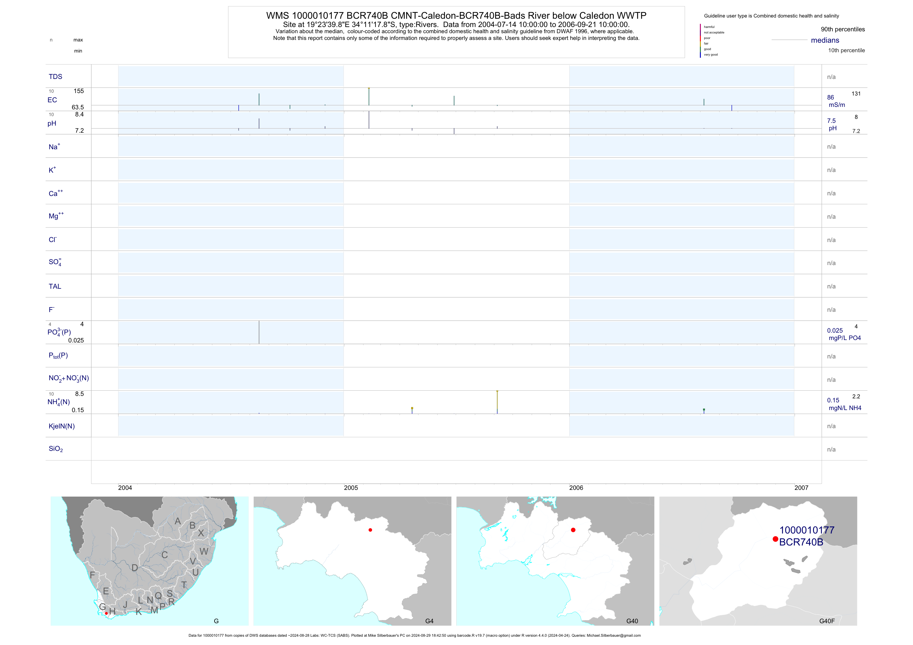
| G40 1000010177 | plot | data | CMNT-Caledon-BCR740B-Bads River below Caledon WWTP | Rivers | 10 | 2004-07-14 | 2006-09-21 | 86 | BCR740B | -34.18830 | 19.39440 |
| G40 1000011039 | plot | data | CMNT-Bot+palmiet-BR400A-Bot River Above the Town | Rivers | 169 | 1995-07-25 | 2013-11-21 | 46 | BR400A | -34.19180 | 19.22880 |
| G40 1000011041 | plot | data | CMNT-Bot+palmiet-BR400B-Bot River at Rooiheuwel | Rivers | 212 | 1995-07-25 | 2013-11-21 | 43 | BR400B | -34.23460 | 19.21570 |
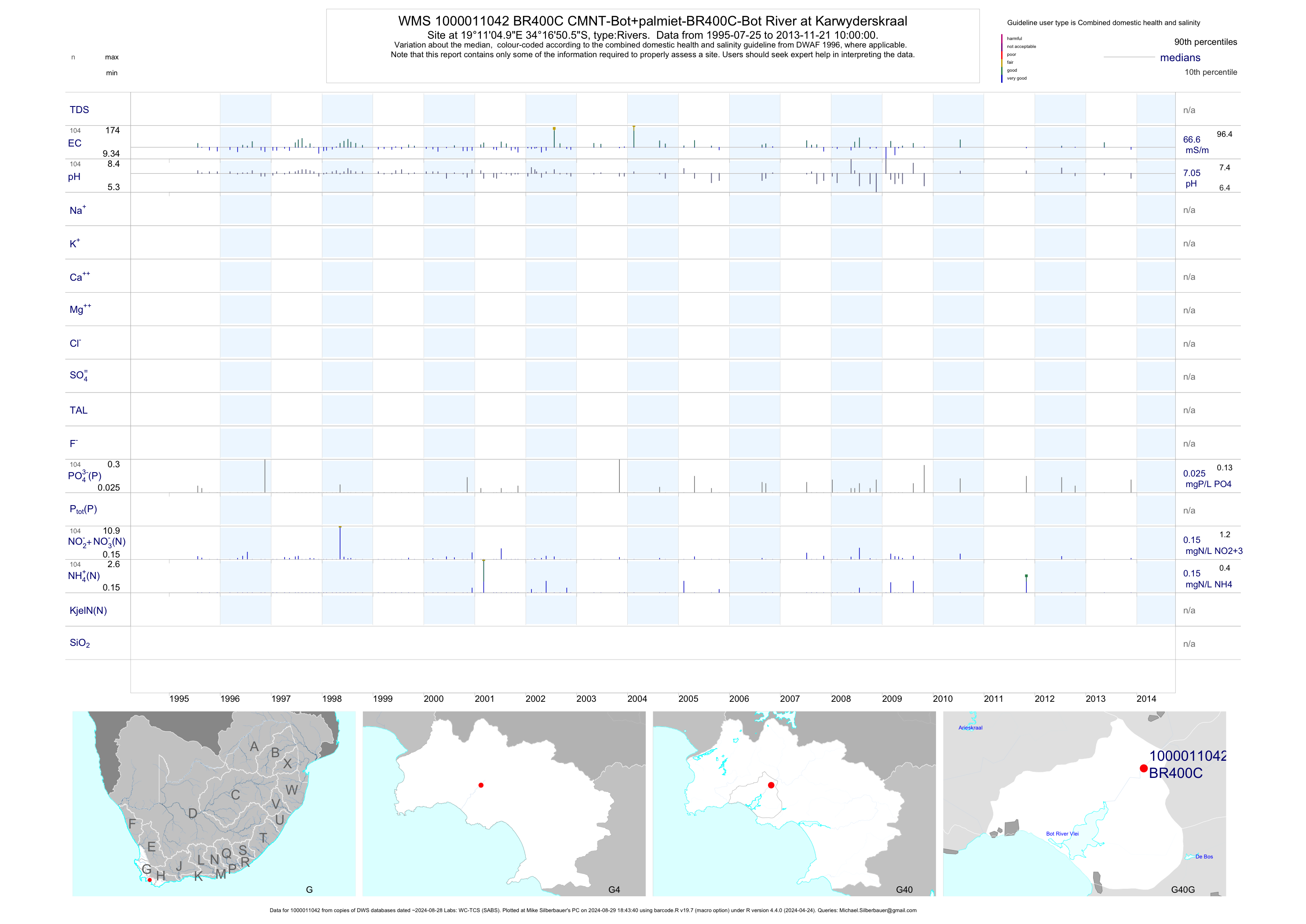
| G40 1000011042 | plot | data | CMNT-Bot+palmiet-BR400C-Bot River at Karwyderskraal | Rivers | 110 | 1995-07-25 | 2013-11-21 | 67 | BR400C | -34.28070 | 19.18470 |
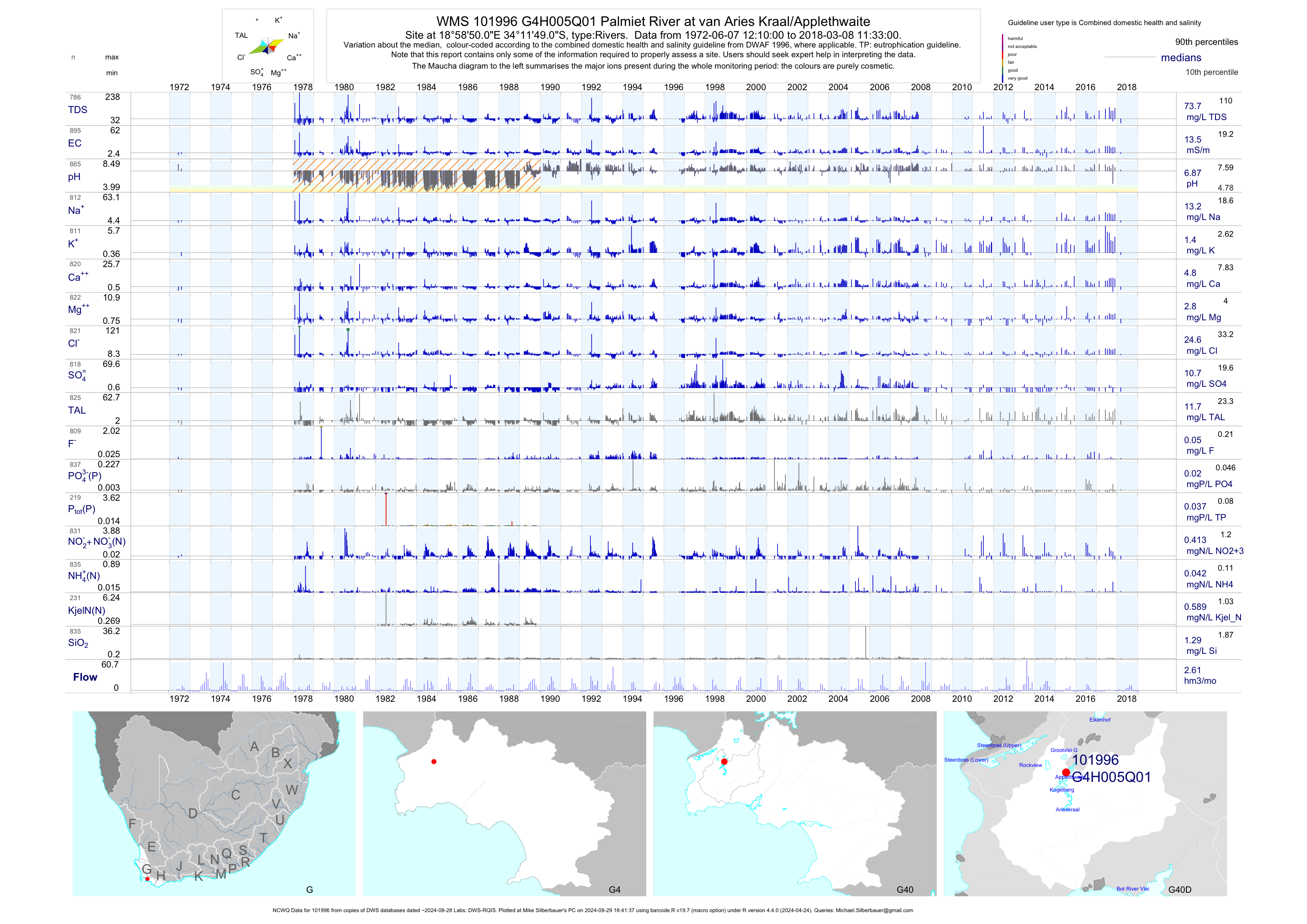
| G40 101996 | plot | data | Palmiet River at van Aries Kraal/Applethwaite (NCWQ) | Rivers | 901 | 1972-06-07 | 2018-03-08 | 14 | G4H005 | -34.19694 | 18.98056 |
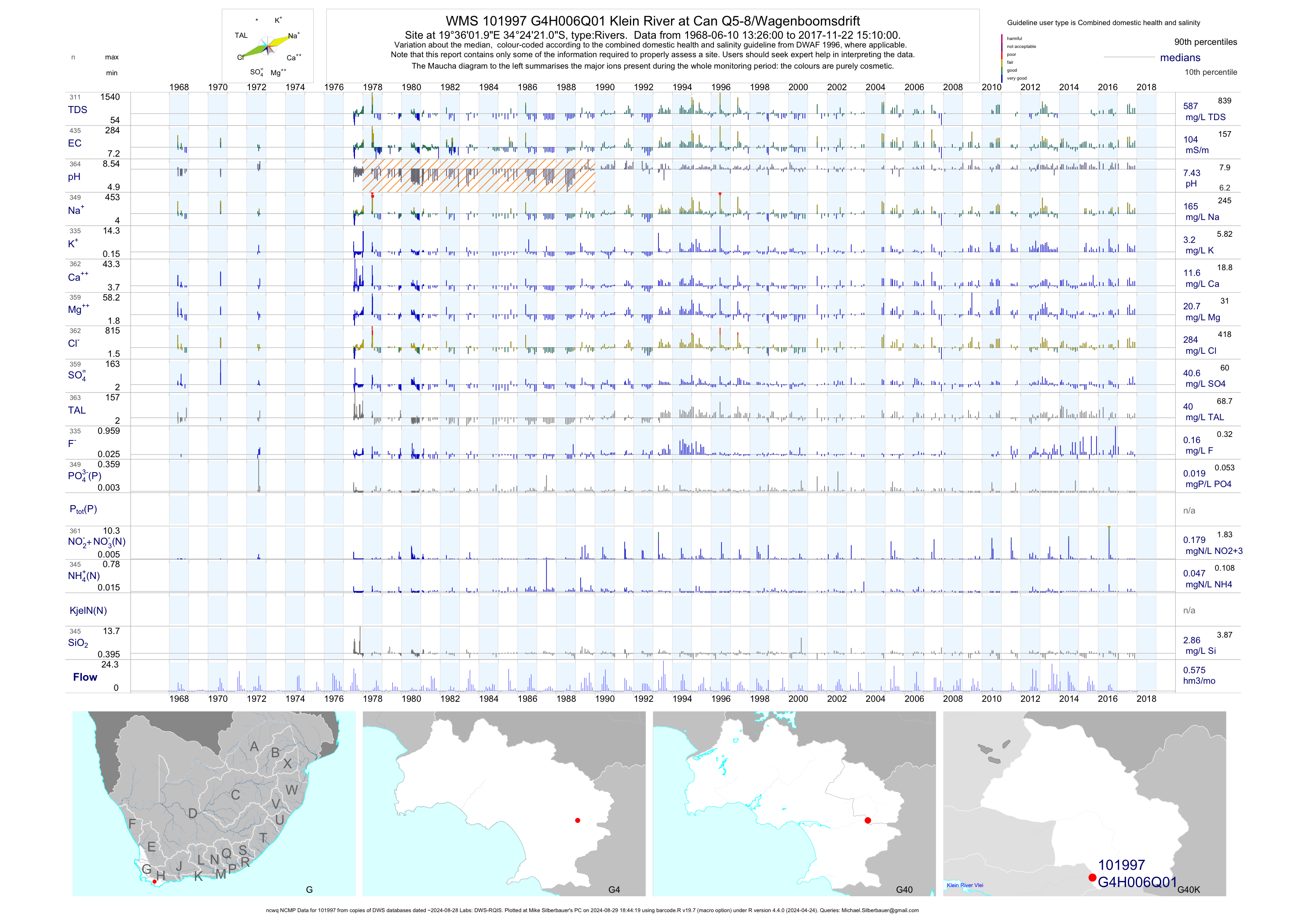
| G40 101997 | plot | data | Klein River at Can Q5-8/Wagenboomsdrift (ncwq NCMP) | Rivers | 435 | 1968-06-10 | 2017-11-22 | 104 | G4H006 | -34.40583 | 19.60056 |
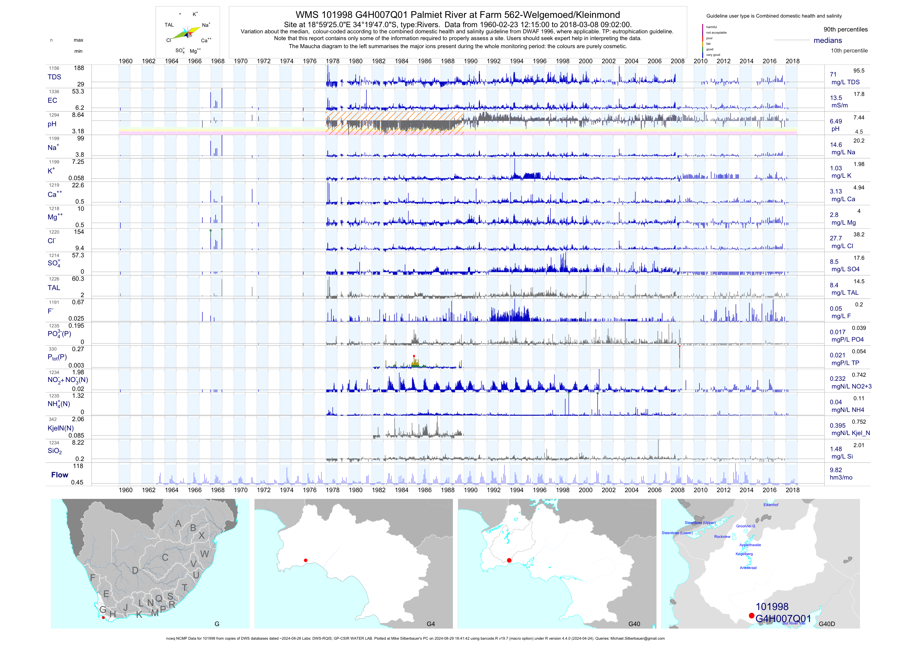
| G40 101998 | plot | data | Palmiet River at Farm 562-Welgemoed/Kleinmond (ncwq NCMP) | Rivers | 1339 | 1960-02-23 | 2018-03-08 | 14 | G4H007 | -34.32972 | 18.99028 |
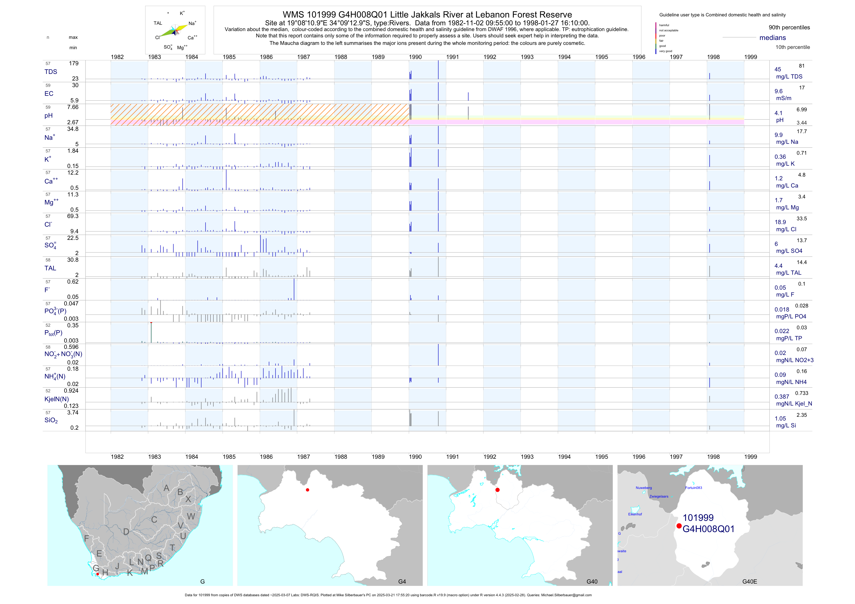
| G40 101999 | plot | data | Little Jakkals River at Lebanon Forest Reserve | Rivers | 59 | 1982-11-02 | 1998-01-27 | 10 | G4H008 | -34.15361 | 19.13639 |
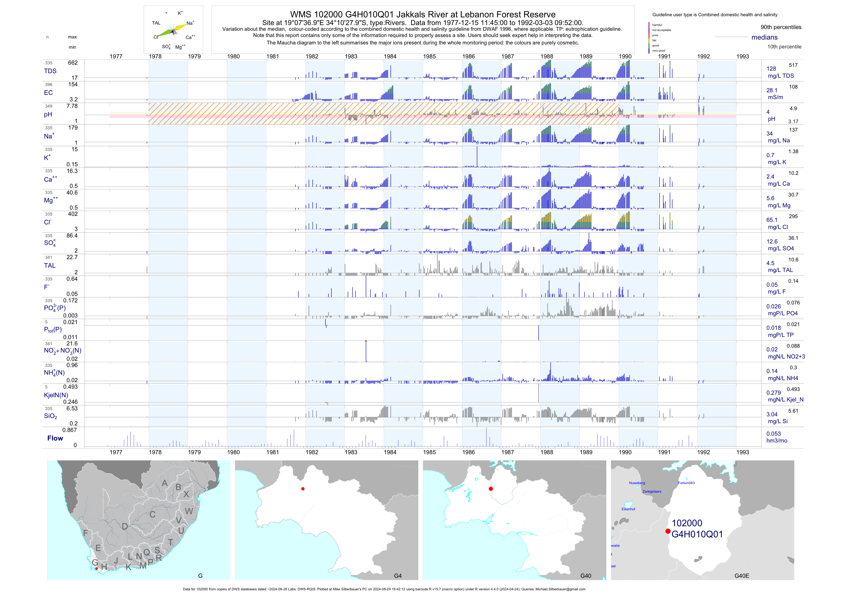
| G40 102000 | plot | data | Jakkals River at Lebanon Forest Reserve | Rivers | 396 | 1977-12-15 | 1992-03-03 | 28 | G4H010 | -34.17444 | 19.12694 |
| G40 102001 | plot | data | Little Jakkals River at Lebanon Forest Reserve | Rivers | 52 | 1982-11-02 | 1993-05-04 | 8 | G4H012 | -34.14861 | 19.14306 |
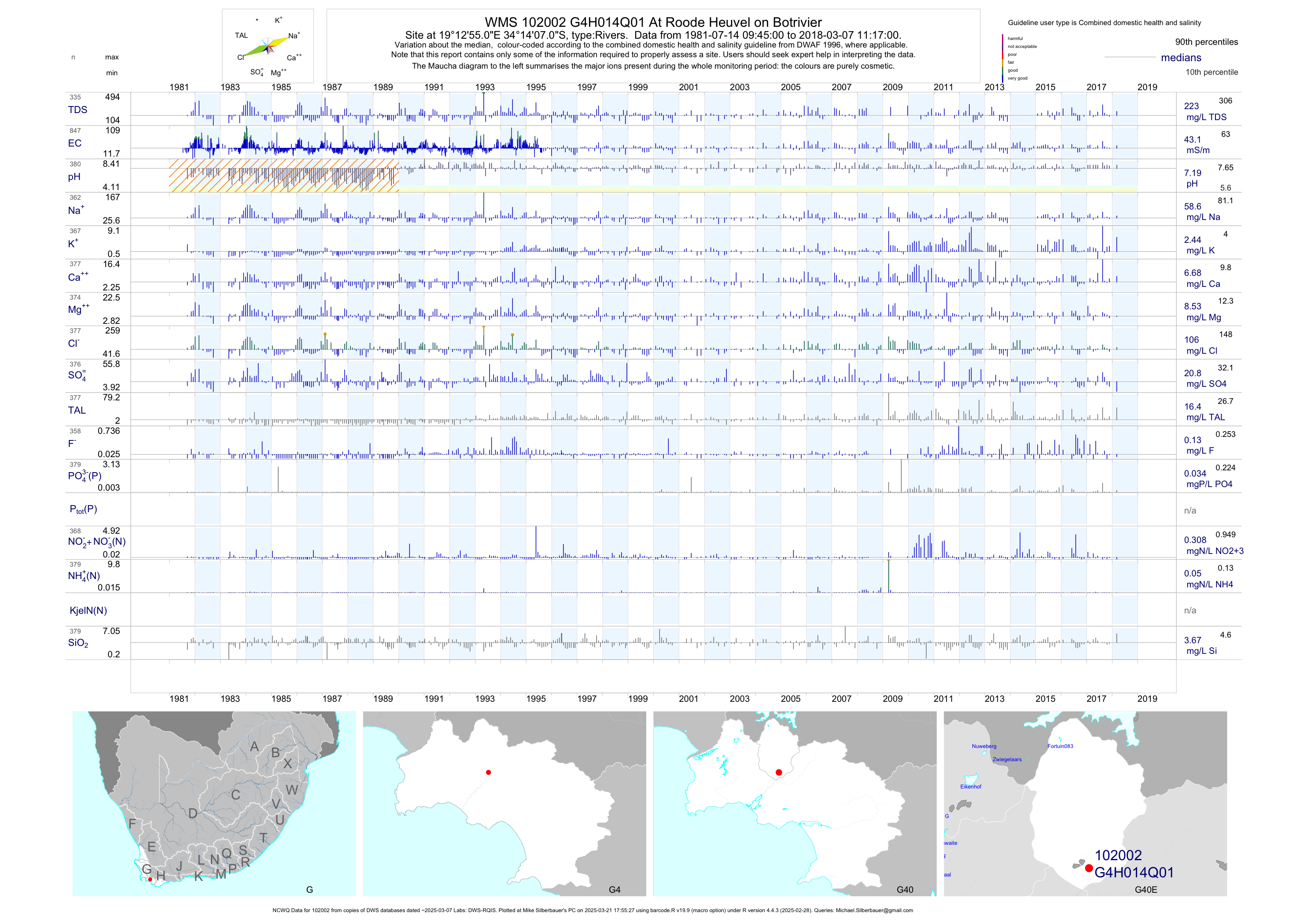
| G40 102002 | plot | data | At Roode Heuvel on Botrivier (NCWQ) | Rivers | 849 | 1981-07-14 | 2018-03-07 | 43 | G4H014 | -34.23528 | 19.21528 |
| G40 102003 | plot | data | Jakkals River Tributary 1A at Lebanon Forest Rese | Rivers | 59 | 1982-11-02 | 1990-06-05 | 8 | G4H015 | -34.14722 | 19.13694 |
| G40 102004 | plot | data | Jakkals Riv. Tributary 1BCD at Lebanon Forest Res | Rivers | 57 | 1982-11-02 | 1992-01-20 | 8 | G4H016 | -34.16389 | 19.13861 |
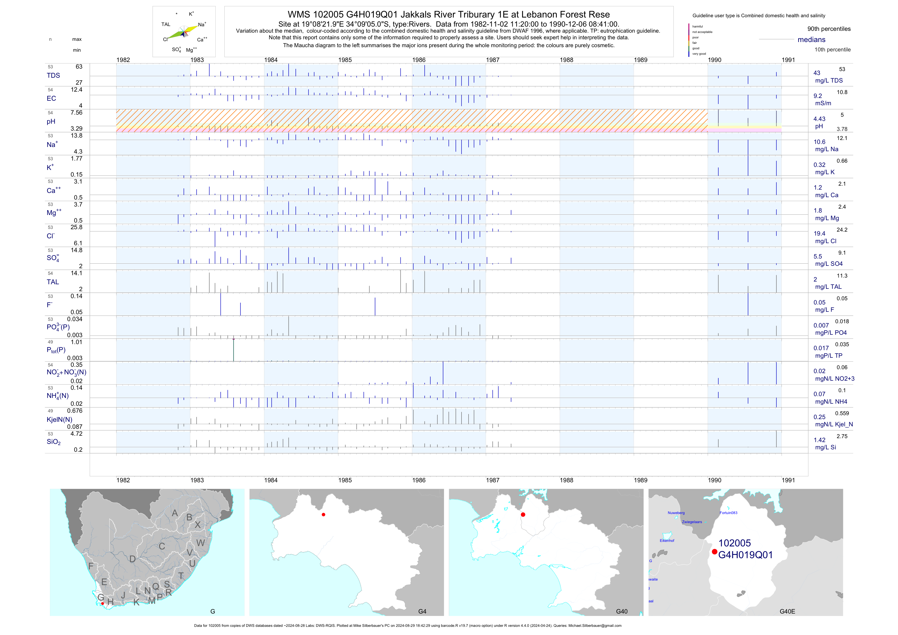
| G40 102005 | plot | data | Jakkals River Triburary 1E at Lebanon Forest Rese | Rivers | 54 | 1982-11-02 | 1990-12-06 | 9 | G4H019 | -34.15139 | 19.13944 |
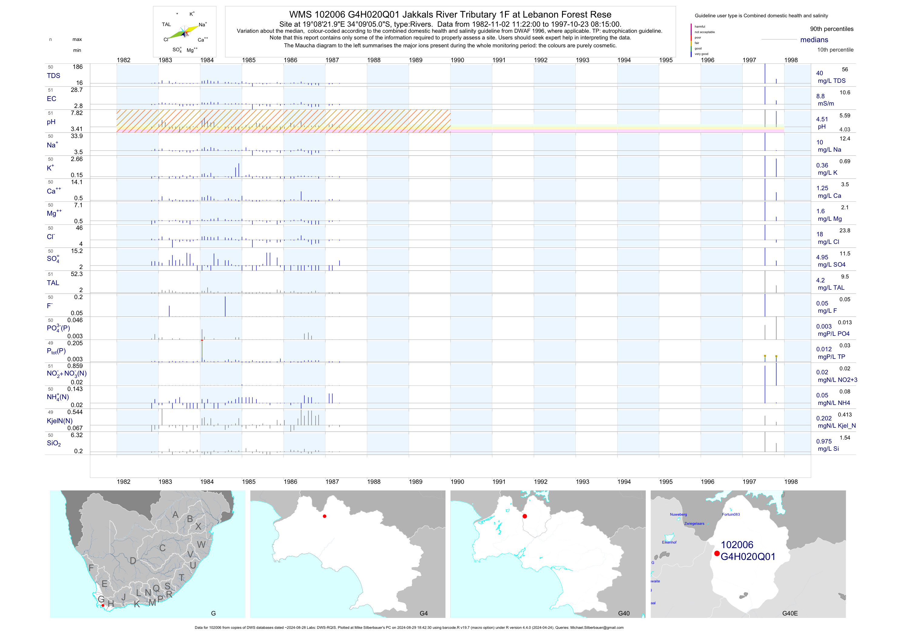
| G40 102006 | plot | data | Jakkals River Tributary 1F at Lebanon Forest Rese | Rivers | 51 | 1982-11-02 | 1997-10-23 | 9 | G4H020 | -34.15139 | 19.13944 |
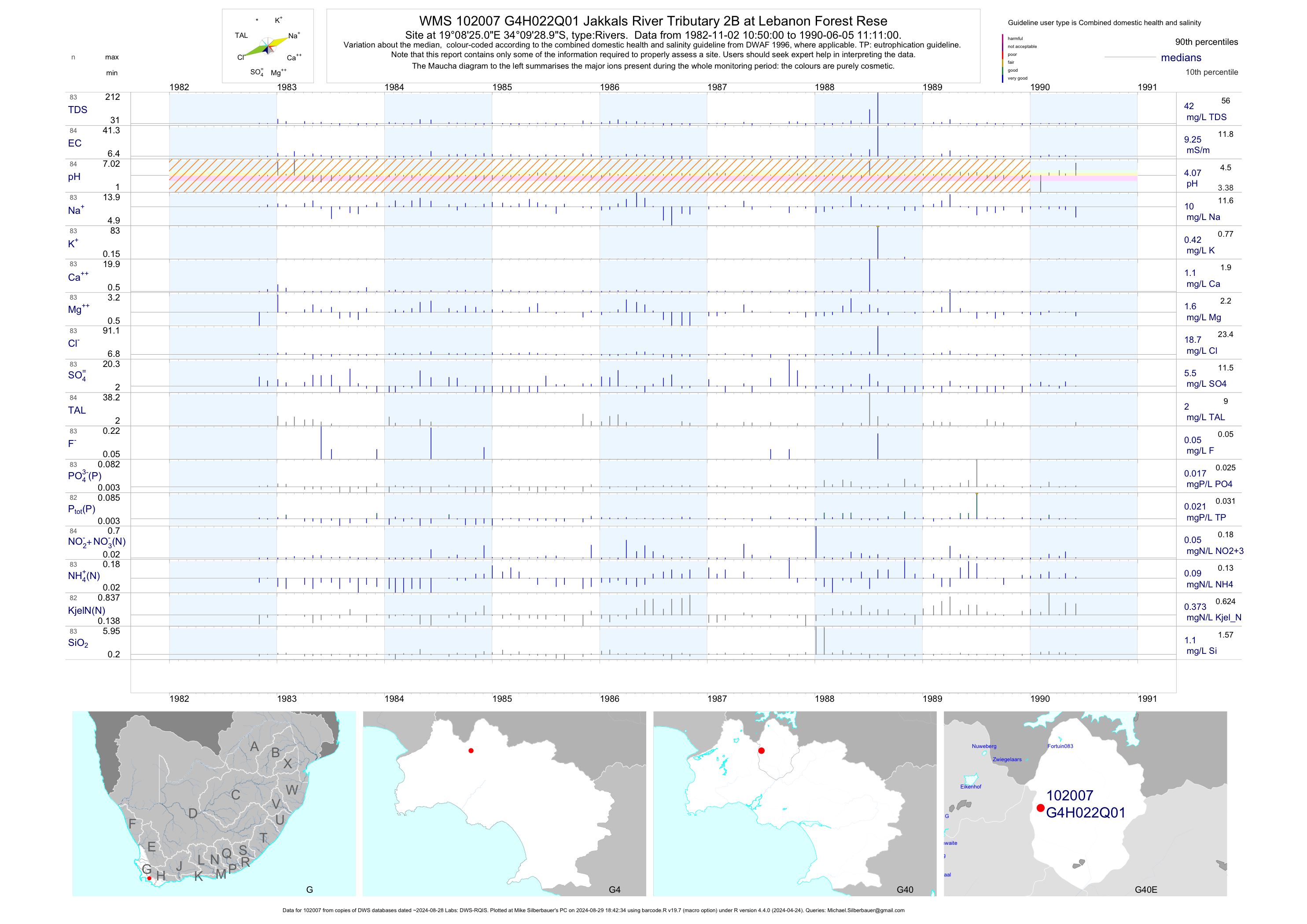
| G40 102007 | plot | data | Jakkals River Tributary 2B at Lebanon Forest Rese | Rivers | 84 | 1982-11-02 | 1990-06-05 | 9 | G4H022 | -34.15806 | 19.14028 |
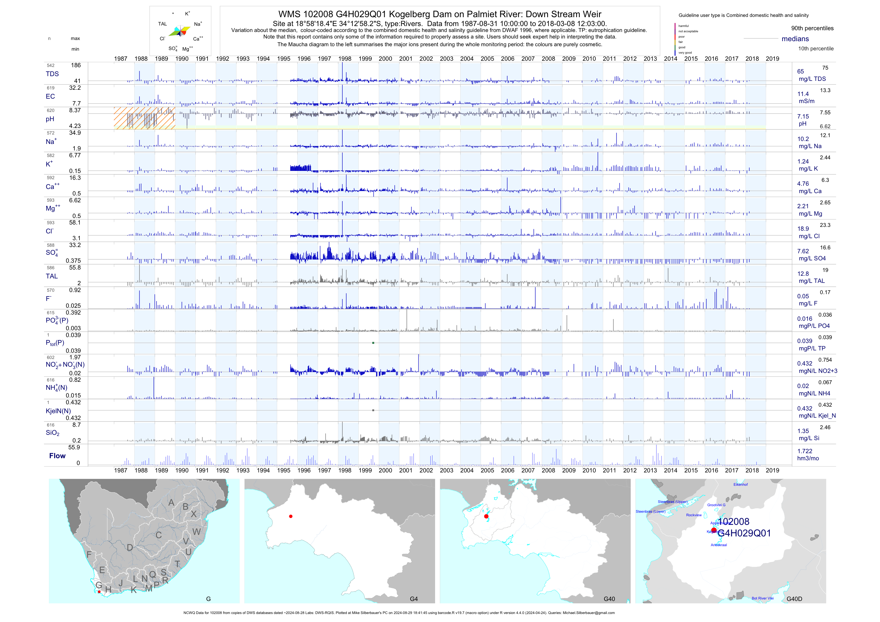
| G40 102008 | plot | data | Kogelberg Dam on Palmiet River: Down Stream Weir (NCWQ) | Rivers | 621 | 1987-08-31 | 2018-03-08 | 11 | G4H029 | -34.21618 | 18.97179 |
| G40 200189677 | plot | data | - CMNT-Bot+palmiet -KR400C1- Klipdrif R at Worcester Street Bridge | Rivers | 23 | 2009-08-12 | 2013-11-21 | 10 | GRAB1 | -34.14442 | 19.02410 |
| G40 193472 | plot | data | - Upper Klipdrift in Pine View at Klipdrift River | Rivers | 8 | 2013-02-28 | 2013-09-26 | 8 | GRAB3 | -34.14419 | 19.00075 |
| G40 193473 | plot | data | - Grabouw Industries at Klipdrift River | Rivers | 8 | 2013-01-23 | 2013-09-26 | 21 | GRAB5 | -34.14797 | 19.00208 |
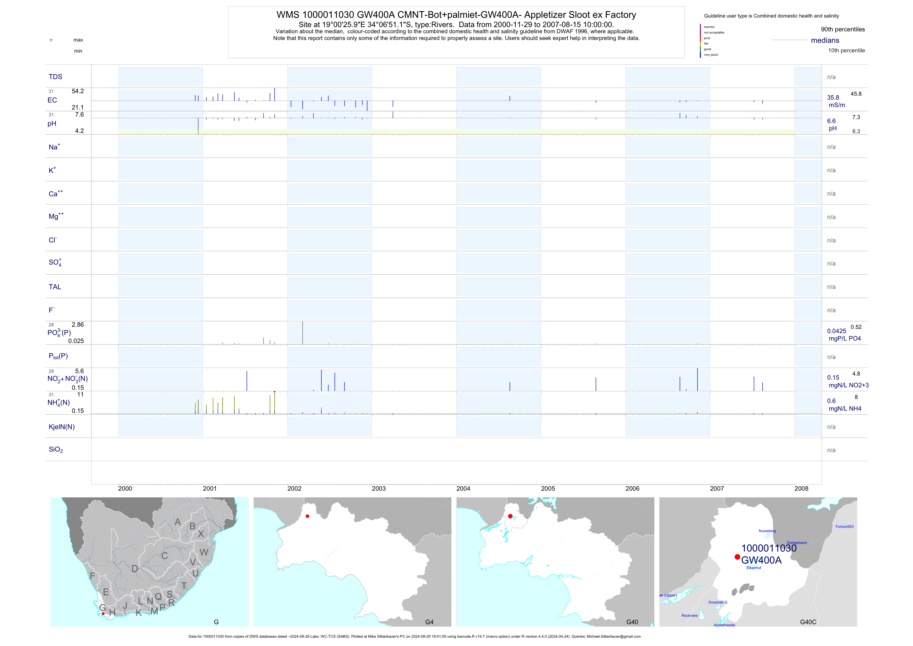
| G40 1000011030 | plot | data | CMNT-Bot+palmiet-GW400A- Appletizer Sloot ex Factory | Rivers | 31 | 2000-11-29 | 2007-08-15 | 36 | GW400A | -34.11420 | 19.00720 |
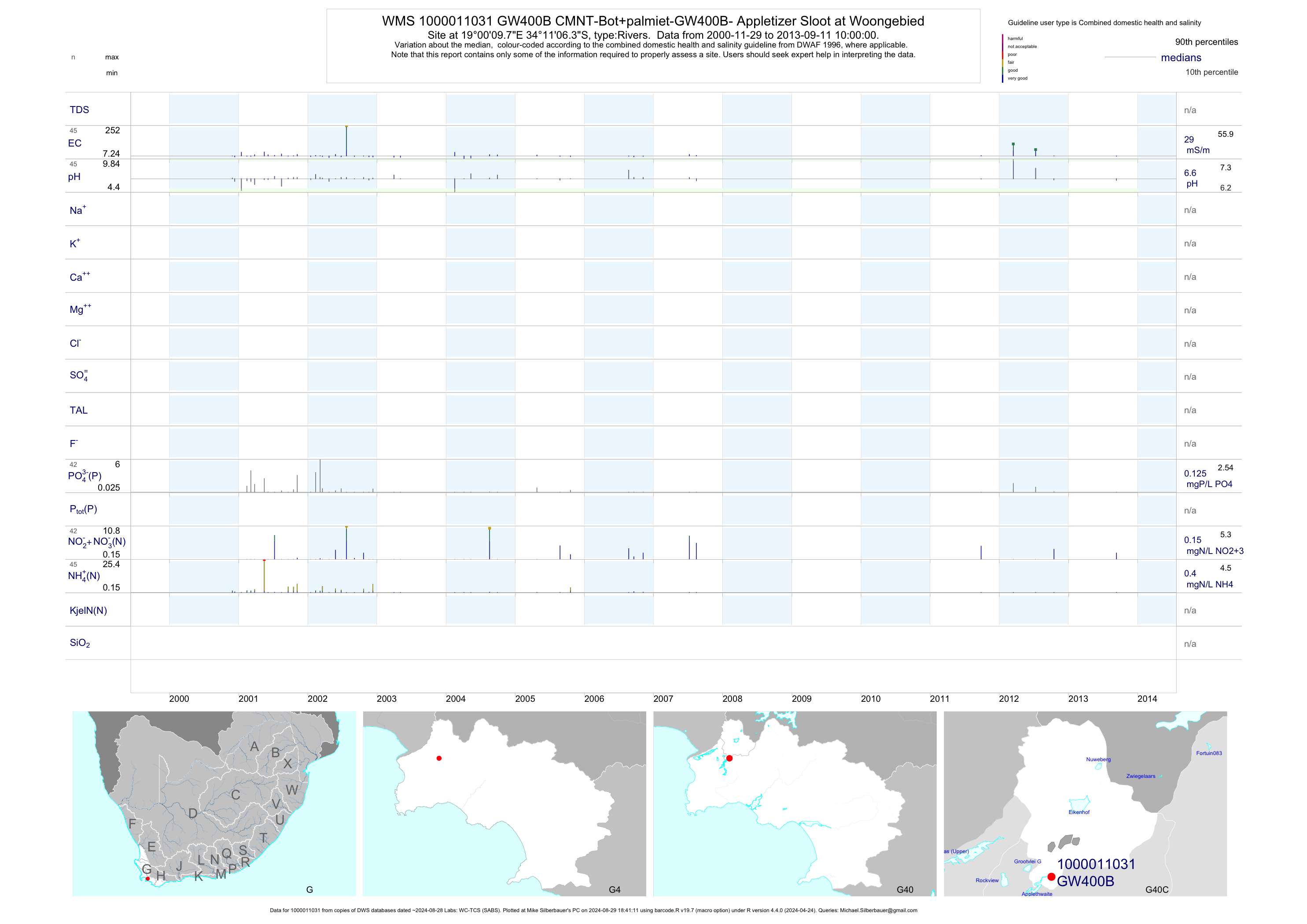
| G40 1000011031 | plot | data | CMNT-Bot+palmiet-GW400B- Appletizer Sloot at Woongebied | Rivers | 45 | 2000-11-29 | 2013-09-11 | 29 | GW400B | -34.18510 | 19.00270 |
| G40 1000011032 | plot | data | CMNT-Bot+palmiet-GW400C- Appletizer and Woongebied Sloot | Rivers | 38 | 2000-11-29 | 2013-11-21 | 29 | GW400C | -34.18340 | 19.00190 |
| G40 200189744 | plot | data | CMNT-Bot+palmiet-GW400D- Appletizer-Buffer See | Rivers | 9 | 2011-09-27 | 2013-11-21 | 69 | GW400D | -34.20442 | 18.98998 |
| G40 200189745 | plot | data | CMNT-Bot+palmiet-GW400E- Appletizer-ex Labyrinth | Rivers | 10 | 2011-09-27 | 2013-11-21 | 77 | GW400E | -34.20032 | 18.98341 |
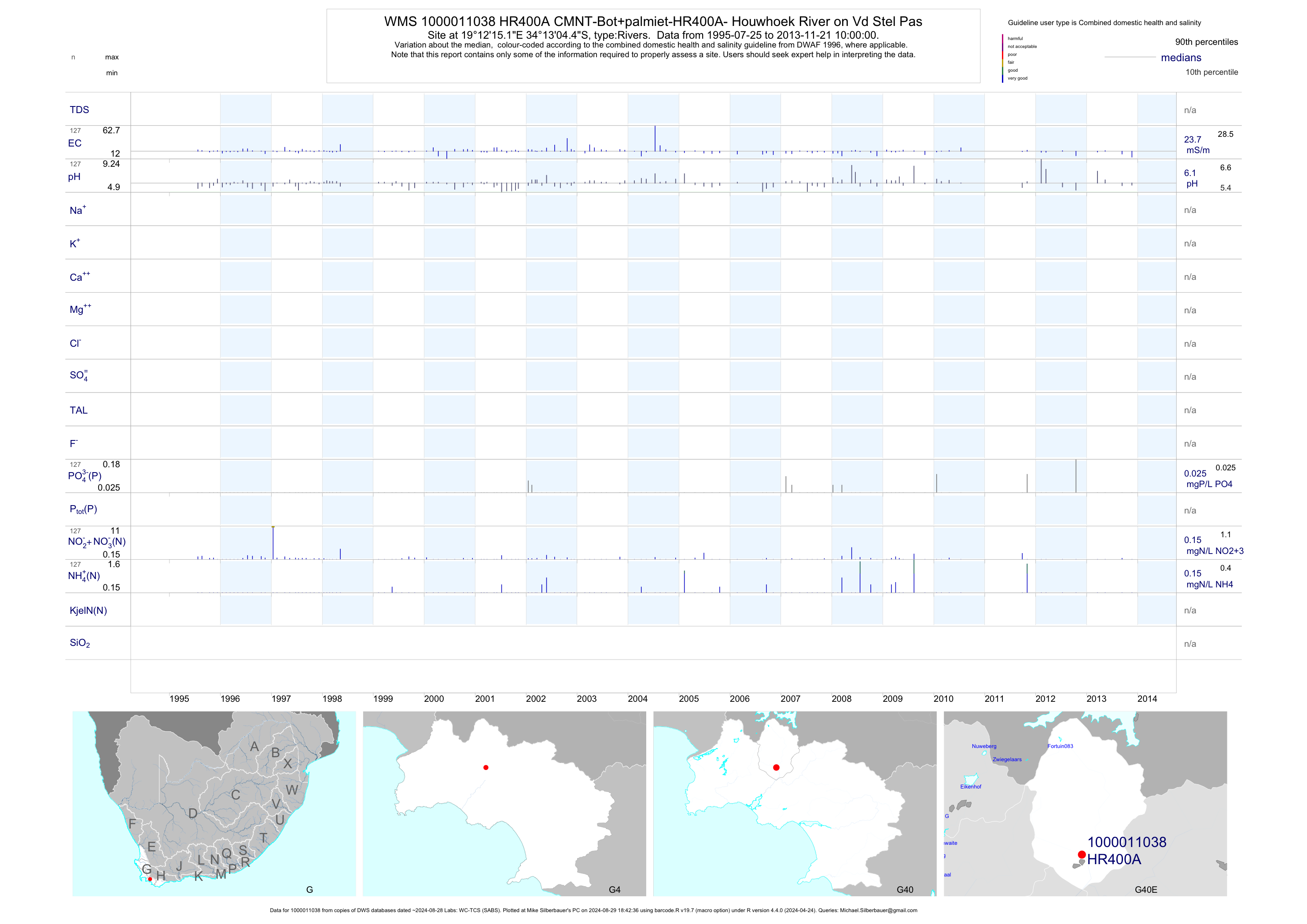
| G40 1000011038 | plot | data | CMNT-Bot+palmiet-HR400A- Houwhoek River on Vd Stel Pas | Rivers | 172 | 1995-07-25 | 2013-11-21 | 24 | HR400A | -34.21790 | 19.20420 |
| G40 200189731 | n/a | n/a | WC-BOCMA - K1 - Klein Estuary - Scout Camp | Rivers | 39 | 2010-12-02 | 2014-02-20 | n/a | K1 | -34.41572 | 19.29825 |
| G40 200189732 | n/a | n/a | WC-BOCMA - K2 - Klein Estuary - Prawn Flats | Rivers | 38 | 2010-12-02 | 2014-02-20 | n/a | K2 | -34.41409 | 19.30553 |
| G40 200189733 | n/a | n/a | WC-BOCMA - K3 - Klein Estuary - Yacht Club | Rivers | 40 | 2010-12-02 | 2014-02-20 | n/a | K3 | -34.40964 | 19.34906 |
| G40 200189734 | n/a | n/a | WC-BOCMA - K4 - Klein Estuary - Stanford Slipway | Rivers | 36 | 2010-12-02 | 2014-02-14 | n/a | K4 | -34.43628 | 19.45350 |
| G40 200189735 | n/a | n/a | WC-BOCMA - K5 - Klein Estuary - King Street Jetty | Rivers | 36 | 2010-12-02 | 2014-02-20 | n/a | K5 | -34.43689 | 19.45667 |
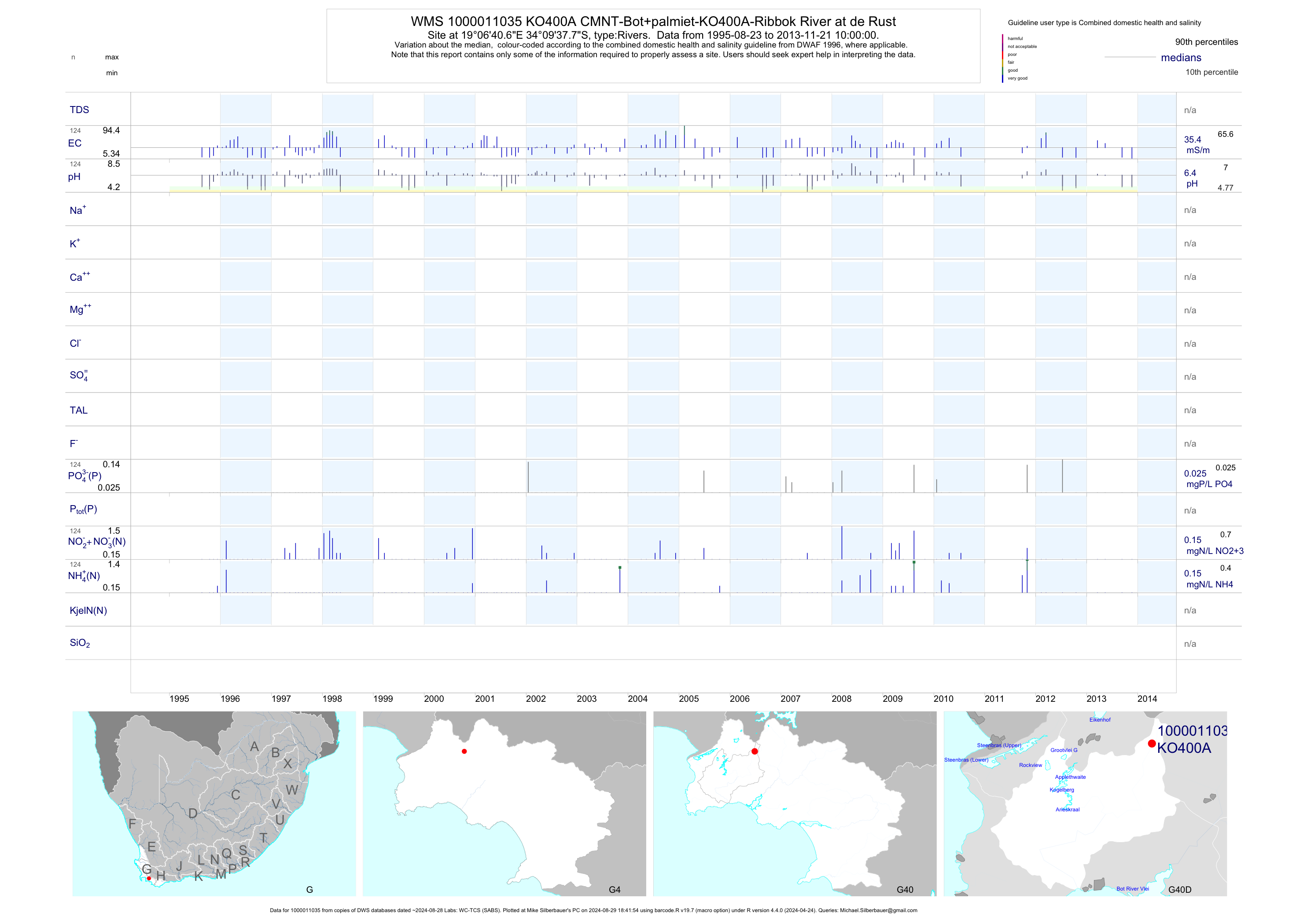
| G40 1000011035 | plot | data | CMNT-Bot+palmiet-KO400A-Ribbok River at de Rust | Rivers | 124 | 1995-08-23 | 2013-11-21 | 35 | KO400A | -34.16050 | 19.11130 |
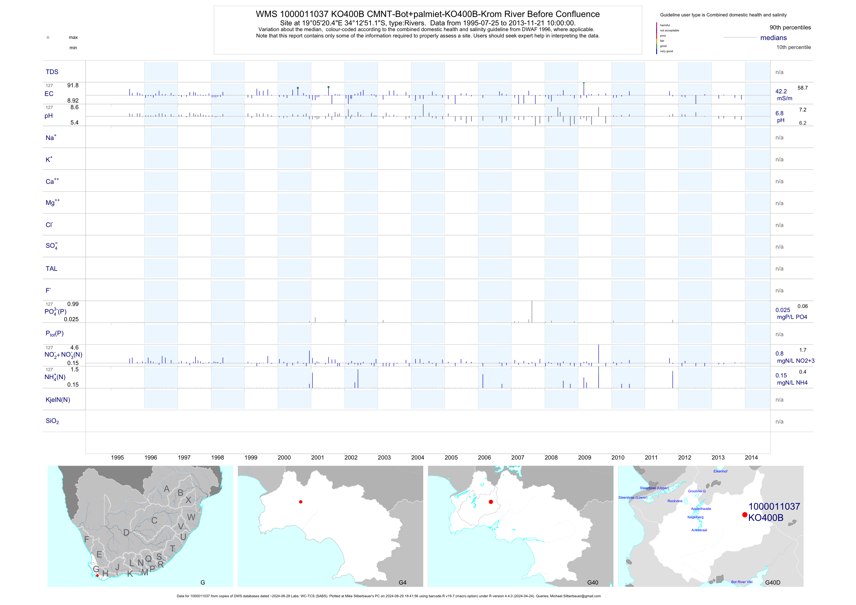
| G40 1000011037 | plot | data | CMNT-Bot+palmiet-KO400B-Krom River Before Confluence | Rivers | 128 | 1995-07-25 | 2013-11-21 | 42 | KO400B | -34.21420 | 19.08900 |
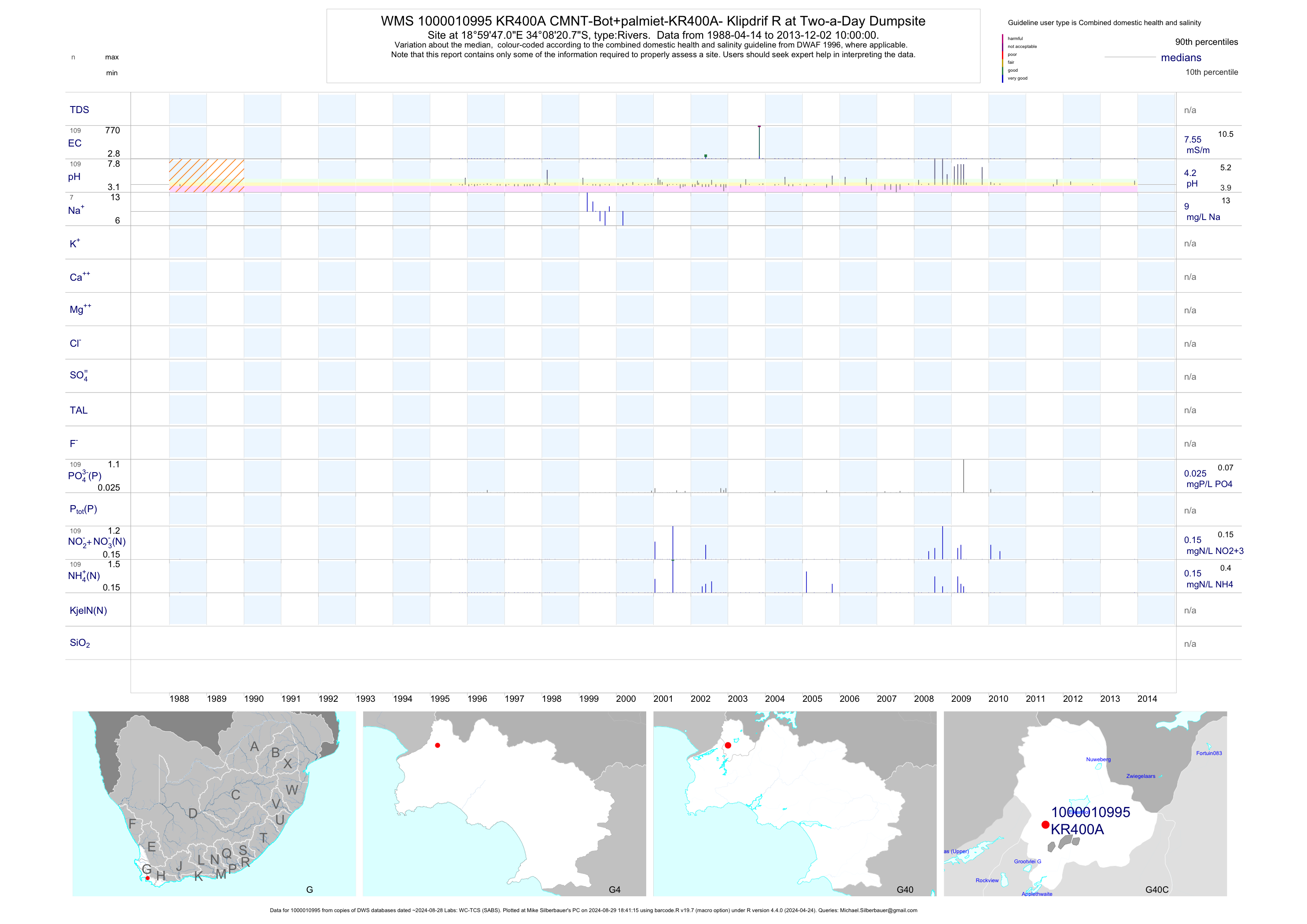
| G40 1000010995 | plot | data | CMNT-Bot+palmiet-KR400A- Klipdrif R at Two-a-Day Dumpsite | Rivers | 118 | 1988-04-14 | 2013-12-02 | 8 | KR400A | -34.13910 | 18.99640 |
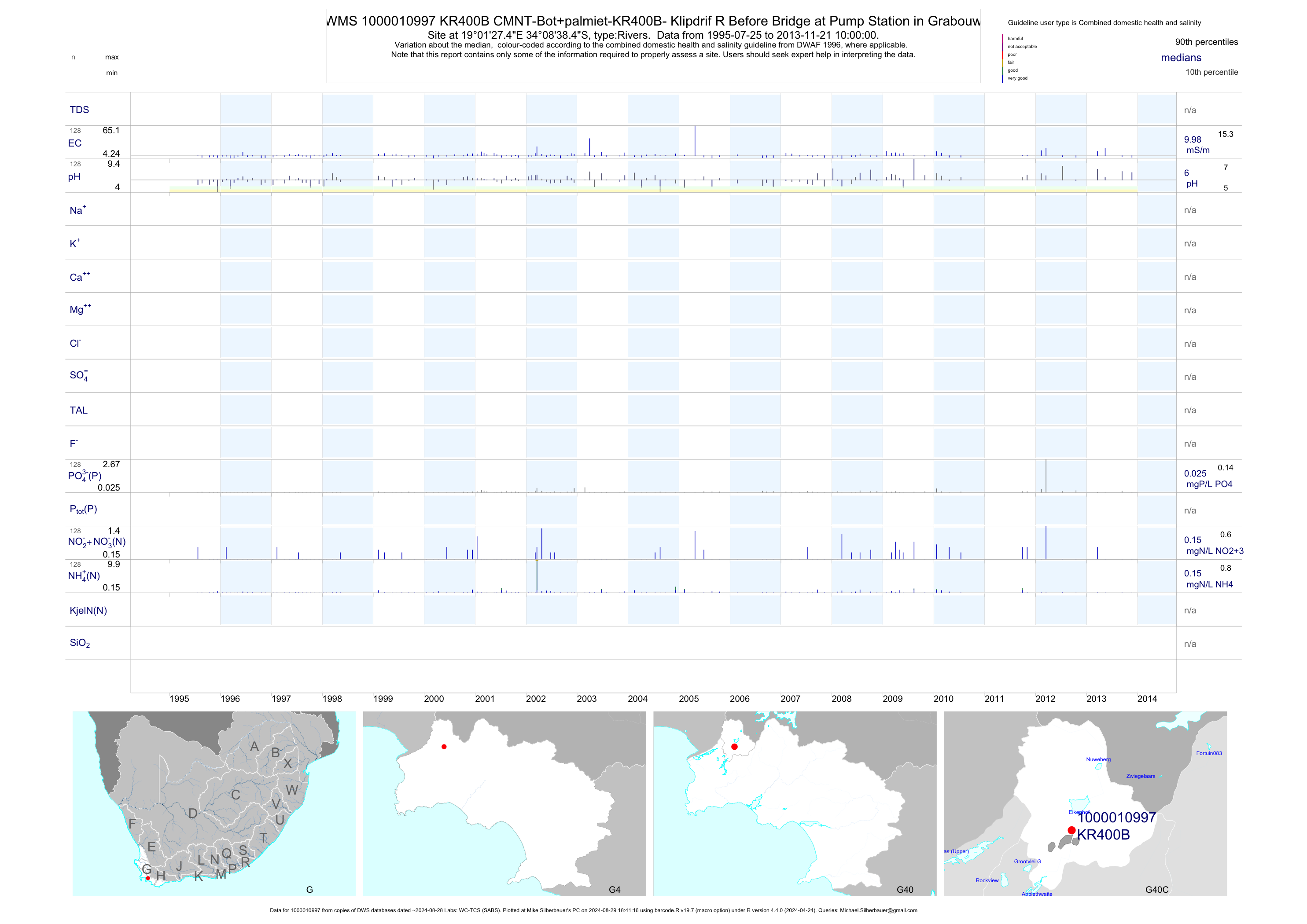
| G40 1000010997 | plot | data | CMNT-Bot+palmiet-KR400B- Klipdrif R Before Bridge at Pump Station in Grabouw | Rivers | 146 | 1995-07-25 | 2013-11-21 | 10 | KR400B | -34.14400 | 19.02430 |
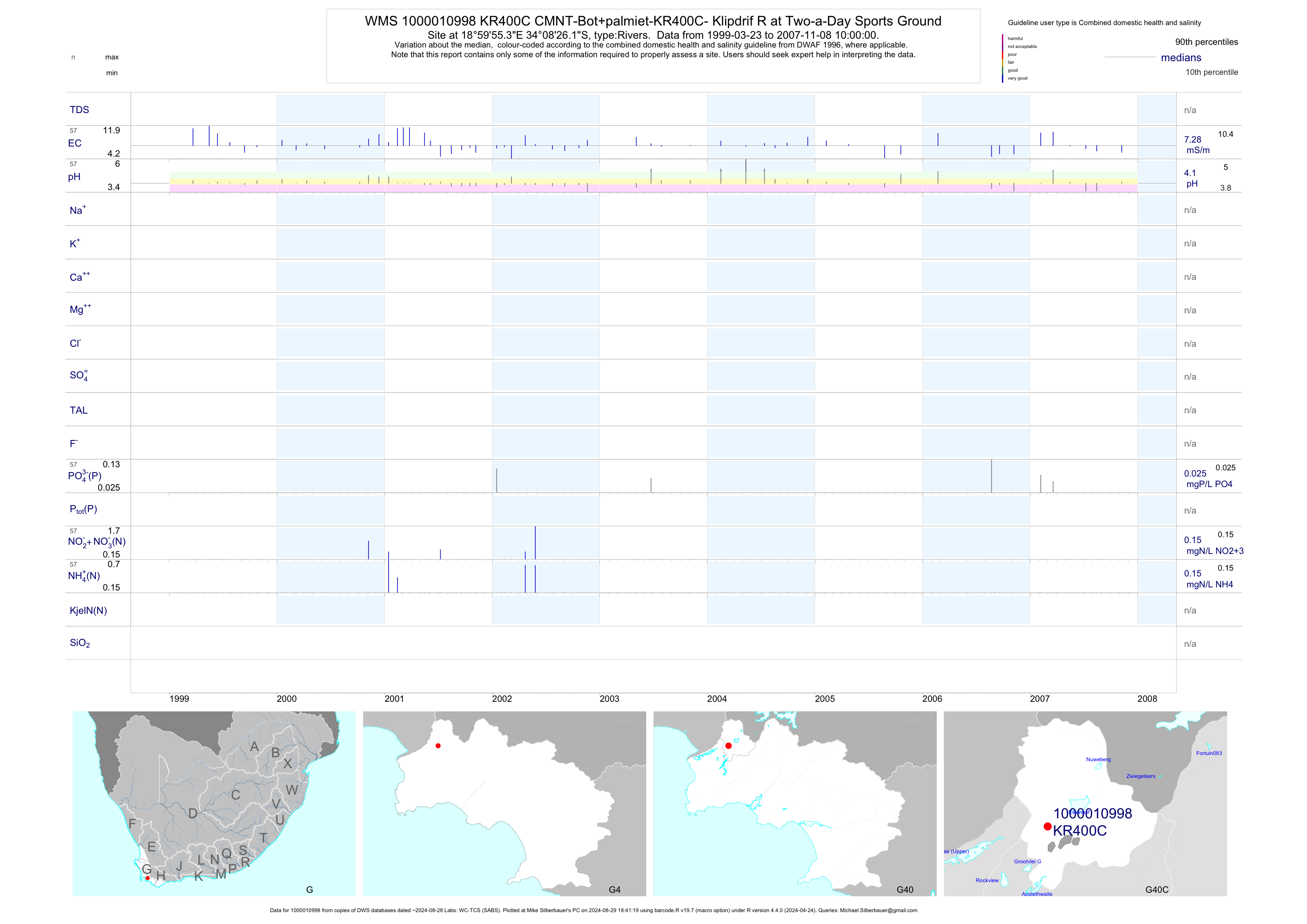
| G40 1000010998 | plot | data | CMNT-Bot+palmiet-KR400C- Klipdrif R at Two-a-Day Sports Ground | Rivers | 57 | 1999-03-23 | 2007-11-08 | 7 | KR400C | -34.14060 | 18.99870 |
| G40 200189729 | n/a | n/a | WC-BOCMA - O1 - Onrus Estuary - Mouth - River | Rivers | 38 | 2010-12-02 | 2014-02-20 | n/a | O1 | -34.41822 | 19.17850 |
| G40 200189730 | n/a | n/a | WC-BOCMA - O2 - Onrus Estuary - Mouth - Lagoon | Rivers | 39 | 2010-12-02 | 2014-02-06 | n/a | O2 | -34.41783 | 19.17881 |
| G40 200189748 | n/a | n/a | WC-BOCMA - P1 - Palmiet Estuary | Rivers | 16 | 2012-07-12 | 2014-02-20 | n/a | P1 | -34.34105 | 18.99476 |
| G40 200189749 | n/a | n/a | WC-BOCMA - P2 - Palmiet Estuary | Rivers | 17 | 2012-07-12 | 2014-02-20 | n/a | P2 | -34.33053 | 18.99080 |
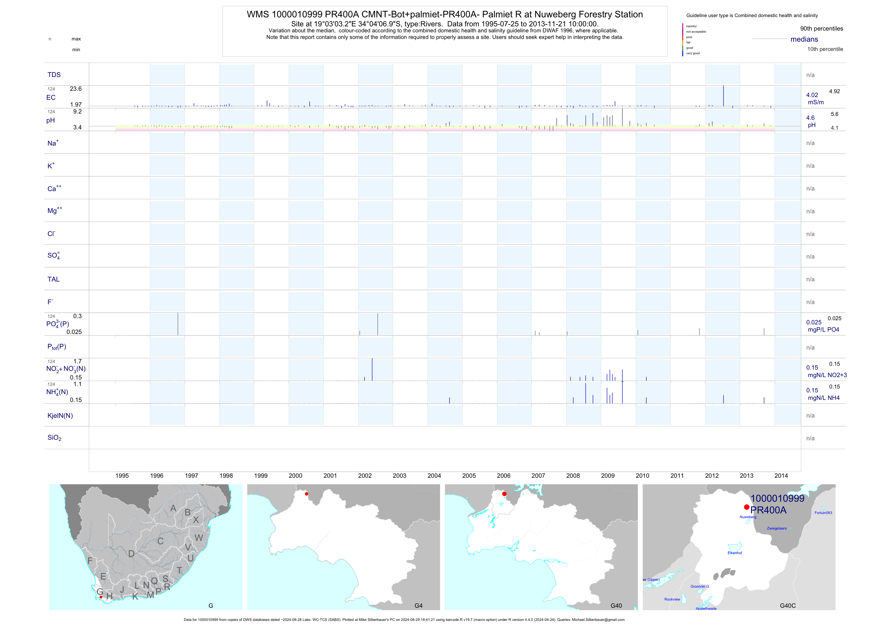
| G40 1000010999 | plot | data | CMNT-Bot+palmiet-PR400A- Palmiet R at Nuweberg Forestry Station | Rivers | 124 | 1995-07-25 | 2013-11-21 | 4 | PR400A | -34.06860 | 19.05090 |
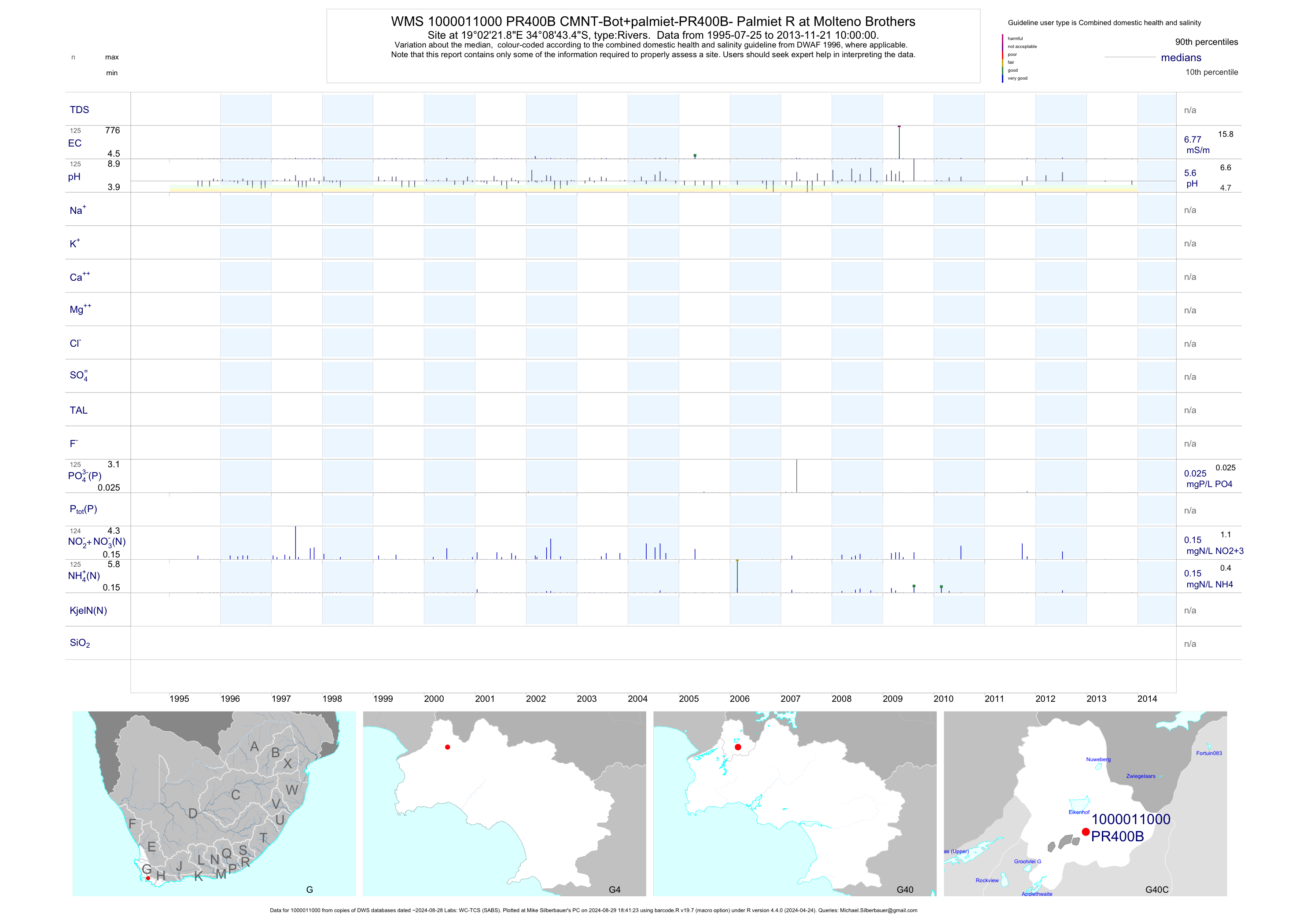
| G40 1000011000 | plot | data | CMNT-Bot+palmiet-PR400B- Palmiet R at Molteno Brothers | Rivers | 125 | 1995-07-25 | 2013-11-21 | 7 | PR400B | -34.14540 | 19.03940 |
| G40 1000011033 | plot | data | CMNT-Bot+palmiet-PR400C- Palmiet River at Oudebrug | Rivers | 125 | 1995-07-25 | 2013-11-21 | 16 | PR400C | -34.17680 | 19.00730 |
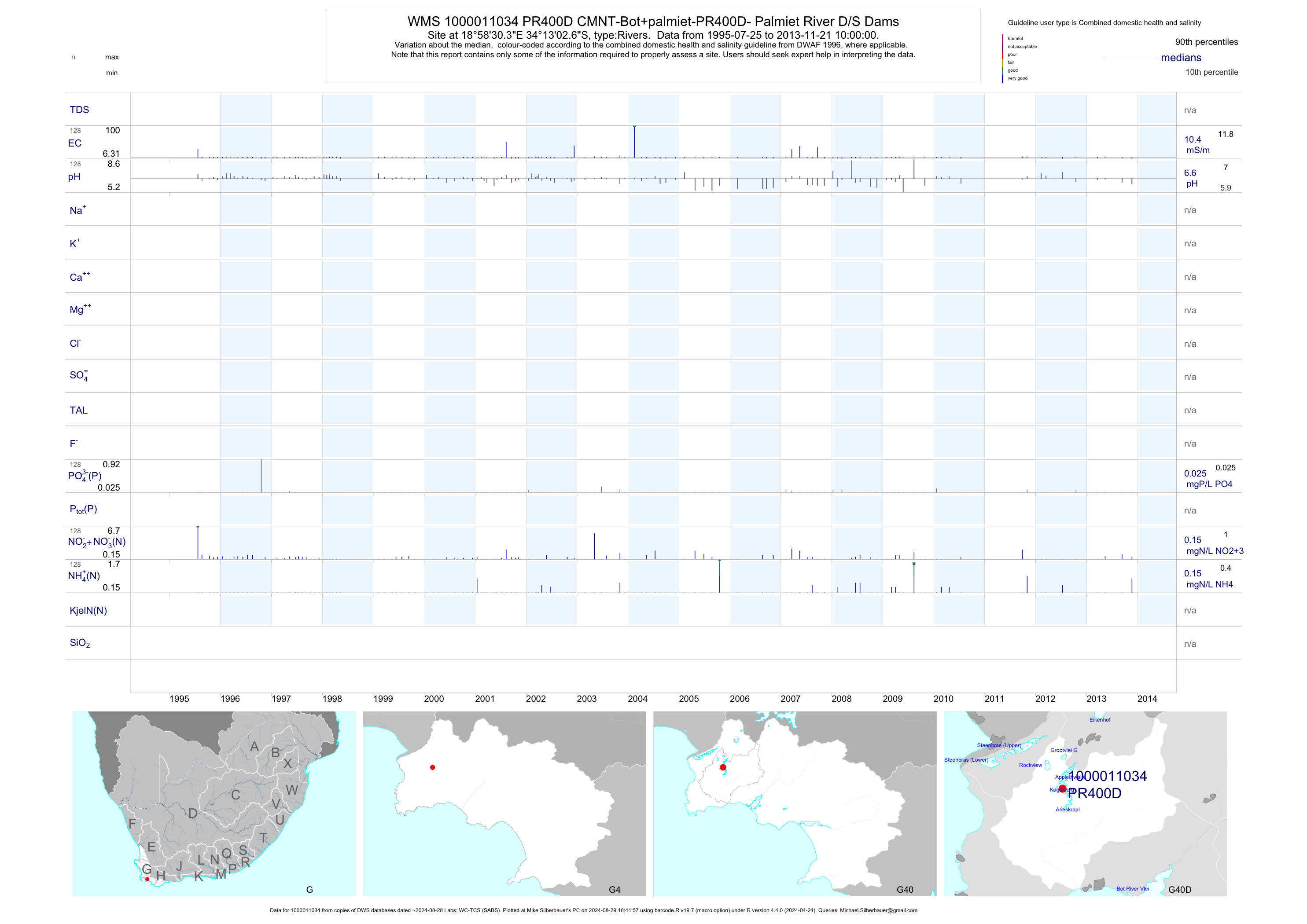
| G40 1000011034 | plot | data | CMNT-Bot+palmiet-PR400D- Palmiet River D/S Dams | Rivers | 128 | 1995-07-25 | 2013-11-21 | 10 | PR400D | -34.21740 | 18.97510 |
| G40 1000011036 | plot | data | CMNT-Bot+palmiet-PR400E- Palmiet River Above Estuary | Rivers | 117 | 1995-07-25 | 2013-11-21 | 13 | PR400E | -34.32790 | 18.98130 |
| G40 1000011043 | plot | data | CMNT-Bot+palmiet-SW400A-Swart River at Low Water Bridge | Rivers | 97 | 1995-07-25 | 2013-11-21 | 146 | SW400A | -34.25900 | 19.22470 |
| G40 200189736 | n/a | n/a | WC-BOCMA - U1 - Uilkraals Estuary - Resort Opposite Mouth | Rivers | 35 | 2010-12-02 | 2014-02-20 | n/a | U1 | -34.60494 | 19.40925 |
| G40 187987 | plot | data | Uylen Kraal downstream of Kraaibos Dam on Uilenkraalsrivier (NEMP) | Rivers | 19 | 2015-04-29 | 2017-02-21 | 61 | 187987 | -34.57380 | 19.47950 |
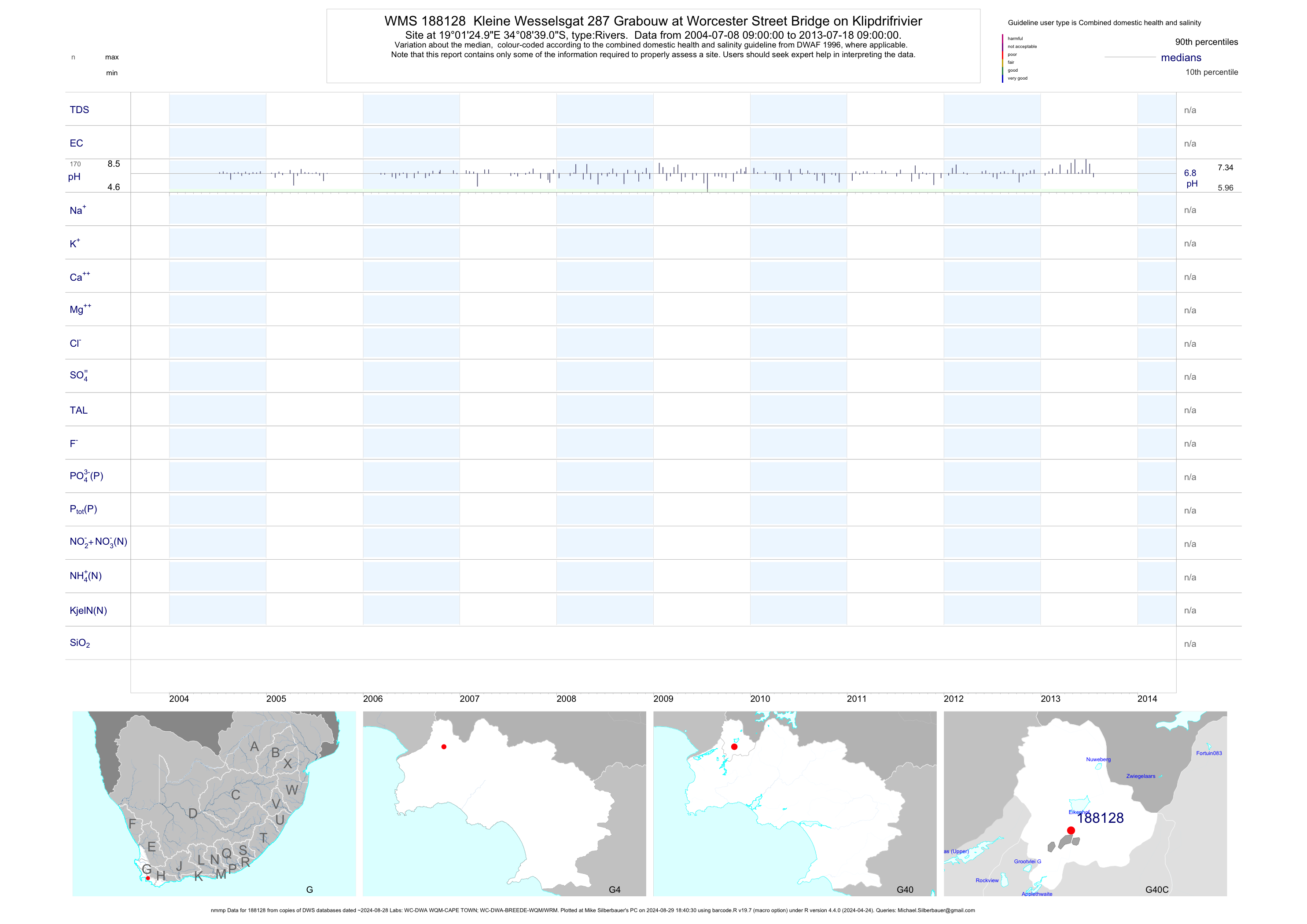
| G40 188128 | plot | data | Kleine Wesselsgat 287 Grabouw at Worcester Street Bridge on Klipdrifrivier (nmmp) | Rivers | 511 | 2004-07-08 | 2013-07-18 | n/a | 188128 | -34.14417 | 19.02361 |
| G40 193350 | plot | data | Caledon at Main Bridge | Rivers | 21 | 2012-11-28 | 2014-01-28 | 44 | 193350 | -34.23678 | 19.36058 |
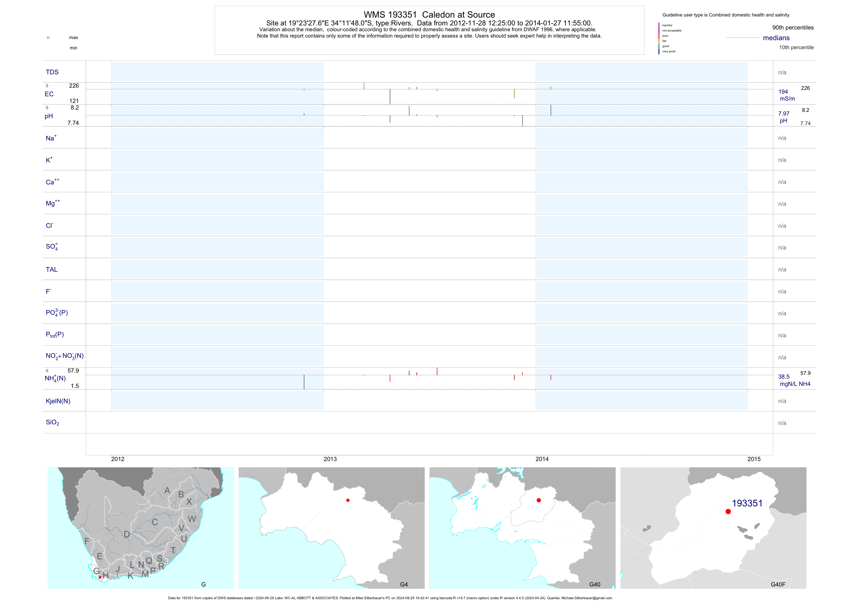
| G40 193351 | plot | data | Caledon at Source | Rivers | 19 | 2012-11-28 | 2014-01-28 | 194 | 193351 | -34.19669 | 19.39103 |
| G40 193352 | plot | data | Caledon downstream of WWTW | Rivers | 19 | 2012-11-28 | 2014-01-28 | 111 | 193352 | -34.18769 | 19.39450 |
| G40 193353 | plot | data | Caledon at Wooden Bridge | Rivers | 19 | 2012-11-28 | 2014-01-28 | 37 | 193353 | -34.23047 | 19.43756 |
| G40 193474 | plot | data | Huisriver at Palmiet | Rivers | 10 | 2013-01-23 | 2013-10-29 | 27 | 193474 | -34.22525 | 19.01556 |
| G40 193488 | plot | data | Onrus River : Down-Stream of R43 Bridge | Rivers | 4 | 2013-10-24 | 2014-02-20 | 36 | 193488 | -34.41086 | 19.19289 |
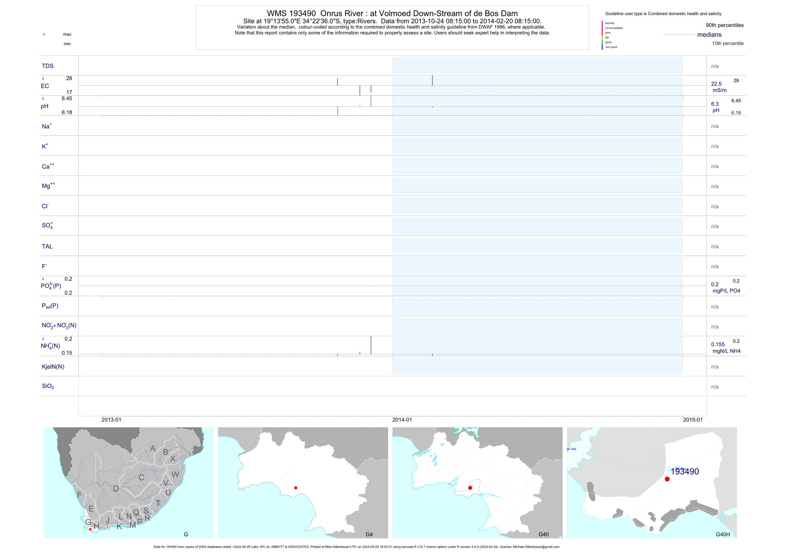
| G40 193490 | plot | data | Onrus River : at Volmoed Down-Stream of de Bos Dam | Rivers | 4 | 2013-10-24 | 2014-02-20 | 22 | 193490 | -34.37667 | 19.23197 |
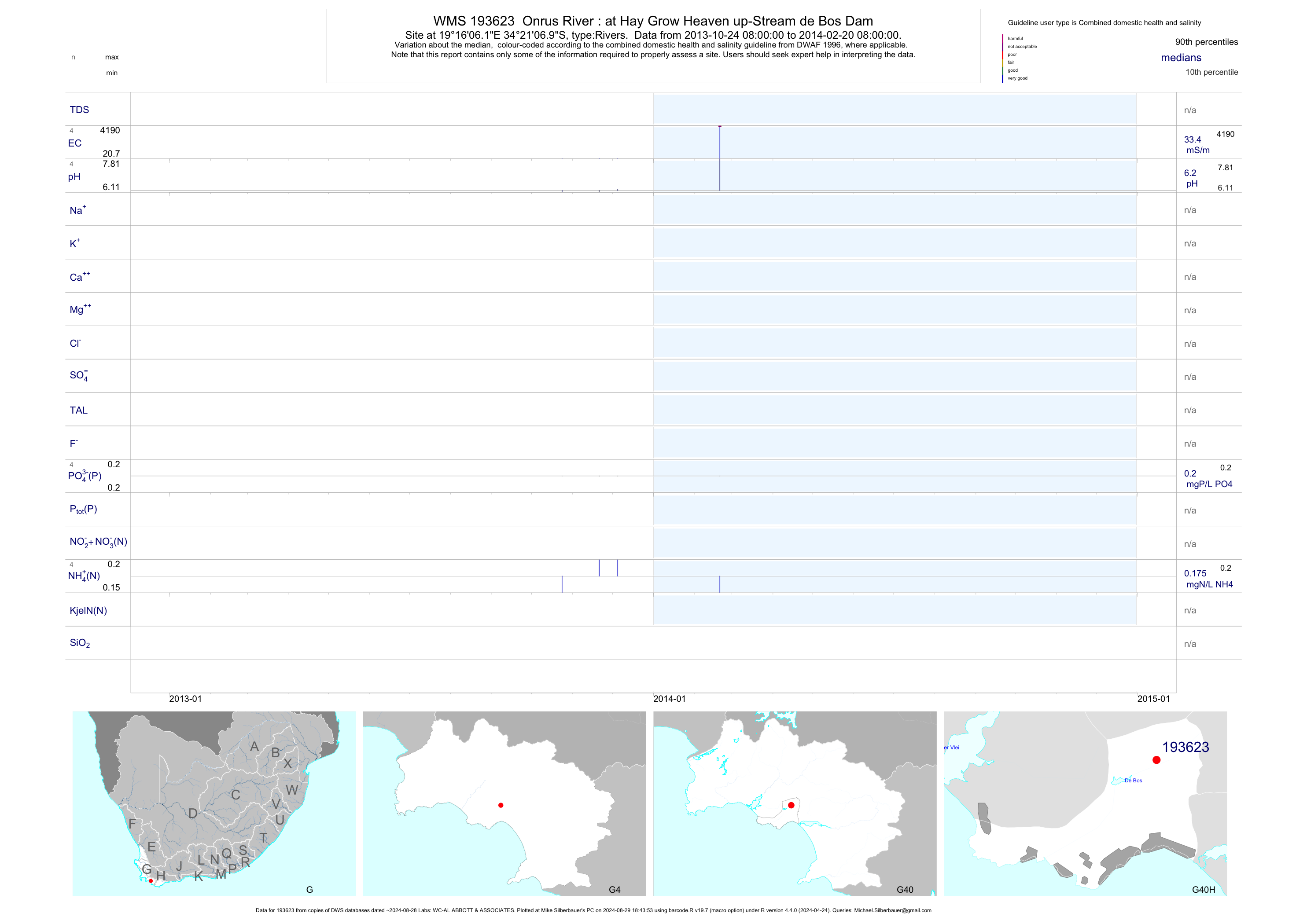
| G40 193623 | plot | data | Onrus River : at Hay Grow Heaven up-Stream de Bos Dam | Rivers | 4 | 2013-10-24 | 2014-02-20 | 33 | 193623 | -34.35192 | 19.26839 |
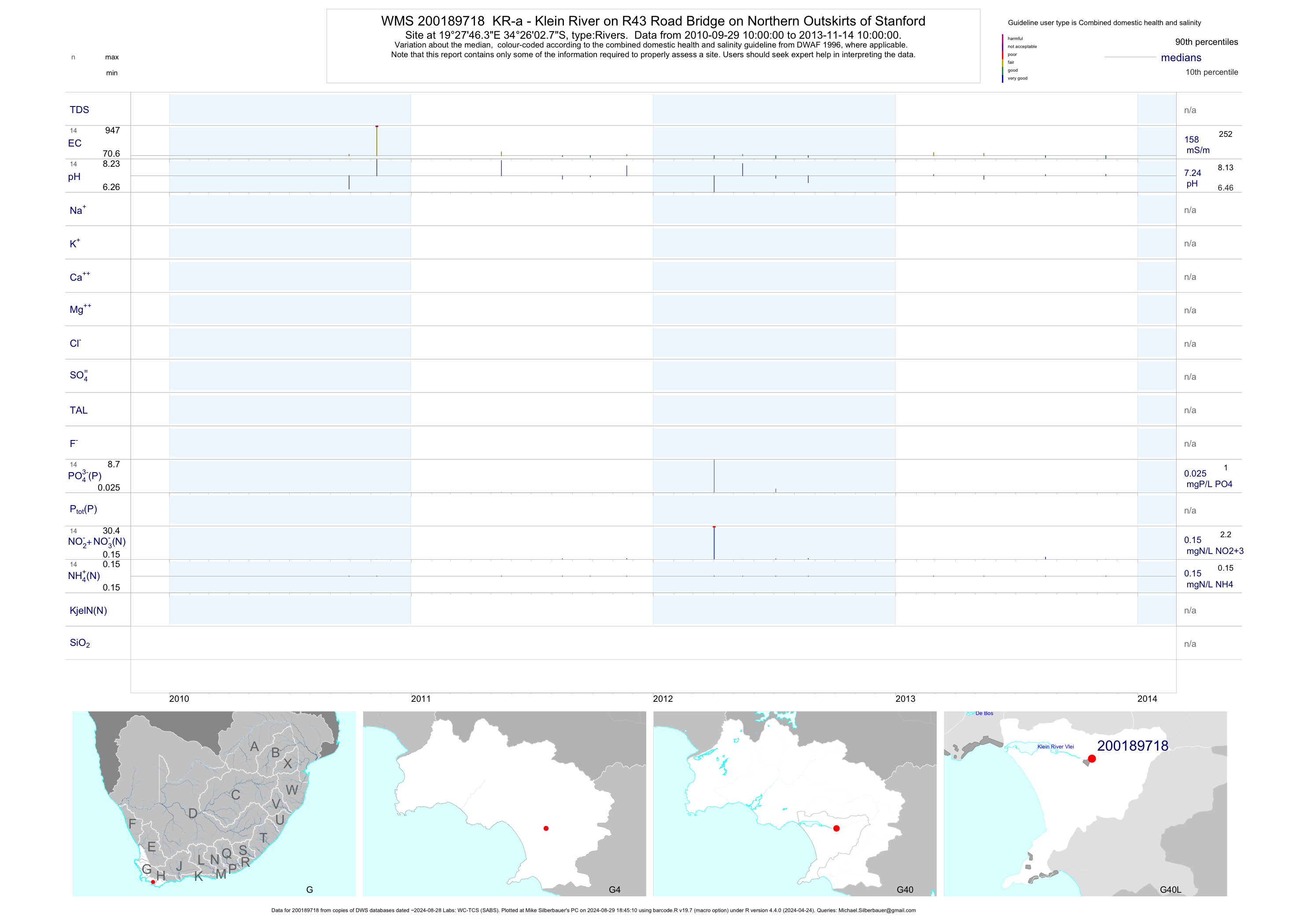
| G40 200189718 | plot | data | KR-a - Klein River on R43 Road Bridge on Northern Outskirts of Stanford | Rivers | 28 | 2010-09-29 | 2013-11-14 | 158 | 200189718 | -34.43410 | 19.46288 |
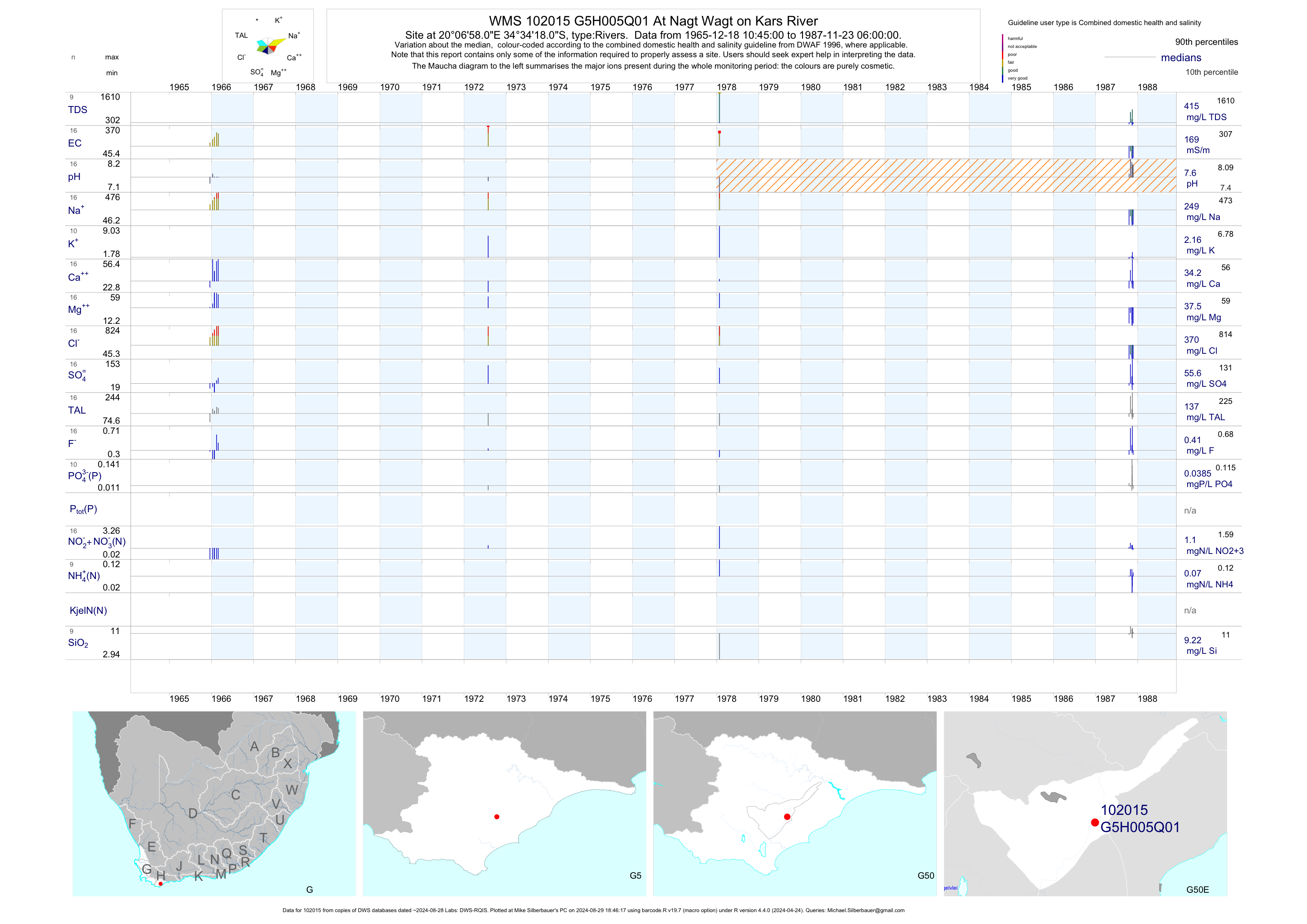
| G50 102015 | plot | data | At Nagt Wagt on Kars River | Rivers | 16 | 1965-12-18 | 1987-11-23 | 169 | G5H005 | -34.57167 | 20.11611 |
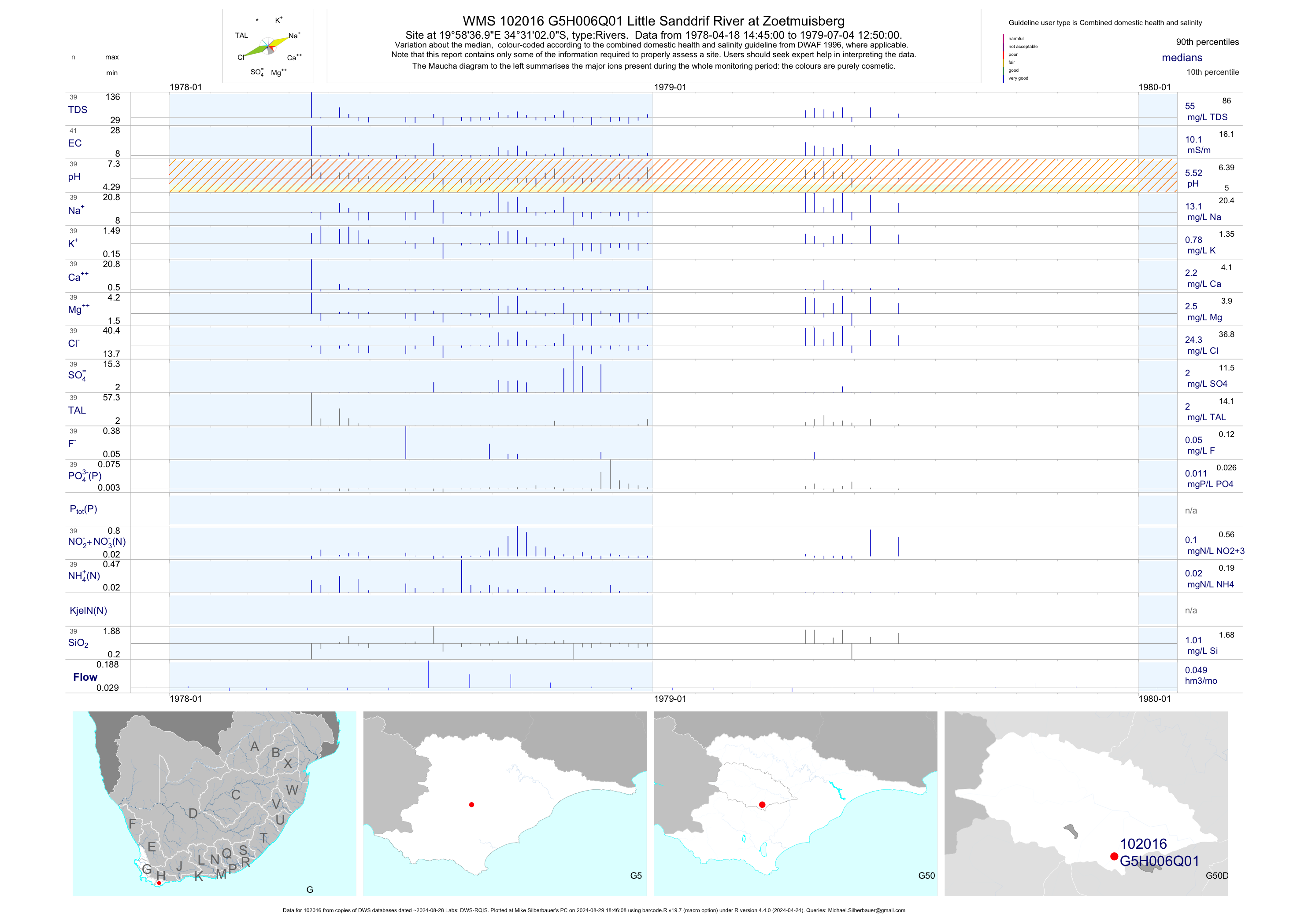
| G50 102016 | plot | data | Little Sanddrif River at Zoetmuisberg | Rivers | 41 | 1978-04-18 | 1979-07-04 | 10 | G5H006 | -34.51722 | 19.97694 |
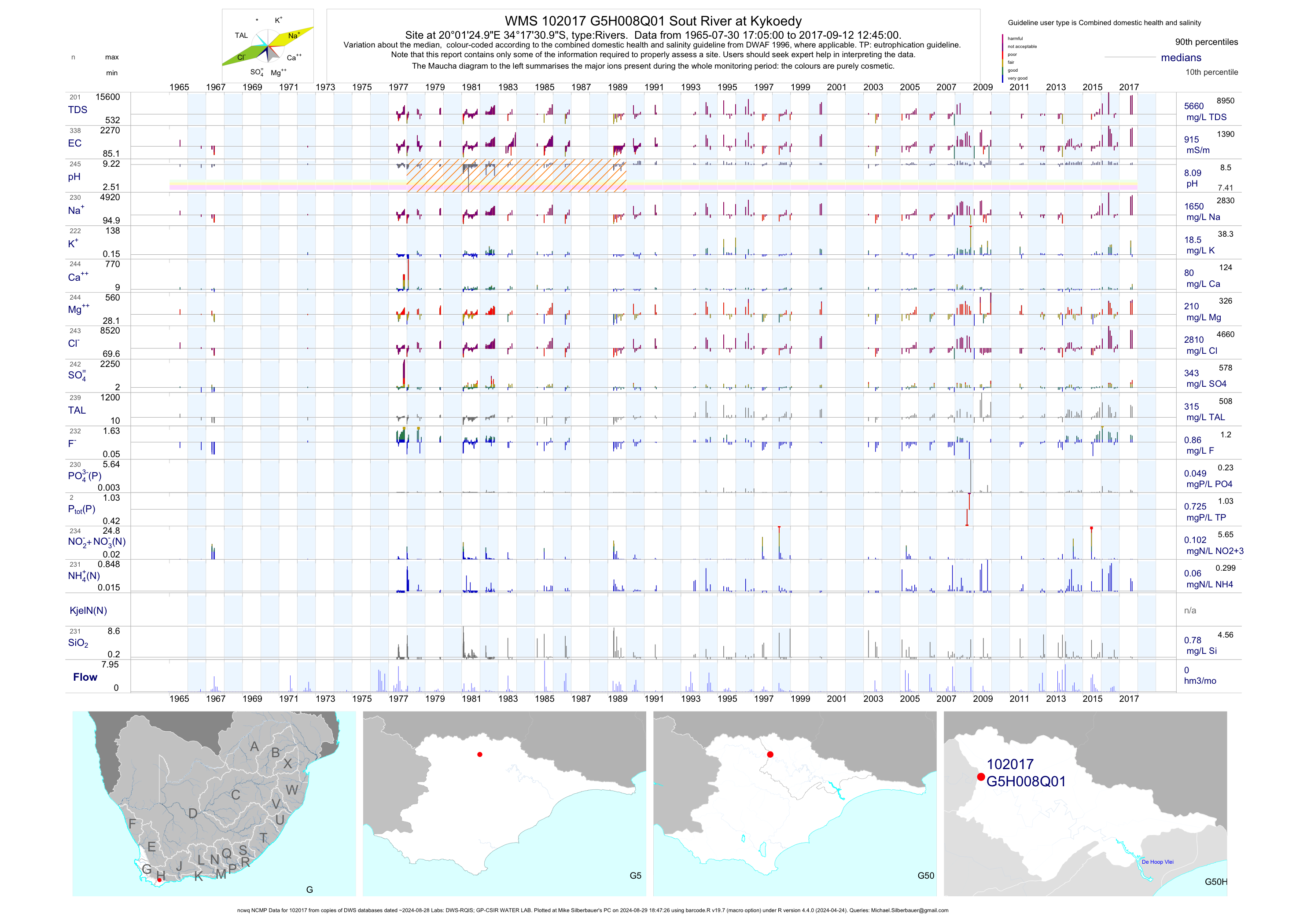
| G50 102017 | plot | data | Sout River at Kykoedy (ncwq NCMP) | Rivers | 338 | 1965-07-30 | 2017-09-12 | 915 | G5H008 | -34.29194 | 20.02361 |
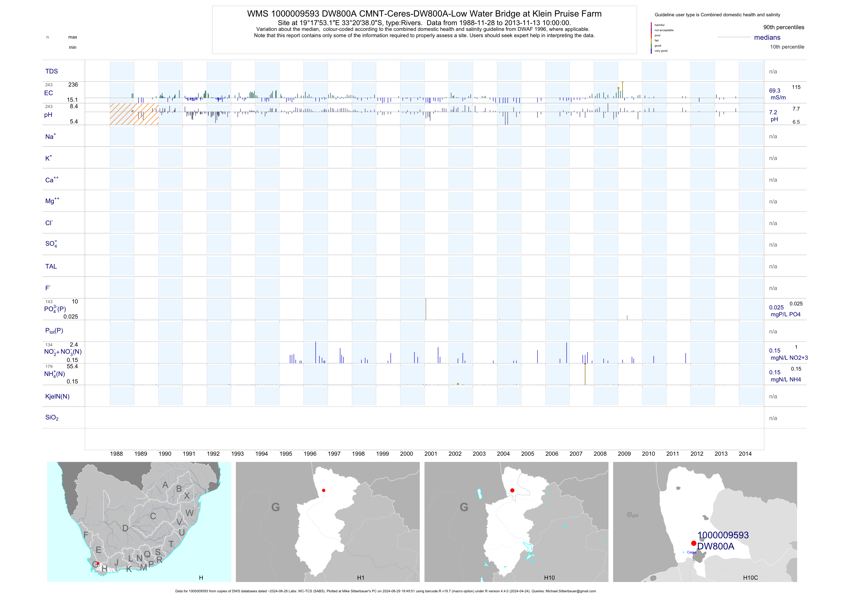
| H10 1000009593 | plot | data | CMNT-Ceres-DW800A-Low Water Bridge at Klein Pruise Farm | Rivers | 350 | 1988-11-28 | 2013-11-13 | 69 | DW800A | -33.34390 | 19.29810 |
| H10 1000009594 | plot | data | CMNT-Ceres-DW800A1-After Runoff from Cfp Irri Area on Mazoe | Rivers | 140 | 1995-04-18 | 2013-11-13 | 38 | DW800A1 | -33.35810 | 19.30060 |
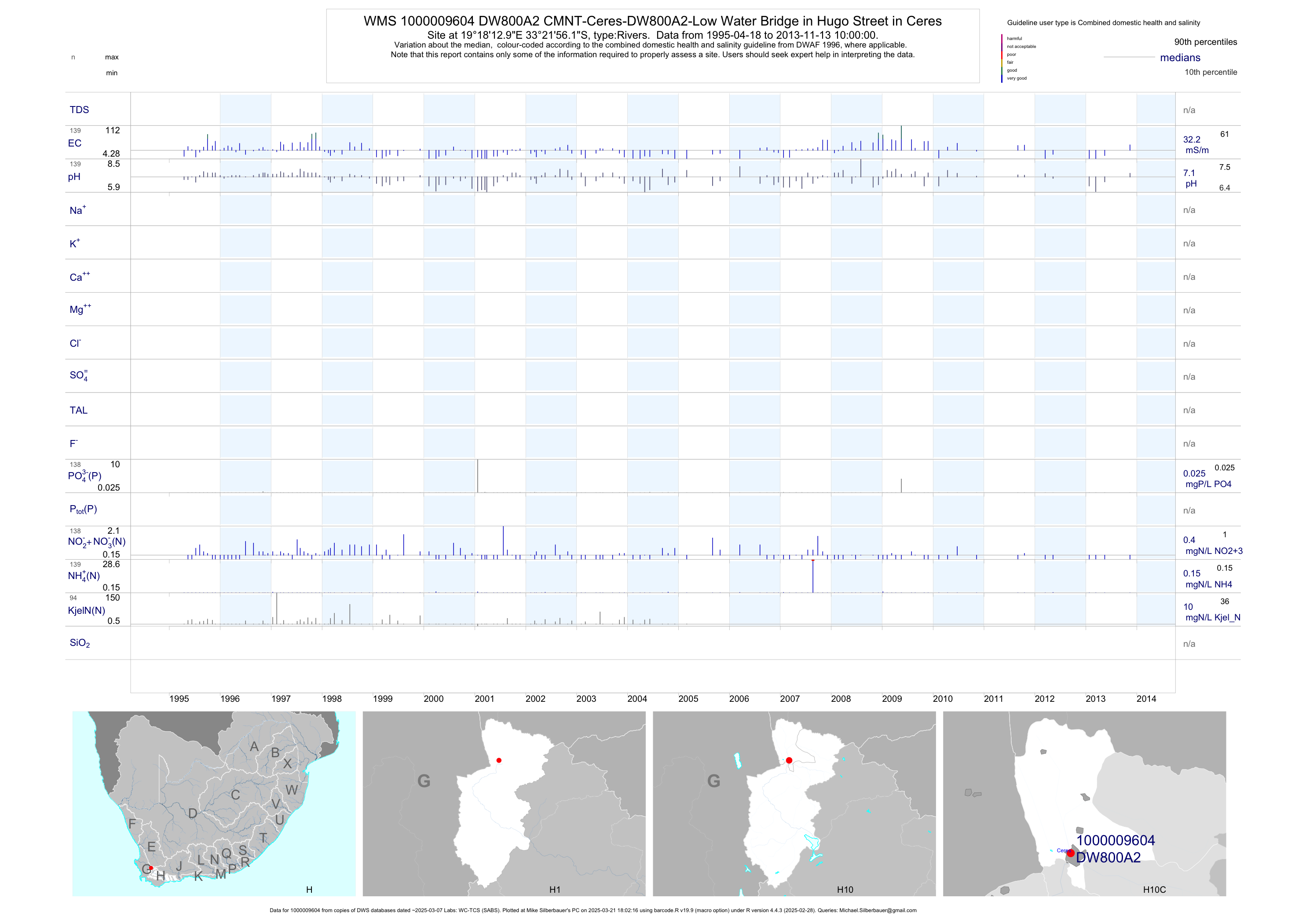
| H10 1000009604 | plot | data | CMNT-Ceres-DW800A2-Low Water Bridge in Hugo Street in Ceres | Rivers | 234 | 1995-04-18 | 2013-11-13 | 32 | DW800A2 | -33.36560 | 19.30360 |
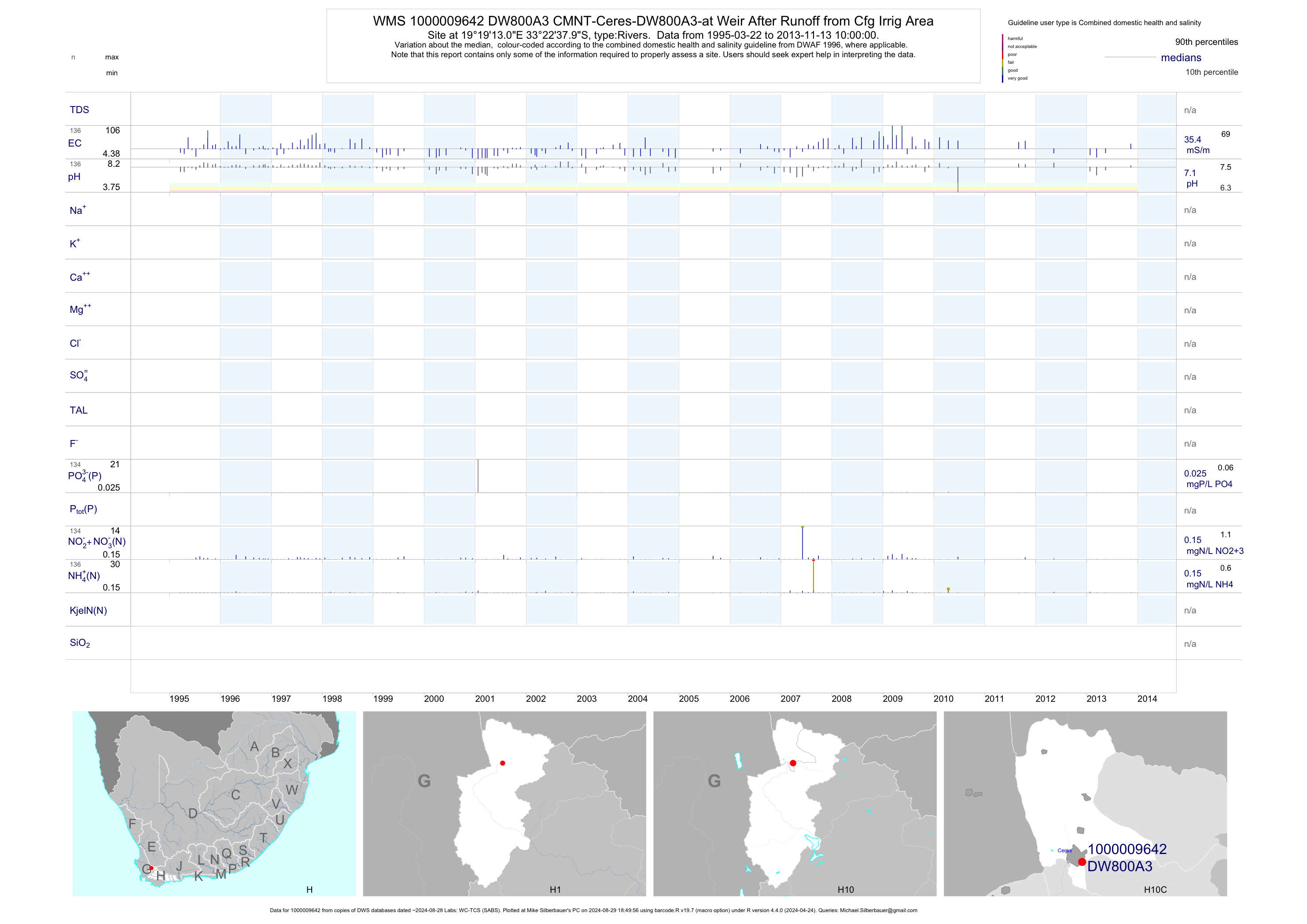
| H10 1000009642 | plot | data | CMNT-Ceres-DW800A3-at Weir After Runoff from Cfg Irrig Area | Rivers | 136 | 1995-03-22 | 2013-11-13 | 35 | DW800A3 | -33.37720 | 19.32030 |
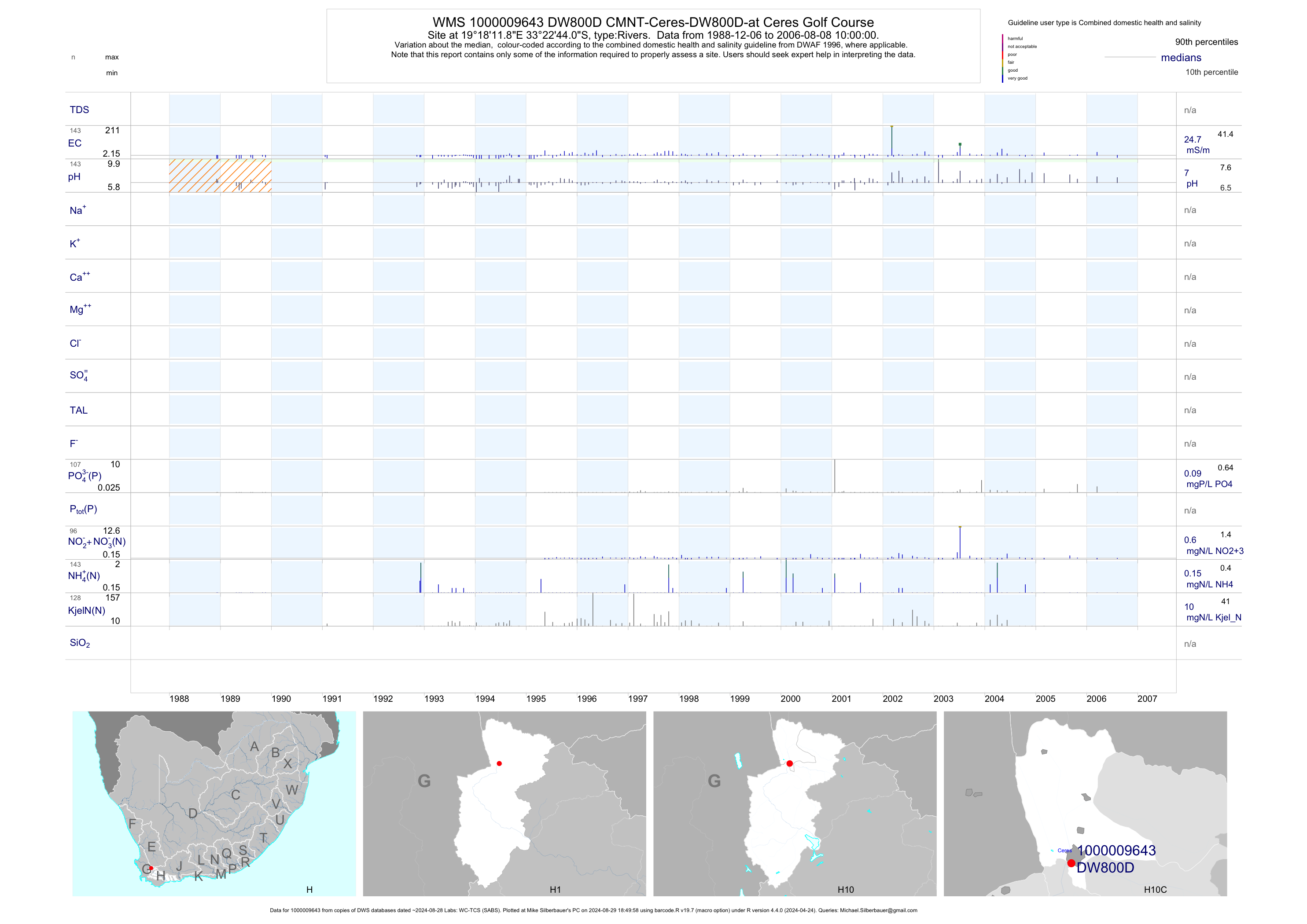
| H10 1000009643 | plot | data | CMNT-Ceres-DW800D-at Ceres Golf Course | Rivers | 143 | 1988-12-06 | 2006-08-08 | 25 | DW800D | -33.37890 | 19.30330 |
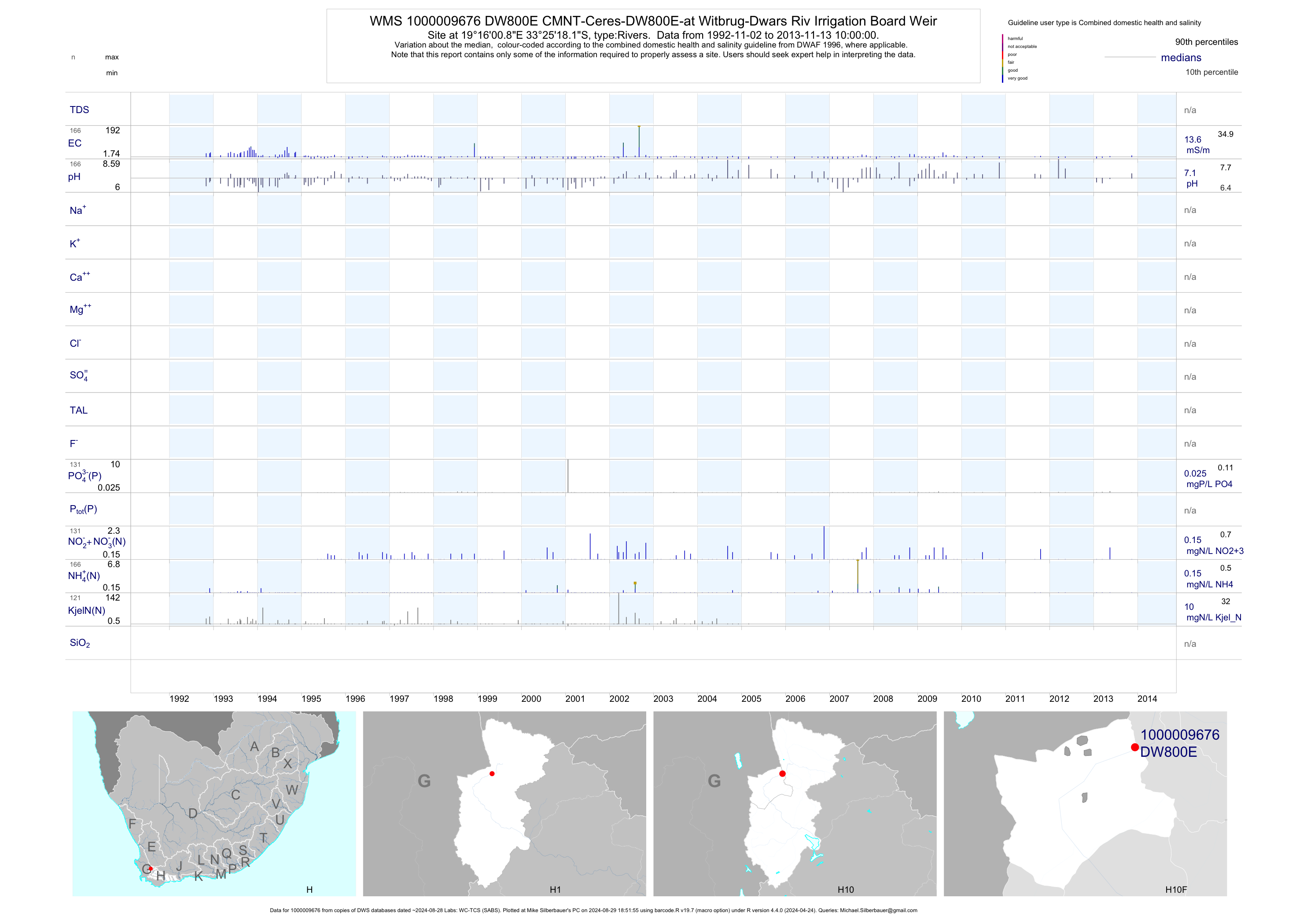
| H10 1000009676 | plot | data | CMNT-Ceres-DW800E-at Witbrug-Dwars Riv Irrigation Board Weir | Rivers | 289 | 1992-11-02 | 2013-11-13 | 14 | DW800E | -33.42170 | 19.26690 |
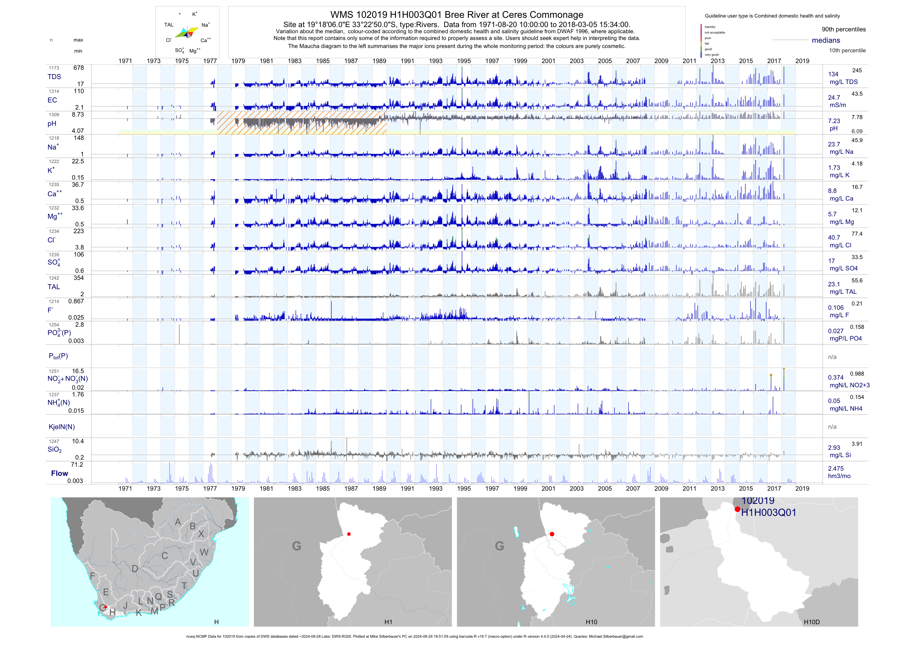
| H10 102019 | plot | data | Bree River at Ceres Commonage (ncwq NCMP) | Rivers | 1314 | 1971-08-20 | 2018-03-05 | 25 | H1H003 | -33.38056 | 19.30167 |
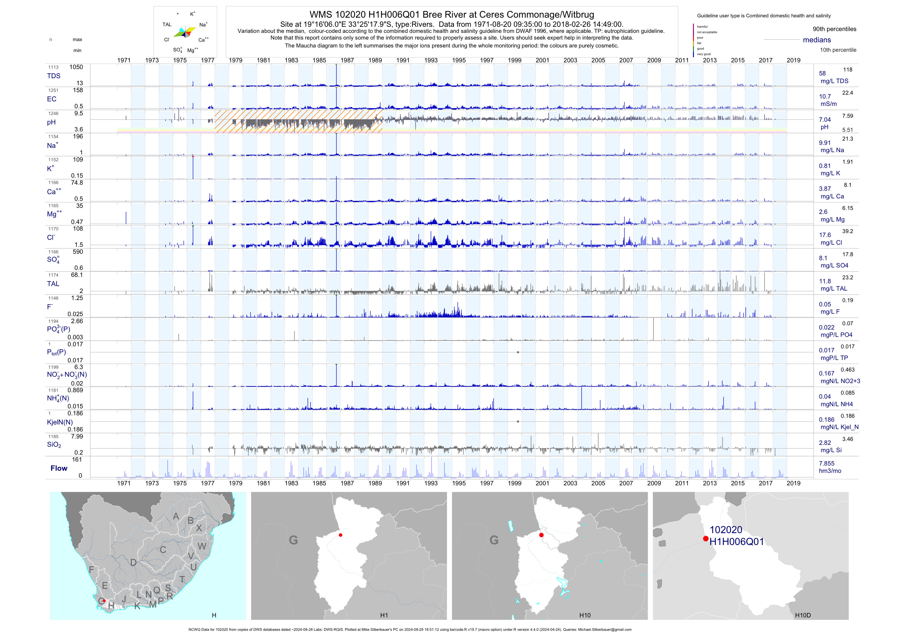
| H10 102020 | plot | data | Bree River at Ceres Commonage/Witbrug (NCWQ) | Rivers | 1252 | 1971-08-20 | 2018-02-26 | 11 | H1H006 | -33.42167 | 19.26833 |
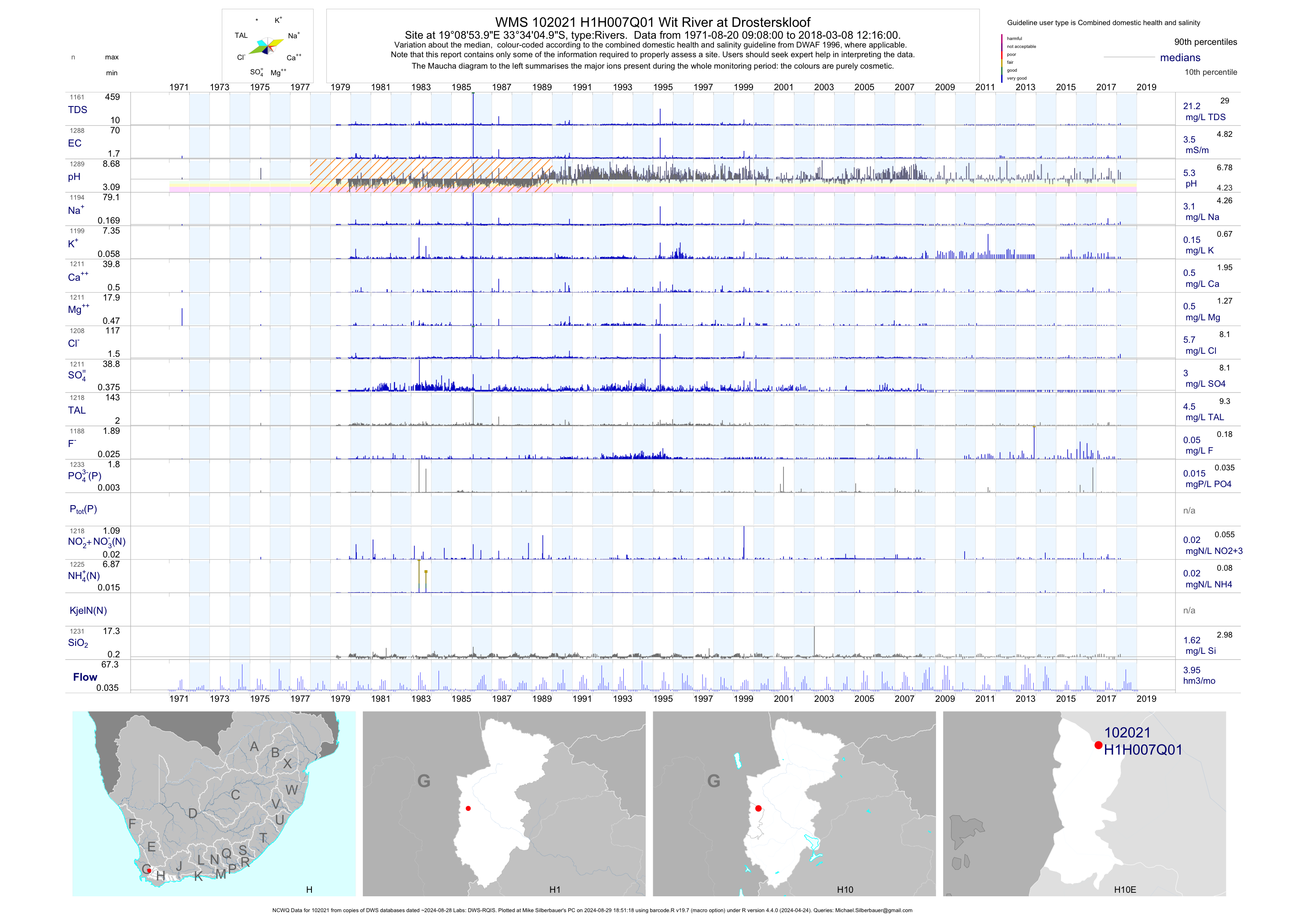
| H10 102021 | plot | data | Wit River at Drosterskloof (NCWQ) | Rivers | 1291 | 1971-08-20 | 2018-03-08 | 4 | H1H007 | -33.56806 | 19.14833 |
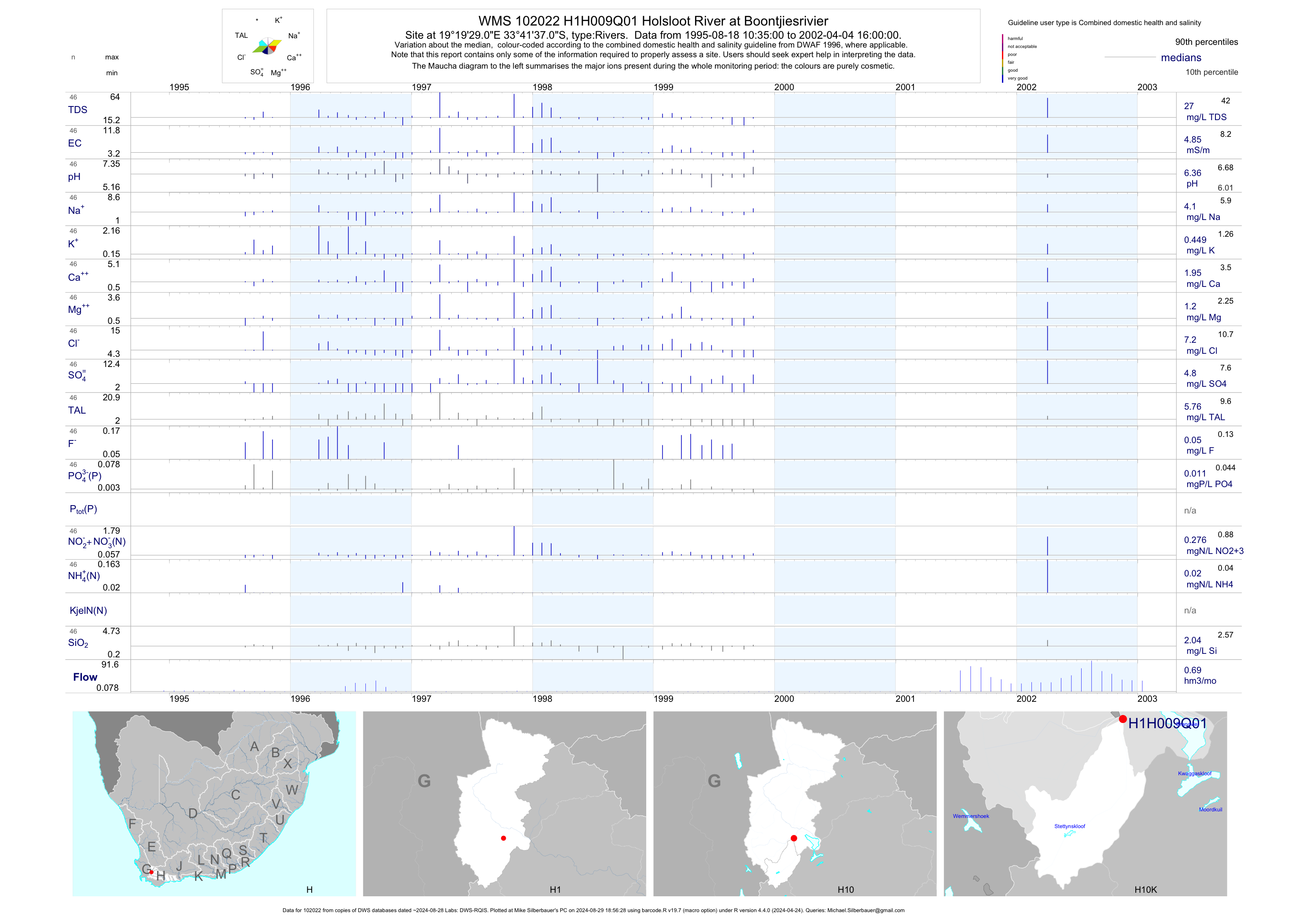
| H10 102022 | plot | data | Holsloot River at Boontjiesrivier | Rivers | 46 | 1995-08-18 | 2002-04-04 | 5 | H1H009 | -33.69361 | 19.32472 |
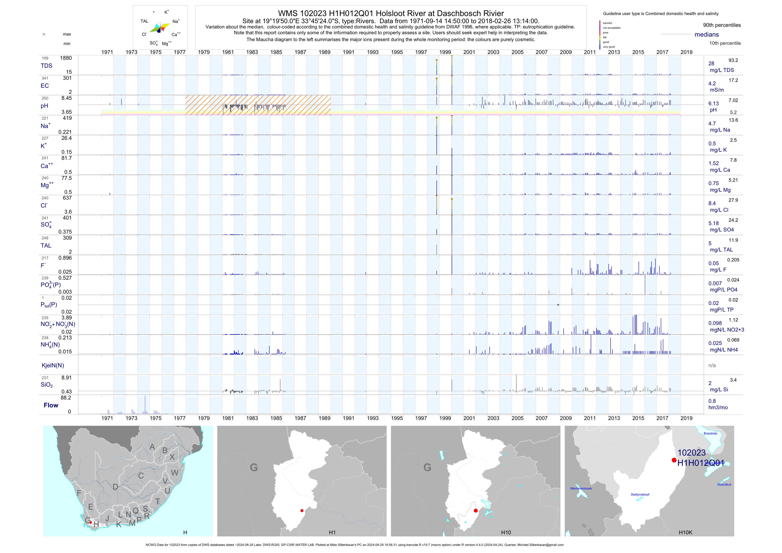
| H10 102023 | plot | data | Holsloot River at Daschbosch Rivier (NCWQ) | Rivers | 342 | 1971-09-14 | 2018-02-26 | 4 | H1H012 | -33.75667 | 19.33056 |
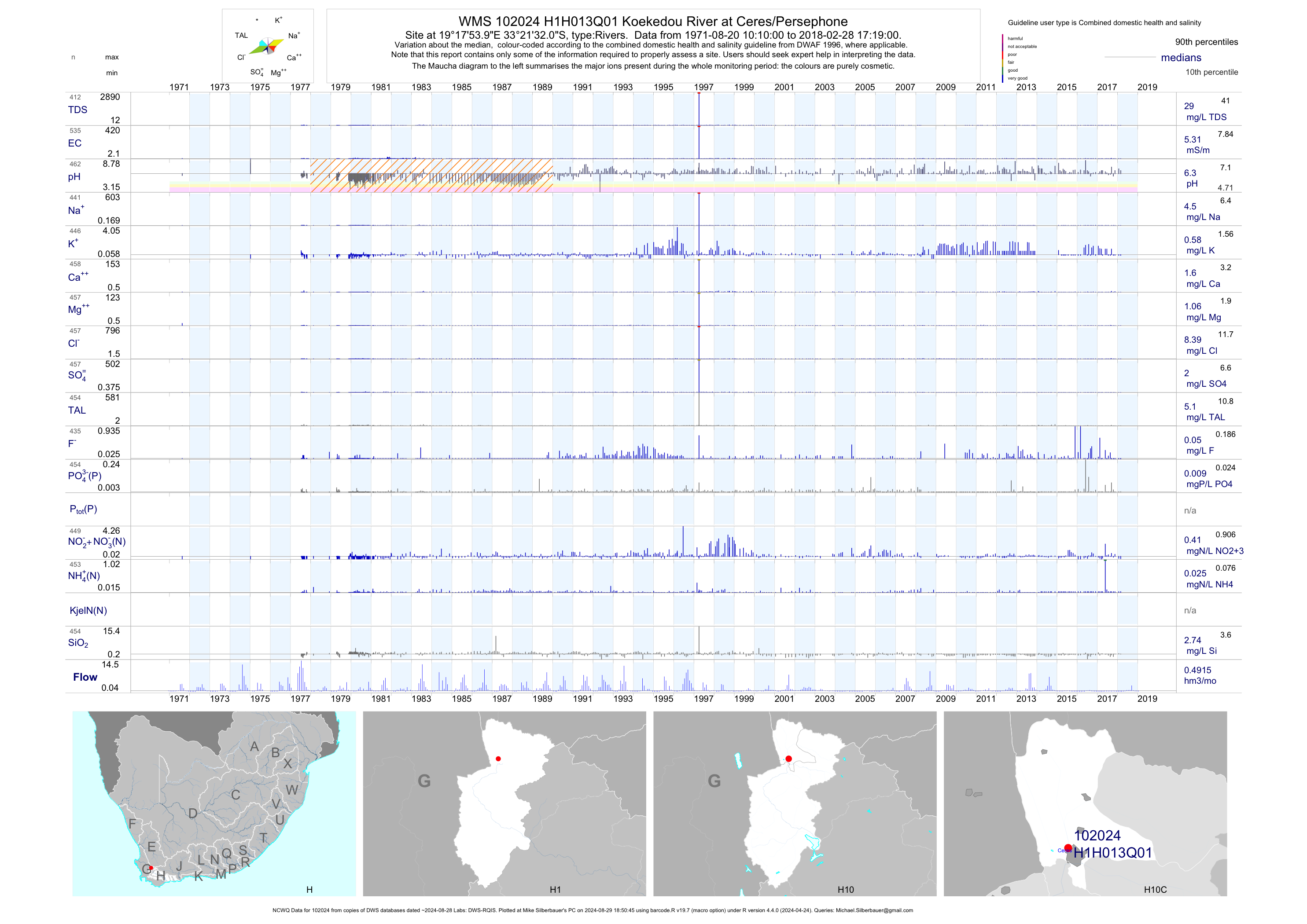
| H10 102024 | plot | data | Koekedou River at Ceres/Persephone (NCWQ) | Rivers | 540 | 1971-08-20 | 2018-02-28 | 5 | H1H013 | -33.35889 | 19.29833 |
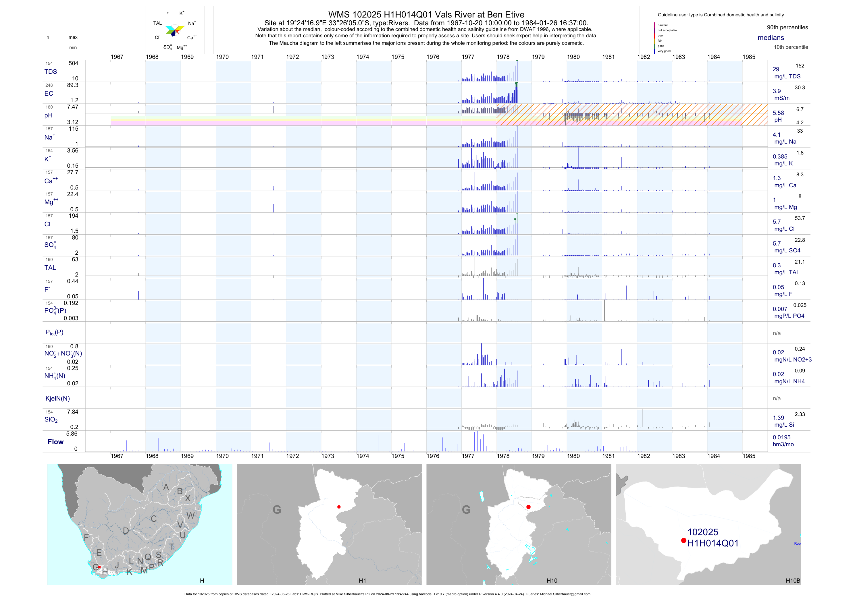
| H10 102025 | plot | data | Vals River at Ben Etive | Rivers | 248 | 1967-10-20 | 1984-01-26 | 4 | H1H014 | -33.43472 | 19.40472 |
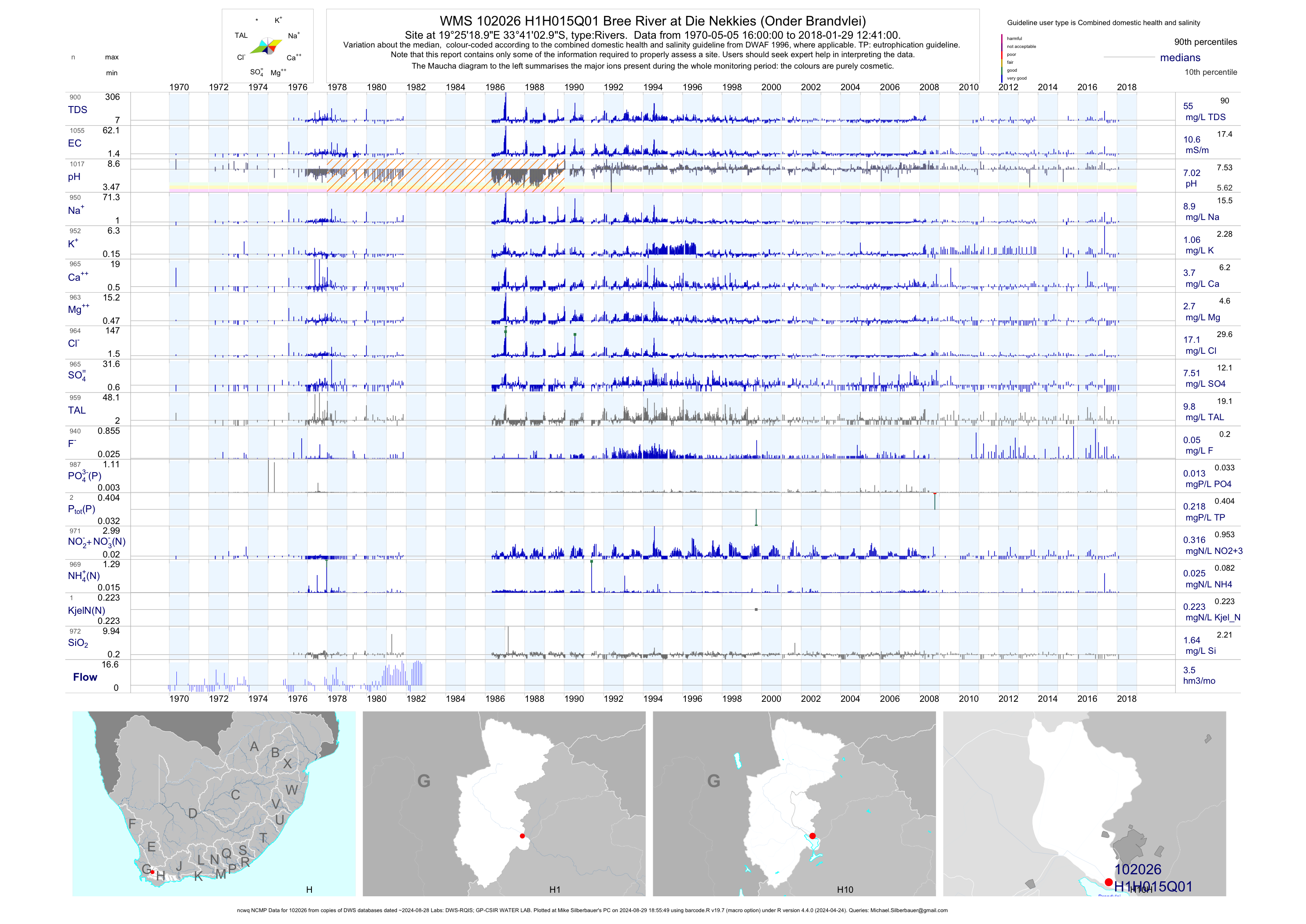
| H10 102026 | plot | data | Bree River at Die Nekkies (Onder Brandvlei) (ncwq NCMP) | Rivers | 1062 | 1970-05-05 | 2018-01-29 | 11 | H1H015 | -33.68417 | 19.42194 |
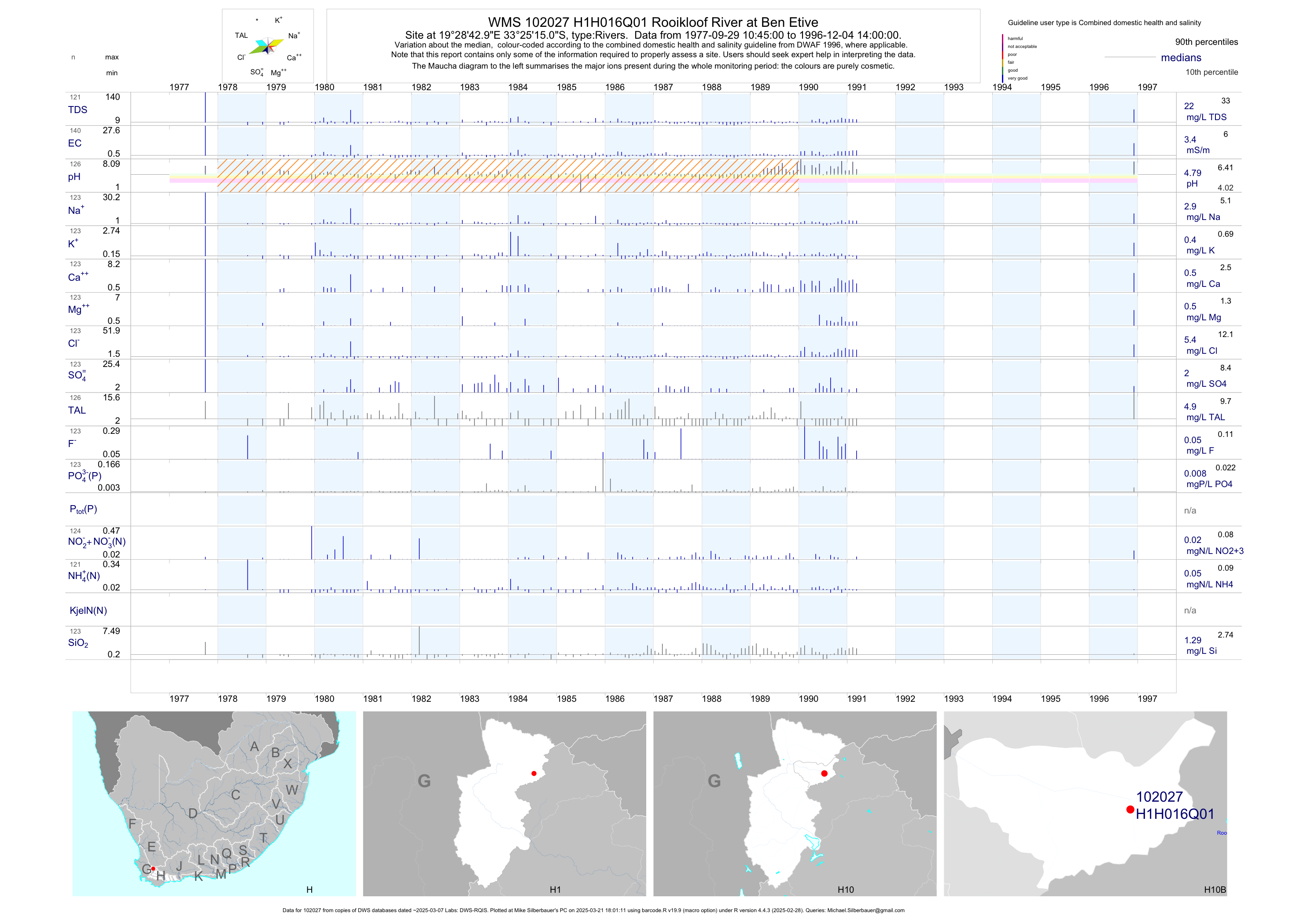
| H10 102027 | plot | data | Rooikloof River at Ben Etive | Rivers | 140 | 1977-09-29 | 1996-12-04 | 3 | H1H016 | -33.42083 | 19.47861 |
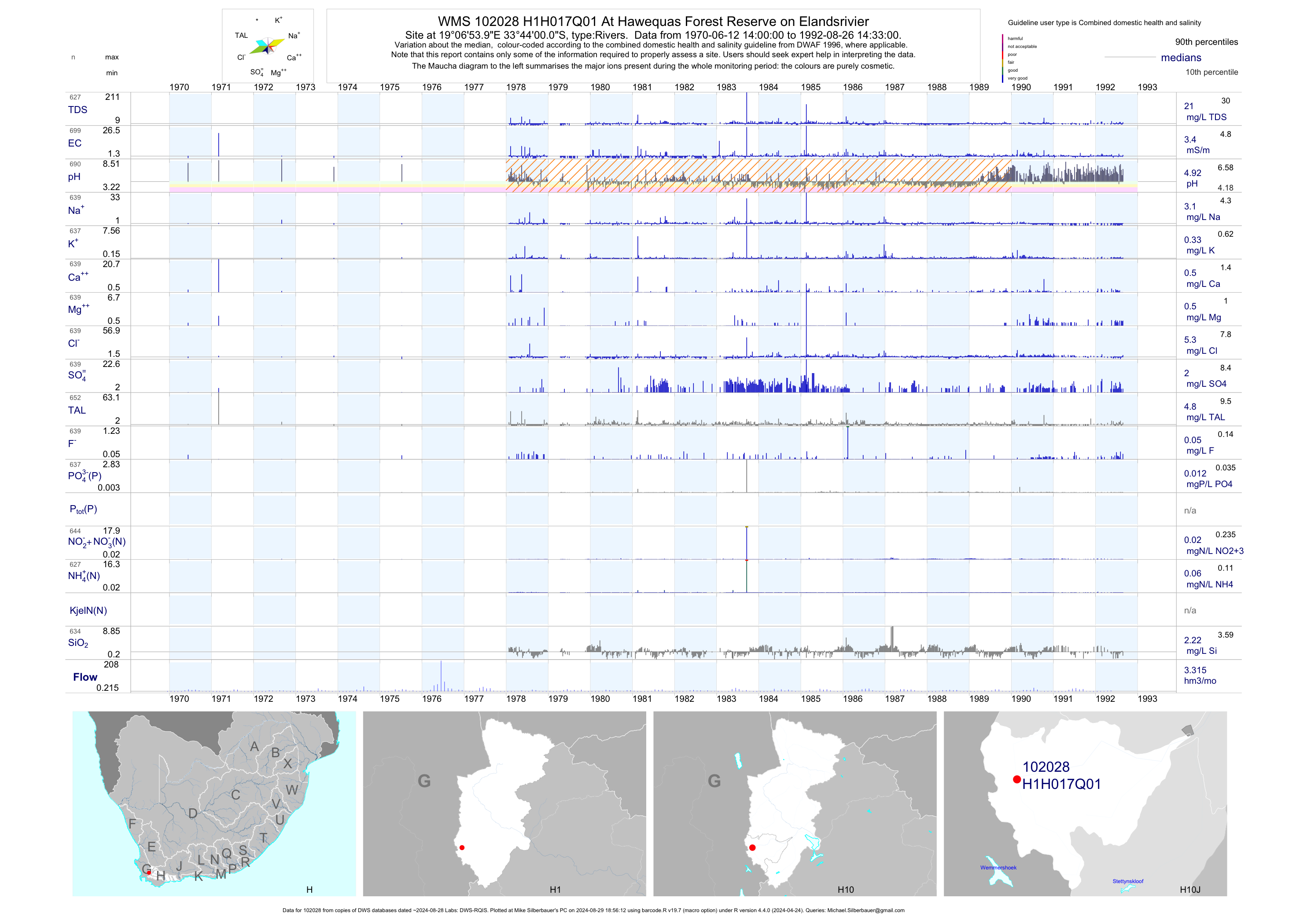
| H10 102028 | plot | data | At Hawequas Forest Reserve on Elandsrivier | Rivers | 699 | 1970-06-12 | 1992-08-26 | 3 | H1H017 | -33.73333 | 19.11500 |
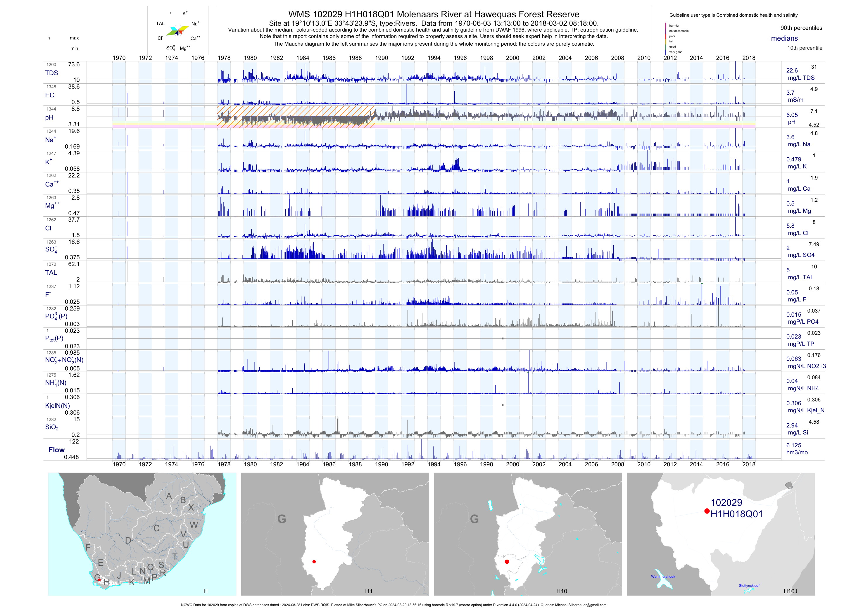
| H10 102029 | plot | data | Molenaars River at Hawequas Forest Reserve (NCWQ) | Rivers | 1353 | 1970-06-03 | 2018-03-02 | 4 | H1H018 | -33.72333 | 19.17028 |
| H10 102030 | plot | data | Slanghoek River at Slanghoek | Rivers | 67 | 1970-08-27 | 1988-09-06 | 6 | H1H019 | -33.58500 | 19.22528 |
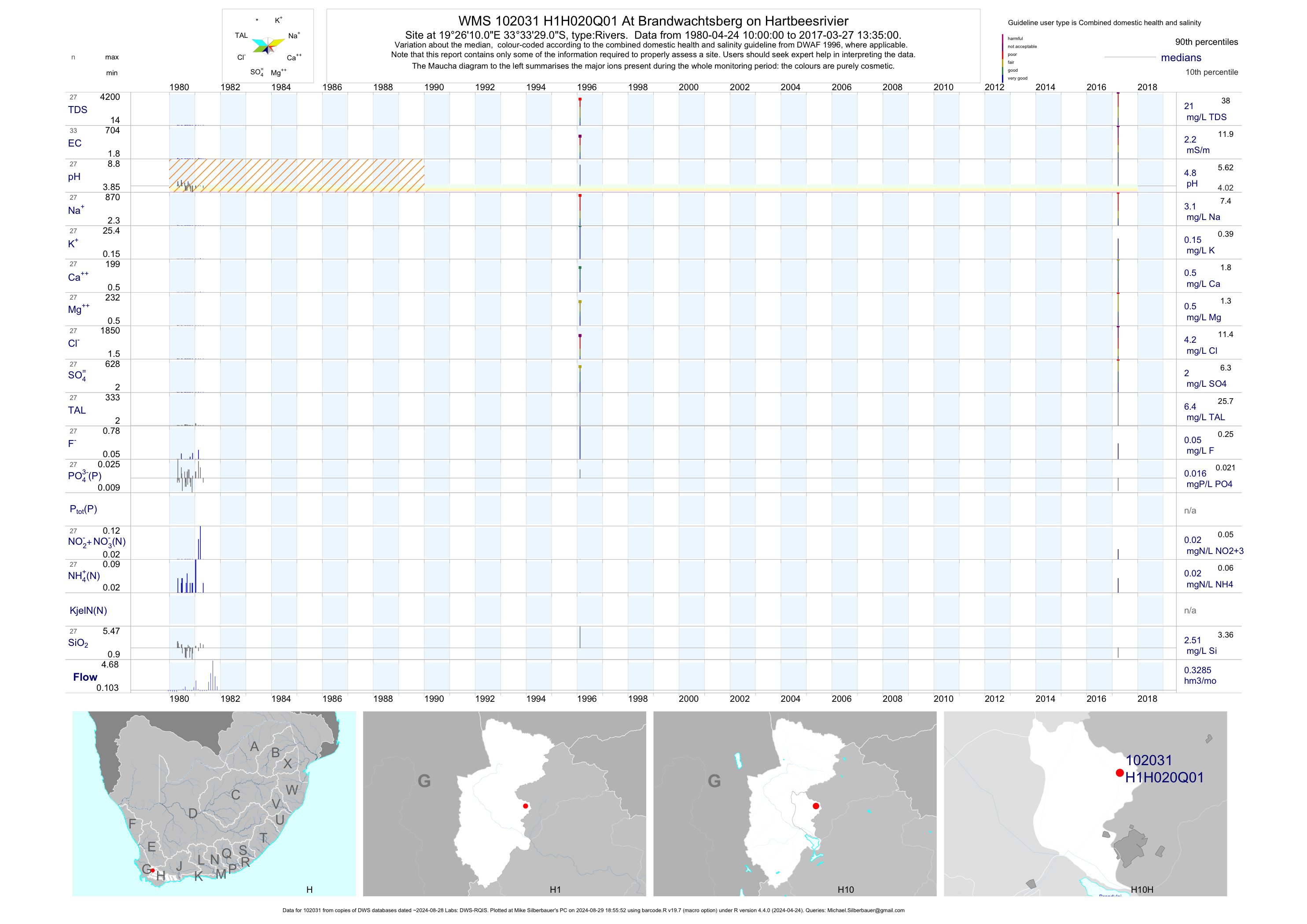
| H10 102031 | plot | data | At Brandwachtsberg on Hartbeesrivier | Rivers | 33 | 1980-04-24 | 2017-03-27 | 2 | H1H020 | -33.55806 | 19.43611 |
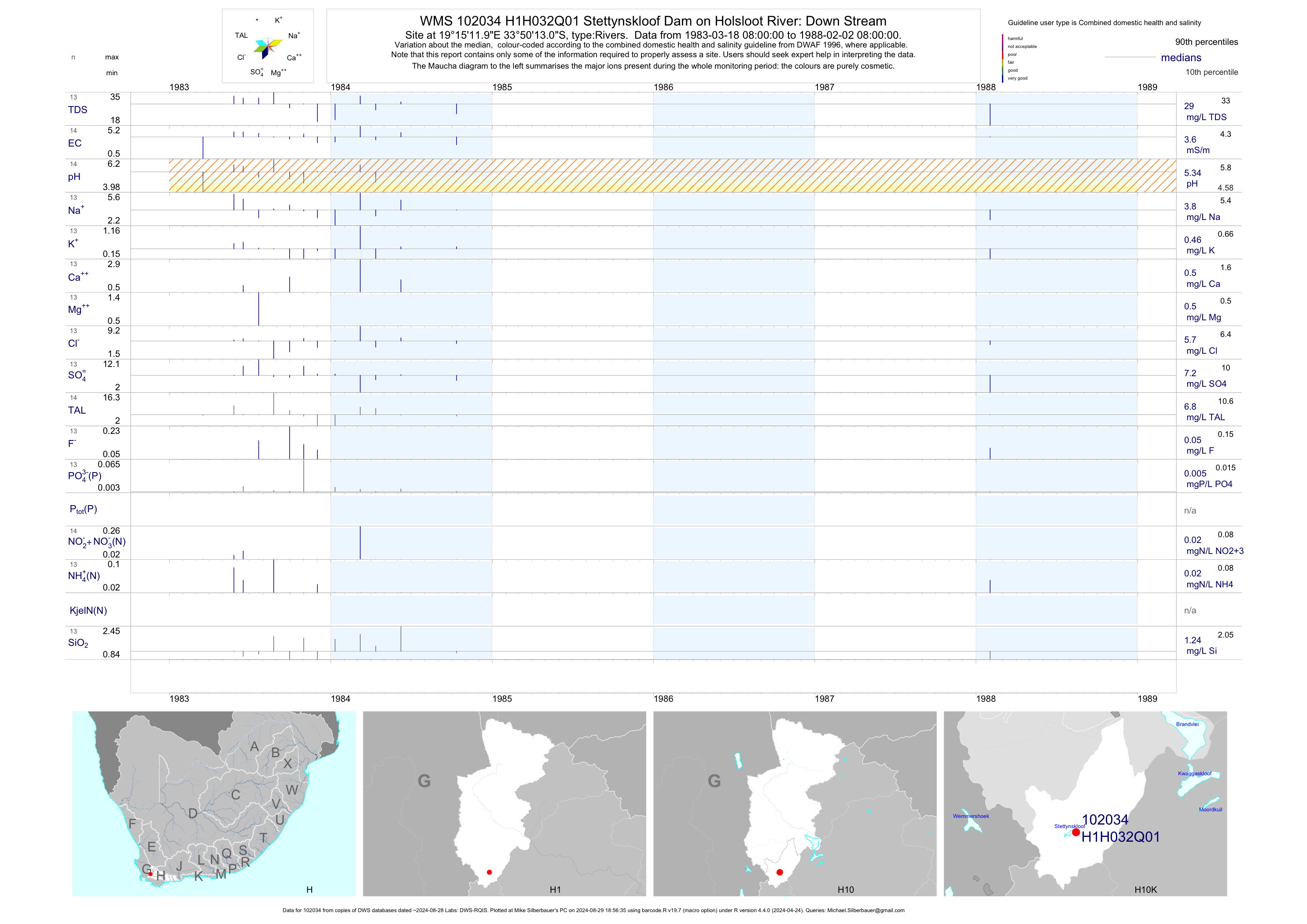
| H10 102034 | plot | data | Stettynskloof Dam on Holsloot River: Down Stream | Rivers | 14 | 1983-03-18 | 1988-02-02 | 4 | H1H032 | -33.83694 | 19.25333 |
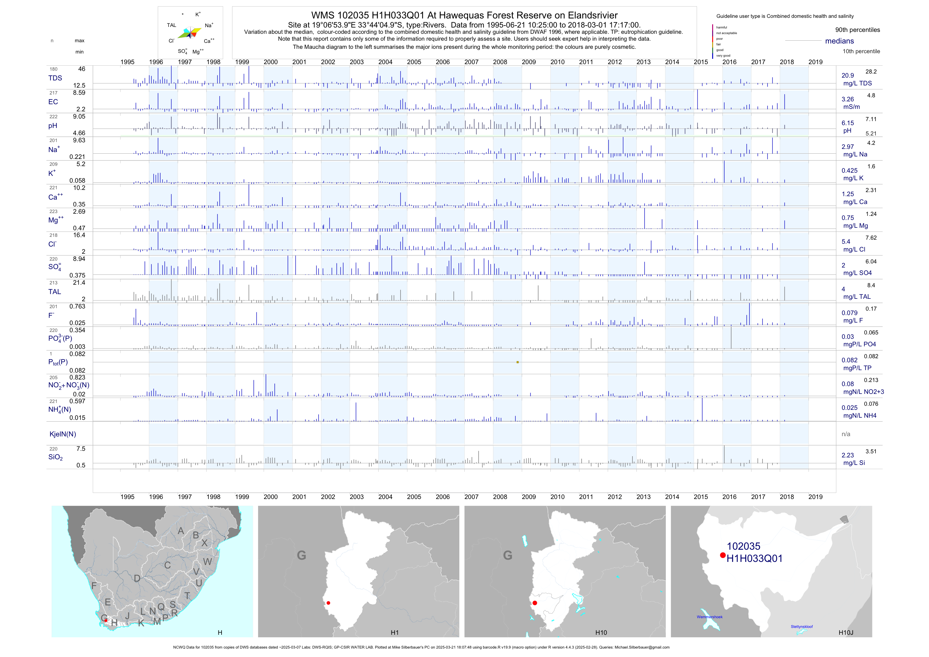
| H10 102035 | plot | data | At Hawequas Forest Reserve on Elandsrivier (NCWQ) | Rivers | 223 | 1995-06-21 | 2018-03-01 | 3 | H1H033 | -33.73472 | 19.11500 |
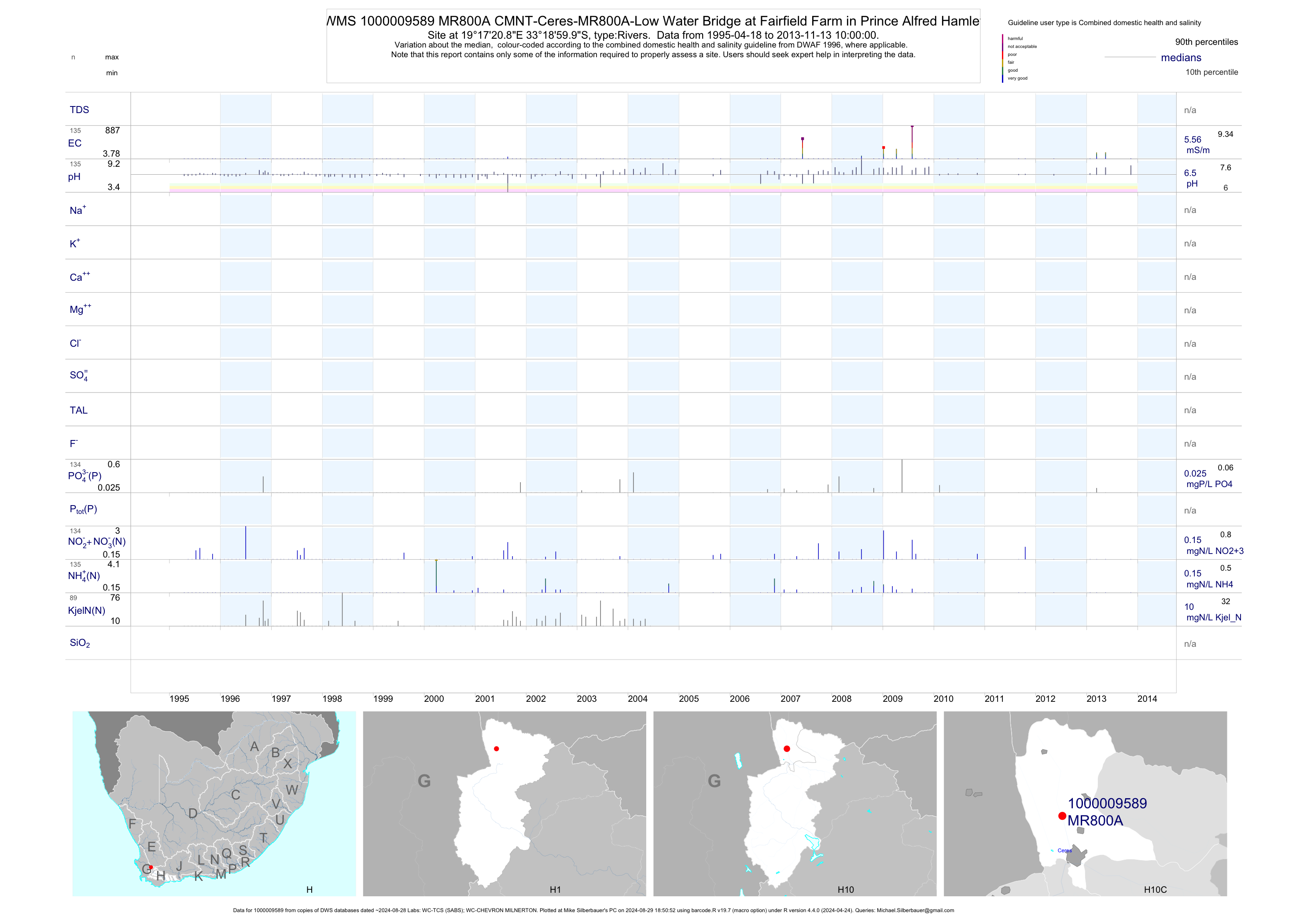
| H10 1000009589 | plot | data | CMNT-Ceres-MR800A-Low Water Bridge at Fairfield Farm in Prince Alfred Hamlet | Rivers | 225 | 1995-04-18 | 2013-11-13 | 6 | MR800A | -33.31667 | 19.28912 |
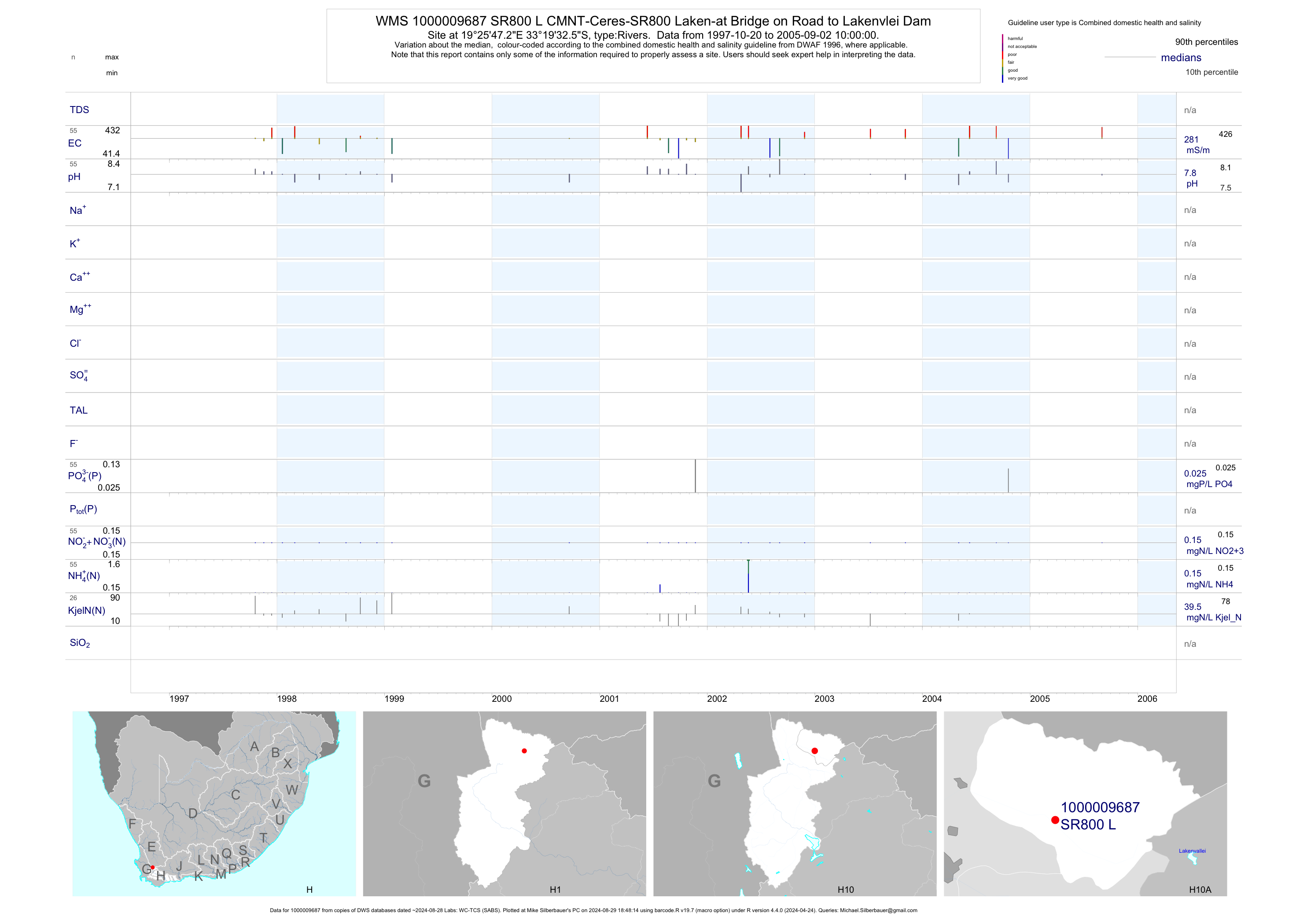
| H10 1000009687 | plot | data | CMNT-Ceres-SR800 Laken-at Bridge on Road to Lakenvlei Dam | Rivers | 55 | 1997-10-20 | 2005-09-02 | 281 | SR800 L | -33.32570 | 19.42980 |
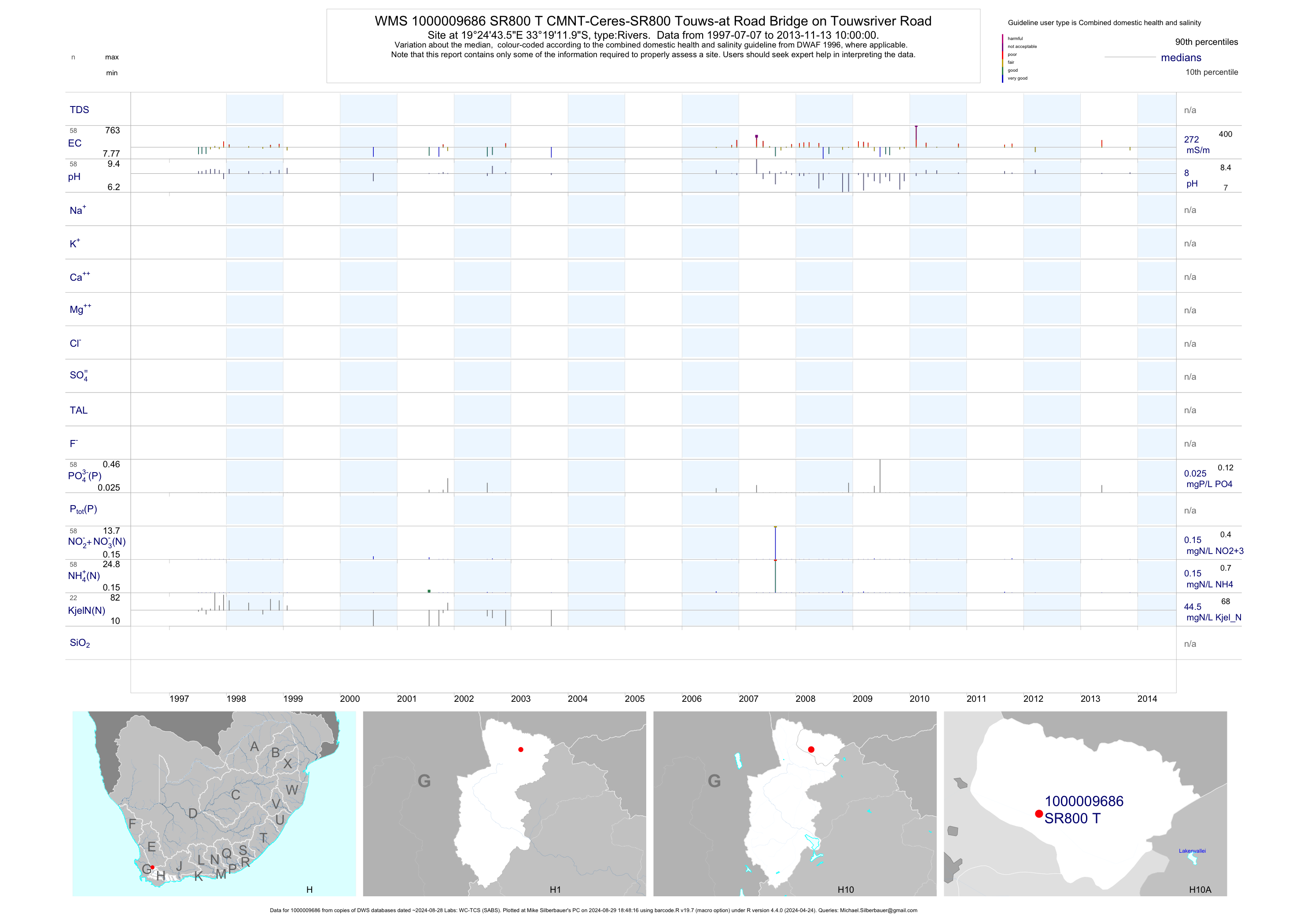
| H10 1000009686 | plot | data | CMNT-Ceres-SR800 Touws-at Road Bridge on Touwsriver Road | Rivers | 81 | 1997-07-07 | 2013-11-13 | 272 | SR800 T | -33.32000 | 19.41210 |
| H10 1000009591 | plot | data | CMNT-Ceres-SR800A-Low Water Bridge on Fairfield Farm | Rivers | 220 | 1995-04-18 | 2013-11-13 | 137 | SR800A | -33.32170 | 19.29250 |
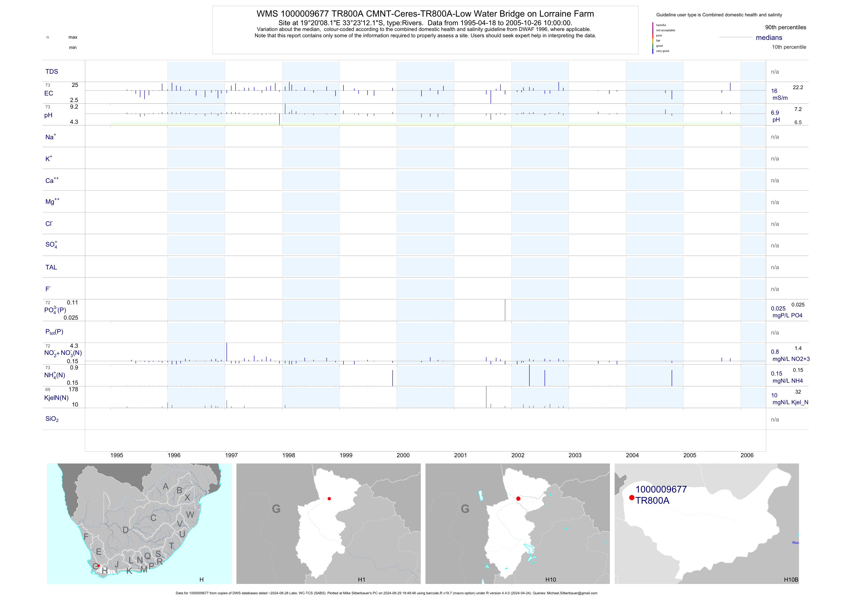
| H10 1000009677 | plot | data | CMNT-Ceres-TR800A-Low Water Bridge on Lorraine Farm | Rivers | 142 | 1995-04-18 | 2005-10-26 | 16 | TR800A | -33.38670 | 19.33560 |
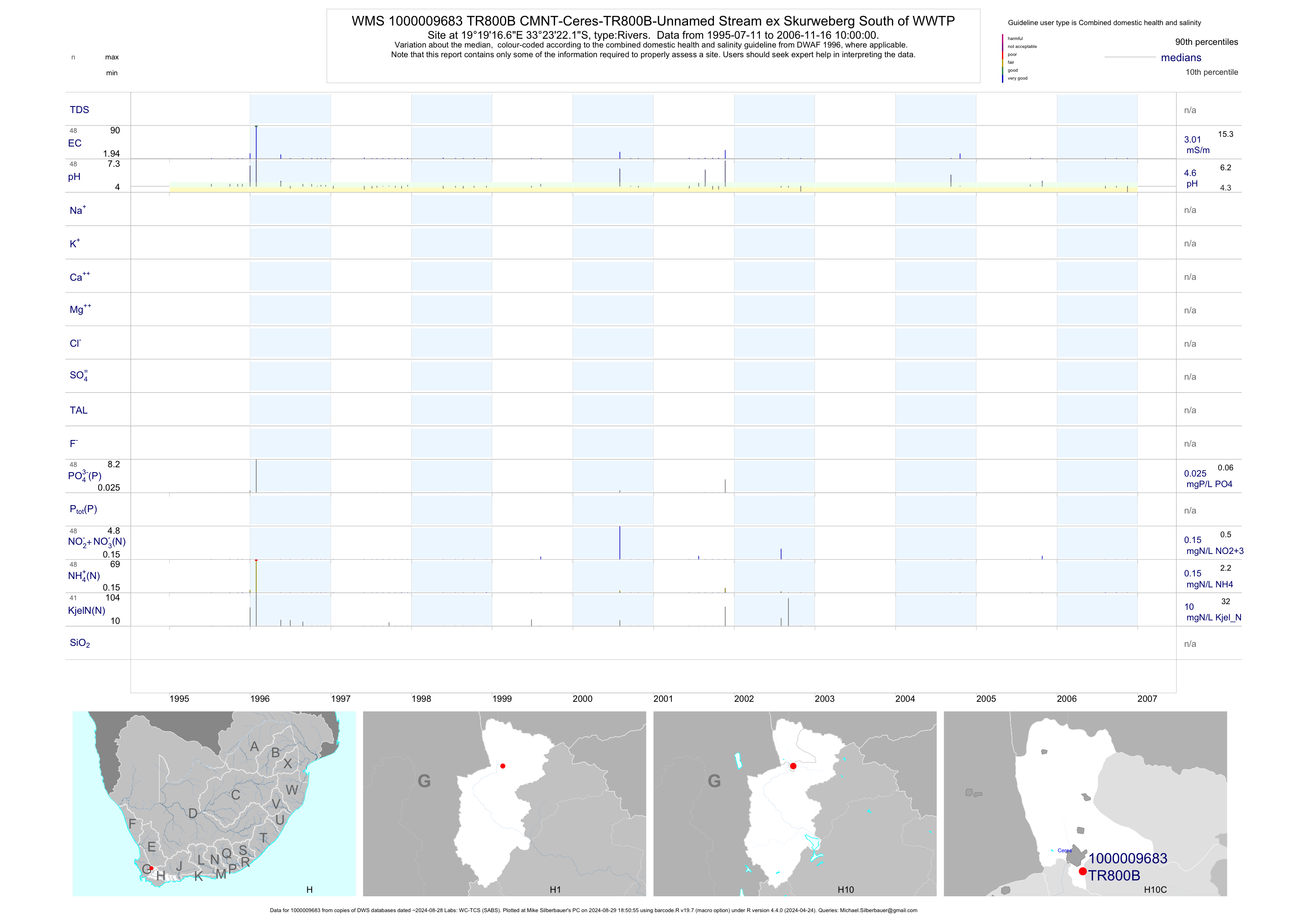
| H10 1000009683 | plot | data | CMNT-Ceres-TR800B-Unnamed Stream ex Skurweberg South of WWTP | Rivers | 89 | 1995-07-11 | 2006-11-16 | 3 | TR800B | -33.38950 | 19.32130 |
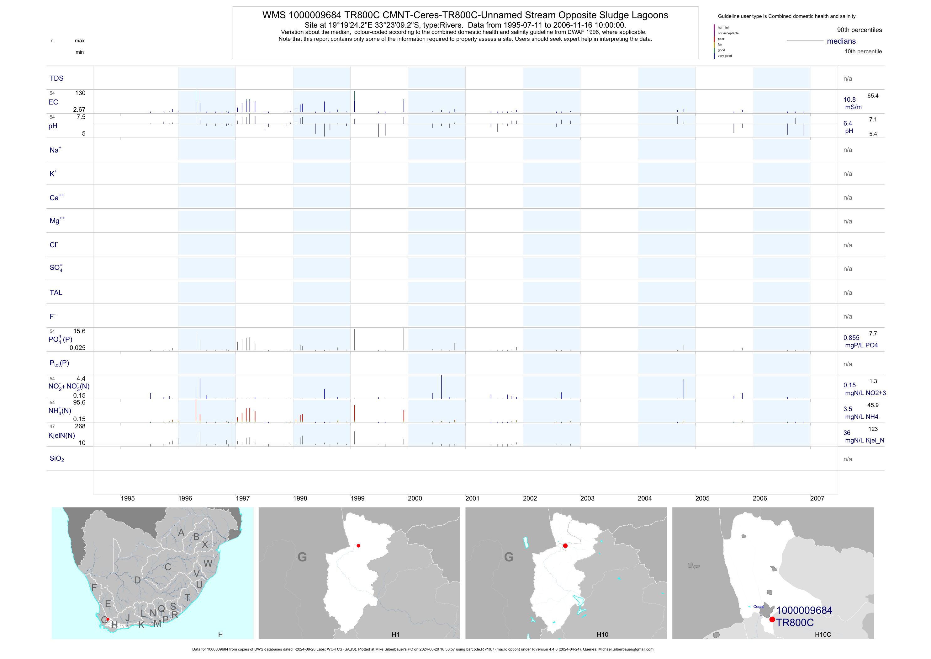
| H10 1000009684 | plot | data | CMNT-Ceres-TR800C-Unnamed Stream Opposite Sludge Lagoons | Rivers | 101 | 1995-07-11 | 2006-11-16 | 11 | TR800C | -33.38590 | 19.32340 |
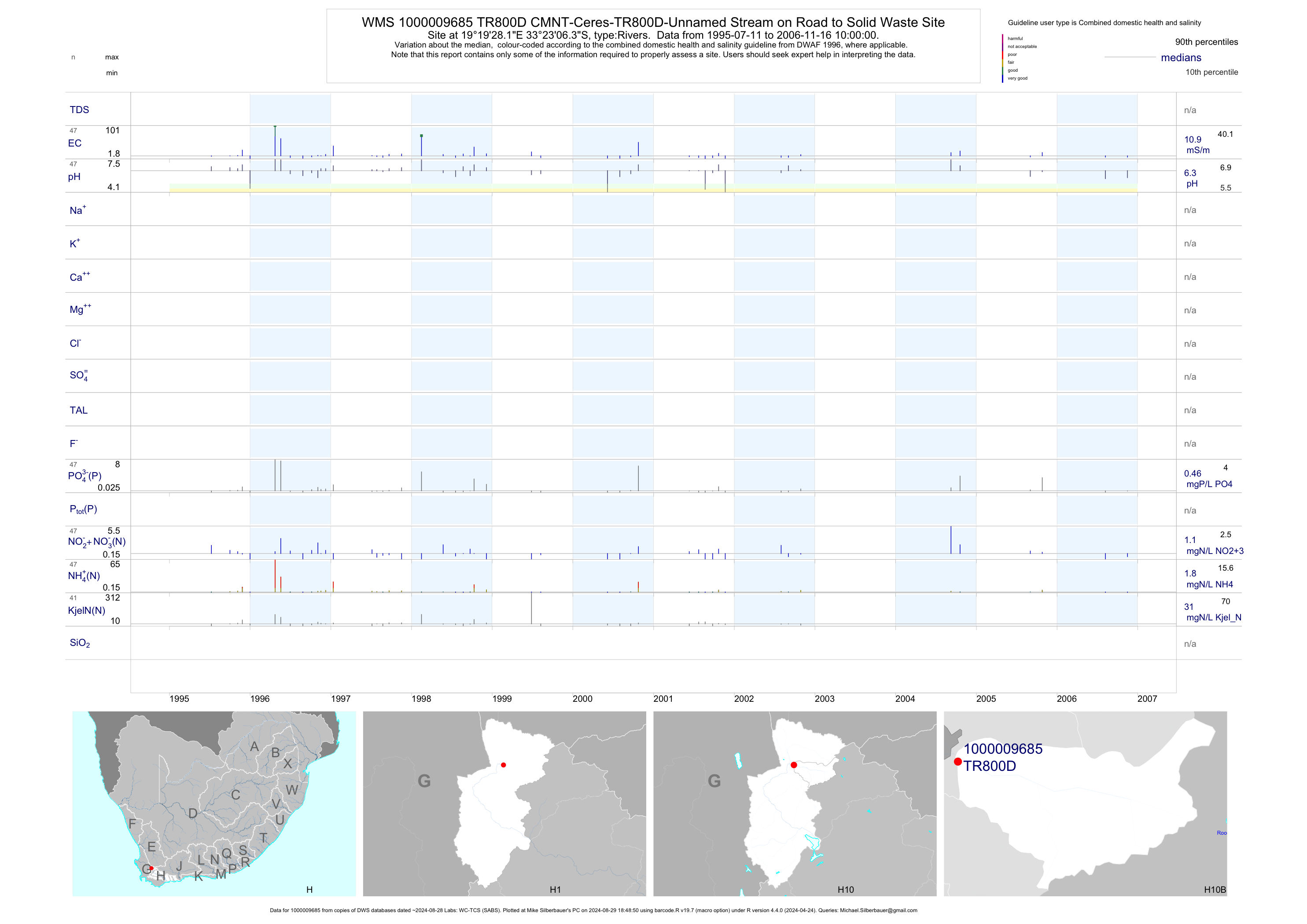
| H10 1000009685 | plot | data | CMNT-Ceres-TR800D-Unnamed Stream on Road to Solid Waste Site | Rivers | 88 | 1995-07-11 | 2006-11-16 | 11 | TR800D | -33.38510 | 19.32450 |
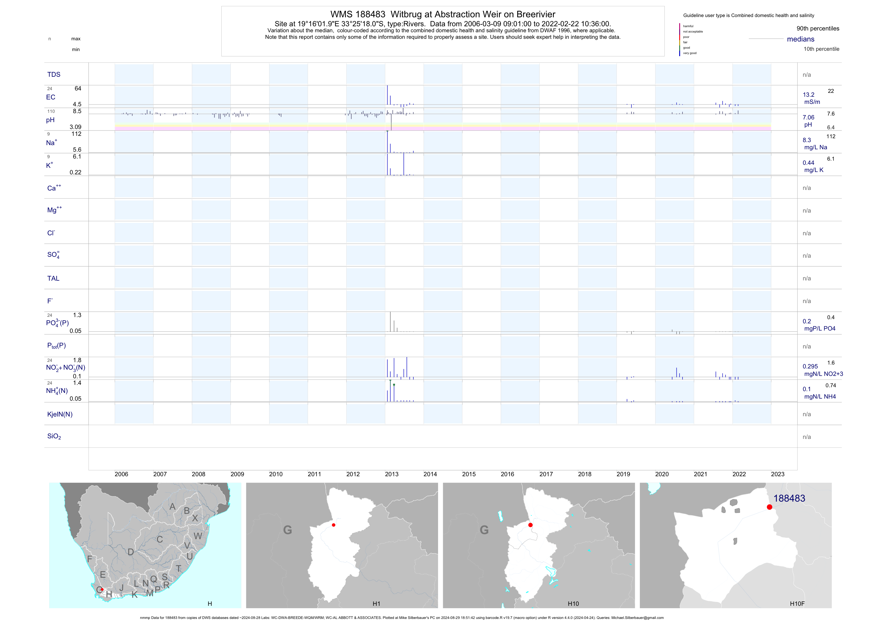
| H10 188483 | plot | data | Witbrug at Abstraction Weir on Breerivier (nmmp) | Rivers | 399 | 2006-03-09 | 2014-05-21 | 12 | 188483 | -33.42167 | 19.26721 |
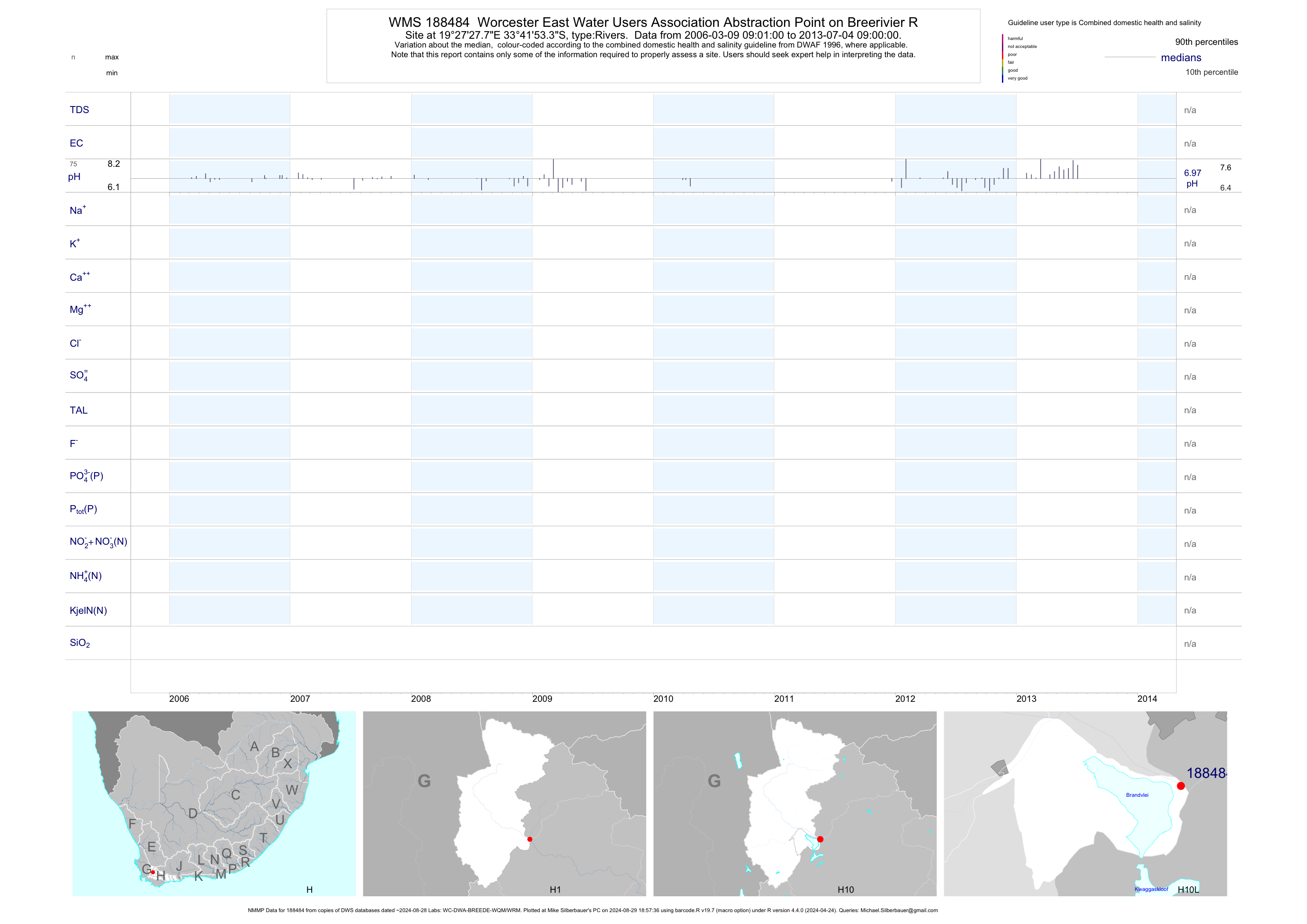
| H10 188484 | plot | data | Worcester East Water Users Association Abstraction Point on Breerivier R (NMMP) | Rivers | 347 | 2006-03-09 | 2013-07-04 | n/a | 188484 | -33.69815 | 19.45772 |
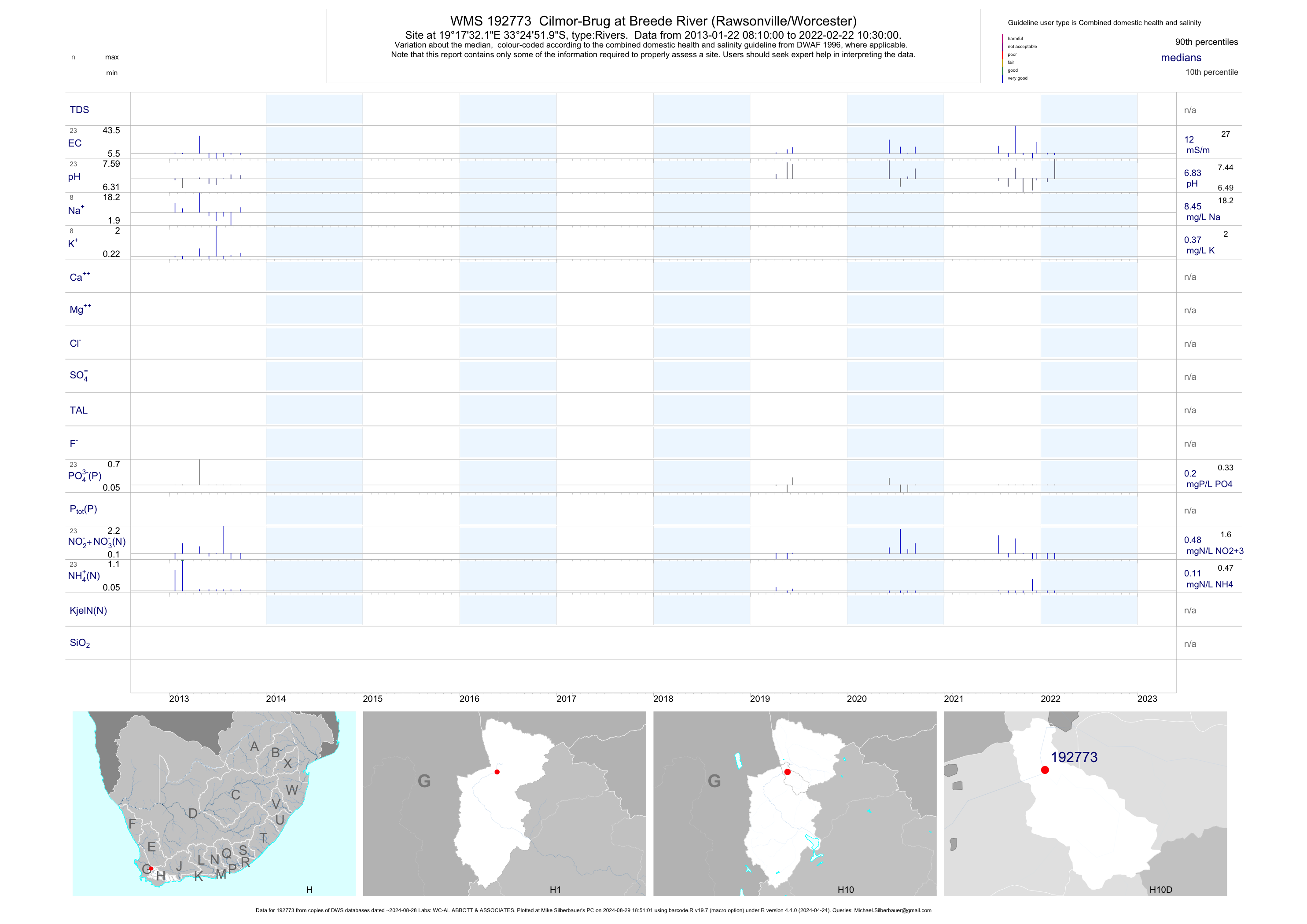
| H10 192773 | plot | data | Cilmor-Brug at Breede River (Rawsonville/Worcester) | Rivers | 14 | 2013-01-22 | 2014-03-26 | 10 | 192773 | -33.41442 | 19.29227 |
| H10 192776 | plot | data | Eilandia Rivierkamp at Breede River (Rawsonville/Worcester) | Rivers | 5 | 2013-02-19 | 2014-05-21 | 14 | 192776 | -33.46171 | 19.38790 |
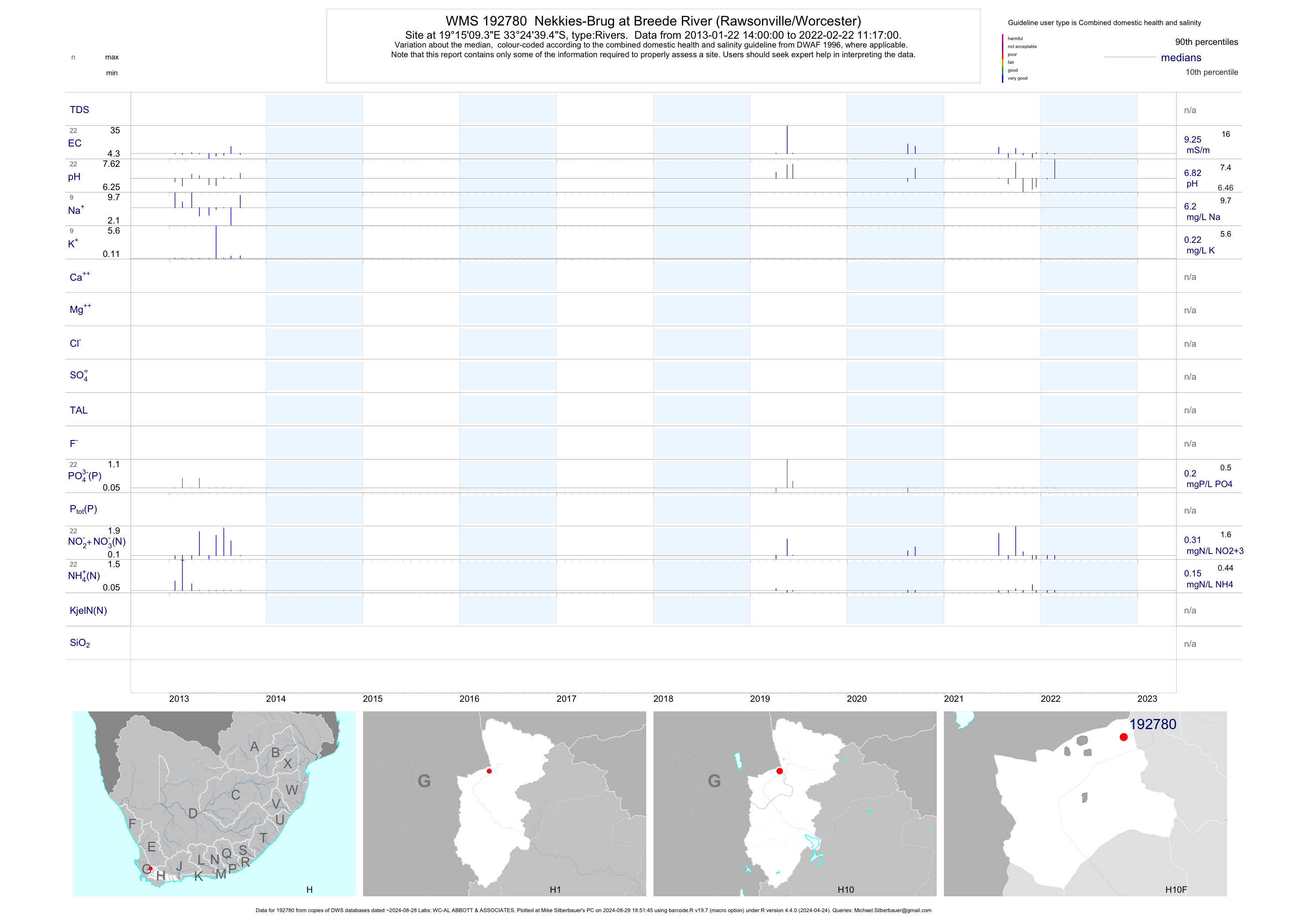
| H10 192780 | plot | data | Nekkies-Brug at Breede River (Rawsonville/Worcester) | Rivers | 19 | 2013-01-22 | 2014-03-27 | 8 | 192780 | -33.41095 | 19.25259 |
| H10 192789 | n/a | n/a | Bonnievale at Koegmanskloof Rivier (Bonnievale) | Rivers | 8 | 2013-05-30 | 2014-02-20 | n/a | 192789 | -33.40885 | 19.19873 |
| H10 193355 | n/a | n/a | Cer 6 Bainskloof Brug on Breeriver (NMMP) | Rivers | 2 | 2013-09-18 | 2014-01-28 | n/a | 193355 | -33.51982 | 19.18587 |
| H10 193475 | plot | data | Bainskloof Brag(Darling Brag) at Breede River | Rivers | 18 | 2013-01-22 | 2014-05-21 | 12 | 193475 | -33.51982 | 19.18648 |
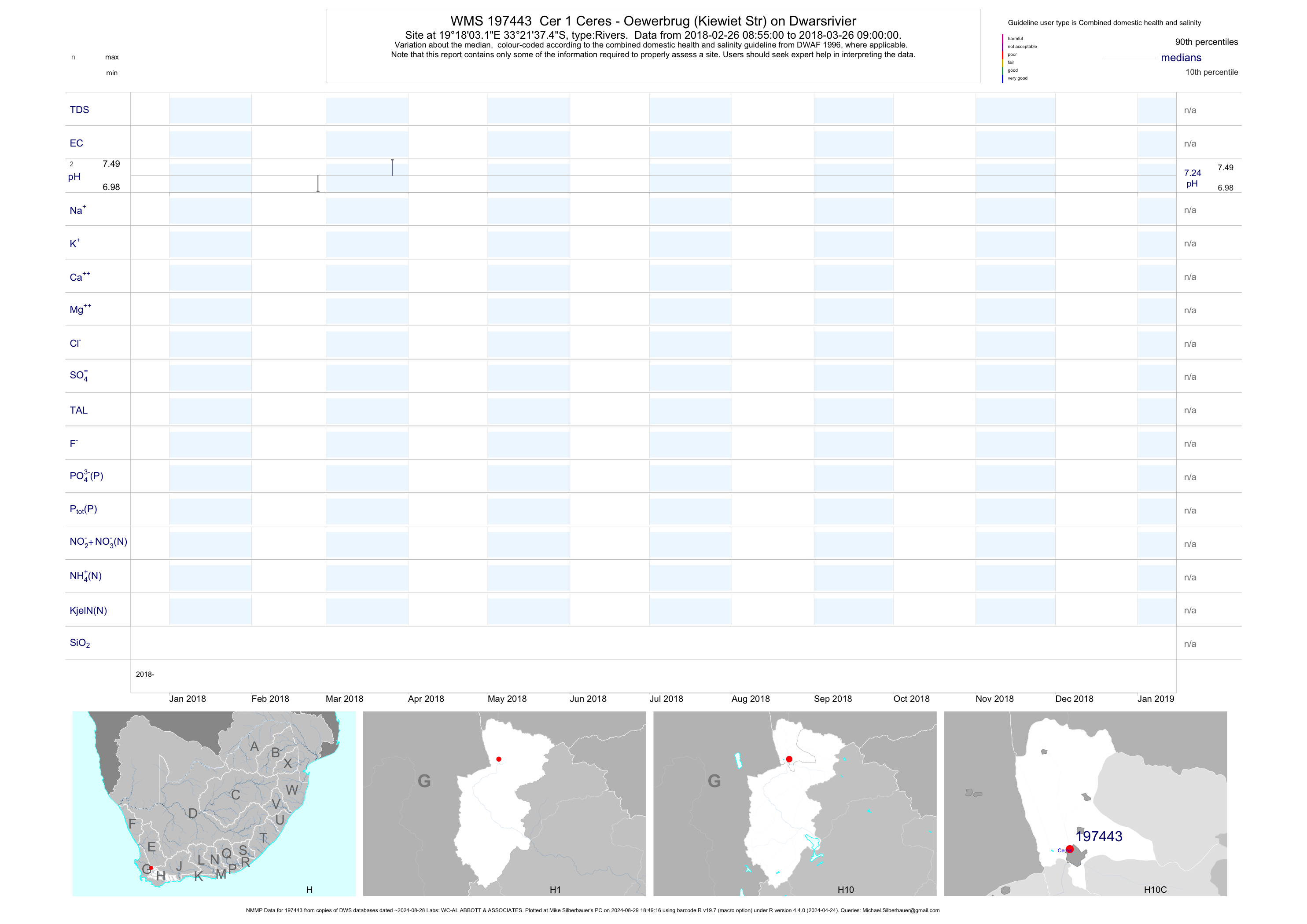
| H10 197443 | plot | data | Cer 1 Ceres - Oewerbrug (Kiewiet Str) on Dwarsrivier (NMMP) | Rivers | 3 | 2018-02-26 | 2018-03-26 | n/a | 197443 | -33.36040 | 19.30087 |
| H10 197444 | plot | data | Cer 2 Ceres - Elandsplaas on Dwarsrivier (NMMP) | Rivers | 4 | 2018-02-26 | 2018-03-26 | n/a | 197444 | -33.37463 | 19.31828 |
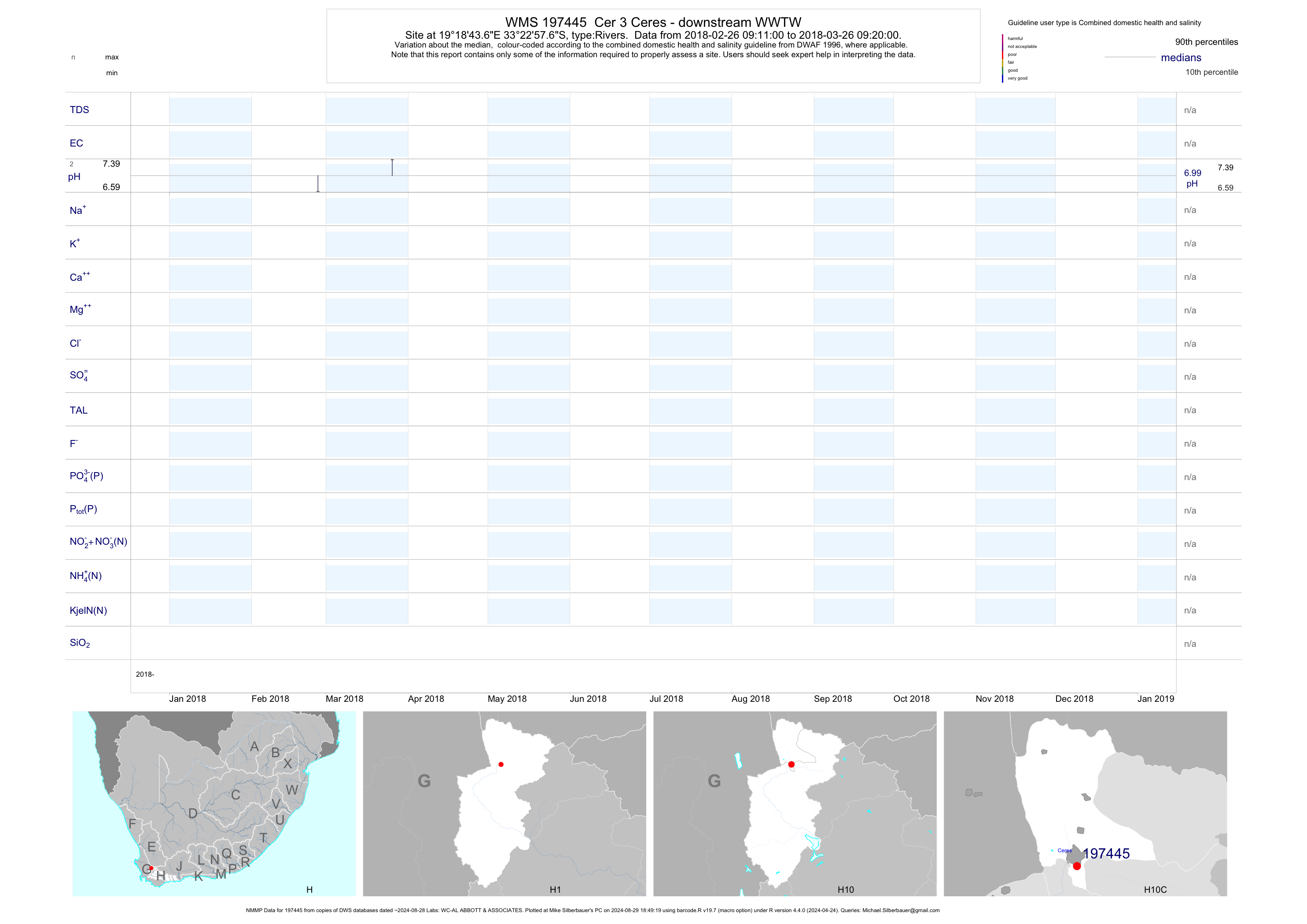
| H10 197445 | plot | data | Cer 3 Ceres - downstream WWTW (NMMP) | Rivers | 4 | 2018-02-26 | 2018-03-26 | n/a | 197445 | -33.38268 | 19.31213 |
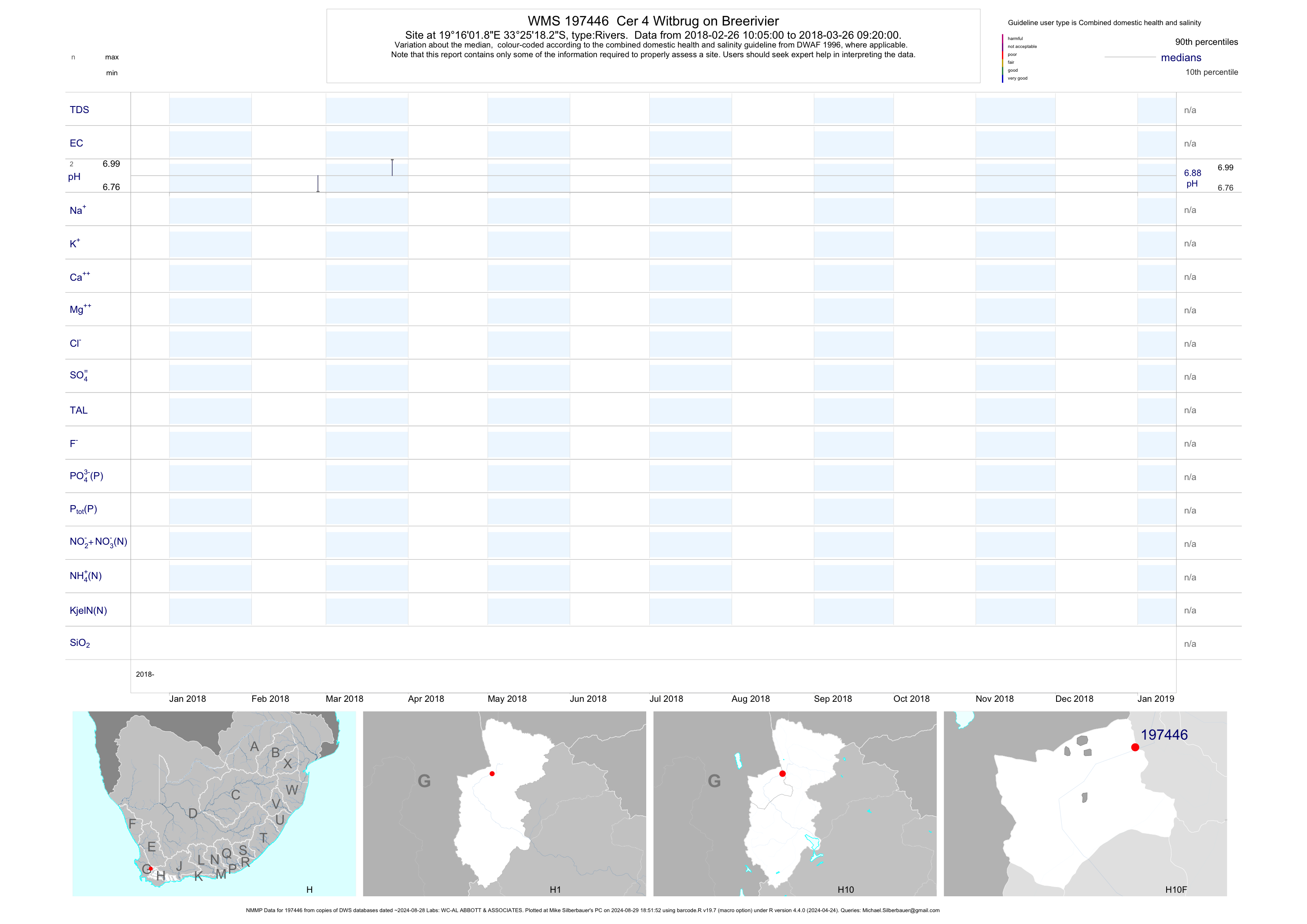
| H10 197446 | plot | data | Cer 4 Witbrug on Breerivier (NMMP) | Rivers | 4 | 2018-02-26 | 2018-03-26 | n/a | 197446 | -33.42175 | 19.26718 |
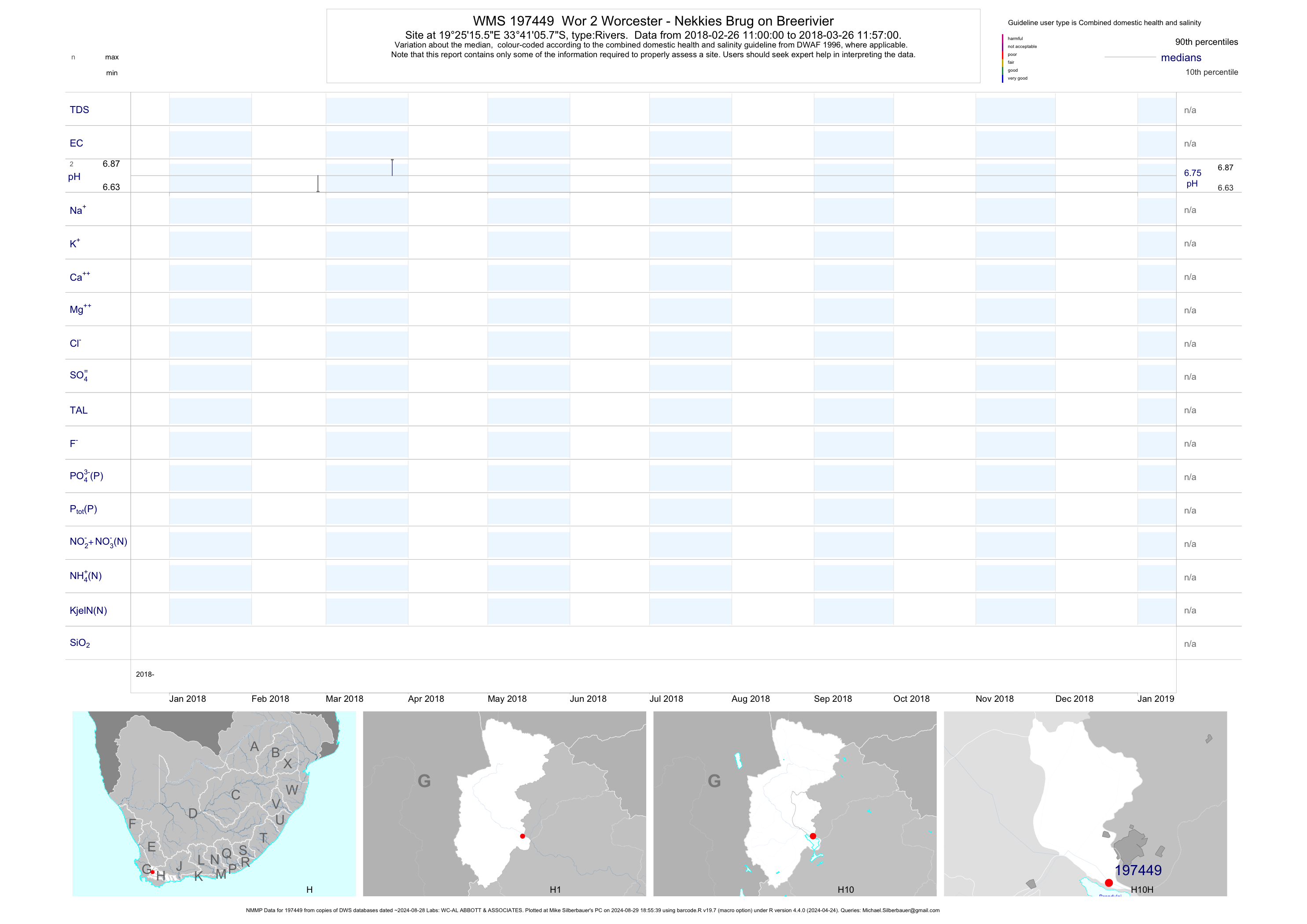
| H10 197449 | plot | data | Wor 2 Worcester - Nekkies Brug on Breerivier (NMMP) | Rivers | 4 | 2018-02-26 | 2018-03-26 | n/a | 197449 | -33.68492 | 19.42098 |
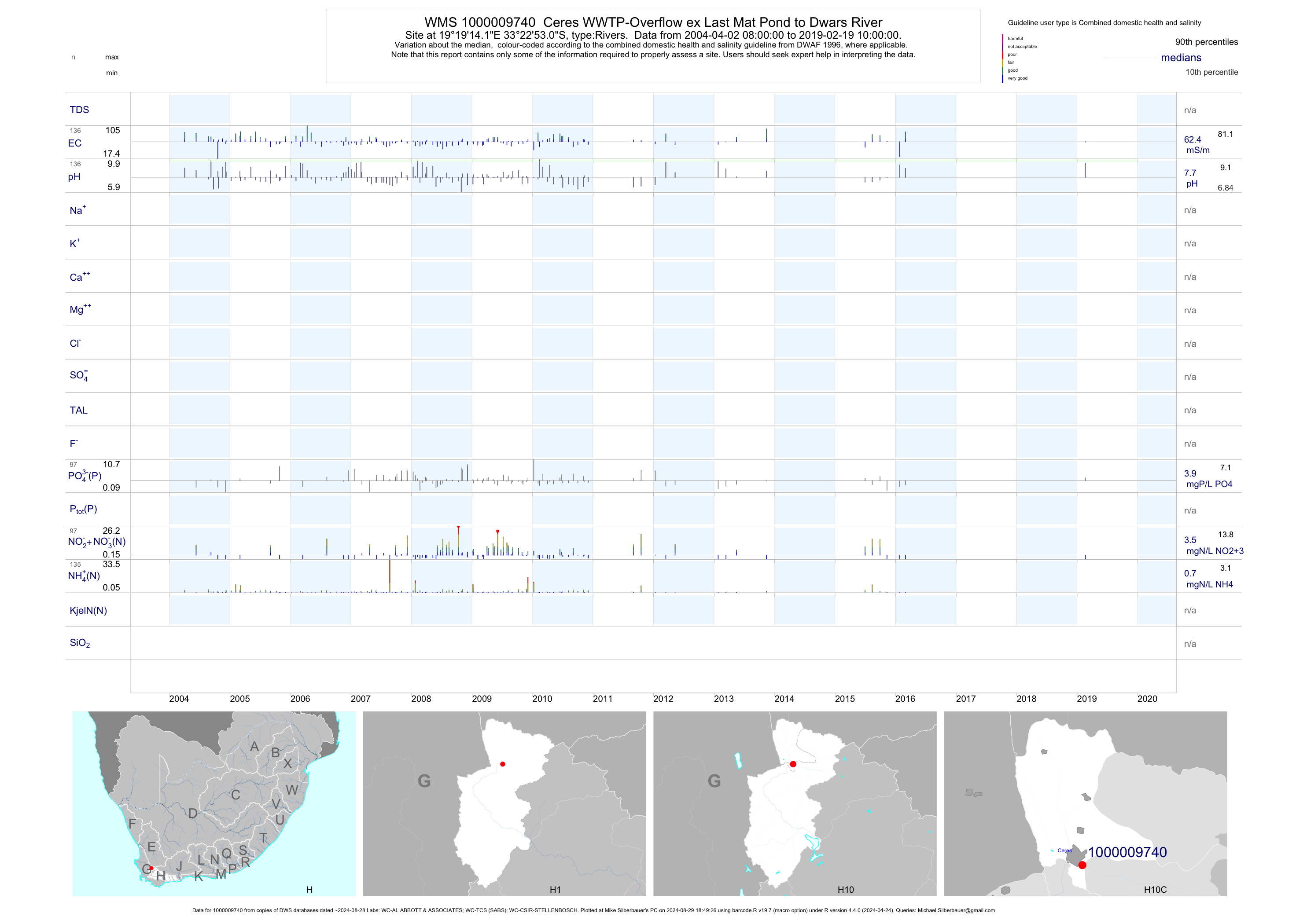
| H10 1000009740 | plot | data | Ceres WWTP-Overflow ex Last Mat Pond to Dwars River | Rivers | 654 | 1988-02-23 | 2019-02-19 | 58 | 1-9740 | -33.38140 | 19.32060 |
| H20 102039 | plot | data | Hex River at New Glen Heatlie/Sesbek | Rivers | 225 | 1972-08-16 | 1996-06-23 | 11 | H2H001 | -33.56222 | 19.51083 |
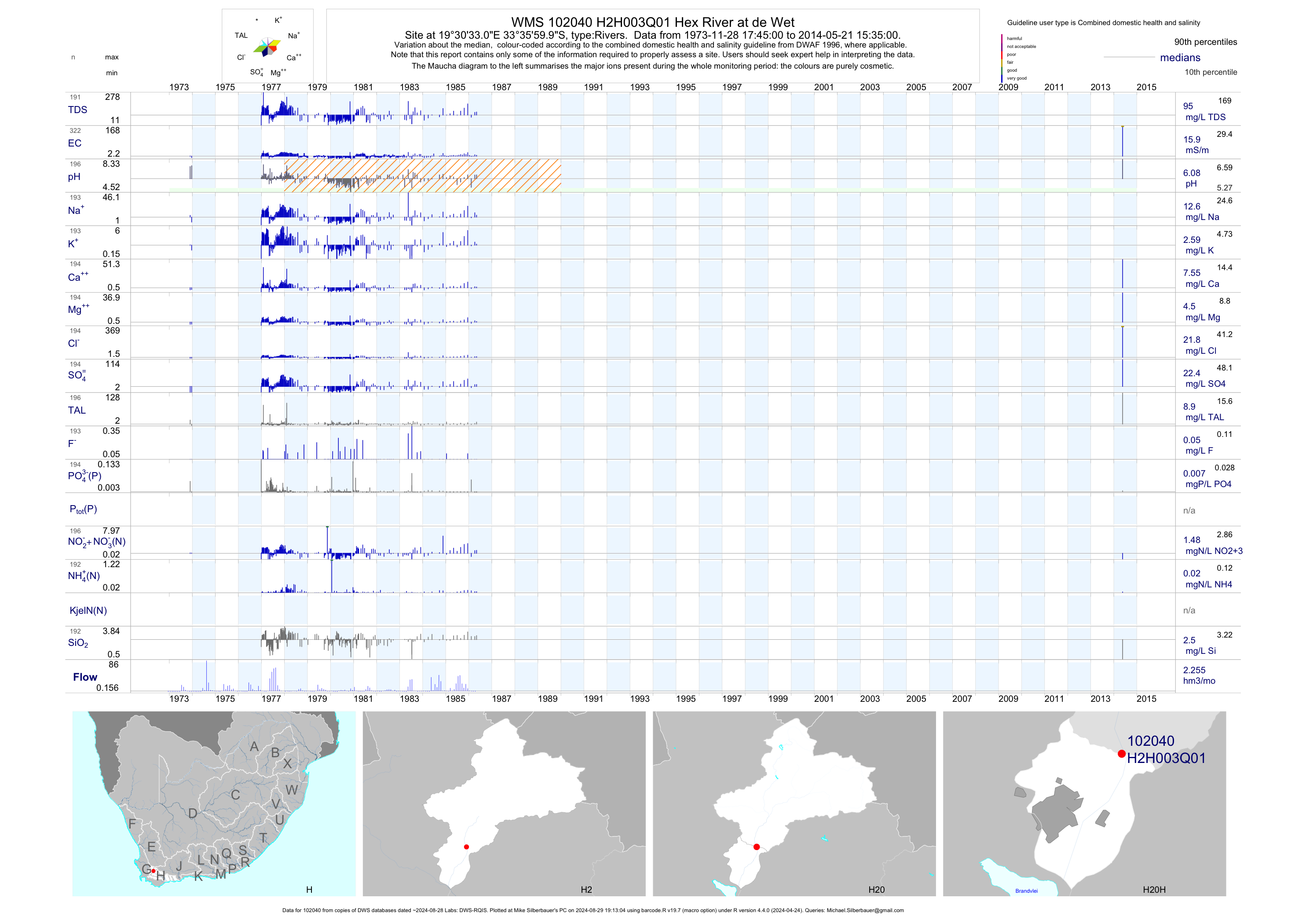
| H20 102040 | plot | data | Hex River at de Wet | Rivers | 322 | 1973-11-28 | 2014-05-21 | 16 | H2H003 | -33.60000 | 19.50917 |
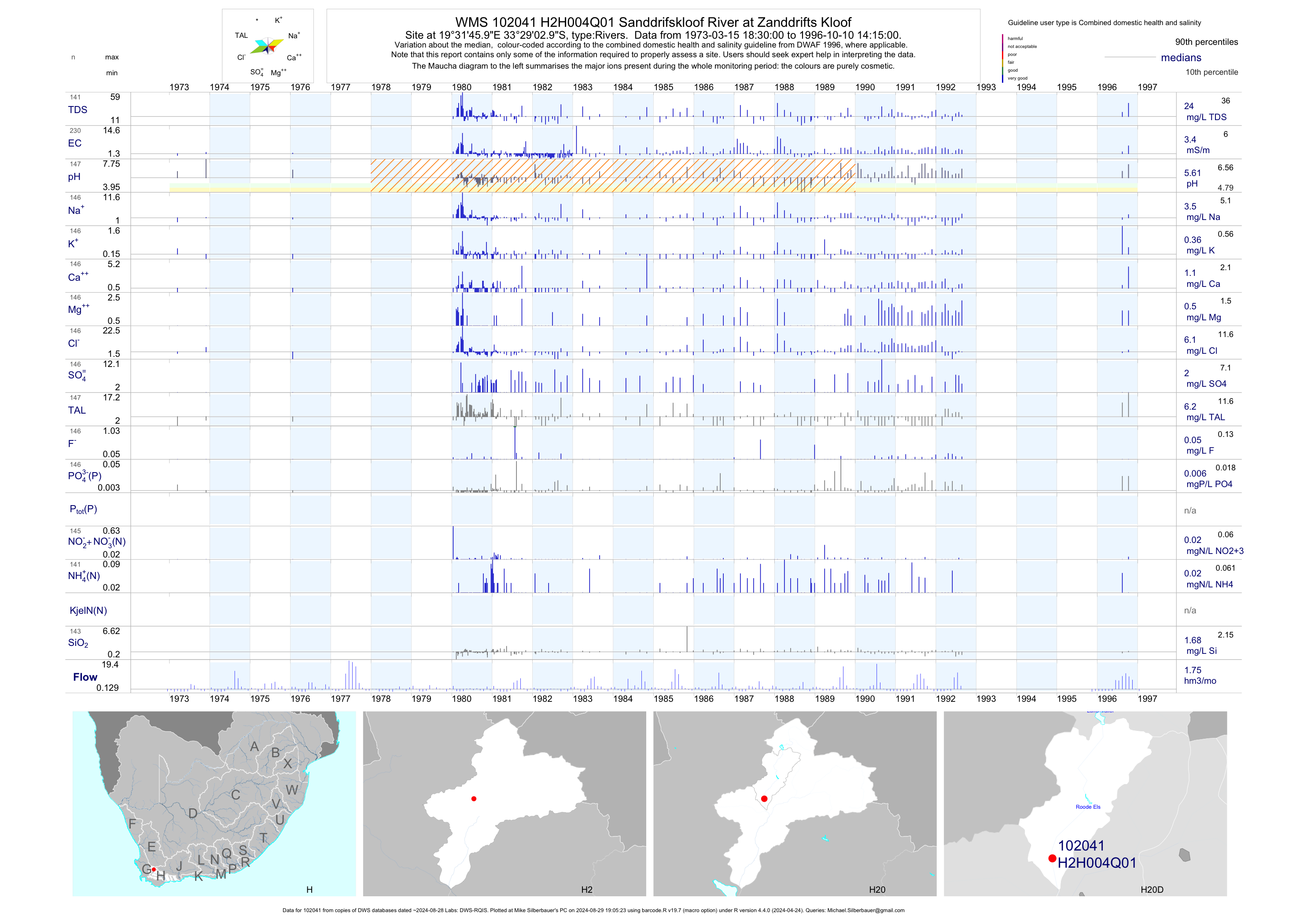
| H20 102041 | plot | data | Sanddrifskloof River at Zanddrifts Kloof | Rivers | 230 | 1973-03-15 | 1996-10-10 | 3 | H2H004 | -33.48417 | 19.52944 |
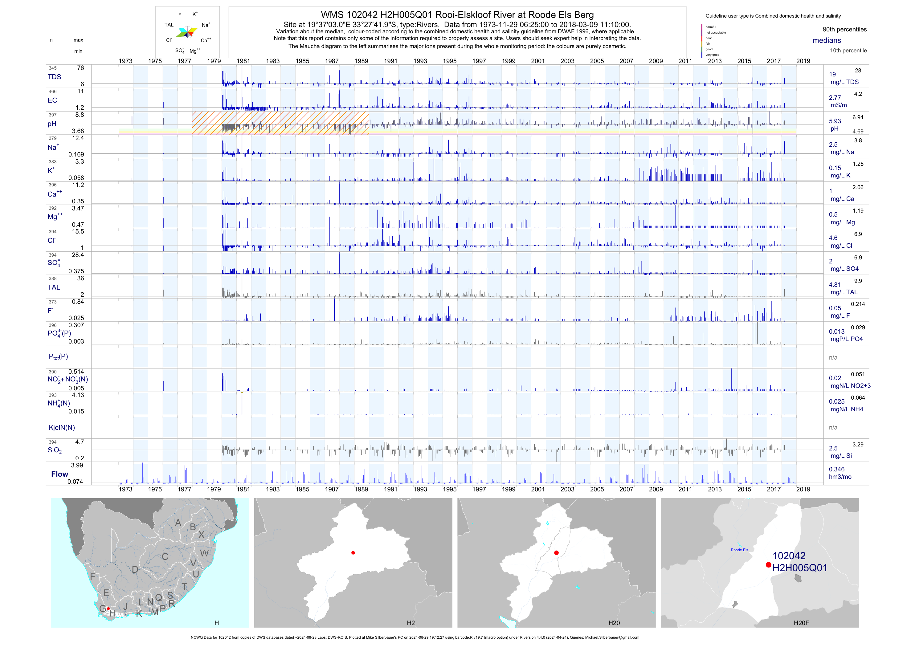
| H20 102042 | plot | data | Rooi-Elskloof River at Roode Els Berg (NCWQ) | Rivers | 475 | 1973-11-29 | 2018-03-09 | 3 | H2H005 | -33.46167 | 19.61750 |
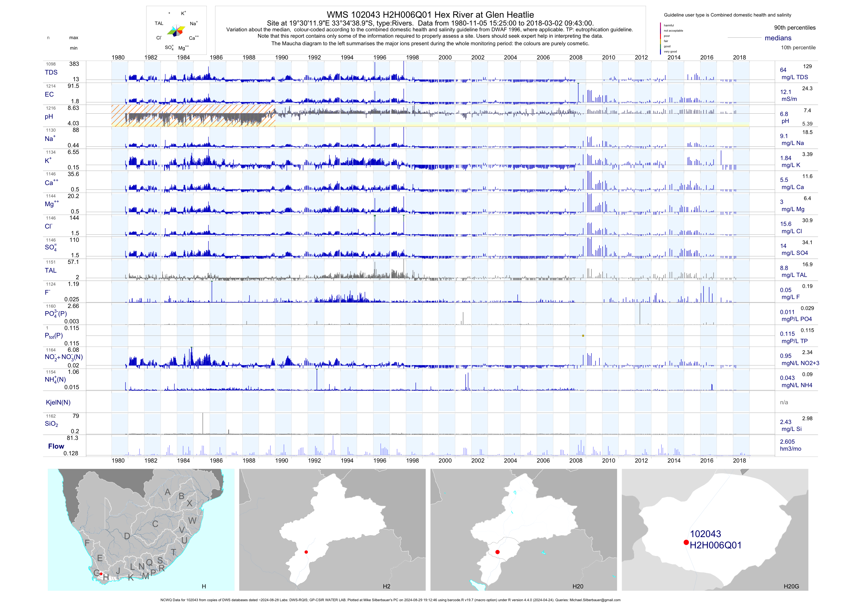
| H20 102043 | plot | data | Hex River at Glen Heatlie (NCWQ) | Rivers | 1223 | 1980-11-05 | 2018-03-02 | 12 | H2H006 | -33.57750 | 19.50333 |
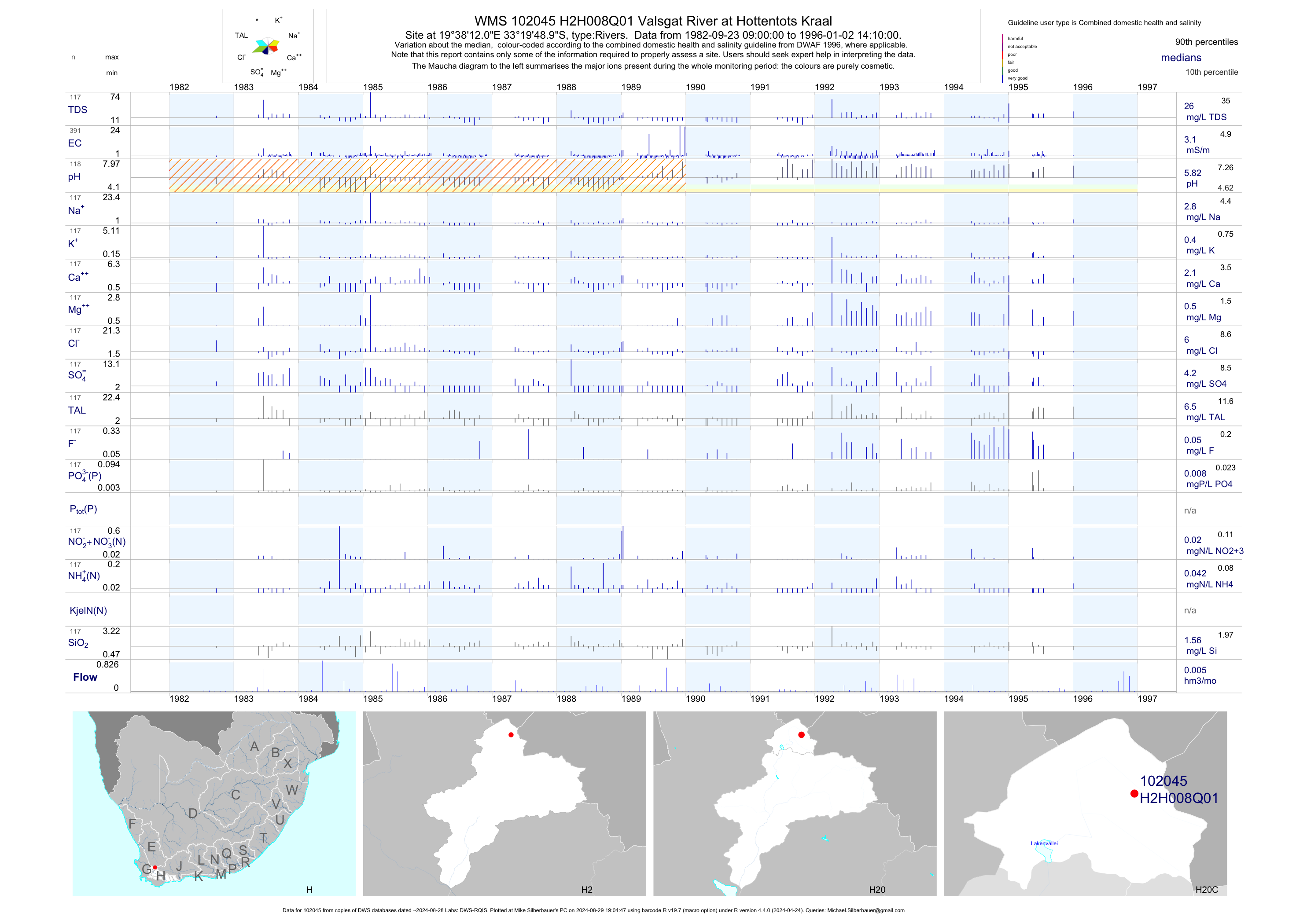
| H20 102045 | plot | data | Valsgat River at Hottentots Kraal | Rivers | 391 | 1982-09-23 | 1996-01-02 | 3 | H2H008 | -33.33028 | 19.63667 |
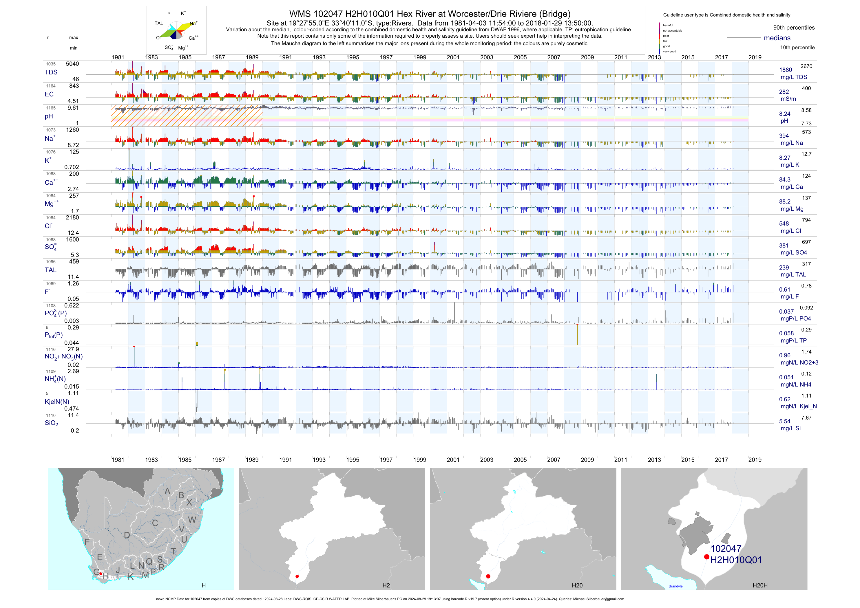
| H20 102047 | plot | data | Hex River at Worcester/Drie Riviere (Bridge) (ncwq NCMP) | Rivers | 1165 | 1981-04-03 | 2018-01-29 | 282 | H2H010 | -33.66972 | 19.46528 |
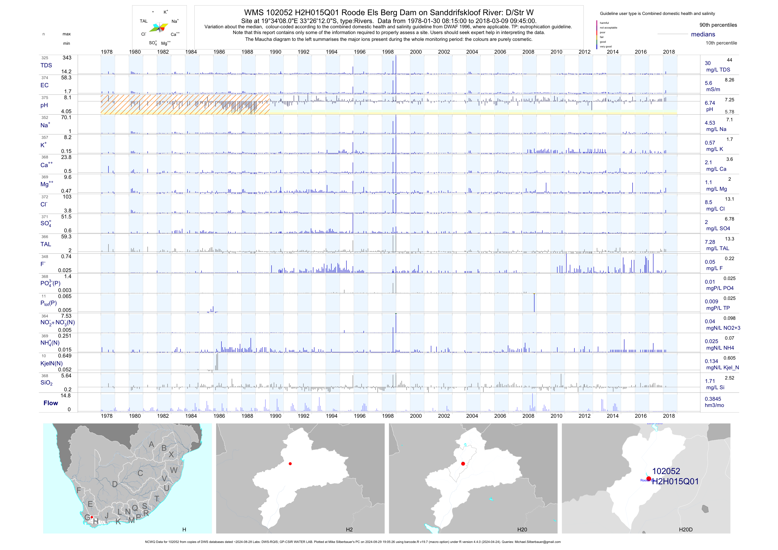
| H20 102052 | plot | data | Roode Els Berg Dam on Sanddrifskloof River: D/Str W (NCWQ) | Rivers | 376 | 1978-01-30 | 2018-03-09 | 6 | H2H015 | -33.43667 | 19.56889 |
| H20 102053 | plot | data | Lakenvallei Dam on Sanddrifskloof River: D/Stream W (NCWQ) | Rivers | 432 | 1977-01-13 | 2018-03-05 | 13 | H2H016 | -33.36667 | 19.58056 |
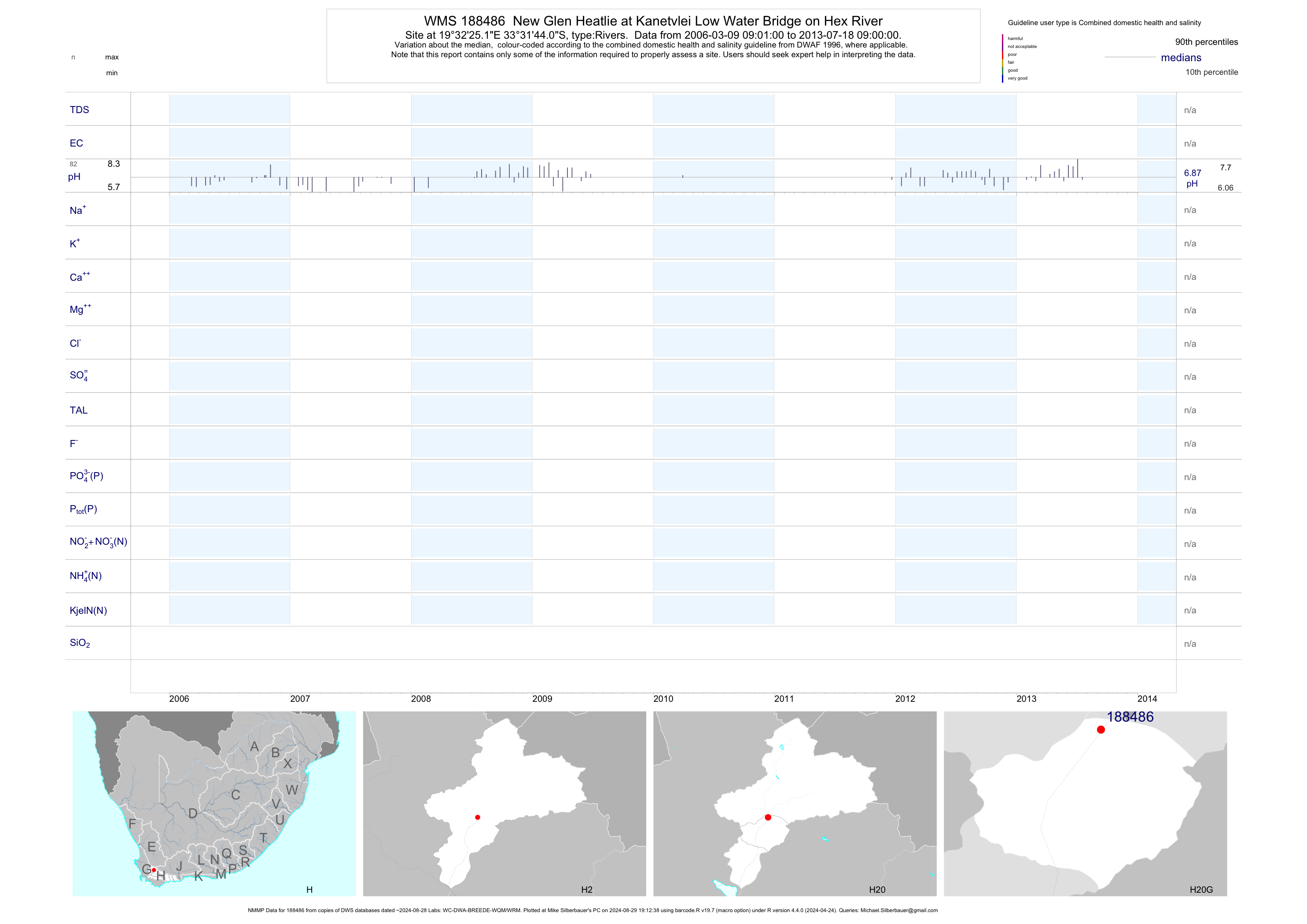
| H20 188486 | plot | data | New Glen Heatlie at Kanetvlei Low Water Bridge on Hex River (NMMP) | Rivers | 379 | 2006-03-09 | 2013-07-18 | n/a | 188486 | -33.52890 | 19.54033 |
| H20 192778 | plot | data | Kogmanskloof Inloop at Breede River (Bonnievale) | Rivers | 7 | 2013-03-27 | 2013-09-25 | 46 | 192778 | -33.52499 | 19.59787 |
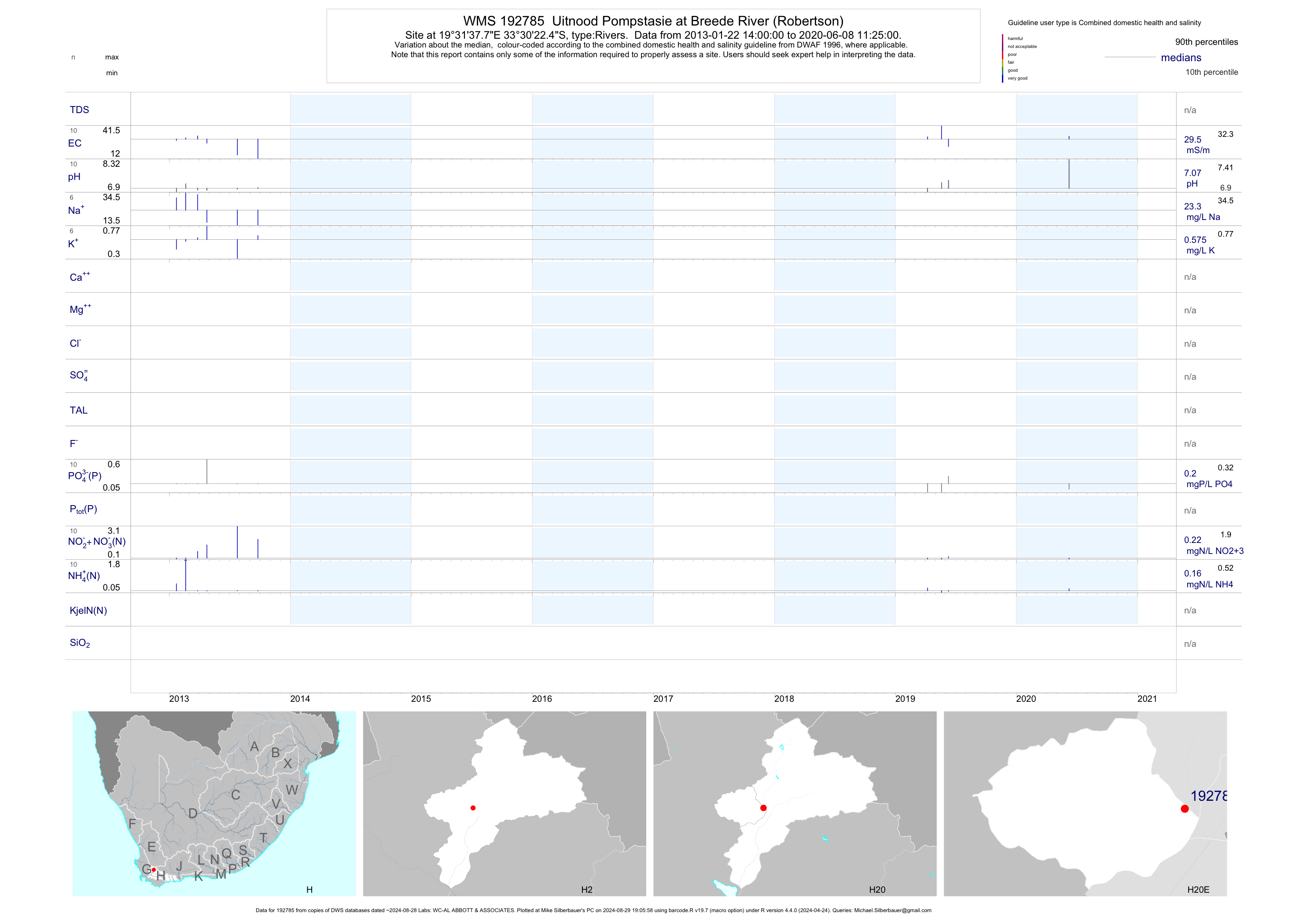
| H20 192785 | plot | data | Uitnood Pompstasie at Breede River (Robertson) | Rivers | 15 | 2013-01-22 | 2014-02-20 | 27 | 192785 | -33.50624 | 19.52714 |
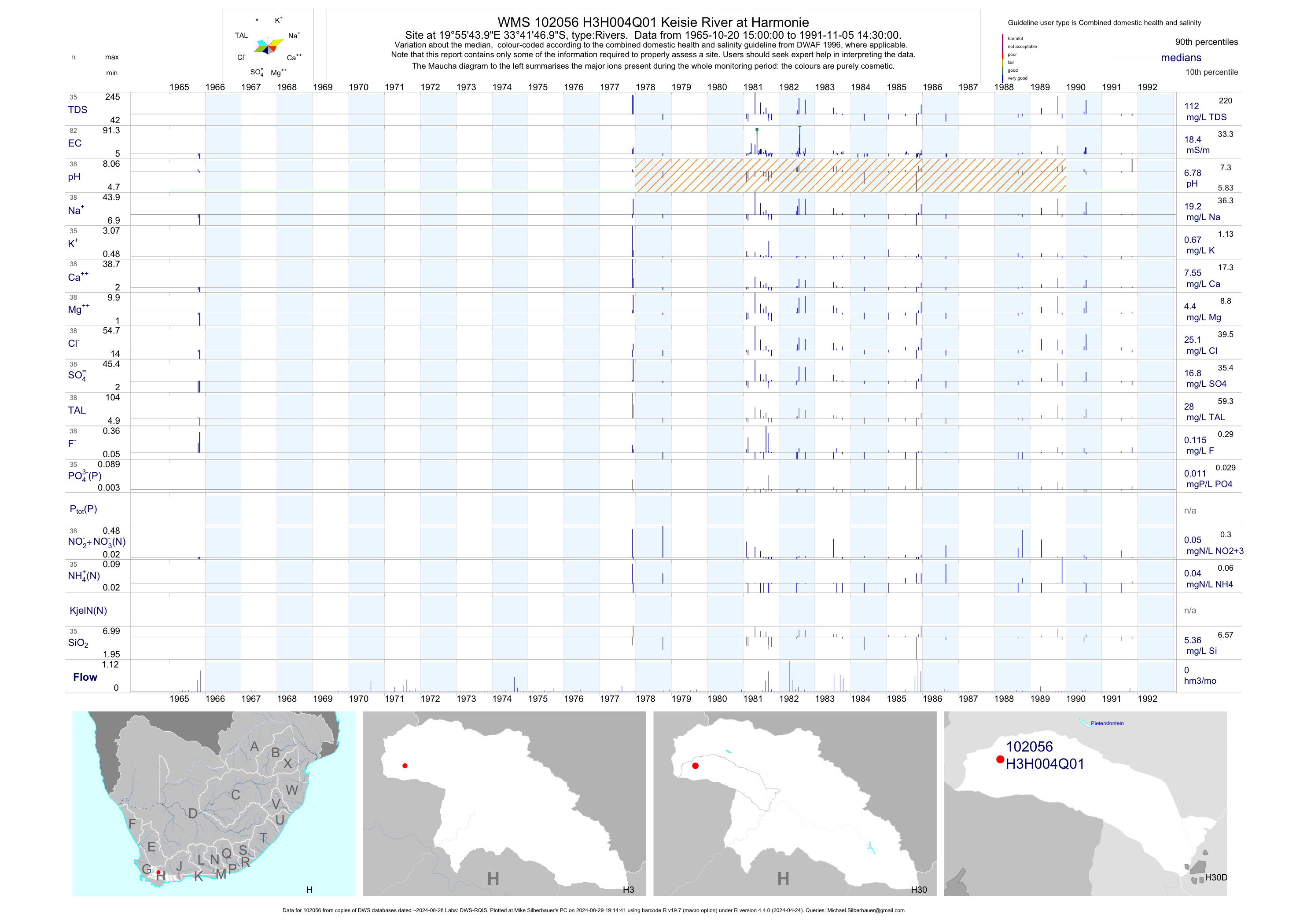
| H30 102056 | plot | data | Keisie River at Harmonie | Rivers | 82 | 1965-10-20 | 1991-11-05 | 18 | H3H004 | -33.69639 | 19.92889 |
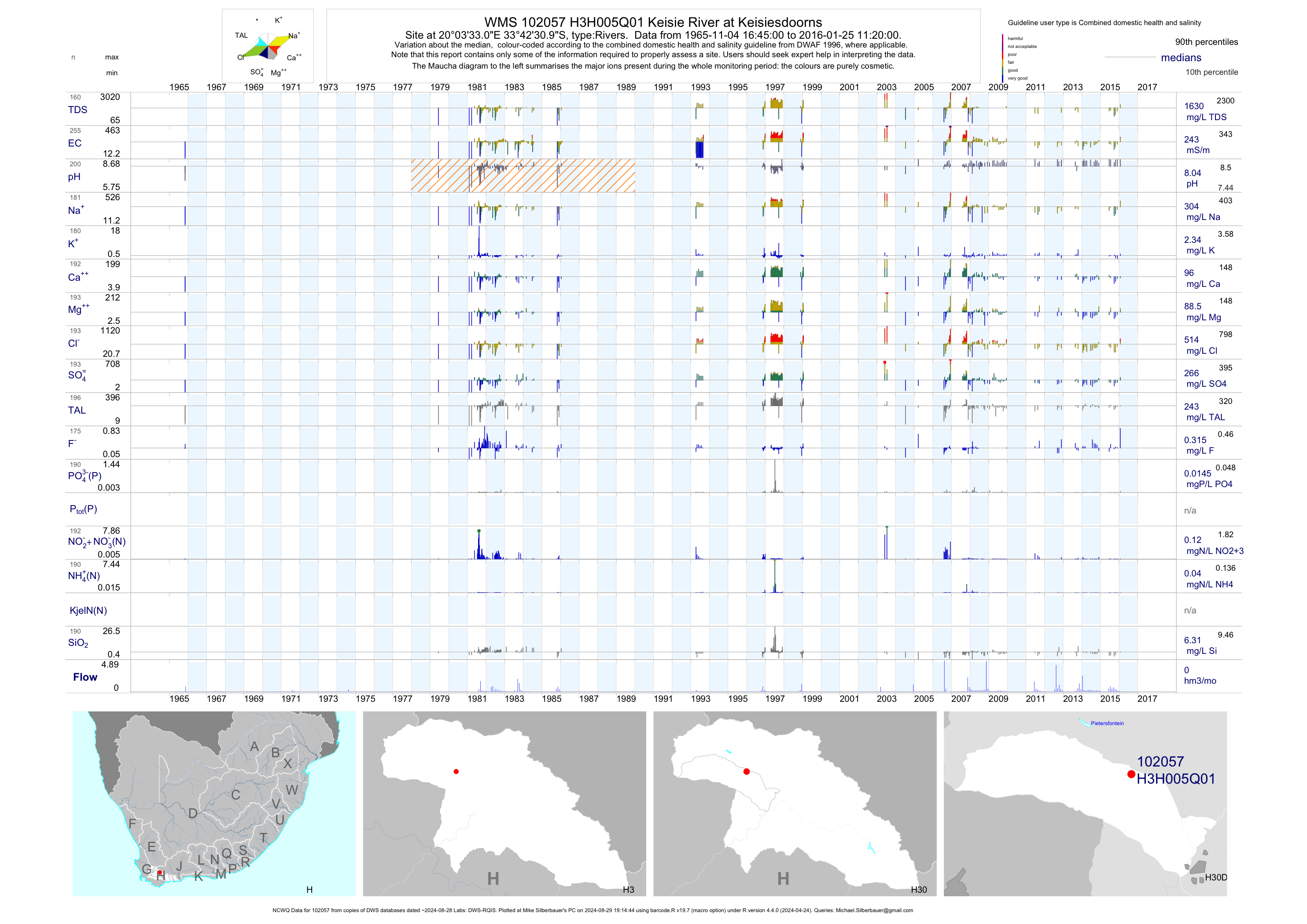
| H30 102057 | plot | data | Keisie River at Keisiesdoorns (NCWQ) | Rivers | 258 | 1965-11-04 | 2016-01-25 | 243 | H3H005 | -33.70861 | 20.05917 |
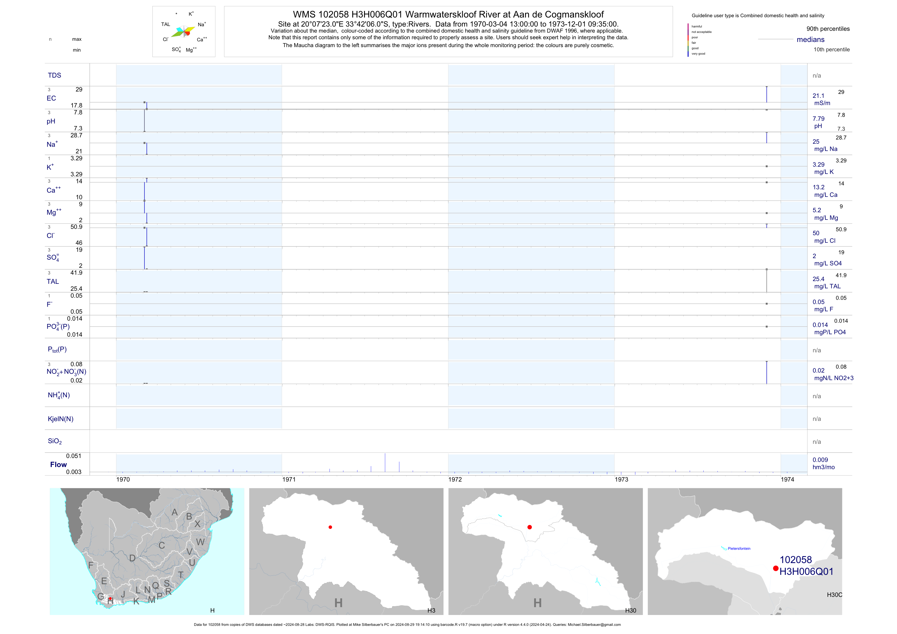
| H30 102058 | plot | data | Warmwaterskloof River at Aan de Cogmanskloof | Rivers | 3 | 1970-03-04 | 1973-12-01 | 21 | H3H006 | -33.70167 | 20.12306 |
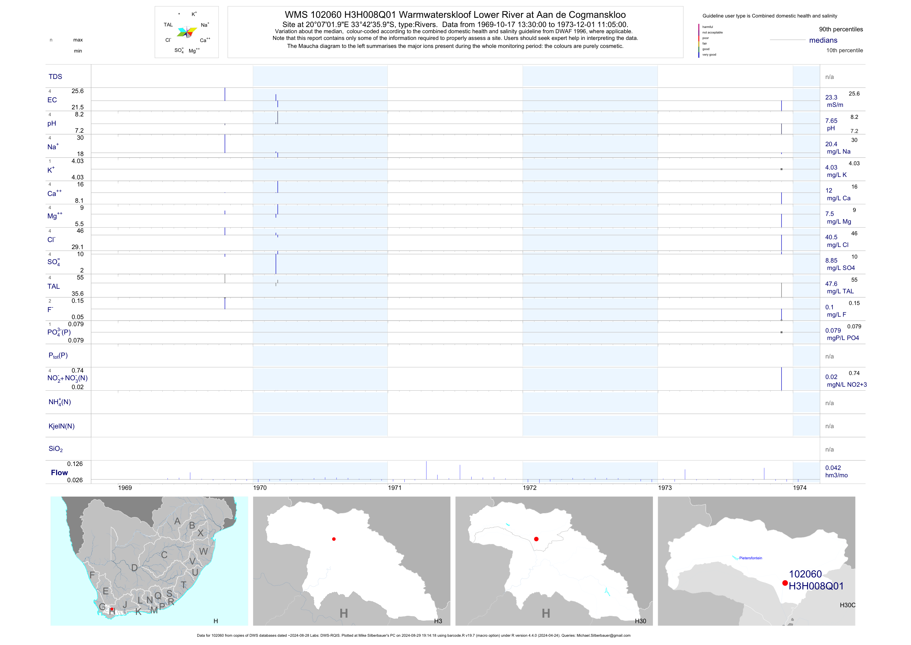
| H30 102060 | plot | data | Warmwaterskloof Lower River at Aan de Cogmanskloo | Rivers | 4 | 1969-10-17 | 1973-12-01 | 23 | H3H008 | -33.71000 | 20.11722 |
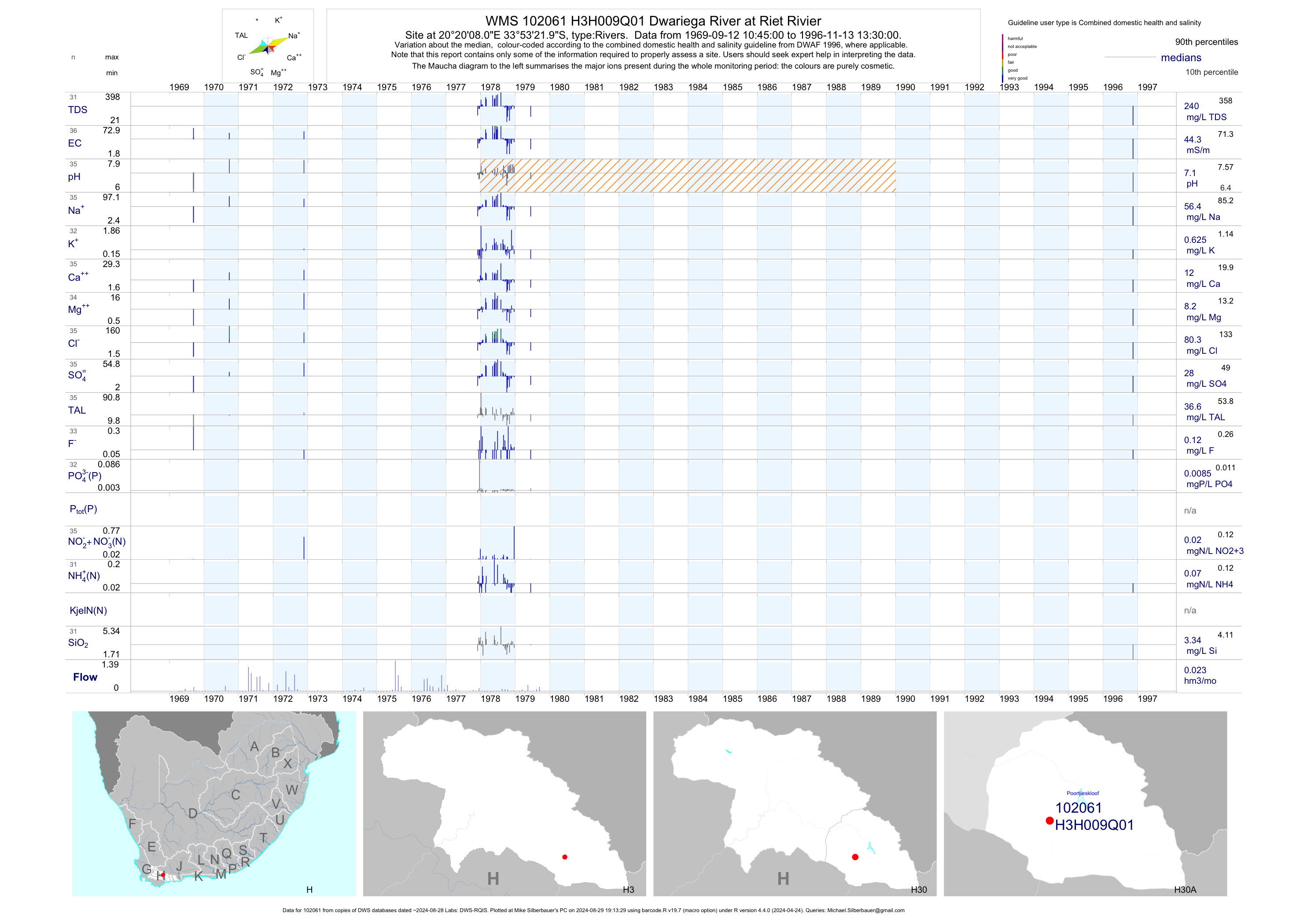
| H30 102061 | plot | data | Dwariega River at Riet Rivier | Rivers | 36 | 1969-09-12 | 1996-11-13 | 44 | H3H009 | -33.88944 | 20.33556 |
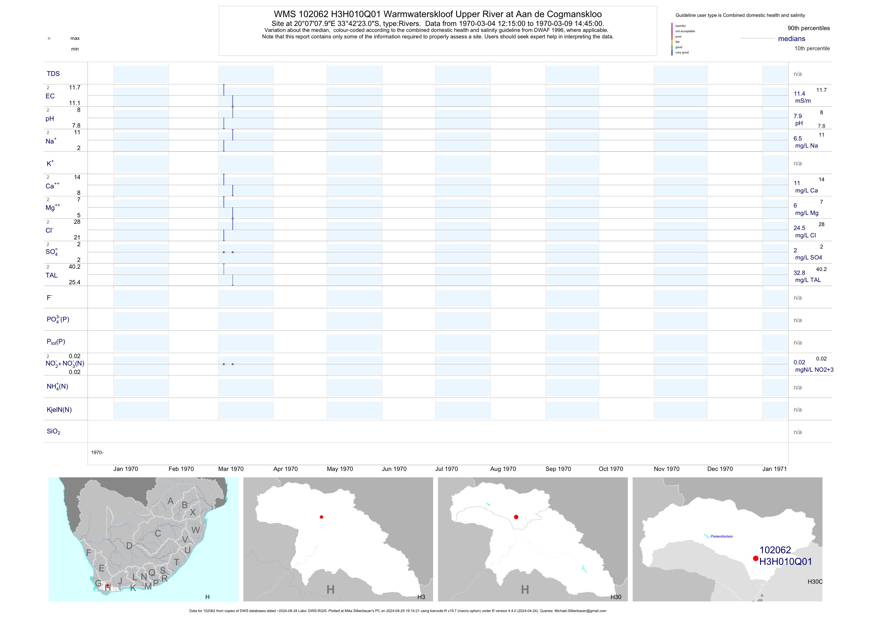
| H30 102062 | plot | data | Warmwaterskloof Upper River at Aan de Cogmanskloo | Rivers | 2 | 1970-03-04 | 1970-03-09 | 11 | H3H010 | -33.70639 | 20.11889 |
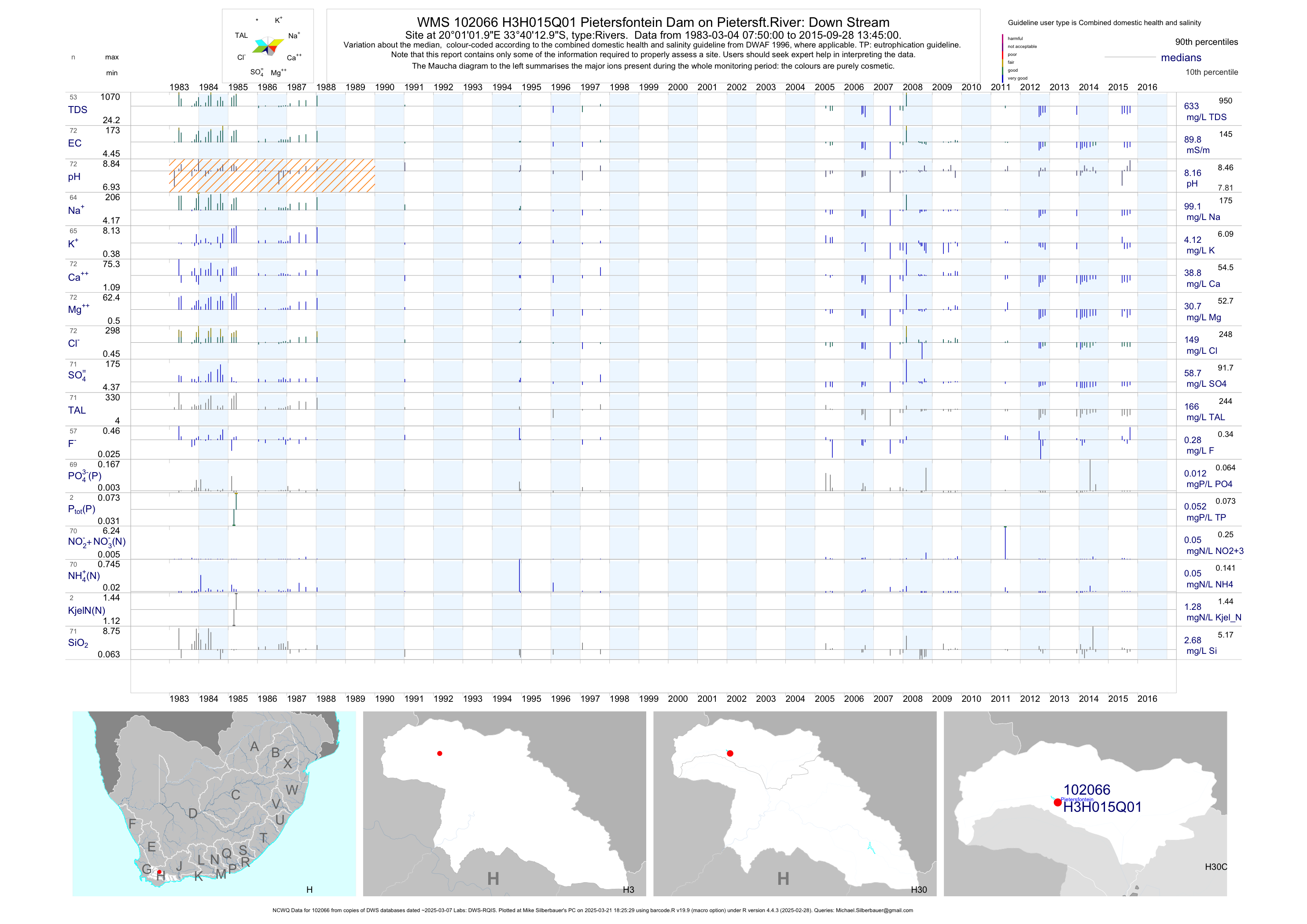
| H30 102066 | plot | data | Pietersfontein Dam on Pietersft.River: Down Stream (NCWQ) | Rivers | 73 | 1983-03-04 | 2015-09-28 | 90 | H3H015 | -33.67028 | 20.01722 |
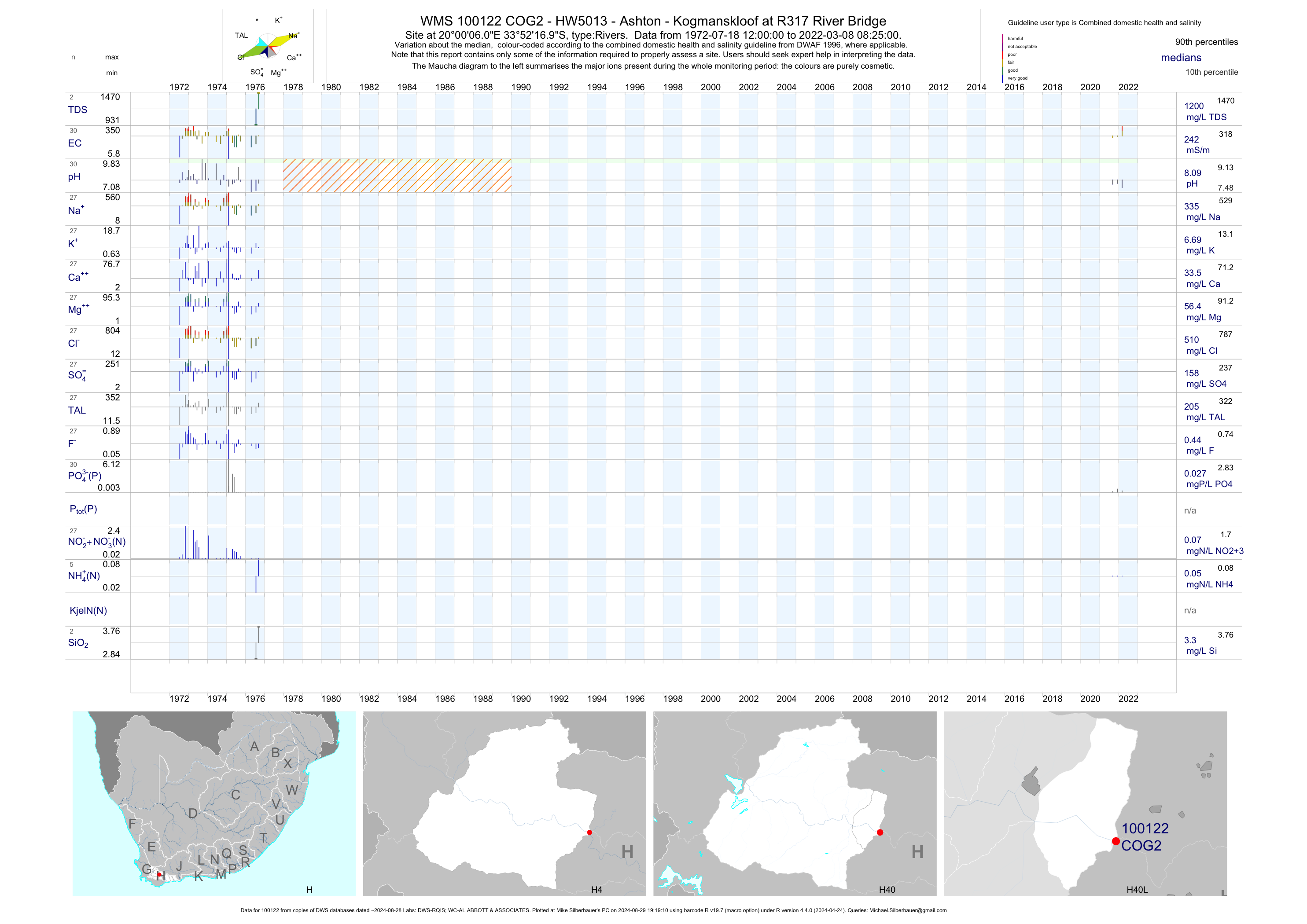
| H40 100122 | plot | data | - HW5013 - Ashton - Kogmanskloof at R317 River Bridge | Rivers | 27 | 1972-07-18 | 1976-09-13 | 244 | COG2 | -33.87139 | 20.00167 |
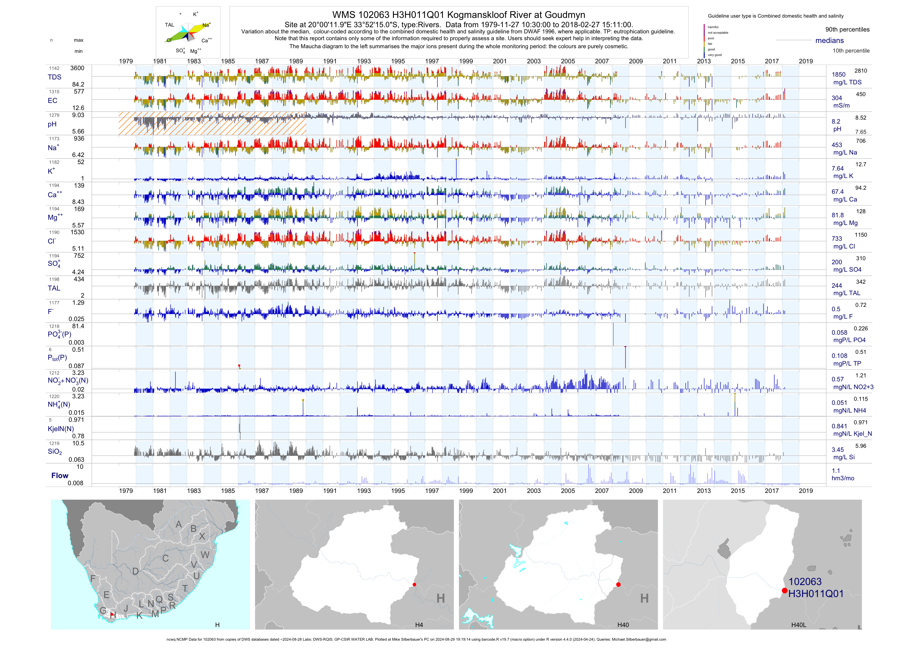
| H40 102063 | plot | data | Kogmanskloof River at Goudmyn (ncwq NCMP) | Rivers | 1318 | 1979-11-27 | 2018-02-27 | 304 | H3H011 | -33.87083 | 20.00333 |
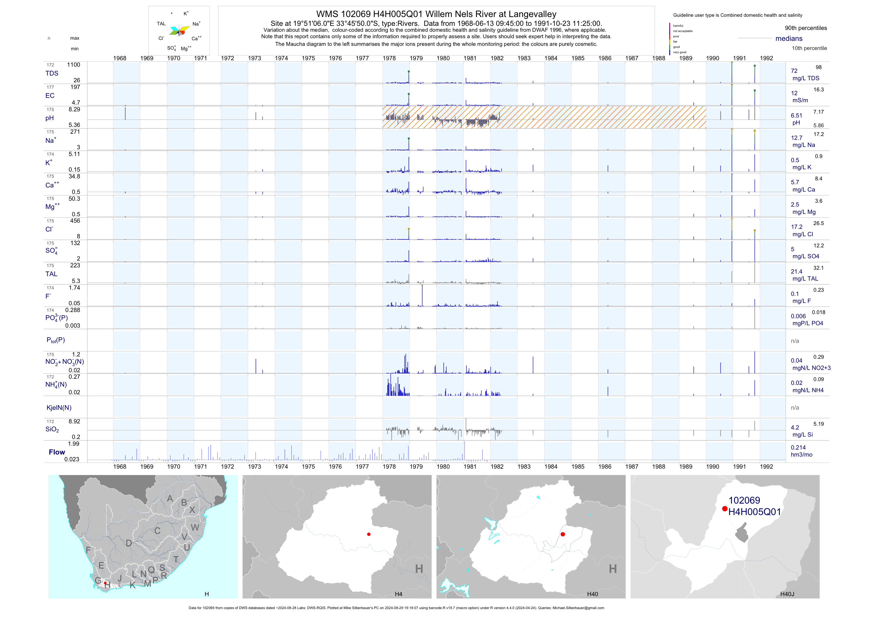
| H40 102069 | plot | data | Willem Nels River at Langevalley | Rivers | 177 | 1968-06-13 | 1991-10-23 | 12 | H4H005 | -33.76389 | 19.85167 |
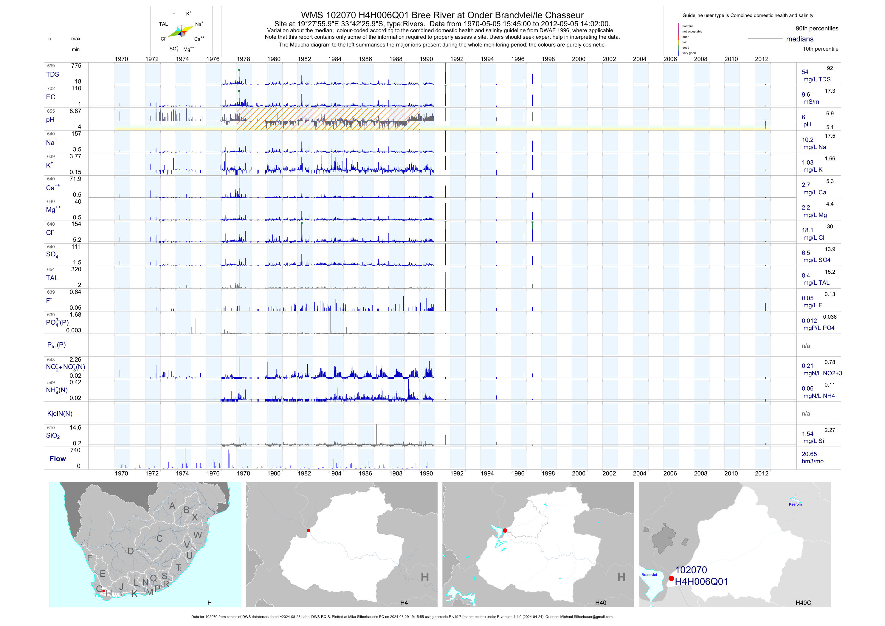
| H40 102070 | plot | data | Bree River at Onder Brandvlei/le Chasseur | Rivers | 702 | 1970-05-05 | 2012-09-05 | 10 | H4H006 | -33.70722 | 19.46556 |
| H40 102071 | plot | data | Koo River at Die Koo | Rivers | 147 | 1965-11-09 | 1998-06-18 | 231 | H4H007 | -33.63861 | 19.81444 |
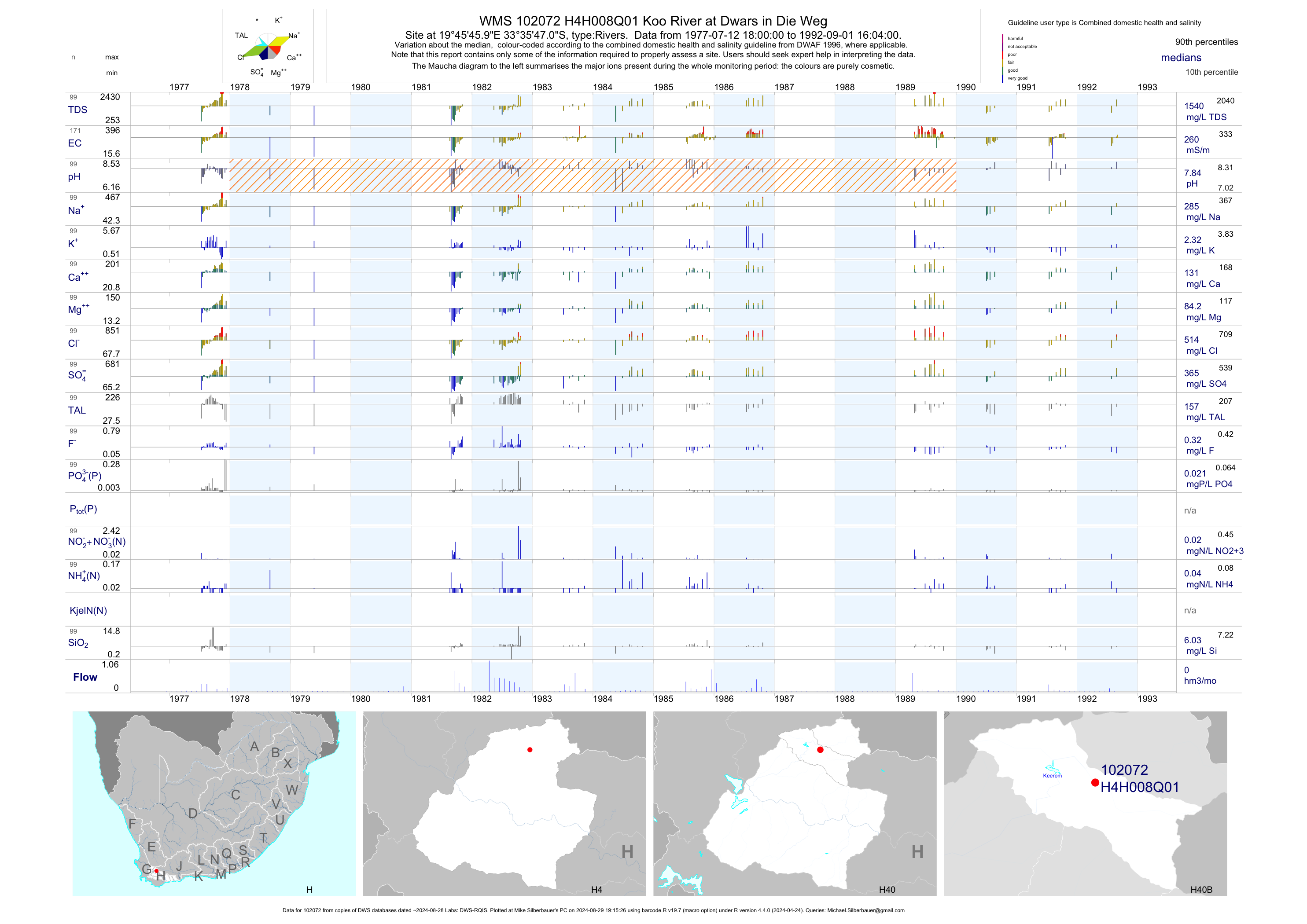
| H40 102072 | plot | data | Koo River at Dwars in Die Weg | Rivers | 171 | 1977-07-12 | 1992-09-01 | 260 | H4H008 | -33.59639 | 19.76278 |
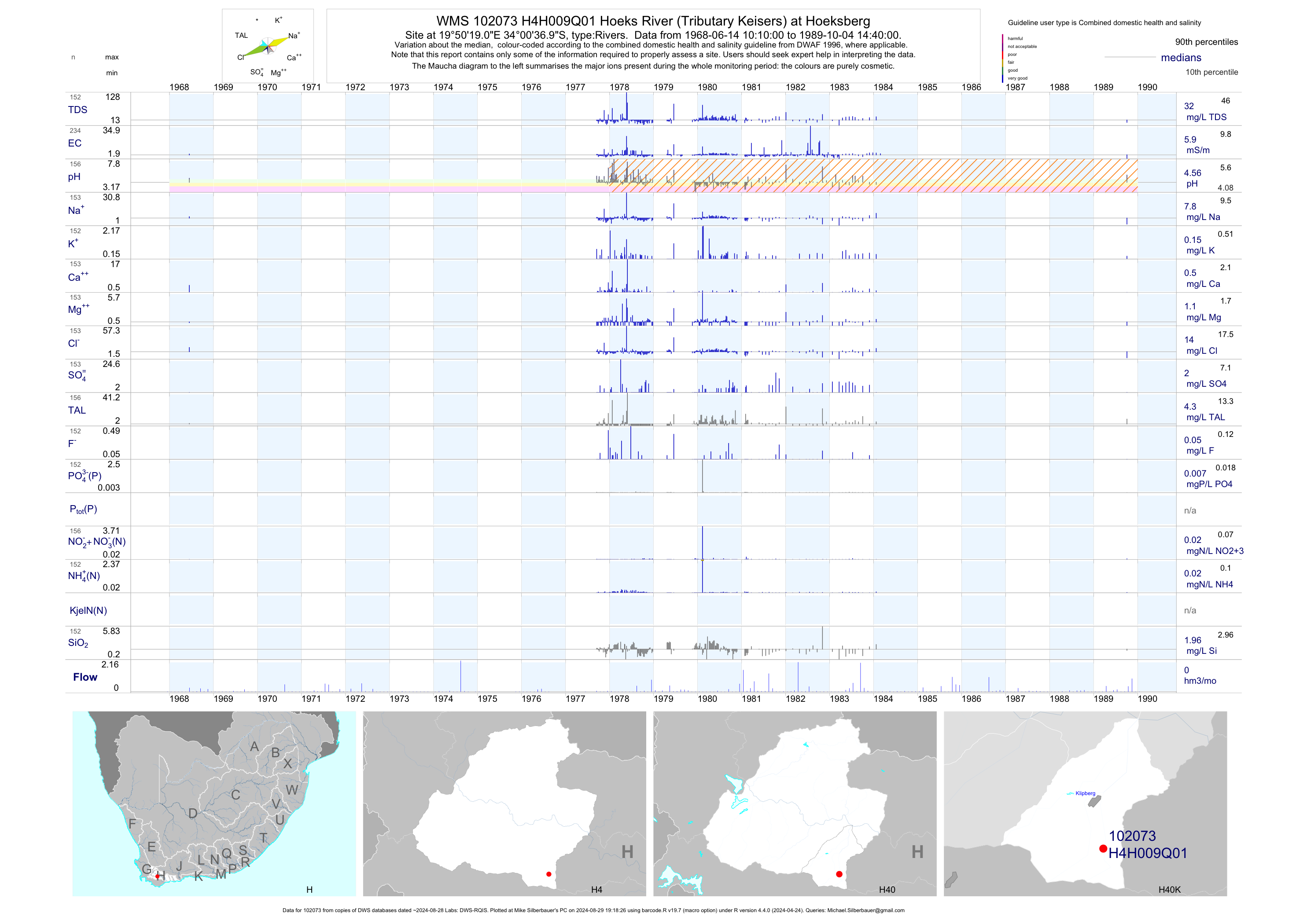
| H40 102073 | plot | data | Hoeks River (Tributary Keisers) at Hoeksberg | Rivers | 234 | 1968-06-14 | 1989-10-04 | 6 | H4H009 | -34.01028 | 19.83861 |
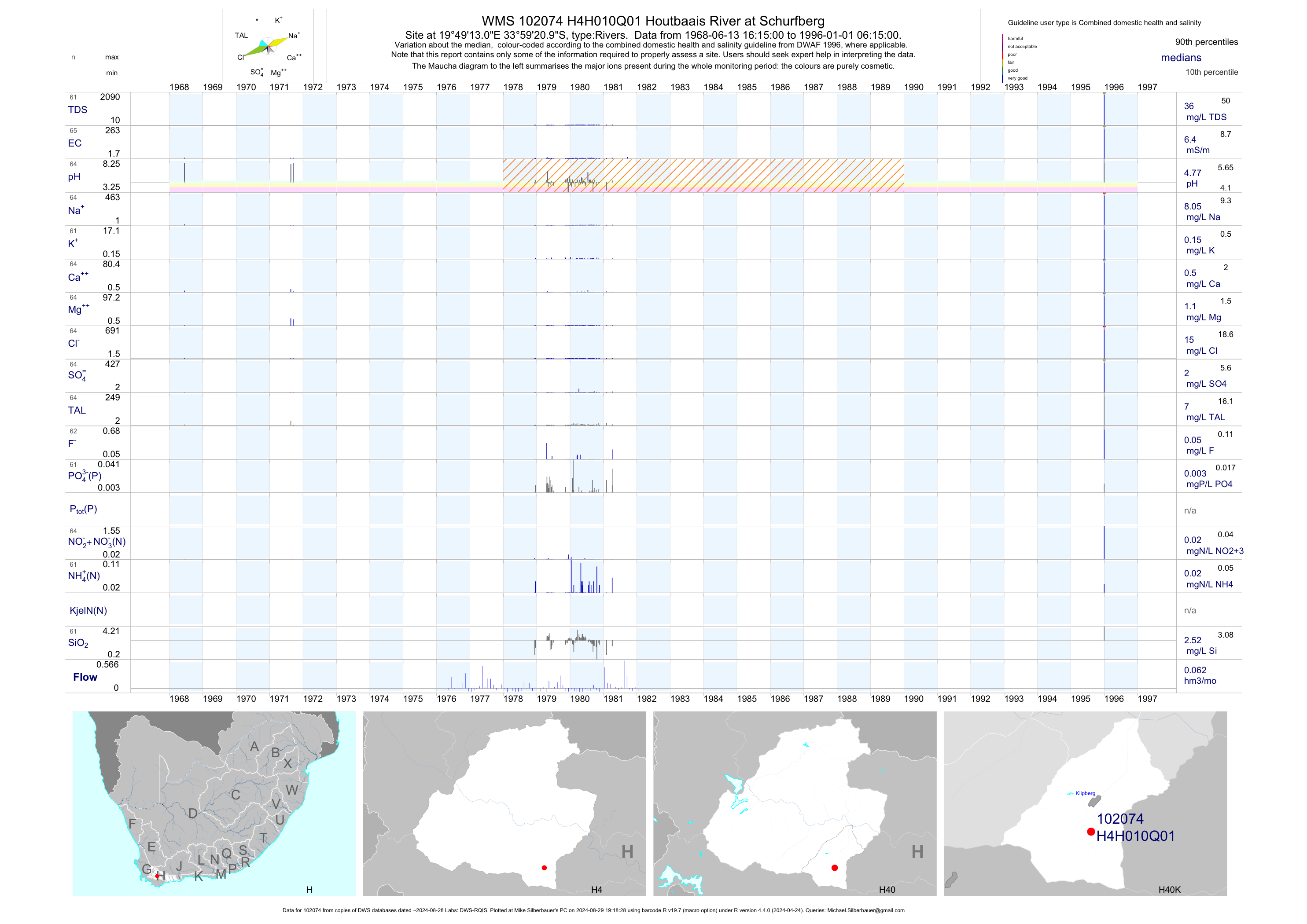
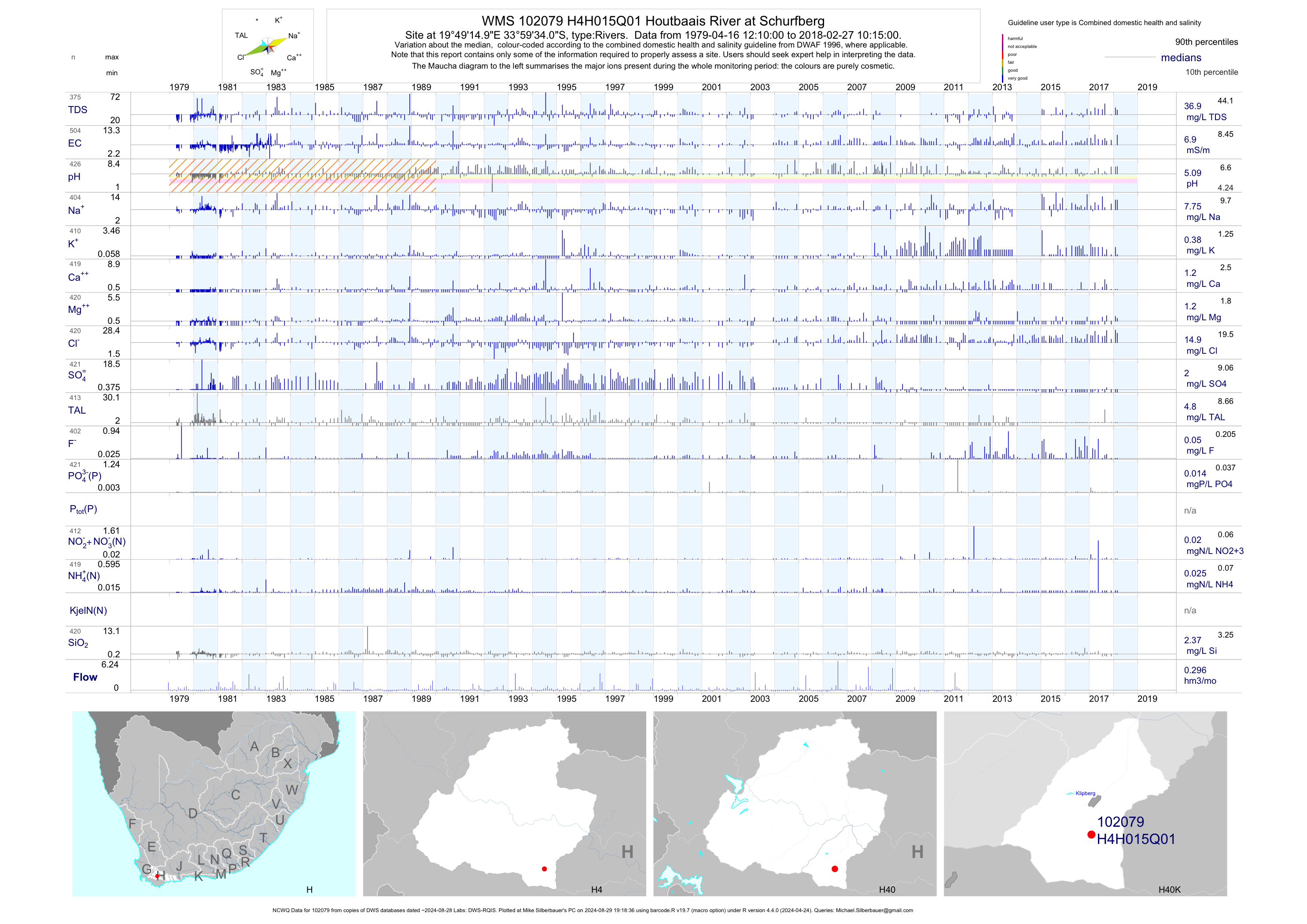
| H40 102074 | plot | data | Houtbaais River at Schurfberg | Rivers | 65 | 1968-06-13 | 1996-01-01 | 6 | H4H010 | -33.98917 | 19.82028 |
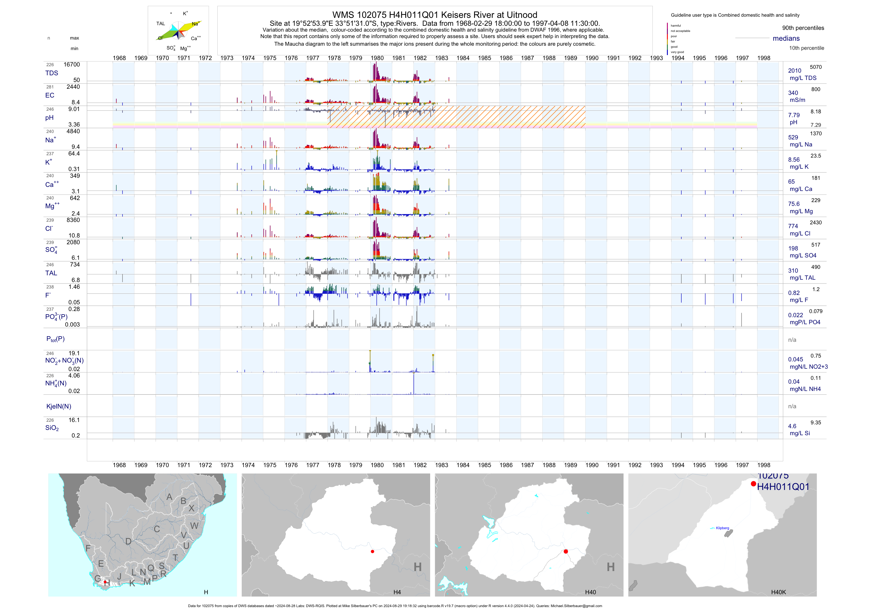
| H40 102075 | plot | data | Keisers River at Uitnood | Rivers | 281 | 1968-02-29 | 1997-04-08 | 340 | H4H011 | -33.85861 | 19.88167 |
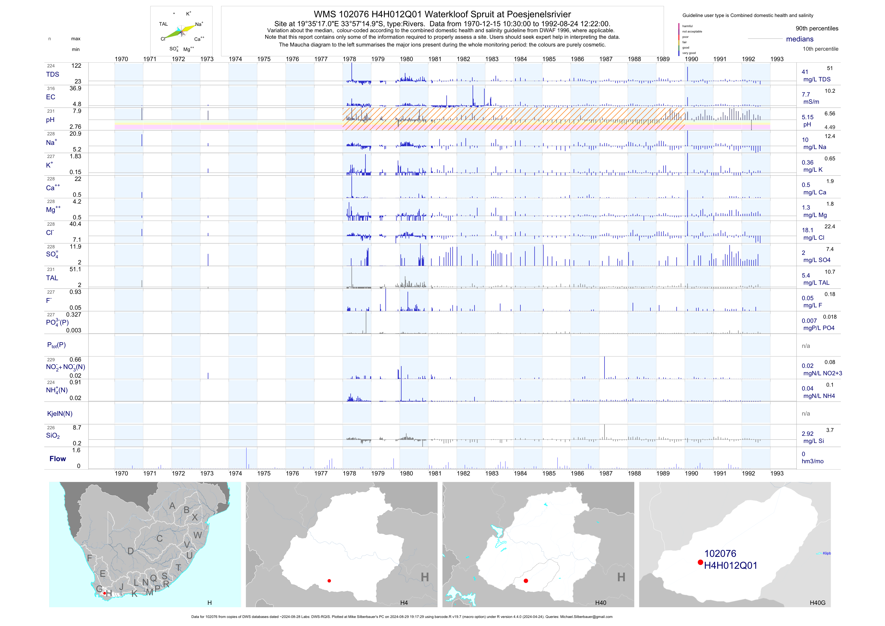
| H40 102076 | plot | data | Waterkloof Spruit at Poesjenelsrivier | Rivers | 316 | 1970-12-15 | 1992-08-24 | 8 | H4H012 | -33.95417 | 19.58806 |
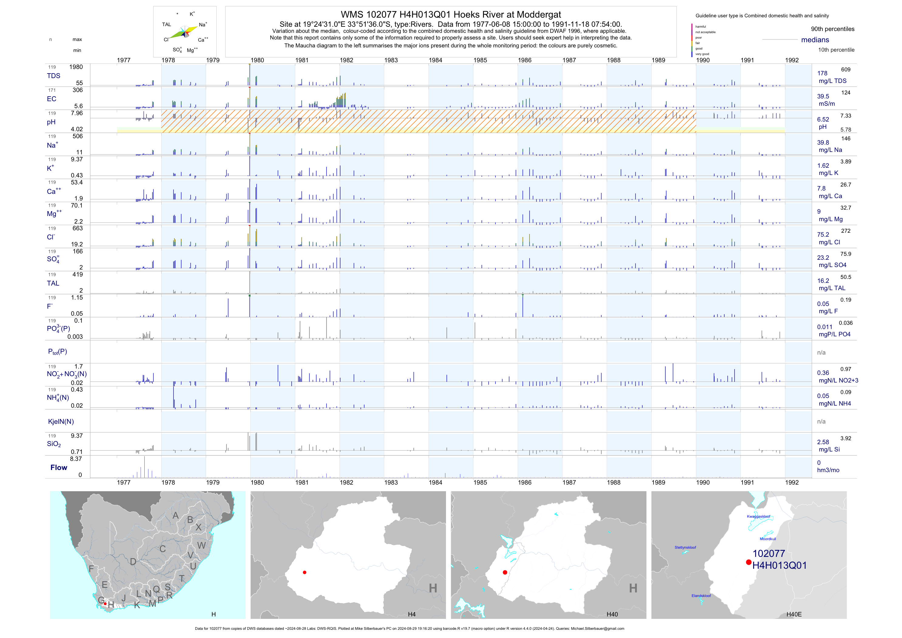
| H40 102077 | plot | data | Hoeks River at Moddergat | Rivers | 171 | 1977-06-08 | 1991-11-18 | 40 | H4H013 | -33.86000 | 19.40861 |
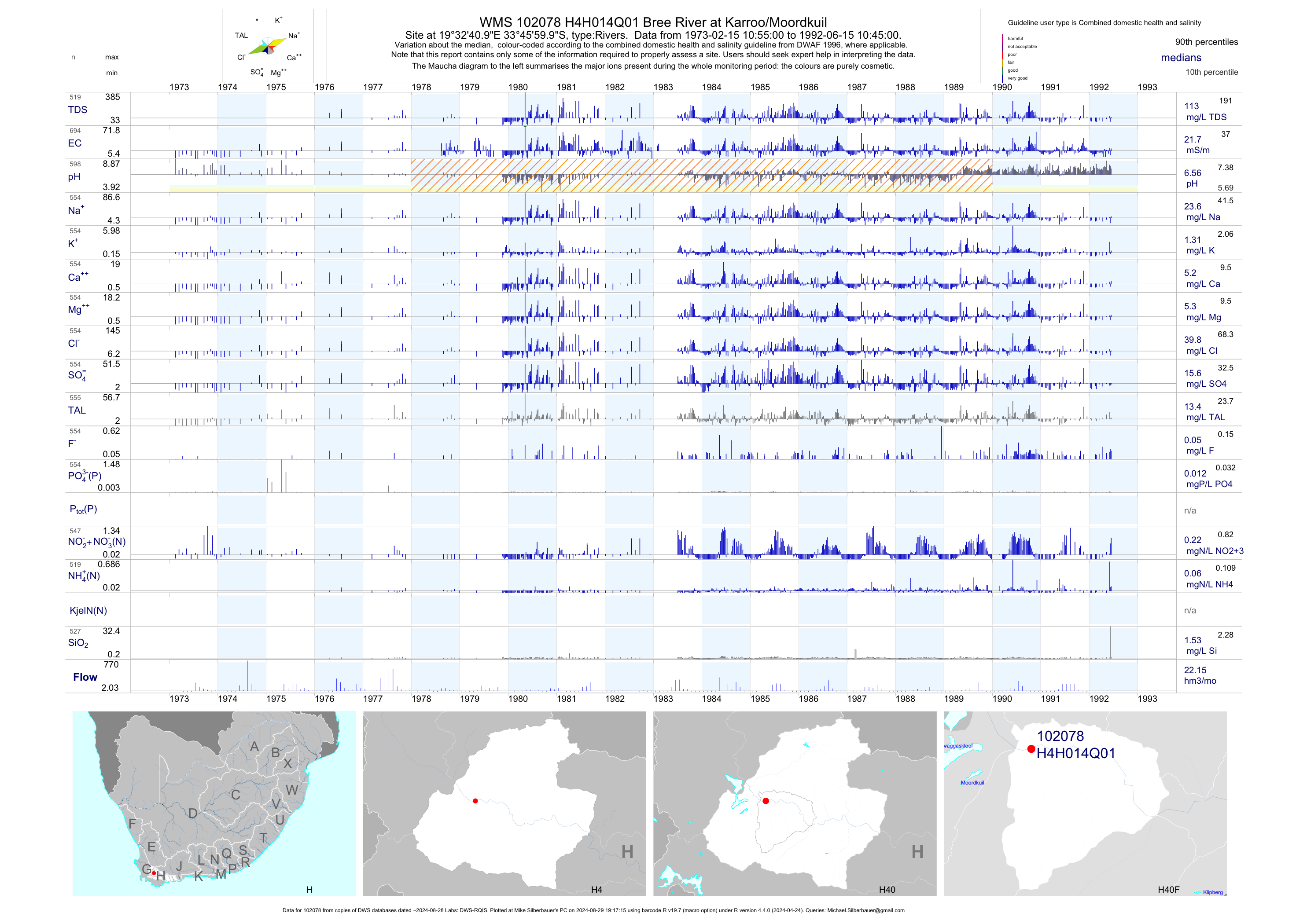
| H40 102078 | plot | data | Bree River at Karroo/Moordkuil | Rivers | 694 | 1973-02-15 | 1992-06-15 | 22 | H4H014 | -33.76667 | 19.54472 |
| H40 102079 | plot | data | Houtbaais River at Schurfberg (NCWQ) | Rivers | 507 | 1979-04-16 | 2018-02-27 | 7 | H4H015 | -33.99278 | 19.82083 |
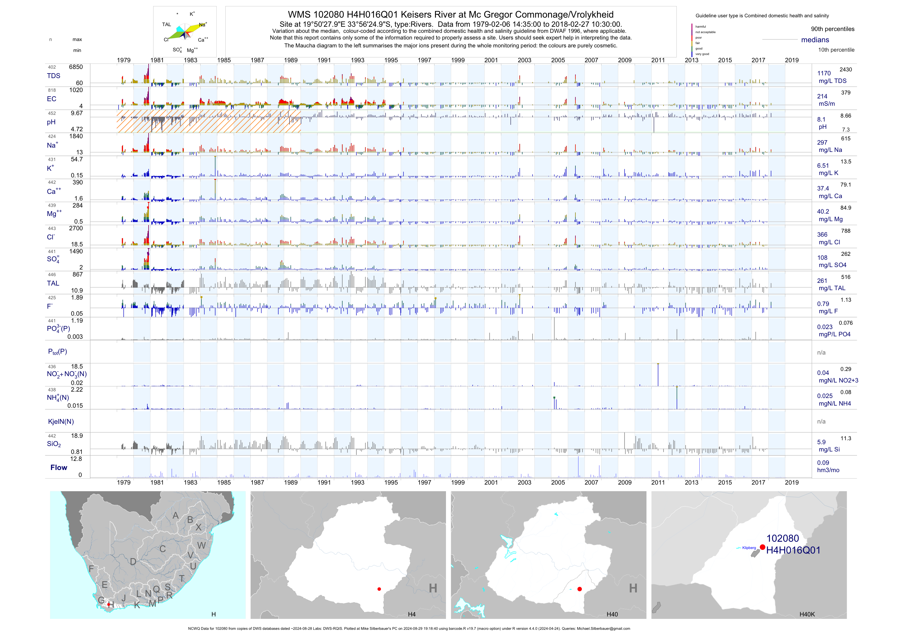
| H40 102080 | plot | data | Keisers River at Mc Gregor Commonage/Vrolykheid (NCWQ) | Rivers | 819 | 1979-02-06 | 2018-02-27 | 214 | H4H016 | -33.94028 | 19.84111 |
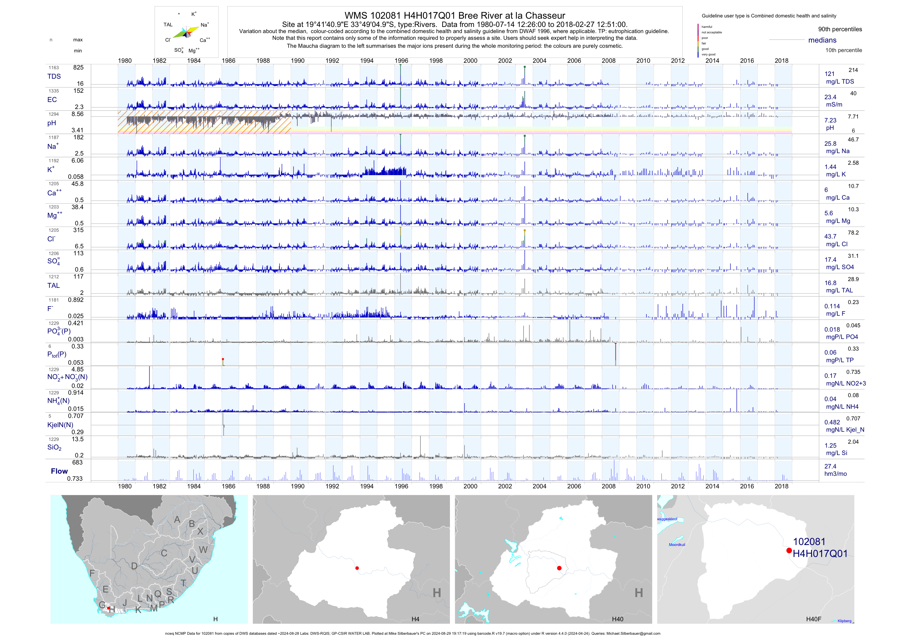
| H40 102081 | plot | data | Bree River at la Chasseur (ncwq NCMP) | Rivers | 1336 | 1980-07-14 | 2018-02-27 | 23 | H4H017 | -33.81806 | 19.69472 |
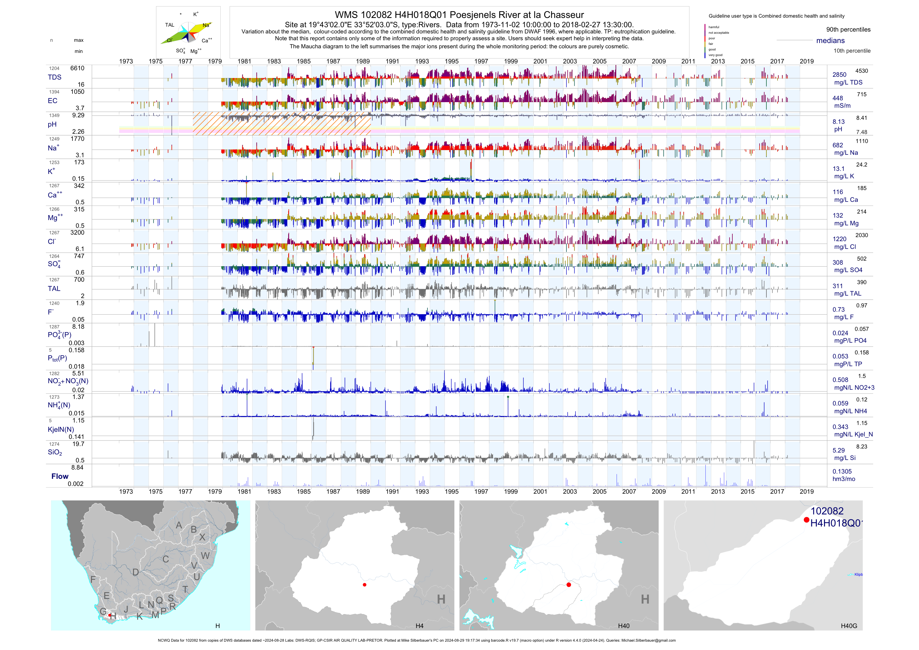
| H40 102082 | plot | data | Poesjenels River at la Chasseur (NCWQ) | Rivers | 1398 | 1973-11-02 | 2018-02-27 | 448 | H4H018 | -33.86750 | 19.71722 |
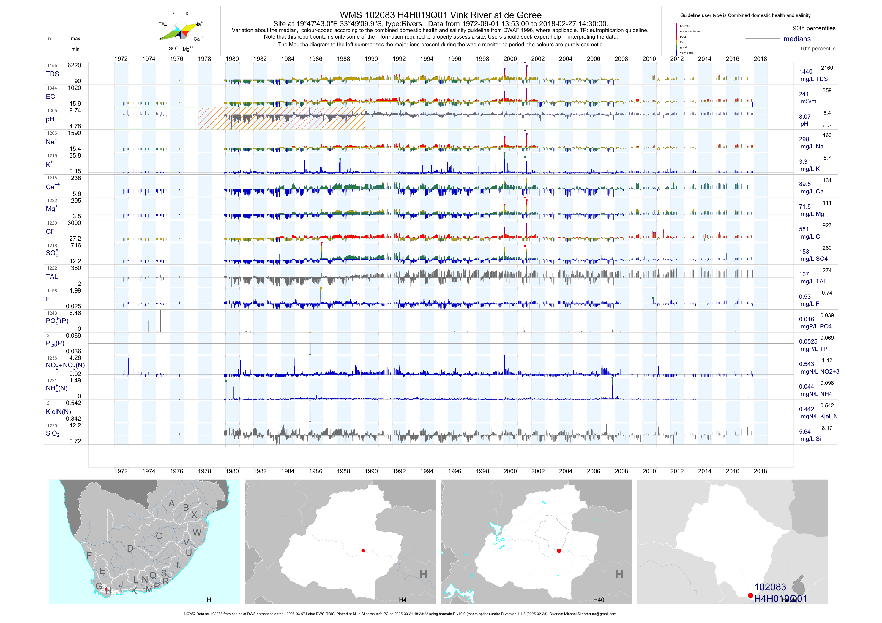
| H40 102083 | plot | data | Vink River at de Goree (NCWQ) | Rivers | 1345 | 1972-09-01 | 2018-02-27 | 241 | H4H019 | -33.81944 | 19.79528 |
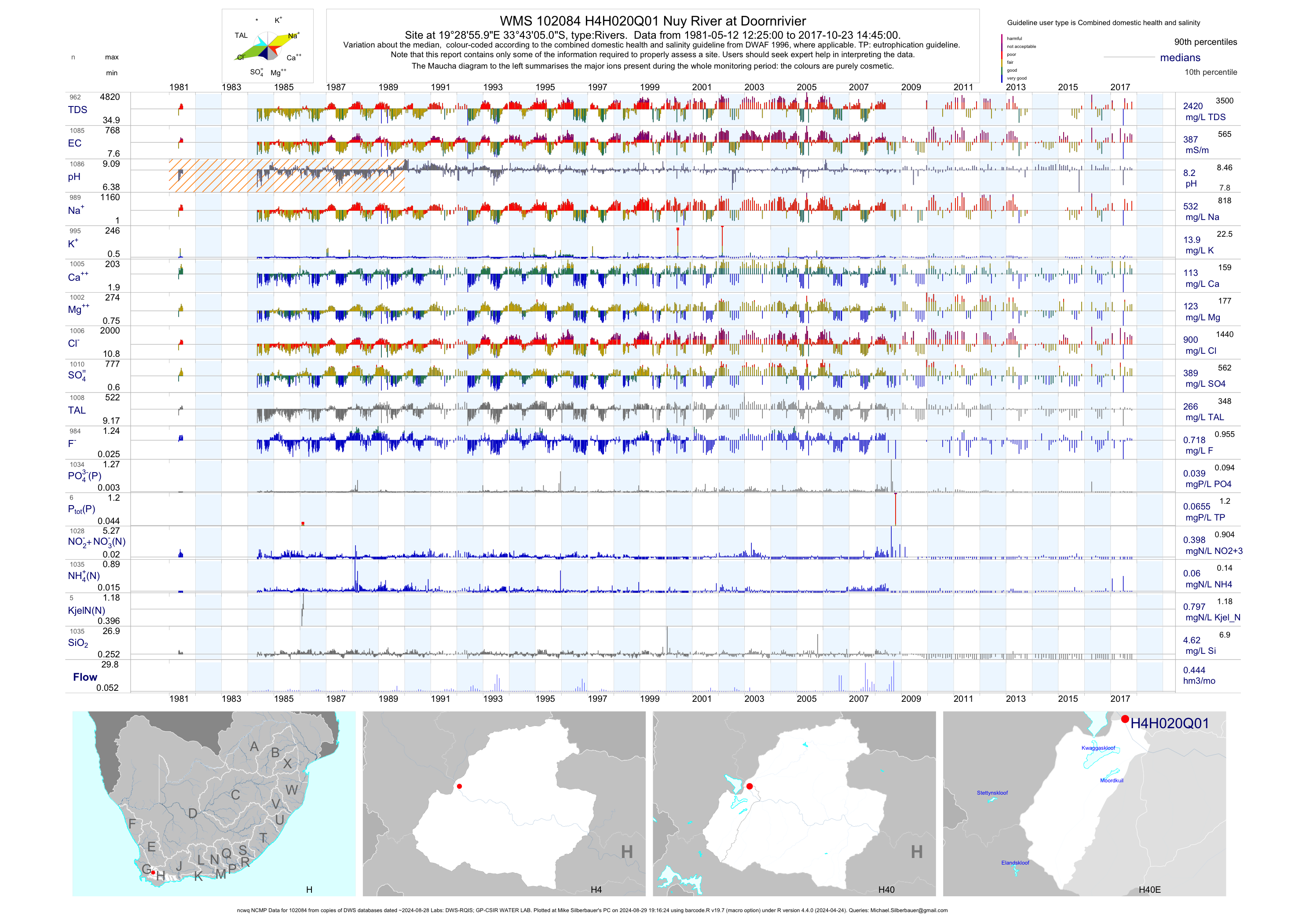
| H40 102084 | plot | data | Nuy River at Doornrivier (ncwq NCMP) | Rivers | 1086 | 1981-05-12 | 2017-10-23 | 387 | H4H020 | -33.71806 | 19.48222 |
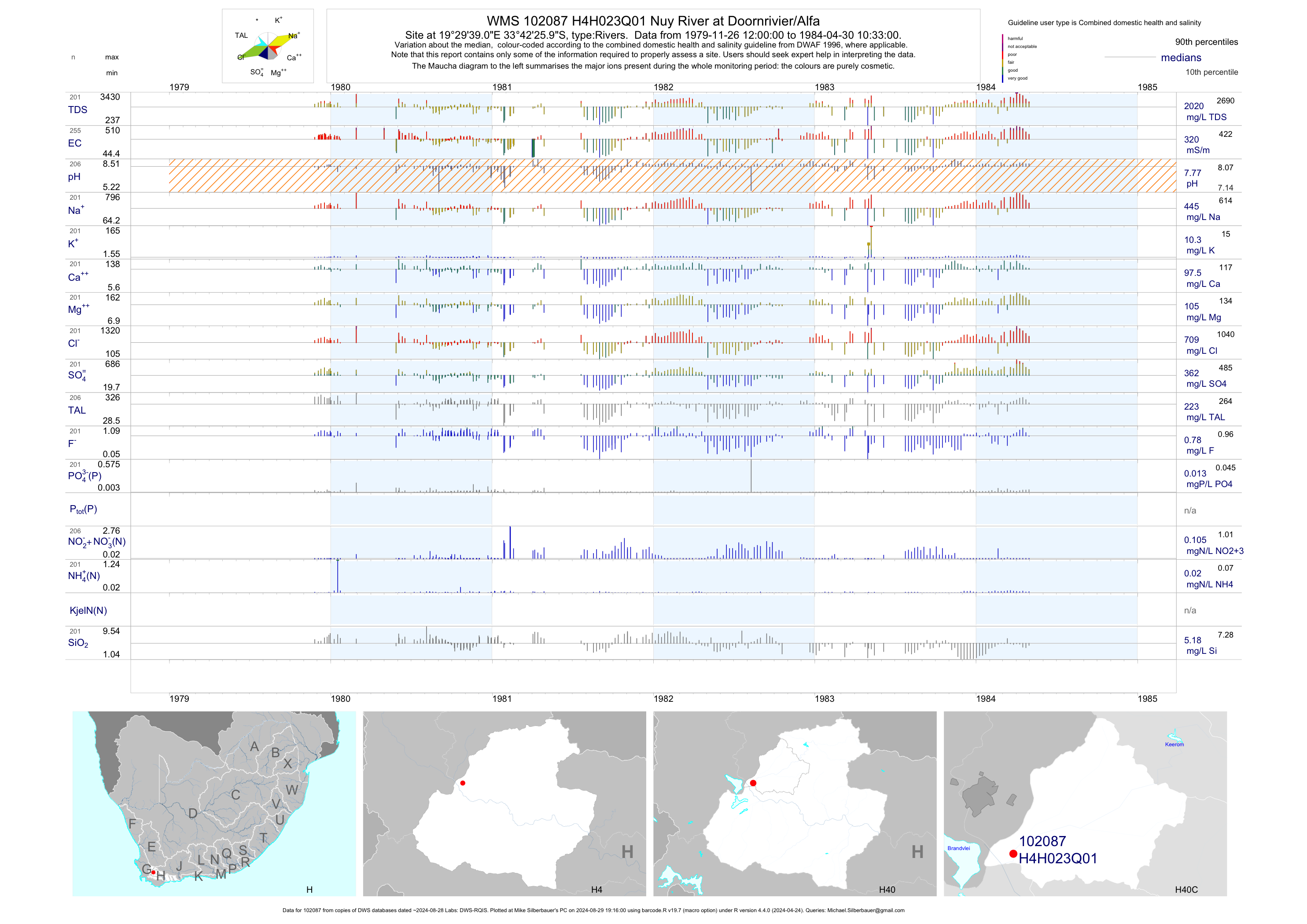
| H40 102087 | plot | data | Nuy River at Doornrivier/Alfa | Rivers | 255 | 1979-11-26 | 1984-04-30 | 320 | H4H023 | -33.70722 | 19.49417 |
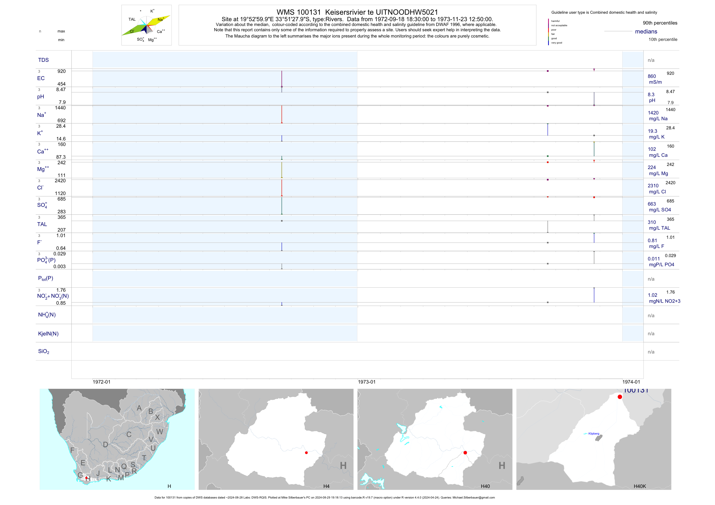
| H40 100131 | plot | data | Keisersrivier te UITNOODHW5021 | Rivers | 3 | 1972-09-18 | 1973-11-23 | 860 | 100131 | -33.85778 | 19.88333 |
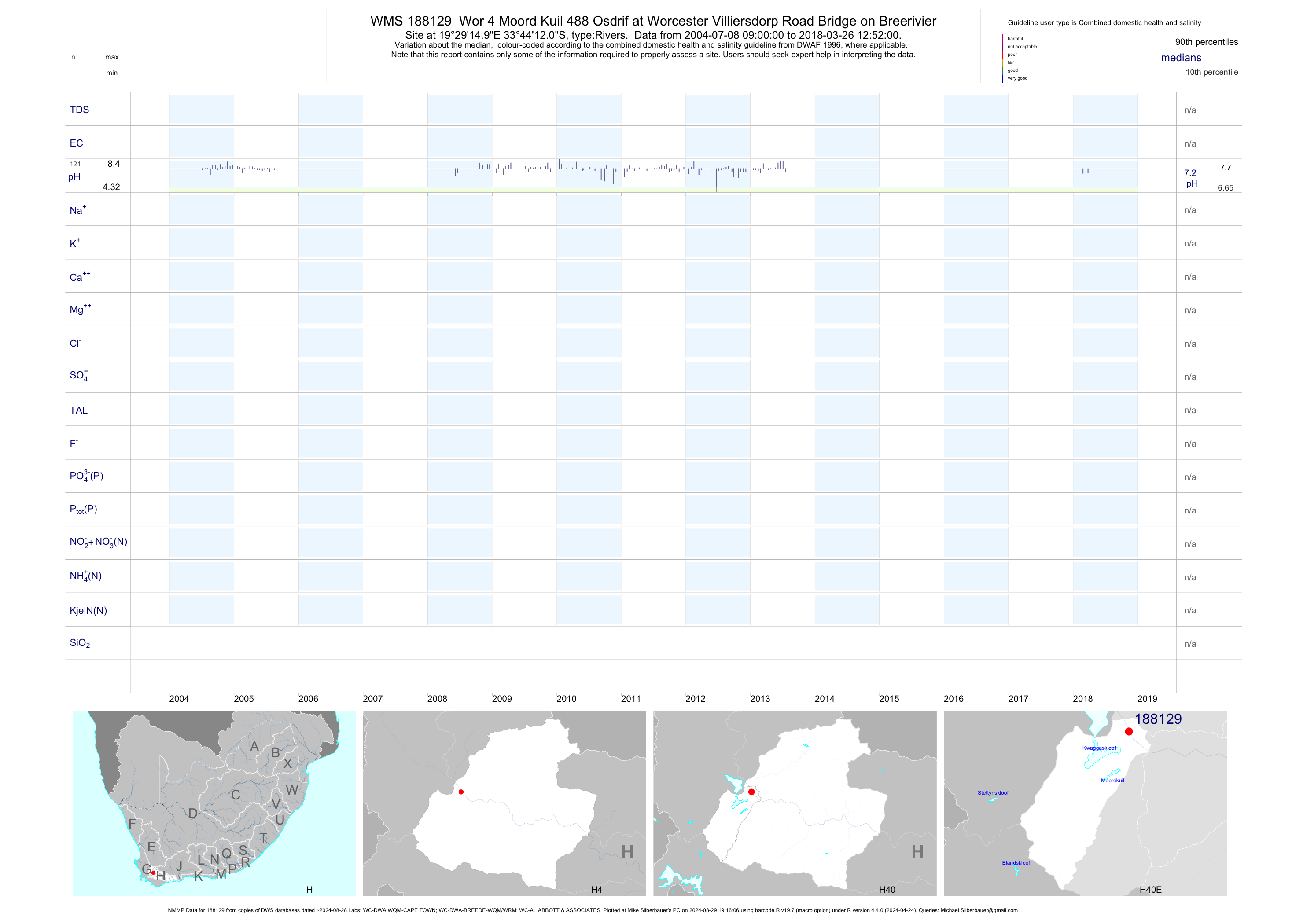
| H40 188129 | plot | data | Wor 4 Moord Kuil 488 Osdrif at Worcester Villiersdorp Road Bridge on Breerivier (NMMP) | Rivers | 366 | 2004-07-08 | 2018-03-26 | n/a | 188129 | -33.73667 | 19.48750 |
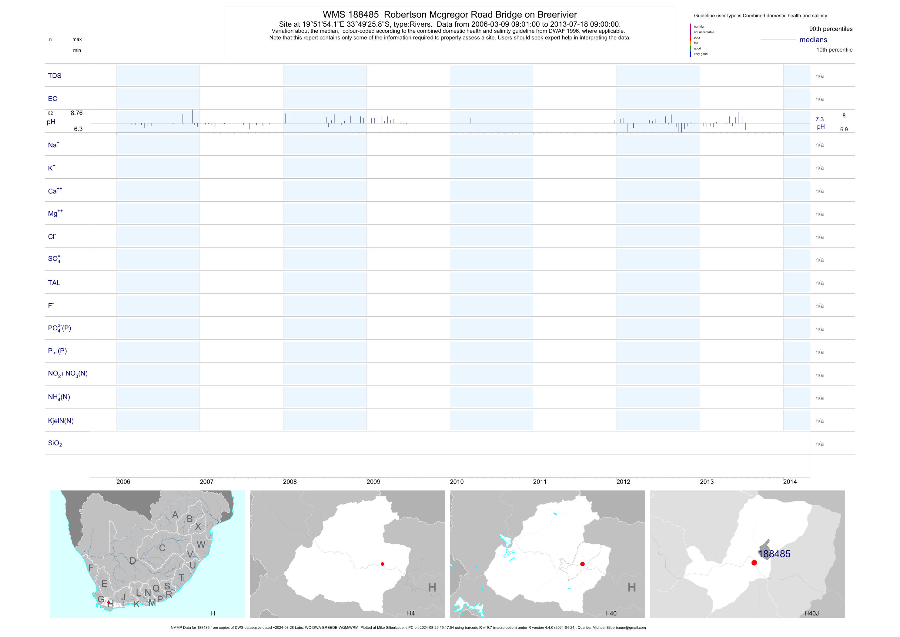
| H40 188485 | plot | data | Robertson Mcgregor Road Bridge on Breerivier (NMMP) | Rivers | 369 | 2006-03-09 | 2013-07-18 | n/a | 188485 | -33.82386 | 19.86506 |
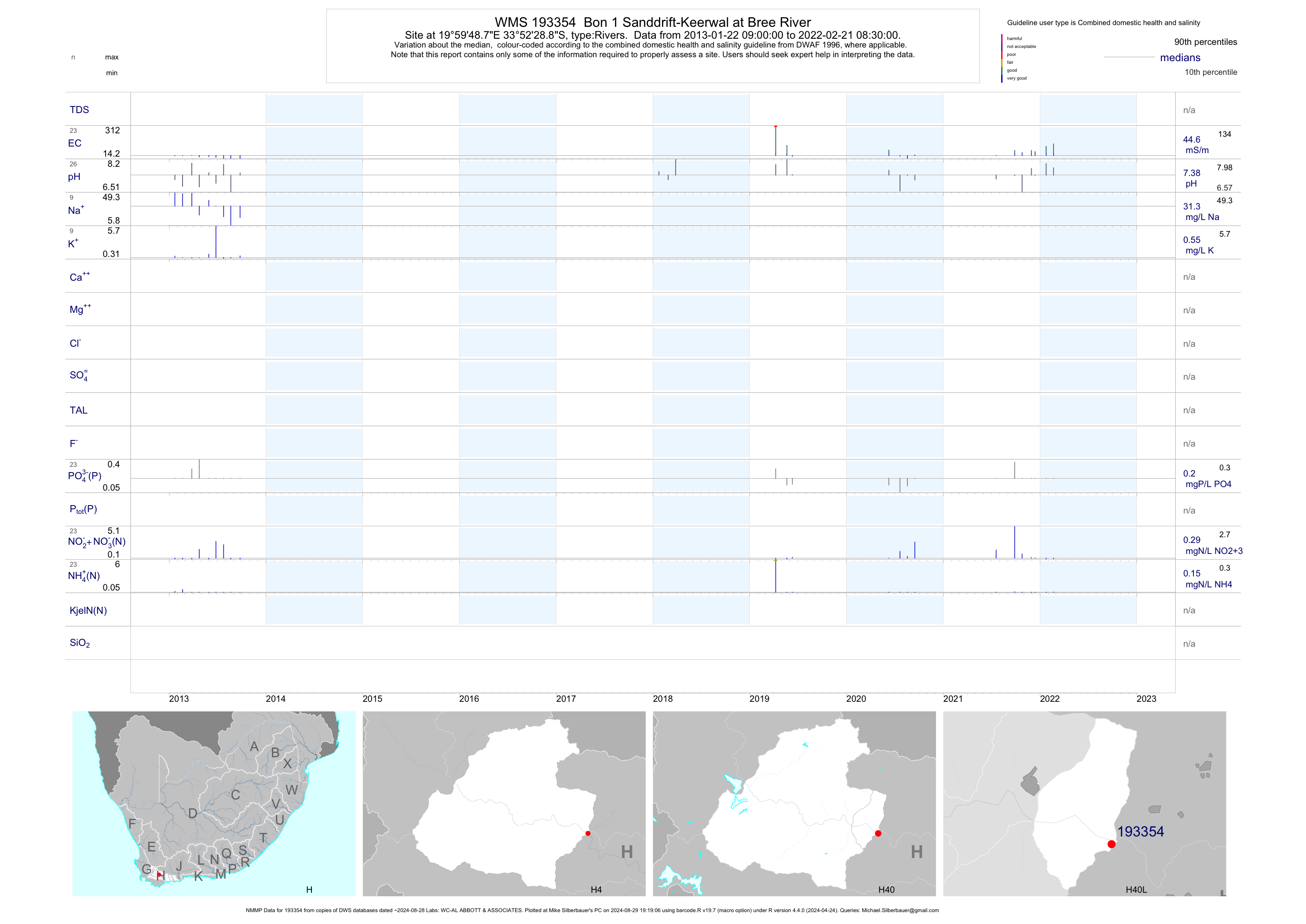
| H40 193354 | plot | data | Bon 1 Sanddrift-Keerwal at Bree River (NMMP) | Rivers | 26 | 2013-01-22 | 2018-03-27 | 33 | 193354 | -33.87468 | 19.99687 |
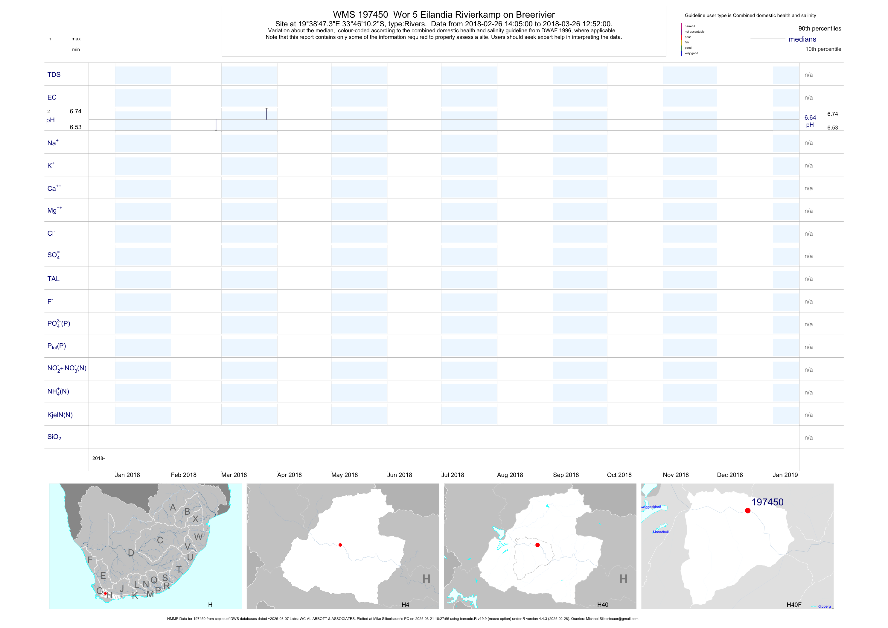
| H40 197450 | plot | data | Wor 5 Eilandia Rivierkamp on Breerivier (NMMP) | Rivers | 3 | 2018-02-26 | 2018-03-26 | n/a | 197450 | -33.76952 | 19.64650 |
| H40 197451 | plot | data | Rob 1 Robertson - Silverstrand on Breerivier (NMMP) | Rivers | 4 | 2018-02-26 | 2018-03-26 | n/a | 197451 | -33.81608 | 19.84997 |
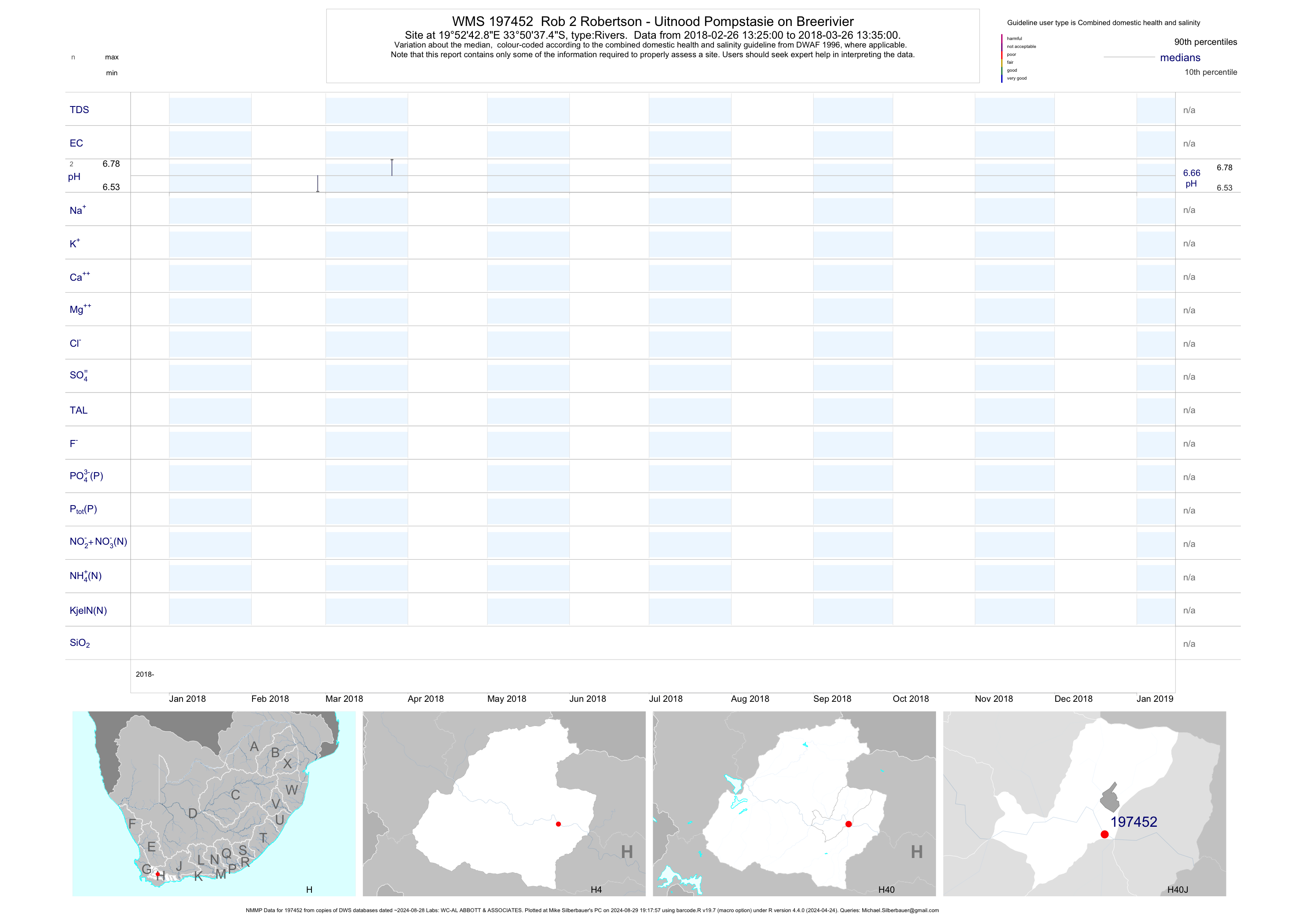
| H40 197452 | plot | data | Rob 2 Robertson - Uitnood Pompstasie on Breerivier (NMMP) | Rivers | 4 | 2018-02-26 | 2018-03-26 | n/a | 197452 | -33.84373 | 19.87857 |
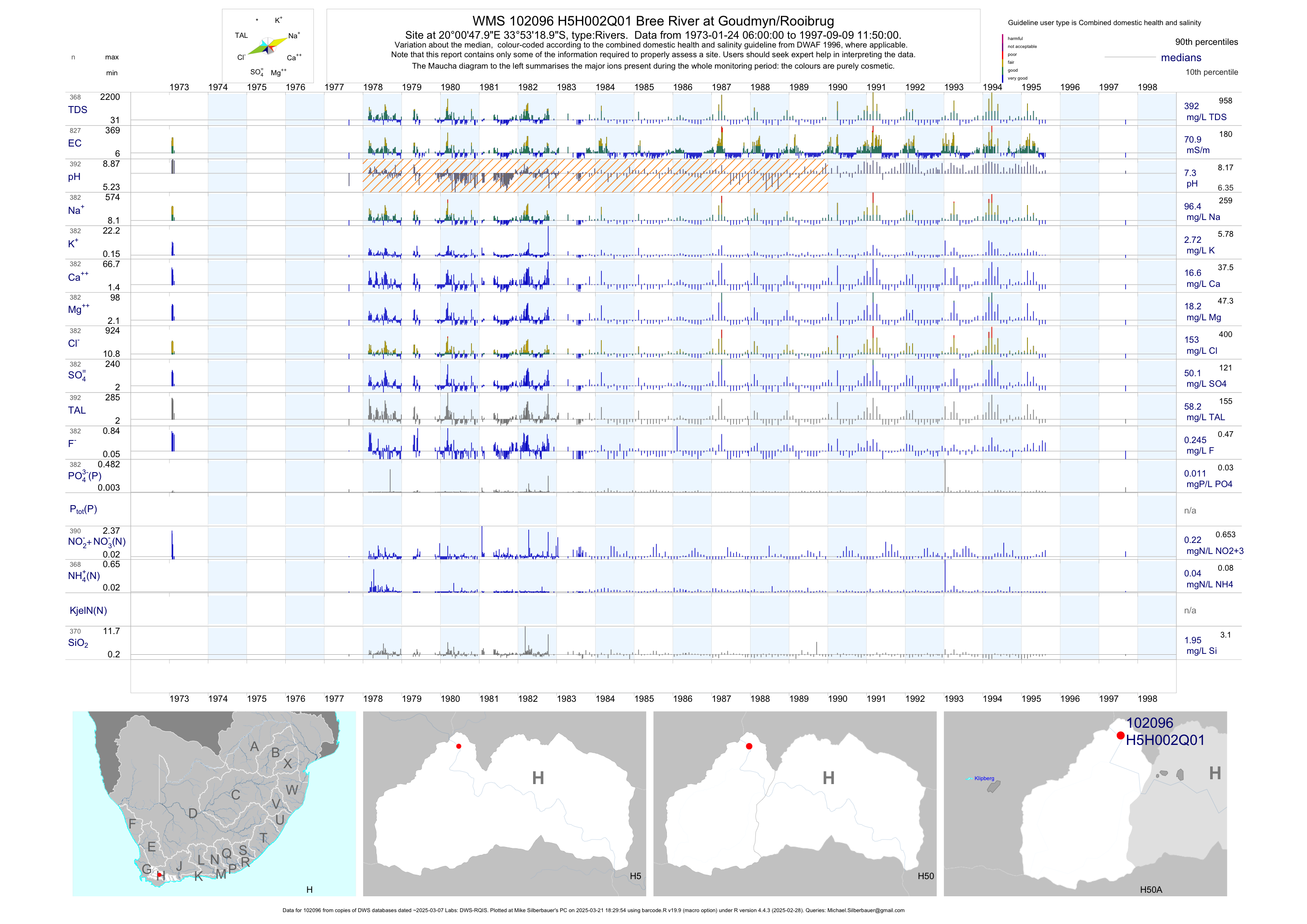
| H50 102096 | plot | data | Bree River at Goudmyn/Rooibrug | Rivers | 3124 | 1955-08-22 | 1997-09-09 | 71 | H5H002 | -33.88861 | 20.01333 |
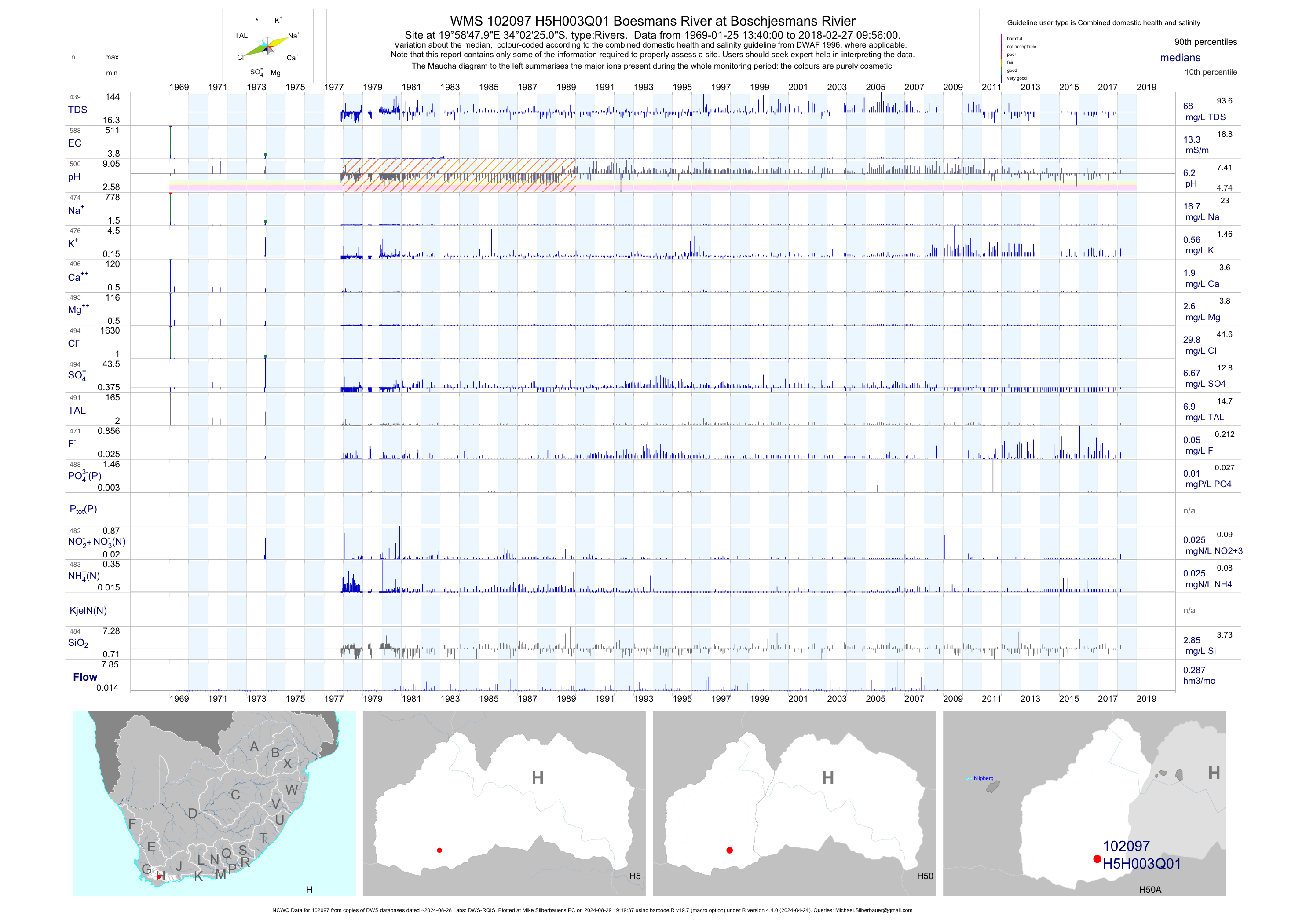
| H50 102097 | plot | data | Boesmans River at Boschjesmans Rivier (NCWQ) | Rivers | 590 | 1969-01-25 | 2018-02-27 | 13 | H5H003 | -34.04028 | 19.98000 |
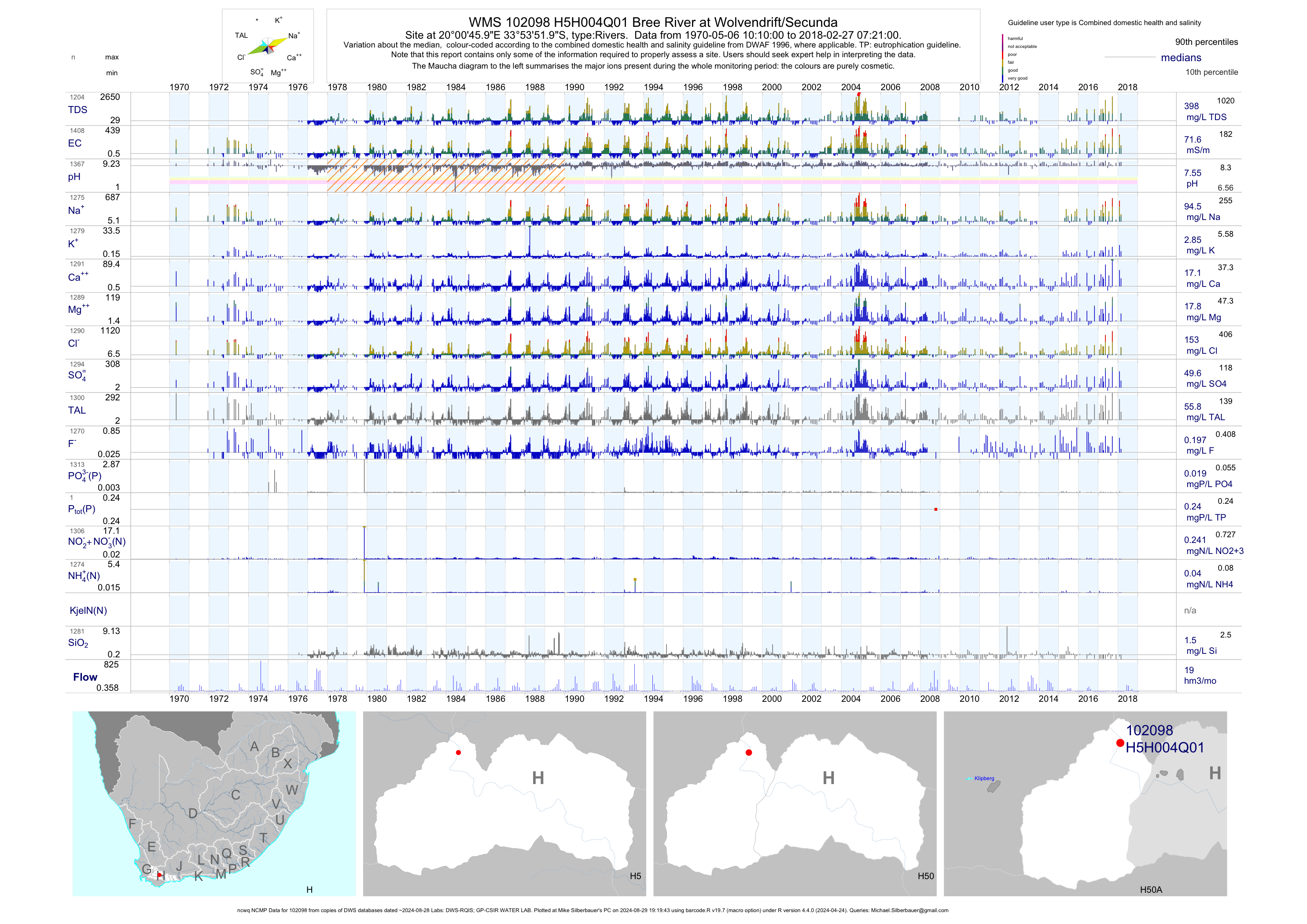
| H50 102098 | plot | data | Bree River at Wolvendrift/Secunda (ncwq NCMP) | Rivers | 1411 | 1970-05-06 | 2018-02-27 | 72 | H5H004 | -33.89778 | 20.01278 |
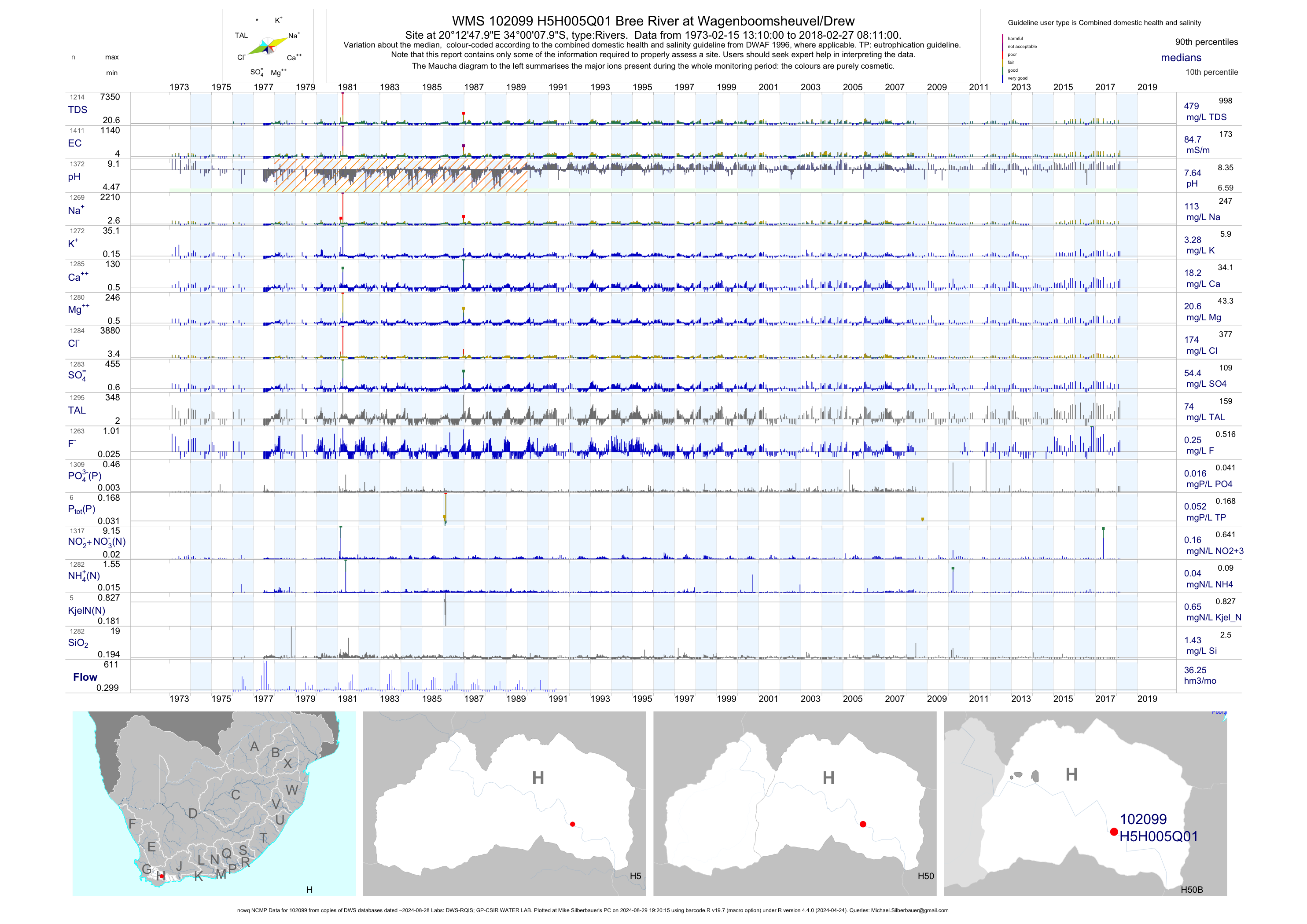
| H50 102099 | plot | data | Bree River at Wagenboomsheuvel/Drew (ncwq NCMP) | Rivers | 1414 | 1973-02-15 | 2018-02-27 | 85 | H5H005 | -34.00222 | 20.21333 |
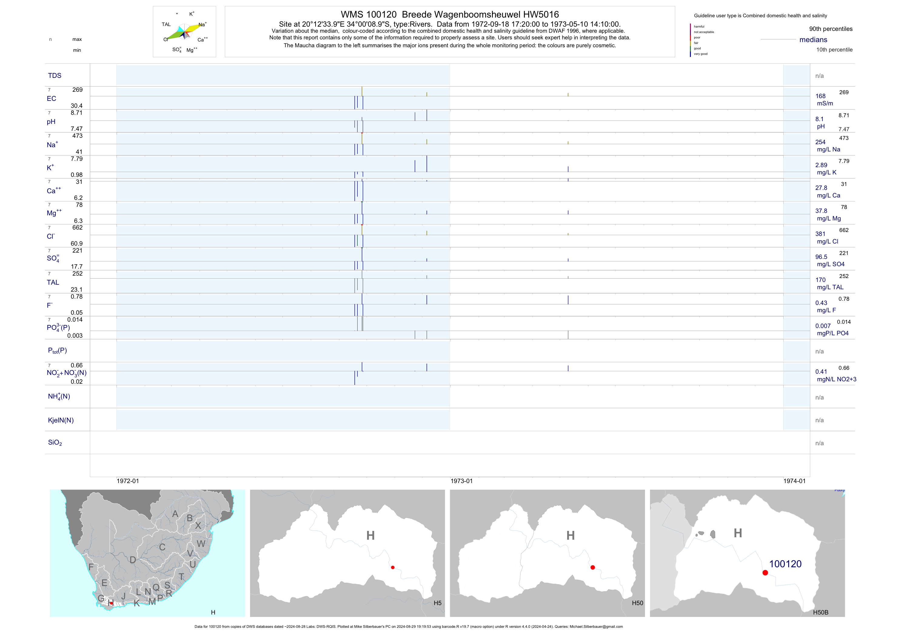
| H50 100120 | plot | data | Breede Wagenboomsheuwel HW5016 | Rivers | 7 | 1972-09-18 | 1973-05-10 | 168 | 100120 | -34.00250 | 20.20944 |
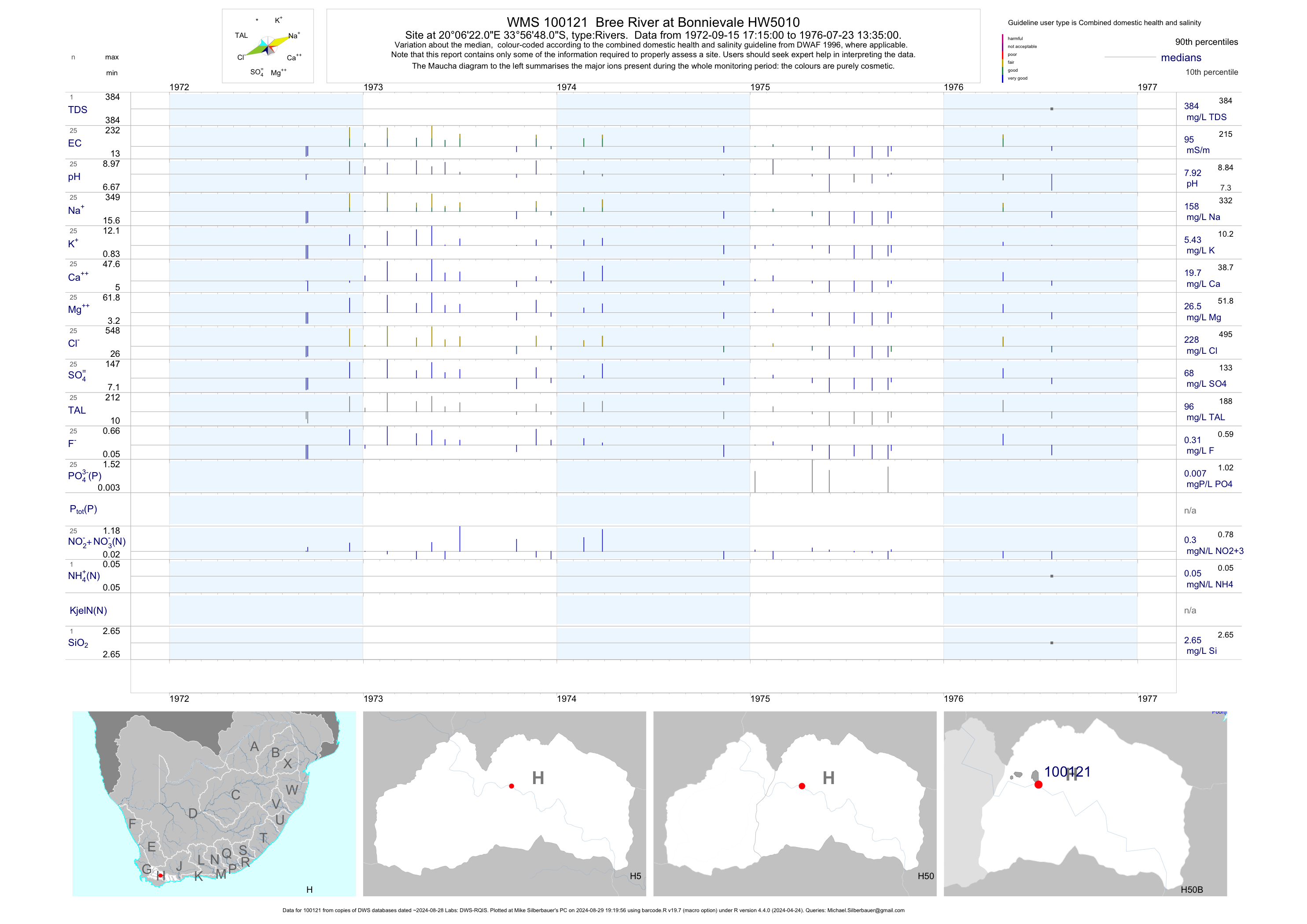
| H50 100121 | plot | data | Bree River at Bonnievale HW5010 | Rivers | 25 | 1972-09-15 | 1976-07-23 | 95 | 100121 | -33.94667 | 20.10611 |
| H50 197453 | plot | data | Bon 3 Bonnievale - Jonklheerplaat on Breerivier (NMMP) | Rivers | 4 | 2018-01-24 | 2018-03-27 | n/a | 197453 | -33.96190 | 20.04778 |
| H50 197454 | plot | data | Bon 4 Bonnievale - Parmalat Edenvale Plaas on Breerivier (NMMP) | Rivers | 6 | 2018-01-23 | 2018-03-27 | n/a | 197454 | -33.95055 | 20.11200 |
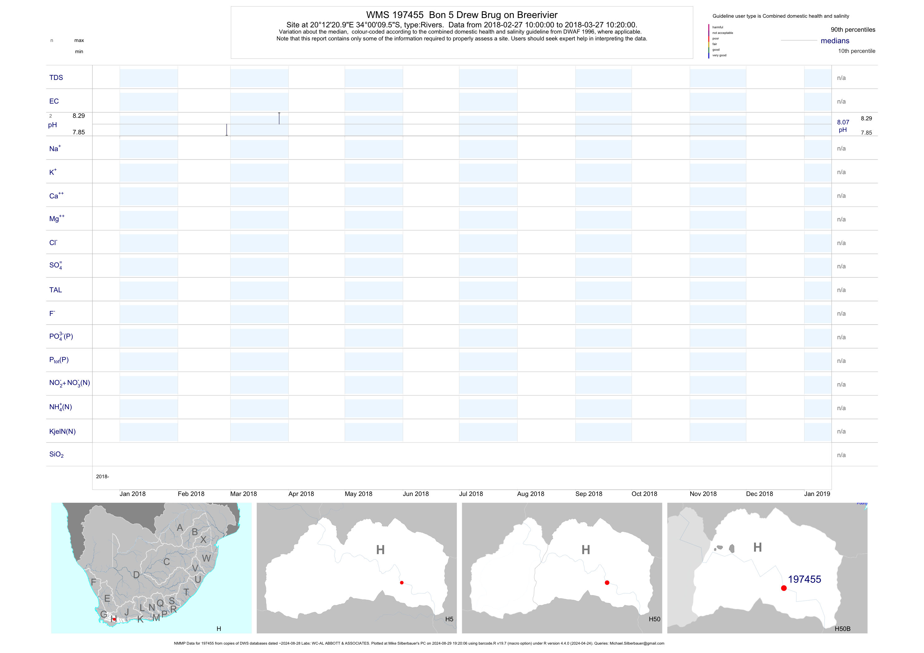
| H50 197455 | plot | data | Bon 5 Drew Brug on Breerivier (NMMP) | Rivers | 4 | 2018-02-27 | 2018-03-27 | n/a | 197455 | -34.00265 | 20.20582 |
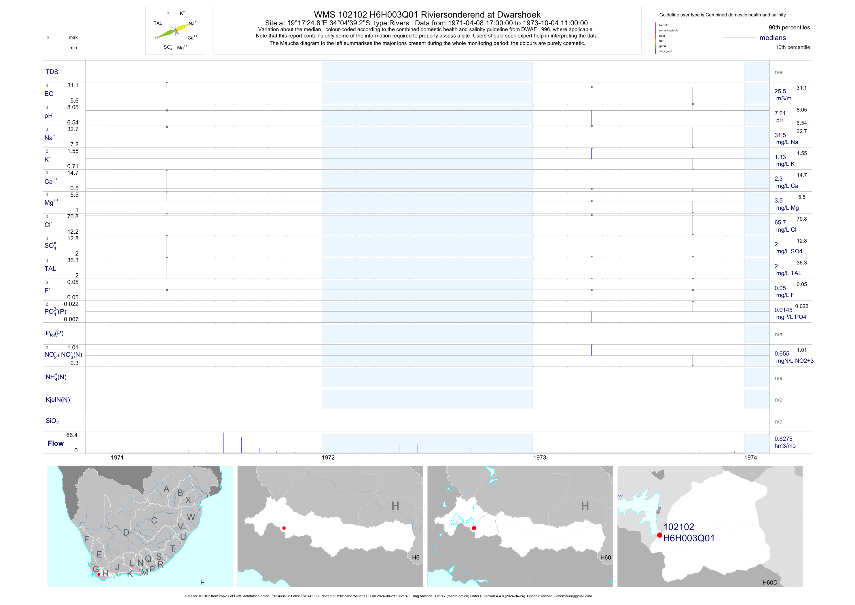
| H60 102102 | plot | data | Riviersonderend at Dwarshoek | Rivers | 3 | 1971-04-08 | 1973-10-04 | 26 | H6H003 | -34.07758 | 19.29023 |
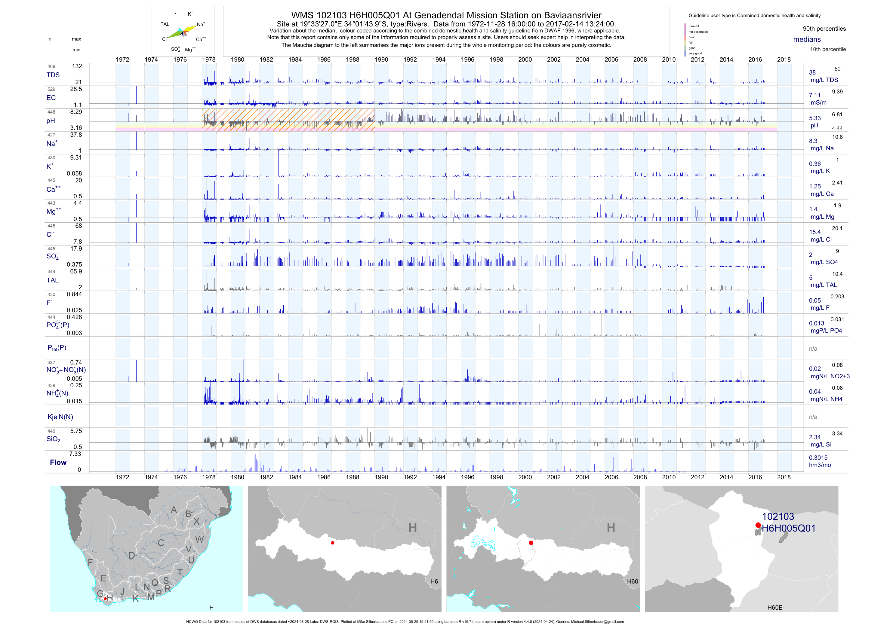
| H60 102103 | plot | data | At Genadendal Mission Station on Baviaansrivier (NCWQ) | Rivers | 531 | 1972-11-28 | 2017-02-14 | 7 | H6H005 | -34.02889 | 19.55750 |
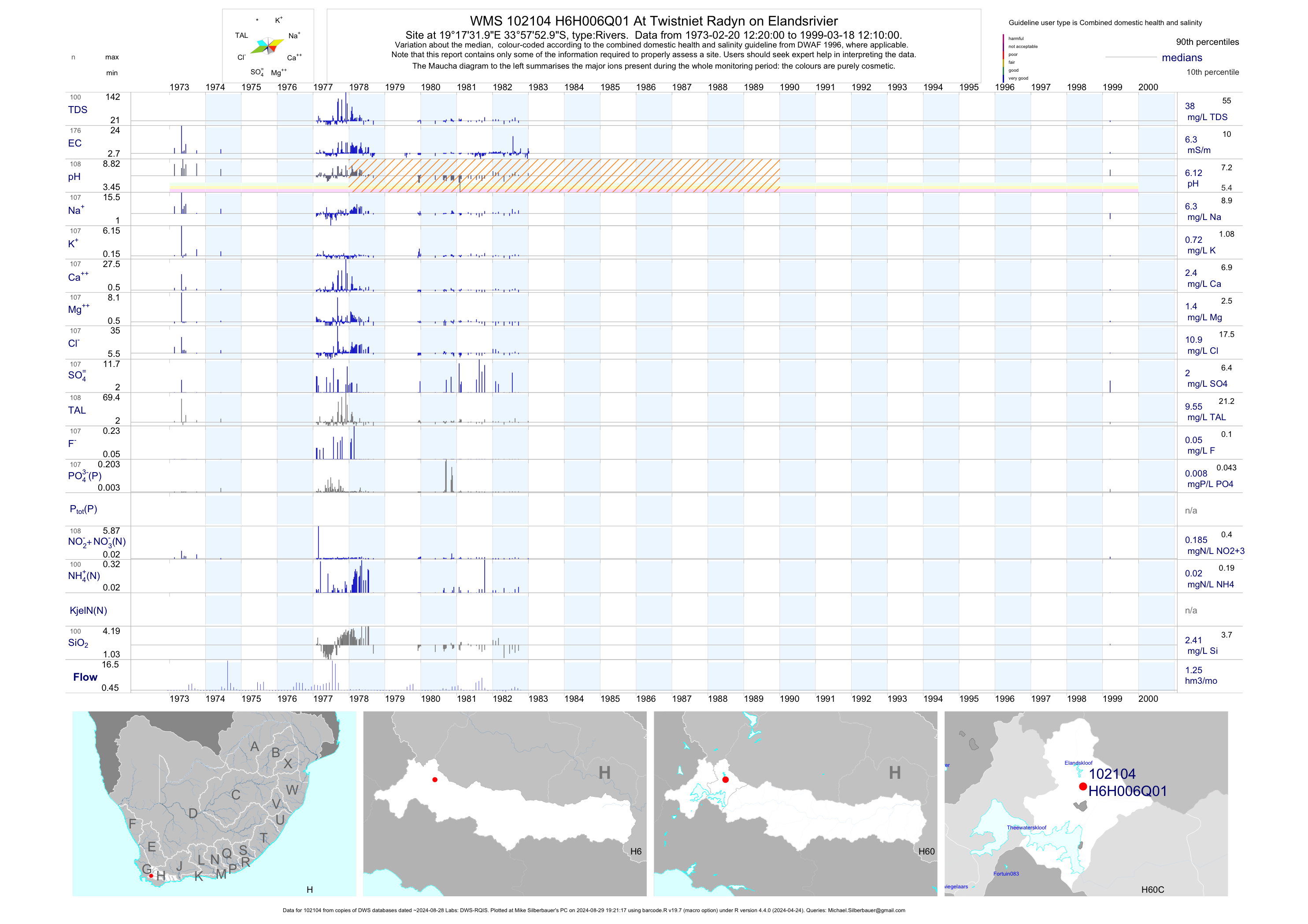
| H60 102104 | plot | data | At Twistniet Radyn on Elandsrivier | Rivers | 176 | 1973-02-20 | 1999-03-18 | 6 | H6H006 | -33.96472 | 19.29222 |
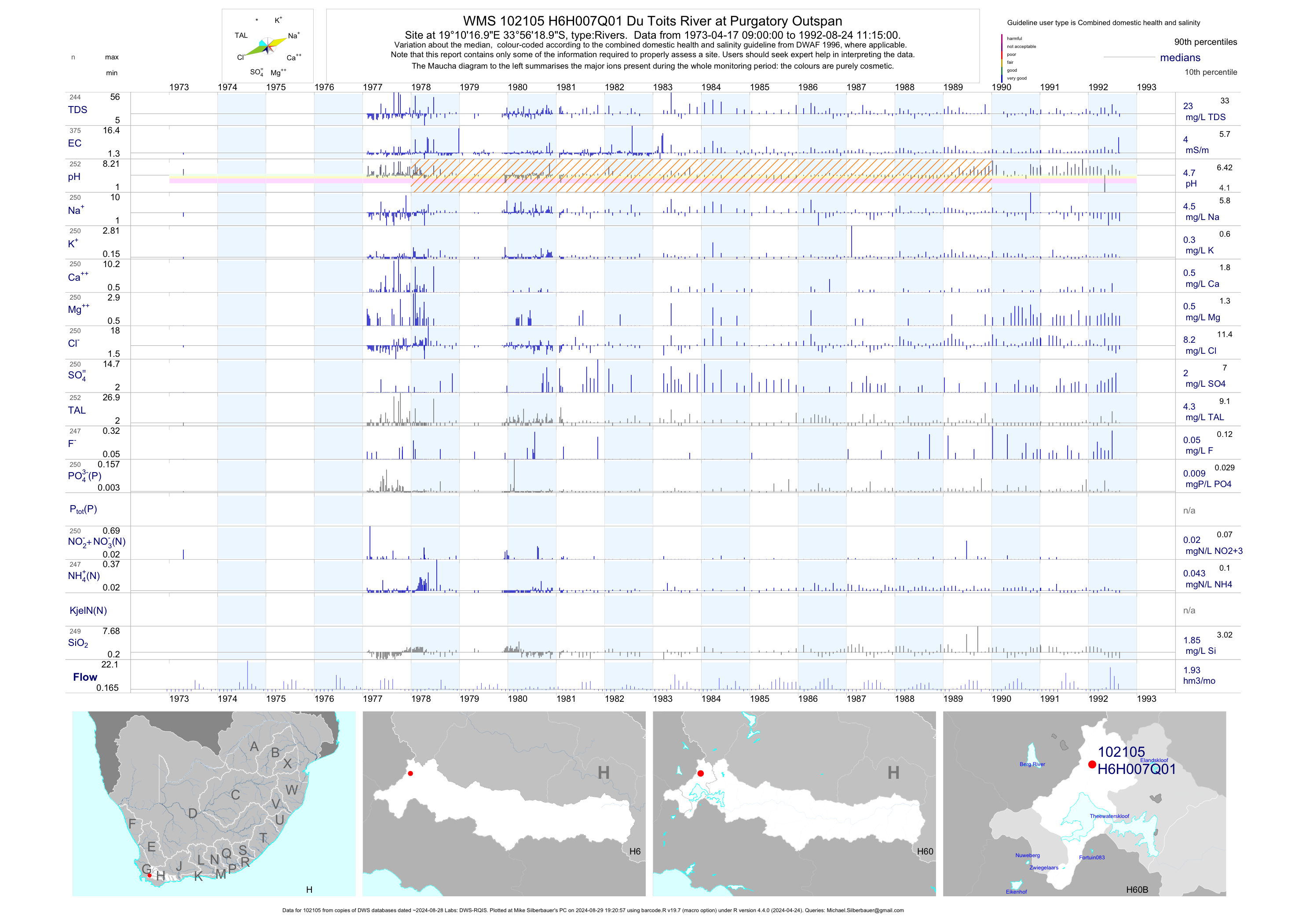
| H60 102105 | plot | data | Du Toits River at Purgatory Outspan | Rivers | 375 | 1973-04-17 | 1992-08-24 | 4 | H6H007 | -33.93861 | 19.17139 |
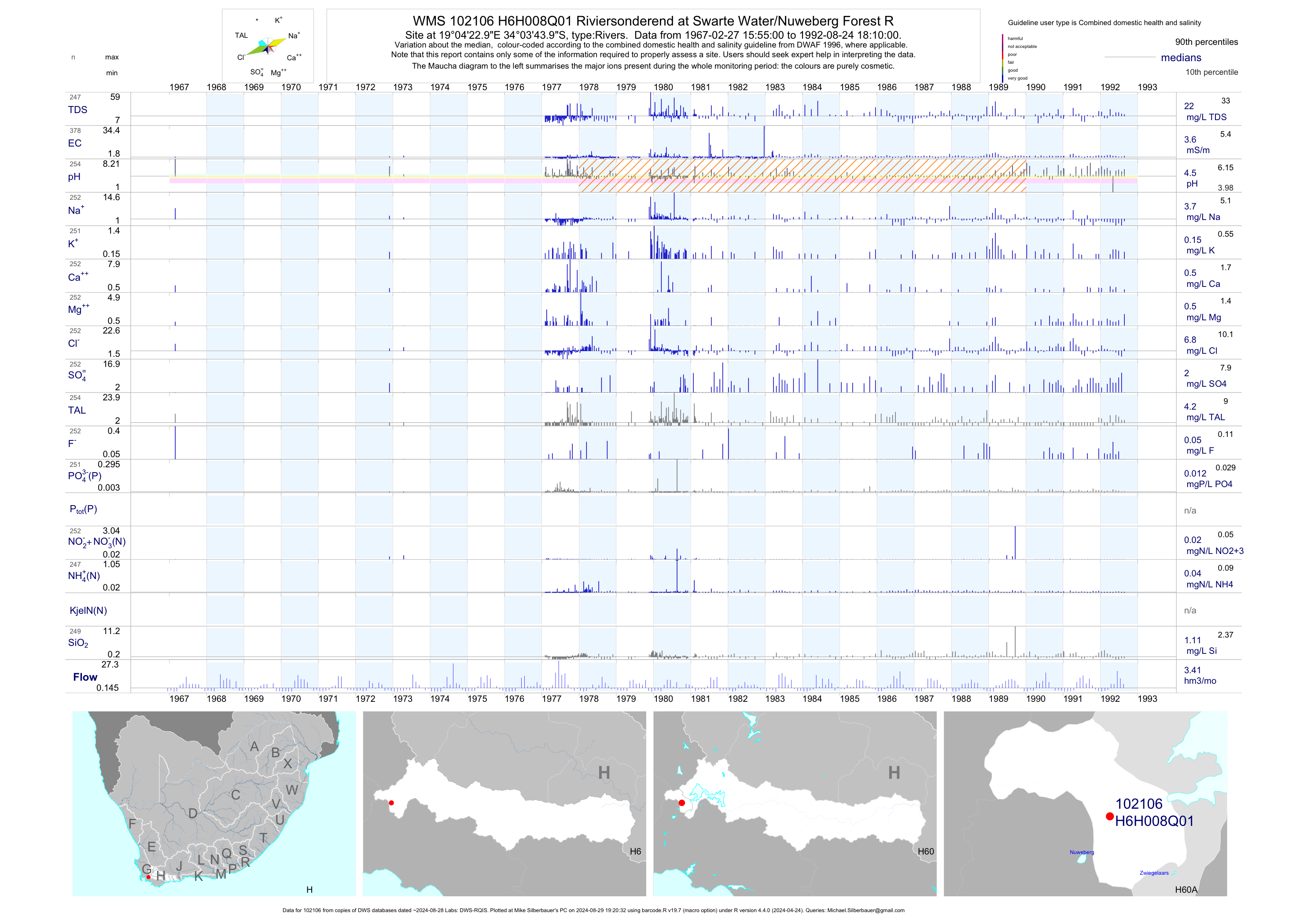
| H60 102106 | plot | data | Riviersonderend at Swarte Water/Nuweberg Forest R | Rivers | 378 | 1967-02-27 | 1992-08-24 | 4 | H6H008 | -34.06222 | 19.07306 |
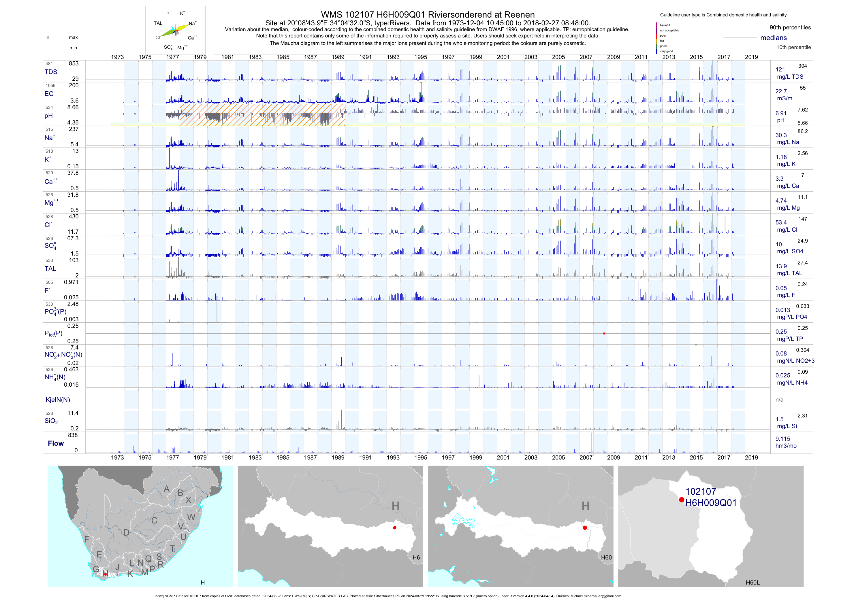
| H60 102107 | plot | data | Riviersonderend at Reenen (ncwq NCMP) | Rivers | 1056 | 1973-12-04 | 2018-02-27 | 23 | H6H009 | -34.07556 | 20.14556 |
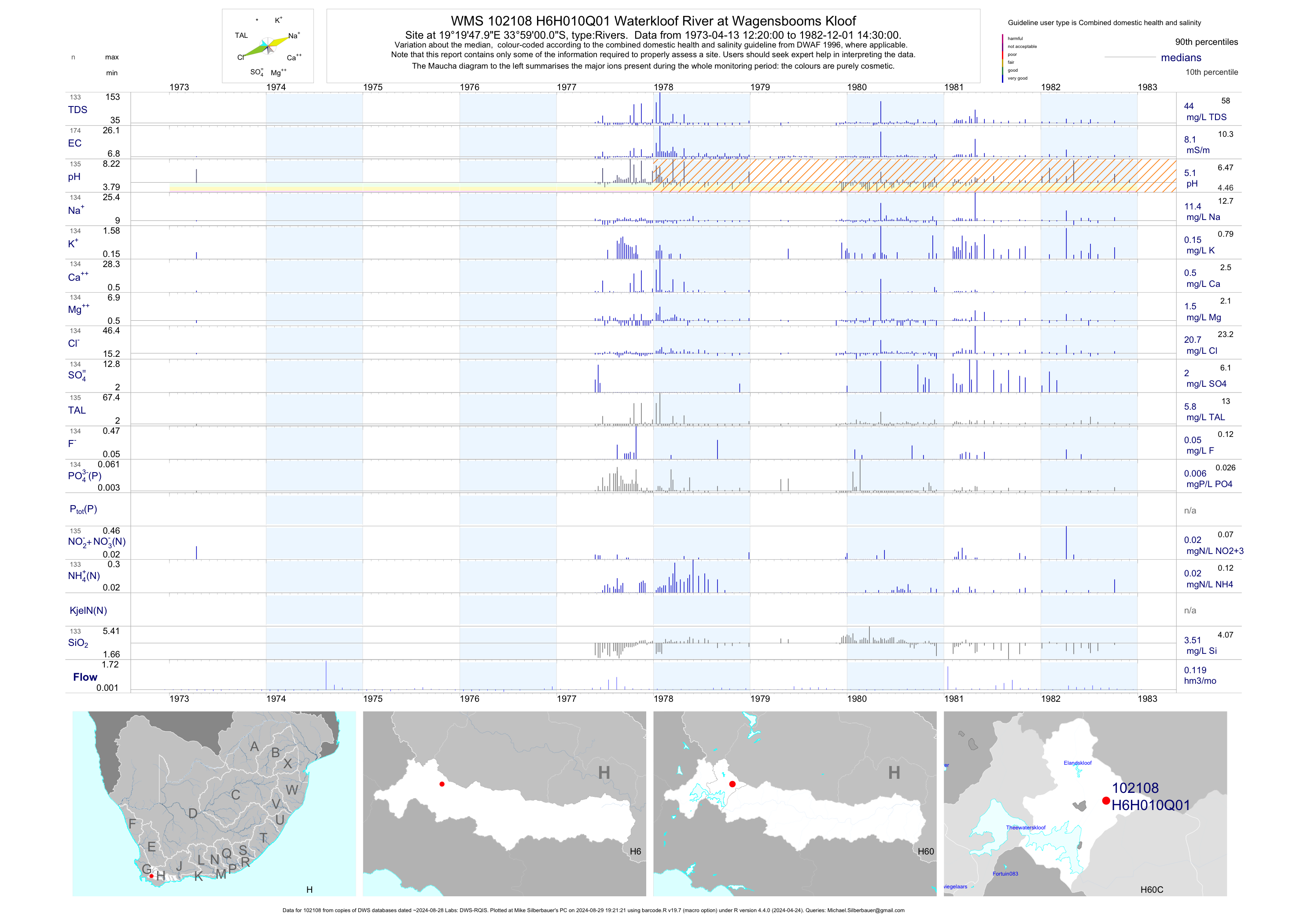
| H60 102108 | plot | data | Waterkloof River at Wagensbooms Kloof | Rivers | 174 | 1973-04-13 | 1982-12-01 | 8 | H6H010 | -33.98333 | 19.33000 |
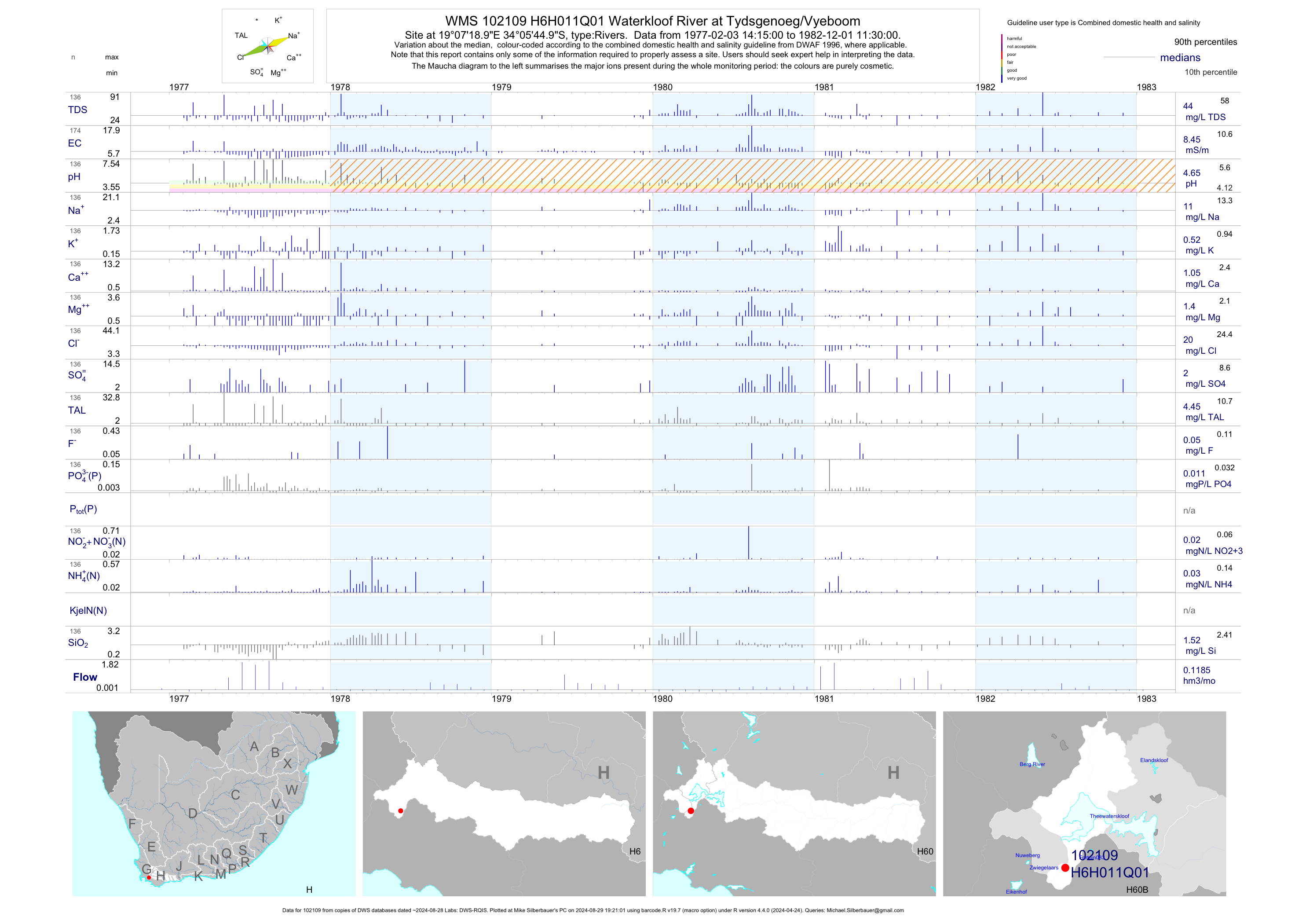
| H60 102109 | plot | data | Waterkloof River at Tydsgenoeg/Vyeboom | Rivers | 174 | 1977-02-03 | 1982-12-01 | 8 | H6H011 | -34.09583 | 19.12194 |
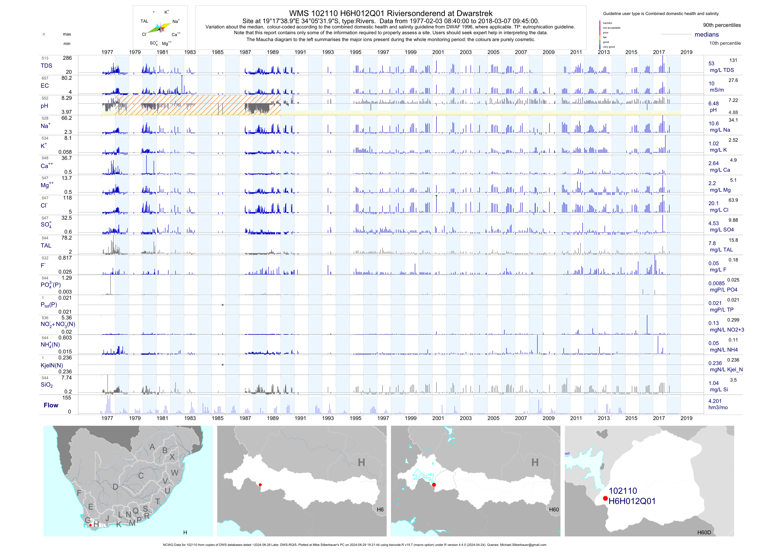
| H60 102110 | plot | data | Riviersonderend at Dwarstrek (NCWQ) | Rivers | 657 | 1977-02-03 | 2018-03-07 | 10 | H6H012 | -34.09222 | 19.29417 |
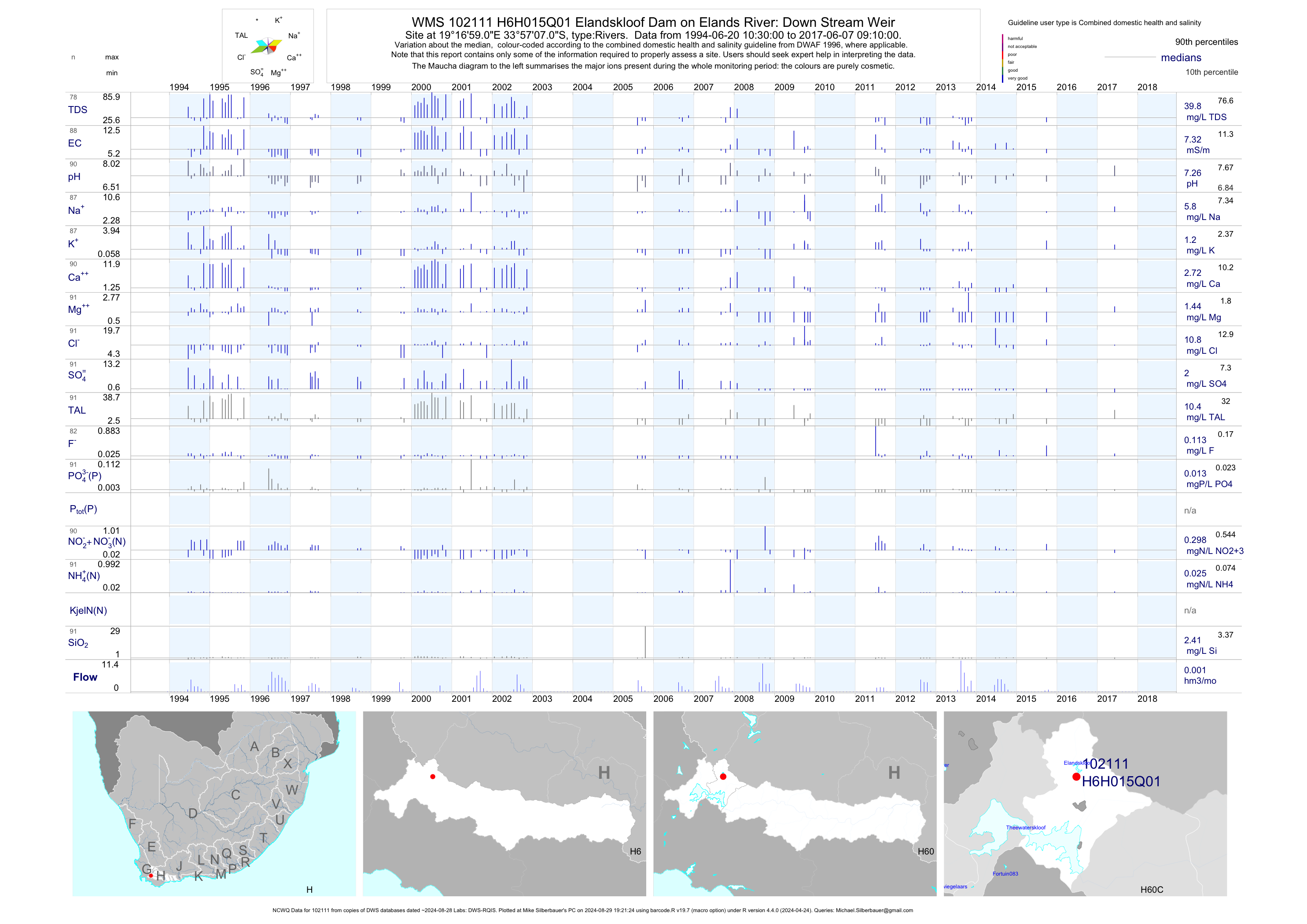
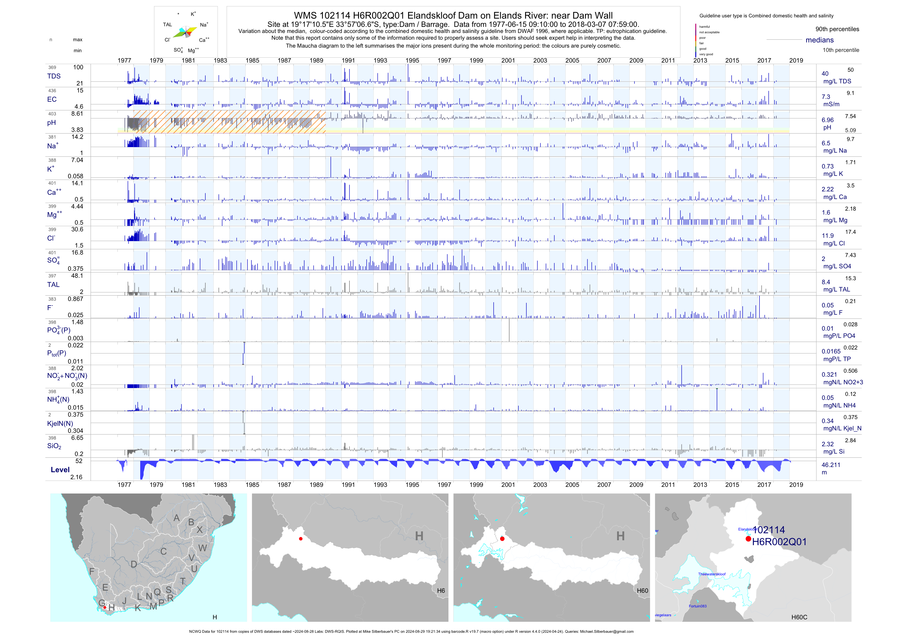
| H60 102111 | plot | data | Elandskloof Dam on Elands River: Down Stream Weir (NCWQ) | Rivers | 91 | 1994-06-20 | 2017-06-07 | 7 | H6H015 | -33.95194 | 19.28306 |
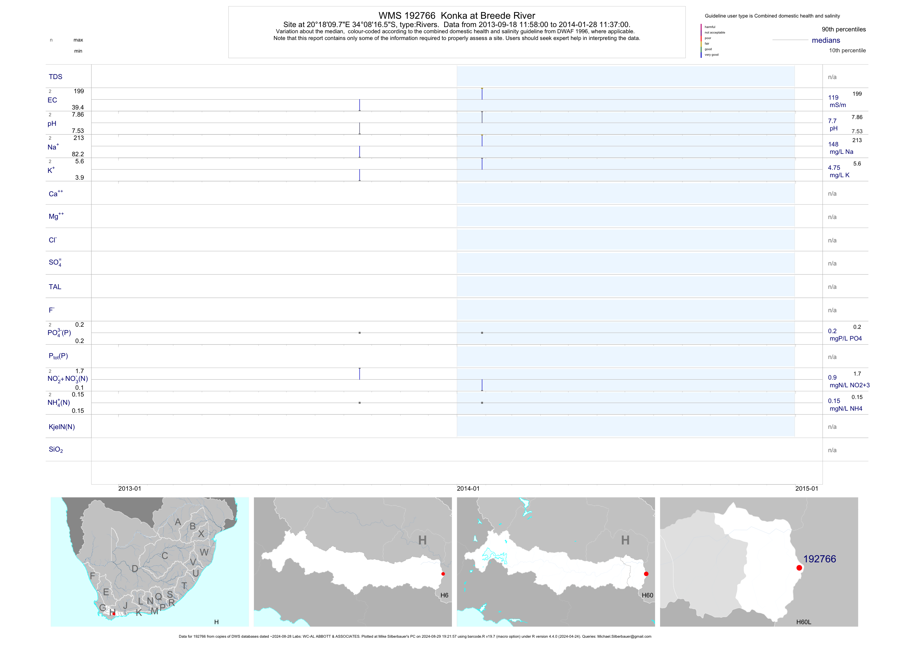
| H60 192766 | plot | data | Konka at Breede River | Rivers | 4 | 2013-09-18 | 2014-01-28 | 119 | 192766 | -34.13792 | 20.30271 |
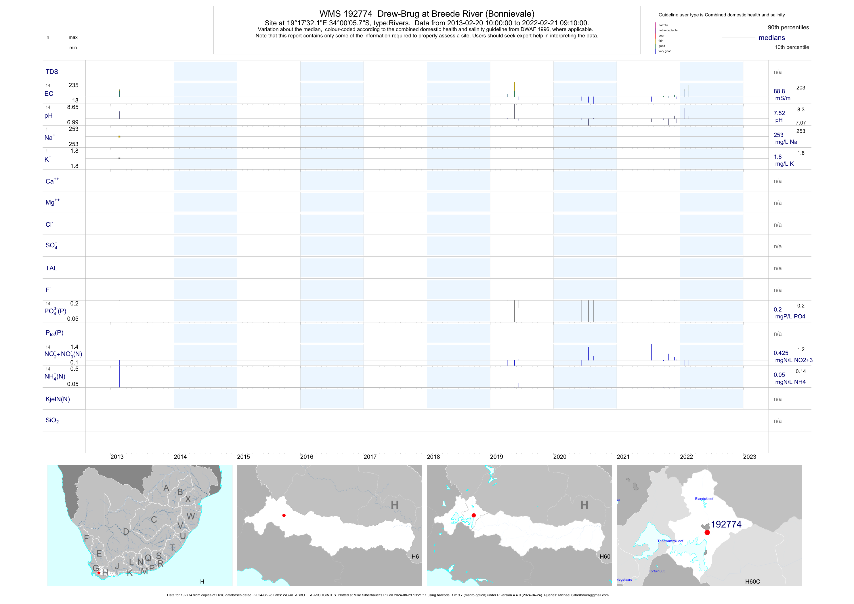
| H60 192774 | plot | data | Drew-Brug at Breede River (Bonnievale) | Rivers | 2 | 2013-02-20 | 2013-02-20 | 158 | 192774 | -34.00159 | 19.29227 |
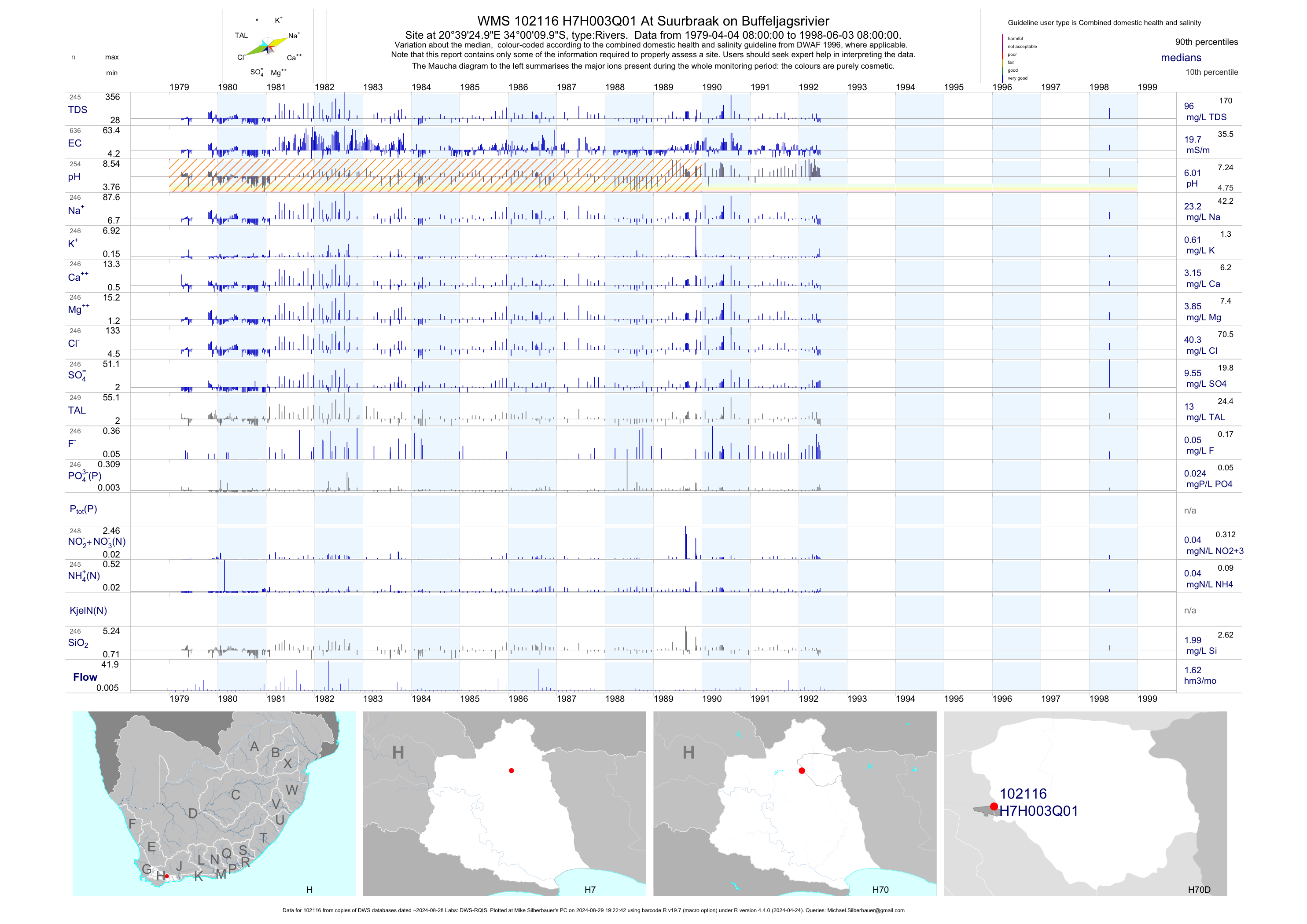
| H70 102116 | plot | data | At Suurbraak on Buffeljagsrivier | Rivers | 636 | 1979-04-04 | 1998-06-03 | 20 | H7H003 | -34.00278 | 20.65694 |
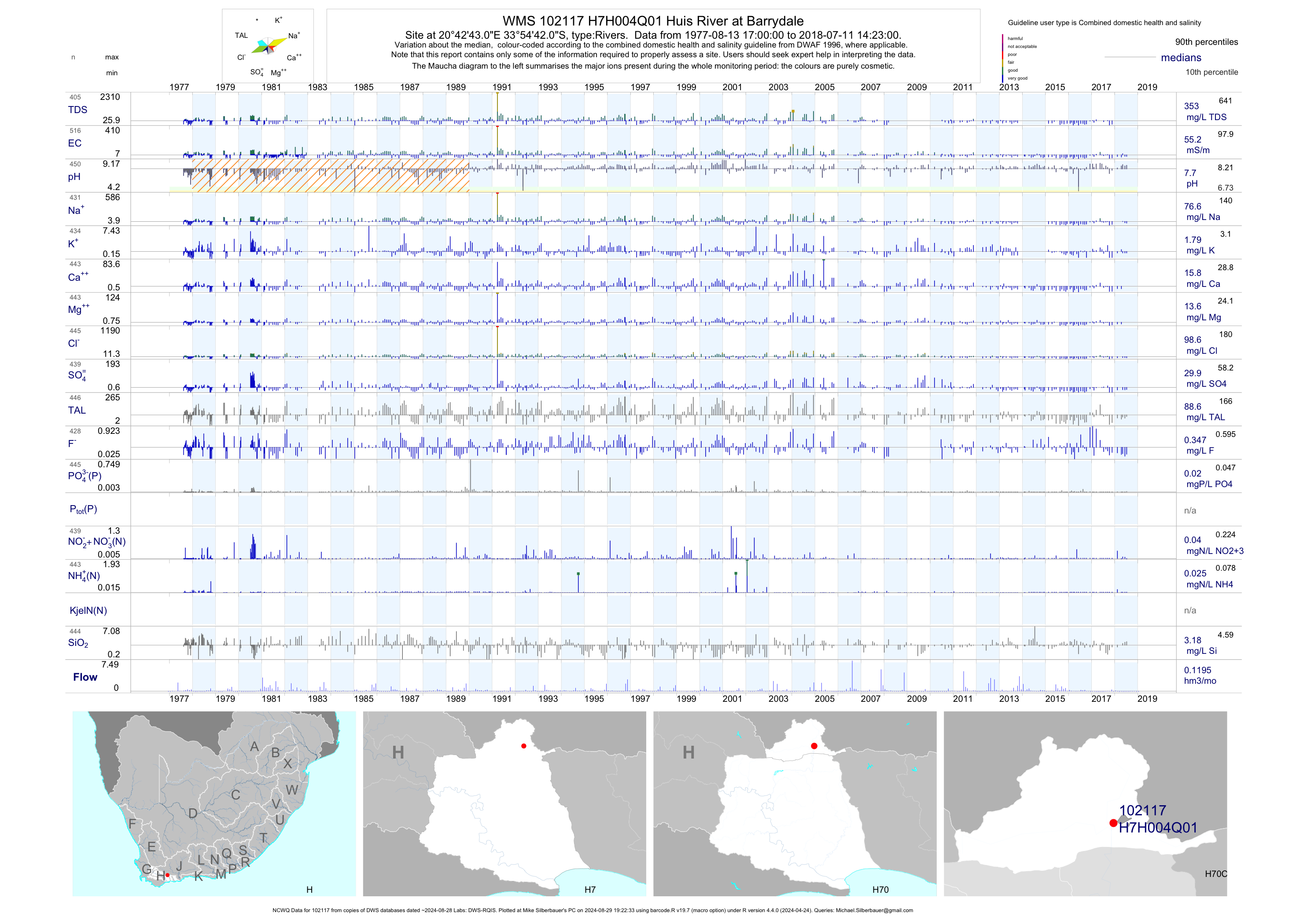
| H70 102117 | plot | data | Huis River at Barrydale (NCWQ) | Rivers | 517 | 1977-08-13 | 2018-07-11 | 55 | H7H004 | -33.91167 | 20.71194 |
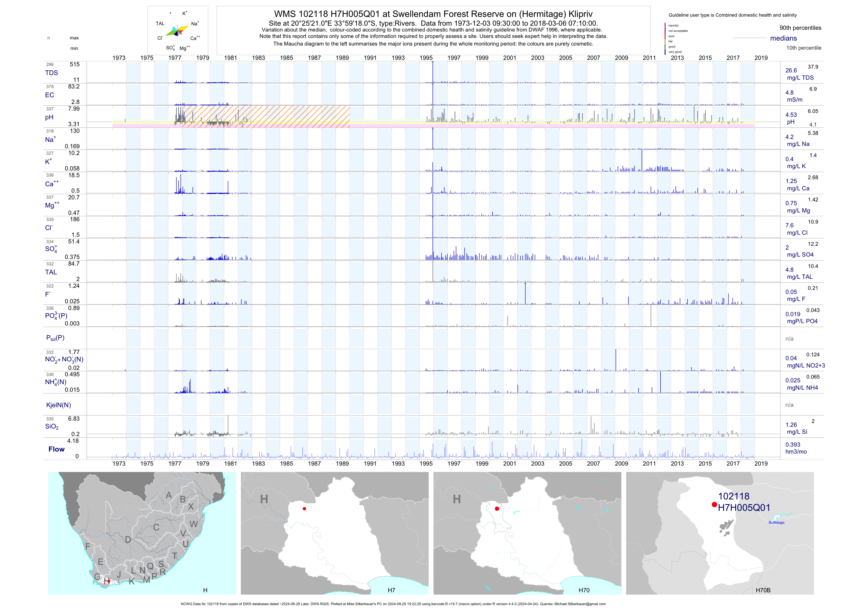
| H70 102118 | plot | data | at Swellendam Forest Reserve on (Hermitage) Klipriv (NCWQ) | Rivers | 381 | 1973-12-03 | 2018-03-06 | 5 | H7H005 | -33.98833 | 20.42250 |
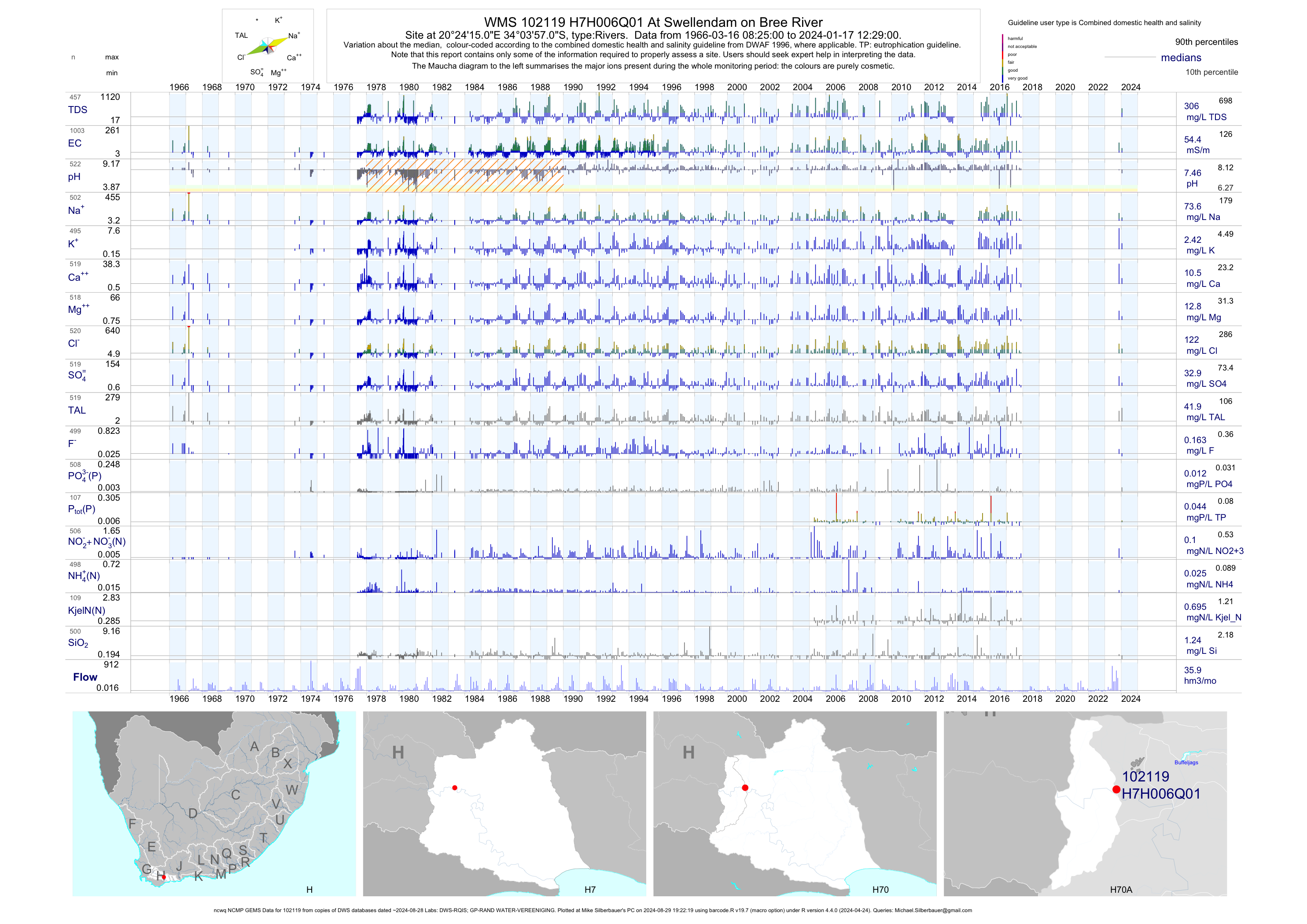
| H70 102119 | plot | data | At Swellendam on Bree River (ncwq NCMP GEMS) | Rivers | 1001 | 1966-03-16 | 2017-11-21 | 54 | H7H006 | -34.06583 | 20.40417 |
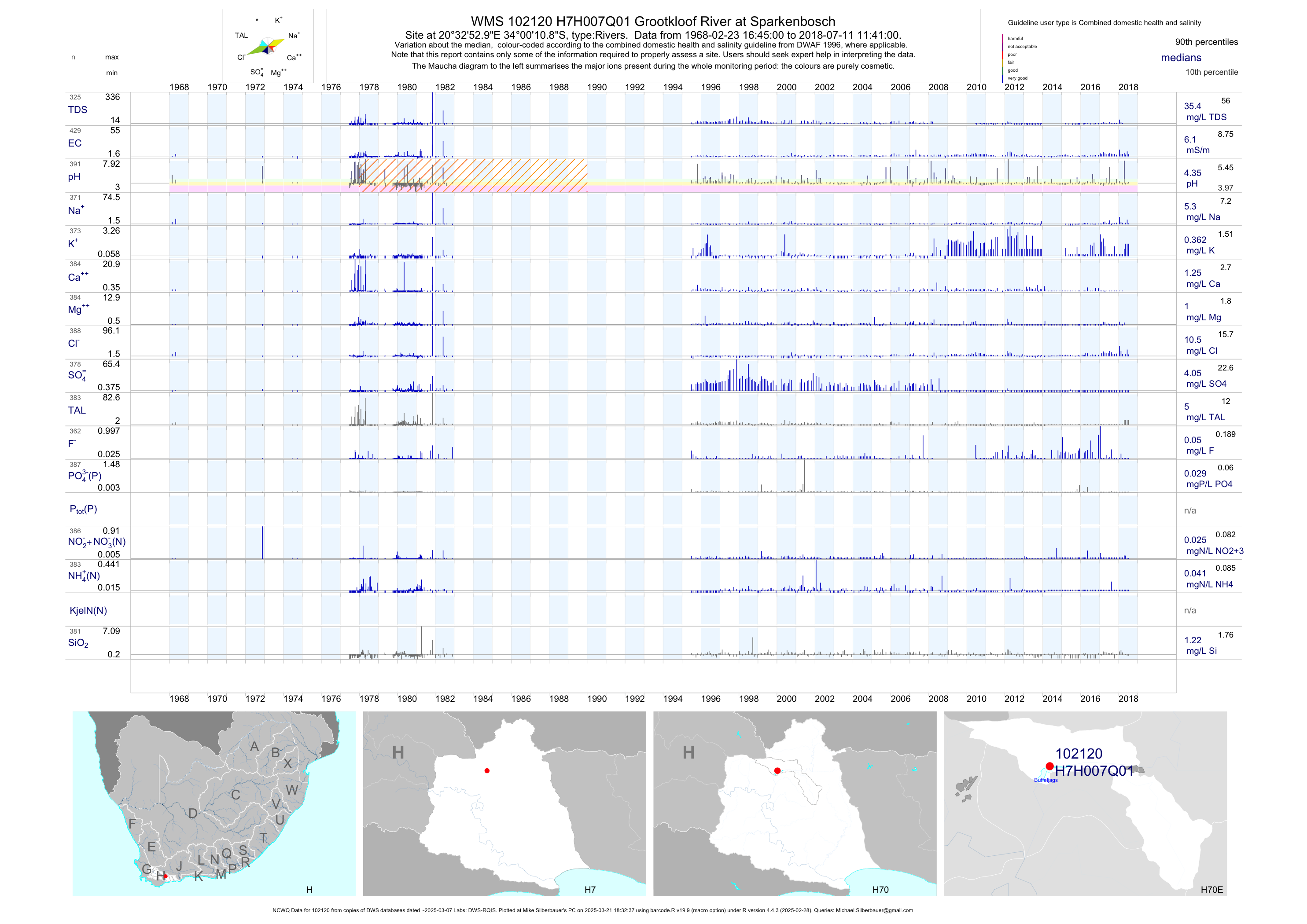
| H70 102120 | plot | data | Grootkloof River at Sparkenbosch (NCWQ) | Rivers | 433 | 1968-02-23 | 2018-07-11 | 6 | H7H007 | -34.01972 | 20.54833 |
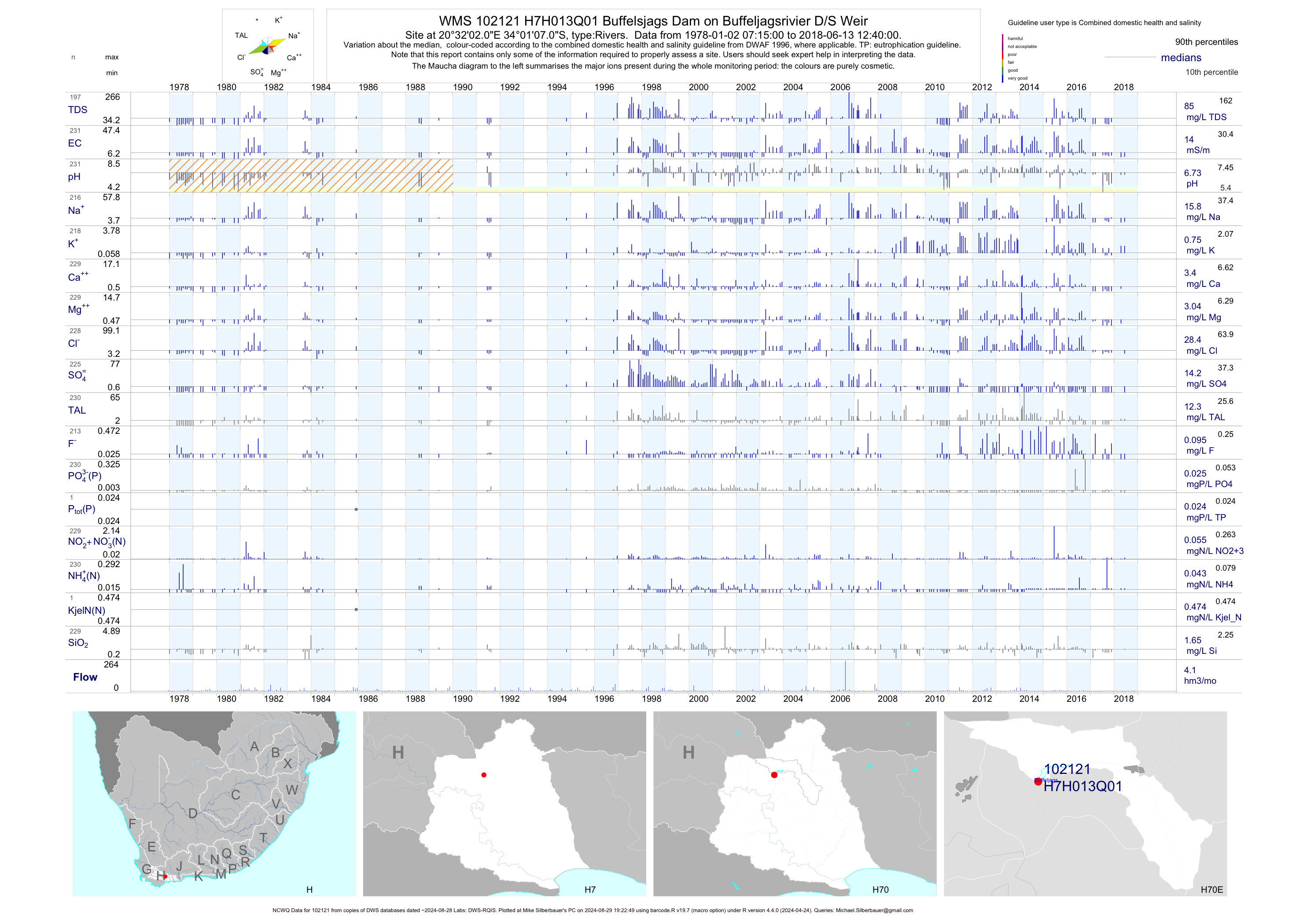
| H70 102121 | plot | data | Buffelsjags Dam on Buffeljagsrivier D/S Weir (NCWQ) | Rivers | 231 | 1978-01-02 | 2018-06-13 | 14 | H7H013 | -34.01861 | 20.53389 |
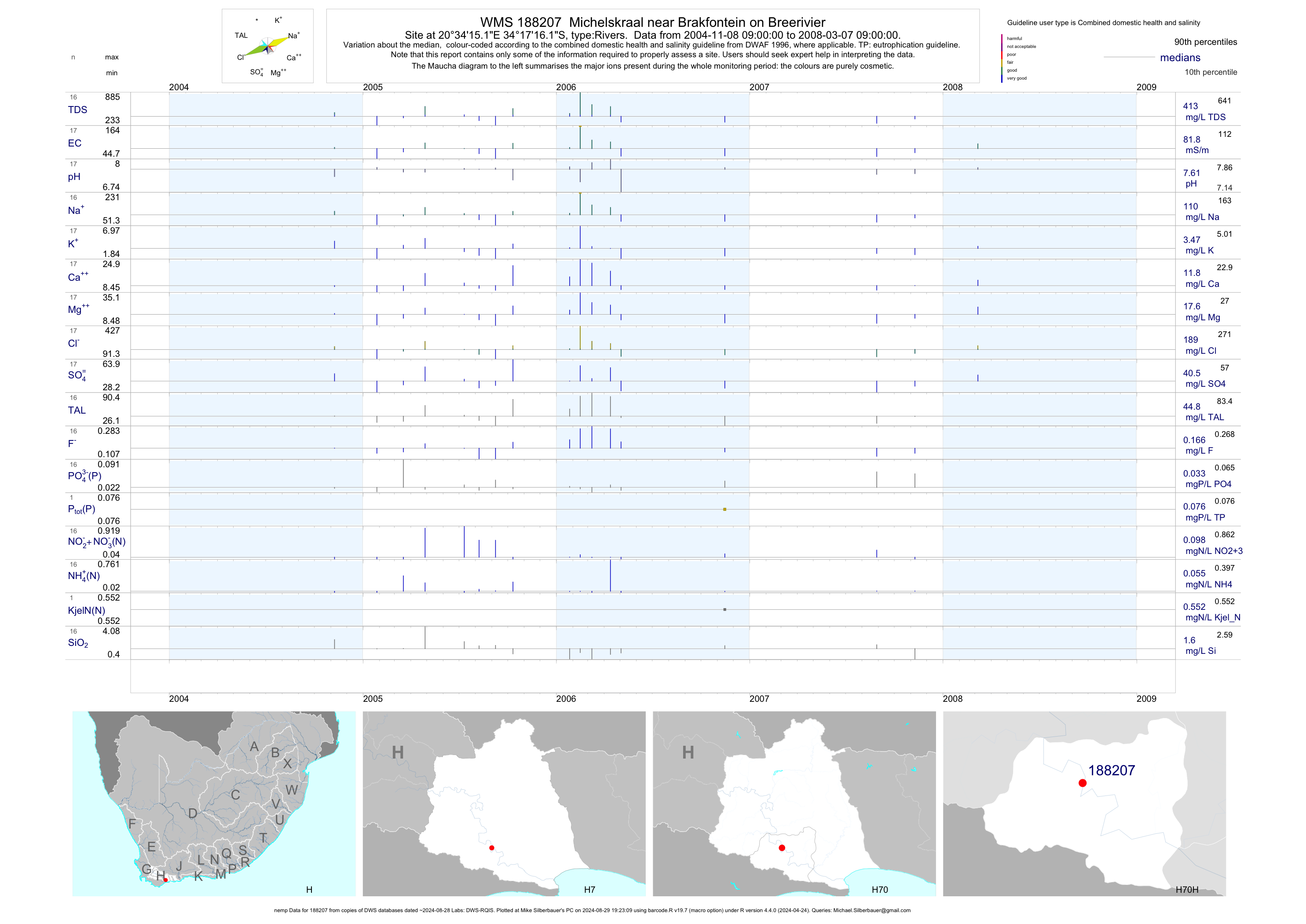
| H70 188207 | plot | data | Michelskraal near Brakfontein on Breerivier (nemp) | Rivers | 17 | 2004-11-08 | 2008-03-07 | 82 | 188207 | -34.28781 | 20.57089 |
| H70 192765 | plot | data | Buffeljaags at Breede River | Rivers | 5 | 2013-09-18 | 2016-09-20 | 196 | 192765 | -34.08057 | 20.30533 |
| H70 192769 | n/a | n/a | Malgas at Breede River | Rivers | 2 | 2013-09-18 | 2014-01-28 | n/a | 192769 | -34.17876 | 20.34217 |
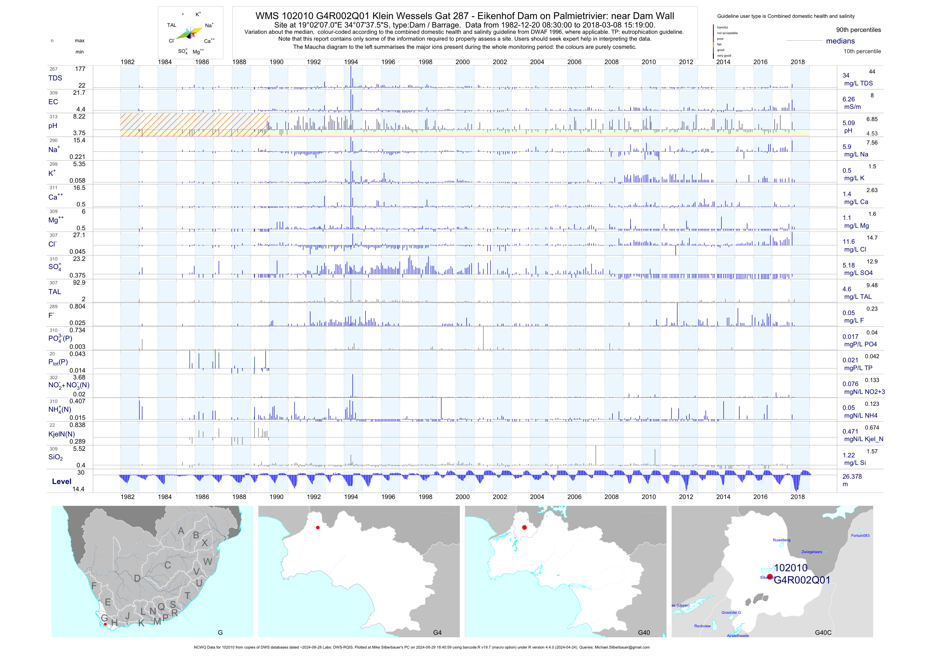
| G40 102010 | plot | data | Klein Wessels Gat 287 - Eikenhof Dam on Palmietrivier: near Dam Wall (NCWQ) Q01 | Dam / Barrage | 493 | 1982-12-20 | 2018-03-08 | 6 | G4R002 | -34.12710 | 19.03530 |
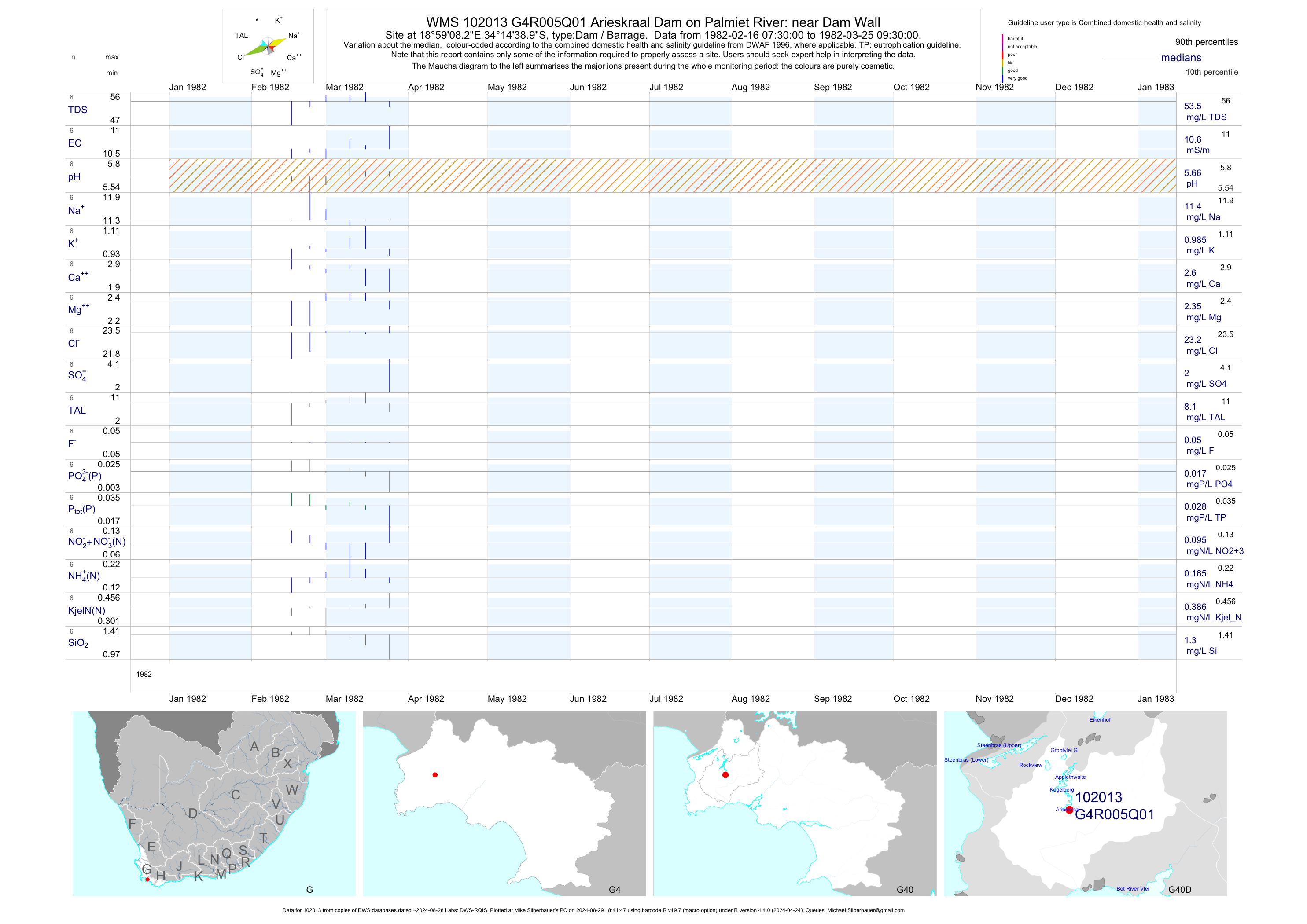
| G40 102013 | plot | data | Arieskraal Dam on Palmiet River: near Dam Wall Q01 | Dam / Barrage | 6 | 1982-02-16 | 1982-03-25 | 11 | G4R005 | -34.24414 | 18.98562 |
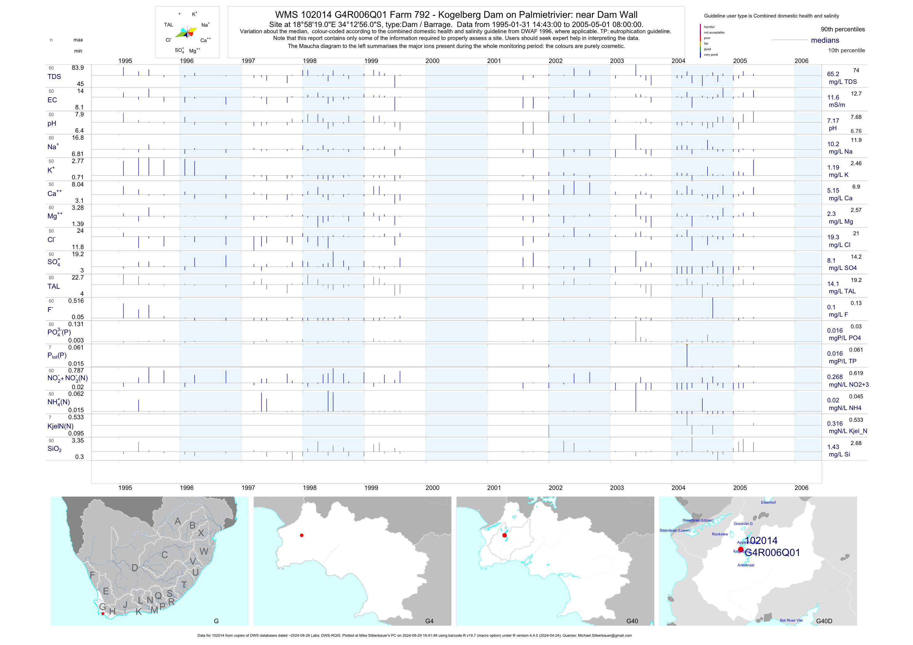
| G40 102014 | plot | data | Farm 792 - Kogelberg Dam on Palmietrivier: near Dam Wall Q01 | Dam / Barrage | 50 | 1995-01-31 | 2005-05-01 | 12 | G4R006 | -34.21556 | 18.97194 |
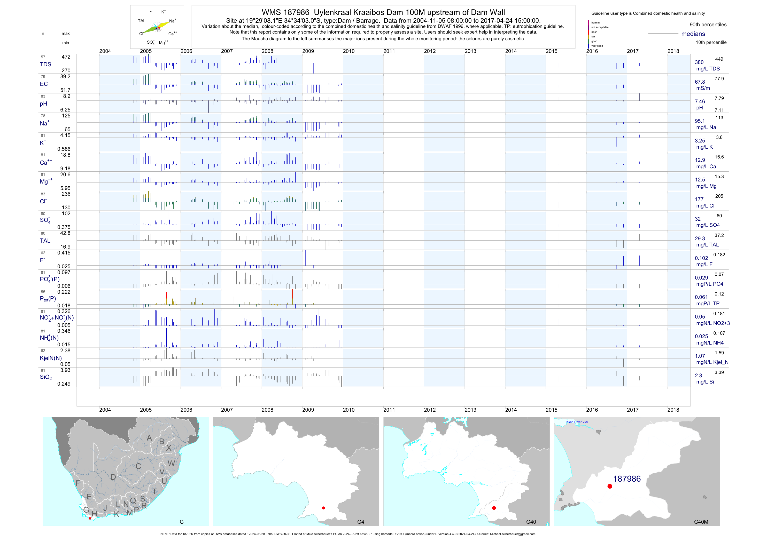
| G40 187986 | plot | data | Uylenkraal Kraaibos Dam 100M upstream of Dam Wall (NEMP) | Dam / Barrage | 284 | 2004-11-05 | 2017-04-24 | 68 | 187986 | -34.56750 | 19.48560 |
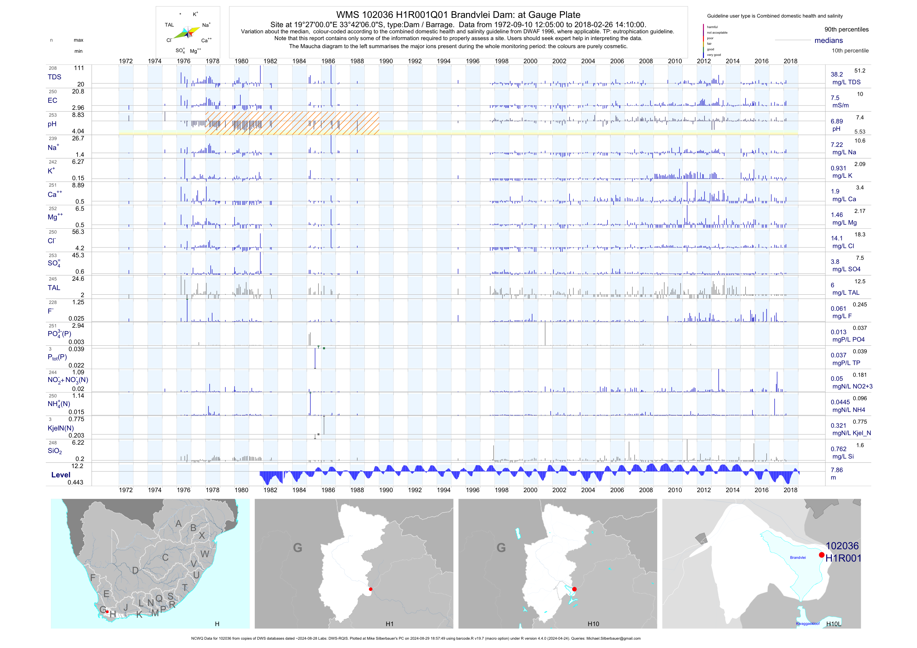
| H10 102036 | plot | data | Brandvlei Dam: at Gauge Plate (NCWQ) Q01 | Dam / Barrage | 522 | 1972-09-10 | 2018-02-26 | 8 | H1R001 | -33.70167 | 19.45000 |
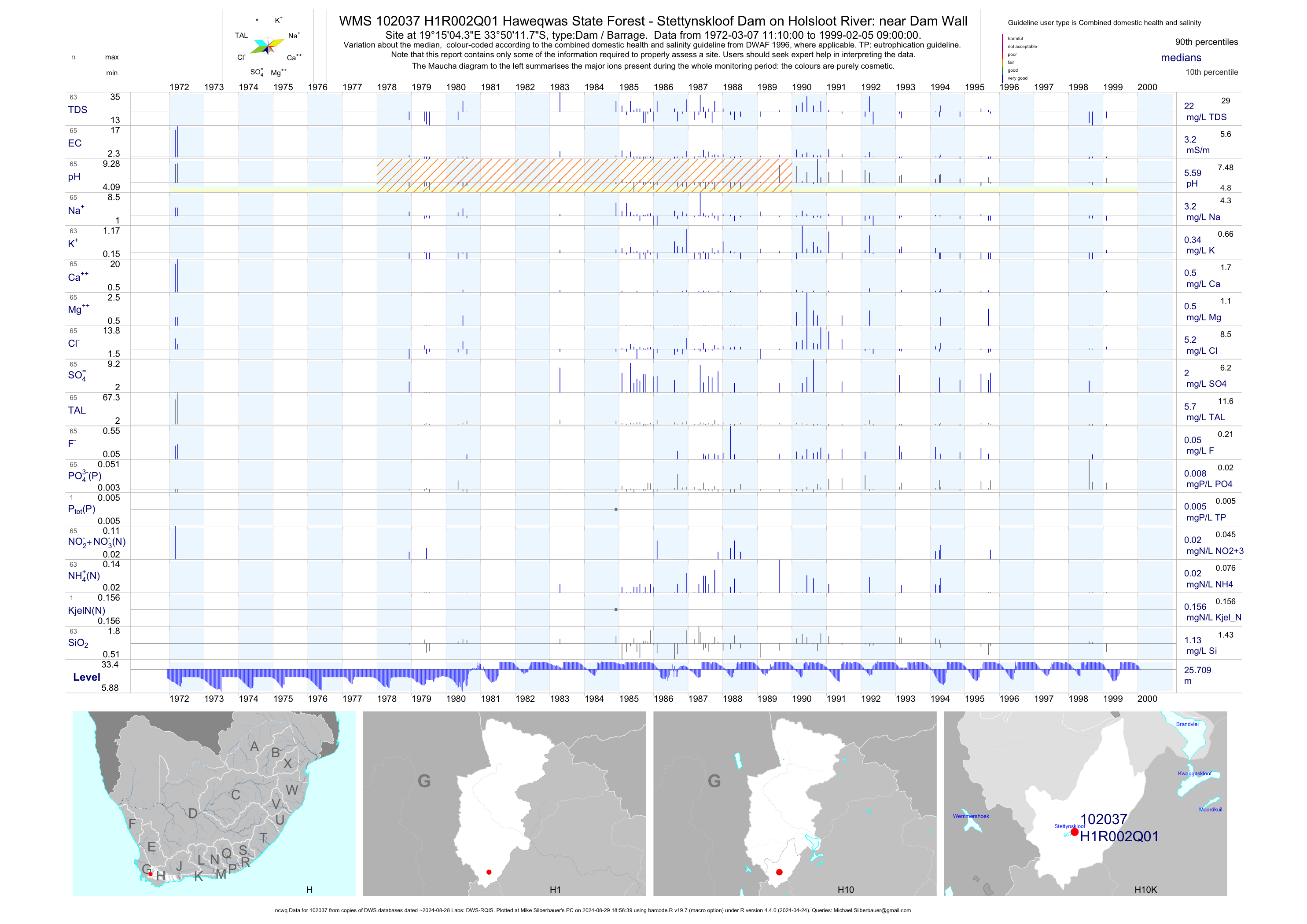
| H10 102037 | plot | data | Haweqwas State Forest - Stettynskloof Dam on Holsloot River: near Dam Wall (ncwq) Q01 | Dam / Barrage | 65 | 1972-03-07 | 1999-02-05 | 3 | H1R002 | -33.83660 | 19.25120 |
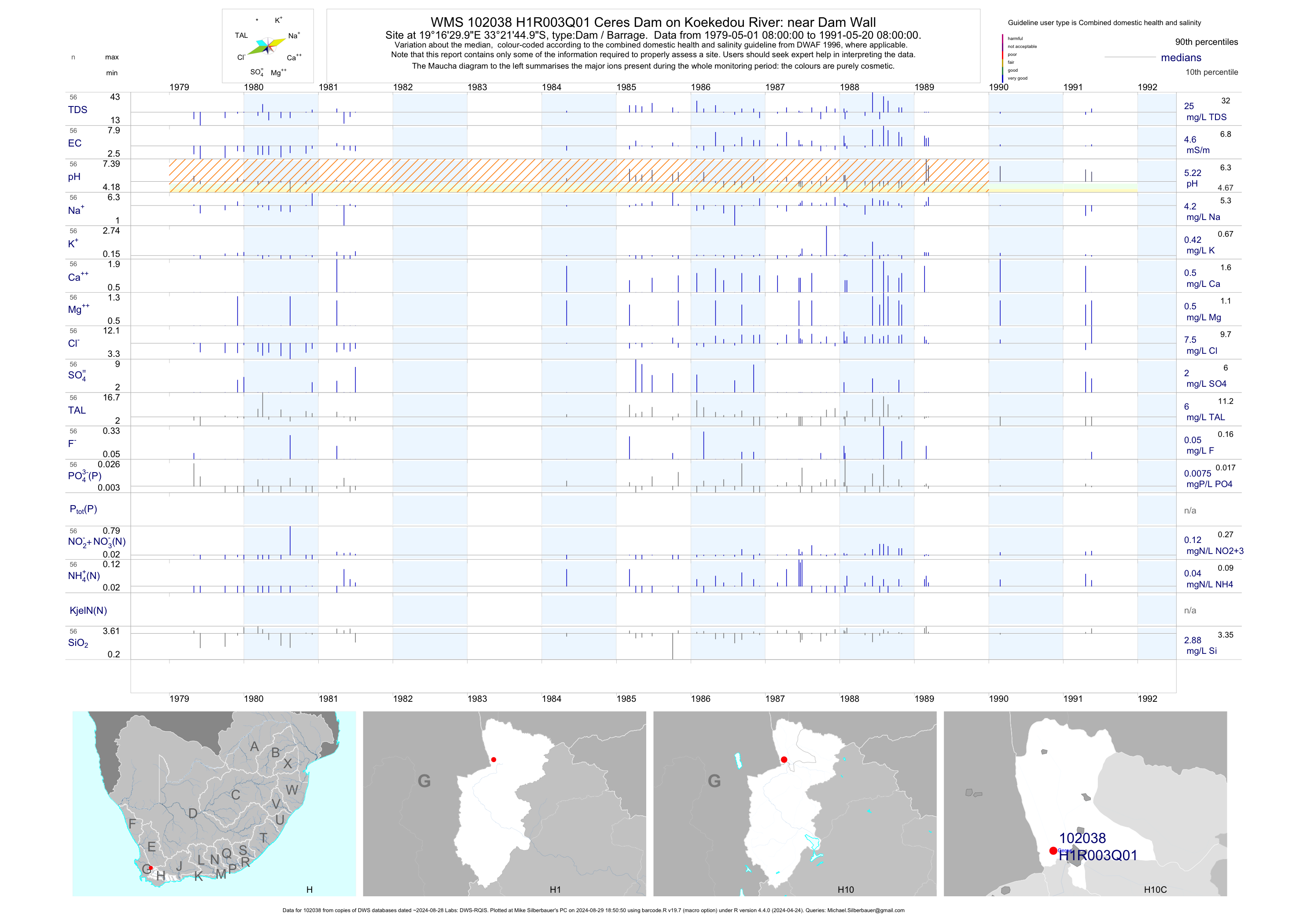
| H10 102038 | plot | data | Ceres Dam on Koekedou River: near Dam Wall Q01 | Dam / Barrage | 56 | 1979-05-01 | 1991-05-20 | 5 | H1R003 | -33.36250 | 19.27500 |
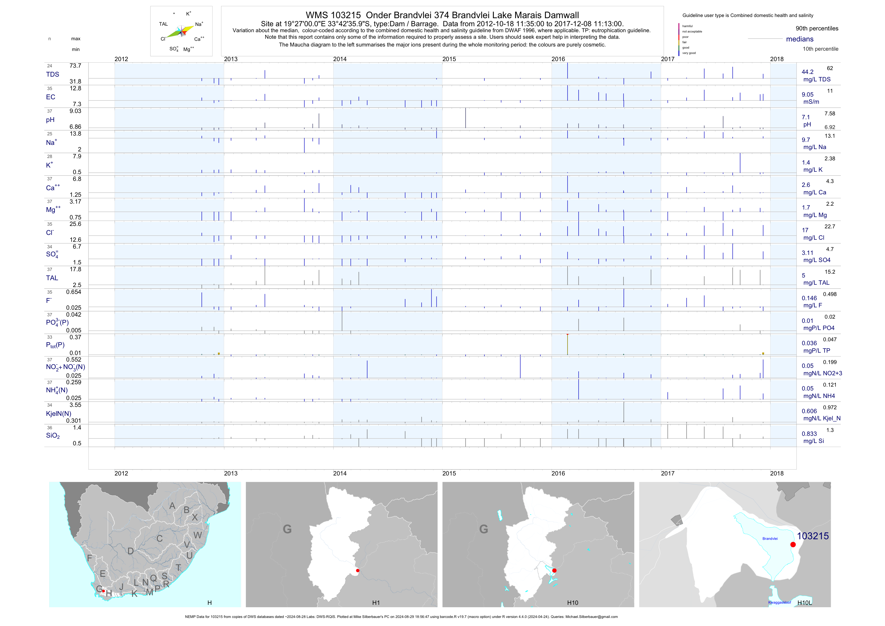
| H10 103215 | plot | data | Onder Brandvlei 374 Brandvlei Lake Marais Damwall (NEMP) | Dam / Barrage | 201 | 2012-10-15 | 2019-03-08 | 9 | 103215 | -33.71000 | 19.45000 |
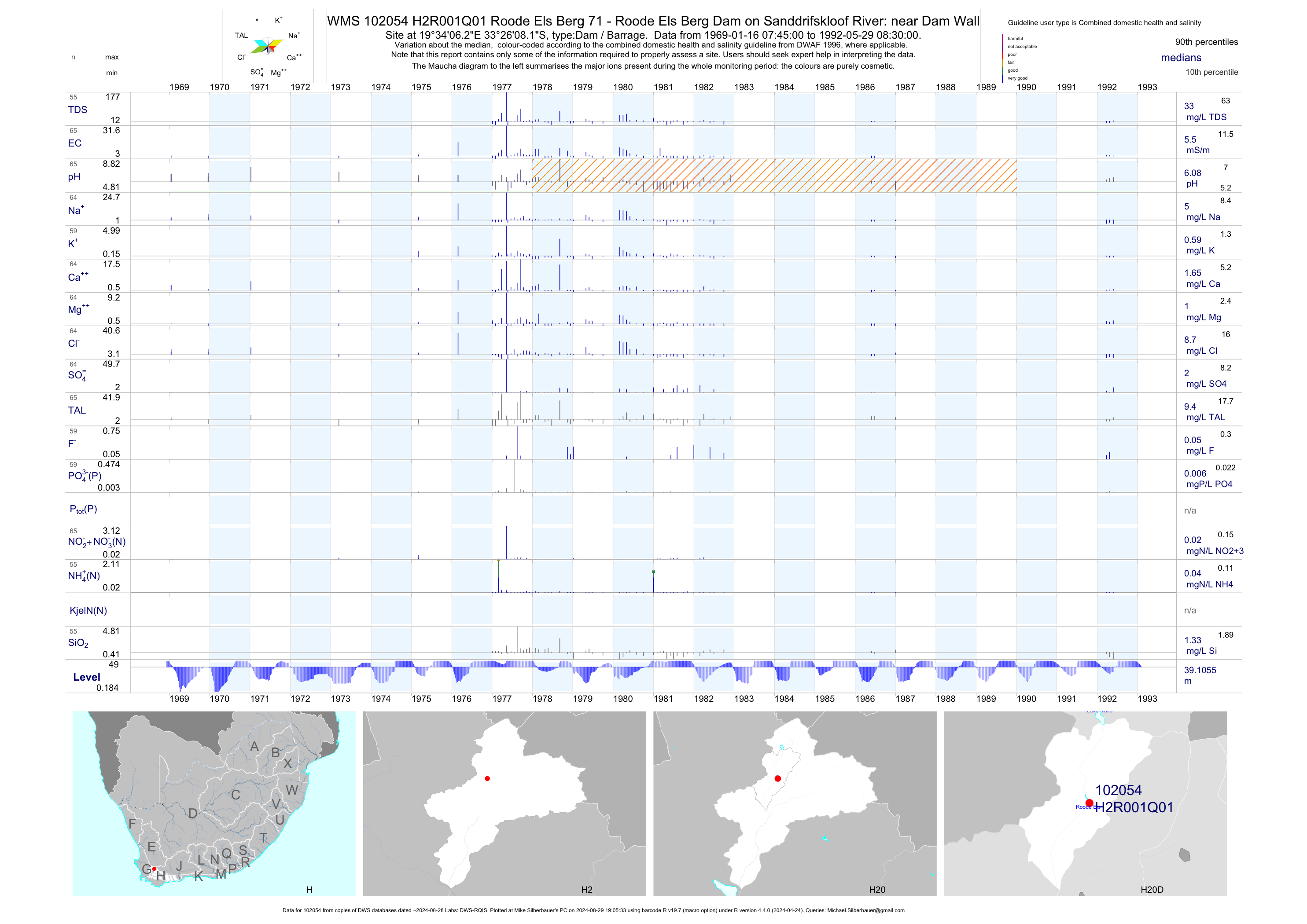
| H20 102054 | plot | data | Roode Els Berg 71 - Roode Els Berg Dam on Sanddrifskloof River: near Dam Wall Q01 | Dam / Barrage | 66 | 1969-01-16 | 1992-05-29 | 6 | H2R001 | -33.43560 | 19.56840 |
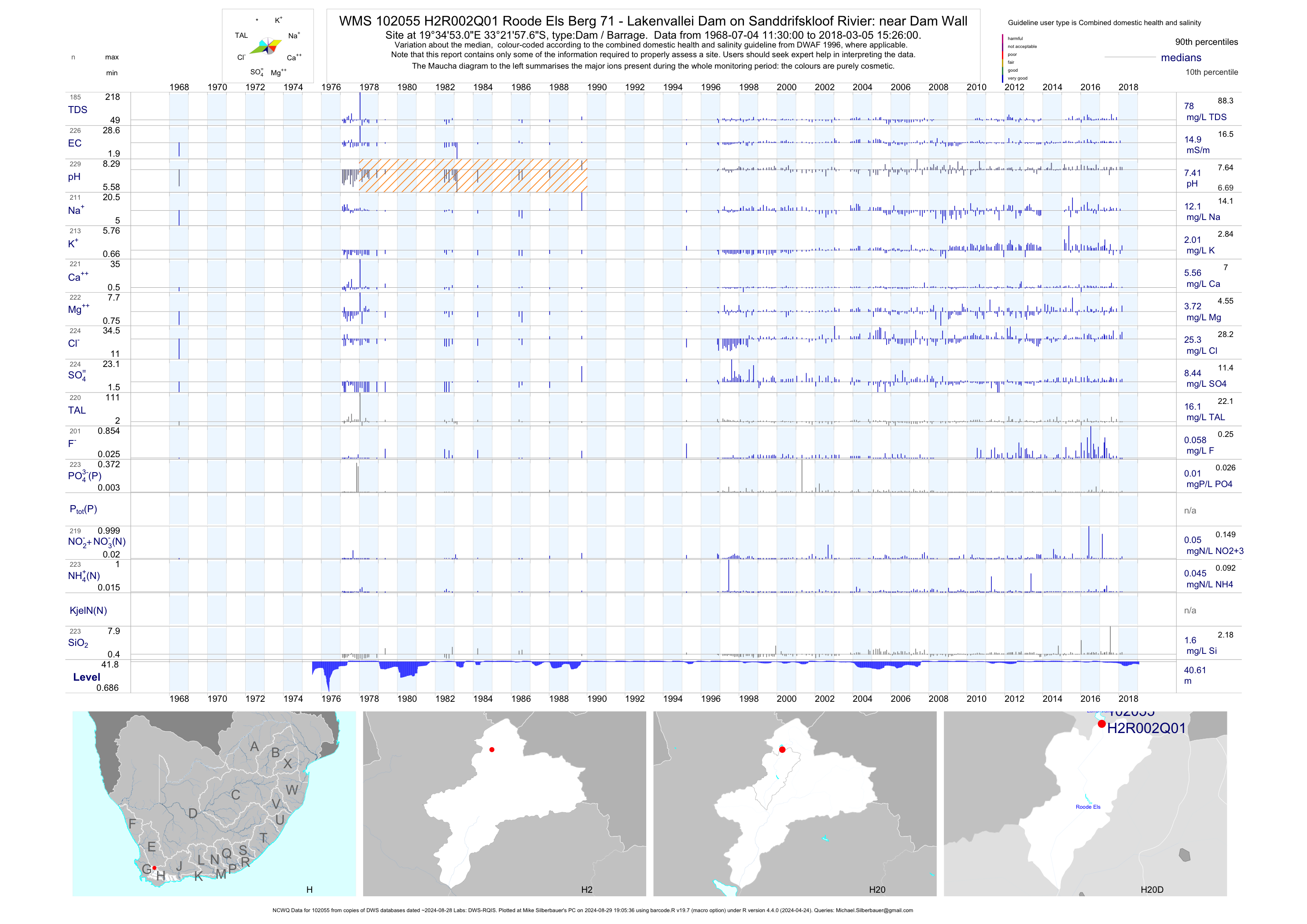
| H20 102055 | plot | data | Roode Els Berg 71 - Lakenvallei Dam on Sanddrifskloof Rivier: near Dam Wall (NCWQ) Q01 | Dam / Barrage | 229 | 1968-07-04 | 2018-03-05 | 15 | H2R002 | -33.36600 | 19.58140 |
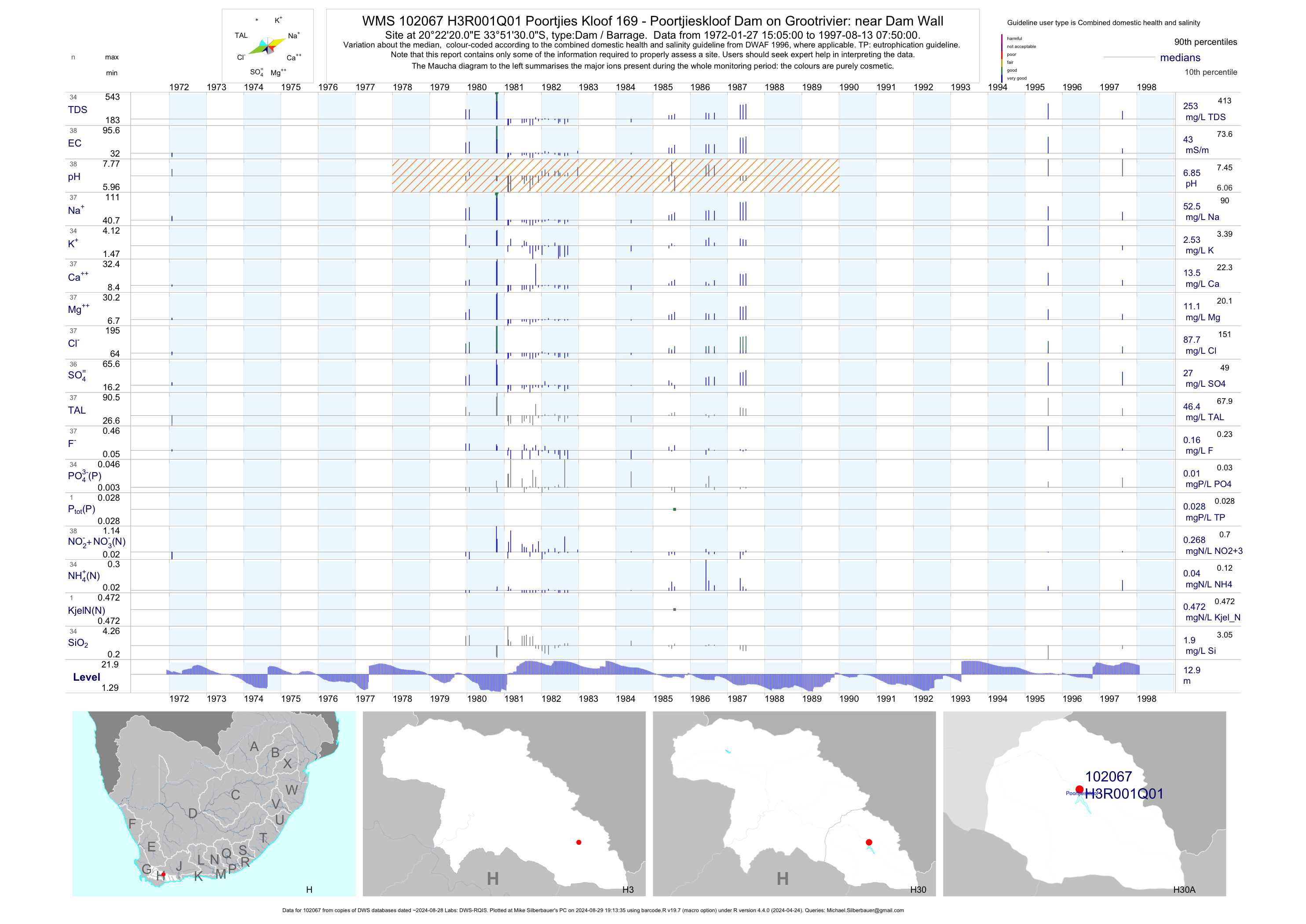
| H30 102067 | plot | data | Poortjies Kloof 169 - Poortjieskloof Dam on Grootrivier: near Dam Wall Q01 | Dam / Barrage | 38 | 1972-01-27 | 1997-08-13 | 43 | H3R001 | -33.85833 | 20.37222 |
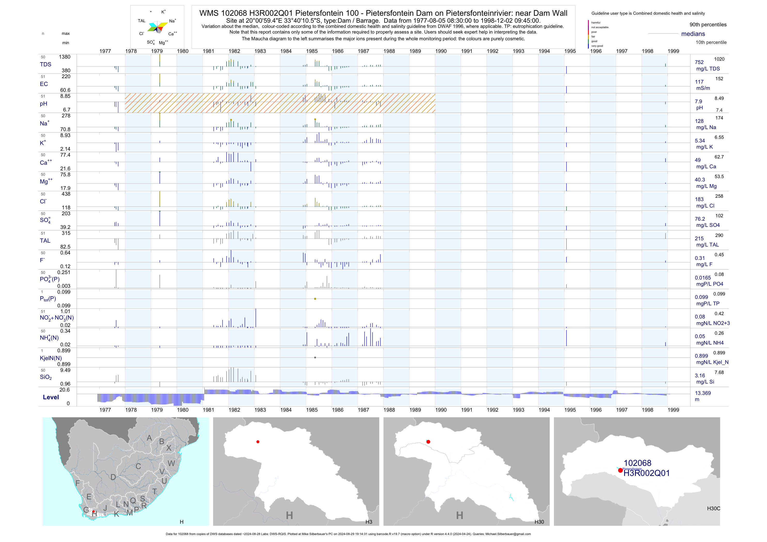
| H30 102068 | plot | data | Pietersfontein 100 - Pietersfontein Dam on Pietersfonteinrivier: near Dam Wall Q01 | Dam / Barrage | 51 | 1977-08-05 | 1998-12-02 | 117 | H3R002 | -33.66960 | 20.01650 |
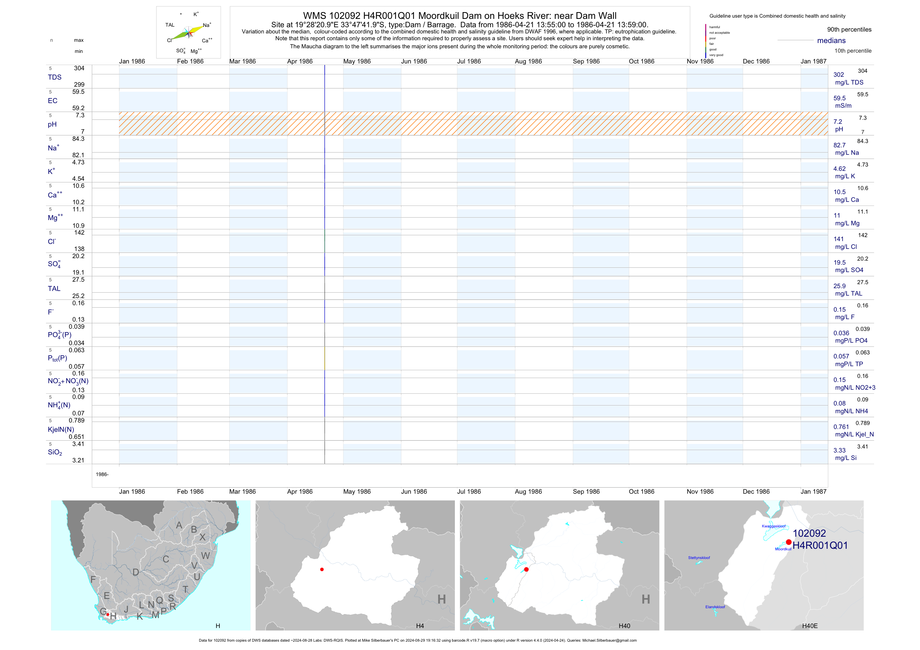
| H40 102092 | plot | data | Moordkuil Dam on Hoeks River: near Dam Wall Q01 | Dam / Barrage | 5 | 1986-04-21 | 1986-04-21 | 60 | H4R001 | -33.79500 | 19.47250 |
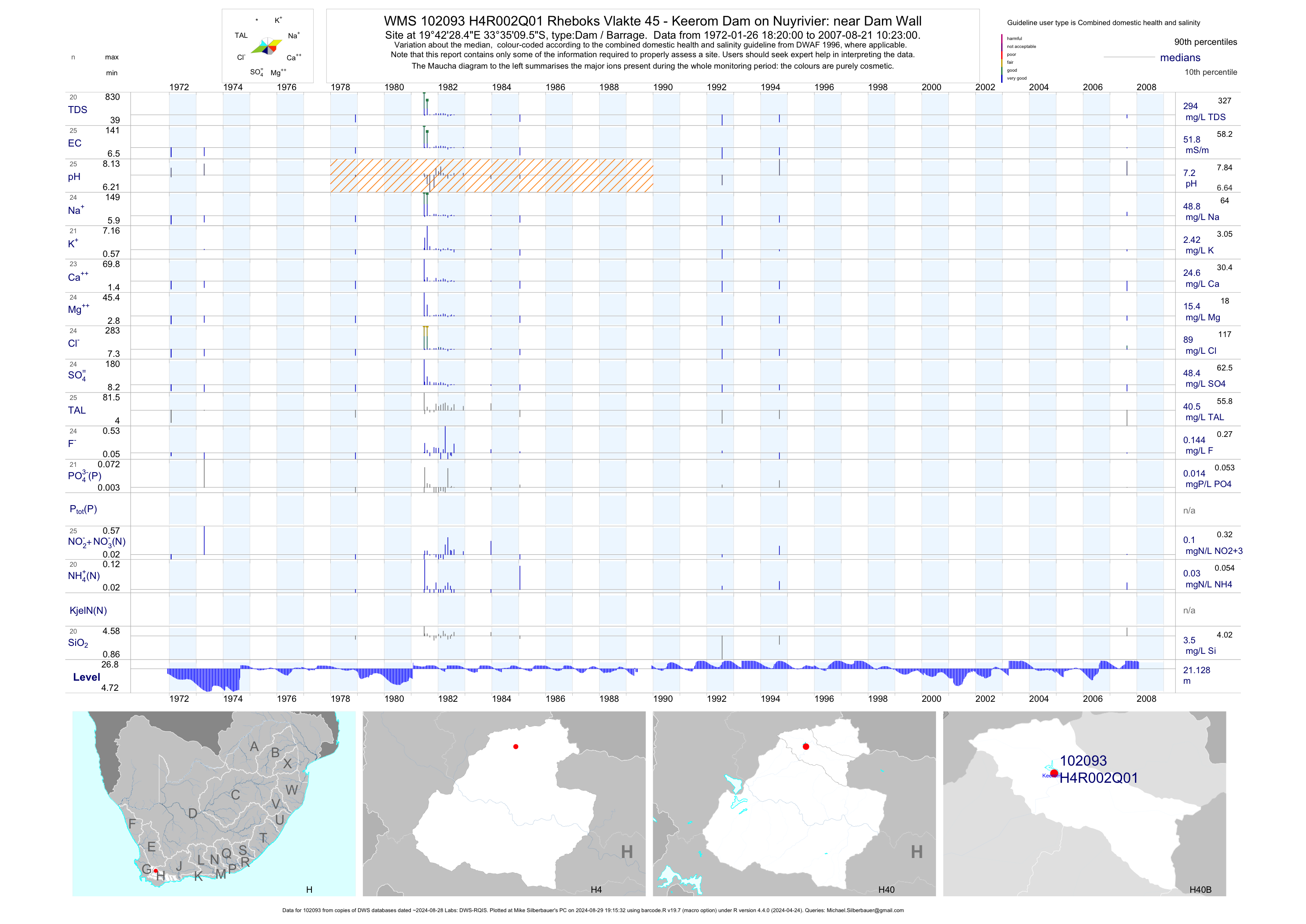
| H40 102093 | plot | data | Rheboks Vlakte 45 - Keerom Dam on Nuyrivier: near Dam Wall Q01 | Dam / Barrage | 25 | 1972-01-26 | 2007-08-21 | 52 | H4R002 | -33.58600 | 19.70790 |
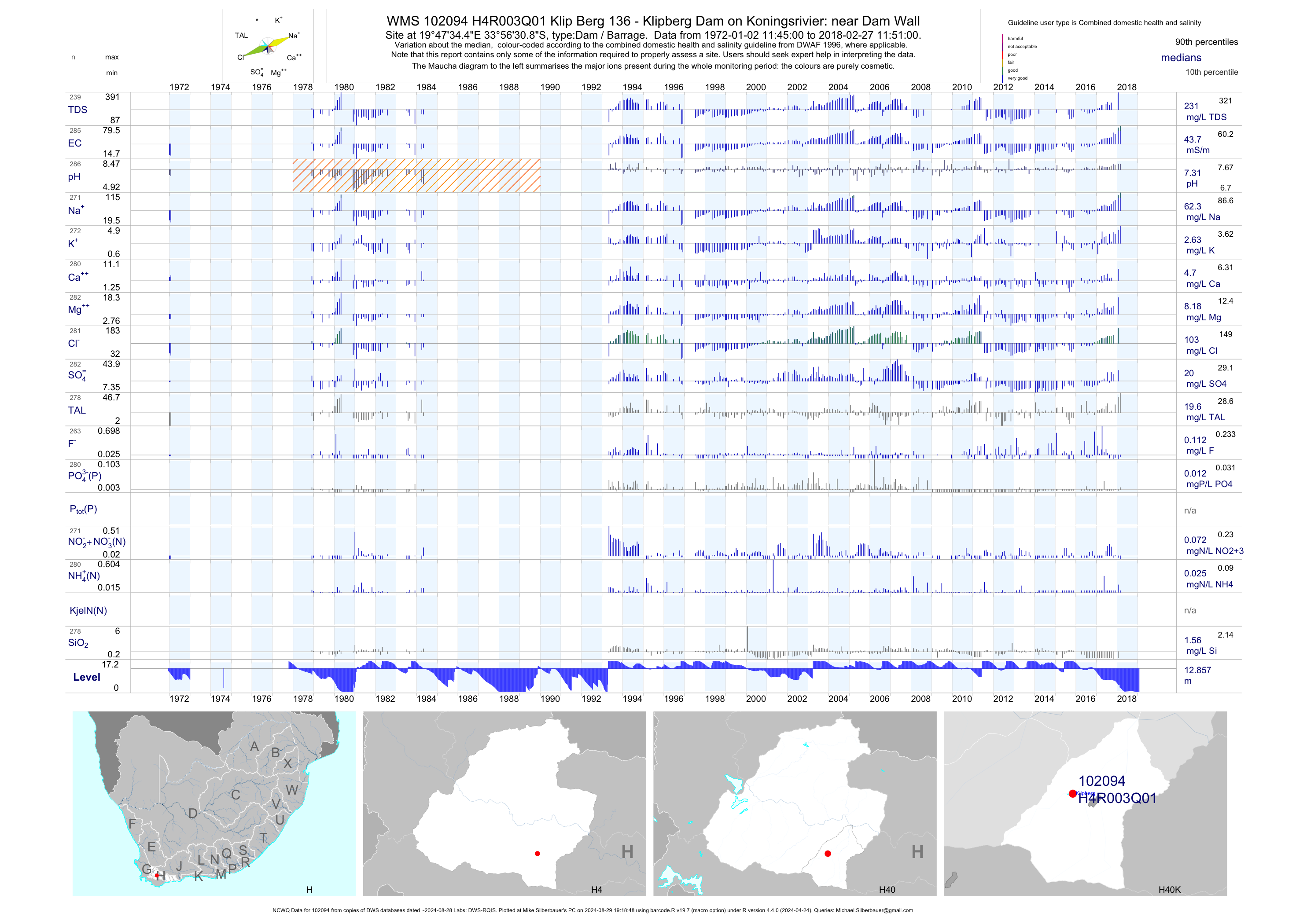
| H40 102094 | plot | data | Klip Berg 136 - Klipberg Dam on Koningsrivier: near Dam Wall (NCWQ) Q01 | Dam / Barrage | 286 | 1972-01-02 | 2018-02-27 | 44 | H4R003 | -33.94190 | 19.79290 |
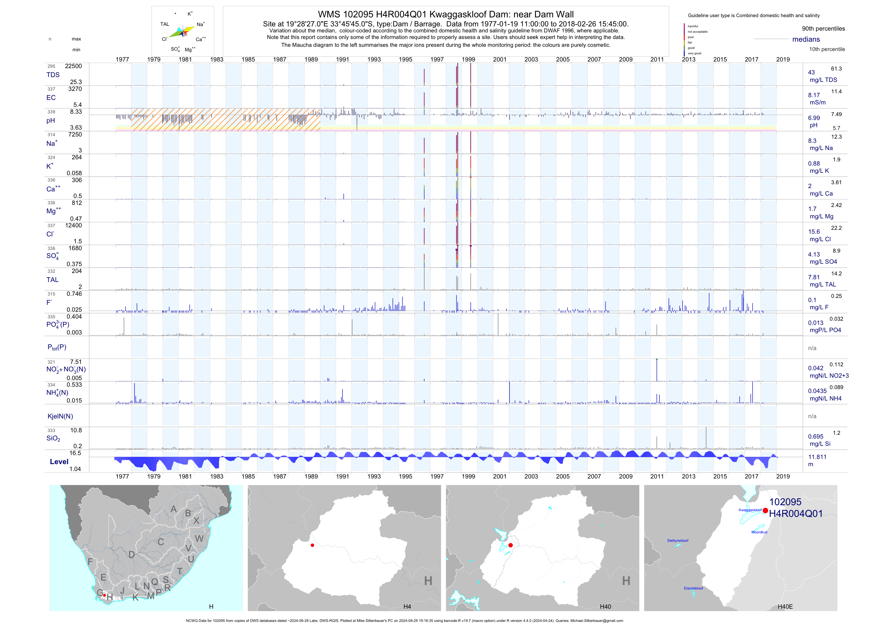
| H40 102095 | plot | data | Kwaggaskloof Dam: near Dam Wall (NCWQ) Q01 | Dam / Barrage | 339 | 1977-01-19 | 2018-02-26 | 8 | H4R004 | -33.76250 | 19.47417 |
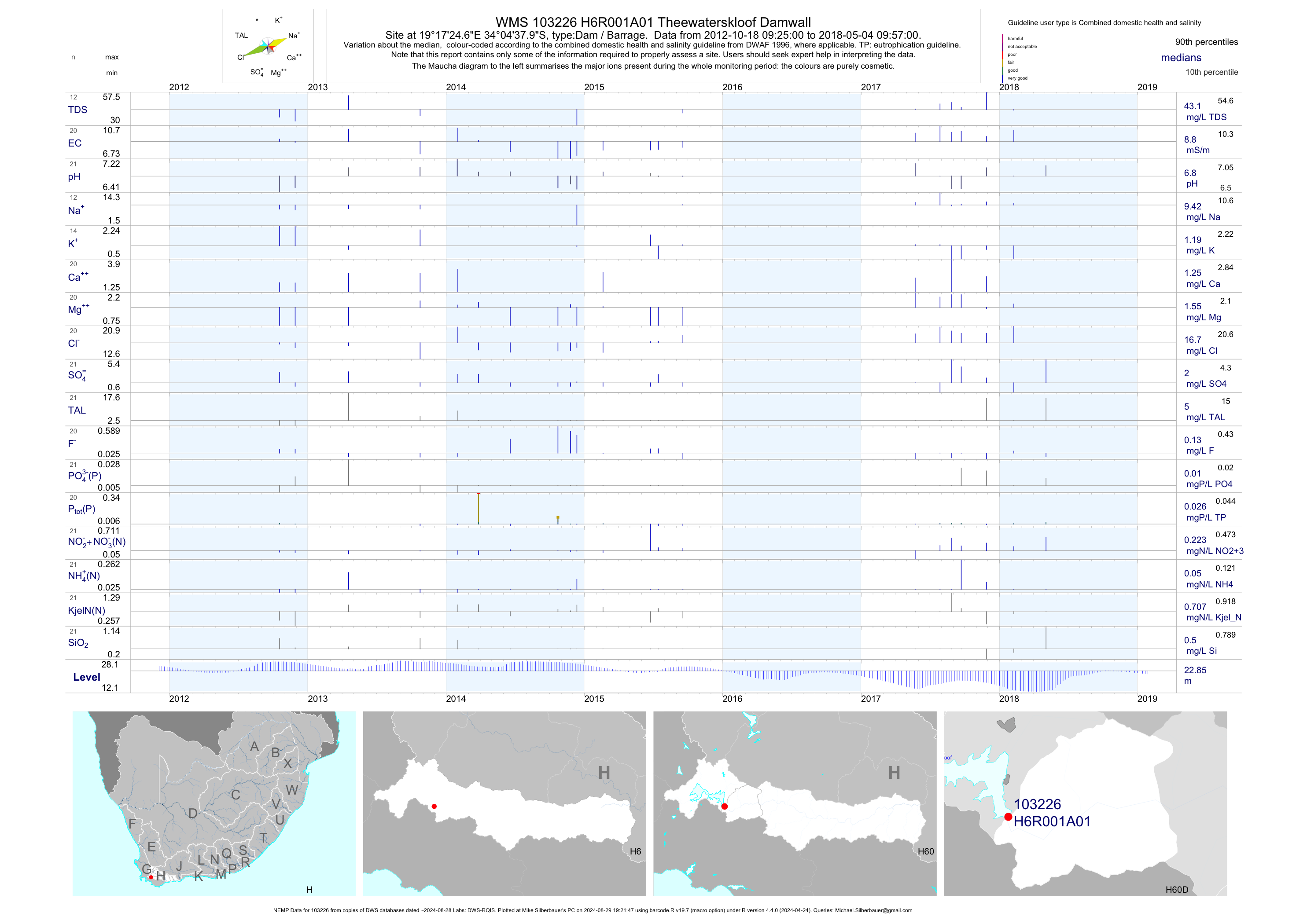
| H60 103226 | plot | data | Theewaterskloof Damwall (NEMP) A01 | Dam / Barrage | 133 | 2012-10-18 | 2019-02-22 | 9 | H6R001 | -34.07722 | 19.29017 |
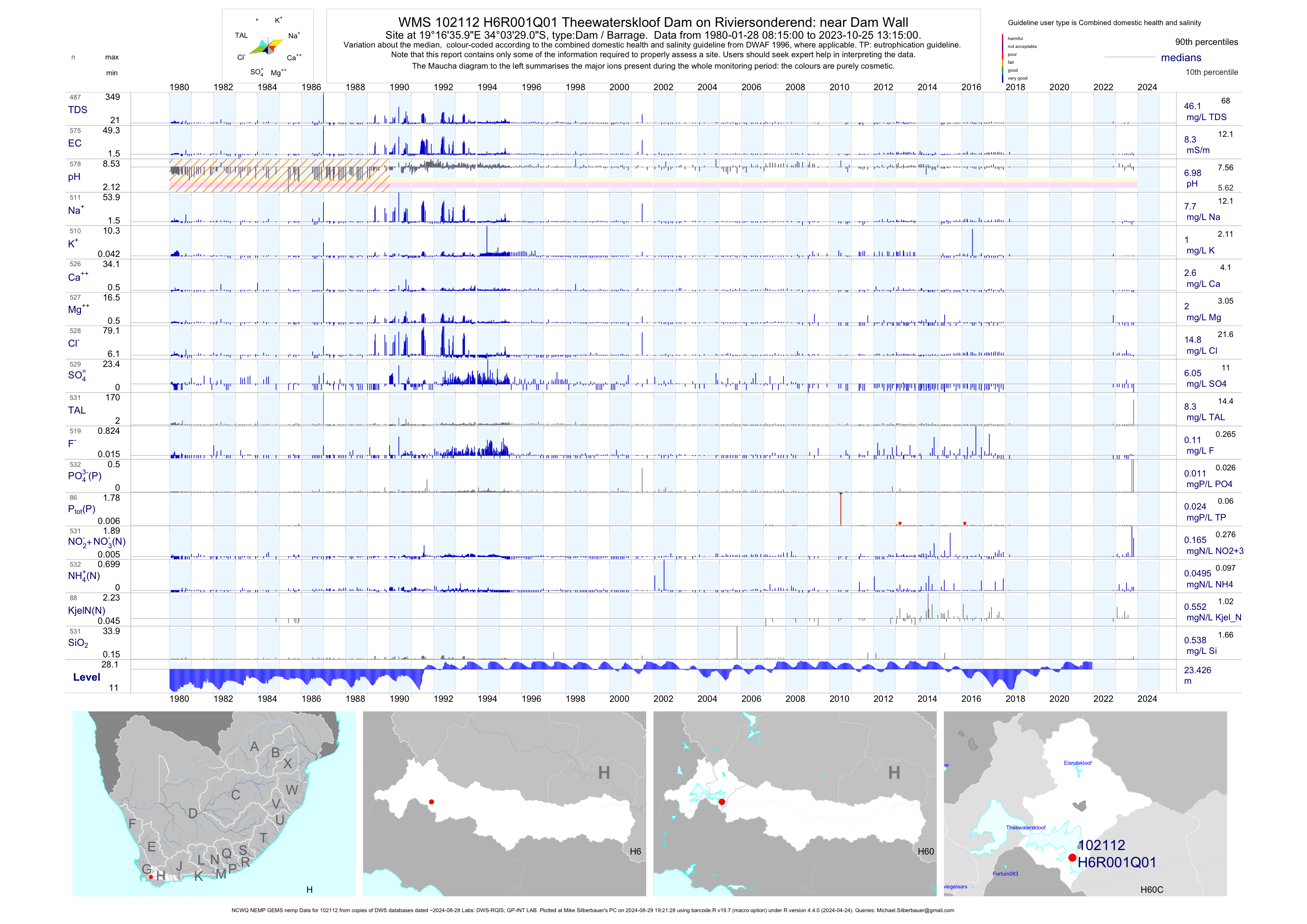
| H60 102112 | plot | data | Theewaterskloof Dam on Riviersonderend: near Dam Wall (NCWQ NEMP GEMS nemp) Q01 | Dam / Barrage | 894 | 1980-01-28 | 2019-02-22 | 8 | H6R001 | -34.05806 | 19.27667 |
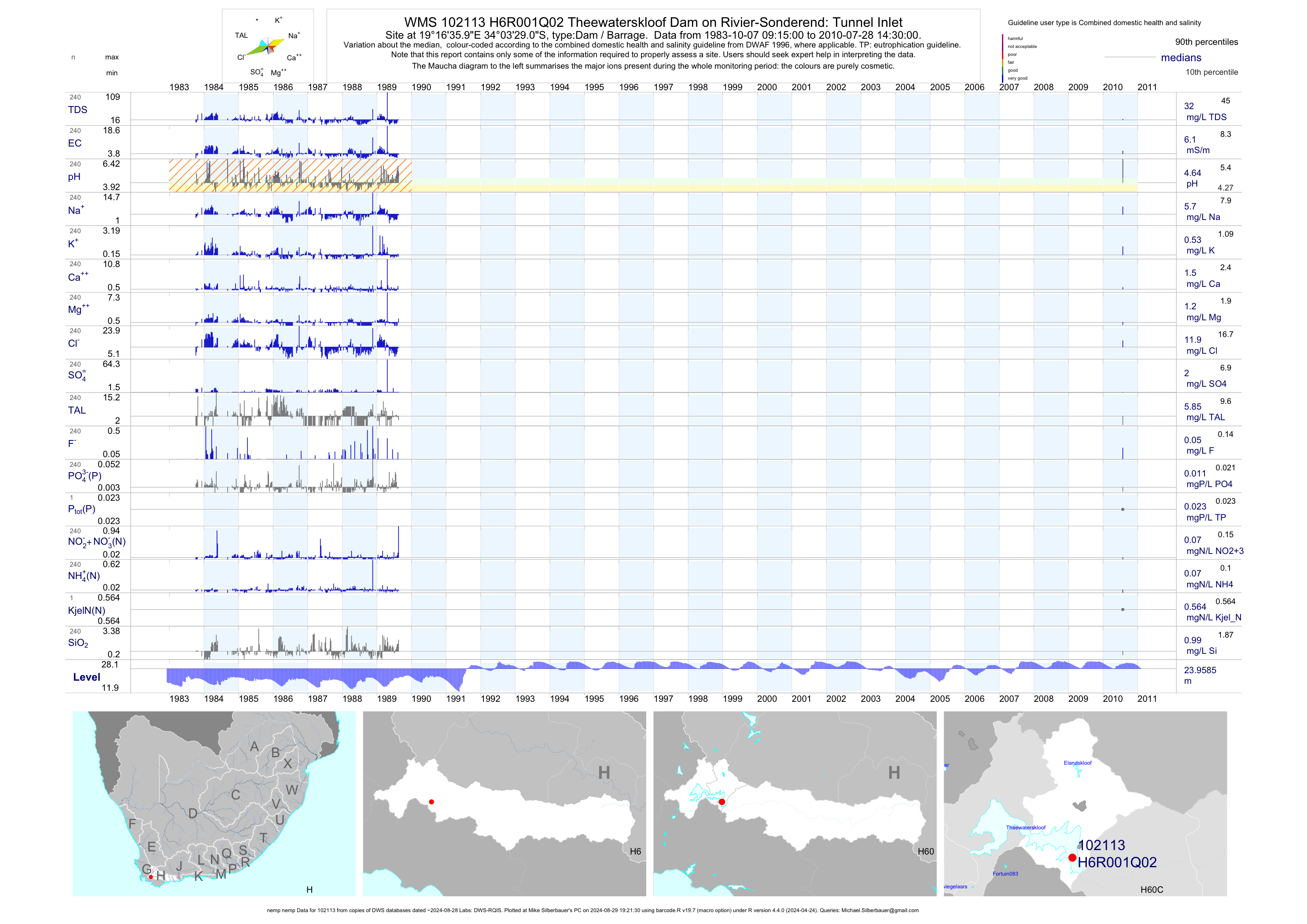
| H60 102113 | plot | data | Theewaterskloof Dam on Rivier-Sonderend: Tunnel Inlet (nemp nemp) Q02 | Dam / Barrage | 240 | 1983-10-07 | 2010-07-28 | 6 | H6R001 | -34.05806 | 19.27667 |
| H60 102114 | plot | data | Elandskloof Dam on Elands River: near Dam Wall (NCWQ) Q01 | Dam / Barrage | 439 | 1977-06-15 | 2018-03-07 | 7 | H6R002 | -33.95184 | 19.28627 |
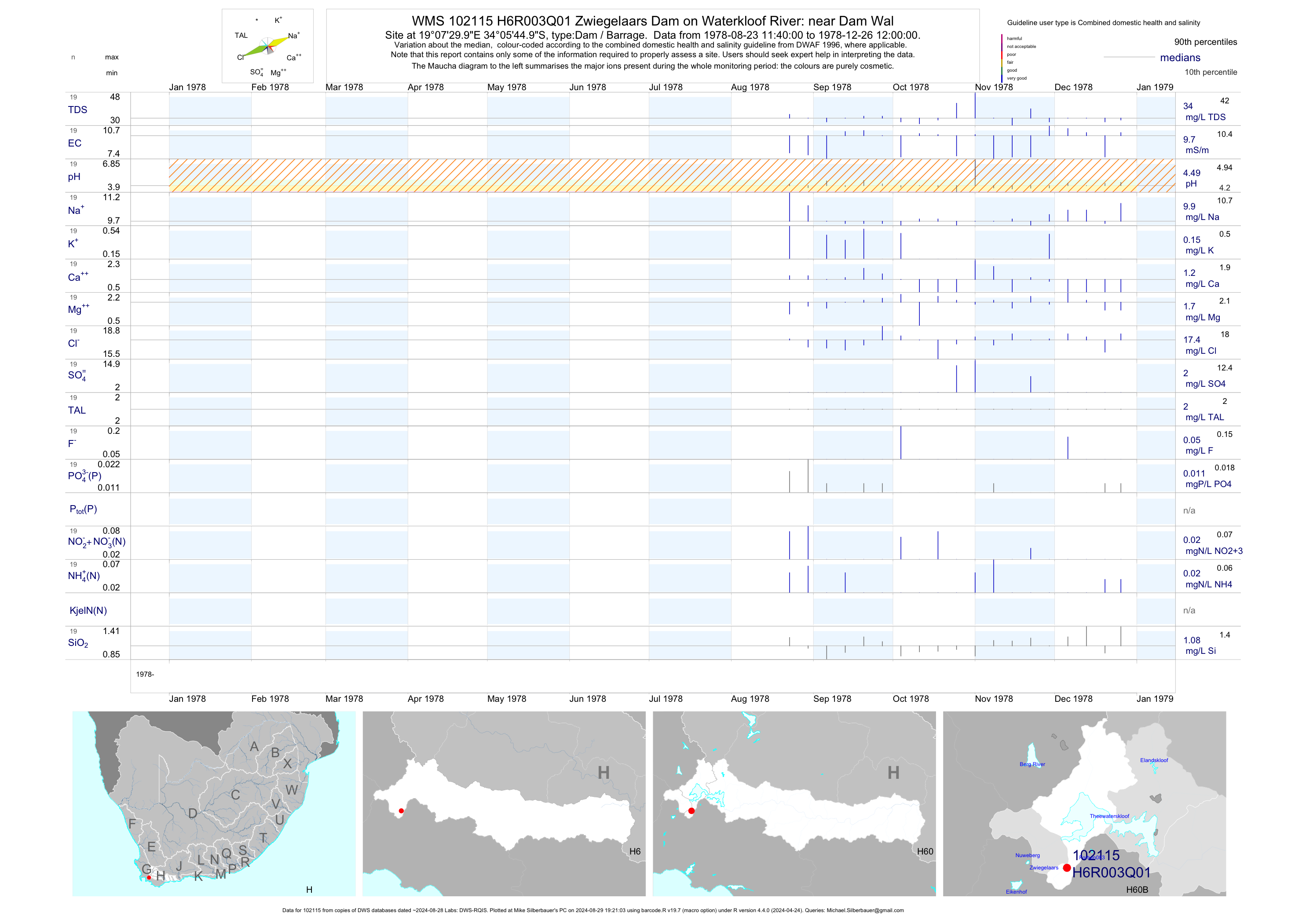
| H60 102115 | plot | data | Zwiegelaars Dam on Waterkloof River: near Dam Wal Q01 | Dam / Barrage | 19 | 1978-08-23 | 1978-12-26 | 10 | H6R003 | -34.09583 | 19.12500 |
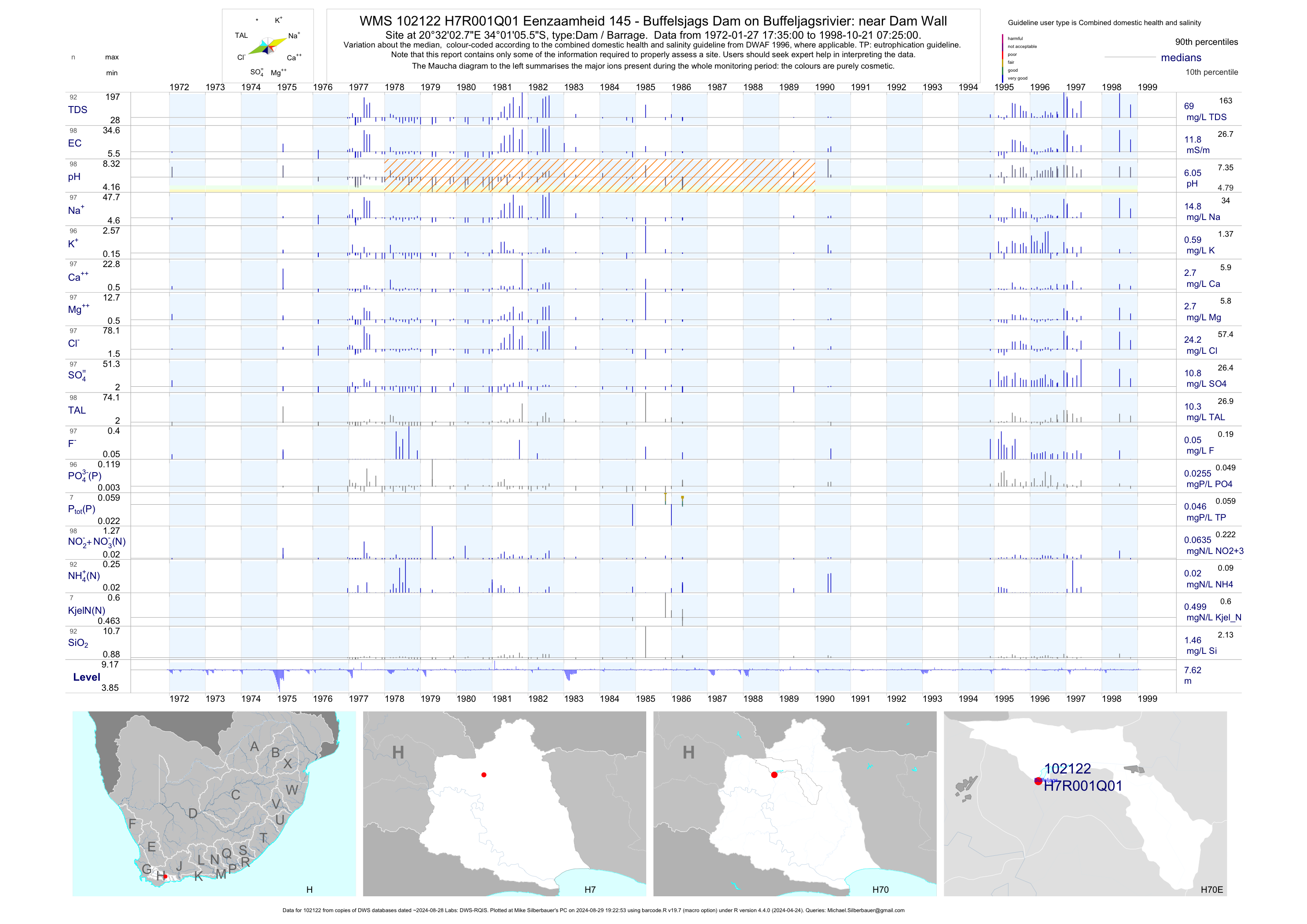
| H70 102122 | plot | data | Eenzaamheid 145 - Buffelsjags Dam on Buffeljagsrivier: near Dam Wall Q01 | Dam / Barrage | 100 | 1972-01-27 | 1998-10-21 | 12 | H7R001 | -34.01820 | 20.53410 |
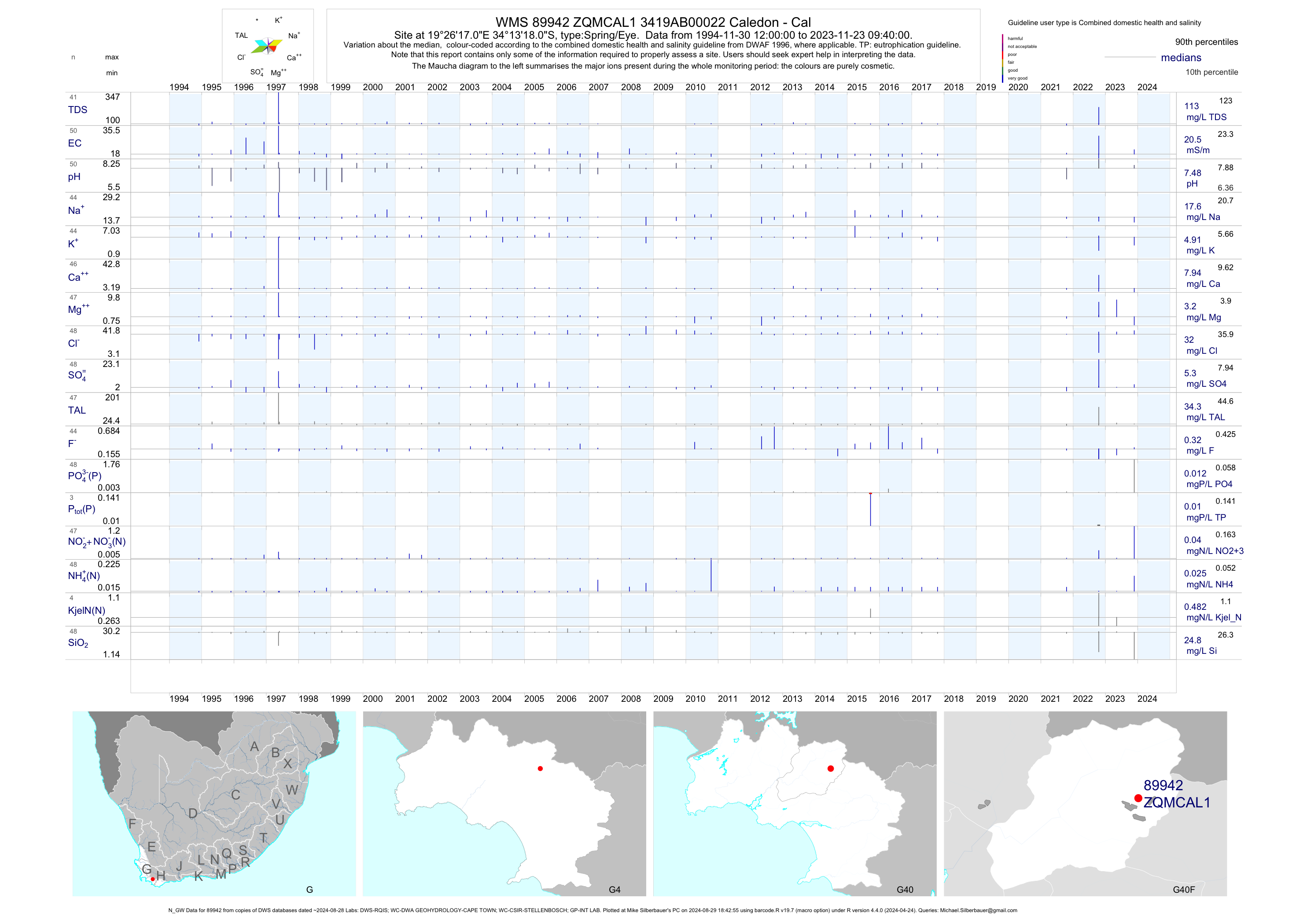
| G40 89942 | plot | data | 3419AB00022 Caledon - Cal (N_GW) | Spring/Eye | 49 | 1994-11-30 | 2017-10-19 | 20 | ZQMCAL1 | -34.22167 | 19.43806 |
| G40 90021 | plot | data | 3419CB00009 Strandfontein - Gf (N_GW) | Spring/Eye | 45 | 1994-11-22 | 2017-10-19 | 209 | ZQMGYS1 | -34.55556 | 19.36250 |
| G40 90022 | plot | data | 3419CB00010 Walkersbay - Kl (N_GW) | Spring/Eye | 34 | 1994-11-22 | 2012-09-21 | 107 | ZQMGYW1 | -34.54444 | 19.37222 |
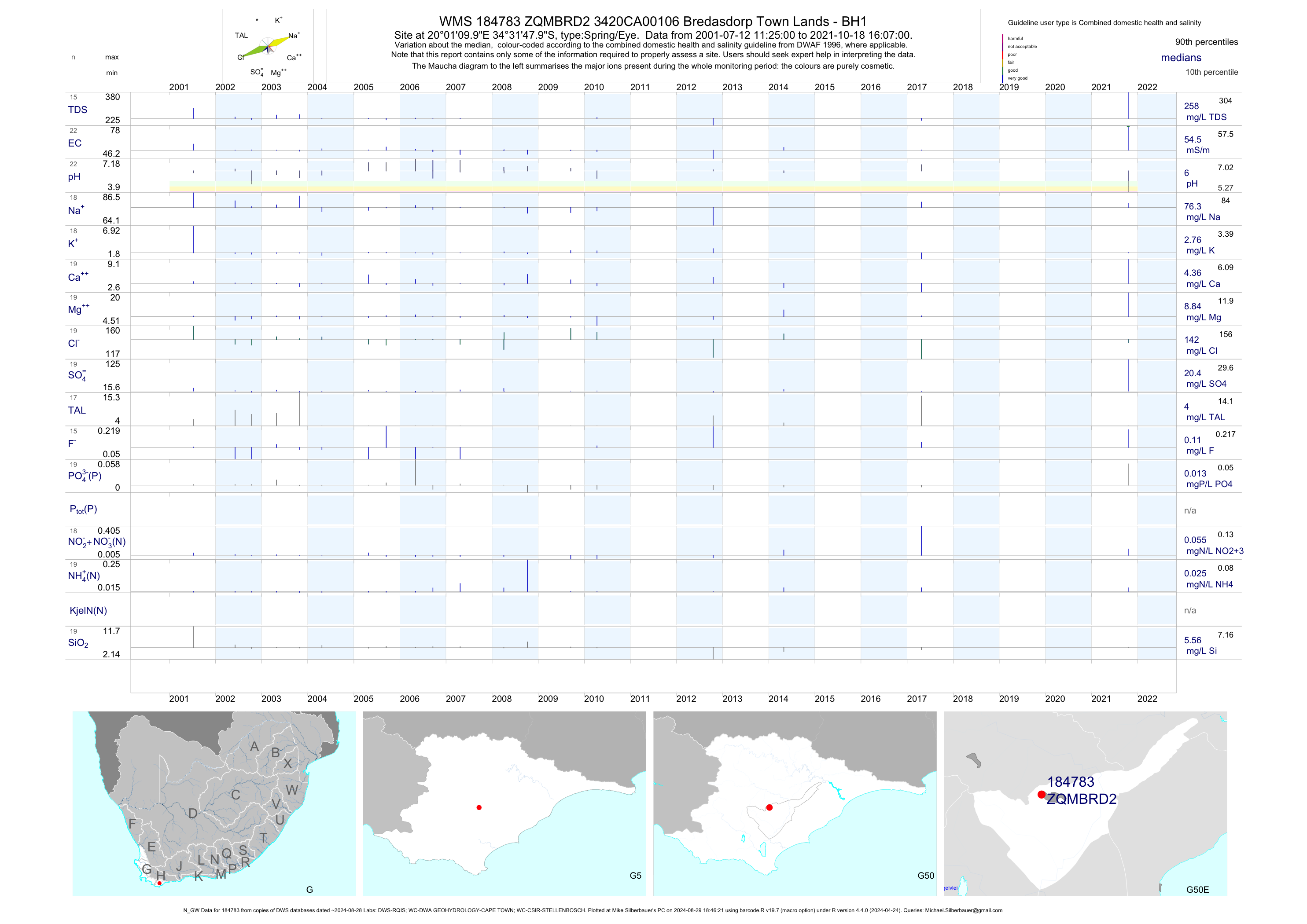
| G50 184783 | plot | data | 3420CA00106 Bredasdorp Town Lands - BH1 (N_GW) | Spring/Eye | 24 | 2001-07-12 | 2017-04-24 | 54 | ZQMBRD2 | -34.53000 | 20.01944 |
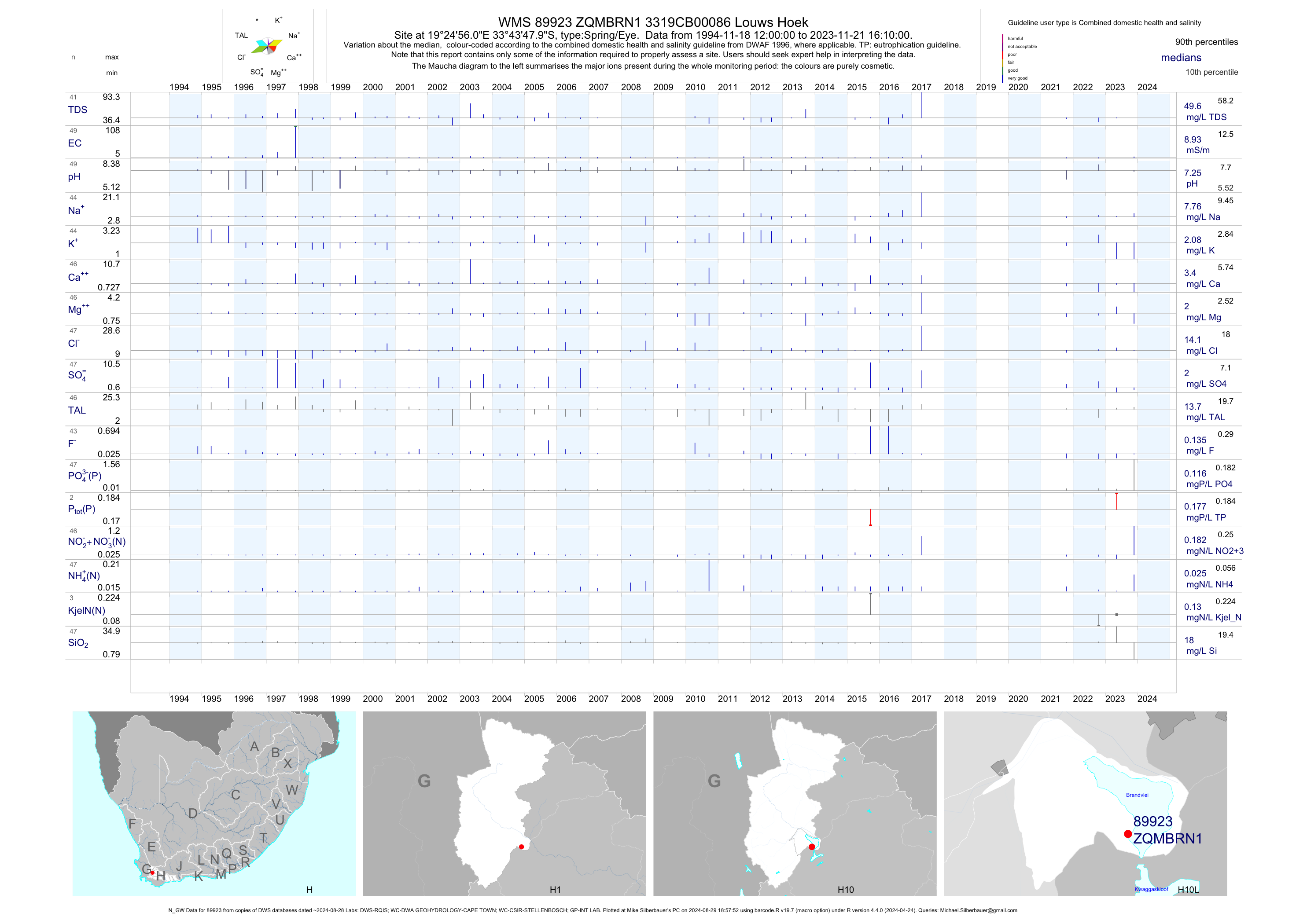
| H10 89923 | plot | data | 3319CB00086 Louws Hoek (N_GW) | Spring/Eye | 51 | 1994-11-18 | 2017-04-25 | 9 | ZQMBRN1 | -33.73000 | 19.41556 |
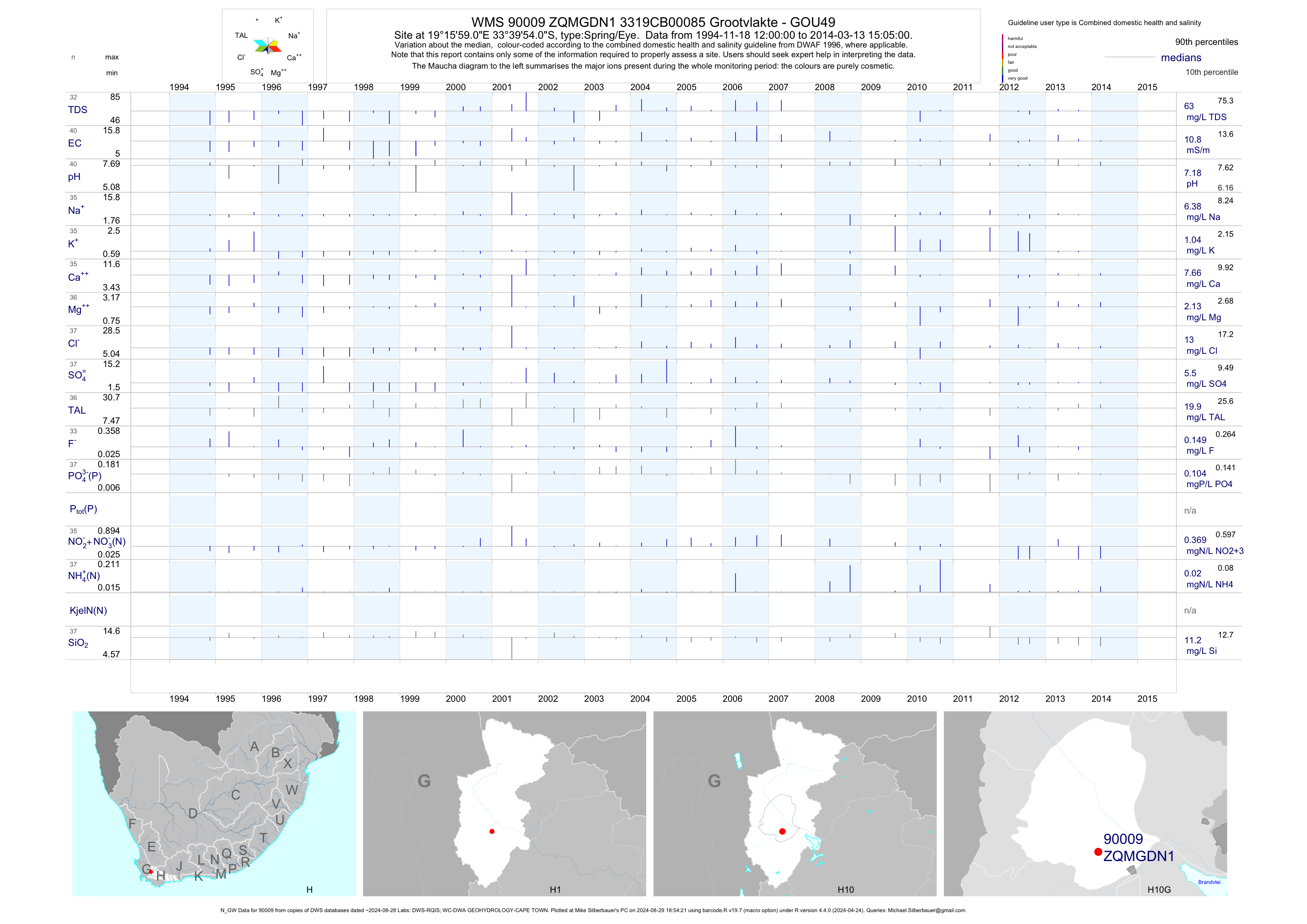
| H10 90009 | plot | data | 3319CB00085 Grootvlakte - GOU49 (N_GW) | Spring/Eye | 44 | 1994-11-18 | 2014-03-13 | 11 | ZQMGDN1 | -33.66500 | 19.26639 |
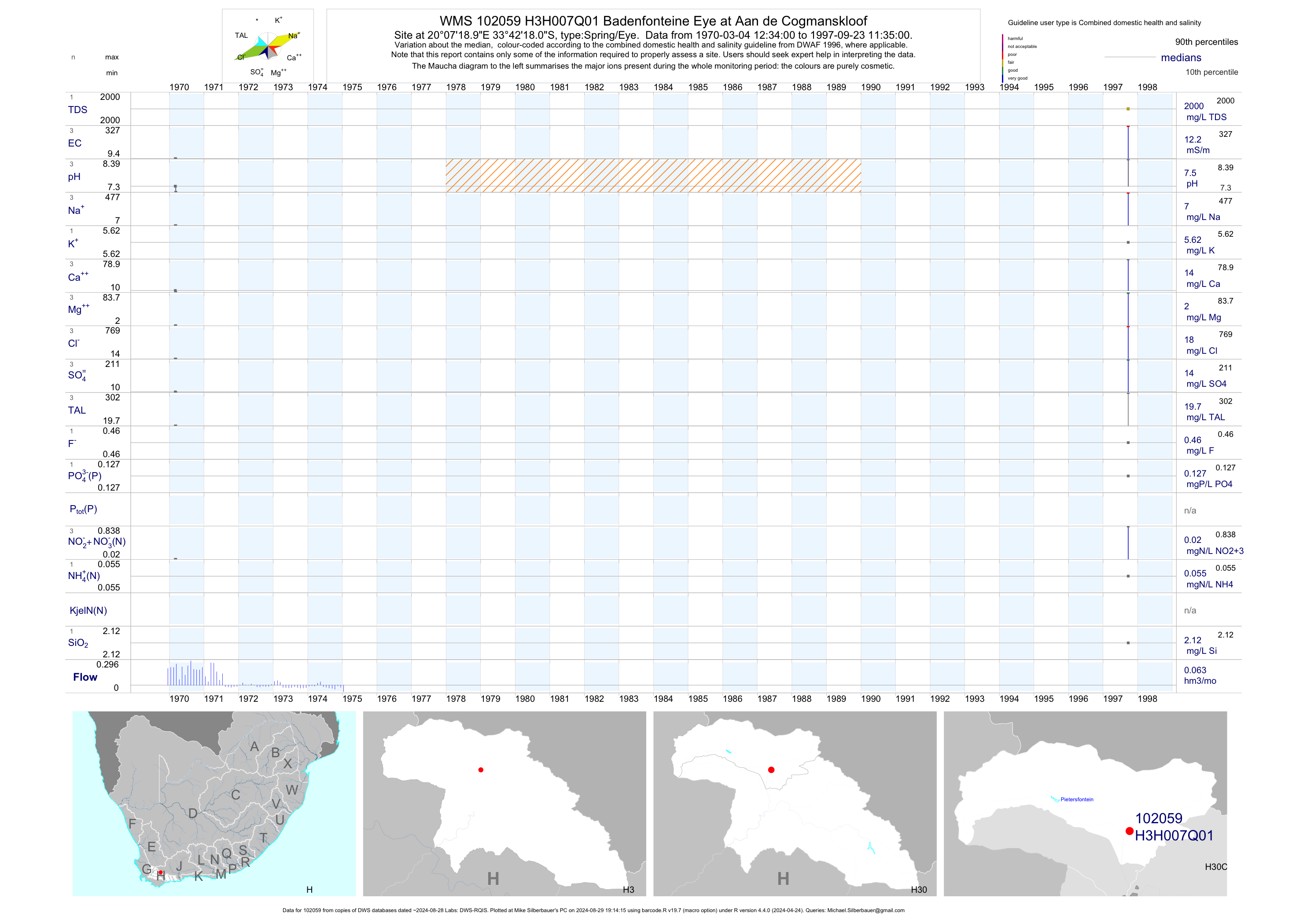
| H30 102059 | plot | data | Badenfonteine Eye at Aan de Cogmanskloof | Spring/Eye | 3 | 1970-03-04 | 1997-09-23 | 12 | H3H007 | -33.70500 | 20.12194 |
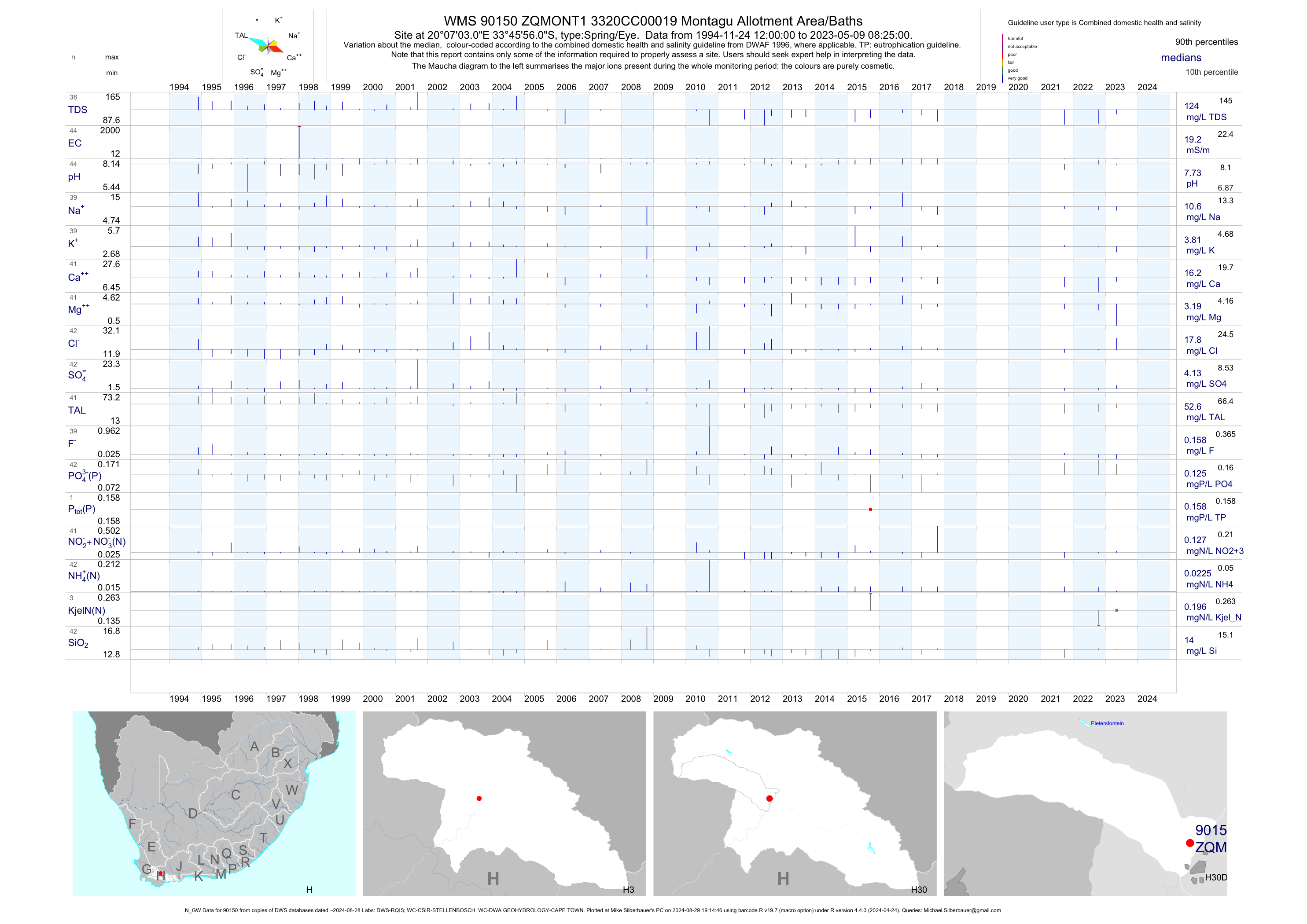
| H30 90150 | plot | data | 3320CC00019 Montagu Allotment Area/Baths (N_GW) | Spring/Eye | 45 | 1994-11-24 | 2017-10-20 | 20 | ZQMONT1 | -33.76556 | 20.11750 |
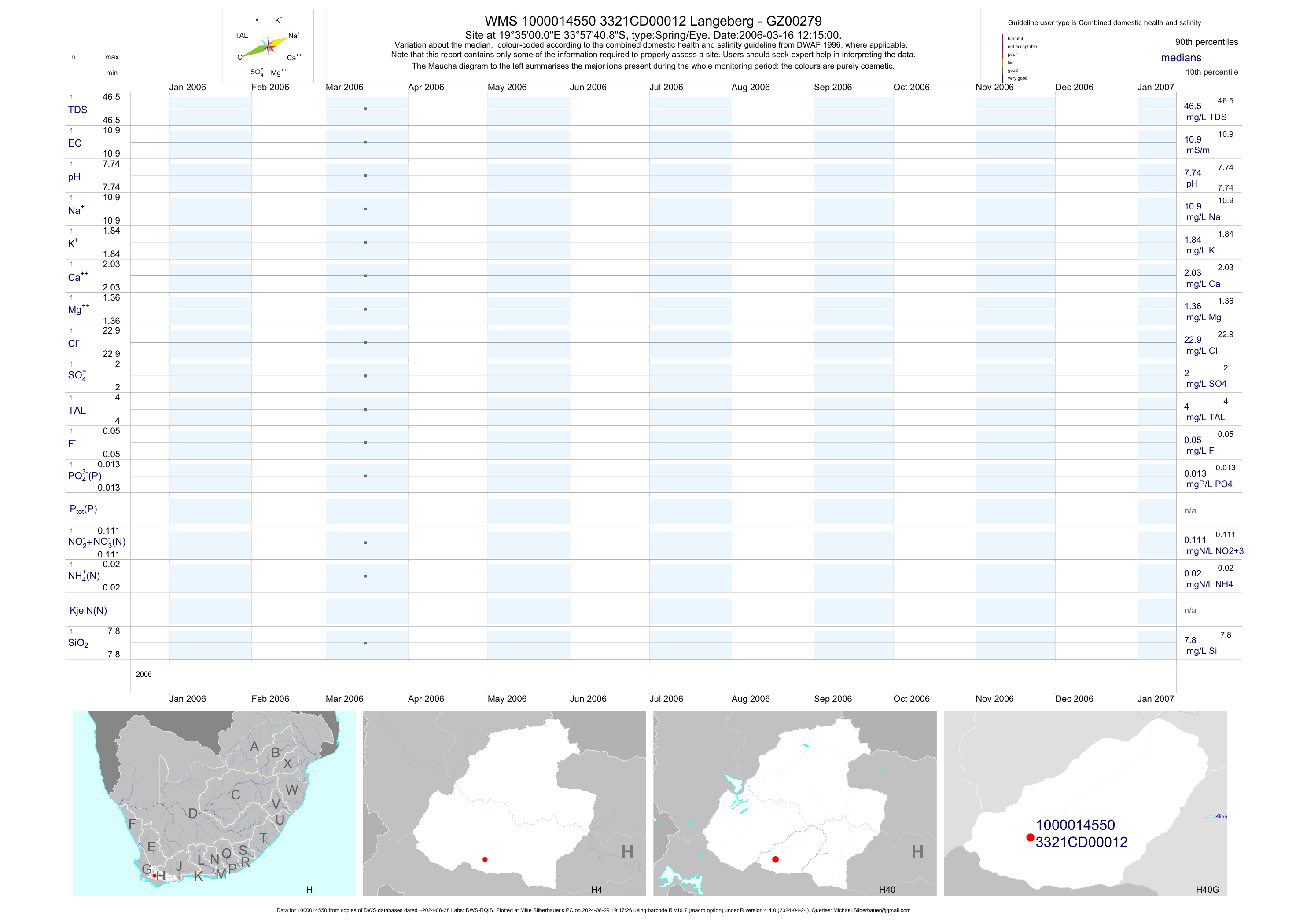
| H40 1000014550 | plot | data | Langeberg - GZ00279 | Spring/Eye | 2 | 2006-03-16 | 2006-03-16 | 11 | 12 | -33.96136 | 19.58333 |
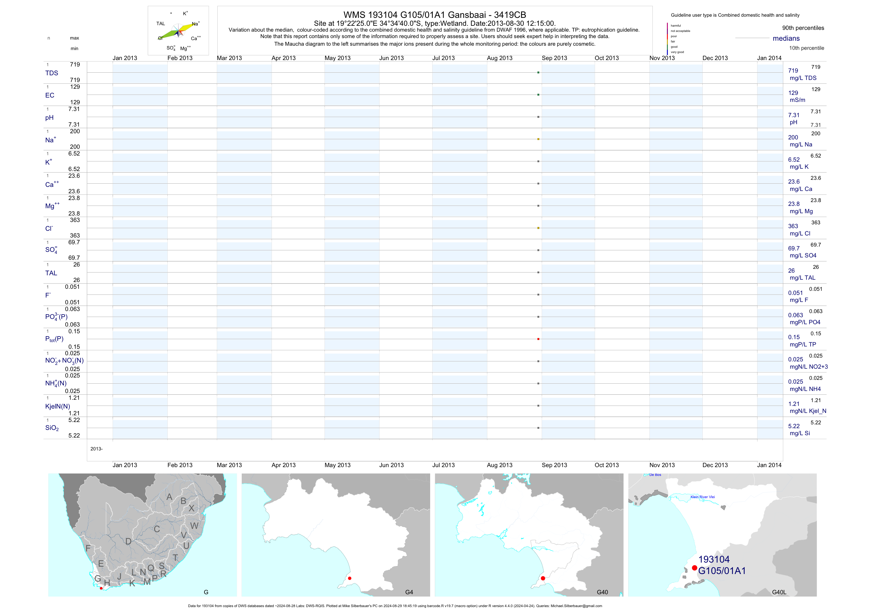
| G40 193104 | plot | data | Gansbaai - 3419CB | Wetland | 1 | 2013-08-30 | 2013-08-30 | 129 | G105/01A1 | -34.57778 | 19.37361 |
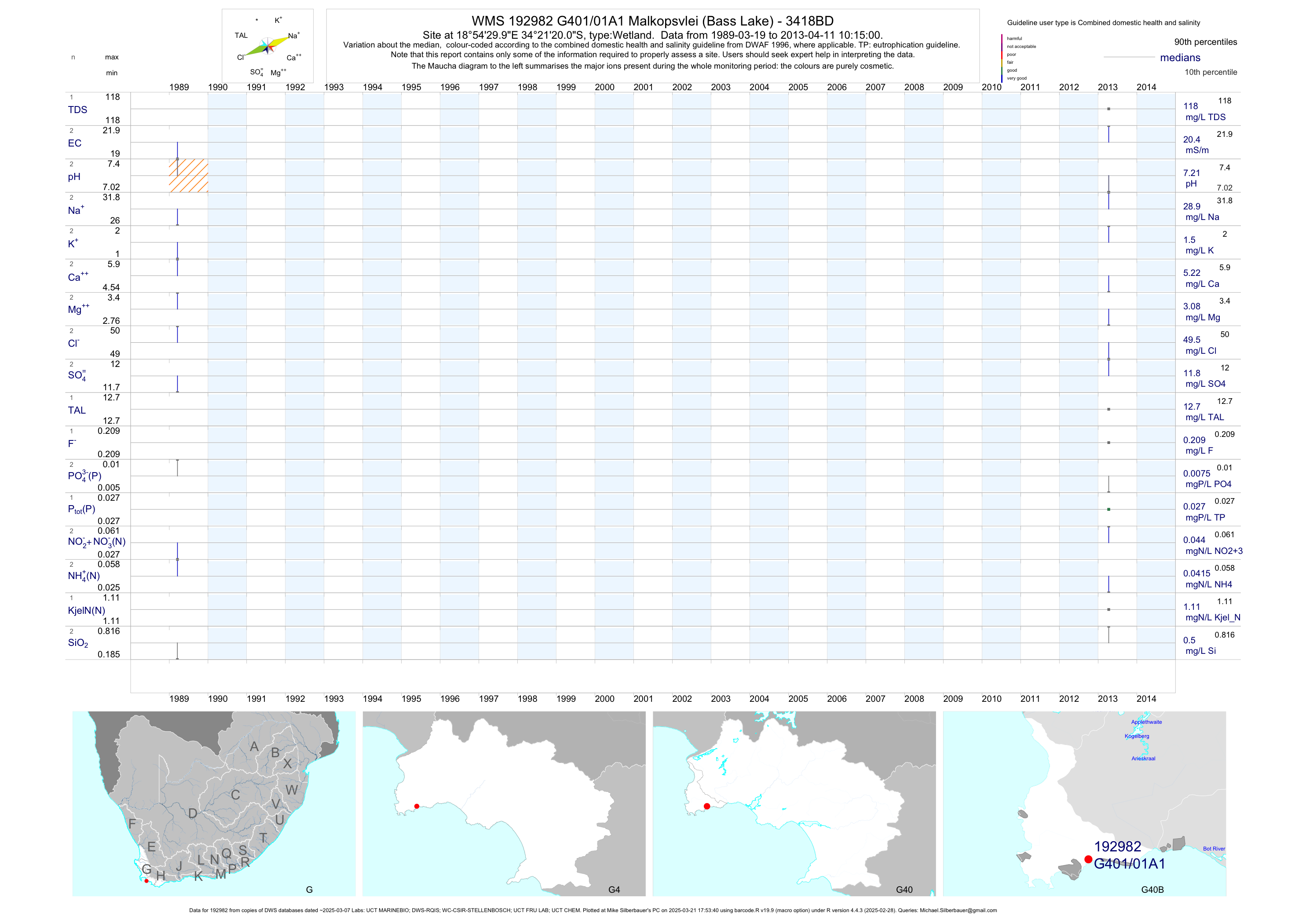
| G40 192982 | plot | data | Malkopsvlei (Bass Lake) - 3418BD | Wetland | 6 | 1989-03-19 | 2013-04-11 | 20 | G401/01A1 | -34.35556 | 18.90833 |
| G40 192953 | plot | data | Groot Rondevlei 2 (Bettys Bay) - 3418BD | Wetland | 1 | 2013-04-11 | 2013-04-11 | 39 | G401/02A1 | -34.36389 | 18.88278 |
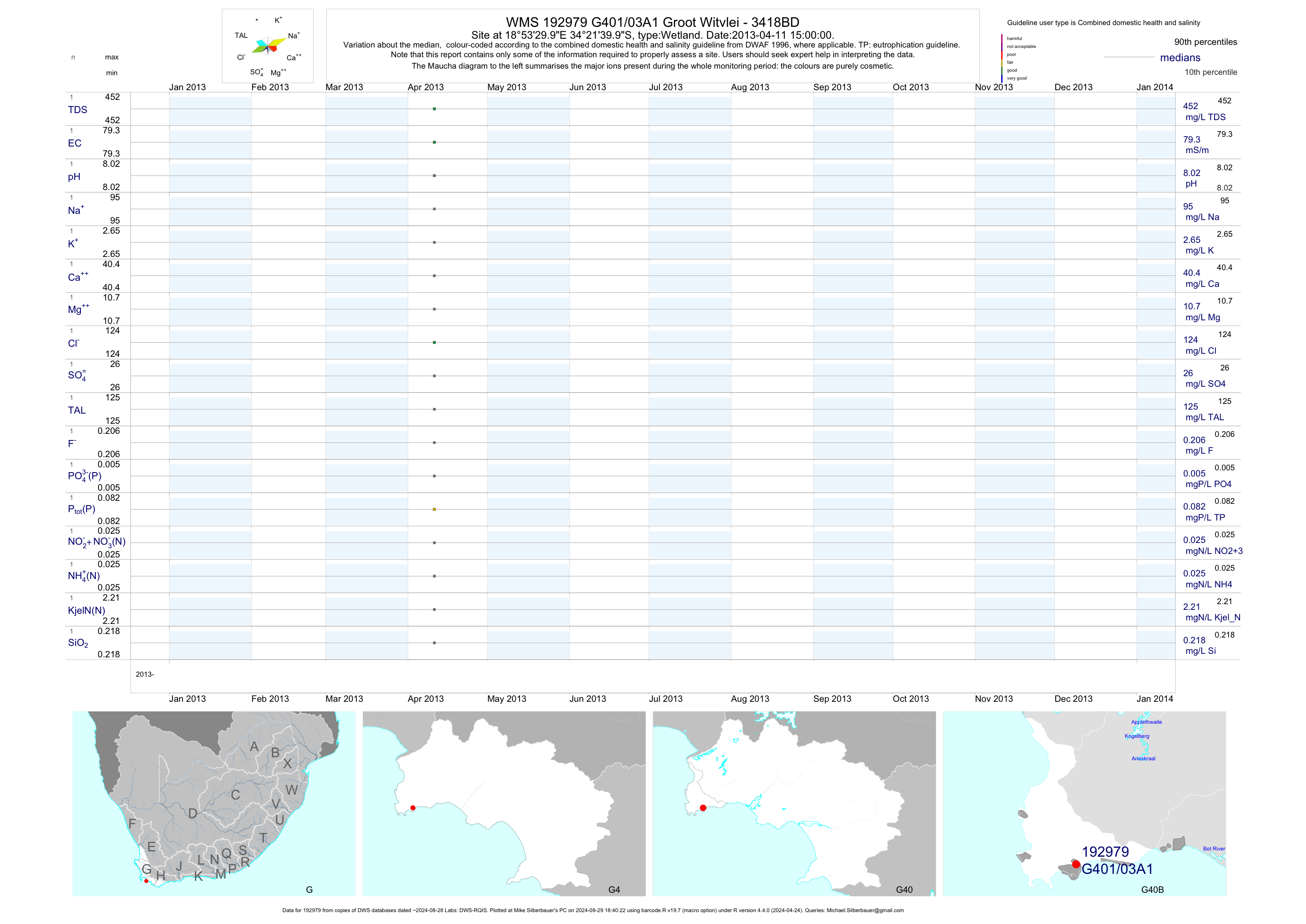
| G40 192979 | plot | data | Groot Witvlei - 3418BD | Wetland | 1 | 2013-04-11 | 2013-04-11 | 79 | G401/03A1 | -34.36111 | 18.89167 |
| G40 193007 | plot | data | Vermont Pan - 3419AC | Wetland | 6 | 1988-05-23 | 2013-10-07 | 930 | G403/01B1 | -34.40972 | 19.15833 |
| G40 193009 | plot | data | Hemel en Aarde - 3419AC | Wetland | 6 | 1988-05-23 | 2013-10-07 | 36 | G403/02A1 | -34.38500 | 19.23056 |
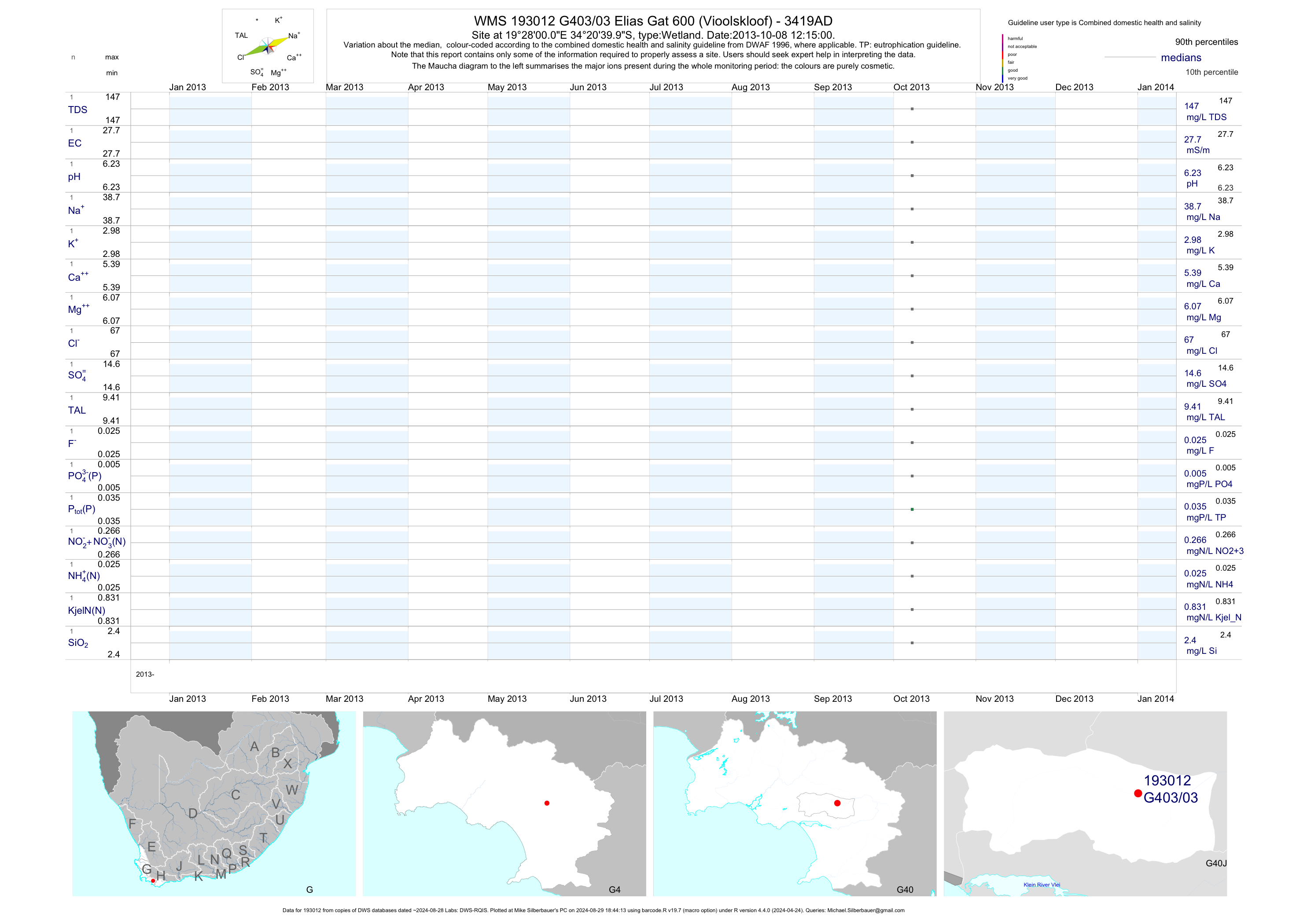
| G40 193012 | plot | data | Elias Gat 600 (Vioolskloof) - 3419AD | Wetland | 1 | 2013-10-08 | 2013-10-08 | 28 | G403/03 | -34.34444 | 19.46667 |
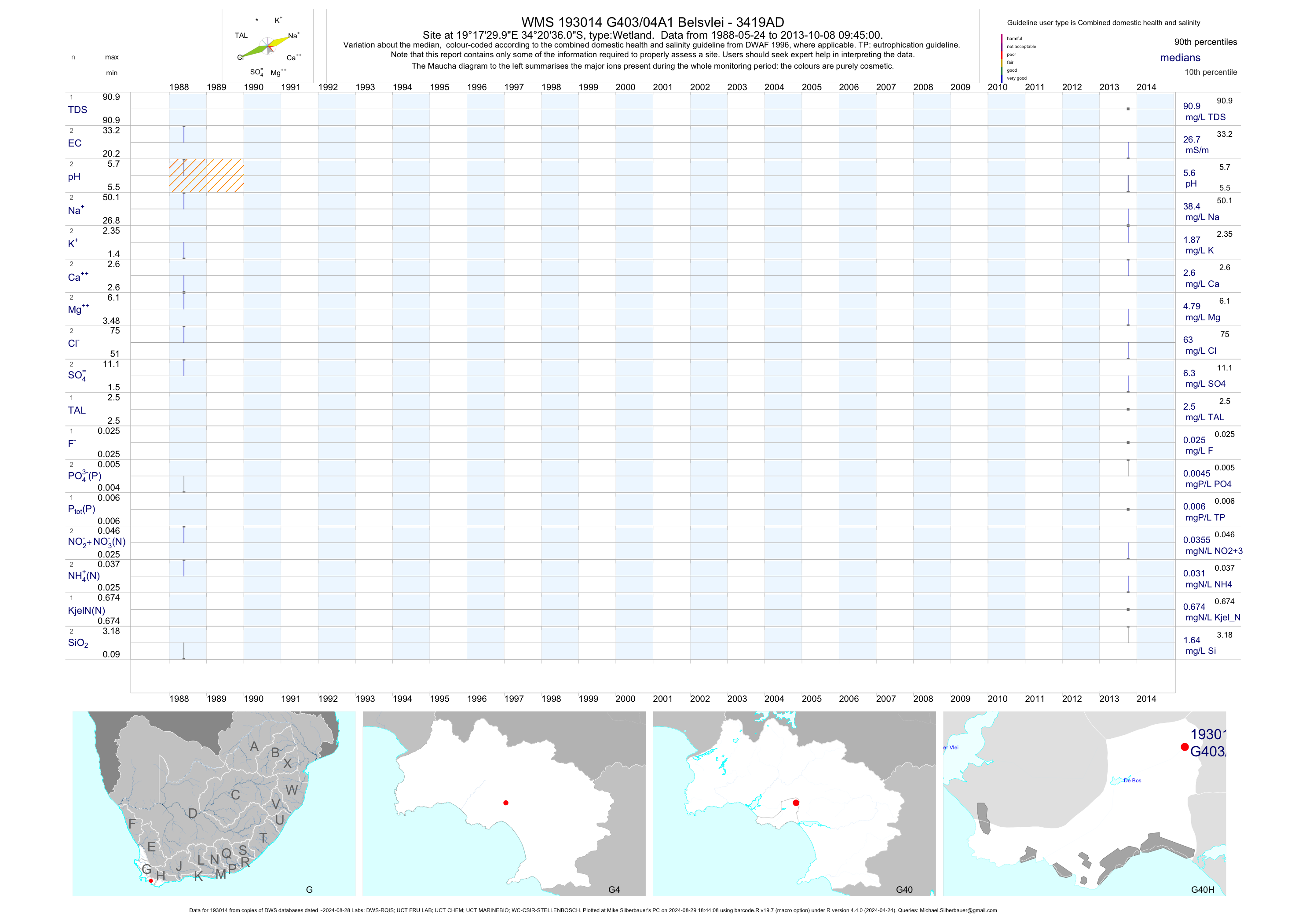
| G40 193014 | plot | data | Belsvlei - 3419AD | Wetland | 6 | 1988-05-24 | 2013-10-08 | 27 | G403/04A1 | -34.34333 | 19.29167 |
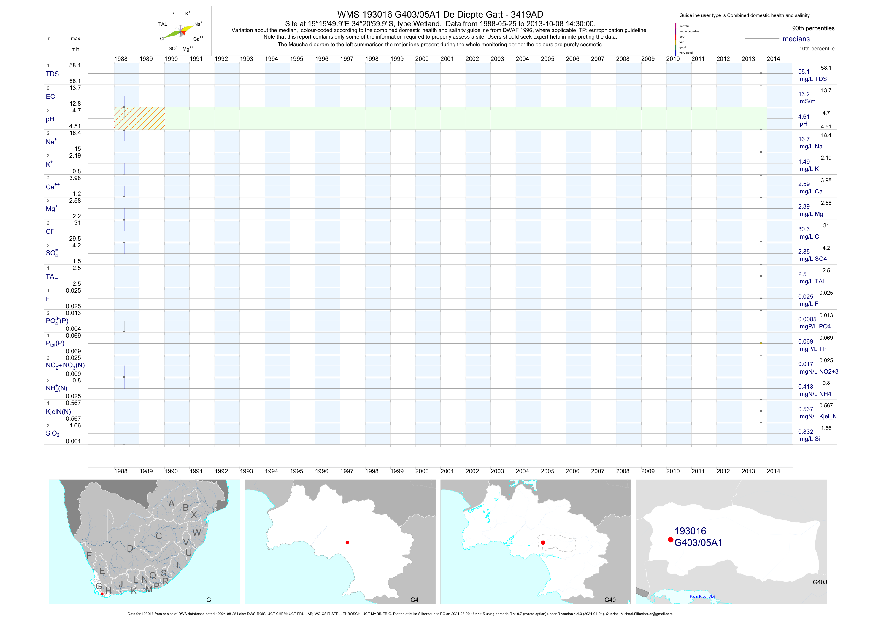
| G40 193016 | plot | data | De Diepte Gatt - 3419AD | Wetland | 6 | 1988-05-25 | 2013-10-08 | 13 | G403/05A1 | -34.35000 | 19.33056 |
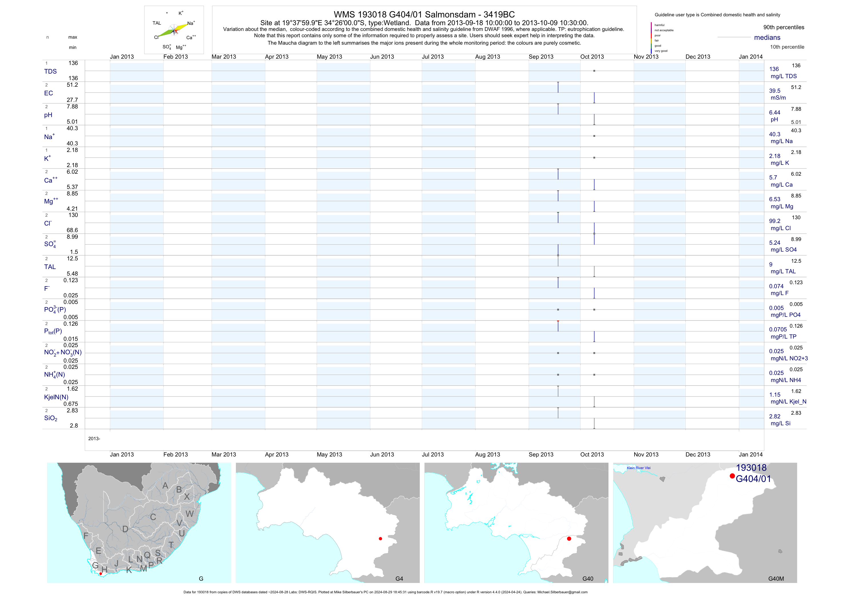
| G40 193018 | plot | data | Salmonsdam - 3419BC | Wetland | 2 | 2013-09-18 | 2013-10-09 | 39 | G404/01 | -34.43333 | 19.63333 |
| G40 200189737 | n/a | n/a | WC-BOCMA - Vp - Vermont Pan | Wetland | 17 | 2010-12-28 | 2013-01-31 | n/a | VP | -34.39781 | 19.26558 |
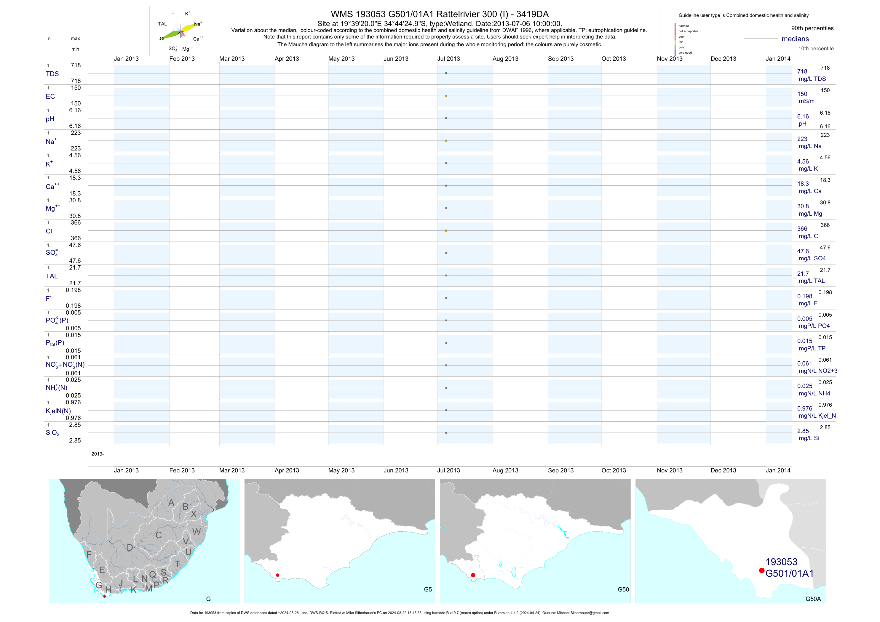
| G50 193053 | plot | data | Rattelrivier 300 (I) - 3419DA | Wetland | 1 | 2013-07-06 | 2013-07-06 | 150 | G501/01A1 | -34.74028 | 19.65556 |
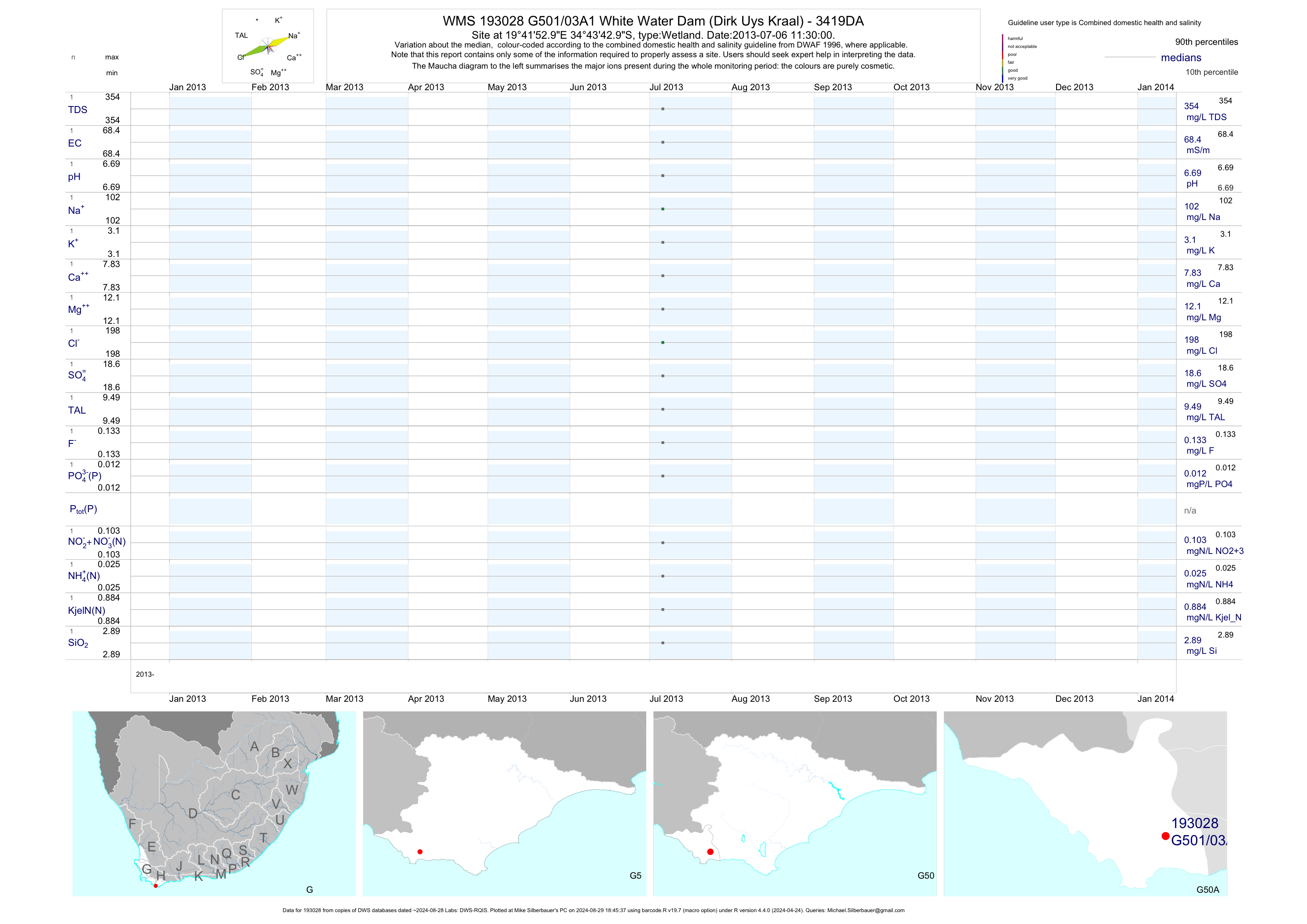
| G50 193028 | plot | data | White Water Dam (Dirk Uys Kraal) - 3419DA | Wetland | 1 | 2013-07-06 | 2013-07-06 | 68 | G501/03A1 | -34.72861 | 19.69806 |
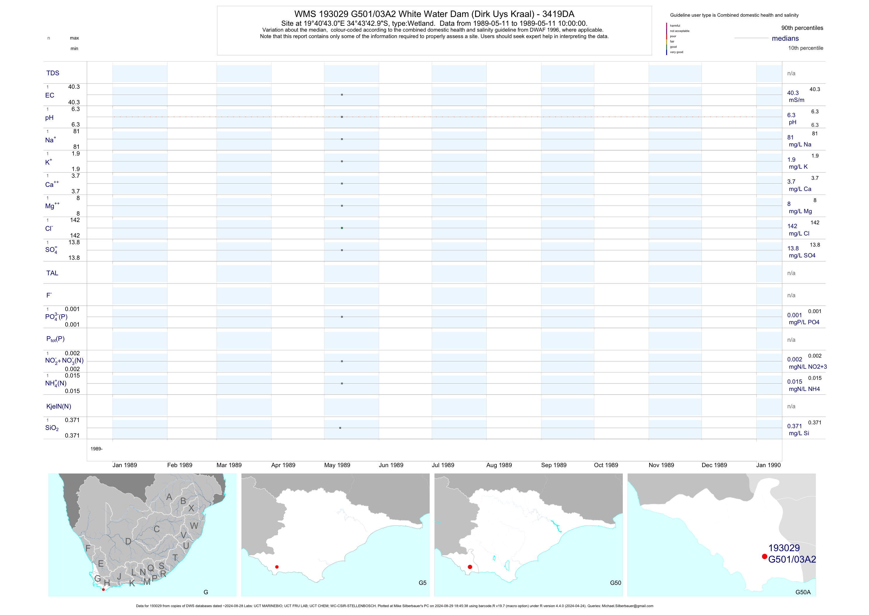
| G50 193029 | plot | data | White Water Dam (Dirk Uys Kraal) - 3419DA | Wetland | 5 | 1989-05-11 | 1989-05-11 | 40 | G501/03A2 | -34.72861 | 19.67861 |
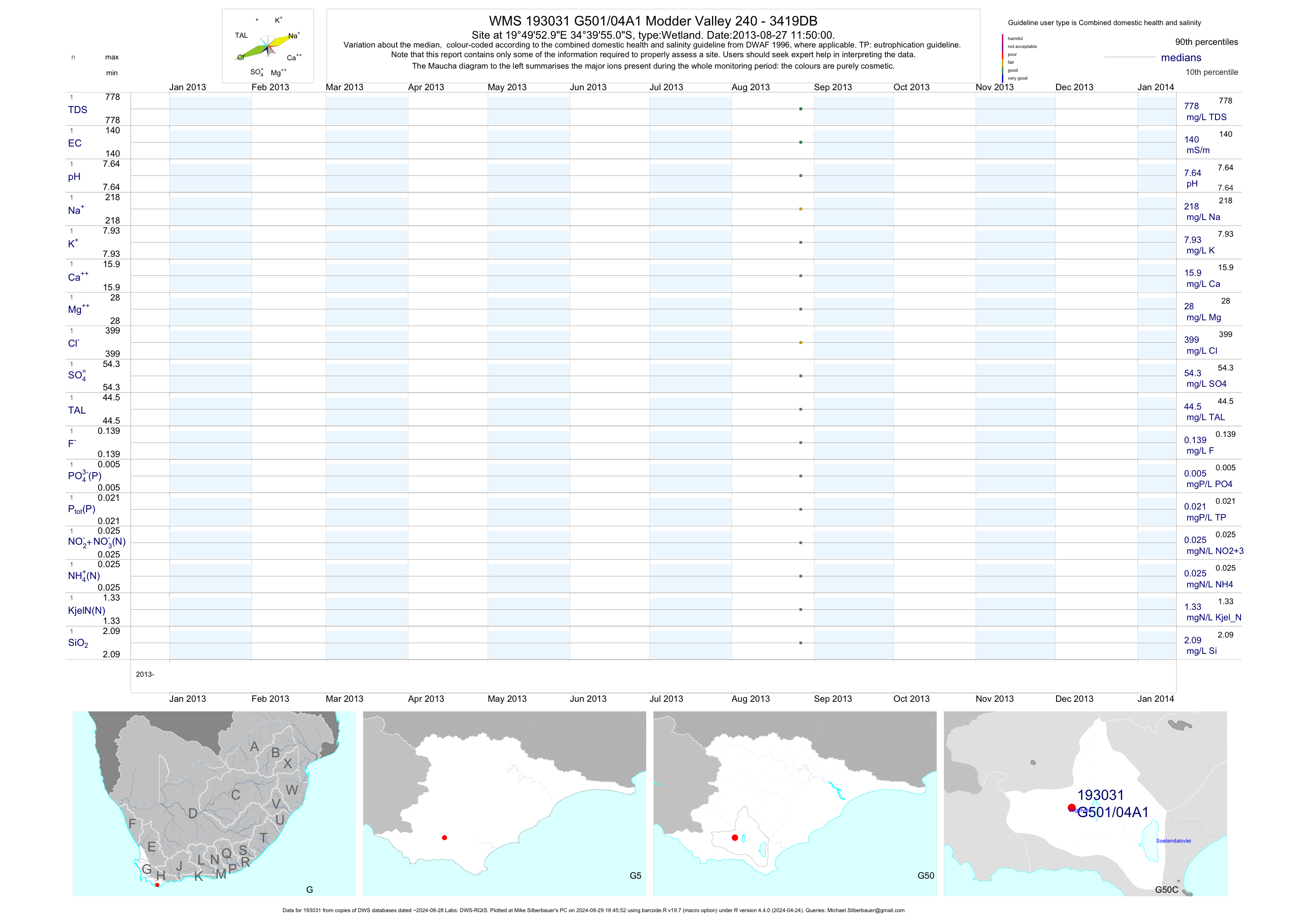
| G50 193031 | plot | data | Modder Valley 240 - 3419DB | Wetland | 1 | 2013-08-27 | 2013-08-27 | 140 | G501/04A1 | -34.66528 | 19.83139 |
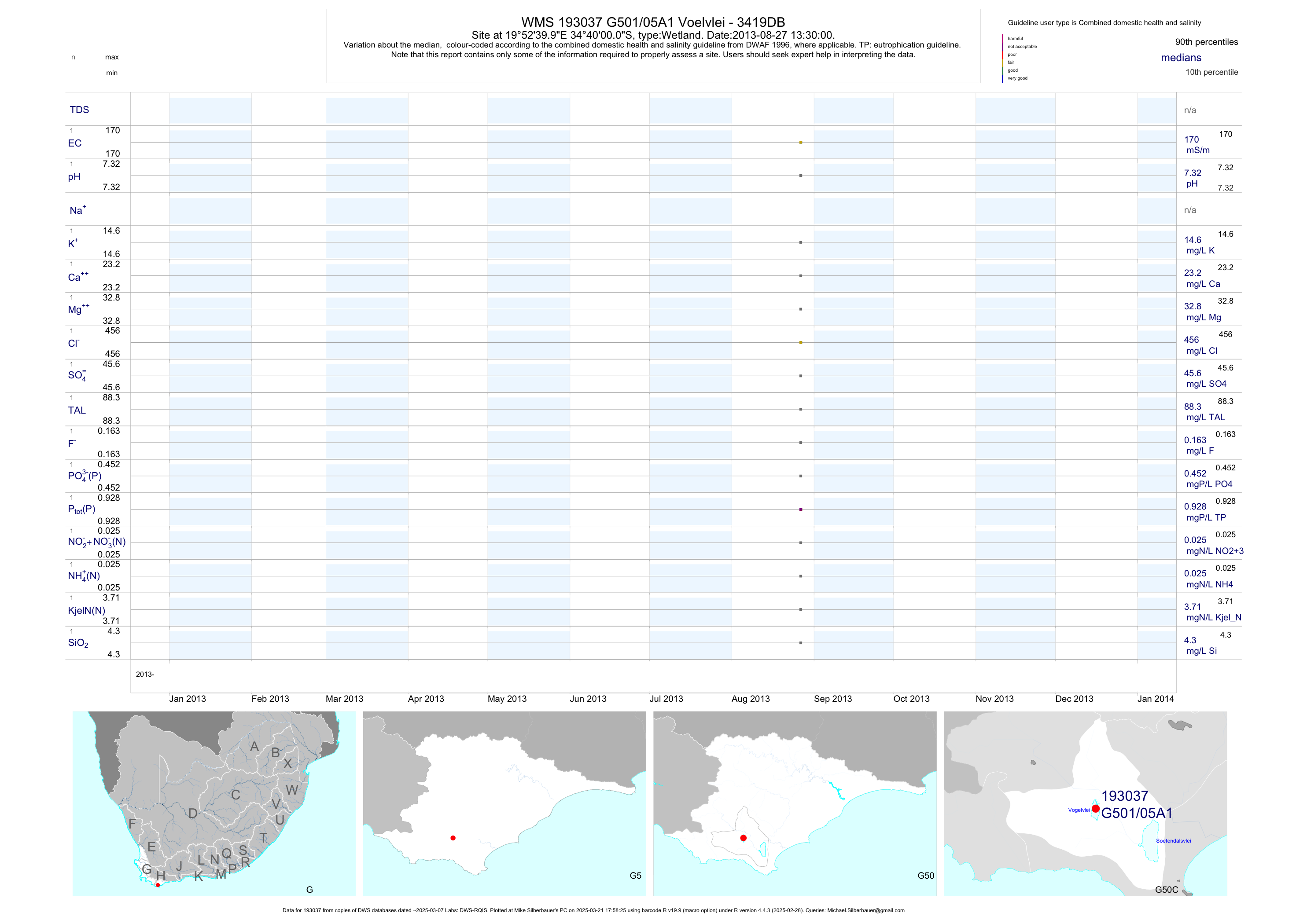
| G50 193037 | plot | data | Voelvlei - 3419DB | Wetland | 1 | 2013-08-27 | 2013-08-27 | 170 | G501/05A1 | -34.66667 | 19.87778 |
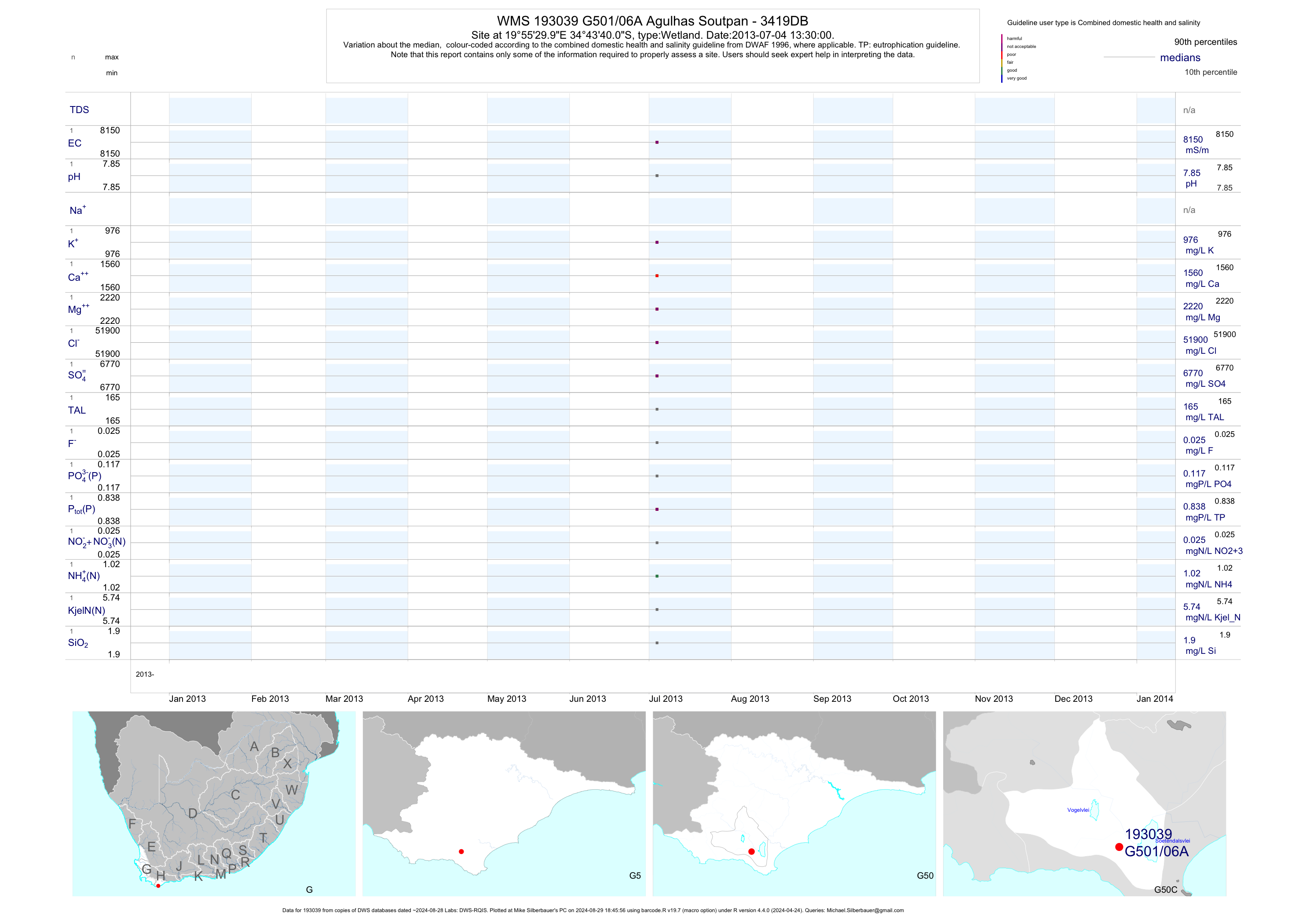
| G50 193039 | plot | data | Agulhas Soutpan - 3419DB | Wetland | 1 | 2013-07-04 | 2013-07-04 | 8150 | G501/06A | -34.72778 | 19.92500 |
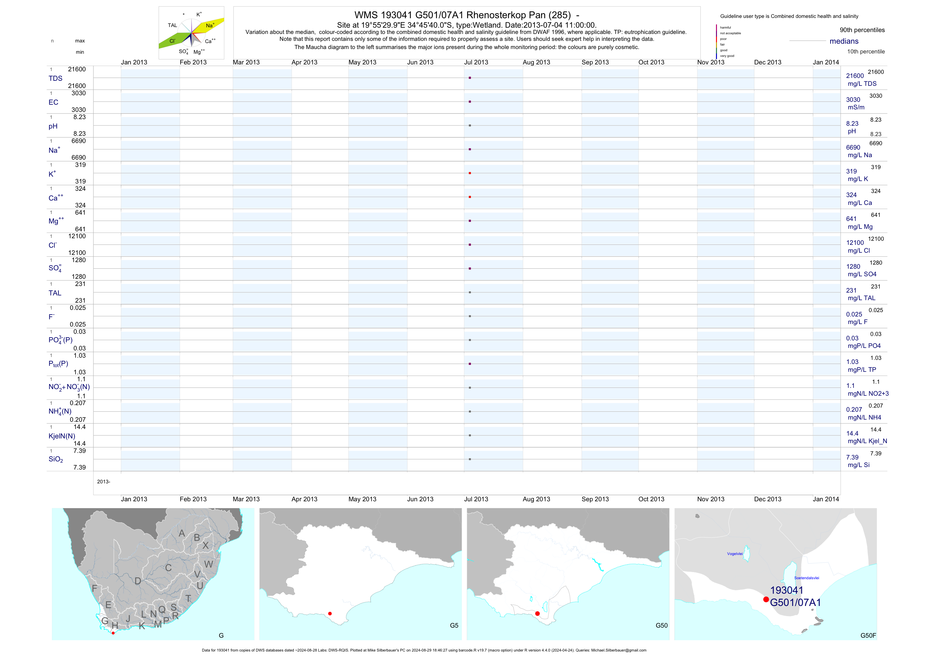
| G50 193041 | plot | data | Rhenosterkop Pan (285) - | Wetland | 1 | 2013-07-04 | 2013-07-04 | 3027 | G501/07A1 | -34.76111 | 19.92500 |
| G50 193043 | plot | data | Soetendalsvlei (de Mond Staatsbos) - 3419DB | Wetland | 1 | 2013-07-04 | 2013-07-04 | 456 | G501/08A | -34.71667 | 19.98333 |
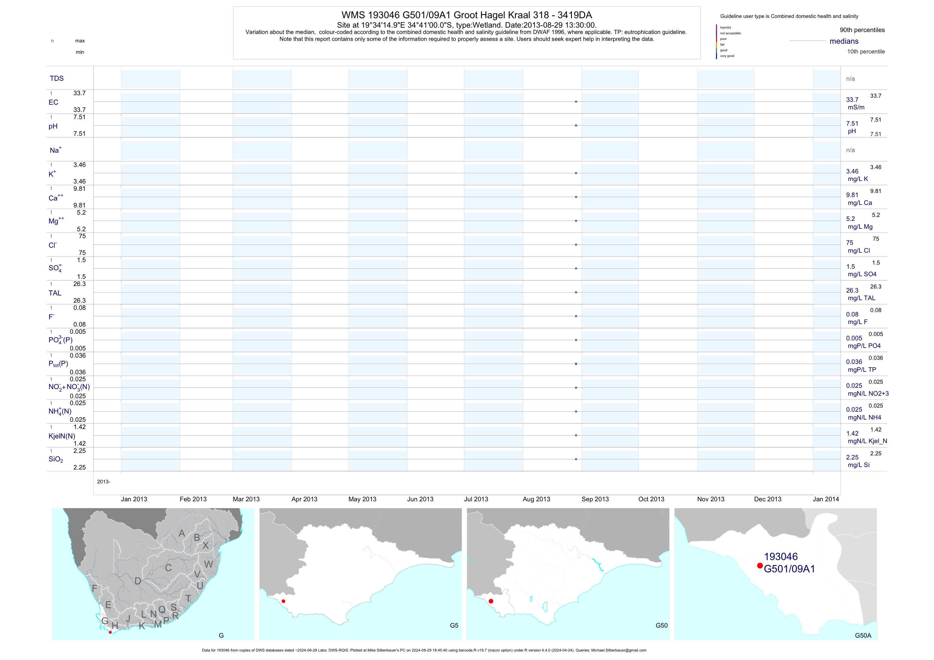
| G50 193046 | plot | data | Groot Hagel Kraal 318 - 3419DA | Wetland | 1 | 2013-08-29 | 2013-08-29 | 34 | G501/09A1 | -34.68333 | 19.57083 |
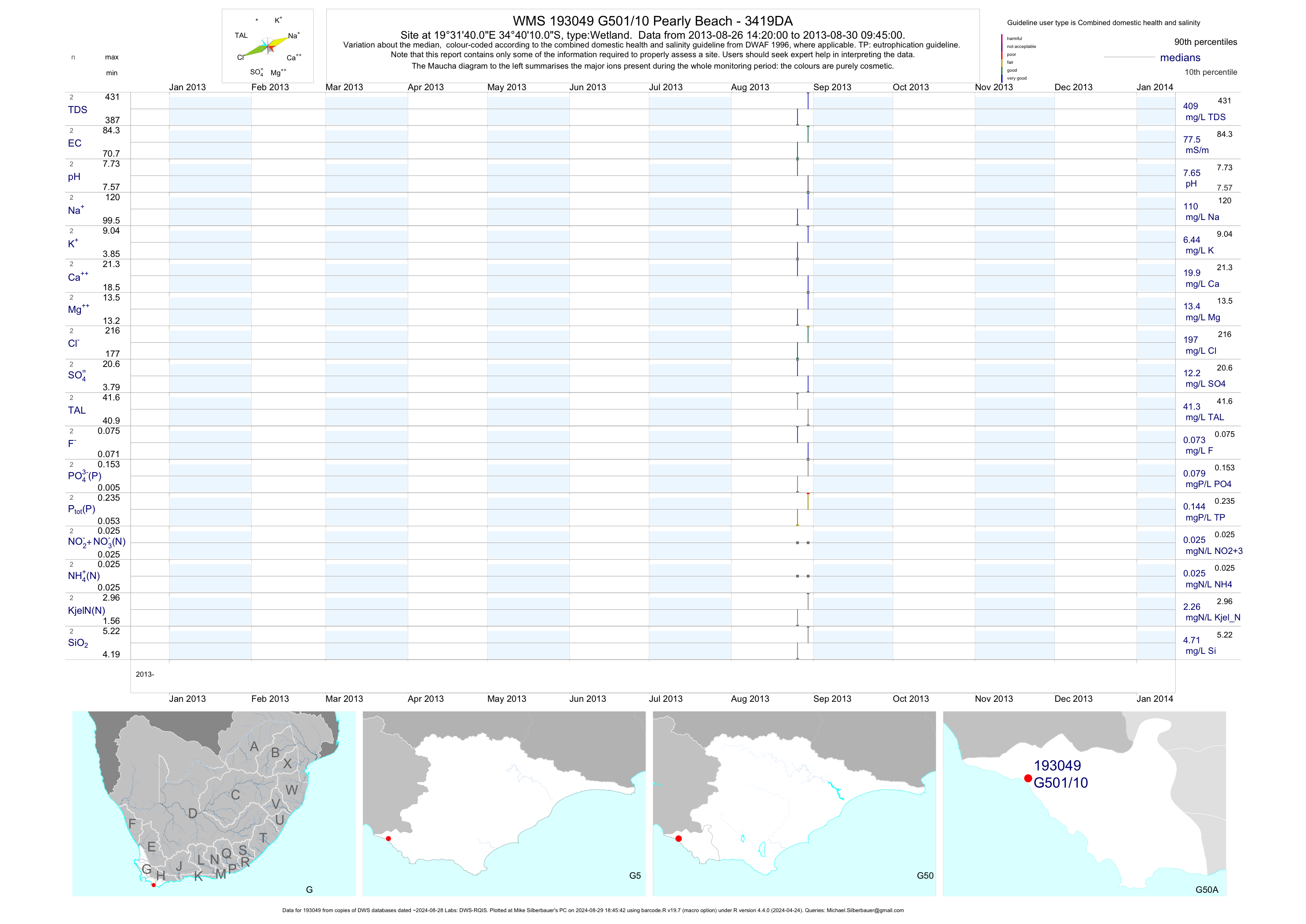
| G50 193049 | plot | data | Pearly Beach - 3419DA | Wetland | 2 | 2013-08-26 | 2013-08-30 | 78 | G501/10 | -34.66944 | 19.52778 |
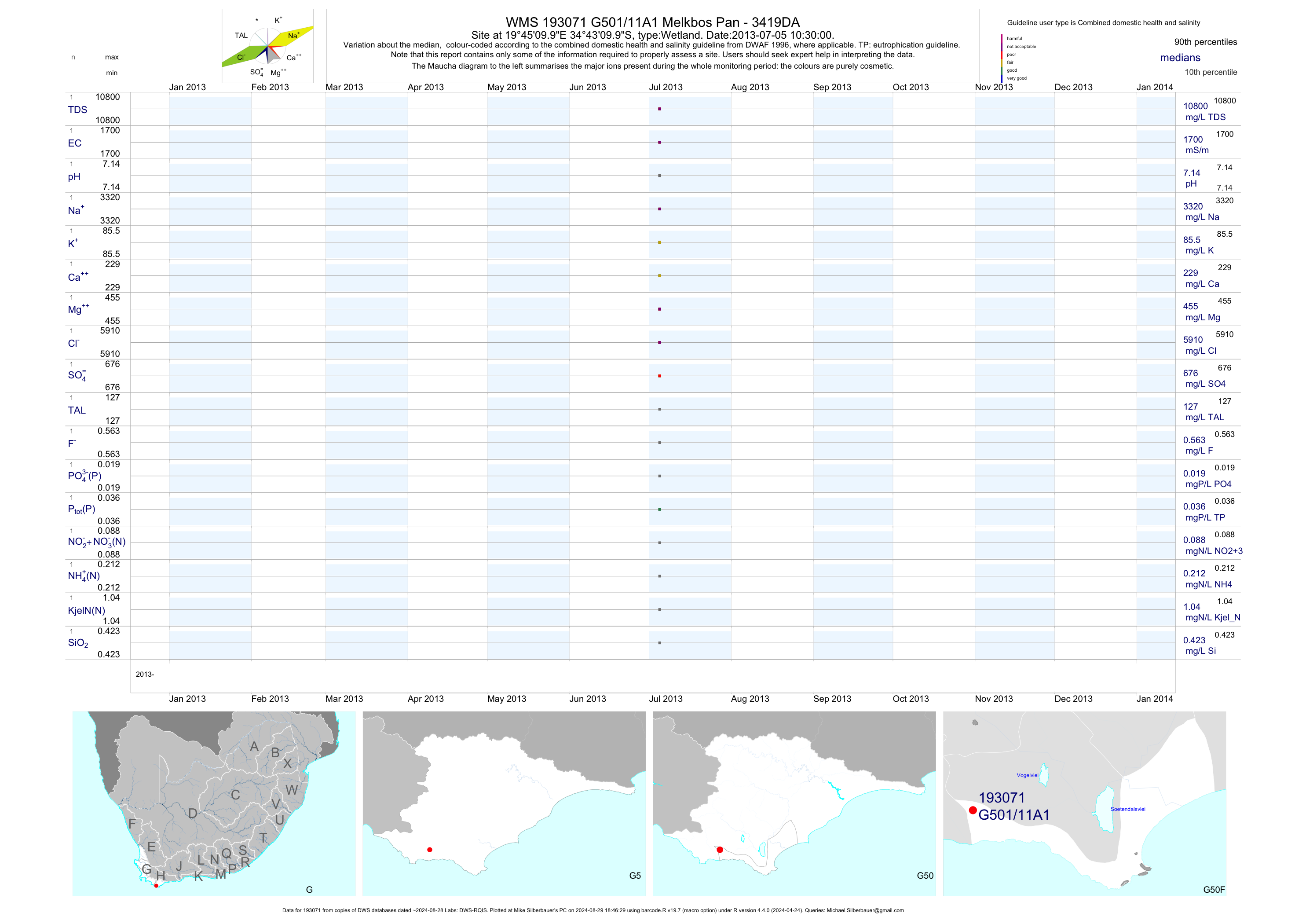
| G50 193071 | plot | data | Melkbos Pan - 3419DA | Wetland | 1 | 2013-07-05 | 2013-07-05 | 1702 | G501/11A1 | -34.71944 | 19.75278 |
| G50 193098 | plot | data | Die Pan (Vispan) - 3419DA | Wetland | 1 | 2013-07-05 | 2013-07-05 | n/a | G501/12 | -34.74444 | 19.75278 |
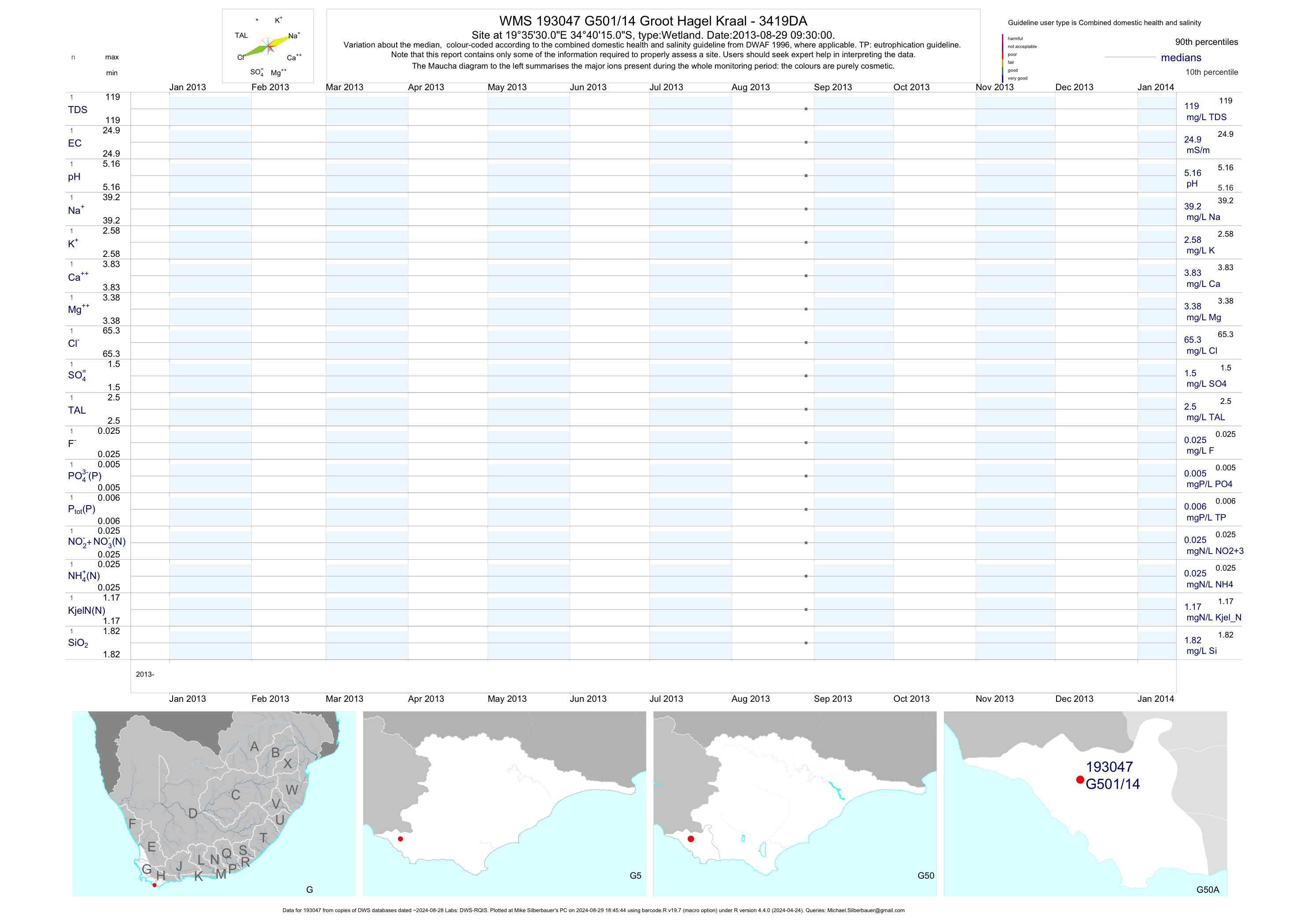
| G50 193047 | plot | data | Groot Hagel Kraal - 3419DA | Wetland | 1 | 2013-08-29 | 2013-08-29 | 25 | G501/14 | -34.67083 | 19.59167 |
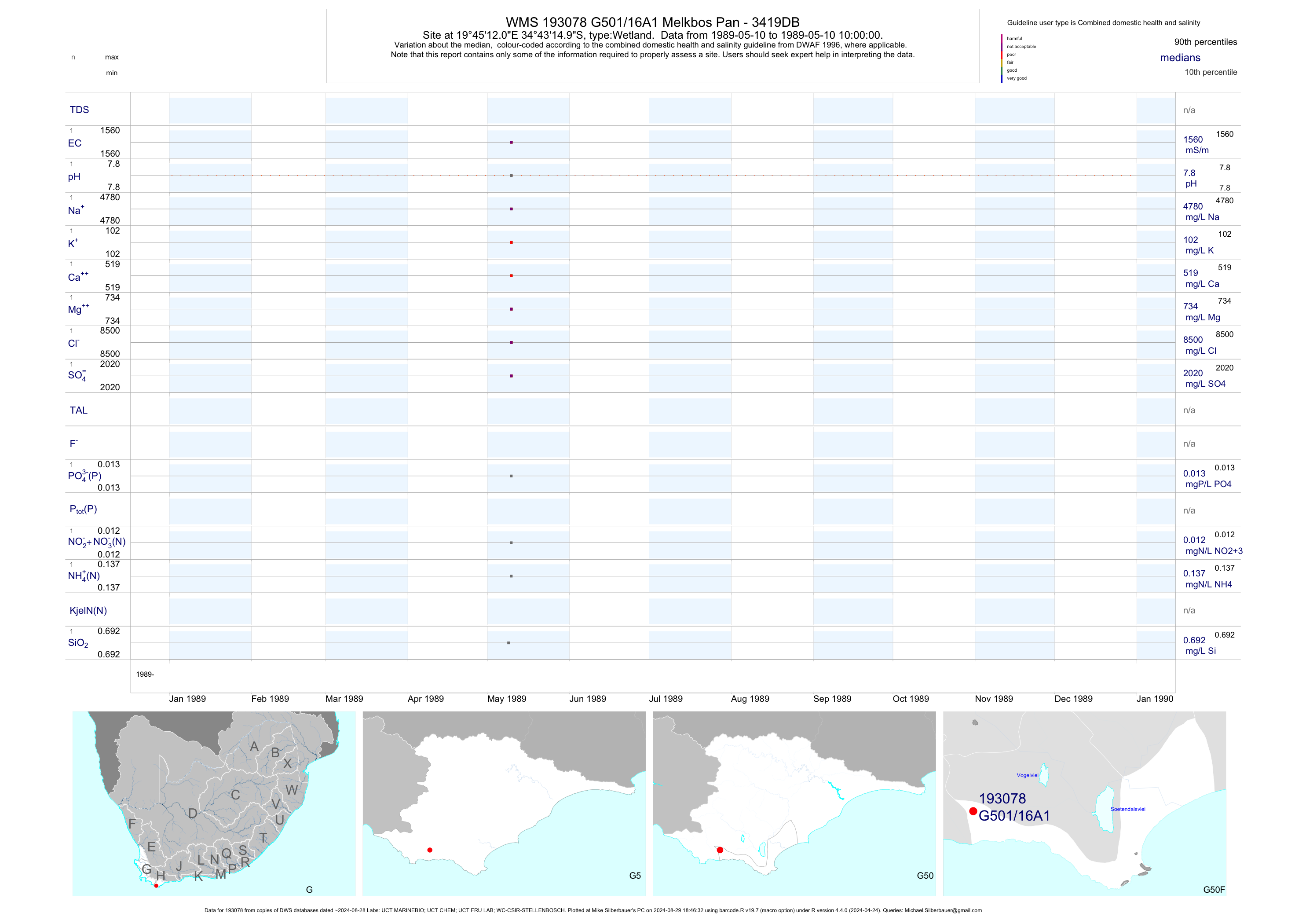
| G50 193078 | plot | data | Melkbos Pan - 3419DB | Wetland | 5 | 1989-05-10 | 1989-05-10 | 1561 | G501/16A1 | -34.72083 | 19.75333 |
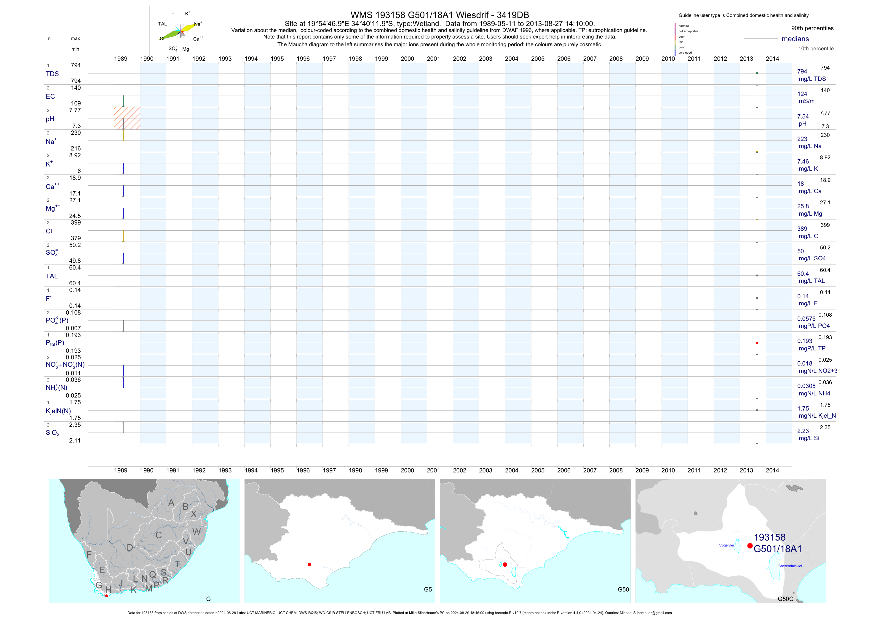
| G50 193158 | plot | data | Wiesdrif - 3419DB | Wetland | 6 | 1989-05-11 | 2013-08-27 | 124 | G501/18A1 | -34.67000 | 19.91306 |
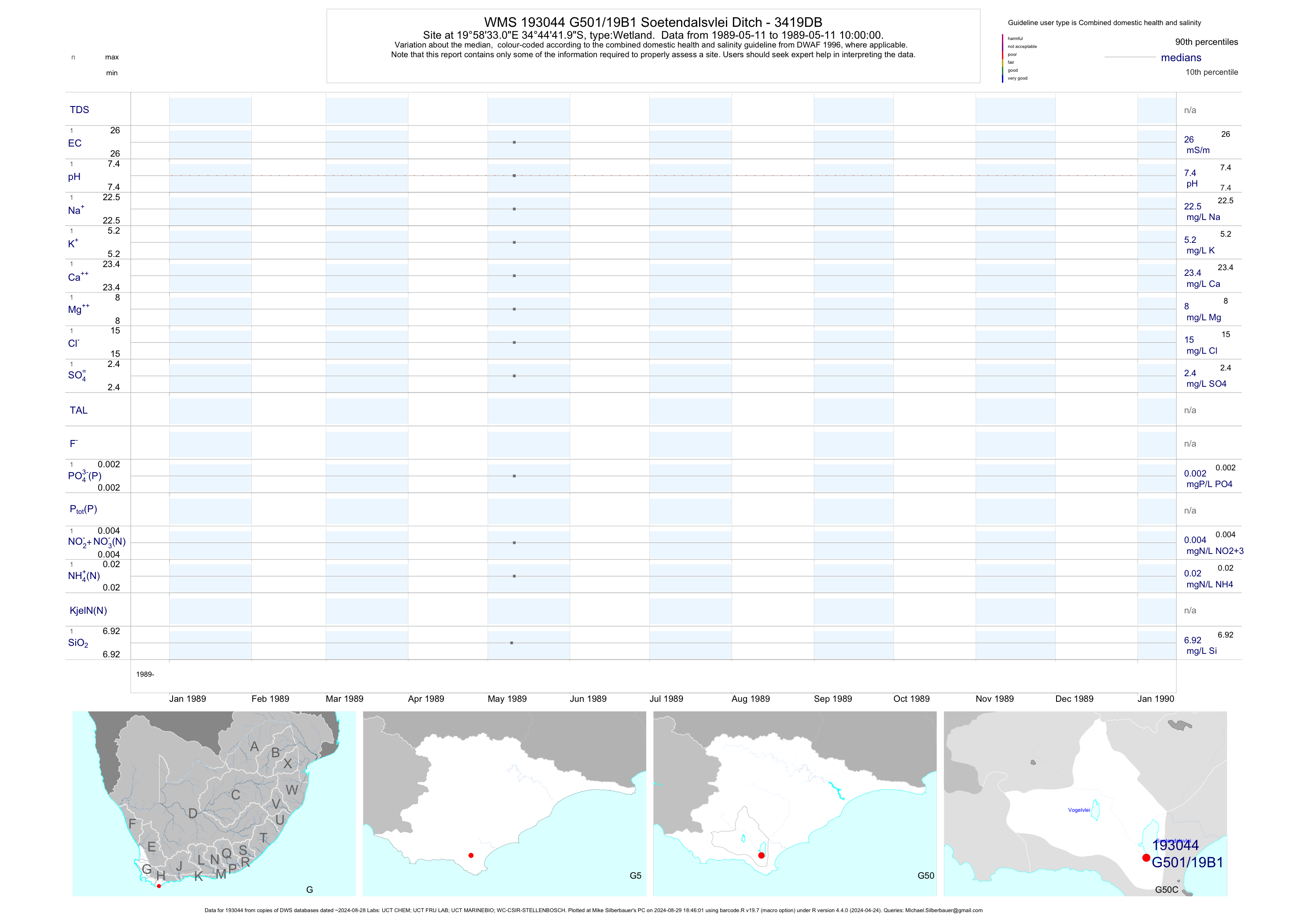
| G50 193044 | plot | data | Soetendalsvlei Ditch - 3419DB | Wetland | 5 | 1989-05-11 | 1989-05-11 | 26 | G501/19B1 | -34.74500 | 19.97583 |
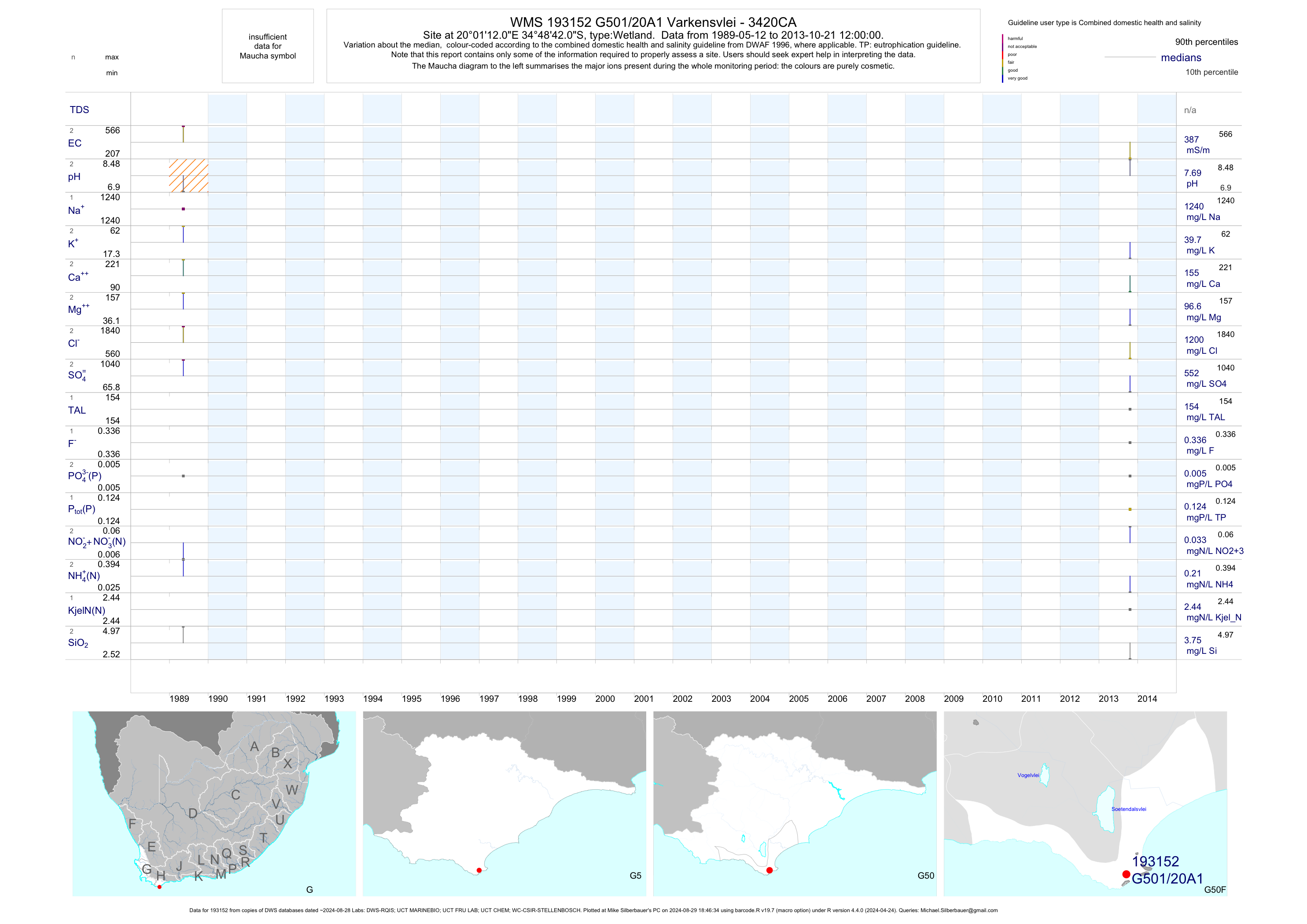
| G50 193152 | plot | data | Varkensvlei - 3420CA | Wetland | 6 | 1989-05-12 | 2013-10-21 | 387 | G501/20A1 | -34.81167 | 20.02000 |
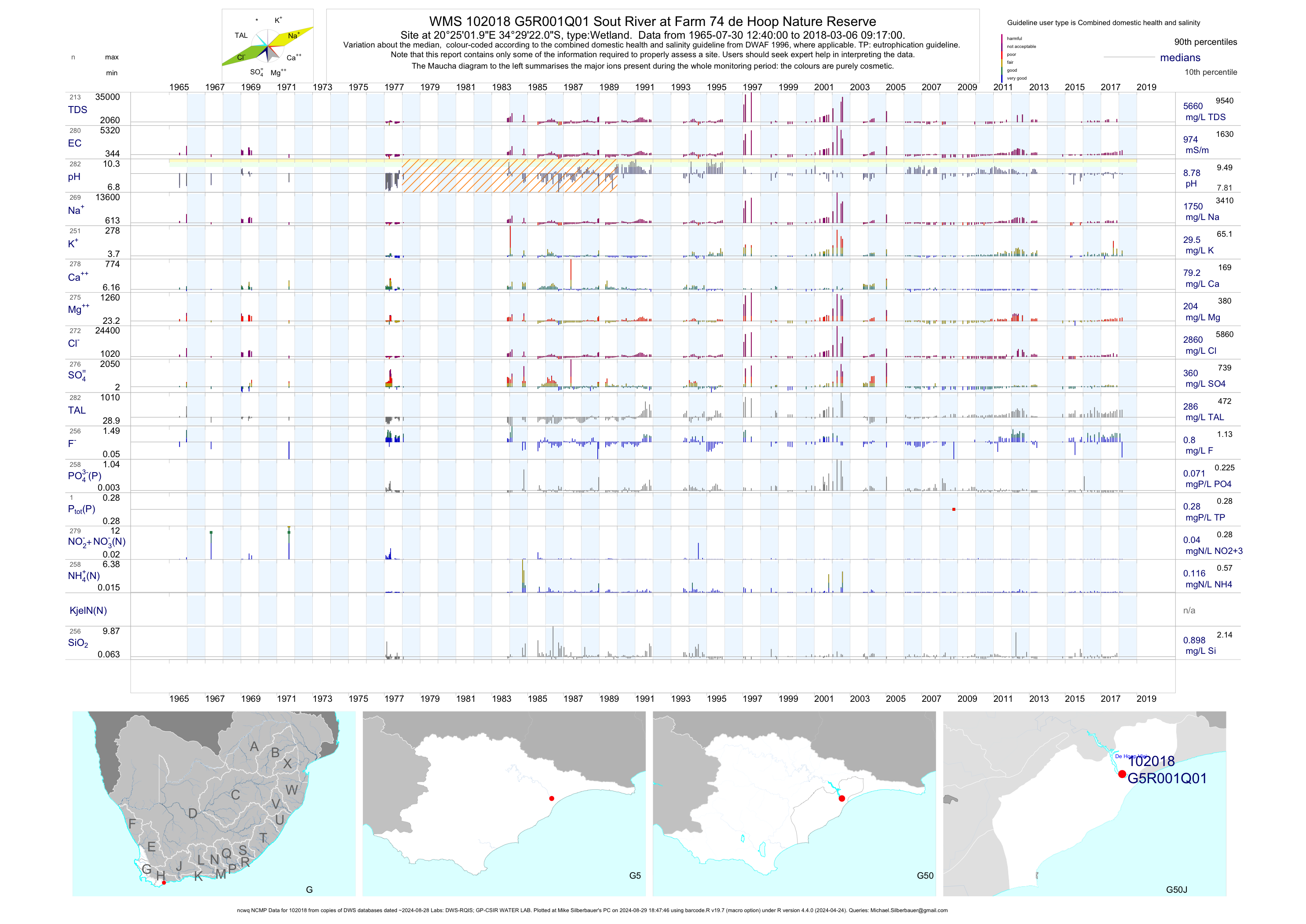
| G50 102018 | plot | data | Sout River at Farm 74 de Hoop Nature Reserve (ncwq NCMP) Q01 | Wetland | 283 | 1965-07-30 | 2018-03-06 | 974 | G5R001 | -34.48944 | 20.41722 |
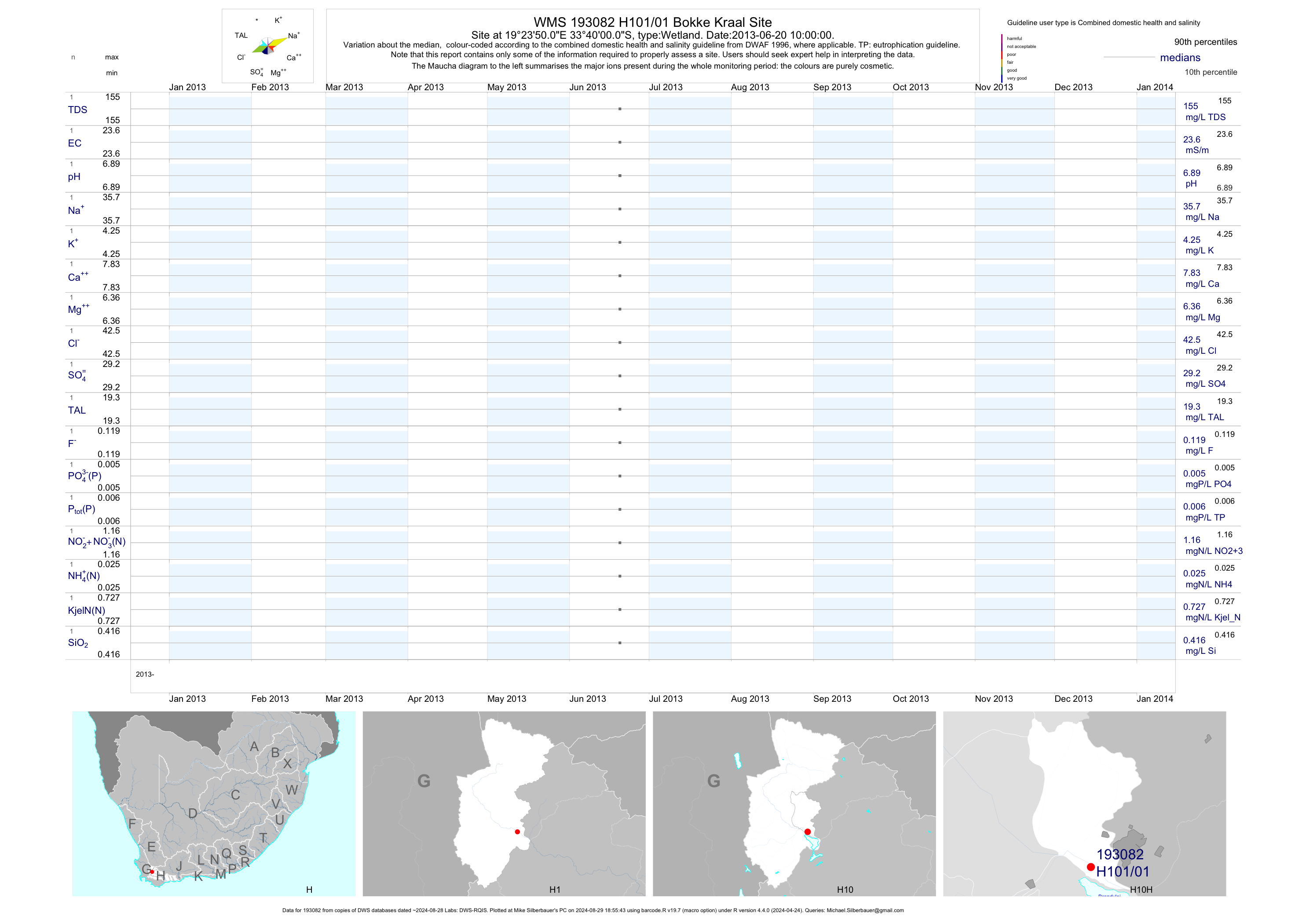
| H10 193082 | plot | data | Bokke Kraal Site | Wetland | 1 | 2013-06-20 | 2013-06-20 | 24 | H101/01 | -33.66667 | 19.39722 |
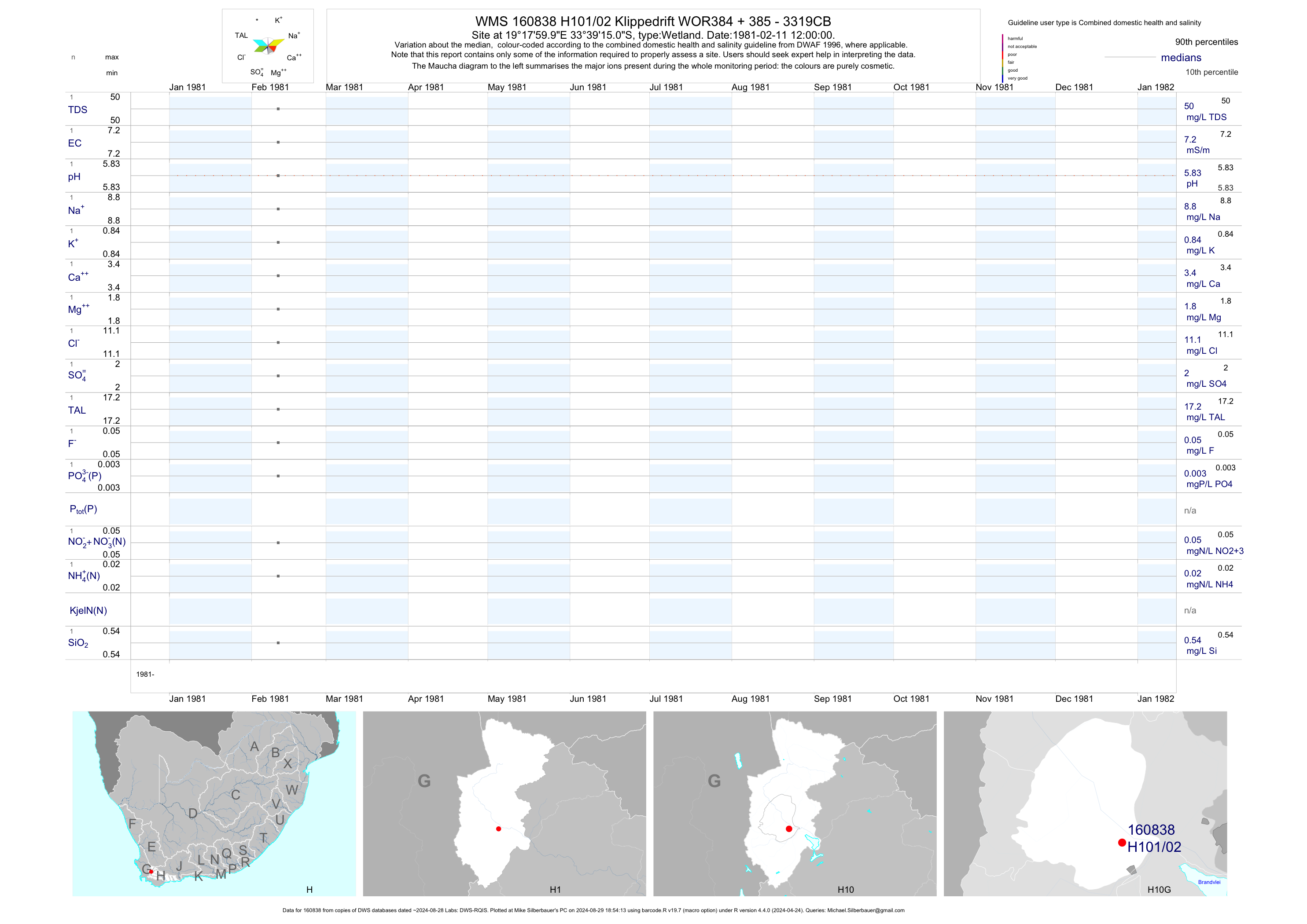
| H10 160838 | plot | data | Klippedrift WOR384 + 385 - 3319CB | Wetland | 1 | 1981-02-11 | 1981-02-11 | 7 | H101/02 | -33.65417 | 19.30000 |
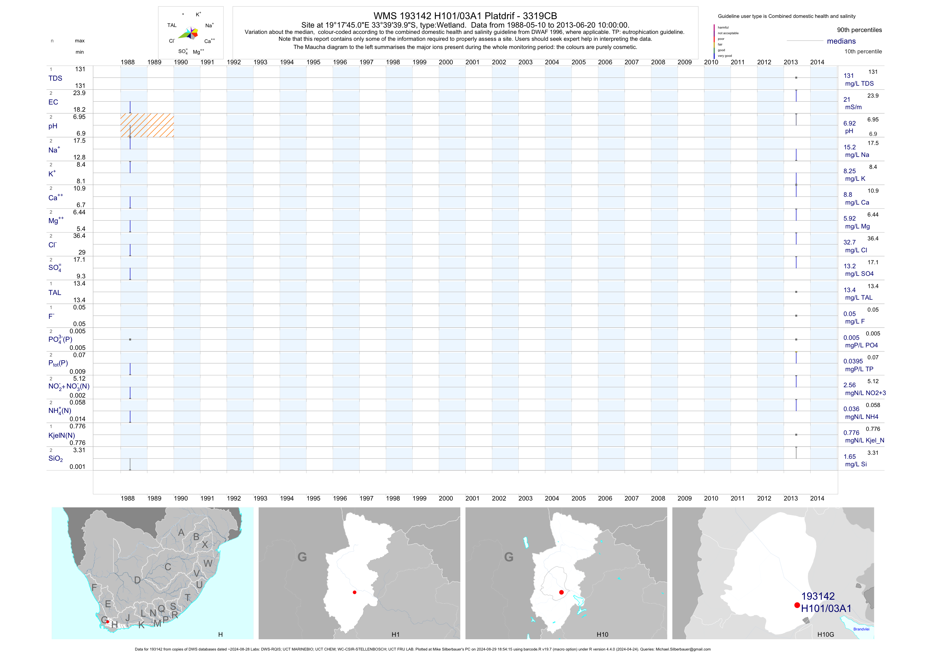
| H10 193142 | plot | data | Platdrif - 3319CB | Wetland | 6 | 1988-05-10 | 2013-06-20 | 21 | H101/03A1 | -33.66111 | 19.29583 |
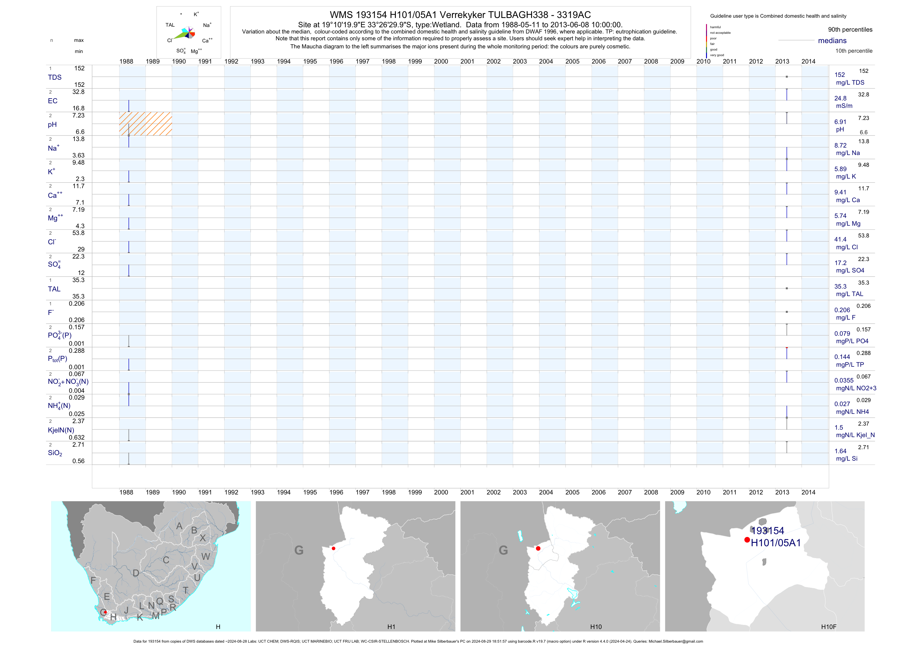
| H10 193154 | plot | data | Verrekyker TULBAGH338 - 3319AC | Wetland | 6 | 1988-05-11 | 2013-06-08 | 25 | H101/05A1 | -33.44167 | 19.17222 |
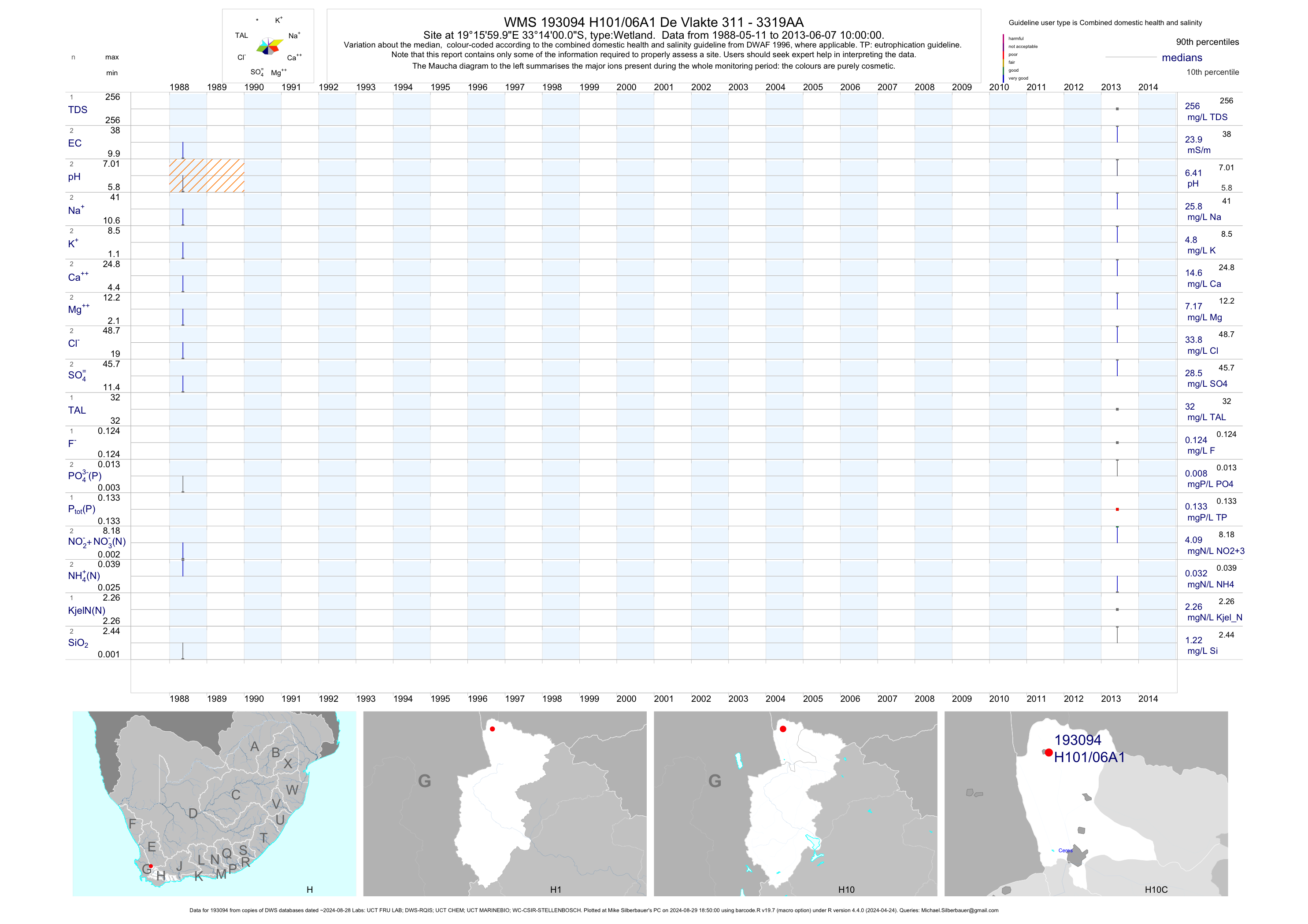
| H10 193094 | plot | data | De Vlakte 311 - 3319AA | Wetland | 6 | 1988-05-11 | 2013-06-07 | 24 | H101/06A1 | -33.23333 | 19.26667 |
| H10 188205 | plot | data | Wolseley Forest Reserve on Skilpadgat (nemp) | Pan | 22 | 2004-12-01 | 2008-08-14 | 37 | 188205 | -33.43614 | 19.17639 |
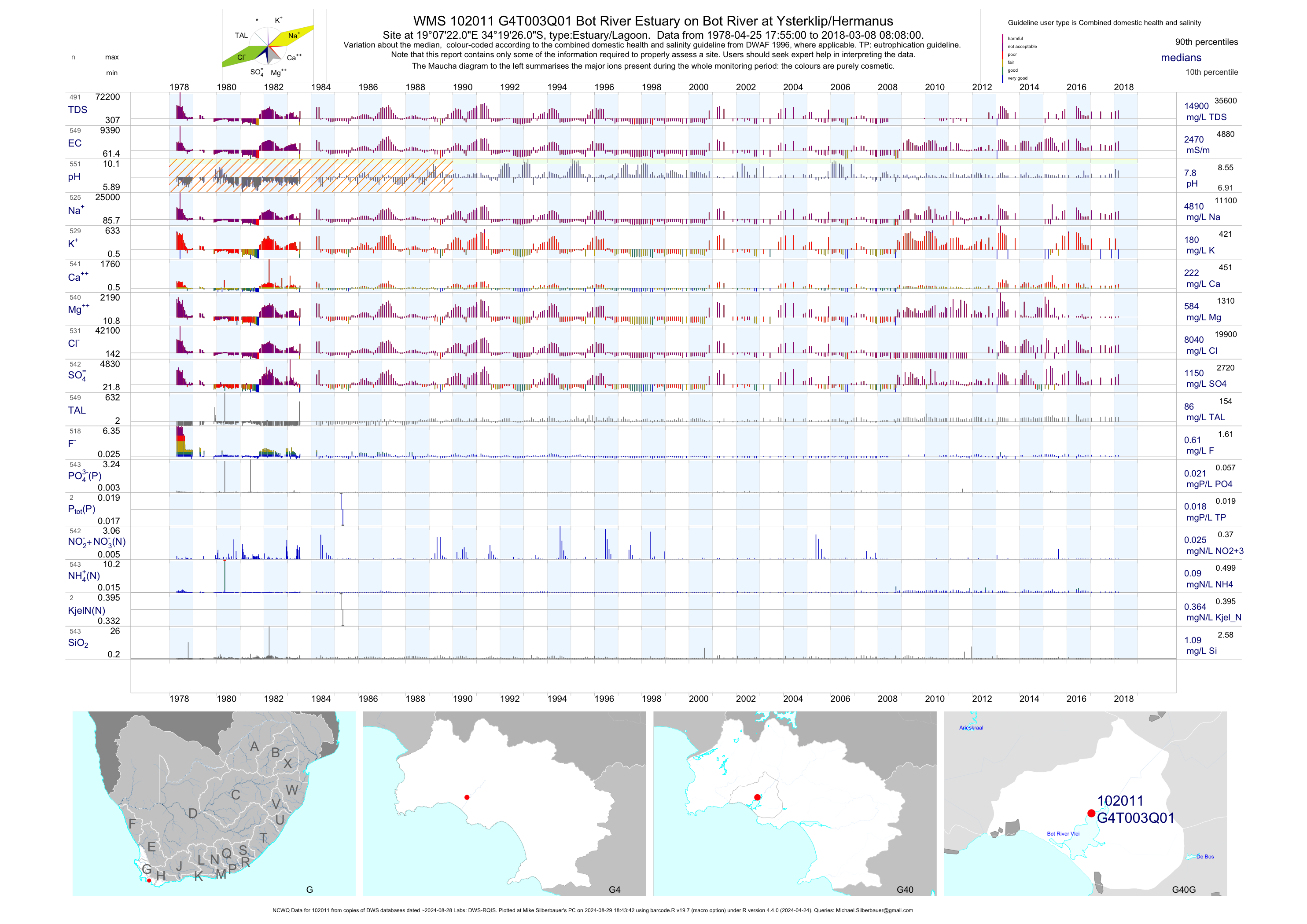
| G40 102011 | plot | data | Bot River Estuary on Bot River at Ysterklip/Hermanus (NCWQ) | Estuary/Lagoon | 551 | 1978-04-25 | 2018-03-08 | 2471 | G4T003 | -34.32389 | 19.12278 |
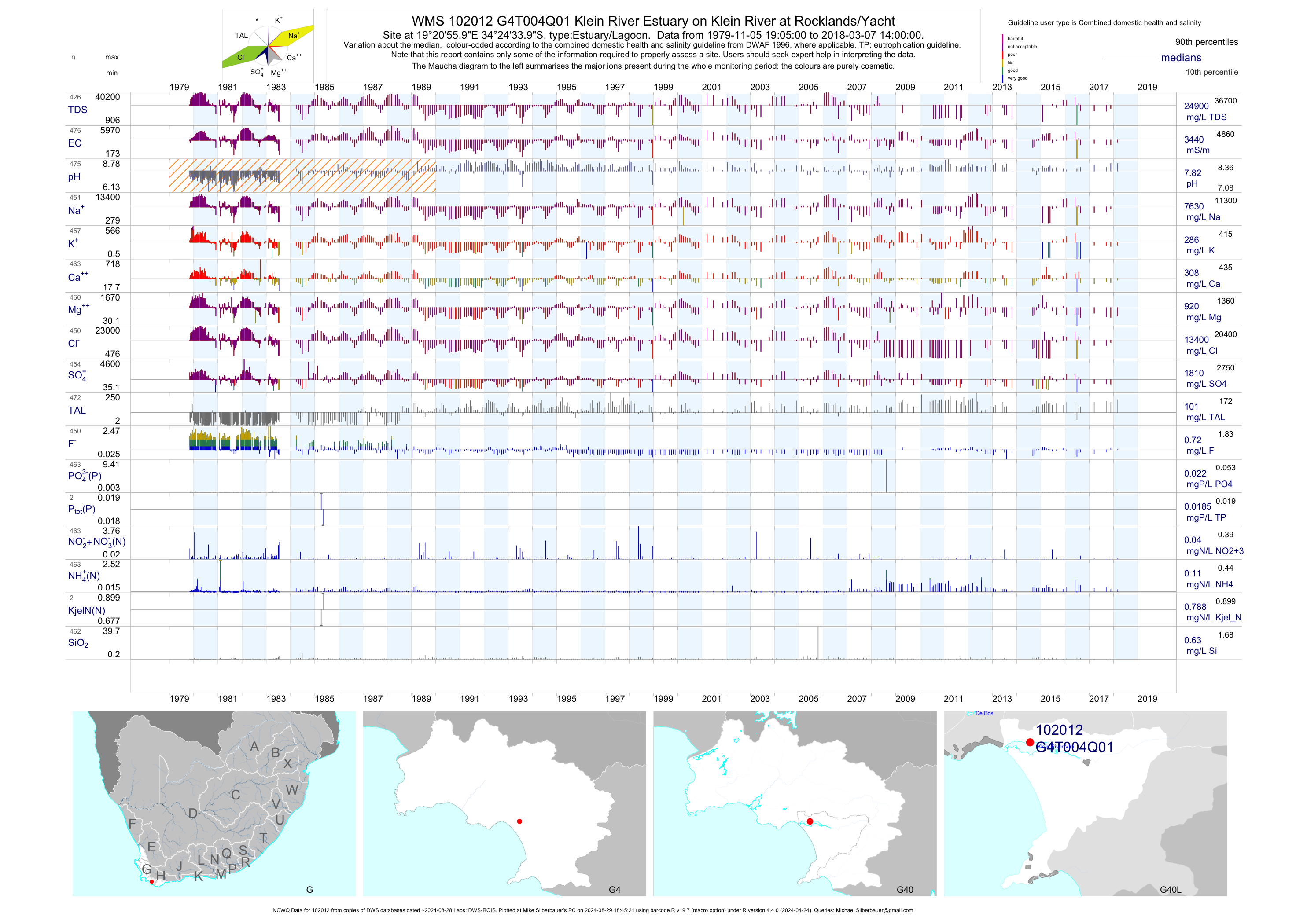
| G40 102012 | plot | data | Klein River Estuary on Klein River at Rocklands/Yacht (NCWQ) | Estuary/Lagoon | 475 | 1979-11-05 | 2018-03-07 | 3436 | G4T004 | -34.40944 | 19.34889 |
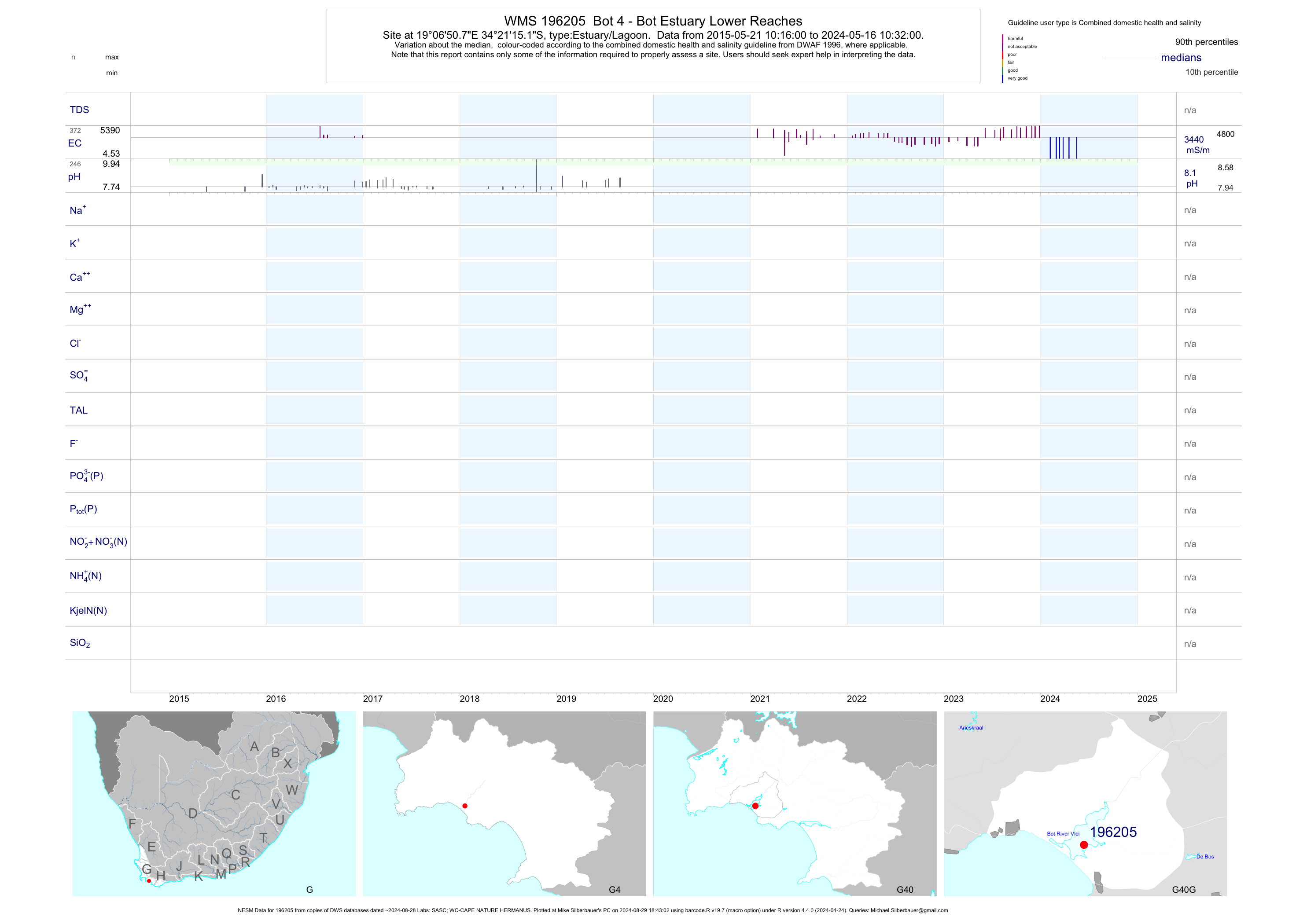
| G40 196205 | plot | data | Bot 4 - Bot Estuary Lower Reaches (NESM) | Estuary/Lagoon | 40 | 2015-05-21 | 2019-04-23 | 3782 | 196205 | -34.35422 | 19.11411 |
| G40 196206 | plot | data | Bot 2 - Bot Estuary at Estuary Mouth (NESM) | Estuary/Lagoon | 41 | 2015-05-21 | 2019-04-23 | 3772 | 196206 | -34.35956 | 19.10444 |
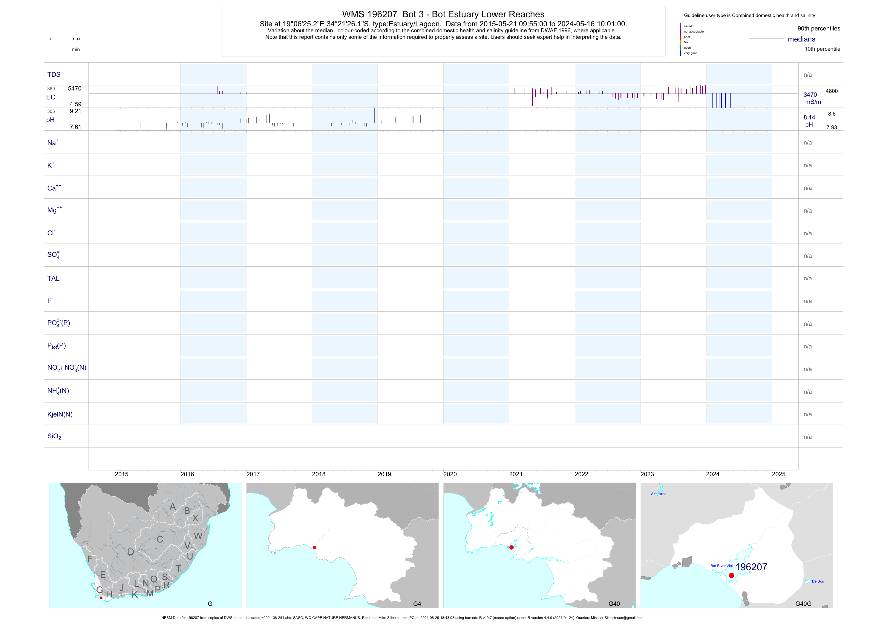
| G40 196207 | plot | data | Bot 3 - Bot Estuary Lower Reaches (NESM) | Estuary/Lagoon | 40 | 2015-05-21 | 2019-04-23 | 3807 | 196207 | -34.35725 | 19.10700 |
| G40 196208 | plot | data | Bot 5 - Bot Estuary Middle Reaches B (West) (NESM) | Estuary/Lagoon | 42 | 2015-05-21 | 2019-04-23 | 3819 | 196208 | -34.35111 | 19.11033 |
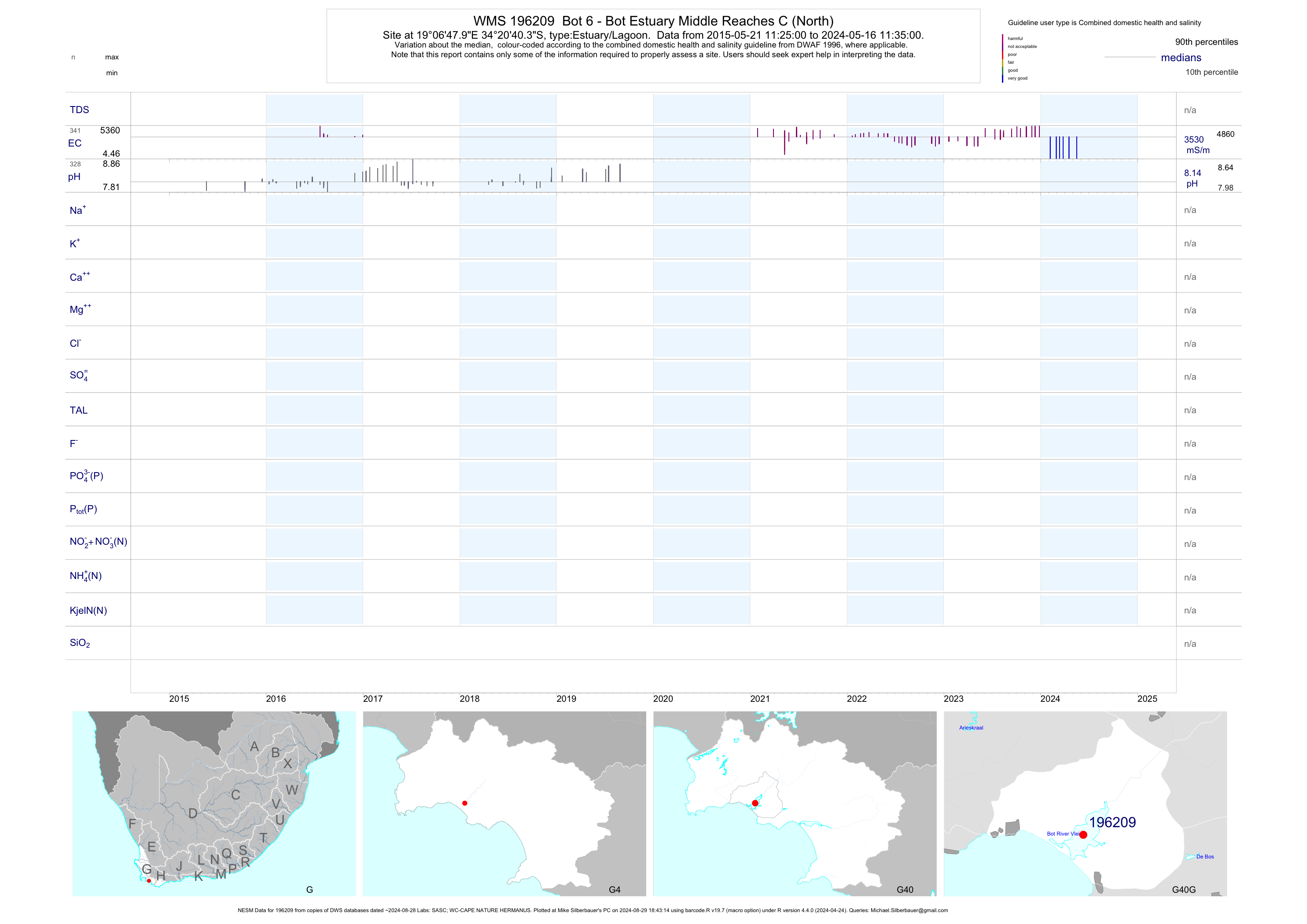
| G40 196209 | plot | data | Bot 6 - Bot Estuary Middle Reaches C (North) (NESM) | Estuary/Lagoon | 44 | 2015-05-21 | 2019-04-23 | 3804 | 196209 | -34.34456 | 19.11331 |
| G40 196210 | plot | data | Bot 7 - Bot Estuary Benquela Cove a (South) (NESM) | Estuary/Lagoon | 43 | 2015-05-21 | 2019-04-23 | 3801 | 196210 | -34.34017 | 19.11808 |
| G40 196211 | plot | data | Bot 8 - Bot Estuary Benquela Cove B (North) (NESM) | Estuary/Lagoon | 43 | 2015-05-21 | 2019-04-23 | 3820 | 196211 | -34.33170 | 19.12208 |
| G40 196212 | plot | data | Bot 9 - Bot Estuary Arrabela a (West) (NESM) | Estuary/Lagoon | 43 | 2015-05-21 | 2019-04-23 | 3756 | 196212 | -34.32622 | 19.12744 |
| G40 196213 | plot | data | Bot 10 - Bot Estuary Arrabela B (East) (NESM) | Estuary/Lagoon | 43 | 2015-05-21 | 2019-04-23 | 3780 | 196213 | -34.32856 | 19.12978 |
| G40 196214 | plot | data | Bot 11 - Bot Estuary Benquela Cove C (East) (NESM) | Estuary/Lagoon | 43 | 2015-05-21 | 2019-04-23 | 3773 | 196214 | -34.34072 | 19.12514 |
| G40 196215 | plot | data | Bot 12 - Bot Estuary Benquela Cove D (Spit) (NESM) | Estuary/Lagoon | 41 | 2015-05-21 | 2019-04-23 | 3793 | 196215 | -34.35142 | 19.12214 |
| G40 196216 | plot | data | Bot 13 - Bot Estuary Fisherhaven Riverside Road (NESM) | Estuary/Lagoon | 37 | 2015-05-21 | 2019-04-23 | 3753 | 196216 | -34.35433 | 19.12450 |
| G40 196217 | plot | data | Bot 1 - Bot Estuary Fisherhaven Slipway (NESM) | Estuary/Lagoon | 39 | 2015-05-21 | 2019-04-23 | 5055 | 196217 | -34.35547 | 19.12434 |
| G40 196223 | plot | data | Klein 1 - Klein Estuary Klein 1 LR - Mond | Estuary/Lagoon | 29 | 2015-05-22 | 2019-04-23 | 2813 | 196223 | -34.41553 | 19.29436 |
| G40 196225 | plot | data | Klein 2 - Klein Estuary Klein 2 LR Prawn Flats | Estuary/Lagoon | 41 | 2015-05-22 | 2019-04-23 | 2919 | 196225 | -34.41583 | 19.31025 |
| G40 196226 | plot | data | Klein 3 - Klein Estuary Klein 3 LR Elf Point | Estuary/Lagoon | 39 | 2015-10-14 | 2019-04-23 | 2935 | 196226 | -34.41547 | 19.31403 |
| G40 196227 | plot | data | Klein 4 - Klein Estuary Klein 4 Mr Maanskynbaai | Estuary/Lagoon | 44 | 2015-05-22 | 2019-04-23 | 2934 | 196227 | -34.40917 | 19.33000 |
| G40 196228 | plot | data | Klein 5 - Klein Estuary Klein 5 Mr Mccarthy | Estuary/Lagoon | 42 | 2015-05-22 | 2019-04-23 | 2840 | 196228 | -34.41400 | 19.34208 |
| G40 196229 | plot | data | Klein 6 - Klein Estuary Klein 6 Mr Yacht Club | Estuary/Lagoon | 43 | 2015-05-22 | 2019-04-23 | 2873 | 196229 | -34.41083 | 19.35003 |
| G40 196230 | plot | data | Klein 7 - Klein Estuary Klein 7 Mr Mosaic Farm | Estuary/Lagoon | 40 | 2015-10-14 | 2019-04-23 | 2883 | 196230 | -34.41867 | 19.34736 |
| G40 196231 | plot | data | Klein 8 - Klein Estuary Klein 8 Mr Rocklands | Estuary/Lagoon | 43 | 2015-05-22 | 2019-04-23 | 2906 | 196231 | -34.41119 | 19.36642 |
| G40 196232 | plot | data | Klein 9 - Klein Estuary Klein 9 Mr CSIR 9 | Estuary/Lagoon | 41 | 2015-10-14 | 2019-04-23 | 2844 | 196232 | -34.41108 | 19.37139 |
| G40 196233 | plot | data | Klein 10 - Klein Estuary Klein 10 Ur Channel | Estuary/Lagoon | 42 | 2015-10-14 | 2019-04-23 | 2919 | 196233 | -34.41144 | 19.37847 |
| G40 196234 | plot | data | Klein 11 - Klein Estuary 11 Ur Set Site | Estuary/Lagoon | 39 | 2015-05-22 | 2019-04-23 | 2511 | 196234 | -34.42465 | 19.41300 |
| G40 196235 | plot | data | Klein 12 - Klein Estuary Klein 12 Ur Lochinvar Farm | Estuary/Lagoon | 38 | 2015-05-22 | 2019-04-23 | 2496 | 196235 | -34.42959 | 19.42991 |
| G40 196236 | plot | data | Klein 13 - Klein Estuary Klein 13 Ur Powerlines | Estuary/Lagoon | 37 | 2015-05-22 | 2019-04-23 | 2751 | 196236 | -34.43282 | 19.44148 |
| G40 196237 | plot | data | Klein 14 - Klein Estuary Klein 14 Ur Down River from Slip | Estuary/Lagoon | 40 | 2015-05-22 | 2019-04-23 | 2469 | 196237 | -34.43582 | 19.45250 |
| G40 196238 | plot | data | Klein 15 - Klein Estuary Klein 15 Ur | Estuary/Lagoon | 36 | 2015-05-22 | 2019-04-23 | 2398 | 196238 | -34.43148 | 19.45833 |
| H70 193359 | plot | data | Government Slipway at Breede Estuary (NESM) | Estuary/Lagoon | 72 | 2012-02-07 | 2019-03-22 | 5430 | BR-01 | -34.39830 | 20.83749 |
| H70 193360 | plot | data | Fishing Lodge at Breede Estuary (NESM) | Estuary/Lagoon | 85 | 2012-03-09 | 2019-03-22 | 5383 | BR-02 | -34.39800 | 20.82678 |
| H70 193361 | plot | data | Mudlark Breede Estuary (NESM) | Estuary/Lagoon | 75 | 2012-03-09 | 2019-03-22 | 5310 | BR-03 | -34.40430 | 20.80826 |
| H70 193362 | plot | data | Goudmyn at Breede Estuary (NESM) | Estuary/Lagoon | 73 | 2012-03-09 | 2019-03-22 | 4617 | BR-04 | -34.40410 | 20.78775 |
| H70 193363 | plot | data | Karoolskraal at Breede Estuary (NESM) | Estuary/Lagoon | 79 | 2012-03-09 | 2019-03-22 | 3323 | BR-05 | -34.39400 | 20.76631 |
| H70 193364 | plot | data | Powerlines at Breede Estuary (NESM) | Estuary/Lagoon | 72 | 2012-03-09 | 2019-03-22 | 3259 | BR-06 | -34.39240 | 20.75099 |
| H70 193365 | plot | data | 13KM from Mouth at Breede Estuary (NESM) | Estuary/Lagoon | 68 | 2012-03-09 | 2019-03-22 | 3110 | BR-07 | -34.38860 | 20.73876 |
| H70 193366 | plot | data | Whitehouse at Breede Estuary (NESM) | Estuary/Lagoon | 73 | 2012-03-09 | 2019-03-22 | 2757 | BR-08 | -34.37700 | 20.71934 |
| H70 193367 | plot | data | 17KM from Mouth at Breede Estuary (NESM) | Estuary/Lagoon | 66 | 2012-03-09 | 2019-03-22 | 2174 | BR-09 | -34.36230 | 20.70075 |
| H70 193368 | plot | data | Bobbejaanskrans at Breede Estuary (NESM) | Estuary/Lagoon | 58 | 2012-03-09 | 2019-03-22 | 1685 | BR-10 | -34.34740 | 20.68786 |
| H70 193369 | plot | data | Ronnies at Breede Estuary (NESM) | Estuary/Lagoon | 50 | 2012-03-09 | 2019-03-22 | 1576 | BR-11 | -34.34961 | 20.67194 |
| H70 193370 | plot | data | Bushpub at Breede Estuary (NESM) | Estuary/Lagoon | 39 | 2012-03-09 | 2019-03-22 | 1123 | BR-12 | -34.35163 | 20.65083 |
| H70 193371 | plot | data | Kemp at Breede Estuary (NESM) | Estuary/Lagoon | 38 | 2012-03-09 | 2019-03-22 | 826 | BR-13 | -34.34965 | 20.66498 |
| H70 193372 | plot | data | The Riverine at Breede Estuary (NESM) | Estuary/Lagoon | 48 | 2012-03-09 | 2019-03-22 | 551 | BR-14 | -34.34432 | 20.61815 |
| H70 193373 | plot | data | Bluegums at Breede Estuary (NESM) | Estuary/Lagoon | 35 | 2012-03-09 | 2019-03-22 | 383 | BR-15 | -34.35134 | 20.60429 |
| H70 193374 | plot | data | Second House Duprecia at Breede Estuary (NESM) | Estuary/Lagoon | 32 | 2012-03-09 | 2019-03-22 | 329 | BR-16 | -34.34253 | 20.59933 |
| H70 193375 | plot | data | 33KM from Mouth at Breede Estuary (NESM) | Estuary/Lagoon | 40 | 2012-03-09 | 2019-03-22 | 266 | BR-17 | -34.32557 | 20.60393 |
| H70 193376 | plot | data | 35KM from Mouth at Breede Estuary (NESM) | Estuary/Lagoon | 26 | 2012-03-09 | 2019-03-22 | 184 | BR-18 | -34.31901 | 20.61669 |
| H70 193377 | plot | data | Dave Taylor at Breede Estuary (NESM) | Estuary/Lagoon | 24 | 2012-03-09 | 2019-03-22 | 250 | BR-19 | -34.30394 | 20.61299 |
| H70 193378 | plot | data | Point at Breede Estuary (NESM) | Estuary/Lagoon | 22 | 2012-03-09 | 2019-03-22 | 156 | BR-20 | -34.30263 | 20.58982 |
| H70 193379 | plot | data | at Breede Estuary (NESM) | Estuary/Lagoon | 32 | 2012-03-09 | 2019-03-22 | 131 | BR-21 | -34.29572 | 20.58549 |
| G40 181246 | plot | data | Grabouw WWTP-Overflow ex Last Mat Dam to Palmiet River | Waste Water Treatment Works | 395 | 1990-10-02 | 2016-03-16 | 56 | 181246 | -34.15833 | 19.02083 |
| G40 181403 | plot | data | Elgin Orchards WWTP-Dis ex Package Plant to Palmiet River | Waste Water Treatment Works | 317 | 1988-08-24 | 2013-11-14 | 46 | 181403 | -34.17444 | 18.99972 |
| G40 188646 | plot | data | Nieuwe Berg Nuweberg WWTP Overflow ex Cl Contact Tank to Palmiet Ri Iver | Waste Water Treatment Works | 16 | 2006-05-09 | 2009-03-19 | 31 | 188646 | -34.06810 | 19.04940 |
| G40 1000010153 | plot | data | Botrivier WWTP-Intermittant O/Flow ex Batch Reactor to River | Waste Water Treatment Works | 183 | 1997-06-03 | 2016-03-16 | 116 | 1-10153 | -34.23260 | 19.20700 |
| G40 1000010154 | plot | data | Caledon WWTP-Overflow ex Top Irri Dam to Bads River | Waste Water Treatment Works | 262 | 1991-01-21 | 2019-02-20 | 155 | 1-10154 | -34.20410 | 19.39040 |
| G40 1000010160 | plot | data | Hermanus WWTP-Overflow ex Cl Tank to Surf Zone | Waste Water Treatment Works | 486 | 1990-10-26 | 2016-03-16 | 106 | 1-10160 | -34.42820 | 19.20950 |
| G40 1000010162 | plot | data | Hawston WWTP-Overflow ex Last Mat Pond to Wetland | Waste Water Treatment Works | 371 | 1997-06-03 | 2016-03-16 | 112 | 1-10162 | -34.37360 | 19.12760 |
| G40 1000010164 | plot | data | Gansbaai WWTP-Overflow ex Last Mat Pond to Wetland | Waste Water Treatment Works | 252 | 1997-11-18 | 2016-03-16 | 186 | 1-10164 | -34.59130 | 19.34230 |
| G40 1000010167 | plot | data | Stanford WWTP-Final Effluent Discharge to Klein River | Waste Water Treatment Works | 217 | 1997-07-15 | 2016-03-16 | 129 | 1-10167 | -34.45380 | 19.44890 |
| G40 1000010169 | plot | data | Kleinmond WWTP-Overflow ex Last Mat Pond to Wetland | Waste Water Treatment Works | 168 | 2003-02-21 | 2016-03-16 | 81 | 1-10169 | -34.33610 | 18.98900 |
| G40 1000010225 | plot | data | Molteno Bros WWTP-Overflow ex Last Mat Pond to Palmiet River | Waste Water Treatment Works | 64 | 2004-09-30 | 2013-12-02 | 24 | 1-10225 | -34.14220 | 19.04140 |
| G40 1000010252 | plot | data | Elgin Fruit Packers Grabouw-Overflow ex Dam to Palmiet River | Waste Water Treatment Works | 65 | 2004-09-29 | 2013-11-14 | 22 | 1-10252 | -34.16900 | 19.00850 |
| G50 1000010134 | plot | data | Bredasdorp WWTP-Overflow ex Last Mat Pond to Droerivier | Waste Water Treatment Works | 129 | 2000-01-04 | 2019-02-20 | 198 | 1-10134 | -34.54770 | 20.06050 |
| H10 181420 | plot | data | Wolseley WWTP-S-E Disch to Unnamed Trib of Breede | Waste Water Treatment Works | 299 | 2000-06-06 | 2019-02-19 | 65 | 181420 | -33.42500 | 19.18472 |
| H10 200000053 | plot | data | Goudini Spa WWTP-Overflow ex Last Mat Pond to Badsrivier | Waste Water Treatment Works | 347 | 1995-01-23 | 2019-02-18 | 34 | 2-53 | -33.67056 | 19.26389 |
| H10 200000055 | plot | data | Eureka Yc WWTP-B Cntrl-O/Flow ex Cl Tank to Kliprivier | Waste Water Treatment Works | 194 | 1995-01-23 | 2019-02-18 | 49 | 2-55 | -33.67611 | 19.27167 |
| H10 1000009535 | plot | data | Dwarsrivier Prison WWTP-Overflow ex Last Mat Dam to Irri Dam | Waste Water Treatment Works | 240 | 2000-01-06 | 2019-02-19 | 68 | 1-9535 | -33.47010 | 19.20660 |
| H10 1000009556 | plot | data | Rawsonville WWTP-Overflow ex Last Mat Pond to Smalblaar Riv | Waste Water Treatment Works | 133 | 2004-01-14 | 2019-02-18 | 52 | 1-9556 | -33.68130 | 19.33310 |
| H20 181429 | plot | data | Worcester WWTP-O/Flow ex Last Mat Pond to Breede River | Waste Water Treatment Works | 242 | 2000-02-01 | 2019-02-18 | 93 | 181429 | -33.67083 | 19.45000 |
| H20 1000009547 | plot | data | De Doorns WWTP-Overflow ex Final Mat Pond to Hex River | Waste Water Treatment Works | 168 | 1998-03-16 | 2019-02-19 | 77 | 1-9547 | -33.47810 | 19.65480 |
| H30 181435 | plot | data | Ashton WWTP-Overflow ex Last Ox Pond to Sarahs River | Waste Water Treatment Works | 240 | 1999-12-06 | 2019-02-18 | 144 | 181435 | -33.84417 | 20.07917 |
| H30 181436 | plot | data | Montagu WWTP-Overflow ex Final Ox Pond to Kingna River | Waste Water Treatment Works | 229 | 1999-12-06 | 2019-02-18 | 147 | 181436 | -33.78750 | 20.13500 |
| H40 181286 | plot | data | Robertson WWTP-Overflow ex Last Ox Pond to Breede via Hoops | Waste Water Treatment Works | 239 | 1999-12-06 | 2019-02-18 | 150 | 181286 | -33.81917 | 19.87278 |
| H40 1000009541 | plot | data | Mcgregor WWTP-Overflow ex Final Ox Pond to Irrigation Area | Waste Water Treatment Works | 44 | 2004-03-15 | 2007-09-20 | 148 | 1-9541 | -33.93740 | 19.83950 |
| H50 181450 | plot | data | Bonnievale WWTP-Overflow ex Final Ox Pond to Irrigation Site | Waste Water Treatment Works | 65 | 2004-03-15 | 2010-06-10 | 148 | 181450 | -33.90944 | 20.10833 |
| H60 181456 | plot | data | Villiersdorp WWTP-Overflow ex Last Mat Pond to Elands River | Waste Water Treatment Works | 300 | 1992-10-26 | 2019-02-20 | 51 | 181456 | -33.99583 | 19.28333 |
| H60 190934 | plot | data | WC-Genadendal WWTW Genadendal 39 - at V-Notch from Final Maturation Pond Discharge to Riviersond | Waste Water Treatment Works | 73 | 2008-10-30 | 2019-02-20 | 73 | 190934 | -34.05318 | 19.56769 |
| H60 1000009533 | plot | data | Dpw-Helderstroom Prison WWTP-Overflow ex Last Ox Pond | Waste Water Treatment Works | 239 | 2000-01-04 | 2019-02-20 | 33 | 1-9533 | -34.07650 | 19.37060 |
| H70 1000009534 | plot | data | Buffeljagsrivier Prison WWTP | Waste Water Treatment Works | 220 | 2000-01-04 | 2019-02-20 | 51 | 1-9534 | -34.03410 | 20.54080 |
| H70 1000010118 | plot | data | Klipprivier Swelllendam WWTW Discharge to Klipriver | Waste Water Treatment Works | 140 | 2000-01-04 | 2019-02-20 | 61 | 1-10118 | -34.03780 | 20.42220 |
| H70 1000010119 | plot | data | Swellendam New WWTP-Discharge to Kliprivier | Waste Water Treatment Works | 186 | 2000-01-04 | 2014-02-20 | 119 | 1-10119 | -34.04140 | 20.43130 |
| H10 102032 | plot | data | Brandvlei Dam: Right Canal | Canal | 19 | 1972-04-30 | 1983-04-11 | 7 | H1H027 | -33.70444 | 19.45361 |
| H10 102033 | plot | data | Brandvlei Dam:inlet Canal from Holsloot at Bokke Kraal (NCWQ) | Canal | 359 | 1972-08-31 | 2017-11-27 | 4 | H1H029 | -33.68444 | 19.36806 |
| H20 102044 | plot | data | Inverdoorn Canal from Valsgat Riv at Hottentotskr (NCWQ) | Canal | 473 | 1982-07-22 | 2017-11-20 | 3 | H2H007 | -33.33028 | 19.63667 |
| H20 102046 | plot | data | Spek Canal from Spek River at Uitkomst (NCWQ) | Canal | 788 | 1983-06-16 | 2018-03-05 | 3 | H2H009 | -33.34500 | 19.62083 |
| H20 102048 | plot | data | De Wet Canal from Hex Riv at New Glen Heatlie/Ses | Canal | 39 | 1979-09-10 | 1998-07-21 | 9 | H2H011 | -33.56222 | 19.51083 |
| H20 102049 | plot | data | Nonna Canal from Hex River at New Glen Heatlie/se | Canal | 36 | 1979-09-24 | 1999-03-02 | 8 | H2H012 | -33.56222 | 19.51083 |
| H20 102050 | plot | data | Canal (Right) from Hex River at de Wet | Canal | 27 | 1979-10-15 | 1980-07-07 | 9 | H2H013 | -33.60000 | 19.50917 |
| H20 102051 | plot | data | Roode Els Berg Dam on Sanddrifskloof River: Tunnel (NCWQ) | Tunnel | 243 | 1977-01-31 | 2018-03-09 | 5 | H2H014 | -33.46222 | 19.61667 |
| H30 102064 | plot | data | Poortjieskloof Dam on Groot River: Left Canal (NCWQ) | Canal | 310 | 1979-10-25 | 2018-03-06 | 54 | H3H013 | -33.85833 | 20.37500 |
| H30 102065 | plot | data | Pietersfontein Dam on Pietersft. River: Irr. Pipeli | Pipeline | 2 | 1983-02-18 | 1983-08-05 | 101 | H3H014 | -33.66667 | 20.01667 |
| H40 102085 | plot | data | Le Chasseur Canal from Bree at Onder Brandvlei/Os | Canal | 600 | 1979-11-26 | 1990-12-03 | 10 | H4H021 | -33.70722 | 19.46556 |
| H40 102086 | plot | data | Le Chasseur Canal from Kwaggaskloof Dam at Doornri (NCWQ) | Canal | 1203 | 1981-04-01 | 2018-02-26 | 10 | H4H022 | -33.76250 | 19.47917 |
| H40 102088 | plot | data | Robertson Canal from Bree River at de Goree (NCWQ) | Canal | 1285 | 1972-09-18 | 2018-02-27 | 27 | H4H024 | -33.83028 | 19.78917 |
| H40 102089 | plot | data | Keerom Dam on Nuy River: Right Canal (NCWQ) | Canal | 356 | 1978-02-16 | 2018-03-05 | 24 | H4H033 | -33.58528 | 19.71111 |
| H40 102090 | plot | data | Klipberg Dam on Konings River: Left Canal | Canal | 15 | 1995-08-14 | 1997-06-17 | 46 | H4H034 | -33.94222 | 19.79389 |
| H40 102091 | plot | data | Kwaggaskloof Dam: Canal from Dam (Left) (NCWQ) | Canal | 129 | 1977-12-20 | 2018-02-26 | 9 | H4H035 | -33.76250 | 19.47417 |
| H50 102100 | plot | data | Sanddrift Canal from Bree River at Goudmyn (NCWQ) | Canal | 1252 | 1979-11-12 | 2018-02-27 | 47 | H5H006 | -33.89000 | 20.01500 |
| H50 102101 | plot | data | Angora Canal from Bree River at Wolvendrift (NCWQ) | Canal | 1223 | 1979-12-03 | 2018-02-27 | 40 | H5H007 | -33.89278 | 20.01500 |
| G40 200000111 | plot | data | Bon Acres 287 (dup name 31448) | unknown | 2 | 2000-09-06 | 2000-09-06 | 14 | 337 | -34.14000 | 19.02583 |
| G40 101221 | plot | data | Walkersbay/Gansbaai | unknown | 1 | 1993-10-29 | 1993-10-29 | 101 | 101221 | -34.54444 | 19.37222 |
| G40 101222 | plot | data | Strandfontein/Gansbaai | unknown | 1 | 1993-10-29 | 1993-10-29 | 125 | 101222 | -34.55556 | 19.36250 |
| G40 200189746 | plot | data | Vermont Salt Pan Outlet(1) | unknown | 5 | 2011-11-22 | 2013-11-14 | 2460 | 200189746 | -34.41098 | 19.16109 |
| G40 200189747 | plot | data | Vermont Salt Pan Outlet(2) Caravan Park | unknown | 5 | 2011-11-22 | 2013-11-14 | 2470 | 200189747 | -34.40910 | 19.15569 |
| G50 99868 | plot | data | Soutrivier (dup name 6019) | unknown | 1 | 1977-06-03 | 1977-06-03 | 996 | 99868 | -34.41000 | 20.33750 |
| G50 99869 | plot | data | Soutrivier (dup name 6020) | unknown | 1 | 1977-06-02 | 1977-06-02 | 684 | 99869 | -34.44194 | 20.38250 |
| G50 99870 | plot | data | Pottebergsrivier | unknown | 1 | 1977-06-03 | 1977-06-03 | 862 | 99870 | -34.38861 | 20.32000 |
| G50 99871 | plot | data | Soutrivier (dup name 6021) | unknown | 1 | 1977-06-03 | 1977-06-03 | 917 | 99871 | -34.39444 | 20.30194 |
| G50 101036 | plot | data | Welgegund (dup name 6707) | unknown | 1 | 1991-07-30 | 1991-07-30 | 4030 | 101036 | -34.38722 | 20.12056 |
| H10 99935 | plot | data | Smalbaarriver | unknown | 1 | 1978-03-30 | 1978-03-30 | 5 | 99935 | -33.69028 | 19.30083 |
| H10 99936 | plot | data | Holslootriver | unknown | 1 | 1978-03-30 | 1978-03-30 | 11 | 99936 | -33.69417 | 19.32444 |
| H10 99937 | plot | data | Breeriver (dup name 6065) | unknown | 1 | 1978-03-30 | 1978-03-30 | 12 | 99937 | -33.68472 | 19.42222 |
| H10 99938 | plot | data | Molenaarsriver | unknown | 1 | 1978-03-30 | 1978-03-30 | 3 | 99938 | -33.70500 | 19.24167 |
| H10 99939 | plot | data | Klipdrift (dup name 6066) | unknown | 1 | 1978-03-30 | 1978-03-30 | 12 | 99939 | -33.64722 | 19.30222 |
| H10 99940 | plot | data | Jandutoitsrivier (dup name 6067) | unknown | 1 | 1978-03-30 | 1978-03-30 | 4 | 99940 | -33.59861 | 19.32167 |
| H10 99941 | plot | data | Breeriver (dup name 6068) | unknown | 1 | 1978-03-30 | 1978-03-30 | 16 | 99941 | -33.54361 | 19.20833 |
| H10 99942 | plot | data | Slanghoekriver | unknown | 1 | 1978-03-30 | 1978-03-30 | 7 | 99942 | -33.59028 | 19.22417 |
| H10 99943 | plot | data | Hartebeesriver | unknown | 1 | 1978-03-30 | 1978-03-30 | 68 | 99943 | -33.62611 | 19.39306 |
| H10 100124 | plot | data | Breede D/S Brandvlei HW5001 | unknown | 1 | 1972-09-01 | 1972-09-01 | 9 | 100124 | -33.68389 | 19.42167 |
| H10 100273 | plot | data | Goudinifontein | unknown | 1 | 1976-10-05 | 1976-10-05 | 7 | 100273 | -33.66667 | 19.26667 |
| H10 100274 | plot | data | Brandvleifontein | unknown | 1 | 1976-10-04 | 1976-10-04 | 8 | 100274 | -33.73333 | 19.41667 |
| H10 100384 | plot | data | Brandvlei (dup name 6260) | unknown | 1 | 1980-06-16 | 1980-06-16 | 8 | 100384 | -33.72972 | 19.41667 |
| H10 100385 | plot | data | Brandvlei (dup name 6261) | unknown | 1 | 1980-06-16 | 1980-06-16 | 8 | 100385 | -33.72917 | 19.41667 |
| H10 100571 | plot | data | Tierstel | unknown | 1 | 1981-02-18 | 1981-02-18 | 2 | 100571 | -33.71667 | 19.25000 |
| H10 100572 | plot | data | Holsloot | unknown | 1 | 1981-02-18 | 1981-02-18 | 4 | 100572 | -33.76667 | 19.31667 |
| H10 100573 | plot | data | Hartebees | unknown | 2 | 1981-02-18 | 1981-02-18 | 13 | 100573 | -33.55000 | 19.33333 |
| H10 100574 | plot | data | Wabooms | unknown | 2 | 1981-02-18 | 1981-02-18 | 5 | 100574 | -33.50000 | 19.23333 |
| H10 100575 | plot | data | Bree | unknown | 1 | 1981-02-18 | 1981-02-18 | 8 | 100575 | -33.53333 | 19.21667 |
| H10 100576 | plot | data | Slanghoek (dup name 6387) | unknown | 1 | 1981-02-18 | 1981-02-18 | 9 | 100576 | -33.53333 | 19.16667 |
| H10 100585 | plot | data | Hex (dup name 6395) | unknown | 1 | 1981-02-10 | 1981-02-10 | 103 | 100585 | -33.48333 | 19.40000 |
| H10 100586 | plot | data | Hex (dup name 6396) | unknown | 1 | 1981-02-10 | 1981-02-10 | 85 | 100586 | -33.51667 | 19.33333 |
| H10 100587 | plot | data | Molenaars (dup name 6397) | unknown | 1 | 1981-02-10 | 1981-02-10 | 12 | 100587 | -33.71667 | 19.26667 |
| H10 100588 | plot | data | Molenaars (dup name 6398) | unknown | 1 | 1981-02-18 | 1981-02-18 | 3 | 100588 | -33.71472 | 19.26306 |
| H10 101285 | plot | data | De Poort van du Toit Kloof (dup name 6819) | unknown | 1 | 1994-07-08 | 1994-07-08 | 4 | 101285 | -33.70444 | 19.07833 |
| H10 101290 | plot | data | C | unknown | 1 | 1994-07-08 | 1994-07-08 | 3 | 101290 | -33.72139 | 19.08861 |
| H10 101291 | plot | data | Gevonden (dup name 6822) | unknown | 1 | 1994-07-08 | 1994-07-08 | 3 | 101291 | -33.69917 | 19.21611 |
| H10 101292 | plot | data | De Poort van du Toit Kloof (dup name 6823) | unknown | 1 | 1994-07-08 | 1994-07-08 | 4 | 101292 | -33.73139 | 19.10306 |
| H10 101743 | plot | data | Nooitgedacht 322 (dup name 7136) | unknown | 2 | 1999-02-11 | 1999-02-11 | 16 | 101743 | -33.21556 | 19.33278 |
| H20 99823 | plot | data | Sanddrifsriver | unknown | 1 | 1976-12-22 | 1976-12-22 | 3 | 99823 | -33.50278 | 19.53056 |
| H20 99828 | plot | data | Spring at Hexriver Pass | unknown | 1 | 1977-01-12 | 1977-01-12 | 285 | 99828 | -33.40167 | 19.76083 |
| H20 99886 | plot | data | Hex Rivier (dup name 6036) | unknown | 4 | 1977-08-03 | 1977-12-10 | 55 | 99886 | -33.48389 | 19.59528 |
| H20 99944 | plot | data | Hexriver (dup name 6069) | unknown | 1 | 1978-05-01 | 1978-05-01 | 45 | 99944 | -33.47083 | 19.66250 |
| H20 99945 | plot | data | Buffelskraal (dup name 6070) | unknown | 1 | 1978-05-01 | 1978-05-01 | 2 | 99945 | -33.40417 | 19.72806 |
| H20 99946 | plot | data | Sandriver | unknown | 1 | 1978-05-01 | 1978-05-01 | 47 | 99946 | -33.44389 | 19.67694 |
| H20 99947 | plot | data | Rooielskloof (dup name 6071) | unknown | 1 | 1978-05-01 | 1978-05-01 | 2 | 99947 | -33.46389 | 19.62361 |
| H20 99948 | plot | data | Rooielskloof (dup name 6072) | unknown | 1 | 1978-05-01 | 1978-05-01 | 64 | 99948 | -33.48167 | 19.62167 |
| H20 100189 | plot | data | Hexrivierte Worcester HW5025 | unknown | 1 | 1974-06-02 | 1974-06-02 | 300 | 100189 | -33.64917 | 19.47833 |
| H20 100253 | plot | data | Hexriver (dup name 6194) | unknown | 19 | 1975-10-20 | 1978-05-01 | 151 | 100253 | -33.43611 | 19.69417 |
| H20 100254 | plot | data | Hexriver (dup name 6195) | unknown | 18 | 1975-10-23 | 1978-05-01 | 172 | 100254 | -33.46111 | 19.67139 |
| H20 100255 | plot | data | Hexriver (dup name 6196) | unknown | 16 | 1975-11-24 | 1978-05-01 | 149 | 100255 | -33.47194 | 19.66222 |
| H20 100256 | plot | data | Hexriver (dup name 6197) | unknown | 19 | 1975-10-23 | 1978-05-01 | 140 | 100256 | -33.48417 | 19.62889 |
| H20 100257 | plot | data | Hexriver (dup name 6198) | unknown | 15 | 1975-11-24 | 1978-05-01 | 104 | 100257 | -33.49222 | 19.59528 |
| H20 100258 | plot | data | Hexriver (dup name 6199) | unknown | 1 | 1976-08-11 | 1976-08-11 | 60 | 100258 | -33.50972 | 19.55250 |
| H20 100259 | plot | data | Sandrifsriver (dup name 6200) | unknown | 13 | 1975-10-22 | 1978-05-01 | 4 | 100259 | -33.50278 | 19.53250 |
| H20 100260 | plot | data | Sandrifsriver (dup name 6201) | unknown | 9 | 1976-02-28 | 1977-01-21 | 4 | 100260 | -33.50972 | 19.53056 |
| H20 100261 | plot | data | Hexriver (dup name 6202) | unknown | 14 | 1975-10-20 | 1977-10-06 | 24 | 100261 | -33.52917 | 19.54111 |
| H20 100262 | plot | data | Hexriver (dup name 6203) | unknown | 15 | 1975-10-19 | 1978-05-01 | 79 | 100262 | -33.51528 | 19.55250 |
| H20 100296 | plot | data | Broekriver | unknown | 9 | 1976-09-08 | 1978-05-01 | 181 | 100296 | -33.40750 | 19.73083 |
| H20 100372 | plot | data | Amandels | unknown | 1 | 1980-04-10 | 1980-04-10 | 2 | 100372 | -33.50000 | 19.53333 |
| H20 100373 | plot | data | Hex (dup name 6251) | unknown | 1 | 1980-05-06 | 1980-05-06 | 56 | 100373 | -33.47500 | 19.62500 |
| H20 100577 | plot | data | Hex (dup name 6388) | unknown | 2 | 1981-02-10 | 1981-02-18 | 135 | 100577 | -33.40000 | 19.61667 |
| H20 100578 | plot | data | Hex (dup name 6389) | unknown | 1 | 1981-02-10 | 1981-02-10 | 109 | 100578 | -33.41667 | 19.58333 |
| H20 100579 | plot | data | Hex (dup name 6390) | unknown | 1 | 1981-02-10 | 1981-02-10 | 179 | 100579 | -33.43333 | 19.60000 |
| H20 100580 | plot | data | Hex (dup name 6391) | unknown | 2 | 1981-02-10 | 1981-02-10 | 190 | 100580 | -33.45000 | 19.58333 |
| H20 100581 | plot | data | Groothoek (dup name 6392) | unknown | 1 | 1981-02-10 | 1981-02-10 | 3 | 100581 | -33.41667 | 19.56667 |
| H20 100582 | plot | data | Els | unknown | 1 | 1981-02-10 | 1981-02-10 | 3 | 100582 | -33.45000 | 19.50000 |
| H20 100583 | plot | data | Hex (dup name 6393) | unknown | 2 | 1981-02-10 | 1981-02-10 | 95 | 100583 | -33.46667 | 19.50000 |
| H20 100584 | plot | data | Hex (dup name 6394) | unknown | 1 | 1981-02-10 | 1981-02-10 | 101 | 100584 | -33.46667 | 19.46667 |
| H20 100833 | plot | data | VENT2HEX-Tonnel | unknown | 1 | 1984-06-27 | 1984-06-27 | 116 | 100833 | -33.41806 | 19.79167 |
| H20 100834 | plot | data | Chainroof 23965 | unknown | 1 | 1984-06-27 | 1984-06-27 | 329 | 100834 | -33.41583 | 19.83333 |
| H30 101280 | plot | data | Farm (dup name 6816) | unknown | 1 | 1994-07-08 | 1994-07-08 | 22 | 101280 | -33.80056 | 20.10694 |
| H30 101281 | plot | data | Roodeberg (dup name 6817) | unknown | 1 | 1994-07-08 | 1994-07-08 | 18 | 101281 | -33.81056 | 20.09167 |
| H30 101282 | plot | data | Goree | unknown | 1 | 1994-07-08 | 1994-07-08 | 17 | 101282 | -33.82194 | 20.09250 |
| H40 100108 | plot | data | Breede Rivier HW5022 | unknown | 11 | 1972-09-18 | 1972-12-06 | 15 | 100108 | -33.76639 | 19.54472 |
| H40 100113 | plot | data | Robertsoncanal Breerivier | unknown | 1 | 1972-05-01 | 1972-05-01 | 58 | 100113 | -33.83333 | 19.92083 |
| H40 100118 | plot | data | Cogmanskloofrivier Breerivier | unknown | 1 | 1972-05-01 | 1972-05-01 | 179 | 100118 | -33.87222 | 20.00000 |
| H40 100126 | plot | data | Doorn River at Moordkuil HW5007 | unknown | 5 | 1972-09-01 | 1976-09-14 | 450 | 100126 | -33.78250 | 19.49333 |
| H40 100128 | plot | data | Breetemoordkuilsdrift HW5022 | unknown | 1 | 1973-01-04 | 1973-01-04 | 7 | 100128 | -33.78306 | 19.54472 |
| H40 100129 | plot | data | Bree te Aan de DOORNRIVERHW5004 | unknown | 2 | 1972-09-01 | 1973-06-14 | 92 | 100129 | -33.70778 | 19.46583 |
| H40 100130 | plot | data | Bree te de Goree Aan de Breede HW501 0 (dup name 6149) | unknown | 1 | 1972-09-01 | 1972-09-01 | 33 | 100130 | -33.82972 | 19.79139 |
| H40 100147 | plot | data | Bree HW5017 (dup name 6153) | unknown | 1 | 1973-11-23 | 1973-11-23 | 80 | 100147 | -33.87000 | 19.99222 |
| H40 100153 | plot | data | Cogmanskloof HW5013OF | unknown | 1 | 1973-10-17 | 1973-10-17 | 245 | 100153 | -33.87139 | 19.96833 |
| H40 100154 | plot | data | Bree te de Goree Aan de Breede HW501 0 (dup name 6155) | unknown | 1 | 1973-10-17 | 1973-10-17 | 18 | 100154 | -33.82917 | 19.79139 |
| H40 100155 | plot | data | Bree HW5017 (dup name 6156) | unknown | 6 | 1973-10-17 | 1975-01-10 | 44 | 100155 | -33.87000 | 19.99500 |
| H40 100162 | plot | data | Nuyrivier te Lot 2 HW5006 | unknown | 3 | 1973-10-17 | 1976-09-14 | 460 | 100162 | -33.67694 | 19.57472 |
| H40 100190 | plot | data | Nuyriver HW5023 | unknown | 1 | 1974-06-21 | 1974-06-21 | 260 | 100190 | -33.71139 | 19.50194 |
| H40 100191 | plot | data | HEXRIVIERHW5024 | unknown | 2 | 1975-01-10 | 1976-09-14 | 392 | 100191 | -33.70694 | 19.49528 |
| H40 100192 | plot | data | Doorn River at Moordkuil HW5007 - | unknown | 1 | 1974-09-13 | 1974-09-13 | 74 | 100192 | -33.78250 | 19.49389 |
| H40 100211 | plot | data | Willem Nels HW5028 | unknown | 1 | 1975-09-24 | 1975-09-24 | 26 | 100211 | -33.80583 | 19.87250 |
| H40 193480 | plot | data | Kwaggaskloof Dam (1) at First Pressure Relief Well from Drain Pipe | unknown | 1 | 2013-07-08 | 2013-07-08 | 2314 | 193480 | -33.76216 | 19.47311 |
| H40 193481 | plot | data | Kwaggaskloof Dam (2) at First Pressure Relief Well from Drain Pipe | unknown | 1 | 2013-07-08 | 2013-07-08 | 2312 | 193481 | -33.76219 | 19.47311 |
| H40 193482 | plot | data | Kwaggaskloof Dam (3) from Main Hole (1) into Concrete Channel | unknown | 1 | 2013-07-08 | 2013-07-08 | 2311 | 193482 | -33.76226 | 19.47477 |
| H40 193483 | plot | data | Kwaggaskloof Dam (4) 75M downstream of Channel 1 | unknown | 1 | 2013-07-08 | 2013-07-08 | 3496 | 193483 | -33.76276 | 19.47400 |
| H40 193484 | plot | data | Kwaggaskloof Dam (5) at Pressure Relief Well 31 - to the Right of Kwaggaskloof Embankment | unknown | 2 | 2013-01-30 | 2013-07-08 | 149 | 193484 | -33.76276 | 19.47400 |
| H40 193485 | plot | data | Kwaggaskloof Dam (6) downstream of the Drainage Channel | unknown | 1 | 2013-07-09 | 2013-07-09 | 649 | 193485 | -33.76368 | 19.47458 |
| H50 99797 | plot | data | Angorakanaal HW5011 | unknown | 27 | 1970-05-06 | 1976-09-13 | 47 | 99797 | -33.89250 | 20.01111 |
| H50 99798 | plot | data | Zanddrift-Kanaal HW5012 | unknown | 23 | 1970-05-06 | 1976-09-13 | 47 | 99798 | -33.88917 | 20.01500 |
| H50 100117 | plot | data | Plaatrivier Breerivier | unknown | 1 | 1972-05-01 | 1972-05-01 | 270 | 100117 | -33.94583 | 20.10556 |
| H50 100119 | plot | data | Grootrivier Zanddrift | unknown | 1 | 1972-09-18 | 1972-09-18 | 129 | 100119 | -33.92500 | 19.99167 |
| H50 100123 | plot | data | Zanddriftcanal HW5012 (dup name 6148) | unknown | 2 | 1972-09-01 | 1972-12-06 | 59 | 100123 | -33.88917 | 20.01528 |
| H50 100143 | plot | data | Zanddriftcanal HW5012 (dup name 6151) | unknown | 1 | 1973-05-10 | 1973-05-10 | 132 | 100143 | -33.88917 | 20.01500 |
| H50 100145 | plot | data | Boesmans te Langverwagt HW5019 | unknown | 15 | 1973-06-14 | 1976-07-23 | 118 | 100145 | -33.95667 | 20.02583 |
| H50 100166 | plot | data | Breerivier Bonnievale | unknown | 1 | 1974-01-25 | 1974-01-25 | 134 | 100166 | -33.92917 | 20.10417 |
| H60 99825 | plot | data | Elandsrivier (dup name 5992) | unknown | 59 | 1977-02-03 | 1978-07-20 | 11 | 99825 | -34.00556 | 19.29167 |
| H60 99826 | plot | data | Amandelrivier (dup name 5993) | unknown | 57 | 1977-02-03 | 1978-07-20 | 4 | 99826 | -33.98889 | 19.18611 |
| H60 99827 | plot | data | Vyeboomcanal | unknown | 43 | 1977-02-10 | 1978-07-20 | 12 | 99827 | -34.07361 | 19.09028 |
| H60 99837 | plot | data | Vyeboomkanaal | unknown | 1 | 1977-05-12 | 1977-05-12 | 8 | 99837 | -34.07361 | 19.10694 |
| H60 99900 | plot | data | Amandelrivier (dup name 6047) | unknown | 1 | 1978-02-01 | 1978-02-01 | 11 | 99900 | -33.98889 | 19.18889 |
| H60 99909 | plot | data | Elandsrivier (dup name 6048) | unknown | 1 | 1978-05-24 | 1978-05-24 | 10 | 99909 | -34.00556 | 19.28889 |
| H60 100193 | plot | data | Riviersonderend at Rusvaley | unknown | 5 | 1974-11-26 | 1975-05-12 | 11 | 100193 | -34.02500 | 19.20833 |
| H60 100658 | plot | data | 0U Werf | unknown | 1 | 1982-02-17 | 1982-02-17 | 18 | 100658 | -34.03944 | 19.14194 |
| H60 100659 | plot | data | Rivier-Sonderend | unknown | 1 | 1982-02-17 | 1982-02-17 | 7 | 100659 | -34.04139 | 19.14861 |
| H70 101276 | plot | data | Plaas (dup name 6812) | unknown | 1 | 1994-07-07 | 1994-07-07 | 11 | 101276 | -33.98500 | 20.72028 |
| H70 101277 | plot | data | Plaas (dup name 6813) | unknown | 1 | 1994-07-07 | 1994-07-07 | 6 | 101277 | -33.95972 | 20.70861 |
| H70 101278 | plot | data | North Station (dup name 6814) | unknown | 1 | 1994-07-07 | 1994-07-07 | 8 | 101278 | -33.95250 | 20.70806 |
| H70 101279 | plot | data | North Station (dup name 6815) | unknown | 1 | 1994-07-07 | 1994-07-07 | 8 | 101279 | -33.94028 | 20.70833 |
| G40 1000262193 | plot | data | TMG499 (Rainfall) Koggelberg Biospere Nature Reserve G4NP0007 | Meteorology | 17 | 2012-01-12 | 2017-10-10 | 6 | 1000262193 | -34.33026 | 18.95607 |
| G40 1000262196 | plot | data | TMG486 (Rainfall) Nieuweberg Nature Reserve G4NP0001 | Meteorology | 17 | 2012-10-16 | 2017-10-11 | 5 | 1000262196 | -34.08503 | 19.05106 |
| G40 1000262201 | plot | data | TMG488 (Rainfall) Eensbedrogen-Landroskop Lower G4NP0002 | Meteorology | 16 | 2012-10-16 | 2017-10-11 | 4 | 1000262201 | -34.05334 | 19.04006 |
| G40 1000262205 | plot | data | TMG495 (Rainfall) Steenbrasdam G4NP0008 | Meteorology | 16 | 2012-10-15 | 2017-07-17 | 5 | 1000262205 | -34.21090 | 18.84803 |
| G40 1000262207 | plot | data | TMG489 (Rainfall) Landdroskop Upper G4NP0003 | Meteorology | 18 | 2012-10-16 | 2017-10-12 | 4 | 1000262207 | -34.04913 | 19.00946 |
| G50 1000260851 | plot | data | BE00034 (Rainfall) Cape Infantry Cape Infantry | Meteorology | 3 | 2008-02-13 | 2008-07-16 | 12 | 1000260851 | -34.40278 | 20.59194 |
| H60 1000261781 | plot | data | Sos Loskop 22 | Meteorology | 1 | 2012-04-07 | 2012-04-07 | 6 | RC14 | -34.00586 | 19.22175 |
| H60 1000262198 | plot | data | TMG498 (Rainfall) Purgatory H6NP0003 | Meteorology | 17 | 2012-10-17 | 2017-10-12 | 4 | 1000262198 | -33.94394 | 19.17751 |
| H60 1000262203 | plot | data | TMG496 (Rainfall) Boesmanskloof H6NP0001 | Meteorology | 16 | 2012-10-16 | 2017-10-12 | 4 | 1000262203 | -34.00300 | 19.10070 |
| H60 1000262204 | plot | data | TMG497 (Rainfall) Sos Camp H6NP0002 | Meteorology | 13 | 2012-10-17 | 2017-10-12 | 4 | 1000262204 | -34.00580 | 19.22173 |
| H60 1000262211 | plot | data | TMG490 (Rainfall) Nuweberg Gate Mountain G4NP0006 | Meteorology | 16 | 2012-10-16 | 2017-07-20 | 6 | 1000262211 | -34.08268 | 19.06149 |
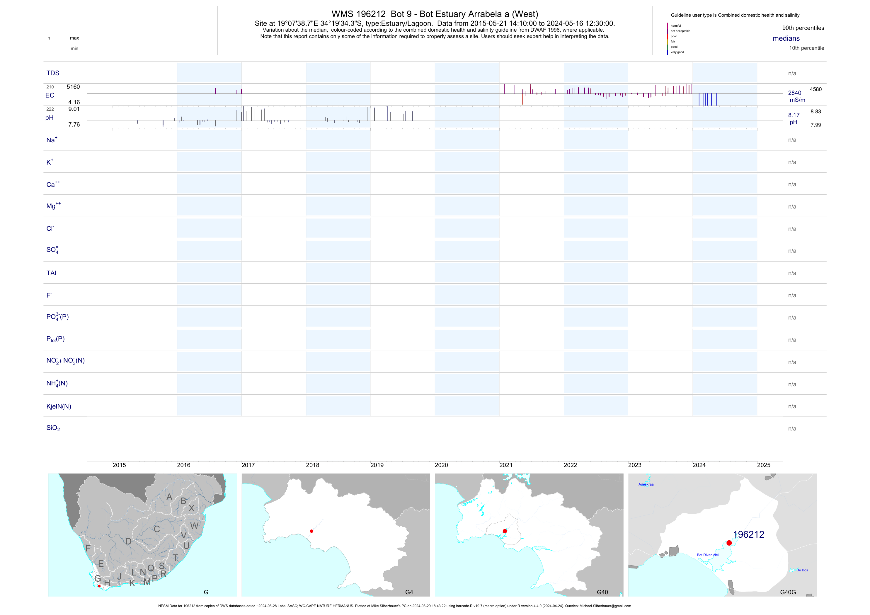
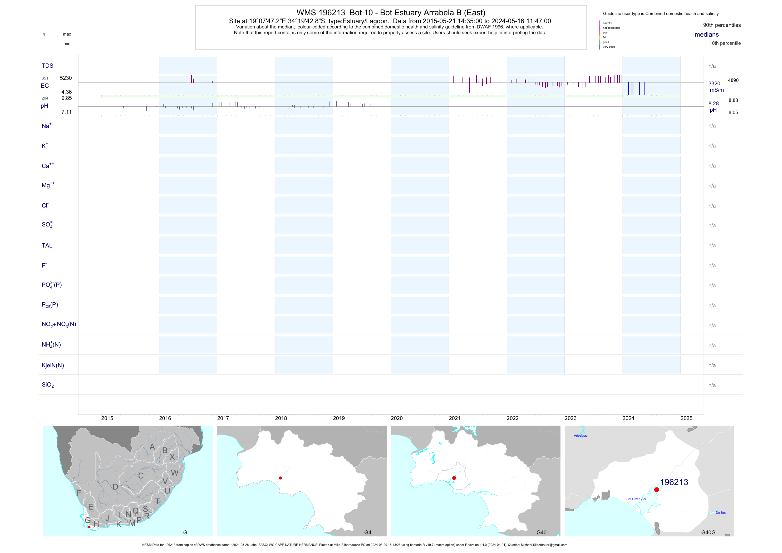
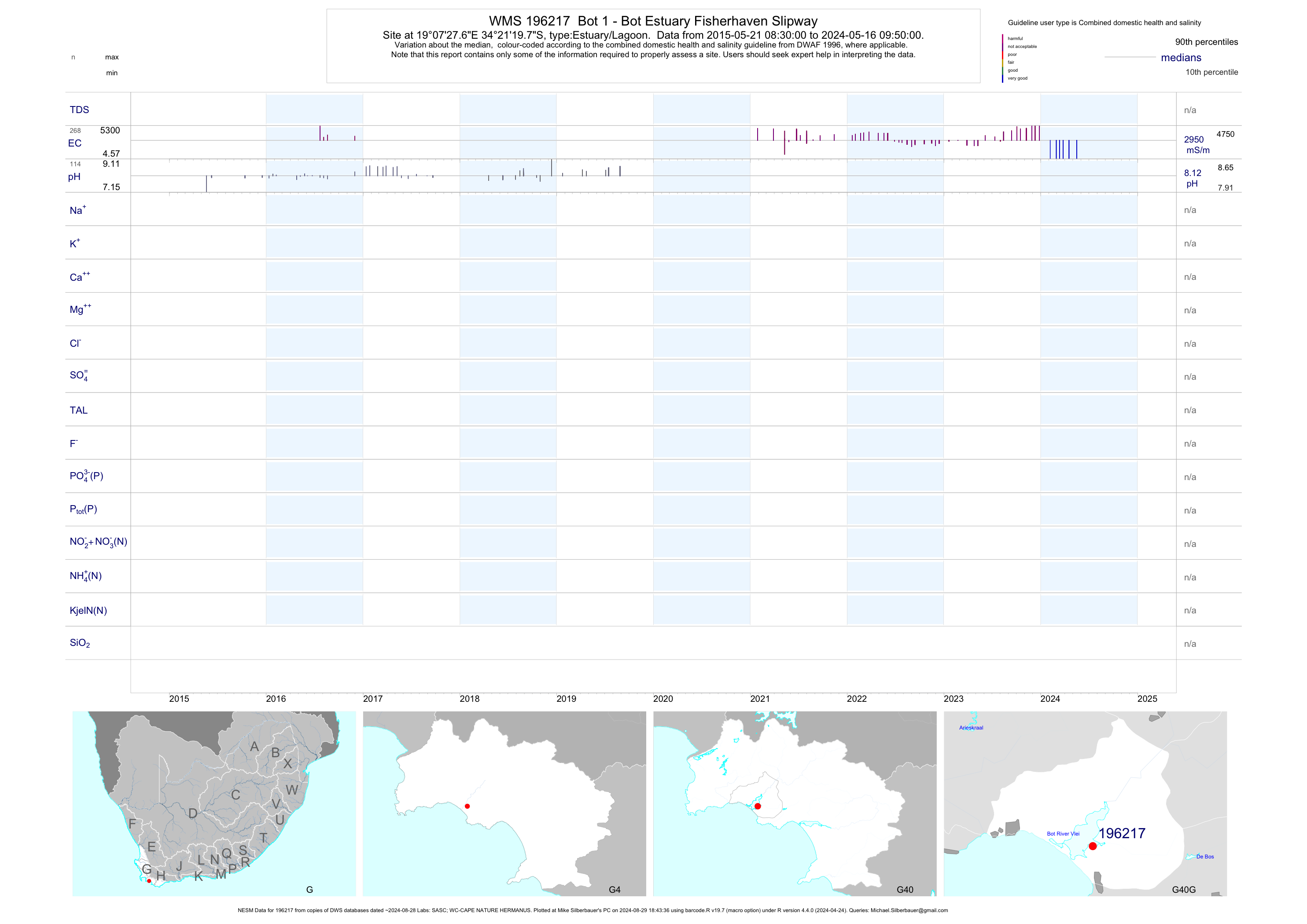
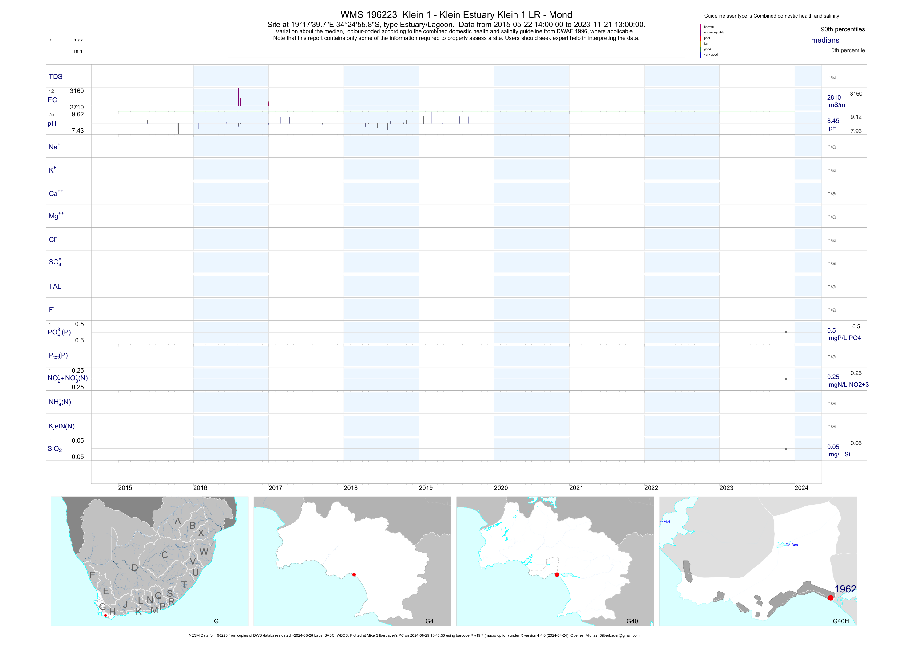
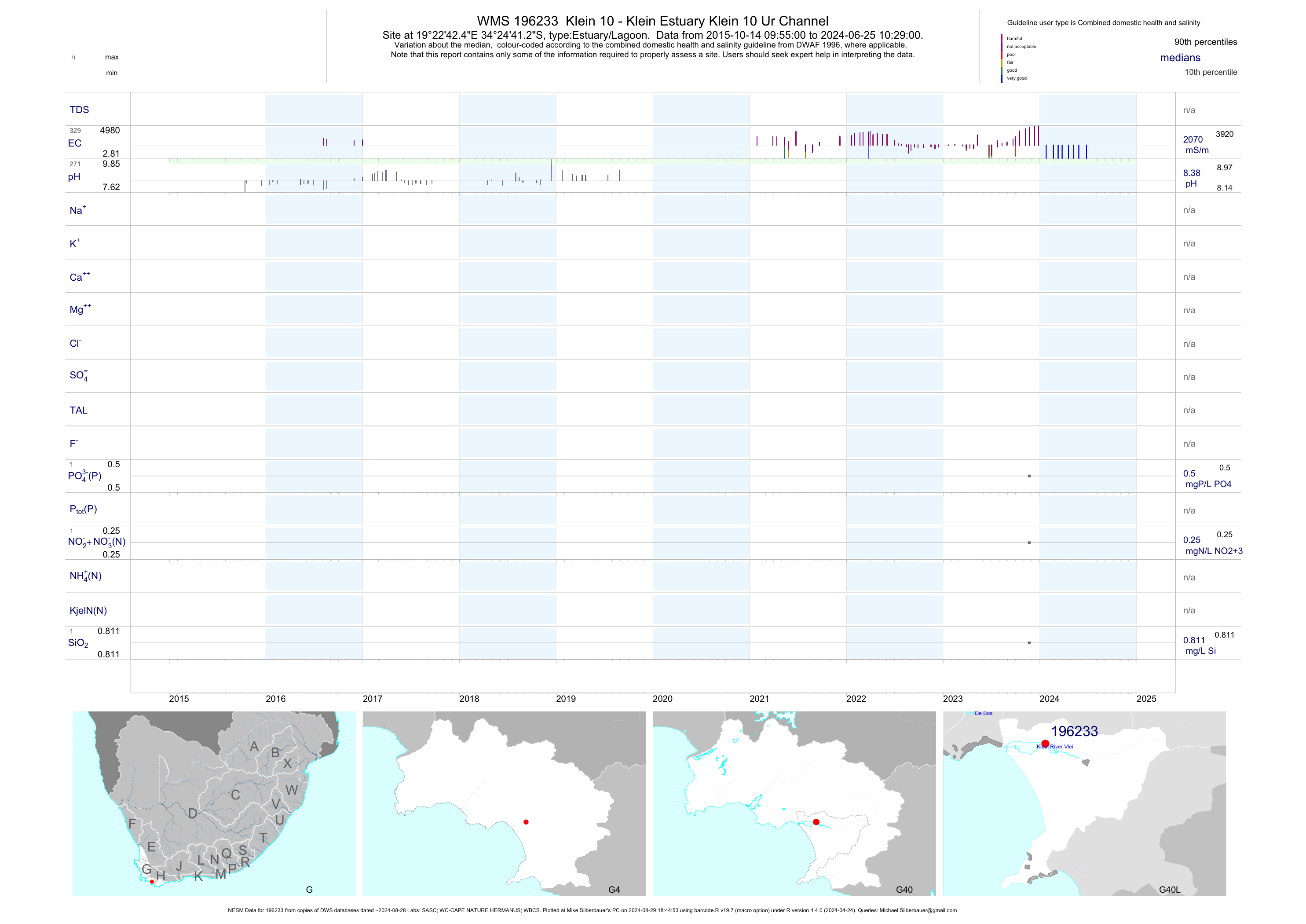
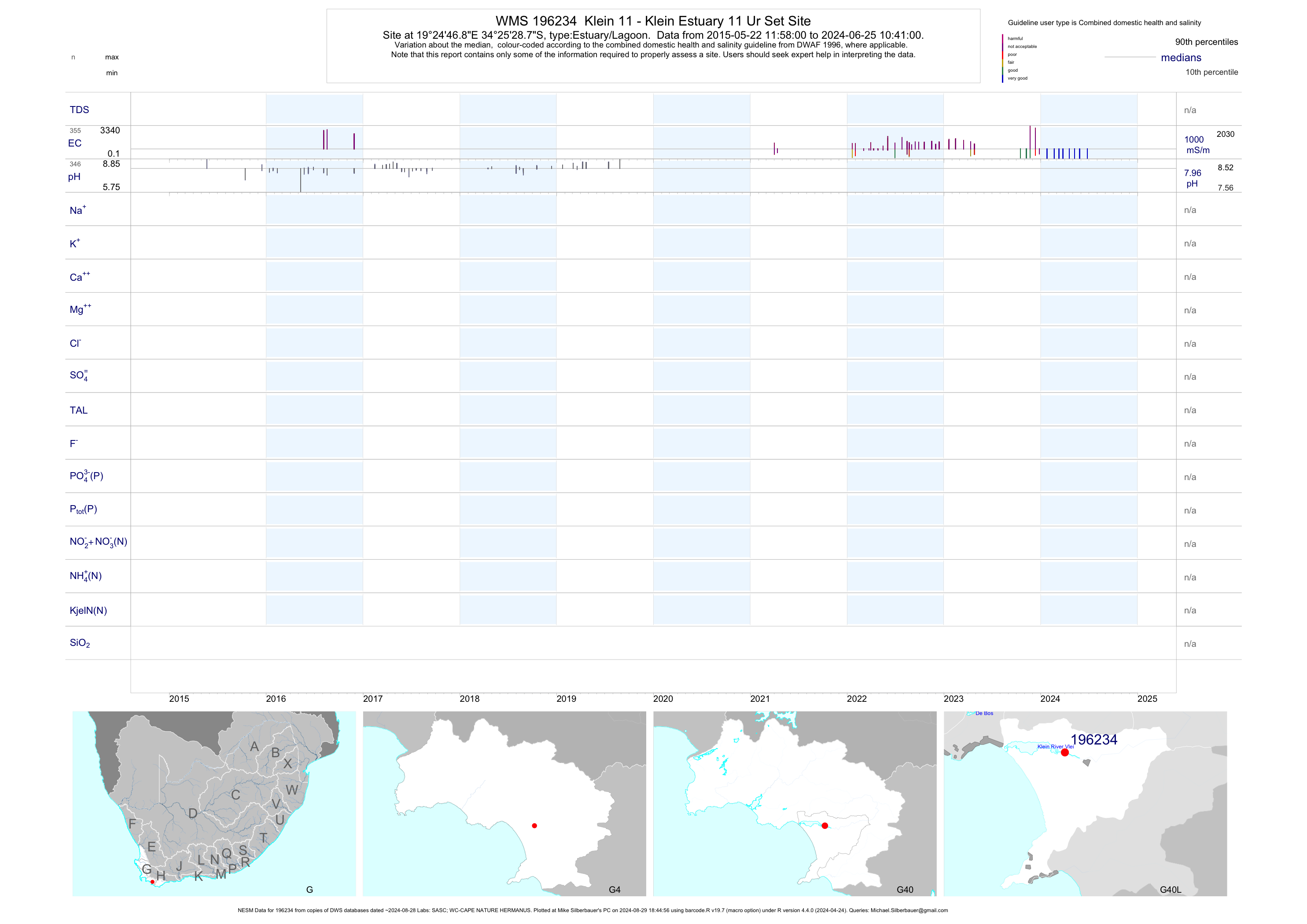
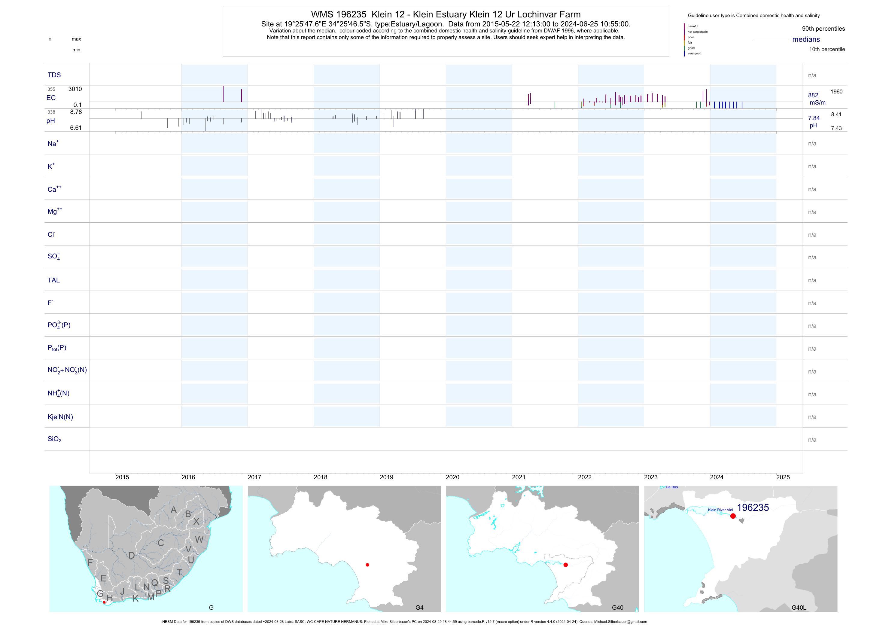
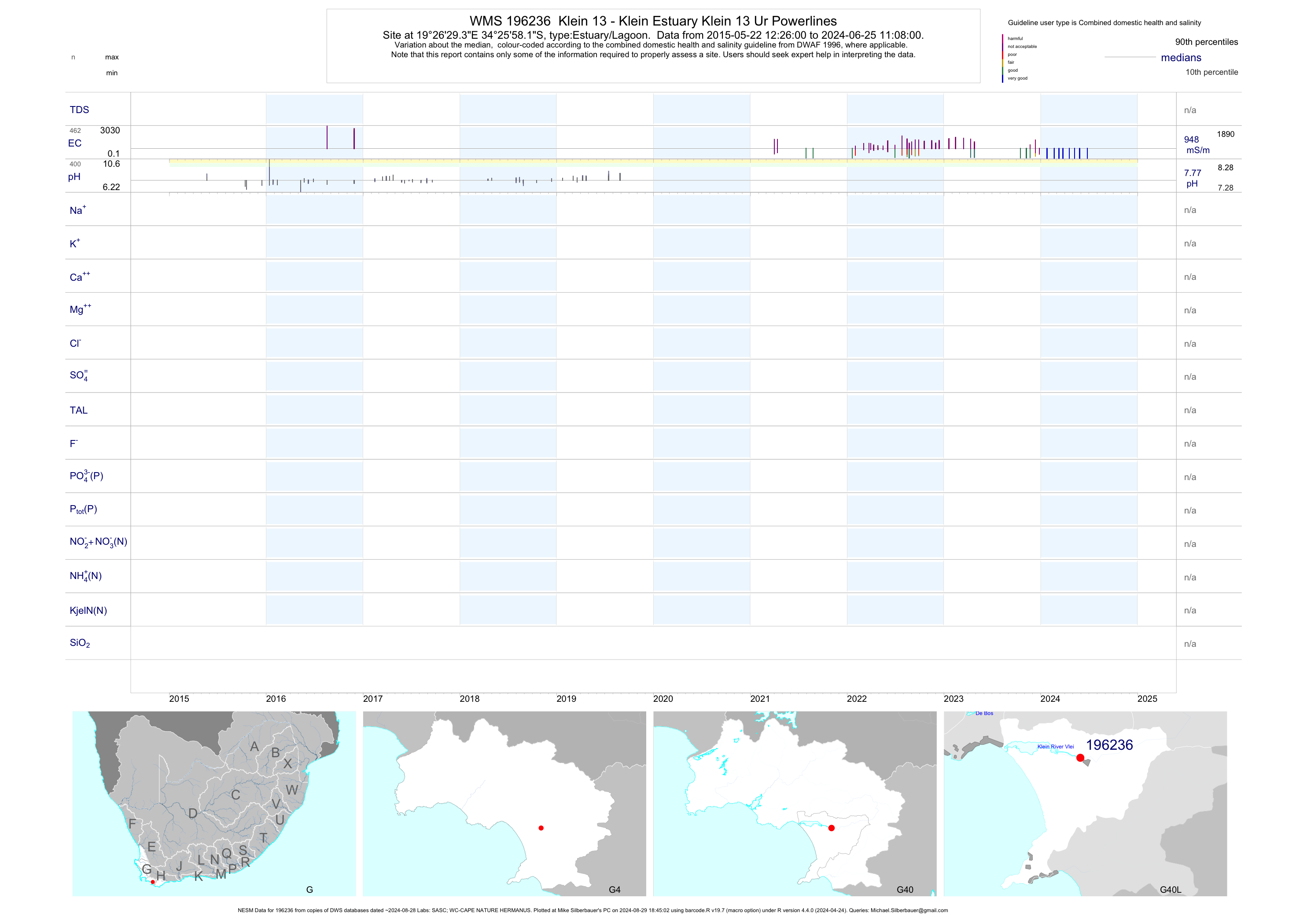
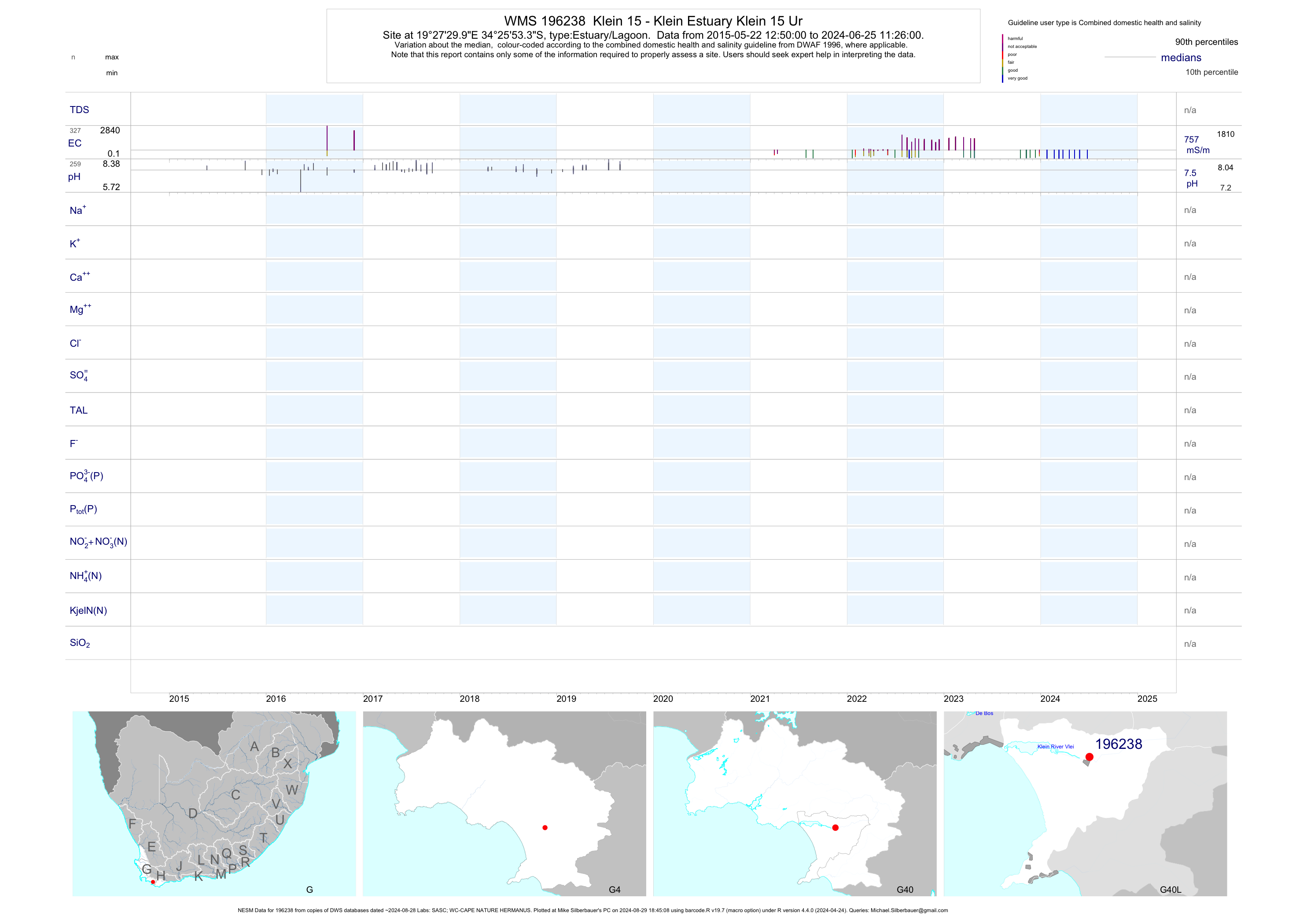
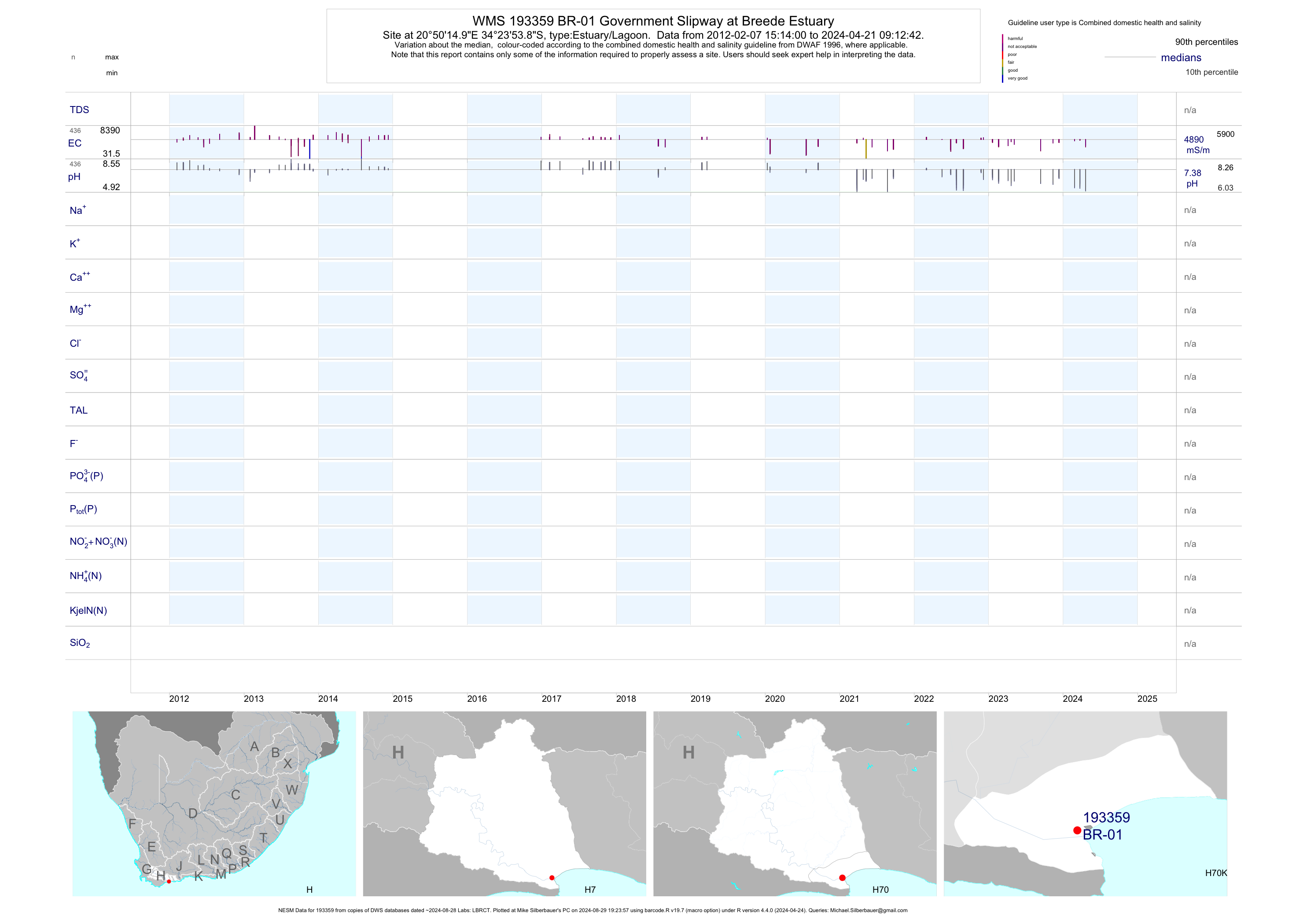
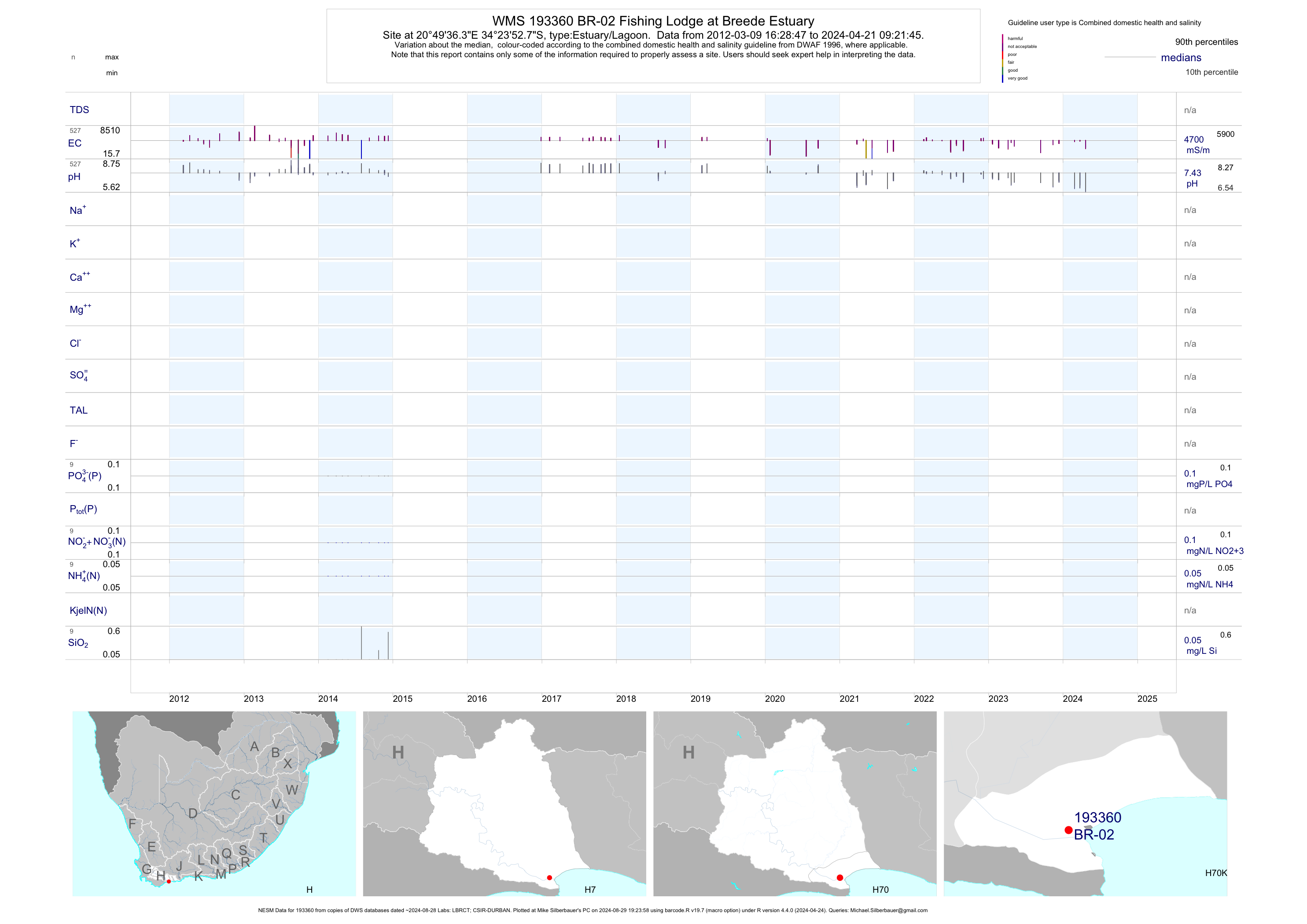
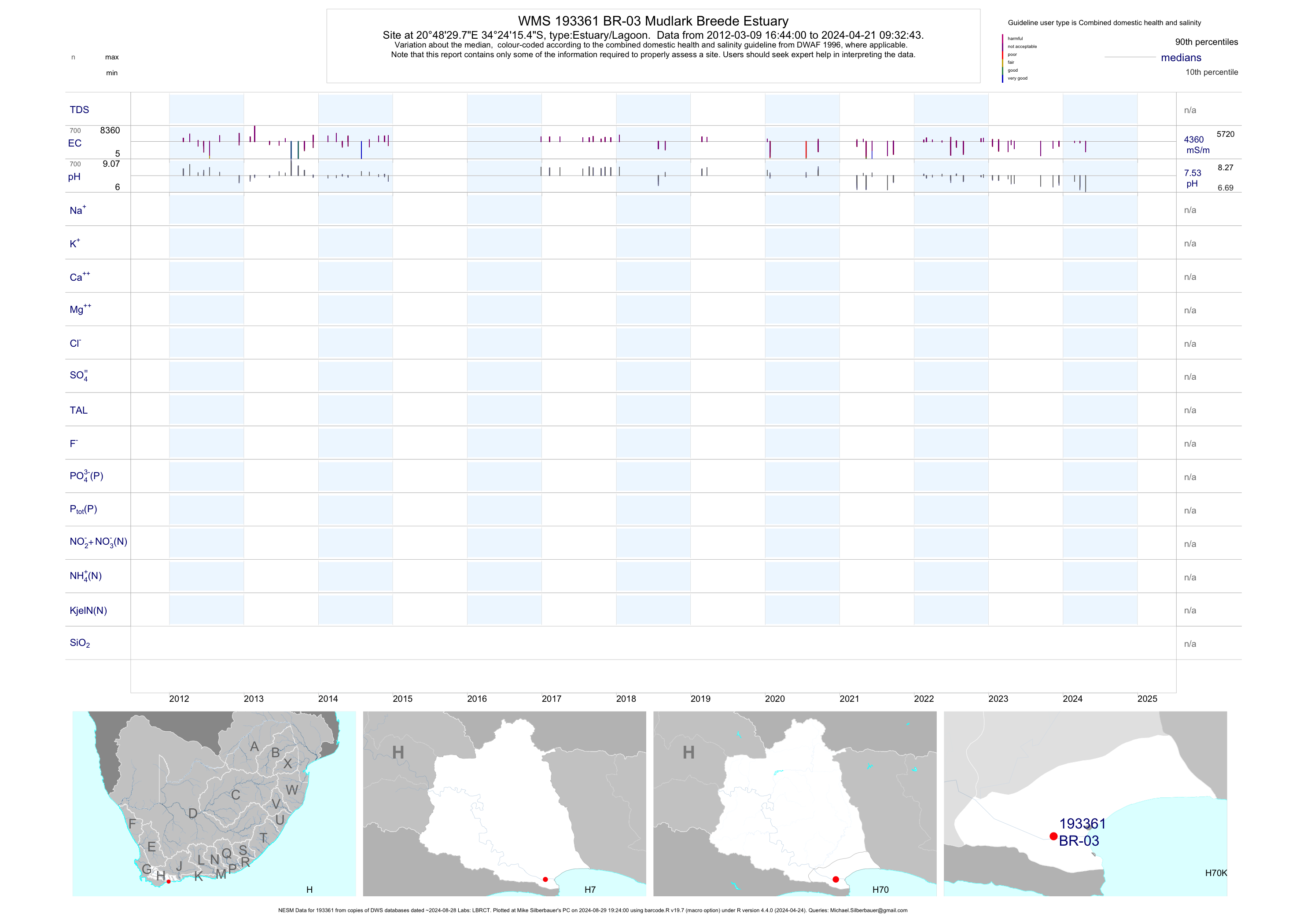
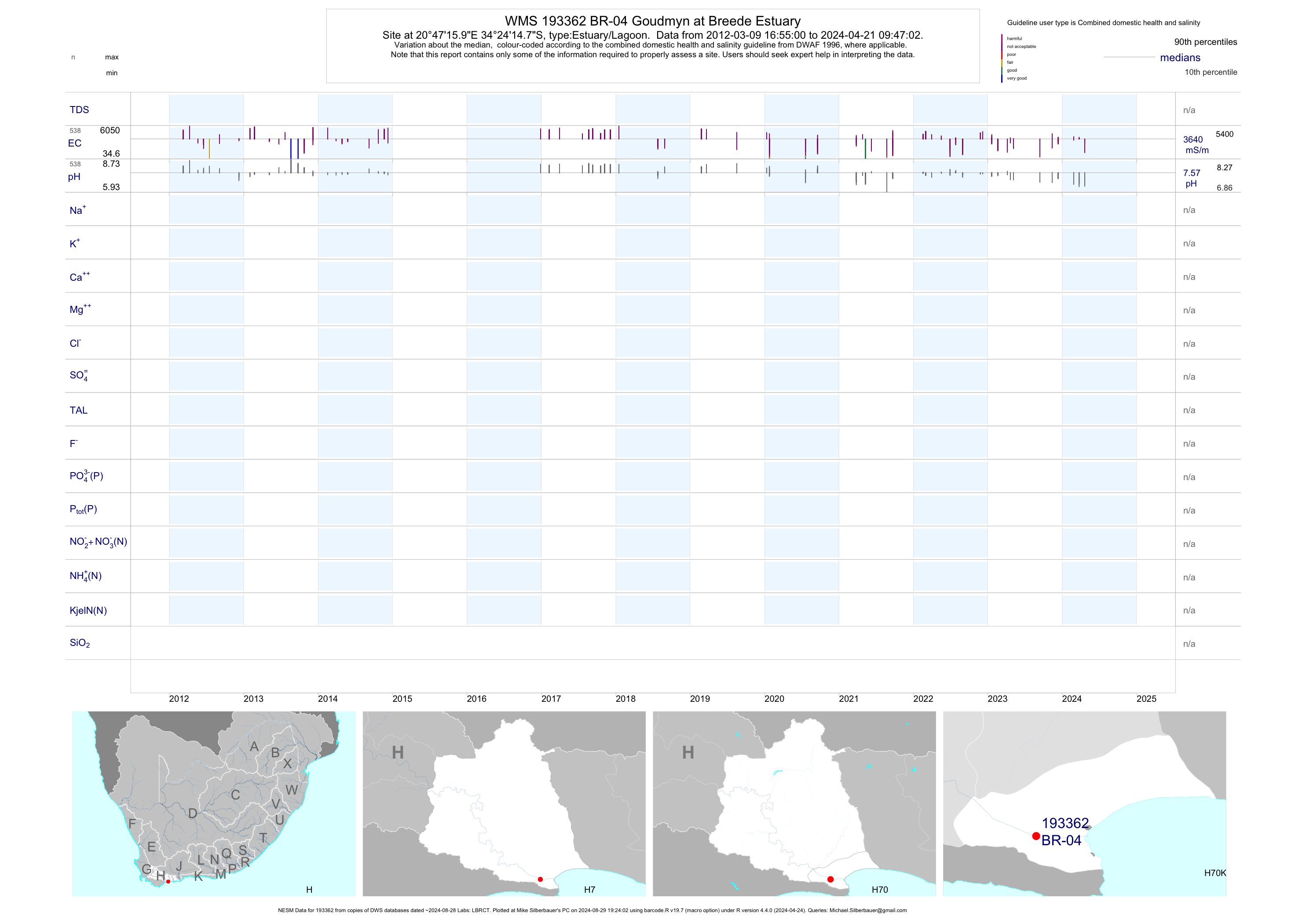
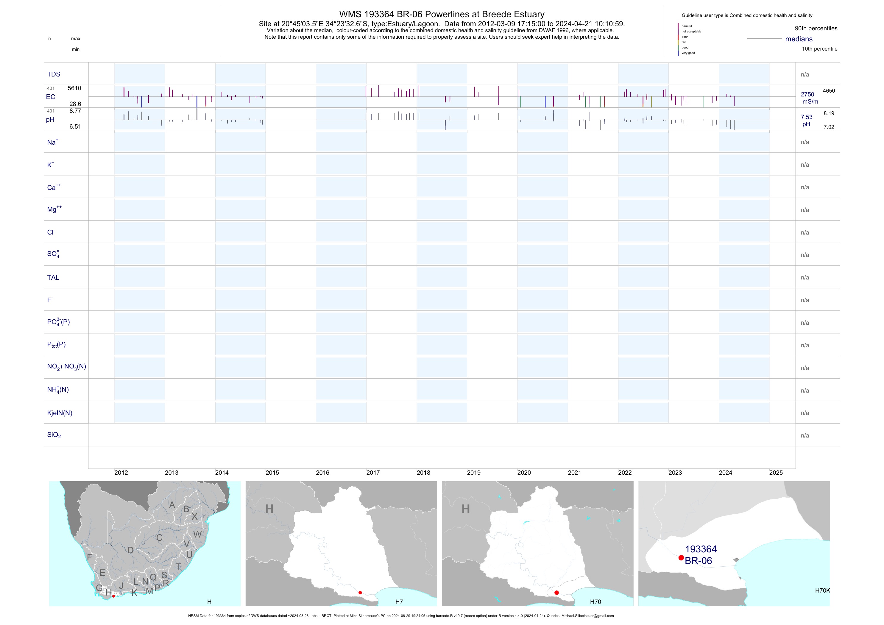
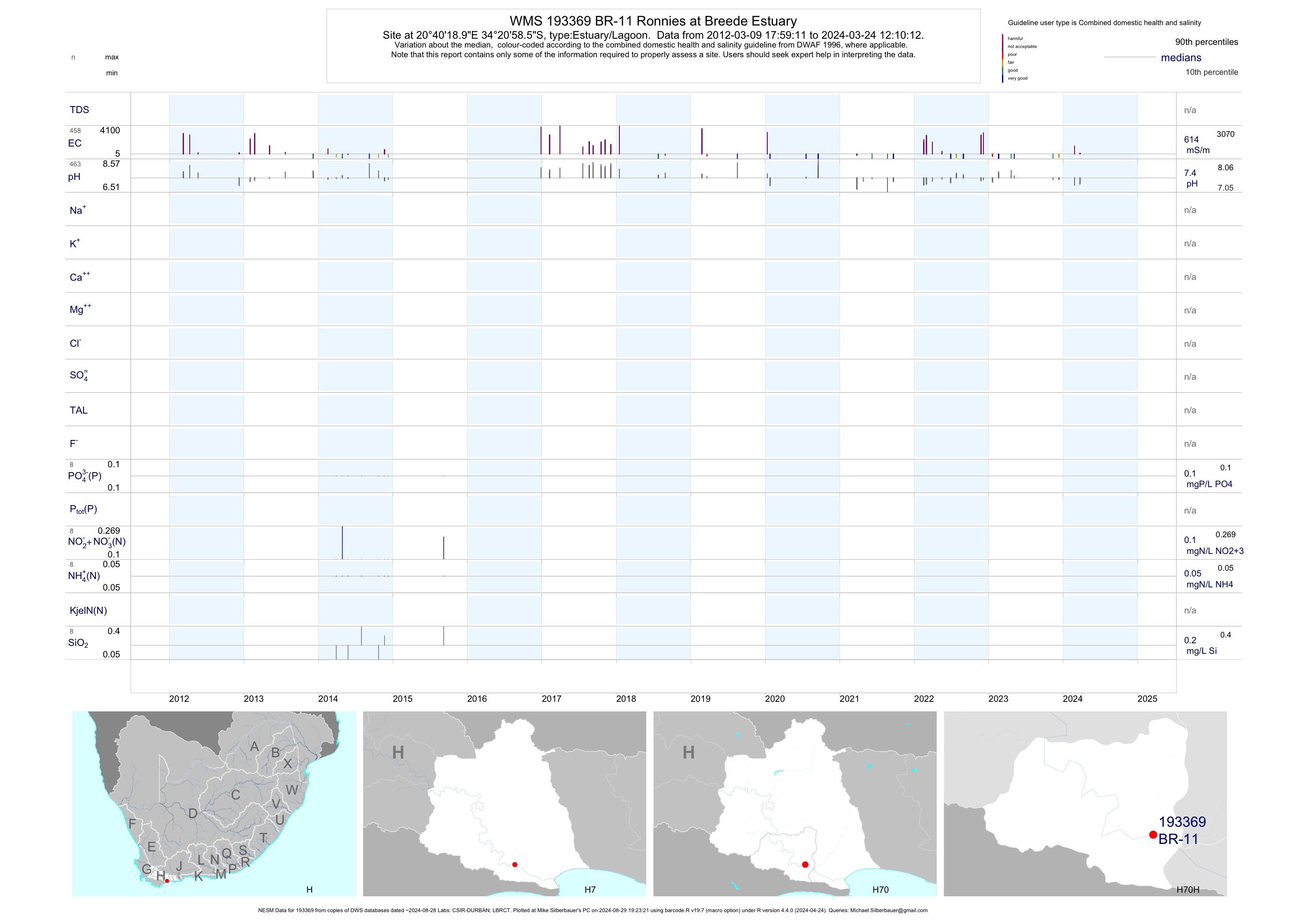
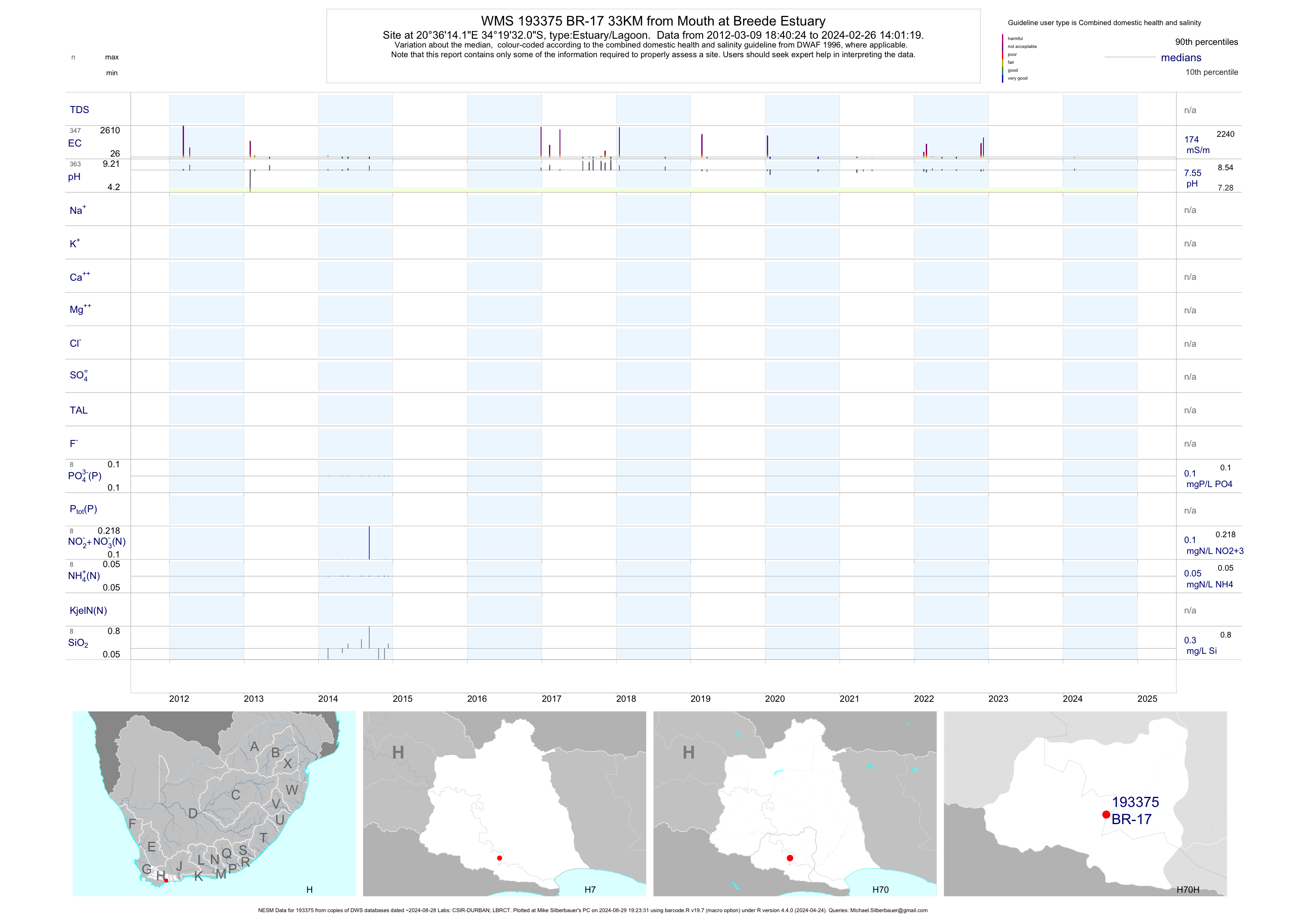
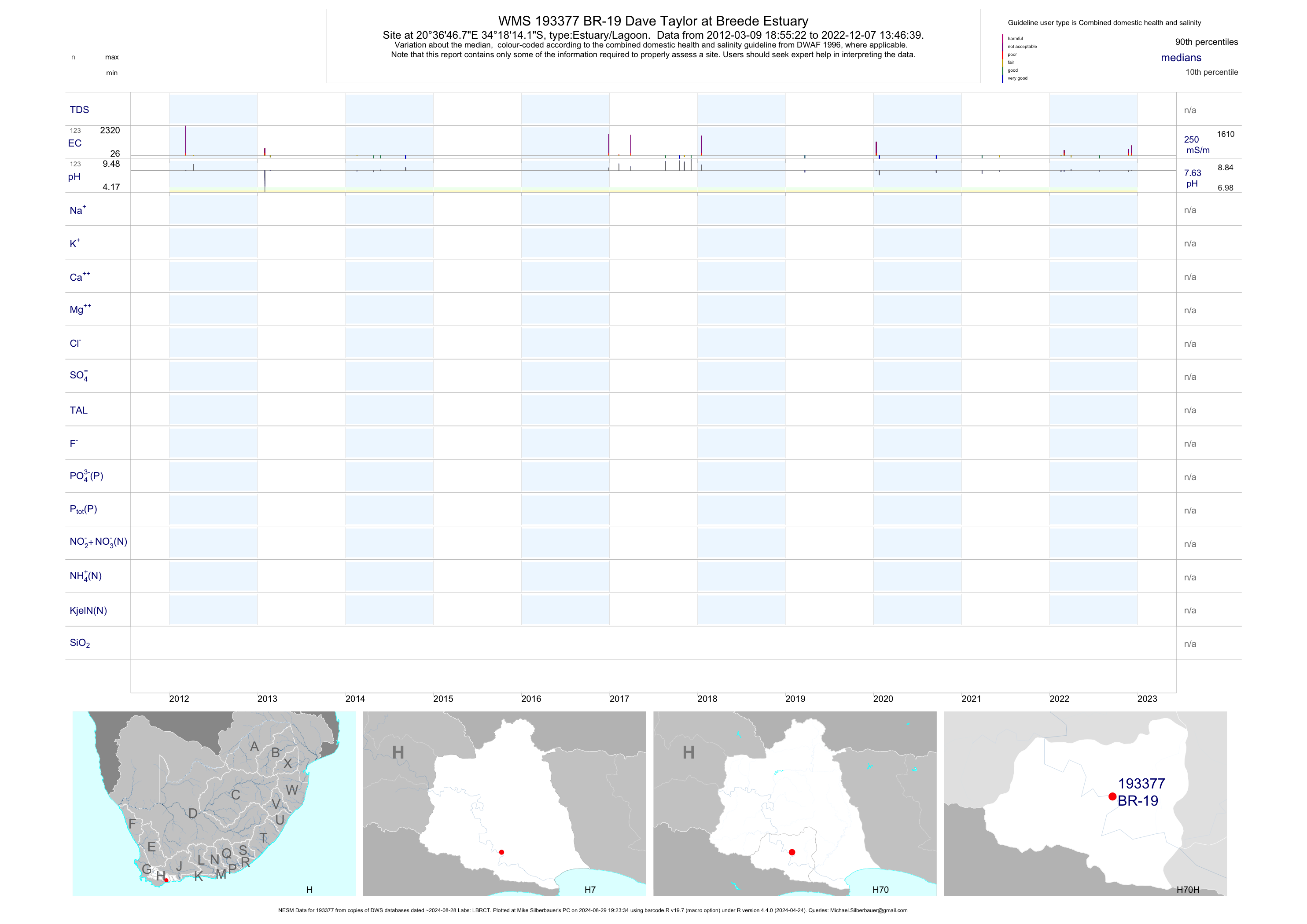
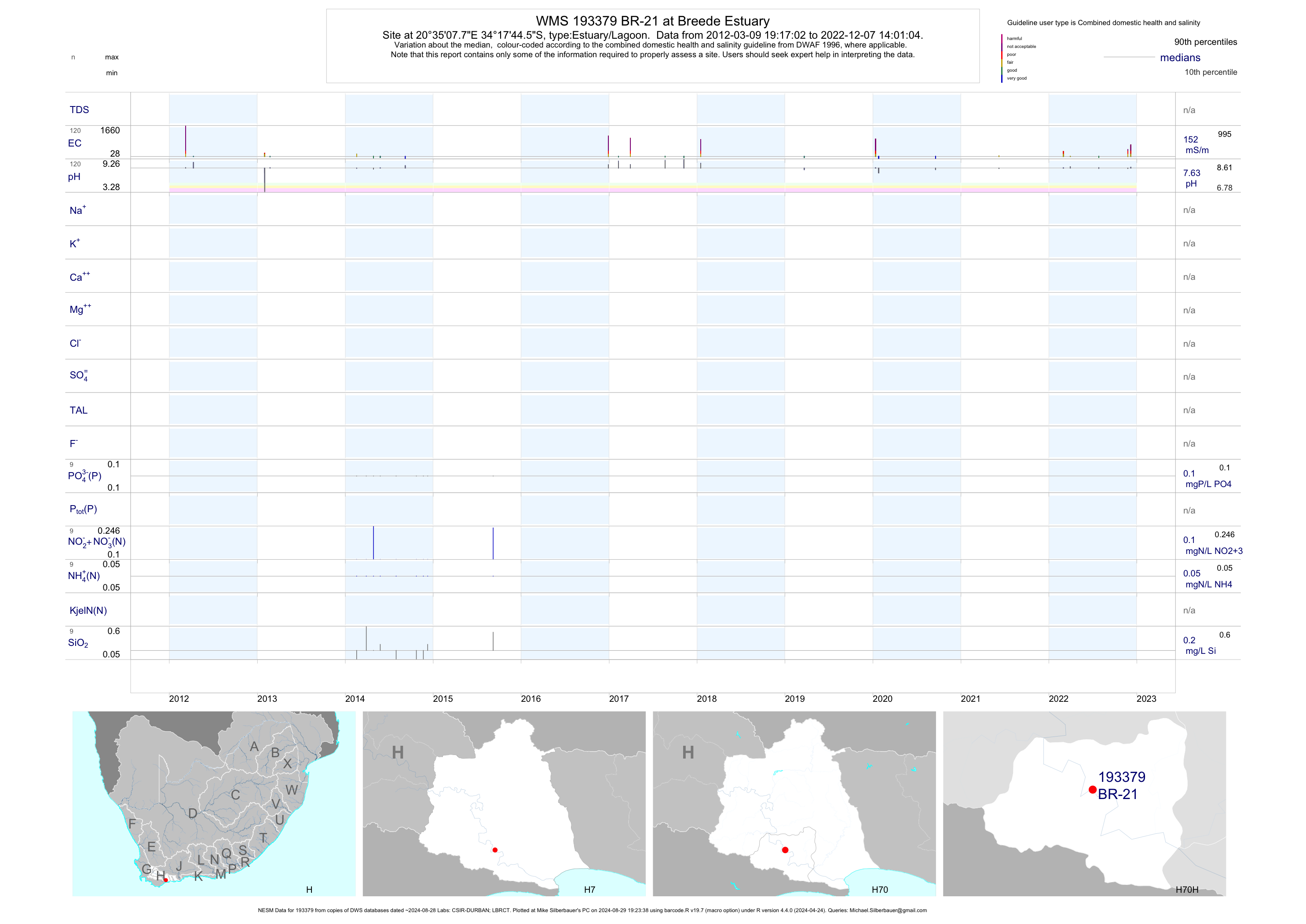
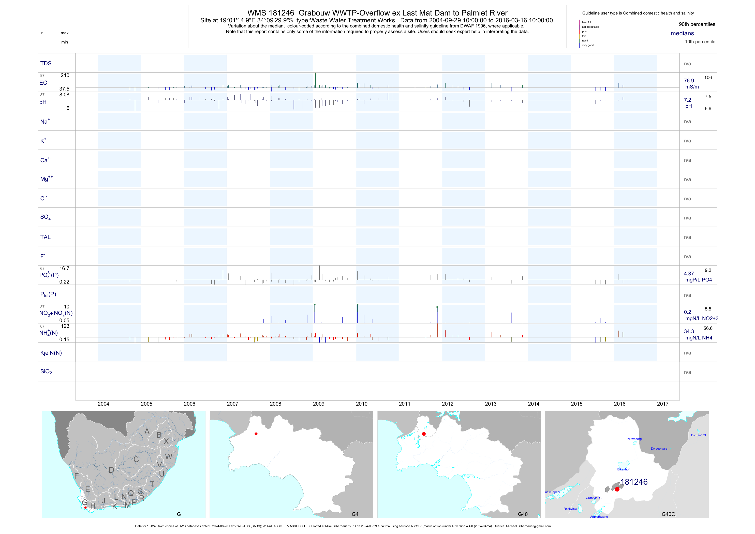
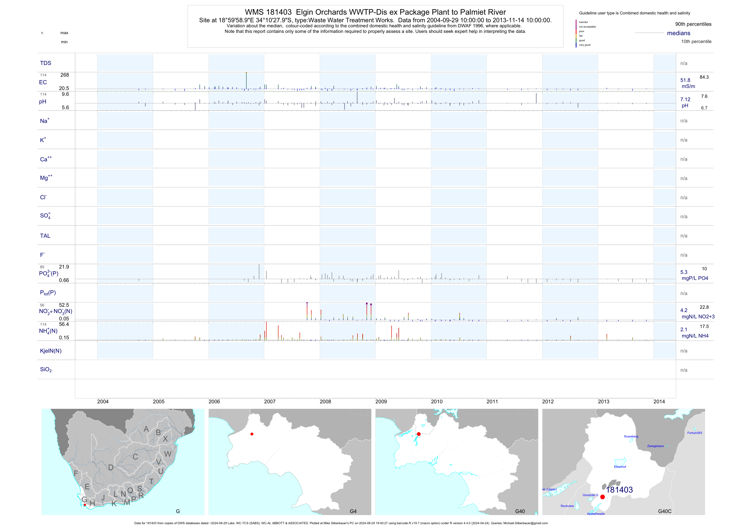
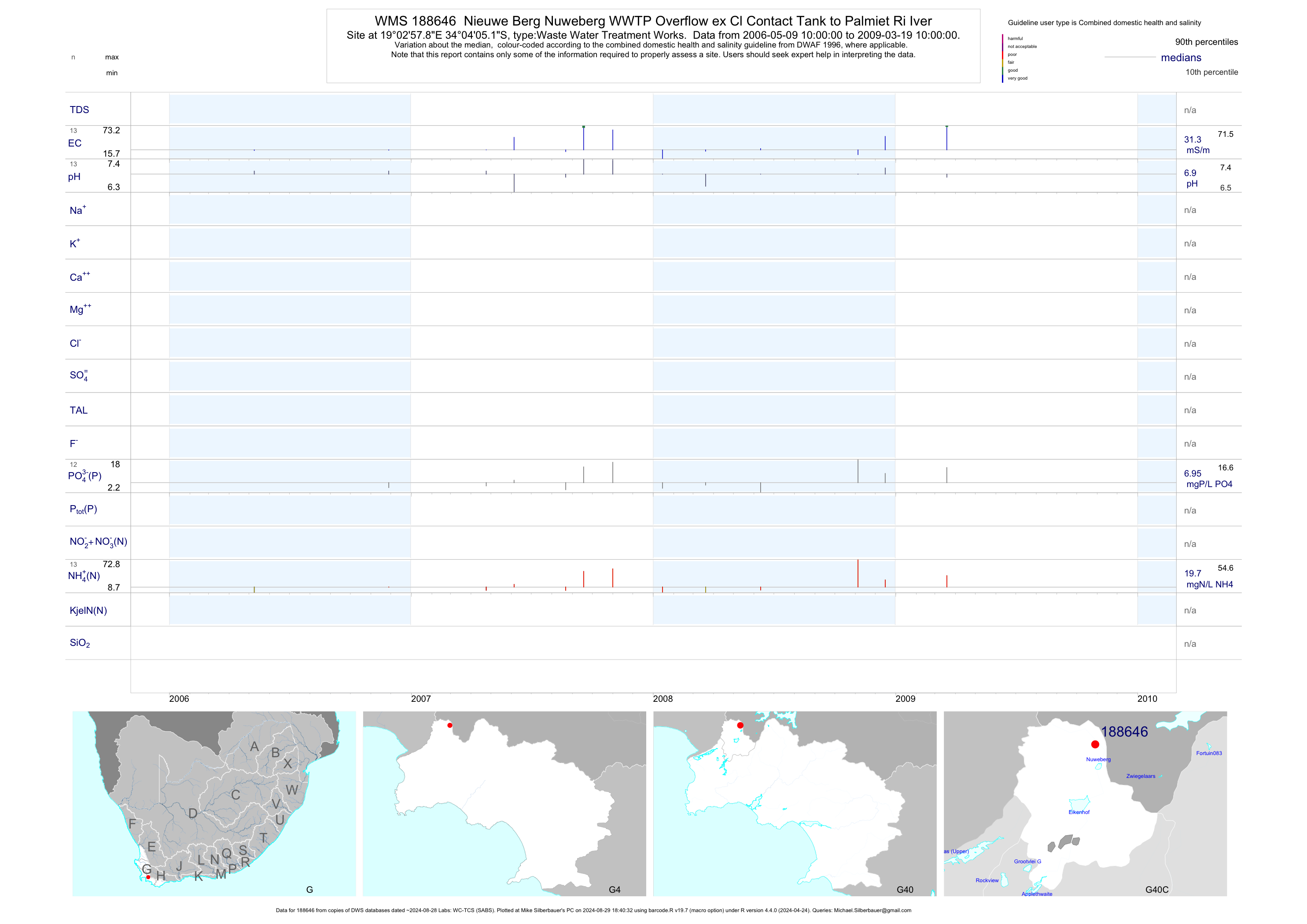
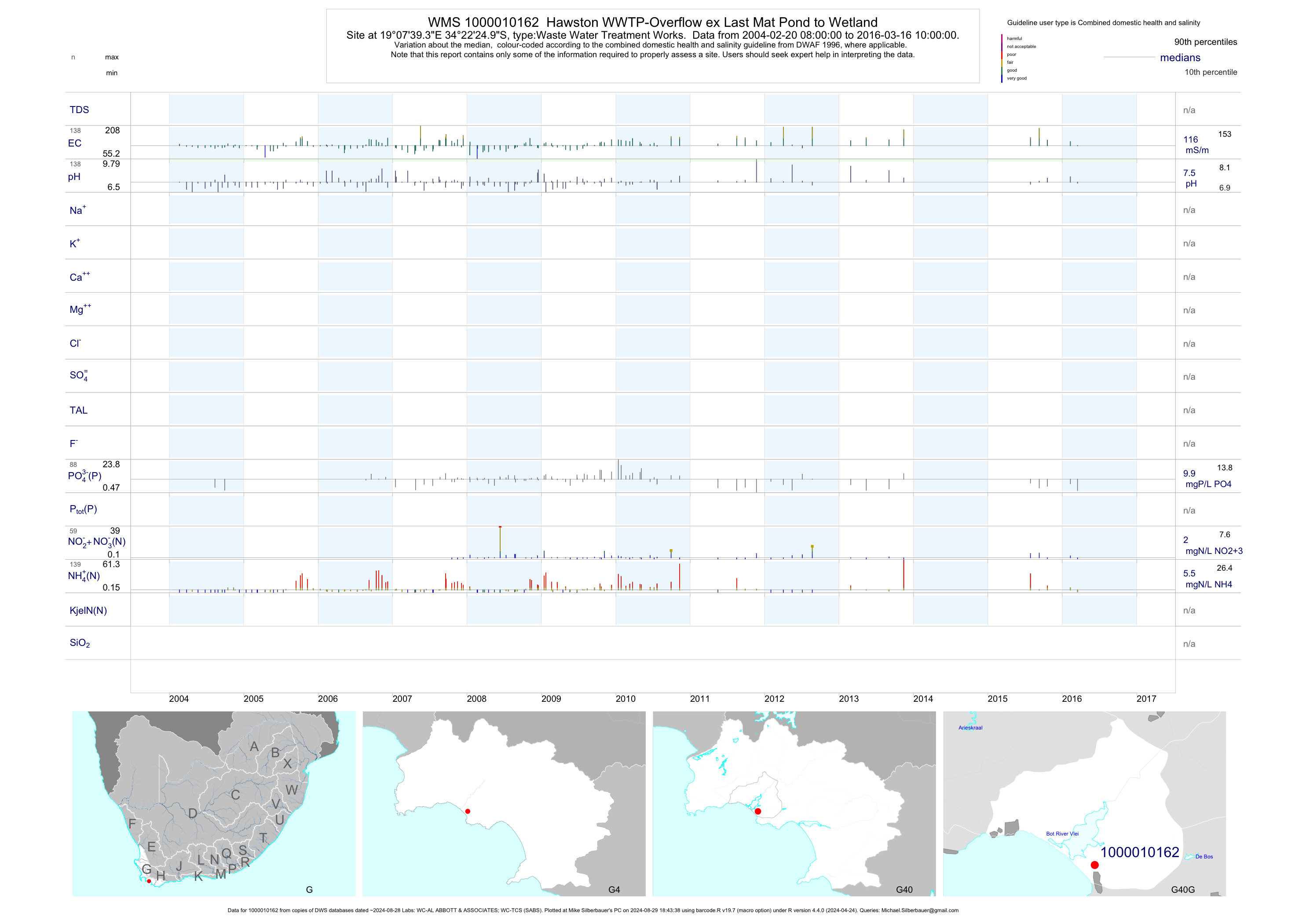
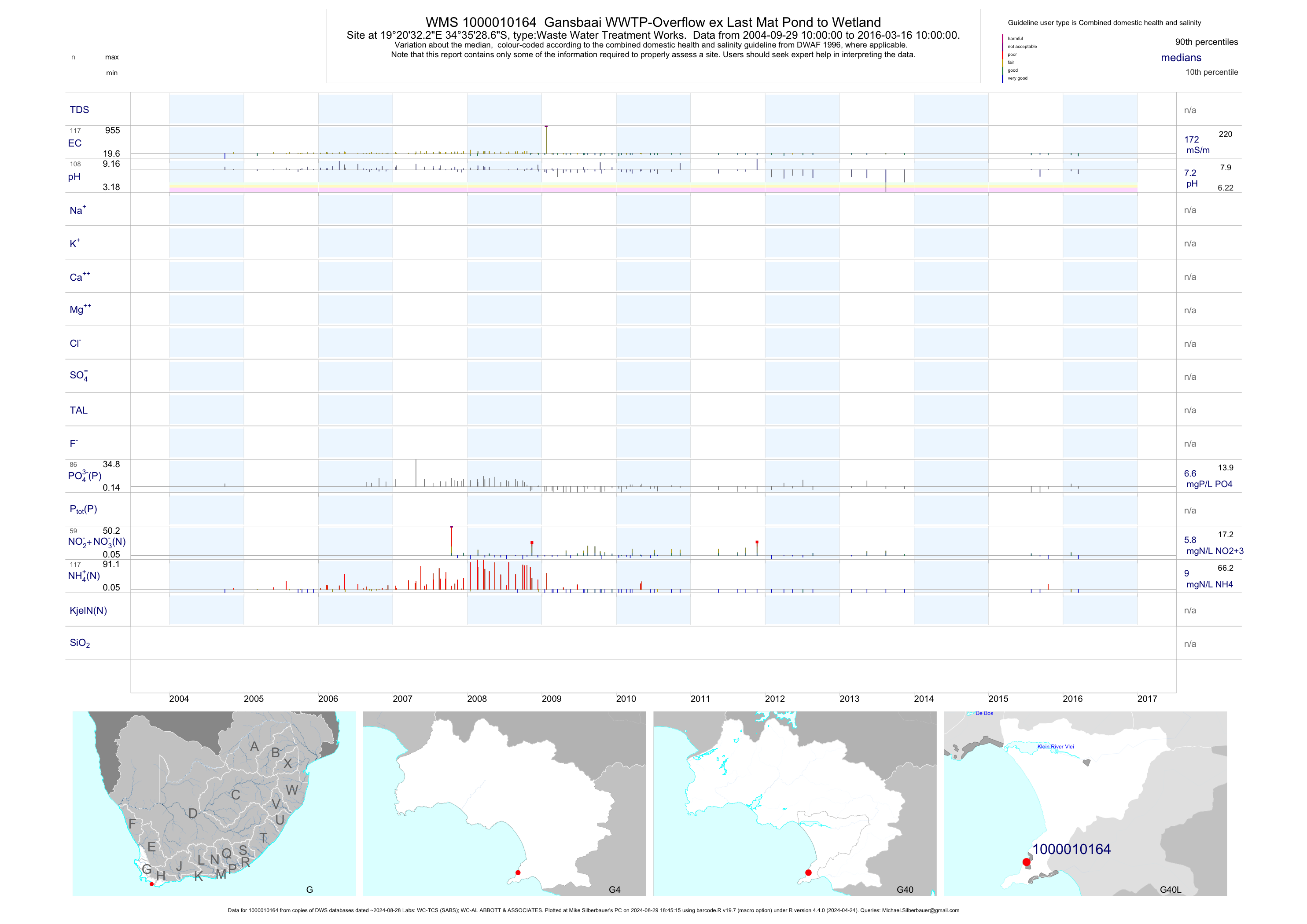
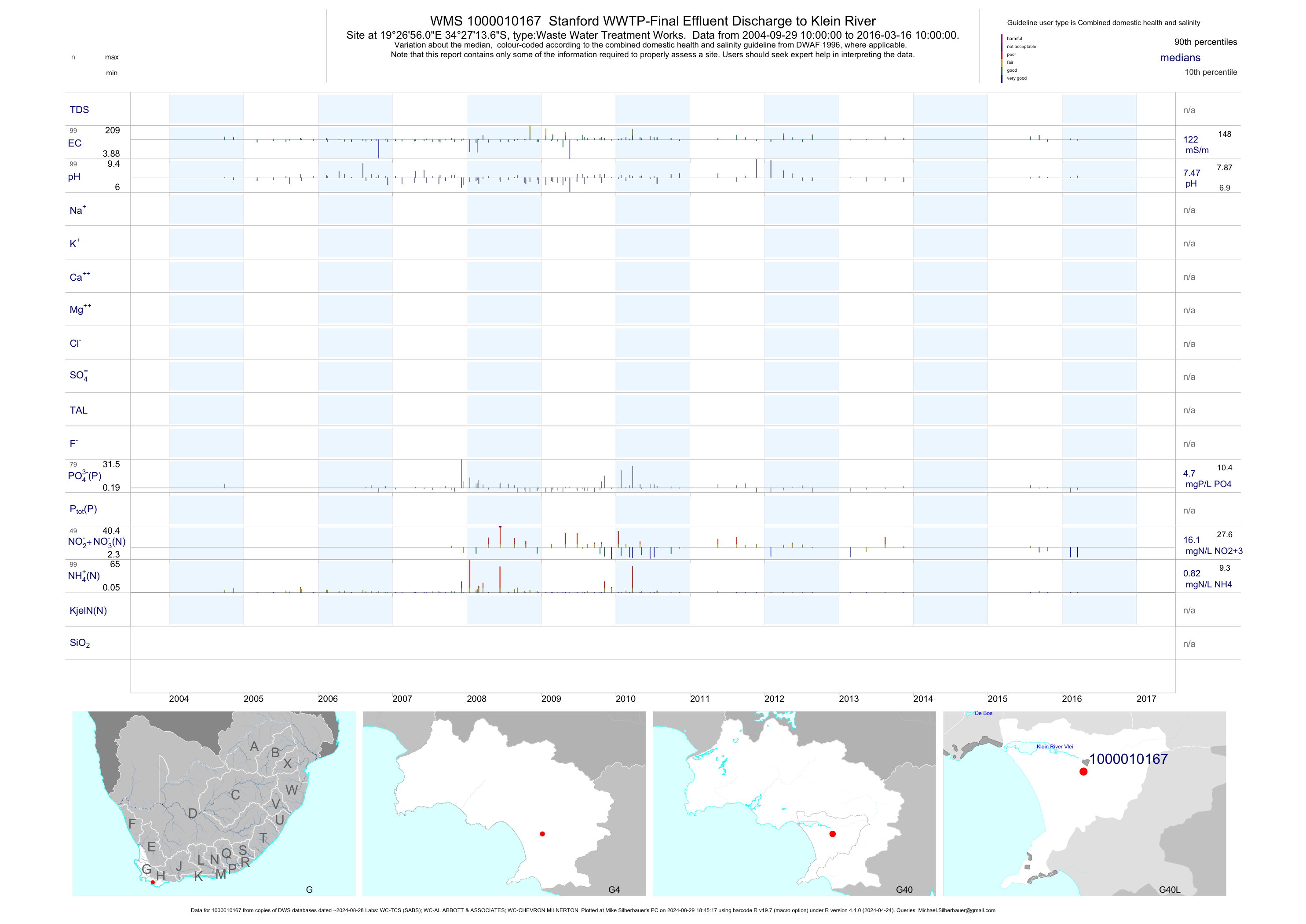
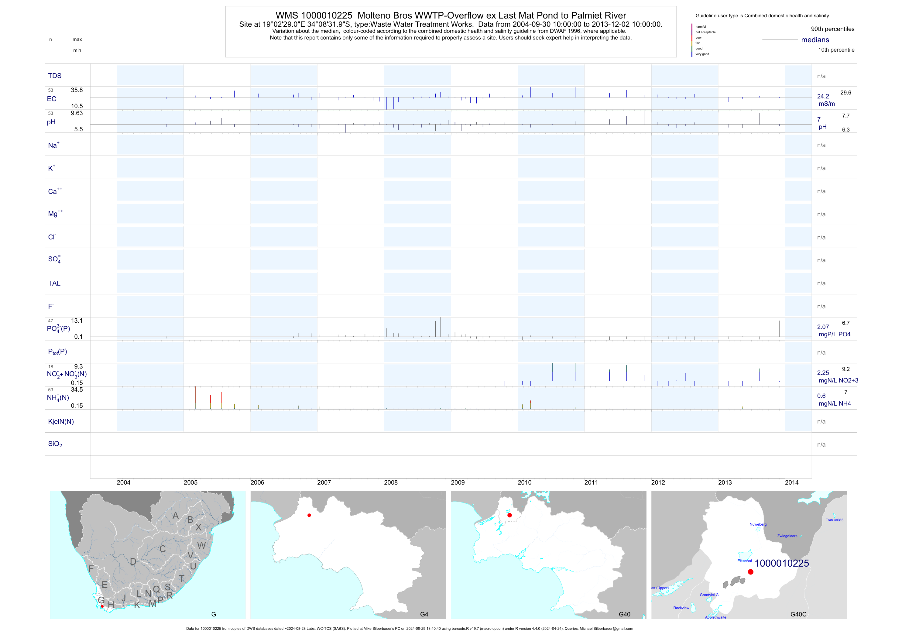
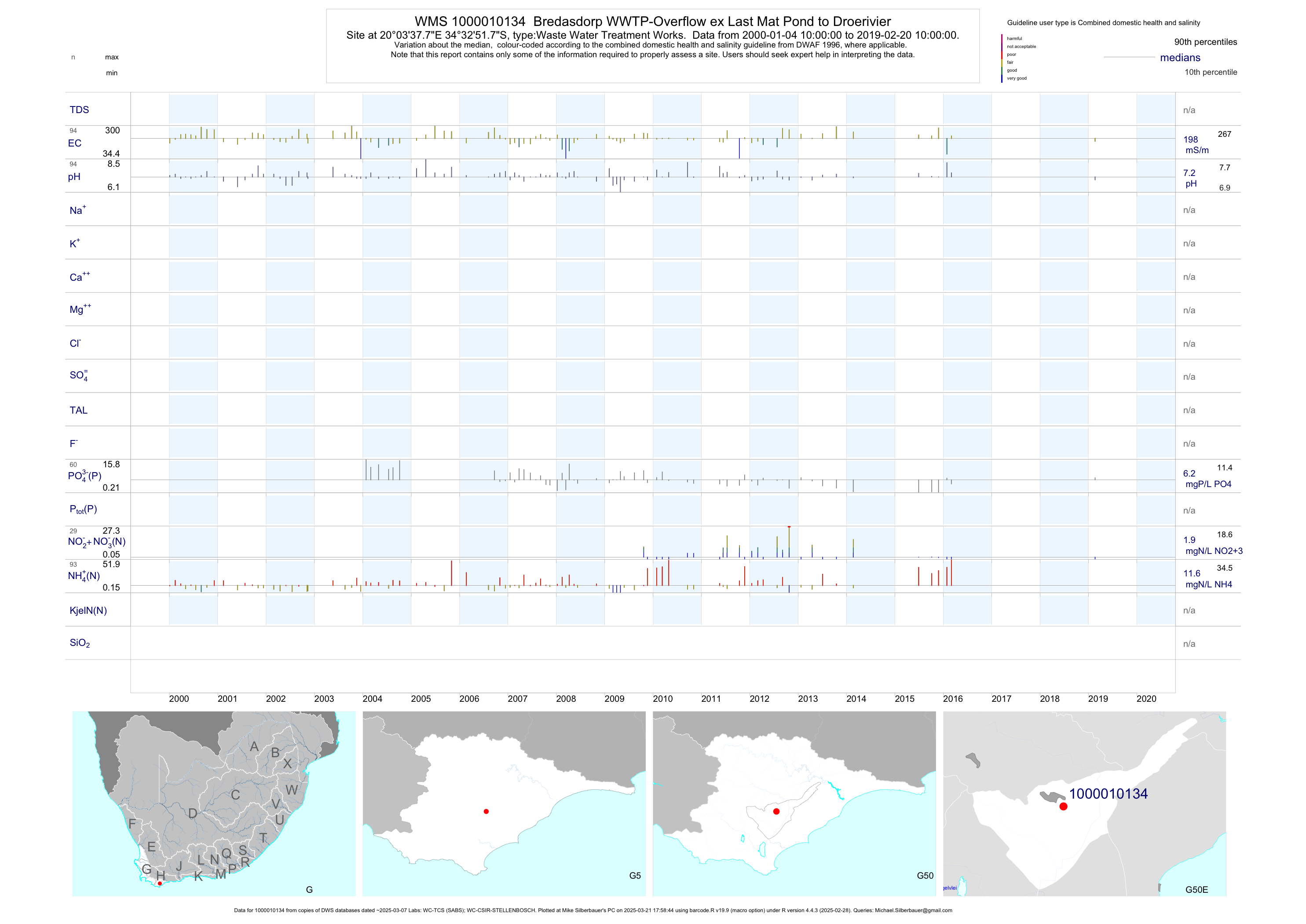
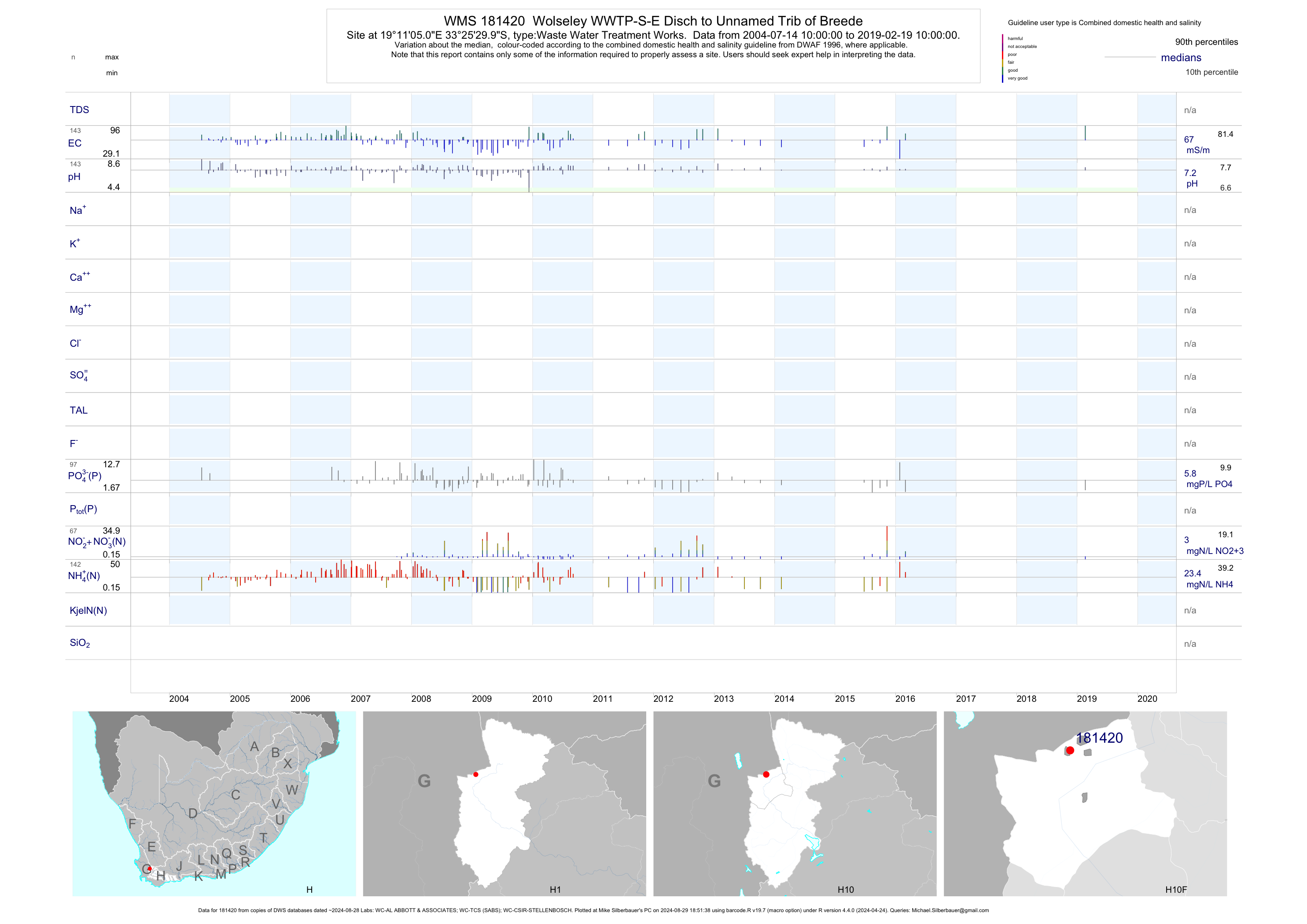
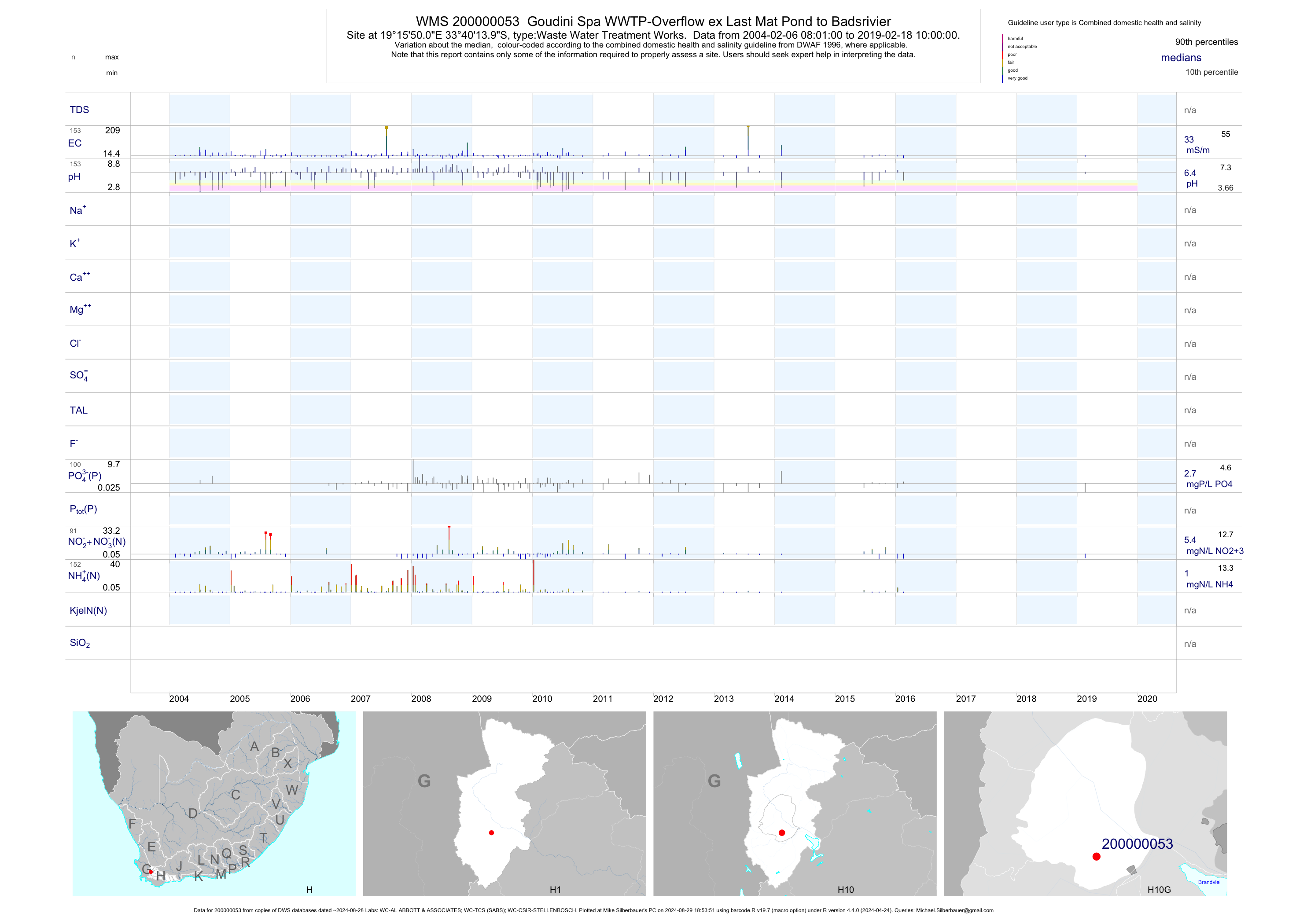
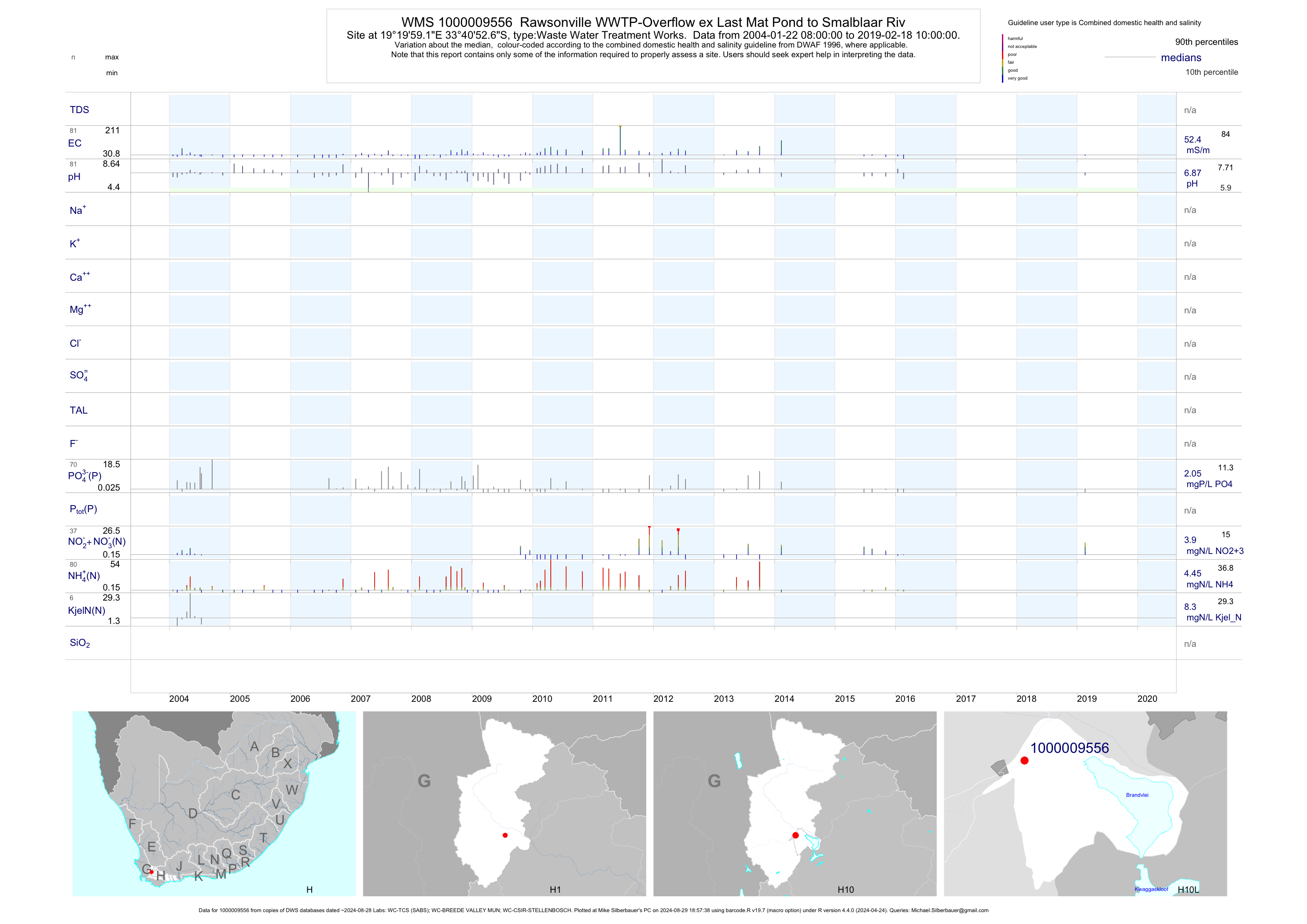
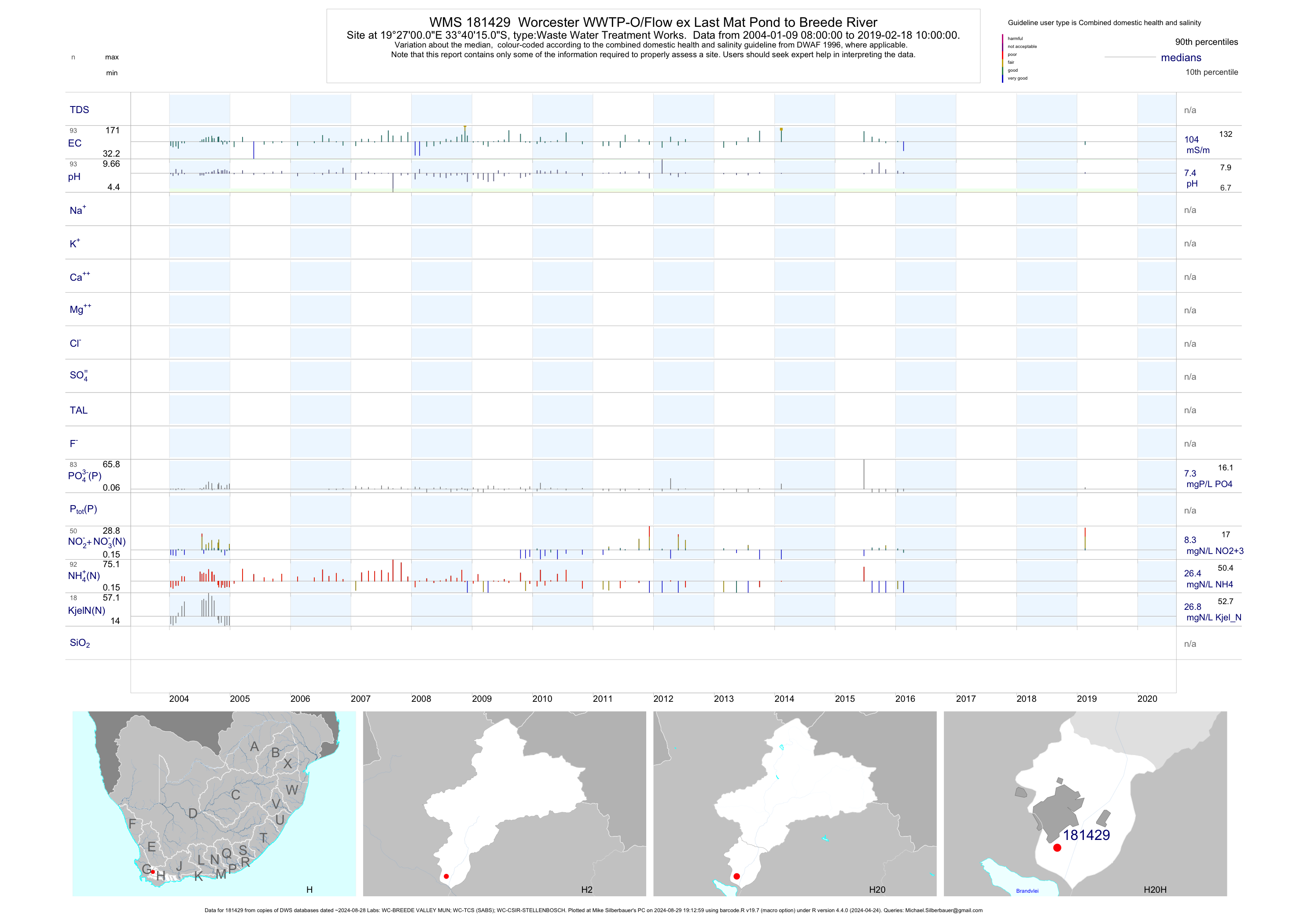
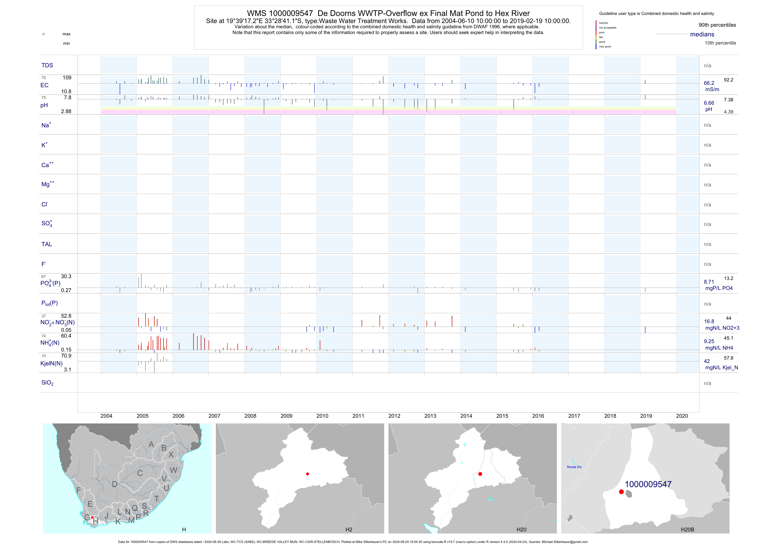
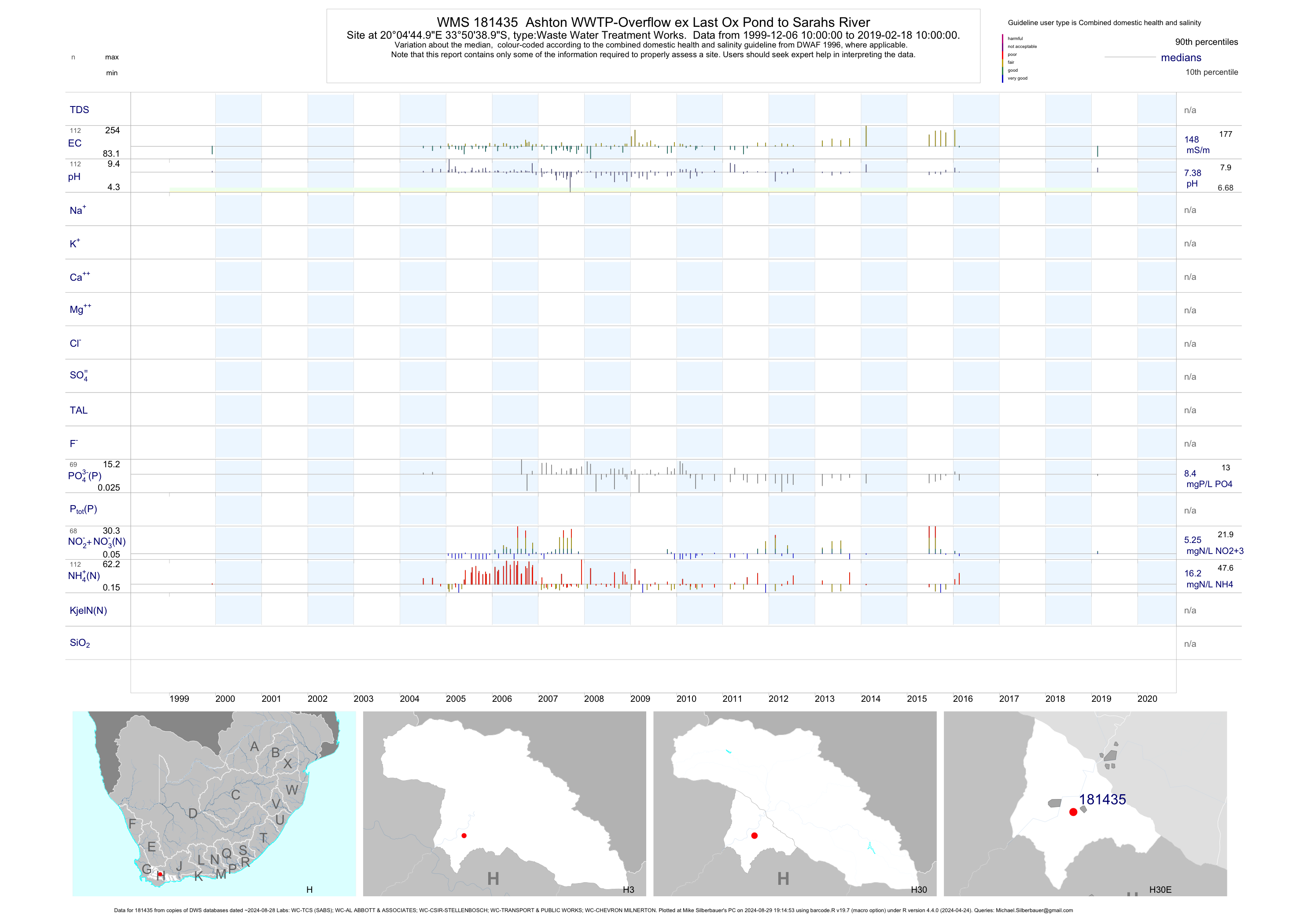
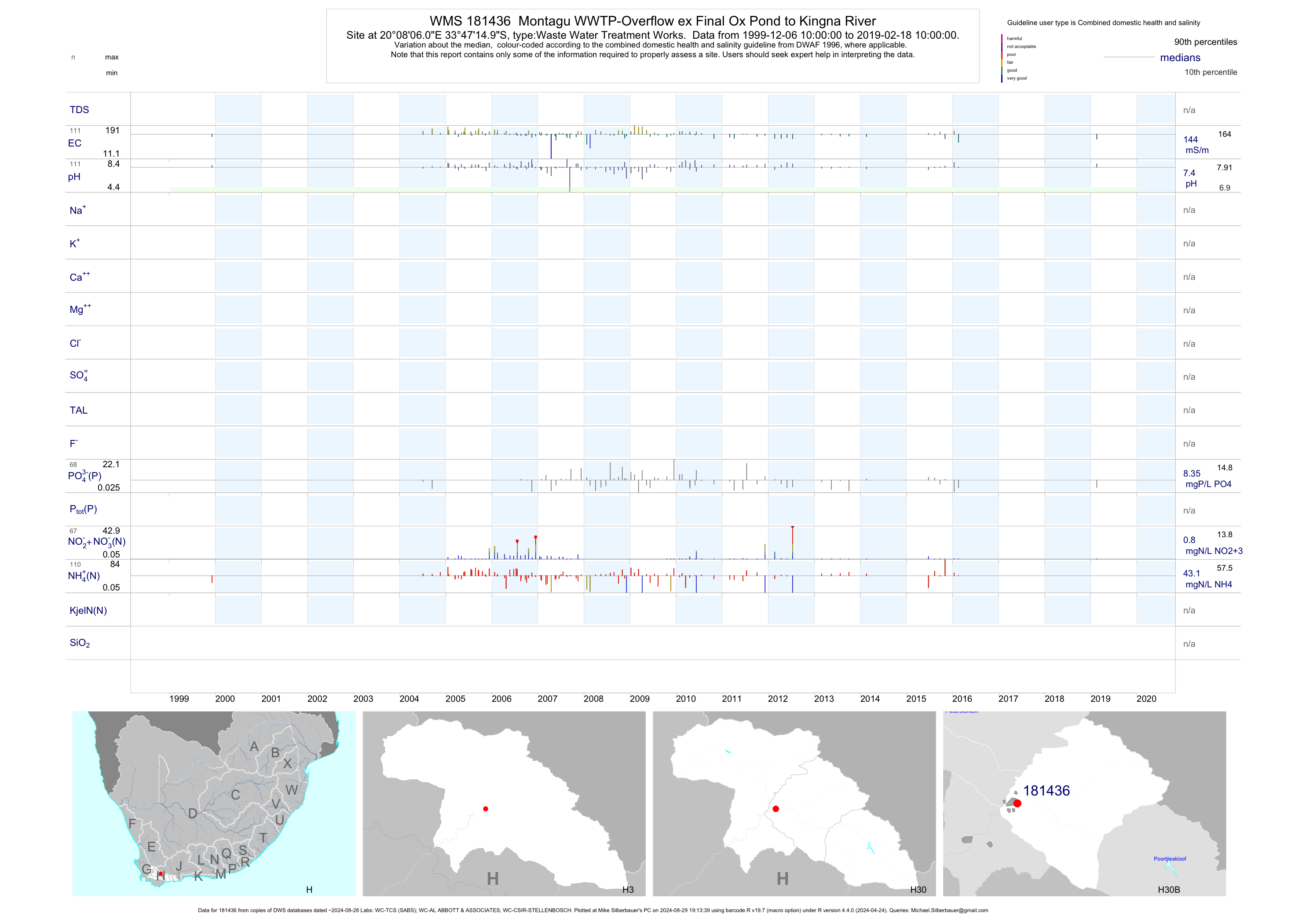
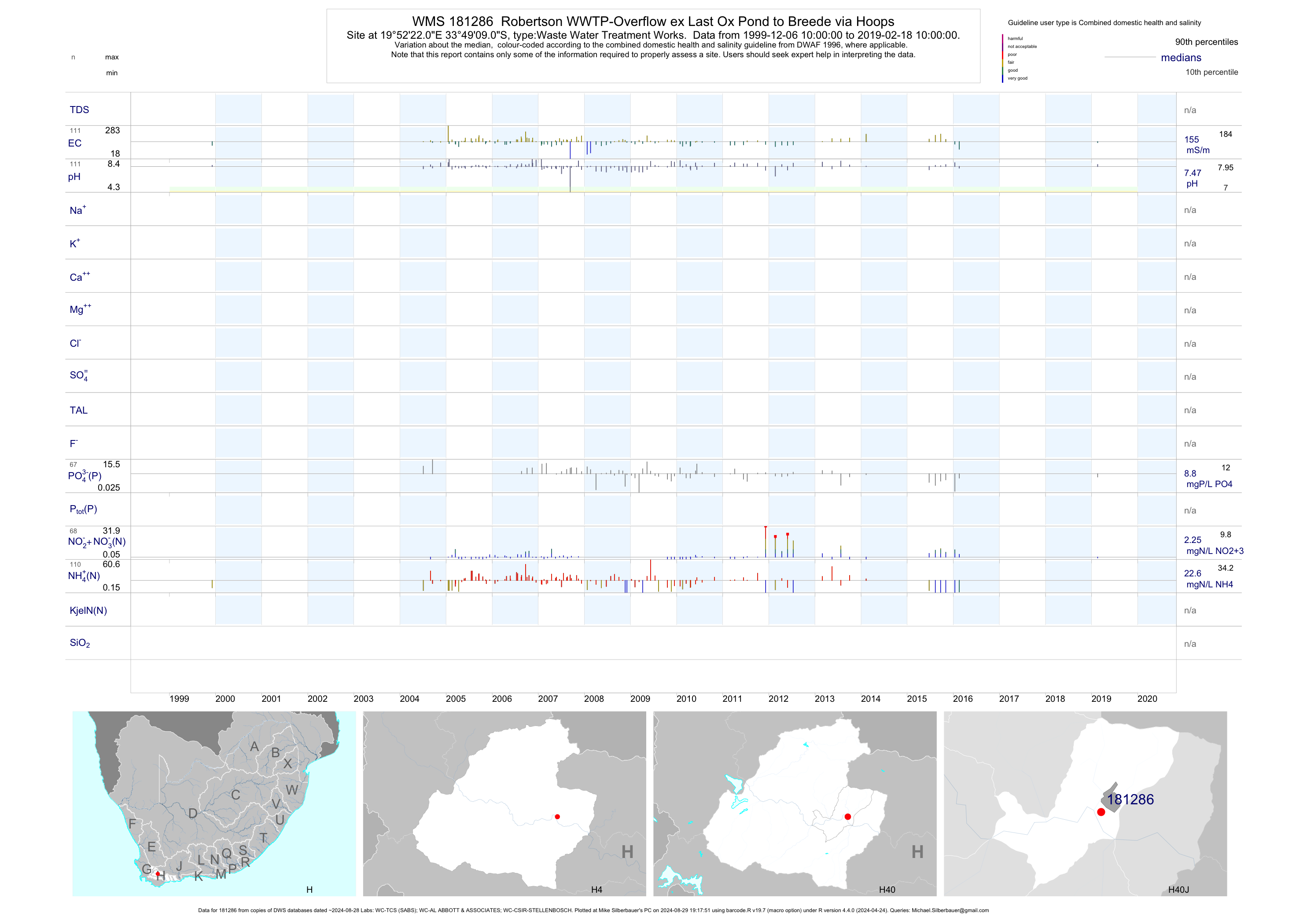
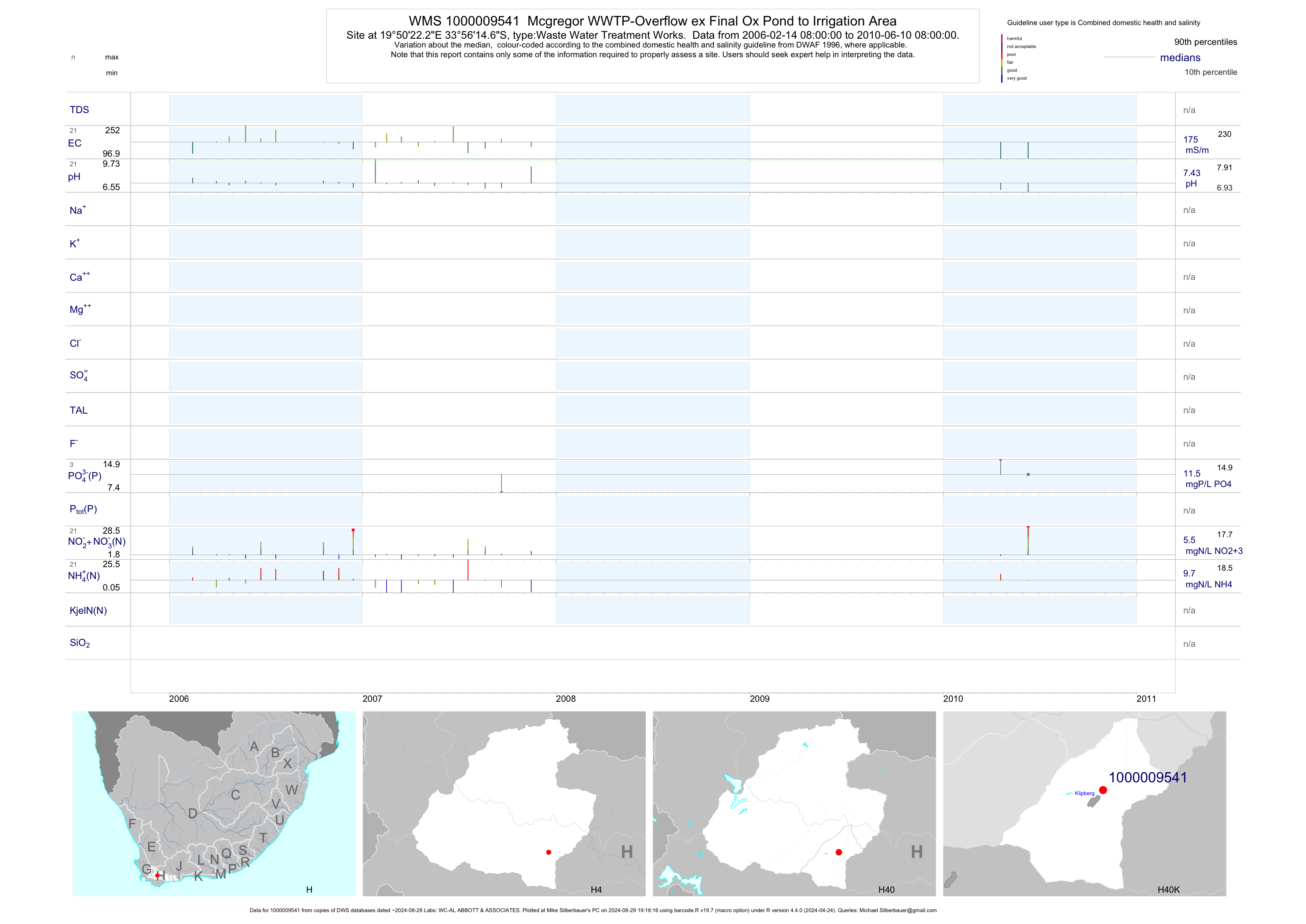
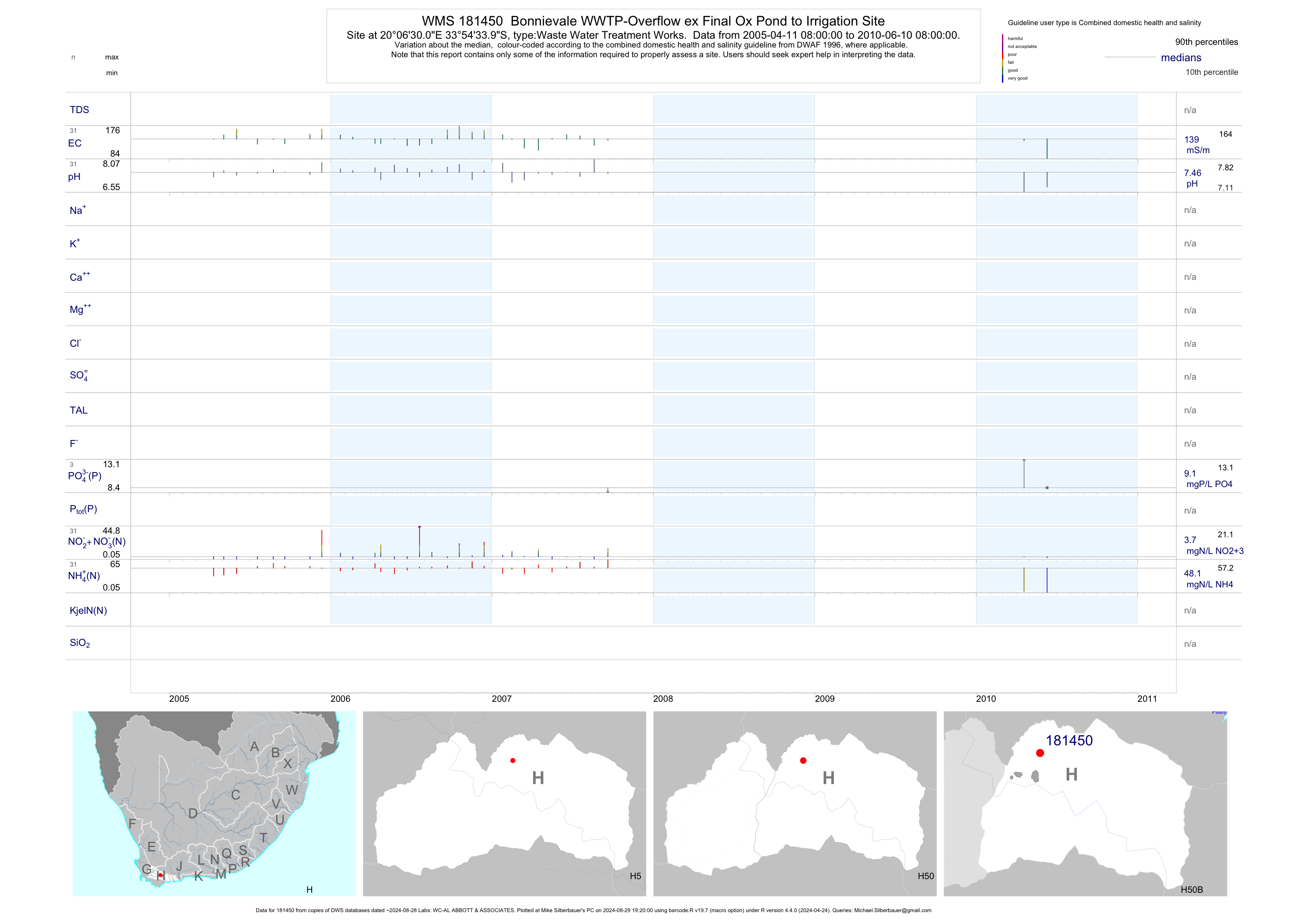
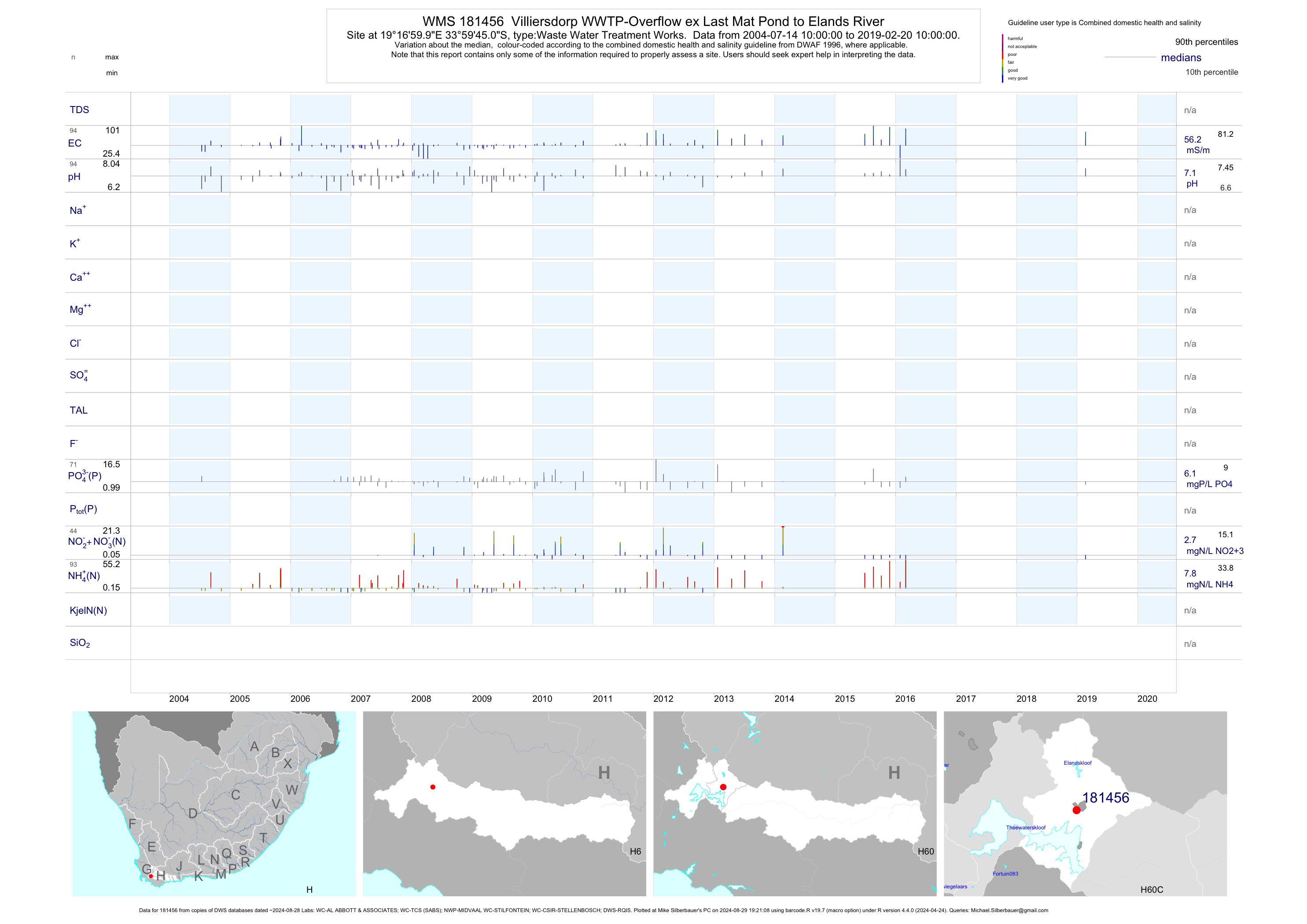
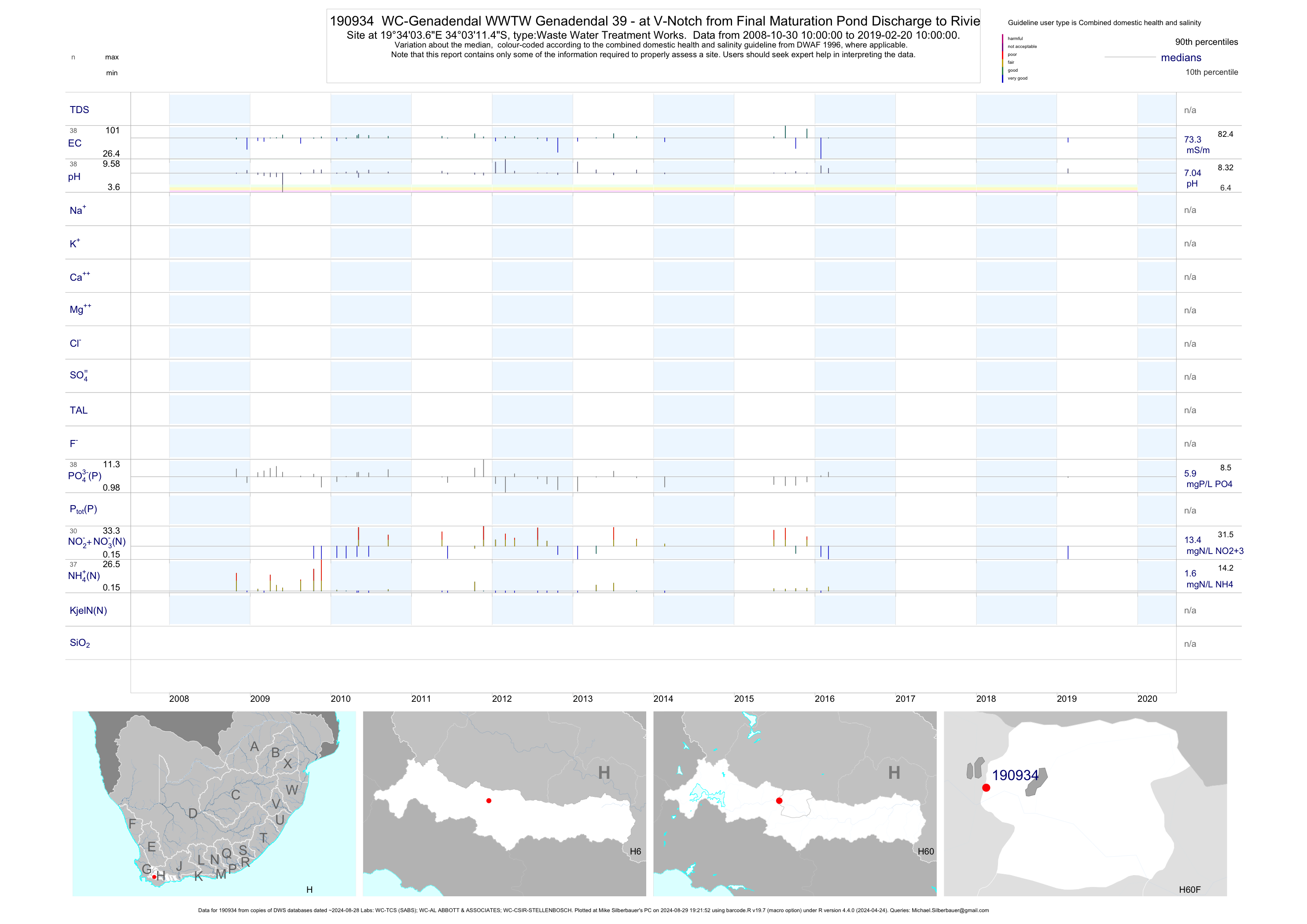
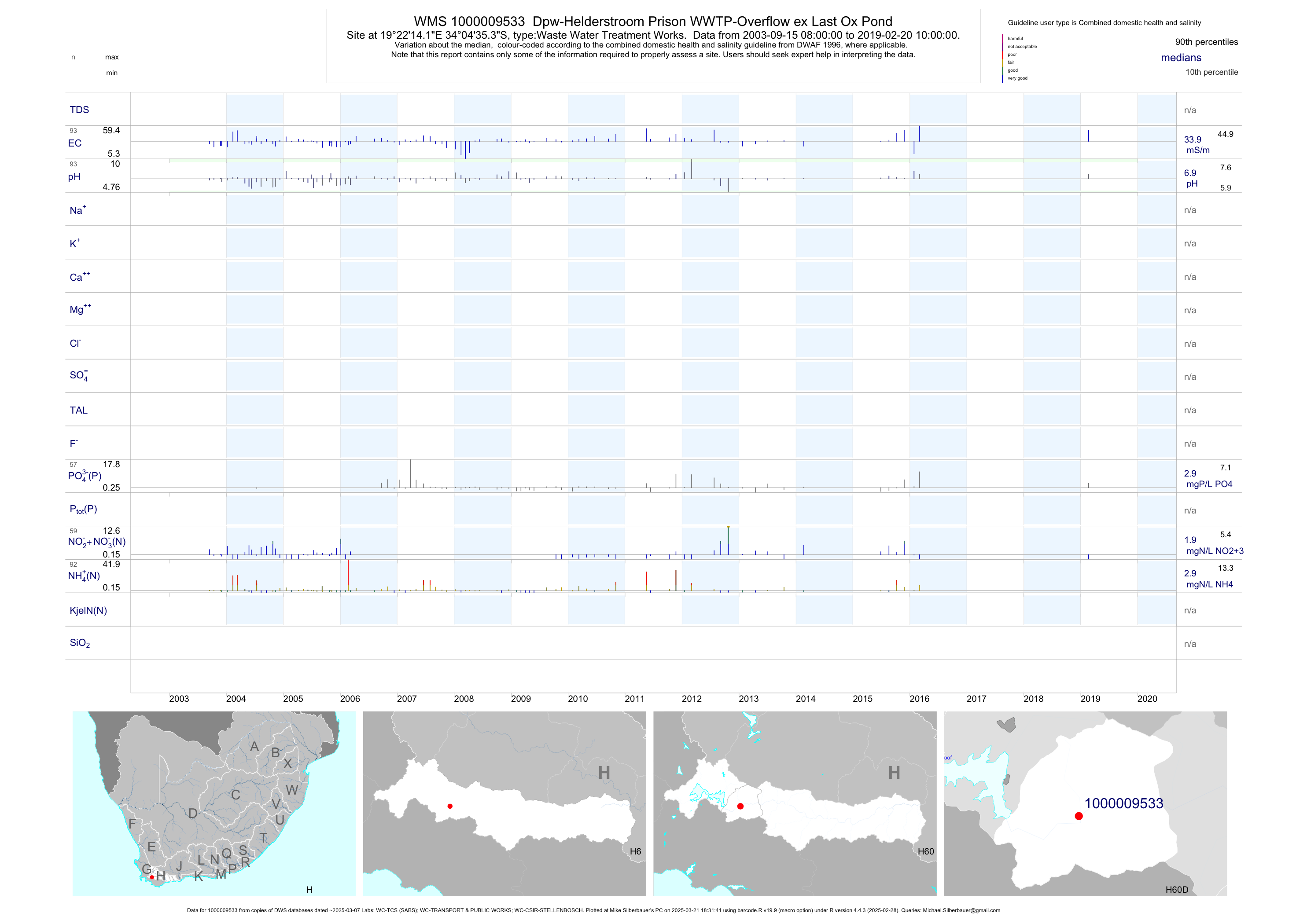
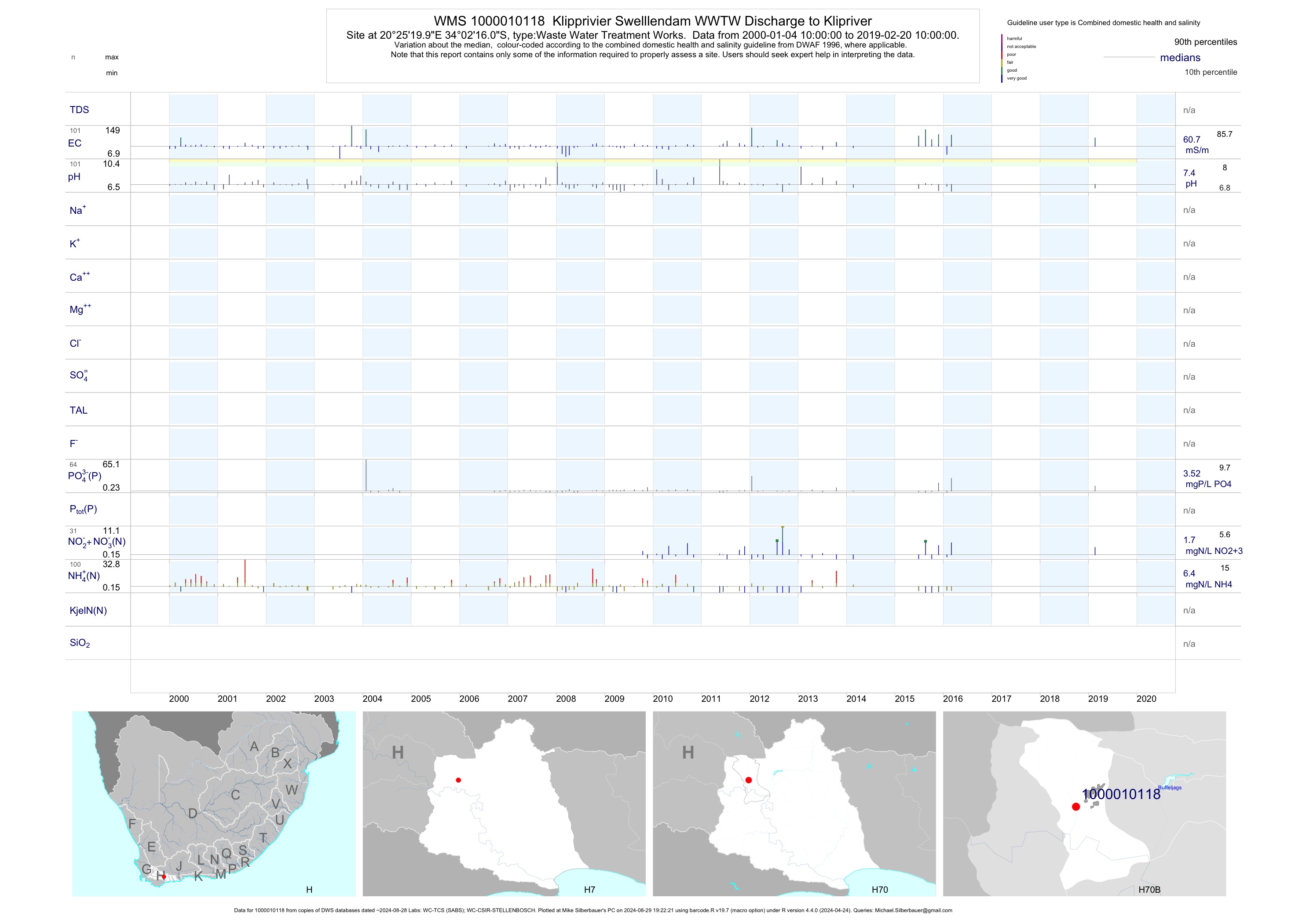
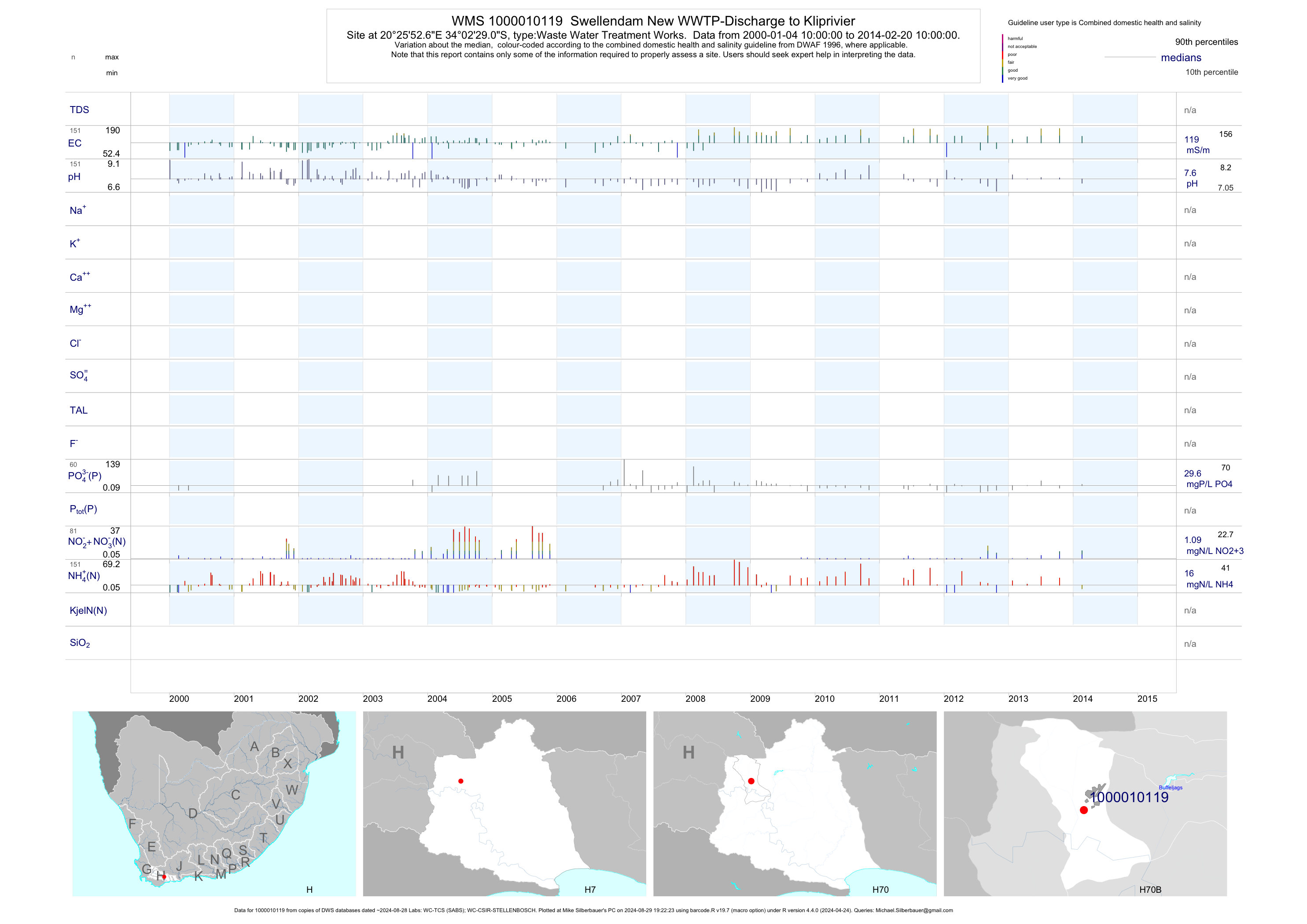
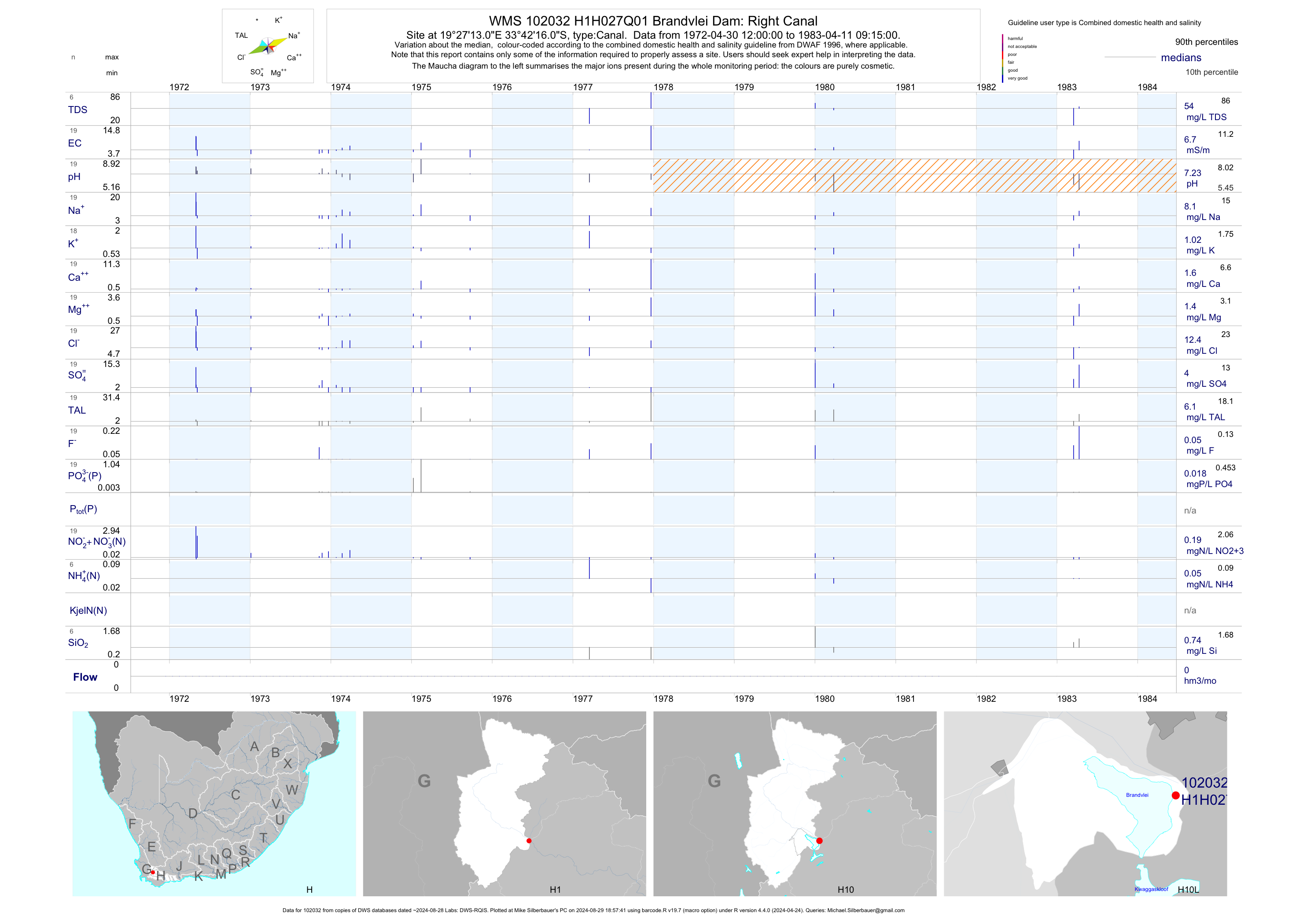
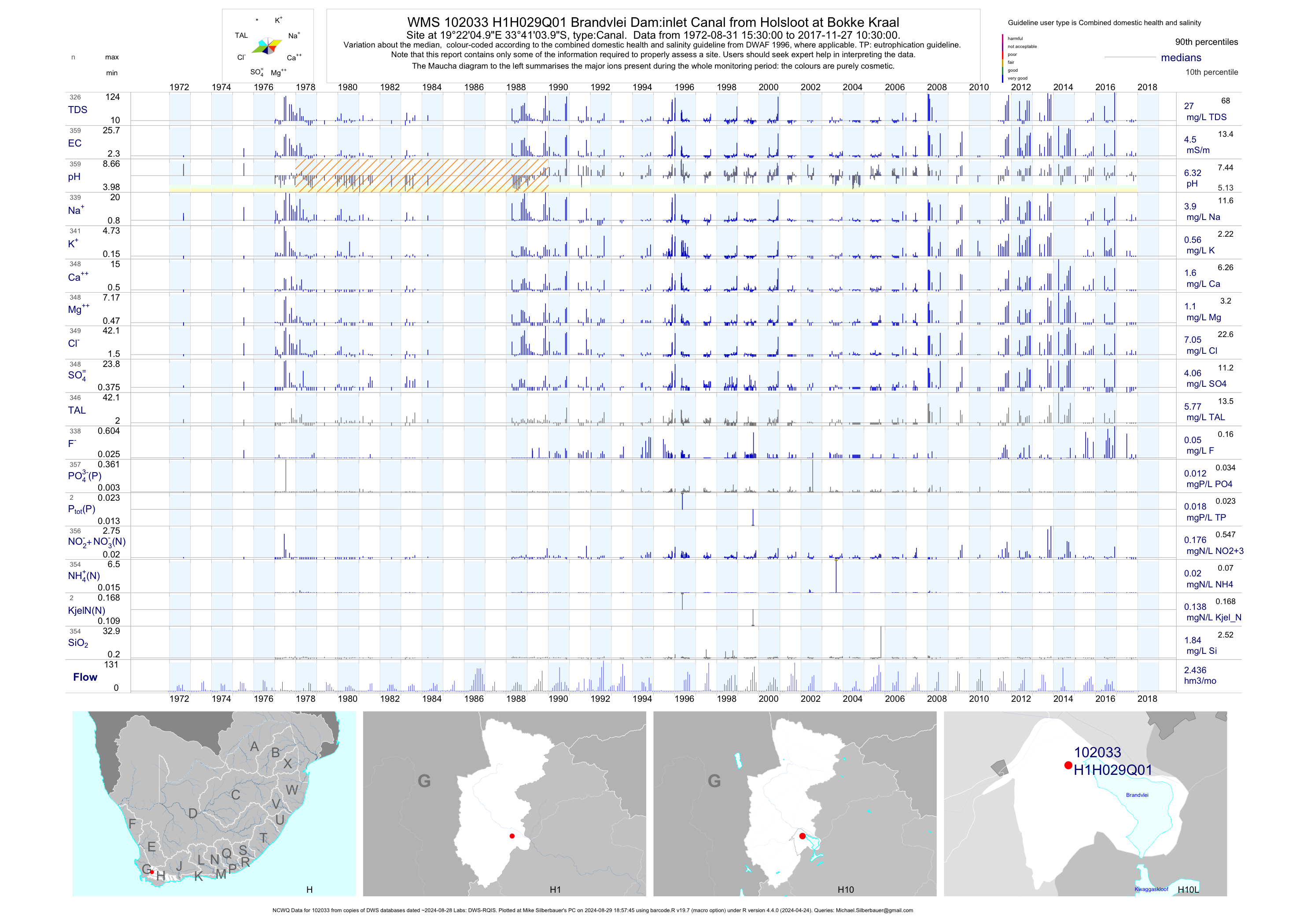
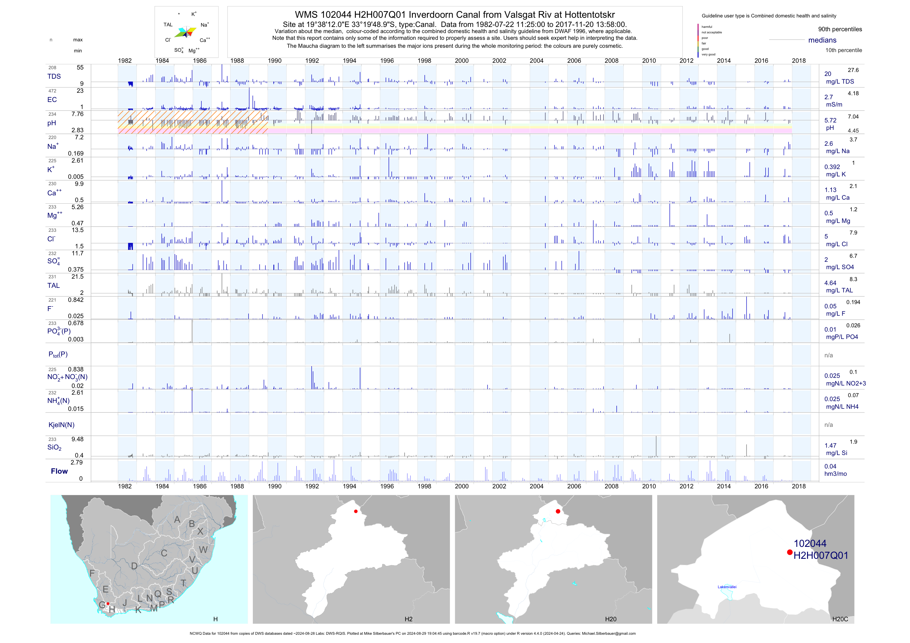
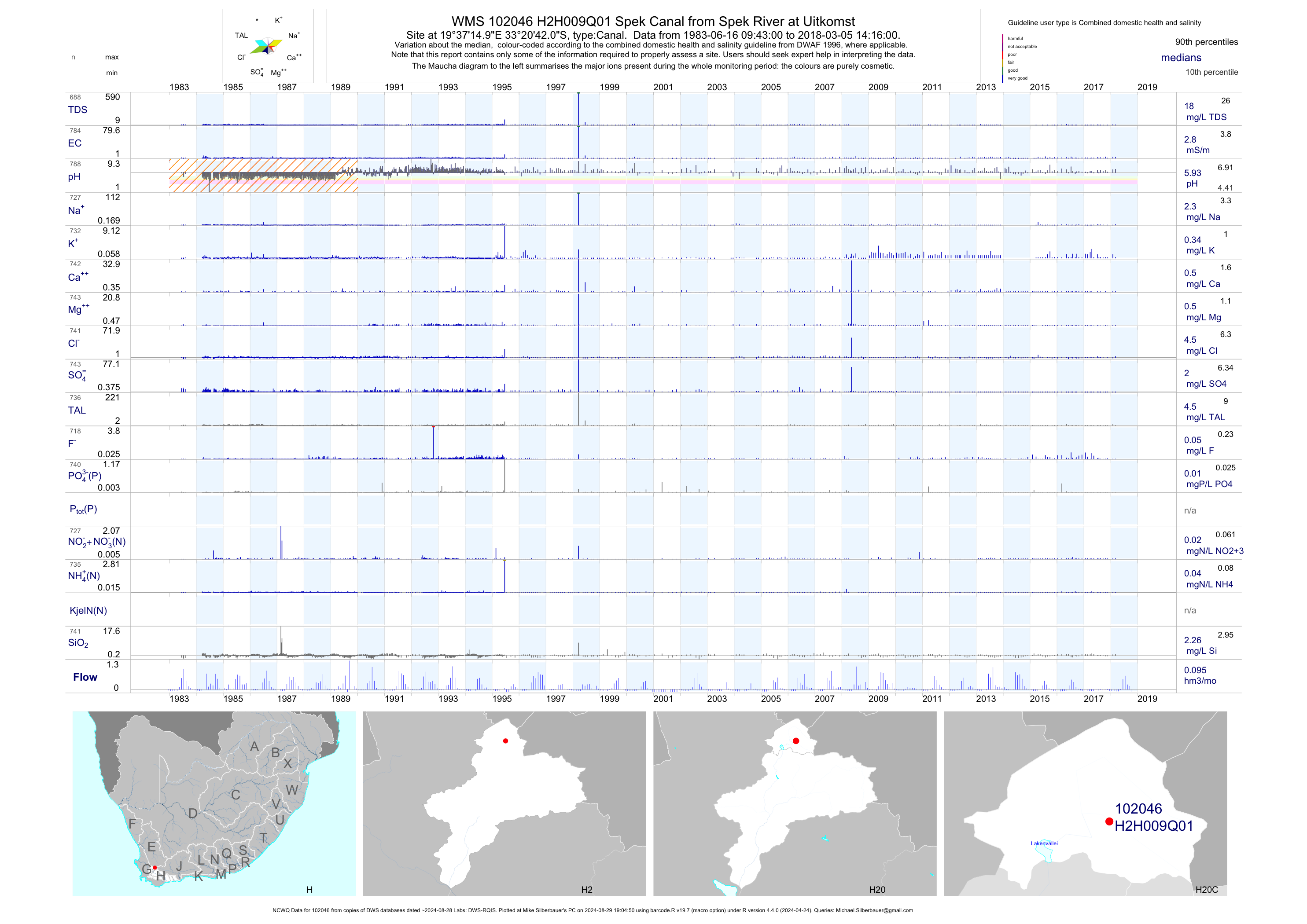
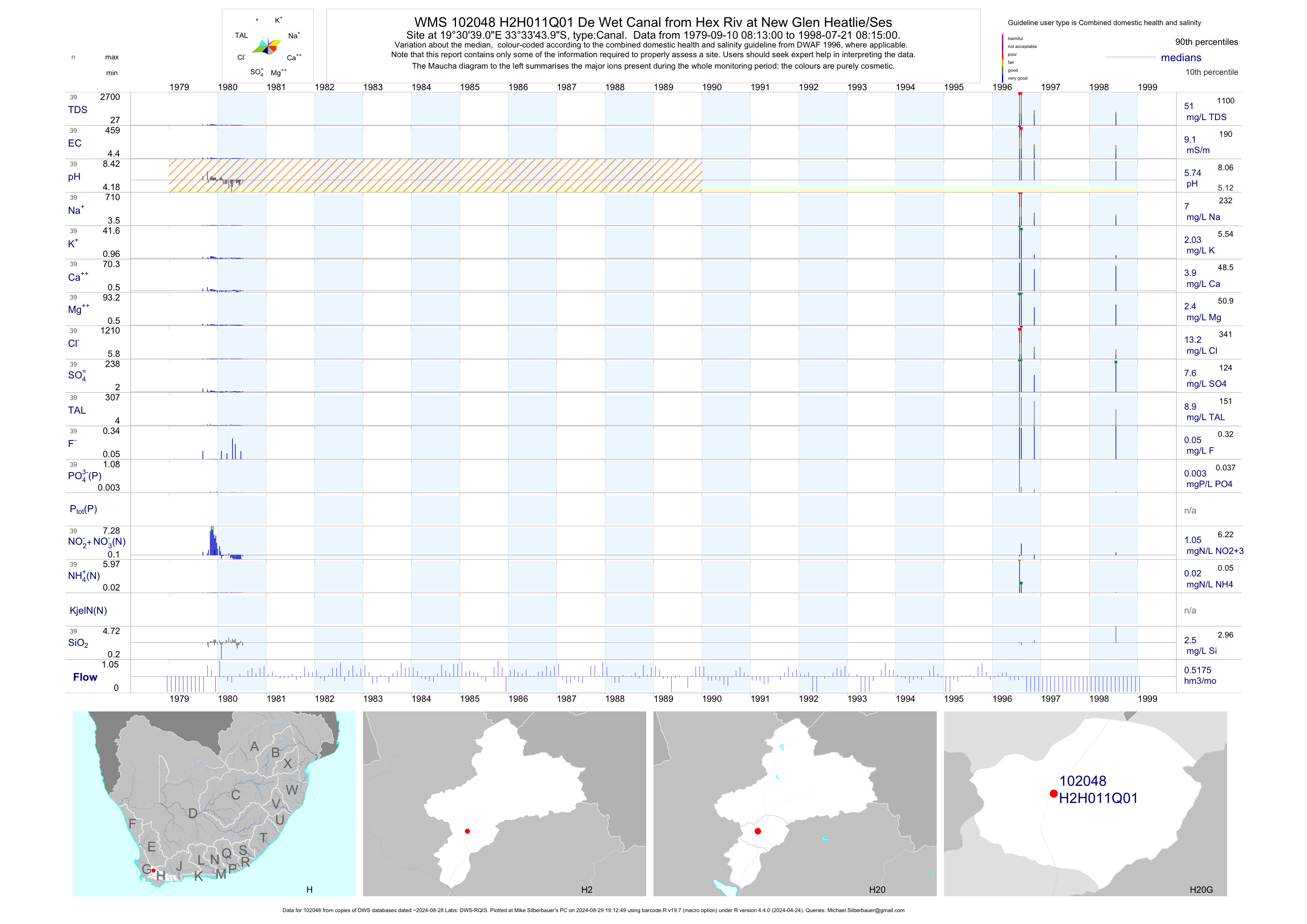
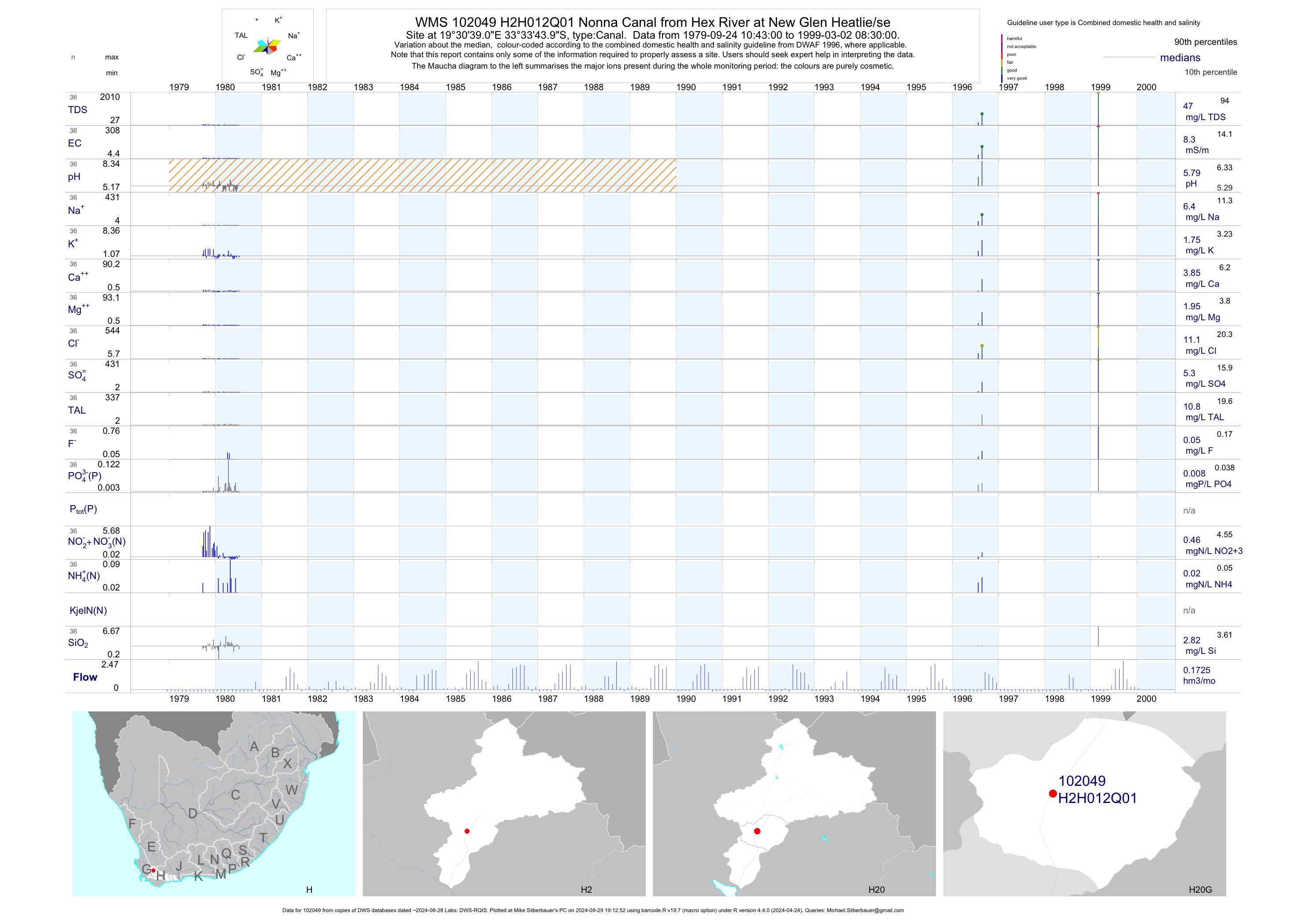
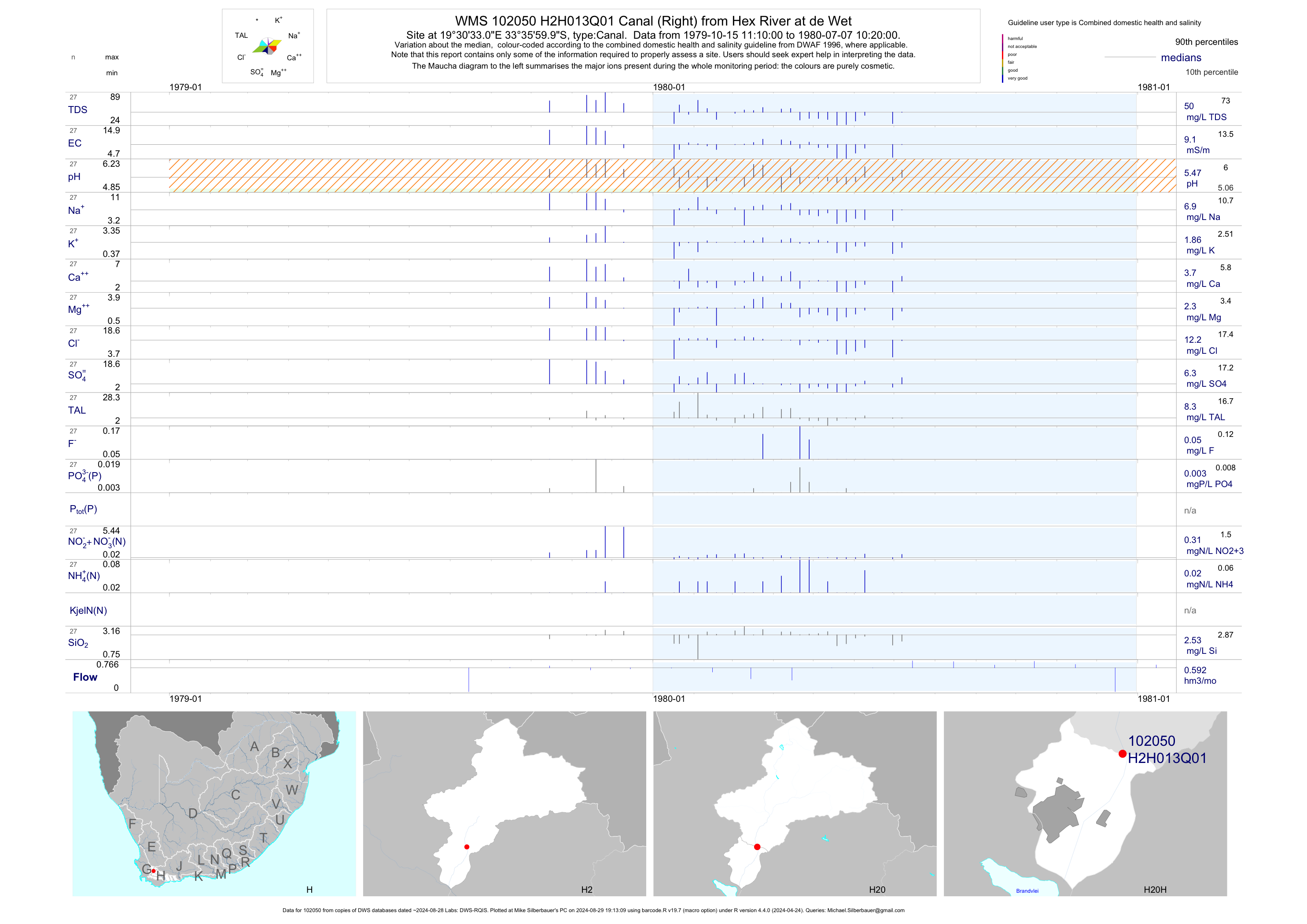
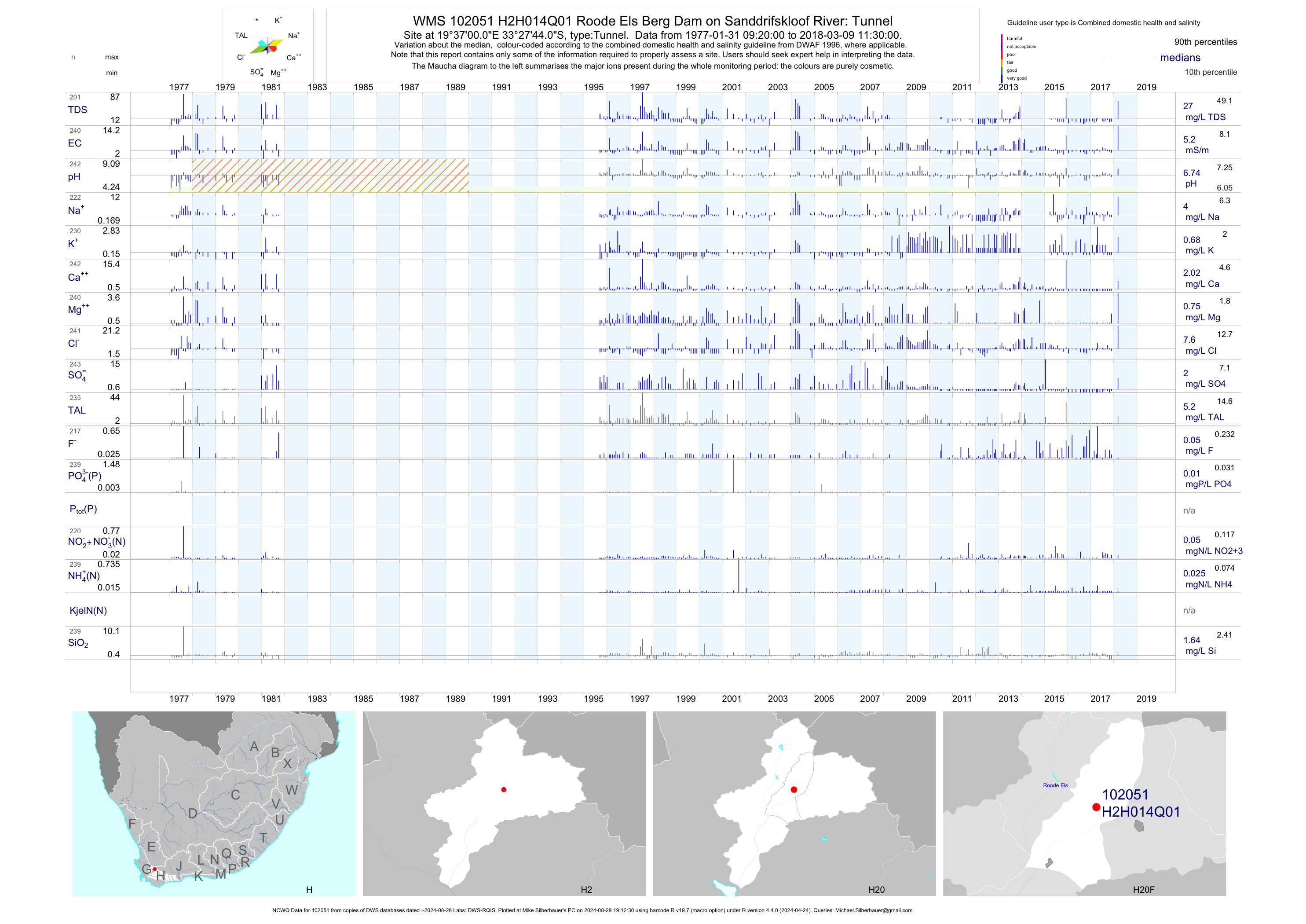
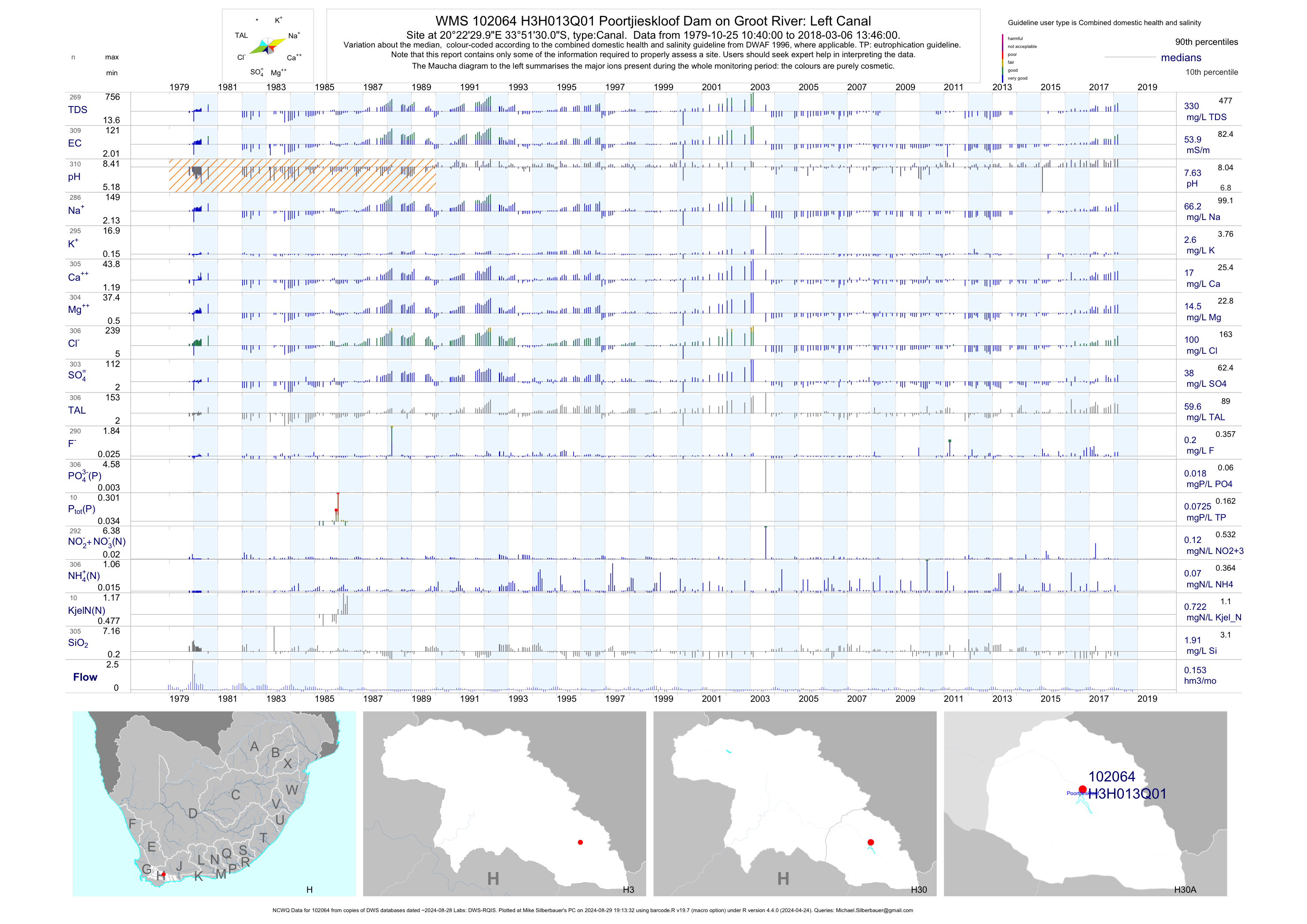
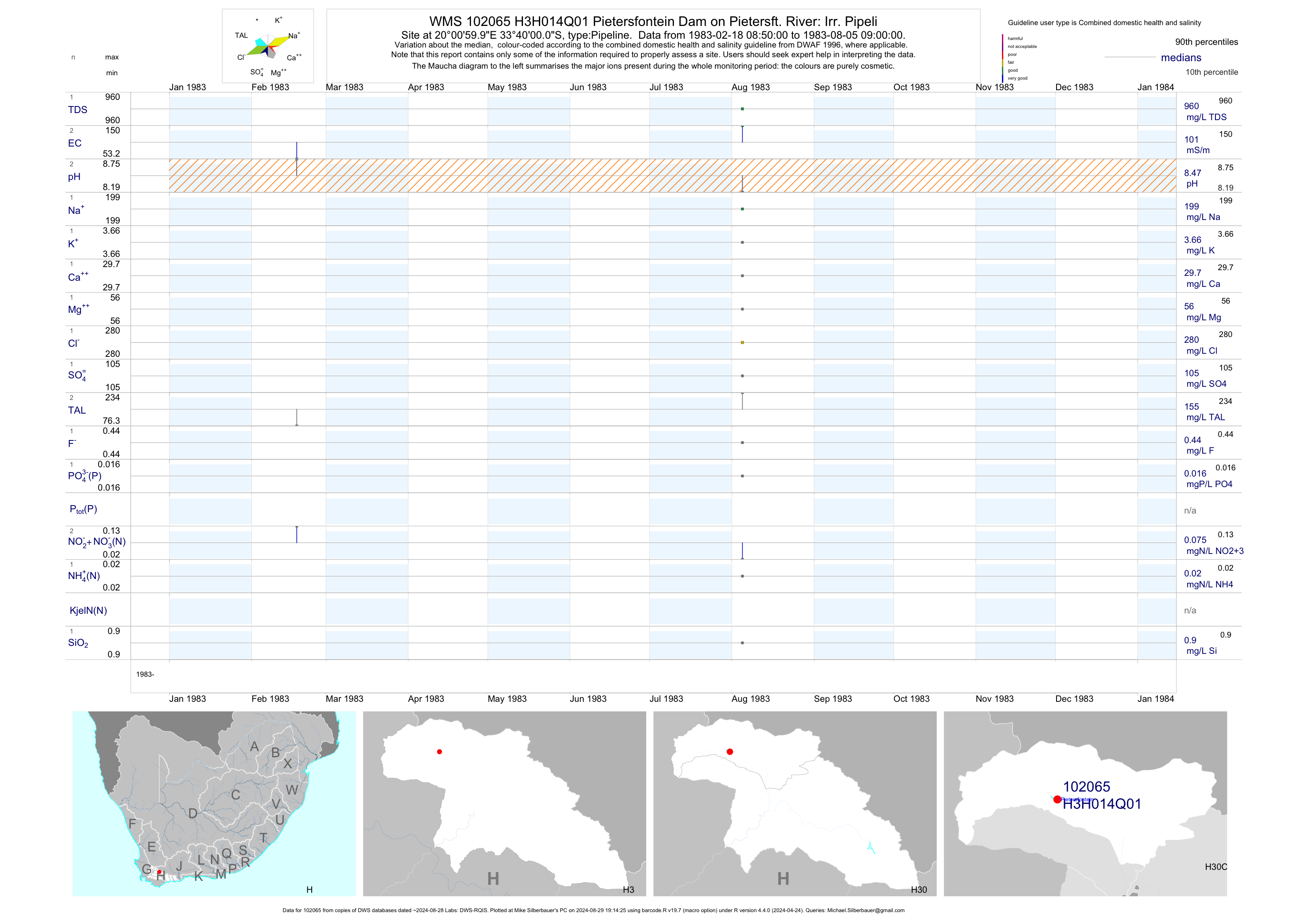
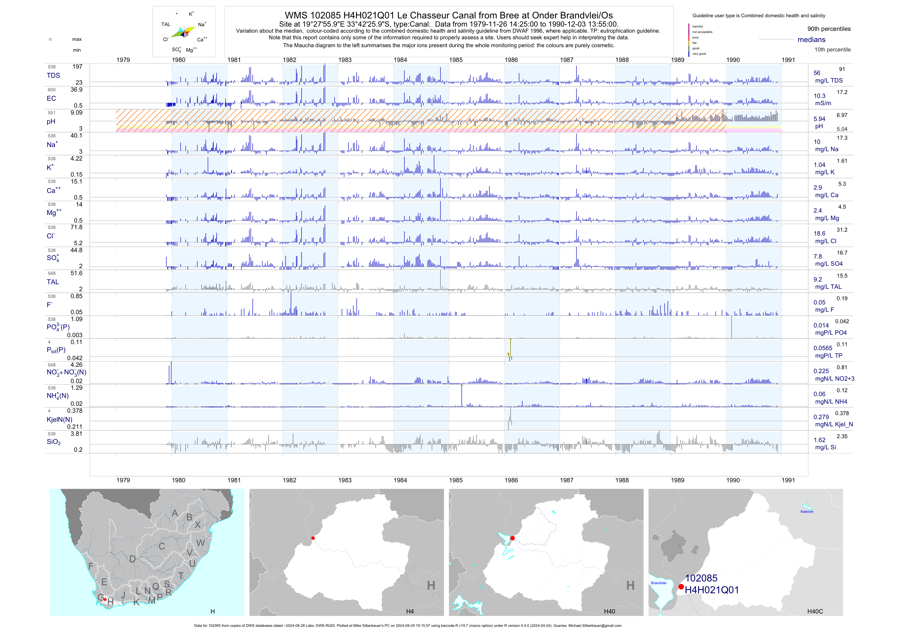
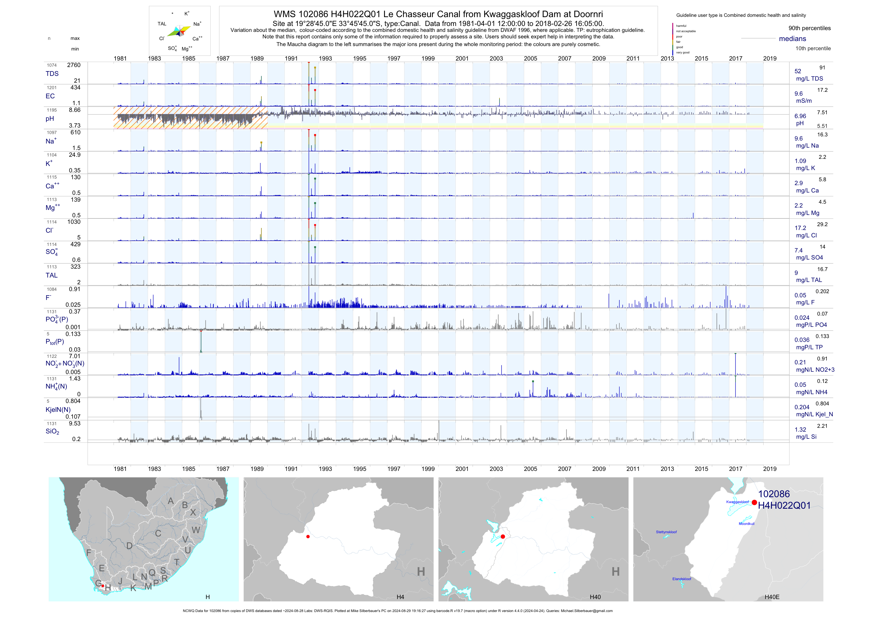
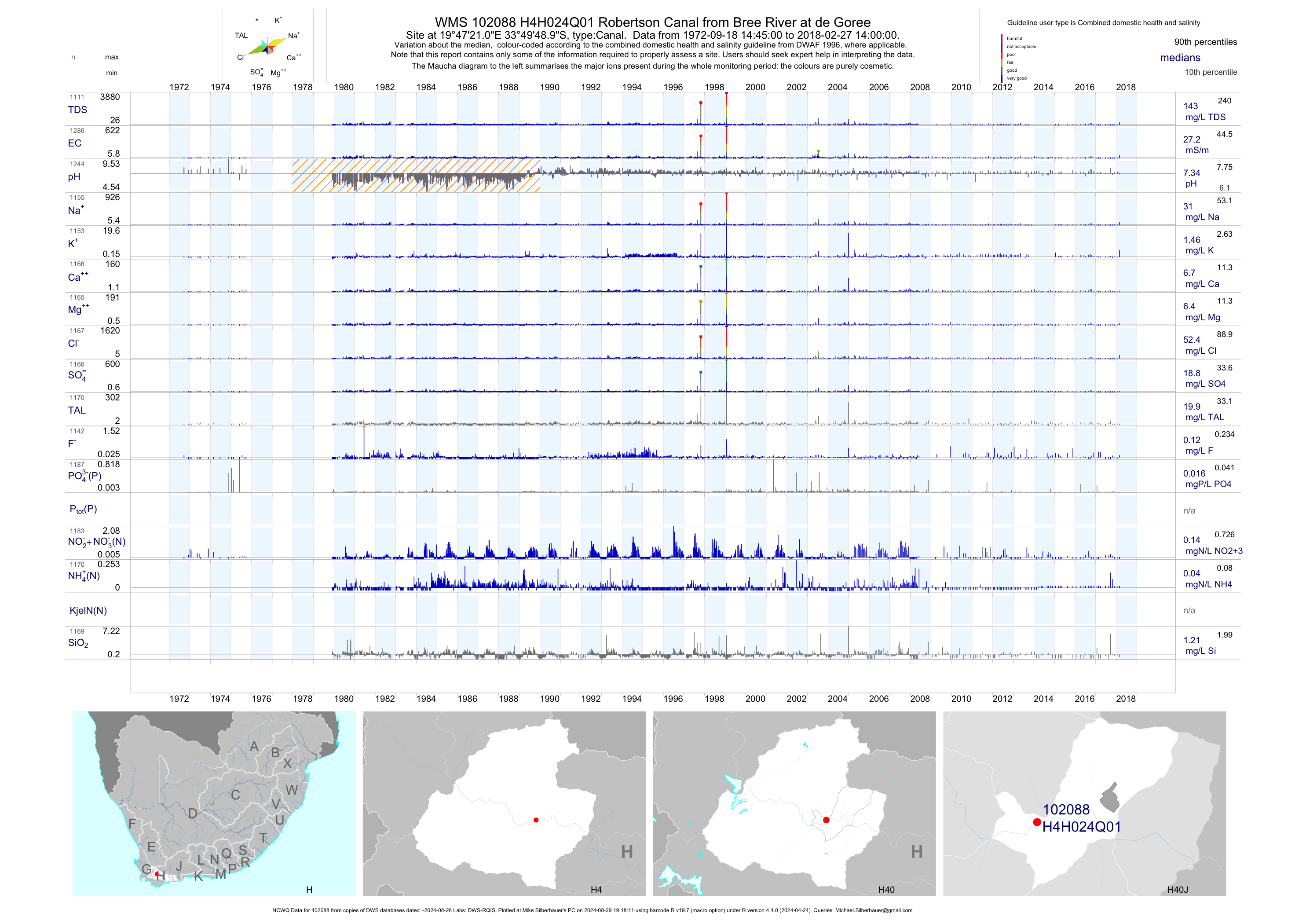
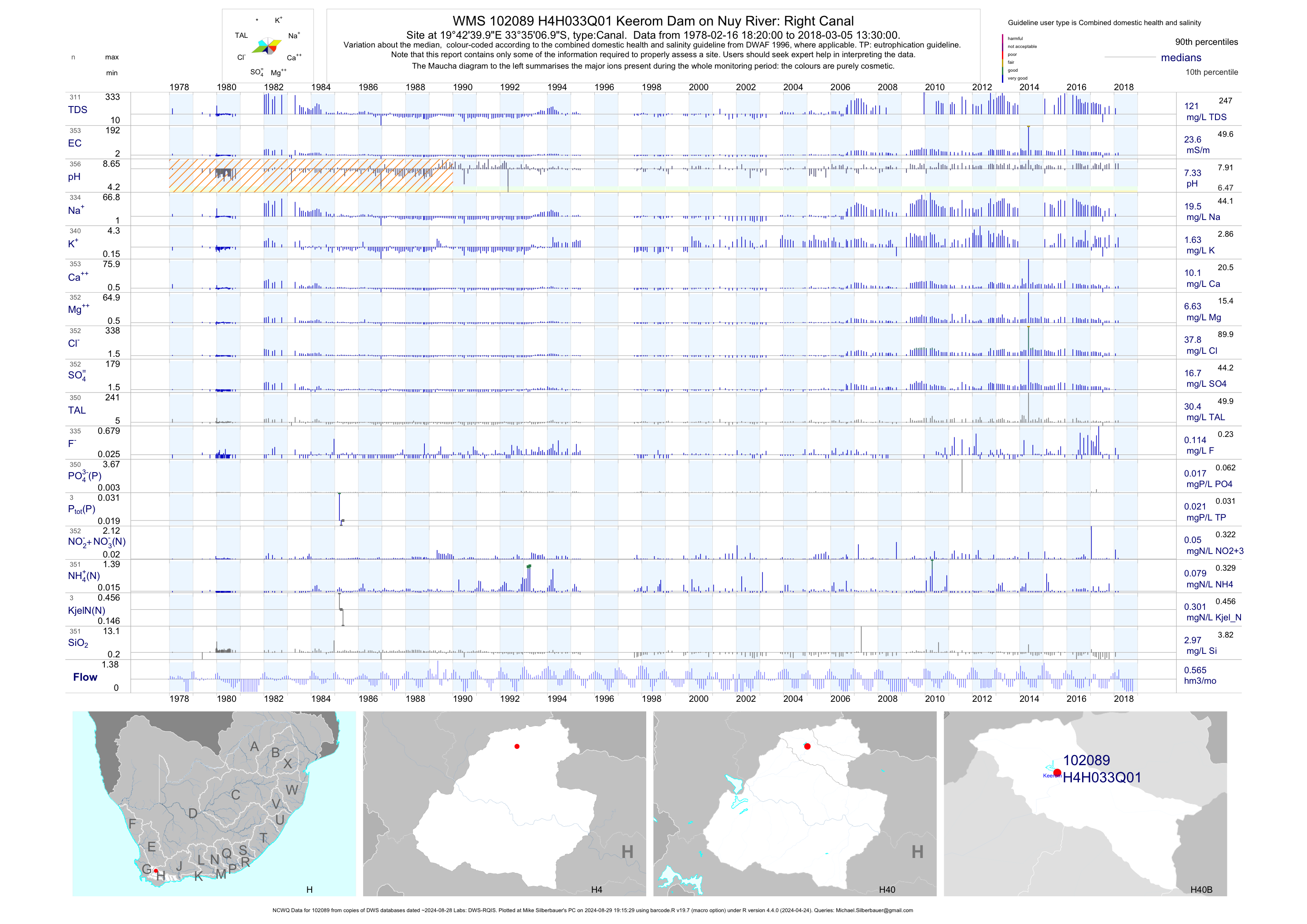
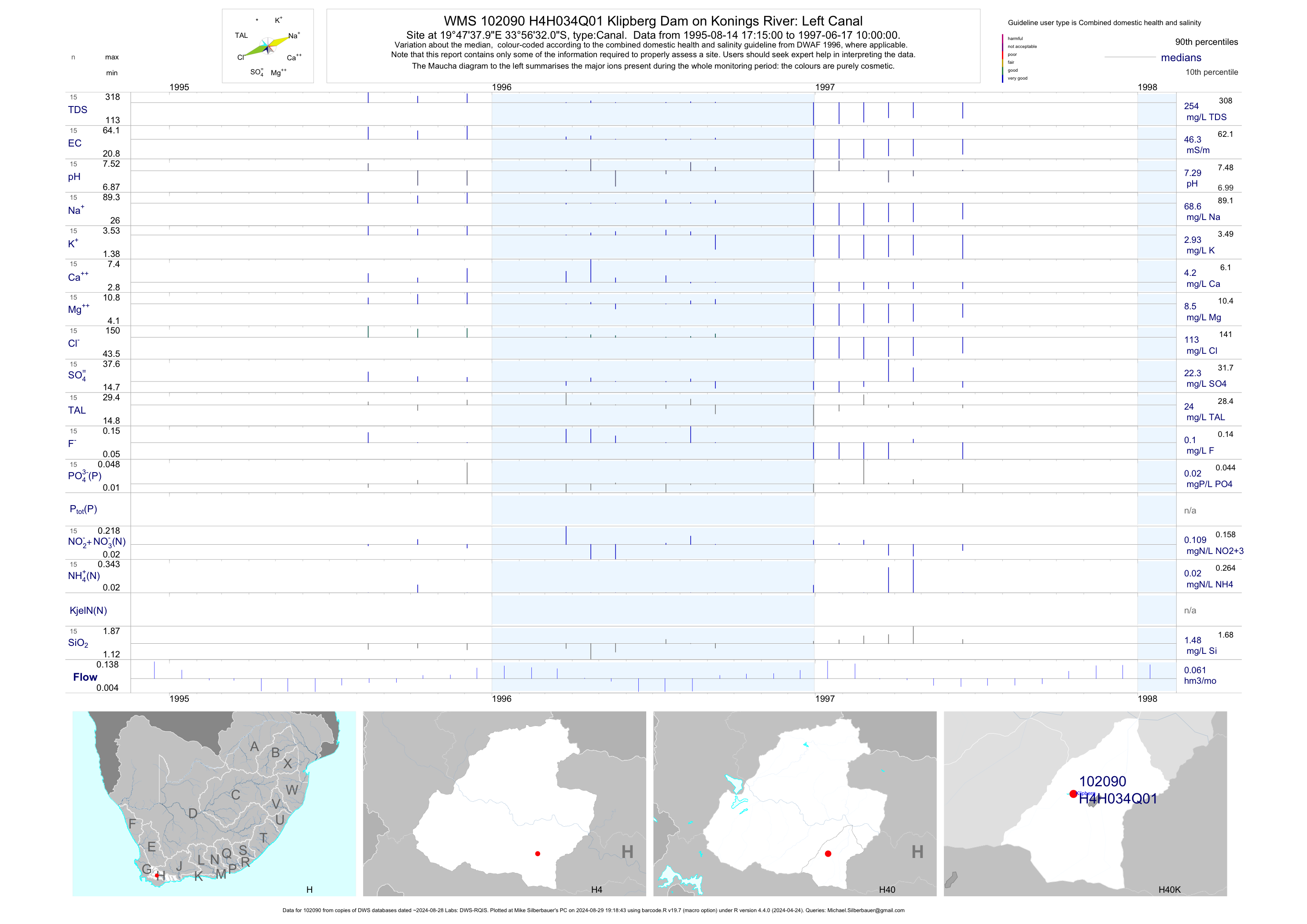
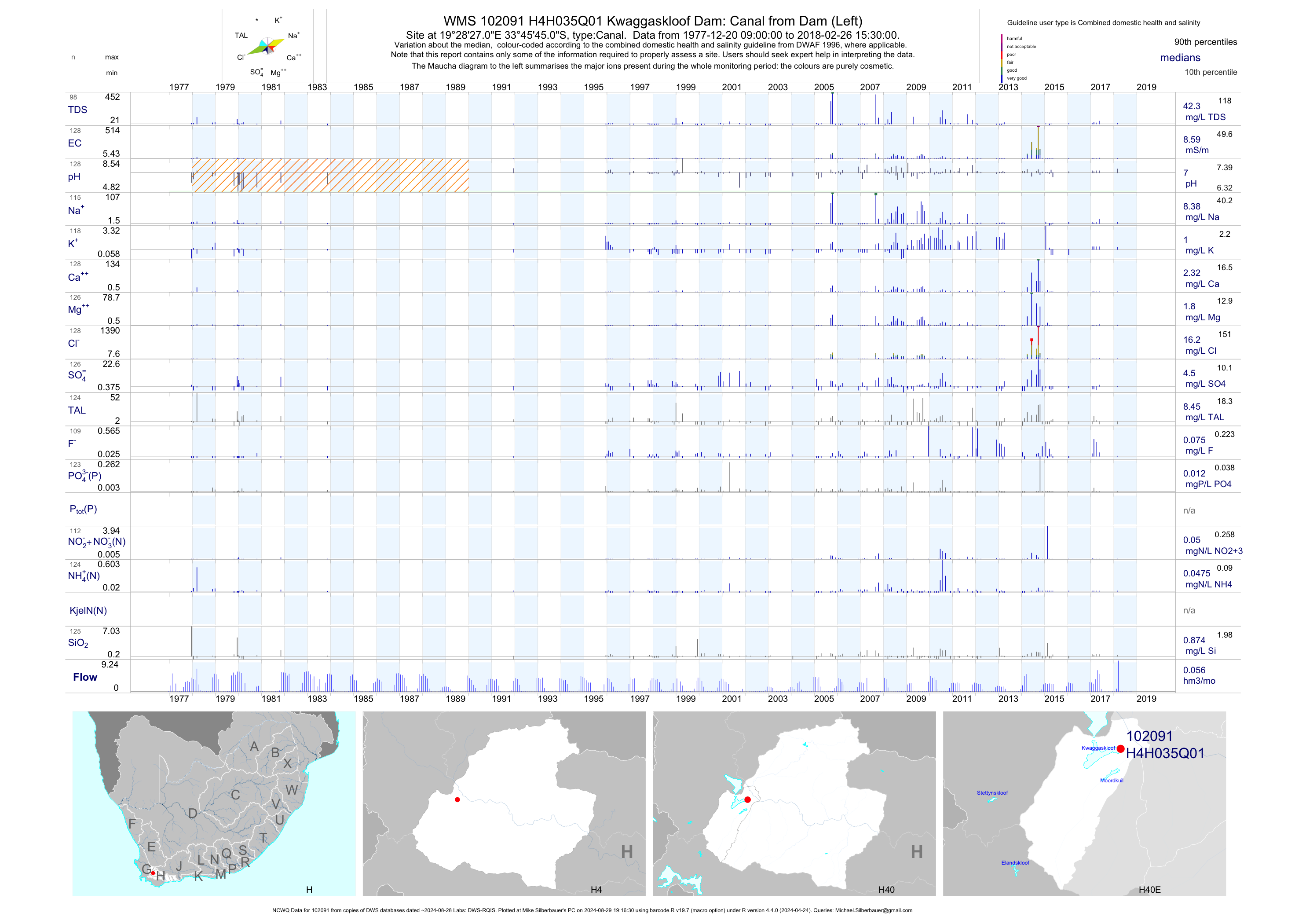
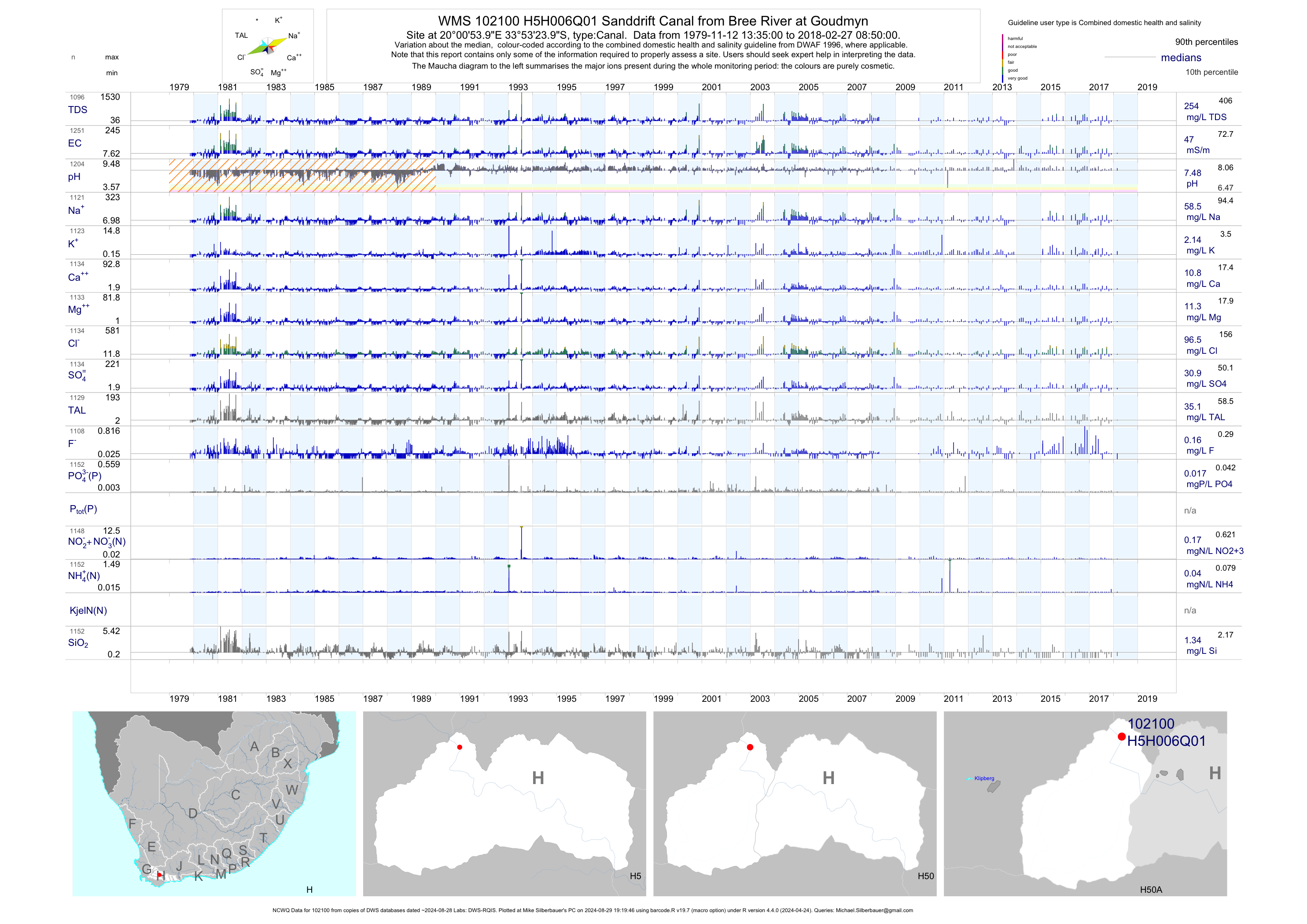
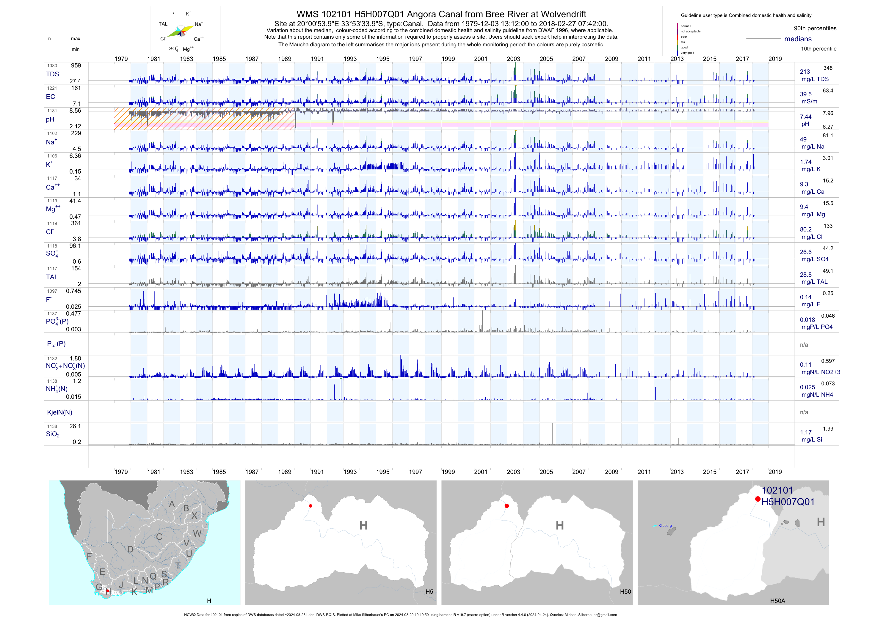
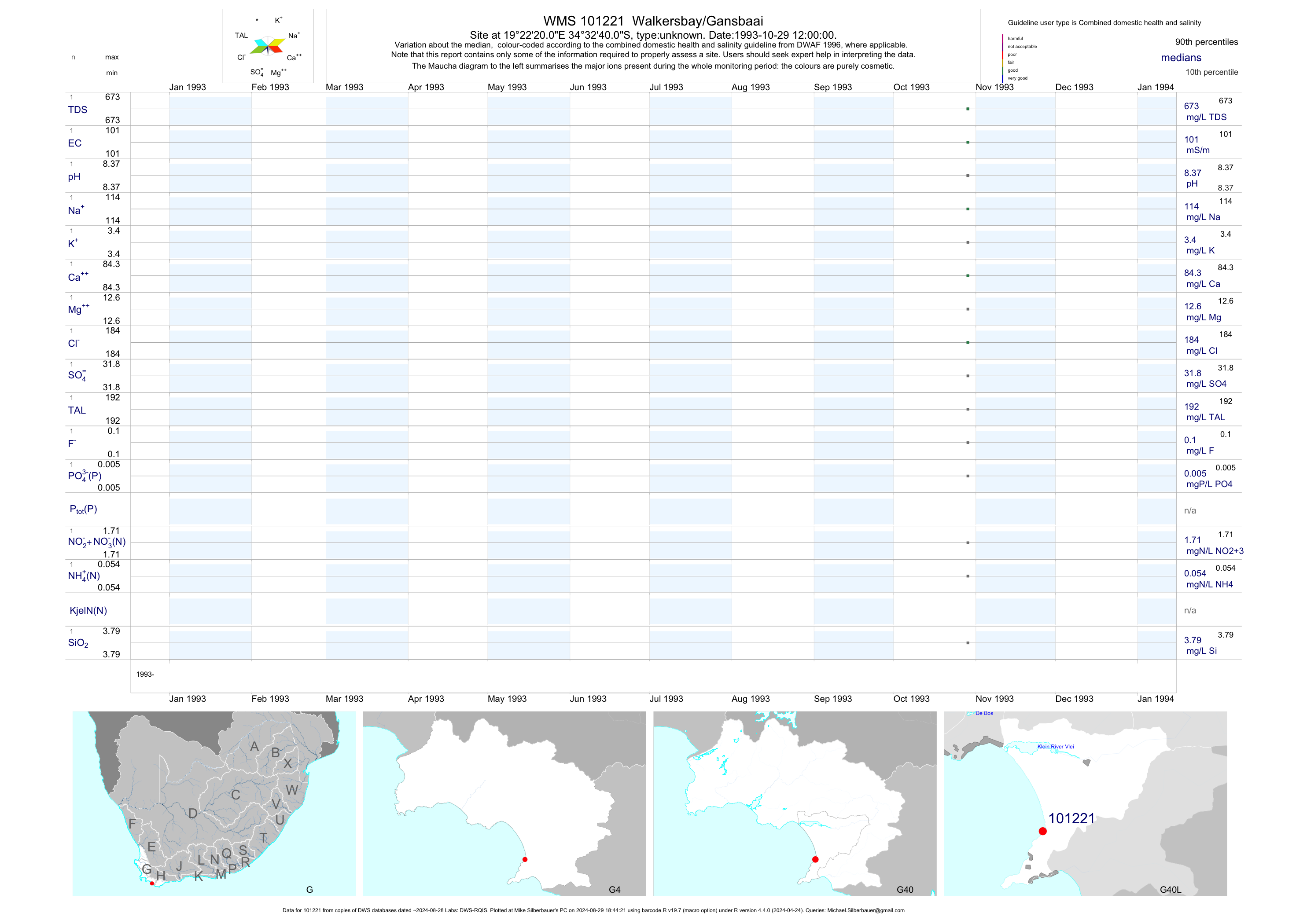
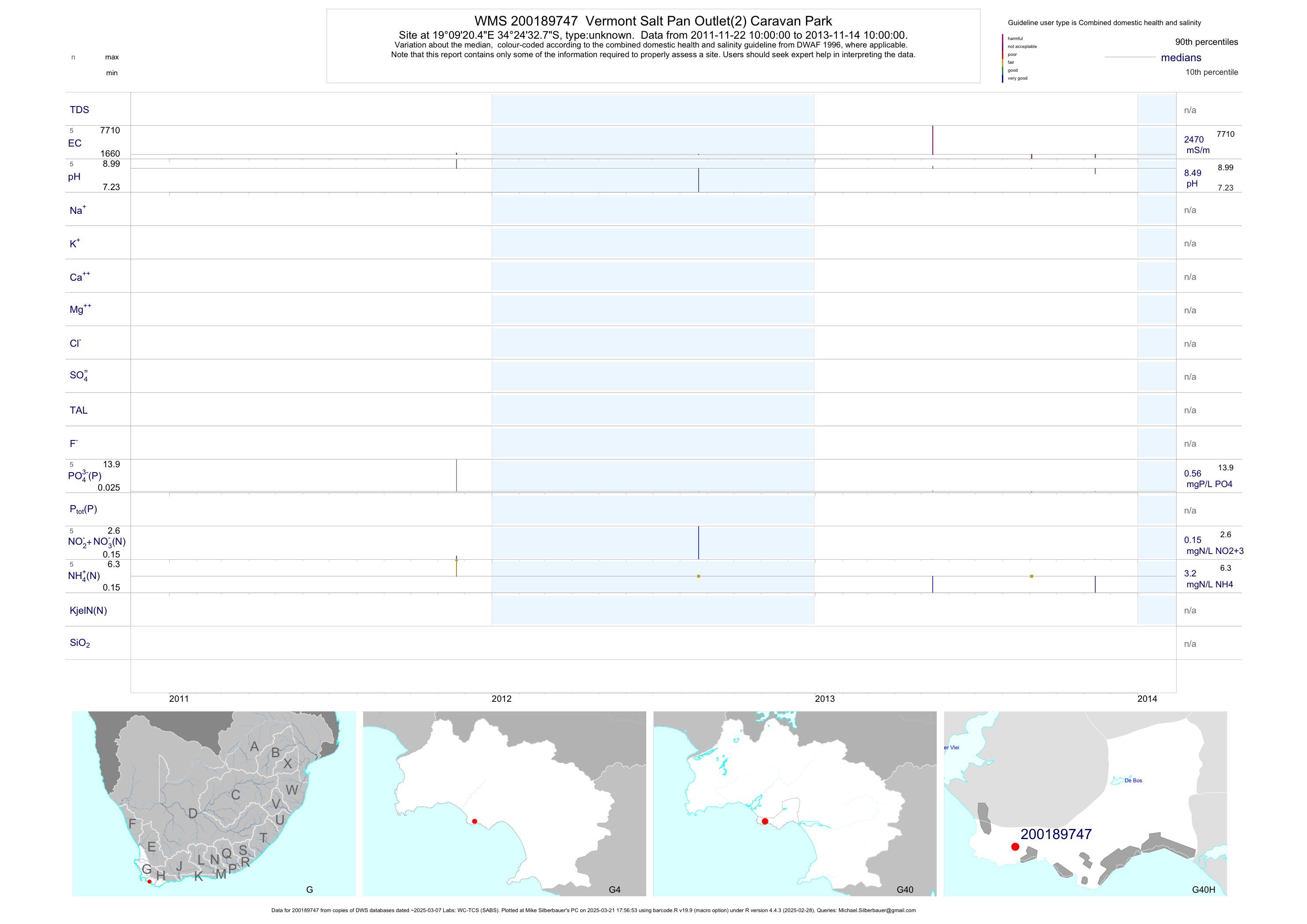
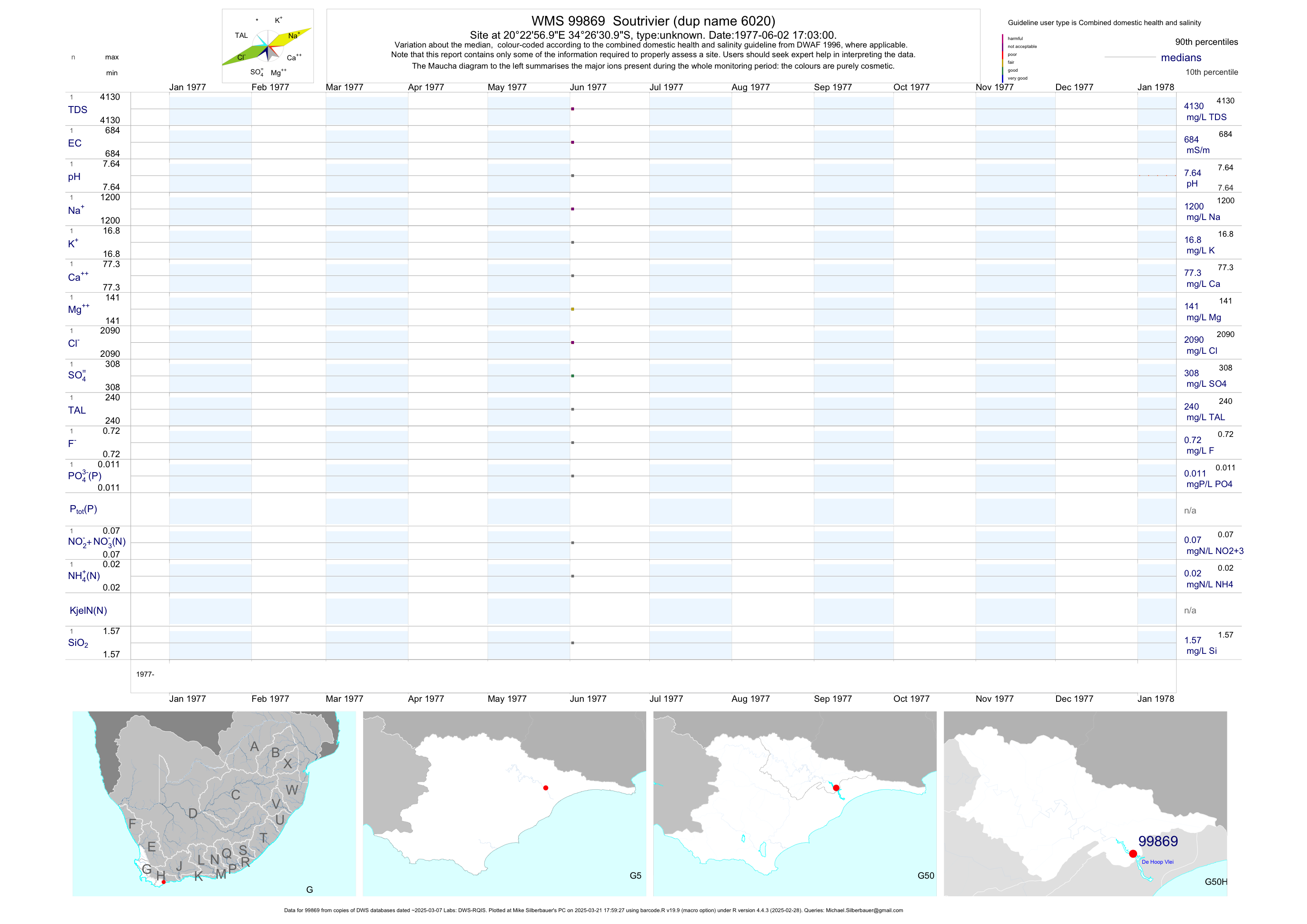
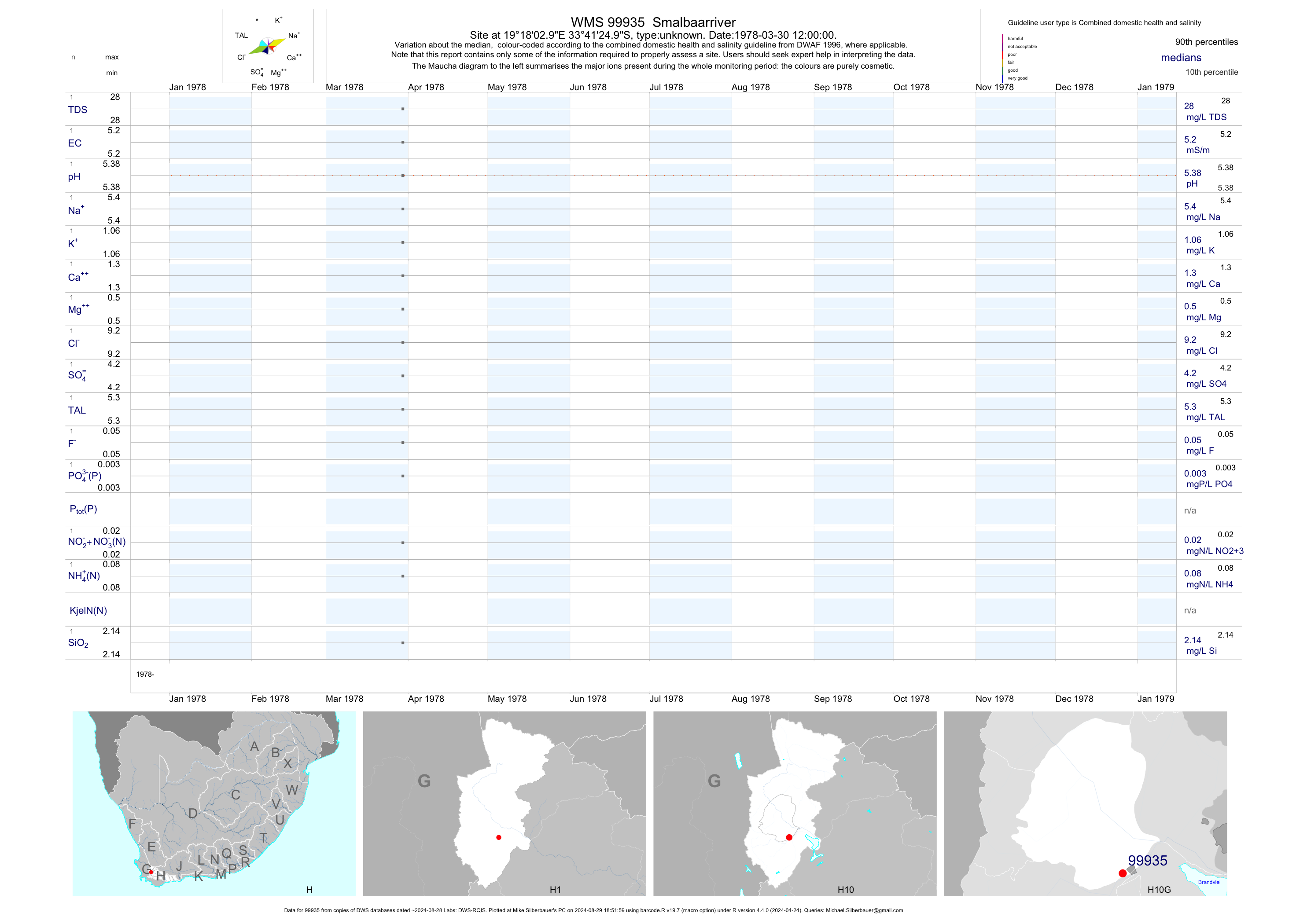
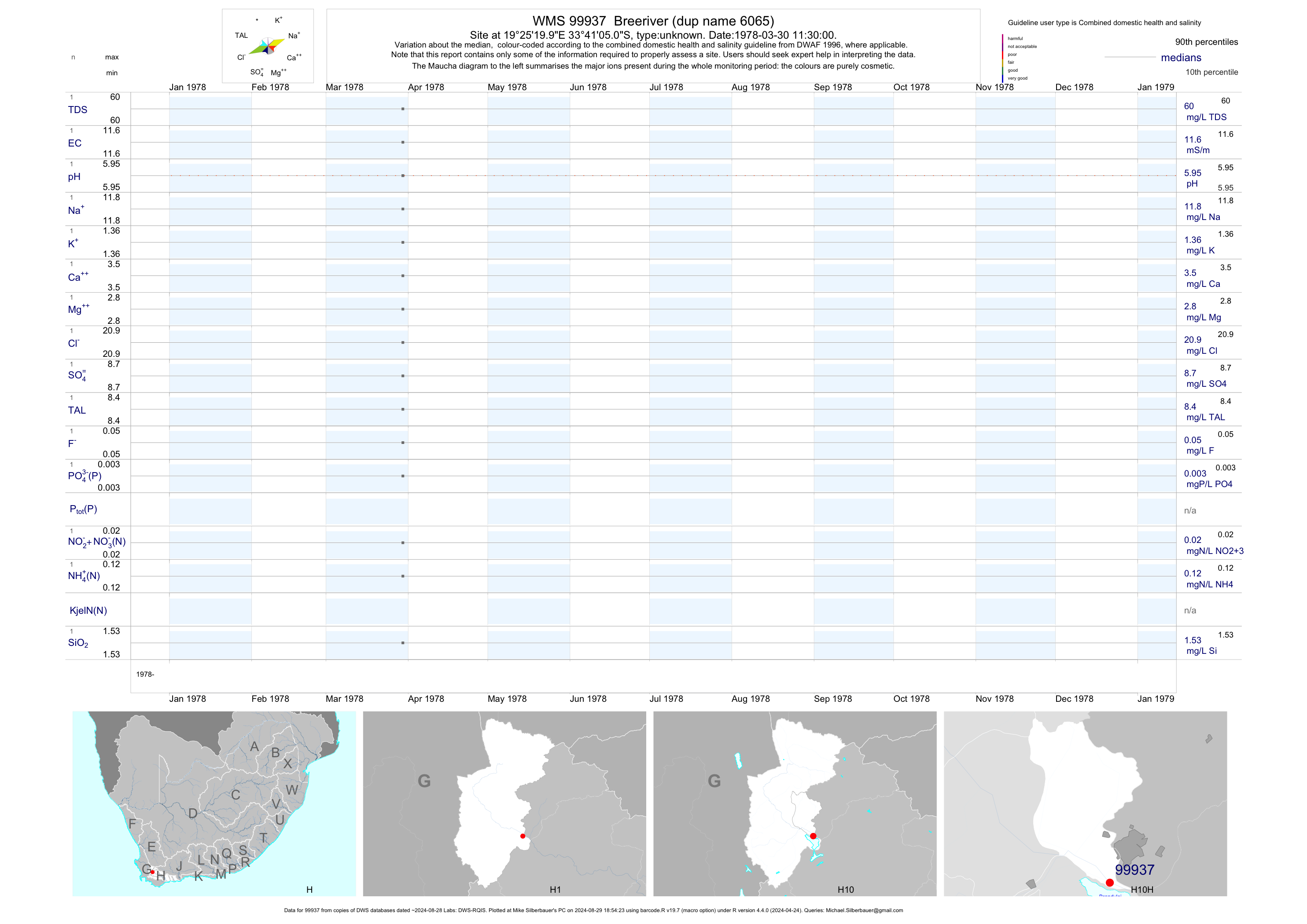
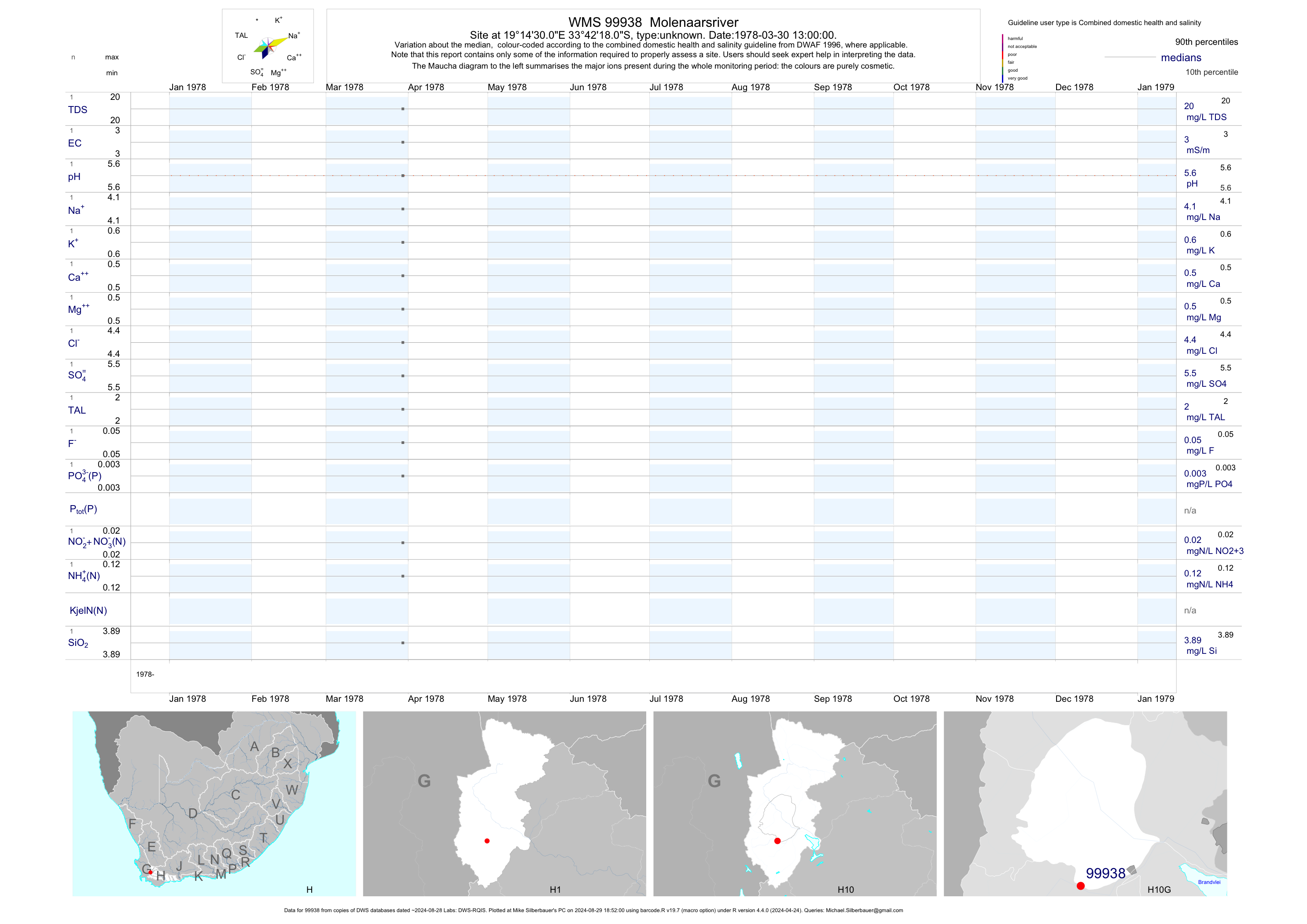
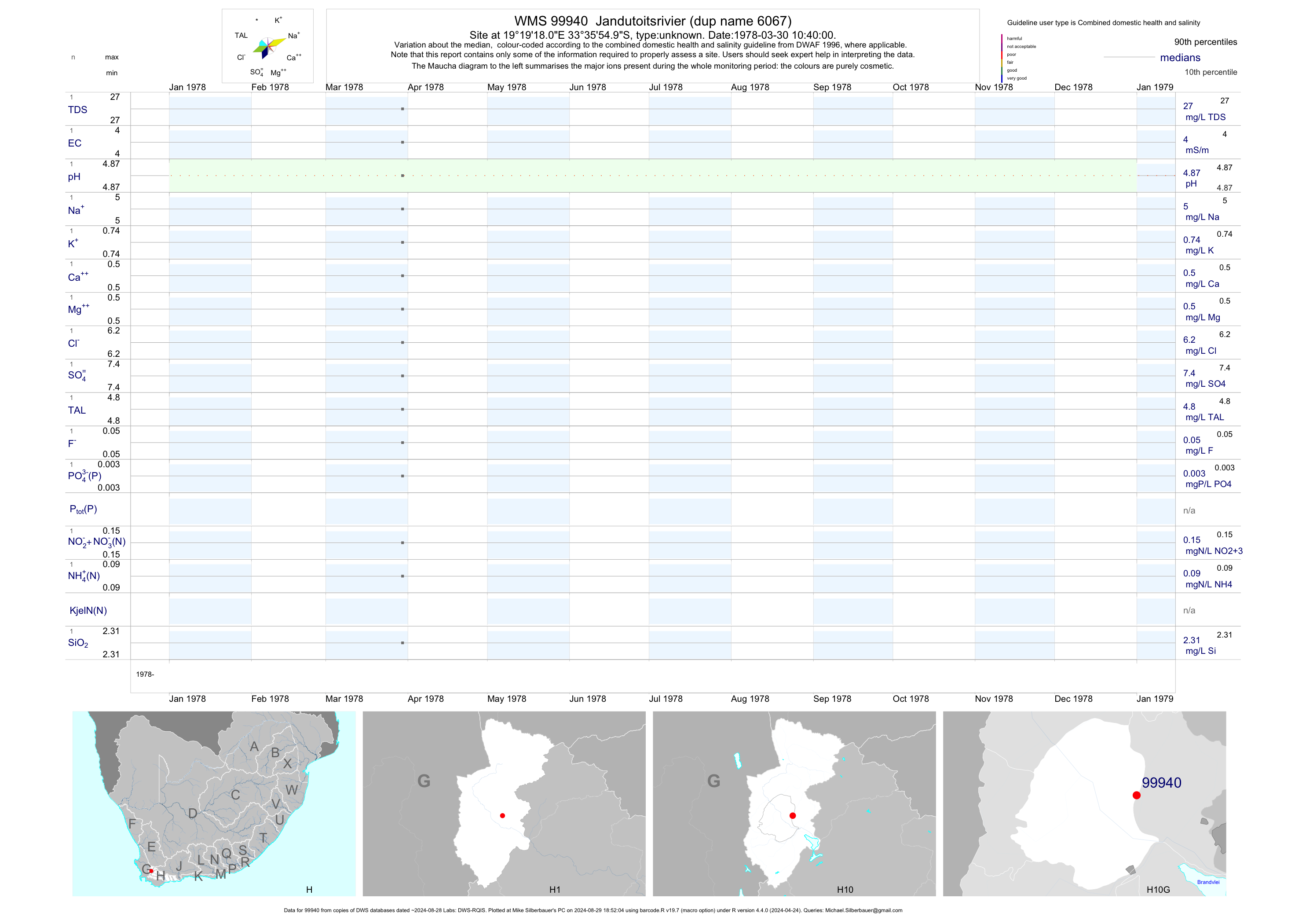
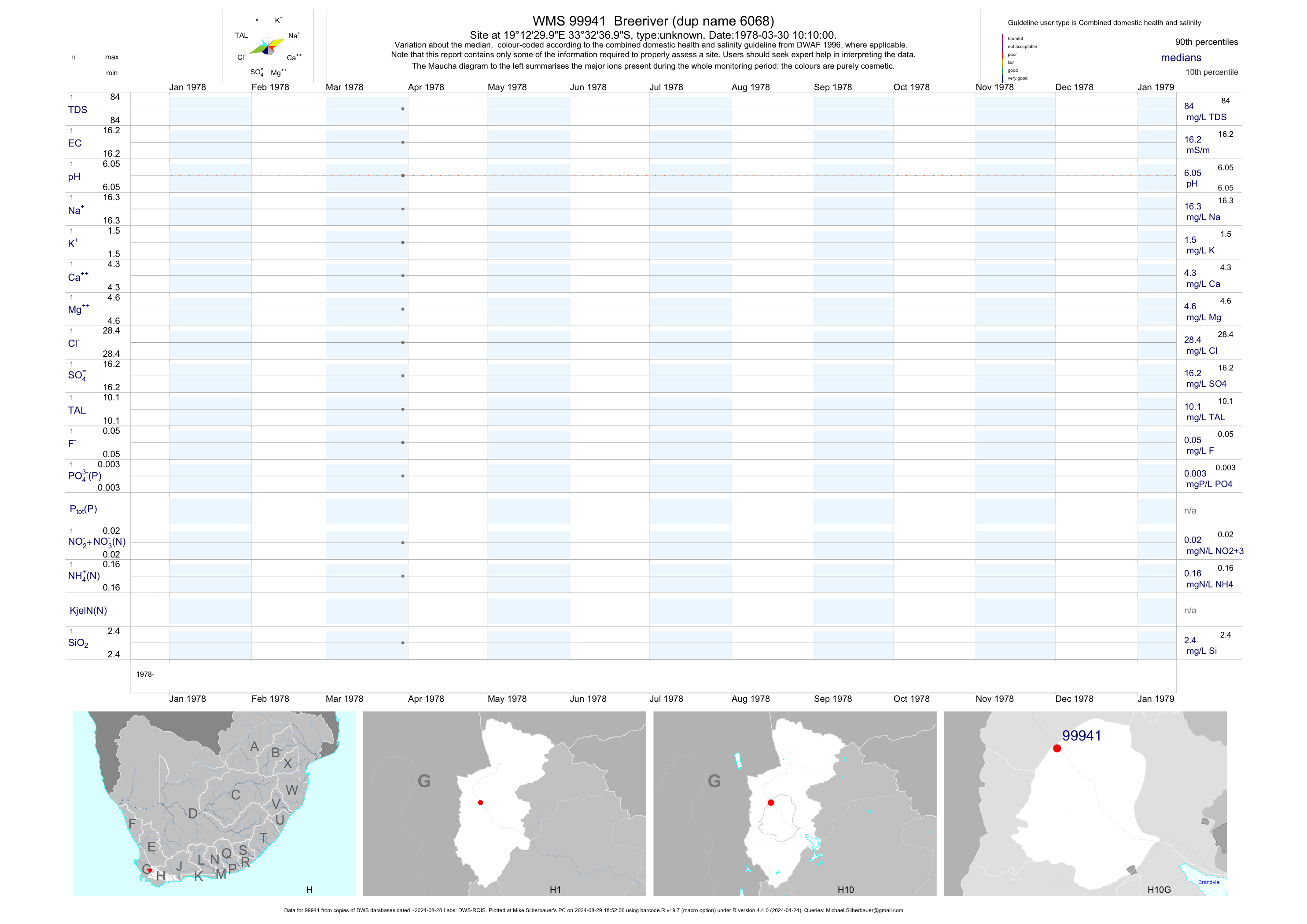
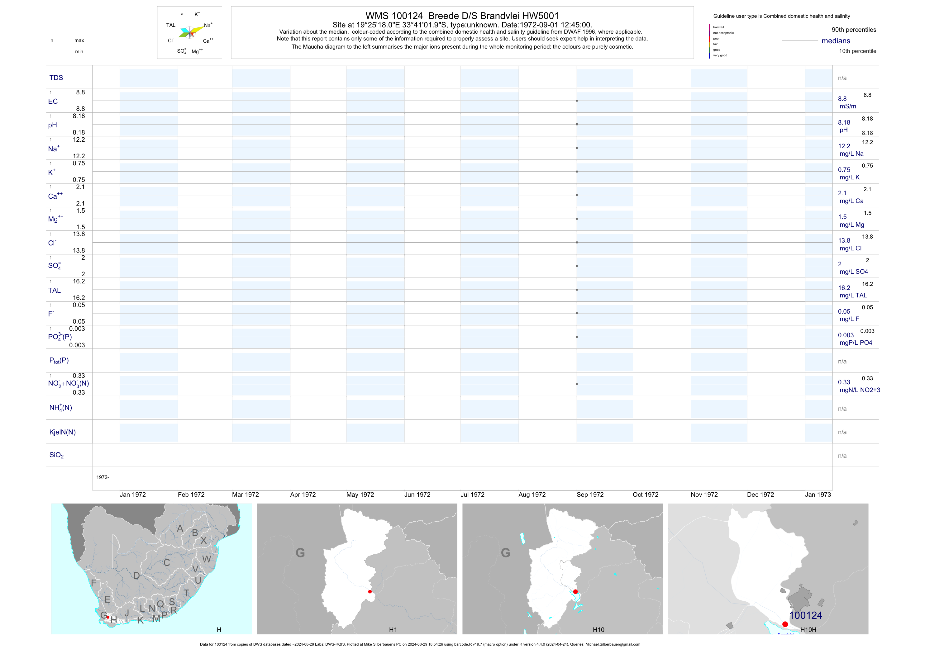
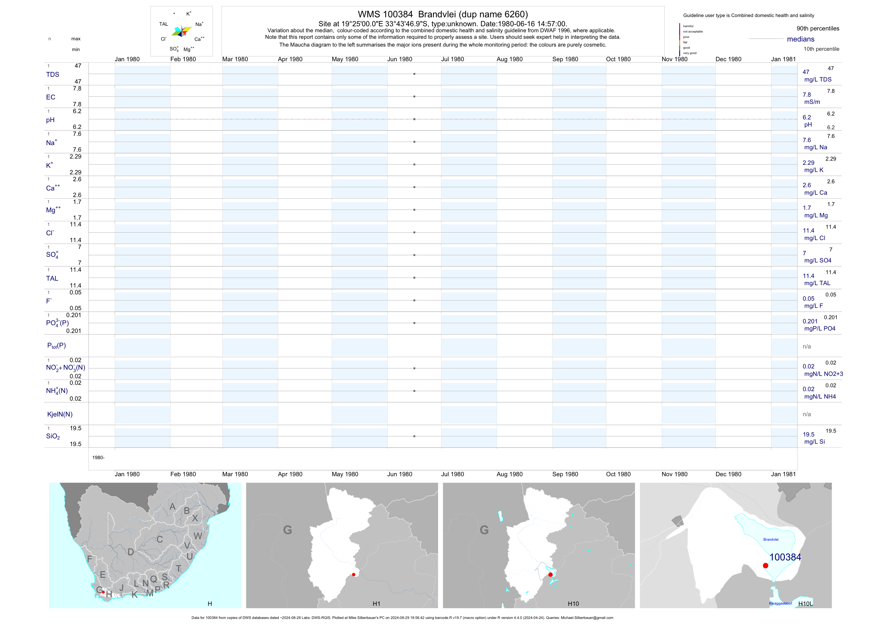
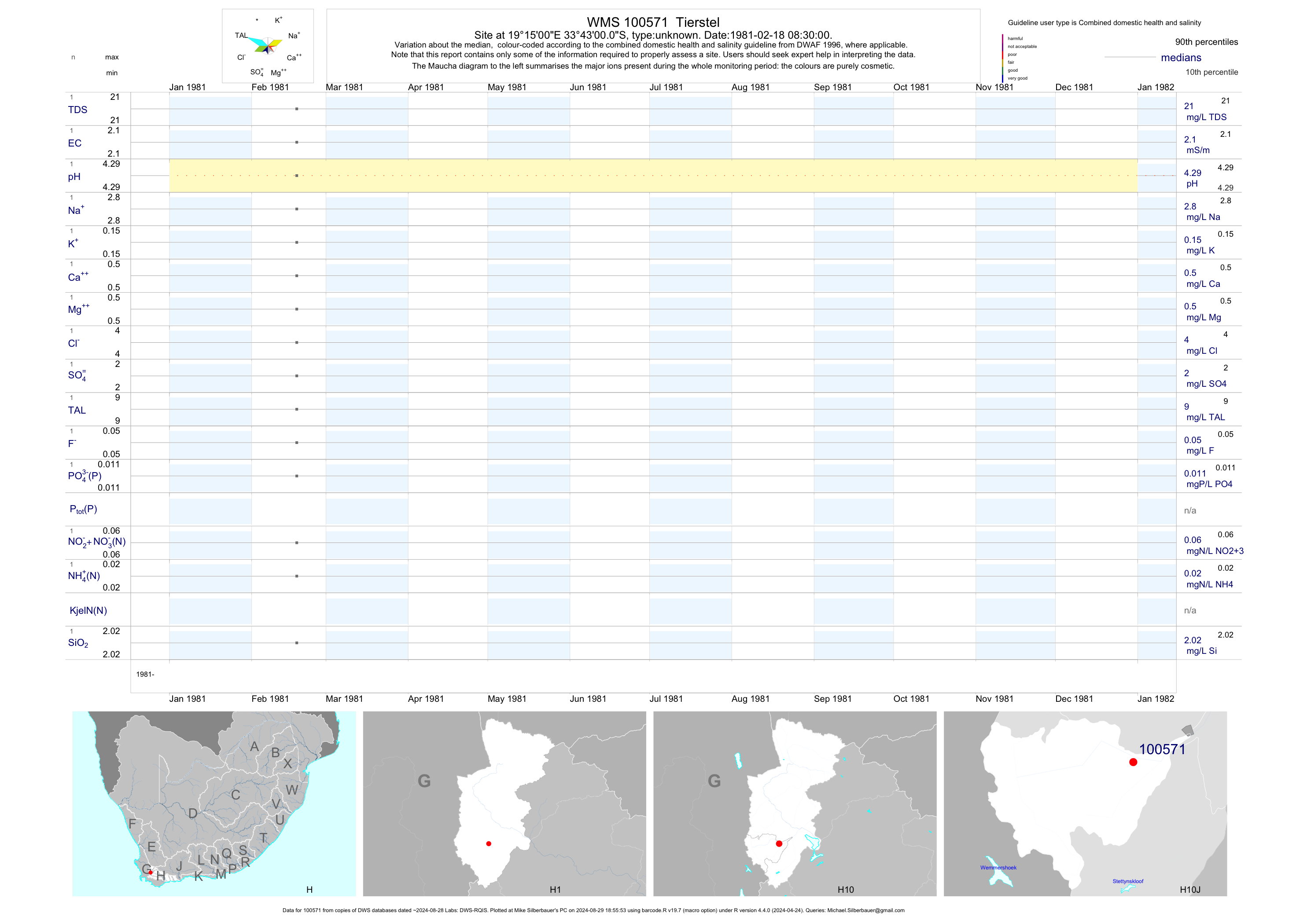
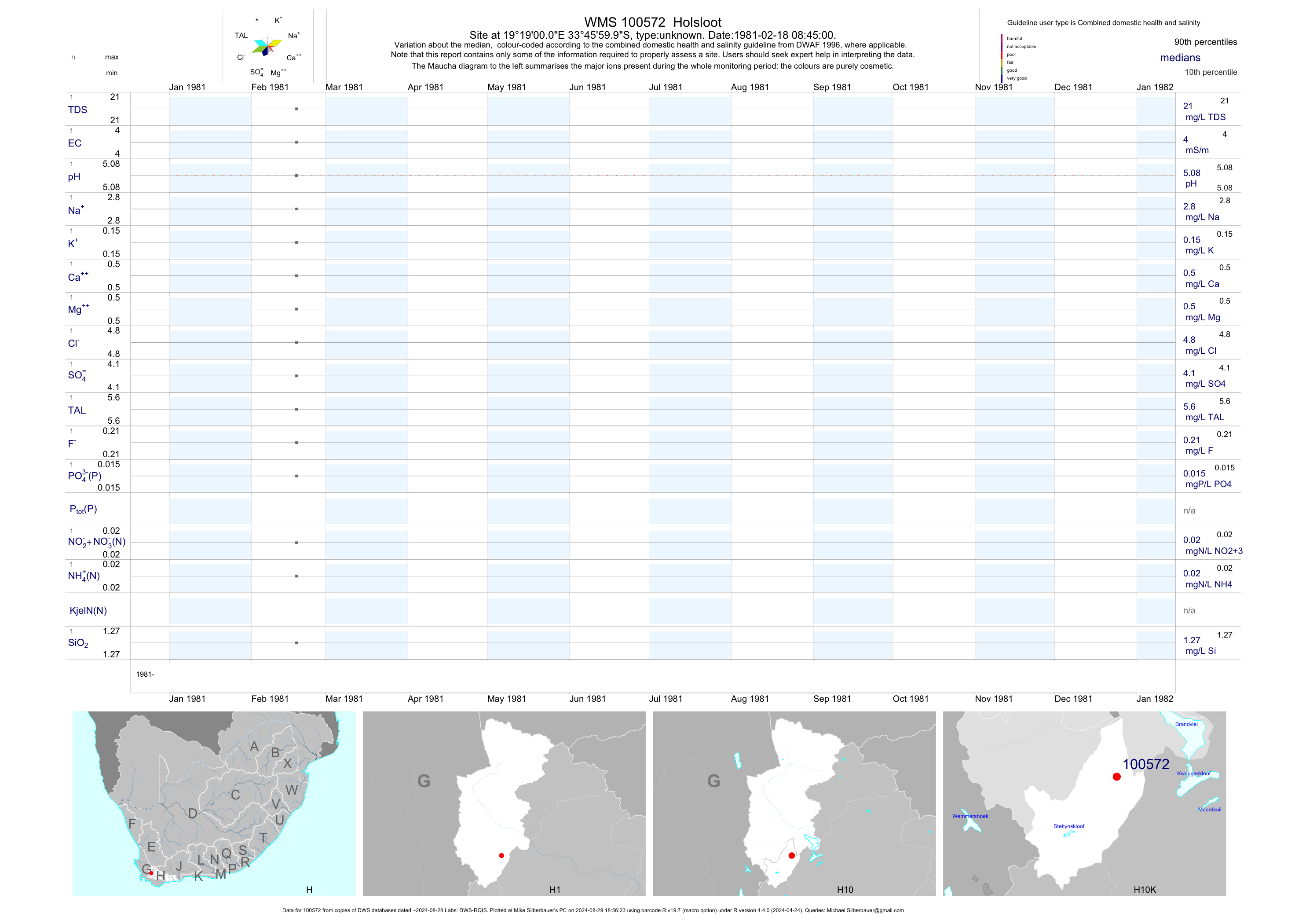
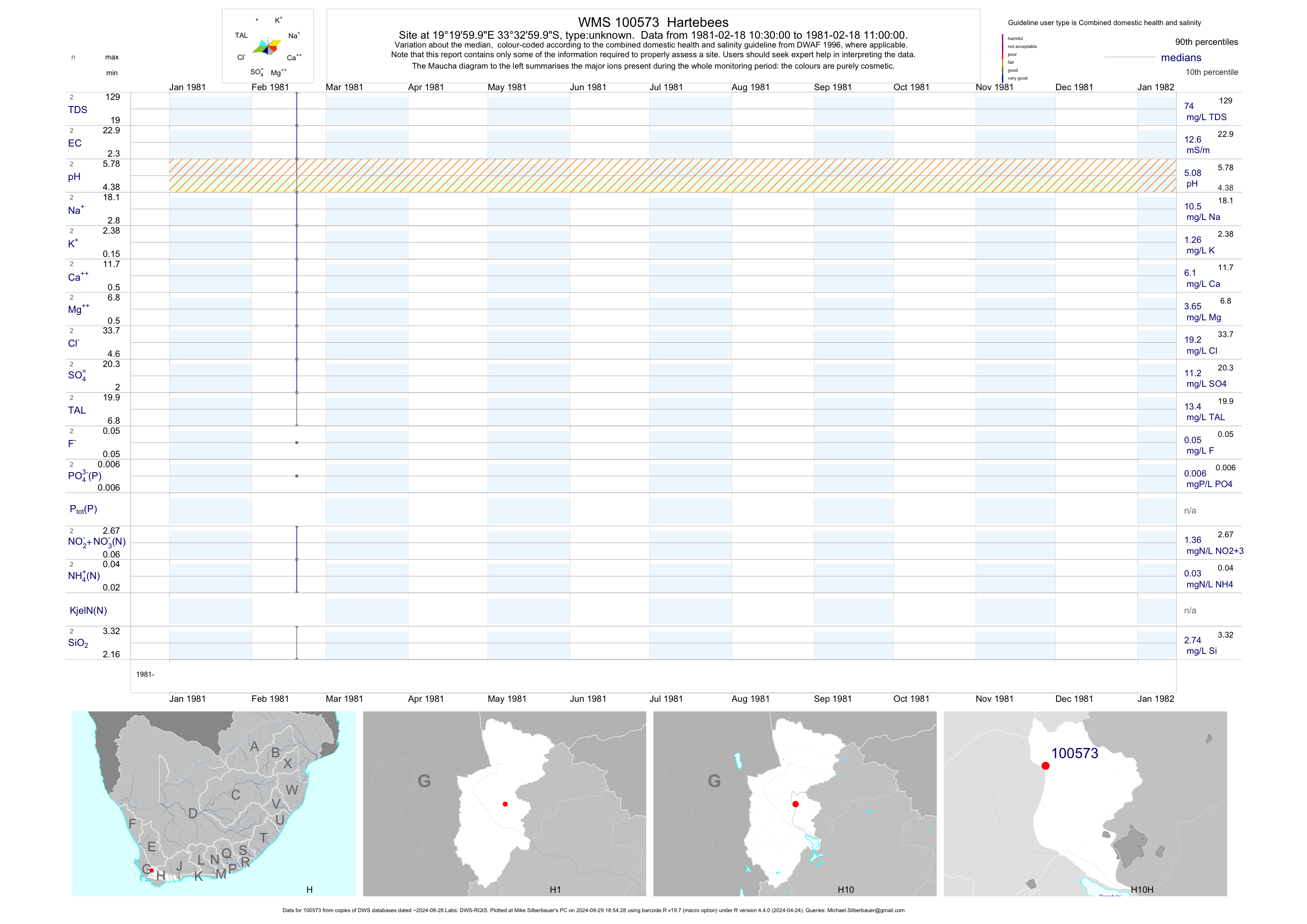
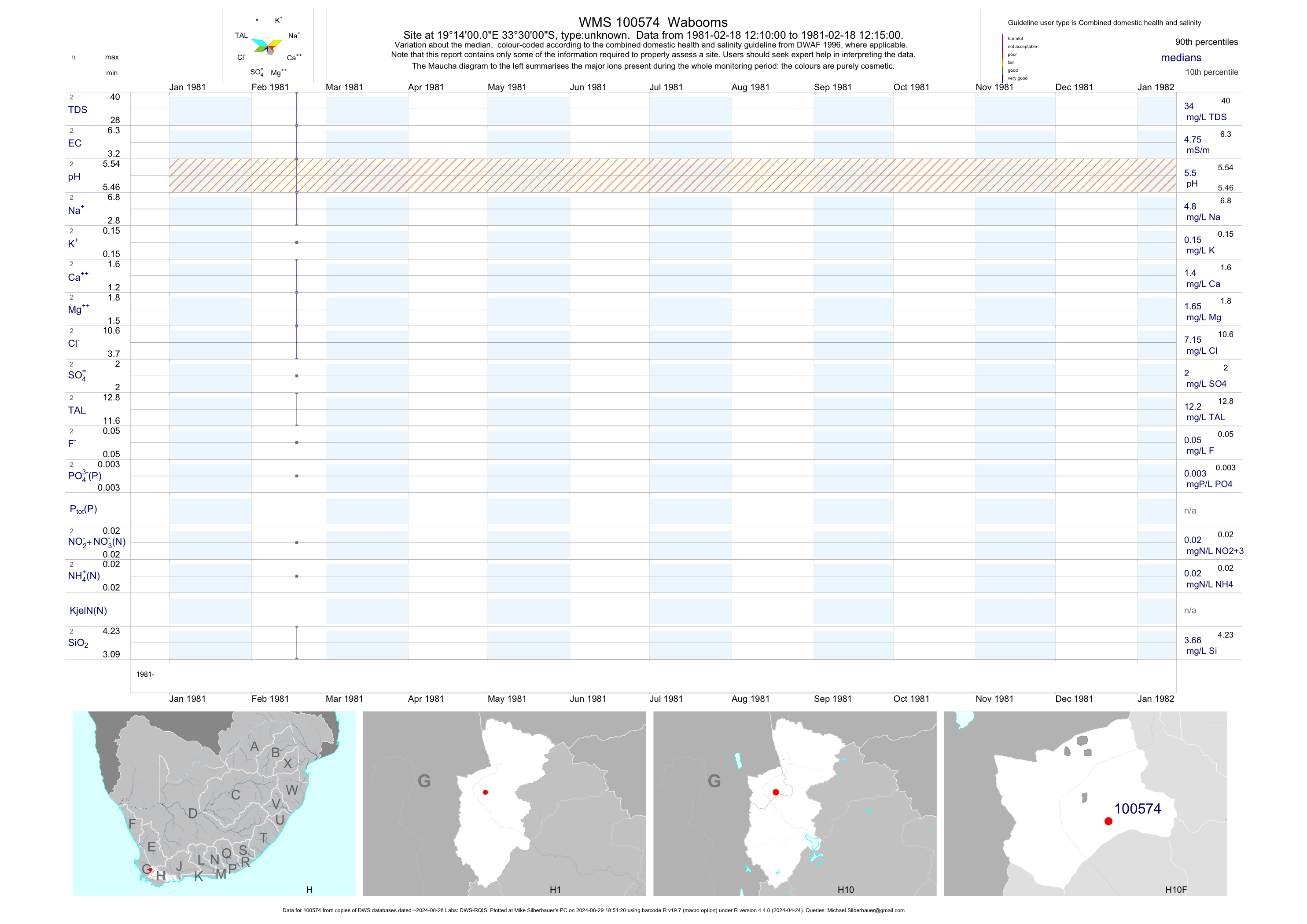
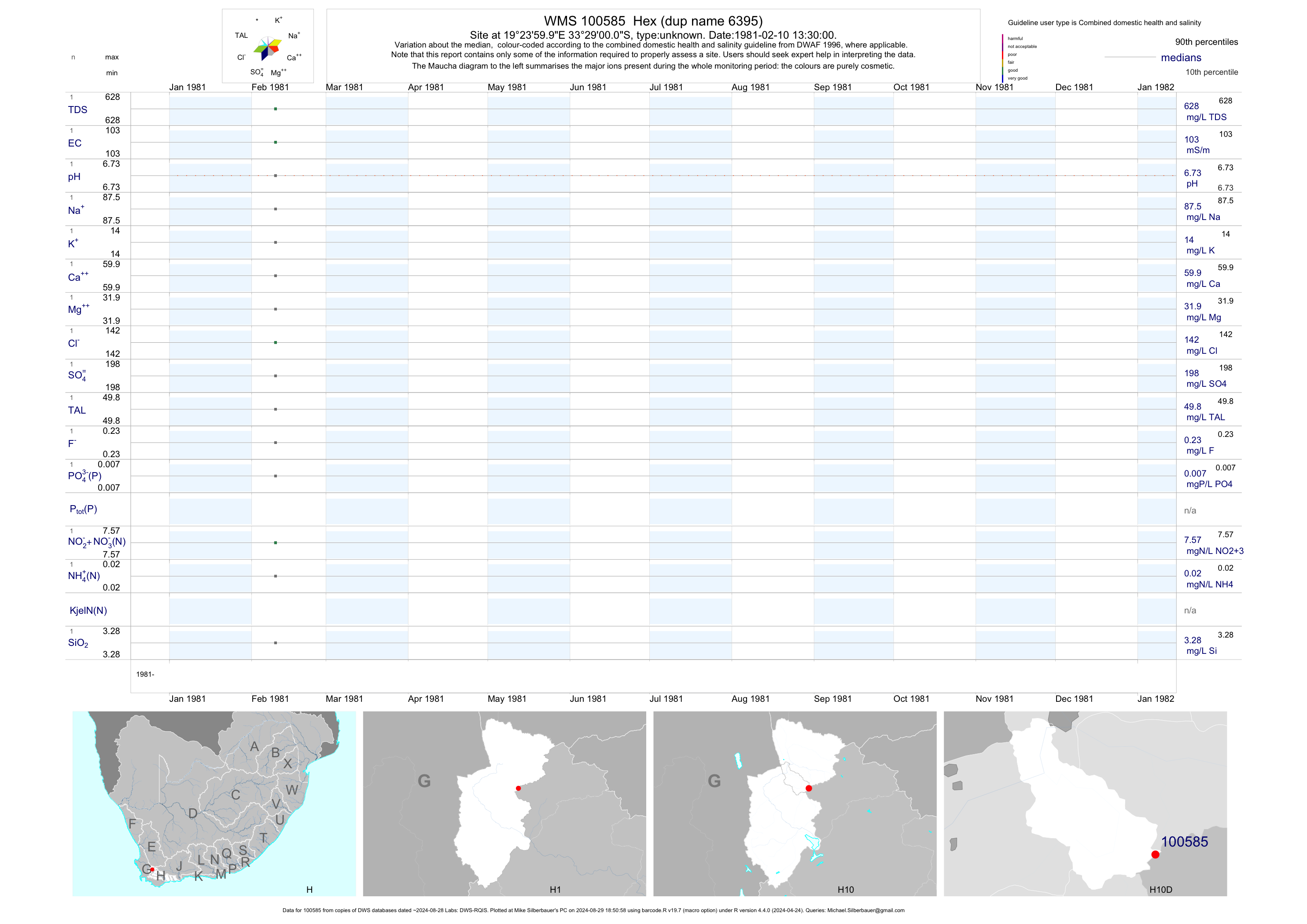
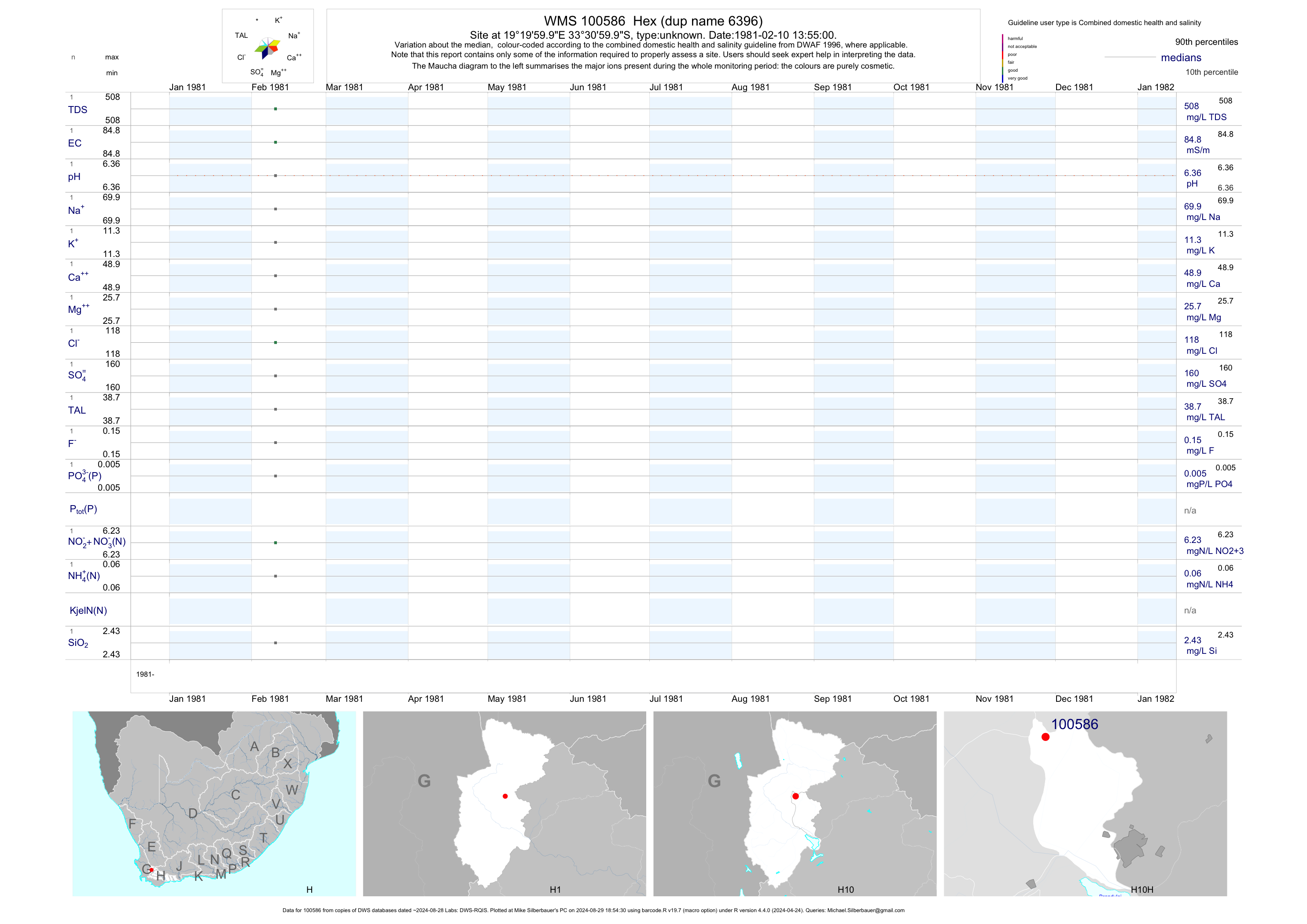
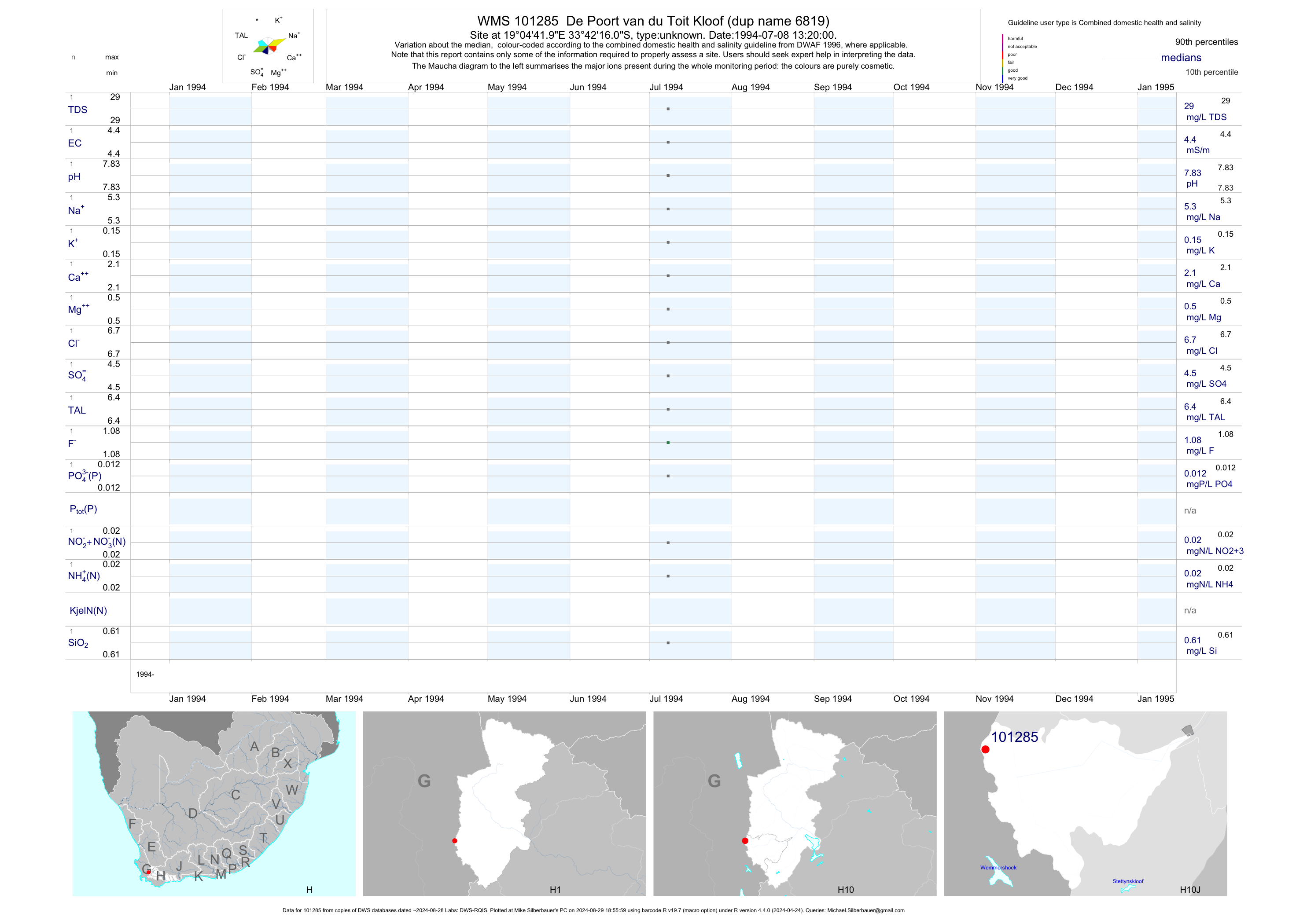
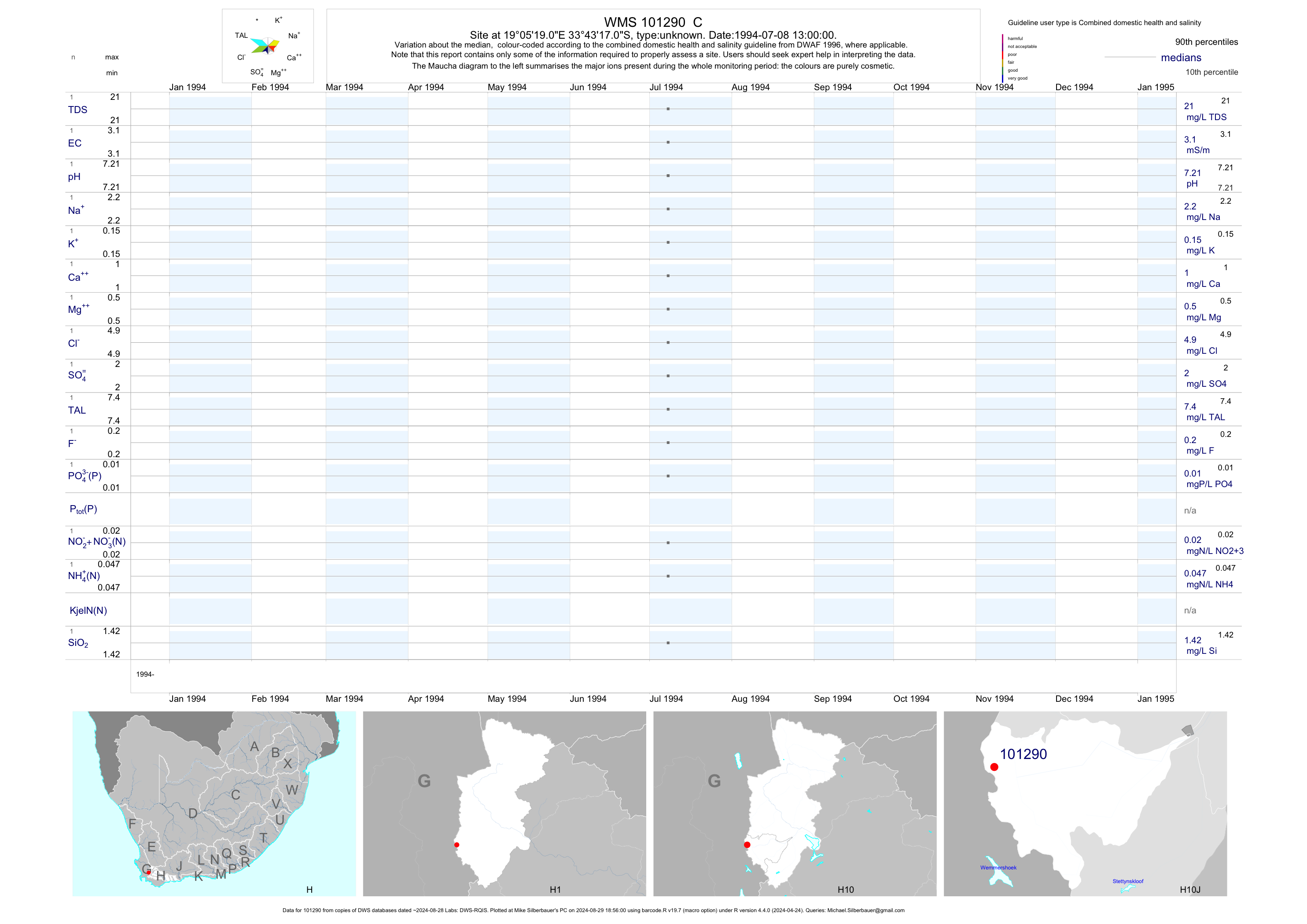
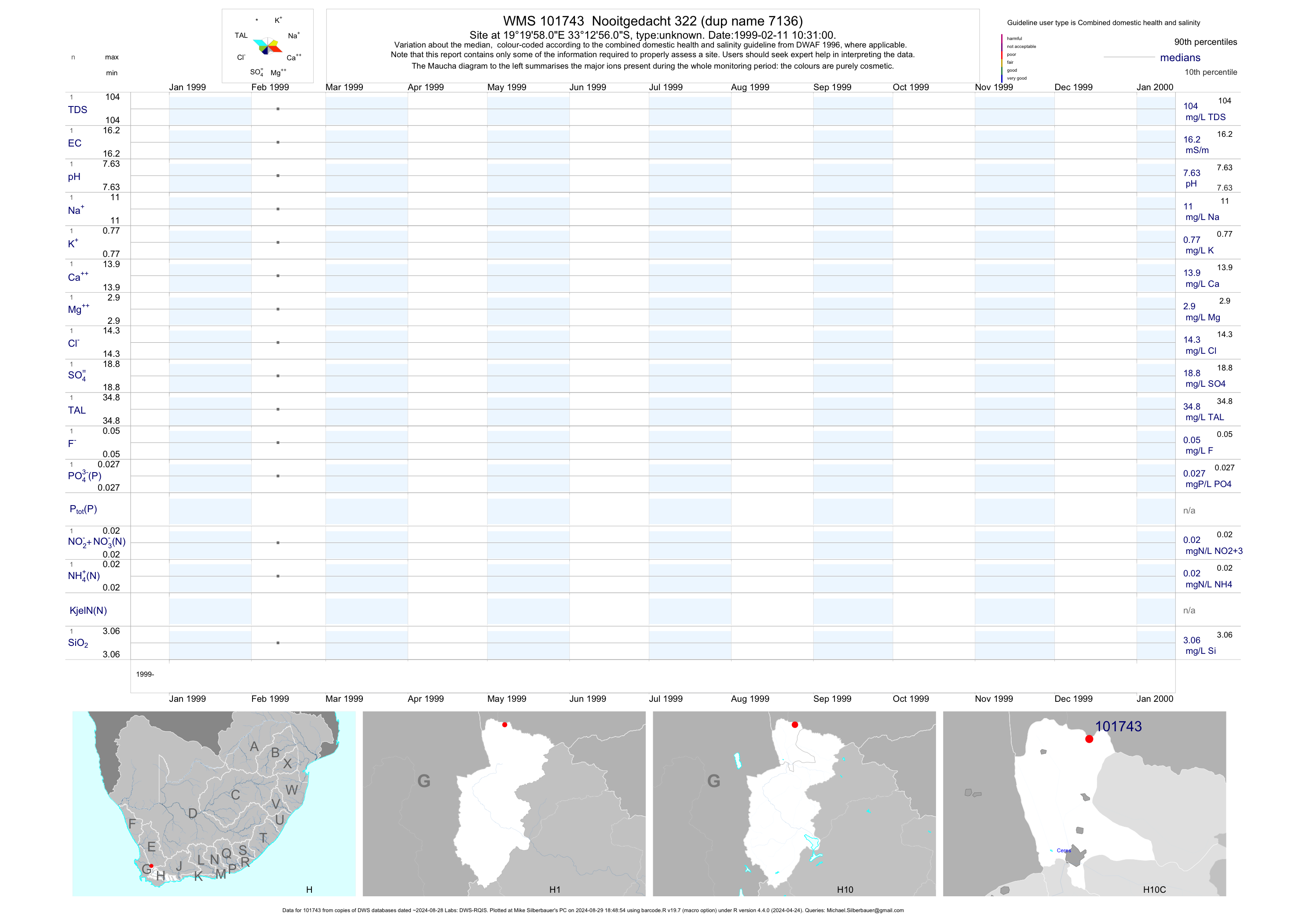
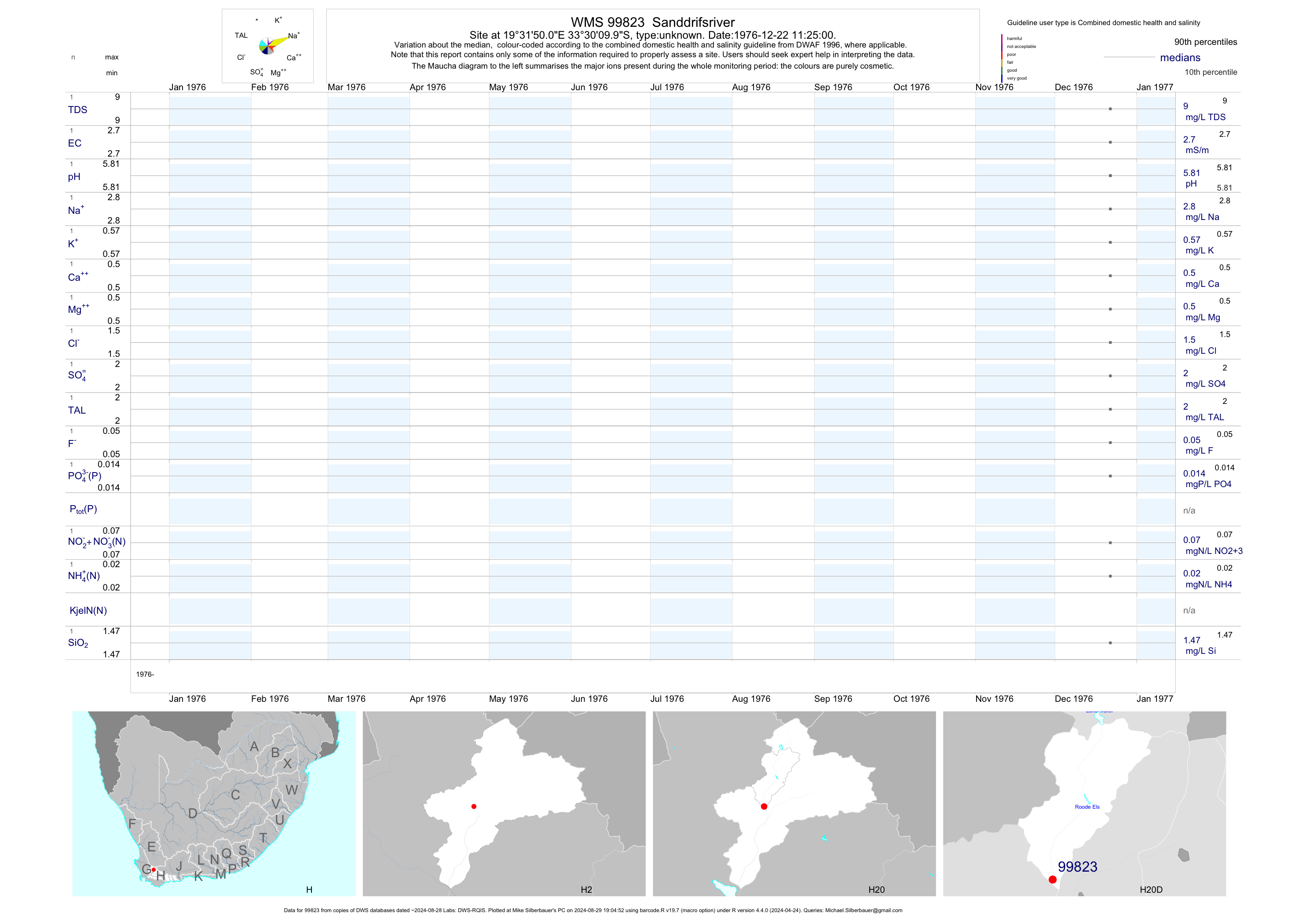
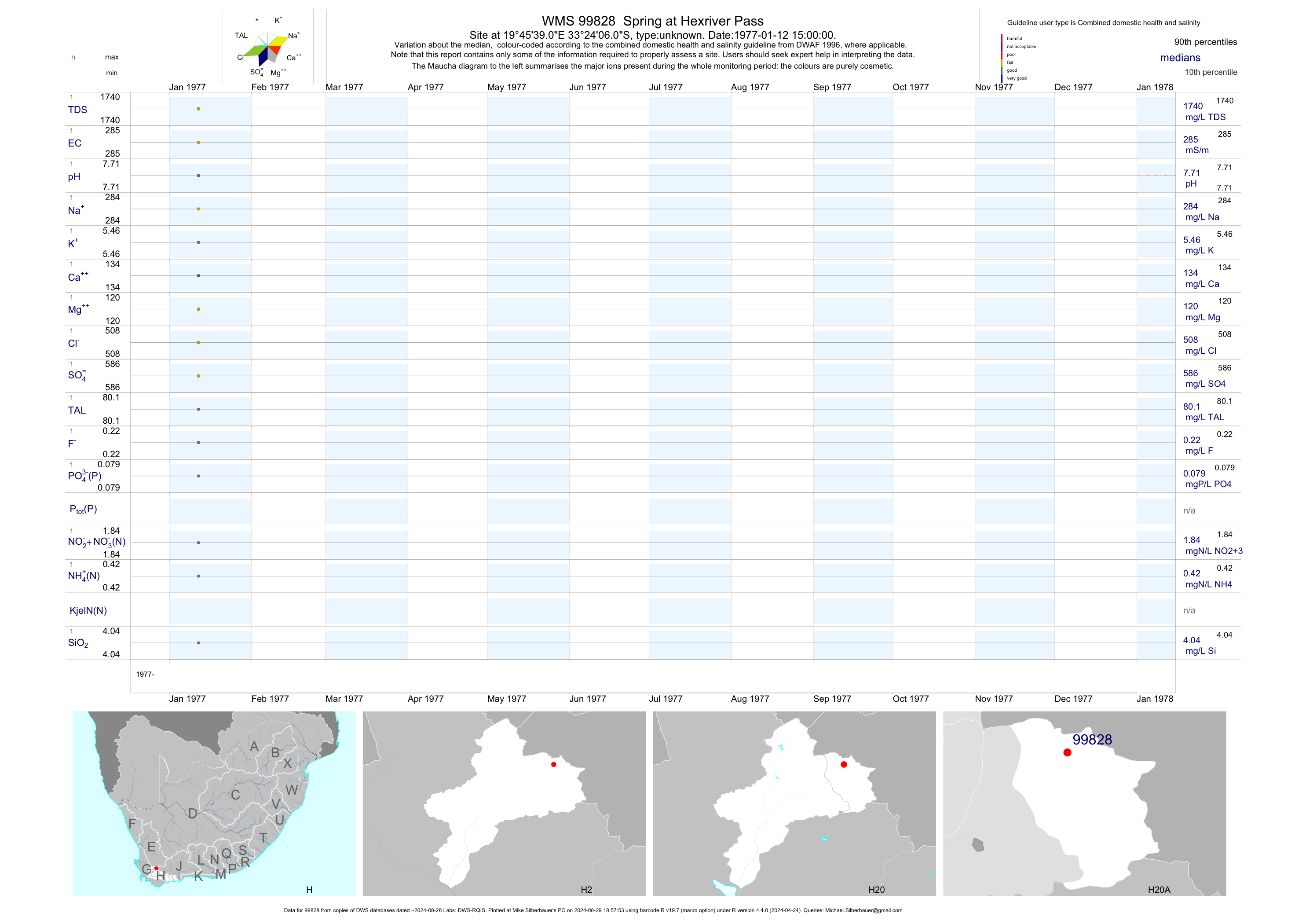
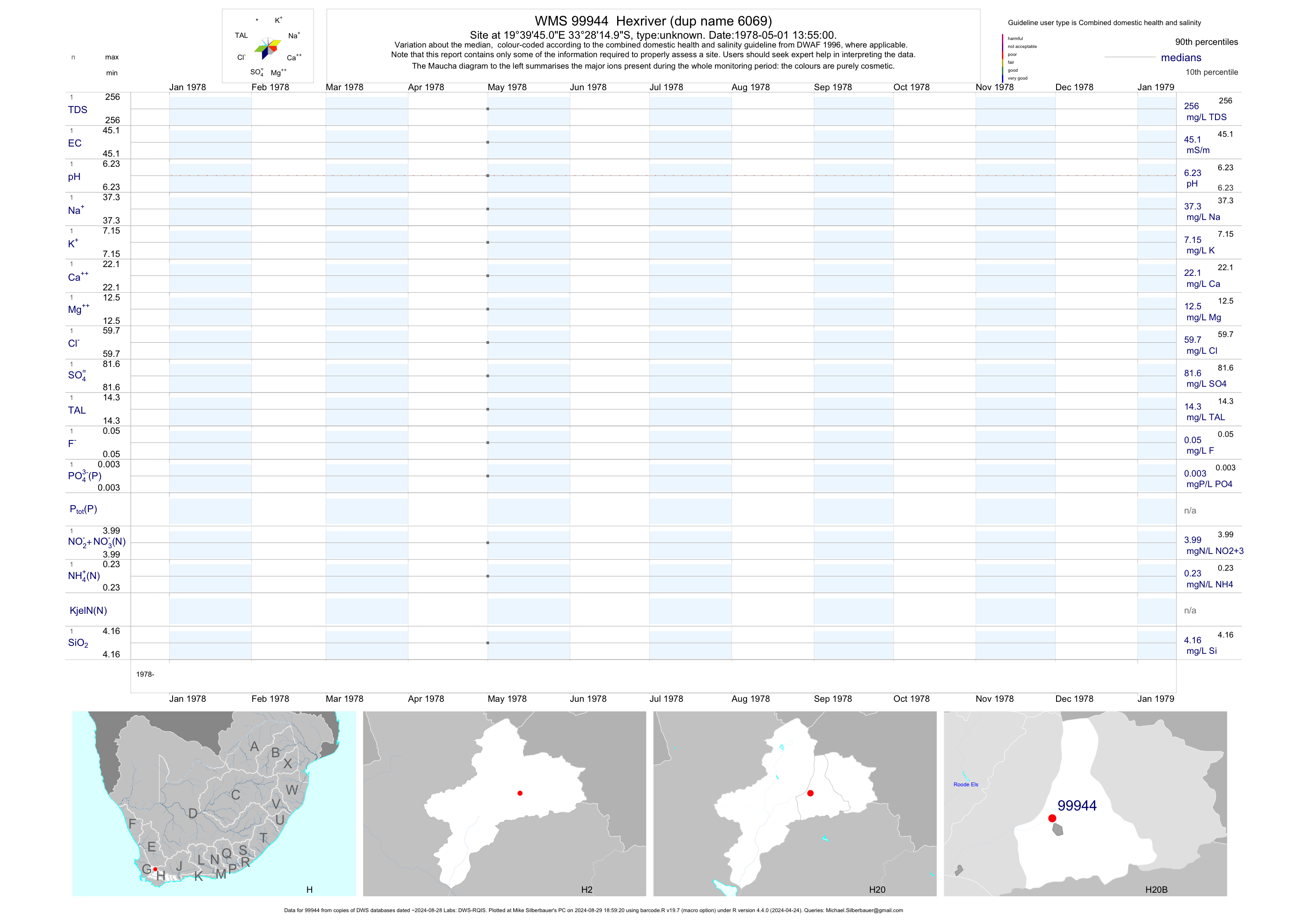
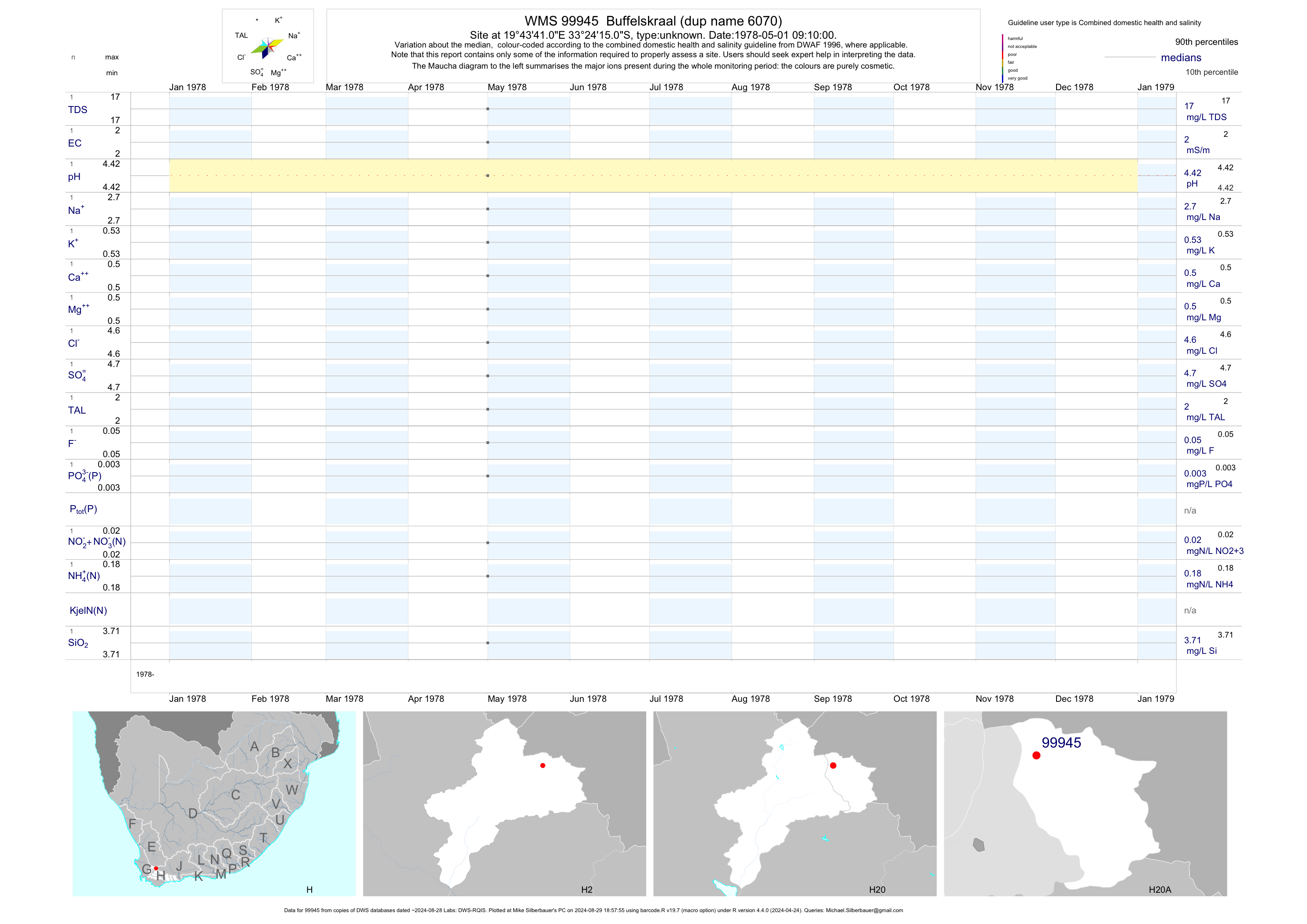
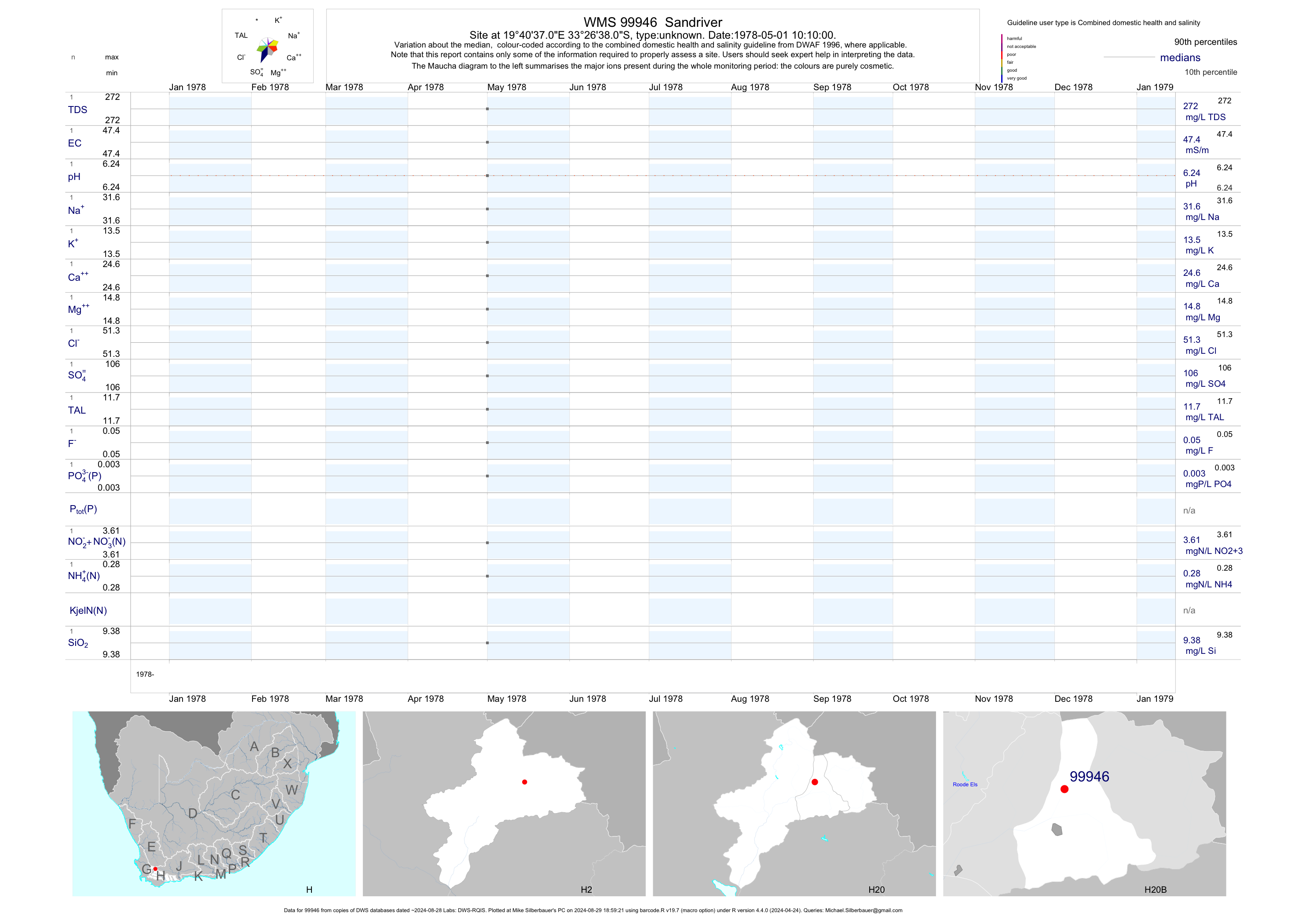
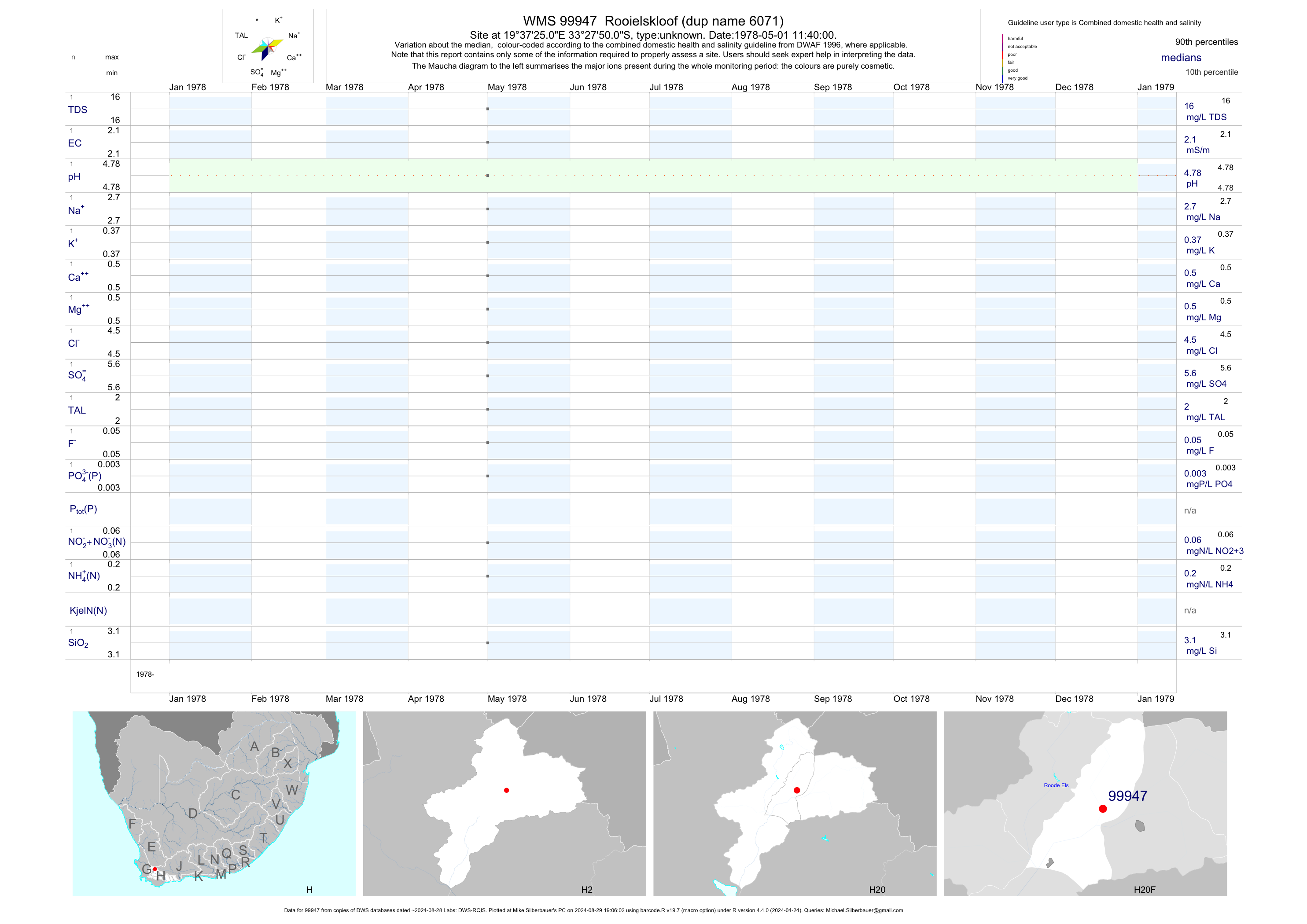
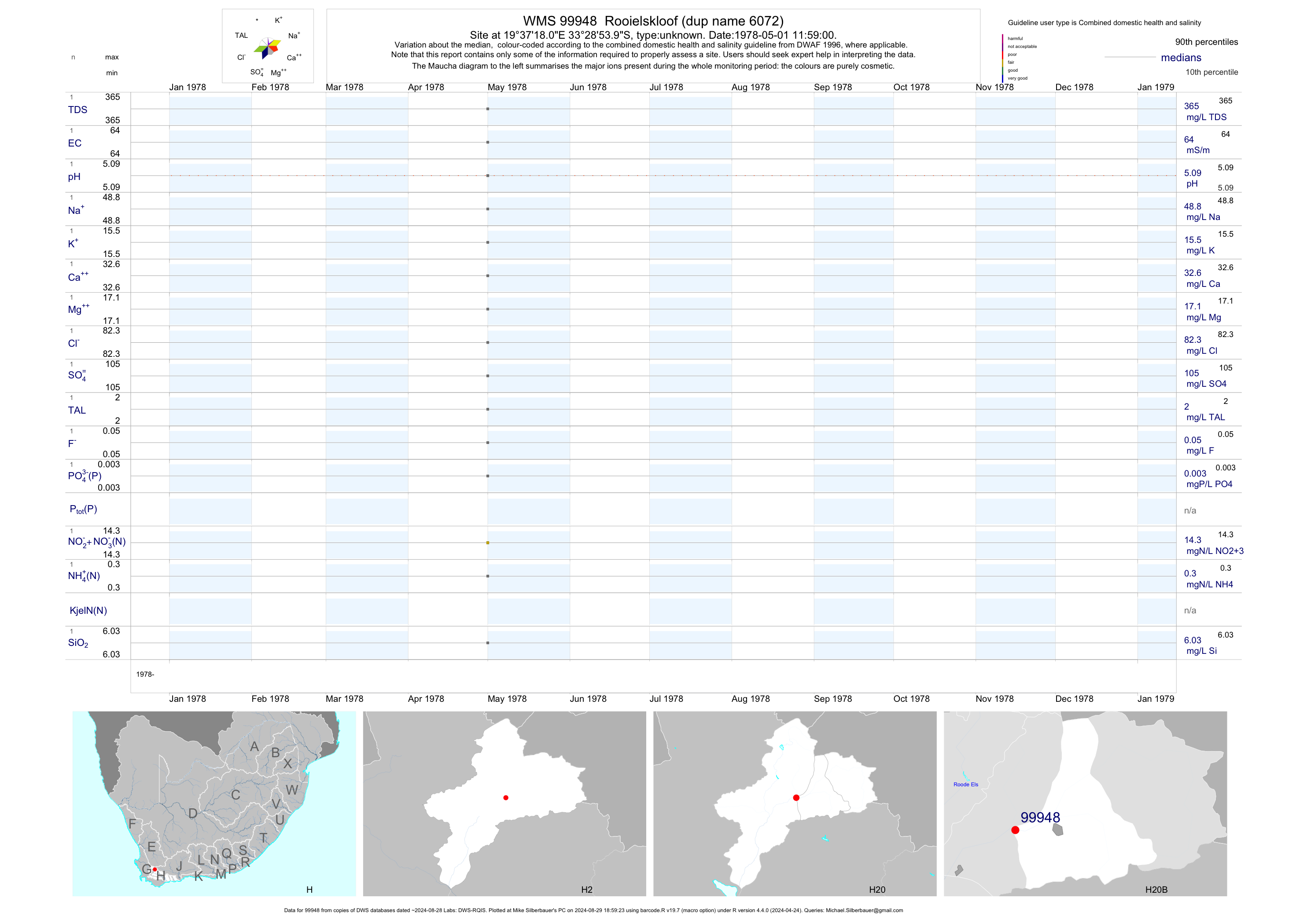
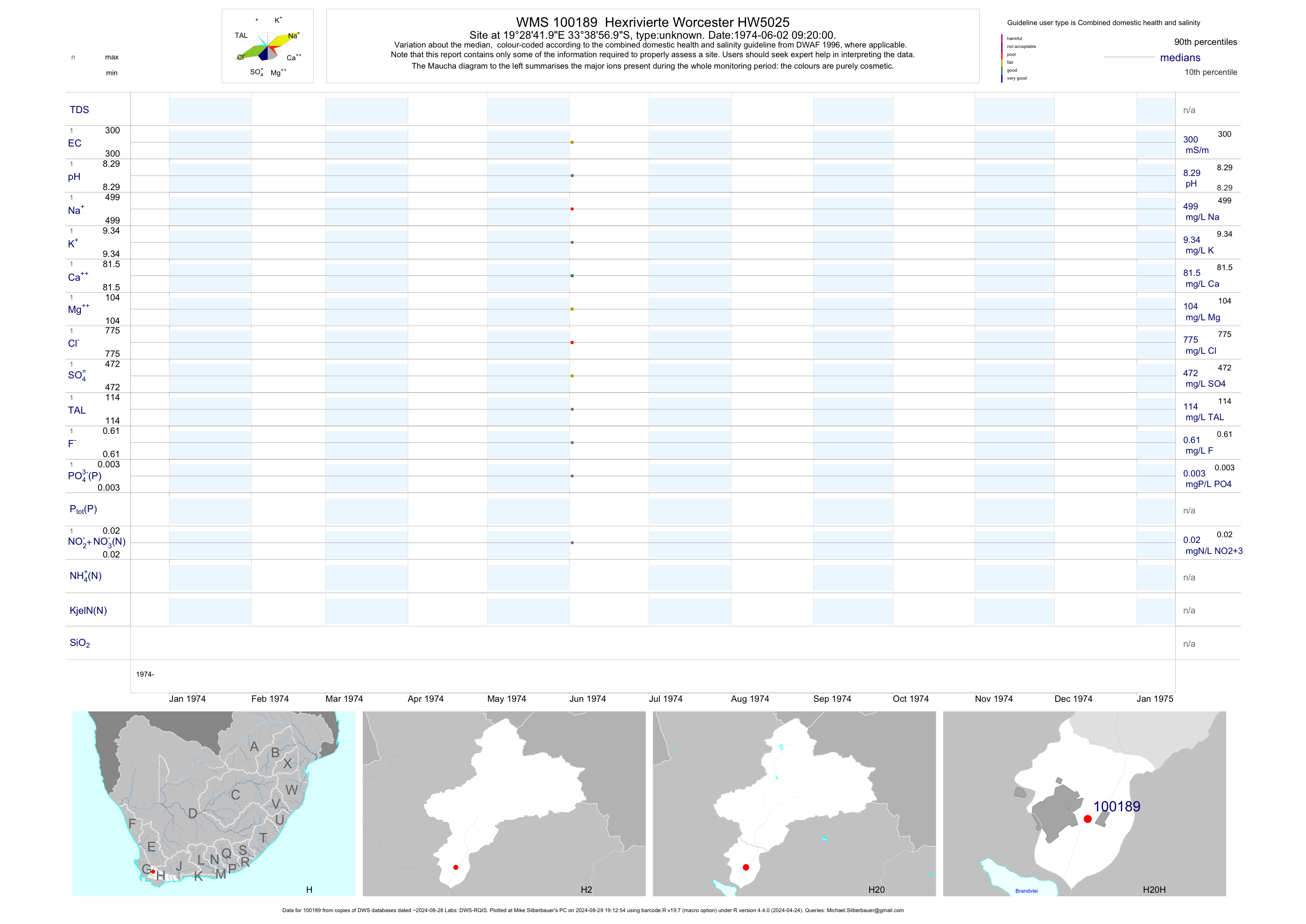
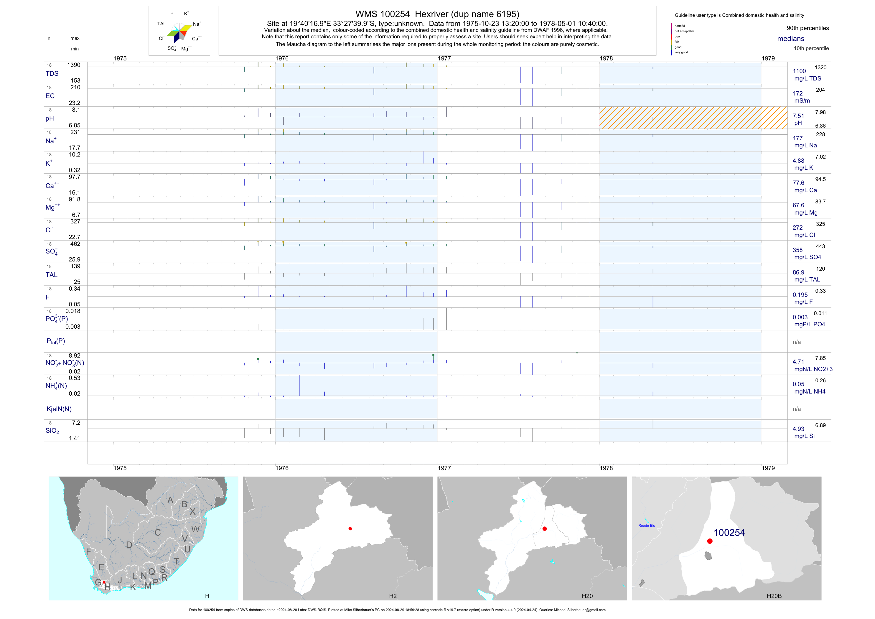
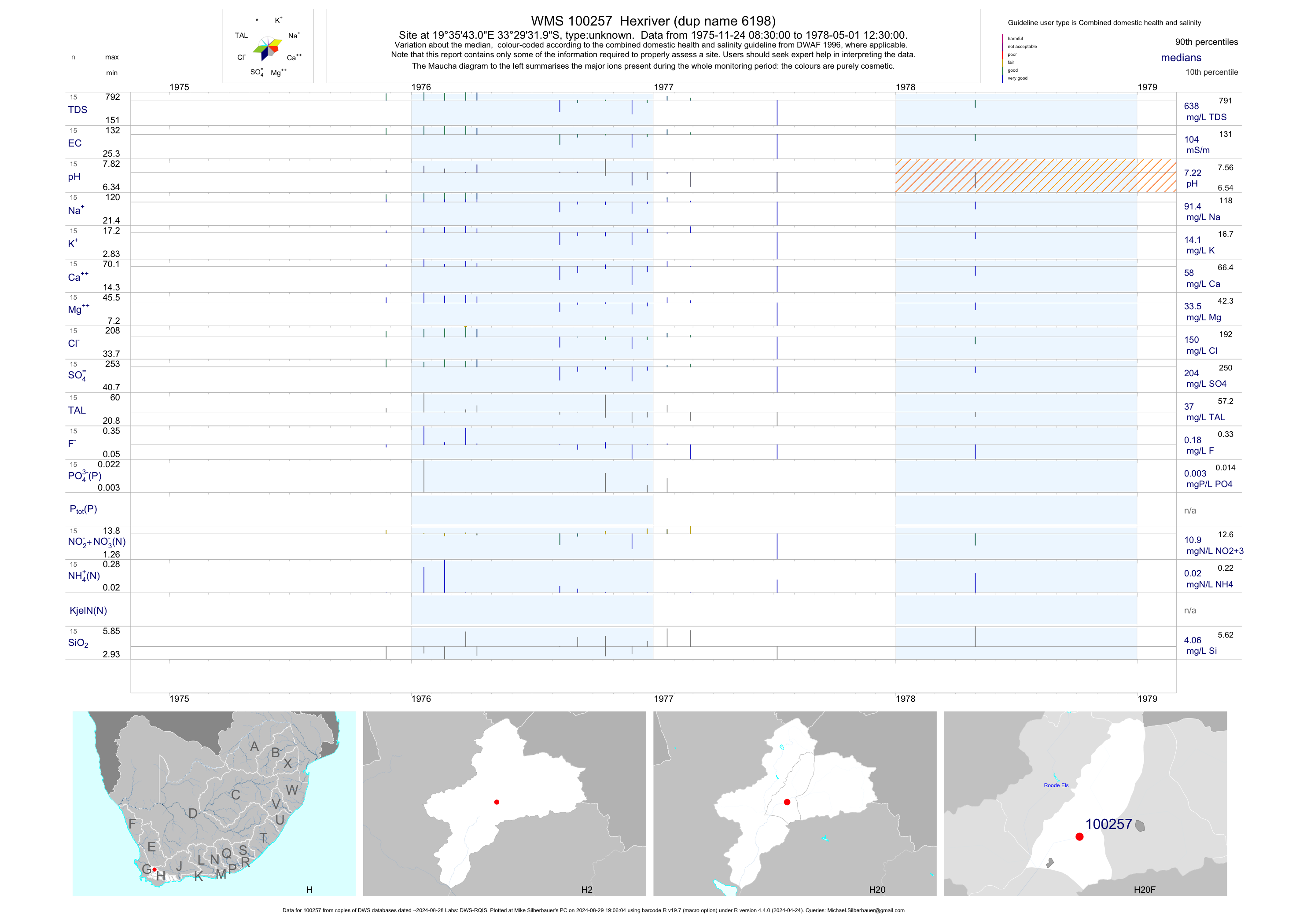
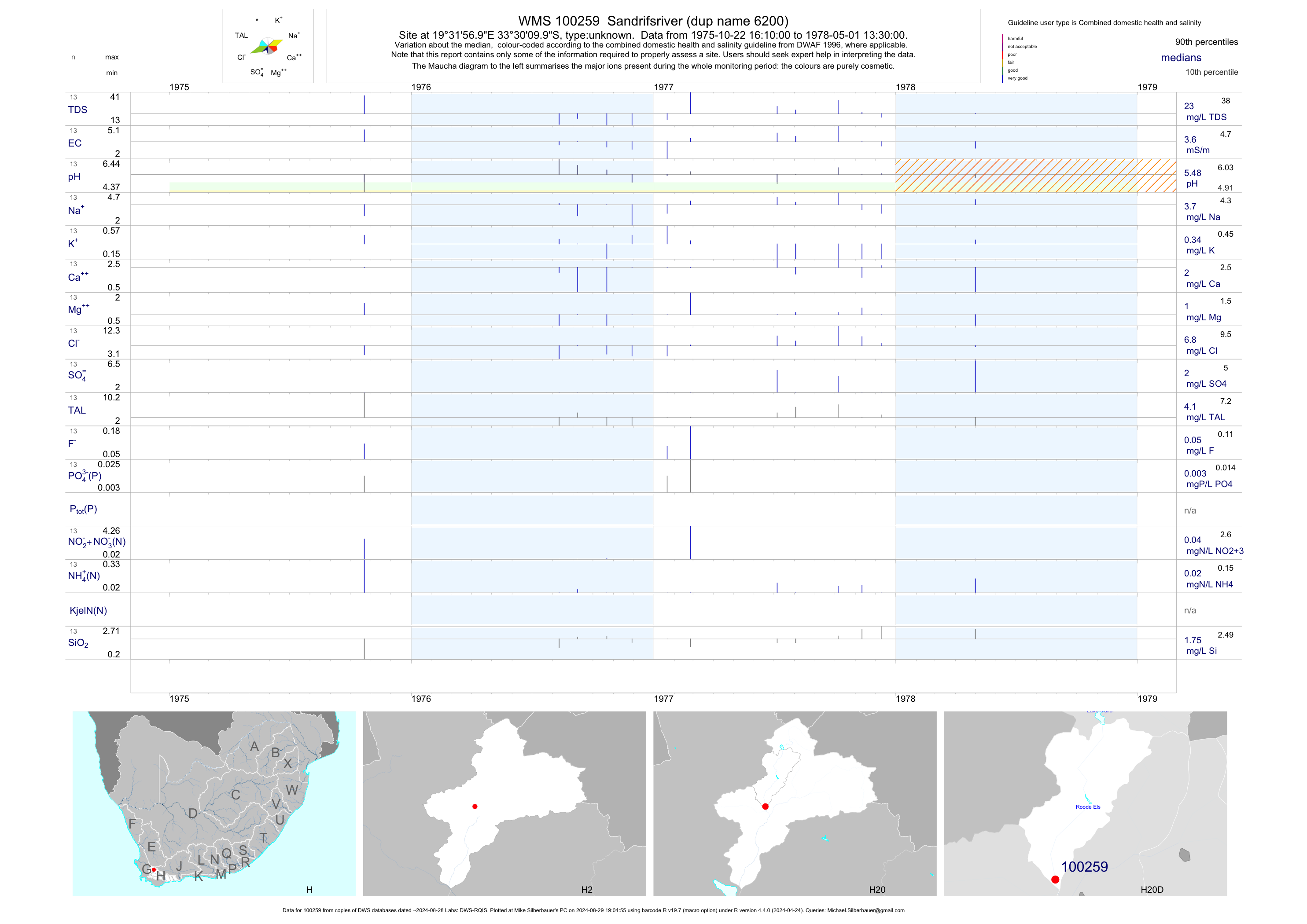
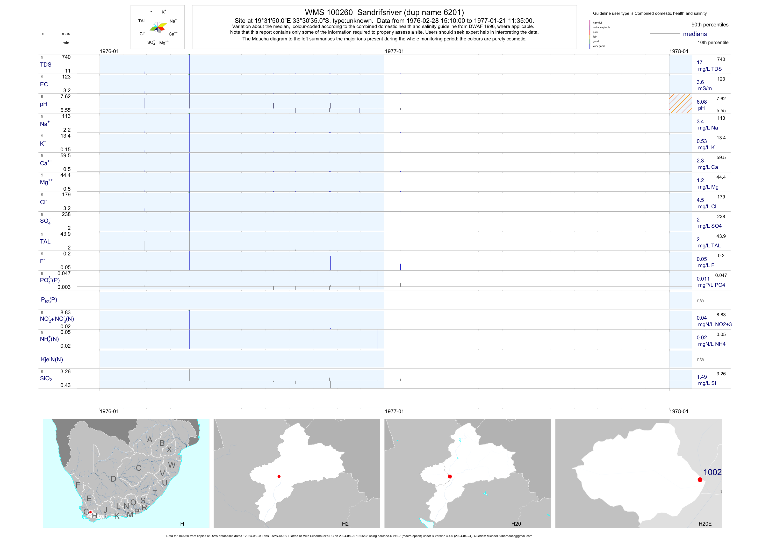
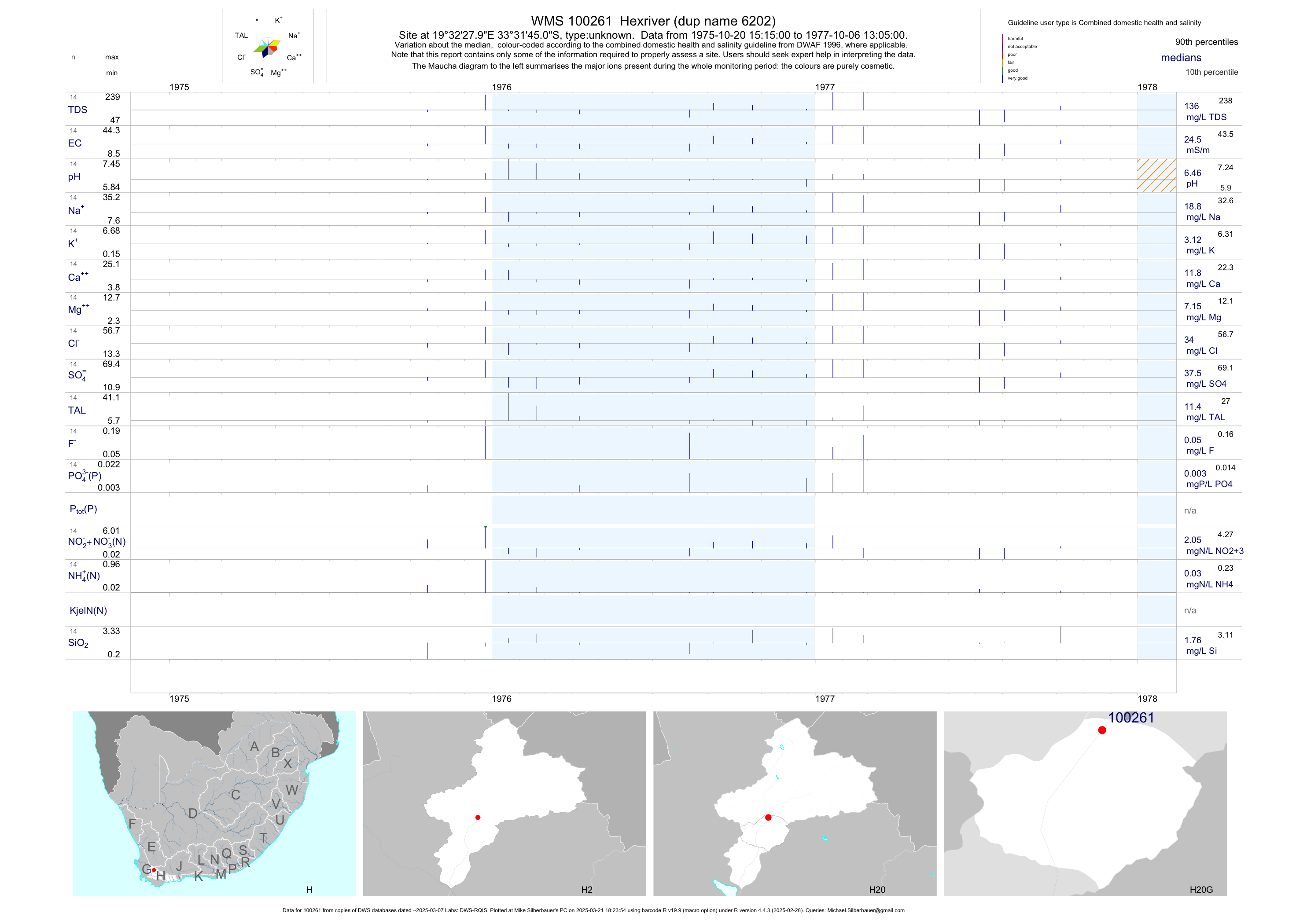
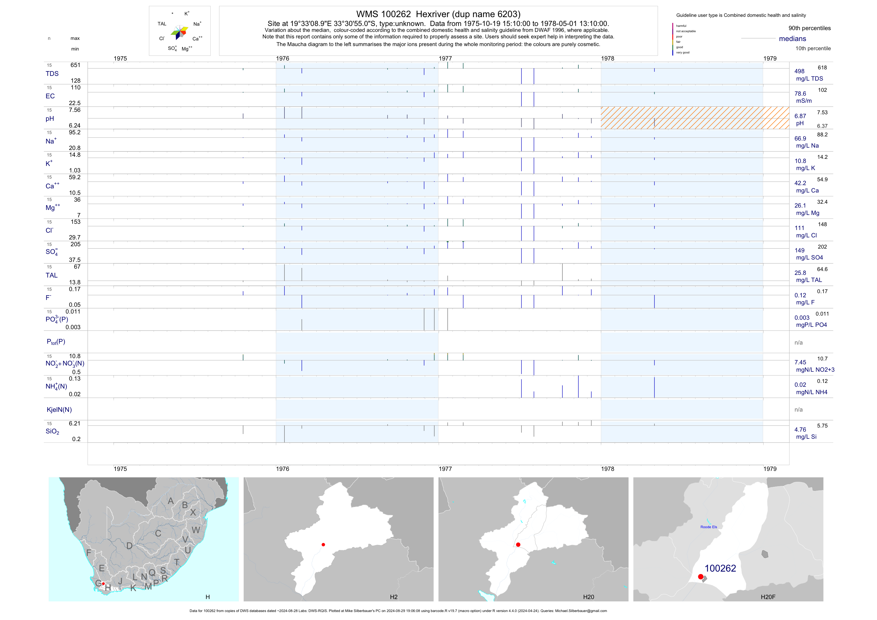
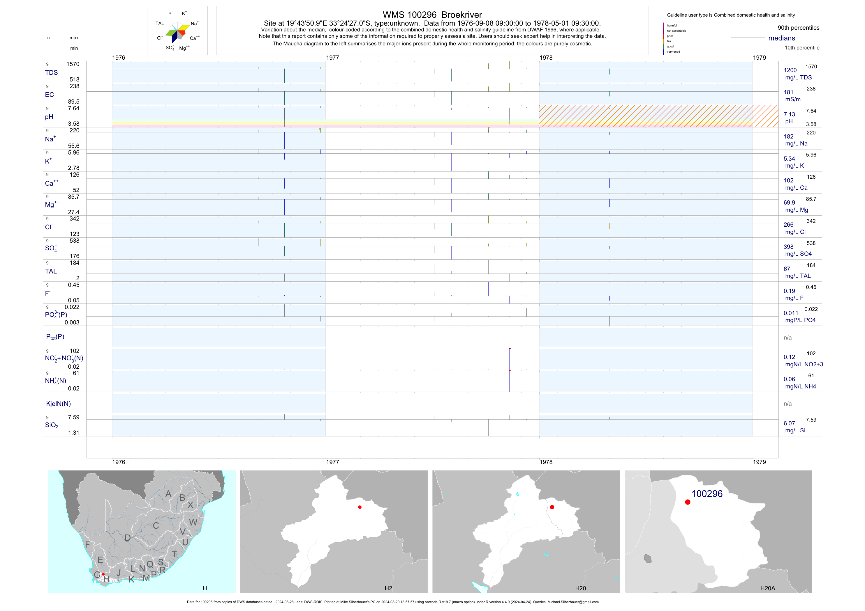
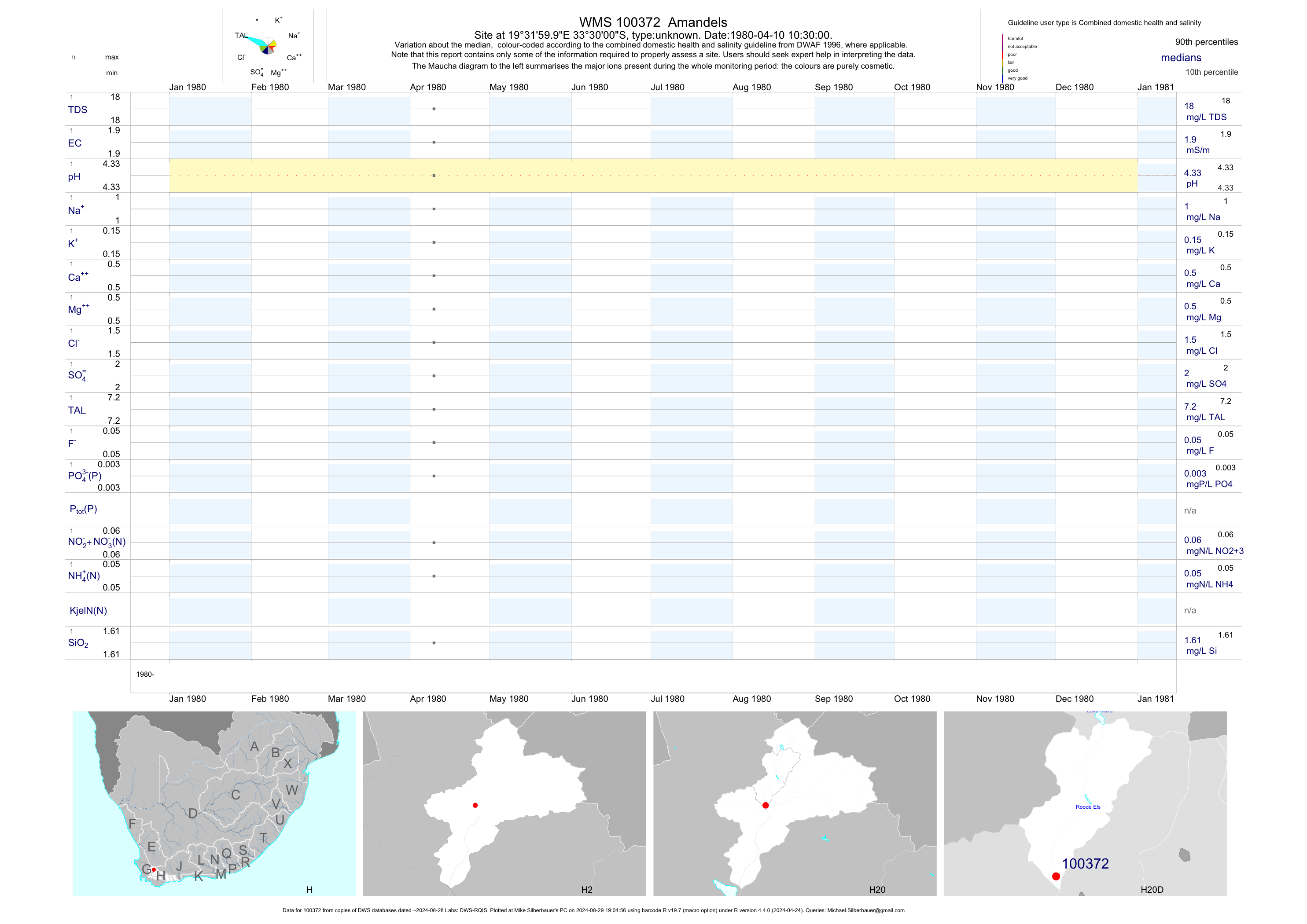
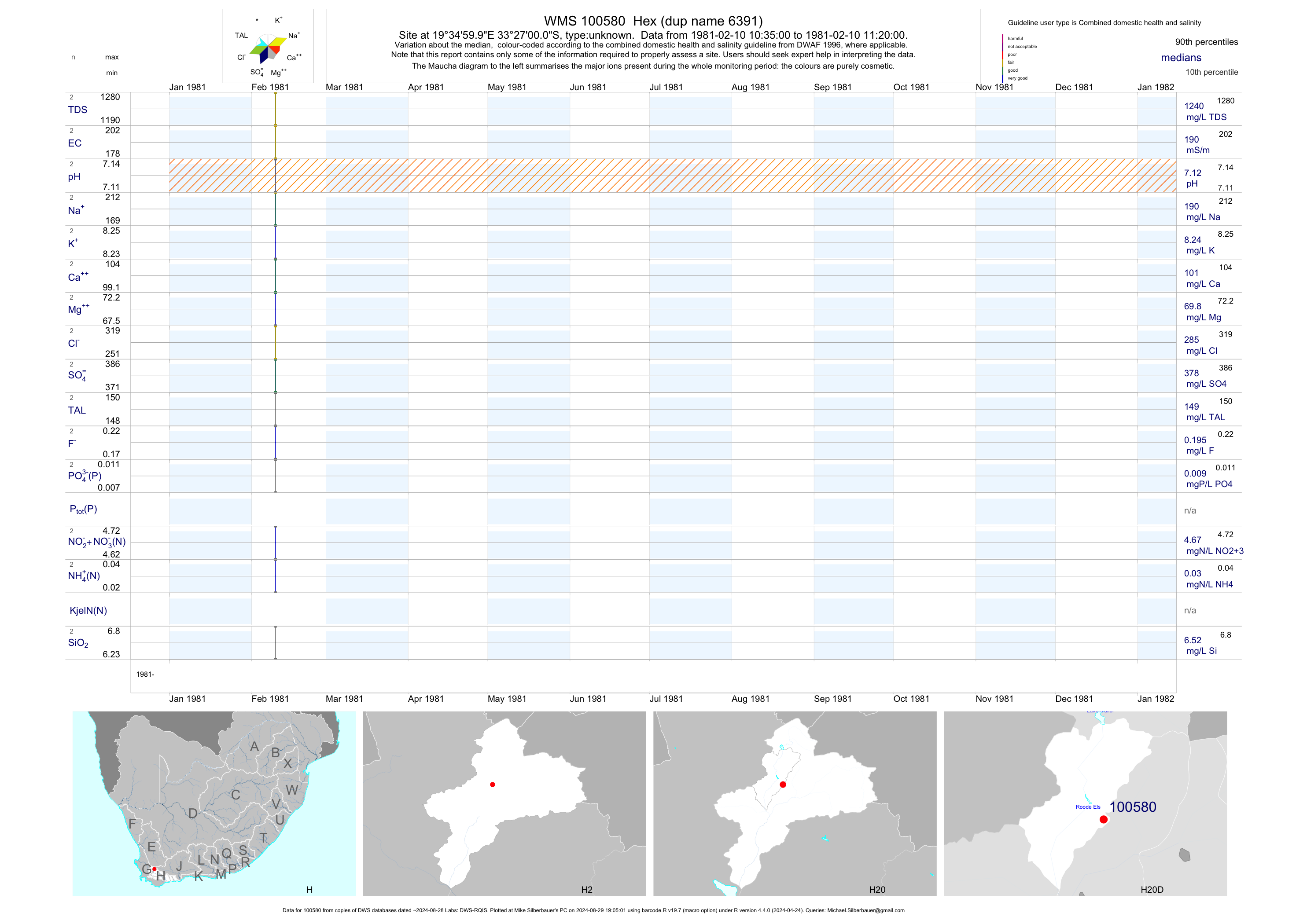
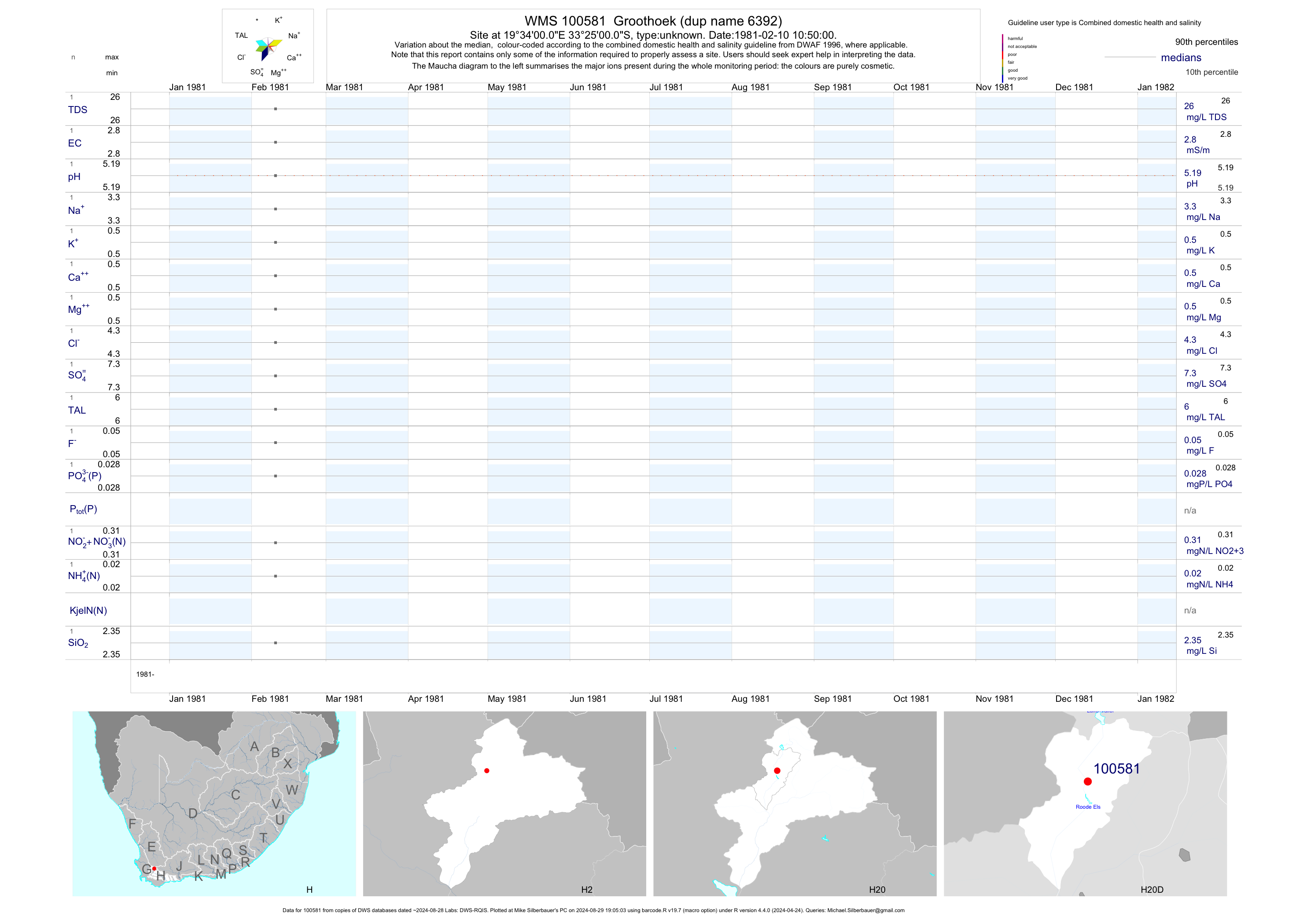
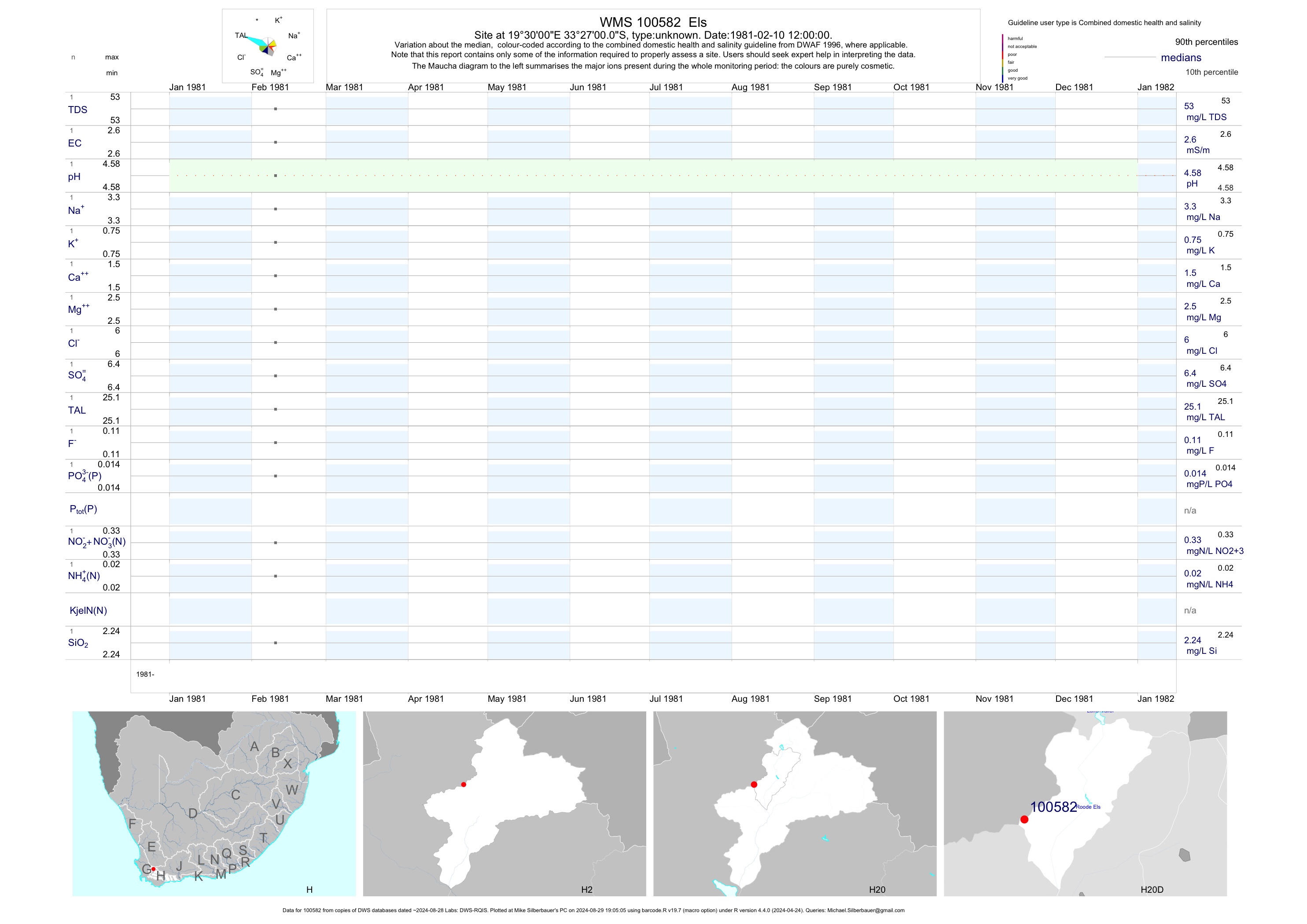
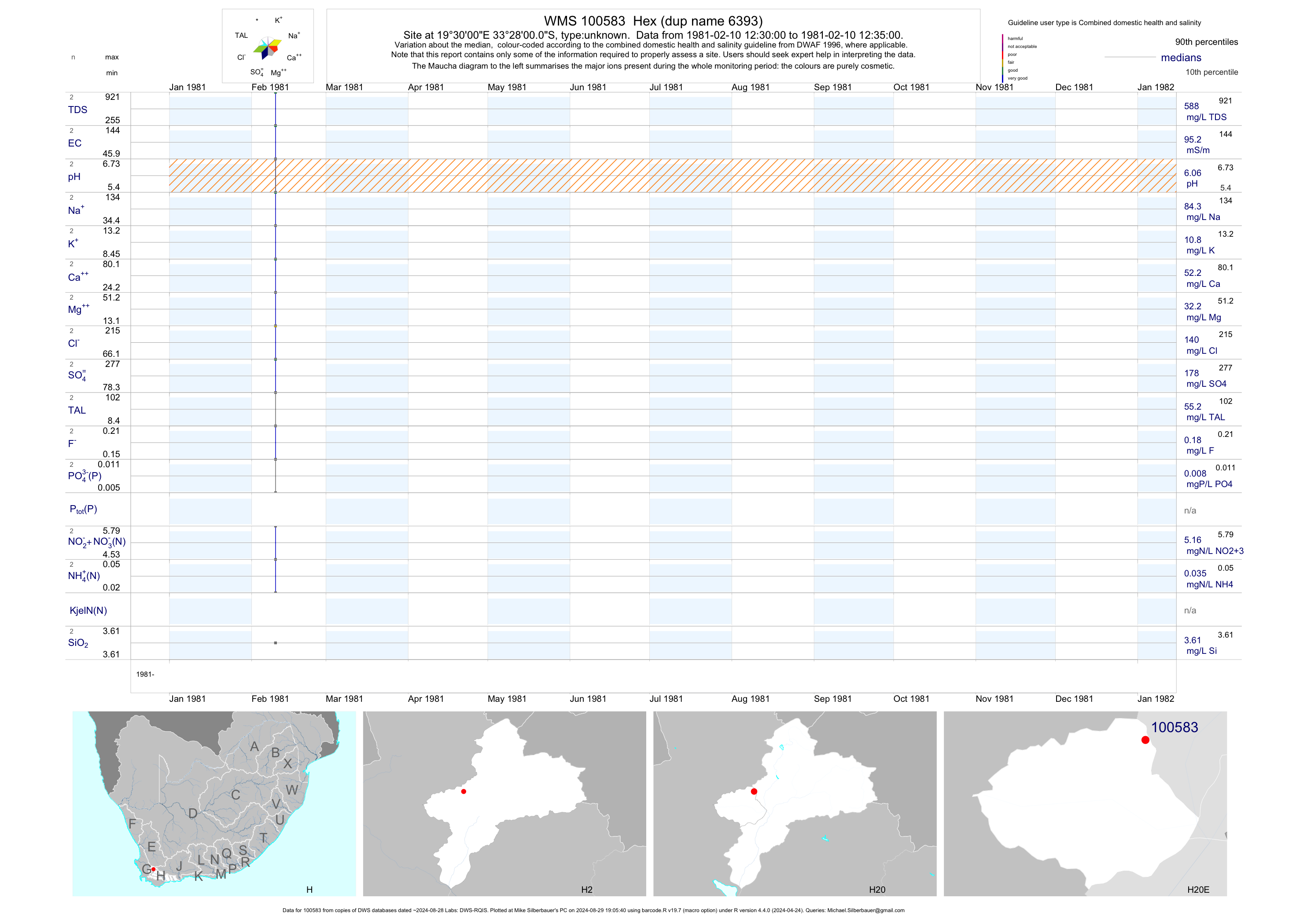
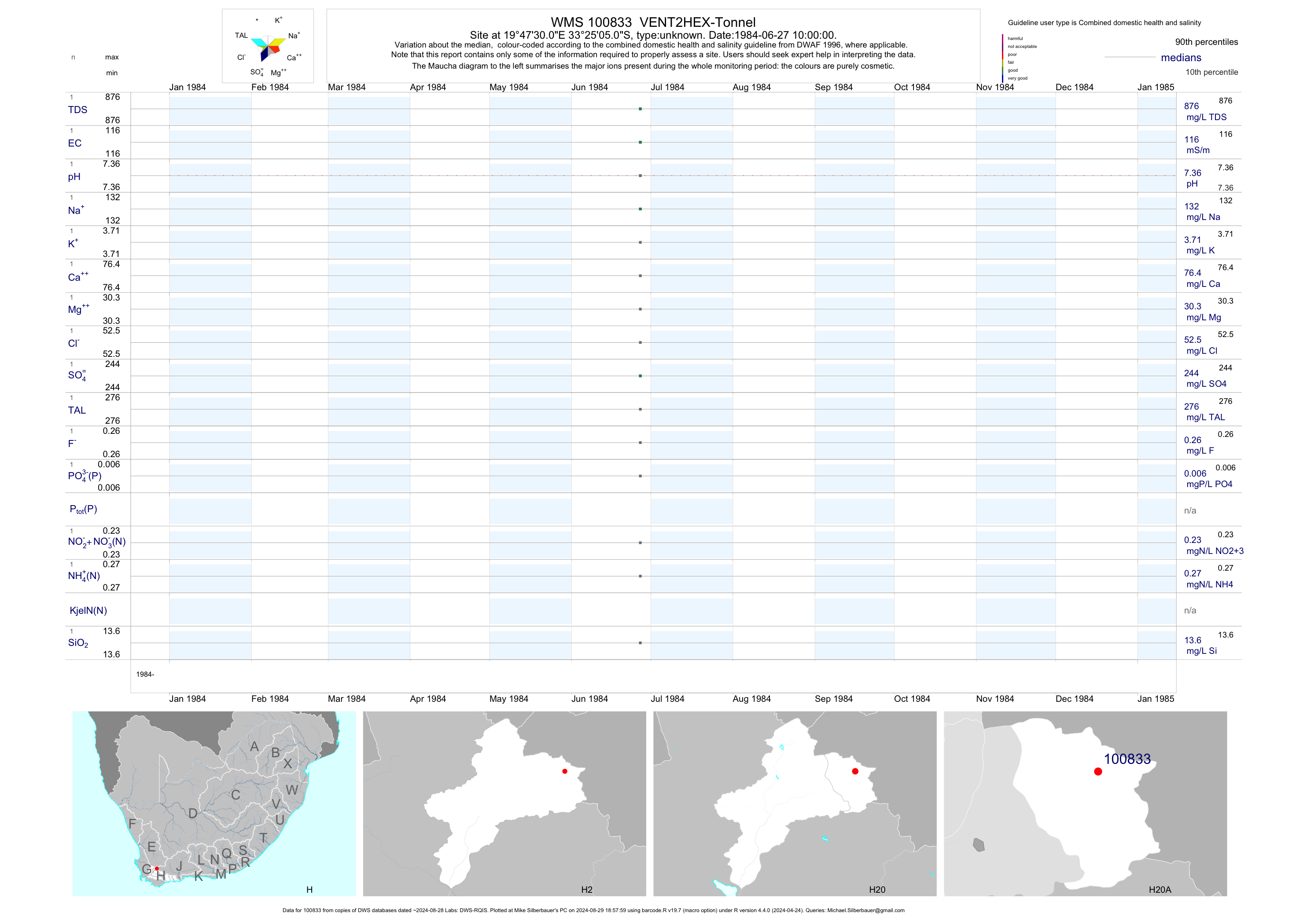
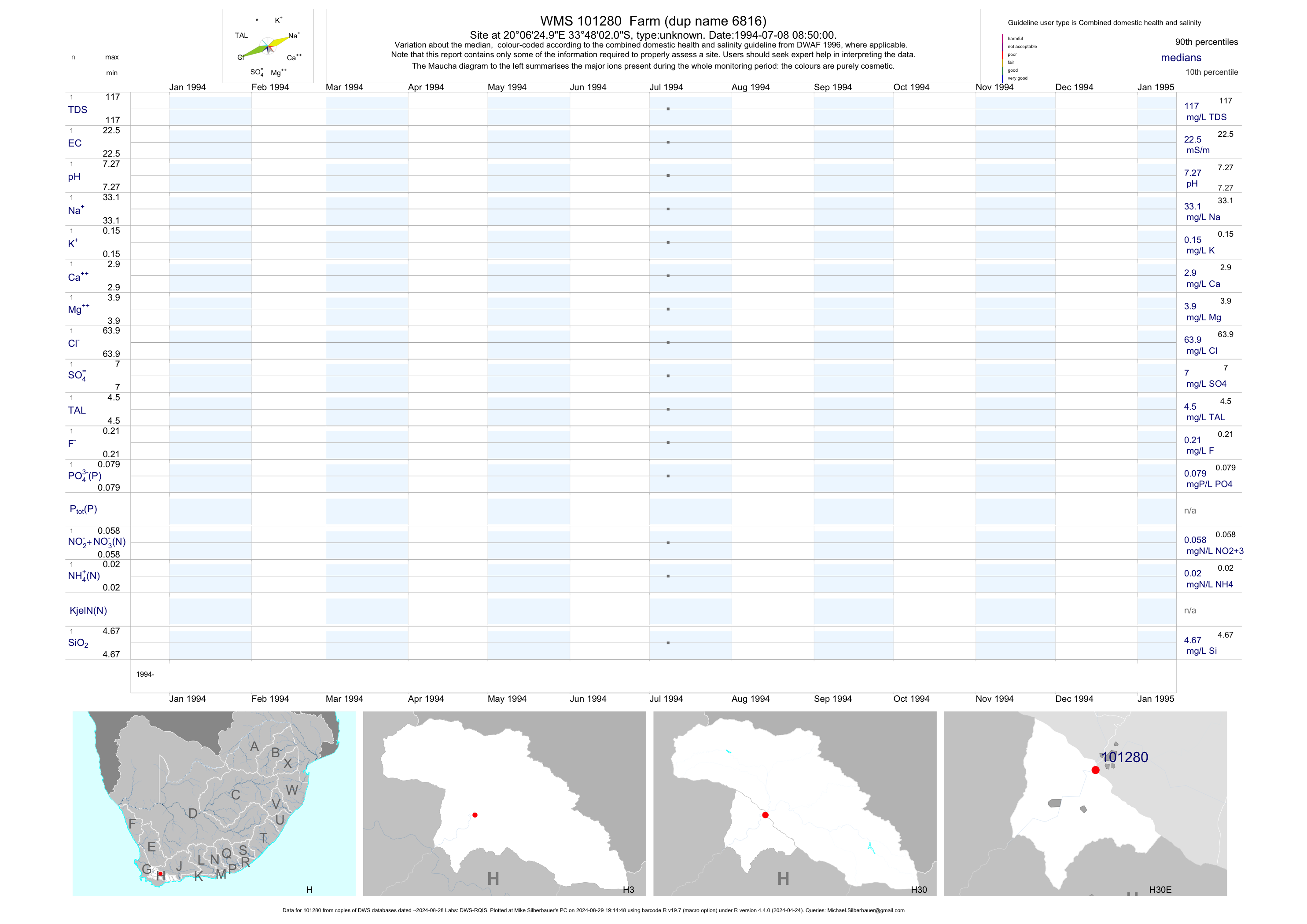
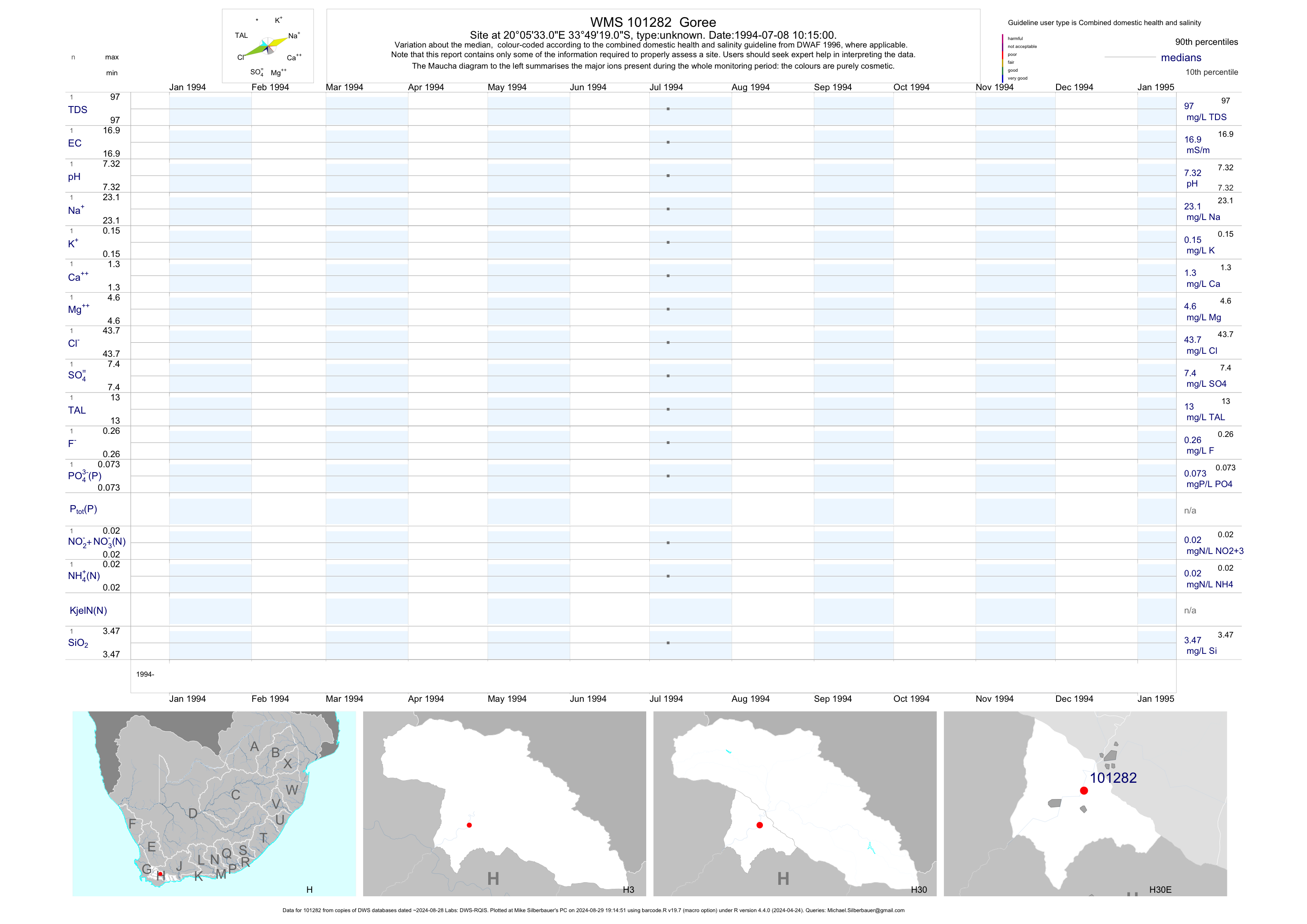
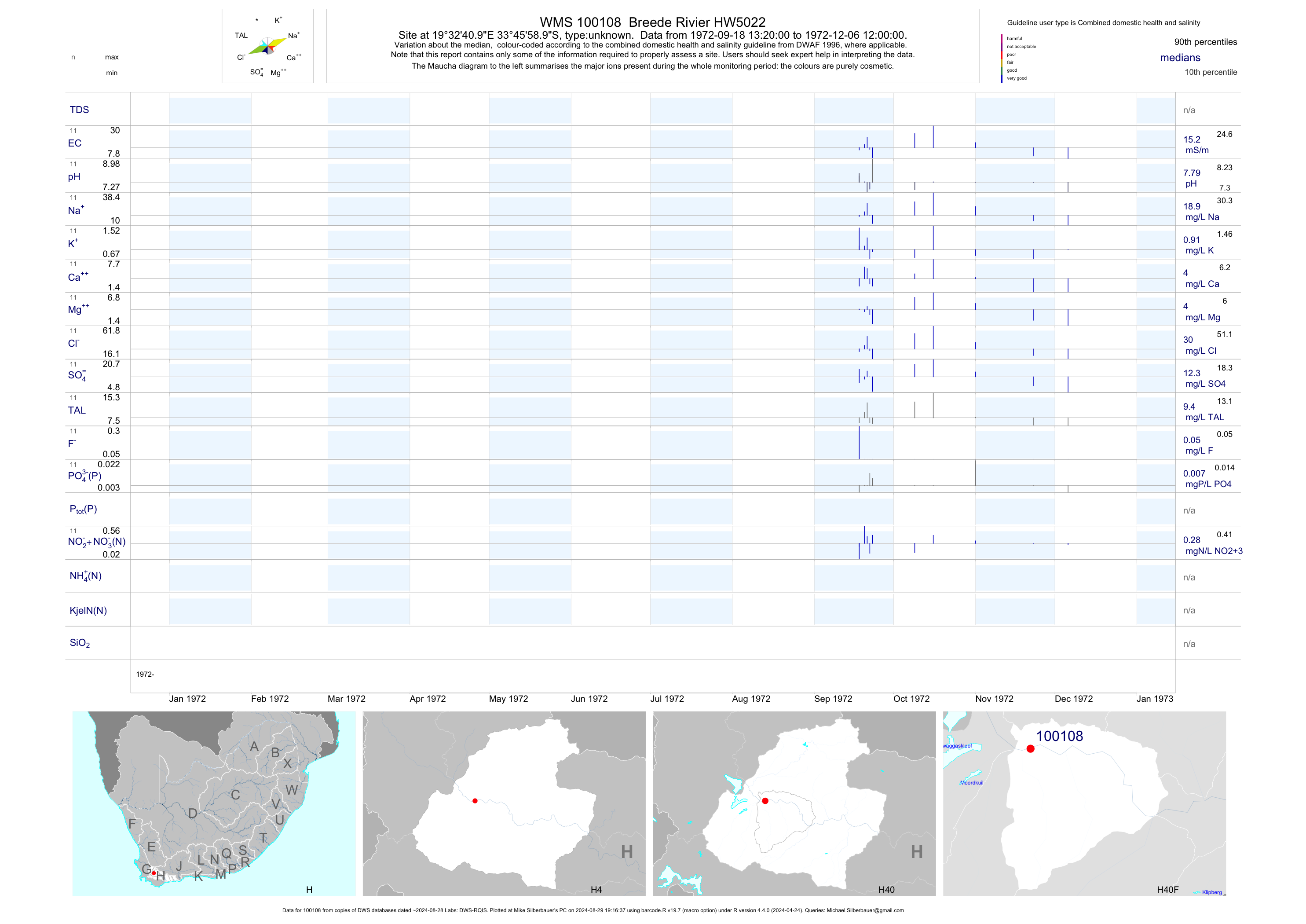
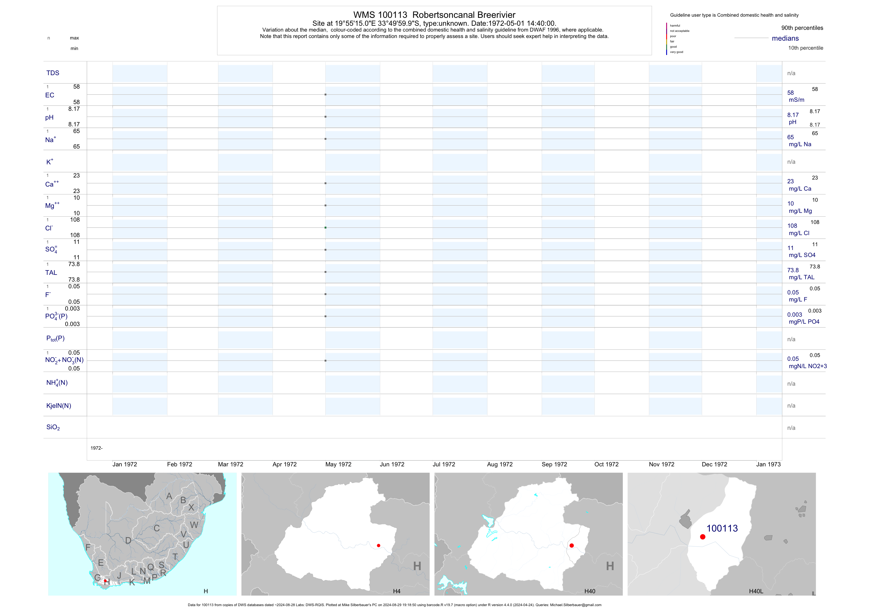
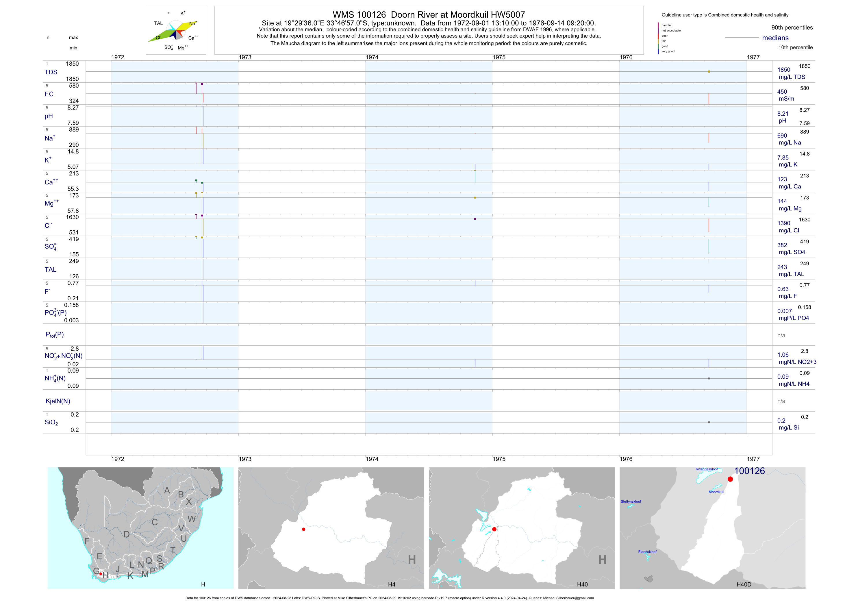
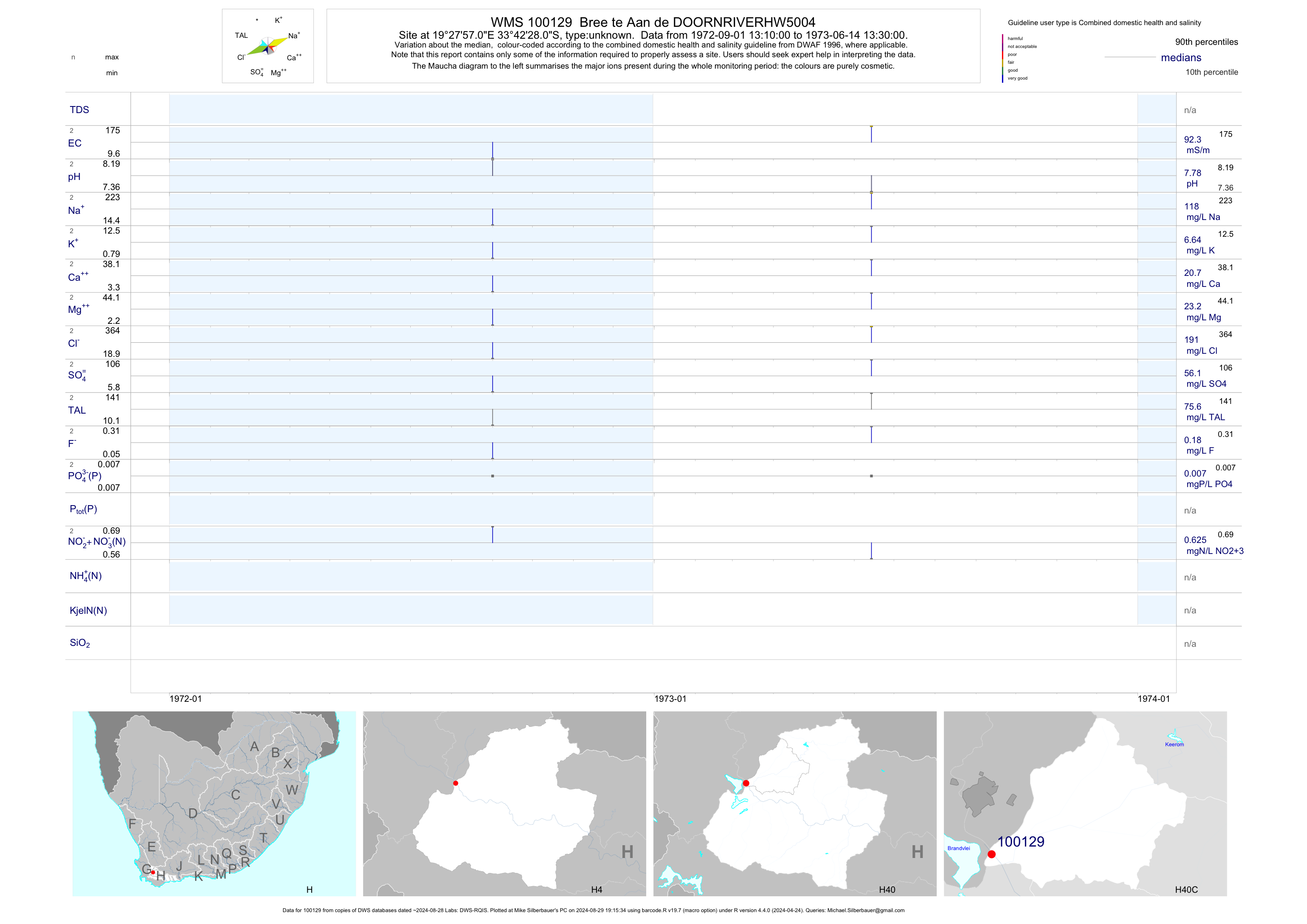
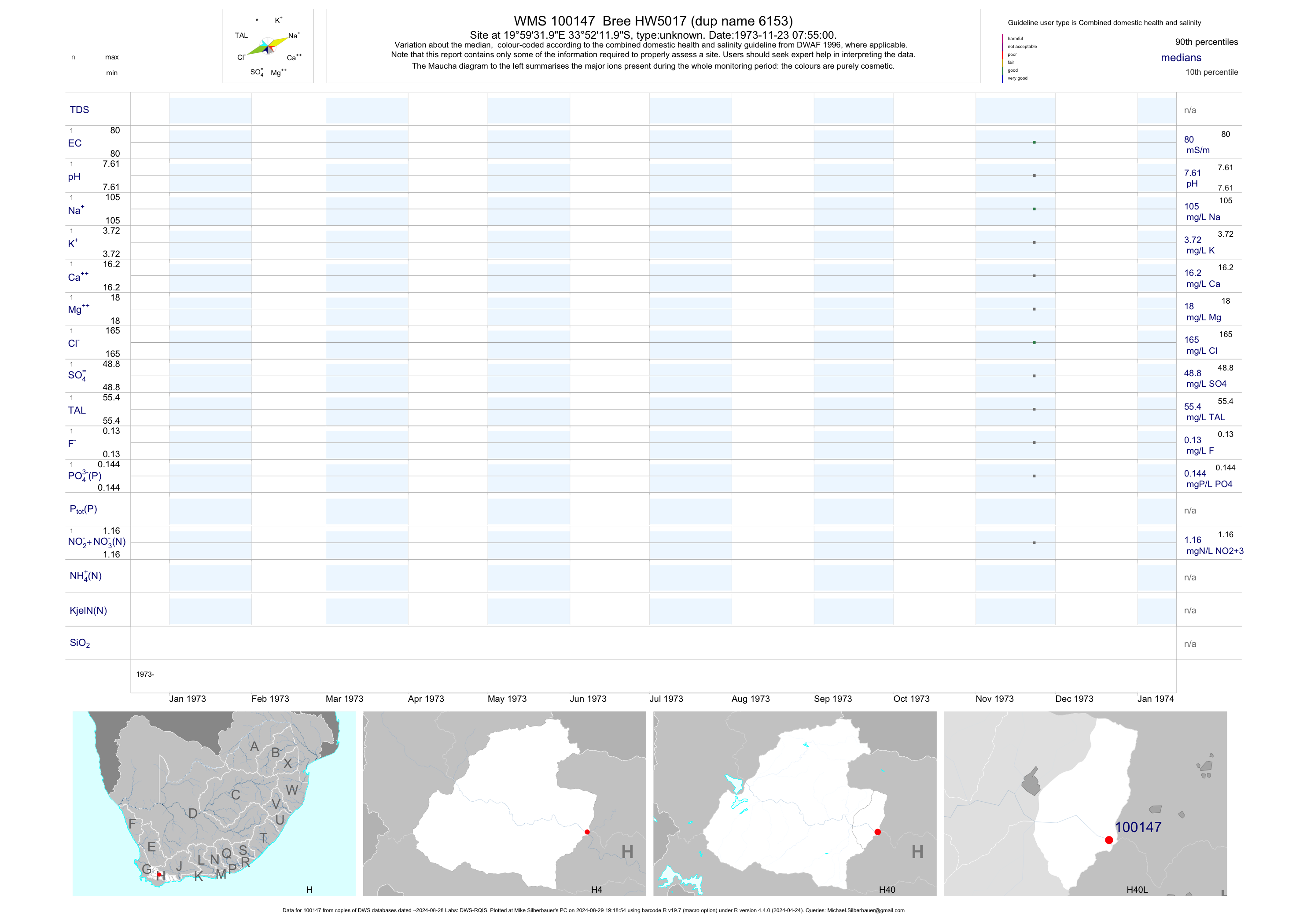
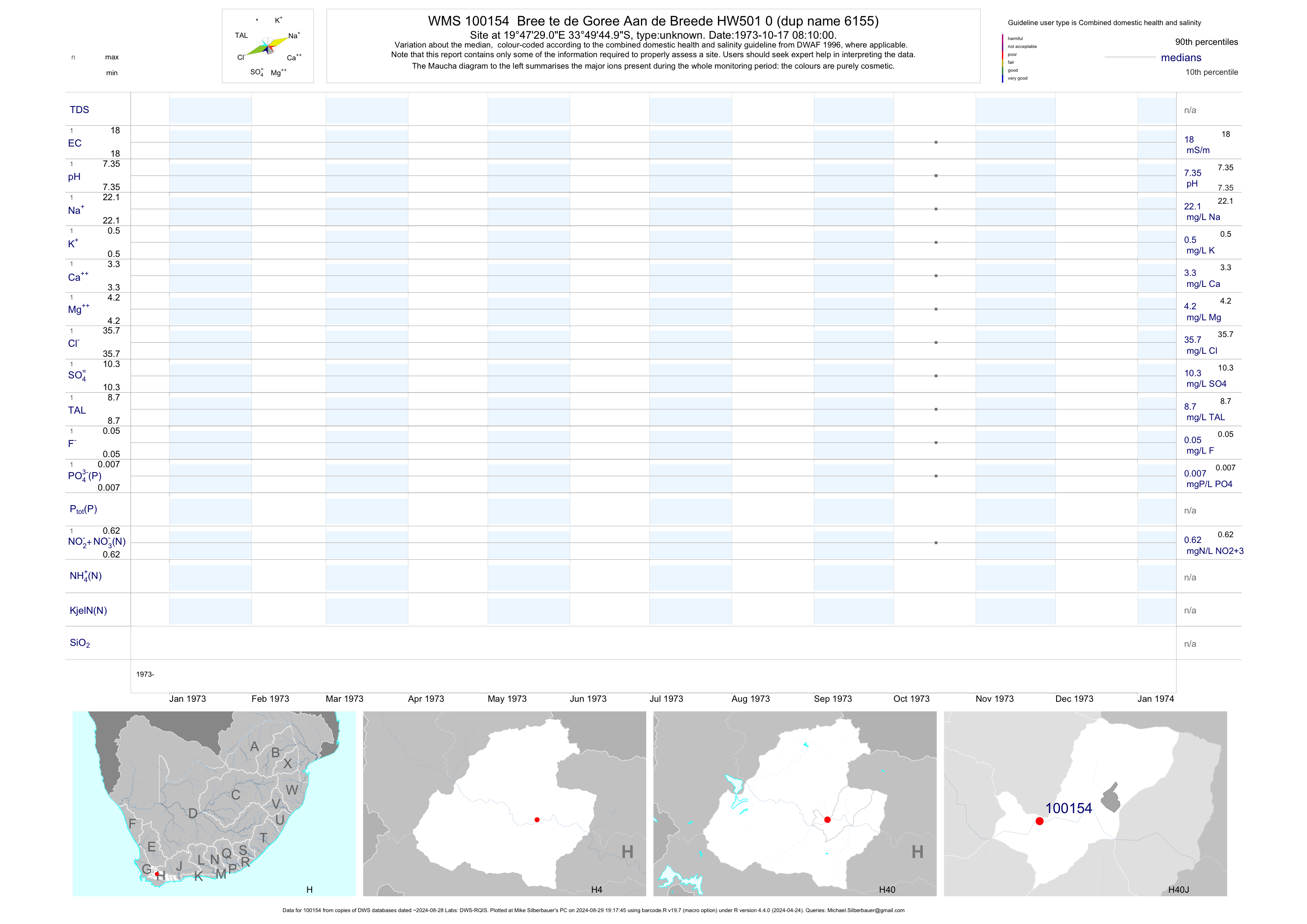
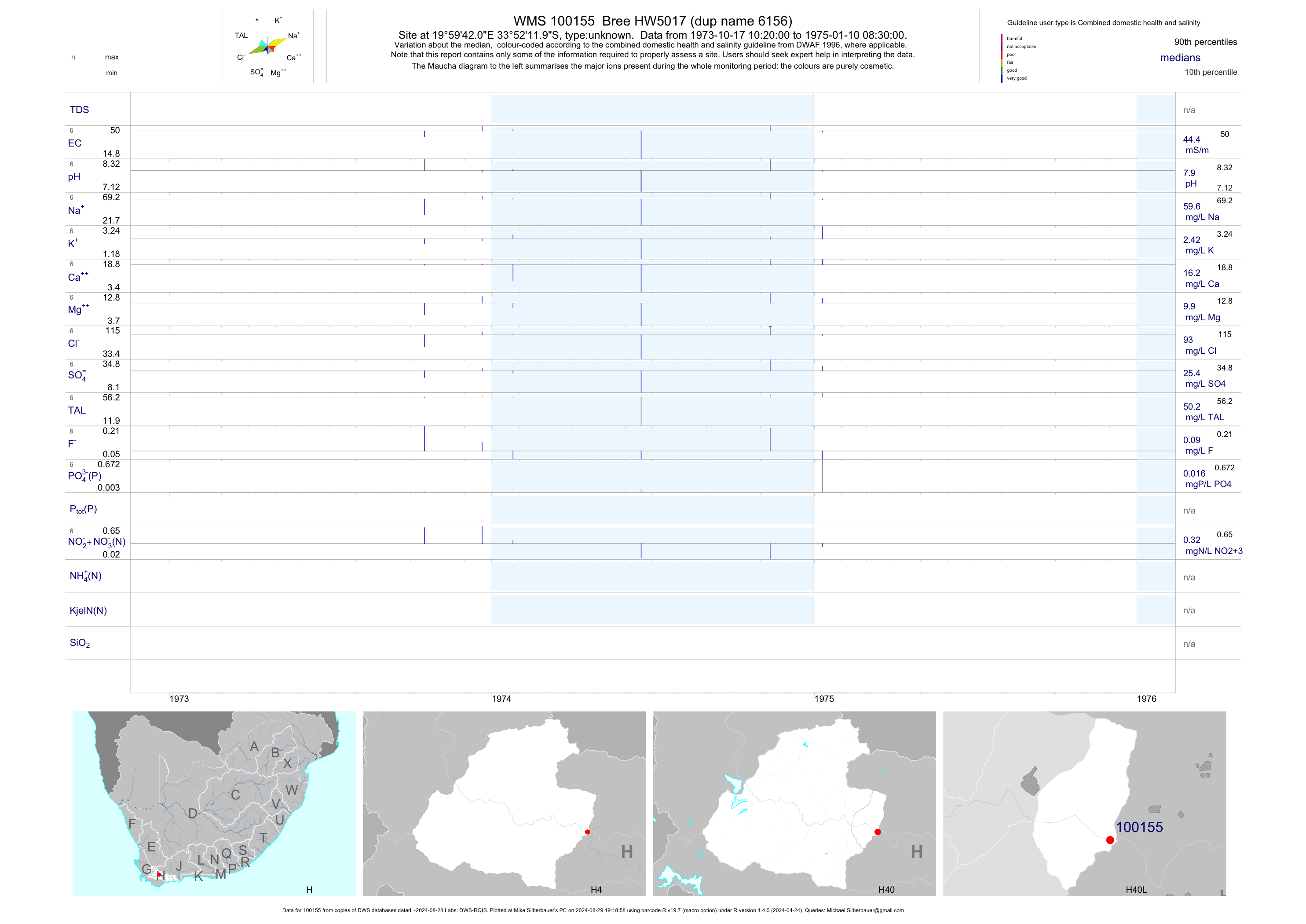
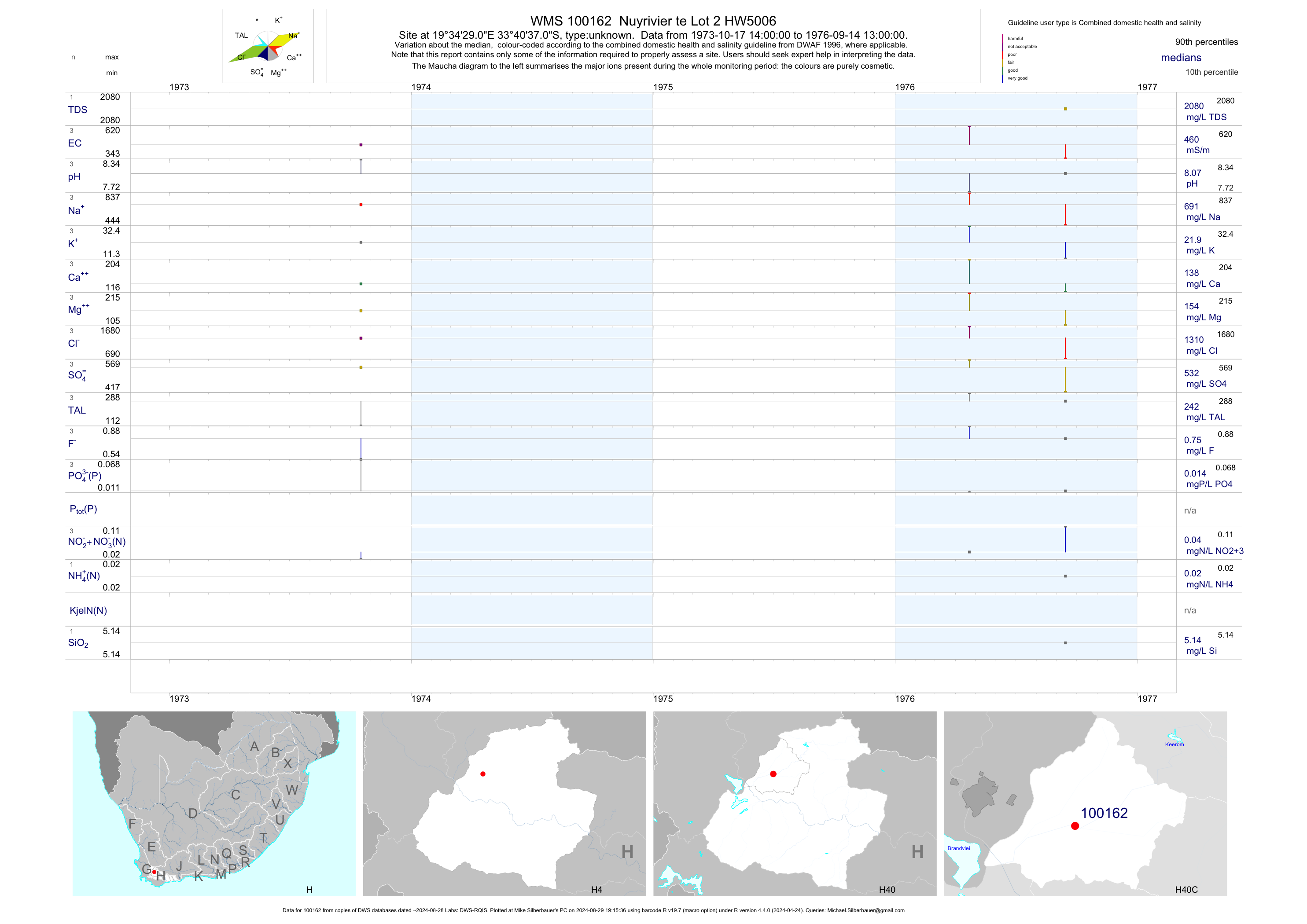
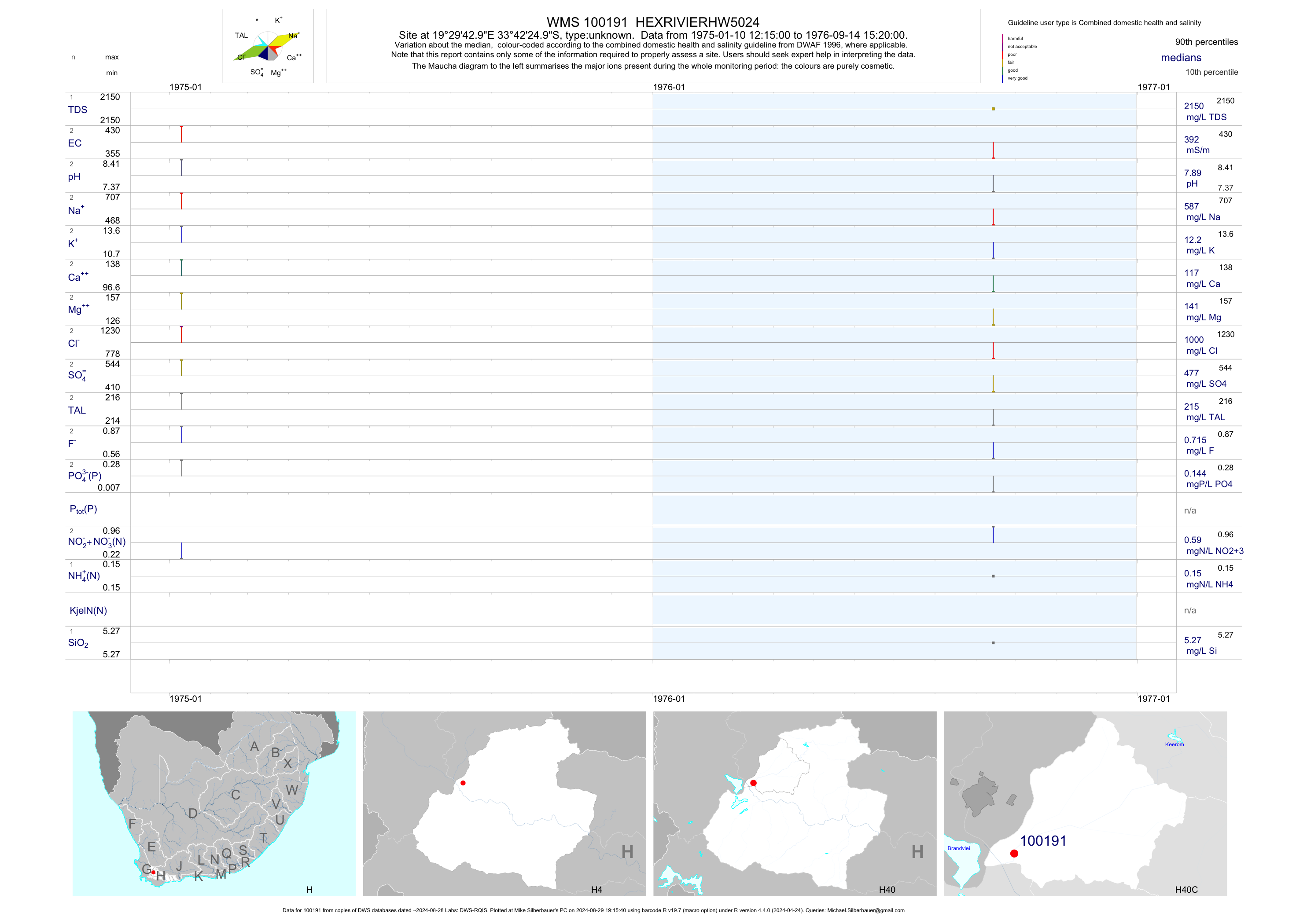
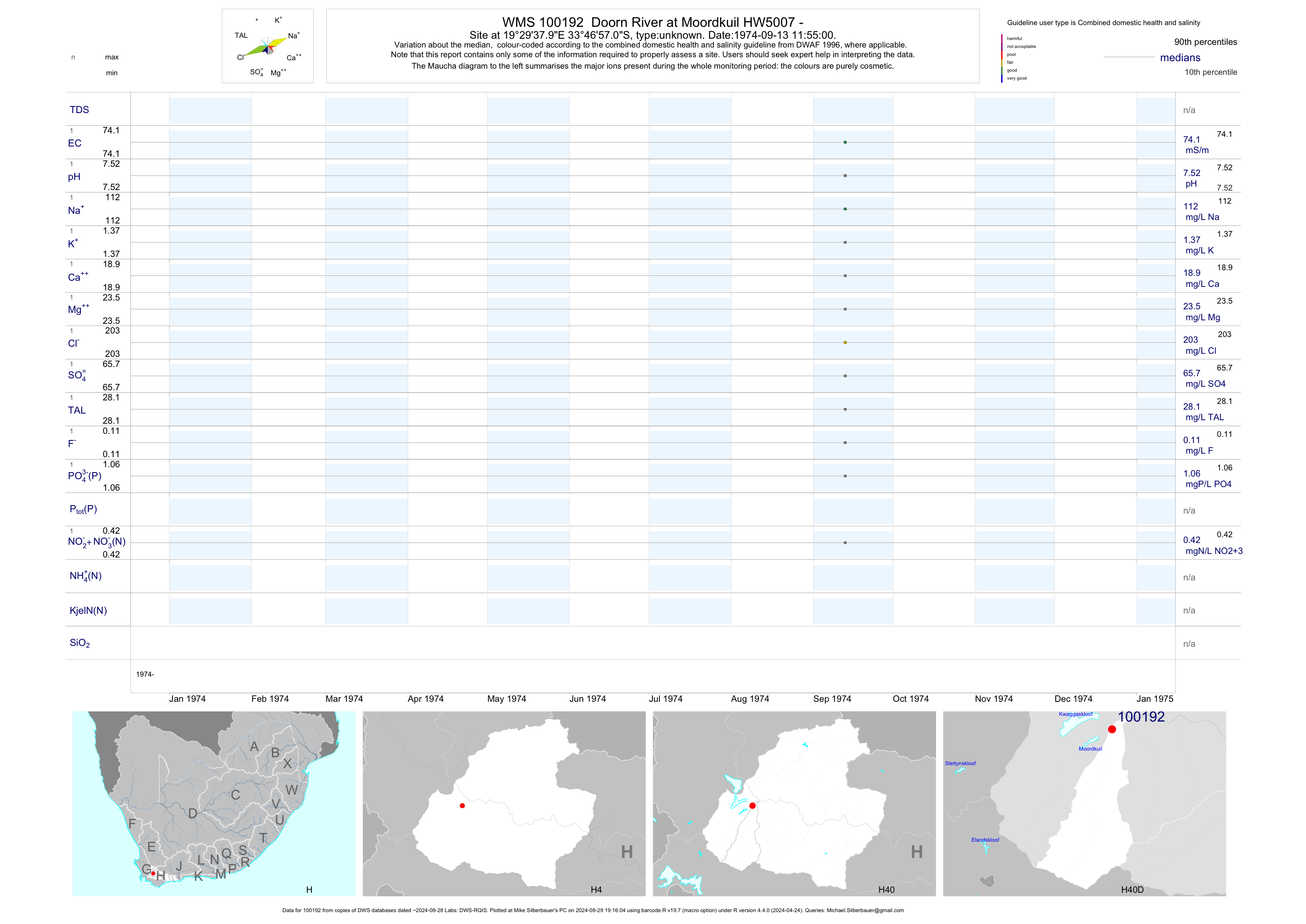
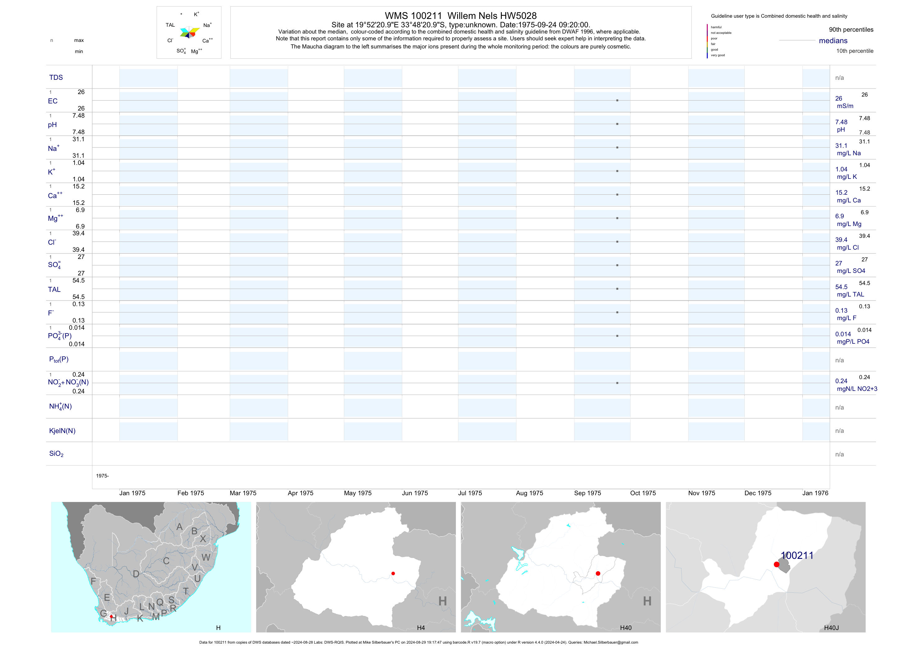
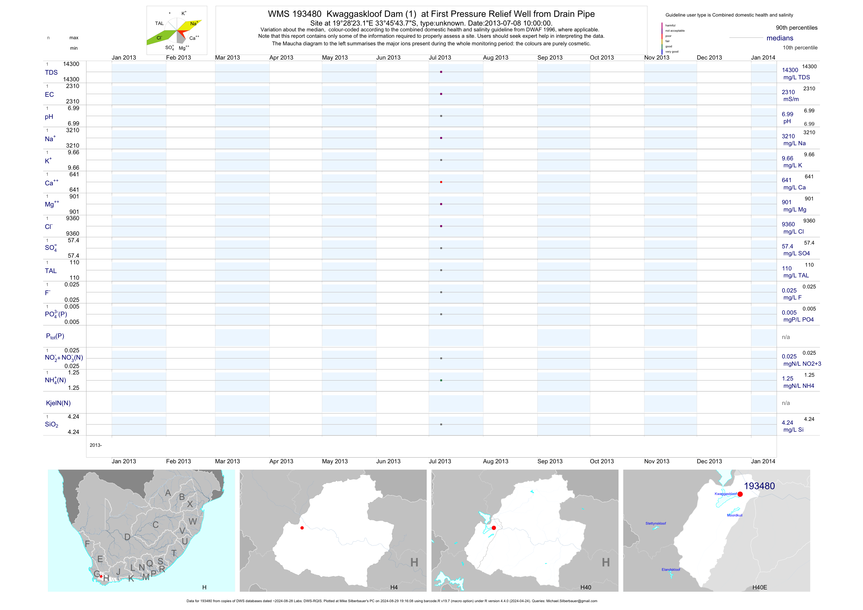
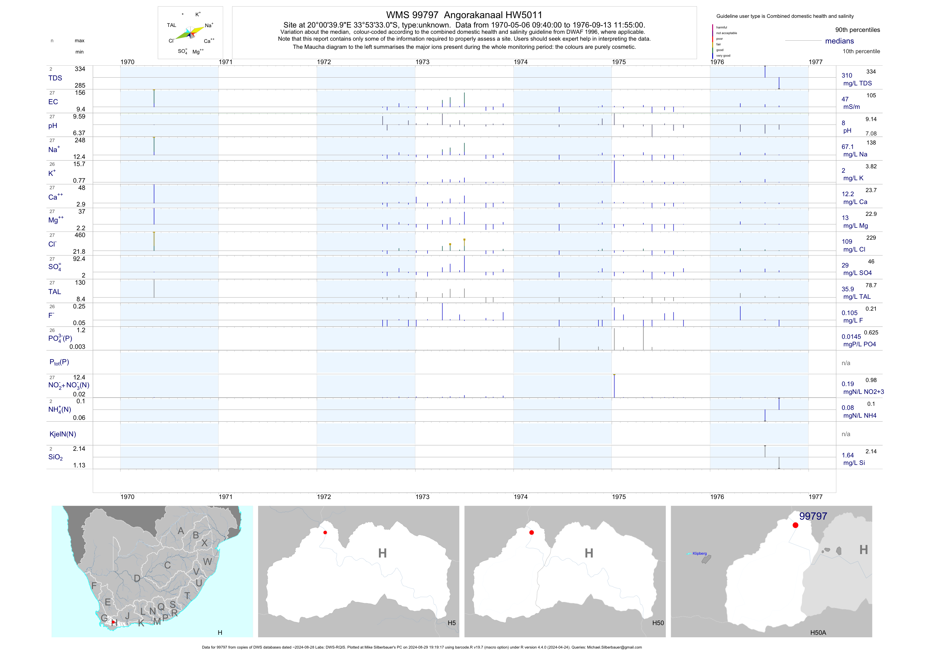
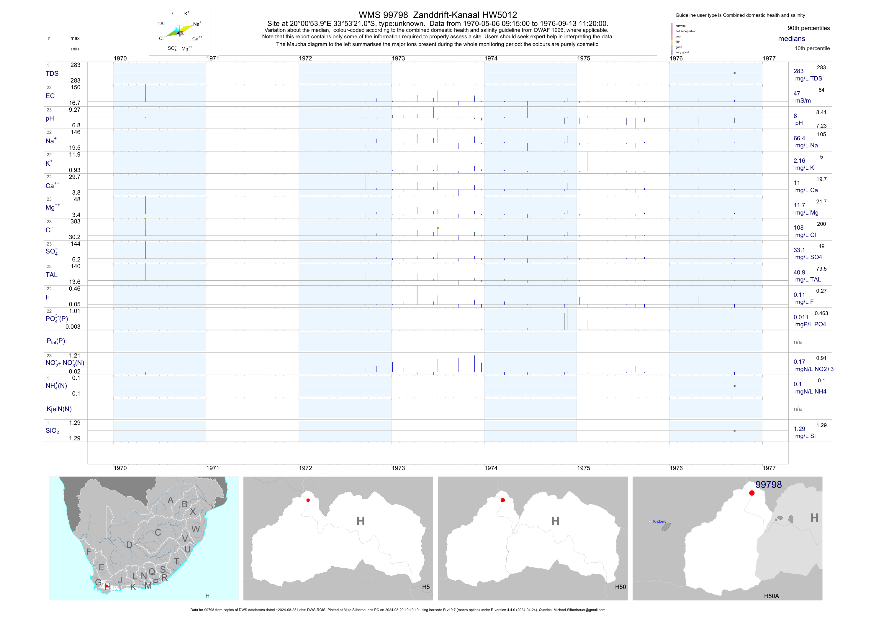
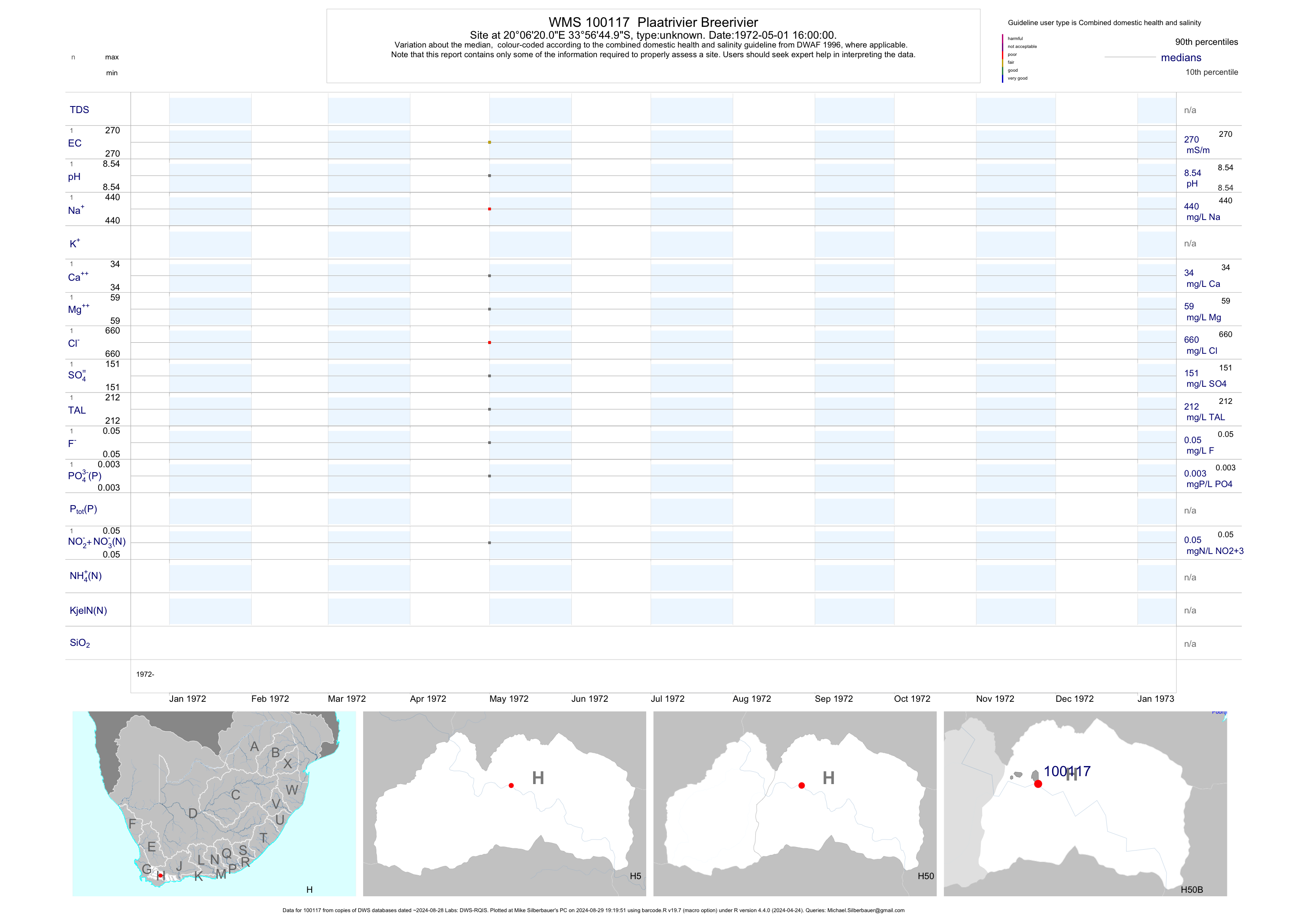
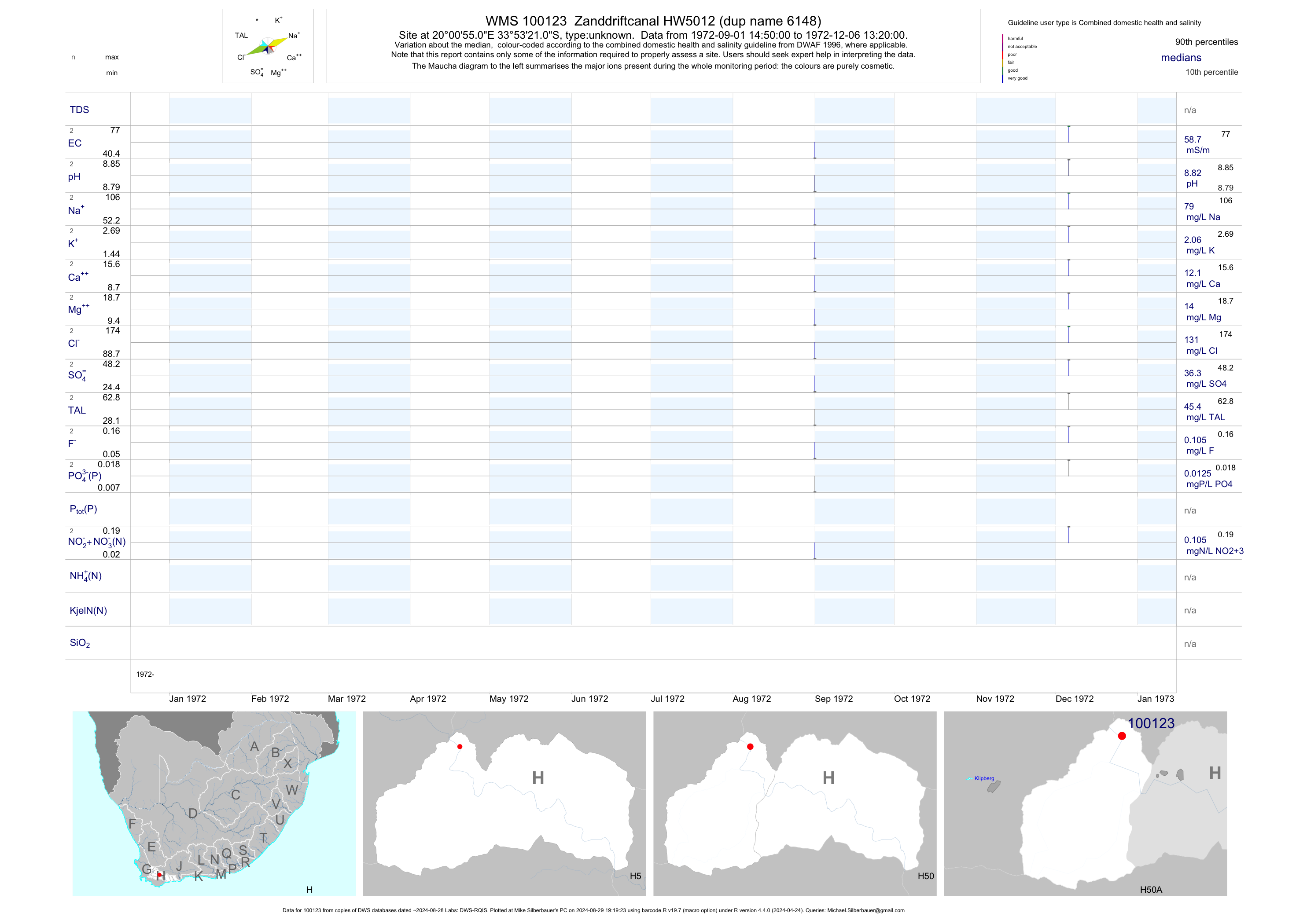
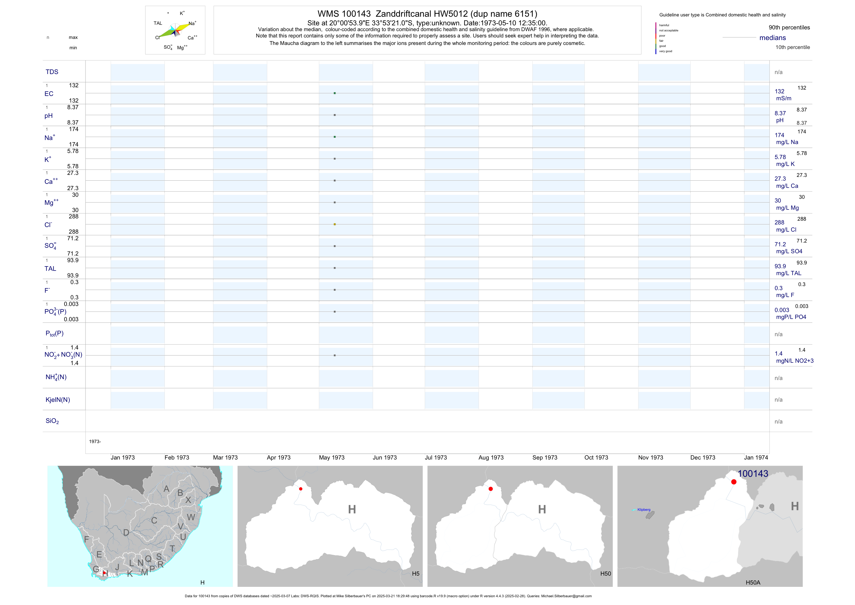
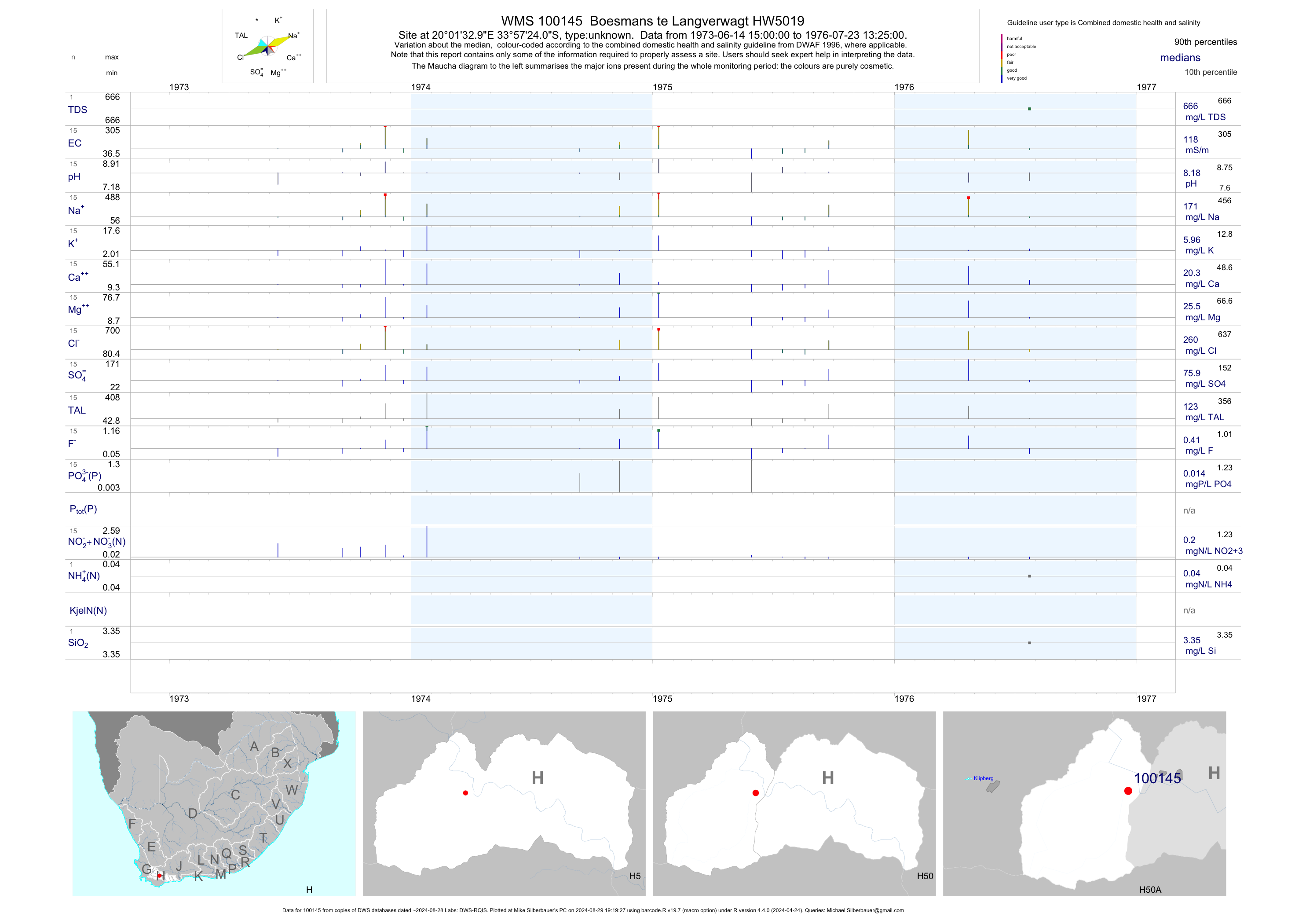
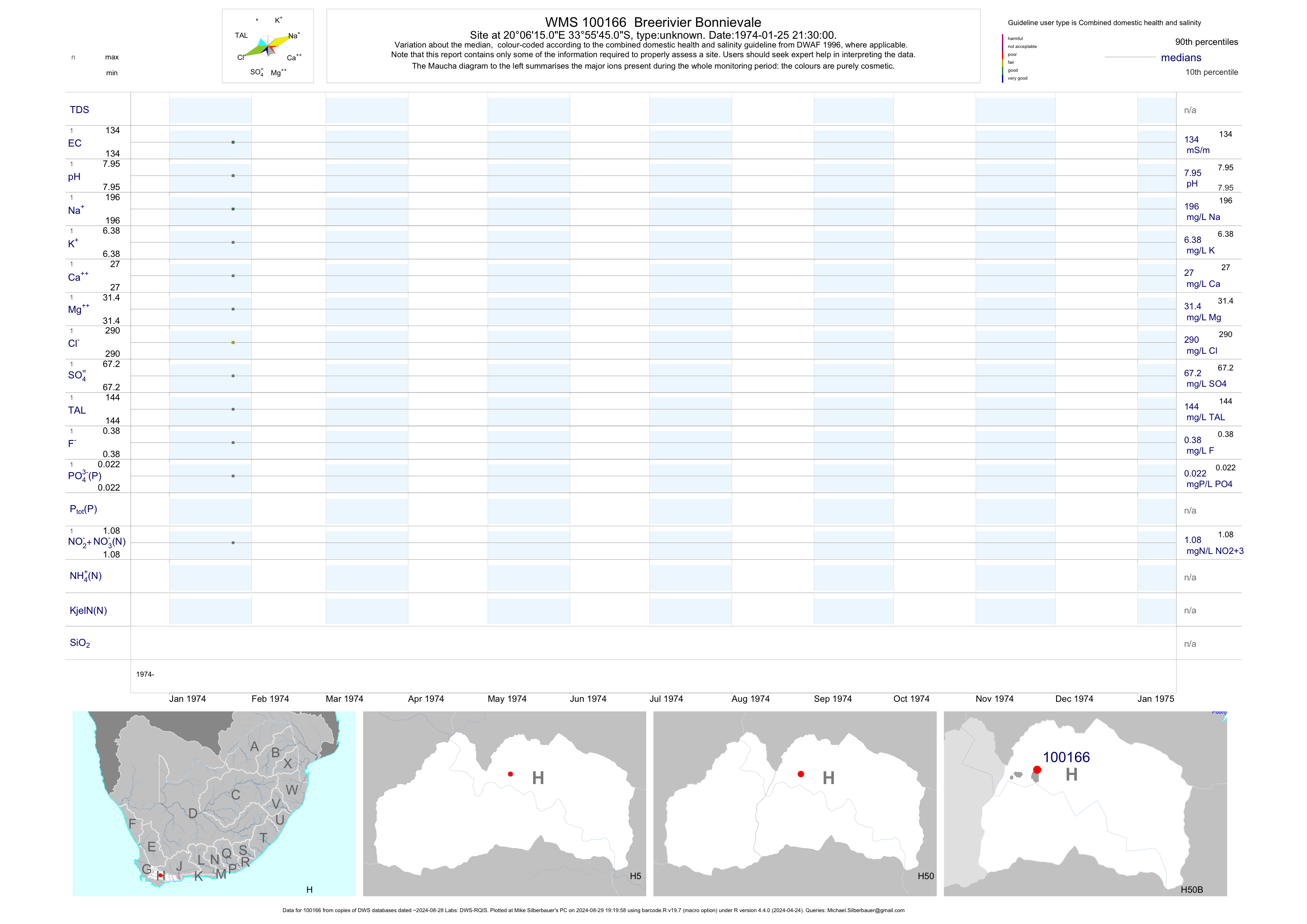
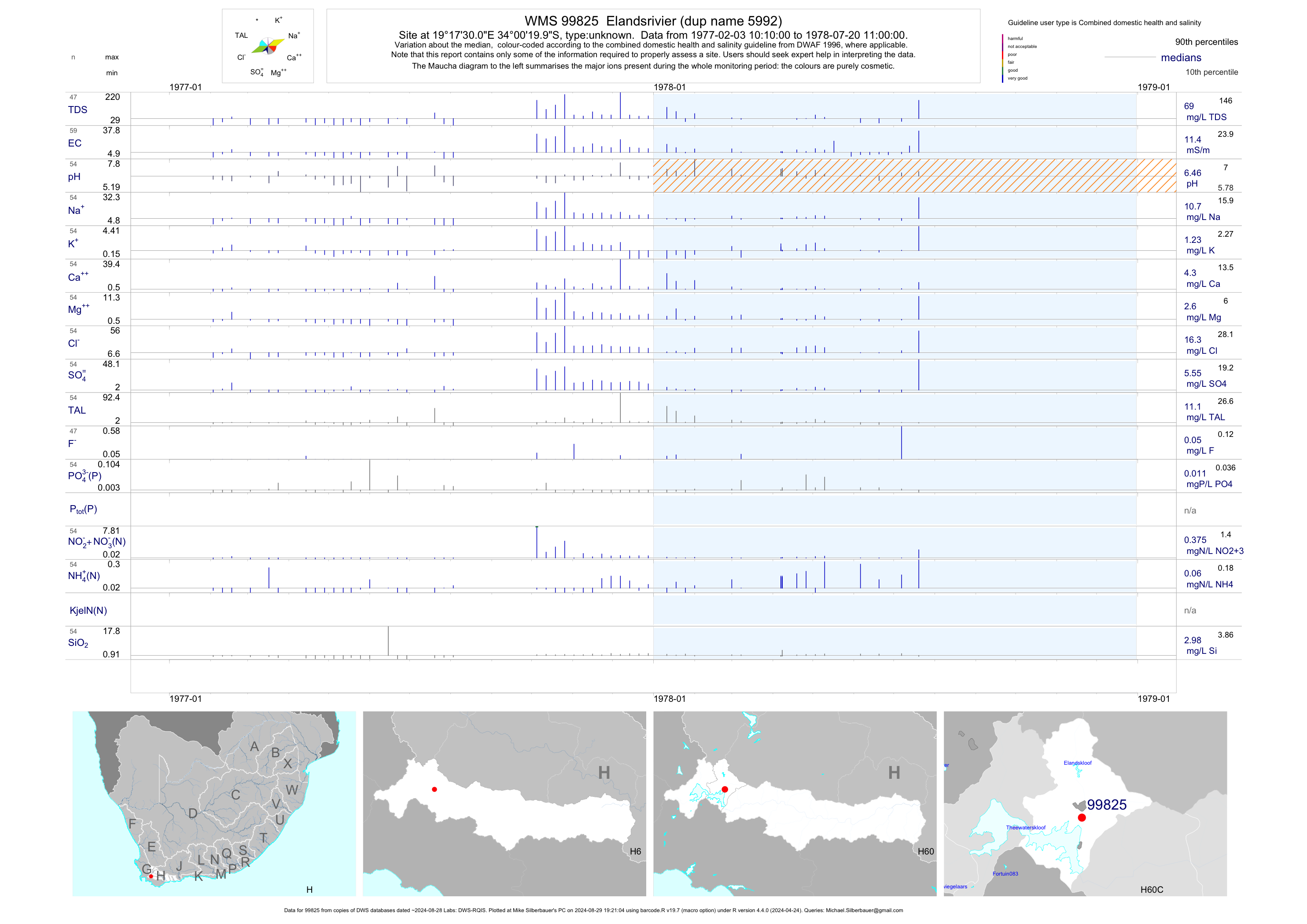
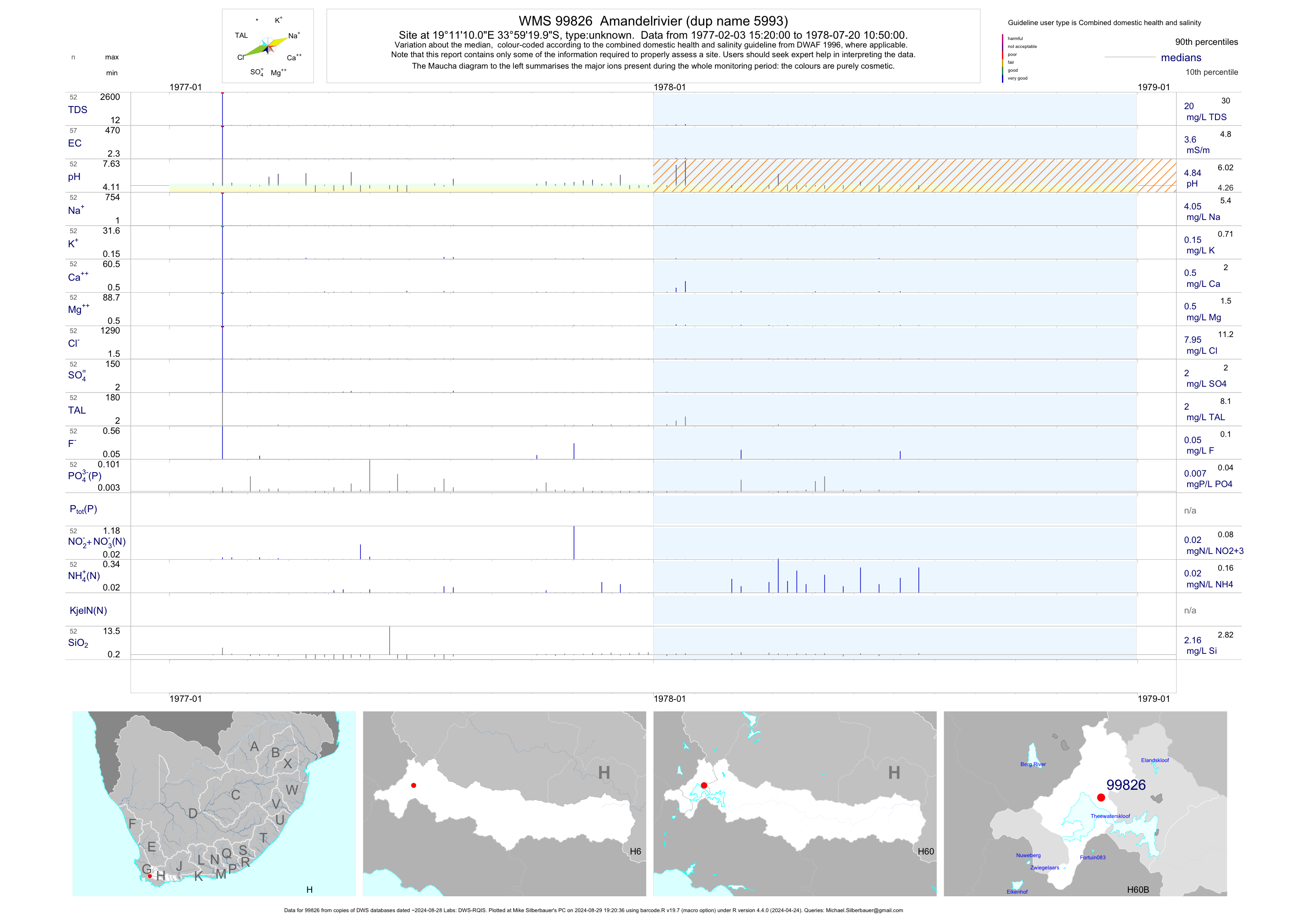
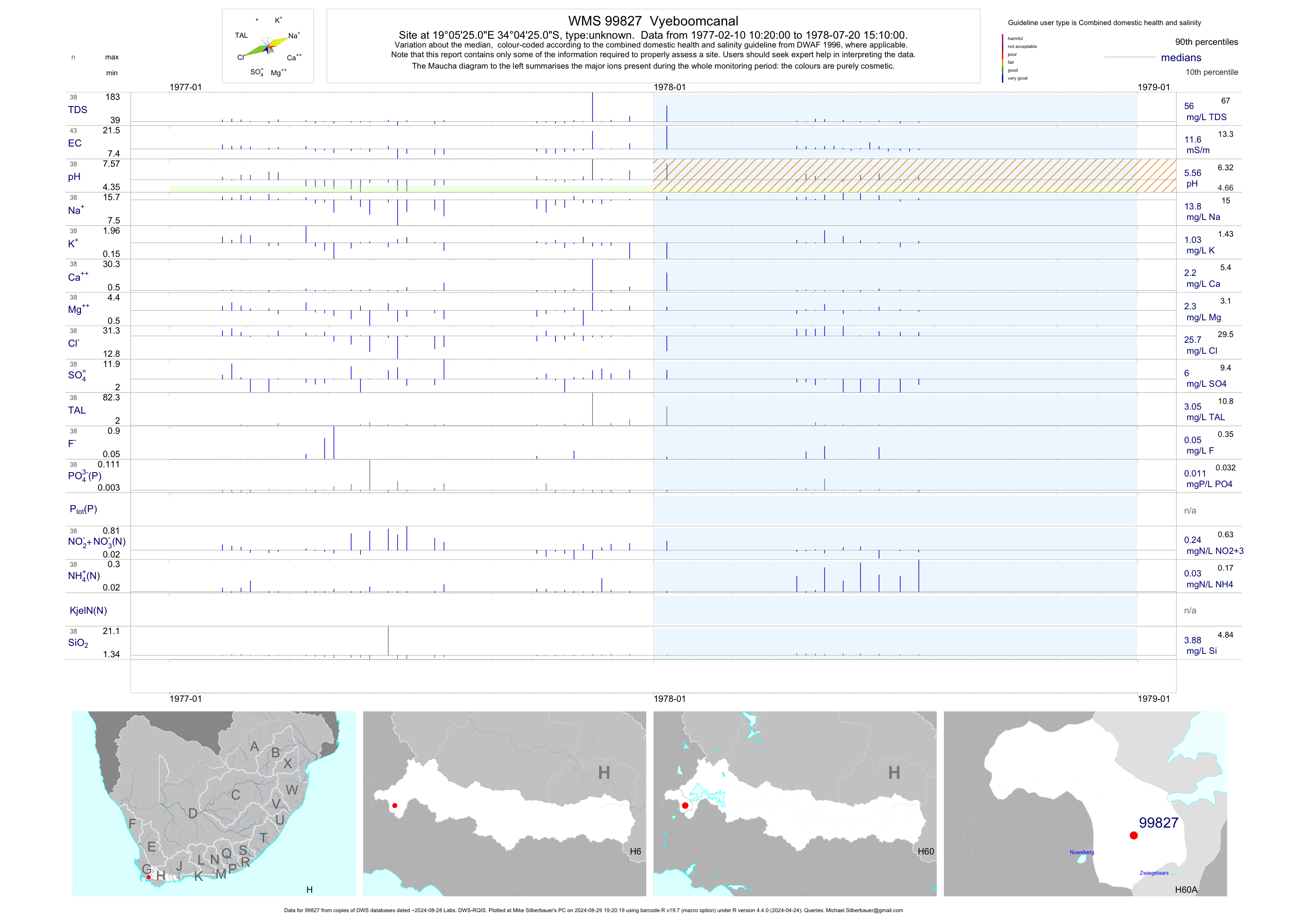
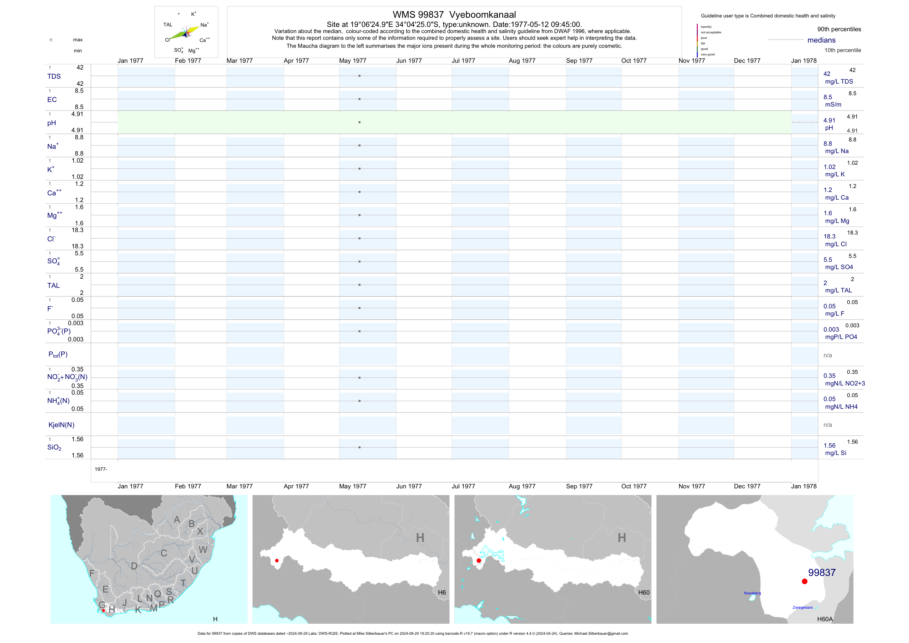
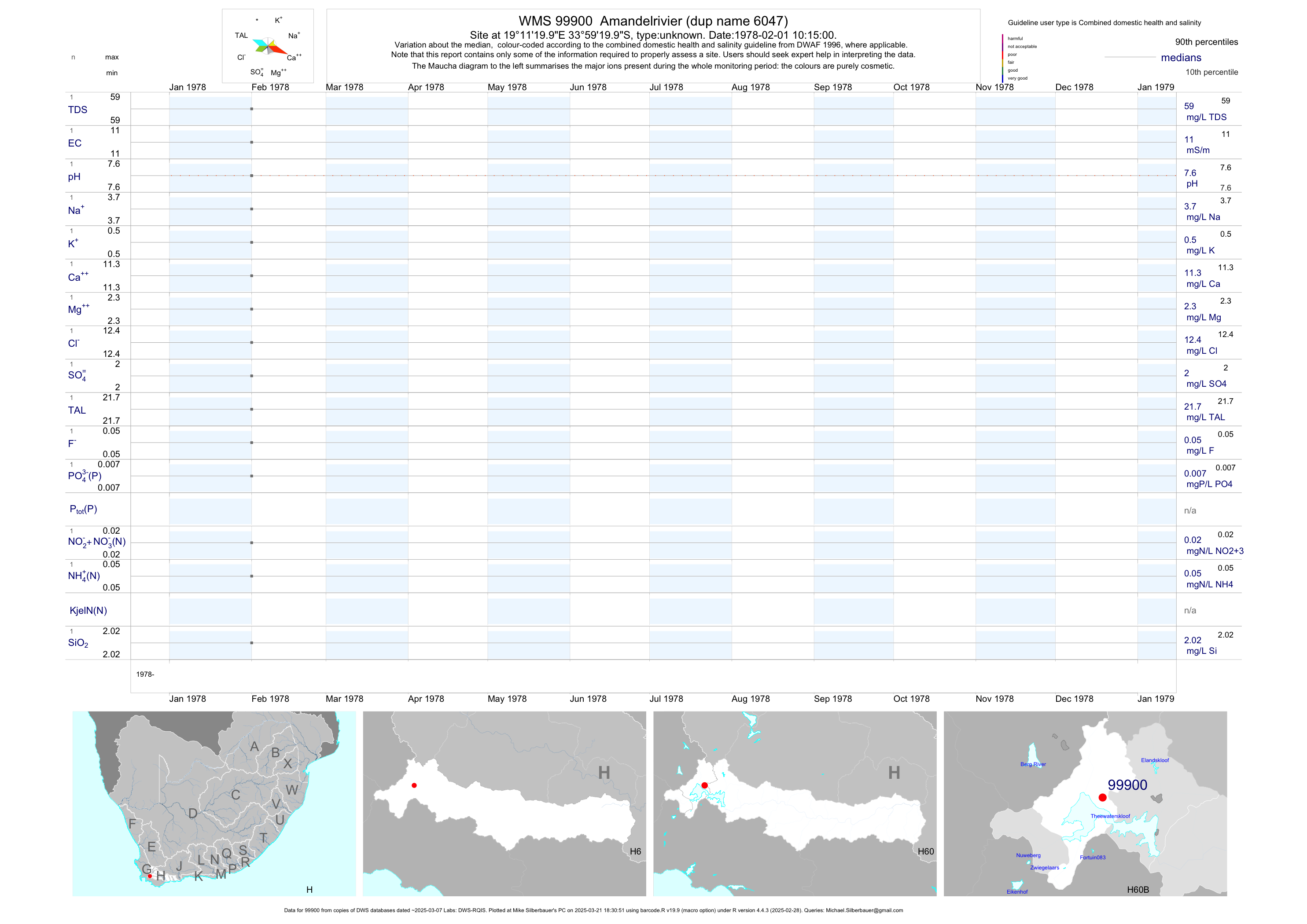
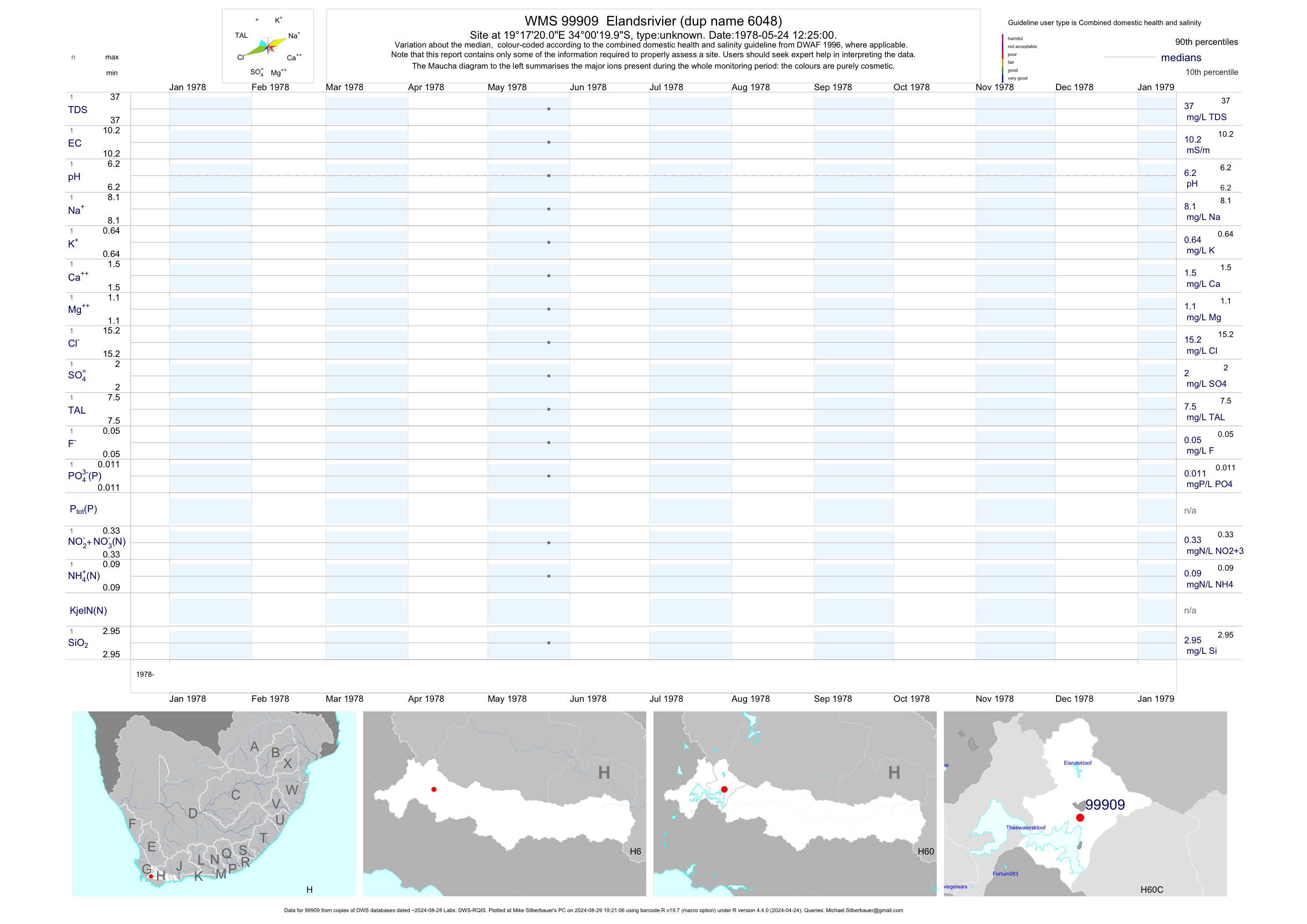
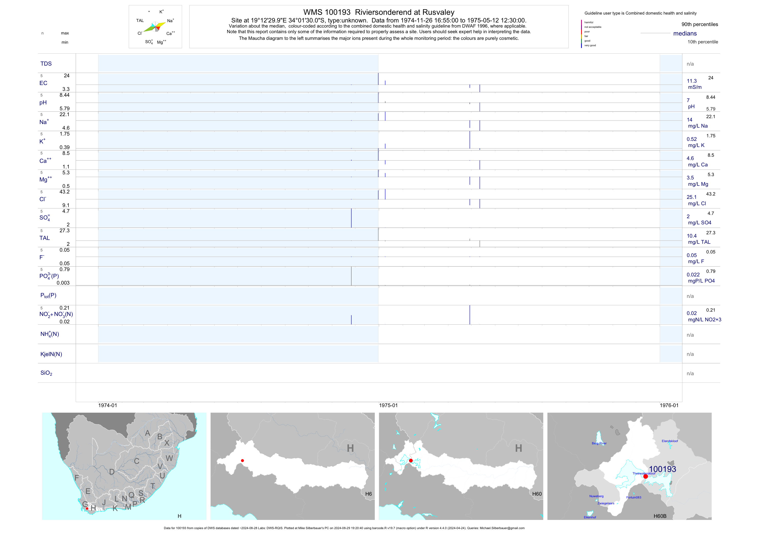
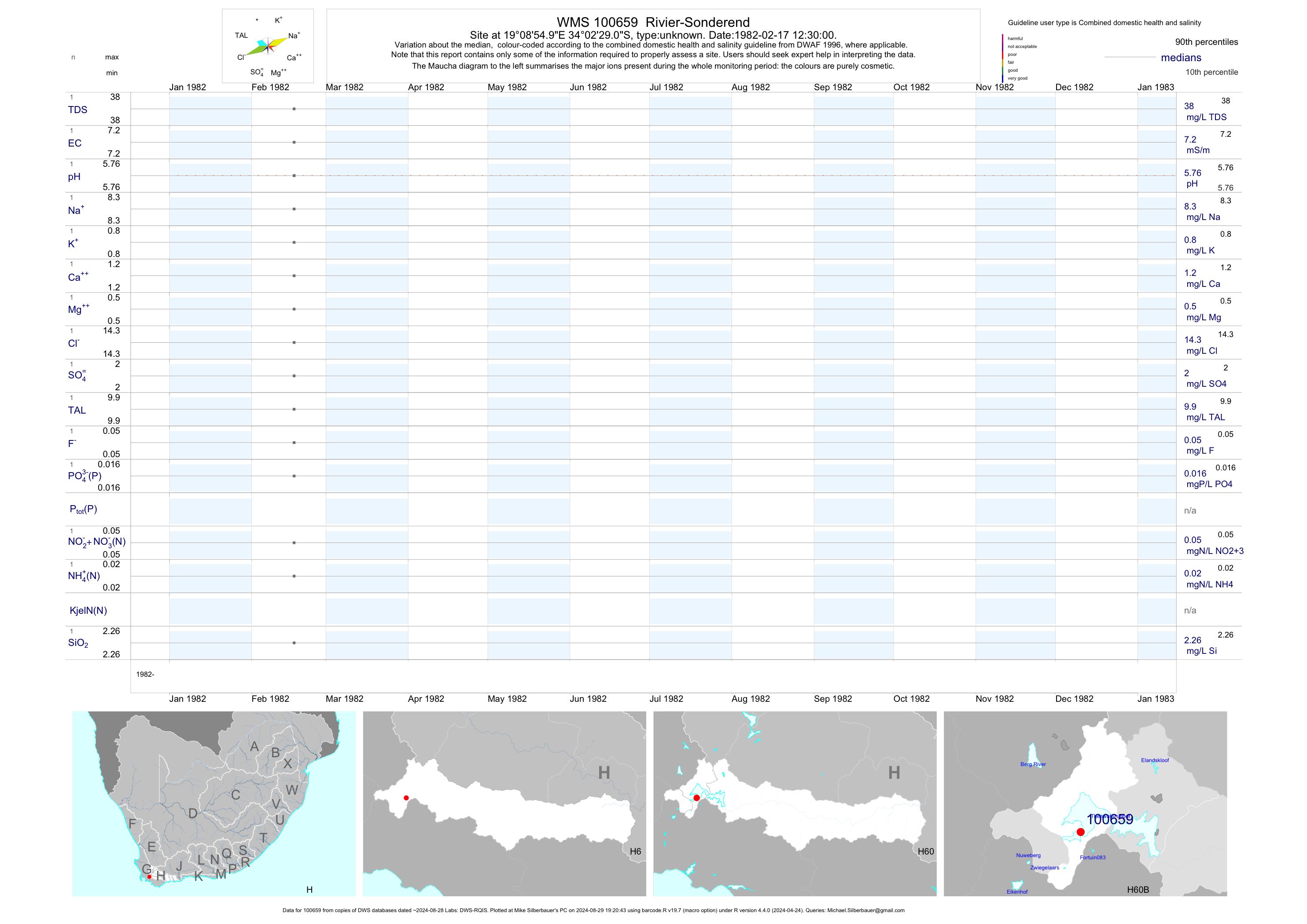
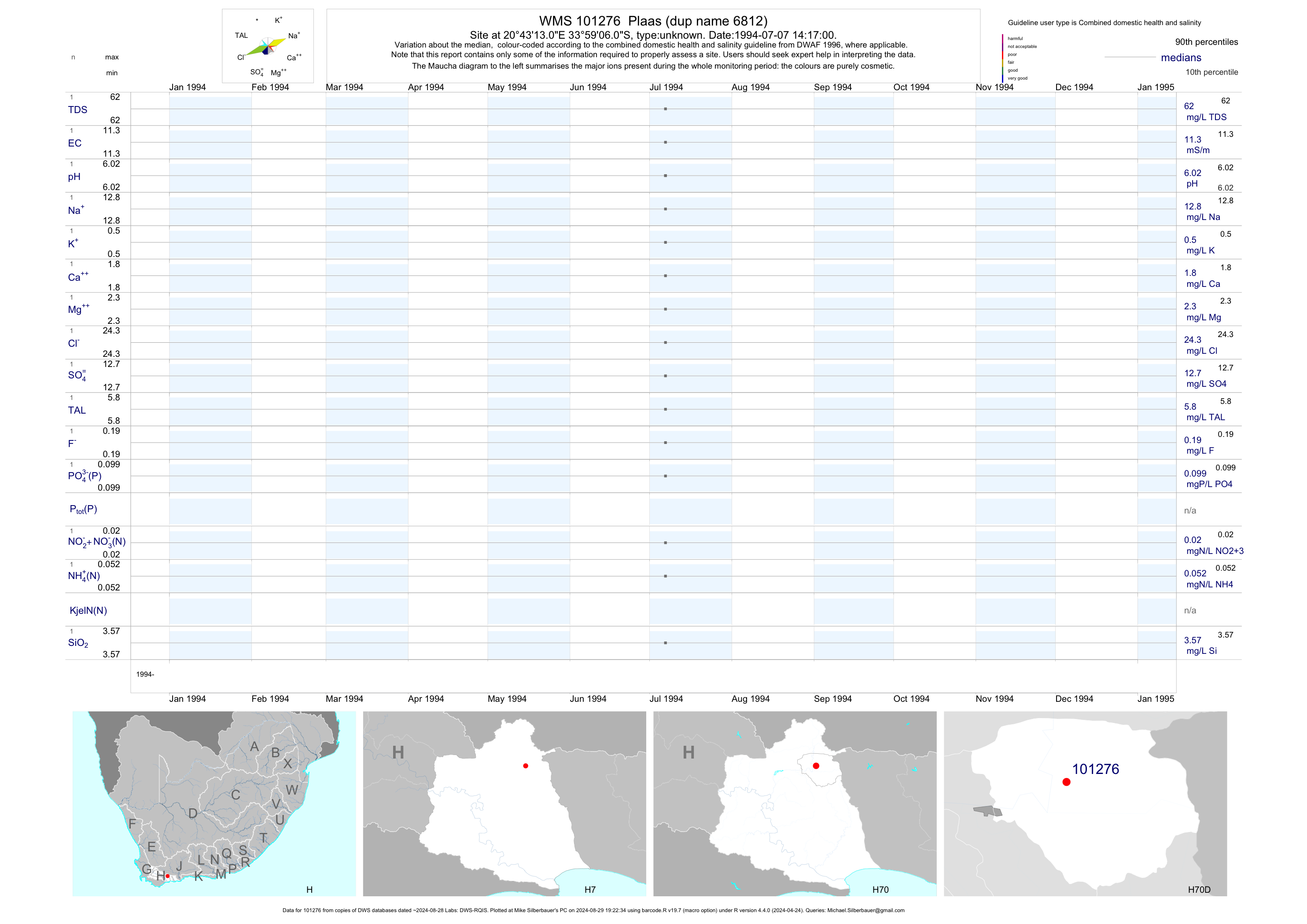
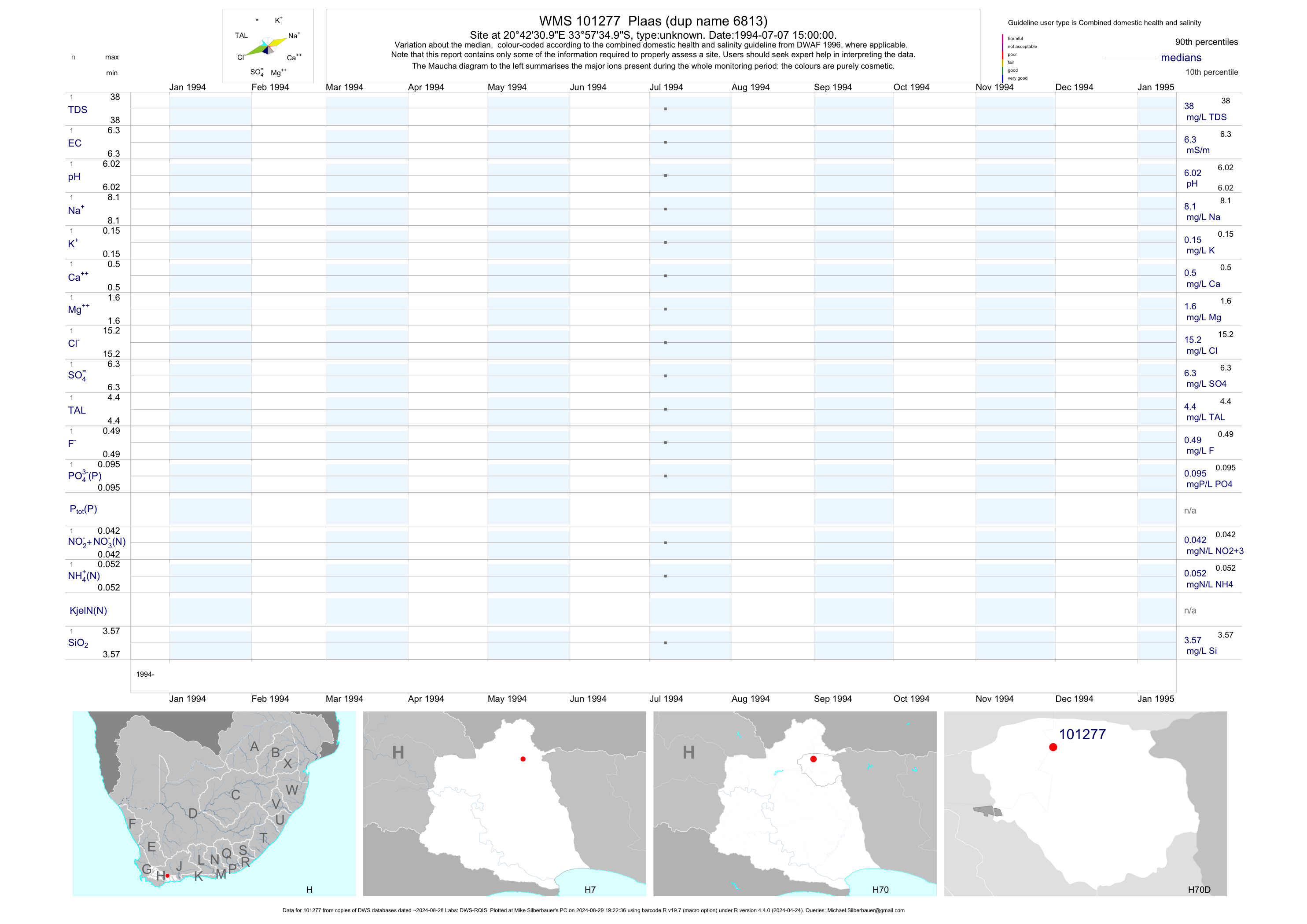
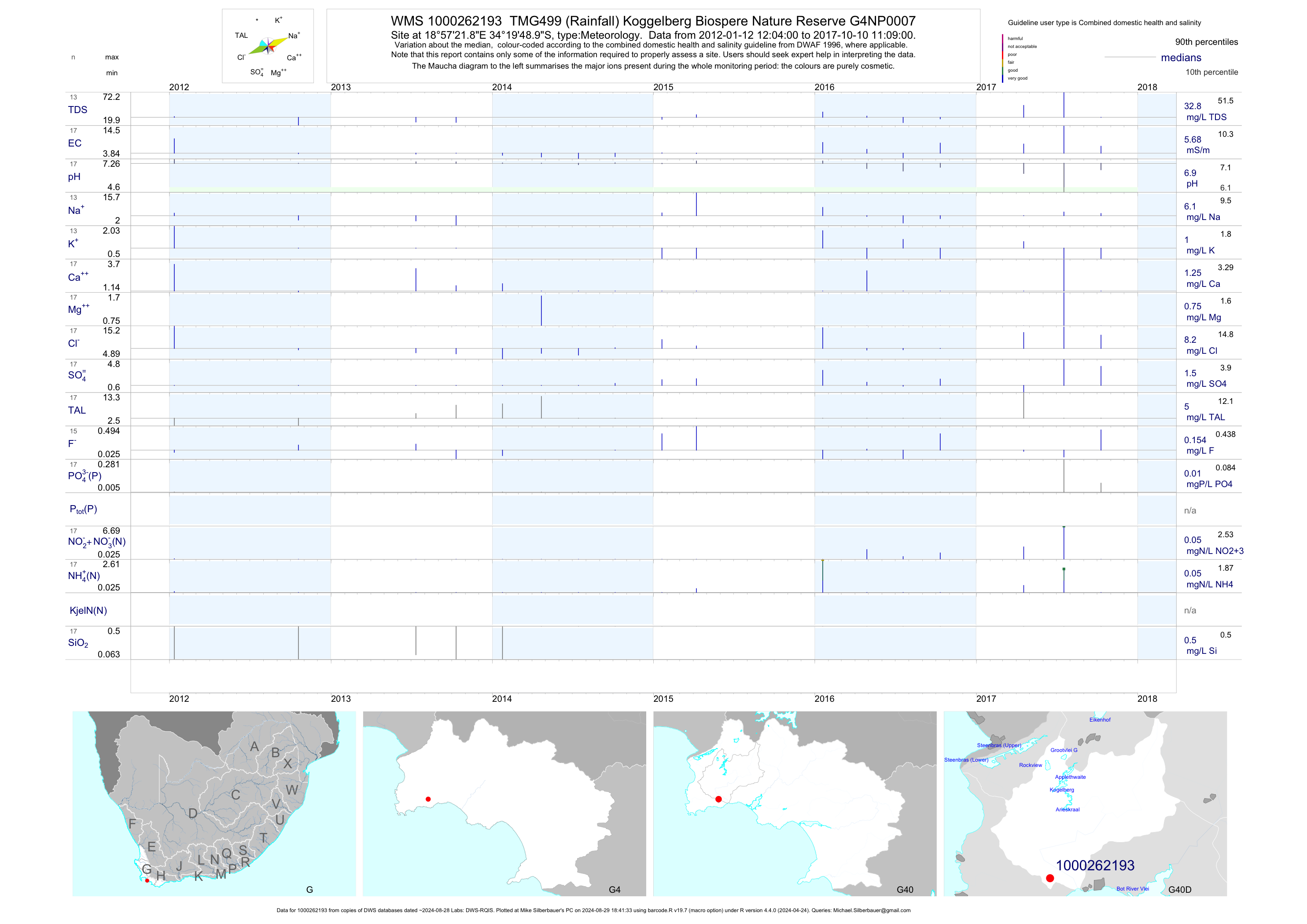
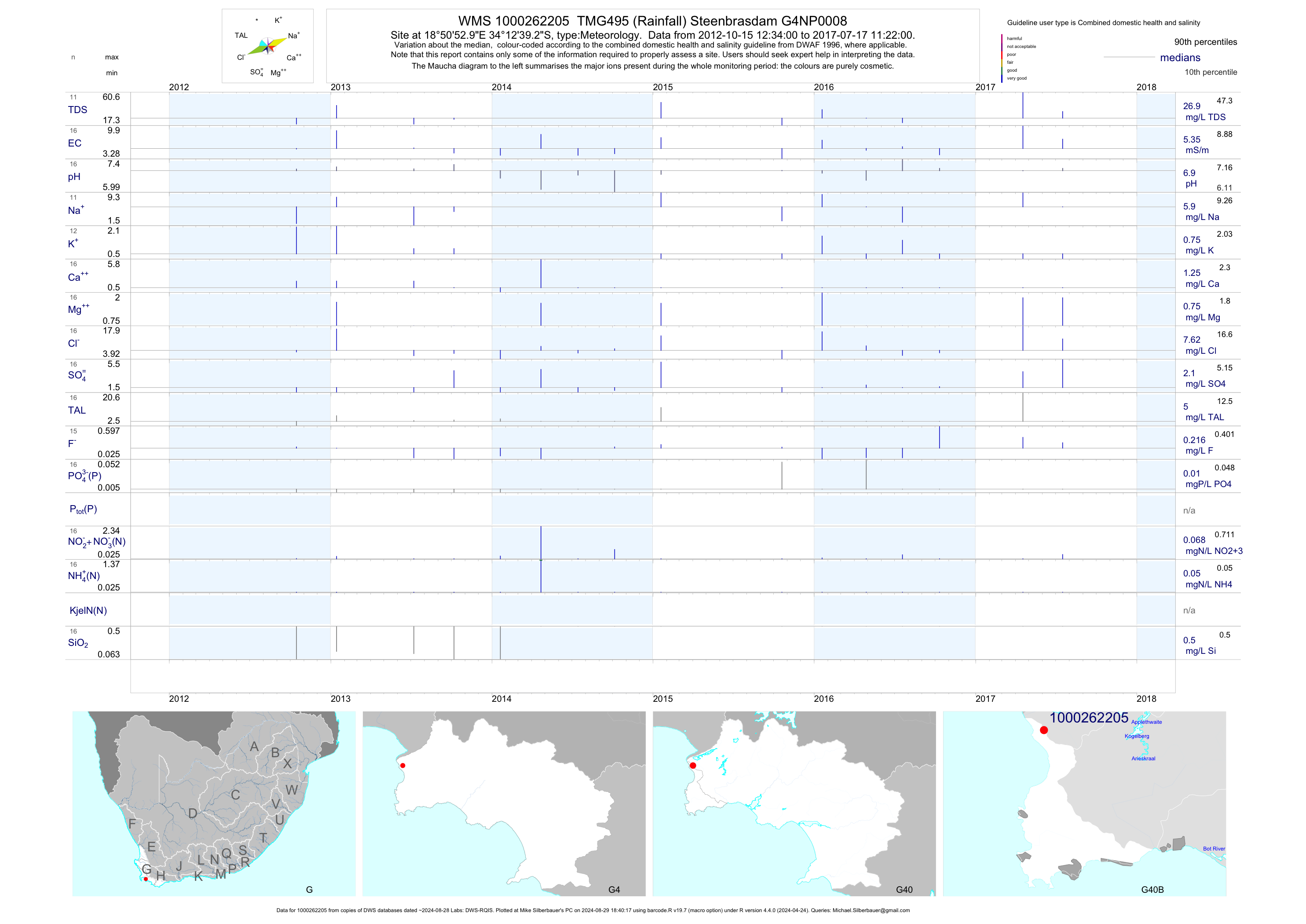
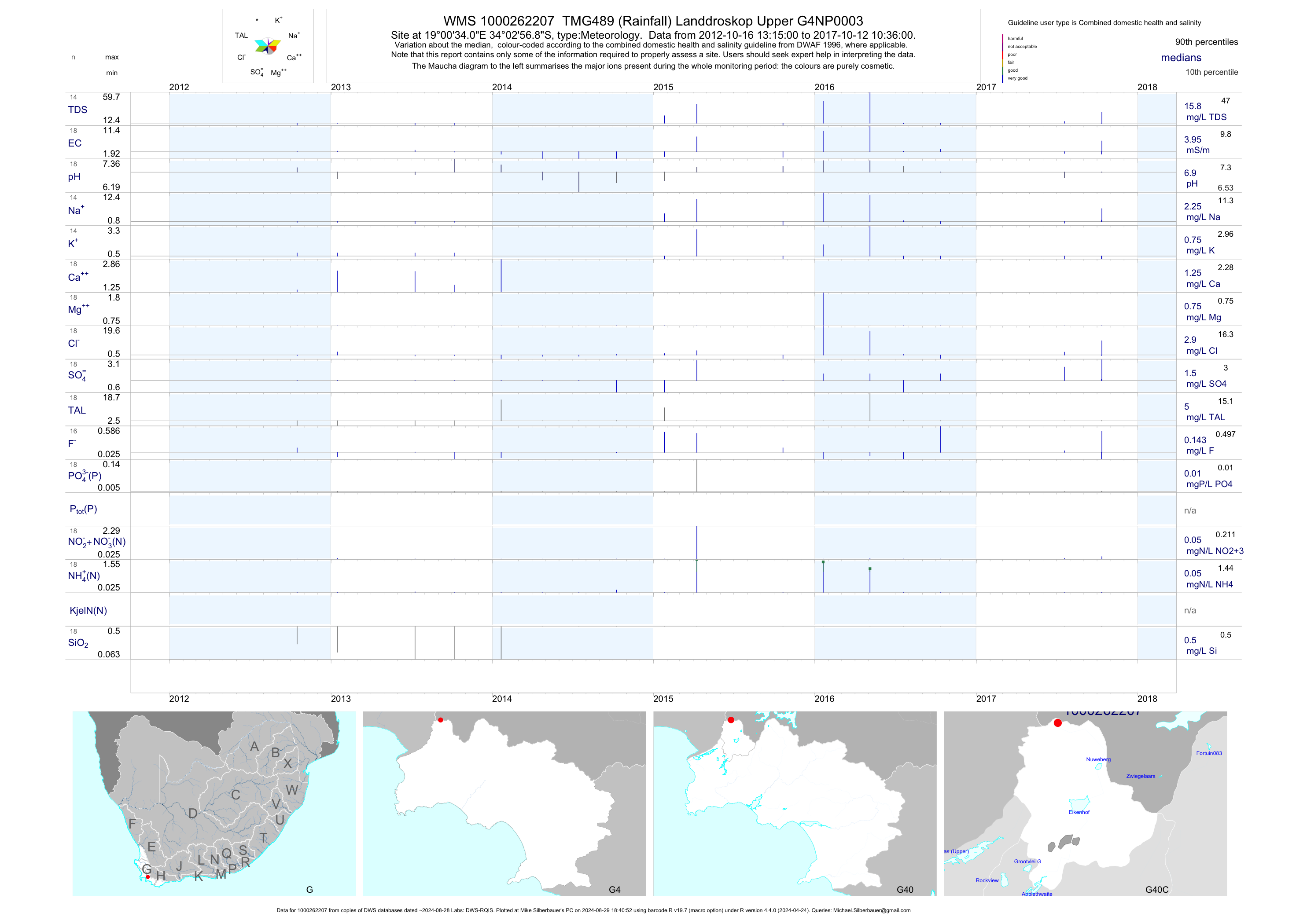
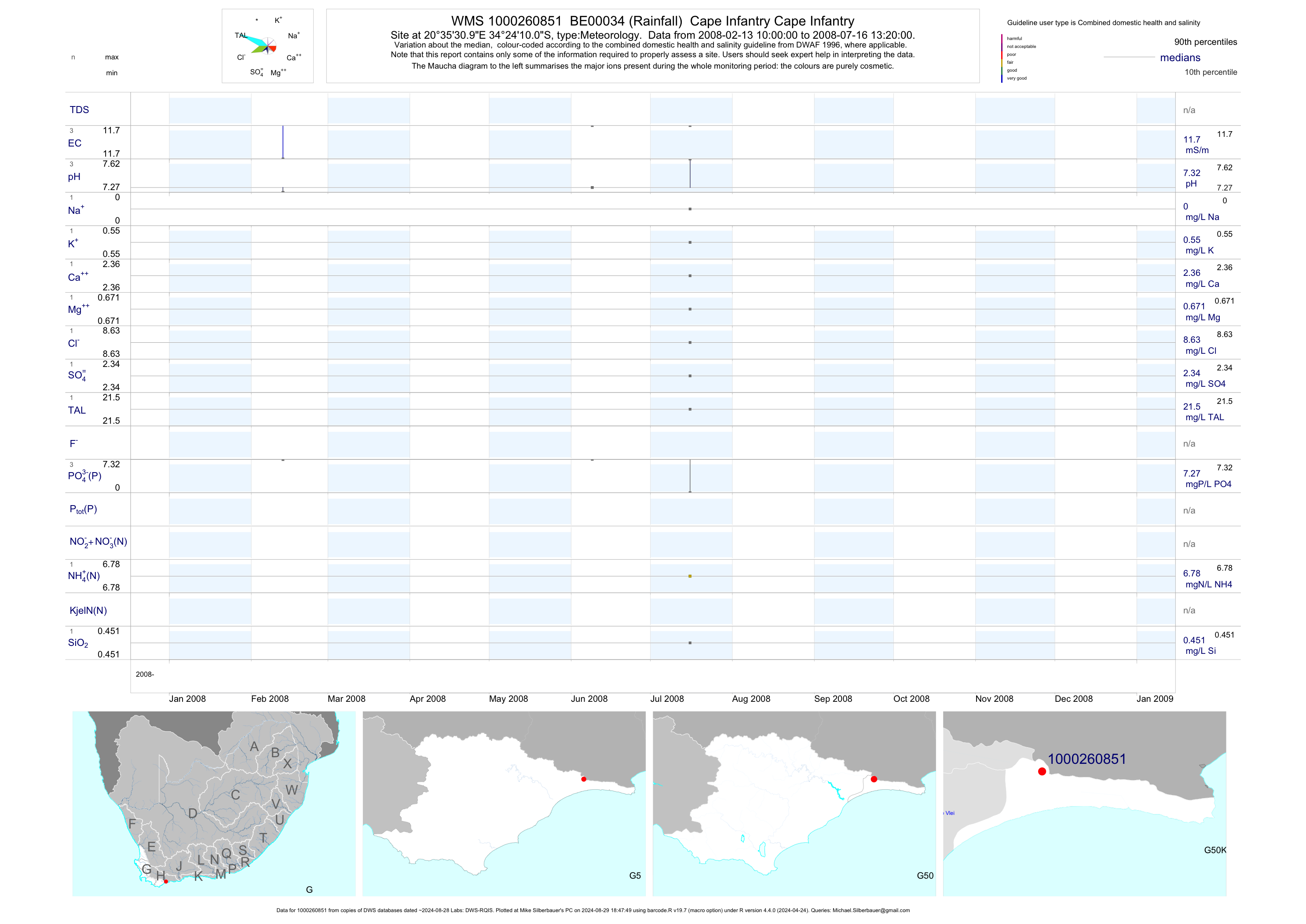
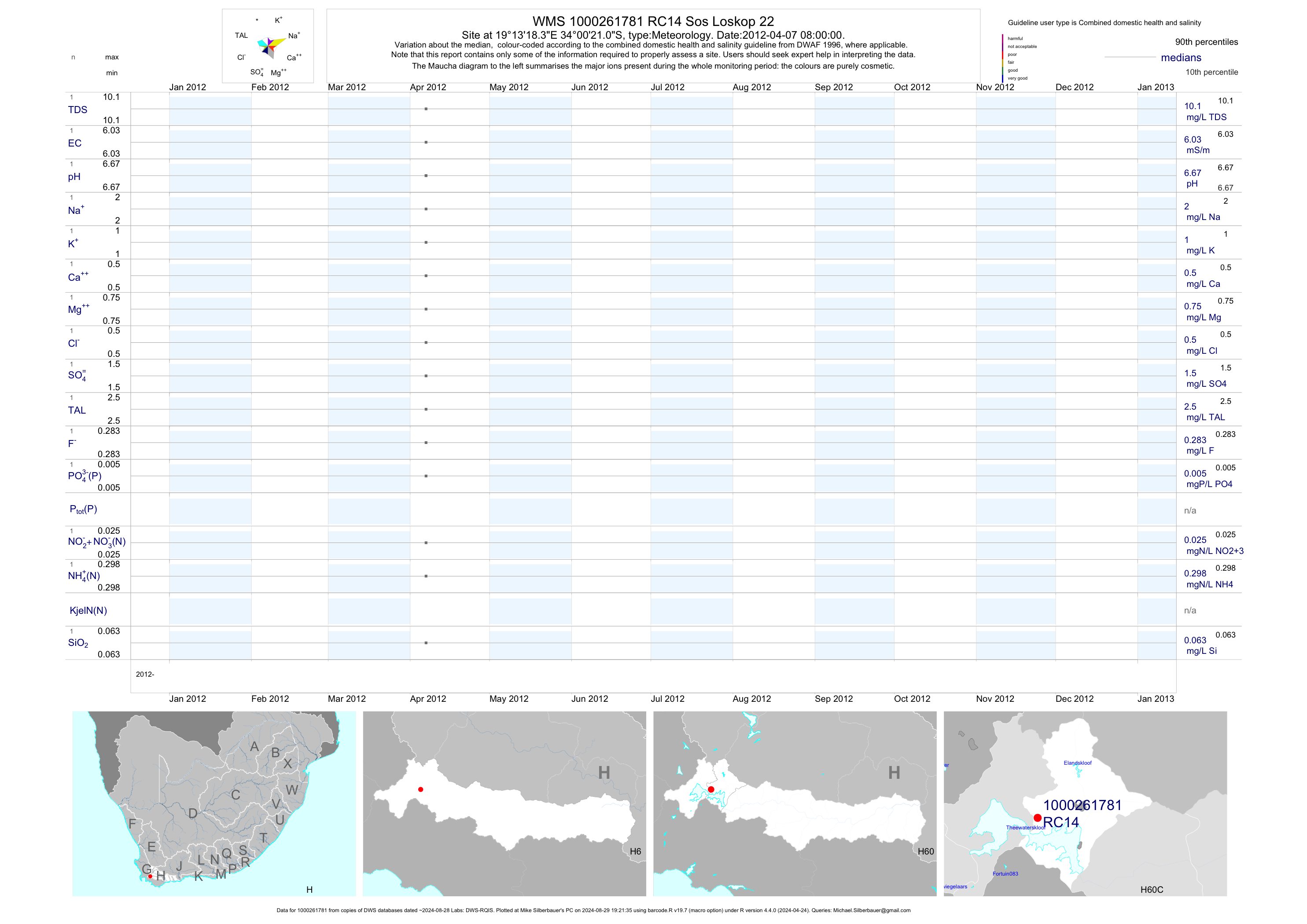
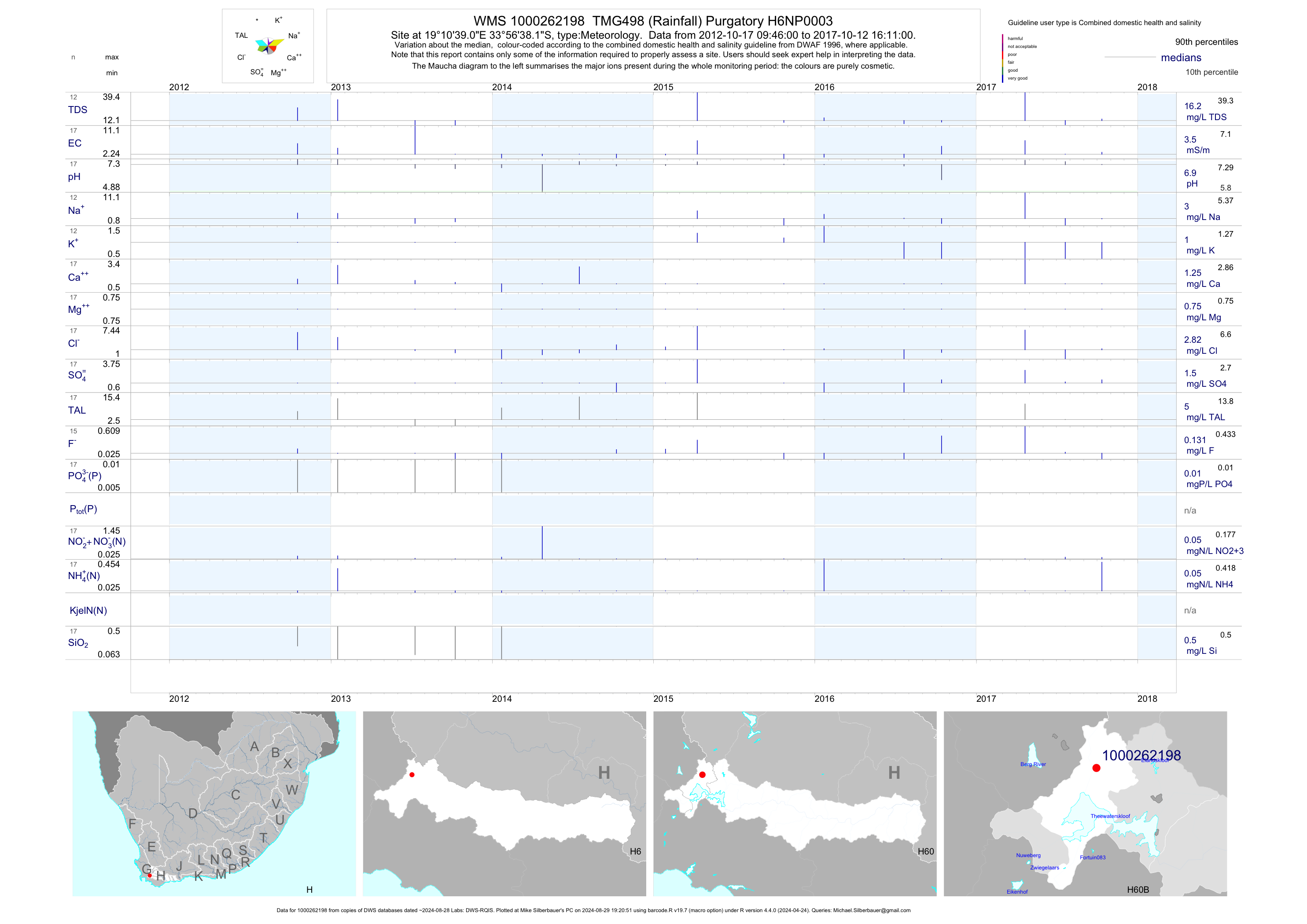
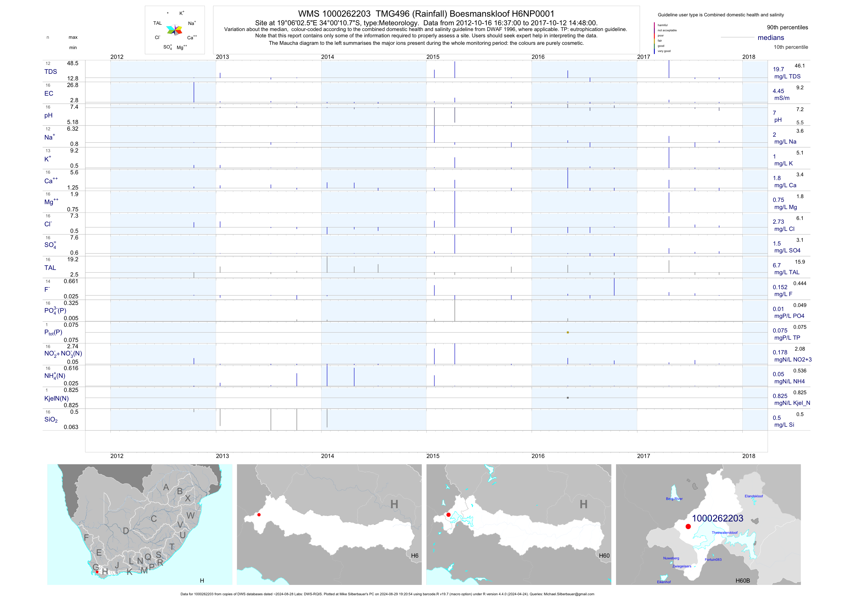
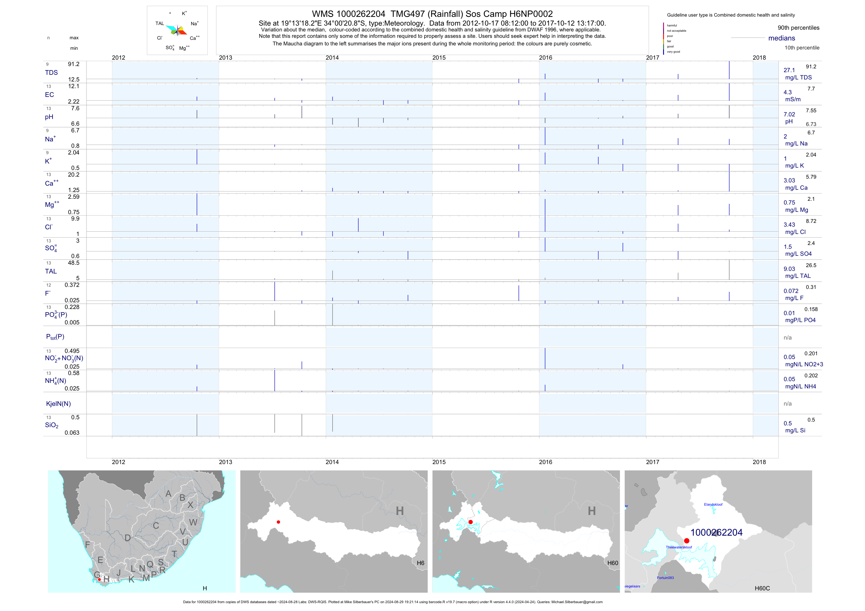
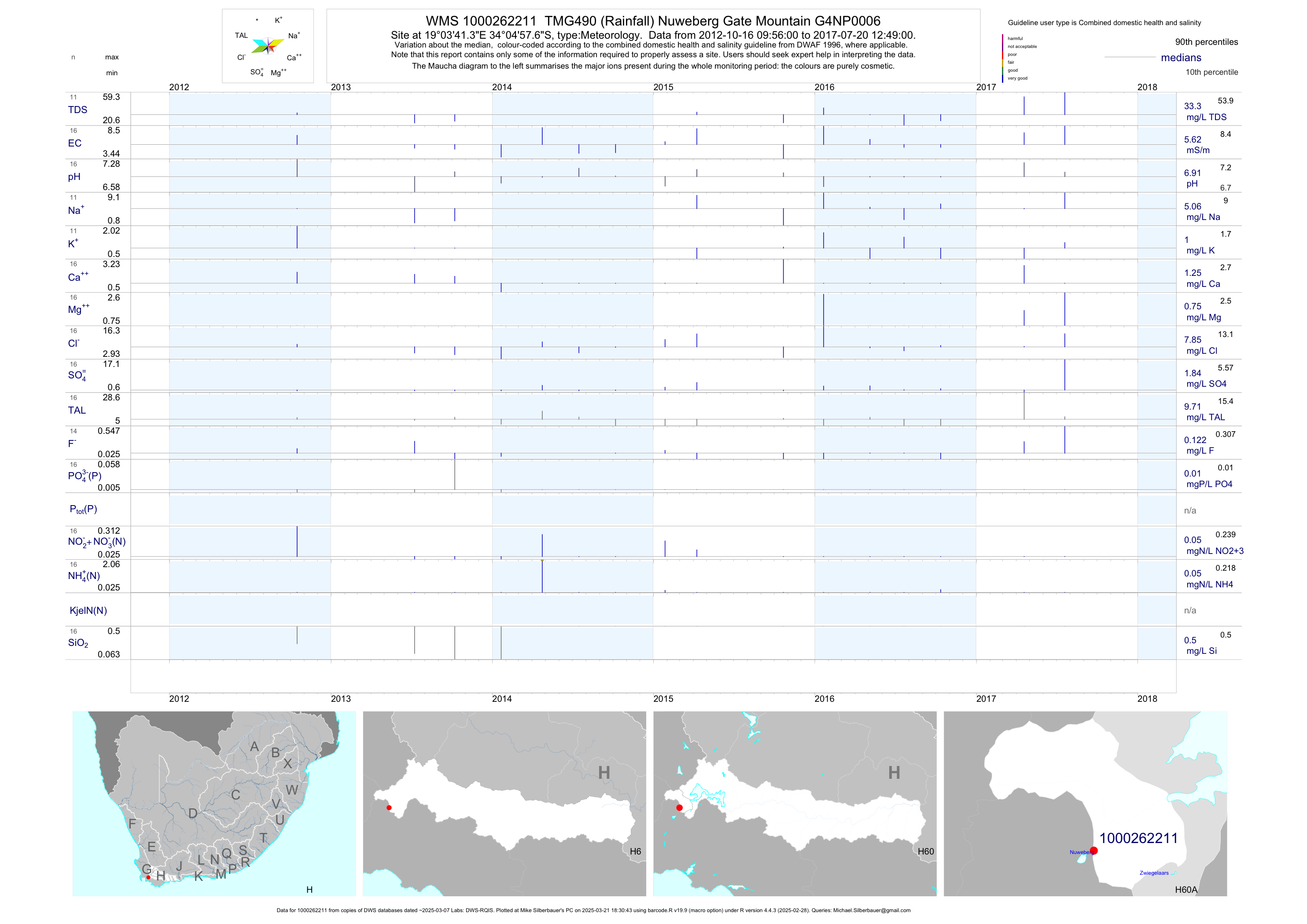