|
|
| RHP |
South African
River Health Programme
|
State of the Rivers Report
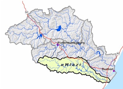
uMngeni River and Neighbouring Rivers and Streams
|
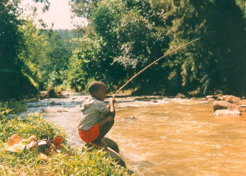
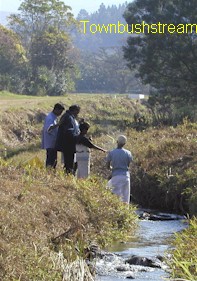
 Boys fishing in the river
 |
| WHY IS IT IMPORTANT TO KNOW ABOUT RIVER HEALTH? |
|
|
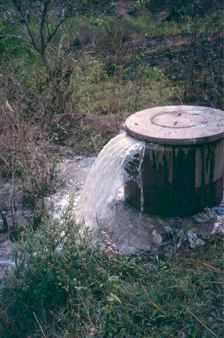
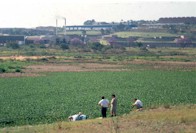
People need rivers. Human and economic well-being are directly or indirectly dependent on the goods and services provided by river systems. For example, we obtain drinking water and water for irrigating crops from rivers, we may fish, harvest reeds, have picnics on the riverbanks or perform baptisms in the river pools. Some goods and services provided by rivers are important for human survival, such as water for drinking and subsistence fishing. Other uses of goods and services support social needs (e.g. recreation, such as swimming) and economic growth (e.g. agricultural and industrial production).
Some goods and services may be lost, or reduced in diversity, quality and/or quantity, when a river system is impaired. The sustained use of a range of goods and services is therefore, directly dependent on the ecological health of the river. (The term "river health" simply refers to the condition of a river, in the same way as health would refer to the condition of a person or an economy). In order to protect our ability to use and benefit from river goods and services over the long term, we must look after the health of our rivers and their ability to provide these goods and services.
Why do we need this report?
Information about river health tells us about the range and quality of goods and services that a particular state of the river system can deliver. It also tells us about the sorts of impacts that a river system can absorb. This information helps us to manage our rivers because with an understanding of river health we can set goals and decide on action steps for achieving a desired river state that would ensure the provision of a preferred range and quality of goods and services. River health information collected over a period of time also allows us to track changes in river health and therefore our progress towards (or away from) a defined goal.
Why be involved?
Many aspects of our survival and economic growth are critically affected, directly or indirectly, by the health of our rivers and by the decisions that change their ability to deliver a range of goods and services. Therefore, the decisions around what we want and need from our rivers and the way we share the benefits, should be made jointly. In order to make informed decisions, we need appropriate and trusted information. It is in the field of river health monitoring and reporting that the River Health Programme contributes to informed decision-making in support of sound river management.
|
| THE RIVER HEALTH PROGRAMME |
|
Background
The Department of Water and Sanitation (DWAF) is the custodian of our country's water resources. This responsibility includes the protection of the ability of river ecosystems to continue to provide goods and services, and in doing so, to protect their use and associated benefits for current and future generations. As a result, DWAF initiated the River Health Programme (RHP) in 1994.
What is the objective of the RHP? This programme is designed to develop a capacity and information base to enable us to report on the ecological state of our rivers, in an objective and scientifically sound manner. At the same, through river health reporting, the programme aims to be explicit in identifying areas of sustainable utilisation and also to flag areas where deterioration of the river system is causing undesirable changes in the delivery of goods and services.
What does the RHP do? The programme generates information which is based on the assessment of the condition od biological communities in and around rivers (such as fish, aquatic invertebrates, riparian vegetation and river habitats). Together, they provide an integrated measure of the health of river systems.
A collaborative venture
The River Health Programme consists of partnerships that are critical for the success of the programme. At the national level, DWAF plays the lead role while the Department of Environmental Affairs and Tourism (DEAT) and the Water Research Commission (WRC) are key partners. RHP activities are co-ordinated at a provincial level where collaboration plays an important role. Each province has a network of implementers who work together, usually under the leadership of a Provincial Champion.
Through actively working together and sharing skills and resources, implementation teams can achieve goals that would not be possible for any one organisation working alone. The implementation team for KZN was elected at an open workshop in 1997. A cross-section of organisations have contributed since then, including the DWAf, the Town and Regional Planning Commission, Umgeni Water, The Umlaas Irrigation Board, Richards Bay Minerals, eThekwini Municipality, Mhlatuze Water, Universities of Zululand and Natal, KZN Wildlife, Farmer Support Group (Ntshogweni Catchment Project), CSIR and Alletson Ecologicals.
Legal Context of the RHP
The equitable, efficient and sustainable use of our water resources is the central objective of South Africa's water policy. The National Water Act (1998) recognises that the best way to achieve this would be to manage aquatic ecosystems (including rivers) at the catchment scale and through joint participation by all interested parties. The RHP supports this management process by providing river health information that will be needed by both managers and the participating public to make decisions.
Although the RHP is not specifically mandated by any South African act or parliament, RHP activities and outputs are strongly aligned with legal requirements: The Water Act requires that the health of aquatic ecosystems is monitored and the RHP monitoring results can in turn, be used to support certain legal principles contained in the National Environmental Management Act (NEMA) and the National Water Act. For example, RHP results can be used to support evidence of environmental degradation. The law also requires that river protection measures should take into account the characteristics of in-stream and riparian vegetation as well as the characteristics and distribution of aquatic plants and animals.
|
|
The RHP also supports the NEMA which is largely concerned with governing the sustainable use of the environment and the protection of ecosystems (including rivers). The act calls for information about the current state of ecosystems as well as changes in state over time, indicating where environmental impacts are occurring and providing guidance for the planning future developments.
|

Sampling in the river
|
|
Many factors influence the health of a river ecosystem: viz. geomorphological characteristics, hydrological and hydraullic processes, chemical and physical water quality and the nature of instream and riparian habitats. Measuring each of these in detail would be impractical. The RHP therefore focuses on selected ecological indicator groups that are representative of the larger ecosystem and are feasible to measure. In this way, complex data, collected for each indicator group, can be summarised and expressed in a format that is easy to understand. The following indices were used to assess the health of the uMngeni and neighbouring rivers:
|

|
WATER QUALITY INDEX - The index is based on data collected by Umgeni Water and eThekwini Municipality as part of their routine monitoring programmes. The index combines a range of water quality variables that are the most useful for indicating deteriorating water quality, and which indicate most clearly the potential for obtaining goods and services from this water. Variables included in this index are E. coli (indicating degree of faecal contamination), turbidity, conductivity, nitrate, ammonia, total and soluble forms of phosphorus, suspended solids and total organic carbon.
|

|
INDEX OF HABITAT INTEGRITY (IHI) Habitat availability and diversity are major determinants of the suite of fuana and flora found in a specific ecosystem. Therefore, knowledge of the quality of habitats is very important in an overall assessment of ecosystem health. The IHI is designed to assess the impact of major disturbances on river ecosystems. Disturbances include water abstraction, flow regulation and river channel modification. The index accounts for both the condition of the riparian zone and instream habitats.
|

|
Riparian zone - This provides habitat for aquatic and terrestrial species, contributes towards maintaining the form of the river channel and serves as filters for sediment, nutrient and light. The structure and function of riparian vegetation are altered with vegetation removal, cultivation, construction, inundation, erosion, sedimentation and invasion by alien vegetation within or close to the riparian zone.
|
|
|
Instream habitat - This will vary depending on the substrate, with awide diversity of organisms, although some rivers are naturally poor in habitat diversity. Disturbances include excessive sedimentation or scouring of the river bottom, alteration of the water quality by the addition of contaminants, and changes in the natural flow regime of the river due to the presence of dams and/or major abstractions.
|
|
The IHI assessment of the uMngeni catchment was not conducted using the full method due to cost constraints. The method used was a "desktop" method that made use of expert local knowledge to answer a range of questions forming a matrix, from which the IHI score was derived.
|

|
SOUTH AFRICAN SCORING SYSTEM (SASS) - index for aquatic invertebrates - A variety of invertebrate organisms (e.g. insect larvae, snails, crabs, worms) require specific aquatic habitat types and water quality conditions for at least part of their life cycle. Changes in the composition and structure of aquatic invertebrate communities are signs of change in overall river condition. As most invertebrates are relatively short-lived and remain in one area during their aquatic life phase, they are particularly good indicators of localised conditions in a river over the short term (months). The SASS is a relatively simple index that is based on the families of aquatic invertebrates present at a site.
|

|
FISH ASSEMBLAGE INTEGRITY INDEX (FAII) - Fish, being relatively long-lived and mobile, are good indicators of long term influences on a river reach and the general habitat conditions within the reach.The number of species of fish that occur in a specific reach, their sensitivity to various forms of disturbances as well as factors such as different size classes and the condition of fish, can be used as indicators of river health. The FAII integrates such characteristics of a fish assemblage. The output of the FAII is an expression of the degree to which a fish assemblage deviates from what would have been expected in the absence of human impacts.
|
|
Fish data for the uMngeni catchment were unfortunately not in a format that could be used for the proper implementation of the FAII and no monitoring programmes have yet been implemented for fish assessment in the catchment. As a result, a simpler method had to be used. This "bench-top" method assessed existing (historical) knowledge of the diversity of species and fish habitats, the presence of important or rare species, in a matrix that gave an overall score. The information used was not always current, so recent changes in fish population may have been missed.
|
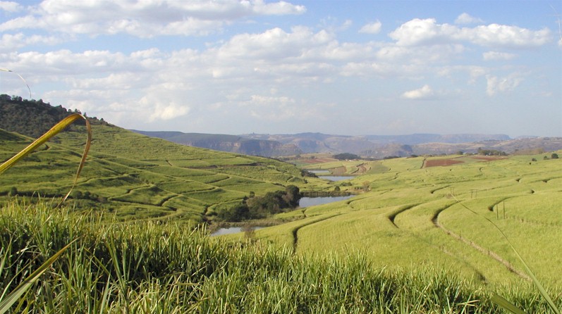
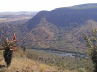
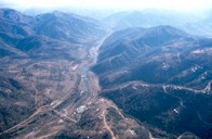
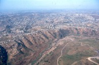
Valley of a Thousand Hills

|
| RIVER HEALTH CLASSIFICATION |
|
| Once river health indices are measured, they need to be interpreted within a framework that allows us to compare the health of one monitoring site (or river system) with another. An ecoregion classification system was used to delineate ecological boundaries that allow us to assess the health of the uMngeni and uMlazi Rivers.
Ecoregions are regions of broad ecological similarity. In other words, rivers that occur within a particular ecoregion will be more similar to each other than to rivers in other ecoregions. For example, the Midmar Dam resources unit in this report (p.14) is divided into two regions, an upper and lower. These are two distinct ecoregions. Variation in natural characteristics such as, climate, geology, physiography and vegetation as well as river habitat and the distribution of biota, was used to delineate the ecoregions. Because they present units of ecological similarity, ecoregions provide convenient boundaries within which to do ecological assessments and to set goals for an improved state of the river ecosystem.
|
River Health Classes
The results that are obtained by applying the biological and habitat indices during a river survey provide the information for determining the health of the river. In order to standardise the output of the different indices as well as to allow comparison of the health of different river systems, a river health classification is used. Each index is calibrated so that its results can be expressed as a river health class.
River health classes can be expressed in terms of ecological and management perspectives.
Each of the river health classes is associated with a level of ecosystem health, and the potential to offer a particular range of goods and services. For example, a section of river in Natural Class may be most suitable for conservation and tourism, and even though it could be used for agriculture, the socio-economic returns on the latter activity might be much smaller compared to the conservation and tourism option. Similarly, a choice could be made whether to use a Good Class river as a source of drinking water, or for agriculture, or for tourism, or some combination of these. A river in the Fair Class may have lost its capacity to serve some of these potential users. An example may be a river that contains salt pollution as a result of providing service to industry. This river would no longer be ideal for use by agriculture, but this may be considered as acceptable from management point of view. In the Poor Class, a river's ability to provide a wide range of goods and services to a range of users is severely compromised. For example, while highly polluted river continues to provide a service to industry in getting rid of its waste, the detrimental effects of this pollution to others may be unacceptable.
|
|
RIVER HEALTH CLASS
|
ECOLOGICAL PERSPECTIVE
|
MANAGEMENT PERSPECTIVE
|
|
Natural
|
No or negligible modification of in-stream and riparian habitats and biota.
|
Protected rivers, relatively untouched by human hands; no discharge or impoundments allowed.
|
|
Good
|
Ecosystems essentially in good state; biodiversity largely intact.
|
Some human-related disturbance but mostly of low impact potential.
|
|
Fair
|
Sensitive species may be lost; lower abundances of biological populations are likely to occur, or sometimes, higher abundances of tolerant or opportunistic species occur.
|
Multiple disturbances associated with need for socio-economic development, e.g. impoundment, habitat modification and water quality degradation.
|
|
Poor
|
Habitat diversity and availability have declined; mostly only tolerant species present, species present are often diseased; population dynamics have been disrupted (e.g. biota can no longer reproduce or alien species have invaded the ecosystem).
|
Often characterised by high human densities or extensive resource exploitation. Management intervention is needed to improve river health - e.g. to restore flow patterns, river habitats or water quality
|
| STATE-OF-RIVERS (SoR) REPORTING |
|
|
State of the Environment (SoE) reporting, led by DEAT, has developed over the past decade in response to a need for appropriate information to assist with environmental decision-making. The national SoE for South Africa uses the Driving Force-Pressure-State-Impact-Response framework to explain what is causing environmental change, how good or bad the conditions are and what we can and are doing about it.
In response to the need for improved environmental reporting, this State-of-Rivers (SoR) report, the third one of a series, is designed to
assist ecologically sound management of the uMngeni and its neighbouring rivers, so that these rivers can deliver an optimal range of goods and services to people, and
inform and educate the people of South Africa about the state of health of these rivers and the importance of ensuring sustained benefits from them through wise management.
|
Upper uMngeni River
|
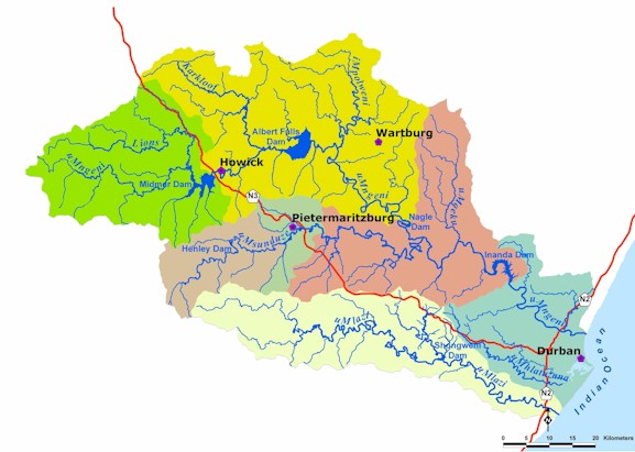
UMNGENI AND NEIGHBOURING CATCHMENT ECOREGIONS
|
|
An ecoregion is an area of ecological similarity. This categorisation of rivers is used to make meaningful comparisons between river health scores. Ideally, river sites within one ecoregion will be ecologically similar.
|
|
Move the cursor on the map to locate the ecoregions. Click on the ecoregion of your choice to link to information related to that it.
|
|
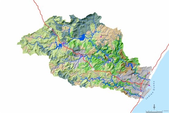
CATCHMENT STATISTICS
uMngeni catchment size:
441km2, river length 225km from source to mouth;
uMsunduze catchment size:
875km2, tributary length 115km
uMlazi catchment size:
970km2, river length 172km
Mean annual precipitation (MAP):
uMngeni: 410 - 1 450mm
uMlazi: 410 - 1 100mm
Mean annual runoff (MAR):
uMngeni: 72 - 680mm
uMlazi: 72 - 173mm
Mean annual evaporation (MAE):
uMngeni: 1 360 - 2 040mm
uMlazi: 1 070 - 1 360mm
Rainfall strongly seasonal with > 80% falling between October and March.
|
|
MIDLAND MOUNTAIN STREAMS:
Veld type: Dominated by (75%) highland sourveld and transition to Cymbopogon-Themeda veld
Terrain: 29% high mountains, with a mix of low mountains, undulating hills and lowlands
Geology: 46% dolerite, 38% shales, siltstones & sandstones
Soil: 55% well-drained soils, 33% shallow soils on weathering rock
Average altitude: 1 600m
Average air temperature: 15°C
MAP: 720mm
MAR: 195mm
|
|
|
MIDLAND FOOTHILL STREAMS:
Veld type: 41% Ngongoni veld of Natal mist-belt with 30% highland sourveld and Dohne sourveld
Terrain: Low mountains (41%)and undulating hills and lowlands (40%)
Geology: 42% shales and siltstones with 35% dolerite & 16% sandstones
Soil: 64% well-drained soils, 25% shallow soils on weathering rock
Average altitude: 1 200m
Average air temperature: 15°C
MAP: 930mm
MAR: 175mm
|
SAVANNAH STREAMS:
Veld type: Dominated by (66%) Ngongoni veld, with 13% Ngongoni veld of Natal mist-belt and 12% Pondoland coastal plateau sourveld
Terrain: A mix of highly dissected undulating mountains, low mountains, undulating hills and lowlands
Geology: 36% shales and siltstones, 21% Natal red-brown sandstones
Soil: 42% well-drained soils, shallow (30%) and poorly drained soils (20%)
Average altitude: 650m
Average air temperature: 18°C
MAP: 890mm
MAR: 100mm
|

|
|
VALLEY BUSHVELD STREAMS:
Veld type: 99% valley bushveld
Terrain: Low mountains (39%) with 27% mountains, and lowlands
Geology: 30% granites, 23% Natal red-brown sandstones
Soil: 33% shallow soils on weathering rock, 42% well-drained soils
Average altitude: 700m
Average air temperature: 20°C
MAP: 720mm
MAR: 95mm
|
SANDY LOWLAND STREAMS:
Veld type: 98% coastal forest and thornveld
Terrain: dominated by (60%) highly dissected undulating mountains with 21% plains
Geology: 58% Natal red-brown sandstones, 24% granites and shales
Soil: 60% shallow soils on weathering rock
Average altitude: < 200m
Average air temperature: 20°C
MAP: 940mm
MAR: 200mm
|
|
|
COASTAL BELT STREAMS:
Veld type: 91% coastal forest and thornveld
Terrain: Plains
Geology: 56% Berea red sands, 39% beach sands
Soil: 55% shallow soils on weathering rock, 25% well-drained soils
Average altitude: < 200m
Average air temperature: 20°C
MAP: 890mm
MAR: 120mm
|
|
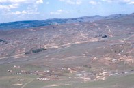
OVERVIEW OF THE STUDY AREA
|
|
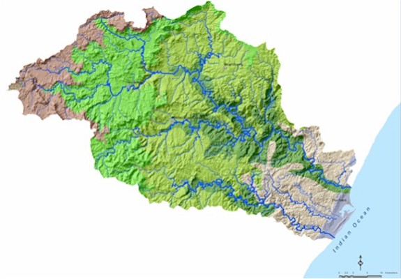
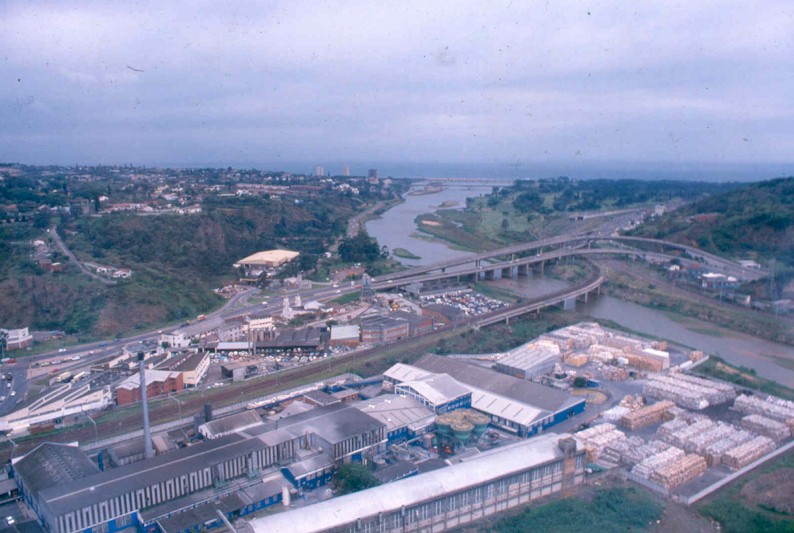
The uMngeni and neighbouring catchments form a region of widely varying land uses. These range from conserved natural areas to areas of intense urban and industrial development. The region is one of major economic, cultural and ecological importance and careful planning is necessary if all these needs and actvities are to be sustainable.
|
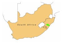
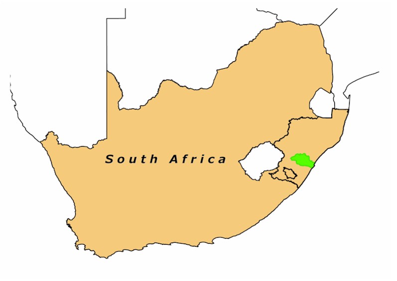
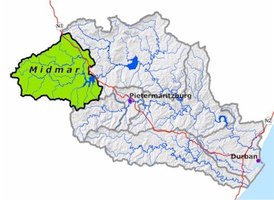
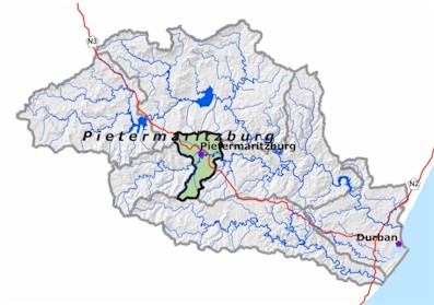
Study area highlighted in lime
|
|
ECONOMIC AND SOCIAL PROFILE
The economic information here is based on the uMvoti to uMzimkulu Water Management Area (WMA), which includes the study area. The Gross Geographic Product (GGP) of the WMA was R26 billion in 1997 (nearly 15% of the SA GGP). The Durban and Pietermaritzburg magisterial districts contributed 57.5% and 11.7% to this figure respectively.
|
Grasslands: 32% of catchment
|
Thicket & Bushland: 17% of catchment
|
Past economic growth:
(1988 - 1997) was most notable in the electricity, trade, community services and agricultural sectors.
Current growth:
Largest contributors to GGP are manufacturing (e.g. metals, machinery, leather, food and paper), trade, government and finance.
|
Future growth:
The trade and manufacturing sectors are likely to show the most significant future growth. The informal economic sector is becoming an increasingly important contributor.
|
Cultivated crops and pastures:
18% of catchment
|
Forestry plantations: 17% of catchment
|
Total population: uMngeni catchment: 1 753 400; uMlazi catchment: 812 700
Population distribution and density: mostly < 2500 people per km2, with very dense populations (between 5000 and over 20 000 people per km2) in the Durban, Pietermaritzburg and Chatsworth areas
|
|
Population: 64% Black, 17% Asian, 16% White, 3% Coloured
Language: approximately 76% Zulu, 24 % English
Average Annual income per person is R15 100
Rate of unemployment is 27.9% (national average is 29.3%)
|
Degraded land: 3% of catchment
|
Urban (Springfield Flats):
12% of catchment
|
56.8% of the population is active in the formal economy
Sanitation: 63% of households have piped water
Poverty index (uMngeni catchment) is 0.23 (compared to 0.37 of the WMA), based on economic activity, literacy and service provision criteria
|
|
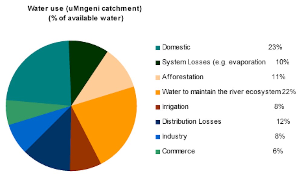
Water demand in the uMngeni catchment has outstripped the river's ability to supply. Without current additional water transferred from the Mooi River to Midmar dam, the economy of the area would be compromised. Despite effective water demand management, increased future demand is expected and further water import from the uMkhomazi River is being considered. The value and use of other river services (besides water availability) have not been quantified.
|
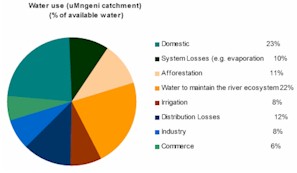
Water use in the uMngeni catchment
|
HOW TO READ THIS REPORT
|
|
The river health information for the uMngeni and neighbouring rivers was organised into seven resources units for reporting purposes.
|
|
A resource unit is a sub-catchment of the larger study area that was chosen as a unit of reporting partly because it is a sensible goegraphic unit for river management, but also because people can relate to sub-catchments (often associated with dams) much better thatn to ecoregions, which are used by ecologists and managers to make ecological assessments. The uMngeni catchment was divided into six resource units, with several corresponding to the drainage areas of the major dams, while the uMlazi catchment forms a resource unit on its own. Resource unit nformation pages are followed by a summary and overviews of river issues of particular interest in these catchments.
|
|
Move the cursor on the map to locate the resource units. Click on the resource unit of your choice to link to further information related to it.
|
|
|
Each page that deals with a particular resource unit shows the same type of information, i.e.an introduction to the resource unit, the present health, driver of river health, a summary of goods and services derived from the river system and the key management actions that are needed to improve river health in the particular resource unit. Topics of particular interest in any one resource unit are also highlighted and these may deal with drivers, impacts, river goods and services or management reponses.
Information was chosen deliberately. National guidelines require that we report on the present health, the drivers of present health and the actions we plan to perform in order to improve river health. But, the report also addresses river goods and services so that we are able to link the types of benefits we derive from rivers with changes to their ecological state, and the way in which we manage these.
The present health is a measure of the current ecological state of the river and it reflects the response of the river to all the natural as well as human induced disturbances that have taken place prior to the survey. In this report, different aspects of the current state of the river (condition of fish population, habitat quality, etc.) are shown by means of icons and these are based on river health data collected over the last decade.
Pressure and driving forces. Pressures are those fators that have an impact on the health of the river, while driving forces refer to human activities which create these pressures. Knowing about the driving forces and pressures on a river provides insight into why the river is in its present health and in turn, help us to decide what actions may improve river health.
Goods and services provided by the rivers refer to the river ecosystem processes and products that sustain and support human life. People benefit from the harvest, use and trade of these goods and services and they form a familiar part of our economy. Some of the goods and services that we get from rivers are water for drinking, cooking, washing, power generation, manufacturing and crop irrigation, food (for example fish and crabs from the river and fruits from the riparian zone), a surface for recreation (and associated tourism), the dilution and processing of pollutants and the provision of building materials (reeds, wood, staone, sand).
A particular state of the river ecosystem enables us to use a particular range of goods and services provided by the river. The use of goods and services also influences (or drives) the state of the river ecosystems. For example, a factory may use river water as a coolant, but at the same time it may return water to the river with an altered chemistry. This process may affect water quality and make it unsuitable for say, crop irrigation downstream of the factory. Thus, the use of river gooods and services bring costs as well as benefits to different users.
Management actions. These refer to what is currently being done, how people should respond to problems (through changes to management strategies and policy), how to make their response more effective and how to prioritise management actions.
|
MIDMAR RESOURCE UNIT
Upstream of Midmar Dam wall and including the uMngeni and Lions rivers, as well as large wetlands at the headwaters.
|
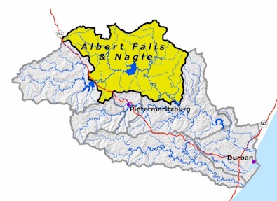
ALBERT FALLS AND NAGLE RESOURCE UNIT
Including the uMngeni River from below Midmar Dam to Nagle Dam, including the Karkloof, and iMpolweni tributarties.
|
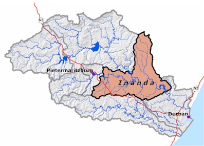
INANDA RESOURCE UNIT
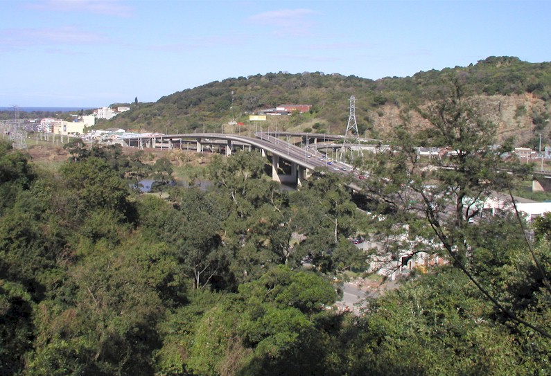
Including the uMngeni River from below Nagle Dam to Inanda and the uMsunduze River below Pietermaritzburg. This unit includes Valley of a Thousand Hills.
|
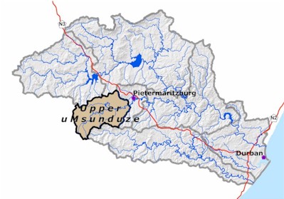
UPPER UMSUNDUZE RESOURCE UNIT
Including the upper reaches of the uMsunduze River.
|
PIETERMARITZBURG RESOURCE UNIT
With the uMsunduze River flowing through Pietermaritzburg.
|
UMLAZI RESOURCE UNIT
From the Midland Foothills to the near Durban airport. This resource unit includes the Sterkspruit and Wekeweke tribitaries.
|
LOWER UMNGENI AND DURBAN RESOURCE UNIT
Including the uMngeni River along the flat coastal plain, the Blue Lagoon estuary and the uMbilo and uMhlatuzana Rivers.
|
|
Move the cursor on the map and click on the specified resource unit to link to further information related it.
|
|
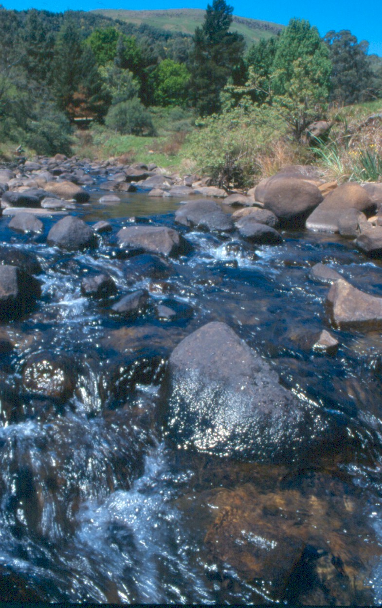
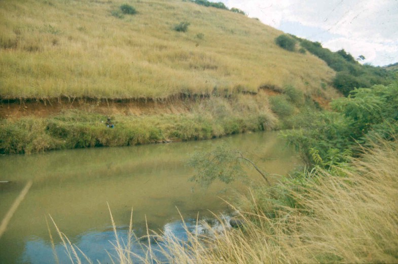
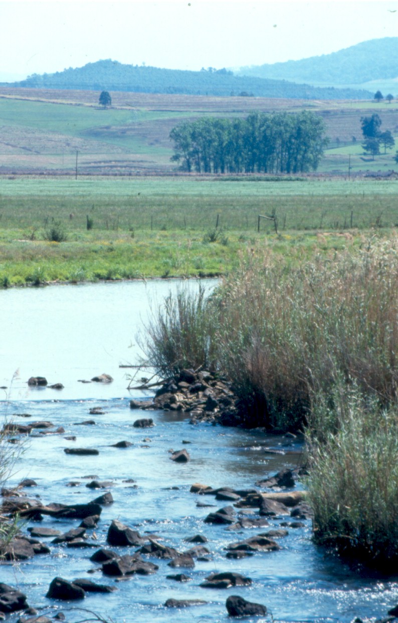
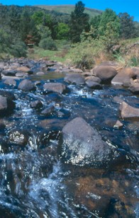
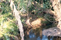
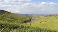
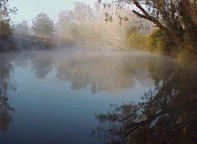
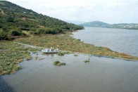
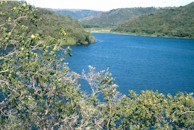
The uMngeni River rises in the uMngeni Vlei area, an ancient wetland surrounded by a rim of hills, at the west end of the catchment 1 760m above sea level. From its source, the uMngeni River flows eastward through rolling pastoral landscape and is joined by the Lions River before flowing into Midmar Dam, a popular sport and recreation resource. The river channel is narrow, overhung by grassed banks, fine-leaved shrubs and occasional trees. River habitats here are predominantly riffles and pools. Cascades are common due to hard dolerite rock. The main land use in this region is forestry and agriculture.
|
uMngeni River just above Midmar
|
|
Water quality in this resource unit is generally Good.
Riparian habitats are degraded by invasive trees such as wattles, gums and pines but are in Good condition.
Instream habitat is Good, although the large number of farm dams have modified water flow, which in turn affects downstream habitats.
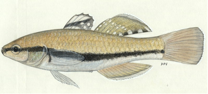
Invertebrate condition appears close to Natural. Fish are in good condition but lower down are only in Fair condition due to the impact of aliens (trout, carp and bass) and invasive indigenous catfish. For most biota the upper reaches of the uMngeni and Lions Rivers are in better condition than downstream towards Midmar Dam.
|
|
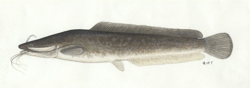
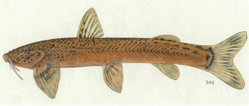
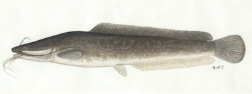
The Sharptooth catfish (barbel) although indigenous to KZN, never originally occurred upstream of Howick Falls. today it is an alien species in Midmar Dam and upstream.
|
|
Damage to wetlands is widespread (see page 15).
Plantation forests contribute to excessive sedimentation and destabilisation of riverbanks. These trees (as well as invasive alien plants) also use a lot of water, over-shade the river and displace indigenous vegetation.
The construction of Midmar Dam transformed what used to be a large natural wetland. There are also numerous farm dams in the catchment. See p. 30 for more detail about the impact of dams on river health.
Agriculture, in particular dairies, piggeries and maize production, impact moderately on river health through excessive nutrient input into rivers.
The interbasin transfer of water from the Mooi River to the uMngeni system is a potential threat to the health of both river systems through flow alteration and genetic mixing of biota.
|
|
This is the main water catchment for the KwaZulu-Natal (KZN) Midlands, providing high quality potable water right down to Kloof and the Inanda valley.
Wetlands contribute to the sustained provision of water through dry periods and even maintained supply during the dry early 1980s and 1990s.
Water is used for pasture irrigation, forestry and other forms of dryland agriculture.
Value of conserving rare and endangered habitats and species, e.g. wattled crane of the uMngeni vlei and the endemic mountain malachite dragonfly. Also present is the rare plant Hydrostachys which grows on waterfalls in this area.
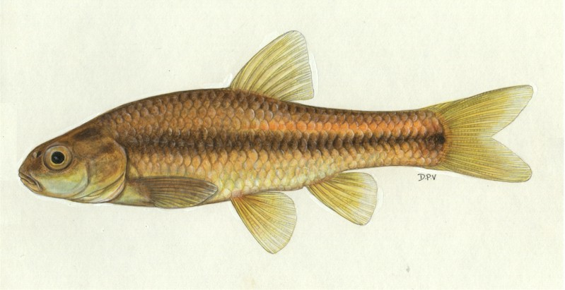
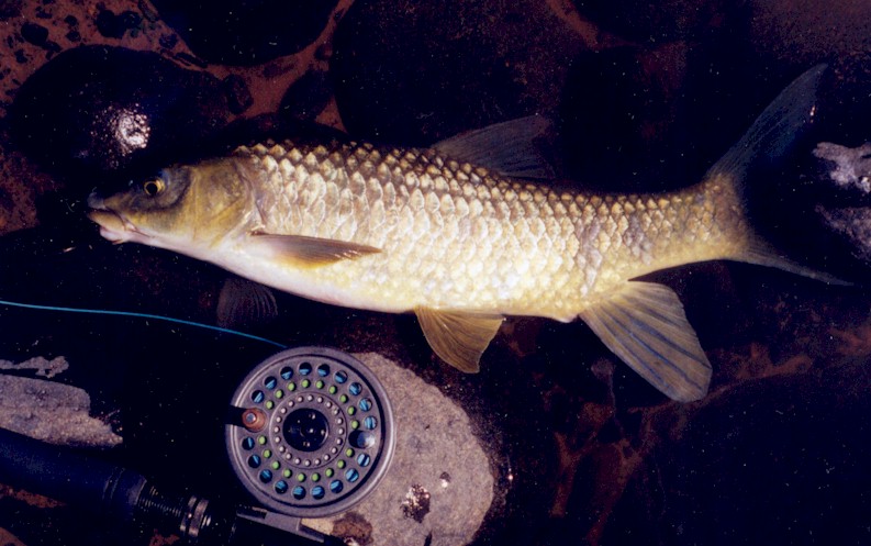
The river and the many dams in the area provide for sport and recreation. Indigenous (the KZN yellowfish is a demon to catch!) and exotic fish e.g. trout in cool headwater streams and dams, are popular catches here. Midmar Dam is a hub for water sports including the famous Midmar Mile that draws thousands of swimmers each year.
|
|
Prevent further loss of wetlands and protect existing wetlands.
Plantation forests should continue to be managed sensitively, and options for new plantings restricted.
Continued alien plant management, in and outside of the riparian zone. Recent improvements in the management of plantations and alien plants by forest companies and Umgeni Water are commendable.
Piggery and dairy effluents and sediment and nutrient loads from lands under maize and pasture should be managed.
Pollution from the growing Mphophomeni settlement requires management.
Water savings through water demand management can be redirected to maintain and improve river health and thus river-based goods and services.
Proper fire management is needed, as excessive burning can negatively affect wetland vegetation, damage mist belt forests and impair the soil's ability to absorb rainwater.
|
| TROUT IN THE UPPER UMNGENI RIVER
|
|
|
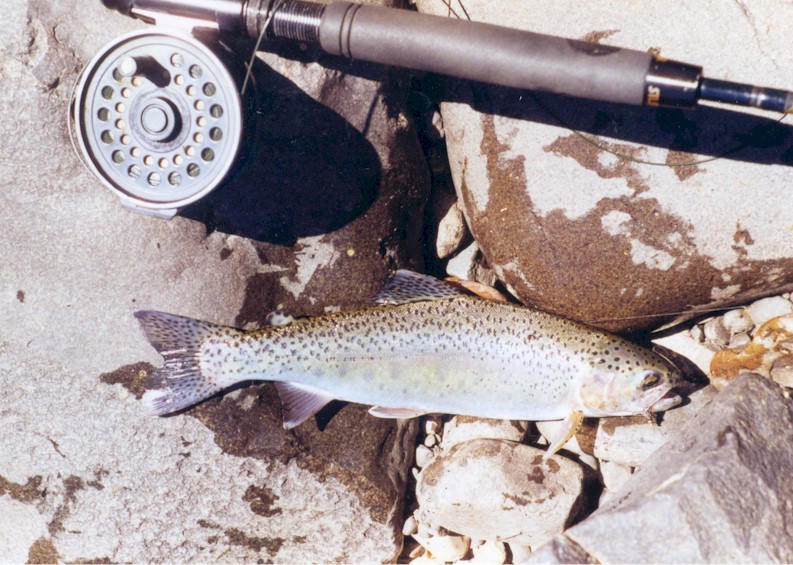
Brown trout (introduced here in 1890) are found in the upper uMngeni River while rainbow trout (used for recreational angling) are found in dams of the upper catchment. Although breeding takes place in some streams where suitable gravel beds exist, reproduction in the streams is limited and populations are generally maintained by the annual introduction of trout reared in hatcheries.
|
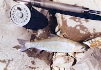
Trout
|
|
Trout, being an alien predator, adds a new component to the aquatic ecosystem. The most obvious impact on the uMngeni resulting from trout angling has been the construction of more farm dams. Trout prey on indigenous animals but the impact appears to be minimal. Frogs are preyed on both as adults and as tadpoles although a large portion of the frog population is inaccessible to fish predators. The indigenous Natal mountain catfish is preyed on by trout but they occur in streams that are too small for trout and their cryptic lifestyle reduce their vulnerability. Crabs and aquatic insects are a notable item in the trout diet. Some species are more subject to predation than others, but anything more than a local reduction in abundance seems unlikely. In the uMngeni River, trout are nowhere present in large numbers and the measurable effect on invertebrate prey is likely to be minimal.
The presence of trout is the subject of an ongoing controversy as many feel that trout have no place in South African rivers.
|
| WETLANDS IN THE UMNGENI CATCHMENT
|
|
uMngeni Vlei
|
Wetlands in this catchment are most abundant upstream of Midmar Dam, and those in the headwaters are known as "the uMngeni sponge". Some of these wetlands are formally conserved (protected by KZN Wildlife) and they are important breeding areas for the threatened wattled crane.
|
|
Many of the catchment's wetlands have been destroyed by human activities and the state of the remaining wetlands varies greatly. Some are in good condition while others are degraded and their original functions impaired. Currently, the most significant threats to wetlands here are cultivation, artificial drainage, dams and urbanization (especially in the Pietermaritzburg and Durban areas), alien plant invasion, overgrazing and too frequent burning. At the highest altitudes, approximately half of the original wetland area has been lost, while below this the loss has been greater than 60%.
The continued loss and degradation of uMngeni wetlands is serious given their positive impact on river health by purifying water, controlling erosion and regulating water flow through the catchment.
Forestry companies in the area are contributing to wetland restoration by removing exotic forest trees planted within wetland areas in the catchment.
|
|
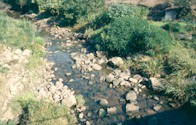
A study by Umgeni Water in the iMpofana catchment (below Michaelhouse School) showed how effective the removal of alien vegetation is in improving water yield. Thus, leaving these trees to grow and spread would cause a substantial decline in future water yield.
|

Alien plant removal along
iMpofana River
|
Alien plant removal along
iMpofana River
|
Alien plants require ongoing management but their removal is cheaper than investing capital in infrastructure such as pumping schemes or new dams. There are also numerous other benefits. Since the project started in 1999, it has provided income to more than 160 rural families and has been used as a vehicle to educate children about environmental concerns. Trade has also been generated through new micro-enterprises such as fire-wood and charcoal production. Other benefits include reduced soil erosion by improving indigenous vegetation cover, improving the status of wetlands and increasing the area for stock grazing.
|
|
Since the start of this project, the Department of Agriculture has grouped alien invasive plants according to their potential impact. For example, a Category 2 invader such as black wattle, may only be grown under controlled circumstances.
|
ALBERT FALLS RESOURCE UNIT
|
|
Move the cursor on the map and click on the specified resource unit to link to further information related it.
|
|
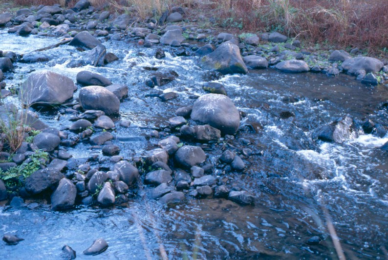
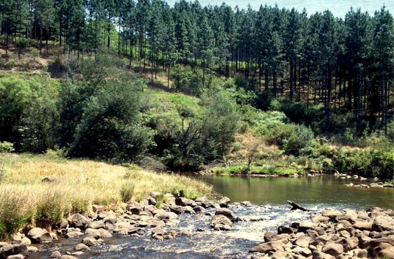
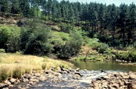
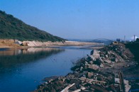
uMngeni River between Albert
Falls and Nagle Dams
|
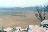
Below Midmar Dam, the uMngeni plunges over the 111m high Howick Falls and into the uMngeni Valley where remnants of Midland forest can be seen. The Karkloof tributary then joins before the uMngeni flows into Albert Falls Dam. Approaching Albert Falls, the uMngeni meanders through grassed farmland, where the riverbanks are treeless or invaded by woody alien plants. Below the Albert Falls, the river traverses deeply dissected terrain, which forms the western edge of the Valley of a Thousand Hills. At Nagle Dam, the river is still at a high elevation (400m above sea level) despite being a mere 50km from the coast. The main land use types here are forestry in the west and north and cultivated land, especially sugar cane, and feedlots in the Wartburg area. A large part of the area is hot, dry valley bushveld used for subsistence agriculture. The population of the area is 68 900.
|
|
Water quality in this resource unit is Good although only Fair at iMpolweni River.
Riparian habitat in the upper reaches is badly affected by agriculture and forestry although better in the Umgeni Valley Nature Reserve. In the lower bushveld reaches, riparian habitat is Good despite vegetation encroachment into the river channel.
Instream habitat of the Karkloof River is Good and even Natural in the lower reaches. In the uMngeni River, the influence of dams (altered flow pattern and water quality) is noticeable and instream habitat here is only Fair.
Invertebrates of the uMngeni and Karkloof are in Good condition and even Natural in the lower reaches of the latter.
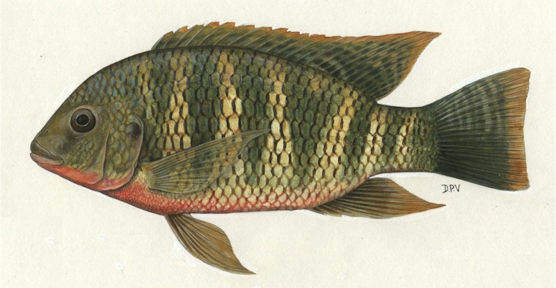
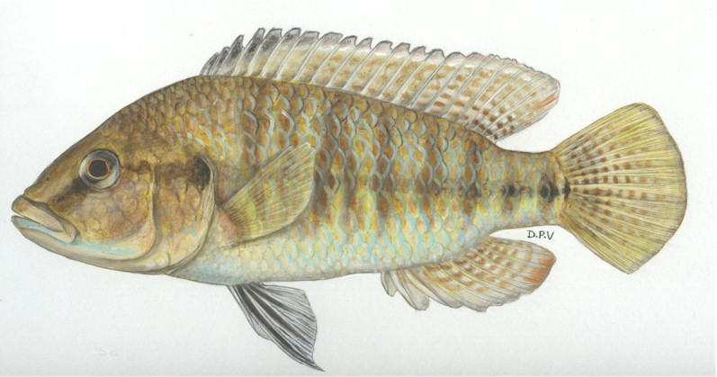
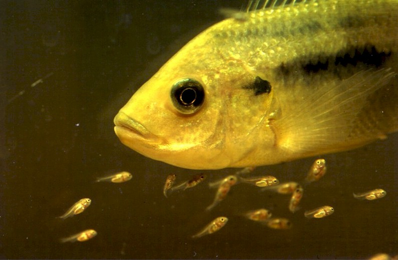
Fish scores show the same trend but reflect the presence of invasive species (trout in the upper Karkloof, and bass in several places). Some indigenous fish are also alien here, like the Mozambique and redbreast tilapia. The fish in the lower uMngeni are only in Fair condition due to the regulation of the river by dams.
|
|
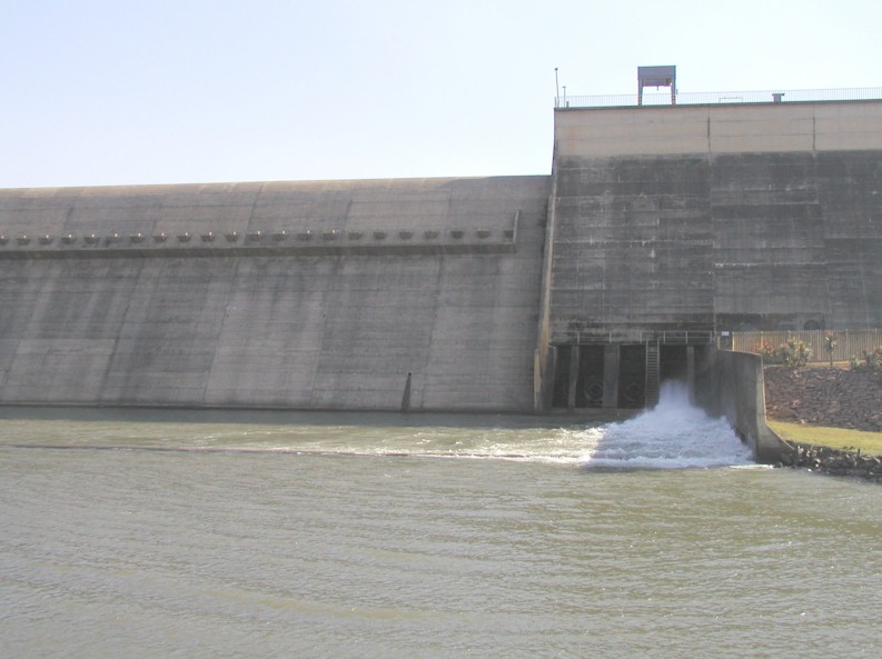
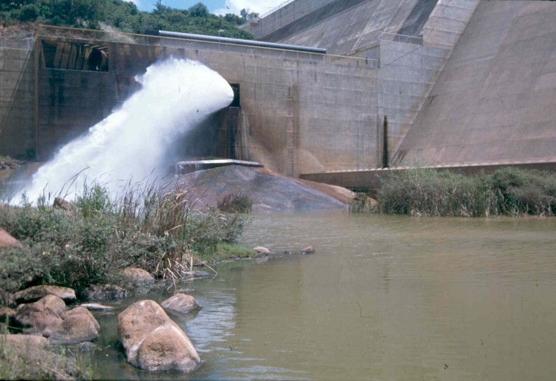
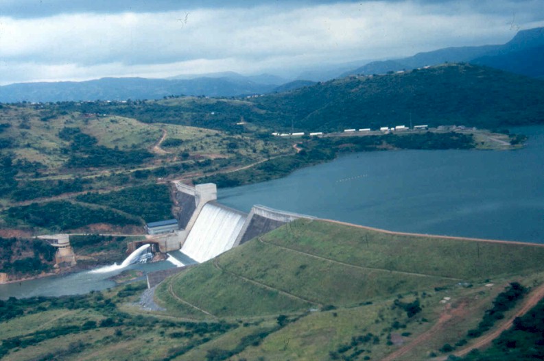
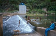
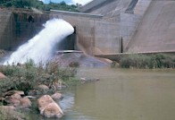
Water releases from Albert Falls Dam (right) are particularly "unnatural" as flows tend to be highest in the dry winter months, and low during summer. This flow pattern can disrupt ecological processes (see section on dams). At Nagle Dam, bypass gates can be used to mimic a more natural flow pattern.
|
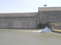
Albert Falls Dam
|
|
A considerable portion of the Albert Falls and Nagle catchments (in the upper reaches) are under plantation forests and invasive alien trees which reduce the flow of water to the river.
Cattle feedlots below Albert Falls Dam introduce excess nutrients to the river system.
Effluent discharges from Howick impact on the uMngeni River. Considerable impacts also emanate from the iMpolweni area where poor land management and inadequate sanitation contribute to turbid, nutrient-rich waters.
|
|
Tourism and recreation especially around Howick Falls, is based largely on and around the river. Msinsi Holdings offer a tourist package based on the river and the two large dams that includes game viewing, water-skiing, sailing, canoeing, angling and birding.
Environmental education at Umgeni Valley Nature Reserve and tourism in various game reserves (e.g. Albert Falls, Game Valley) centre around the uMngeni and Karkloof rivers.
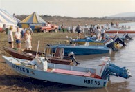
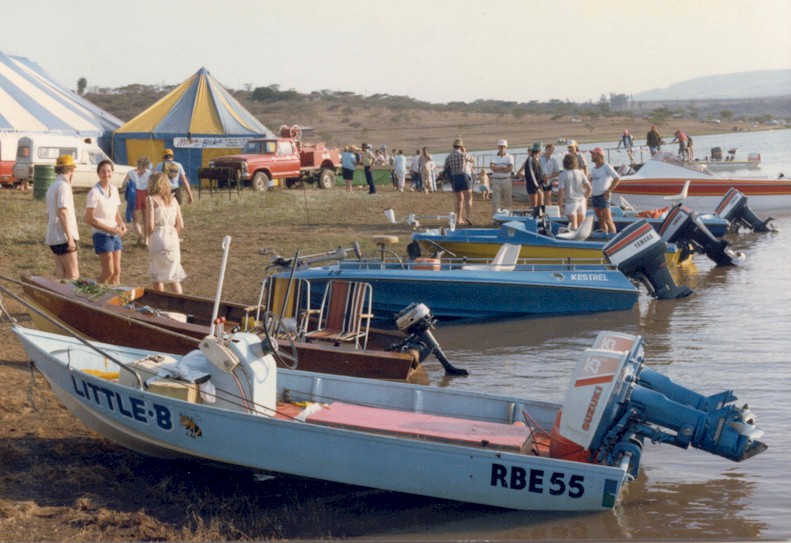
Bass fishing competition
|
Rural people particularly in the Mpolweni catchment utilize the river extensively for recreation, drinking water (in places), fishing and for plant products from the riparian zone.
Good quality water used by forestry and agriculture, the latter especially just below Albert Falls Dam, in the eastern section and in parts of the Karkloof catchment.
Angling is very popular in this resource unit, not only in the two large dams, but also in the rivers (see section on fish of the uMngeni River). Albert Falls has been considered one of the world's top bass dams.
The river carries water to Albert Falls and Nagle dams which are the main supply reservoirs for the greater Durban area, supplying more than 400 million litres of water per day for mainly domestic and industrial purposes. The river between the two dams carries water from Albert Falls dam, a storage reservoir, to Nagle dam, from where the water is piped to Durban.
|
| MANAGEMENT PRIORITIES
|
|
Define desirable river health below Midmar and Albert Falls dams and from this determine the amount, quality and flow pattern of water needed to maintain the river ecosystem so as to provide desired river-based goods and services (i.e the ecological Reserve).
Water demand management by agriculture and forestry and pollution control.
Minimise overgrazing in the iMpolweni district to reduce excessive sediment input to the river.
Minimise effluent pollution from the Howick area.
Accommodate the passage of young eels past dam walls.
|
uMngeni River below Albert Falls Dam
|
| EXTINCTION IN THE KARKLOOF RIVER
|
|

Ephemera mooiana
|
The Karkloof mist-belt forests, with their giant yellowwood trees, have over the years been heavily harvested and cleared for agriculture and plantation forestry. These magnificent forests, of which a few pristine patches still exist, were associated with streams of unquestionable quality and reliability. The upper reaches of the Karkloof River, were in the 1950s found to contain a rare burrowing mayfly, Ephemera mooiana, which has only ever been found here and in the Mooi River above Rosetta. In these rivers it burrowed into the hard mud banks beneath the water. Unfortunately, with the removal of indigenous forests and the conversion of the grasslands to agriculture, it appears that this species may now be extinct. An extensive search for this rare mayfly by a student from the University of Natal together with Umgeni Water, has proved fruitless.
|
| A RARE CRUSTACEAN OF THE UMNGENI RIVER
|
|
|
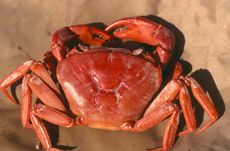
Potomonautes dentatus (right) is a river crab found in the uMngeni River, discovered here in 1992. This large species favours fast-running water and can sometimes be seen climbing the vertical cracks in the rocks at Albert Falls waterfall.
|
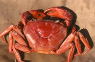
Potomonautes
|
| A VERY RARE AQUATIC PLANT
|
|
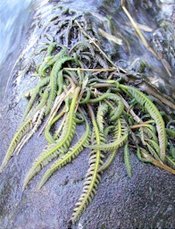
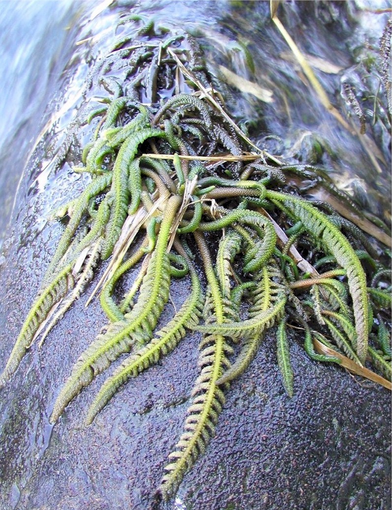
Hydrostachys
|
Hydrostachys polymorpha is a small fern-like plant that grows in fast currents, clinging to the rocky substrate of waterfalls and rapids. Hydrostachys is sensitive to changing temperatures (especially below dams) and excessive silt in the water. It is found fairly widely in the upper reaches of the uMngeni (especially the Karkloof tributary) and neighbouring rivers.
|
|
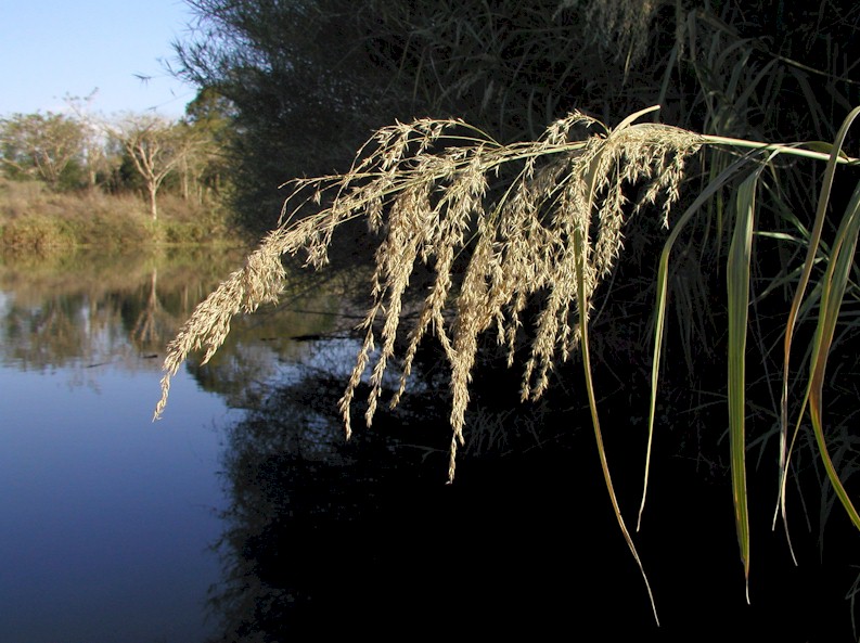
The reeds on the river between Midmar and Albert Falls Dams are often assumed to be Phragmites australis (syn.P.communis), but on careful study, have proved to be mostly the more tropical relative P. mauritianus which seems to have greater preference for oxygenated, faster flowing water than does P.australis [NOTE: P. australis is widespread in KZN, from Drankenensberg to coast, and is likely also to be present, but probably not admired].
|
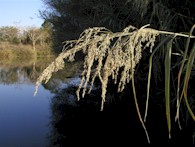
Phragmites near Morton's Drift
|
UPPER UMSUNDUZE RESOURCE UNIT
|
|
Move the cursor on the map and click on the specified resource unit to link to further information related it.
|
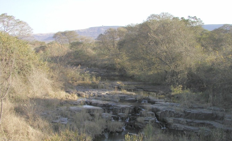
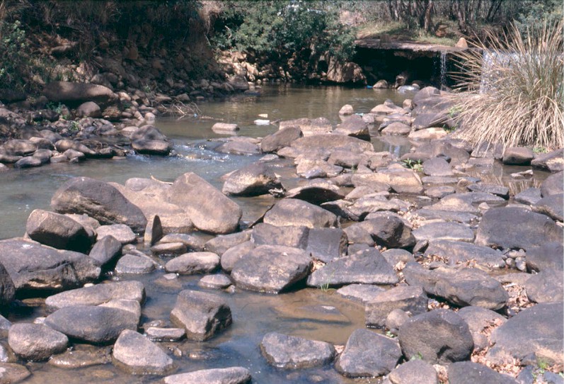
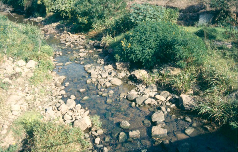
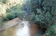
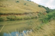
Upper uMsunduze River
|
The uMsunduze is one of the major tributaries of the uMngeni River. It rises near Elandskop on the road to Bulwer (1 500m above sea level) and flows eastward to Henley Dam, Edendale and Pietermaritzburg. The river flows into the hot, dry Edendale valley, where the river gradient is high and the substrate rocky. Pools are few and small in size and the water tends to be highly turbid soil eroded from the catchment.
|
|
The main land use types here are subsistence cultivation and rural developments with urban areas in the vicinity of Edendale and Imbali. The human population of the area is 278 000. There is also a small area of plantation forestry in the middle of this resource unit.
|

Taylor's Halt
|
Water quality is Fair, but spoiled by turbidity and faecal contamination, the latter particularly bad in the lower reaches.
In the upper reaches the riparian habitat is heavily exploited mainly by stock and by excessive wood harvesting and also due to excessive burning of vegetation during winter (annual fires are probably not a natural occurrence). In the lower reaches there are also impacts from alien vegetation.
Instream habitat in the upper portion of the area is Good which allows for healthy fish and invertebrate populations. In the lower reaches instream condition is Poor mainly due to the impact of Henley Dam and water quality issues.
Invertebrates up and downstream of Henley Dam suggest that the river is in Good condition. Species diversity is good, and many sensitive organisms are found here.
The fish scores are higher in the upper reaches due mainly to the presence of the Natal mountain catfish which used to occur in the lower reaches as well. Unfortunately bass have invaded both sections.
|
|
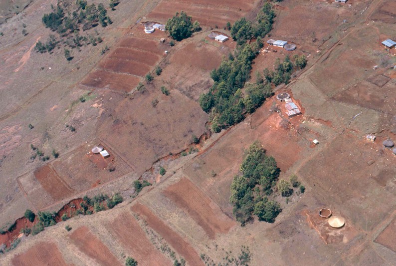
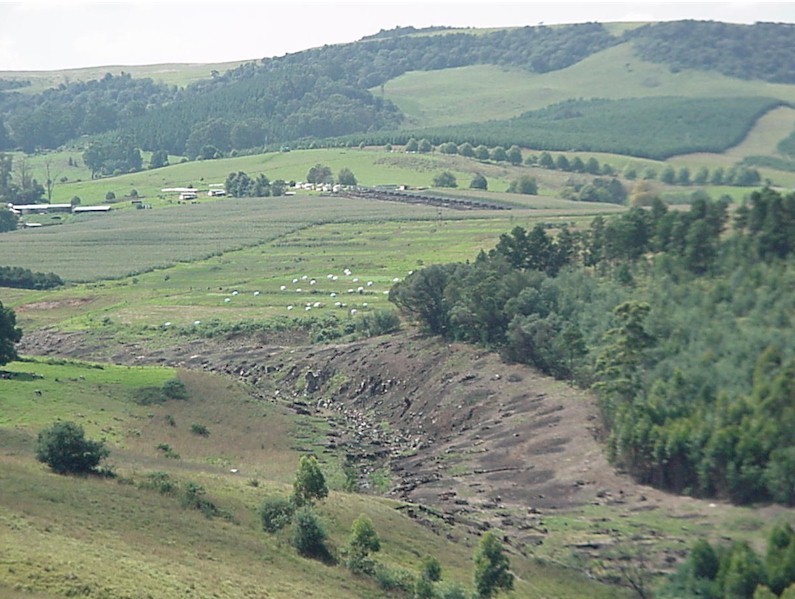
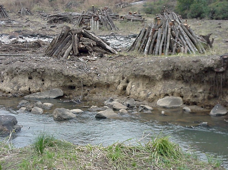
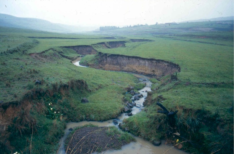
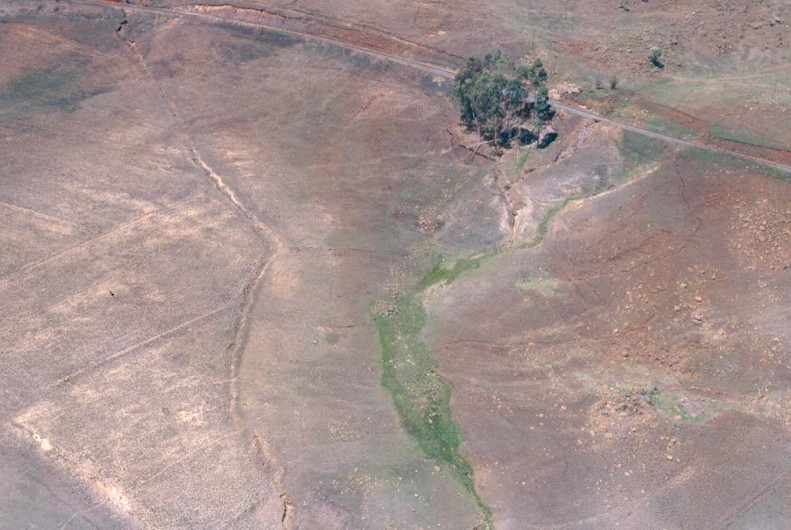
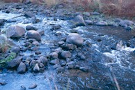
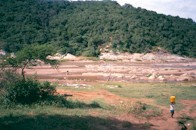
Overgrazing by stock has led to poor grass cover. This leads to rapid run-off of rain, poor infiltration, rapid and high flooding with soil erosion, incision of the river and turbid water.
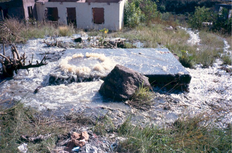
Many informal settlements lack adequate waste services, leading to faecal and nutrient pollution. Sewer surcharges in the lower reaches compound the issue.
|
Overgrazed uMsunduze Catchment
|
|
Industrial effluents and illegal discharges are few but occur nevertheless.
Henley Dam (now decommissioned as a supply dam) does impact on water quality. Water passing over the dam is unnaturally low in nutrients and has phytoplankton not normally found in local rivers. This encourages the occurrence of invertebrate species adapted to filtering phytoplankton, which are not natural in this area.
|
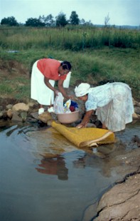
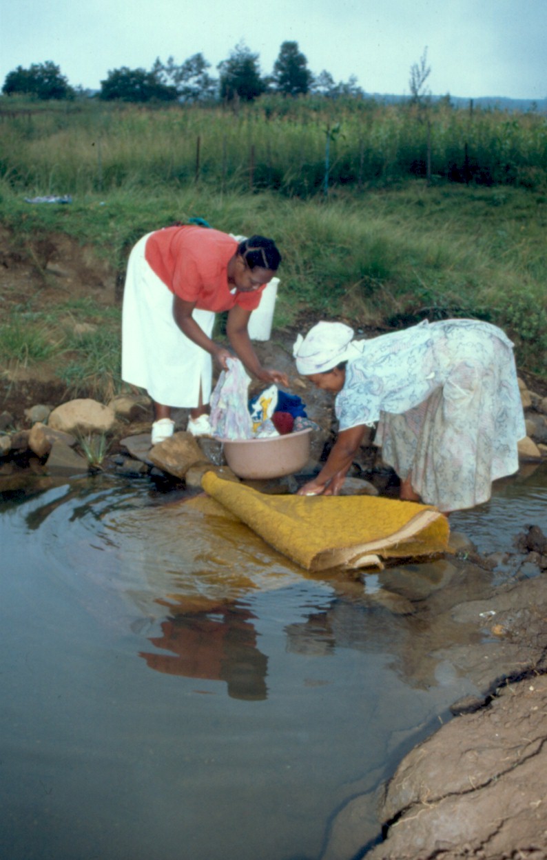
Clothes washing in the
uMsunduze River
|
Dilution and transport of pollutants from the urban/peri-urban areas.
Water to support small-scale agriculture in the upper portion of catchment, with emphasis on stock watering.
Recreation and subsistence fishing.
Reeds from the riparian zone.
Cultural and in particular spiritual activities.
The river is used for clothes washing.
|
|
Measures to minimize immediate human health hazard from faecal contamination e.g. complete provision of potable water and sanitation.
Upgrading and improved management of sewerage systems.
Control of stock numbers and overgrazing to reduce land degradation.
Reduce frequency of veld fires.
|

Overflowing sewer
|
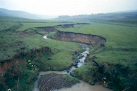
| TOO MUCH WATER, TOO LITTLE WATER
|
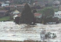
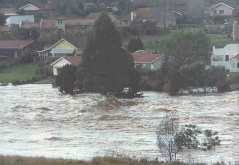
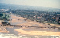
Howick - 1987 floods
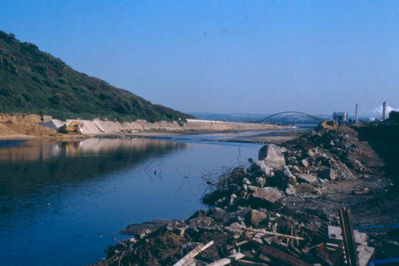
As is the case in many parts of South Africa, the uMngeni River catchment is subject to wide fluctuations in flow, ranging from crippling droughts to raging floods over the space of a few years. The last twenty years have seen these in extreme proportions, with two of the most severe droughts in recorded history (early 1980s and 1990s) interspersed by two extreme floods, cyclone Domoina in 1984 and the September 1987 floods. The latter had the greatest impact on the uMngeni River.
|
We must appreciate that while these changes in river flow are inconvenient to society, they are essential for the maintenance of the natural ecosystem. The plants and animals associated with this river evolved to cope with these cycles and any change will mean that some species will be lost or their numbers and dynamics altered. One of the worst things we do to the uMngeni River, is to regulate its flow so that it is uniform all year round, and from year to year. In this case hardy pioneer species characteristic of the uMngeni would be replaced by less adaptable species, many of which may be alien imports from rivers which have a more constant flow. Species diversity is reduced, and the whole ecosystem becomes impoverished. As a result, the risk of the breakdown of ecosystem functions and resulting failure to deliver desired goods and services to people, becomes greater.
|
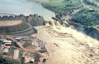
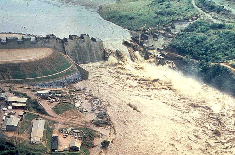
Inanda Dam - 1987 floods
Management of the uMngeni River becomes difficult as it must balance the needs of society for a constant flow of water, with the needs of the environment which requires that some of the variability of the system be maintained.

uMsunduze Catchment
|
PIETERMARITZBURG RESOURCE UNIT
|
|
Move the cursor on the map and click on the specified resource unit to link to further information related it.
|
|
This resource unit is dominated by the urban sprawl of Pietermaritzburg (altitude 750m), a mix of formal city, residential and industrial suburbs and informal housing developments. Here the uMsunduze River enters a canalised reach (an 'artificial' river) at Camps Drift. It then passes through the city in an incised narrow channel and is joined by small tributaries before picking up treated effluent from Darvill wastewater works. Large parts of Pietermaritzburg used to be floodplains and wetlands but the river system is now a shadow of what it was. The total population of the area is 239 500 people.
|
uMsunduze River downstream of N3
|
Water quality in the region is Poor mainly due to faecal contamination and declines as the river passes through the city. Interestingly, the effluent from Darvill Wastewater Works often improves the quality of the river water.
Of concern is the Poor health of both the instream and riparian habitats. Extensive canalisation (particularly at Camps Drift) has significant impacts on the river's natural flow pattern. Because of Poor water quality (eutrophic and turbid water) habitat is Poor for the natural fauna and flora.
The decline in the health of the invertebrates from Good to Poor over a few kilometres, shows the magnitude of urban impacts. In the lower reaches of the city, only the toughest invertebrates survive, and then in great quantities due to the abundance of organic "food" (i.e. pollutants).
Fish health is Fair to Good, as most of the indigenous species in the area are resilient to pollution. However, alien species abound, especially in the Camps Drift impoundment, where carp and bass are common. The weirs on the river are mostly impassable to migrating fish.
|
|
Urbanization and high population densities, including areas with minimal sanitation services. The extensive network of sewers discharges its contents into the river at times.
City street storm water discharges can be as polluting as sewage discharges. The large surface area of paved ground and rooftops increases run-off during storm events.
Legal and illegal discharges from factories are a major problem, particularly on the Baynespruit tributary, which drains the Willowton Industrial area.
Impoundment of the river at Camps Drift has extensively altered its nature.
Mowing of riparian vegetation and canalization reduces the river's ability to recover from flooding, increases flow velocities and results in damage to river morphology within and downstream of the resource unit.
Large alien trees (e.g. at Alexandra Park) and other invasive alien plants in the riparian zone shade natural vegetation, destabilise the banks and alter the instream habitat.
|

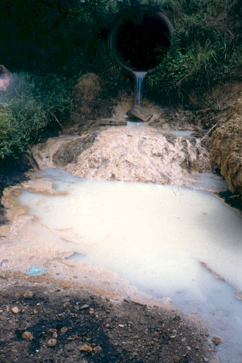
Pollution from "stormwater" drain
|
Transport and assimilation of domestic and industrial pollutants.
Informal domestic water use especially from the small tributaries entering the uMsunduze.
Subsistence and recreational fishing.
Adequate river flow and sufficient water of adequate quality to support contact recreation like canoeing (e.g. Dusi canoe marathon); threatened at times due to poor water quality. Swimming is no longer safe here.
The river forms the focal point of an open space outdoor and parkland facility - Alexandra Park and Camps Drift. The full potential of this facility is spoiled by poor water quality.
River-based educational activities are widespread.
|
|
Reduction in pollution from sewers, informal settlements, city streets, illegal discharges and the wastewater works and reduction in solid waste (litter).
Control of water weeds and alien weeds in the riparian zone, including removal of large alien trees, unless where serving an important function (e.g. shading in Alexandra Park).
|

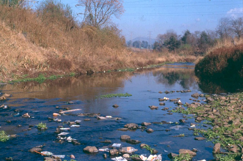
Pollution in the Slangspruit
|
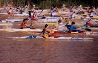
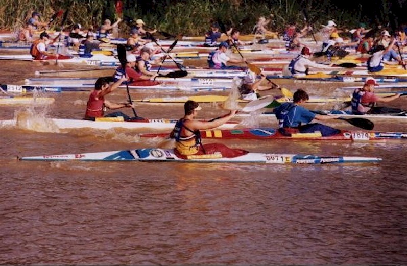
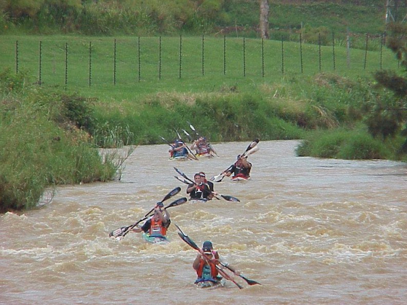
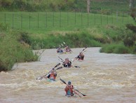
The Dusi Marathon
Dusi below N3 near Woodhouse
|
In January each year, the Dusi canoe marathon starts at Camps Drift in Pietermaritzburg and ends at Blue Lagoon in Durban, with some 3000 paddlers participating. The total exchange of money on this event in direct costs i.e. equipment and accommodation, is R20 - 30 million. The marketing value is approximately R100 million, giving an indication of the economic value of a sporting event which relies heavily on adequate river flow and good water quality. The Dusi marathon has redirected much of its income to developments in the rural parts of the catchment.
Unfortunately the event is threatened by faecal contamination and by water hyacinth choking the river near the estuary.
|
| DRAGONFLIES AND RIPARIAN VEGETATION
|
|
|
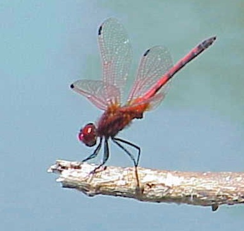
Dragonflies are familiar to us as the pretty aerial creatures associated with streams and ponds. Young dragonflies (larvae) live underwater in the weed or mud and are highly sensitive to stream conditions such as flow, water temperature and amount of sunlight on the water.
|
|
Most species avoid heavily forested areas, except where there is dappled sunlight on the bank and water. Invasive alien plants in the riparian zone over-shade the banks, making the habitat unsuitable for most dragonfly species. Local biologists recently found that the removal of invasive alien plants has a dramatically positive effect on dragonfly abundance. Within one season of alien plant removal, dragonflies return. Dragonfly abundance and diversity can thus provide an indication of both instream and riparian vegetation health.
|
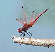
Red Dragonfly
|
Dragonflies are also sensitive to altitude. The species found at Albert Falls are quite different from those at Midmar.
Pietermaritzburg lies in between and has dragonfly species from both higher and lower elevations. This dual recruitment combined with a variety of habitats makes the National Botanical Gardens at Pietermaritzburg a dragonfly hotspot of 30 or so species.
|
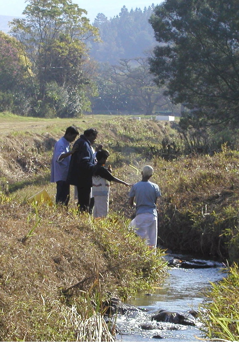
Hindu ceremony on the Townbush Stream
|
Several local communities make use of the rivers for cultural and religious purposes.
|
|
Move the cursor on the map and click on the specified resource unit to link to further information related it.
|
|
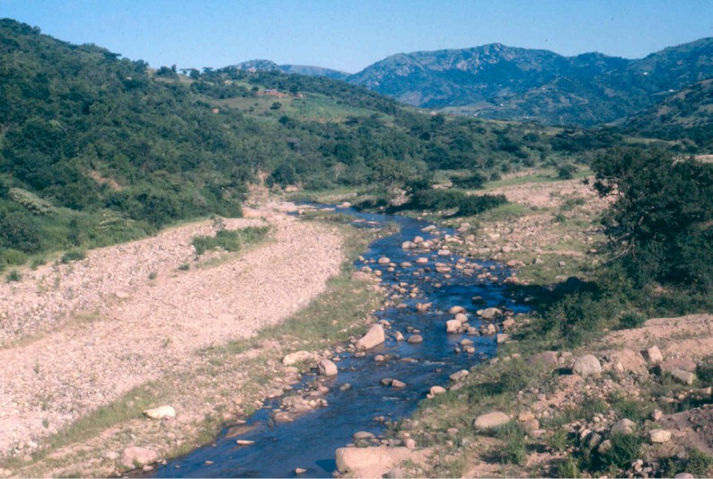
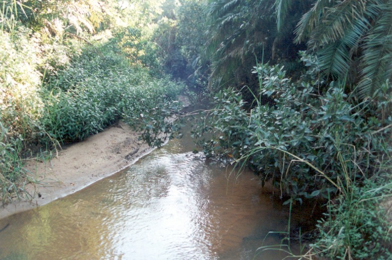
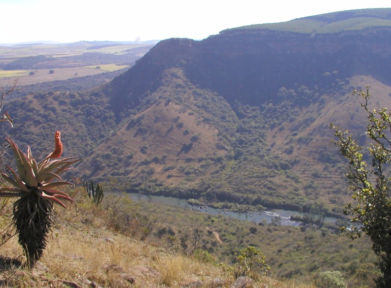
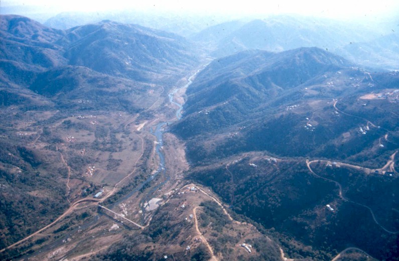
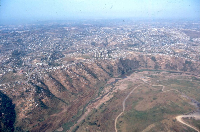
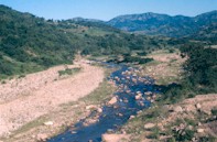
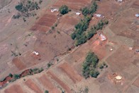
Below Nagle Dam, the uMngeni River is joined by the uMsunduze tributary and continues in an easterly direction. Towards Inanda Dam, increasing air temperatures and more unpredictable rainfall results in riparian grassland being partly replaced by indigenous tree and shrub thornveld dominated by indigenous acacias. Apart from farmlands around the uMsunduze, this resource unit is dominated by the rural Valley of a Thousand Hills, a vigorously undulating landscape with hills and valleys. A large rural population lives here, and many are directly dependent on the uMngeni River. The total population of the area is 152 000.
|
uMngeni River in the
Valley of a Thousand Hills
|
In the valley bushveld region, the uMsunduze River water quality is Poor, reflecting the impacts of the upstream city of Pietermaritzburg. The uMsunduze River thus reduces the health of the uMngeni River. Aquatic weeds flourish because of high nutrient levels, in particular in the uMsunduze River (see section on aquatic weeds).
The riparian zone of this river is in a Good condition despite intensive utilization in parts, especially in the lower reaches.
Instream habitat of the uMsunduze River is Fair. With the combination of poor water quality (caused primarily by excessive nutrients, toxic pollutants and high silt loads), the river habitat is unsuitable to the more delicate plants and animals. The instream habitat of the uMngeni River is in Good condition.
Invertebrates of the uMsunduze are in a Fair condition, reflecting the poor water quality coming from the city. The river is home to masses of benthic algae and large numbers of hardy species such as midge larvae (Chironomids).
The fish in the area are fairly tolerant and have done well despite the poor water quality. Aliens include carp, bass and redbreast tilapia. Invertebrates and fish of the uMngeni River are in Good condition.
|
|
Water flow is affected by the dams upstream. Inanda Dam wall blocks fish migration. Some estuary species would have been present here but are now absent due to Inanda Dam wall.
In the area of the "Thousand Hills", the natural vegetation including that of the riparian zone has been much depleted as a result of over-utilization by a large local population. The area also suffers severe invasion by alien plants. The result is increased erosion and sedimentation of the river, and bank instability both of which reduce river health.
Excessive nutrients and pollution in the uMsunduze River from the upstream city of Pietermaritzburg.
Overharvesting by subsistence fishermen.
Aquatic weeds are found throughout this resource unit, including water hyacinth, water lettuce, Kariba weed and parrots feather (see section on aquatic weeds)
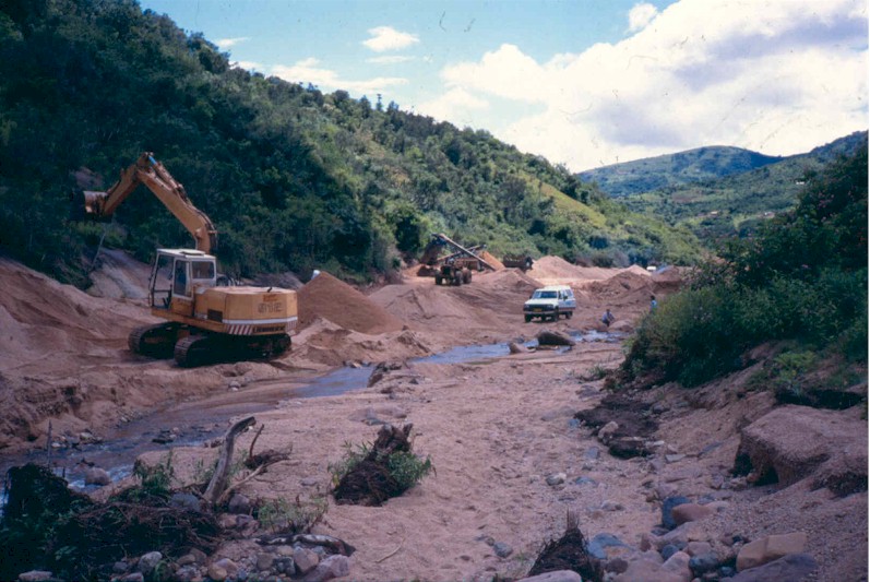
Sand mining.
|
|
The instream purification of polluted water is a major service provided by the river, in particular the uMsunduze.
Supply of large amounts of good quality water via Inanda Dam to the city of Durban. Also extensive use of water by rural people for riparian agriculture and stock and game watering.
Sand mining from the river bed is an important activity in the middle reaches.
Scenic river environment and adequate river flow support a small but potentially much larger tourism industry. The river itself supports vibrant canoeing activity. Inanda Dam and Resources Reserve is only 45 minutes' drive from Durban and is an extremely popular site for jet skiing, power boating, yachting, fishing and self-guided hiking trails.
Riparian and wetland plants harvested for craft weaving, e.g. ikhwane and imizi.
Unfortunately this area has also lost valuable products - important indigenous medicinal plant species such as Siphonochilus aethopica and Stangeria eriopus have been eliminated.
|
Darvill effluent
|
Manage flow releases from Nagle Dam to meet river-based needs downstream.
Consider the installation of eelways to allow juvenile migrating eels to climb the dam walls.
Minimise overgrazing and resultant sedimentation of the river.
Management of pollution and eutrophication, in particular of the uMsunduze River.
Control the spread of aquatic and terrestrial alien plants.
|
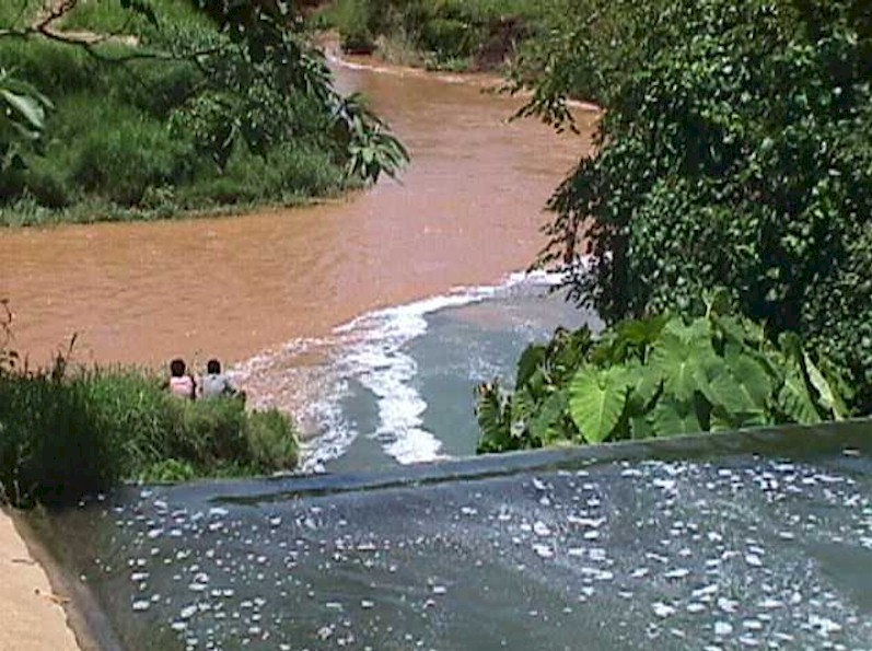
| RIVER AND SELF-PURIFICATION
|
|
|
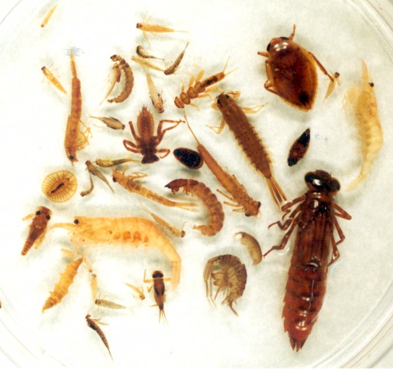
Rivers have an extraordinary ability to purify themselves. Self-purification takes place as the water tumbles over rocks and sand, where huge numbers of invertebrates live together with a coating of microscopic algae, bacteria and other forms of life. These algae and bacteria absorb the nutrients and pollutants contained in the water. Some invertebrates in turn, feed on these organisms, while some bacteria convert toxic ammonia to less noxious forms.
|
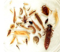
Local macro invertebrates
|
|
The activity of all these creatures scrubs, cleans and filters every millilitre of water, converting pollutants into animal and plant bodies, which in turn feed the next level on the food chain. These processes provide a service that is not visible and seldom appreciated. If rivers are abused to a point where these purification processes are damaged, the consequences for all users of the river could be extreme. The uMsunduze River is a prime example of a river where these processes play a very important purification role, producing a more acceptable water quality by the time it joins the uMngeni.
|
|
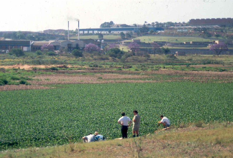
Within the uMngeni catchment, Inanda Dam and the uMngeni River upstream from the dam suffers the highest incidence of aquatic plant invasion.
|
Water hyacinth on Inanda Dam
|
Aquatic alien plants become problematic when their rampant spread is encouraged by excessive nutrients, particularly from urban runoff, sewage and agricultural fertilizers. The mild climate of KwaZulu-Natal also encourages rapid growth. Water hyacinth, water lettuce, Kariba weed, red water fern and parrot's feather have all been found at various places and times within the uMngeni and uMlazi Rivers.
|
|
These plants clog the water surface, deplete oxygen, foster mosquitoes, disrupt rivers' self-purification processes and may lead to a loss of aquatic species, with an associated loss in resource use and value. They also evapotranspire large volumes of water. Water supplied from water bodies covered with alien plants often requires sophisticated, expensive treatment.
|
|
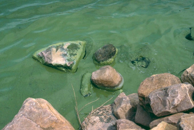
Algal blooms develop when water nutrient levels are high enough to support rampant growth. The nutrients mainly responsible are phosphorus (mostly from detergents and fertiliser) and nitrogen (from sewage and fertiliser). One way to minimise problems associated with algal blooms is to maintain river health by preventing excess nutrients from entering rivers and thus dams.
|
Algal bloom
|
|
Algal blooms sometimes impart high costs to water consumers. The cost of removing just the taste and odour imparted by algae at times of a severe bloom (e.g. approximately once in 24 months on Nagle Dam), is significant. Millions of Rands worth of chemicals have to be kept at the water works year round, just in case these algae get out of hand.
In the early 1990s Inanda Dam became a mass of noxious algae, largely due to the rotting vegetation and humus layer drowned by the rising waters. Since then the dam has stabilised and water quality has improved mainly due to upgrades by Umgeni Water at Darvill Wastewater works, that reduced the nutrient load from Pietermaritzburg.
Shongweni Dam (in the neighbouring uMlazi catchment) has also had severe problems, with the main cause being excessive nutrient inputs from Hammarsdale and Mpumalanga. Blooms of, at times toxic, blue-green algae have been common, making this dam unsuitable for domestic water supplies, and of questionable quality for recreation purposes.
|
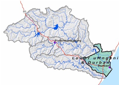
LOWER UMNGENI RESOURCE UNIT
|
|
Move the cursor on the map and click on the specified resource unit to link to further information related it.
|
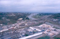
uMngeni River at Claremont
|
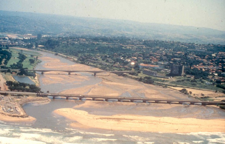
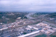
From Inanda Dam, the uMngeni River flows from the Valley of a Thousand Hills with a gentle gradient for 24 km before it flows out to sea at Durban. This part of the river is extensively modified, with riparian vegetation and the channel significantly altered to accommodate human settlement and activities. Historically the uMngeni River entered Durban bay over a large swampy plain where Durban is now situated. This resource unit is highly urbanized (population 1 314 200). A few smaller rivers are also important here. They include the uMhlatuzana and uMbilo Rivers which rise in the hills above Durban, draining large areas of urban and industrial development before entering the bay.
|
Water quality in the uMngeni River is Fair, due mainly to the purification of the water in Inanda Dam. Unfortunately by the time the river enters the sea, water quality is Poor from the large volume of city pollutants.
Riparian health is Fair, but is no longer subject to frequent flooding, resulting in excessive reed growth and invasion by terrestrial weeds.
Instream habitat (Fair) is affected largely by dam-regulated flows and prevention of the natural supply of sand to the river. This causes silting and closing of the estuary, reducing its contact with the marine environment.
Invertebrates are in Good condition although species composition would probably not resemble the natural diversity, due to the unnatural water quality.
|
The river and estuary fish populations are in Fair condition. Water quality of the uMhlatuzana and uMbilo Rivers is Poor, due to urban impacts. Habitat integrity, riparian and instream condition of the uMhlatuzana River are Fair, with resulting invertebrate populations also being in Fair health. The fish are in a Fair condition, but Poor in the lower reaches. In the lower reaches the riparian habitat quality deteriorates to Poor.
The uMbilo River habitats are in a Fair condition although mixed, with Good health in the middle reaches and Poor health in the lower reaches. The invertebrates in this river were in a Poor class as a result of the heavy pollution load. Fish are in a poor condition in the lower reaches.
|
The uMbilo River
|
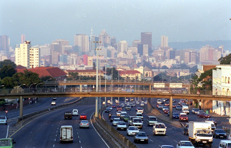
Cityscape
|
Intensive, large-scale urbanization and associated modification of the river course.
Canalisation of the uMngeni, uMbilo and uMhlatuzana Rivers has removed natural habitat in the lower reaches.
High population densities and effluent discharges, excessive nutrients and polluted run-off from streets, factory yards and informal settlements.
Upstream activities, dams and bulk water abstractions alter water quality and sediment dynamics, reduce flow and alter the river's natural flow regime on which many species depend.
Water hyacinth negatively affects the aquatic ecosystem (see section on aquatic weeds in the Inanda Resource Unit).
|
|
Sufficient flow and water volume to transport and assimilate domestic and industrial waste.
The estuary is a nursery area for many marine fishes, and provides for sport angling for kingfish, springer and gurnards. Subsistence fishermen also collect fish from the river here and higher upstream. Blue Lagoon with its beachwood mangroves is an important recreational and educational facility.
Sand mining for construction, although since Inanda Dam was built, the supply of "Umgeni Sand" has diminished.
The flood plain of the river has provided valuable land for building although at a high ecological cost.
The river is extensively used for cultural and spiritual activities.
The river below Inanda Dam is used for canoeing.
Much of the Durban Metropolitan Open Space System (which includes education and recreation facilities) is based on these rivers.
|
|
Management of water releases from Inanda Dam to maintain the services provided by the river and estuary.
Management and minimisation of industrial and domestic pollution.
Control of rampant aquatic weed, in particular water hyacinth.
Restoration of riparian vegetation especially by elimination of invasive alien plants (e.g. triffid weed).
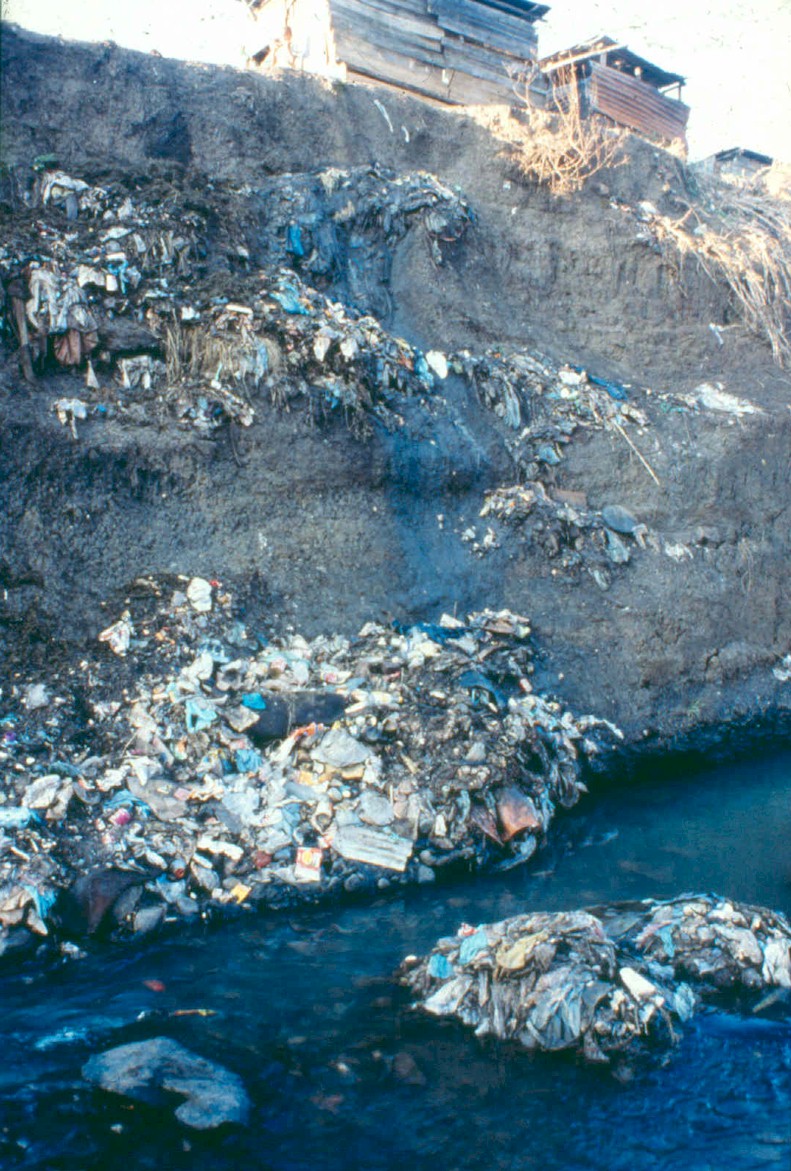
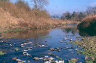
Solid waste disposal, especially in the informal areas, is a priority. Litter of the rivers and Durban Bay is a widespread aesthetic and health problem.
|
Water release from Inanda Dam
|
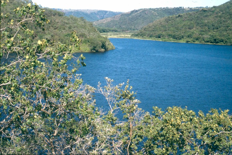
|
Estuaries, like rivers, provide us with a wide range of opportunities and benefits. They are an important location for recreational and subsistence activities. The health of estuaries is dependent on the provision of freshwater from the rivers that feed them. By protecting river health, we are also protecting estuaries and the benefits that people derive from them.
|
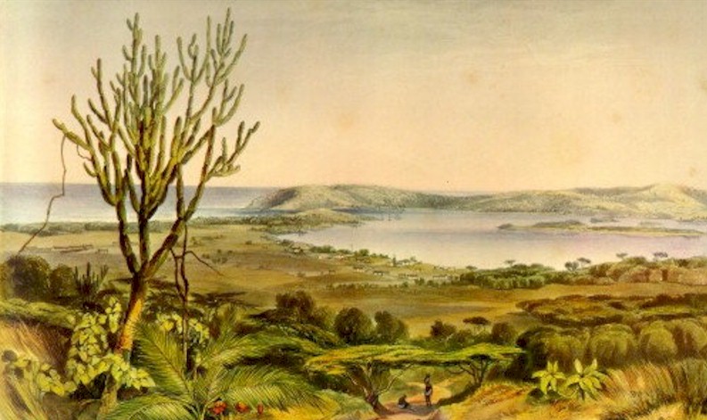
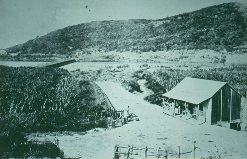
The Estuary
|
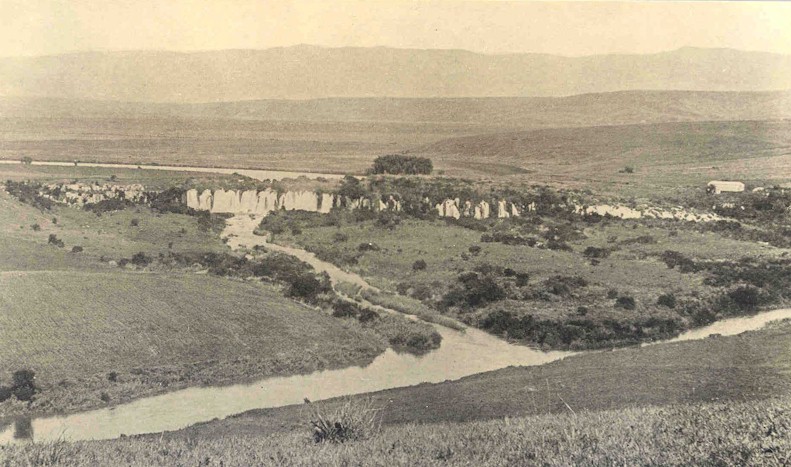
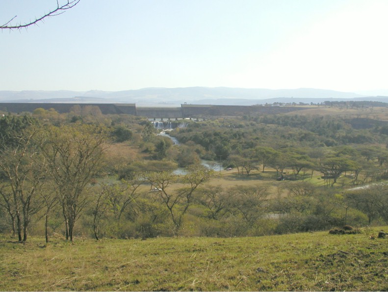
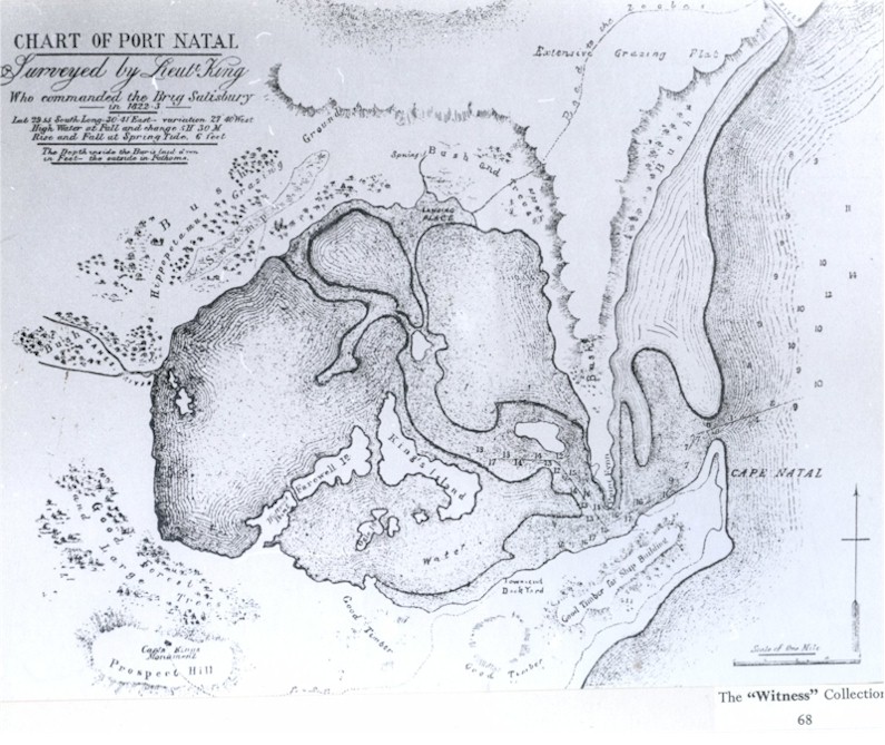
The uMngeni estuary is very different today compared to the 1800s. The estuary mouth appears to have moved between the bay and the sea until it was mechanically redirected by the city engineer in the early 1900s due to concerns of flooding, malaria and damage to reclamation works.
|
|
There have also been significant changes in the estuary habitat. Between 1934 and 1984 the estuary has lost many of its intertidal and backwater habitats. Also, salt concentrations extended much further inland historically. Bridge construction, industrial and organic pollution and the damming of the rivers appear to exert the most significant impact on the estuary. Altered flows (due to upstream impoundment) have transformed the previously flood-dependent and permanently open estuary to a temporary open/closed system. In the absence of floods, sediment accumulates, changing the ecology of the system and thus the system's ability to provide a certain range of estuary-based goods and services.
Despite human impacts, the uMngeni remains an important estuary. The remaining 44ha of Beachwood mangroves in the estuary support a wide diversity of plants and animals. Studies in the early 1980s recorded 56 fish species, 13 prawn species and 11 crab species. The estuary also provides habitat for juvenile marine fish. The uMngeni estuary also provides a variety of recreational opportunities. But, the uMngeni River will need to be managed carefully in order to maintain a desirable level of benefits from the estuary.
|
|
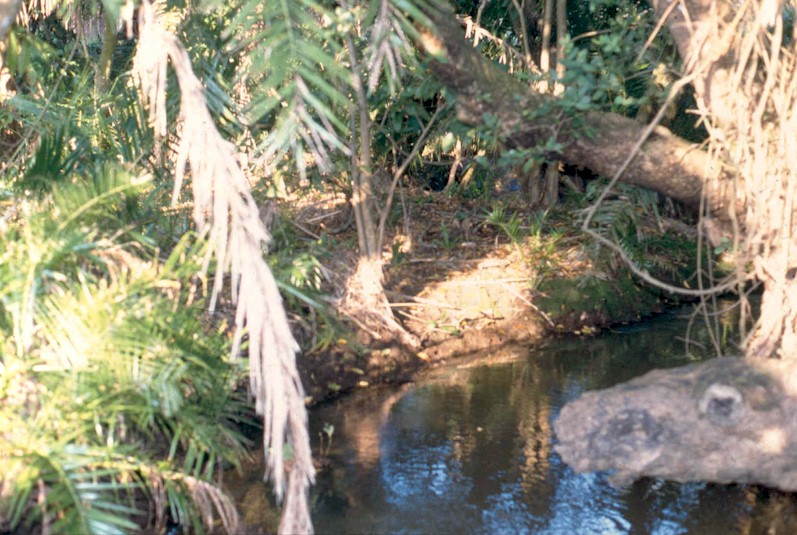
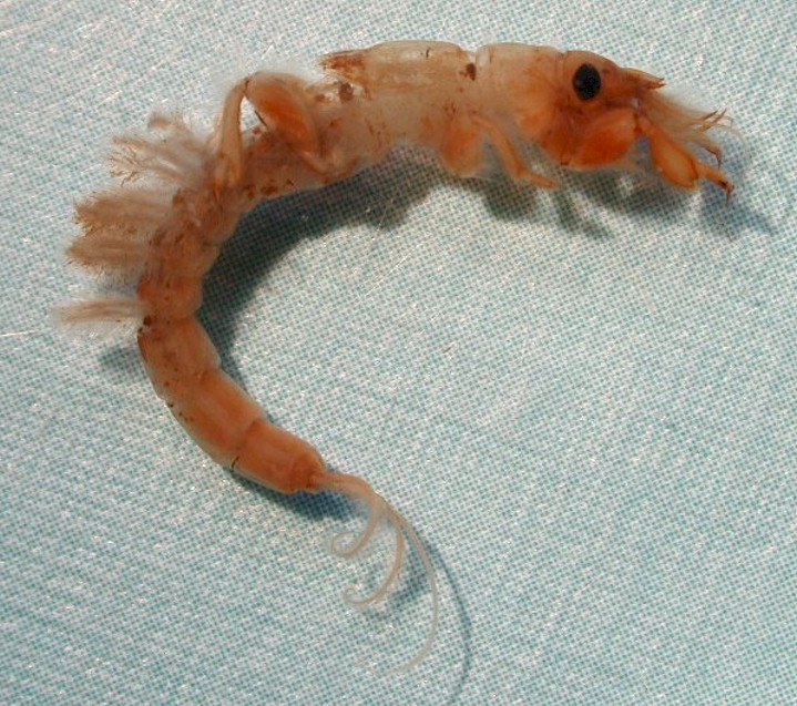
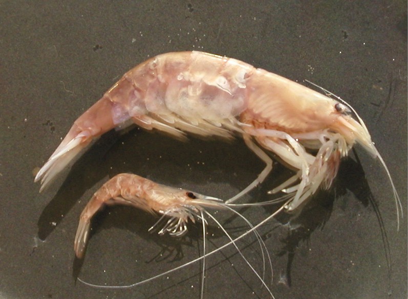
The Molweni River, a tributary of the uMngeni at Krantzkloof Nature Reserve near Durban, boasts a freshwater shrimp (Atyoida serrata - large shrimp in photo) only recently found in African waters. It lives exclusively in rocky crevices in torrential water.
|
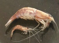
Freshwater shrimp in the
Molweni River
|
|
Move the cursor on the map and click on the specified resource unit to link to further information related it.
|
|
|
The uMlazi River originates south west of Pietermaritzburg at 1 500m above sea level. In the upper uMlazi, the main land-use types are agriculture, forestry and small rural and peri-urban settlemements. The river flows through the Baynesfield and Mapstone dams before entering the Tala Valley, an area of intense commercial agriculture and isolated forestry. From here, the river flows into Thornlea Dam, through the Killarney valley and Mpumalanga settlement and into Shongweni Dam. Here the river is joined by the Sterkspruit and Wekeweke tributaries. Below Shongweni Dam, the river runs through steep sided valleys and then through rural areas downstream of Dassenhoek. It then flows through the densely populated areas of Chatsworth, uMlazi and the industrial zone near Durban airport (historically a large swamp) before flowing out to sea through a concrete canal (i.e. an artificial river). The population of the uMlazi catchment is 690 800.
|
uMlazi River
|
Water quality in the upper uMlazi is Good, but deteriorates to Poor in the lower reaches.
Riparian habitat is Good in the upper reaches, but invasive alien plants are a major problem especially in the lower reaches, despite control efforts. The riparian zone is also affected by heavy stock grazing.
Instream habitat is Natural in the upper reaches aided by removal of alien plants from the banks. In the lower reaches of the uMlazi and the Sterkspruit below Hammarsdale, the instream habitats are only Fair, largely due to excessive nutrient input.
Invertebrates upstream of Shongweni Dam are in Good condition due to the presence of several pollution sensitive species.
Fish are in Good condition but Fair in the middle reaches and Poor in the sea. The biota of the Sterkspruit are in Poor condition.
|
|
Regulation of river flow by impoundments.
Abstraction for irrigation (upper uMlazi) and water use by plantation forests.
Excessive industrial (in particular Hammarsdale and Isipingo) and nutrient inputs (mainly by agricultural activities in the upper catchment and 4 wastewater works in the middle and lower catchments) to the river leading to eutrophication (excessive nutrient enrichment of water).
Rampant aquatic weed growth.
Sand mining for construction purposes.
Rapid urbanisation (e.g. Mpumalanga and lower uMlazi), with increasing population densities and inadequate services, leading to increased contaminated runoff and faecal pollution from residential areas (e.g. KwaNdengezi and Dassenhoek) and informal settlements.
Surcharging sewers in the lower catchment.
Canalisation of the uMlazi River in the lower reaches and loss of the original estuary.
|
Shongweni Dam
|
Supply of good quality water mainly to formal agriculture and forestry in the upper reaches and Tala Valley; also for small-scale agriculture and rural settlements.
Subsistence and sport fishing in rivers and dams.
Tourism and trade, based on presence of the river (and dams), their scenic value and opportunities for water-based activities: e.g. game viewing and canoeing on and around e.g. Shongweni Dam and Resources Reserve.
River-based education activities abound in this catchment.
Assimilation and transport of pollutants from agriculture, the domestic sector and industry.
Sand mining (below Shongweni Dam).
|
|
Improved industrial, domestic and agricultural pollution control.
Integrated approach to aquatic weed management.
Continued support for riparian weed eradication efforts initiated by the Working for Water Programme. This needs to be extended to shrub species in the lower reaches.
Appropriate operating rules for water releases from all the larger dams, to improve the health of downstream river ecosystems and thus improve the levels of goods and services provided by the river.
Manage sewer surcharges in the lower reaches.
|
The uMlazi "estuary"
|
|
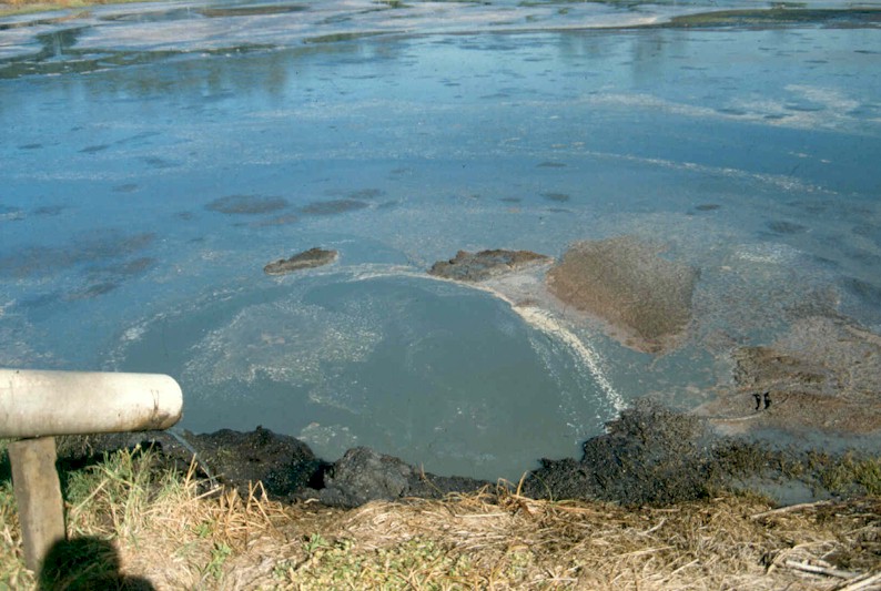
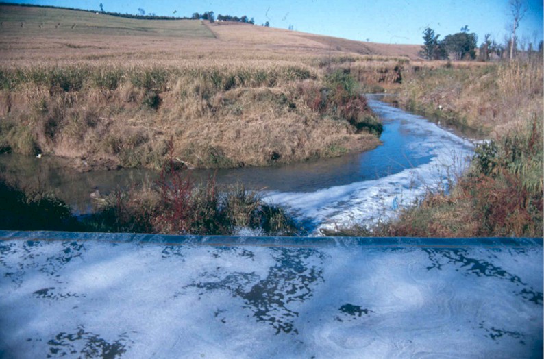
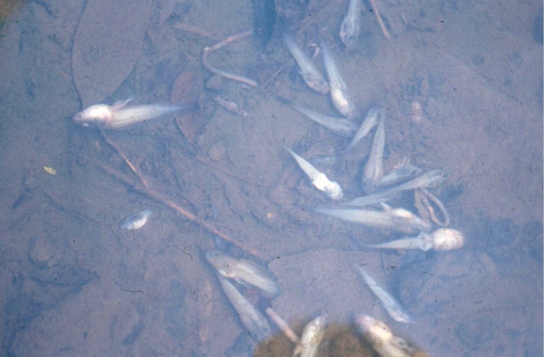
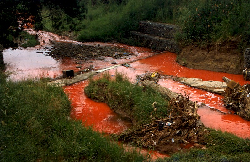
Due to its location between the port of Durban and the Gauteng region, the uMngeni and uMlazi catchments are traversed by road, rail and pipeline routes, which carry huge amounts of hazardous cargo. Large quantities of such materials are also used or produced by the many industries in the Durban-Pietermaritzburg area. Spills of hazardous materials from either transport accidents or industries therefore pose a significant threat to human health and the environment.
Owing to the range of materials being transported and used almost every kind of pollution threat is possible. Hydrocarbons, pesticides, heavy metal compounds, acids, alkalis have all been transported in quantity through these catchments. Substances such as salt, sugar, vegetable oil, molasses and milk, are not toxic in small amounts, but if tons of these materials end up in rivers, serious environmental damage can and does occur.
Effective response protocols have been developed and the expertise to respond to spills is well developed. However, clear understanding of the threat by industrial producers and catchment residents is still lacking.
|
| SOUND CATCHMENT MANAGEMENT PRACTICES
|
|
|
Improvement in agricultural and forestry practice (e.g. harvesting activities, riparian zone management and invasive alien plant control in partnership with the Working for Water Programme) in the upper uMlazi has been dramatic. Despite intense agriculture in the Tala Valley reduction in the use of pesticides and fertilisers has contributed to moderately good river health scores.
Active river and land management committees have been formed, especially in upper uMlazi (under the guidance of the Umlaas Irrigation Board) and Tala valley. These focus on pollution control and in particular riparian zone aspects of river management.
A culture of 'river care' and a high level of awareness and action in both formal (e.g. agricultural) and informal (rural community) sectors (e.g. Entembeni community involvement in alien plant clearing and rehabilitation of river banks) have resulted in actions that promote improved river and catchment management.
|
| WATER WEEDS IN THE UMLAZI CATCHMENT
|
|
Hyacinth on Hammarsdale Dam
|
The growth of water weeds has a significant impact on river health and reduces the benefits that people could derive from a more healthy river ecosystem. In Thornlea Dam in the Tala Valley, the spread of water hyacinth has been brought under control through manual removal by landowners and by biological control (i.e. using the plant's natural enemies). However, in the mid-section of the catchment there is a serious aquatic weed problem, exacerbated by high nutrient levels from agricultural fertilisers and wastewater works. Water hyacinth is well established near Mpumalanga, although they have been vigorously attacked by the biocontrol agents.
|
|
The Hammarsdale Dam on the Sterkspruit tributary is a major breeding ground for this weed. This infestation has been the subject of much controversy and is being used by the Plant Protection Research Institute to raise biocontrol agents that attack and feed on the weeds.
Although the biological control agents are thriving, because of the high nutrient levels and the rapid growth of the plants they have not been able to reduce the weed population effectively. According to the Hammarsdale Industrial Conservancy, the plan is to use herbicides to kill the plants so that the dam can be used by the people of Hammarsdale.
Msinsi Holdings have achieved some success in combating hyacinth in Shongweni Dam using chemical control in a zero tolerance procedure. However, because of reinfestation from Hammarsdale upstream, they require ongoing management. There is also a massive infestation in the lower uMlazi River as it enters Durban, to the extent that at times the river disappears under a green blanket.
|
SUMMARY: STATE OF THE UMNGENI AND NEIGHBOURING RIVERS AND STREAMS
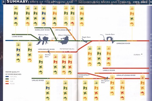 |
DAMS AND URBAN RIVERS: IMPACTS NEEDING SPECIAL ATTENTION
|
|
DAMS AND RIVER HEALTH
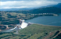
A large dam - Inanda
|
The rivers of the uMngeni and uMlazi catchments are heavily regulated by large dams, weirs and smaller farm dams that capture water to provide drinking water and water for irrigating crops. These rivers are also under pressure purely through the large and often dense human population in the area that depends on the products and services that these rivers provide. Dams and urban development have a significant influence on the health of these rivers.
|
|
There are 129 registered dams in the uMngeni and uMsunduze catchments. Five of these dams can be considered large, namely Midmar, Albert Falls, Nagle, Henley and Inanda. Together these dams have a capacity of 753 million cubic metres of water, more than the mean annual runoff for the entire catchment (740 million cubic metres). Dams provide storage capacity for water, contain floods and provide sites for recreation activities. But they also cause river health problems.
Problems include:
All the dams on the uMngeni River were built mainly for water supply, and are not managed to accommodate downstream ecological needs. As a result, rivers downstream of dams shrink and have altered habitat. This may result in diminished availability of useful benefits (e.g. less fish and reeds).
Dams trap sediments and nutrients, resulting in the release of cleaner 'high-energy' water downstream. This water erodes sediments from the river. Very clean water may also alter faunal composition because clearer water favours predators that use sight to hunt their prey, for example bass, while yellowfish are well adapted to turbid water.
Water released from dams generate downstream flows that are unnatural, leading to changes in the life cycle (and sometimes death of) aquatic fauna. For example a flood in mid-winter can trigger inappropriate cues for breeding and as a result, increased risk of offspring deaths.
Water spilling over a dam usually contains large numbers of algae. Algae are not typical of fast flowing and turbid rivers such as the uMngeni and introduce a new food source to the system, which results in changes to the invertebrate community structure.
Water released from the bottom of the dam (e.g. Albert Falls and most of the other dams on the uMngeni River) is much colder than the river water, and contains dissolved manganese, iron, sulphur and ammonia, all of which are potentially toxic to aquatic life. Some of these problems can persist for more than 20 km downstream.
Reduced flow downstream of a dam can lead to vegetation encroachment, by reeds such as Phragmites australis and even terrestrial species, resulting in the narrowing of the river channel. This can have devastating effects in the event of large floods when the river channel can no longer transport the flood waters. Flood waters then tend to uproot plants that are swept downstream where they jam against (and sometimes damage) bridges and other infrastructure.
Dams are barriers to fish migration. Fortunately, on the uMngeni River this impact is minimal as there are only two species that migrate. Eels manage to climb most dams walls and the yellowfish will make do in suitable areas below the dams.
Dams affect the goods and services delivered by rivers, especially to people who depend on products that are directly associated with the river ecosystem. Fortunately, these impacts can be managed by releasing water from dams in a way that is compatible with downstream needs. Plans are afoot to investigate this for the uMngeni River.
|
|
URBAN RIVERS
More than 12% of the uMngeni and uMlazi catchments is formally or informally urbanised and we can expect this trend to increase in future. An urban setting and high population numbers and densities create a particular set of challenges for river health and this in turn affects the types, amount and quality of river benefits.
|
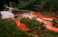
Printing dye in the river -
Pietermaritzburg
|
|
Increased pressure on water supply; therefore increased pressure to construct water supply infrastructure such as large dams and water transfer schemes.
Paving/hardening of large areas which alters catchment hydrology and the quality of water which returns to streams and rivers; and
Increased volume and concentration of solid, domestic, organic and industrial waste; The box below provides detail on the impacts of faecal contamination, a particularly severe problem in the uMngeni and uMlazi river systems.
|
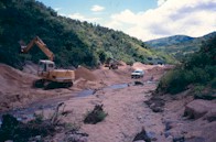
Sandmining in the uMsunduze
catchment
|
The impacts of urban activities on rivers are intense, but at the same time, people in urban environments need and demand much from their rivers - enough clean water for basic needs, effective waste removal as well as a river that provides for recreation activities and which is aesthetically pleasant. We need to reconcile the need for economic growth, human well-being and the continued provision of desired goods and services from rivers with in urban setting. We will need to make careful trade-offs around the costs and benefits of our activities in relation to river systems.
|
|
RIVERS AND CHOLERA
Cholera is water-borne bacterial infection associated with a lack of good quality drinking water and sanitation. Although the fatality rate was low (< 0.4%) during the 2000/01 cholera epidemic, KZN reported 116 170 cases. During the epidemic, municipal water was safe, but people relying on drinking water directly from rivers and dams were especially vulnerable.
|
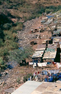
Informal settlement in Durban
|
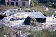
Sewer surcharge
|
The prevalence of cholera is related to HIV/AIDS since people with immune systems weakened by HIV/AIDS are easily attacked by cholera, a highly opportunistic disease.
|
| FAECAL CONTAMINATION AND IMPACTS OF INFORMAL SETTLEMENTS
|
|
One of the major impacts of the fast-growing informal settlements in and around Durban and Pietermaritzburg is the contamination of the streams and waterways with raw sewage. This usually happens where faecal matter is either washed from the surface of the ground, or pit latrines seep below ground and into the streams. In more developed areas, blockages cause sewers to discharge their load into the nearest river. For example, recently, in the lower uMlazi catchment, more raw sewage has entered the river than finds its way to the treatment plant!
Escherichia coli (E.coli) is a human gut bacterium. Its presence in water indicates faecal contamination. Water should be completely clear of this contaminant if it is to be safe to drink, and even the recreation potential is negatively affected by the presence of E.coli as counts in excess of 400 counts per 100 ml (SA Guidelines) will result in a high risk. The following are some recent E.coli results illustrating that the provision of goods and services by these rivers have been compromised by poor management of human activities and infrastructure relating to faecal contamination.
Mayville Stream, a small stream between Mayville and Westridge Tennis Stadium, E.coli up to 290 000 per 100ml of water. (Cause: Informal communities - inadequate sanitation).
Bellair Stream, E.coli up to 310 000. (Cause : informal community - inadequate sanitation).
Aller River, New Germany. E.coli up to 400 000. (Cause: informal community - inadequate sanitation).
Umhlangaan River above Kwamashu waste water works. E.coli up to 240 000. (Cause: broken sewers in Kwamashu Township).
iSiphingo River above the Isipingo waste water treatment works, E.coli count up to 10 000 000 and exceeding 100 000, 60% of the time. (Cause: broken sewers in uMlazi Township).
uMngeni River at Kennedy Road, E.coli up to 1 080 000. (Cause: Informal Community on the banks of the Palmiet River.) This is an example of the impact that a community on a small river can have on a larger river!
uMlazi River below Fongozi Stream, E.coli up to 720 000. (Cause: broken sewers in uMlazi township).
The Slangspruit just above Pietermaritzburg and the Baynespruit within the city boundaries, have recently contained E.coli counts of 670 000 and 610 000 per 100 ml respectively.
|
FISH OF THE UMNGENI RIVER
|
|
The uMngeni River boasts 48 species of freshwater (FW) fish (36 indigenous and 12 alien), listed here. A further 57 species are found in the estuary that do not come into fresh water. These have not been shown here.
|
|
Common Name
riverbream
longspine glassy
Natal mountain catfish
African mottled eel
Madagascar mottled eel
longfin eel
Natal topminnow
freshwater goby
chubbyhead barb
redtail barb
straightfin barb
bowstripe barb
duckbill sleeper
goldfish
sharptooth catfish
grass carp
carp
dusky sleeper
blackthroat goby
tropical sand-goby
mosquitofish
estuarine roundherring
sleepy goby
river goby
tank goby
golden sleeper
scaly/KZN yellowfish
bluegill
river snapper
opossum pipefish
freshwater pipefish
smallmouth bass
spotted bass
largemouth bass
Natal moony
Cape moony
flathead mullet
freshwater mullet
rainbow trout
Mozambique tilapia
guppy
southern mouthbrooder
checked goby
brown trout
bearded eelgoby
redbreast tilapia
banded tilapia
swordtail |
Species Names (# means alien)
Acanthopagrus berda
Ambassis productus
Amphilius natalensis
Anguilla bengalensis labiata
Anguilla marmorata
Anguilla Mossambica
Aplocheilichthys myaposae
Awaous aeneofuscus
Barbus anoplus
Barbus gurneyi
Barbus paludinosus
Barbus viviporus
Butis butis
Carassius auratus #
Clarias gariepinus
Ctenopharyngodon idella #
Cyprinus carpio #
Eleotris fusca
Favonigobius melanobrachus
Favonigobius reichei
Gambusia affinis #
Gilchristella aestuaria
Glossogobius biocellatus
Glossogobius callidus
Glossogobius giuris
Hypseleotris cyprinoides
Labeobarbus natalensis
Lepomis macrochirus #
Lutjanus argentimaculatus
Microphis brachyurus
Microphis fluviatilis
Micropterus dolomieu #
Micropterus punctulatus #
Micropterus salmoides #
Monodactylus argenteus
Monodactylus falciformis
Mugil cephalus
Myxus capensis
Oncorhynchus mykiss #
Oreochromis mossambicus
Poecilia reticulata #
Pseudocrenilabrus philander
Redigobius dewaali
Salmo trutta #
Taenioides jacksoni
Tilapia rendalli
Tilapia sparrmanii
Xiphophorus helleri # |
Notes
FW/estuarine
FW/estuarine
FW/estuarine
FW/estuarine Red Data
FW/estuarine Red Data
FW/estuarine
FW/estuarine Red Data
Red Data
FW/estuarine
FW/estuarine
FW/estuarine
FW/estuarine
FW/estuarine
FW/estuarine Red Data
Red Data
FW/estuarine Red Data
|
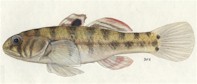
Checked goby
|
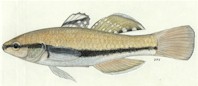
Golden sleeper
|
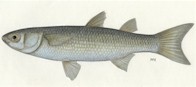
Freshwater mullet
|
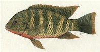
Redbreast tilapia
|
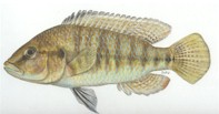
Southern mouthbrooder
|
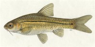
Bowstripe barb
|
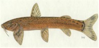
Natal mountain catfish
|
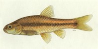
Chubbyhead barb
|
|
INDIGENOUS FISH OF THE UMNGENI RIVER
|
|
Some of the more interesting species include:
|
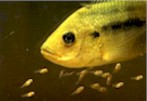
Mozambique tilapia
|
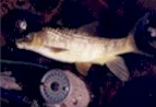
KZN yellowfish
|
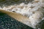
KZN yellowfish jump a weir
|
|
The longfin eel is the most common eel found in this river system. Eels breed at sea and juveniles migrate up rivers, even climbing waterfalls and dam walls.
The scaly or KZN yellowfish, nowadays much sought after by flyfishersmen and the redtail barb are endemic to KwaZulu-Natal, i.e. found only in this province.
The Natal mountain catfish, is a small scaleless species normally associated with mountain foothill streams.
The flathead mullet and freshwater mullet (endemic) are common in fresh waters near the coast and occur up as far as Inanda Dam.
Four tilapia species are found in the uMngeni system. The redbreast tilapia has been translocated from the Pongolo system into farm dams, where it has a valuable impact on over-abundant water weeds. The Mozambique tilapia, the banded tilapia and the southern mouthbrooder occur naturally in the uMngeni system.
The golden sleeper is an attractive and scarce species found in a few streams near the mouth of the uMngeni, but not in the main river.
There are five scarce goby species and one scarce eleotrid species found in the estuary area. All are small and lack colour and so are not very noticeable. Of these, the bearded eelgoby lives in burrows in soft mud and is endemic to KwaZulu-Natal.
Exotic fish populations abound and in some cases threaten indigenous fish populations. Fortunately most of the exotic fish are best suited to living in the dams in the region where their impact cannot be considered to be serious. Bass in particular are voracious predators in dams and sometimes in rivers. Trout also thrive in the dams and upper reaches of the uMngeni River where their impact is varied and the subject of controversy (see section on Trout in the upper uMngeni River in the Midmar Resource Unit).
|
|
The uMngeni River and its bigger tributaries have indigenous and introduced fish species and thus offer a range of options to fishermen.
Trout angling is popular in the headwaters and has been since around 1895 when the first trout hatchery was built near Balgowan. Midmar Dam catches include barbel, carp and the KZN yellowfish during spring.
|
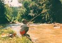
Child fishing in the uMsunduze River
|
Between Howick Falls and Albert Falls Dam, the river is rocky with fast flowing water - ideal habitat for the KZN yellowfish which is also a popular catch here. The Albert Falls Dam itself is an excellent angling venue. While the fish species are much the same as in the Midmar Dam, the warmer water and abundance of submerged trees result in greater growth and the capture of more trophy size specimens.
|
|
Downstream of Albert Falls, the river is well known for its carp but further downstream the KZN yellowfish and catfish are popular to both recreational and subsistence fishermen. Nagle Dam provides good catches of carp, tilapia and catfish, but neither Nagle or Inanda Dam are considered prime fishing venues.
Blue Lagoon, with its additional saltwater species, was historically a hive of fishing activity, but deterioration in river health and siltation of the estuary led to a decline in the angling. Recently, however, the estuary has seen a resurgence in angling popularity. Light tackle anglers in particular are now common here and catch a variety of species such as kingfish, springer, and gurnards. These are all marine fish but hopefully this indicates that the estuary is once again becoming a nursery for many fish species.
|
A HISTORICAL DESCRIPTION OF THE UMNGENI RIVER
|
|
This historical description was compiled from available written and photographic records dating back to the 1600s.
|
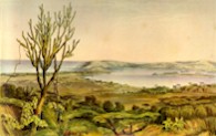
Durban Bay around 1850
|

Durban Today
|
|
This report tells us about the current state of the uMngeni and neighbouring rivers. Why would it be important to examine how these rivers looked and behaved in the past? By understanding something of the historical state of these rivers, we are made aware of the goods and services they provided back then and how these may be different from the present situation. This comparison gives an indication of the trajectory we are on in relation to our rivers so that we can try to manage, and perhaps restore the benefits we get from them.
|
|
We are fortunate that the vision of various people in the 1950s and 1960s resulted in fairly detailed surveys of the uMngeni River. These were published by the CSIR and the Town & Regional Planning Commission. But, these reports document the river in an already impacted condition.
Earlier knowledge of the uMngeni River in the upper parts of the catchment is limited, other than from incidental reference made in various texts. Because of the development of Pietermaritzburg, some information on the uMsunduze is available mostly in the form of old photographs. There is considerably more information about the river estuary and its relation to Durban Bay, as this was an important resource for the settlers in the early 1800s.
|
Lower uMngeni Bridge - 1870
|
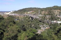
Lower uMngeni Bridge - 2002
|
|
The uMngeni Estuary
Information on the meanderings of the uMngeni estuary is confusing and scant. It appears that the position of the estuary has changed repeatedly, moving not only north and south along the coast, but at times the uMngeni River flowed directly into Durban Bay.
Russel (1899) noted that the name uMngeni means "River of Entrance" because the ancient uMngeni flowed into Durban Bay via a low-lying area known as "Eastern Vlei". But, a map of Durban drawn by Lt. King in 1823 shows the river clearly entering the sea in approximately its current position, with little sign of a pathway to the Bay.
A 1909 Mercury Pictorial (9th September) reported that the estuary had marched "three miles" from its present position towards Durban. Concern was expressed and the estuary was manually redirected towards its current position. This probably happened repeatedly.
From and old account written in the late 1600s, the author describes what is now Durban where the mouth of the river is clearly the Bay itself: "Neither is there any want of water, for every hill affords little brooks, which glide down several ways, some of which meet by degrees, which make up the river of Natal (uMngeni River), which dischargeth itself into the East Indian ocean, in latitude 30 S, where it opens pretty wide, and is deep enough for small ships. But at the mouth of the river is a bar, which has not above 10 or 11 feet of water on it in a spring tide, though within there is water enough. This river is the principal of the country of Natal, and has lately been frequented by some of our ships, particularly by a small ship that Captain Rogers owned. (Dampier's Voyages - British Museum - repeated in Bird 1888).
Accordingly to Hattersley (1936) who described Durban in the 1800s: "Then as now, the beach (in Durban Bay) was the centre of amusement. The boys fishing for eels in the big pond, formed in the "dip" in West Street by the stream which originally connected the Umgeni with the bay, provided favourite sport in the days before building operations covered the swampy ground (today the dip in West St is between Field St and Gardiner St). At low spring tide, it was very nearly possible to walk on dry sand across to the Bluff, and the channels could be easily waded by those who did not fear sharks. North of the Point, the little-used ocean beach swarmed with white crabs." Hattersley, MA (1936) .
Cooper & Mason (1987) say the following of the meandering estuary: "?the uMngeni flowed southward between the Berea Ridge and a line of coastal dunes before discharging into Natal Bay. This former course is marked by thick estuarine deposits beneath Durban and is visible on satellite images of the Natal coast. In a chart of 1860 this former course of the uMngeni is marked by a series of marshes."
In 1856 a great flood laid waste the Springfield Estate along the Umgeni, which had grown the first Natal-grown sugar for sale on the Durban market. (Hattersley 1936)
Descriptions of Durban Bay
Following is an extract from a dispatch from Commander Simon van der Stel (1690) - reporting on the search by the ship de Noord for the sailors from the wrecked ship Stavenisse. When they got to the Bay of Natal they found some of the crew of the Stavenisse. The report describes the Bay as follows: "There are many dense forests with short-stemmed trees; but at the bay of Natal are two forests, full a "mijl" square, with tall, straight and thick trees, fit for house or ship timber, in which is abundance of honey and wax: but no wax is to be had from the natives as they eat the wax as well as the honey. ...In the rivers are eels and congers, and in the bay of Natal king's fish and sun-fish, besides all kinds of fish known in India and here, as may be further seen from the annexed account taken down from the mouths of our men." (in Bird, 1888)
Thomas Green was an immigrant to Natal in 1843 and wrote the following description of his arrival in Durban.(in Hattersley, 1936).
|
|
"I stood in amazement at the grandeur of the scene. Everything was primitive; the hands of man had not defaced it. The inner Bay was like a sheet of silver, the home of wild fowl that man had never frightened. I thought the Bay the most beautiful sight that I had ever seen. But the sunset that evening in May with the golden tints beggars any description that I can give. I have never seen the like before in Ireland, where I come from. The beautiful Berea untouched, all one sheet of evergreen, and the home of elephants and other animals."
|
| The uMngeni River in Durban
The town that became Durban developed on the flat plain at the base of the Berea. The scant vegetation rapidly became a mass of loose blown sand, which drove the inhabitants to distraction. The Anglican Bishop of Natal, Bishop Colenso wrote the following account of the drinking water in the town: "A greater evil in Durban is the water, which is taken usually from wells, that are not sunk deep enough, and consequently abound with decaying vegetable, if not animal matter, and innumerable animalcules and worms?..At present, the remedy is to drink rain water, or the water of the Umgeni River, which is brought by carriers a distance of four miles and is excellent. Indeed, had the Dutch founded the town of Durban, as they did that of Maritzburg, they would long ago have had the Umgeni pouring its beneficent streams through every street, and bringing health and cleanliness to every door. How long will it be before the public spirit of Englishmen will achieve this?" (Durban's water supply was not materially improved until HW Currie sunk a well in 1879 (Curries Fountain) in the vicinity of the present Botanic Garden). Bishop JW Colenso (1854) in Hattersley (1936)
Alfred Delegorgue describes going on a hippo hunt in the Seekoei Vlei, now dominated by the N2 road, sewage works and a new garage development. All that remains of what was the scene described below, are some reeds and a small polluted lake. The rest of the area is drained by a system of canals. "After we had crossed the sandy bed and forded the beautiful river (the uMngeni), another challenge faced us in the guise of a steep and difficult ascent on the other side. Without benefit of roads, we reached the summit of this hill and then skidded down towards a pretty peninsula surrounded by a deep lake, where the large heads of hippopotamus could be seen here and there on the surface of the water?.we pitched our tent on the inviting green promontory ? the slope was so gentle, the grass so short, the top of the little hill so well placed between the crocodiles and hippopotamus ?. Mosquitoes attacked us in their millions, finding their way under our bed clothes which gave no protection, invading our noses, our ears, our eyebrows and our beards." (1848 - Delegorgue).
|
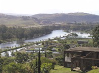
Seekoei Vlei - 2002
|
Swimming gala in the uMsunduze River,
around 1909
|
|
Pietermaritzburg
The town of Pietermaritzburg was distinguished in the early 1840s by the furrows of flowing water that carried water from the Little Bushmans River (the 'Dorpspruit' which carried the same name as uMsunduze) down the length of all of the streets .The water was abstracted from a point just below the entrance to the Botanical gardens to a point at the top of Longmarket St for a period of 40 years (Meineke and Summers, 1983). Each property owner was responsible for maintaining the furrow past his/her property, and the custom was to draw water into barrels in the early morning of each day, when water quality was likely to be at its best. This water provided an important service to the citizens, even though pedestrians occasionally fell into them by accident at night! Crabs abounded in these furrows, to the delight of the town's children. Syringa trees were originally planted to indicate the boundaries of the streets, and after all these years have become an invasive problem.
The furrows were converted into a piped supply in 1881 and in time, the waters of the Dorpspruit became insufficient to provide for the growing town. Catchment management in the Dorpspruit became an issue in 1887 when the reservoir caretaker was appointed to protect the water supply via protection of the vegetation. Water was also taken from the Town Bush stream where in 1901 a water treatment plant was built at the confluence with the Chase Valley Stream. The first water was pumped from the uMsunduze in 1903 and by the following year sights were set on the tributaries in the Henley area, which provided water into a pipeline. It was only in 1924 that a dam was built on the uMsindusaan River. This dam collapsed in the year of completion, but was rebuilt within a few years (1927). Henley dam was then built on the main uMsunduze and was completed in 1943.
Pietermartzburg's first sewer discharge in1863 was into the uMsunduze below old jail in Burger St. This created water quality problems within the town until a main was installed in 1905 to carry the sewage to below the town.
The uMsunduze River was the venue for most swimming activities in Pietermaritzburg. Each February the annual swimming gala was held, including a race of 300m part of which was swum upstream. In 1896 the event was interrupted by a sudden spate that washed away the officials' raft and the military marquee on the banks, table, chairs and all.
A severe drought in Pietermaritzburg (489mm rain - 53% of average) during 1931 coupled to the great Depression, was accompanied by an outbreak of malaria that moved inland from the coast.
In 1875 the uMsunduze in Alexandra Park was shaded by large weeping willows (Hattersley, 1936). Bishop Colenso noted in 1854 that the willow trees were only eight to ten years old, and were already "very fine in their growth".
|
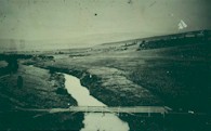
Footbridge between Chapel Street and Alexandra Park - 1866
|

The same site today
|
|
A further report notes that: "There is no record of when the first weeping willow trees were planted in this part. The original cutting, which became the parent tree of all weeping willows in South Africa was taken from a tree at Napoleon's grave at St. Helena." Miss Smythe-History of Nottingham Road 1850-75 (in Hattersley, 1936).
The pictures of the footbridge just below Chapel St crossing to Alexandra Park (above) give an interesting insight into the changes in vegetation that have taken place over the years. Note how the banks of the river have overgrown with exotic trees, resulting in the destabilisation of the soil and subsequent incision of the river deeper into the ground.
|
|
Boating on the waters of the uMsunduze became a popular pastime (see picture on the right) from a weir below Musson's Tea Room up towards Commercial Rd. At the time it was stated "this stretch is today one of the prettiest river stretches in South Africa and is one of the city's best attractions".
|
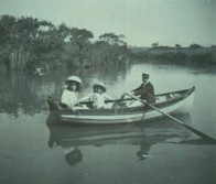
Boating on the uMsunduze around 1902
|
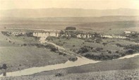
Albert Falls - 1912
|
"In September 21, 1853, snow lay half-way down the Town Hill, the only time I have seen it there. In April 1856, there was one of the highest floods ever known in the colony, and the bridge over the Umsundusi was washed away."
- Rev. James Green, (in Hattersley 1936)
|
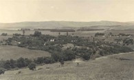
Albert Falls - 1952
|
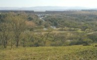
Albert Falls - 2002
|
"In 1868, when I was nine, we children were taken to see Victoria Bridge, over the Umsundusi, which had collapsed in the centre through the river raging far over its banks in the floods. A drift was made above where the bridge was, which was used for traffic?..in Loop Street, near Buchanan Street, was a mill, Van der Plank's I think it was called. A very strong stream of water leading into Burger Street turned the wheel. Often and often, we children watched the mealies being ground into meal."
Mrs. G. Lamond Narrative of Family History, Natal Archives - Hattersley)
|
|
Further stories from Pietermaritzburg
"At the bottom of the town was very good snipe shooting, in the "vlei" - a marsh. Piet Otto, lived in his farm 14 miles from headquarters, and possessed 17 000 acres of fenced land (now Otto's bluff). The Umgeni River ran through the farm, very deep in some places. He allowed me to shoot where I liked on condition that I did not shoot his pet hippos. There were seven; but one year he had a contract to supply the troops with forage. I got a note sent express, saying "for goodness' sake come and help kill the sea cows, they are destroying my forage and I cannot carry out my contract". ?Eventually all but two were shot; these two had enough of it and went away to pastures new. GA Lucas, (in Hattersley 1936)
"In the early days of the town, game was very plentiful in the neighbourhood, and besides this, there were lots of leopards and hyenas. The latter frequently prowled about the town.."
Pistorius, CW. 1845. (in C. Bird papers)
"Our shooting ground consisted of all the land in sight of the city, including all the town lands, which supplied us with riet buck, oribi, duiker and paauw. Fox Hill was named by myself and others, who at times got up a scratch pack of dogs, immaterial what breed so long as they gave us a run, after jackal."
JW Shepstone (in Hattersley, 1936).
Pietermaritzburg in the 1800s was not the green vista that it is today. One early description noted "the country around Pietermaritzburg is almost entirely destitute of wood, except in some of the mountain kloofs, giving the whole neighbourhood a wild, yet monotonous appearance." This can be seen in many paintings and photographs of the old city.
Upper uMngeni River
Only old photographs exist to show how the uMngeni River has changed over the years. A series of pictures of Albert Falls (see above) illustrates how development has changed the river environment from an extensive grassland area with grassy riparian vegetation, to one covered with thick woody vegetation, some indigenous and some exotic, a dam and railway line . The area has little resemblance to the original scene, which will today be reflected in the much altered river ecology.
|
|
The wildlife in the 1800s
Interesting species were recorded by Wahlberg (1838-1856) and Delegorgue (lived 1814 - 1850, visited Pietermaritzburg 1839) both of whom were avid collectors of specimens. Wahlberg sent several thousand of these, from insects to hippos, to Sweden where many are still preserved. Many of the species below we would hardly associate with these areas any more.
|
Durban
Side necked turtles (Pelomedusidae) in the Bay
Fiddler crabs
Pythons were common
Great Snipe (not seen for many years)
Black-breasted snake eagle
Woolly-necked stork
Cuckoo hawk
Bateleur eagles were common
Goliath heron
Giant eagle owl
Marabou
Red duiker
Southern reed buck
Leopard
Buffalo
Lion
Elephants in herds of more than 1000
Enormous swarms of locusts
|
uMngeni river
Marabou stork
Saddle-billed stork
Marsh owl
Mayflies were a staple diet of Bustards and Black kite
Ratel/honey badger
Wattled crane (rare)
Samango monkey
Guinea fowl
Green dove
Crested guinea fowl
Short eared owl
Bushbaby
Hippos and crocodiles in Seekoei Valley
|
uMlazi estuary
Namaqua dove
Jacana
Cato Ridge
Lions on the upper uMlazi (Cato Ridge area) - with innumerable bugs which prevented sleep
Glossy ibis near Cato Ridge
|
Pietermaritzburg
Mozambique spitting cobra
Klipspringer
Grey rhebok
Riet buck (Southern reed buck)
Oribi
Duiker
Jackal
Leopard
Hyena
Ground hornbill
Snipe
Bald Ibis
Blue swallow
Hares
Cane rats were common on the banks of the uMsunduze
|
|
Local cultural history
The Zulu people acknowledge water spirits including the river snake, the 'snake of the waters that gives life'. This belief system unites people, both the living and the dead, with natural forces, the non-human spirit world and the supreme deities. The ideal pool for ceremonies involving the river snake (e.g. diviner submergence) contains 'living water', and usually is below a waterfall where the water is turbulent and deep.
|
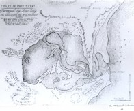
Map of Durban Bay - 1823
|
|
Reeds are also a key symbol for the Zulu people, as they believe that their people emerged from a bed of reeds in ancient times. The reed mat is thus an essential part of the diviner's habit, and is directly linked to its association with water, healing and creation.
In some areas of KZN it is believed that the heavenly princess, iNkosazana has rest days where she needs to have the river to herself. Accordingly the use of the river on her day - lesuku leNkosazana (Mondays and Saturdays), is strictly prohibited.
In the uMlazi River, river ceremonies are conducted several times a year by about 78% of the Salem community. These include:
Umsenga - the reed dance where young girls cut river reeds and take them to the Inkosi's house as a gesture of honour.
Unomkhubulwane (Goddess of Water) - seeds are thrown into the river to ask the Goddess for blessings and a good harvest.
Weddings - the bride will bath in the river prior to the wedding ceremony, to remove evil spirits and bless the marriage.
Besides bathing, ceremonial use of the river is its most common use, with the supply of building materials, recreation and clothes washing being of lesser importance.
A degraded river reduces the acceptability of the river for ceremonial purposes. Almost all of the people in Salem acknowledge that respect for the river and its attributes for cultural and religious ceremonies are diminishing.
|
| HISTORICAL REFERENCES
|
|
Bird, J (1888) The Annals of Natal 1495 - 1845. P.Davis & Sons, Pietermaritzburg.
Delegorgue, A (1848) Travels in Southern Africa. Published 1990, University of Natal Press. Volumes 1&2.
Brand, PAJ, Kemp, PH, Pretorius, SJ ad Schoonbee,HJ (1967) Water Quality and Abatement of Pollution in Natal Rivers. National Institute for Water Research, CSIR, Pretoria, and the Natal Town and Regional Planning Commission, Pietermaritzburg. Volume 13.
Hattersley, AF (1936) More Annals of Natal. Shuter and Shooter, Pietermaritzburg.
Meineke, EN and Summers GM (1983) Municipal Engineering in Pietermaritzburg for the first hundred years. City Engineers Department, Pietermaritzburg.
Russel, G (1899) The History of Old Durban and reminiscences of an emigrant of 1850. Durban: P.Davis & Sons. 512p
Schoonbee, HJ (1964) A hydrobiological investigation of the Umgeni River system, Natal and its bearing on the ecological interpretation of fuanal communities in South African rivers. National Institute for Water Research, CSIR, Pretoria Volumes 1-3.
Schoonbee, HJ (1963) Pollution studies in the Umgeni Basin (Natal). National Institute for Water Research, CSIR, Pretoria, Volumes 1-3.
Wahlberg, JA (1838 - 1856) Travel Journals (and some letters) South African and Namibia/Botswana. Published 1994, Van Riebeeck Society, Cape Town.
|
|