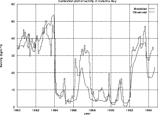
Figure 16: Salinity in Catalina Bay during calibration period
The available period of input data was divided in two and the model was calibrated on the second half and verified on the first half.
Figures 16 and 17 are graphs of the salinity in Catalina Bay and North Lake during the calibration period.
Figure 16: Salinity in Catalina Bay during calibration period
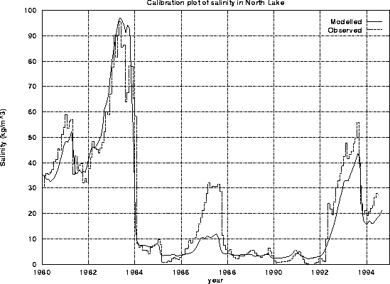
Figure 17: Salinity in North Lake during calibration period
The salinity gradient from the north to the south of the lake is important ecologically. Figure 18 displays the gradient during the calibration period.
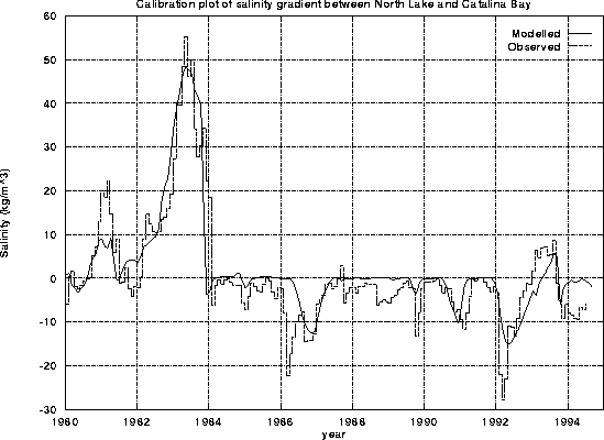
Figure 18: Salinity gradient between North Lake and Catalina during
calibration period
Figures 19 and 20 are graphs of the salinity in Catlina Bay and North Lake during the verification period.
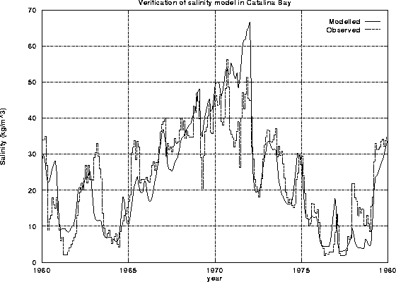
Figure 19: Salinity in Catalina Bay during verification period
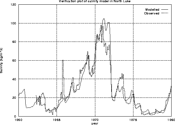
Figure 20: Salinity in North Lake during verification period
Figure 21 display the salinity gradient during the verification period.
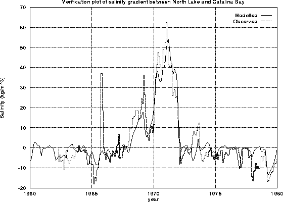
Figure 21: Salinity gradient between North Lake and Catalina during
verification period