Resource water quality data for region N.

Resource water quality data for region N. |
|
| Water quality | Description | Type | n | First date | Last date | med EC | Flow, if any |
Latitude | Longitude | ||
|---|---|---|---|---|---|---|---|---|---|---|---|
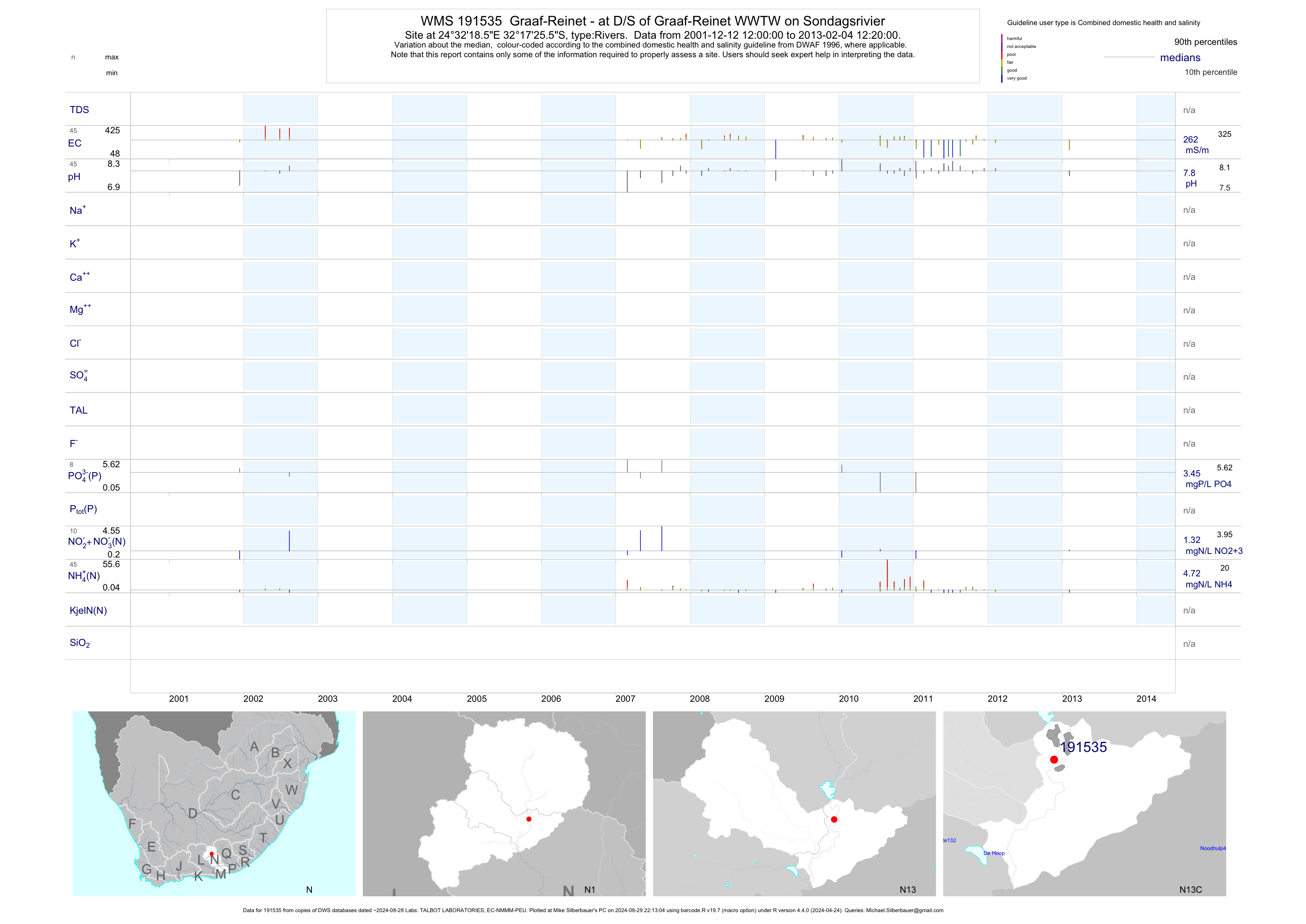
| N13 191535 | plot | data | Graaf-Reinet - at D/S of Graaf-Reinet WWTW on Sondagsrivier | Rivers | 86 | 2001-12-12 | 2013-02-04 | 259 | 191535 | -32.29042 | 24.53847 |
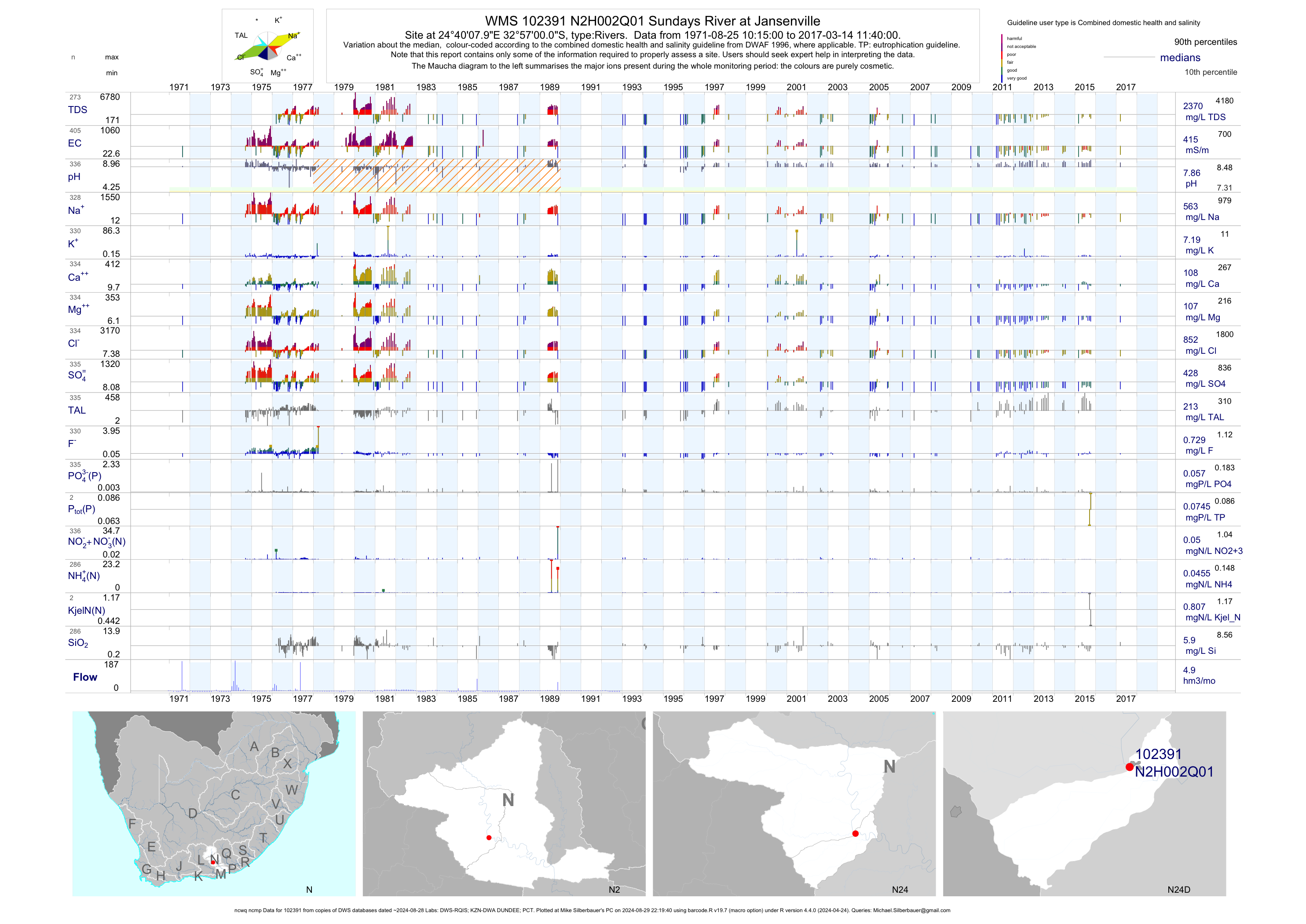
| N24 102391 | plot | data | Sundays River at Jansenville (ncwq ncmp) | Rivers | 619 | 1953-02-12 | 2017-03-14 | 415 | N2H002 | -32.95000 | 24.66889 |
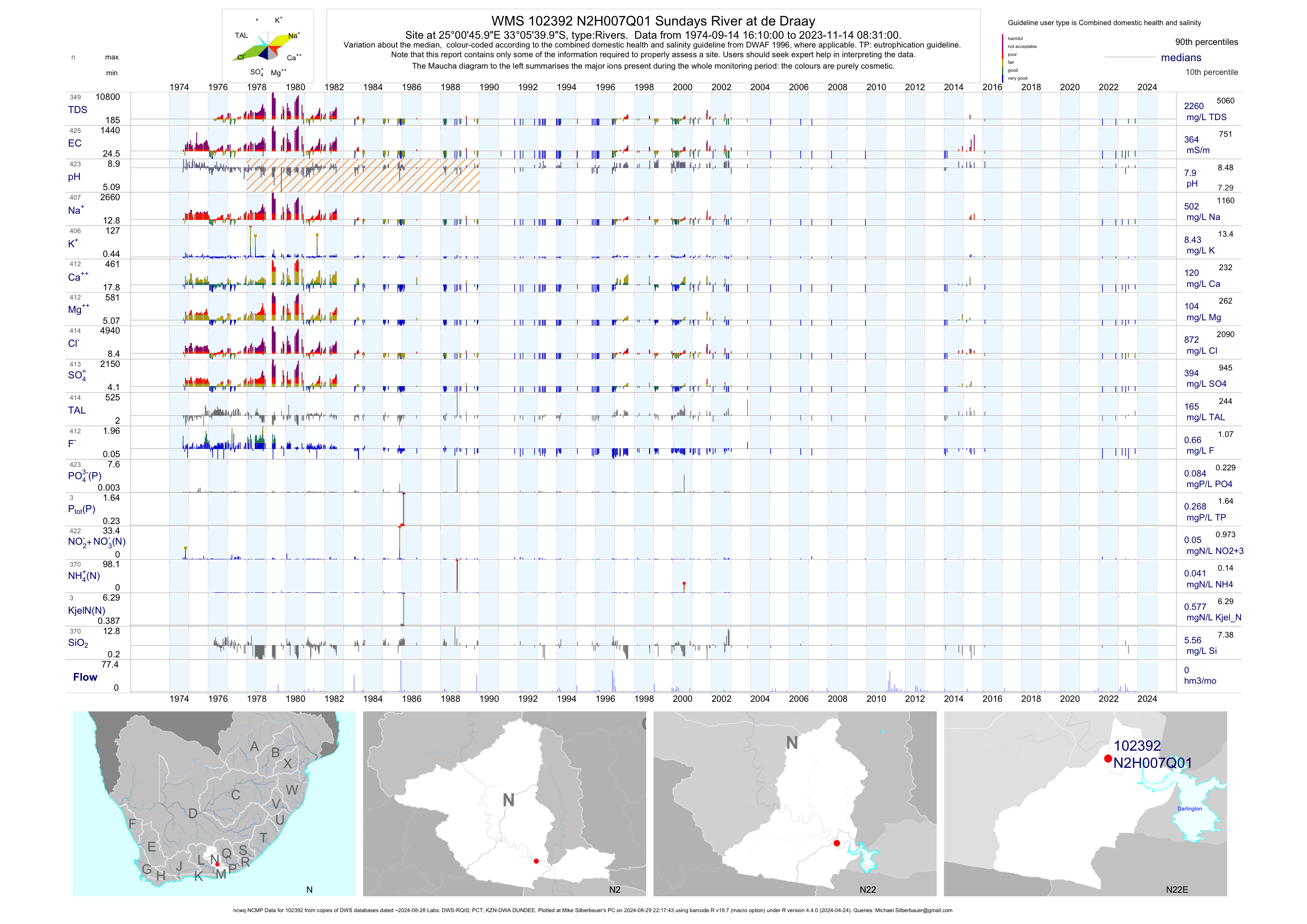
| N22 102392 | plot | data | Sundays River at de Draay (ncwq NCMP) | Rivers | 463 | 1974-09-14 | 2016-02-11 | 371 | N2H007 | -33.09444 | 25.01278 |
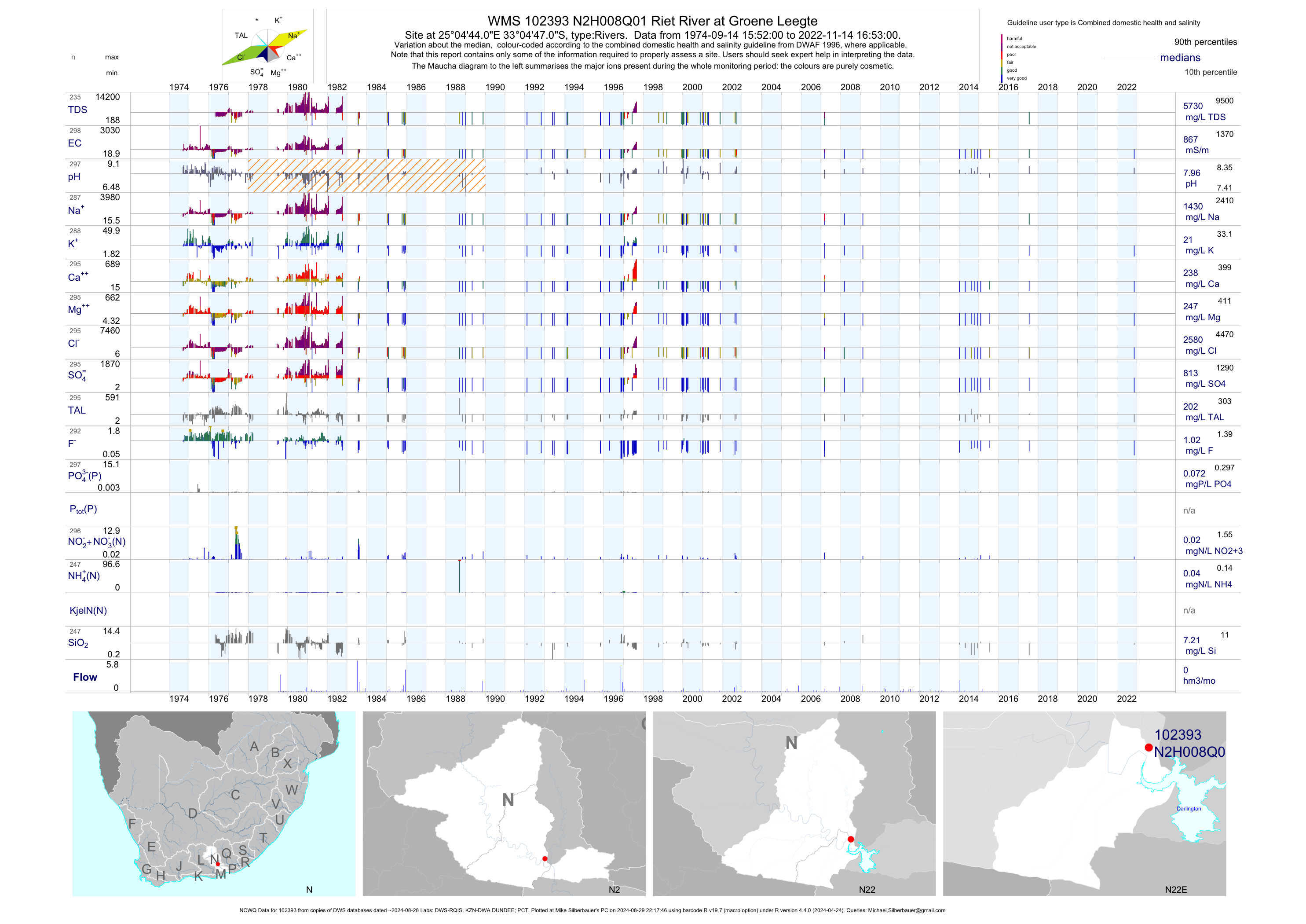
| N22 102393 | plot | data | Riet River at Groene Leegte (NCWQ) | Rivers | 302 | 1974-09-14 | 2017-07-20 | 880 | N2H008 | -33.07972 | 25.07889 |
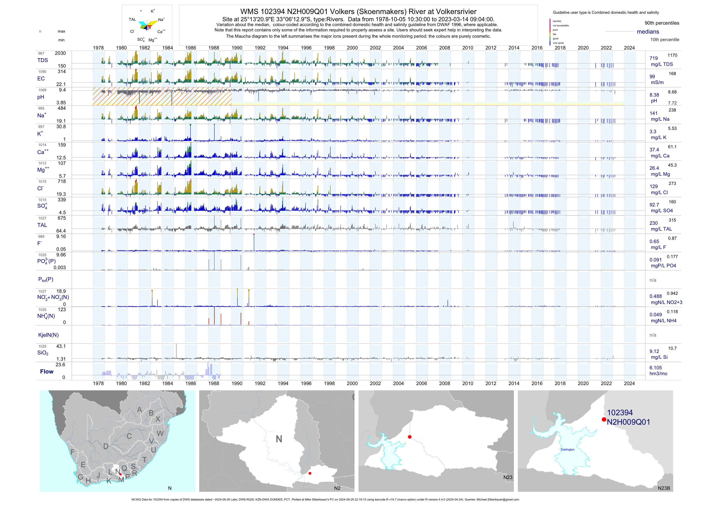
| N23 102394 | plot | data | Volkers (Skoenmakers) River at Volkersrivier (NCWQ) | Rivers | 1221 | 1978-10-05 | 2018-06-07 | 100 | N2H009 | -33.10361 | 25.22250 |
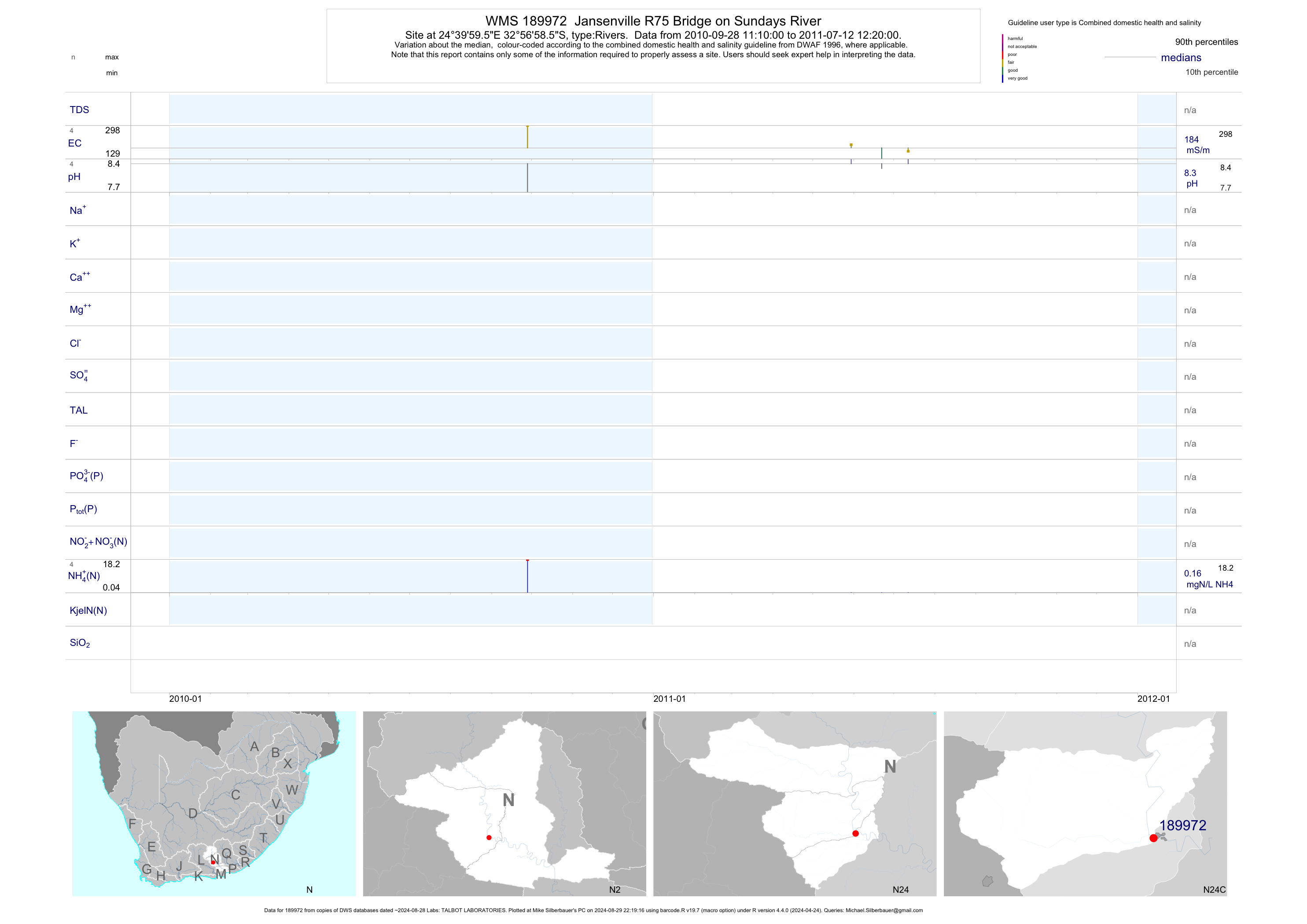
| N24 189972 | plot | data | Jansenville R75 Bridge on Sundays River | Rivers | 8 | 2010-09-28 | 2011-07-12 | 184 | 189972 | -32.94958 | 24.66656 |
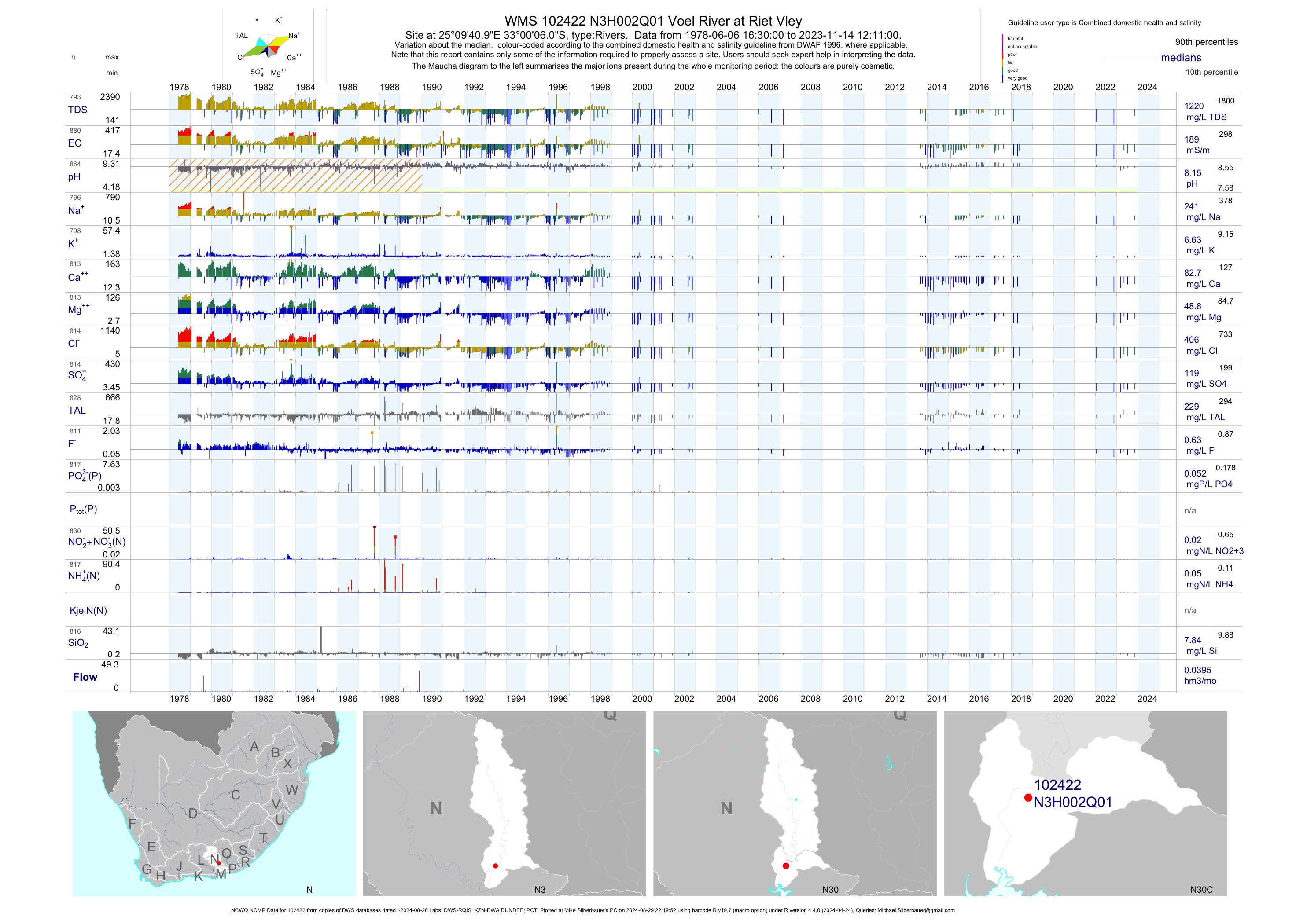
| N30 102422 | plot | data | Voel River at Riet Vley (NCWQ NCMP) | Rivers | 988 | 1978-06-06 | 2018-05-17 | 189 | N3H002 | -33.00167 | 25.16139 |
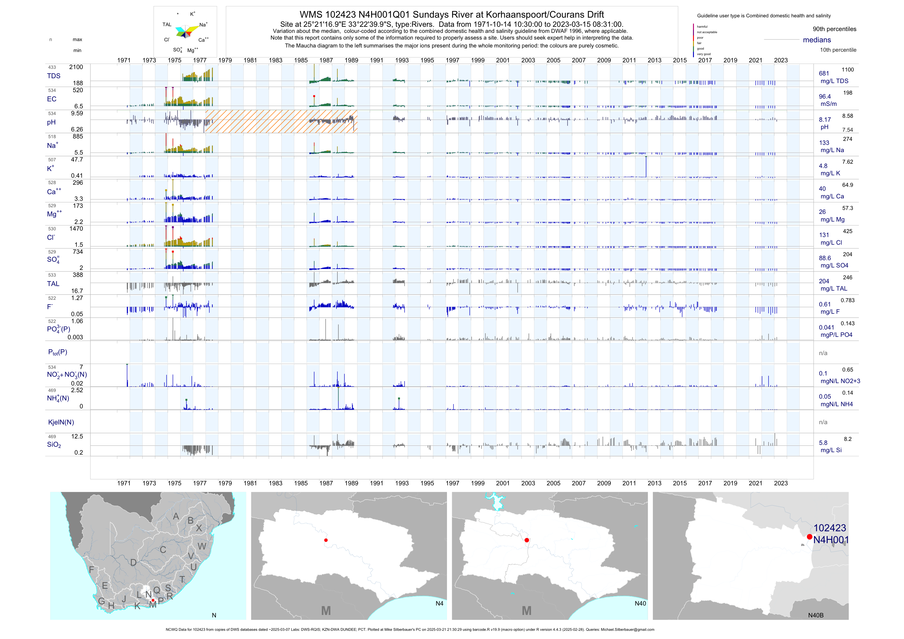
| N40 102423 | plot | data | Sundays River at Korhaanspoort/Courans Drift (NCWQ) | Rivers | 525 | 1971-10-14 | 2018-06-08 | 97 | N4H001 | -33.37778 | 25.35472 |
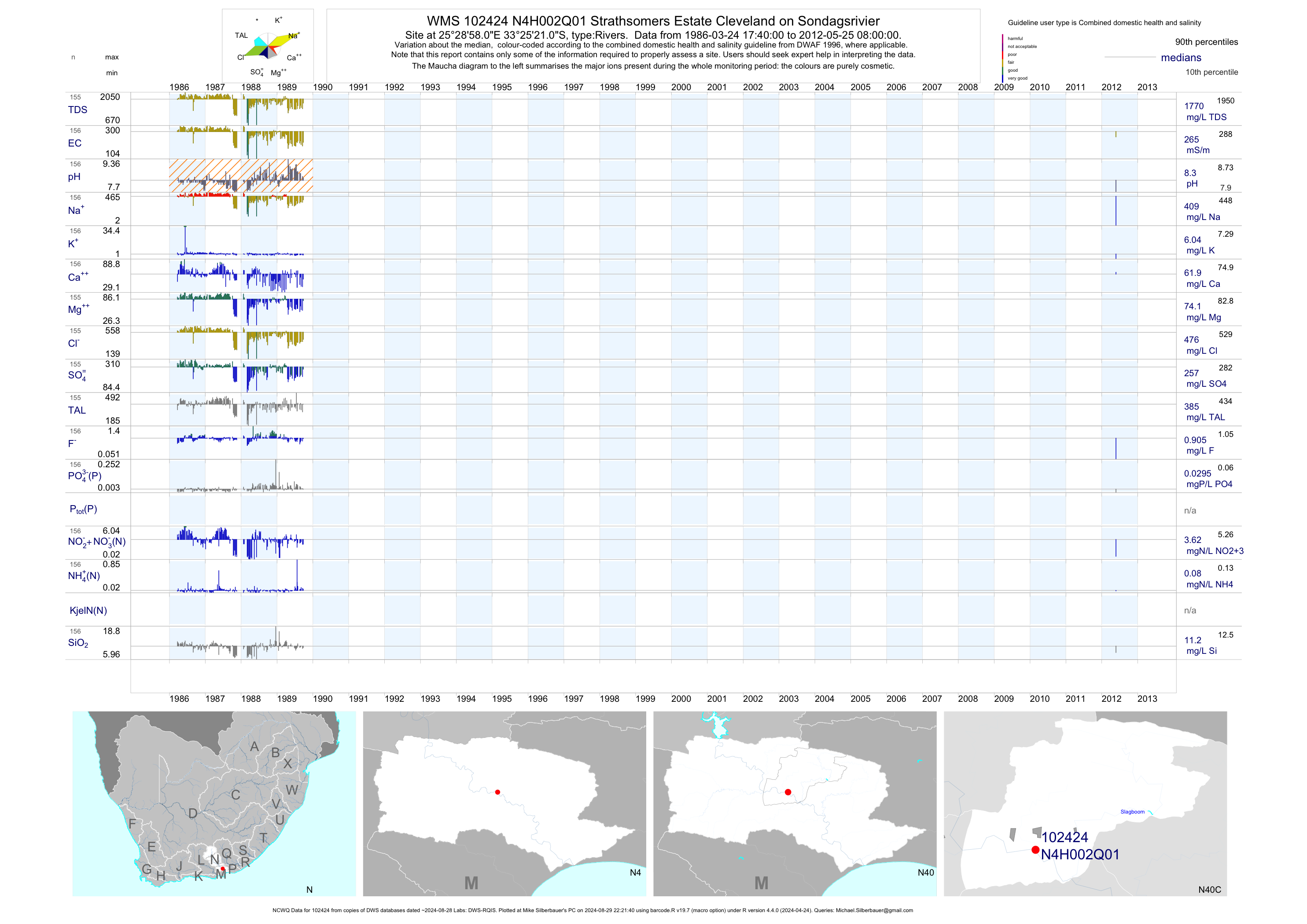
| N40 102424 | plot | data | Strathsomers Estate Cleveland on Sondagsrivier (NCWQ) | Rivers | 158 | 1986-03-24 | 2012-05-25 | 265 | N4H002 | -33.42250 | 25.48278 |
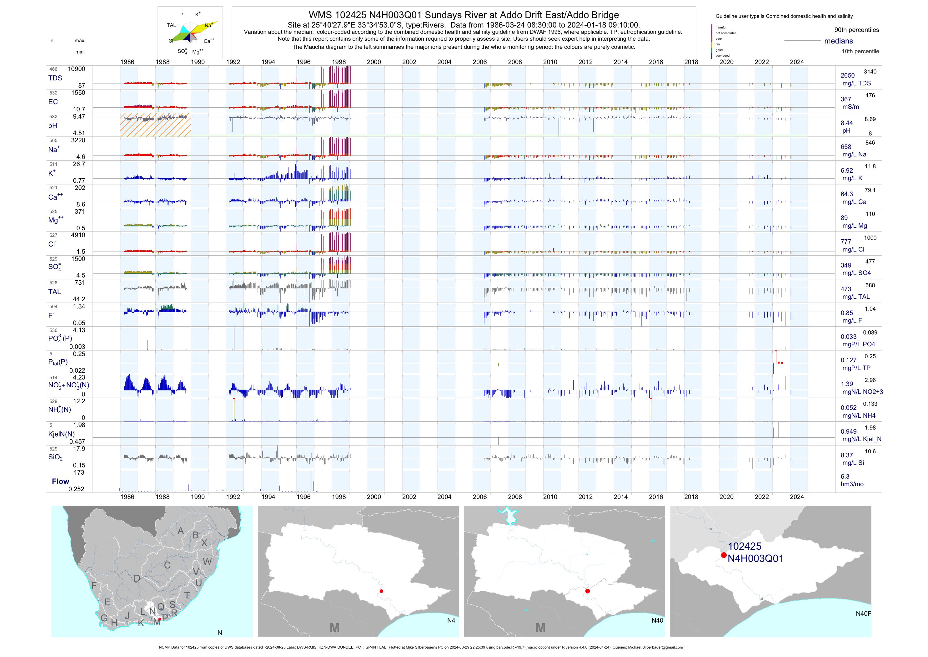
| N40 102425 | plot | data | Sundays River at Addo Drift East/Addo Bridge (NCMP) | Rivers | 614 | 1986-03-24 | 2018-06-08 | 367 | N4H003 | -33.58139 | 25.67444 |
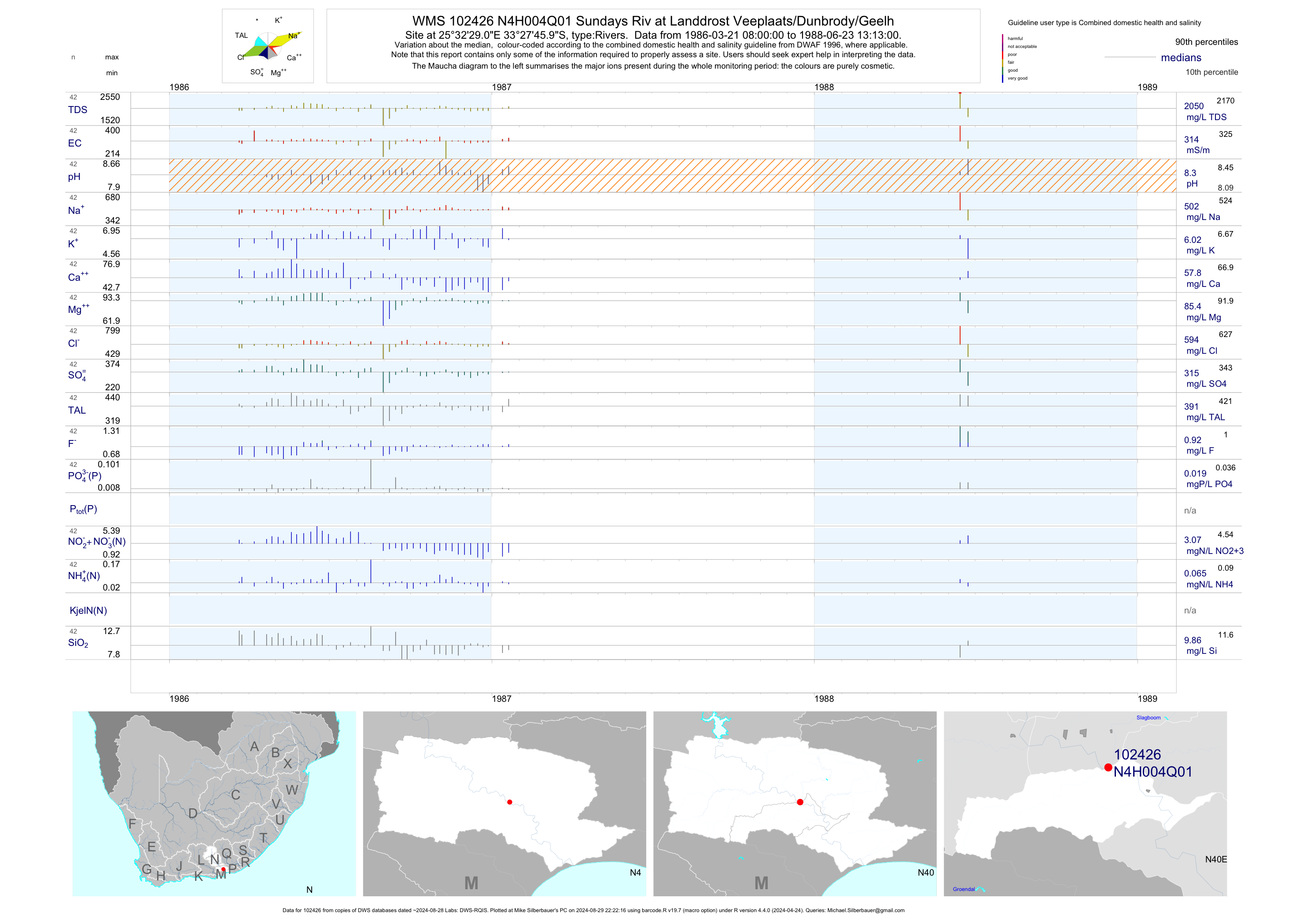
| N40 102426 | plot | data | Sundays Riv at Landdrost Veeplaats/Dunbrody/Geelh | Rivers | 42 | 1986-03-21 | 1988-06-23 | 314 | N4H004 | -33.46278 | 25.54139 |
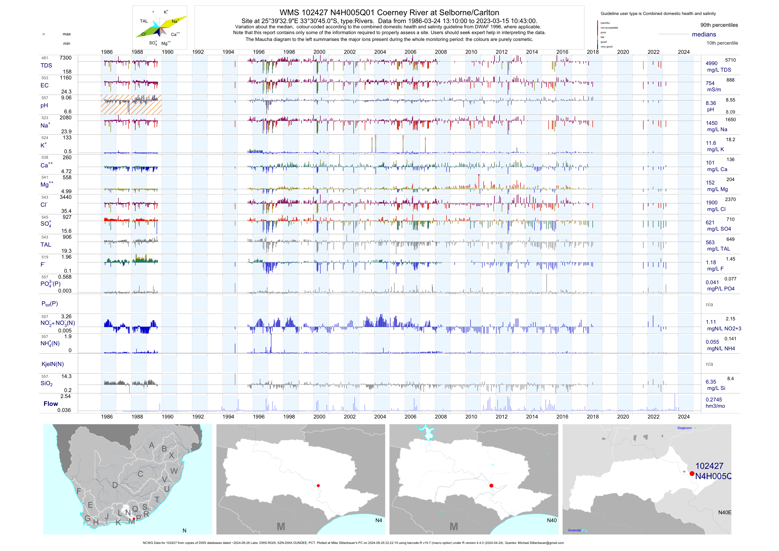
| N40 102427 | plot | data | Coerney River at Selborne/Carlton (NCWQ) | Rivers | 553 | 1986-03-24 | 2018-05-18 | 755 | N4H005 | -33.51250 | 25.65917 |
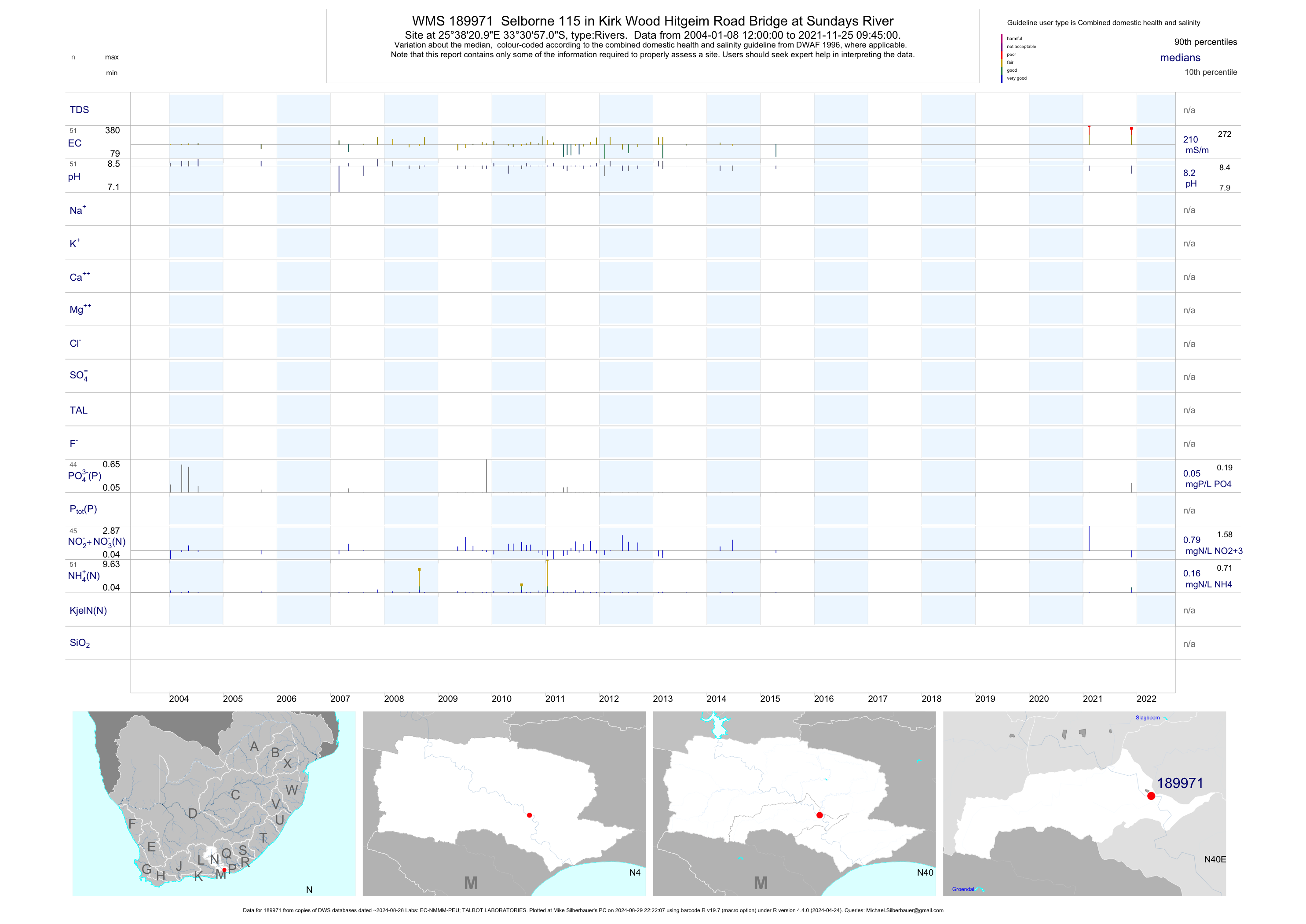
| N40 189971 | plot | data | Selborne 115 in Kirk Wood Hitgeim Road Bridge at Sundays River | Rivers | 94 | 2004-01-08 | 2015-04-16 | 206 | 189971 | -33.51583 | 25.63917 |
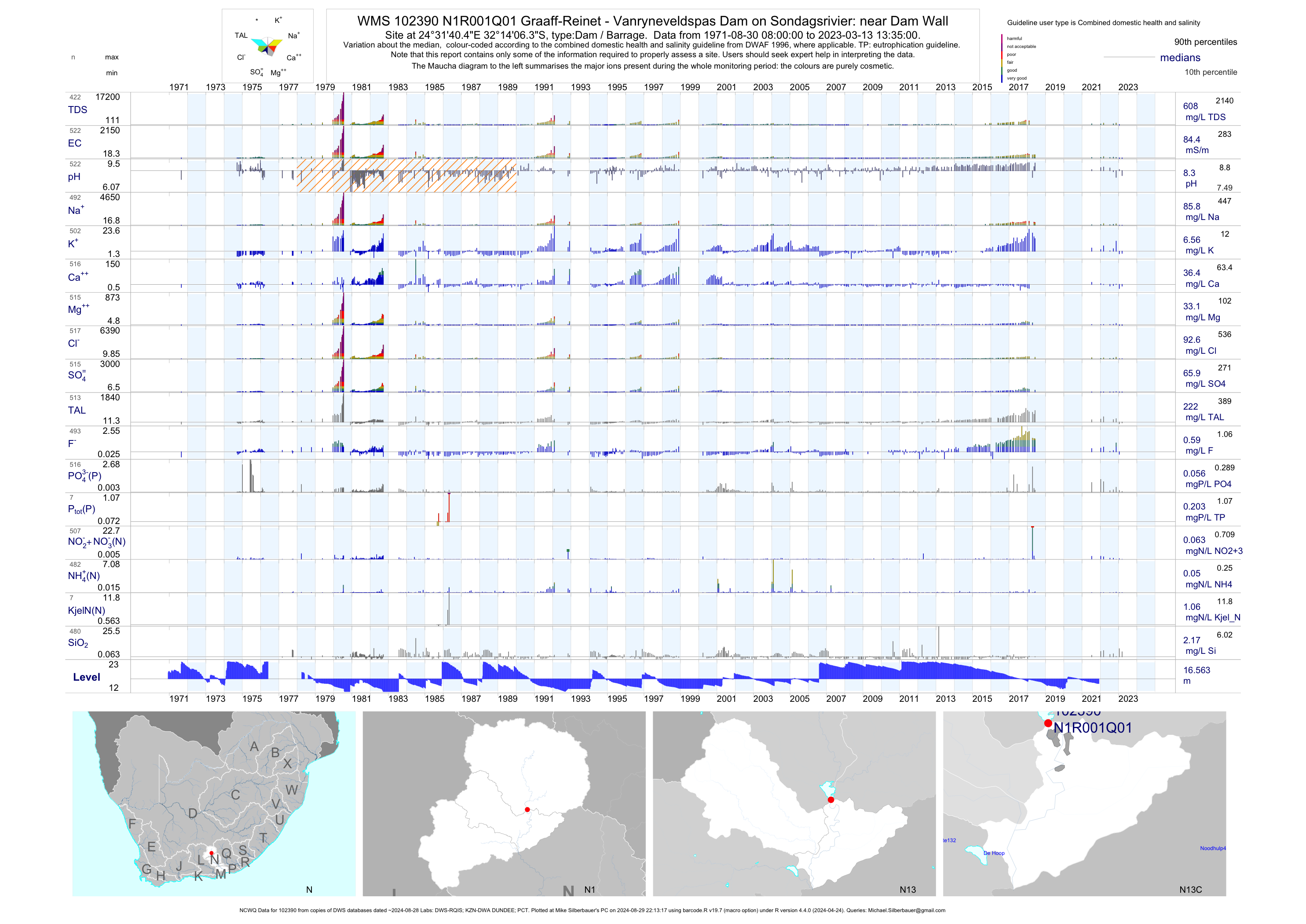
| N13 102390 | plot | data | Graaff-Reinet - Vanryneveldspas Dam on Sondagsrivier: near Dam Wall (NCWQ) Q01 | Dam / Barrage | 517 | 1971-08-30 | 2018-06-05 | 84 | N1R001 | -32.23510 | 24.52790 |
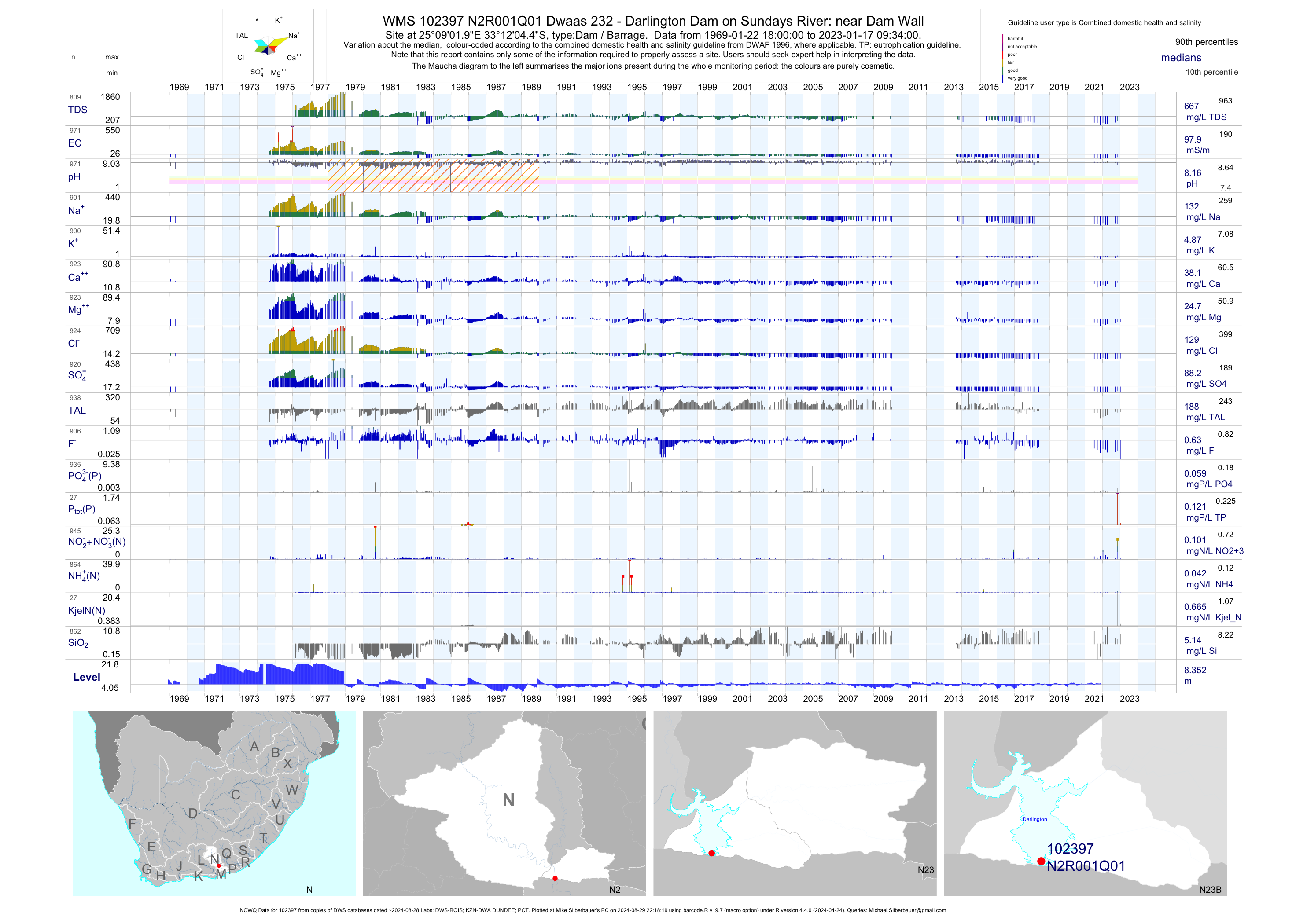
| N23 102397 | plot | data | Dwaas 232 - Darlington Dam on Sundays River: near Dam Wall (NCWQ) Q01 | Dam / Barrage | 1439 | 1969-01-22 | 2018-05-17 | 98 | N2R001 | -33.20125 | 25.15054 |
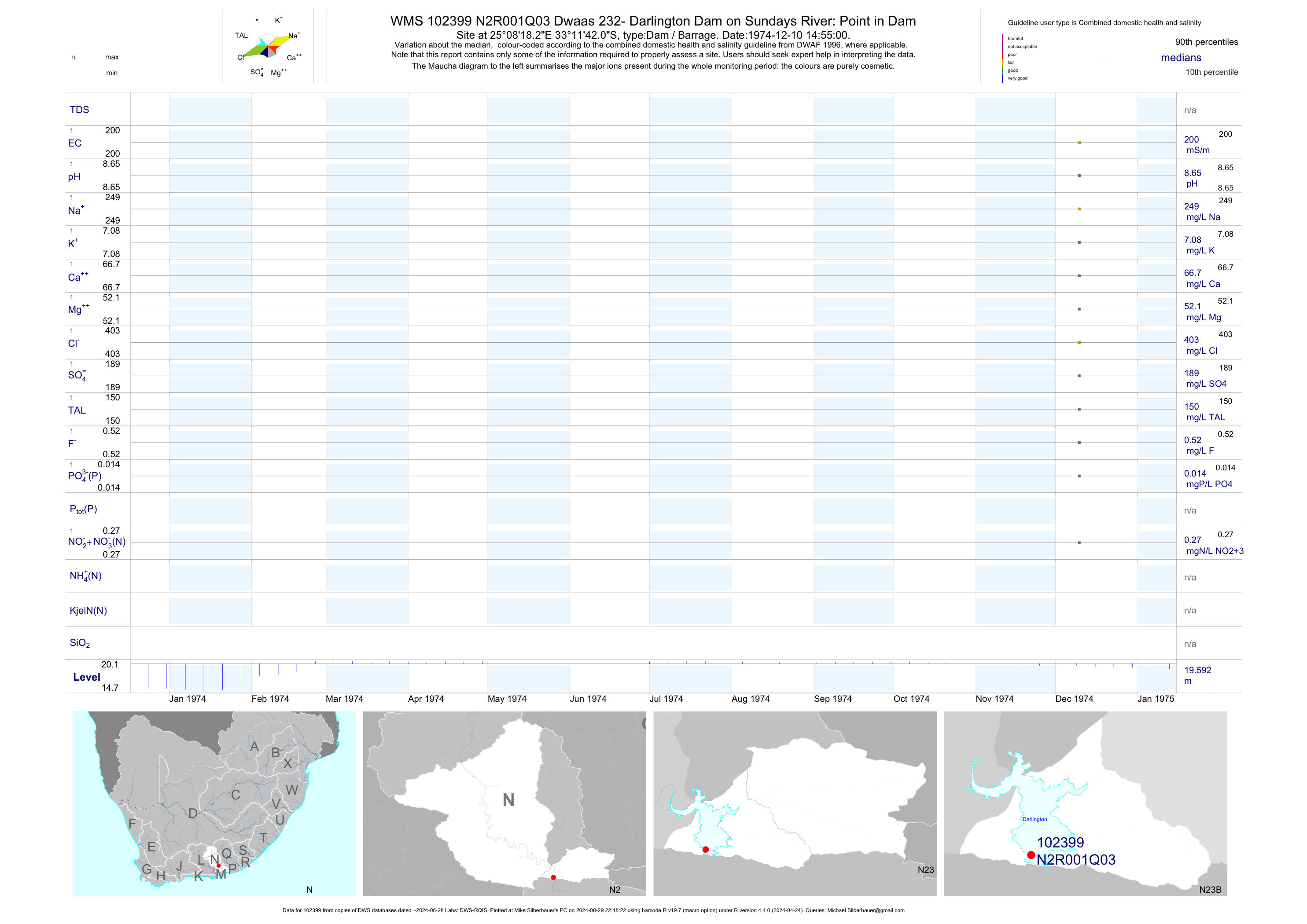
| N23 102398 | plot | data | Dwaas 232 - Darlington Dam on Sundays River: Point in Dam Q02 | Dam / Barrage | 1 | 1974-12-10 | 1974-12-10 | 200 | N2R001 | -33.20074 | 25.15979 |
| N23 102399 | plot | data | Dwaas 232- Darlington Dam on Sundays River: Point in Dam Q03 | Dam / Barrage | 2 | 1974-12-10 | 1975-03-01 | 200 | N2R001 | -33.19501 | 25.13840 |
| N23 102400 | plot | data | Dwaas 232 - Darlington Dam on Sundays River: Point in Dam Q04 | Dam / Barrage | 2 | 1974-12-10 | 1975-03-01 | 205 | N2R001 | -33.17786 | 25.13420 |
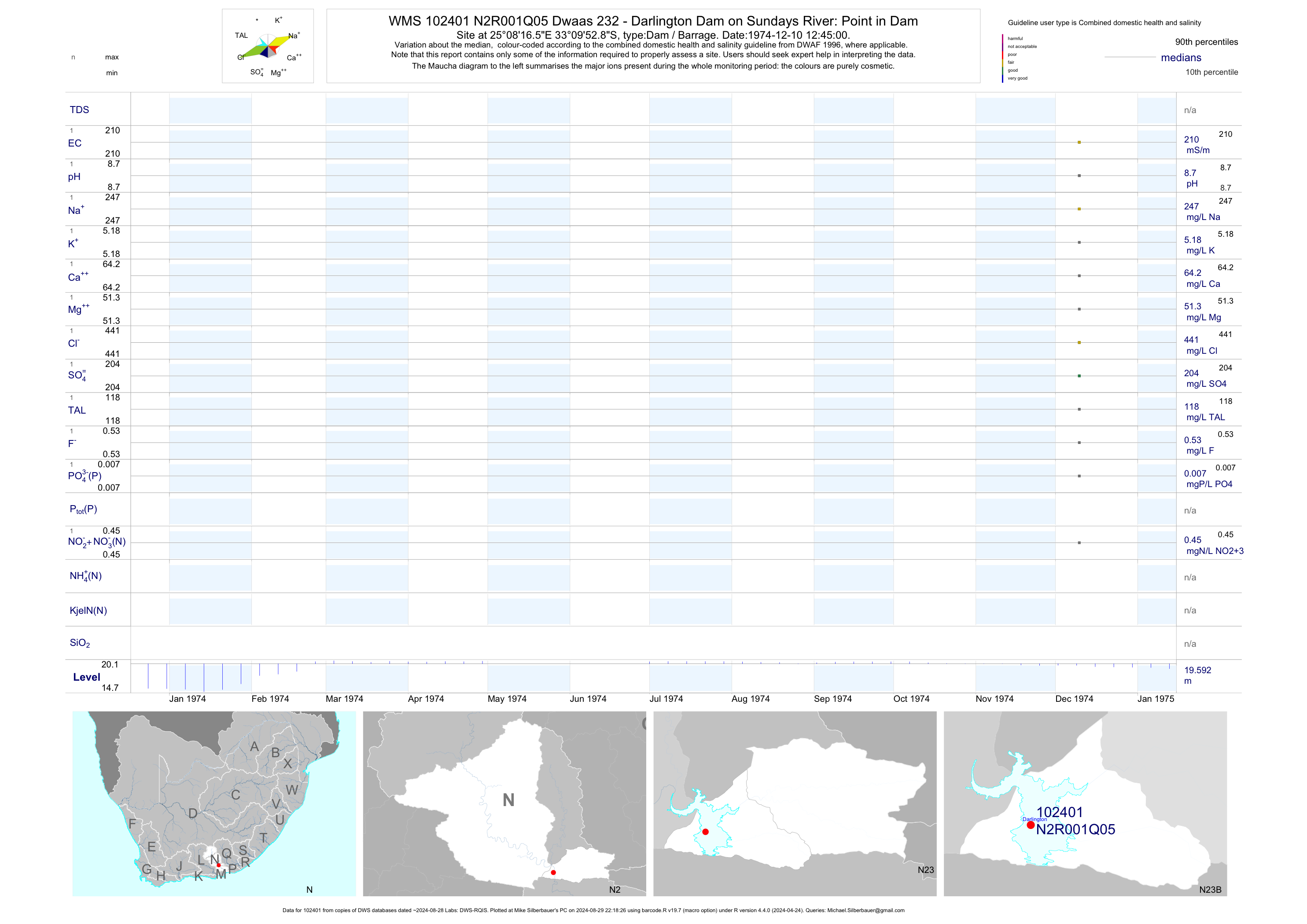
| N23 102401 | plot | data | Dwaas 232 - Darlington Dam on Sundays River: Point in Dam Q05 | Dam / Barrage | 2 | 1974-12-10 | 1975-03-01 | 210 | N2R001 | -33.16469 | 25.13794 |
| N23 102402 | plot | data | Rietrivier 230 - Darlington Dam on Sundays River: Point in Dam Q06 | Dam / Barrage | 2 | 1974-12-10 | 1975-03-01 | 210 | N2R001 | -33.14124 | 25.13294 |
| N23 102403 | plot | data | Rietrivier 230 - Darlington Dam on Sundays River: Point in Dam Q07 | Dam / Barrage | 2 | 1974-12-10 | 1975-03-01 | 218 | N2R001 | -33.13952 | 25.15520 |
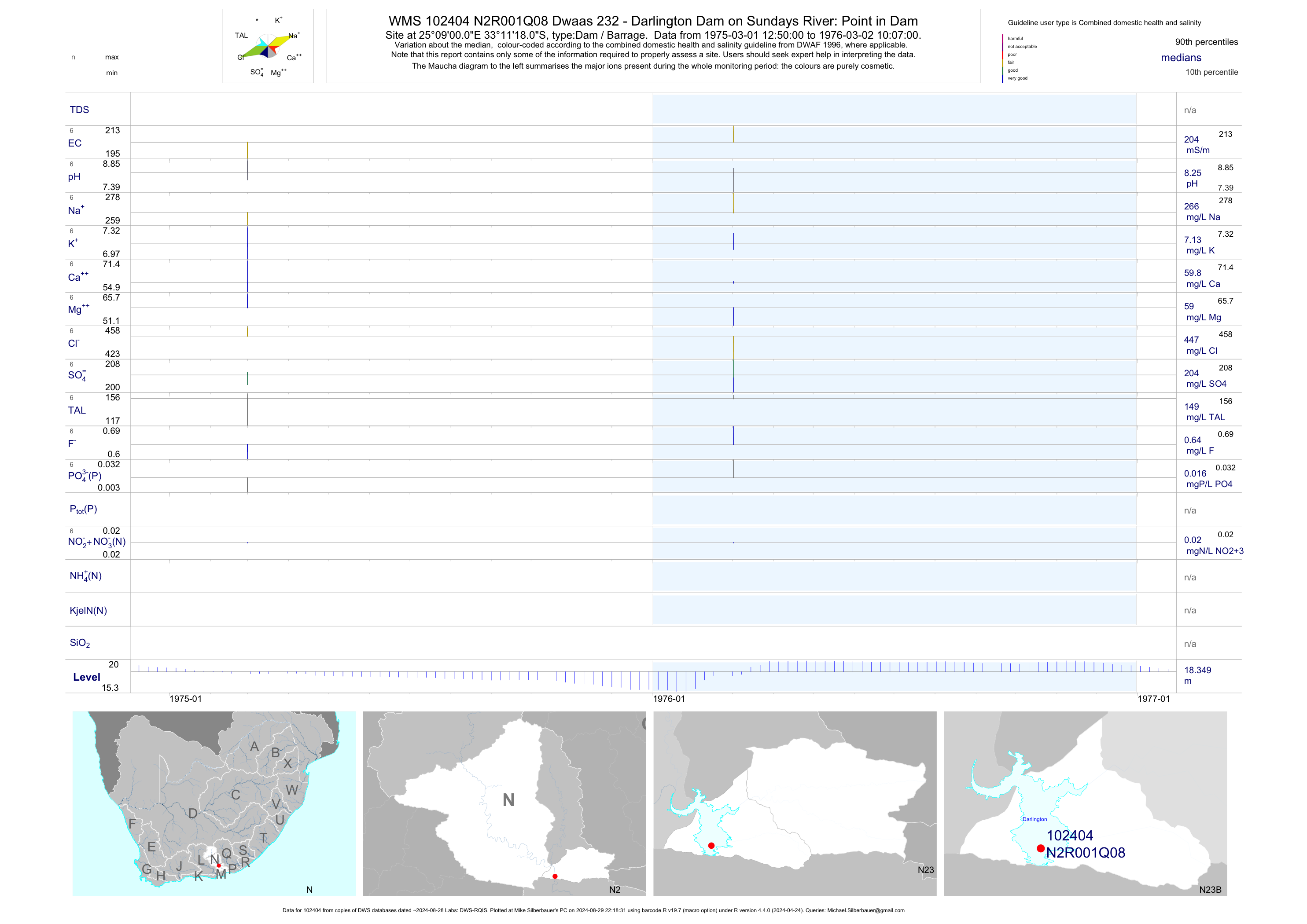
| N23 102404 | plot | data | Dwaas 232 - Darlington Dam on Sundays River: Point in Dam Q08 | Dam / Barrage | 8 | 1975-03-01 | 1976-03-02 | 204 | N2R001 | -33.18833 | 25.15000 |
| N23 102405 | plot | data | Dwaas 232 - Darlington Dam on Sundays River: Point in Dam Q09 | Dam / Barrage | 8 | 1975-03-01 | 1976-03-02 | 204 | N2R001 | -33.17716 | 25.14999 |
| N23 102406 | plot | data | Dwaas 232 - Darlington Dam on Sundays River: Point in Dam Q10 | Dam / Barrage | 8 | 1975-03-01 | 1976-03-02 | 205 | N2R001 | -33.17211 | 25.15003 |
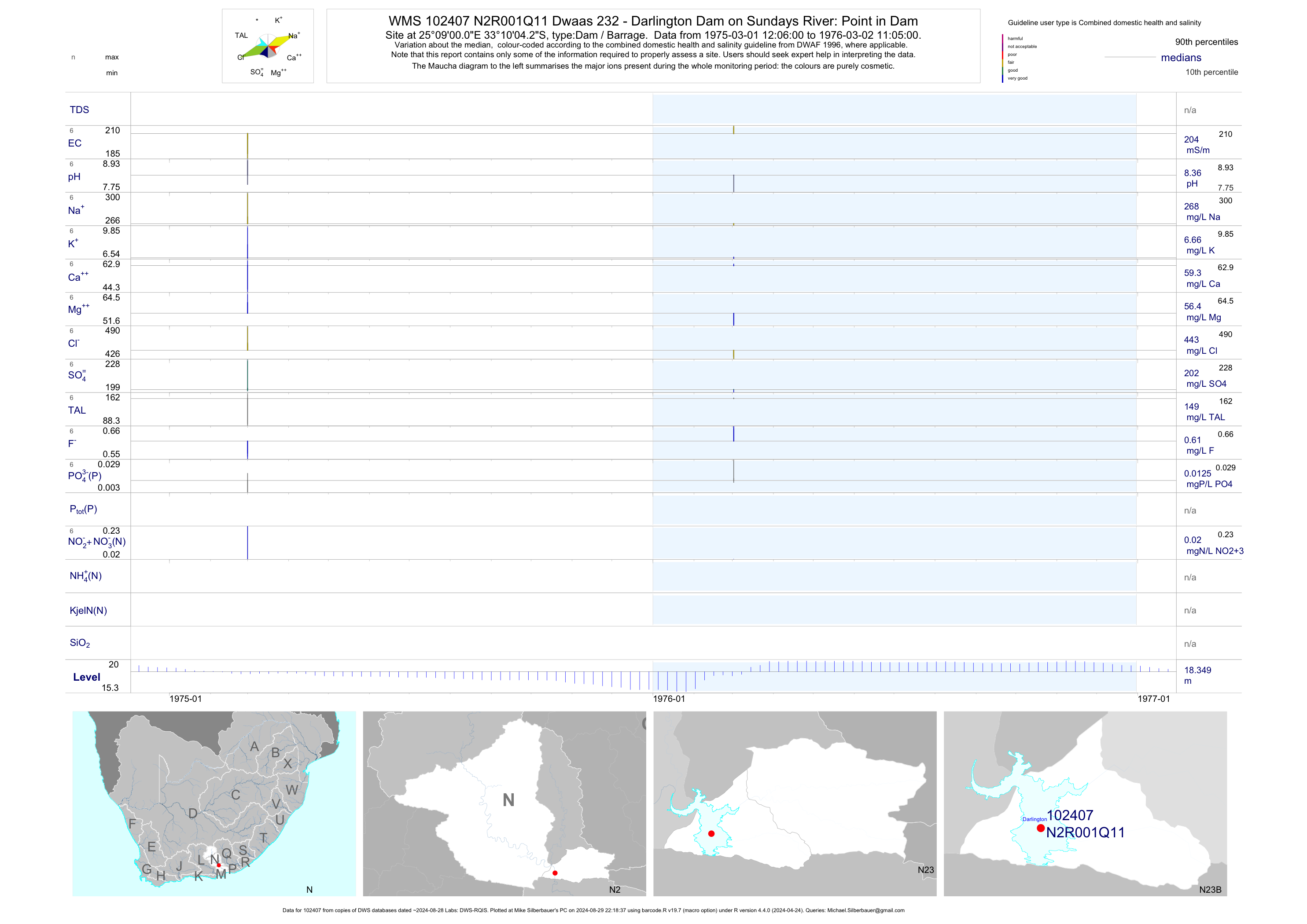
| N23 102407 | plot | data | Dwaas 232 - Darlington Dam on Sundays River: Point in Dam Q11 | Dam / Barrage | 8 | 1975-03-01 | 1976-03-02 | 204 | N2R001 | -33.16785 | 25.15002 |
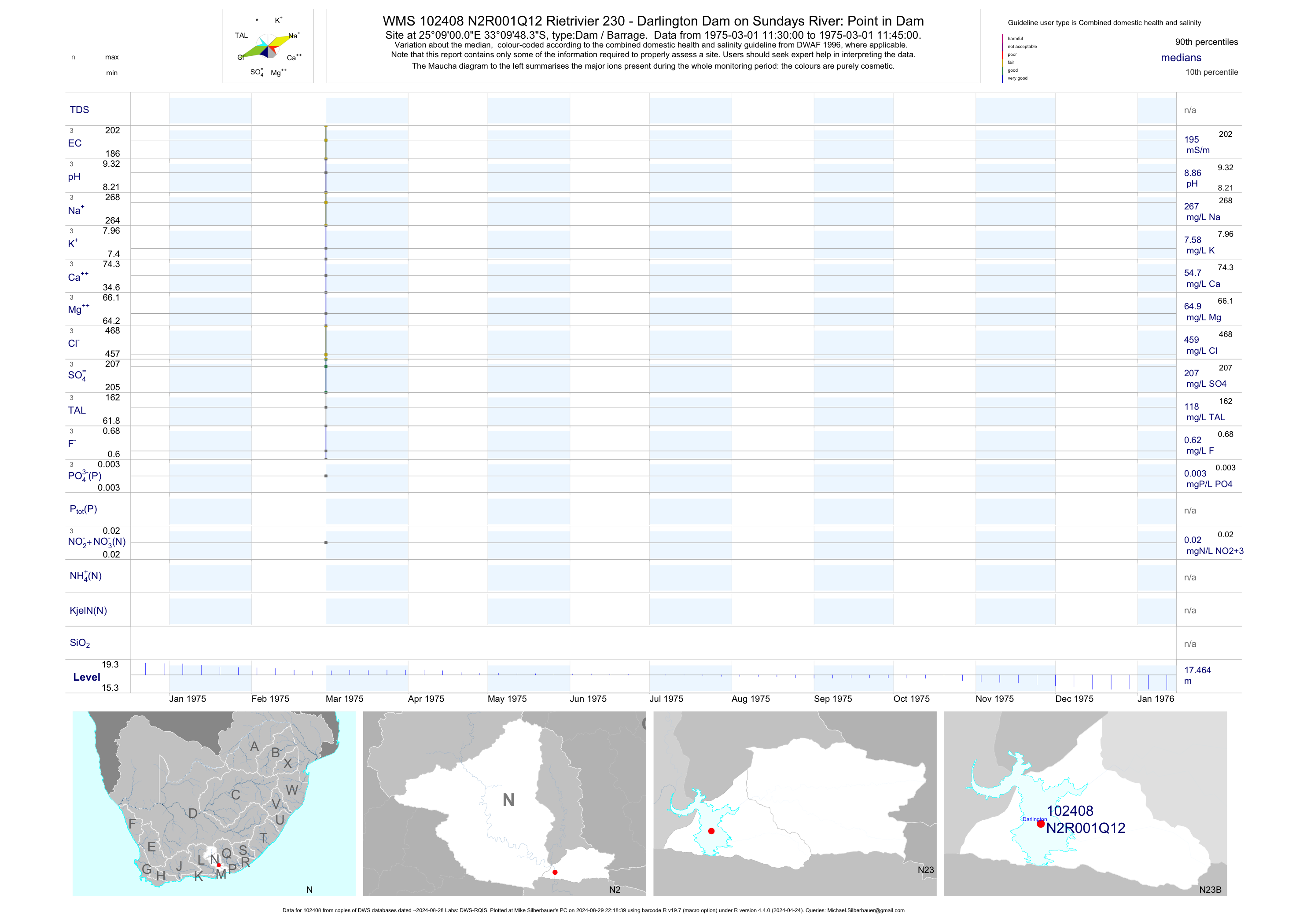
| N23 102408 | plot | data | Rietrivier 230 - Darlington Dam on Sundays River: Point in Dam Q12 | Dam / Barrage | 3 | 1975-03-01 | 1975-03-01 | 195 | N2R001 | -33.16343 | 25.15001 |
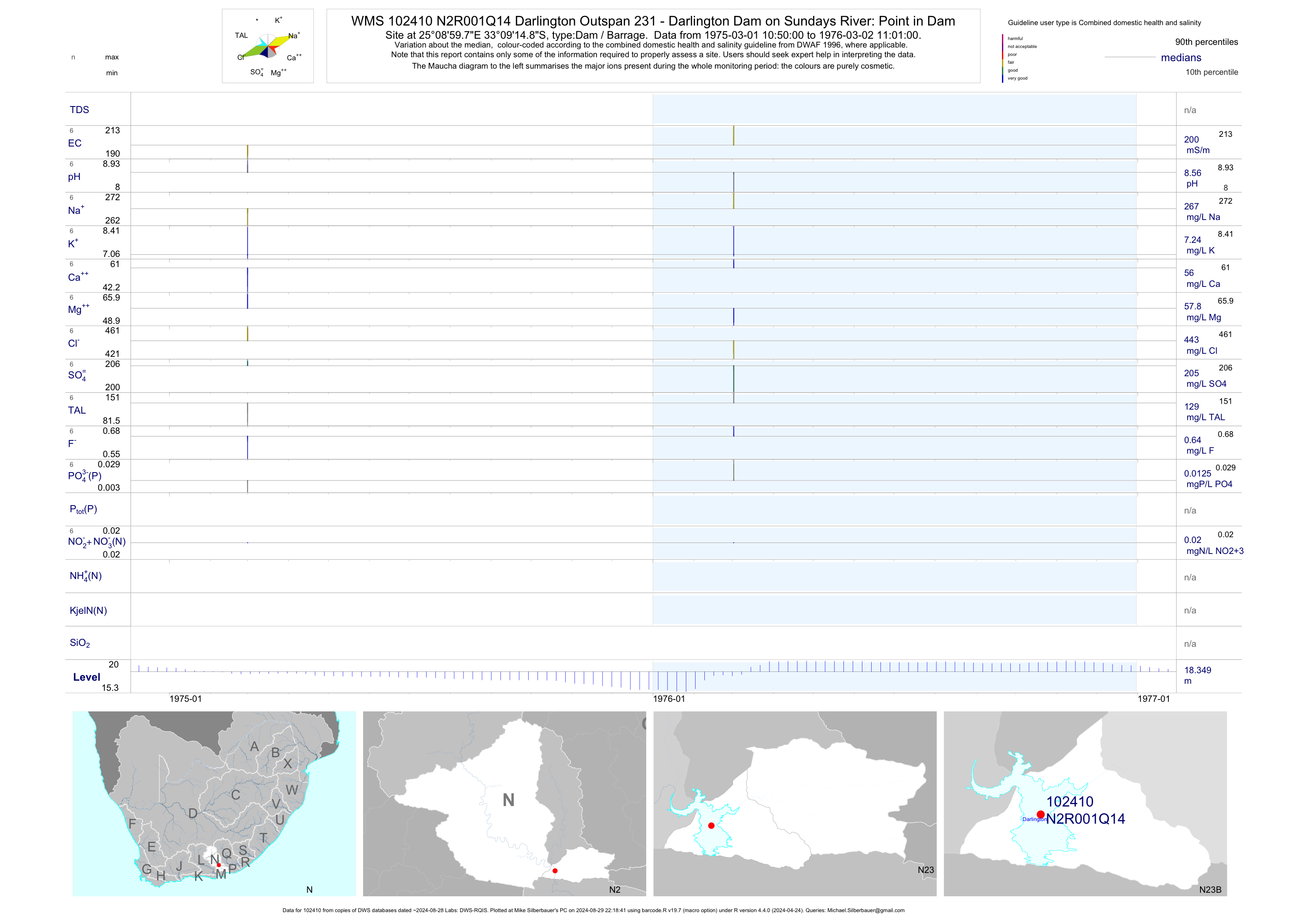
| N23 102410 | plot | data | Darlington Outspan 231 - Darlington Dam on Sundays River: Point in Dam Q14 | Dam / Barrage | 7 | 1975-03-01 | 1976-03-02 | 200 | N2R001 | -33.15412 | 25.14992 |
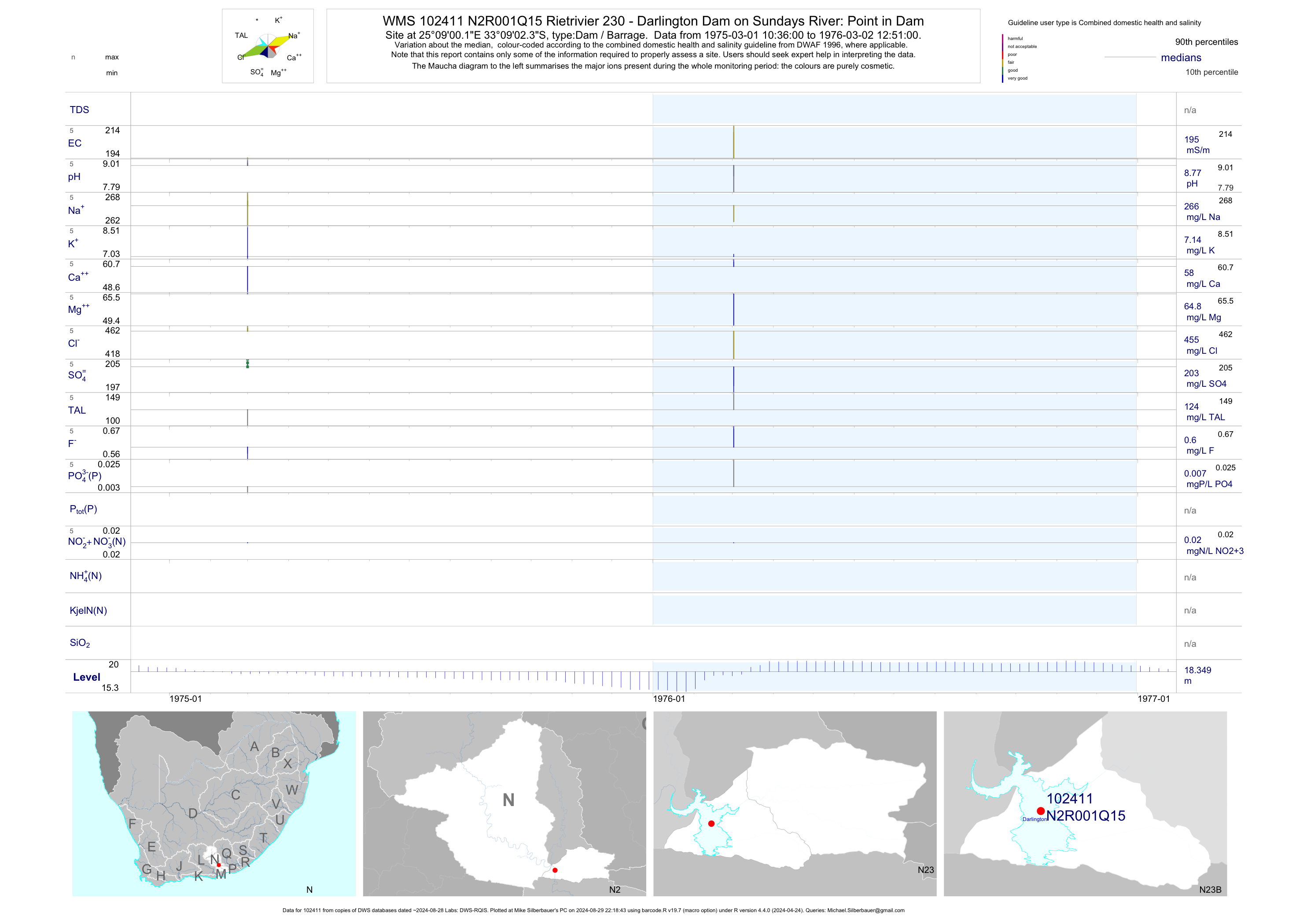
| N23 102411 | plot | data | Rietrivier 230 - Darlington Dam on Sundays River: Point in Dam Q15 | Dam / Barrage | 6 | 1975-03-01 | 1976-03-02 | 195 | N2R001 | -33.15064 | 25.15003 |
| N23 102412 | plot | data | Rietrivier 230 - Darlington Dam on Sundays River: Point in Dam Q16 | Dam / Barrage | 3 | 1975-03-01 | 1976-03-02 | 190 | N2R001 | -33.14542 | 25.14977 |
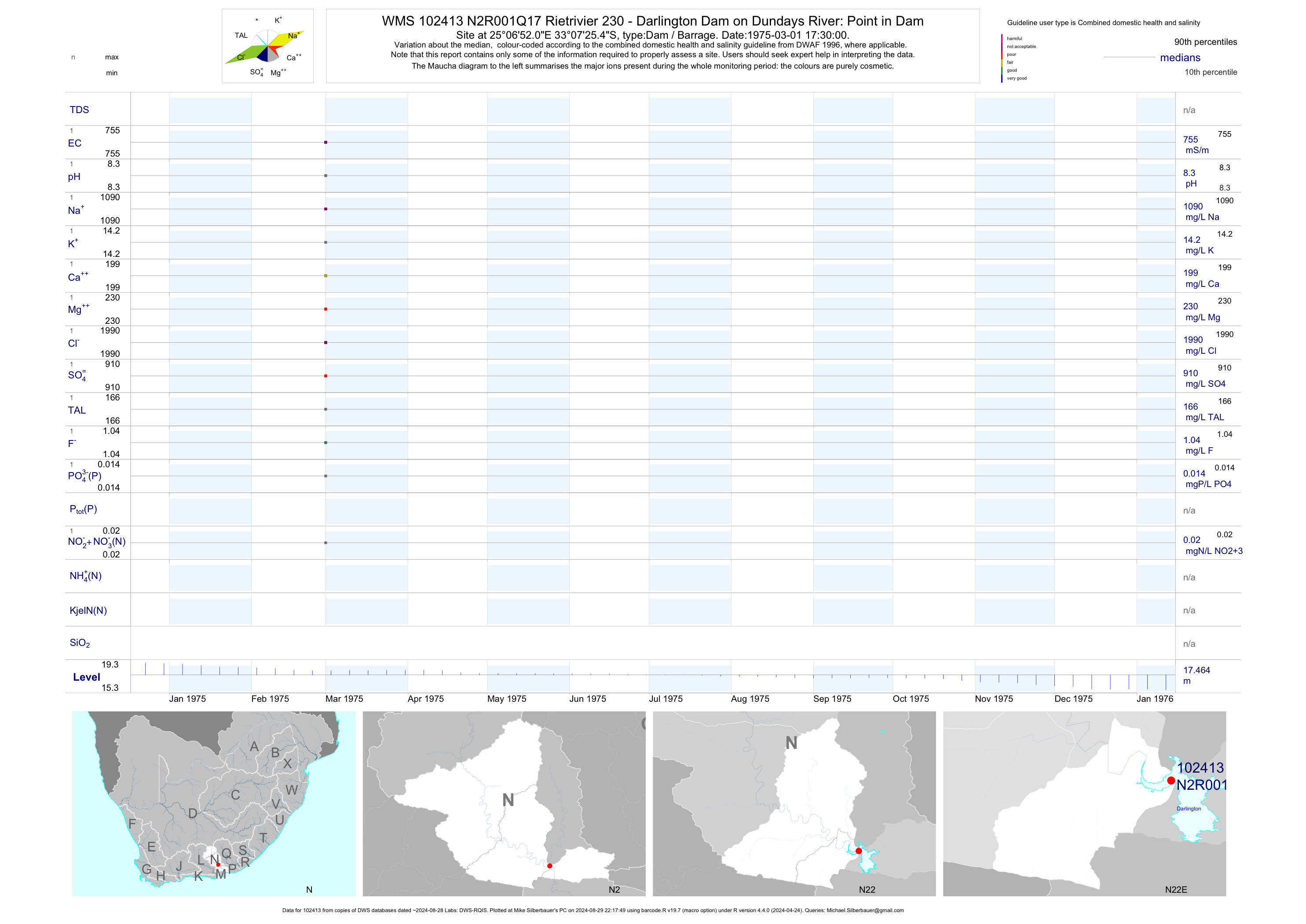
| N22 102413 | plot | data | Rietrivier 230 - Darlington Dam on Dundays River: Point in Dam Q17 | Dam / Barrage | 1 | 1975-03-01 | 1975-03-01 | 755 | N2R001 | -33.12374 | 25.11447 |
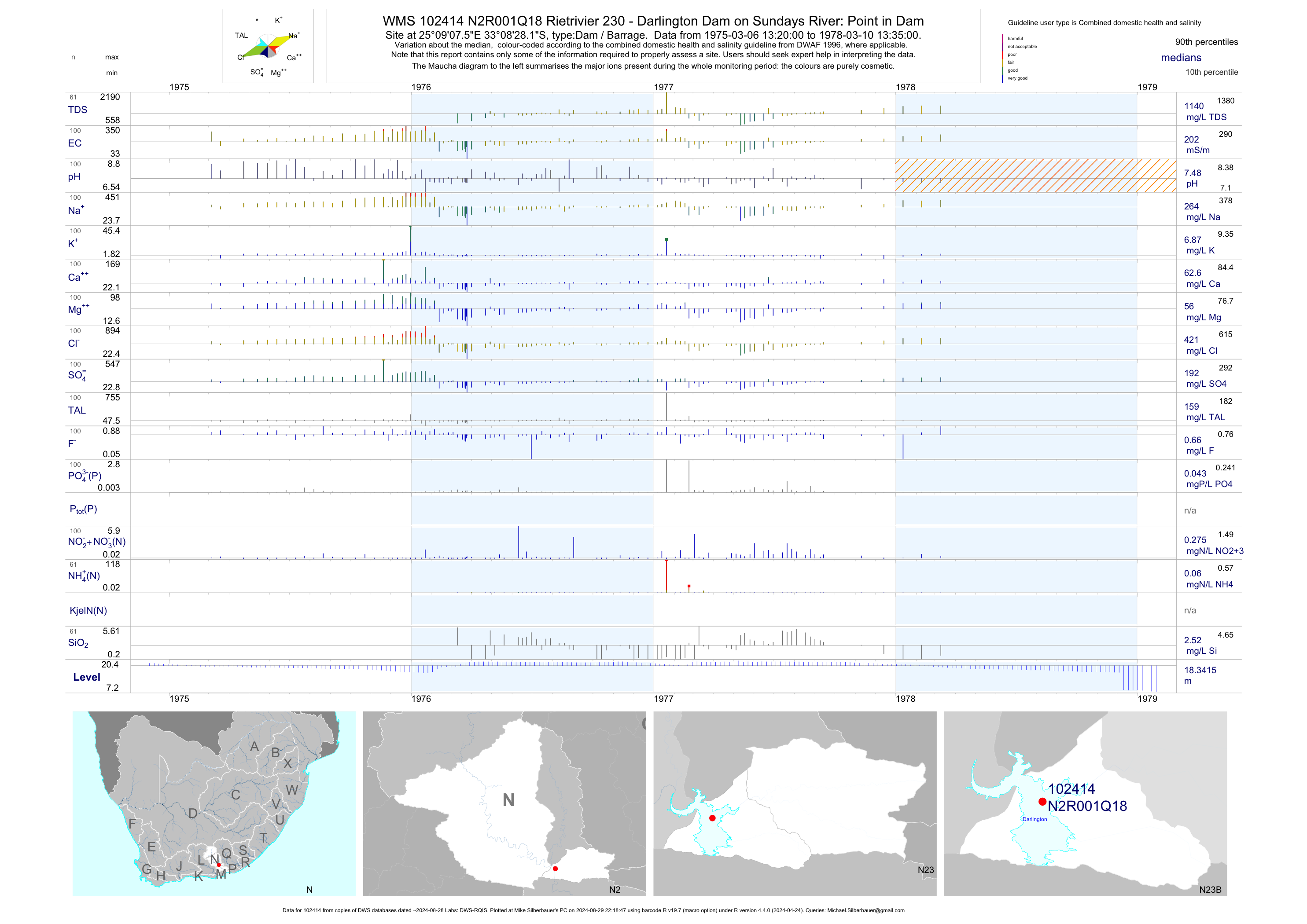
| N23 102414 | plot | data | Rietrivier 230 - Darlington Dam on Sundays River: Point in Dam Q18 | Dam / Barrage | 100 | 1975-03-06 | 1978-03-10 | 202 | N2R001 | -33.14115 | 25.15210 |
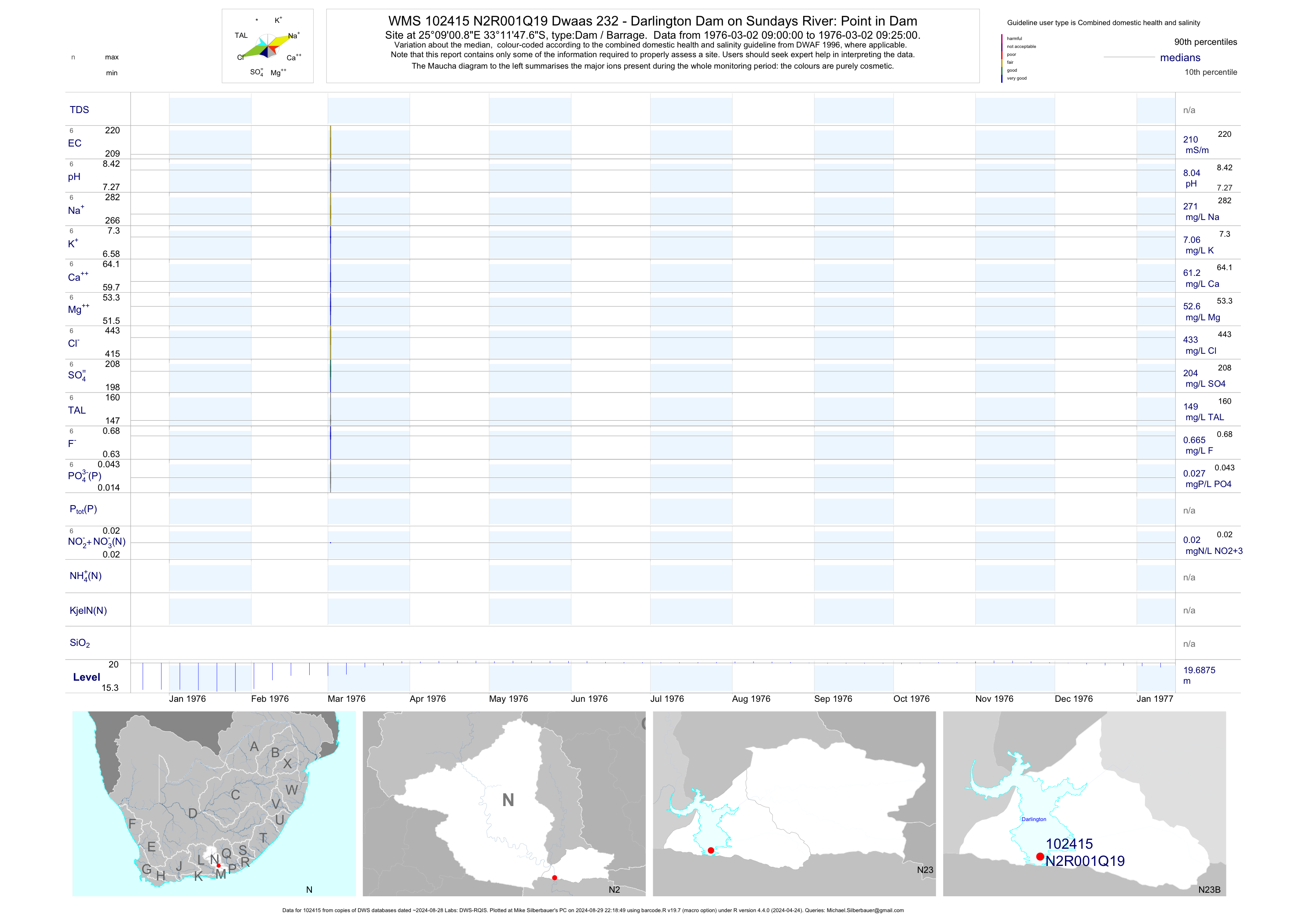
| N23 102415 | plot | data | Dwaas 232 - Darlington Dam on Sundays River: Point in Dam Q19 | Dam / Barrage | 7 | 1976-03-02 | 1976-03-02 | 210 | N2R001 | -33.19657 | 25.15023 |
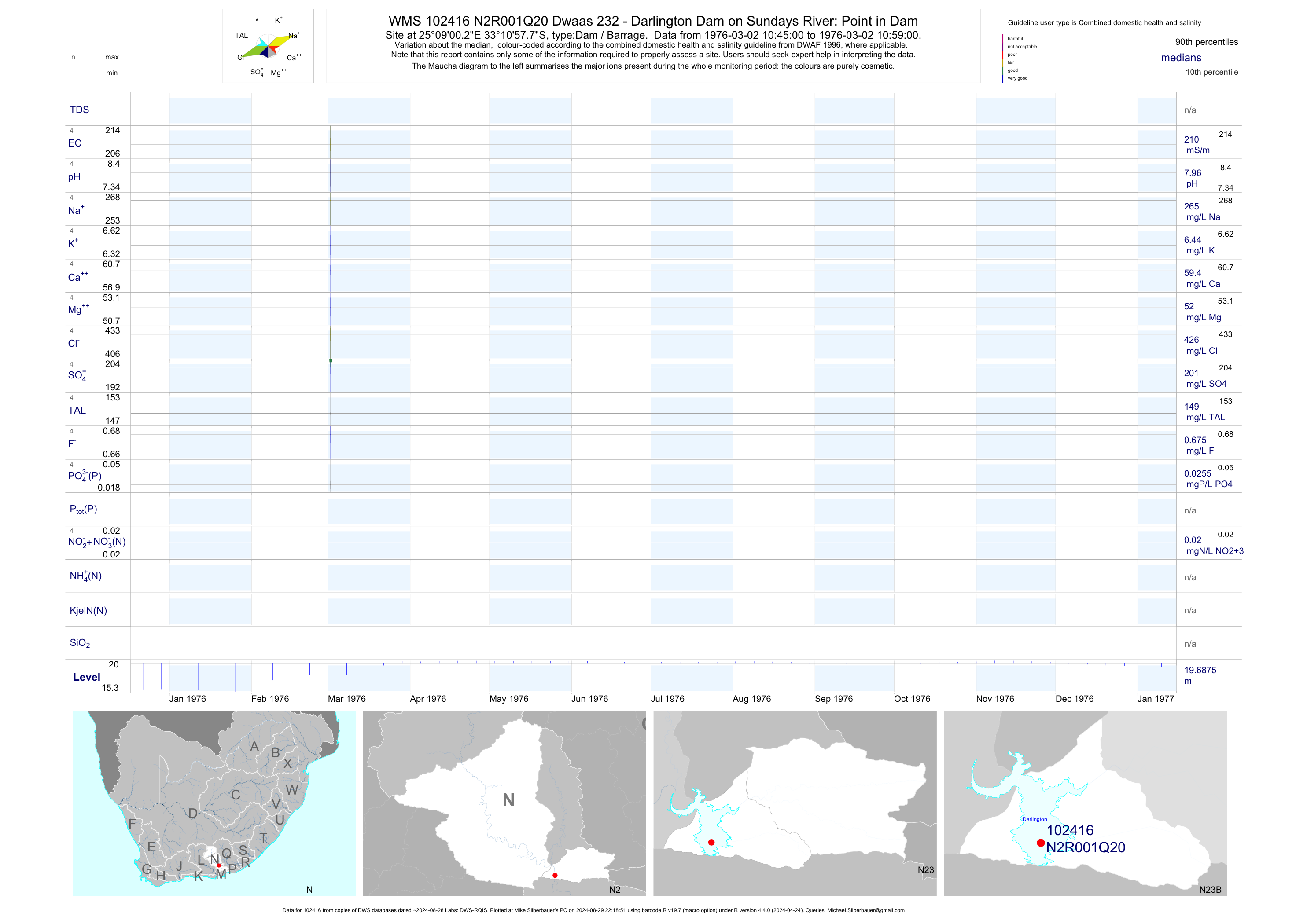
| N23 102416 | plot | data | Dwaas 232 - Darlington Dam on Sundays River: Point in Dam Q20 | Dam / Barrage | 5 | 1976-03-02 | 1976-03-02 | 210 | N2R001 | -33.18272 | 25.15008 |
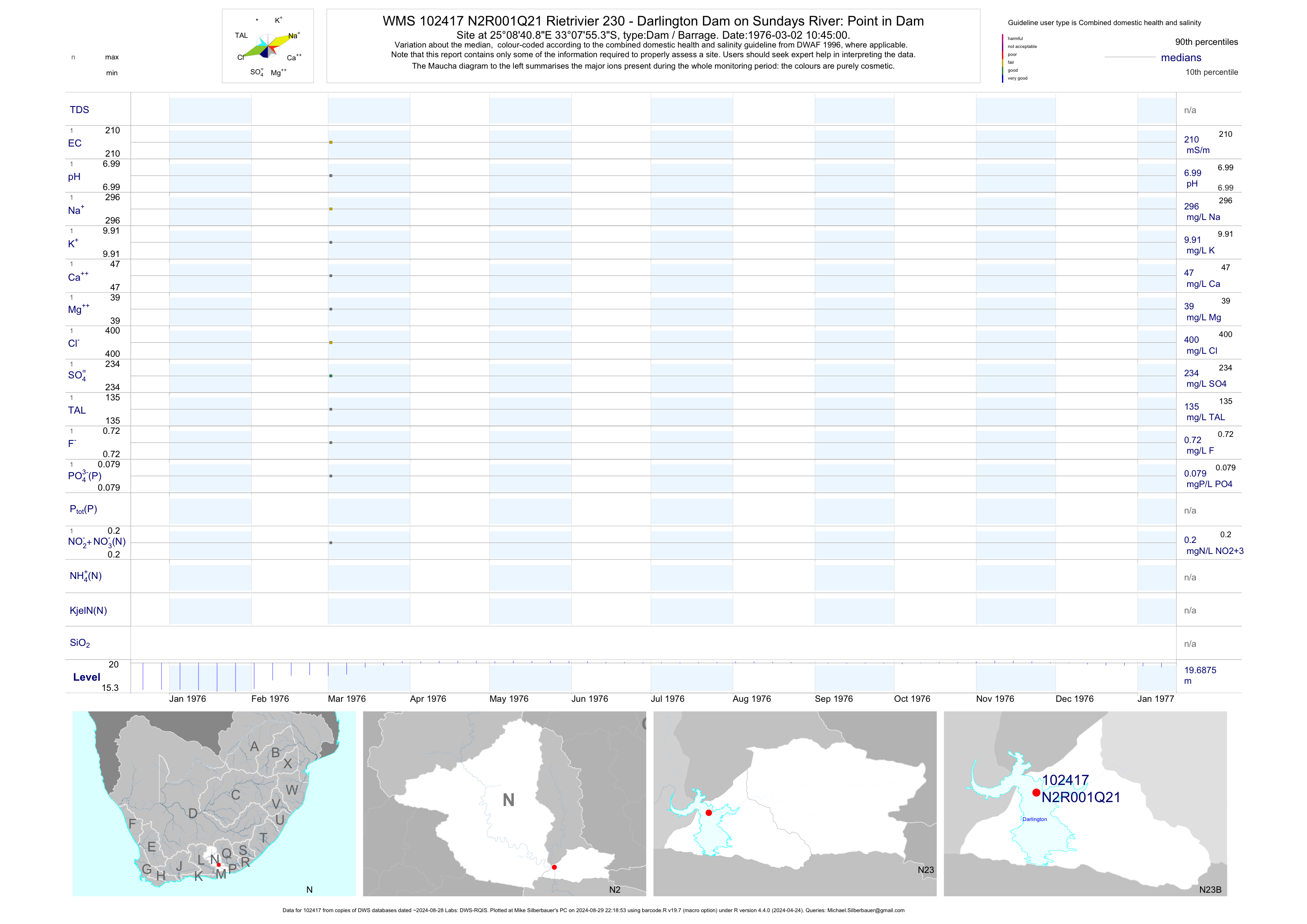
| N23 102417 | plot | data | Rietrivier 230 - Darlington Dam on Sundays River: Point in Dam Q21 | Dam / Barrage | 1 | 1976-03-02 | 1976-03-02 | 210 | N2R001 | -33.13204 | 25.14469 |
| N23 102418 | plot | data | Rietrivier 230 - Darlington Dam on Sundays River: Point in Dam Q22 | Dam / Barrage | 1 | 1976-03-02 | 1976-03-02 | 190 | N2R001 | -33.13131 | 25.14259 |
| N23 102419 | plot | data | Rietrivier 230 - Darlington Dam on Sundays River: Point in Dam Q23 | Dam / Barrage | 1 | 1976-03-02 | 1976-03-02 | 250 | N2R001 | -33.13714 | 25.14541 |
| N23 102420 | plot | data | Rietrivier 230 - Darlington Dam on Sundays River: Point in Dam Q24 | Dam / Barrage | 1 | 1976-03-02 | 1976-03-02 | 210 | N2R001 | -33.13515 | 25.15835 |
| N23 102421 | plot | data | Rietrivier 230 - Darlington Dam on Sundays River: Point in Dam Q25 | Dam / Barrage | 1 | 1976-03-02 | 1976-03-02 | 210 | N2R001 | -33.13076 | 25.17039 |
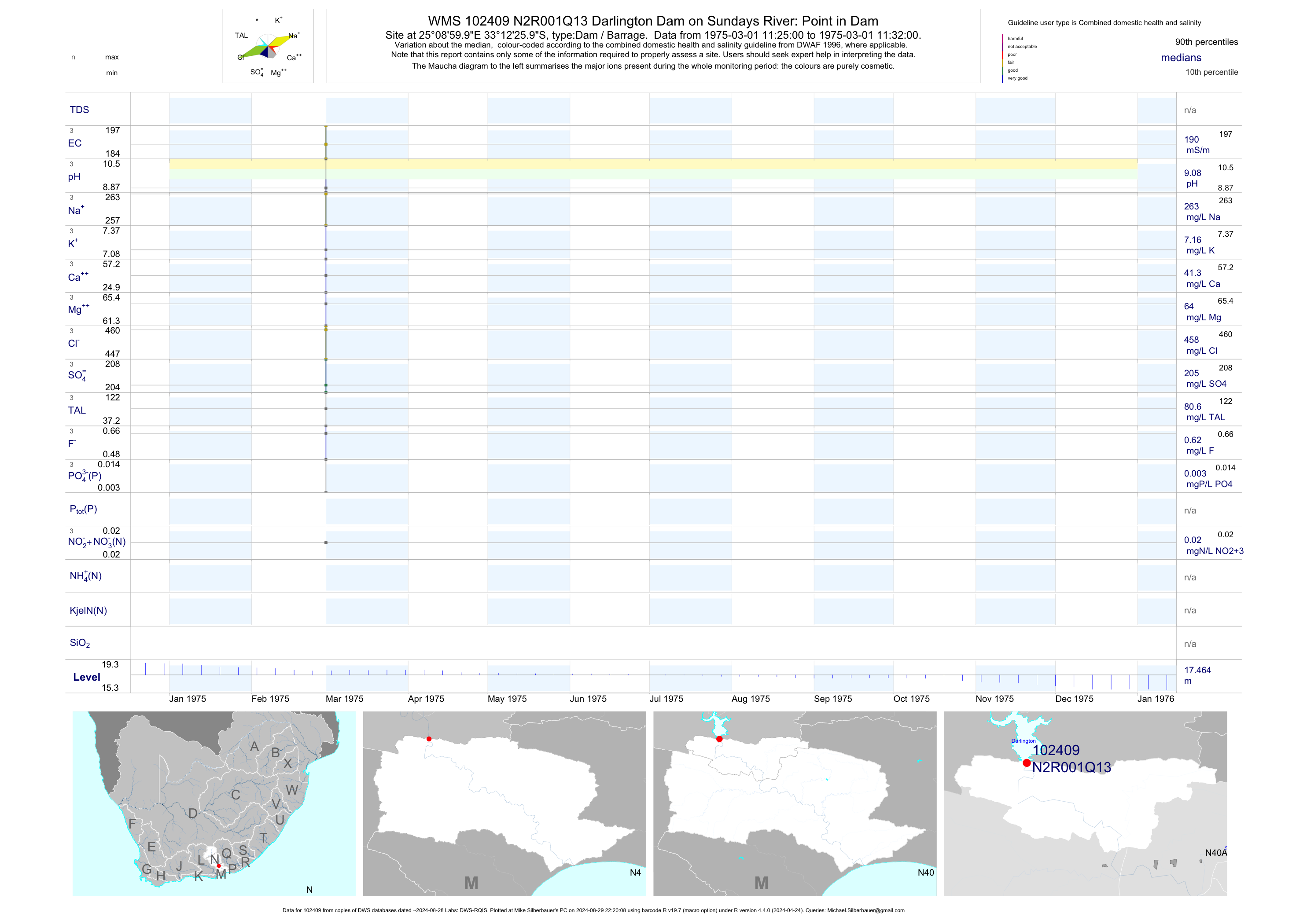
| N40 102409 | plot | data | Darlington Dam on Sundays River: Point in Dam Q13 | Dam / Barrage | 3 | 1975-03-01 | 1975-03-01 | 190 | N2R001 | -33.20722 | 25.15000 |
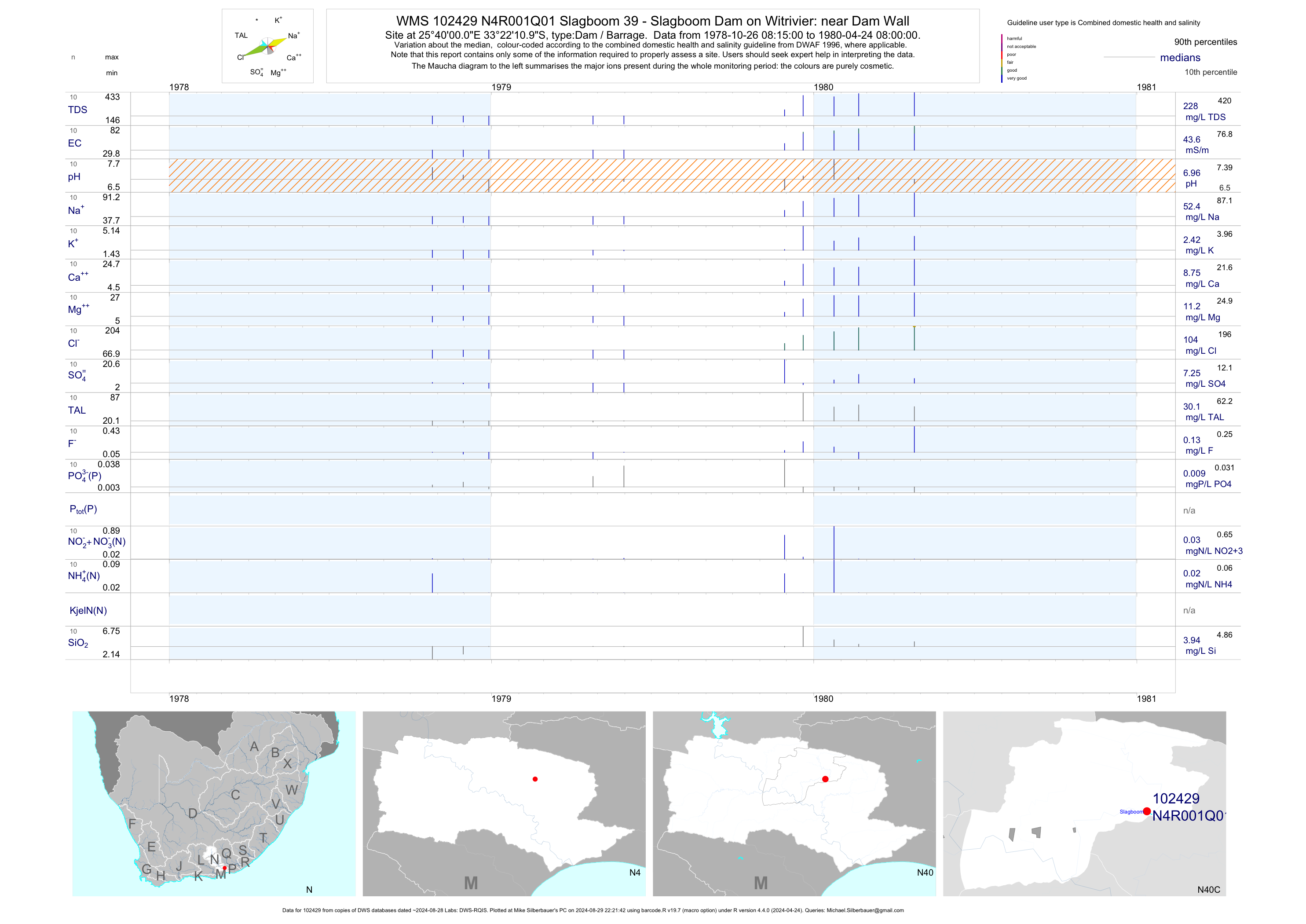
| N40 102429 | plot | data | Slagboom 39 - Slagboom Dam on Witrivier: near Dam Wall Q01 | Dam / Barrage | 10 | 1978-10-26 | 1980-04-24 | 44 | N4R001 | -33.36972 | 25.66667 |
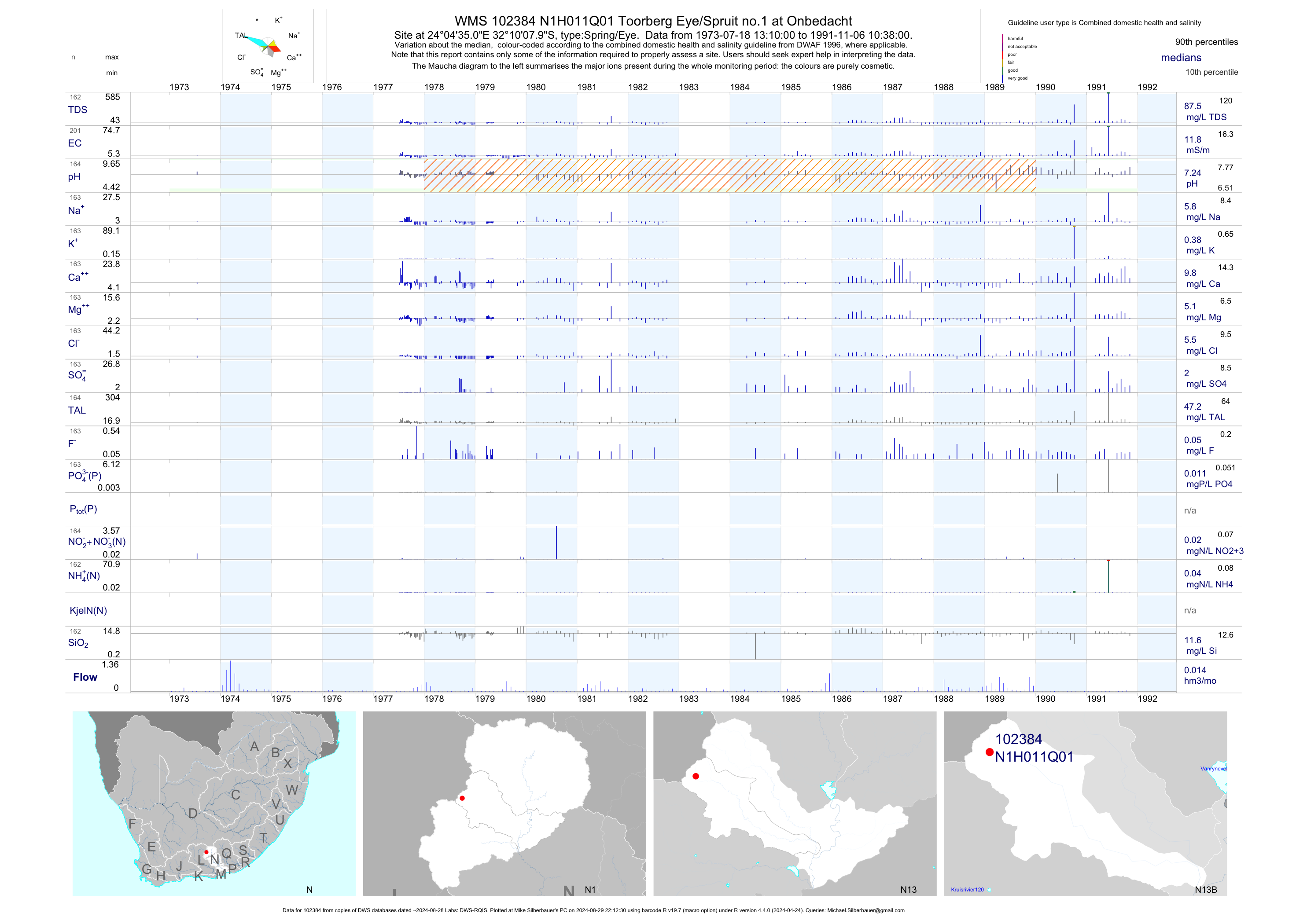
| N13 102384 | plot | data | Toorberg Eye/Spruit no.1 at Onbedacht | Spring/Eye | 202 | 1973-07-18 | 1991-11-06 | 12 | N1H011 | -32.16889 | 24.07639 |
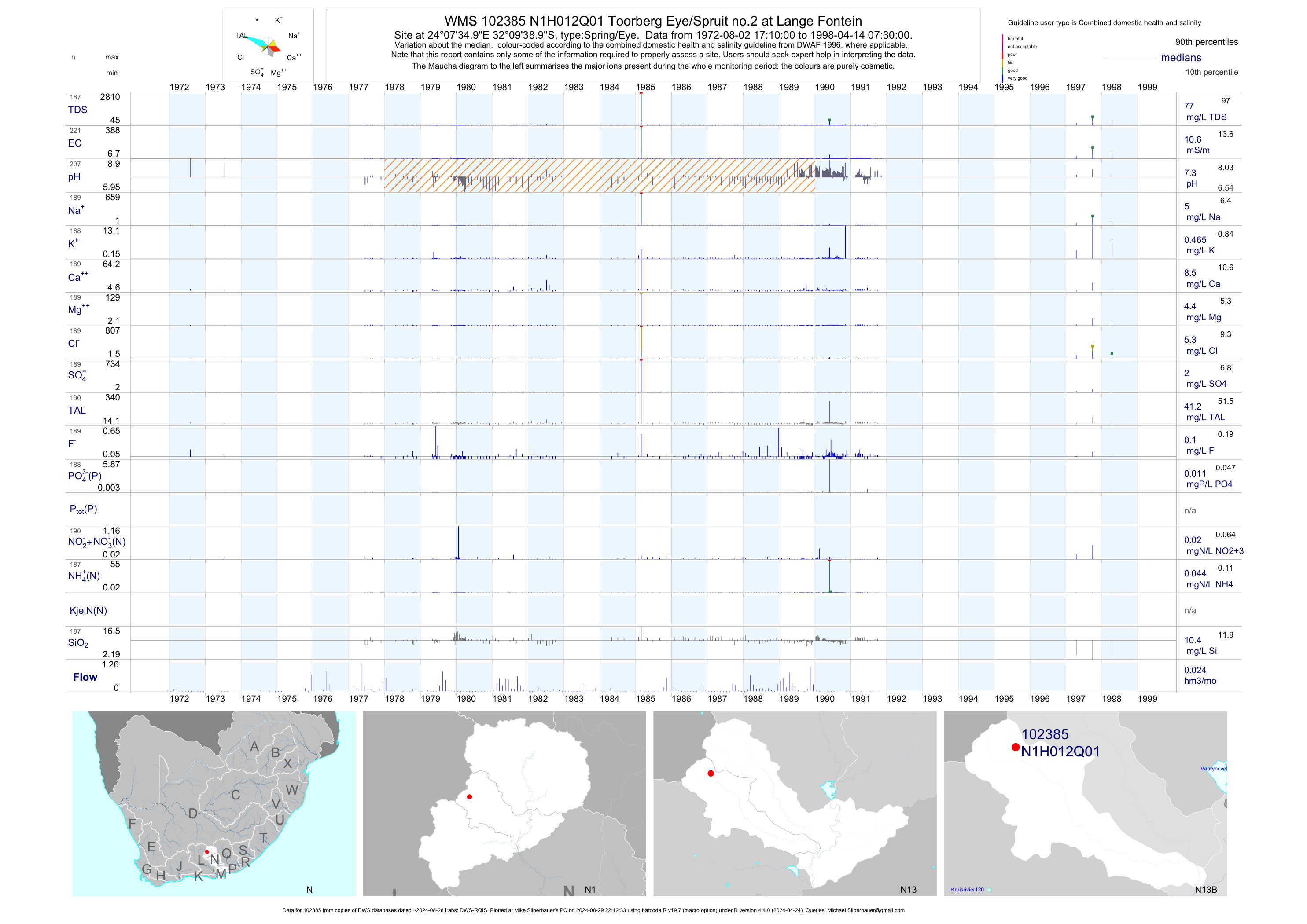
| N13 102385 | plot | data | Toorberg Eye/Spruit no.2 at Lange Fontein | Spring/Eye | 223 | 1972-08-02 | 1998-04-14 | 11 | N1H012 | -32.16083 | 24.12639 |
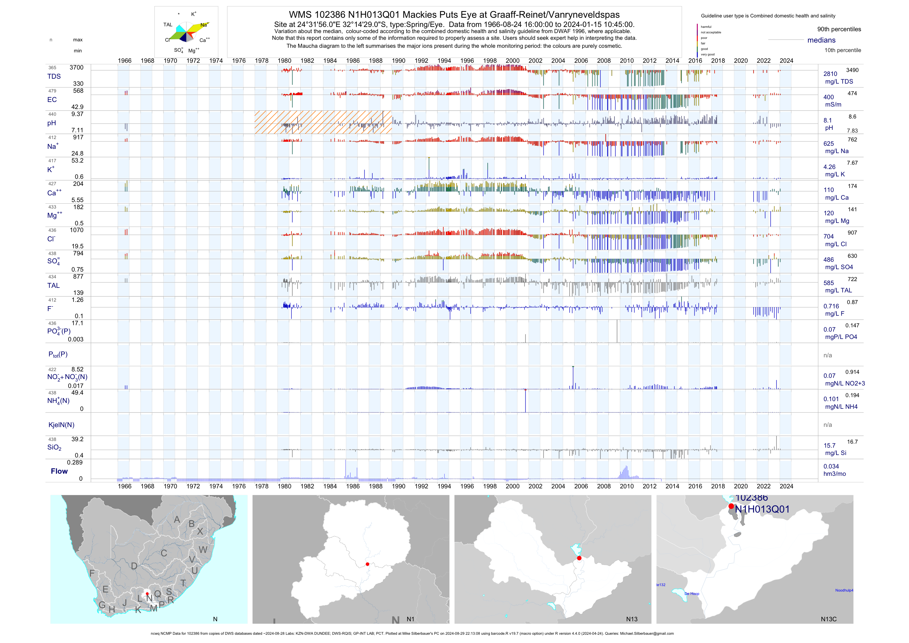
| N13 102386 | plot | data | Mackies Puts Eye at Graaff-Reinet/Vanryneveldspas (ncwq NCMP) | Spring/Eye | 469 | 1966-08-24 | 2018-06-25 | 401 | N1H013 | -32.24139 | 24.53222 |
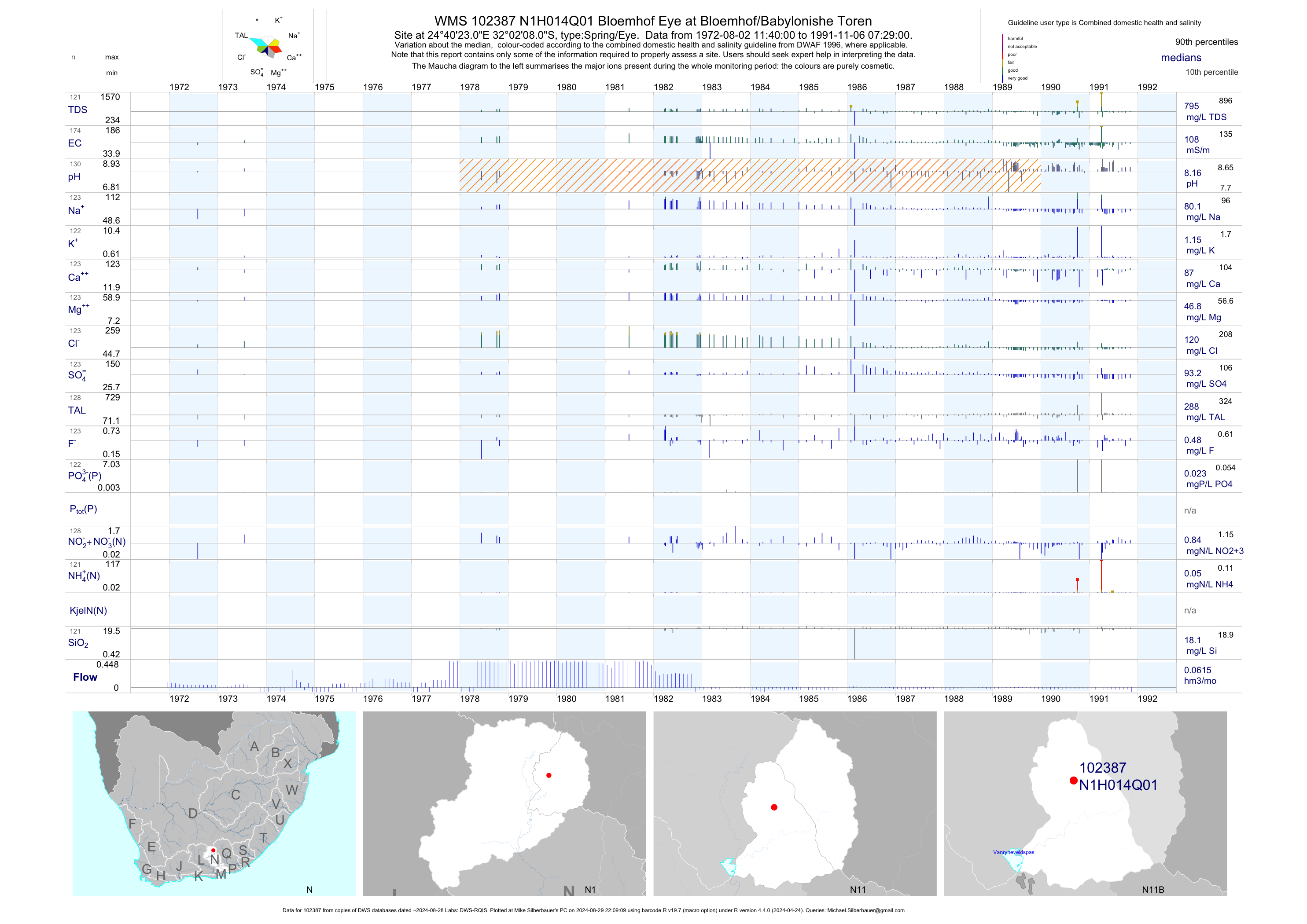
| N11 102387 | plot | data | Bloemhof Eye at Bloemhof/Babylonishe Toren | Spring/Eye | 175 | 1972-08-02 | 1991-11-06 | 108 | N1H014 | -32.03556 | 24.67306 |
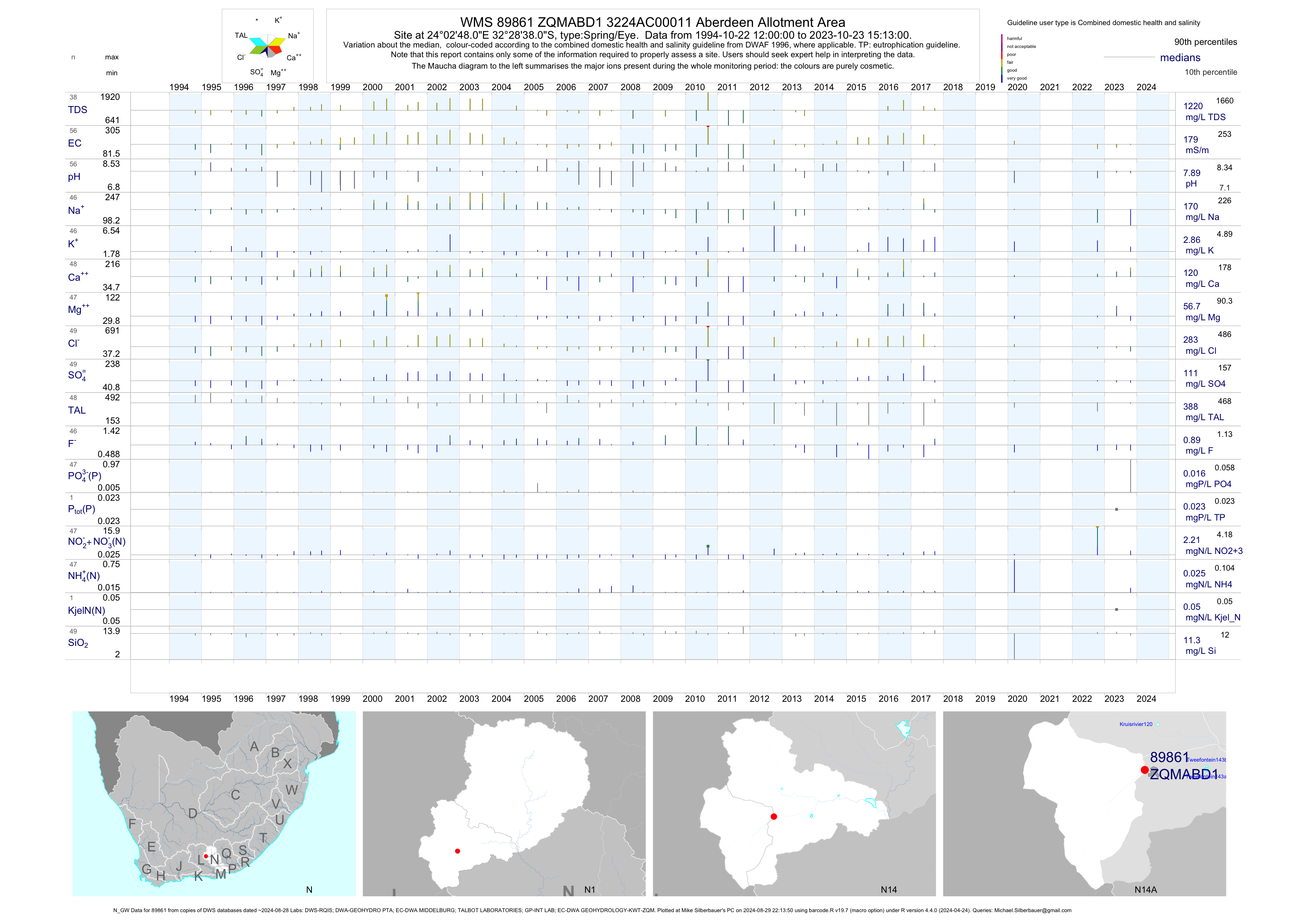
| N14 89861 | plot | data | 3224AC00011 Aberdeen Allotment Area (N_GW) | Spring/Eye | 57 | 1994-10-22 | 2017-09-27 | 183 | ZQMABD1 | -32.47722 | 24.04667 |
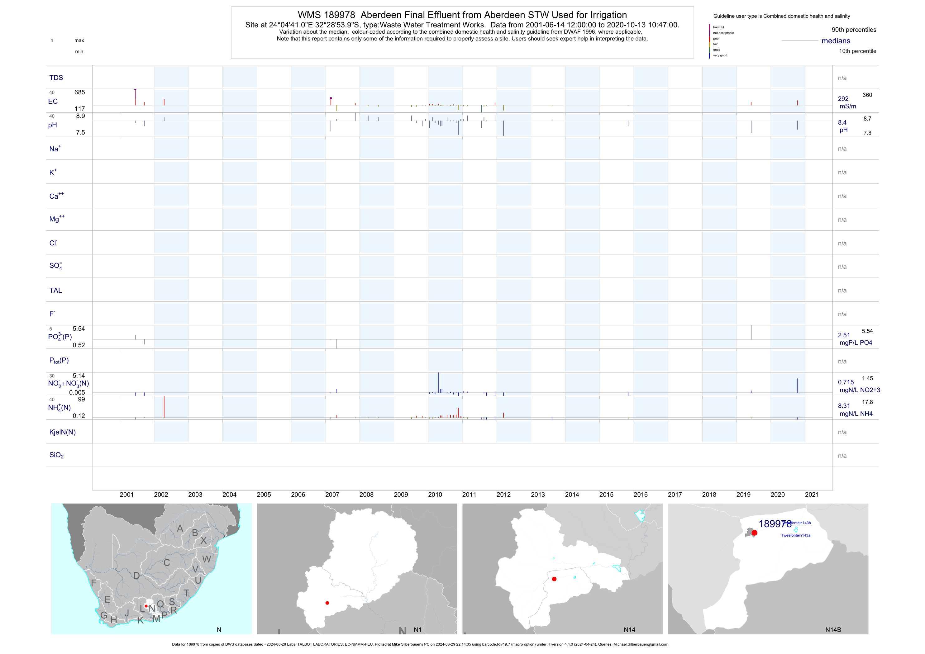
| N14 189978 | plot | data | Aberdeen Final Effluent from Aberdeen STW Used for Irrigation | Waste Water Treatment Works | 73 | 2001-06-14 | 2019-06-06 | 292 | 189978 | -32.48167 | 24.07806 |
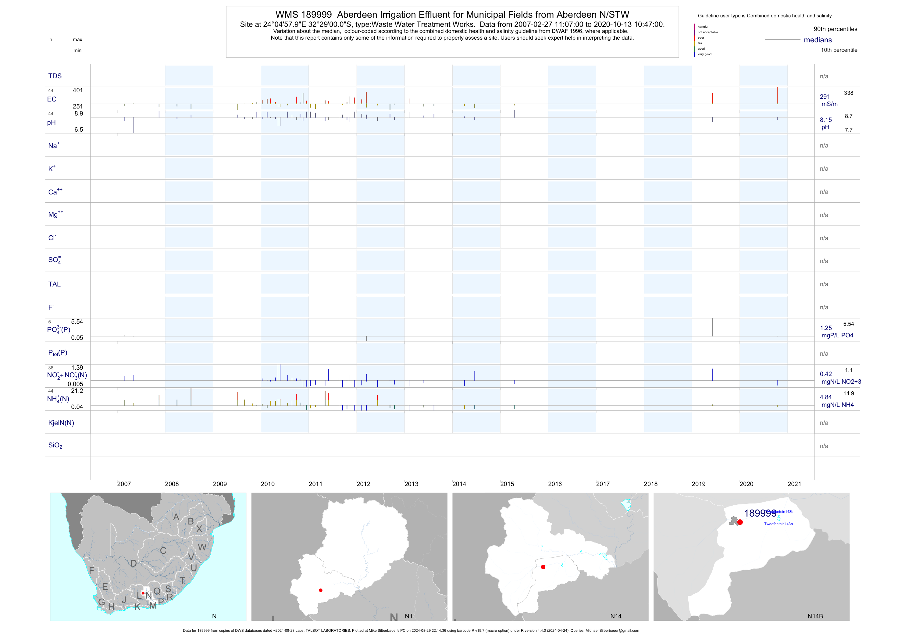
| N14 189999 | plot | data | Aberdeen Irrigation Effluent for Municipal Fields from Aberdeen N/STW | Waste Water Treatment Works | 83 | 2007-02-27 | 2015-04-20 | 291 | 189999 | -32.48333 | 24.08278 |
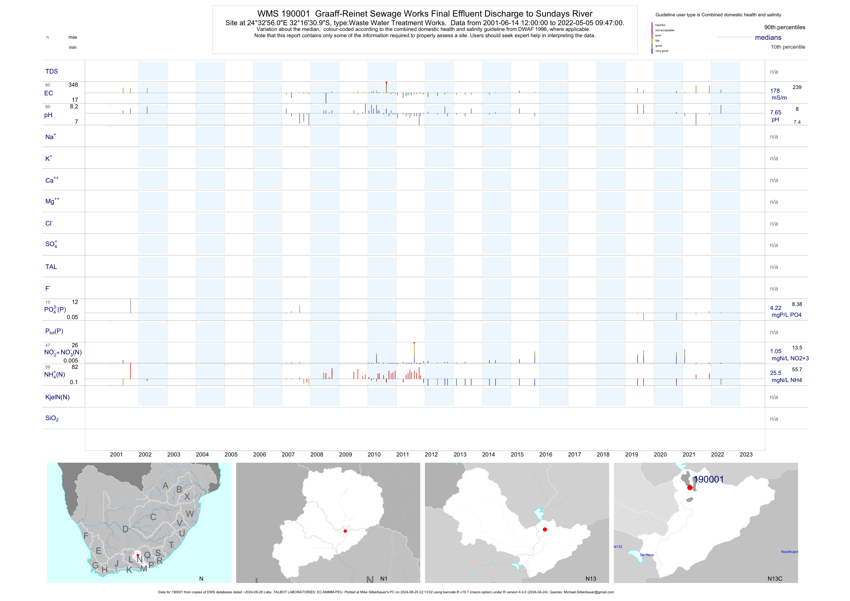
| N13 190001 | plot | data | Graaff-Reinet Sewage Works Final Effluent Discharge to Sundays River | Waste Water Treatment Works | 109 | 2001-06-14 | 2019-06-05 | 174 | 190001 | -32.27528 | 24.54889 |
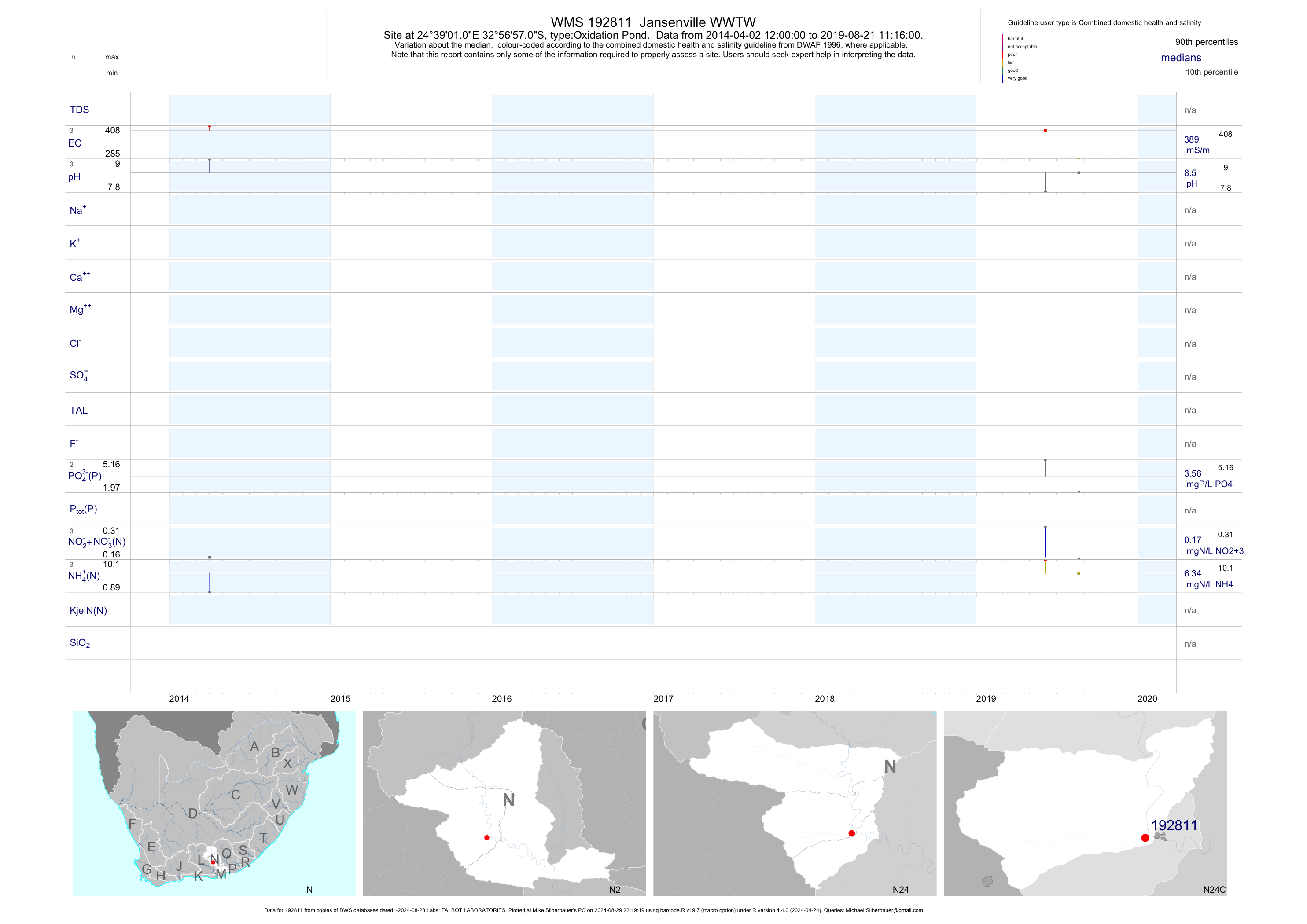
| N24 192811 | plot | data | Jansenville WWTW | Oxidation Pond | 2 | 2014-04-02 | 2014-04-02 | 389 | 192811 | -32.94918 | 24.65030 |
| N40 189995 | plot | data | Boplaas Farmlands Irrigation Effluent from Addo STW | Waste Water Treatment Works | 101 | 2004-01-08 | 2015-04-16 | 130 | 189995 | -33.54250 | 25.71250 |
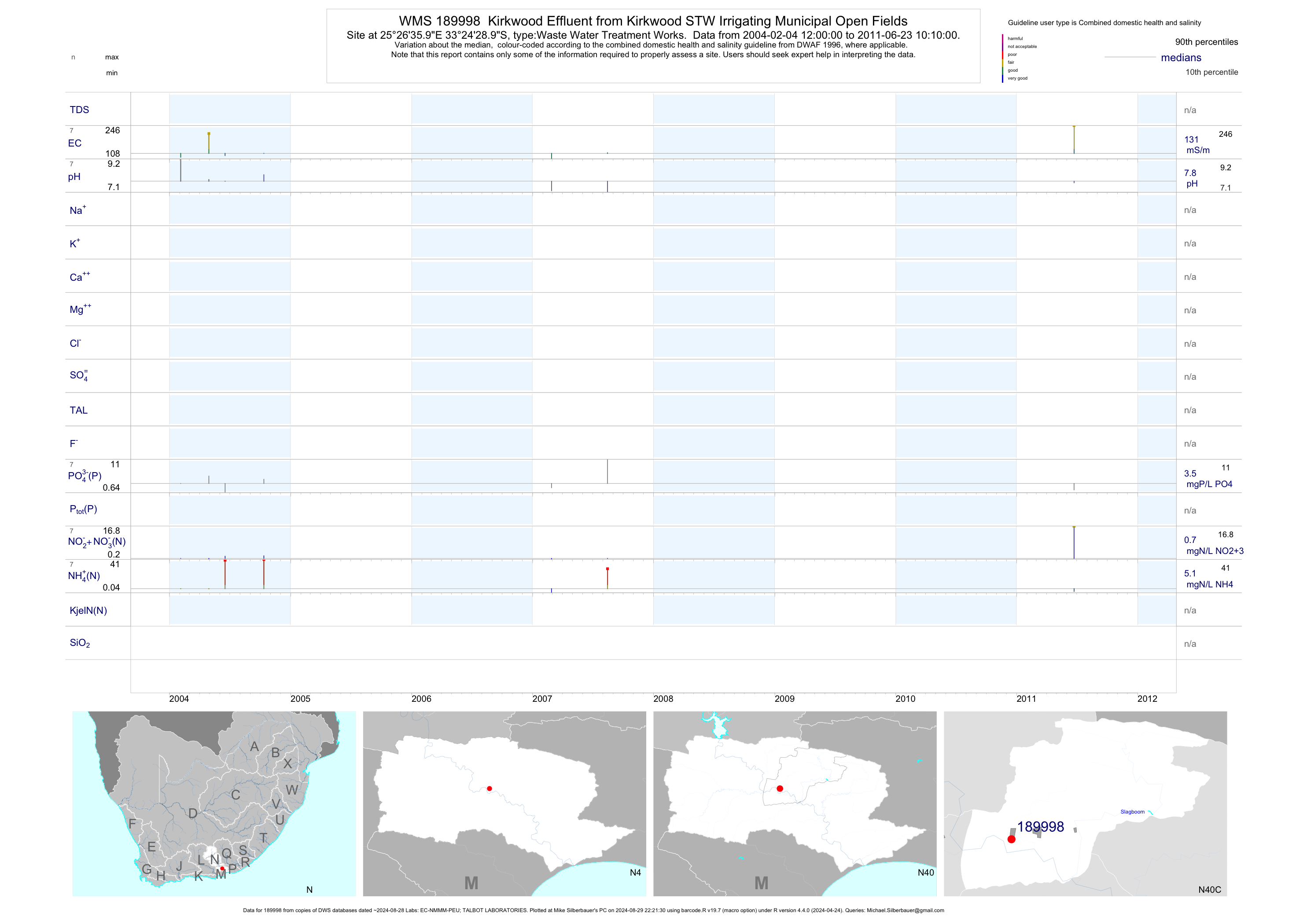
| N40 189998 | plot | data | Kirkwood Effluent from Kirkwood STW Irrigating Municipal Open Fields | Waste Water Treatment Works | 12 | 2004-02-04 | 2011-06-23 | 131 | 189998 | -33.40806 | 25.44333 |
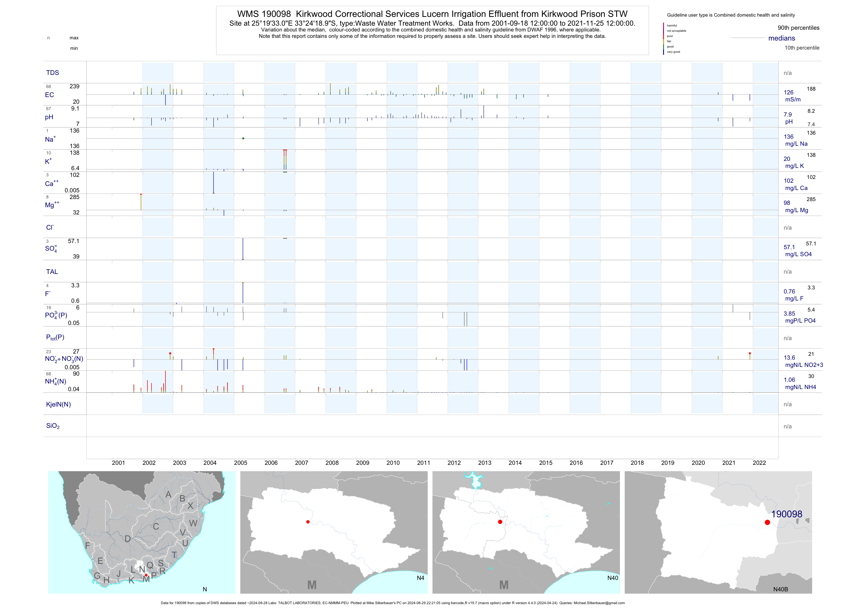
| N40 190098 | plot | data | Kirkwood Correctional Services Lucern Irrigation Effluent from Kirkwood Prison STW | Waste Water Treatment Works | 125 | 2001-09-18 | 2015-04-16 | 127 | 190098 | -33.40528 | 25.32583 |
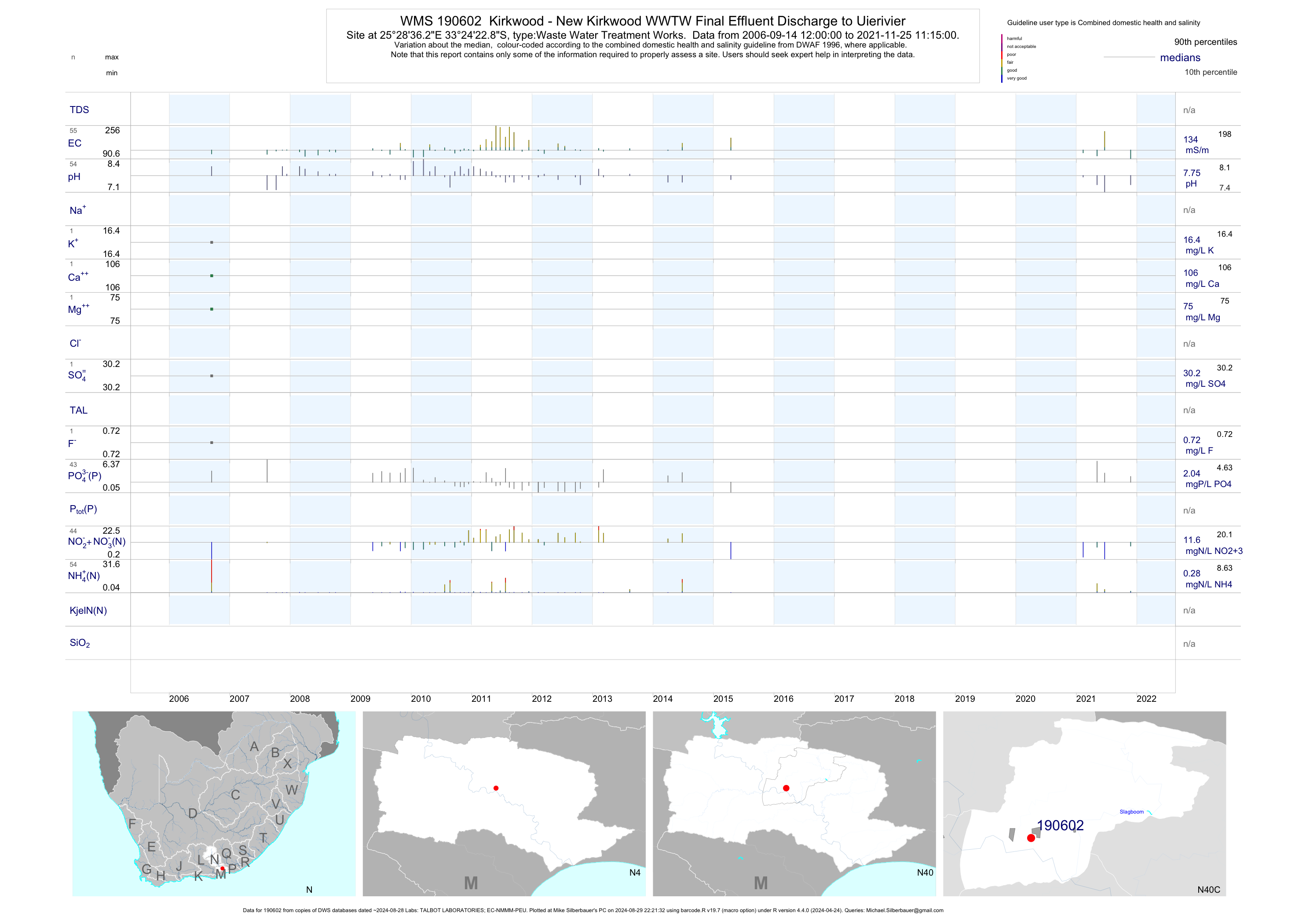
| N40 190602 | plot | data | Kirkwood - New Kirkwood WWTW Final Effluent Discharge to Uierivier | Waste Water Treatment Works | 101 | 2006-09-14 | 2015-04-16 | 135 | 190602 | -33.40633 | 25.47675 |
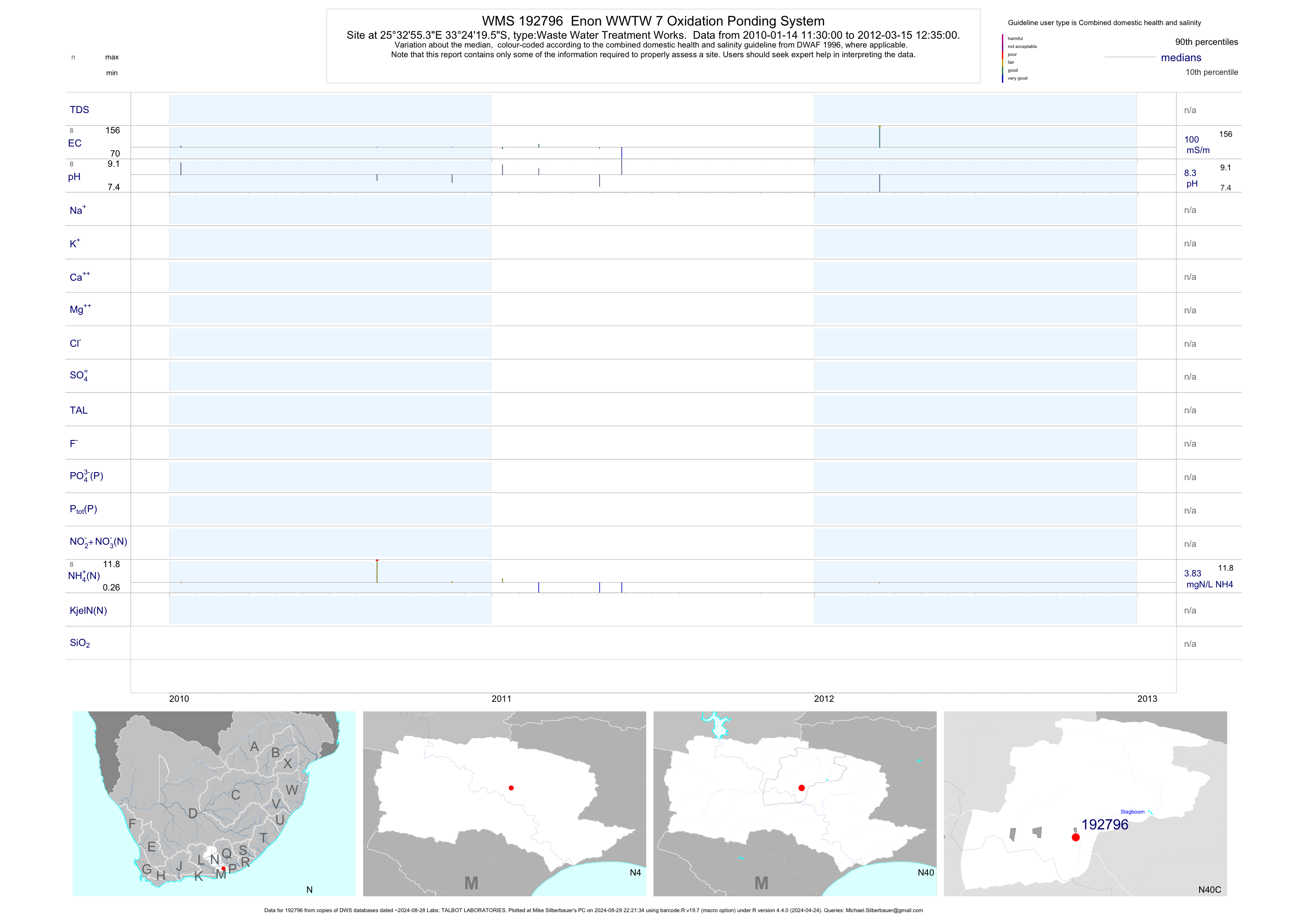
| N40 192796 | plot | data | Enon WWTW 7 Oxidation Ponding System | Waste Water Treatment Works | 17 | 2010-01-14 | 2012-03-15 | 100 | 192796 | -33.40542 | 25.54869 |
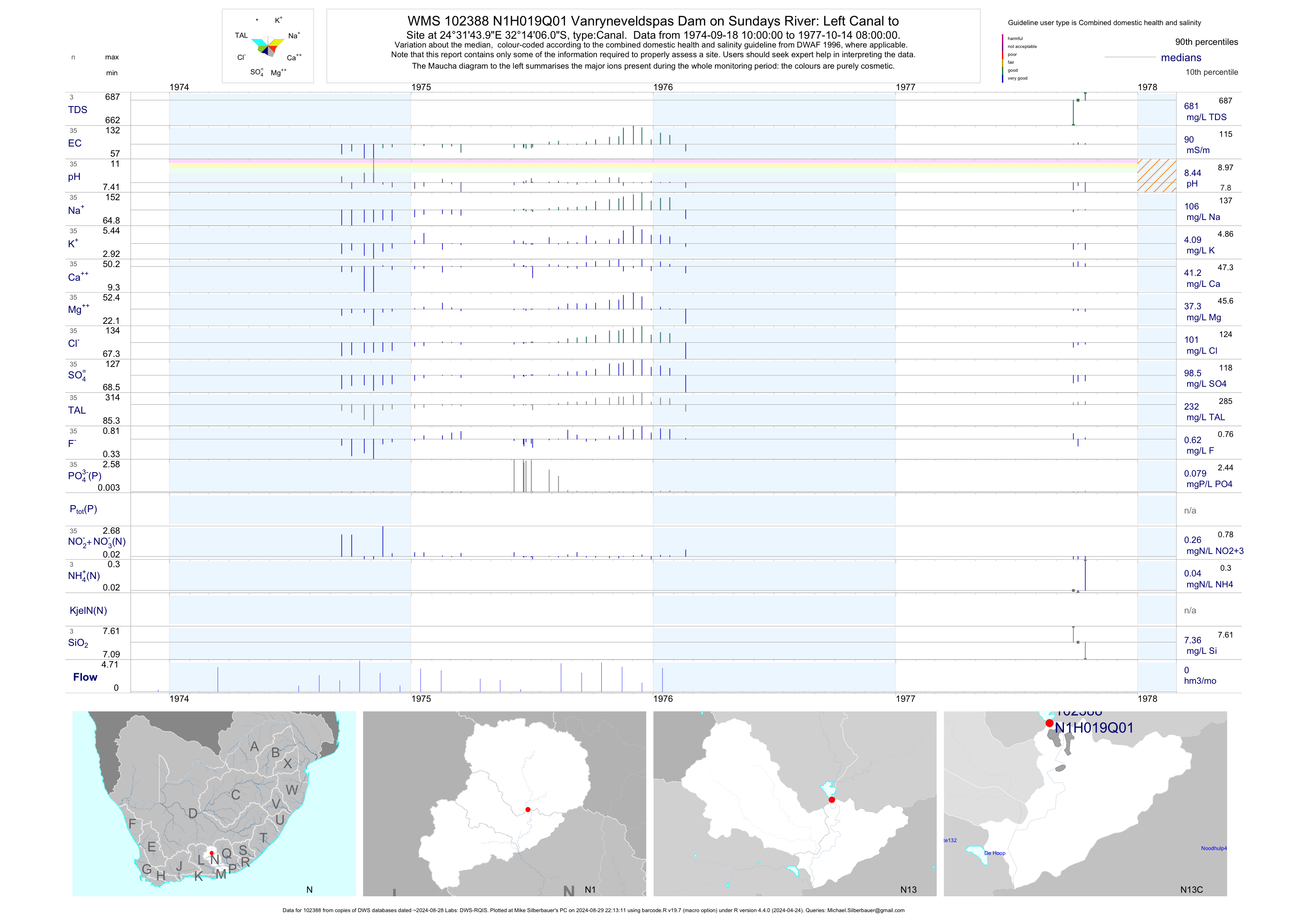
| N13 102388 | plot | data | Vanryneveldspas Dam on Sundays River: Left Canal to | Canal | 35 | 1974-09-18 | 1977-10-14 | 90 | N1H019 | -32.23500 | 24.52889 |
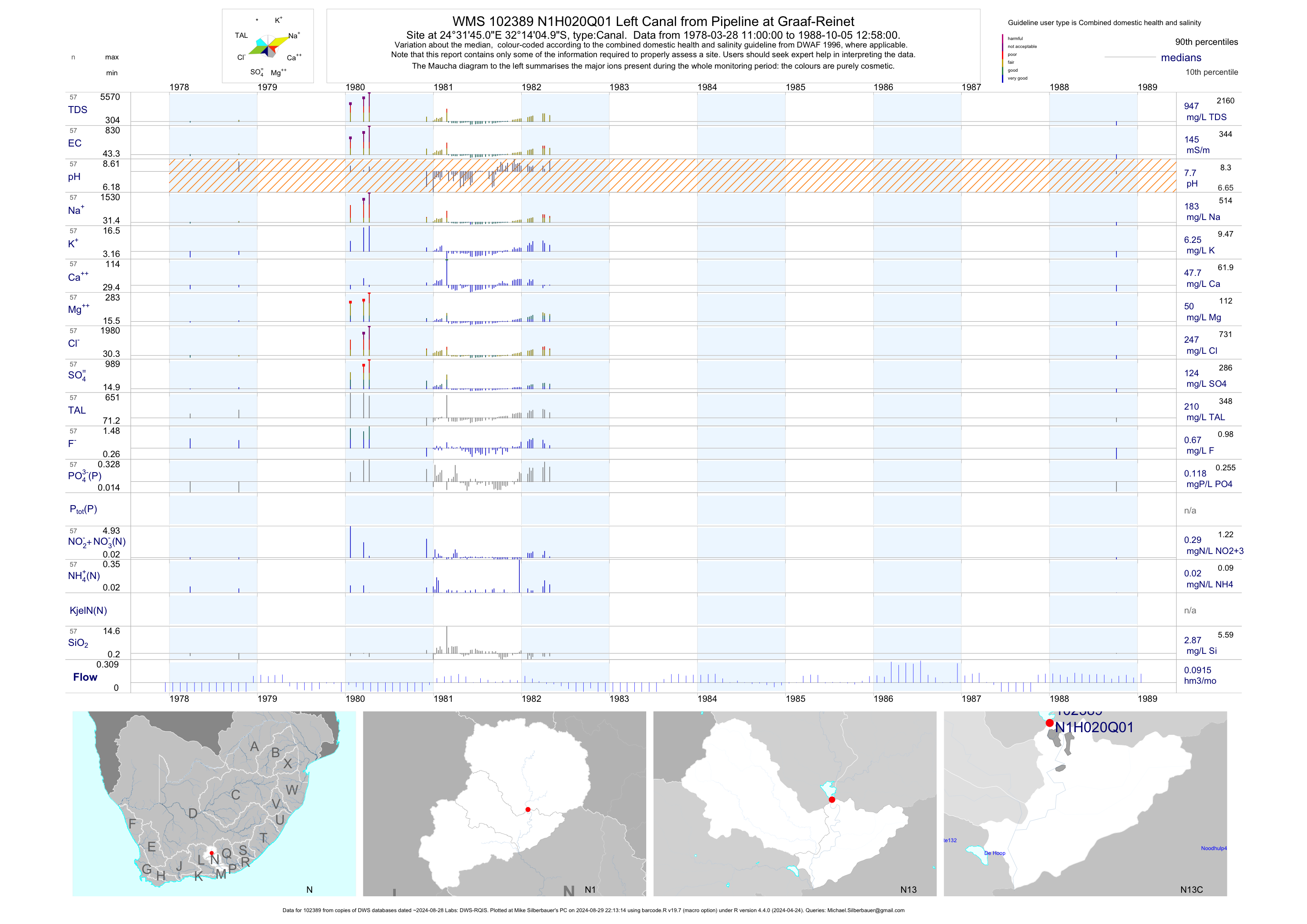
| N13 102389 | plot | data | Left Canal from Pipeline at Graaf-Reinet | Canal | 57 | 1978-03-28 | 1988-10-05 | 145 | N1H020 | -32.23472 | 24.52917 |
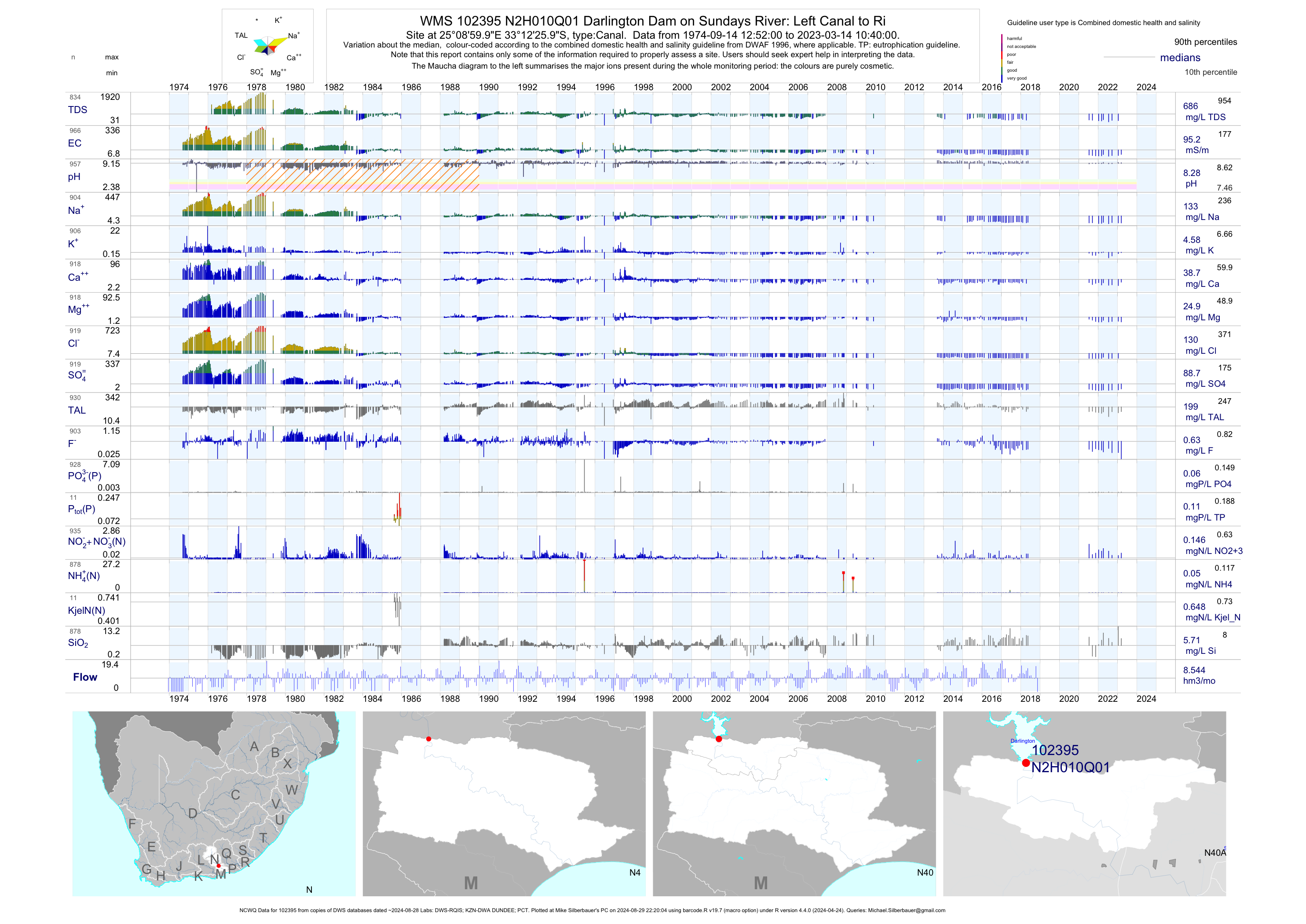
| N40 102395 | plot | data | Darlington Dam on Sundays River: Left Canal to Ri (NCWQ) | Canal | 960 | 1974-09-14 | 2018-05-17 | 96 | N2H010 | -33.20722 | 25.15000 |
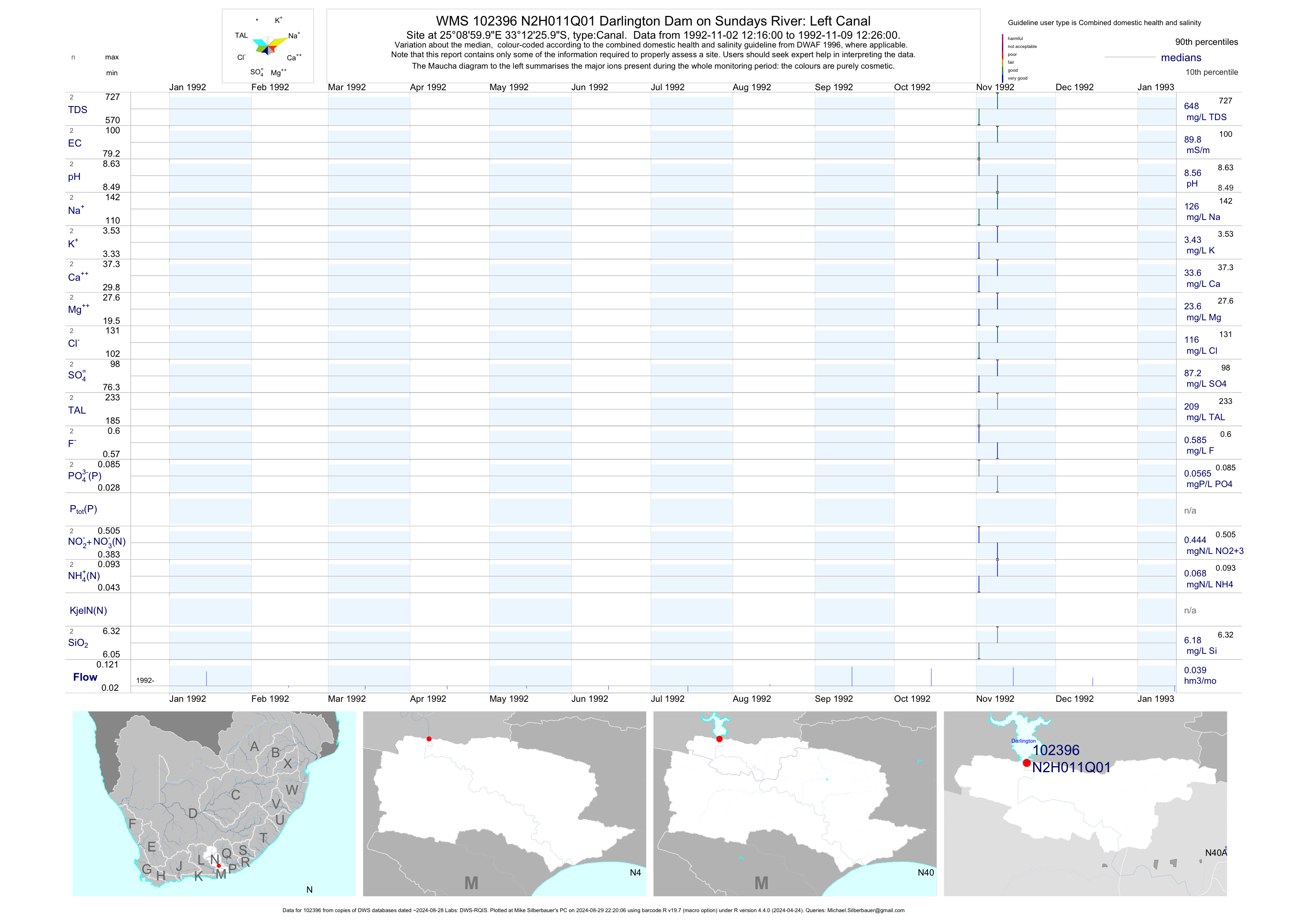
| N40 102396 | plot | data | Darlington Dam on Sundays River: Left Canal | Canal | 2 | 1992-11-02 | 1992-11-09 | 90 | N2H011 | -33.20722 | 25.15000 |
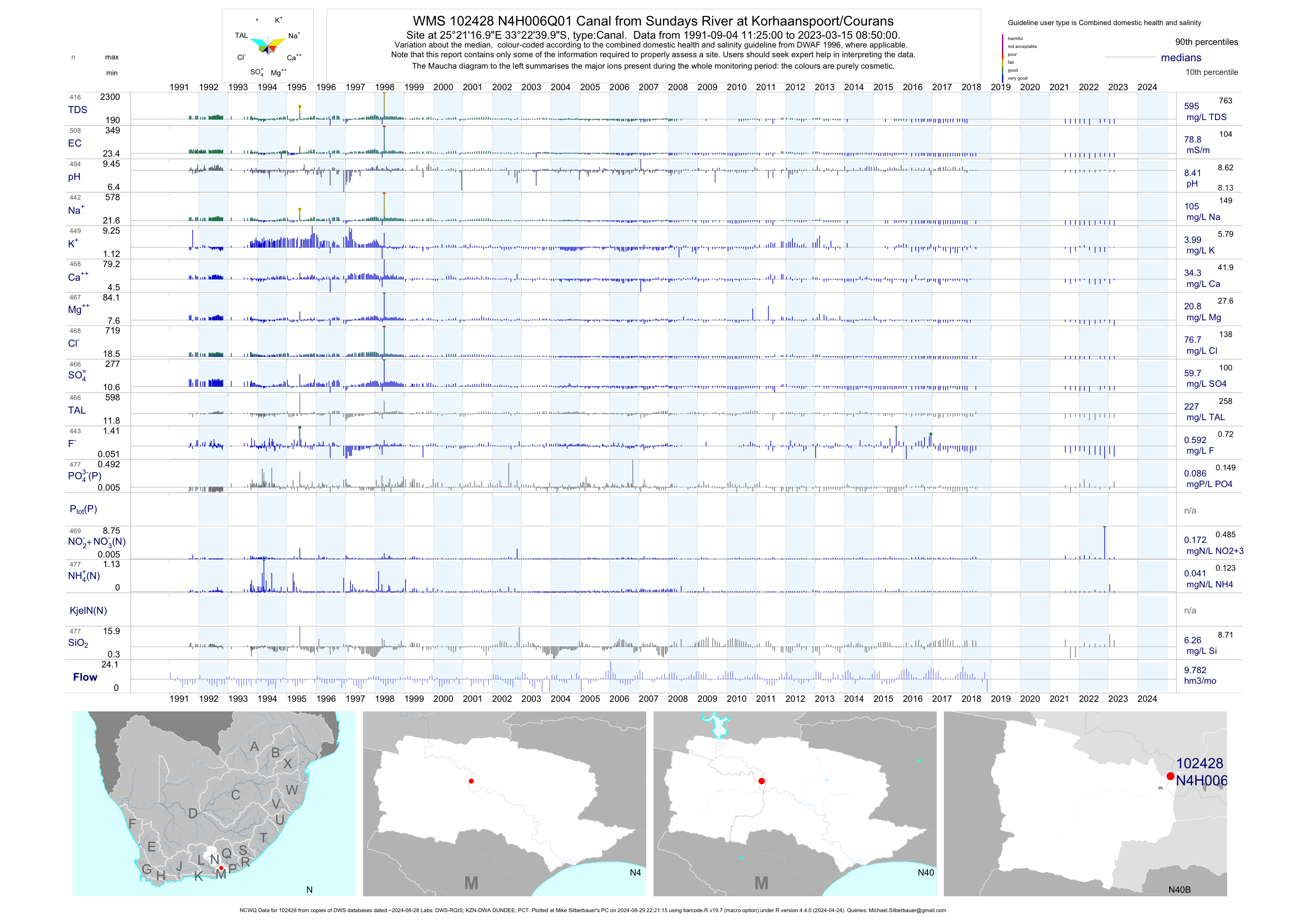
| N40 102428 | plot | data | Canal from Sundays River at Korhaanspoort/Courans (NCWQ) | Canal | 501 | 1991-09-04 | 2018-06-26 | 79 | N4H006 | -33.37778 | 25.35472 |
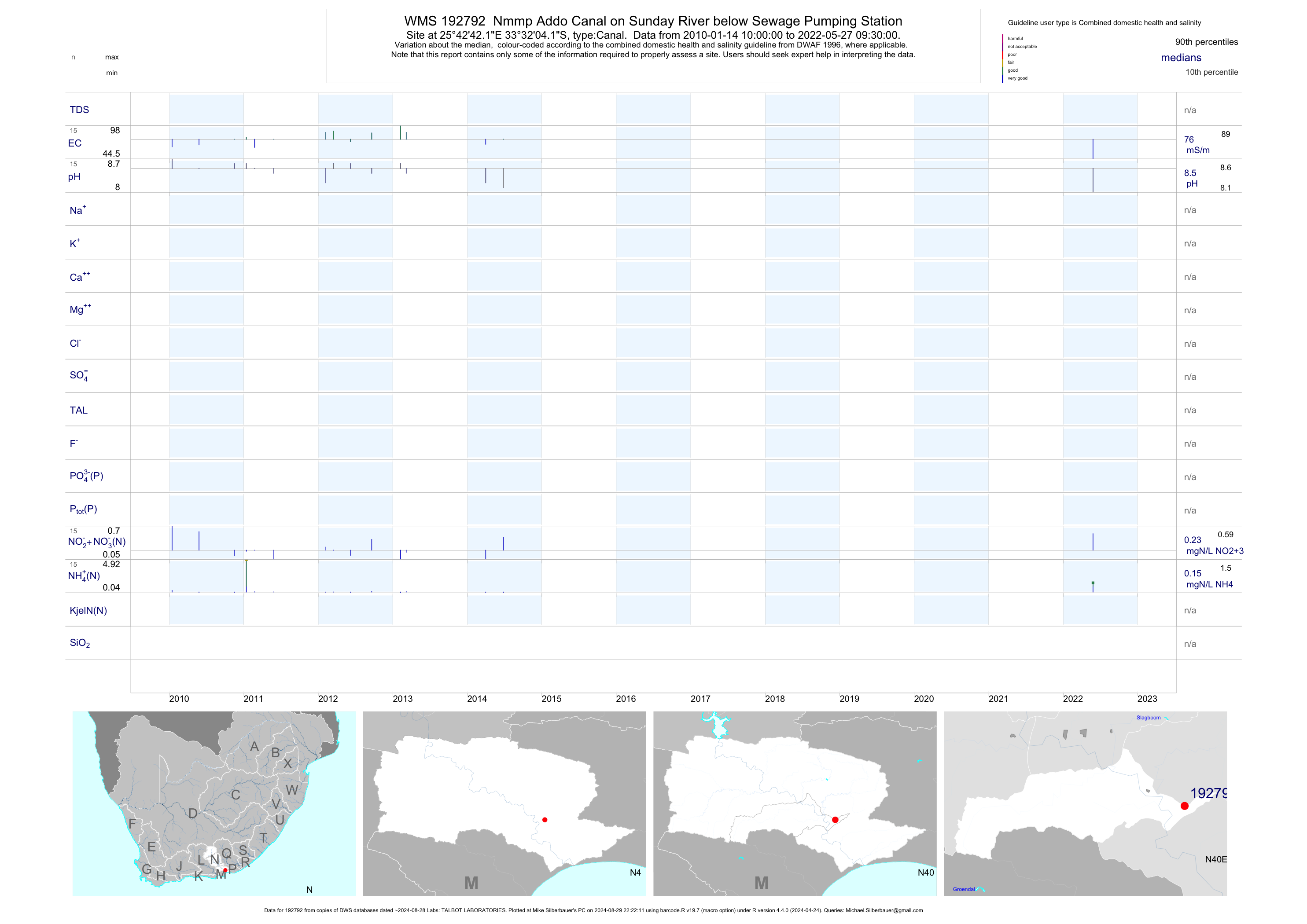
| N40 192792 | plot | data | Nmmp Addo Canal on Sunday River below Sewage Pumping Station | Canal | 29 | 2010-01-14 | 2014-06-26 | 76 | 192792 | -33.53447 | 25.71169 |
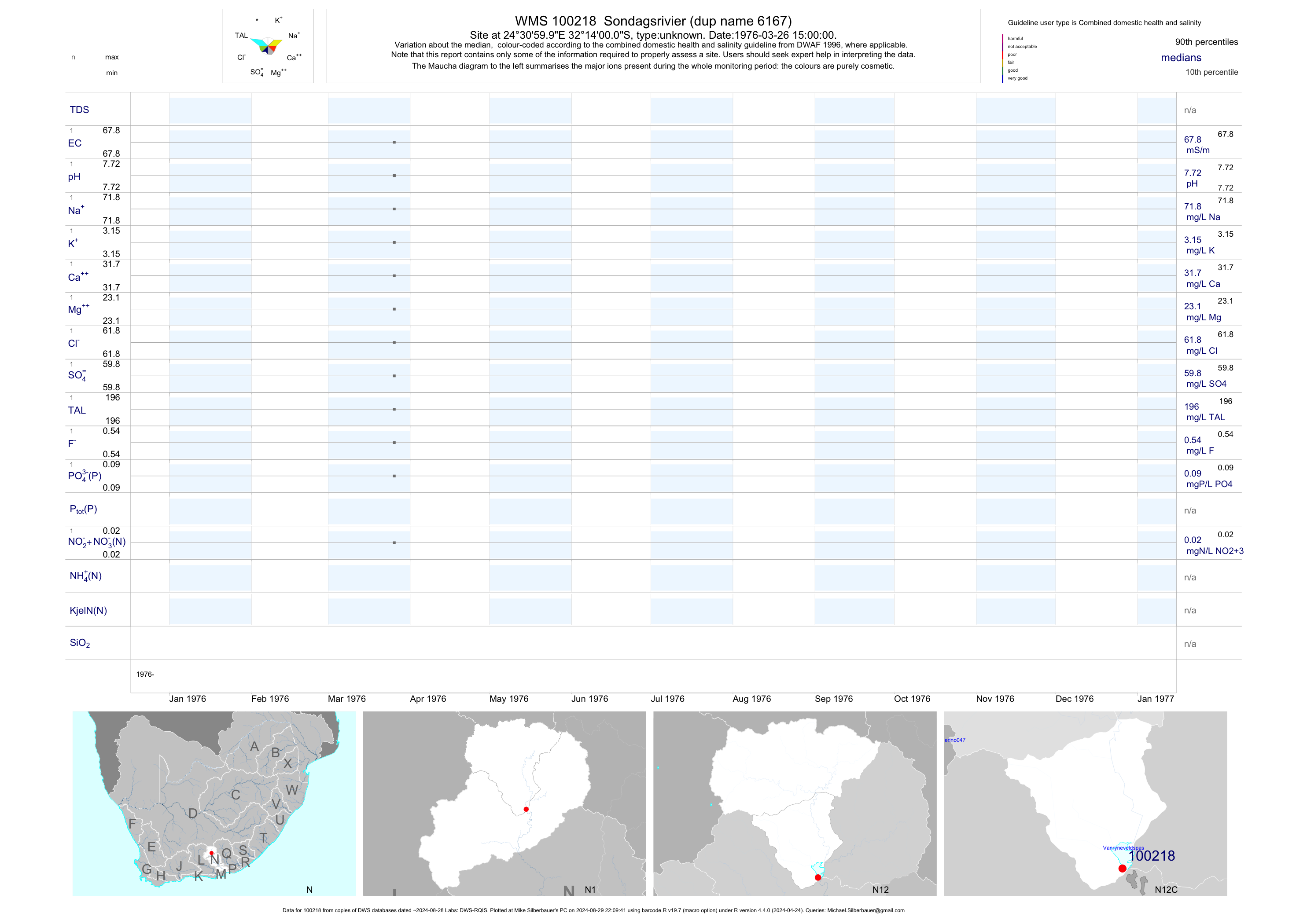
| N12 100218 | plot | data | Sondagsrivier (dup name 6167) | unknown | 1 | 1976-03-26 | 1976-03-26 | 68 | 100218 | -32.23333 | 24.51667 |
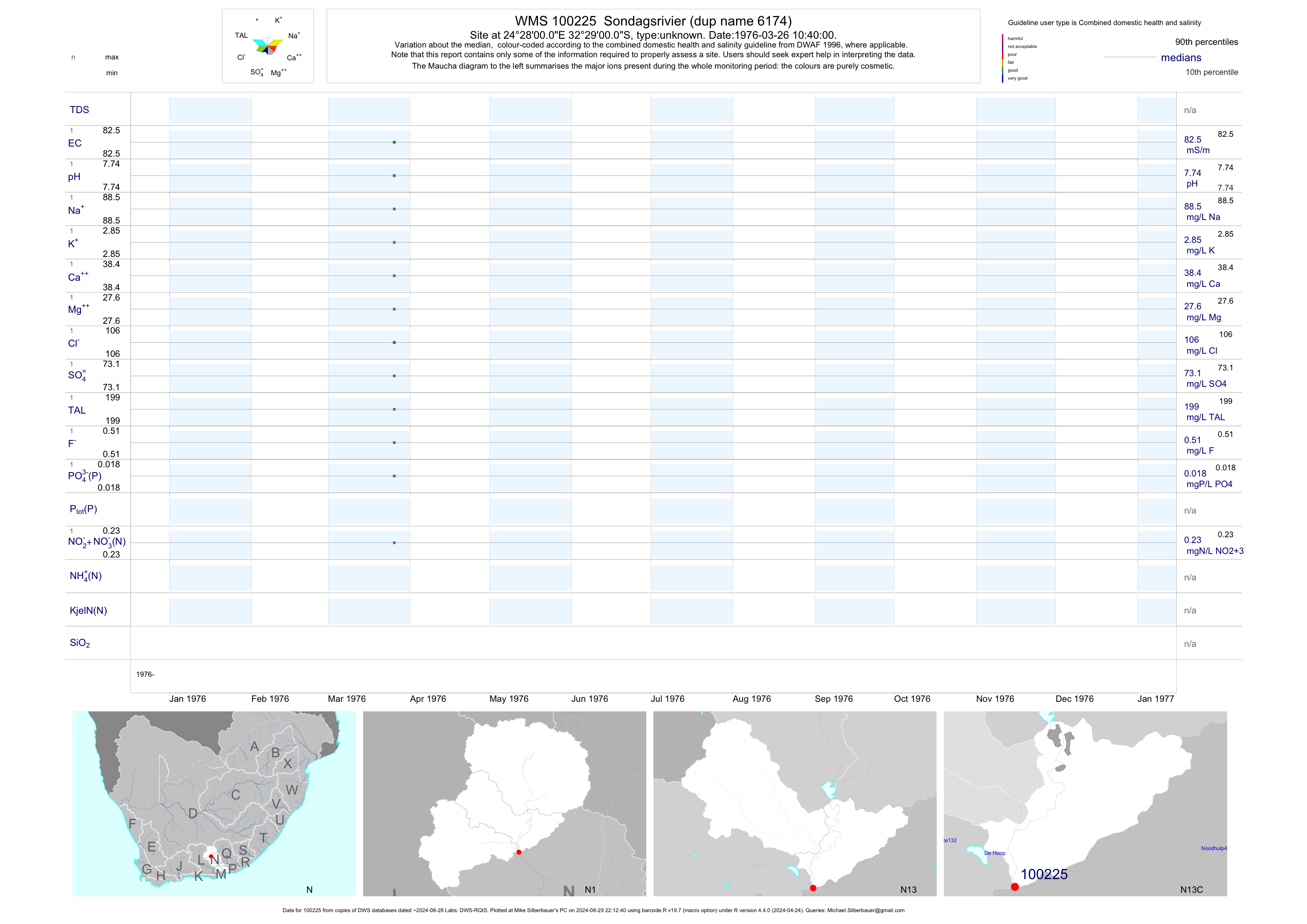
| N13 100225 | plot | data | Sondagsrivier (dup name 6174) | unknown | 1 | 1976-03-26 | 1976-03-26 | 82 | 100225 | -32.48333 | 24.46667 |
| N13 100226 | plot | data | Sondagsrivier (dup name 6175) | unknown | 1 | 1976-03-26 | 1976-03-26 | 90 | 100226 | -32.40000 | 24.48333 |
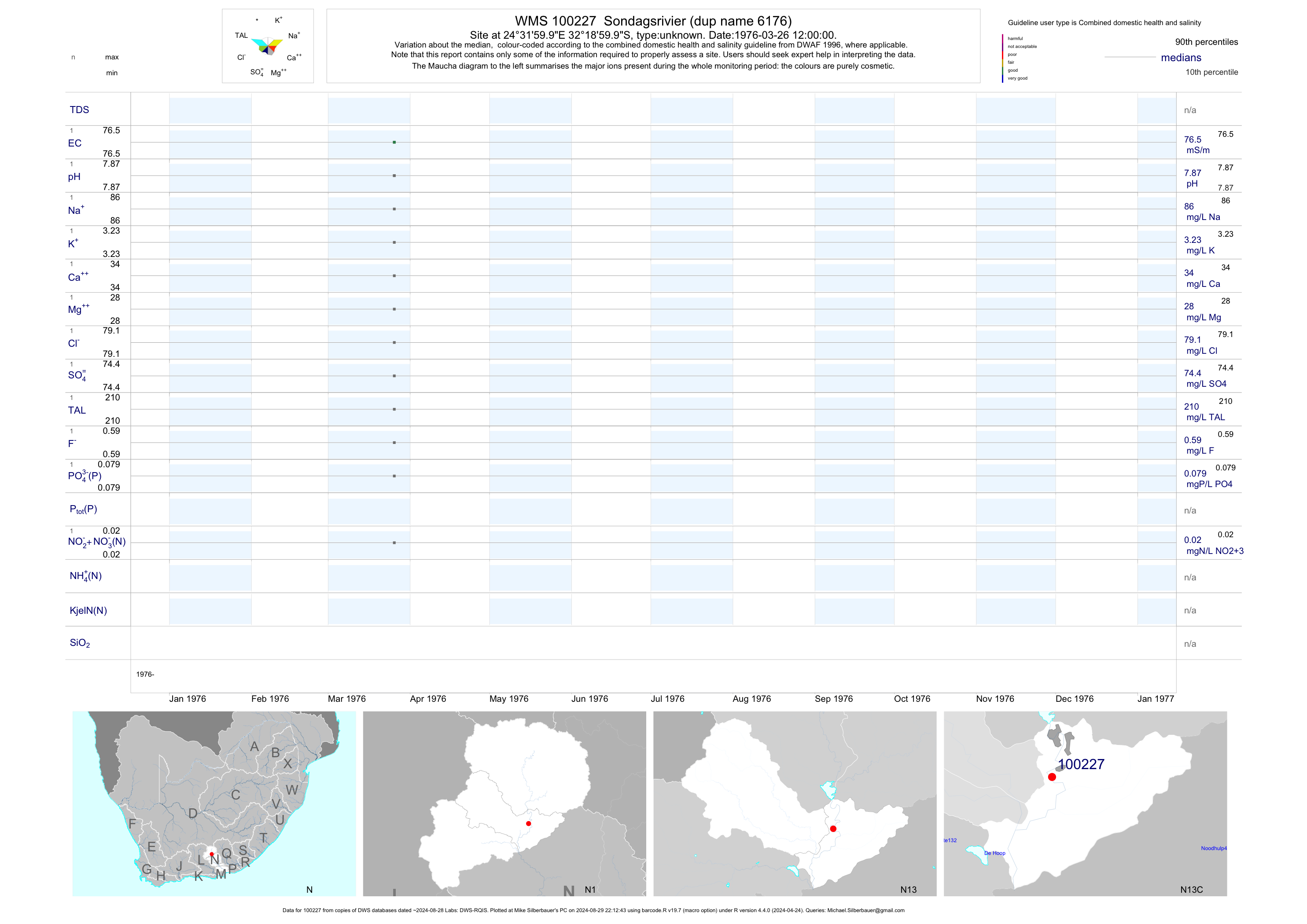
| N13 100227 | plot | data | Sondagsrivier (dup name 6176) | unknown | 1 | 1976-03-26 | 1976-03-26 | 76 | 100227 | -32.31667 | 24.53333 |
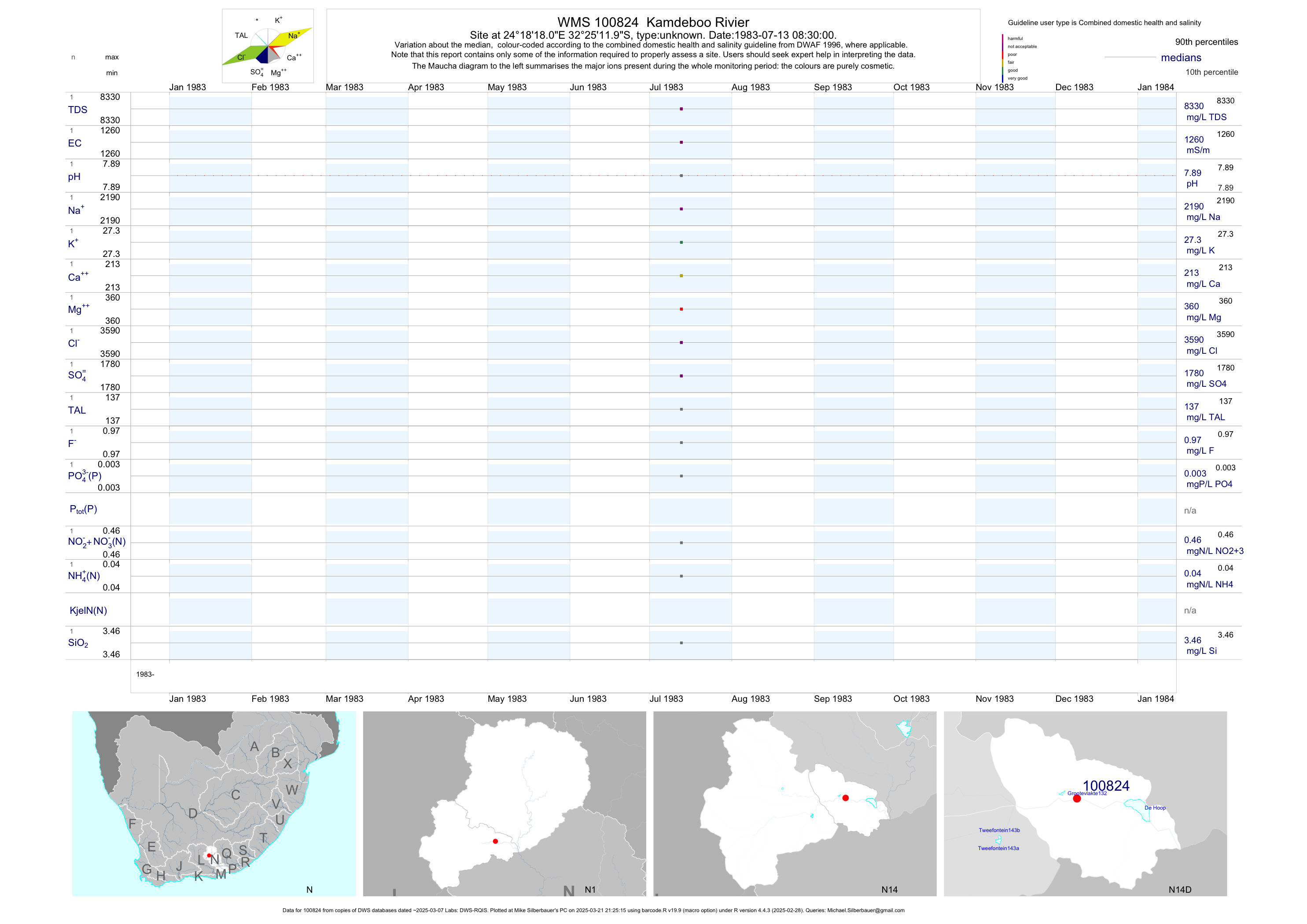
| N14 100824 | plot | data | Kamdeboo Rivier | unknown | 1 | 1983-07-13 | 1983-07-13 | 1256 | 100824 | -32.42000 | 24.30500 |
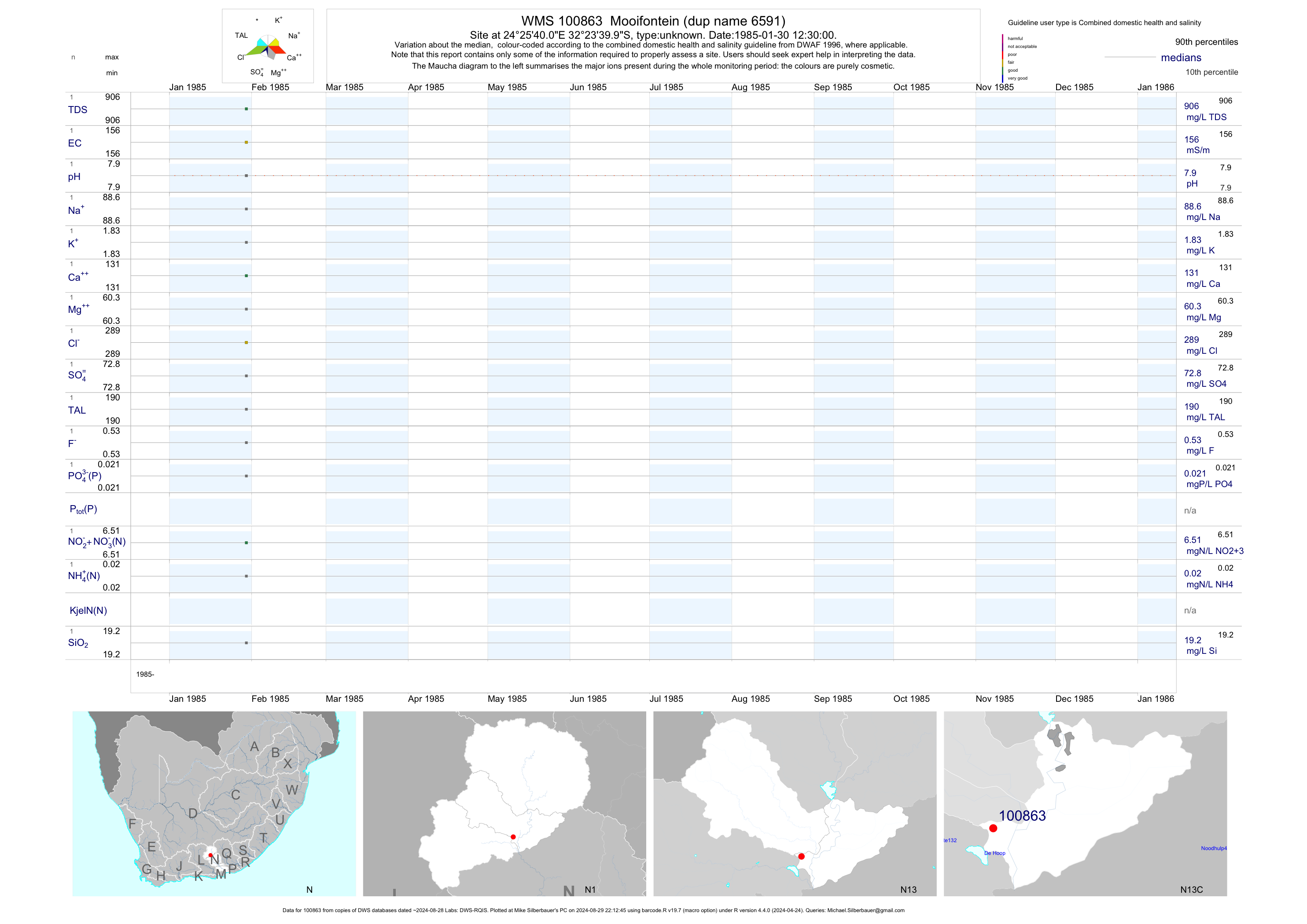
| N13 100863 | plot | data | Mooifontein (dup name 6591) | unknown | 1 | 1985-01-30 | 1985-01-30 | 156 | 100863 | -32.39444 | 24.42778 |
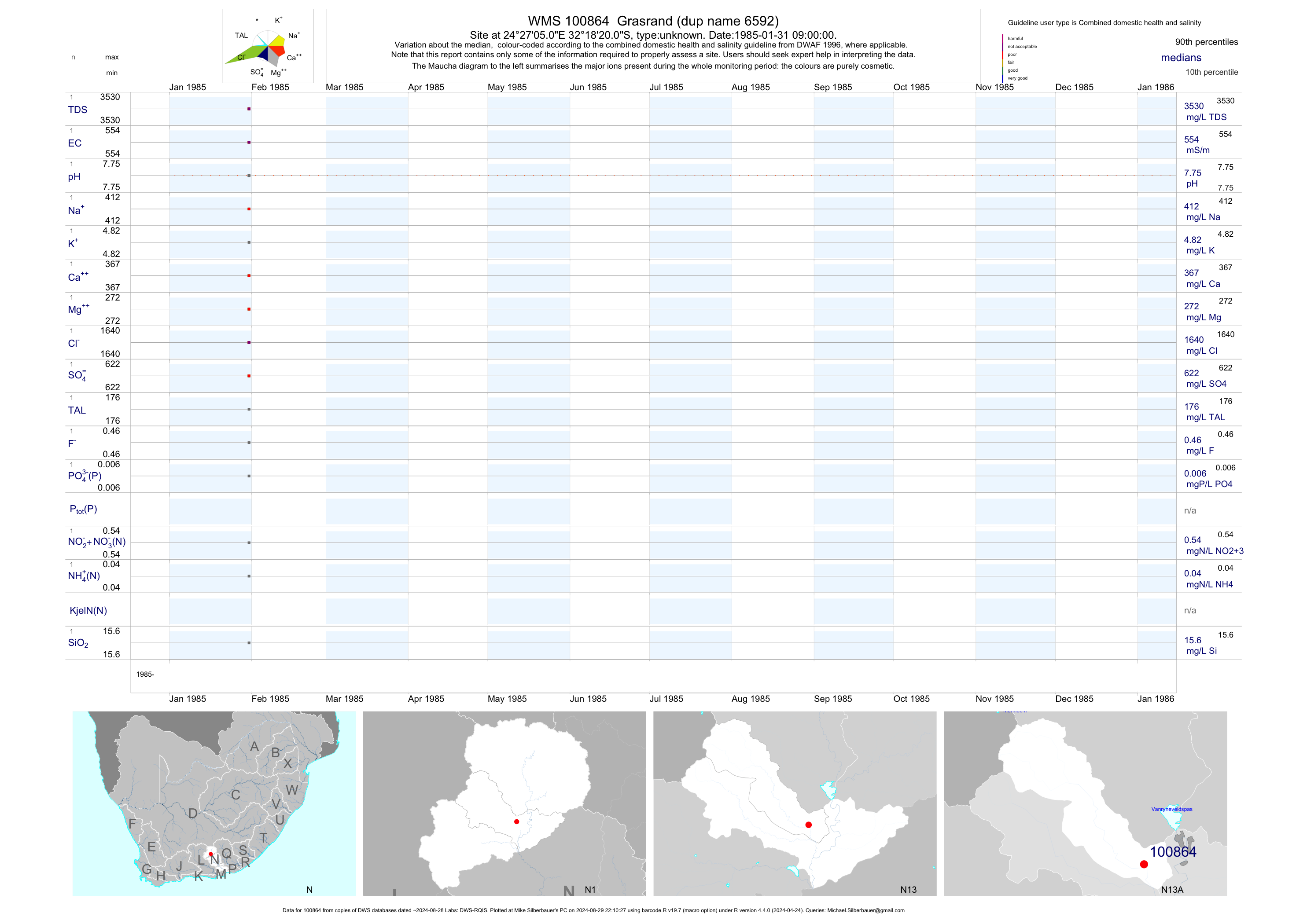
| N13 100864 | plot | data | Grasrand (dup name 6592) | unknown | 1 | 1985-01-31 | 1985-01-31 | 554 | 100864 | -32.30556 | 24.45139 |
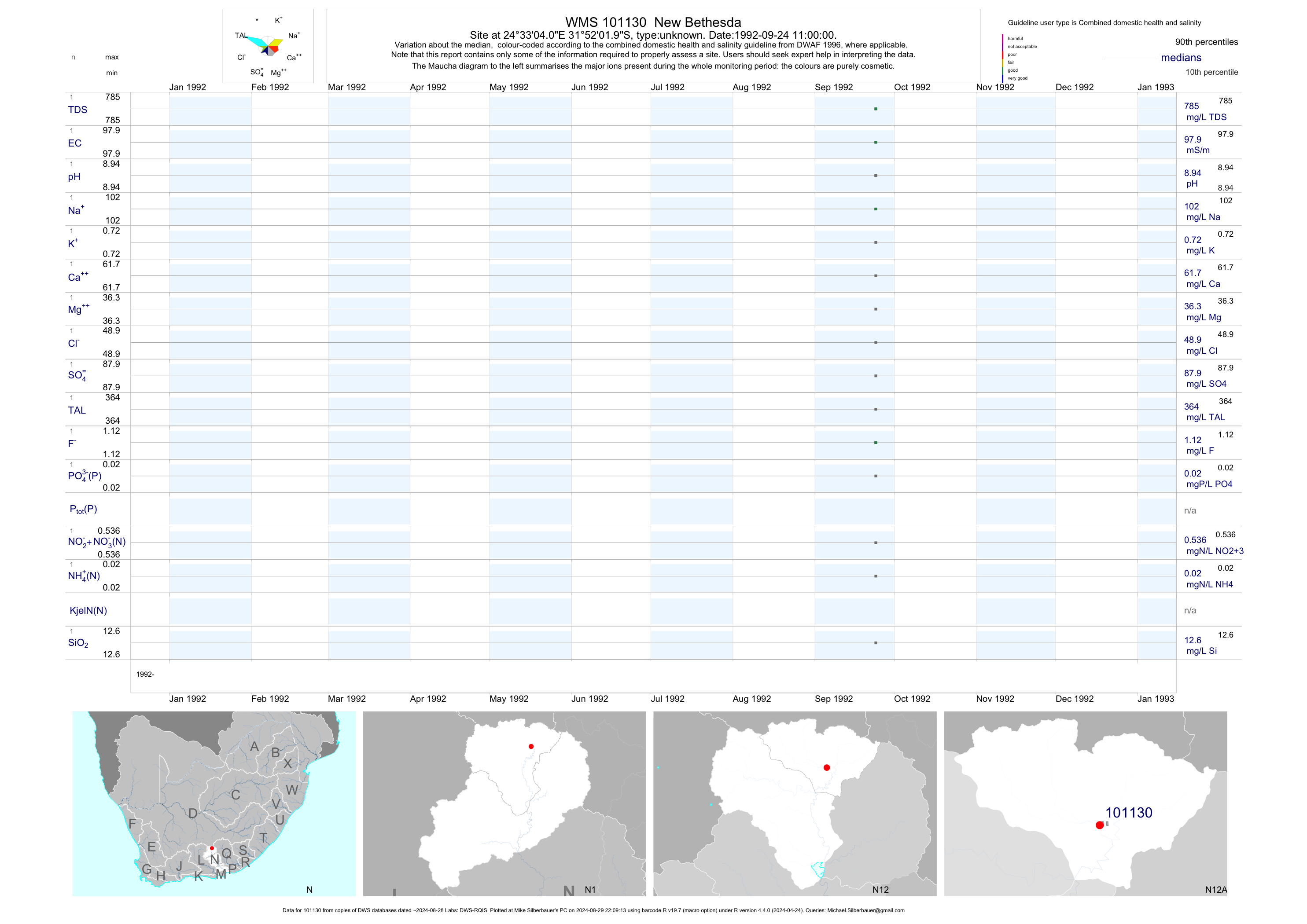
| N12 101130 | plot | data | New Bethesda | unknown | 1 | 1992-09-24 | 1992-09-24 | 98 | 101130 | -31.86722 | 24.55111 |
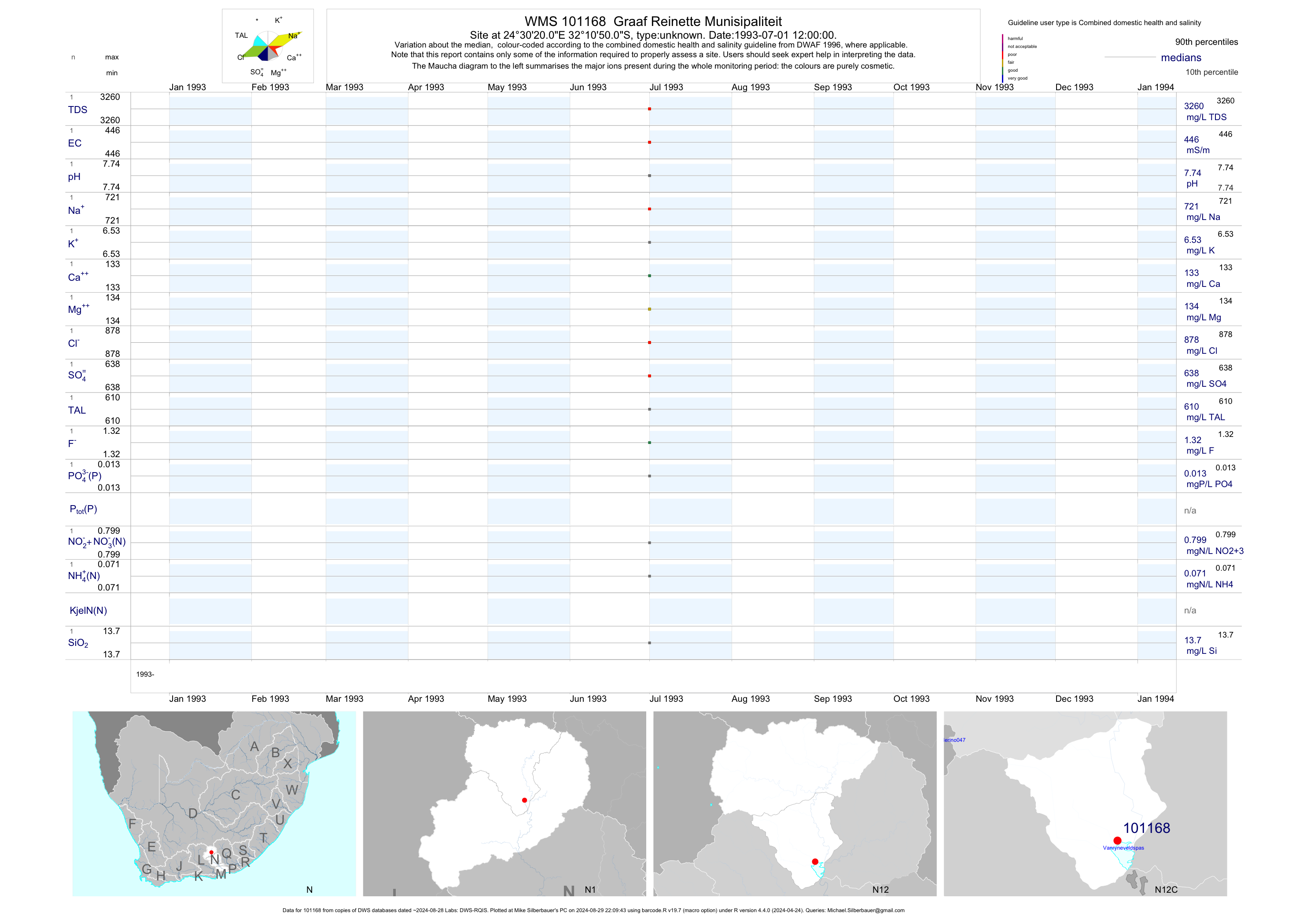
| N12 101168 | plot | data | Graaf Reinette Munisipaliteit | unknown | 1 | 1993-07-01 | 1993-07-01 | 446 | 101168 | -32.18056 | 24.50556 |
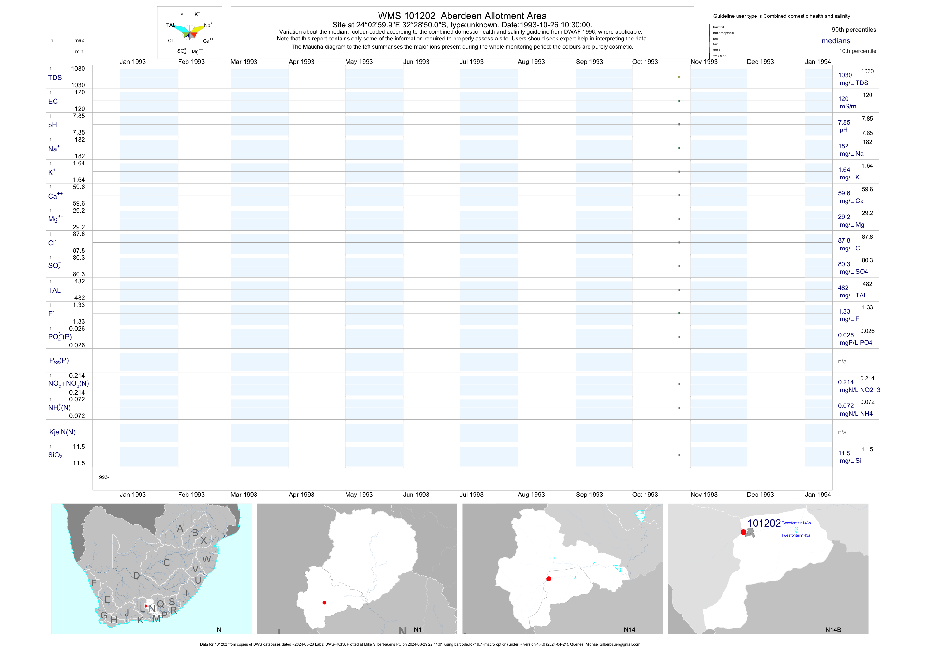
| N14 101202 | plot | data | Aberdeen Allotment Area | unknown | 1 | 1993-10-26 | 1993-10-26 | 120 | 101202 | -32.48056 | 24.05000 |
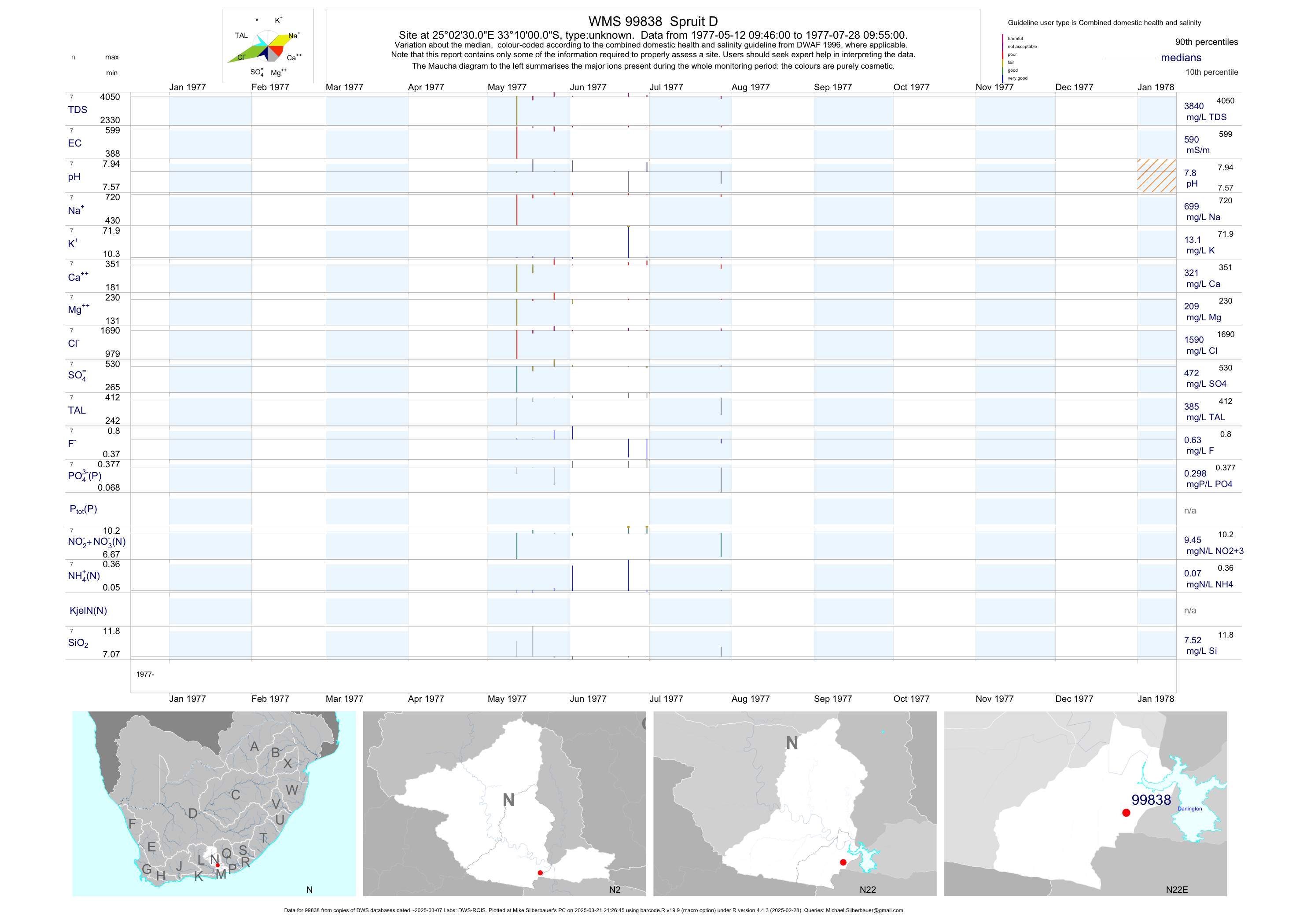
| N22 99838 | plot | data | Spruit D | unknown | 7 | 1977-05-12 | 1977-07-28 | 590 | 99838 | -33.16667 | 25.04167 |
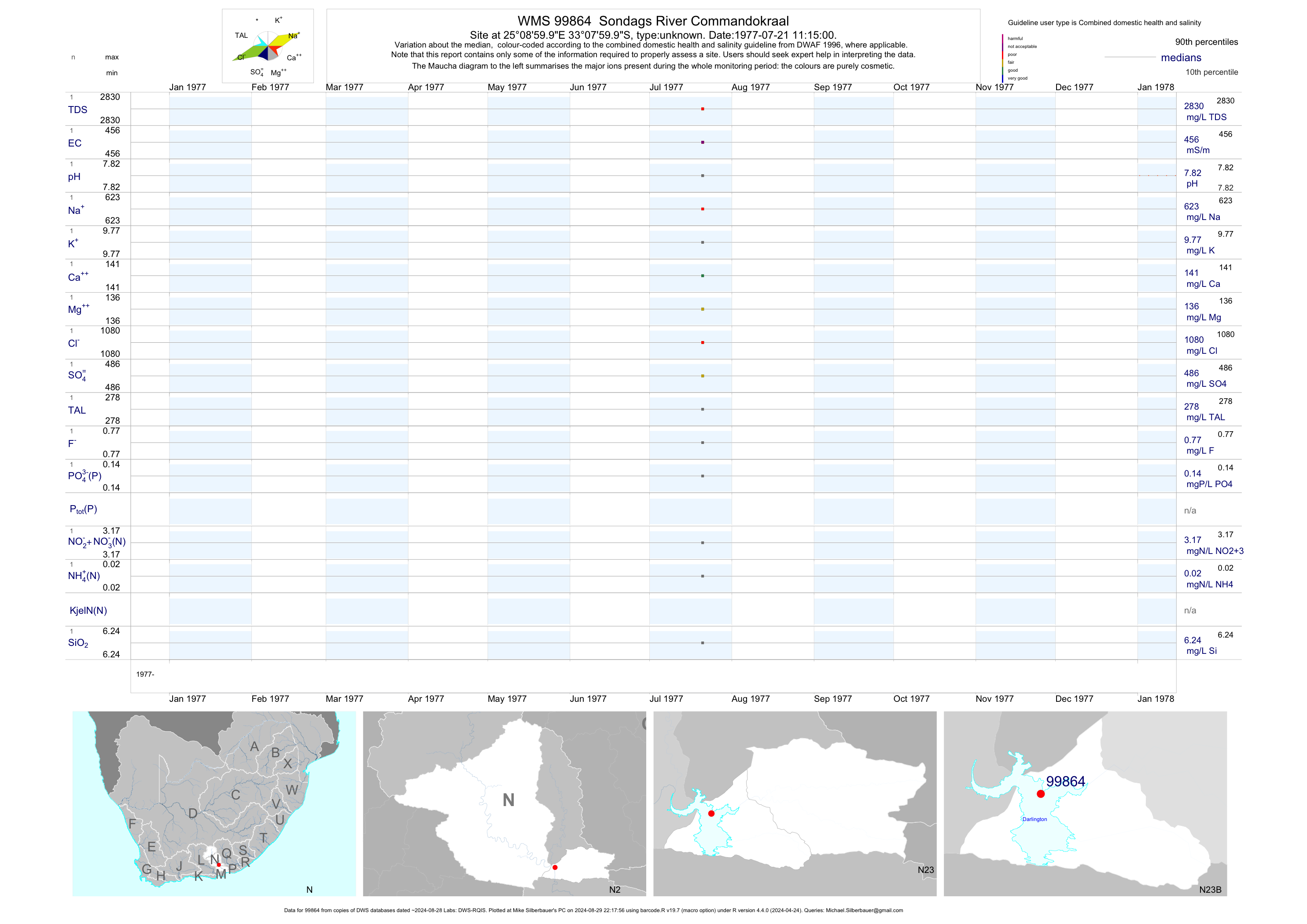
| N23 99864 | plot | data | Sondags River Commandokraal | unknown | 1 | 1977-07-21 | 1977-07-21 | 456 | 99864 | -33.13333 | 25.15000 |
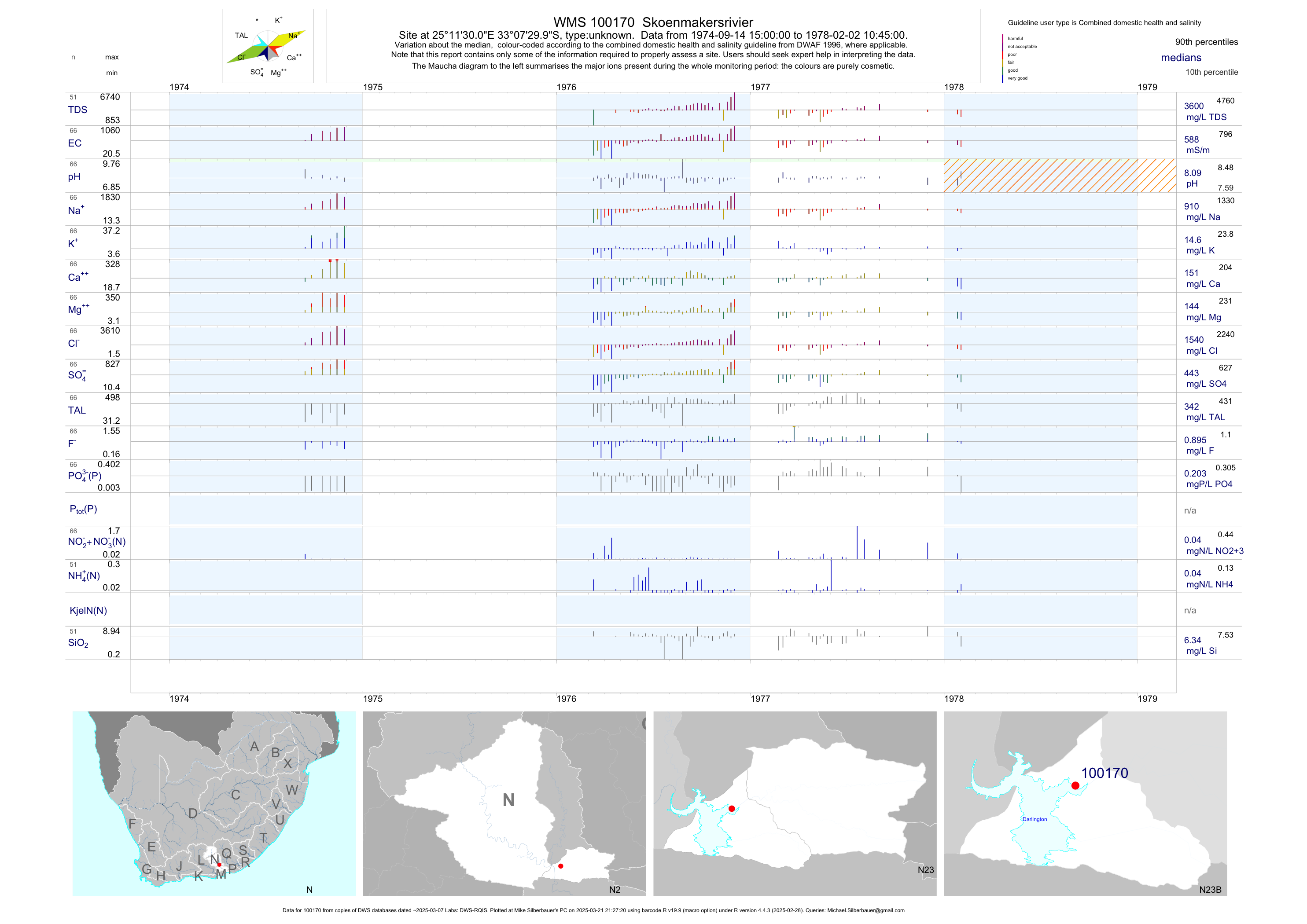
| N23 100170 | plot | data | Skoenmakersrivier | unknown | 66 | 1974-09-14 | 1978-02-02 | 588 | 100170 | -33.12500 | 25.19167 |
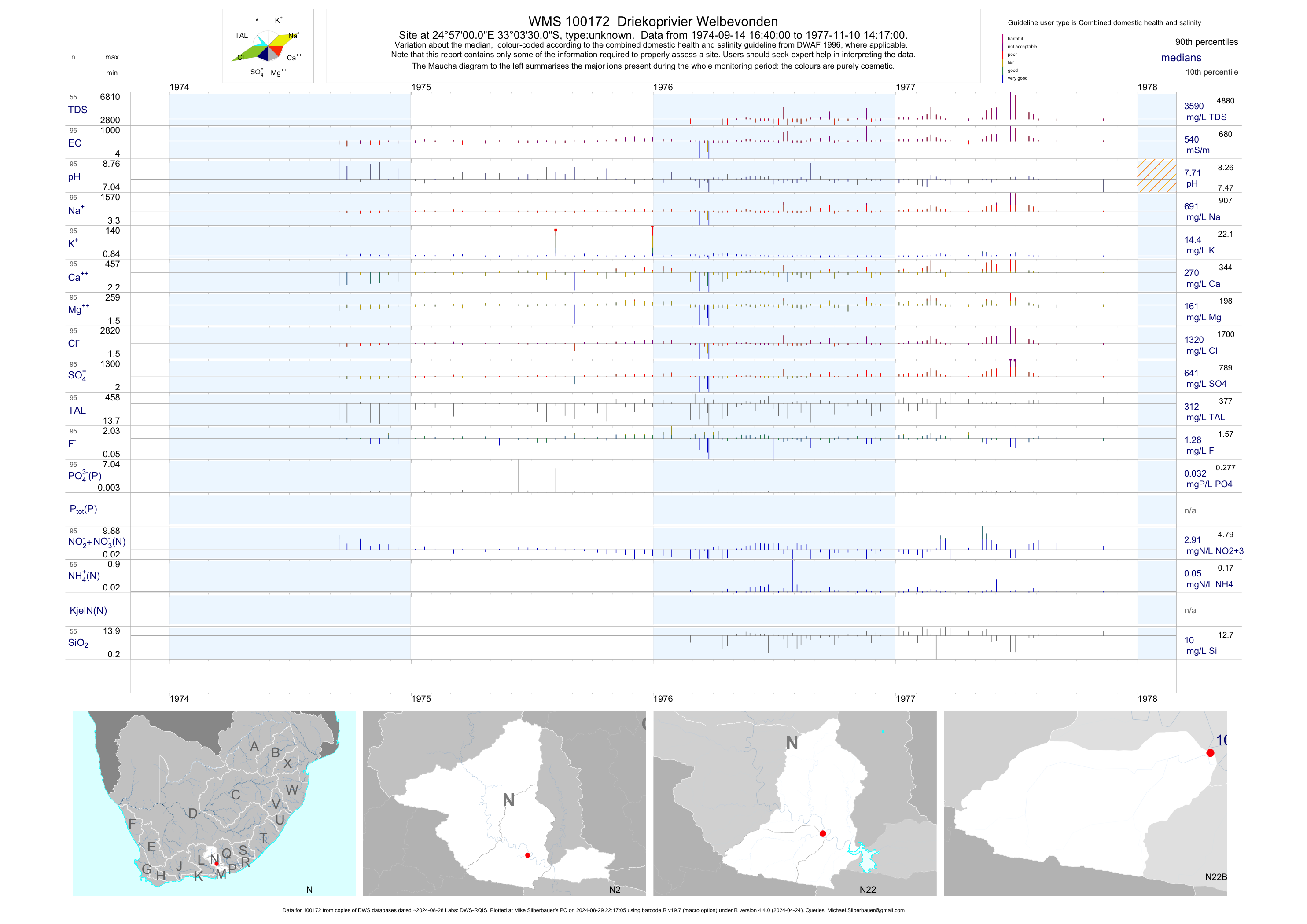
| N22 100172 | plot | data | Driekoprivier Welbevonden | unknown | 95 | 1974-09-14 | 1977-11-10 | 540 | 100172 | -33.05833 | 24.95000 |
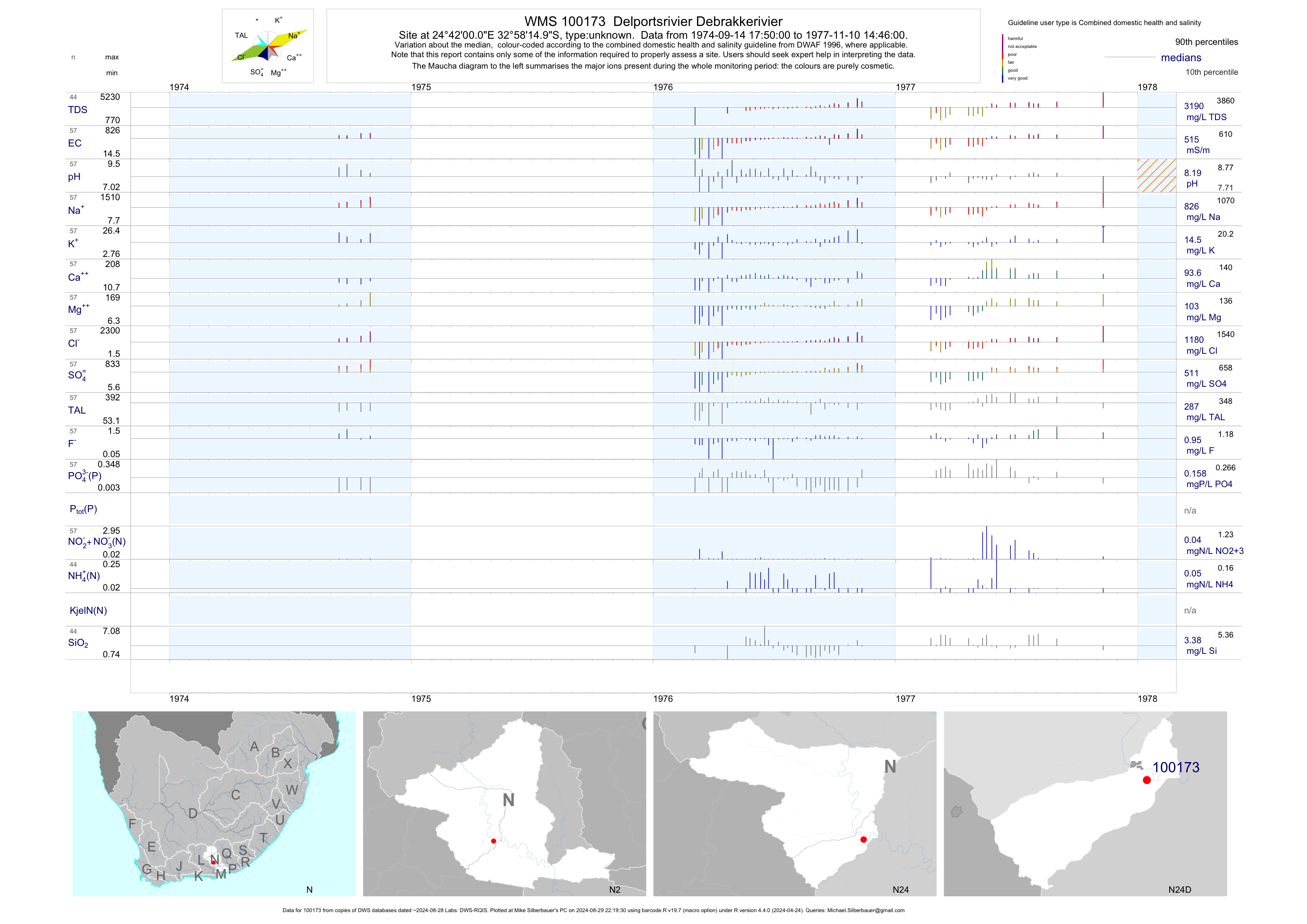
| N24 100173 | plot | data | Delportsrivier Debrakkerivier | unknown | 57 | 1974-09-14 | 1977-11-10 | 515 | 100173 | -32.97083 | 24.70000 |
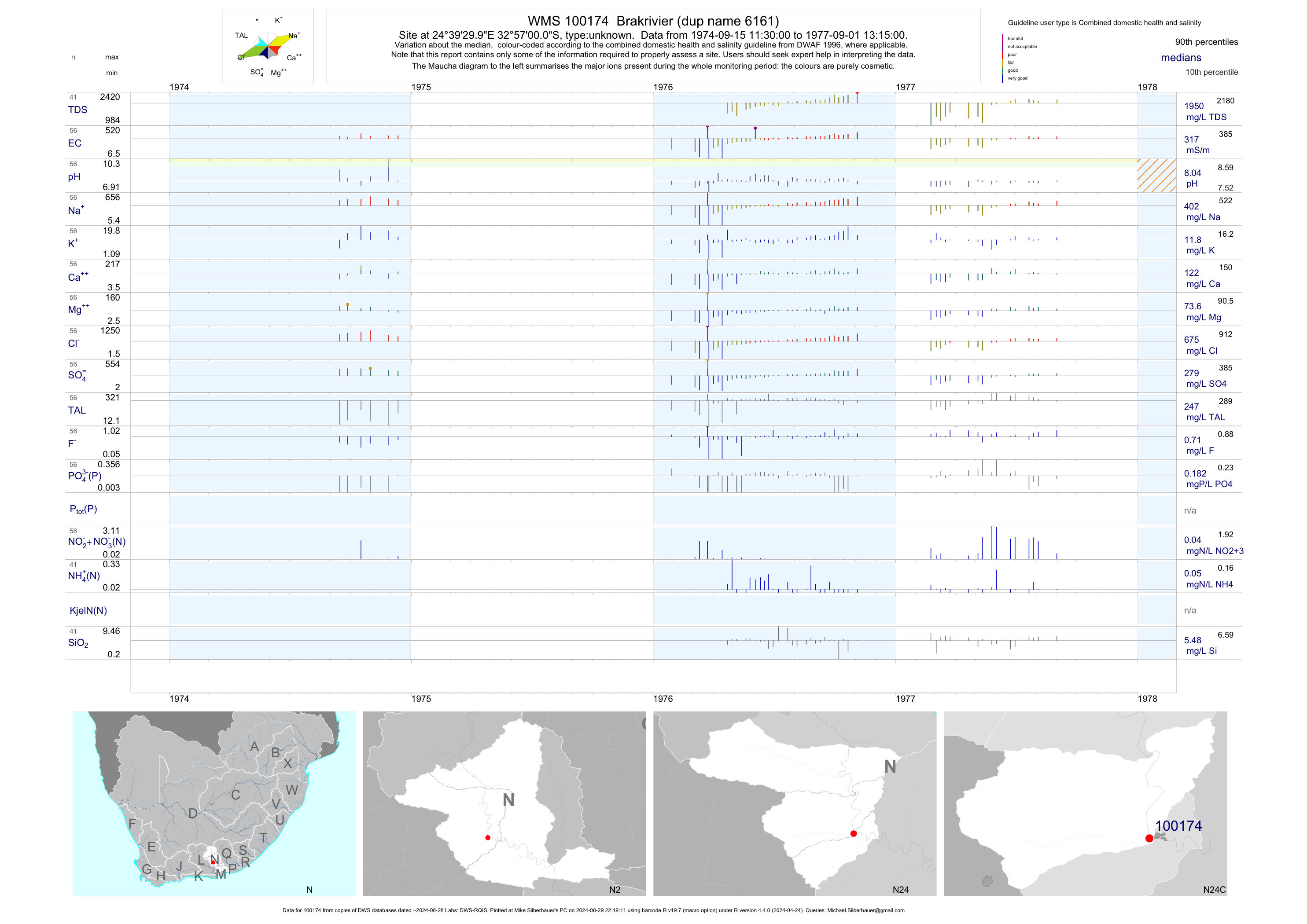
| N24 100174 | plot | data | Brakrivier (dup name 6161) | unknown | 56 | 1974-09-15 | 1977-09-01 | 317 | 100174 | -32.95000 | 24.65833 |
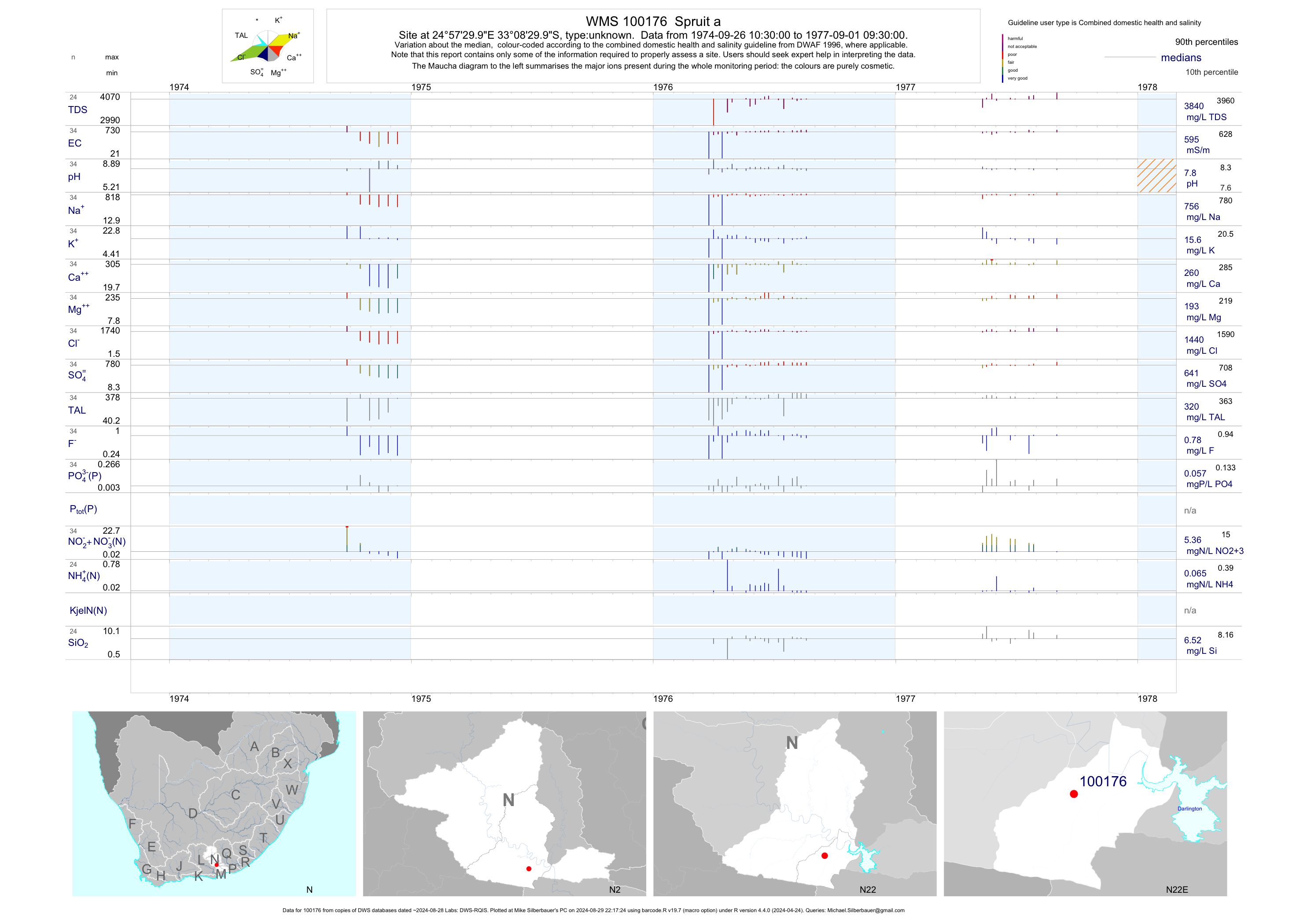
| N22 100176 | plot | data | Spruit a | unknown | 34 | 1974-09-26 | 1977-09-01 | 595 | 100176 | -33.14167 | 24.95833 |
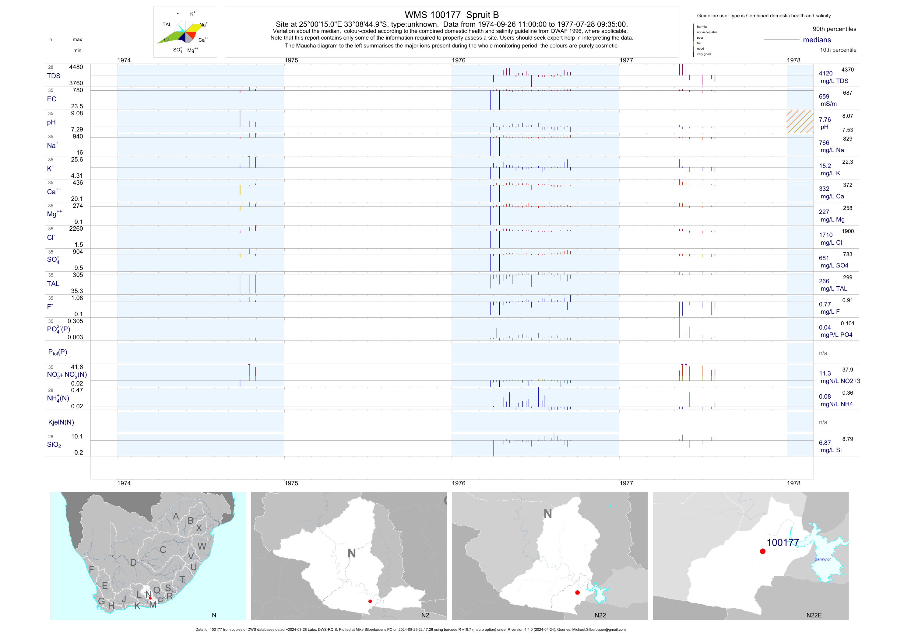
| N22 100177 | plot | data | Spruit B | unknown | 35 | 1974-09-26 | 1977-07-28 | 659 | 100177 | -33.14583 | 25.00417 |
| N22 100178 | plot | data | Spruit C | unknown | 38 | 1974-09-26 | 1977-09-01 | 639 | 100178 | -33.15000 | 25.01667 |
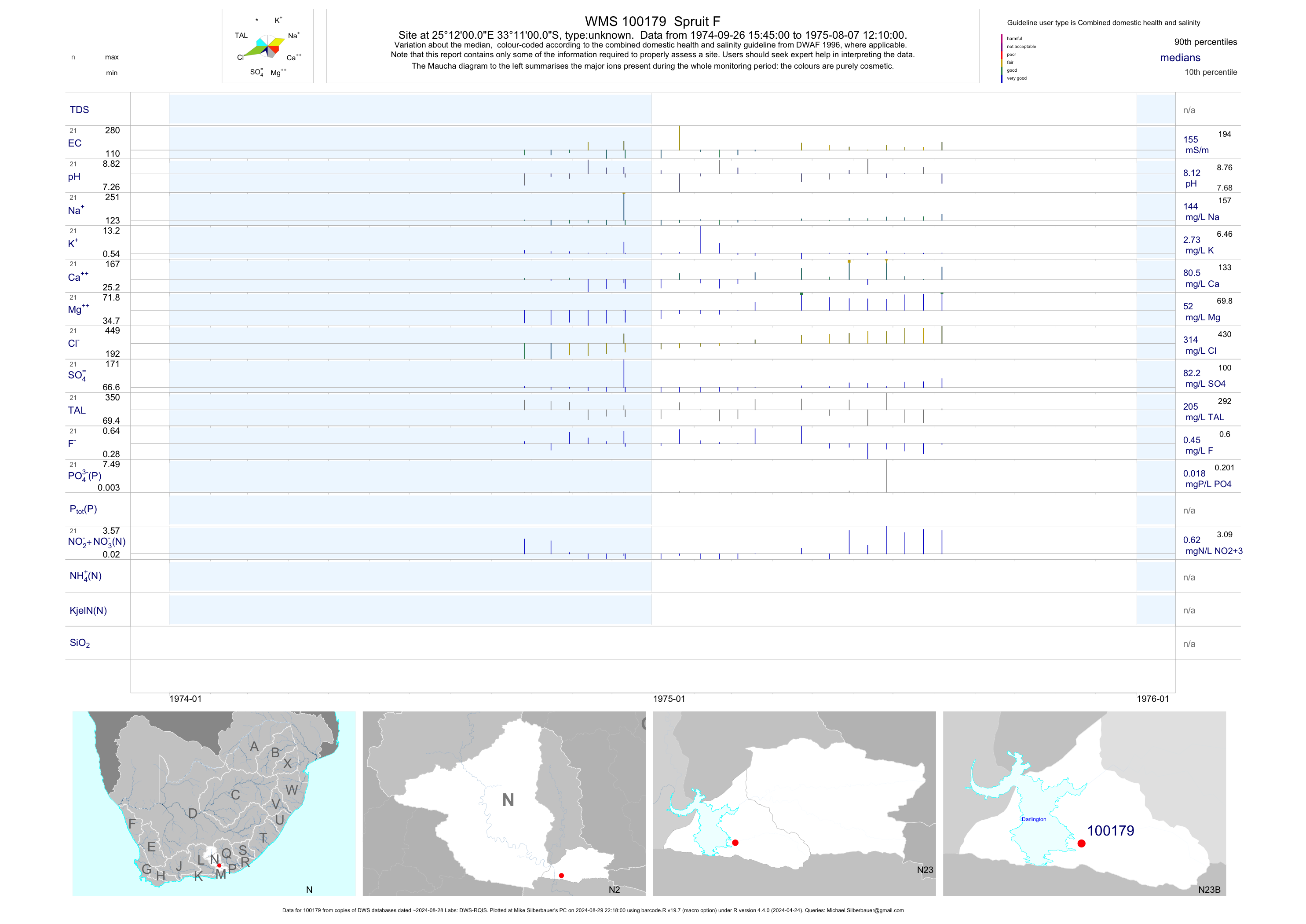
| N23 100179 | plot | data | Spruit F | unknown | 21 | 1974-09-26 | 1975-08-07 | 155 | 100179 | -33.18333 | 25.20000 |
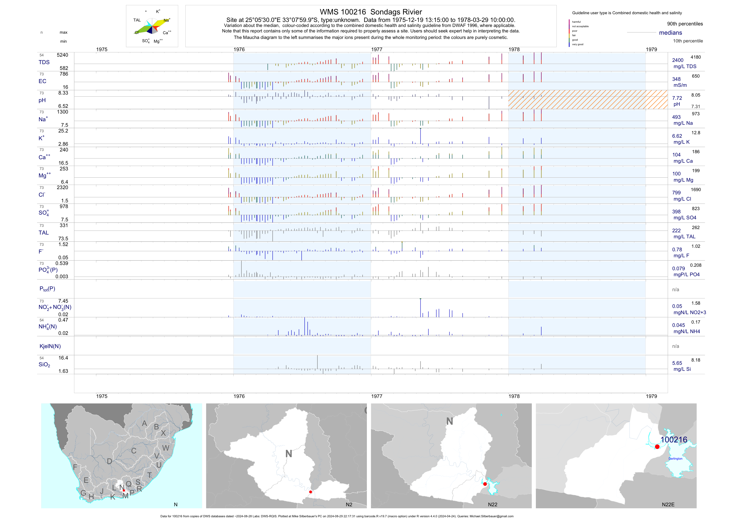
| N22 100216 | plot | data | Sondags Rivier | unknown | 73 | 1975-12-19 | 1978-03-29 | 348 | 100216 | -33.13333 | 25.09167 |
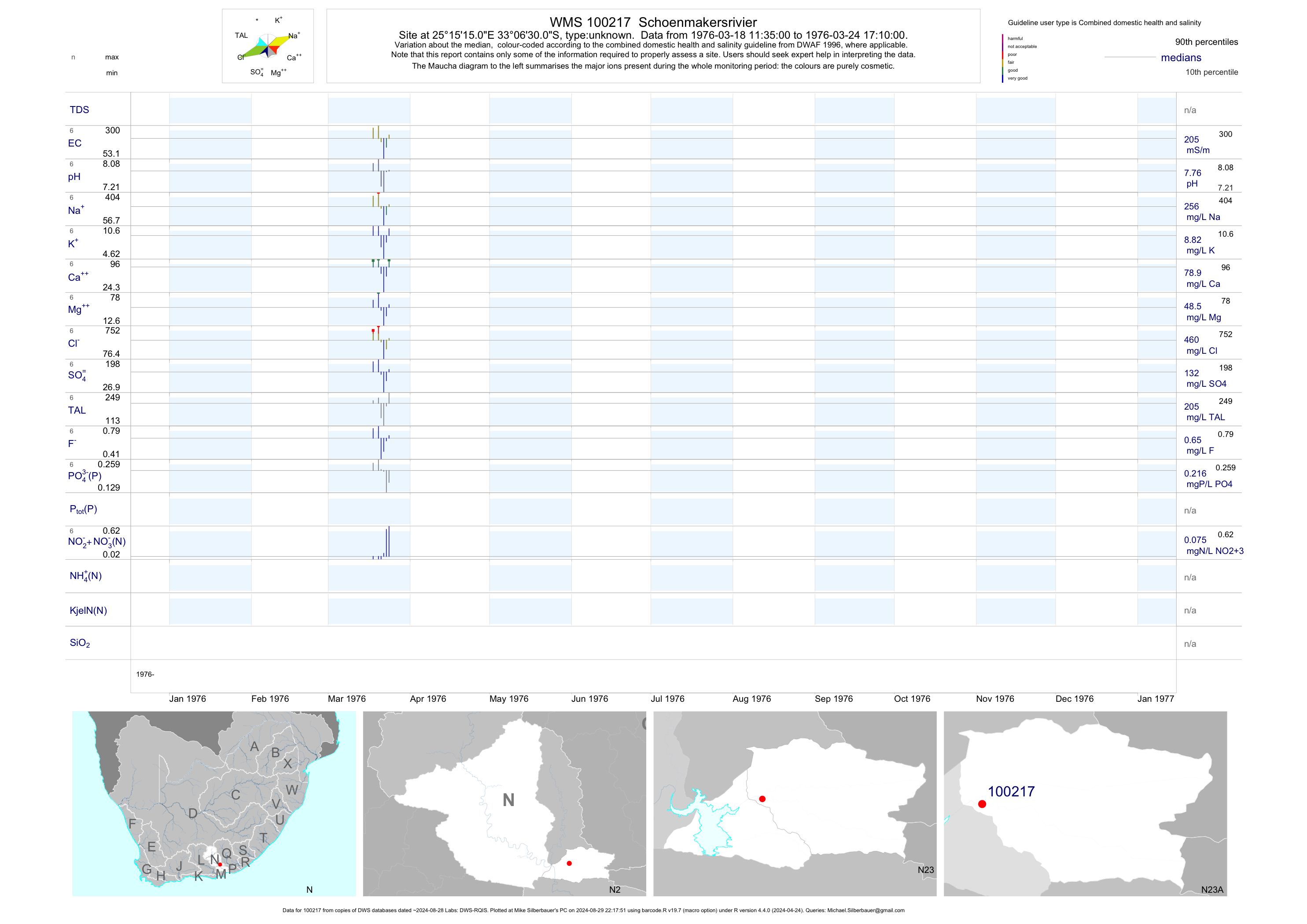
| N23 100217 | plot | data | Schoenmakersrivier | unknown | 6 | 1976-03-18 | 1976-03-24 | 205 | 100217 | -33.10833 | 25.25417 |
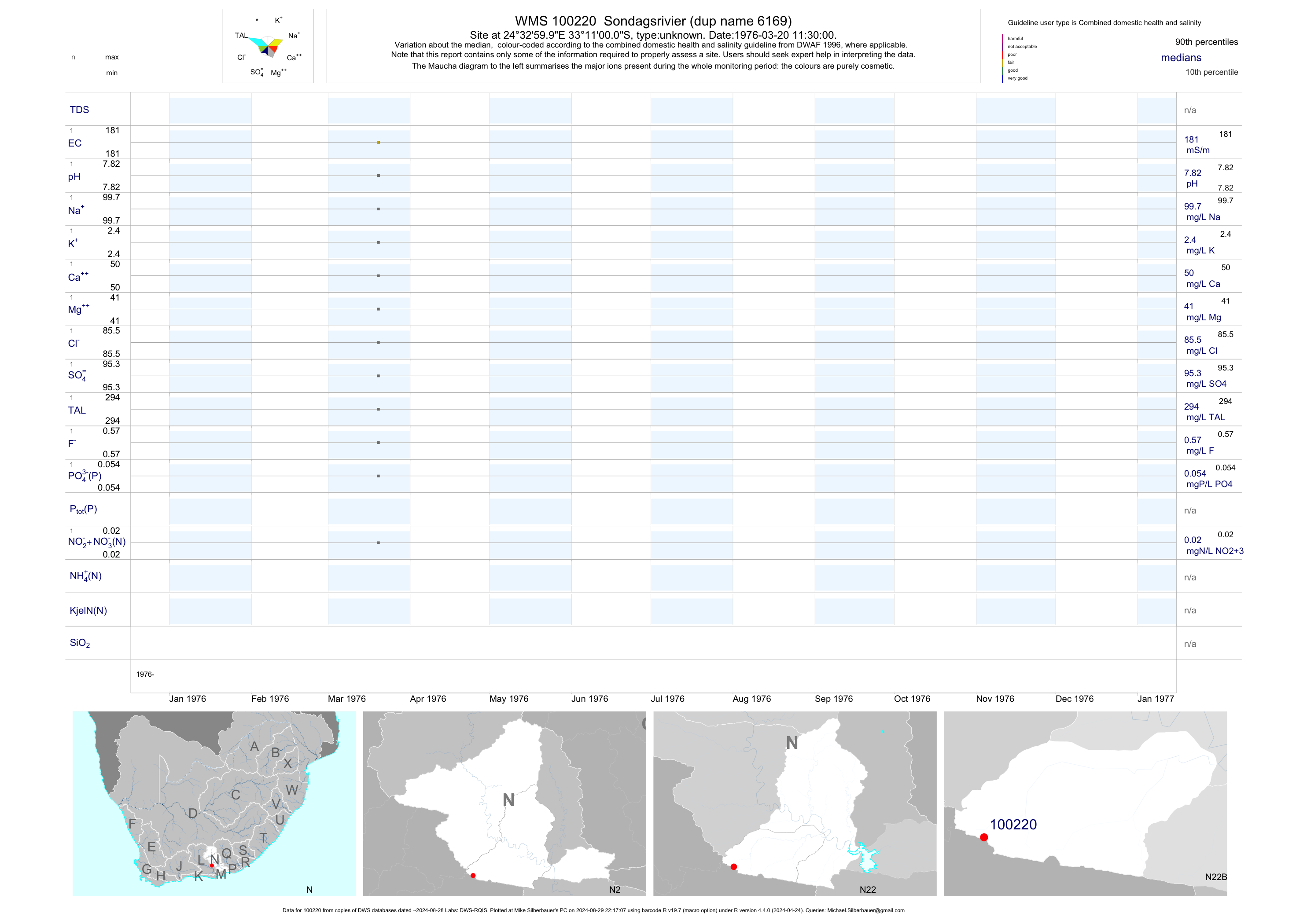
| N22 100220 | plot | data | Sondagsrivier (dup name 6169) | unknown | 1 | 1976-03-20 | 1976-03-20 | 181 | 100220 | -33.18333 | 24.55000 |
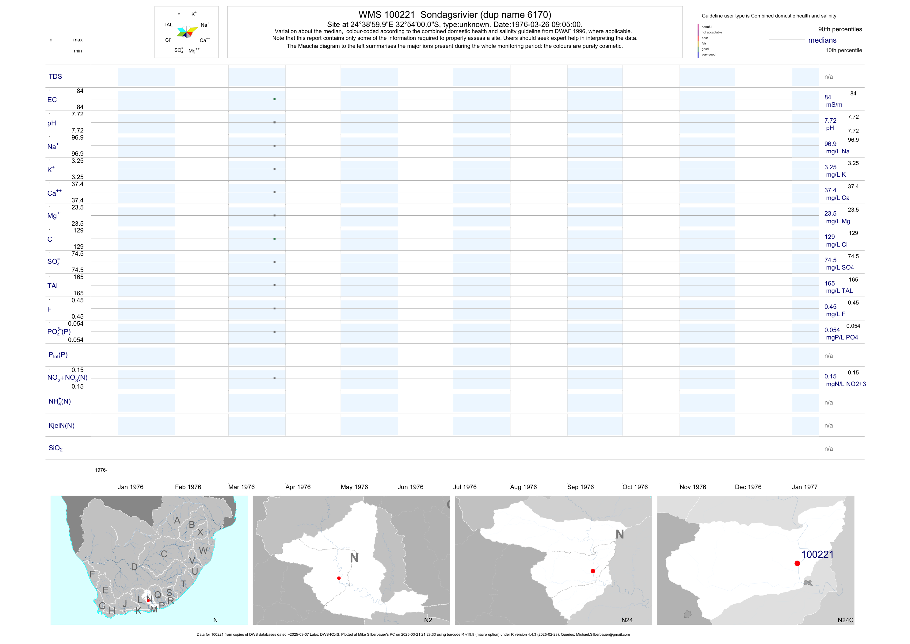
| N24 100221 | plot | data | Sondagsrivier (dup name 6170) | unknown | 1 | 1976-03-26 | 1976-03-26 | 84 | 100221 | -32.90000 | 24.65000 |
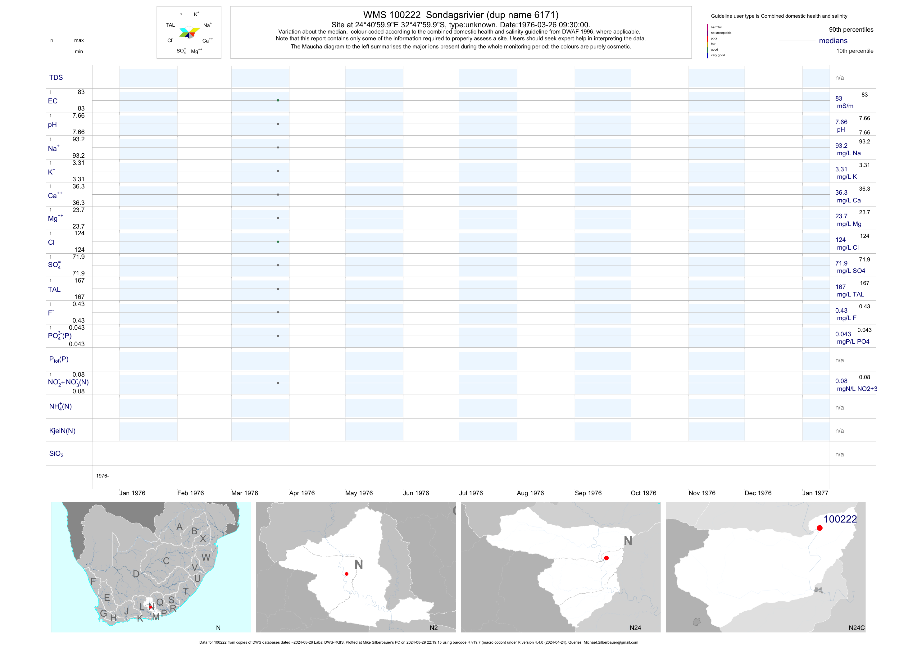
| N24 100222 | plot | data | Sondagsrivier (dup name 6171) | unknown | 1 | 1976-03-26 | 1976-03-26 | 83 | 100222 | -32.80000 | 24.68333 |
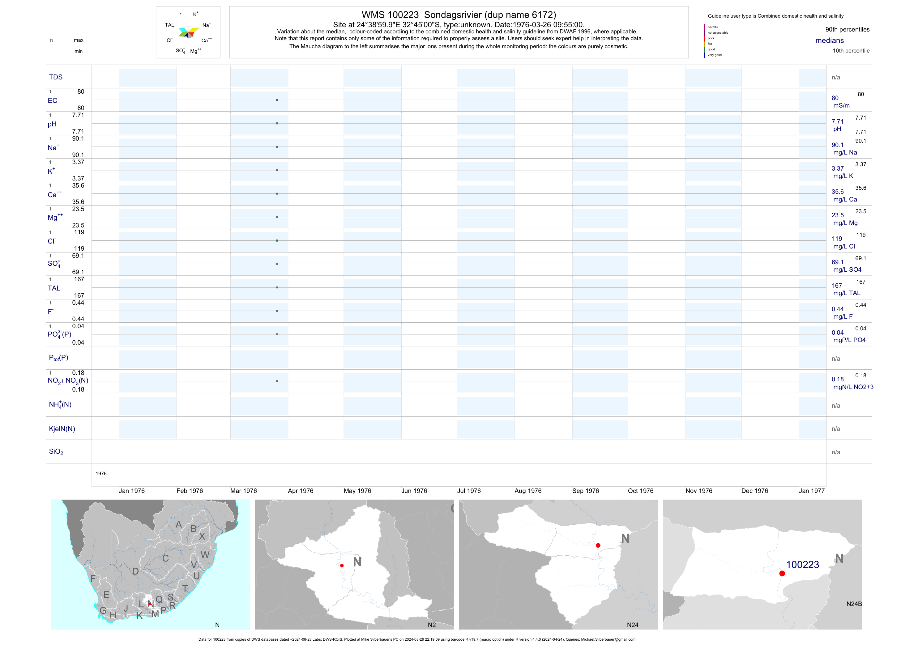
| N24 100223 | plot | data | Sondagsrivier (dup name 6172) | unknown | 1 | 1976-03-26 | 1976-03-26 | 80 | 100223 | -32.75000 | 24.65000 |
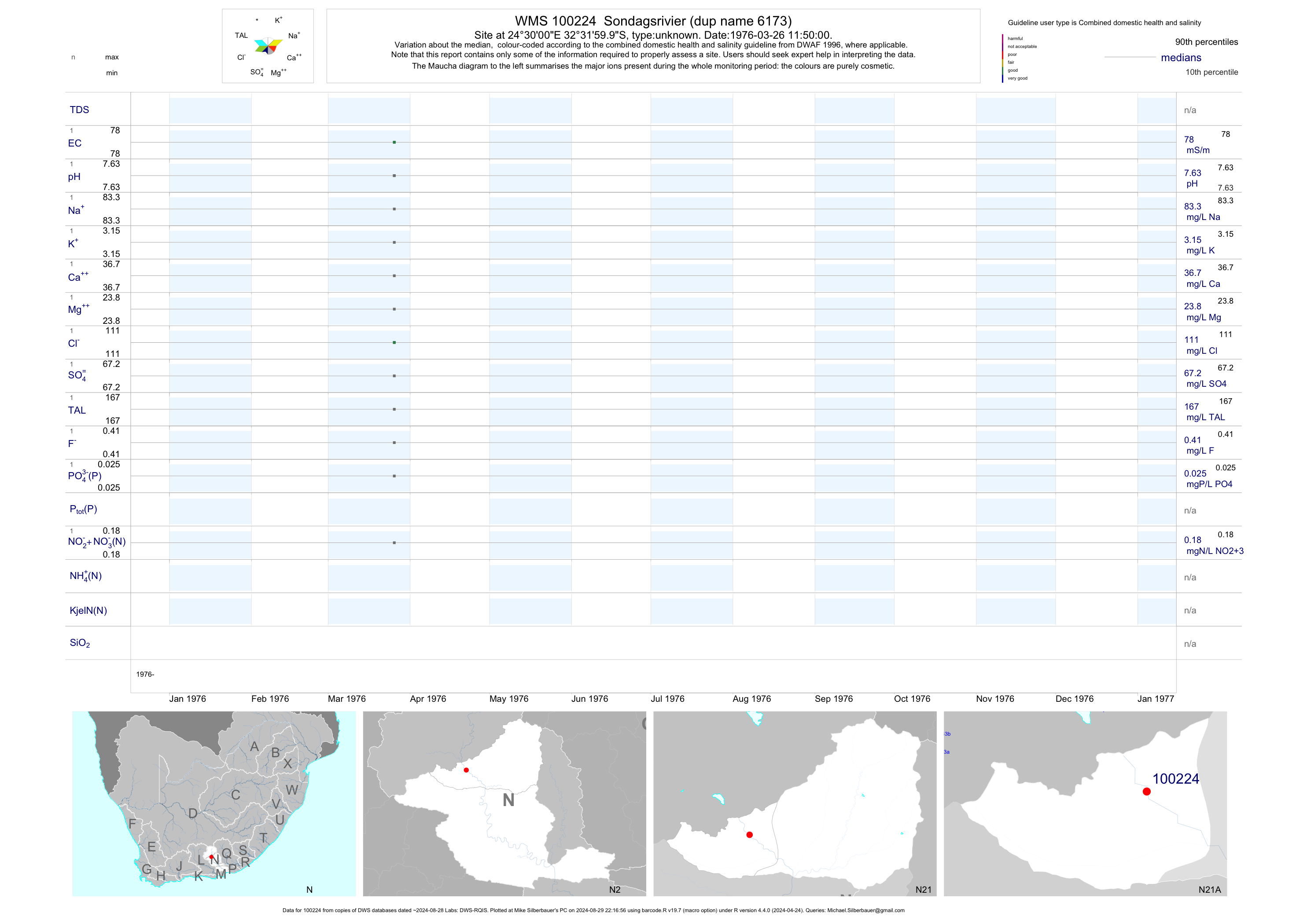
| N21 100224 | plot | data | Sondagsrivier (dup name 6173) | unknown | 1 | 1976-03-26 | 1976-03-26 | 78 | 100224 | -32.53333 | 24.50000 |
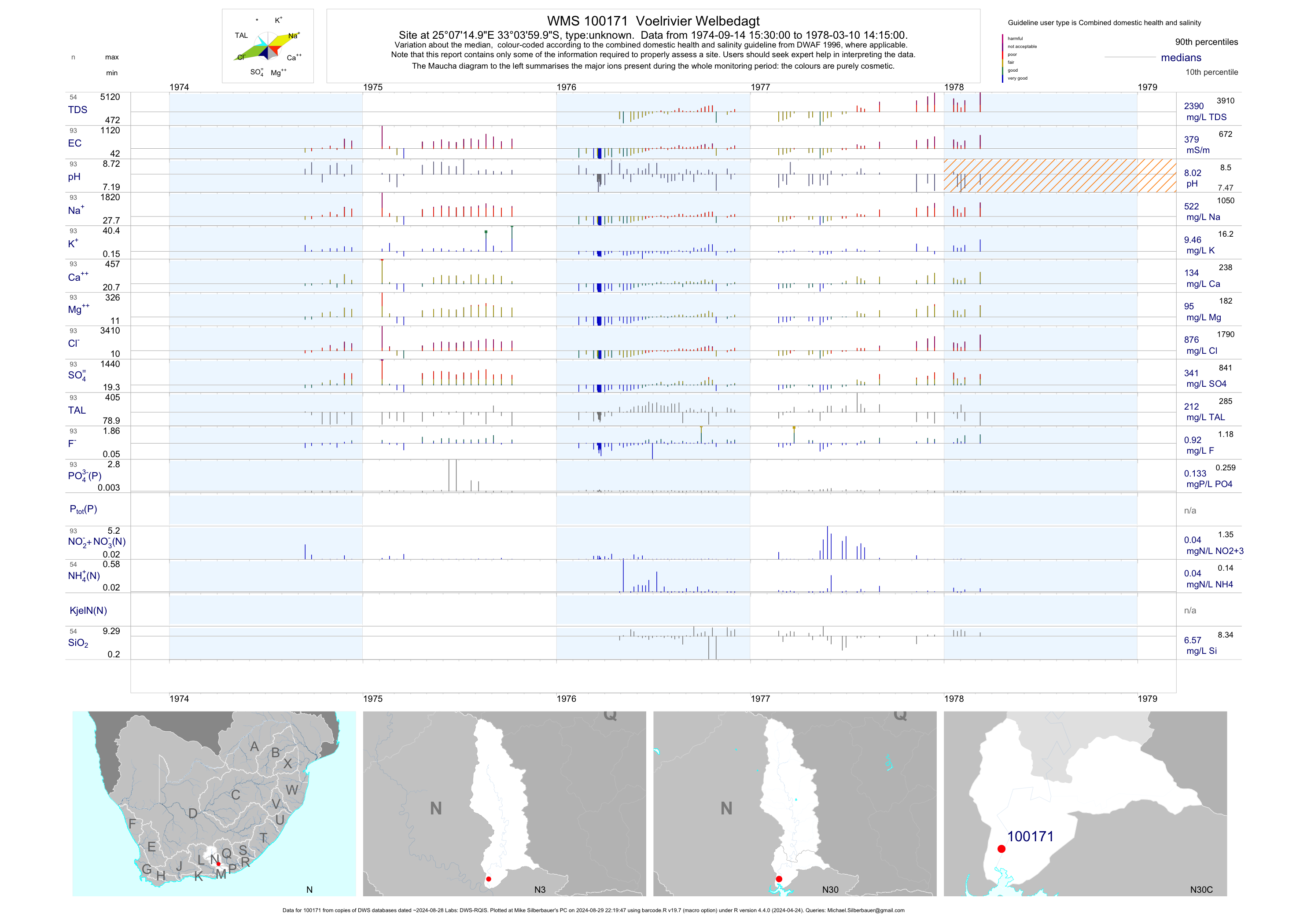
| N30 100171 | plot | data | Voelrivier Welbedagt | unknown | 93 | 1974-09-14 | 1978-03-10 | 379 | 100171 | -33.06667 | 25.12083 |
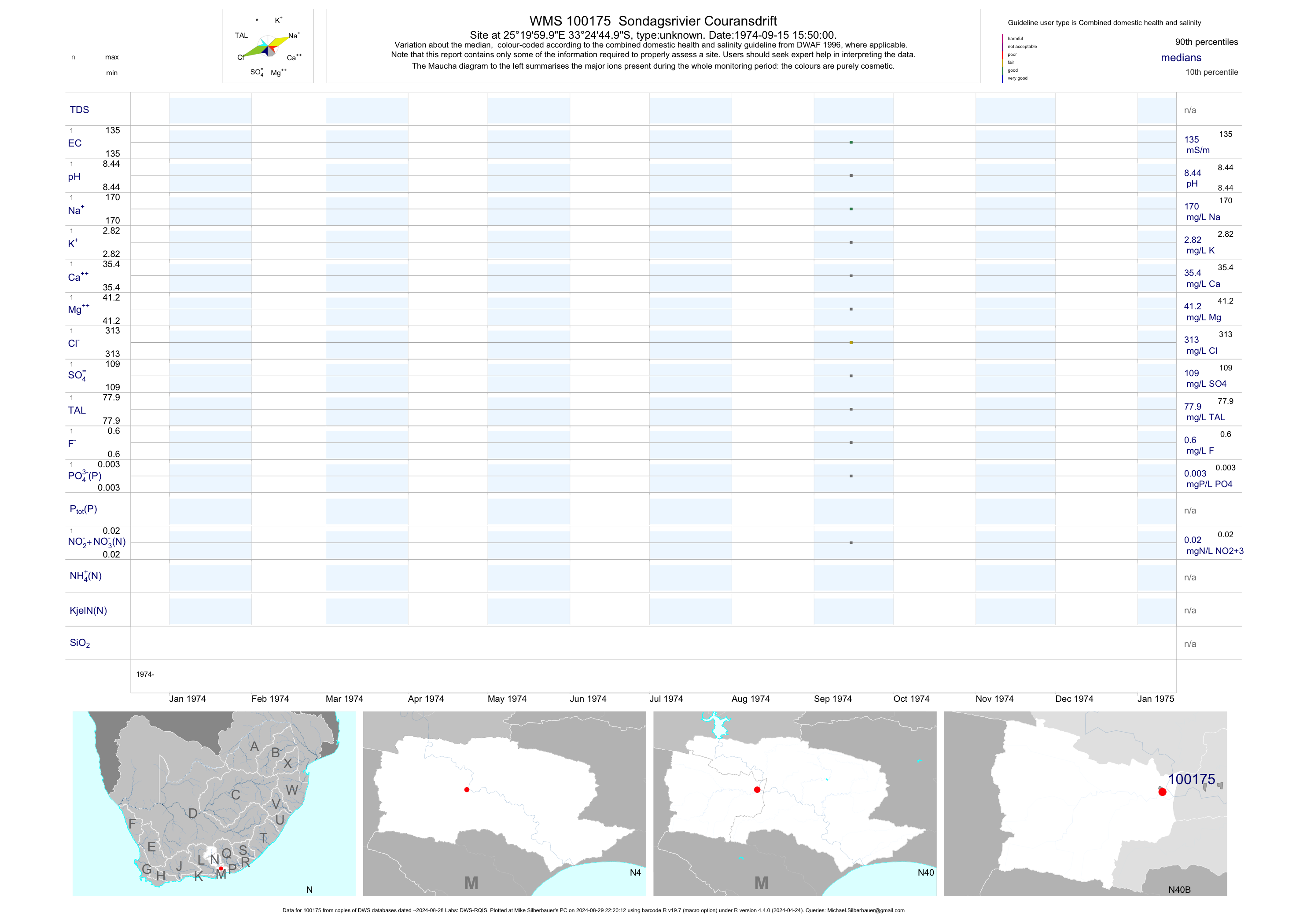
| N40 100175 | plot | data | Sondagsrivier Couransdrift | unknown | 1 | 1974-09-15 | 1974-09-15 | 135 | 100175 | -33.41250 | 25.33333 |
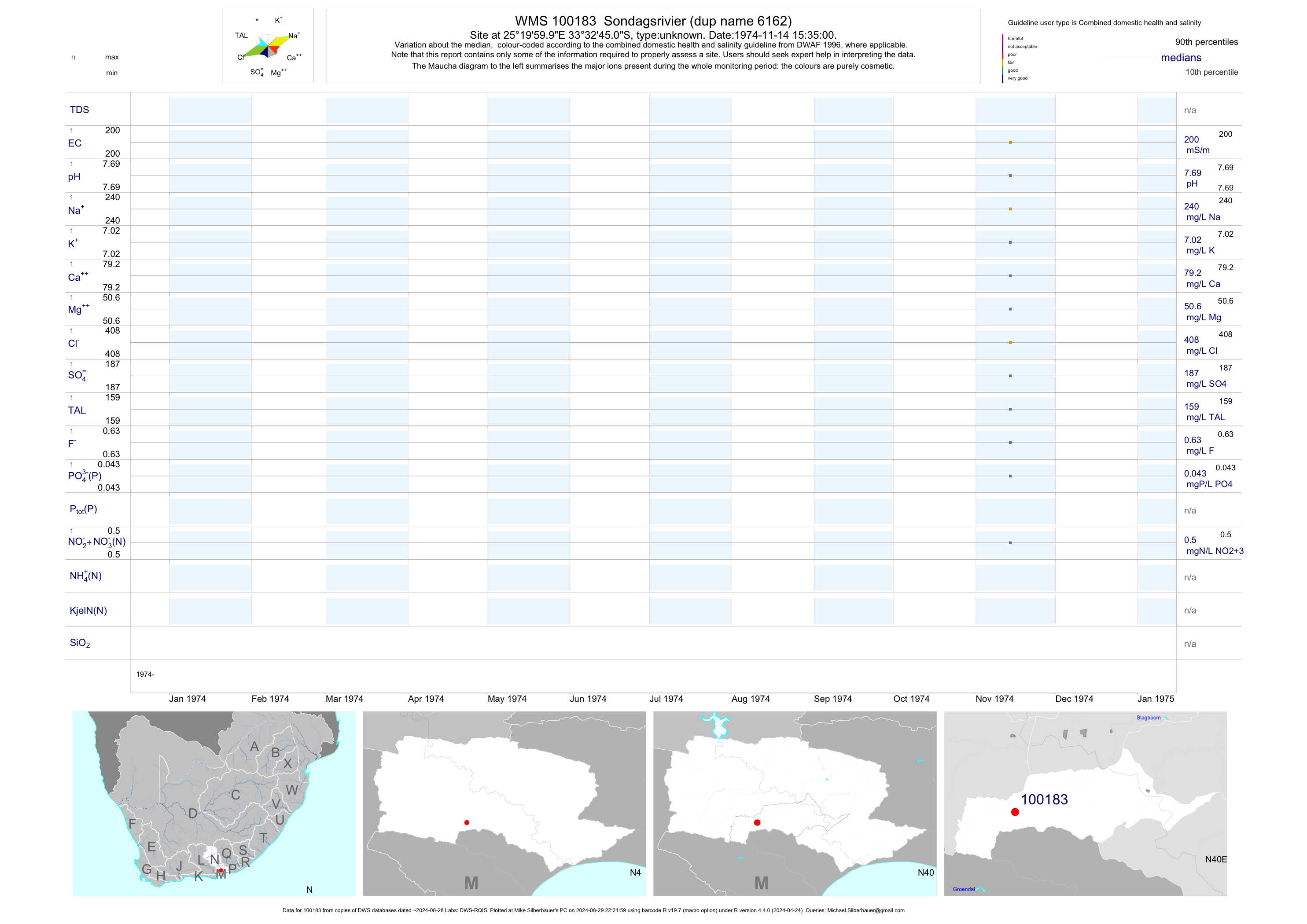
| N40 100183 | plot | data | Sondagsrivier (dup name 6162) | unknown | 1 | 1974-11-14 | 1974-11-14 | 200 | 100183 | -33.54583 | 25.33333 |
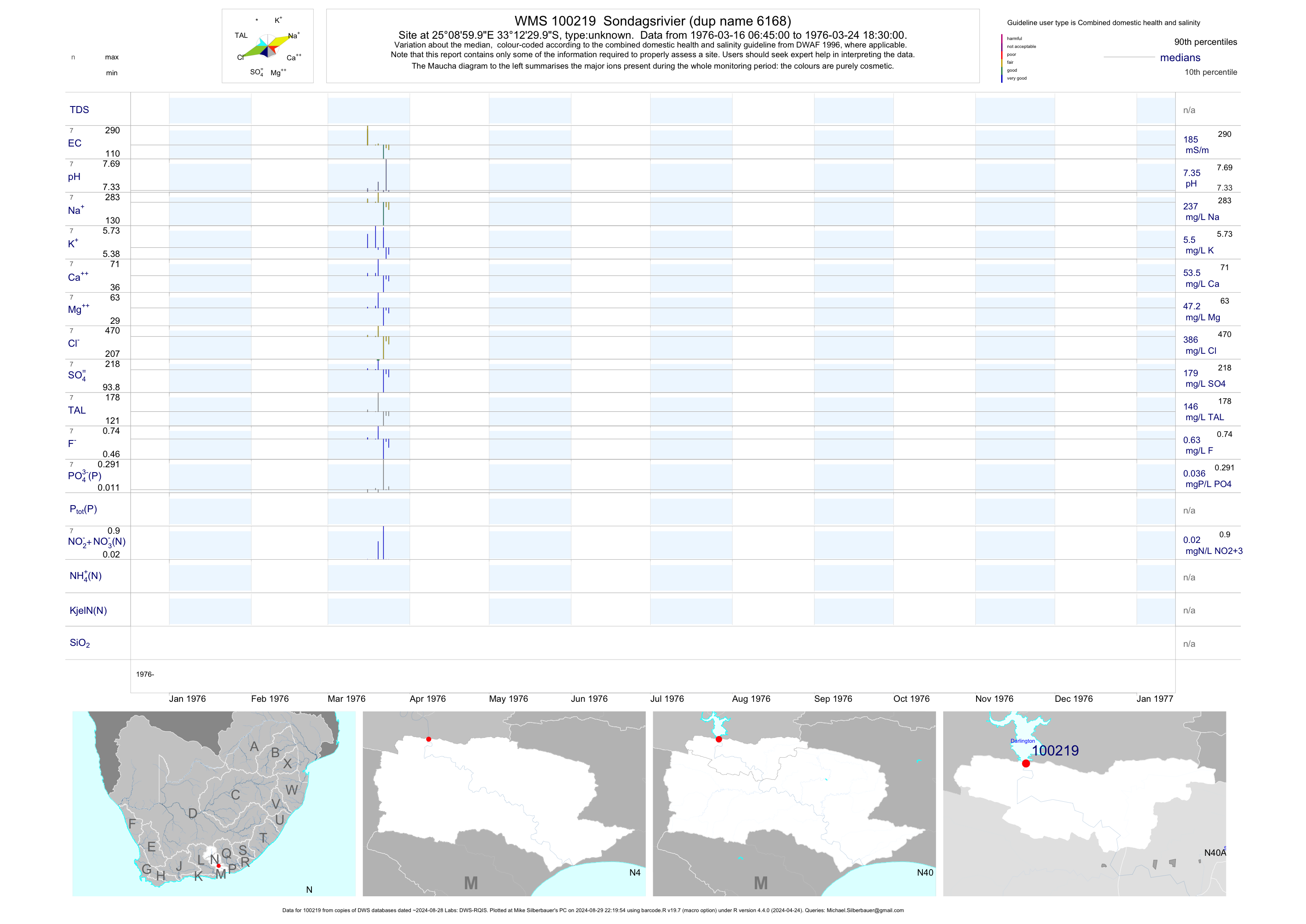
| N40 100219 | plot | data | Sondagsrivier (dup name 6168) | unknown | 7 | 1976-03-16 | 1976-03-24 | 185 | 100219 | -33.20833 | 25.15000 |
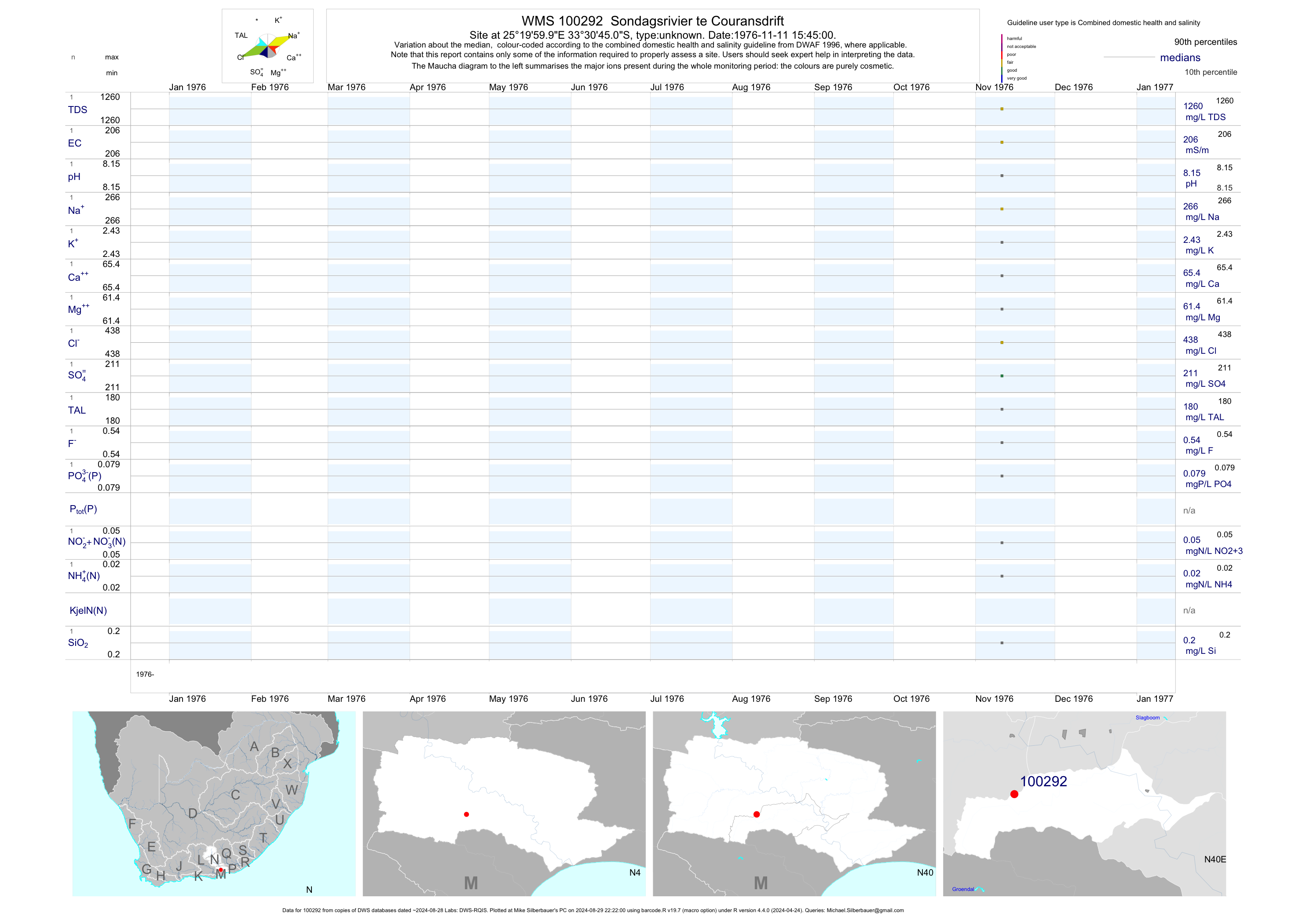
| N40 100292 | plot | data | Sondagsrivier te Couransdrift | unknown | 1 | 1976-11-11 | 1976-11-11 | 206 | 100292 | -33.51250 | 25.33333 |
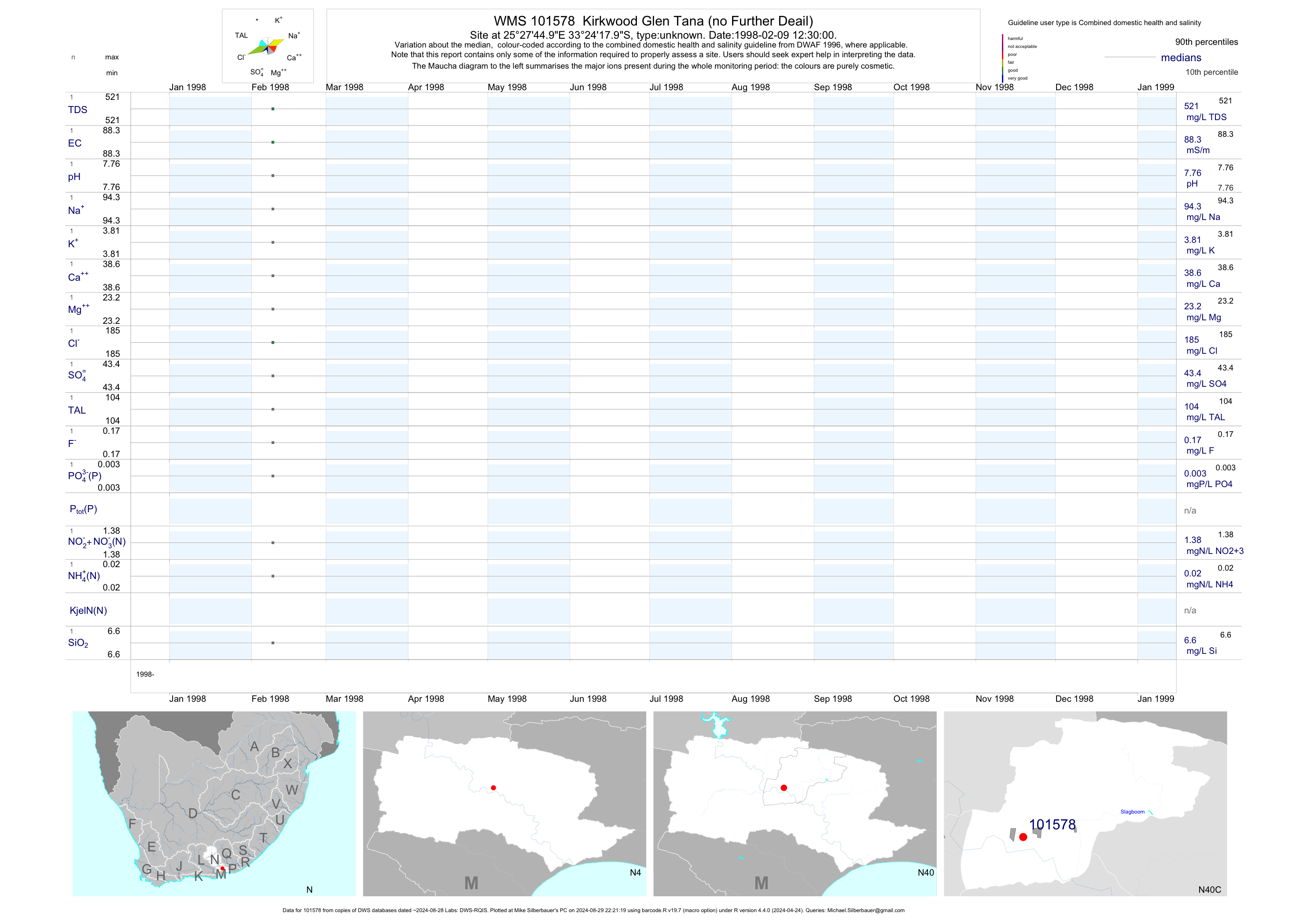
| N40 101578 | plot | data | Kirkwood Glen Tana (no Further Deail) | unknown | 1 | 1998-02-09 | 1998-02-09 | 88 | 101578 | -33.40500 | 25.46250 |
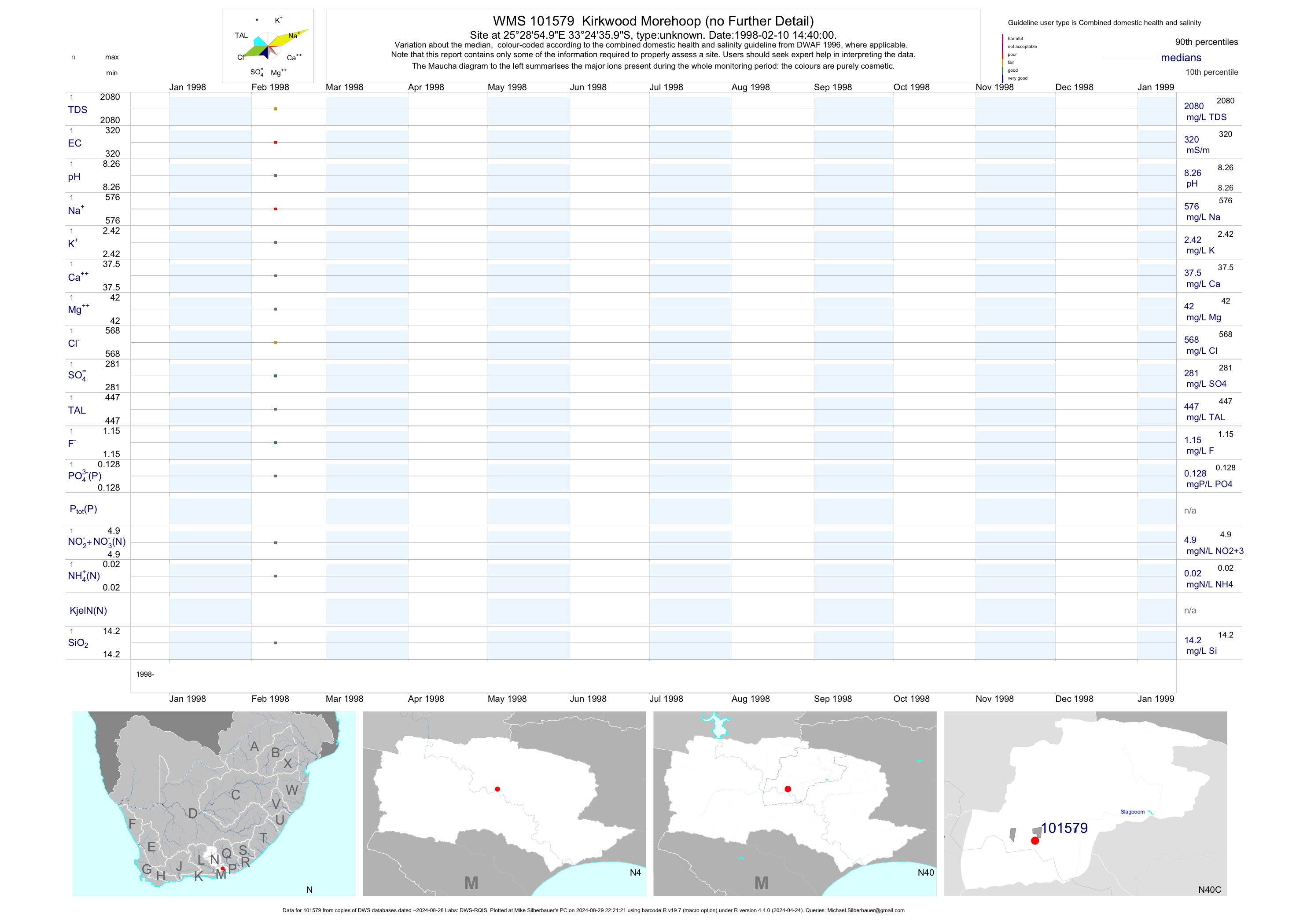
| N40 101579 | plot | data | Kirkwood Morehoop (no Further Detail) | unknown | 1 | 1998-02-10 | 1998-02-10 | 320 | 101579 | -33.41000 | 25.48194 |
| N40 101580 | plot | data | Strathsomers Estate 42 Kirkwood- Bayvilla (no Further Detail) | unknown | 1 | 1998-02-11 | 1998-02-11 | 307 | 101580 | -33.41444 | 25.43194 |
| N40 101581 | plot | data | Kirkwood Varslig (no Further Detail) | unknown | 1 | 1998-02-12 | 1998-02-12 | 267 | 101581 | -33.42361 | 25.48333 |
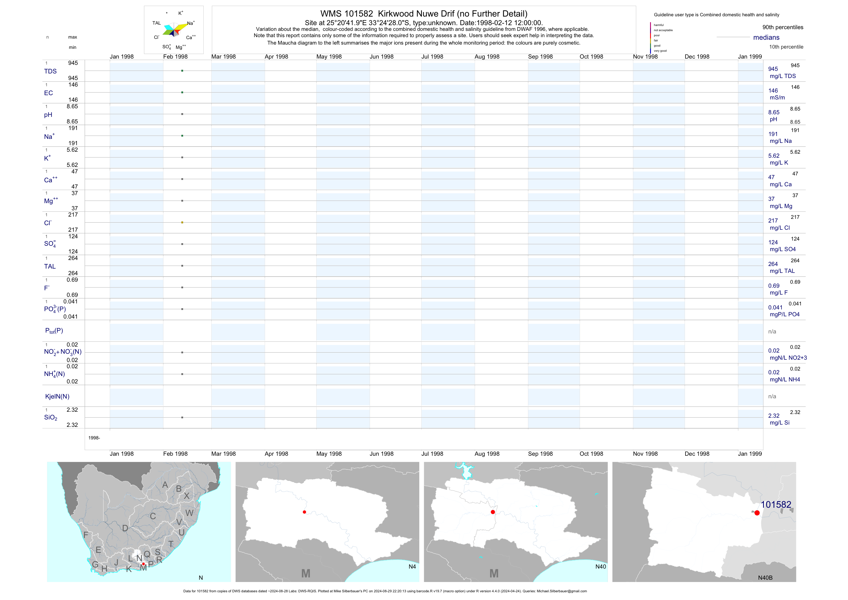
| N40 101582 | plot | data | Kirkwood Nuwe Drif (no Further Detail) | unknown | 1 | 1998-02-12 | 1998-02-12 | 146 | 101582 | -33.40778 | 25.34500 |
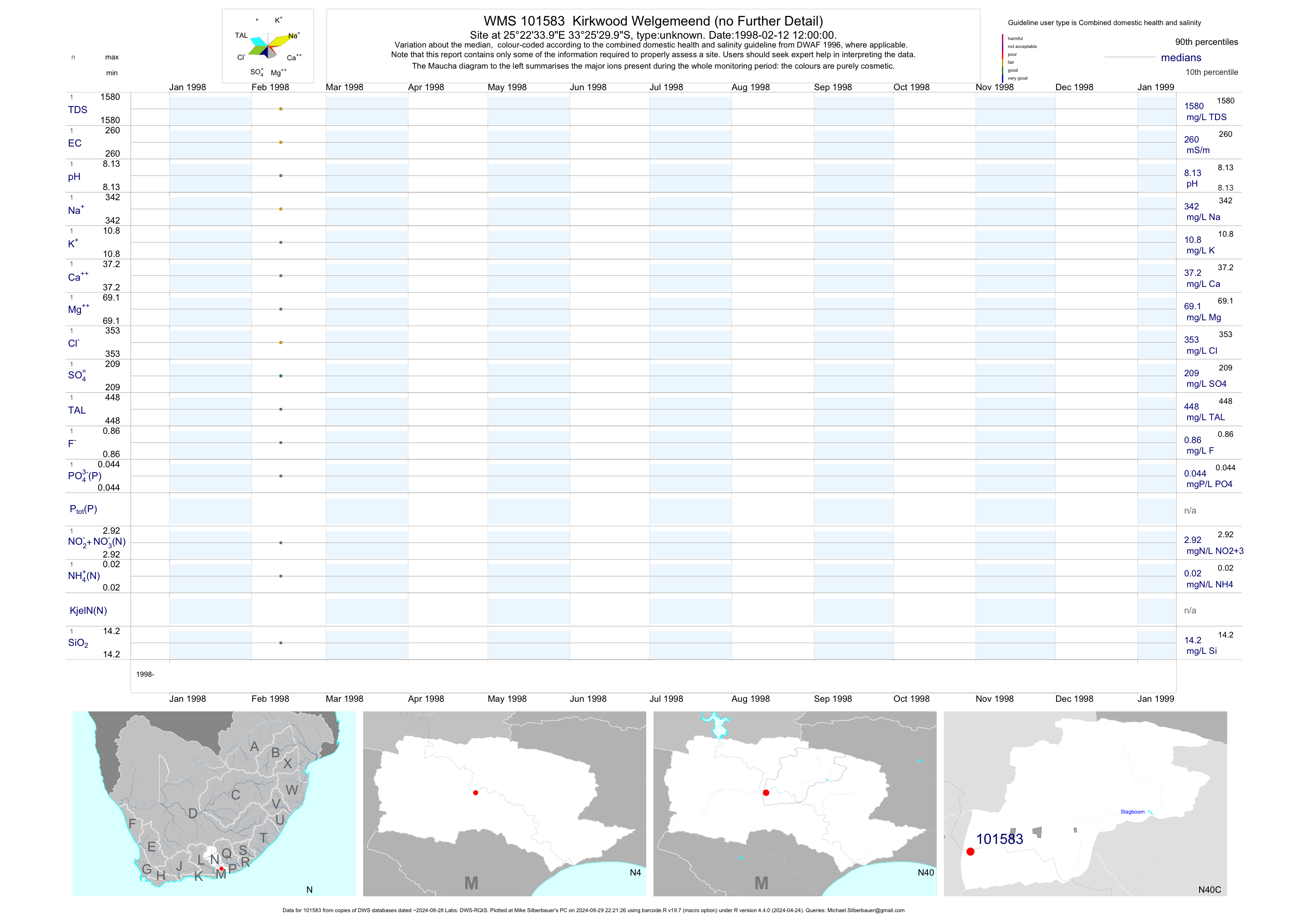
| N40 101583 | plot | data | Kirkwood Welgemeend (no Further Detail) | unknown | 1 | 1998-02-12 | 1998-02-12 | 260 | 101583 | -33.42500 | 25.37611 |
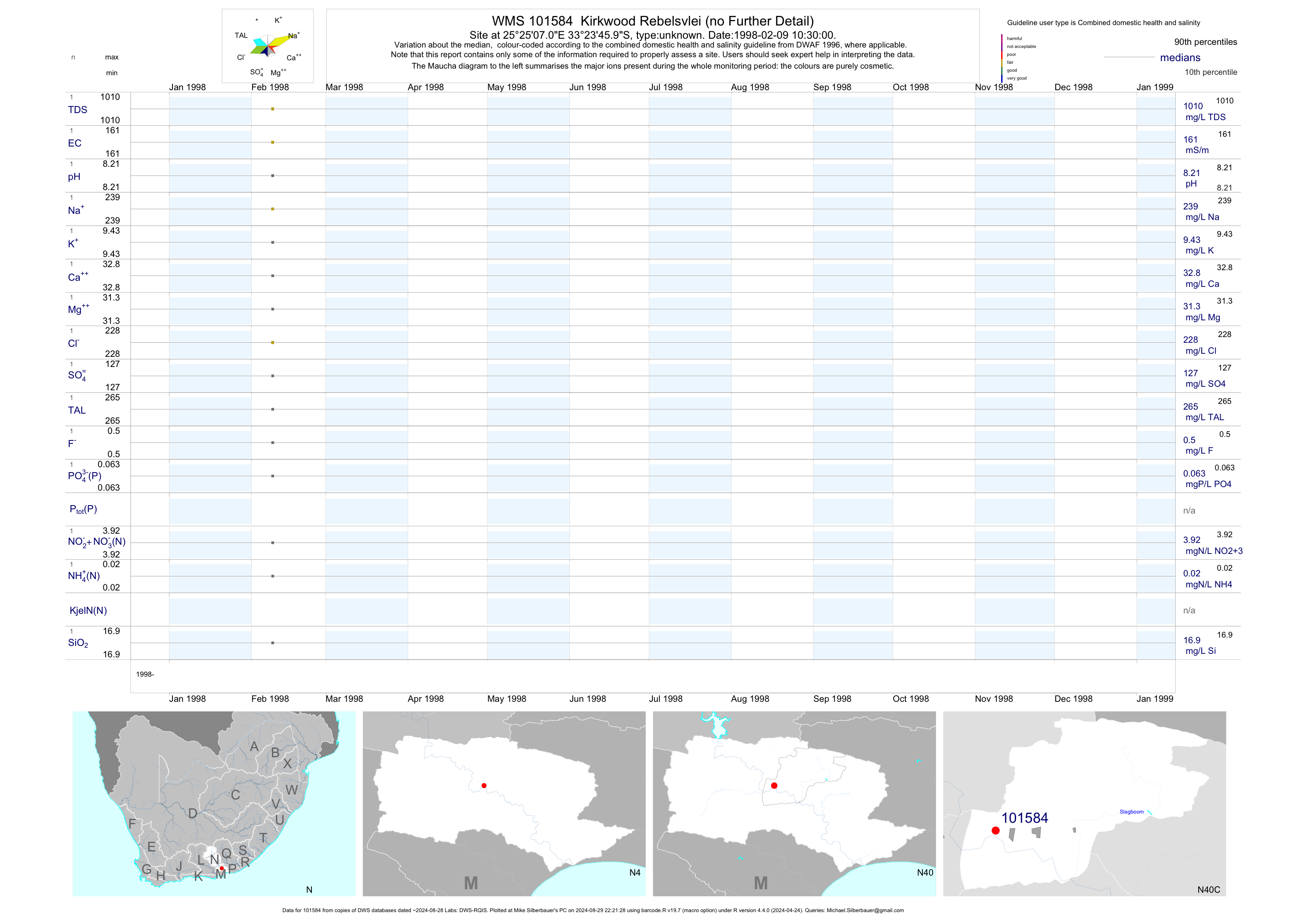
| N40 101584 | plot | data | Kirkwood Rebelsvlei (no Further Detail) | unknown | 1 | 1998-02-09 | 1998-02-09 | 161 | 101584 | -33.39611 | 25.41861 |