Resource water quality data for region P.

Resource water quality data for region P. |
|
| Water quality | Description | Type | n | First date | Last date | med EC | Flow, if any |
Latitude | Longitude | ||
|---|---|---|---|---|---|---|---|---|---|---|---|
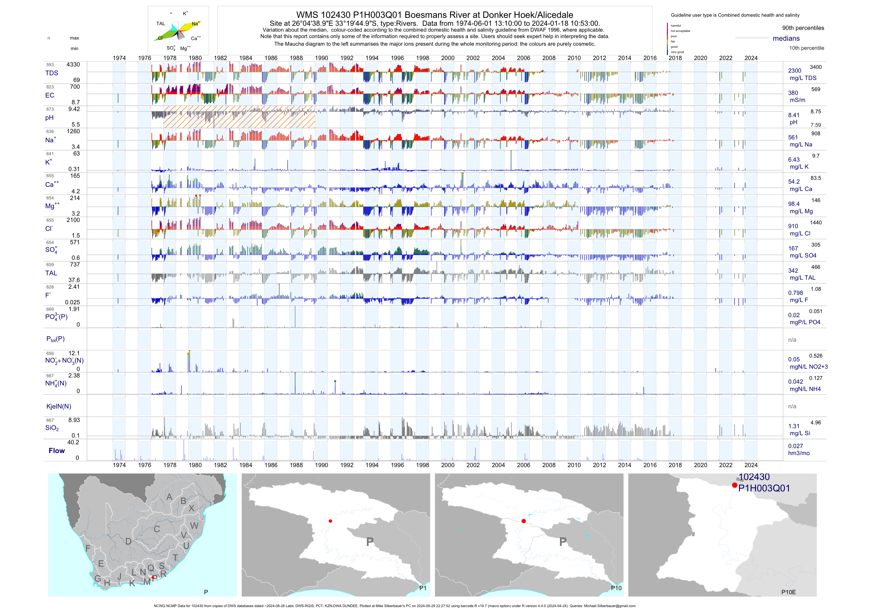
| P10 102430 | plot | data | Boesmans River at Donker Hoek/Alicedale (NCWQ NCMP) | Rivers | 953 | 1971-08-29 | 2018-05-16 | 382 | P1H003 | -33.32917 | 26.07750 |
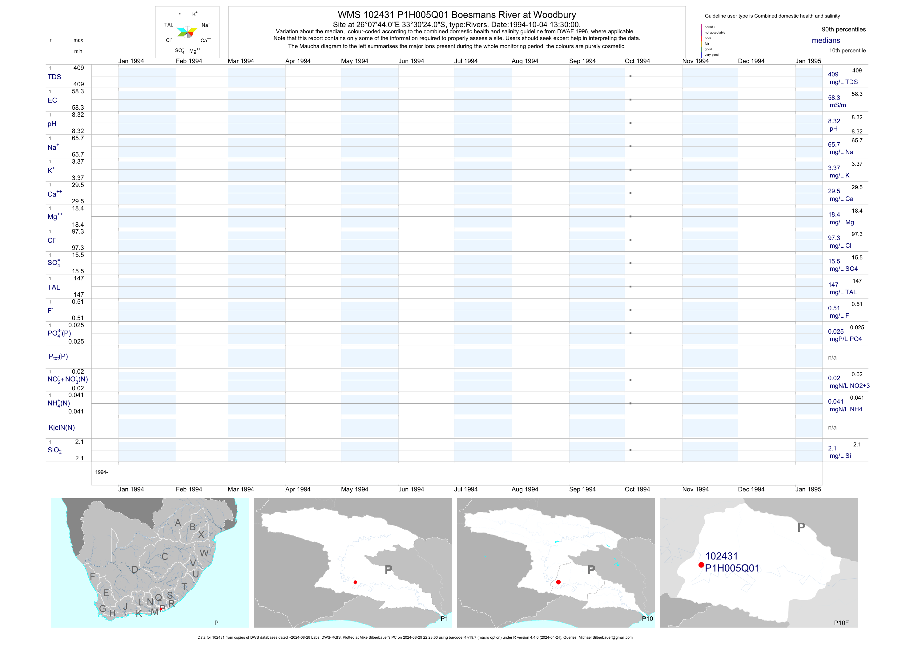
| P10 102431 | plot | data | Boesmans River at Woodbury | Rivers | 1 | 1994-10-04 | 1994-10-04 | 58 | P1H005 | -33.50667 | 26.12889 |
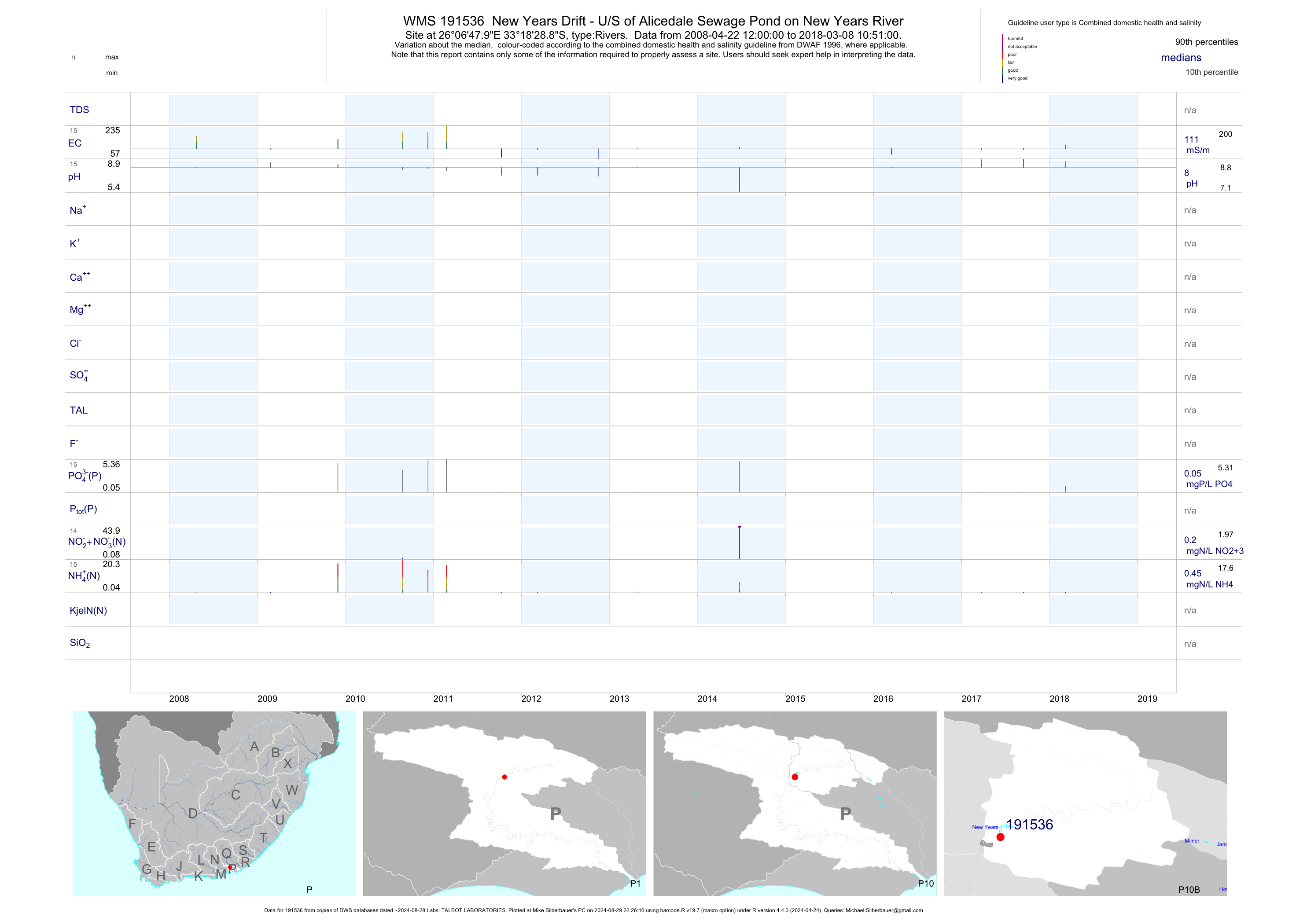
| P10 191536 | plot | data | New Years Drift - U/S of Alicedale Sewage Pond on New Years River | Rivers | 25 | 2008-04-22 | 2017-03-23 | 111 | 191536 | -33.30802 | 26.11332 |
| P10 191537 | plot | data | New Years Drift- at D/S of Alicedale Sewage Pond on New Years River | Rivers | 88 | 2008-04-22 | 2017-06-14 | 146 | 191537 | -33.31651 | 26.10321 |
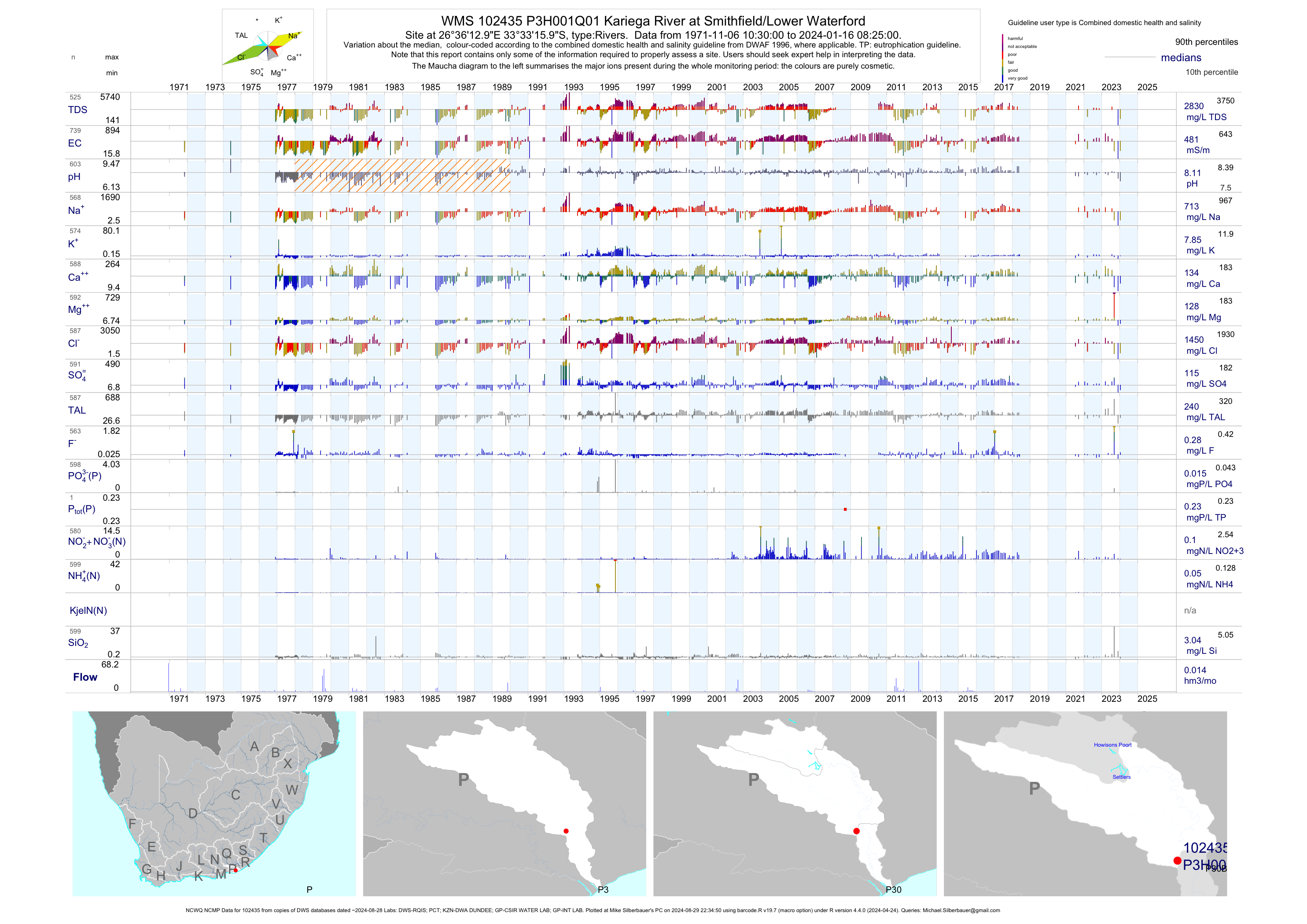
| P30 102435 | plot | data | Kariega River at Smithfield/Lower Waterford (NCWQ NCMP) | Rivers | 810 | 1971-11-06 | 2018-06-01 | 480 | P3H001 | -33.55444 | 26.60361 |
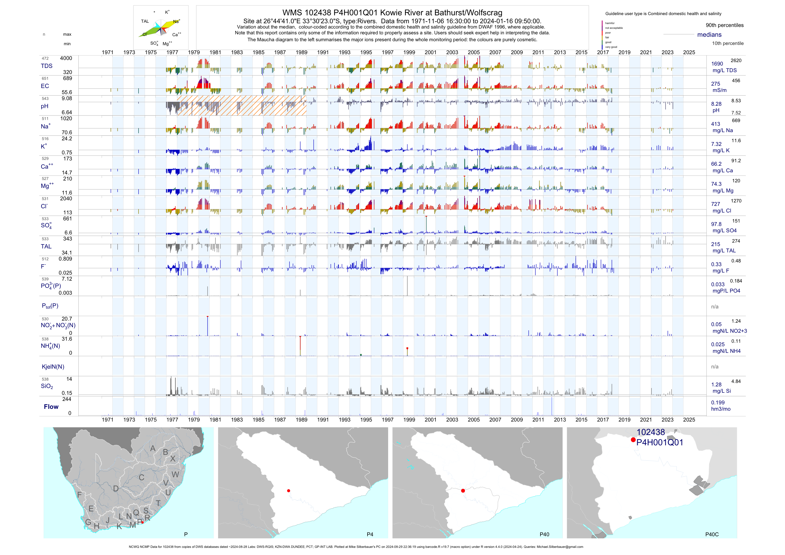
| P40 102438 | plot | data | Kowie River at Bathurst/Wolfscrag (NCWQ NCMP) | Rivers | 713 | 1971-11-06 | 2018-07-18 | 276 | P4H001 | -33.50639 | 26.74472 |
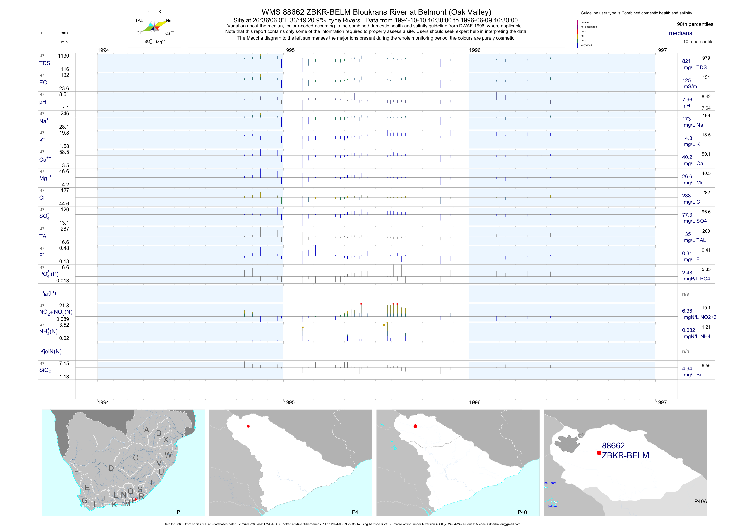
| P40 88662 | plot | data | Bloukrans River at Belmont (Oak Valley) | Rivers | 47 | 1994-10-10 | 1996-06-09 | 125 | ZBKR-BELM | -33.32250 | 26.60167 |
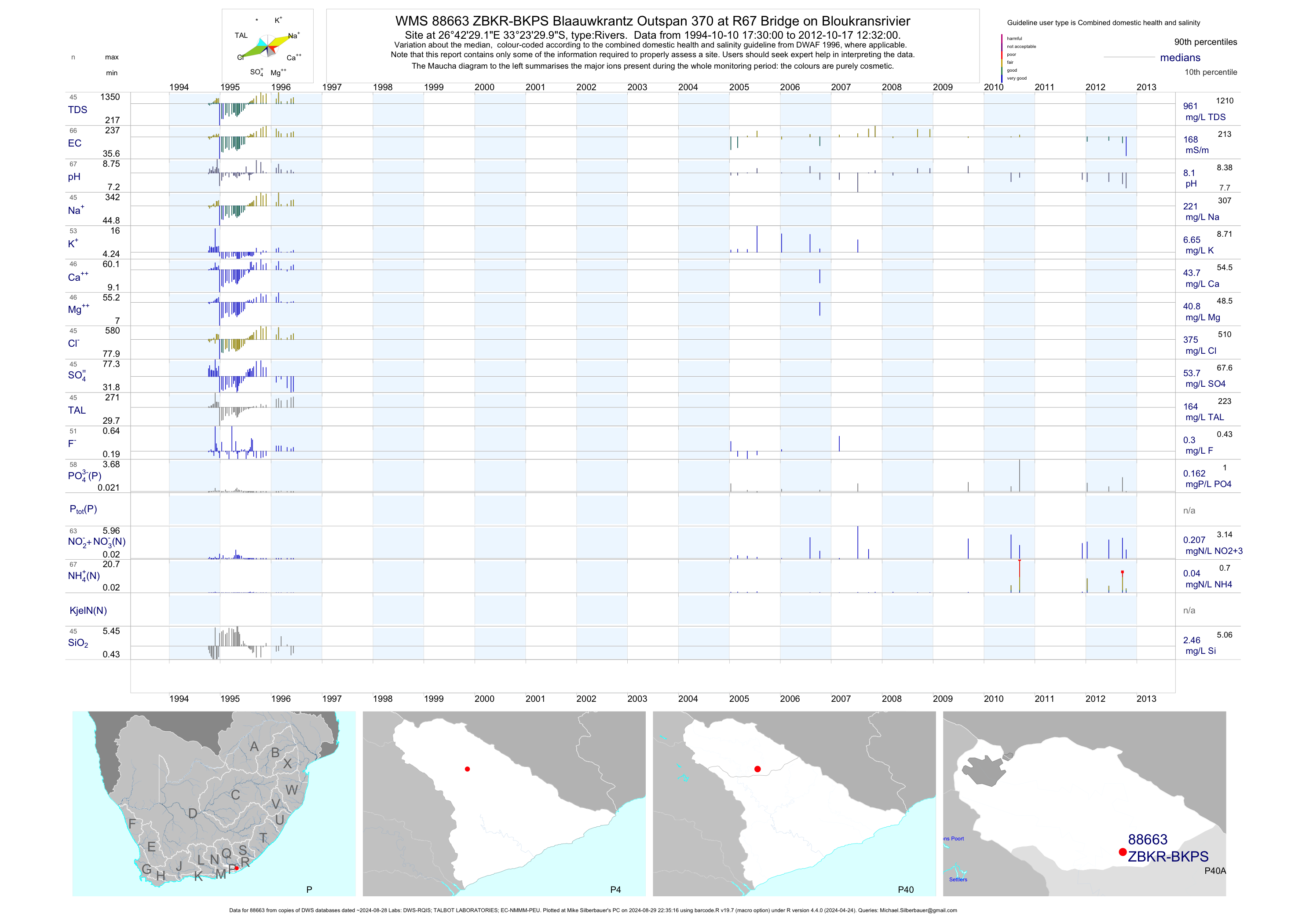
| P40 88663 | plot | data | Blaauwkrantz Outspan 370 at R67 Bridge on Bloukransrivier | Rivers | 87 | 1994-10-10 | 2012-10-17 | 168 | ZBKR-BKPS | -33.39164 | 26.70811 |
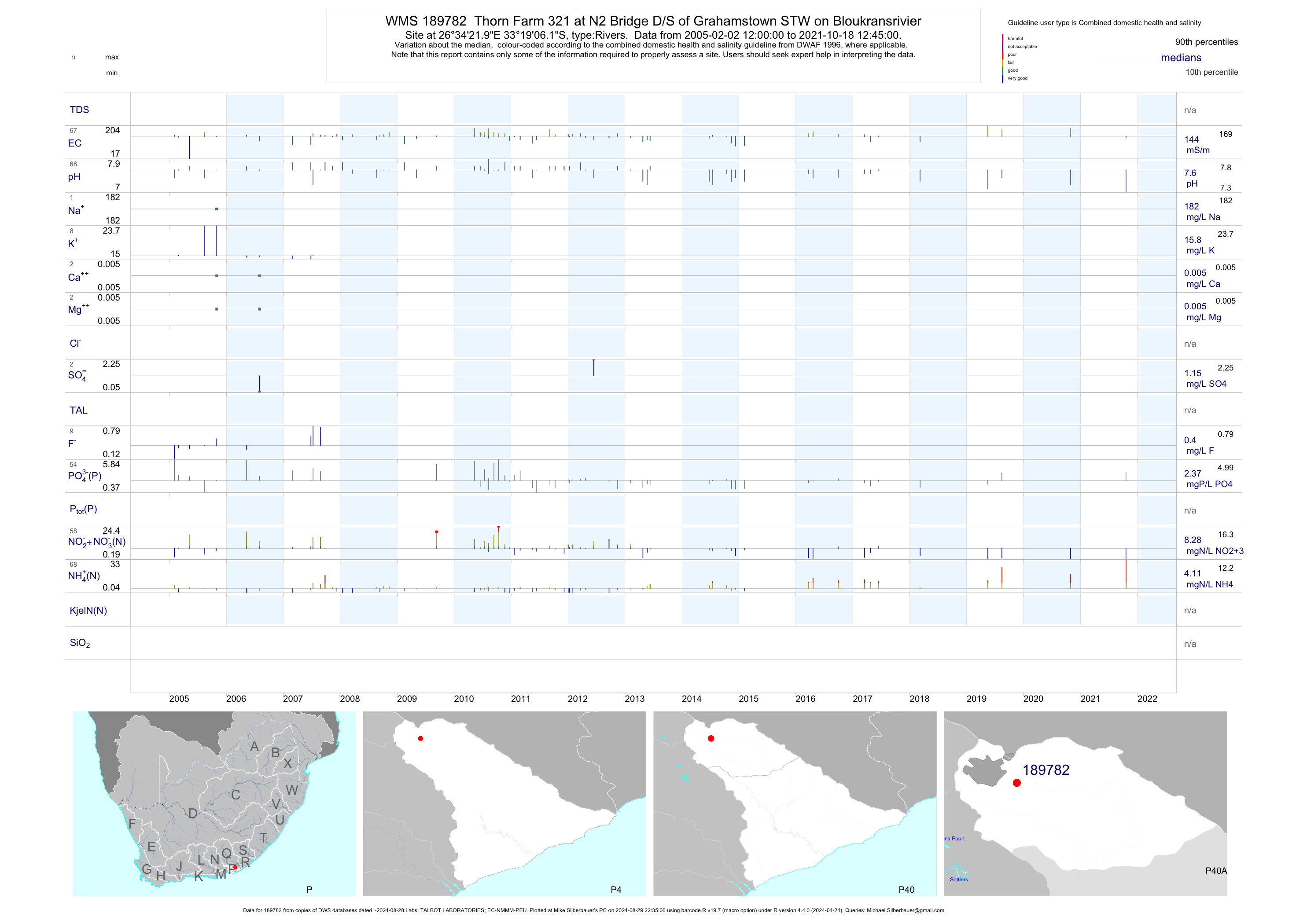
| P40 189782 | plot | data | Thorn Farm 321 at N2 Bridge D/S of Grahamstown STW on Bloukransrivier | Rivers | 130 | 2005-01-11 | 2019-08-14 | 144 | 189782 | -33.31837 | 26.57275 |
| P40 189791 | plot | data | Thorn Farm 321 upstream of Grahamstown Central STW on Bloukransrivier | Rivers | 109 | 2005-04-05 | 2019-08-14 | 148 | 189791 | -33.31544 | 26.55897 |
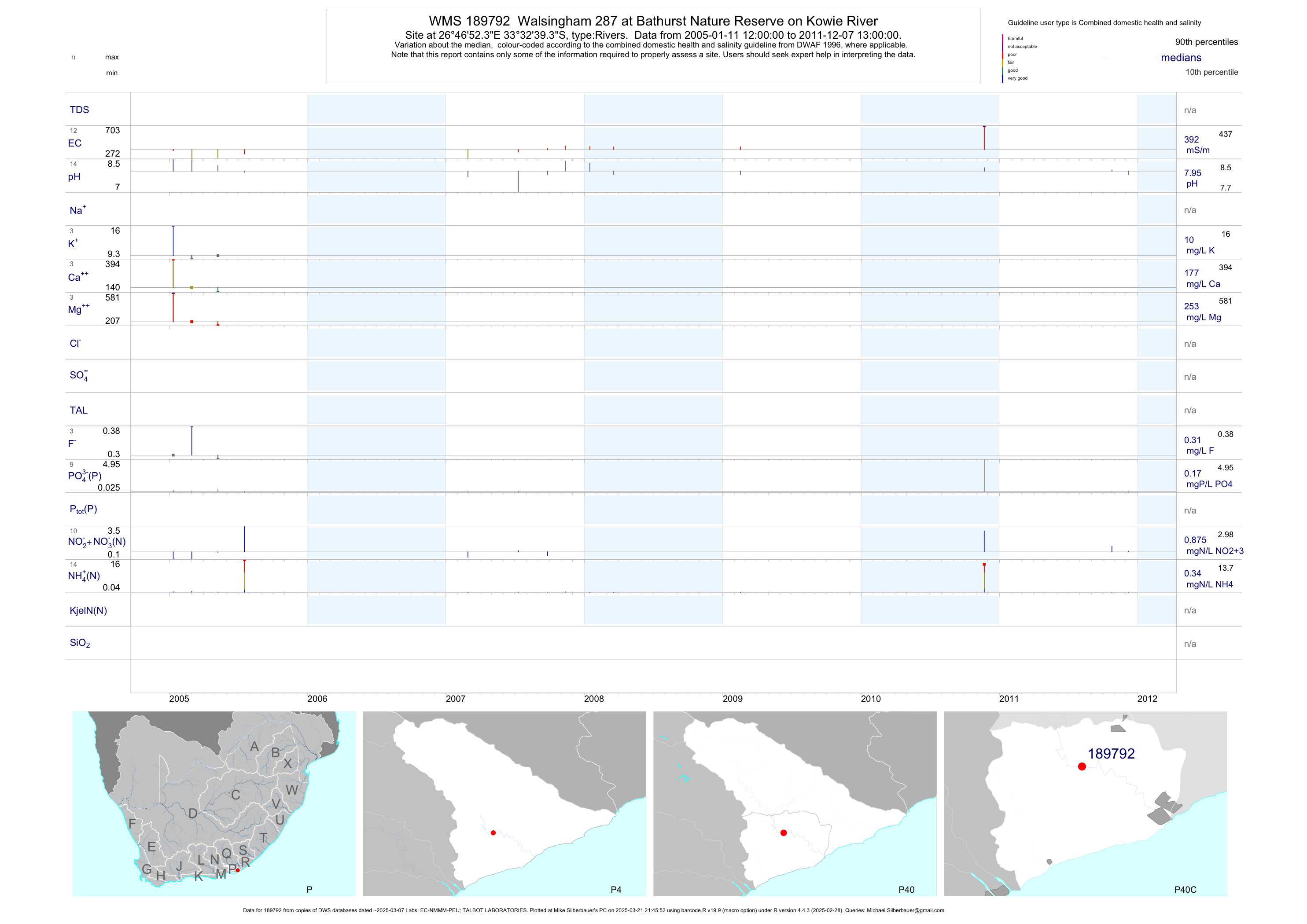
| P40 189792 | plot | data | Walsingham 287 at Bathurst Nature Reserve on Kowie River | Rivers | 28 | 2005-01-11 | 2011-12-07 | 392 | 189792 | -33.54425 | 26.78122 |
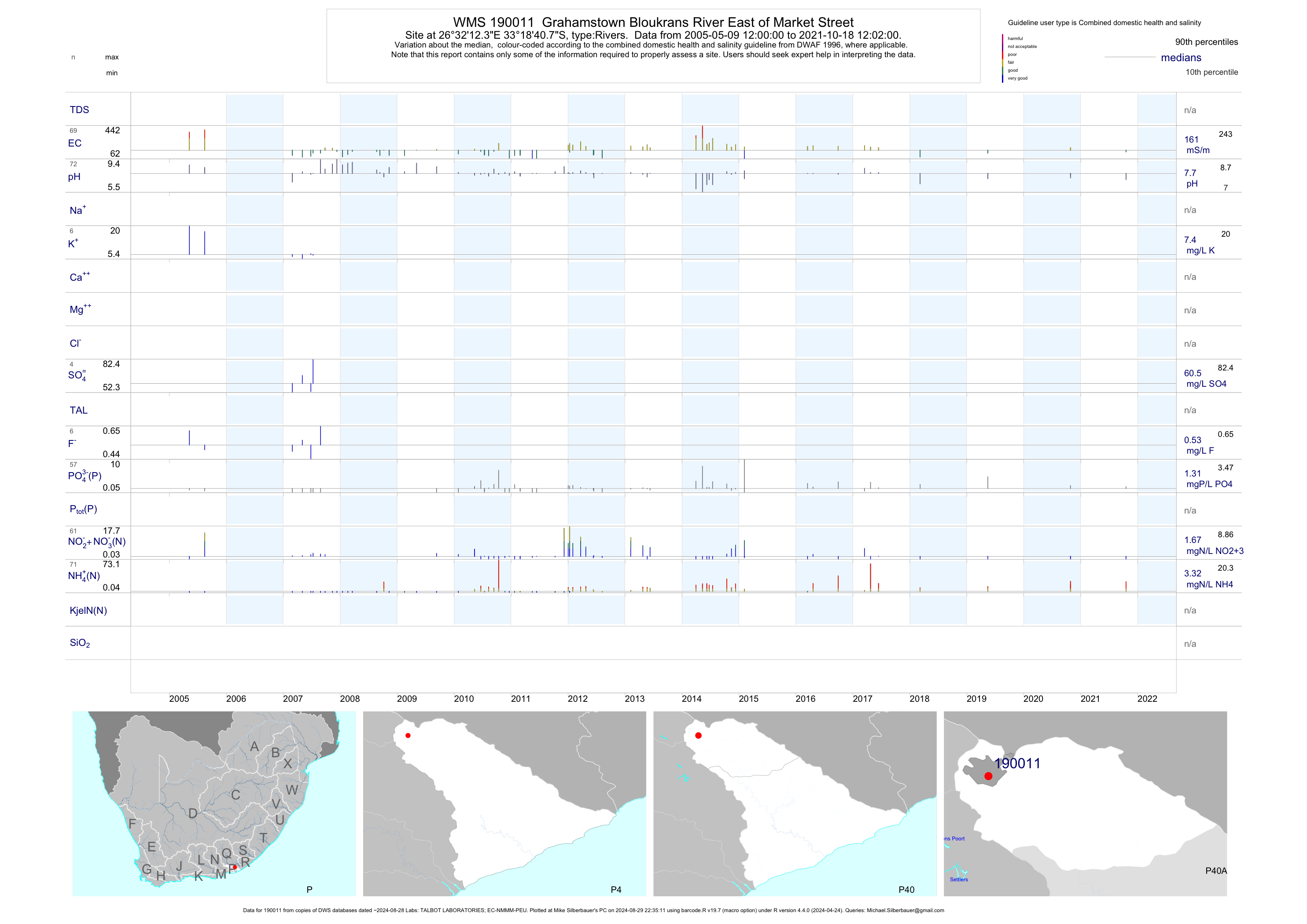
| P40 190011 | plot | data | Grahamstown Bloukrans River East of Market Street | Rivers | 138 | 2005-05-09 | 2019-05-16 | 161 | 190011 | -33.31131 | 26.53678 |
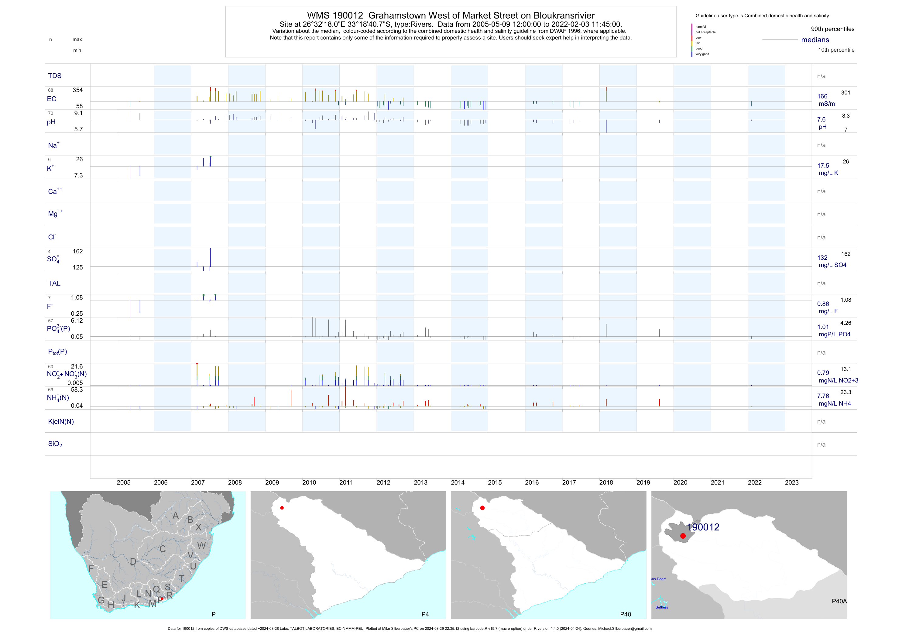
| P40 190012 | plot | data | Grahamstown West of Market Street on Bloukransrivier | Rivers | 131 | 2005-05-09 | 2019-08-14 | 186 | 190012 | -33.31131 | 26.53836 |
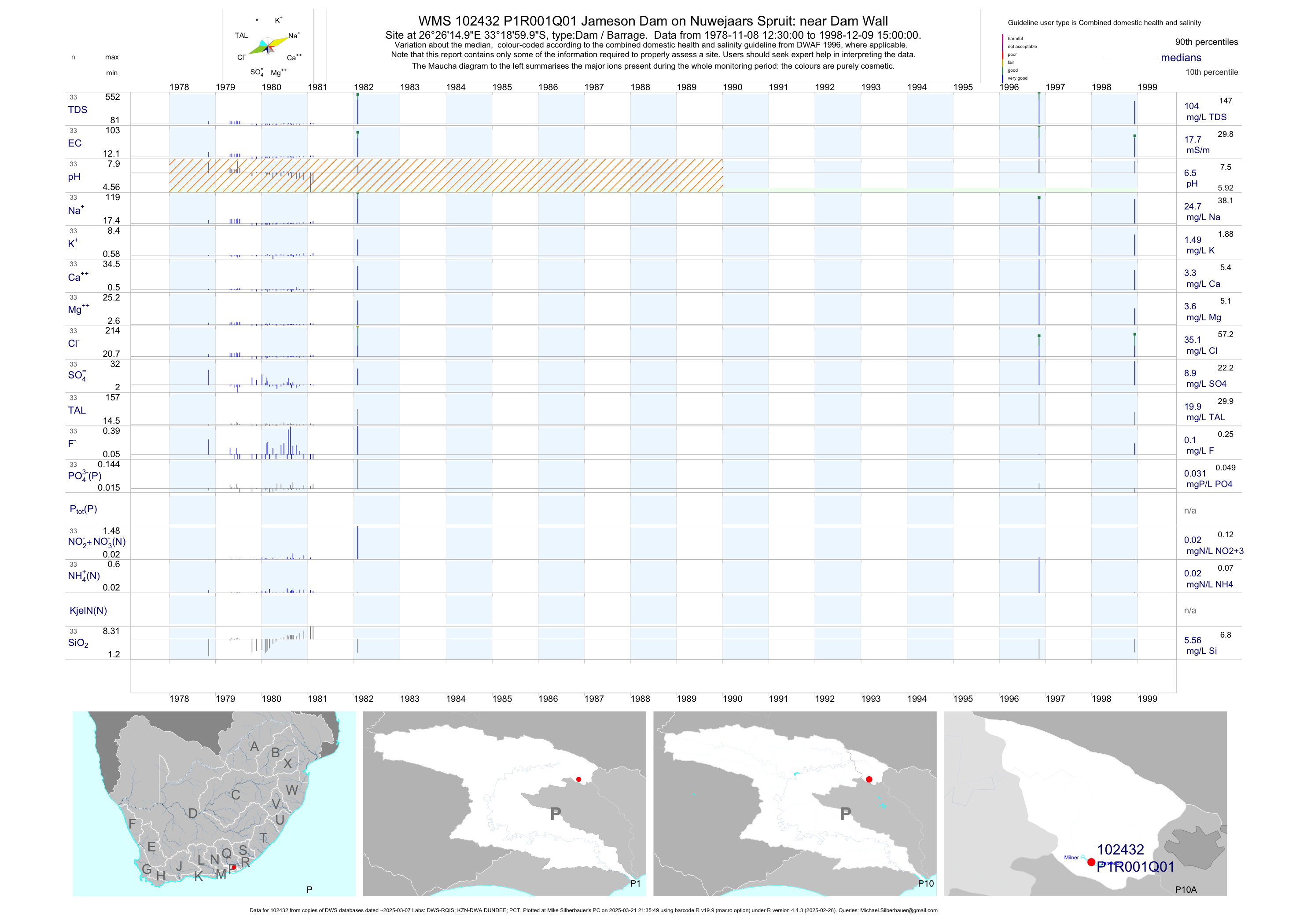
| P10 102432 | plot | data | Jameson Dam on Nuwejaars Spruit: near Dam Wall Q01 | Dam / Barrage | 33 | 1978-11-08 | 1998-12-09 | 18 | P1R001 | -33.31667 | 26.43750 |
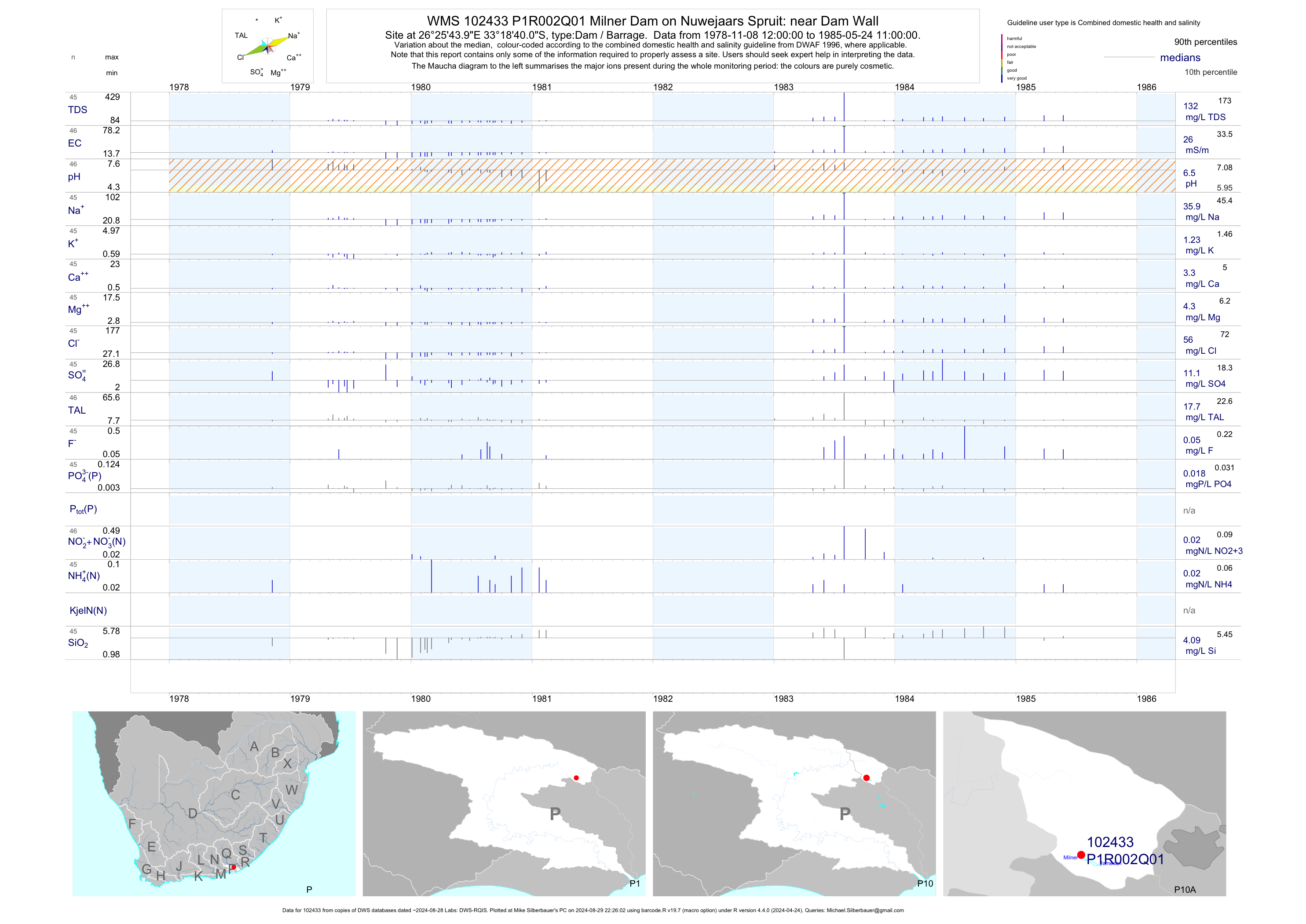
| P10 102433 | plot | data | Milner Dam on Nuwejaars Spruit: near Dam Wall Q01 | Dam / Barrage | 46 | 1978-11-08 | 1985-05-24 | 26 | P1R002 | -33.31111 | 26.42889 |
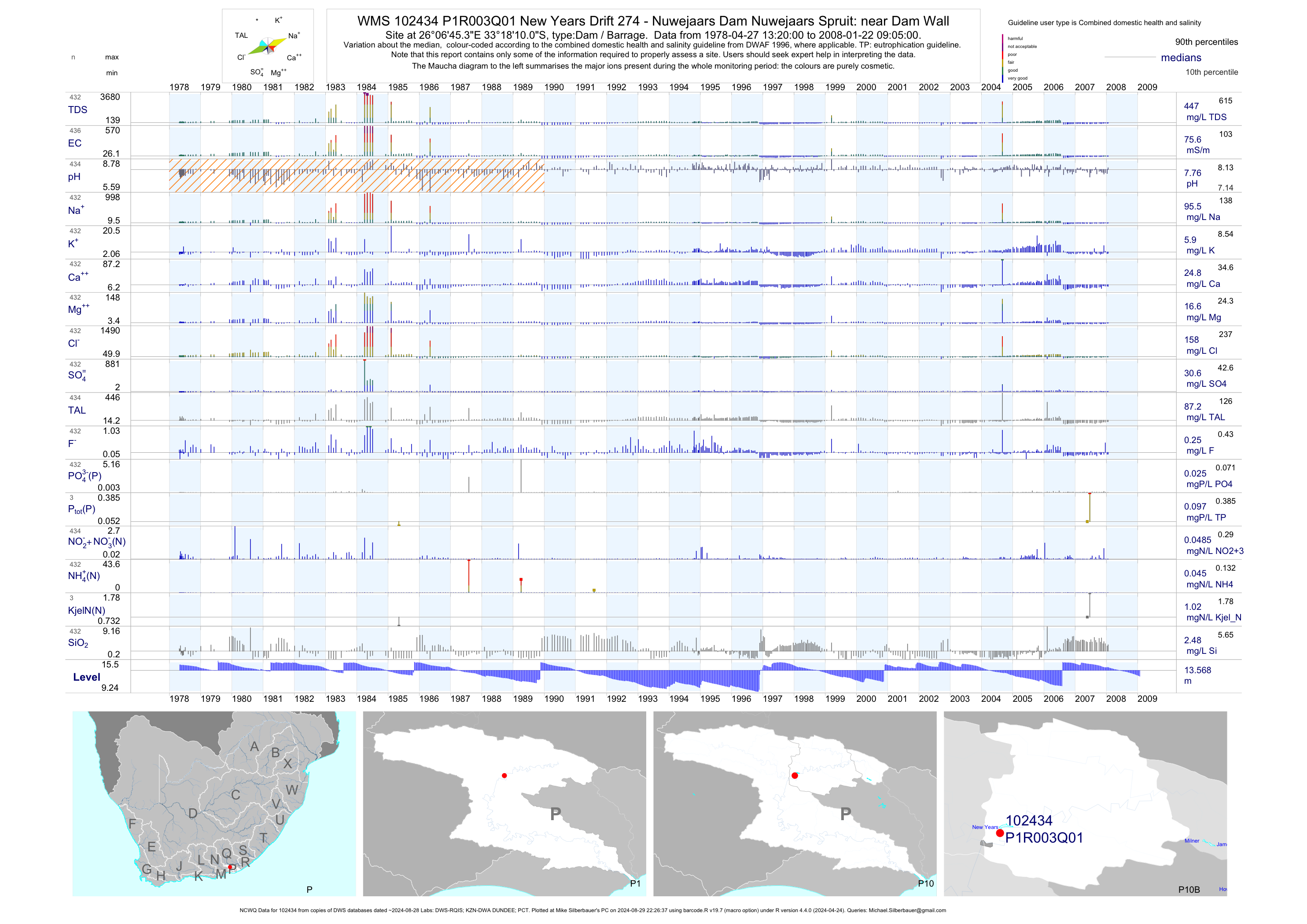
| P10 102434 | plot | data | New Years Drift 274 - Nuwejaars Dam Nuwejaars Spruit: near Dam Wall (NCWQ) Q01 | Dam / Barrage | 436 | 1978-04-27 | 2008-01-22 | 76 | P1R003 | -33.30280 | 26.11260 |
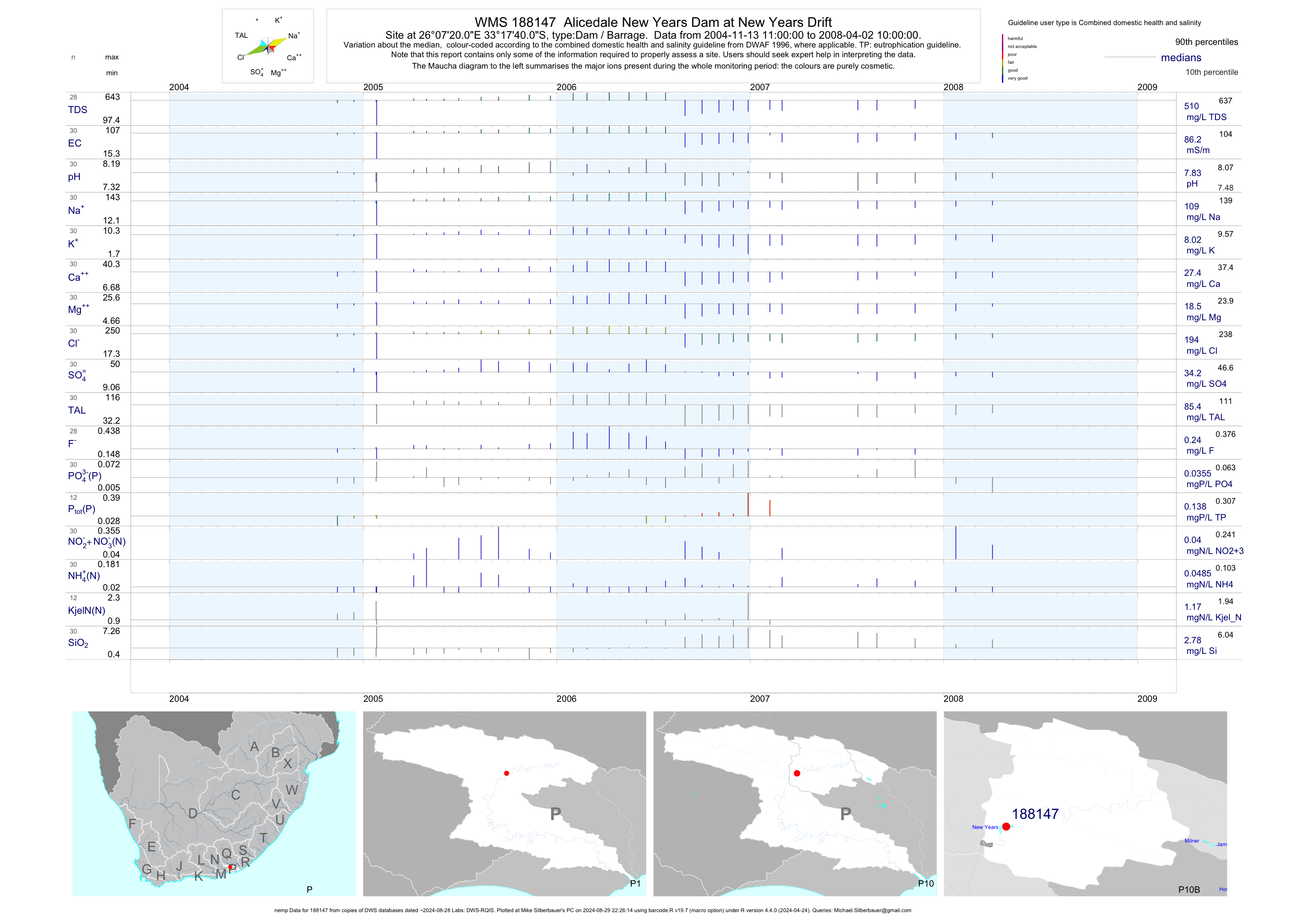
| P10 188147 | plot | data | Alicedale New Years Dam at New Years Drift (nemp) | Dam / Barrage | 30 | 2004-11-13 | 2008-04-02 | 86 | 188147 | -33.29444 | 26.12222 |
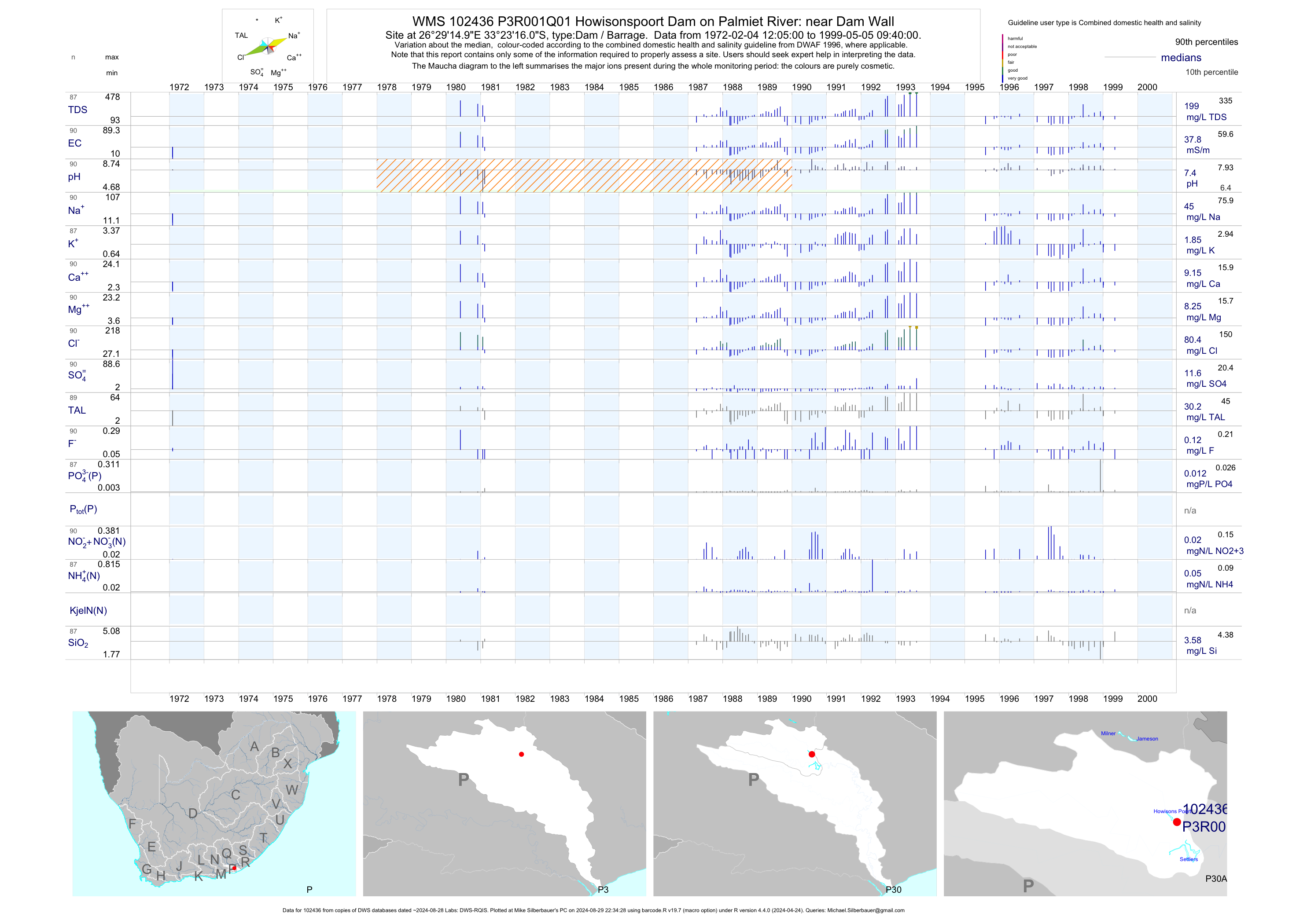
| P30 102436 | plot | data | Howisonspoort Dam on Palmiet River: near Dam Wall Q01 | Dam / Barrage | 90 | 1972-02-04 | 1999-05-05 | 38 | P3R001 | -33.38778 | 26.48750 |
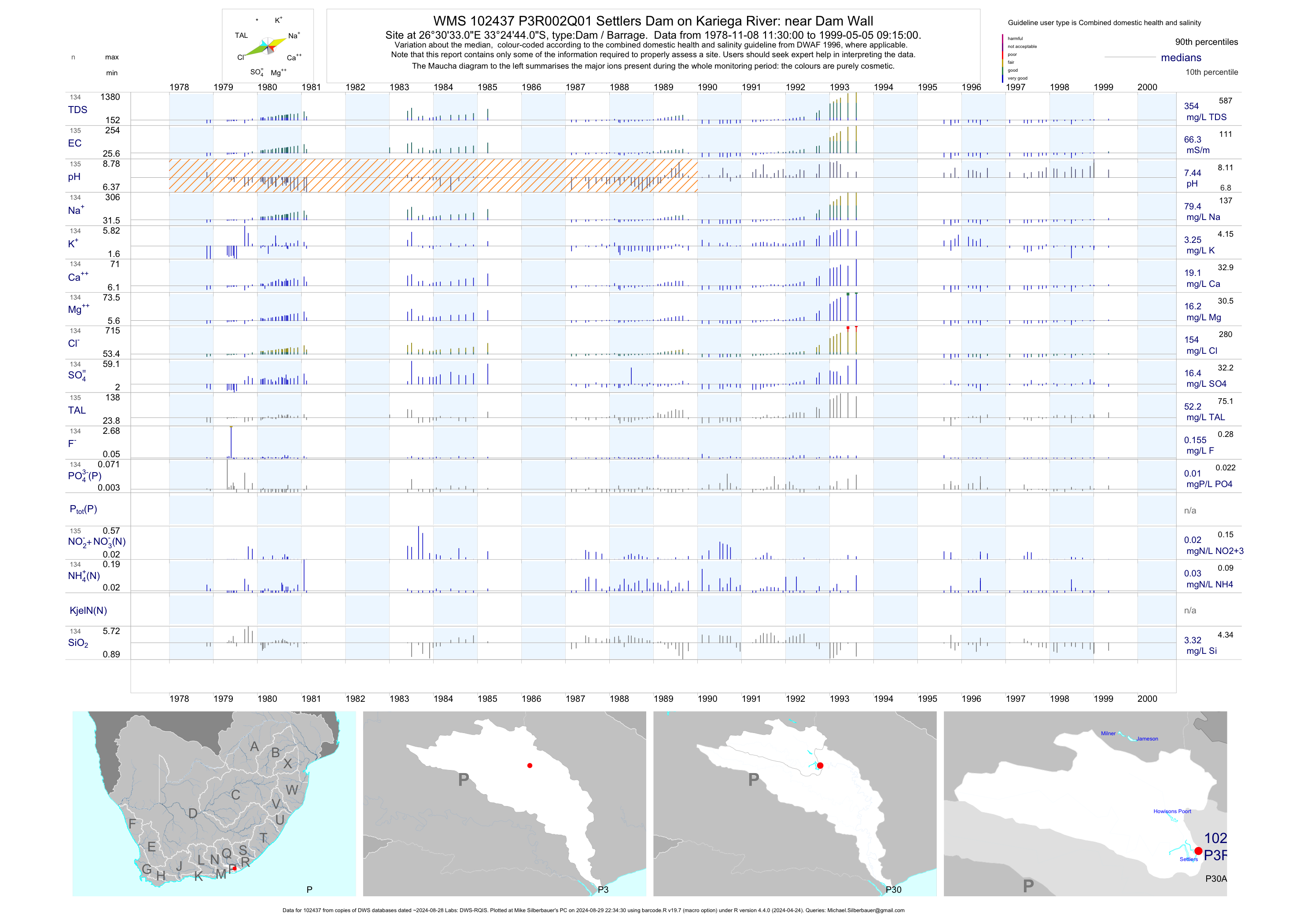
| P30 102437 | plot | data | Settlers Dam on Kariega River: near Dam Wall Q01 | Dam / Barrage | 135 | 1978-11-08 | 1999-05-05 | 66 | P3R002 | -33.41222 | 26.50917 |
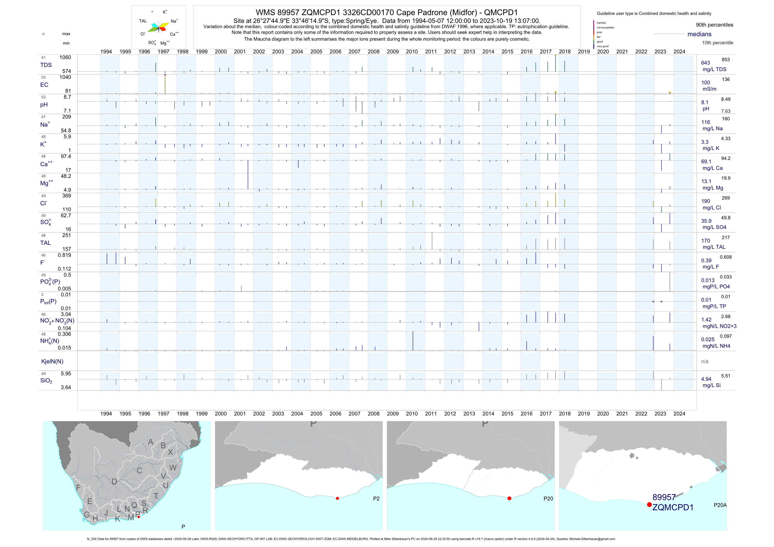
| P20 89957 | plot | data | 3326CD00170 Cape Padrone (Midfor) - QMCPD1 (N_GW) | Spring/Eye | 57 | 1994-05-07 | 2018-04-18 | 100 | ZQMCPD1 | -33.77083 | 26.46250 |
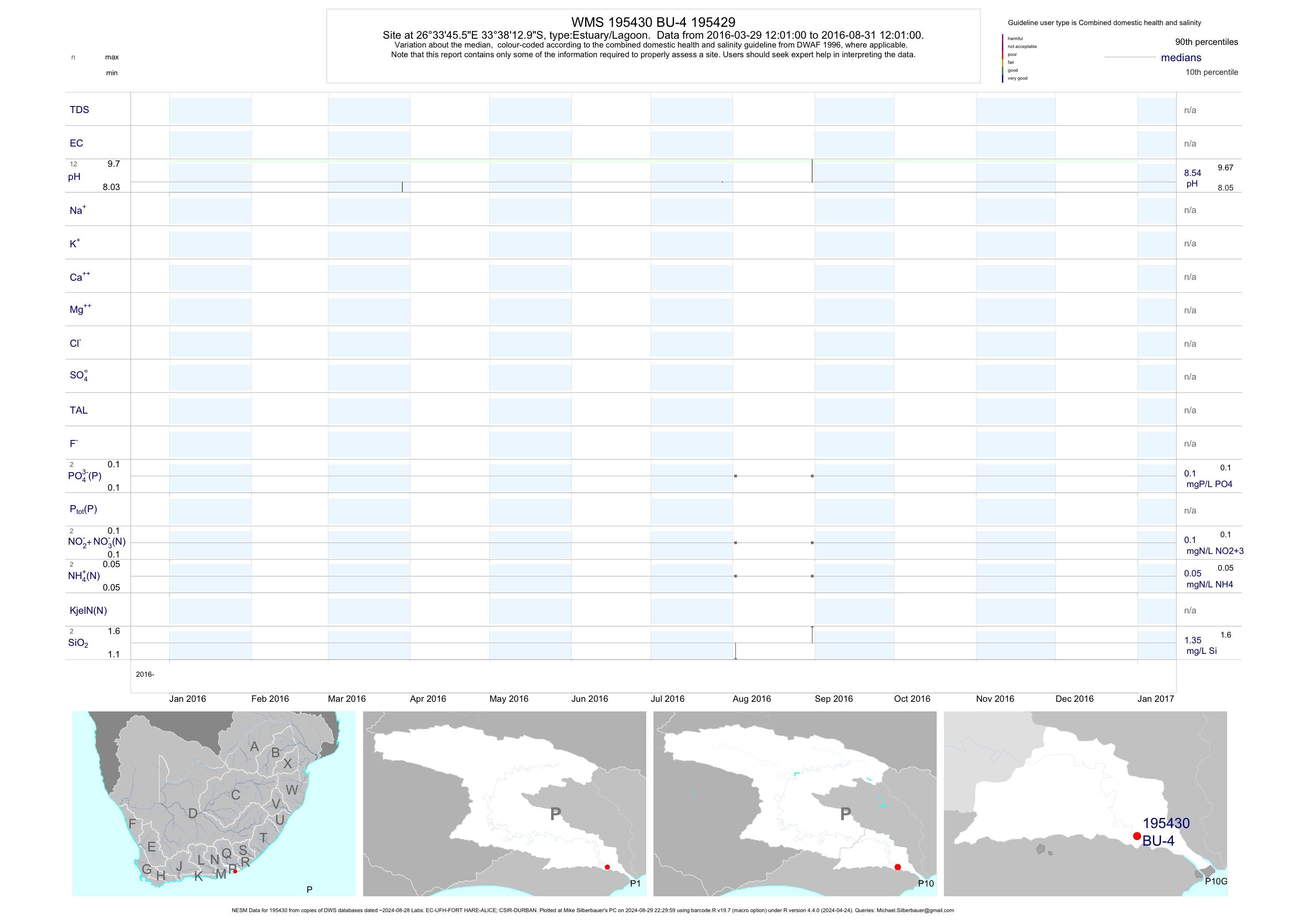
| P10 195430 | plot | data | 195429 | Estuary/Lagoon | 9 | 2016-03-29 | 2016-11-23 | n/a | BU-4 | -33.63694 | 26.56264 |
| P10 195431 | plot | data | 195430 | Estuary/Lagoon | 7 | 2016-03-29 | 2016-11-23 | n/a | BU-5 | -33.61721 | 26.53473 |
| P10 195432 | plot | data | 195431 | Estuary/Lagoon | 7 | 2016-03-29 | 2016-11-23 | n/a | BU-6 | -33.62047 | 26.52089 |
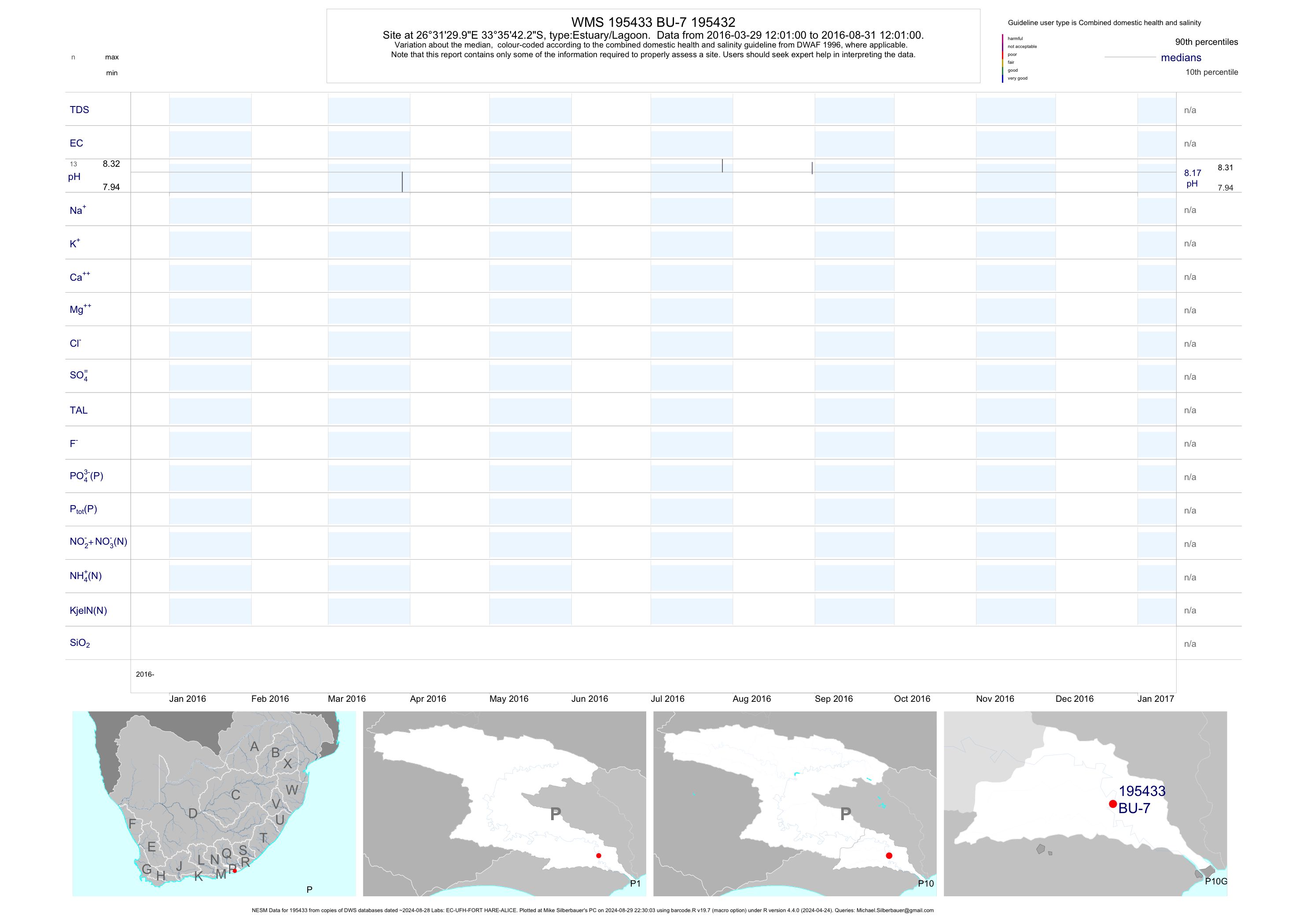
| P10 195433 | plot | data | 195432 | Estuary/Lagoon | 6 | 2016-03-29 | 2016-11-23 | n/a | BU-7 | -33.59507 | 26.52500 |
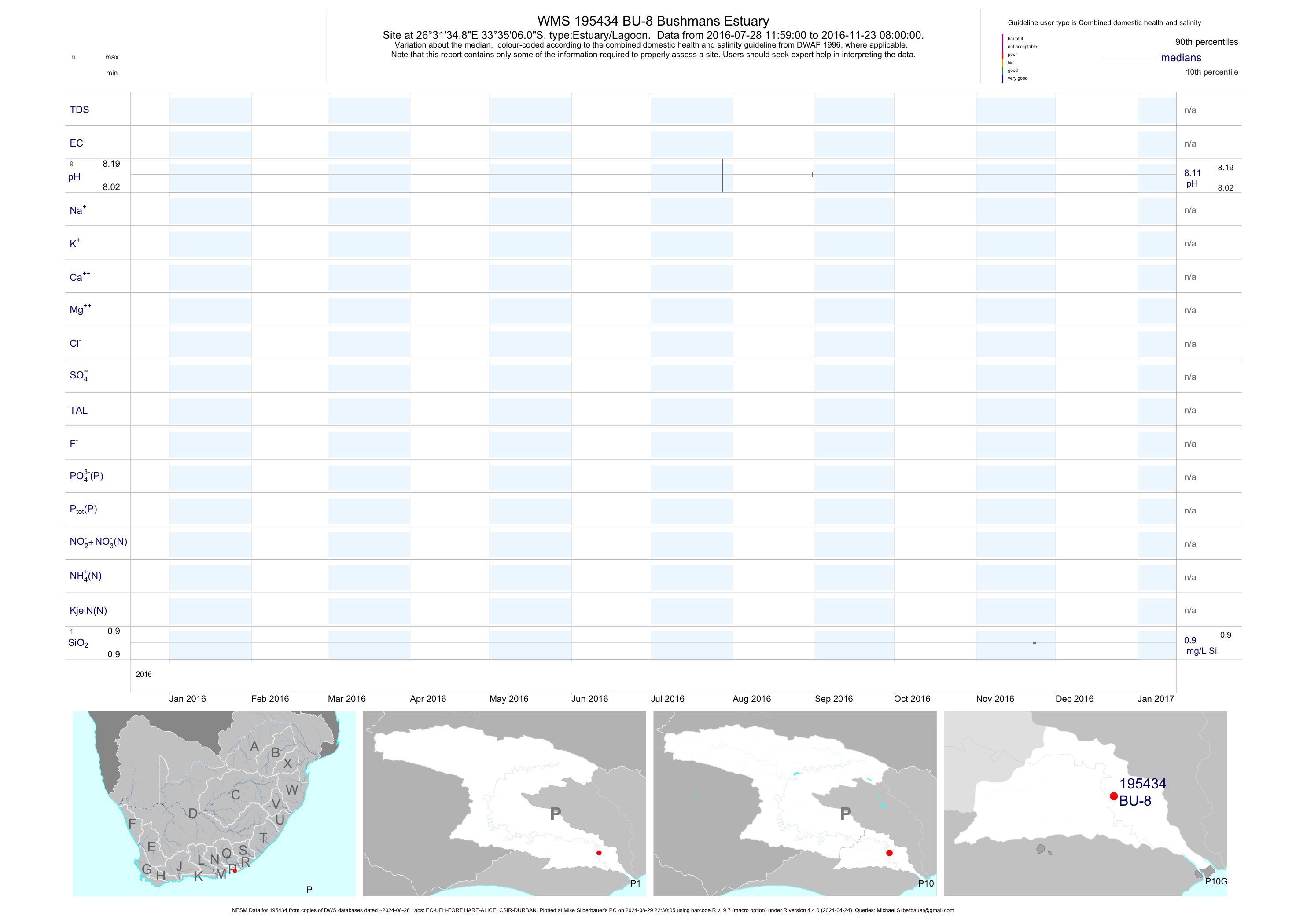
| P10 195434 | plot | data | Bushmans Estuary | Estuary/Lagoon | 7 | 2016-07-28 | 2016-11-23 | n/a | BU-8 | -33.58501 | 26.52635 |
| P20 195427 | plot | data | Bushmans Estuary | Estuary/Lagoon | 7 | 2016-03-29 | 2016-11-23 | n/a | BU-1 | -33.68953 | 26.66178 |
| P20 195428 | plot | data | Bushmans Estuary | Estuary/Lagoon | 5 | 2016-03-29 | 2016-11-23 | n/a | BU-2 | -33.66667 | 26.63889 |
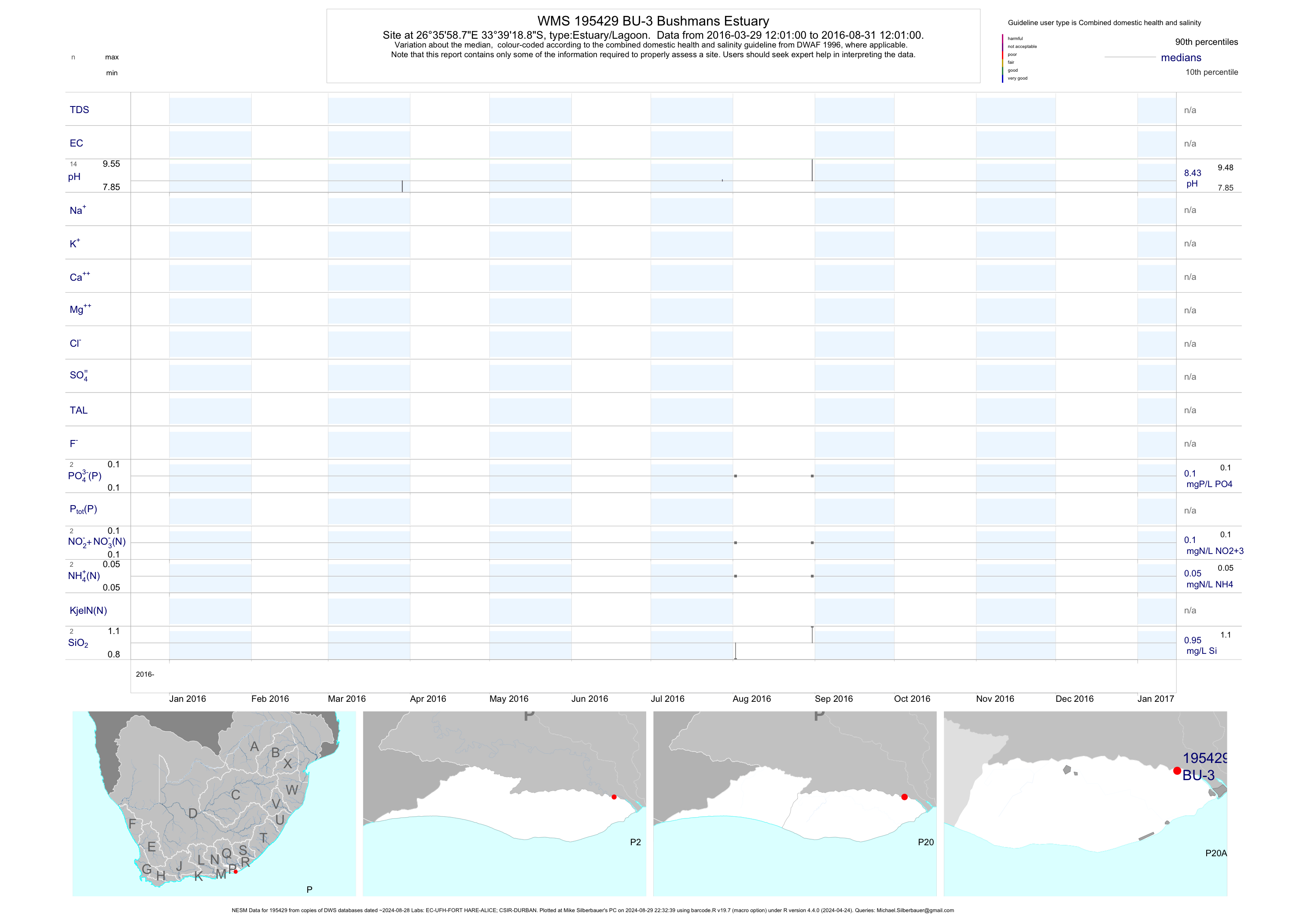
| P20 195429 | plot | data | Bushmans Estuary | Estuary/Lagoon | 9 | 2016-03-29 | 2016-11-23 | n/a | BU-3 | -33.65524 | 26.59967 |
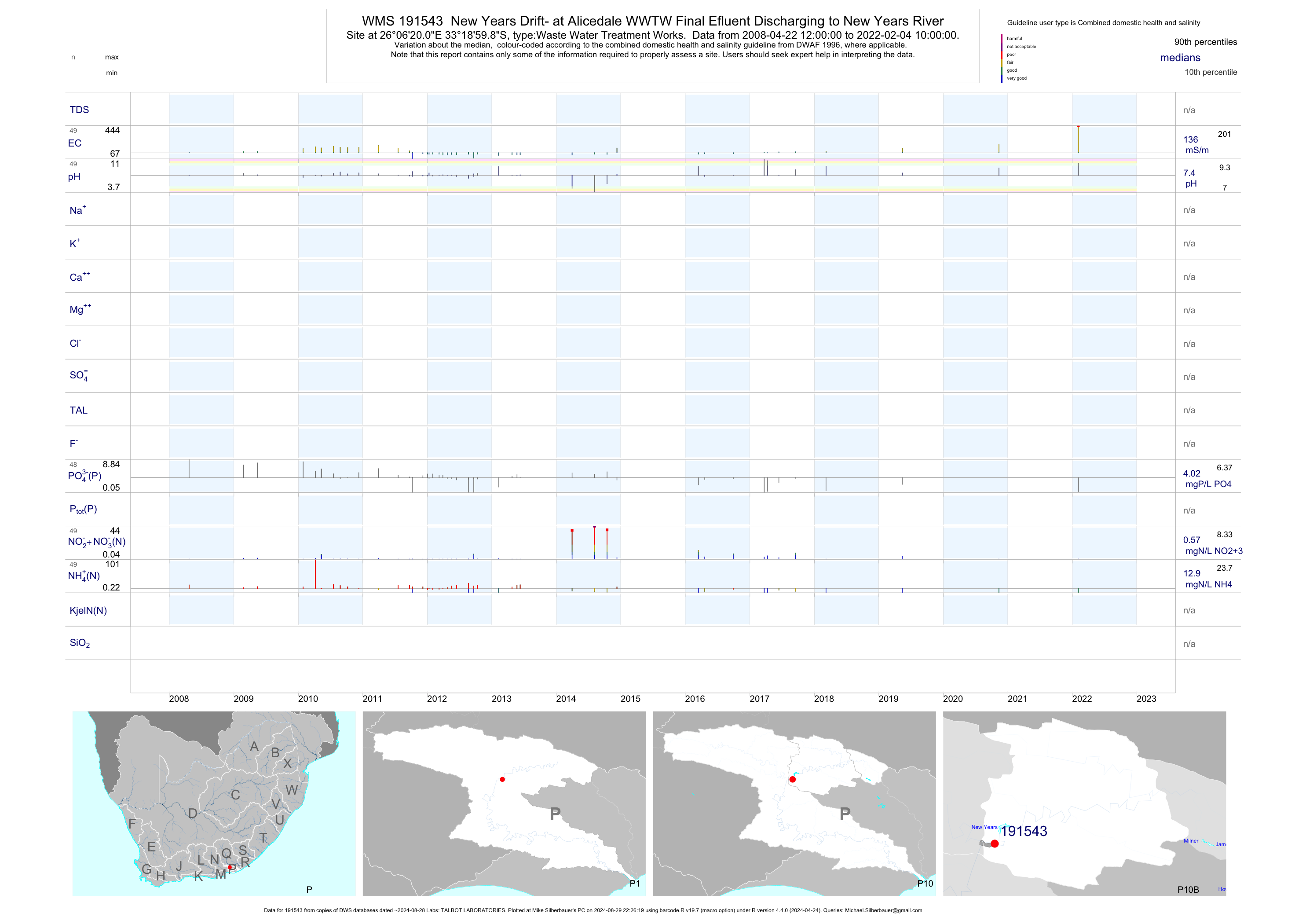
| P10 191543 | plot | data | New Years Drift- at Alicedale WWTW Final Efluent Discharging to New Years River | Waste Water Treatment Works | 88 | 2008-04-22 | 2019-05-16 | 128 | 191543 | -33.31662 | 26.10556 |
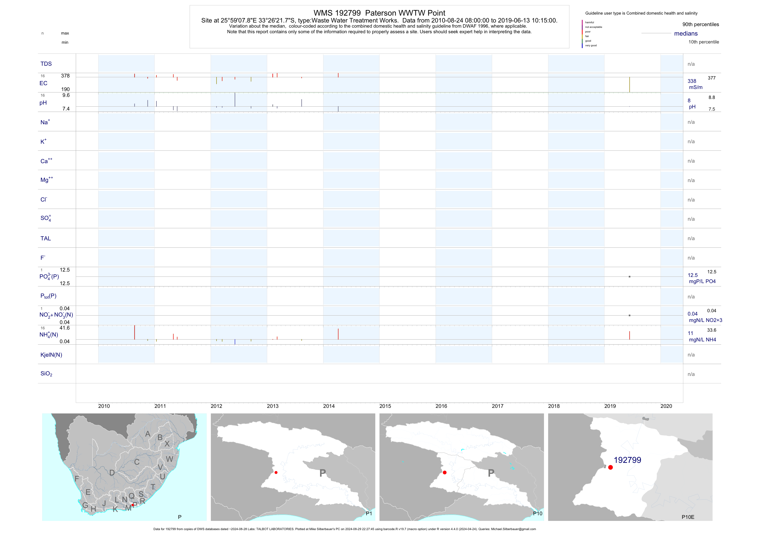
| P10 192799 | plot | data | Paterson WWTW Point | Waste Water Treatment Works | 31 | 2010-08-24 | 2019-06-13 | 338 | 192799 | -33.43939 | 25.98550 |
| P20 189786 | plot | data | Kenton-on-Sea Final Discharge from STW to Kariega Estuary | Waste Water Treatment Works | 129 | 2005-01-11 | 2019-08-15 | 382 | 189786 | -33.67000 | 26.66083 |
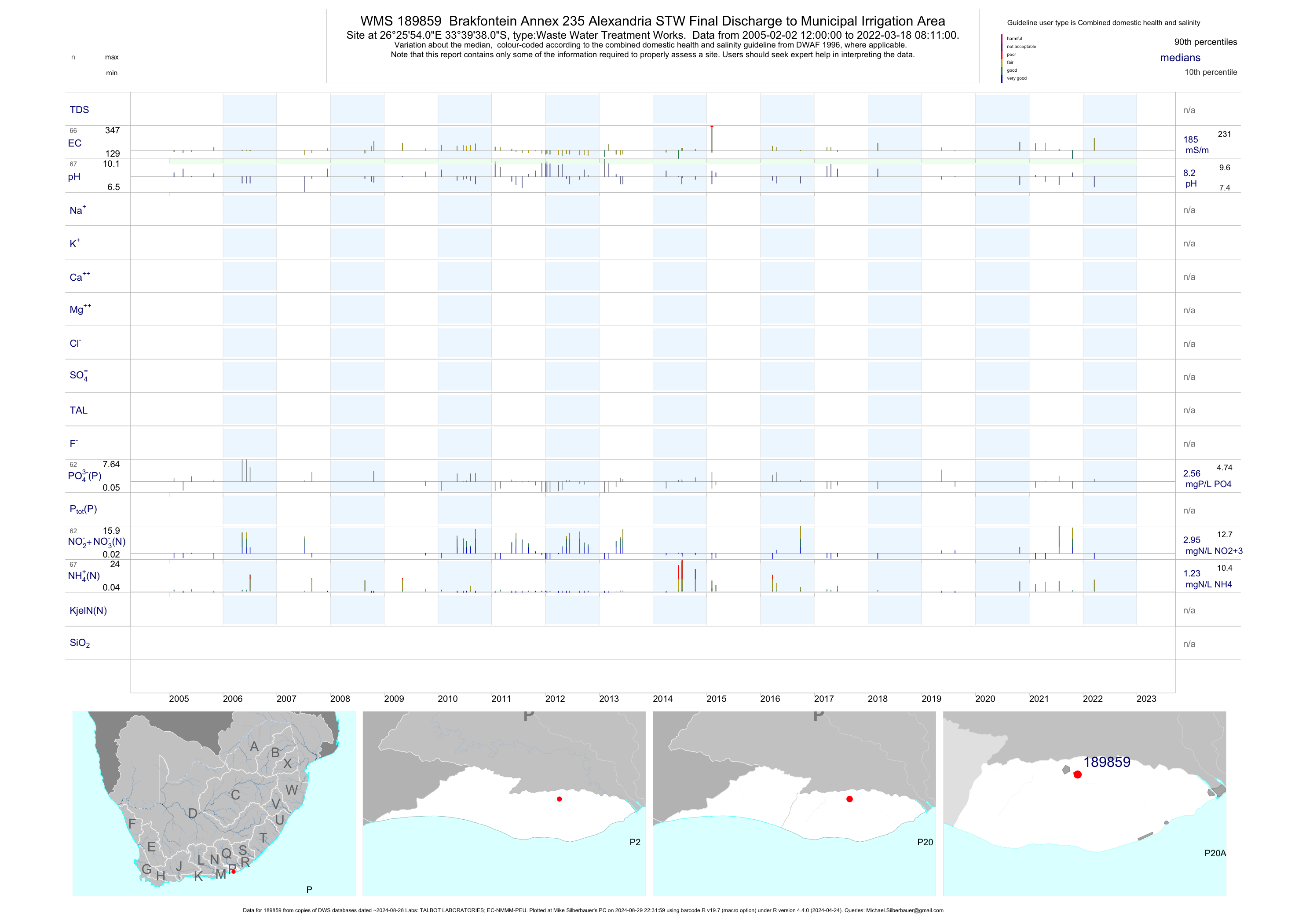
| P20 189859 | plot | data | Brakfontein Annex 235 Alexandria STW Final Discharge to Municipal Irrigation Area | Waste Water Treatment Works | 121 | 2005-02-02 | 2019-08-15 | 182 | 189859 | -33.66056 | 26.43167 |
| P20 190010 | plot | data | Marselle 348 Irrigating Effluent from Bushmans Oxidation Ponds STW | Waste Water Treatment Works | 96 | 2005-04-05 | 2019-08-15 | 439 | 190010 | -33.66836 | 26.62650 |
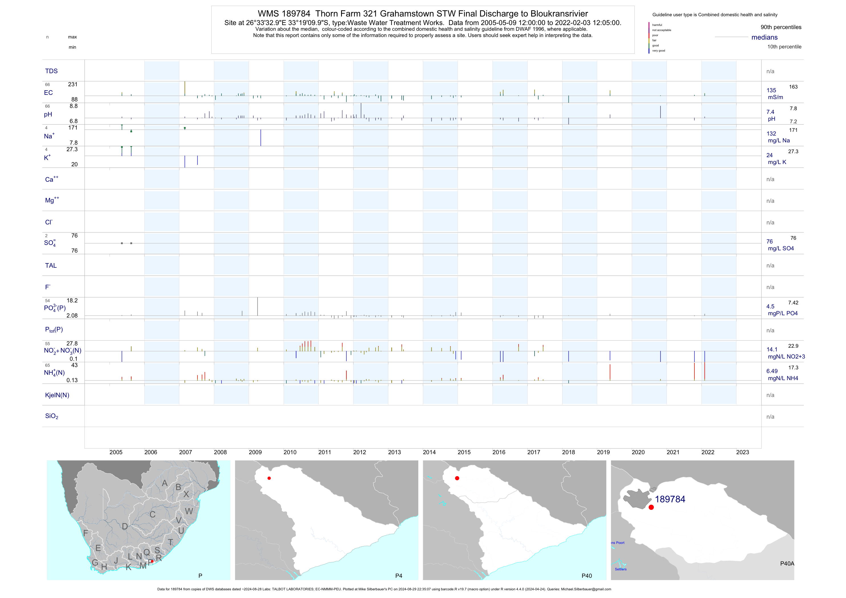
| P40 189784 | plot | data | Thorn Farm 321 Grahamstown STW Final Discharge to Bloukransrivier | Waste Water Treatment Works | 120 | 2005-05-09 | 2019-05-16 | 134 | 189784 | -33.31944 | 26.55917 |
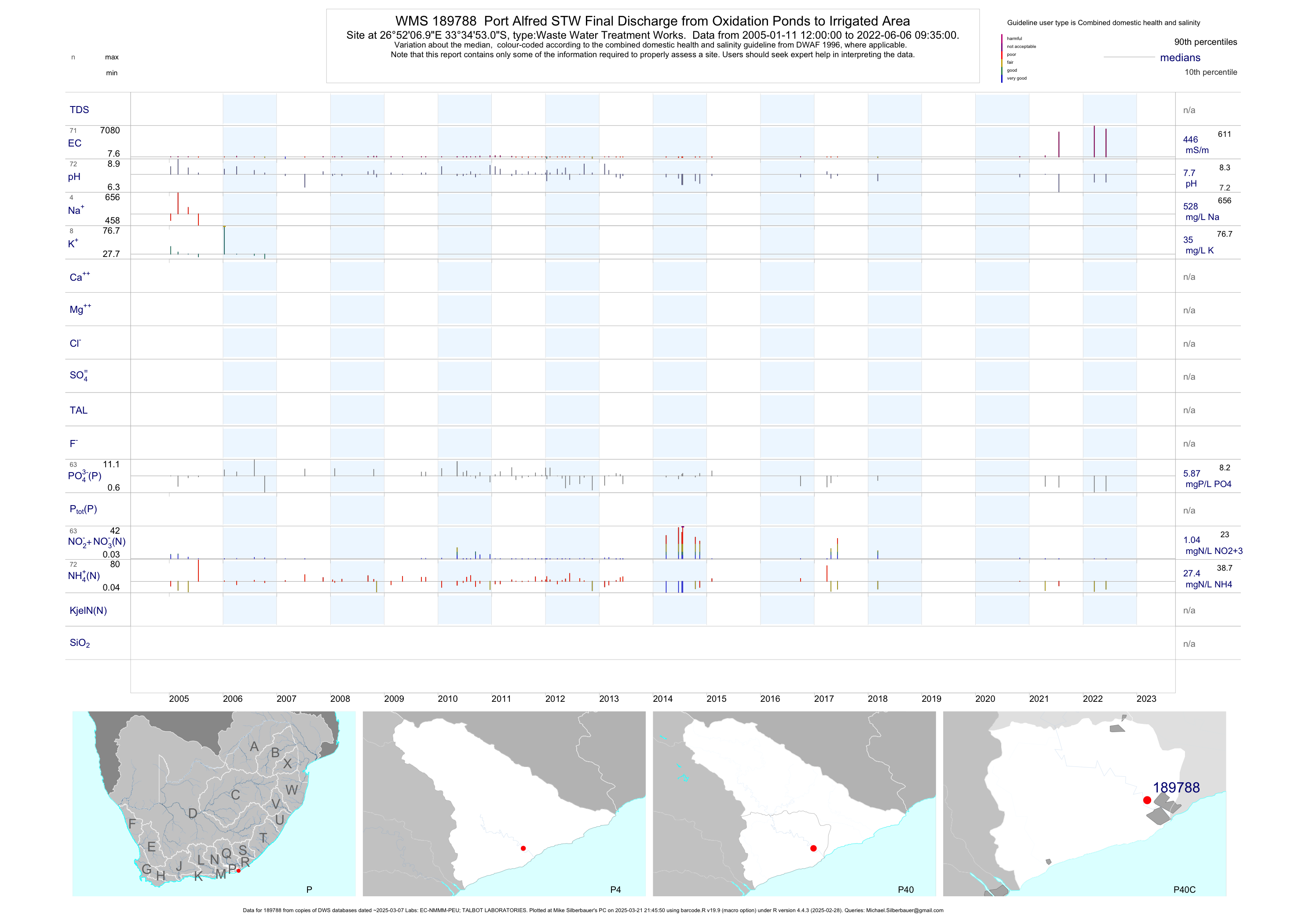
| P40 189788 | plot | data | Port Alfred STW Final Discharge from Oxidation Ponds to Irrigated Area | Waste Water Treatment Works | 125 | 2005-01-11 | 2018-03-08 | 428 | 189788 | -33.58139 | 26.86861 |
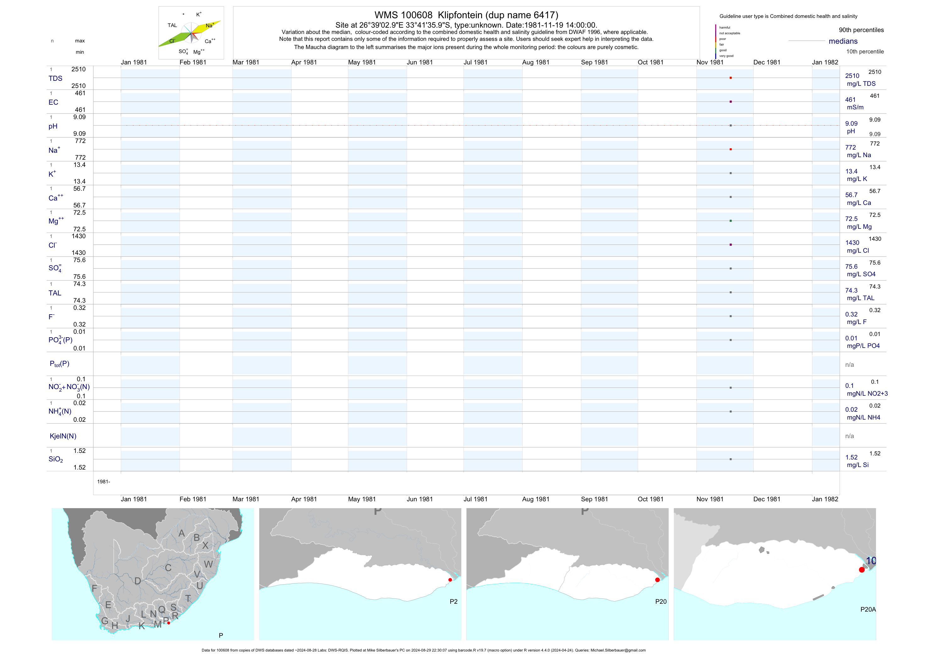
| P20 100608 | plot | data | Klipfontein (dup name 6417) | unknown | 1 | 1981-11-19 | 1981-11-19 | 461 | 100608 | -33.69333 | 26.65083 |
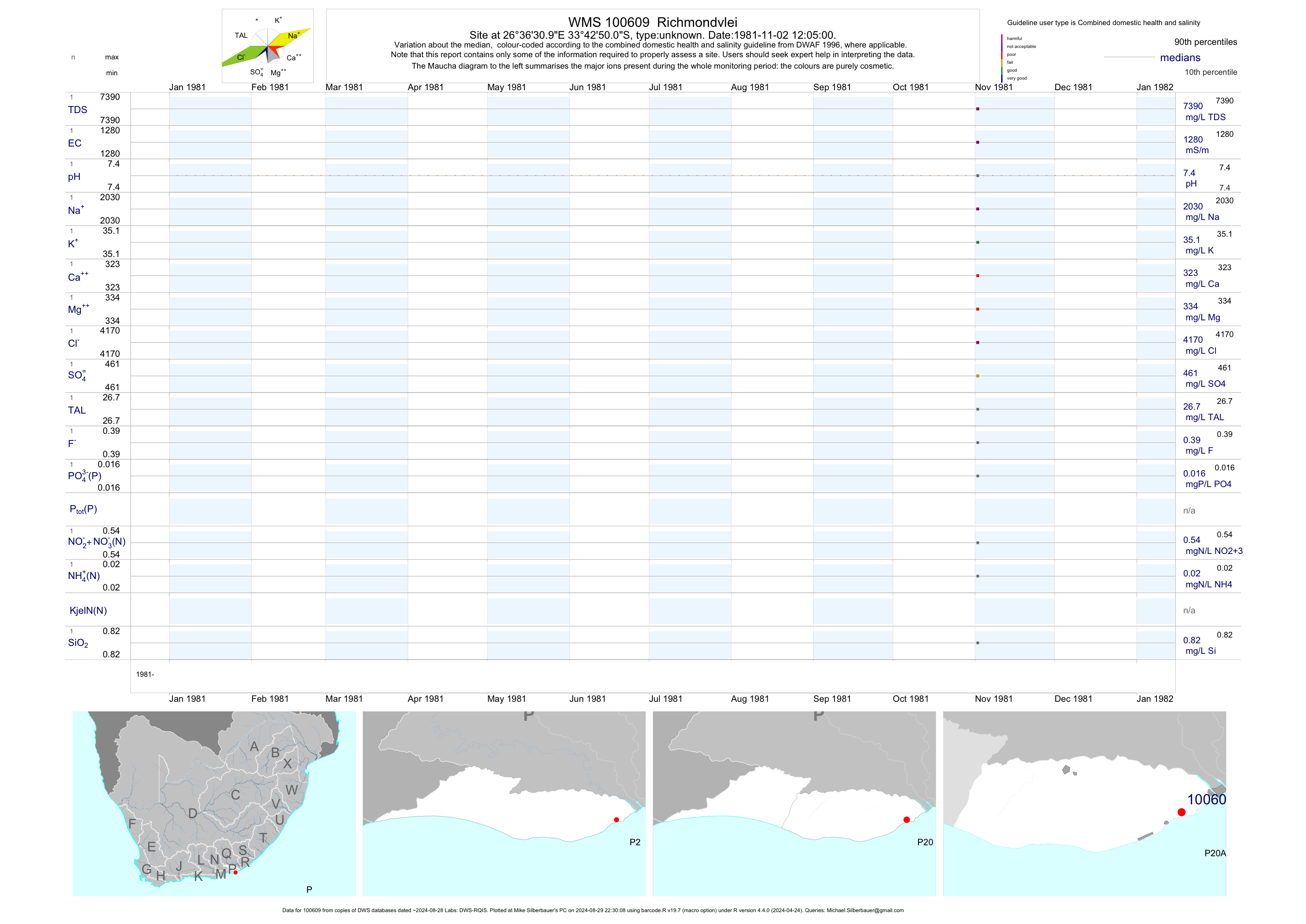
| P20 100609 | plot | data | Richmondvlei | unknown | 1 | 1981-11-02 | 1981-11-02 | 1282 | 100609 | -33.71389 | 26.60861 |
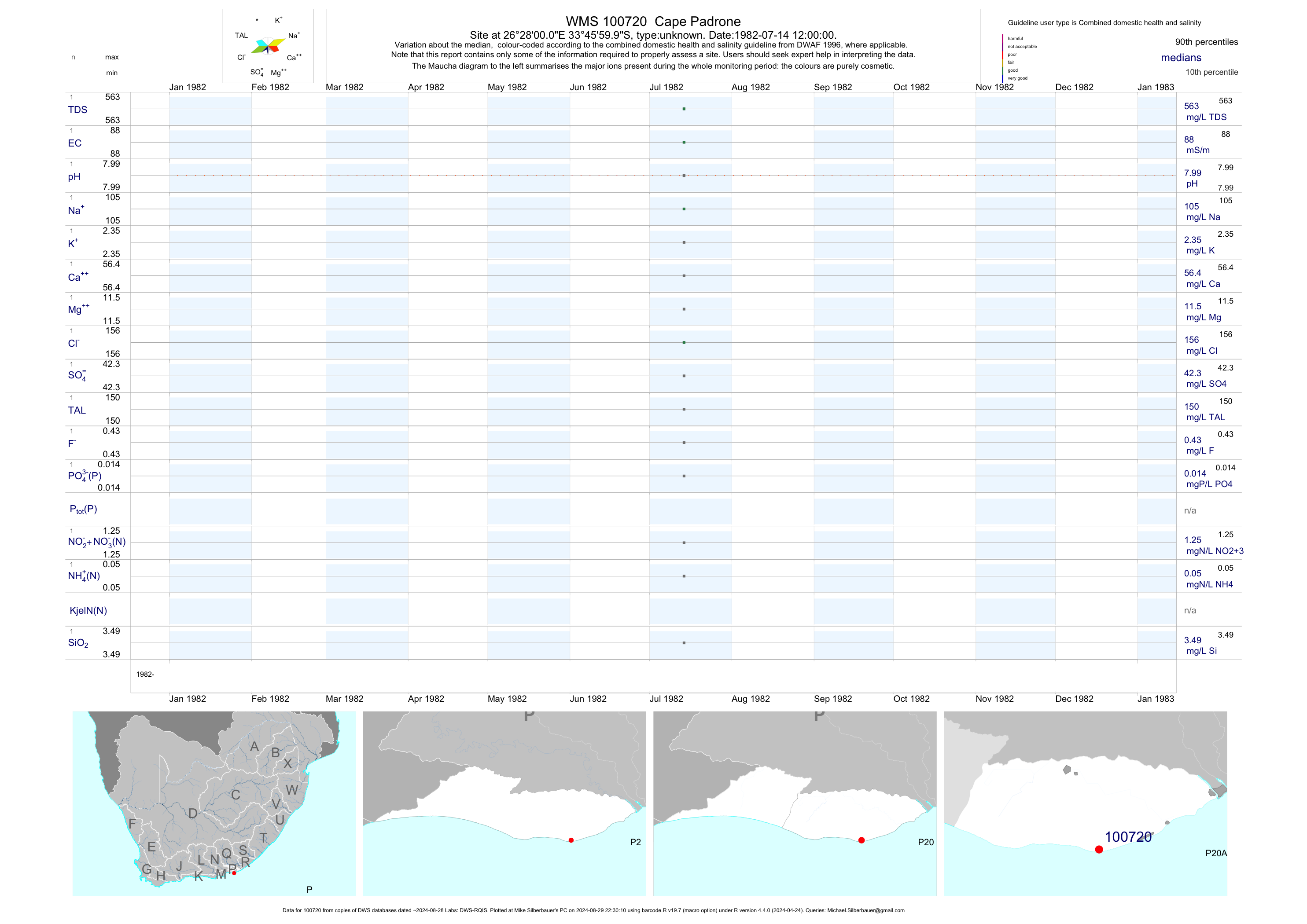
| P20 100720 | plot | data | Cape Padrone | unknown | 1 | 1982-07-14 | 1982-07-14 | 88 | 100720 | -33.76667 | 26.46667 |
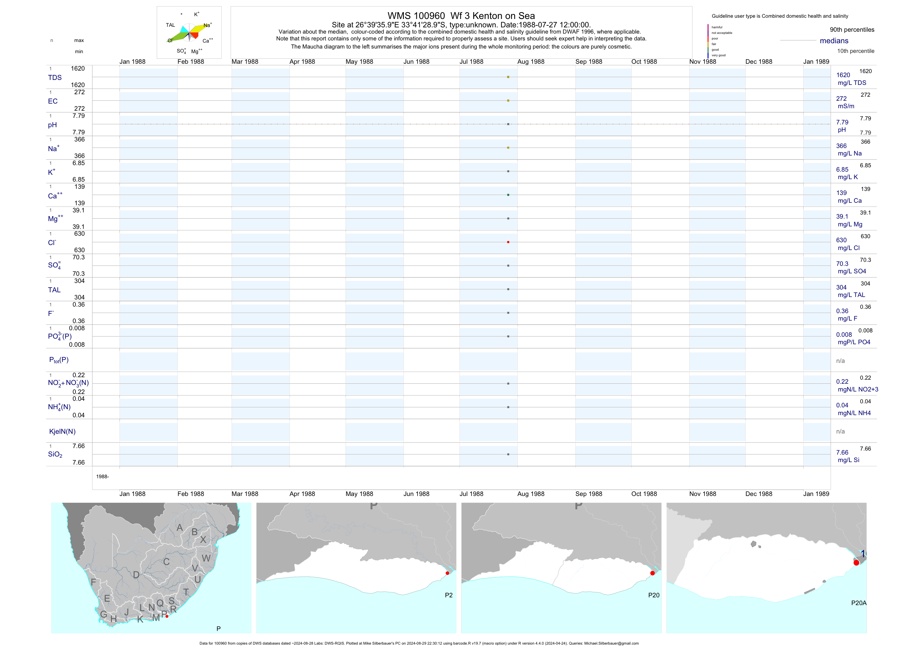
| P20 100960 | plot | data | Wf 3 Kenton on Sea | unknown | 1 | 1988-07-27 | 1988-07-27 | 272 | 100960 | -33.69139 | 26.66000 |
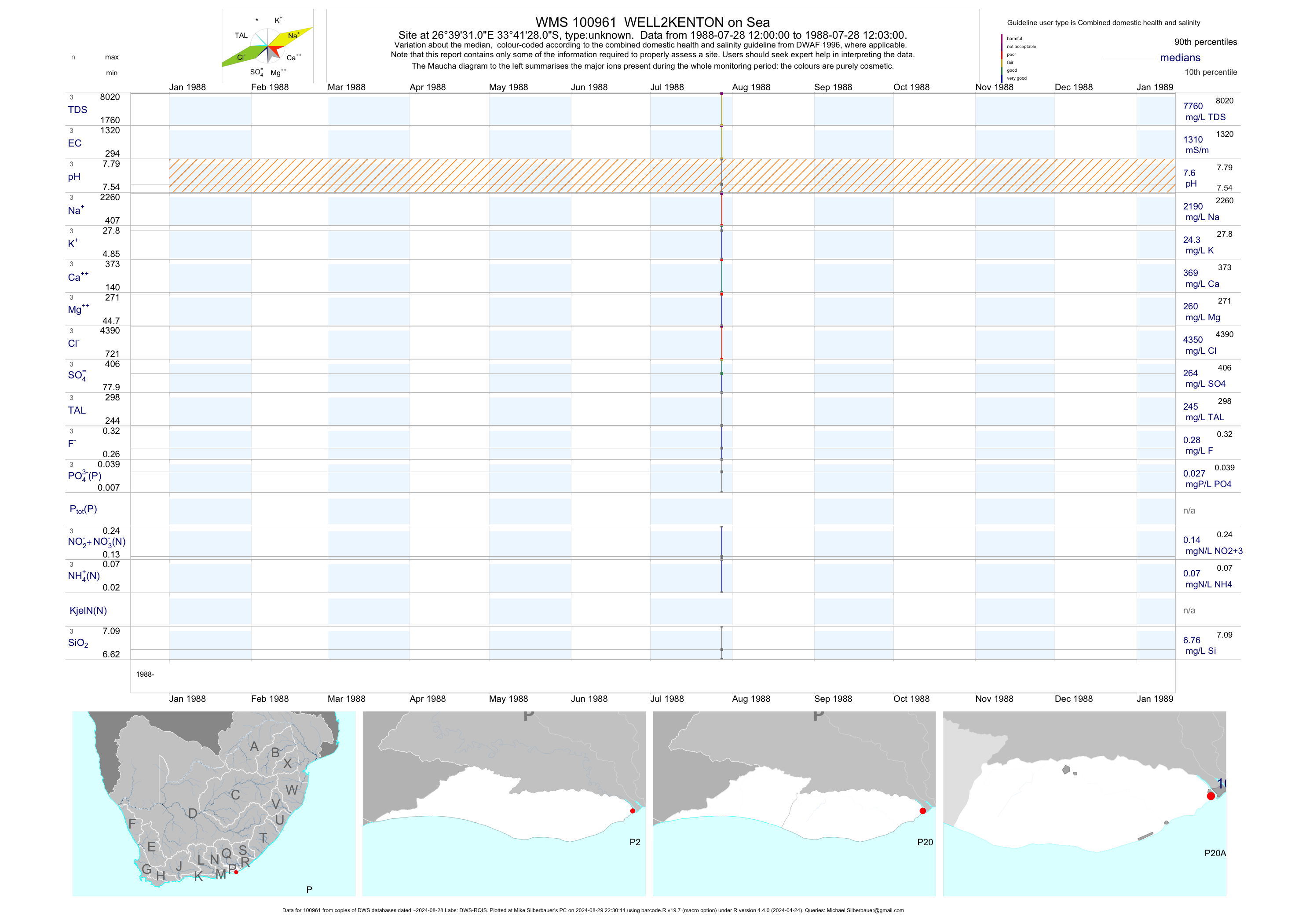
| P20 100961 | plot | data | WELL2KENTON on Sea | unknown | 3 | 1988-07-28 | 1988-07-28 | 1311 | 100961 | -33.69111 | 26.65861 |