Resource water quality data for region S.

Resource water quality data for region S. |
|
| Water quality | Description | Type | n | First date | Last date | med EC | Flow, if any |
Latitude | Longitude | ||
|---|---|---|---|---|---|---|---|---|---|---|---|
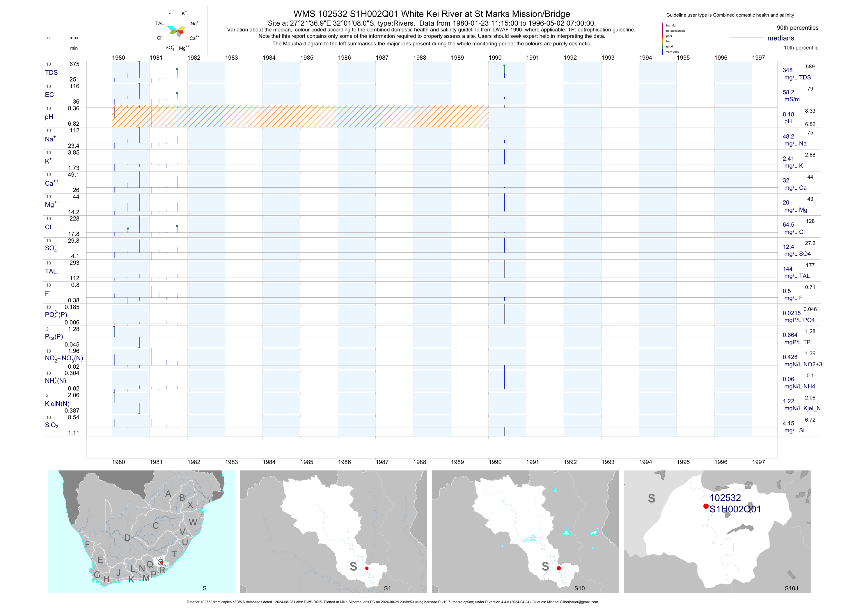
| S10 102532 | plot | data | White Kei River at St Marks Mission/Bridge | Rivers | 10 | 1980-01-23 | 1996-05-02 | 58 | S1H002 | -32.01889 | 27.36028 |
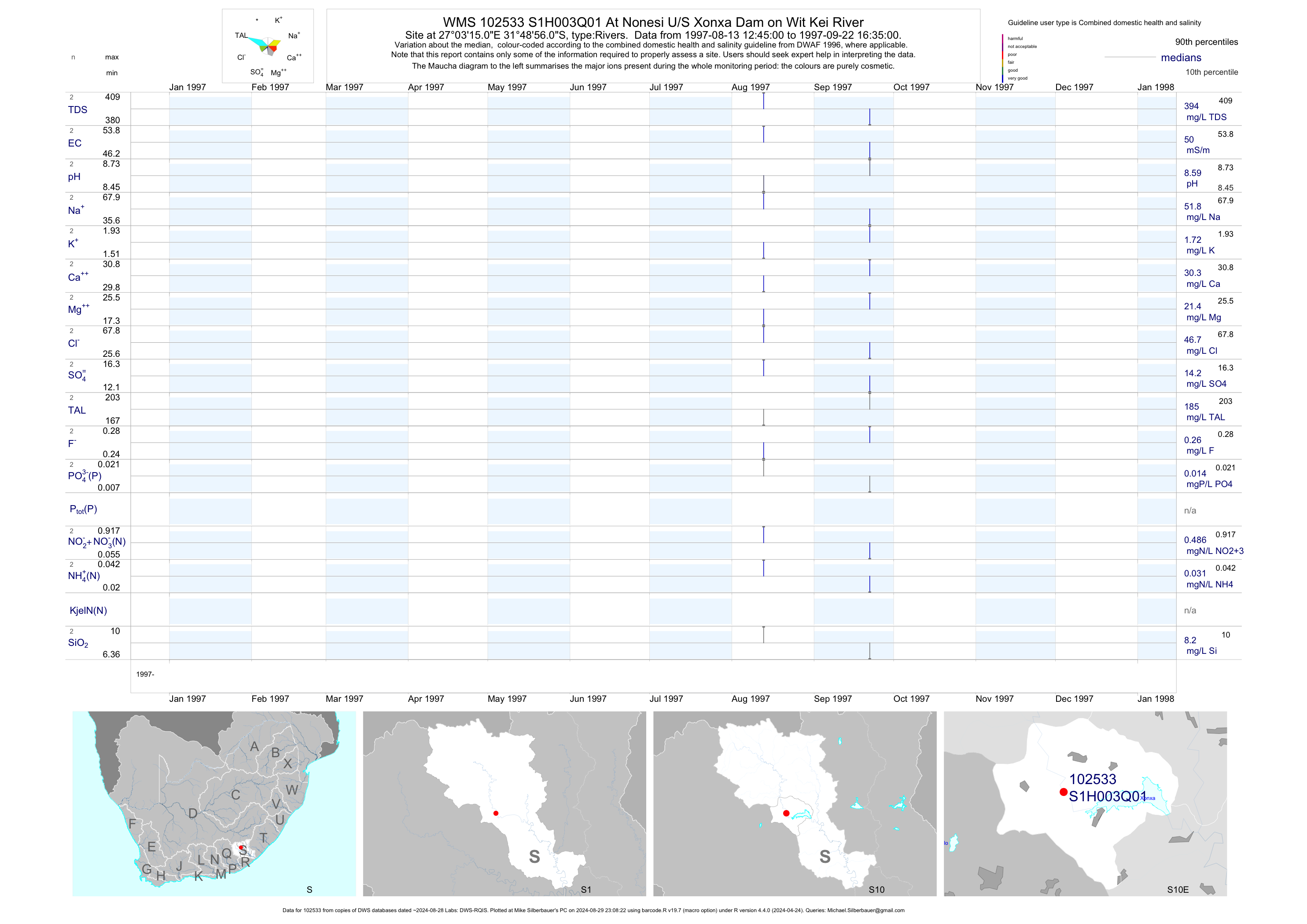
| S10 102533 | plot | data | At Nonesi U/S Xonxa Dam on Wit Kei River | Rivers | 2 | 1997-08-13 | 1997-09-22 | 50 | S1H003 | -31.81556 | 27.05417 |
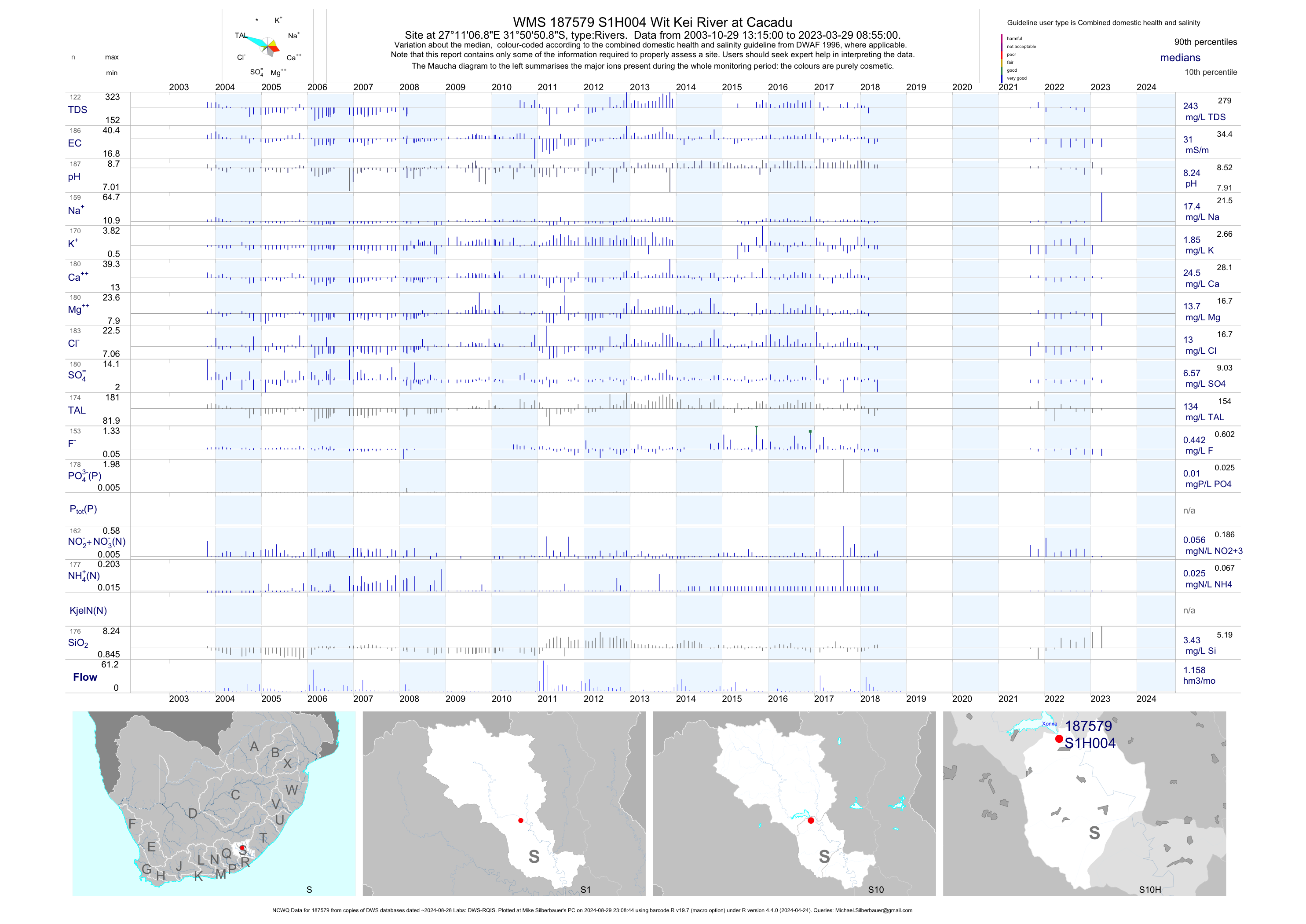
| S10 187579 | plot | data | Wit Kei River at Cacadu (NCWQ) | Rivers | 178 | 2003-10-29 | 2018-05-15 | 31 | S1H004 | -31.84744 | 27.18522 |
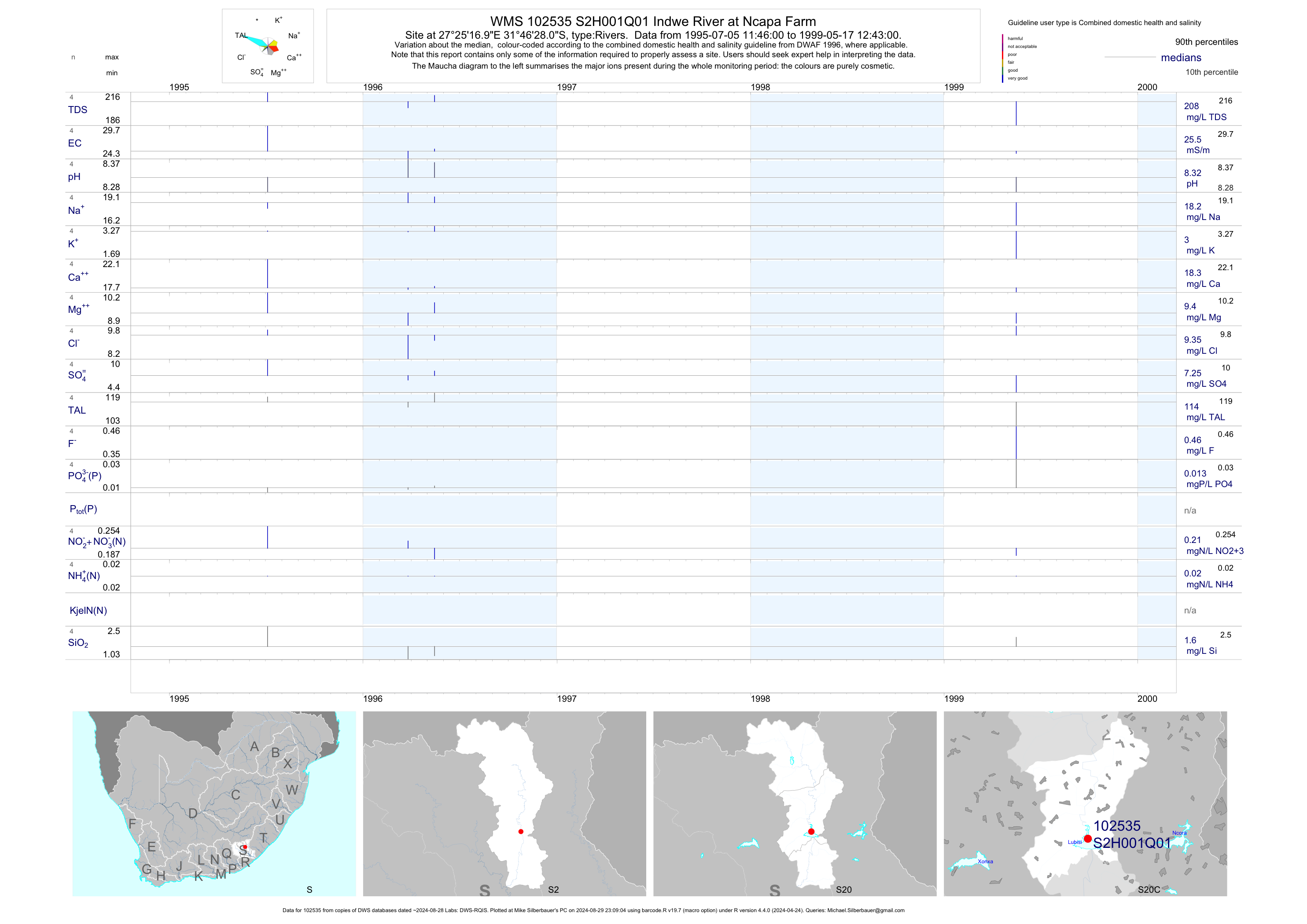
| S20 102535 | plot | data | Indwe River at Ncapa Farm | Rivers | 11 | 1953-10-22 | 1999-05-17 | 26 | S2H001 | -31.77444 | 27.42139 |
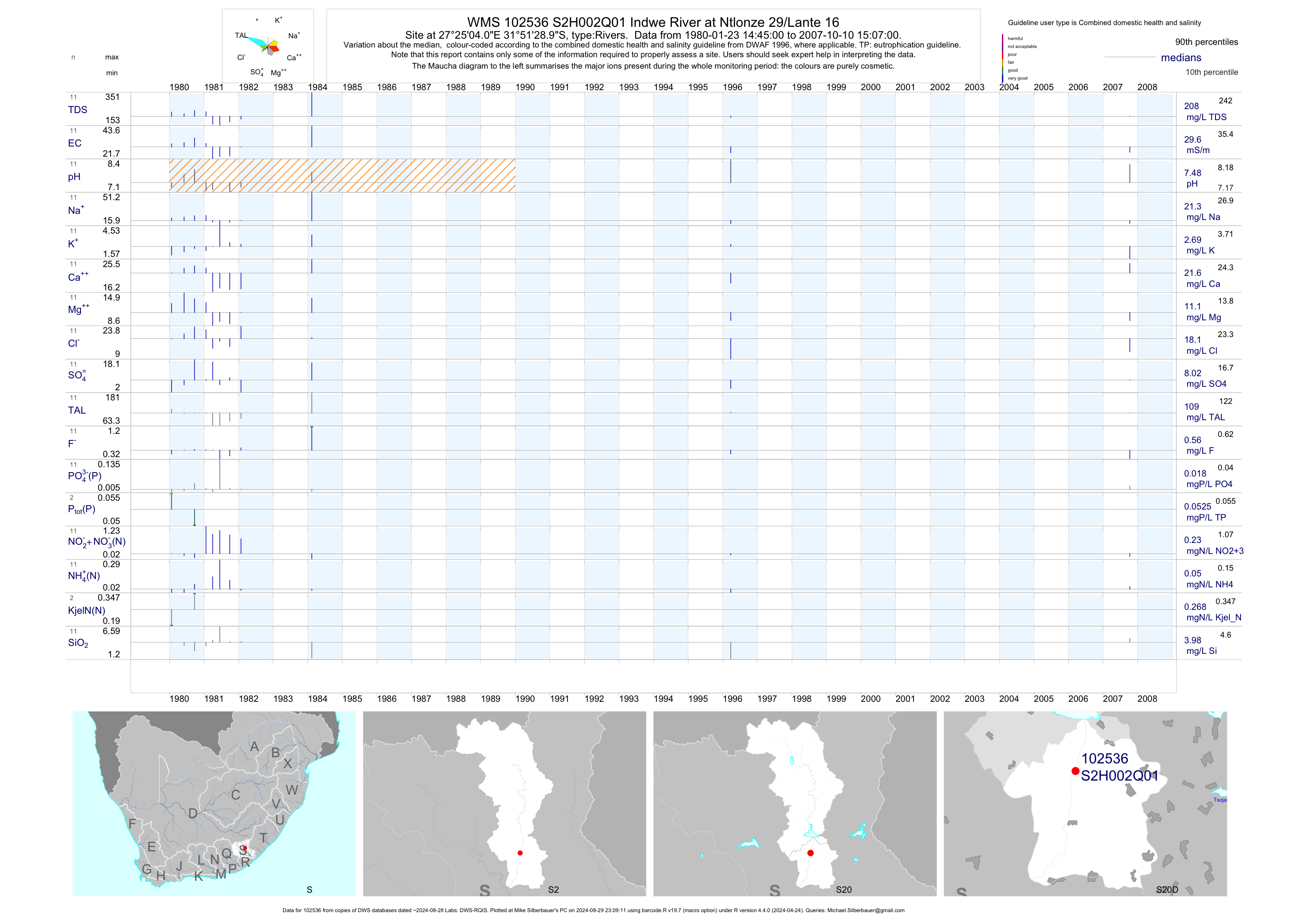
| S20 102536 | plot | data | Indwe River at Ntlonze 29/Lante 16 | Rivers | 11 | 1980-01-23 | 2007-10-10 | 30 | S2H002 | -31.85806 | 27.41778 |
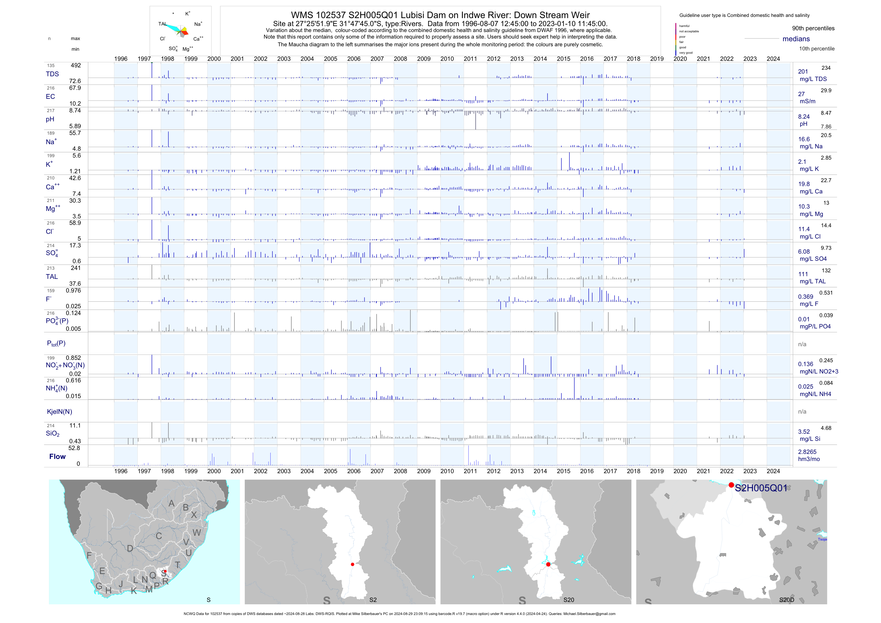
| S20 102537 | plot | data | Lubisi Dam on Indwe River: Down Stream Weir (NCWQ) | Rivers | 212 | 1996-08-07 | 2018-06-25 | 27 | S2H005 | -31.79583 | 27.43111 |
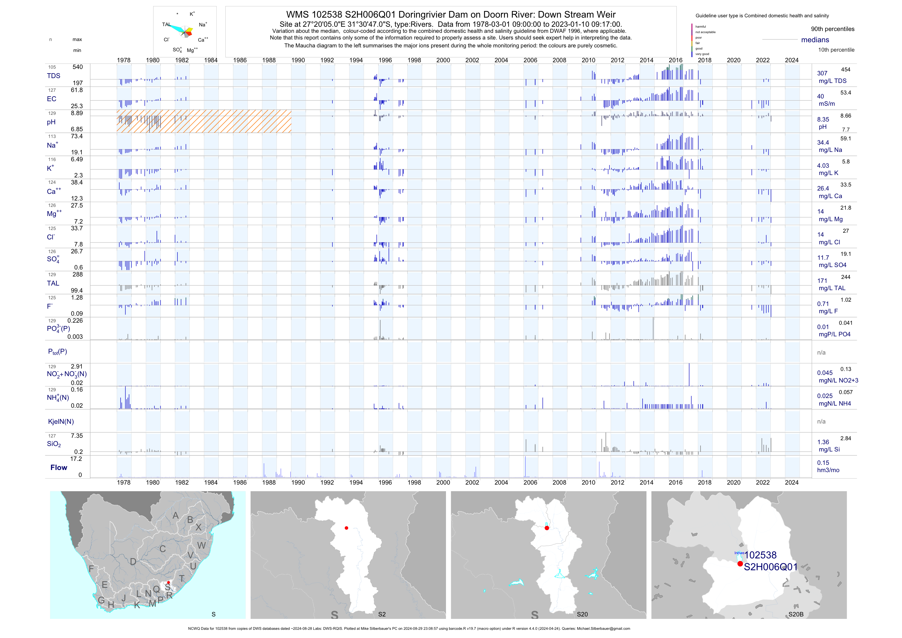
| S20 102538 | plot | data | Doringrivier Dam on Doorn River: Down Stream Weir (NCWQ) | Rivers | 122 | 1978-03-01 | 2018-05-03 | 41 | S2H006 | -31.51306 | 27.33472 |
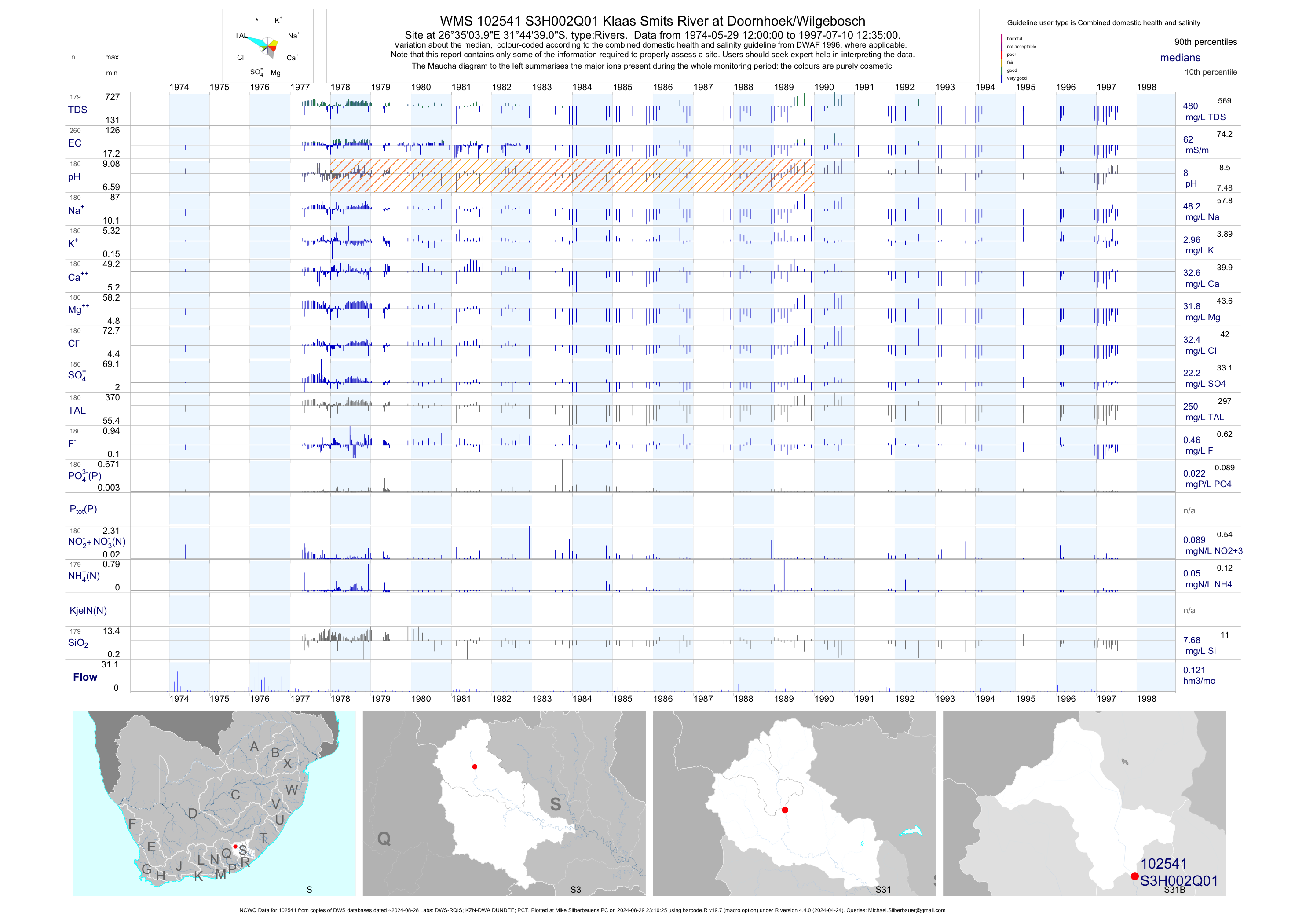
| S31 102541 | plot | data | Klaas Smits River at Doornhoek/Wilgebosch (NCWQ) | Rivers | 445 | 1958-09-19 | 1997-07-10 | 62 | S3H002 | -31.74417 | 26.58444 |
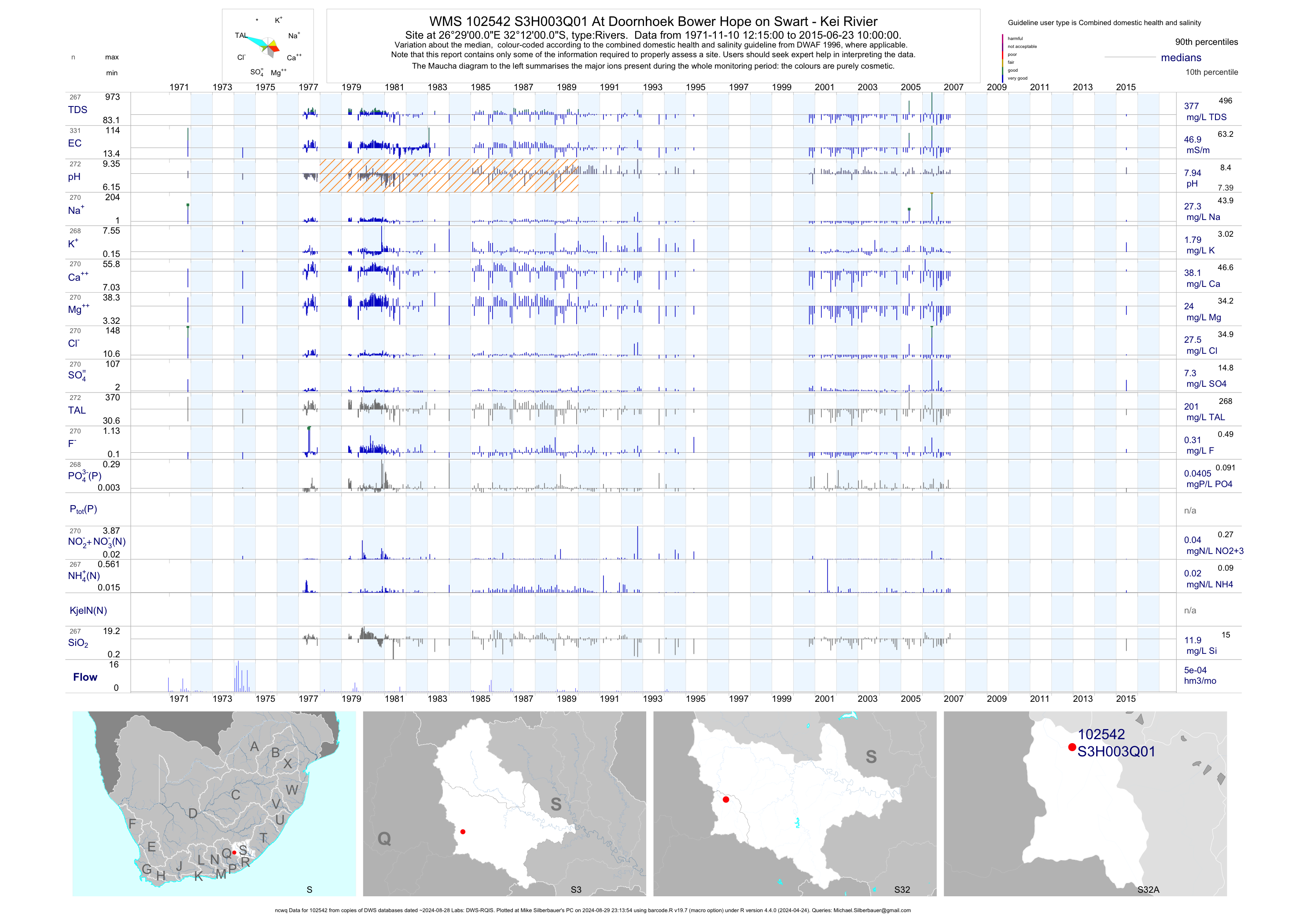
| S32 102542 | plot | data | At Doornhoek Bower Hope on Swart - Kei Rivier (ncwq) | Rivers | 362 | 1953-09-11 | 2015-06-23 | 47 | S3H003 | -32.20000 | 26.48333 |
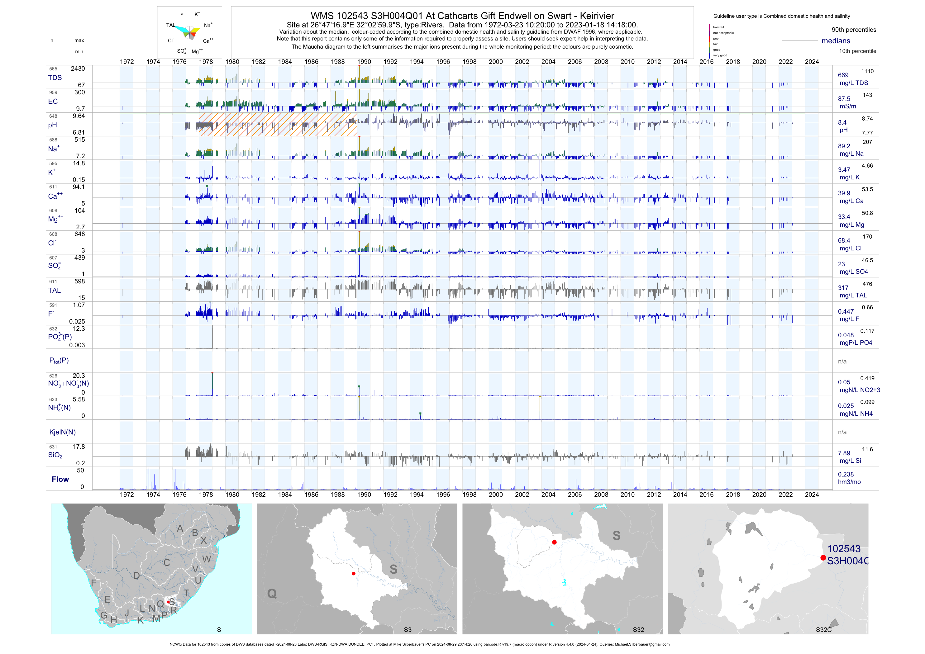
| S32 102543 | plot | data | At Cathcarts Gift Endwell on Swart - Keirivier (NCWQ) | Rivers | 1043 | 1972-03-23 | 2018-05-14 | 88 | S3H004 | -32.05000 | 26.78806 |
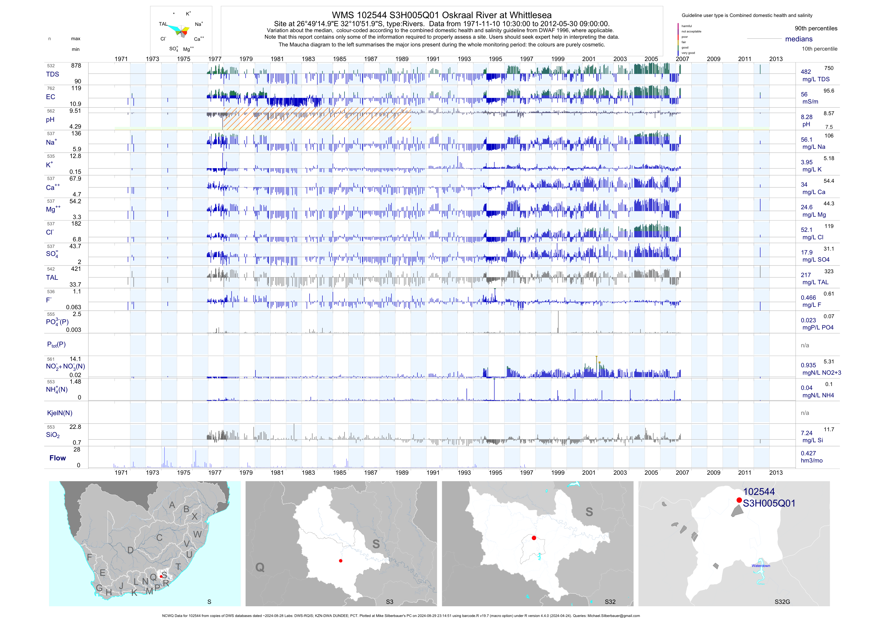
| S32 102544 | plot | data | Oskraal River at Whittlesea (NCWQ) | Rivers | 763 | 1971-11-10 | 2012-05-30 | 56 | S3H005 | -32.18111 | 26.82083 |
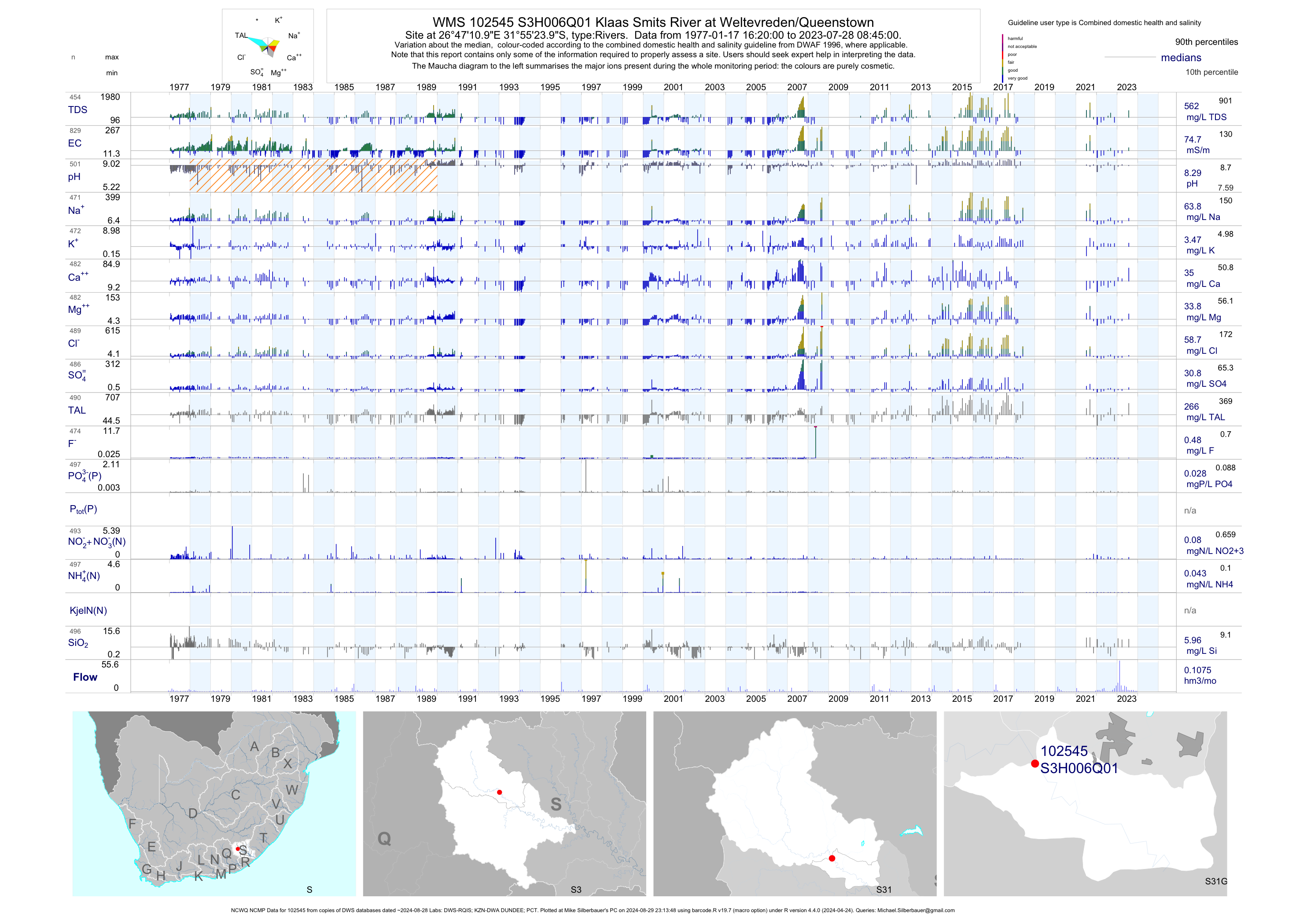
| S31 102545 | plot | data | Klaas Smits River at Weltevreden/Queenstown (NCWQ NCMP) | Rivers | 856 | 1977-01-17 | 2018-06-05 | 75 | S3H006 | -31.92333 | 26.78639 |
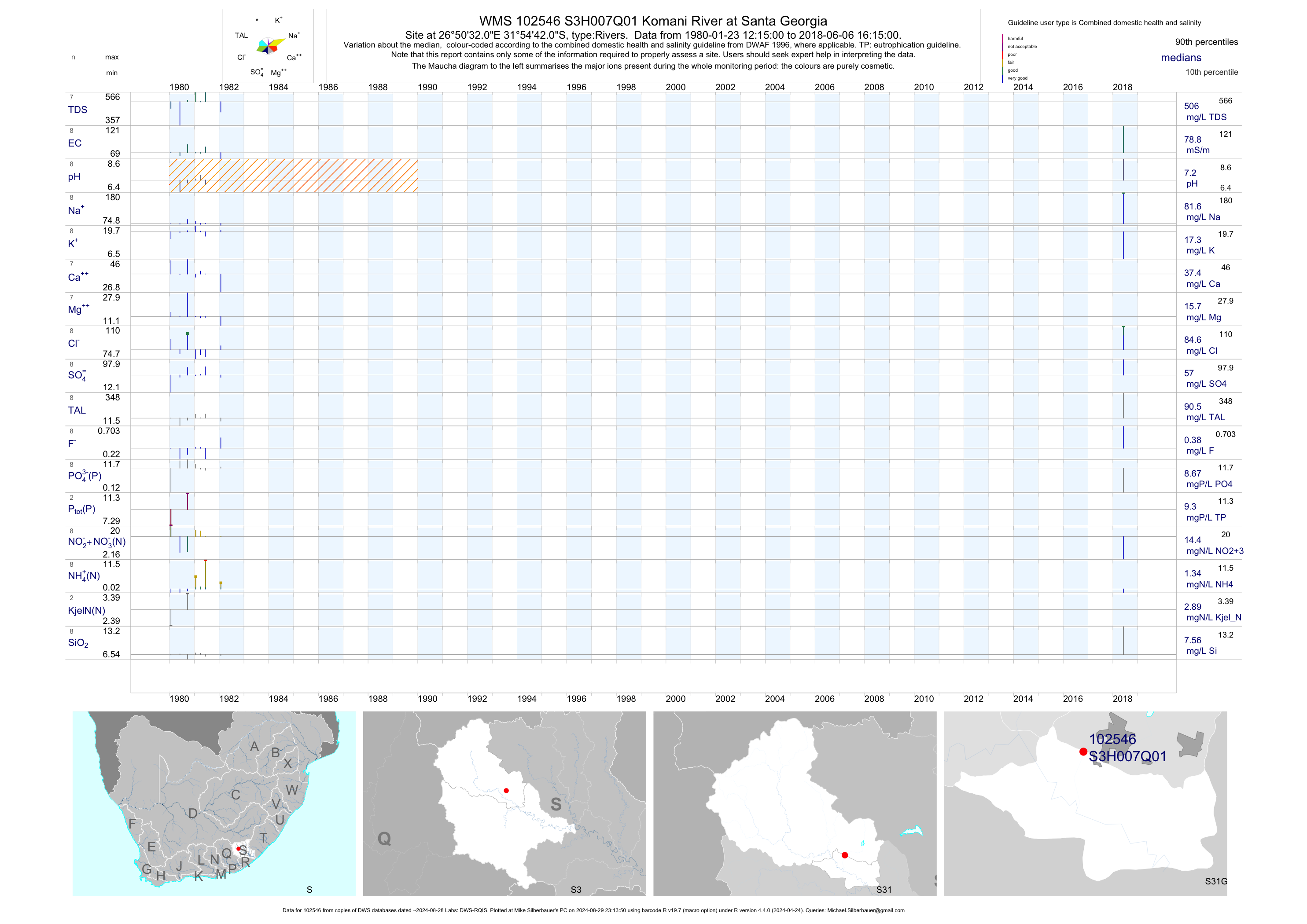
| S31 102546 | plot | data | Komani River at Santa Georgia | Rivers | 8 | 1980-01-23 | 2018-06-06 | 79 | S3H007 | -31.91167 | 26.84222 |
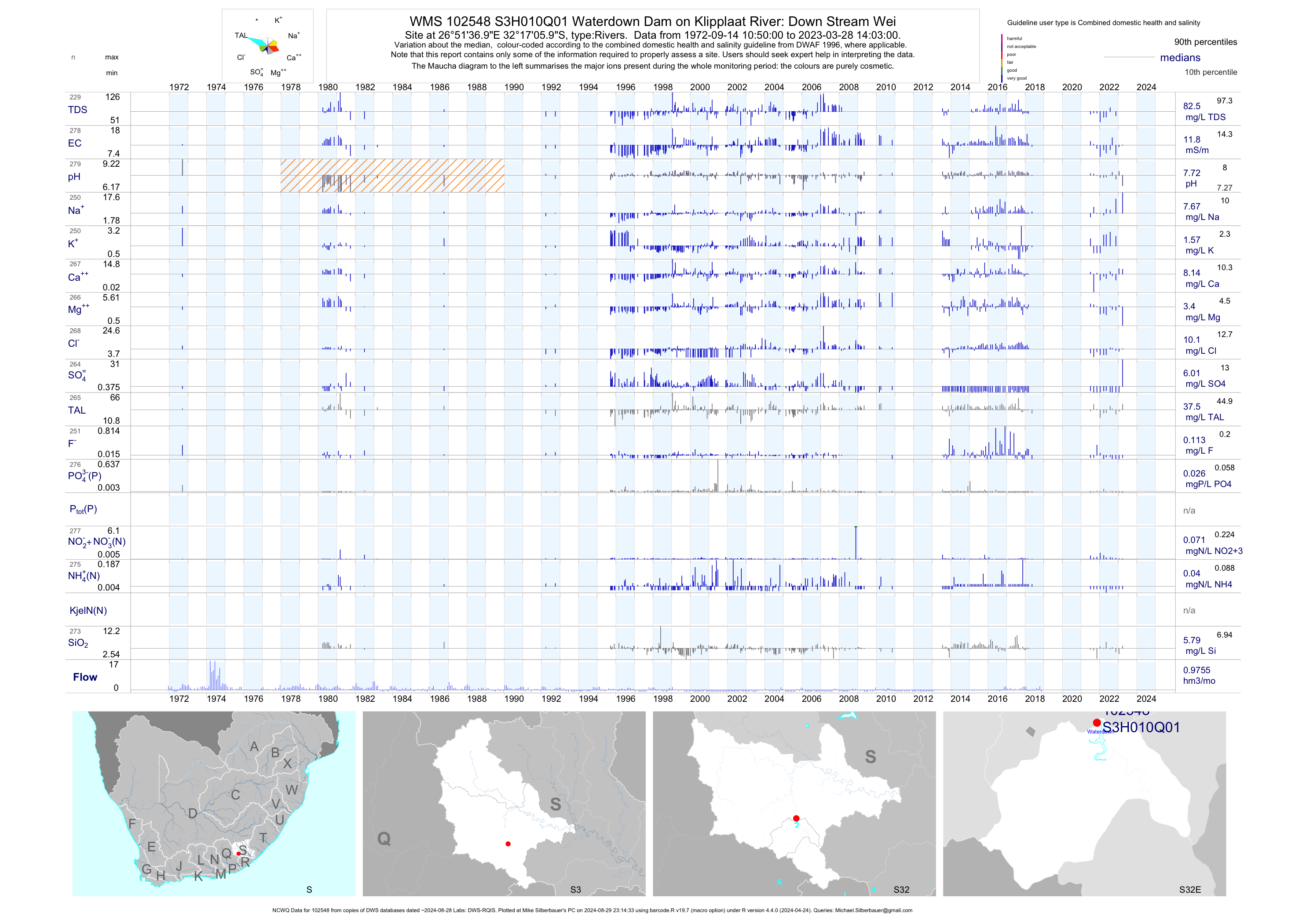
| S32 102548 | plot | data | Waterdown Dam on Klipplaat River: Down Stream Wei (NCWQ) | Rivers | 268 | 1972-09-14 | 2018-05-15 | 12 | S3H010 | -32.28500 | 26.86028 |
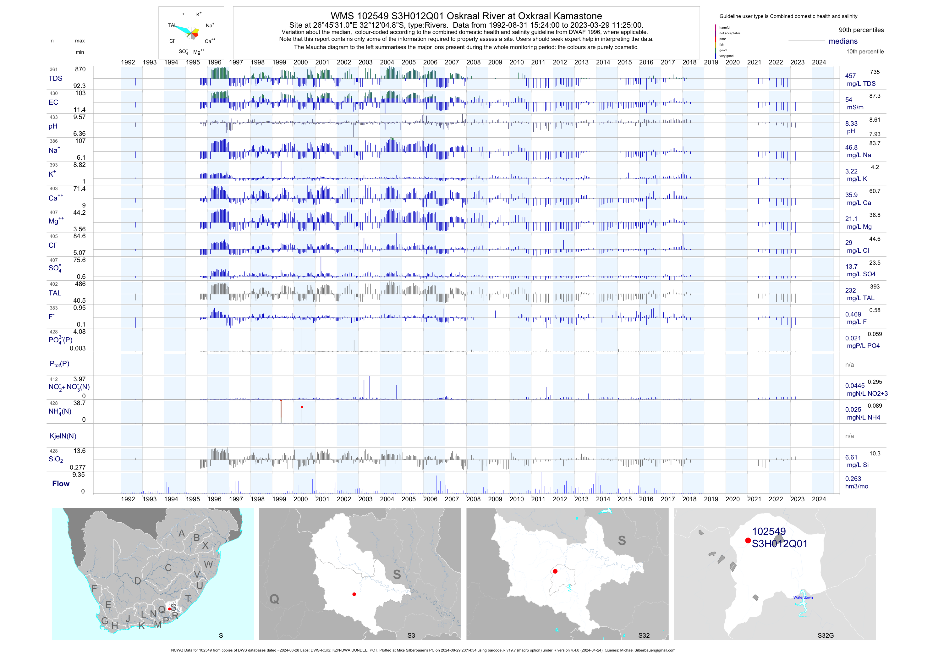
| S32 102549 | plot | data | Oskraal River at Oxkraal Kamastone (NCWQ) | Rivers | 424 | 1992-08-31 | 2018-05-15 | 55 | S3H012 | -32.20134 | 26.75861 |
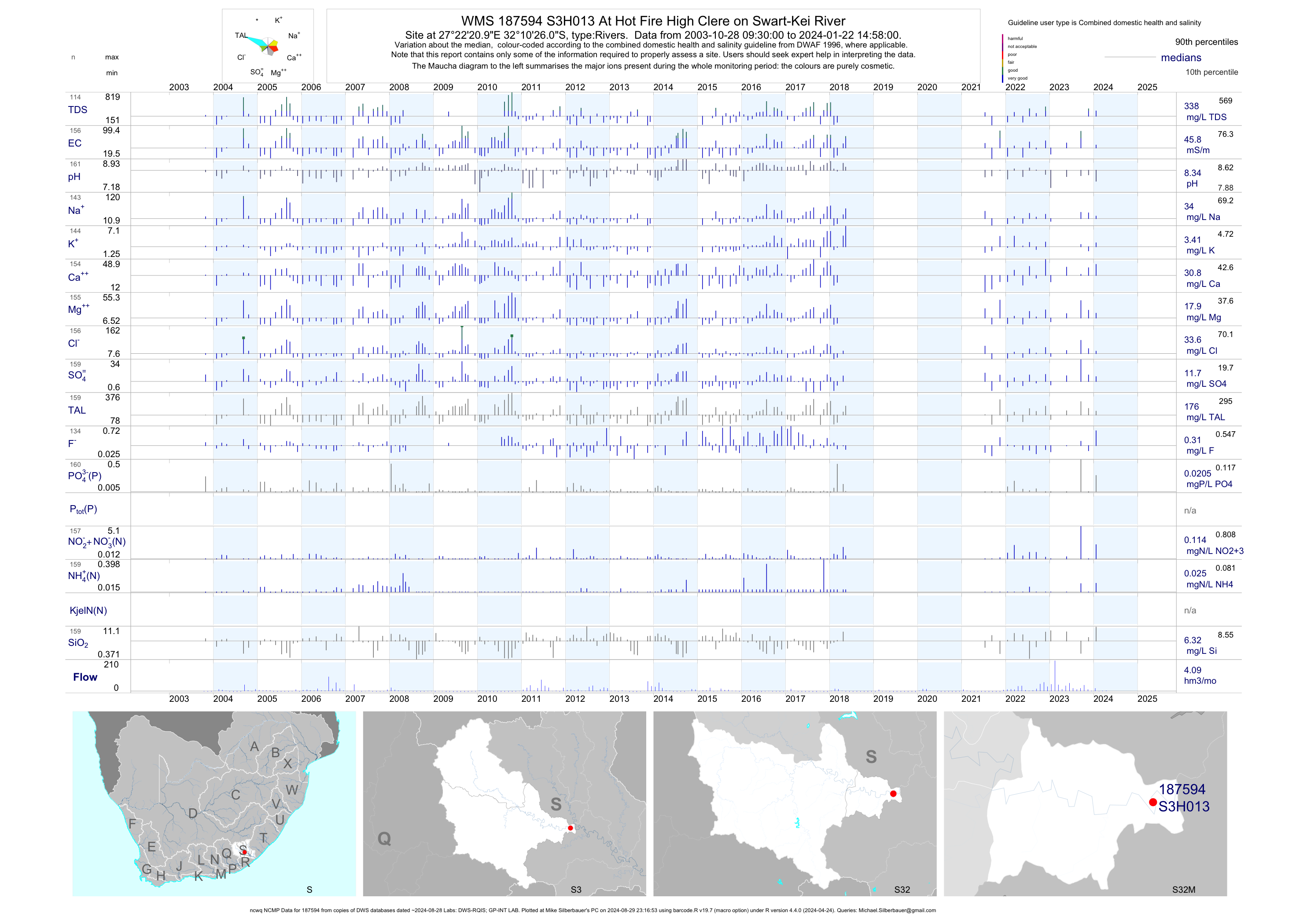
| S32 187594 | plot | data | At Hot Fire High Clere on Swart-Kei River (ncwq NCMP) | Rivers | 149 | 2003-10-28 | 2018-05-15 | 46 | S3H013 | -32.17389 | 27.37250 |
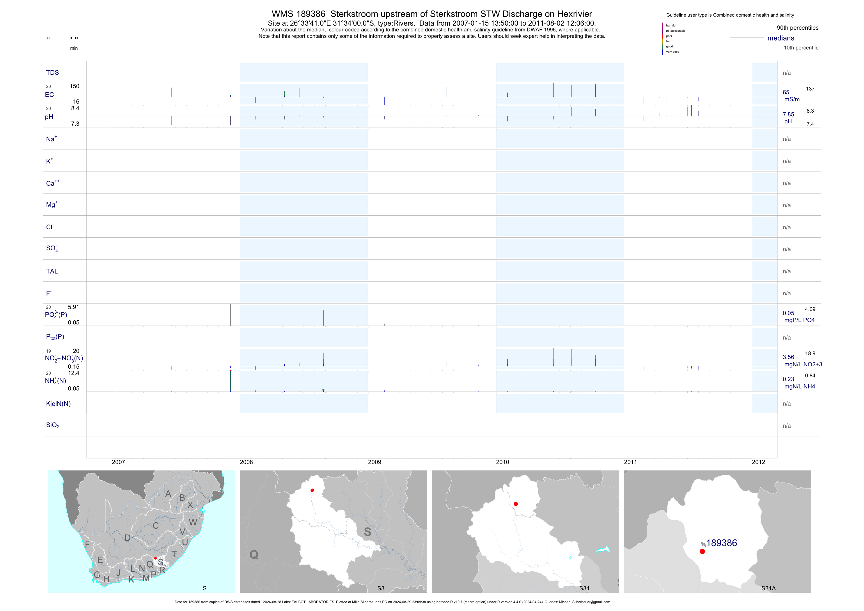
| S31 189386 | plot | data | Sterkstroom upstream of Sterkstroom STW Discharge on Hexrivier | Rivers | 36 | 2007-01-15 | 2011-08-02 | 65 | 189386 | -31.56669 | 26.56141 |
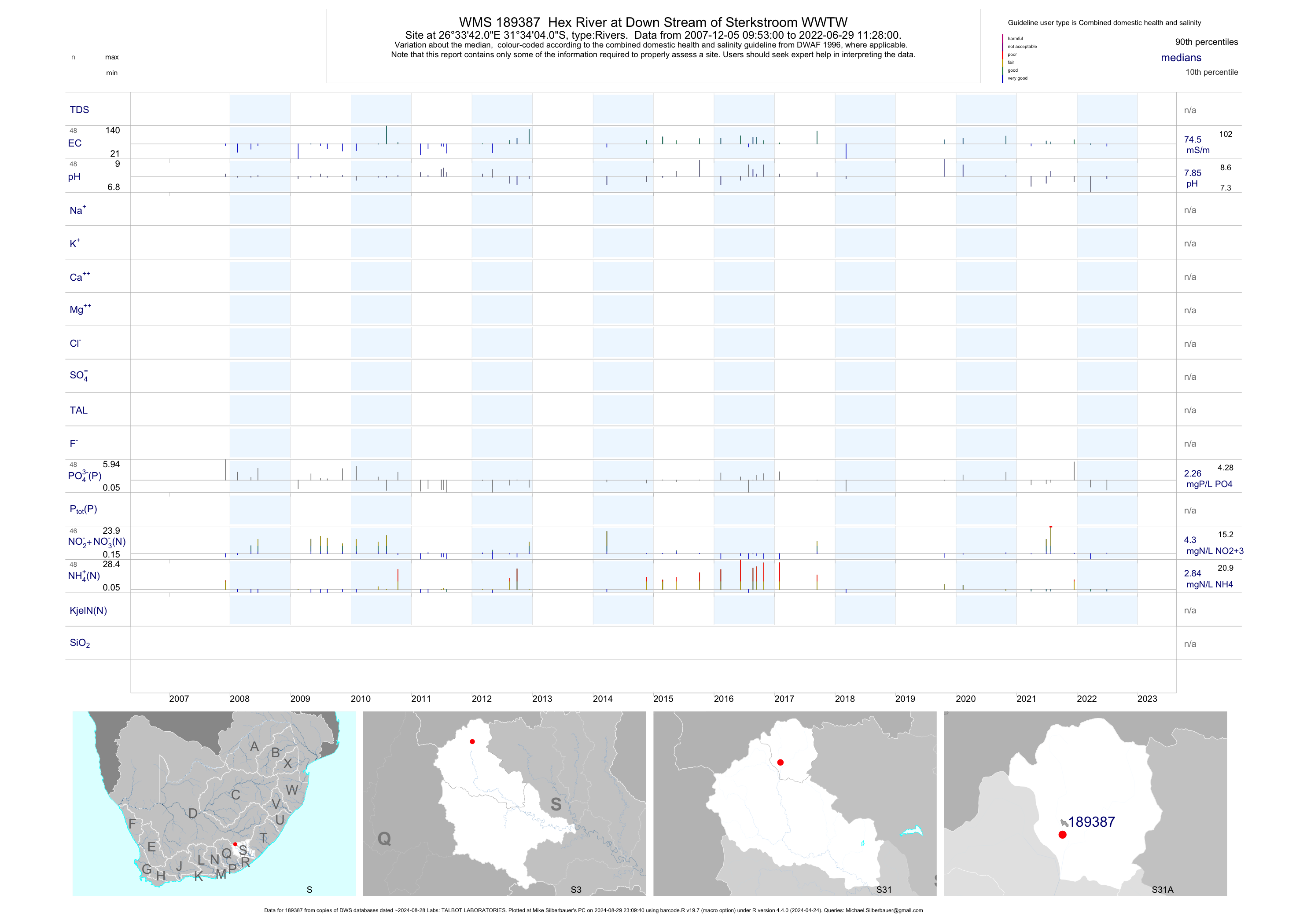
| S31 189387 | plot | data | Hex River at Down Stream of Sterkstroom WWTW | Rivers | 79 | 2007-12-05 | 2018-03-08 | 74 | 189387 | -31.56778 | 26.56169 |
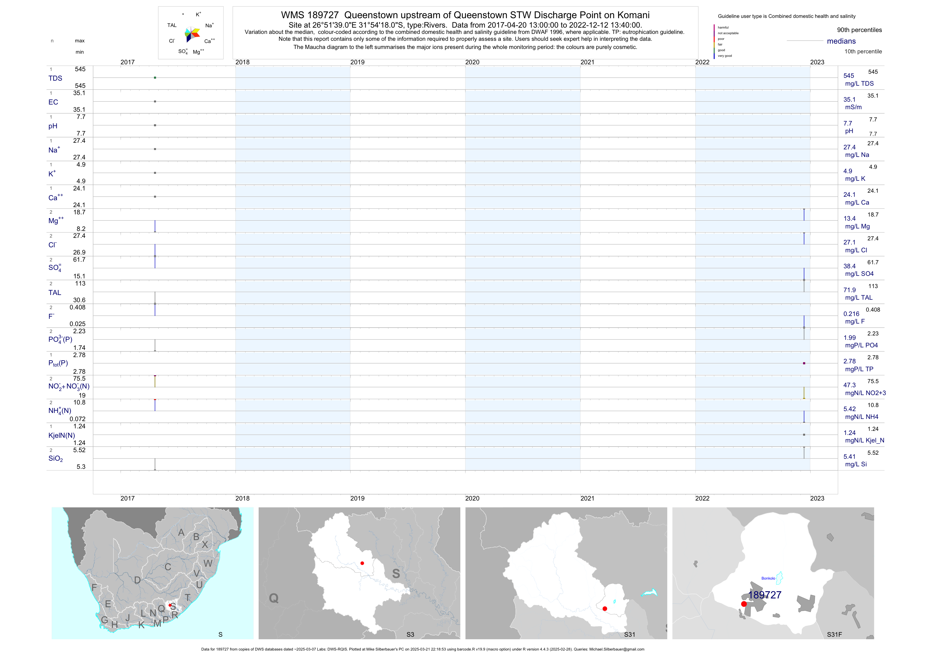
| S31 189727 | plot | data | Queenstown upstream of Queenstown STW Discharge Point on Komani | Rivers | 1 | 2017-04-20 | 2017-04-20 | 35 | 189727 | -31.90503 | 26.86086 |
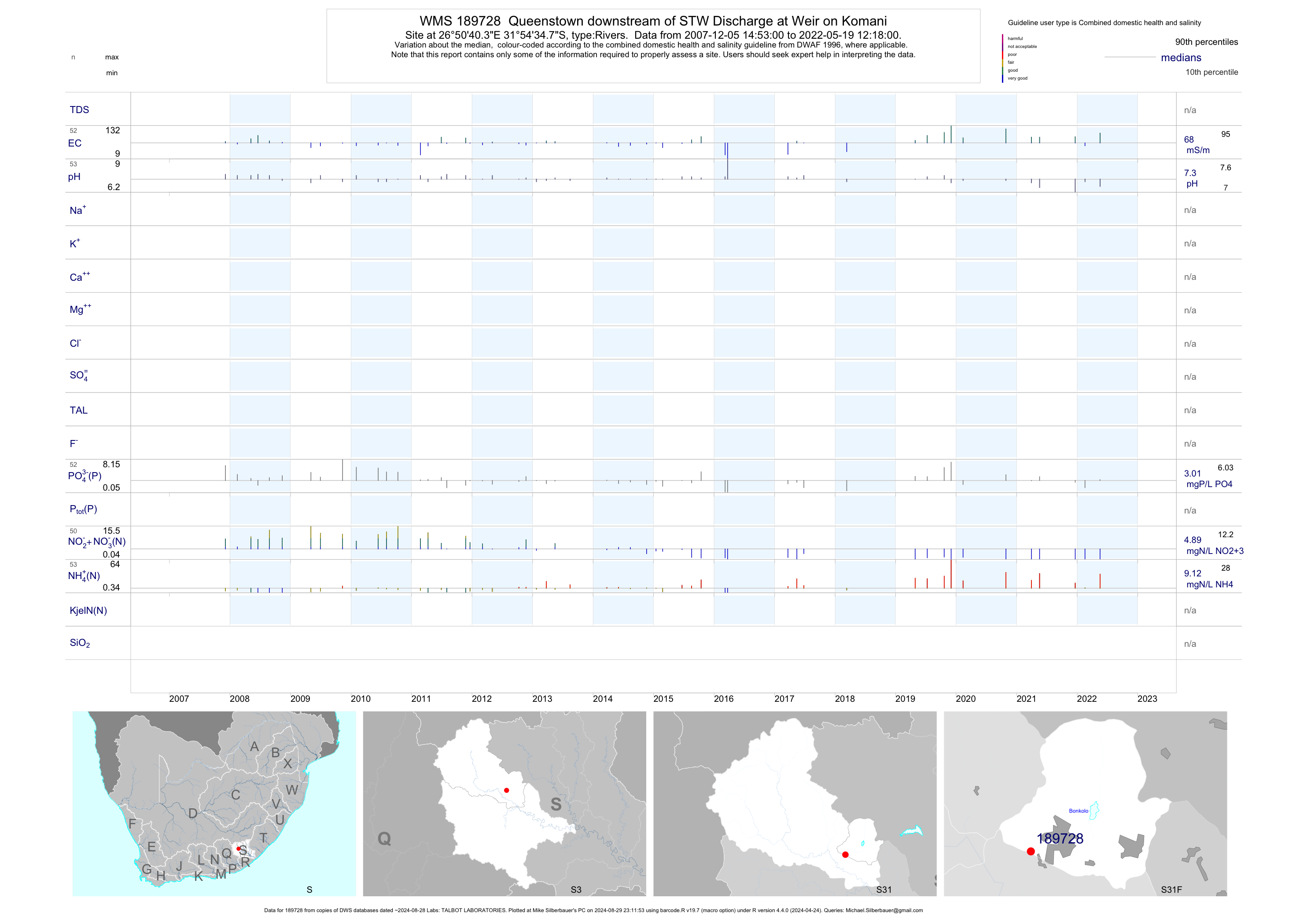
| S31 189728 | plot | data | Queenstown downstream of STW Discharge at Weir on Komani | Rivers | 87 | 2007-12-05 | 2019-04-29 | 67 | 189728 | -31.90967 | 26.84456 |
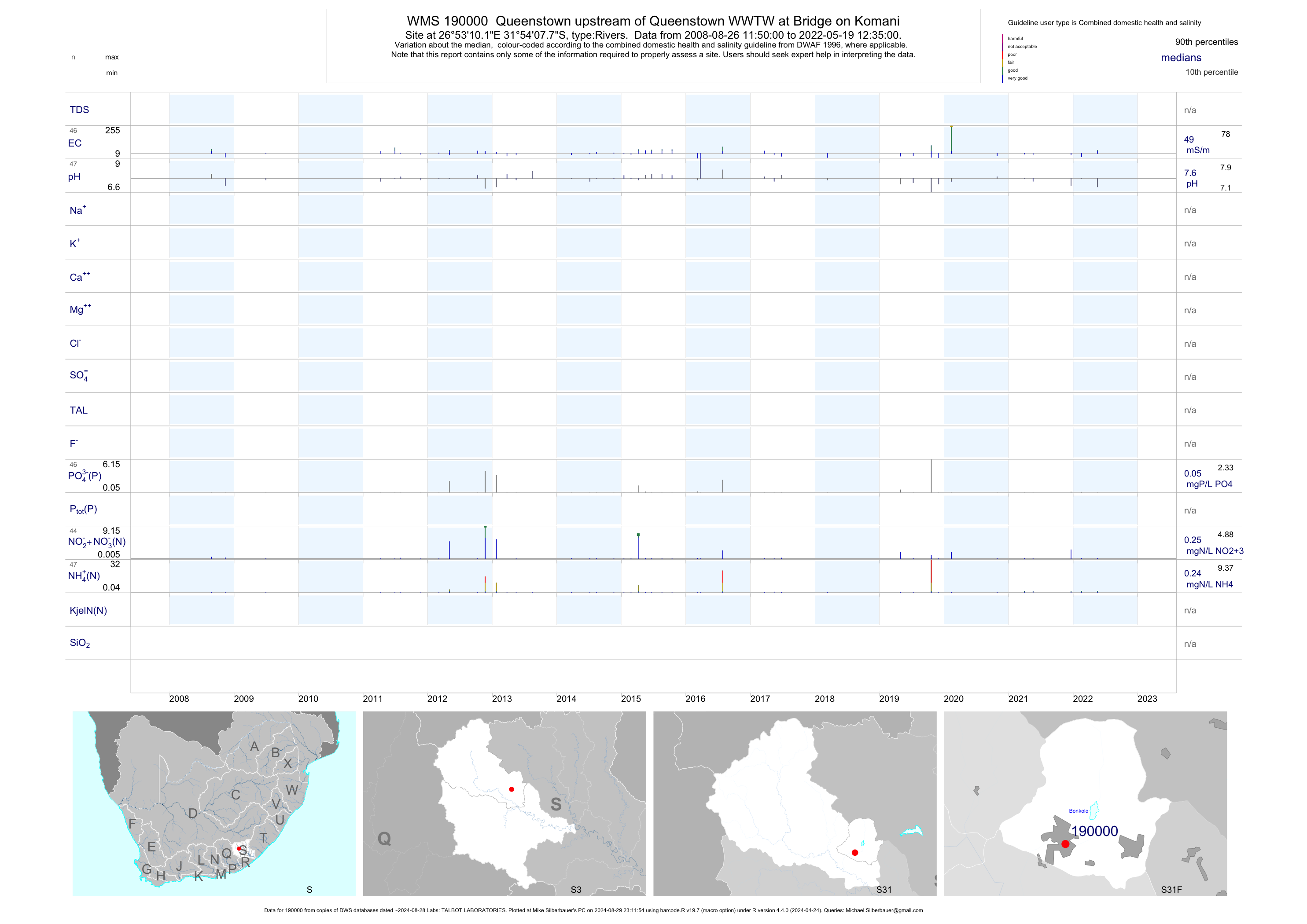
| S31 190000 | plot | data | Queenstown upstream of Queenstown WWTW at Bridge on Komani | Rivers | 68 | 2008-08-26 | 2019-04-29 | 52 | 19- | -31.90214 | 26.88614 |
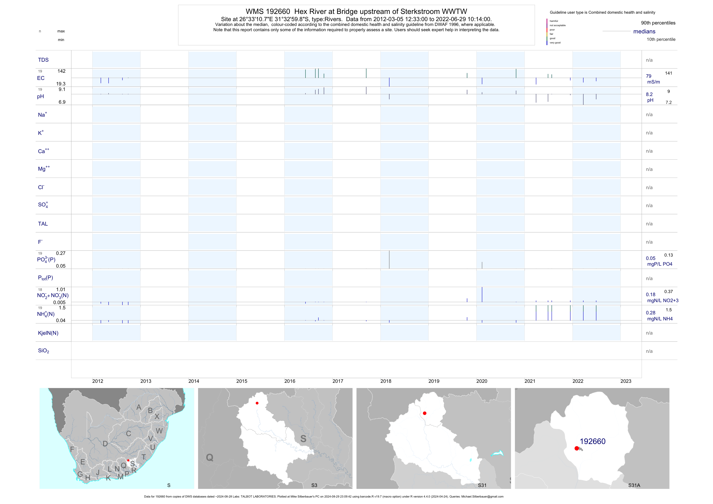
| S31 192660 | plot | data | Hex River at Bridge upstream of Sterkstroom WWTW | Rivers | 20 | 2012-03-05 | 2018-03-08 | 92 | 192660 | -31.54997 | 26.55297 |
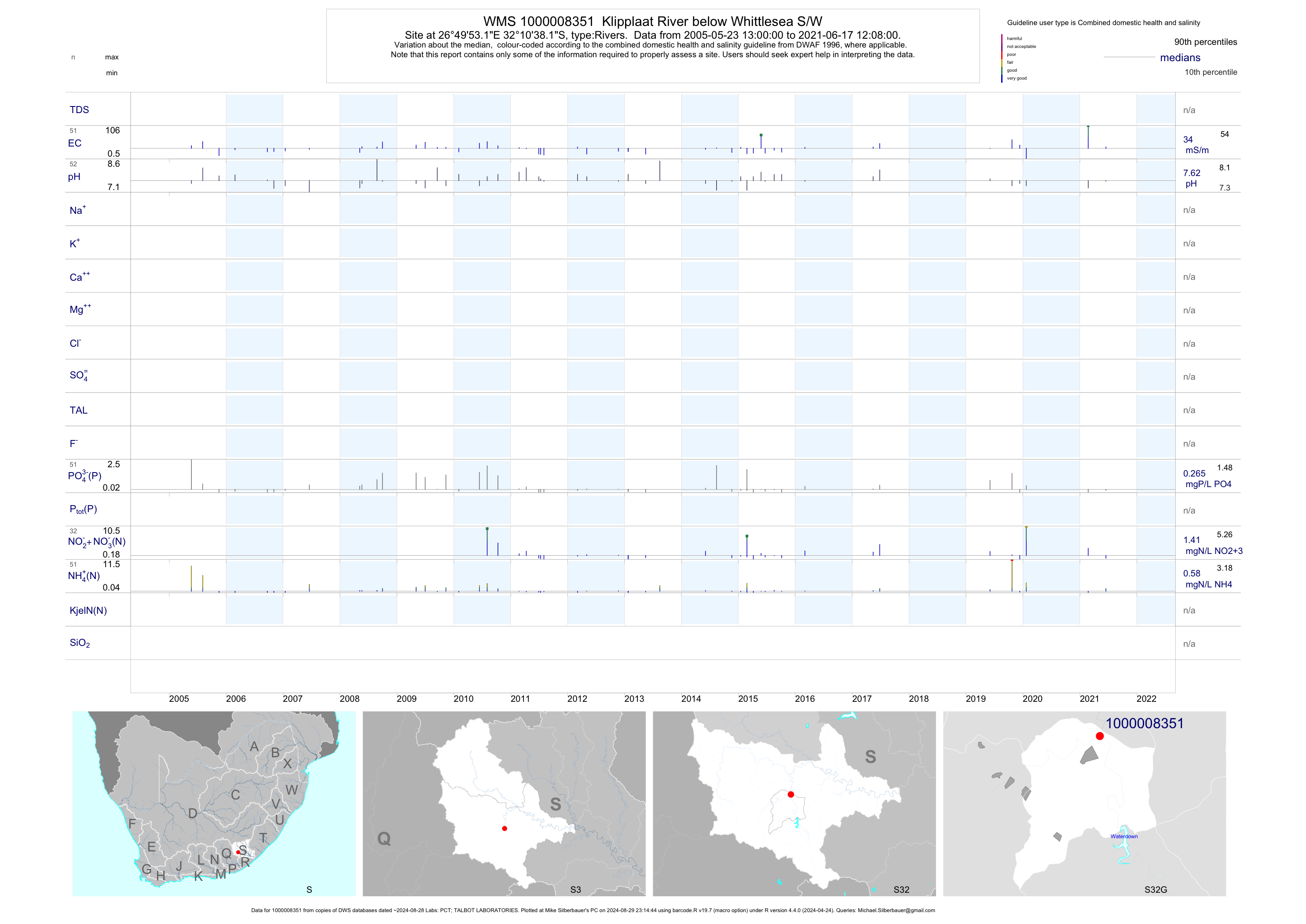
| S32 1000008351 | plot | data | Klipplaat River below Whittlesea S/W | Rivers | 90 | 2005-05-23 | 2017-06-26 | 31 | 1-8351 | -32.17728 | 26.83144 |
| S32 1000008353 | plot | data | Klipplaat River MR0095 Bridge at upstream of Whittlesea WWTW | Rivers | 88 | 2005-05-23 | 2017-06-26 | 28 | 1-8353 | -32.17728 | 26.83153 |
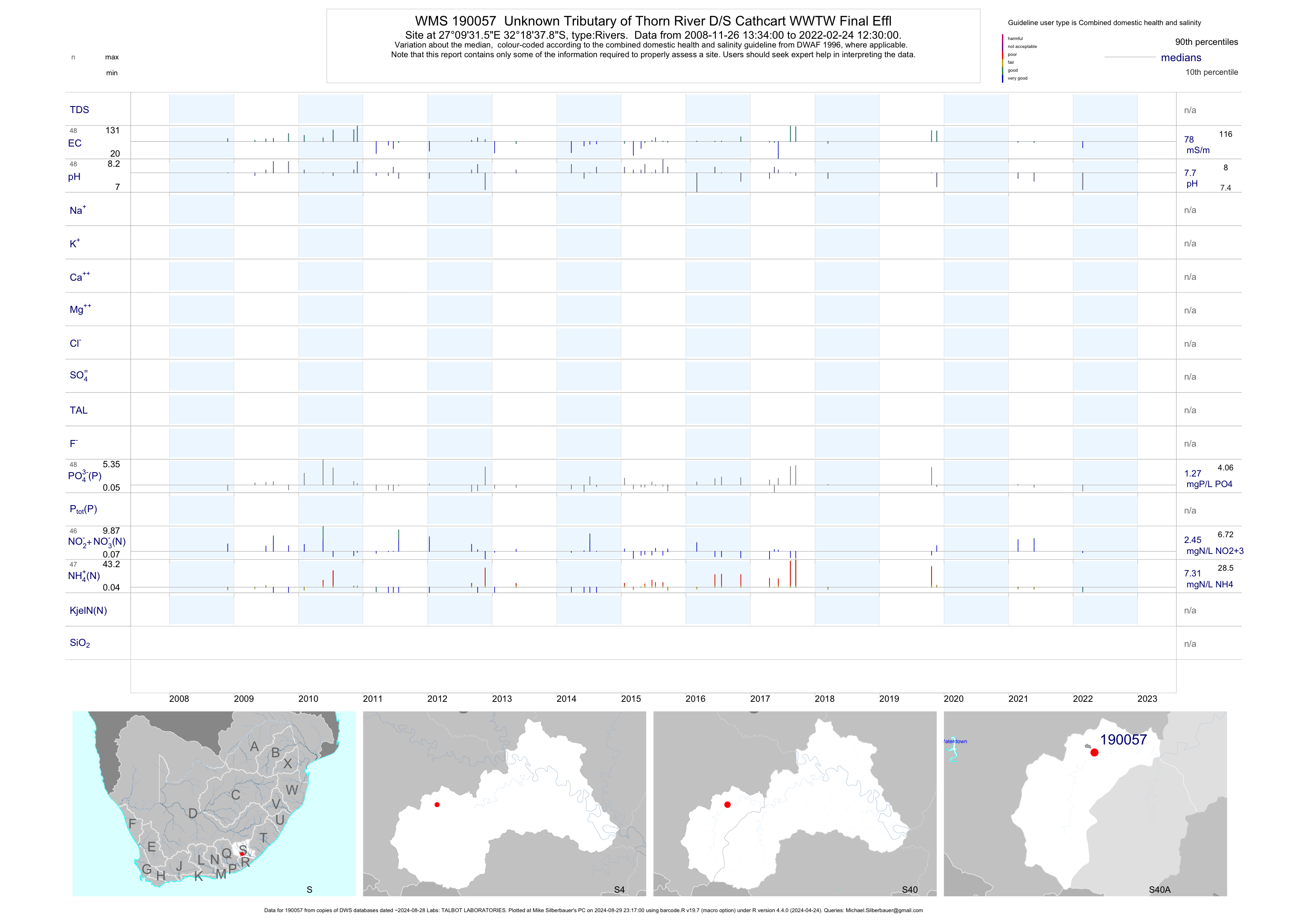
| S40 190057 | plot | data | Unknown Tributary of Thorn River D/S Cathcart WWTW Final Effl | Rivers | 85 | 2008-11-26 | 2018-03-15 | 79 | 190057 | -32.31050 | 27.15878 |
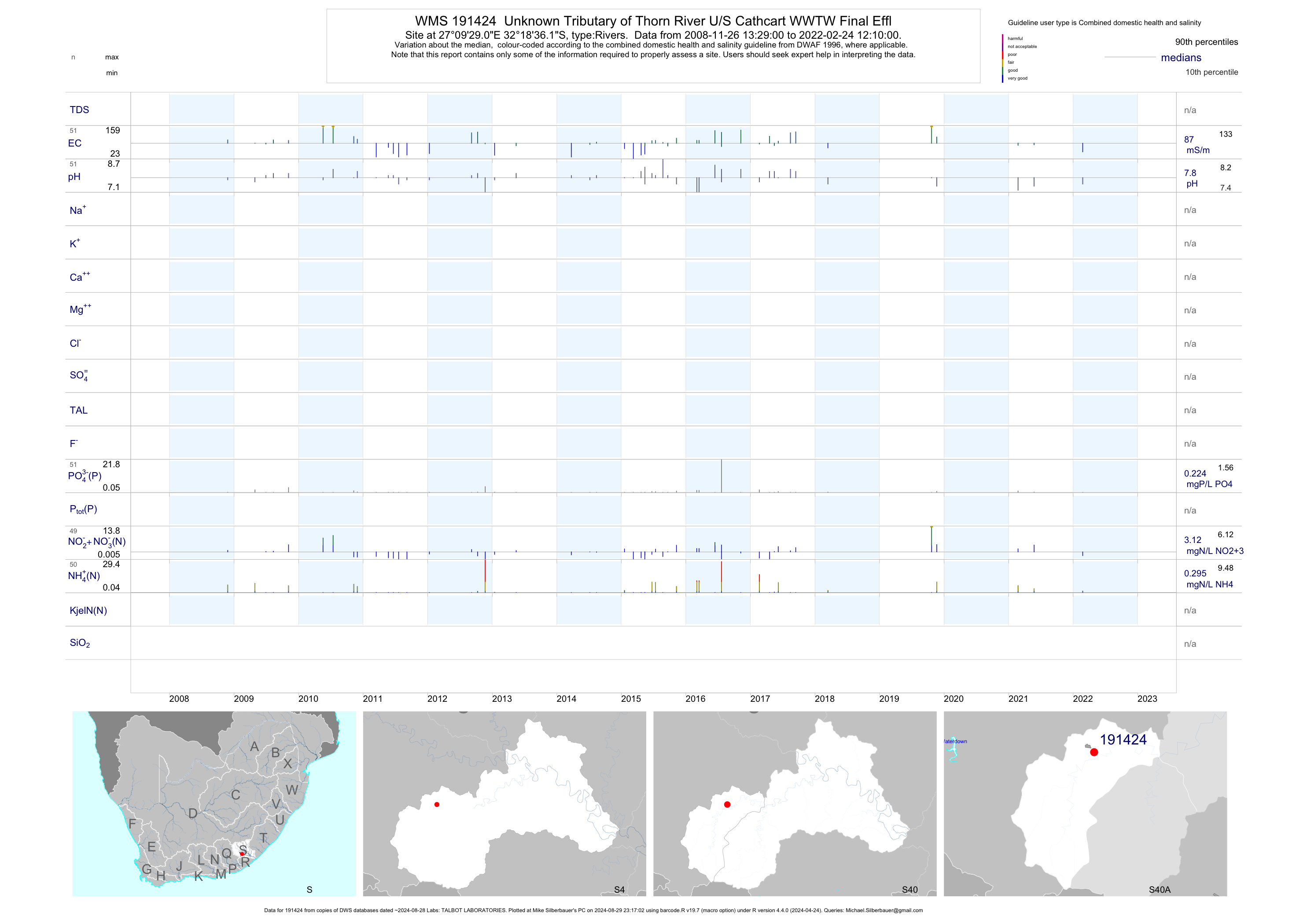
| S40 191424 | plot | data | Unknown Tributary of Thorn River U/S Cathcart WWTW Final Effl | Rivers | 91 | 2008-11-26 | 2018-03-15 | 90 | 191424 | -32.31003 | 27.15806 |
| S40 192645 | plot | data | Thorn River at Weir upstream N6 Bridge to Carthcart | Rivers | 51 | 2012-01-11 | 2018-03-15 | 48 | 192645 | -32.31998 | 27.15718 |
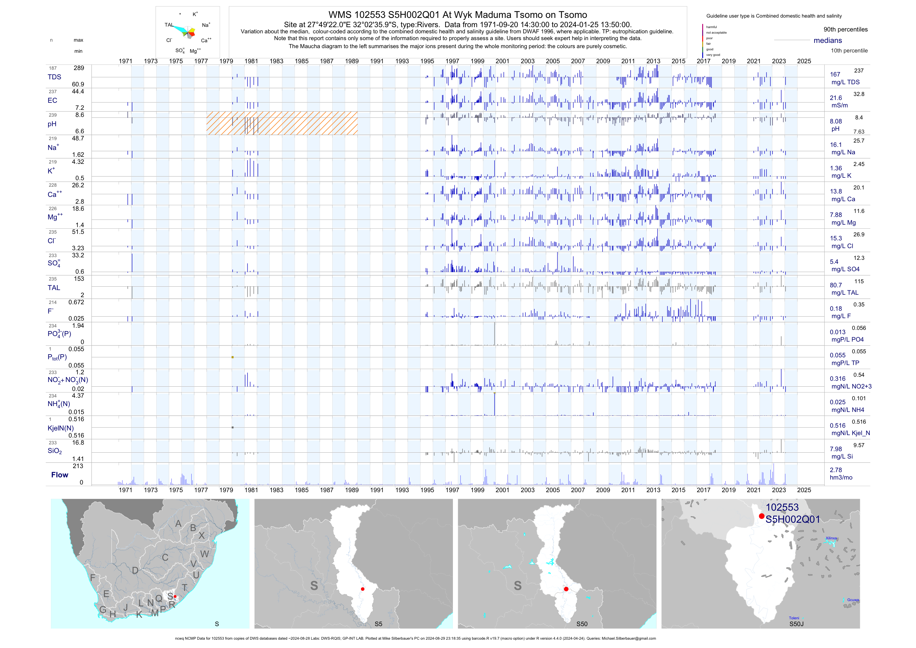
| S50 102553 | plot | data | At Wyk Maduma Tsomo on Tsomo (ncwq NCMP) | Rivers | 226 | 1971-09-20 | 2018-06-23 | 22 | S5H002 | -32.04333 | 27.82278 |
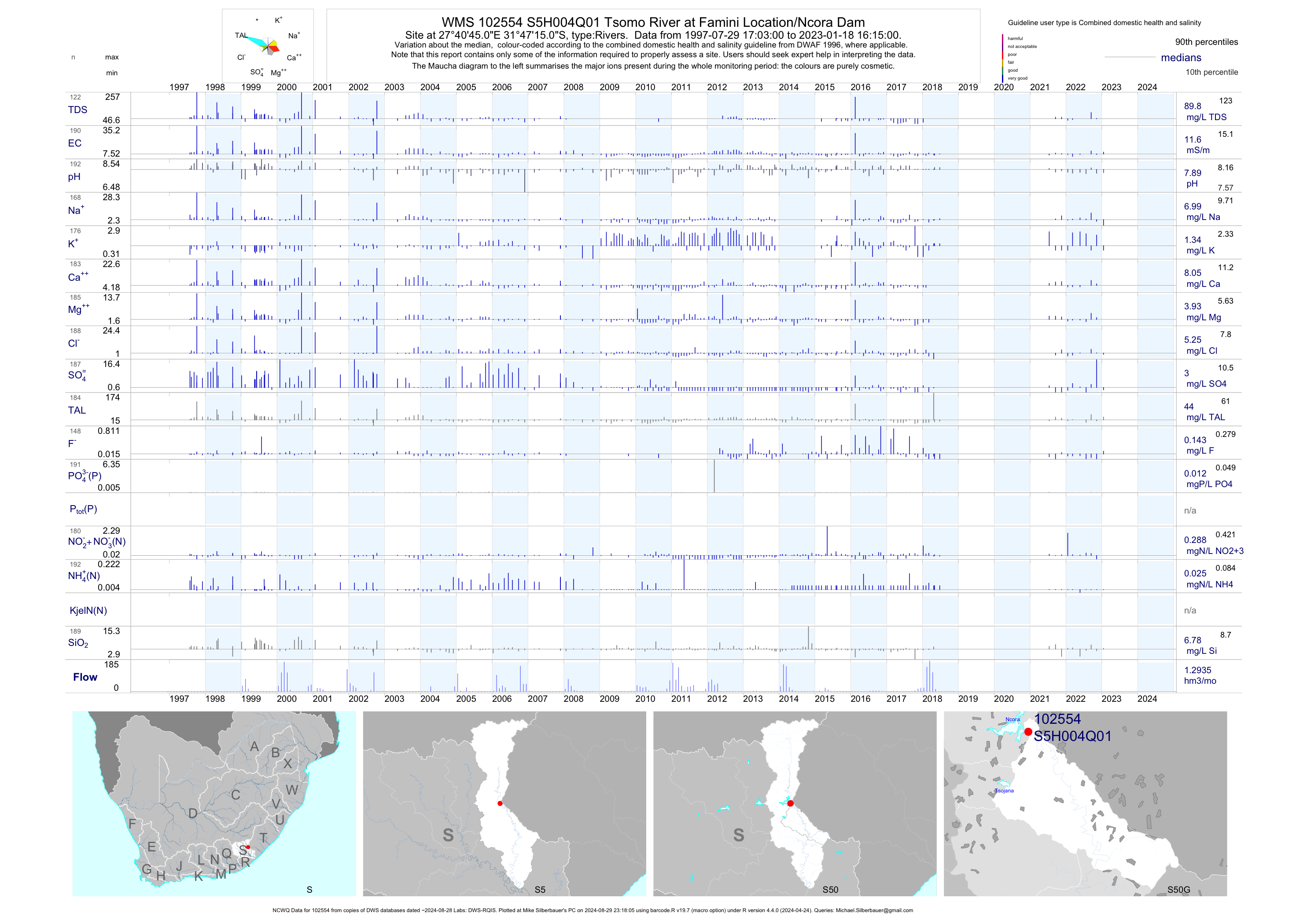
| S50 102554 | plot | data | Tsomo River at Famini Location/Ncora Dam (NCWQ) | Rivers | 182 | 1997-07-29 | 2018-06-25 | 12 | S5H004 | -31.78750 | 27.67917 |
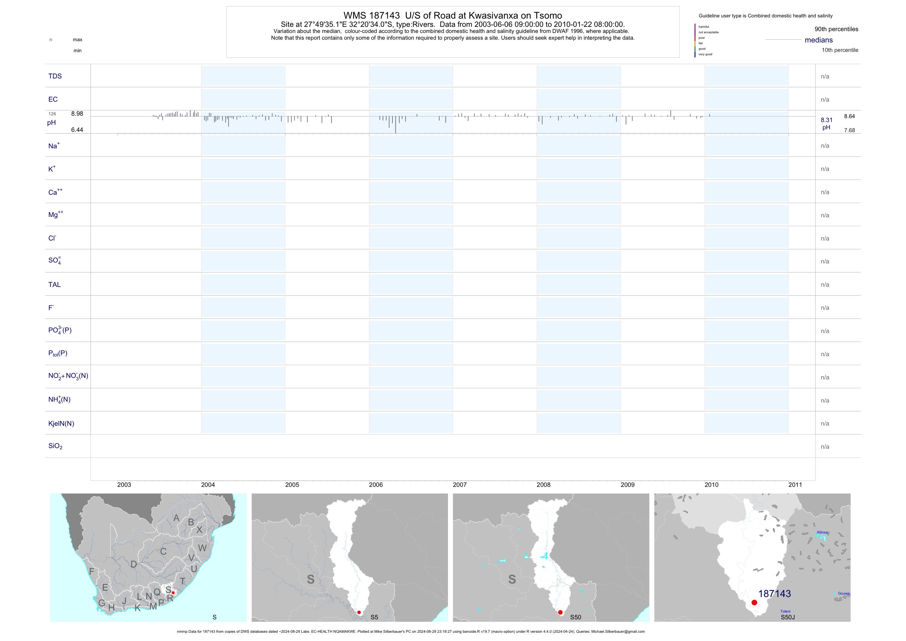
| S50 187143 | plot | data | U/S of Road at Kwasivanxa on Tsomo (nmmp) | Rivers | 379 | 2003-06-06 | 2010-01-22 | n/a | 187143 | -32.34280 | 27.82643 |
| S50 187146 | plot | data | Upper Ngculu Village at Nqamakwe on Ngculu (nmmp) | Rivers | 410 | 2003-05-22 | 2013-07-10 | n/a | 187146 | -32.19269 | 27.92752 |
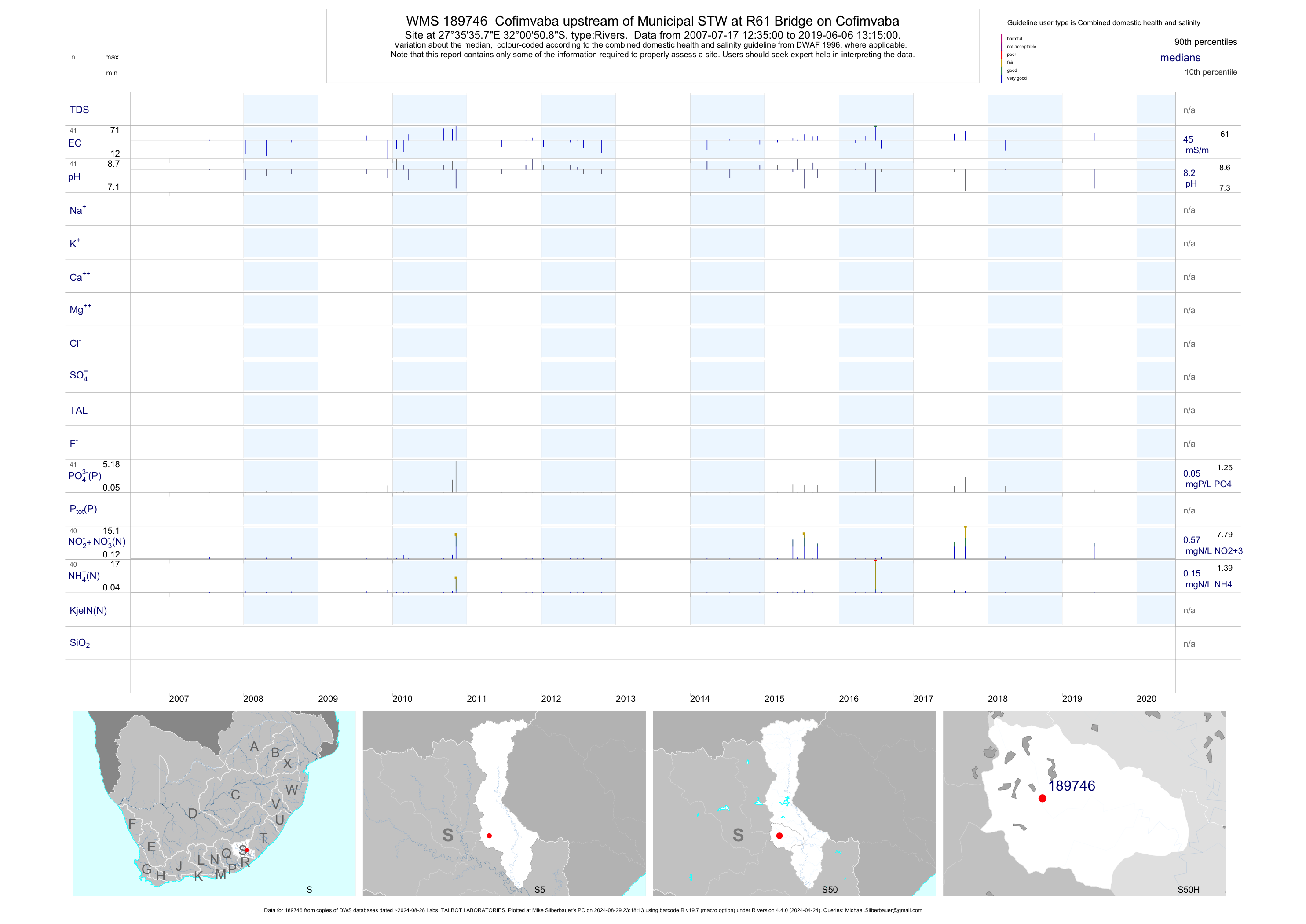
| S50 189746 | plot | data | Cofimvaba upstream of Municipal STW at R61 Bridge on Cofimvaba | Rivers | 69 | 2007-07-17 | 2019-06-06 | 45 | 189746 | -32.01414 | 27.59325 |
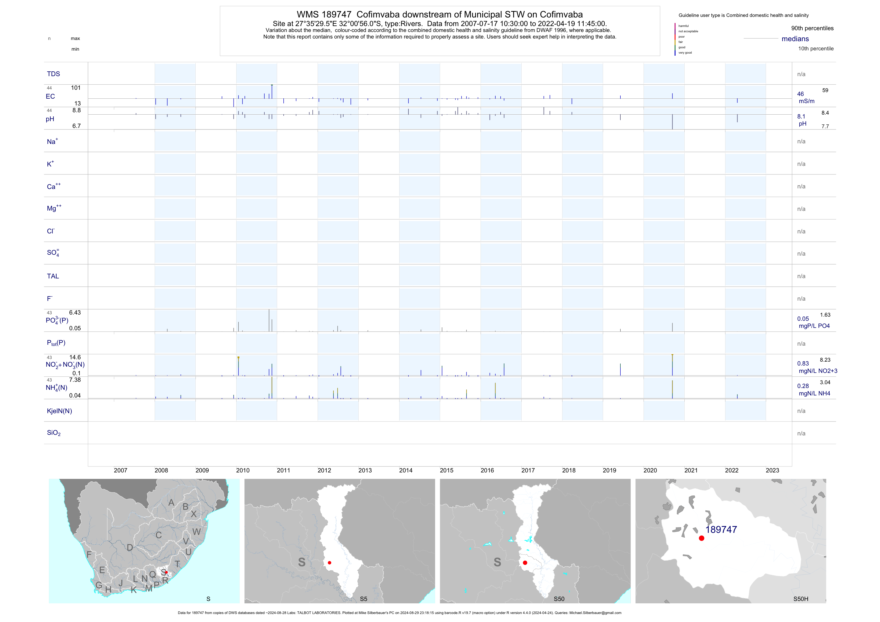
| S50 189747 | plot | data | Cofimvaba downstream of Municipal STW on Cofimvaba | Rivers | 72 | 2007-07-17 | 2019-06-06 | 46 | 189747 | -32.01556 | 27.59156 |
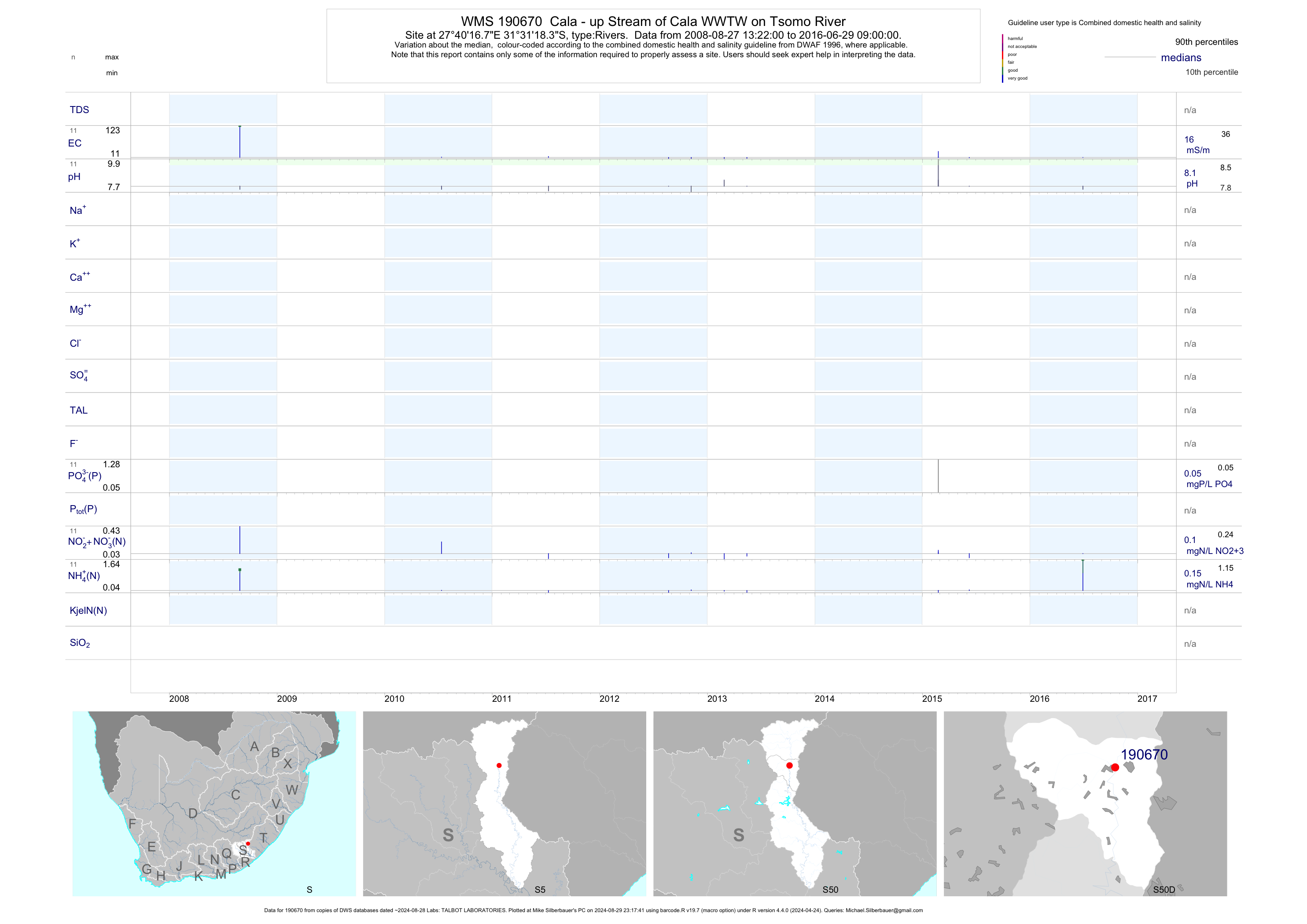
| S50 190670 | plot | data | Cala - up Stream of Cala WWTW on Tsomo River | Rivers | 23 | 2008-08-27 | 2016-06-29 | 16 | 190670 | -31.52176 | 27.67133 |
| S50 190671 | plot | data | Cala - Down Stream of Cala WWTW on Tsomo River | Rivers | 23 | 2008-08-27 | 2016-06-29 | 15 | 190671 | -31.52562 | 27.67128 |
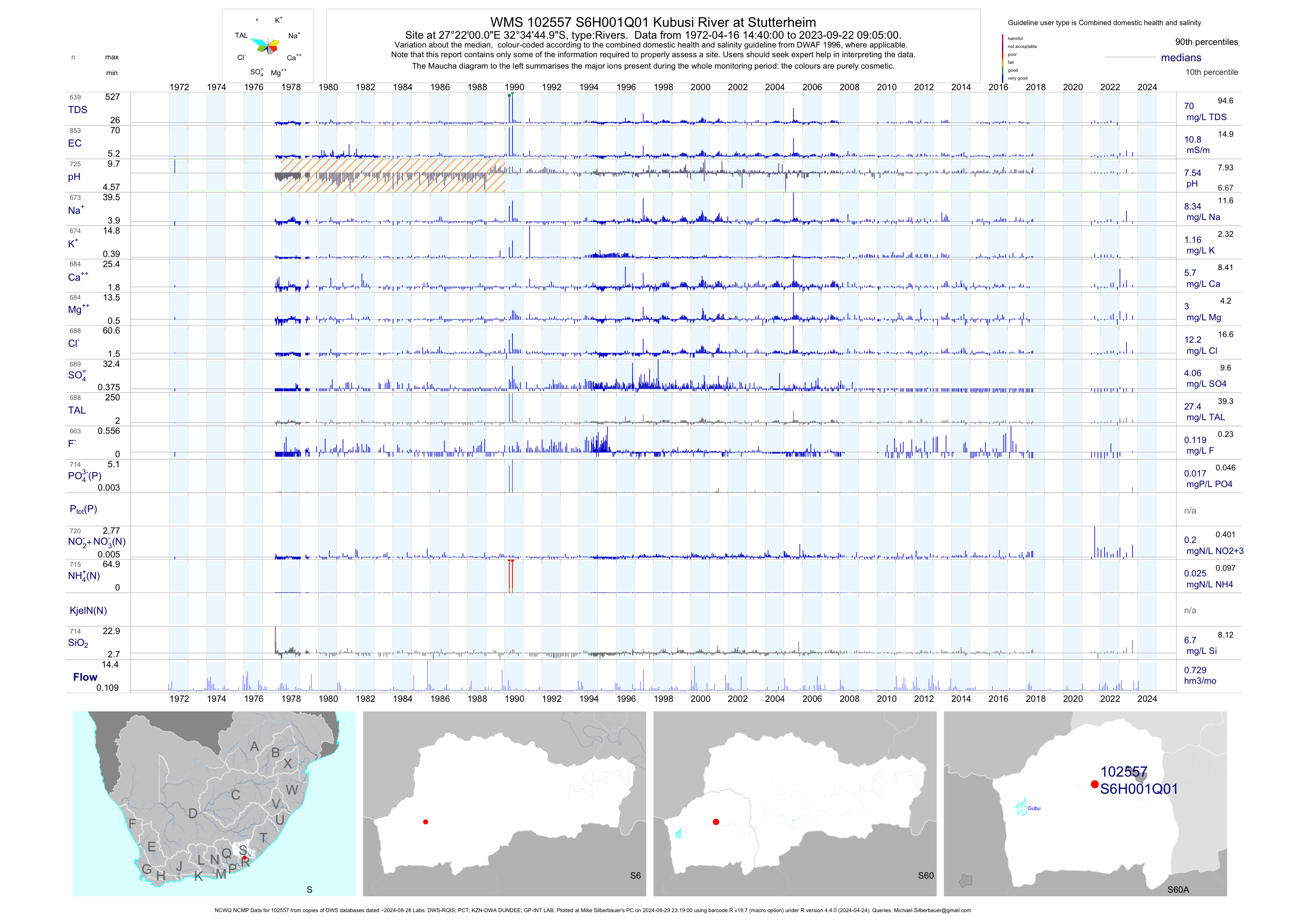
| S60 102557 | plot | data | Kubusi River at Stutterheim (NCWQ NCMP) | Rivers | 857 | 1952-11-10 | 2018-05-14 | 11 | S6H001 | -32.57917 | 27.36667 |
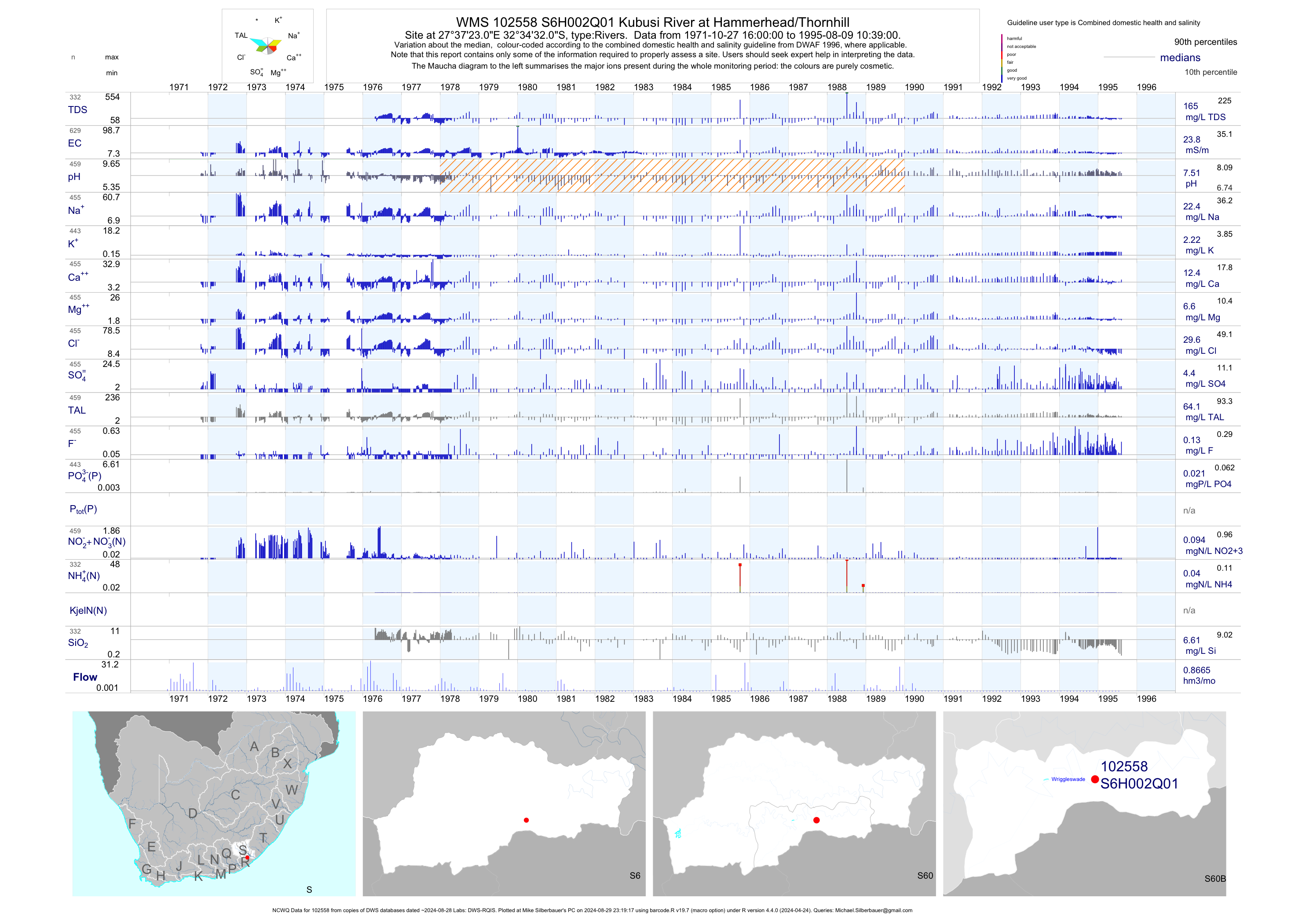
| S60 102558 | plot | data | Kubusi River at Hammerhead/Thornhill (NCWQ) | Rivers | 734 | 1971-10-27 | 1995-08-09 | 24 | S6H002 | -32.57556 | 27.62306 |
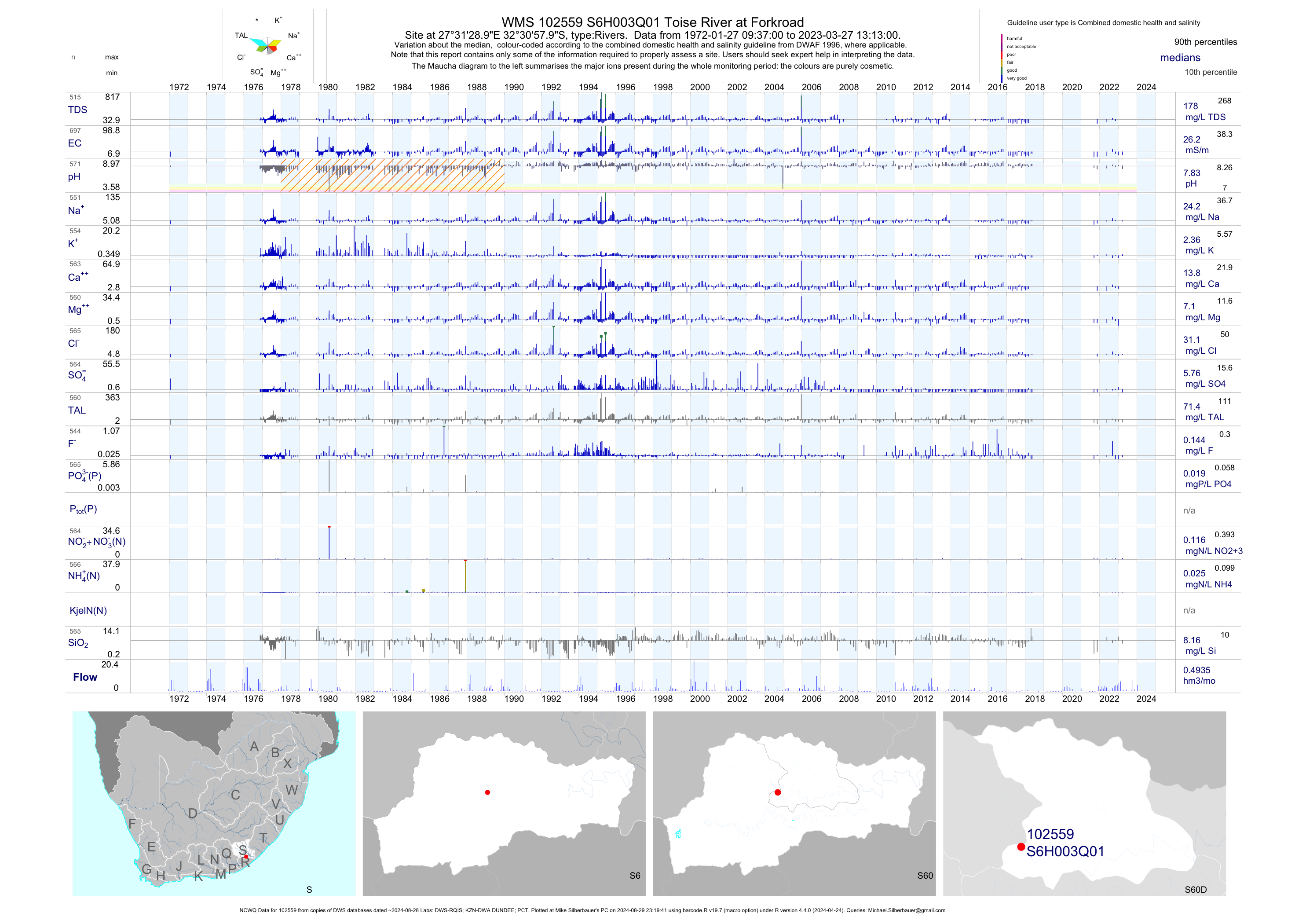
| S60 102559 | plot | data | Toise River at Forkroad (NCWQ) | Rivers | 784 | 1972-01-27 | 2018-05-16 | 26 | S6H003 | -32.51611 | 27.52472 |
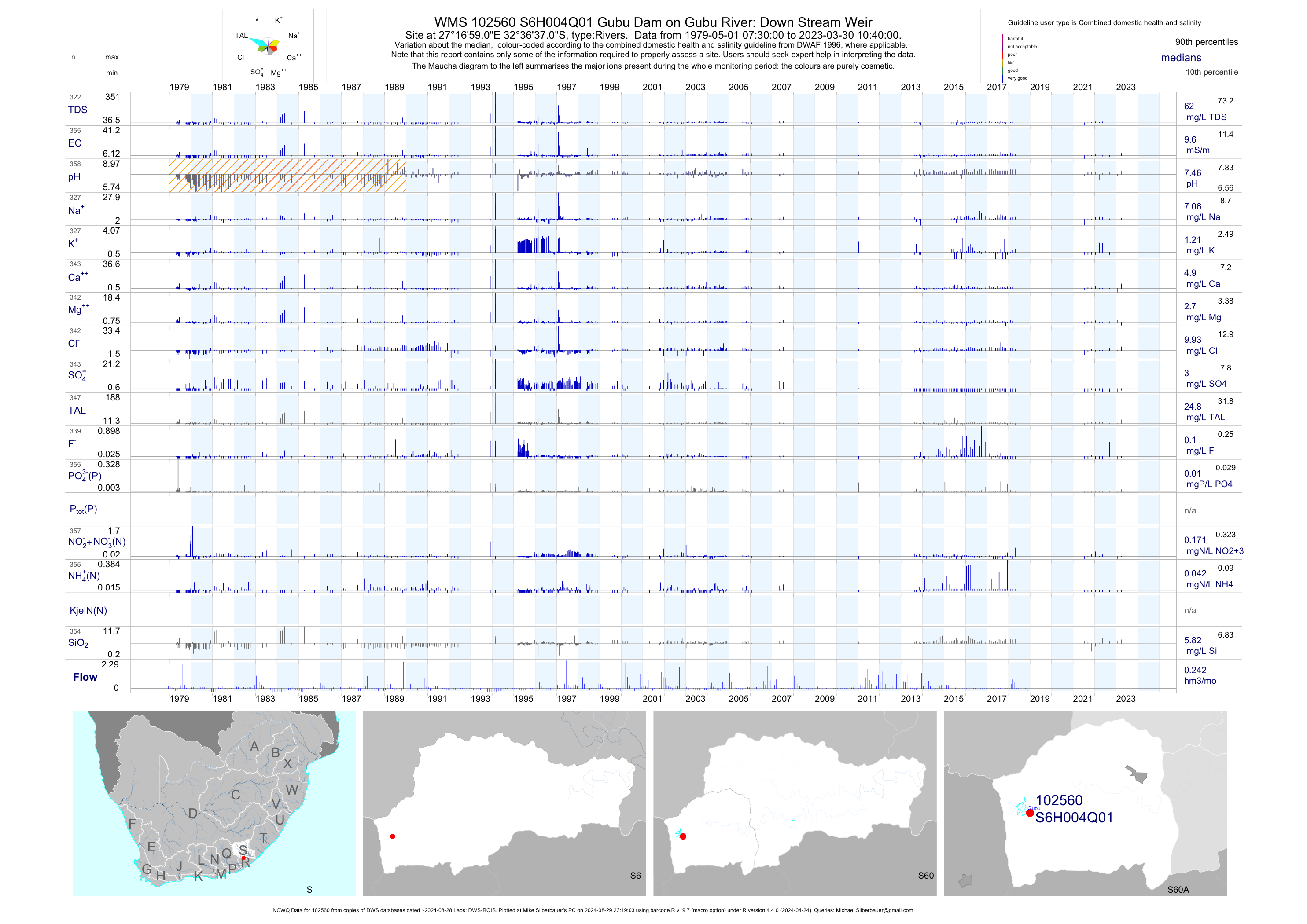
| S60 102560 | plot | data | Gubu Dam on Gubu River: Down Stream Weir (NCWQ) | Rivers | 355 | 1979-05-01 | 2018-04-23 | 10 | S6H004 | -32.61028 | 27.28306 |
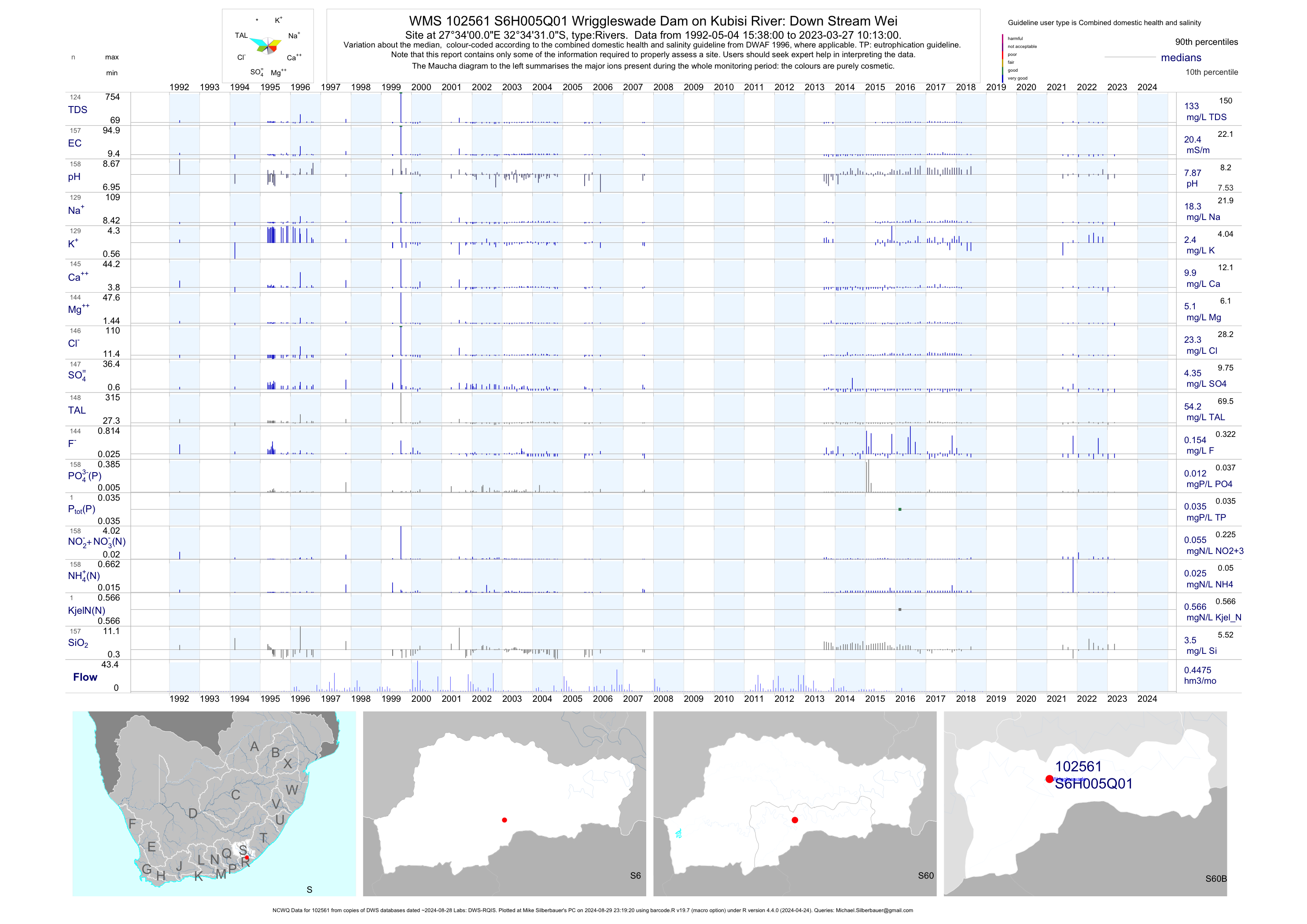
| S60 102561 | plot | data | Wriggleswade Dam on Kubisi River: Down Stream Wei (NCWQ) | Rivers | 210 | 1992-05-04 | 2018-06-28 | 20 | S6H005 | -32.57528 | 27.56667 |
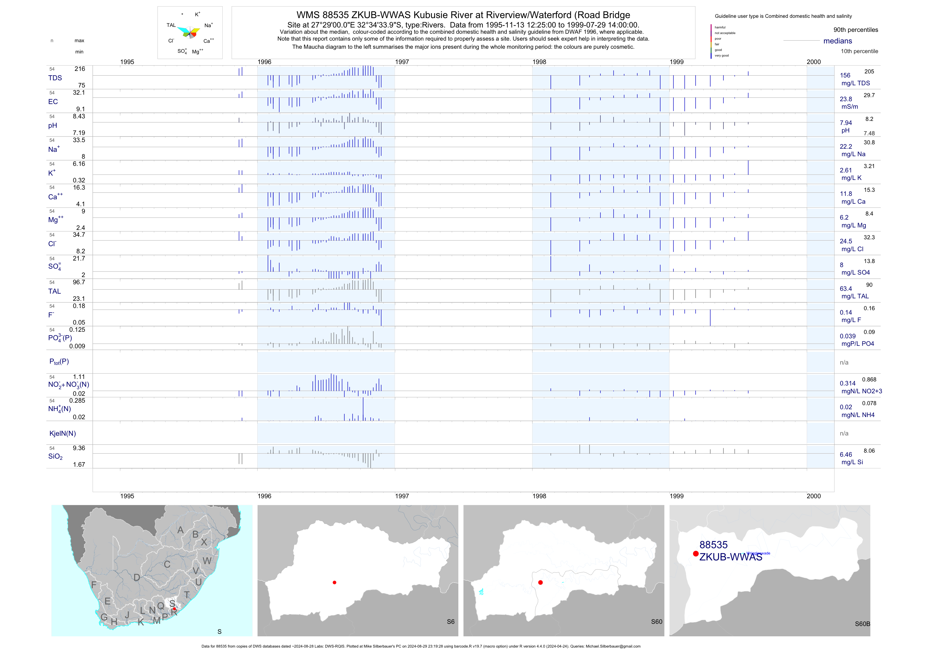
| S60 88535 | plot | data | Kubusie River at Riverview/Waterford (Road Bridge | Rivers | 108 | 1994-11-08 | 1999-07-29 | 24 | ZKUB-WWAS | -32.57611 | 27.48333 |
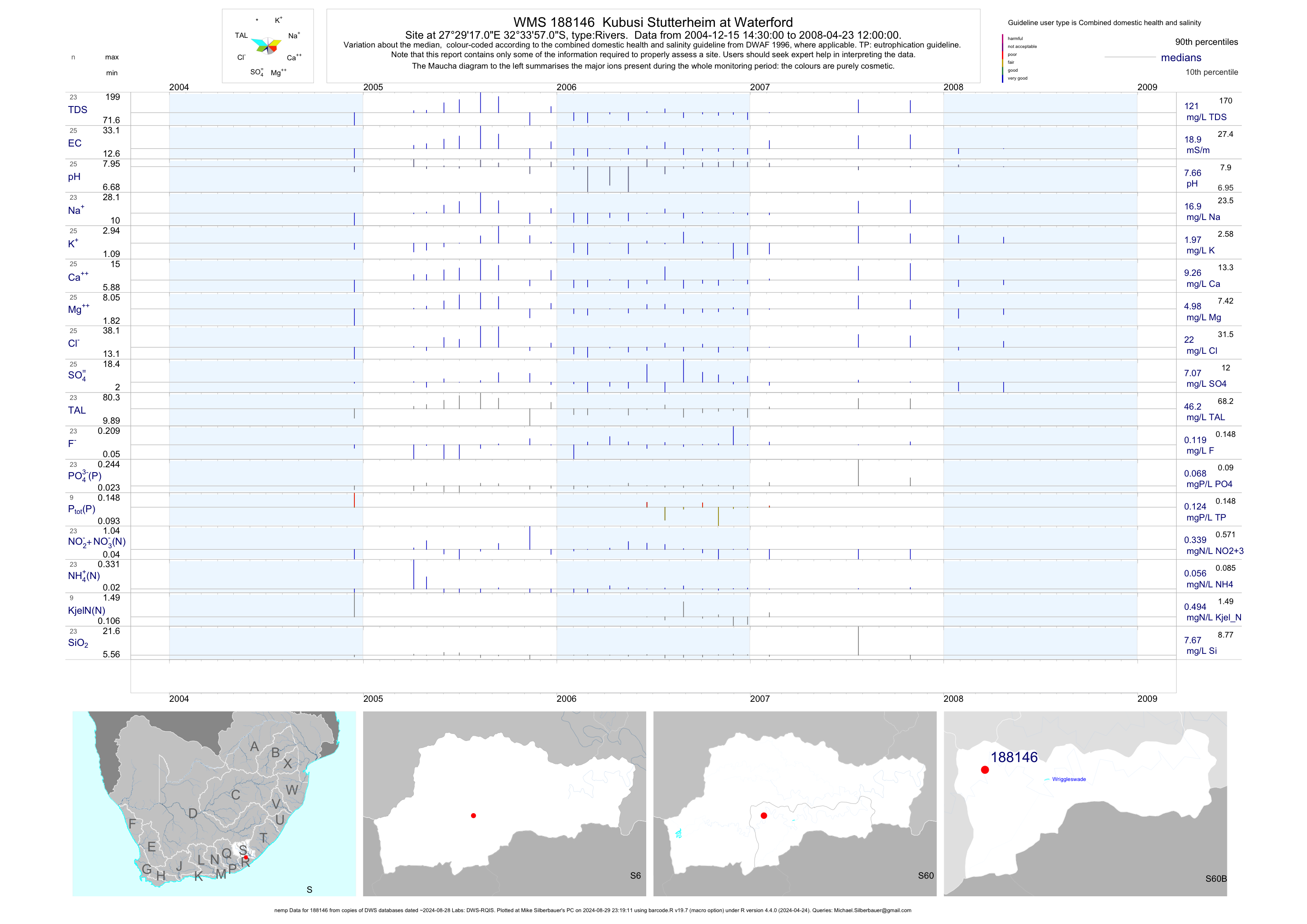
| S60 188146 | plot | data | Kubusi Stutterheim at Waterford (nemp) | Rivers | 25 | 2004-12-15 | 2008-04-23 | 19 | 188146 | -32.56583 | 27.48806 |
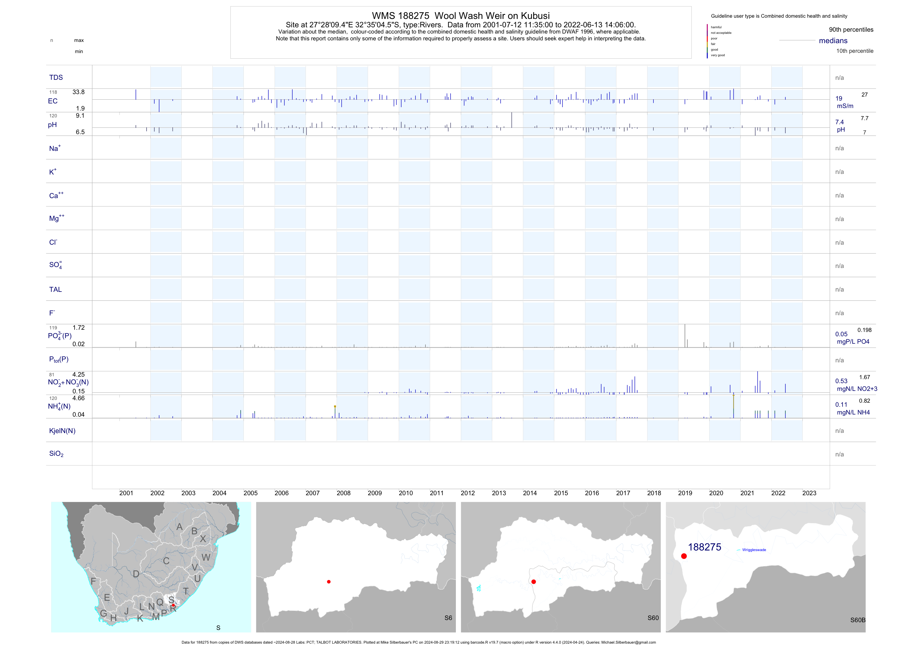
| S60 188275 | plot | data | Wool Wash Weir on Kubusi | Rivers | 206 | 2001-07-12 | 2019-04-17 | 19 | 188275 | -32.58461 | 27.46928 |
| S60 188276 | plot | data | Mundell S Farm on Cumakala | Rivers | 206 | 2000-07-28 | 2019-04-17 | 26 | 188276 | -32.58750 | 27.43628 |
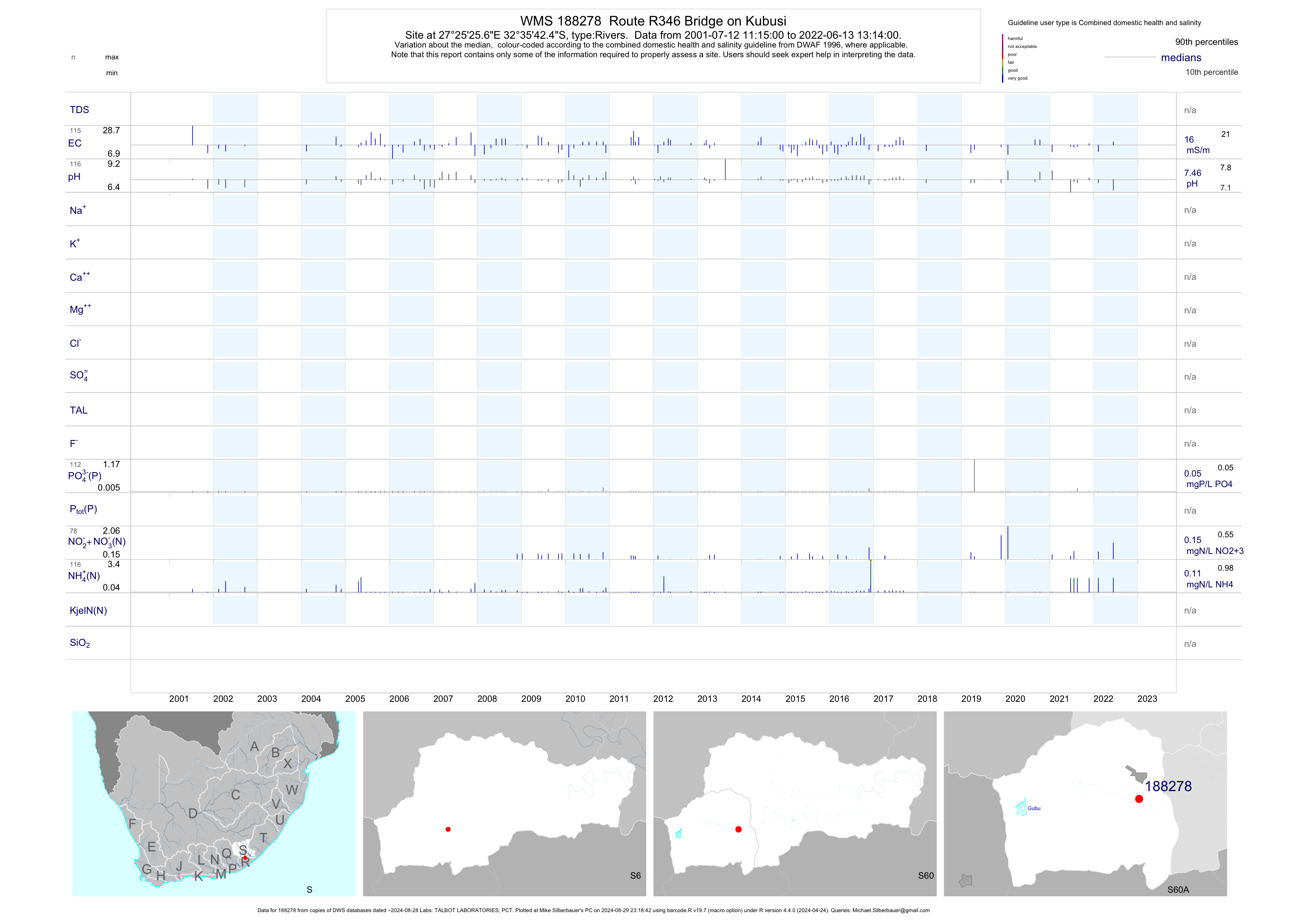
| S60 188278 | plot | data | Route R346 Bridge on Kubusi | Rivers | 199 | 2001-07-12 | 2019-04-17 | 16 | 188278 | -32.59511 | 27.42378 |
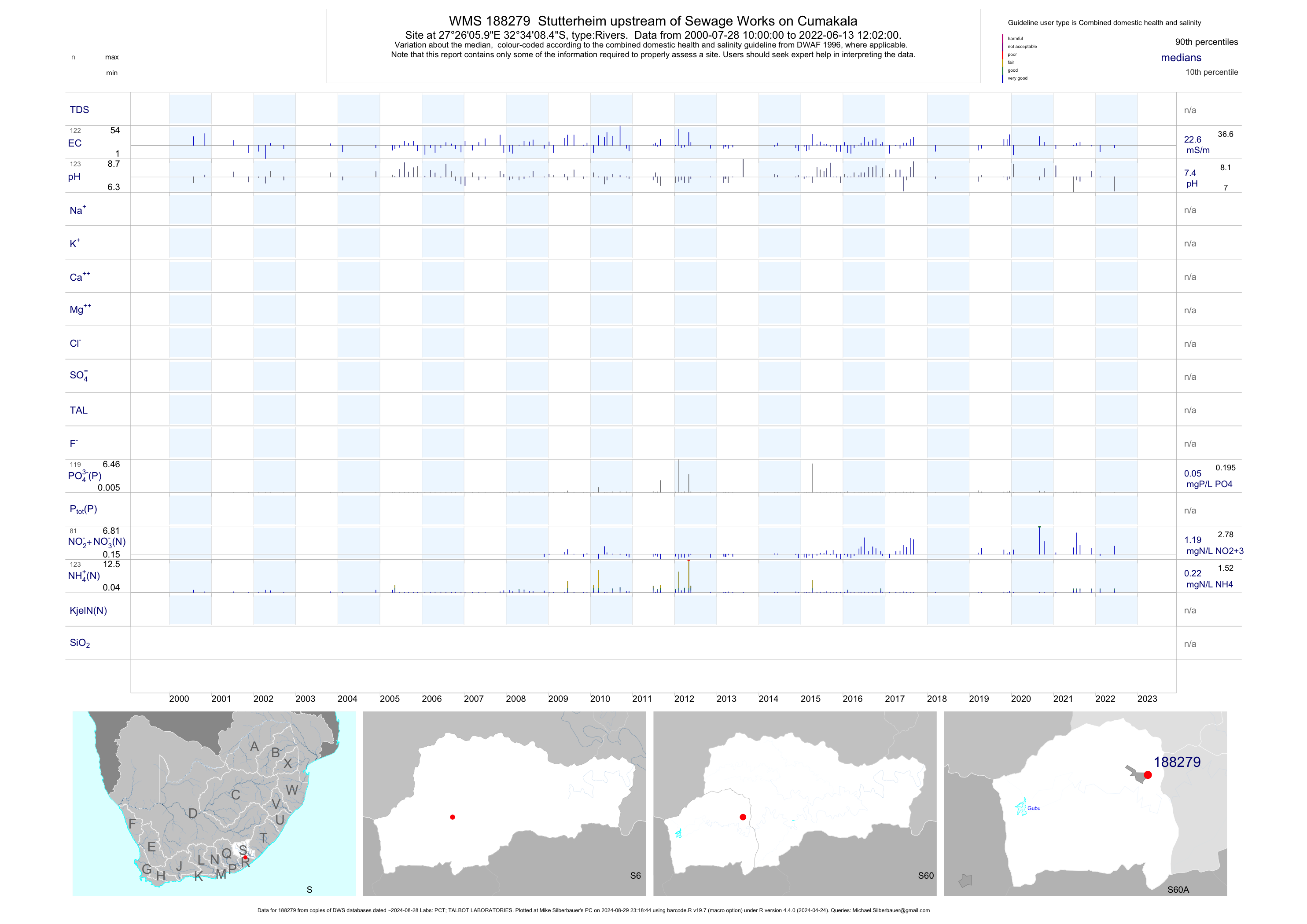
| S60 188279 | plot | data | Stutterheim upstream of Sewage Works on Cumakala | Rivers | 208 | 2000-07-28 | 2019-04-17 | 23 | 188279 | -32.56900 | 27.43500 |
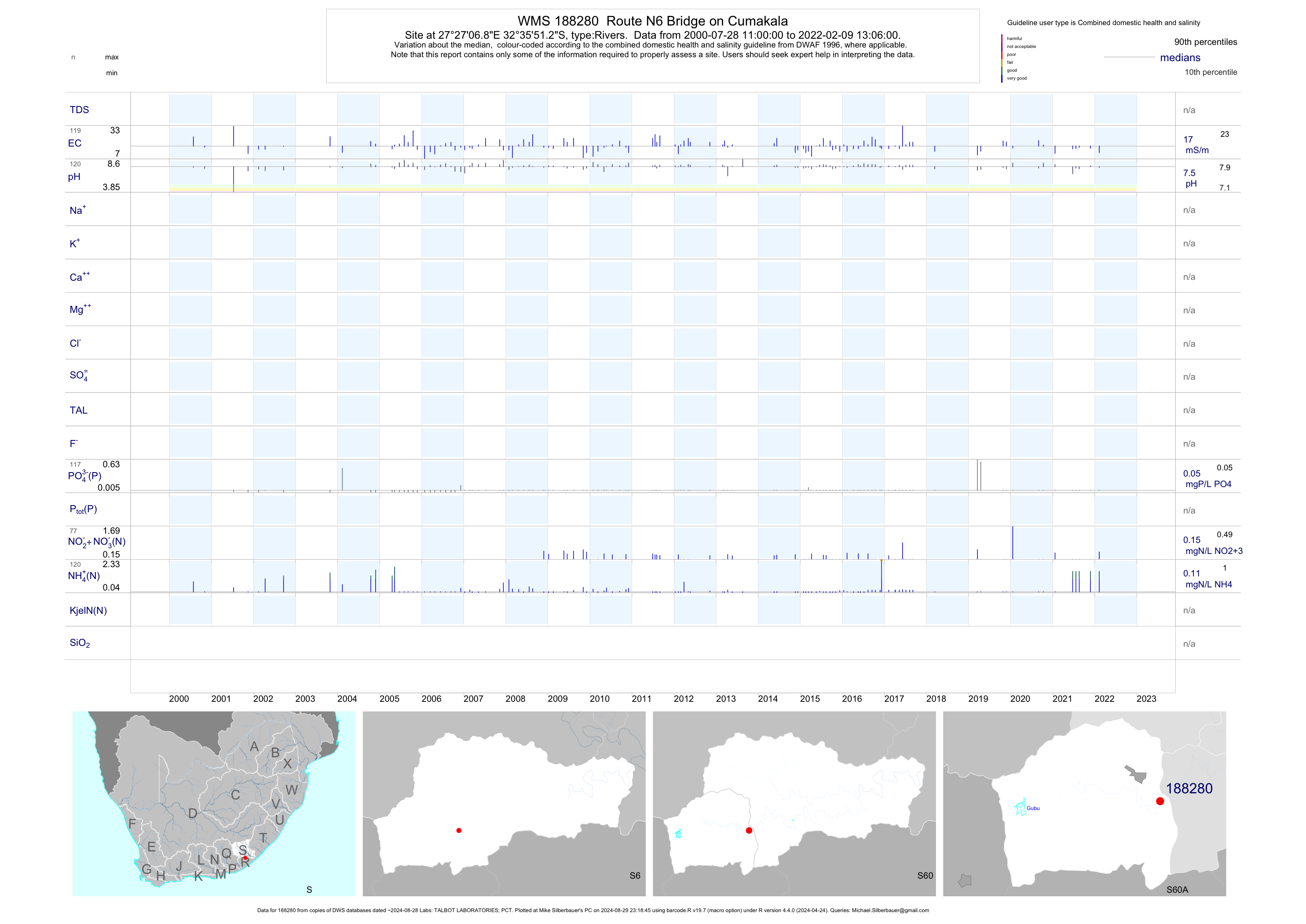
| S60 188280 | plot | data | Route N6 Bridge on Cumakala | Rivers | 208 | 2000-07-28 | 2019-04-17 | 17 | 188280 | -32.59756 | 27.45192 |
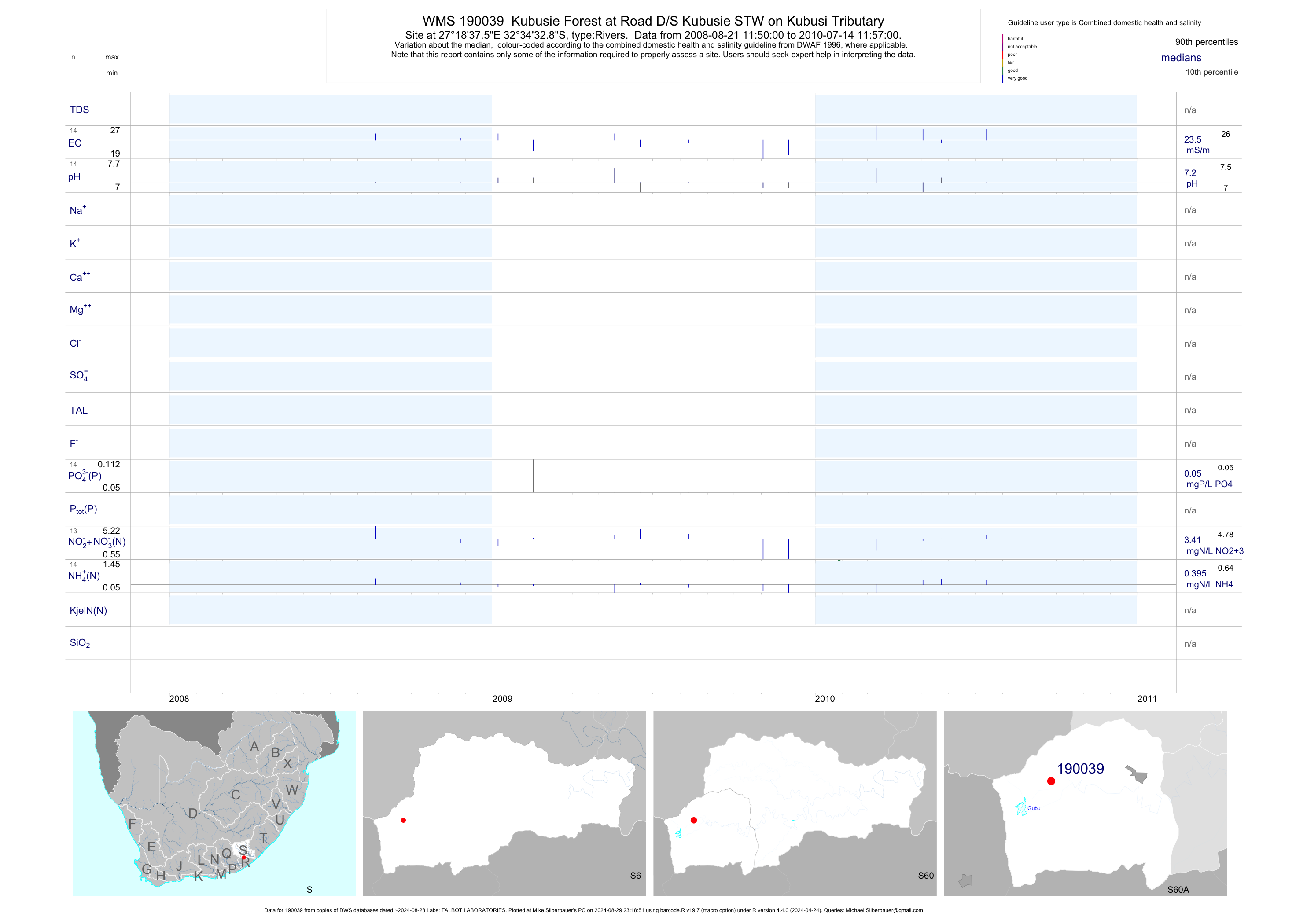
| S60 190039 | plot | data | Kubusie Forest at Road D/S Kubusie STW on Kubusi Tributary | Rivers | 28 | 2008-08-21 | 2010-07-14 | 24 | 190039 | -32.57578 | 27.31042 |
| S60 190731 | plot | data | Stutterheim - at Rd Bridge on Cumakala Trib ds of Stutterheim Solid Waste S | Rivers | 141 | 2008-11-26 | 2019-04-17 | 36 | 190731 | -32.55783 | 27.43672 |
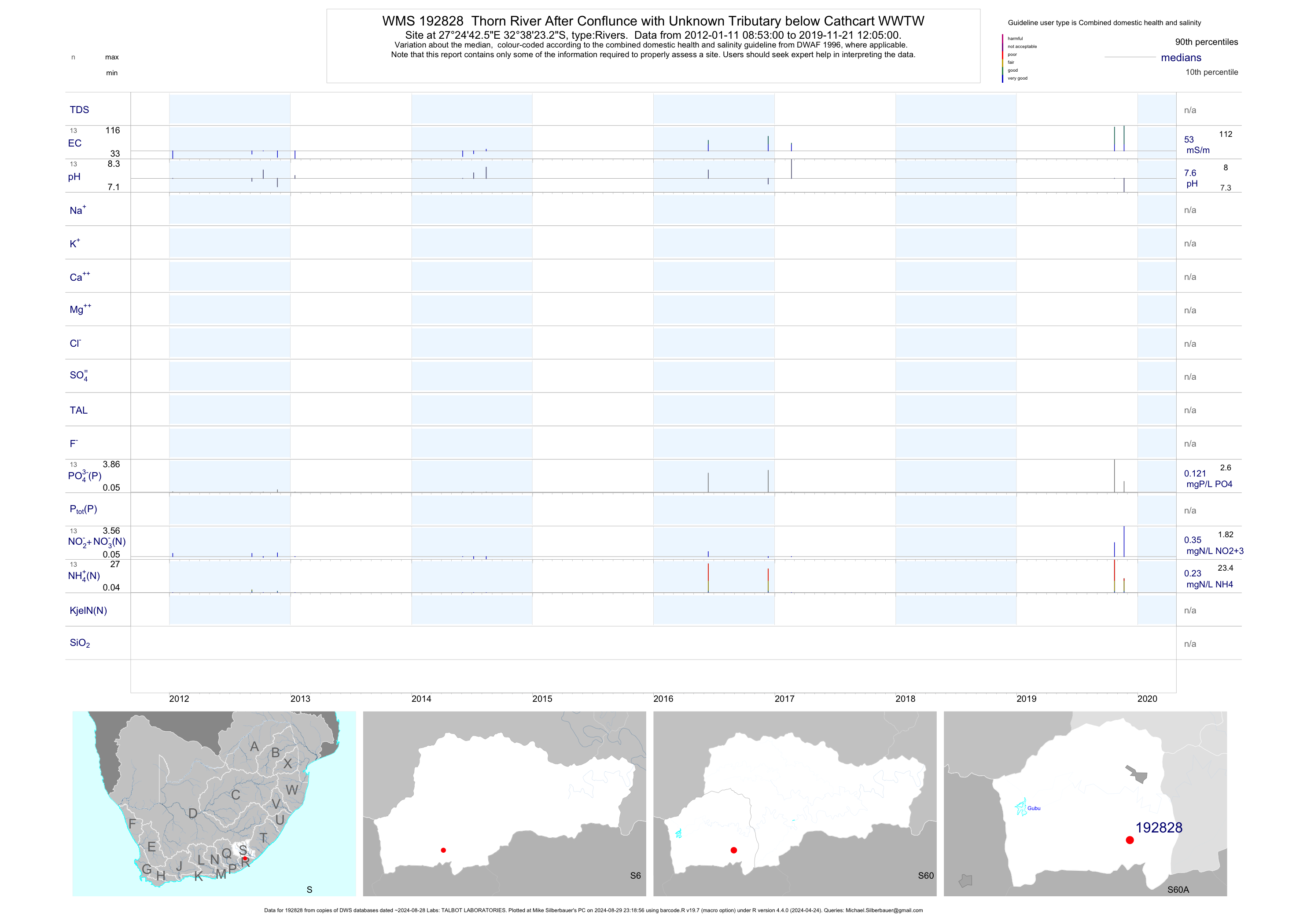
| S60 192828 | plot | data | Thorn River After Conflunce with Unknown Tributary below Cathcart WWTW | Rivers | 23 | 2012-01-11 | 2018-03-15 | 46 | 192828 | -32.63981 | 27.41181 |
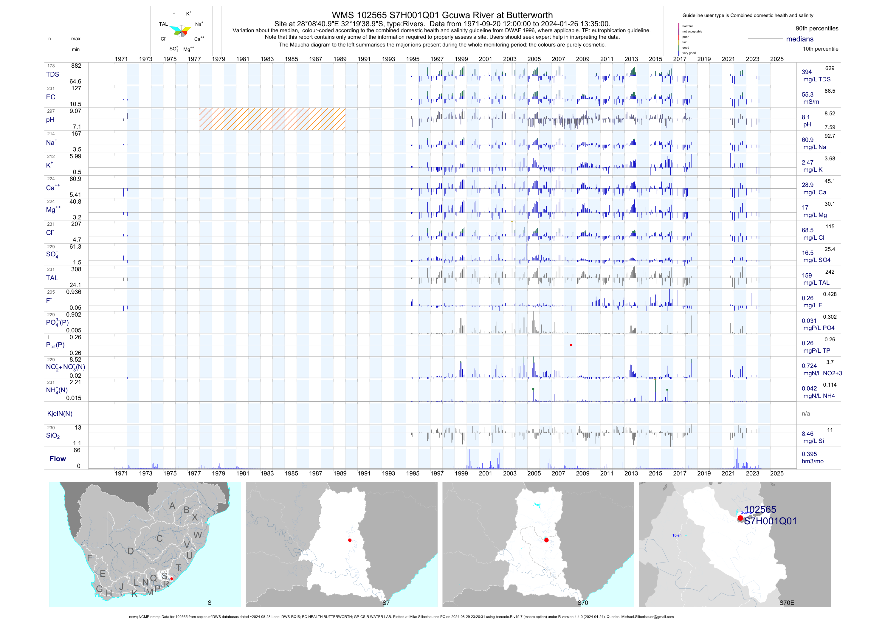
| S70 102565 | plot | data | Gcuwa River at Butterworth (ncwq NCMP nmmp) | Rivers | 414 | 1971-09-20 | 2018-06-27 | 56 | S7H001 | -32.32750 | 28.14472 |
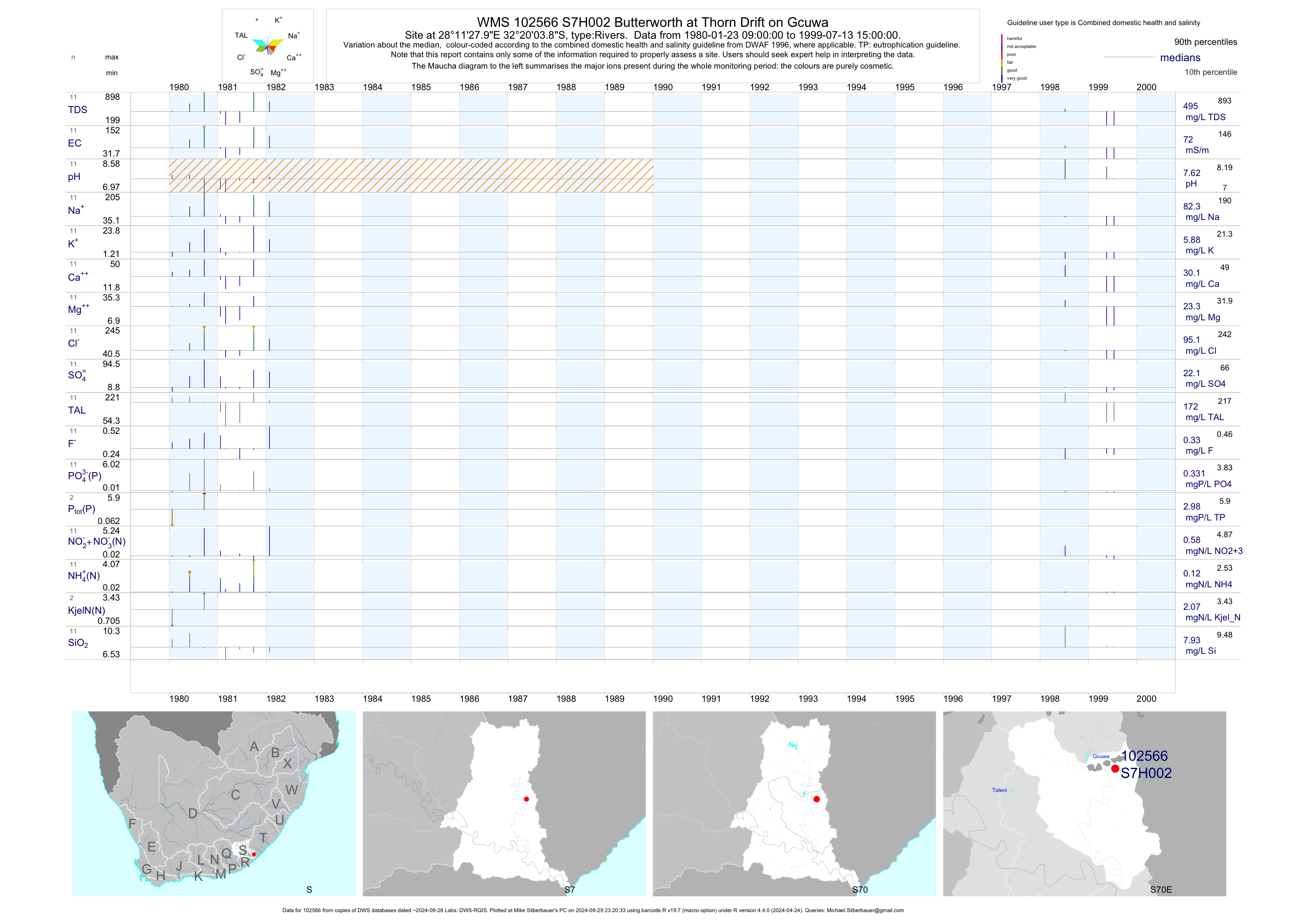
| S70 102566 | plot | data | Butterworth at Thorn Drift on Gcuwa | Rivers | 11 | 1980-01-23 | 1999-07-13 | 72 | S7H002 | -32.33440 | 28.19110 |
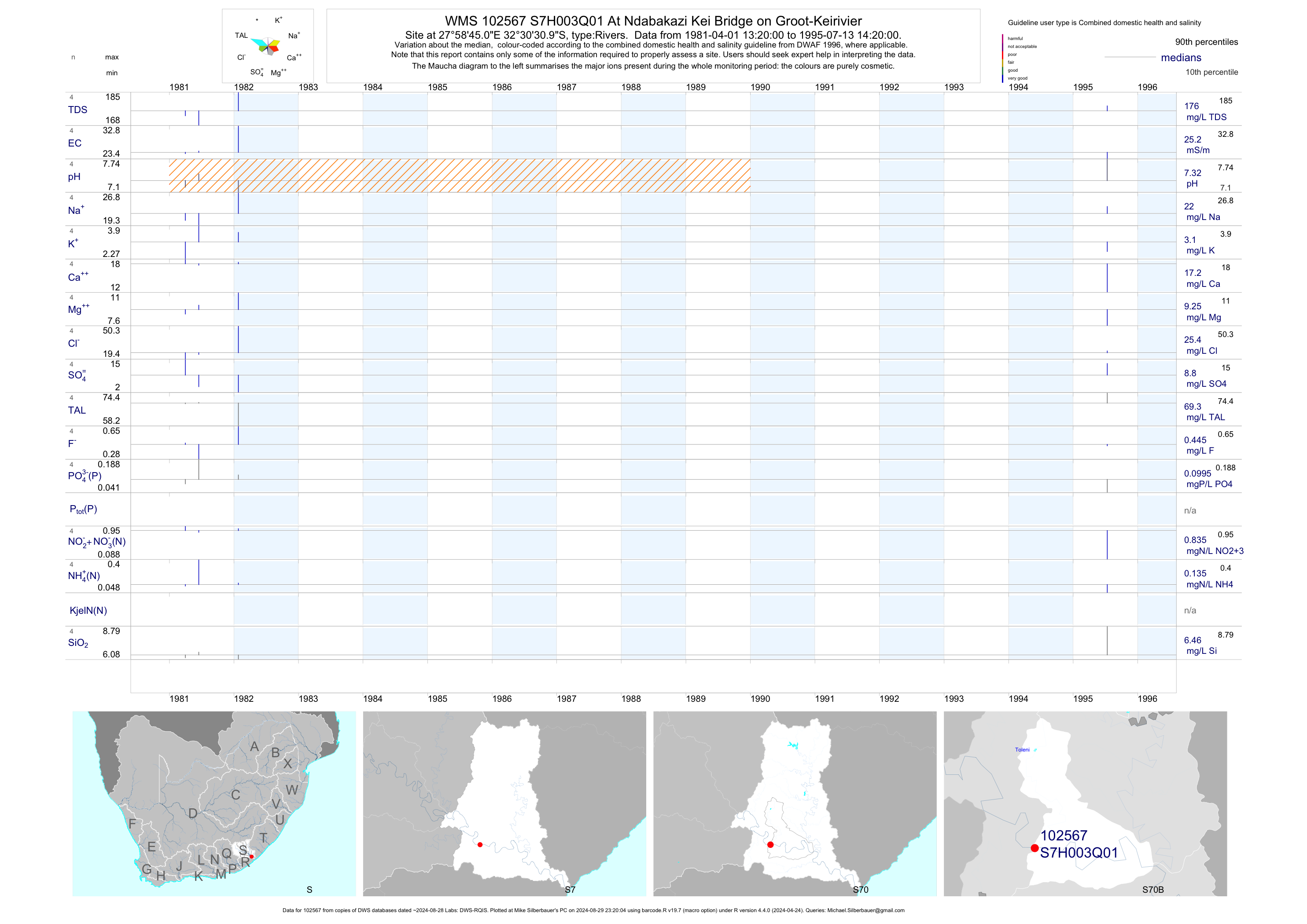
| S70 102567 | plot | data | At Ndabakazi Kei Bridge on Groot-Keirivier | Rivers | 4 | 1981-04-01 | 1995-07-13 | 25 | S7H003 | -32.50861 | 27.97917 |
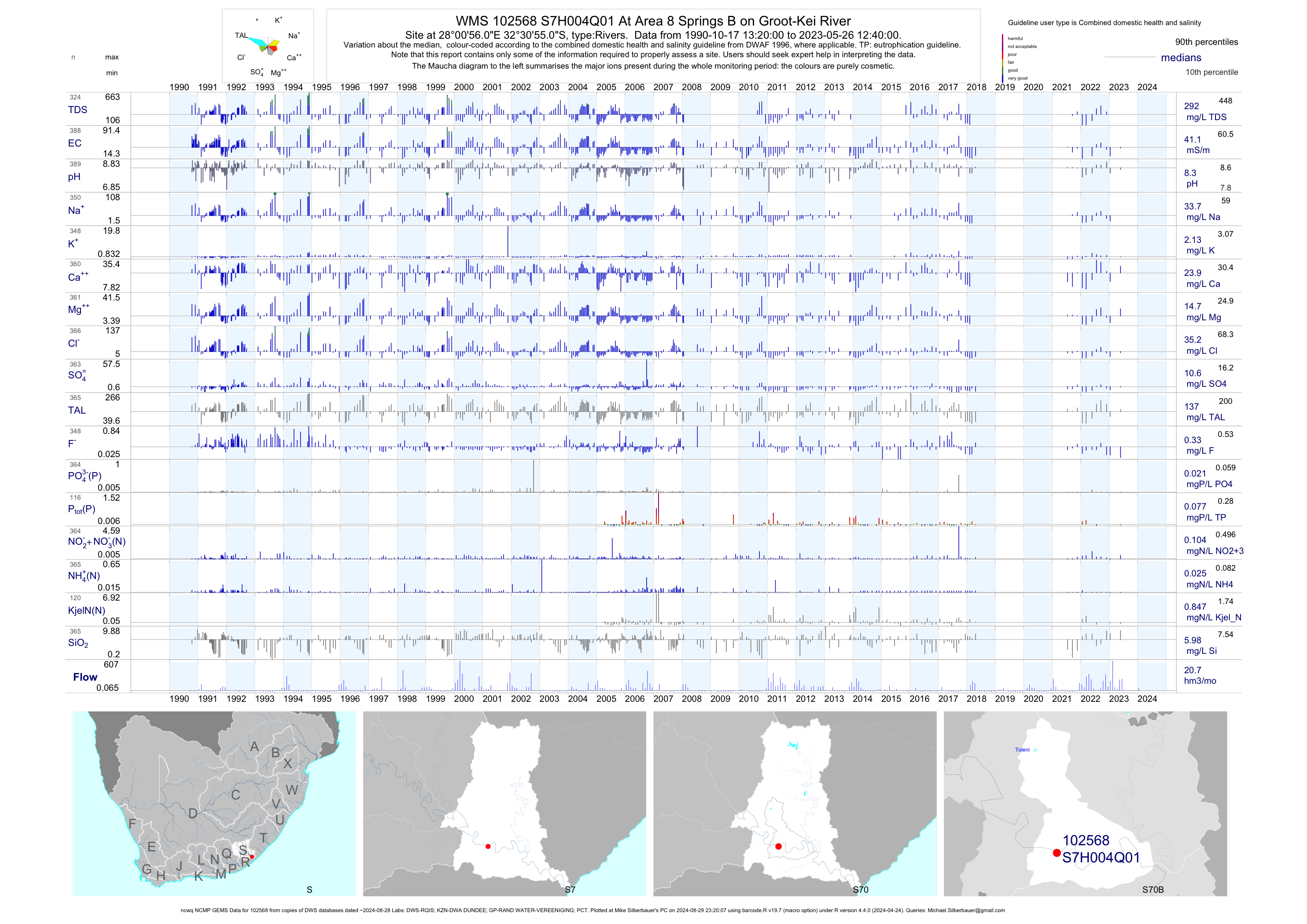
| S70 102568 | plot | data | At Area 8 Springs B on Groot-Kei River (ncwq NCMP GEMS) | Rivers | 418 | 1990-10-17 | 2018-05-02 | 41 | S7H004 | -32.51528 | 28.01556 |
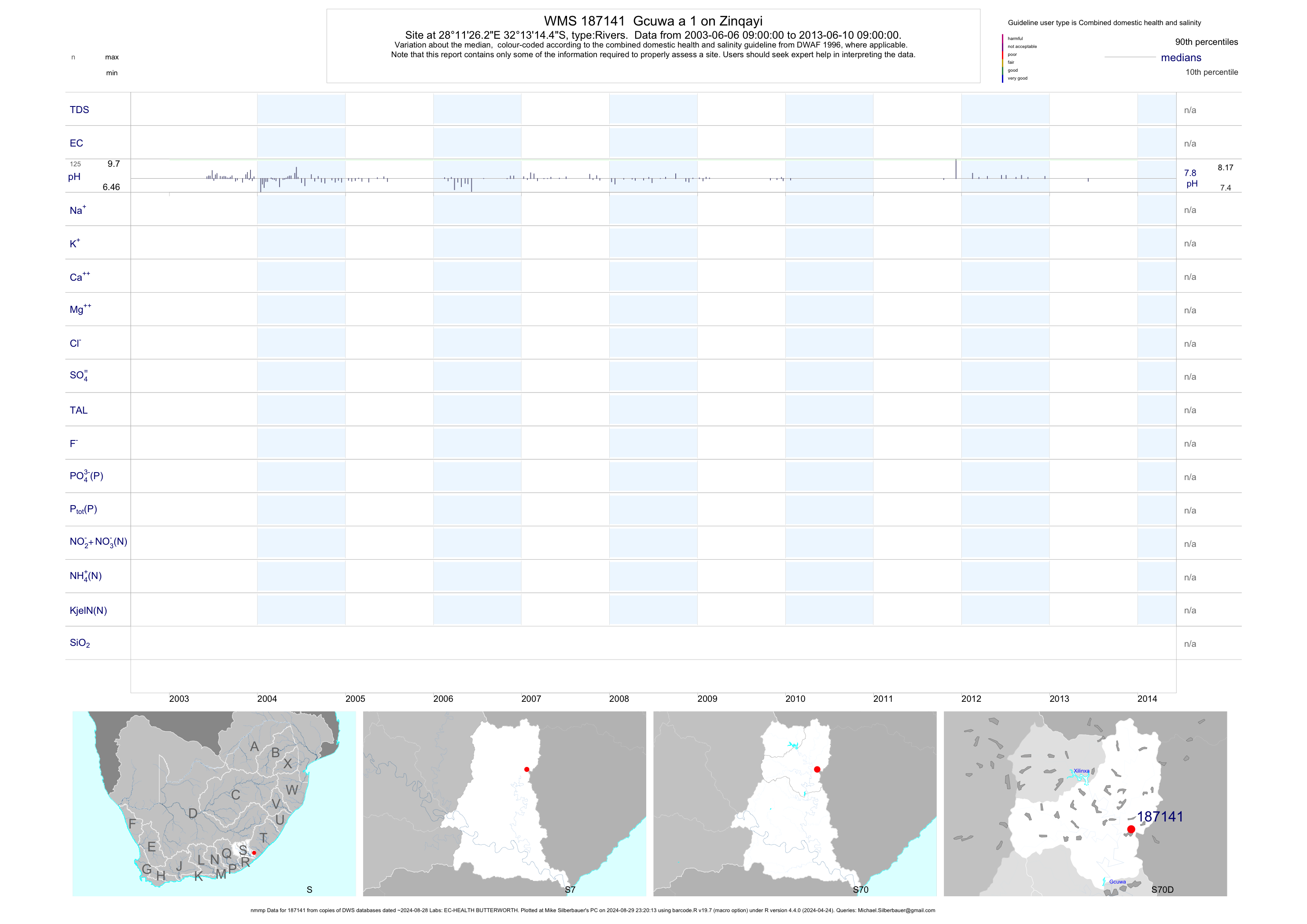
| S70 187141 | plot | data | Gcuwa a 1 on Zinqayi (nmmp) | Rivers | 375 | 2003-06-06 | 2013-07-10 | n/a | 187141 | -32.22067 | 28.19063 |
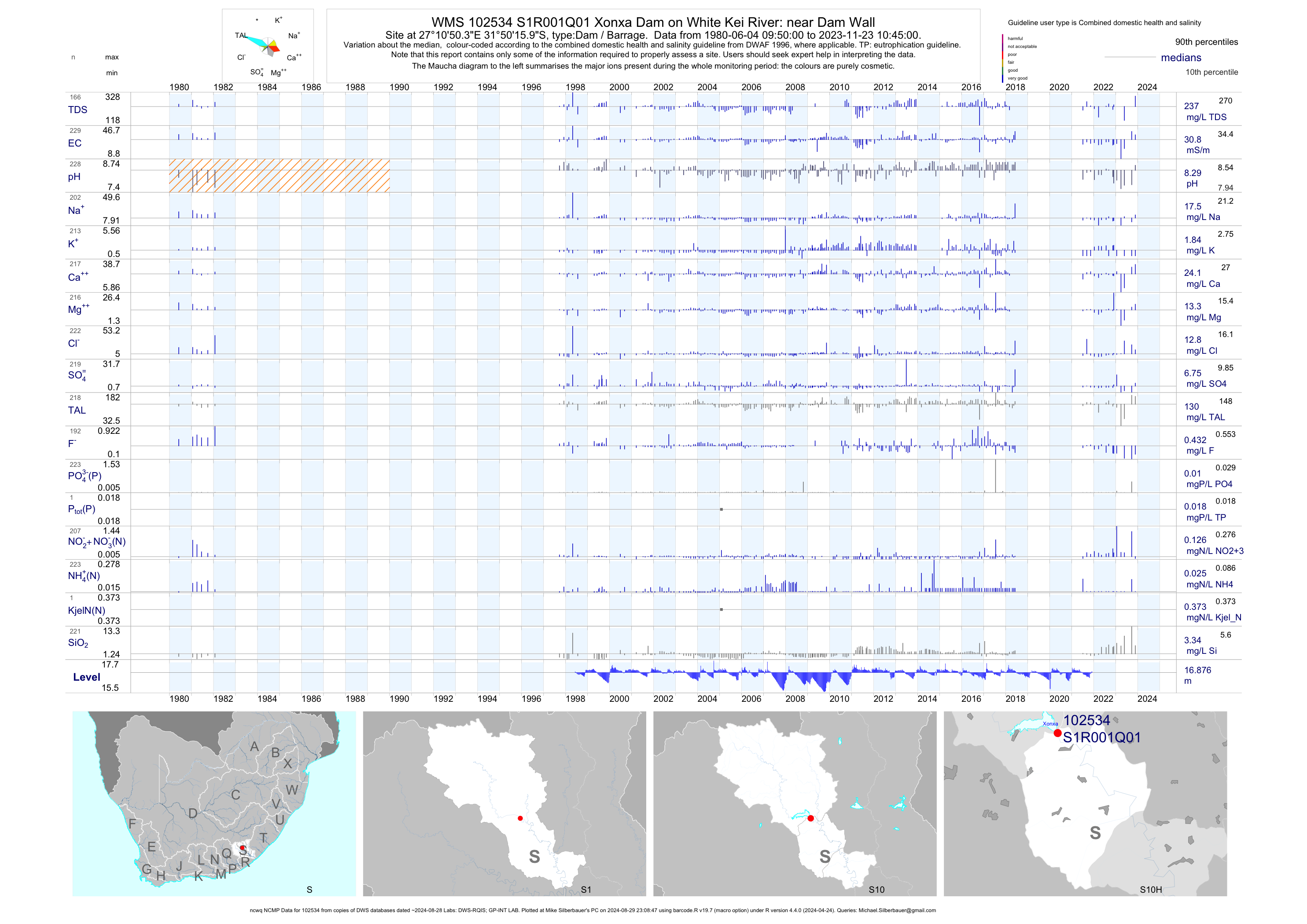
| S10 102534 | plot | data | Xonxa Dam on White Kei River: near Dam Wall (ncwq NCMP) Q01 | Dam / Barrage | 918 | 1980-06-04 | 2018-06-05 | 31 | S1R001 | -31.83776 | 27.18066 |
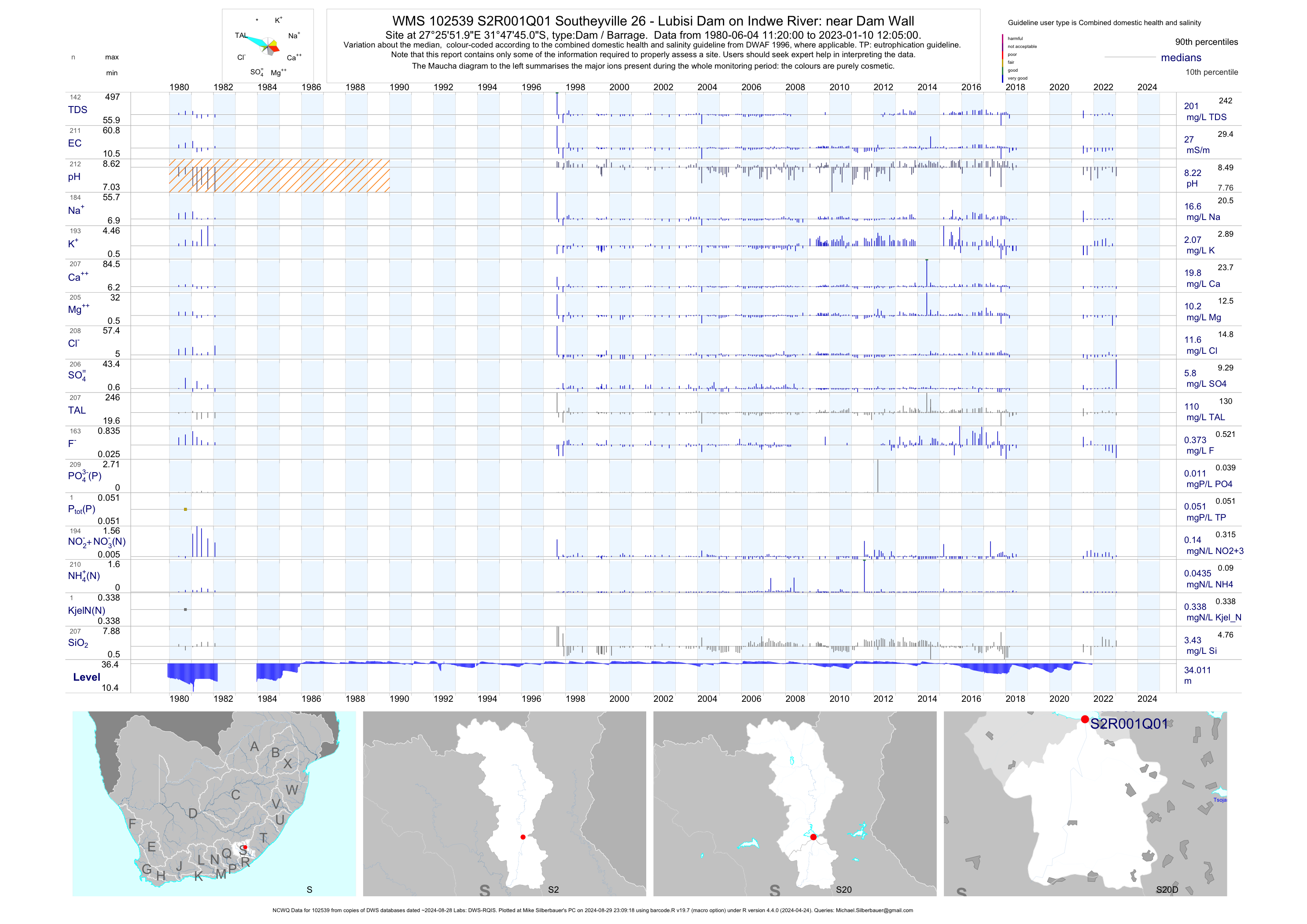
| S20 102539 | plot | data | Southeyville 26 - Lubisi Dam on Indwe River: near Dam Wall (NCWQ) Q01 | Dam / Barrage | 937 | 1980-06-04 | 2018-06-25 | 27 | S2R001 | -31.79583 | 27.43111 |
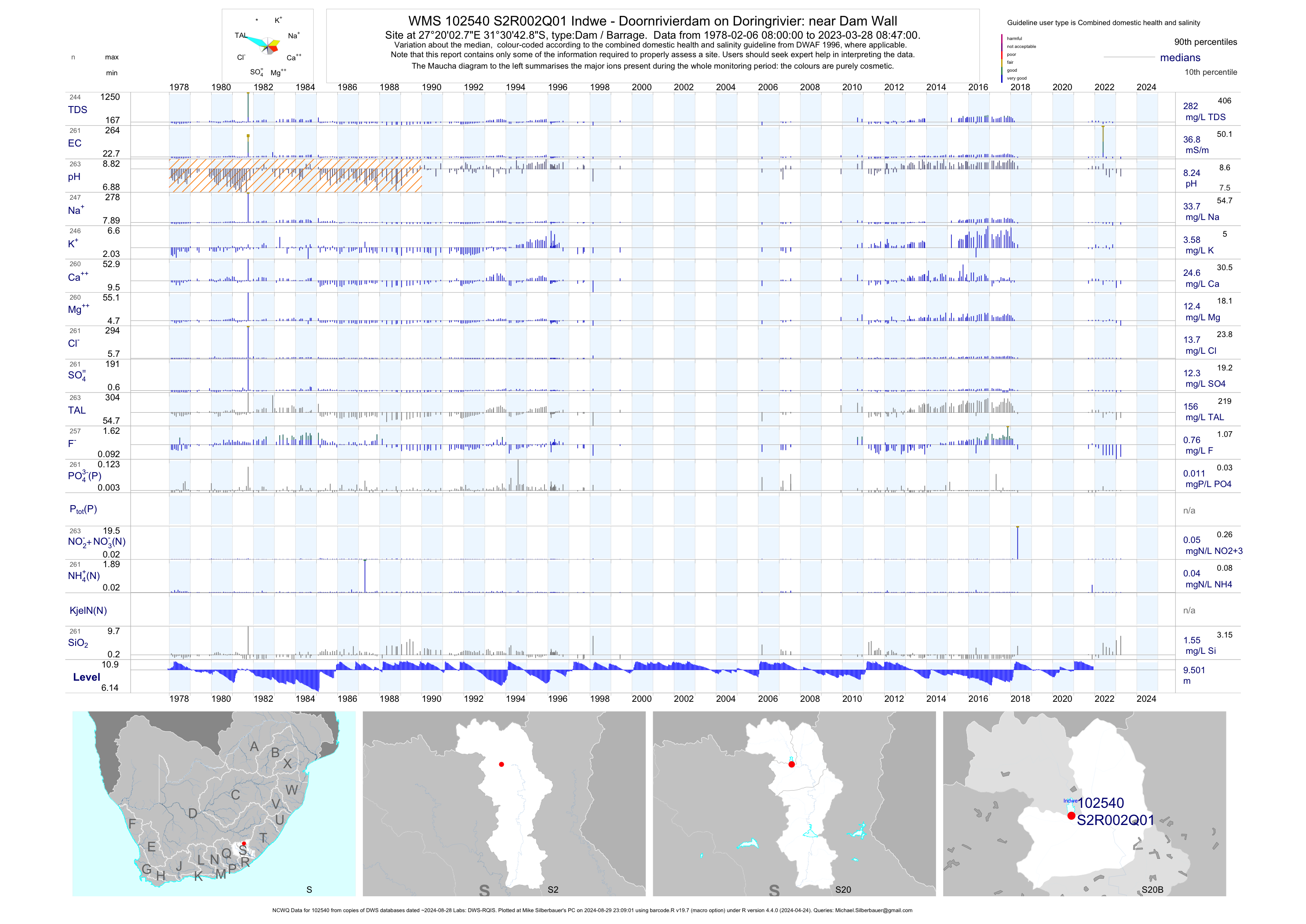
| S20 102540 | plot | data | Indwe - Doornrivierdam on Doringrivier: near Dam Wall (NCWQ) Q01 | Dam / Barrage | 910 | 1978-02-06 | 2018-05-03 | 37 | S2R002 | -31.51190 | 27.33410 |
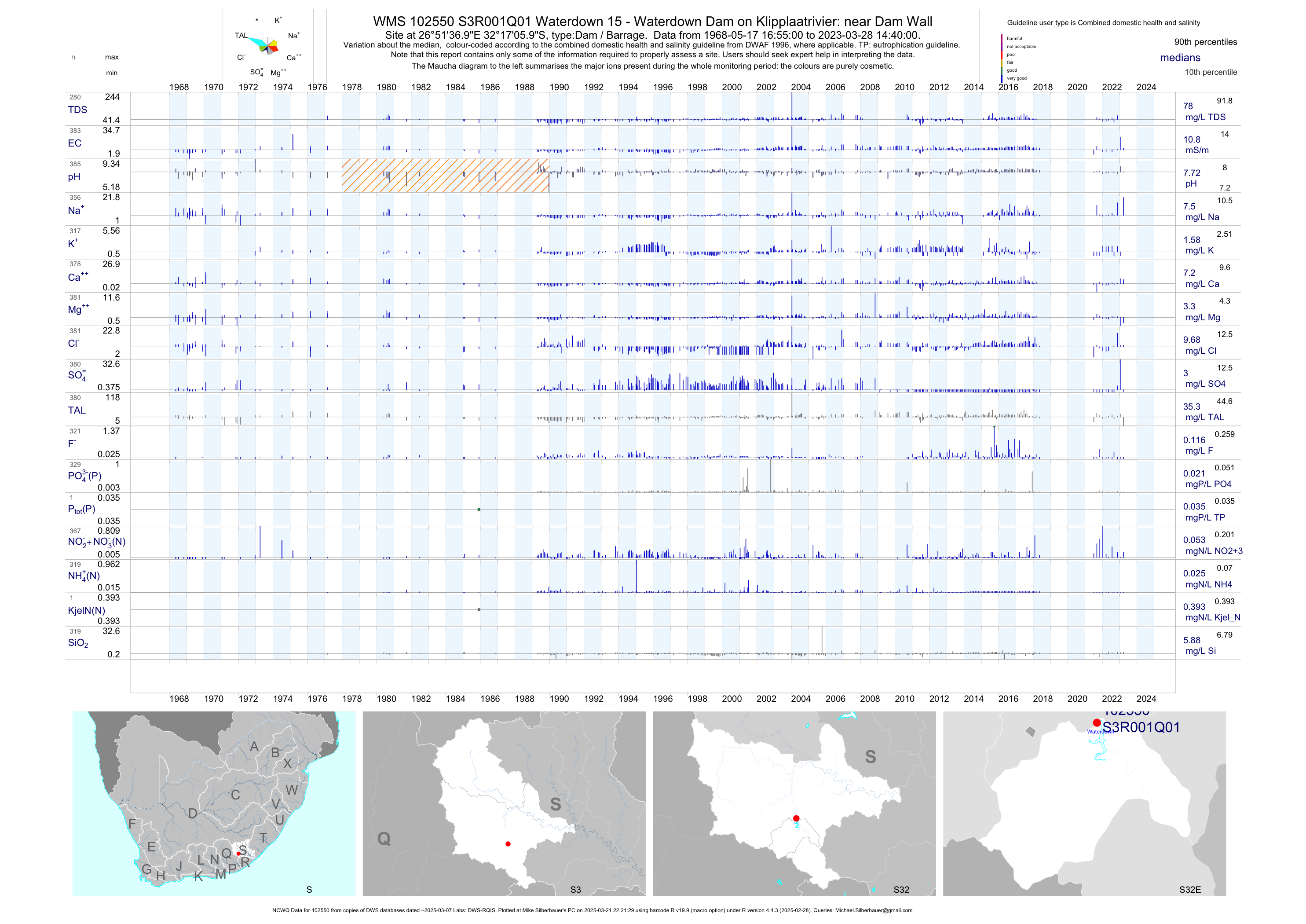
| S32 102550 | plot | data | Waterdown 15 - Waterdown Dam on Klipplaatrivier: near Dam Wall (NCWQ) Q01 | Dam / Barrage | 958 | 1968-05-17 | 2018-05-15 | 11 | S3R001 | -32.28500 | 26.86028 |
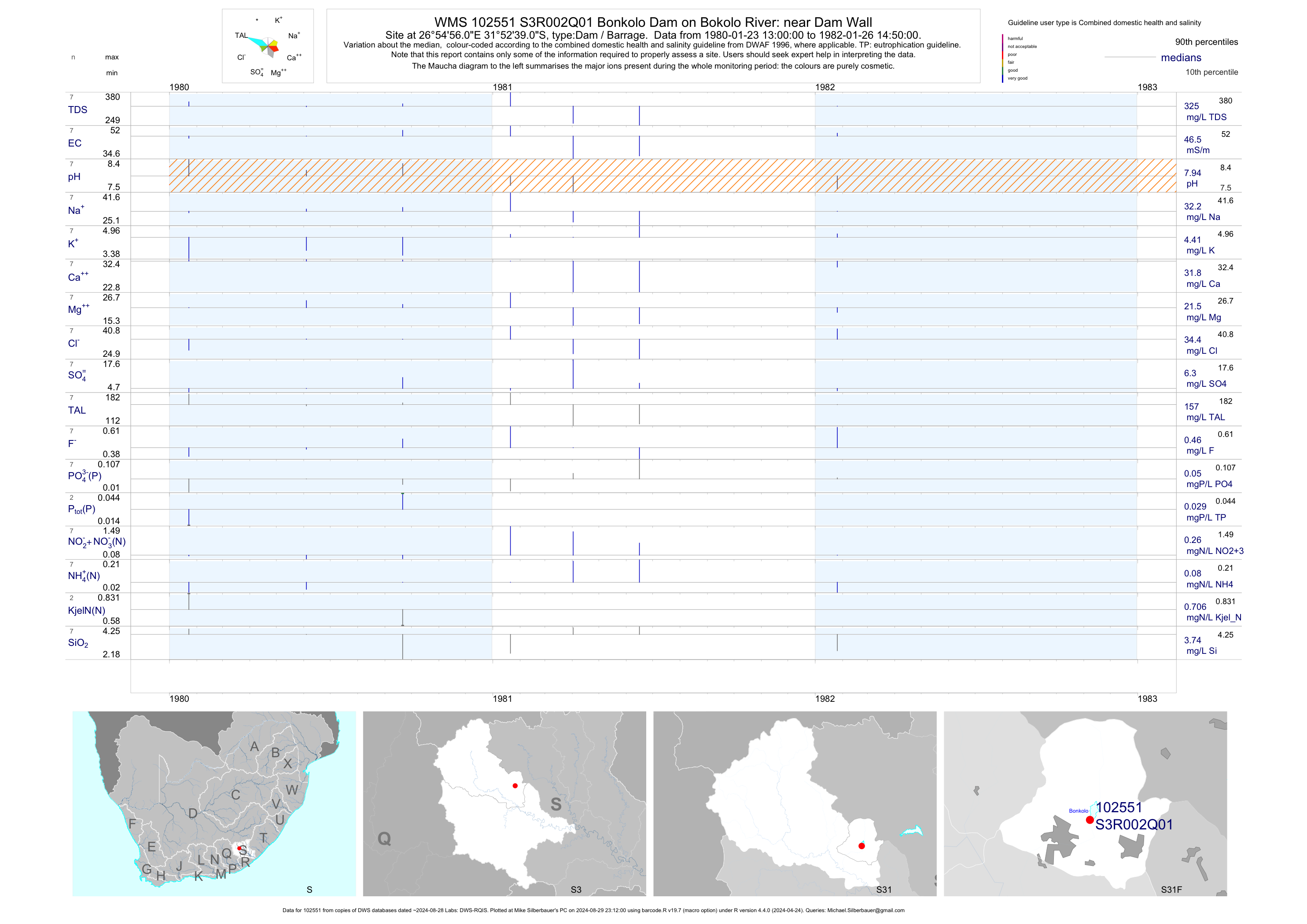
| S31 102551 | plot | data | Bonkolo Dam on Bokolo River: near Dam Wall Q01 | Dam / Barrage | 7 | 1980-01-23 | 1982-01-26 | 46 | S3R002 | -31.87750 | 26.91556 |
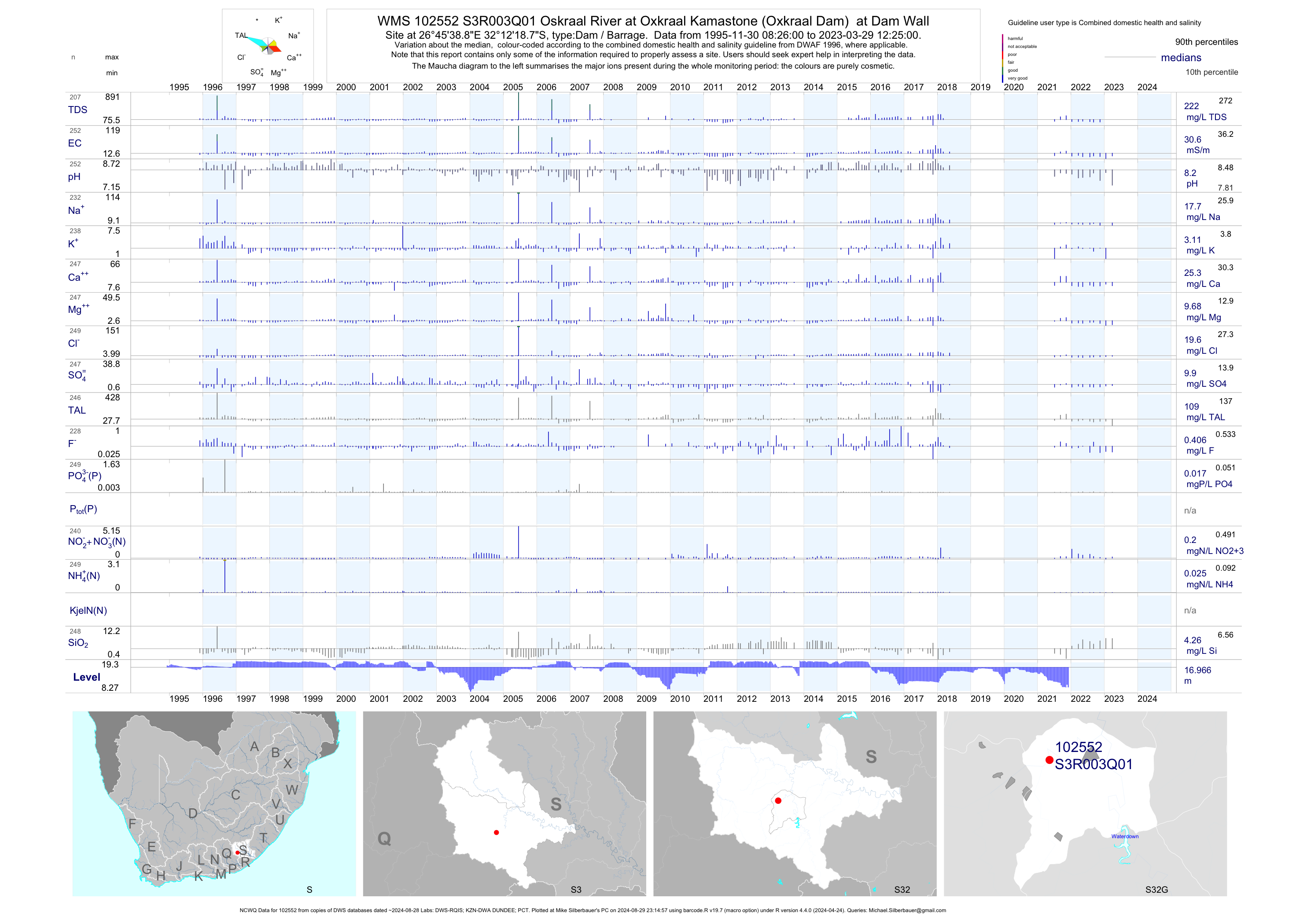
| S32 102552 | plot | data | Oskraal River at Oxkraal Kamastone (Oxkraal Dam) at Dam Wall (NCWQ) Q01 | Dam / Barrage | 242 | 1995-11-30 | 2018-05-15 | 31 | S3R003 | -32.20520 | 26.76080 |
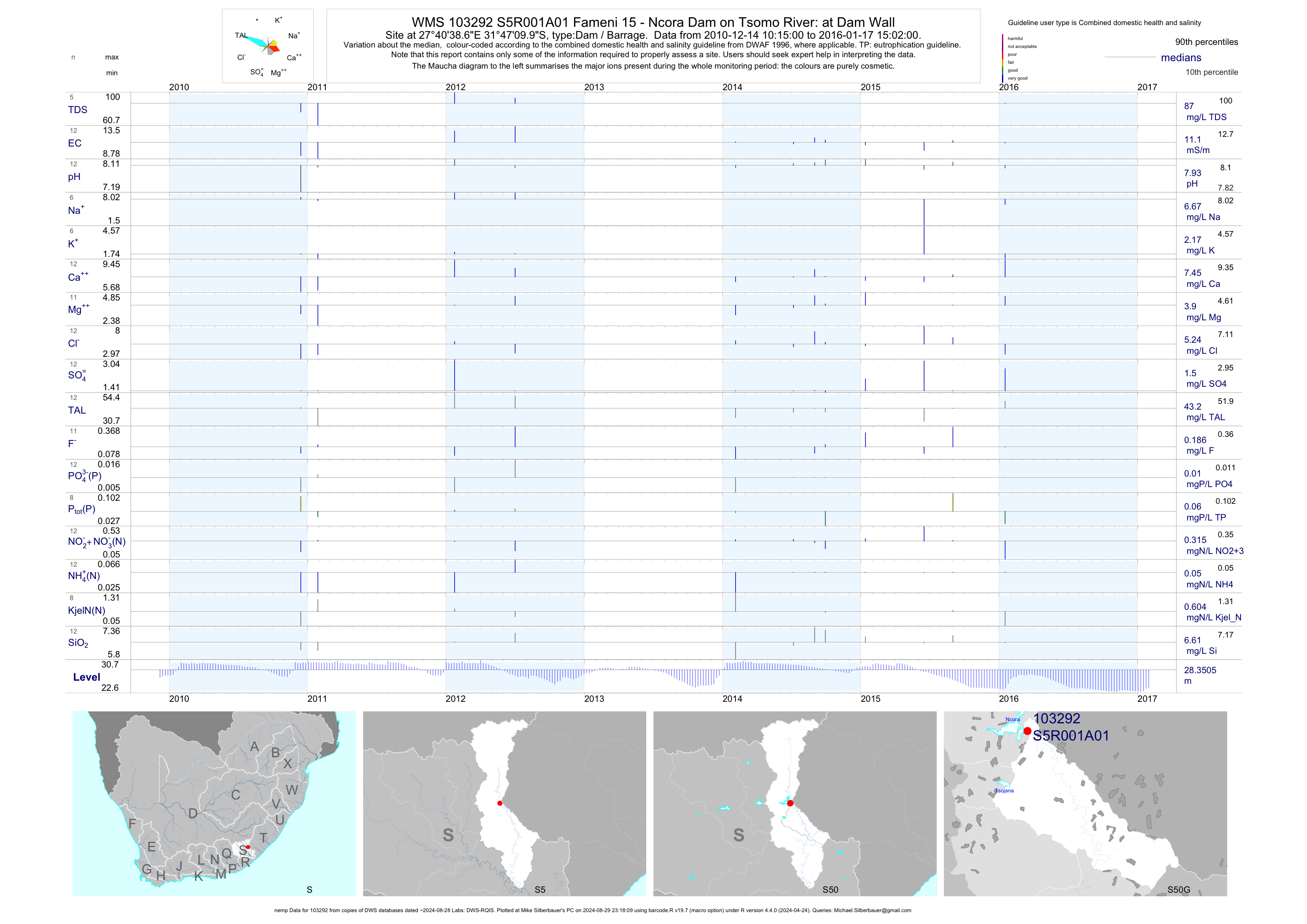
| S50 103292 | plot | data | Fameni 15 - Ncora Dam on Tsomo River: at Dam Wall (nemp) A01 | Dam / Barrage | 737 | 2003-01-20 | 2016-01-17 | 11 | S5R001 | -31.78610 | 27.67740 |
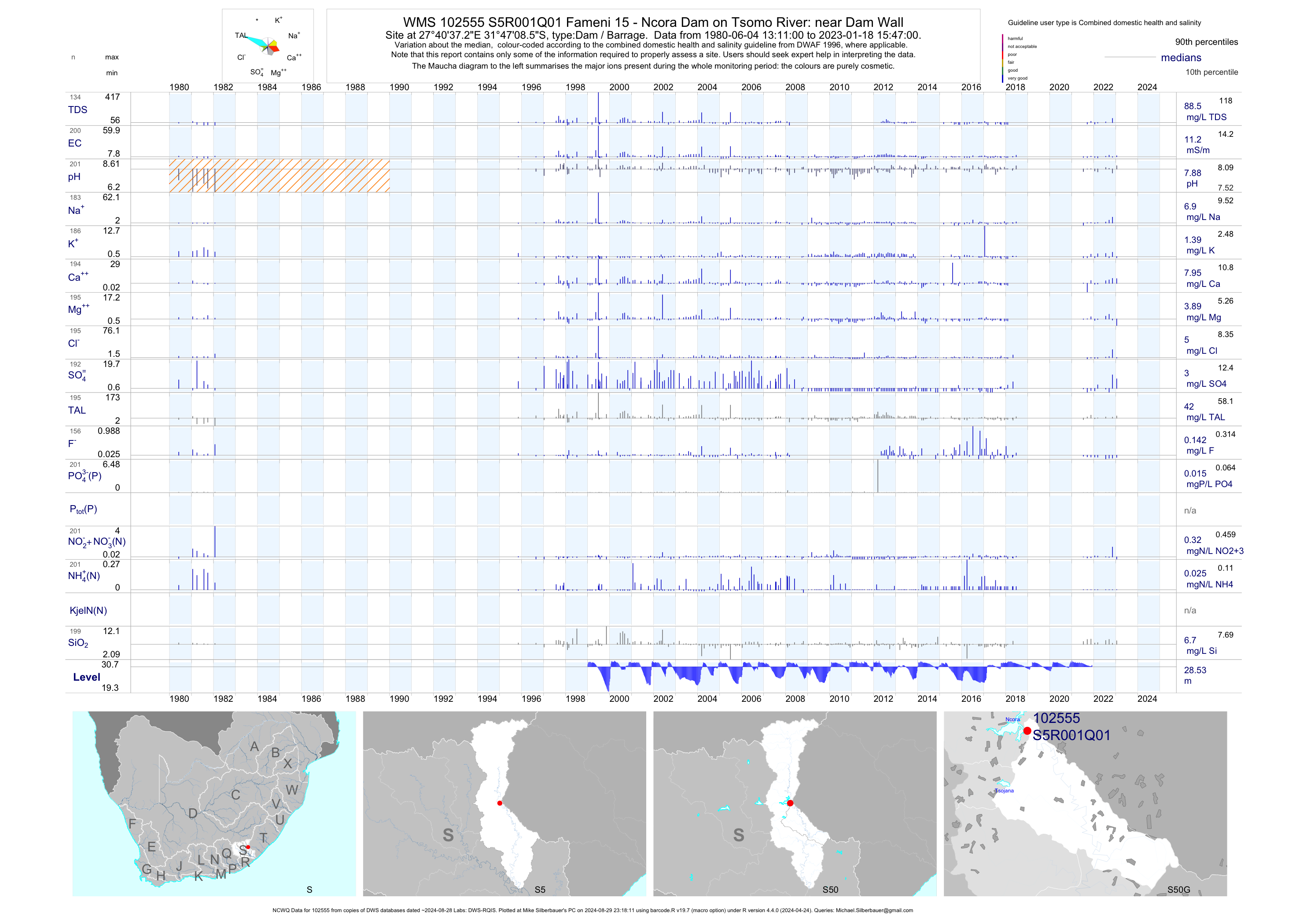
| S50 102555 | plot | data | Fameni 15 - Ncora Dam on Tsomo River: near Dam Wall (NCWQ) Q01 | Dam / Barrage | 194 | 1980-06-04 | 2018-06-25 | 11 | S5R001 | -31.78570 | 27.67700 |
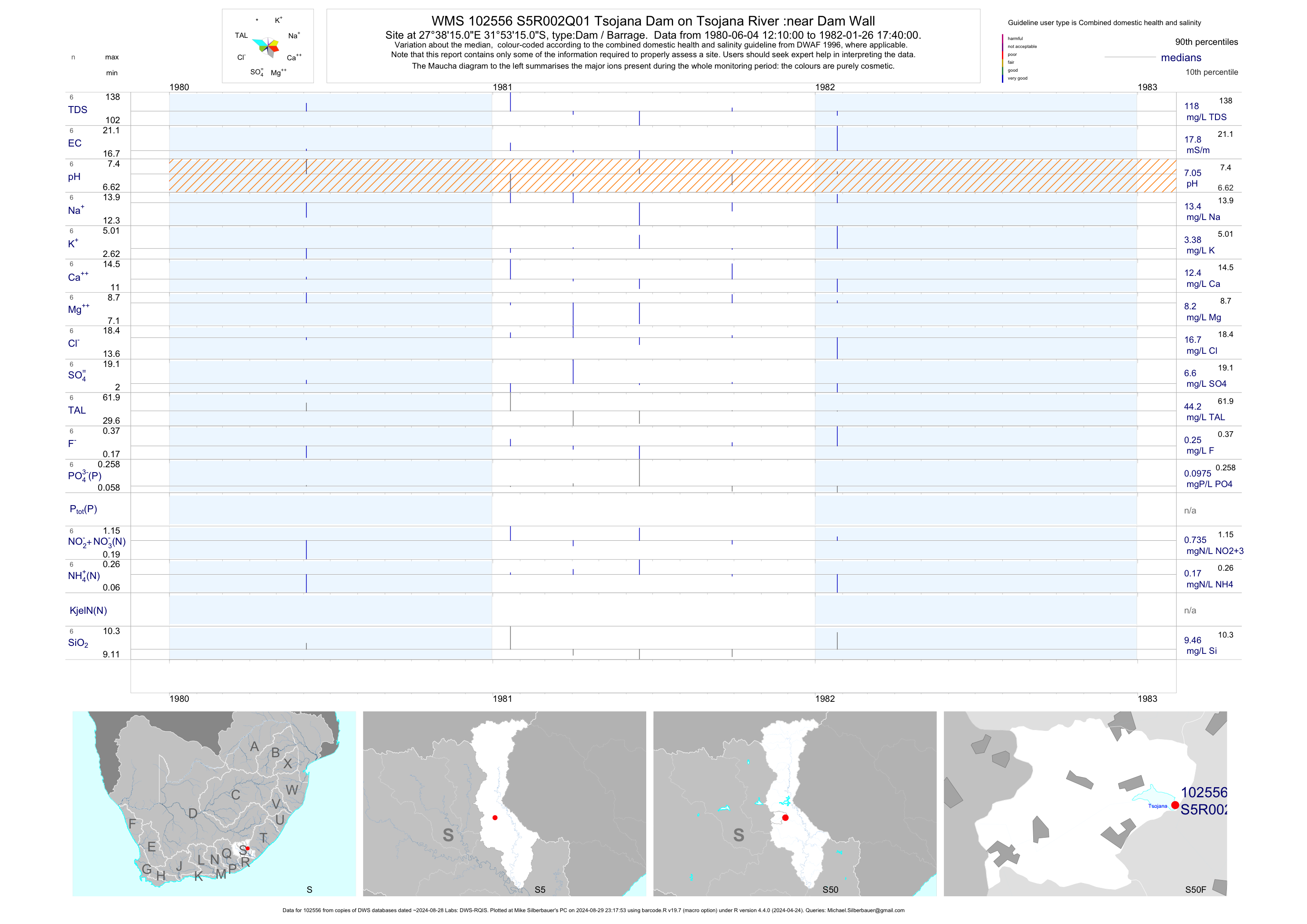
| S50 102556 | plot | data | Tsojana Dam on Tsojana River :near Dam Wall Q01 | Dam / Barrage | 604 | 1980-06-04 | 2012-04-06 | 18 | S5R002 | -31.88750 | 27.63750 |
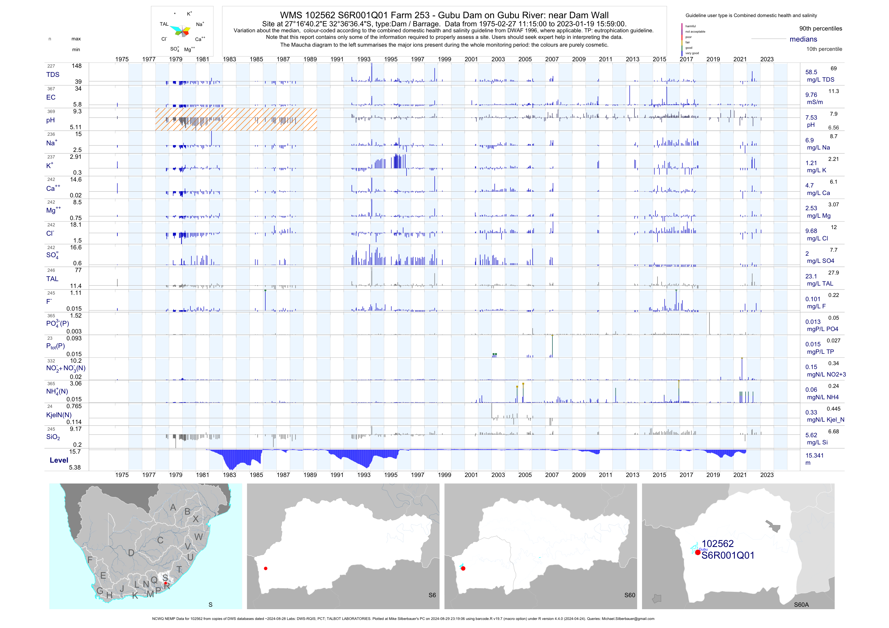
| S60 102562 | plot | data | Farm 253 - Gubu Dam on Gubu River: near Dam Wall (NCWQ NEMP) Q01 | Dam / Barrage | 454 | 1975-02-27 | 2019-04-17 | 10 | S6R001 | -32.61014 | 27.27786 |
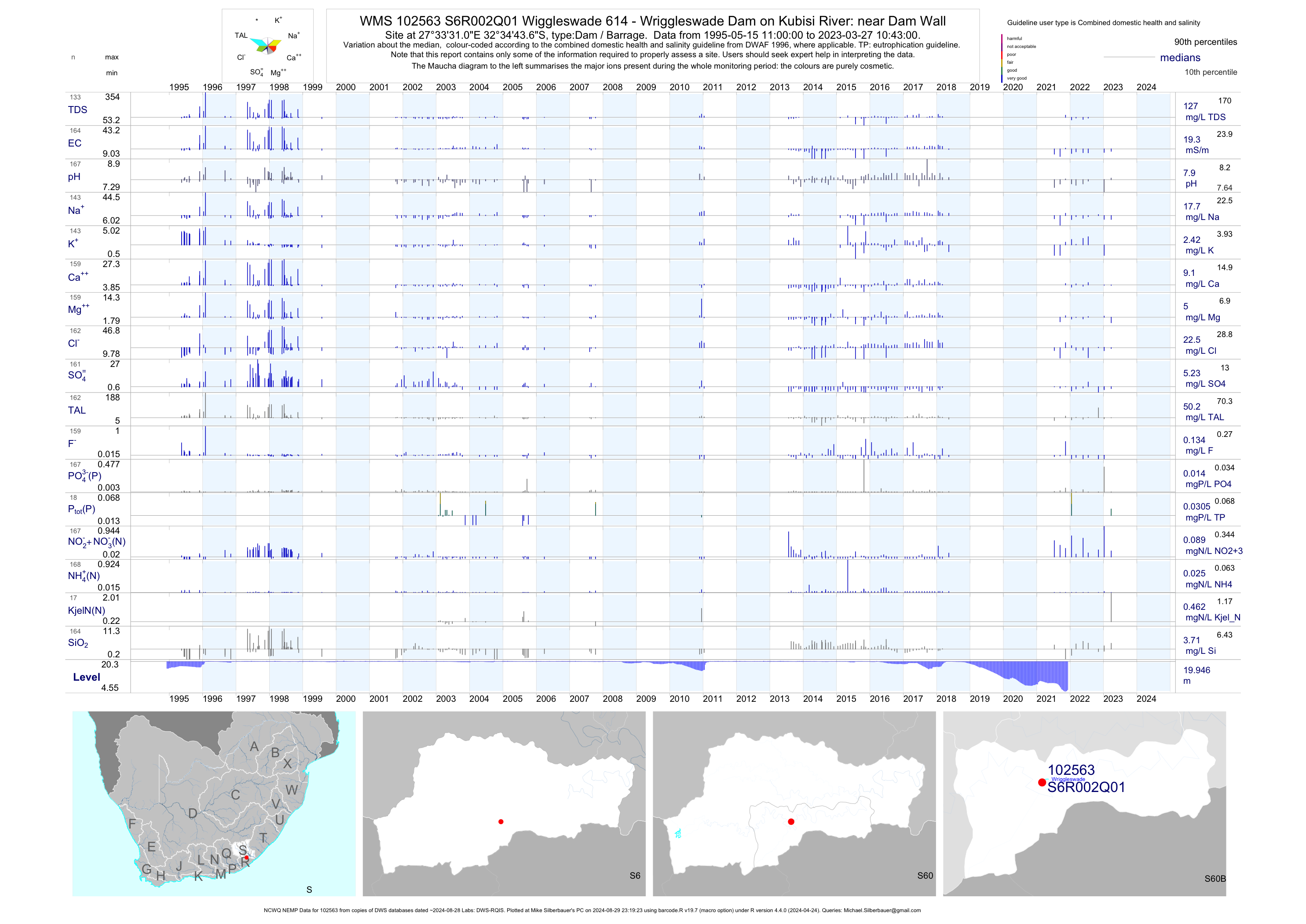
| S60 102563 | plot | data | Wiggleswade 614 - Wriggleswade Dam on Kubisi River: near Dam Wall (NCWQ NEMP) Q01 | Dam / Barrage | 210 | 1994-11-08 | 2018-05-14 | 19 | S6R002 | -32.57879 | 27.55861 |
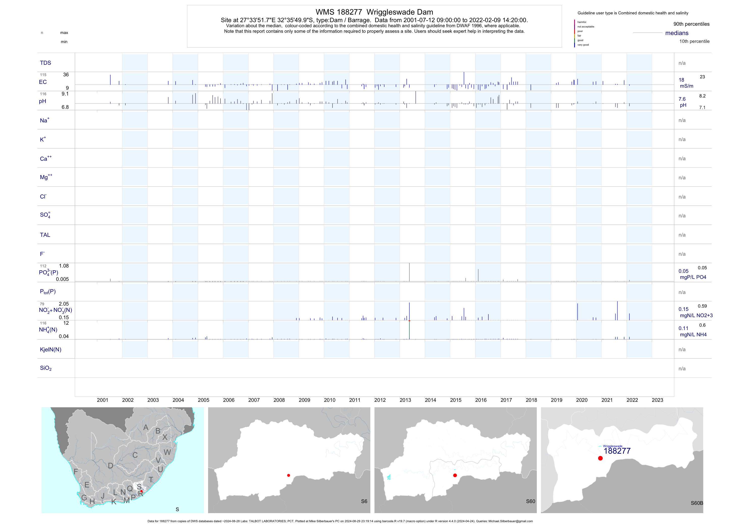
| S60 188277 | plot | data | Wriggleswade Dam | Dam / Barrage | 201 | 2001-07-12 | 2019-04-17 | 17 | 188277 | -32.59719 | 27.56439 |
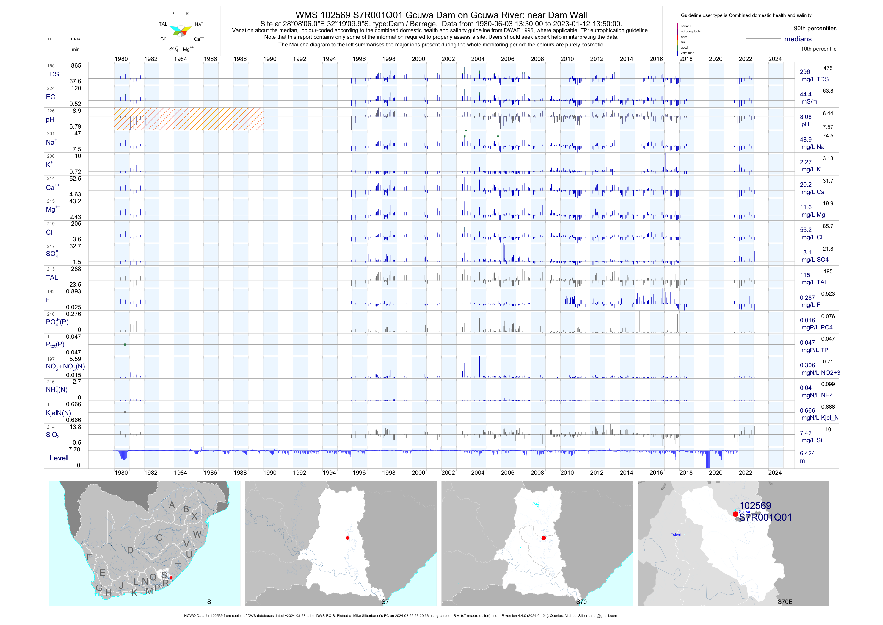
| S70 102569 | plot | data | Gcuwa Dam on Gcuwa River: near Dam Wall (NCWQ) Q01 | Dam / Barrage | 218 | 1980-06-03 | 2018-06-27 | 45 | S7R001 | -32.31944 | 28.13500 |
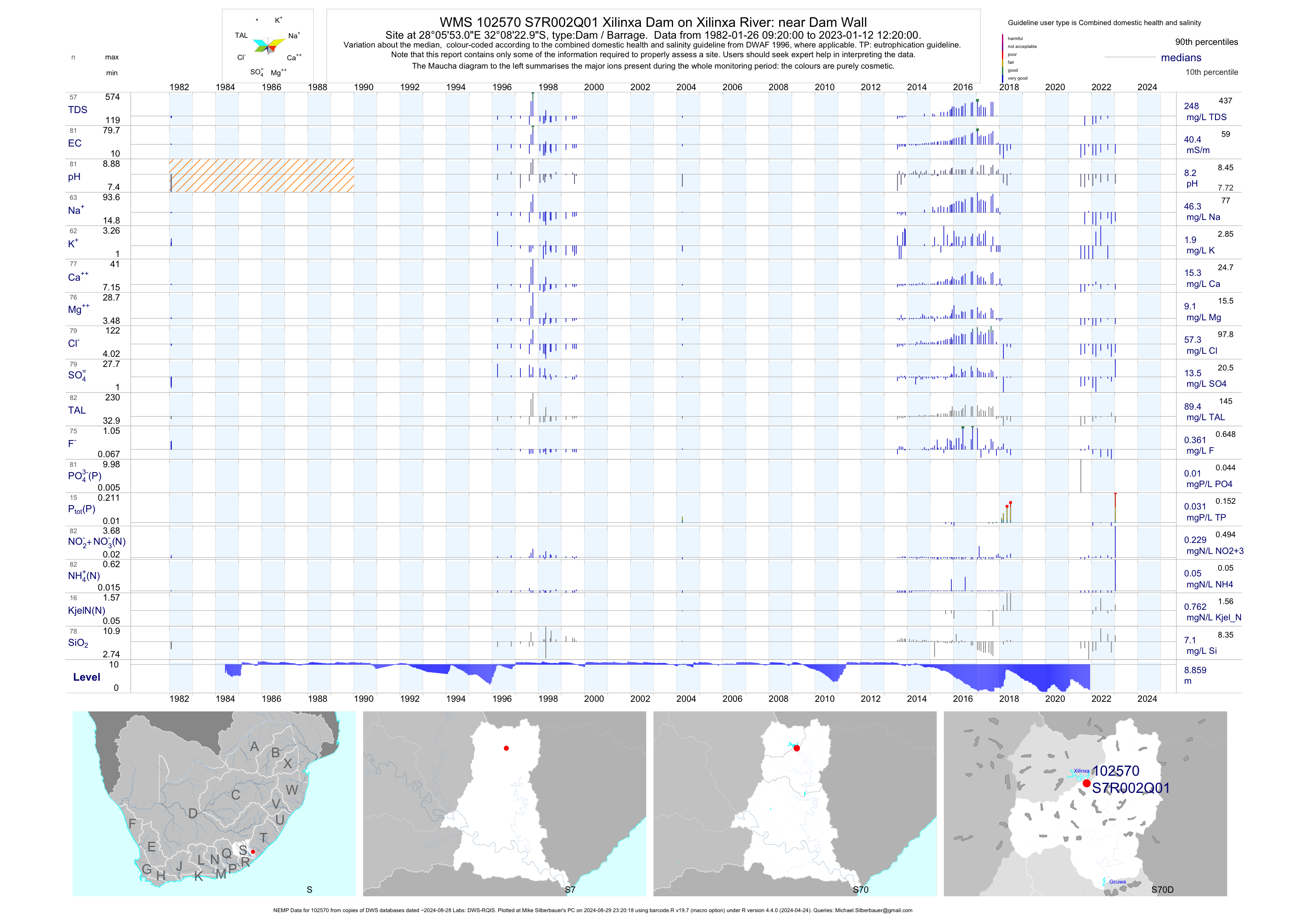
| S70 102570 | plot | data | Xilinxa Dam on Xilinxa River: near Dam Wall (NEMP) Q01 | Dam / Barrage | 74 | 1982-01-26 | 2018-06-27 | 41 | S7R002 | -32.13972 | 28.09806 |
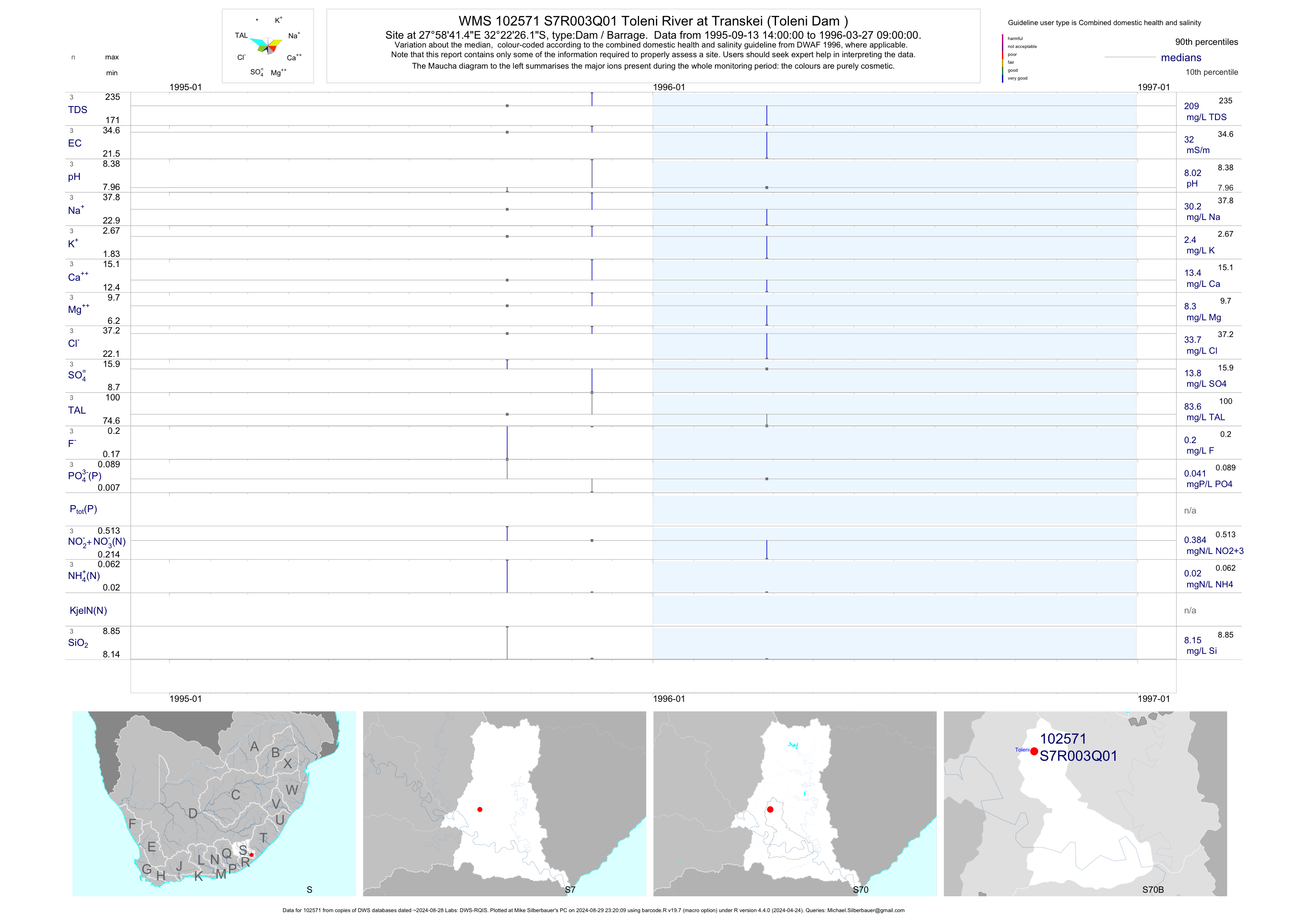
| S70 102571 | plot | data | Toleni River at Transkei (Toleni Dam ) Q01 | Dam / Barrage | 3 | 1995-09-13 | 1996-03-27 | 32 | S7R003 | -32.37394 | 27.97818 |
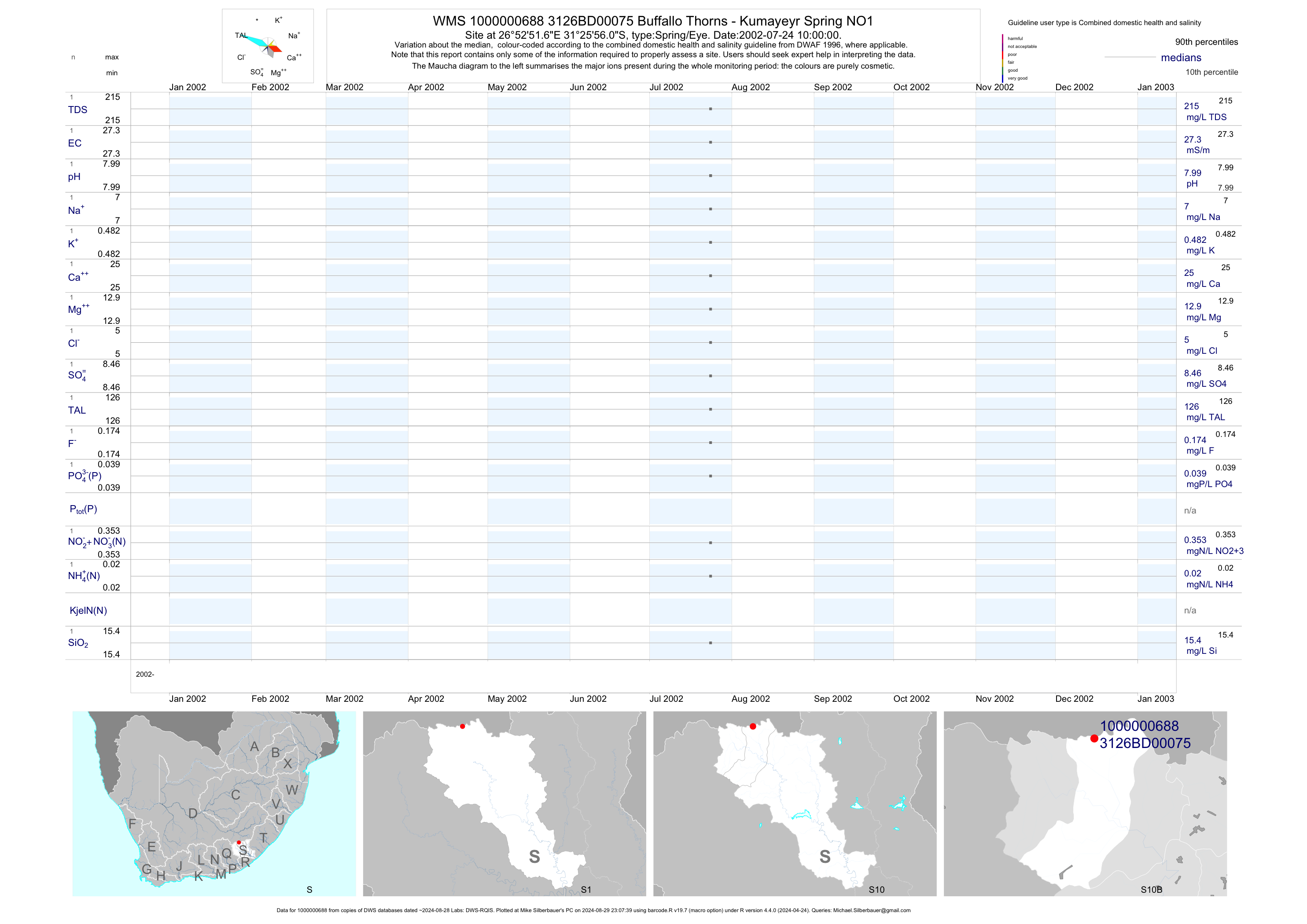
| S10 1000000688 | plot | data | Buffallo Thorns - Kumayeyr Spring NO1 | Spring/Eye | 1 | 2002-07-24 | 2002-07-24 | 27 | 75 | -31.43222 | 26.88100 |
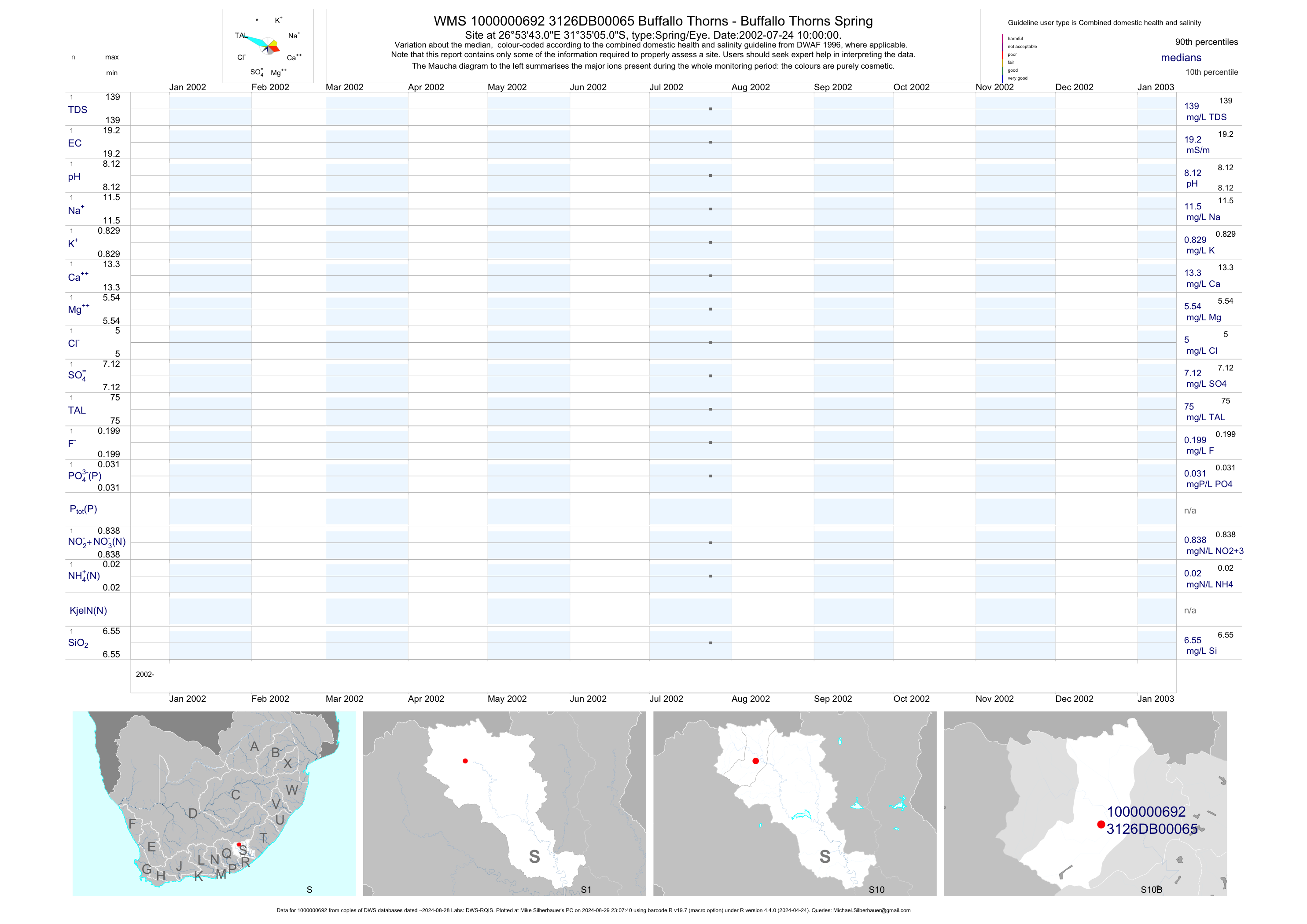
| S10 1000000692 | plot | data | Buffallo Thorns - Buffallo Thorns Spring | Spring/Eye | 1 | 2002-07-24 | 2002-07-24 | 19 | 65 | -31.58472 | 26.89528 |
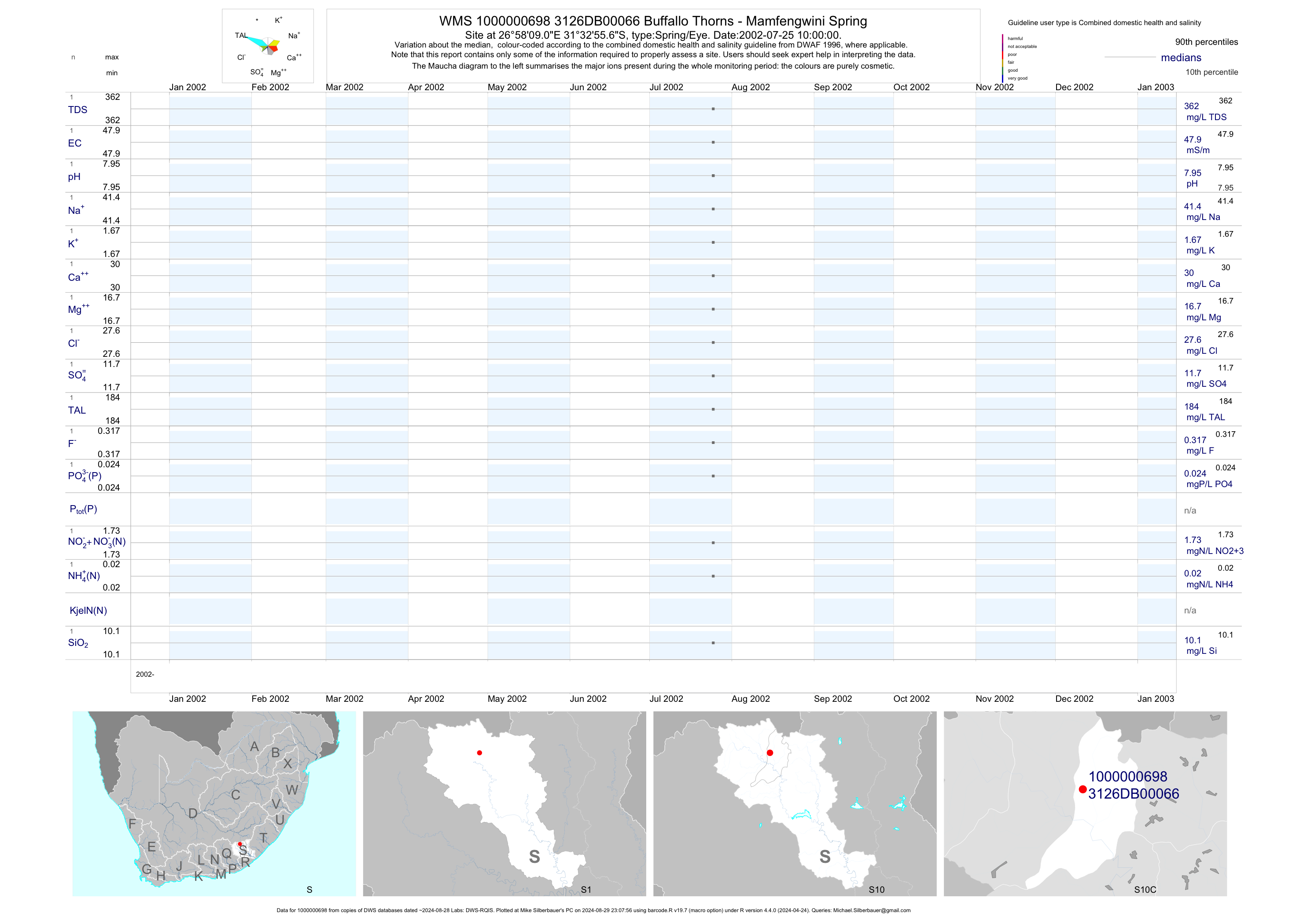
| S10 1000000698 | plot | data | Buffallo Thorns - Mamfengwini Spring | Spring/Eye | 1 | 2002-07-25 | 2002-07-25 | 48 | 66 | -31.54878 | 26.96919 |
| S10 1000000700 | plot | data | Buffallo Thorns - Ngcalase Spring | Spring/Eye | 1 | 2002-07-25 | 2002-07-25 | 10 | 67 | -31.55622 | 26.97361 |
| S10 1000000709 | plot | data | Buffallo Thorns - Mcwangele Spring | Spring/Eye | 1 | 2002-08-06 | 2002-08-06 | 33 | 70 | -31.55572 | 26.88311 |
| S10 1000000711 | plot | data | Mcwangele - Mcwangele Spring NO2 | Spring/Eye | 1 | 2002-08-06 | 2002-08-06 | 32 | 71 | -31.55569 | 26.88364 |
| S10 1000000721 | plot | data | Upper Vaalbank - Hukwini Spring | Spring/Eye | 1 | 2002-08-06 | 2002-08-06 | 9 | 72 | -31.68467 | 26.89656 |
| S10 1000000690 | plot | data | Buffallo Thorns - Kumayeye Spring no 2 | Spring/Eye | 1 | 2002-07-24 | 2002-07-24 | 36 | 73 | -31.59131 | 26.88722 |
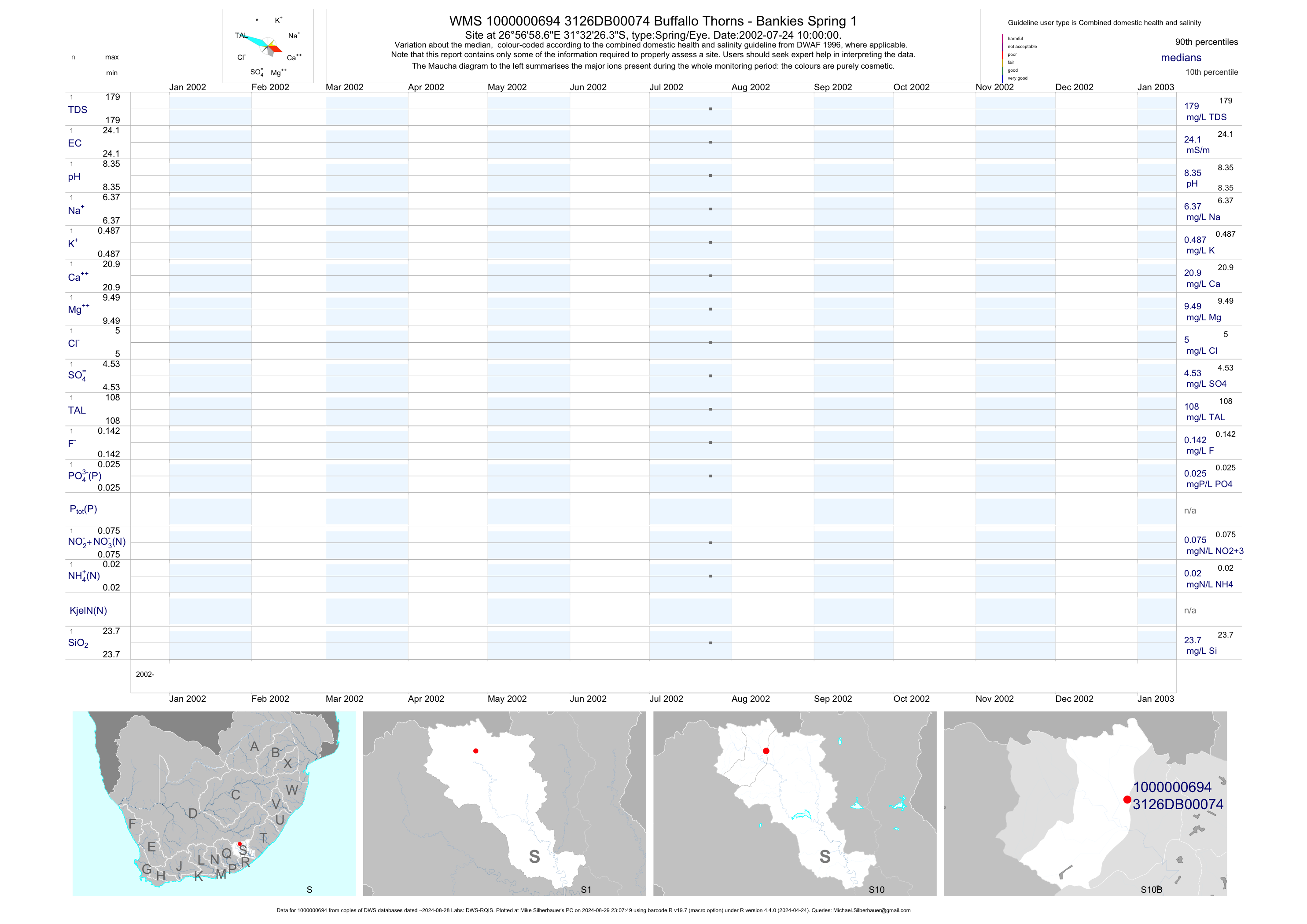
| S10 1000000694 | plot | data | Buffallo Thorns - Bankies Spring 1 | Spring/Eye | 1 | 2002-07-24 | 2002-07-24 | 24 | 74 | -31.54067 | 26.94964 |
| S10 1000000696 | plot | data | Buffallo Thorns - Bankies Spring NO2 | Spring/Eye | 1 | 2002-07-25 | 2002-07-25 | 25 | 75 | -31.53736 | 26.95786 |
| S10 1000000713 | plot | data | Buffallo Thorns - Tsawulayo Spring | Spring/Eye | 1 | 2002-08-06 | 2002-08-06 | 47 | 54 | -31.57750 | 27.02322 |
| S10 1000000715 | plot | data | Buffallo Thorns - Gxojeni Spring NO1 | Spring/Eye | 1 | 2002-08-07 | 2002-08-07 | 22 | 55 | -31.54553 | 27.00364 |
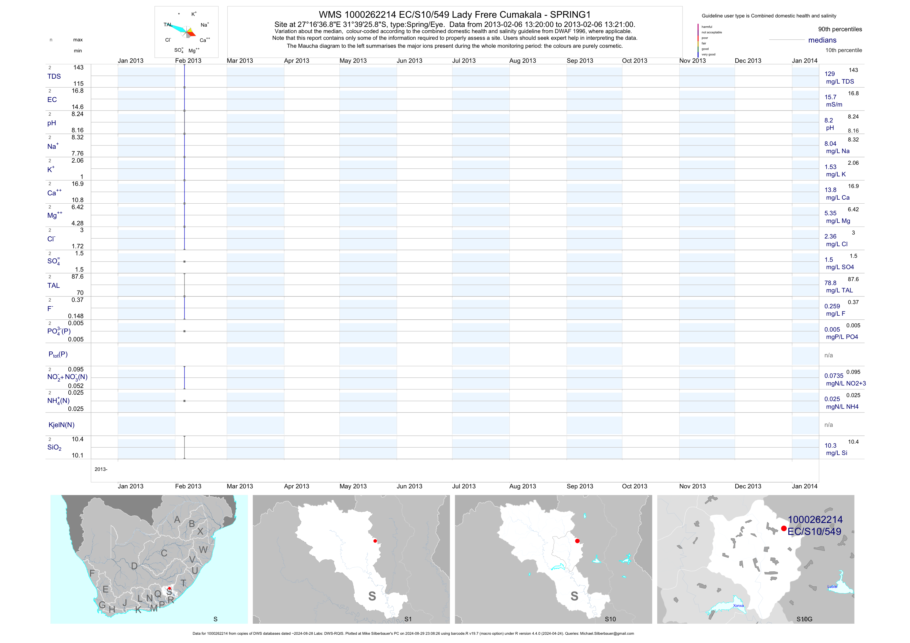
| S10 1000262214 | plot | data | Lady Frere Cumakala - SPRING1 | Spring/Eye | 2 | 2013-02-06 | 2013-02-06 | 16 | EC/S10/549 | -31.65717 | 27.27689 |
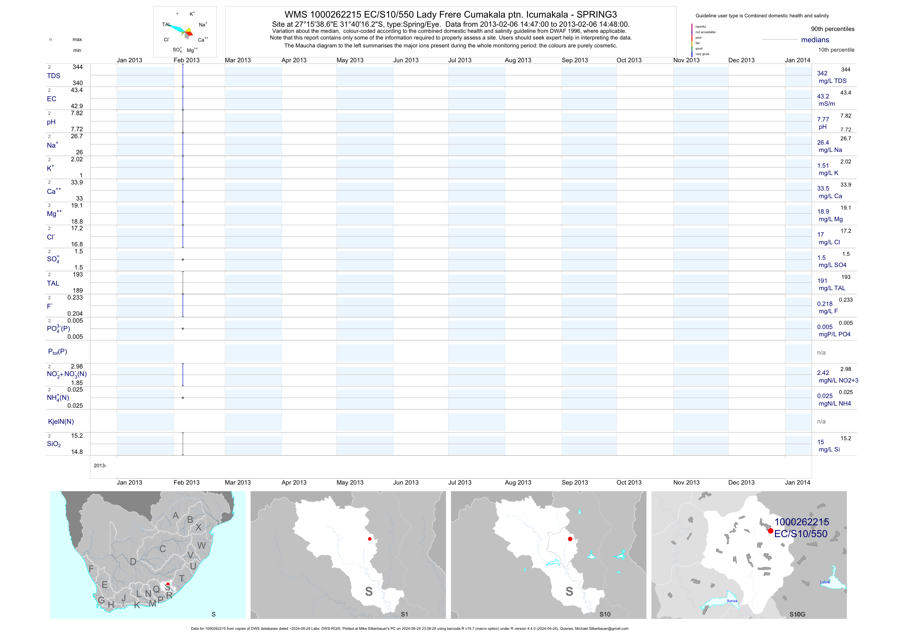
| S10 1000262215 | plot | data | Lady Frere Cumakala ptn. Icumakala - SPRING3 | Spring/Eye | 2 | 2013-02-06 | 2013-02-06 | 43 | EC/S10/550 | -31.67117 | 27.26072 |
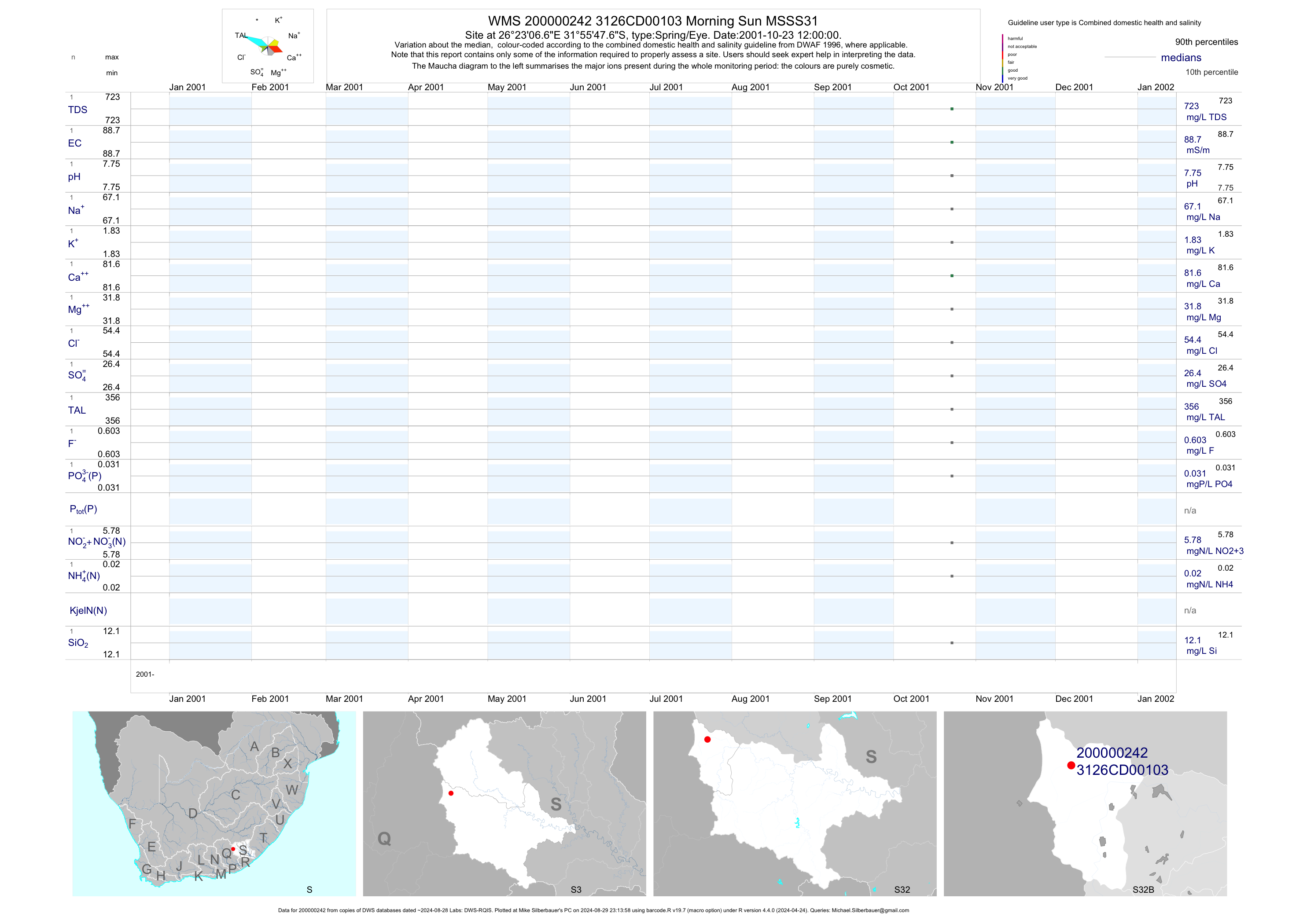
| S32 200000242 | plot | data | Morning Sun MSSS31 | Spring/Eye | 1 | 2001-10-23 | 2001-10-23 | 89 | 103 | -31.92989 | 26.38517 |
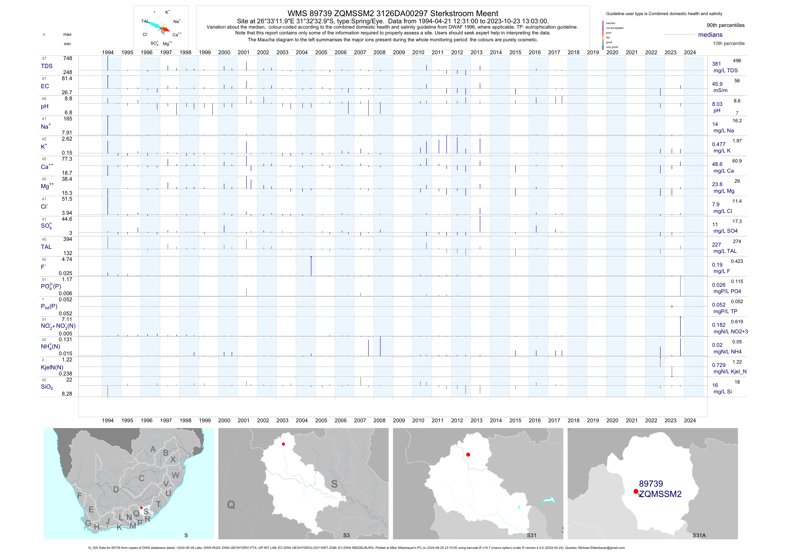
| S31 89739 | plot | data | 3126DA00297 Sterkstroom Meent (N_GW) | Spring/Eye | 50 | 1994-04-21 | 2017-09-14 | 46 | ZQMSSM2 | -31.54250 | 26.55333 |
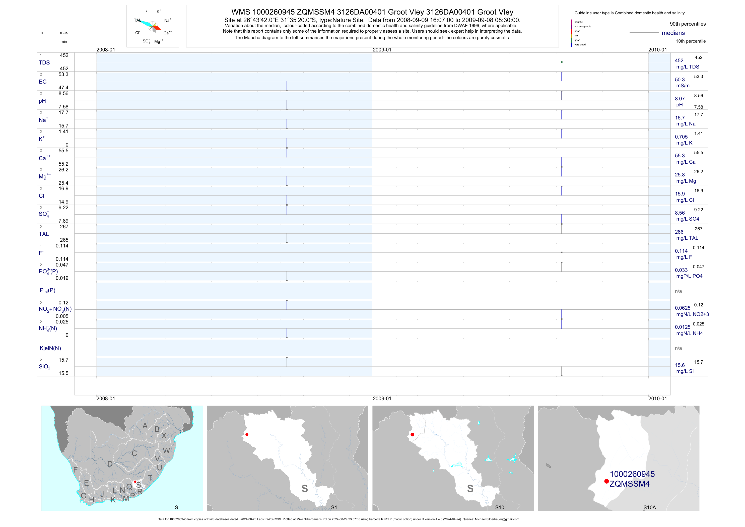
| S10 1000260945 | plot | data | 3126DA00401 Groot Vley 3126DA00401 Groot Vley | Nature Site | 2 | 2008-09-09 | 2009-09-08 | 50 | ZQMSSM4 | -31.58889 | 26.72834 |
| S31 189385 | plot | data | Sterkstroom STW Final Effluent Discharge to Hexrivier | Waste Water Treatment Works | 98 | 2007-01-15 | 2019-07-11 | 64 | 189385 | -31.56736 | 26.56085 |
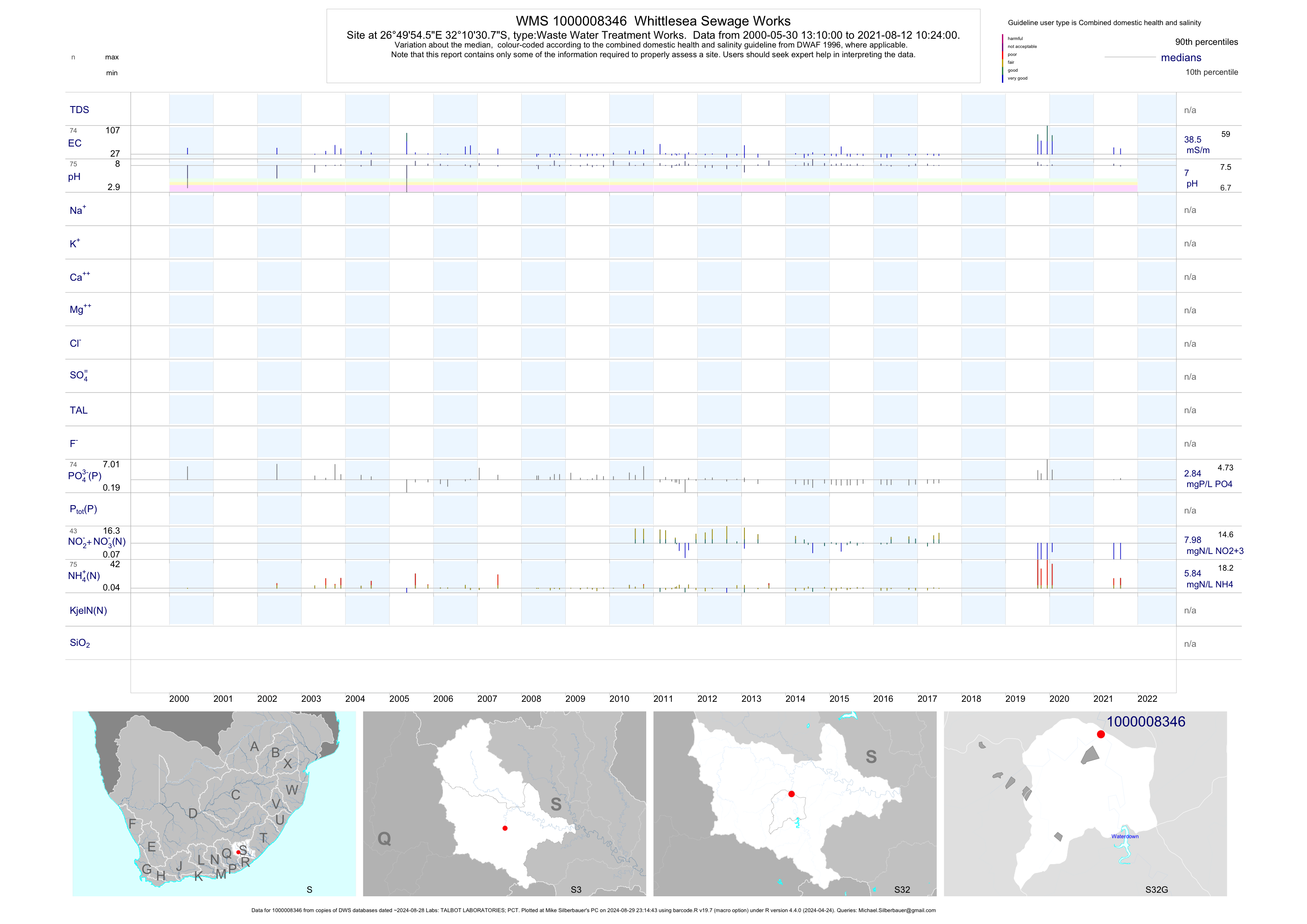
| S32 1000008346 | plot | data | Whittlesea Sewage Works | Waste Water Treatment Works | 137 | 2000-05-30 | 2017-06-26 | 38 | 1-8346 | -32.17520 | 26.83181 |
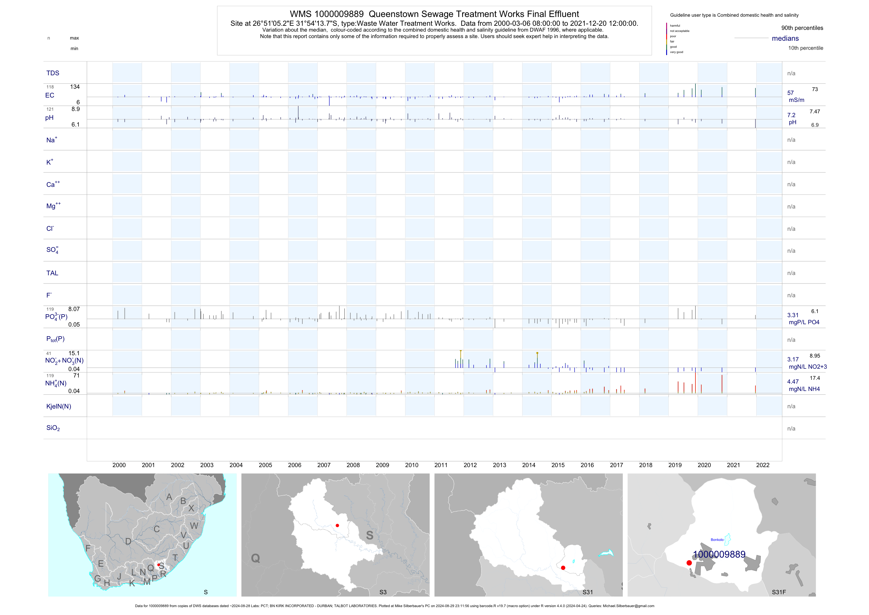
| S31 1000009889 | plot | data | Queenstown Sewage Treatment Works Final Effluent | Waste Water Treatment Works | 224 | 2000-03-06 | 2019-07-11 | 57 | 1-9889 | -31.90382 | 26.85145 |
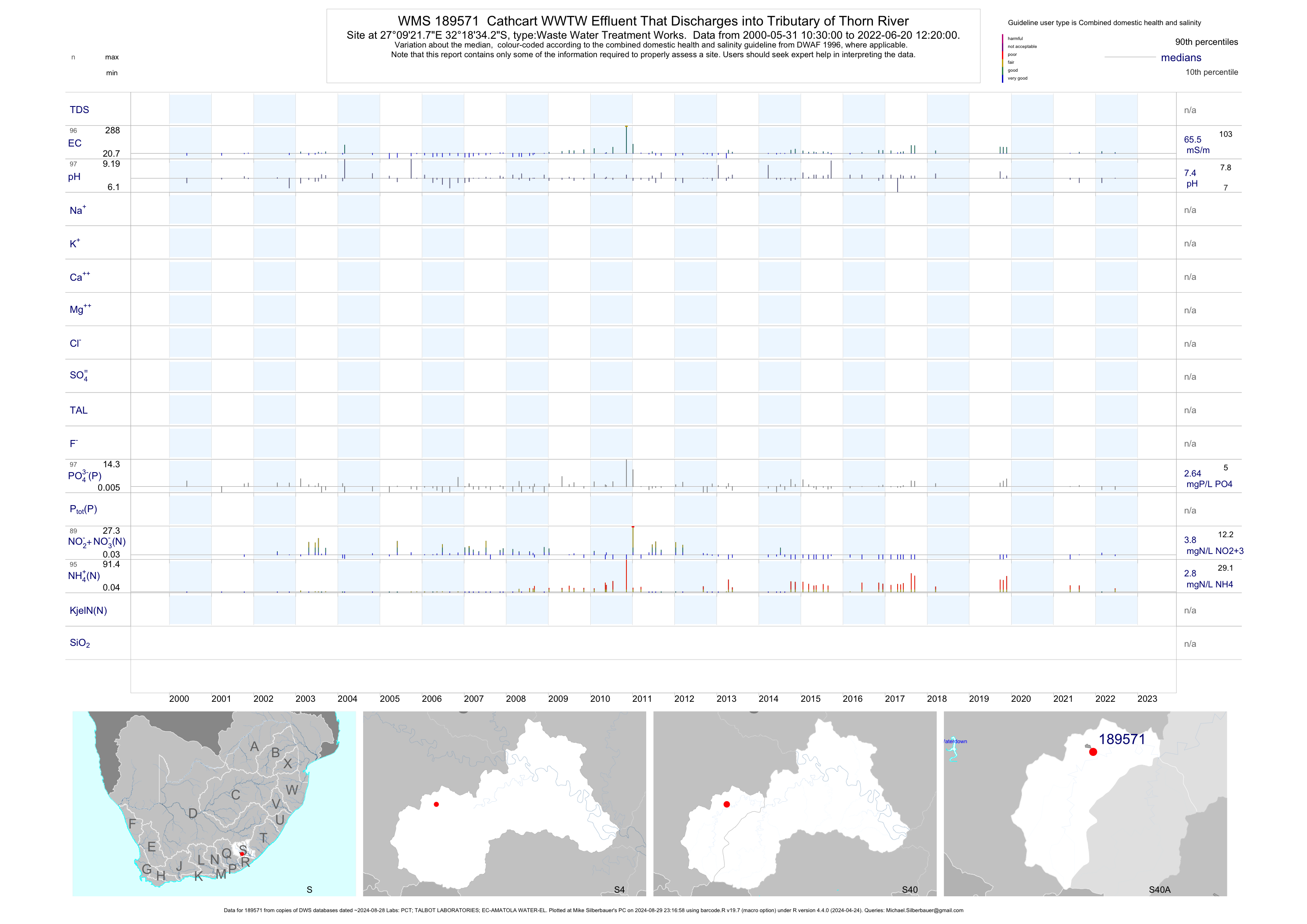
| S40 189571 | plot | data | Cathcart WWTW Effluent That Discharges into Tributary of Thorn River | Waste Water Treatment Works | 171 | 2000-05-31 | 2018-03-15 | 64 | 189571 | -32.30950 | 27.15606 |
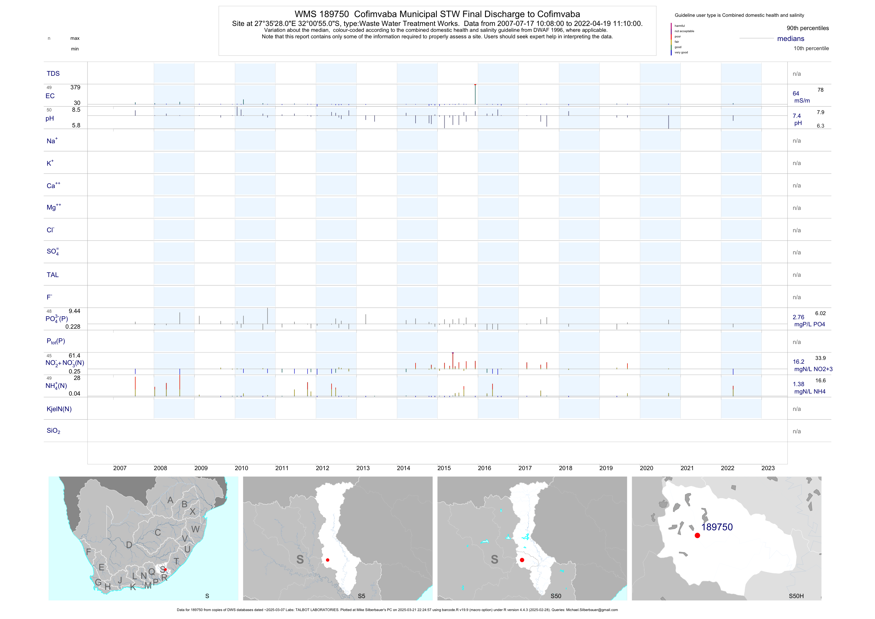
| S50 189750 | plot | data | Cofimvaba Municipal STW Final Discharge to Cofimvaba | Waste Water Treatment Works | 81 | 2007-07-17 | 2019-06-06 | 64 | 189750 | -32.01531 | 27.59114 |
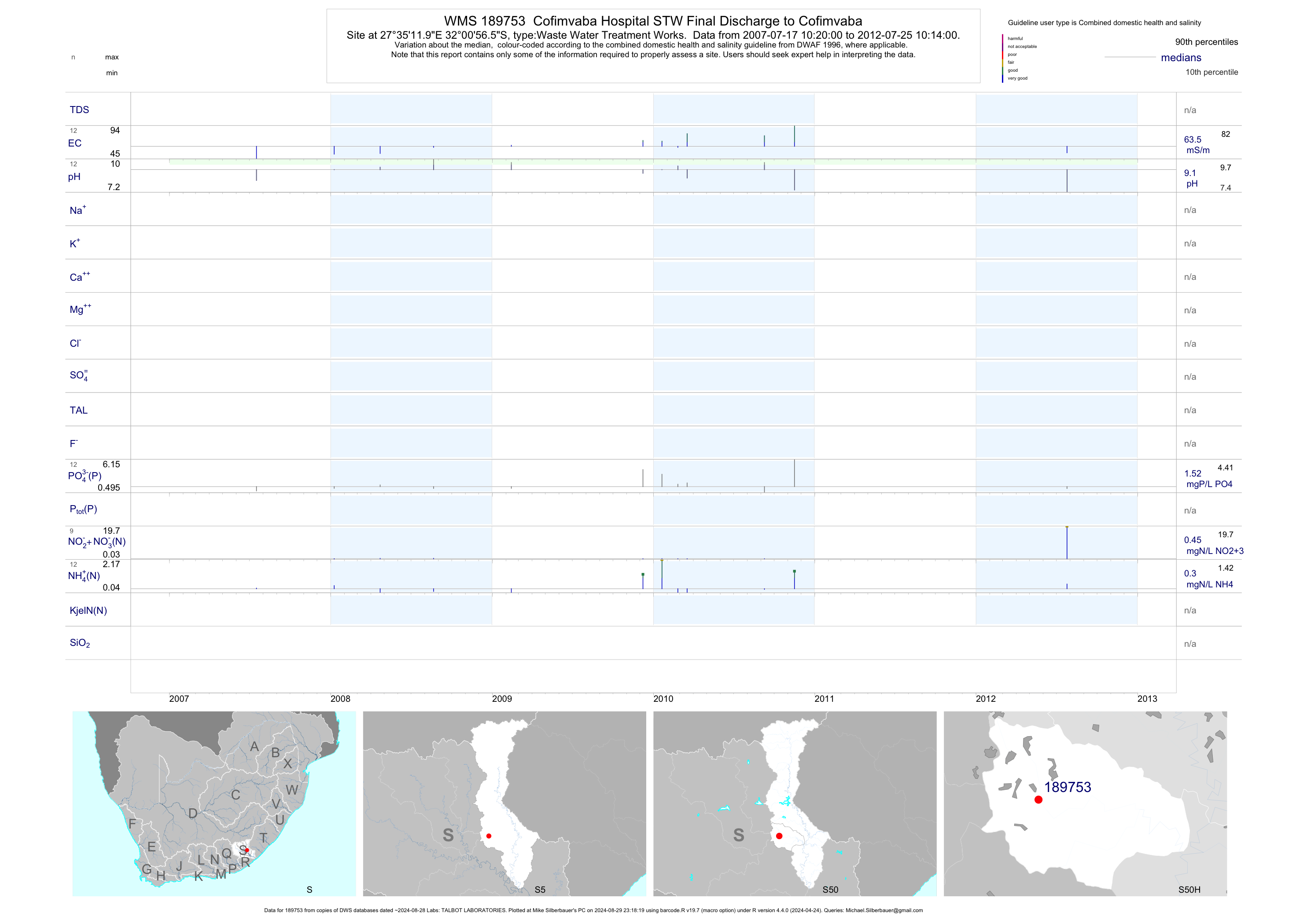
| S50 189753 | plot | data | Cofimvaba Hospital STW Final Discharge to Cofimvaba | Waste Water Treatment Works | 23 | 2007-07-17 | 2012-07-25 | 64 | 189753 | -32.01572 | 27.58667 |
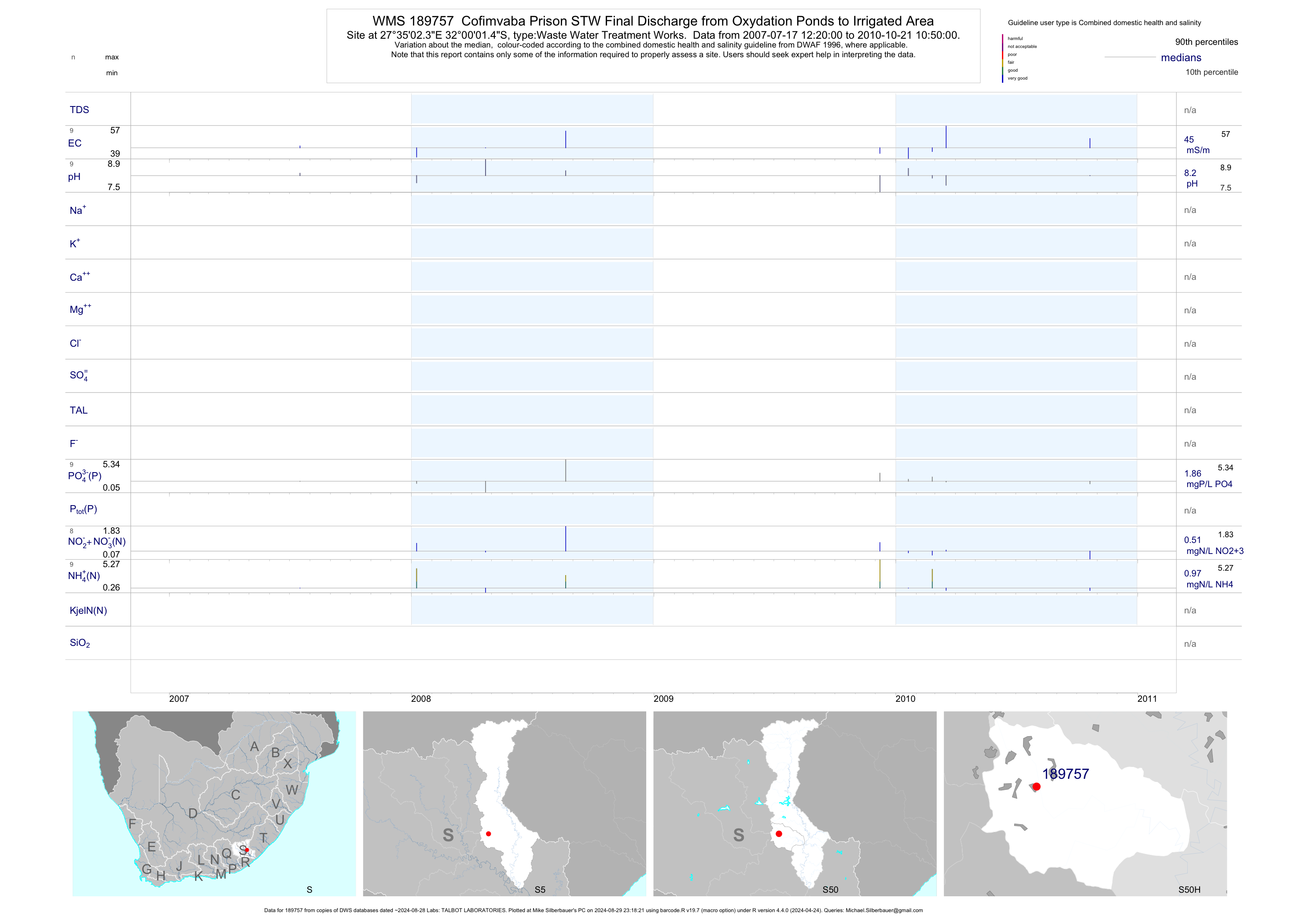
| S50 189757 | plot | data | Cofimvaba Prison STW Final Discharge from Oxydation Ponds to Irrigated Area | Waste Water Treatment Works | 18 | 2007-07-17 | 2010-10-21 | 45 | 189757 | -32.00041 | 27.58399 |
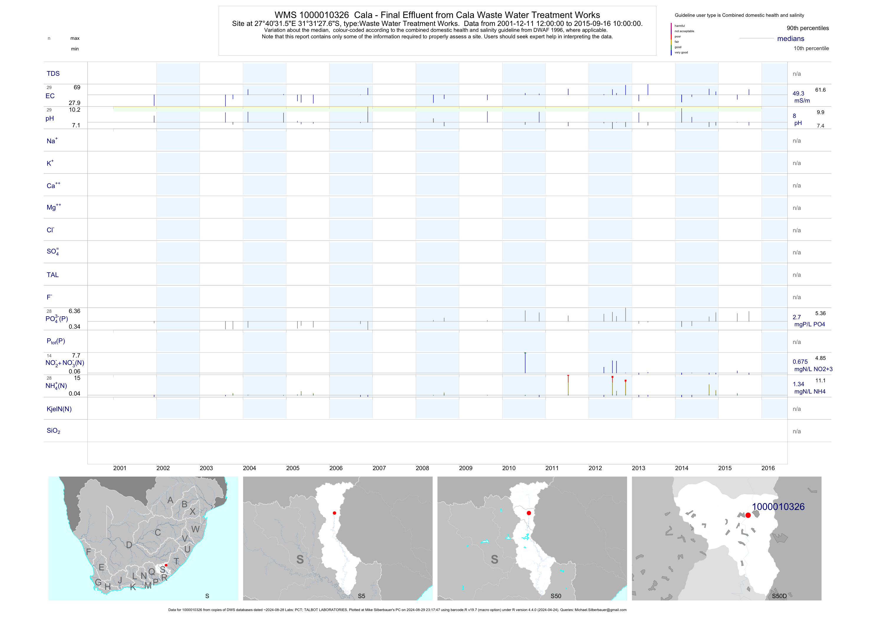
| S50 1000010326 | plot | data | Cala - Final Effluent from Cala Waste Water Treatment Works | Waste Water Treatment Works | 56 | 2001-12-11 | 2015-09-16 | 49 | 1-10326 | -31.52433 | 27.67542 |
| S60 189382 | plot | data | Kubusie Forest Kubusie Sewage Treatment Works Final Discharge | Waste Water Treatment Works | 202 | 2000-07-28 | 2019-04-17 | 35 | 189382 | -32.57908 | 27.30142 |
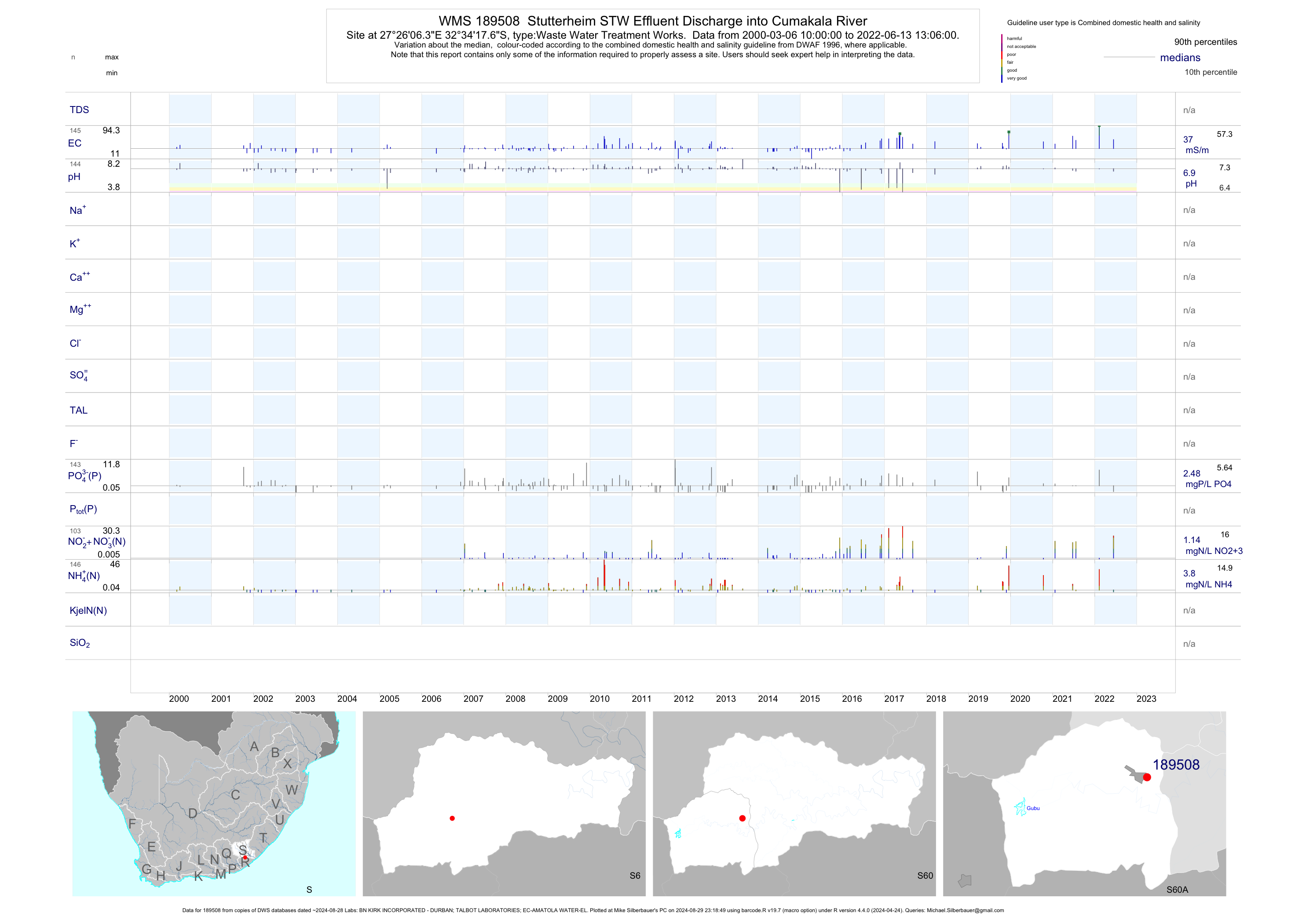
| S60 189508 | plot | data | Stutterheim STW Effluent Discharge into Cumakala River | Waste Water Treatment Works | 269 | 2000-03-06 | 2019-04-17 | 37 | 189508 | -32.57156 | 27.43508 |
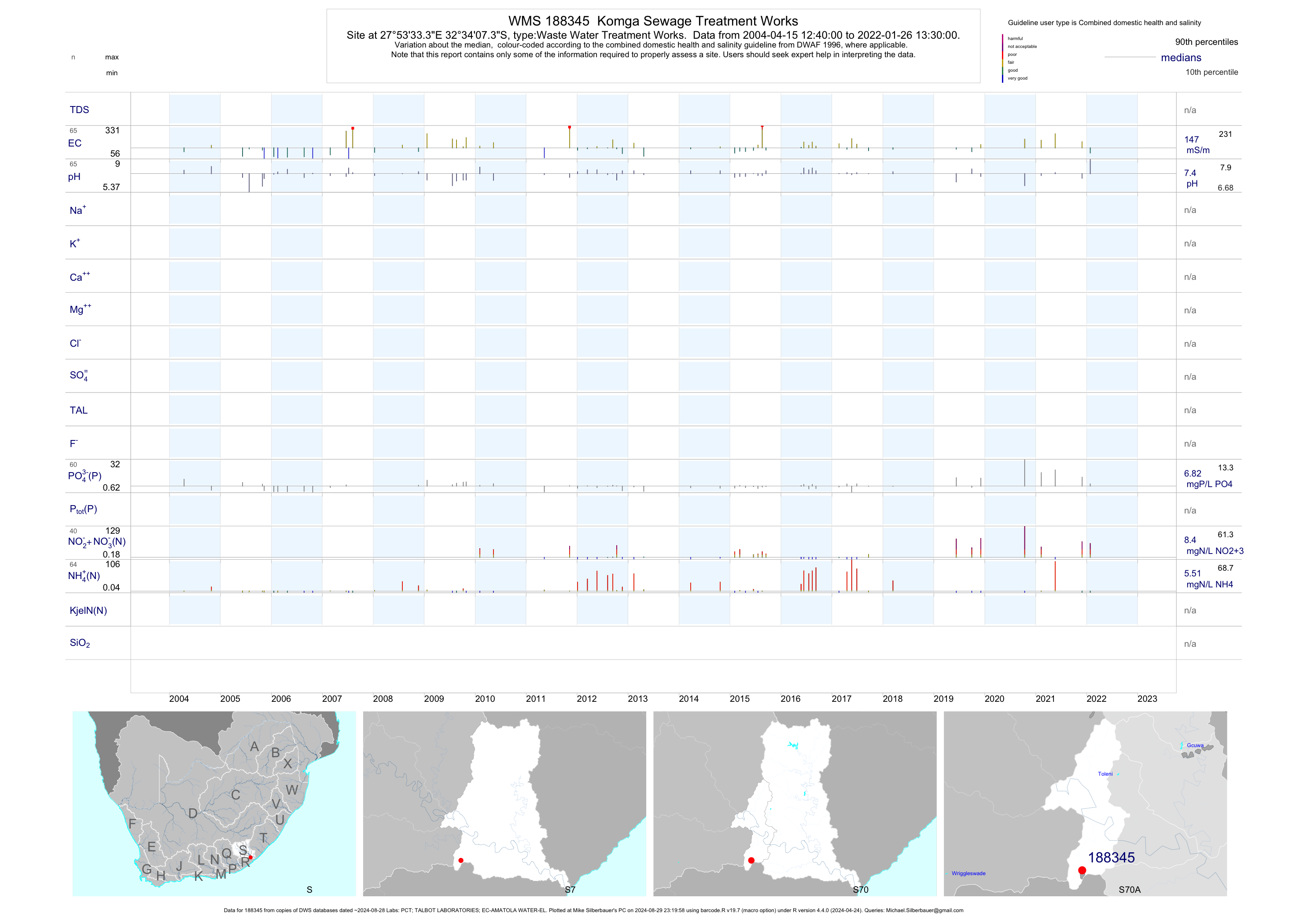
| S70 188345 | plot | data | Komga Sewage Treatment Works | Waste Water Treatment Works | 99 | 2004-04-15 | 2019-06-11 | 139 | 188345 | -32.56872 | 27.89258 |
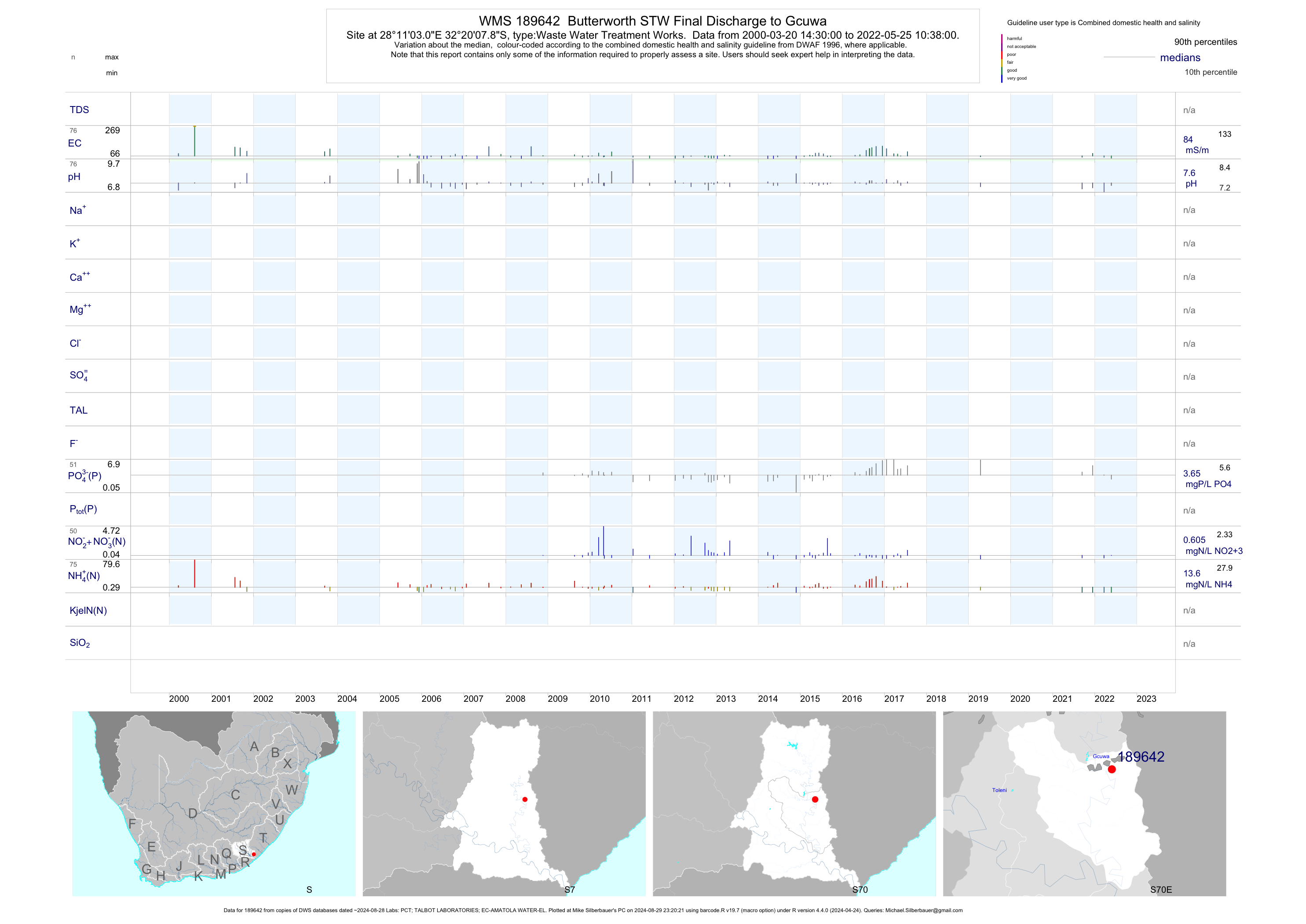
| S70 189642 | plot | data | Butterworth STW Final Discharge to Gcuwa | Waste Water Treatment Works | 118 | 2000-03-20 | 2017-04-25 | 84 | 189642 | -32.33551 | 28.18417 |
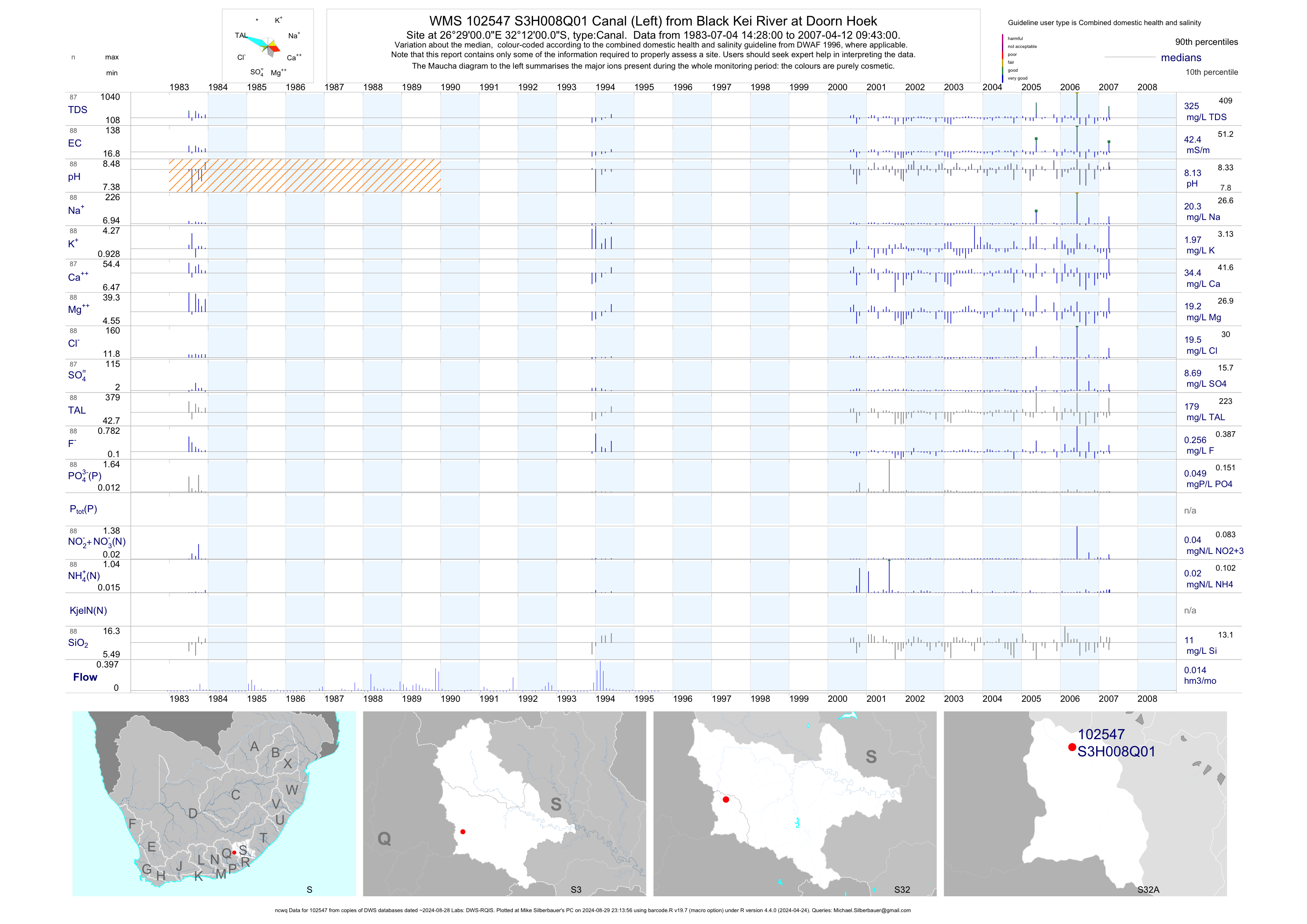
| S32 102547 | plot | data | Canal (Left) from Black Kei River at Doorn Hoek (ncwq) | Canal | 88 | 1983-07-04 | 2007-04-12 | 42 | S3H008 | -32.20000 | 26.48333 |
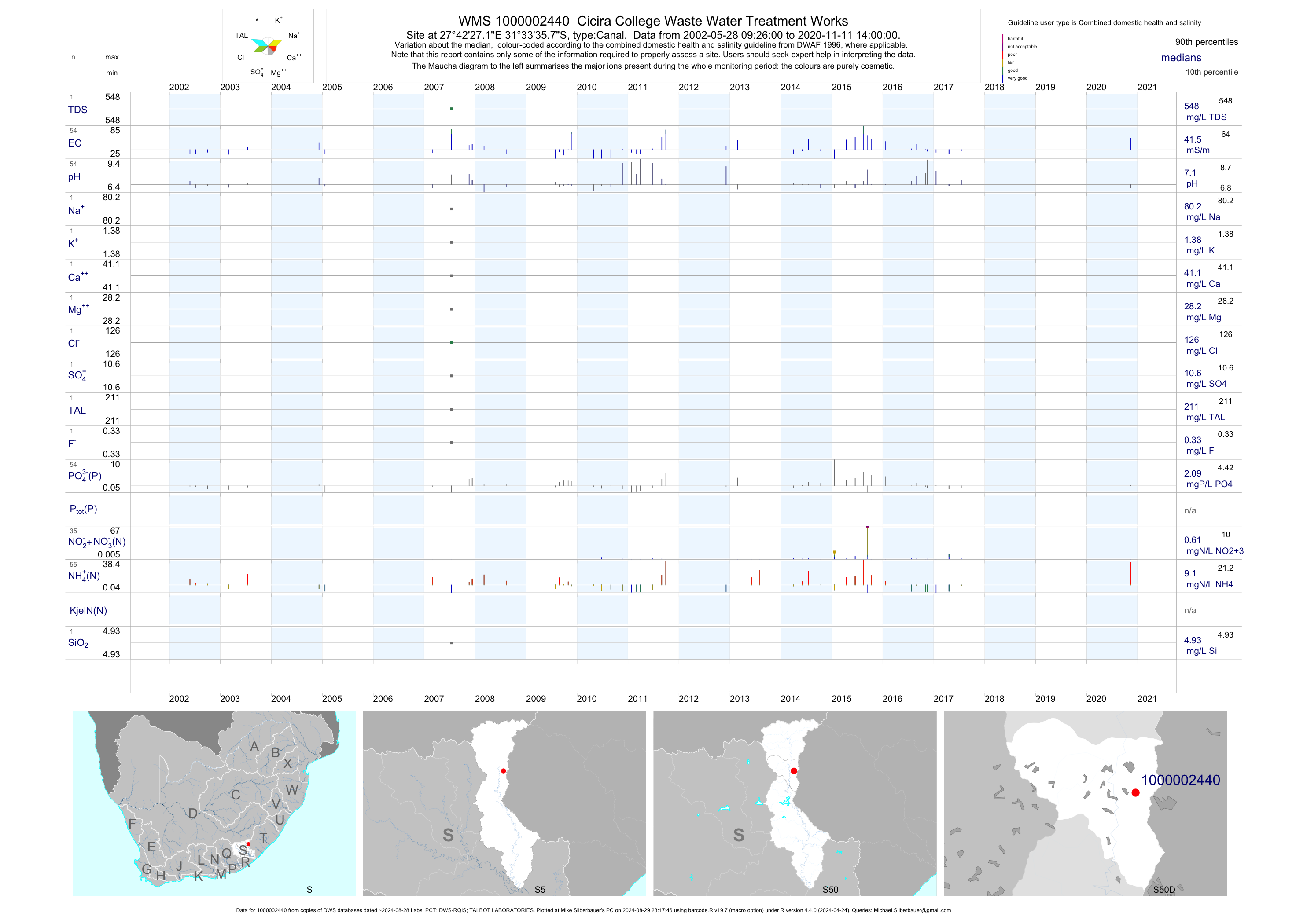
| S50 1000002440 | plot | data | Cicira College Waste Water Treatment Works | Canal | 96 | 2002-05-28 | 2017-07-17 | 42 | 1-2440 | -31.55992 | 27.70753 |
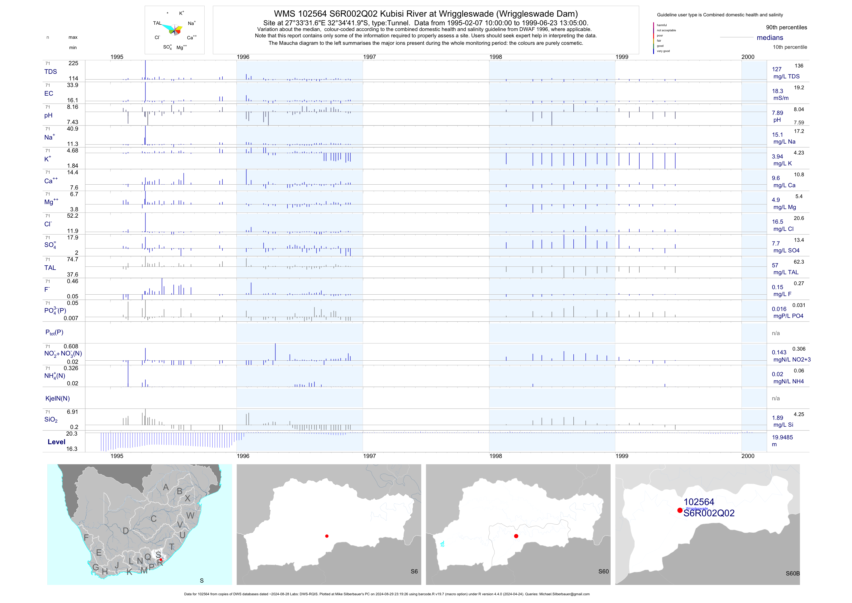
| S60 102564 | plot | data | Kubisi River at Wriggleswade (Wriggleswade Dam) Q02 | Tunnel | 91 | 1995-02-07 | 1999-06-23 | 18 | S6R002 | -32.57832 | 27.55879 |
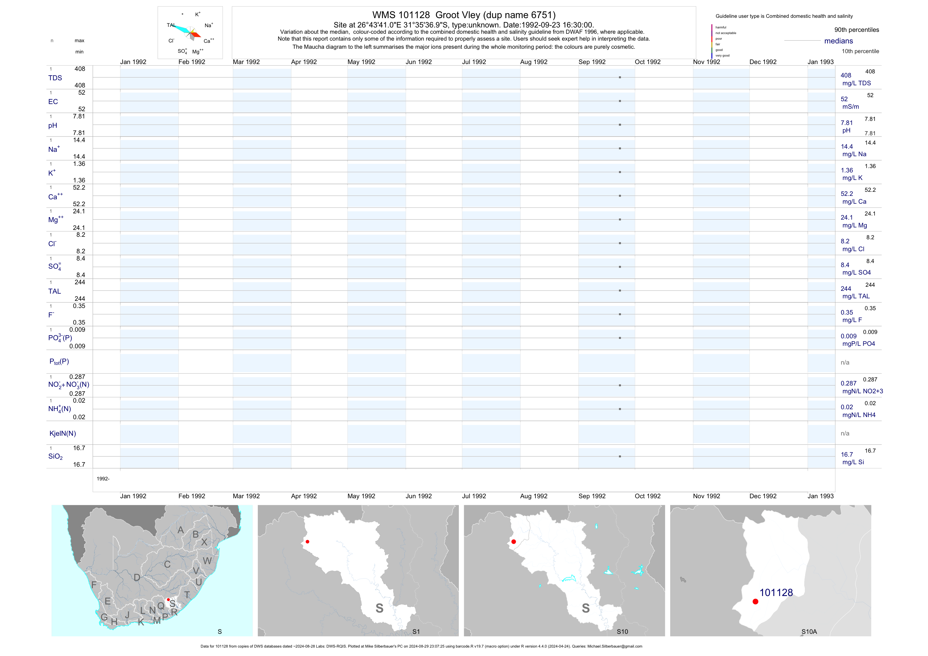
| S10 101128 | plot | data | Groot Vley (dup name 6751) | unknown | 1 | 1992-09-23 | 1992-09-23 | 52 | 101128 | -31.59361 | 26.72806 |
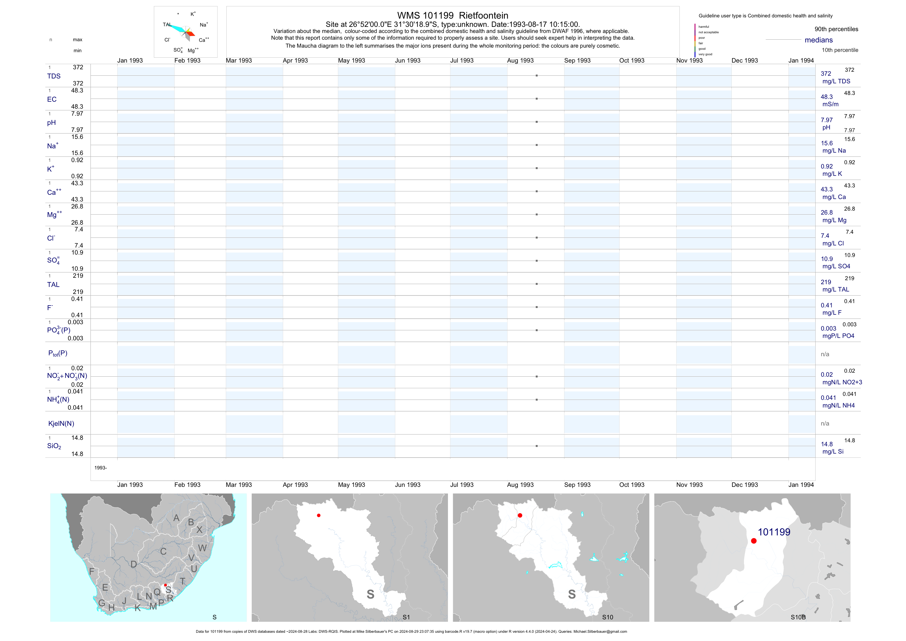
| S10 101199 | plot | data | Rietfoontein | unknown | 1 | 1993-08-17 | 1993-08-17 | 48 | 101199 | -31.50528 | 26.86667 |
| S10 101200 | plot | data | Groot Vley (dup name 6784) | unknown | 1 | 1993-10-28 | 1993-10-28 | 48 | 101200 | -31.58750 | 26.72944 |
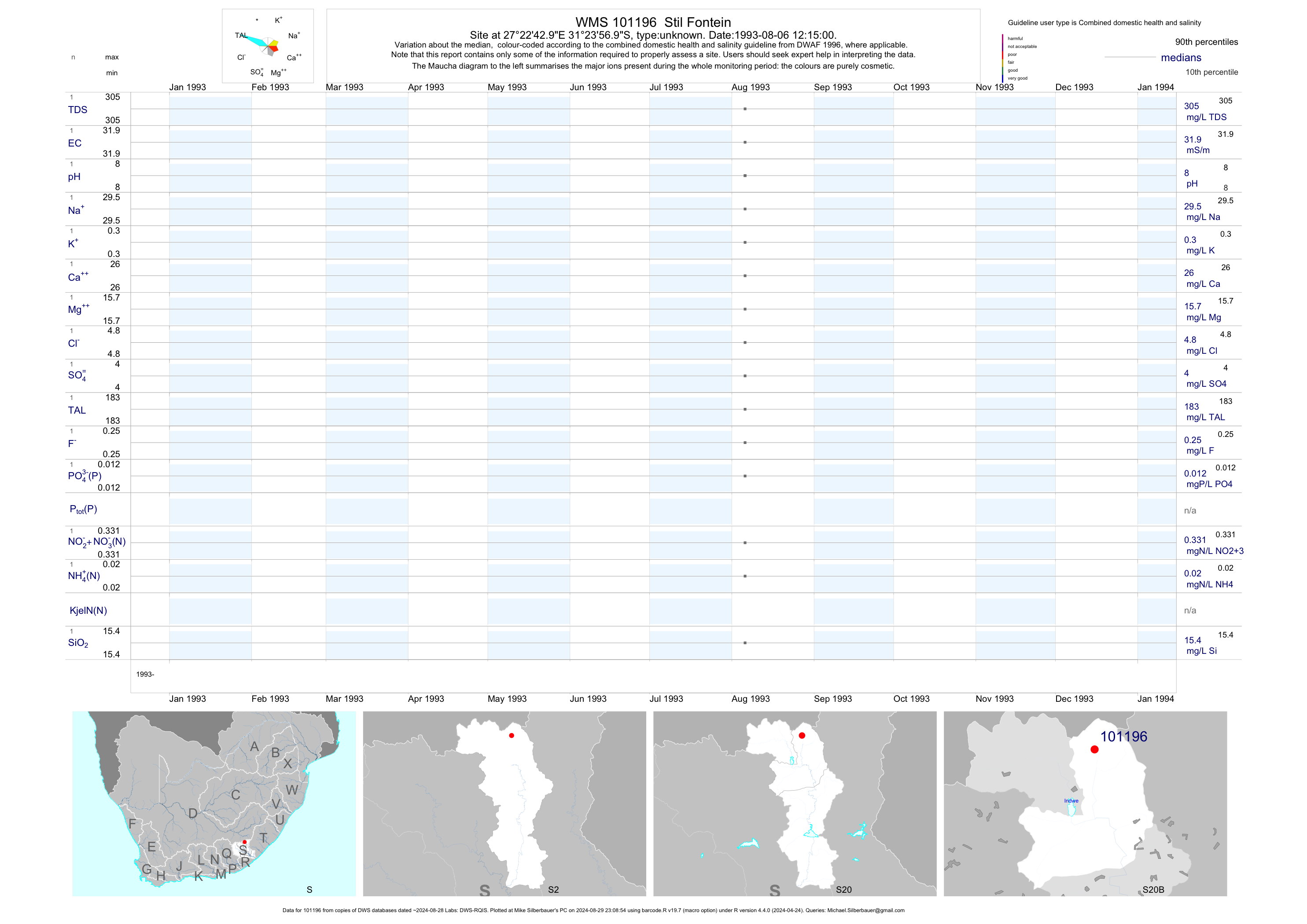
| S20 101196 | plot | data | Stil Fontein | unknown | 1 | 1993-08-06 | 1993-08-06 | 32 | 101196 | -31.39917 | 27.37861 |
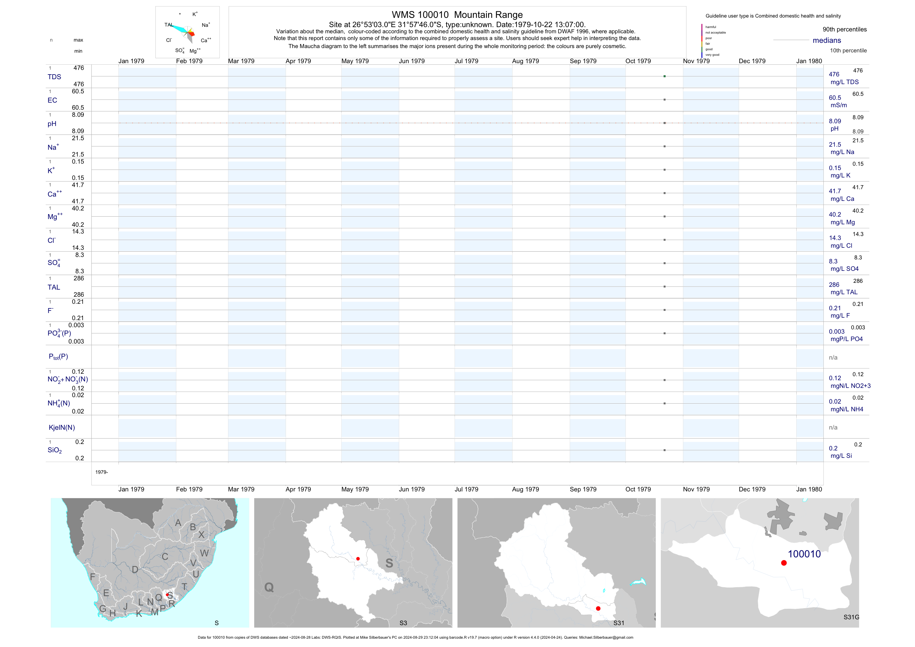
| S31 100010 | plot | data | Mountain Range | unknown | 1 | 1979-10-22 | 1979-10-22 | 60 | 100010 | -31.96278 | 26.88417 |
| S31 100011 | plot | data | Bowes (dup name 6116) | unknown | 1 | 1979-10-18 | 1979-10-18 | 43 | 100011 | -31.96361 | 26.93806 |
| S31 100012 | plot | data | Bowes (dup name 6117) | unknown | 1 | 1979-10-22 | 1979-10-22 | 63 | 100012 | -31.98528 | 26.95611 |
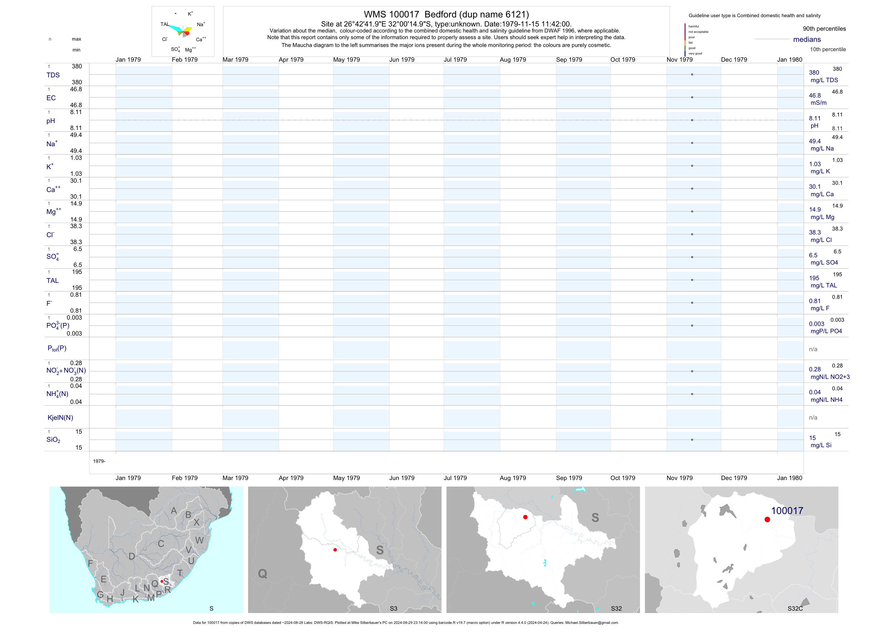
| S32 100017 | plot | data | Bedford (dup name 6121) | unknown | 1 | 1979-11-15 | 1979-11-15 | 47 | 100017 | -32.00417 | 26.71167 |
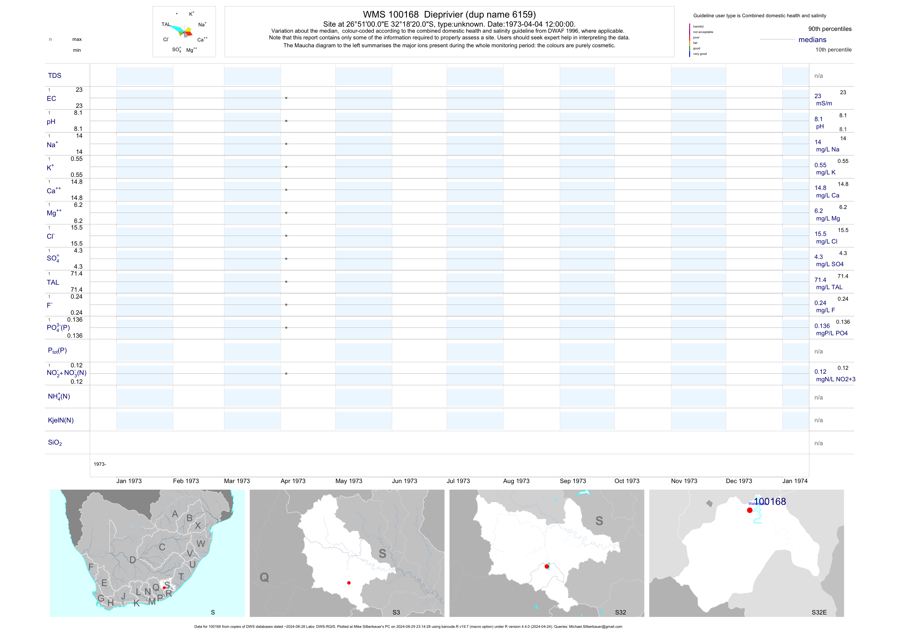
| S32 100168 | plot | data | Dieprivier (dup name 6159) | unknown | 1 | 1973-04-04 | 1973-04-04 | 23 | 100168 | -32.30556 | 26.85000 |
| S32 100169 | plot | data | Kliprivier (dup name 6160) | unknown | 1 | 1973-04-04 | 1973-04-04 | 8 | 100169 | -32.31250 | 26.88750 |
| S31 101188 | plot | data | Glen Torret | unknown | 1 | 1993-08-05 | 1993-08-05 | 34 | 101188 | -31.79222 | 26.33833 |
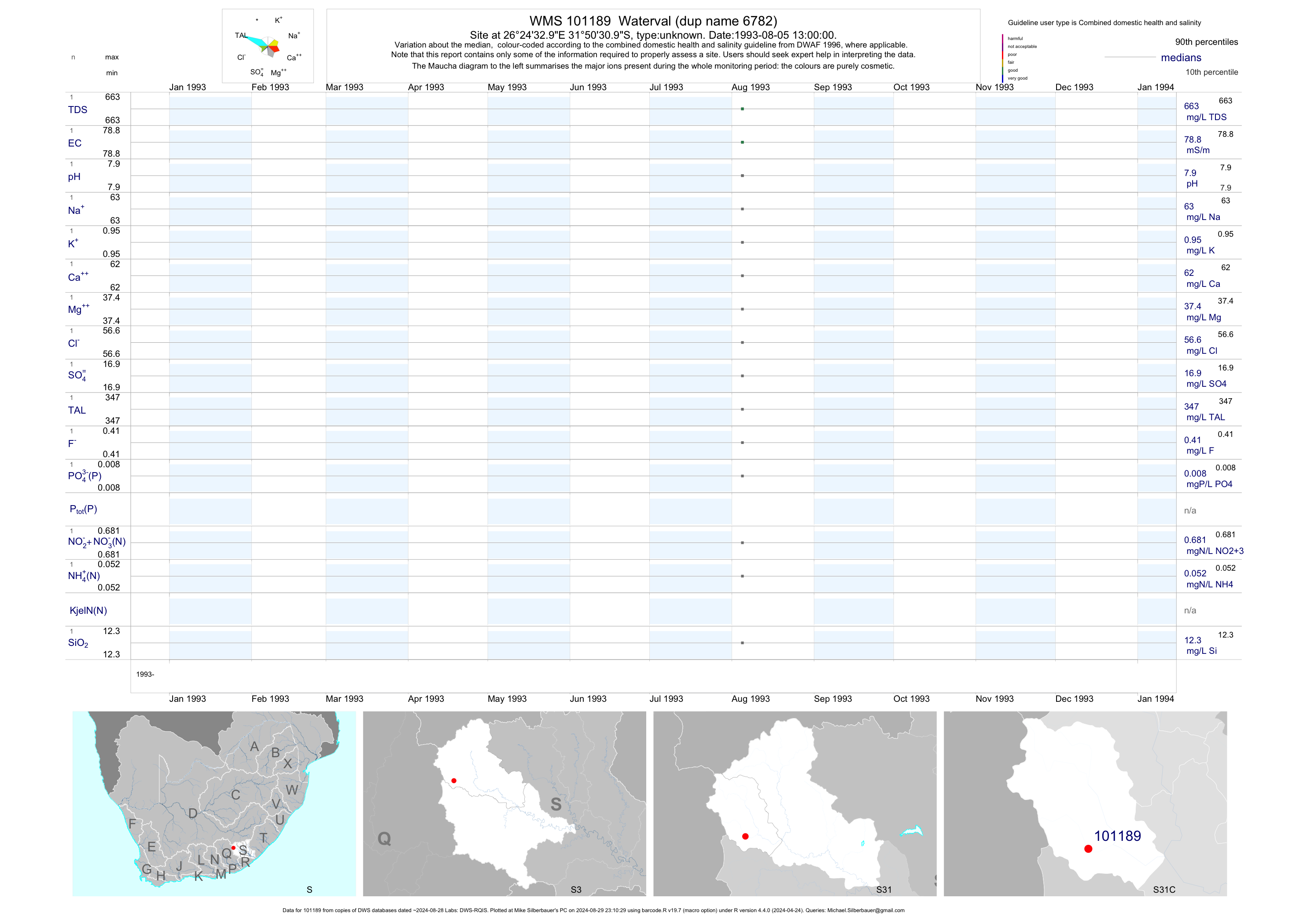
| S31 101189 | plot | data | Waterval (dup name 6782) | unknown | 1 | 1993-08-05 | 1993-08-05 | 79 | 101189 | -31.84194 | 26.40917 |
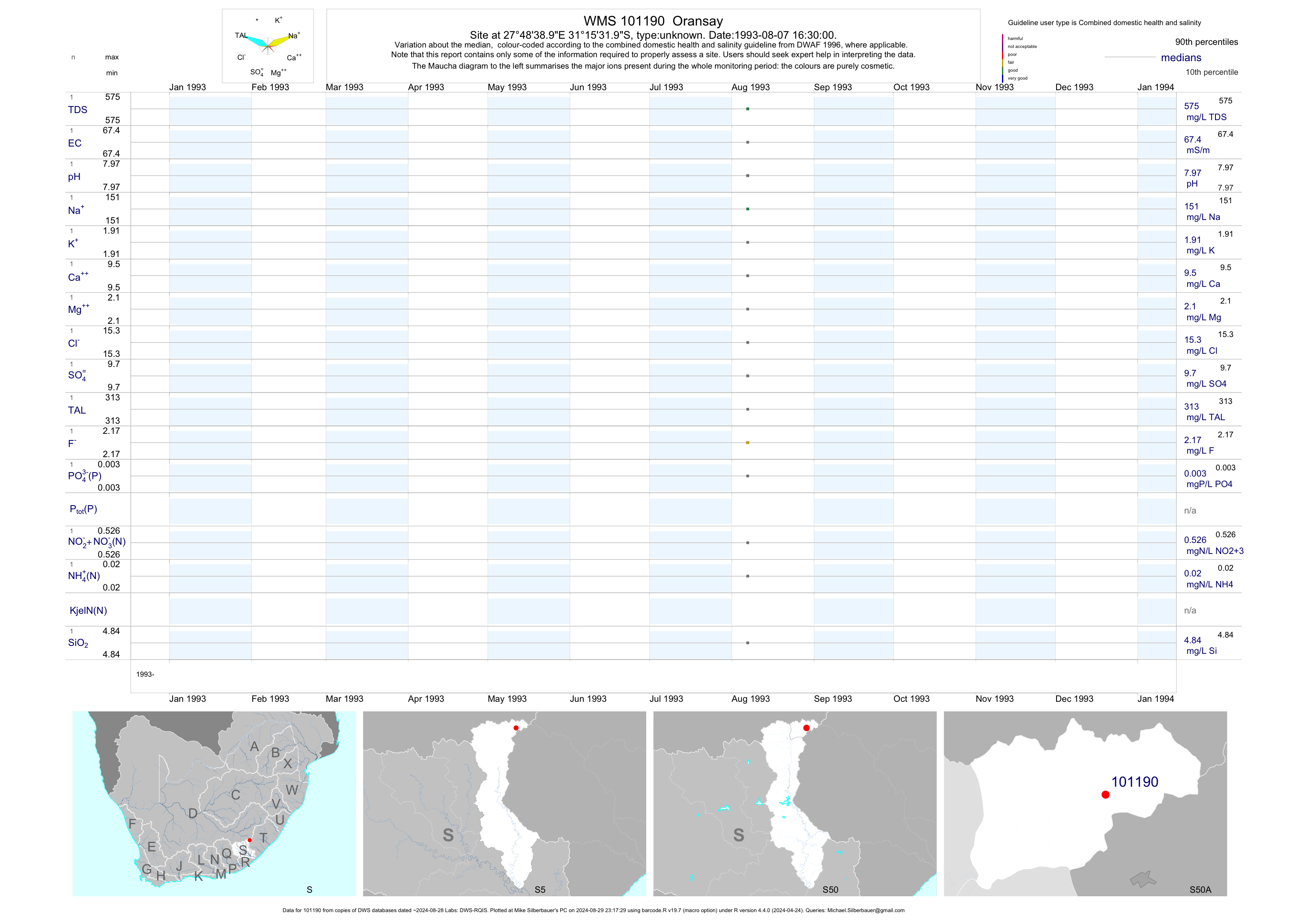
| S50 101190 | plot | data | Oransay | unknown | 1 | 1993-08-07 | 1993-08-07 | 67 | 101190 | -31.25889 | 27.81083 |
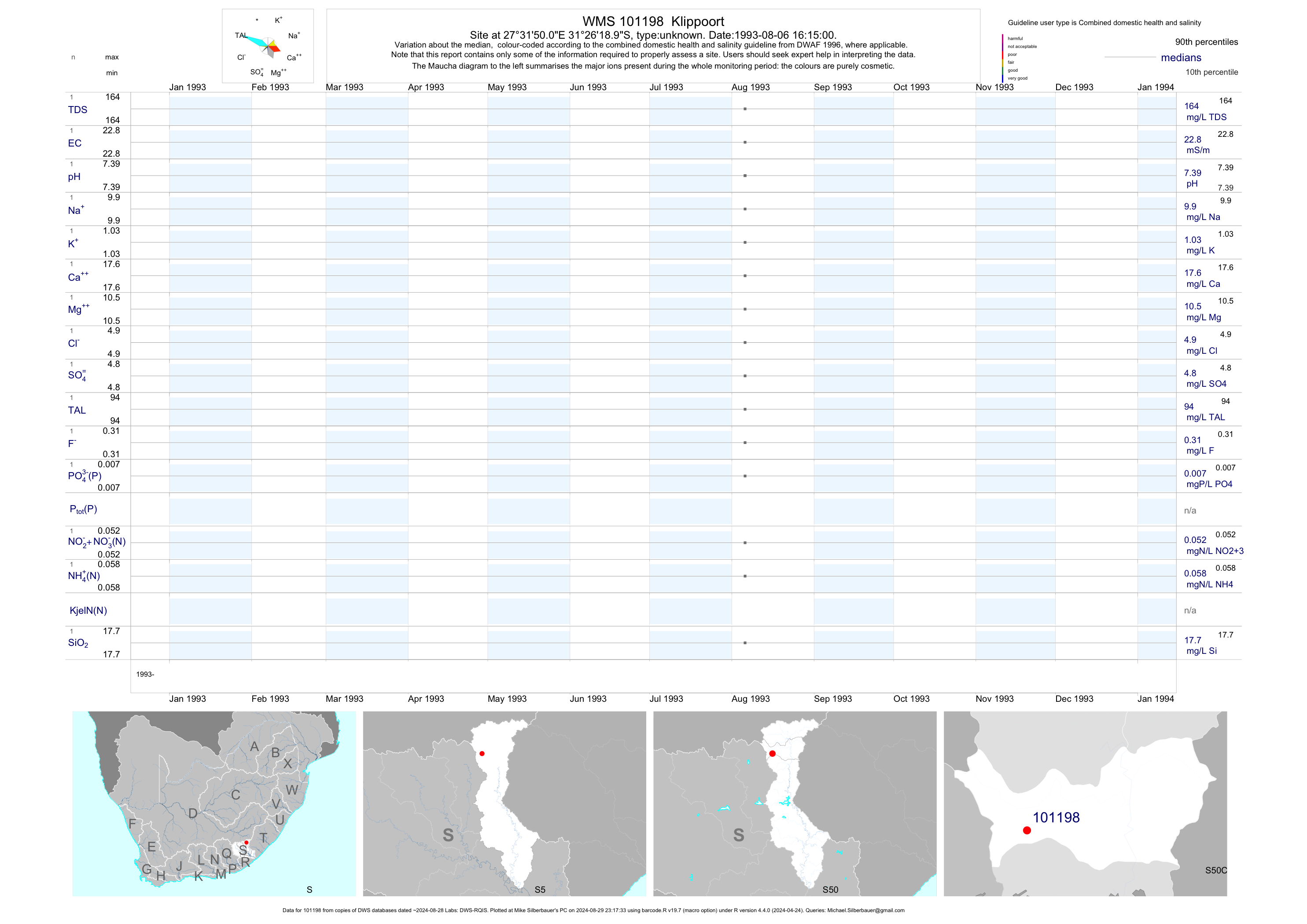
| S50 101198 | plot | data | Klippoort | unknown | 1 | 1993-08-06 | 1993-08-06 | 23 | 101198 | -31.43861 | 27.53056 |
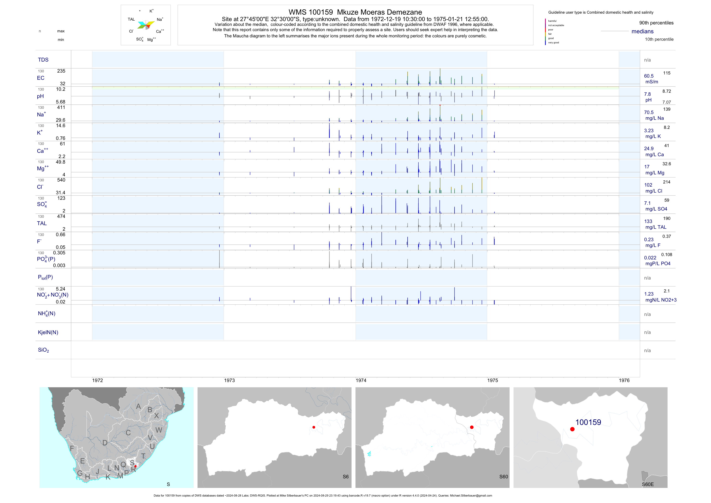
| S60 100159 | plot | data | Mkuze Moeras Demezane | unknown | 130 | 1972-12-19 | 1975-01-21 | 60 | 100159 | -32.50000 | 27.75000 |
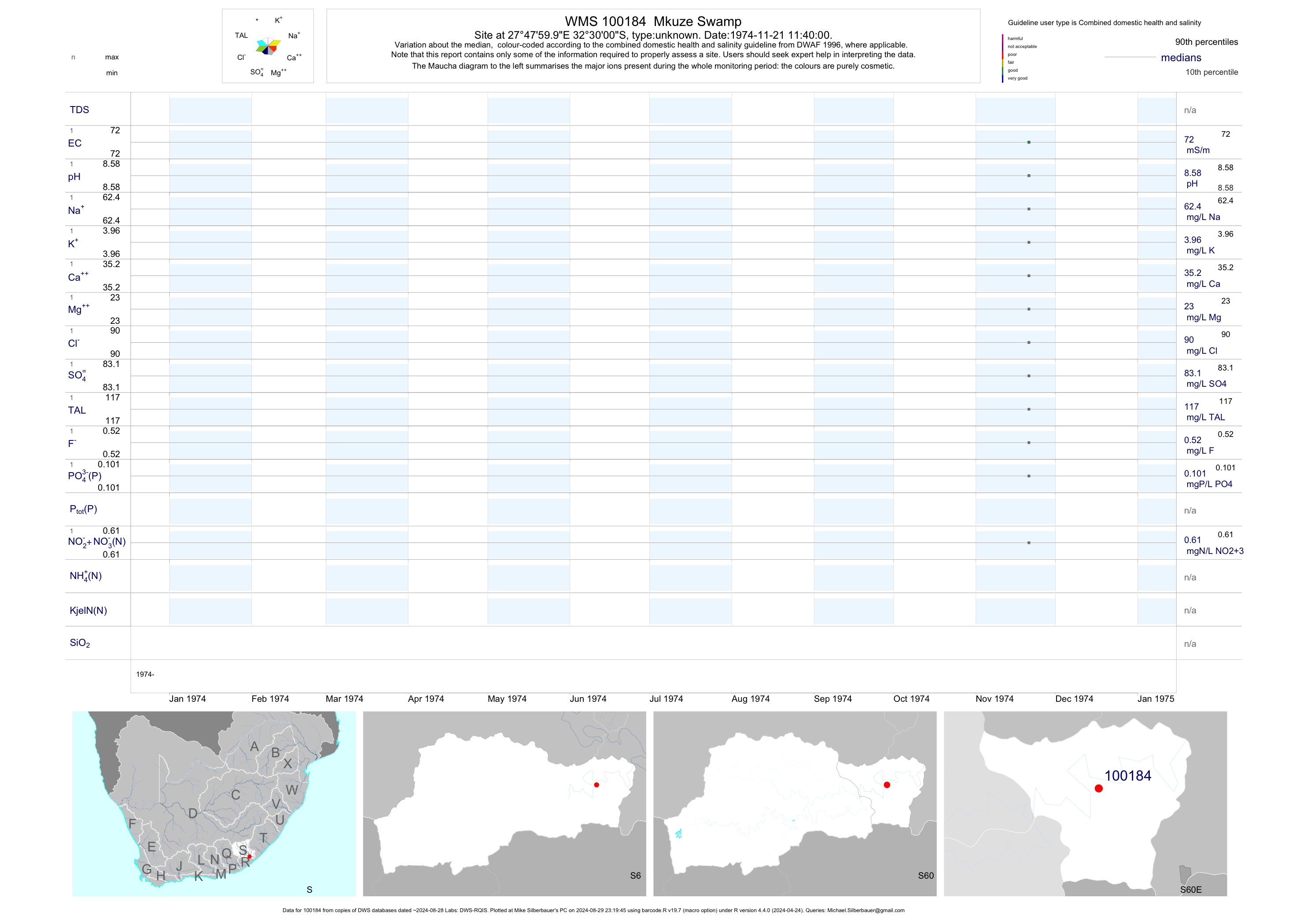
| S60 100184 | plot | data | Mkuze Swamp | unknown | 1 | 1974-11-21 | 1974-11-21 | 72 | 100184 | -32.50000 | 27.80000 |