Resource water quality data for Luvuvhu and Letaba WMA.

Resource water quality data for Luvuvhu and Letaba WMA. |
|
| Water quality | Description | Type | n | First date | Last date | med EC | Flow, if any |
Latitude | Longitude | ||
|---|---|---|---|---|---|---|---|---|---|---|---|
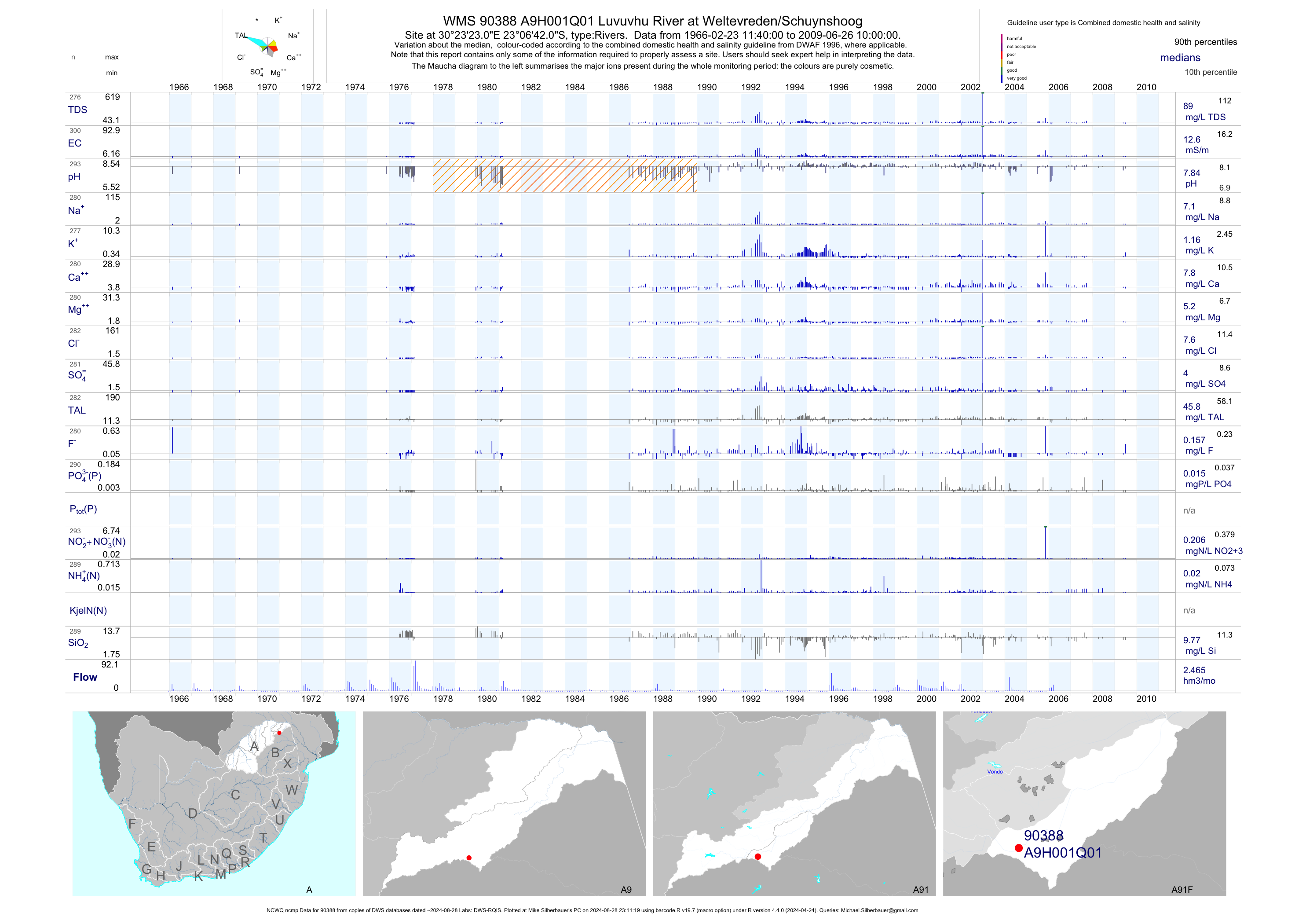
| A91 90388 | plot | data | Luvuvhu River at Weltevreden/Schuynshoog (NCWQ ncmp) | Rivers | 300 | 1966-02-23 | 2009-06-26 | 13 | A9H001 | -23.11167 | 30.38972 |
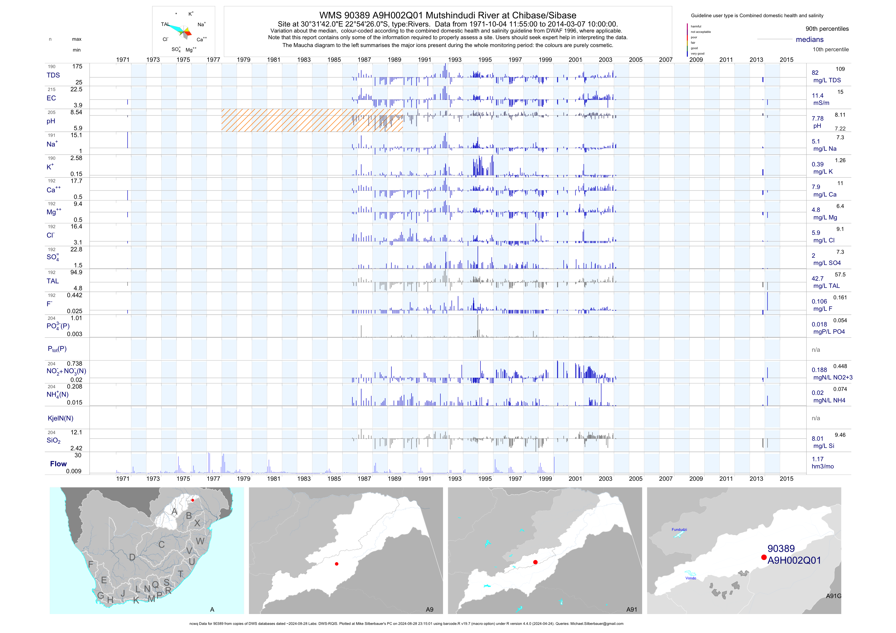
| A91 90389 | plot | data | Mutshindudi River at Chibase/Sibase (ncwq) | Rivers | 216 | 1971-10-04 | 2014-03-07 | 11 | A9H002 | -22.90722 | 30.52833 |
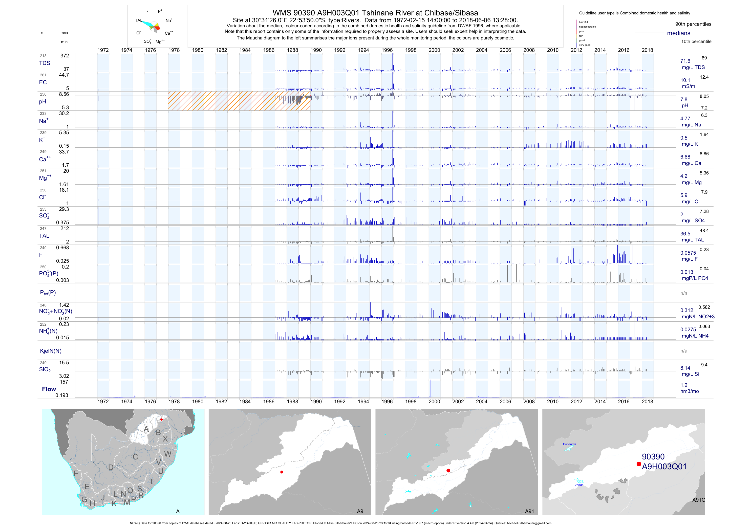
| A91 90390 | plot | data | Tshinane River at Chibase/Sibasa (NCWQ) | Rivers | 269 | 1972-02-15 | 2018-06-06 | 10 | A9H003 | -22.89722 | 30.52389 |
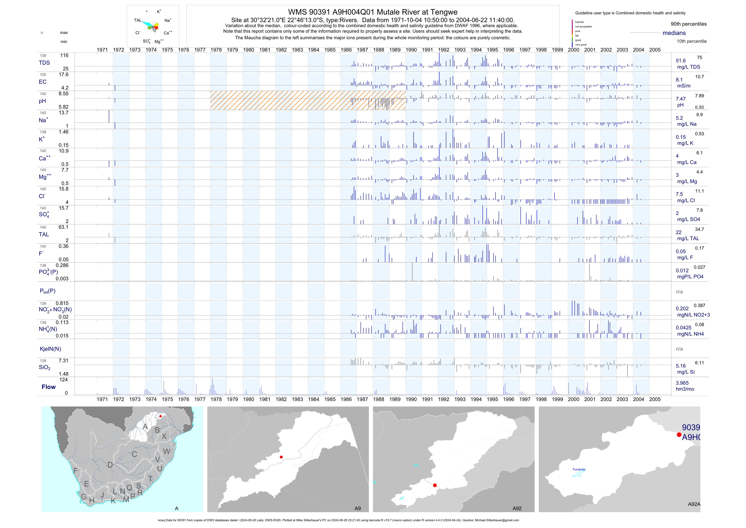
| A92 90391 | plot | data | Mutale River at Tengwe (ncwq) | Rivers | 150 | 1971-10-04 | 2004-06-22 | 8 | A9H004 | -22.77028 | 30.53917 |
| A91 90392 | plot | data | Luvuvhu River at Nooitgedacht | Rivers | 26 | 1966-02-24 | 1986-09-30 | 12 | A9H005 | -23.08472 | 30.17333 |
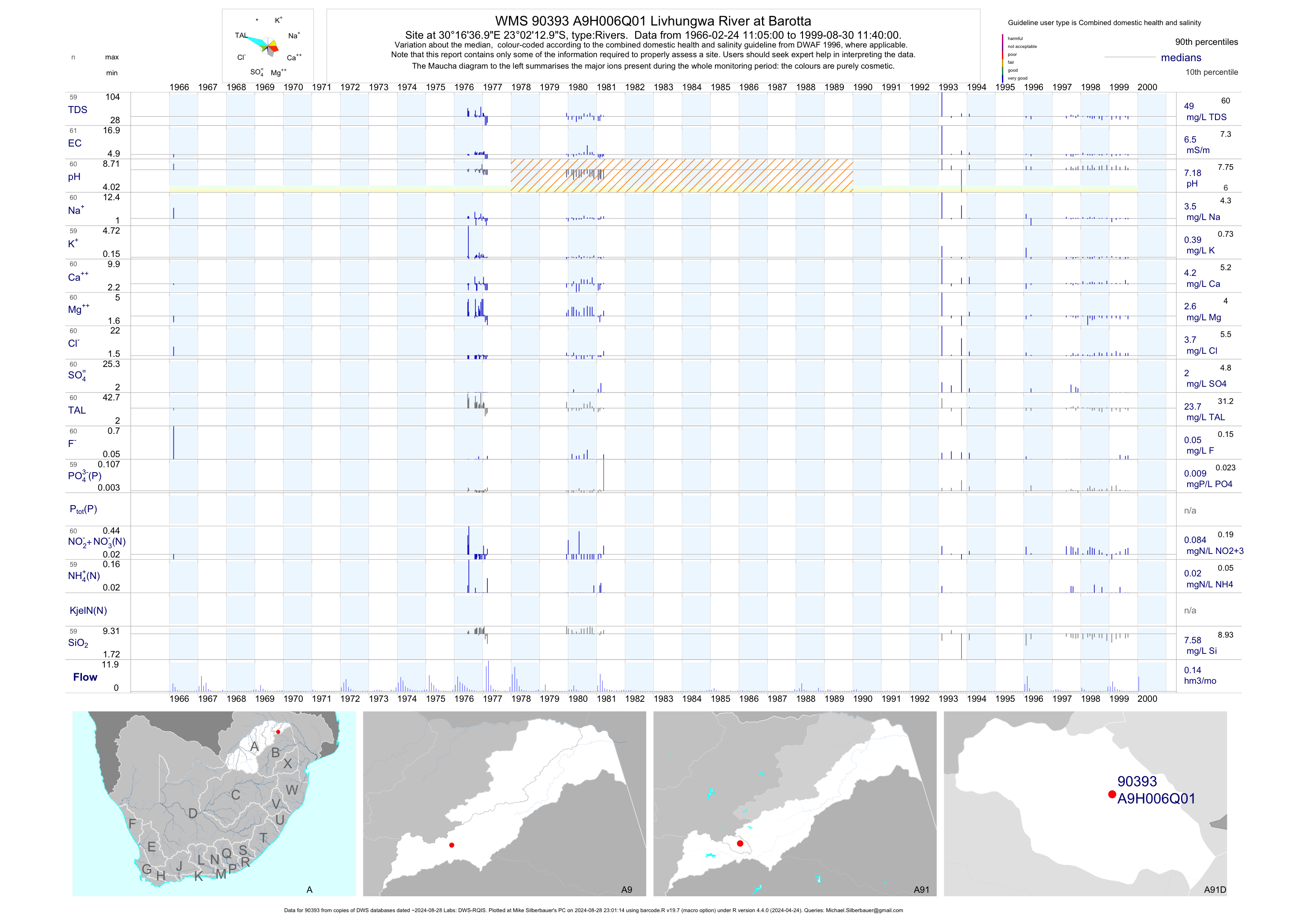
| A91 90393 | plot | data | Livhungwa River at Barotta | Rivers | 61 | 1966-02-24 | 1999-08-30 | 6 | A9H006 | -23.03694 | 30.27694 |
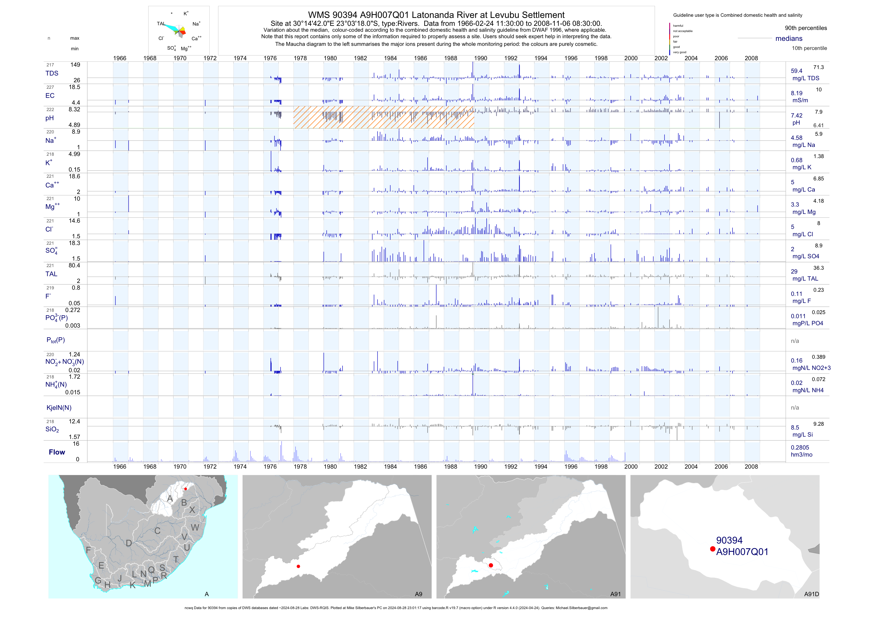
| A91 90394 | plot | data | Latonanda River at Levubu Settlement (ncwq) | Rivers | 227 | 1966-02-24 | 2008-11-06 | 8 | A9H007 | -23.05500 | 30.24500 |
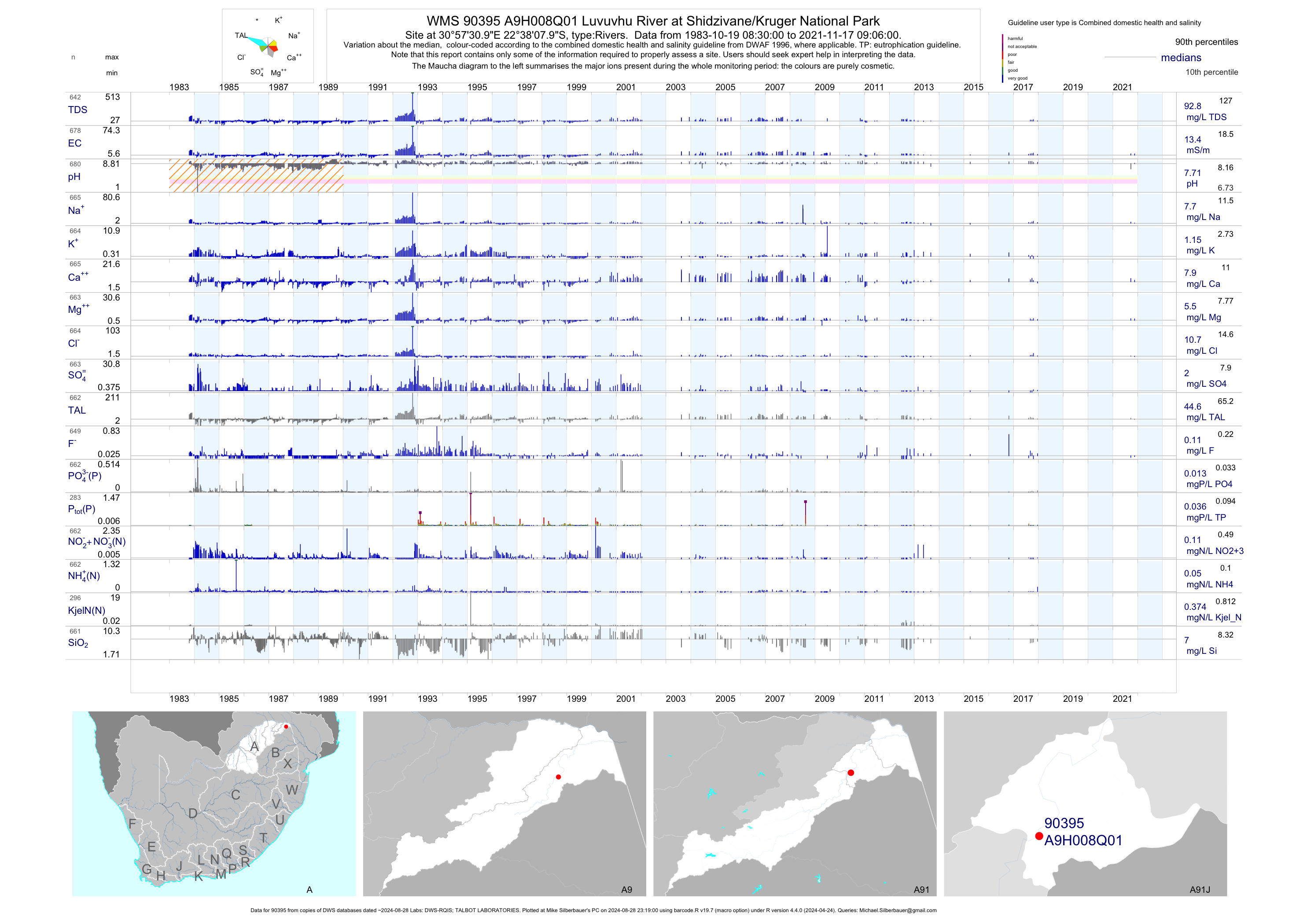
| A91 90395 | plot | data | Luvuvhu River at Shidzivane/Kruger National Park | Rivers | 975 | 1983-10-19 | 2017-12-20 | 13 | A9H008 | -22.63556 | 30.95861 |
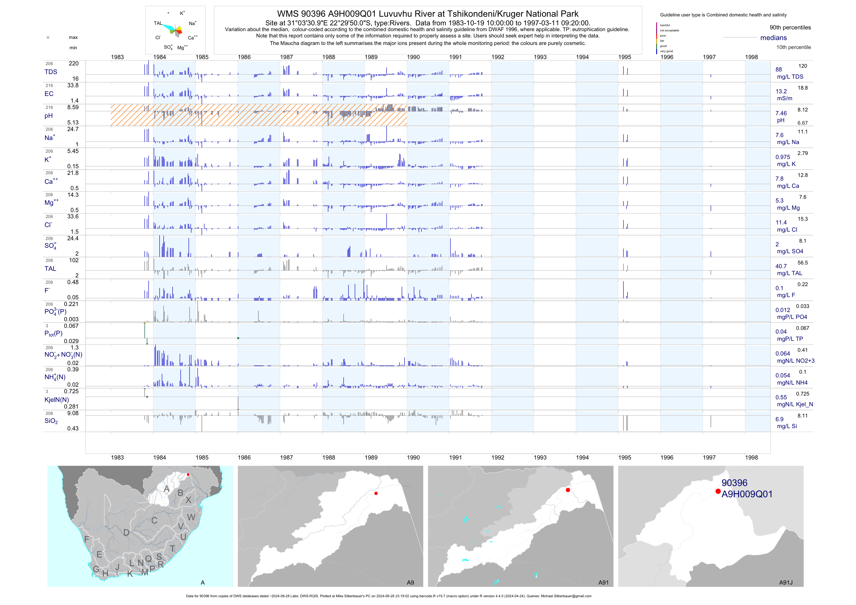
| A91 90396 | plot | data | Luvuvhu River at Tshikondeni/Kruger National Park | Rivers | 252 | 1983-10-19 | 1997-03-11 | 13 | A9H009 | -22.49722 | 31.05861 |
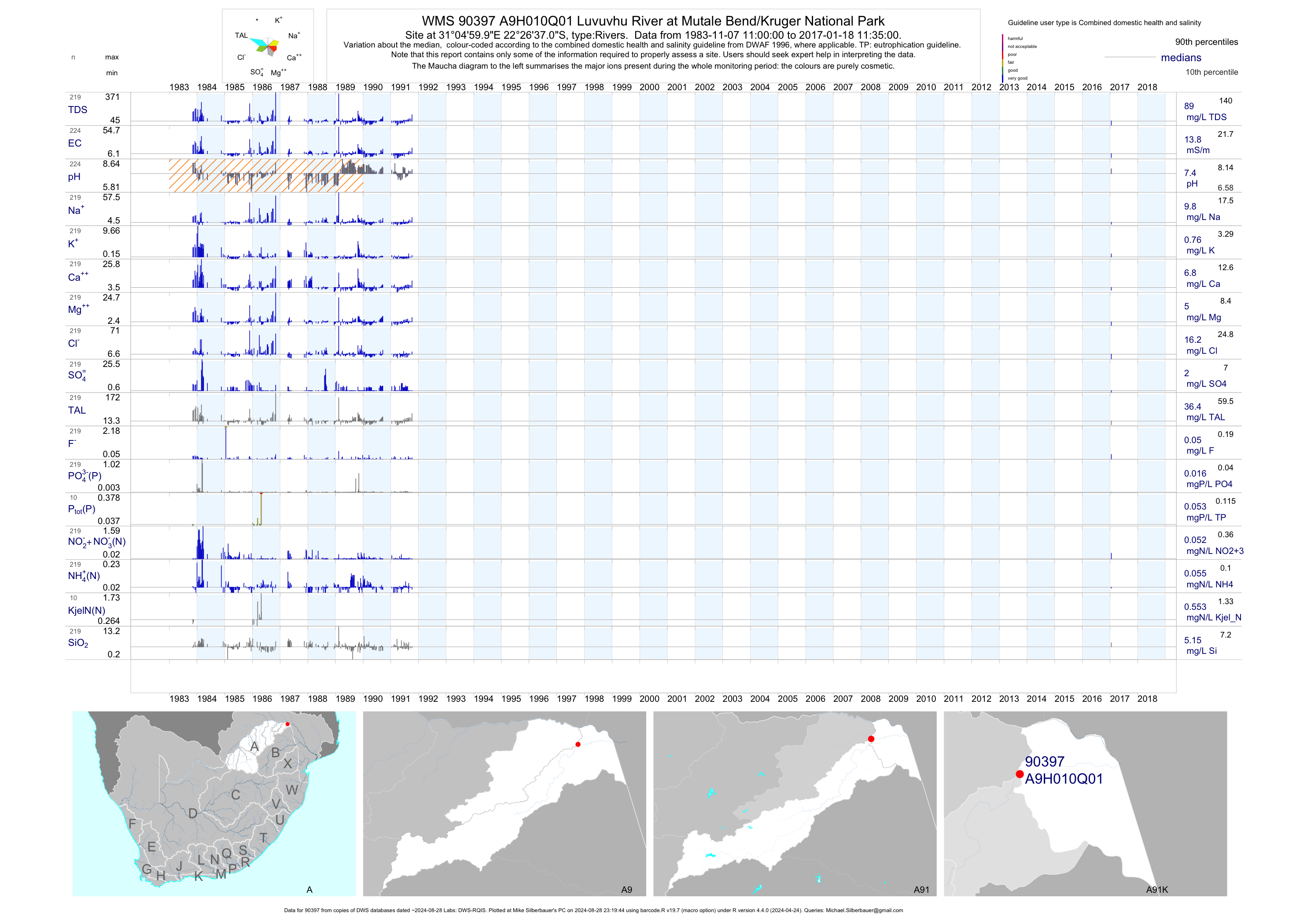
| A91 90397 | plot | data | Luvuvhu River at Mutale Bend/Kruger National Park | Rivers | 258 | 1983-11-07 | 2017-01-18 | 14 | A9H010 | -22.44361 | 31.08333 |
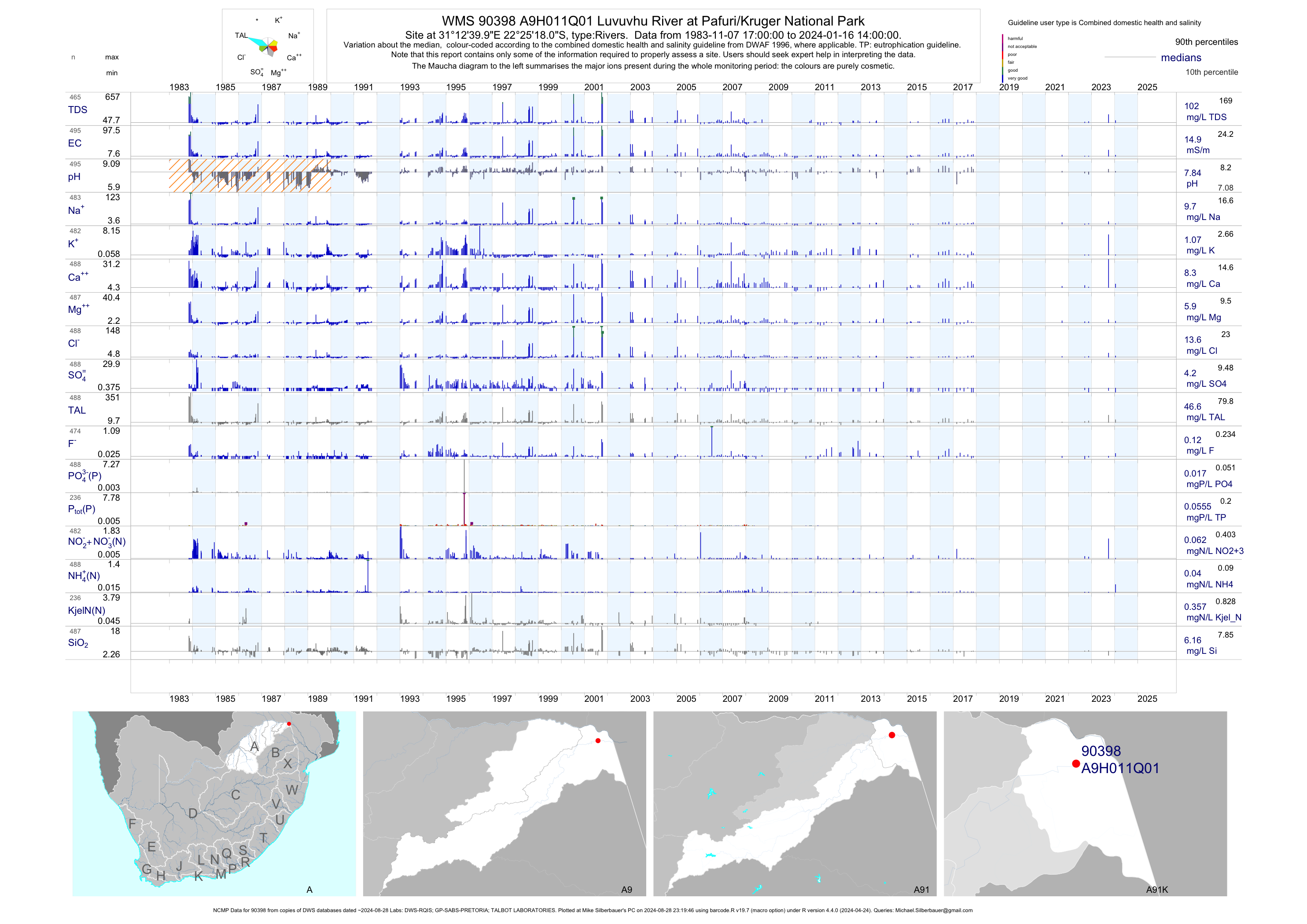
| A91 90398 | plot | data | Luvuvhu River at Pafuri/Kruger National Park (NCMP) | Rivers | 753 | 1983-11-07 | 2018-05-19 | 15 | A9H011 | -22.42167 | 31.21111 |
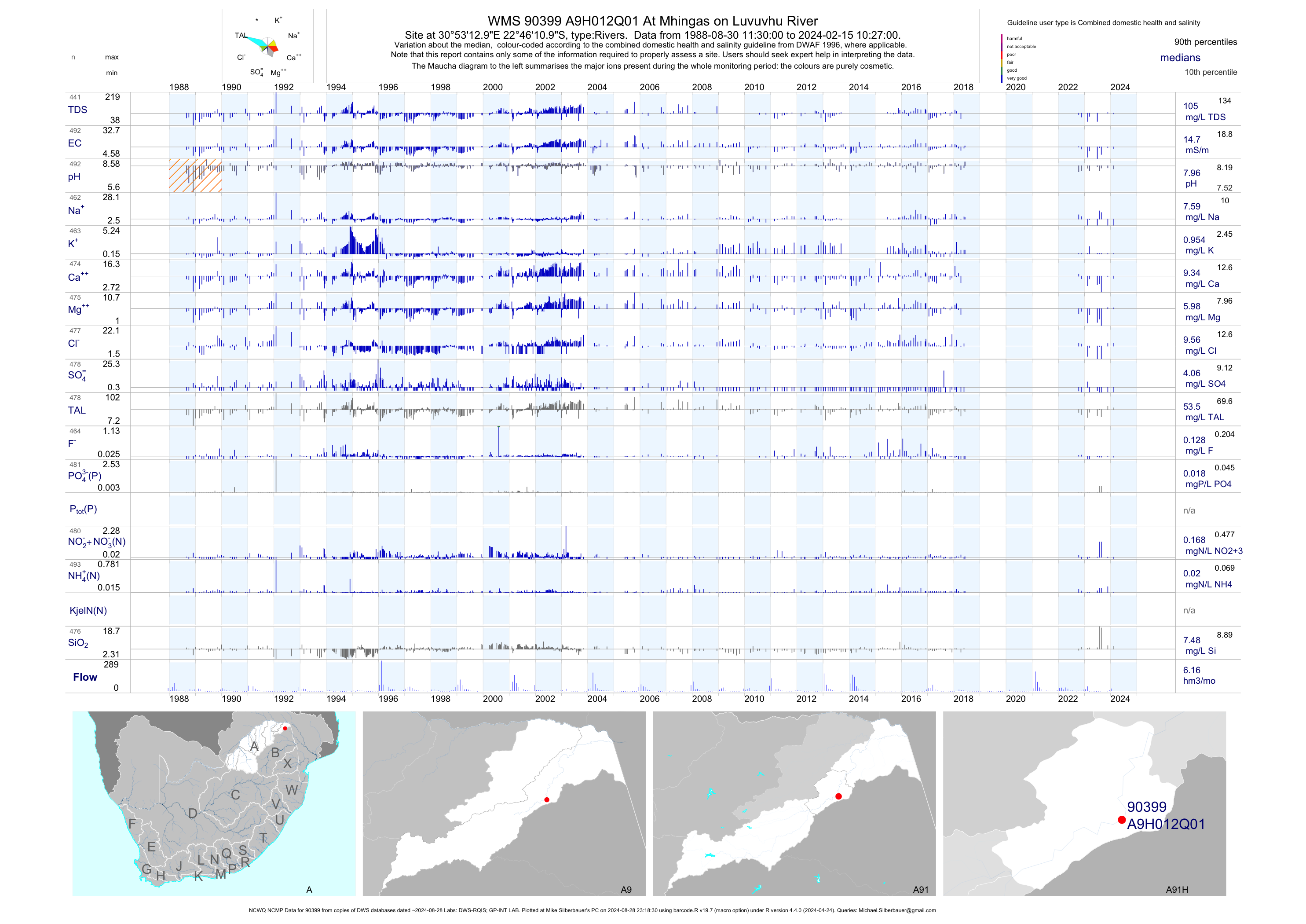
| A91 90399 | plot | data | At Mhingas on Luvuvhu River (NCWQ NCMP) | Rivers | 617 | 1988-08-30 | 2018-09-27 | 15 | A9H012 | -22.76972 | 30.88694 |
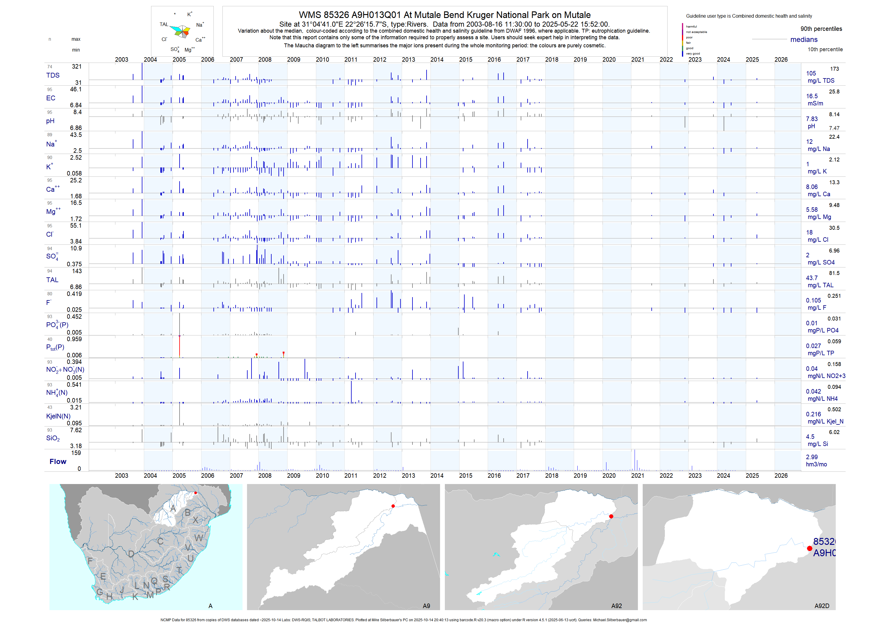
| A92 85326 | plot | data | At Mutale Bend Kruger National Park on Mutale (NCMP) | Rivers | 174 | 2003-08-16 | 2018-05-19 | 16 | A9H013 | -22.43772 | 31.07806 |
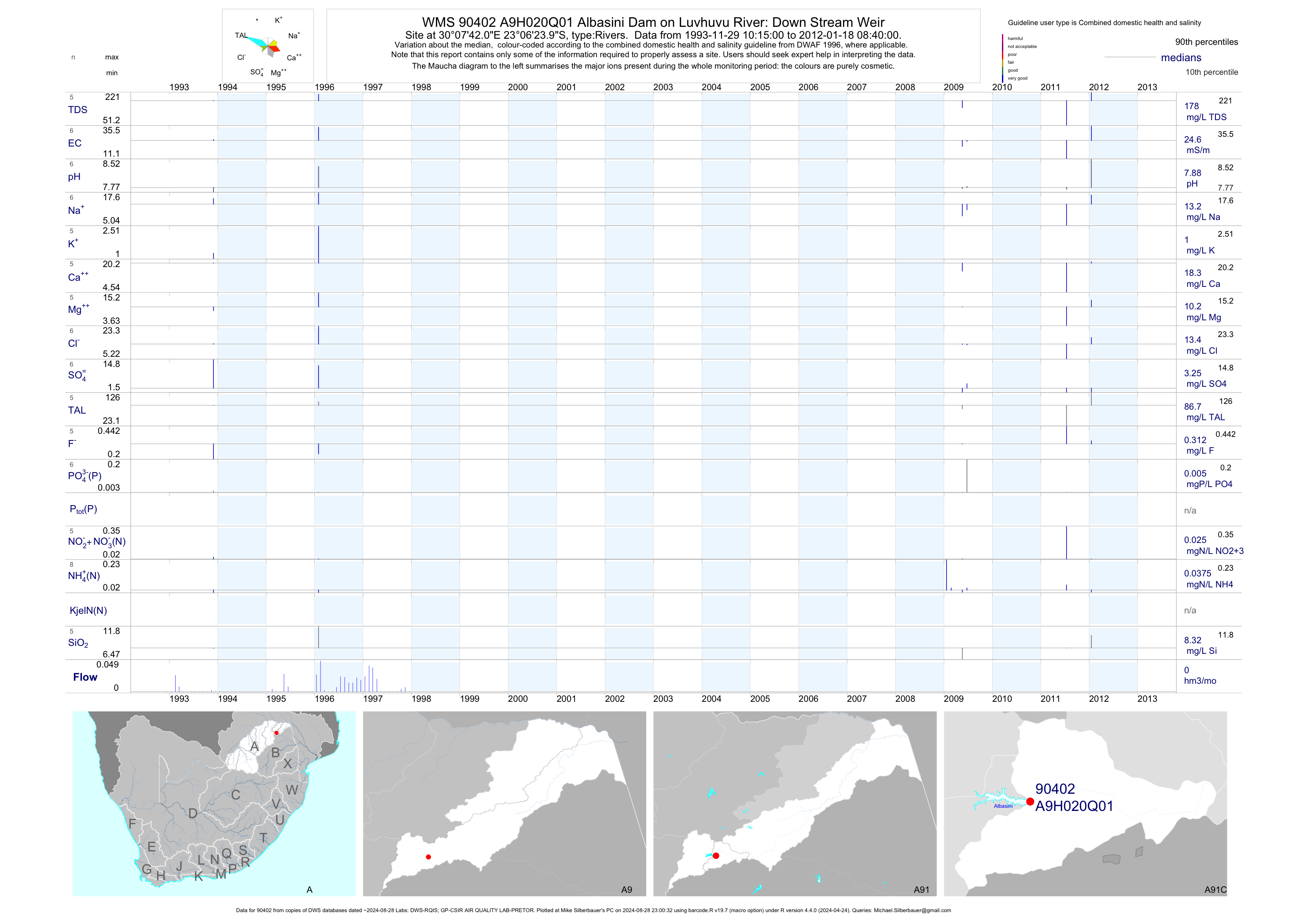
| A91 90402 | plot | data | Albasini Dam on Luvhuvu River: Down Stream Weir | Rivers | 9 | 1993-11-29 | 2012-01-18 | 25 | A9H020 | -23.10667 | 30.12833 |
| A91 90403 | plot | data | Mutshindudi River at Chibase/Sibasa (NCWQ) | Rivers | 115 | 1997-06-30 | 2007-09-14 | 5 | A9H024 | -22.94806 | 30.35639 |
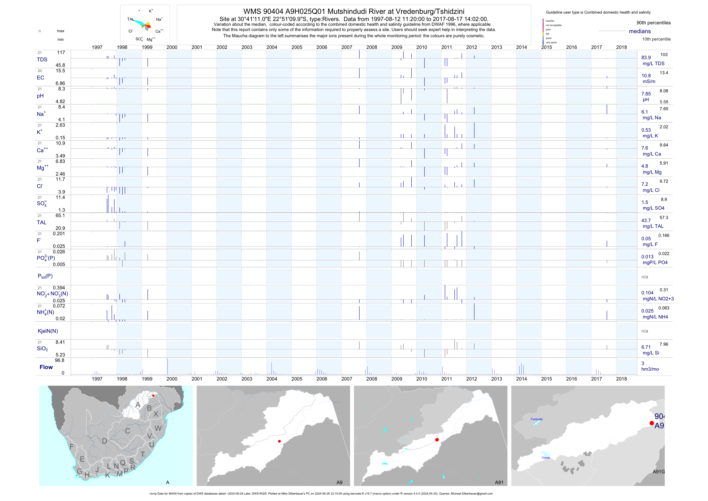
| A91 90404 | plot | data | Mutshindudi River at Vredenburg/Tshidzini (ncmp) | Rivers | 21 | 1997-08-12 | 2017-08-17 | 11 | A9H025 | -22.85278 | 30.68639 |
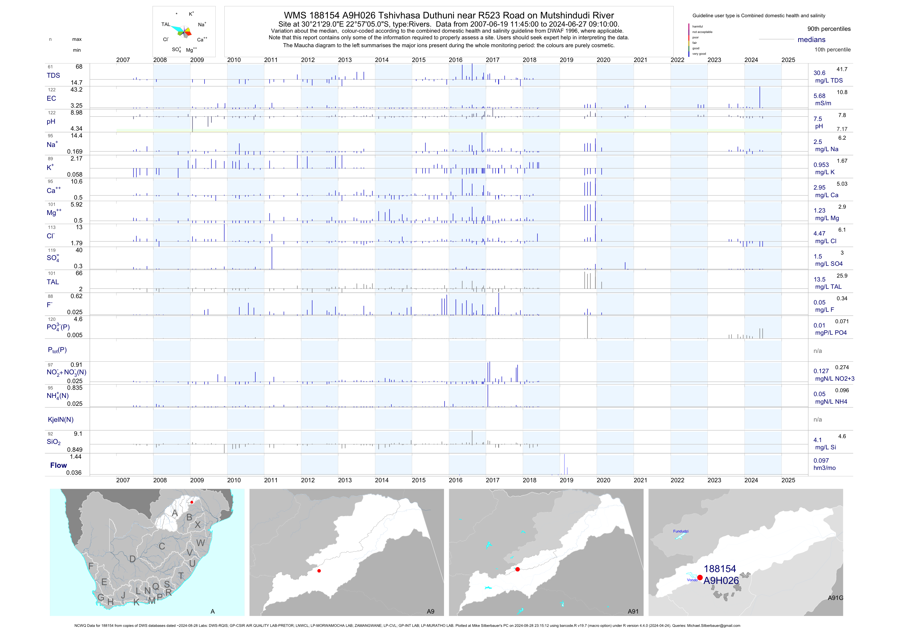
| A91 188154 | plot | data | Tshivhasa Duthuni near R523 Road on Mutshindudi River (NCWQ) | Rivers | 110 | 2007-06-19 | 2018-06-06 | 5 | A9H026 | -22.95139 | 30.35806 |
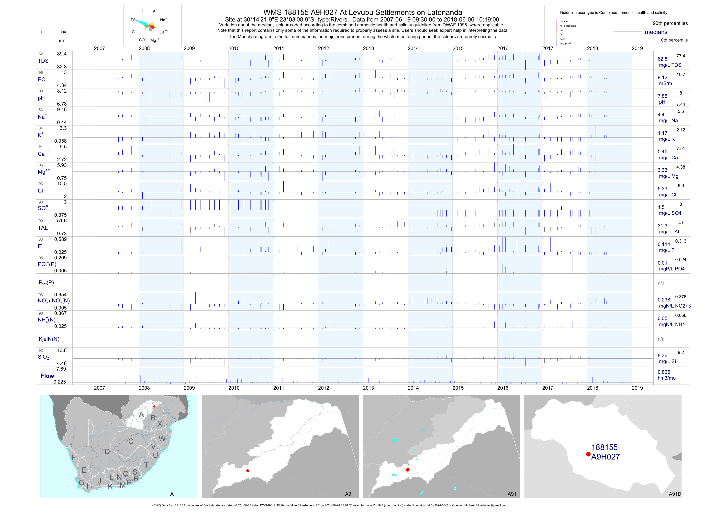
| A91 188155 | plot | data | At Levubu Settlements on Latonanda (NCWQ) | Rivers | 98 | 2007-06-19 | 2018-06-06 | 9 | A9H027 | -23.05250 | 30.23944 |
| A91 188156 | n/a | n/a | Luvuvhu at Nooitgedacht | Rivers | 2 | 2014-02-13 | 2014-02-13 | n/a | A9H028 | -23.08645 | 30.17488 |
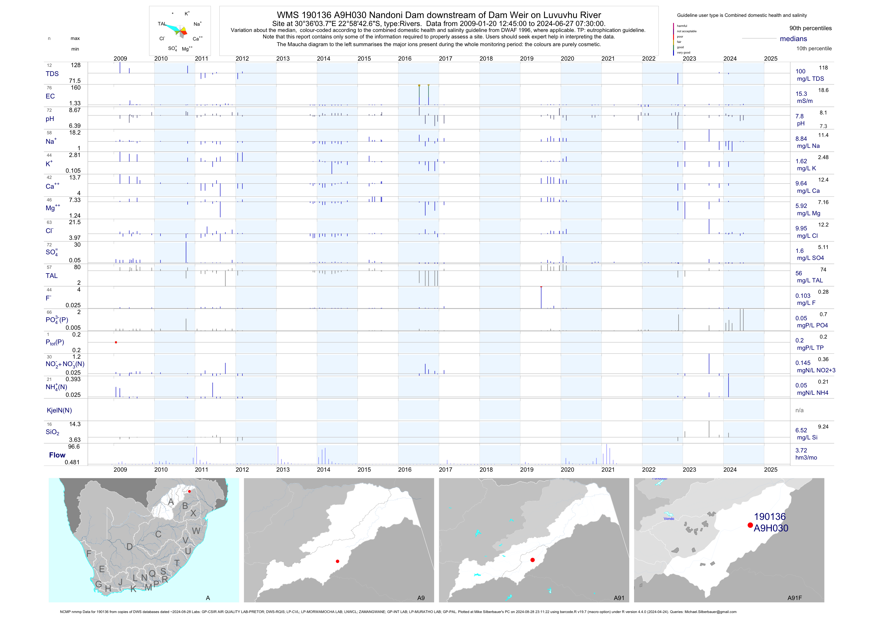
| A91 190136 | plot | data | Nandoni Dam downstream of Dam Weir on Luvuvhu River (NCMP nmmp) | Rivers | 88 | 2009-01-20 | 2017-02-15 | 15 | A9H030 | -22.97852 | 30.60104 |
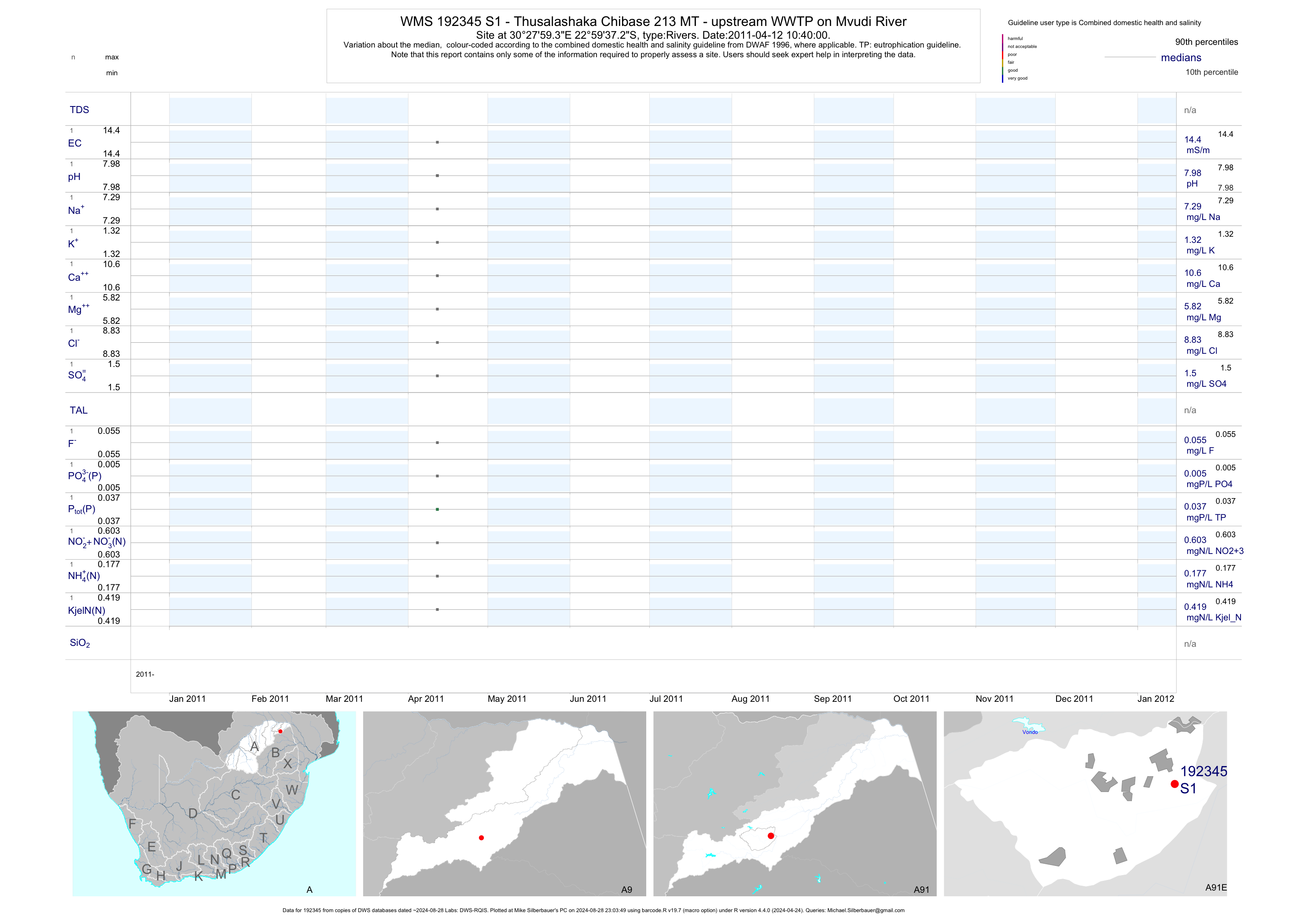
| A91 192345 | plot | data | - Thusalashaka Chibase 213 MT - upstream WWTP on Mvudi River | Rivers | 4 | 2011-04-12 | 2011-04-12 | 14 | S1 | -22.99369 | 30.46647 |
| A91 192346 | plot | data | - Thusalashaka Mpapuli 278 MT - downstream WWTP on Mvudi River | Rivers | 6 | 2011-04-12 | 2011-04-12 | 18 | S2 | -23.00275 | 30.47894 |
| A91 192347 | plot | data | - Dididi Molenje 204 LT - at Nzindi River and Luvuvhu River Confluence | Rivers | 2 | 2011-04-12 | 2011-04-12 | 12 | S3 | -22.99714 | 30.50569 |
| A91 192465 | plot | data | - Molenje 204 LT - D/S Nandoni Dam; 100M South of Nandoni Bridge on Luvuvhu | Rivers | 4 | 2011-04-12 | 2011-04-12 | 12 | S6 | -22.97180 | 30.60329 |
| A91 88562 | plot | data | Luvuvhu River at Lambani (3KM up Stream A9H012) | Rivers | 2 | 1994-10-12 | 1994-10-12 | 19 | ZLUVU-LAM | -22.77333 | 30.86139 |
| A91 88563 | plot | data | Luvuvhu River at Mahinga (1;7KM Down Stream A9H01 | Rivers | 1 | 1994-10-12 | 1994-10-12 | n/a | ZLUVU-MAH | -22.75722 | 30.89500 |
| A91 88581 | plot | data | Mutshindudi River at Shapela | Rivers | 2 | 1994-10-13 | 1994-10-13 | 12 | ZMUTS-SHA | -22.87556 | 30.60583 |
| A91 88582 | plot | data | Mutshindudi River at Tshibielwe (Bridge) | Rivers | 2 | 1994-10-13 | 1994-10-13 | 12 | ZMUTS-TSH | -22.85944 | 30.64389 |
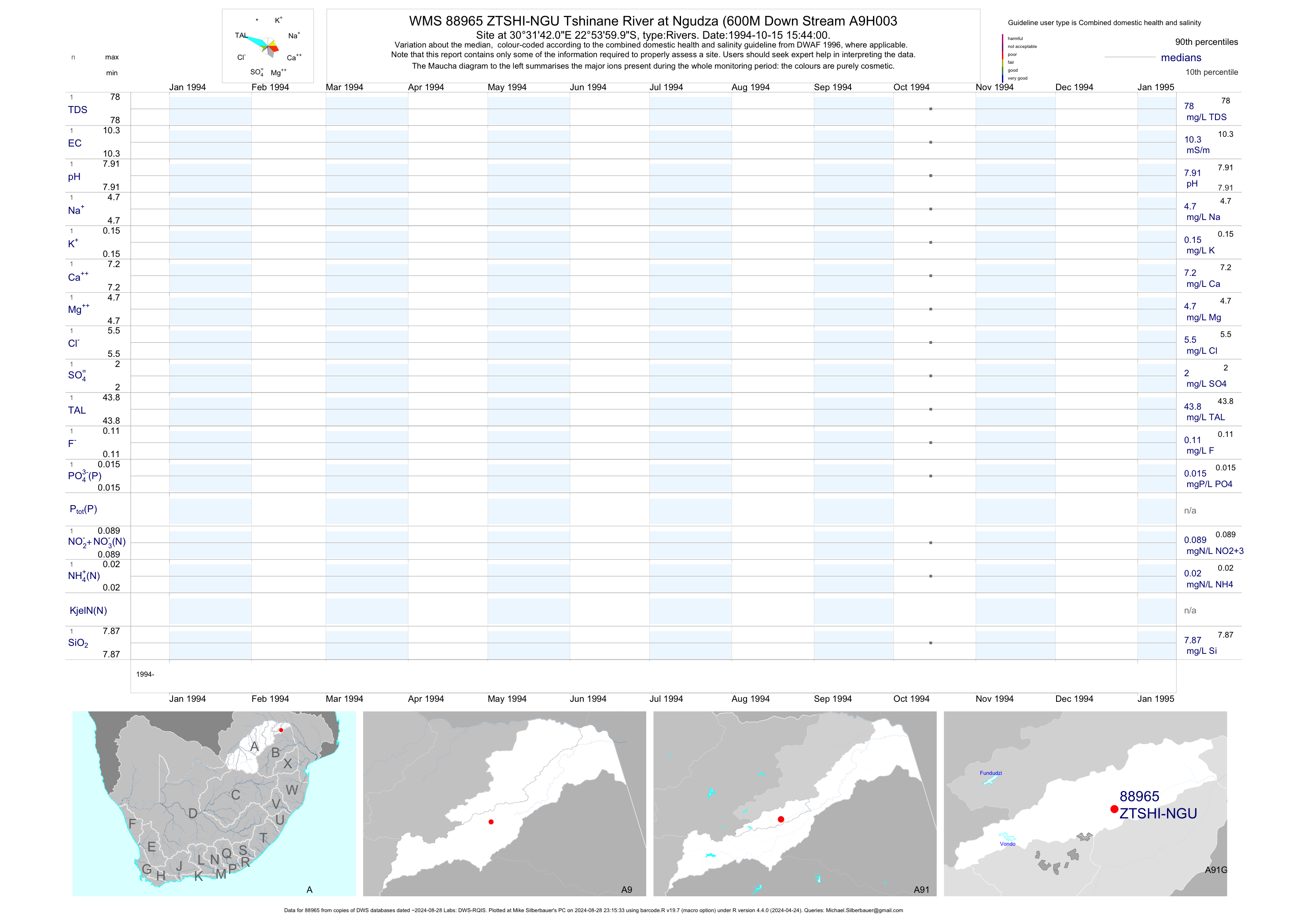
| A91 88965 | plot | data | Tshinane River at Ngudza (600M Down Stream A9H003 | Rivers | 2 | 1994-10-13 | 1994-10-15 | 10 | ZTSHI-NGU | -22.90000 | 30.52833 |
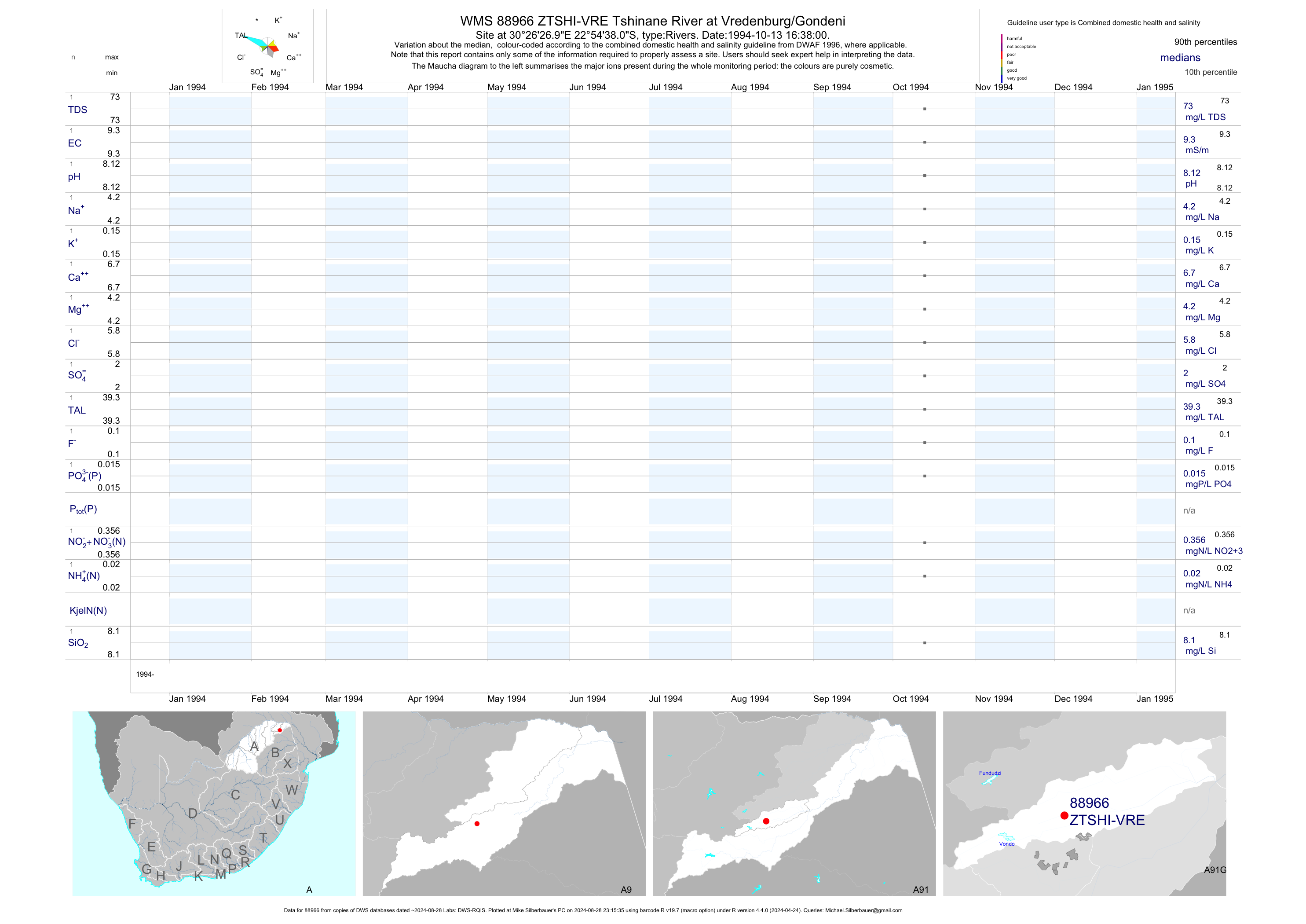
| A91 88966 | plot | data | Tshinane River at Vredenburg/Gondeni | Rivers | 2 | 1994-10-13 | 1994-10-13 | 9 | ZTSHI-VRE | -22.91056 | 30.44083 |
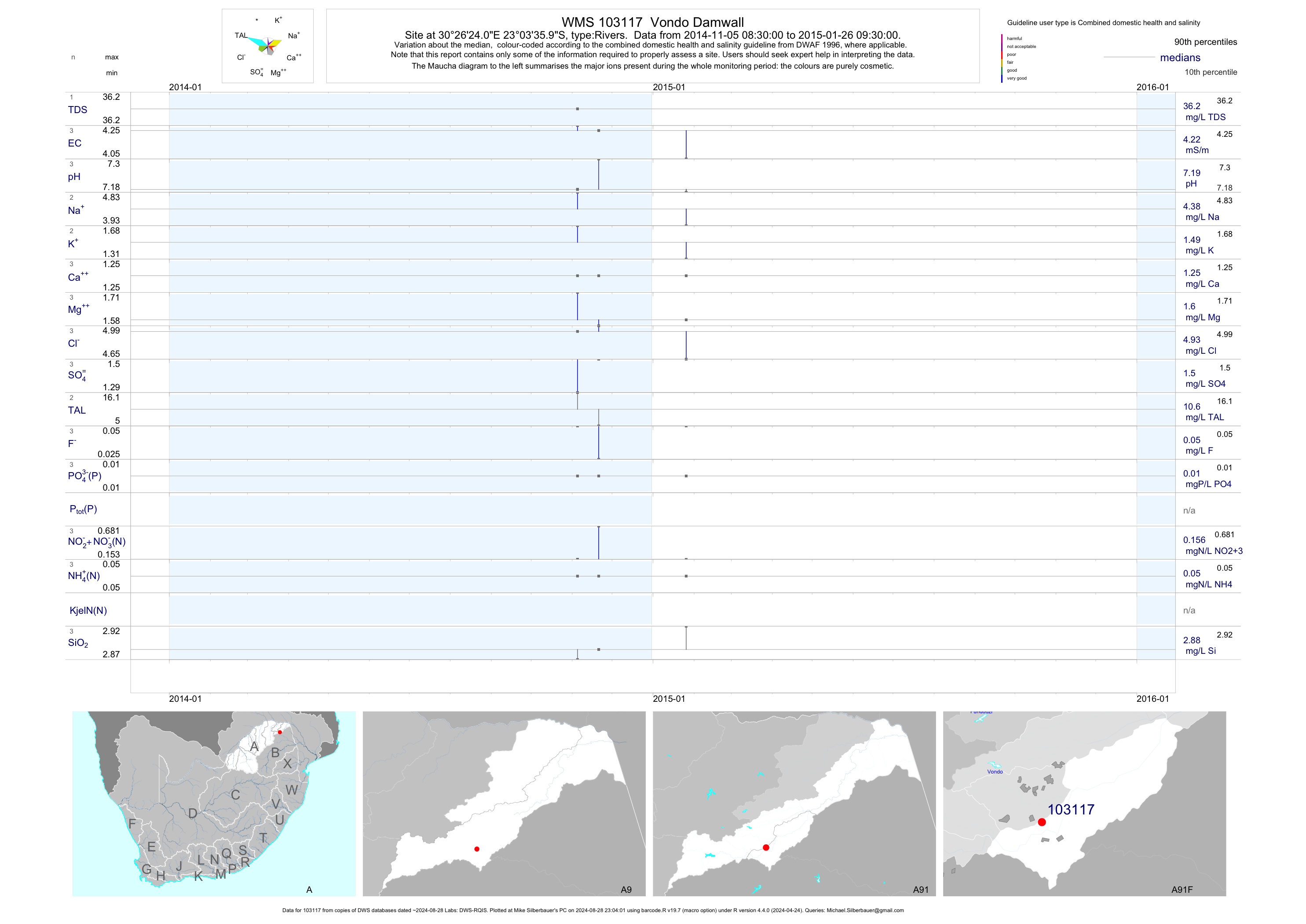
| A91 103117 | plot | data | Vondo Damwall | Rivers | 3 | 2014-11-05 | 2015-01-26 | 4 | 103117 | -23.06000 | 30.44000 |
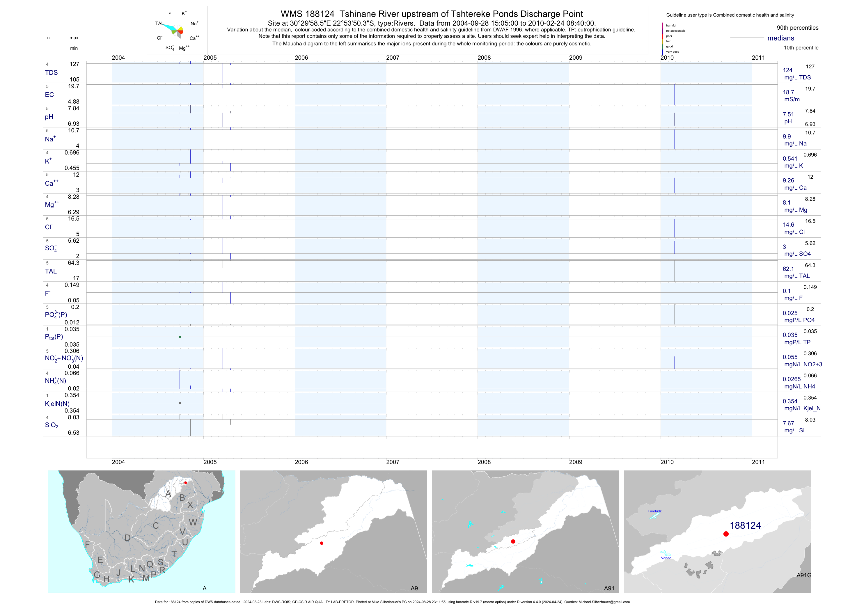
| A91 188124 | plot | data | Tshinane River upstream of Tshtereke Ponds Discharge Point | Rivers | 19 | 2004-09-28 | 2010-02-24 | 19 | 188124 | -22.89733 | 30.49960 |
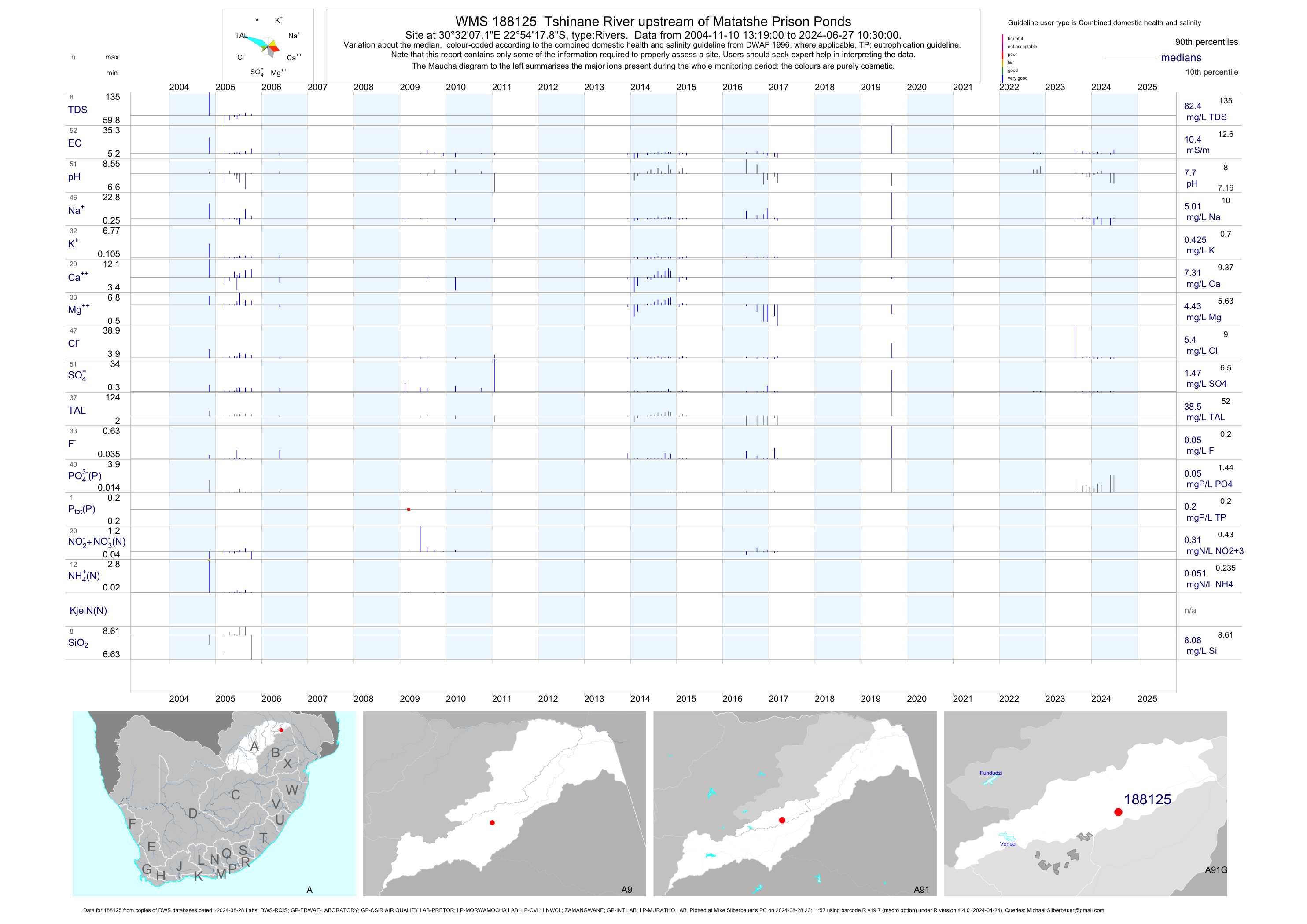
| A91 188125 | plot | data | Tshinane River upstream of Matatshe Prison Ponds | Rivers | 102 | 2004-11-10 | 2017-03-09 | 10 | 188125 | -22.90497 | 30.53532 |
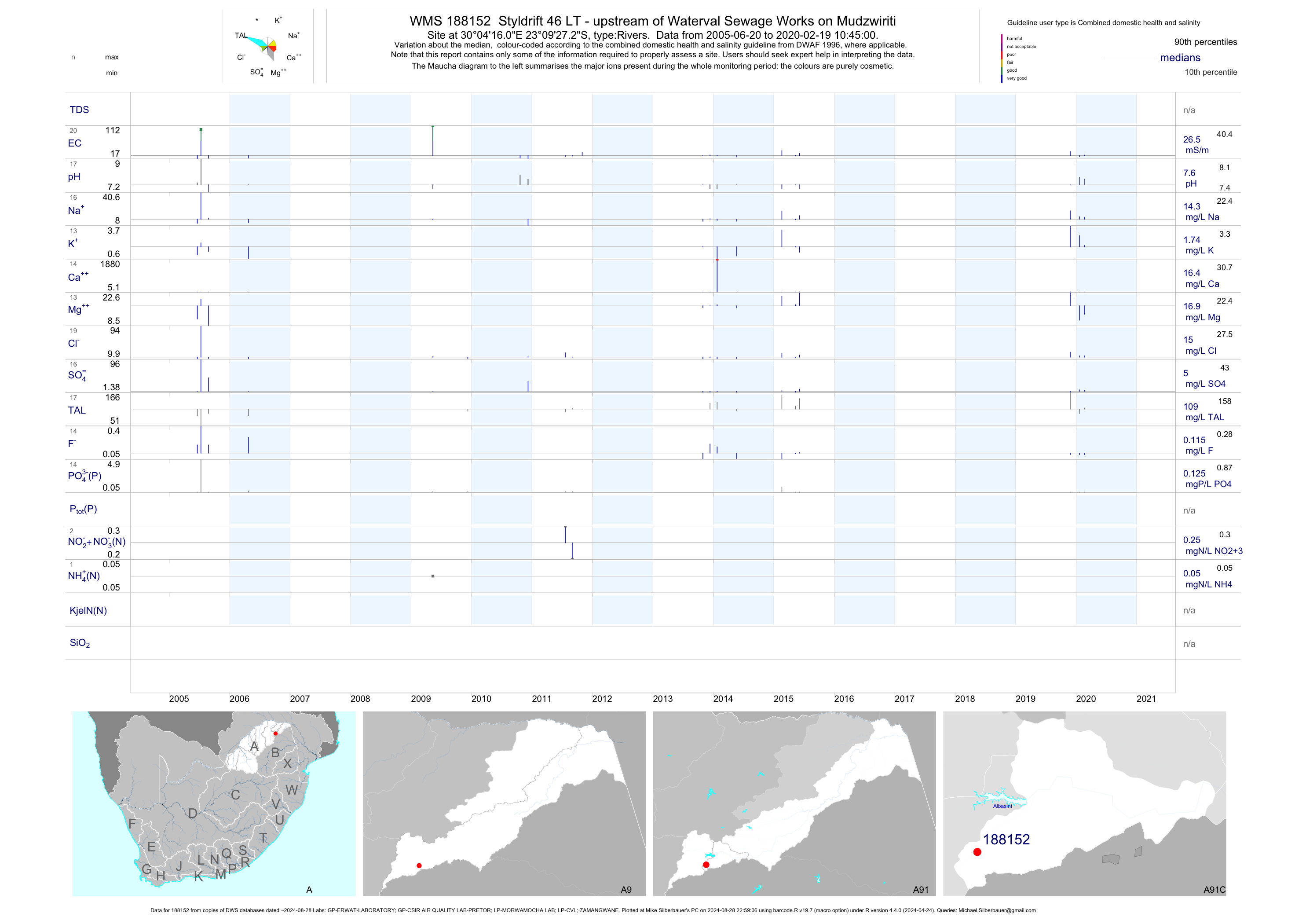
| A91 188152 | plot | data | Styldrift 46 LT - upstream of Waterval Sewage Works on Mudzwiriti | Rivers | 42 | 2005-06-20 | 2016-10-27 | 26 | 188152 | -23.15758 | 30.07111 |
| A91 188179 | plot | data | Mphaphuli upstream of Thohoyandou Sewage Treatment Works | Rivers | 119 | 2004-11-10 | 2015-06-03 | 17 | 188179 | -23.00007 | 30.47090 |
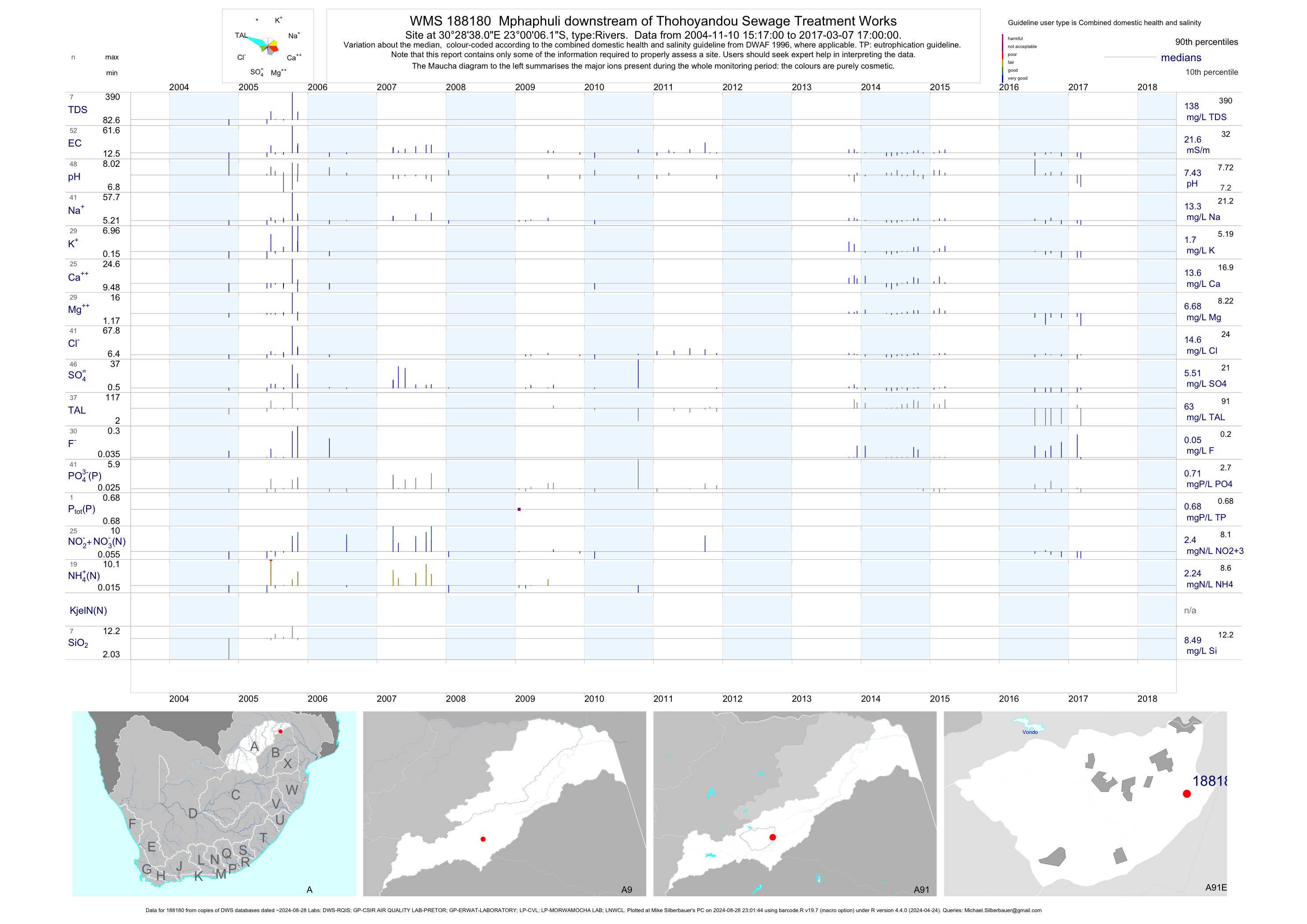
| A91 188180 | plot | data | Mphaphuli downstream of Thohoyandou Sewage Treatment Works | Rivers | 134 | 2004-11-10 | 2017-03-07 | 22 | 188180 | -23.00170 | 30.47725 |
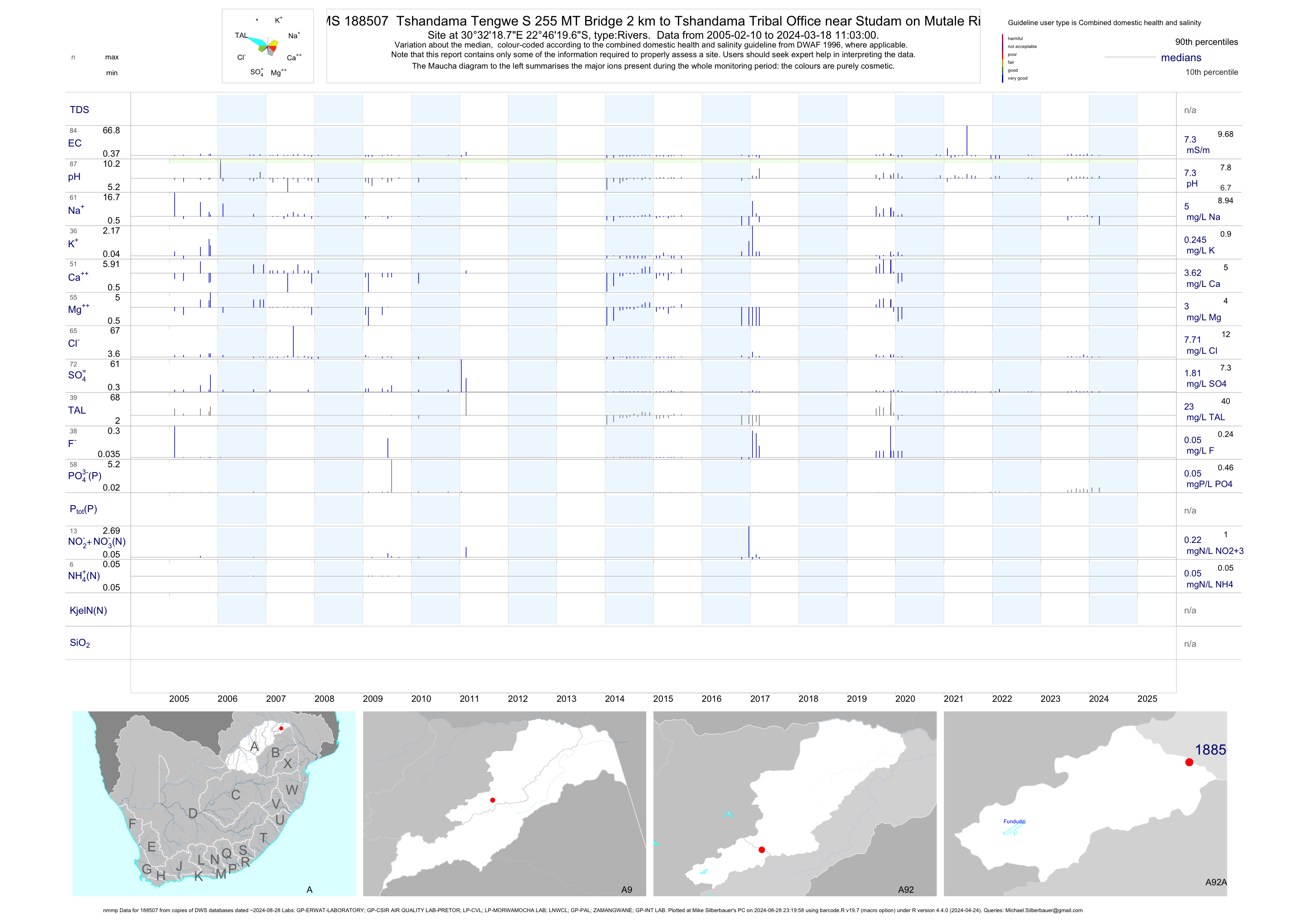
| A92 188507 | plot | data | Tshandama Tengwe S 255 MT Bridge 2 km to Tshandama Tribal Office near Studam on Mutale River (nmmp) | Rivers | 118 | 2005-02-10 | 2017-03-09 | 7 | 188507 | -22.77214 | 30.53856 |
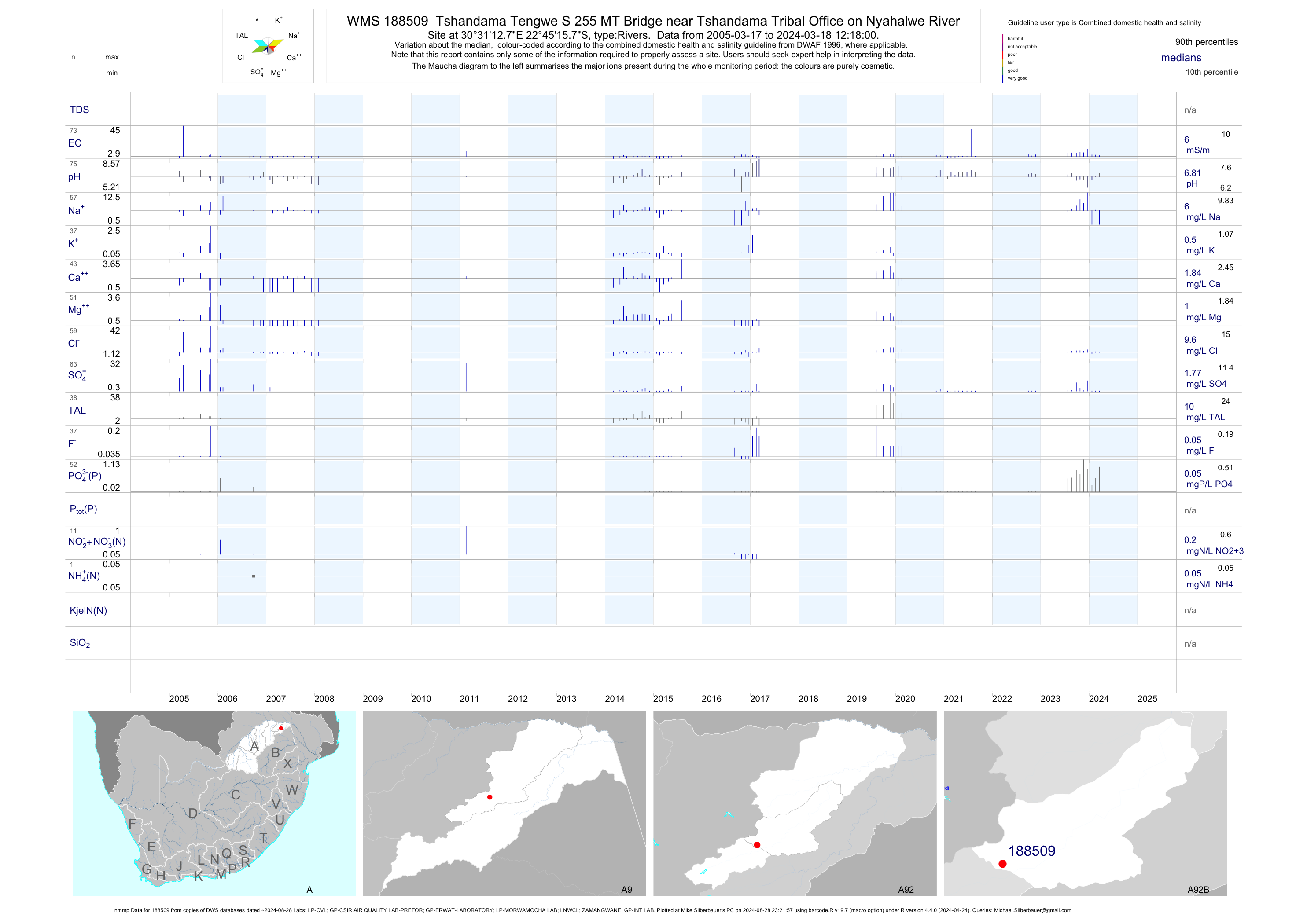
| A92 188509 | plot | data | Tshandama Tengwe S 255 MT Bridge near Tshandama Tribal Office on Nyahalwe River (nmmp) | Rivers | 96 | 2005-03-17 | 2017-03-08 | 6 | 188509 | -22.75439 | 30.52019 |
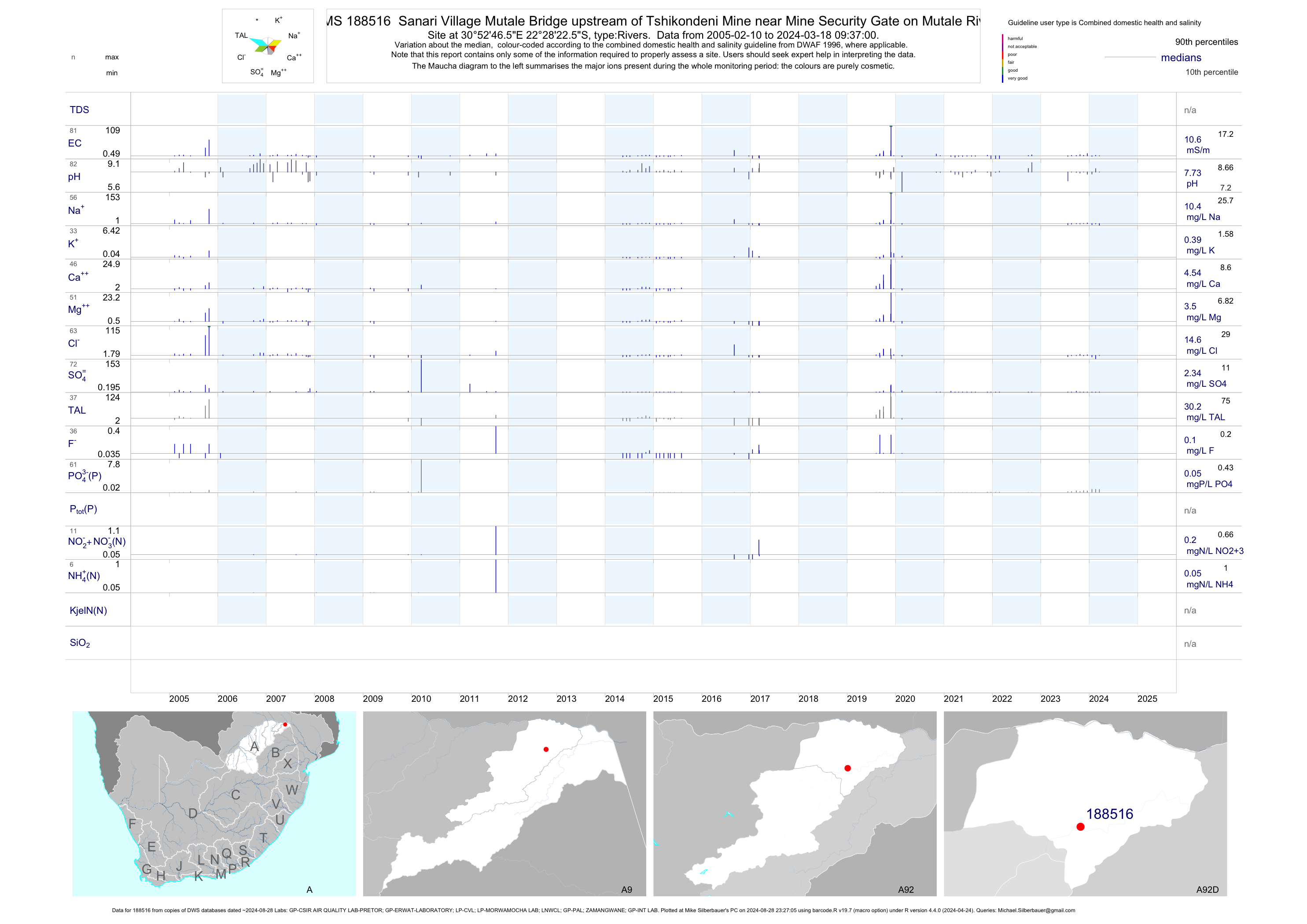
| A92 188516 | plot | data | Sanari Village Mutale Bridge upstream of Tshikondeni Mine near Mine Security Gate on Mutale River | Rivers | 109 | 2005-02-10 | 2017-03-09 | 10 | 188516 | -22.47292 | 30.87958 |
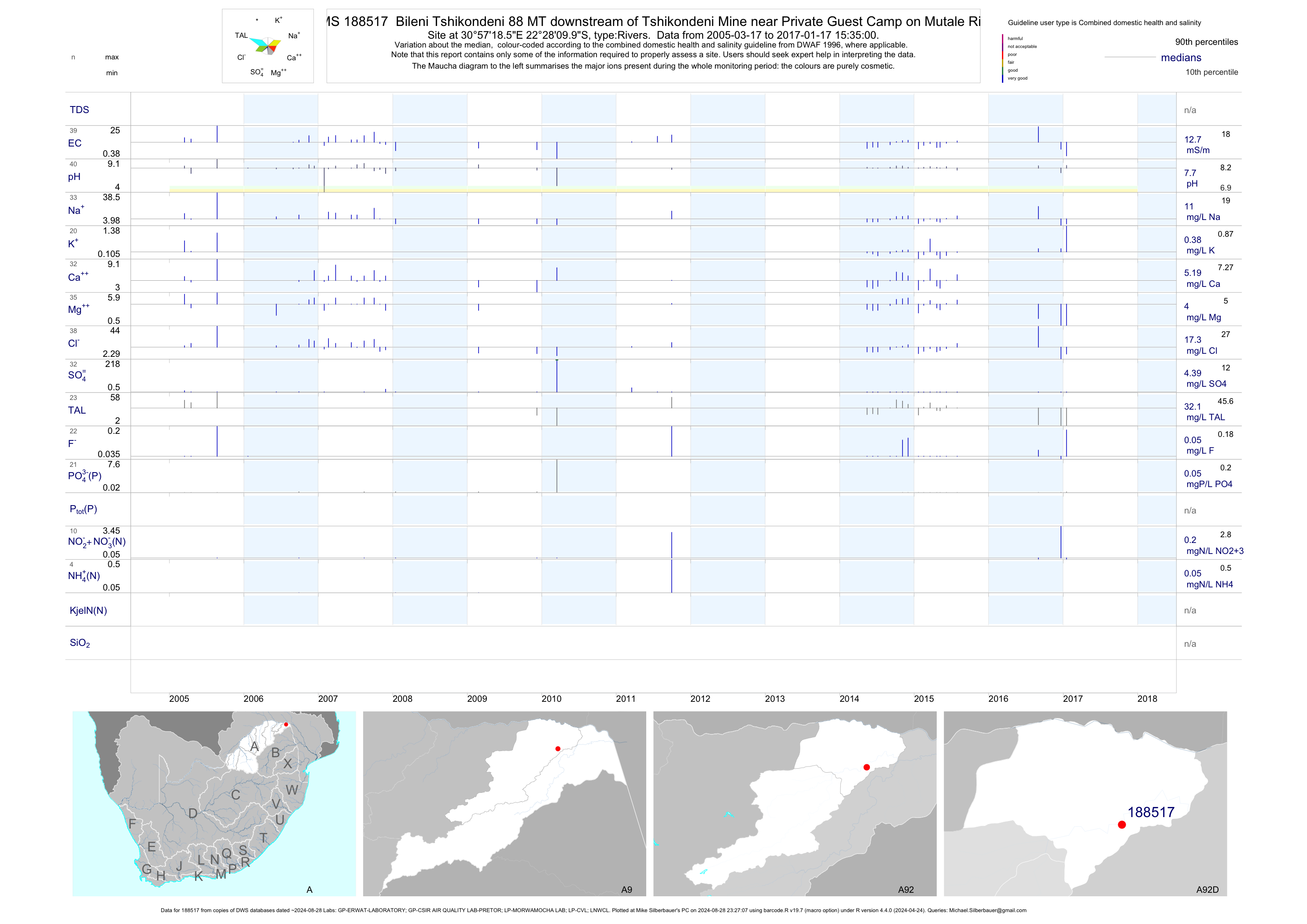
| A92 188517 | plot | data | Bileni Tshikondeni 88 MT downstream of Tshikondeni Mine near Private Guest Camp on Mutale River | Rivers | 86 | 2005-03-17 | 2017-01-17 | 13 | 188517 | -22.46942 | 30.95514 |
| A91 188566 | plot | data | Lwamondo U/S of Tshifulanani Thohoyando Bridge on Dzindi | Rivers | 17 | 2014-09-04 | 2017-03-09 | 13 | 188566 | -23.02103 | 30.39764 |
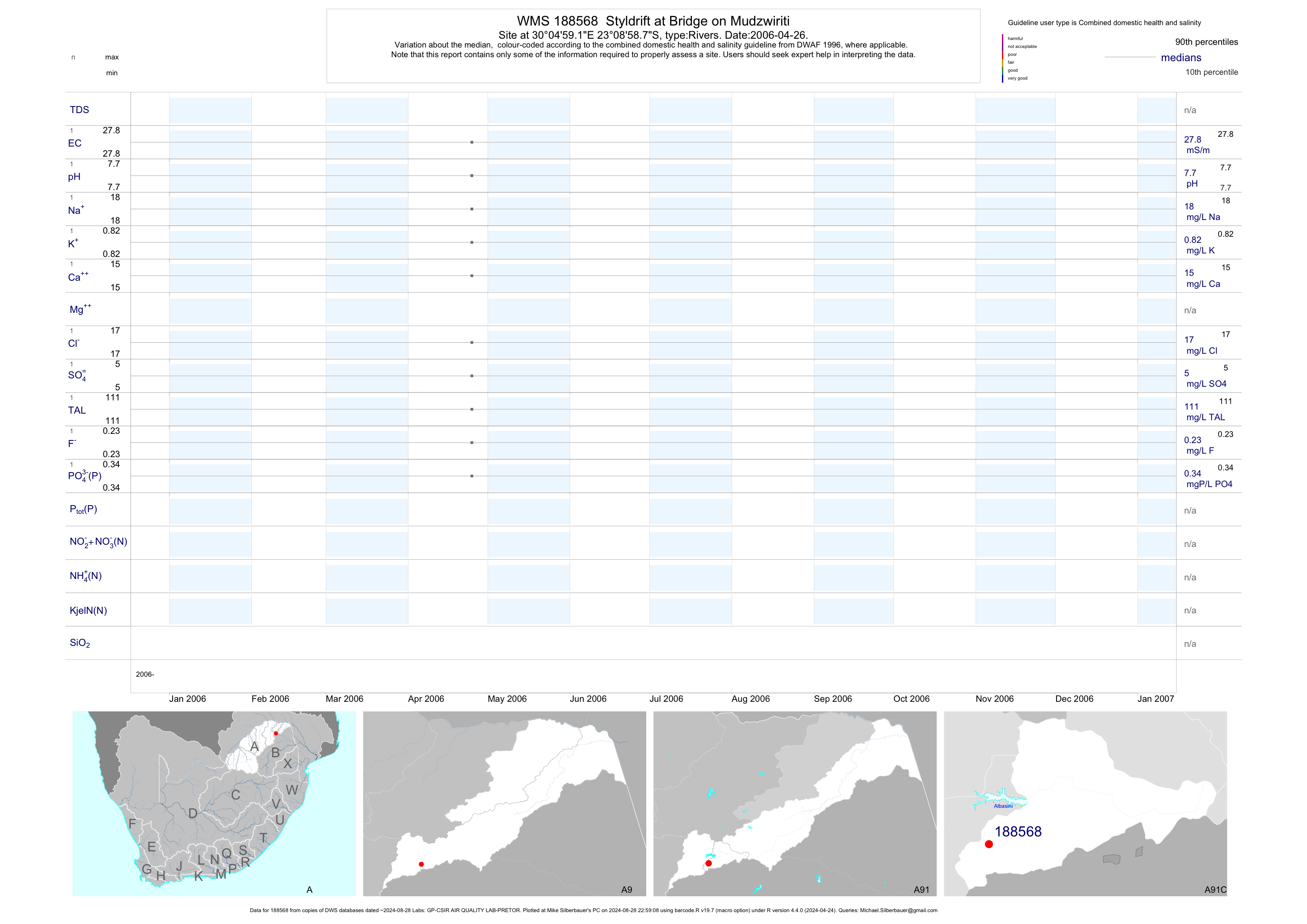
| A91 188568 | plot | data | Styldrift at Bridge on Mudzwiriti | Rivers | 1 | 2006-04-26 | 2006-04-26 | 28 | 188568 | -23.14967 | 30.08308 |
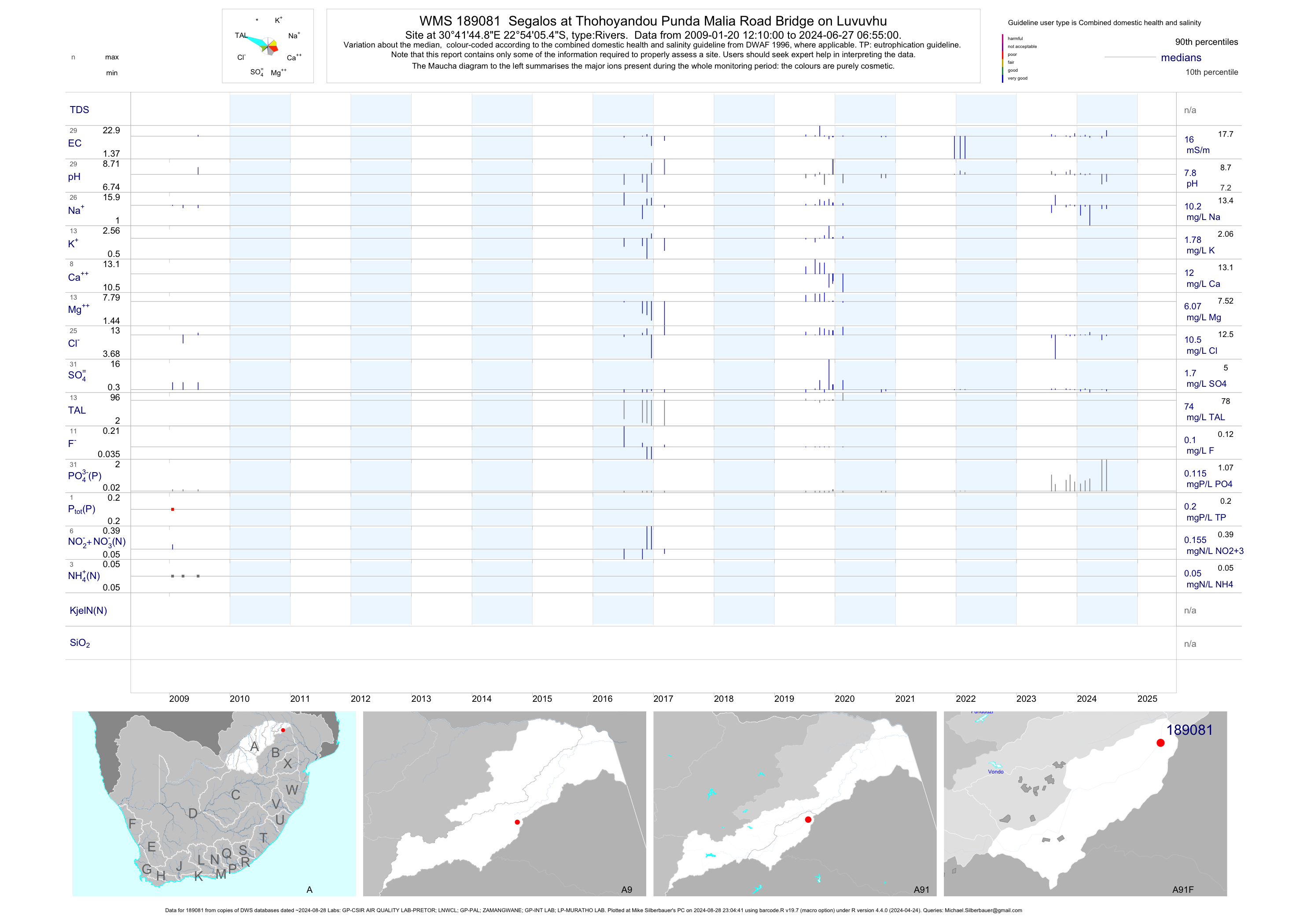
| A91 189081 | plot | data | Segalos at Thohoyandou Punda Malia Road Bridge on Luvuvhu | Rivers | 12 | 2009-01-20 | 2017-03-08 | 16 | 189081 | -22.90153 | 30.69578 |
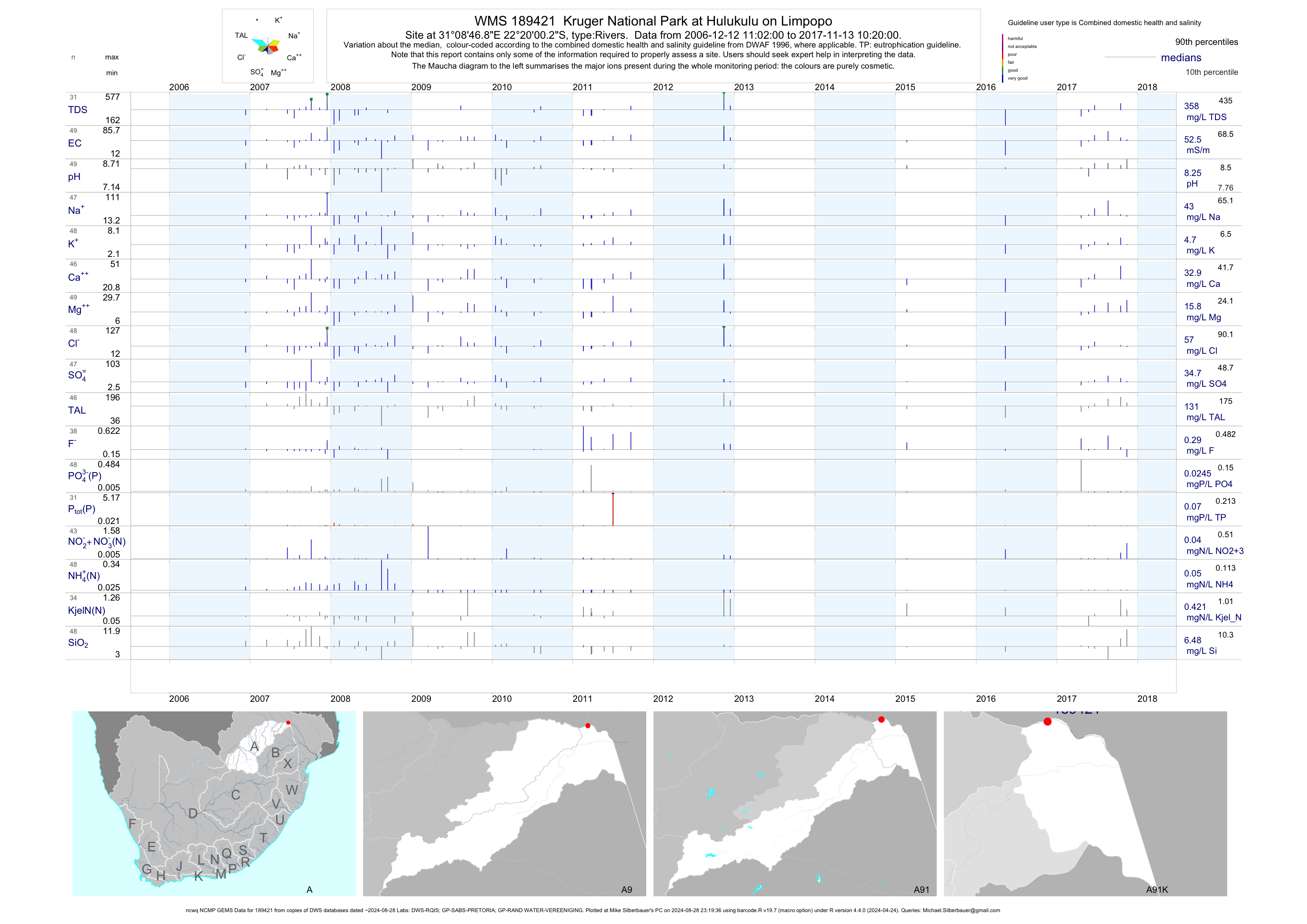
| A91 189421 | plot | data | Kruger National Park at Hulukulu on Limpopo (ncwq NCMP GEMS) | Rivers | 79 | 2006-12-12 | 2018-05-19 | 52 | 189421 | -22.33339 | 31.14636 |
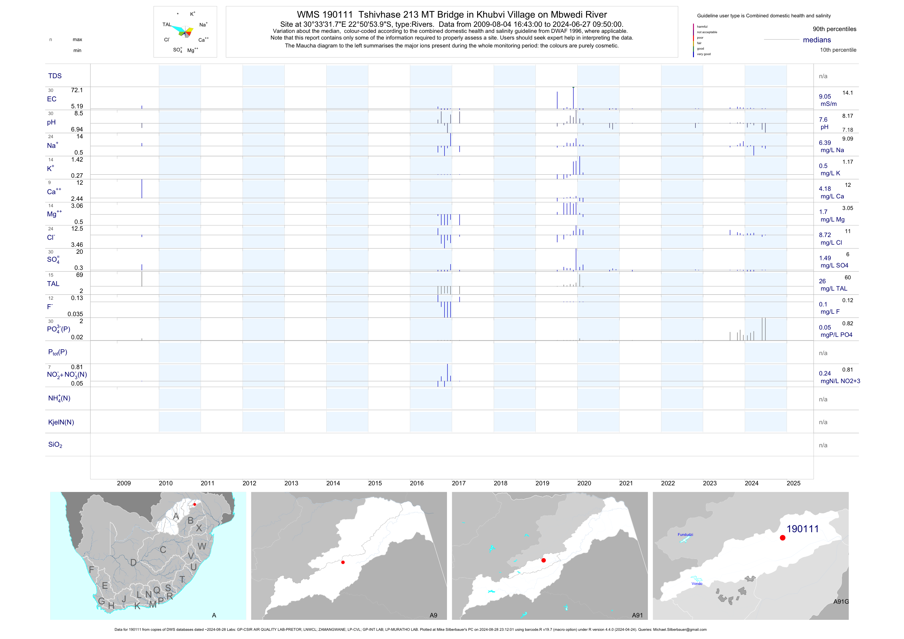
| A91 190111 | plot | data | Tshivhase 213 MT Bridge in Khubvi Village on Mbwedi River | Rivers | 11 | 2009-08-04 | 2017-03-08 | 6 | 190111 | -22.84833 | 30.55883 |
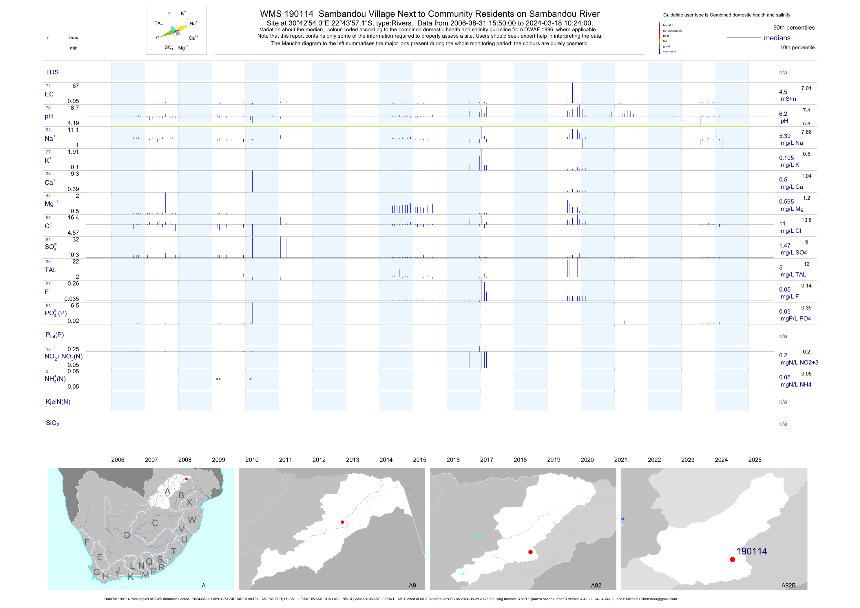
| A92 190114 | plot | data | Sambandou Village Next to Community Residents on Sambandou River | Rivers | 76 | 2006-08-31 | 2017-03-08 | 4 | 190114 | -22.73256 | 30.71503 |
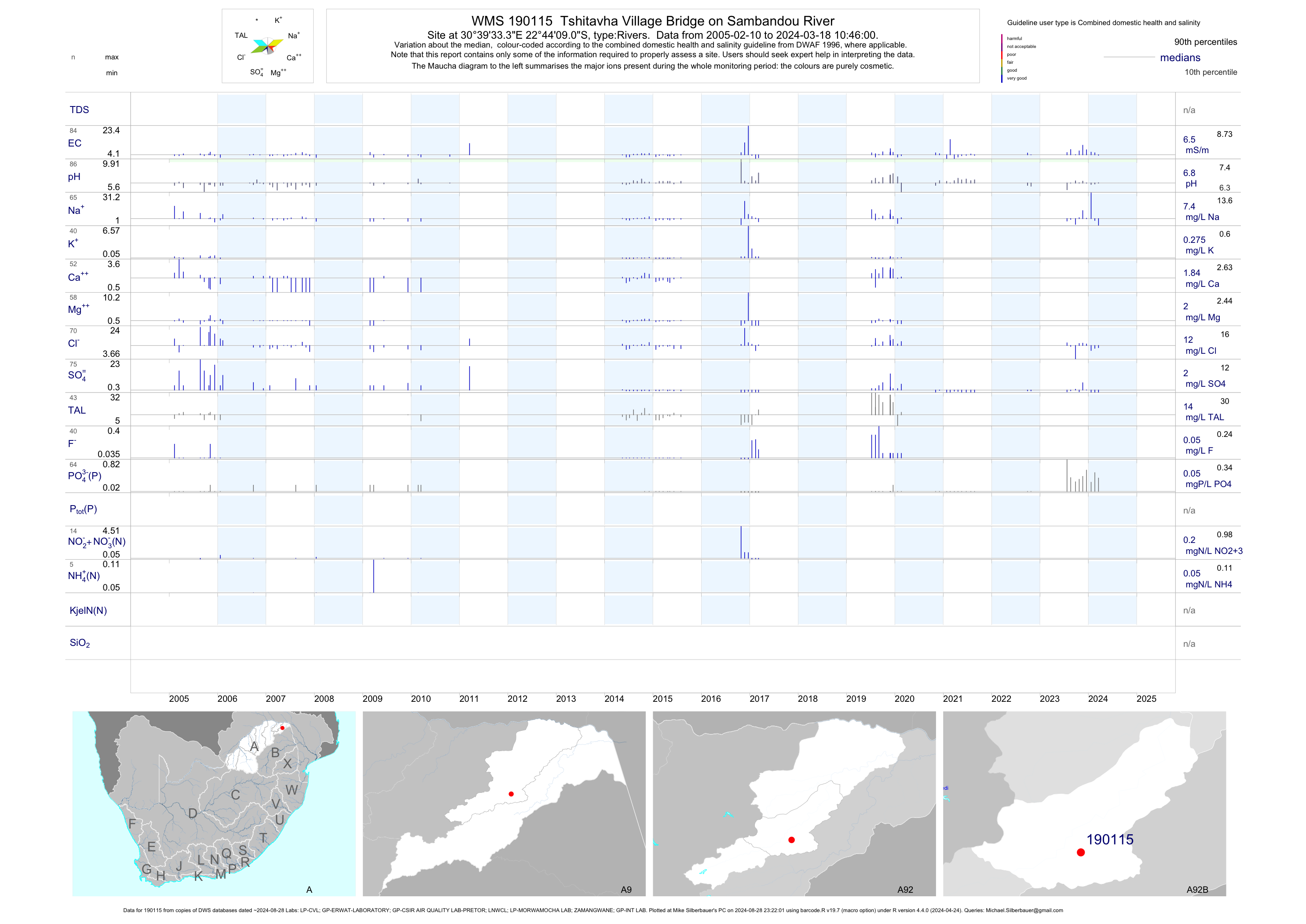
| A92 190115 | plot | data | Tshitavha Village Bridge on Sambandou River | Rivers | 121 | 2005-02-10 | 2017-03-08 | 6 | 190115 | -22.73583 | 30.65925 |
| A92 190116 | plot | data | Sambandou Village Sambandou Well Next to Nnyawedzeni Primary School near River | Rivers | 65 | 2006-08-31 | 2017-01-17 | 16 | 190116 | -22.73147 | 30.70122 |
| A92 190118 | plot | data | Tshandama Pile Village Community Residence on Tshiombedi River | Rivers | 108 | 2005-06-28 | 2017-03-09 | 3 | 190118 | -22.76153 | 30.48086 |
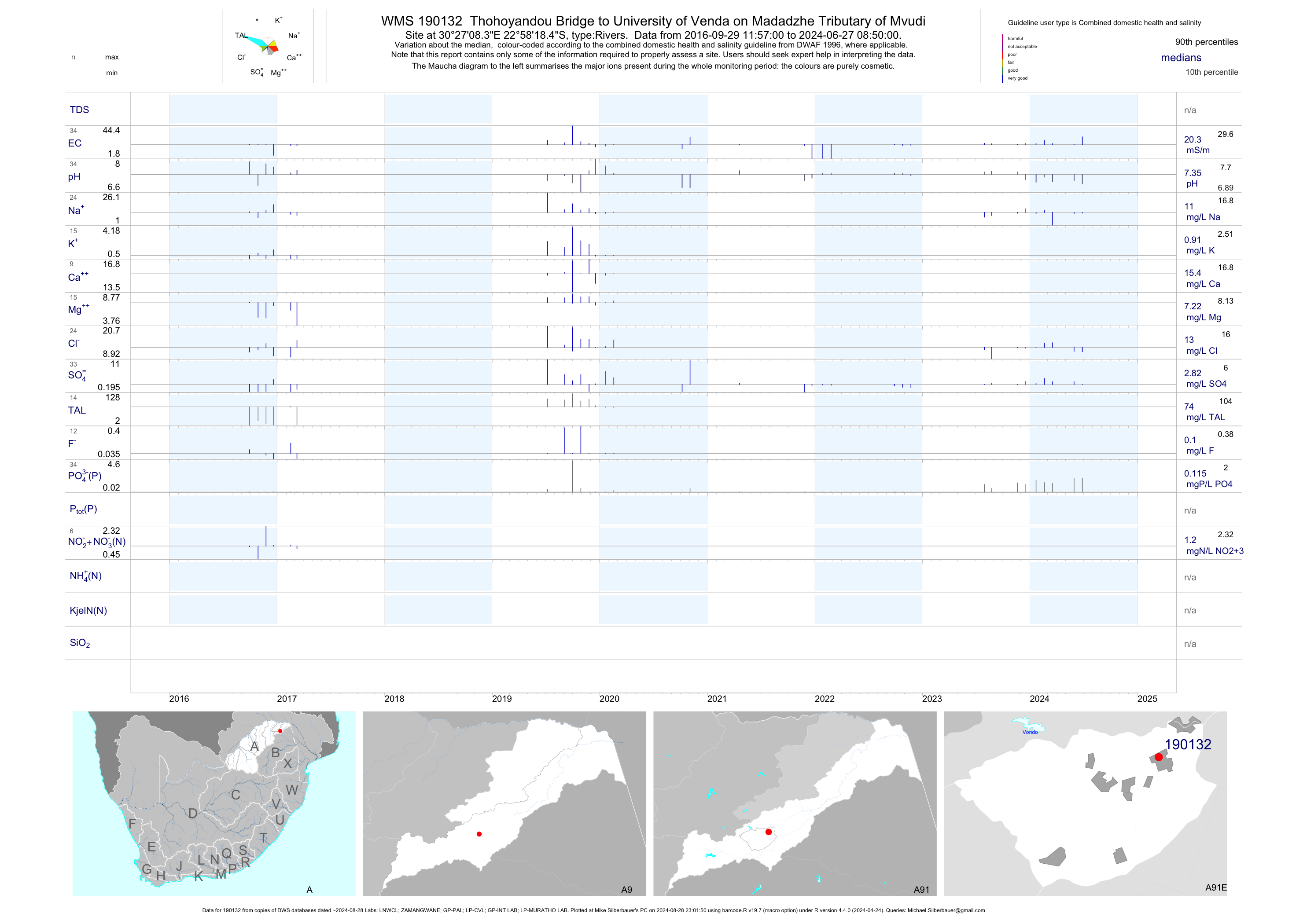
| A91 190132 | plot | data | Thohoyandou Bridge to University of Venda on Madadzhe Tributary of Mvudi | Rivers | 10 | 2016-09-29 | 2017-03-09 | 19 | 190132 | -22.97179 | 30.45233 |
| A91 190134 | plot | data | Lwamondo upstream of Vuwani Military Base STW Bridge on Dzondo River | Rivers | 2 | 2009-08-24 | 2009-08-24 | 19 | 190134 | -23.05691 | 30.39279 |
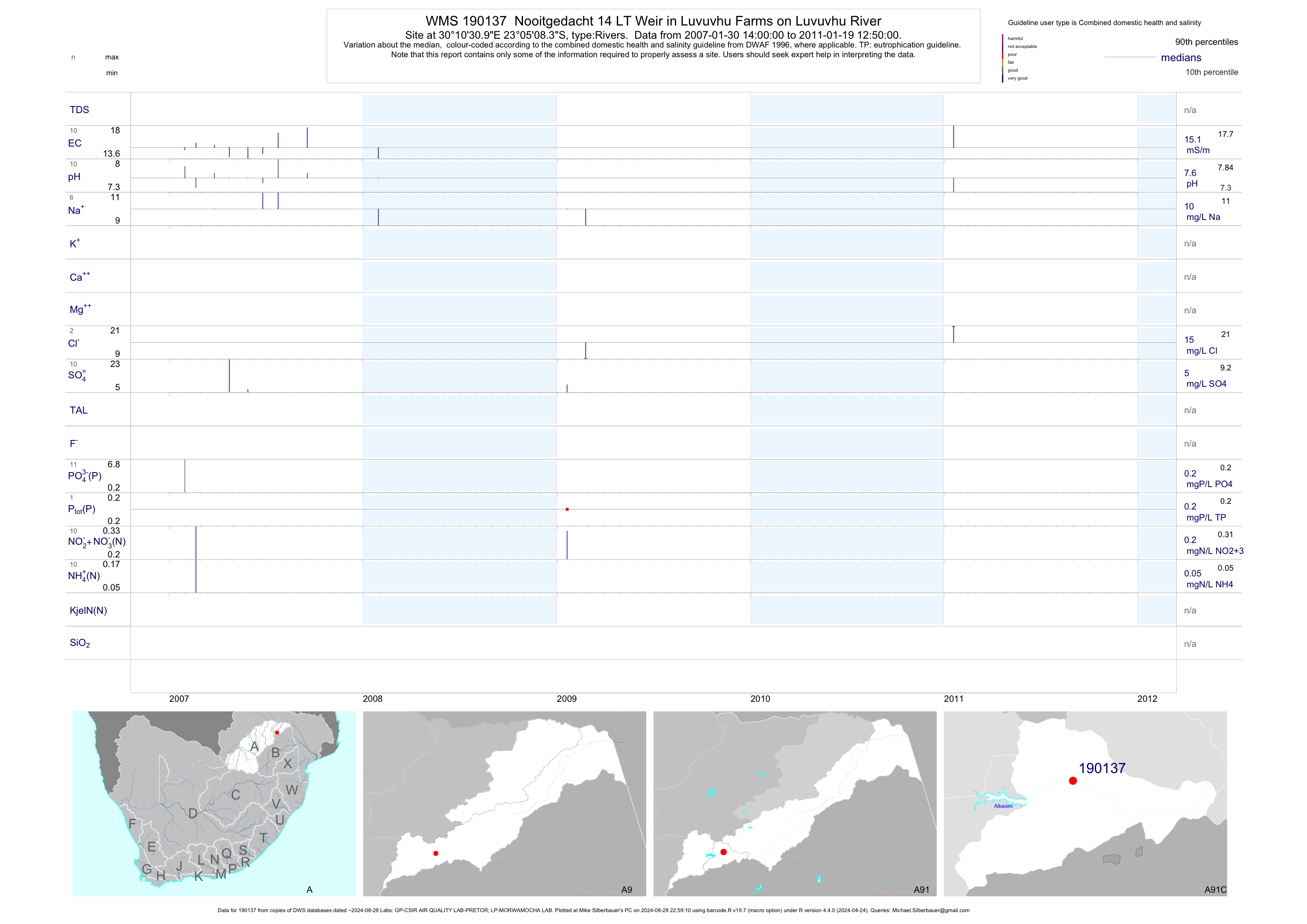
| A91 190137 | plot | data | Nooitgedacht 14 LT Weir in Luvuvhu Farms on Luvuvhu River | Rivers | 32 | 2007-01-30 | 2011-01-19 | 15 | 190137 | -23.08567 | 30.17528 |
| A91 190138 | plot | data | Klein Australie 13 LT Weir on Lotanyanda River Before Tshakhuma Village | Rivers | 42 | 2007-01-30 | 2009-06-23 | 9 | 190138 | -23.05661 | 30.24306 |
| A92 190148 | plot | data | Tengwe 255 MT Bashasha Village downstream of Tshilamba Oxidation Ponds on Lumvulini River | Rivers | 59 | 2008-01-29 | 2015-07-31 | 7 | 190148 | -22.74586 | 30.55044 |
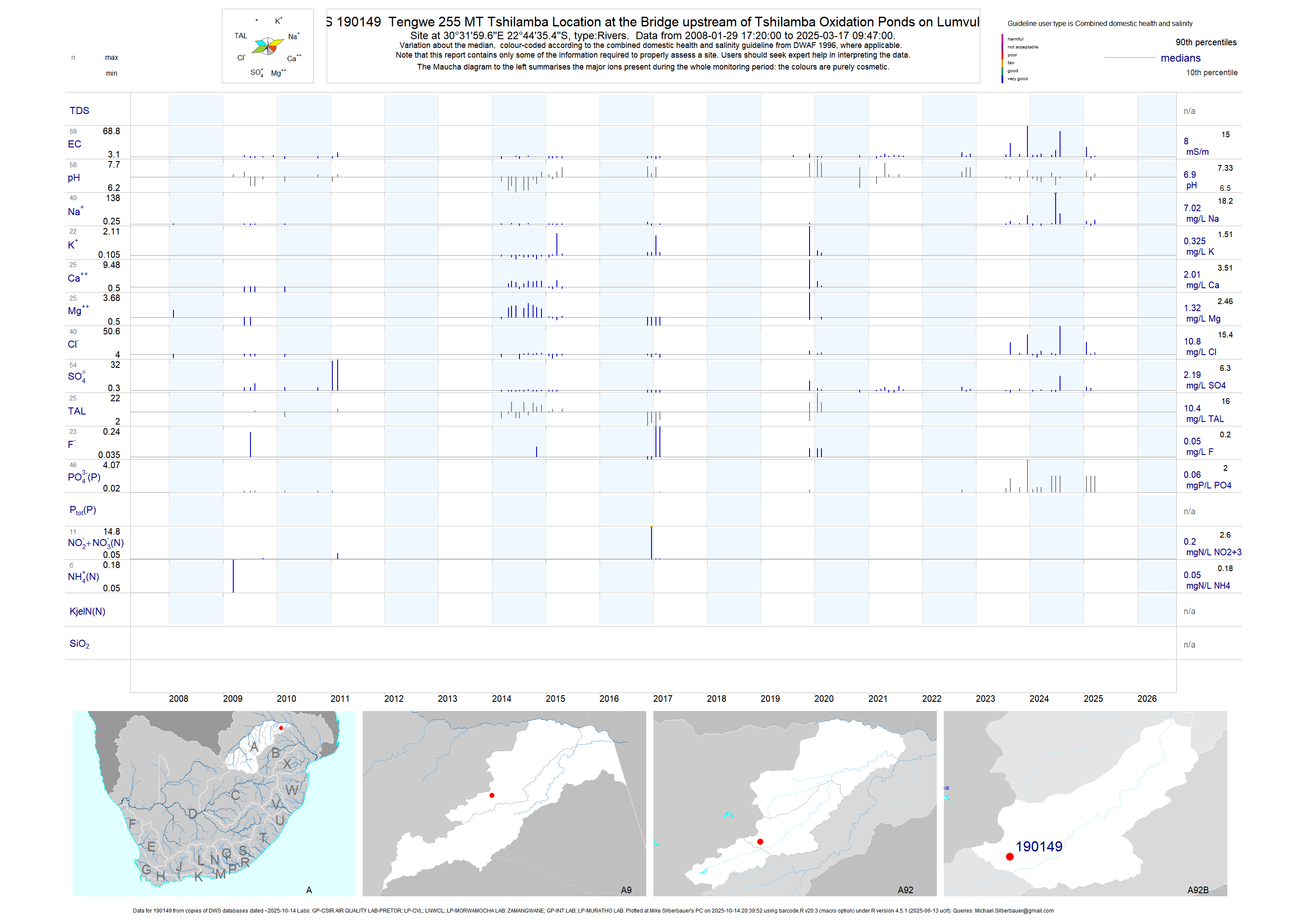
| A92 190149 | plot | data | Tengwe 255 MT Tshilamba Location at the Bridge upstream of Tshilamba Oxidation Ponds on Lumvulini R | Rivers | 56 | 2008-01-29 | 2017-02-15 | 6 | 190149 | -22.74319 | 30.53325 |
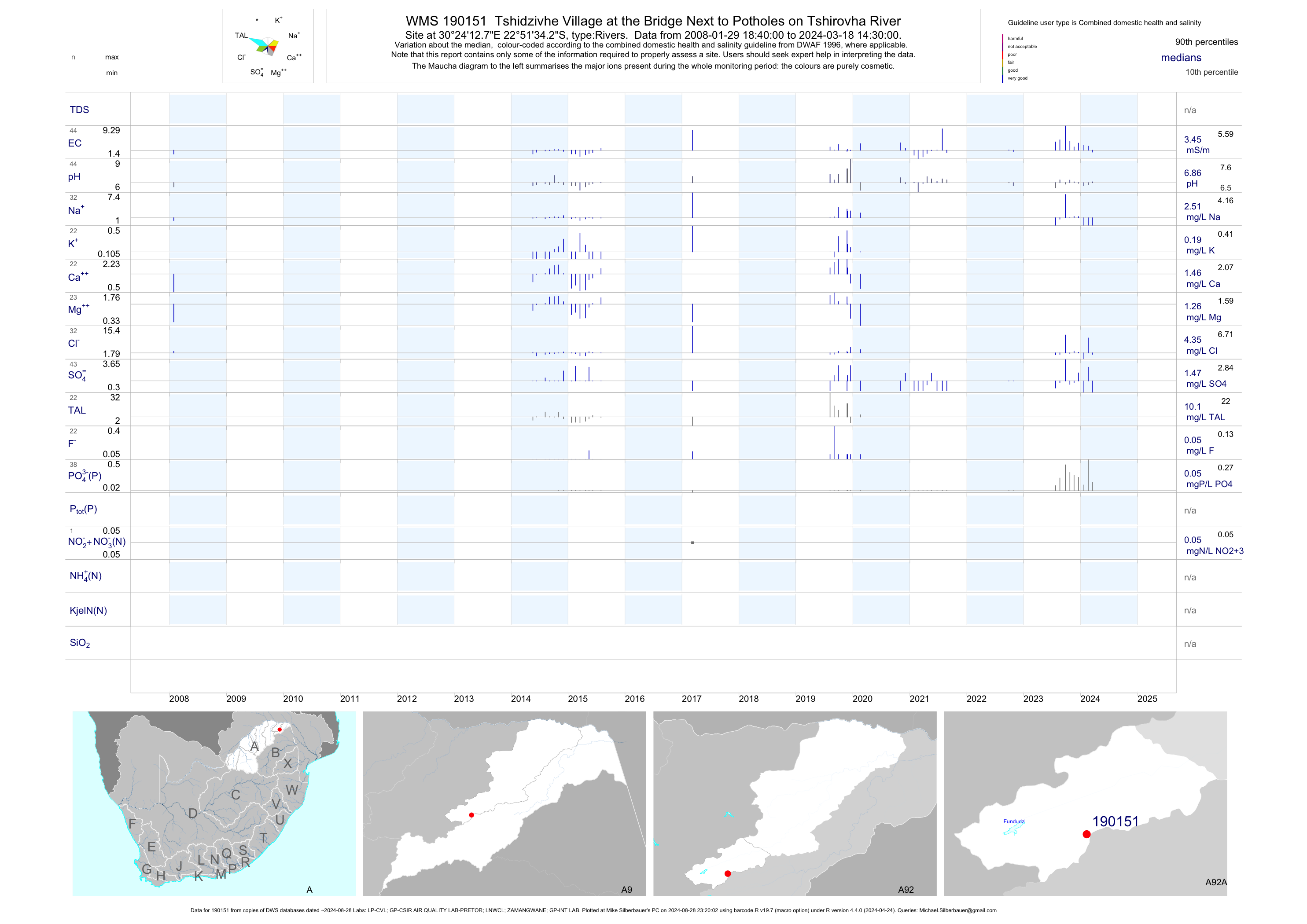
| A92 190151 | plot | data | Tshidzivhe Village at the Bridge Next to Potholes on Tshirovha River | Rivers | 34 | 2008-01-29 | 2017-03-09 | 3 | 190151 | -22.85950 | 30.40353 |
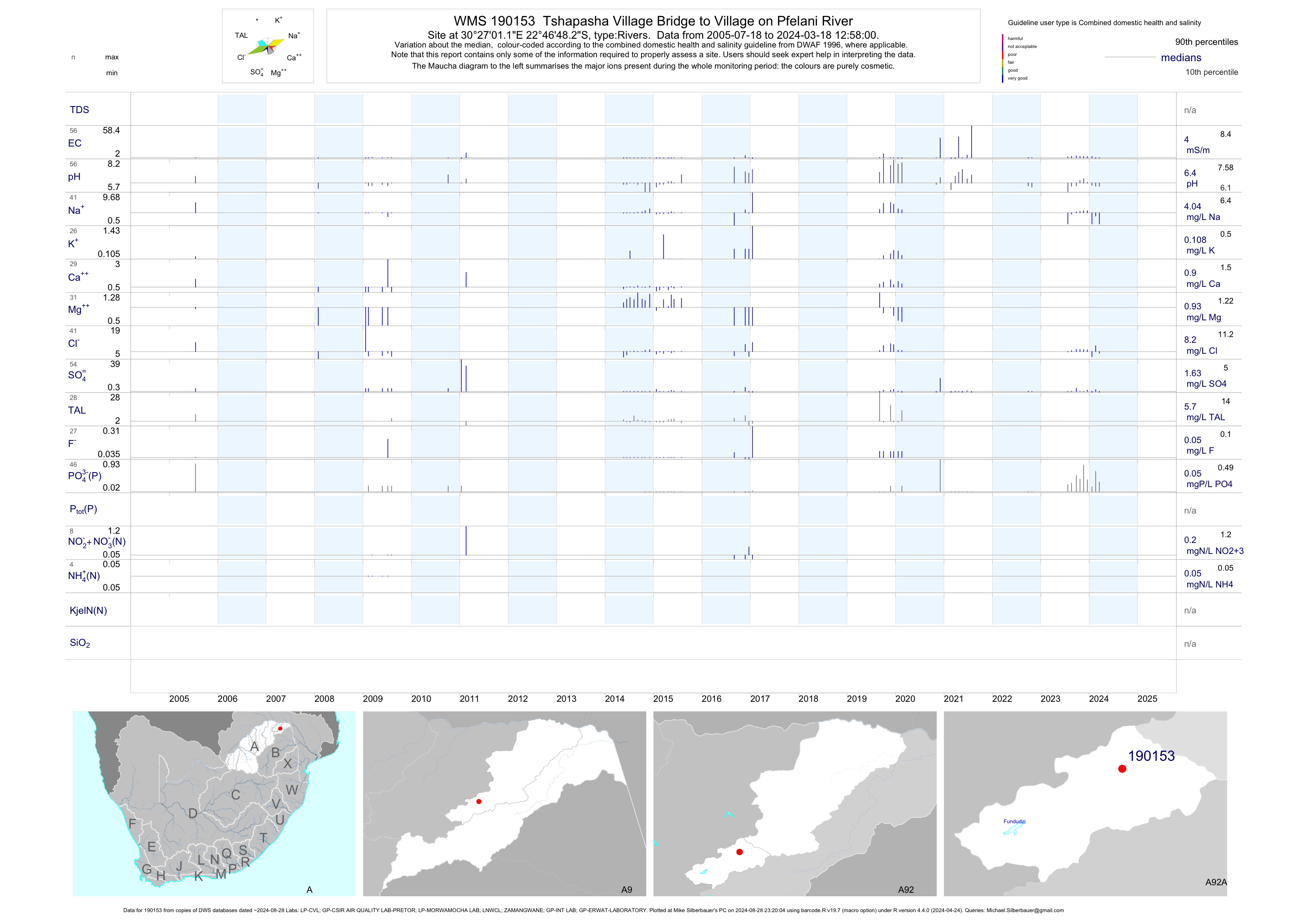
| A92 190153 | plot | data | Tshapasha Village Bridge to Village on Pfelani River | Rivers | 60 | 2005-07-18 | 2017-03-09 | 4 | 190153 | -22.78006 | 30.45031 |
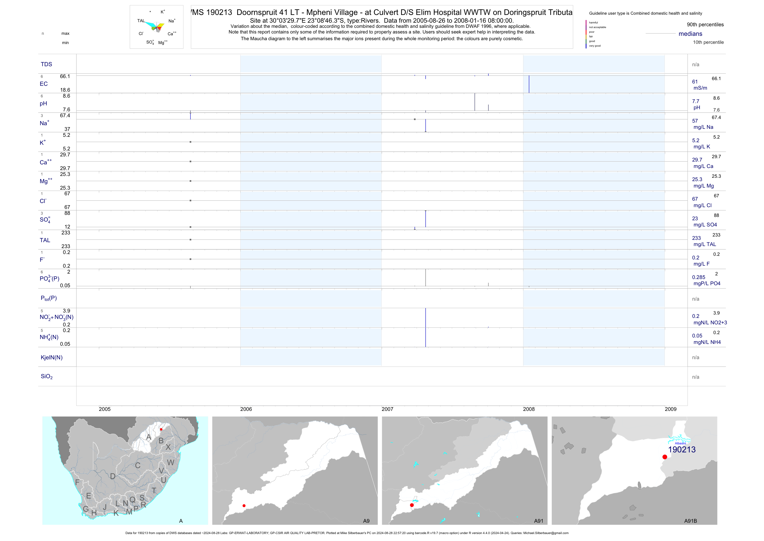
| A91 190213 | plot | data | Doornspruit 41 LT - Mpheni Village - at Culvert D/S Elim Hospital WWTW on Doringspruit Tributary | Rivers | 22 | 2005-08-26 | 2008-01-16 | 61 | 190213 | -23.14619 | 30.05825 |
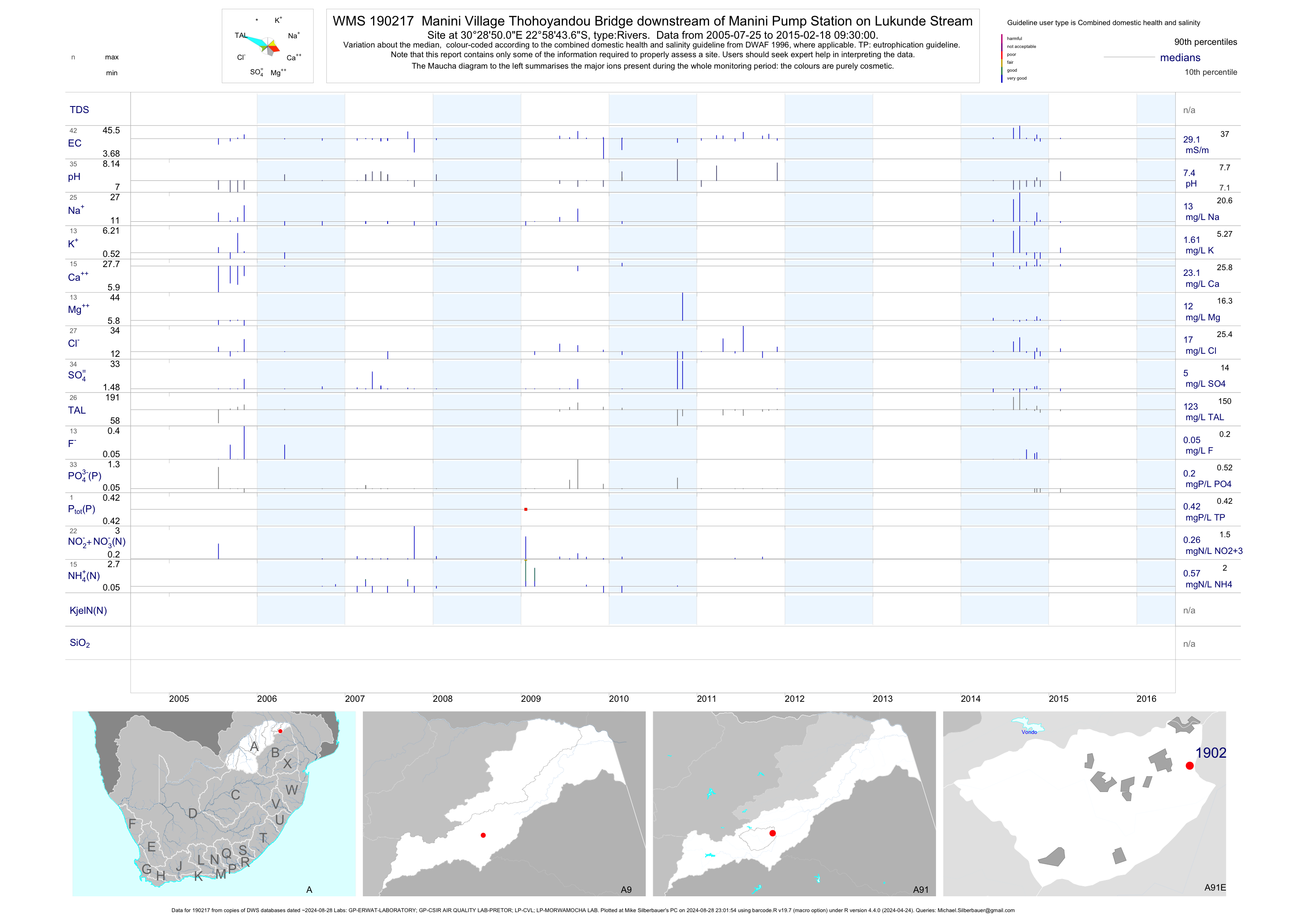
| A91 190217 | plot | data | Manini Village Thohoyandou Bridge downstream of Manini Pump Station on Lukunde Stream | Rivers | 111 | 2005-07-25 | 2015-06-01 | 29 | 190217 | -22.97879 | 30.48058 |
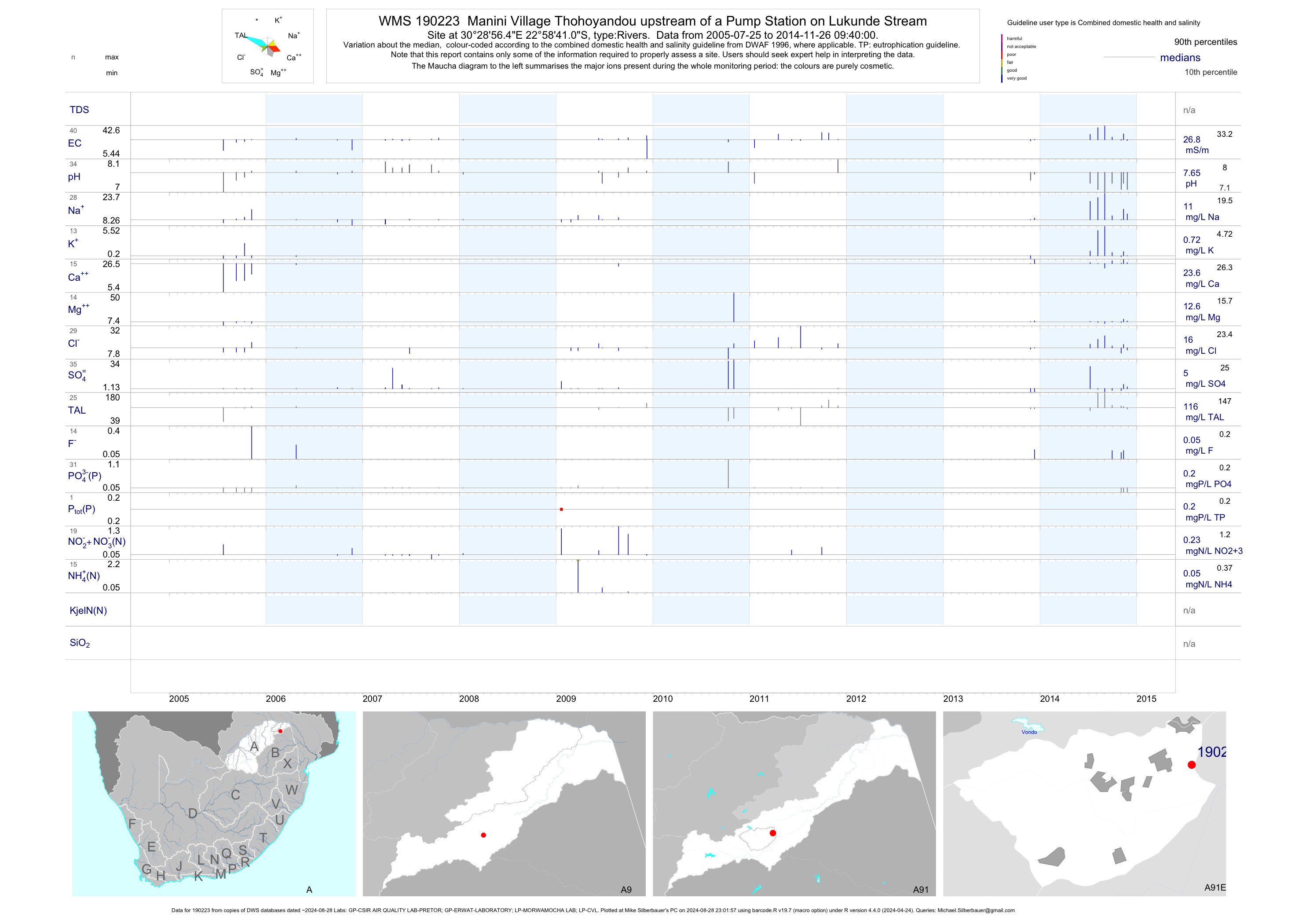
| A91 190223 | plot | data | Manini Village Thohoyandou upstream of a Pump Station on Lukunde Stream | Rivers | 102 | 2005-07-25 | 2014-11-26 | 27 | 190223 | -22.97807 | 30.48235 |
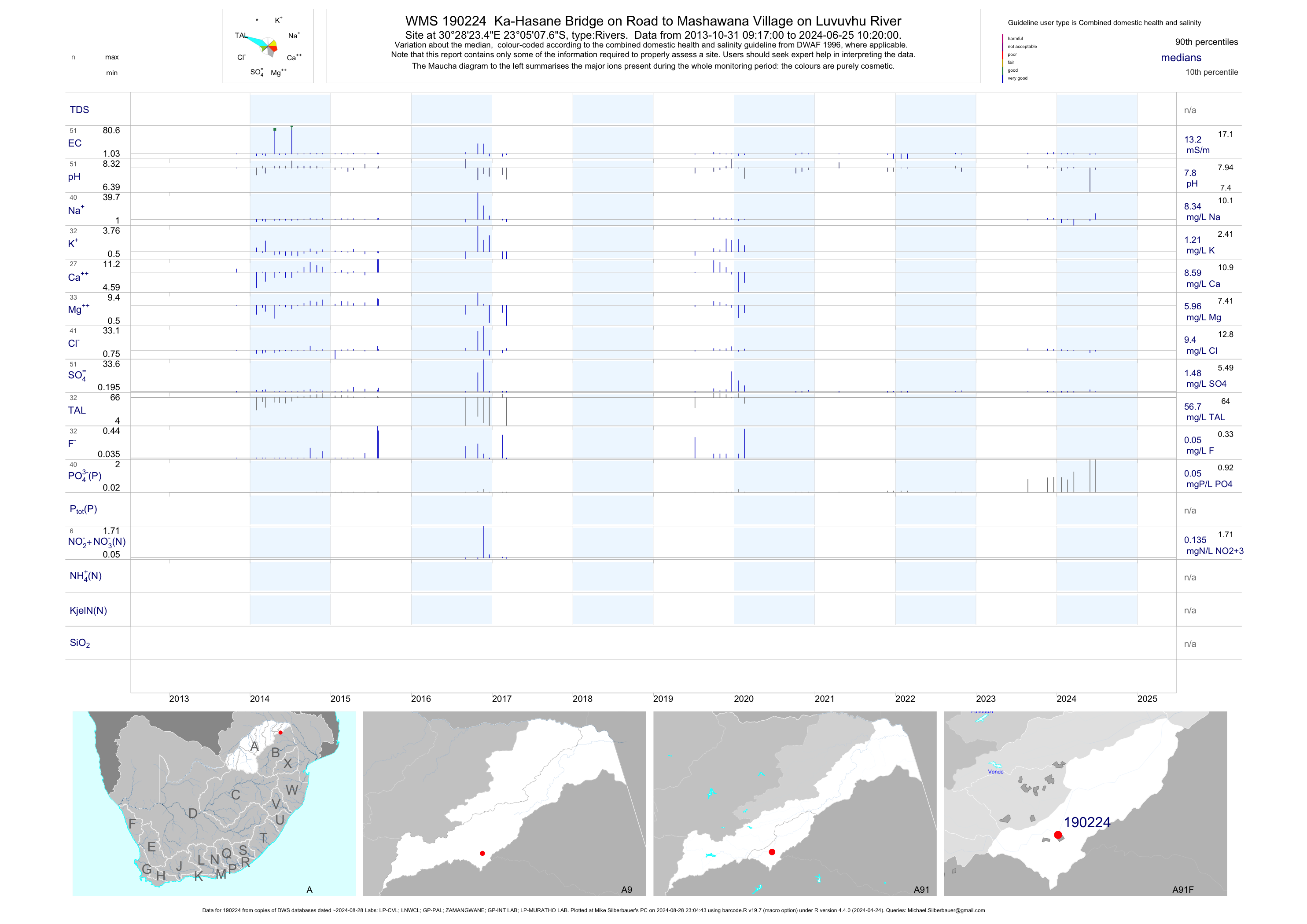
| A91 190224 | plot | data | Ka-Hasane Bridge on Road to Mashawana Village on Luvuvhu River | Rivers | 50 | 2013-10-31 | 2017-03-07 | 13 | 190224 | -23.08547 | 30.47319 |
| A91 191601 | plot | data | Didide Molenje 204 LT - on Luvuvhu River; U/S of Confluence with Dzindi | Rivers | 13 | 2010-01-13 | 2010-11-30 | n/a | 191601 | -23.00239 | 30.50422 |
| A91 191602 | plot | data | Dididi Mpapuli 278 MT - on Dzindi River; U/S of Confluence with Luvuvhu | Rivers | 9 | 2010-01-13 | 2010-11-29 | n/a | 191602 | -23.00283 | 30.49631 |
| A91 191603 | plot | data | Dididi Chibase 213 MT - on Mvudi River; U/S of Confluence with Dzindi | Rivers | 9 | 2010-01-13 | 2010-12-01 | n/a | 191603 | -23.00125 | 30.49572 |
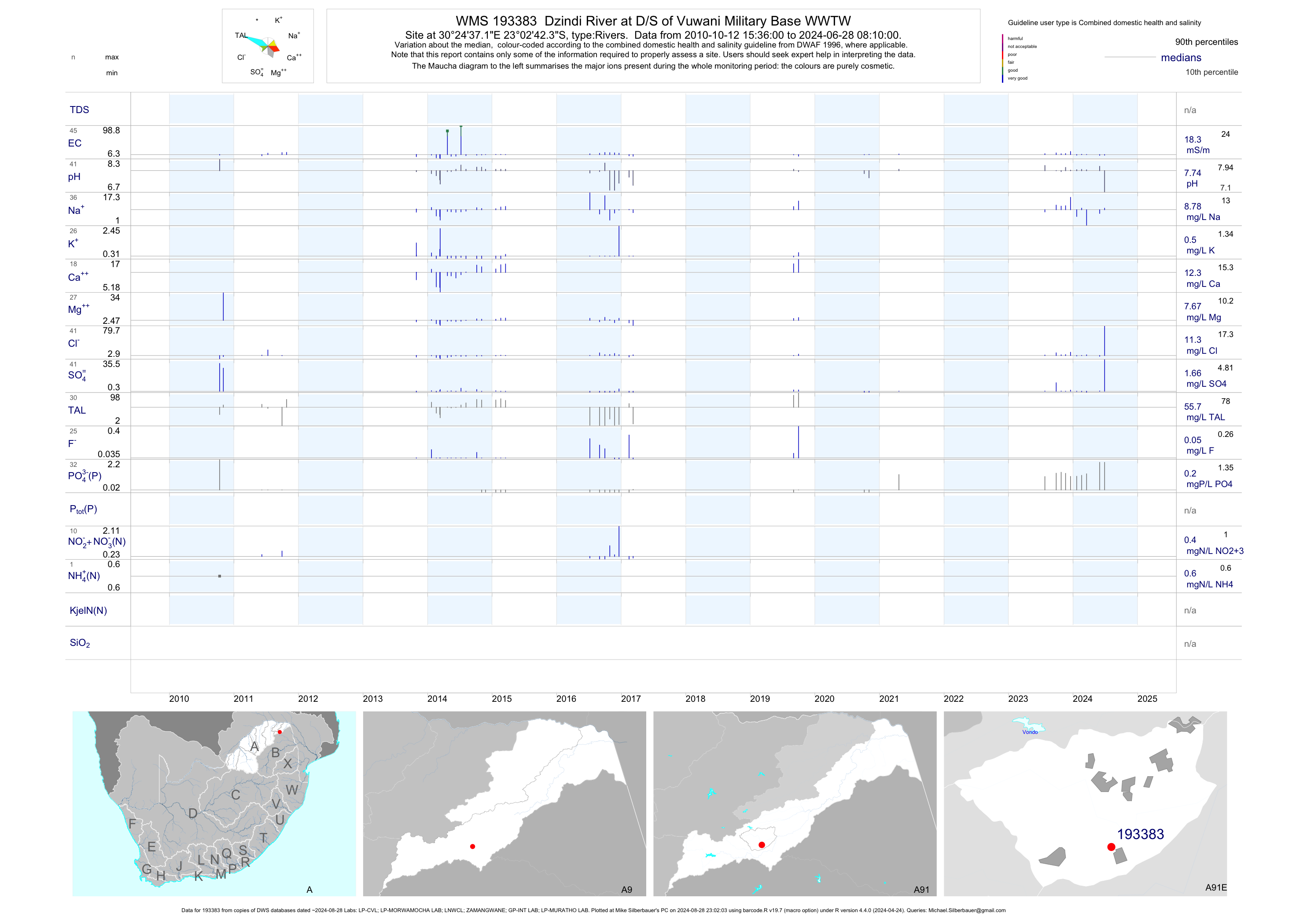
| A91 193383 | plot | data | Dzindi River at D/S of Vuwani Military Base WWTW | Rivers | 64 | 2010-10-12 | 2017-03-09 | 18 | 193383 | -23.04509 | 30.41032 |
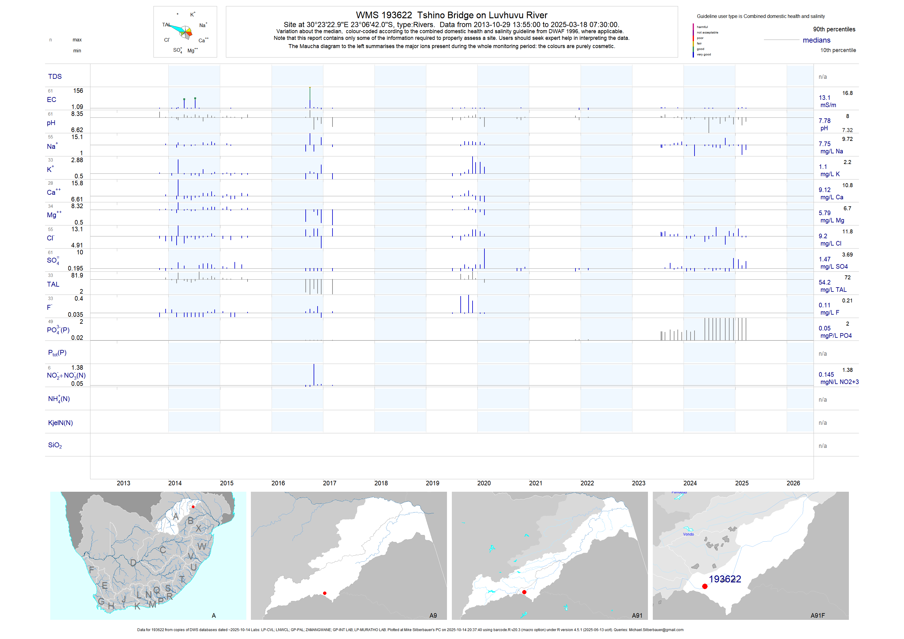
| A91 193622 | plot | data | Tshino Bridge on Luvhuvu River | Rivers | 48 | 2013-10-29 | 2017-03-09 | 13 | 193622 | -23.11167 | 30.38972 |
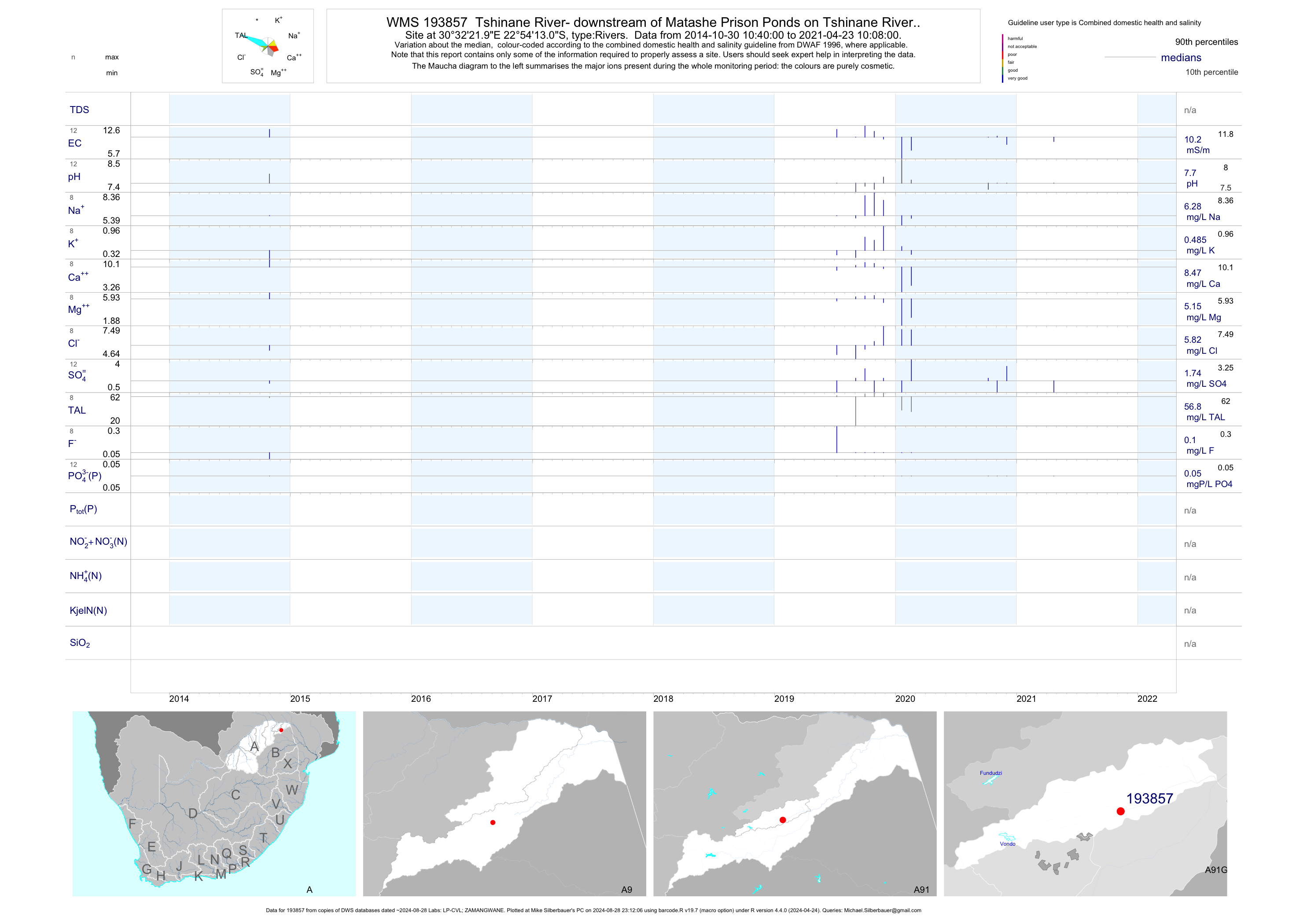
| A91 193857 | plot | data | Tshinane River- downstream of Matashe Prison Ponds on Tshinane River.. | Rivers | 2 | 2014-10-30 | 2014-10-30 | 12 | 193857 | -22.90364 | 30.53944 |
| A91 194057 | plot | data | Dzindi River Bridge at Tswinga Village | Rivers | 38 | 2014-04-23 | 2017-03-07 | 14 | 194057 | -23.01055 | 30.47712 |
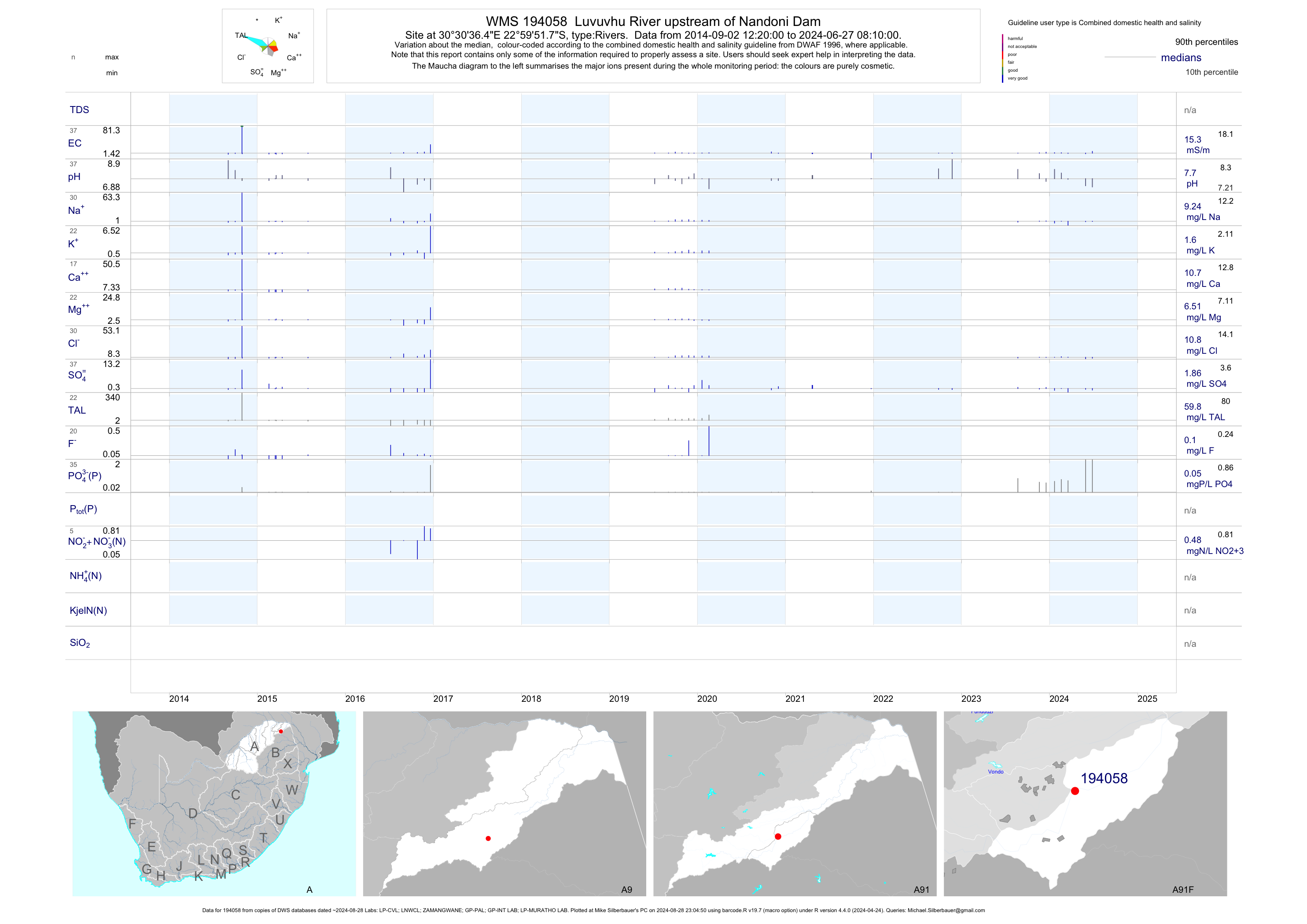
| A91 194058 | plot | data | Luvuvhu River upstream of Nandoni Dam | Rivers | 29 | 2014-08-05 | 2017-02-15 | 15 | 194058 | -22.99770 | 30.51013 |
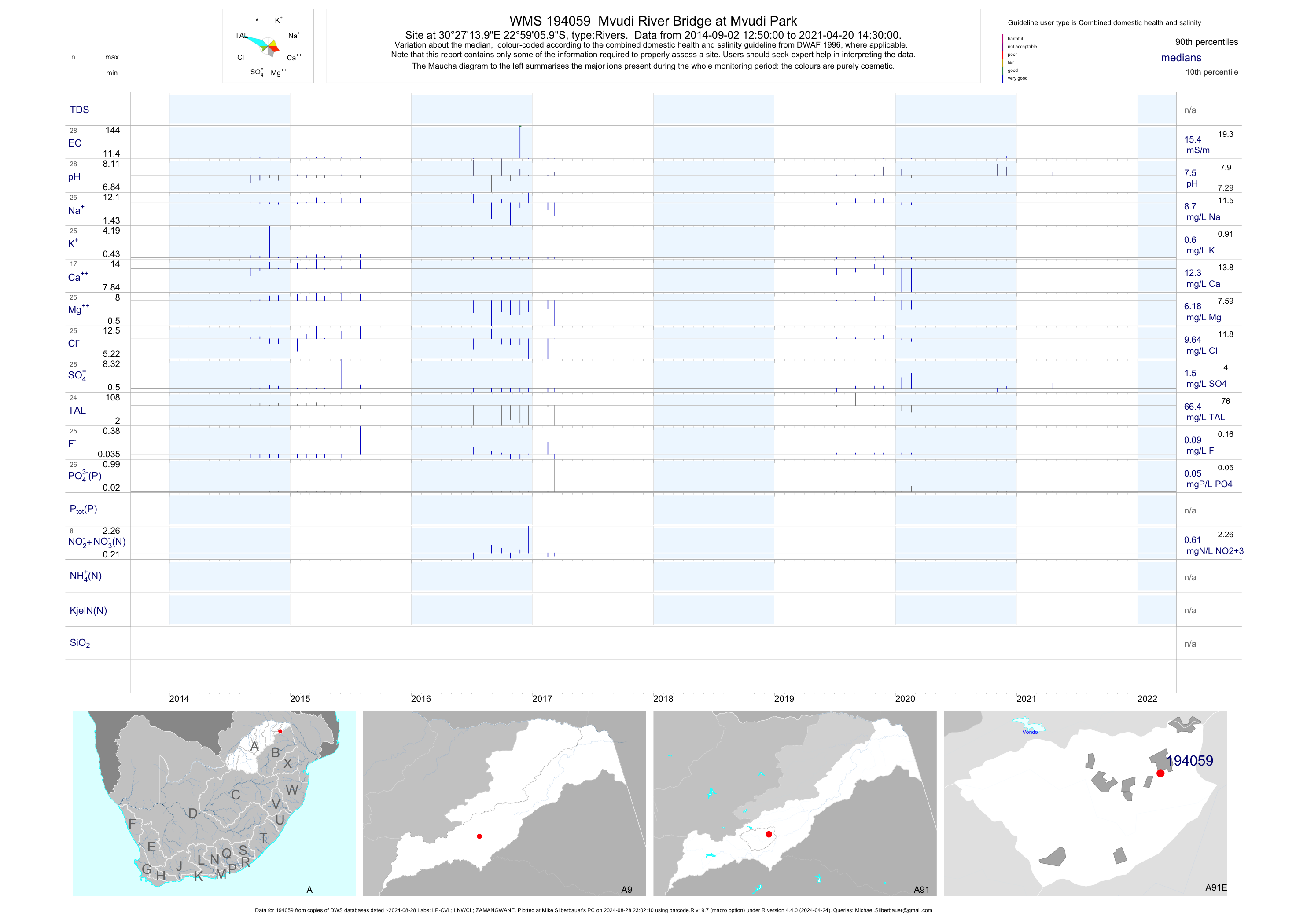
| A91 194059 | plot | data | Mvudi River Bridge at Mvudi Park | Rivers | 32 | 2014-07-05 | 2017-03-07 | 16 | 194059 | -22.98499 | 30.45388 |
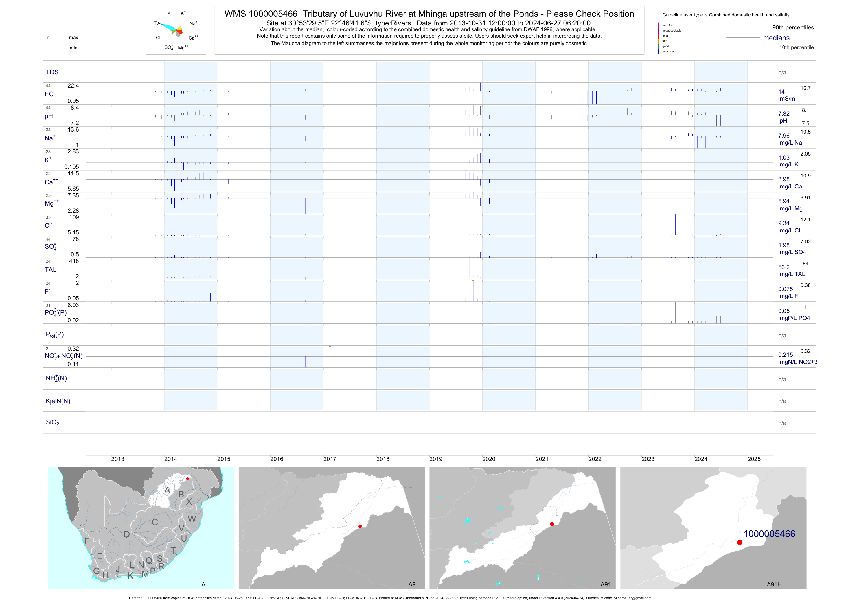
| A91 1000005466 | plot | data | Tributary of Luvuvhu River at Mhinga upstream of the Ponds - Please Check Position | Rivers | 36 | 2013-10-31 | 2017-02-15 | 13 | 1-5466 | -22.77825 | 30.89155 |
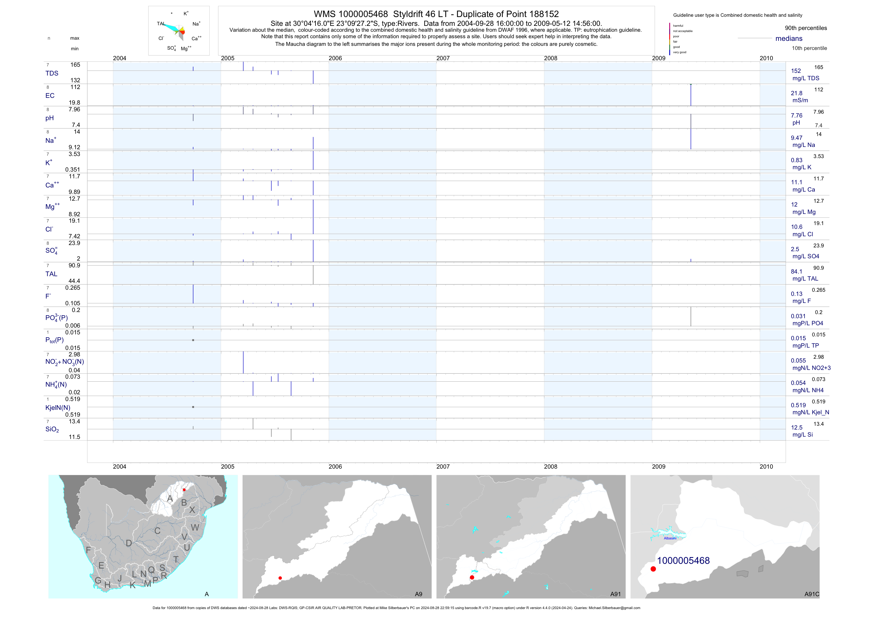
| A91 1000005468 | plot | data | Styldrift 46 LT - Duplicate of Point 188152 | Rivers | 28 | 2004-09-28 | 2009-05-12 | 22 | 1-5468 | -23.15758 | 30.07111 |
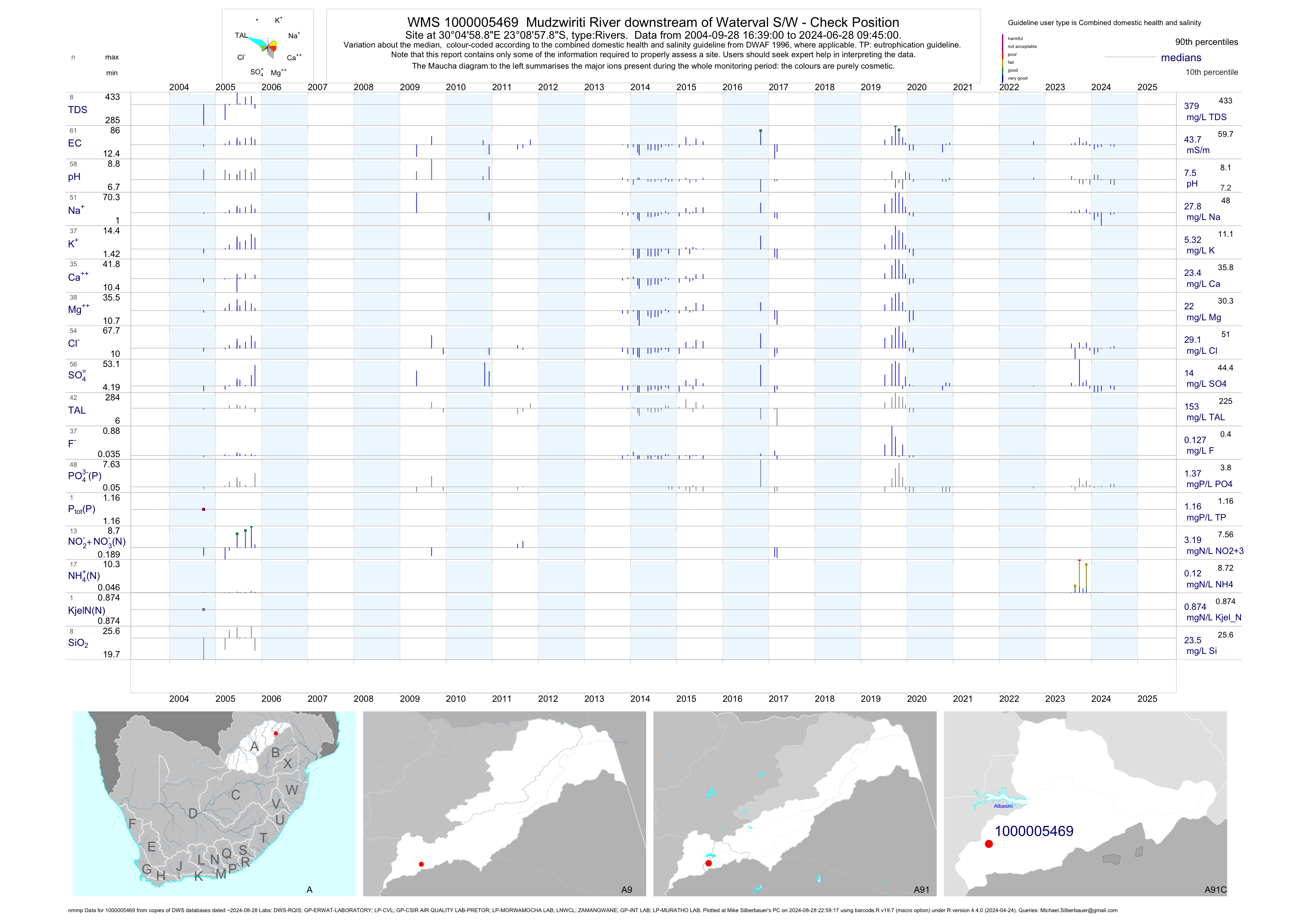
| A91 1000005469 | plot | data | Mudzwiriti River downstream of Waterval S/W - Check Position (nmmp) | Rivers | 102 | 2004-09-28 | 2017-03-07 | 43 | 1-5469 | -23.14940 | 30.08302 |
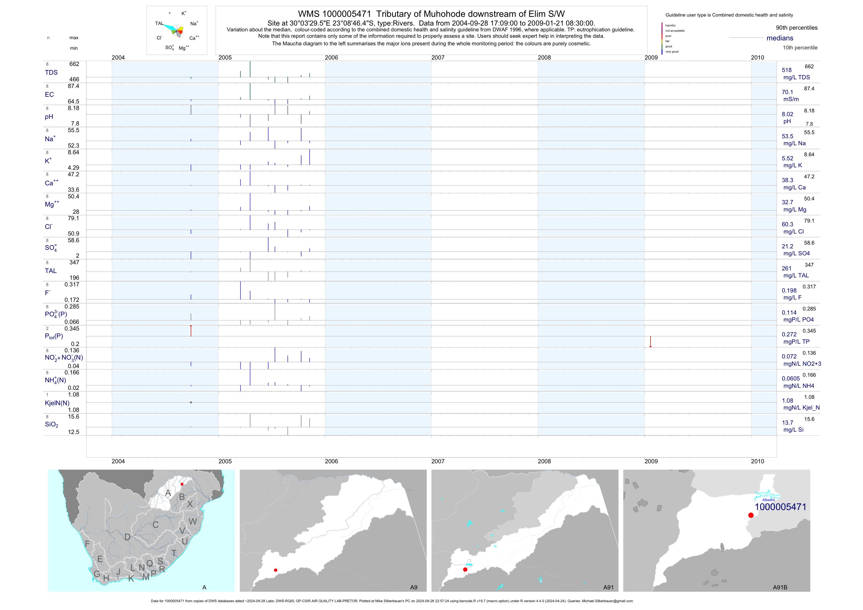
| A91 1000005471 | plot | data | Tributary of Muhohode downstream of Elim S/W | Rivers | 34 | 2004-09-28 | 2009-01-21 | 70 | 1-5471 | -23.14625 | 30.05822 |
| A91 1000009909 | plot | data | Tshinane River downstream of Thsitereke Discharge Point | Rivers | 36 | 2004-09-28 | 2005-10-11 | 40 | 1-9909 | -22.89817 | 30.50117 |
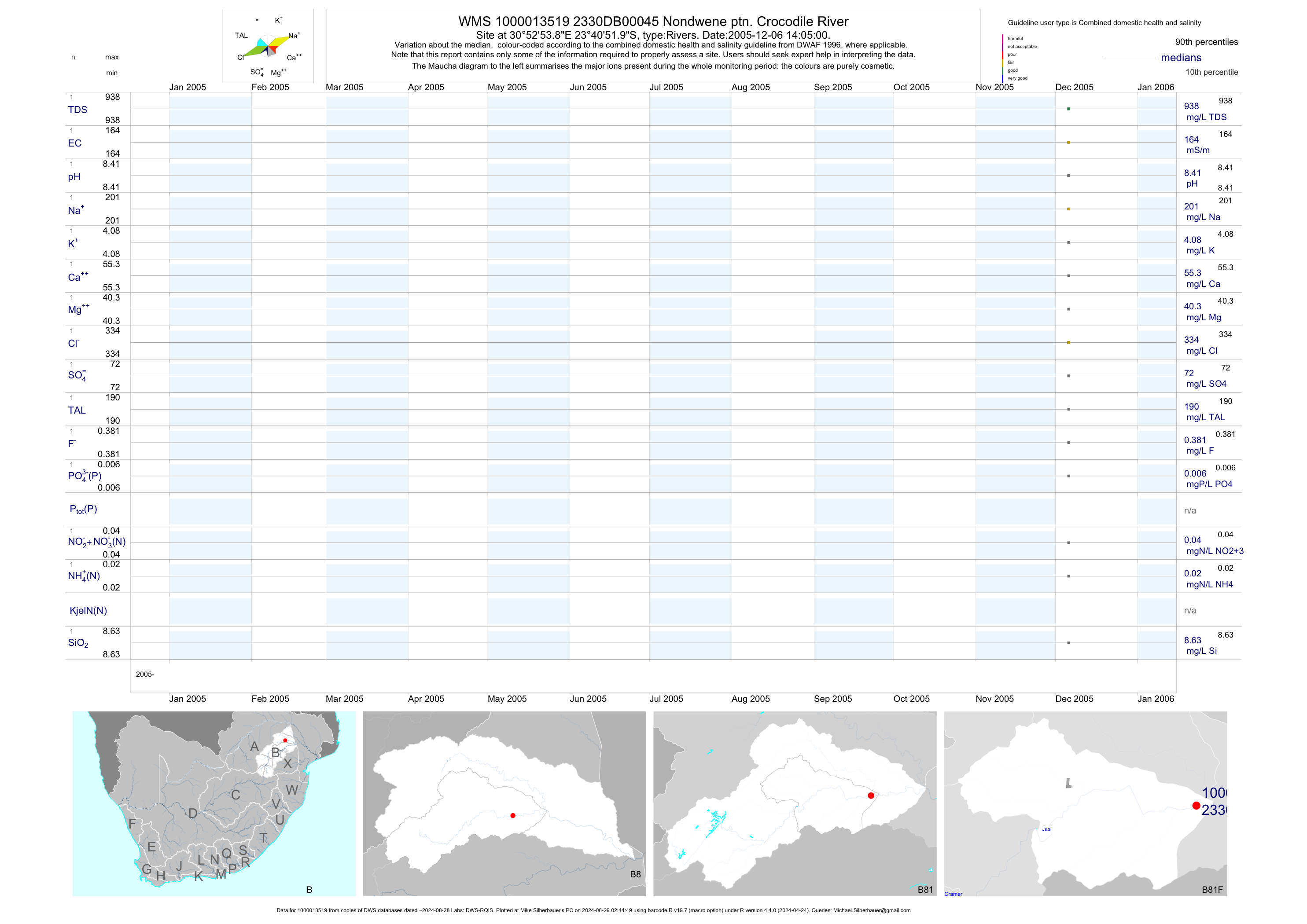
| B81 1000013519 | plot | data | Nondwene ptn. Crocodile River | Rivers | 2 | 2005-12-06 | 2005-12-06 | 164 | 45 | -23.68110 | 30.88162 |
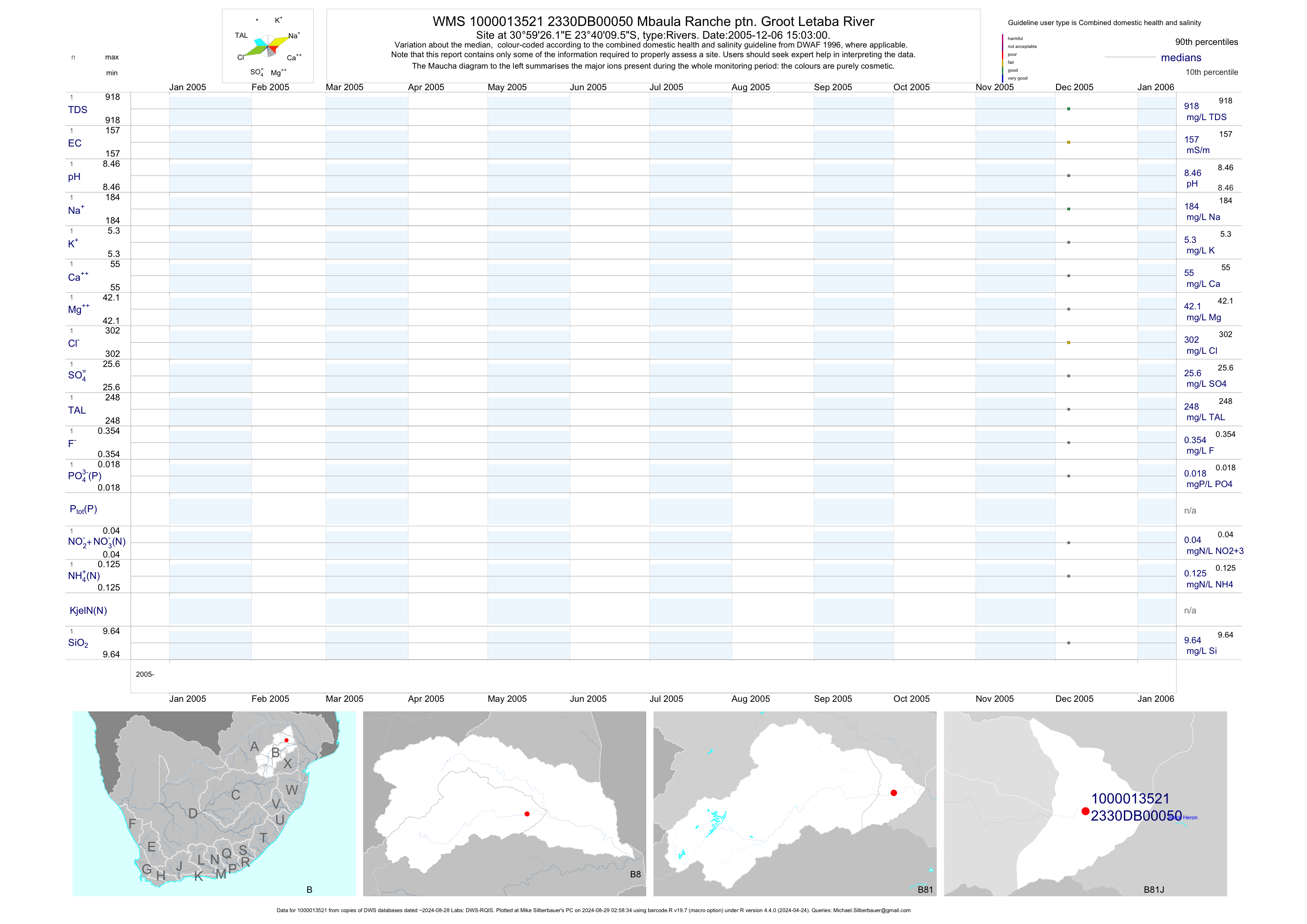
| B81 1000013521 | plot | data | Mbaula Ranche ptn. Groot Letaba River | Rivers | 2 | 2005-12-06 | 2005-12-06 | 157 | 50 | -23.66932 | 30.99061 |
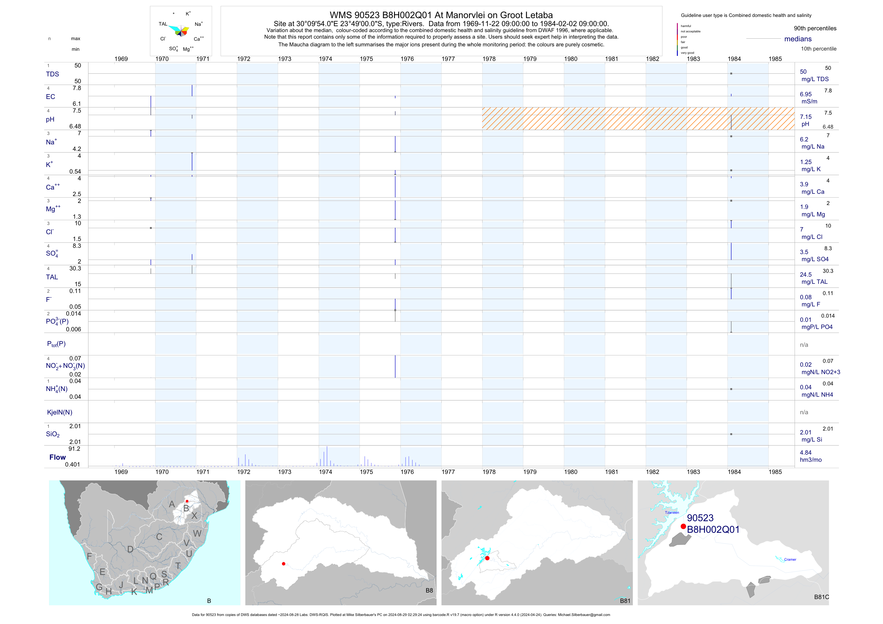
| B81 90523 | plot | data | At Manorvlei on Groot Letaba | Rivers | 4 | 1969-11-22 | 1984-02-02 | 7 | B8H002 | -23.81667 | 30.16500 |
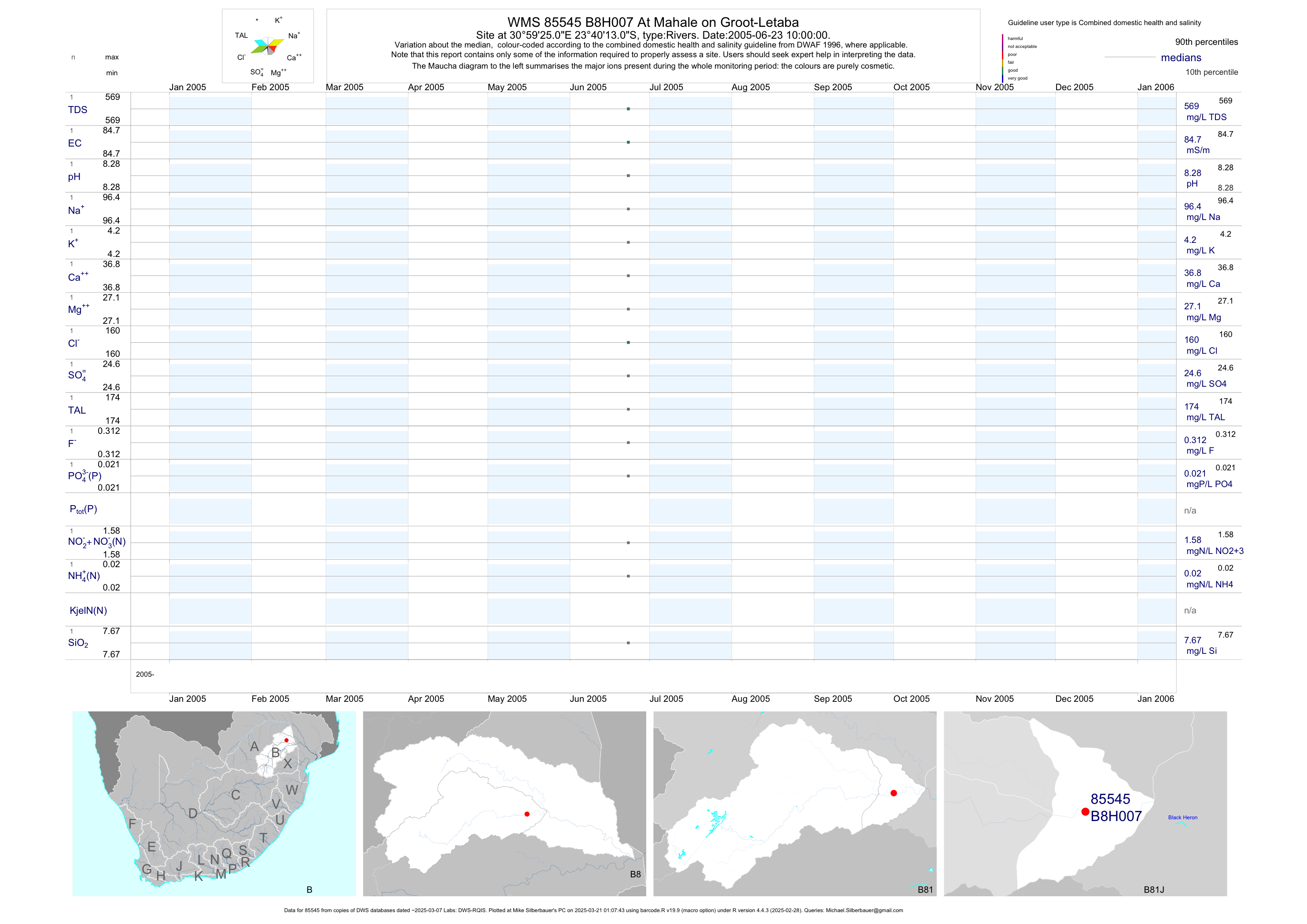
| B81 85545 | plot | data | At Mahale on Groot-Letaba | Rivers | 2 | 2005-06-23 | 2005-06-23 | 85 | B8H007 | -23.67028 | 30.99028 |
| B81 90524 | plot | data | At Letaba Ranch on Groot Letaba (ncwq NCMP) | Rivers | 1099 | 1977-09-21 | 2018-09-26 | 35 | B8H008 | -23.65806 | 31.05000 |
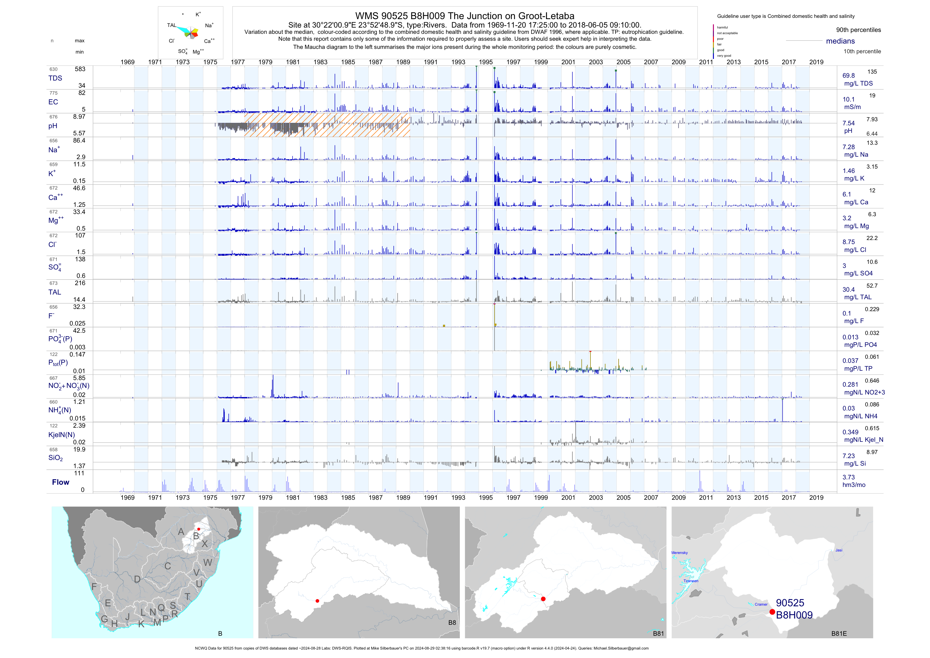
| B81 90525 | plot | data | The Junction on Groot-Letaba (NCWQ) | Rivers | 817 | 1969-11-20 | 2018-06-05 | 10 | B8H009 | -23.88028 | 30.36694 |
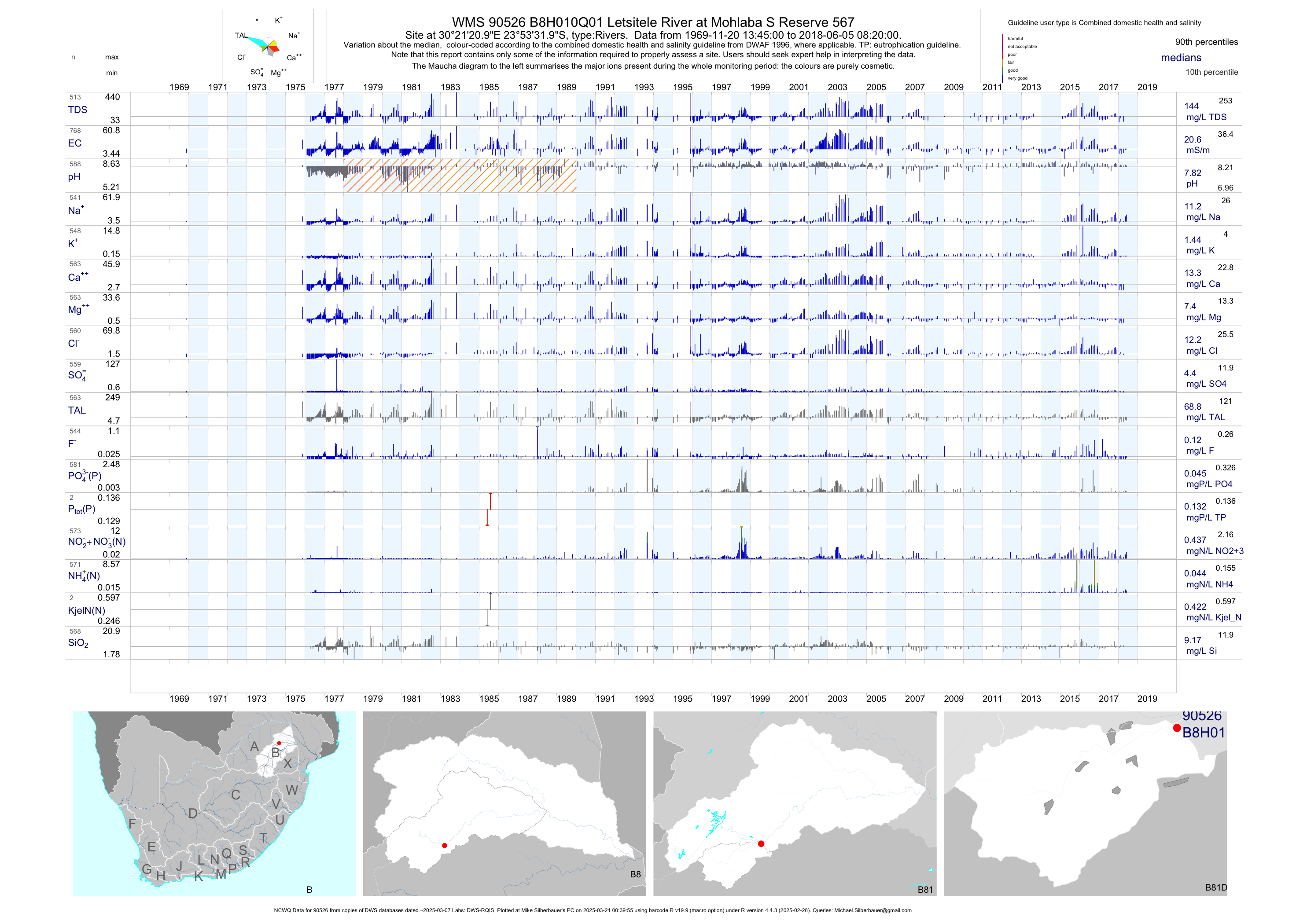
| B81 90526 | plot | data | Letsitele River at Mohlaba S Reserve 567 (NCWQ) | Rivers | 837 | 1969-11-20 | 2018-06-05 | 21 | B8H010 | -23.89222 | 30.35583 |
| B81 90527 | plot | data | At Grysappel on Groot Letaba (NCWQ nemp) | Rivers | 585 | 1969-11-21 | 2018-06-07 | 6 | B8H014 | -23.88056 | 30.07972 |
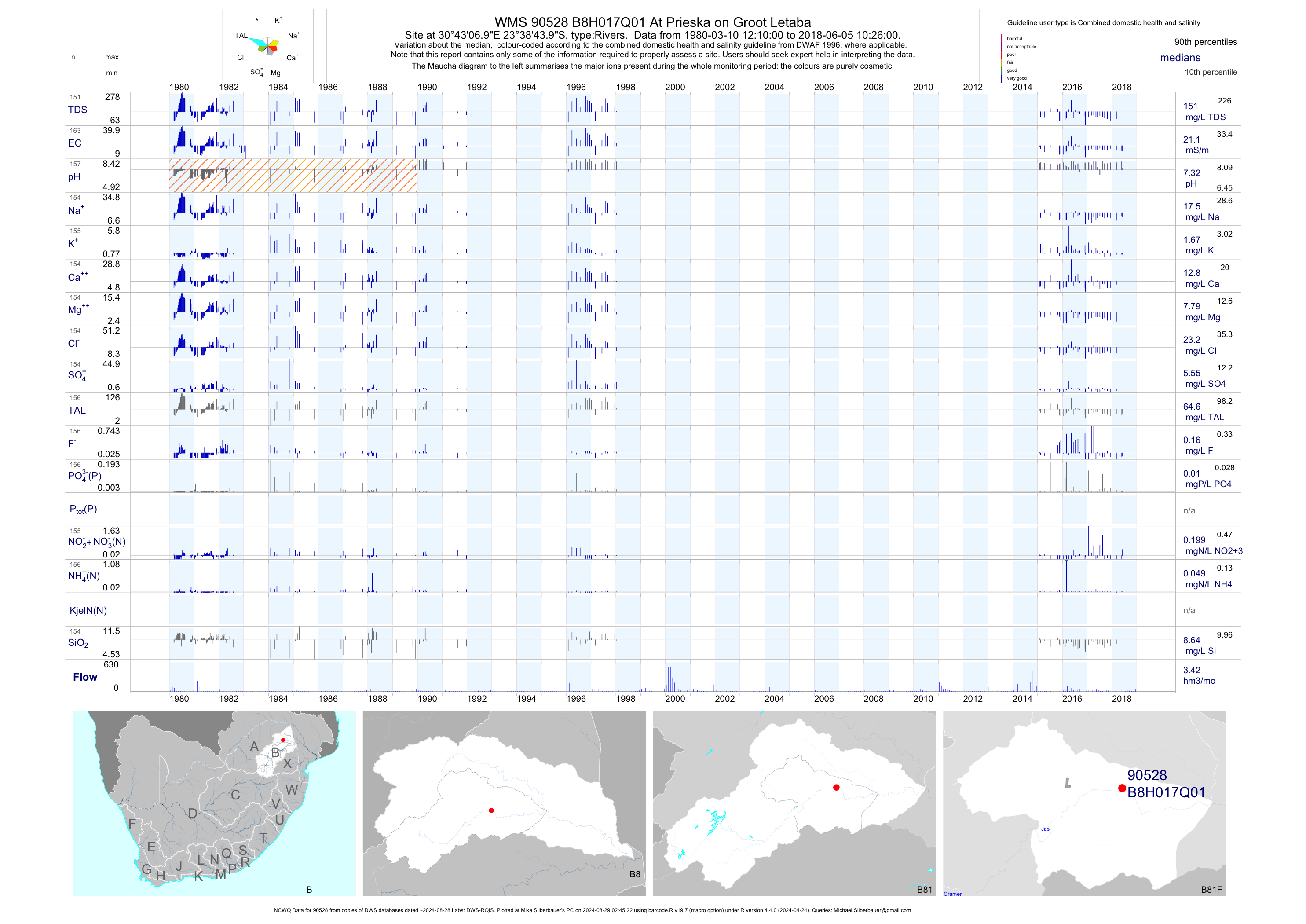
| B81 90528 | plot | data | At Prieska on Groot Letaba (NCWQ) | Rivers | 165 | 1980-03-10 | 2018-06-05 | 21 | B8H017 | -23.64556 | 30.71861 |
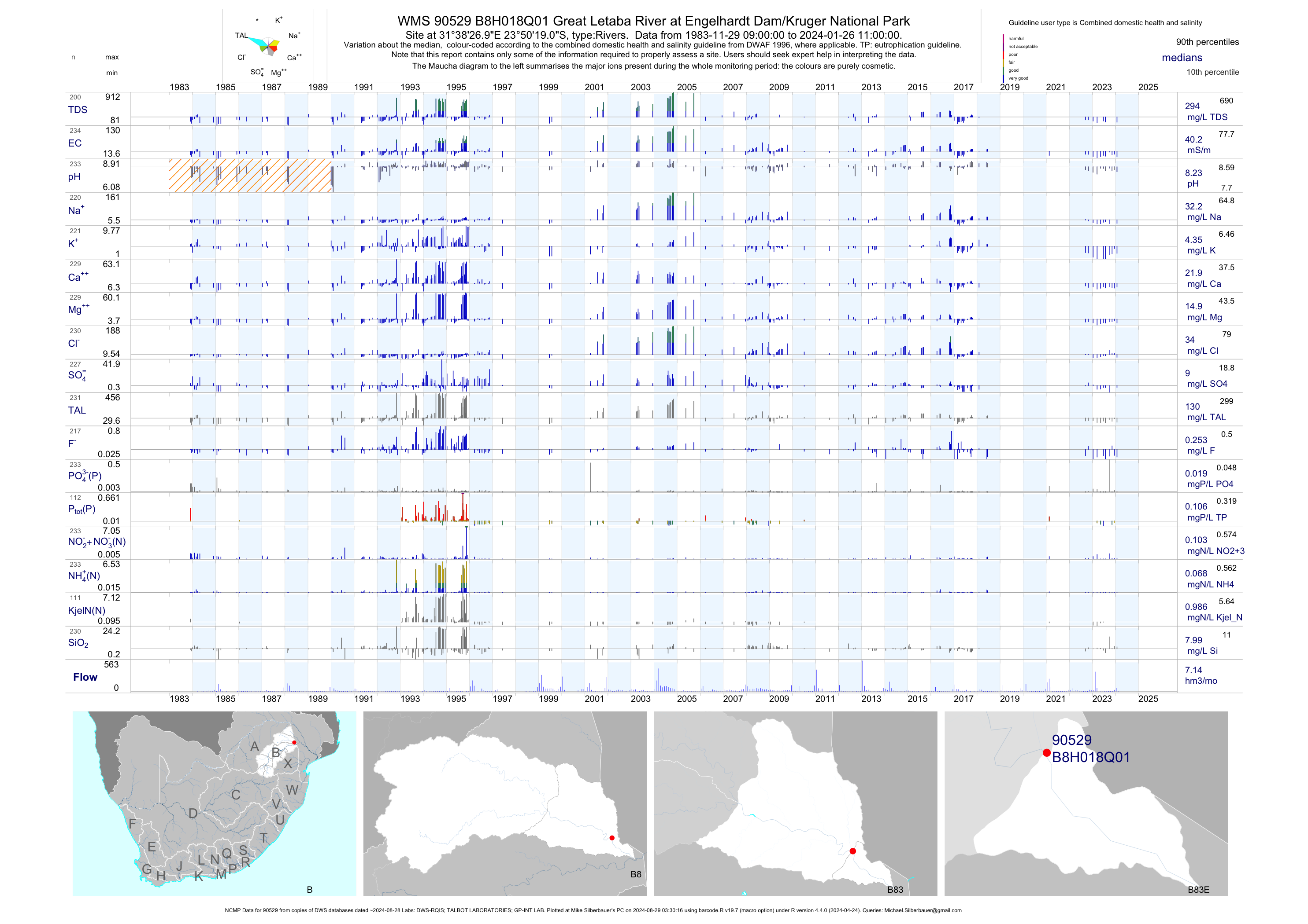
| B83 90529 | plot | data | Great Letaba River at Engelhardt Dam/Kruger National Park (NCMP) | Rivers | 357 | 1983-11-29 | 2018-06-15 | 41 | B8H018 | -23.83861 | 31.64083 |
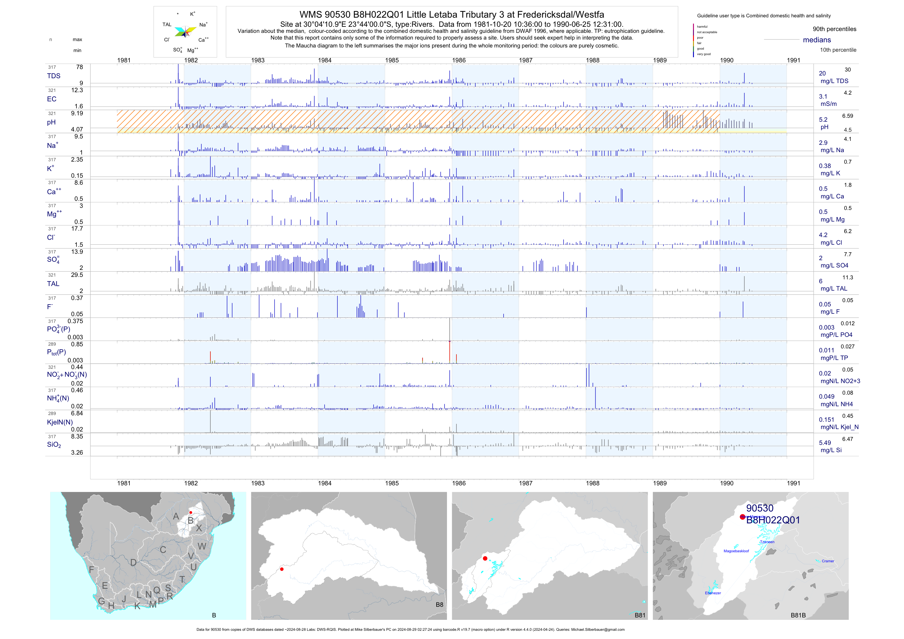
| B81 90530 | plot | data | Little Letaba Tributary 3 at Fredericksdal/Westfa | Rivers | 321 | 1981-10-20 | 1990-06-25 | 3 | B8H022 | -23.73333 | 30.06972 |
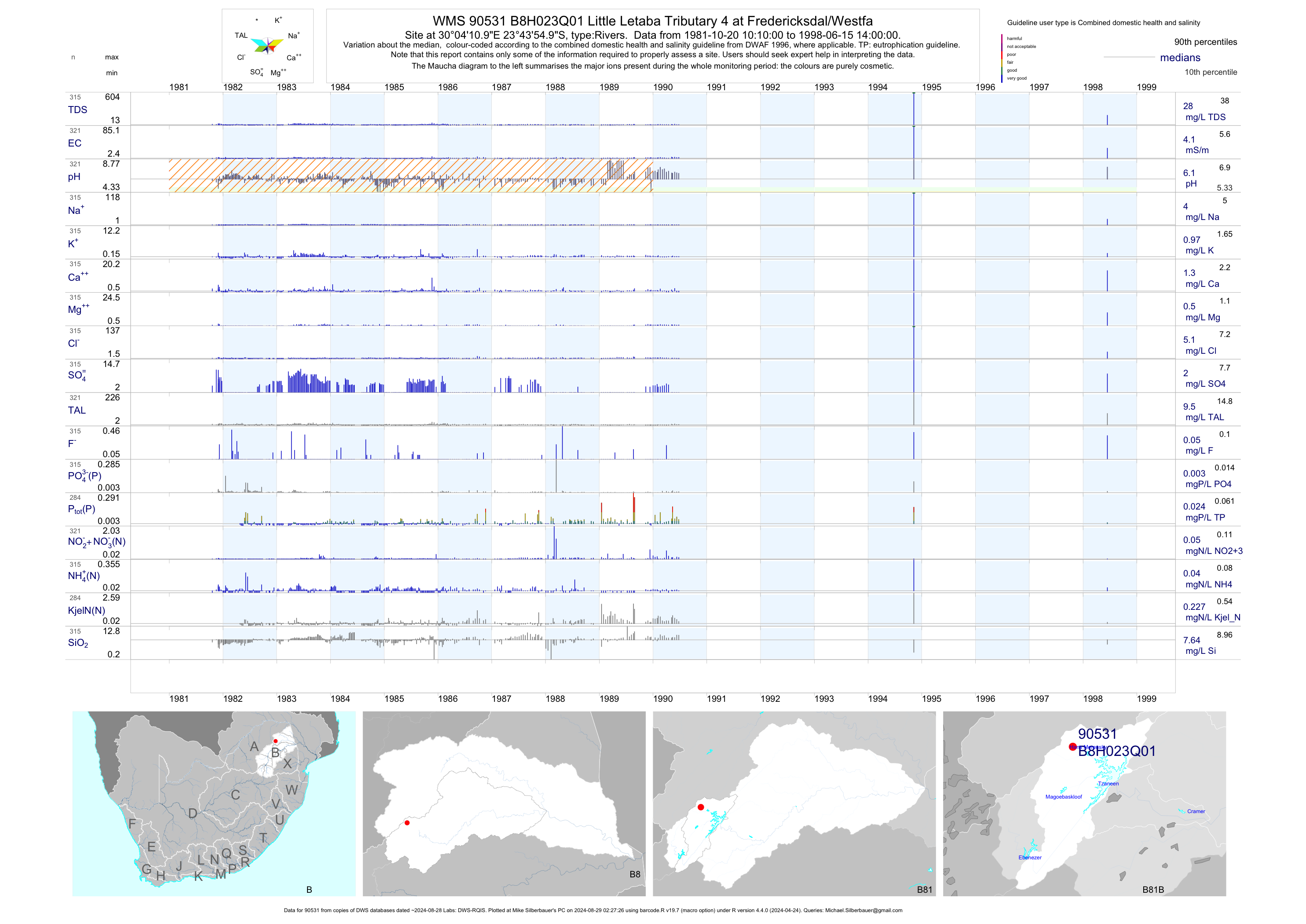
| B81 90531 | plot | data | Little Letaba Tributary 4 at Fredericksdal/Westfa | Rivers | 321 | 1981-10-20 | 1998-06-15 | 4 | B8H023 | -23.73194 | 30.06972 |
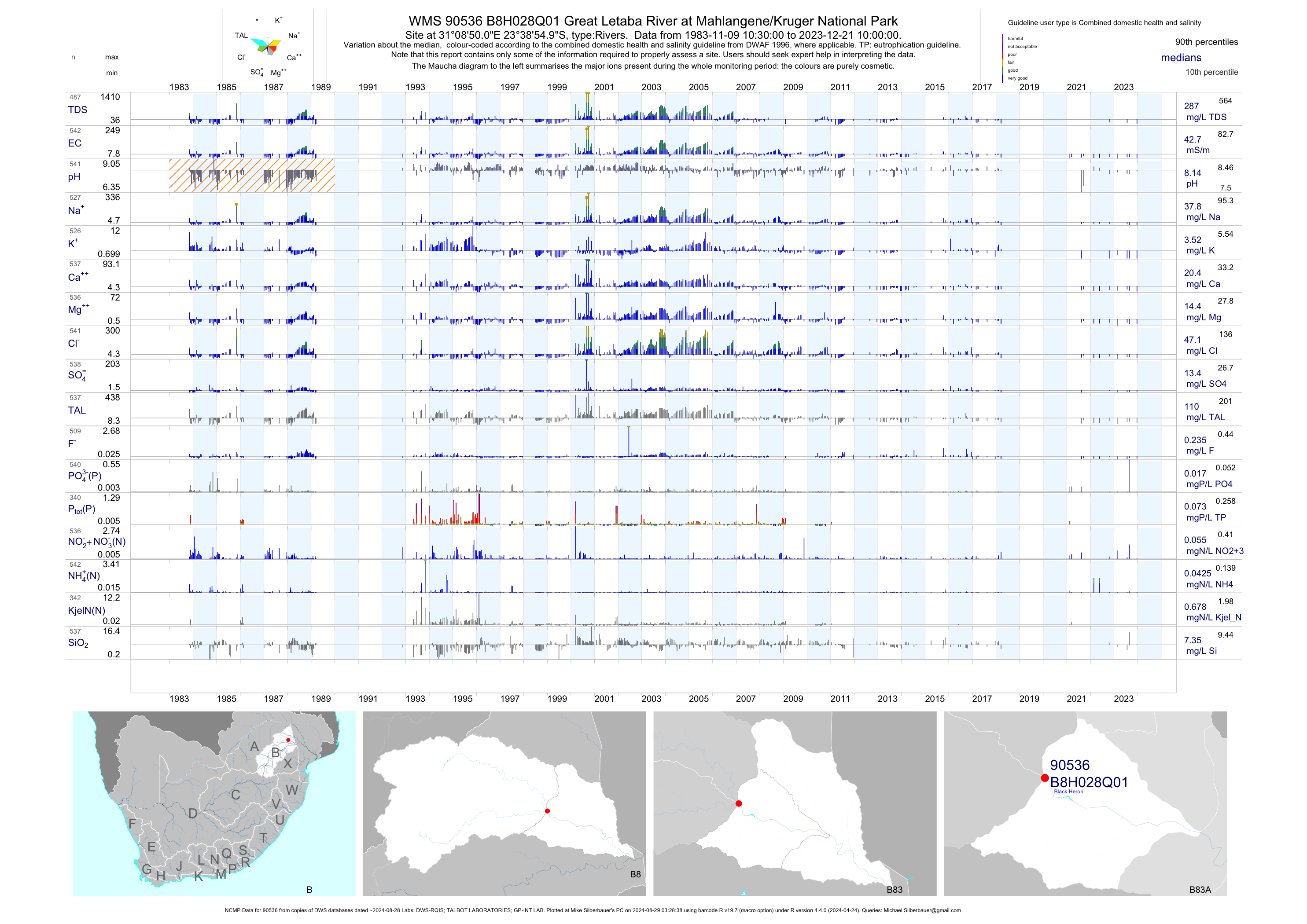
| B83 90536 | plot | data | Great Letaba River at Mahlangene/Kruger National Park (NCMP) | Rivers | 820 | 1983-11-09 | 2018-03-20 | 43 | B8H028 | -23.64861 | 31.14722 |
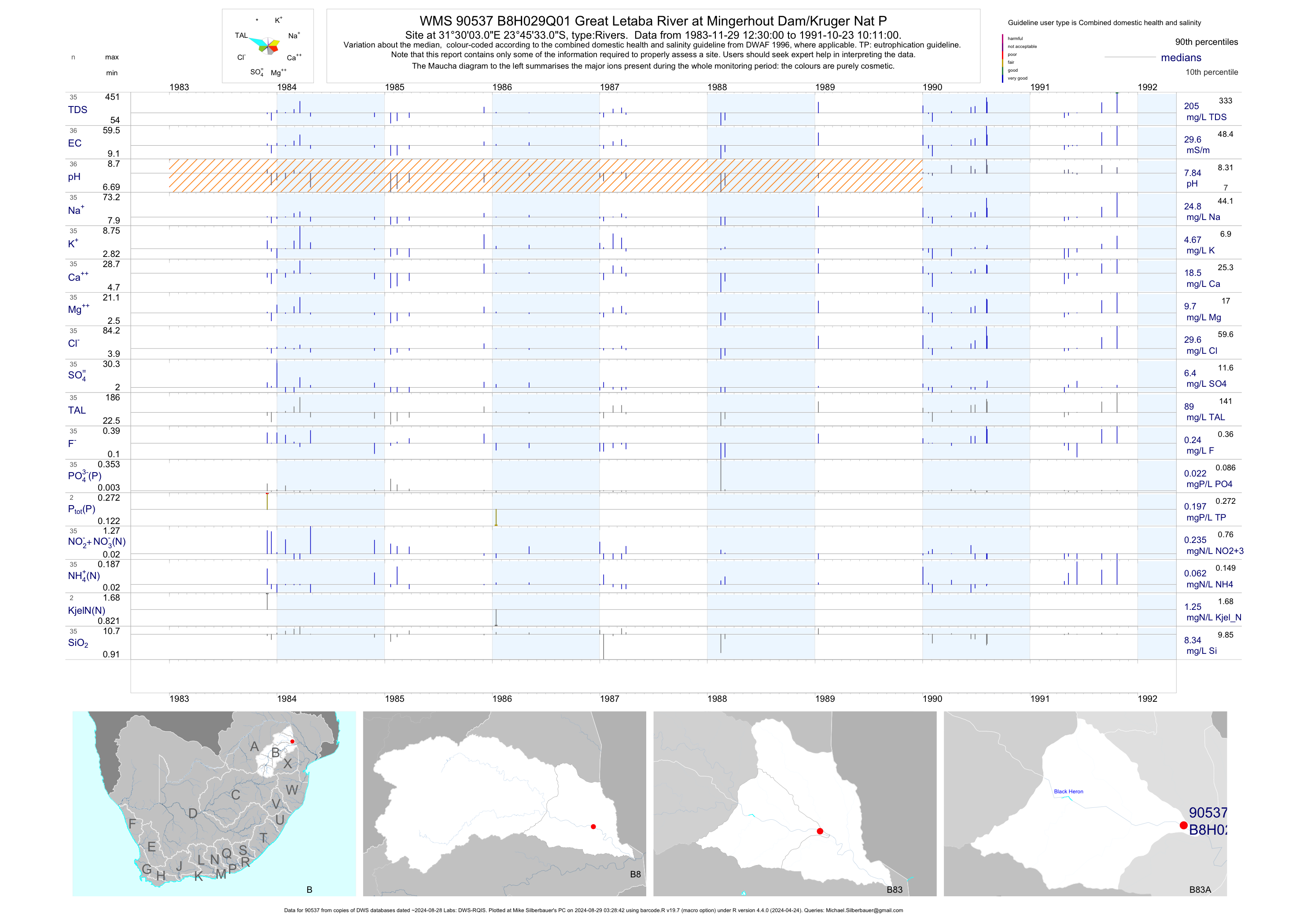
| B83 90537 | plot | data | Great Letaba River at Mingerhout Dam/Kruger Nat P | Rivers | 41 | 1983-11-29 | 1991-10-23 | 30 | B8H029 | -23.75917 | 31.50083 |
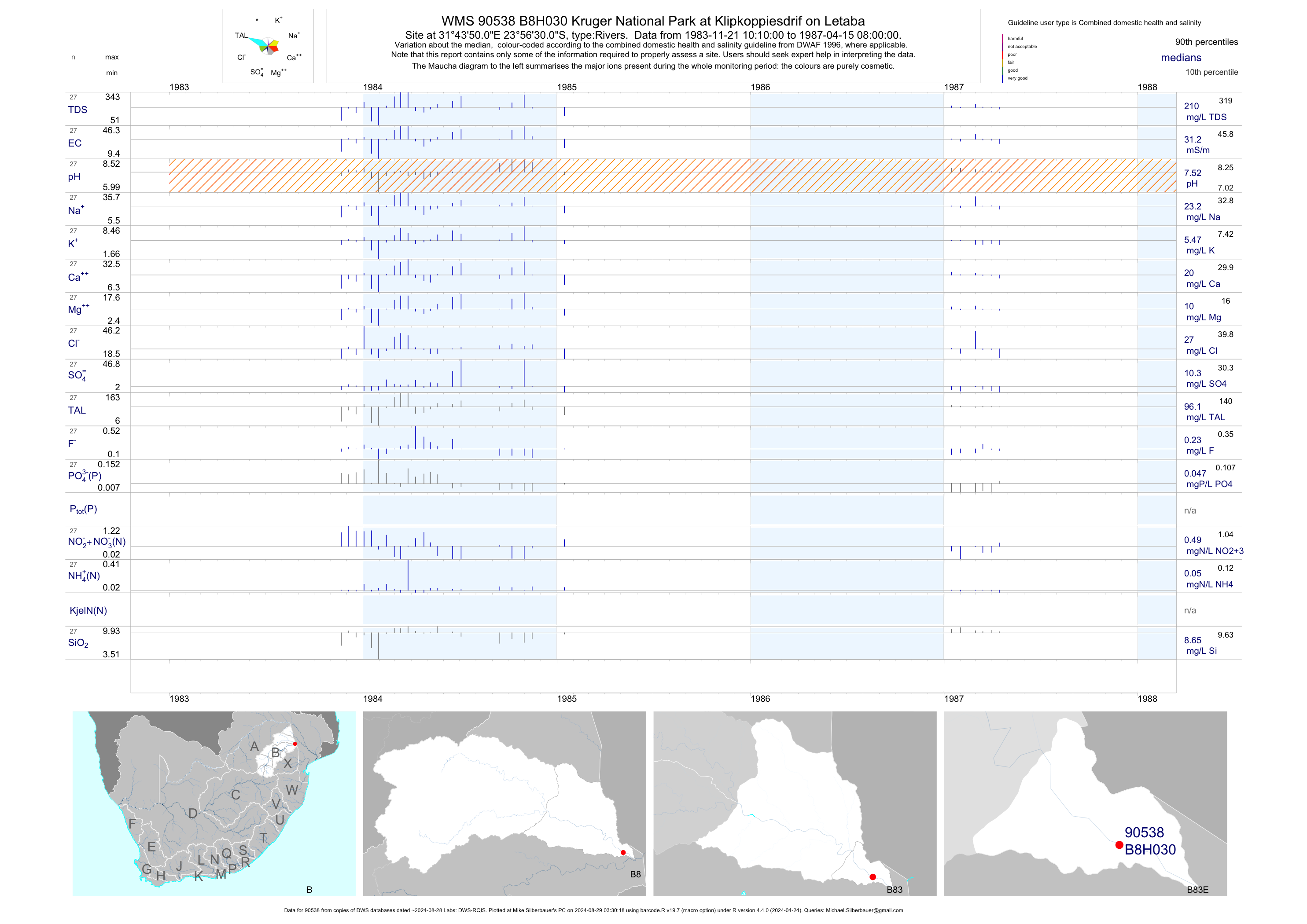
| B83 90538 | plot | data | Kruger National Park at Klipkoppiesdrif on Letaba | Rivers | 27 | 1983-11-21 | 1987-04-15 | 31 | B8H030 | -23.94167 | 31.73056 |
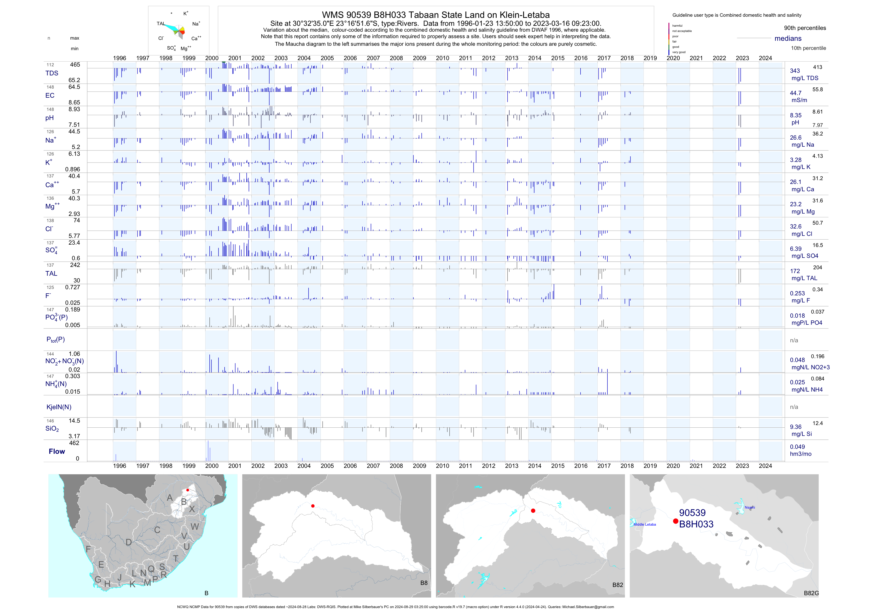
| B82 90539 | plot | data | Tabaan State Land on Klein-Letaba (NCWQ NCMP) | Rivers | 154 | 1996-01-23 | 2018-06-05 | 45 | B8H033 | -23.28100 | 30.54306 |
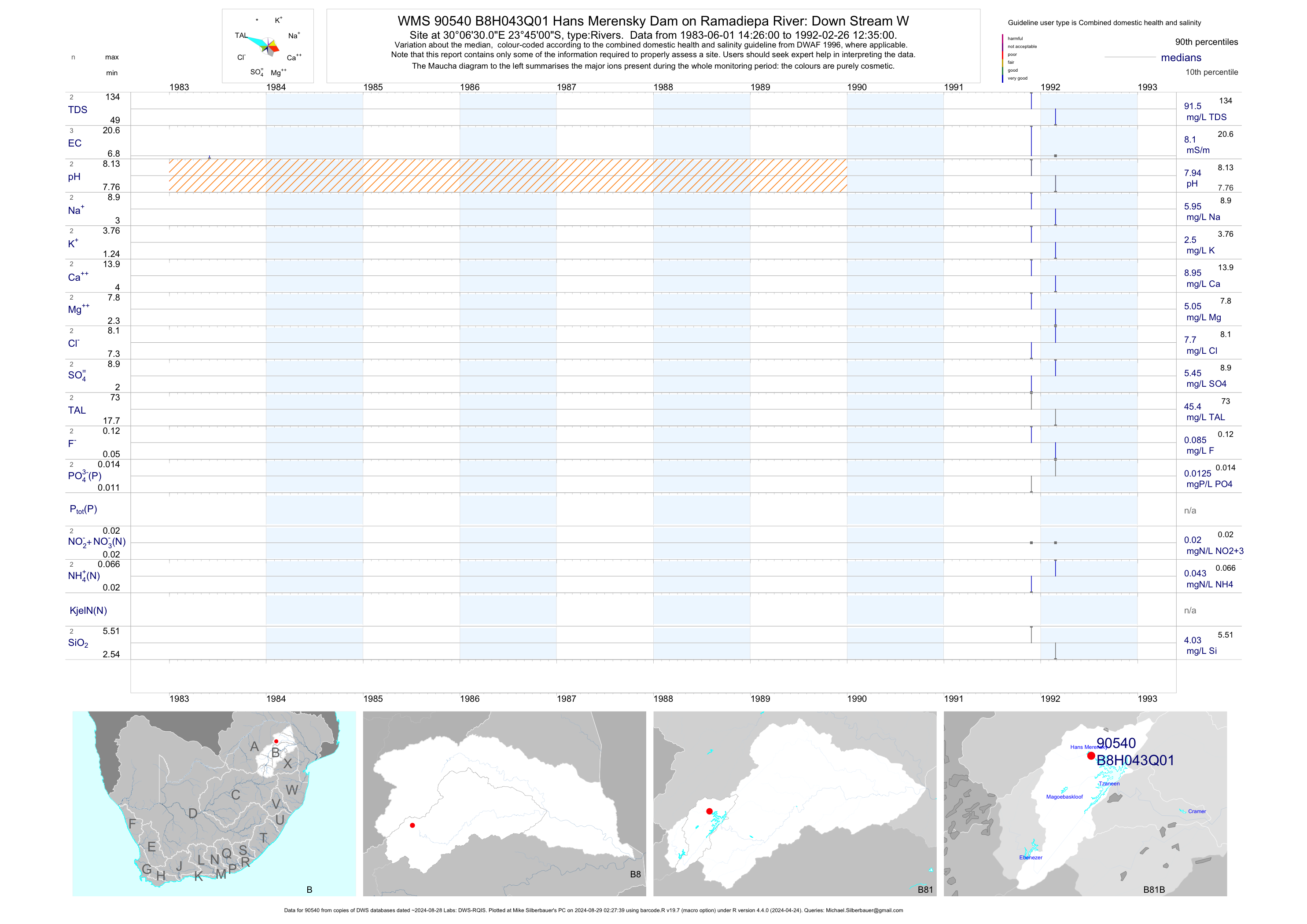
| B81 90540 | plot | data | Hans Merensky Dam on Ramadiepa River: Down Stream W | Rivers | 3 | 1983-06-01 | 1992-02-26 | 8 | B8H043 | -23.75000 | 30.10833 |
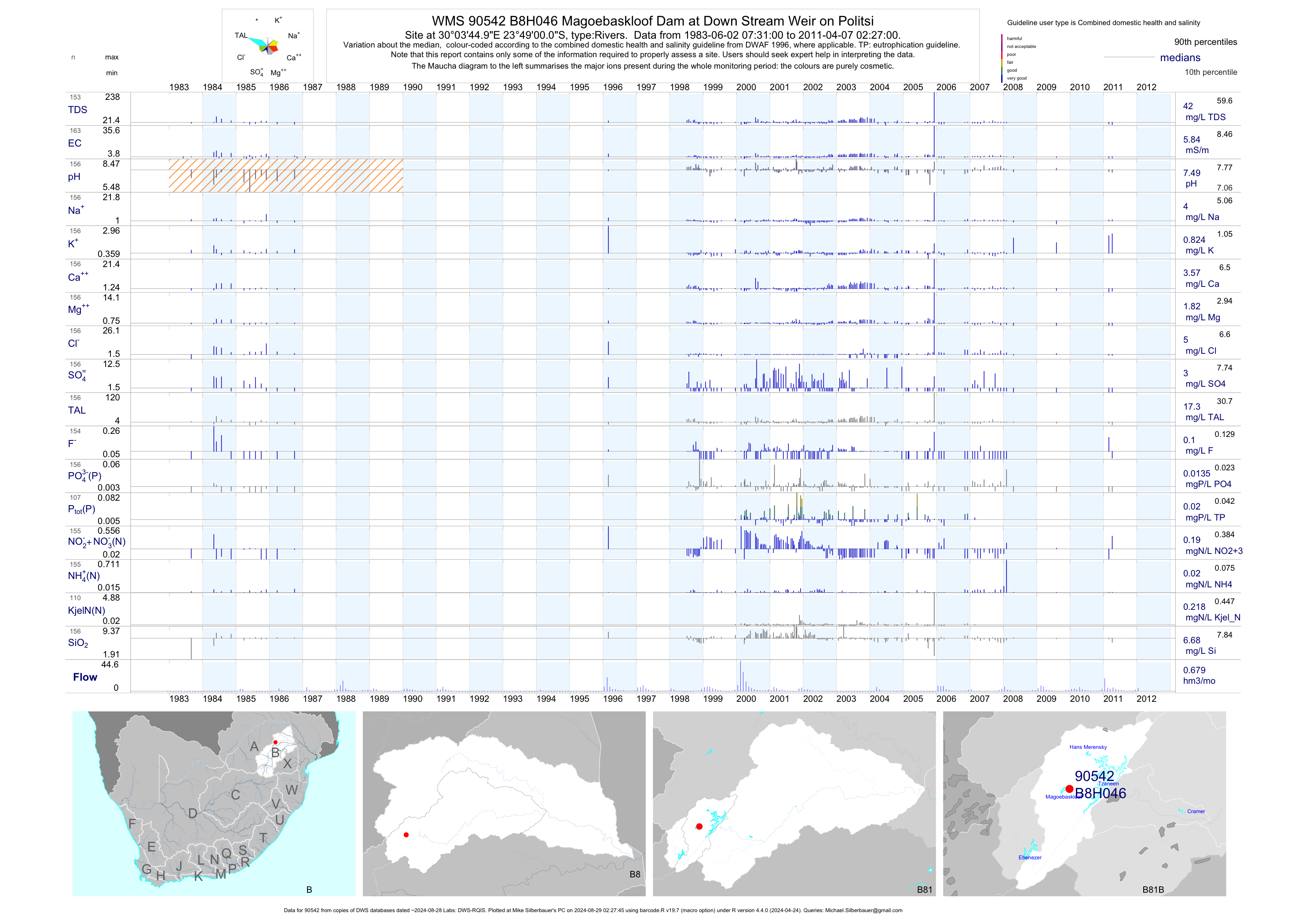
| B81 90542 | plot | data | Magoebaskloof Dam at Down Stream Weir on Politsi | Rivers | 163 | 1983-06-02 | 2011-04-07 | 6 | B8H046 | -23.81667 | 30.06250 |
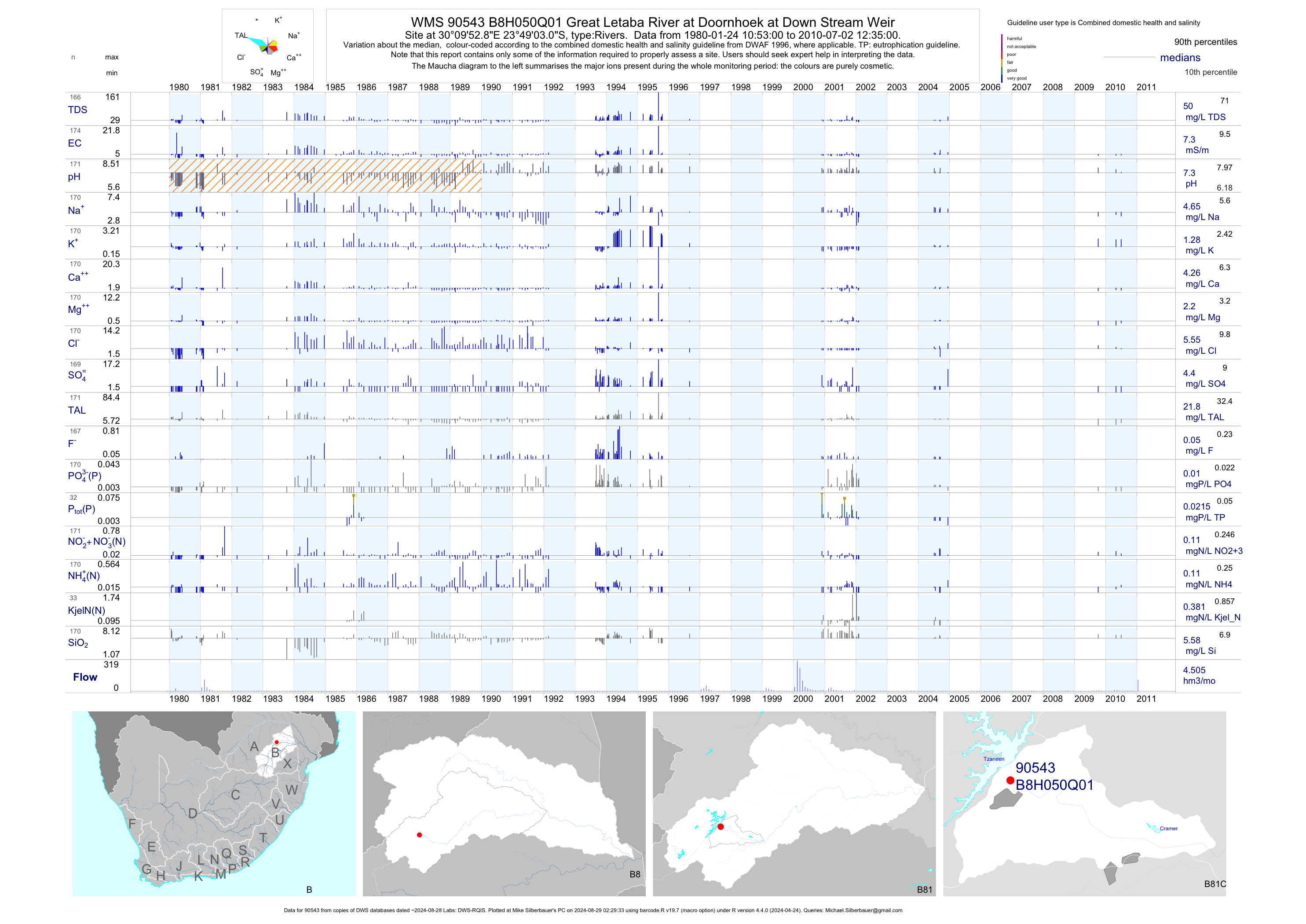
| B81 90543 | plot | data | Great Letaba River at Doornhoek at Down Stream Weir | Rivers | 174 | 1980-01-24 | 2010-07-02 | 7 | B8H050 | -23.81752 | 30.16468 |
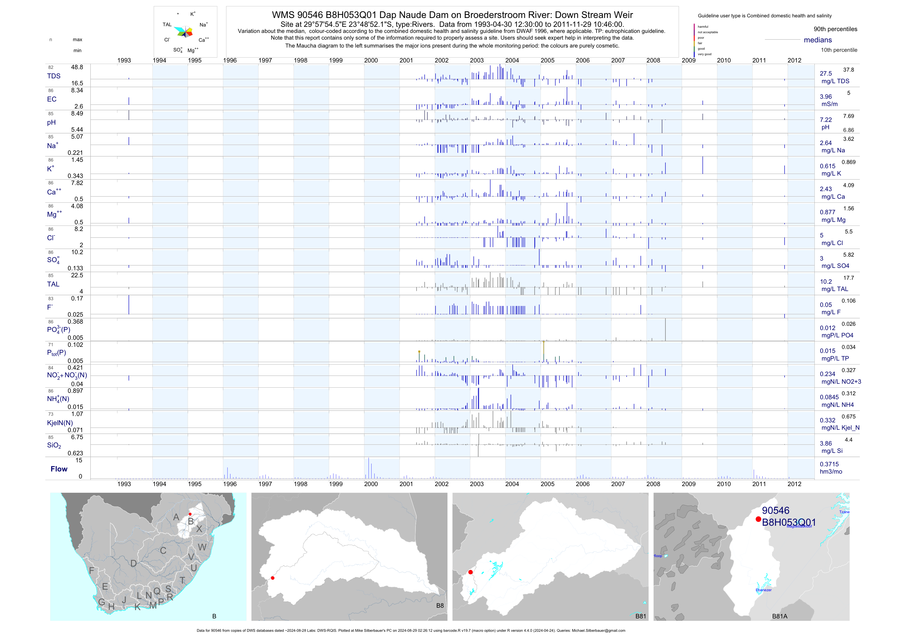
| B81 90546 | plot | data | Dap Naude Dam on Broederstroom River: Down Stream Weir | Rivers | 86 | 1993-04-30 | 2011-11-29 | 4 | B8H053 | -23.81449 | 29.96514 |
| B82 90548 | plot | data | Middle Letaba Dam on Mid Letaba River: Down Stream | Rivers | 1 | 1992-04-01 | 1992-04-01 | 22 | B8H056 | -23.27167 | 30.40306 |
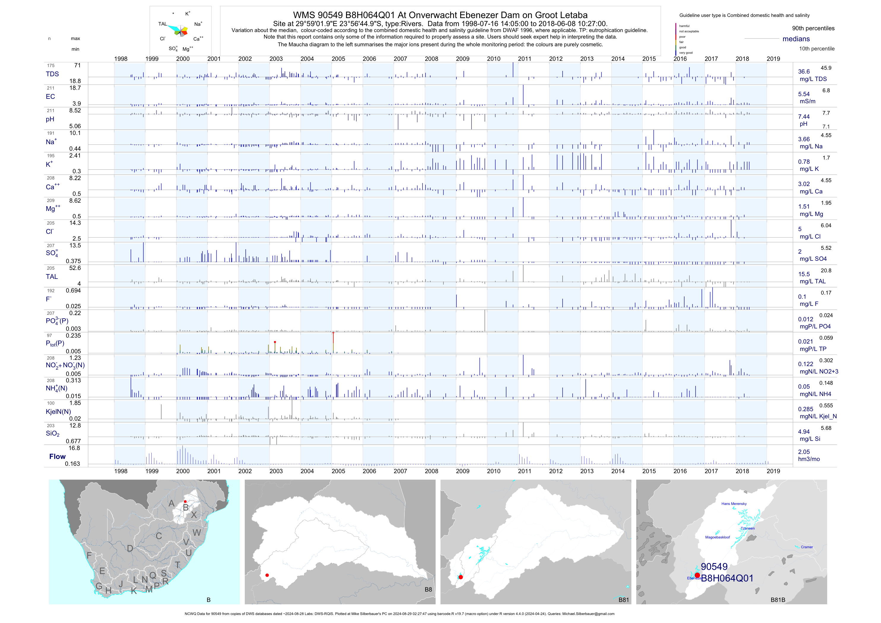
| B81 90549 | plot | data | At Onverwacht Ebenezer Dam on Groot Letaba (NCWQ) | Rivers | 211 | 1998-07-16 | 2018-06-08 | 6 | B8H064 | -23.94583 | 29.98389 |
| B83 191197 | plot | data | 04/09 - Kruger Nationa Park on Nhlanganini River near Nhlanganini Dam (NCWQ) | Rivers | 3 | 2011-03-21 | 2012-12-20 | 71 | KNP1 | -23.93500 | 31.48444 |
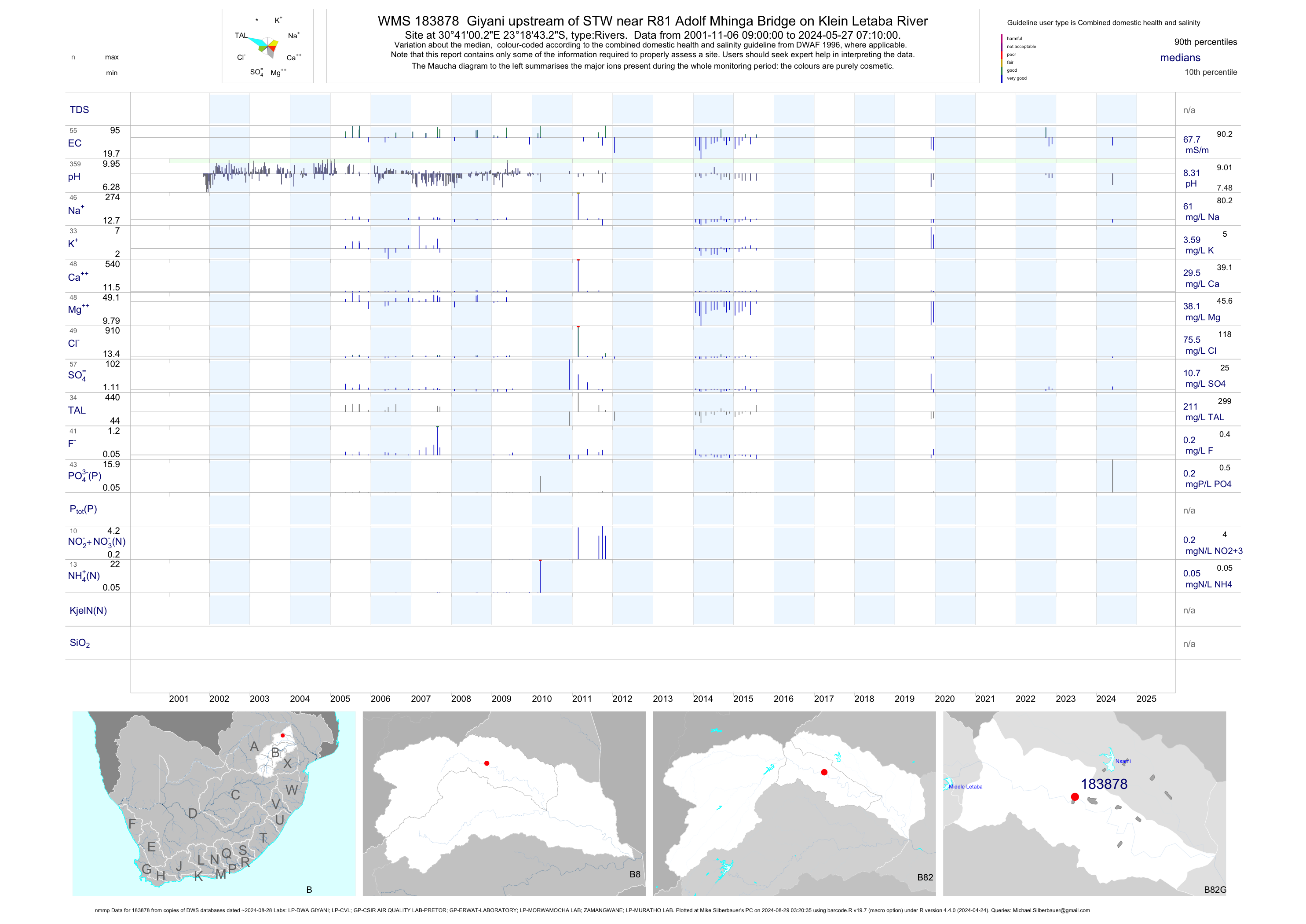
| B82 183878 | plot | data | Giyani upstream of STW near R81 Adolf Mhinga Bridge on Klein Letaba River (nmmp) | Rivers | 1044 | 2001-11-06 | 2015-07-29 | 73 | 183878 | -23.31200 | 30.68342 |
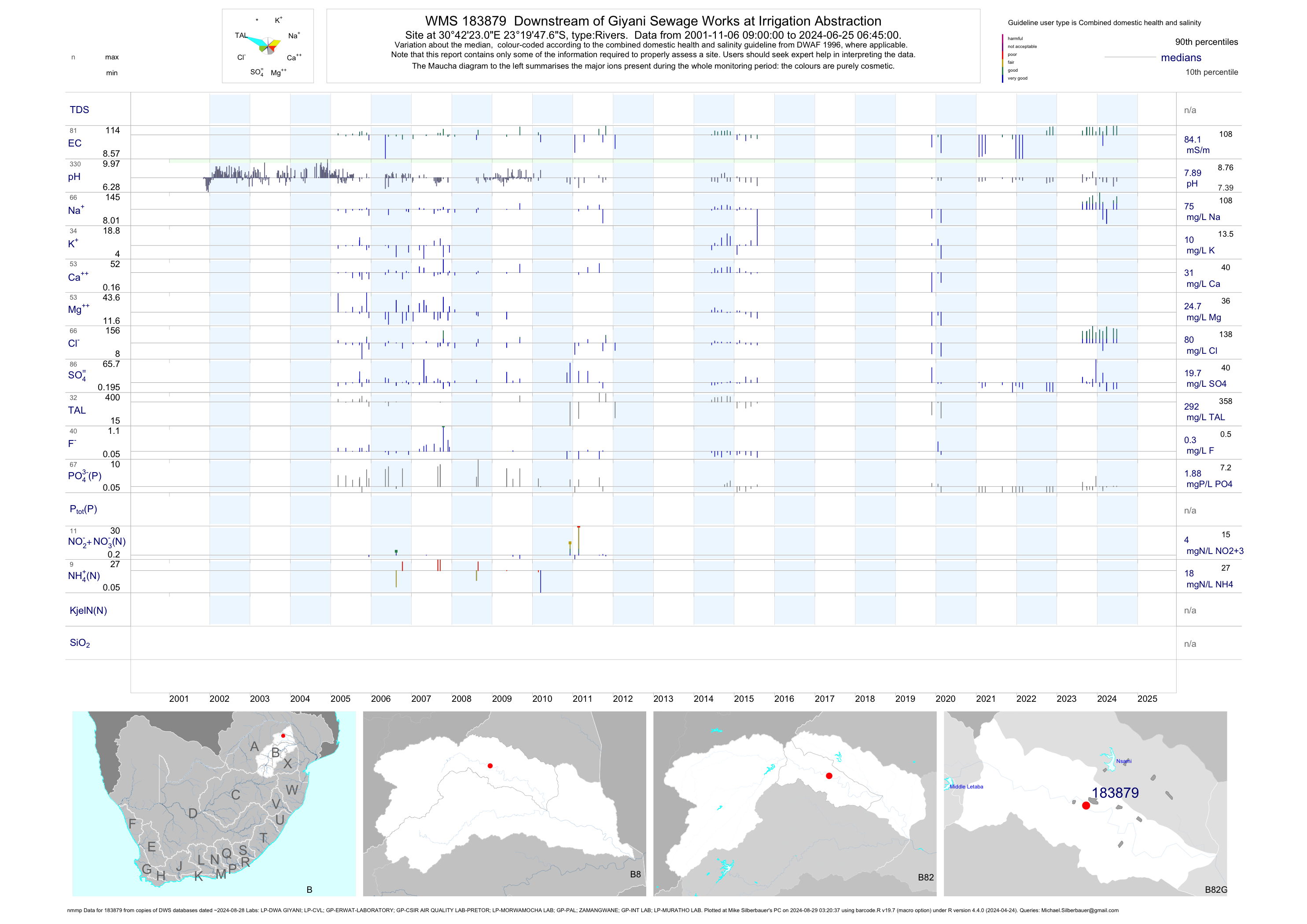
| B82 183879 | plot | data | Downstream of Giyani Sewage Works at Irrigation Abstraction (nmmp) | Rivers | 889 | 2001-11-06 | 2015-07-29 | 82 | 183879 | -23.32990 | 30.70640 |
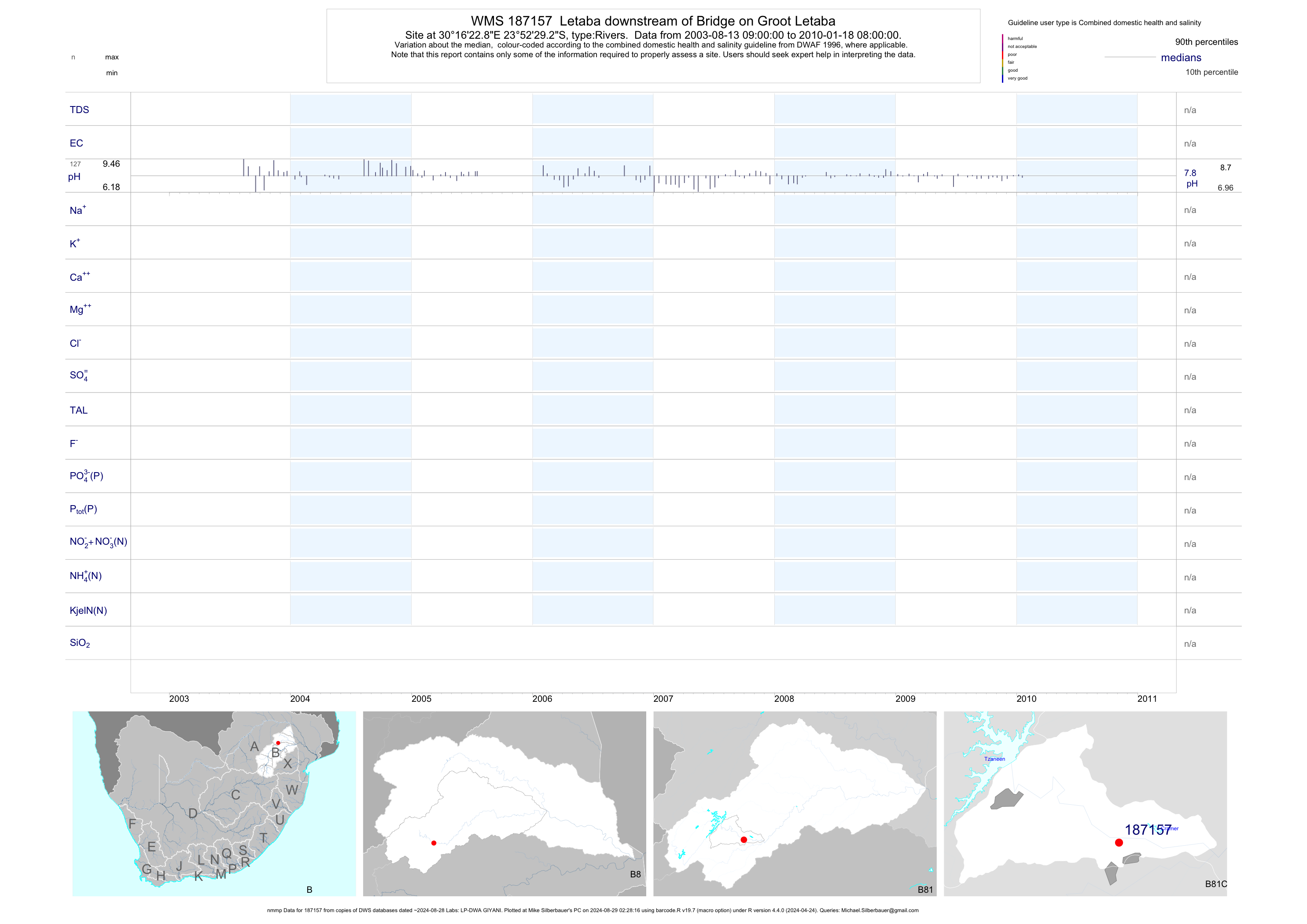
| B81 187157 | plot | data | Letaba downstream of Bridge on Groot Letaba (nmmp) | Rivers | 398 | 2003-08-13 | 2013-05-23 | n/a | 187157 | -23.87478 | 30.27303 |
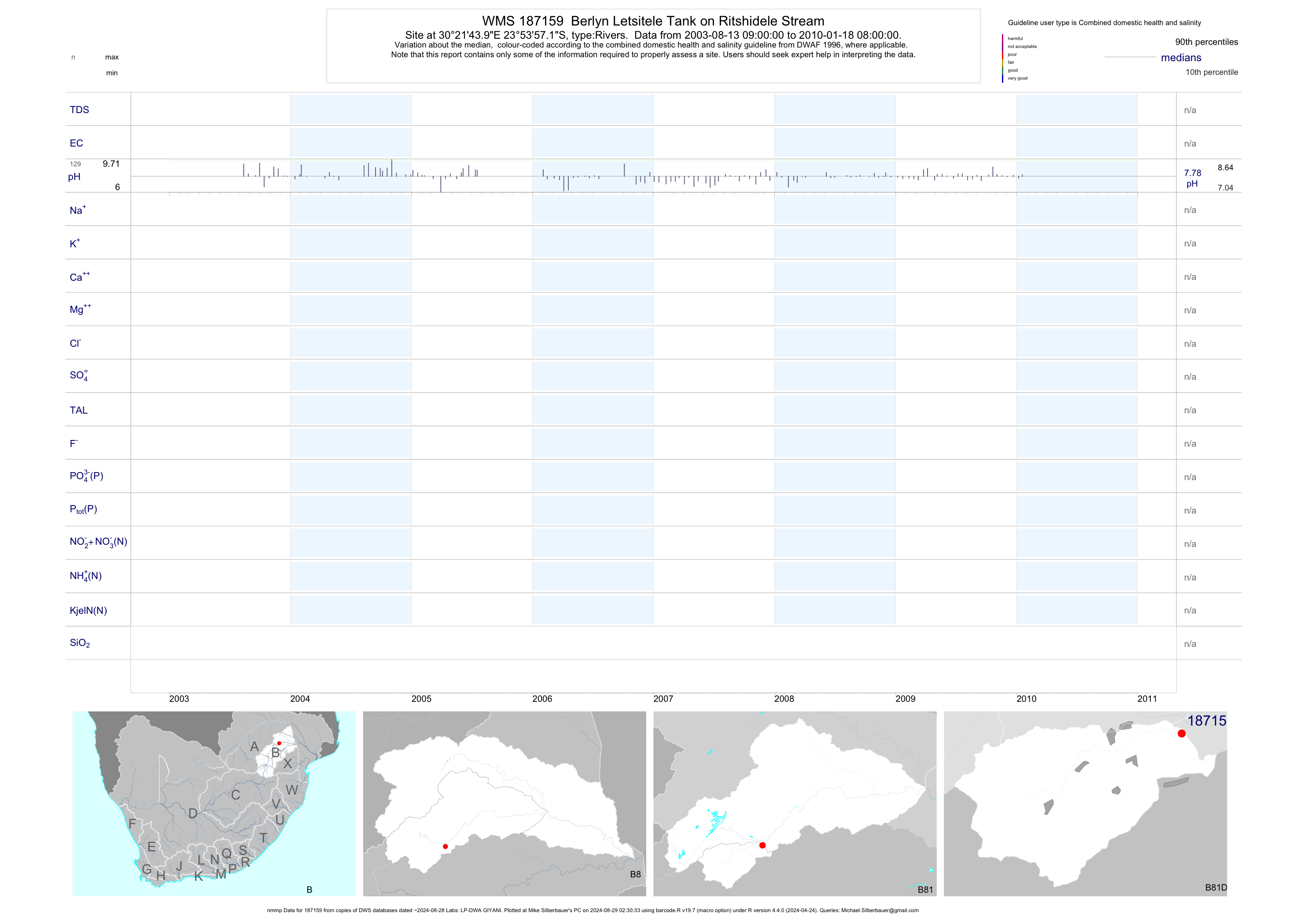
| B81 187159 | plot | data | Berlyn Letsitele Tank on Ritshidele Stream (nmmp) | Rivers | 401 | 2003-08-13 | 2013-05-23 | n/a | 187159 | -23.89920 | 30.36220 |
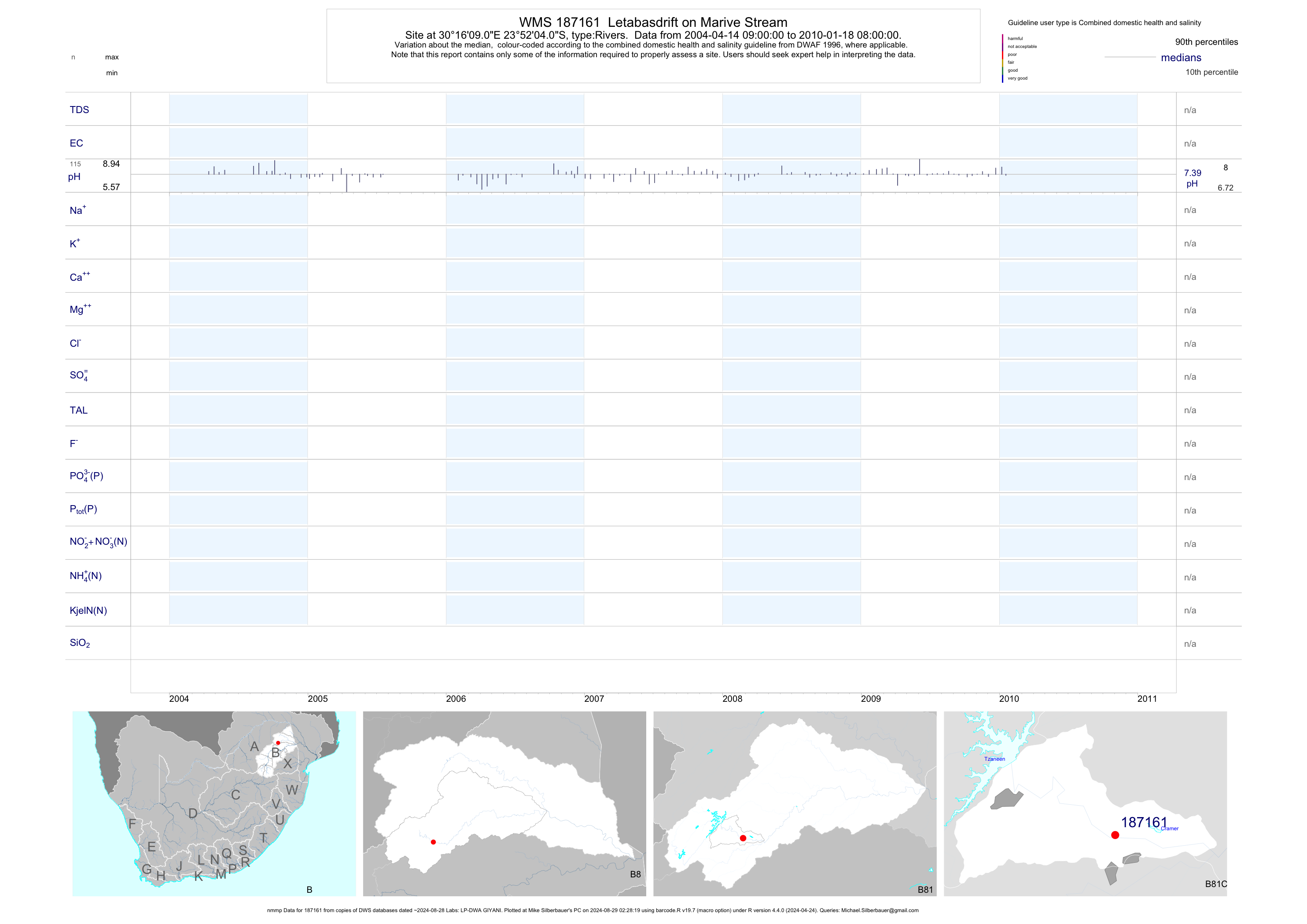
| B81 187161 | plot | data | Letabasdrift on Marive Stream (nmmp) | Rivers | 353 | 2004-04-14 | 2010-01-18 | n/a | 187161 | -23.86781 | 30.26919 |
| B81 187684 | plot | data | At Craig Head on Letsitele | Rivers | 3 | 2003-12-02 | 2003-12-02 | 14 | 187684 | -23.97472 | 30.16508 |
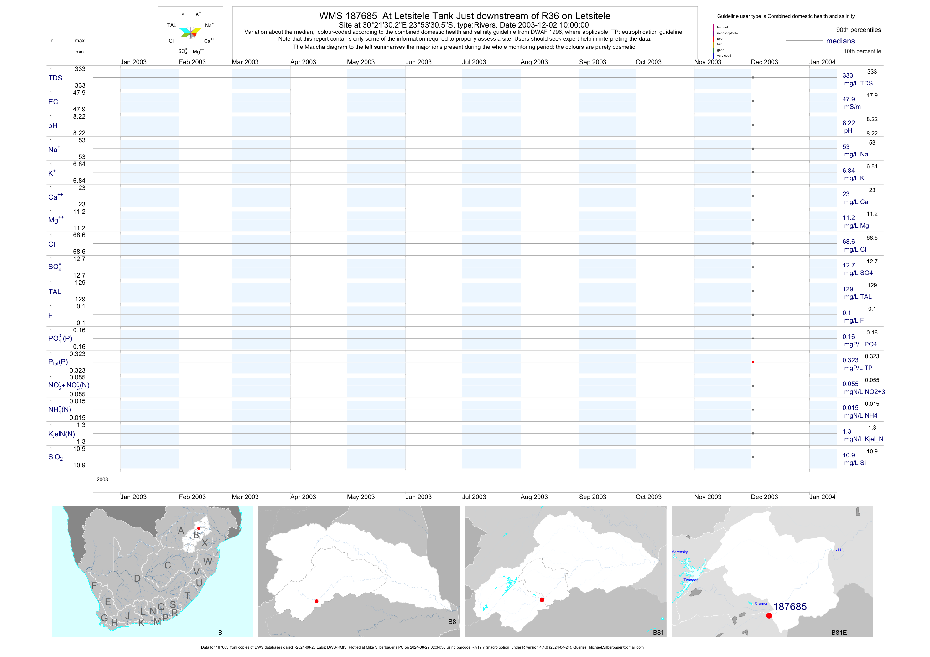
| B81 187685 | plot | data | At Letsitele Tank Just downstream of R36 on Letsitele | Rivers | 3 | 2003-12-02 | 2003-12-02 | 48 | 187685 | -23.89181 | 30.35839 |
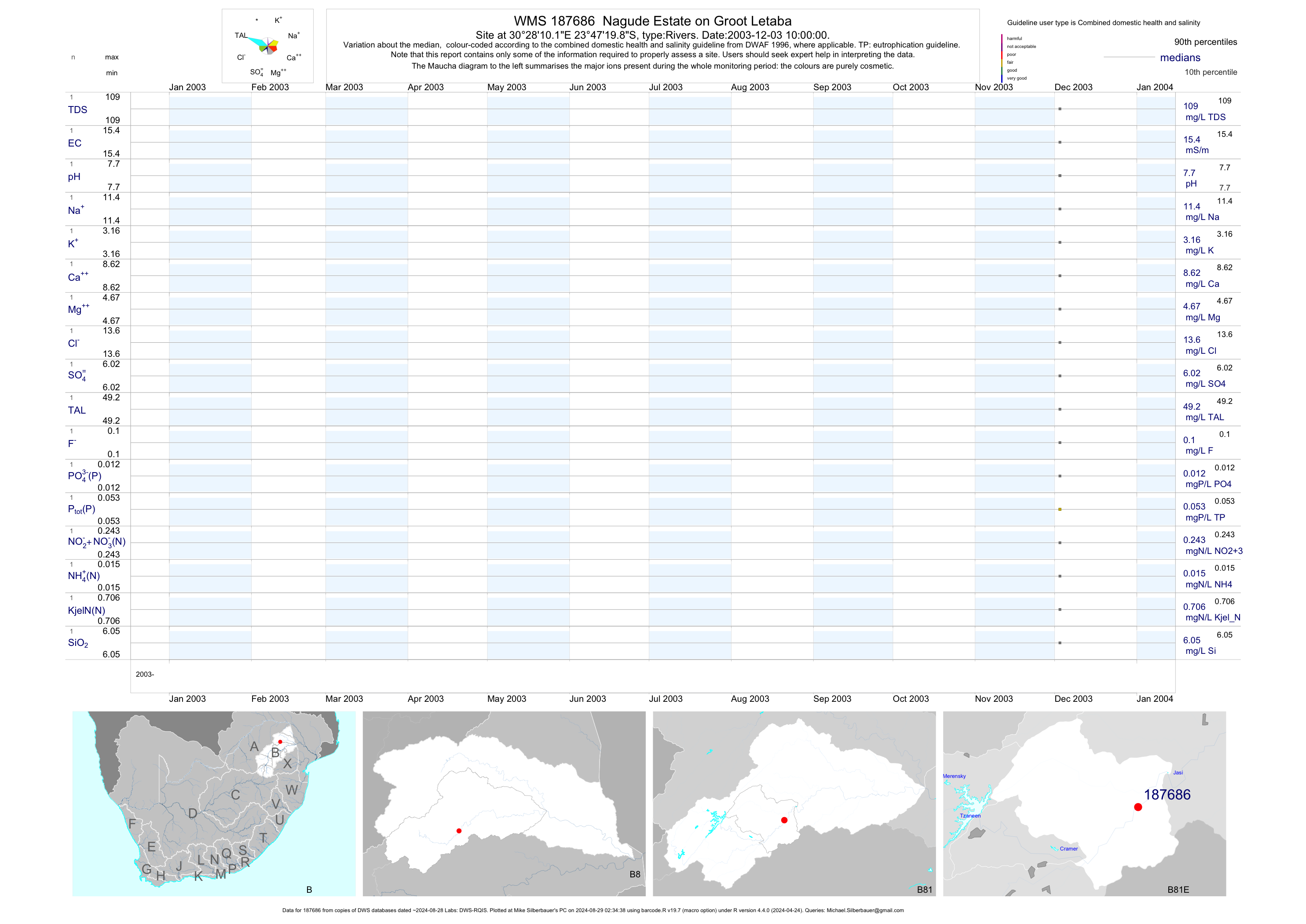
| B81 187686 | plot | data | Nagude Estate on Groot Letaba | Rivers | 3 | 2003-12-03 | 2003-12-03 | 15 | 187686 | -23.78885 | 30.46947 |
| B81 187687 | plot | data | At Letaba Drift at Bridge on R529 to Giyani on Groot Letaba | Rivers | 3 | 2003-12-03 | 2003-12-03 | 22 | 187687 | -23.68403 | 30.60964 |
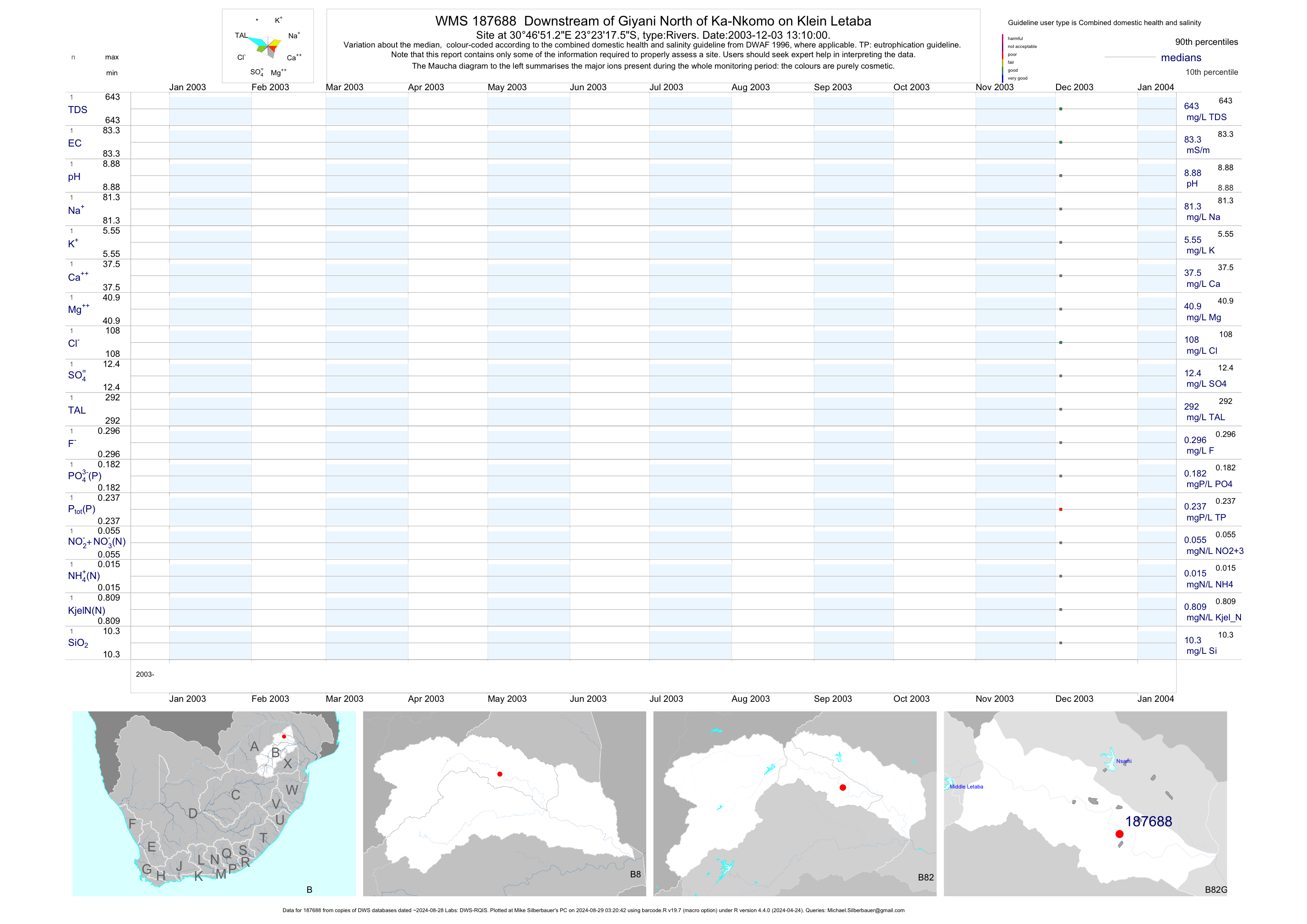
| B82 187688 | plot | data | Downstream of Giyani North of Ka-Nkomo on Klein Letaba | Rivers | 3 | 2003-12-03 | 2003-12-03 | 83 | 187688 | -23.38820 | 30.78090 |
| B81 187689 | plot | data | Letaba Hospital near Valencia Estate at the Bridge on Great Letaba River | Rivers | 109 | 2003-12-02 | 2015-07-29 | 10 | 187689 | -23.87150 | 30.27068 |
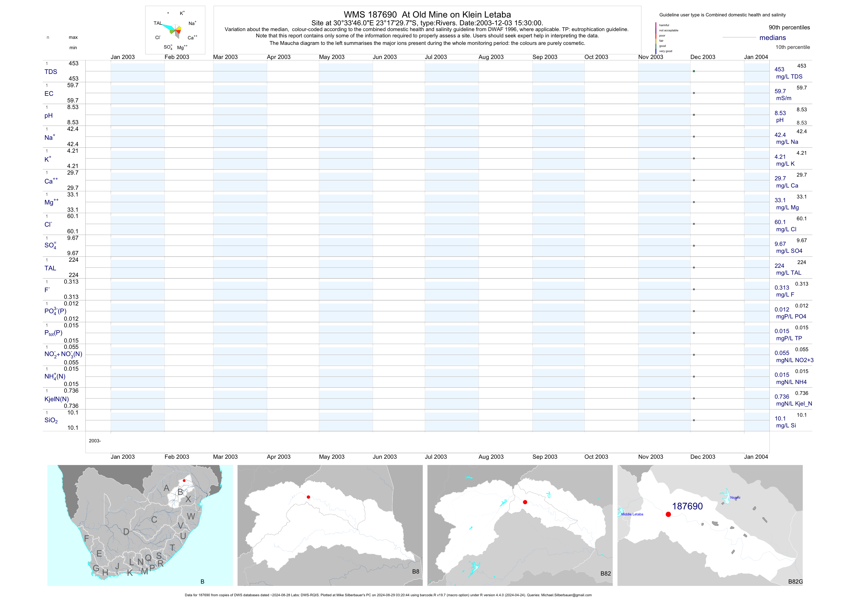
| B82 187690 | plot | data | At Old Mine on Klein Letaba | Rivers | 3 | 2003-12-03 | 2003-12-03 | 60 | 187690 | -23.29161 | 30.56278 |
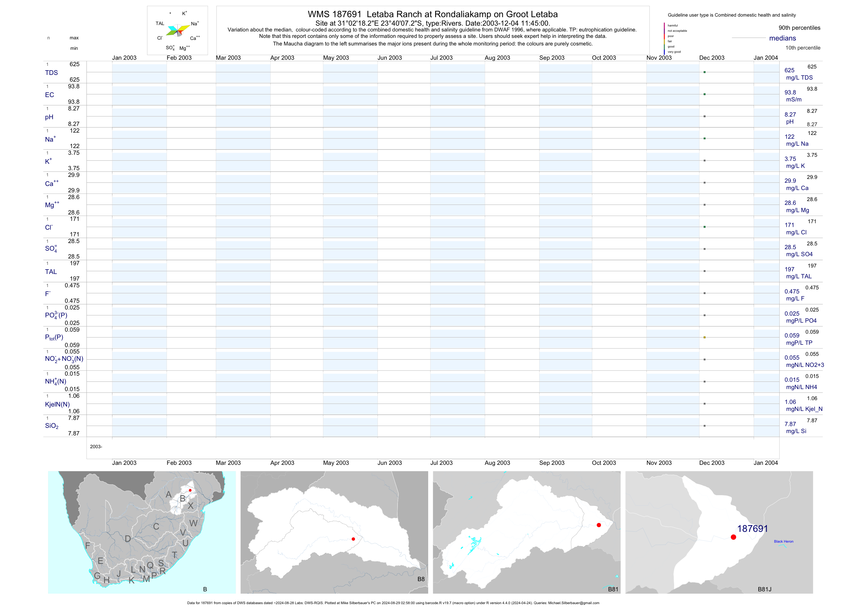
| B81 187691 | plot | data | Letaba Ranch at Rondaliakamp on Groot Letaba | Rivers | 3 | 2003-12-04 | 2003-12-04 | 94 | 187691 | -23.66869 | 31.03839 |
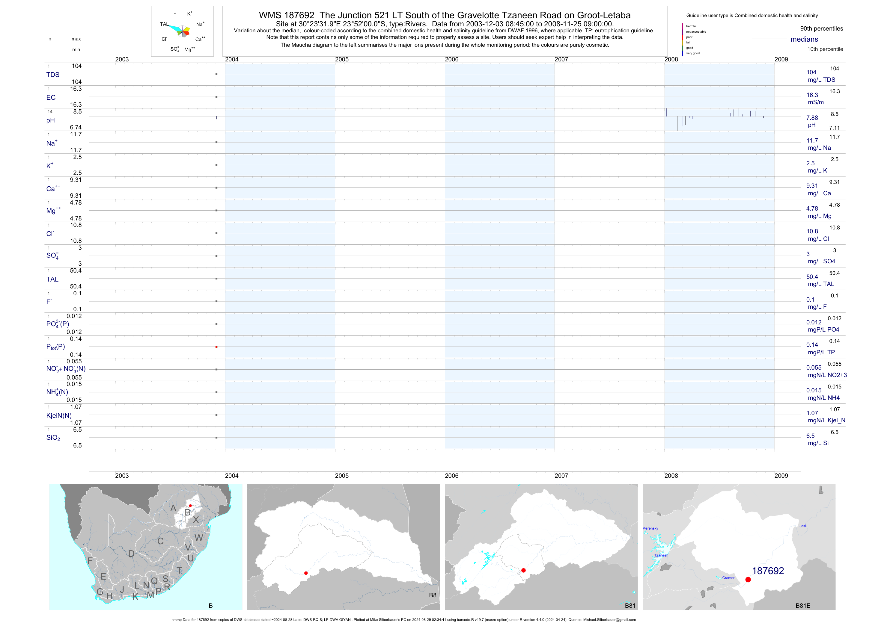
| B81 187692 | plot | data | The Junction 521 LT South of the Gravelotte Tzaneen Road on Groot-Letaba (nmmp) | Rivers | 48 | 2003-12-03 | 2008-11-25 | 16 | 187692 | -23.86667 | 30.39222 |
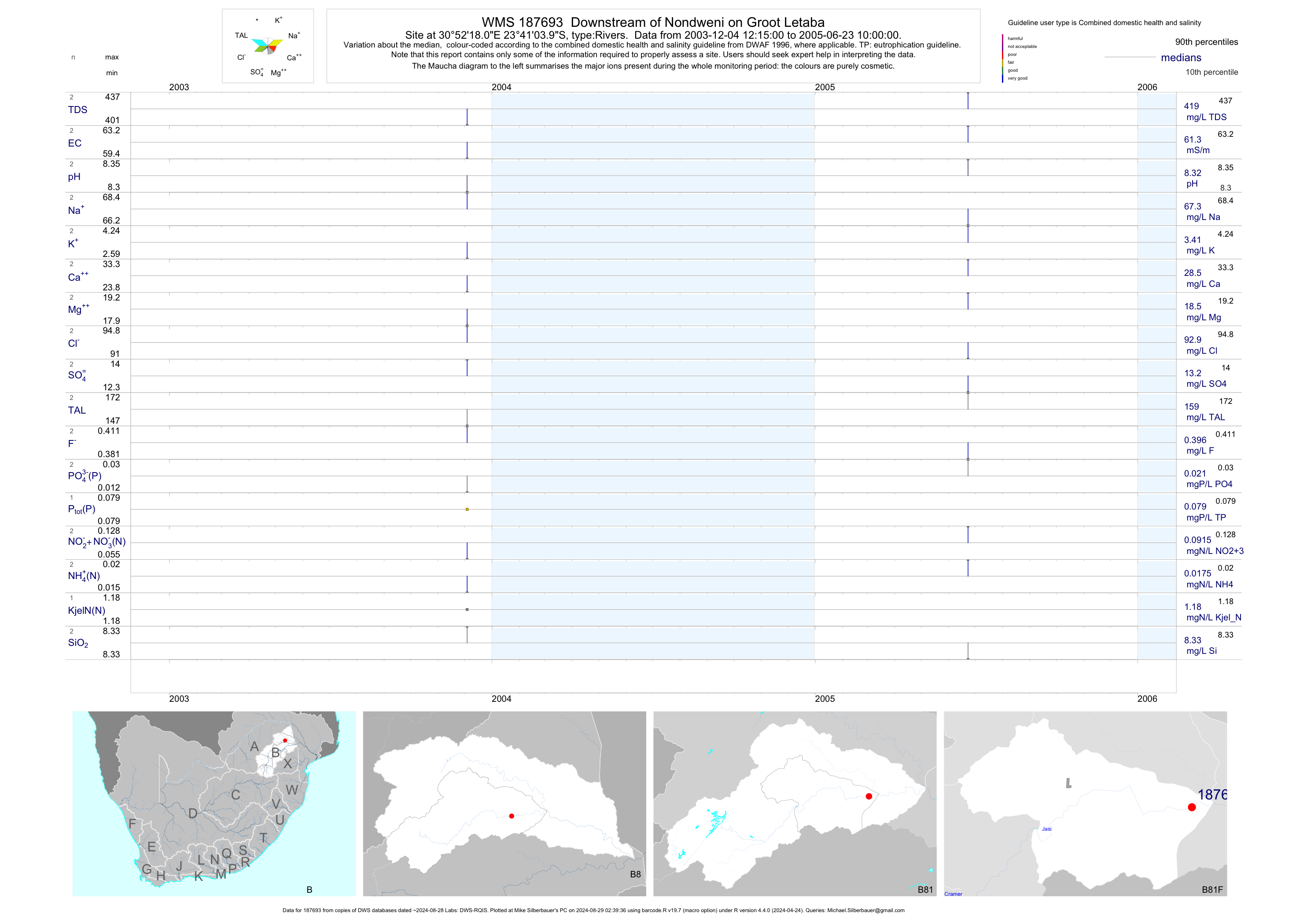
| B81 187693 | plot | data | Downstream of Nondweni on Groot Letaba | Rivers | 5 | 2003-12-04 | 2005-06-23 | 61 | 187693 | -23.68444 | 30.87167 |
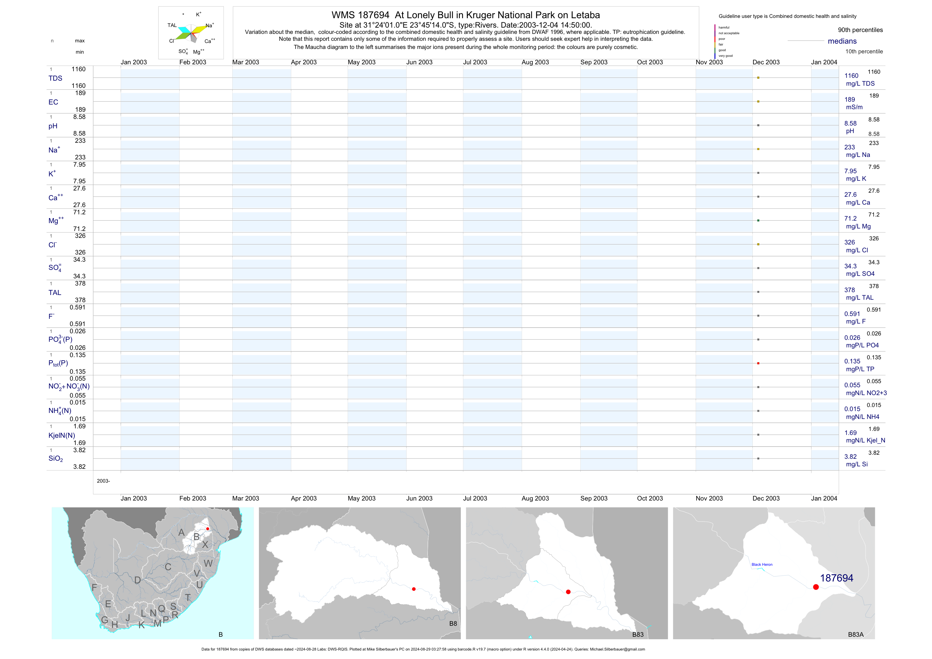
| B83 187694 | plot | data | At Lonely Bull in Kruger National Park on Letaba | Rivers | 3 | 2003-12-04 | 2003-12-04 | 189 | 187694 | -23.75390 | 31.40030 |
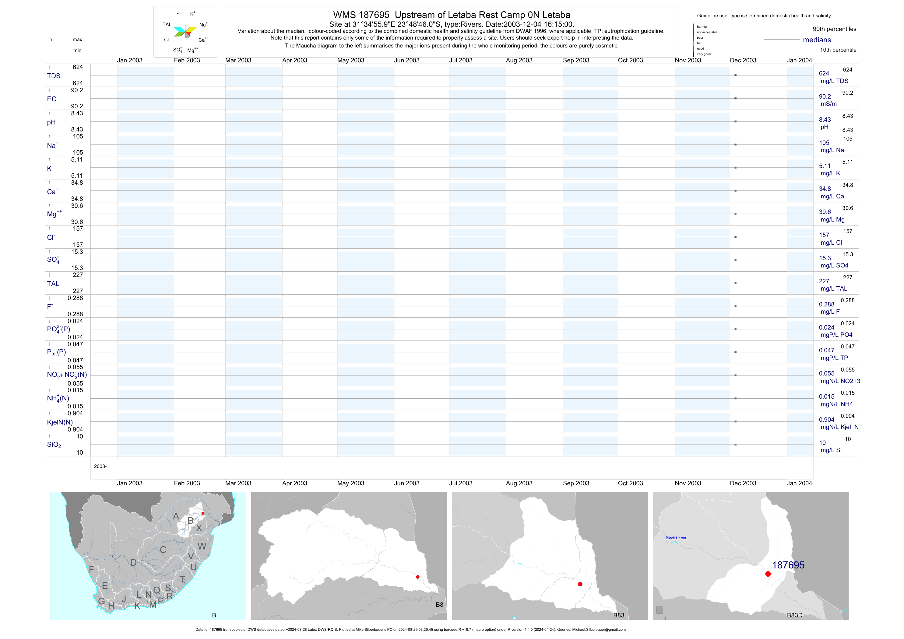
| B83 187695 | plot | data | Upstream of Letaba Rest Camp 0N Letaba | Rivers | 3 | 2003-12-04 | 2003-12-04 | 90 | 187695 | -23.81280 | 31.58220 |
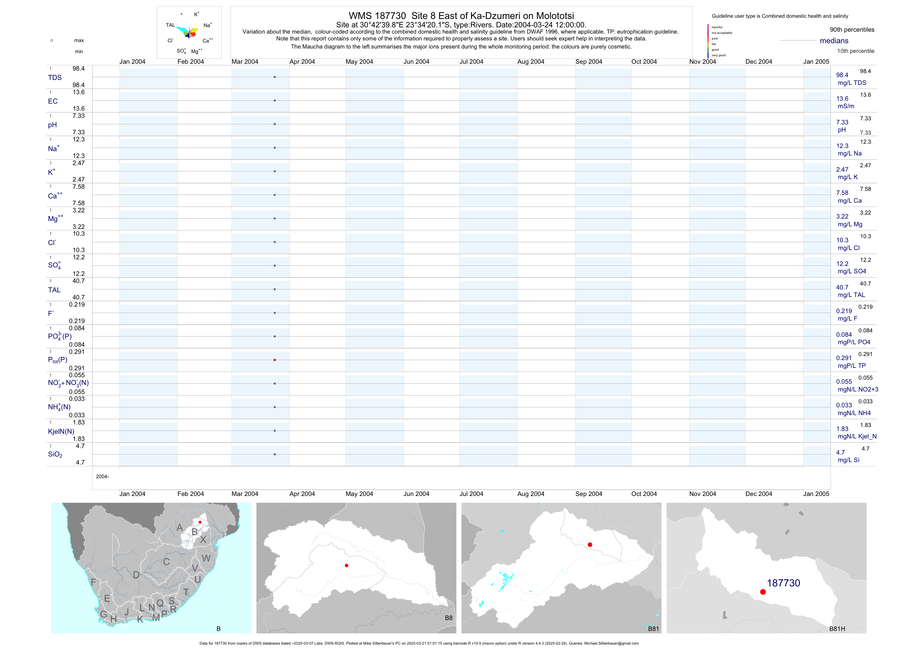
| B81 187730 | plot | data | Site 8 East of Ka-Dzumeri on Molototsi | Rivers | 3 | 2004-03-24 | 2004-03-24 | 14 | 187730 | -23.57225 | 30.71108 |
| B82 187967 | plot | data | Site 12 Locatie van de Knopneuzen on Klein Letaba | Rivers | 2 | 2004-03-25 | 2004-03-25 | 20 | 187967 | -23.25081 | 30.49572 |
| B82 187968 | plot | data | Site 13 Sterkwater on Middel Letaba | Rivers | 3 | 2004-03-23 | 2004-03-23 | 32 | 187968 | -23.37161 | 30.32183 |
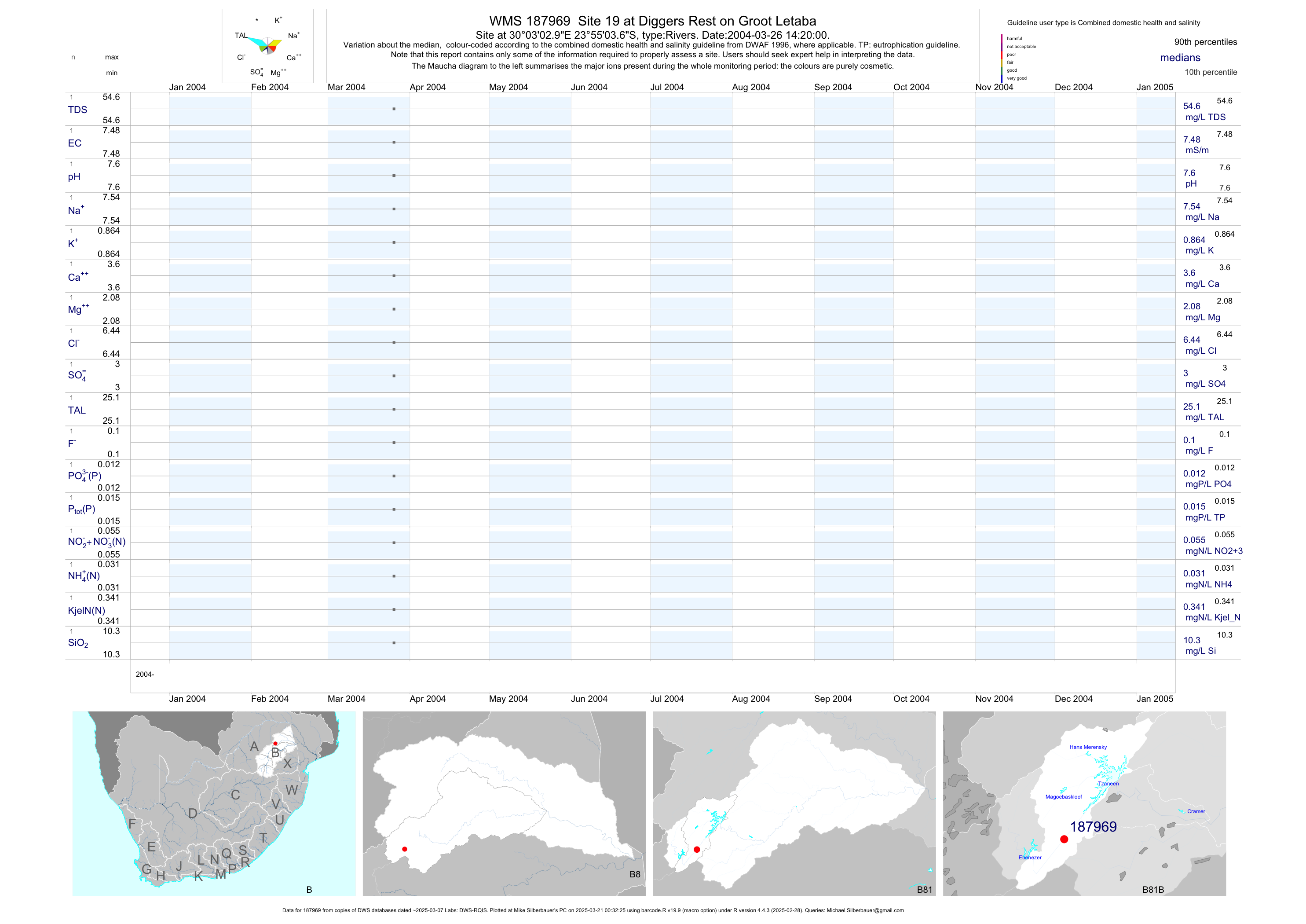
| B81 187969 | plot | data | Site 19 at Diggers Rest on Groot Letaba | Rivers | 3 | 2004-03-26 | 2004-03-26 | 7 | 187969 | -23.91769 | 30.05083 |
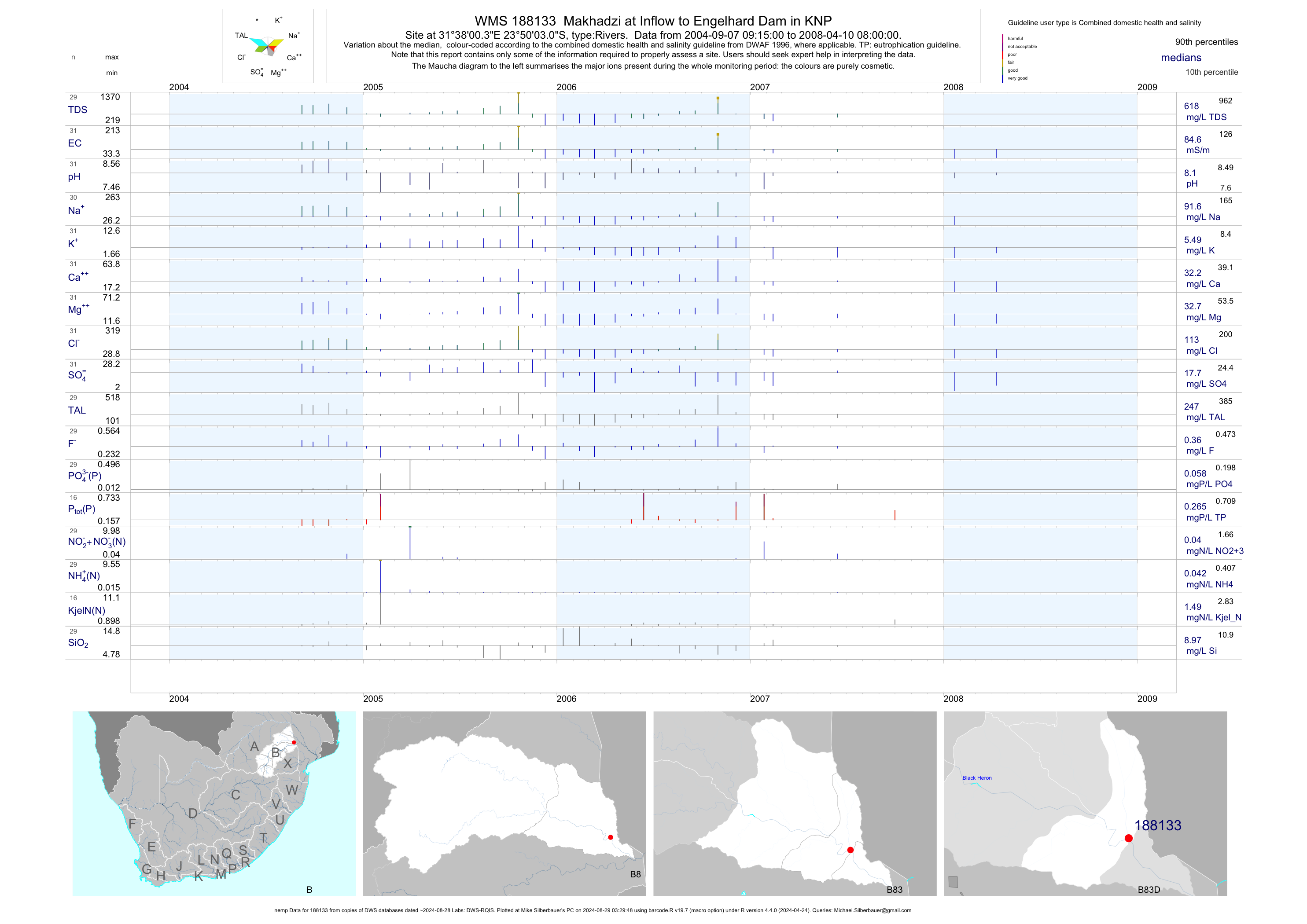
| B83 188133 | plot | data | Makhadzi at Inflow to Engelhard Dam in KNP (nemp) | Rivers | 32 | 2004-09-07 | 2008-04-10 | 85 | 188133 | -23.83419 | 31.63342 |
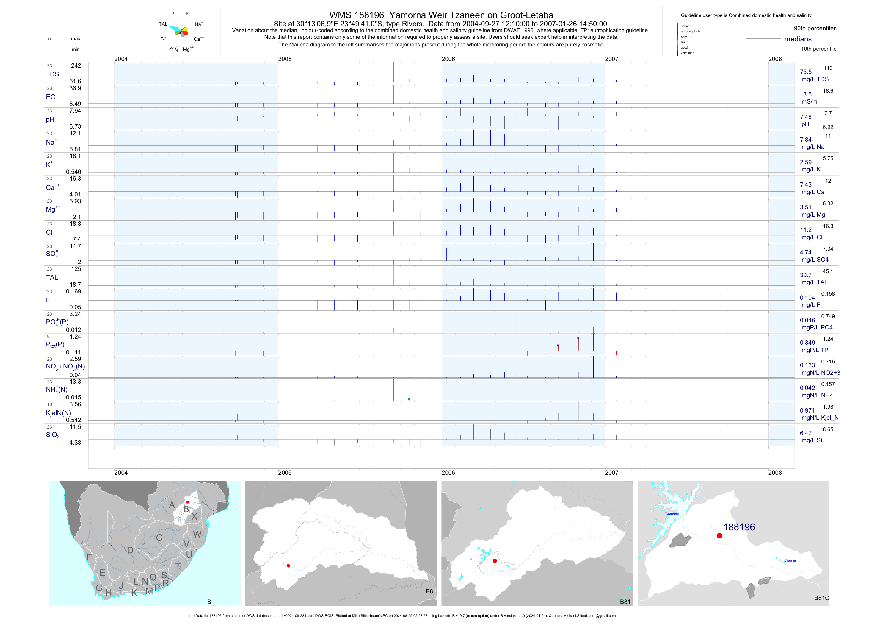
| B81 188196 | plot | data | Yamorna Weir Tzaneen on Groot-Letaba (nemp) | Rivers | 23 | 2004-09-27 | 2007-01-26 | 14 | 188196 | -23.82806 | 30.21861 |
| B81 188764 | plot | data | Site 1 downstream of Tzaneen Dam on Groot Letaba | Rivers | 20 | 2005-12-06 | 2006-10-12 | 8 | 188764 | -23.80632 | 30.16473 |
| B81 188765 | plot | data | Site 2 Manorvlei on Groot Letaba | Rivers | 20 | 2005-12-06 | 2006-10-12 | 9 | 188765 | -23.82860 | 30.16713 |
| B81 188766 | plot | data | Site 3 Manorvlei on Groot Letaba | Rivers | 20 | 2005-12-06 | 2006-10-12 | 14 | 188766 | -23.82230 | 30.17442 |
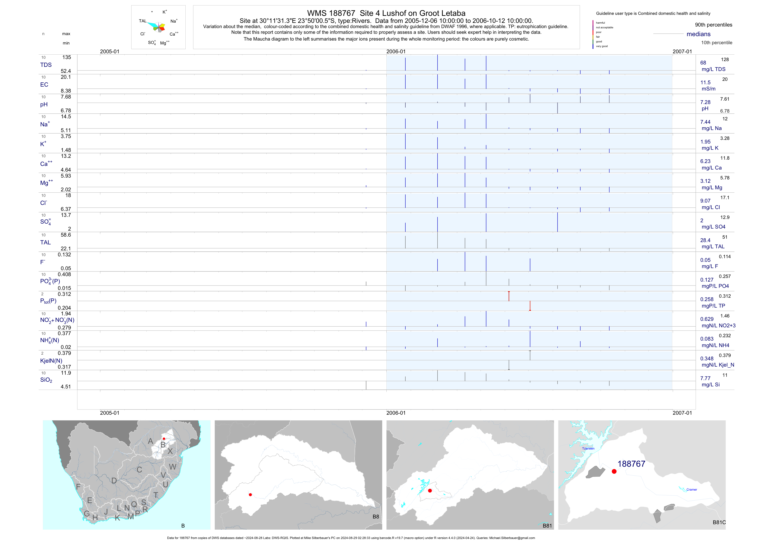
| B81 188767 | plot | data | Site 4 Lushof on Groot Letaba | Rivers | 20 | 2005-12-06 | 2006-10-12 | 12 | 188767 | -23.83350 | 30.19203 |
| B81 188768 | plot | data | Yamorna at Site 5 on Groot-Letaba | Rivers | 20 | 2005-12-06 | 2006-10-12 | 15 | 188768 | -23.82670 | 30.21913 |
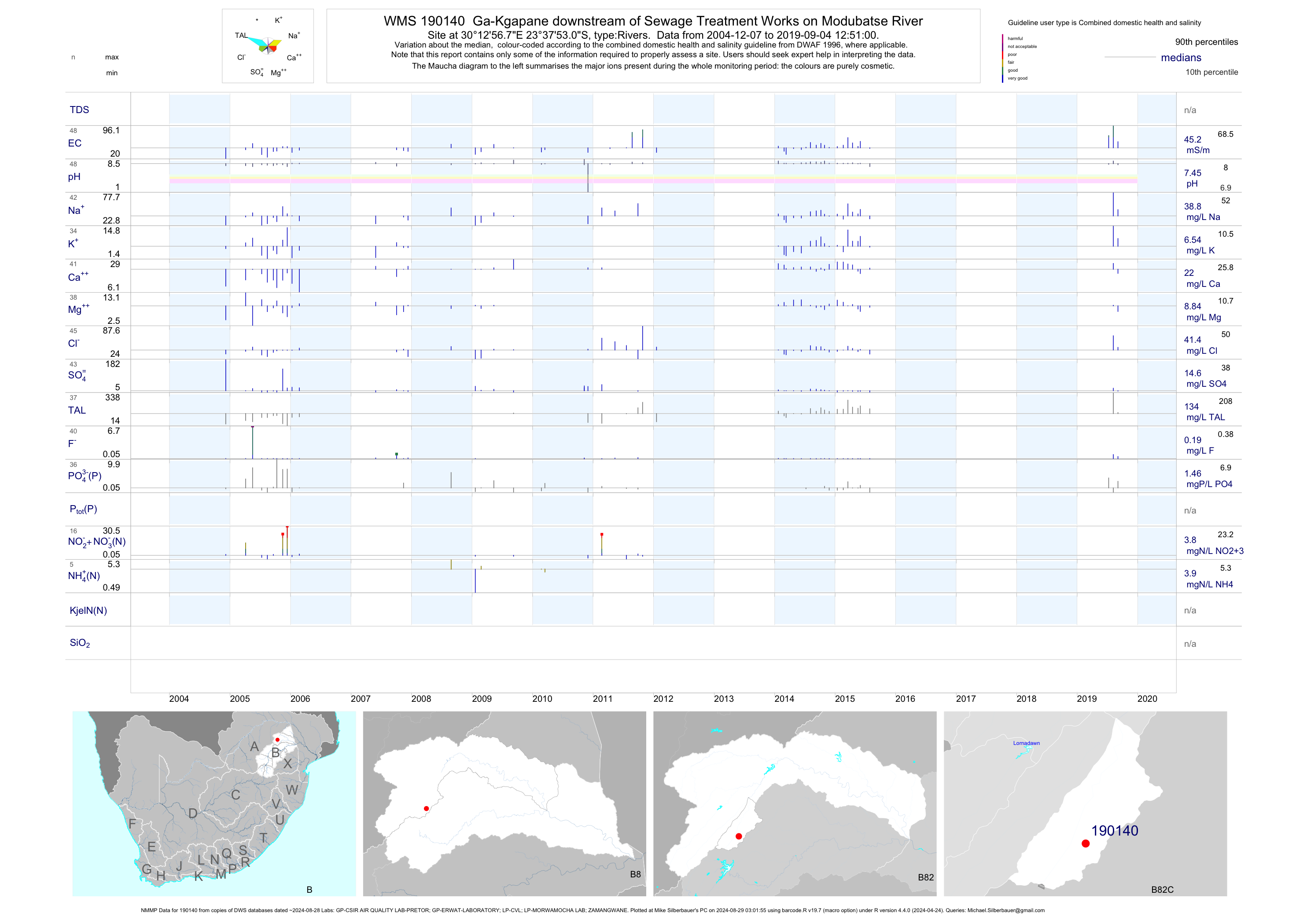
| B82 190140 | plot | data | Ga-Kgapane downstream of Sewage Treatment Works on Modubatse River (NMMP) | Rivers | 117 | 2004-12-07 | 2015-07-29 | 44 | 190140 | -23.63140 | 30.21577 |
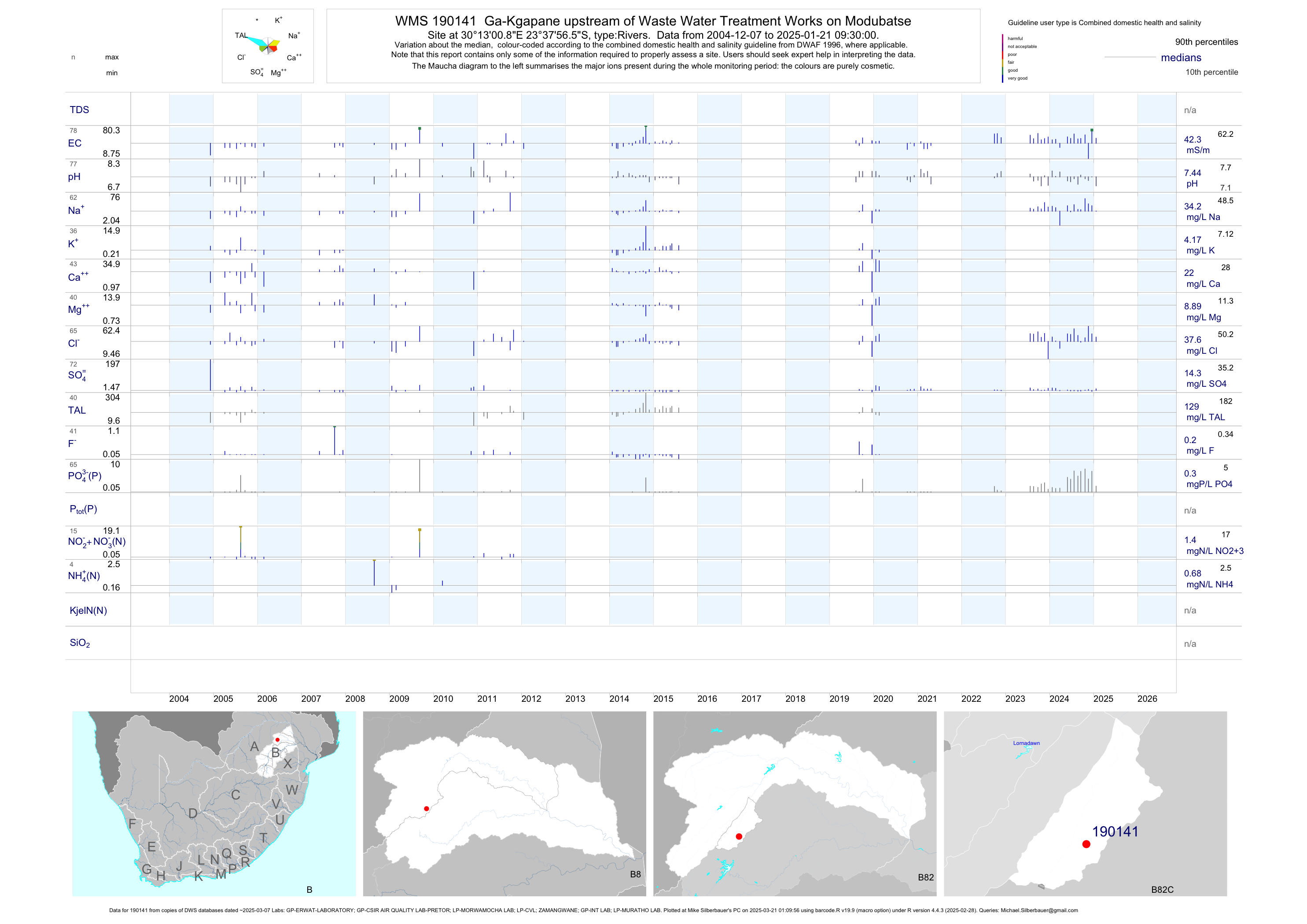
| B82 190141 | plot | data | Ga-Kgapane upstream of Waste Water Treatment Works on Modubatse | Rivers | 112 | 2004-12-07 | 2015-07-29 | 38 | 190141 | -23.63237 | 30.21691 |
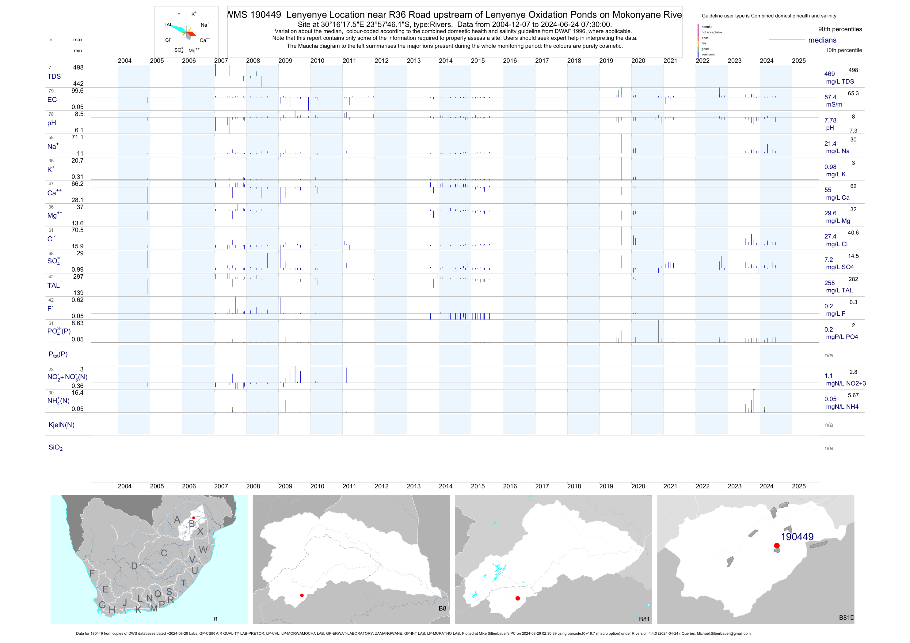
| B81 190449 | plot | data | Lenyenye Location near R36 Road upstream of Lenyenye Oxidation Ponds on Mokonyane River | Rivers | 98 | 2004-12-07 | 2015-07-29 | 57 | 190449 | -23.96281 | 30.27154 |
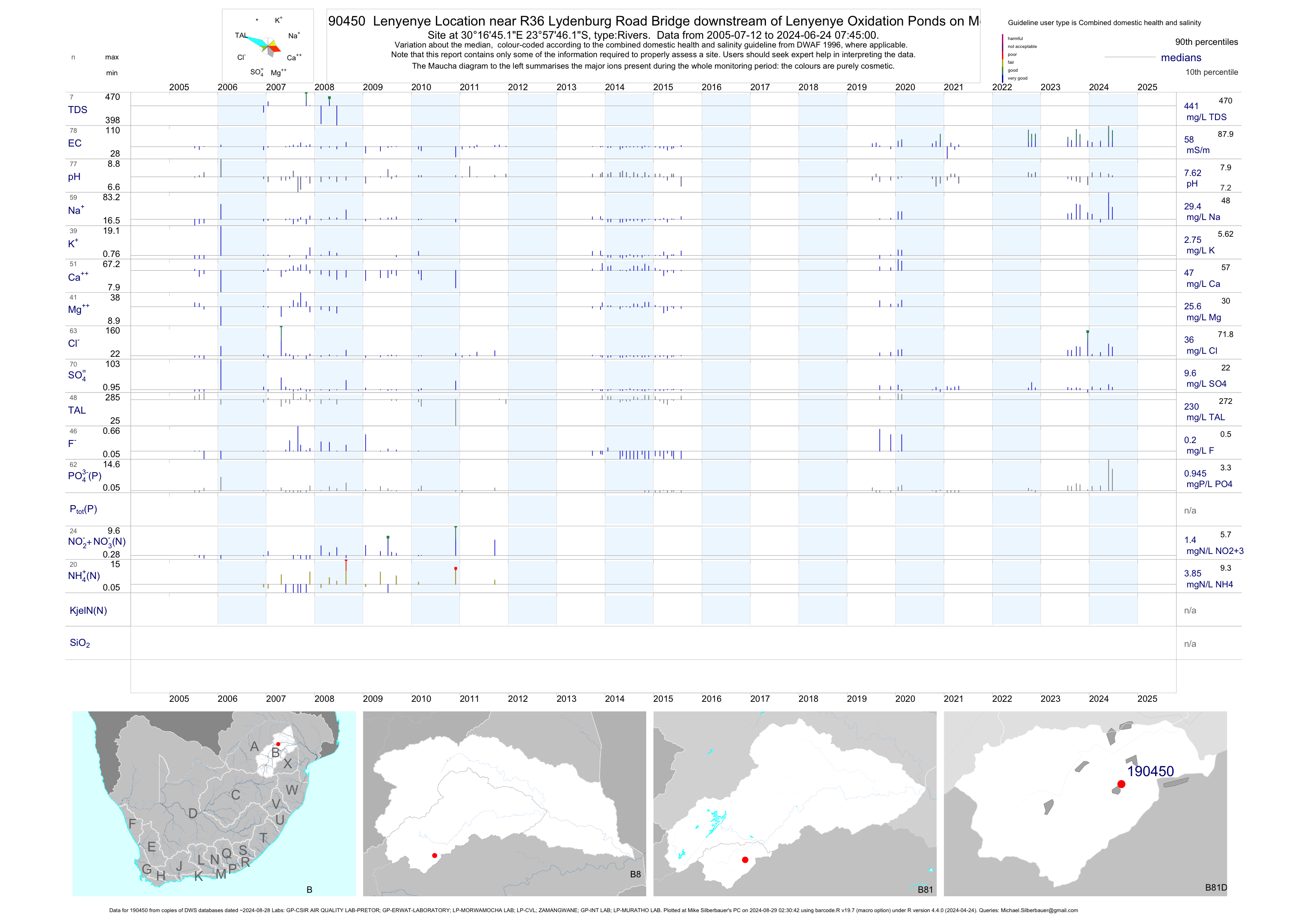
| B81 190450 | plot | data | Lenyenye Location near R36 Lydenburg Road Bridge downstream of Lenyenye Oxidation Ponds on Mokonya | Rivers | 105 | 2005-07-12 | 2015-07-29 | 57 | 190450 | -23.96282 | 30.27922 |
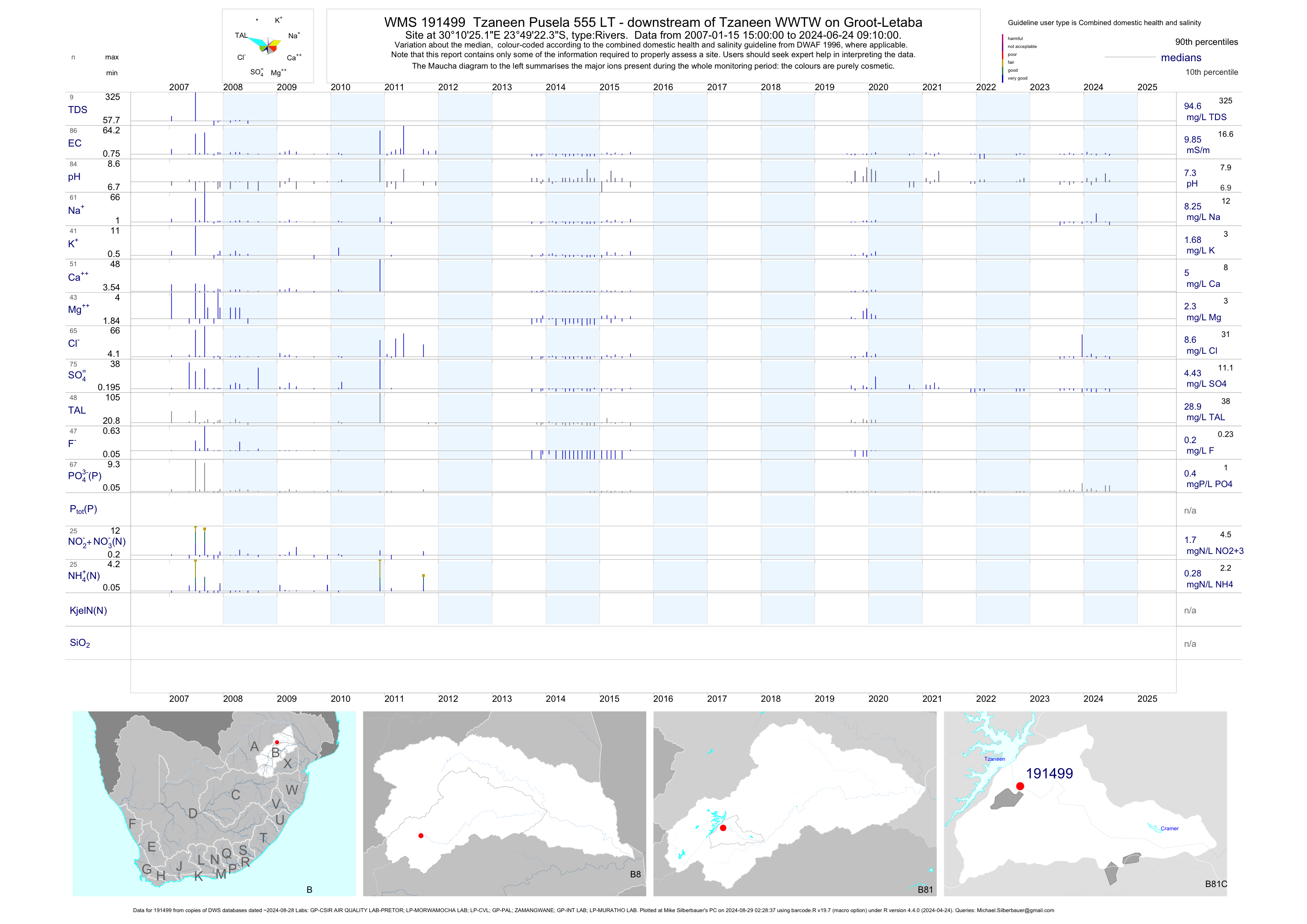
| B81 191499 | plot | data | Tzaneen Pusela 555 LT - downstream of Tzaneen WWTW on Groot-Letaba | Rivers | 100 | 2007-01-15 | 2015-07-29 | 10 | 191499 | -23.82287 | 30.17367 |
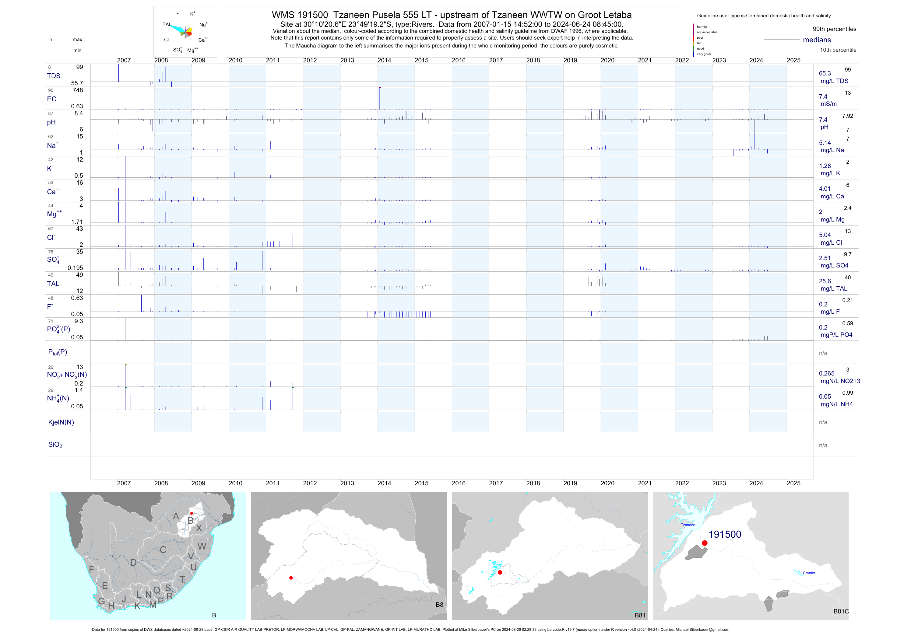
| B81 191500 | plot | data | Tzaneen Pusela 555 LT - upstream of Tzaneen WWTW on Groot Letaba | Rivers | 98 | 2007-01-15 | 2015-07-29 | 8 | 191500 | -23.82202 | 30.17240 |
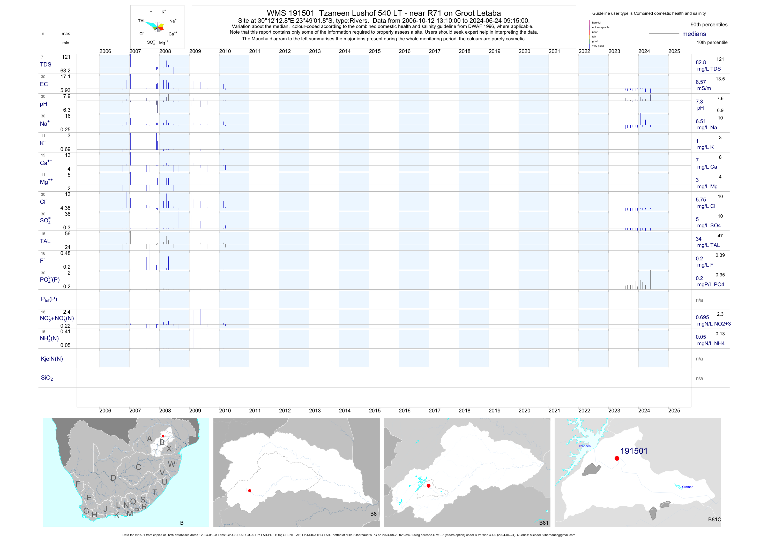
| B81 191501 | plot | data | Tzaneen Lushof 540 LT - near R71 on Groot Letaba | Rivers | 30 | 2006-10-12 | 2010-03-16 | 11 | 191501 | -23.81717 | 30.20358 |
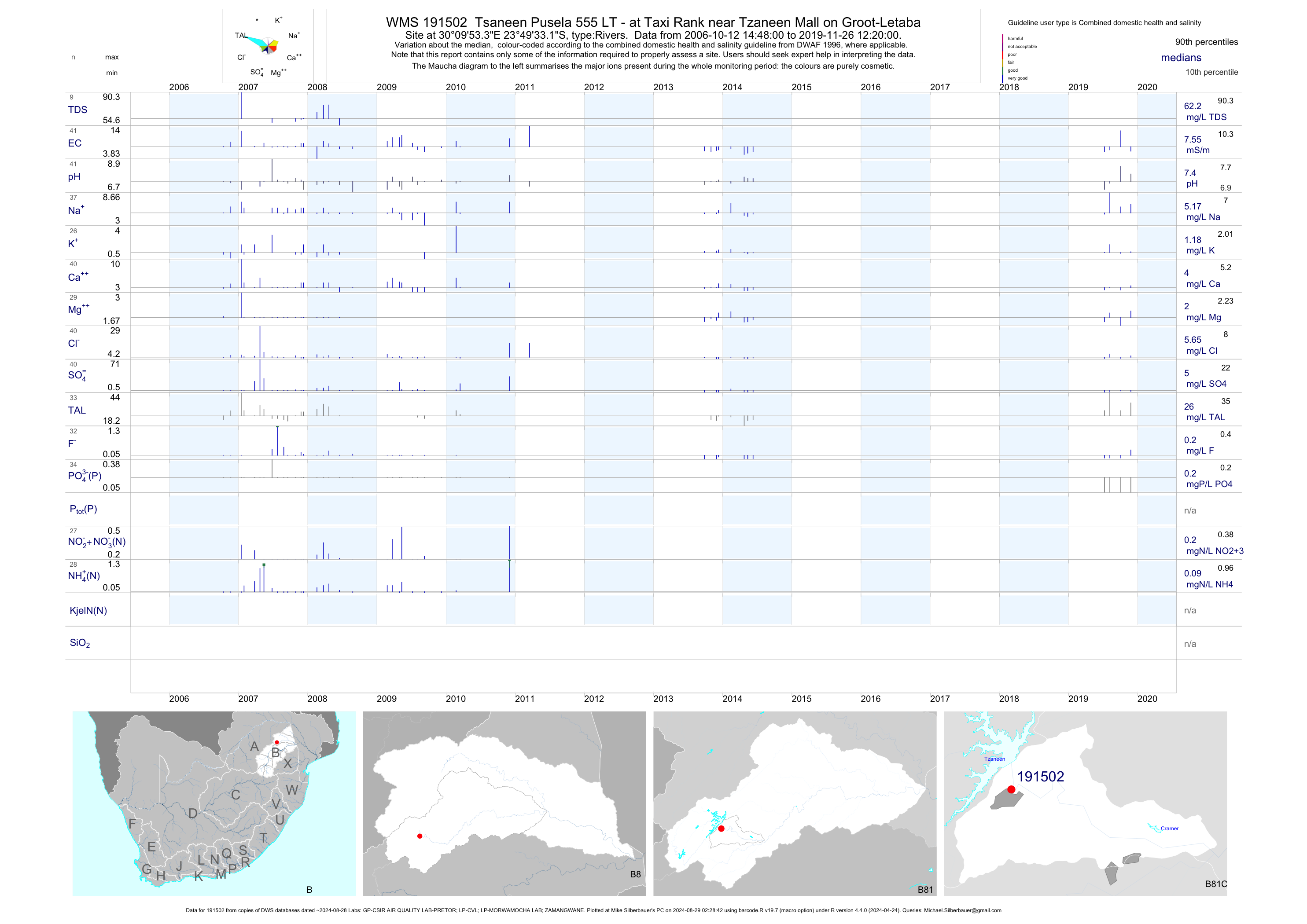
| B81 191502 | plot | data | Tsaneen Pusela 555 LT - at Taxi Rank near Tzaneen Mall on Groot-Letaba | Rivers | 70 | 2006-10-12 | 2014-06-10 | 8 | 191502 | -23.82587 | 30.16482 |
| B81 1000015225 | plot | data | Nondwene Geohydro Point 1 on Groot Letaba | Rivers | 2 | 2006-06-27 | 2006-06-27 | 42 | 1-15225 | -23.68242 | 30.87304 |
| B81 1000015226 | plot | data | Nondwene Geohydro Point 2 on Groot Letaba | Rivers | 2 | 2006-06-27 | 2006-06-27 | 58 | 1-15226 | -23.67071 | 30.99082 |
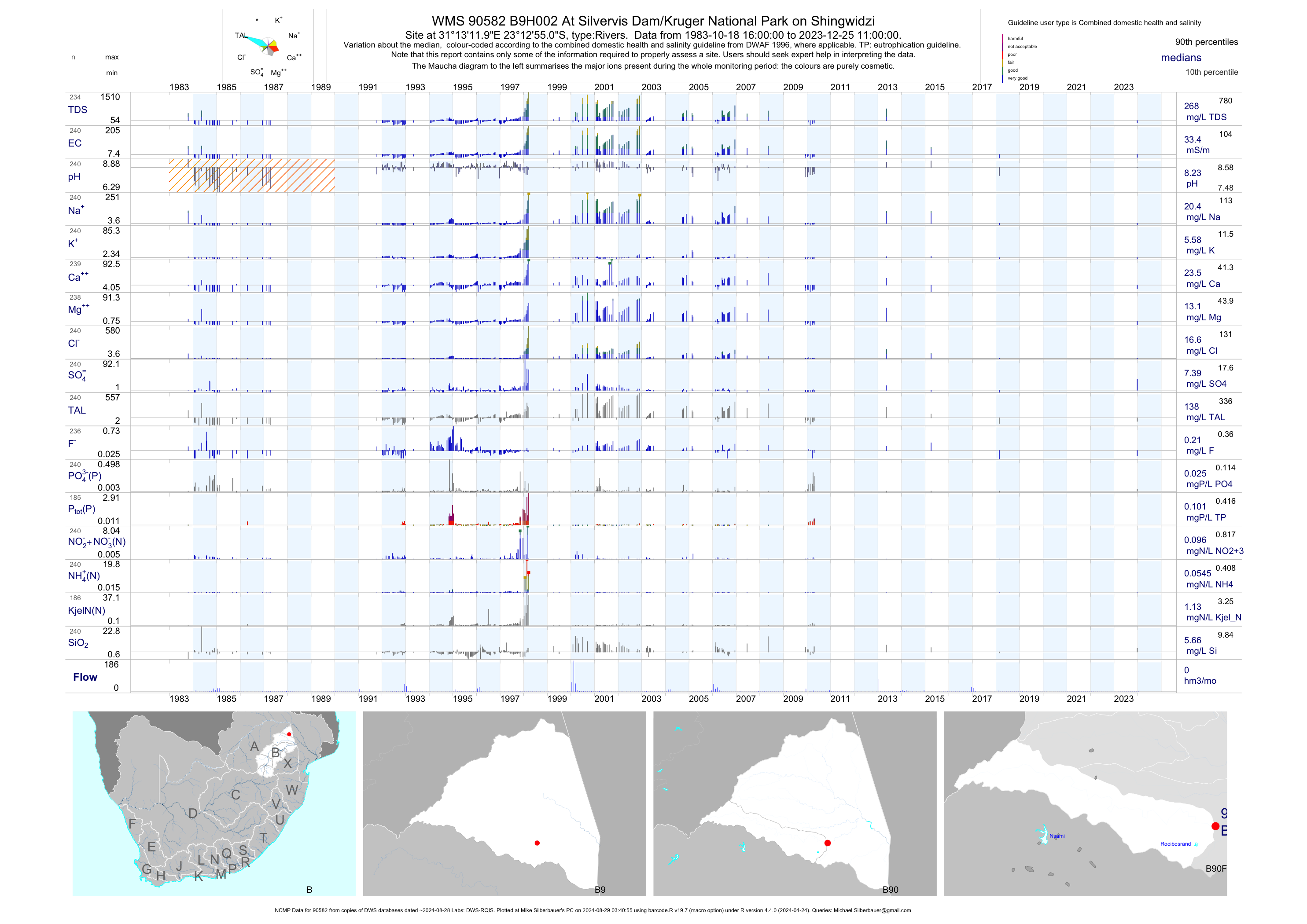
| B90 90582 | plot | data | At Silvervis Dam/Kruger National Park on Shingwidzi (NCMP) | Rivers | 422 | 1983-10-18 | 2018-02-21 | 33 | B9H002 | -23.21528 | 31.22000 |
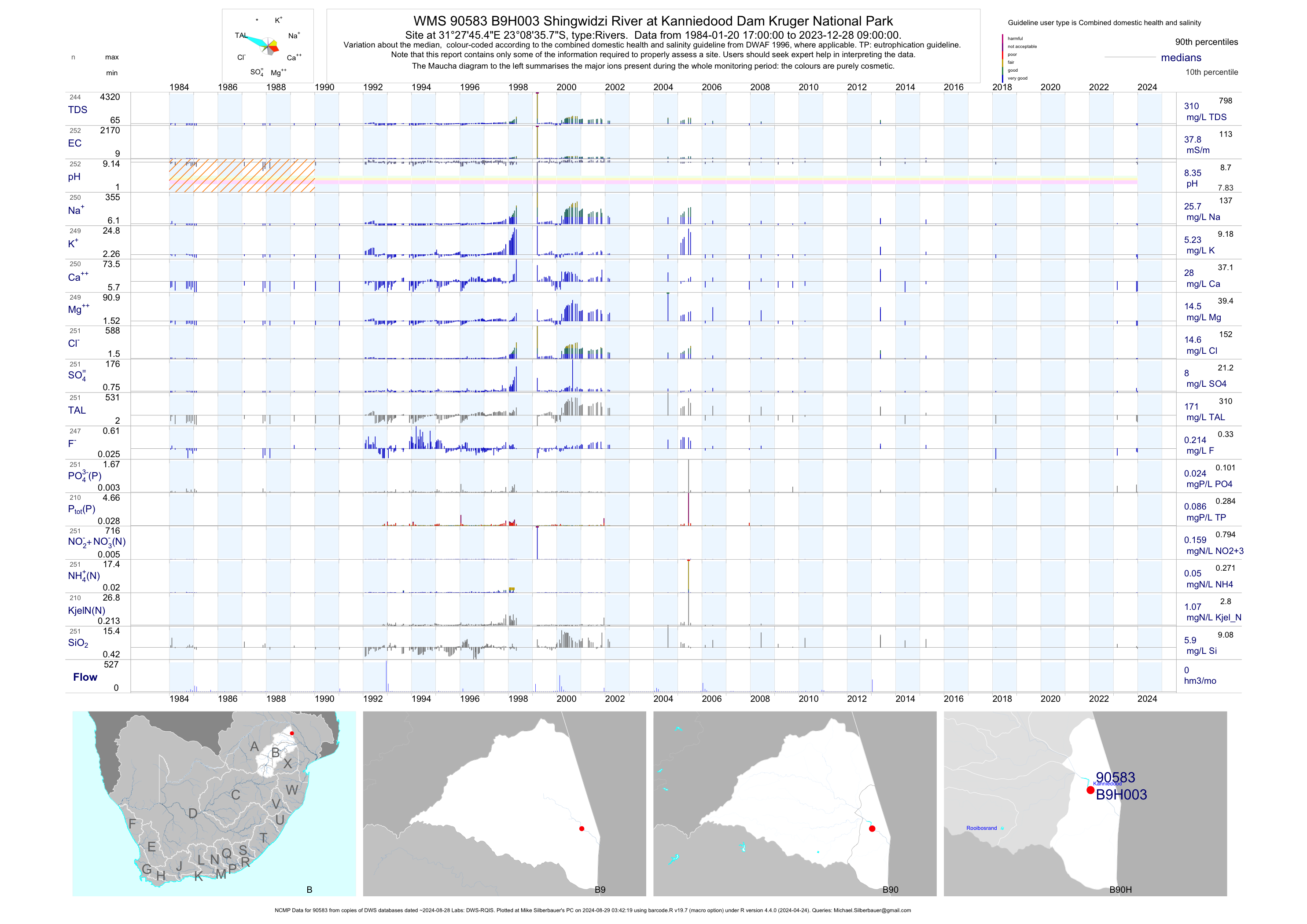
| B90 90583 | plot | data | Shingwidzi River at Kanniedood Dam Kruger National Park (NCMP) | Rivers | 385 | 1984-01-20 | 2018-02-21 | 38 | B9H003 | -23.14327 | 31.46262 |
| B90 188499 | plot | data | Boltman 211 LT - Malamulele downstream of Malamulele STW near Dam on Manzworo River | Rivers | 67 | 2009-01-20 | 2015-03-16 | 64 | 188499 | -23.00812 | 30.71813 |
| B90 190155 | plot | data | Malamulele upstream of Malamulele STW near Dept. of Agriculture on Manzworo River | Rivers | 62 | 2007-06-26 | 2014-11-14 | 76 | 190155 | -23.00564 | 30.70083 |
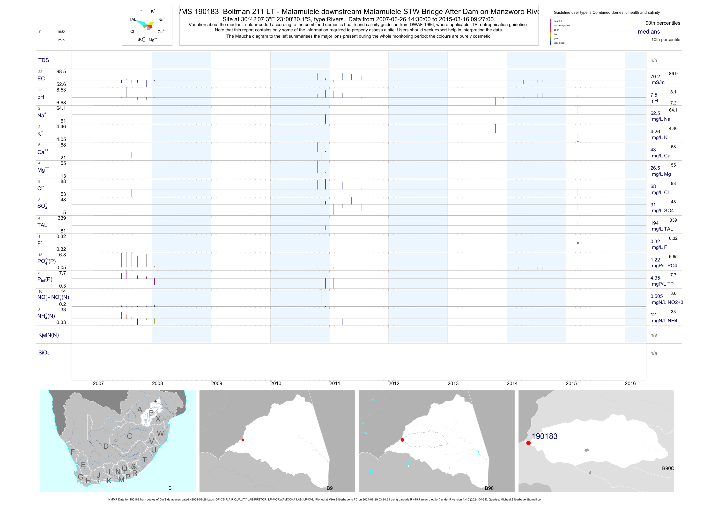
| B90 190183 | plot | data | Boltman 211 LT - Malamulele downstream Malamulele STW Bridge After Dam on Manzworo River (NMMP) | Rivers | 59 | 2007-06-26 | 2015-03-16 | 70 | 190183 | -23.00839 | 30.70203 |
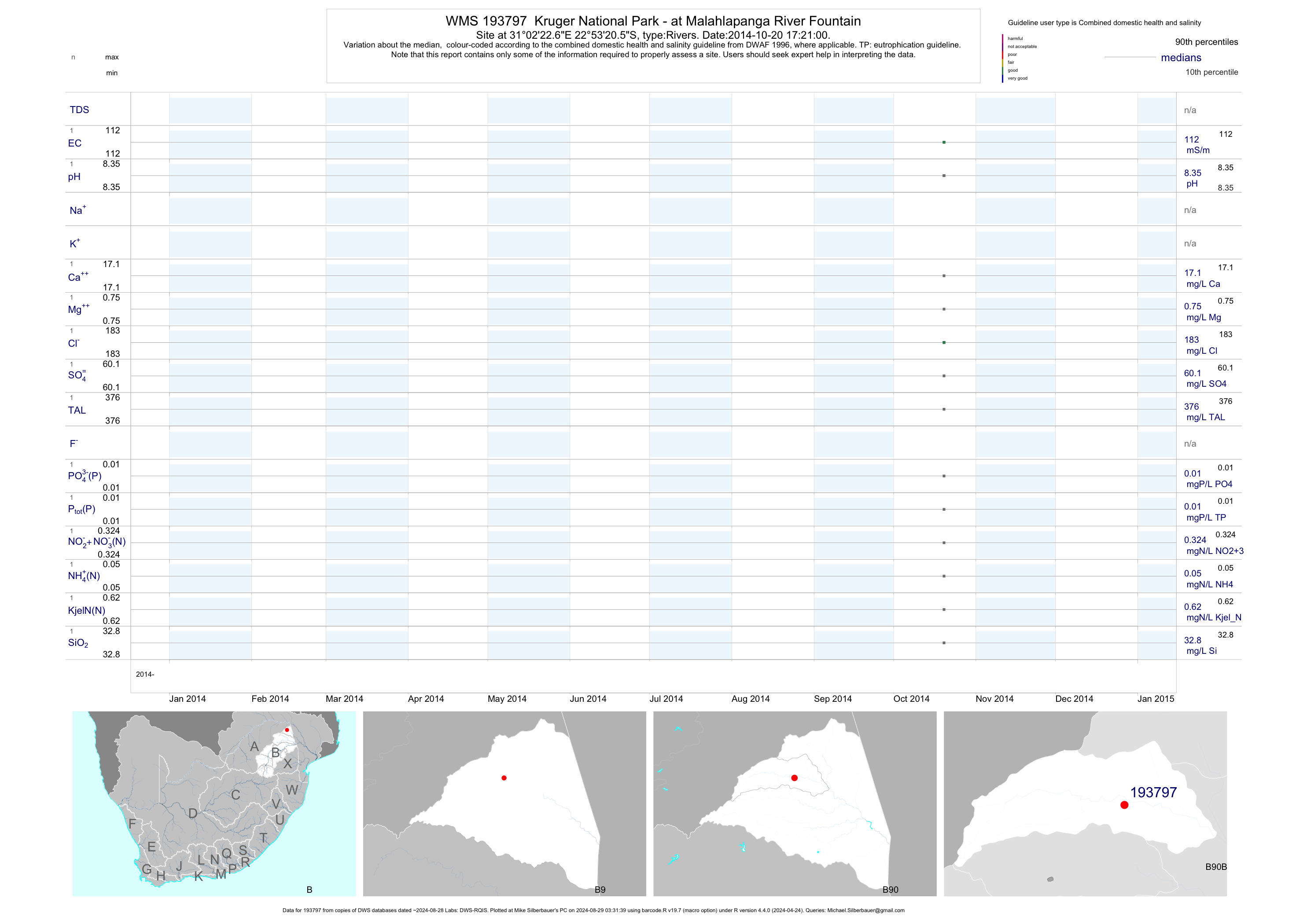
| B90 193797 | plot | data | Kruger National Park - at Malahlapanga River Fountain | Rivers | 3 | 2014-10-20 | 2014-10-20 | 112 | 193797 | -22.88904 | 31.03963 |
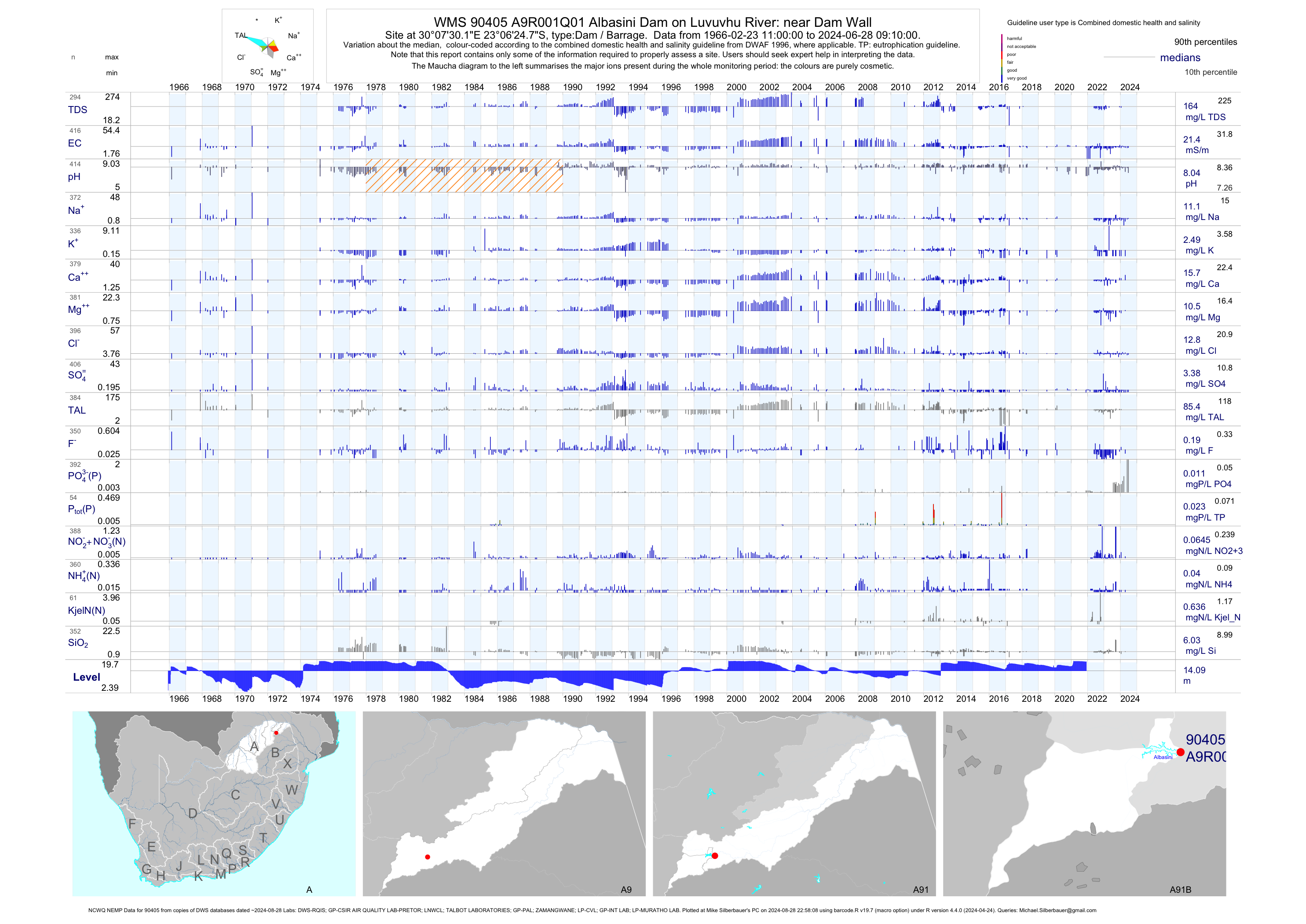
| A91 90405 | plot | data | Albasini Dam on Luvuvhu River: near Dam Wall (NCWQ NEMP) Q01 | Dam / Barrage | 837 | 1966-02-23 | 2018-07-10 | 22 | A9R001 | -23.10686 | 30.12506 |
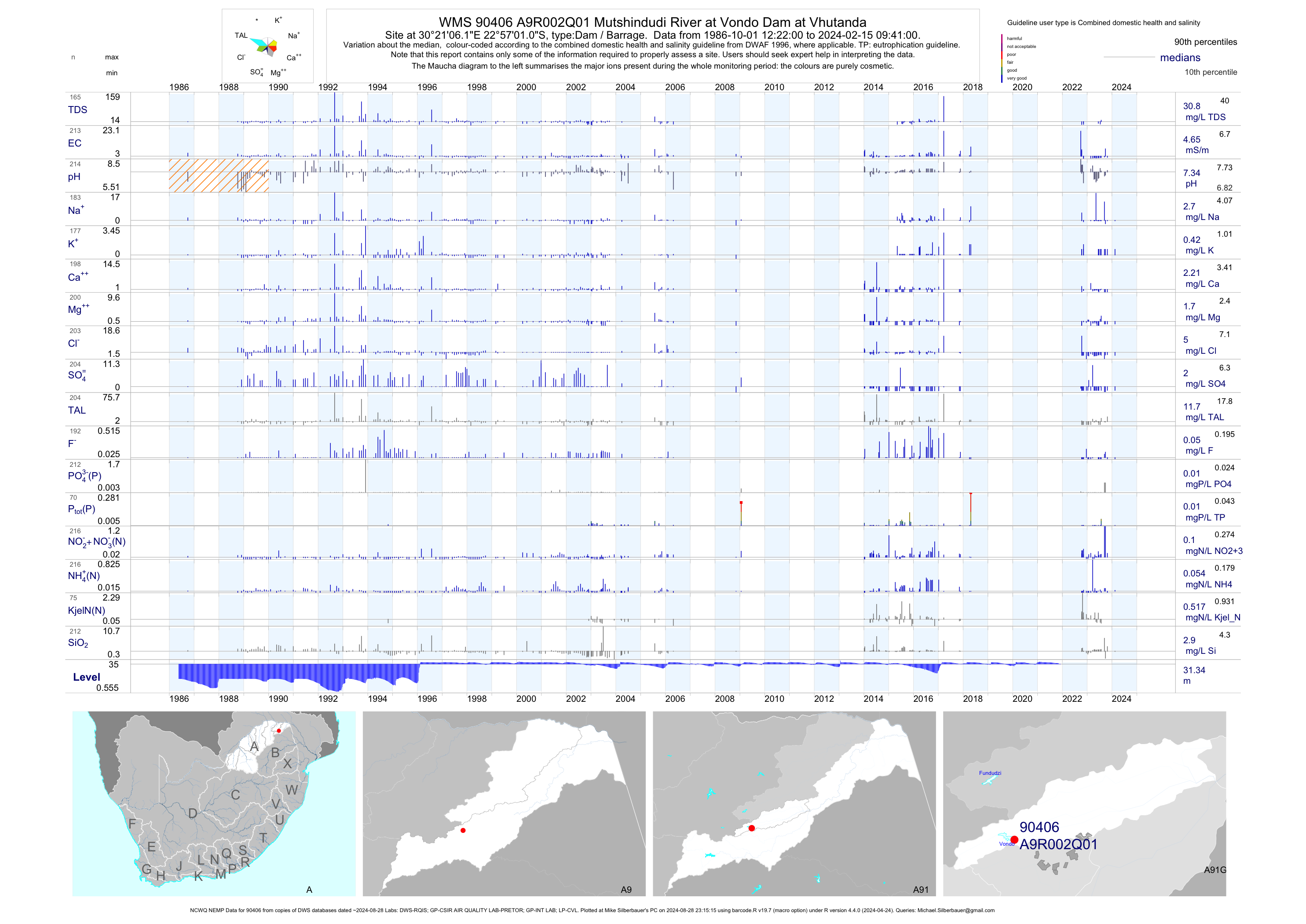
| A91 90406 | plot | data | Mutshindudi River at Vondo Dam at Vhutanda (NCWQ NEMP) Q01 | Dam / Barrage | 449 | 1986-10-01 | 2018-07-09 | 5 | A9R002 | -22.95029 | 30.35172 |
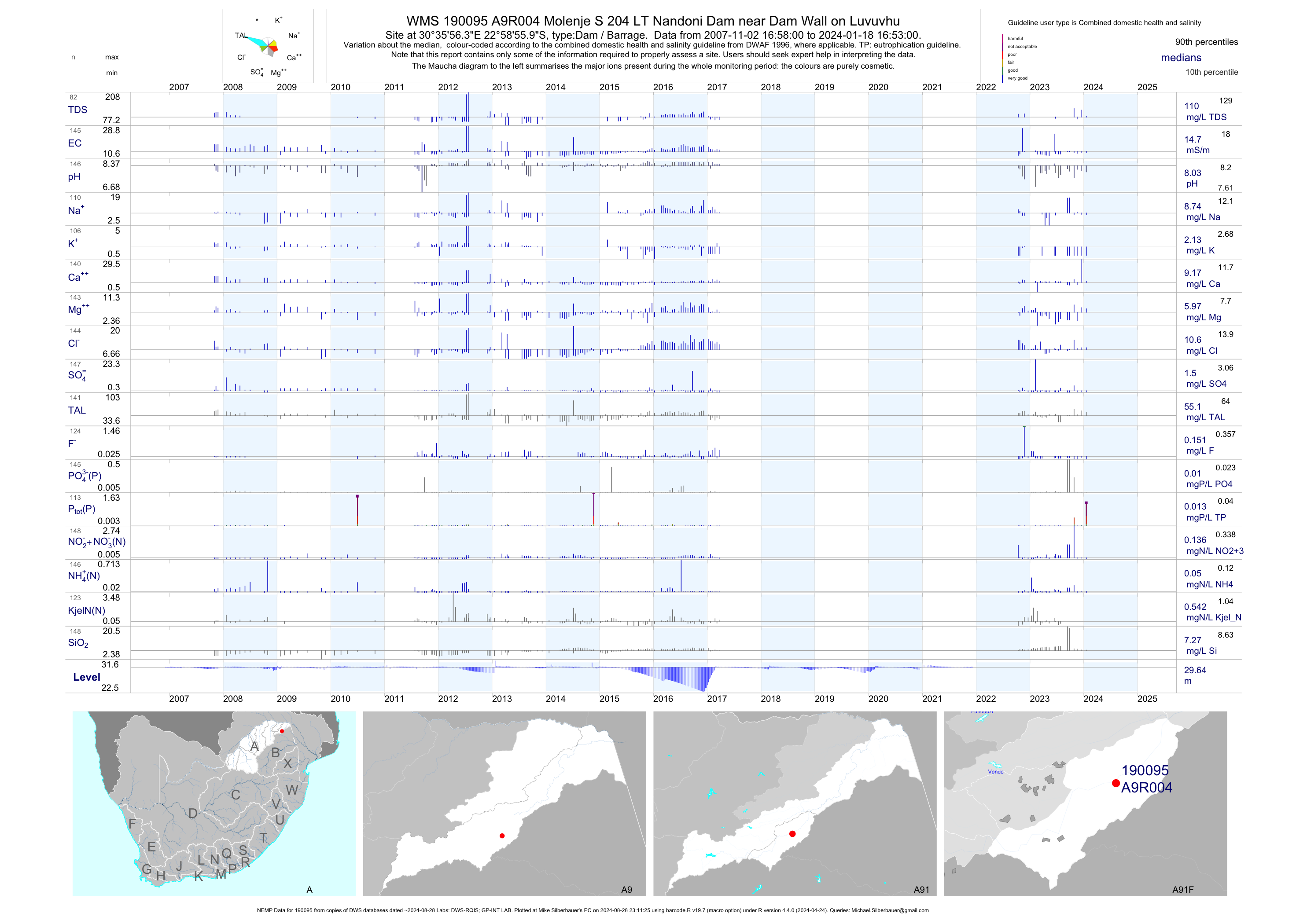
| A91 190095 | plot | data | Molenje S 204 LT Nandoni Dam near Dam Wall on Luvuvhu (NEMP) Q01 | Dam / Barrage | 578 | 2007-11-02 | 2018-09-25 | 15 | A9R004 | -22.98219 | 30.59897 |
| A91 191596 | plot | data | Nandoni 3 - Mulenzhe Molenje 204 LT - at Nandoni Dam on Luvuvhu | Dam / Barrage | 13 | 2010-01-13 | 2010-11-30 | n/a | 191596 | -22.99800 | 30.54322 |
| A91 191597 | plot | data | Nandoni 5 - Mpapuli 278 MT - at Nandoni Dam on Luvuvhu | Dam / Barrage | 9 | 2010-01-13 | 2010-11-30 | n/a | 191597 | -22.99036 | 30.54781 |
| A91 191598 | plot | data | Nandoni 4 - Budeli Mpapuli 278 MT - at Nandoni Dam on Luvuvhu | Dam / Barrage | 10 | 2010-01-13 | 2010-11-30 | n/a | 191598 | -22.98306 | 30.56378 |
| A91 191599 | plot | data | Nandoni 2 - Mulenzhe Molenje 204 LT at Nandoni Dam on Luvuvhu | Dam / Barrage | 10 | 2010-01-13 | 2010-11-29 | n/a | 191599 | -22.99642 | 30.57536 |
| A91 191600 | plot | data | Nandoni 1 - Molenje 204 LT - near Nandoni Dam Wall on Luvuvhu | Dam / Barrage | 7 | 2010-01-13 | 2010-11-29 | n/a | 191600 | -22.98200 | 30.59553 |
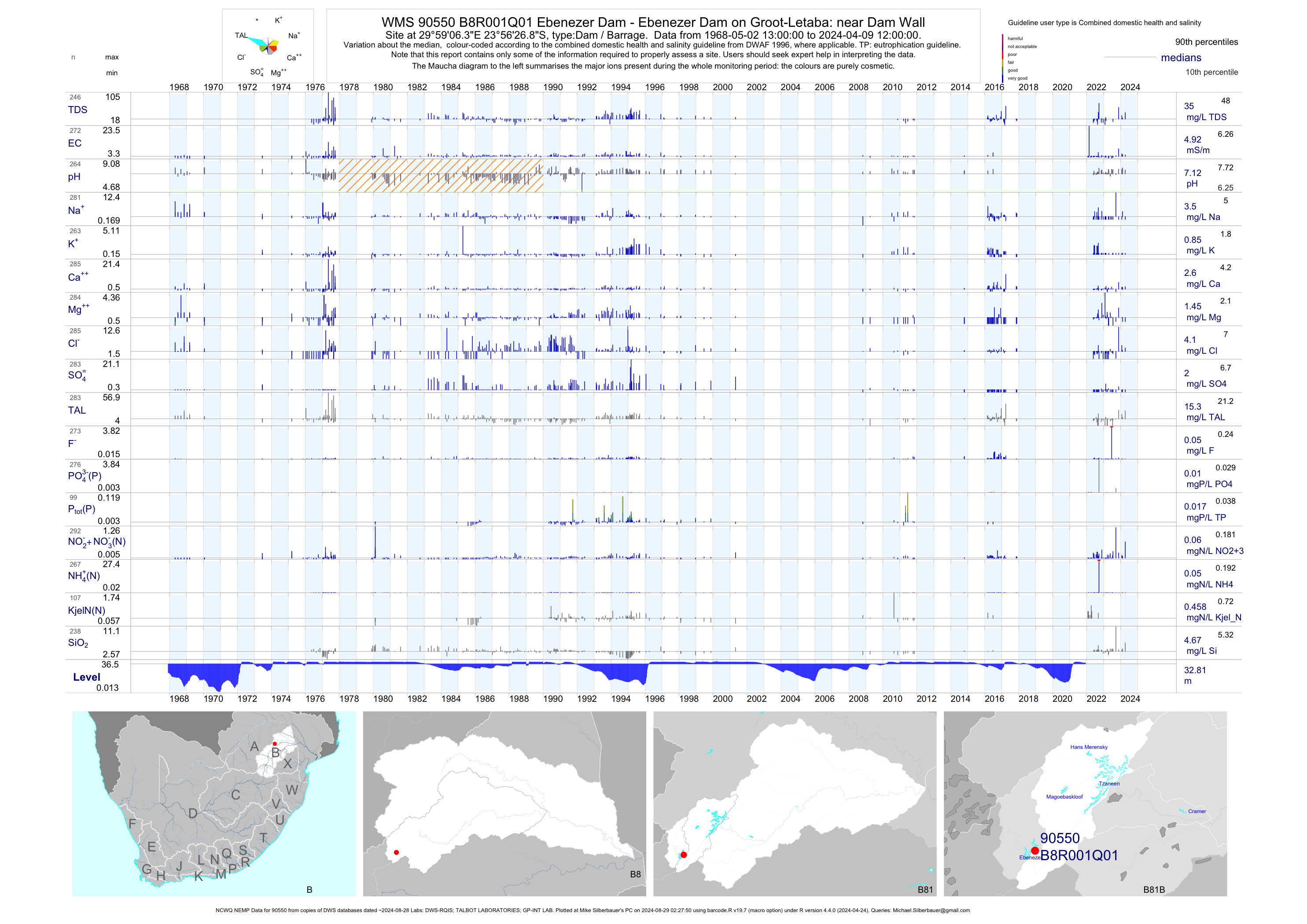
| B81 90550 | plot | data | Ebenezer Dam - Ebenezer Dam on Groot-Letaba: near Dam Wall (NCWQ NEMP) Q01 | Dam / Barrage | 1170 | 1968-05-02 | 2018-05-07 | 5 | B8R001 | -23.94080 | 29.98510 |
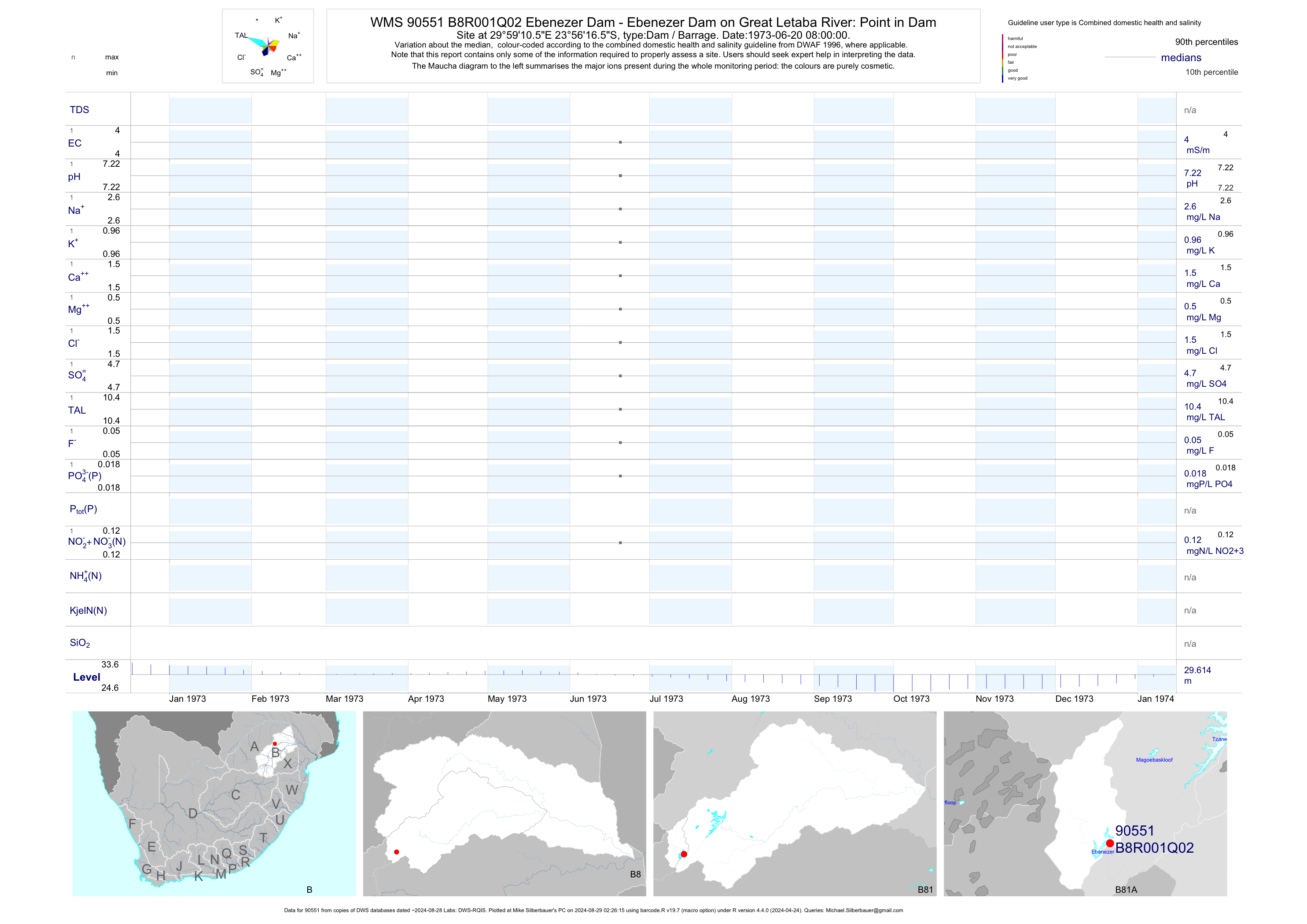
| B81 90551 | plot | data | Ebenezer Dam - Ebenezer Dam on Great Letaba River: Point in Dam Q02 | Dam / Barrage | 1 | 1973-06-20 | 1973-06-20 | 4 | B8R001 | -23.93793 | 29.98626 |
| B81 90552 | plot | data | Ebenezer Dam - Ebenezer Dam on Great Letaba River: Point in Dam Q03 | Dam / Barrage | 72 | 1973-06-20 | 1977-10-04 | 4 | B8R001 | -23.93465 | 29.98554 |
| B81 90553 | plot | data | Van Zylsrust 1021 LS - Ebenezer Dam on Great Lataba River: Point in Dam Q04 | Dam / Barrage | 1 | 1973-06-20 | 1973-06-20 | 4 | B8R001 | -23.93213 | 29.98800 |
| B81 90554 | plot | data | Van Zylsrust 1021 LS - Ebenezer Dam on Great Letaba River: Point in Dam Q05 | Dam / Barrage | 1 | 1973-06-20 | 1973-06-20 | 4 | B8R001 | -23.93072 | 29.98622 |
| B81 90555 | plot | data | Goedehoop 1022 LS - Ebenezer Dam on Great Letaba River: Point in Dam Q06 | Dam / Barrage | 1 | 1973-06-20 | 1973-06-20 | 4 | B8R001 | -23.92957 | 29.98447 |
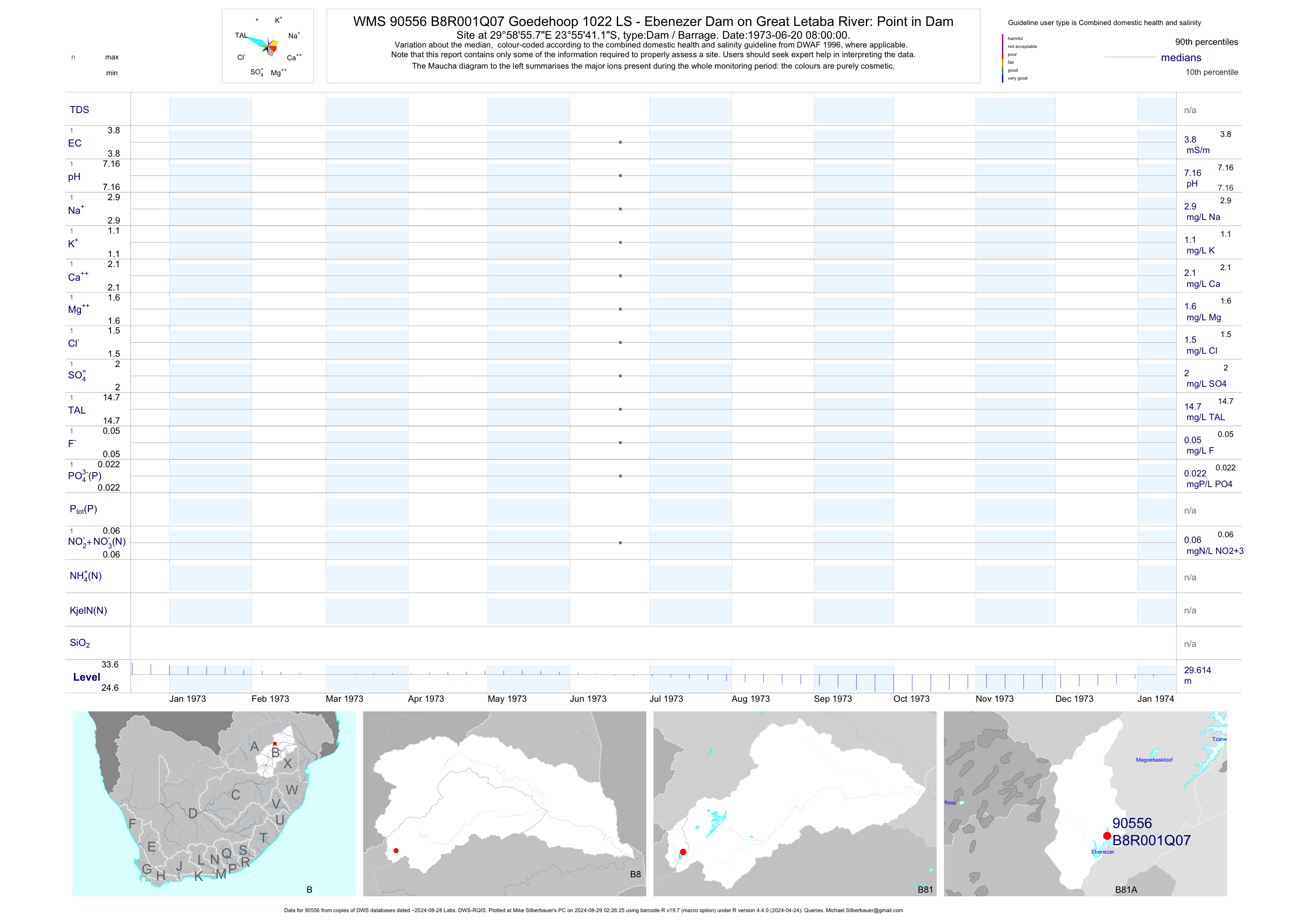
| B81 90556 | plot | data | Goedehoop 1022 LS - Ebenezer Dam on Great Letaba River: Point in Dam Q07 | Dam / Barrage | 1 | 1973-06-20 | 1973-06-20 | 4 | B8R001 | -23.92811 | 29.98217 |
| B81 90557 | plot | data | Goedehoop 1022 LS - Ebenezer Dam on Great Letaba River: Point in Dam Q08 | Dam / Barrage | 1 | 1973-06-20 | 1973-06-20 | 5 | B8R001 | -23.92628 | 29.98038 |
| B81 90558 | plot | data | Goedehoop 1022 LS - Ebenezer Dam on Great Letaba River: Point in Dam Q09 | Dam / Barrage | 1 | 1973-06-20 | 1973-06-20 | 4 | B8R001 | -23.92294 | 29.98256 |
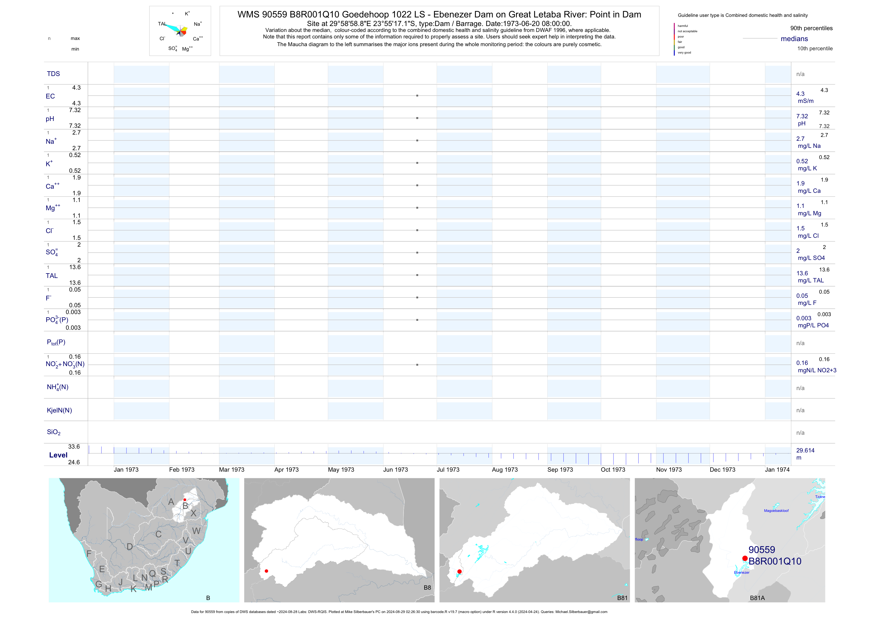
| B81 90559 | plot | data | Goedehoop 1022 LS - Ebenezer Dam on Great Letaba River: Point in Dam Q10 | Dam / Barrage | 1 | 1973-06-20 | 1973-06-20 | 4 | B8R001 | -23.92142 | 29.98301 |
| B81 90560 | plot | data | Goedehoop 1022 LS - Ebenezer Dam on Great Letaba River: Point in Dam Q11 | Dam / Barrage | 1 | 1973-06-20 | 1973-06-20 | 4 | B8R001 | -23.91712 | 29.98382 |
| B81 90561 | plot | data | Goedehoop 1022 LS - Ebenezer Dam on Great Letaba River: Point in Dam Q12 | Dam / Barrage | 27 | 1976-11-11 | 1977-10-04 | 4 | B8R001 | -23.91446 | 29.98440 |
| B81 90562 | plot | data | Ebenezer Dam - Ebenezer Dam on Great Letaba River: Point in Dam Q13 | Dam / Barrage | 1 | 1973-06-20 | 1973-06-20 | 5 | B8R001 | -23.93567 | 29.98334 |
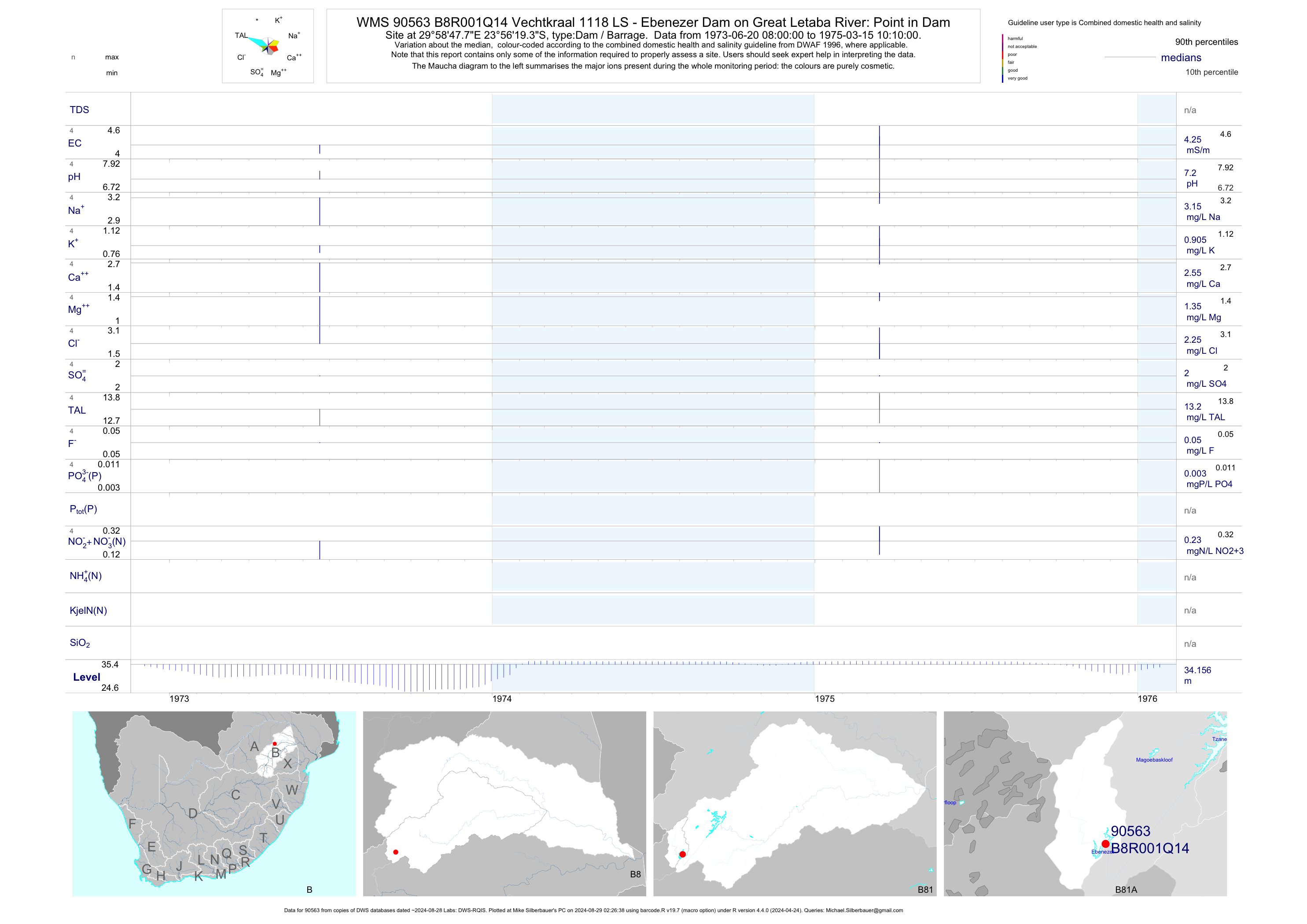
| B81 90563 | plot | data | Vechtkraal 1118 LS - Ebenezer Dam on Great Letaba River: Point in Dam Q14 | Dam / Barrage | 4 | 1973-06-20 | 1975-03-15 | 4 | B8R001 | -23.93870 | 29.97993 |
| B81 90564 | plot | data | Ebenezer Dam - Ebenezer Dam on Great Letaba River: Point in Dam Q15 | Dam / Barrage | 1 | 1973-06-20 | 1973-06-20 | 4 | B8R001 | -23.94208 | 29.97672 |
| B81 90565 | plot | data | De Beers 1125 LS - Ebenezer Dam on Great Letaba River: Point in Dam Q16 | Dam / Barrage | 1 | 1973-06-20 | 1973-06-20 | 4 | B8R001 | -23.94602 | 29.97406 |
| B81 90566 | plot | data | Bekkersvlei 1126 LS - Ebenezer Dam on Great Letaba River: Point in Dam Q17 | Dam / Barrage | 1 | 1973-06-20 | 1973-06-20 | 5 | B8R001 | -23.94904 | 29.97277 |
| B81 90567 | plot | data | Rondebult 1120 LS - Ebenezer Dam on Great Letaba River: Point in Dam Q18 | Dam / Barrage | 1 | 1973-06-20 | 1973-06-20 | 3 | B8R001 | -23.95203 | 29.97178 |
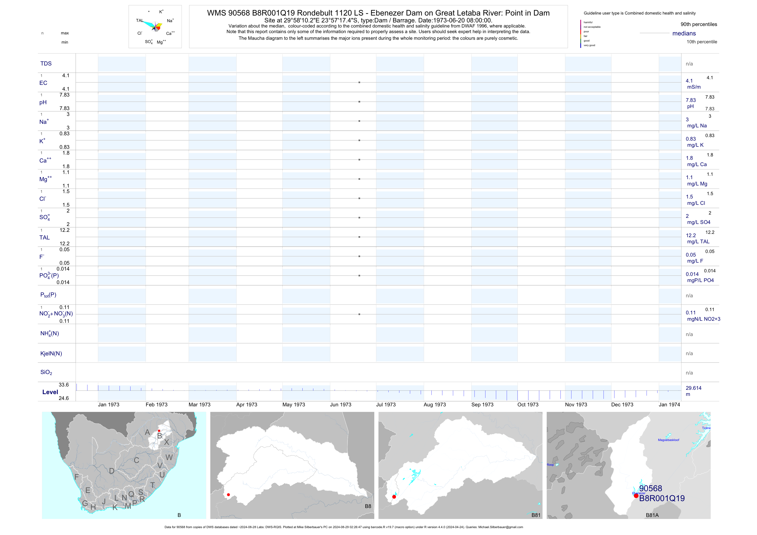
| B81 90568 | plot | data | Rondebult 1120 LS - Ebenezer Dam on Great Letaba River: Point in Dam Q19 | Dam / Barrage | 1 | 1973-06-20 | 1973-06-20 | 4 | B8R001 | -23.95485 | 29.96951 |
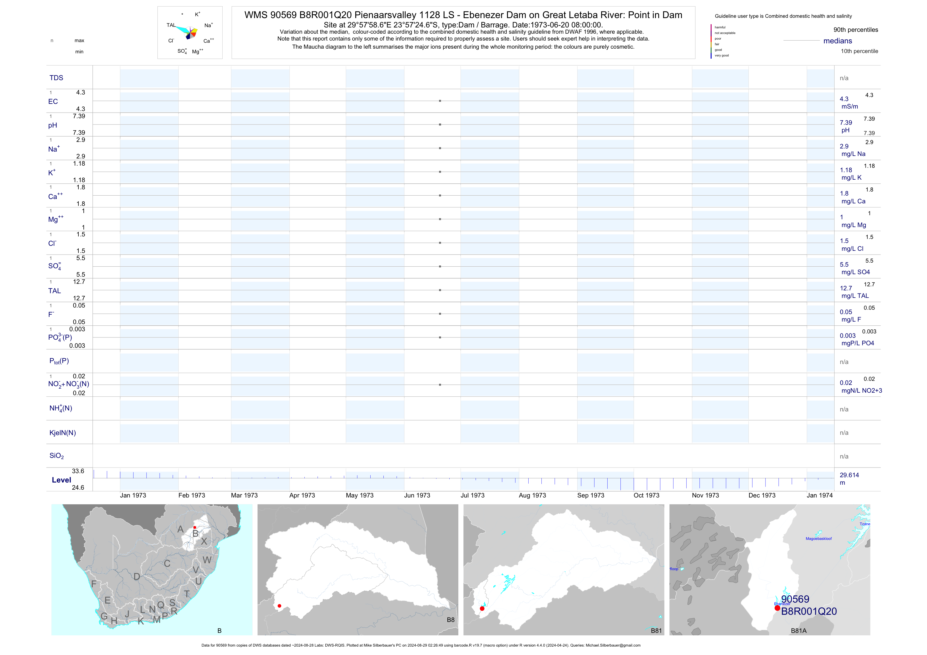
| B81 90569 | plot | data | Pienaarsvalley 1128 LS - Ebenezer Dam on Great Letaba River: Point in Dam Q20 | Dam / Barrage | 1 | 1973-06-20 | 1973-06-20 | 4 | B8R001 | -23.95685 | 29.96629 |
| B81 90570 | plot | data | Stevensrust 1119 LS - Ebenezer Dam on Great Letaba River: Point in Dam Q21 | Dam / Barrage | 1 | 1973-06-20 | 1973-06-20 | 4 | B8R001 | -23.95470 | 29.96332 |
| B81 90571 | plot | data | Uitkyk 1117 LS - Ebenezer Dam on Great Letaba River: Point in Dam Q22 | Dam / Barrage | 1 | 1973-06-20 | 1973-06-20 | 5 | B8R001 | -23.95030 | 29.96262 |
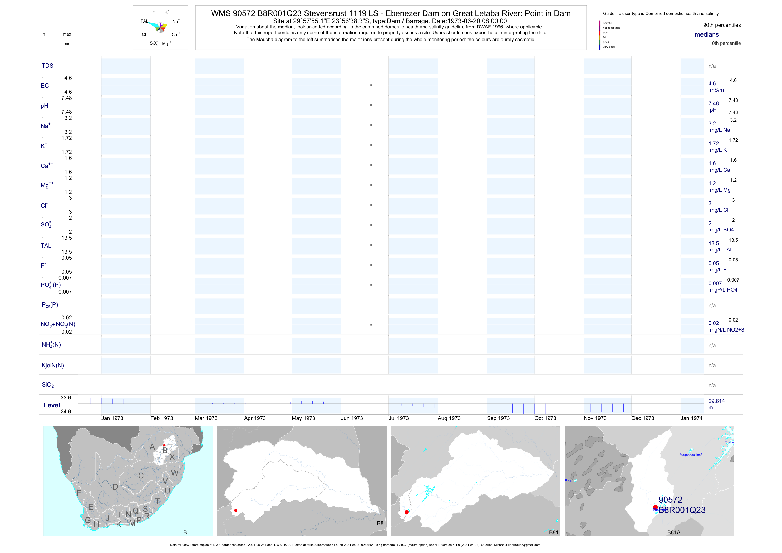
| B81 90572 | plot | data | Stevensrust 1119 LS - Ebenezer Dam on Great Letaba River: Point in Dam Q23 | Dam / Barrage | 1 | 1973-06-20 | 1973-06-20 | 5 | B8R001 | -23.94398 | 29.96531 |
| B81 90573 | plot | data | Kromdraai 1111 LS - Ebenezer Dam on Great Letaba River: Point in Dam Q24 | Dam / Barrage | 1 | 1973-06-20 | 1973-06-20 | 4 | B8R001 | -23.93783 | 29.96394 |
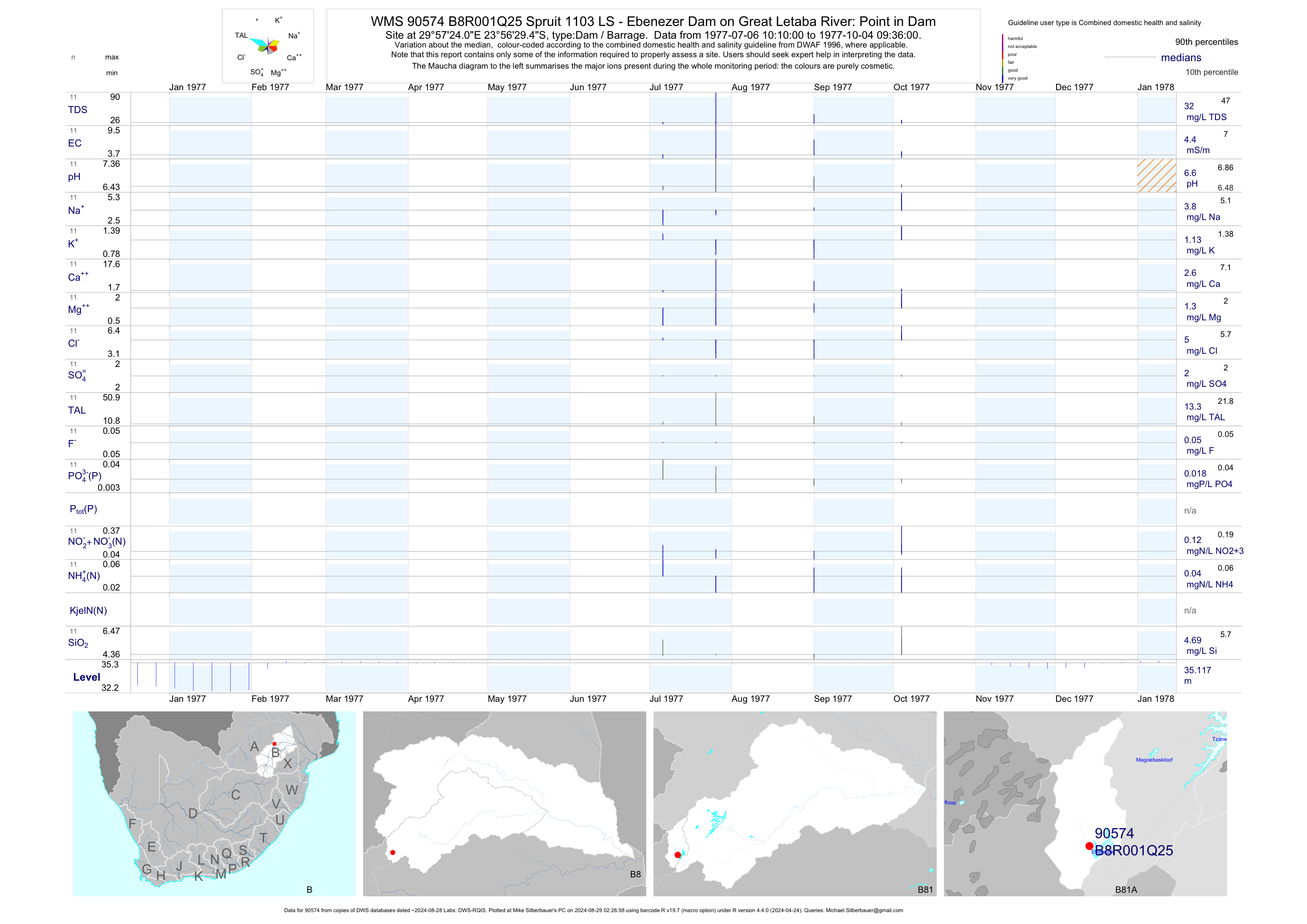
| B81 90574 | plot | data | Spruit 1103 LS - Ebenezer Dam on Great Letaba River: Point in Dam Q25 | Dam / Barrage | 11 | 1977-07-06 | 1977-10-04 | 4 | B8R001 | -23.94151 | 29.95667 |
| B81 90575 | plot | data | Spruit 1103 LS - Ebenezer Dam on Great Letaba River: Point in Dam Q26 | Dam / Barrage | 1 | 1973-06-20 | 1973-06-20 | 4 | B8R001 | -23.94227 | 29.95113 |
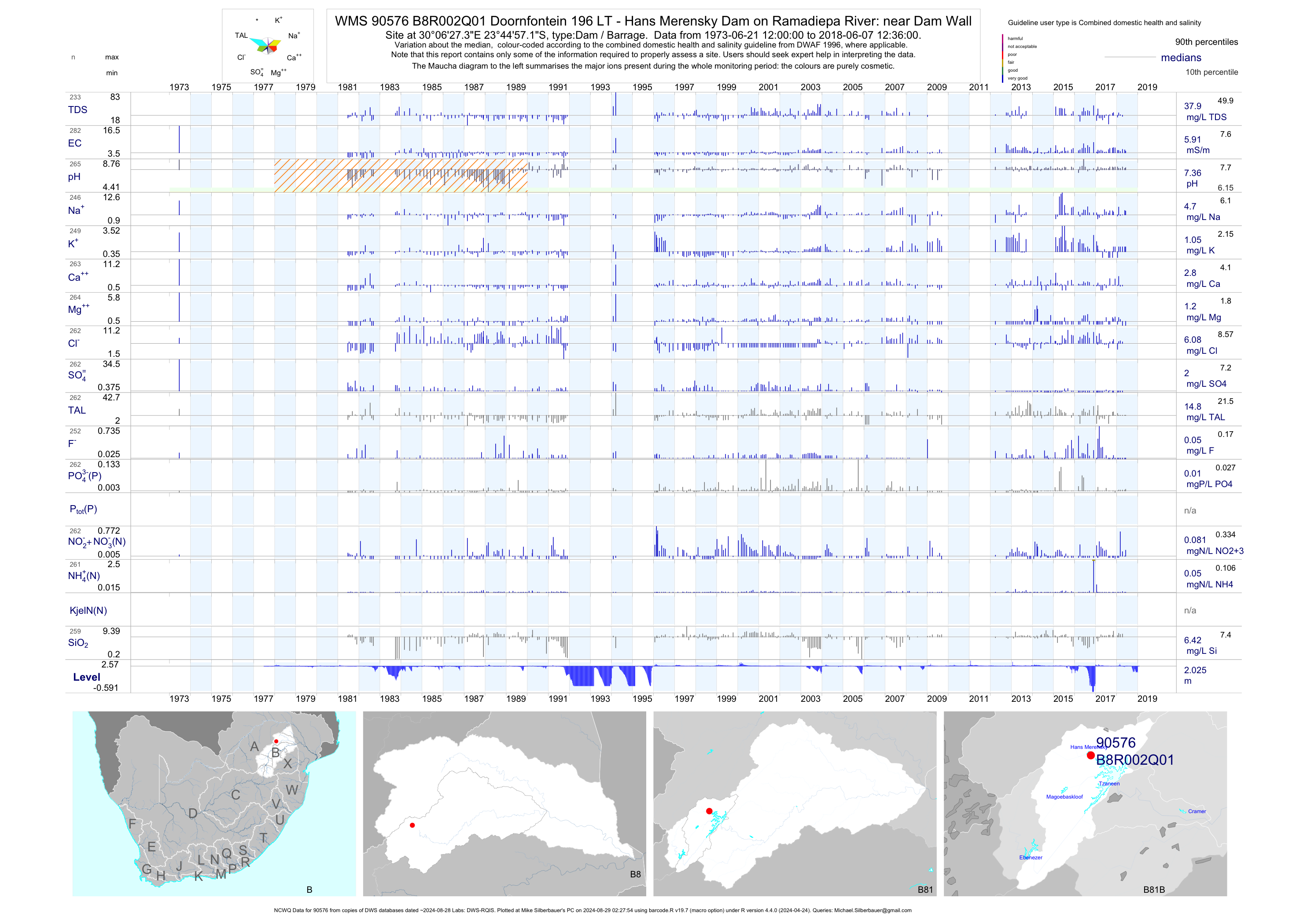
| B81 90576 | plot | data | Doornfontein 196 LT - Hans Merensky Dam on Ramadiepa River: near Dam Wall (NCWQ) Q01 | Dam / Barrage | 283 | 1973-06-21 | 2018-06-07 | 6 | B8R002 | -23.74920 | 30.10760 |
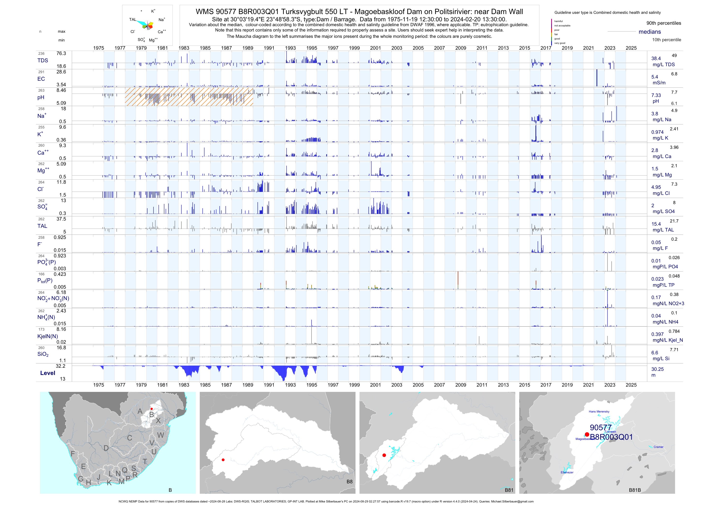
| B81 90577 | plot | data | Turksvygbult 550 LT - Magoebaskloof Dam on Politsirivier: near Dam Wall (NCWQ NEMP) Q01 | Dam / Barrage | 807 | 1975-11-19 | 2018-05-07 | 6 | B8R003 | -23.81620 | 30.05540 |
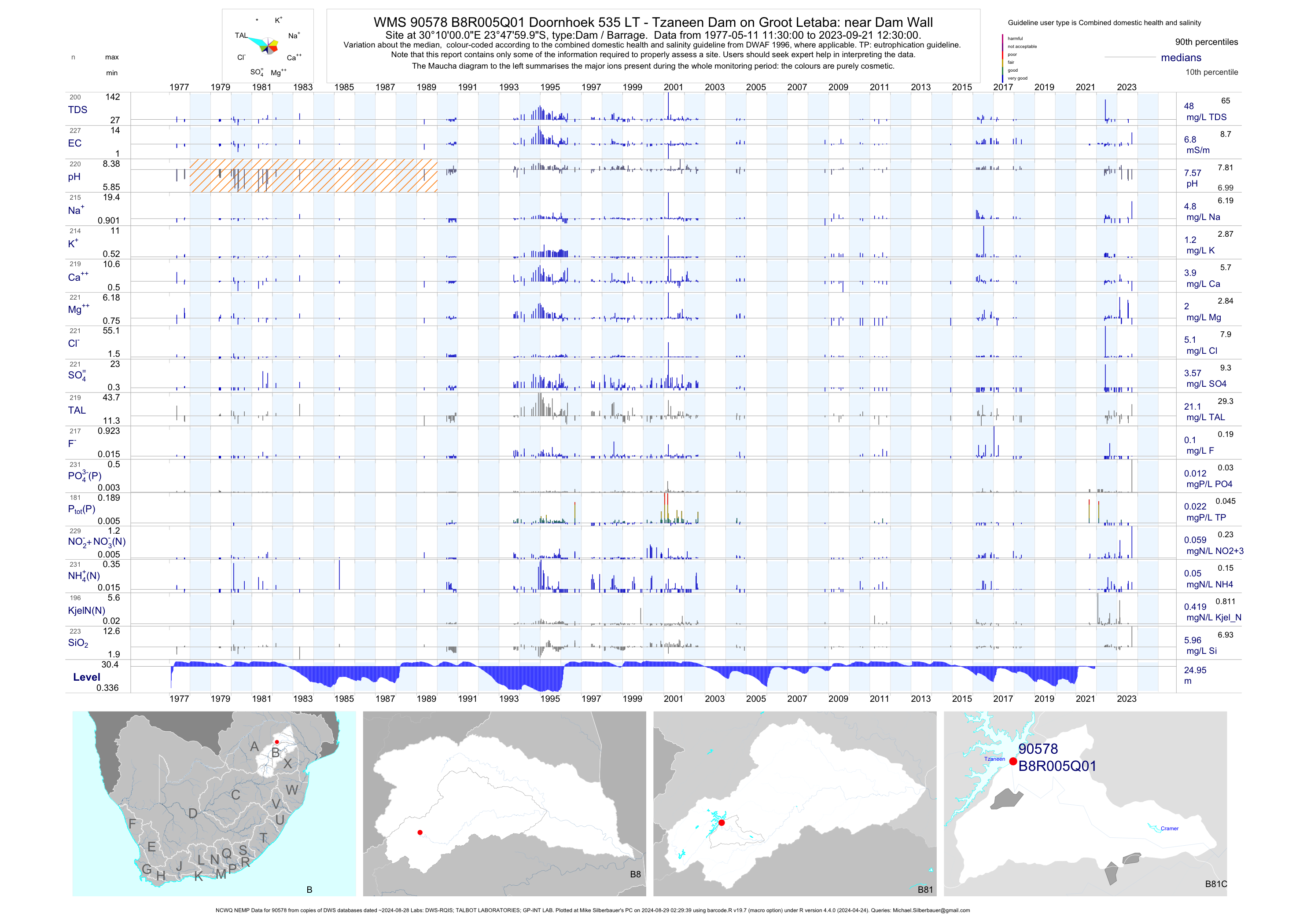
| B81 90578 | plot | data | Doornhoek 535 LT - Tzaneen Dam on Groot Letaba: near Dam Wall (NCWQ NEMP) Q01 | Dam / Barrage | 1287 | 1977-05-11 | 2018-05-11 | 7 | B8R005 | -23.80000 | 30.16667 |
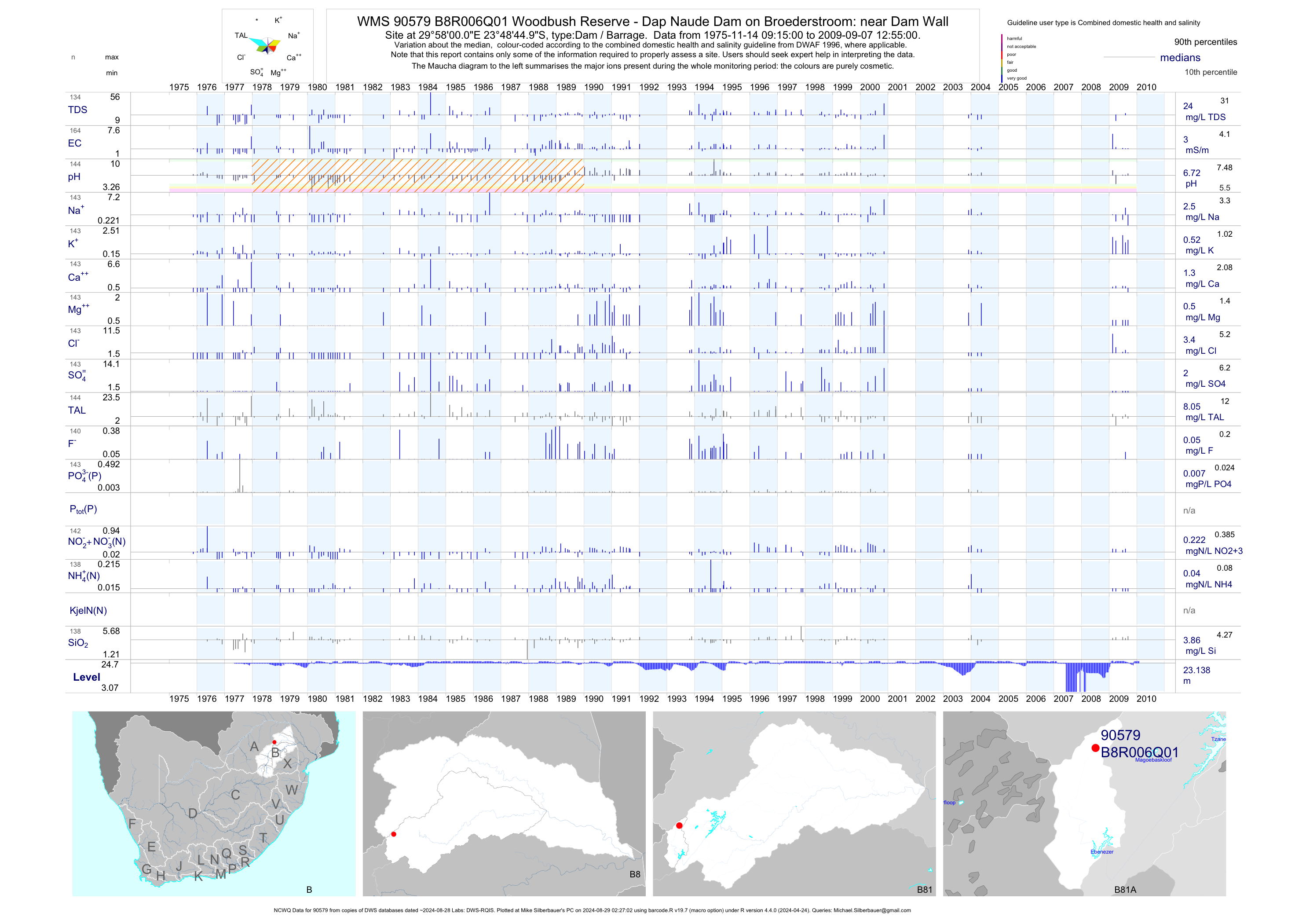
| B81 90579 | plot | data | Woodbush Reserve - Dap Naude Dam on Broederstroom: near Dam Wall (NCWQ) Q01 | Dam / Barrage | 166 | 1975-11-14 | 2009-09-07 | 3 | B8R006 | -23.81250 | 29.96667 |
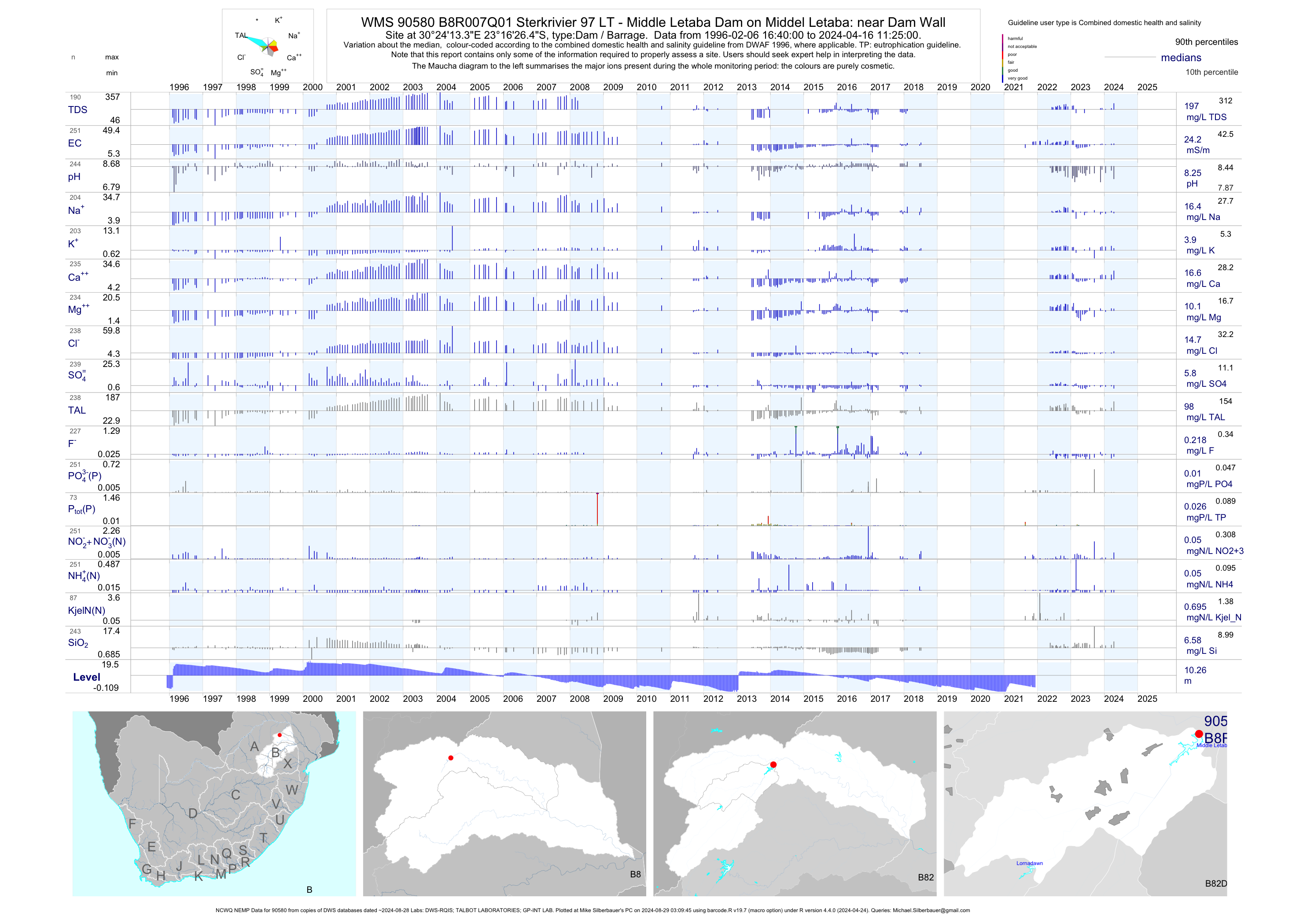
| B82 90580 | plot | data | Sterkrivier 97 LT - Middle Letaba Dam on Middel Letaba: near Dam Wall (NCWQ NEMP) Q01 | Dam / Barrage | 1421 | 1996-02-06 | 2018-08-07 | 24 | B8R007 | -23.27400 | 30.40370 |
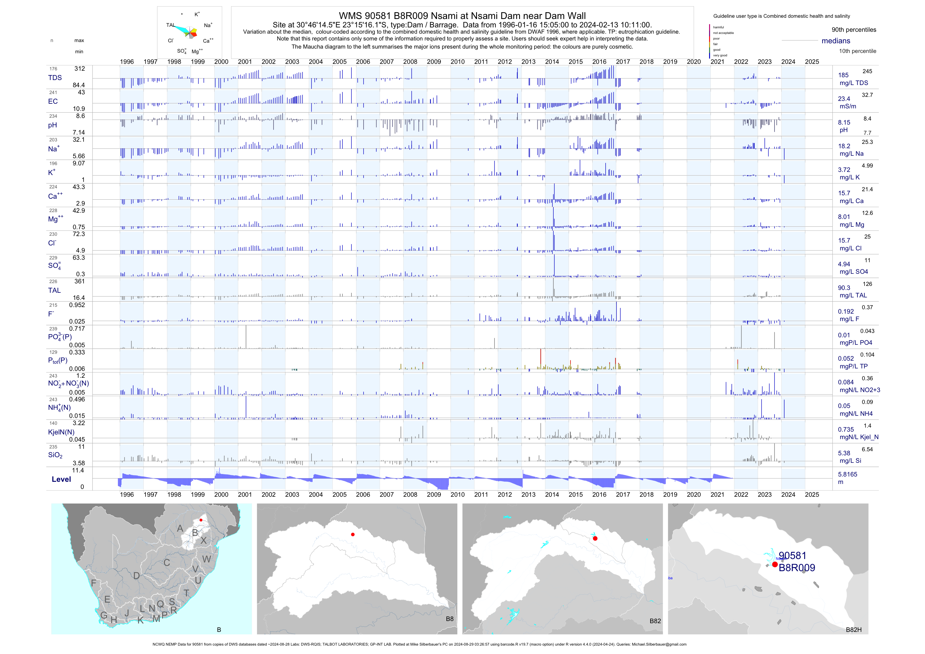
| B82 90581 | plot | data | Nsami at Nsami Dam near Dam Wall (NCWQ NEMP) Q01 | Dam / Barrage | 696 | 1996-01-16 | 2018-08-07 | 24 | B8R009 | -23.25450 | 30.77072 |
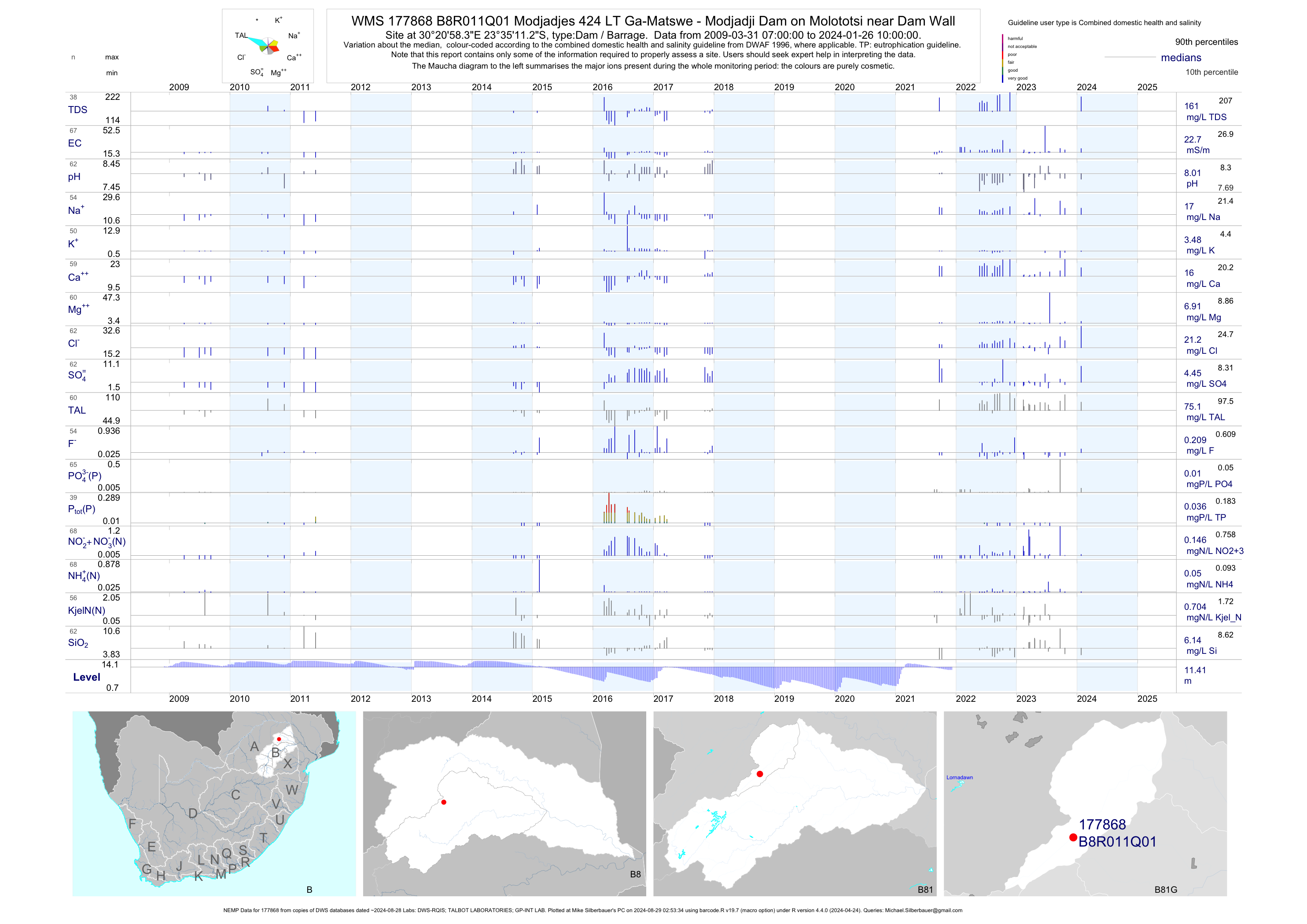
| B81 177868 | plot | data | Modjadjes 424 LT Ga-Matswe - Modjadji Dam on Molototsi near Dam Wall (NEMP) Q01 | Dam / Barrage | 224 | 2009-03-31 | 2018-09-21 | 22 | B8R011 | -23.58646 | 30.34954 |
| B82 185112 | plot | data | Pallakop Irrigation Dam Extraction Point (nmmp) | Dam / Barrage | 963 | 2001-11-06 | 2009-12-22 | n/a | 185112 | -23.29950 | 30.53200 |
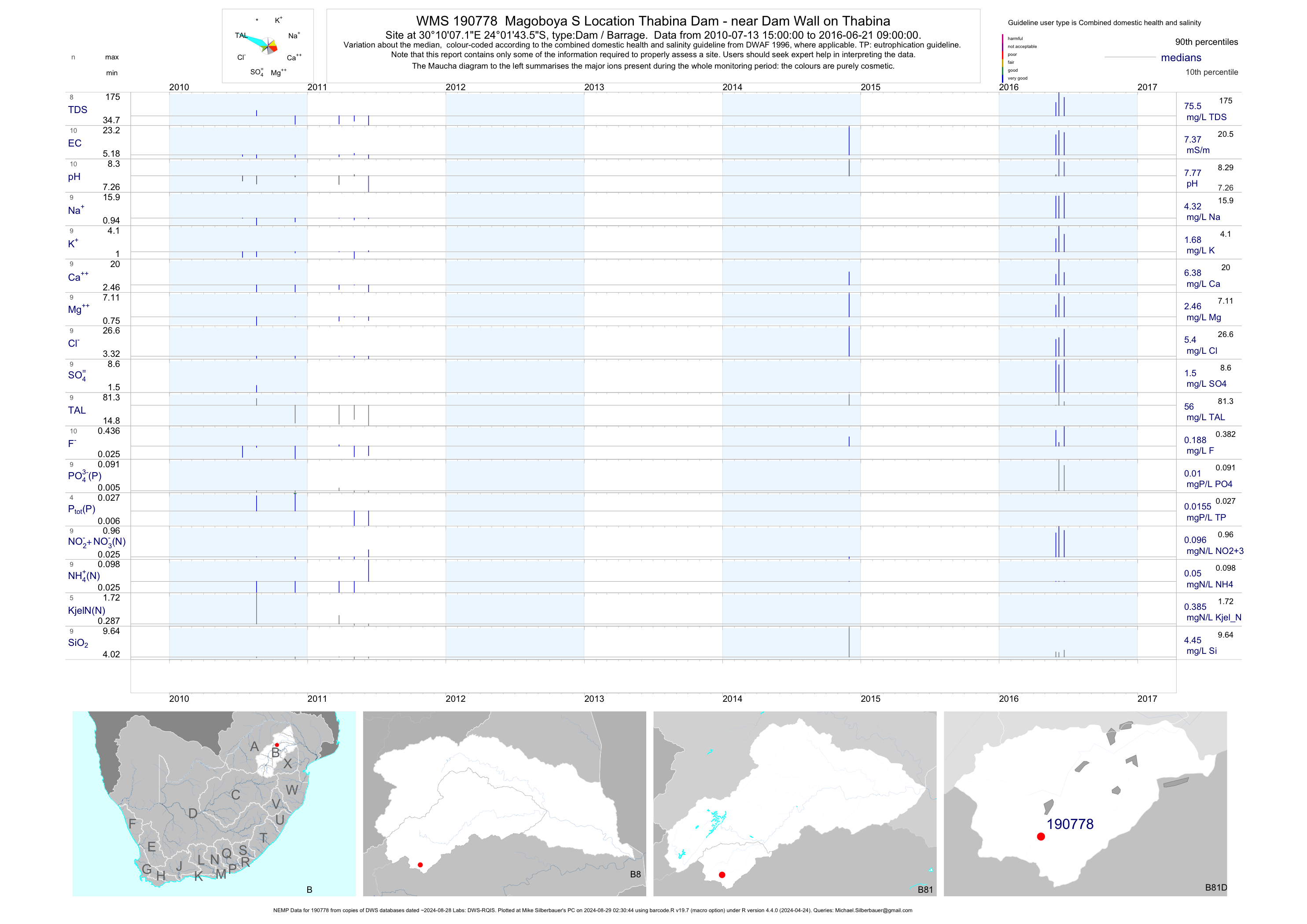
| B81 190778 | plot | data | Magoboya S Location Thabina Dam - near Dam Wall on Thabina (NEMP) | Dam / Barrage | 31 | 2010-07-13 | 2018-05-08 | 7 | 190778 | -24.02877 | 30.16866 |
| A92 184190 | plot | data | Tonondwe - MP02 (dup name 31293) | Spring/Eye | 1 | 2001-05-17 | 2001-05-17 | 31 | 77 | -22.87722 | 30.25667 |
| A92 184194 | plot | data | Tonondwe - MT006 (dup name 31295) | Spring/Eye | 1 | 2001-05-17 | 2001-05-17 | 38 | 78 | -22.87389 | 30.25972 |
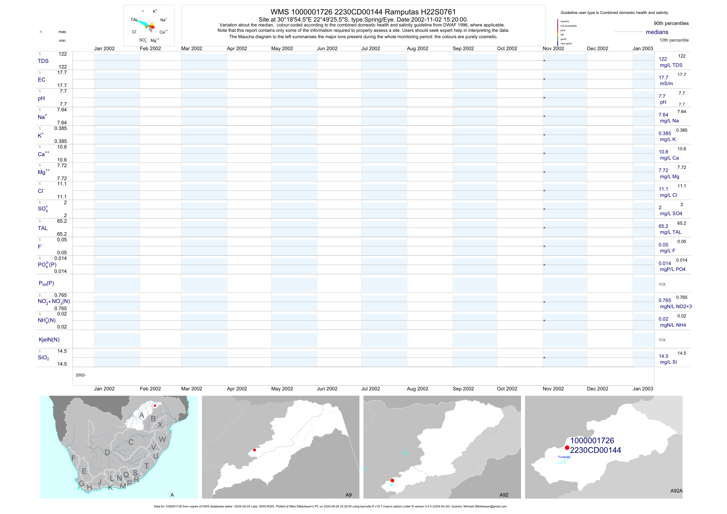
| A92 1000001726 | plot | data | Ramputas H22S0761 | Spring/Eye | 2 | 2002-11-02 | 2002-11-02 | 18 | 144 | -22.82376 | 30.31515 |
| A91 1000001744 | plot | data | Chibase H20S0921 | Spring/Eye | 2 | 2003-01-08 | 2003-01-08 | 10 | 146 | -22.97229 | 30.33396 |
| A92 1000007192 | plot | data | Ramputas H20S1074 | Spring/Eye | 2 | 2003-11-06 | 2003-11-06 | 20 | 155 | -22.82814 | 30.48669 |
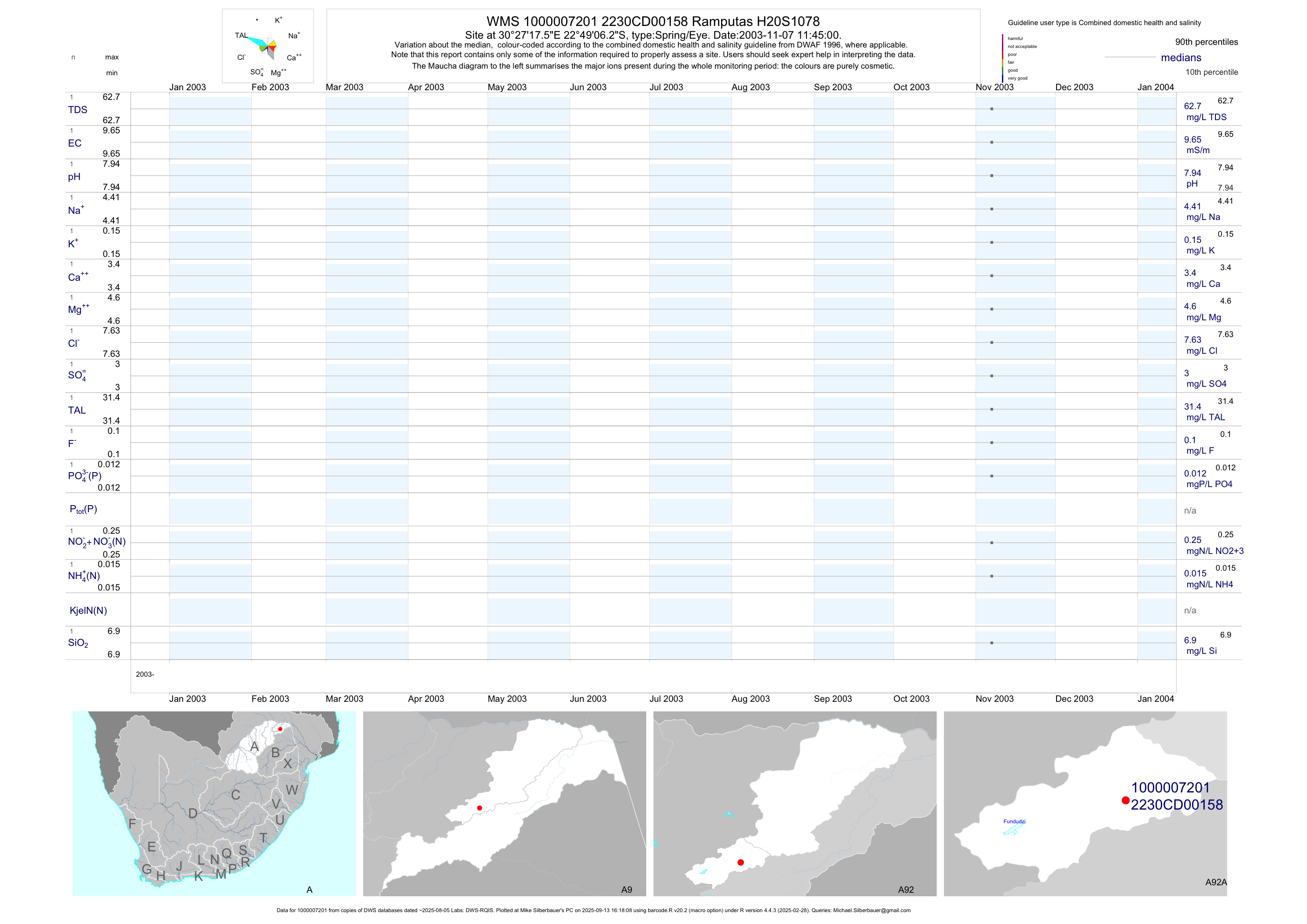
| A92 1000007201 | plot | data | Ramputas H20S1078 | Spring/Eye | 2 | 2003-11-07 | 2003-11-07 | 10 | 158 | -22.81839 | 30.45487 |
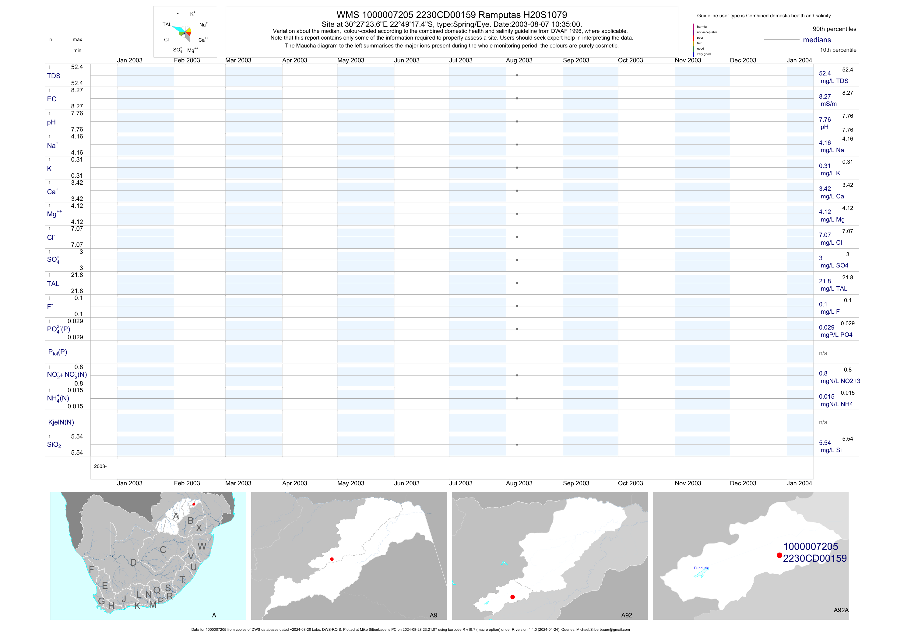
| A92 1000007205 | plot | data | Ramputas H20S1079 | Spring/Eye | 2 | 2003-08-07 | 2003-11-07 | 8 | 159 | -22.82151 | 30.45656 |
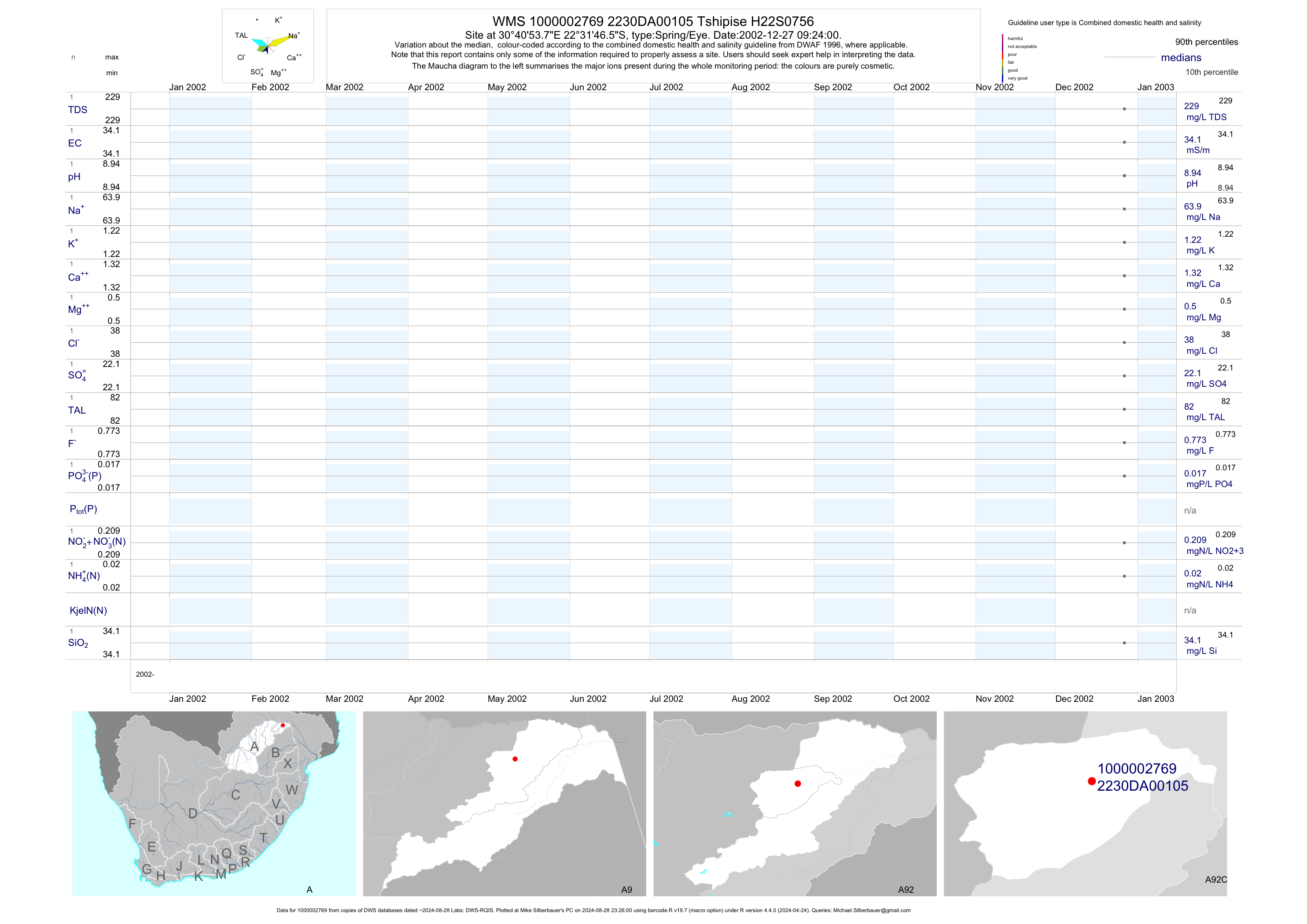
| A92 1000002769 | plot | data | Tshipise H22S0756 | Spring/Eye | 2 | 2002-12-27 | 2002-12-27 | 34 | 105 | -22.52959 | 30.68160 |
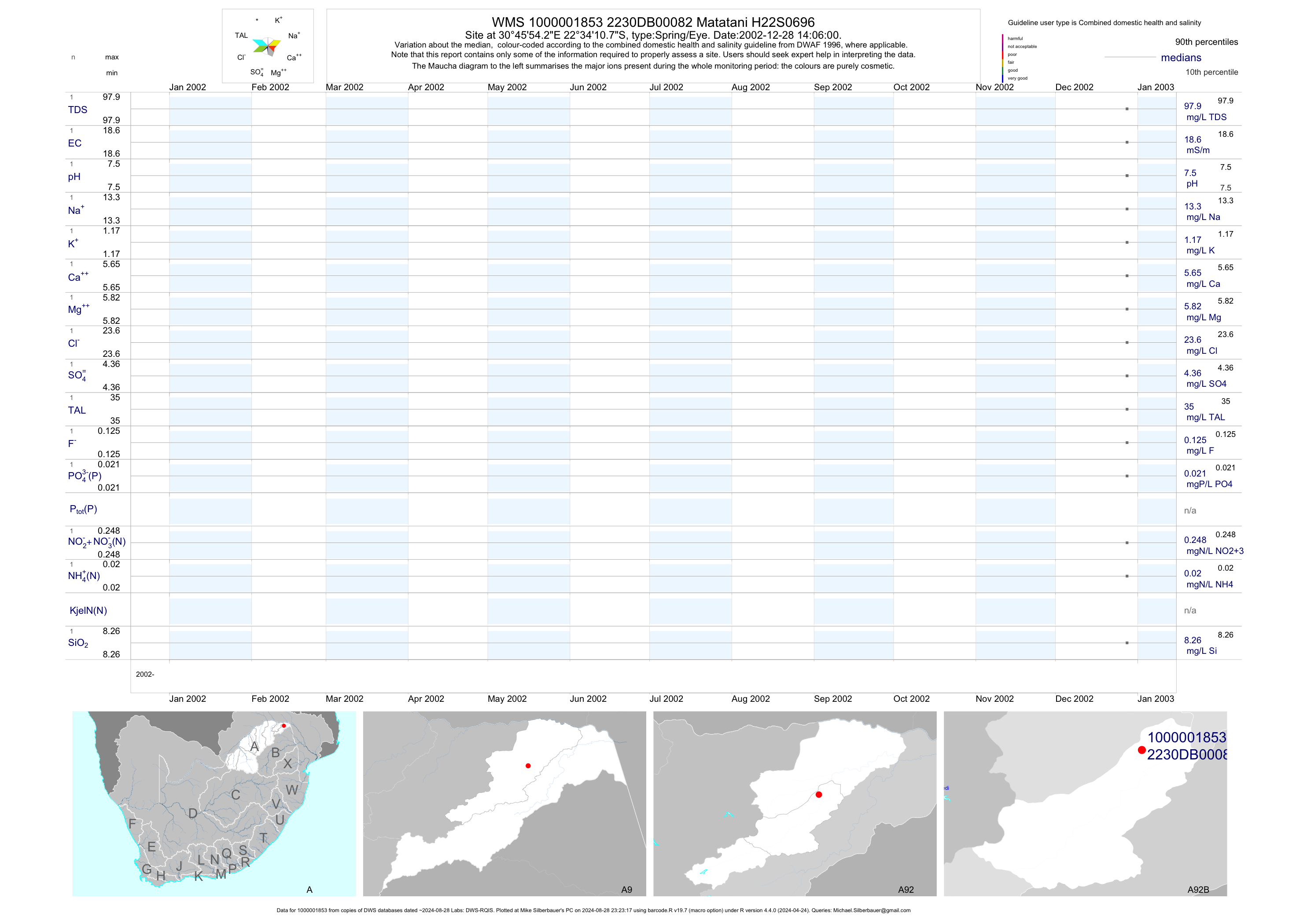
| A92 1000001853 | plot | data | Matatani H22S0696 | Spring/Eye | 2 | 2002-12-28 | 2002-12-28 | 19 | 82 | -22.56966 | 30.76507 |
| A91 1000007325 | plot | data | Thondoni H20S1126 | Spring/Eye | 2 | 2003-12-12 | 2003-12-12 | 7 | 98 | -22.70792 | 30.76401 |
| A91 187038 | plot | data | Mphaphuli H200846 | Spring/Eye | 2 | 2002-11-20 | 2002-11-20 | 46 | 436 | -22.92667 | 30.52527 |
| A91 1000001740 | plot | data | Paswanes H20S0907 | Spring/Eye | 2 | 2002-12-13 | 2002-12-13 | 32 | 438 | -22.79020 | 30.72548 |
| A91 1000001742 | plot | data | Paswanes H20S0908 | Spring/Eye | 2 | 2002-12-13 | 2002-12-13 | 20 | 439 | -22.79582 | 30.71538 |
| A91 1000003257 | plot | data | Chibase H20S0905 | Spring/Eye | 2 | 2003-02-14 | 2003-02-14 | 9 | 441 | -22.80333 | 30.56722 |
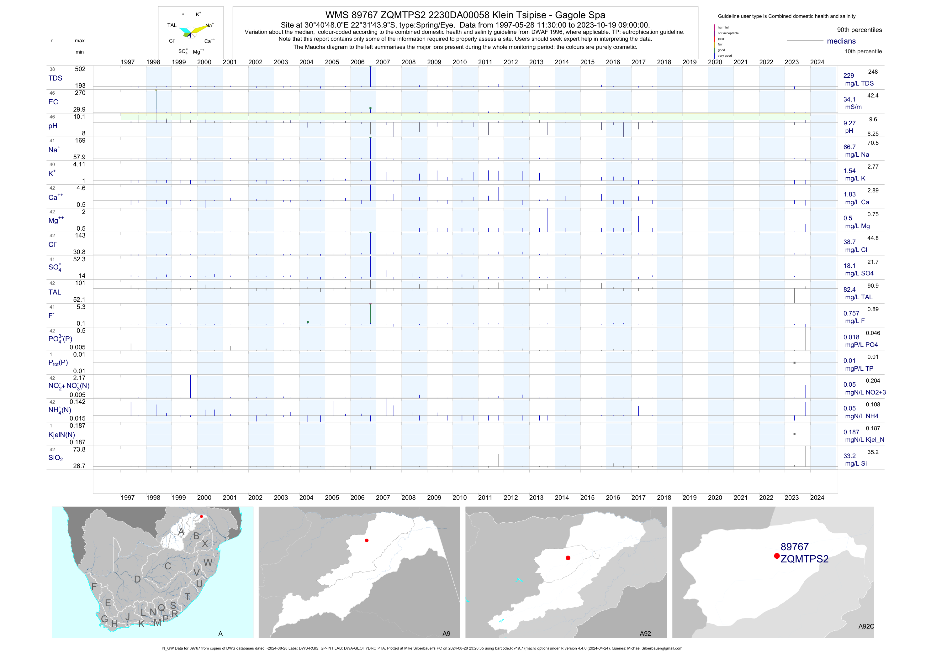
| A92 89767 | plot | data | 2230DA00058 Klein Tsipise - Gagole Spa (N_GW) | Spring/Eye | 47 | 1997-05-28 | 2017-10-23 | 34 | ZQMTPS2 | -22.52889 | 30.68000 |
| B82 1000009607 | plot | data | Mapaana H07F1221 | Spring/Eye | 2 | 2004-06-10 | 2004-06-10 | 18 | 11 | -23.63277 | 30.23666 |
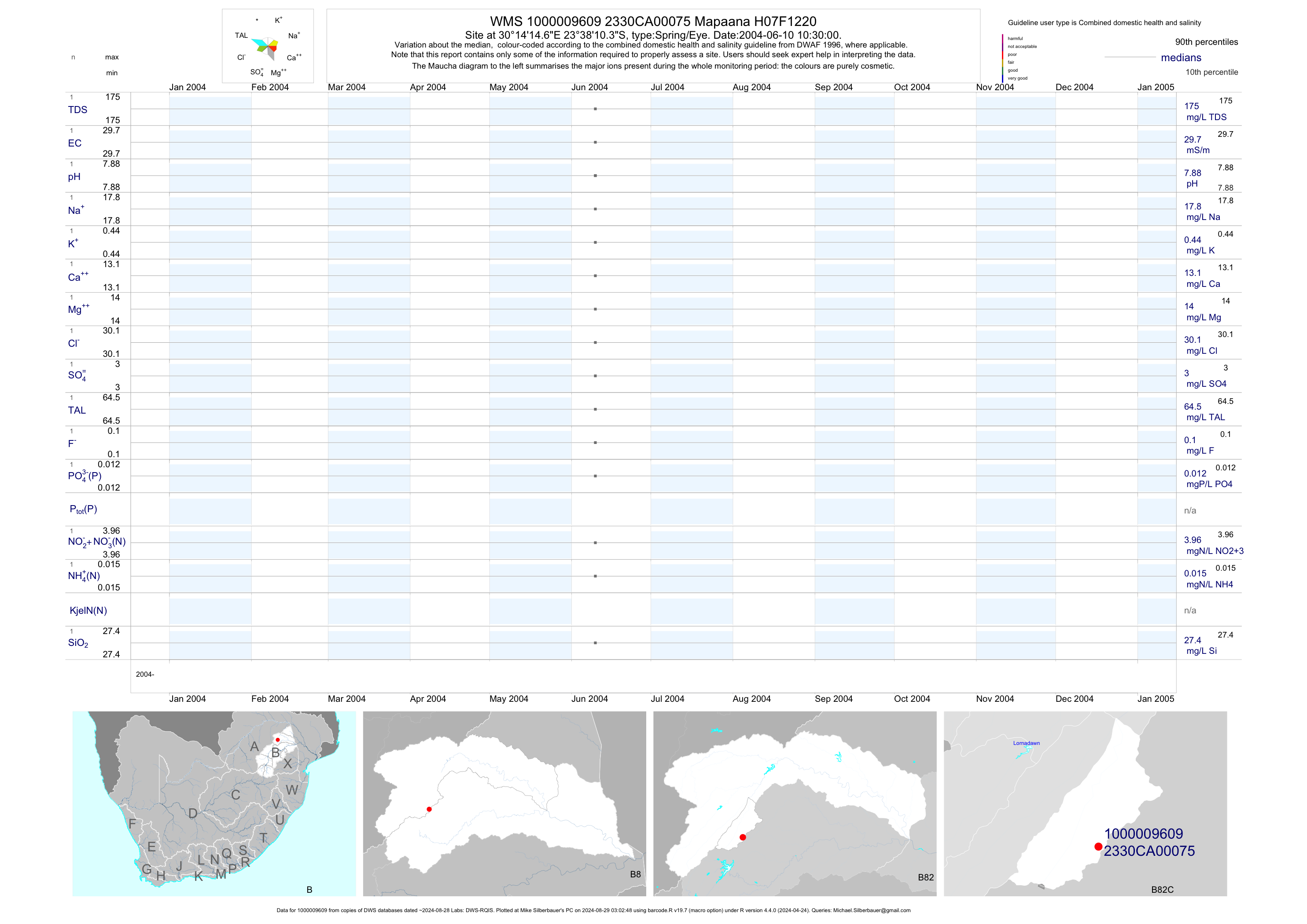
| B82 1000009609 | plot | data | Mapaana H07F1220 | Spring/Eye | 2 | 2004-06-10 | 2004-06-10 | 30 | 75 | -23.63622 | 30.23741 |
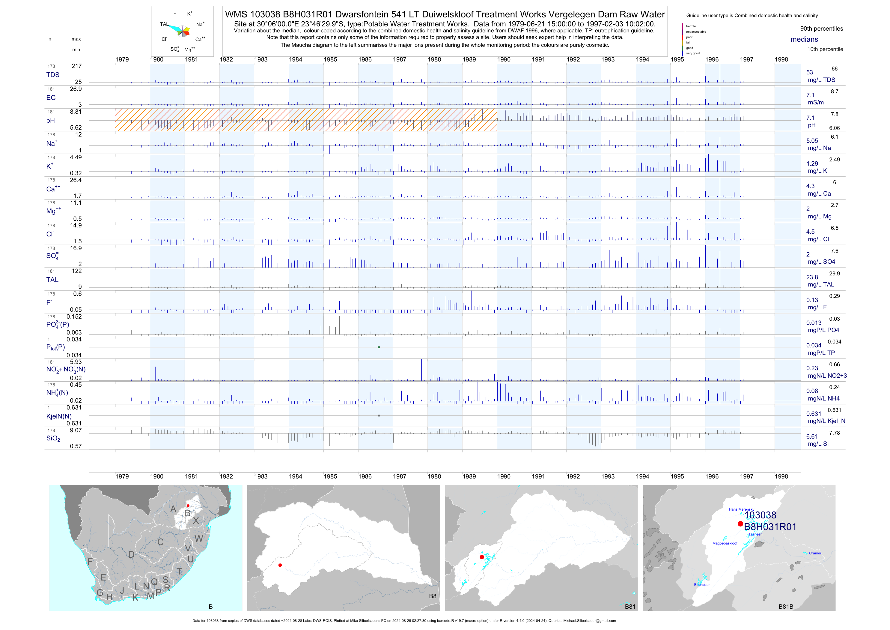
| B81 103038 | plot | data | Dwarsfontein 541 LT Duiwelskloof Treatment Works Vergelegen Dam Raw Water | Potable Water Treatment Works | 428 | 1979-06-21 | 1997-02-03 | 7 | B8H031 | -23.77500 | 30.10000 |
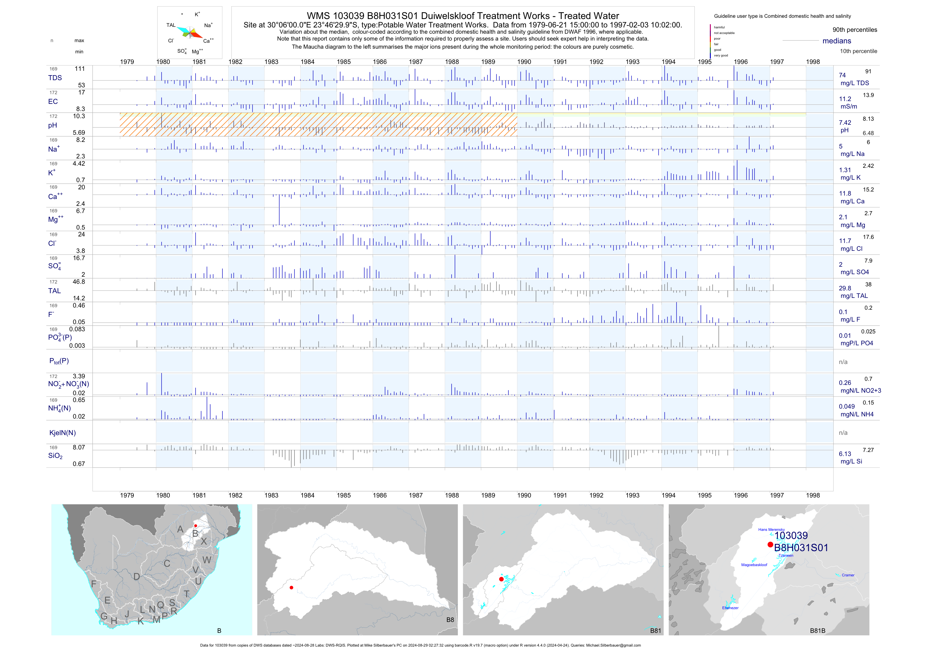
| B81 103039 | plot | data | Duiwelskloof Treatment Works - Treated Water | Potable Water Treatment Works | 399 | 1979-06-21 | 1997-02-03 | 11 | B8H031 | -23.77500 | 30.10000 |
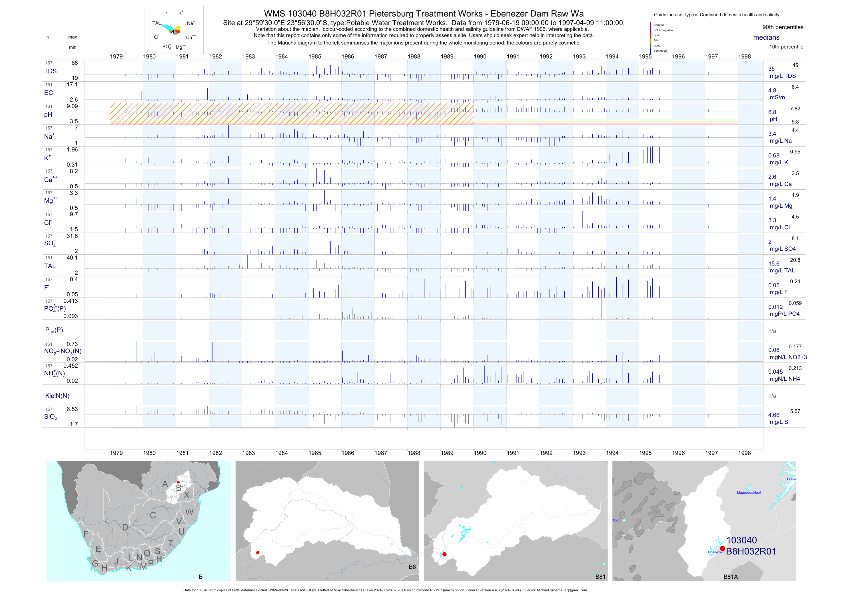
| B81 103040 | plot | data | Pietersburg Treatment Works - Ebenezer Dam Raw Wa | Potable Water Treatment Works | 342 | 1979-06-19 | 1997-04-09 | 5 | B8H032 | -23.94167 | 29.99167 |
| B81 103041 | plot | data | Pietersburg Treatment Works - Treated Water | Potable Water Treatment Works | 332 | 1979-06-19 | 1997-04-08 | 7 | B8H032 | -23.94167 | 29.99167 |
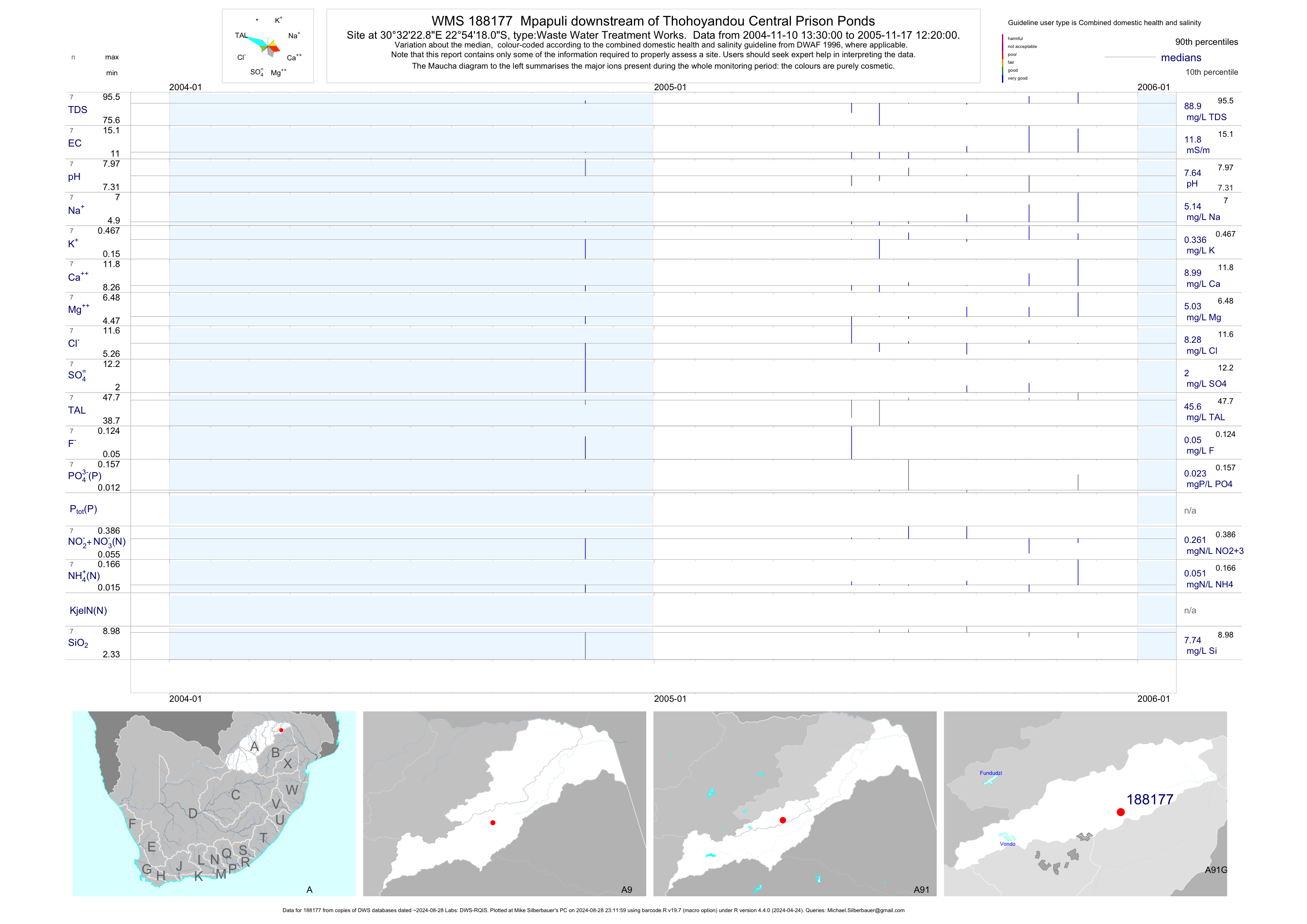
| A91 188177 | plot | data | Mpapuli downstream of Thohoyandou Central Prison Ponds | Waste Water Treatment Works | 27 | 2004-11-10 | 2005-11-17 | 12 | 188177 | -22.90500 | 30.53967 |
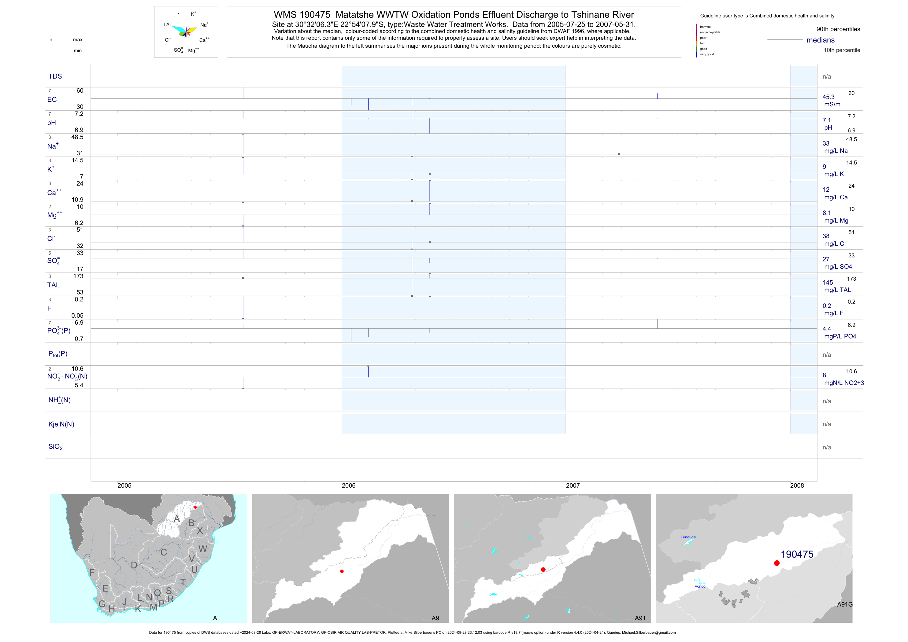
| A91 190475 | plot | data | Matatshe WWTW Oxidation Ponds Effluent Discharge to Tshinane River | Waste Water Treatment Works | 19 | 2005-07-25 | 2007-05-31 | 45 | 190475 | -22.90221 | 30.53509 |
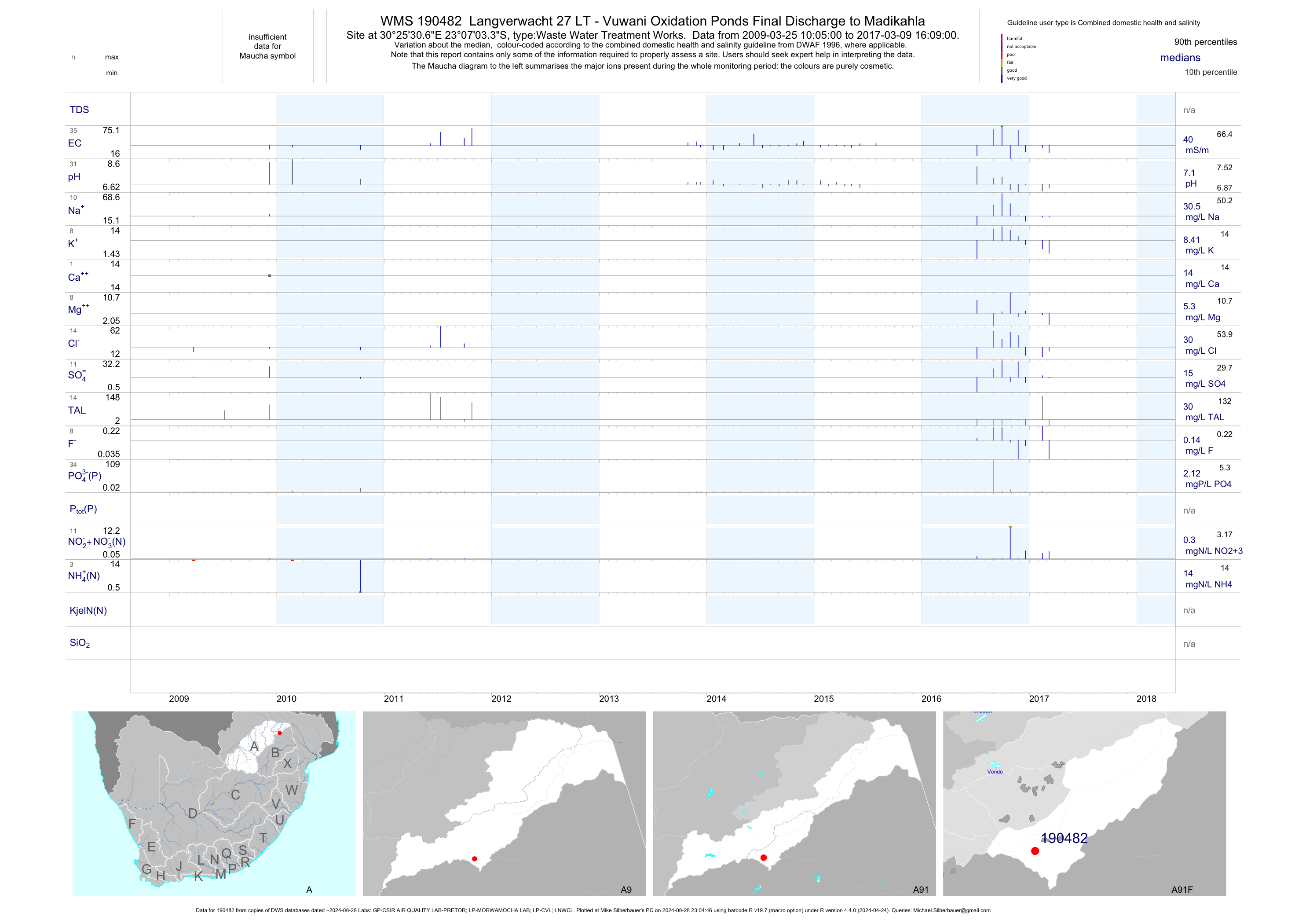
| A91 190482 | plot | data | Langverwacht 27 LT - Vuwani Oxidation Ponds Final Discharge to Madikahla | Waste Water Treatment Works | 72 | 2009-03-25 | 2017-03-09 | 40 | 190482 | -23.11758 | 30.42519 |
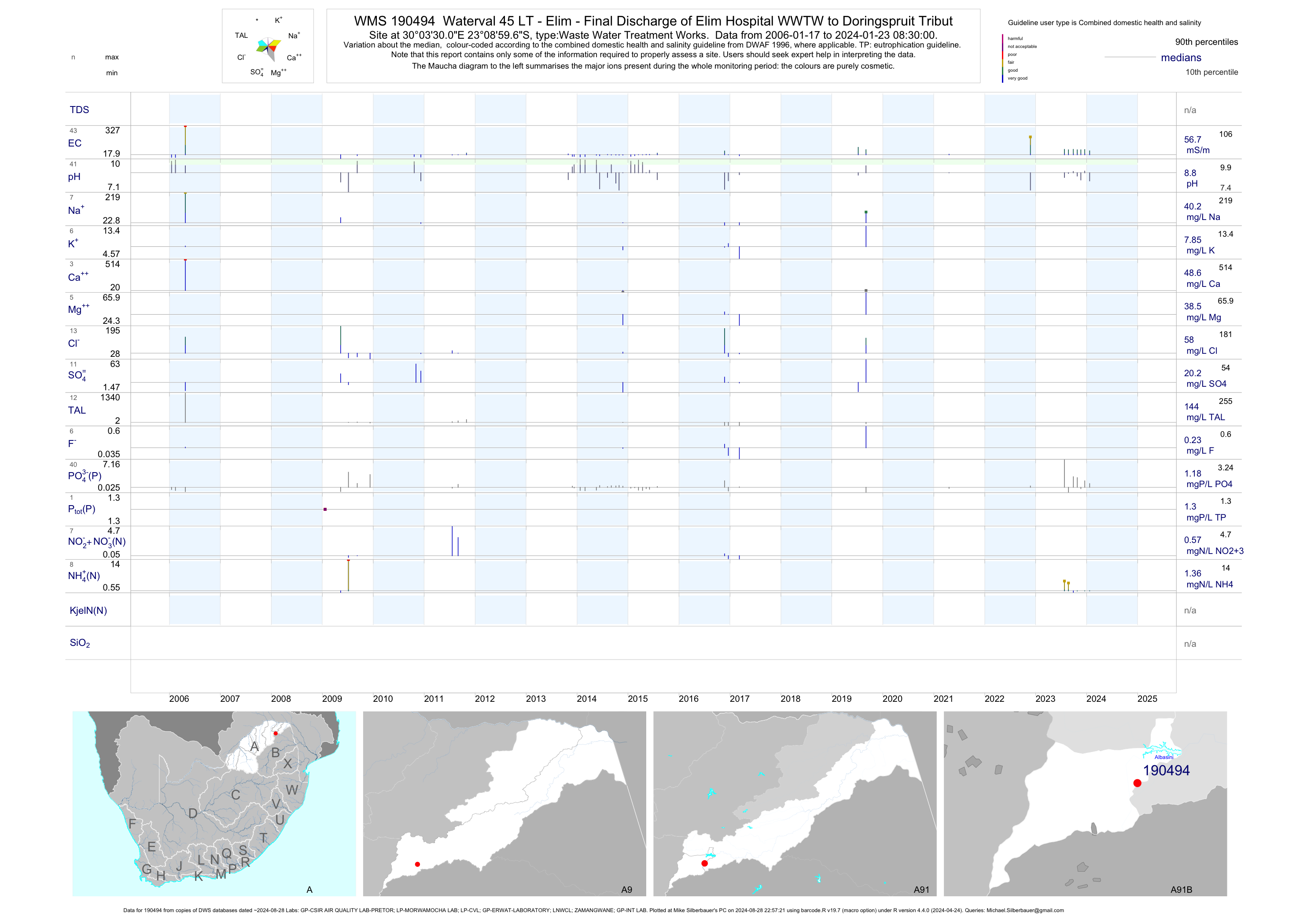
| A91 190494 | plot | data | Waterval 45 LT - Elim - Final Discharge of Elim Hospital WWTW to Doringspruit Tribut | Waste Water Treatment Works | 72 | 2006-01-17 | 2017-03-09 | 53 | 190494 | -23.14989 | 30.05836 |
| A91 190871 | plot | data | Weltevreden 23 LT - Final Effluent Discharge from Vuwani Military Base WWTW | Waste Water Treatment Works | 80 | 2009-01-21 | 2017-03-09 | 31 | 190871 | -23.06544 | 30.39408 |
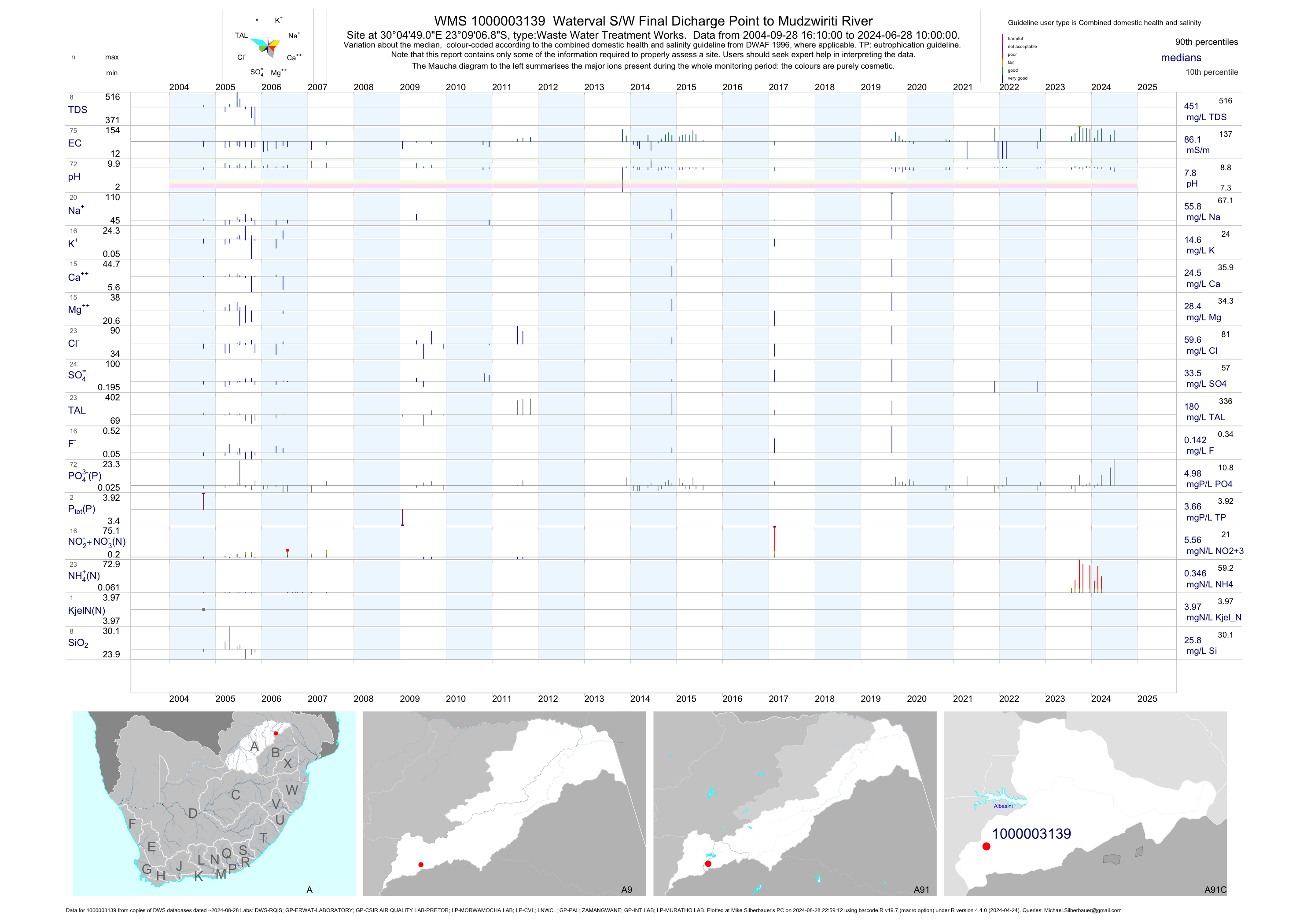
| A91 1000003139 | plot | data | Waterval S/W Final Dicharge Point to Mudzwiriti River | Waste Water Treatment Works | 141 | 2004-09-28 | 2017-03-07 | 72 | 1-3139 | -23.15190 | 30.08030 |
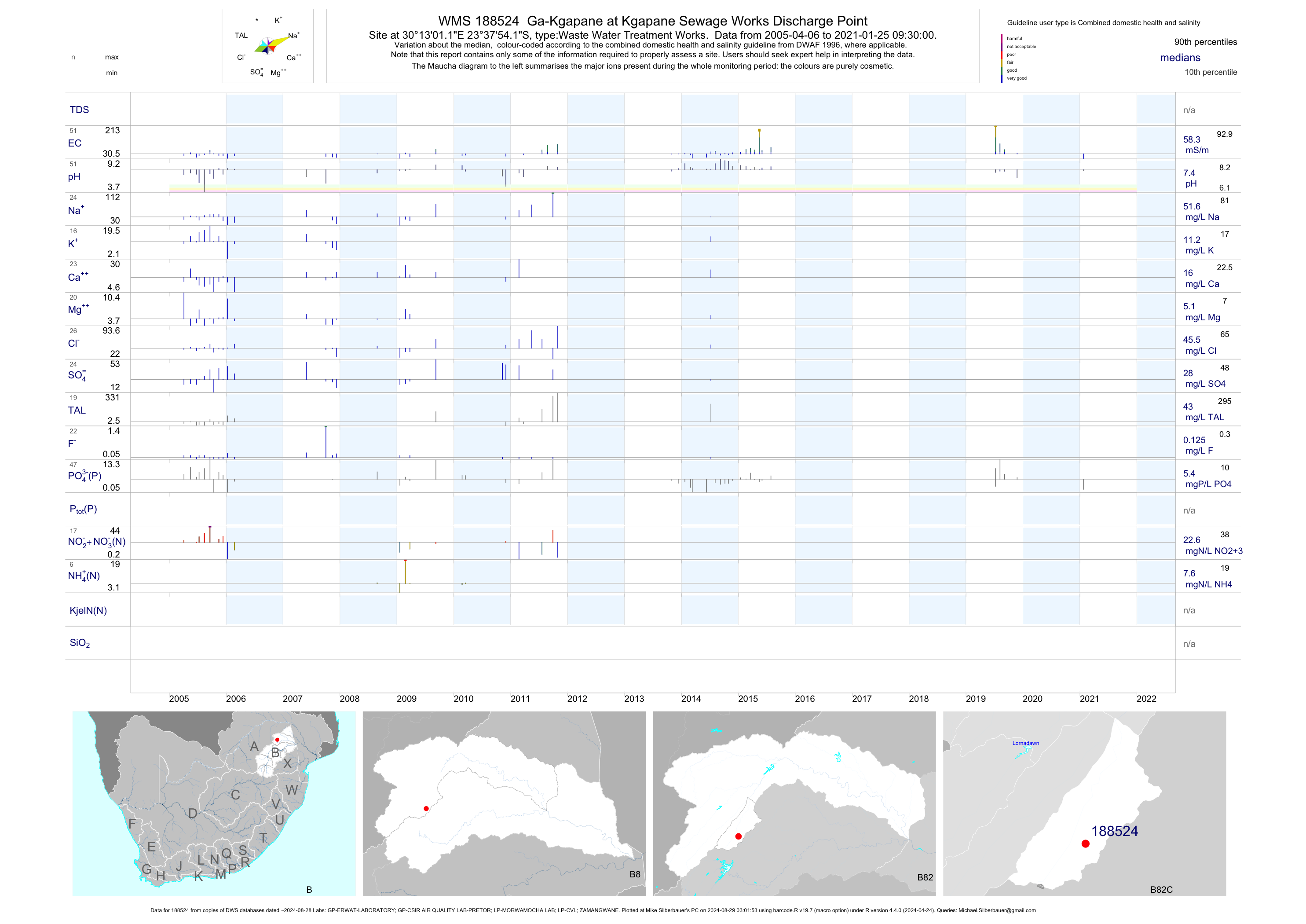
| B82 188524 | plot | data | Ga-Kgapane at Kgapane Sewage Works Discharge Point | Waste Water Treatment Works | 120 | 2005-04-06 | 2015-07-29 | 56 | 188524 | -23.63171 | 30.21698 |
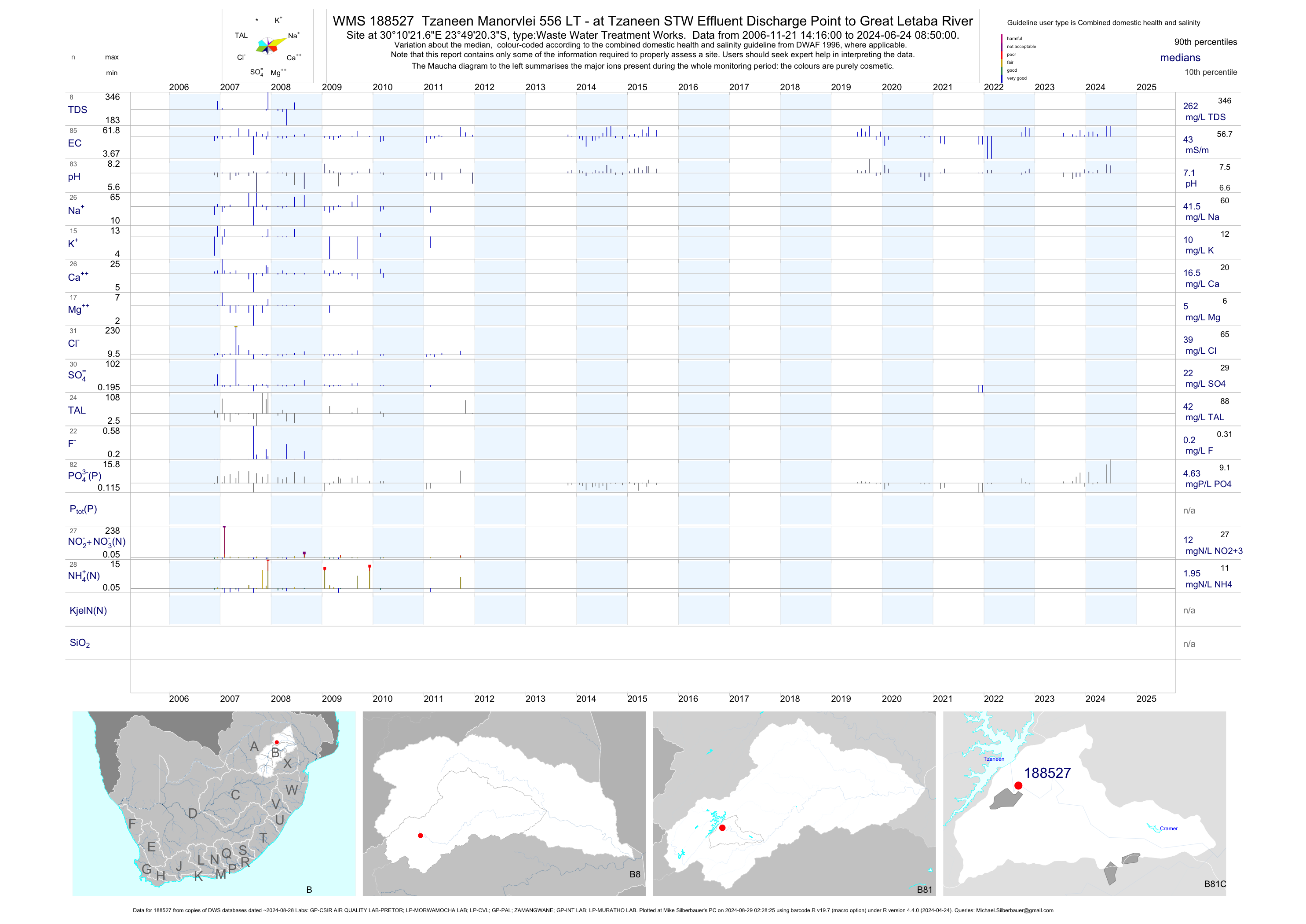
| B81 188527 | plot | data | Tzaneen Manorvlei 556 LT - at Tzaneen STW Effluent Discharge Point to Great Letaba River | Waste Water Treatment Works | 116 | 2006-11-21 | 2015-07-29 | 42 | 188527 | -23.82232 | 30.17268 |
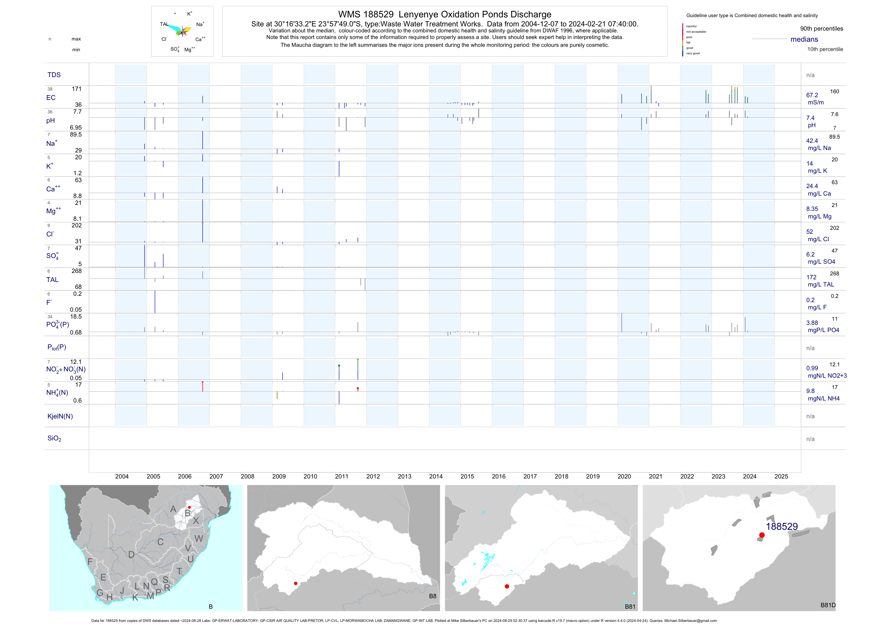
| B81 188529 | plot | data | Lenyenye Oxidation Ponds Discharge | Waste Water Treatment Works | 55 | 2004-12-07 | 2015-07-29 | 58 | 188529 | -23.96362 | 30.27589 |
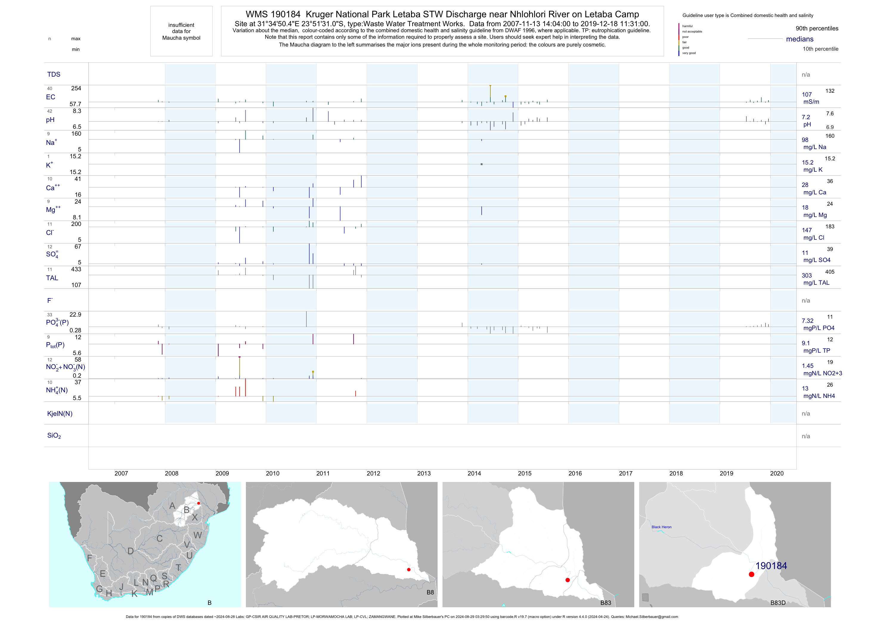
| B83 190184 | plot | data | Kruger National Park Letaba STW Discharge near Nhlohlori River on Letaba Camp | Waste Water Treatment Works | 72 | 2007-11-13 | 2015-07-31 | 105 | 190184 | -23.85861 | 31.58067 |
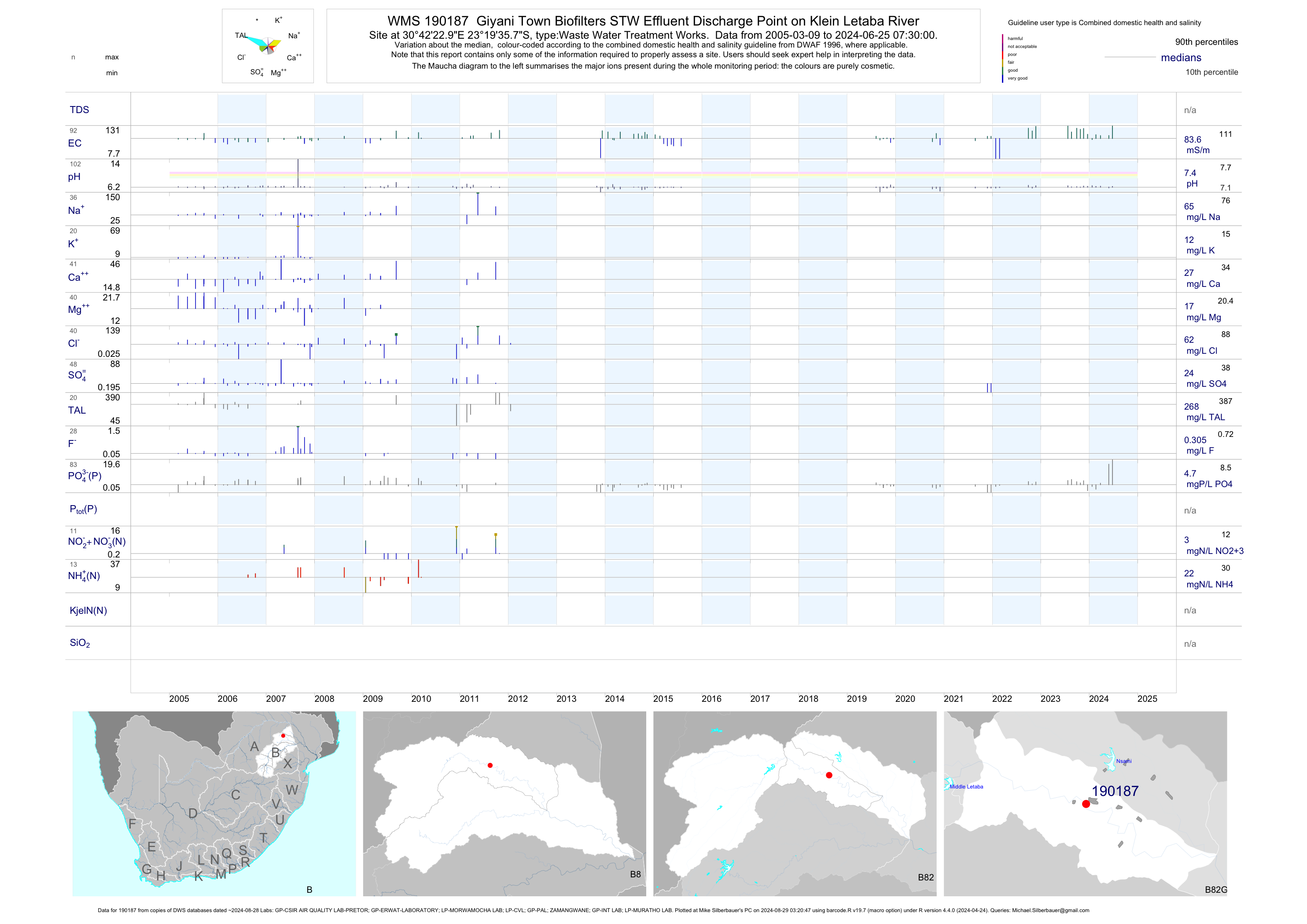
| B82 190187 | plot | data | Giyani Town Biofilters STW Effluent Discharge Point on Klein Letaba River | Waste Water Treatment Works | 179 | 2005-03-09 | 2015-07-29 | 79 | 190187 | -23.32661 | 30.70636 |
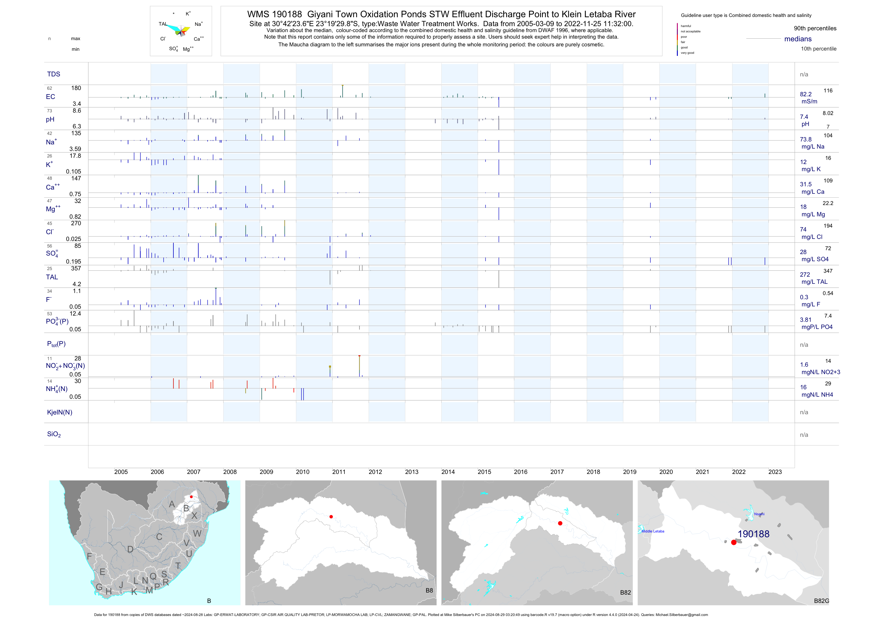
| B82 190188 | plot | data | Giyani Town Oxidation Ponds STW Effluent Discharge Point to Klein Letaba River | Waste Water Treatment Works | 173 | 2005-03-09 | 2015-07-31 | 83 | 190188 | -23.32497 | 30.70656 |
| B90 188495 | plot | data | Kruger National Park Punda Maria Sewage Treatment Works Final Effluent Discharge near Punda Maria Re | Waste Water Treatment Works | 61 | 2007-11-27 | 2015-06-03 | 88 | 188495 | -22.69390 | 31.02523 |
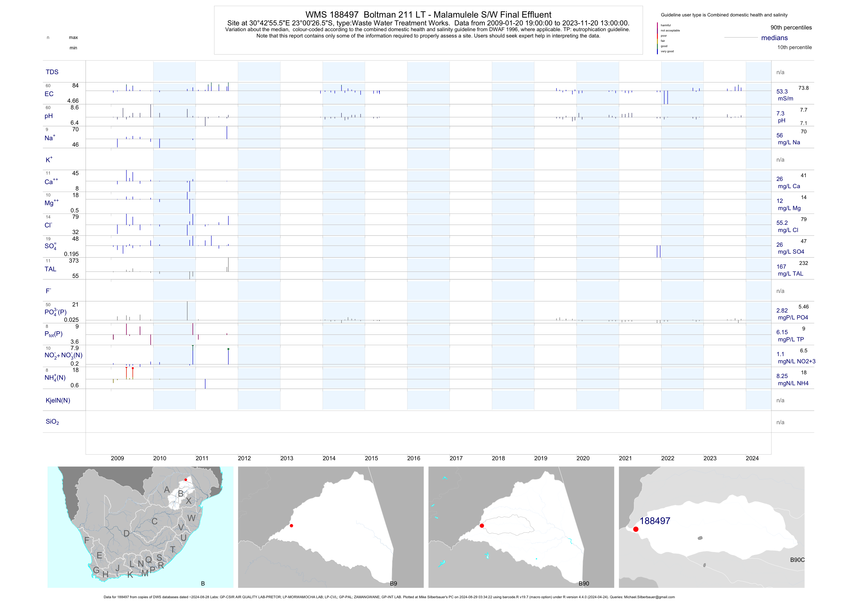
| B90 188497 | plot | data | Boltman 211 LT - Malamulele S/W Final Effluent | Waste Water Treatment Works | 68 | 2009-01-20 | 2015-05-06 | 56 | 188497 | -23.00737 | 30.71543 |
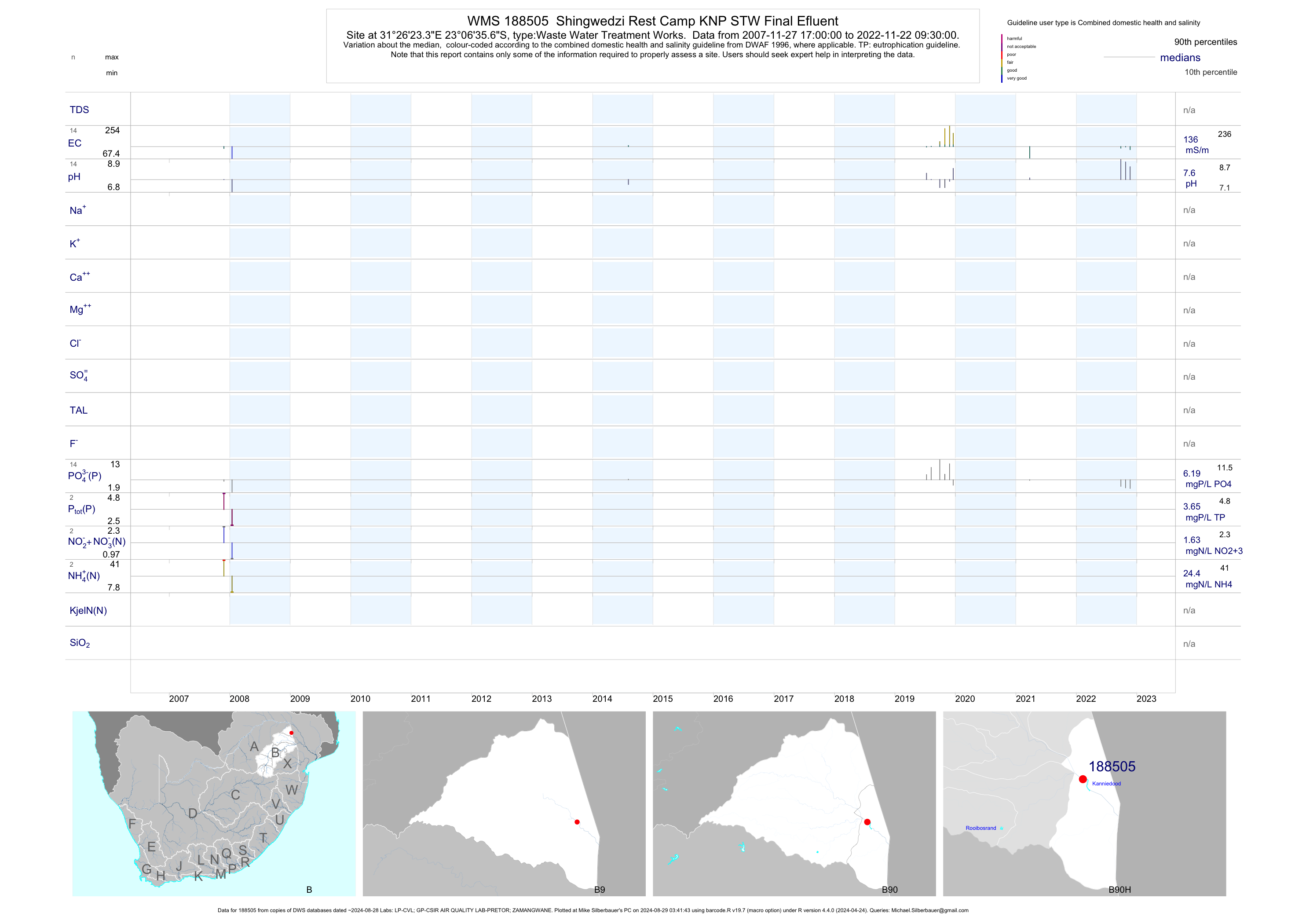
| B90 188505 | plot | data | Shingwedzi Rest Camp KNP STW Final Efluent | Waste Water Treatment Works | 6 | 2007-11-27 | 2014-08-05 | 126 | 188505 | -23.10991 | 31.43981 |
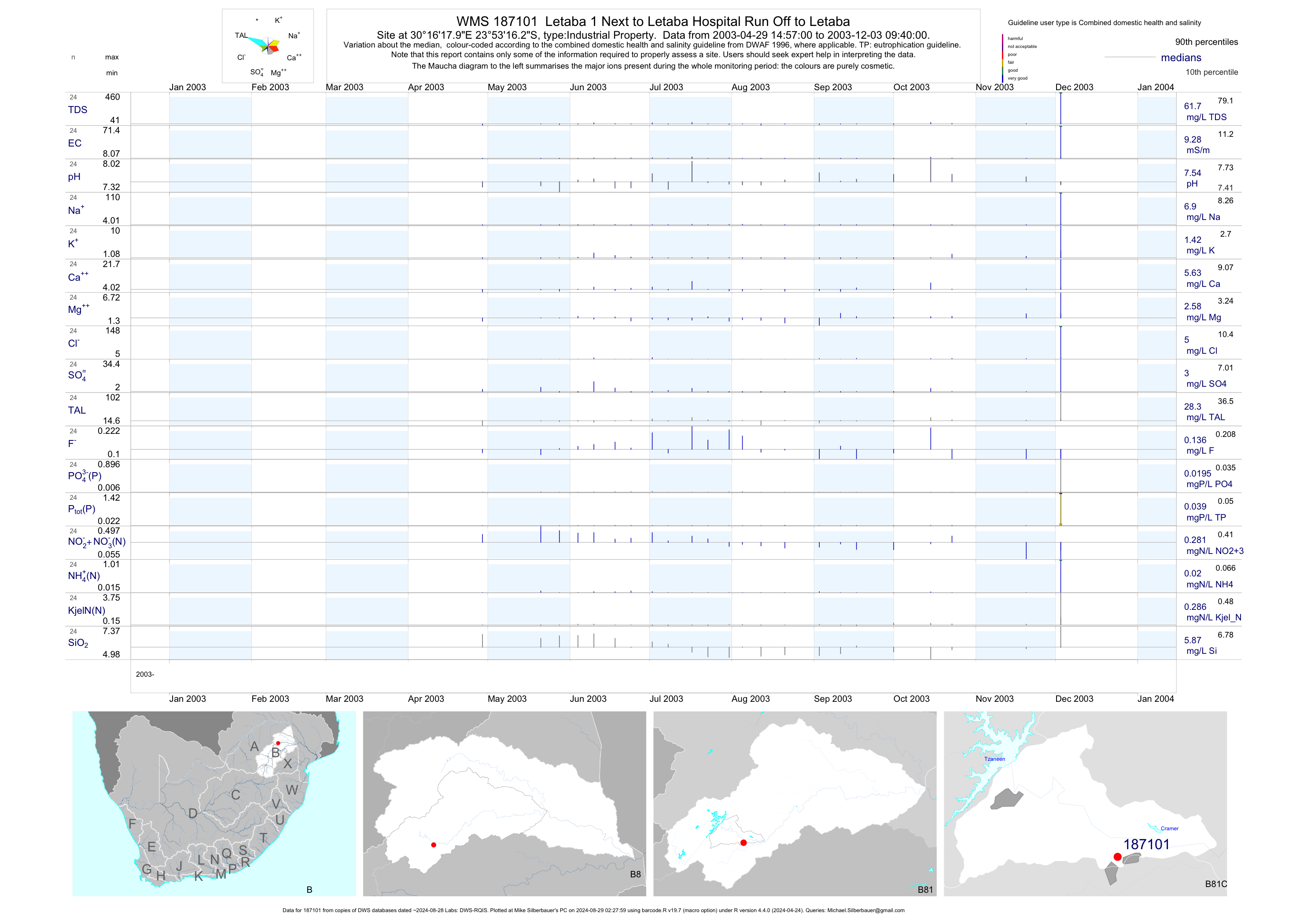
| B81 187101 | plot | data | Letaba 1 Next to Letaba Hospital Run Off to Letaba | Industrial Property | 69 | 2003-04-29 | 2003-12-03 | 9 | 187101 | -23.88785 | 30.27165 |
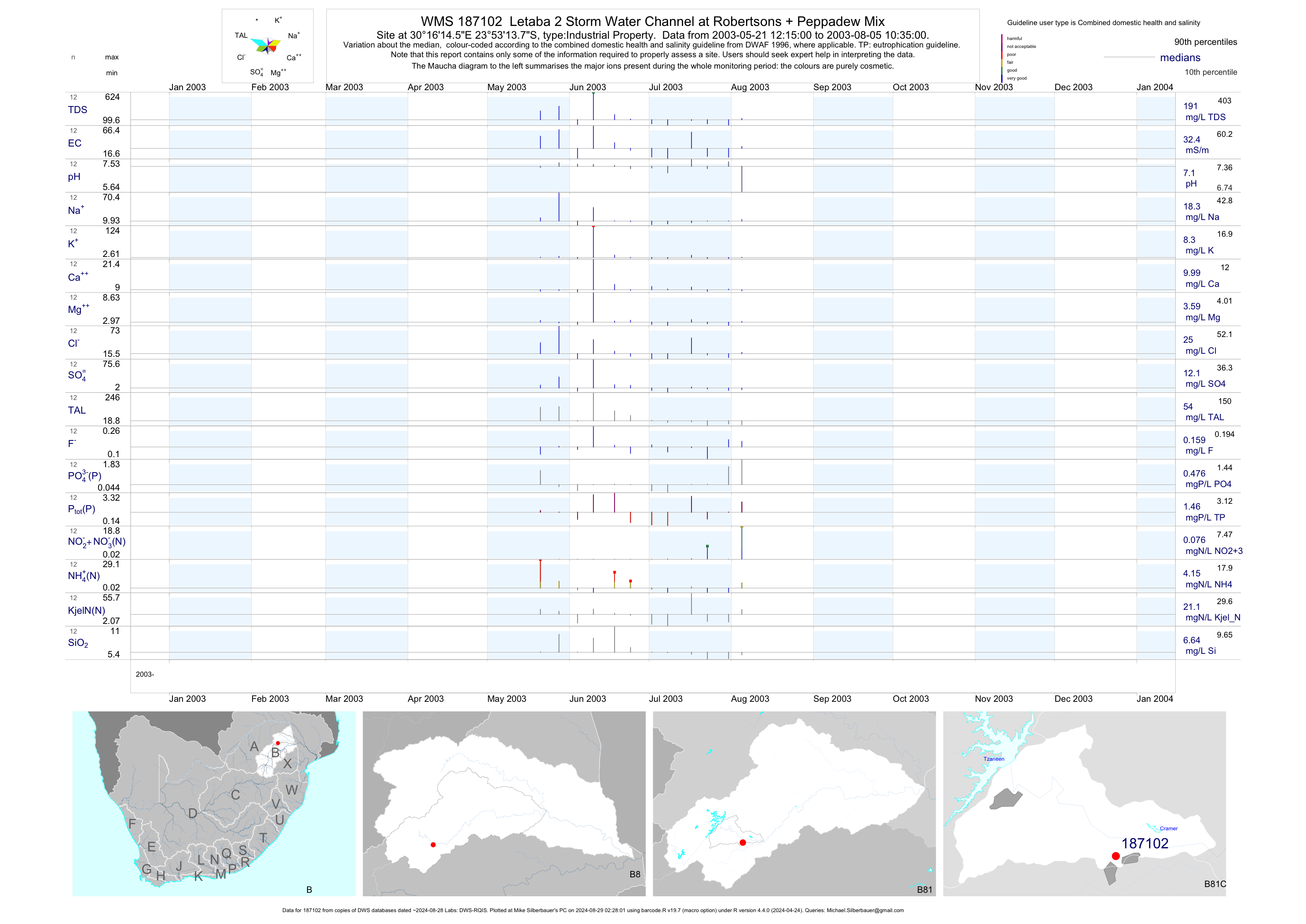
| B81 187102 | plot | data | Letaba 2 Storm Water Channel at Robertsons + Peppadew Mix | Industrial Property | 38 | 2003-04-29 | 2003-08-05 | 32 | 187102 | -23.88715 | 30.27070 |
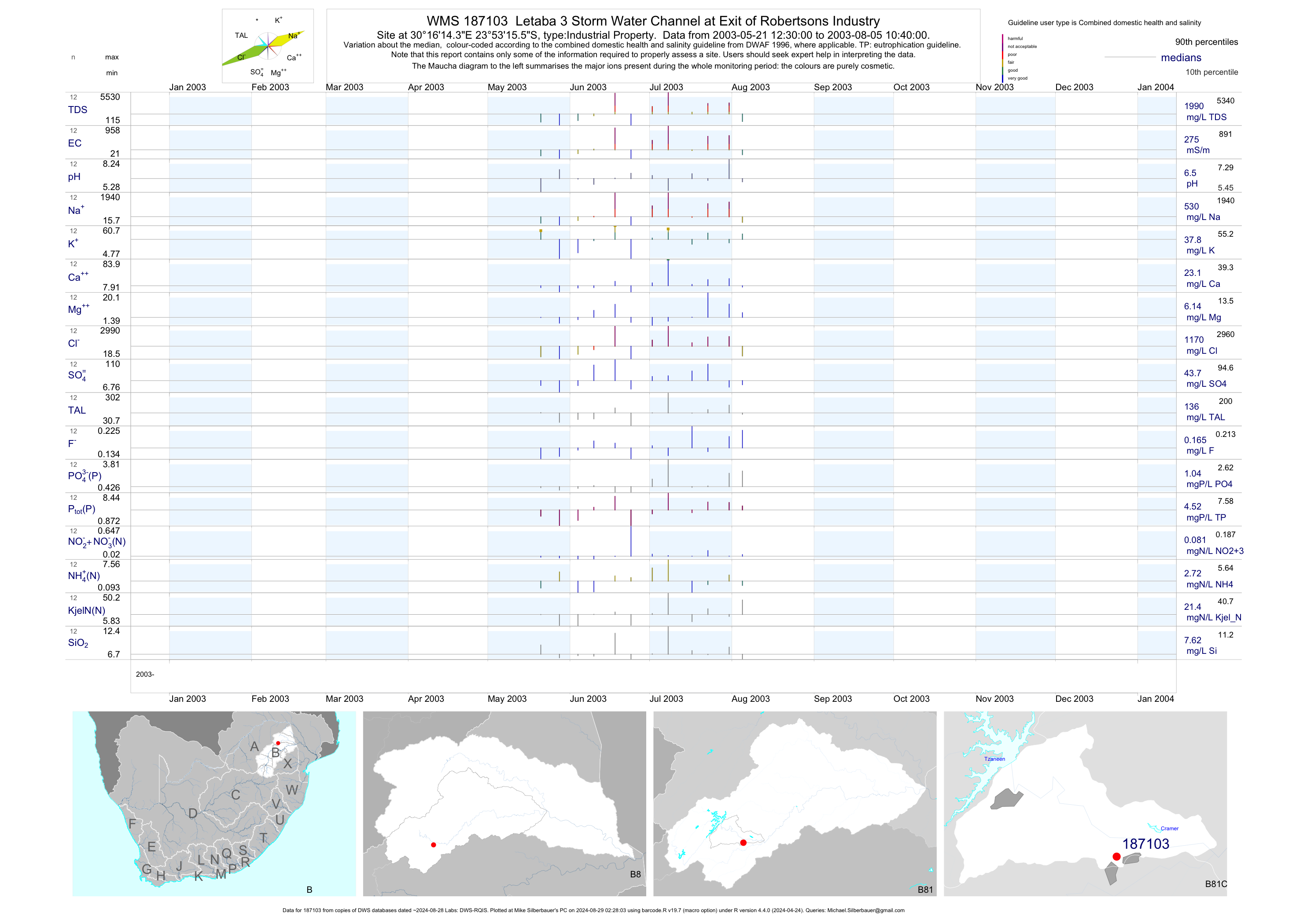
| B81 187103 | plot | data | Letaba 3 Storm Water Channel at Exit of Robertsons Industry | Industrial Property | 38 | 2003-04-29 | 2003-08-05 | 275 | 187103 | -23.88765 | 30.27065 |
| B81 187104 | plot | data | Letaba 4 at Storm Water Outlet from Peppadew and Robertsons | Industrial Property | 58 | 2003-04-29 | 2003-12-03 | 102 | 187104 | -23.88445 | 30.27065 |
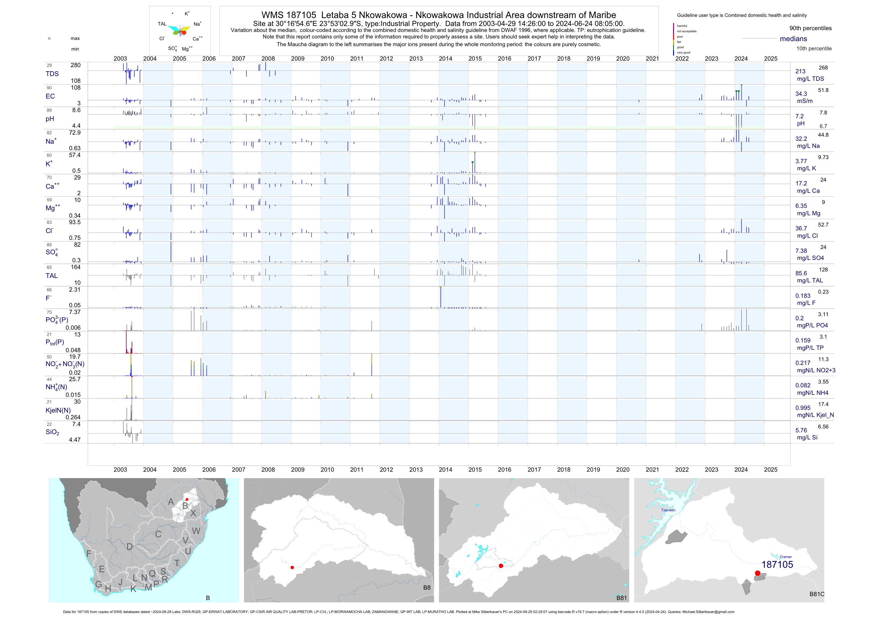
| B81 187105 | plot | data | Letaba 5 Nkowakowa - Nkowakowa Industrial Area downstream of Maribe | Industrial Property | 179 | 2003-04-29 | 2015-07-29 | 33 | 187105 | -23.88415 | 30.28185 |
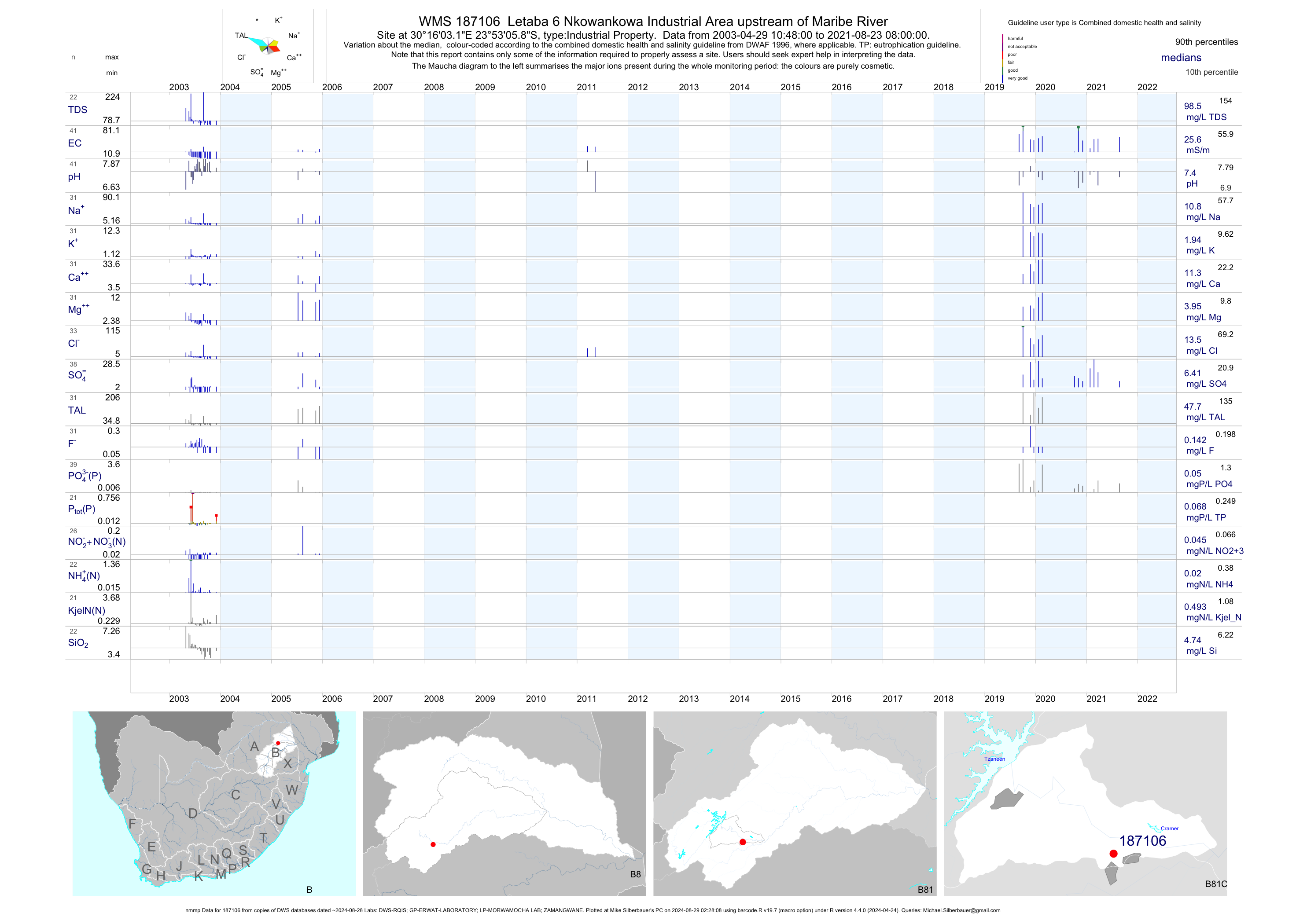
| B81 187106 | plot | data | Letaba 6 Nkowankowa Industrial Area upstream of Maribe River (nmmp) | Industrial Property | 83 | 2003-04-29 | 2011-06-09 | 15 | 187106 | -23.88495 | 30.26755 |
| B81 187107 | plot | data | Letaba 7 Storm Water Chan at Peppadew Solids Effluent Separat | Industrial Property | 39 | 2003-04-29 | 2003-08-05 | 70 | 187107 | -23.88967 | 30.27107 |
| B81 187108 | plot | data | Letaba 8 Storm Water at Peppadew Peppers + Containers Wash | Industrial Property | 23 | 2003-04-29 | 2003-11-20 | 134 | 187108 | -23.89033 | 30.27118 |
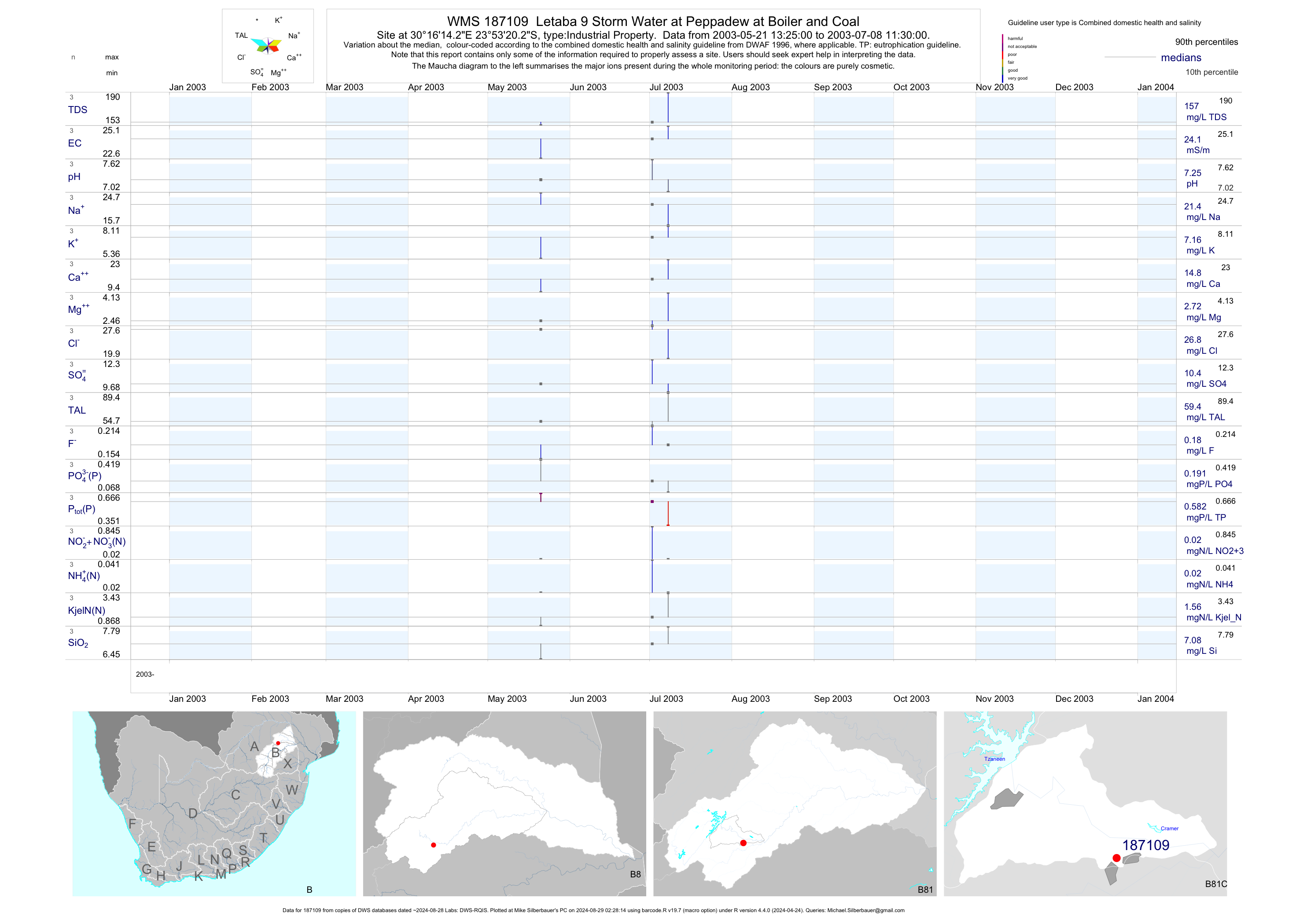
| B81 187109 | plot | data | Letaba 9 Storm Water at Peppadew at Boiler and Coal | Industrial Property | 8 | 2003-05-21 | 2003-07-08 | 24 | 187109 | -23.88895 | 30.27063 |
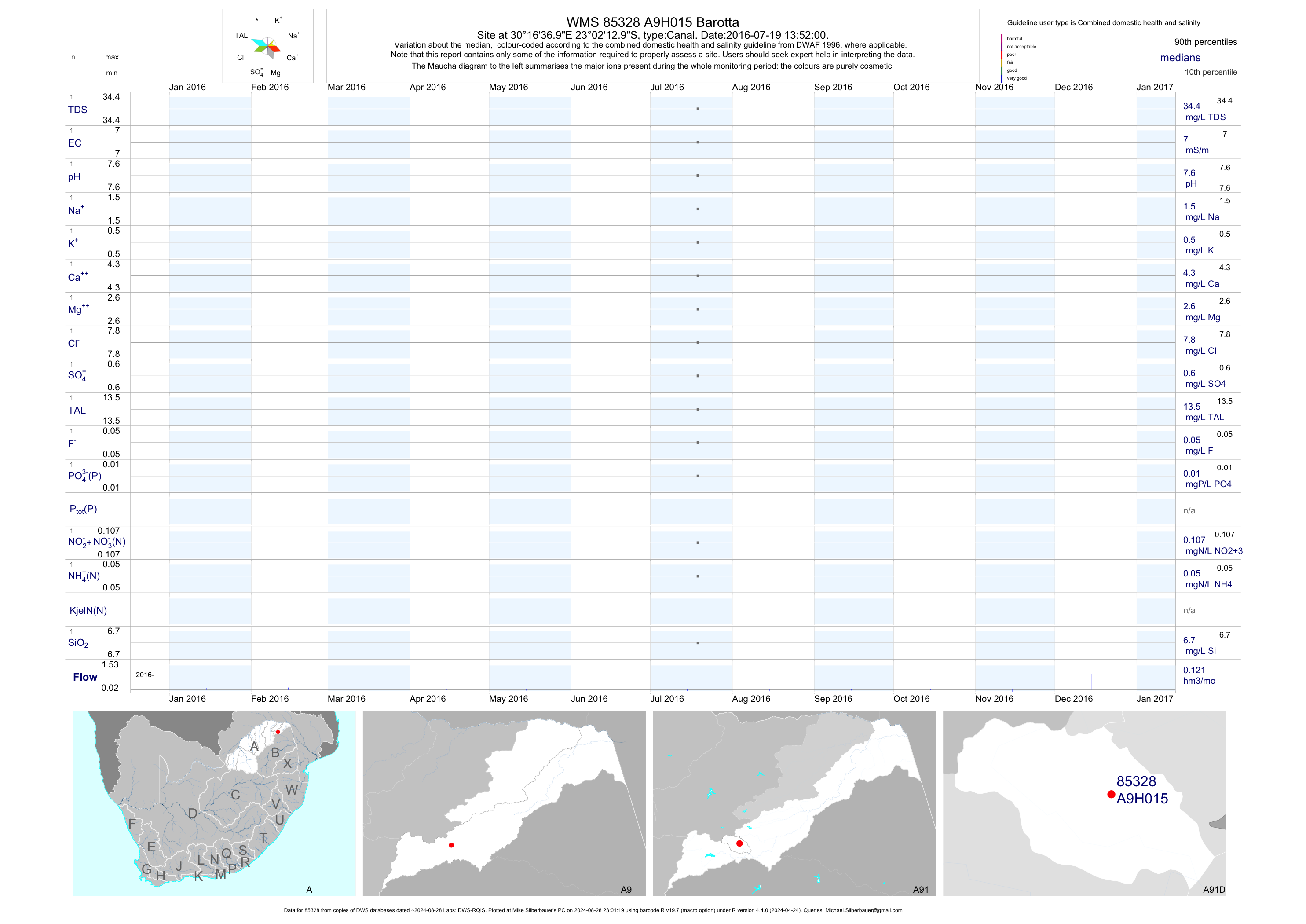
| A91 85328 | plot | data | Barotta | Canal | 1 | 2016-07-19 | 2016-07-19 | 7 | A9H015 | -23.03694 | 30.27694 |
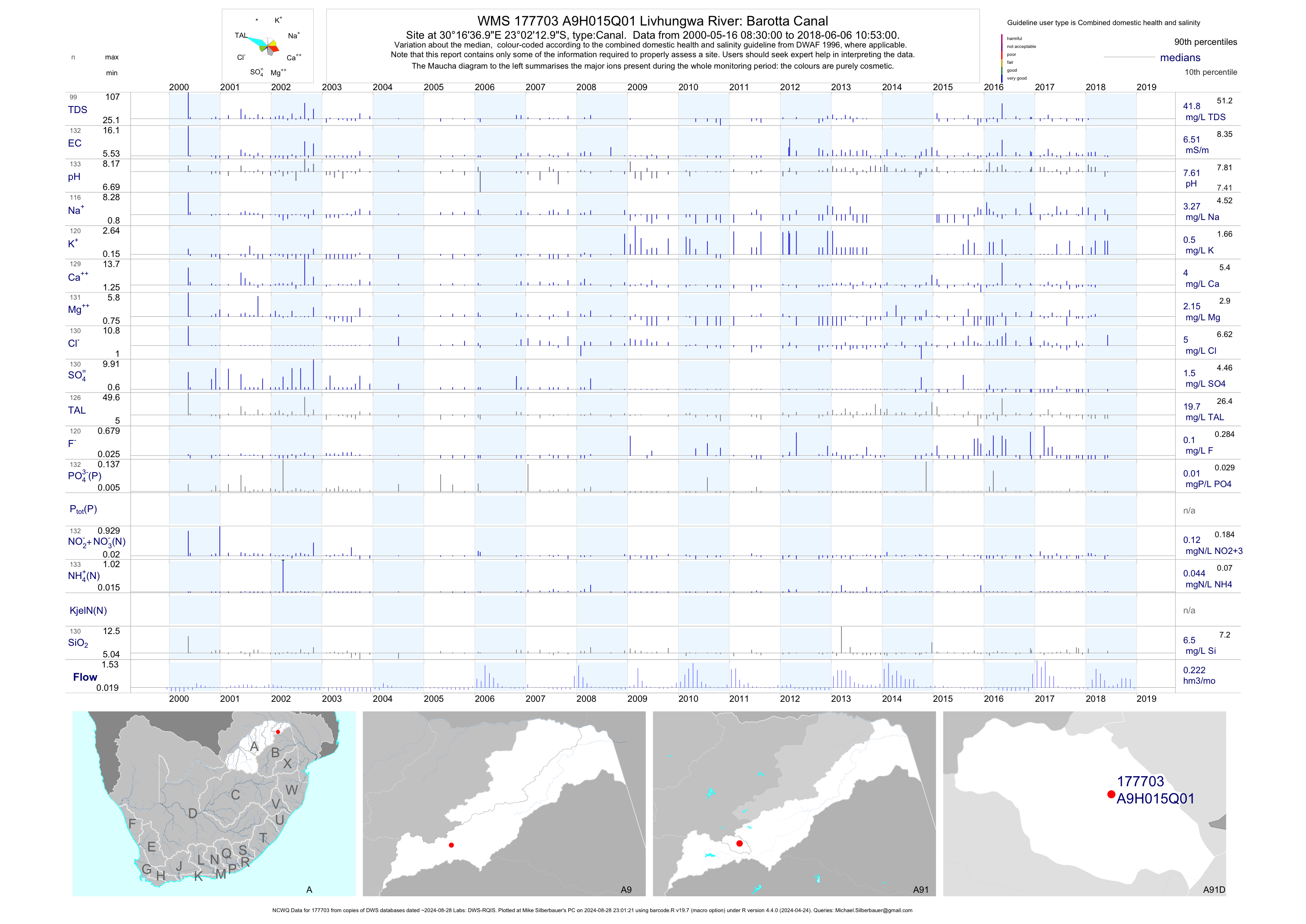
| A91 177703 | plot | data | Livhungwa River: Barotta Canal (NCWQ) | Canal | 133 | 2000-05-16 | 2018-06-06 | 7 | A9H015 | -23.03694 | 30.27694 |
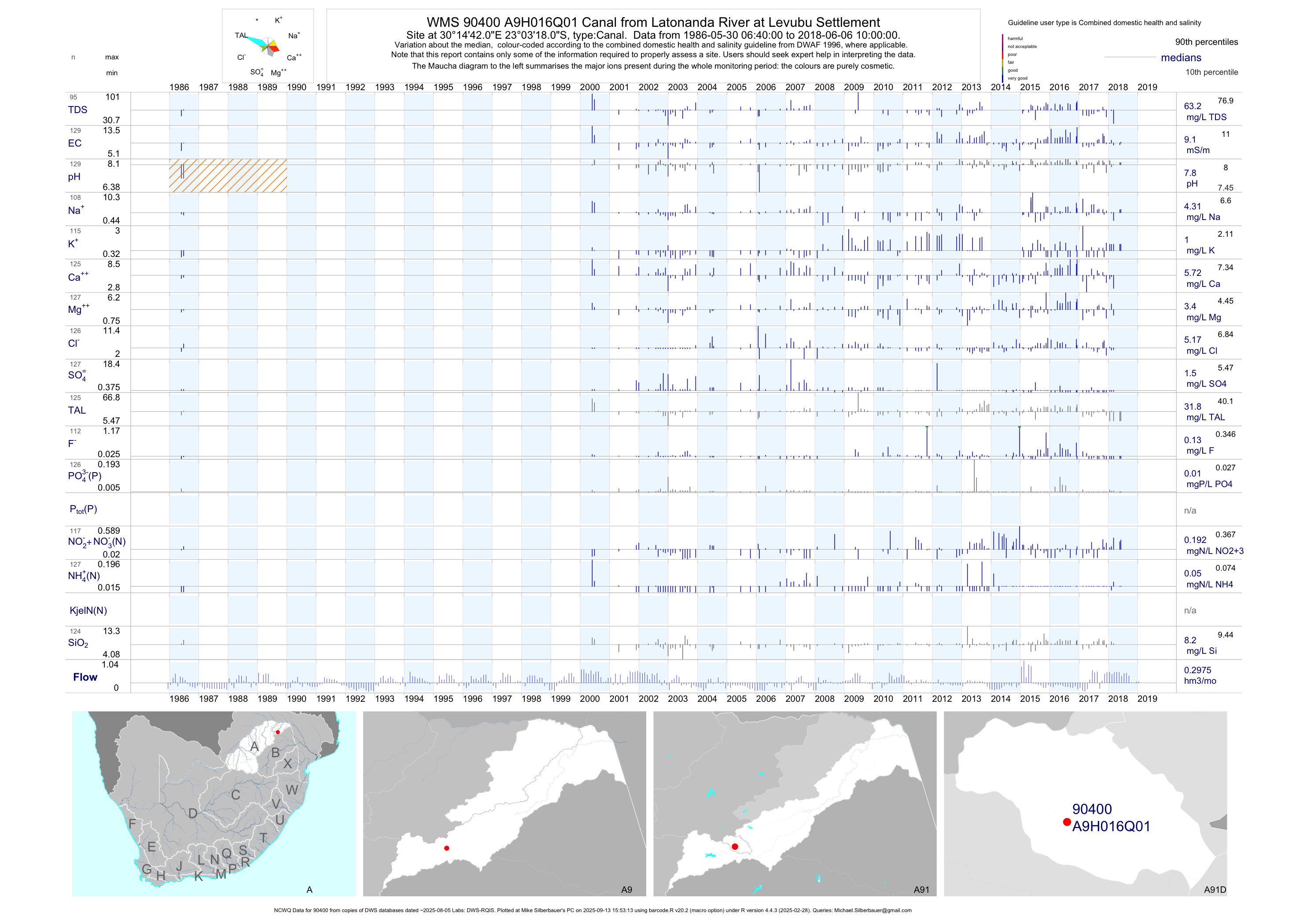
| A91 90400 | plot | data | Canal from Latonanda River at Levubu Settlement (NCWQ) | Canal | 129 | 1986-05-30 | 2018-06-06 | 9 | A9H016 | -23.05500 | 30.24500 |
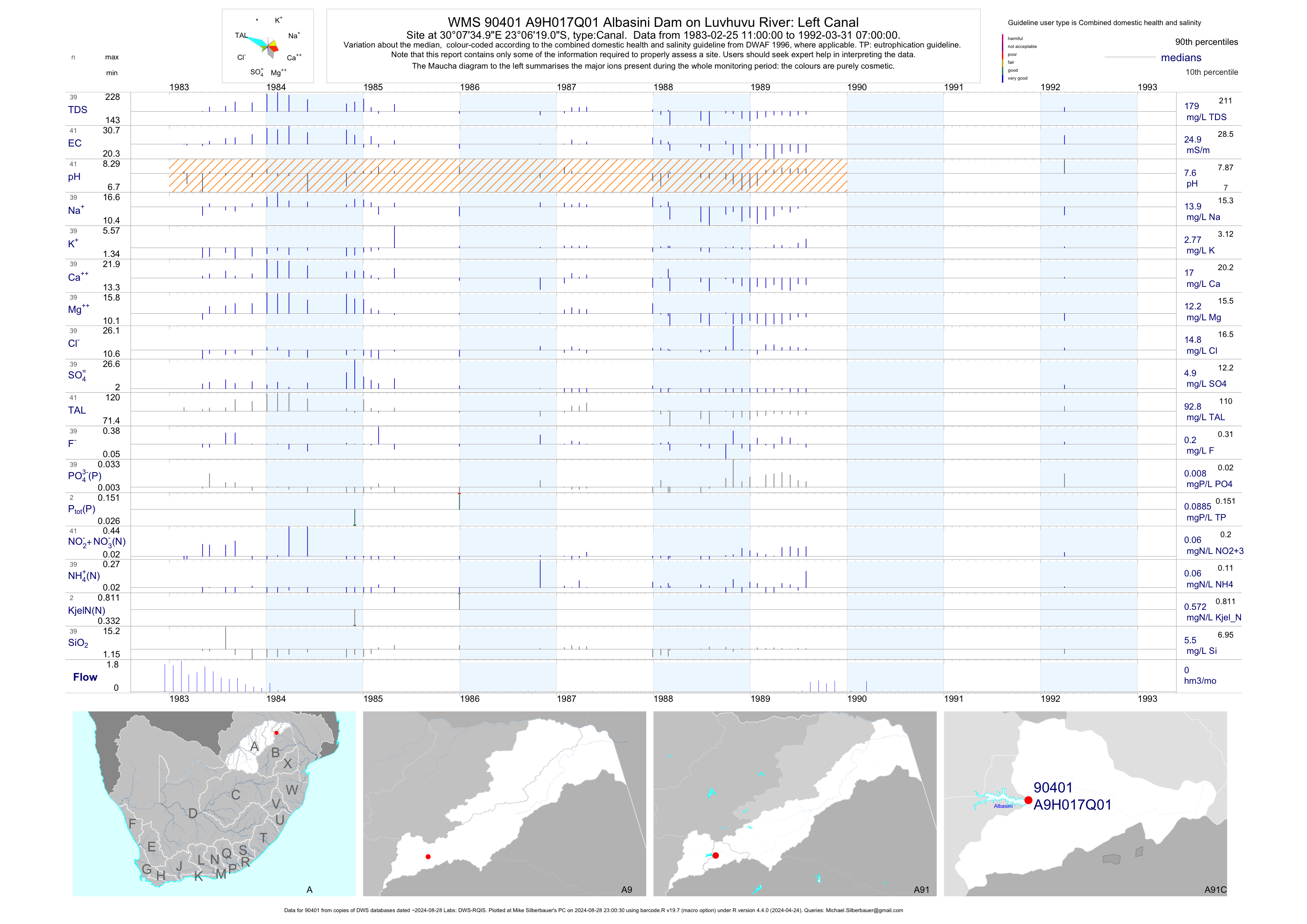
| A91 90401 | plot | data | Albasini Dam on Luvhuvu River: Left Canal | Canal | 41 | 1983-02-25 | 1992-03-31 | 25 | A9H017 | -23.10528 | 30.12639 |
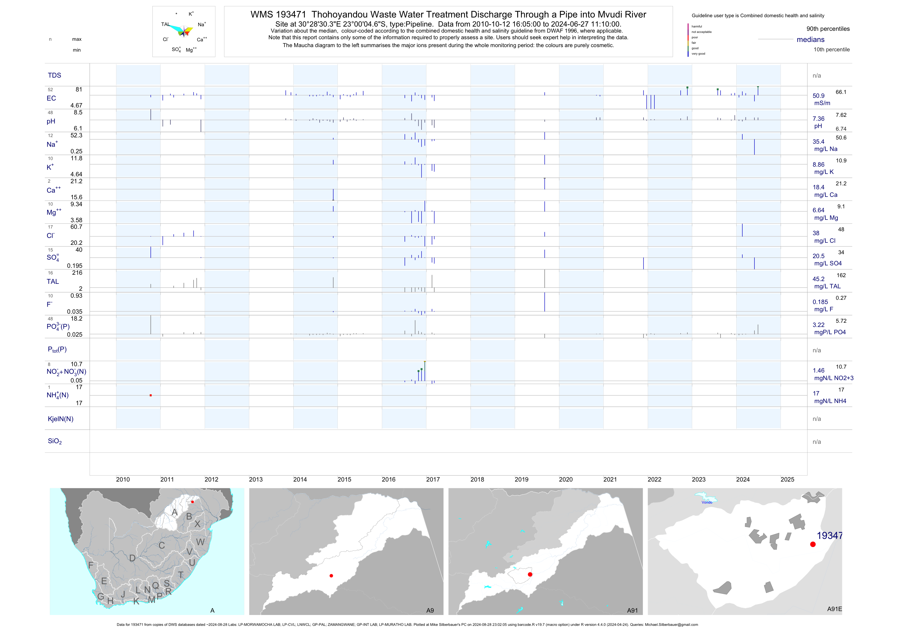
| A91 193471 | plot | data | Thohoyandou Waste Water Treatment Discharge Through a Pipe into Mvudi River | Pipeline | 69 | 2010-10-12 | 2017-03-07 | 49 | 193471 | -23.00130 | 30.47510 |
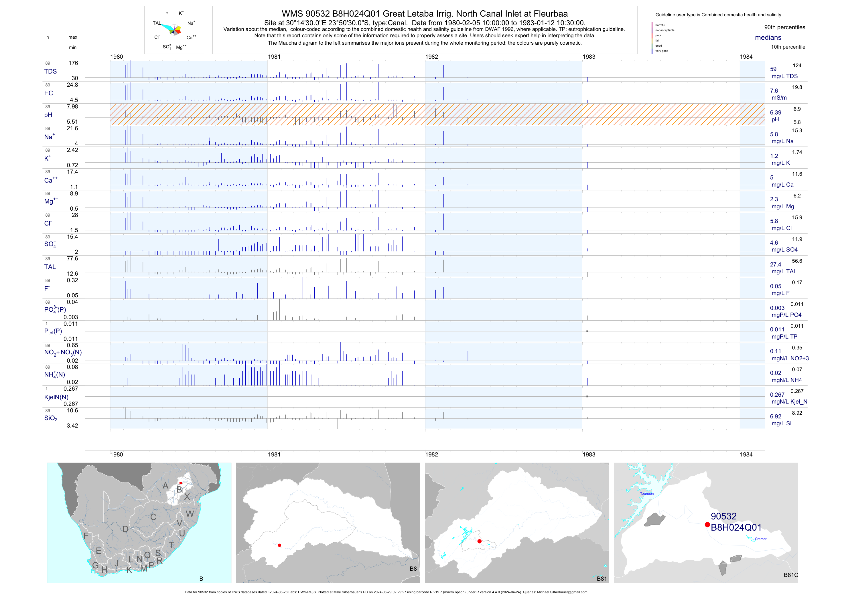
| B81 90532 | plot | data | Great Letaba Irrig. North Canal Inlet at Fleurbaa | Canal | 89 | 1980-02-05 | 1983-01-12 | 8 | B8H024 | -23.84167 | 30.24167 |
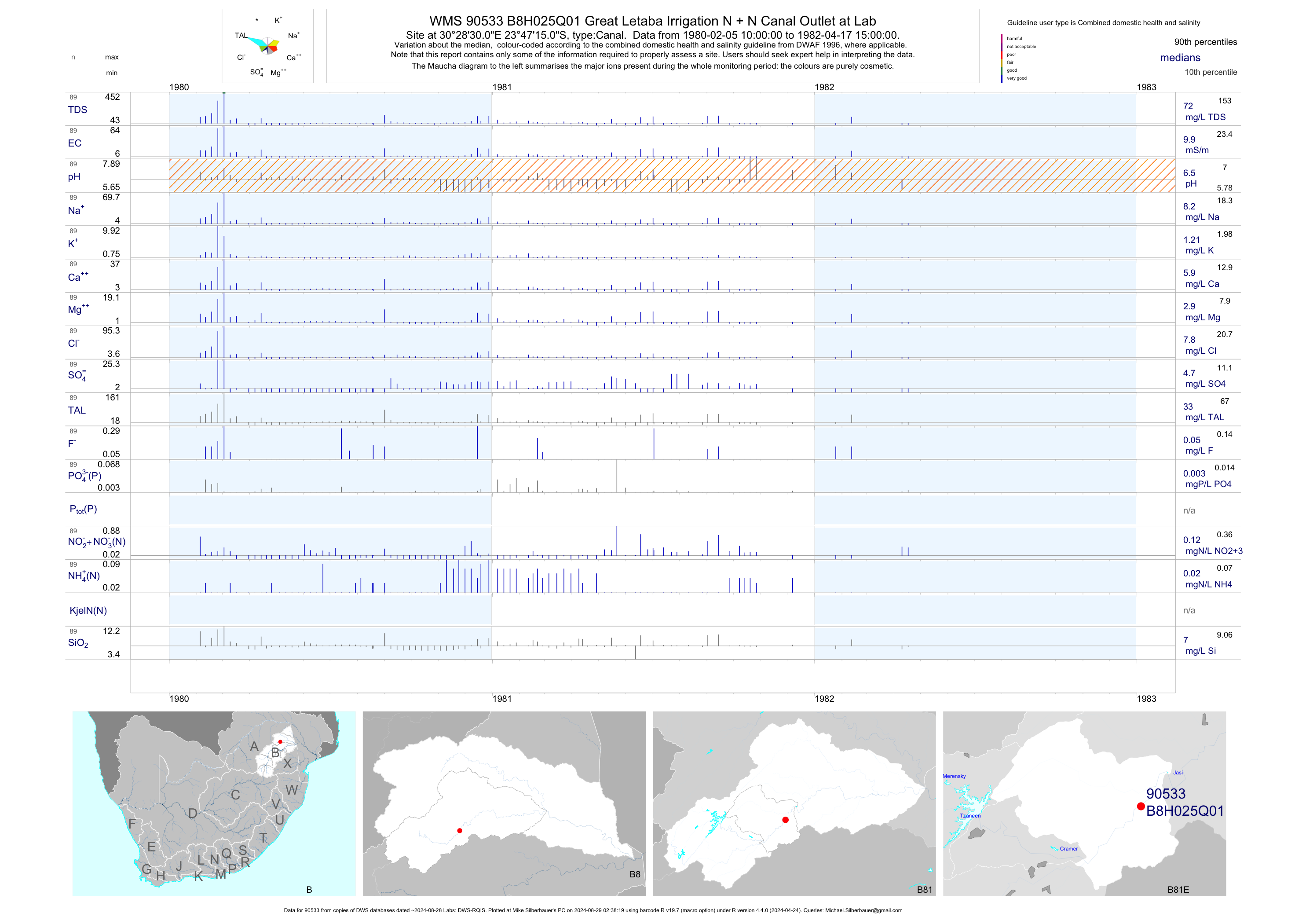
| B81 90533 | plot | data | Great Letaba Irrigation N + N Canal Outlet at Lab | Canal | 89 | 1980-02-05 | 1982-04-17 | 10 | B8H025 | -23.78750 | 30.47500 |
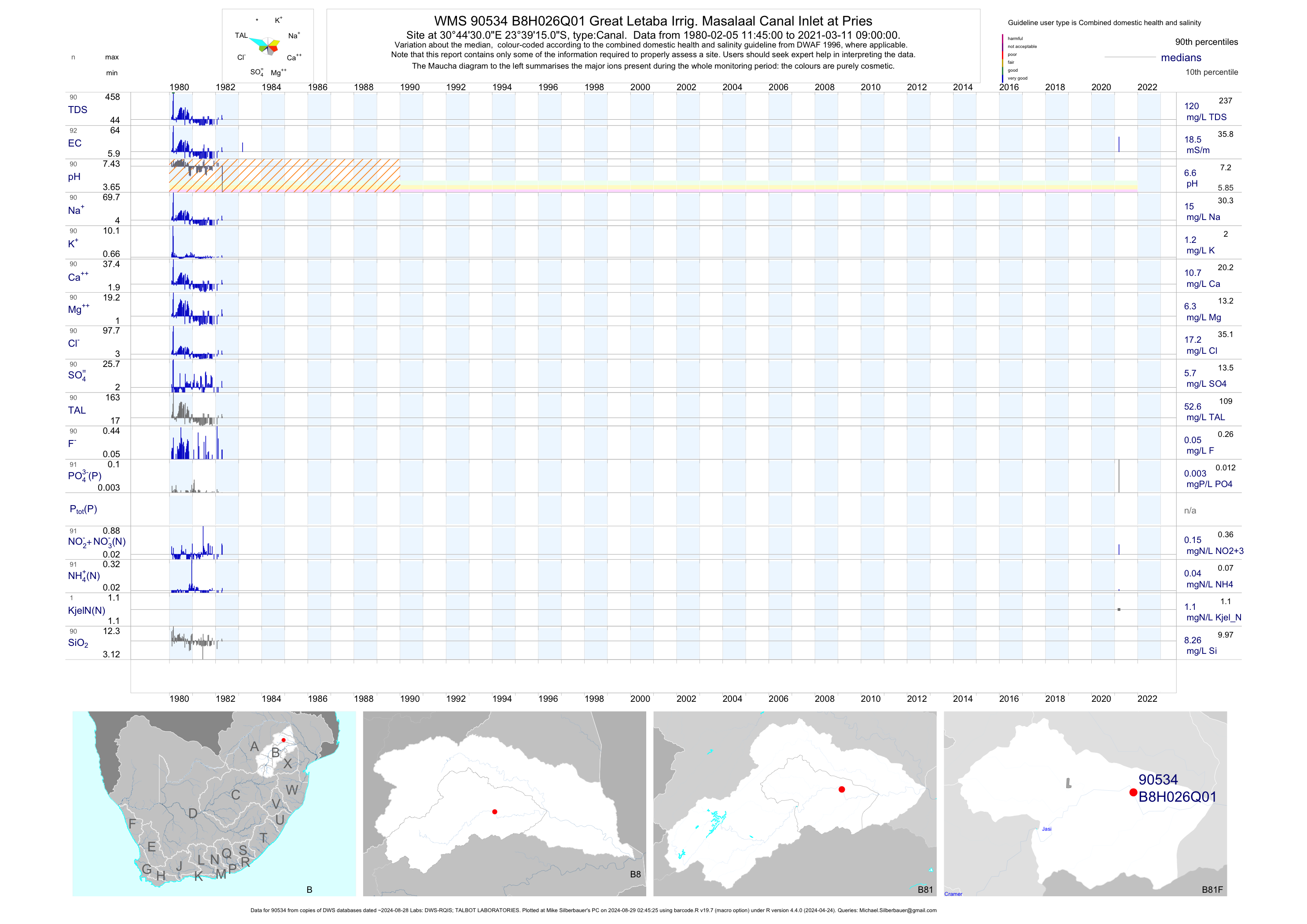
| B81 90534 | plot | data | Great Letaba Irrig. Masalaal Canal Inlet at Pries | Canal | 91 | 1980-02-05 | 1983-03-05 | 18 | B8H026 | -23.65417 | 30.74167 |
| B81 90535 | plot | data | Great Letaba Irri. Masalaal Canal Outlet at Water | Canal | 88 | 1980-02-05 | 2016-09-14 | 20 | B8H027 | -23.69583 | 30.82917 |
| B81 177709 | plot | data | At Prieska on Right Canal from Groot-Letaba (ncwq) | Canal | 2 | 2011-03-02 | 2011-04-06 | 27 | B8H038 | -23.64556 | 30.71861 |
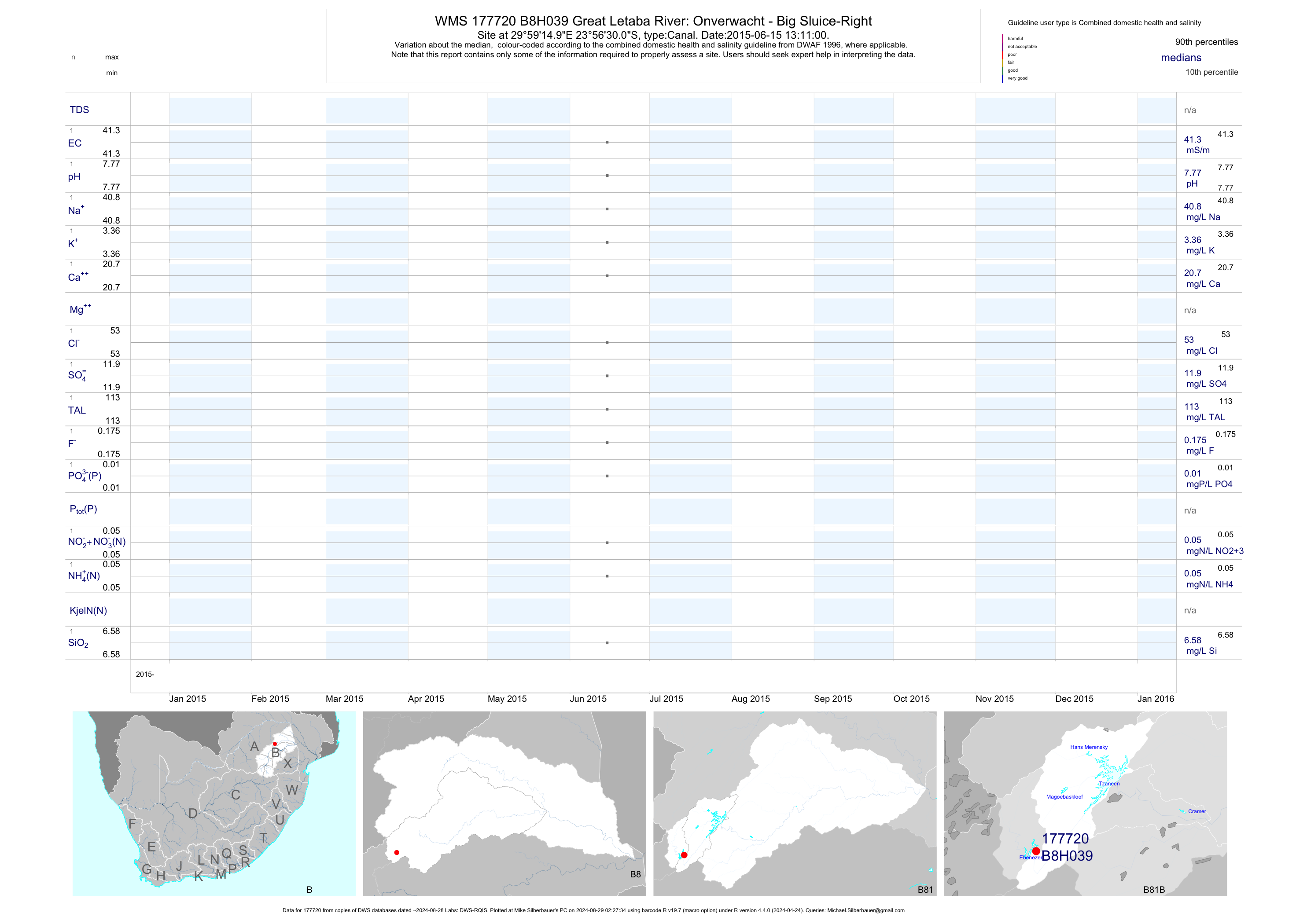
| B81 177720 | plot | data | Great Letaba River: Onverwacht - Big Sluice-Right | Canal | 1 | 2015-06-15 | 2015-06-15 | 41 | B8H039 | -23.94167 | 29.98750 |
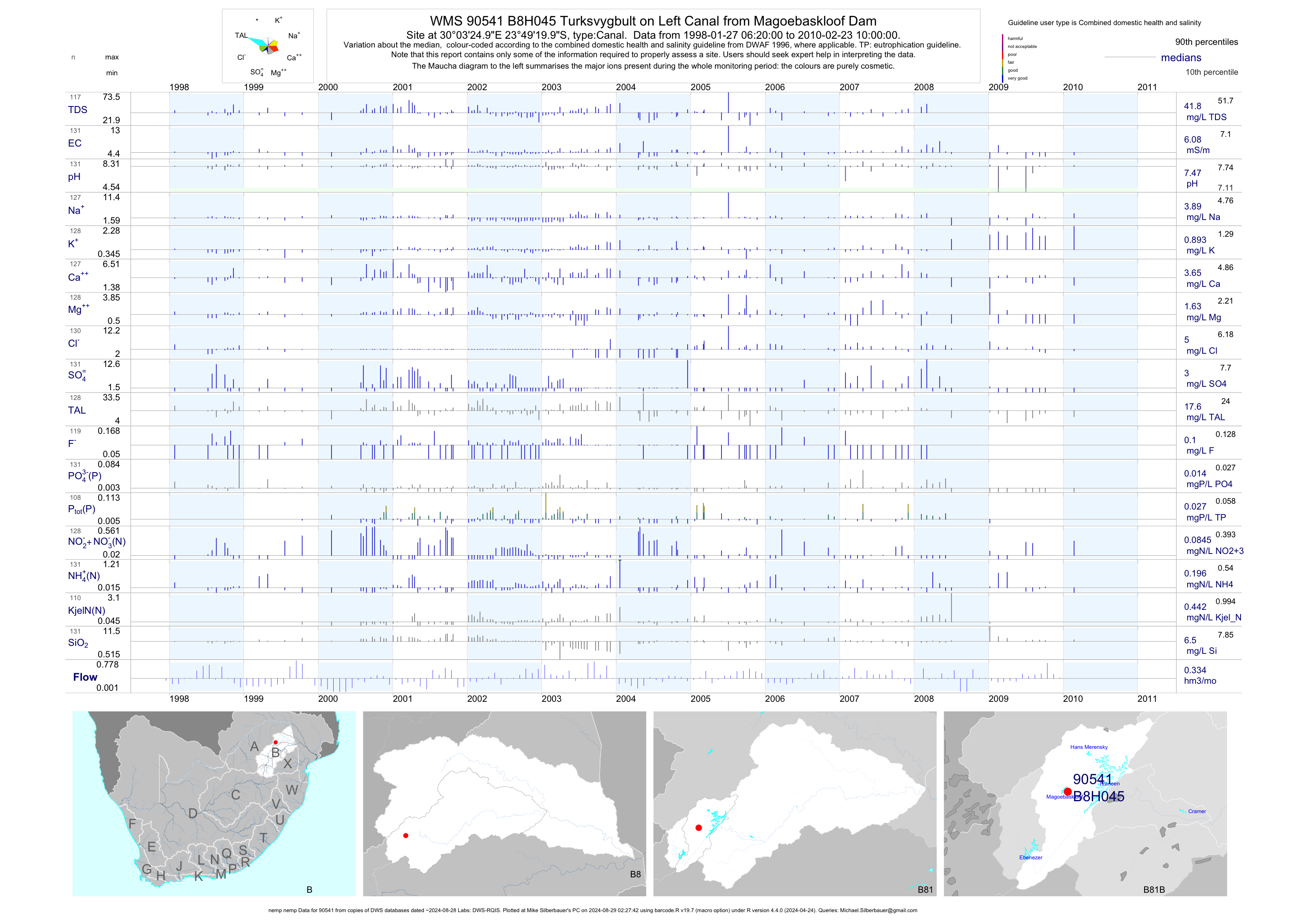
| B81 90541 | plot | data | Turksvygbult on Left Canal from Magoebaskloof Dam (nemp nemp) | Canal | 131 | 1998-01-27 | 2010-02-23 | 6 | B8H045 | -23.82222 | 30.05694 |
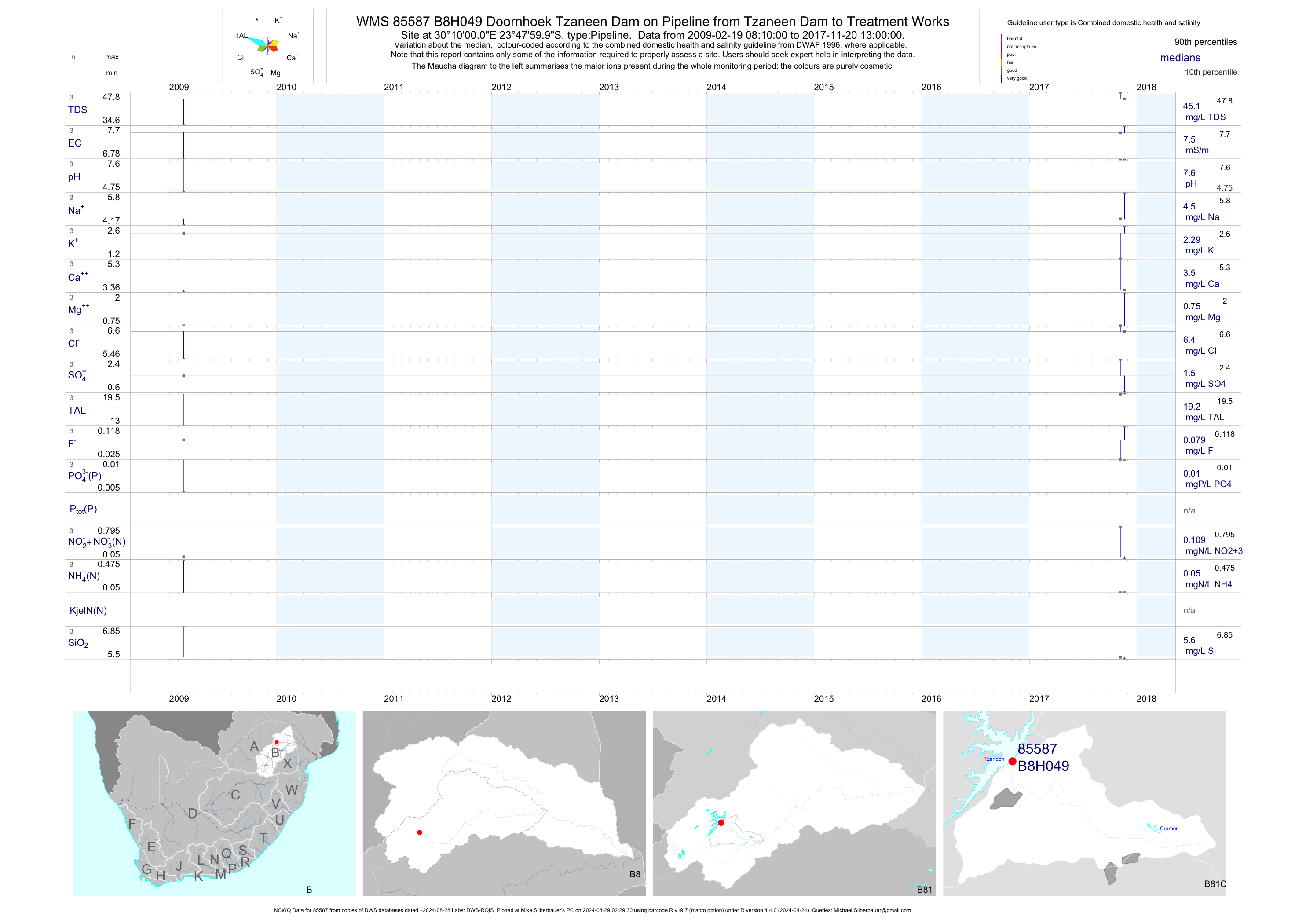
| B81 85587 | plot | data | Doornhoek Tzaneen Dam on Pipeline from Tzaneen Dam to Treatment Works (NCWQ) | Pipeline | 3 | 2009-02-19 | 2017-11-20 | 8 | B8H049 | -23.80000 | 30.16667 |
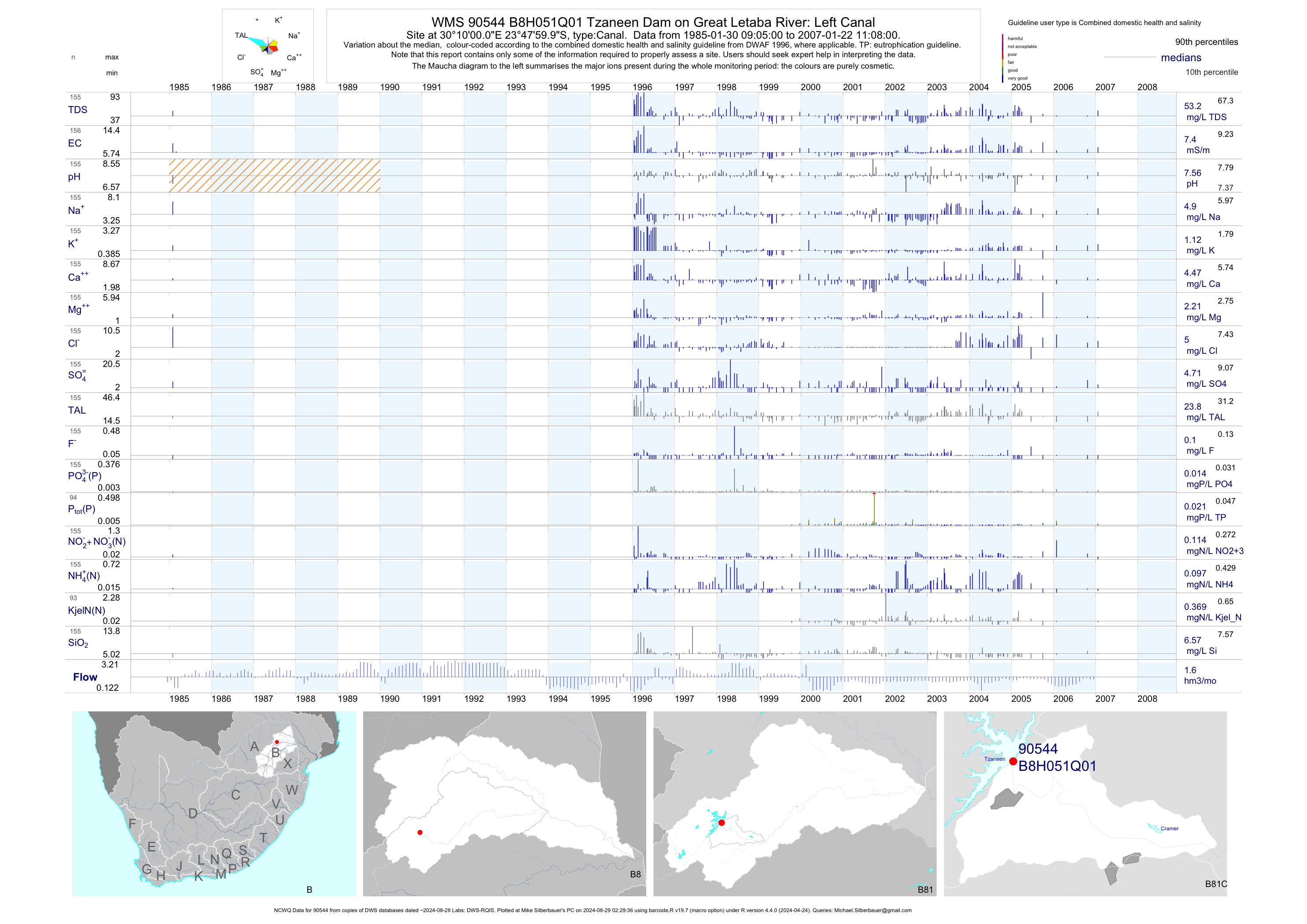
| B81 90544 | plot | data | Tzaneen Dam on Great Letaba River: Left Canal (NCWQ) | Canal | 156 | 1985-01-30 | 2007-01-22 | 7 | B8H051 | -23.80000 | 30.16667 |
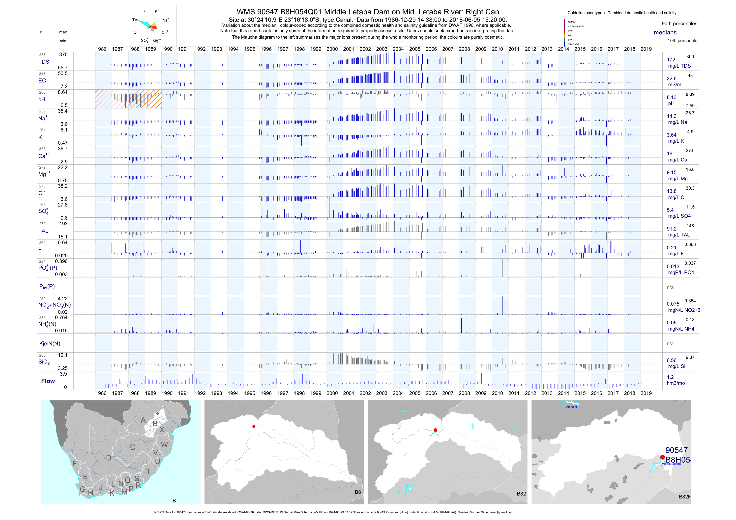
| B82 90547 | plot | data | Middle Letaba Dam on Mid. Letaba River: Right Can (NCWQ) | Canal | 290 | 1986-12-29 | 2018-06-05 | 23 | B8H054 | -23.27167 | 30.40306 |
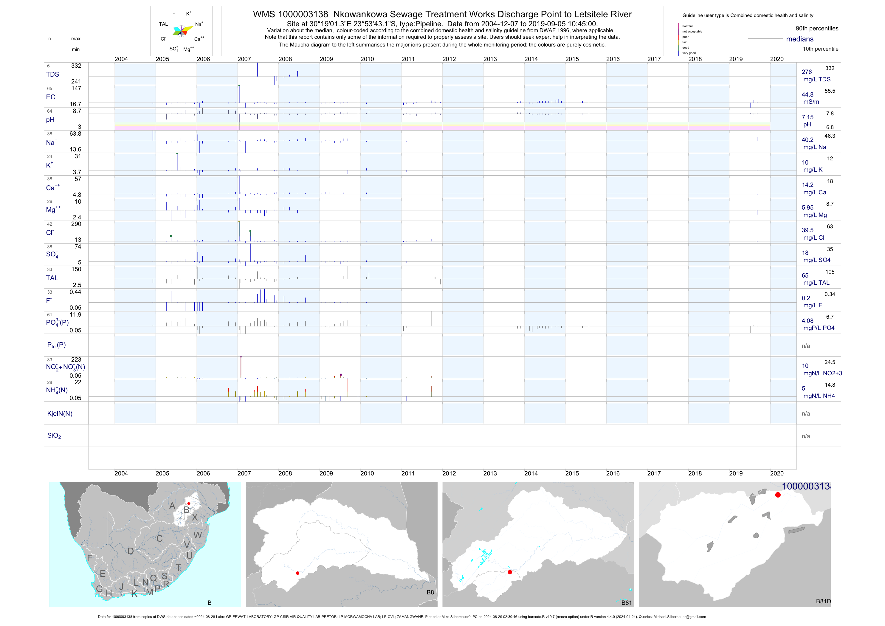
| B81 1000003138 | plot | data | Nkowankowa Sewage Treatment Works Discharge Point to Letsitele River | Pipeline | 141 | 2004-12-07 | 2015-07-29 | 45 | 1-3138 | -23.89532 | 30.31705 |
| B81 1000262079 | plot | data | 2330CB Modjadjes Loc. ptn. Mapitlula - H07P0794 | Lateral Collector | 2 | 2012-11-20 | 2012-11-20 | 19 | 1000262079 | -23.70051 | 30.32086 |
| A91 1000190050 | plot | data | Limondo ptn. Makambe - H20-0617 | unknown | 2 | 2007-05-23 | 2007-05-23 | 16 | 135 | -22.99967 | 30.36645 |
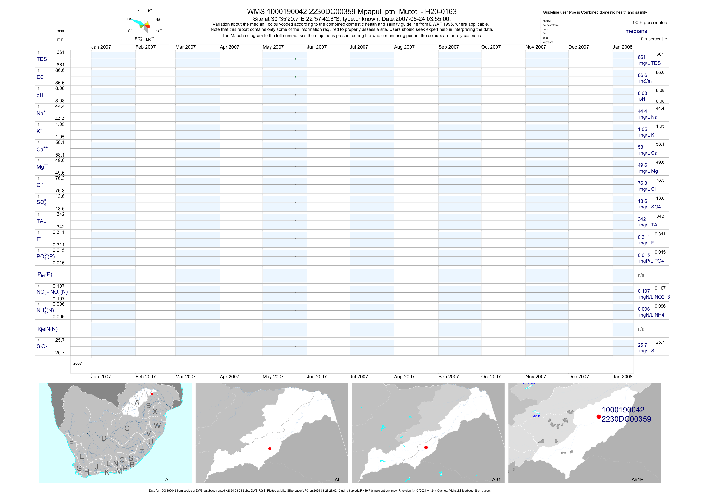
| A91 1000190042 | plot | data | Mpapuli ptn. Mutoti - H20-0163 | unknown | 2 | 2007-05-24 | 2007-05-24 | 87 | 359 | -22.96191 | 30.58911 |
| A91 1000190100 | plot | data | Klipfontein ptn. Valdezia - H17-0695 | unknown | 2 | 2007-06-25 | 2007-06-25 | 24 | 226 | -23.10852 | 30.17683 |
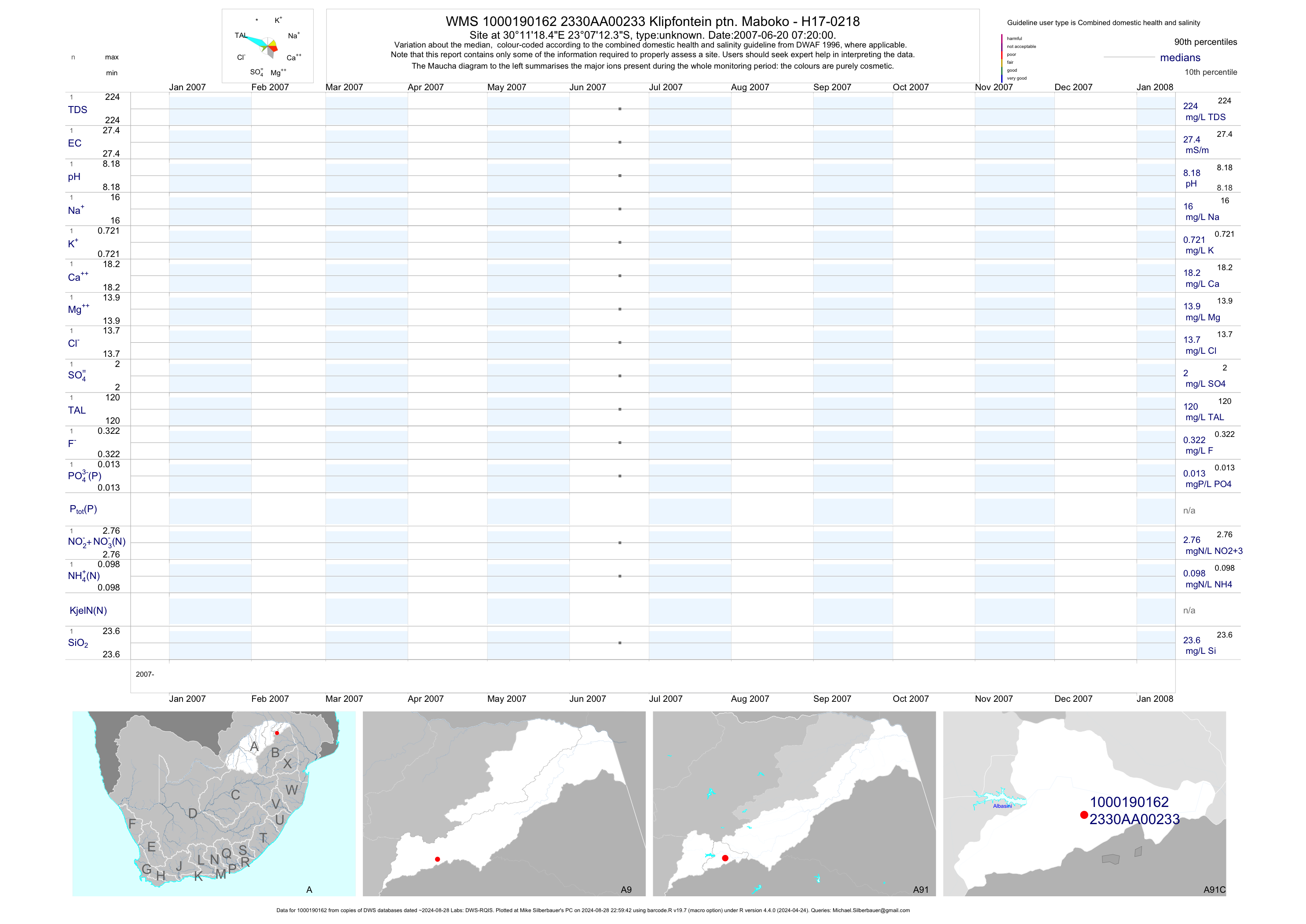
| A91 1000190162 | plot | data | Klipfontein ptn. Maboko - H17-0218 | unknown | 2 | 2007-06-20 | 2007-06-20 | 27 | 233 | -23.12011 | 30.18847 |
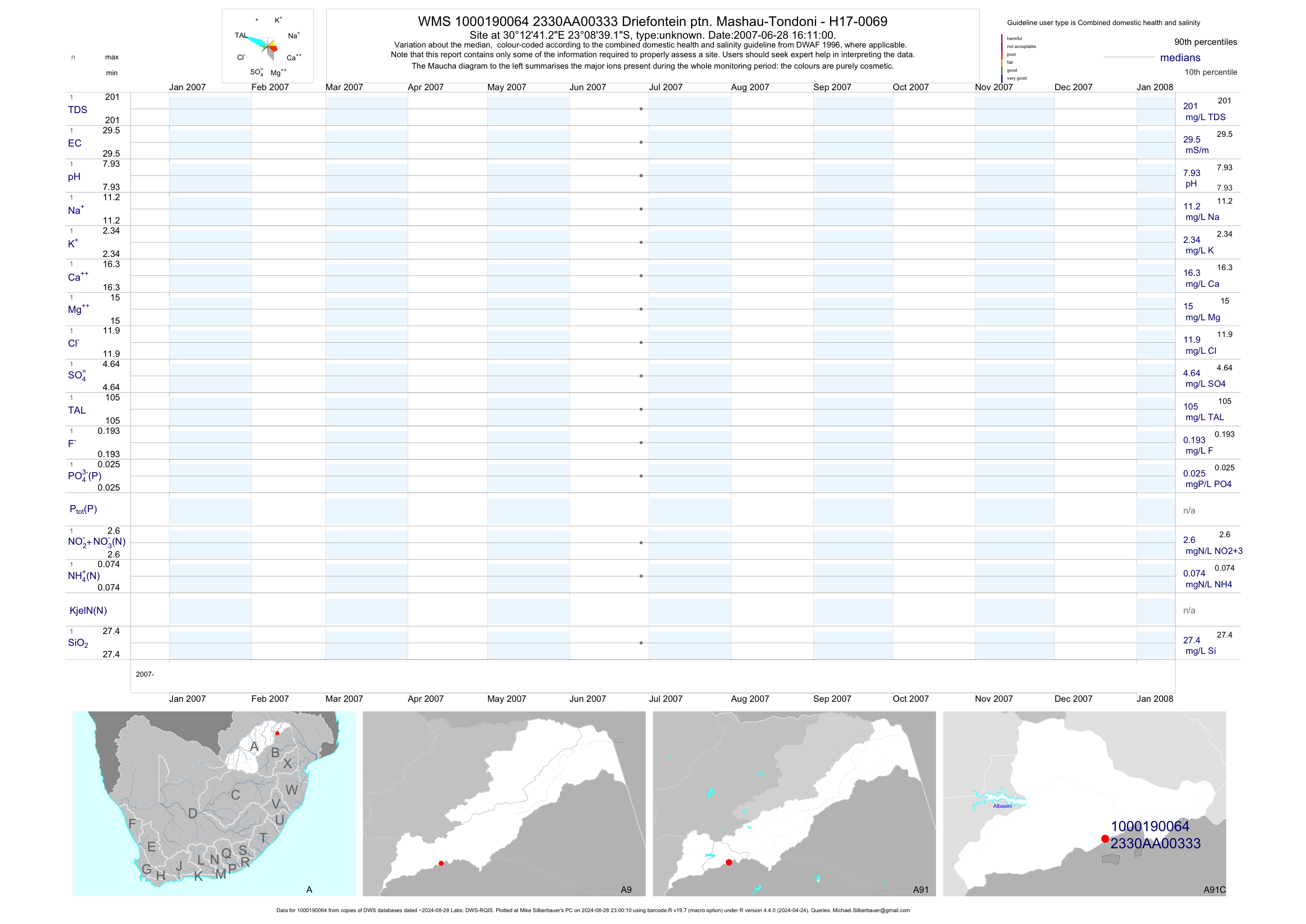
| A91 1000190064 | plot | data | Driefontein ptn. Mashau-Tondoni - H17-0069 | unknown | 2 | 2007-06-28 | 2007-06-28 | 30 | 333 | -23.14422 | 30.21147 |
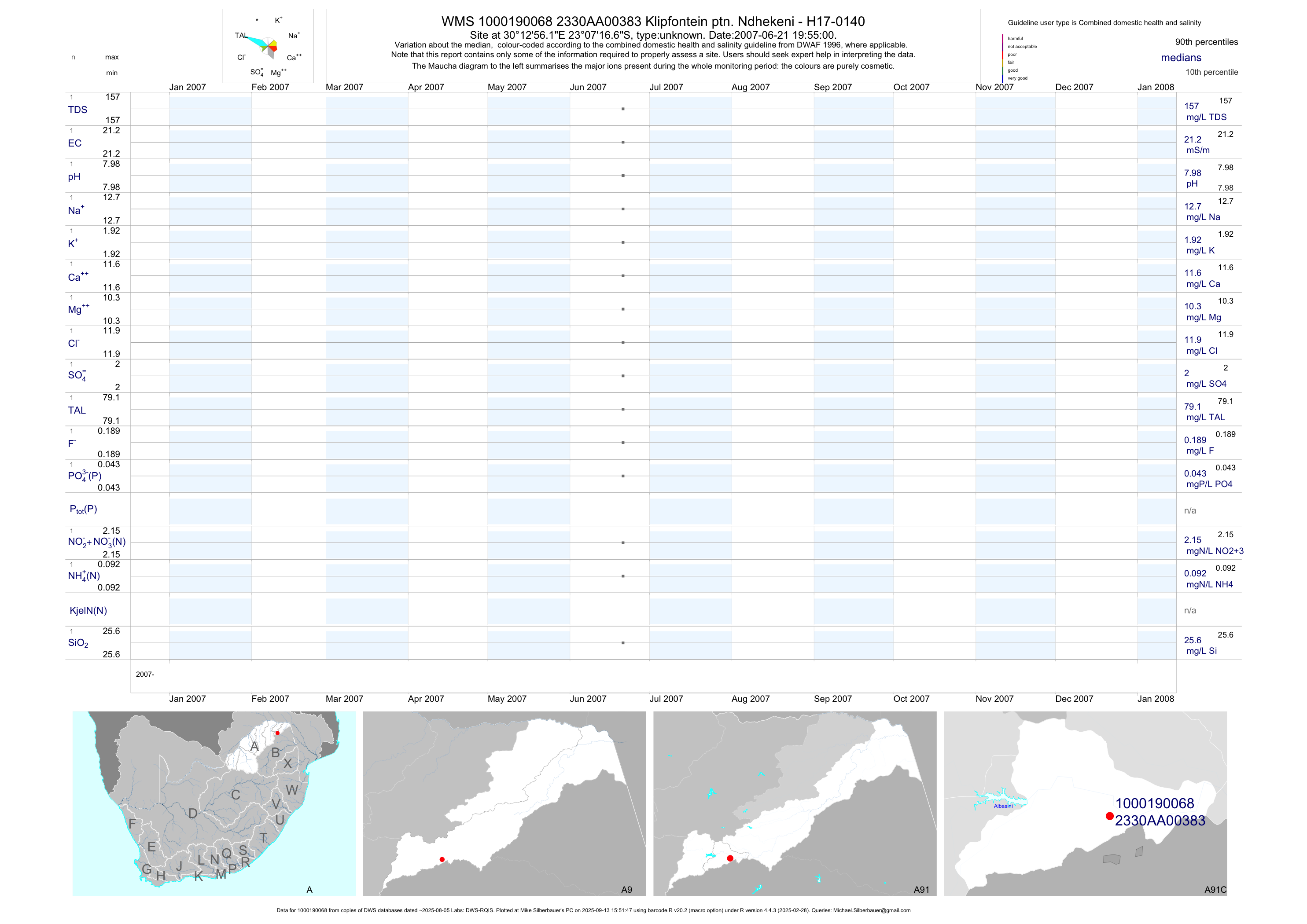
| A91 1000190068 | plot | data | Klipfontein ptn. Ndhekeni - H17-0140 | unknown | 2 | 2007-06-21 | 2007-06-21 | 21 | 383 | -23.12130 | 30.21561 |
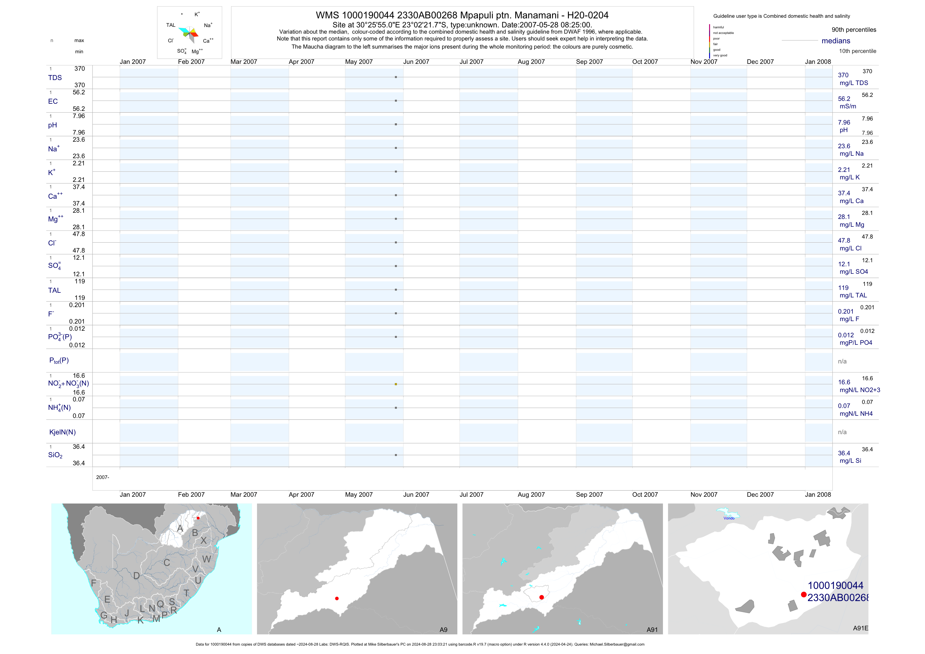
| A91 1000190044 | plot | data | Mpapuli ptn. Manamani - H20-0204 | unknown | 2 | 2007-05-28 | 2007-05-28 | 56 | 268 | -23.03938 | 30.43195 |
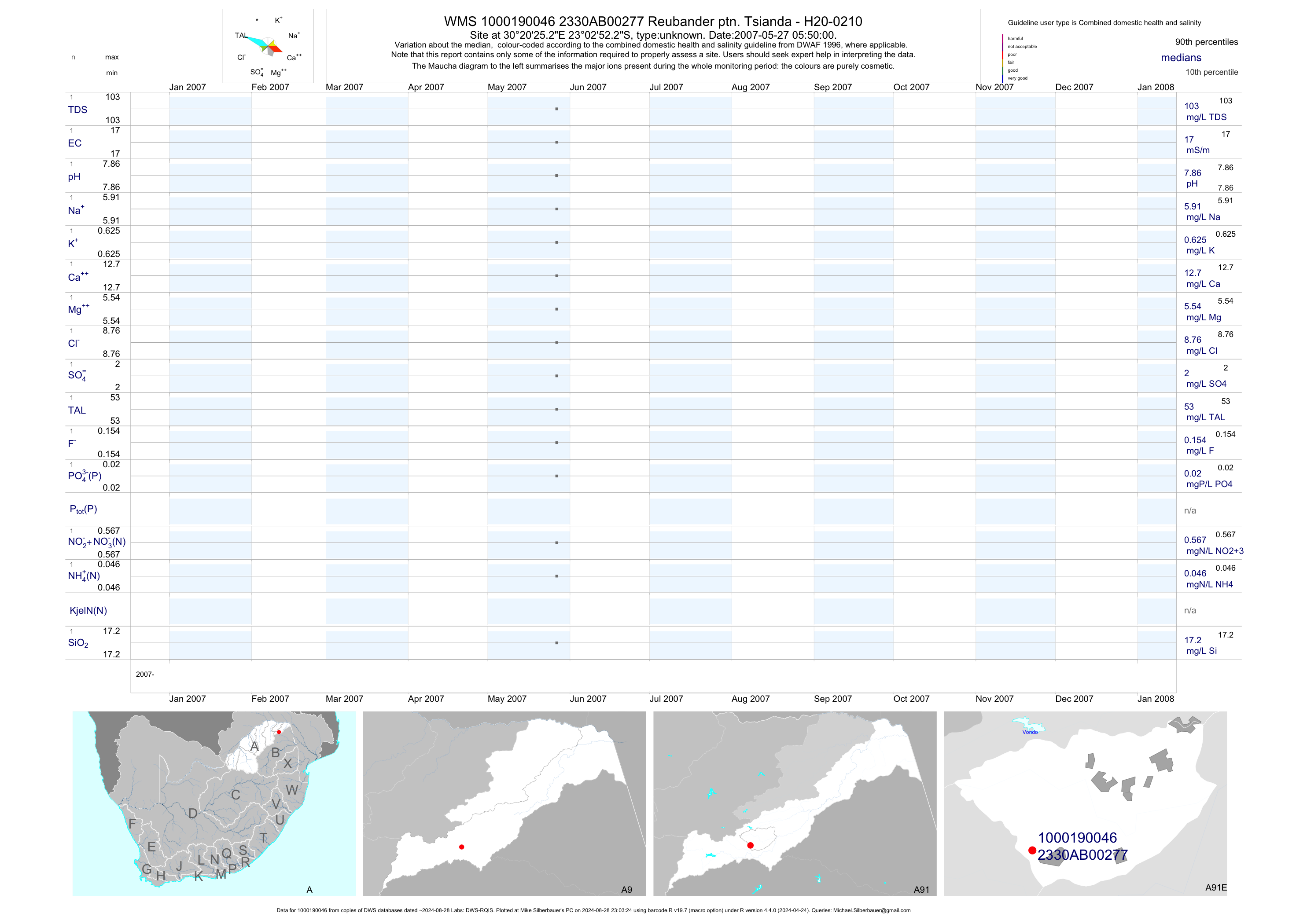
| A91 1000190046 | plot | data | Reubander ptn. Tsianda - H20-0210 | unknown | 2 | 2007-05-27 | 2007-05-27 | 17 | 277 | -23.04786 | 30.34036 |
| A91 1000190168 | plot | data | Lomondo ptn. Lukau - H20-0619 | unknown | 2 | 2007-06-16 | 2007-06-16 | 22 | 356 | -23.00547 | 30.32883 |
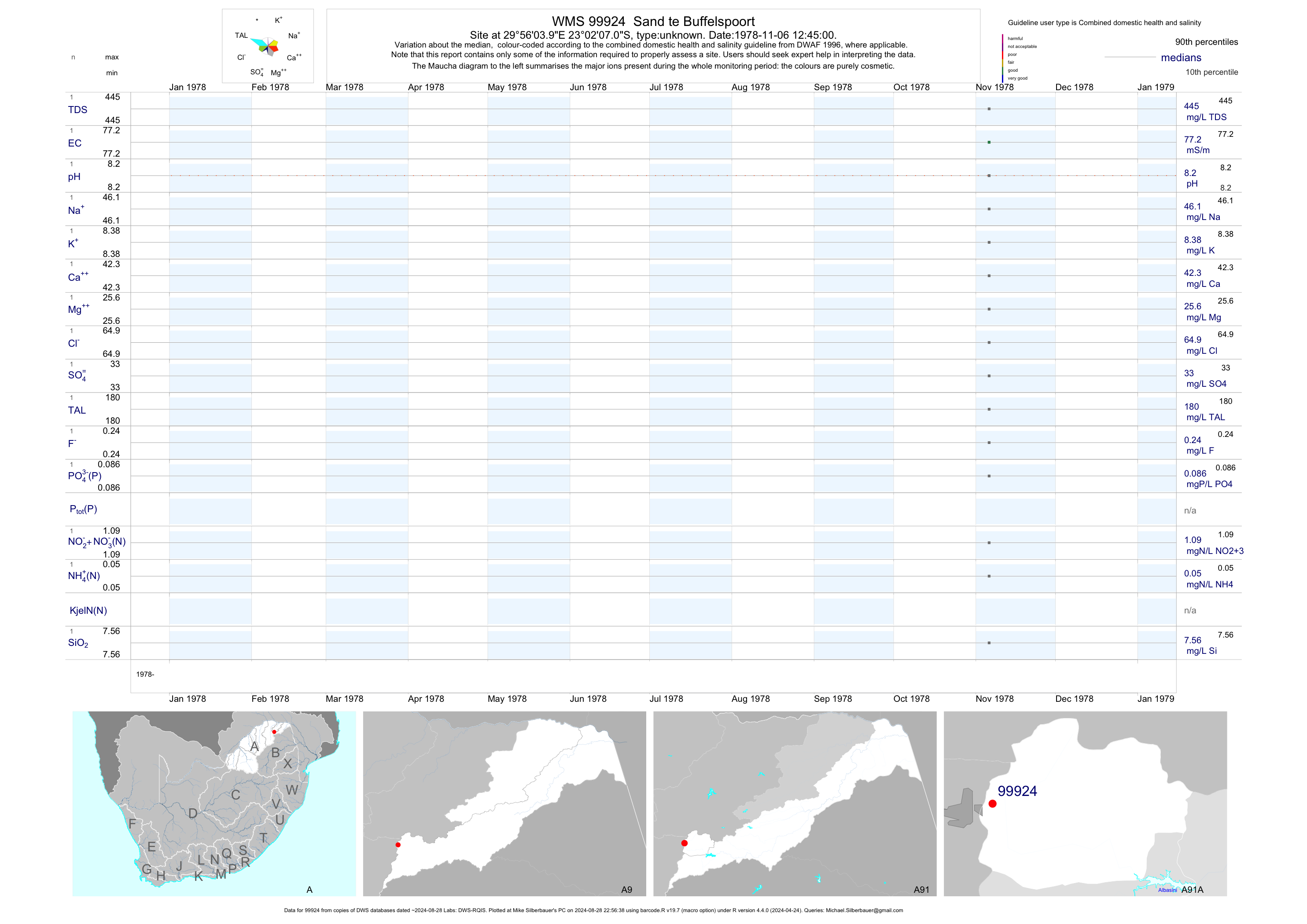
| A91 99924 | plot | data | Sand te Buffelspoort | unknown | 1 | 1978-11-06 | 1978-11-06 | 77 | 99924 | -23.03528 | 29.93444 |
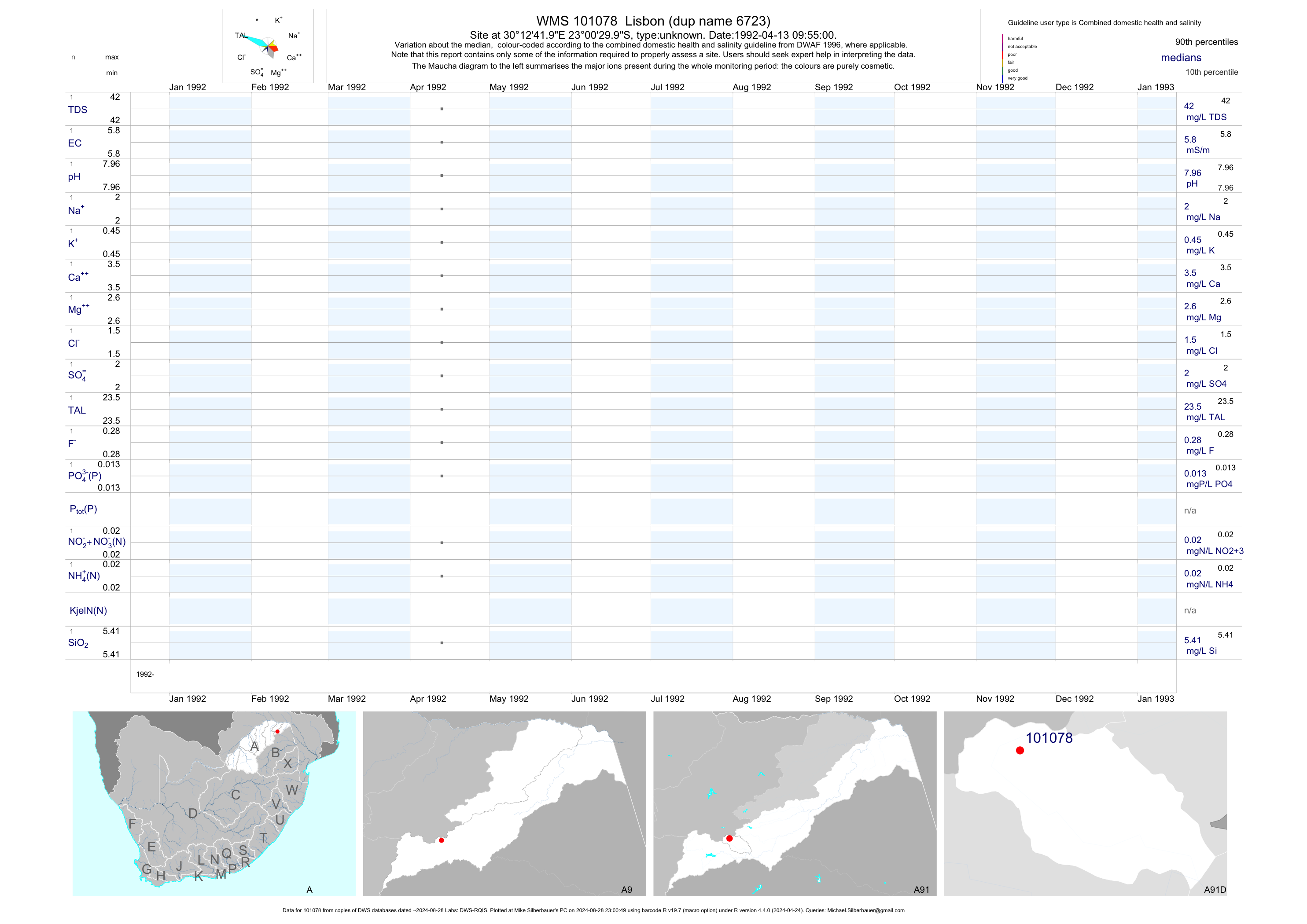
| A91 101078 | plot | data | Lisbon (dup name 6723) | unknown | 1 | 1992-04-13 | 1992-04-13 | 6 | 101078 | -23.00833 | 30.21167 |
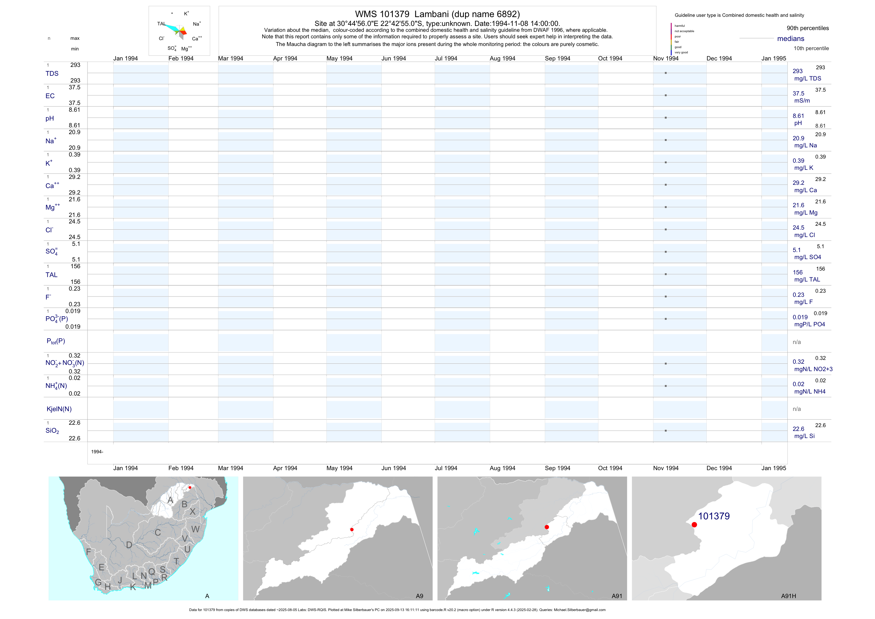
| A91 101379 | plot | data | Lambani (dup name 6892) | unknown | 1 | 1994-11-08 | 1994-11-08 | 38 | 101379 | -22.71528 | 30.74889 |
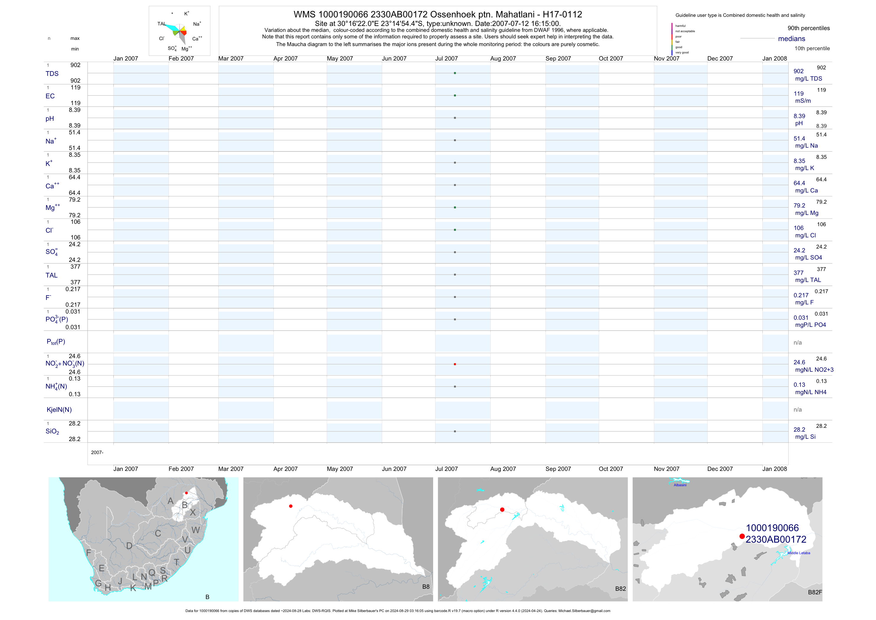
| B82 1000190066 | plot | data | Ossenhoek ptn. Mahatlani - H17-0112 | unknown | 2 | 2007-07-12 | 2007-07-12 | 119 | 172 | -23.24847 | 30.27280 |
| B82 1000190070 | plot | data | Nieuwveld ptn. Nwamatane - H17-0258 | unknown | 3 | 2007-07-09 | 2008-02-07 | 87 | 238 | -23.24136 | 30.36830 |
| B82 1000190048 | plot | data | Loc. van Tabaan ptn. Ha-Davhana H20-0232 | unknown | 2 | 2007-06-02 | 2007-06-02 | 95 | 290 | -23.21961 | 30.46402 |
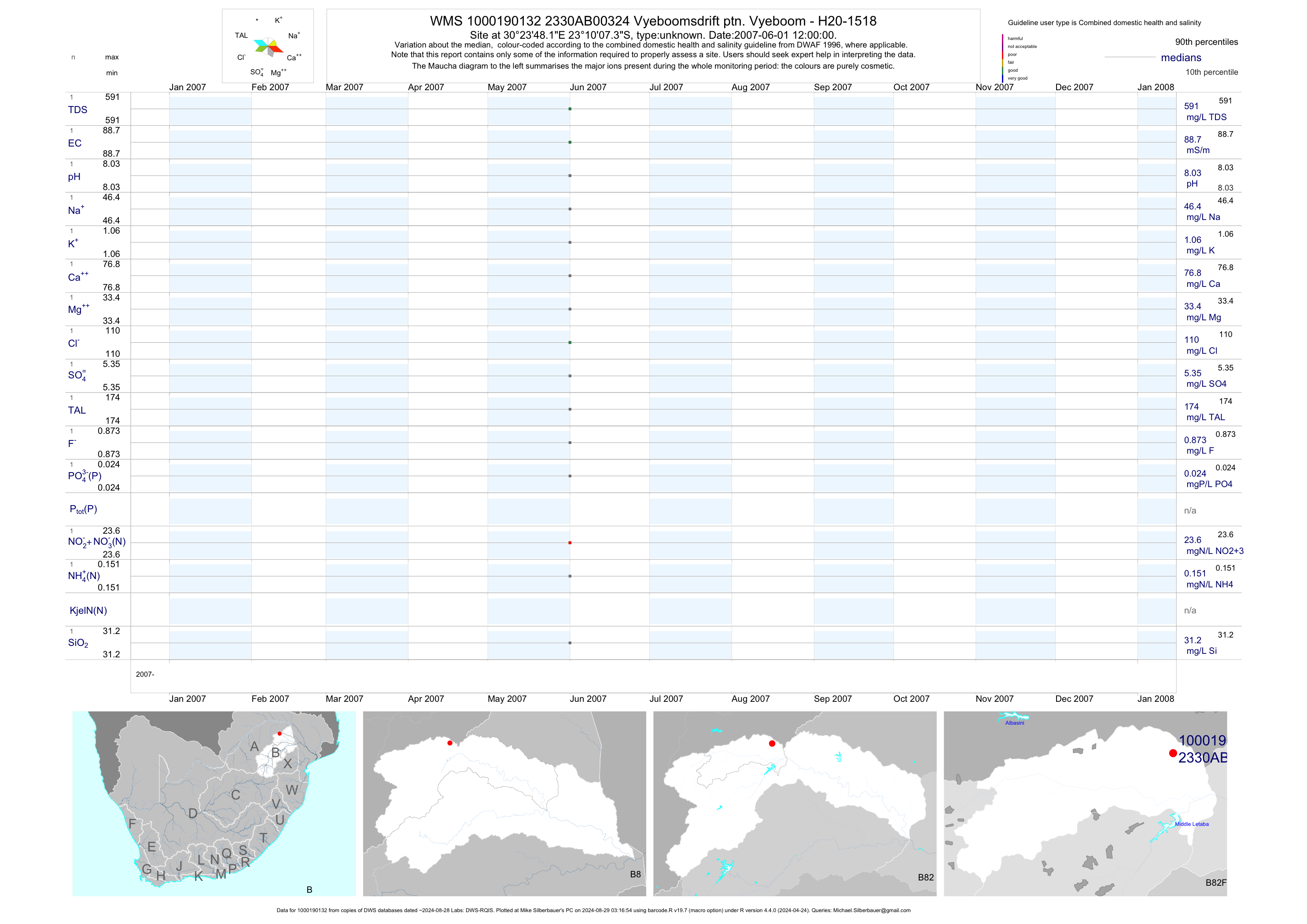
| B82 1000190132 | plot | data | Vyeboomsdrift ptn. Vyeboom - H20-1518 | unknown | 2 | 2007-06-01 | 2007-06-01 | 89 | 324 | -23.16872 | 30.39672 |
| B82 1000190160 | plot | data | Onverwacht ptn. Vhangani - H17-0193 | unknown | 2 | 2007-07-07 | 2007-07-07 | 89 | 354 | -23.19894 | 30.31852 |
| B82 1000190166 | plot | data | Nieuw England ptn. Vhangani - H17-1095 | unknown | 2 | 2007-07-04 | 2007-07-04 | 237 | 355 | -23.18272 | 30.32219 |
| B82 1000190164 | plot | data | Magon ptn. Ntsuki - H17-0367 | unknown | 2 | 2007-07-09 | 2007-07-09 | 72 | 306 | -23.26322 | 30.34945 |
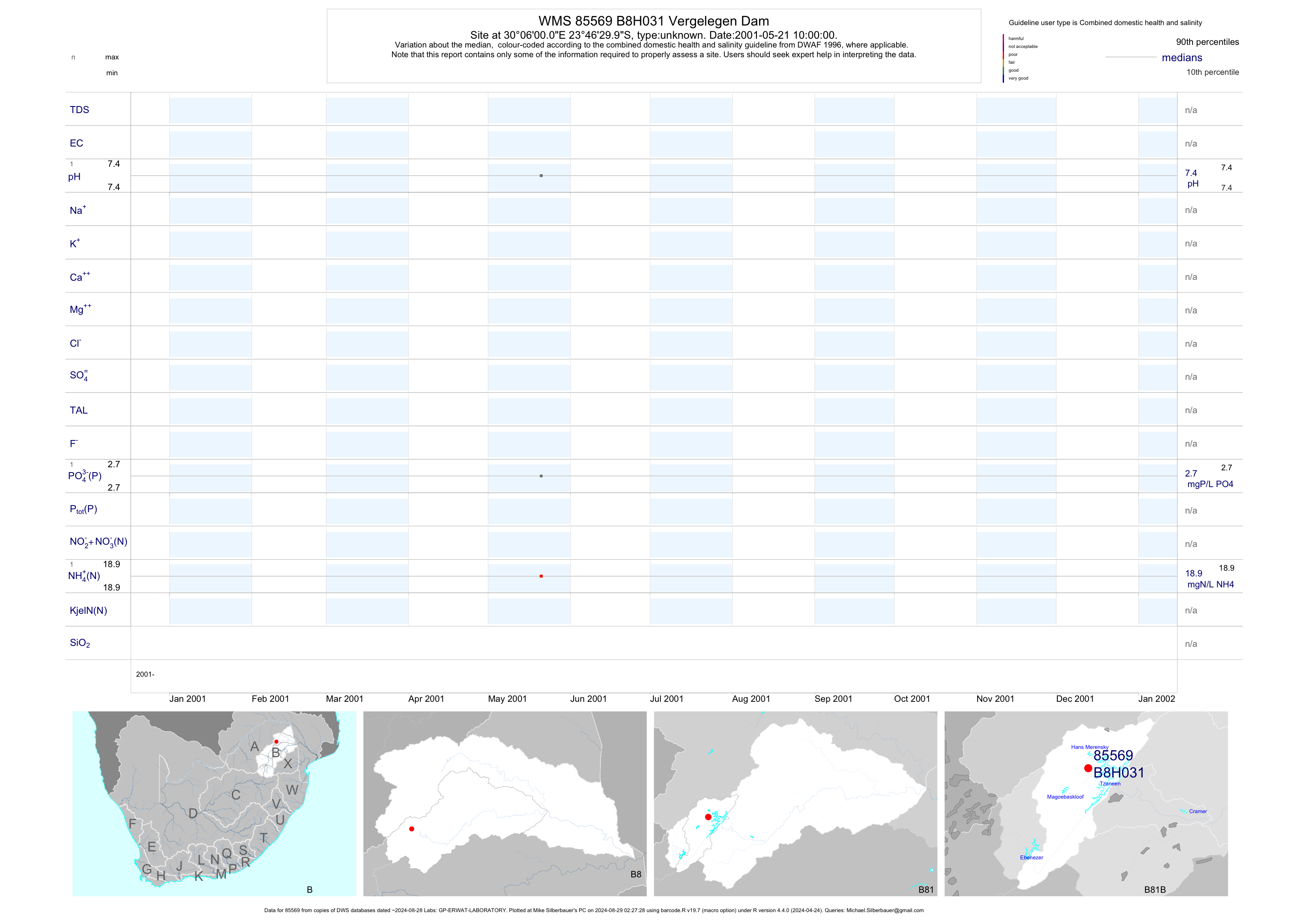
| B81 85569 | plot | data | Vergelegen Dam | unknown | 1 | 2001-05-21 | 2001-05-21 | n/a | B8H031 | -23.77500 | 30.10000 |
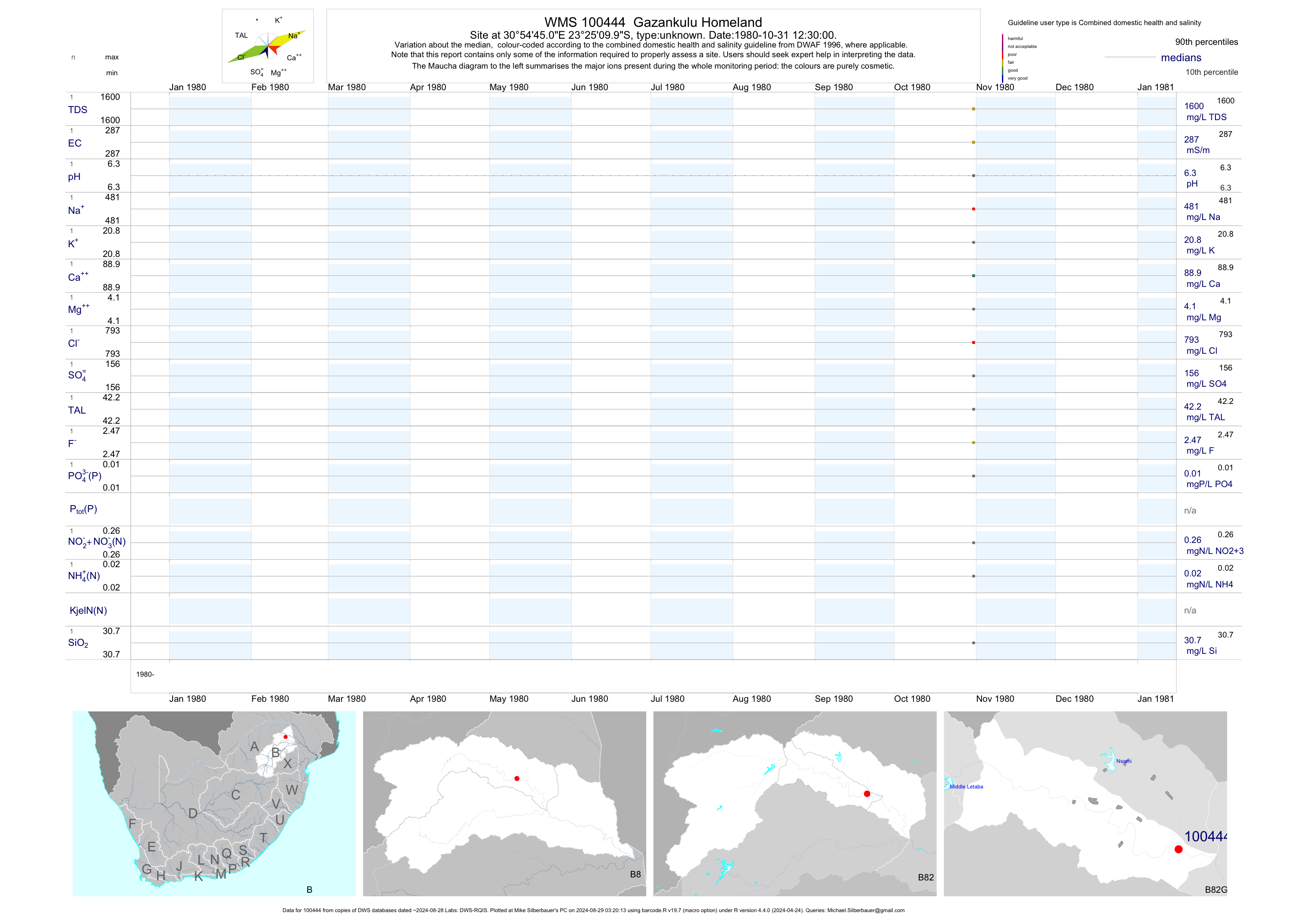
| B82 100444 | plot | data | Gazankulu Homeland | unknown | 1 | 1980-10-31 | 1980-10-31 | 287 | 100444 | -23.41944 | 30.91250 |
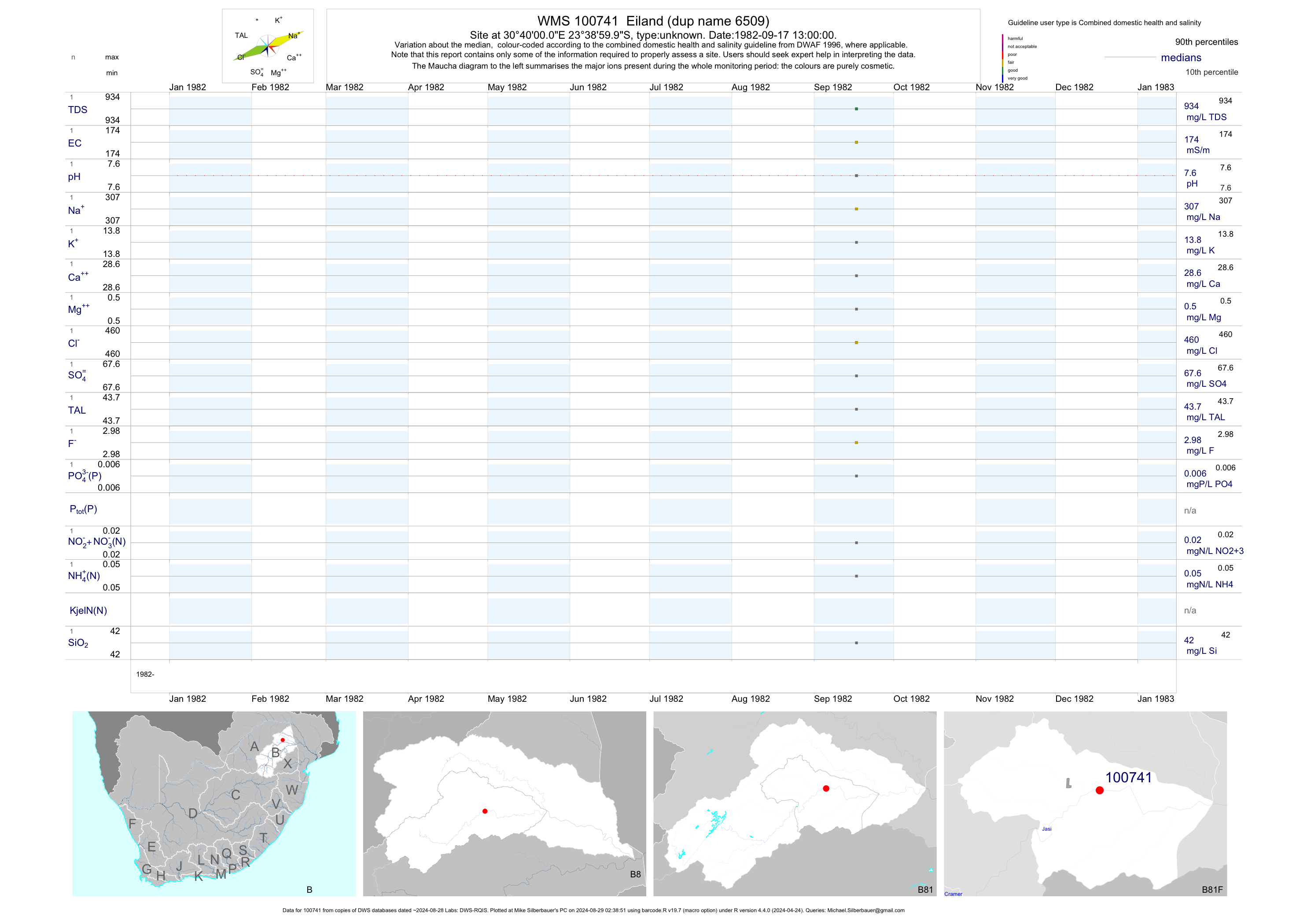
| B81 100741 | plot | data | Eiland (dup name 6509) | unknown | 1 | 1982-09-17 | 1982-09-17 | 174 | 100741 | -23.65000 | 30.66667 |
| B81 100742 | plot | data | Eiland (dup name 6510) | unknown | 1 | 1982-09-15 | 1982-09-15 | 115 | 100742 | -23.68333 | 30.68333 |
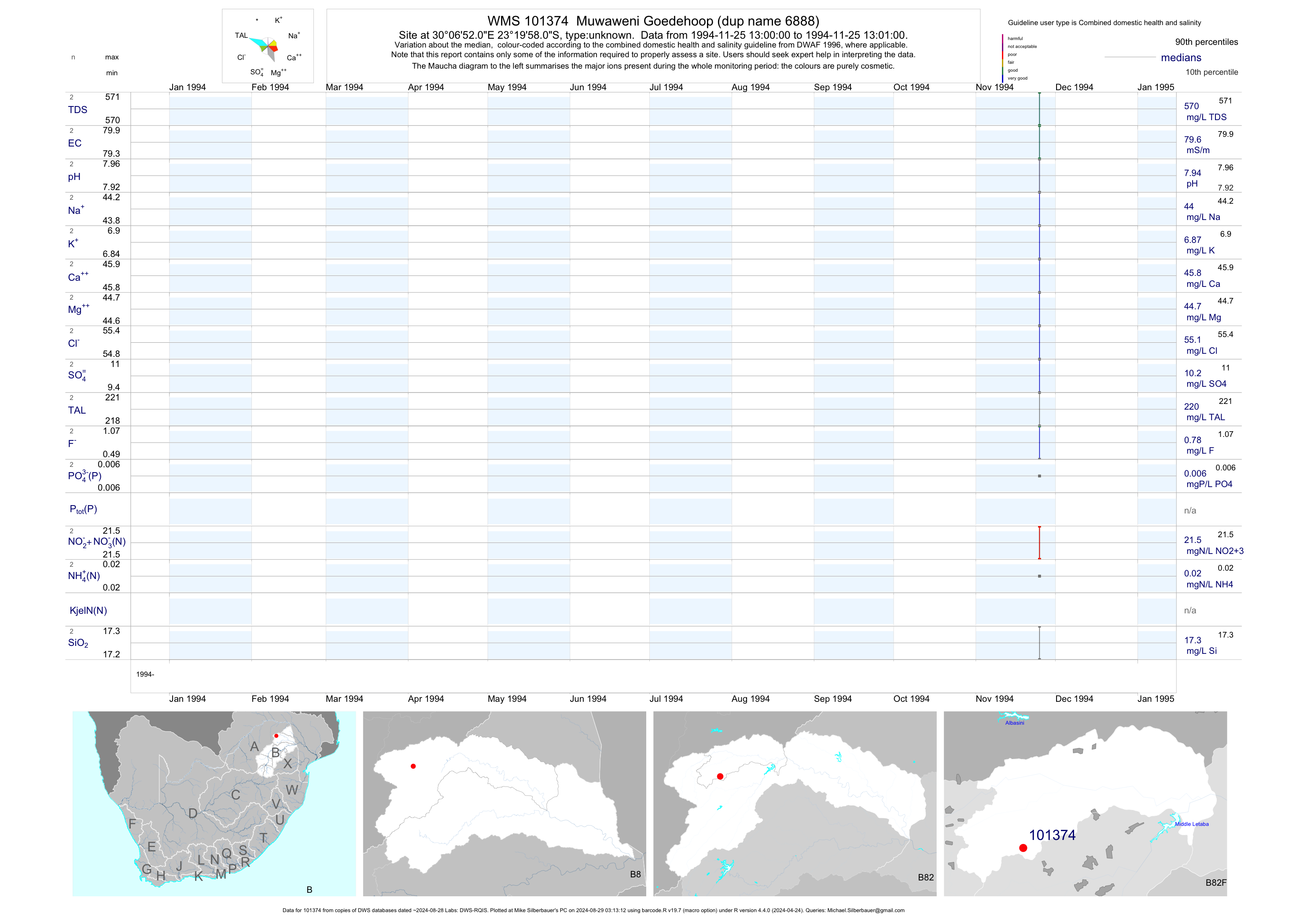
| B82 101374 | plot | data | Muwaweni Goedehoop (dup name 6888) | unknown | 2 | 1994-11-25 | 1994-11-25 | 80 | 101374 | -23.33278 | 30.11444 |
| B82 101375 | plot | data | Lambani Horingfontein | unknown | 2 | 1994-11-16 | 1994-11-23 | 40 | 101375 | -23.29722 | 30.05861 |
| B82 101376 | plot | data | Mpofu Buffelshoek (dup name 6889) | unknown | 1 | 1994-11-16 | 1994-11-16 | 120 | 101376 | -23.30167 | 29.99417 |
| B82 101377 | plot | data | Mpofu Buffelshoek (dup name 6890) | unknown | 1 | 1994-11-16 | 1994-11-16 | 123 | 101377 | -23.30167 | 29.99222 |
| B82 101378 | plot | data | Muwaweni Goedehoop (dup name 6891) | unknown | 2 | 1994-11-28 | 1994-11-28 | 59 | 101378 | -23.32583 | 30.11222 |