Resource water quality data for Mzimvubu to Keiskamma WMA.

Resource water quality data for Mzimvubu to Keiskamma WMA. |
|
| Water quality | Description | Type | n | First date | Last date | med EC | Flow, if any |
Latitude | Longitude | ||
|---|---|---|---|---|---|---|---|---|---|---|---|
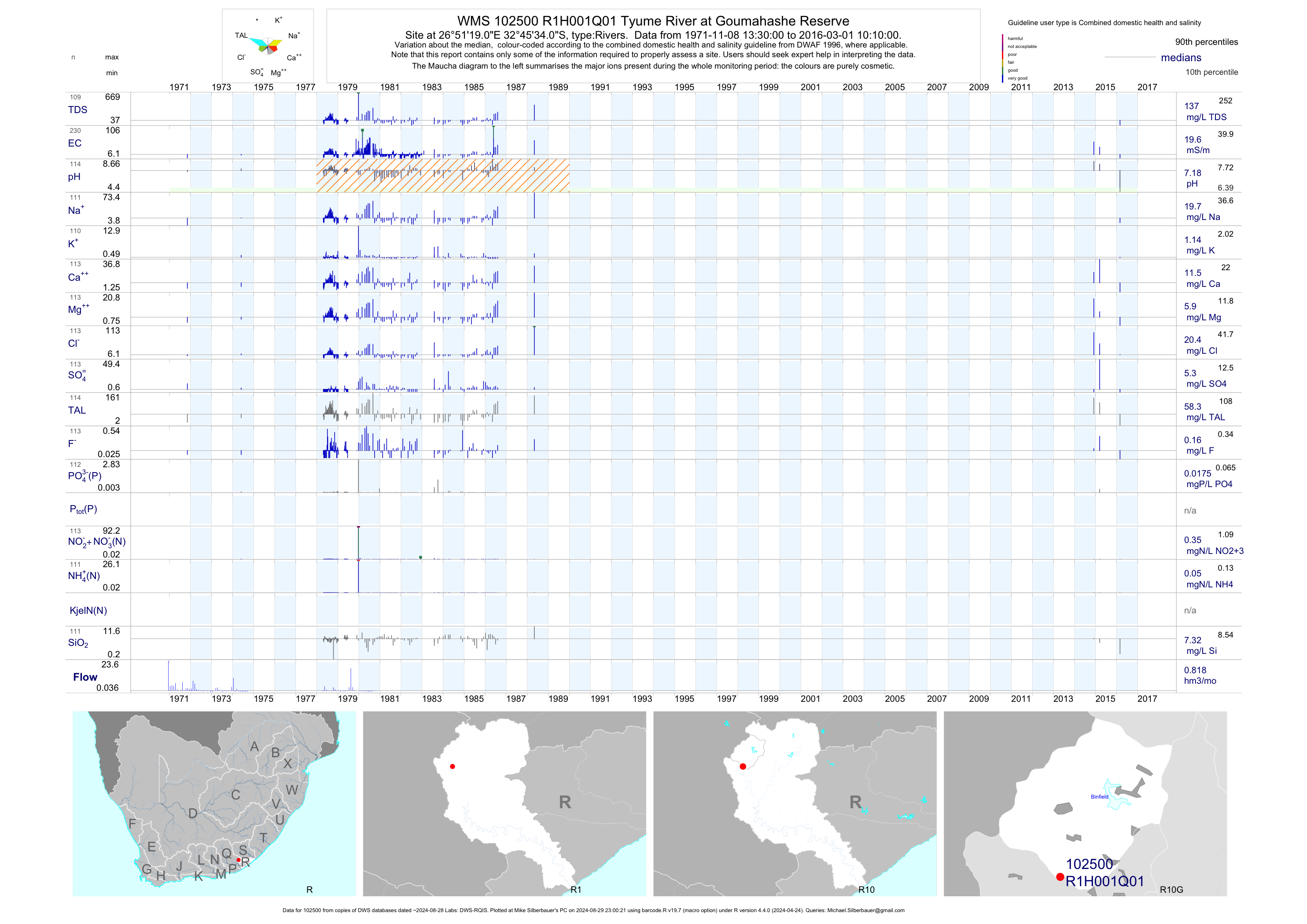
| R10 102500 | plot | data | Tyume River at Goumahashe Reserve | Rivers | 230 | 1971-11-08 | 2016-03-01 | 20 | R1H001 | -32.75944 | 26.85528 |
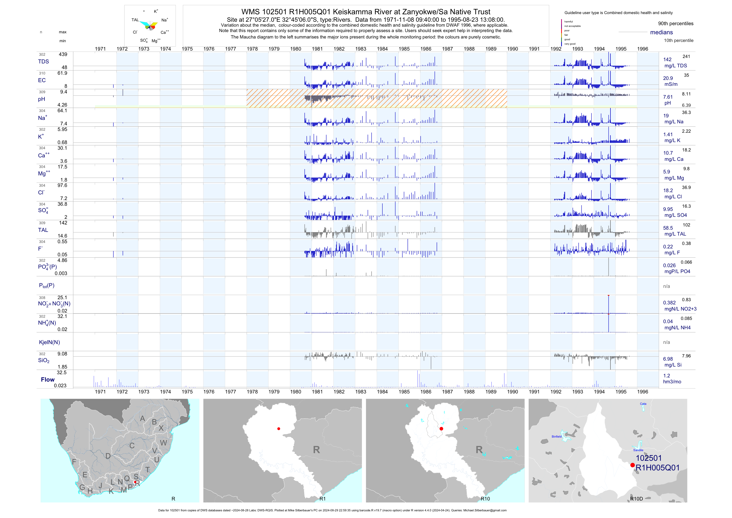
| R10 102501 | plot | data | Keiskamma River at Zanyokwe/Sa Native Trust | Rivers | 447 | 1953-09-14 | 1995-08-23 | 21 | R1H005 | -32.75167 | 27.09083 |
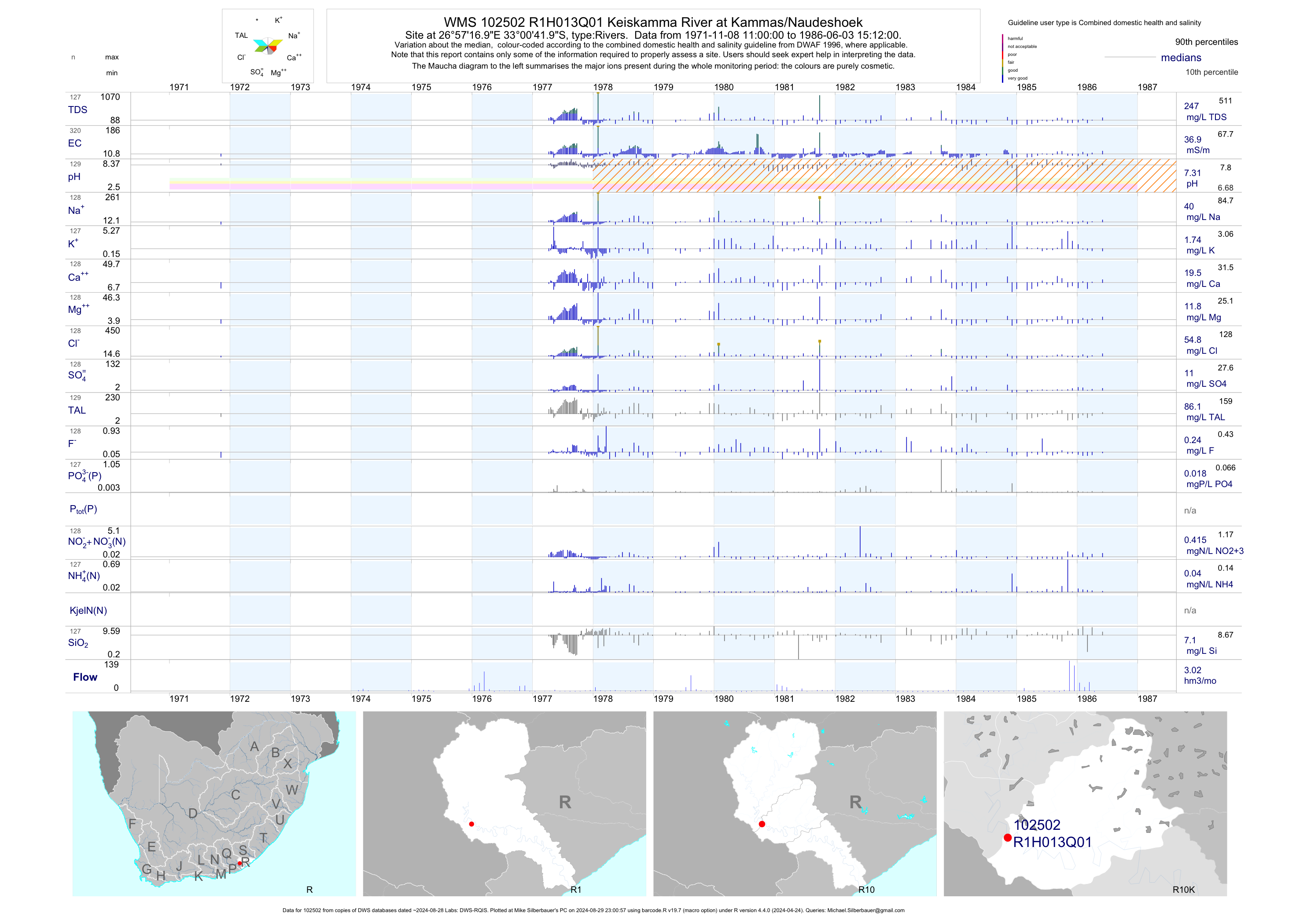
| R10 102502 | plot | data | Keiskamma River at Kammas/Naudeshoek | Rivers | 320 | 1971-11-08 | 1986-06-03 | 37 | R1H013 | -33.01167 | 26.95472 |
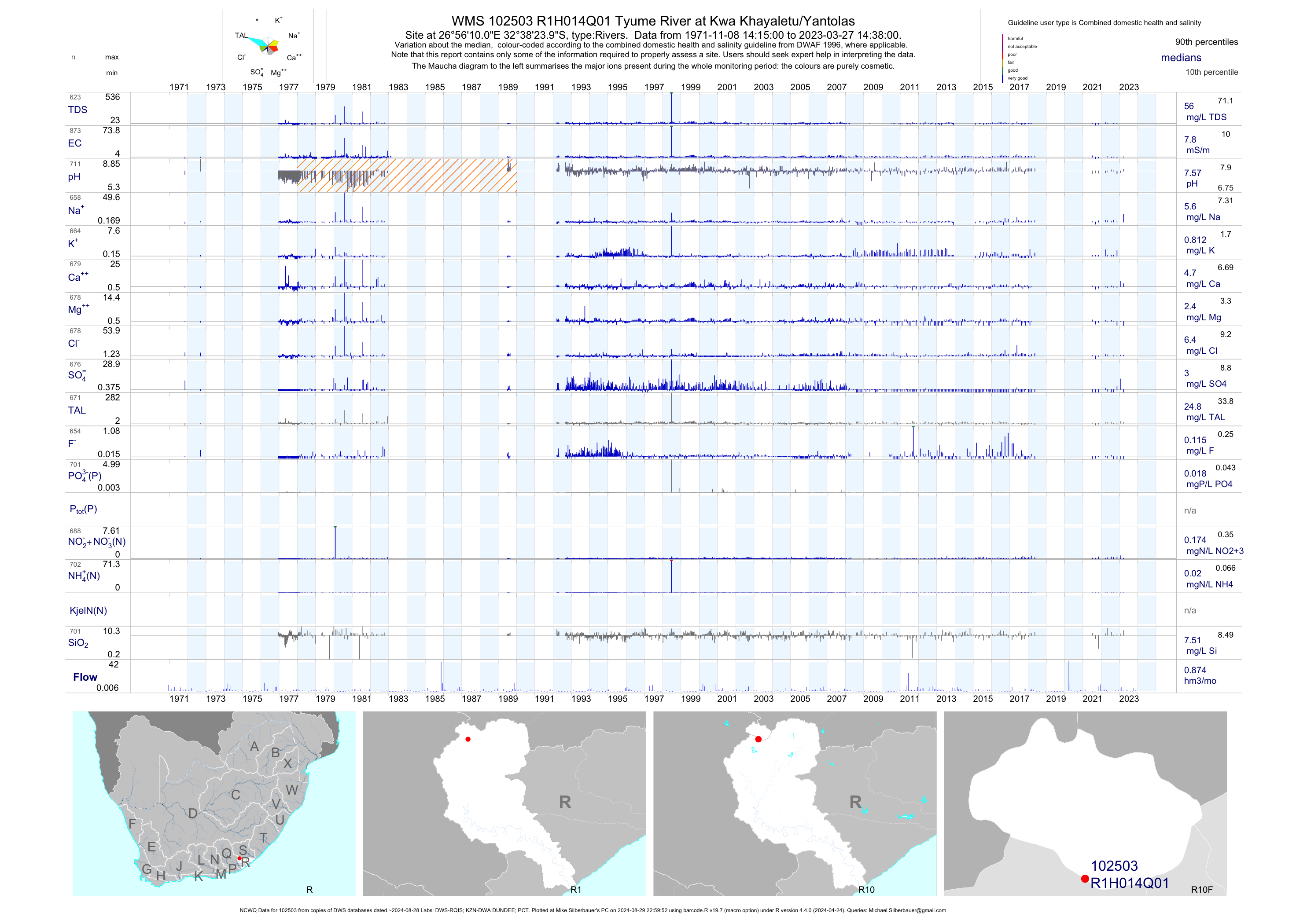
| R10 102503 | plot | data | Tyume River at Kwa Khayaletu/Yantolas (NCWQ) | Rivers | 867 | 1971-11-08 | 2018-05-16 | 8 | R1H014 | -32.64000 | 26.93611 |
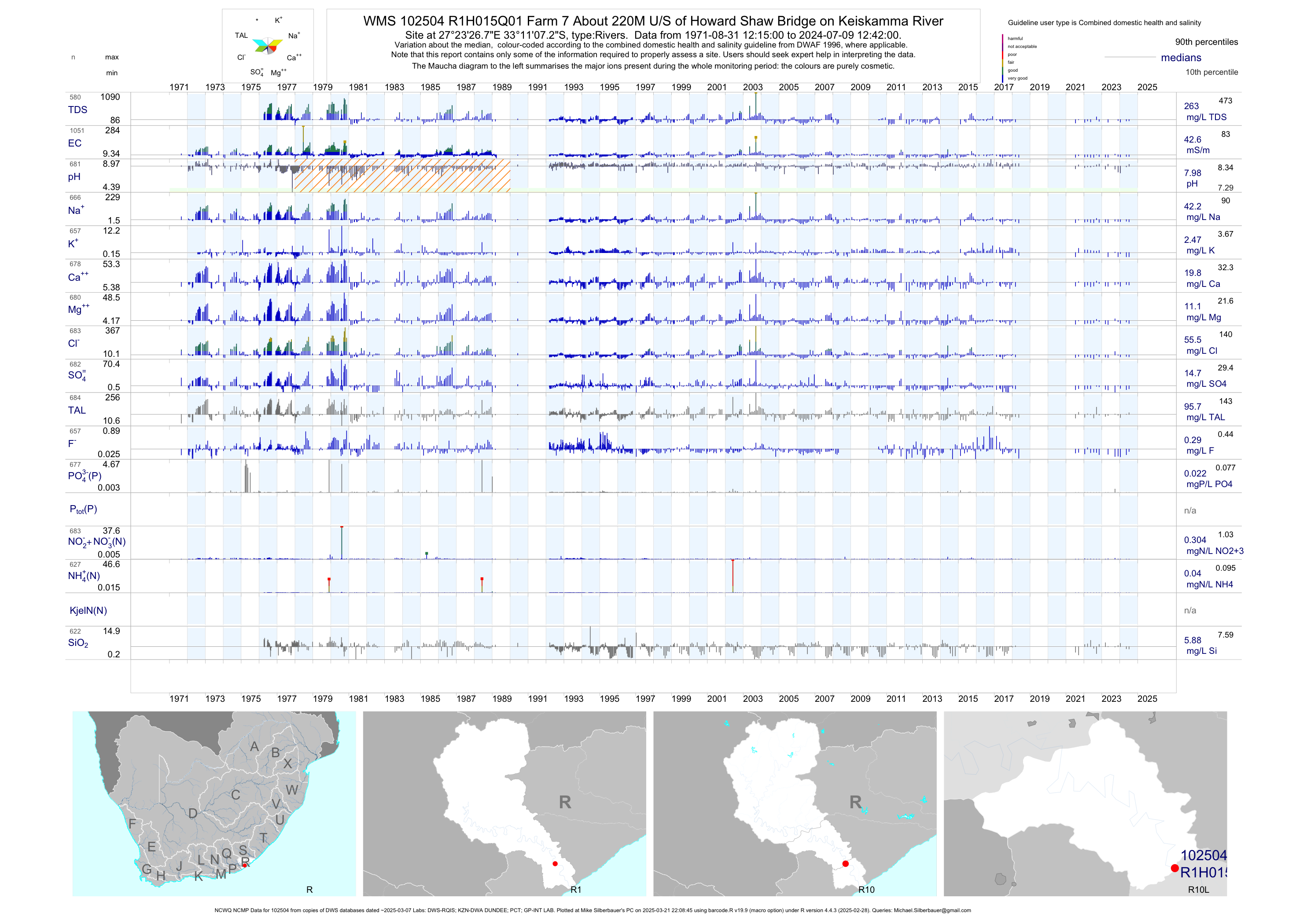
| R10 102504 | plot | data | Farm 7 About 220M U/S of Howard Shaw Bridge on Keiskamma River (NCWQ NCMP) | Rivers | 1129 | 1971-08-31 | 2018-05-17 | 43 | R1H015 | -33.18536 | 27.39075 |
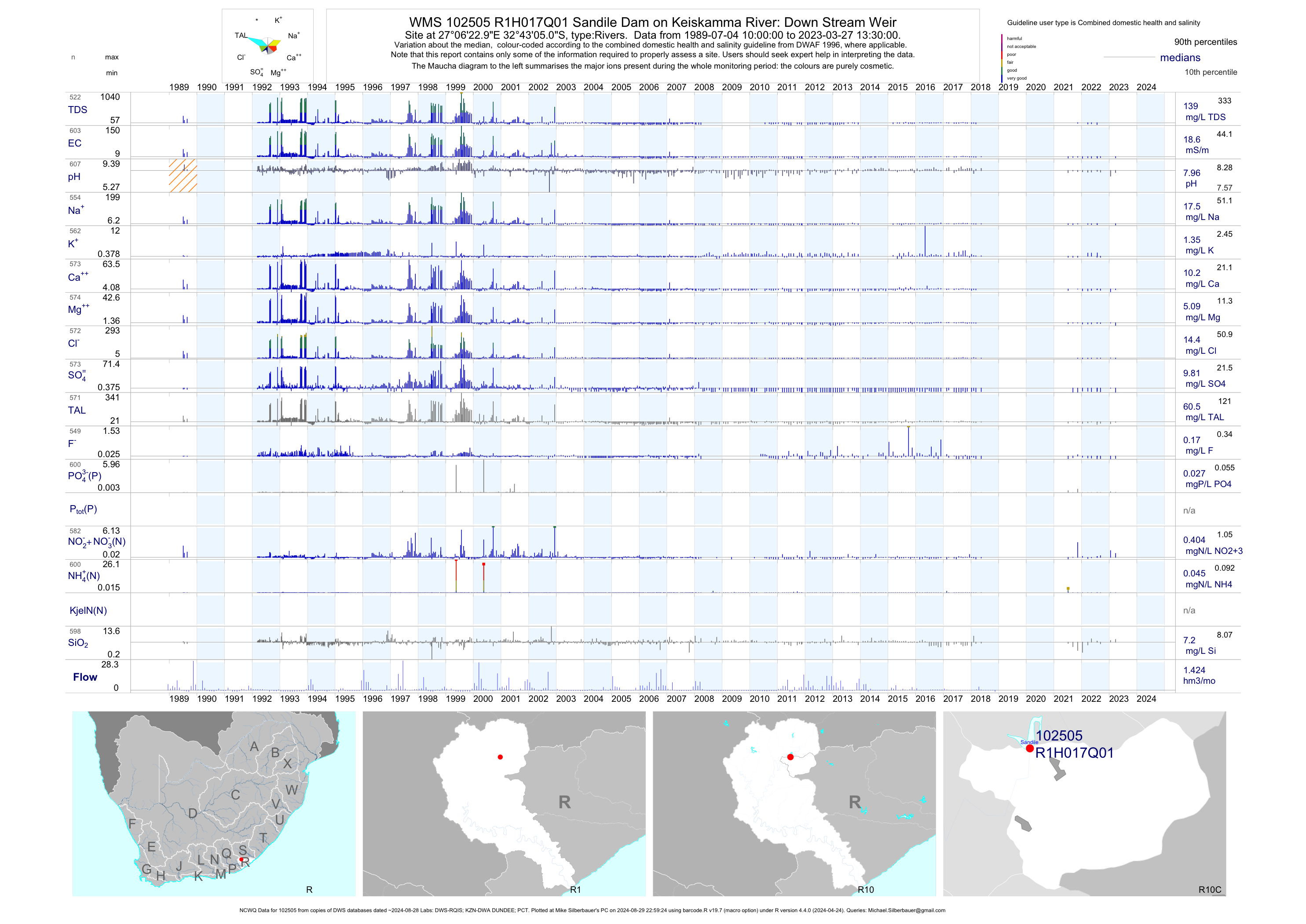
| R10 102505 | plot | data | Sandile Dam on Keiskamma River: Down Stream Weir (NCWQ) | Rivers | 596 | 1989-07-04 | 2018-05-16 | 19 | R1H017 | -32.71806 | 27.10639 |
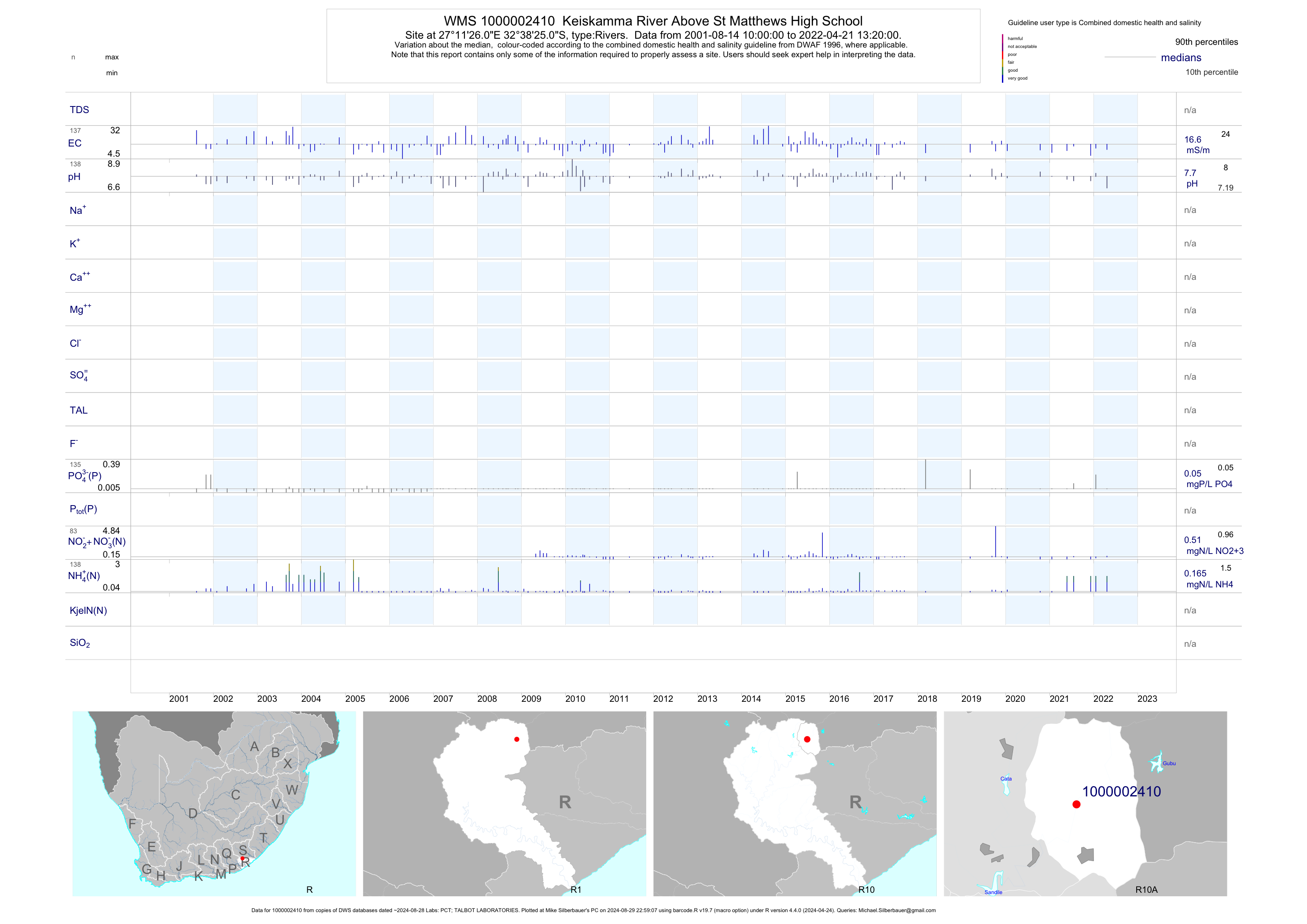
| R10 1000002410 | plot | data | Keiskamma River Above St Matthews High School | Rivers | 244 | 2001-08-14 | 2019-03-13 | 17 | 1-2410 | -32.64031 | 27.19058 |
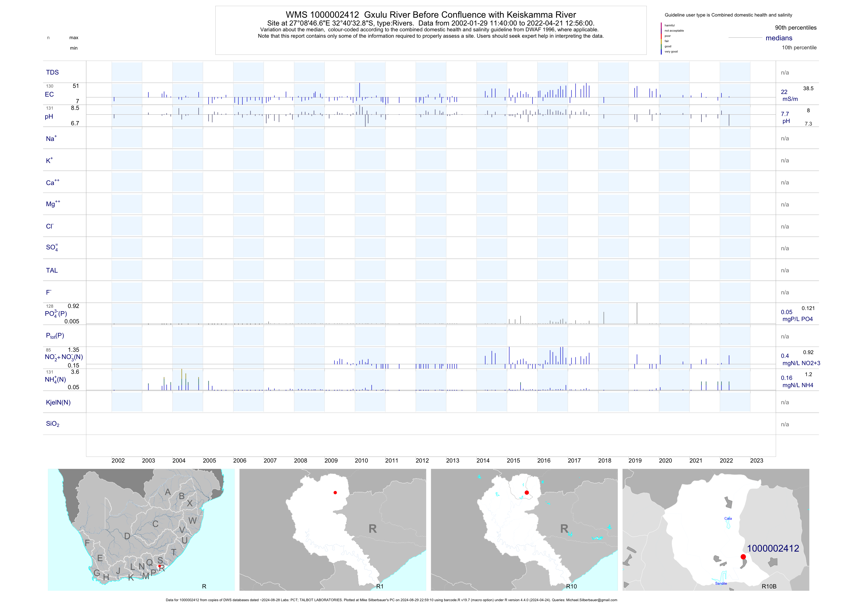
| R10 1000002412 | plot | data | Gxulu River Before Confluence with Keiskamma River | Rivers | 234 | 2002-01-29 | 2019-04-11 | 21 | 1-2412 | -32.67581 | 27.14631 |
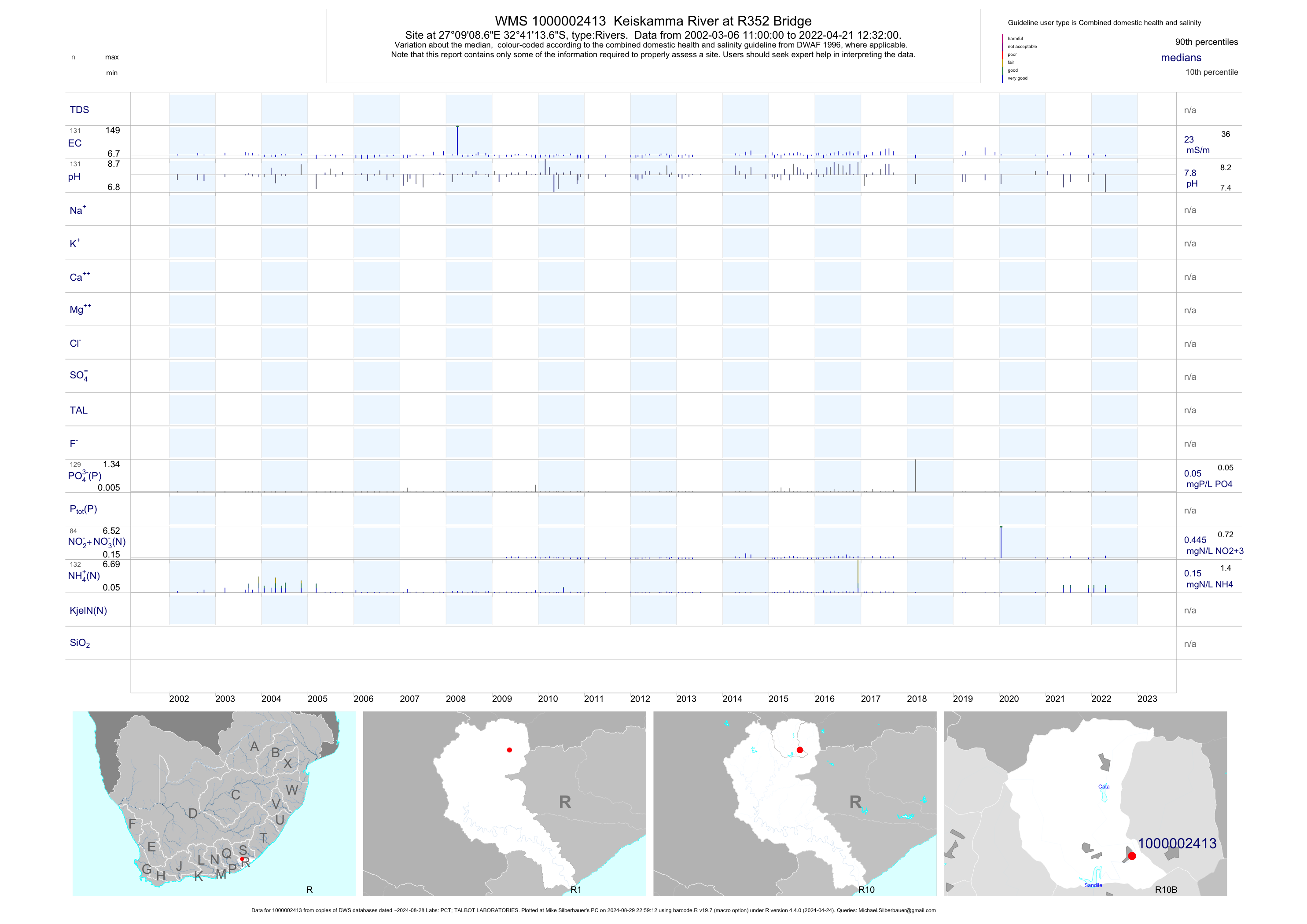
| R10 1000002413 | plot | data | Keiskamma River at R352 Bridge | Rivers | 238 | 2002-03-06 | 2019-04-11 | 23 | 1-2413 | -32.68714 | 27.15239 |
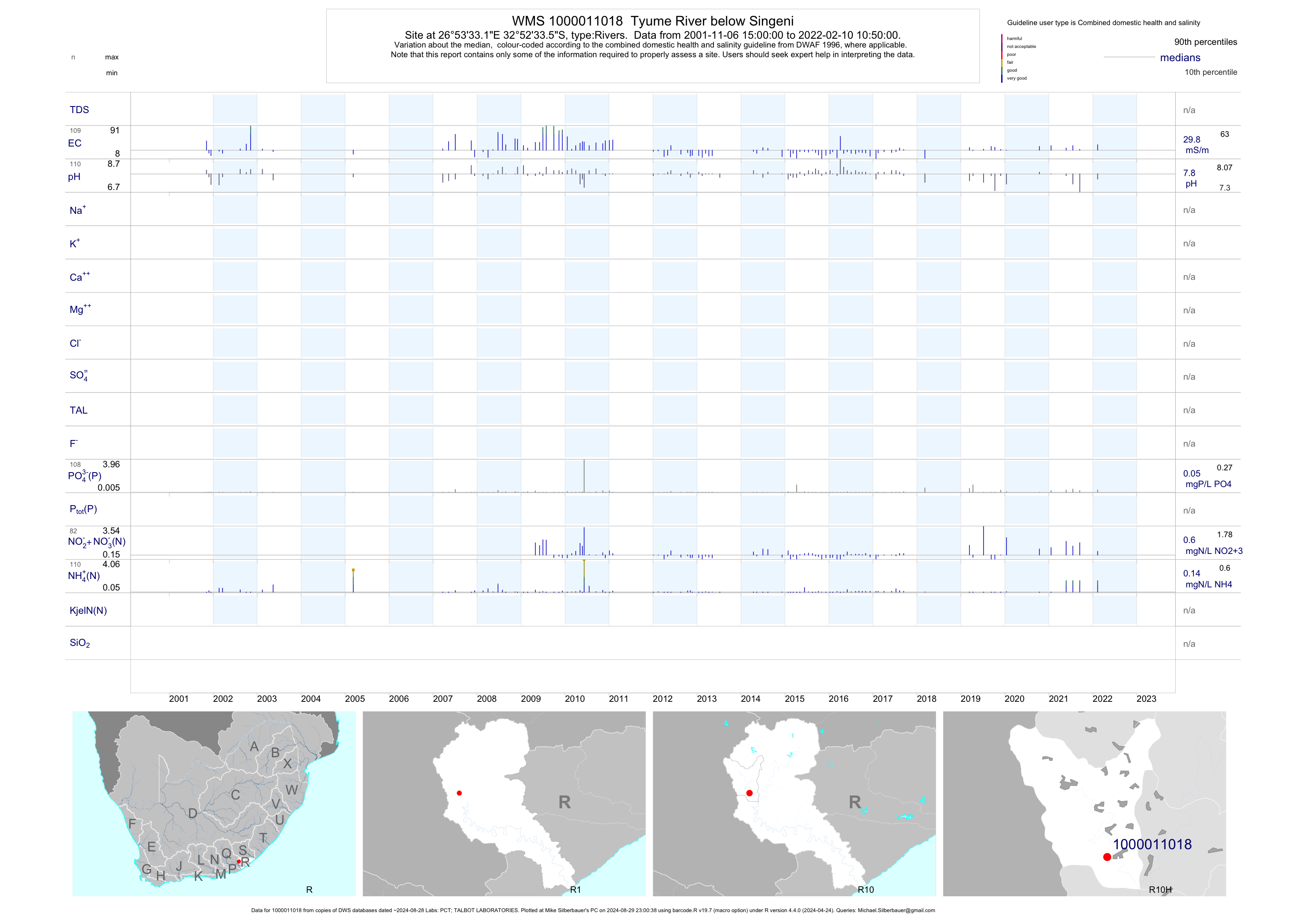
| R10 1000011018 | plot | data | Tyume River below Singeni | Rivers | 193 | 2001-11-06 | 2019-04-11 | 27 | 1-11018 | -32.87597 | 26.89256 |
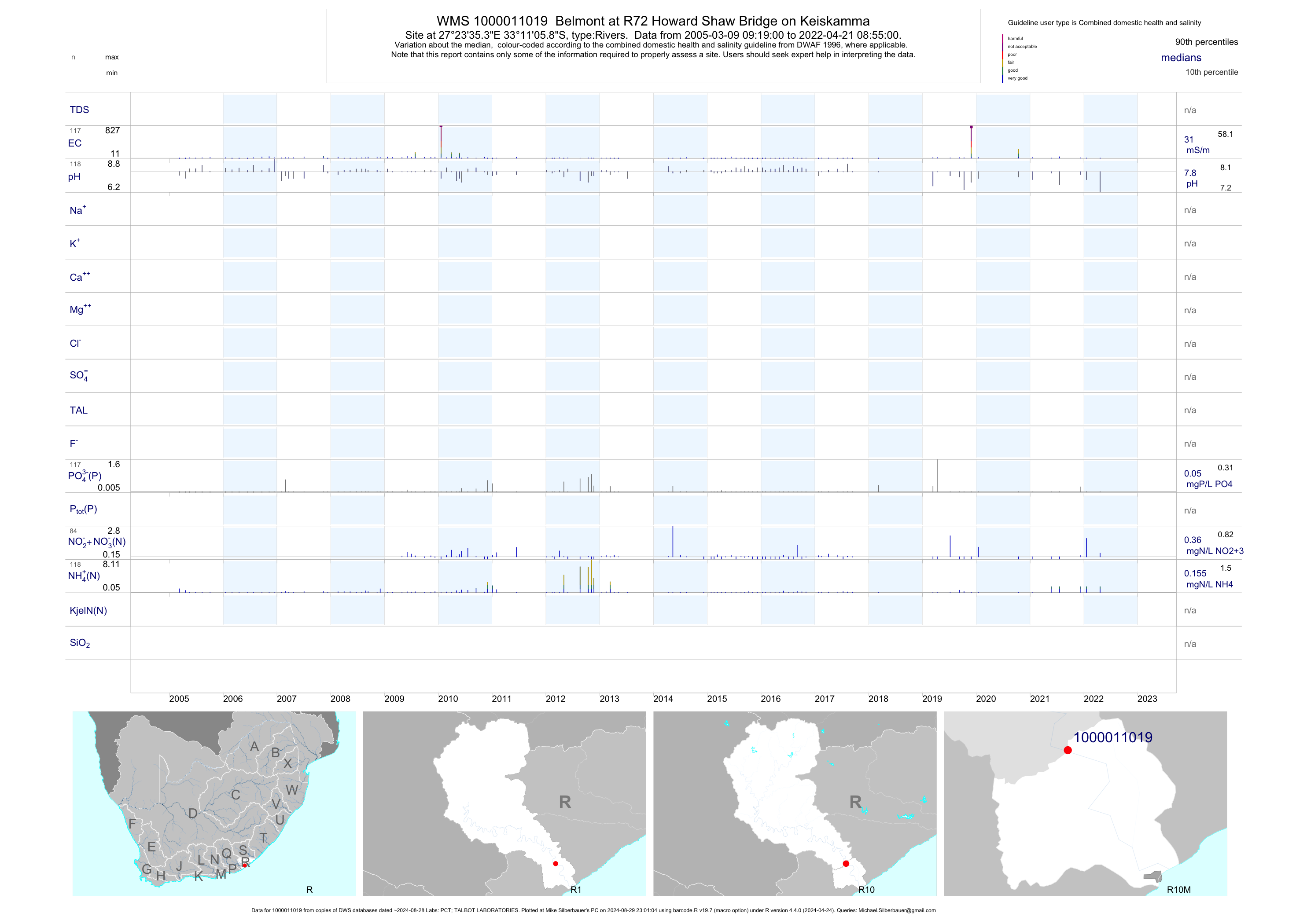
| R10 1000011019 | plot | data | Belmont at R72 Howard Shaw Bridge on Keiskamma | Rivers | 207 | 2005-03-09 | 2019-04-11 | 30 | 1-11019 | -33.18497 | 27.39314 |
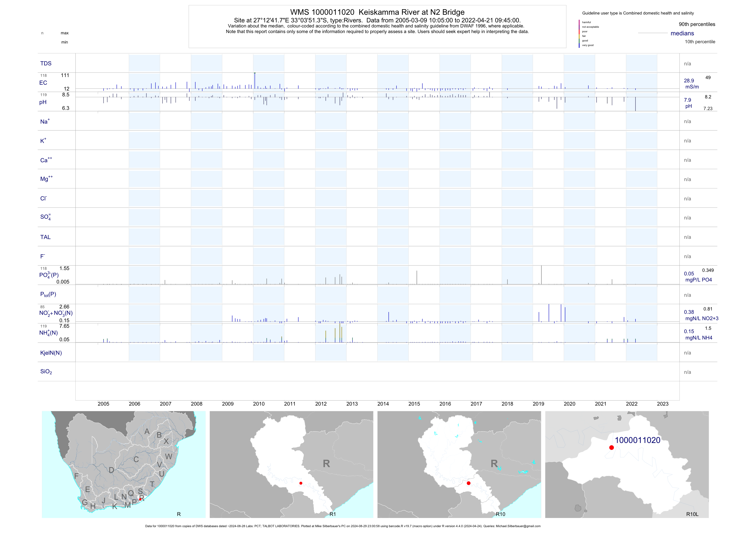
| R10 1000011020 | plot | data | Keiskamma River at N2 Bridge | Rivers | 208 | 2005-03-09 | 2019-04-11 | 28 | 1-11020 | -33.06425 | 27.21161 |
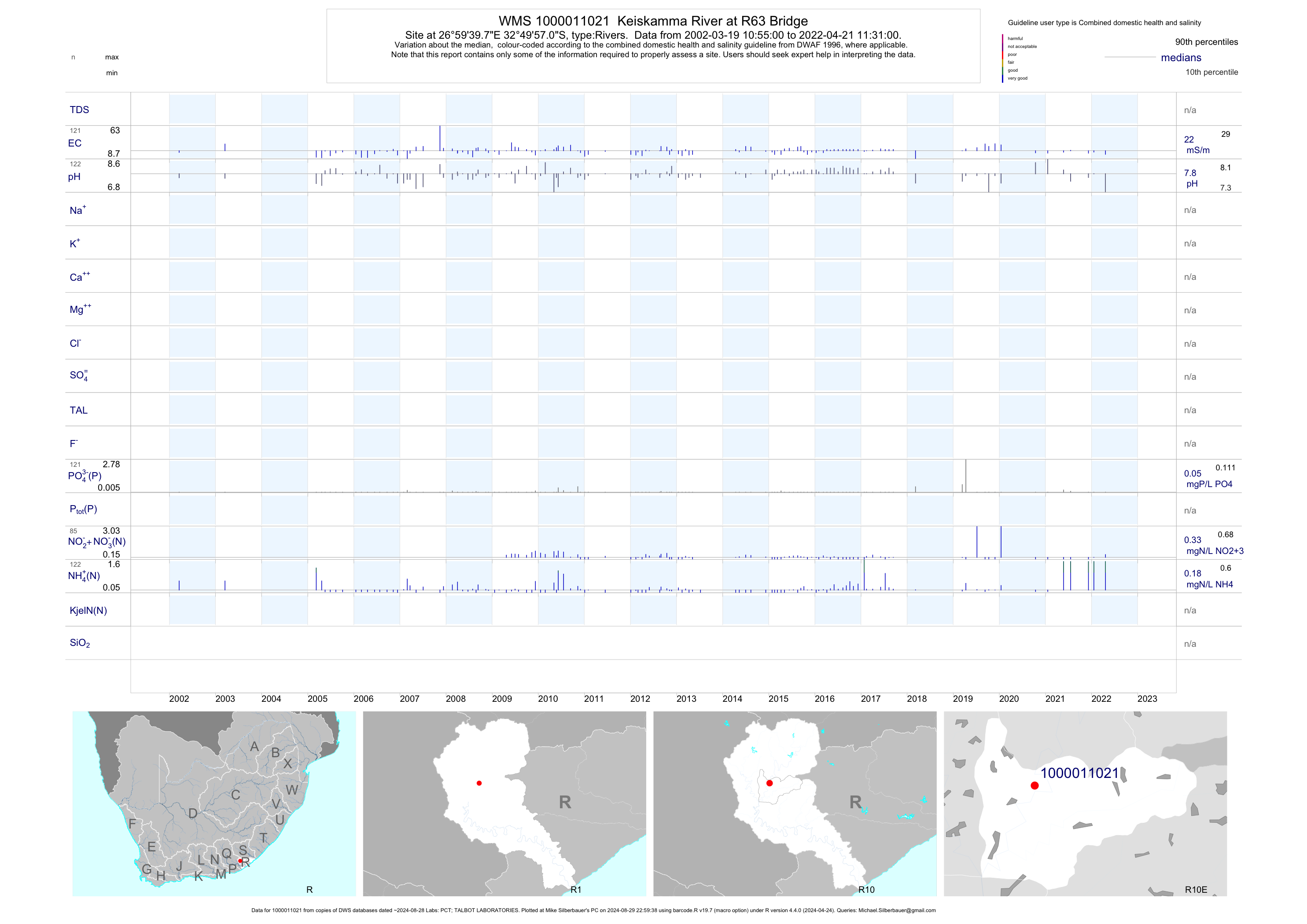
| R10 1000011021 | plot | data | Keiskamma River at R63 Bridge | Rivers | 216 | 2002-03-19 | 2019-04-11 | 22 | 1-11021 | -32.83250 | 26.99439 |
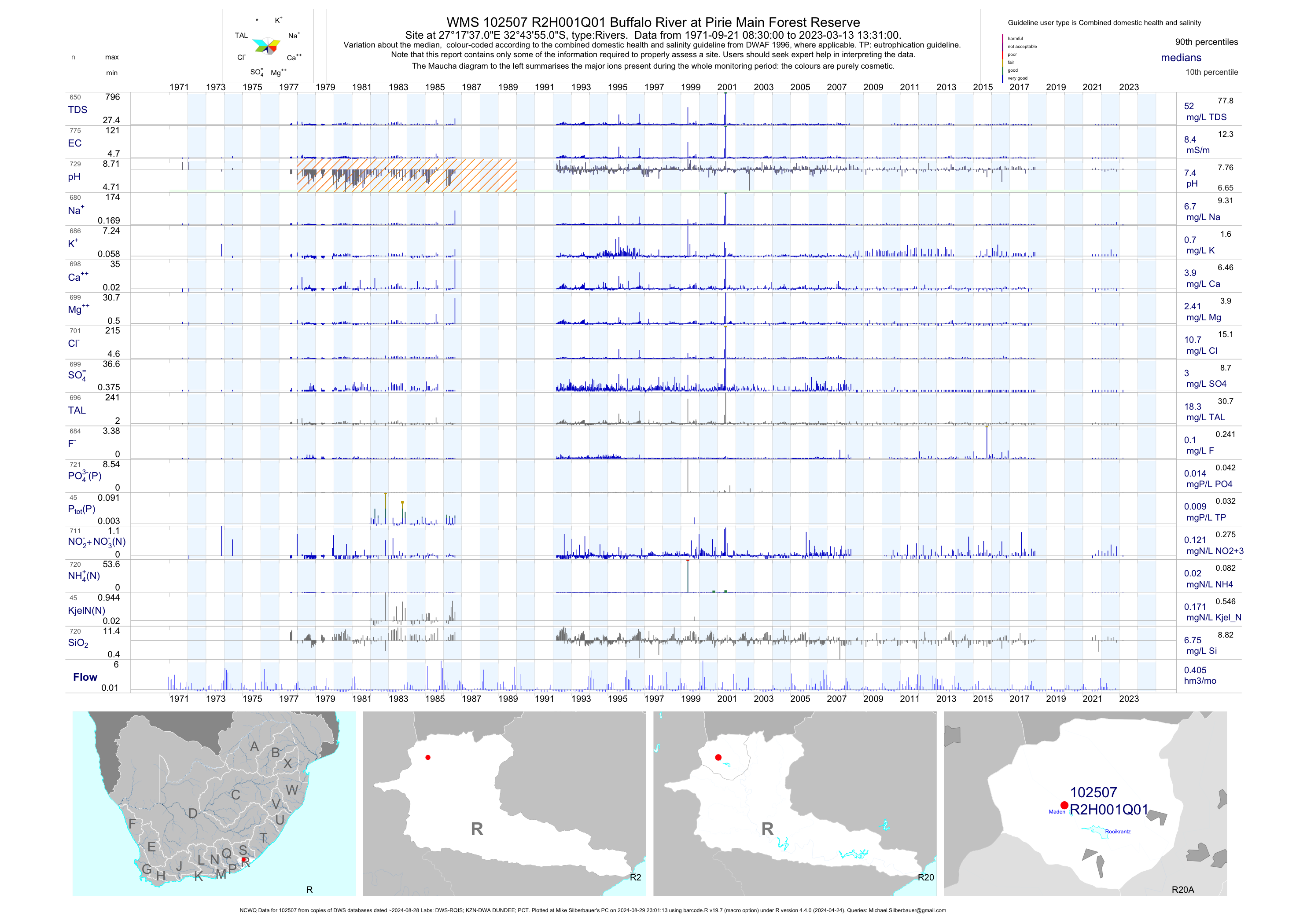
| R20 102507 | plot | data | Buffalo River at Pirie Main Forest Reserve (NCWQ) | Rivers | 769 | 1971-09-21 | 2018-05-17 | 8 | R2H001 | -32.73194 | 27.29361 |
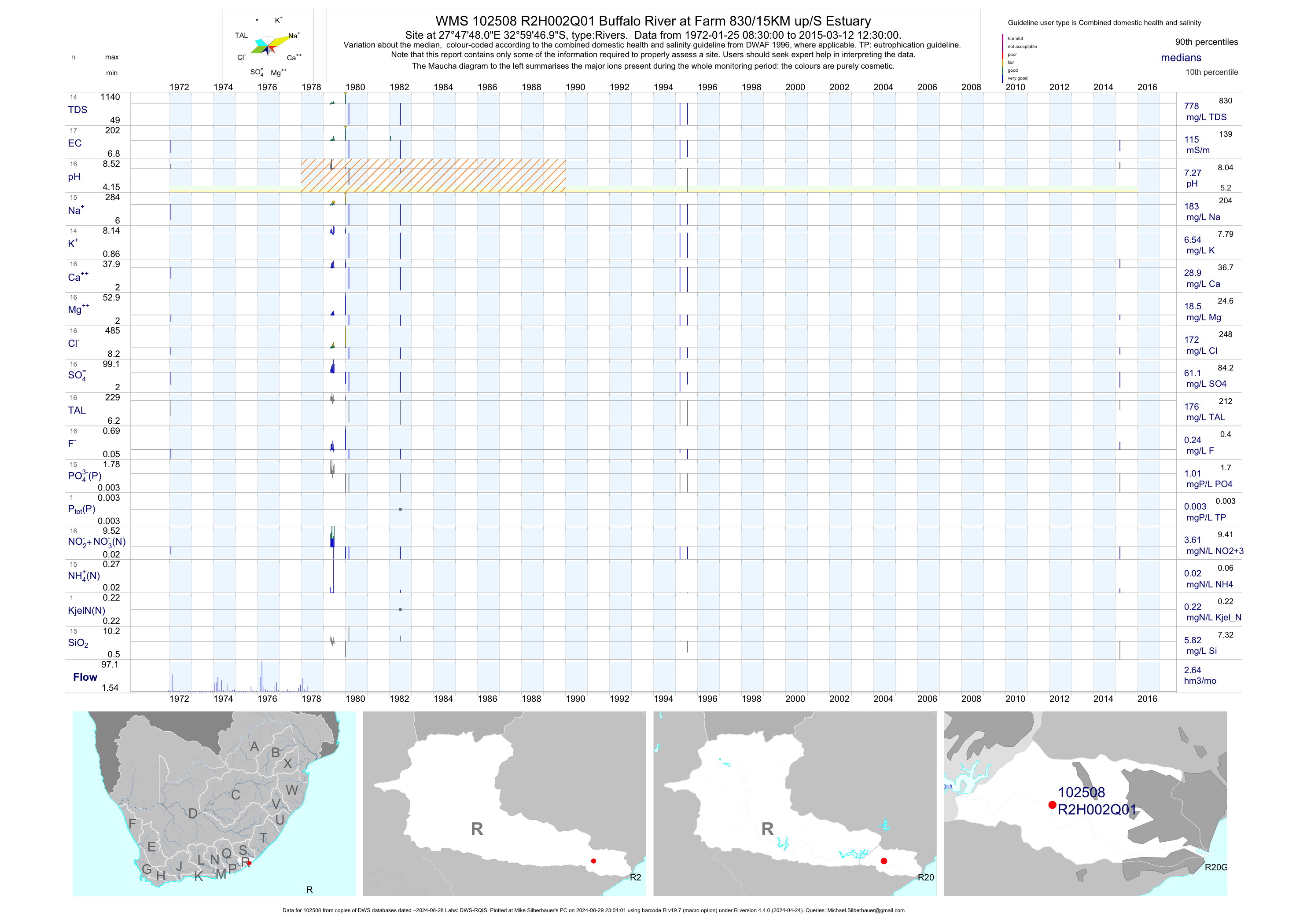
| R20 102508 | plot | data | Buffalo River at Farm 830/15KM up/S Estuary | Rivers | 18 | 1972-01-25 | 2015-03-12 | 115 | R2H002 | -32.99639 | 27.79667 |
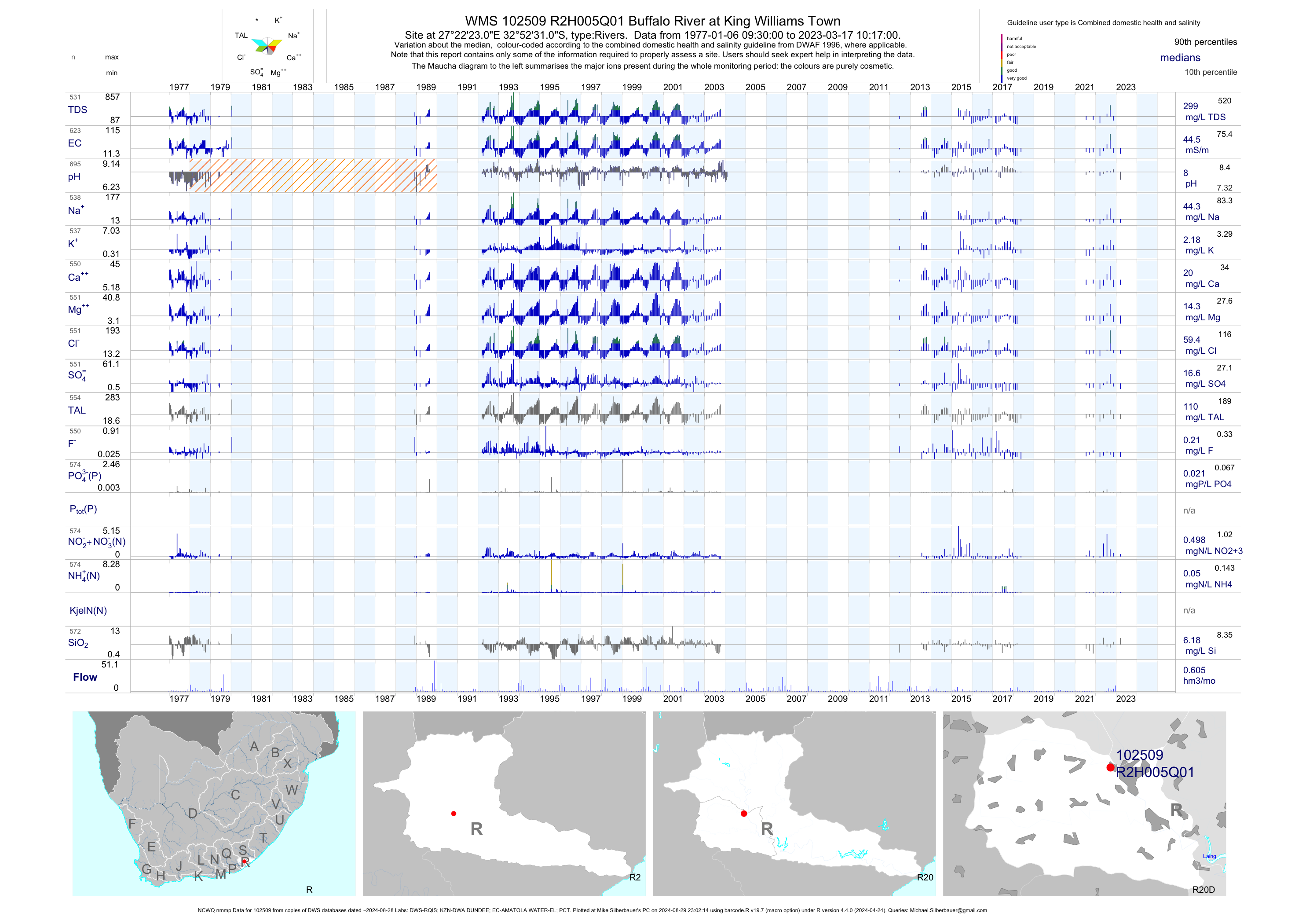
| R20 102509 | plot | data | Buffalo River at King Williams Town (NCWQ nmmp) | Rivers | 1033 | 1977-01-06 | 2018-05-17 | 45 | R2H005 | -32.87528 | 27.37306 |
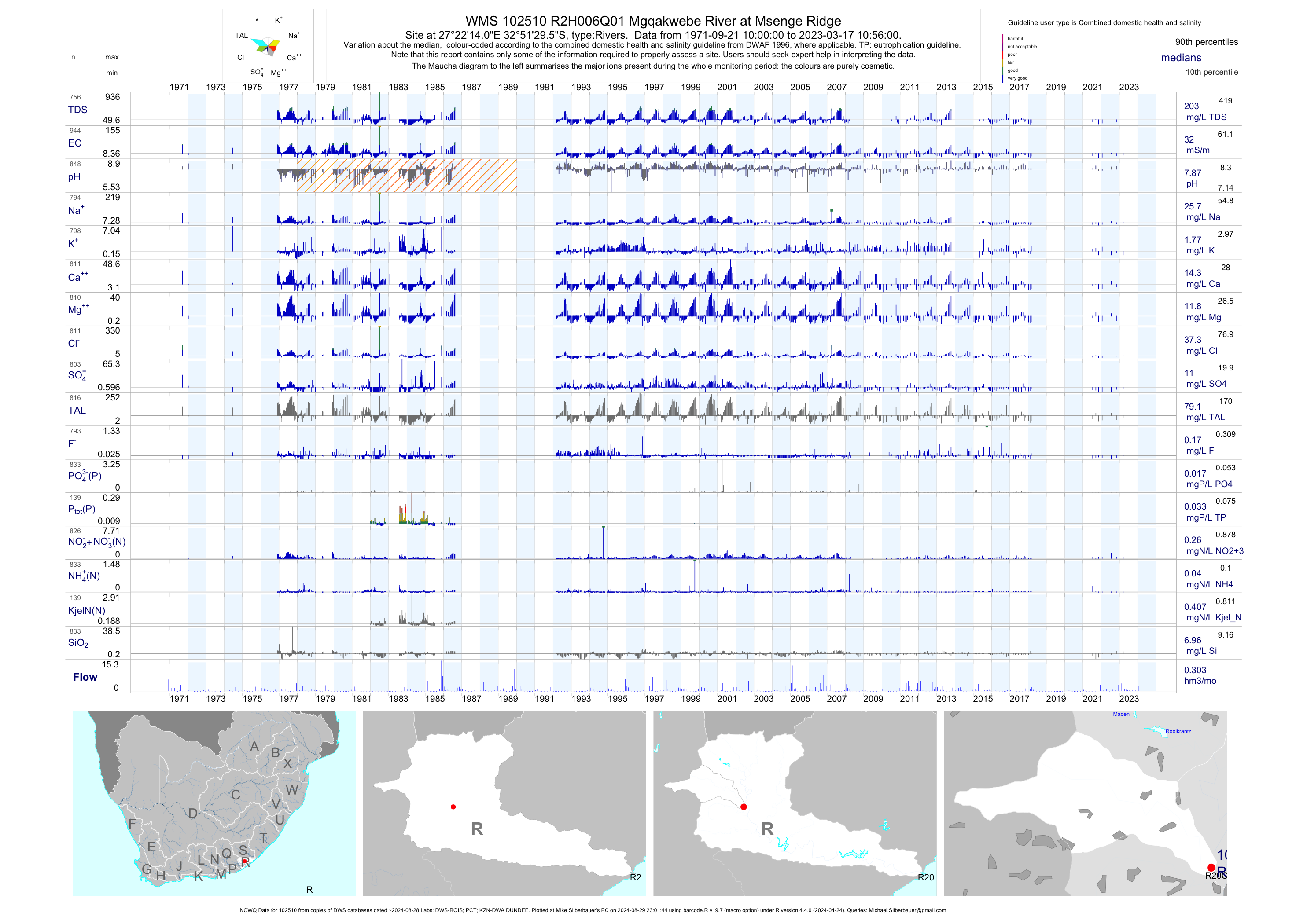
| R20 102510 | plot | data | Mgqakwebe River at Msenge Ridge (NCWQ) | Rivers | 935 | 1971-09-21 | 2018-05-17 | 32 | R2H006 | -32.85819 | 27.37056 |
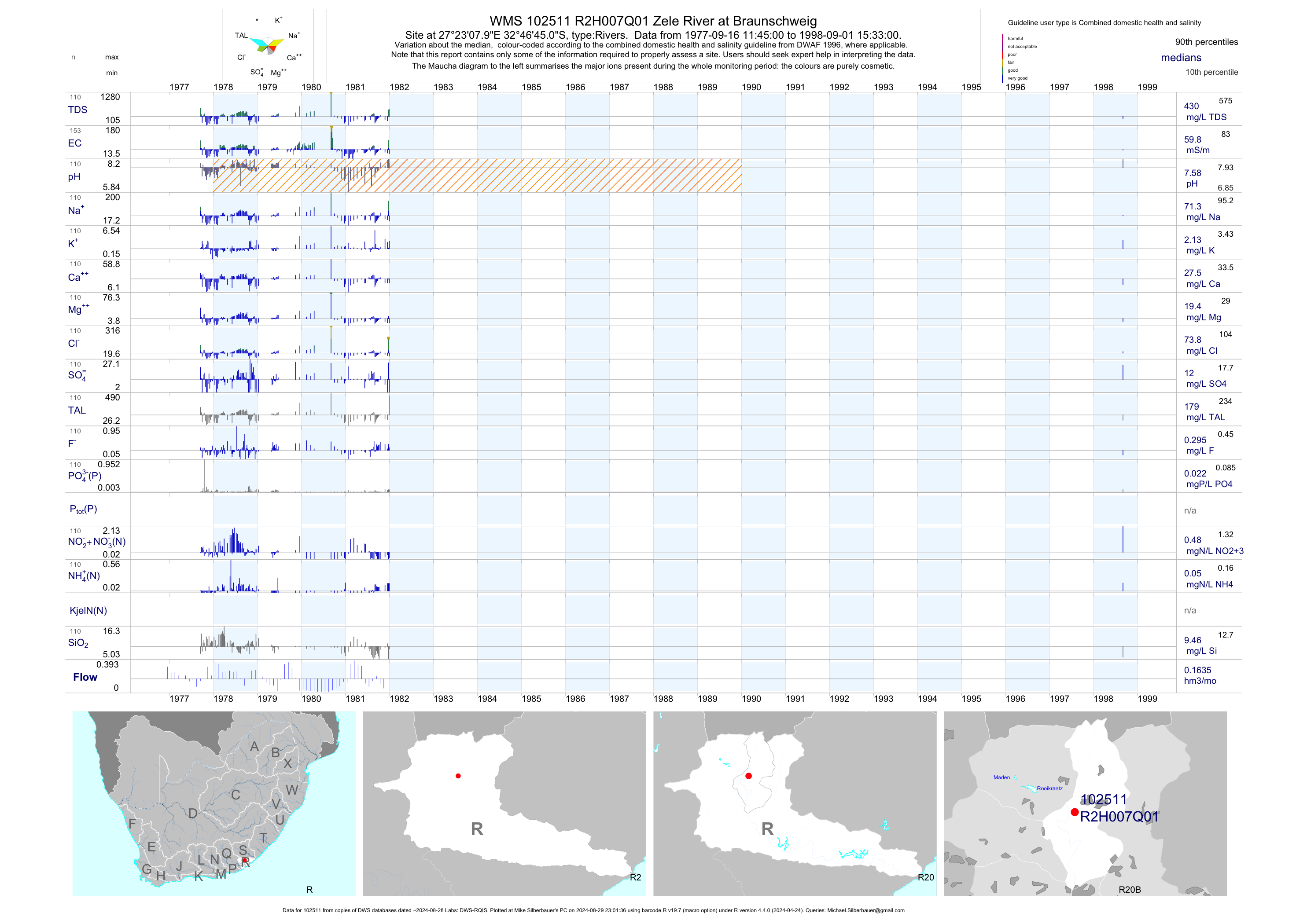
| R20 102511 | plot | data | Zele River at Braunschweig | Rivers | 153 | 1977-09-16 | 1998-09-01 | 60 | R2H007 | -32.77917 | 27.38556 |
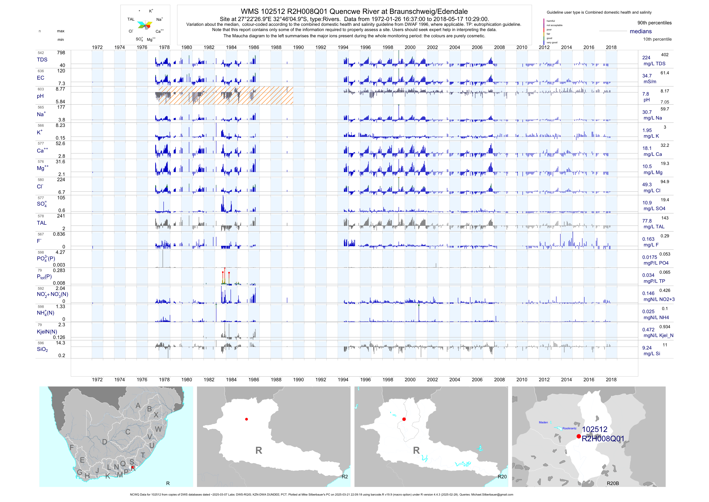
| R20 102512 | plot | data | Quencwe River at Braunschweig/Edendale (NCWQ) | Rivers | 637 | 1972-01-26 | 2018-05-17 | 35 | R2H008 | -32.76806 | 27.37417 |
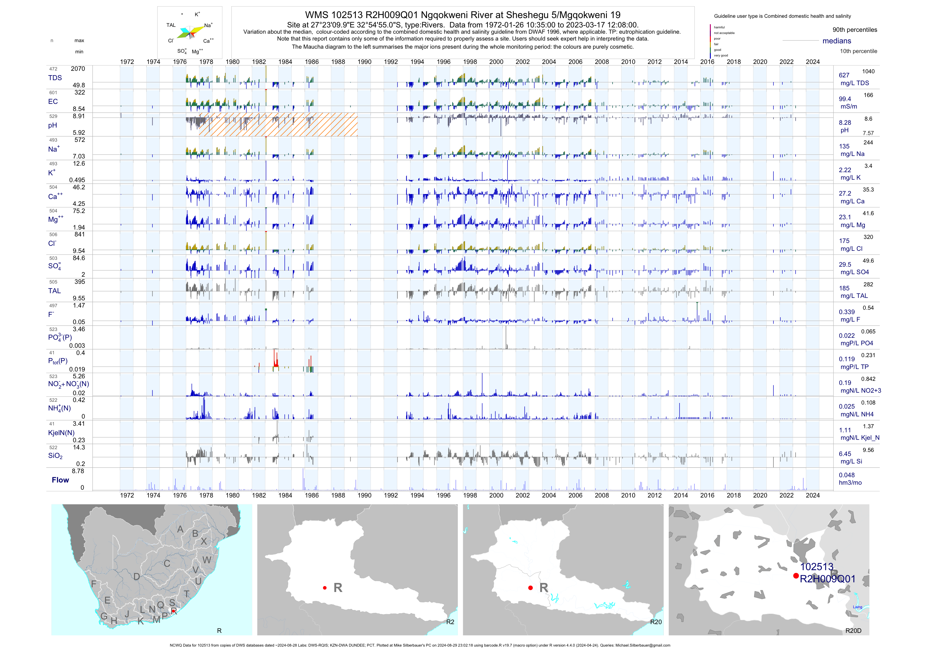
| R20 102513 | plot | data | Ngqokweni River at Sheshegu 5/Mgqokweni 19 (NCWQ) | Rivers | 596 | 1972-01-26 | 2018-05-17 | 100 | R2H009 | -32.91528 | 27.38611 |
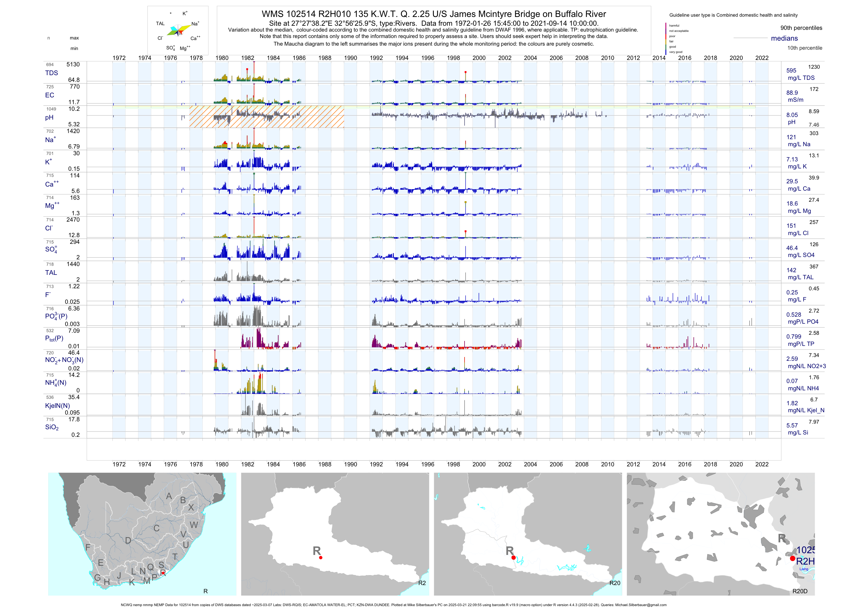
| R20 102514 | plot | data | 135 K.W.T. Q. 2.25 U/S James Mcintyre Bridge on Buffalo River (NCWQ nemp nmmp NEMP) | Rivers | 1804 | 1972-01-26 | 2018-05-17 | 89 | R2H010 | -32.94053 | 27.46064 |
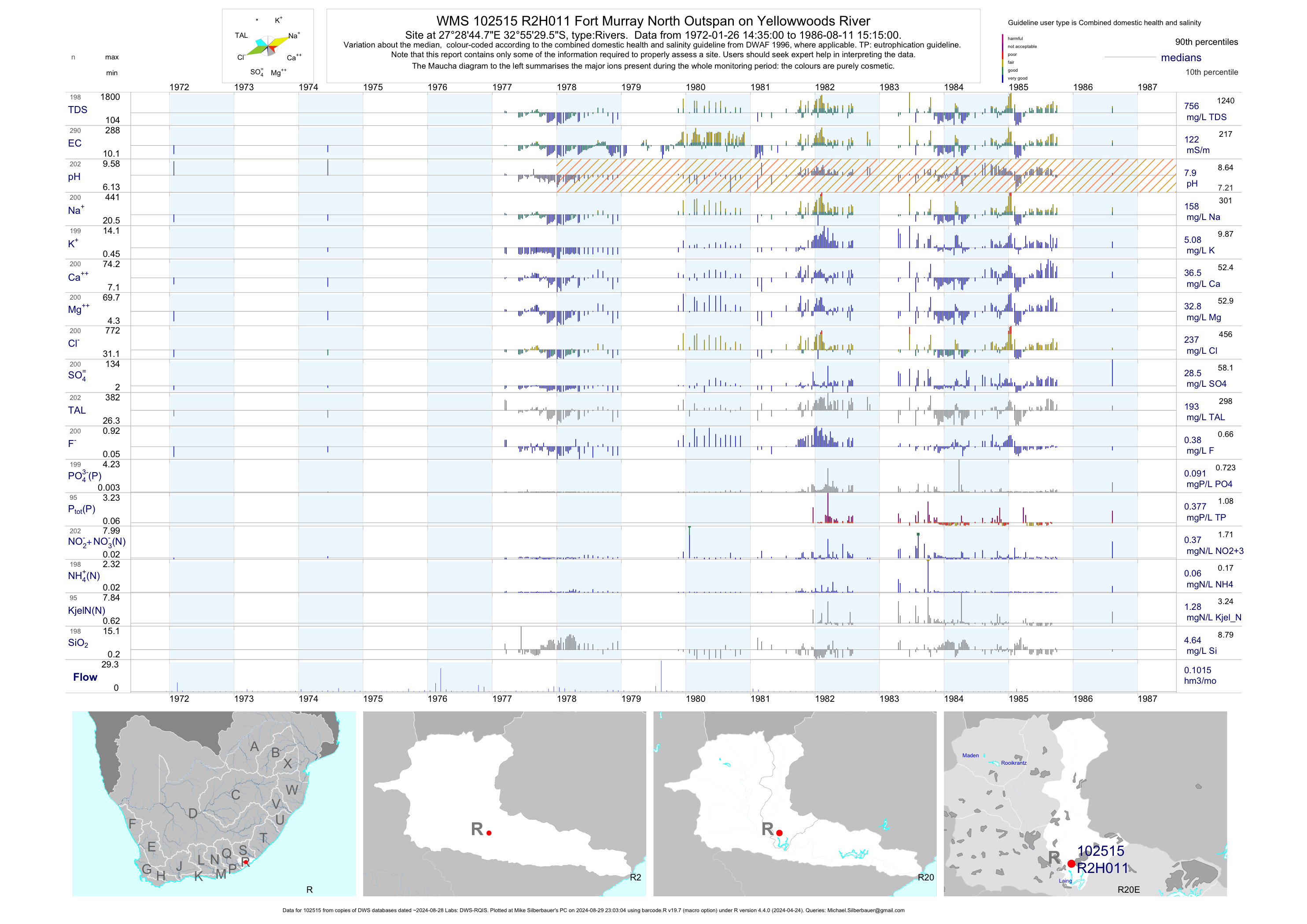
| R20 102515 | plot | data | Fort Murray North Outspan on Yellowwoods River | Rivers | 290 | 1972-01-26 | 1986-08-11 | 122 | R2H011 | -32.92489 | 27.47911 |
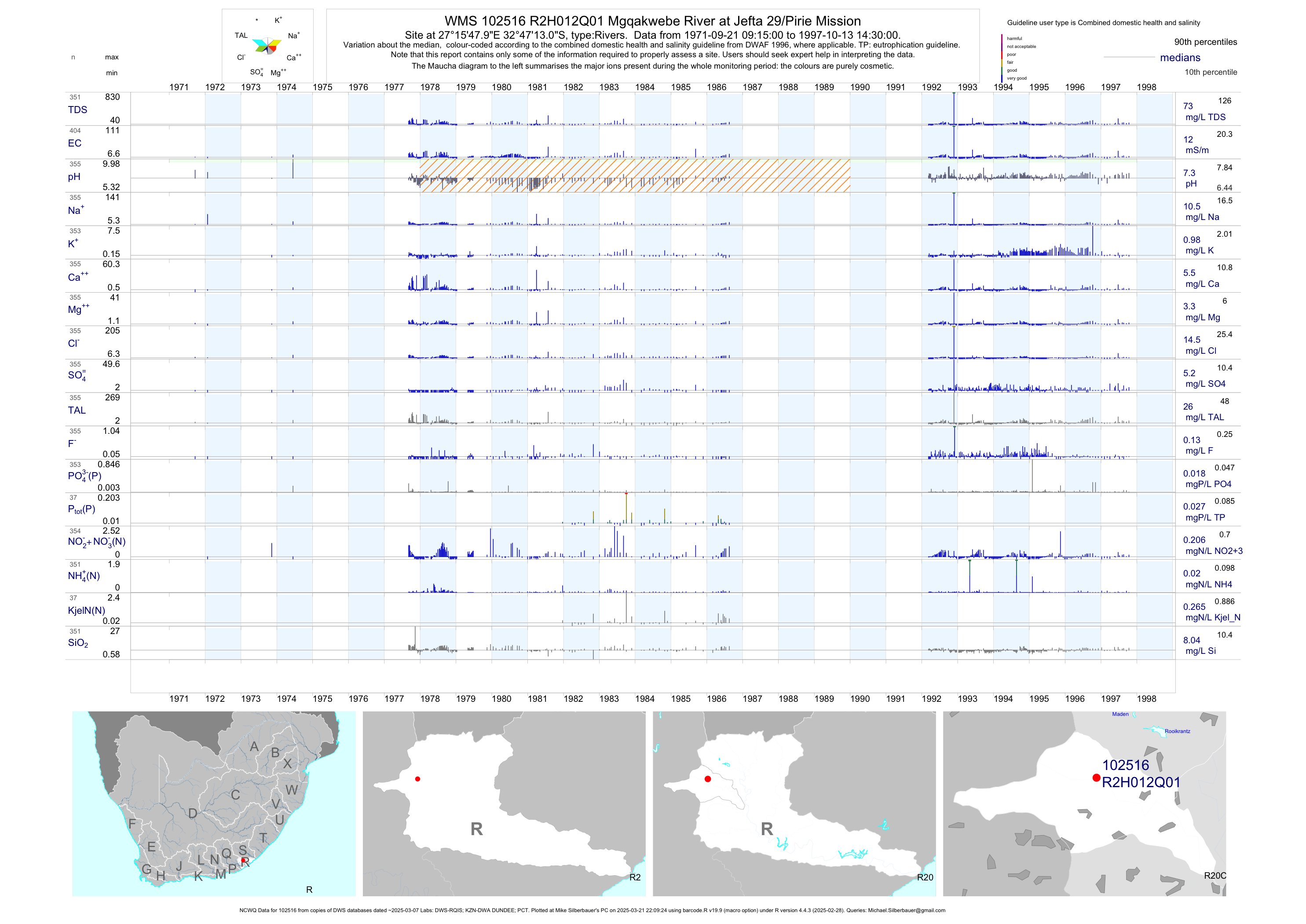
| R20 102516 | plot | data | Mgqakwebe River at Jefta 29/Pirie Mission (NCWQ) | Rivers | 404 | 1971-09-21 | 1997-10-13 | 12 | R2H012 | -32.78694 | 27.26333 |
| R20 102517 | plot | data | Fort Murray North Outspan on Yellowwoods River (NCWQ nemp nmmp NEMP) | Rivers | 1593 | 1989-06-19 | 2018-06-14 | 109 | R2H015 | -32.93169 | 27.47256 |
| R20 102518 | plot | data | Jan Tzatzoes Location North 1924 at Malakalaka on Zwelitshaspruit (NCWQ) | Rivers | 540 | 1989-07-04 | 2018-05-17 | 376 | R2H016 | -32.93500 | 27.44667 |
| R20 1000010980 | plot | data | Jan Tzatzoes Location North 1924 at Malakalaka on Zwelitshaspruit (Duplicate) | Rivers | 274 | 2001-07-12 | 2019-04-19 | 489 | R2H016 | -32.93511 | 27.44589 |
| R20 102522 | plot | data | Potsdam Ndantsane at Mhlabati Needs Camp on Buffalo River (ncwq NCMP gems) | Rivers | 582 | 1994-06-08 | 2019-04-29 | 57 | R2H027 | -32.99164 | 27.64003 |
| R20 187302 | plot | data | Bridle Drift Dam on Buffalo River | Rivers | 245 | 2003-04-29 | 2019-04-19 | 53 | R2H029 | -32.99472 | 27.73389 |
| R20 88704 | plot | data | Mdantsane River at Bridle Drift Dam Inflow | Rivers | 36 | 1995-03-14 | 1999-06-24 | 78 | ZBUF-MDAN | -32.96444 | 27.76278 |
| R20 88705 | plot | data | Shangani River at Bridle Drift Dam Inflow | Rivers | 81 | 1994-11-08 | 1999-06-24 | 82 | ZBUF-SHAN | -32.97028 | 27.70861 |
| R20 88706 | plot | data | Farm 1404 at Inflow to Bridle Drift Dam on Sitolana | Rivers | 47 | 1994-11-08 | 1996-11-05 | 107 | ZBUF-SITO | -32.96611 | 27.72667 |
| R20 88707 | plot | data | Farm 1404 at Bridle Drift Dam Inflow on Mtinteli | Rivers | 63 | 1994-11-08 | 1999-06-24 | 70 | ZBUF-TIND | -32.96667 | 27.74139 |
| R20 89011 | plot | data | Yellowwoods River at Lonsdale/500M East of Road B | Rivers | 71 | 1995-01-10 | 1999-07-29 | 98 | ZYEL-LONS | -32.80417 | 27.47444 |
| R20 189334 | plot | data | Breidbach at Old Bridge US of Breidbach Sewage Pond on Yellowwoods Riv Ver | Rivers | 204 | 2001-09-25 | 2019-04-08 | 78 | 189334 | -32.89614 | 27.44308 |
| R20 189335 | plot | data | Yellowwoods River D/S of Bhisho WWTW | Rivers | 189 | 2001-10-23 | 2019-04-08 | 78 | 189335 | -32.85278 | 27.45835 |
| R20 189768 | plot | data | Gompo Town upstream of East London Central STW on Mzonyana | Rivers | 146 | 2007-08-14 | 2018-03-06 | 61 | 189768 | -33.01136 | 27.85786 |
| R20 189769 | plot | data | Gompo Town Down Stream of East London Central STW on Mzonyana | Rivers | 143 | 2007-08-14 | 2018-03-06 | 74 | 189769 | -33.01186 | 27.85906 |
| R20 190229 | plot | data | King William S Town at Railway Bridge near N2 D/S of Tshoxa on Buffalo River | Rivers | 240 | 2003-04-29 | 2019-04-19 | 47 | 190229 | -32.88117 | 27.38178 |
| R20 1000002455 | plot | data | Buffalo River upstream of R2H005 Weir | Rivers | 225 | 2003-07-08 | 2019-04-19 | 36 | 1-2455 | -32.87186 | 27.38475 |
| R20 1000002458 | plot | data | Buffalo River at Dennis Radue Bridge upstream of Zwelitsha WWTW | Rivers | 272 | 2002-01-23 | 2019-04-19 | 57 | 1-2458 | -32.93228 | 27.43919 |
| R20 1000002477 | plot | data | James Mcintyre Bridge ds of R2H010 on Buffalo River | Rivers | 261 | 2002-01-23 | 2019-04-19 | 66 | 1-2477 | -32.93814 | 27.46631 |
| R20 1000002481 | plot | data | Fort Murray North Outspan at Bridge ds of R2H015 on Yellowwoods River | Rivers | 306 | 2001-09-25 | 2019-04-19 | 94 | 1-2481 | -32.93253 | 27.47281 |
| R20 1000009969 | plot | data | Peelton at Lonsdale Bridge on Yellowwoods River | Rivers | 179 | 2001-09-25 | 2019-04-08 | 72 | 1-9969 | -32.80839 | 27.46989 |
| R20 1000009970 | plot | data | Yellowwoods at Qalase | Rivers | 164 | 2006-12-11 | 2019-04-08 | 78 | 1-9970 | -32.91114 | 27.45550 |
| R20 1000010299 | plot | data | Libenri near Buffalo Farm at R346 Horseshoe Bridge on Buffalo | Rivers | 262 | 2001-07-12 | 2019-04-19 | 47 | 1-10299 | -32.83125 | 27.37883 |
| R20 1000010989 | plot | data | Buffalo River at Buffalo Pass Bridge | Rivers | 279 | 2000-03-31 | 2019-04-19 | 66 | 1-10989 | -33.00611 | 27.82533 |
| R30 102526 | plot | data | Gqunube River at Outspan (NCWQ NCMP nemp NEMP) | Rivers | 487 | 1974-06-03 | 2018-05-18 | 58 | R3H001 | -32.80278 | 27.85639 |
| R30 102527 | plot | data | Nahoon Dam on Nahoon River: downstream Weir (NCWQ NCMP) | Rivers | 159 | 1973-09-05 | 2018-06-28 | 40 | R3H003 | -32.90639 | 27.81028 |
| R30 1000010301 | plot | data | Abbotsford at de Waalbrug on Nahoon | Rivers | 172 | 2004-12-03 | 2019-05-20 | 102 | R3H008 | -32.96492 | 27.91550 |
| R30 88583 | plot | data | Nahoon River at Newlands Road Bridge (nmmp) | Rivers | 896 | 1994-11-08 | 2008-09-18 | 100 | ZNAH-NEWL | -32.89167 | 27.77917 |
| R30 190227 | plot | data | Horseshoe Valley East London at Bridge on Nahoon River | Rivers | 173 | 2001-11-12 | 2019-05-20 | 87 | 190227 | -32.96194 | 27.87211 |
| R30 190544 | plot | data | Farm 279 Wolfridge on Nahoon River at Newlands | Rivers | 165 | 2001-11-12 | 2019-05-20 | 63 | 190544 | -32.85683 | 27.71944 |
| R30 190732 | plot | data | St Luke S Mission Land 96 Navel Valley - at Newlands Bridge on Nahoon River | Rivers | 196 | 2001-06-12 | 2019-05-20 | 89 | 190732 | -32.86694 | 27.76533 |
| R30 193215 | plot | data | Animal Drinking Spot at Mapeu Stream on Farm Page | Rivers | 33 | 2012-03-19 | 2019-03-19 | 104 | 193215 | -32.85101 | 27.55826 |
| R30 193216 | plot | data | Stormwater Bridge on Mapeu Stream below Border Combing/ Compass Waste at Bridge | Rivers | 41 | 2012-03-16 | 2019-03-19 | 150 | 193216 | -32.86967 | 27.56114 |
| R30 194297 | plot | data | Mapeu Stream Before Confluence with Tributary | Rivers | 10 | 2015-12-17 | 2018-03-06 | 121 | 194297 | -32.81272 | 27.55419 |
| R30 194298 | plot | data | Tributary of Mapeu at Storm Water Channel near Formal Chem | Rivers | 6 | 2015-06-10 | 2018-03-06 | 36 | 194298 | -32.86319 | 27.56769 |
| R30 194299 | plot | data | Tributary of Mapeu upstream of Bridge on Road to Formal Chem | Rivers | 30 | 2015-06-10 | 2019-03-19 | 131 | 194299 | -32.86553 | 27.56157 |
| R30 194414 | plot | data | Tributary of Mapeu Stream at Bridge to Hanover | Rivers | 24 | 2015-12-17 | 2019-03-19 | 123 | 194414 | -32.79889 | 27.90633 |
| R30 1000002329 | plot | data | Nahoon River at Plum-Hill | Rivers | 148 | 2001-11-12 | 2019-05-20 | 83 | 1-2329 | -32.81461 | 27.63008 |
| R30 1000002331 | plot | data | Nahoon River at Witch Krans | Rivers | 189 | 2001-06-12 | 2019-05-20 | 70 | 1-2331 | -32.85289 | 27.65233 |
| R30 1000002332 | plot | data | Rwantsa River at Bridge Newlands Location | Rivers | 182 | 2001-01-30 | 2019-05-20 | 143 | 1-2332 | -32.89508 | 27.75553 |
| R30 1000002333 | plot | data | Znahnewl on Nahoon River | Rivers | 172 | 2003-11-26 | 2019-05-20 | 71 | 1-2333 | -32.89214 | 27.77833 |
| R30 1000002334 | plot | data | Nahoon Dam at Slip Way | Rivers | 203 | 2001-04-05 | 2019-05-20 | 42 | 1-2334 | -32.91214 | 27.80956 |
| R30 1000010300 | plot | data | Dorchester Bridge | Rivers | 180 | 2004-12-03 | 2019-05-20 | 102 | 1-10300 | -32.94194 | 27.89619 |
| S10 102532 | plot | data | White Kei River at St Marks Mission/Bridge | Rivers | 10 | 1980-01-23 | 1996-05-02 | 58 | S1H002 | -32.01889 | 27.36028 |
| S10 102533 | plot | data | At Nonesi U/S Xonxa Dam on Wit Kei River | Rivers | 2 | 1997-08-13 | 1997-09-22 | 50 | S1H003 | -31.81556 | 27.05417 |
| S10 187579 | plot | data | Wit Kei River at Cacadu (NCWQ) | Rivers | 178 | 2003-10-29 | 2018-05-15 | 31 | S1H004 | -31.84744 | 27.18522 |
| S20 102535 | plot | data | Indwe River at Ncapa Farm | Rivers | 11 | 1953-10-22 | 1999-05-17 | 26 | S2H001 | -31.77444 | 27.42139 |
| S20 102536 | plot | data | Indwe River at Ntlonze 29/Lante 16 | Rivers | 11 | 1980-01-23 | 2007-10-10 | 30 | S2H002 | -31.85806 | 27.41778 |
| S20 102537 | plot | data | Lubisi Dam on Indwe River: Down Stream Weir (NCWQ) | Rivers | 212 | 1996-08-07 | 2018-06-25 | 27 | S2H005 | -31.79583 | 27.43111 |
| S20 102538 | plot | data | Doringrivier Dam on Doorn River: Down Stream Weir (NCWQ) | Rivers | 122 | 1978-03-01 | 2018-05-03 | 41 | S2H006 | -31.51306 | 27.33472 |
| S31 102541 | plot | data | Klaas Smits River at Doornhoek/Wilgebosch (NCWQ) | Rivers | 445 | 1958-09-19 | 1997-07-10 | 62 | S3H002 | -31.74417 | 26.58444 |
| S32 102542 | plot | data | At Doornhoek Bower Hope on Swart - Kei Rivier (ncwq) | Rivers | 362 | 1953-09-11 | 2015-06-23 | 47 | S3H003 | -32.20000 | 26.48333 |
| S32 102543 | plot | data | At Cathcarts Gift Endwell on Swart - Keirivier (NCWQ) | Rivers | 1043 | 1972-03-23 | 2018-05-14 | 88 | S3H004 | -32.05000 | 26.78806 |
| S32 102544 | plot | data | Oskraal River at Whittlesea (NCWQ) | Rivers | 763 | 1971-11-10 | 2012-05-30 | 56 | S3H005 | -32.18111 | 26.82083 |
| S31 102545 | plot | data | Klaas Smits River at Weltevreden/Queenstown (NCWQ NCMP) | Rivers | 856 | 1977-01-17 | 2018-06-05 | 75 | S3H006 | -31.92333 | 26.78639 |
| S31 102546 | plot | data | Komani River at Santa Georgia | Rivers | 8 | 1980-01-23 | 2018-06-06 | 79 | S3H007 | -31.91167 | 26.84222 |
| S32 102548 | plot | data | Waterdown Dam on Klipplaat River: Down Stream Wei (NCWQ) | Rivers | 268 | 1972-09-14 | 2018-05-15 | 12 | S3H010 | -32.28500 | 26.86028 |
| S32 102549 | plot | data | Oskraal River at Oxkraal Kamastone (NCWQ) | Rivers | 424 | 1992-08-31 | 2018-05-15 | 55 | S3H012 | -32.20134 | 26.75861 |
| S32 187594 | plot | data | At Hot Fire High Clere on Swart-Kei River (ncwq NCMP) | Rivers | 149 | 2003-10-28 | 2018-05-15 | 46 | S3H013 | -32.17389 | 27.37250 |
| S31 189386 | plot | data | Sterkstroom upstream of Sterkstroom STW Discharge on Hexrivier | Rivers | 36 | 2007-01-15 | 2011-08-02 | 65 | 189386 | -31.56669 | 26.56141 |
| S31 189387 | plot | data | Hex River at Down Stream of Sterkstroom WWTW | Rivers | 79 | 2007-12-05 | 2018-03-08 | 74 | 189387 | -31.56778 | 26.56169 |
| S31 189727 | plot | data | Queenstown upstream of Queenstown STW Discharge Point on Komani | Rivers | 1 | 2017-04-20 | 2017-04-20 | 35 | 189727 | -31.90503 | 26.86086 |
| S31 189728 | plot | data | Queenstown downstream of STW Discharge at Weir on Komani | Rivers | 87 | 2007-12-05 | 2019-04-29 | 67 | 189728 | -31.90967 | 26.84456 |
| S31 190000 | plot | data | Queenstown upstream of Queenstown WWTW at Bridge on Komani | Rivers | 68 | 2008-08-26 | 2019-04-29 | 52 | 19- | -31.90214 | 26.88614 |
| S31 192660 | plot | data | Hex River at Bridge upstream of Sterkstroom WWTW | Rivers | 20 | 2012-03-05 | 2018-03-08 | 92 | 192660 | -31.54997 | 26.55297 |
| S32 1000008351 | plot | data | Klipplaat River below Whittlesea S/W | Rivers | 90 | 2005-05-23 | 2017-06-26 | 31 | 1-8351 | -32.17728 | 26.83144 |
| S32 1000008353 | plot | data | Klipplaat River MR0095 Bridge at upstream of Whittlesea WWTW | Rivers | 88 | 2005-05-23 | 2017-06-26 | 28 | 1-8353 | -32.17728 | 26.83153 |
| S40 190057 | plot | data | Unknown Tributary of Thorn River D/S Cathcart WWTW Final Effl | Rivers | 85 | 2008-11-26 | 2018-03-15 | 79 | 190057 | -32.31050 | 27.15878 |
| S40 191424 | plot | data | Unknown Tributary of Thorn River U/S Cathcart WWTW Final Effl | Rivers | 91 | 2008-11-26 | 2018-03-15 | 90 | 191424 | -32.31003 | 27.15806 |
| S40 192645 | plot | data | Thorn River at Weir upstream N6 Bridge to Carthcart | Rivers | 51 | 2012-01-11 | 2018-03-15 | 48 | 192645 | -32.31998 | 27.15718 |
| S50 102553 | plot | data | At Wyk Maduma Tsomo on Tsomo (ncwq NCMP) | Rivers | 226 | 1971-09-20 | 2018-06-23 | 22 | S5H002 | -32.04333 | 27.82278 |
| S50 102554 | plot | data | Tsomo River at Famini Location/Ncora Dam (NCWQ) | Rivers | 182 | 1997-07-29 | 2018-06-25 | 12 | S5H004 | -31.78750 | 27.67917 |
| S50 187143 | plot | data | U/S of Road at Kwasivanxa on Tsomo (nmmp) | Rivers | 379 | 2003-06-06 | 2010-01-22 | n/a | 187143 | -32.34280 | 27.82643 |
| S50 187146 | plot | data | Upper Ngculu Village at Nqamakwe on Ngculu (nmmp) | Rivers | 410 | 2003-05-22 | 2013-07-10 | n/a | 187146 | -32.19269 | 27.92752 |
| S50 189746 | plot | data | Cofimvaba upstream of Municipal STW at R61 Bridge on Cofimvaba | Rivers | 69 | 2007-07-17 | 2019-06-06 | 45 | 189746 | -32.01414 | 27.59325 |
| S50 189747 | plot | data | Cofimvaba downstream of Municipal STW on Cofimvaba | Rivers | 72 | 2007-07-17 | 2019-06-06 | 46 | 189747 | -32.01556 | 27.59156 |
| S50 190670 | plot | data | Cala - up Stream of Cala WWTW on Tsomo River | Rivers | 23 | 2008-08-27 | 2016-06-29 | 16 | 190670 | -31.52176 | 27.67133 |
| S50 190671 | plot | data | Cala - Down Stream of Cala WWTW on Tsomo River | Rivers | 23 | 2008-08-27 | 2016-06-29 | 15 | 190671 | -31.52562 | 27.67128 |
| S60 102557 | plot | data | Kubusi River at Stutterheim (NCWQ NCMP) | Rivers | 857 | 1952-11-10 | 2018-05-14 | 11 | S6H001 | -32.57917 | 27.36667 |
| S60 102558 | plot | data | Kubusi River at Hammerhead/Thornhill (NCWQ) | Rivers | 734 | 1971-10-27 | 1995-08-09 | 24 | S6H002 | -32.57556 | 27.62306 |
| S60 102559 | plot | data | Toise River at Forkroad (NCWQ) | Rivers | 784 | 1972-01-27 | 2018-05-16 | 26 | S6H003 | -32.51611 | 27.52472 |
| S60 102560 | plot | data | Gubu Dam on Gubu River: Down Stream Weir (NCWQ) | Rivers | 355 | 1979-05-01 | 2018-04-23 | 10 | S6H004 | -32.61028 | 27.28306 |
| S60 102561 | plot | data | Wriggleswade Dam on Kubisi River: Down Stream Wei (NCWQ) | Rivers | 210 | 1992-05-04 | 2018-06-28 | 20 | S6H005 | -32.57528 | 27.56667 |
| S60 88535 | plot | data | Kubusie River at Riverview/Waterford (Road Bridge | Rivers | 108 | 1994-11-08 | 1999-07-29 | 24 | ZKUB-WWAS | -32.57611 | 27.48333 |
| S60 188146 | plot | data | Kubusi Stutterheim at Waterford (nemp) | Rivers | 25 | 2004-12-15 | 2008-04-23 | 19 | 188146 | -32.56583 | 27.48806 |
| S60 188275 | plot | data | Wool Wash Weir on Kubusi | Rivers | 206 | 2001-07-12 | 2019-04-17 | 19 | 188275 | -32.58461 | 27.46928 |
| S60 188276 | plot | data | Mundell S Farm on Cumakala | Rivers | 206 | 2000-07-28 | 2019-04-17 | 26 | 188276 | -32.58750 | 27.43628 |
| S60 188278 | plot | data | Route R346 Bridge on Kubusi | Rivers | 199 | 2001-07-12 | 2019-04-17 | 16 | 188278 | -32.59511 | 27.42378 |
| S60 188279 | plot | data | Stutterheim upstream of Sewage Works on Cumakala | Rivers | 208 | 2000-07-28 | 2019-04-17 | 23 | 188279 | -32.56900 | 27.43500 |
| S60 188280 | plot | data | Route N6 Bridge on Cumakala | Rivers | 208 | 2000-07-28 | 2019-04-17 | 17 | 188280 | -32.59756 | 27.45192 |
| S60 190039 | plot | data | Kubusie Forest at Road D/S Kubusie STW on Kubusi Tributary | Rivers | 28 | 2008-08-21 | 2010-07-14 | 24 | 190039 | -32.57578 | 27.31042 |
| S60 190731 | plot | data | Stutterheim - at Rd Bridge on Cumakala Trib ds of Stutterheim Solid Waste S | Rivers | 141 | 2008-11-26 | 2019-04-17 | 36 | 190731 | -32.55783 | 27.43672 |
| S60 192828 | plot | data | Thorn River After Conflunce with Unknown Tributary below Cathcart WWTW | Rivers | 23 | 2012-01-11 | 2018-03-15 | 46 | 192828 | -32.63981 | 27.41181 |
| S70 102565 | plot | data | Gcuwa River at Butterworth (ncwq NCMP nmmp) | Rivers | 414 | 1971-09-20 | 2018-06-27 | 56 | S7H001 | -32.32750 | 28.14472 |
| S70 102566 | plot | data | Butterworth at Thorn Drift on Gcuwa | Rivers | 11 | 1980-01-23 | 1999-07-13 | 72 | S7H002 | -32.33440 | 28.19110 |
| S70 102567 | plot | data | At Ndabakazi Kei Bridge on Groot-Keirivier | Rivers | 4 | 1981-04-01 | 1995-07-13 | 25 | S7H003 | -32.50861 | 27.97917 |
| S70 102568 | plot | data | At Area 8 Springs B on Groot-Kei River (ncwq NCMP GEMS) | Rivers | 418 | 1990-10-17 | 2018-05-02 | 41 | S7H004 | -32.51528 | 28.01556 |
| S70 187141 | plot | data | Gcuwa a 1 on Zinqayi (nmmp) | Rivers | 375 | 2003-06-06 | 2013-07-10 | n/a | 187141 | -32.22067 | 28.19063 |
| T11 87660 | plot | data | Caca 45 Xuka Drift (NCWQ NCMP) | Rivers | 87 | 2009-07-20 | 2018-05-03 | 13 | T1H001 | -31.67194 | 28.11083 |
| T13 102573 | plot | data | At Bashee Bridge on Mbashe (ncwq) | Rivers | 165 | 1972-01-24 | 2016-03-23 | 15 | T1H004 | -31.92028 | 28.44778 |
| T11 102574 | plot | data | Xuka River (2) below Low Water Bridge at Koklen | Rivers | 2 | 1996-04-15 | 1997-08-12 | 12 | T1H005 | -31.60278 | 28.27556 |
| T12 102576 | plot | data | Mgwali River at Clarkebury (ncwq) | Rivers | 153 | 1997-08-12 | 2017-02-17 | 13 | T1H007 | -31.78778 | 28.26667 |
| T11 102577 | plot | data | Slang River at Road Bridge upstream of Elliot WWTW | Rivers | 94 | 1980-01-24 | 2017-04-24 | 10 | T1H008 | -31.33307 | 27.85493 |
| T12 187310 | plot | data | Mgwali River at Clarkebury (ncwq NCMP) | Rivers | 130 | 2005-09-05 | 2018-06-13 | 13 | T1H010 | -31.78778 | 28.26833 |
| T12 189638 | plot | data | At Ncora School Damane on Ncora Tributary (NCMP) | Rivers | 107 | 2007-11-27 | 2018-05-03 | 11 | T1H011 | -31.77778 | 27.72083 |
| T12 192932 | plot | data | Tsomo River Irrigation Canal from Ncora Dam at Damane (NCWQ) | Rivers | 67 | 2012-04-03 | 2018-05-03 | 11 | T1H012 | -31.78689 | 27.70639 |
| T11 189164 | plot | data | At Gxwali Bomvu on Mbashe River (NCMP) | Rivers | 130 | 2006-09-19 | 2018-06-13 | 14 | T1H013 | -31.79967 | 28.33303 |
| T13 189166 | plot | data | At Rune on Mbashe River (NCMP) | Rivers | 125 | 2006-09-19 | 2018-05-04 | 14 | T1H014 | -31.85100 | 28.39269 |
| T13 189160 | plot | data | Rara 34 Collywobbles on Mbashe River (NCMP) | Rivers | 116 | 2006-09-18 | 2018-06-27 | 16 | T1H015 | -32.00056 | 28.58167 |
| T11 102572 | plot | data | Xuka River (1) at the Bridge on R61 (ncwq NCMP) | Rivers | 178 | 1998-01-28 | 2018-06-26 | 15 | 102572 | -31.67194 | 28.11083 |
| T11 102575 | plot | data | Xuka River (2) below Low Water Bridge at Koklen | Rivers | 88 | 1997-09-10 | 2017-02-17 | 11 | 102575 | -31.70444 | 28.23028 |
| T12 188080 | plot | data | Cefane River Down Stream of Ngcobo WWTW | Rivers | 63 | 2004-02-04 | 2017-06-07 | 16 | 188080 | -31.67030 | 27.98871 |
| T11 188309 | plot | data | Ntibane at R61 Bridge on Road to Engcobo on Mbashe | Rivers | 94 | 2003-08-11 | 2015-09-15 | 12 | 188309 | -31.65218 | 28.30272 |
| T12 188310 | plot | data | Esikobeni near Engcobo at R61 Bridge to Cifiimvaba on Mgwali | Rivers | 86 | 2003-10-22 | 2017-02-17 | 9 | 188310 | -31.73362 | 27.94915 |
| T11 188311 | plot | data | Manina Forest at Bridge on Mbashe | Rivers | 94 | 2003-08-13 | 2016-03-23 | 11 | 188311 | -31.57247 | 28.22122 |
| T11 188412 | plot | data | Slang River D/S Elliot STW at Ecowa | Rivers | 96 | 2003-10-03 | 2017-08-08 | 16 | 188412 | -31.35092 | 27.85488 |
| T12 188416 | plot | data | Mjanyana U/S Mjanyana Hospital STW on Mjanyana | Rivers | 47 | 2004-04-21 | 2017-08-28 | 27 | 188416 | -31.83618 | 28.10192 |
| T12 188419 | plot | data | Mjanyana D/S Mjanyana Hospital STW on Mjanyana | Rivers | 31 | 2004-04-23 | 2016-04-04 | 31 | 188419 | -31.83757 | 28.11192 |
| T20 102578 | plot | data | At Norwood Umtata on Mtata (ncwq) | Rivers | 60 | 1971-09-19 | 2006-05-26 | 11 | T2H002 | -31.58417 | 28.78500 |
| T20 102579 | plot | data | At KU Ngobozi First Falls Weir on Mtata | Rivers | 7 | 1980-06-09 | 1982-01-19 | 11 | T2H004 | -31.59944 | 28.81722 |
| T20 102580 | plot | data | At Sidabadabeni Coffee Bay Causeway on Mthatha (Umtata) River (NCMP) | Rivers | 98 | 1980-01-25 | 2018-06-26 | 20 | T2H005 | -31.92500 | 29.13750 |
| T20 102581 | plot | data | At Ntsunguzini Causeway upstream Gqogq on Mtata | Rivers | 7 | 1980-10-03 | 1982-01-19 | 6 | T2H006 | -31.48111 | 28.54417 |
| T20 187311 | plot | data | - Mthatha (Umtata) River (5) at Gauging Weir upstream of Mthatha Prison (ncwq NCMP) | Rivers | 176 | 2005-09-09 | 2018-05-24 | 12 | T2H008 | -31.56889 | 28.76389 |
| T20 188175 | plot | data | Roode Heuvel downstream of Mthatha Dam on Cicira (NCWQ ncmp) | Rivers | 91 | 2007-04-25 | 2018-05-24 | 74 | T2H010 | -31.55670 | 28.73720 |
| T20 187139 | plot | data | At Bridge 400 M US of T2H006 on Mtata (nmmp) | Rivers | 335 | 2003-10-13 | 2012-08-24 | n/a | 187139 | -31.48400 | 28.54500 |
| T20 188083 | plot | data | Orange Grove Village at School on Umtata (nmmp) | Rivers | 423 | 2005-04-08 | 2012-08-24 | n/a | 188083 | -31.63429 | 28.83311 |
| T20 190794 | plot | data | Mtata River 2 downstream of Langeni Forest WWTW | Rivers | 80 | 2008-12-19 | 2017-08-28 | 5 | 190794 | -31.48247 | 28.49331 |
| T20 191625 | n/a | n/a | Umtata - at Bank of Mtata River; D/S of St John S Mission Station | Rivers | 1 | 2010-02-25 | 2010-02-25 | n/a | 191625 | -31.57733 | 28.80981 |
| T20 1000002335 | plot | data | Mtata River 1 upstream of Langeni Forest Products | Rivers | 258 | 2002-01-15 | 2017-08-28 | 4 | 1-2335 | -31.49307 | 28.47702 |
| T20 1000002336 | plot | data | Mtata River 3 D/S Langeni Forest Sawmill | Rivers | 214 | 2002-01-15 | 2017-08-28 | 6 | 1-2336 | -31.48222 | 28.50383 |
| T20 1000002337 | plot | data | Mtata River 4 D/S of Mthatha Dam | Rivers | 156 | 2002-02-12 | 2017-08-28 | 9 | 1-2337 | -31.55230 | 28.74612 |
| T20 1000002344 | plot | data | Mtata River 6 at Road Bridge downstream Umthatha Prison | Rivers | 202 | 2002-01-15 | 2017-08-28 | 10 | 1-2344 | -31.57753 | 28.77692 |
| T20 1000002386 | plot | data | Mtata River (7) downstream of Mthatha City | Rivers | 209 | 2002-01-15 | 2017-08-28 | 12 | 1-2386 | -31.58400 | 28.78714 |
| T20 1000002387 | plot | data | Mtata River 8 at the Bridge below Mthatha WWTW (nmmp) | Rivers | 652 | 2002-01-15 | 2017-08-28 | 15 | 1-2387 | -31.58820 | 28.80220 |
| T20 1000002388 | plot | data | Mtata River 9 downstream of Mthatha First Falls | Rivers | 209 | 2002-01-15 | 2017-08-28 | 15 | 1-2388 | -31.60118 | 28.82023 |
| T20 1000002389 | plot | data | Mtata River 10 downstream of Ngangelizwe Township | Rivers | 129 | 2002-01-15 | 2017-08-28 | 16 | 1-2389 | -31.61010 | 28.82825 |
| T20 1000002441 | plot | data | Mtata River on Cicira Stream | Rivers | 31 | 2003-02-19 | 2010-01-10 | 66 | 1-2441 | -31.56275 | 28.72700 |
| T33 102585 | plot | data | Kinira River at Kinira Drift (NCWQ) | Rivers | 204 | 1971-09-18 | 2018-05-22 | 18 | T3H002 | -30.48278 | 28.62083 |
| T32 102586 | plot | data | Mzimntlana River at Slangfontein/Kokstad (ncwq NCMP) | Rivers | 586 | 1971-09-17 | 2018-05-22 | 15 | T3H004 | -30.56833 | 29.42278 |
| T34 102587 | plot | data | Tina River on N2 Bridge to Mount Frere (ncwq NCMP) | Rivers | 305 | 1965-11-25 | 2018-05-23 | 12 | T3H005 | -31.03139 | 28.88333 |
| T35 102588 | plot | data | Tsitsa River at N2 Bridge to Qumbu (ncwq NCMP) | Rivers | 325 | 1971-09-18 | 2018-05-23 | 11 | T3H006 | -31.23694 | 28.85417 |
| T33 102589 | plot | data | Mzimvubu River on N2 Bridge KU-Makhala to Mount Ayliff (ncwq NCMP) | Rivers | 329 | 1980-01-24 | 2018-05-23 | 17 | T3H007 | -30.86014 | 29.07125 |
| T31 102590 | plot | data | Mzimvubu River at Kromdraai/Inungi (ncwq NCMP) | Rivers | 645 | 1971-09-17 | 2018-09-19 | 14 | T3H008 | -30.57083 | 29.15056 |
| T35 102591 | plot | data | Mooi River at Maclear (NCWQ) | Rivers | 790 | 1971-09-18 | 2018-05-23 | 7 | T3H009 | -31.07111 | 28.35472 |
| T32 102592 | plot | data | Mzintlava River on N2 Bridge to MT Ayliff (ncwq) | Rivers | 100 | 1971-09-18 | 2017-01-17 | 19 | T3H010 | -30.81000 | 29.32278 |
| T35 87704 | plot | data | Wildebeeste River on Ugie Road Bridge | Rivers | 5 | 2009-01-21 | 2014-05-06 | 7 | T3H011 | -31.19361 | 28.23750 |
| T35 102593 | plot | data | Ugie at Road Bridge on Wildebeesrivier (Inxu) | Rivers | 8 | 1980-01-24 | 1982-02-01 | 7 | T3H011 | -31.19385 | 28.23693 |
| T35 102594 | plot | data | Tsitsa River at Waunwpisht/Halcyon Drift | Rivers | 8 | 1980-01-24 | 1982-02-01 | 8 | T3H012 | -30.94861 | 28.45417 |
| T34 102595 | plot | data | Tina River on R56 Bridge to MT Fletcher (NCWQ) | Rivers | 94 | 1980-01-24 | 2017-05-18 | 11 | T3H013 | -30.62972 | 28.48111 |
| T35 102596 | plot | data | Inxu River at St Augustine Mission (ncwq) | Rivers | 27 | 1995-08-30 | 2001-05-07 | 13 | T3H014 | -31.22028 | 28.63111 |
| T35 87709 | plot | data | Tsitsa River at R56 Bridge to MT Frere | Rivers | 105 | 2003-08-27 | 2017-05-18 | 9 | T3H016 | -31.23694 | 28.85417 |
| T32 187315 | plot | data | Mzintlava River at Ludiwana (NCMP) | Rivers | 97 | 2007-10-02 | 2018-05-21 | 19 | T3H017 | -31.10428 | 29.39972 |
| T33 189165 | plot | data | At Mgungundlovo on Kinira River (ncwq NCMP) | Rivers | 108 | 2007-02-16 | 2018-05-23 | 18 | T3H019 | -30.77587 | 29.03222 |
| T36 191141 | plot | data | At Ntontela (Good Hope) on Mzimvubu (NCWQ NCMP) | Rivers | 140 | 2009-03-19 | 2018-11-16 | 15 | T3H020 | -31.39600 | 29.26510 |
| T36 188313 | plot | data | Mzimvubu River 1 at R56 Bridge to Cederville | Rivers | 47 | 2005-07-14 | 2016-02-05 | 28 | 188313 | -31.59498 | 29.51693 |
| T36 188314 | plot | data | Mzimvubu River on R61 Bridge at Port St. Johns | Rivers | 77 | 2005-07-13 | 2017-05-22 | 16 | 188314 | -31.59460 | 29.52753 |
| T35 190891 | plot | data | Tsolo Commonage - upstream of Tsolo Waste Water Treatment Works on Xokonxa | Rivers | 37 | 2007-03-14 | 2019-04-10 | 13 | 190891 | -31.30385 | 28.76110 |
| T35 191629 | plot | data | Xokonxa River downstream of Tsolo Municipality WWTW | Rivers | 41 | 2007-03-14 | 2019-04-10 | 18 | 191629 | -31.30325 | 28.76020 |
| T33 192074 | plot | data | Mzimvubu River (nmmp) | Rivers | 71 | 2011-03-14 | 2012-08-23 | n/a | 192074 | -30.85023 | 29.06872 |
| T35 192075 | plot | data | Tsitsa River (nmmp) | Rivers | 94 | 2011-05-06 | 2012-08-23 | n/a | 192075 | -31.23755 | 28.84688 |
| T33 194416 | plot | data | Kinira River at Bridge Mgungundlovu | Rivers | 6 | 2016-09-19 | 2017-05-18 | 8 | 194416 | -30.74657 | 28.99186 |
| T35 194420 | plot | data | Mooi River 3 - below Maclear WWTW | Rivers | 6 | 2015-08-10 | 2017-04-24 | 6 | 194420 | -31.08561 | 28.38176 |
| T35 194421 | plot | data | Beeste River 2 - below Prenjiesburg WWTW | Rivers | 4 | 2016-08-23 | 2017-04-24 | 6 | 194421 | -31.20261 | 28.24399 |
| T32 1000011806 | plot | data | Betshwana 14 Mount Ayliff - upstream of Mount Ayliff Hospital WWTW on Nkweceni | Rivers | 17 | 2003-10-09 | 2006-07-03 | 25 | 1-11806 | -30.79203 | 29.36915 |
| T32 1000011807 | plot | data | Betshwana 14 Mount Ayliff - downstream of Mount Ayliff Hospital WWTW on Nkweceni | Rivers | 19 | 2003-08-21 | 2006-07-03 | 25 | 1-11807 | -30.79227 | 29.36878 |
| T33 1000011811 | plot | data | Sipetu downstream of Sipetu Hospital WWTW on Sipetu River | Rivers | 47 | 2002-08-14 | 2017-03-16 | 78 | 1-11811 | -31.09373 | 29.18792 |
| T33 1000011812 | plot | data | Sipetu upstream of Sipetu Hospital WWTW on Sipetu River | Rivers | 50 | 2002-06-12 | 2017-03-16 | 72 | 1-11812 | -31.09455 | 29.18723 |
| T60 87740 | plot | data | Ntafufu Loc. 35 (ncmp) | Rivers | 10 | 2010-11-08 | 2014-01-14 | 19 | T6H001 | -31.49444 | 29.52917 |
| T60 102610 | plot | data | Mntafufu River at Lower Ntafufu 35 (NCWQ) | Rivers | 276 | 1971-09-19 | 2018-04-09 | 23 | T6H001 | -31.49444 | 29.52917 |
| T60 102611 | plot | data | Msikaba River at Msikaba Road Bridge | Rivers | 3 | 1981-05-07 | 1982-01-20 | 47 | T6H002 | -31.19806 | 29.60611 |
| T60 102612 | plot | data | Mtentu River at Spes Bona Road Bridge | Rivers | 3 | 1981-05-07 | 1982-01-20 | 31 | T6H003 | -31.12972 | 29.75667 |
| T60 87743 | plot | data | Xura 27 Lusikisiki (ncmp) | Rivers | 14 | 2010-05-03 | 2016-08-16 | 27 | T6H004 | -31.32778 | 29.52861 |
| T60 102613 | plot | data | Xura River at Xura 27/Lusikisiki (NCWQ) | Rivers | 188 | 1995-08-01 | 2018-05-21 | 26 | T6H004 | -31.32778 | 29.52861 |
| T60 188342 | plot | data | Lusikisiki - upstream of St Elizabeth Hospital STW on Lusikisiki | Rivers | 61 | 2004-05-17 | 2017-08-28 | 17 | 188342 | -31.35705 | 29.57353 |
| T60 191624 | plot | data | Lusikisiki River- below Municipal Digesters | Rivers | 15 | 2004-05-17 | 2017-08-28 | 27 | 191624 | -31.36240 | 29.57865 |
| T60 1000011804 | plot | data | Lusikisiki - downstream of St Elizabeth Hospital on Lusikisiki | Rivers | 47 | 2004-05-20 | 2017-08-28 | 33 | 1-11804 | -31.35788 | 29.57244 |
| T70 102615 | plot | data | Mngazi River at Mgwenyana 22/Nmgazi (ncwq NCMP) | Rivers | 212 | 1971-09-19 | 2018-04-09 | 25 | T7H001 | -31.55472 | 29.24556 |
| T70 102616 | plot | data | Mgazana River at Dimakude 12/Mabululu | Rivers | 8 | 1980-04-10 | 1982-01-20 | 48 | T7H003 | -31.62028 | 29.34694 |
| T70 188312 | plot | data | Mngaza River at Bridge to Isilimela Hospital | Rivers | 83 | 2003-10-22 | 2017-04-19 | 33 | 188312 | -31.67675 | 29.38362 |
| T70 188316 | plot | data | Mngazi River at Qhaka | Rivers | 96 | 2003-11-27 | 2017-04-19 | 32 | 188316 | -31.61058 | 29.40455 |
| T70 191622 | plot | data | Sinangwana at upstream of Isilimela Hospital WWTW | Rivers | 25 | 2008-03-17 | 2016-08-15 | 57 | 191622 | -31.73118 | 29.36001 |
| T70 194417 | plot | data | Mtakatye River 1 at Bridge Megacom Libode | Rivers | 3 | 2016-11-15 | 2017-04-19 | 44 | 194417 | -31.53054 | 29.03524 |
| T70 194419 | plot | data | Mtakatye River 2 at Bridge below Libode Town | Rivers | 3 | 2016-11-15 | 2017-04-19 | 40 | 194419 | -31.54453 | 29.00651 |
| T70 1000011808 | plot | data | Ntlaza Mission - upstream of Ntlaza WWTW on Mgwenyana | Rivers | 36 | 2005-02-04 | 2019-04-16 | 28 | 1-11808 | -31.55650 | 29.12083 |
| T70 1000011809 | plot | data | Ntlaza Mission - downstream of Ntlaza WWTW on Mgwenyana | Rivers | 41 | 2005-07-28 | 2019-04-16 | 33 | 1-11809 | -31.55698 | 29.12083 |
| T70 1000011810 | plot | data | Sinangwana River- downstream of Isilimela Hospital WWTW | Rivers | 9 | 2009-05-21 | 2014-05-08 | 61 | 1-11810 | -31.73177 | 29.36123 |
| T90 185150 | plot | data | Qwaninga Site 1 | Rivers | 1 | 2002-07-02 | 2002-07-02 | 46 | 185150 | -32.21670 | 28.35560 |
| T90 185151 | plot | data | Qwaninga Site 8 | Rivers | 1 | 2002-07-02 | 2002-07-02 | 44 | 185151 | -32.32220 | 28.53610 |
| T90 185152 | plot | data | Shixini Site 3 | Rivers | 1 | 2002-07-02 | 2002-07-02 | 44 | 185152 | -32.22500 | 28.54170 |
| T90 185153 | plot | data | Shixini Site 4 | Rivers | 1 | 2002-07-02 | 2002-07-02 | 49 | 185153 | -32.29440 | 28.64170 |
| T90 187574 | plot | data | Upstream of Road to Mahasana Village on Shixini (nmmp) | Rivers | 98 | 2004-01-22 | 2007-04-04 | n/a | 187574 | -32.32842 | 28.67347 |
| T90 187576 | plot | data | Idutywa - upstream of Road to Willowvale on Ngxakaxa (nmmp) | Rivers | 131 | 2004-01-22 | 2015-09-21 | 97 | 187576 | -32.10386 | 28.30878 |
| T90 187578 | plot | data | Cebe Centane Area Mnquma District on Nxaxo (nmmp) | Rivers | 281 | 2004-01-29 | 2013-07-16 | n/a | 187578 | -32.50639 | 28.49033 |
| T90 190829 | plot | data | Idutywa - downstream of Idutywa WWTW Discharge Point on Ngxakaxa | Rivers | 33 | 2010-02-17 | 2016-08-25 | 97 | 190829 | -32.10322 | 28.31419 |
| R10 183994 | plot | data | Sandile Dam on Keiskamma River (NCWQ) Q01 | Dam / Barrage | 22 | 2001-04-03 | 2015-09-29 | 16 | R1R001 | -32.71810 | 27.10640 |
| R10 102506 | plot | data | Binfield Dam on Tyume River: near Dam Wall (NCWQ) Q01 | Dam / Barrage | 1116 | 1989-07-04 | 2018-05-16 | 12 | R1R003 | -32.67972 | 26.90361 |
| R10 190255 | plot | data | Farm 1725 Dimbaza Dam on Mdizeni at Dam Wall | Dam / Barrage | 174 | 2007-01-31 | 2018-03-08 | 46 | 190255 | -32.84642 | 27.23106 |
| R10 1000002421 | plot | data | Sandile Dam | Dam / Barrage | 234 | 2002-01-29 | 2017-09-13 | 14 | 1-2421 | -32.71953 | 27.10103 |
| R20 102523 | plot | data | Mount Coke Forest Reserve - Laing Dam on Buffalo River: near Dam Wall (NCWQ nemp) Q01 | Dam / Barrage | 1197 | 1968-04-10 | 2019-04-19 | 46 | R2R001 | -32.96870 | 27.49350 |
| R20 103283 | plot | data | Quesha S Dam a 695 - Rooikrans Dam on Buffalo River at Dam Wall A01 | Dam / Barrage | 208 | 2003-04-29 | 2019-04-29 | 8 | R2R002 | -32.75510 | 27.32510 |
| R20 102524 | plot | data | Quesha S Dam a 695 - Rooikrans Dam on Buffalo River near Dam Wall (NCWQ) Q01 | Dam / Barrage | 532 | 1968-07-11 | 2018-05-17 | 9 | R2R002 | -32.75481 | 27.32519 |
| R20 102525 | plot | data | Bridle Dam Nature Reserve - Bridle Drift Dam on Buffalo River: near Dam Wall (ncwq NEMP) Q01 | Dam / Barrage | 1869 | 1972-02-07 | 2018-05-18 | 46 | R2R003 | -32.98917 | 27.73111 |
| R20 190353 | plot | data | Pirie Water Supply Reserve 2110 Maden Dam near Citrus Glen Farm at Dam Wall on Buffalo River | Dam / Barrage | 206 | 2003-02-04 | 2019-04-29 | 8 | 190353 | -32.73964 | 27.29908 |
| R30 102530 | plot | data | Farm 305 - Nahoon Dam on Nahoon River: near Dam Wall (NCWQ NEMP) Q01 | Dam / Barrage | 327 | 1968-07-11 | 2018-05-18 | 41 | R3R001 | -32.90969 | 27.81167 |
| R30 102531 | plot | data | Nahoon Dam on Nahoon River: 500M from Dam Wall Q02 | Dam / Barrage | 70 | 1995-05-02 | 1999-05-24 | 35 | R3R001 | -32.90956 | 27.81169 |
| S10 102534 | plot | data | Xonxa Dam on White Kei River: near Dam Wall (ncwq NCMP) Q01 | Dam / Barrage | 918 | 1980-06-04 | 2018-06-05 | 31 | S1R001 | -31.83776 | 27.18066 |
| S20 102539 | plot | data | Southeyville 26 - Lubisi Dam on Indwe River: near Dam Wall (NCWQ) Q01 | Dam / Barrage | 937 | 1980-06-04 | 2018-06-25 | 27 | S2R001 | -31.79583 | 27.43111 |
| S20 102540 | plot | data | Indwe - Doornrivierdam on Doringrivier: near Dam Wall (NCWQ) Q01 | Dam / Barrage | 910 | 1978-02-06 | 2018-05-03 | 37 | S2R002 | -31.51190 | 27.33410 |
| S32 102550 | plot | data | Waterdown 15 - Waterdown Dam on Klipplaatrivier: near Dam Wall (NCWQ) Q01 | Dam / Barrage | 958 | 1968-05-17 | 2018-05-15 | 11 | S3R001 | -32.28500 | 26.86028 |
| S31 102551 | plot | data | Bonkolo Dam on Bokolo River: near Dam Wall Q01 | Dam / Barrage | 7 | 1980-01-23 | 1982-01-26 | 46 | S3R002 | -31.87750 | 26.91556 |
| S32 102552 | plot | data | Oskraal River at Oxkraal Kamastone (Oxkraal Dam) at Dam Wall (NCWQ) Q01 | Dam / Barrage | 242 | 1995-11-30 | 2018-05-15 | 31 | S3R003 | -32.20520 | 26.76080 |
| S50 103292 | plot | data | Fameni 15 - Ncora Dam on Tsomo River: at Dam Wall (nemp) A01 | Dam / Barrage | 737 | 2003-01-20 | 2016-01-17 | 11 | S5R001 | -31.78610 | 27.67740 |
| S50 102555 | plot | data | Fameni 15 - Ncora Dam on Tsomo River: near Dam Wall (NCWQ) Q01 | Dam / Barrage | 194 | 1980-06-04 | 2018-06-25 | 11 | S5R001 | -31.78570 | 27.67700 |
| S50 102556 | plot | data | Tsojana Dam on Tsojana River :near Dam Wall Q01 | Dam / Barrage | 604 | 1980-06-04 | 2012-04-06 | 18 | S5R002 | -31.88750 | 27.63750 |
| S60 102562 | plot | data | Farm 253 - Gubu Dam on Gubu River: near Dam Wall (NCWQ NEMP) Q01 | Dam / Barrage | 454 | 1975-02-27 | 2019-04-17 | 10 | S6R001 | -32.61014 | 27.27786 |
| S60 102563 | plot | data | Wiggleswade 614 - Wriggleswade Dam on Kubisi River: near Dam Wall (NCWQ NEMP) Q01 | Dam / Barrage | 210 | 1994-11-08 | 2018-05-14 | 19 | S6R002 | -32.57879 | 27.55861 |
| S60 188277 | plot | data | Wriggleswade Dam | Dam / Barrage | 201 | 2001-07-12 | 2019-04-17 | 17 | 188277 | -32.59719 | 27.56439 |
| S70 102569 | plot | data | Gcuwa Dam on Gcuwa River: near Dam Wall (NCWQ) Q01 | Dam / Barrage | 218 | 1980-06-03 | 2018-06-27 | 45 | S7R001 | -32.31944 | 28.13500 |
| S70 102570 | plot | data | Xilinxa Dam on Xilinxa River: near Dam Wall (NEMP) Q01 | Dam / Barrage | 74 | 1982-01-26 | 2018-06-27 | 41 | S7R002 | -32.13972 | 28.09806 |
| S70 102571 | plot | data | Toleni River at Transkei (Toleni Dam ) Q01 | Dam / Barrage | 3 | 1995-09-13 | 1996-03-27 | 32 | S7R003 | -32.37394 | 27.97818 |
| T20 102582 | plot | data | Mthatha Dam on Mthatha River (Umtata) : near Dam Wall (NCWQ NEMP) Q01 | Dam / Barrage | 1196 | 1980-06-09 | 2018-05-24 | 9 | T2R001 | -31.55139 | 28.74139 |
| T20 102583 | plot | data | Mhlahlane River at Gqogqora (near Mabeleni Dam Wall) Q01 | Dam / Barrage | 13 | 1980-06-09 | 1999-05-07 | 5 | T2R002 | -31.44676 | 28.56245 |
| T20 102584 | plot | data | Corana Dam on Corana River: near Dam Wall Q01 | Dam / Barrage | 8 | 1995-08-23 | 1999-03-01 | 11 | T2R003 | -31.43772 | 28.87499 |
| T36 102597 | plot | data | Majola Dam on Ntshongweni River: near Dam Wall Q01 | Dam / Barrage | 3 | 1996-04-18 | 2016-10-27 | 15 | T3R002 | -31.50345 | 29.33474 |
| T33 102598 | plot | data | Ntenetyana Dam on Ntenetyana River: near Dam Wall Q01 | Dam / Barrage | 4 | 1995-07-03 | 1996-06-25 | 6 | T3R003 | -30.78056 | 28.93889 |
| T35 102599 | plot | data | Nqadu Dam on Nqado River: near Dam Wall Q01 | Dam / Barrage | 2 | 1995-10-06 | 1996-03-25 | 7 | T3R004 | -31.40556 | 28.76028 |
| T60 102614 | plot | data | Magwa Dam on Mkozi River: near Dam Wall Q01 | Dam / Barrage | 2 | 1996-04-17 | 1996-06-02 | 15 | T6R001 | -31.36667 | 29.65417 |
| T70 102617 | plot | data | Mhlanga(Mlanga) Dam on Mhlanga (Mlanga) River: near Dam Wall Q01 | Dam / Barrage | 5 | 1995-06-27 | 1996-03-25 | 17 | T7R001 | -31.43222 | 28.92972 |
| R30 180418 | n/a | n/a | Glengariff | Spring/Eye | 1 | 1999-06-22 | 1999-06-22 | n/a | 180418 | -32.89389 | 28.09111 |
| S10 1000000688 | plot | data | Buffallo Thorns - Kumayeyr Spring NO1 | Spring/Eye | 1 | 2002-07-24 | 2002-07-24 | 27 | 75 | -31.43222 | 26.88100 |
| S10 1000000692 | plot | data | Buffallo Thorns - Buffallo Thorns Spring | Spring/Eye | 1 | 2002-07-24 | 2002-07-24 | 19 | 65 | -31.58472 | 26.89528 |
| S10 1000000698 | plot | data | Buffallo Thorns - Mamfengwini Spring | Spring/Eye | 1 | 2002-07-25 | 2002-07-25 | 48 | 66 | -31.54878 | 26.96919 |
| S10 1000000700 | plot | data | Buffallo Thorns - Ngcalase Spring | Spring/Eye | 1 | 2002-07-25 | 2002-07-25 | 10 | 67 | -31.55622 | 26.97361 |
| S10 1000000709 | plot | data | Buffallo Thorns - Mcwangele Spring | Spring/Eye | 1 | 2002-08-06 | 2002-08-06 | 33 | 70 | -31.55572 | 26.88311 |
| S10 1000000711 | plot | data | Mcwangele - Mcwangele Spring NO2 | Spring/Eye | 1 | 2002-08-06 | 2002-08-06 | 32 | 71 | -31.55569 | 26.88364 |
| S10 1000000721 | plot | data | Upper Vaalbank - Hukwini Spring | Spring/Eye | 1 | 2002-08-06 | 2002-08-06 | 9 | 72 | -31.68467 | 26.89656 |
| S10 1000000690 | plot | data | Buffallo Thorns - Kumayeye Spring no 2 | Spring/Eye | 1 | 2002-07-24 | 2002-07-24 | 36 | 73 | -31.59131 | 26.88722 |
| S10 1000000694 | plot | data | Buffallo Thorns - Bankies Spring 1 | Spring/Eye | 1 | 2002-07-24 | 2002-07-24 | 24 | 74 | -31.54067 | 26.94964 |
| S10 1000000696 | plot | data | Buffallo Thorns - Bankies Spring NO2 | Spring/Eye | 1 | 2002-07-25 | 2002-07-25 | 25 | 75 | -31.53736 | 26.95786 |
| S10 1000000713 | plot | data | Buffallo Thorns - Tsawulayo Spring | Spring/Eye | 1 | 2002-08-06 | 2002-08-06 | 47 | 54 | -31.57750 | 27.02322 |
| S10 1000000715 | plot | data | Buffallo Thorns - Gxojeni Spring NO1 | Spring/Eye | 1 | 2002-08-07 | 2002-08-07 | 22 | 55 | -31.54553 | 27.00364 |
| S10 1000262214 | plot | data | Lady Frere Cumakala - SPRING1 | Spring/Eye | 2 | 2013-02-06 | 2013-02-06 | 16 | EC/S10/549 | -31.65717 | 27.27689 |
| S10 1000262215 | plot | data | Lady Frere Cumakala ptn. Icumakala - SPRING3 | Spring/Eye | 2 | 2013-02-06 | 2013-02-06 | 43 | EC/S10/550 | -31.67117 | 27.26072 |
| S32 200000242 | plot | data | Morning Sun MSSS31 | Spring/Eye | 1 | 2001-10-23 | 2001-10-23 | 89 | 103 | -31.92989 | 26.38517 |
| S31 89739 | plot | data | 3126DA00297 Sterkstroom Meent (N_GW) | Spring/Eye | 50 | 1994-04-21 | 2017-09-14 | 46 | ZQMSSM2 | -31.54250 | 26.55333 |
| T11 1000000717 | plot | data | Buffallo Thorns - Gxojeni Spring NO2 | Spring/Eye | 1 | 2002-08-07 | 2002-08-07 | 28 | 28 | -31.55439 | 27.98817 |
| T11 1000000954 | plot | data | Baziya ptn. Kuduka Jojweni - Kuduka | Spring/Eye | 1 | 2002-10-30 | 2002-10-30 | n/a | 27 | -31.59027 | 28.42194 |
| T11 1000000956 | plot | data | Baziya ptn. Ngoswane Ezingcuka - Spring 2 | Spring/Eye | 1 | 2002-10-30 | 2002-10-30 | n/a | 28 | -31.59277 | 28.40750 |
| T11 1000000958 | plot | data | Baziya ptn. Ngoswane Ezidengeni - Spring 2 | Spring/Eye | 1 | 2002-10-30 | 2002-10-30 | n/a | 29 | -31.59027 | 28.39138 |
| T11 1000000960 | plot | data | Baziya ptn. Ngoswane Ezidengeni - Spring I | Spring/Eye | 1 | 2002-10-30 | 2002-10-30 | n/a | 30 | -31.59444 | 28.39666 |
| T11 1000000962 | plot | data | Sigubudu ptn. Kwabonga - Kwabonga Spr.1 | Spring/Eye | 1 | 2002-10-31 | 2002-10-31 | n/a | 31 | -31.63250 | 28.45583 |
| T11 1000000971 | plot | data | Baziya ptn. Ngoswane Ezingcuka - Spring I | Spring/Eye | 1 | 2002-10-30 | 2002-10-30 | n/a | 33 | -31.59750 | 28.40194 |
| T11 1000000975 | plot | data | Baziya ptn. Kungqovu Jojweni - Kungqovu | Spring/Eye | 1 | 2002-10-30 | 2002-10-30 | n/a | 35 | -31.59611 | 28.41888 |
| T11 1000000979 | plot | data | Baziya ptn. Kwandungwane - Ai | Spring/Eye | 1 | 2002-11-08 | 2002-11-08 | n/a | 37 | -31.58199 | 28.45805 |
| T11 1000001071 | plot | data | Sigubudu ptn. Magontsini - Emagontsini | Spring/Eye | 1 | 2002-11-13 | 2002-11-13 | n/a | 39 | -31.61778 | 28.48417 |
| T11 1000001073 | plot | data | Sigubudu ptn. Sigubudwini - Sigubudwini | Spring/Eye | 1 | 2002-11-13 | 2002-11-13 | n/a | 40 | -31.64167 | 28.48972 |
| T13 1000000983 | plot | data | Mtentu Nqencu - III B | Spring/Eye | 1 | 2002-11-09 | 2002-11-09 | n/a | 61 | -31.84666 | 28.44972 |
| T13 1000000985 | plot | data | Kugunjana Mqhekezweni - I C | Spring/Eye | 1 | 2002-11-09 | 2002-11-09 | n/a | 62 | -31.81860 | 28.44638 |
| T13 1000000987 | plot | data | Mqhekezweni ptn. Kugunjana - I E | Spring/Eye | 1 | 2002-11-09 | 2002-11-09 | n/a | 63 | -31.80500 | 28.43611 |
| T11 1000000989 | plot | data | Gxalibomvu ptn. Mqekezweni - I G | Spring/Eye | 1 | 2002-11-09 | 2002-11-09 | n/a | 64 | -31.79583 | 28.35194 |
| T13 1000000991 | plot | data | Msana ptn. Mqhekezweni - I F | Spring/Eye | 1 | 2002-11-09 | 2002-11-09 | n/a | 65 | -31.82388 | 28.37388 |
| T13 1000000993 | plot | data | Mtentu ptn. Nquencu - II B | Spring/Eye | 1 | 2002-11-09 | 2002-11-09 | n/a | 66 | -31.84416 | 28.45055 |
| T13 1000000995 | plot | data | Kugunjana Mqekezweni - III C | Spring/Eye | 1 | 2002-11-09 | 2002-11-09 | n/a | 67 | -31.81555 | 28.43666 |
| T13 1000000997 | plot | data | Mtentu ptn. Nqencu - I B | Spring/Eye | 1 | 2002-11-09 | 2002-11-09 | n/a | 68 | -31.83833 | 28.45694 |
| T11 1000000999 | plot | data | Gxwalibomvu ptn. Mqhekezweni - II G | Spring/Eye | 1 | 2002-11-09 | 2002-11-09 | n/a | 69 | -31.80111 | 28.36333 |
| T13 1000001001 | plot | data | Rune ptn. Mqhekezweni - I D | Spring/Eye | 1 | 2002-11-09 | 2002-11-09 | n/a | 70 | -31.83222 | 28.41111 |
| T12 184353 | plot | data | 3127DD00023 Nobokwe (N_GW) | Spring/Eye | 39 | 2001-06-15 | 2017-05-16 | 54 | ZQMNOB1 | -31.88861 | 27.83917 |
| T20 1000000936 | plot | data | Kambi ptn. Kunongcwengana Ngasediphini-Villageii | Spring/Eye | 1 | 2002-11-08 | 2002-11-08 | n/a | 12 | -31.48111 | 28.64111 |
| T20 1000000938 | plot | data | Kambi ptn. Emakhumsheni - Emakhumsheni | Spring/Eye | 1 | 2002-11-08 | 2002-11-08 | n/a | 13 | -31.48000 | 28.66583 |
| T20 1000000940 | plot | data | Kambi ptn. Kunongcwengana Ezifama - Village I | Spring/Eye | 1 | 2002-10-28 | 2002-10-28 | n/a | 14 | -31.48861 | 28.64861 |
| T20 1000000942 | plot | data | Ncise ptn. Ezigongxo - Village I | Spring/Eye | 1 | 2002-11-08 | 2002-11-08 | n/a | 15 | -31.49999 | 28.64916 |
| T20 1000000944 | plot | data | Kambi ptn Mthini Komkhulu - Komkhulu II | Spring/Eye | 1 | 2002-11-08 | 2002-11-08 | n/a | 16 | -31.49000 | 28.65916 |
| T20 1000000946 | plot | data | Ncise ptn. Ezigongxo - Village II | Spring/Eye | 1 | 2002-11-08 | 2002-11-08 | n/a | 17 | -31.49975 | 28.64639 |
| T20 1000000948 | plot | data | Kambi ptn Mthini Komkhulu - Mthini I | Spring/Eye | 1 | 2002-11-08 | 2002-11-08 | n/a | 18 | -31.48861 | 28.66083 |
| T20 1000000950 | plot | data | Kambi ptn. Kunongcwengana Ezifama - Ezifama | Spring/Eye | 1 | 2002-11-08 | 2002-11-08 | n/a | 19 | -31.47500 | 28.62750 |
| T20 1000000952 | plot | data | Baziya ptn. Kwandungwane - Iiia | Spring/Eye | 1 | 2002-11-08 | 2002-11-08 | n/a | 26 | -31.57750 | 28.45277 |
| T20 1000000977 | plot | data | Baziya ptn Kwandungwane - Iv a | Spring/Eye | 1 | 2002-11-08 | 2002-11-08 | n/a | 36 | -31.57527 | 28.44888 |
| T20 1000000981 | plot | data | Baziya ptn. Kwandungwane - a II | Spring/Eye | 1 | 2002-11-08 | 2002-11-08 | n/a | 38 | -31.57833 | 28.45333 |
| T20 1000001069 | plot | data | Upper Tabase ptn Ngqunge - Ngqunge III | Spring/Eye | 1 | 2002-11-13 | 2002-11-13 | n/a | 110 | -31.58694 | 28.51250 |
| T20 1000001075 | plot | data | Upper Tabase ptn. Ngqunge - Ngqunge I | Spring/Eye | 1 | 2002-11-13 | 2002-11-13 | n/a | 111 | -31.59389 | 28.52472 |
| T20 180426 | plot | data | Upper Nlise | Spring/Eye | 1 | 1999-07-25 | 1999-07-25 | 30 | 180426 | -31.50528 | 28.55556 |
| T20 180427 | plot | data | Tabase 4 (dup name 31229) | Spring/Eye | 1 | 1999-07-24 | 1999-07-24 | 52 | 180427 | -31.60611 | 28.49333 |
| T20 180428 | plot | data | Upper Ncise | Spring/Eye | 1 | 1999-07-25 | 1999-07-25 | 52 | 180428 | -31.51500 | 28.55694 |
| T20 180429 | plot | data | Tabase 4 (dup name 31230) | Spring/Eye | 1 | 1999-07-25 | 1999-07-25 | 17 | 180429 | -31.59694 | 28.49444 |
| T20 180430 | plot | data | Upper Tabase 5 (dup name 31231) | Spring/Eye | 1 | 1999-07-26 | 1999-07-26 | 56 | 180430 | -31.56972 | 28.55556 |
| T20 180431 | plot | data | Tabase 4 (dup name 31232) | Spring/Eye | 1 | 1999-07-23 | 1999-07-23 | 11 | 180431 | -31.52500 | 28.47833 |
| T20 180433 | plot | data | Tabase 4 (dup name 31234) | Spring/Eye | 1 | 1999-07-25 | 1999-07-25 | 5 | 180433 | -31.51083 | 28.45583 |
| T20 180434 | plot | data | Upper Tabase 5 (dup name 31235) | Spring/Eye | 1 | 1999-07-23 | 1999-07-23 | 22 | 180434 | -31.57028 | 28.58056 |
| T20 180435 | plot | data | Tabase 4 (dup name 31236) | Spring/Eye | 1 | 1999-07-25 | 1999-07-25 | 17 | 180435 | -31.52389 | 28.49750 |
| T20 180436 | plot | data | Upper Tabase 5 (dup name 31237) | Spring/Eye | 1 | 1999-07-24 | 1999-07-24 | 29 | 180436 | -31.58694 | 28.52500 |
| T20 180437 | plot | data | Tabase | Spring/Eye | 1 | 1999-07-24 | 1999-07-24 | 32 | 180437 | -31.55694 | 28.51194 |
| T20 180440 | plot | data | Upper Ncise 3 (dup name 31240) | Spring/Eye | 1 | 1999-07-29 | 1999-07-29 | 68 | 180440 | -31.50778 | 28.61472 |
| T20 1000264606 | plot | data | Wil-SPR3 Ksd Ward 21 | Spring/Eye | 2 | 2008-03-03 | 2008-03-03 | 23 | 1000264606 | -31.86692 | 28.95608 |
| T20 1000264608 | plot | data | Mb-SPR2 Ksd Ward 12 | Spring/Eye | 2 | 2008-03-03 | 2008-03-03 | 23 | 1000264608 | -31.89664 | 28.88811 |
| T20 1000264610 | plot | data | L-SPR2 Ksd Ward 21 | Spring/Eye | 2 | 2008-03-04 | 2008-03-04 | 50 | 1000264610 | -31.88356 | 28.83419 |
| T33 1000265049 | plot | data | Sivumela Umzimvubu Ward 24 | Spring/Eye | 3 | 2013-07-05 | 2013-07-05 | 14 | EC/T33/888 | -30.71757 | 28.75618 |
| T33 1000265051 | plot | data | Sivumela Umzimvubu Ward 24 | Spring/Eye | 3 | 2013-07-05 | 2013-07-05 | 29 | EC/T33/889 | -30.71901 | 28.74756 |
| T33 1000265053 | plot | data | Sivumela Umzimvubu Ward 24 | Spring/Eye | 3 | 2013-07-05 | 2013-07-05 | 23 | EC/T33/890 | -30.71023 | 28.76597 |
| T33 1000265059 | plot | data | Sivumela Umzimvubu Ward 24 | Spring/Eye | 3 | 2013-07-05 | 2013-07-05 | 31 | EC/T33/893 | -30.69483 | 28.77444 |
| T33 1000265061 | plot | data | Chwebeni Umzimvubu Ward 24 | Spring/Eye | 3 | 2013-07-05 | 2013-07-05 | 43 | EC/T33/894 | -30.63596 | 28.75806 |
| T33 1000265063 | plot | data | Luyengweni Umzimvubu Ward 24 | Spring/Eye | 3 | 2013-07-05 | 2013-07-05 | 5 | EC/T33/895 | -30.63597 | 28.75806 |
| T33 1000265065 | plot | data | Luyengweni Umzimvubu Ward 24 | Spring/Eye | 3 | 2013-07-05 | 2013-07-05 | 8 | EC/T33/896 | -30.63788 | 28.75179 |
| T33 1000265067 | plot | data | Luyengweni Umzimvubu Ward 24 | Spring/Eye | 3 | 2013-07-05 | 2013-07-05 | 6 | EC/T33/897 | -30.63787 | 28.75179 |
| T33 1000265069 | plot | data | Roma Umzimvubu Ward 24 | Spring/Eye | 6 | 2013-07-16 | 2017-08-17 | 16 | EC/T33/898 | -30.71564 | 28.72043 |
| T33 1000265071 | plot | data | Roma Umzimvubu Ward 24 | Spring/Eye | 5 | 2013-07-16 | 2013-08-16 | 14 | EC/T33/899 | -30.71491 | 28.72075 |
| T33 1000265075 | plot | data | Zigadini Umzimvubu Ward 24 | Spring/Eye | 6 | 2013-07-16 | 2013-08-16 | 20 | EC/T33/901 | -30.71085 | 28.73252 |
| T34 1000265077 | plot | data | Zigadini Umzimvubu Ward 24 | Spring/Eye | 6 | 2013-07-16 | 2013-08-16 | 4 | EC/T33/902 | -30.73306 | 28.69920 |
| T35 1000264417 | plot | data | Qolweni Elundini Local Municipality-Ward 16 EC/T35/365 | Spring/Eye | 2 | 2011-09-01 | 2011-09-01 | 7 | 1000264417 | -30.92694 | 28.46117 |
| T35 1000264419 | plot | data | Kwanondyandya Elundini Local Municipality-Ward 16 EC/T35/379 | Spring/Eye | 2 | 2011-09-03 | 2011-09-03 | 8 | 1000264419 | -30.91254 | 28.49089 |
| T34 1000264423 | plot | data | Chevy Chase Elundini Local Municipality-Ward 16 EC/T34/142 | Spring/Eye | 2 | 2011-09-09 | 2011-09-09 | 7 | 1000264423 | -30.84772 | 28.49913 |
| T34 1000264425 | plot | data | Nkalweni Elundini Local Municipality-Ward 16 EC/T34/143 | Spring/Eye | 1 | 2011-09-07 | 2011-09-07 | 7 | 1000264425 | -30.82083 | 28.53553 |
| T34 1000264429 | plot | data | Magedla Elundini Local Municipality EC/T35/383 | Spring/Eye | 2 | 2011-09-05 | 2011-09-05 | 10 | 1000264429 | -30.88017 | 28.50176 |
| T35 1000264431 | plot | data | Mlube Elundini Local Municipality-Ward 16 EC/T35/371 | Spring/Eye | 2 | 2011-09-01 | 2011-09-01 | 14 | 1000264431 | -30.89976 | 28.43517 |
| T35 1000264433 | plot | data | Zwelitsha Elundini Local Municipality-Ward 16 EC/T35/376 | Spring/Eye | 2 | 2011-09-02 | 2011-09-02 | 6 | 1000264433 | -30.91434 | 28.47446 |
| T35 1000264435 | plot | data | Taung Elundini Local Municipality-Ward 16 EC/T35/364 | Spring/Eye | 2 | 2011-08-29 | 2011-08-29 | 4 | 1000264435 | -30.93894 | 28.46503 |
| T36 1000264602 | plot | data | Mco-Sp-11 Qaukeni Lm-Ward 20 | Spring/Eye | 2 | 2007-02-05 | 2007-02-05 | 10 | 1000264602 | -31.37350 | 29.30972 |
| T36 1000264617 | plot | data | Mkh-Sp-018 Port St Johns Lm-Ward 13 + 16 | Spring/Eye | 1 | 2007-03-15 | 2007-03-15 | 6 | 1000264617 | -31.36680 | 29.40207 |
| T36 1000264619 | plot | data | Nda-Sp-015 Port St Johns Lm- Ward 13 + 16 | Spring/Eye | 2 | 2007-03-15 | 2007-03-15 | 4 | 1000264619 | -31.34609 | 29.40278 |
| T36 1000264763 | plot | data | Enj-SPR1 Port St Johns Lm-Ward 1 | Spring/Eye | 2 | 2009-09-09 | 2009-09-09 | 19 | 1000264763 | -31.52175 | 29.49395 |
| T60 1000264593 | plot | data | Tye-SP01 Qaukeni Lm-Ward 20 | Spring/Eye | 2 | 2007-02-05 | 2007-02-05 | 27 | 1000264593 | -31.34834 | 29.63996 |
| T60 1000264595 | plot | data | Mas-Sp-03 Qaukeni Lm- Ward 20 | Spring/Eye | 2 | 2007-02-05 | 2007-02-05 | 16 | 1000264595 | -31.35994 | 29.63528 |
| T60 1000264597 | plot | data | Nik-Sp-04 Qaukeni Lm-Ward 20 | Spring/Eye | 2 | 2007-02-05 | 2007-02-05 | 6 | 1000264597 | -31.37938 | 29.62102 |
| T60 1000264599 | plot | data | Cab-Sp-06 Qaukeni Lm-Ward 20 | Spring/Eye | 2 | 2007-02-05 | 2007-02-05 | 4 | 1000264599 | -31.38642 | 29.61680 |
| T60 1000264615 | plot | data | Mey-Sp-13 Port St Johns Lm-Ward 13 + 16 | Spring/Eye | 2 | 2007-03-15 | 2007-03-15 | 30 | 1000264615 | -31.41507 | 29.49933 |
| T60 1000264757 | plot | data | Gen-SPR2 Port St Johns Lm-Ward 1 | Spring/Eye | 2 | 2009-09-10 | 2009-09-10 | 20 | 1000264757 | -31.48774 | 29.52073 |
| T60 1000264759 | plot | data | Nta-SPR3 Port St Johns Lm-Ward 1 | Spring/Eye | 2 | 2009-09-11 | 2009-09-11 | 62 | 1000264759 | -31.49499 | 29.54029 |
| T60 1000264761 | plot | data | Nta-SPR6 Port St Johns Lm-Ward 1 | Spring/Eye | 2 | 2009-09-09 | 2009-09-09 | 48 | 1000264761 | -31.50031 | 29.54516 |
| T60 1000264765 | plot | data | TAL-SPR1 Port St Johns Lm-Ward 1 | Spring/Eye | 2 | 2009-09-09 | 2009-09-09 | 10 | 1000264765 | -31.52221 | 29.51588 |
| S10 1000260945 | plot | data | 3126DA00401 Groot Vley 3126DA00401 Groot Vley | Nature Site | 2 | 2008-09-09 | 2009-09-08 | 50 | ZQMSSM4 | -31.58889 | 26.72834 |
| T60 195393 | plot | data | Mtentu Estuary | Estuary/Lagoon | 25 | 2016-11-09 | 2019-05-01 | 5176 | ME-1 | -31.24733 | 30.04403 |
| T60 195395 | plot | data | Mtentu Estuary | Estuary/Lagoon | 24 | 2016-11-09 | 2019-05-01 | 5064 | ME-2 | -31.24002 | 30.03343 |
| T60 195396 | plot | data | Mtentu Estuary | Estuary/Lagoon | 17 | 2016-11-09 | 2019-05-01 | 4708 | ME-3 | -31.23617 | 30.02576 |
| T60 195397 | plot | data | Mtentu Estuary | Estuary/Lagoon | 24 | 2016-11-09 | 2019-05-01 | 4798 | ME-4 | -31.23239 | 30.01841 |
| T60 195398 | plot | data | Mtentu Estuary | Estuary/Lagoon | 17 | 2016-11-09 | 2019-05-01 | 4738 | ME-5 | -31.23306 | 30.01620 |
| T60 195399 | plot | data | Mtentu Estuary | Estuary/Lagoon | 21 | 2016-11-09 | 2019-05-01 | 3164 | ME-6 | -31.23236 | 30.01062 |
| T60 195387 | plot | data | Msikaba Estuary | Estuary/Lagoon | 31 | 2016-11-10 | 2019-05-02 | 4052 | MK-1 | -31.31871 | 29.96491 |
| T60 195388 | plot | data | Msikaba Estuary | Estuary/Lagoon | 21 | 2016-11-10 | 2019-05-02 | 4138 | MK-2 | -31.31544 | 29.95518 |
| T60 195389 | plot | data | Msikaba Estuary | Estuary/Lagoon | 30 | 2016-11-10 | 2019-05-02 | 3373 | MK-3 | -31.31248 | 29.94901 |
| T60 195390 | plot | data | Msikaba Estuary | Estuary/Lagoon | 20 | 2016-11-10 | 2019-05-02 | 2920 | MK-4 | -31.30886 | 29.94744 |
| T60 195391 | plot | data | Msikaba Estuary | Estuary/Lagoon | 28 | 2016-11-10 | 2019-05-02 | 499 | MK-5 | -31.30686 | 29.94314 |
| T60 194232 | plot | data | Estuary Mouth at Ntafufu Estuary | Estuary/Lagoon | 27 | 2015-08-25 | 2019-04-30 | 5326 | NT-01 | -31.56385 | 29.63565 |
| T60 194236 | plot | data | 0.4KM from Mouth at Ntafufu Estuary | Estuary/Lagoon | 47 | 2015-04-01 | 2019-04-30 | 5323 | NT-02 | -31.56496 | 29.63257 |
| T60 194230 | plot | data | 1.6 km from Mouth at Ntafufu Estuary | Estuary/Lagoon | 47 | 2015-04-01 | 2019-04-30 | 5233 | NT-03 | -31.56156 | 29.62784 |
| T60 194233 | plot | data | Bomvini at Ntafufu Estuary | Estuary/Lagoon | 32 | 2015-04-01 | 2019-04-30 | 4911 | NT-04 | -31.55496 | 29.62396 |
| T60 194237 | plot | data | 3.6KM from Mouth at Ntafufu Estuary | Estuary/Lagoon | 49 | 2015-04-01 | 2019-04-30 | 5106 | NT-05 | -31.54912 | 29.62660 |
| T60 194231 | plot | data | Sea View at Ntafufu Estuary | Estuary/Lagoon | 47 | 2015-04-01 | 2019-04-30 | 5160 | NT-06 | -31.54461 | 29.62829 |
| R20 103071 | plot | data | Middle Buffalo Treatment Works - Laing Dam Raw Wa | Potable Water Treatment Works | 39 | 1979-06-13 | 1987-05-08 | 62 | R2H014 | -32.96833 | 27.49028 |
| R20 103072 | plot | data | Middle Buffalo Treatment Works - Treated Water | Potable Water Treatment Works | 39 | 1979-06-13 | 1987-05-08 | 71 | R2H014 | -32.96833 | 27.49028 |
| R30 103073 | plot | data | Nahoon Treatment Works - Nahoon Dam Raw Water | Potable Water Treatment Works | 487 | 1979-07-04 | 2002-07-31 | 42 | R3H002 | -32.90944 | 27.81194 |
| R30 103074 | plot | data | Nahoon Treatment Works - Treated Water | Potable Water Treatment Works | 454 | 1979-07-04 | 2002-06-24 | 45 | R3H002 | -32.90944 | 27.81194 |
| R10 188559 | plot | data | Fort Hare University Alice STW | Waste Water Treatment Works | 160 | 2003-07-03 | 2019-08-12 | 39 | 188559 | -32.79274 | 26.84952 |
| R10 190801 | plot | data | Farm 36 - Final Discharge of Hogsback WWTW to Tyumie Tributary | Waste Water Treatment Works | 23 | 2008-03-19 | 2019-03-19 | 30 | 190801 | -32.58611 | 26.90417 |
| R10 191184 | plot | data | Middledrift Prison Final Oxidation Ponds Overflow to Keiskamm | Waste Water Treatment Works | 57 | 2009-07-01 | 2019-04-11 | 72 | 191184 | -32.81097 | 26.99494 |
| R10 1000008608 | plot | data | Middledrift Sewage Works | Waste Water Treatment Works | 366 | 2000-05-03 | 2019-08-14 | 50 | 1-8608 | -32.82086 | 26.99342 |
| R20 188286 | plot | data | Potsdam Sewage Treatment Works | Waste Water Treatment Works | 277 | 2000-05-04 | 2017-06-19 | 84 | 188286 | -32.96656 | 27.71103 |
| R20 188290 | plot | data | Mdantsane Sewage Treatment Works | Waste Water Treatment Works | 411 | 2000-01-19 | 2017-05-23 | 76 | 188290 | -32.96350 | 27.72842 |
| R20 189333 | plot | data | Bisho STW Effluent Discharge from Oxidation Ponds to Yellowwoods | Waste Water Treatment Works | 396 | 2001-09-25 | 2019-04-08 | 87 | 189333 | -32.84694 | 27.46085 |
| R20 189339 | plot | data | Breidbach Sewage Treatment Final Discharge to Yellowwoods River | Waste Water Treatment Works | 350 | 2003-01-11 | 2019-03-18 | 94 | 189339 | -32.90200 | 27.44244 |
| R20 193410 | plot | data | Reeston Sewage Works- Package Plant Discharging to Buffalo River | Waste Water Treatment Works | 25 | 2013-04-24 | 2019-06-05 | 69 | 193410 | -32.99703 | 27.80556 |
| R20 1000002456 | plot | data | Schornville Sewage Works Biofilter Final Effluent Mon Point | Waste Water Treatment Works | 104 | 2002-01-23 | 2008-08-27 | 66 | 1-2456 | -32.89983 | 27.40300 |
| R20 1000002466 | plot | data | Schornville S/W Asp Final Eff Mon Point (dup name 31472) | Waste Water Treatment Works | 423 | 2000-04-20 | 2019-03-14 | 60 | 1-2466 | -32.90014 | 27.40417 |
| R20 1000002474 | plot | data | Zwelitsha S/W | Waste Water Treatment Works | 457 | 2000-01-19 | 2019-03-14 | 88 | 1-2474 | -32.93661 | 27.44878 |
| R30 188343 | plot | data | Lilyfontein School Sewage Works | Waste Water Treatment Works | 120 | 2005-05-10 | 2019-06-11 | 336 | 188343 | -32.87242 | 27.99914 |
| R30 189513 | plot | data | Eastbank Water Reclamation Works Effluent Discharge into Indian Ocean N at Bat S Cave | Waste Water Treatment Works | 207 | 2006-12-19 | 2019-05-19 | 90 | 189513 | -33.00001 | 27.94029 |
| R30 189759 | plot | data | Farm 1877 Berlin STW Final Discharge to Nahoon Tributary | Waste Water Treatment Works | 211 | 2003-10-24 | 2019-03-19 | 91 | 189759 | -32.84092 | 27.62169 |
| R30 190003 | plot | data | Farm 1274 Final Discharge from Chintsa East STW | Waste Water Treatment Works | 62 | 2008-05-15 | 2019-05-21 | 138 | 190003 | -32.81575 | 28.10167 |
| R30 190006 | plot | data | Farm 602 Nahoon Dam STW Final Effluent Discharge to Nahoon River | Waste Water Treatment Works | 148 | 2004-12-03 | 2019-03-19 | 57 | 190006 | -32.90192 | 27.81053 |
| R30 190033 | plot | data | Kei Mouth Mun Kei Mouth STW Final Effluent for Irrigation of Golf Course | Waste Water Treatment Works | 66 | 2006-04-25 | 2019-05-21 | 94 | 190033 | -32.70058 | 28.36267 |
| R30 190044 | plot | data | Farm 27 Amabele STW Final Effluent Discharge to Gqunube | Waste Water Treatment Works | 105 | 2008-01-28 | 2019-04-25 | 66 | 190044 | -32.67217 | 27.53692 |
| R30 191724 | plot | data | Glen Eagles Estate to Measure Quality of the Effluent from Glen Eagles Estate W | Waste Water Treatment Works | 26 | 2010-03-03 | 2013-11-20 | 83 | 191724 | -32.92959 | 28.00246 |
| R30 193405 | plot | data | Byllets Sewage Works- Package Plant Discharging to An Unknown Stream | Waste Water Treatment Works | 25 | 2013-04-23 | 2018-03-14 | 434 | 193405 | -32.76501 | 28.09081 |
| R30 1000011168 | plot | data | Gonubie Sewage Treatment Works | Waste Water Treatment Works | 545 | 2000-05-17 | 2019-05-19 | 87 | 1-11168 | -32.95797 | 27.99289 |
| R40 193395 | plot | data | Christmas Rock Sewage Ponds at Christmas Rock Sewage Ponds | Waste Water Treatment Works | 16 | 2013-02-28 | 2015-08-18 | 122 | 193395 | -33.18358 | 27.63916 |
| R40 1000008858 | plot | data | Cove Rock Sewage Works | Waste Water Treatment Works | 73 | 2003-03-04 | 2019-05-15 | 179 | 1-8858 | -33.06400 | 27.82783 |
| R40 1000011137 | plot | data | Kayser S Beach Sewage Works | Waste Water Treatment Works | 2 | 2013-02-28 | 2013-02-28 | 134 | 1-11137 | -33.20439 | 27.59392 |
| R40 1000011142 | plot | data | Hood Point Marine Discharge | Water/Effluent Treatment Plant | 156 | 2002-05-07 | 2014-08-04 | 556 | 1-11142 | -33.03808 | 27.90508 |
| S31 189385 | plot | data | Sterkstroom STW Final Effluent Discharge to Hexrivier | Waste Water Treatment Works | 98 | 2007-01-15 | 2019-07-11 | 64 | 189385 | -31.56736 | 26.56085 |
| S32 1000008346 | plot | data | Whittlesea Sewage Works | Waste Water Treatment Works | 137 | 2000-05-30 | 2017-06-26 | 38 | 1-8346 | -32.17520 | 26.83181 |
| S31 1000009889 | plot | data | Queenstown Sewage Treatment Works Final Effluent | Waste Water Treatment Works | 224 | 2000-03-06 | 2019-07-11 | 57 | 1-9889 | -31.90382 | 26.85145 |
| S40 189571 | plot | data | Cathcart WWTW Effluent That Discharges into Tributary of Thorn River | Waste Water Treatment Works | 171 | 2000-05-31 | 2018-03-15 | 64 | 189571 | -32.30950 | 27.15606 |
| S50 189750 | plot | data | Cofimvaba Municipal STW Final Discharge to Cofimvaba | Waste Water Treatment Works | 81 | 2007-07-17 | 2019-06-06 | 64 | 189750 | -32.01531 | 27.59114 |
| S50 189753 | plot | data | Cofimvaba Hospital STW Final Discharge to Cofimvaba | Waste Water Treatment Works | 23 | 2007-07-17 | 2012-07-25 | 64 | 189753 | -32.01572 | 27.58667 |
| S50 189757 | plot | data | Cofimvaba Prison STW Final Discharge from Oxydation Ponds to Irrigated Area | Waste Water Treatment Works | 18 | 2007-07-17 | 2010-10-21 | 45 | 189757 | -32.00041 | 27.58399 |
| S50 1000010326 | plot | data | Cala - Final Effluent from Cala Waste Water Treatment Works | Waste Water Treatment Works | 56 | 2001-12-11 | 2015-09-16 | 49 | 1-10326 | -31.52433 | 27.67542 |
| S60 189382 | plot | data | Kubusie Forest Kubusie Sewage Treatment Works Final Discharge | Waste Water Treatment Works | 202 | 2000-07-28 | 2019-04-17 | 35 | 189382 | -32.57908 | 27.30142 |
| S60 189508 | plot | data | Stutterheim STW Effluent Discharge into Cumakala River | Waste Water Treatment Works | 269 | 2000-03-06 | 2019-04-17 | 37 | 189508 | -32.57156 | 27.43508 |
| S70 188345 | plot | data | Komga Sewage Treatment Works | Waste Water Treatment Works | 99 | 2004-04-15 | 2019-06-11 | 139 | 188345 | -32.56872 | 27.89258 |
| S70 189642 | plot | data | Butterworth STW Final Discharge to Gcuwa | Waste Water Treatment Works | 118 | 2000-03-20 | 2017-04-25 | 84 | 189642 | -32.33551 | 28.18417 |
| T12 190078 | plot | data | Engcobo Final Effluent Discharge from Engcobo WWTW to Ngcobo | Waste Water Treatment Works | 107 | 2004-02-04 | 2017-08-08 | 70 | 190078 | -31.67963 | 27.98743 |
| T11 190130 | plot | data | Elliot Municipality WWTW | Waste Water Treatment Works | 93 | 2003-03-06 | 2017-06-14 | 40 | 190130 | -31.34280 | 27.84918 |
| T12 190308 | plot | data | Mjanyana Leper Institution - Final Eflluent Discharge of Mjanyana Hospital WWTW to Mjanya | Waste Water Treatment Works | 68 | 2004-04-26 | 2016-10-25 | 32 | 190308 | -31.83703 | 28.10872 |
| T20 190722 | plot | data | All Saints Hospital WWTW | Waste Water Treatment Works | 90 | 2004-02-04 | 2017-08-08 | 37 | 190722 | -31.58806 | 28.78419 |
| T20 190752 | plot | data | Langeni Forest WWTW | Waste Water Treatment Works | 132 | 2004-01-20 | 2017-07-17 | 45 | 190752 | -31.48530 | 28.47763 |
| T20 1000002397 | plot | data | Umtata Municipality Sewage Works Final Effluent | Waste Water Treatment Works | 150 | 2002-02-18 | 2019-05-22 | 42 | 1-2397 | -31.57962 | 28.80010 |
| T32 190264 | plot | data | Mount Ayliff Commonage MT Ayliff WWTW Final Effluent Discharge to Tributary of Mzintlava River | Waste Water Treatment Works | 16 | 2002-06-19 | 2009-12-15 | 57 | 190264 | -30.81428 | 29.34432 |
| T33 190269 | plot | data | Kunundwana near Mount Frere Town Final Effluent Discharge from Mtfrere WWTW to Irrigated Area | Waste Water Treatment Works | 58 | 2004-03-31 | 2017-04-04 | 42 | 190269 | -30.88706 | 29.01279 |
| T35 190277 | plot | data | Tsolo (Mhlontho) Municipality WWTW | Waste Water Treatment Works | 37 | 2006-10-25 | 2017-08-28 | 86 | 190277 | -31.30385 | 28.76035 |
| T35 190310 | plot | data | Maclear Town Sewage Effluent Discharge near R396 Road on Mooi River | Solid Waste Transfer Site | 44 | 2008-12-03 | 2019-05-07 | 52 | 190310 | -31.08556 | 28.38122 |
| T35 190332 | plot | data | Nessie Knight Hospital WWTW | Waste Water Treatment Works | 58 | 2008-01-24 | 2017-08-15 | 59 | 190332 | -31.00850 | 28.67861 |
| T33 191703 | plot | data | Ntabankulu at Ntabankulu Prison WWTW | Waste Water Treatment Works | 8 | 2015-06-17 | 2017-06-07 | 54 | 191703 | -30.96192 | 29.30586 |
| T33 192813 | plot | data | Matatiele WWTW | Waste Water Treatment Works | 36 | 2010-07-19 | 2016-06-06 | 91 | 192813 | -30.32772 | 28.80119 |
| T33 1000008880 | plot | data | Sipetu Hospital Sewage Works | Waste Water Treatment Works | 62 | 2002-06-12 | 2017-03-16 | 92 | 1-8880 | -31.09357 | 29.18760 |
| T60 188408 | plot | data | Bambisana Hospital Sewage Treatment Works | Waste Water Treatment Works | 39 | 2009-05-21 | 2015-05-21 | 36 | 188408 | -31.44973 | 29.45267 |
| T60 188414 | plot | data | Lusikisiki St Elizabeth Hospital STW | Waste Water Treatment Works | 41 | 2005-06-01 | 2016-08-15 | 52 | 188414 | -31.36025 | 29.56775 |
| T60 188786 | plot | data | Mzamba Police Station STW Discharge to Unknown Tributary | Waste Water Treatment Works | 13 | 2005-01-21 | 2013-03-26 | 42 | 188786 | -31.07500 | 30.18380 |
| T60 188795 | plot | data | Mzamba Wild Coast Sun STW Discharging to Unnamed Stream | Waste Water Treatment Works | 14 | 2005-09-23 | 2013-03-26 | 44 | 188795 | -31.08012 | 30.18152 |
| T70 188411 | plot | data | Ngododa Canzibe Hospital STW Final Discharge to Ngqokozweni | Waste Water Treatment Works | 60 | 2004-03-19 | 2019-04-09 | 36 | 188411 | -31.80268 | 29.06448 |
| T70 190306 | plot | data | Ngqeleni Commonage Oxidation Ponds Final Effluent Discharge to 12 Ha Irrigation Area | Waste Water Treatment Works | 3 | 2013-06-13 | 2016-01-21 | 24 | 190306 | -31.67872 | 29.03902 |
| T70 1000008869 | plot | data | Isilimela Mission - Final Effluent Isilimela Hospital Waste Water Treatment Work | Waste Water Treatment Works | 60 | 2005-02-04 | 2017-02-07 | 69 | 1-8869 | -31.73272 | 29.36010 |
| T70 1000008875 | plot | data | St Barnabas Waste Water Treatment Works | Waste Water Treatment Works | 27 | 2005-02-04 | 2015-05-07 | 50 | 1-8875 | -31.55801 | 29.12080 |
| T80 189615 | plot | data | Elliotdale Saps STW Discharge to Xora Tributary | Waste Water Treatment Works | 16 | 2013-06-06 | 2019-04-09 | 71 | 189615 | -31.96611 | 28.68361 |
| T80 190346 | plot | data | Zitulele Hospital STW Final Effluent Discharge to Hlambehlala Tributary of Mpako River | Waste Water Treatment Works | 33 | 2007-11-19 | 2017-08-08 | 68 | 190346 | -32.04853 | 29.06136 |
| T90 189527 | plot | data | Idutywa Idutywa WWTW Final Effluent Discharge to Mputi | Waste Water Treatment Works | 92 | 2000-03-22 | 2017-01-19 | 104 | 189527 | -32.10267 | 28.31460 |
| T90 193281 | plot | data | Tafalofefe Hospital Waste Water Treatment Plant | Waste Water Treatment Works | 14 | 2012-12-12 | 2015-07-20 | 85 | 193281 | -32.43229 | 28.47461 |
| T80 190345 | plot | data | Holy Cross Hospital STW Final Effluent Discharge to An Irrigation Area | Intensive Livestock/Irrigated Cropping | 5 | 2013-01-24 | 2017-06-14 | 35 | 190345 | -31.95722 | 28.81889 |
| R10 1000002418 | plot | data | Keiskamma S/W Final Effluent | Canal | 305 | 2001-01-24 | 2019-04-11 | 46 | 1-2418 | -32.69200 | 27.14361 |
| R10 1000008603 | plot | data | Dimbaza Sewage Works | Canal | 508 | 2000-01-19 | 2019-08-14 | 34 | 1-8603 | -32.85439 | 27.23394 |
| R20 102519 | plot | data | Laing Dam on Buffalo River: Pipe to Purification (NCWQ nemp NEMP) | Canal | 392 | 1992-09-30 | 2018-05-18 | 47 | R2H017 | -32.96833 | 27.49028 |
| R20 102520 | plot | data | Quesha S Dam a 695 on Pipeline to Beacon Hill from Rooikrans Dam (NCWQ) | Pipeline | 26 | 1977-10-28 | 2001-08-01 | 9 | R2H021 | -32.75544 | 27.32769 |
| R20 102521 | plot | data | Quesha S Dam a 695 on Pipeline to Goodhope Textiles from Rooikrans Dam | Pipeline | 12 | 1994-11-08 | 1995-09-05 | 42 | R2H022 | -32.75544 | 27.32769 |
| R20 103354 | plot | data | Bridle Drift Dam on Buffalo River: River Outlet K01 | Canal | 13 | 1986-03-20 | 1996-11-19 | 37 | R2R003 | -32.98917 | 27.73111 |
| R20 1000010992 | plot | data | Central Treatment Works | Pipeline | 371 | 2000-05-17 | 2017-06-19 | 101 | 1-10992 | -33.00989 | 27.85800 |
| R30 102528 | plot | data | Nahoon Dam on Nahoon River: Pipe to Purification Wor (NCWQ) | Pipeline | 176 | 1973-01-05 | 2018-05-18 | 36 | R3H004 | -32.90944 | 27.81139 |
| R30 102529 | plot | data | Tunnel Outlet from Wriggleswade at Farm 22/Thorny (NCWQ) | Tunnel | 91 | 1995-06-26 | 2018-05-14 | 22 | R3H006 | -32.64000 | 27.58333 |
| R50 1000008826 | plot | data | Mpekweni Sun Sewage Works | Pump Station | 141 | 2004-03-30 | 2019-07-17 | 96 | 1-8826 | -33.43492 | 27.23211 |
| R50 1000008831 | plot | data | Fish River Sun Sewage Works | Pipeline | 134 | 2004-11-18 | 2019-07-17 | 57 | 1-8831 | -33.48514 | 27.13764 |
| S32 102547 | plot | data | Canal (Left) from Black Kei River at Doorn Hoek (ncwq) | Canal | 88 | 1983-07-04 | 2007-04-12 | 42 | S3H008 | -32.20000 | 26.48333 |
| S50 1000002440 | plot | data | Cicira College Waste Water Treatment Works | Canal | 96 | 2002-05-28 | 2017-07-17 | 42 | 1-2440 | -31.55992 | 27.70753 |
| S60 102564 | plot | data | Kubisi River at Wriggleswade (Wriggleswade Dam) Q02 | Tunnel | 91 | 1995-02-07 | 1999-06-23 | 18 | S6R002 | -32.57832 | 27.55879 |
| T20 190283 | plot | data | Ncise Hampson 14 SAI WWTW | Pipeline | 70 | 2004-07-29 | 2017-02-14 | 35 | 190283 | -31.56725 | 28.66439 |
| T20 190326 | plot | data | Efata Oxidation Ponds near Edge Hills R61 Effluent Discharge Point into Cicira River | Pipeline | 84 | 2007-02-28 | 2017-07-17 | 44 | 190326 | -31.56744 | 28.71847 |
| T20 1000002345 | plot | data | Umtata Prison Sewage Works Final Effluent | Canal | 88 | 2002-07-09 | 2019-05-21 | 37 | 1-2345 | -31.57153 | 28.77885 |
| T32 195271 | plot | data | Franklin Vlei Wastewater Treatment Works Discharge via Pipe Line to Mzintlava River | Pipeline | 24 | 2014-06-18 | 2016-06-20 | 13 | 195271 | -30.32226 | 29.45262 |
| T32 1000003893 | plot | data | Kokstad - Final Effluent from Kokstad WWTW to Mzintlava River | Pipeline | 40 | 2014-06-18 | 2017-01-19 | 56 | 1-3893 | -30.55600 | 29.40397 |
| T70 192258 | plot | data | Darnall at Final Discharge from the Darnall Wastewater Treatment Works | Pipeline | 111 | 2003-11-13 | 2018-04-17 | 88 | 192258 | -31.51661 | 29.20595 |
| S10 101128 | plot | data | Groot Vley (dup name 6751) | unknown | 1 | 1992-09-23 | 1992-09-23 | 52 | 101128 | -31.59361 | 26.72806 |
| S10 101199 | plot | data | Rietfoontein | unknown | 1 | 1993-08-17 | 1993-08-17 | 48 | 101199 | -31.50528 | 26.86667 |
| S10 101200 | plot | data | Groot Vley (dup name 6784) | unknown | 1 | 1993-10-28 | 1993-10-28 | 48 | 101200 | -31.58750 | 26.72944 |
| S20 101196 | plot | data | Stil Fontein | unknown | 1 | 1993-08-06 | 1993-08-06 | 32 | 101196 | -31.39917 | 27.37861 |
| S31 100010 | plot | data | Mountain Range | unknown | 1 | 1979-10-22 | 1979-10-22 | 60 | 100010 | -31.96278 | 26.88417 |
| S31 100011 | plot | data | Bowes (dup name 6116) | unknown | 1 | 1979-10-18 | 1979-10-18 | 43 | 100011 | -31.96361 | 26.93806 |
| S31 100012 | plot | data | Bowes (dup name 6117) | unknown | 1 | 1979-10-22 | 1979-10-22 | 63 | 100012 | -31.98528 | 26.95611 |
| S32 100017 | plot | data | Bedford (dup name 6121) | unknown | 1 | 1979-11-15 | 1979-11-15 | 47 | 100017 | -32.00417 | 26.71167 |
| S32 100168 | plot | data | Dieprivier (dup name 6159) | unknown | 1 | 1973-04-04 | 1973-04-04 | 23 | 100168 | -32.30556 | 26.85000 |
| S32 100169 | plot | data | Kliprivier (dup name 6160) | unknown | 1 | 1973-04-04 | 1973-04-04 | 8 | 100169 | -32.31250 | 26.88750 |
| S31 101188 | plot | data | Glen Torret | unknown | 1 | 1993-08-05 | 1993-08-05 | 34 | 101188 | -31.79222 | 26.33833 |
| S31 101189 | plot | data | Waterval (dup name 6782) | unknown | 1 | 1993-08-05 | 1993-08-05 | 79 | 101189 | -31.84194 | 26.40917 |
| S50 101190 | plot | data | Oransay | unknown | 1 | 1993-08-07 | 1993-08-07 | 67 | 101190 | -31.25889 | 27.81083 |
| S50 101198 | plot | data | Klippoort | unknown | 1 | 1993-08-06 | 1993-08-06 | 23 | 101198 | -31.43861 | 27.53056 |
| S60 100159 | plot | data | Mkuze Moeras Demezane | unknown | 130 | 1972-12-19 | 1975-01-21 | 60 | 100159 | -32.50000 | 27.75000 |
| S60 100184 | plot | data | Mkuze Swamp | unknown | 1 | 1974-11-21 | 1974-11-21 | 72 | 100184 | -32.50000 | 27.80000 |
| T11 1000000965 | plot | data | Kwabonga Sigubudu - Kwabonga Spr.2 | unknown | 1 | 2002-10-30 | 2002-10-30 | n/a | 32 | -31.62750 | 28.45833 |
| T11 101193 | plot | data | Draaifontein (dup name 6783) | unknown | 1 | 1993-08-07 | 1993-08-07 | 16 | 101193 | -31.44861 | 27.77139 |
| T32 101136 | plot | data | Kokstad (dup name 6755) | unknown | 1 | 1992-10-01 | 1992-10-01 | 11 | 101136 | -30.48694 | 29.38889 |
| T32 101137 | plot | data | Cedarville | unknown | 1 | 1992-10-01 | 1992-10-01 | 40 | 101137 | -30.39333 | 29.37194 |
| T35 101191 | plot | data | Weatherstone | unknown | 1 | 1993-08-04 | 1993-08-04 | 22 | 101191 | -31.15500 | 28.29472 |
| T35 101192 | plot | data | Via Mala | unknown | 1 | 1993-08-04 | 1993-08-04 | 21 | 101192 | -31.30667 | 28.36139 |
| T35 101194 | plot | data | Highfield | unknown | 1 | 1993-08-04 | 1993-08-04 | 13 | 101194 | -31.09361 | 28.44667 |
| T35 101195 | plot | data | Fair Valley | unknown | 1 | 1993-08-03 | 1993-08-03 | 7 | 101195 | -31.10083 | 28.09944 |
| T35 101197 | plot | data | Roseg | unknown | 1 | 1993-08-05 | 1993-08-05 | 11 | 101197 | -31.25778 | 28.08611 |
| T32 101383 | plot | data | Marshmead | unknown | 1 | 1994-12-03 | 1994-12-03 | 16 | 101383 | -30.32417 | 29.42194 |
| T32 101384 | plot | data | Glen Ard | unknown | 1 | 1994-12-03 | 1994-12-03 | 12 | 101384 | -30.40444 | 29.38500 |
| T32 101385 | plot | data | Tweefontein (dup name 6893) | unknown | 1 | 1994-12-04 | 1994-12-04 | 18 | 101385 | -30.53417 | 29.37806 |
| T32 87684 | plot | data | 0180-722A Kokstad - Evaporation Station at Kokstad | Meteorology | 1 | 2015-02-11 | 2015-02-11 | 14 | T3E002 | -30.53364 | 29.41639 |
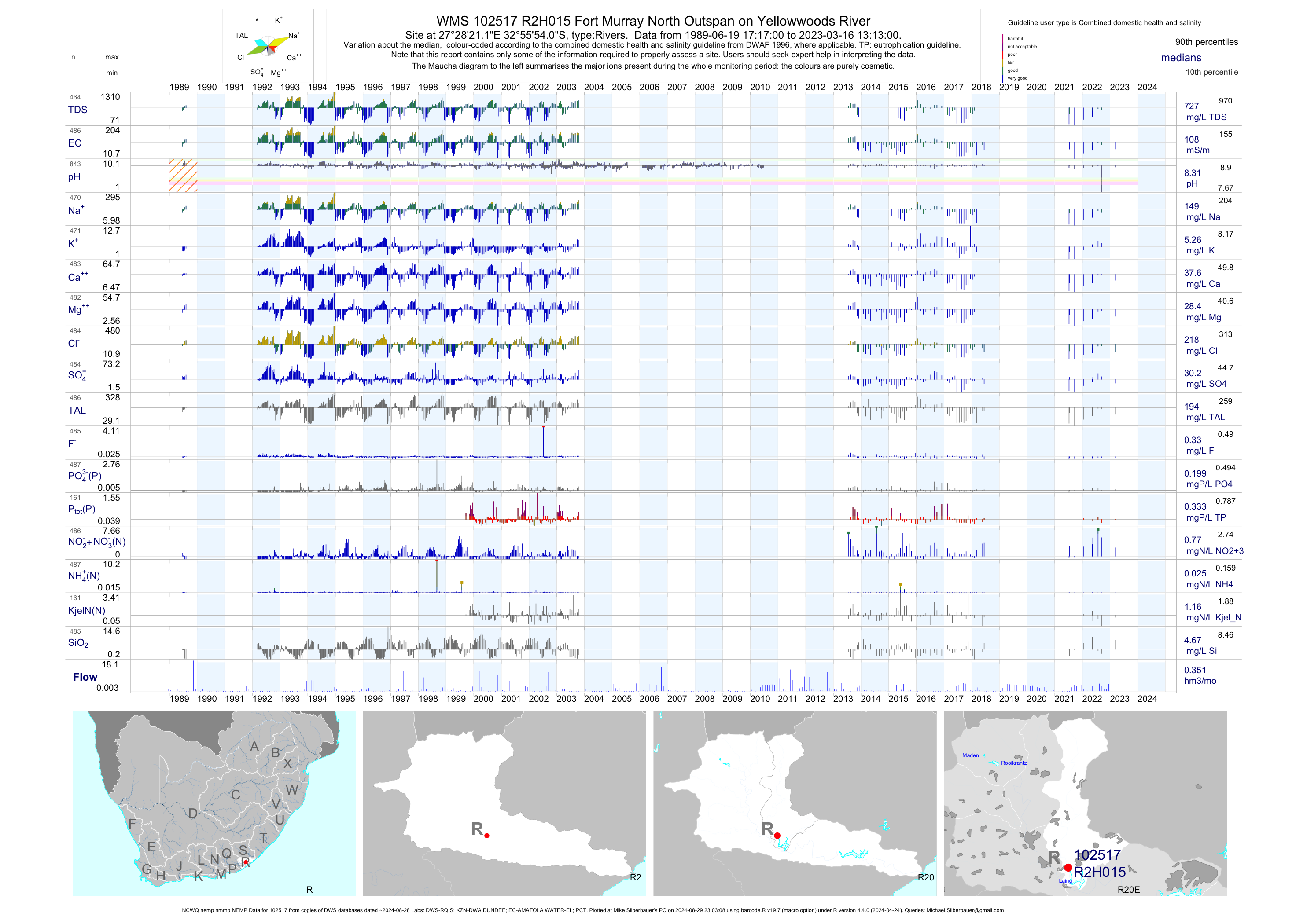
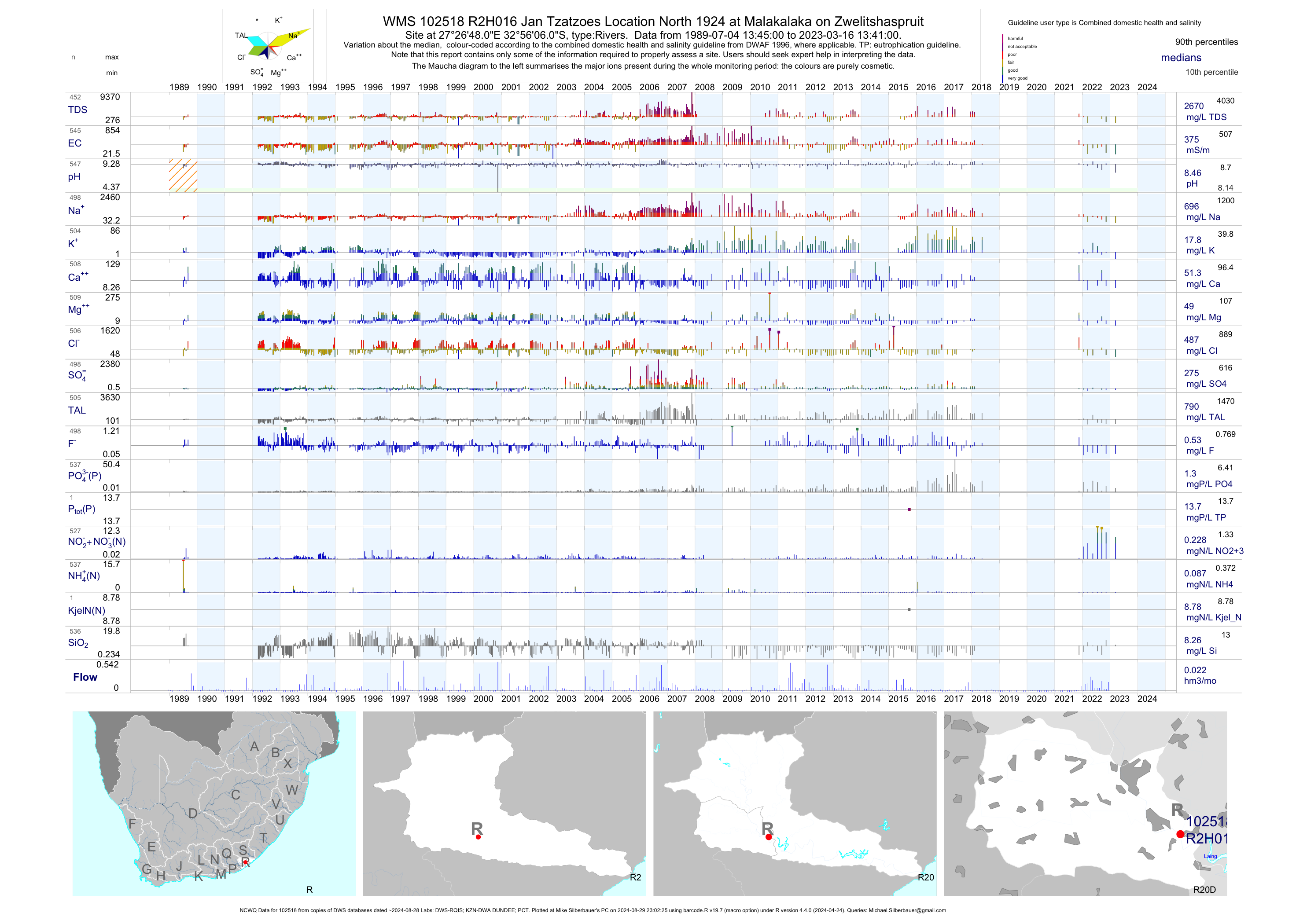
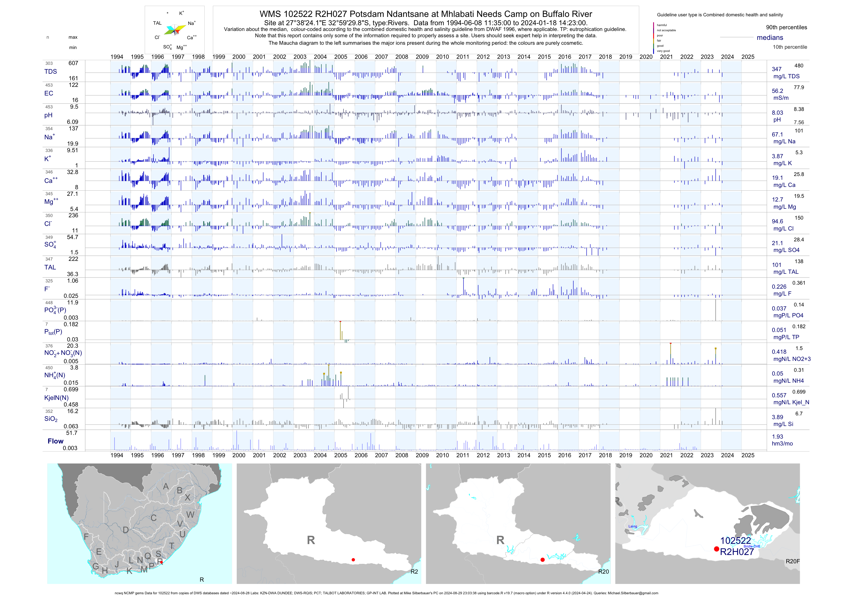
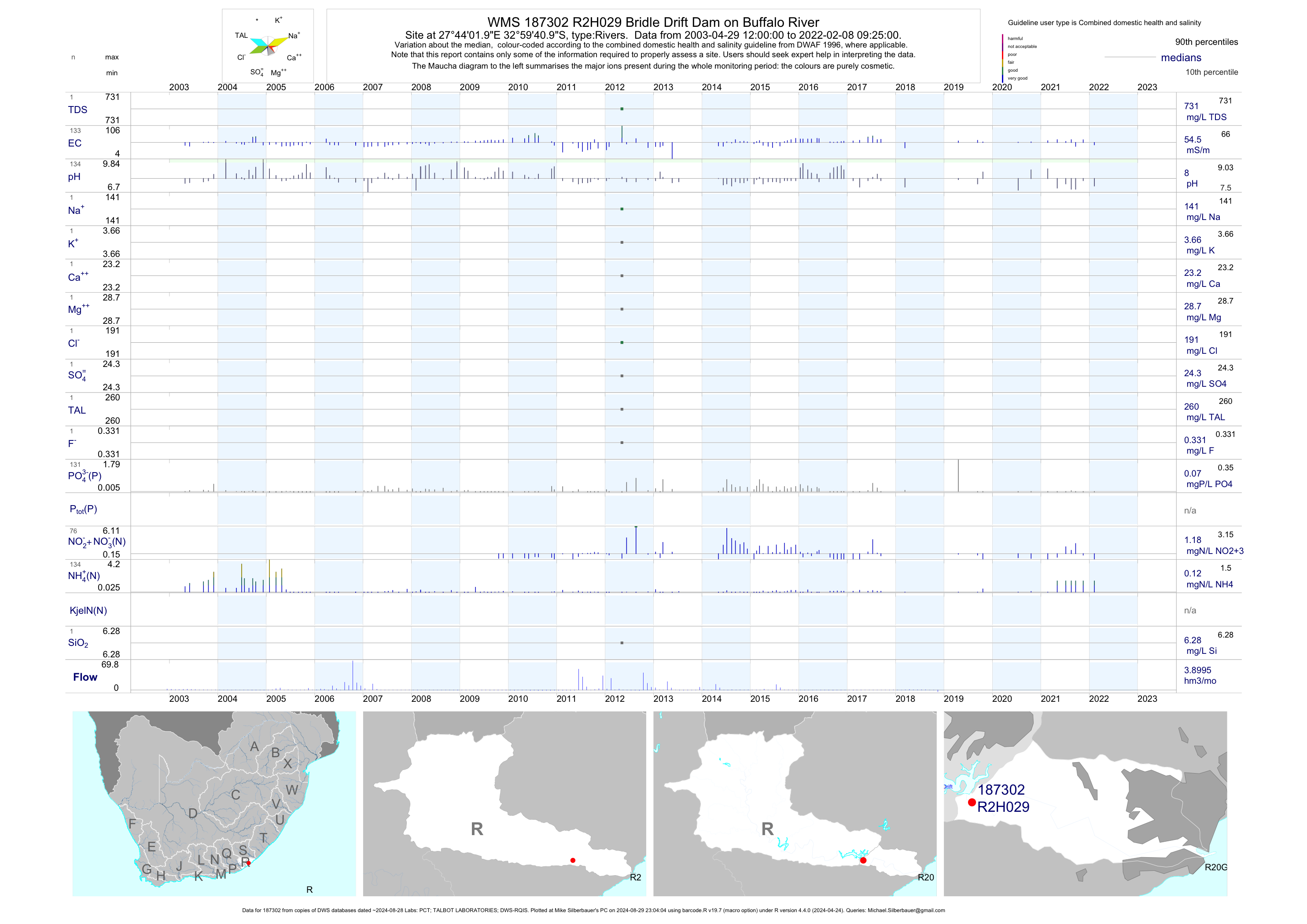
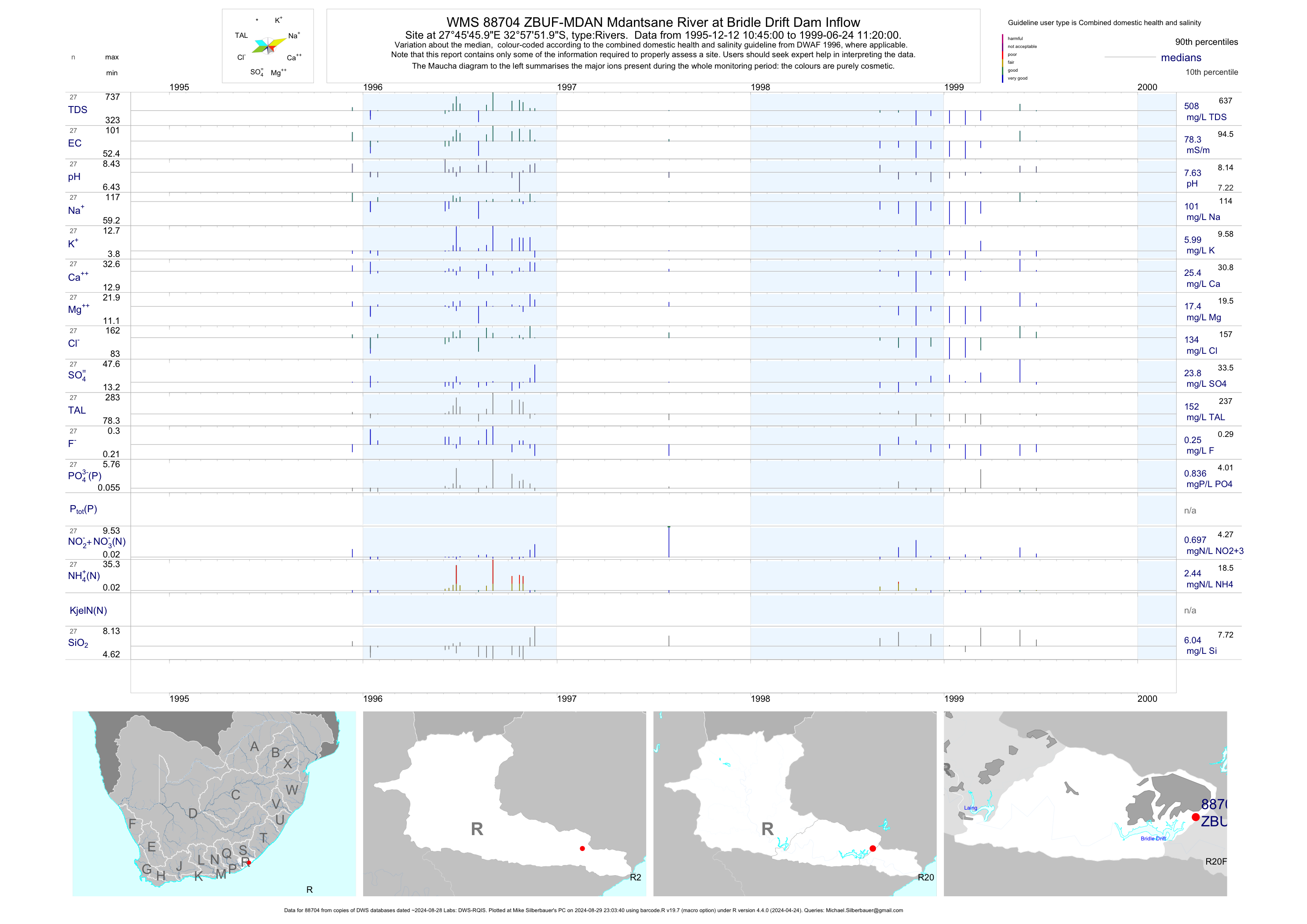
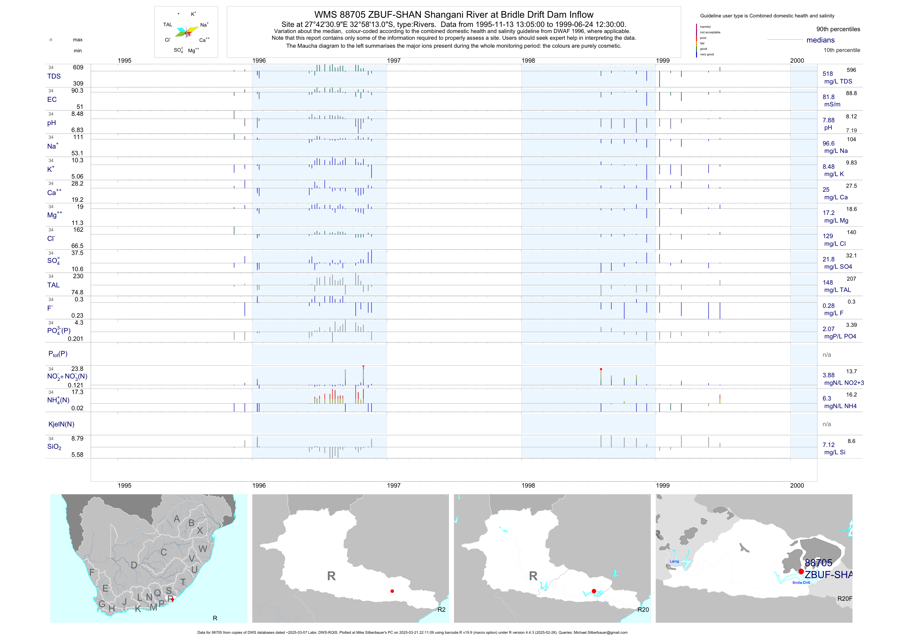
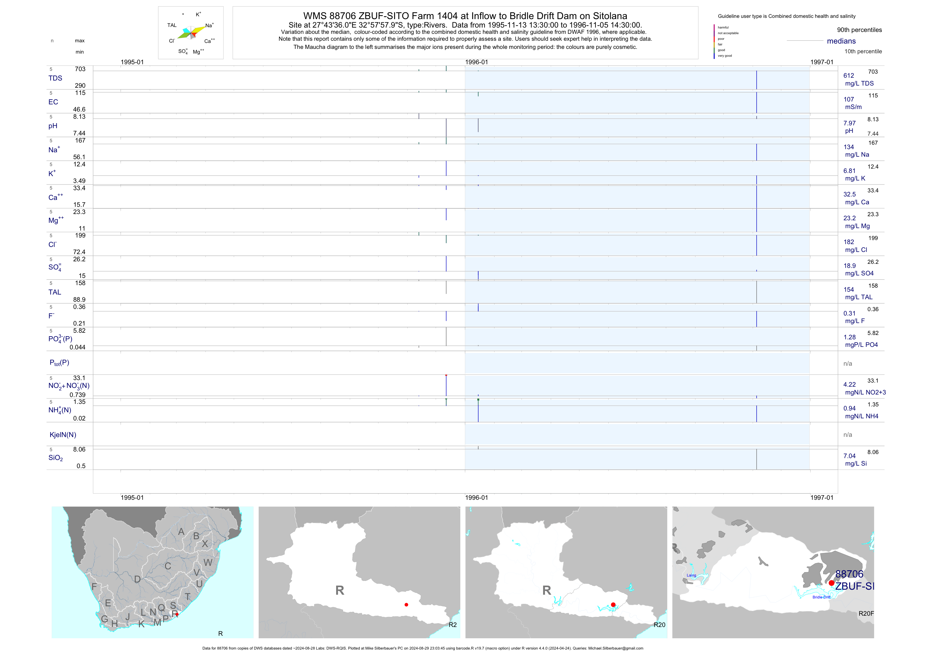
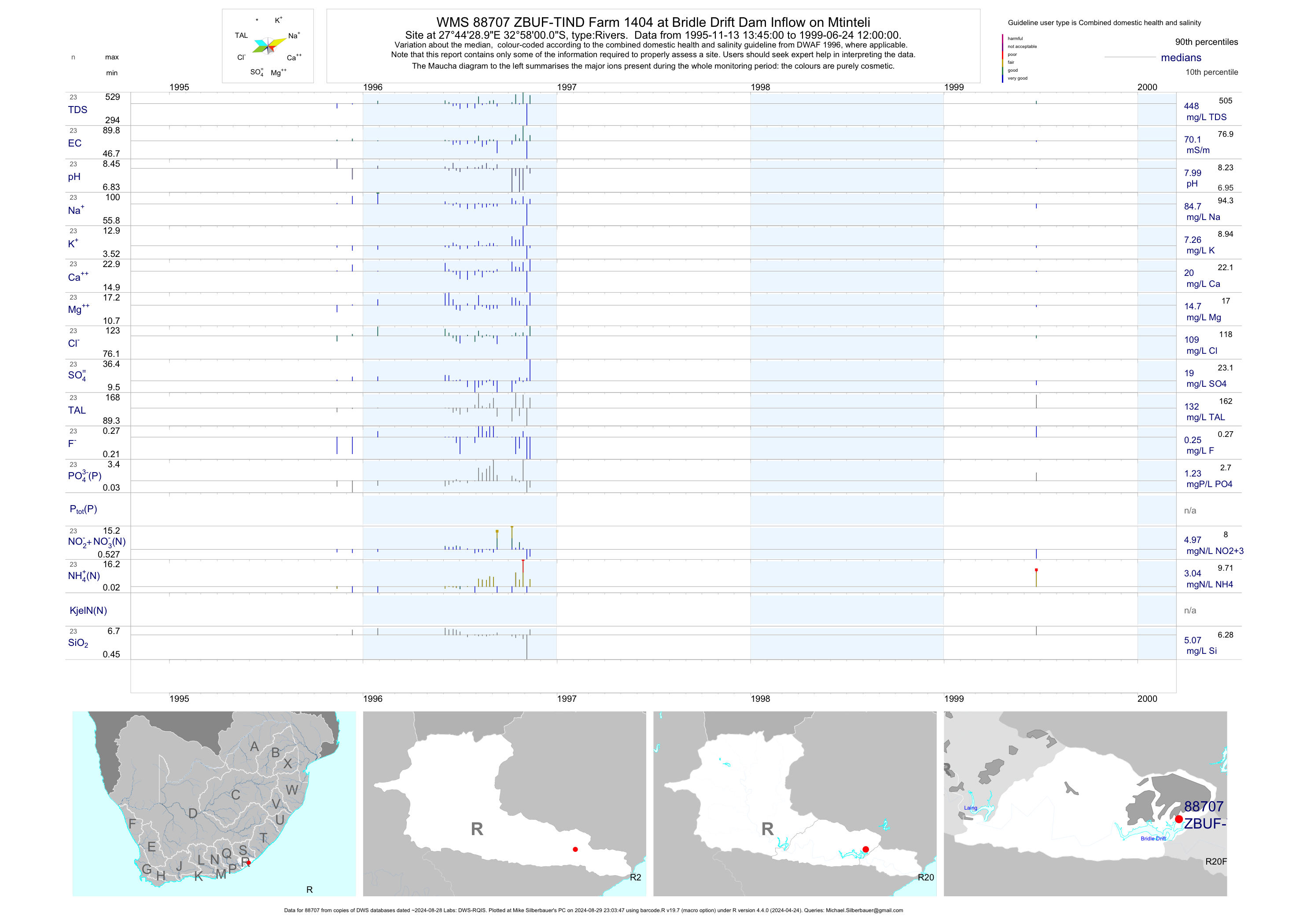
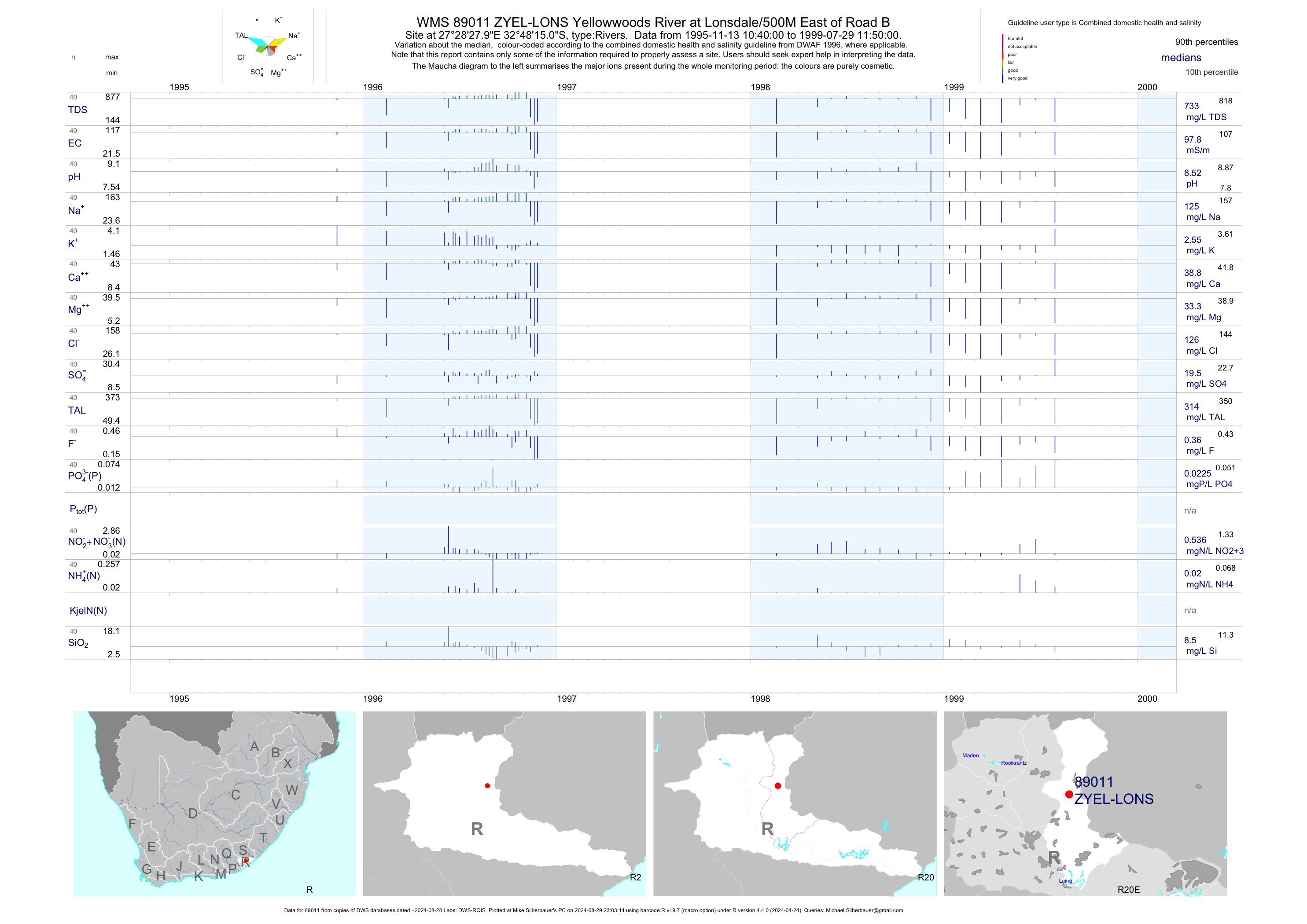
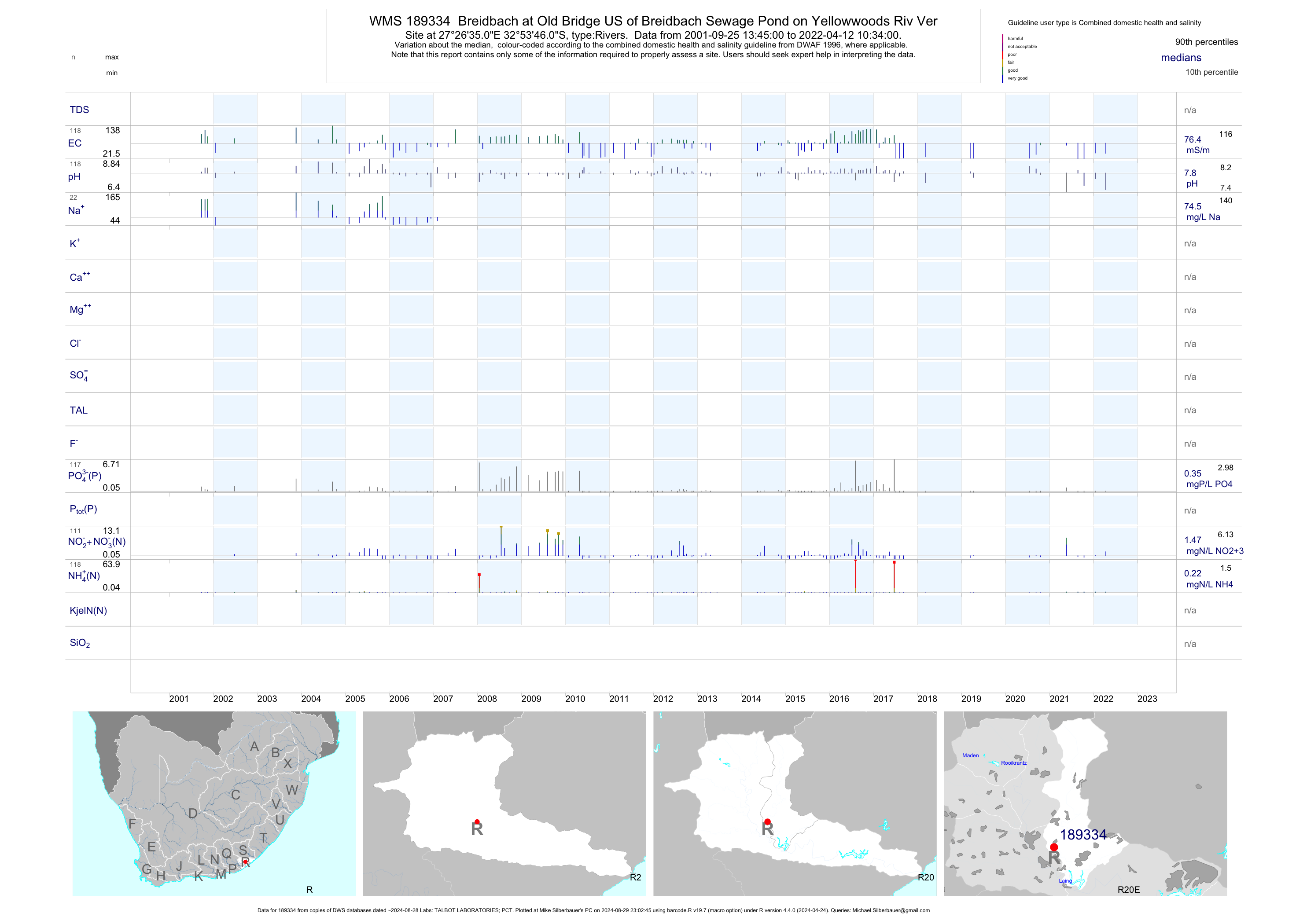
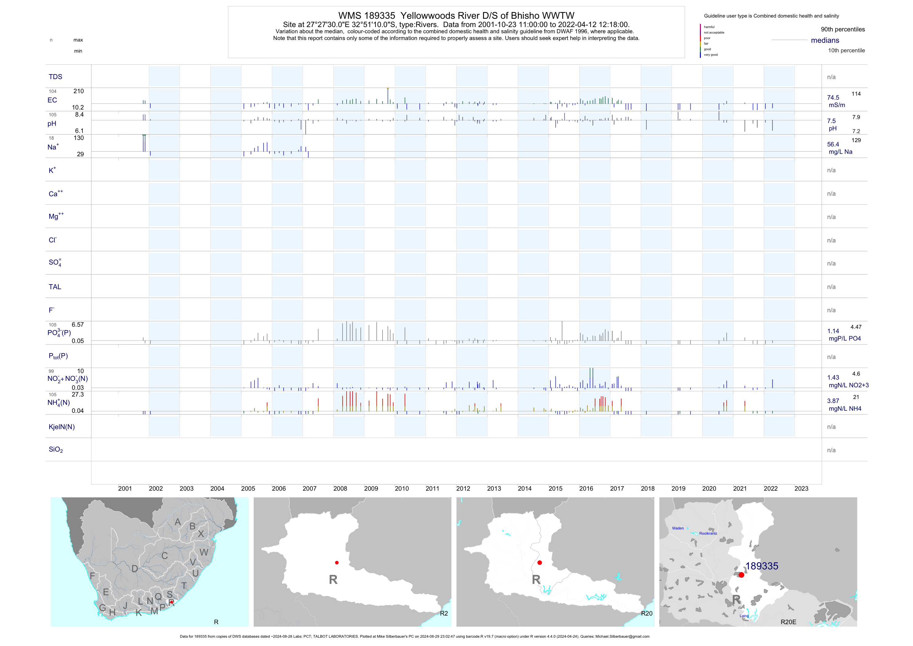
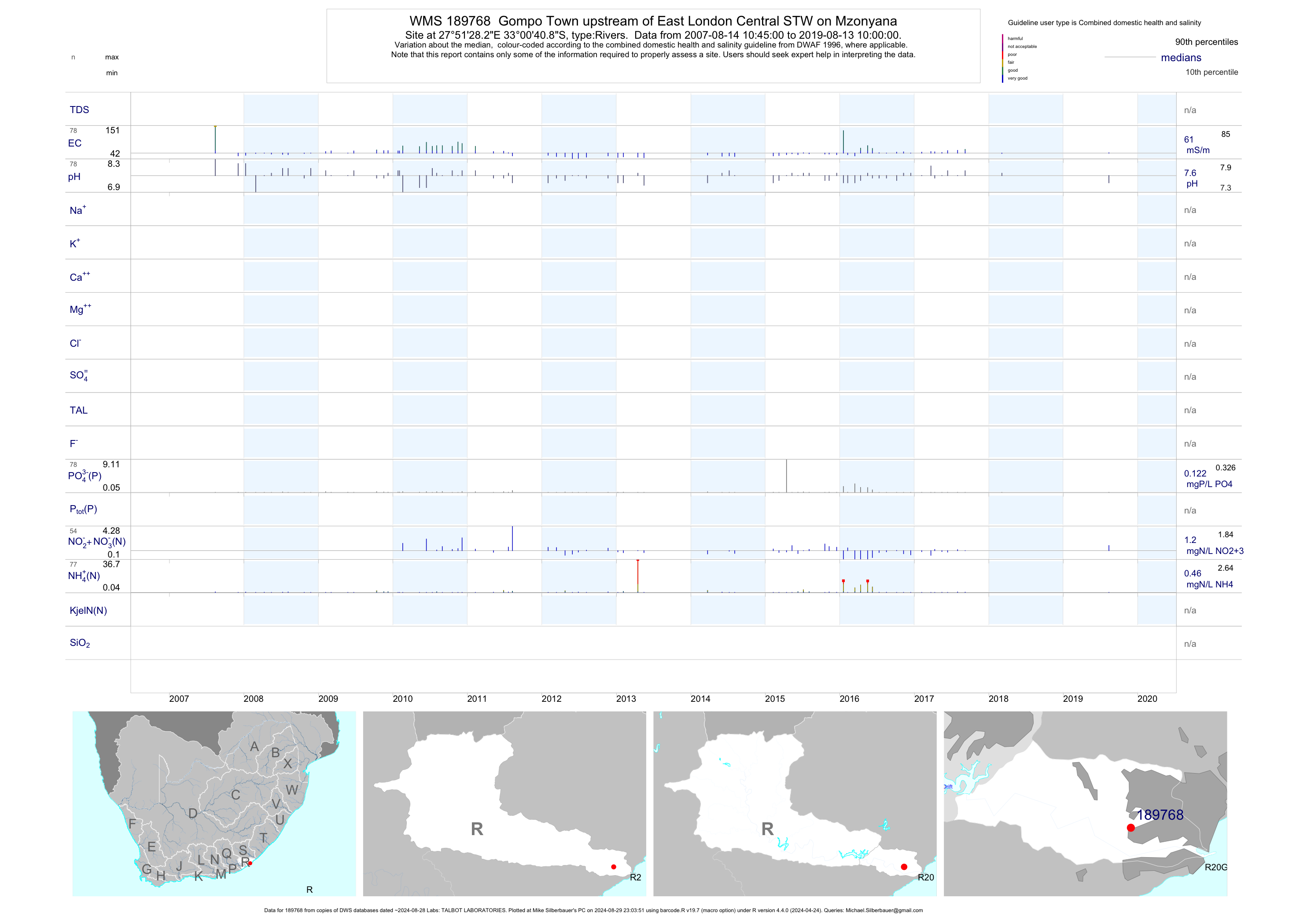
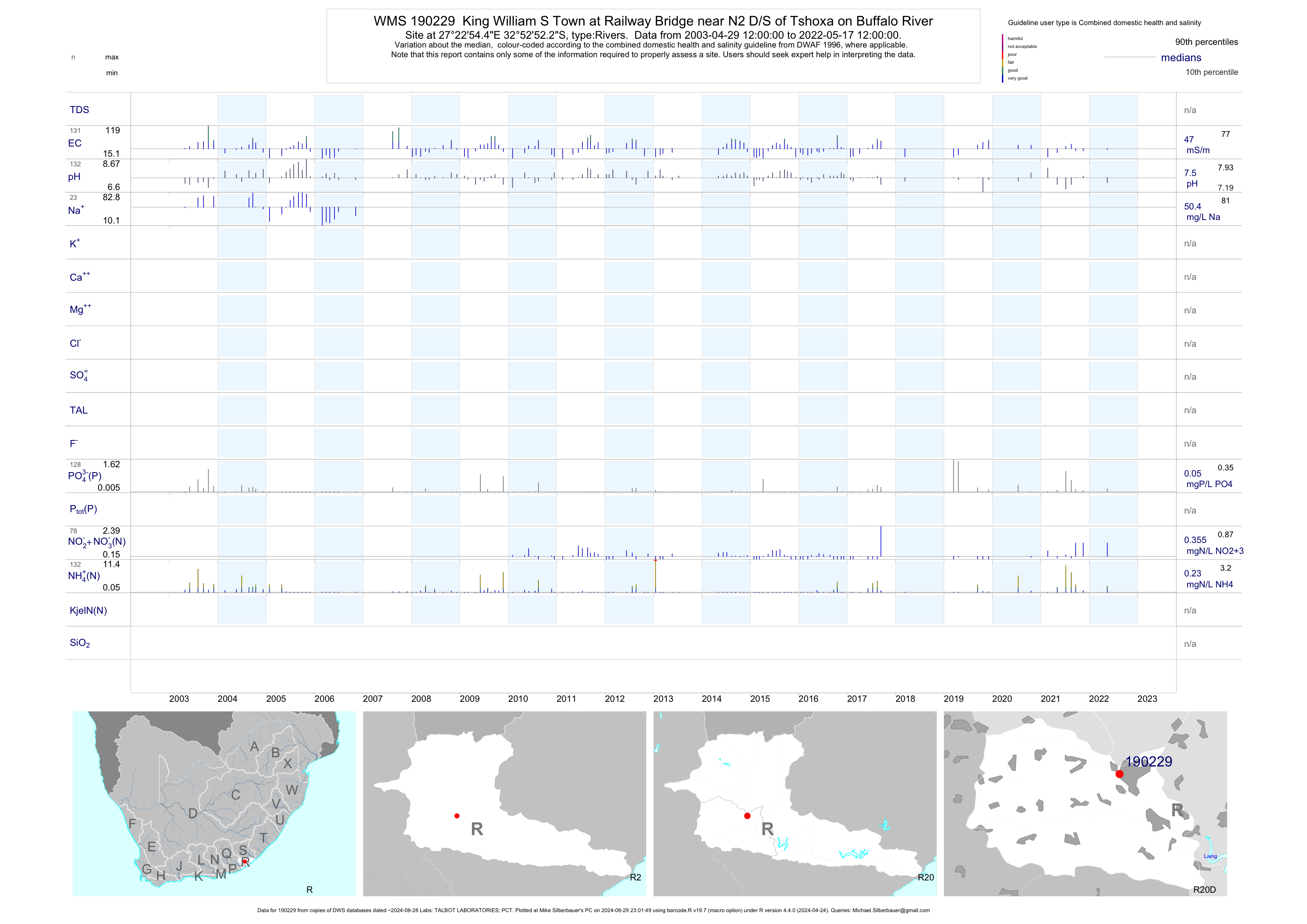
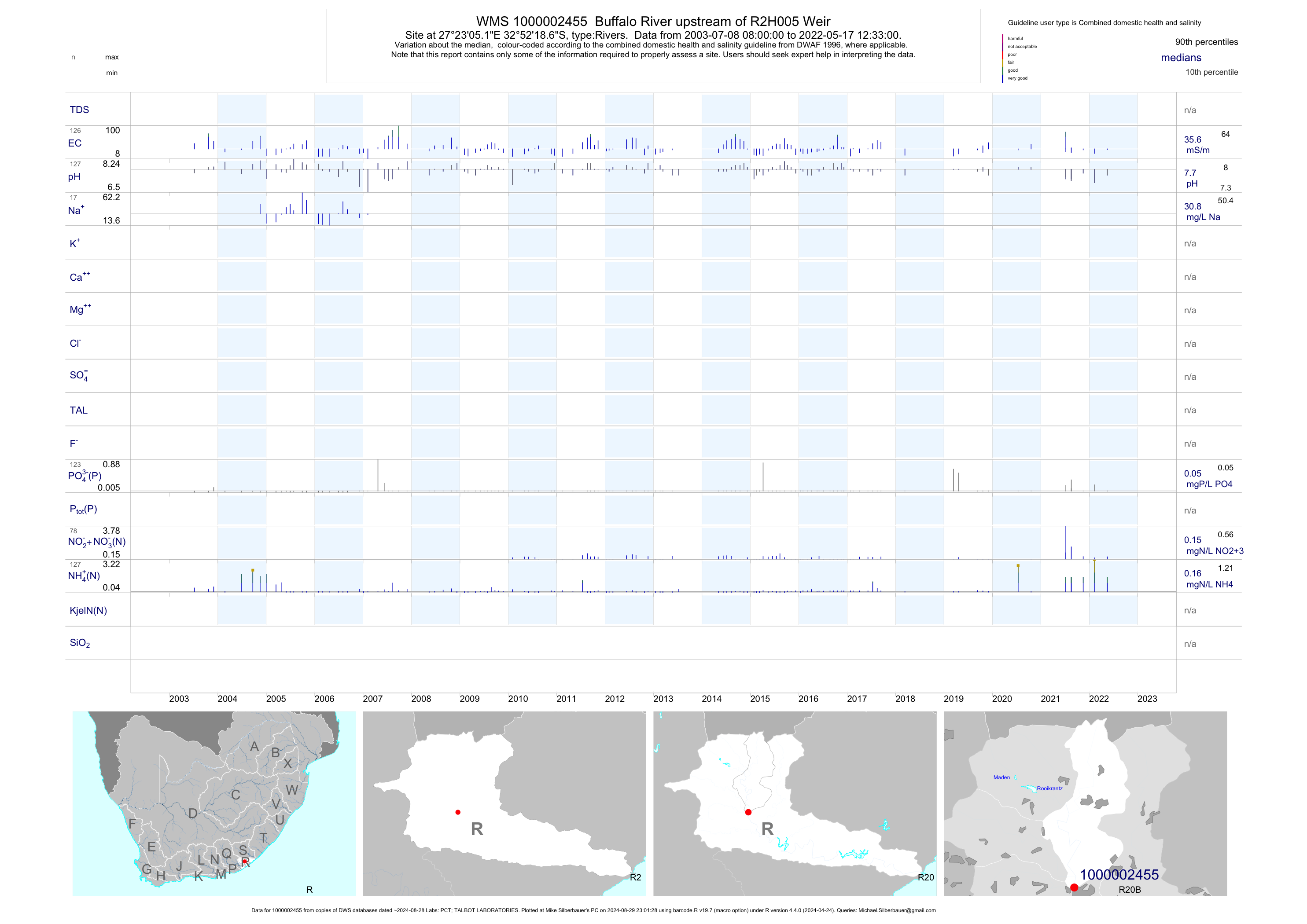
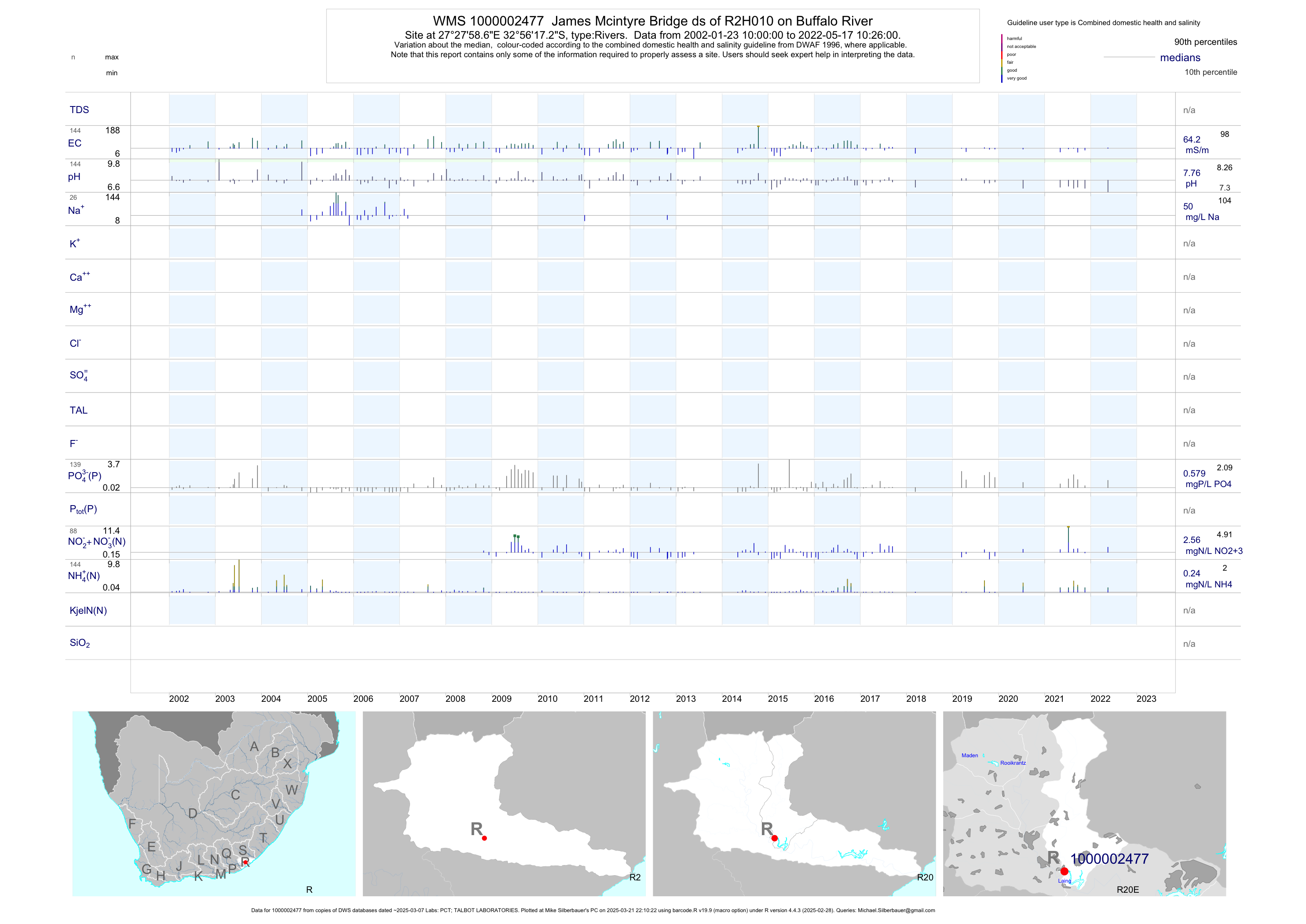
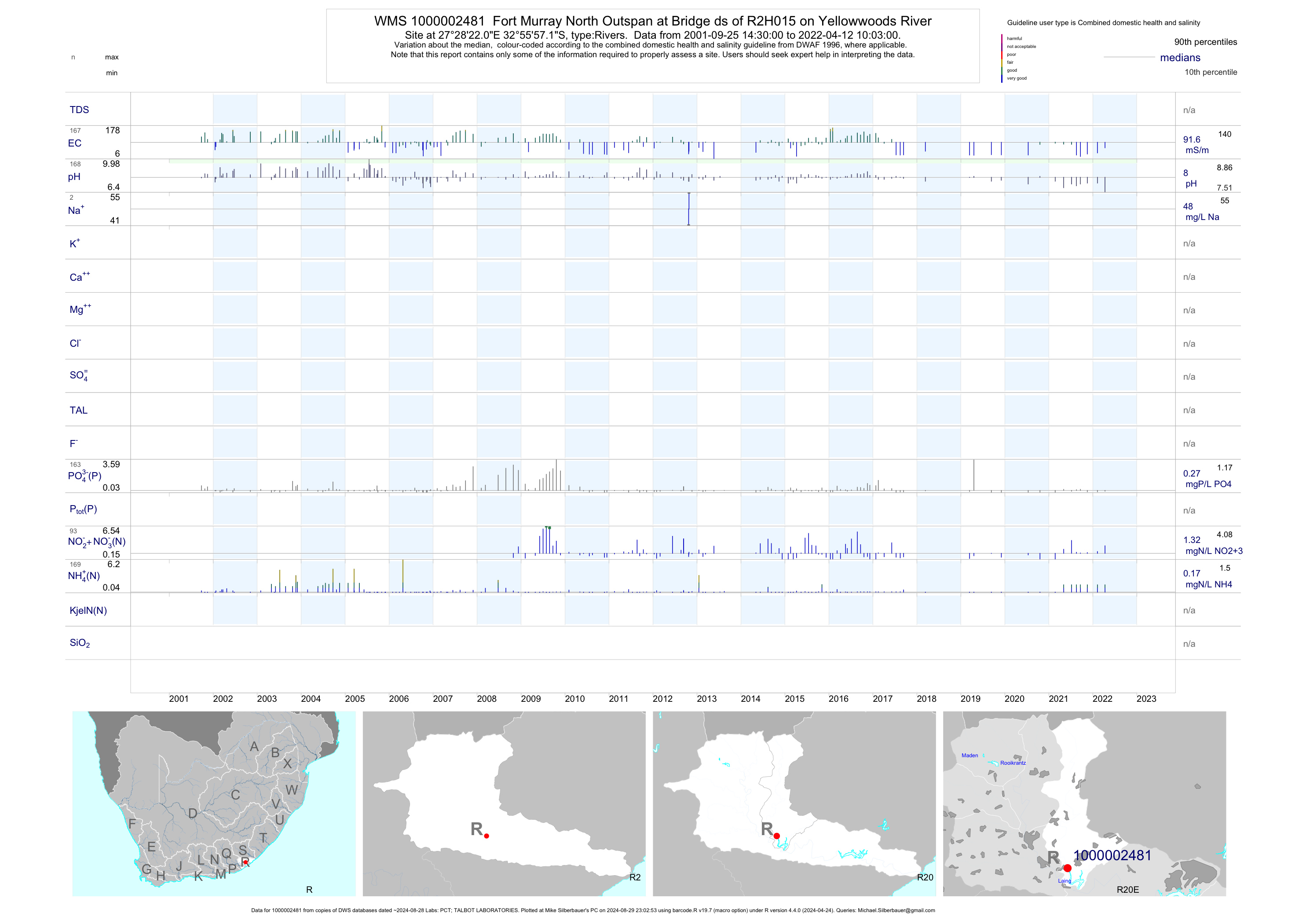
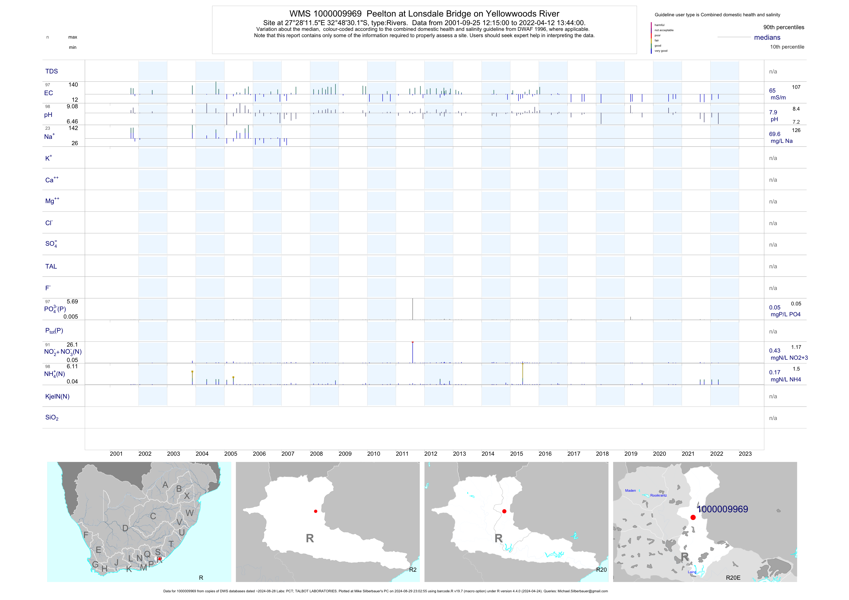
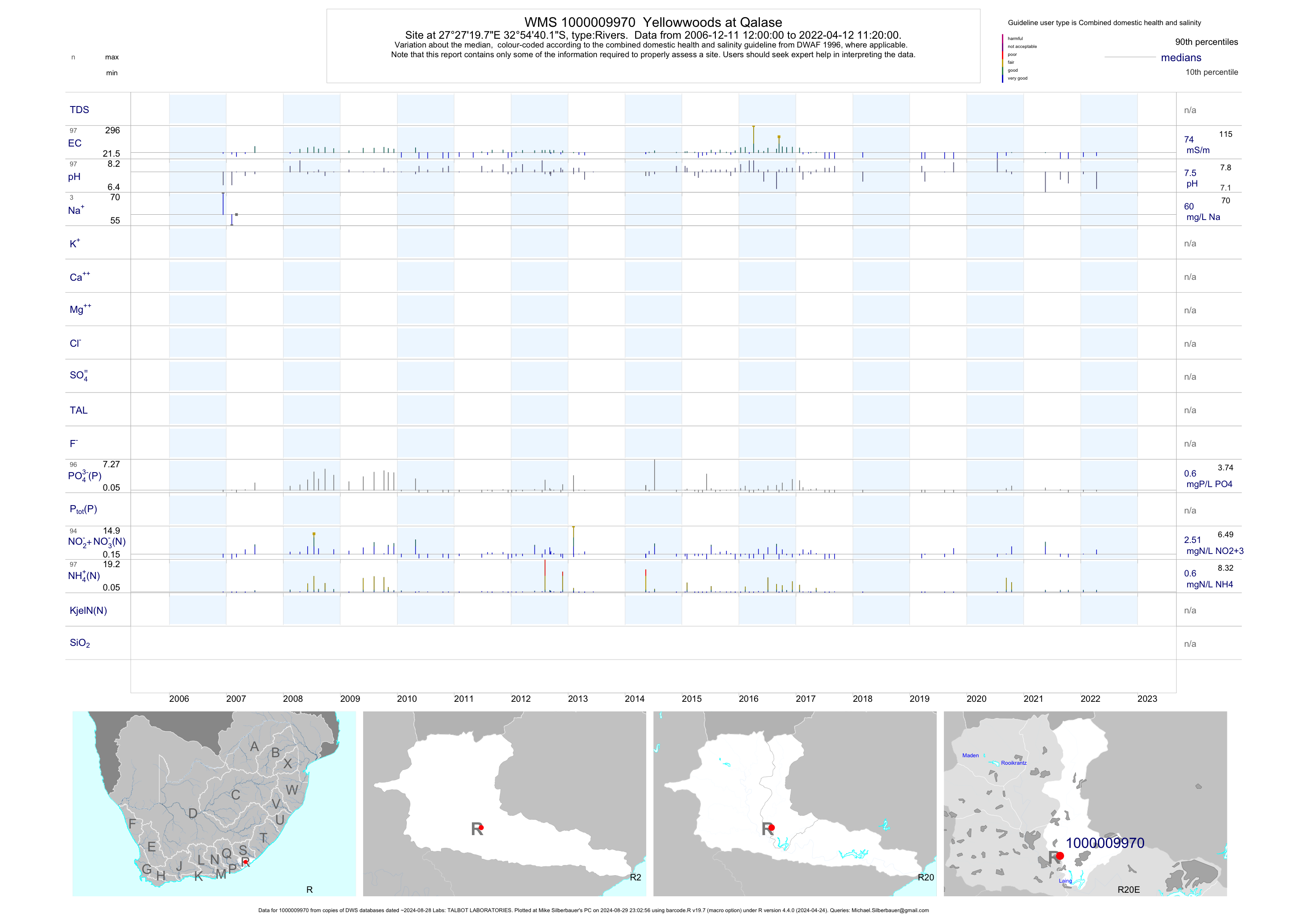
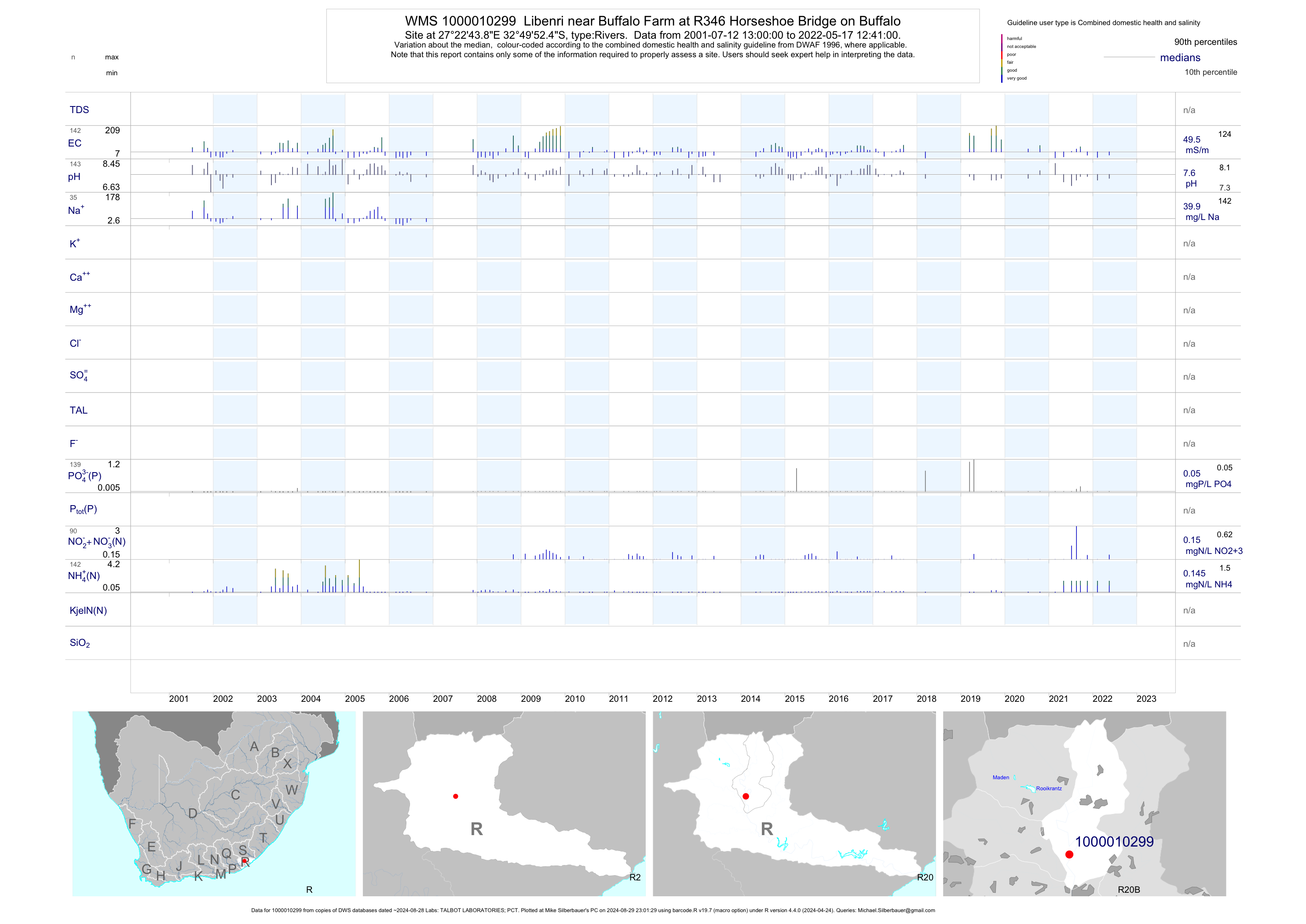
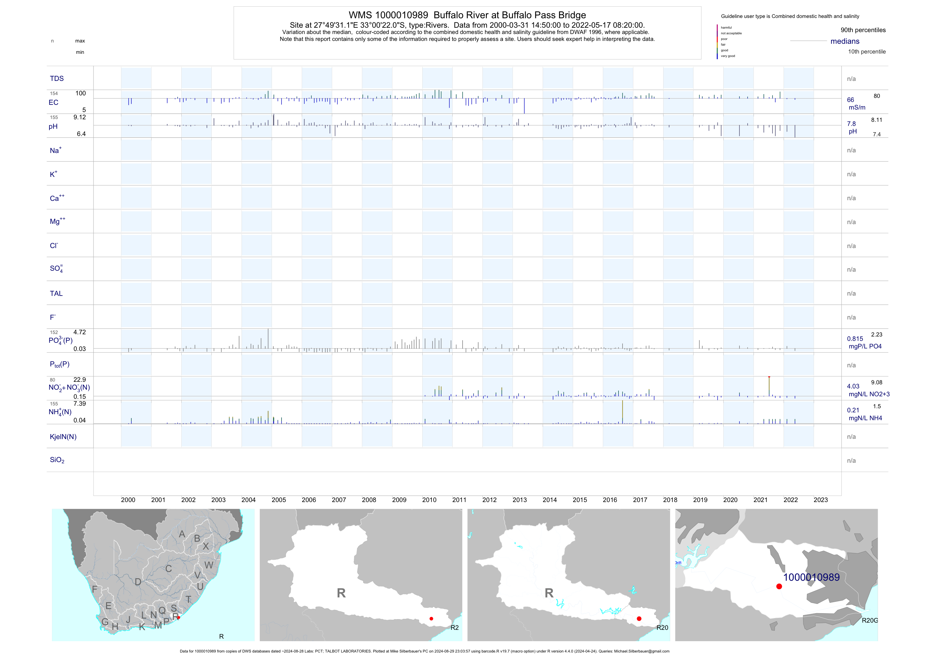
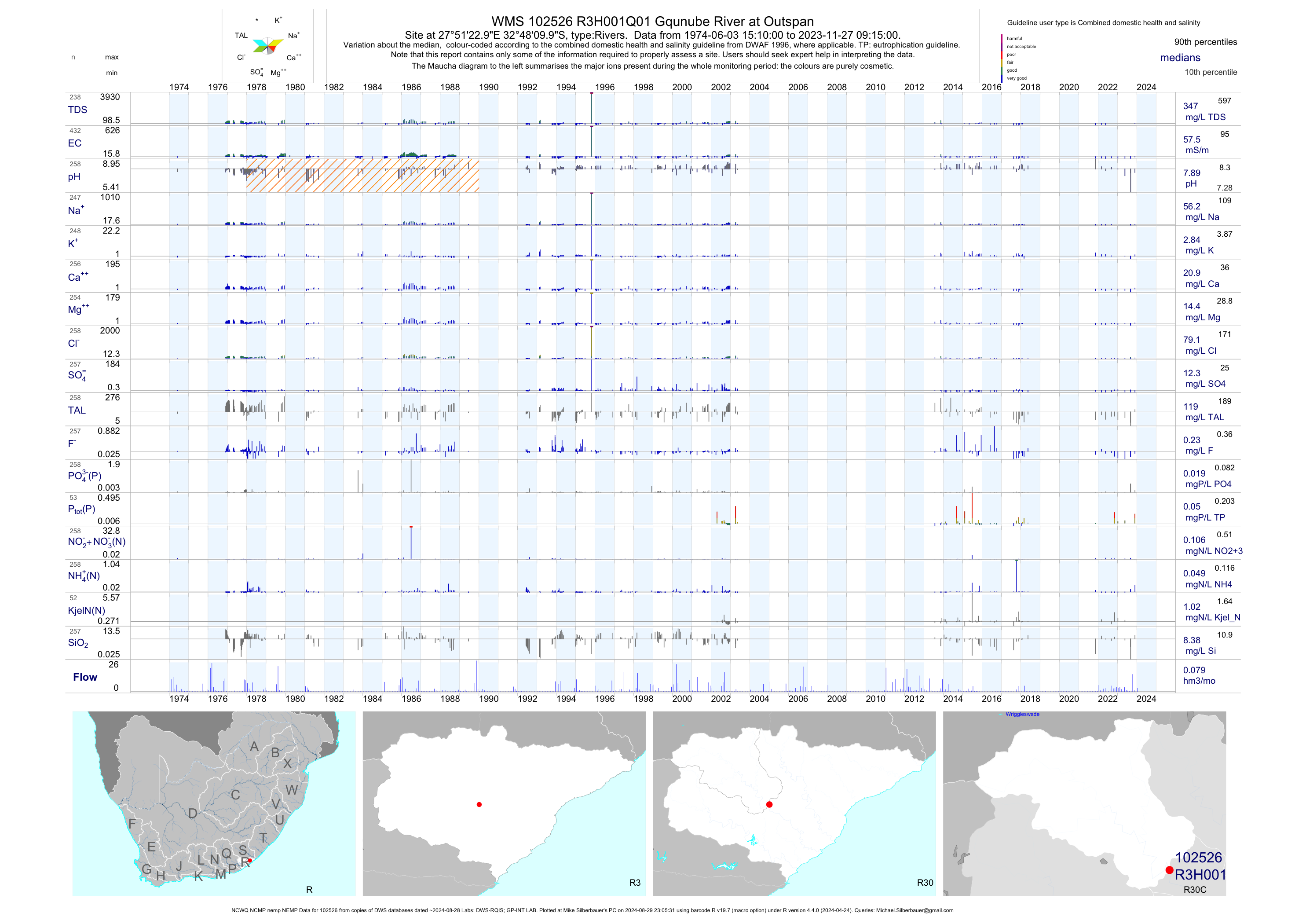
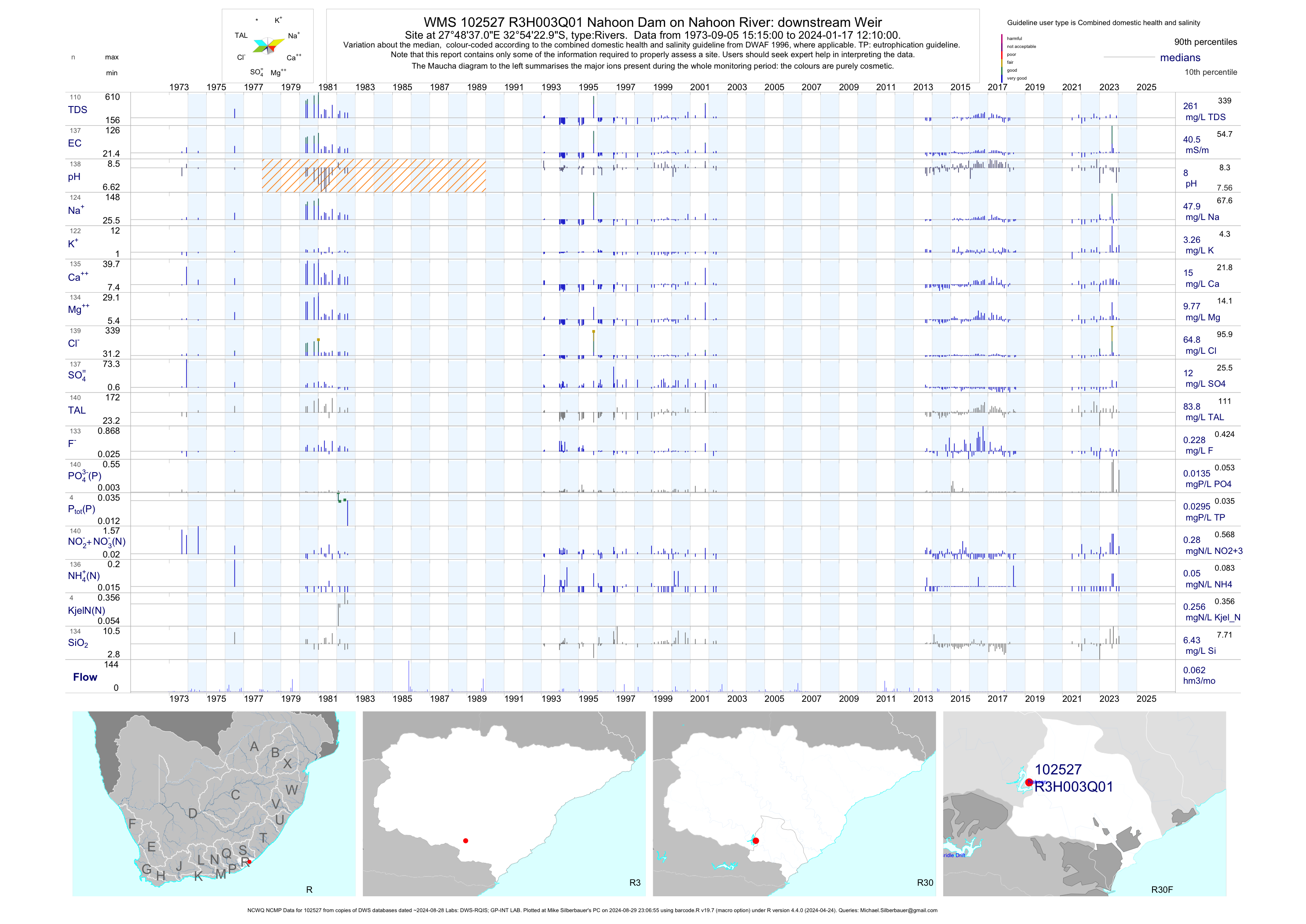
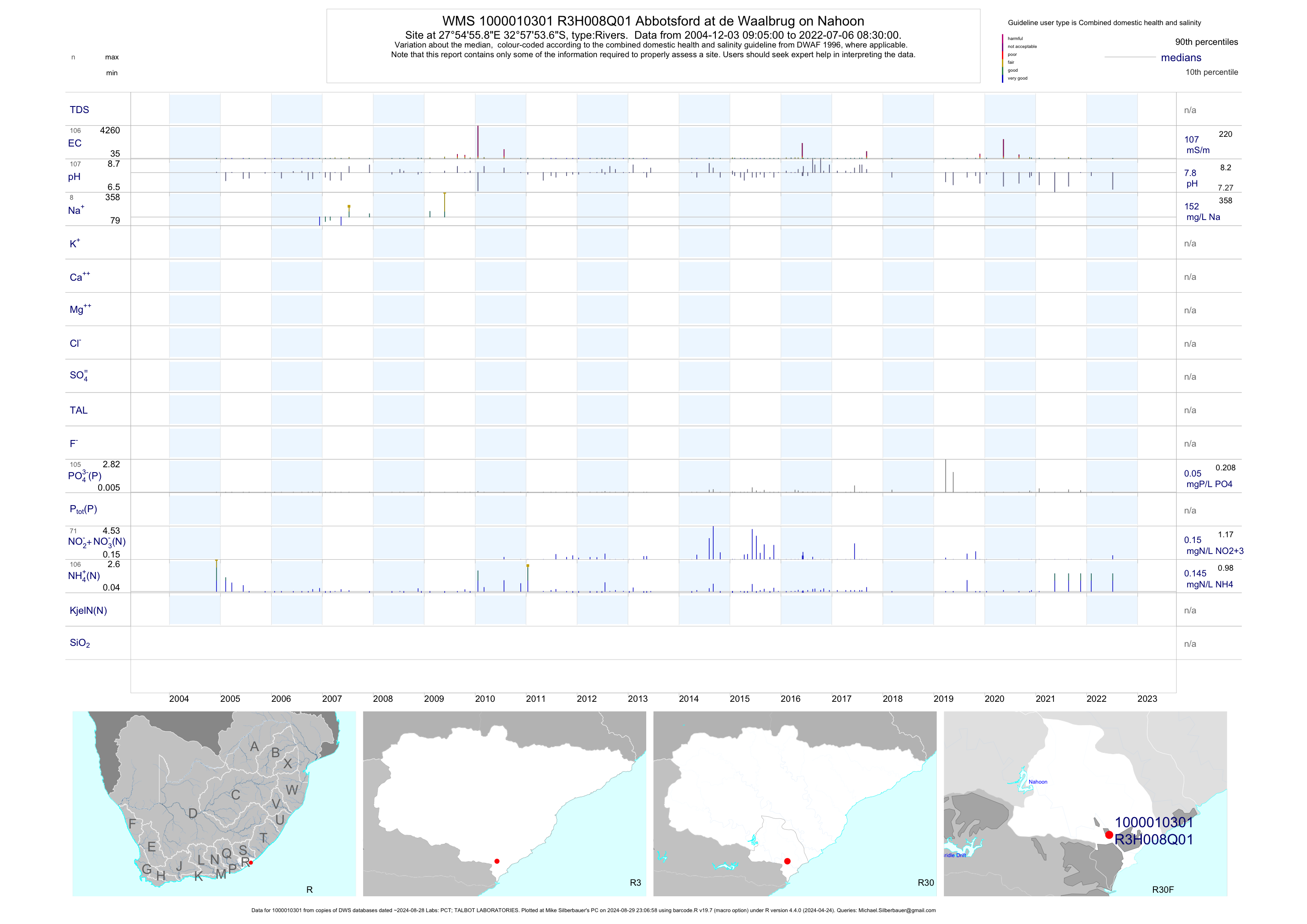
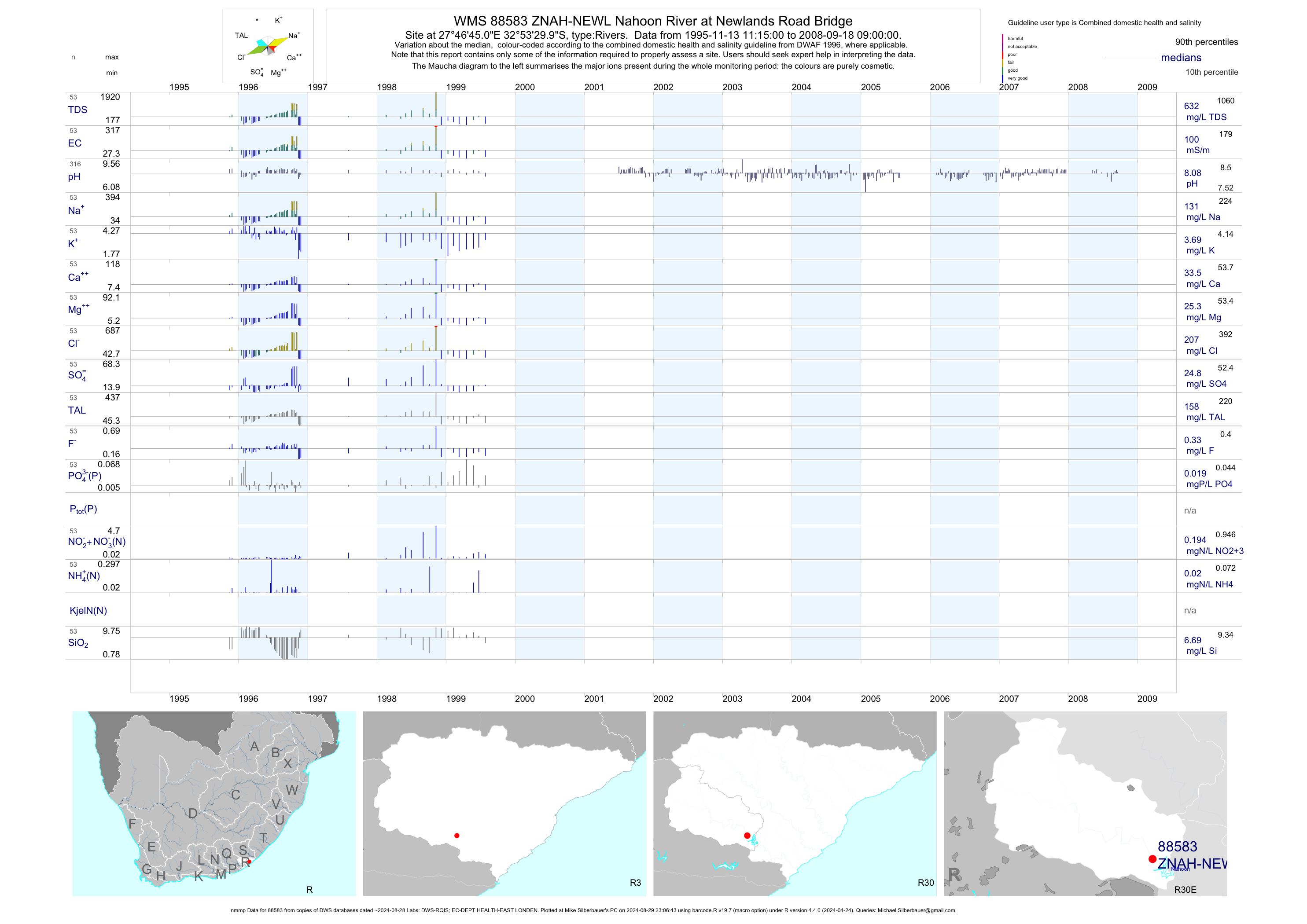
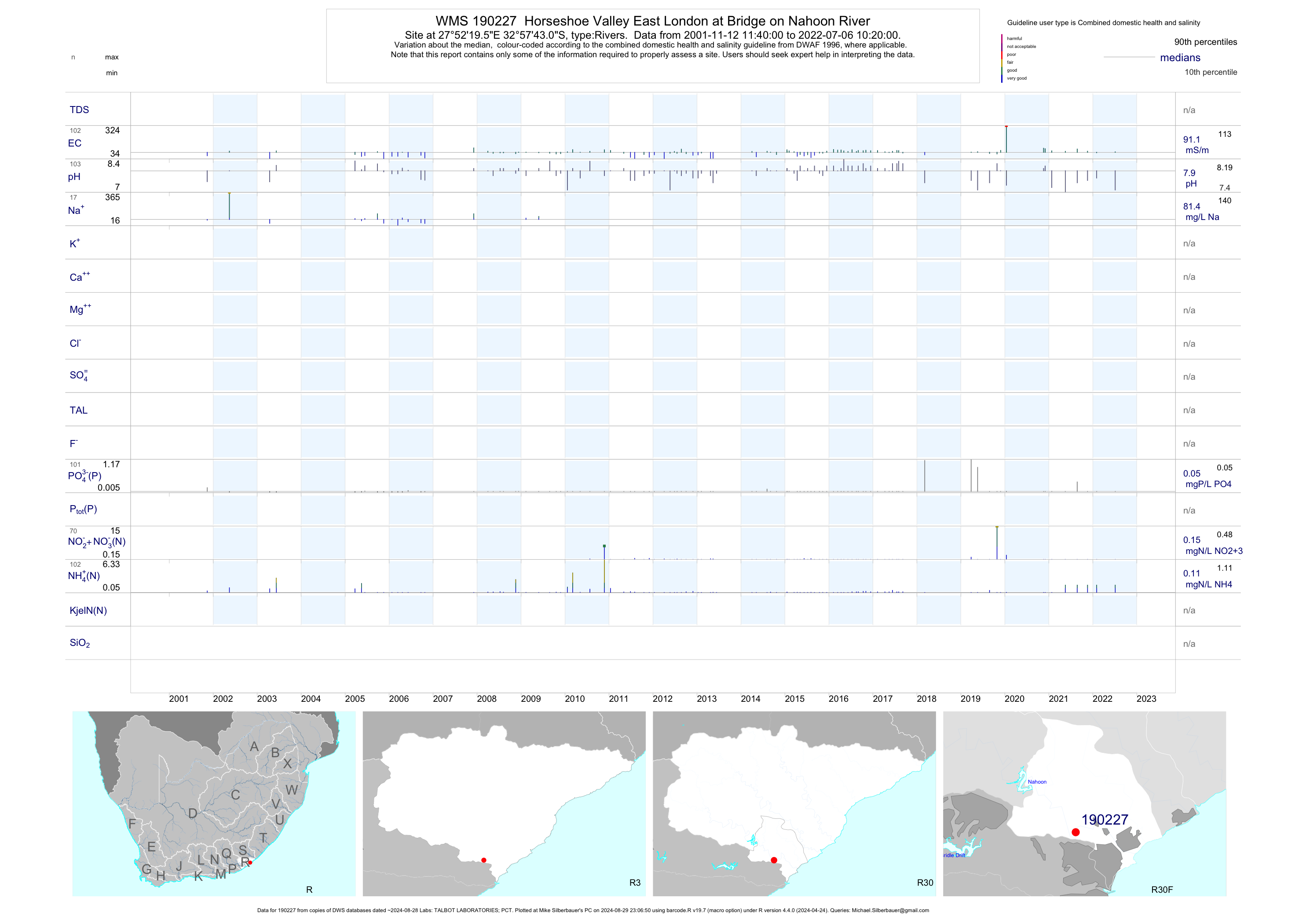
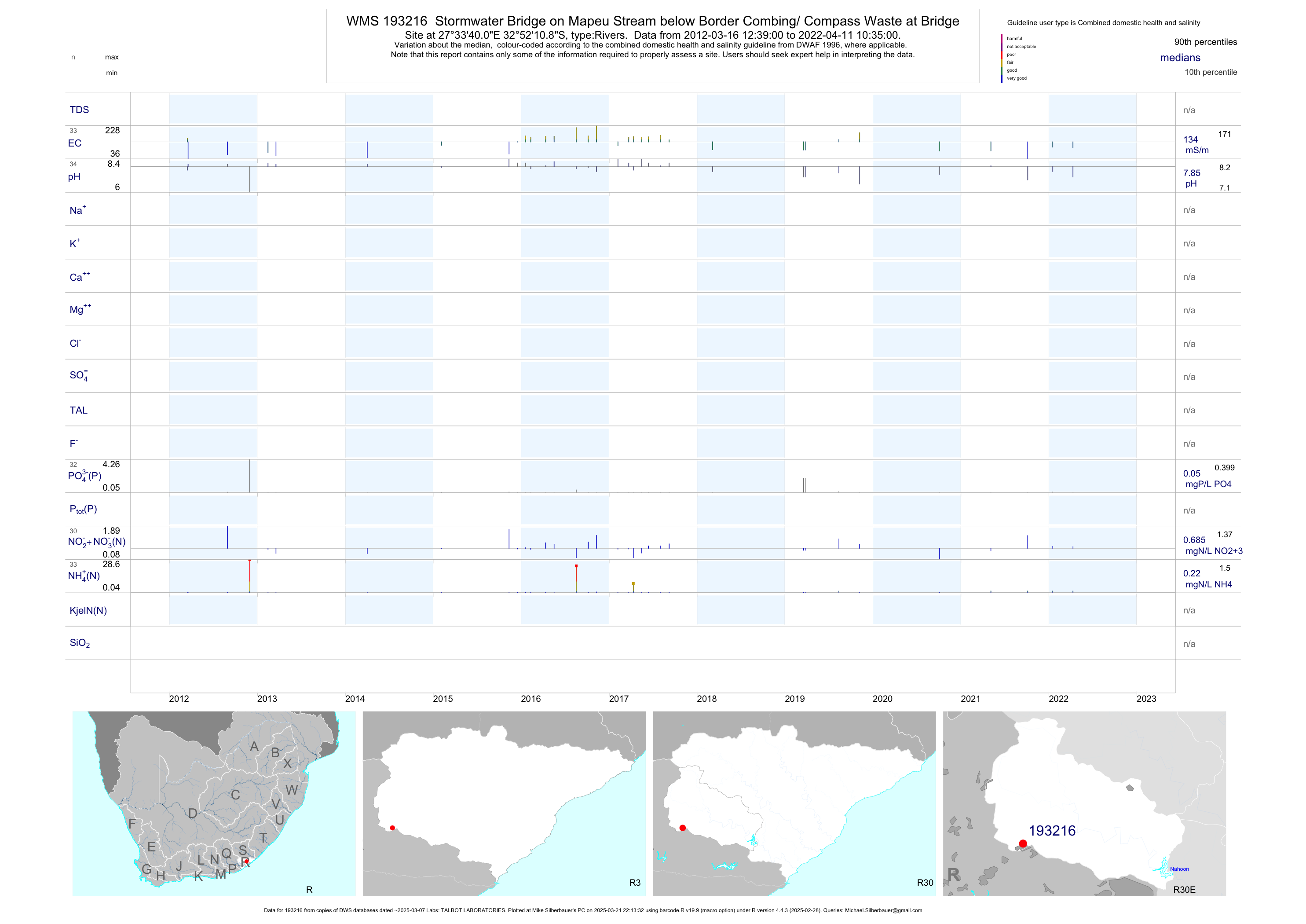
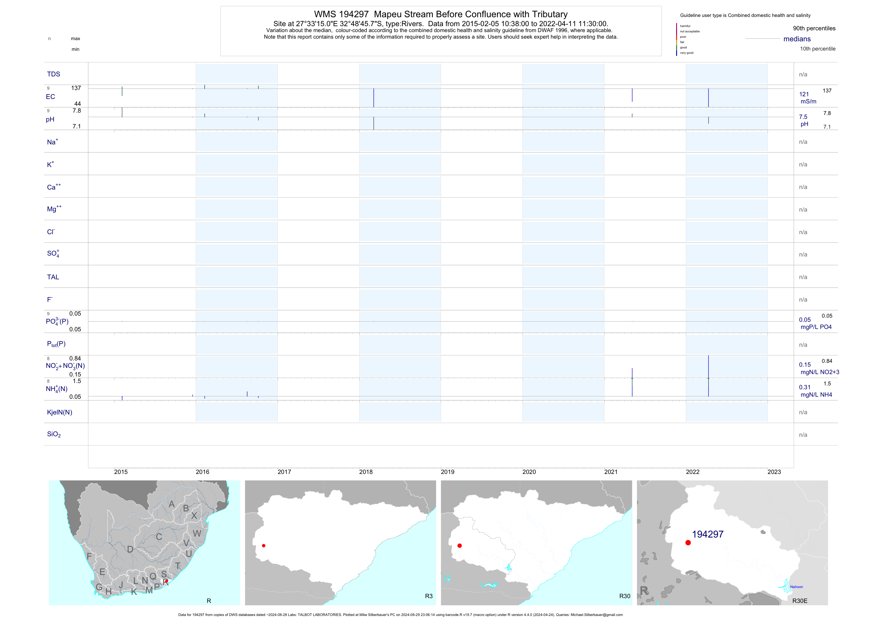
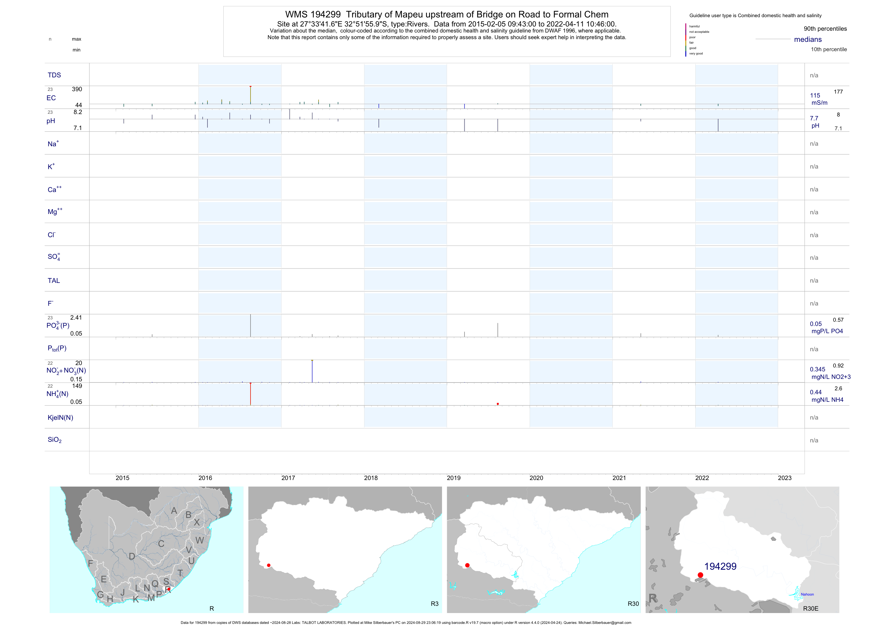
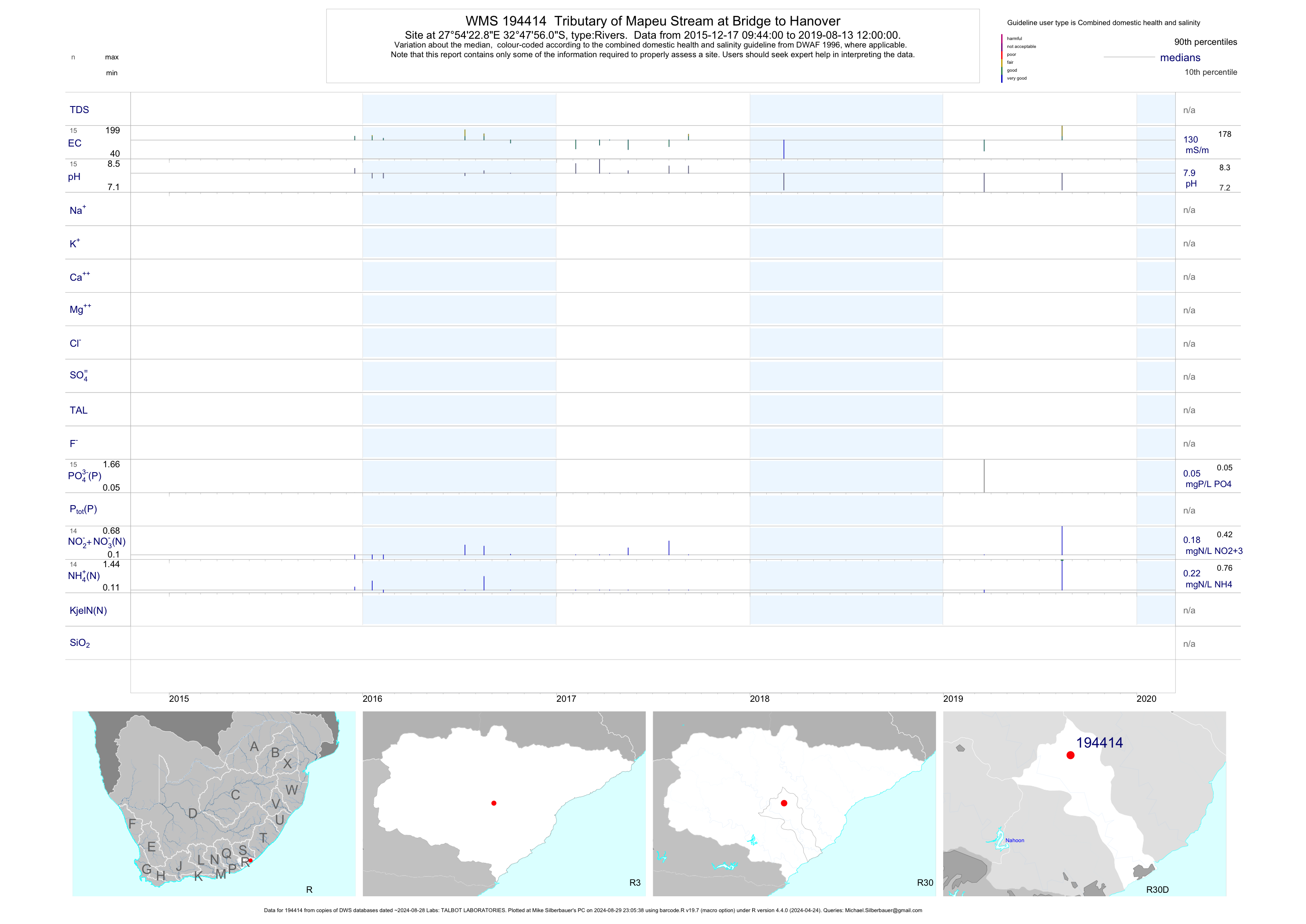
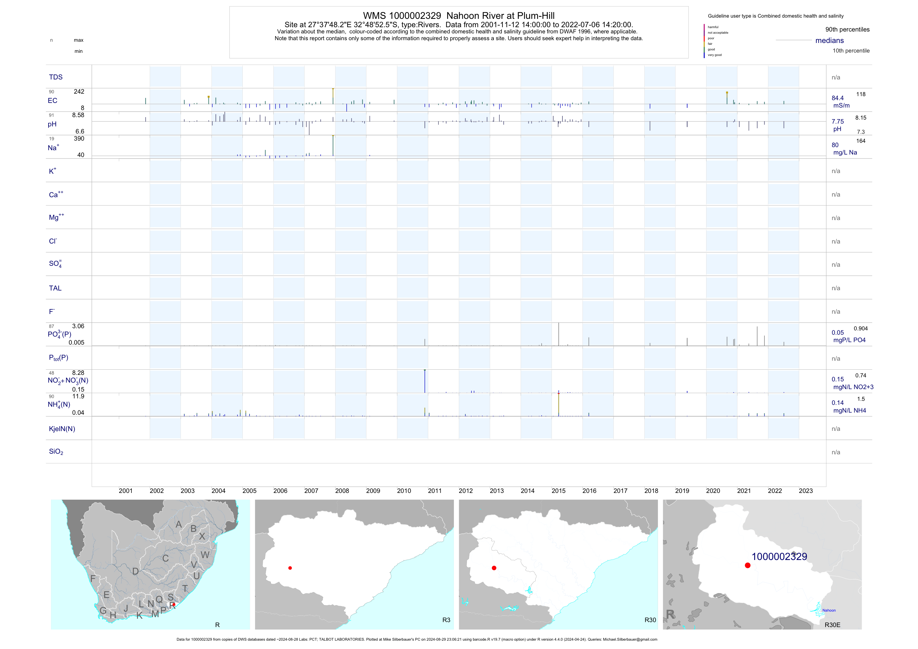
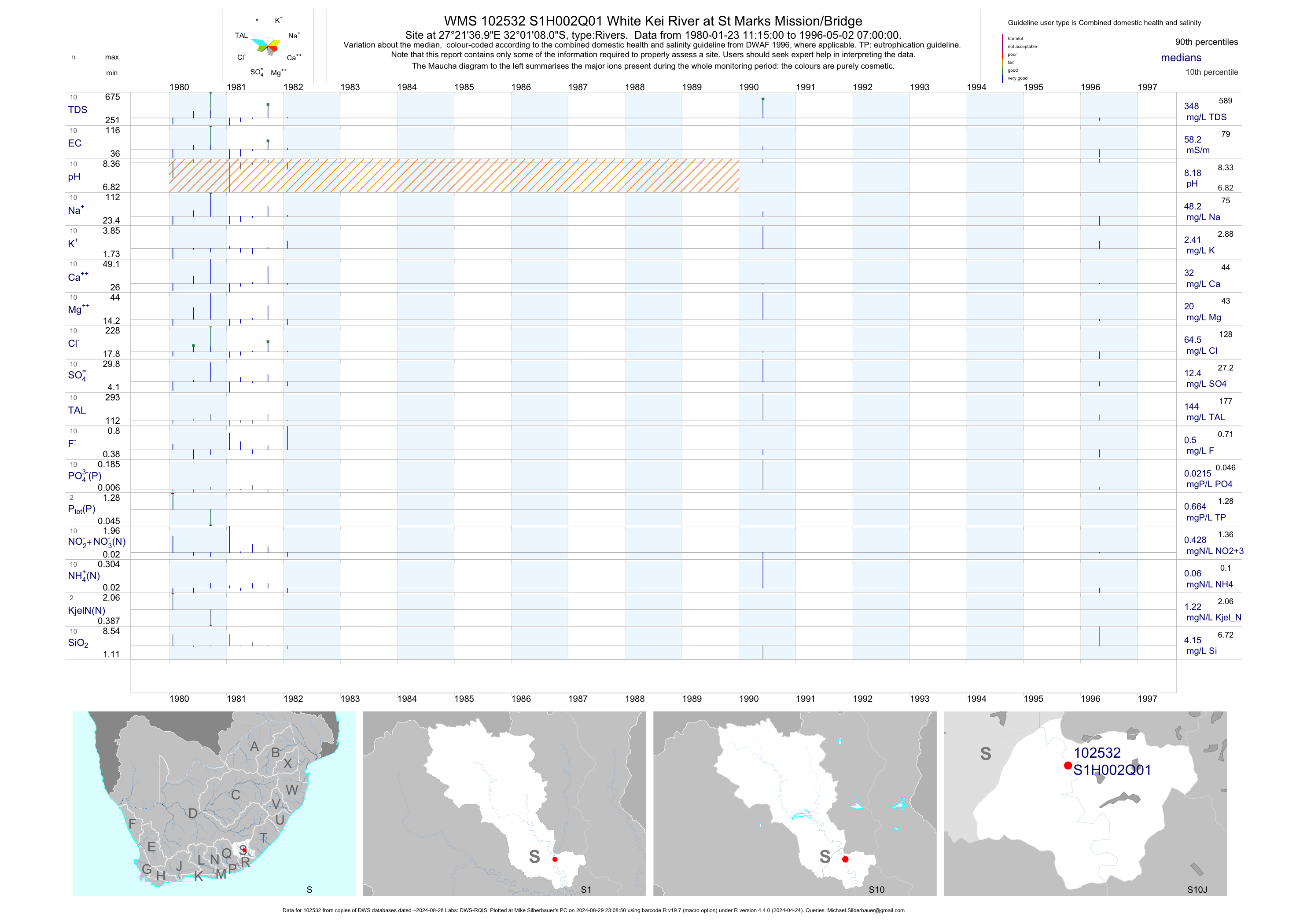
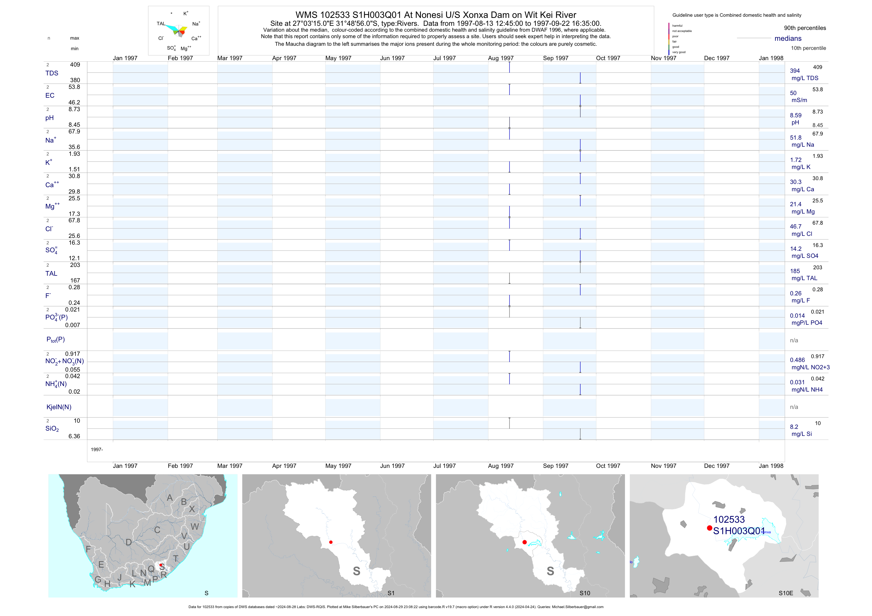
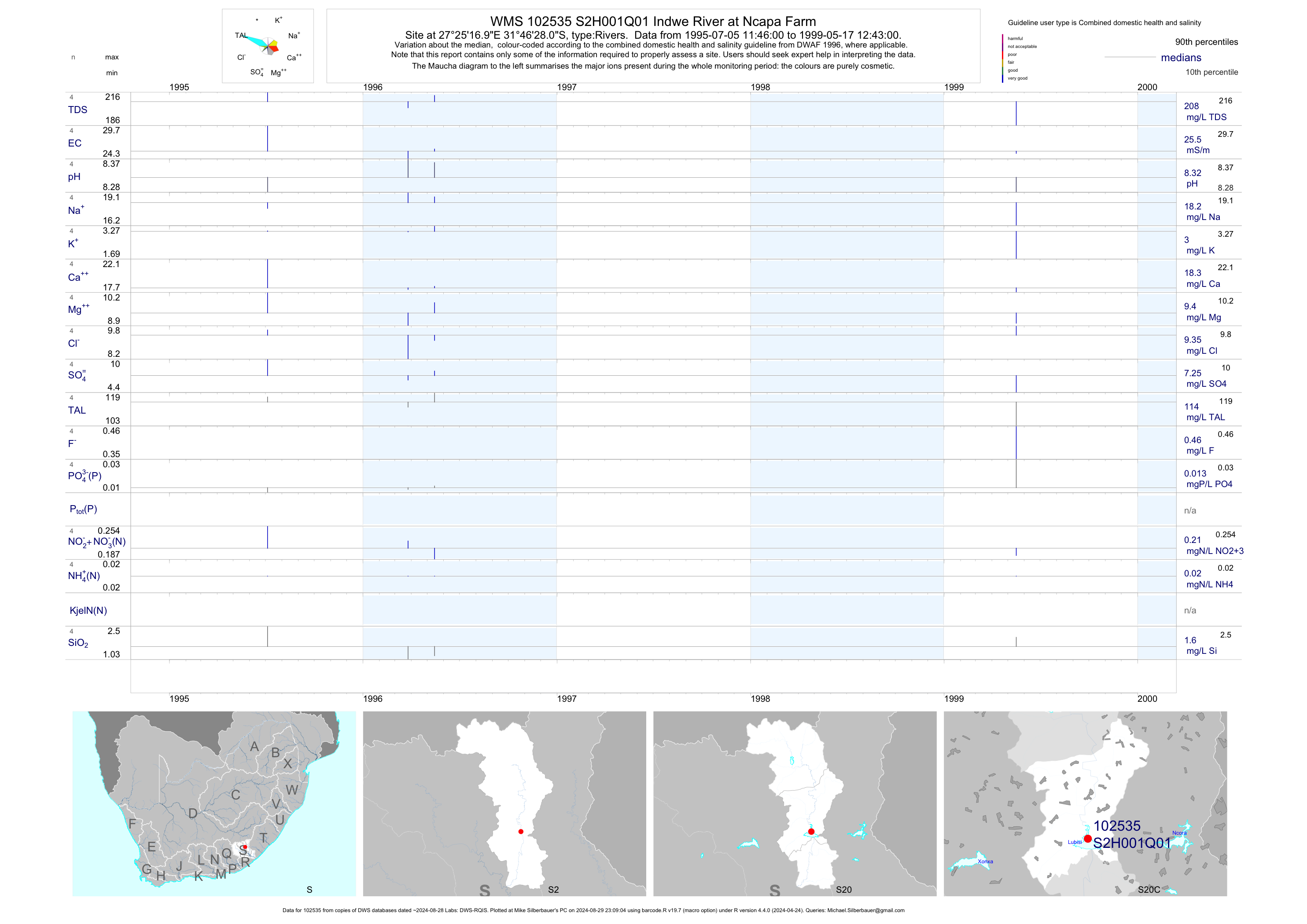
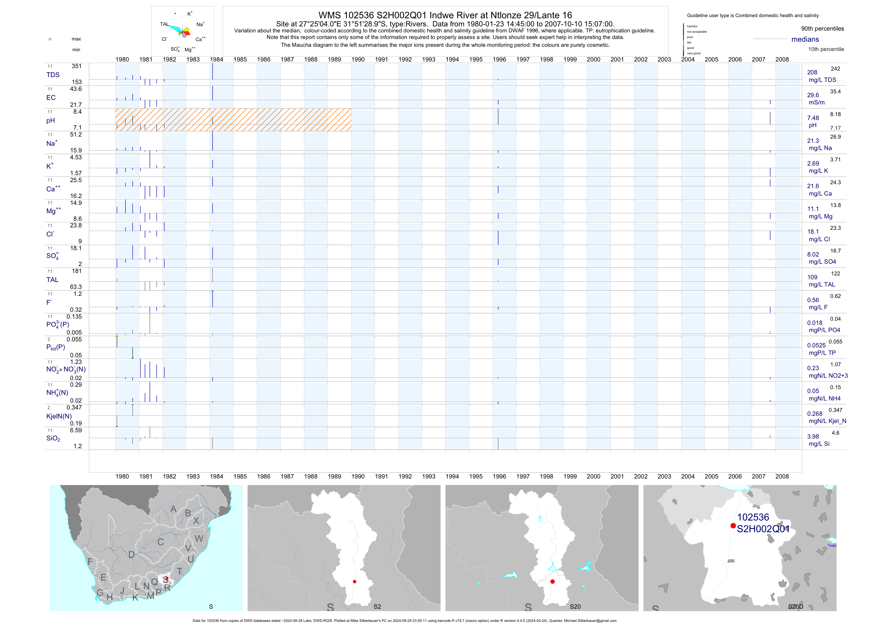
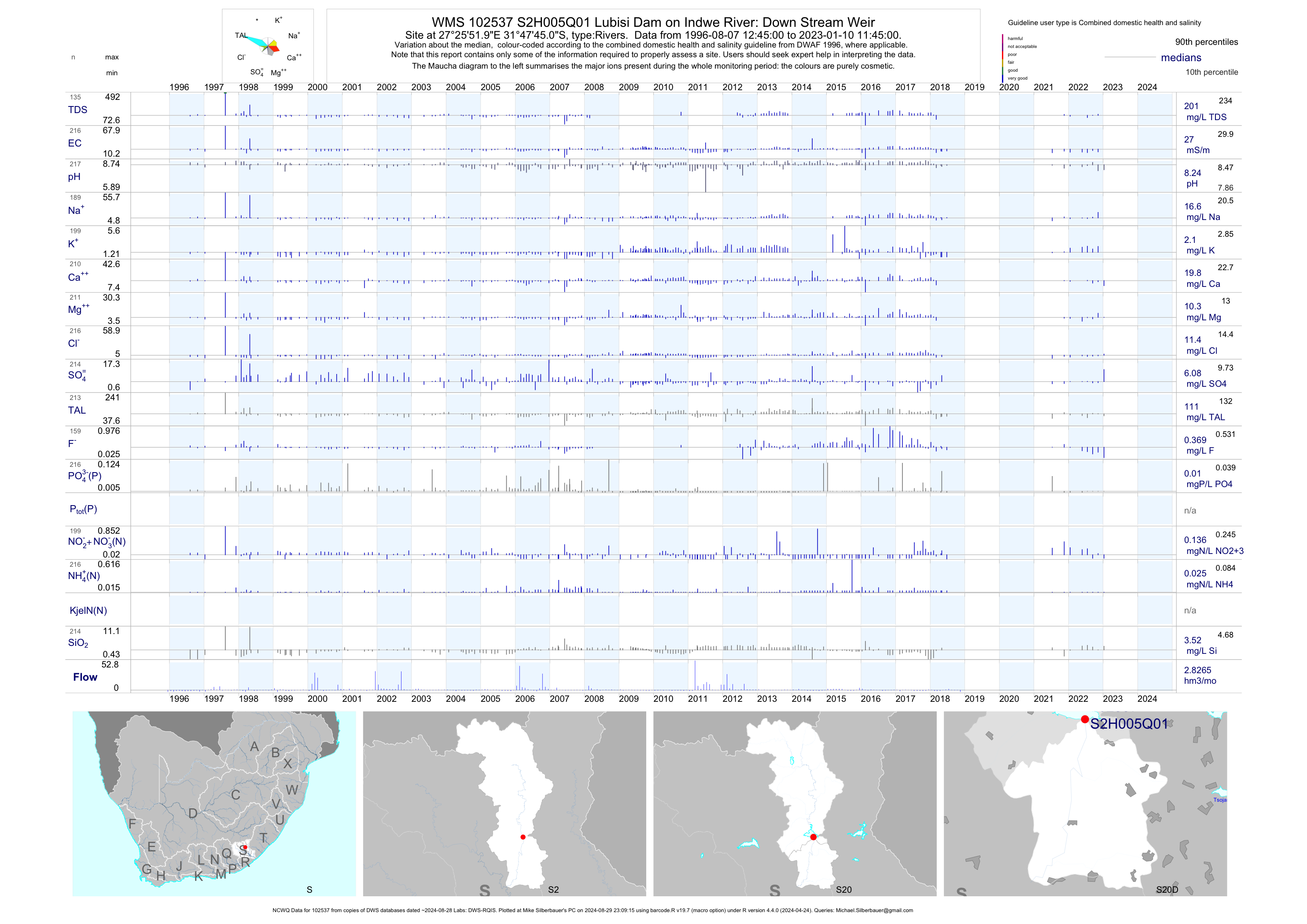
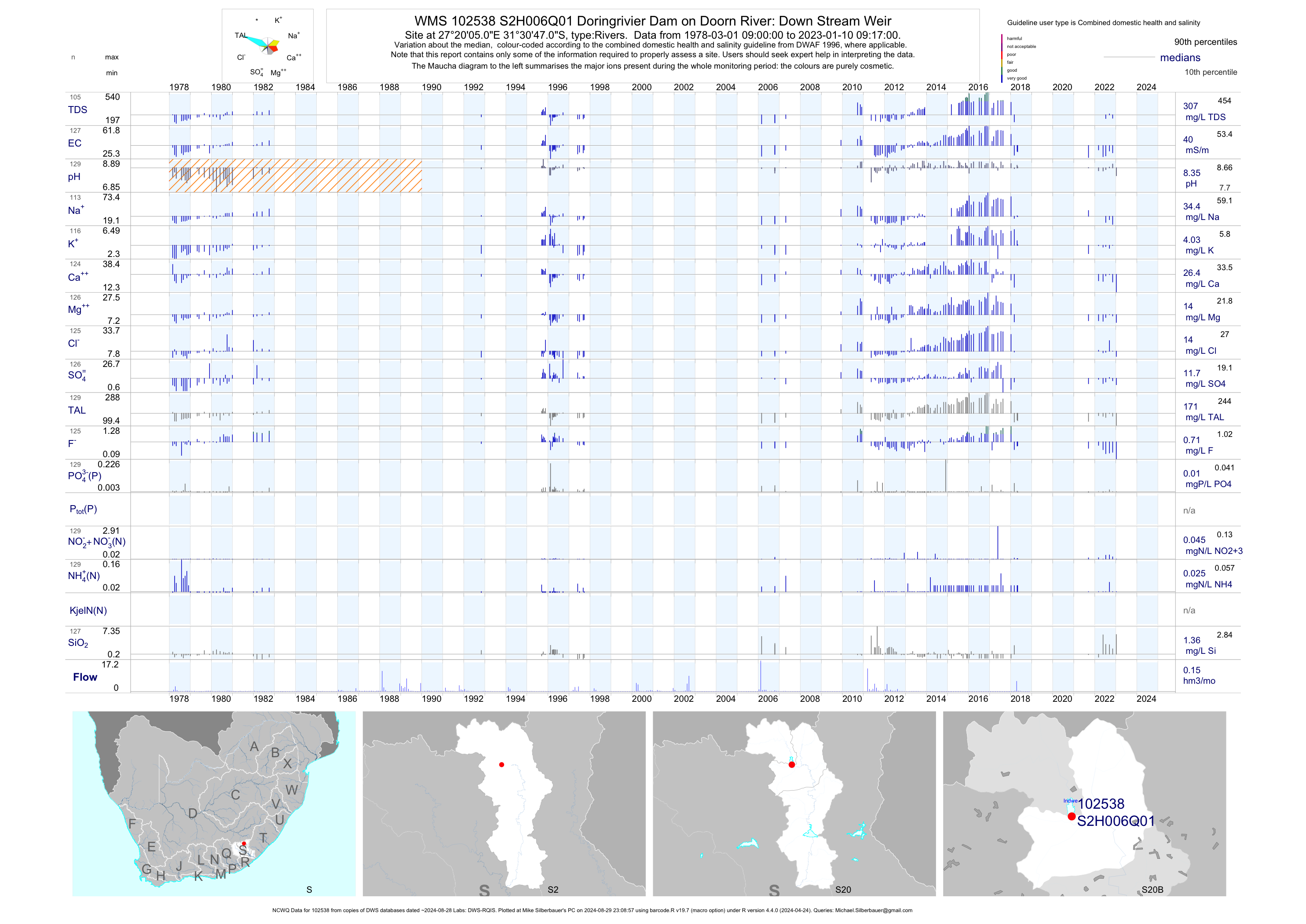
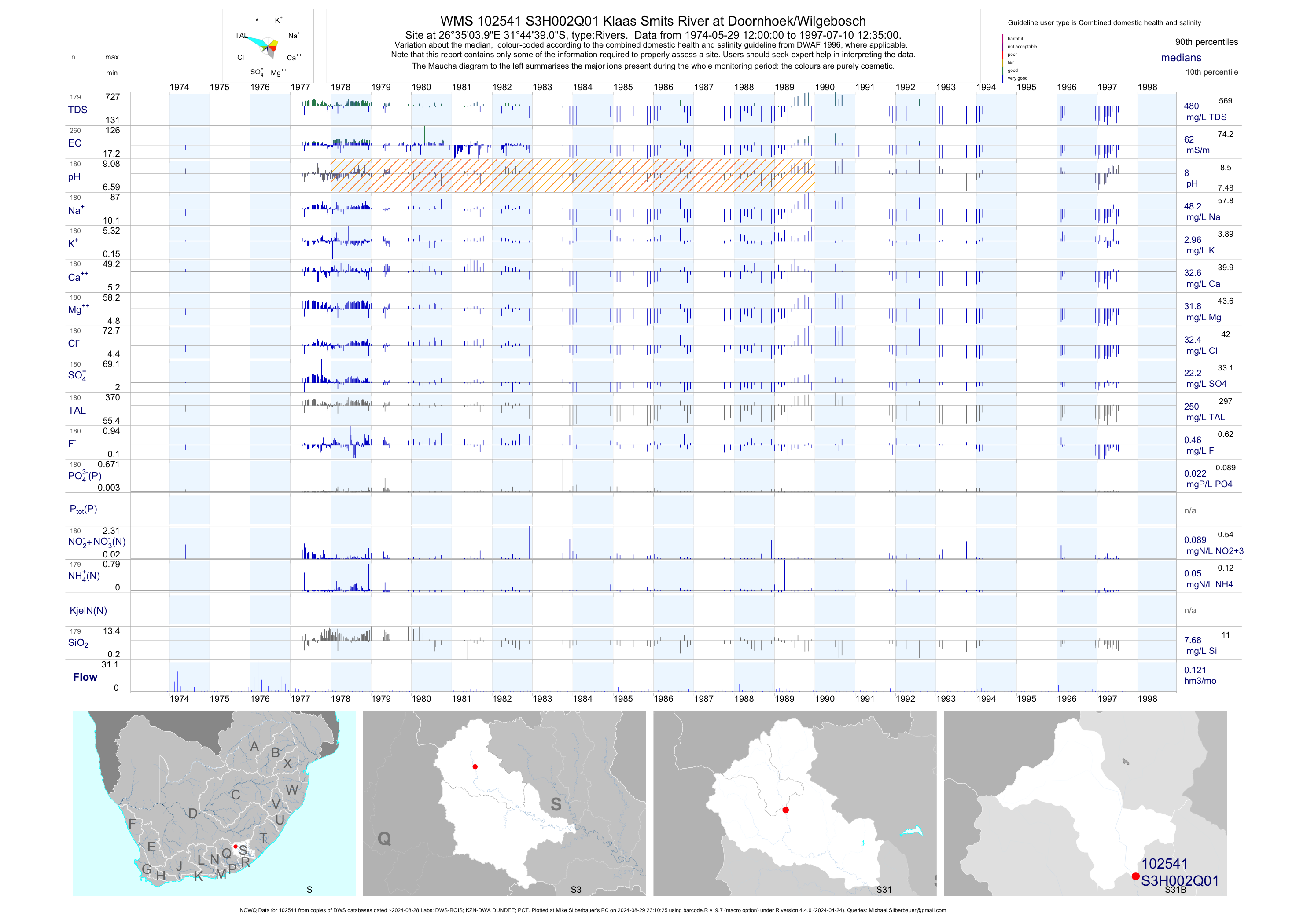
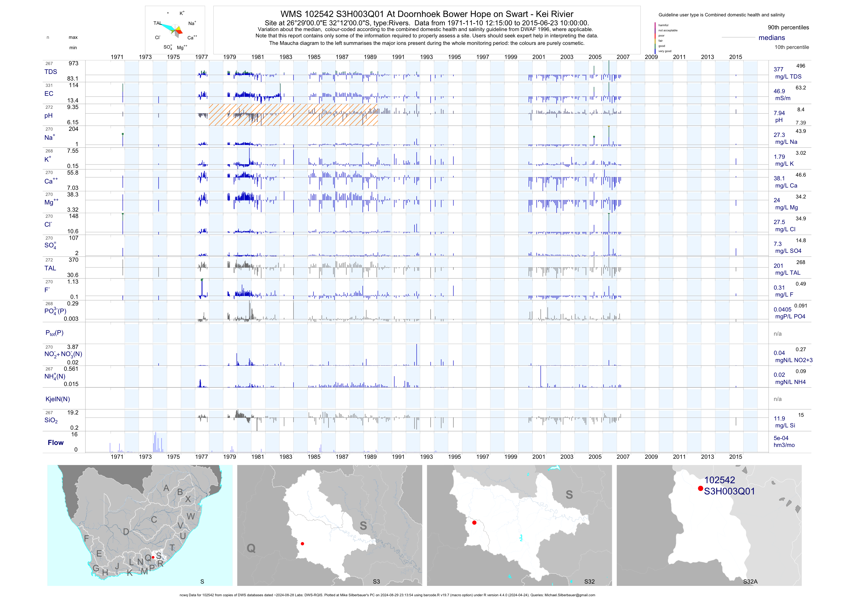
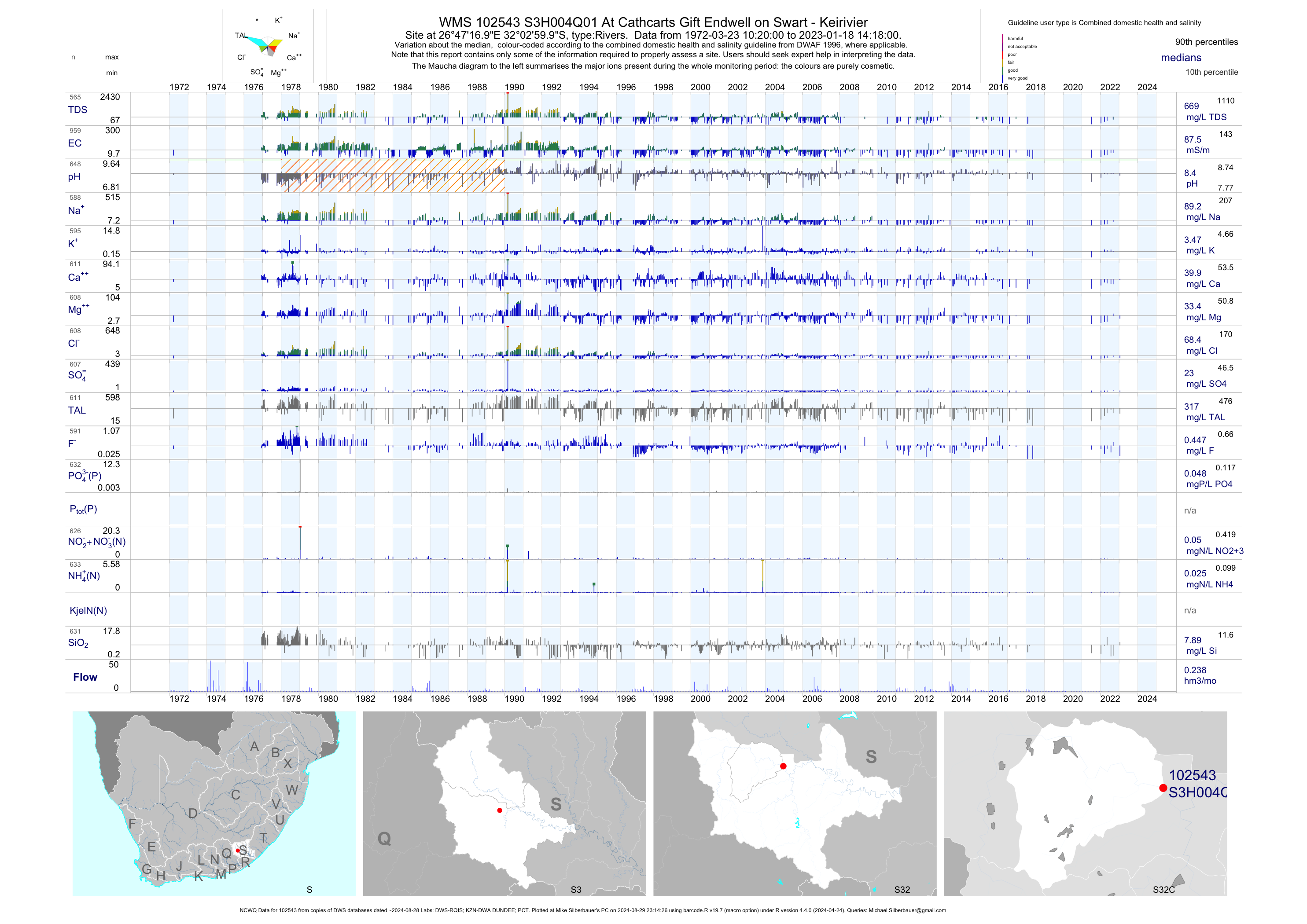
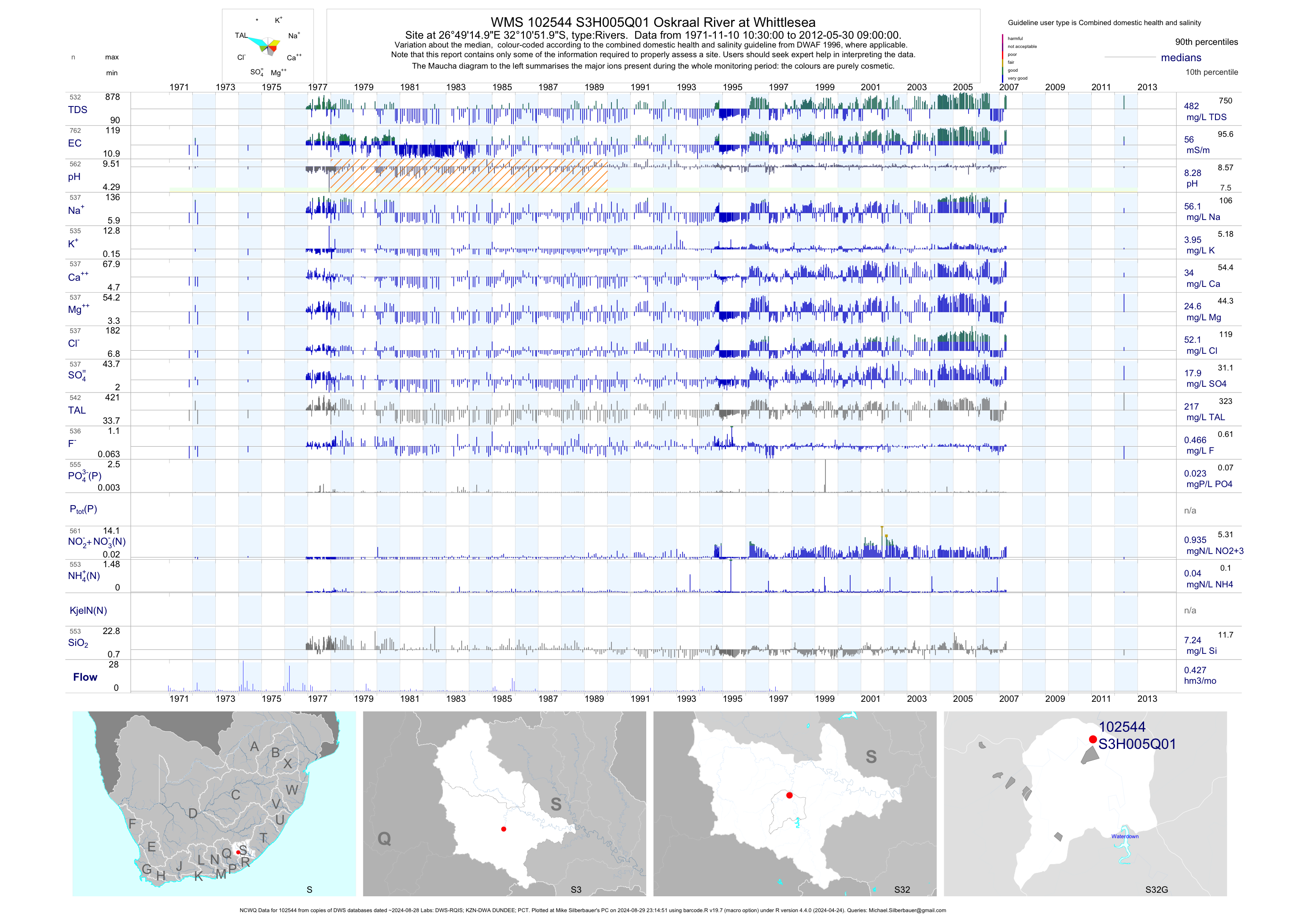
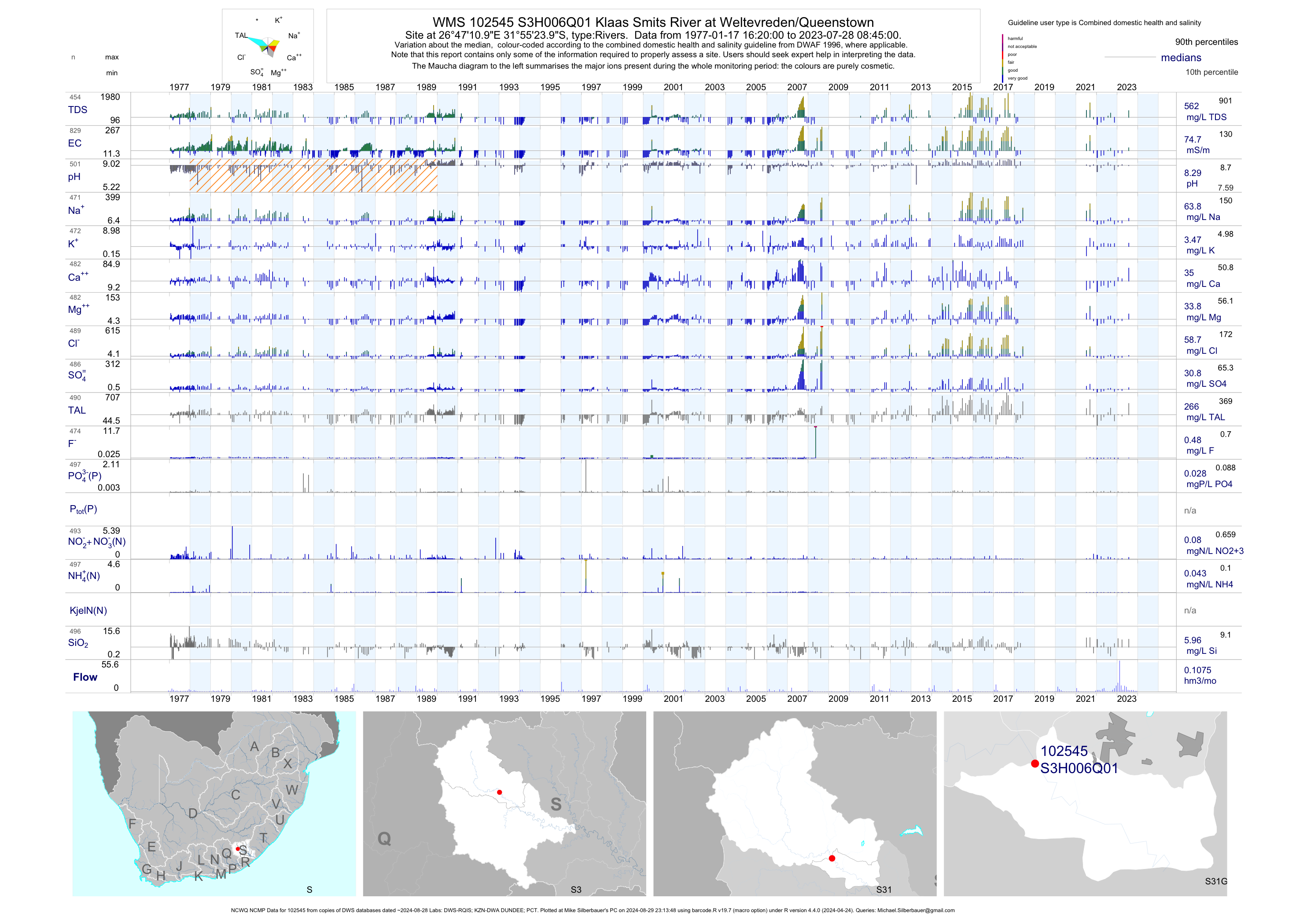
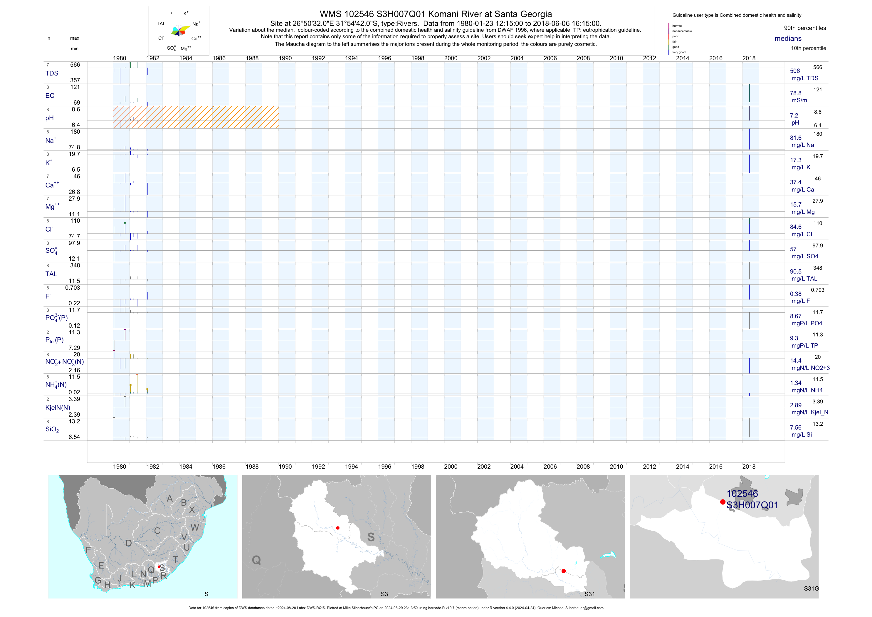
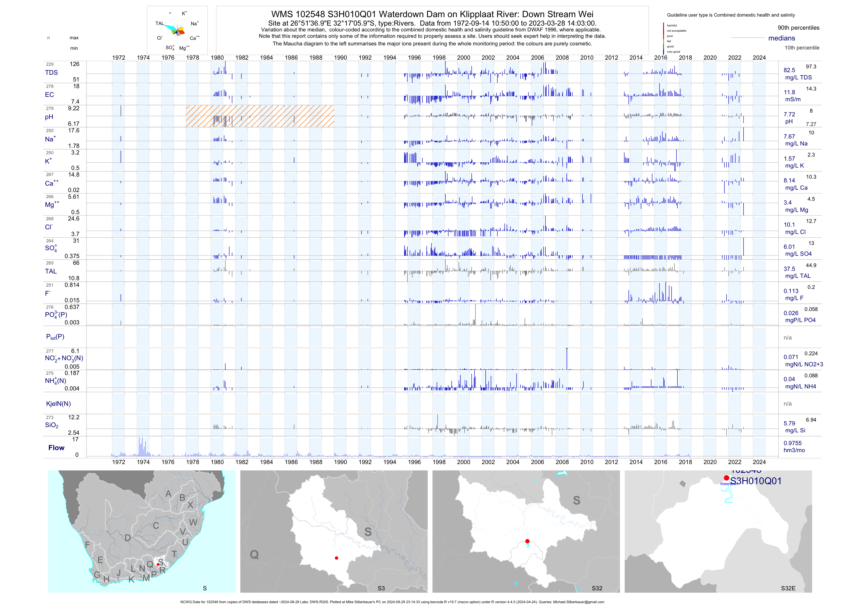
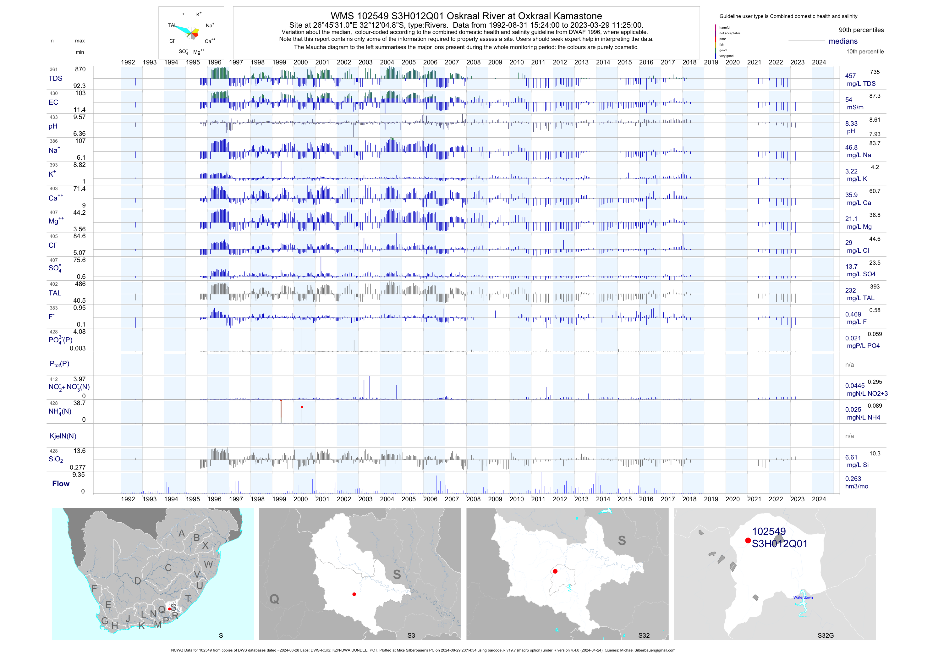
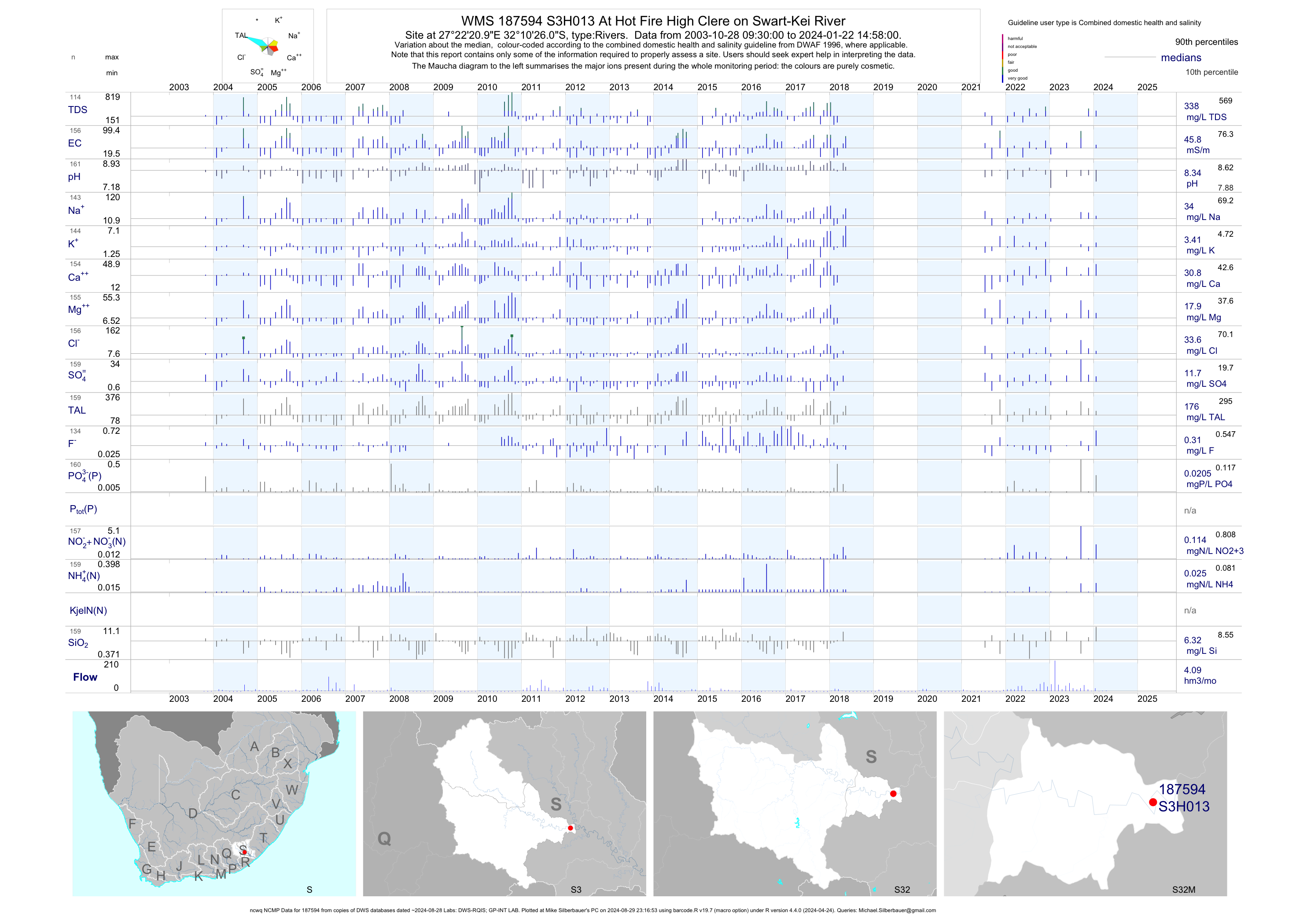
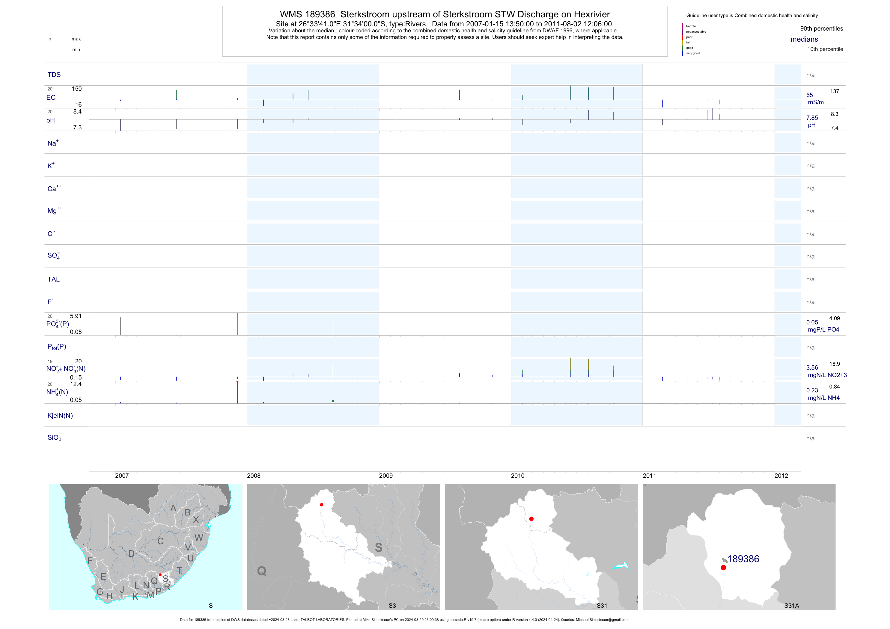
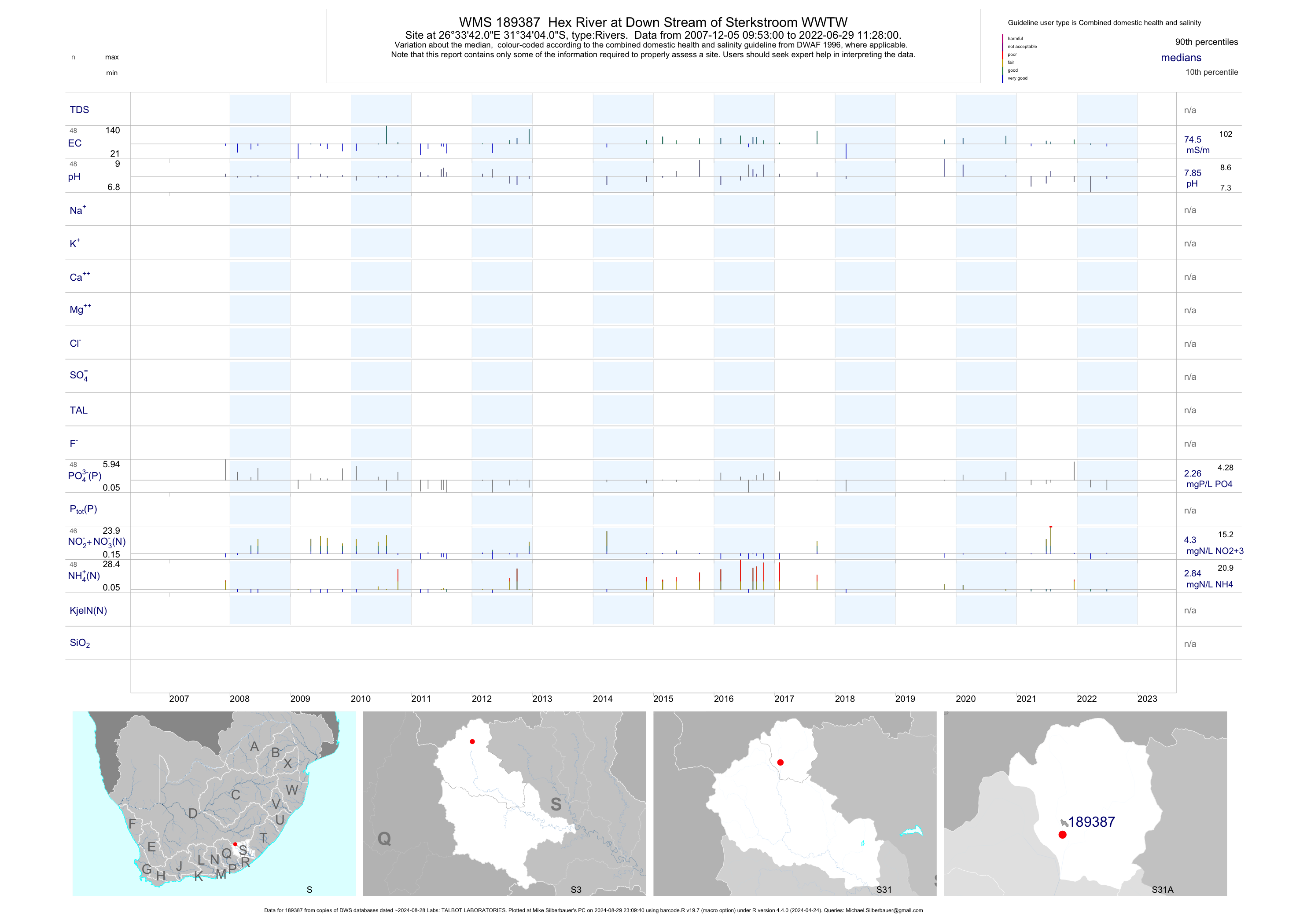
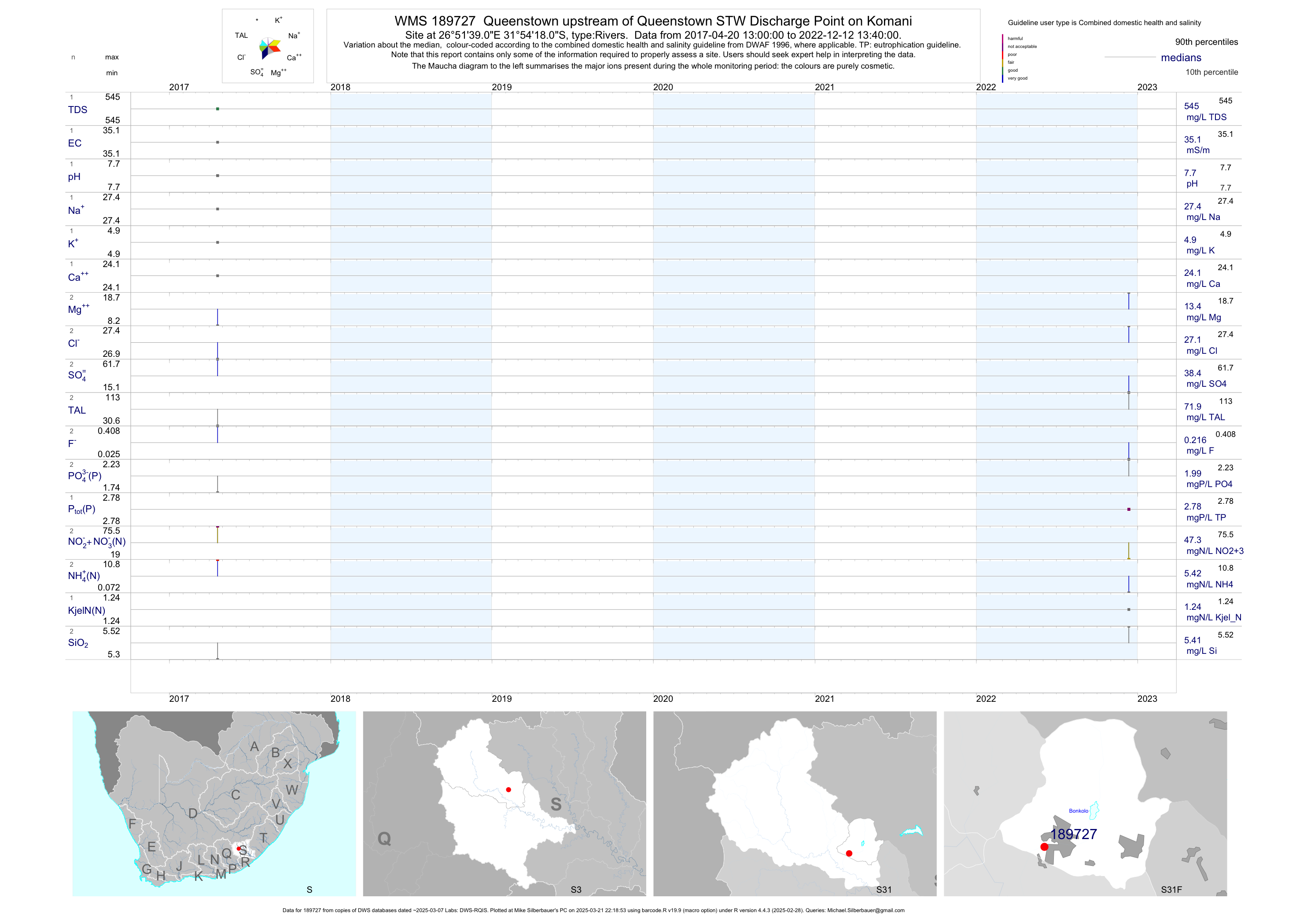
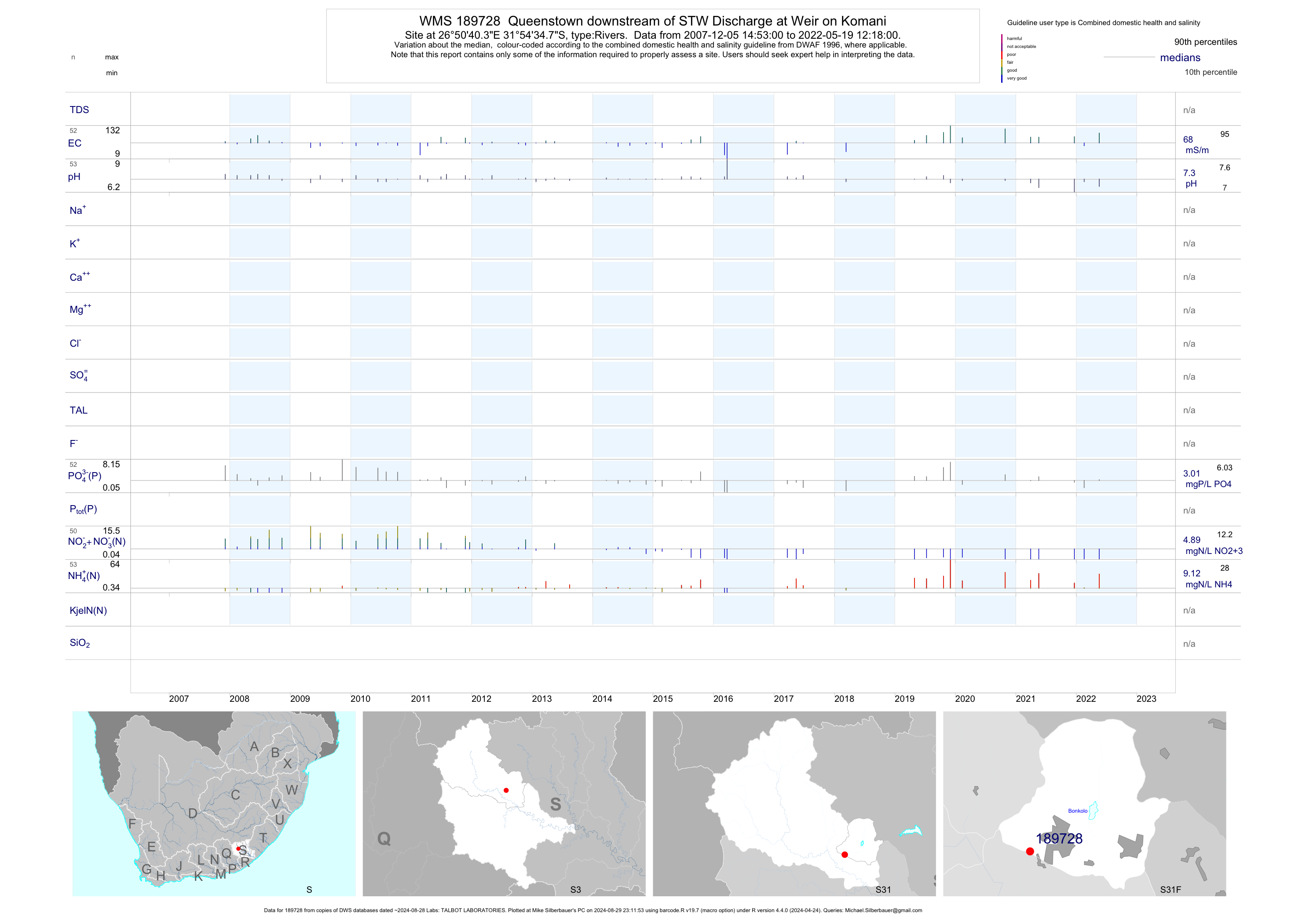
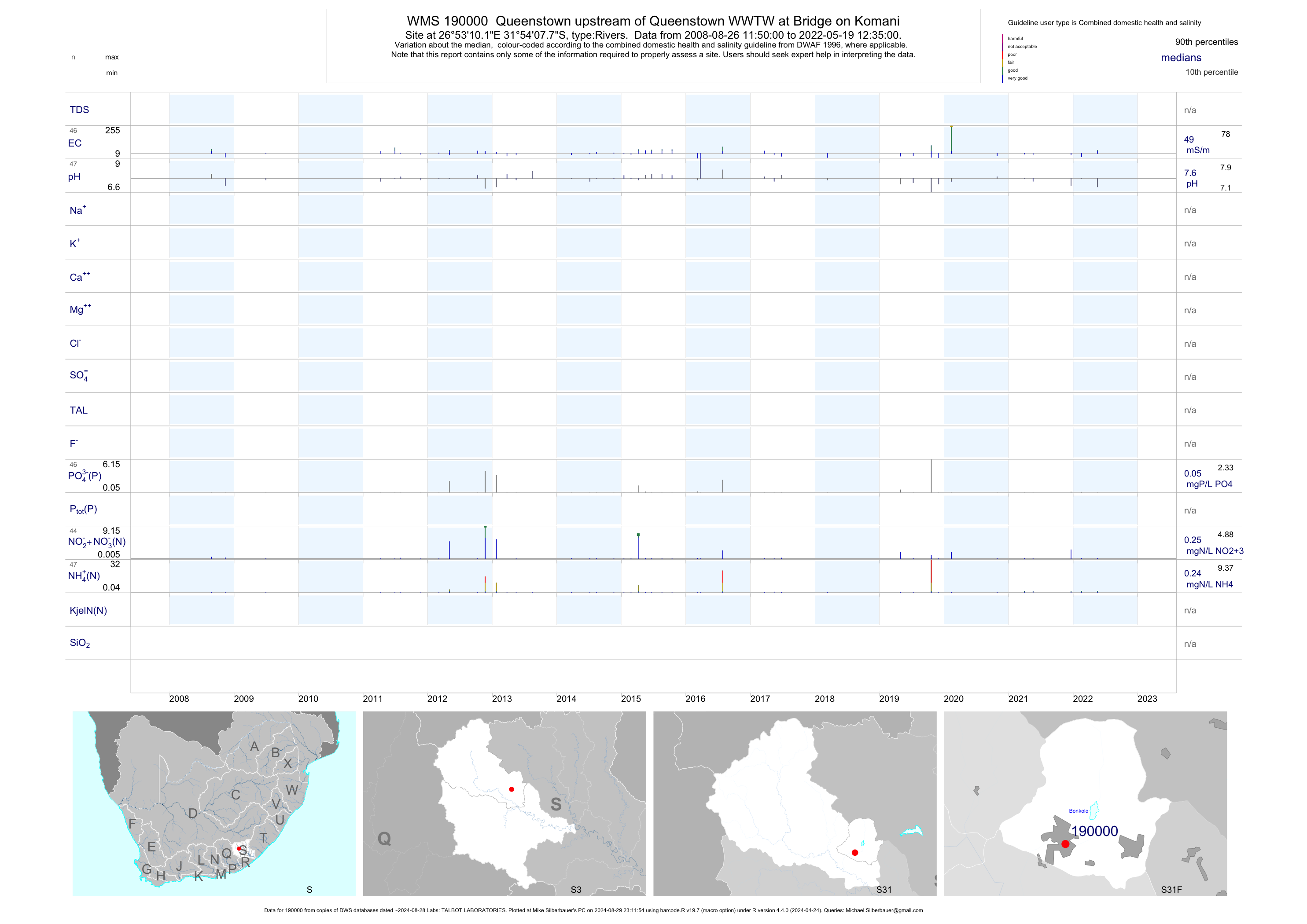
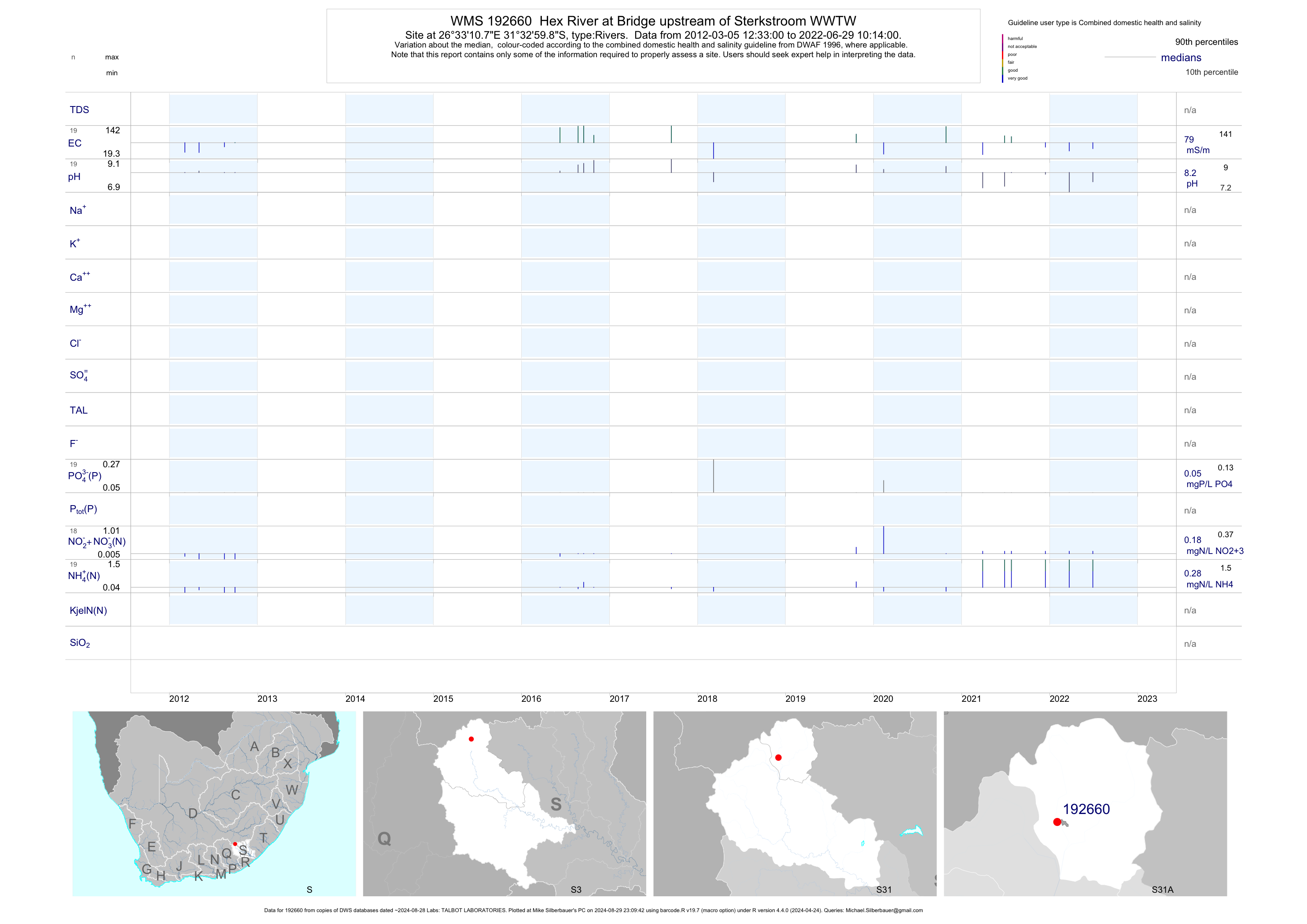
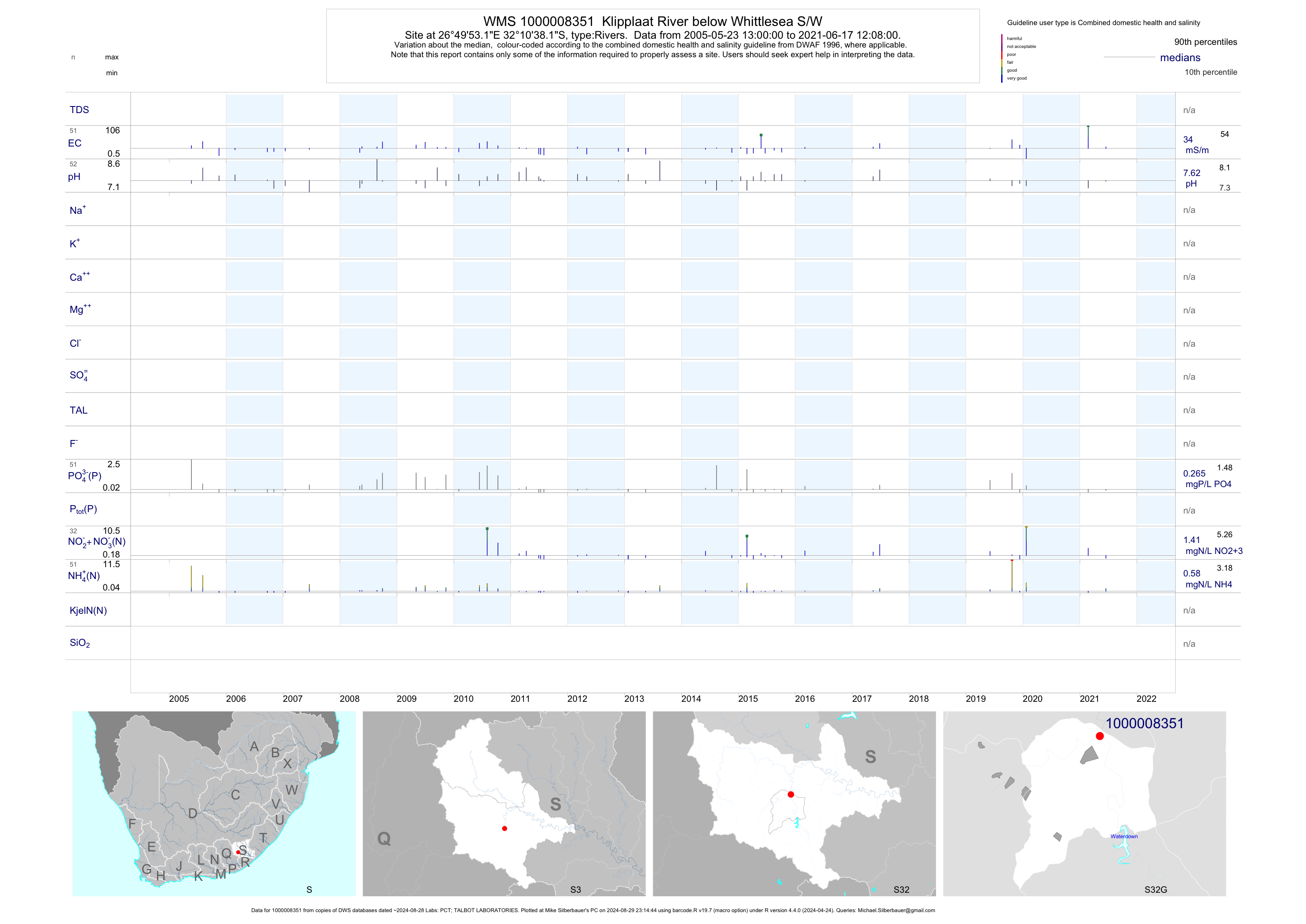
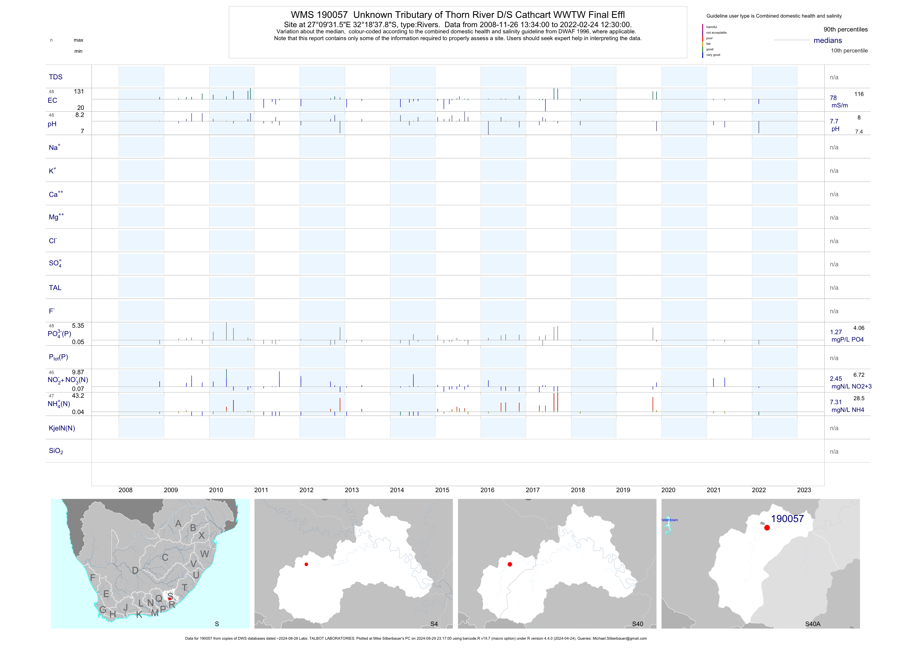
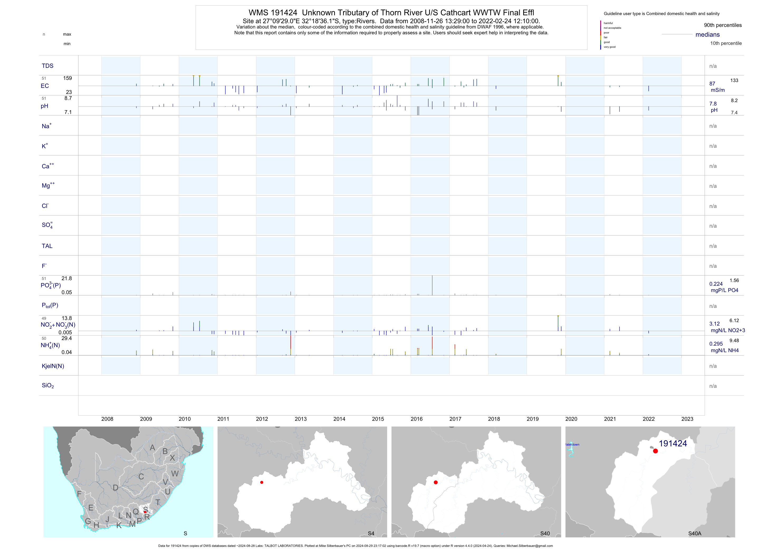
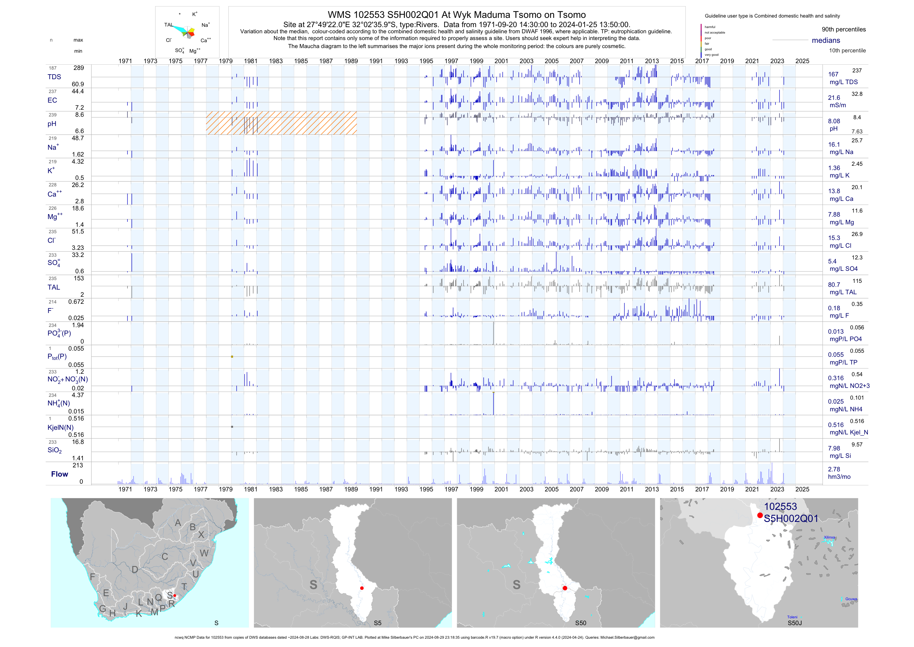
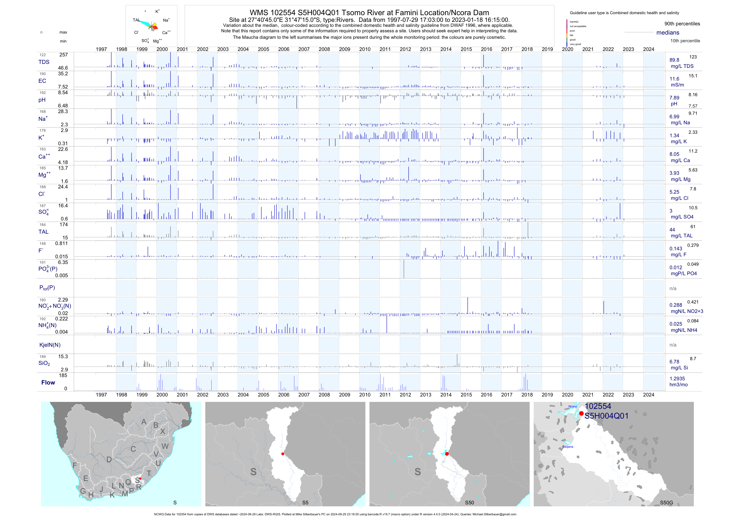
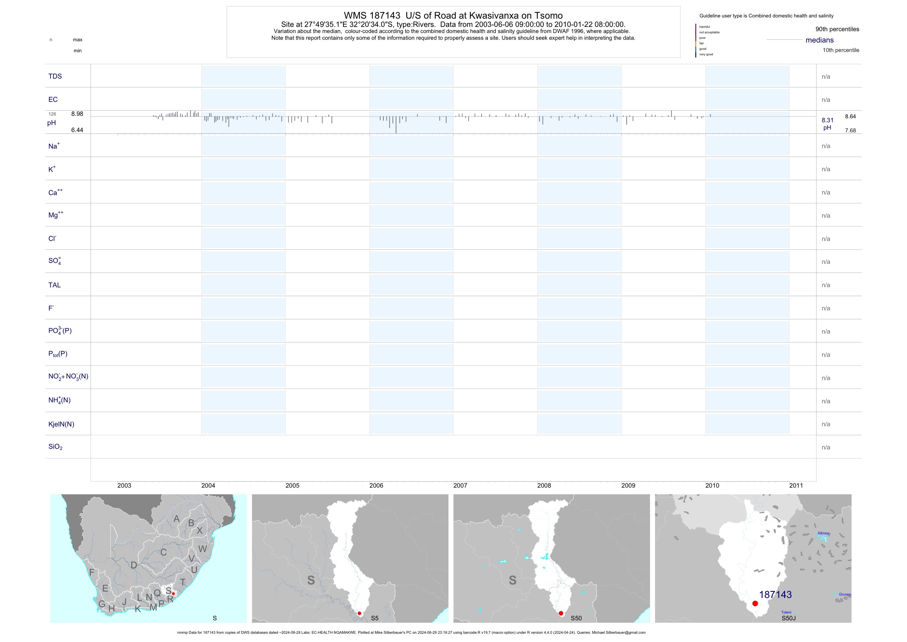
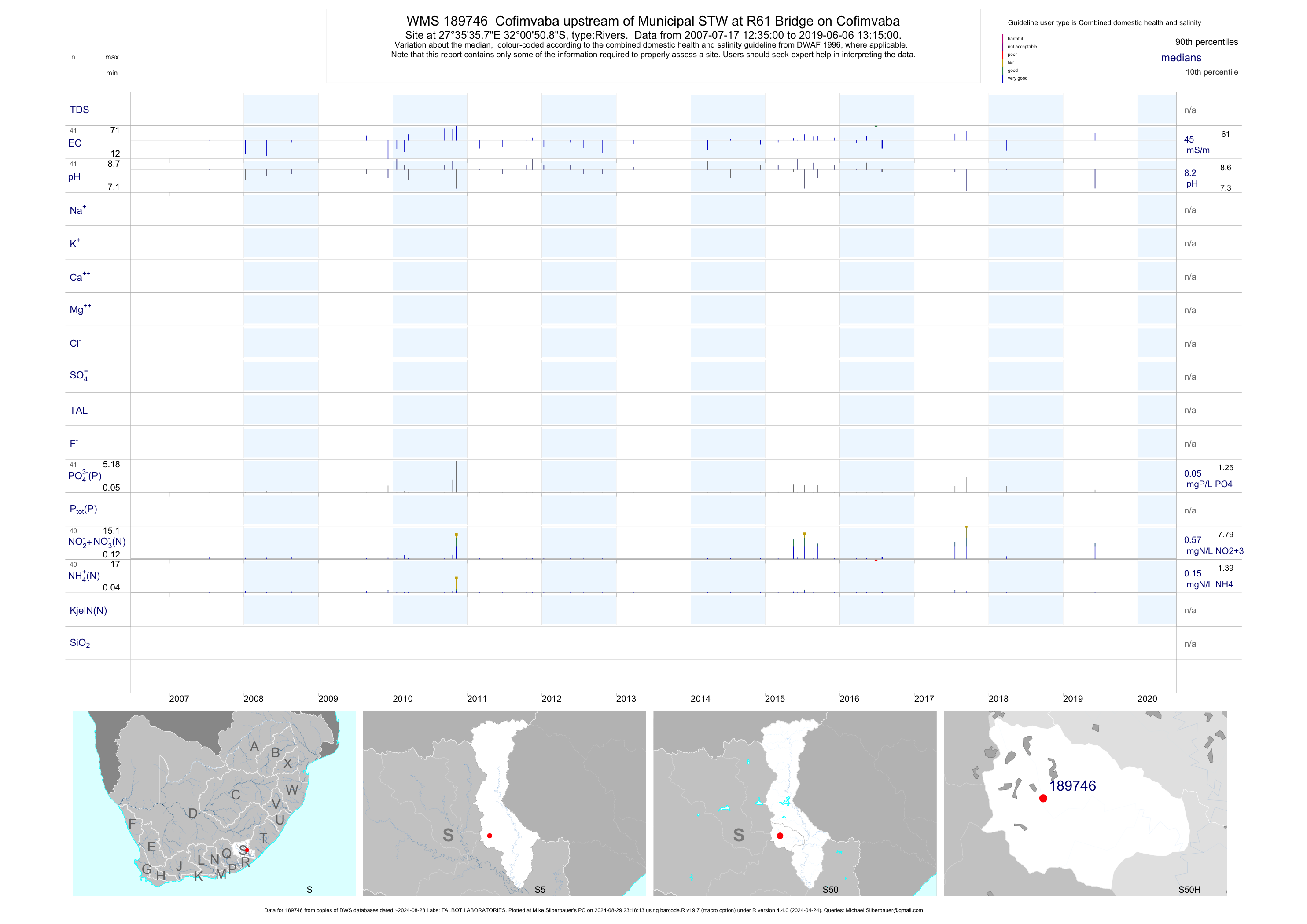
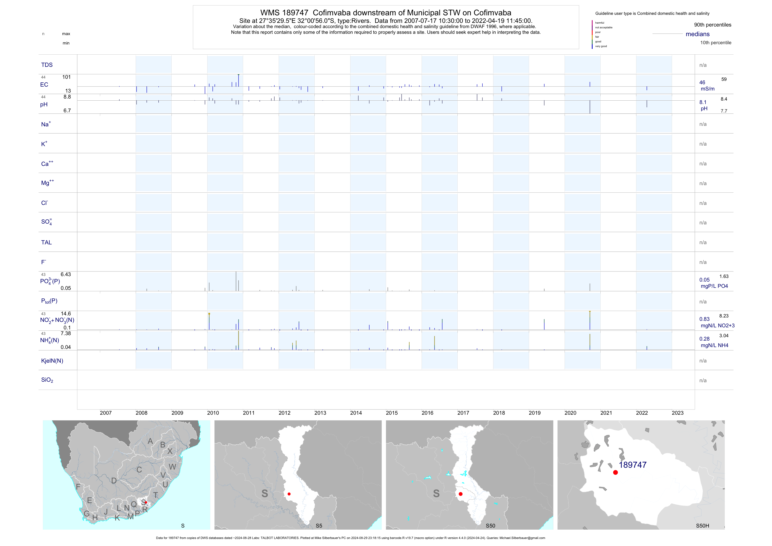
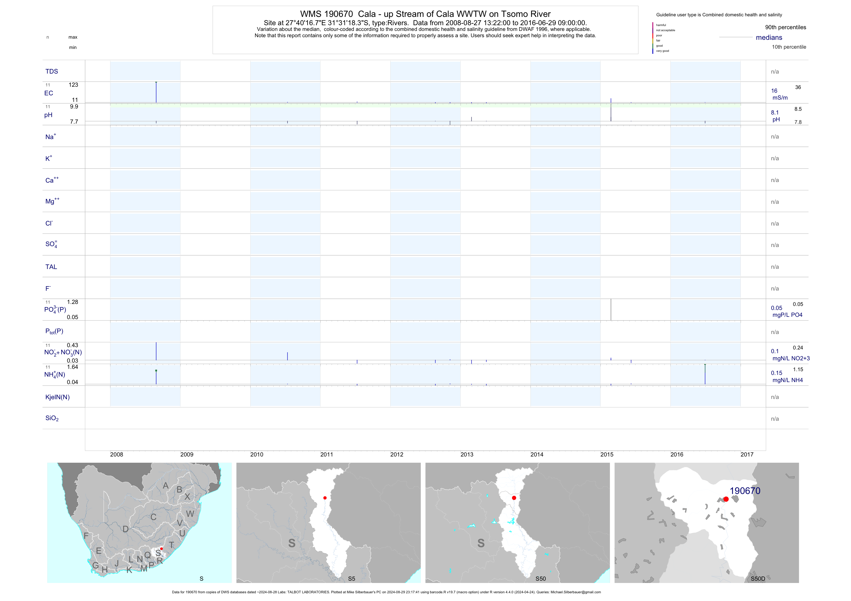
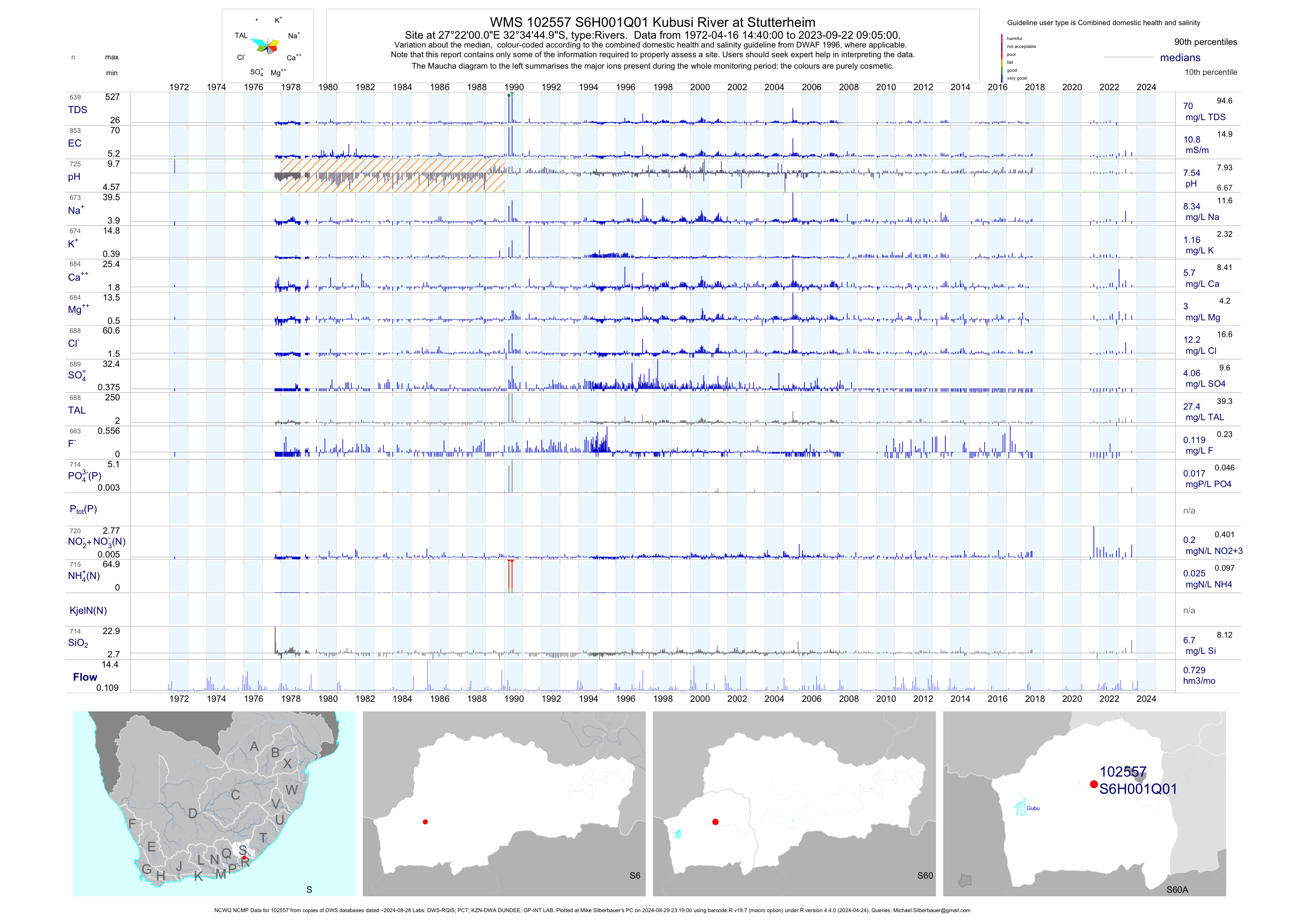
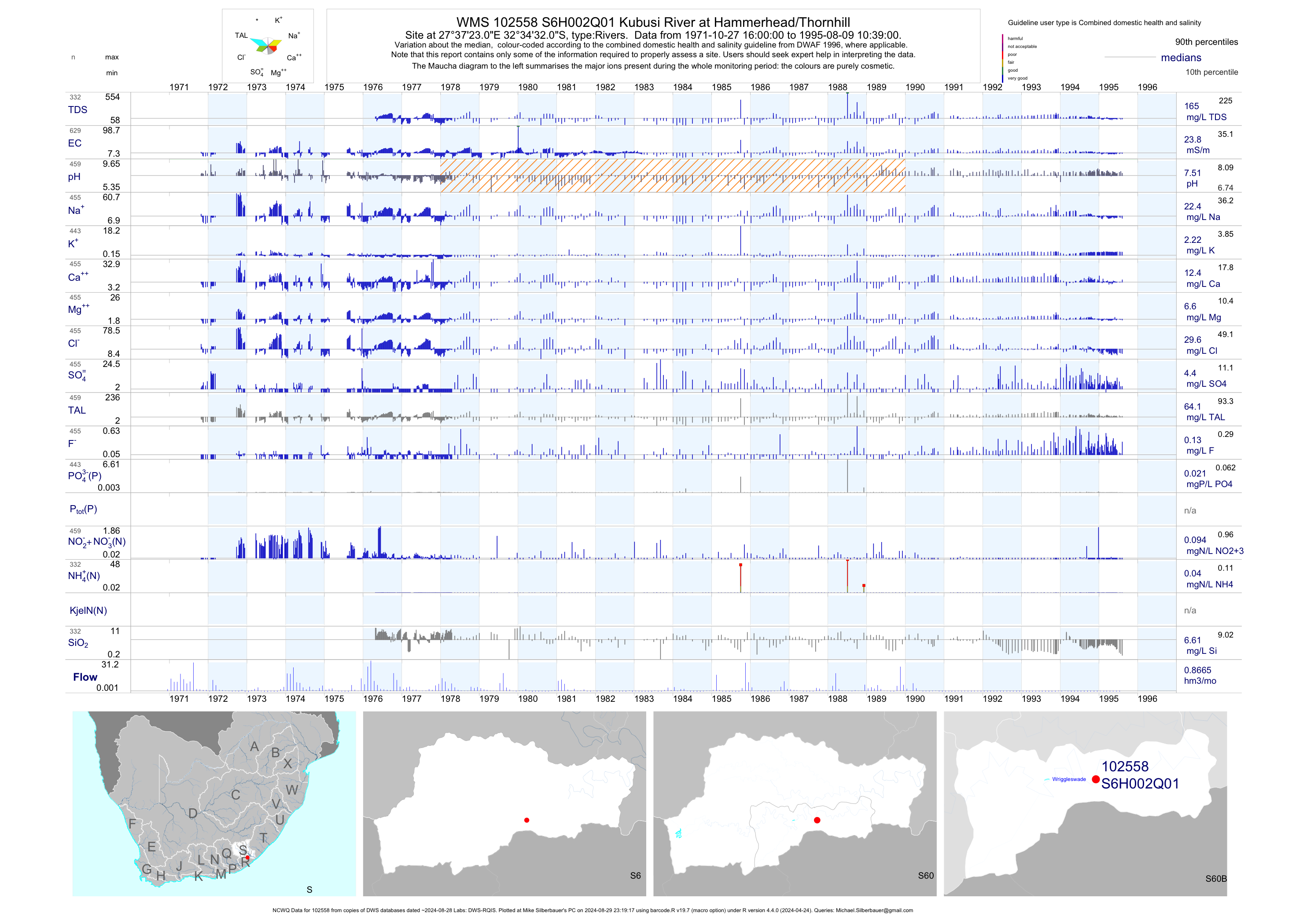
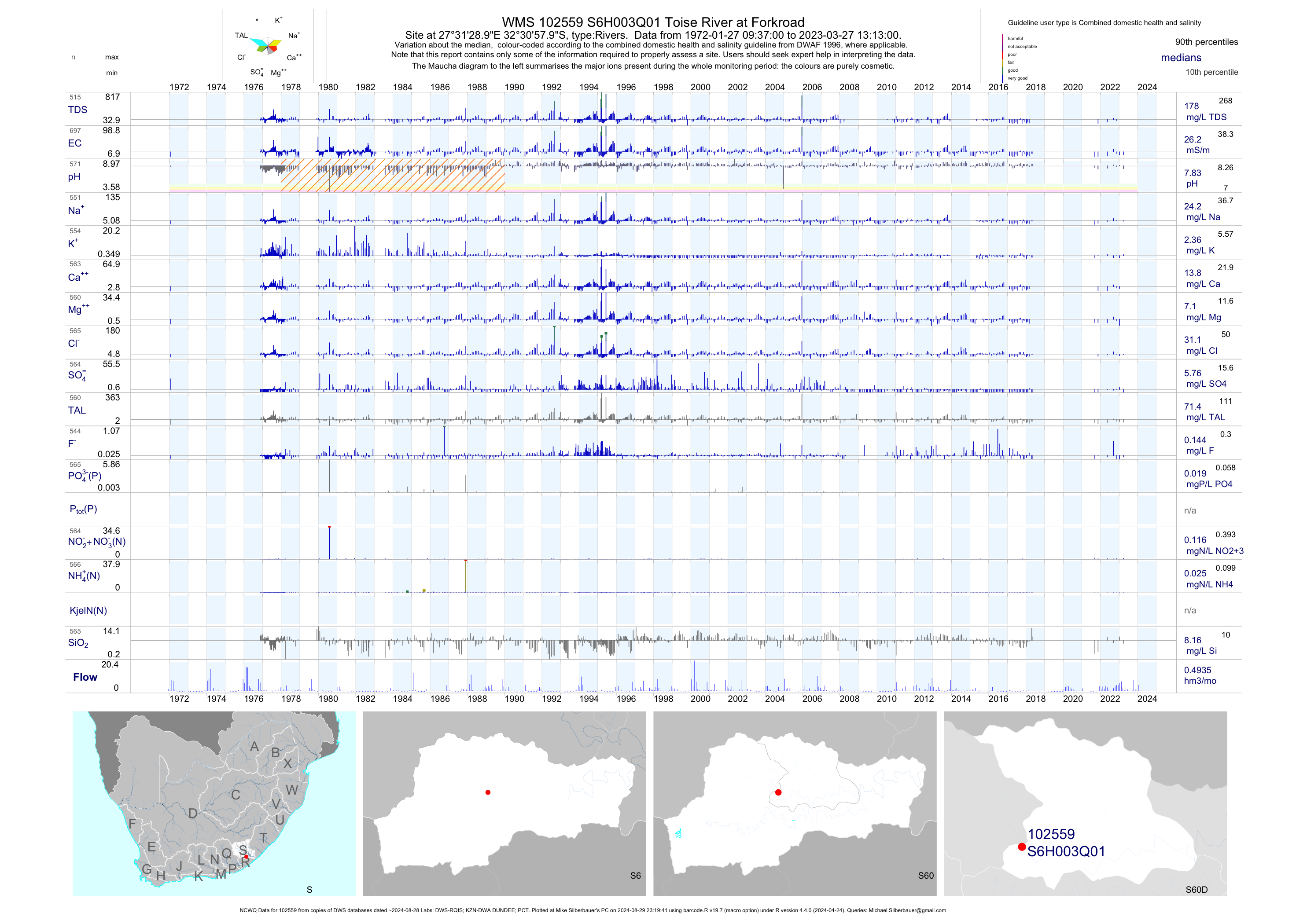
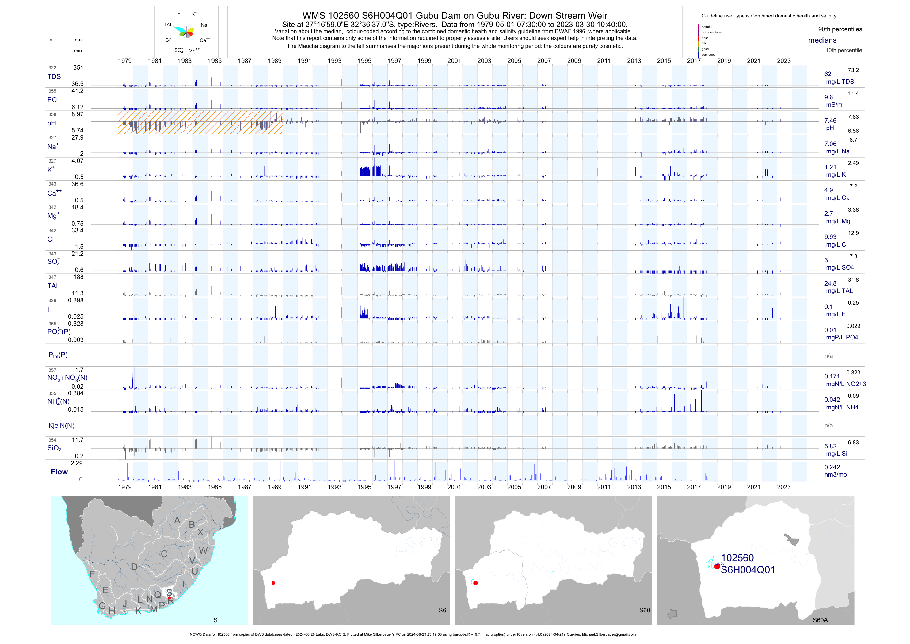
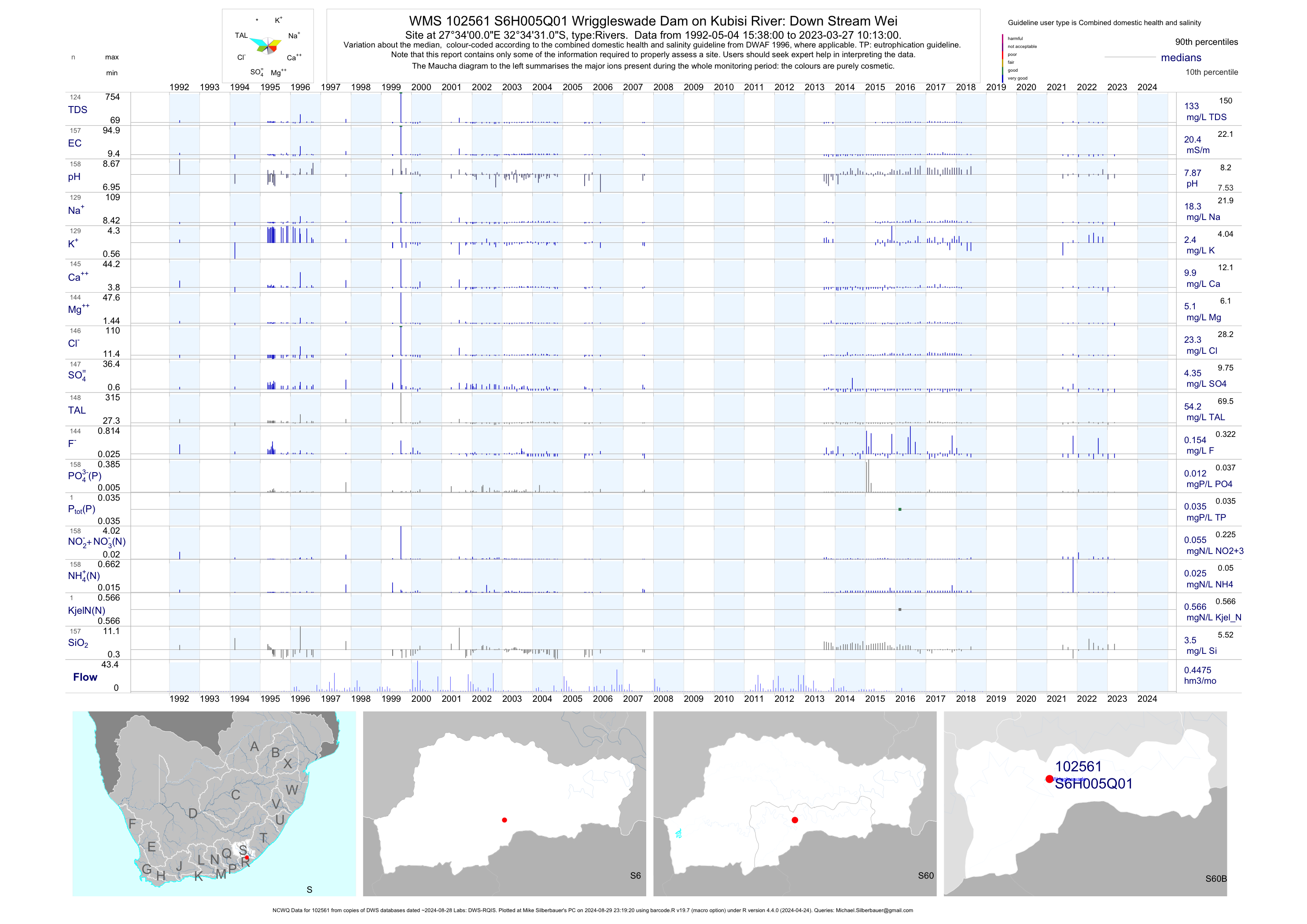
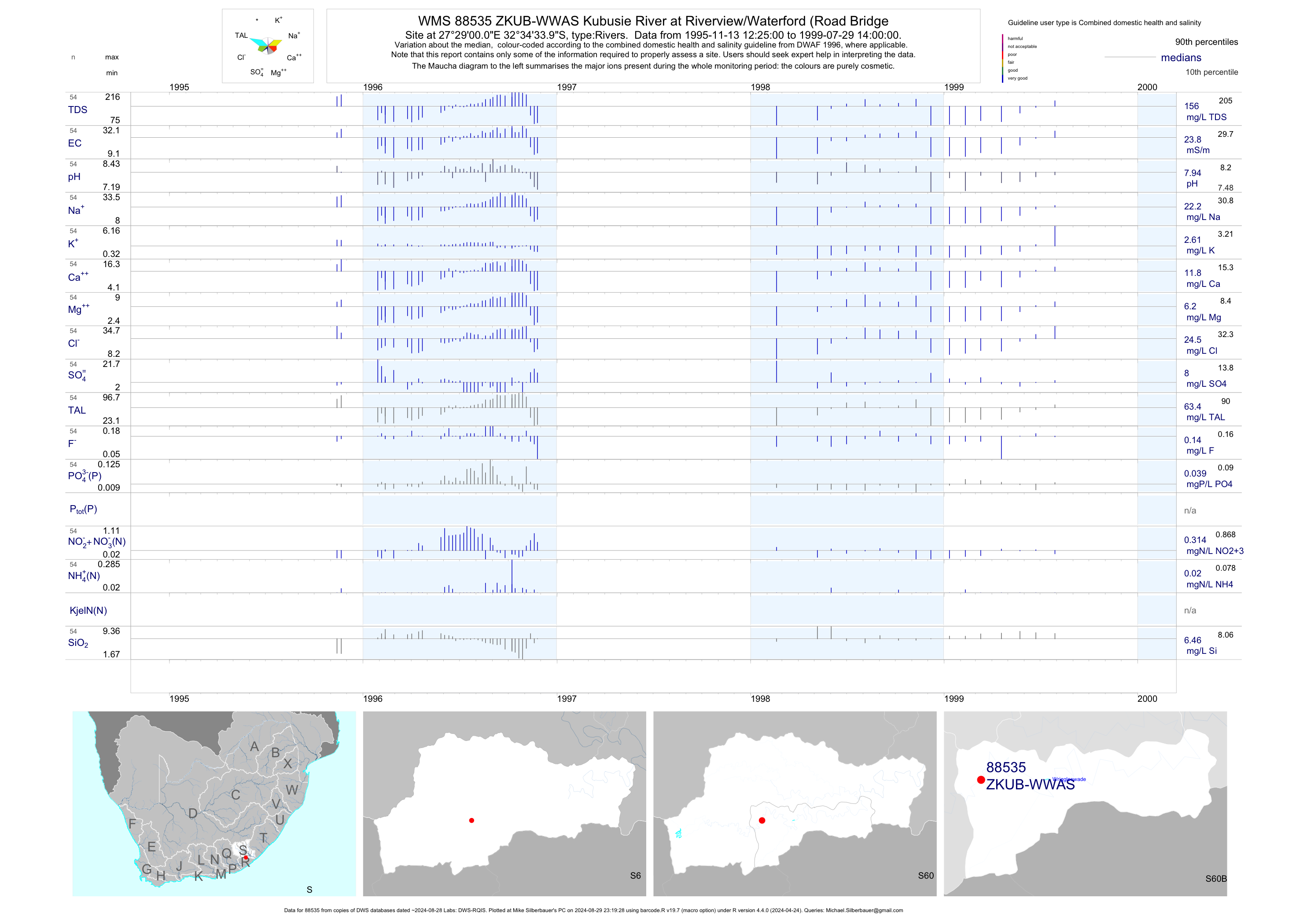
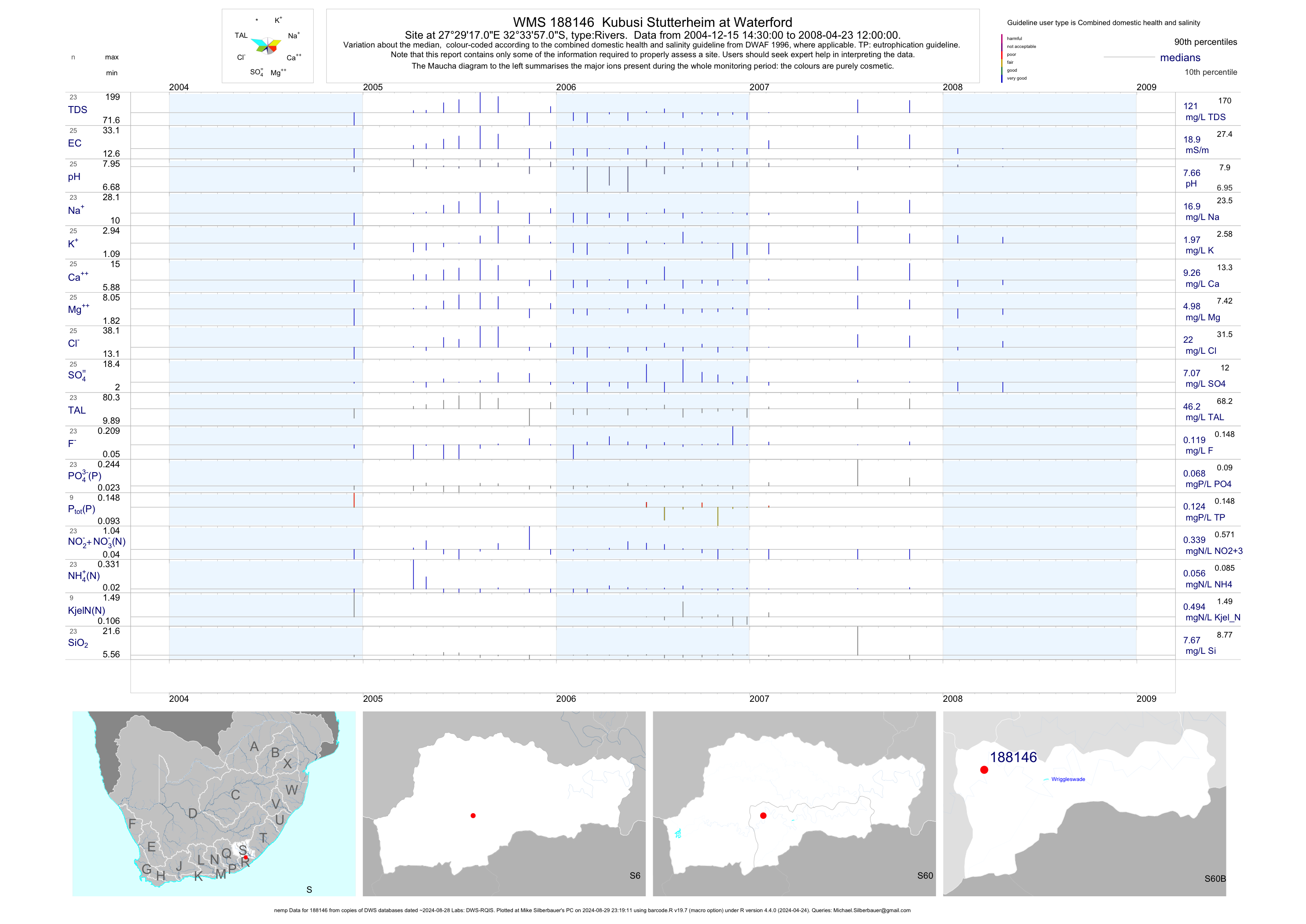
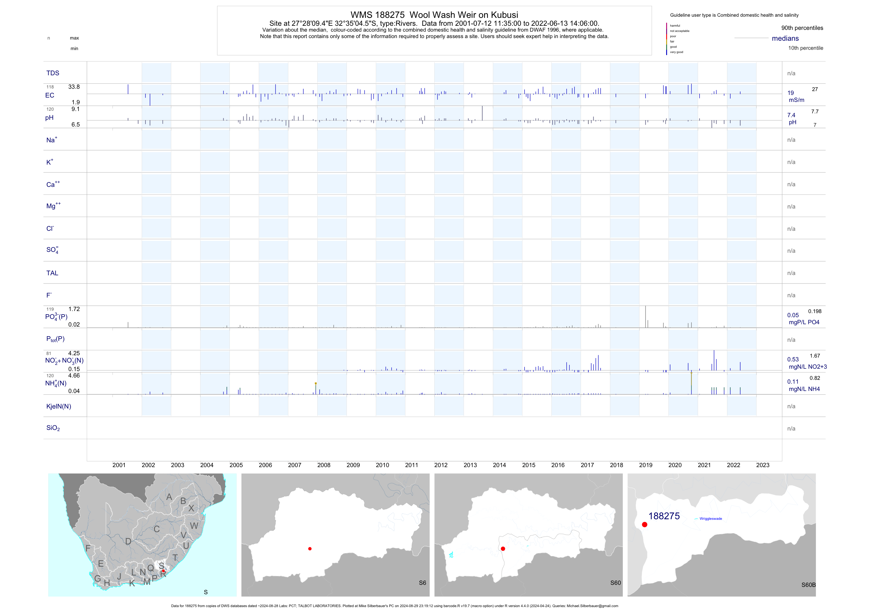
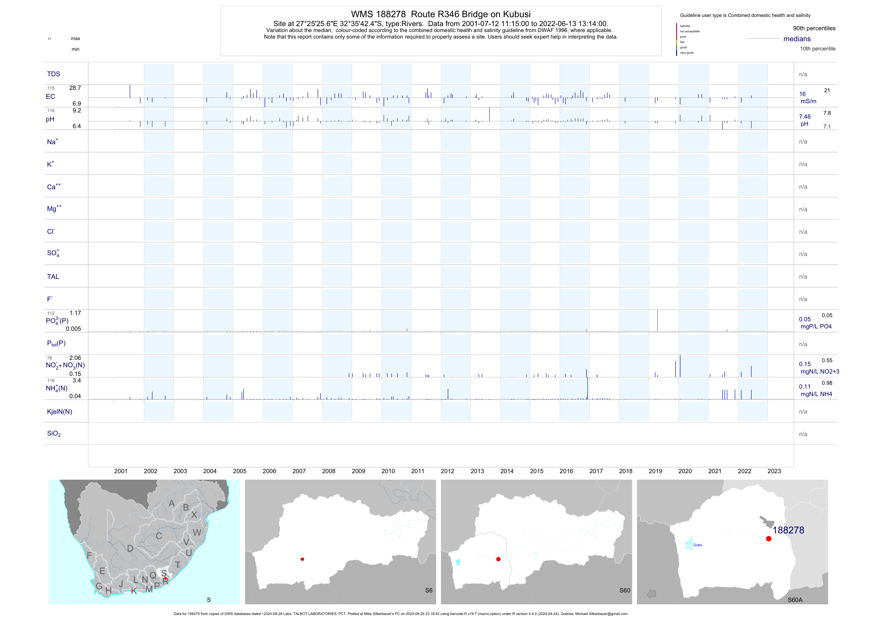
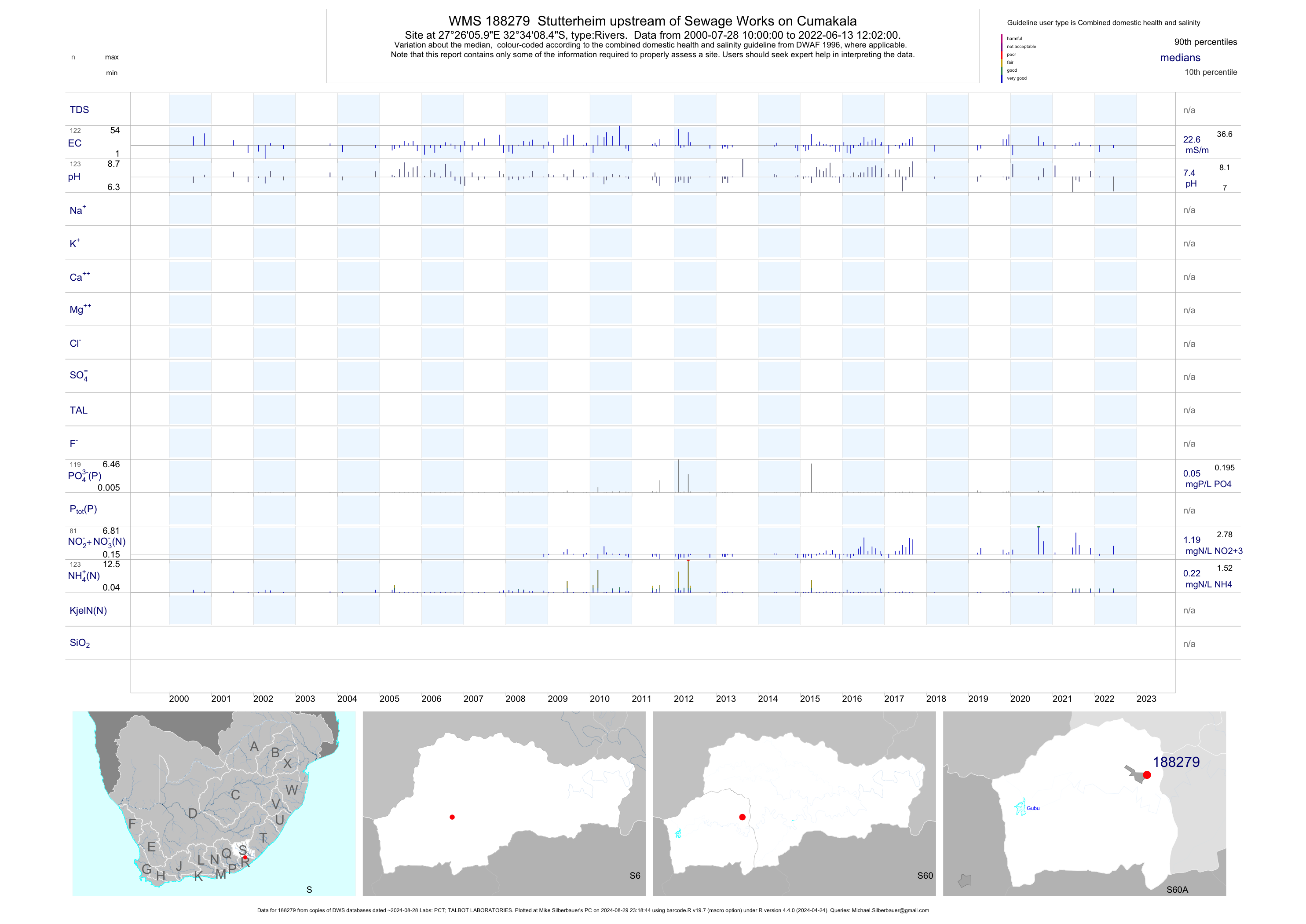
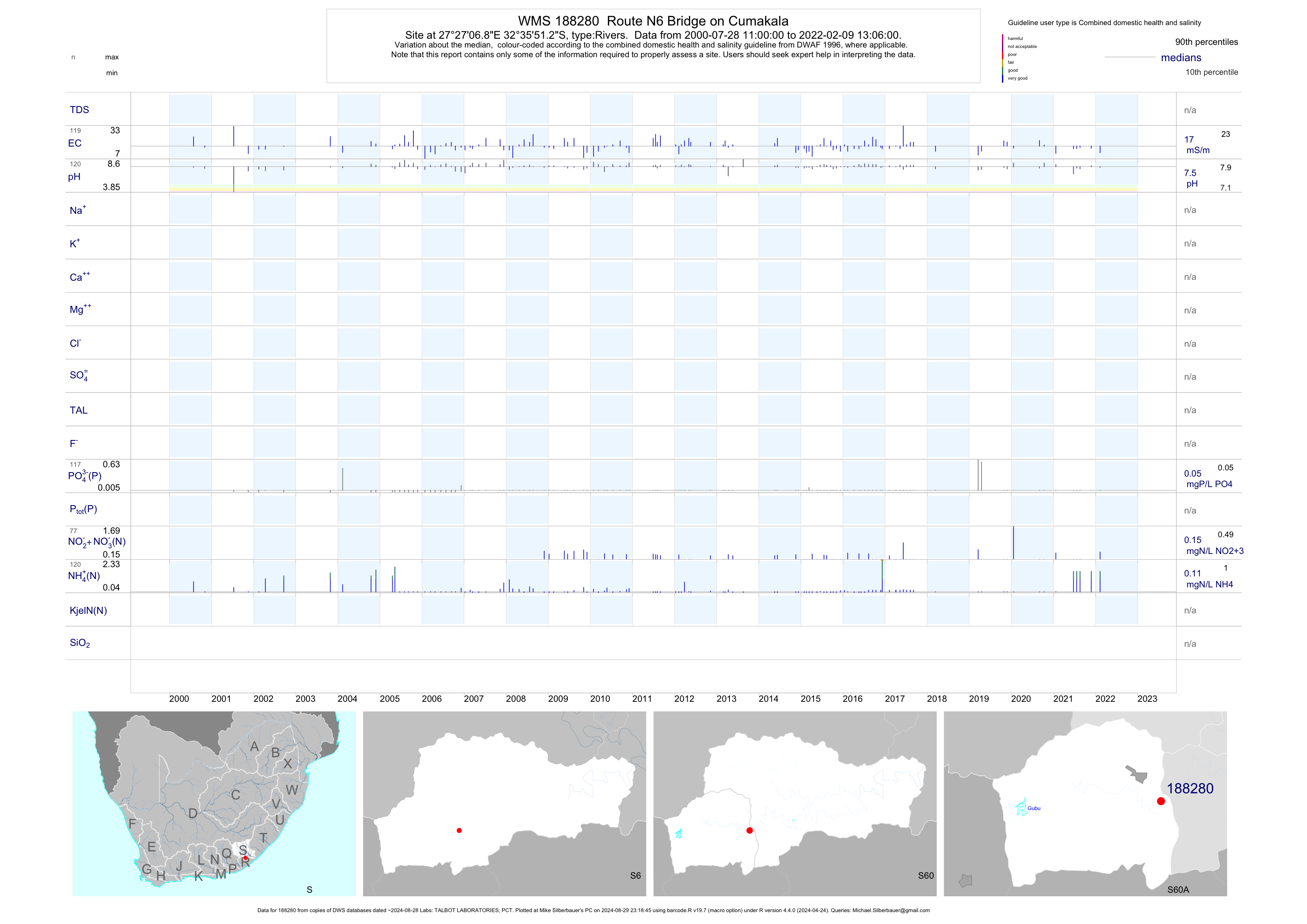
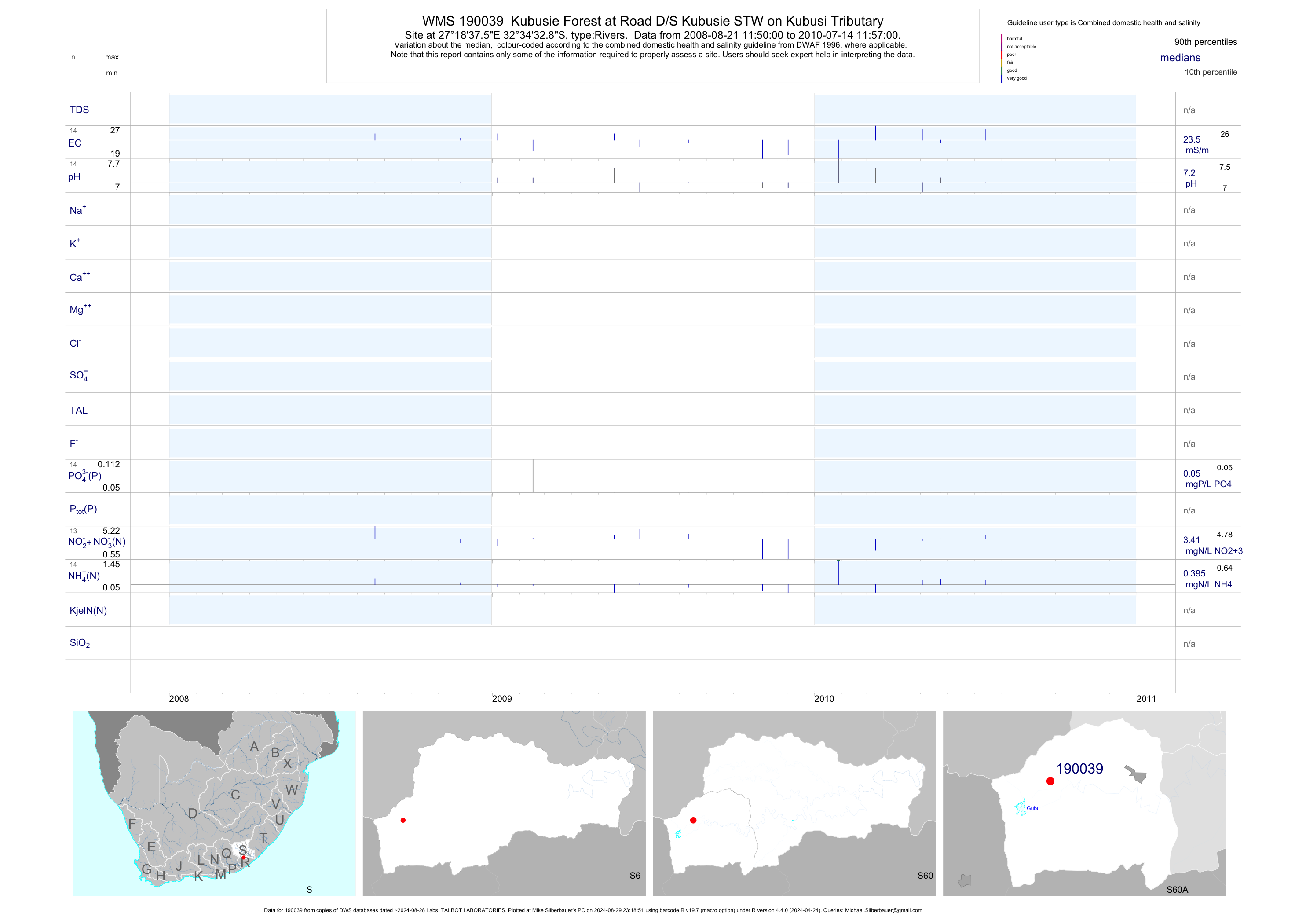
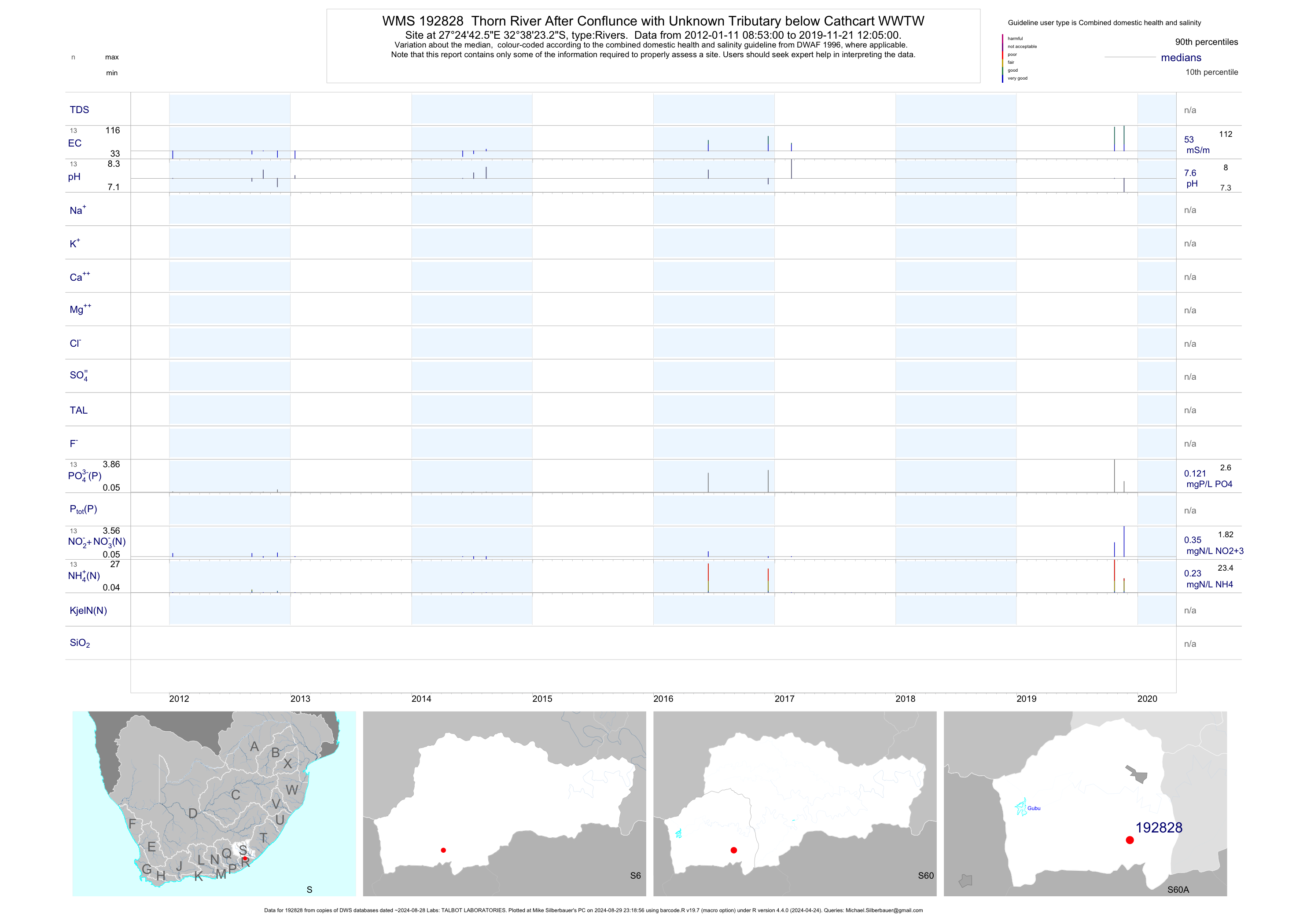
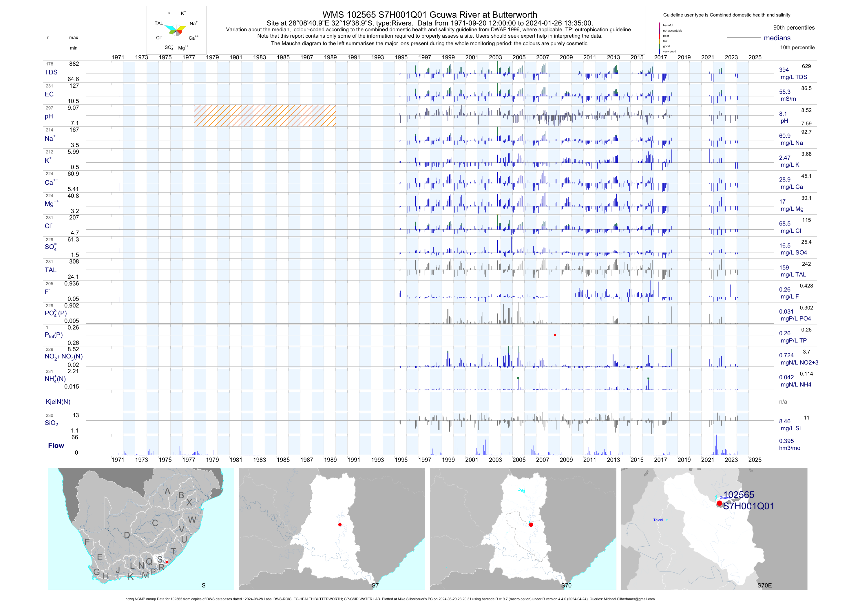
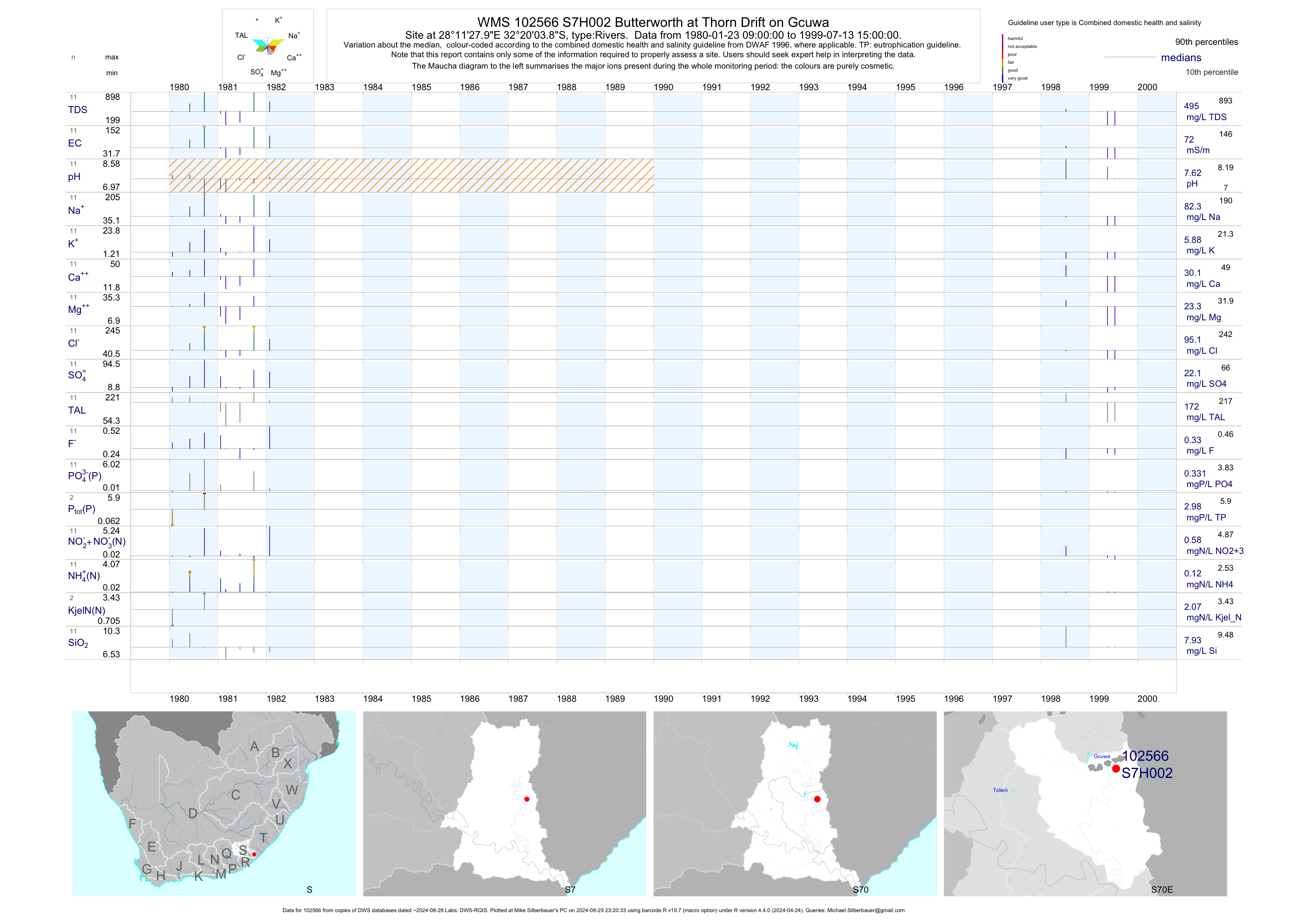
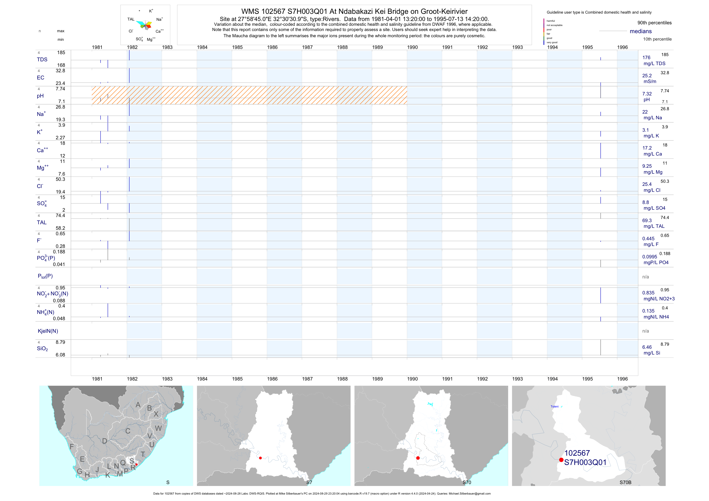
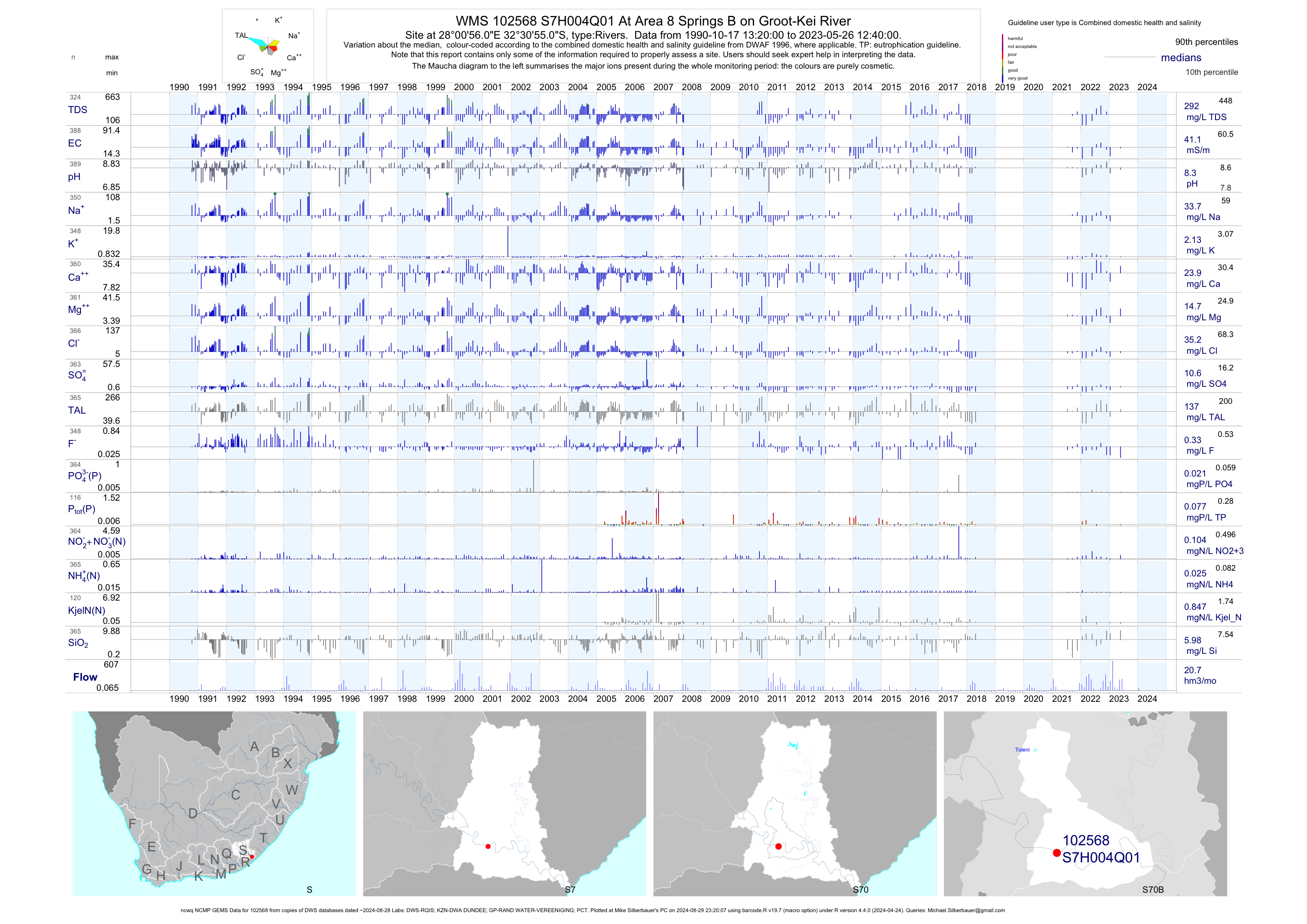
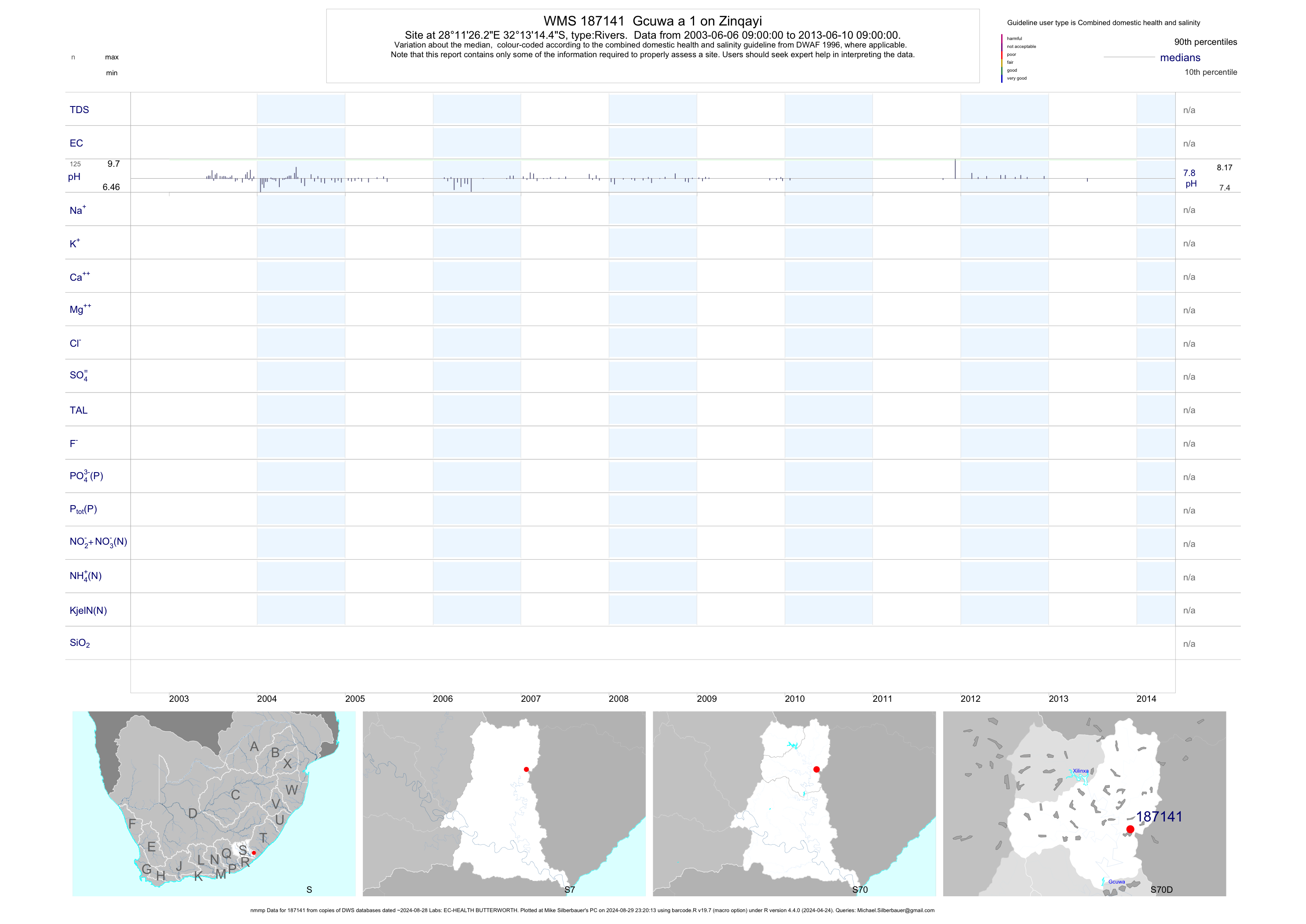
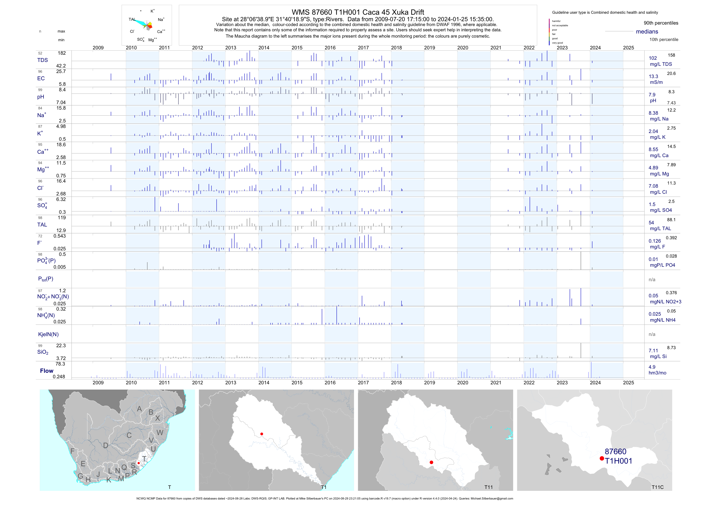
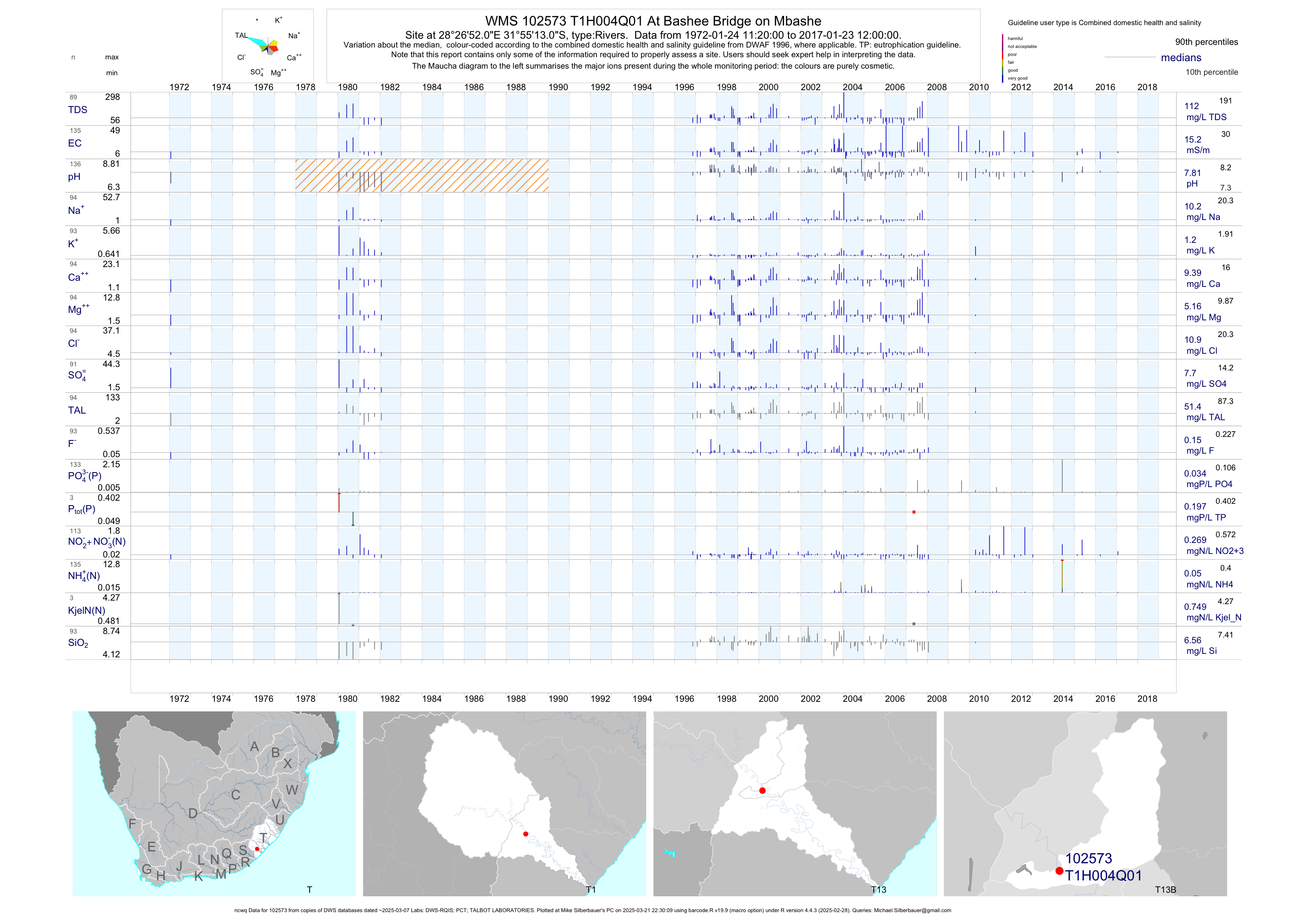
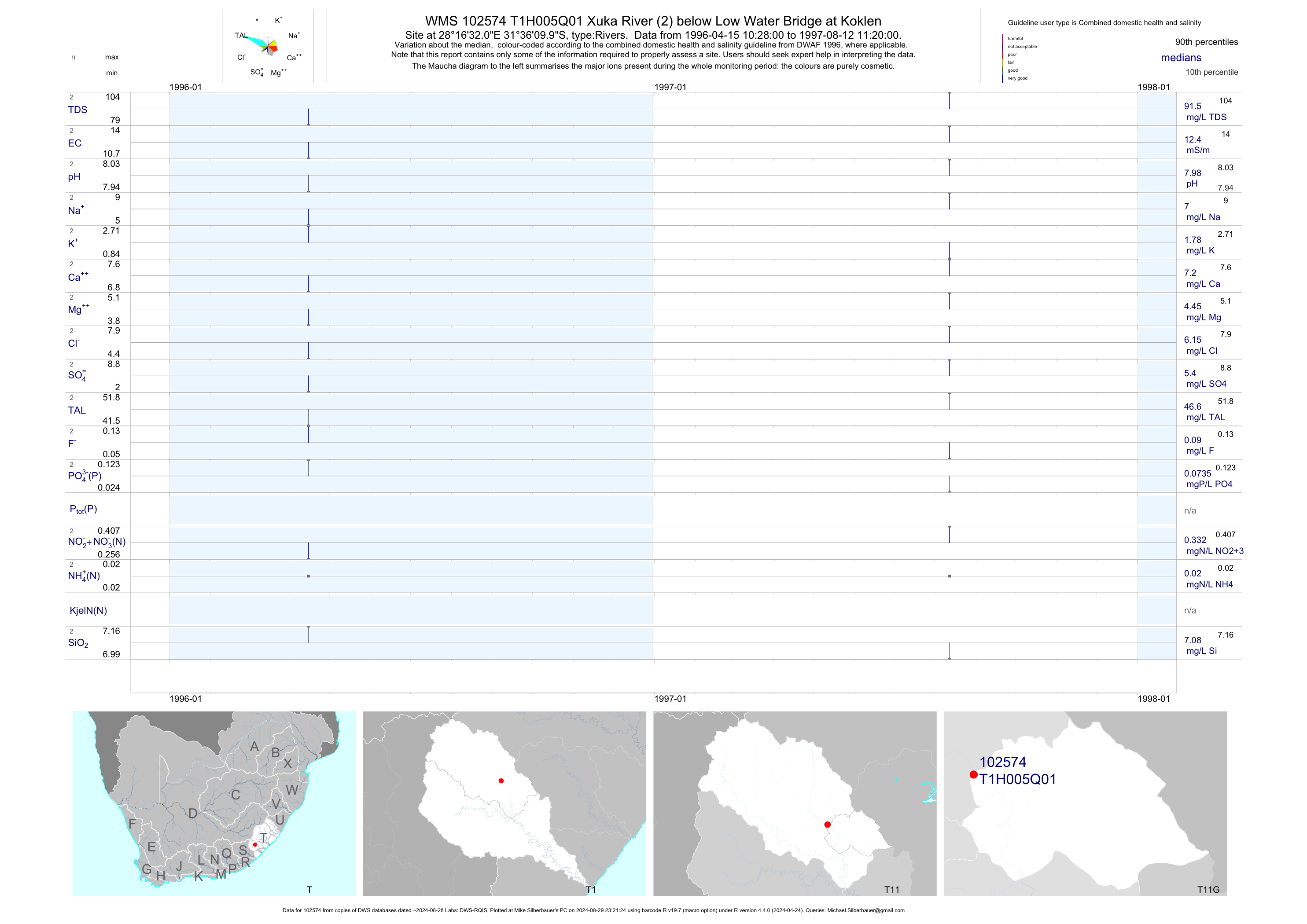
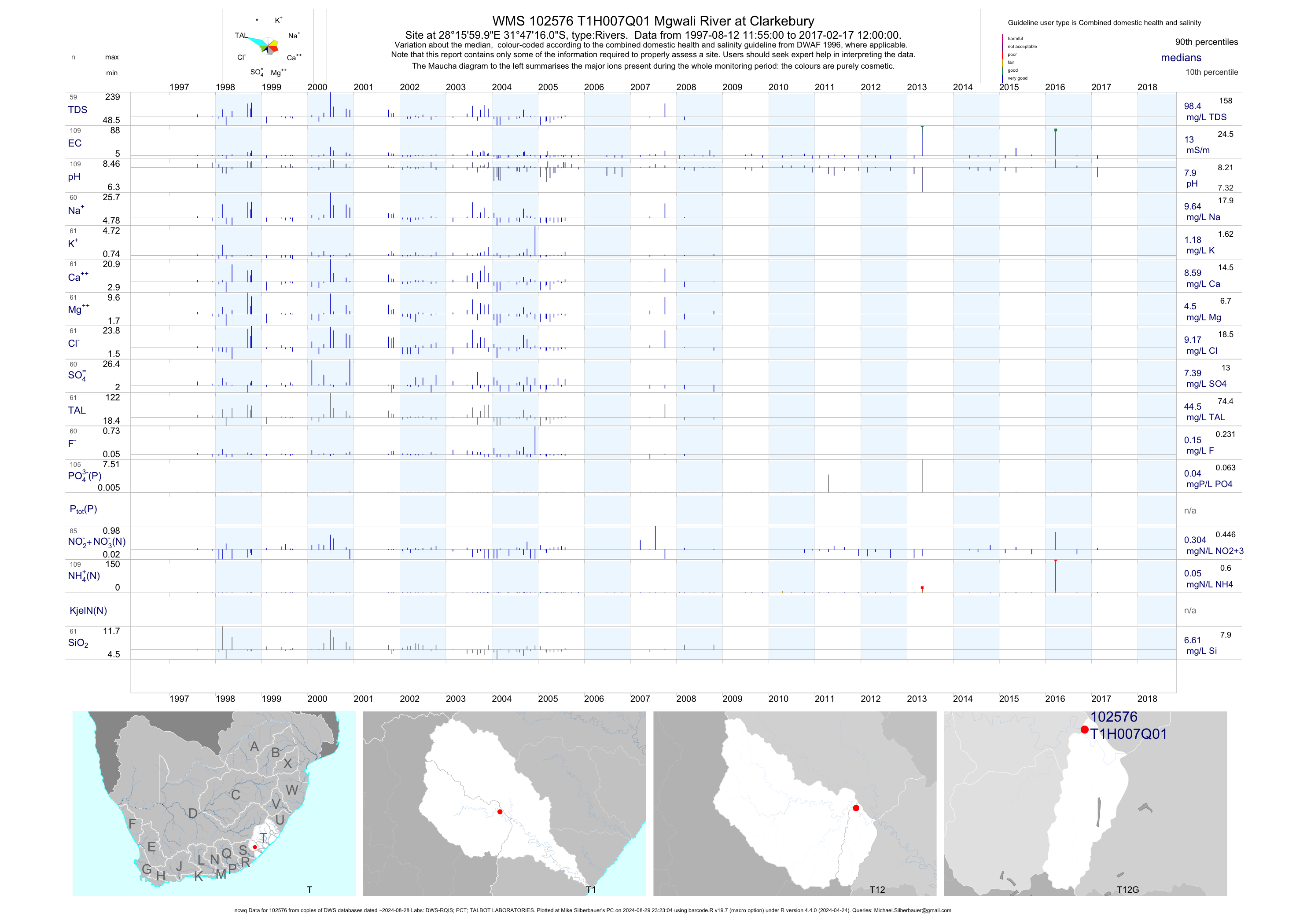
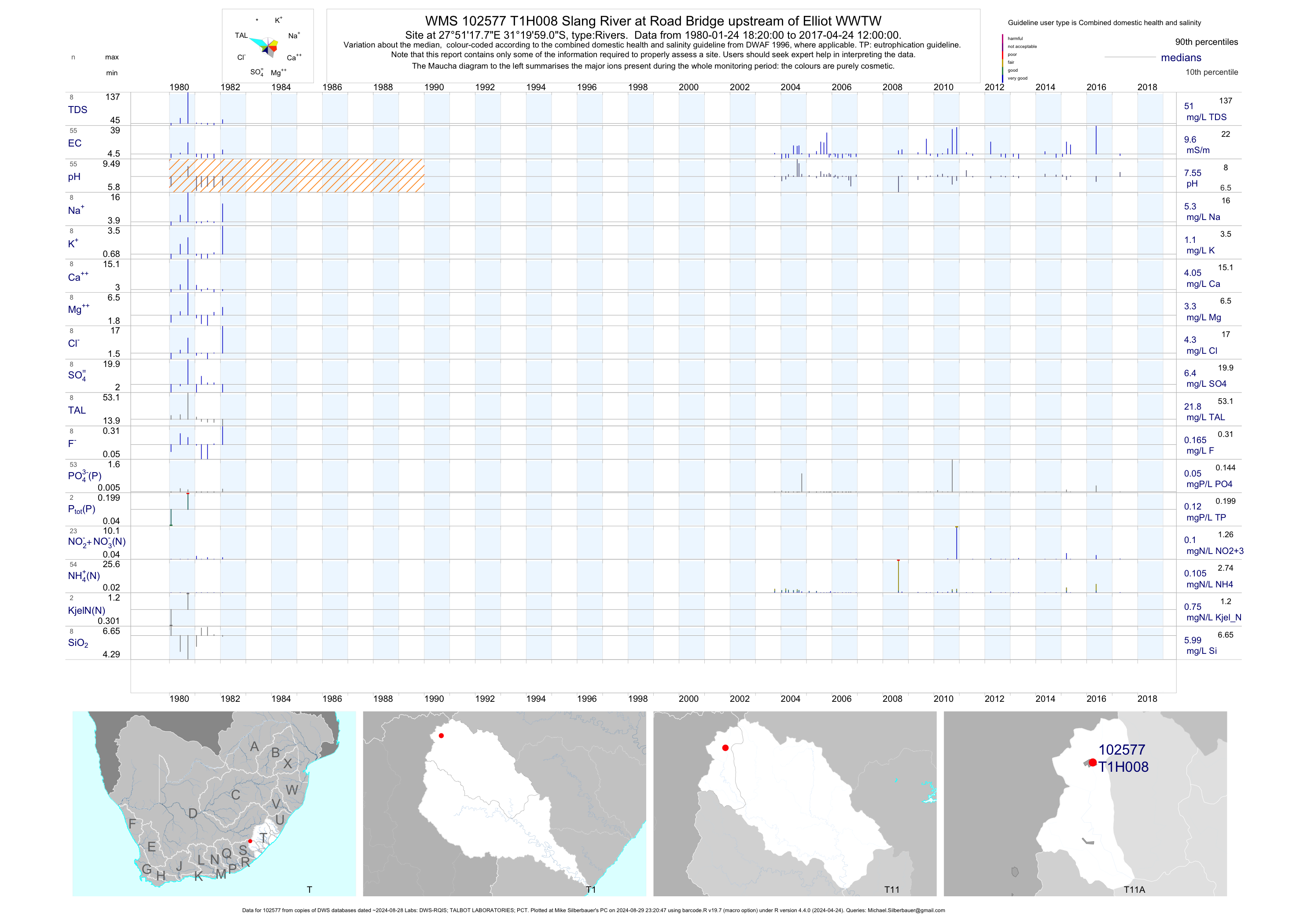
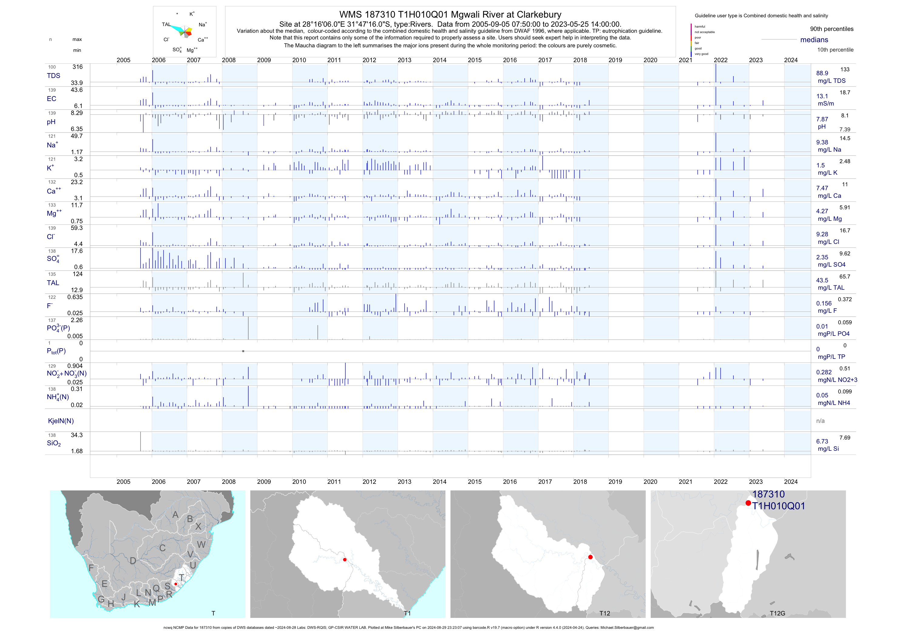
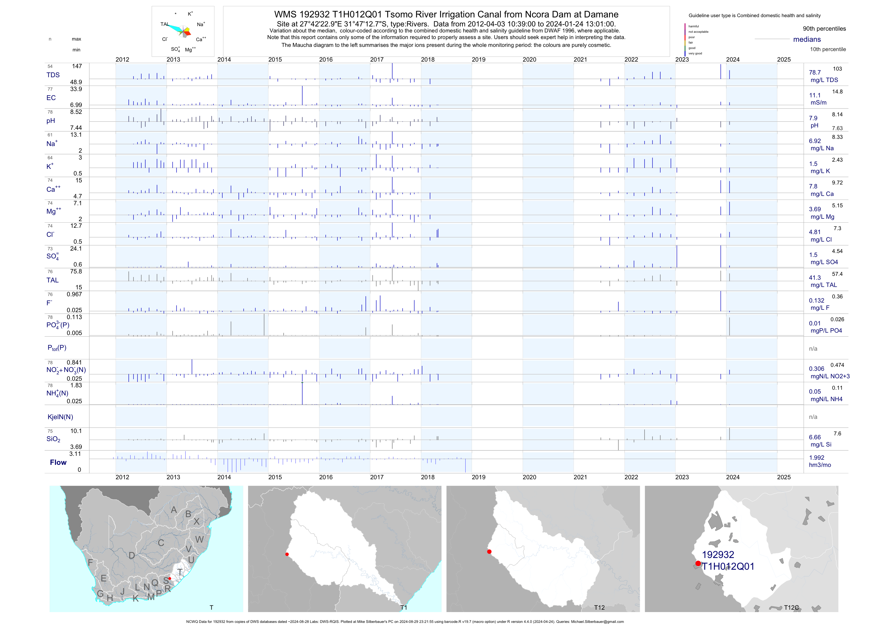
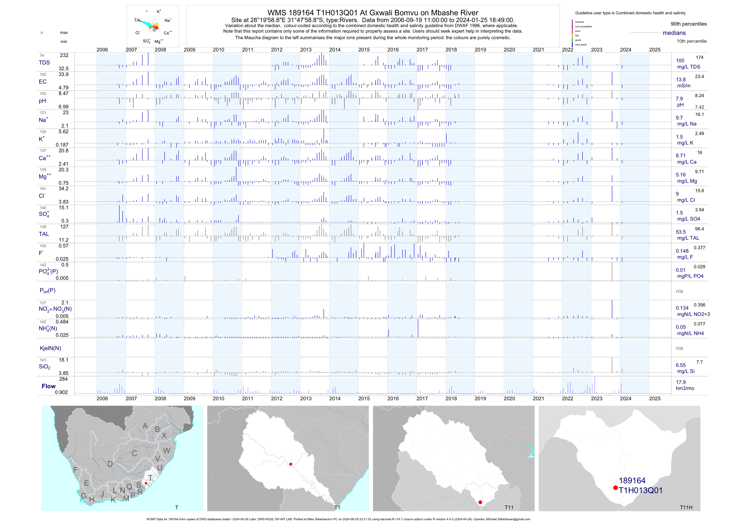
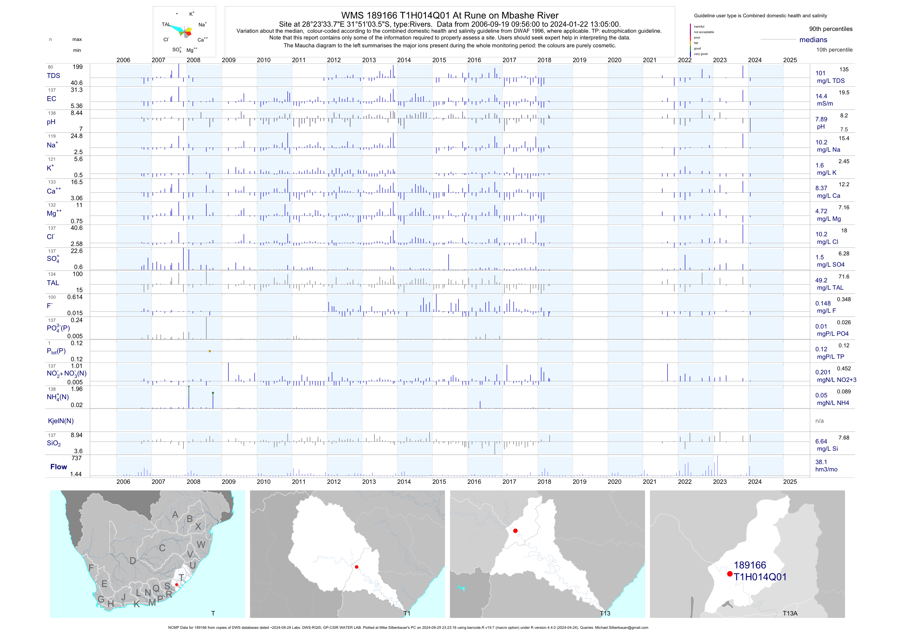
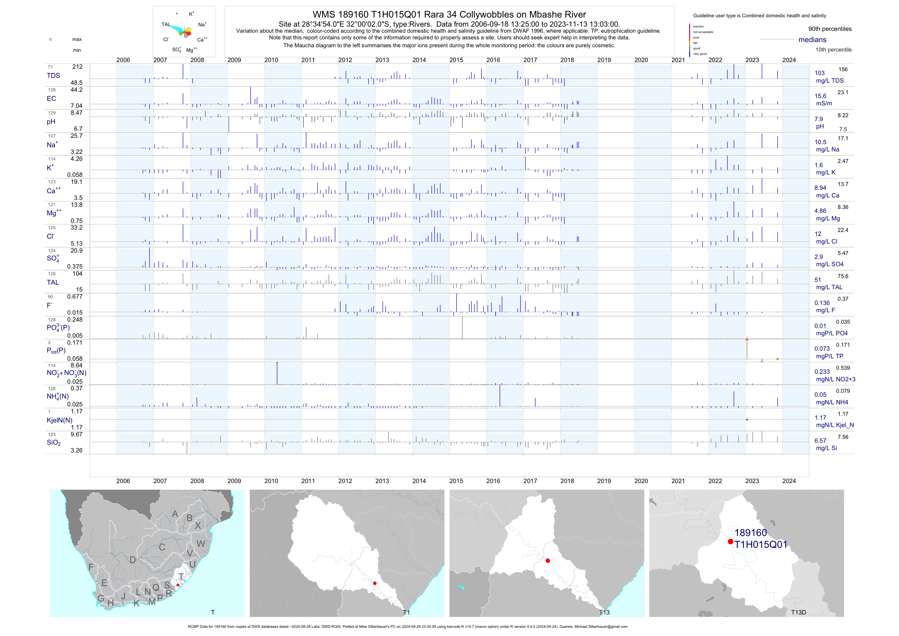
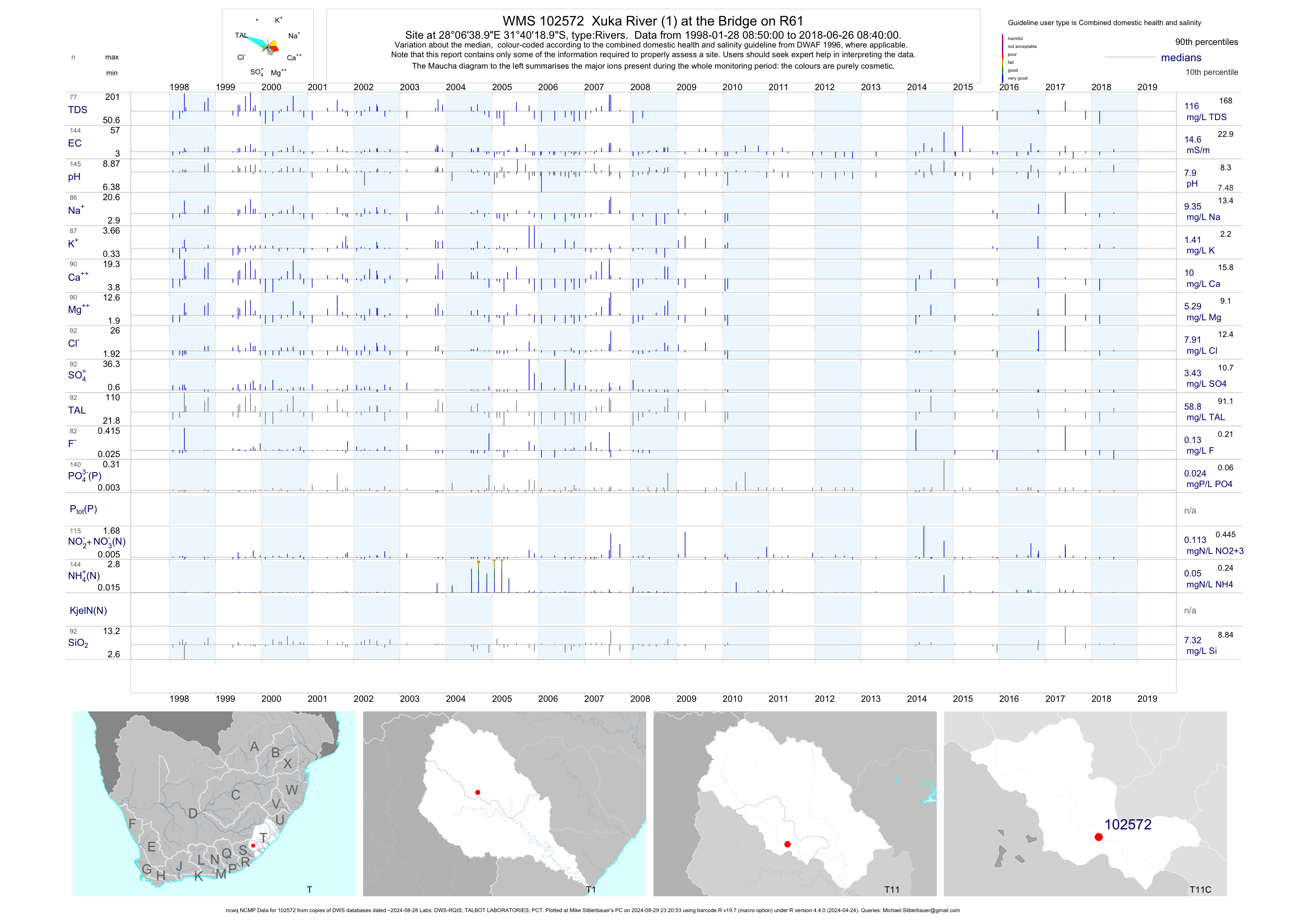
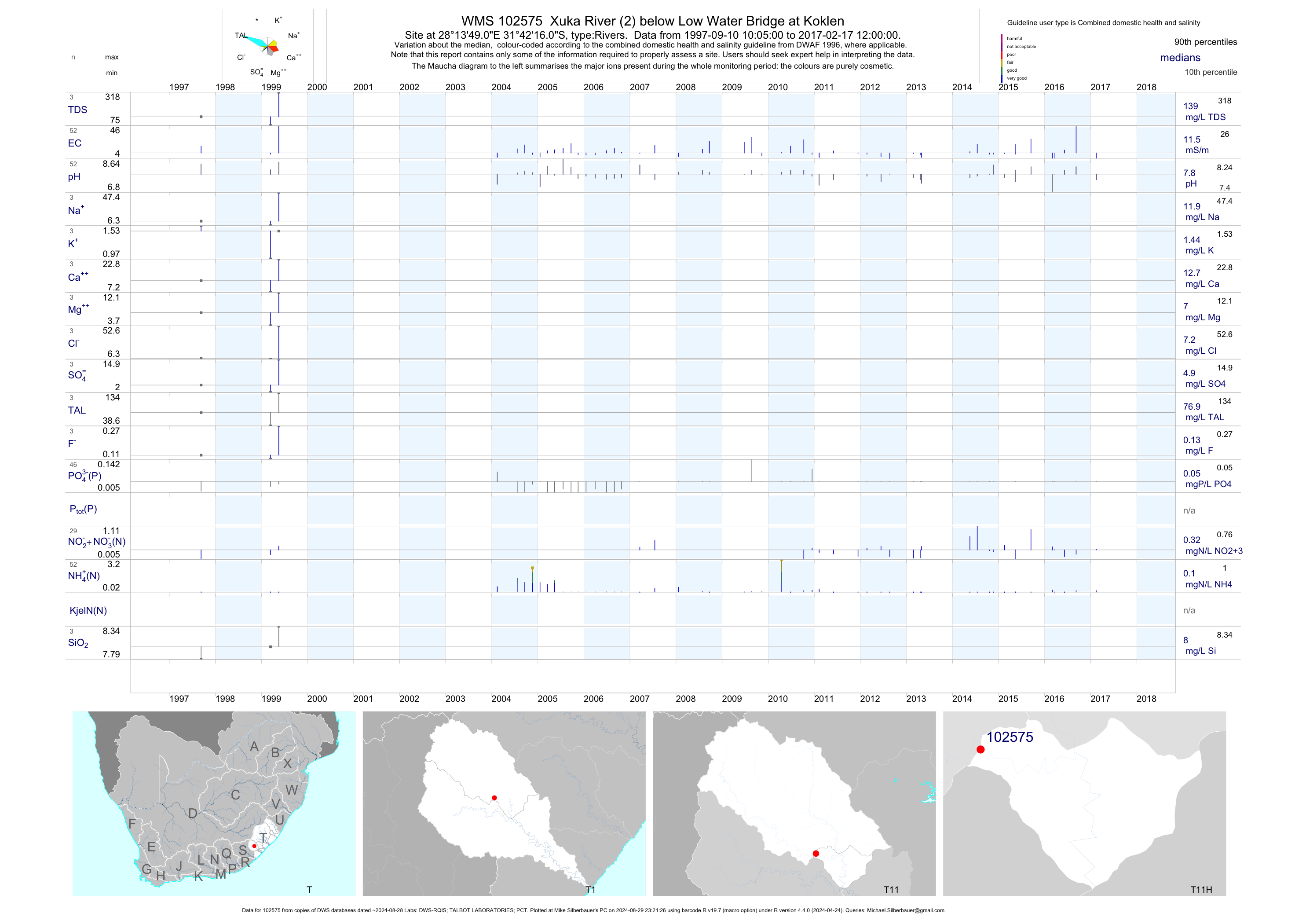
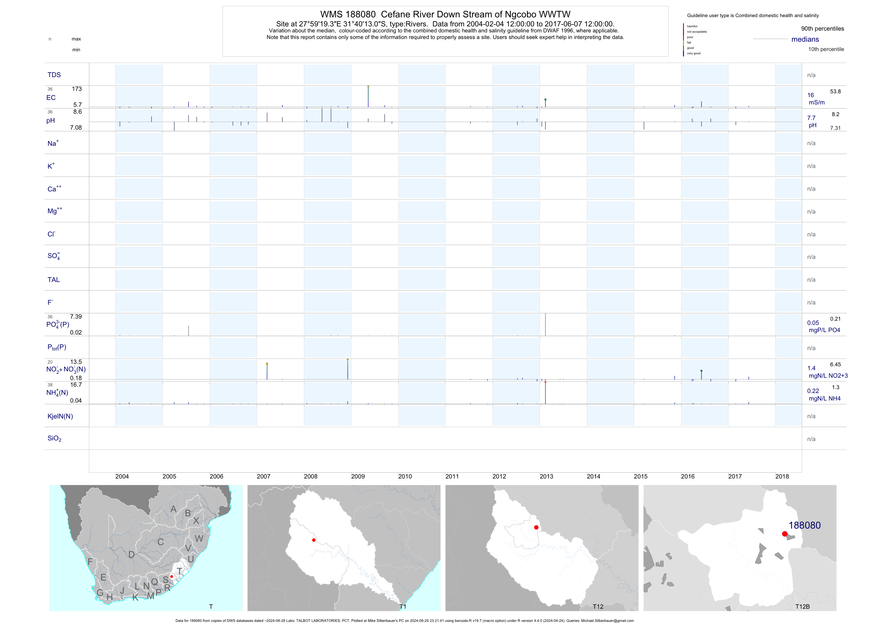
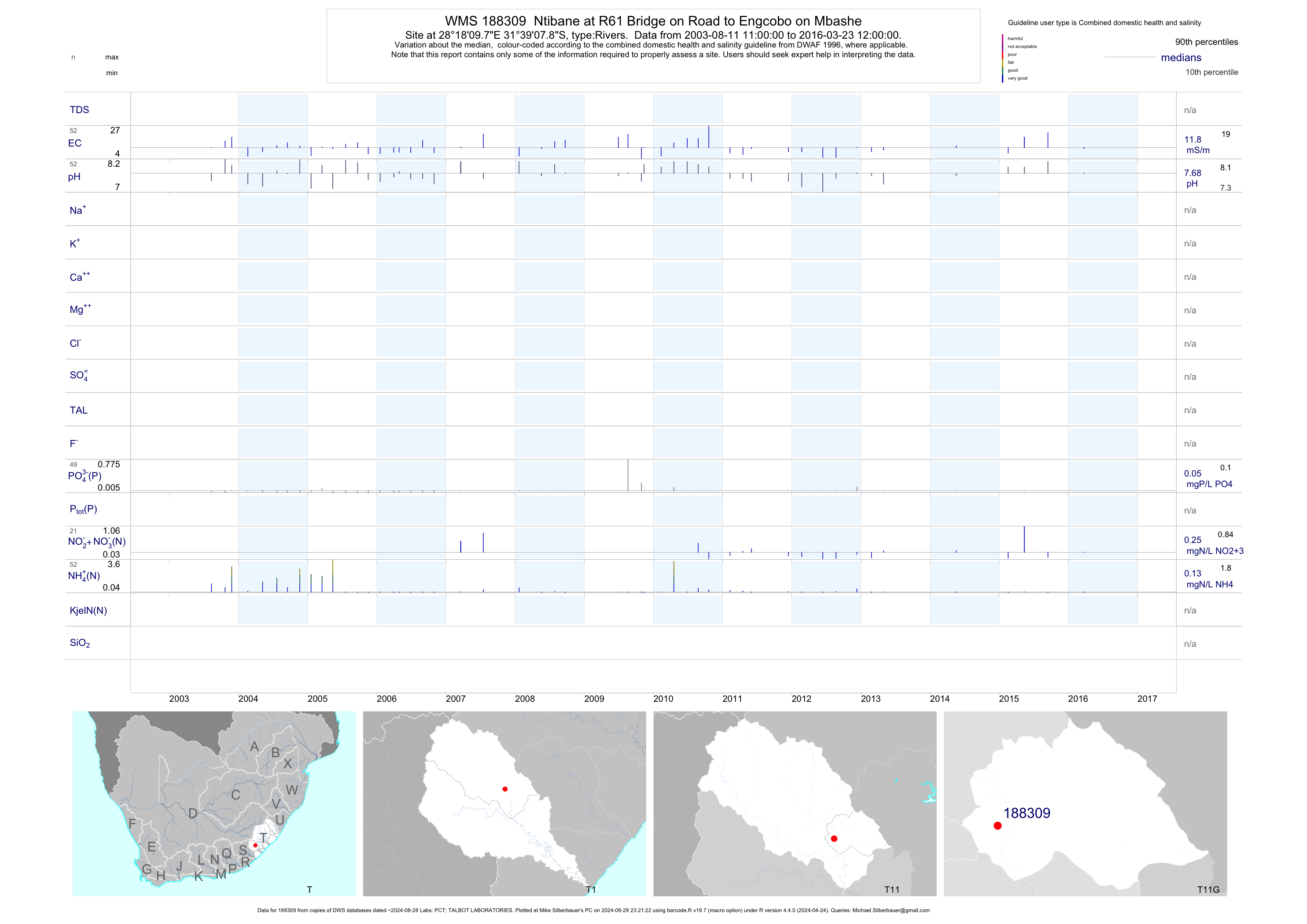
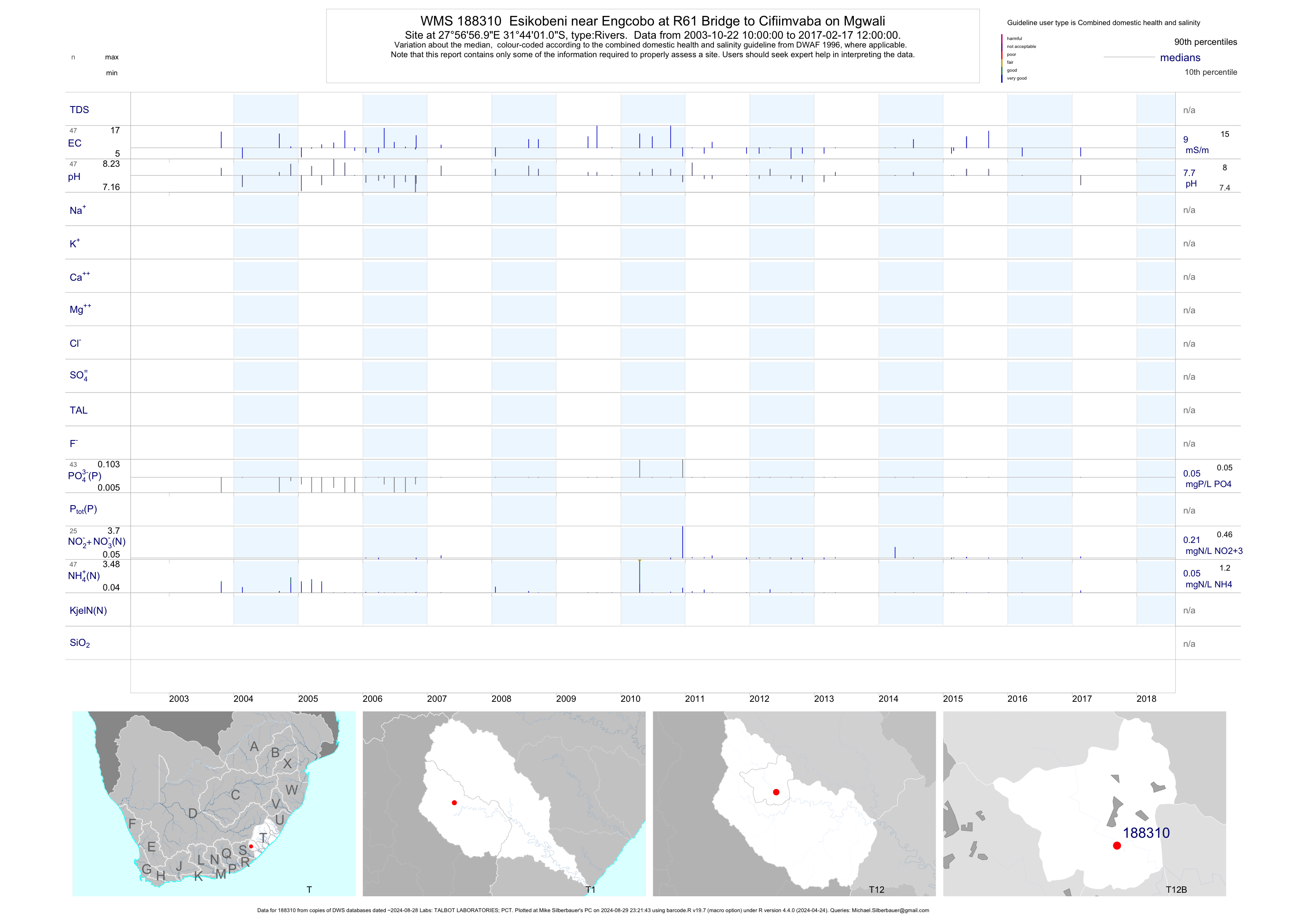
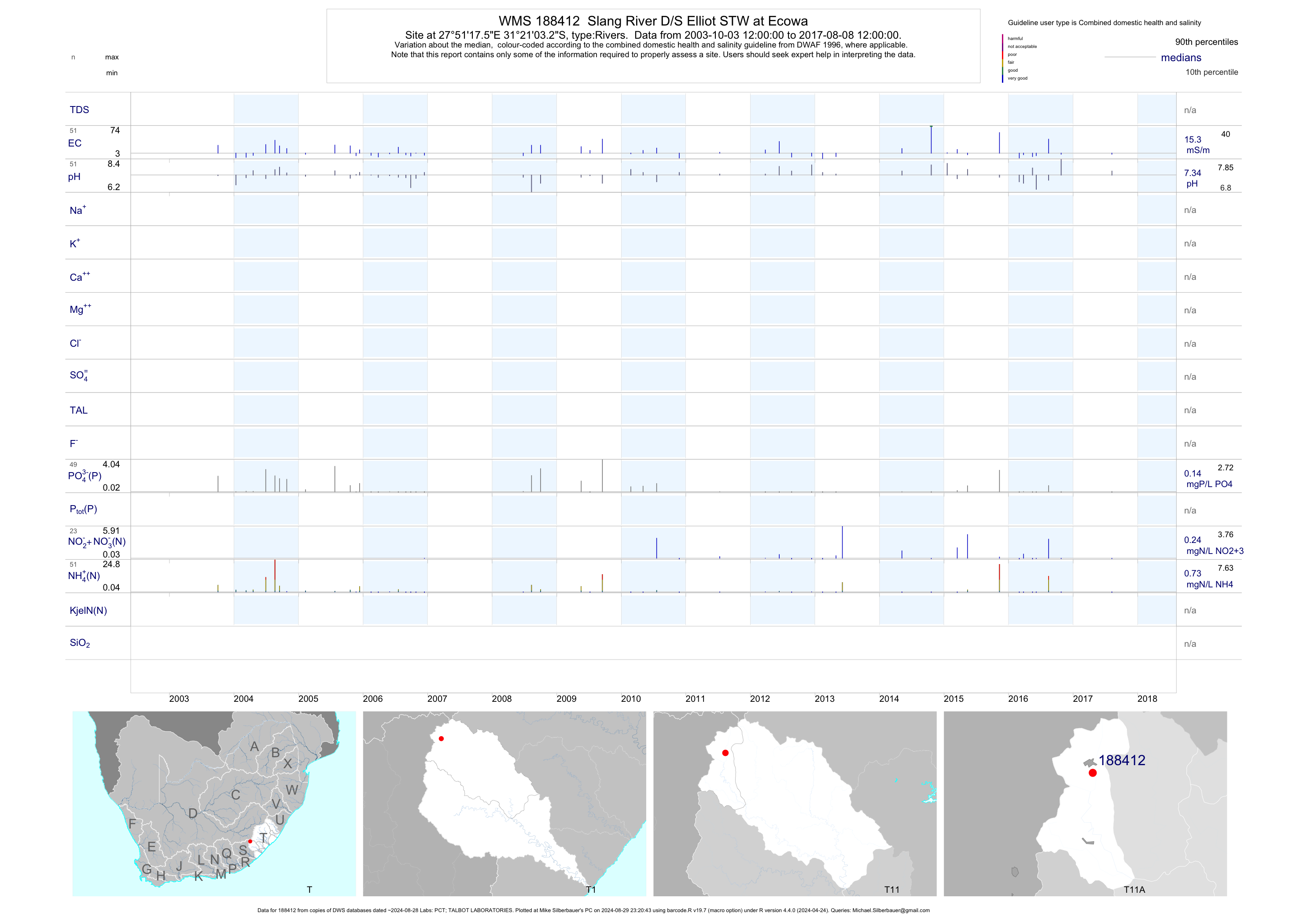
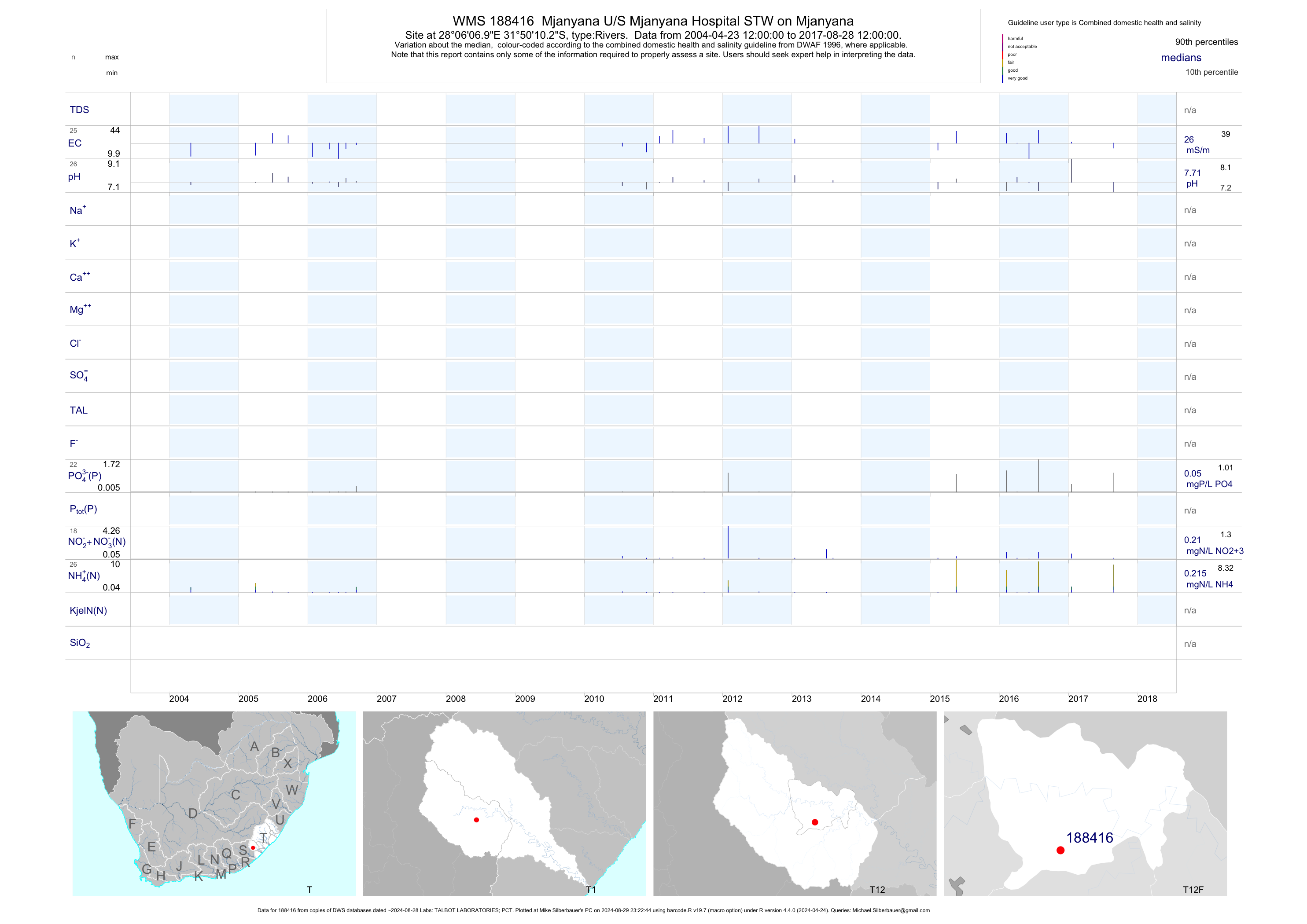
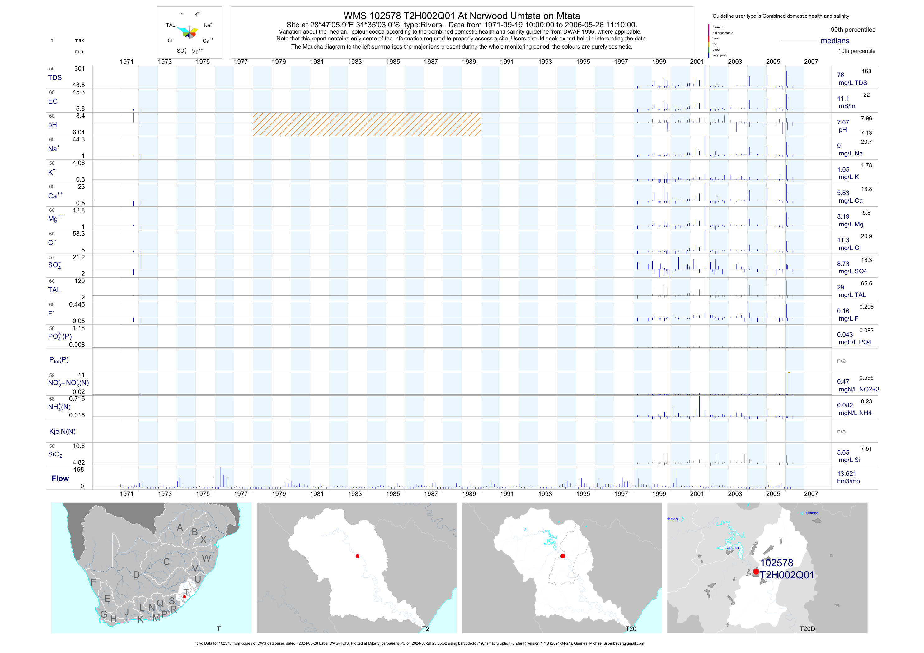
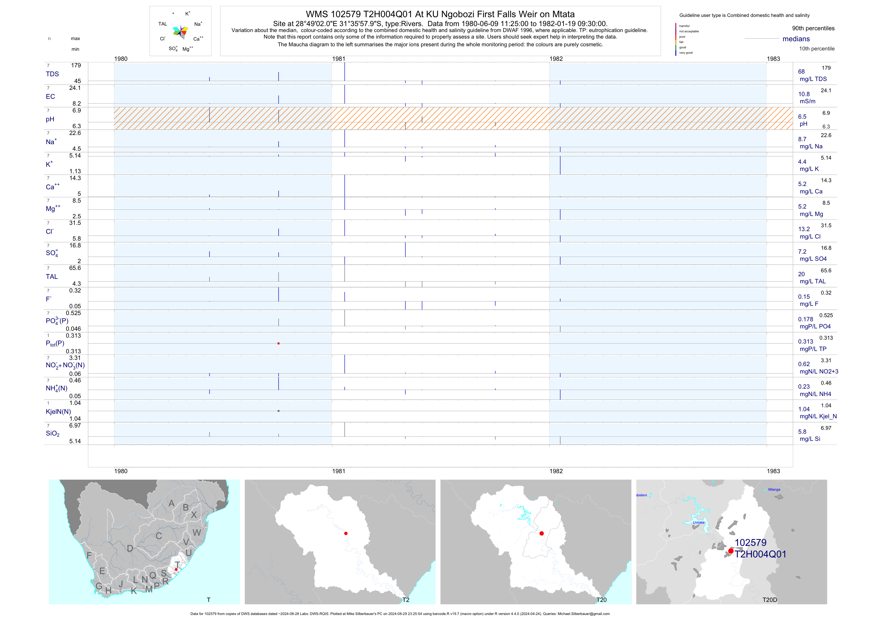
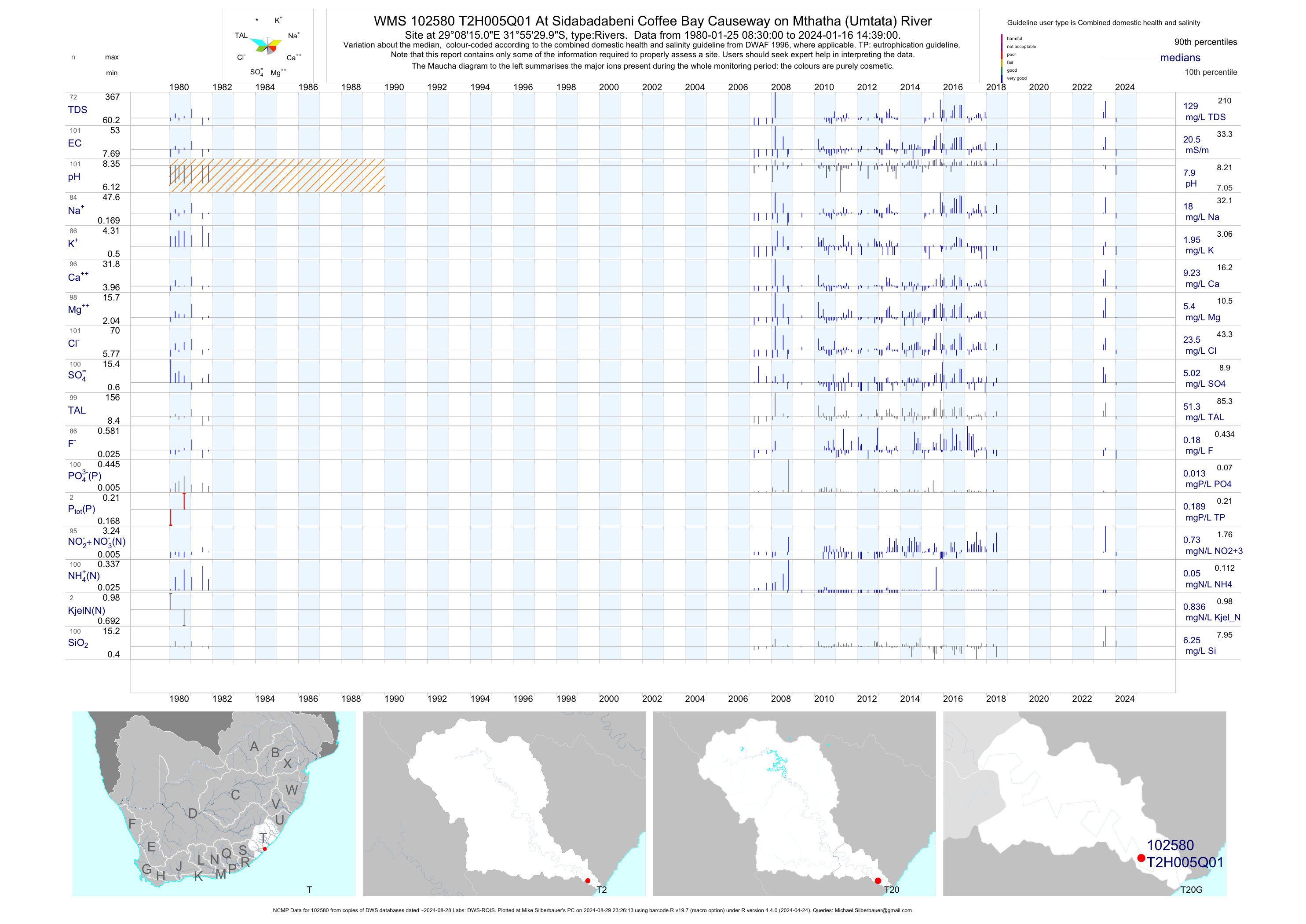
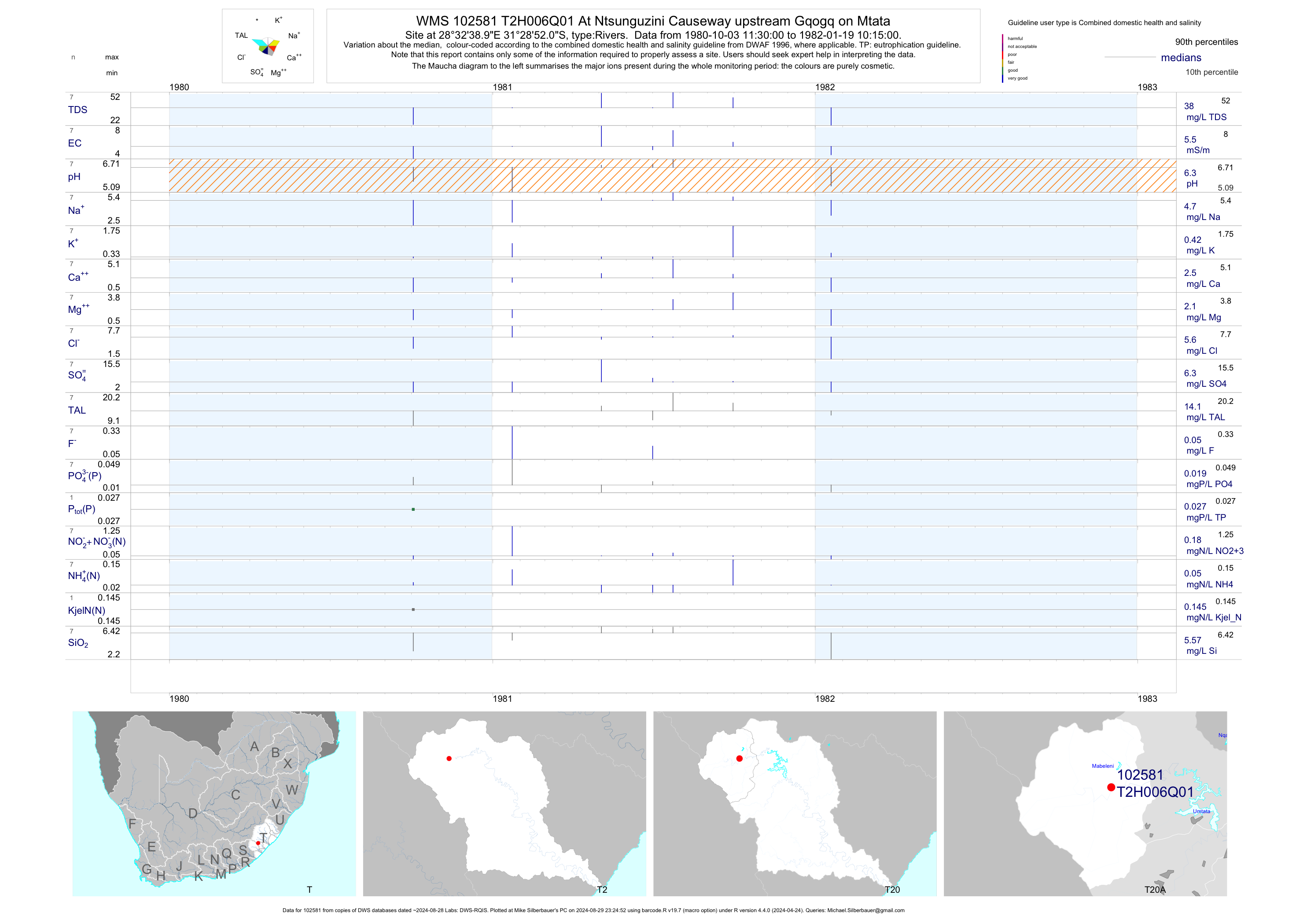
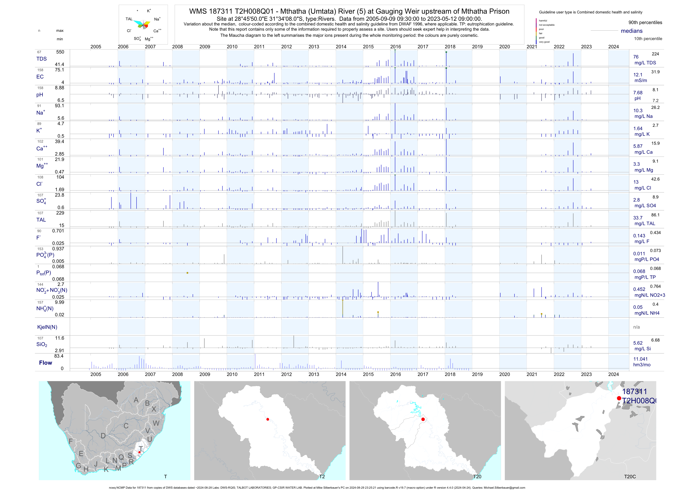
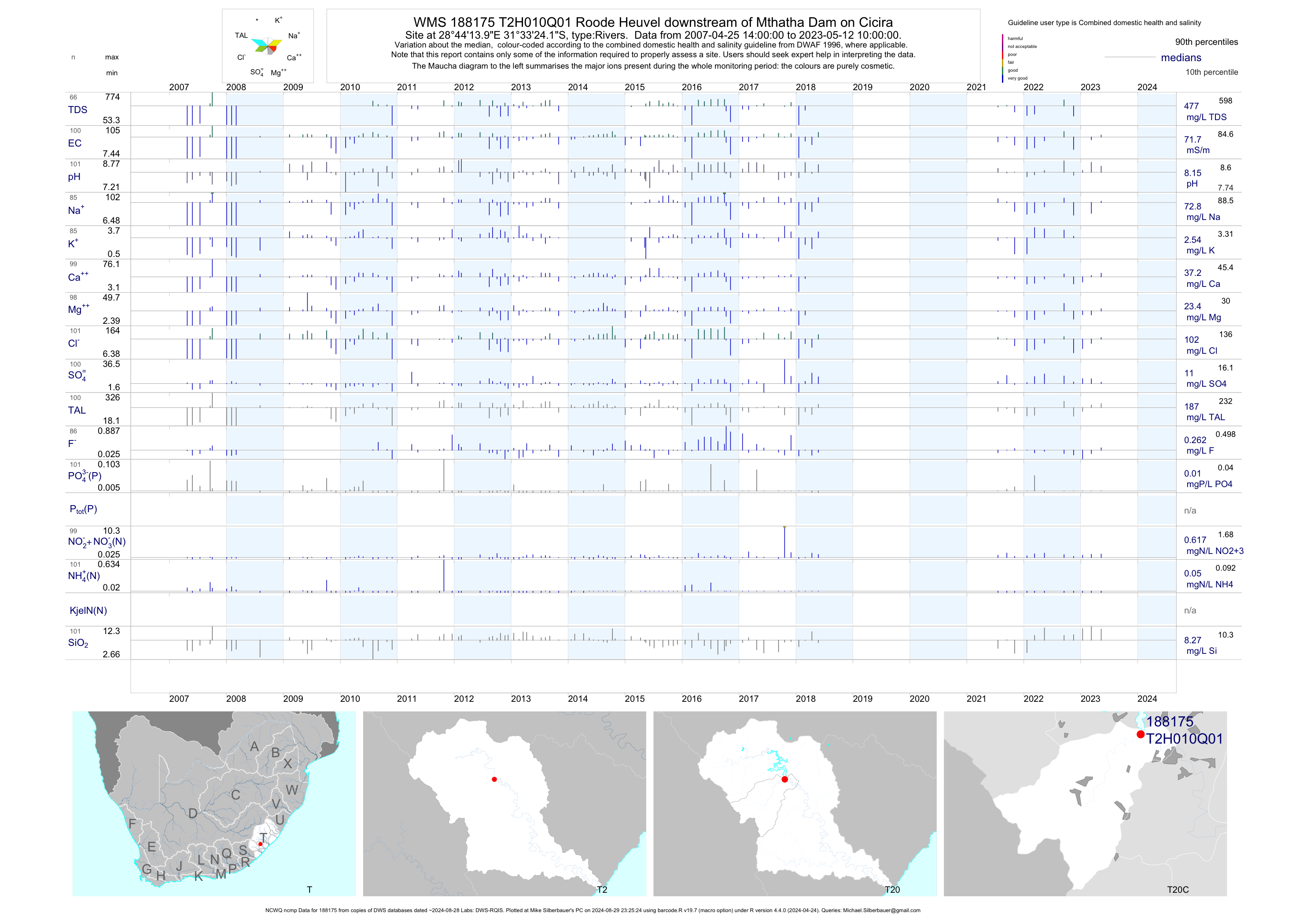
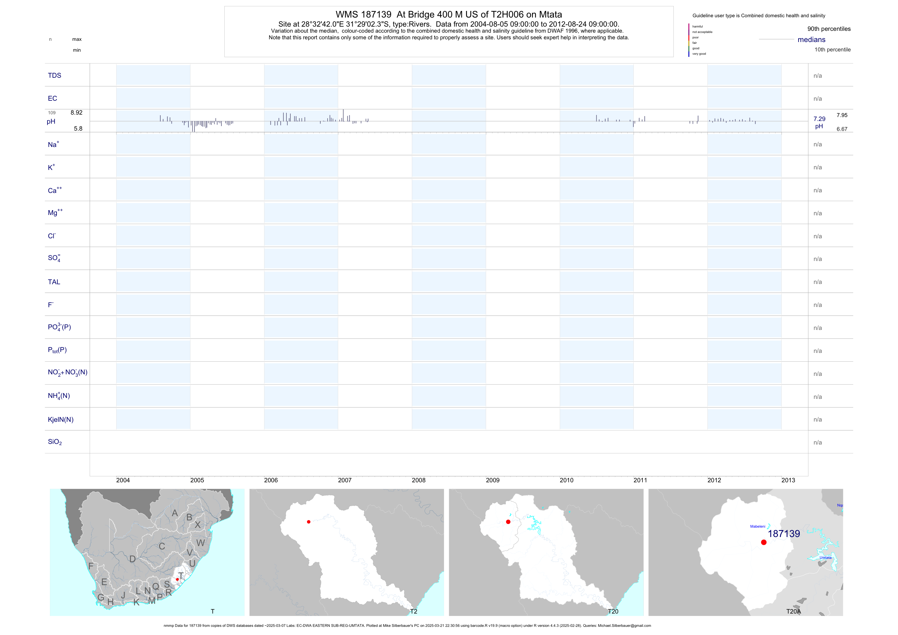
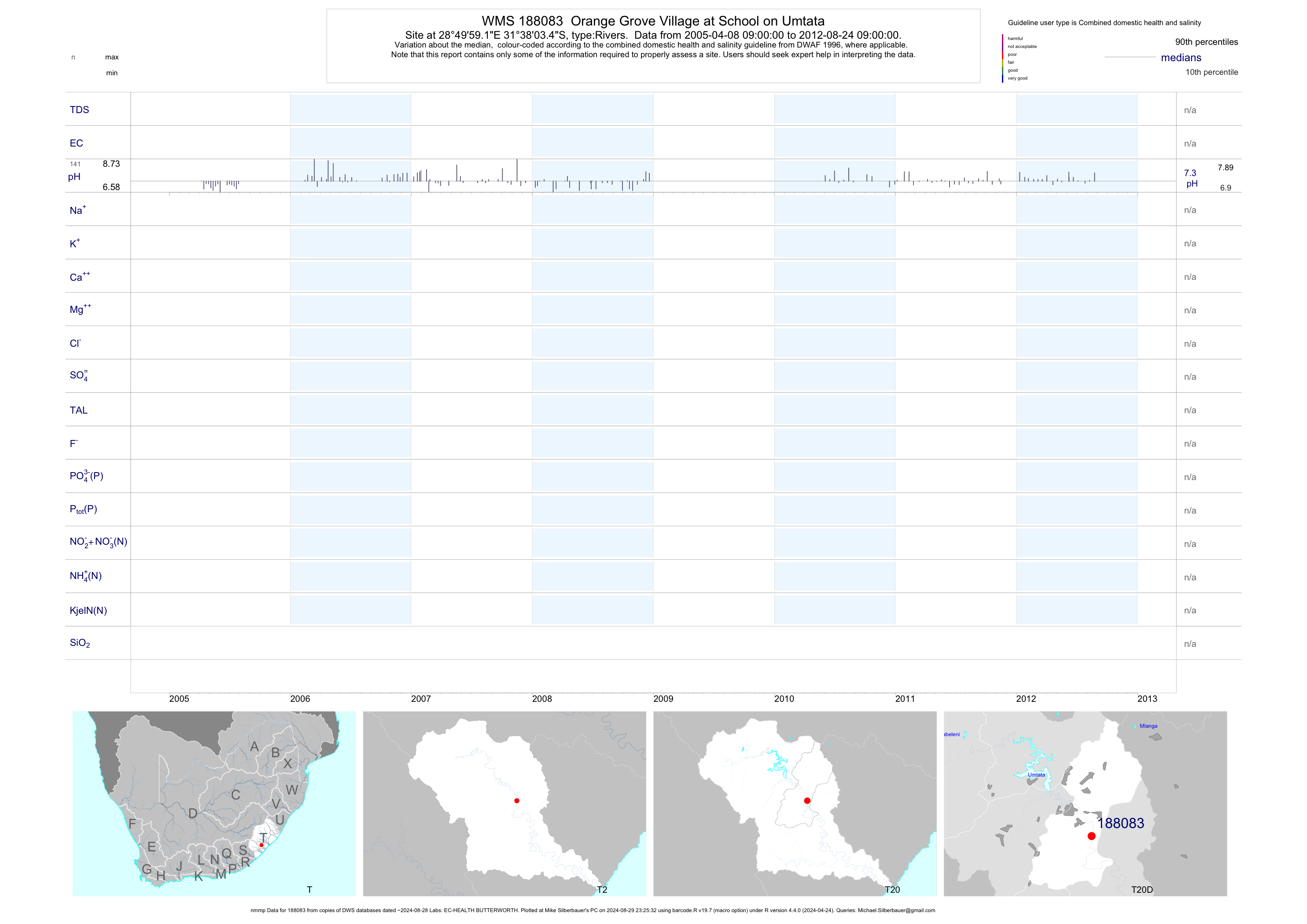
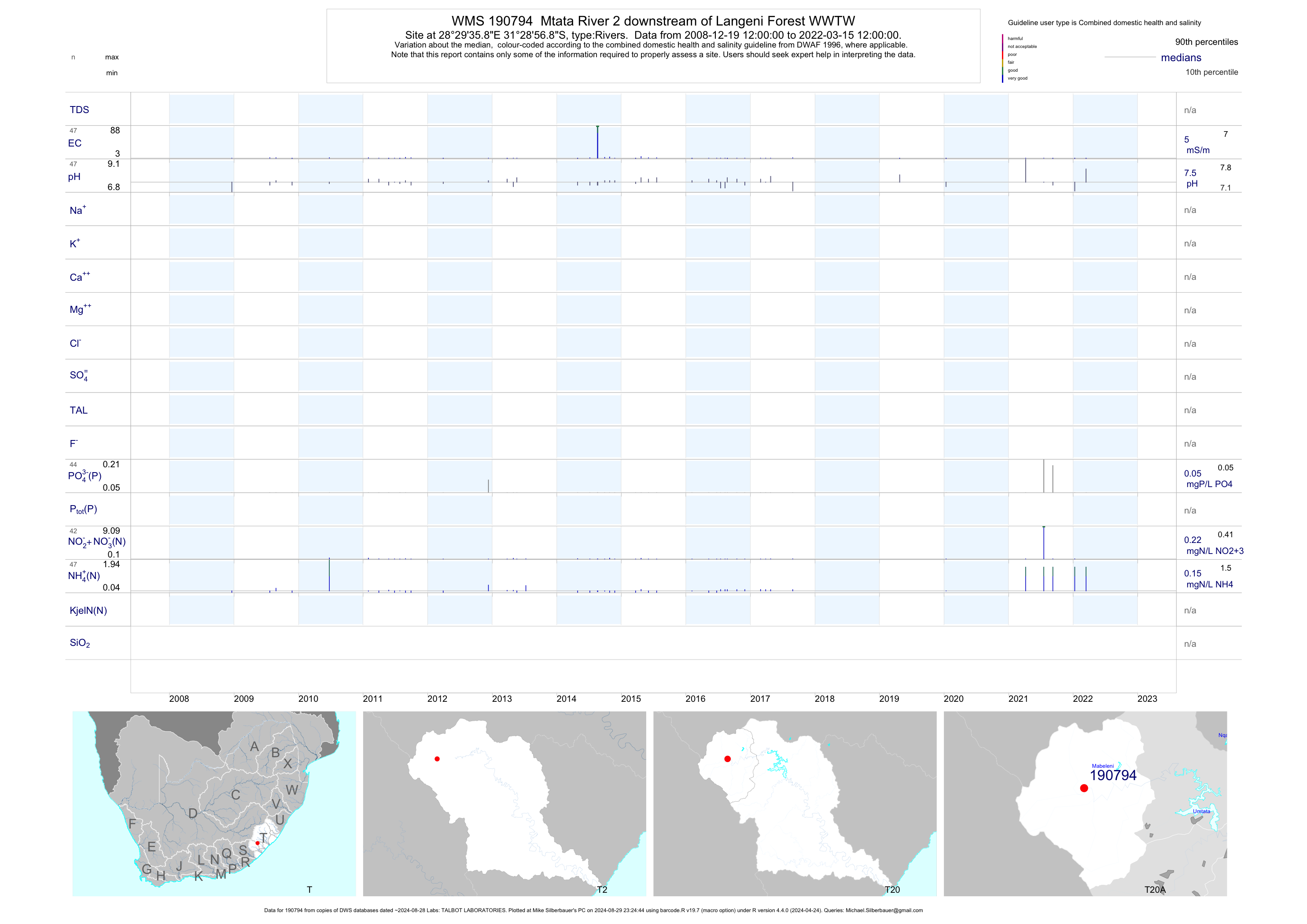
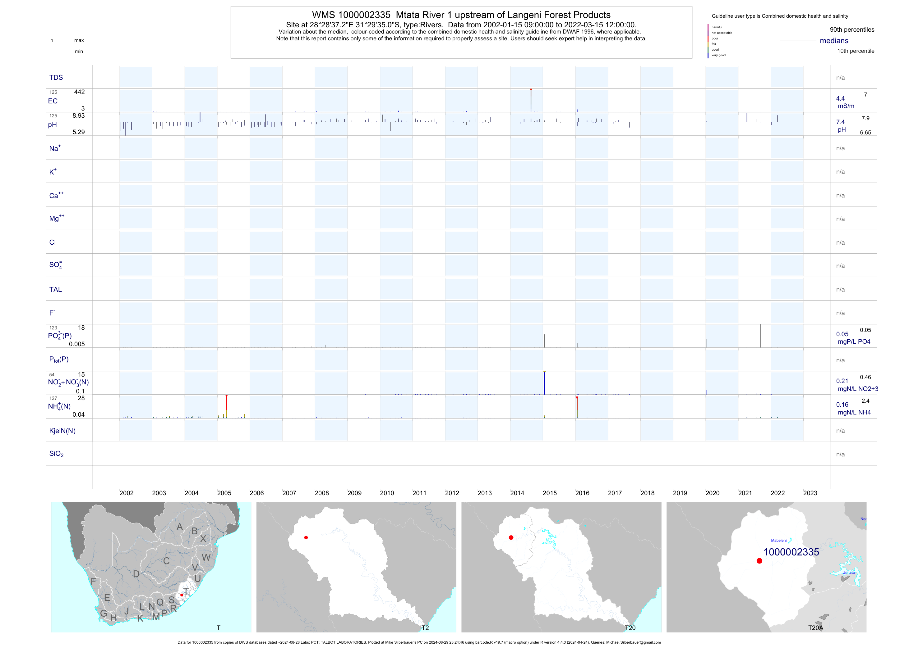
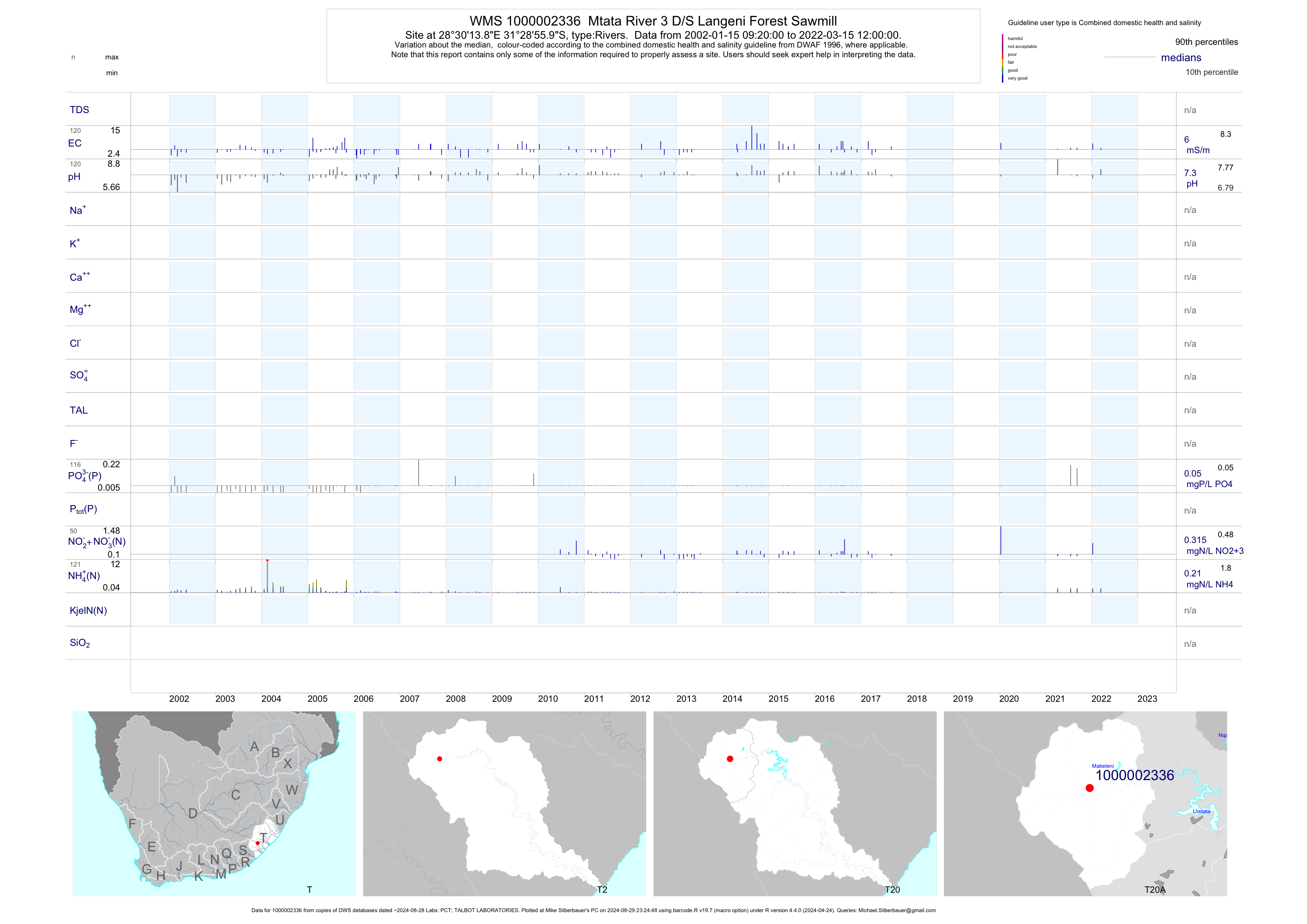
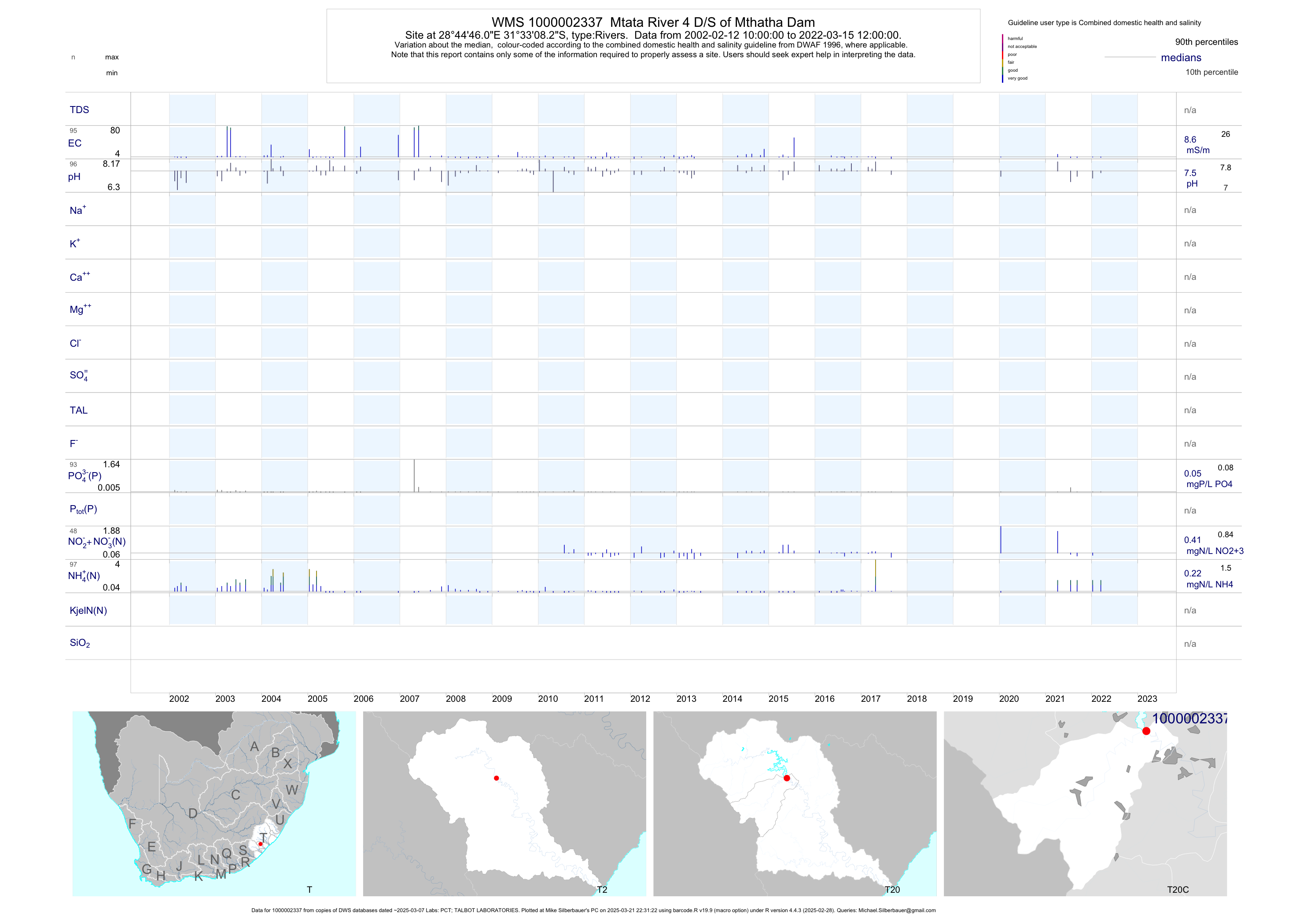
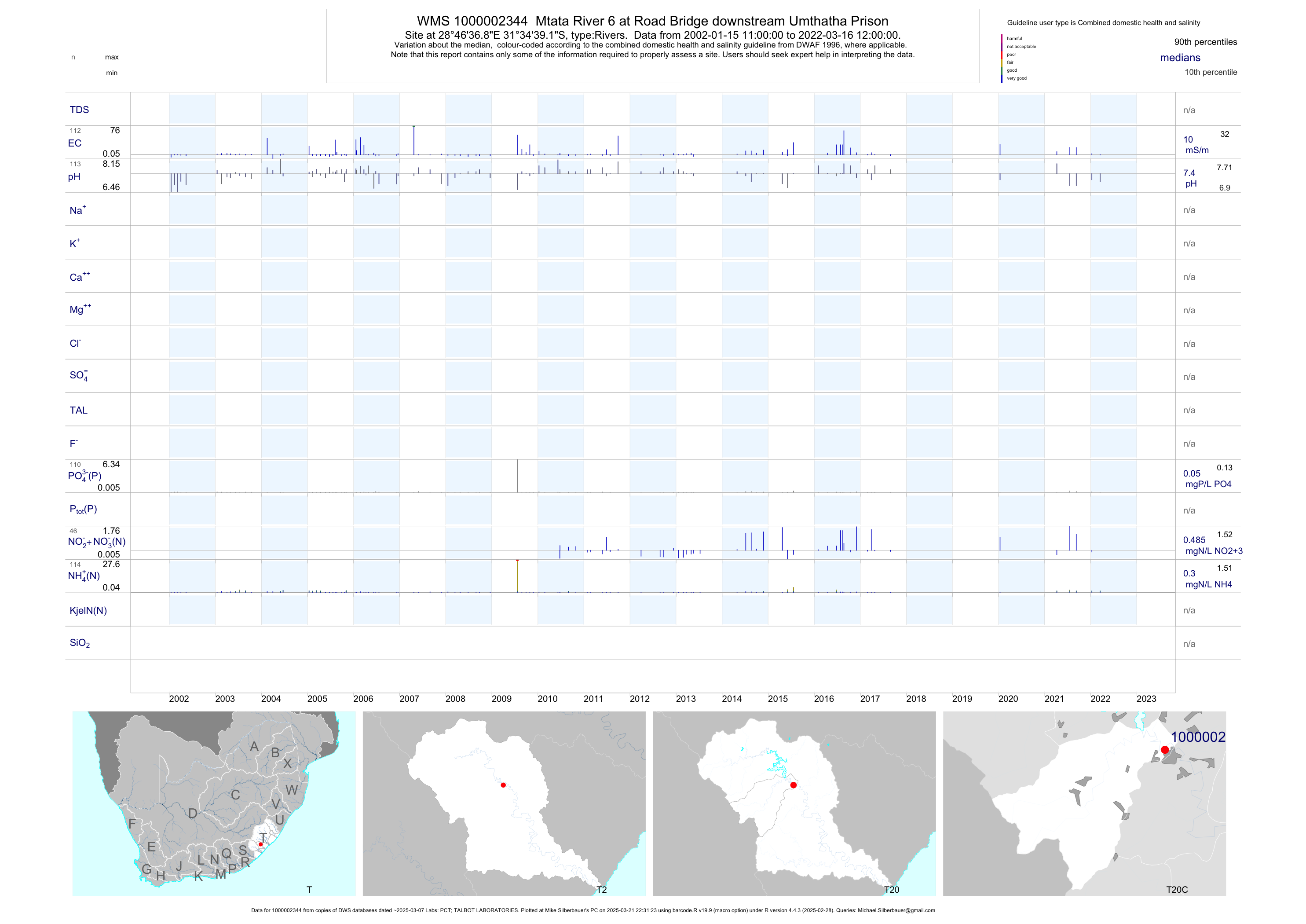
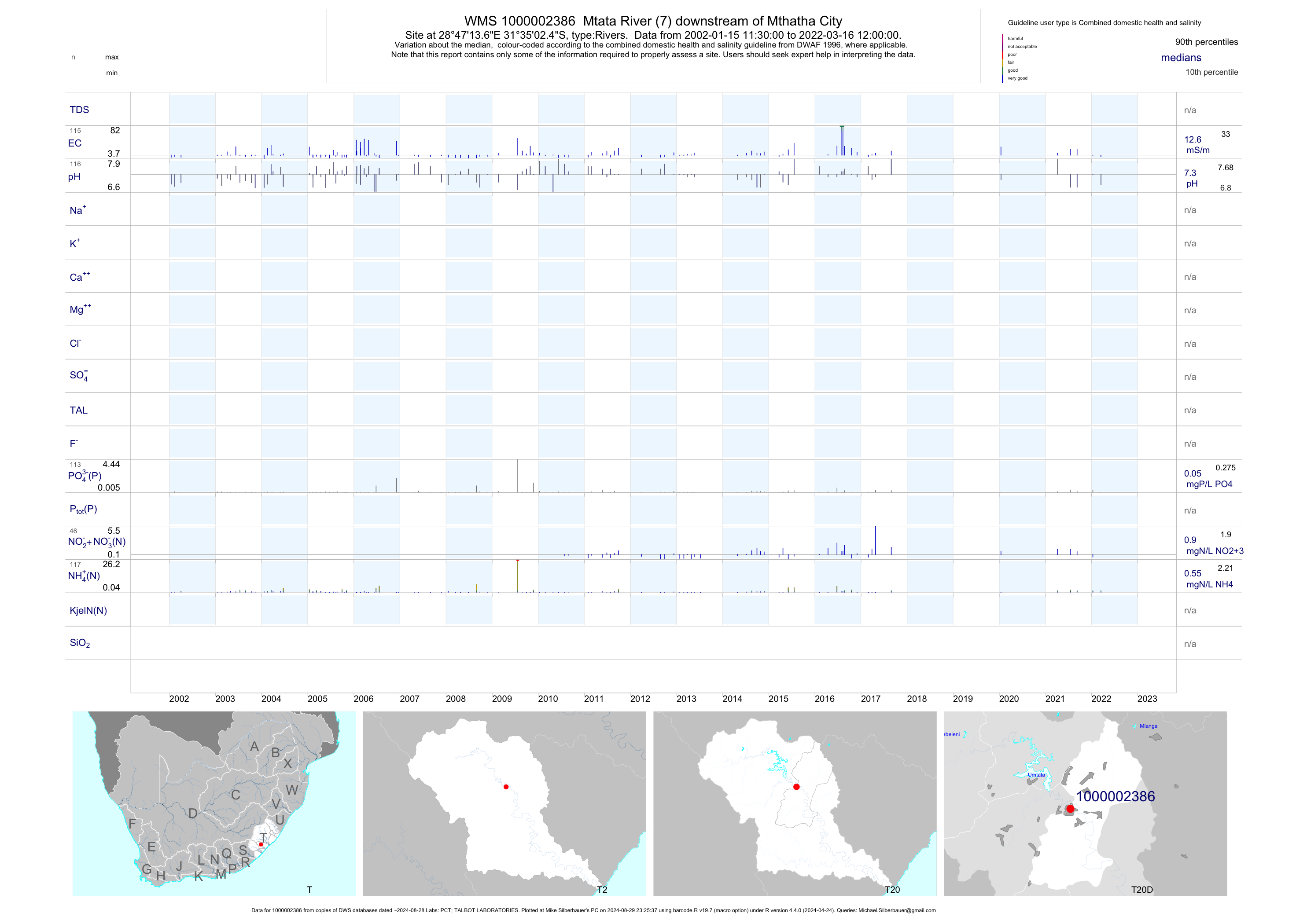
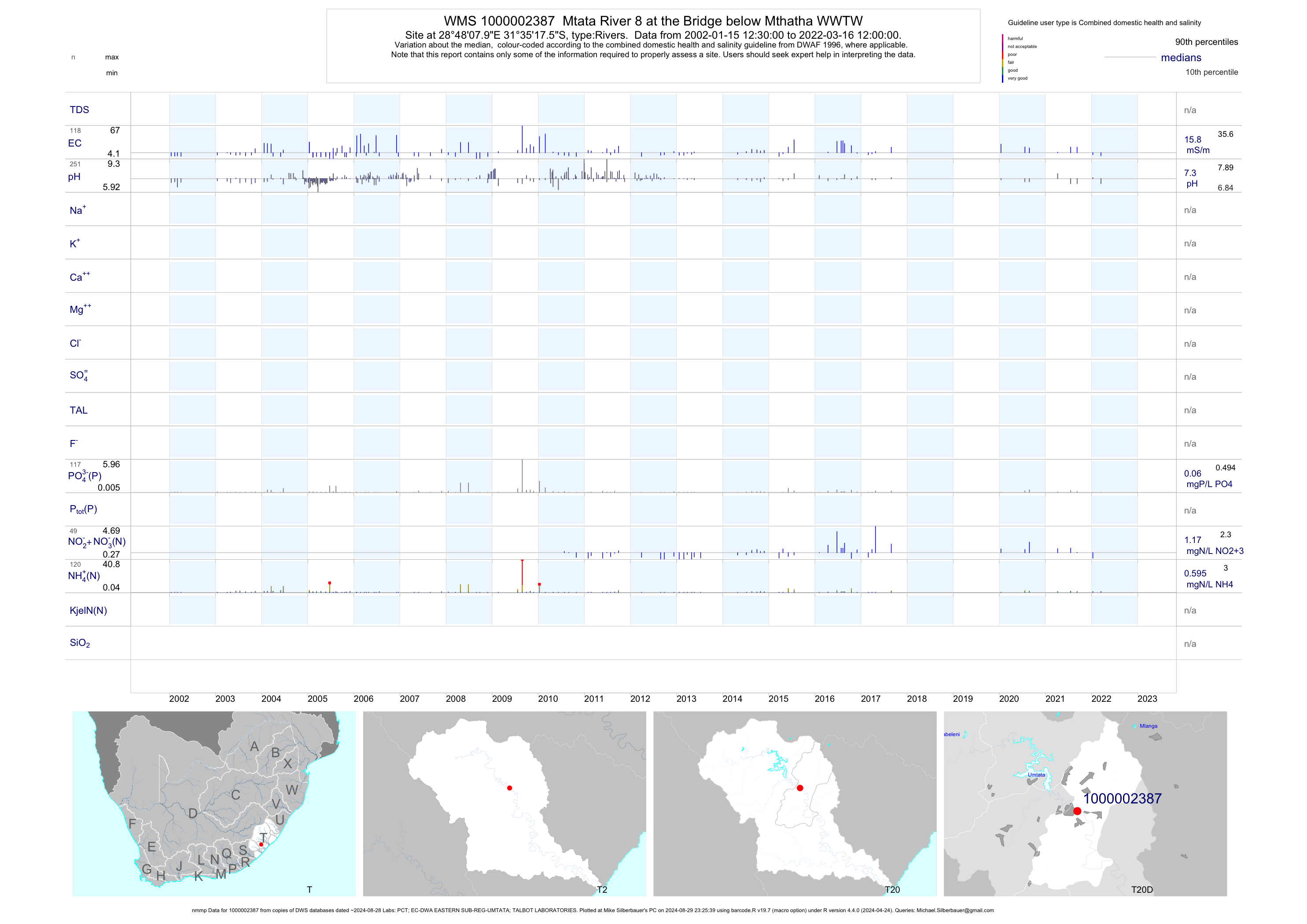
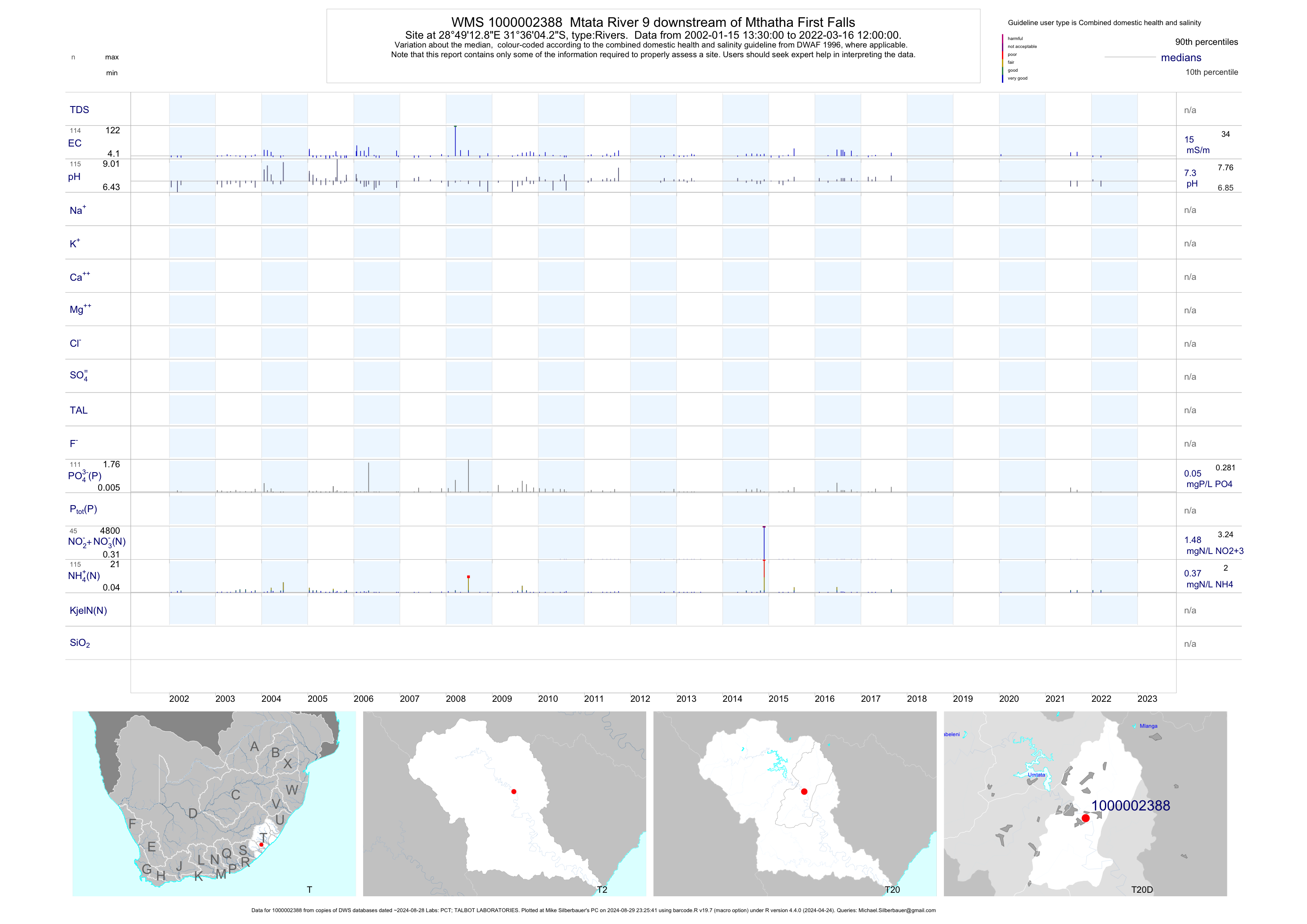
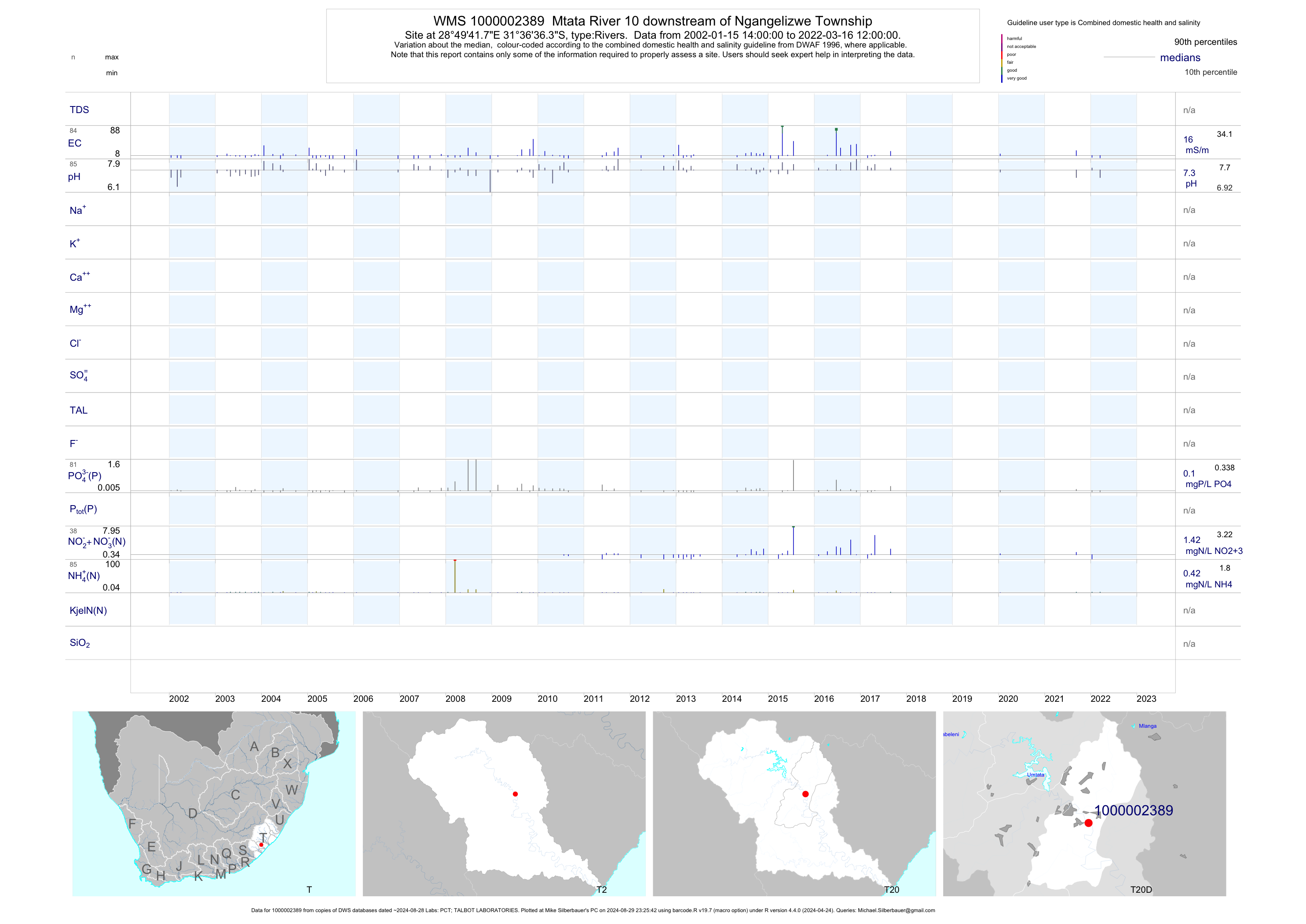
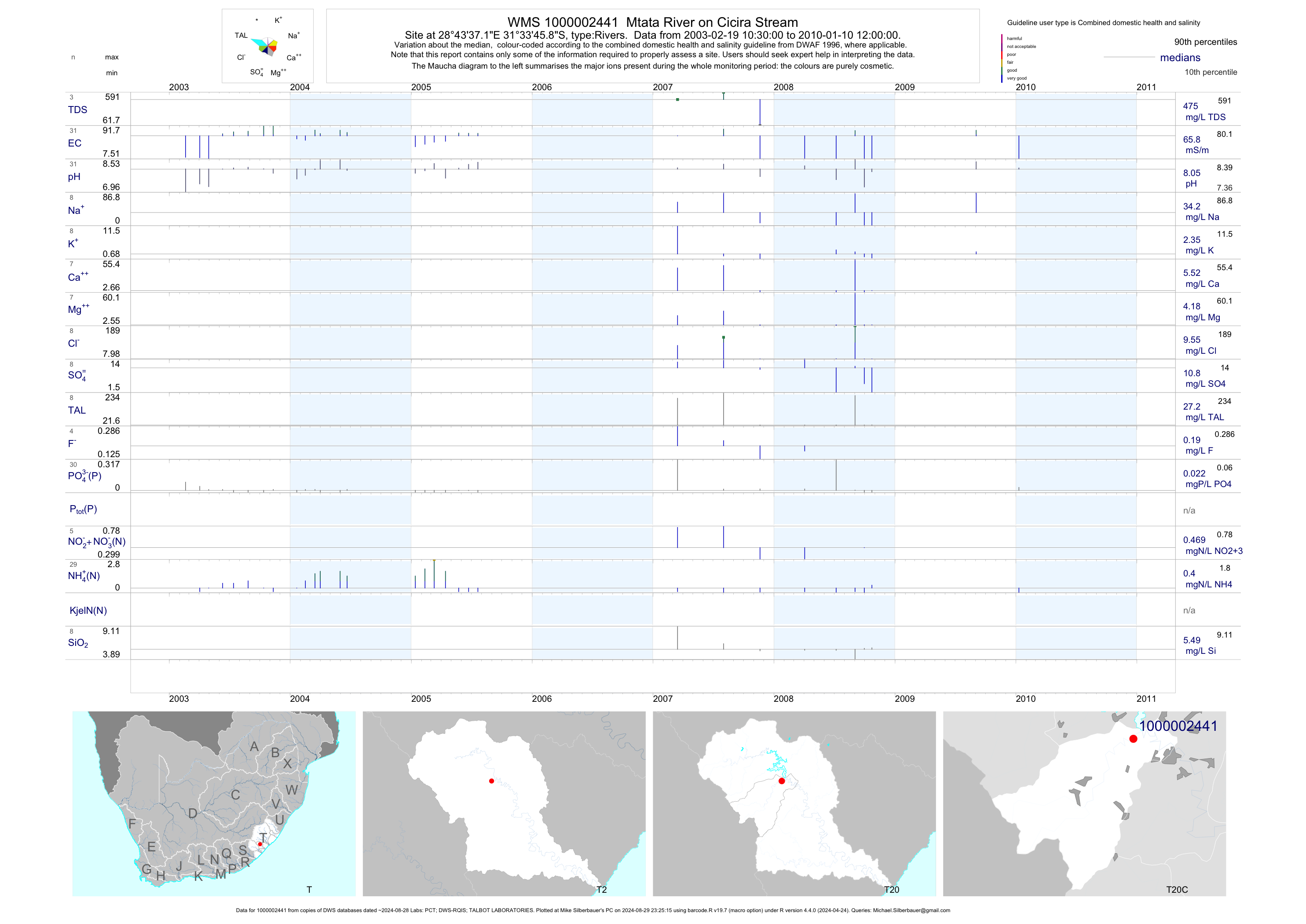
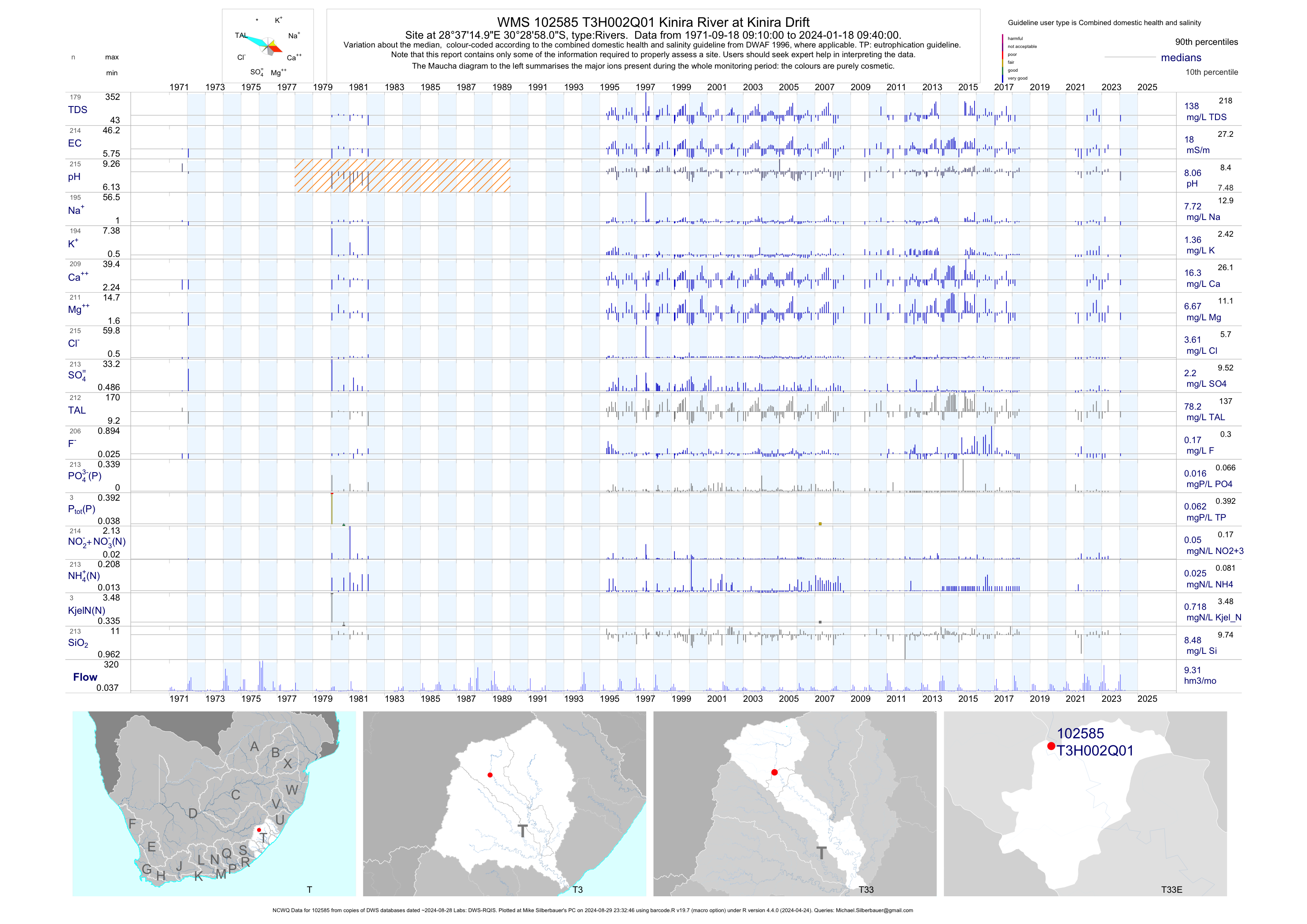
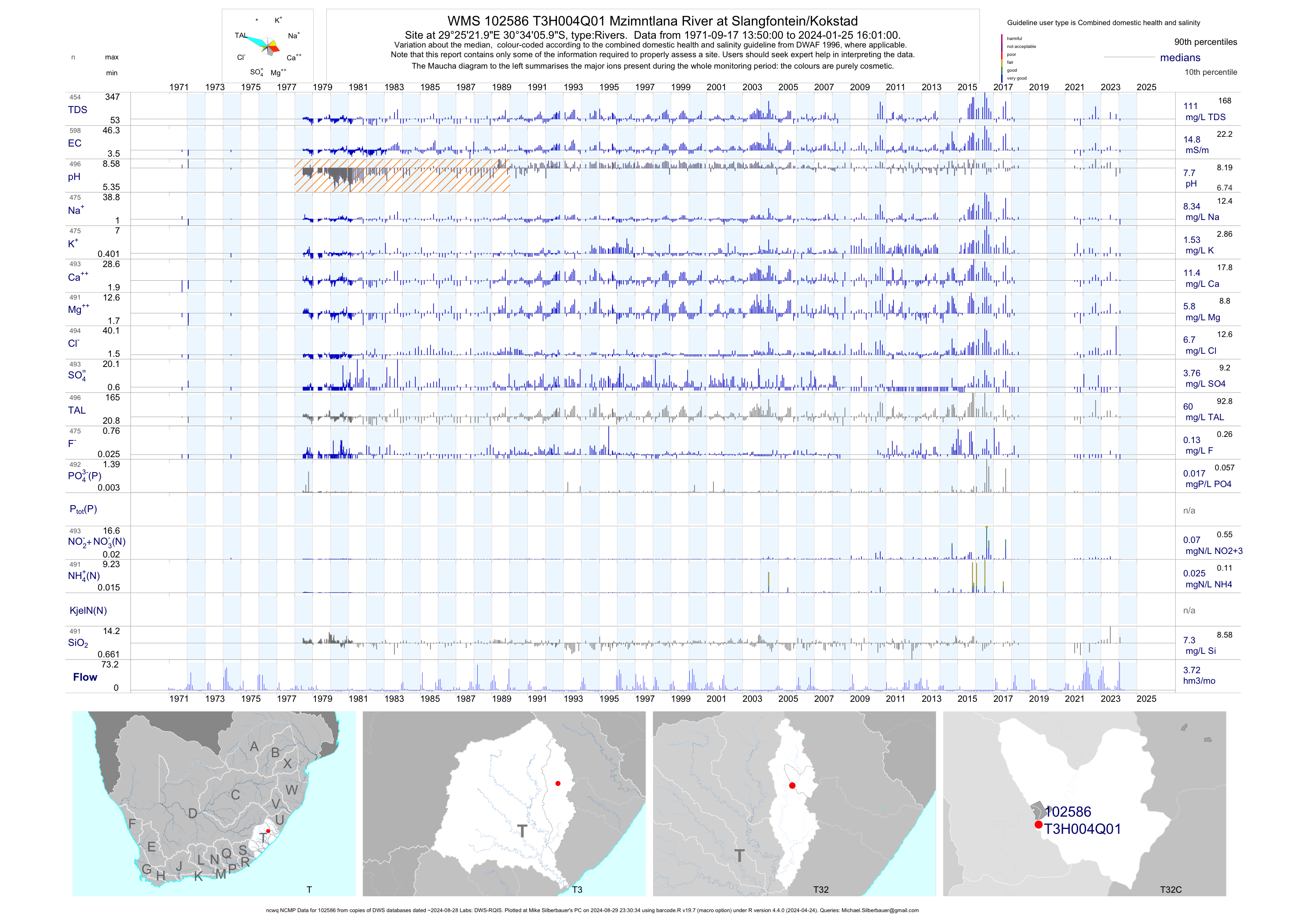
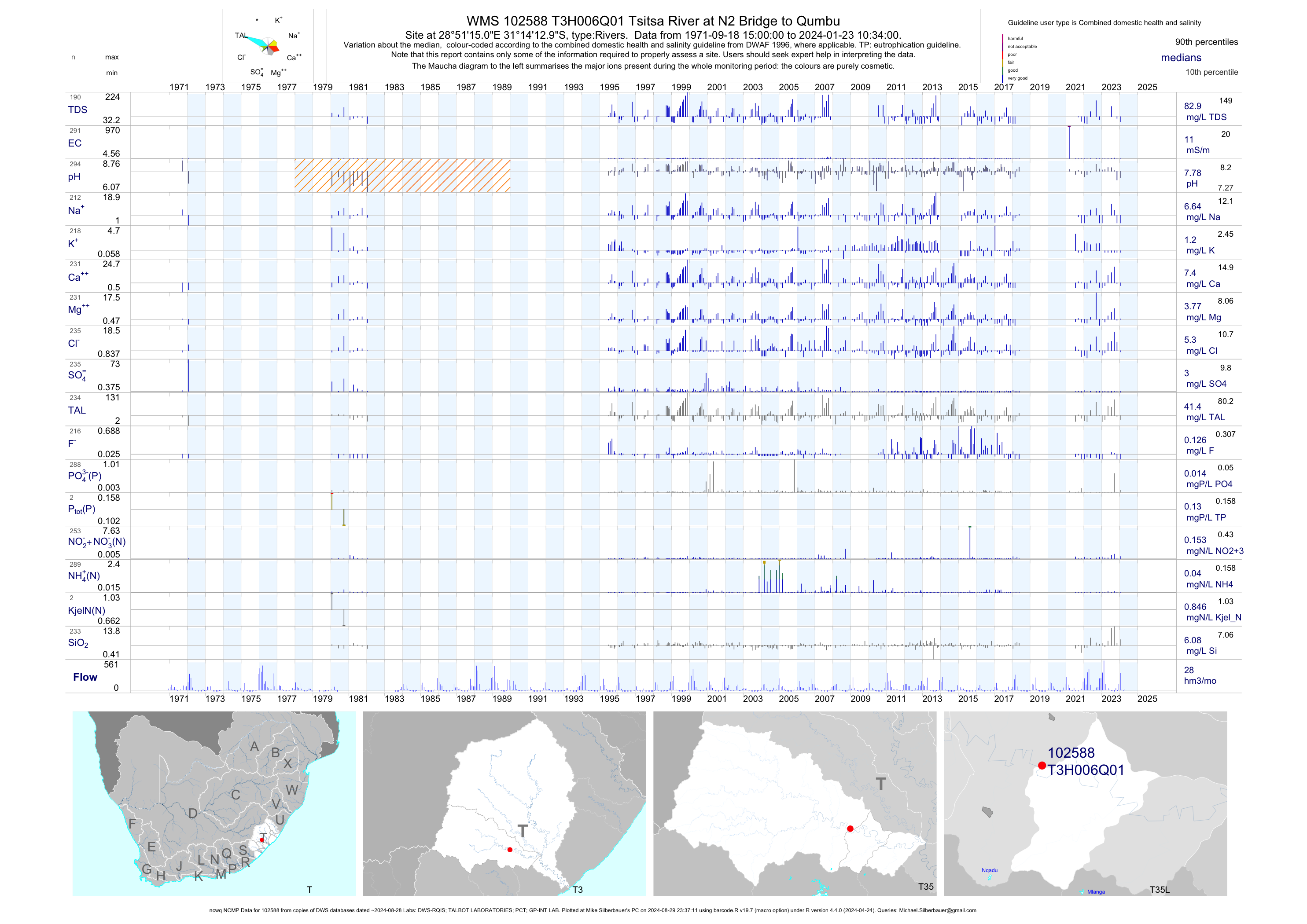
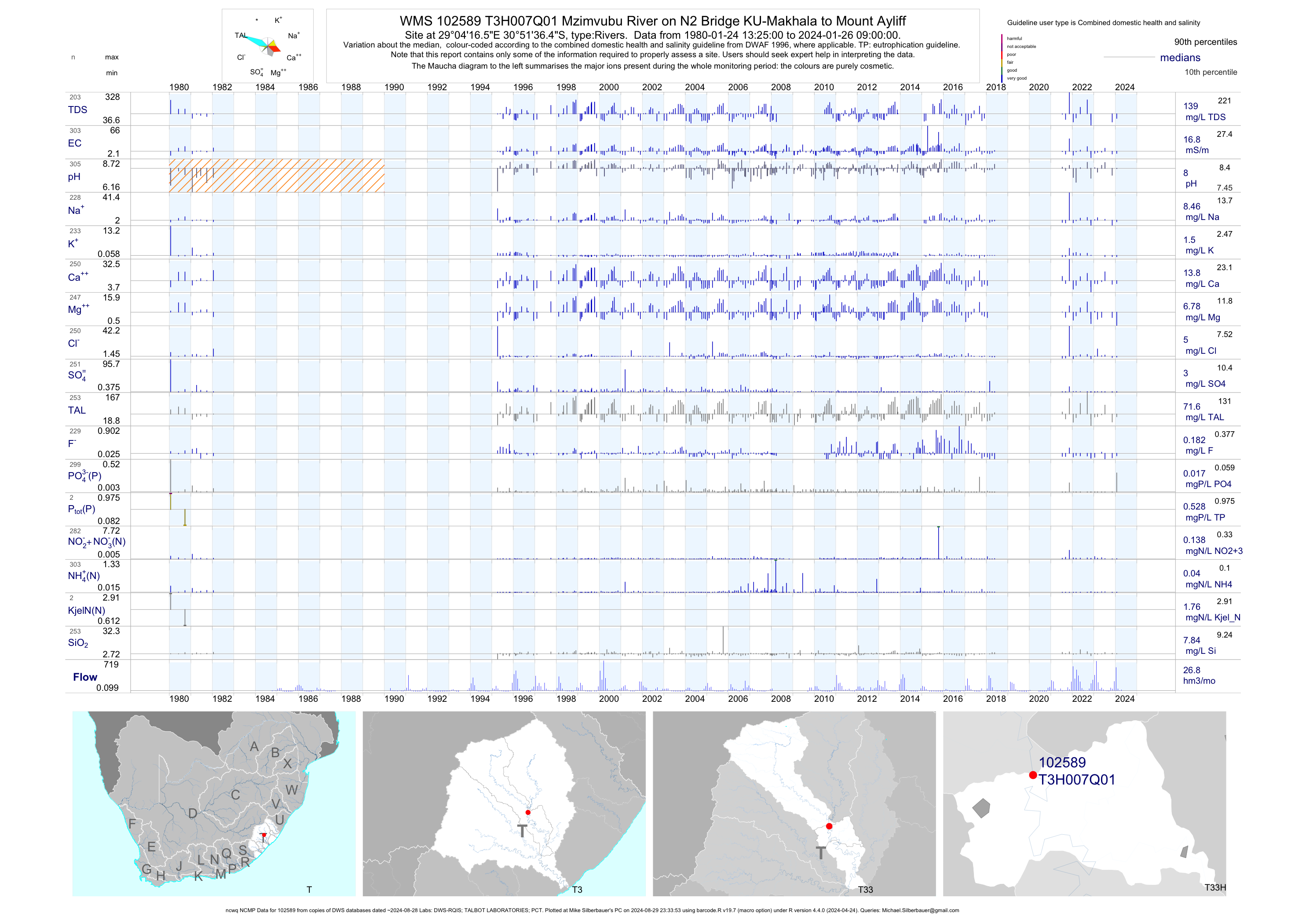
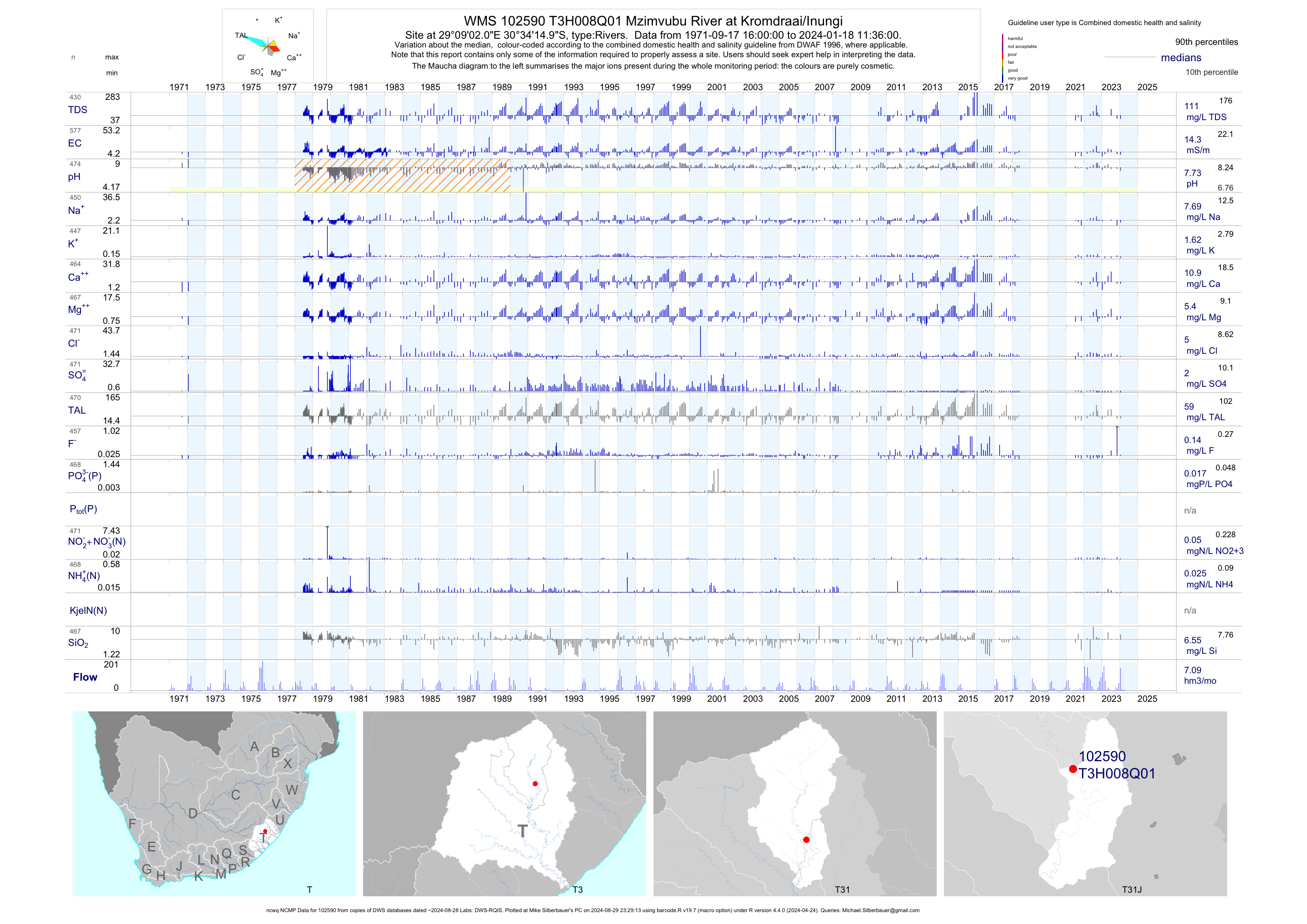
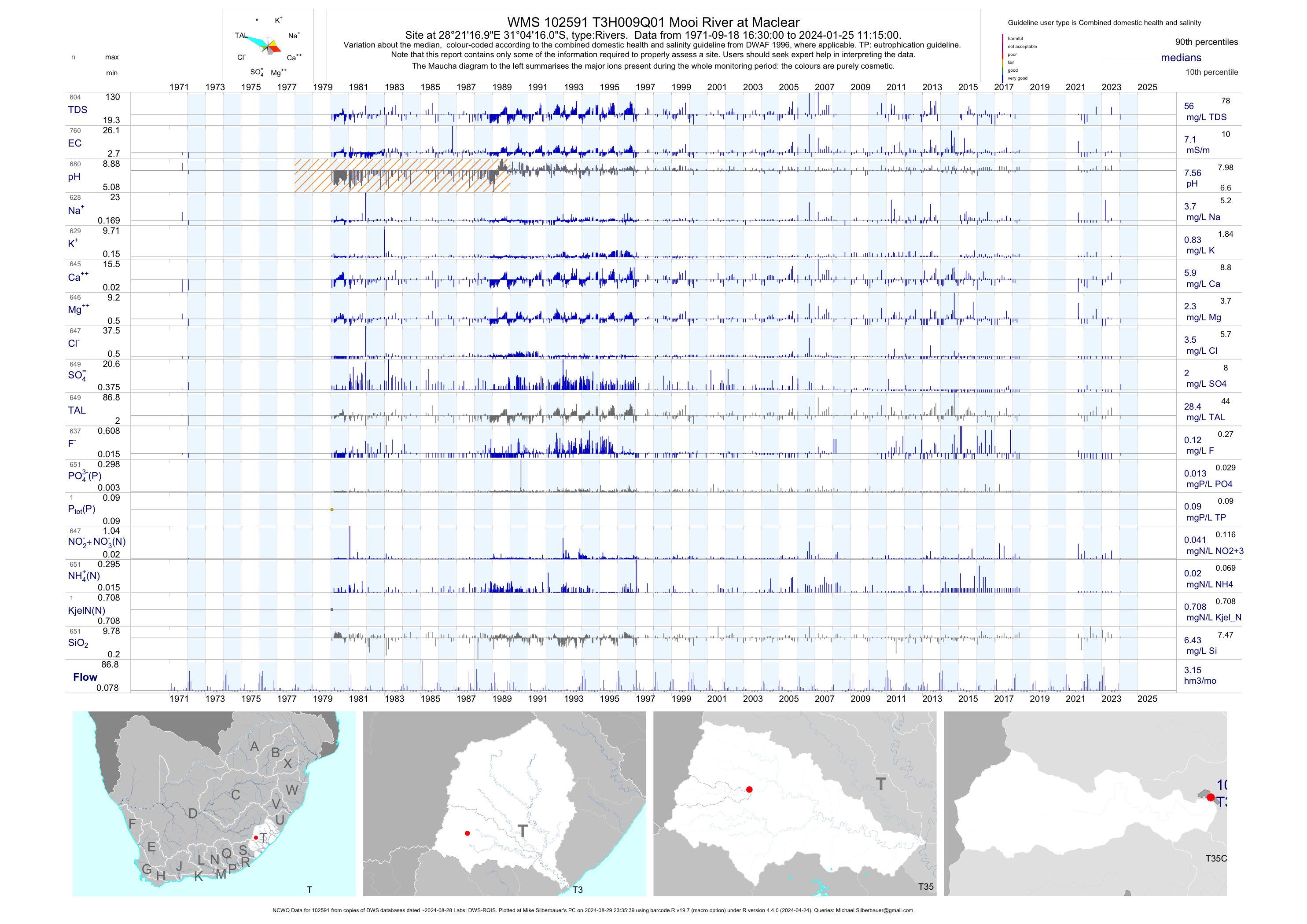
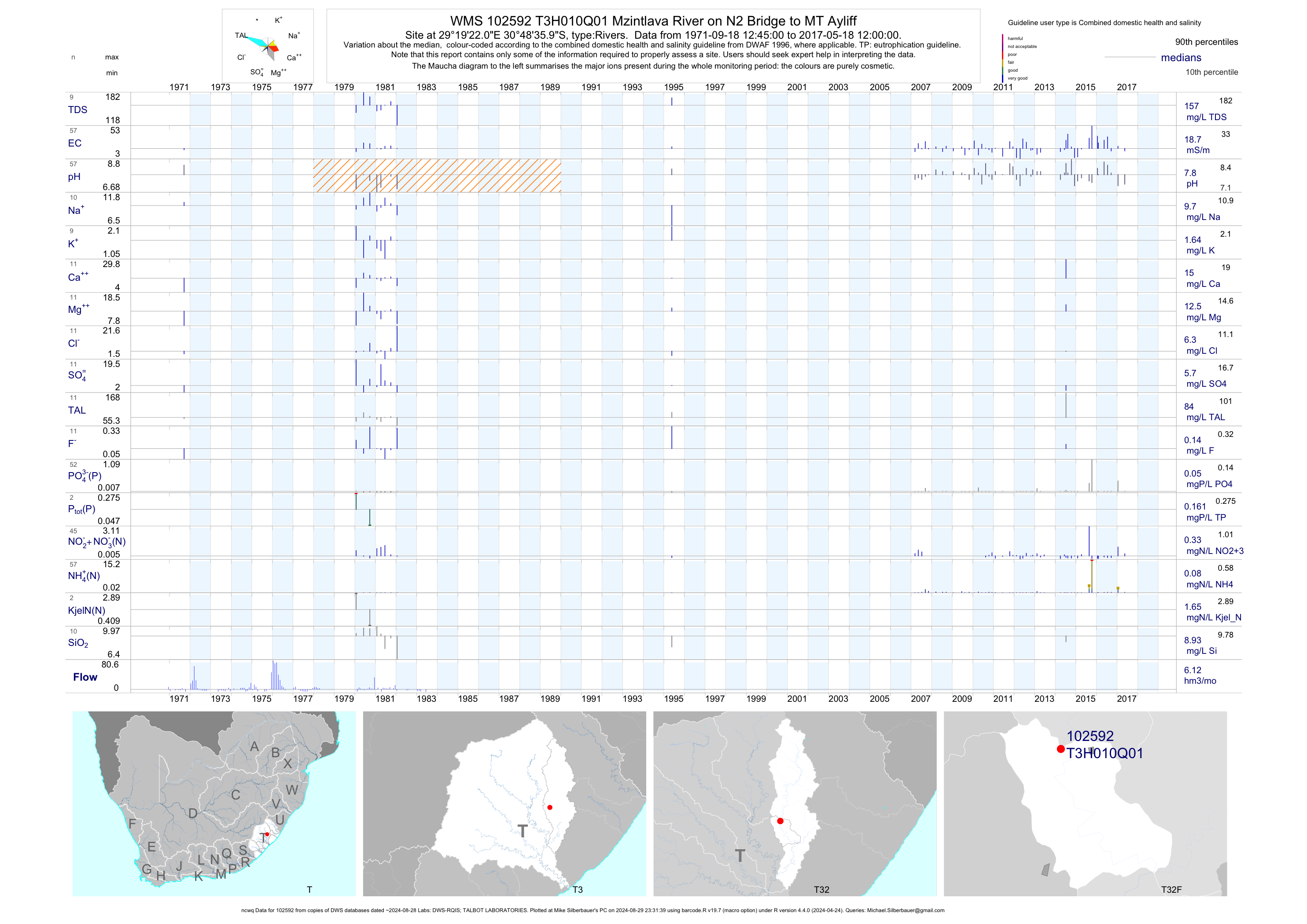
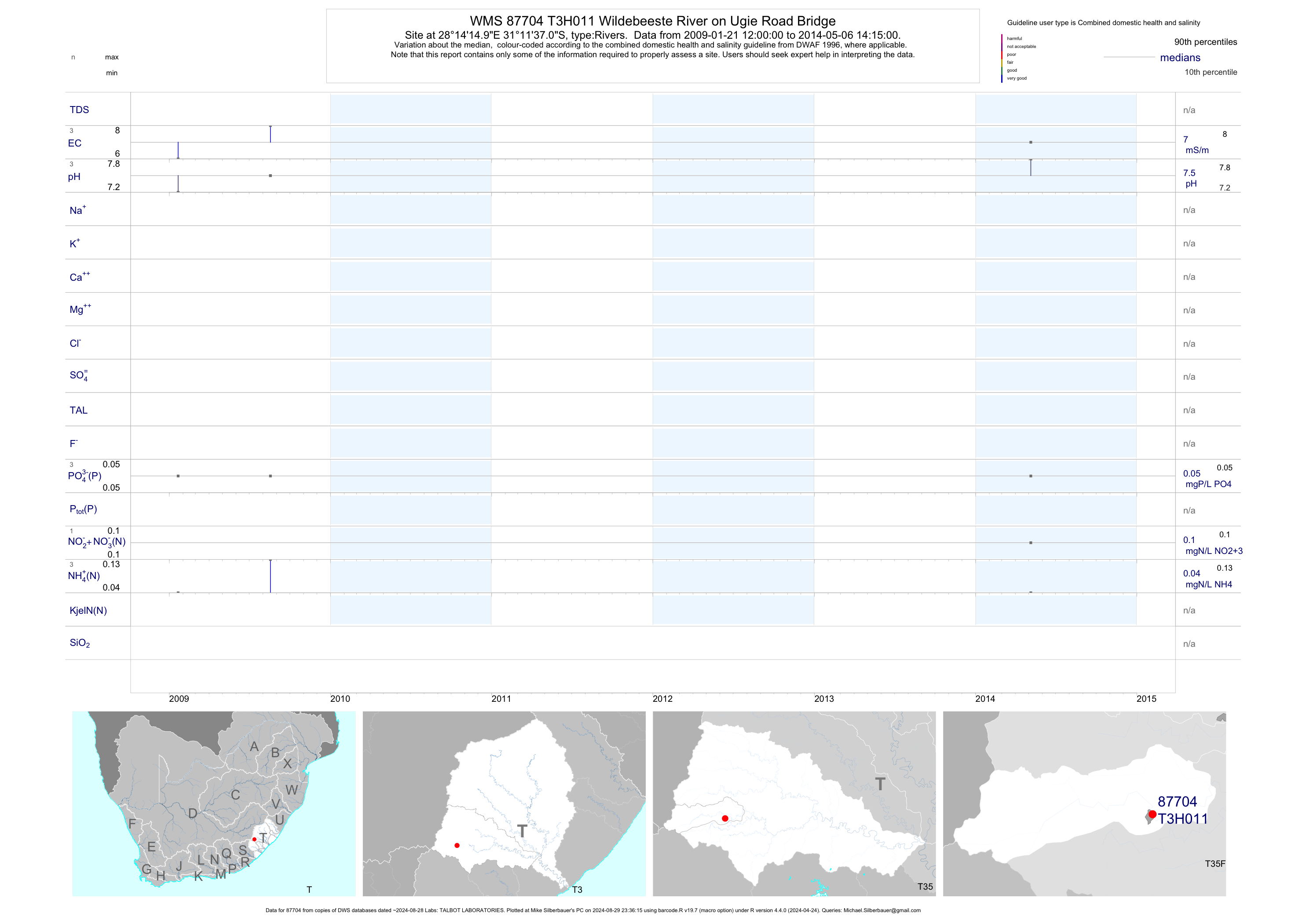
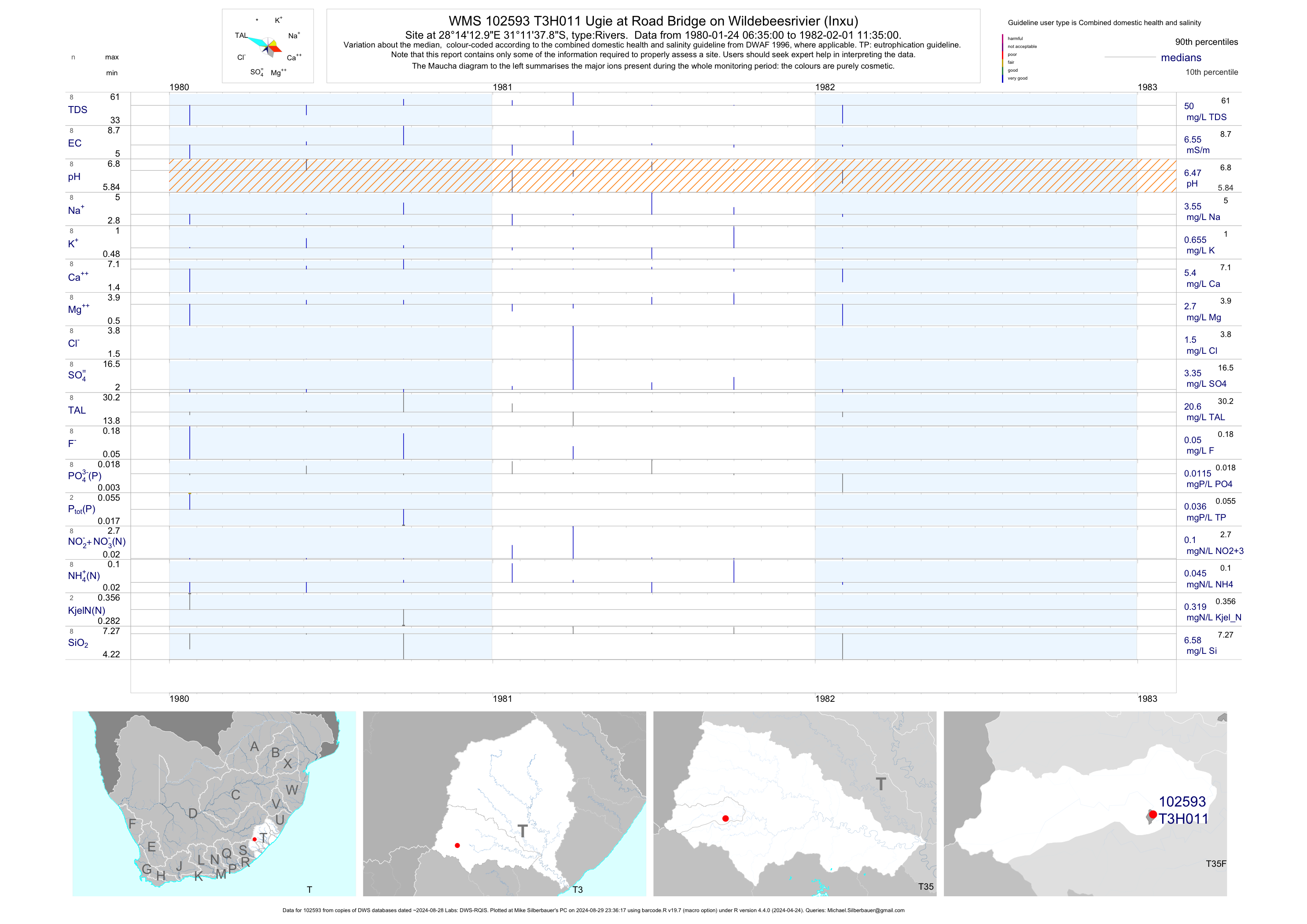
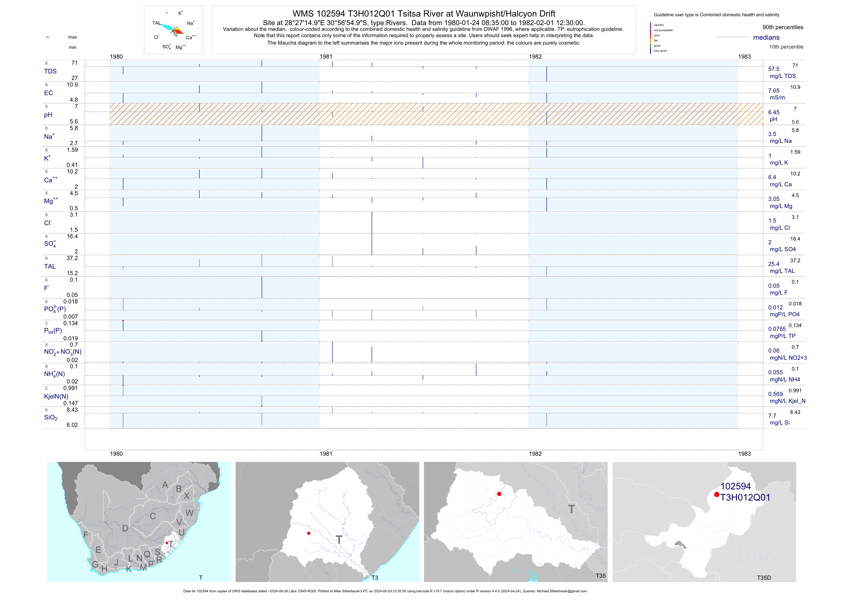
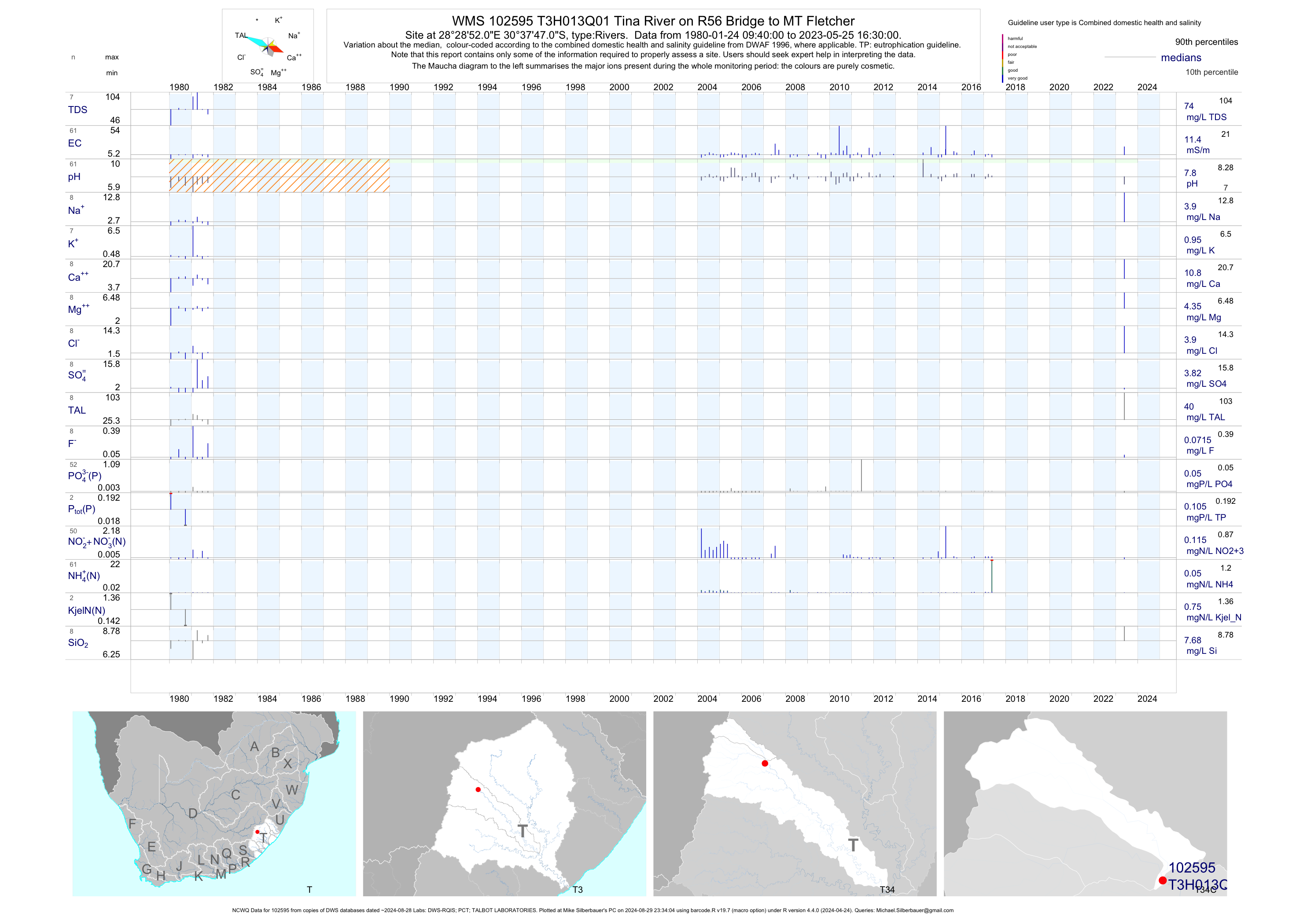
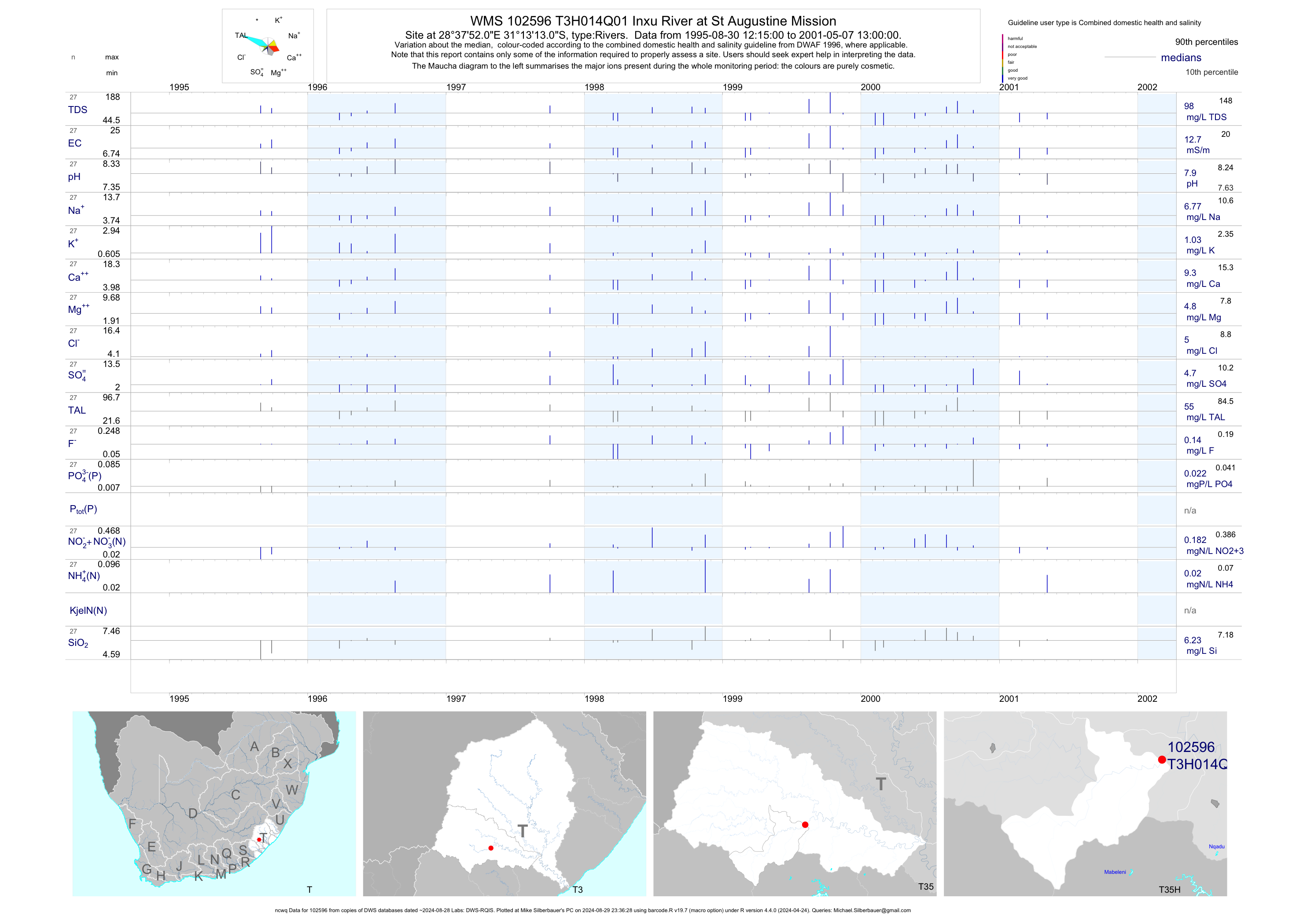
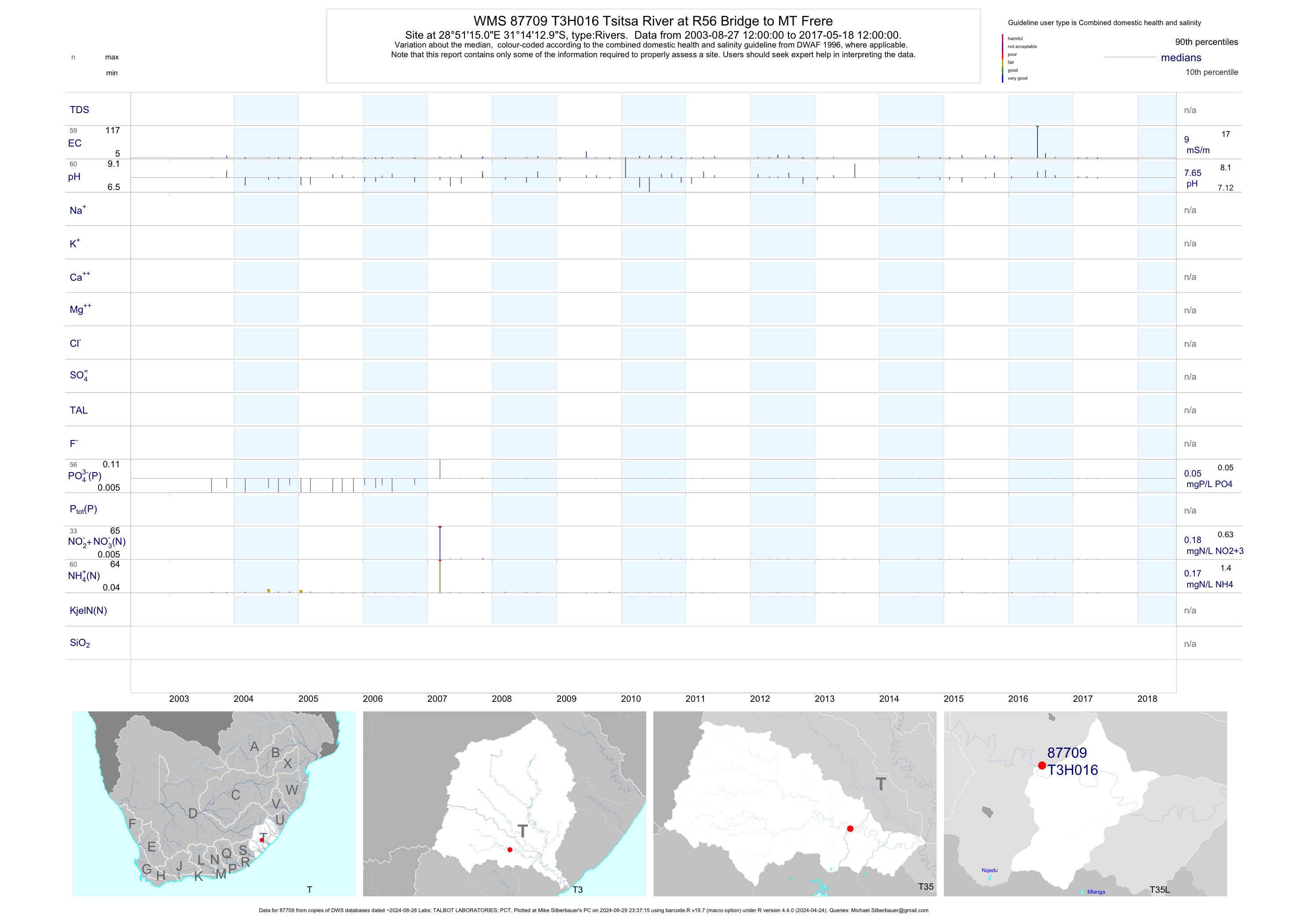
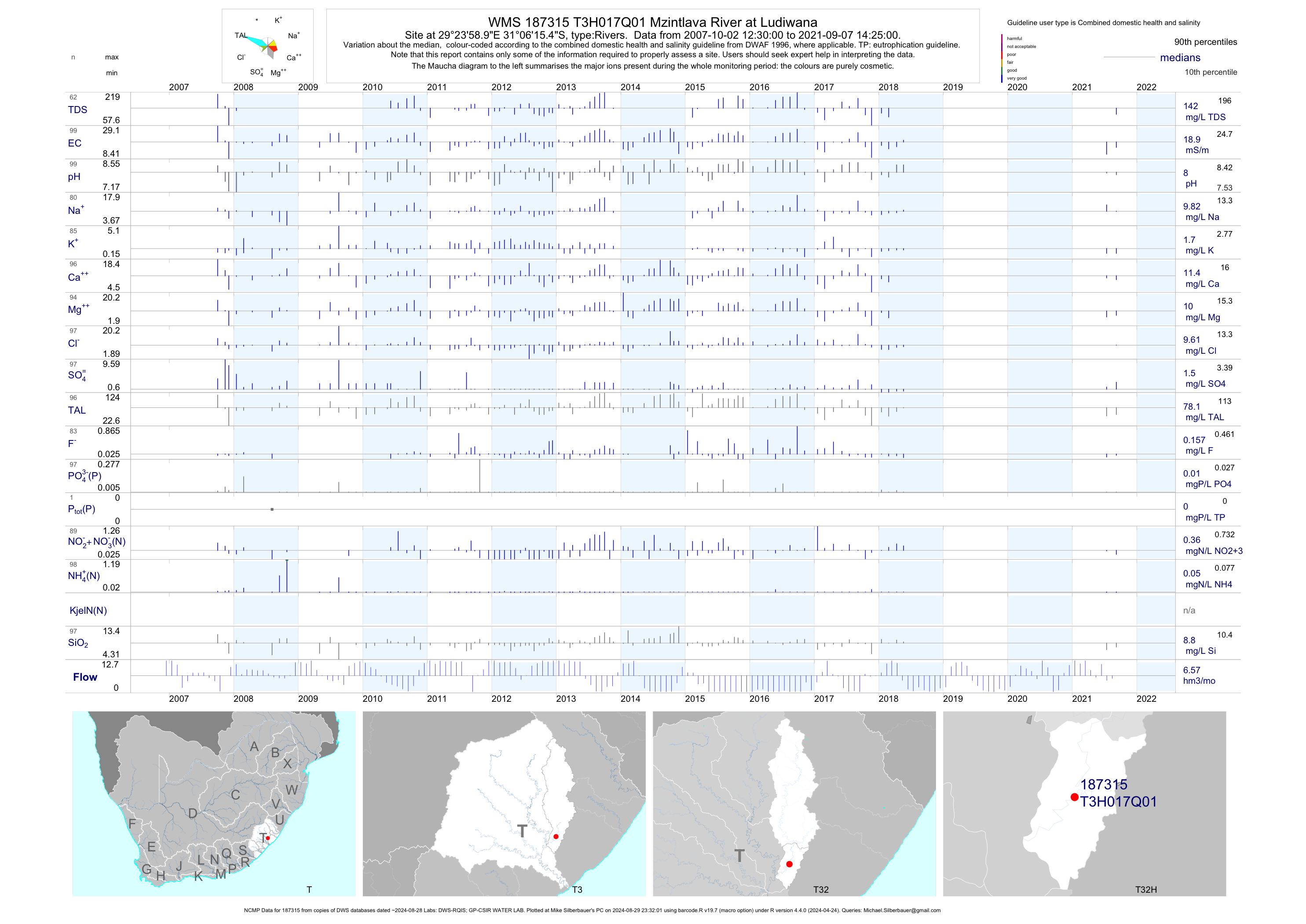
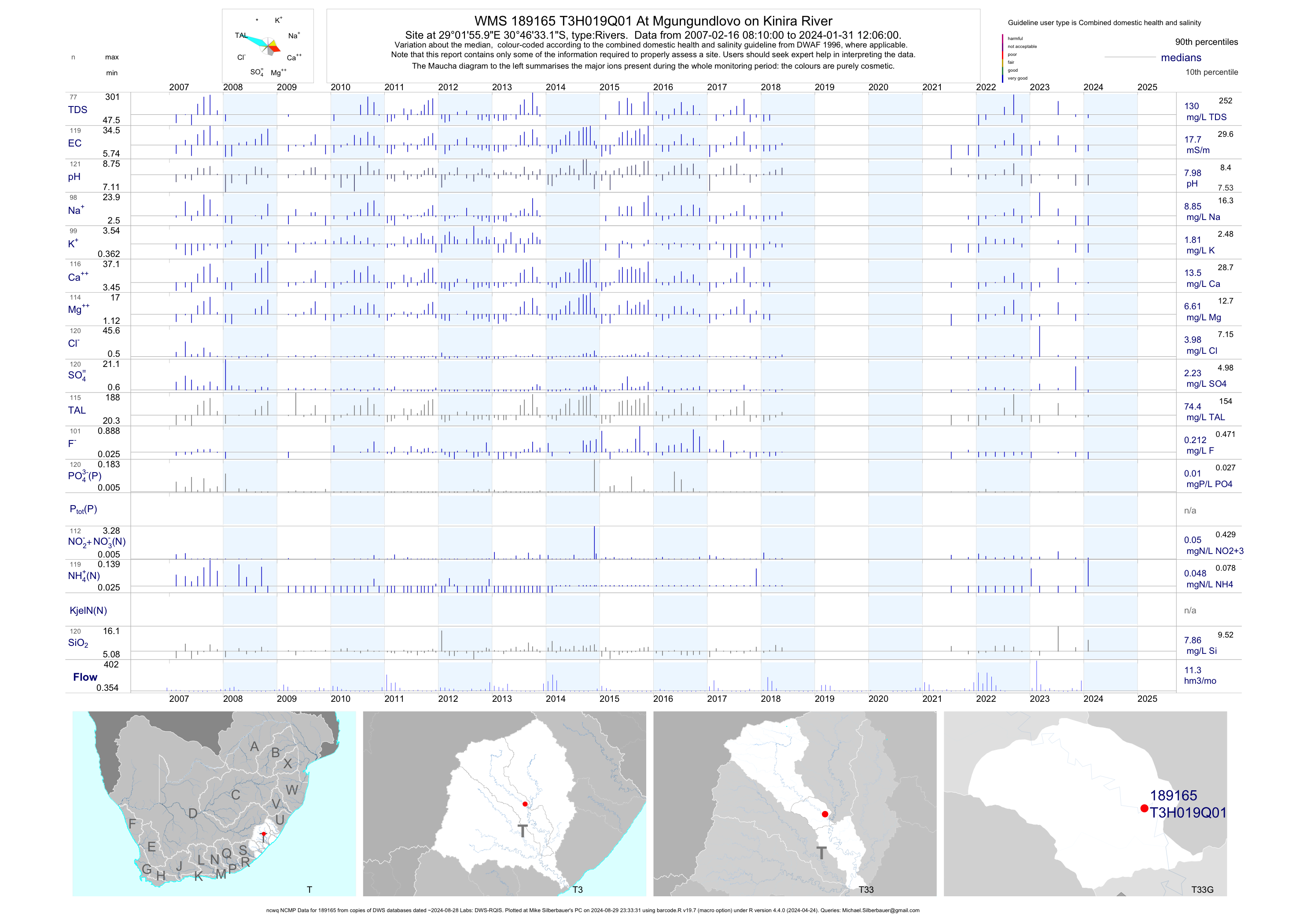
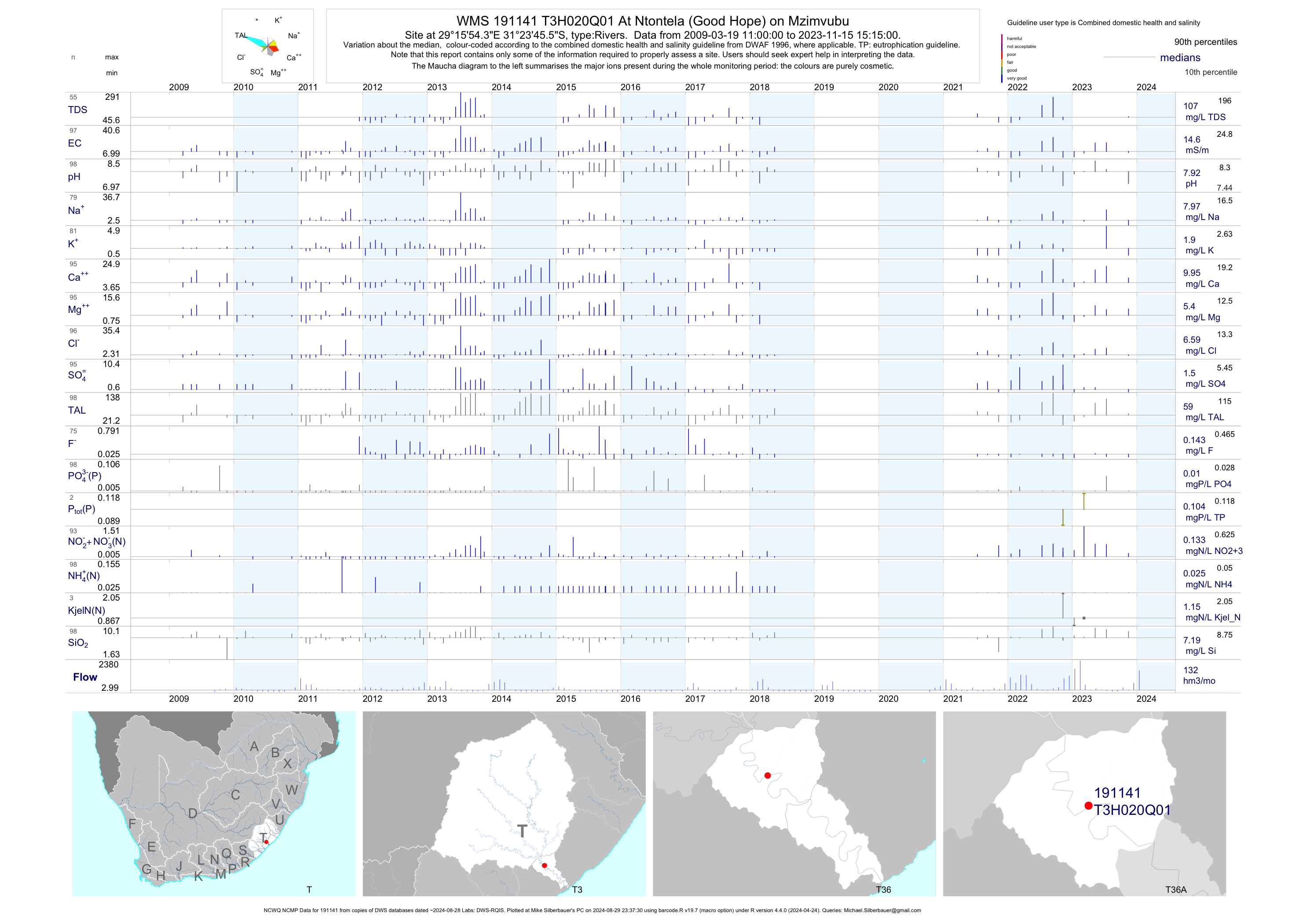
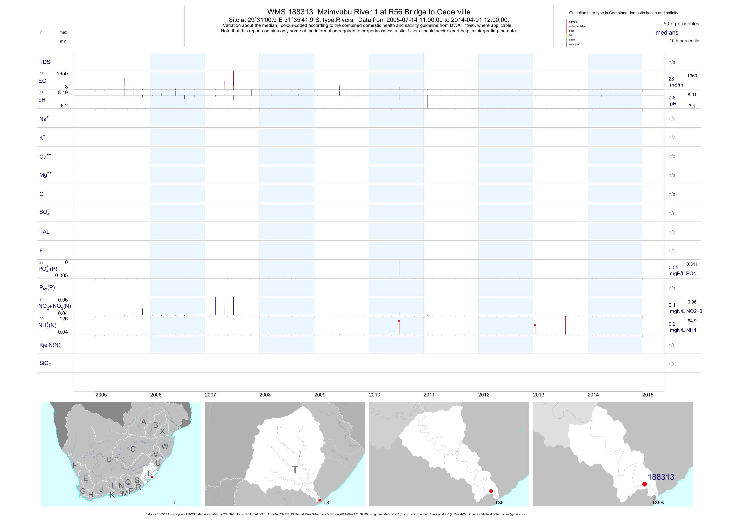
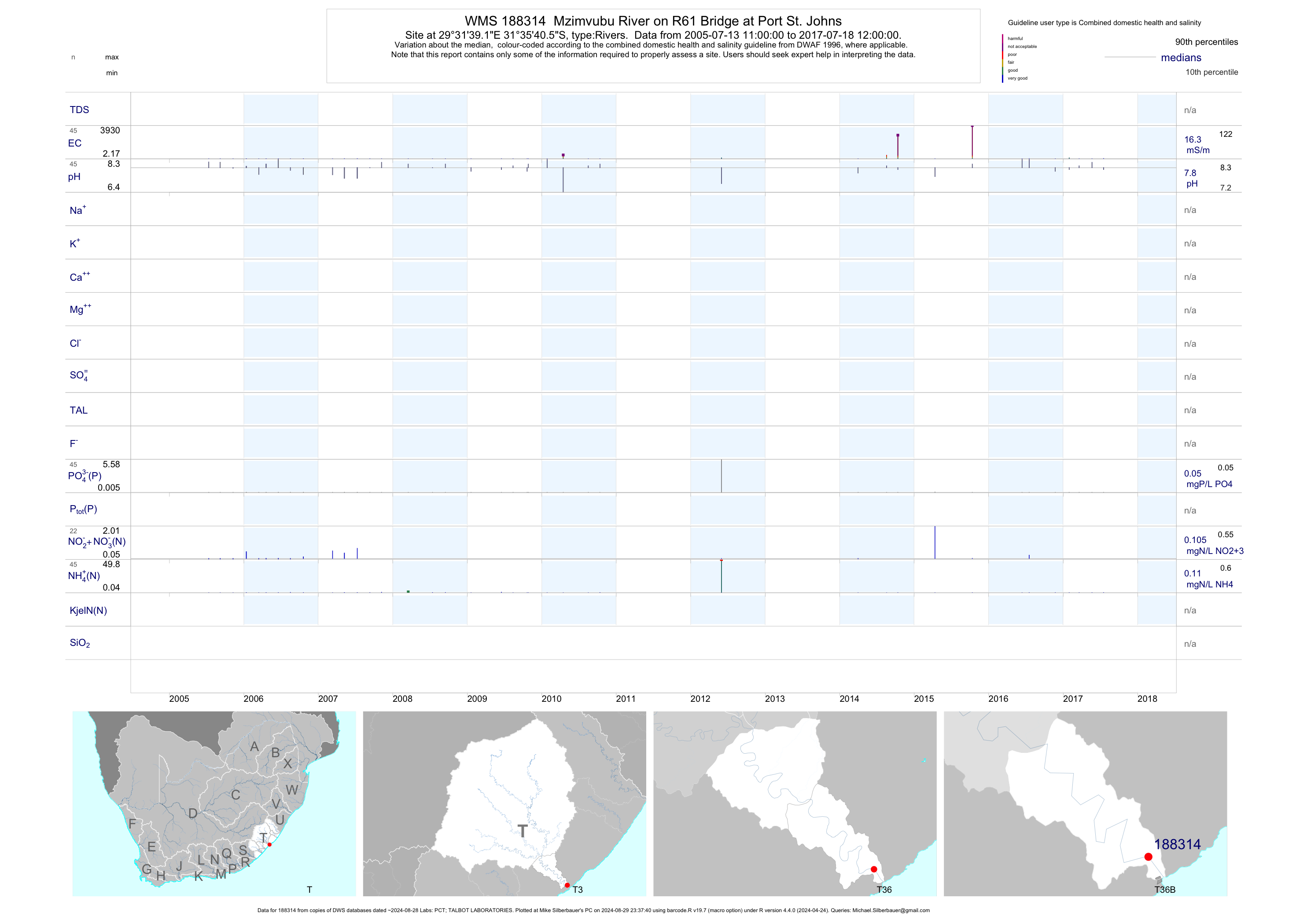
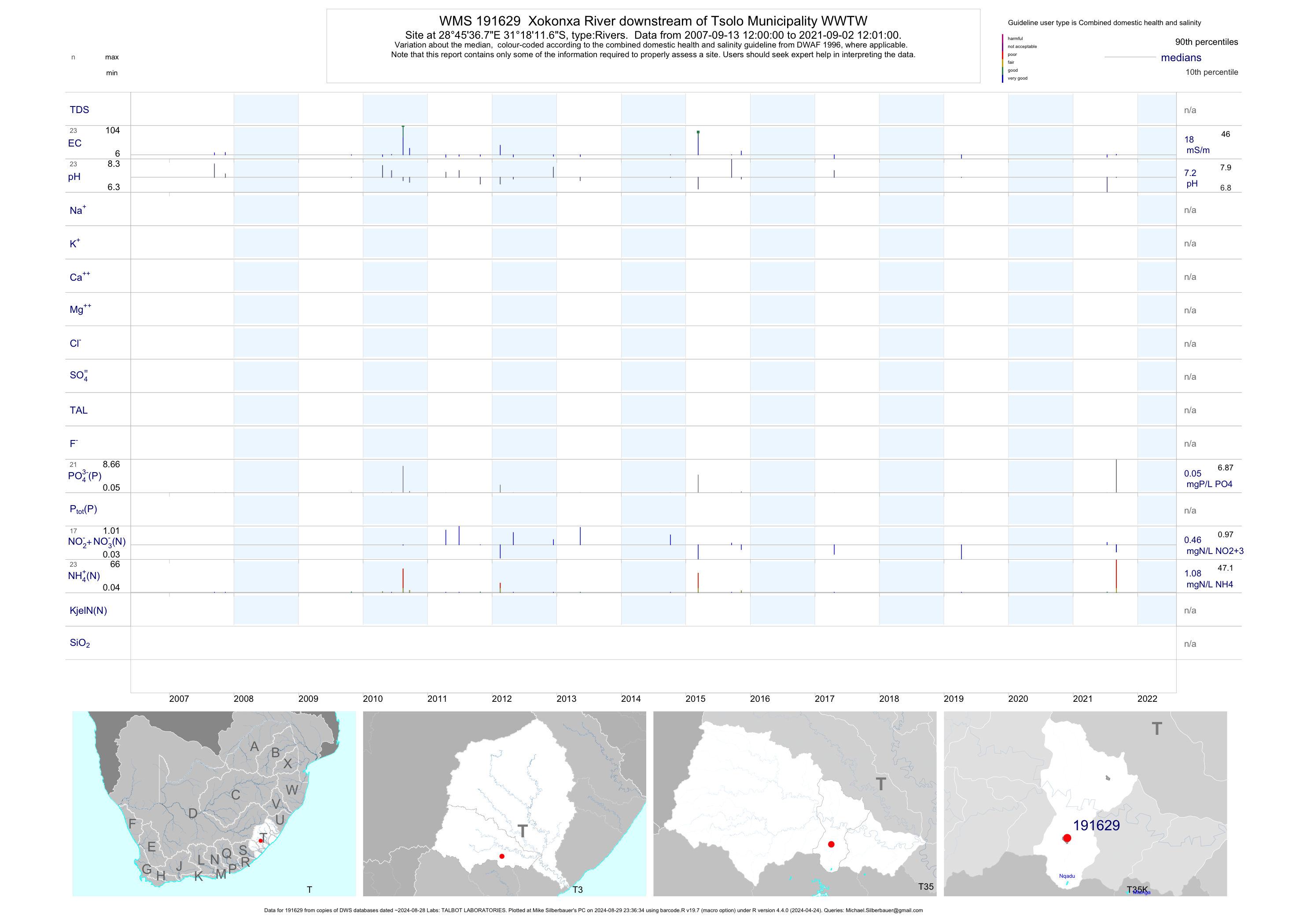
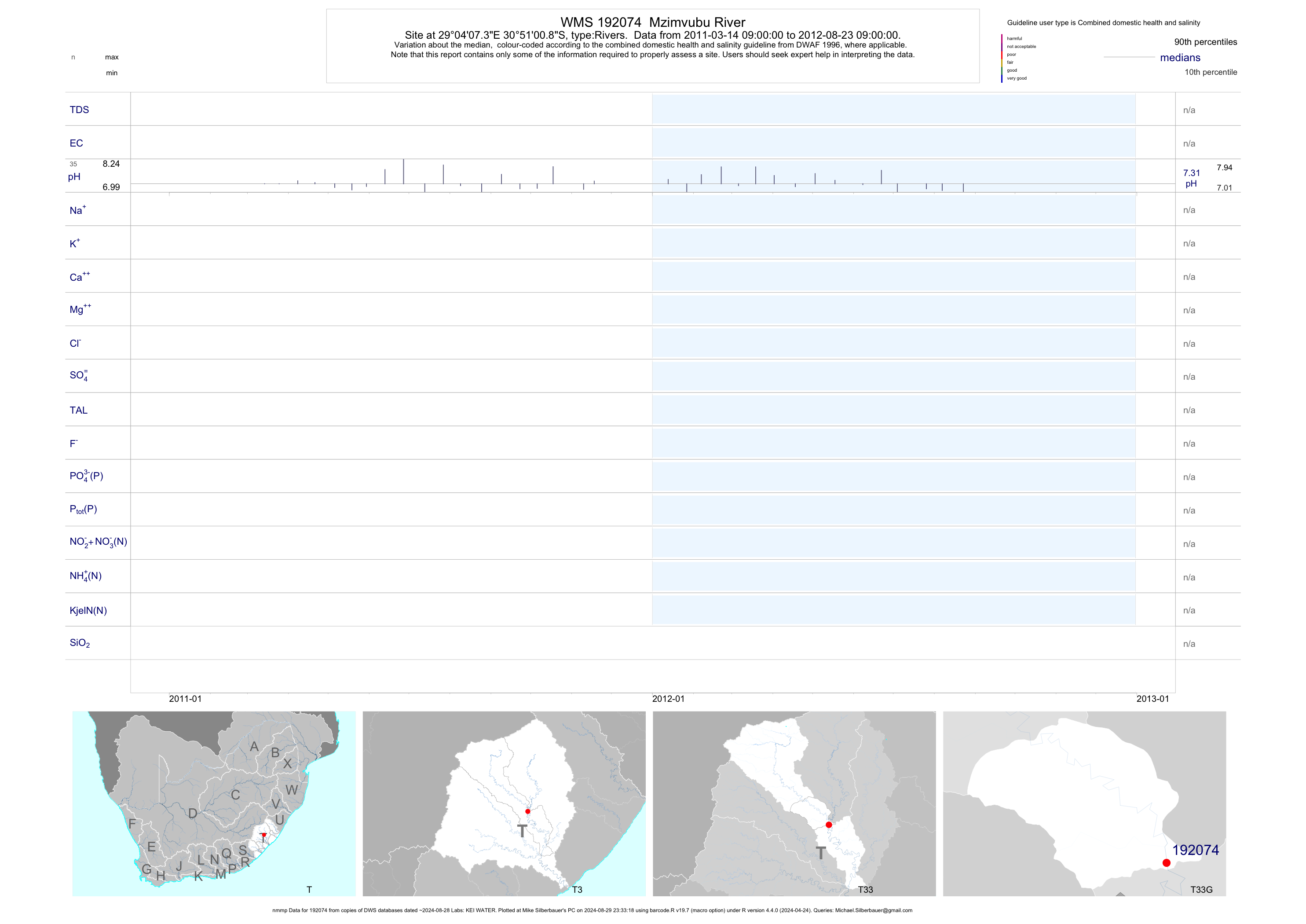
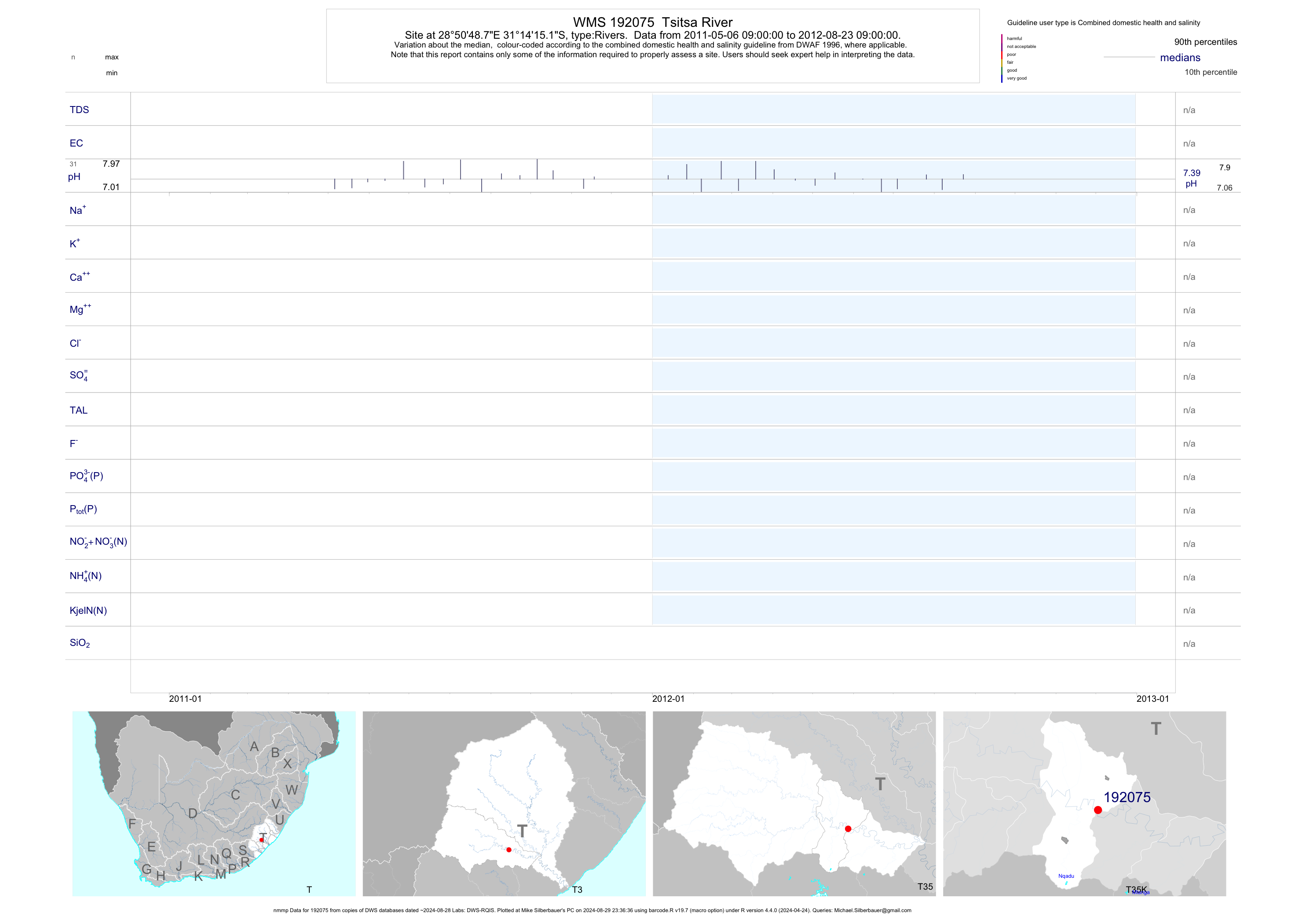
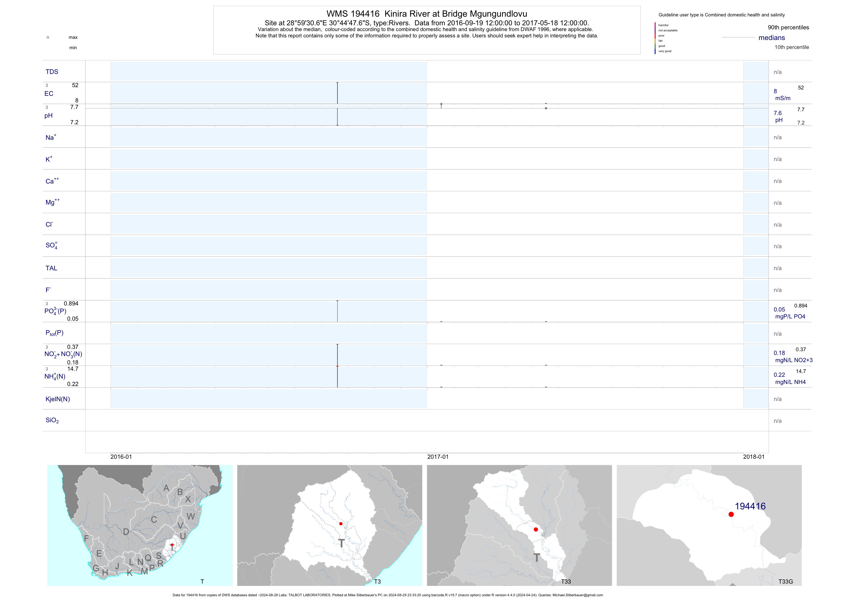
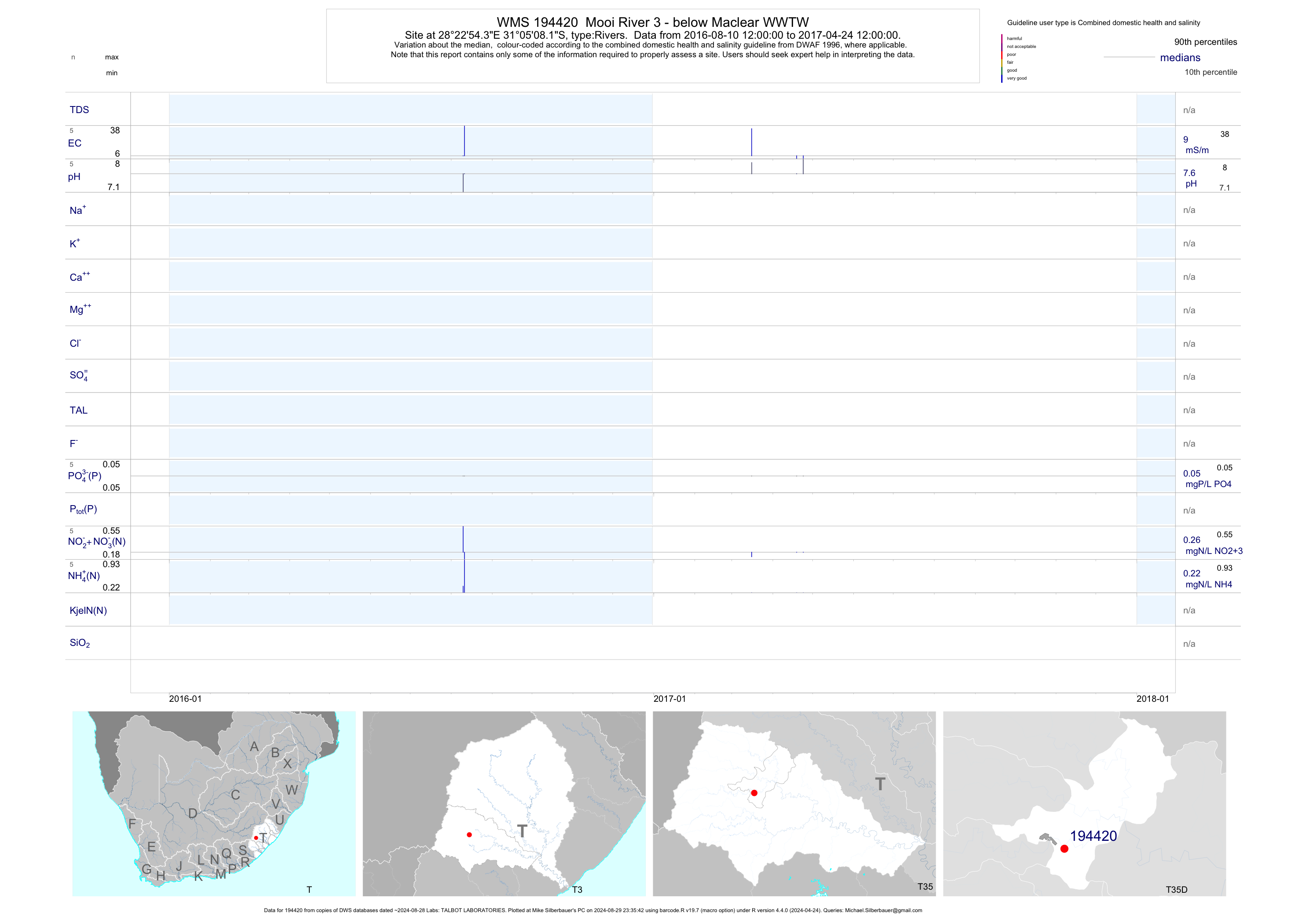
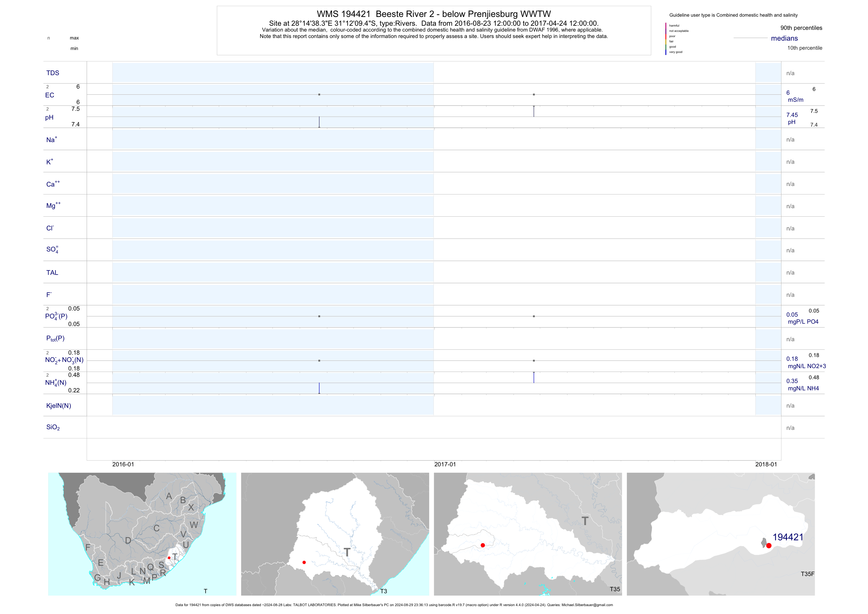
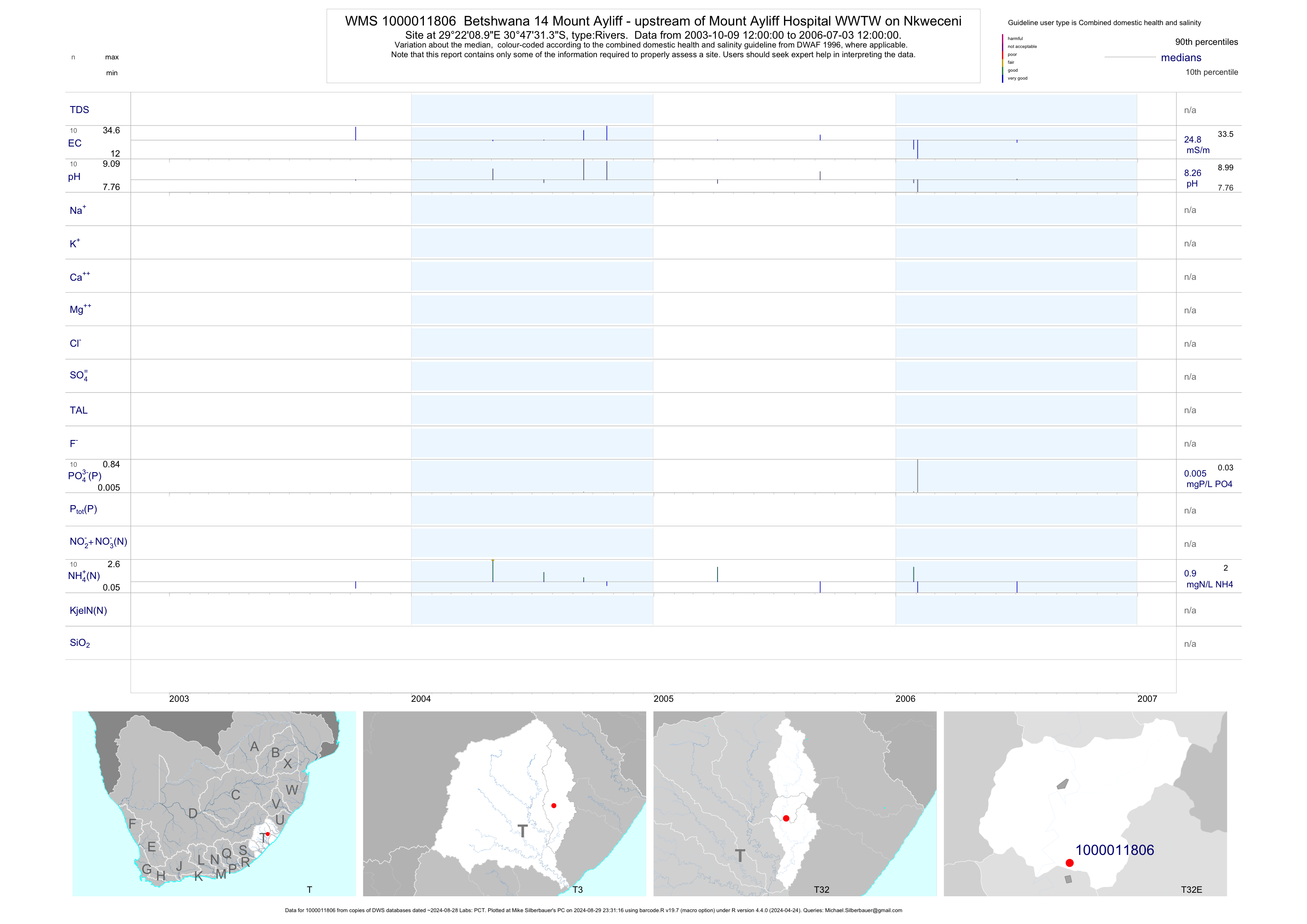
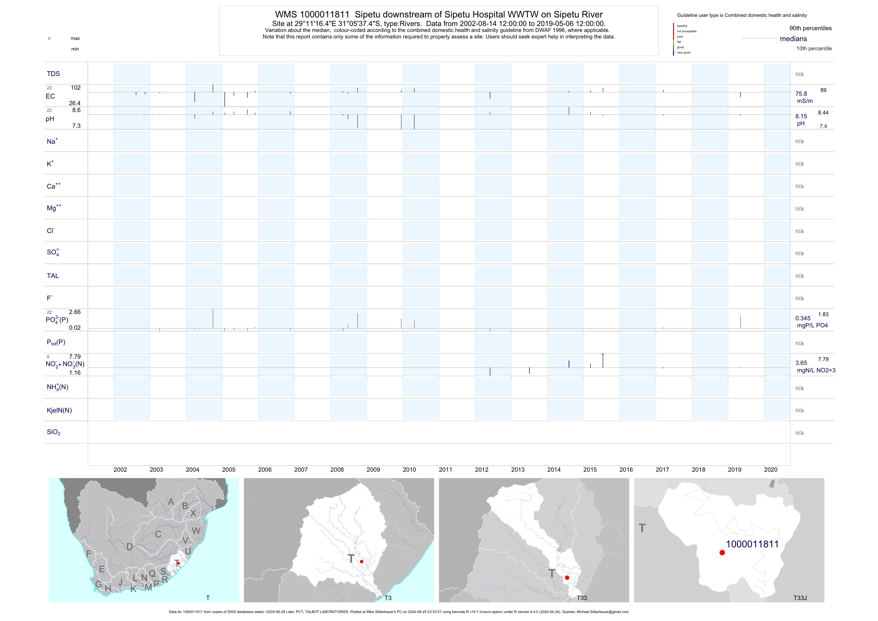
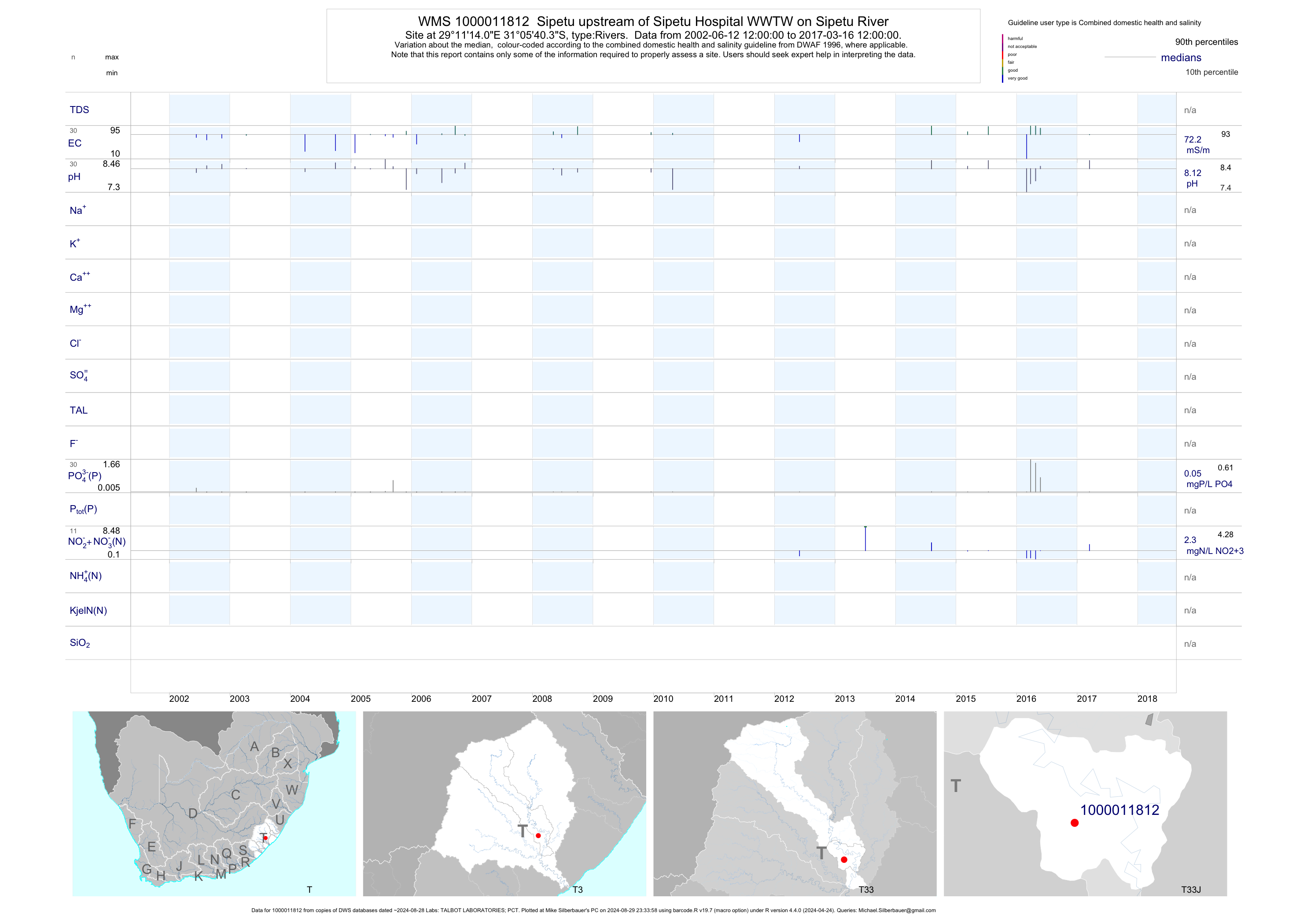
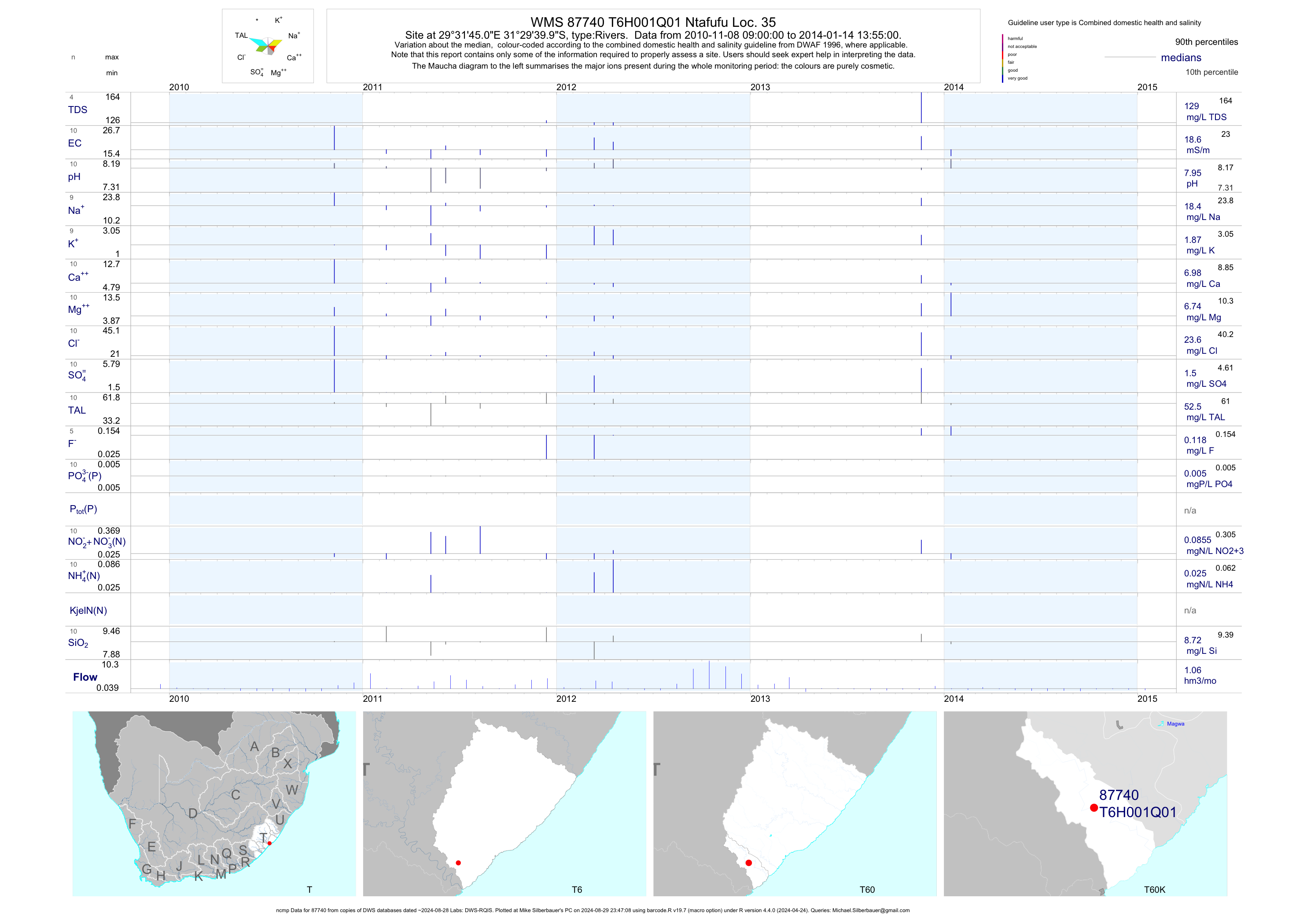
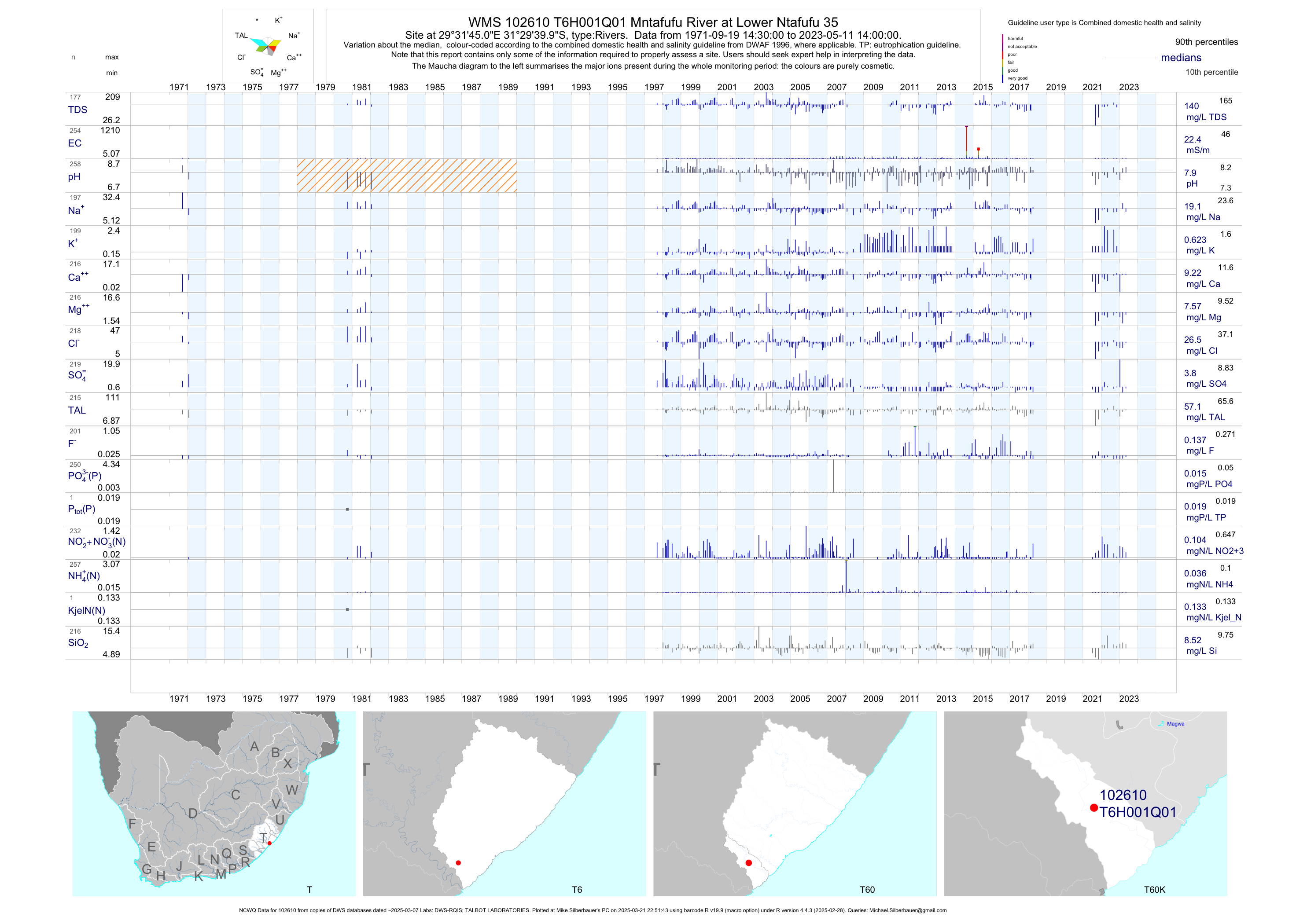
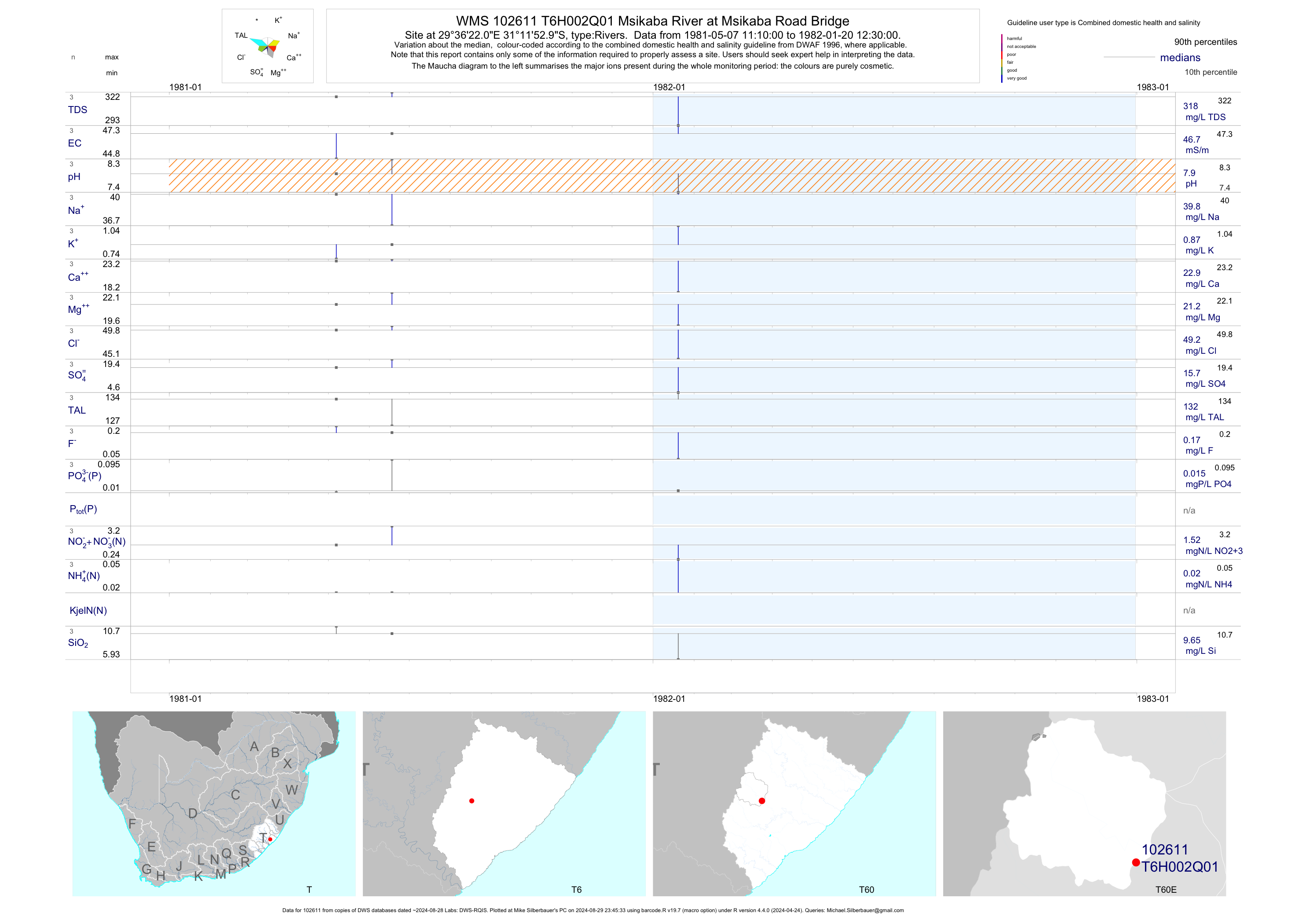
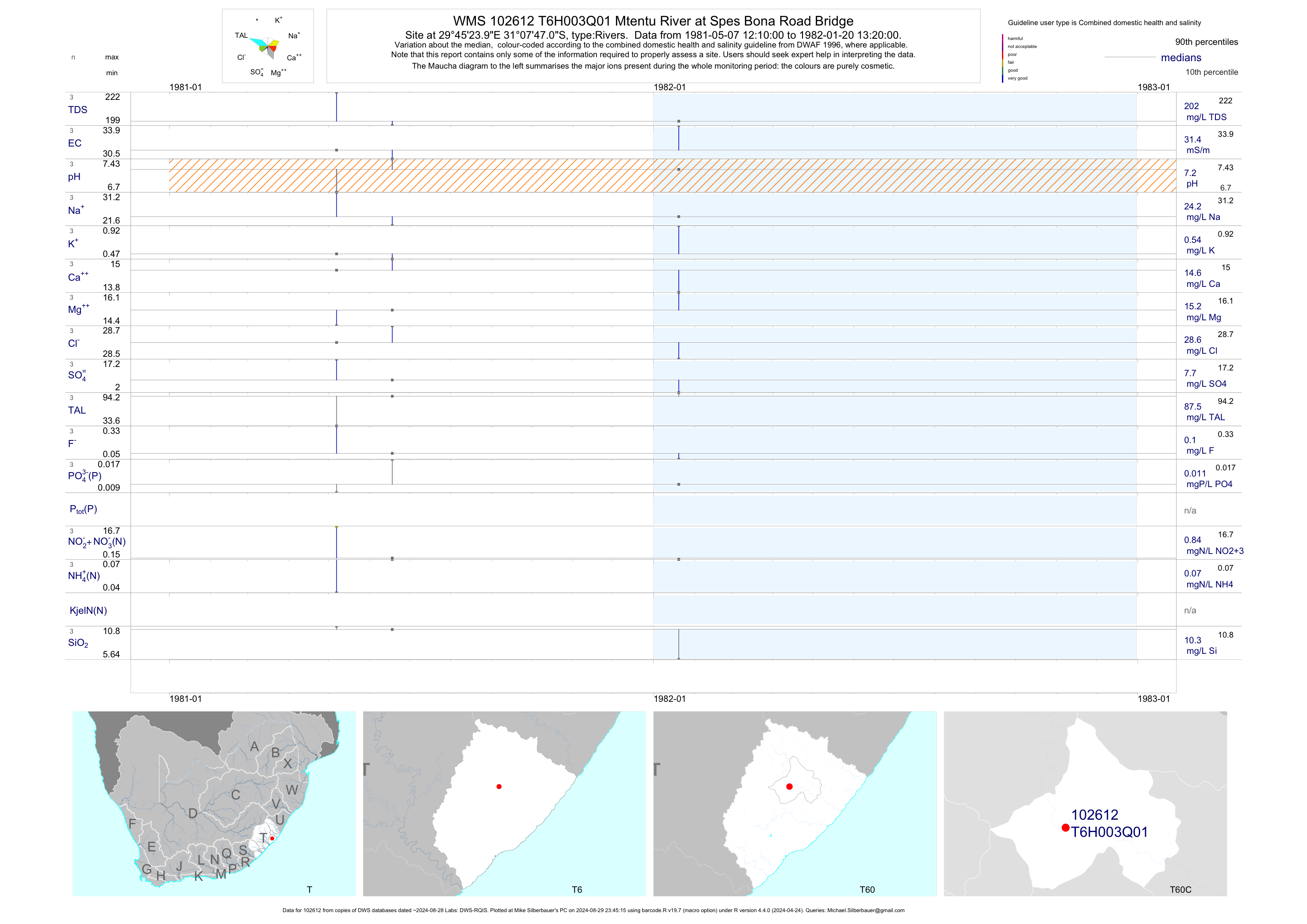
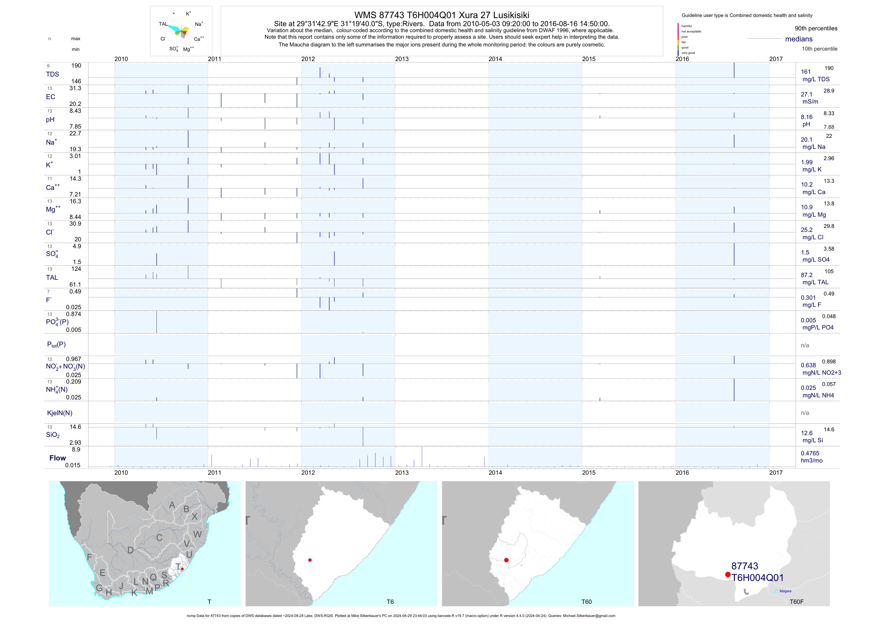
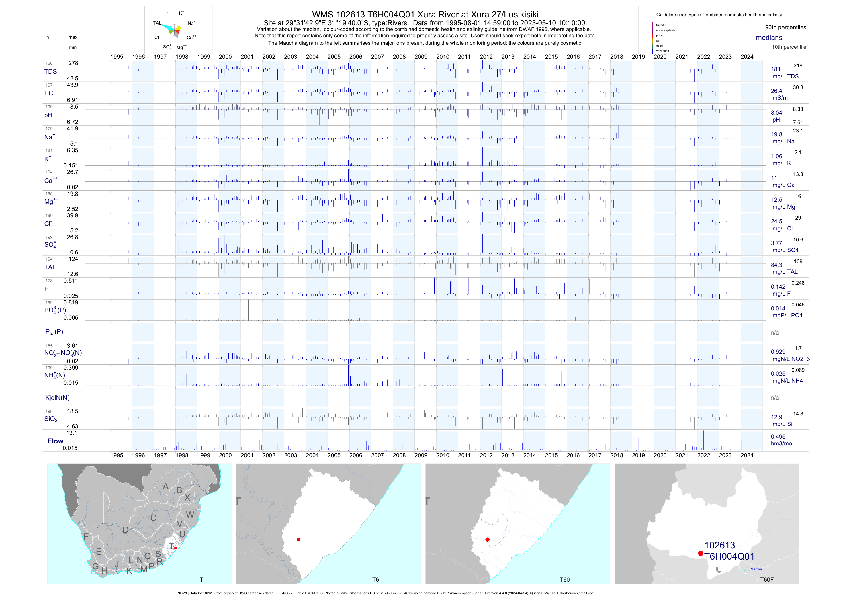
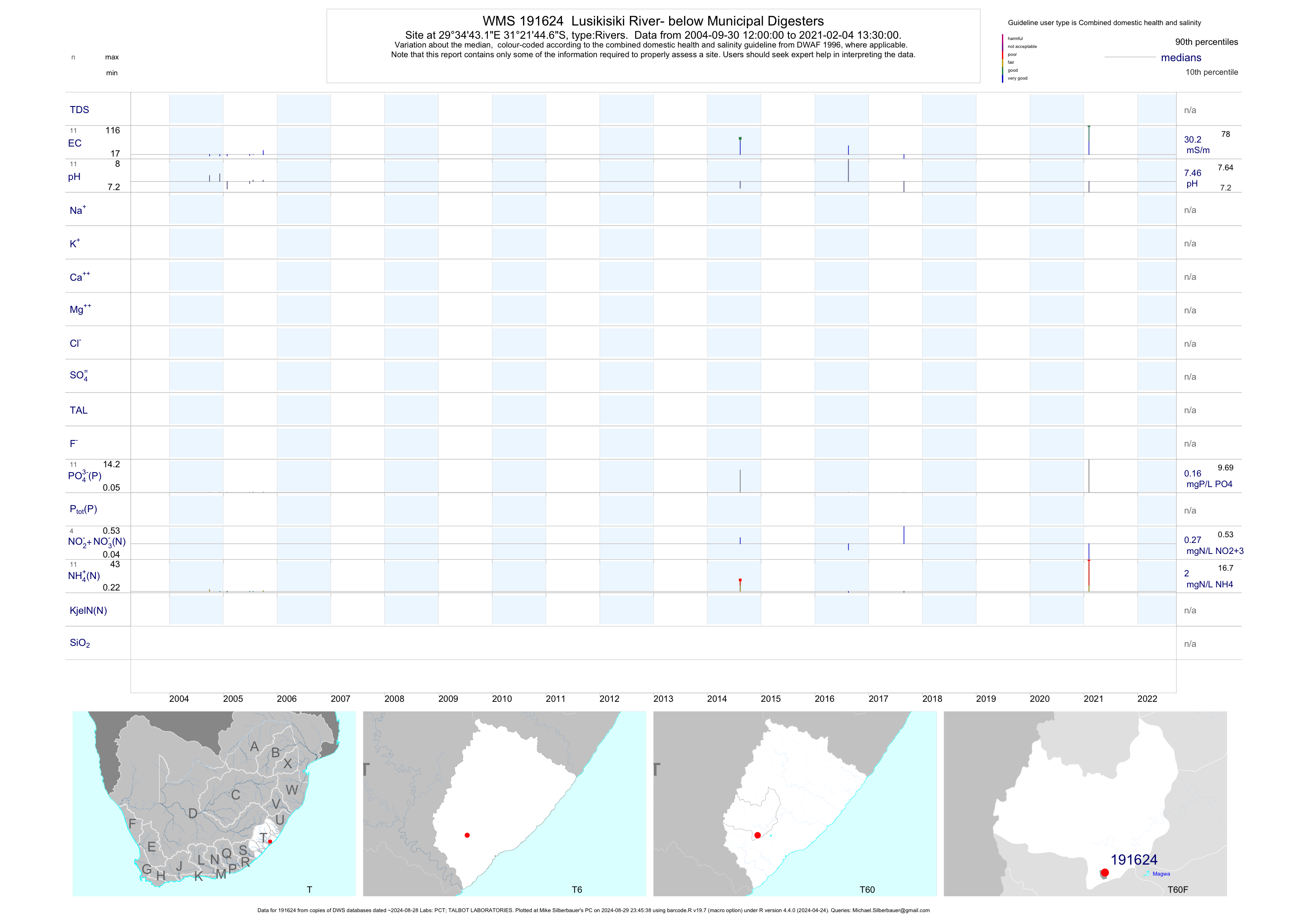
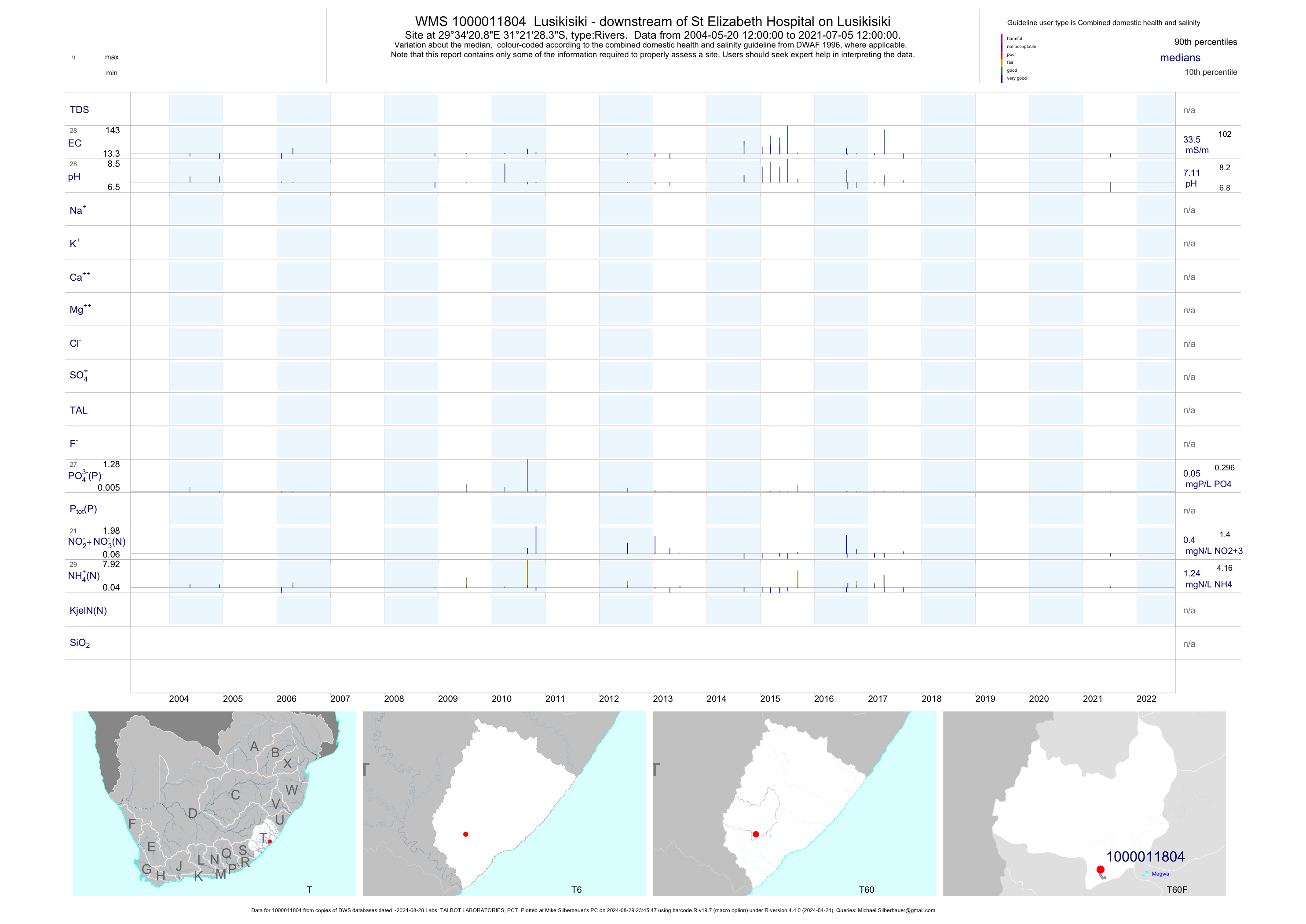
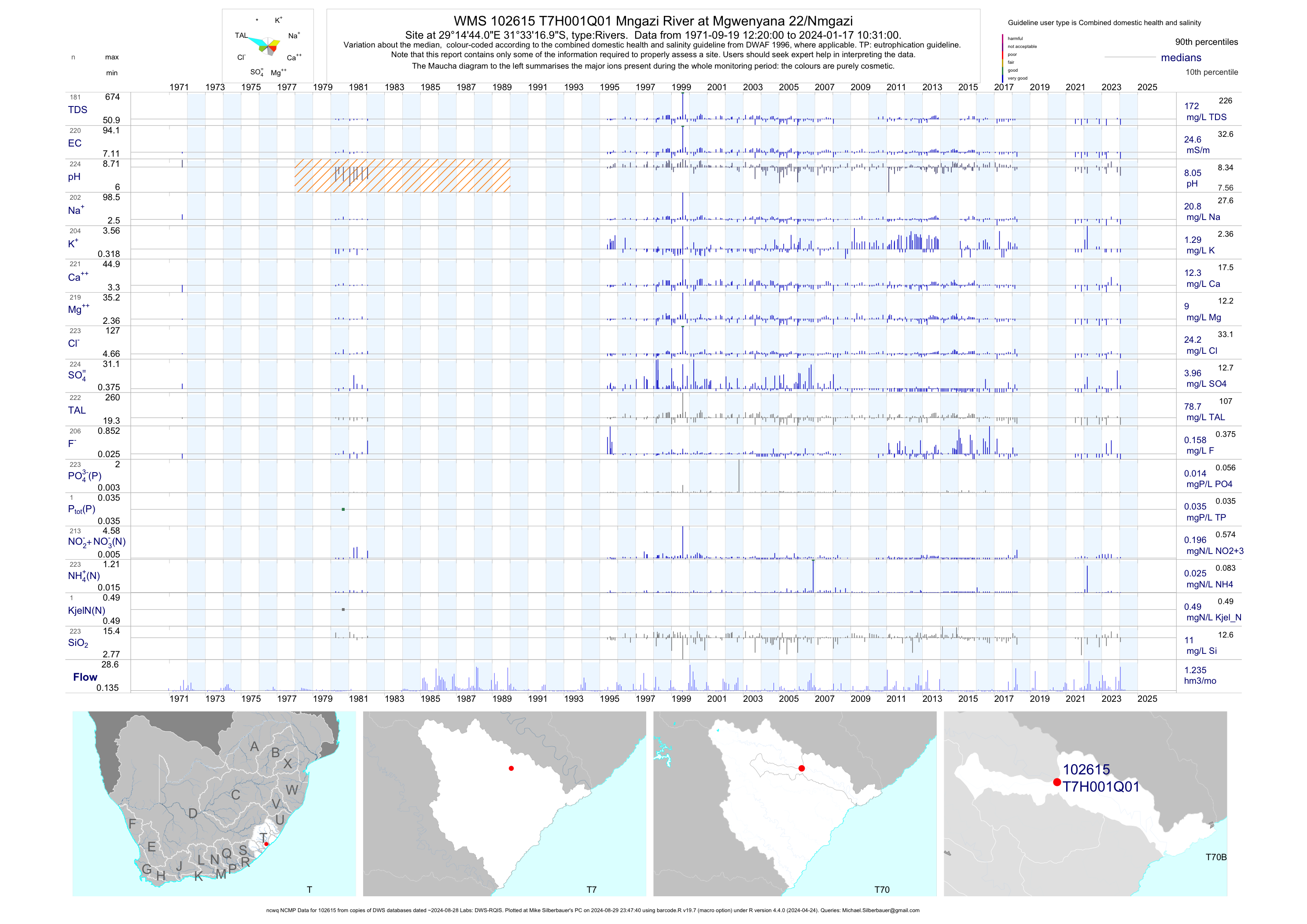
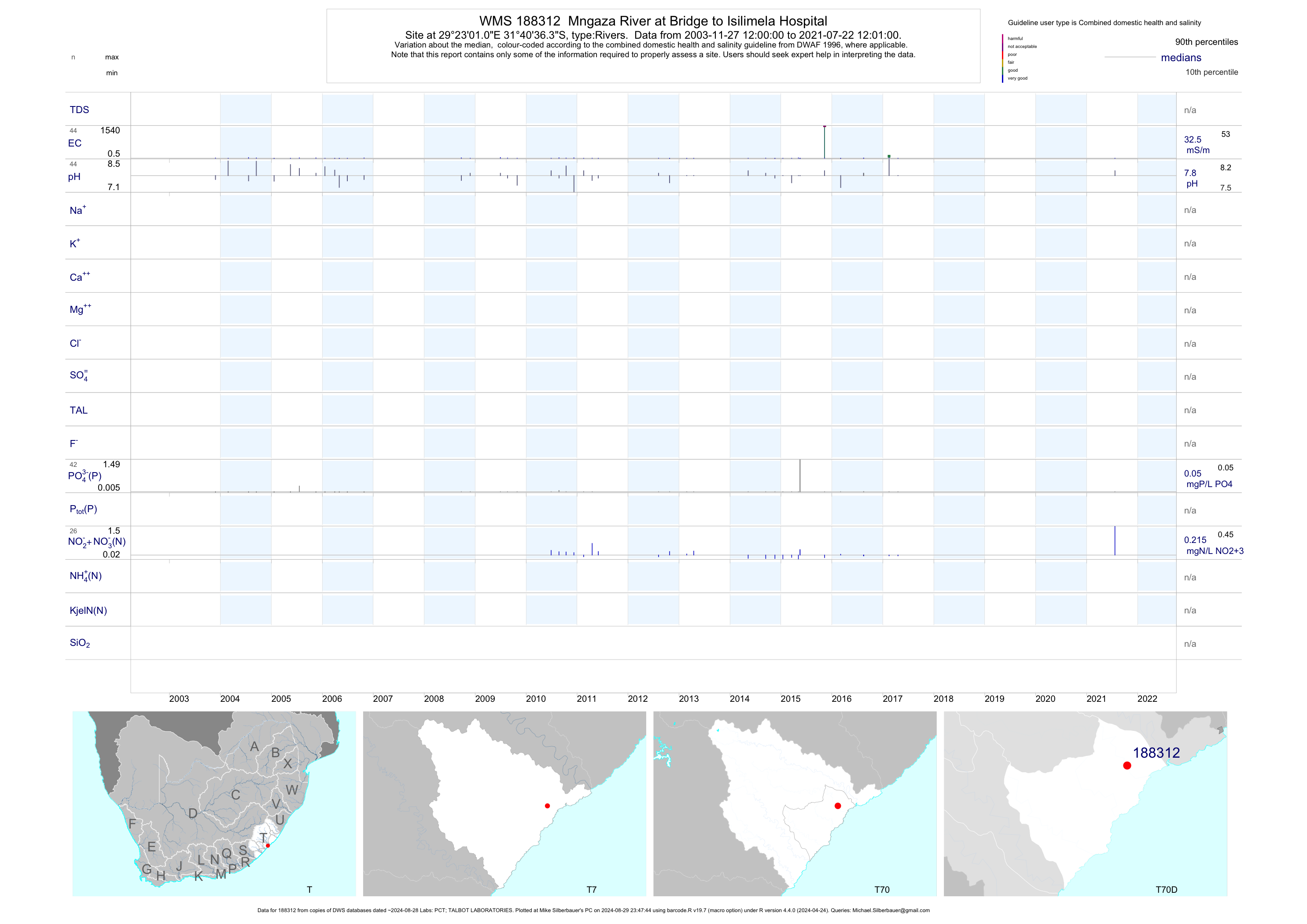
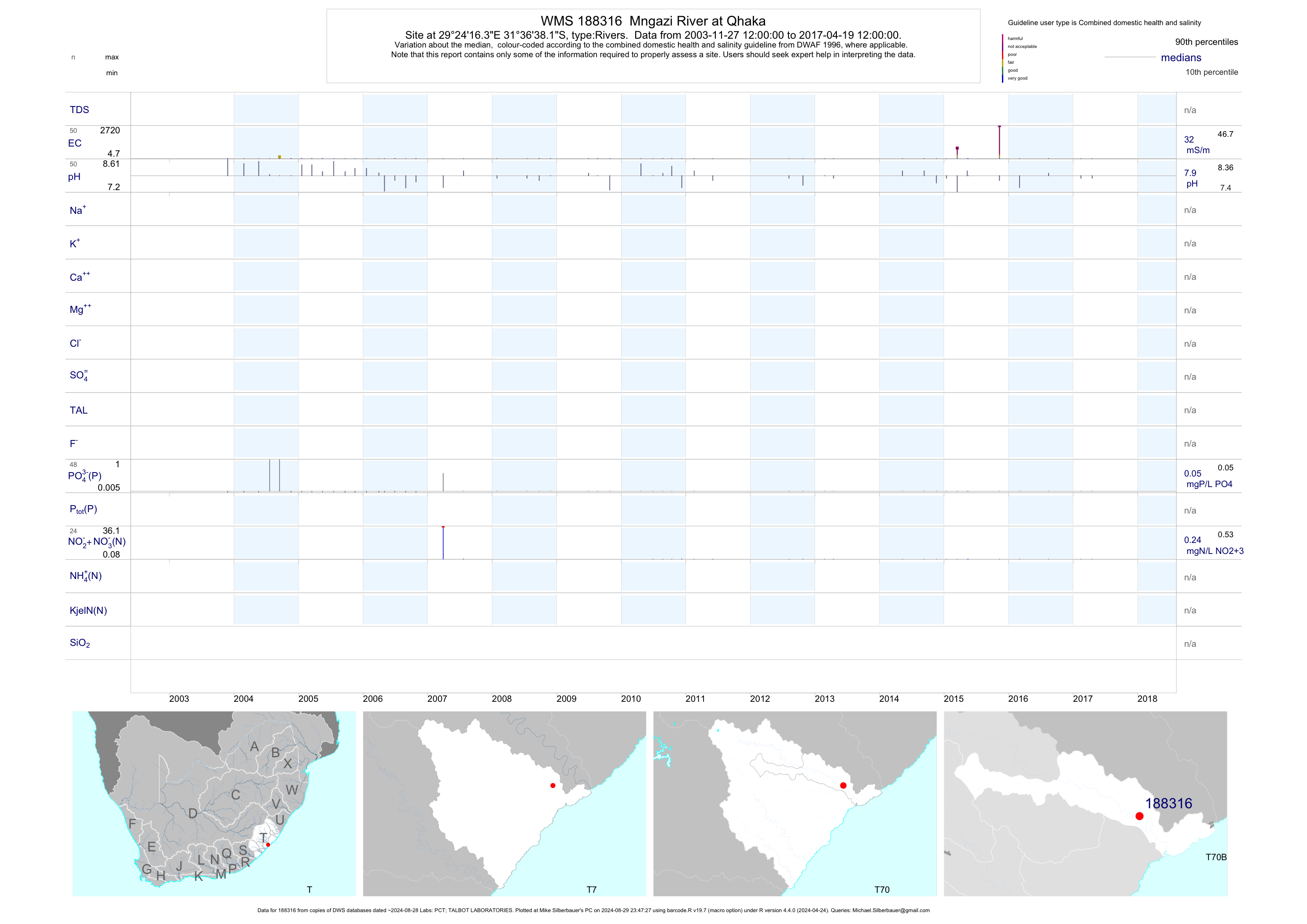
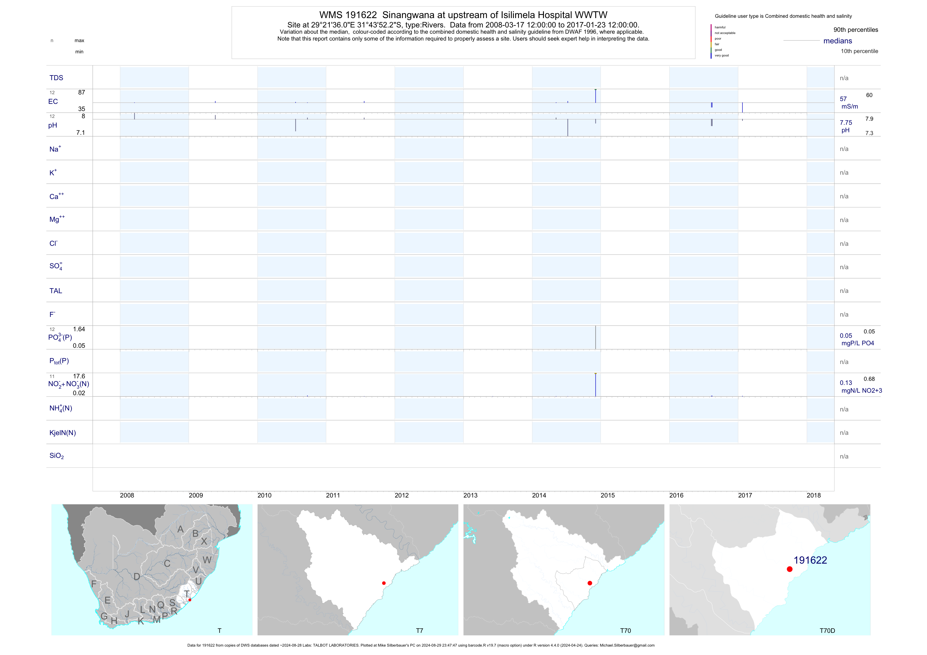
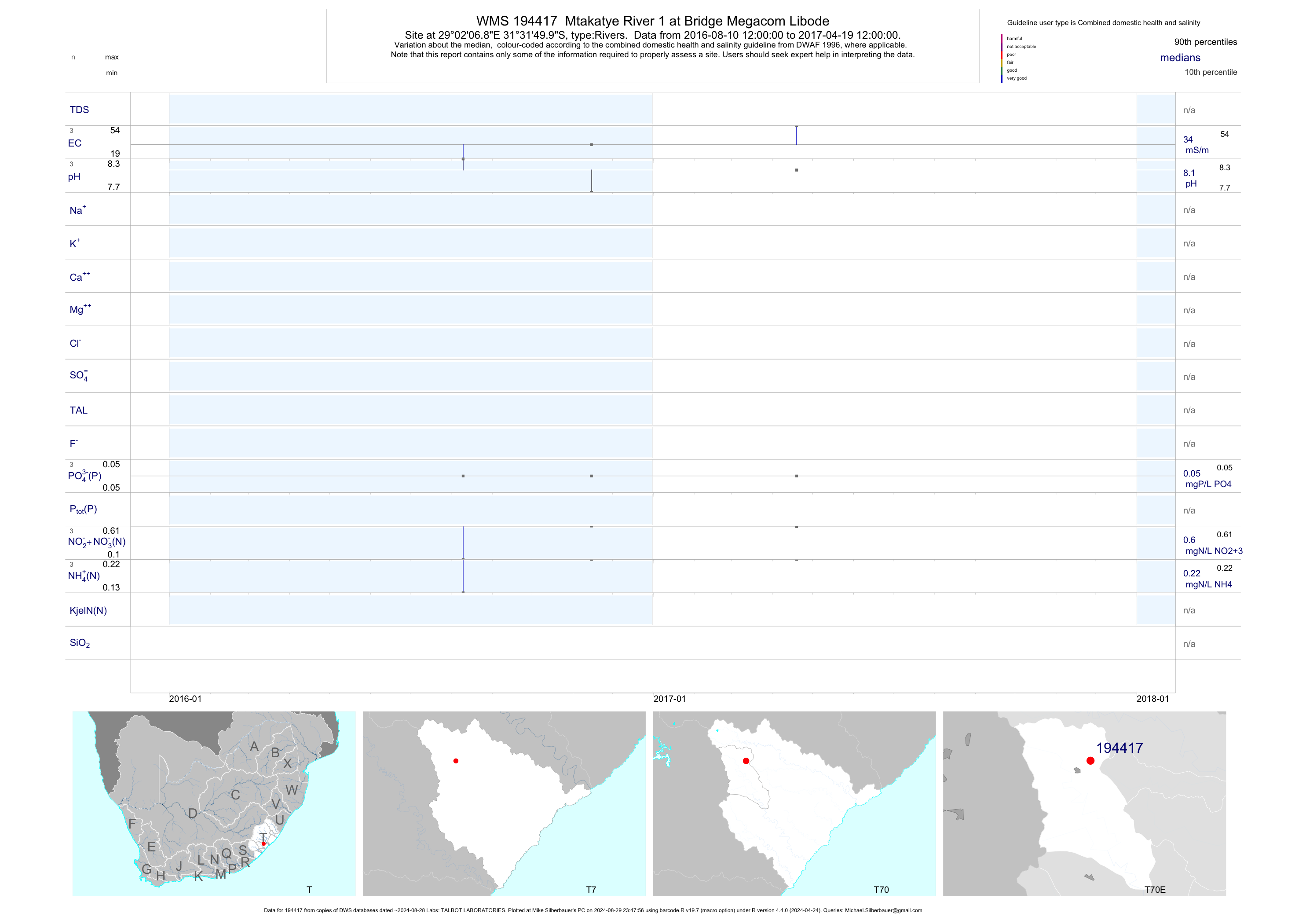
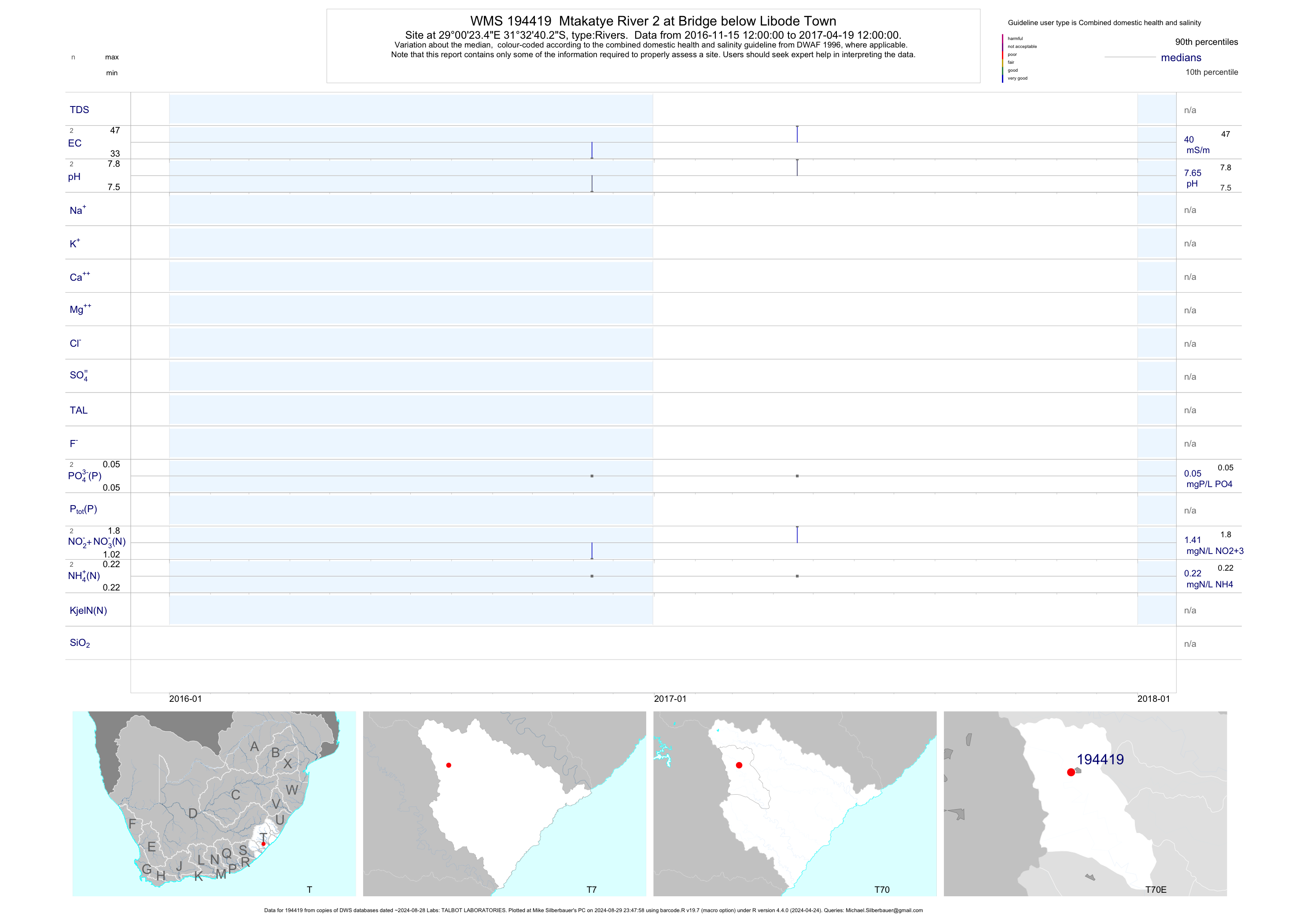
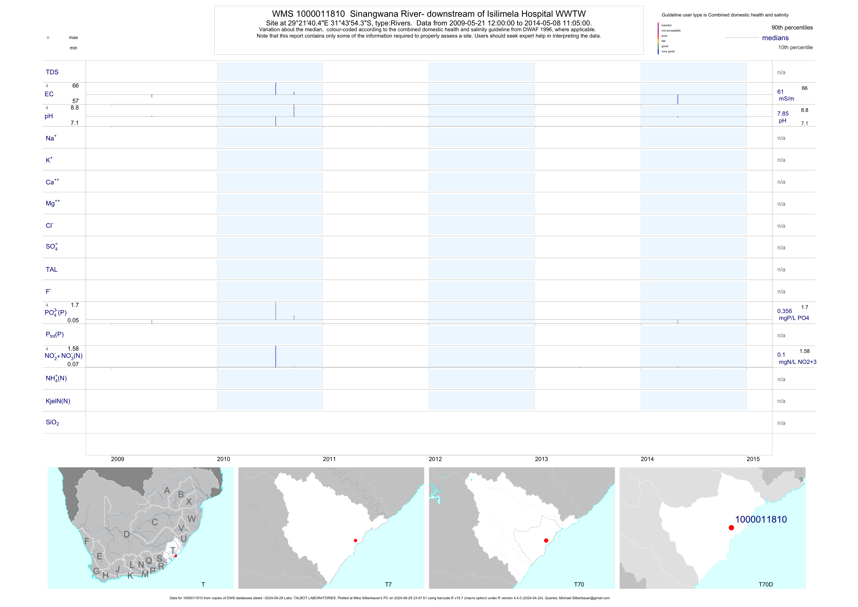
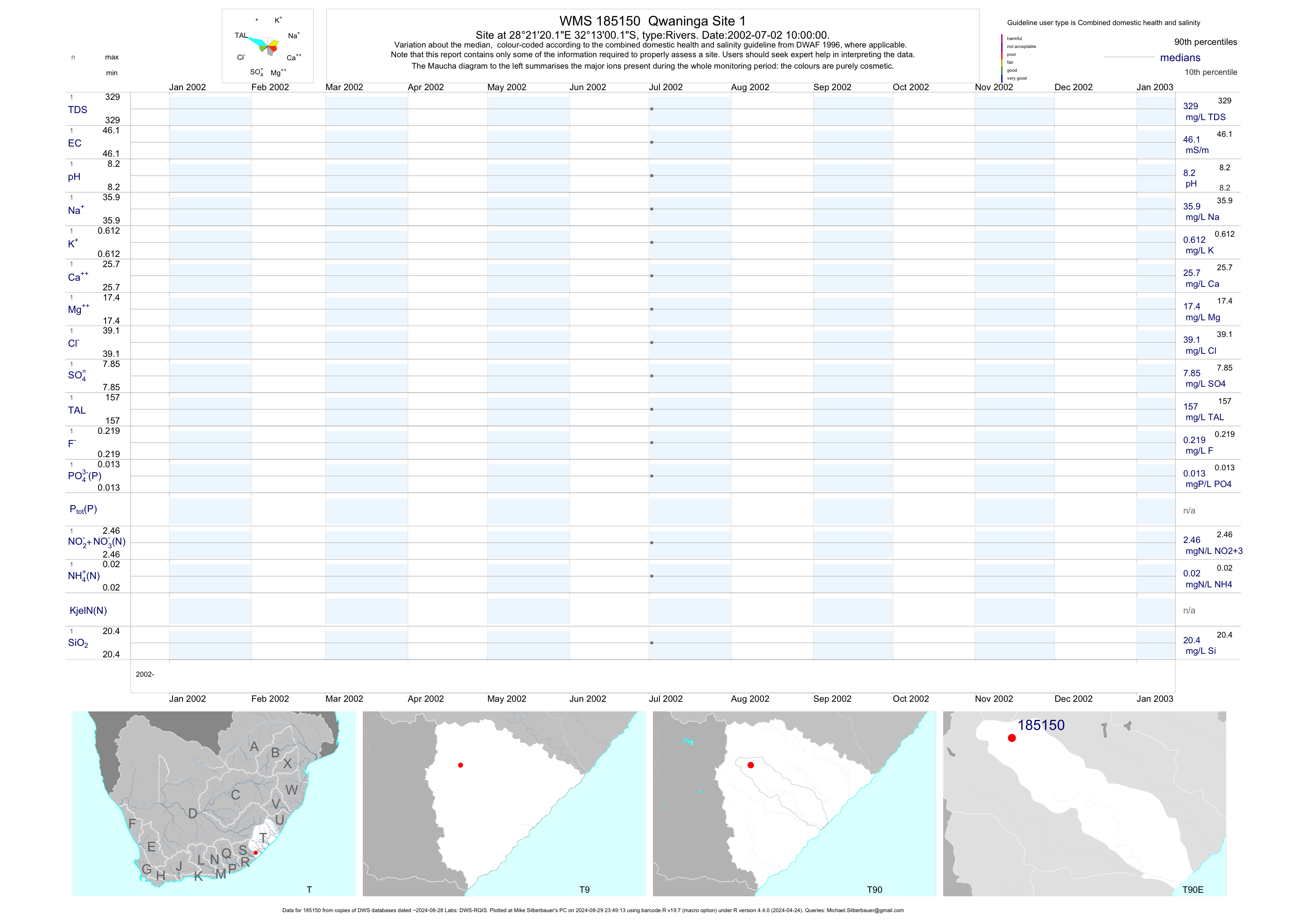
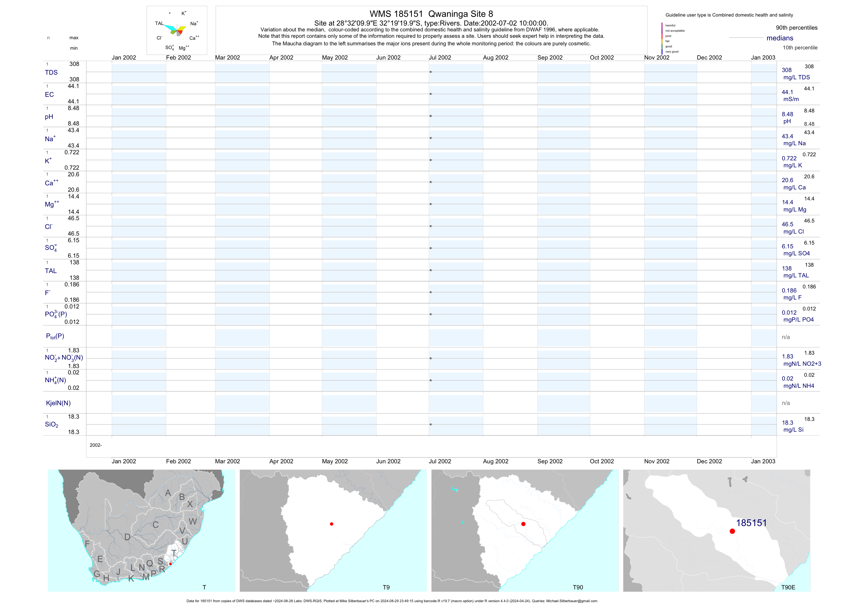
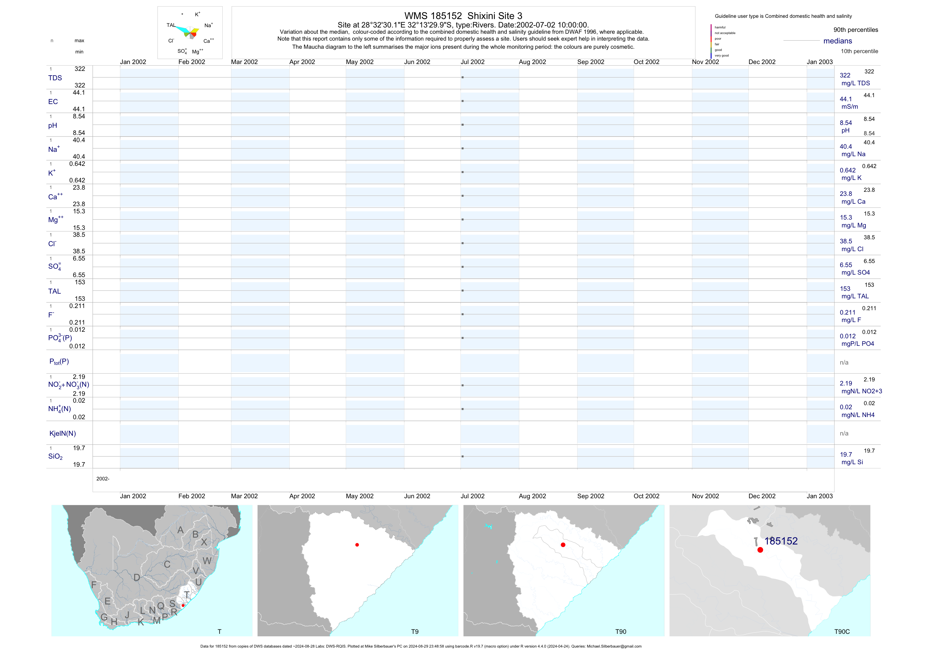
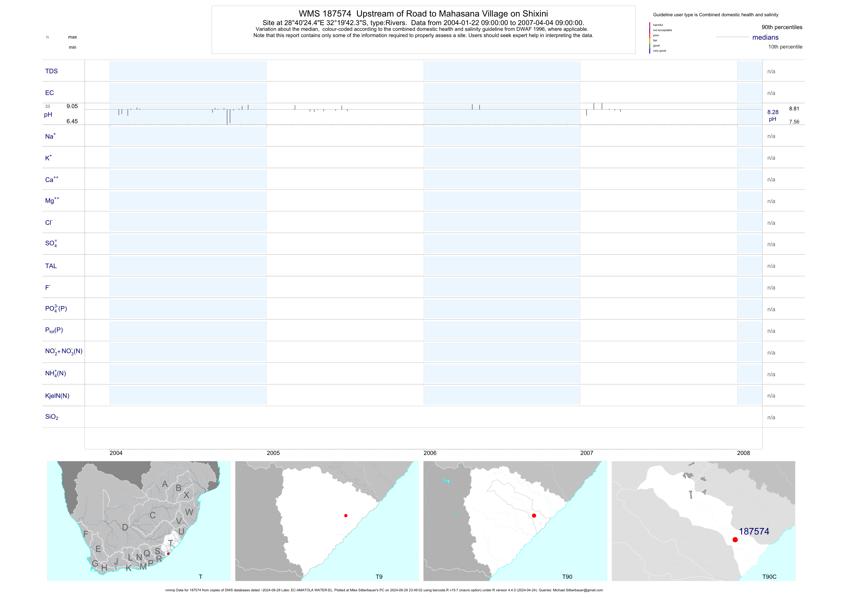
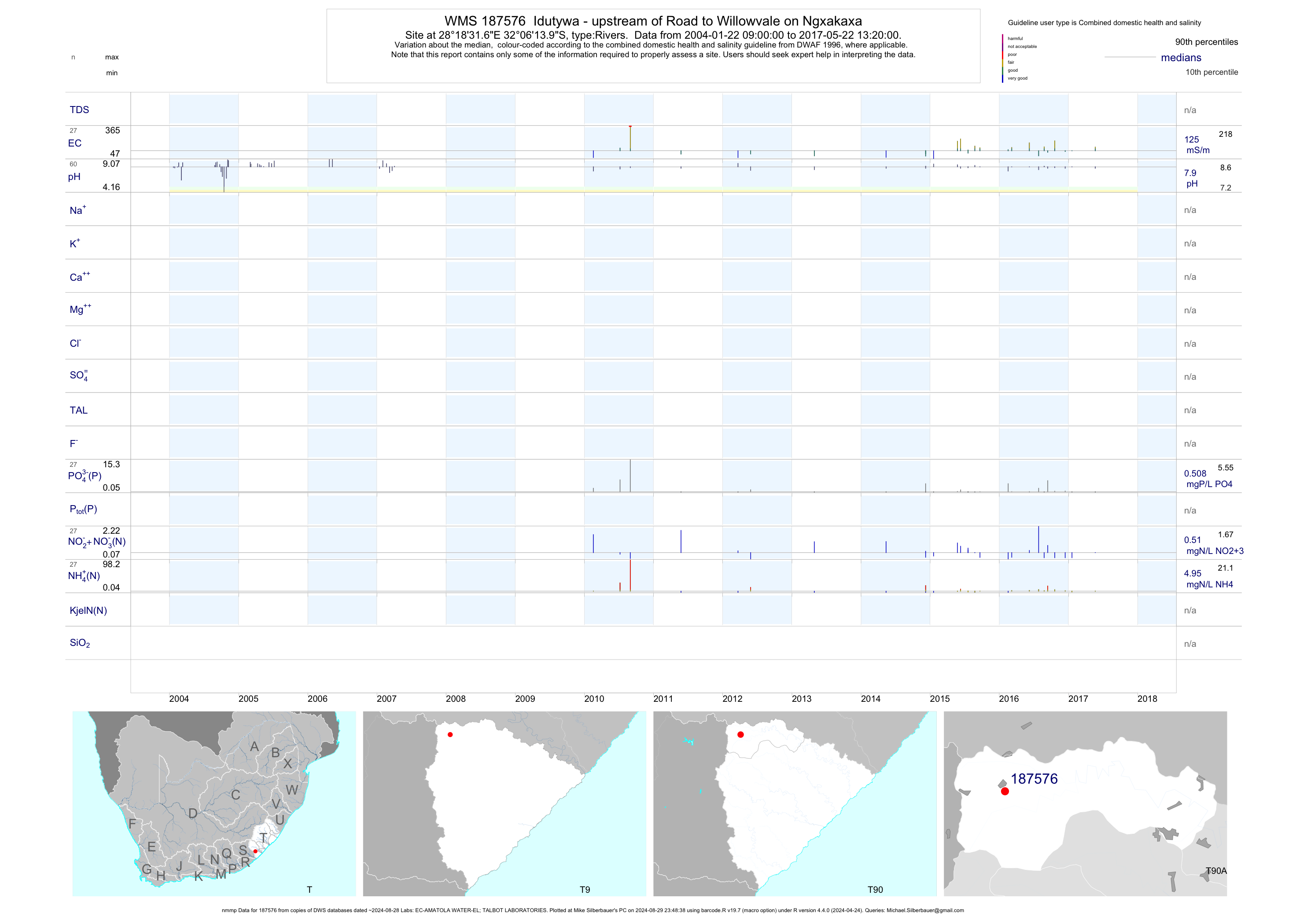
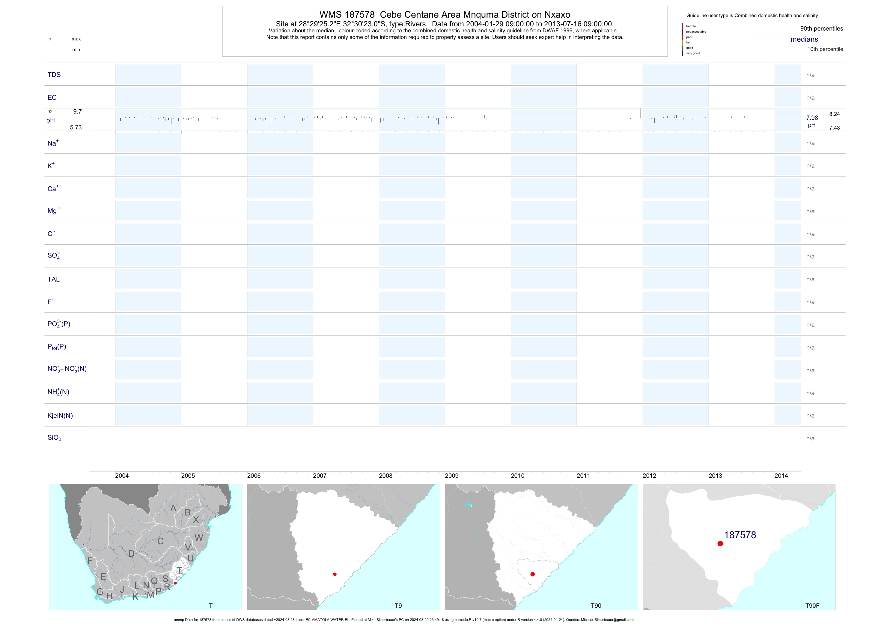
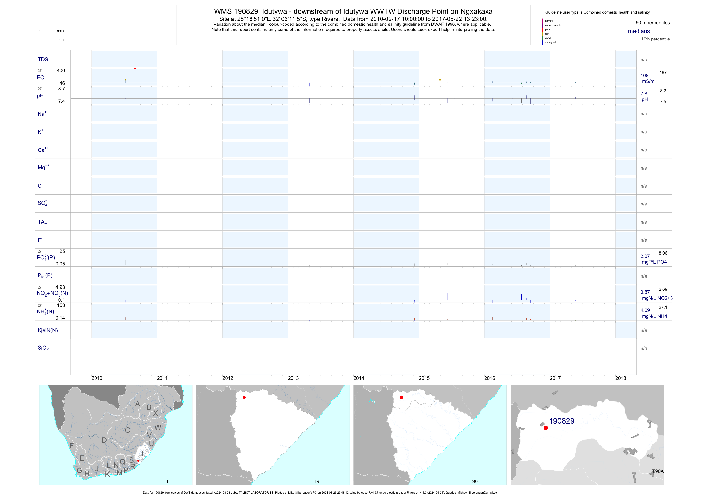
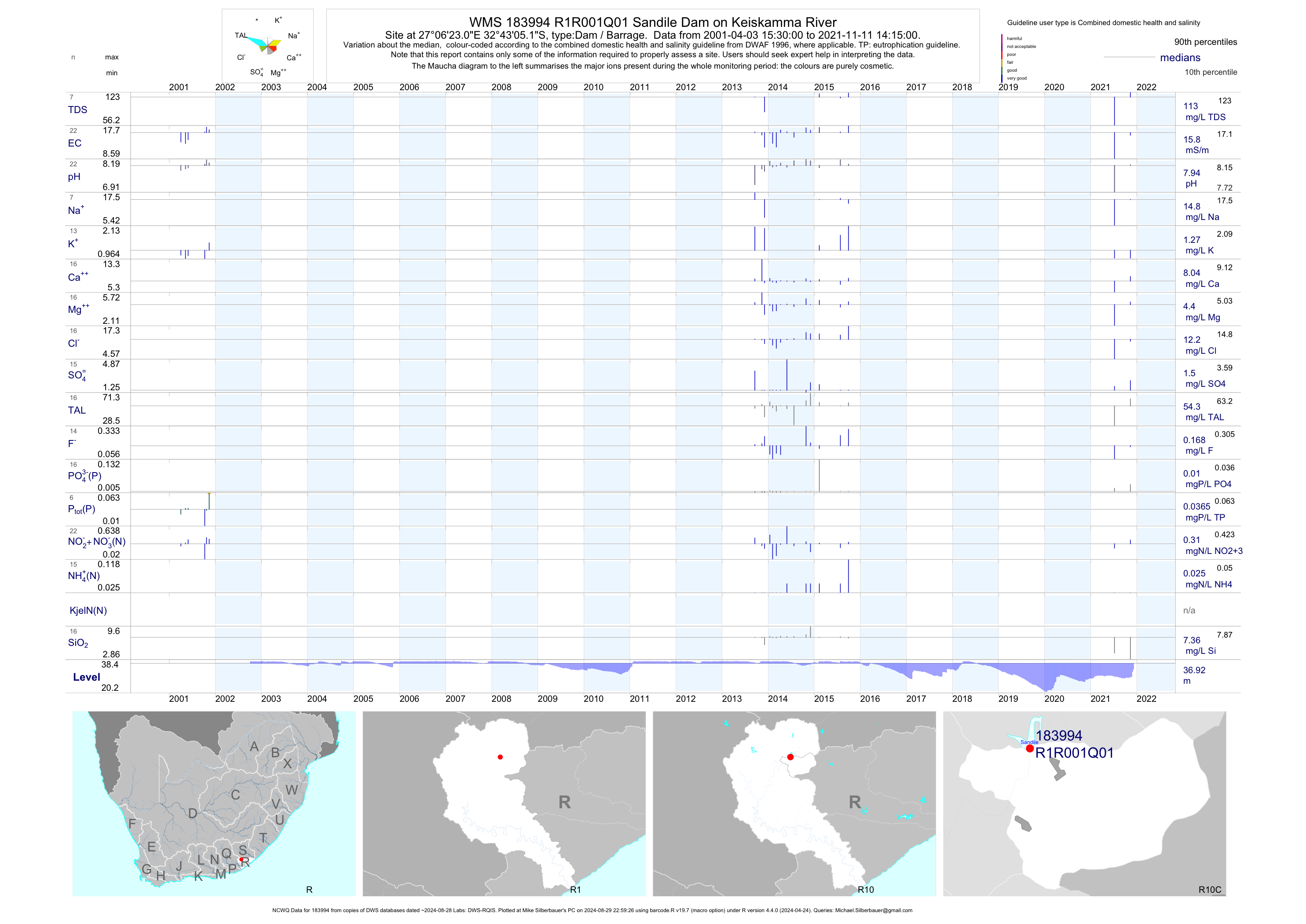
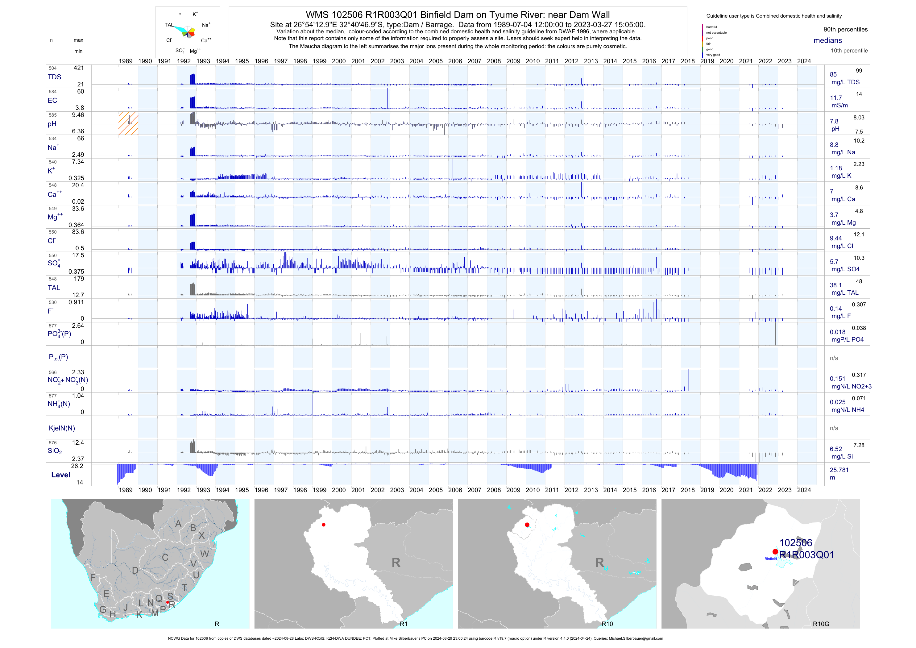
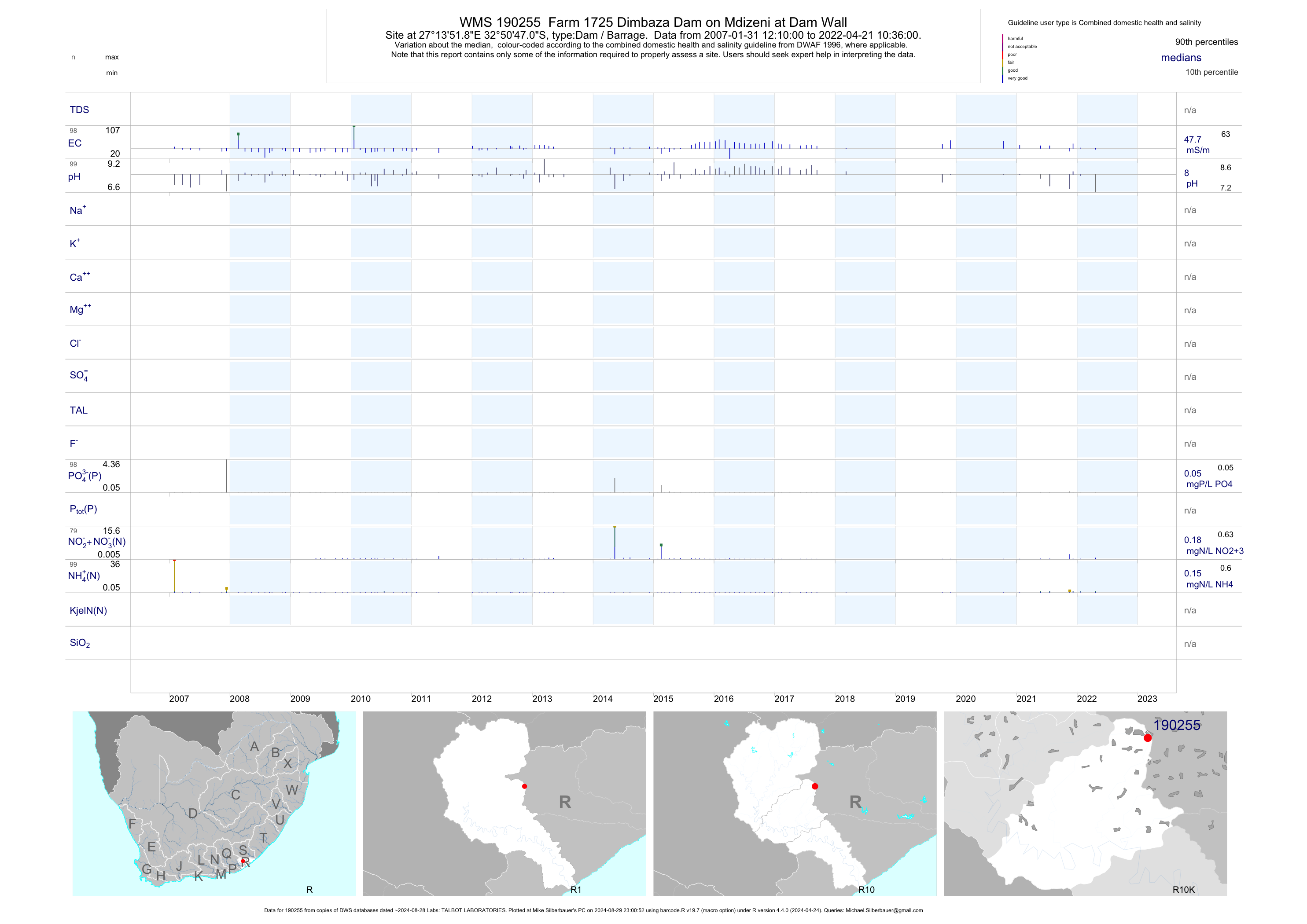
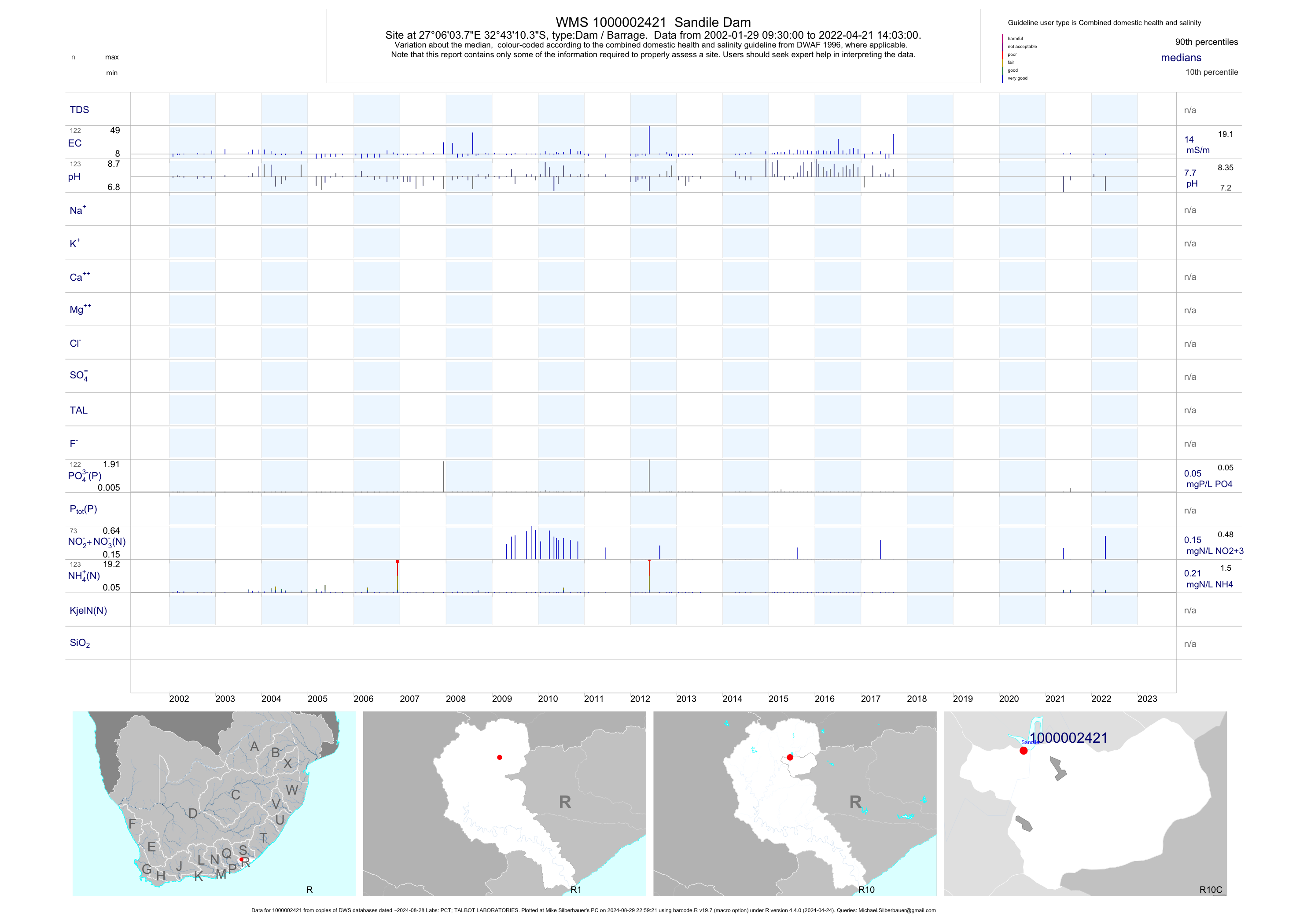
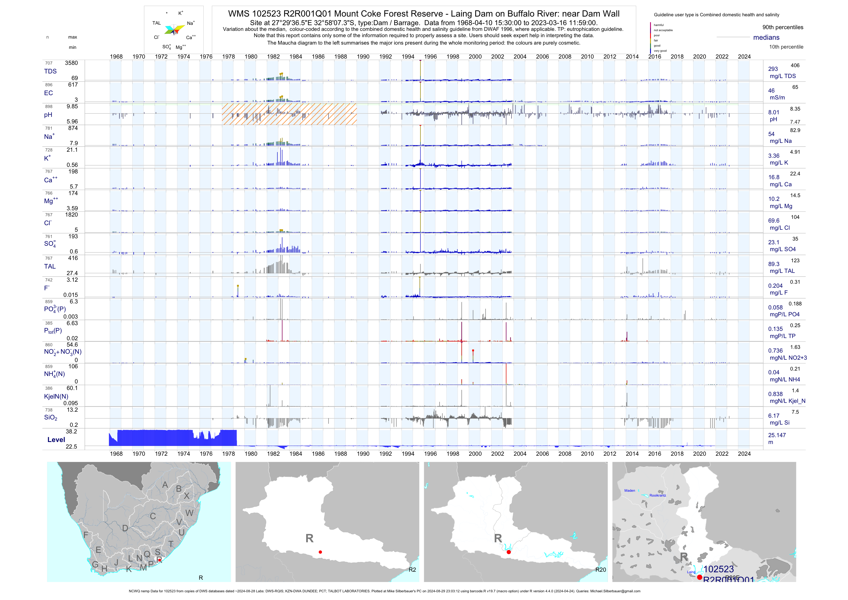
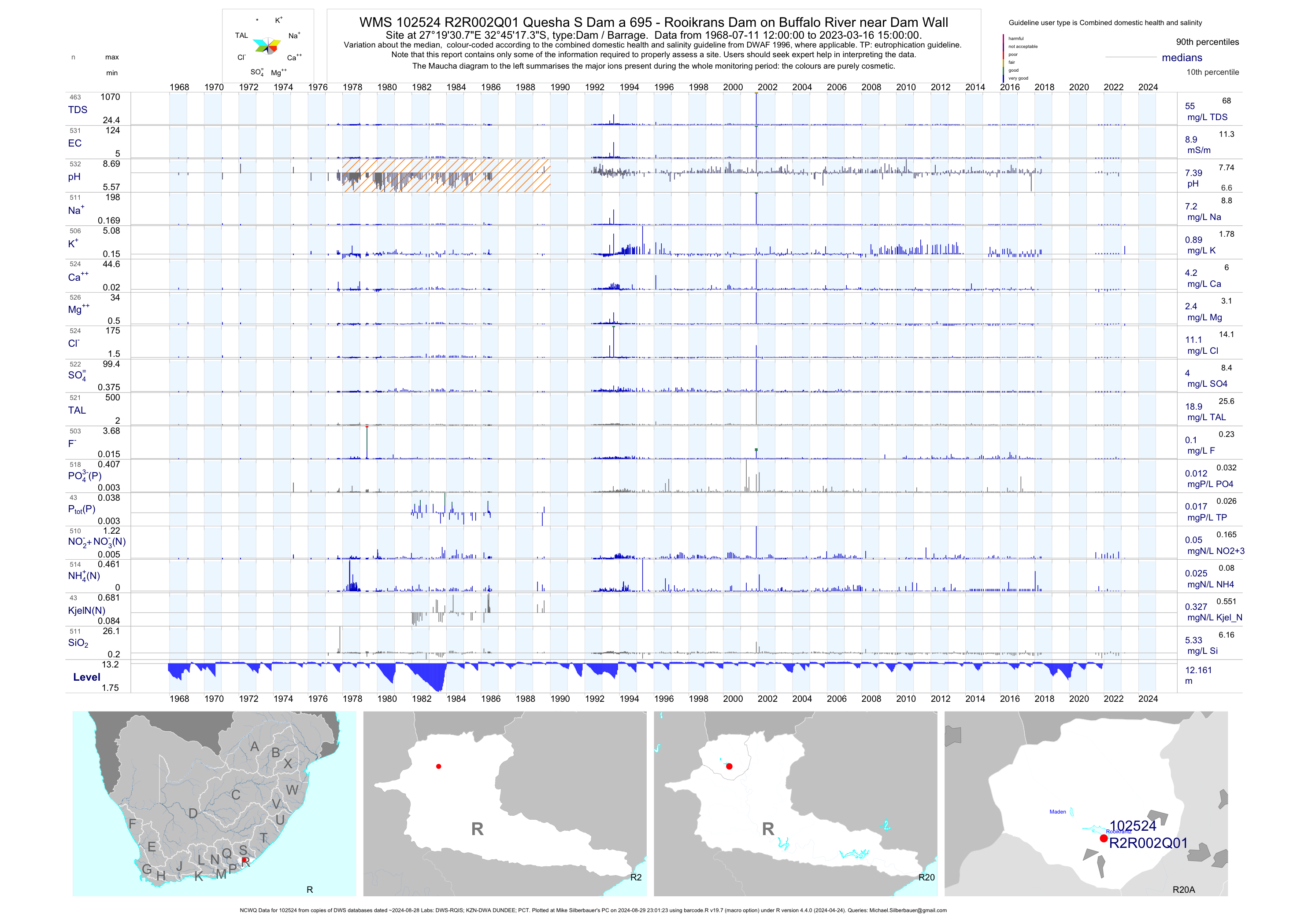
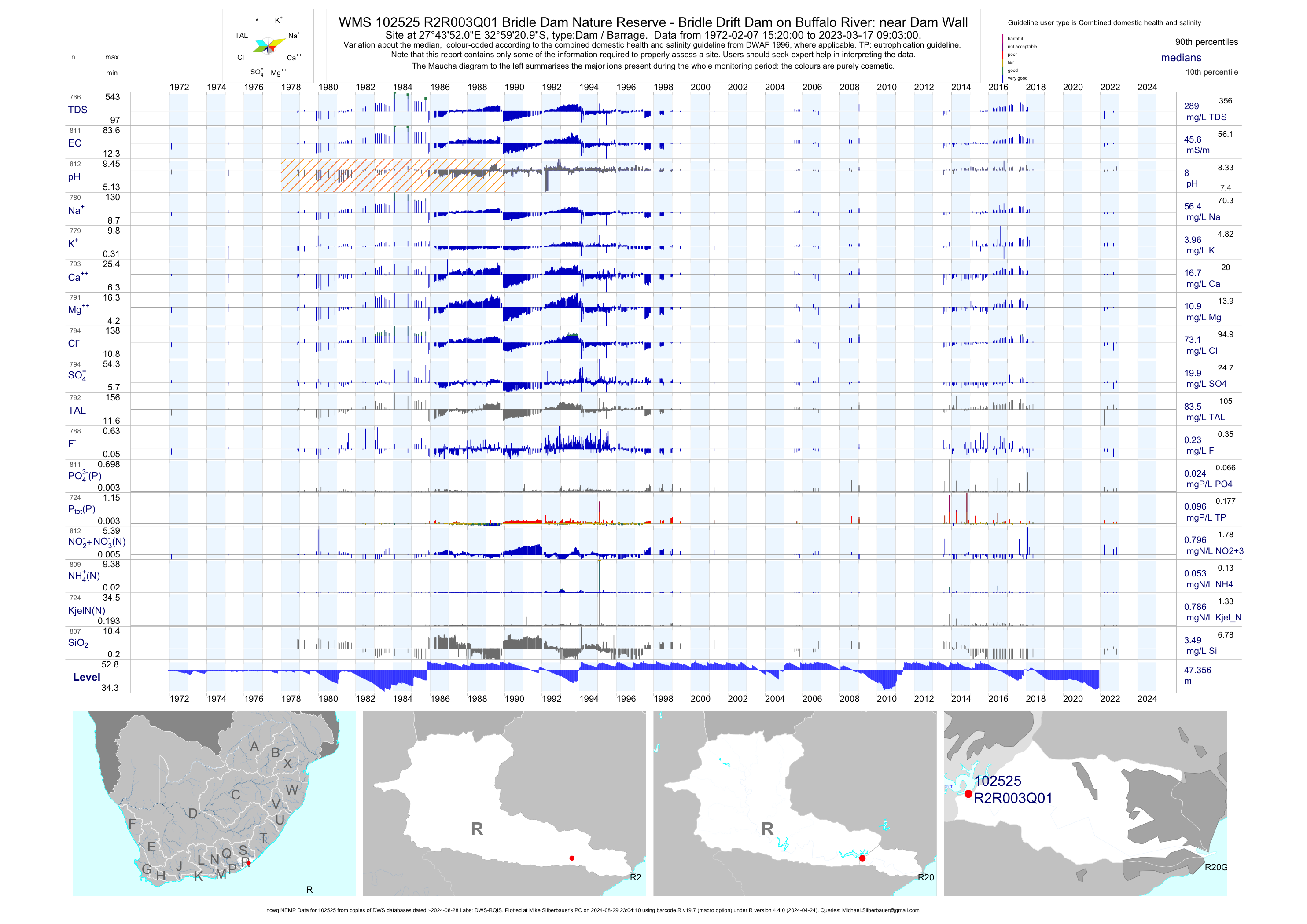
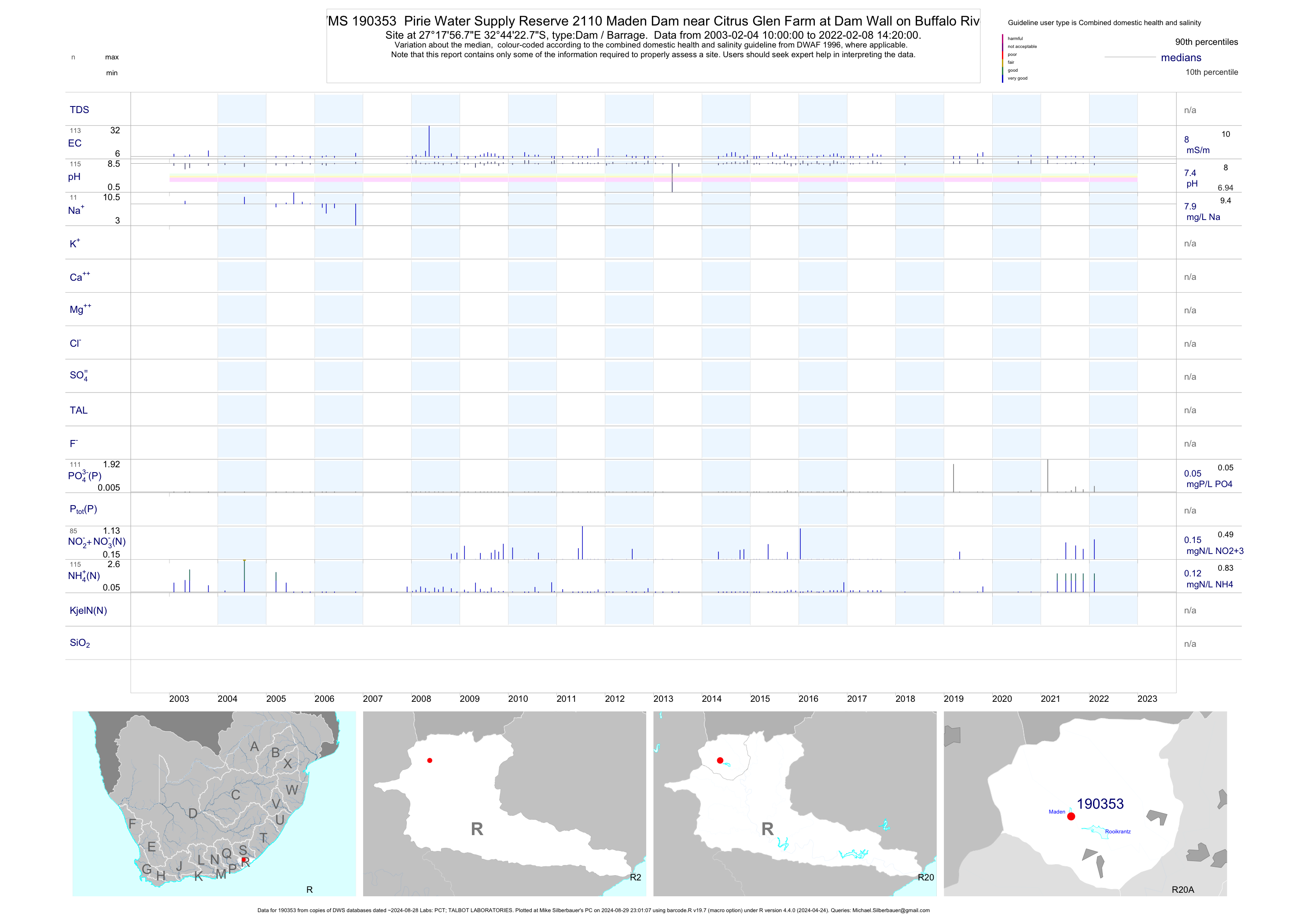
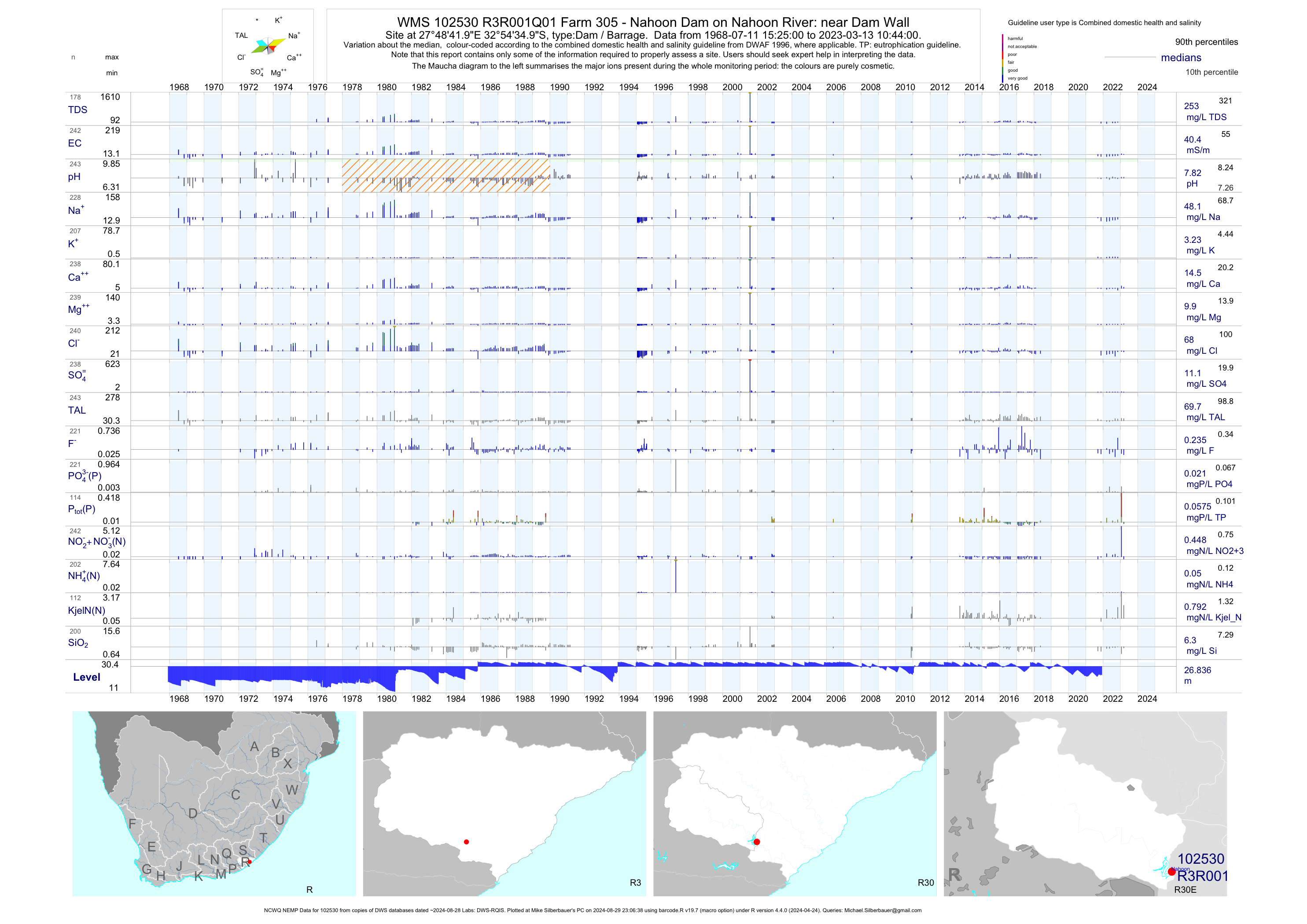
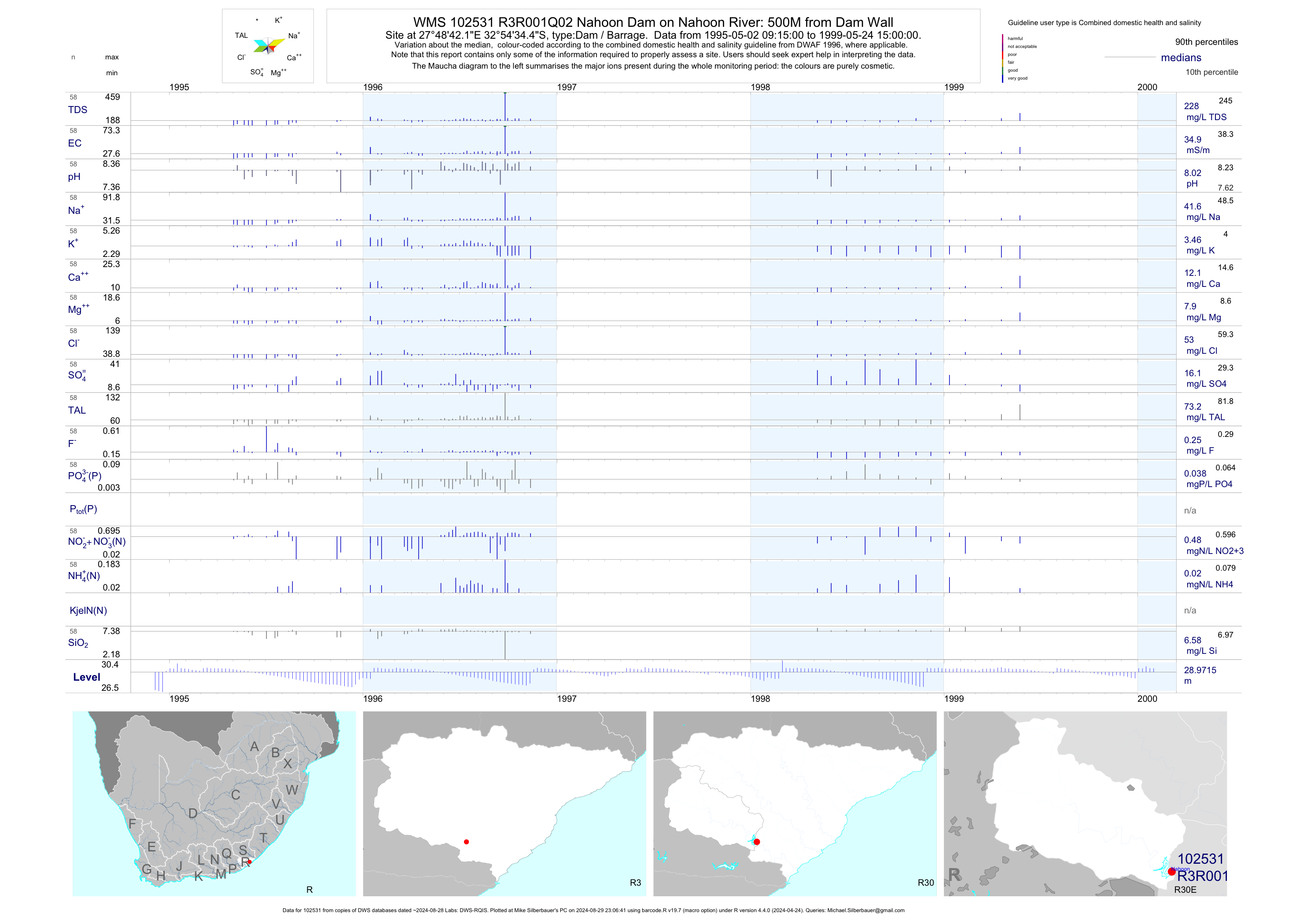
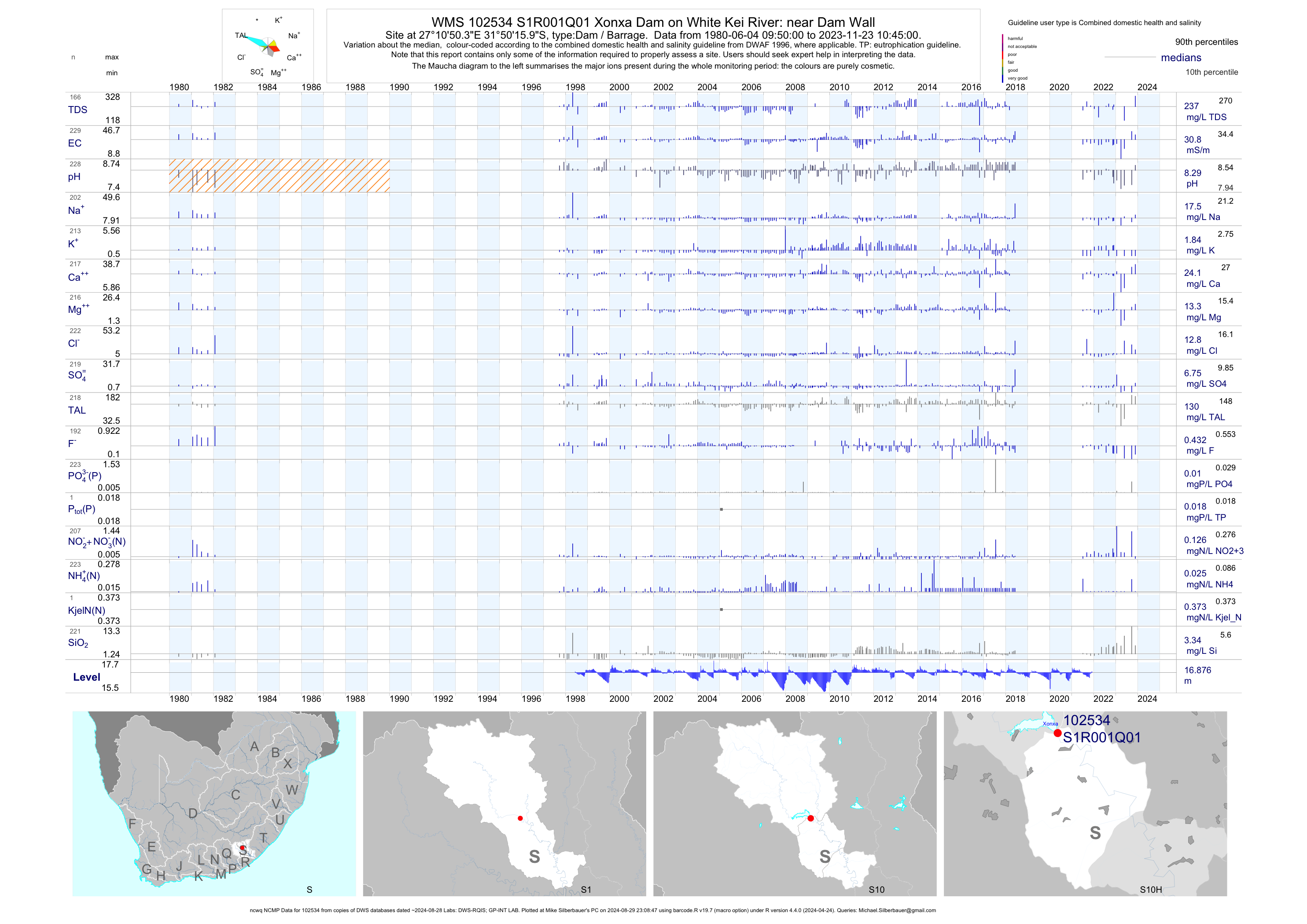
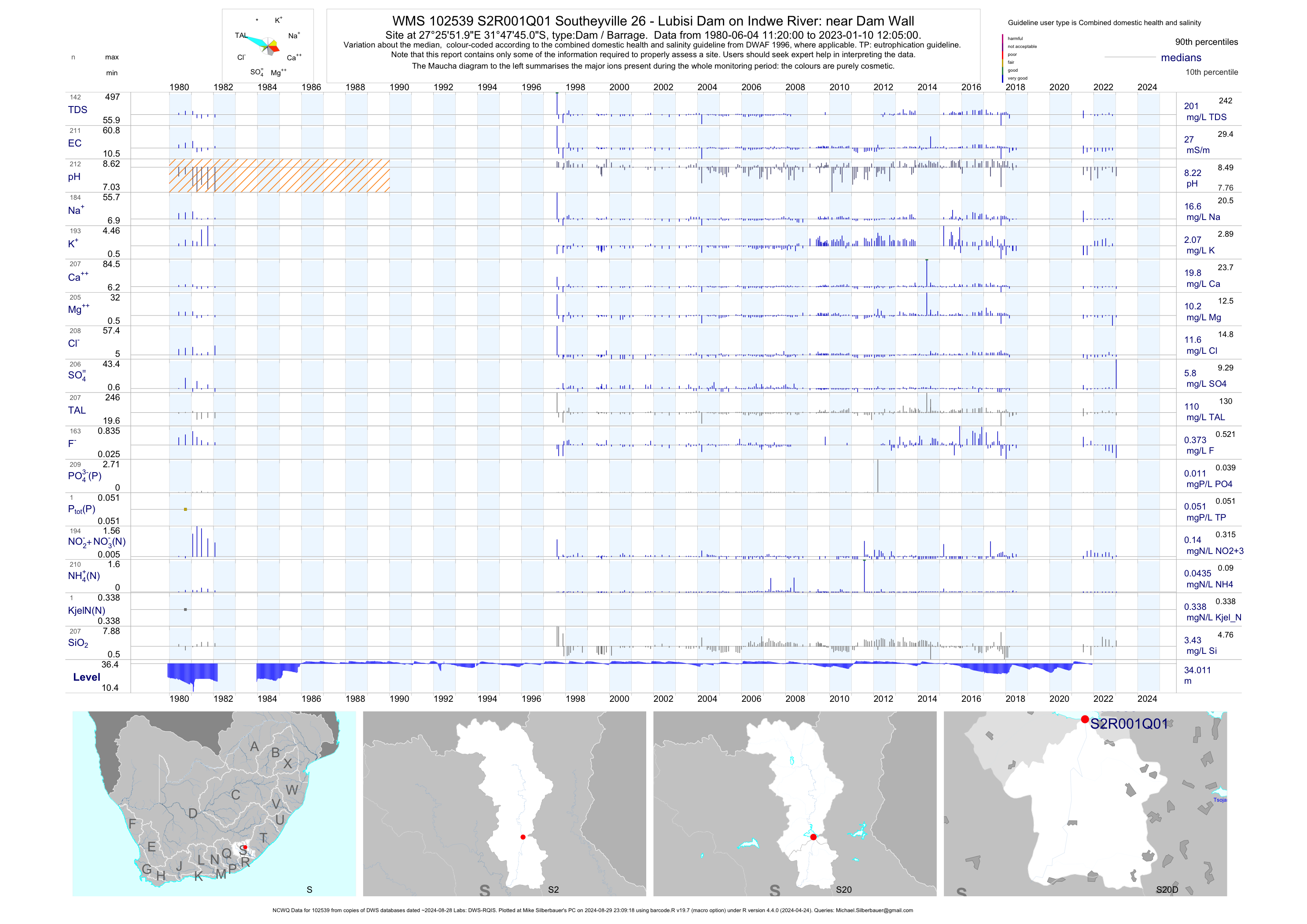
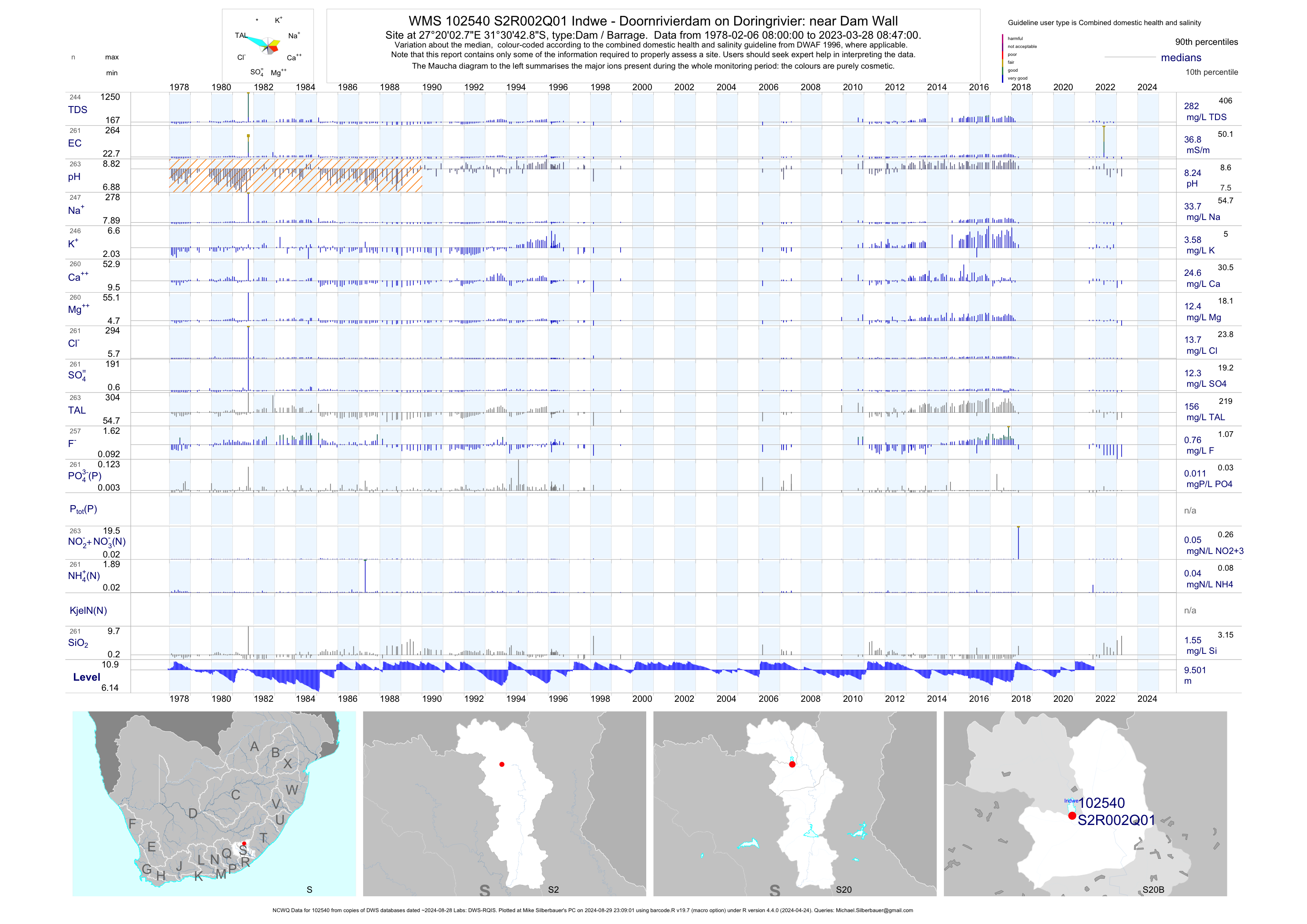
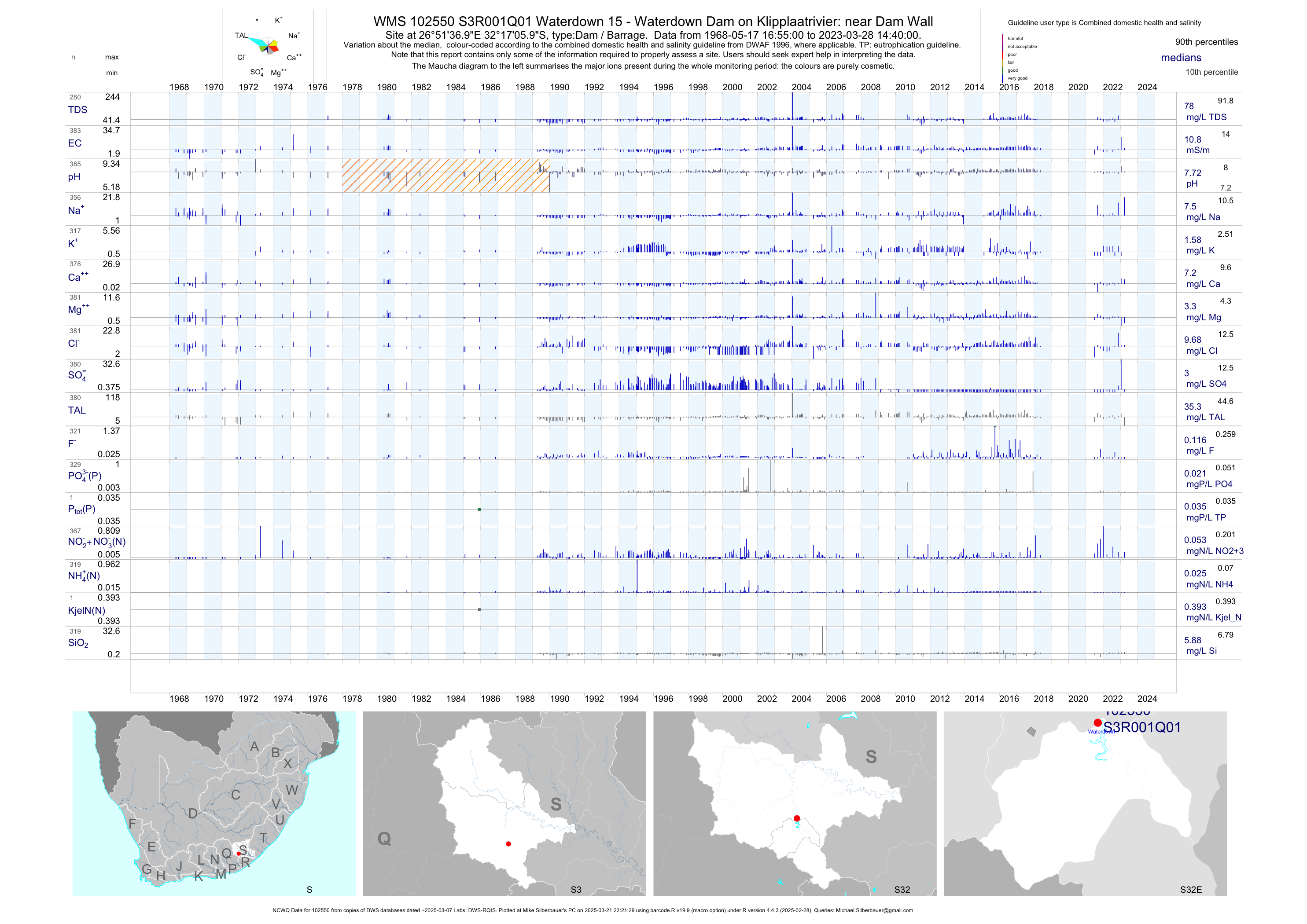
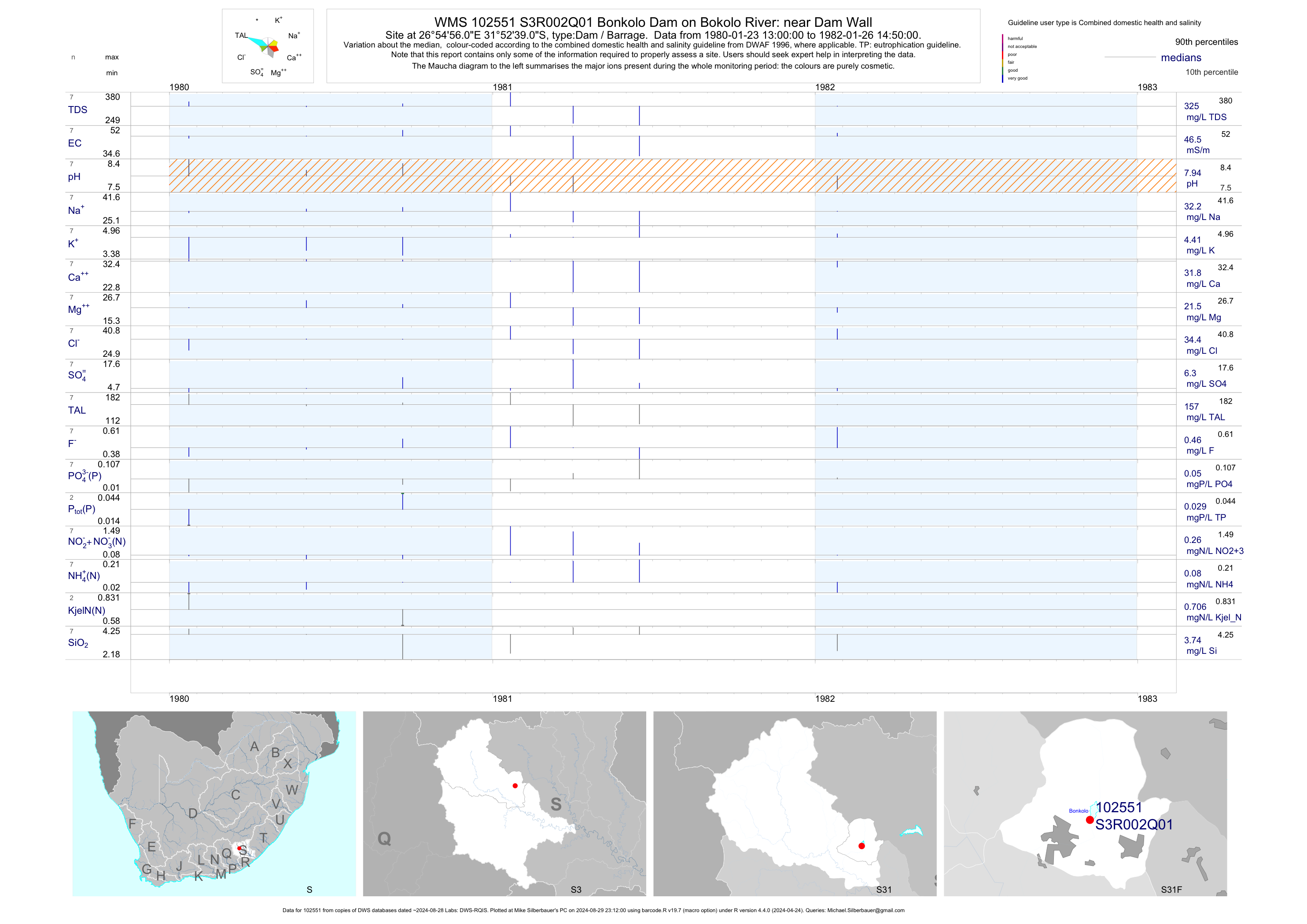
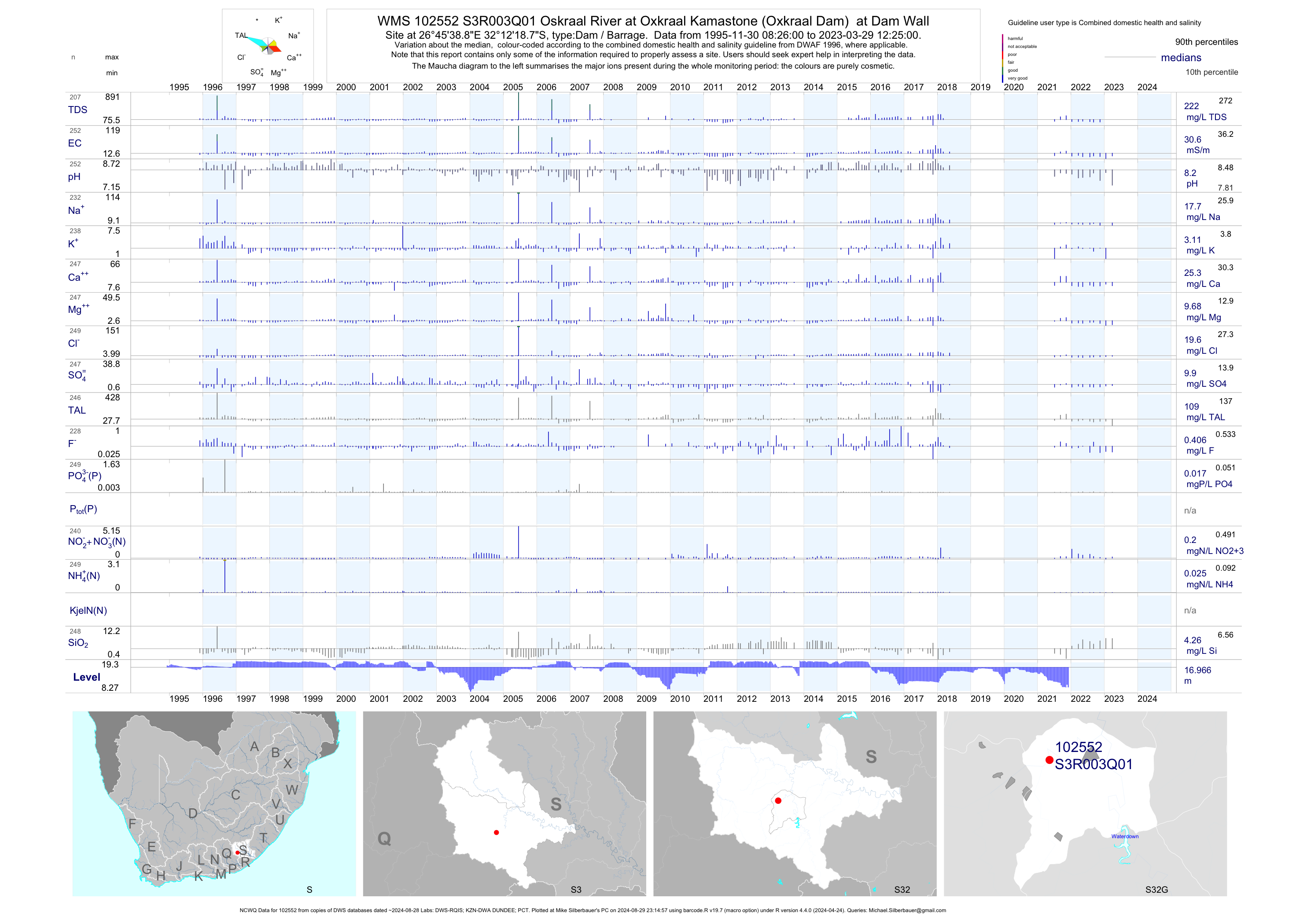
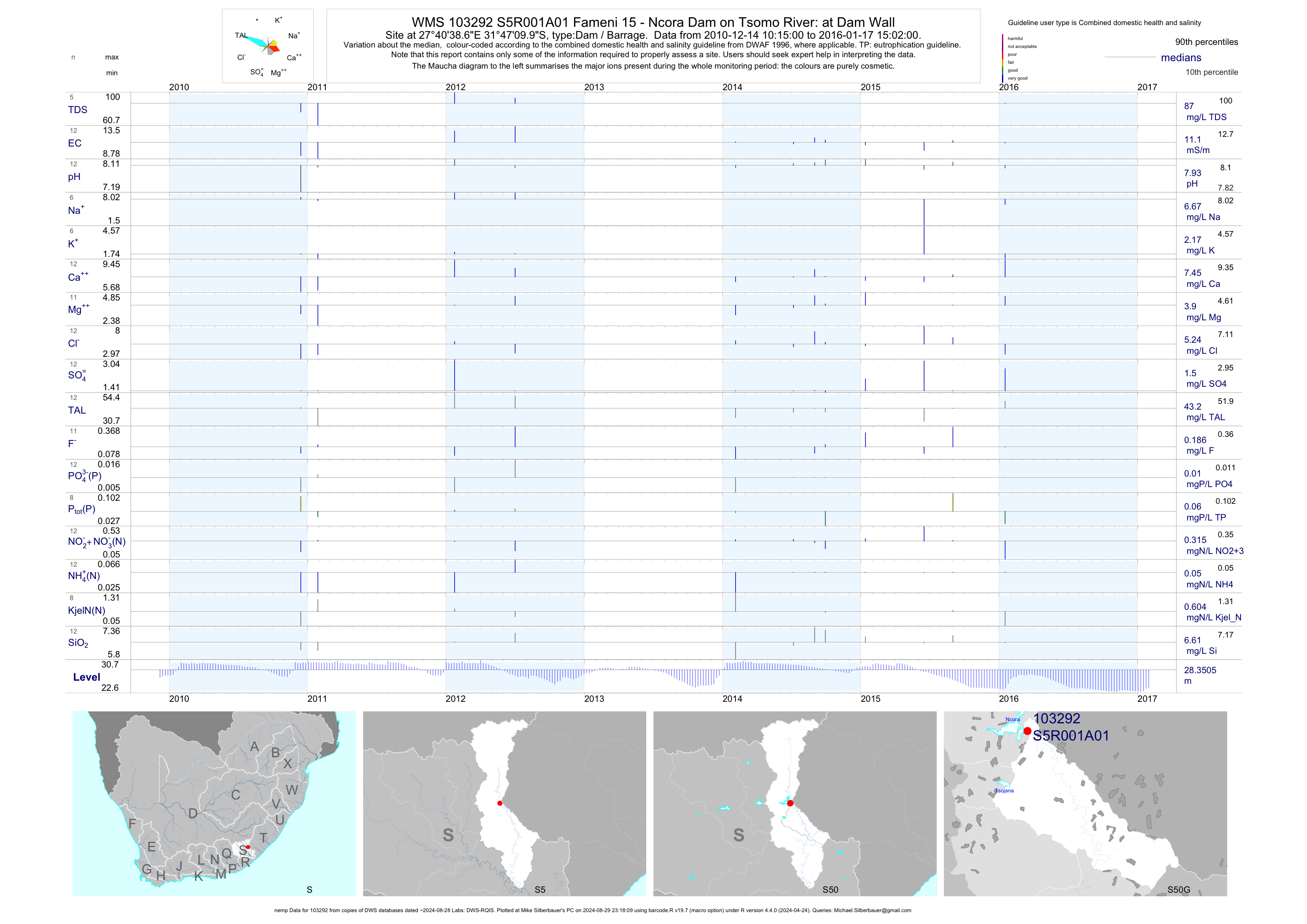
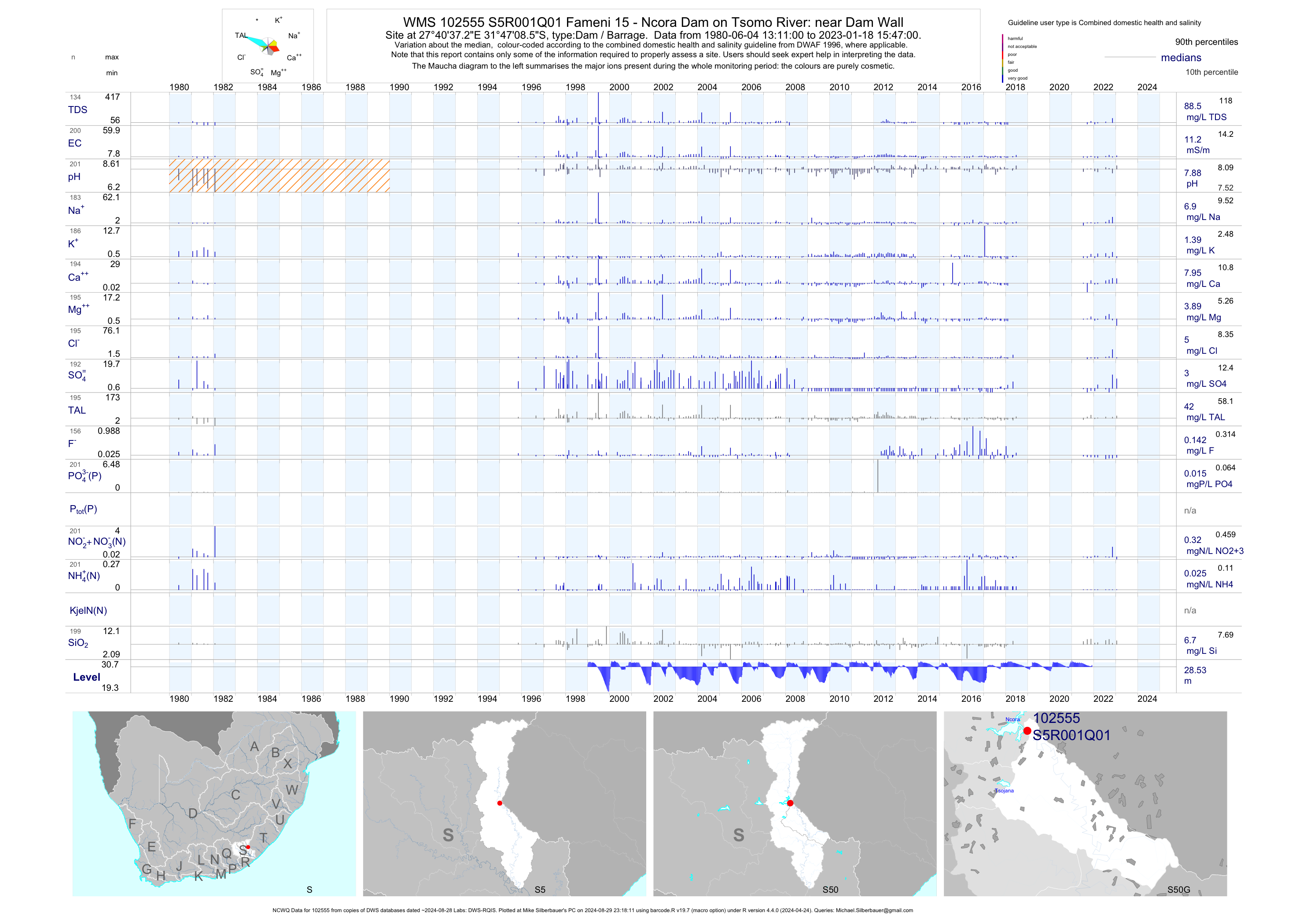
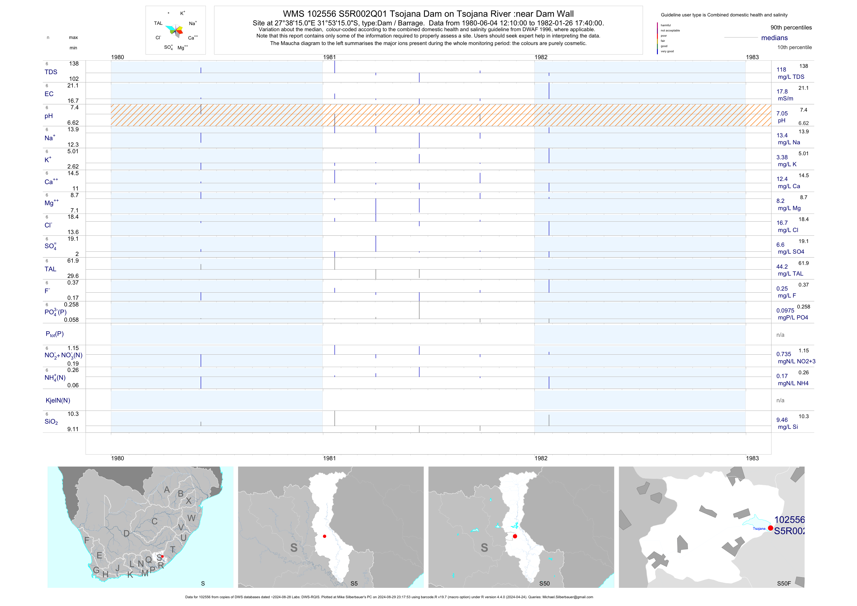
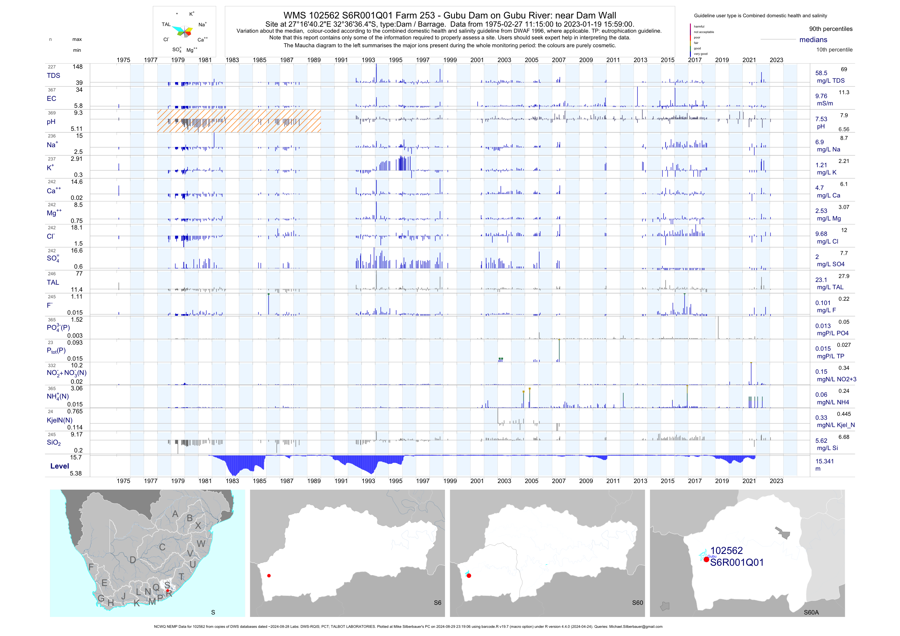
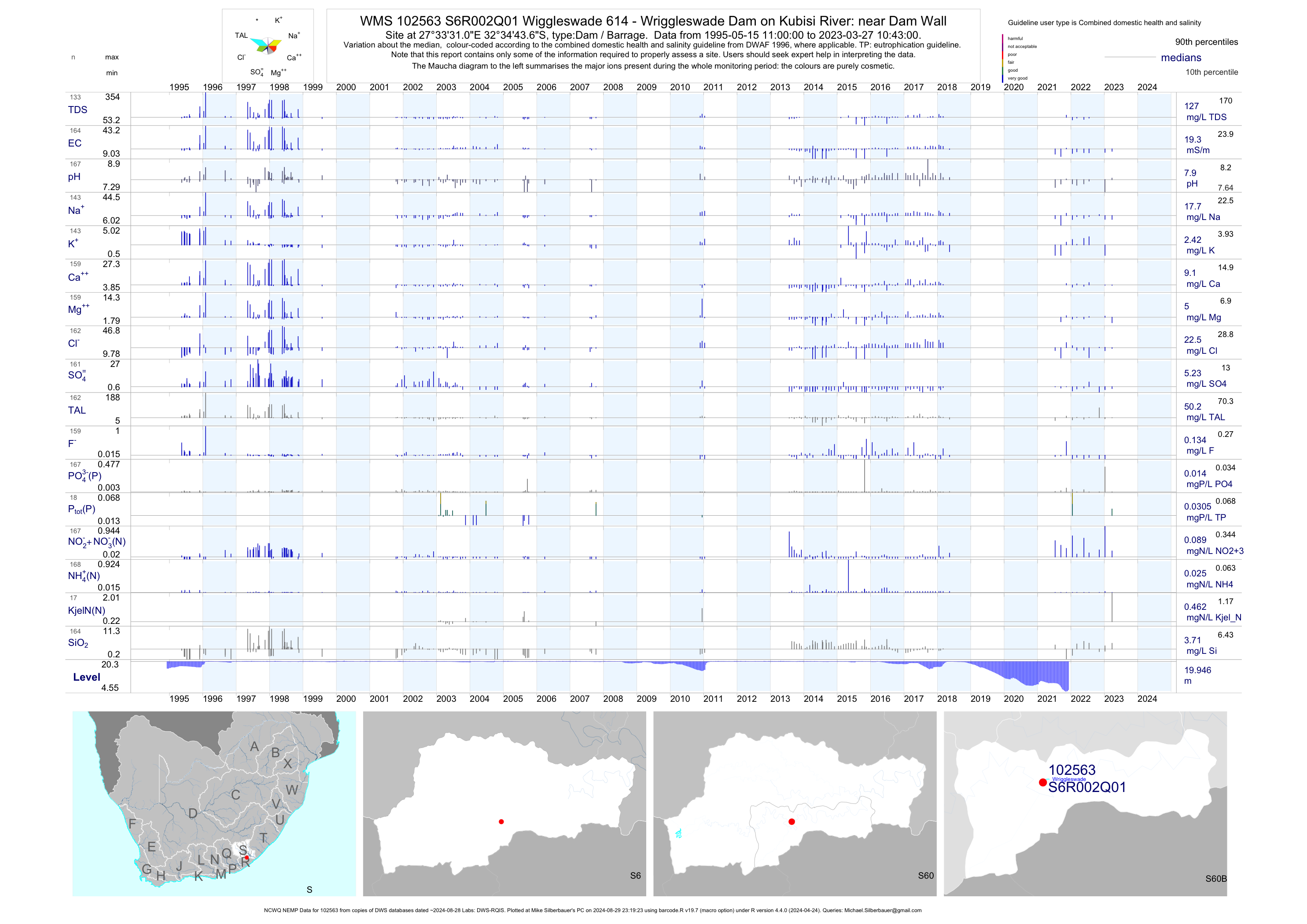
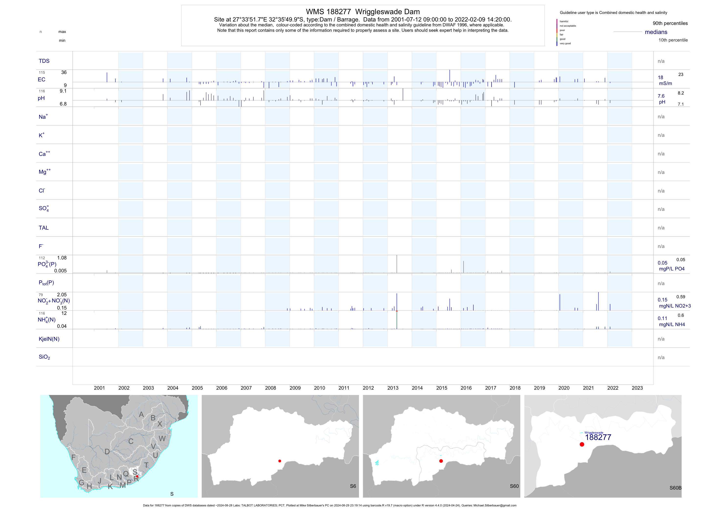
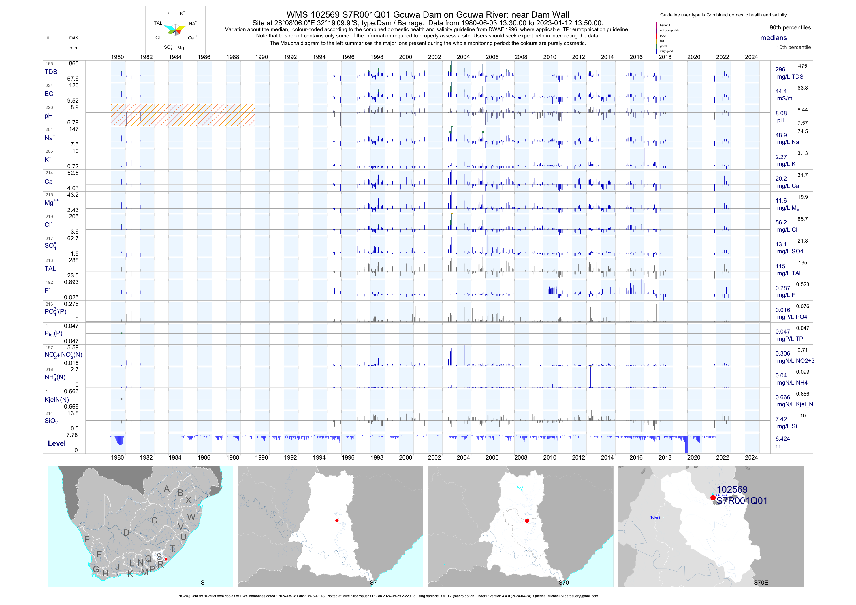
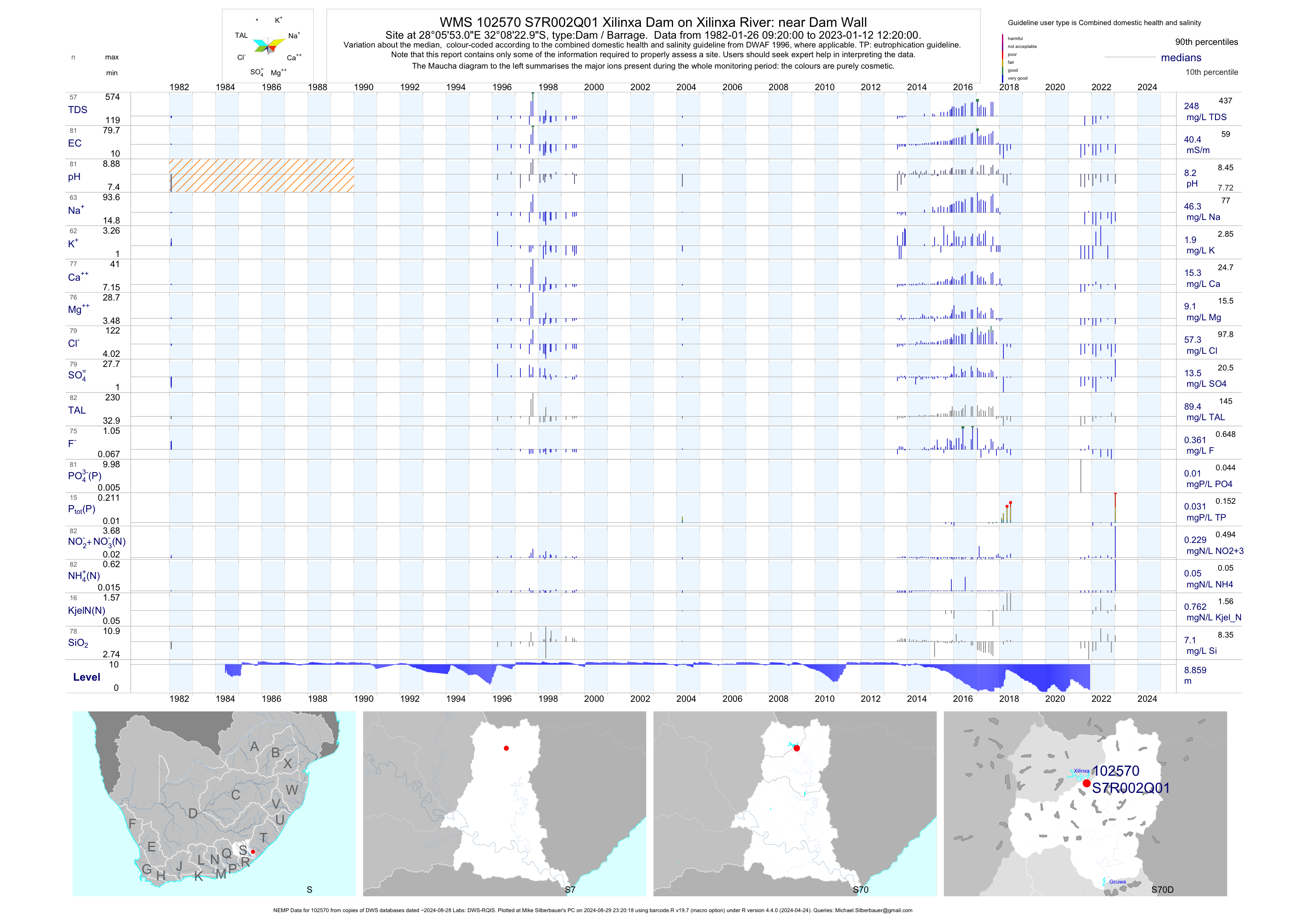
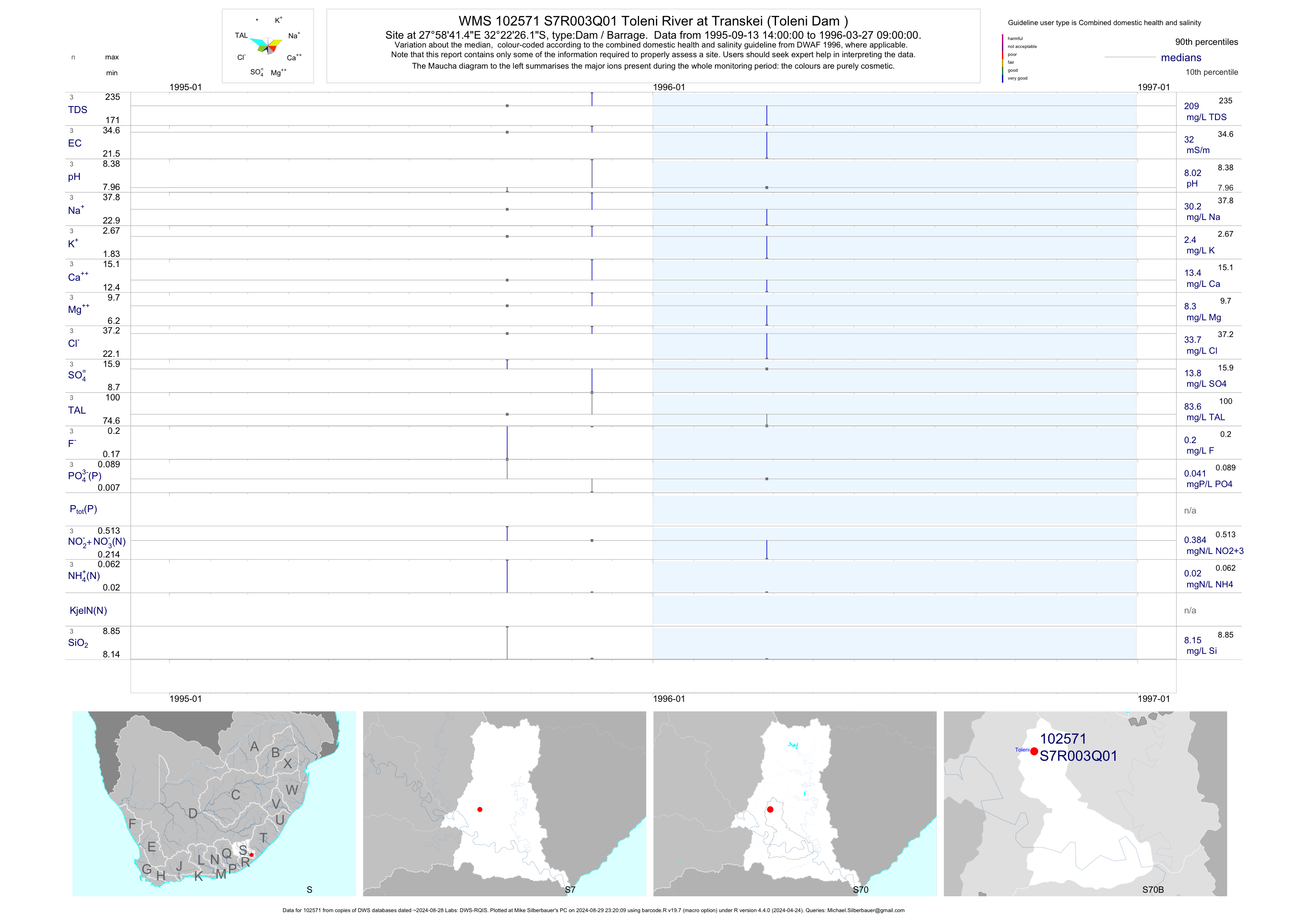
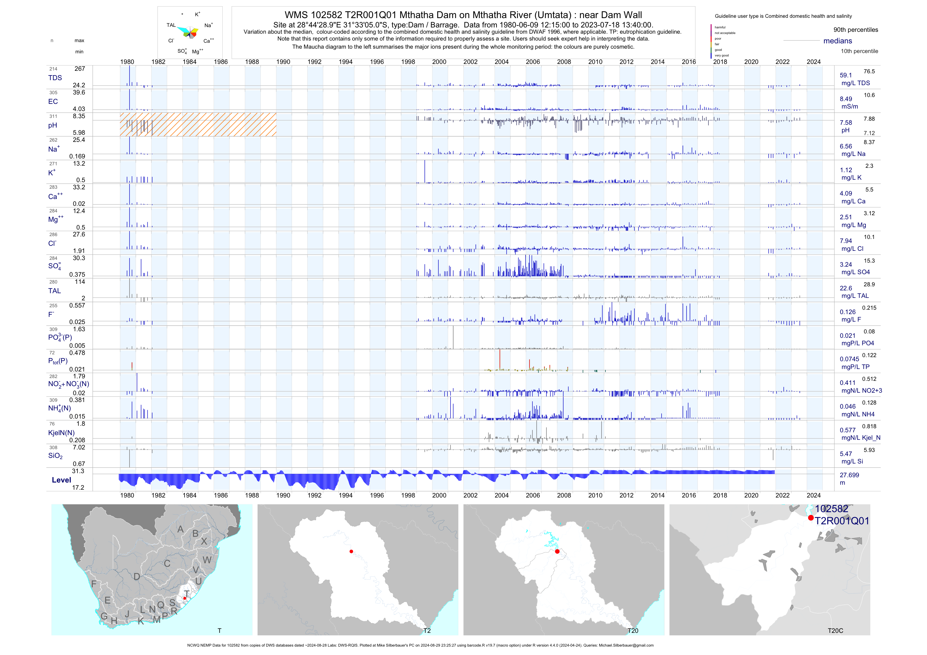
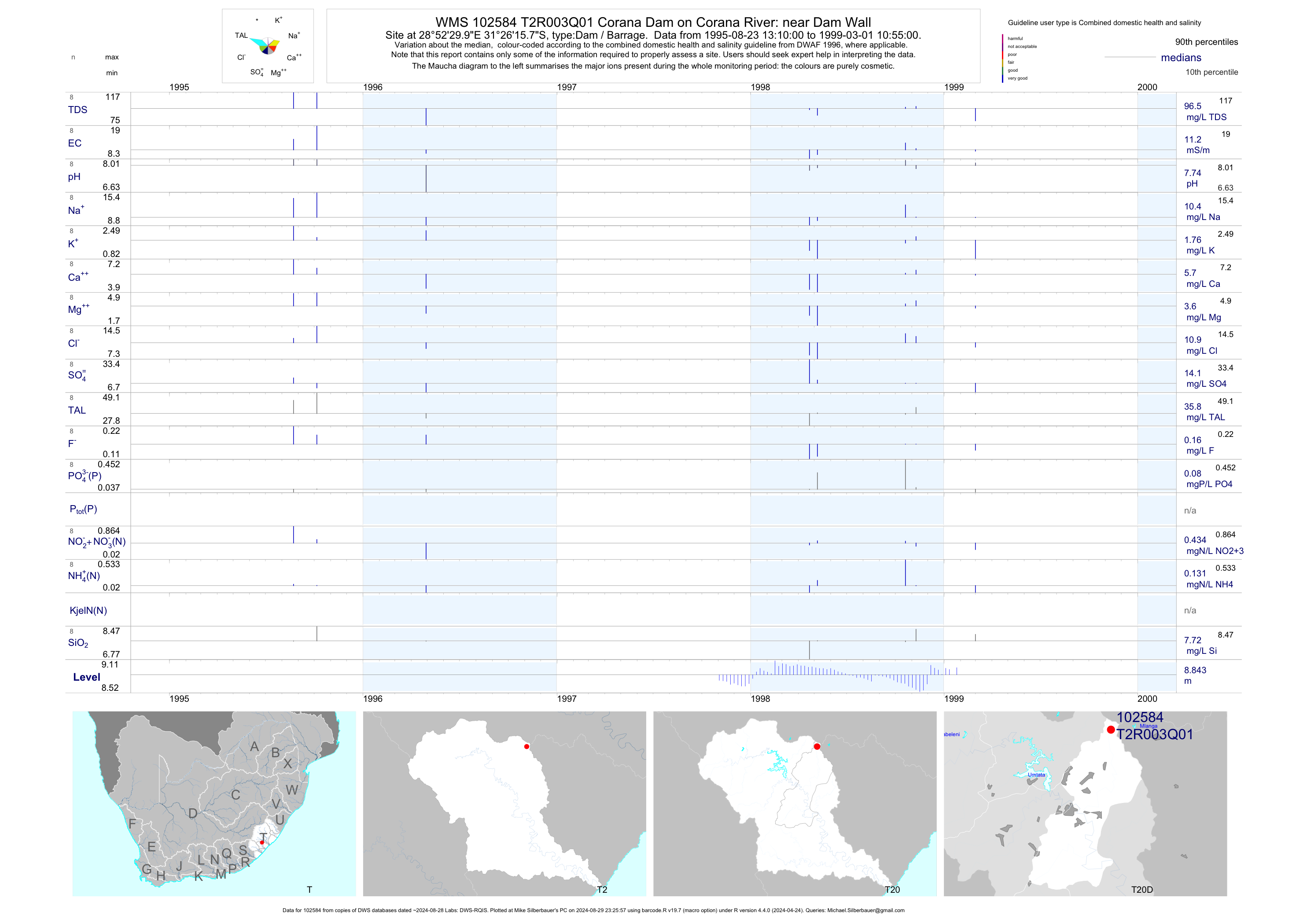
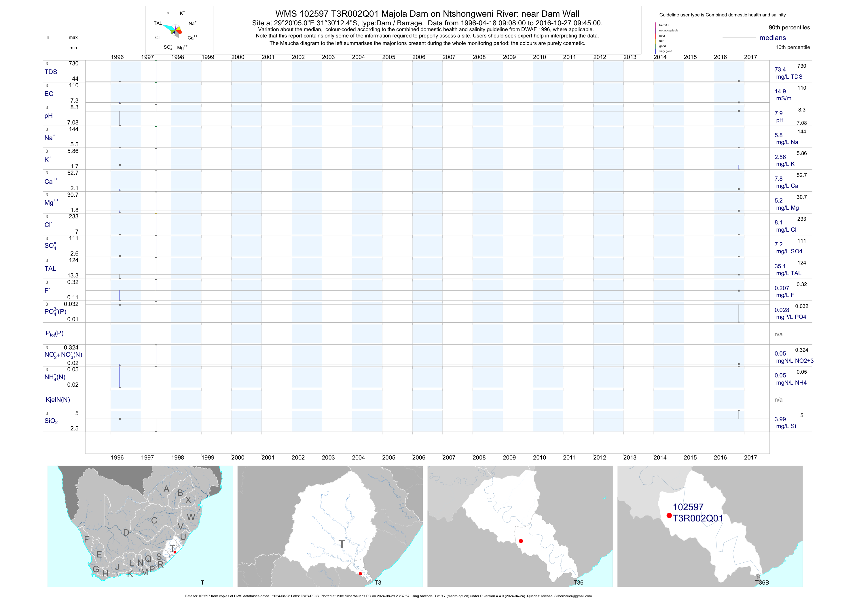
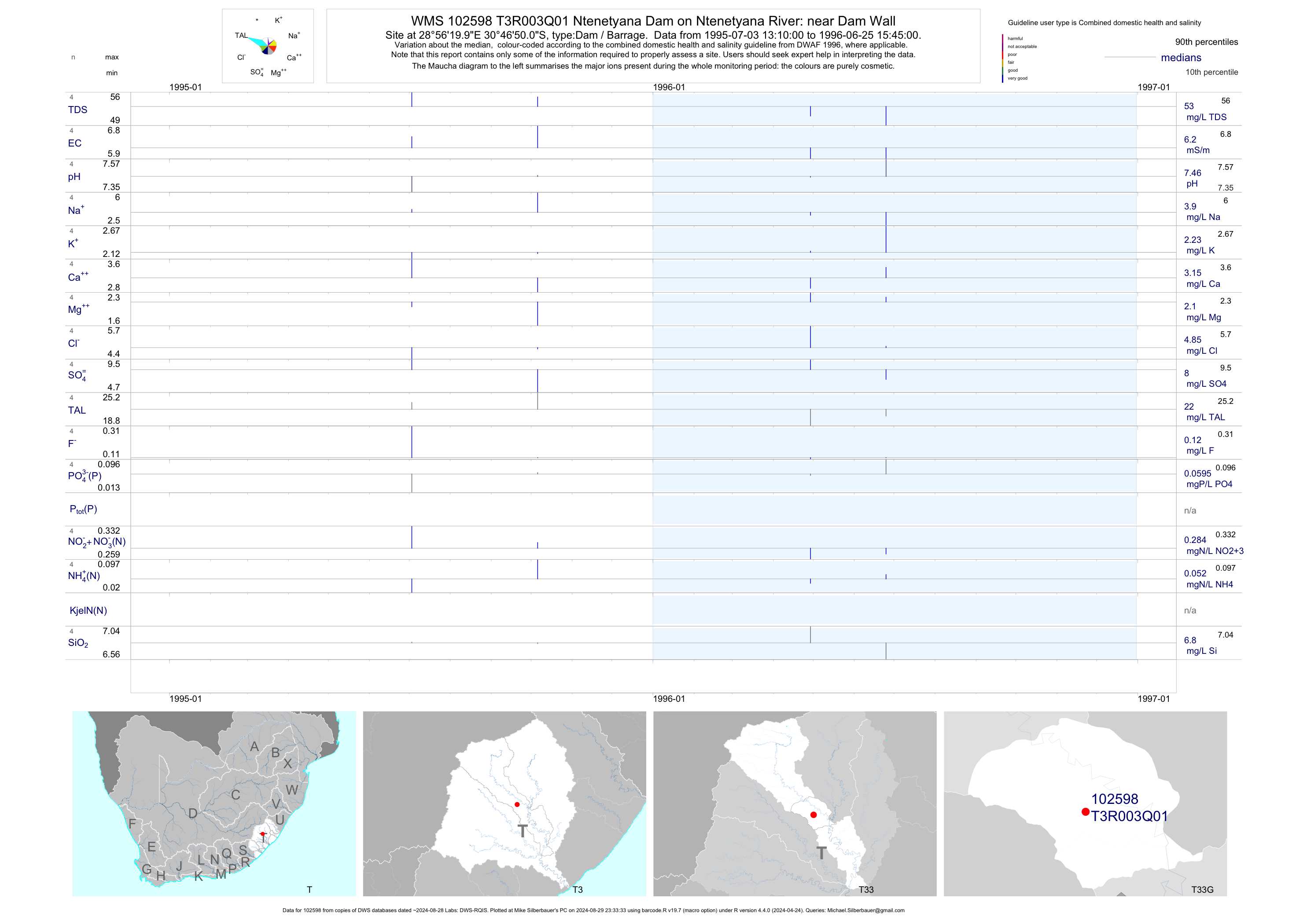
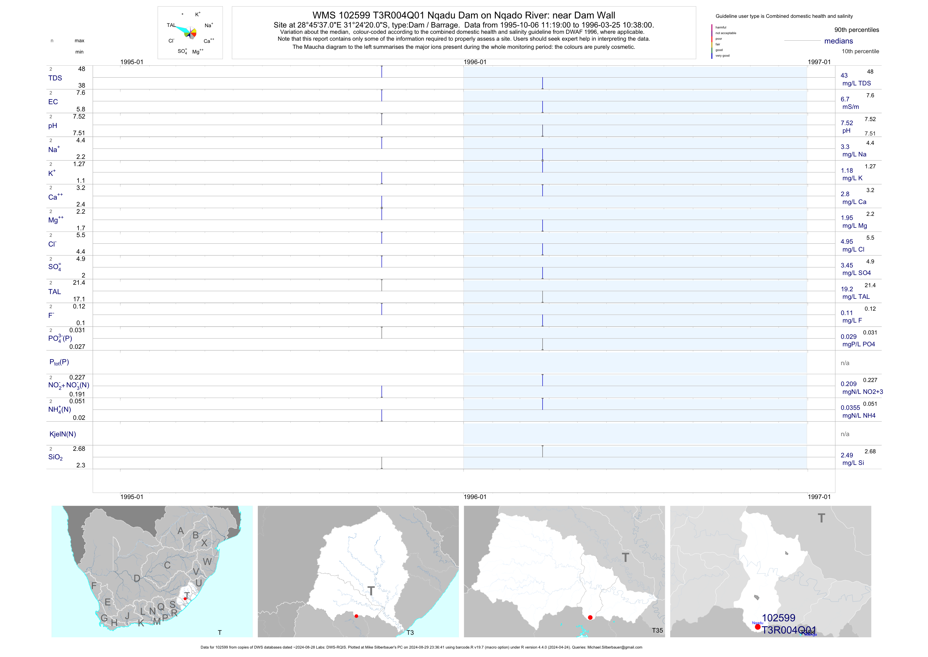
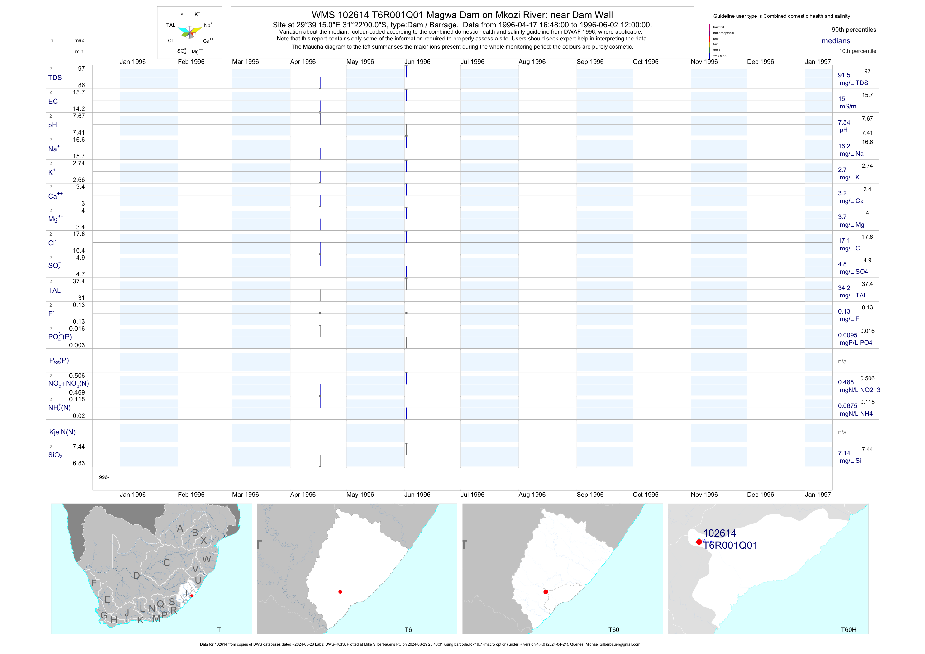
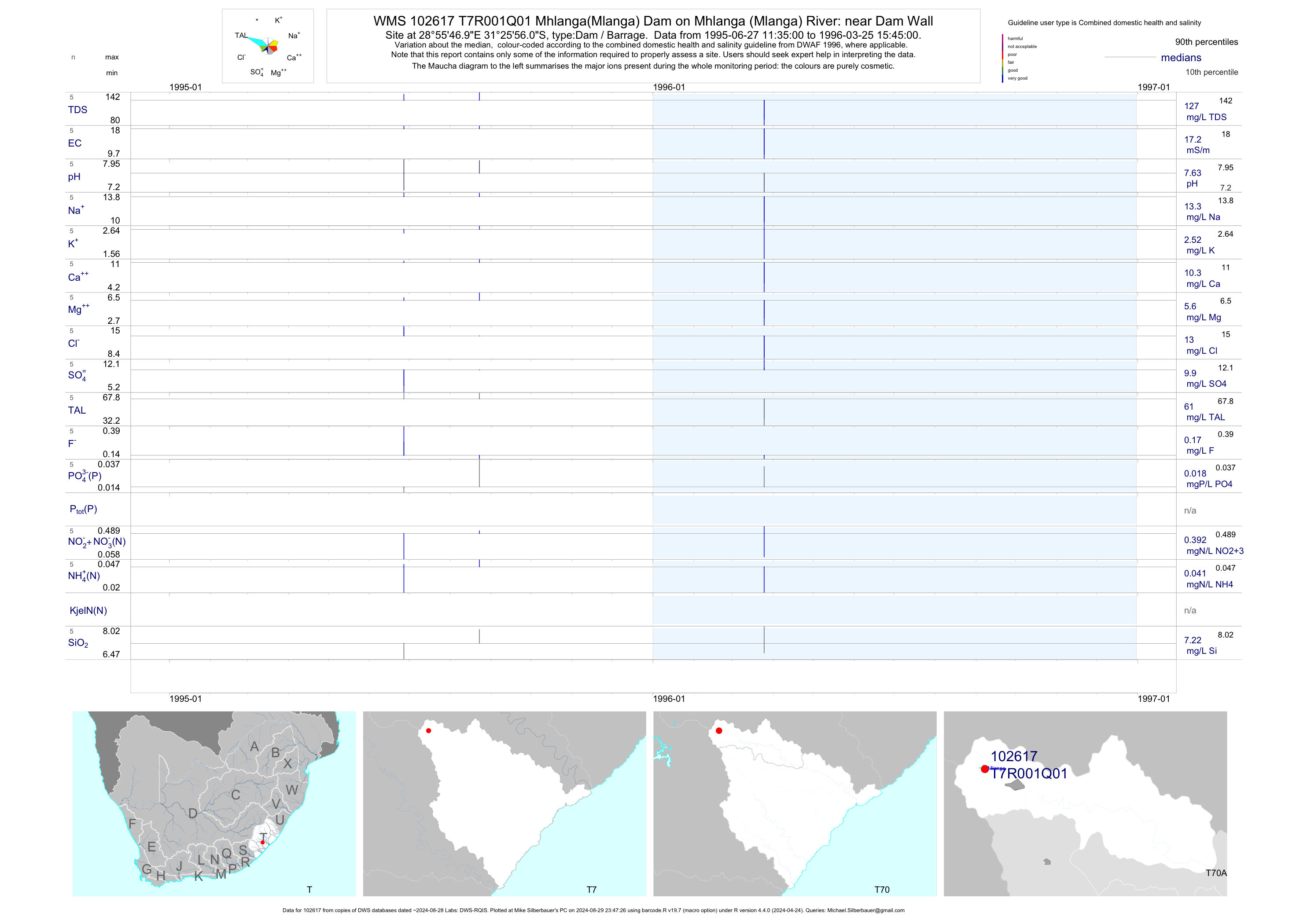
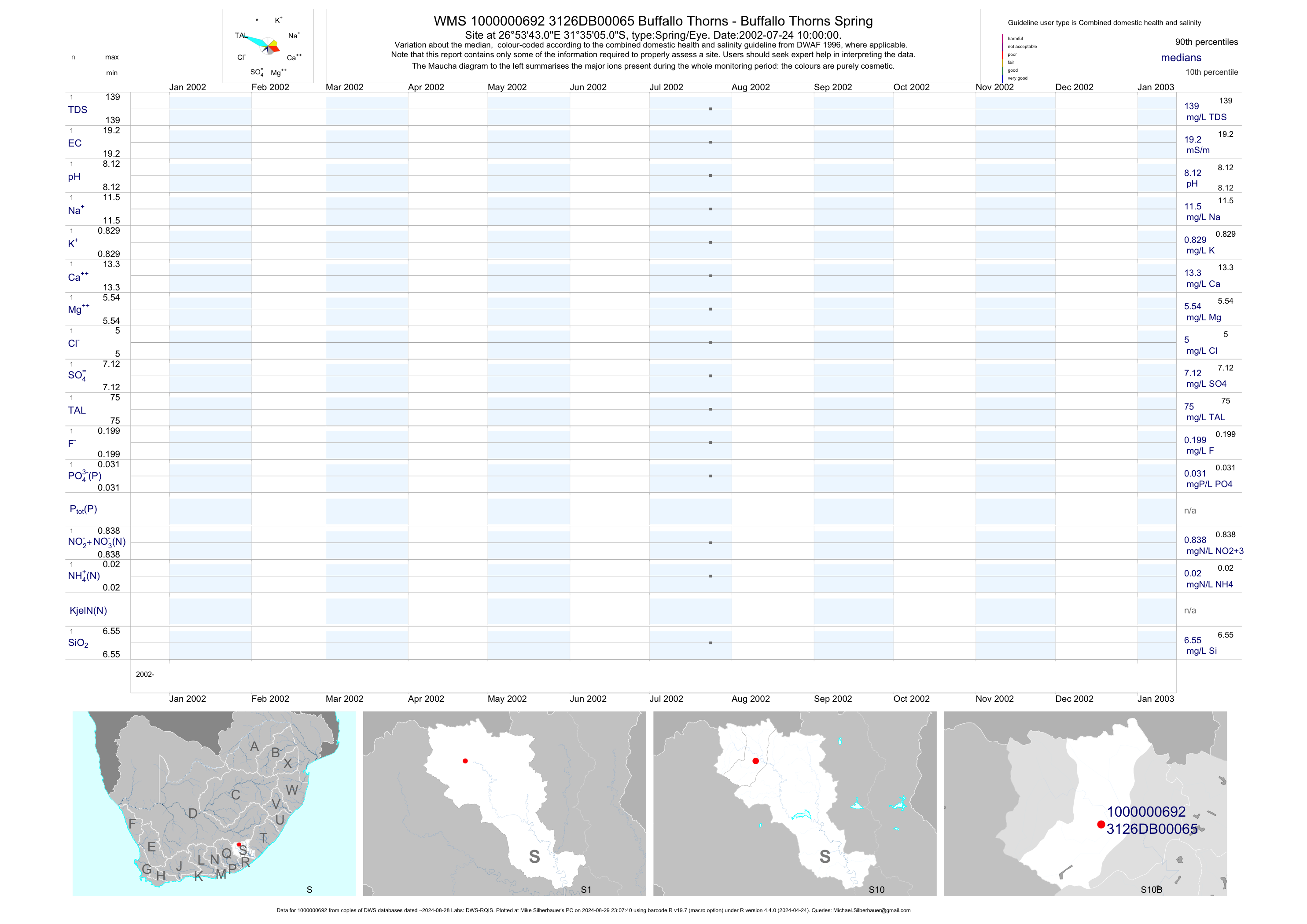
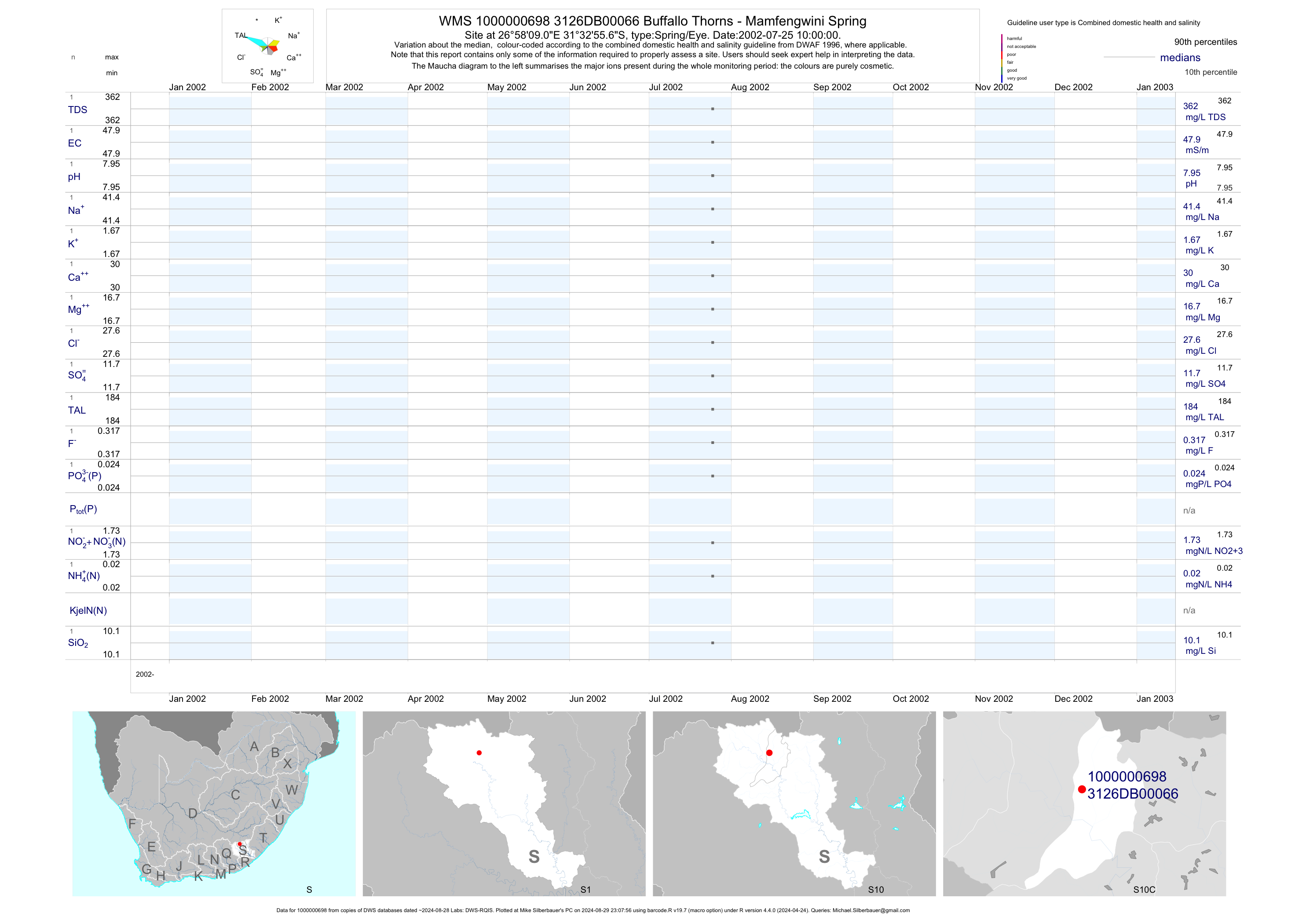
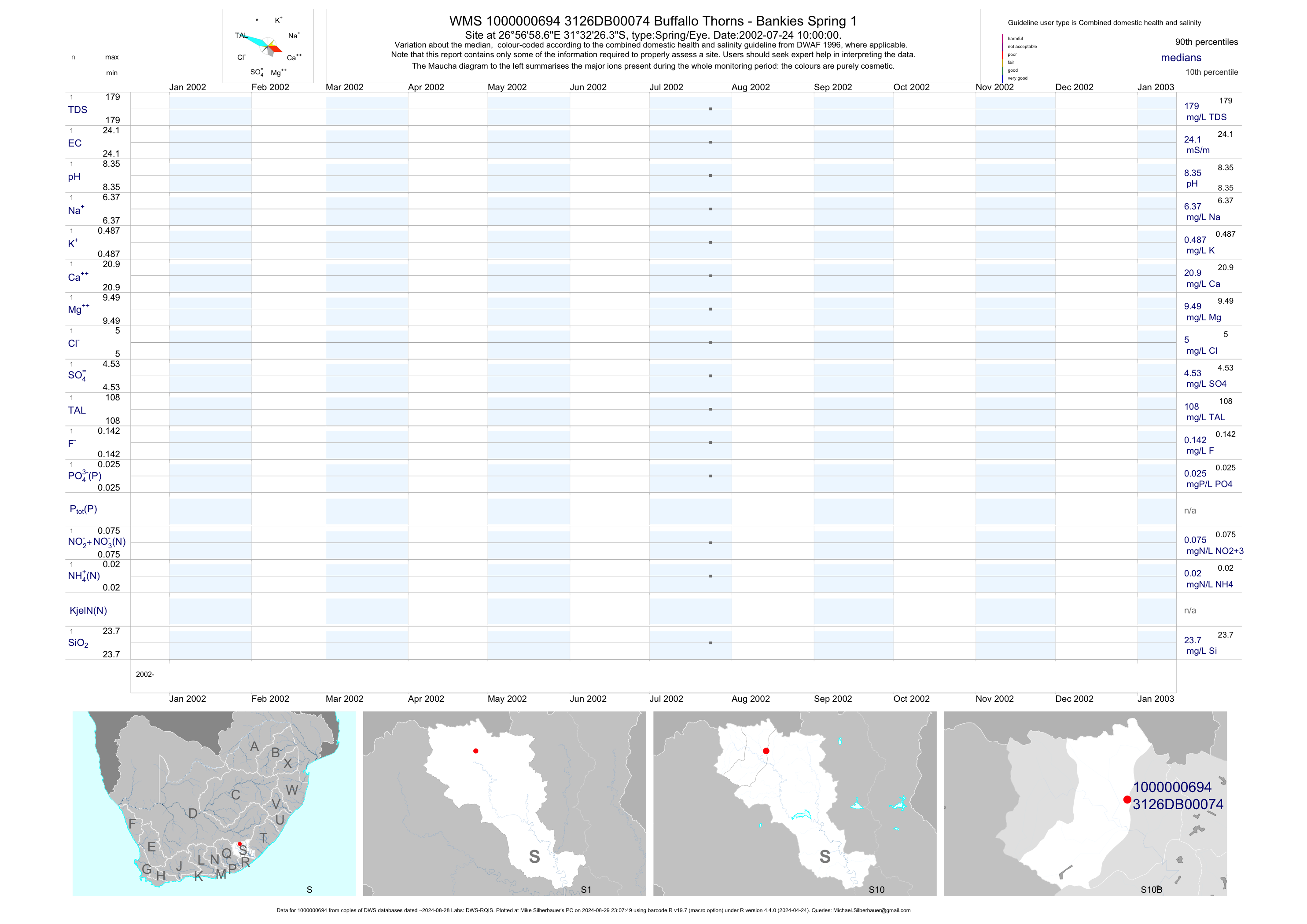
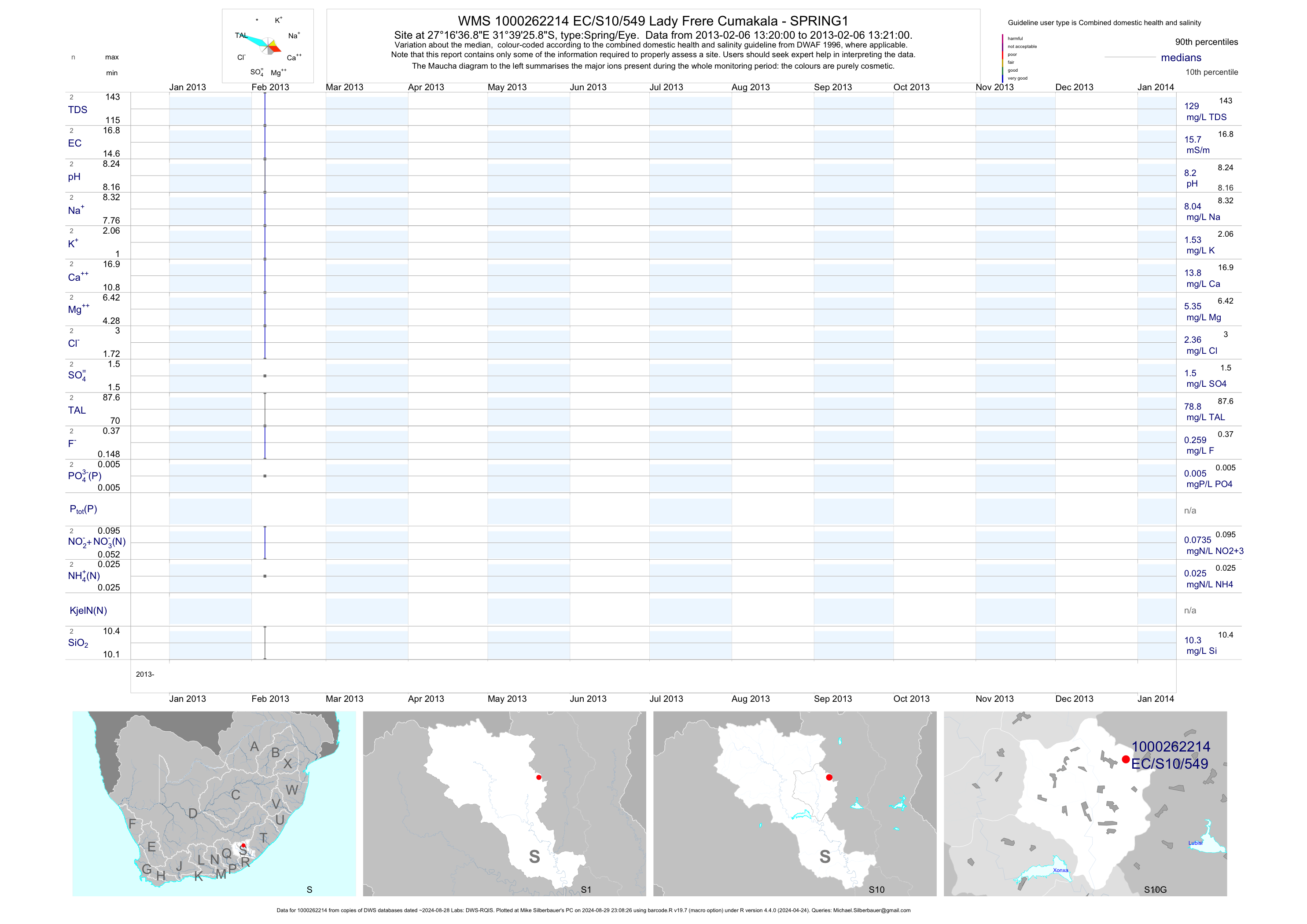
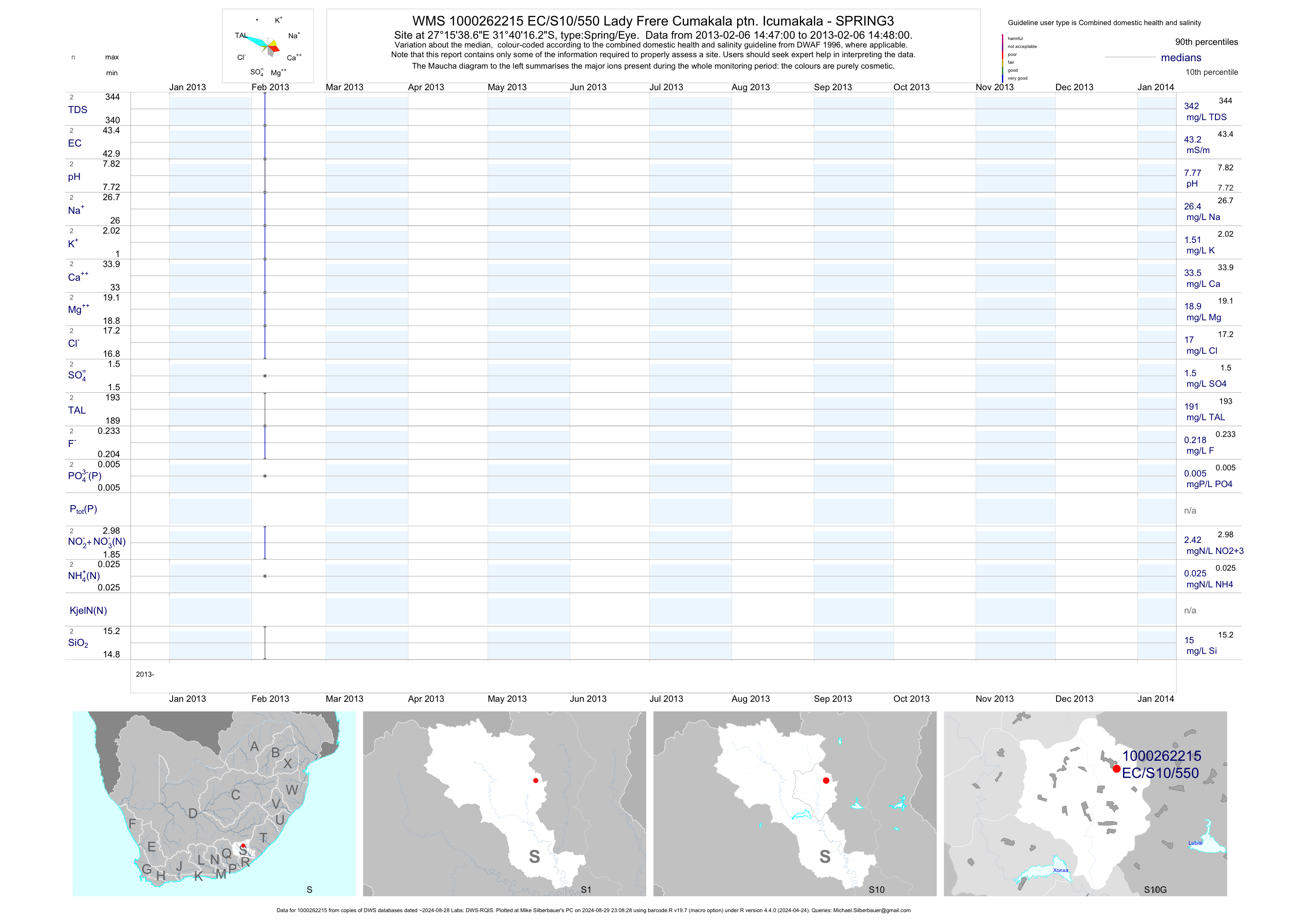
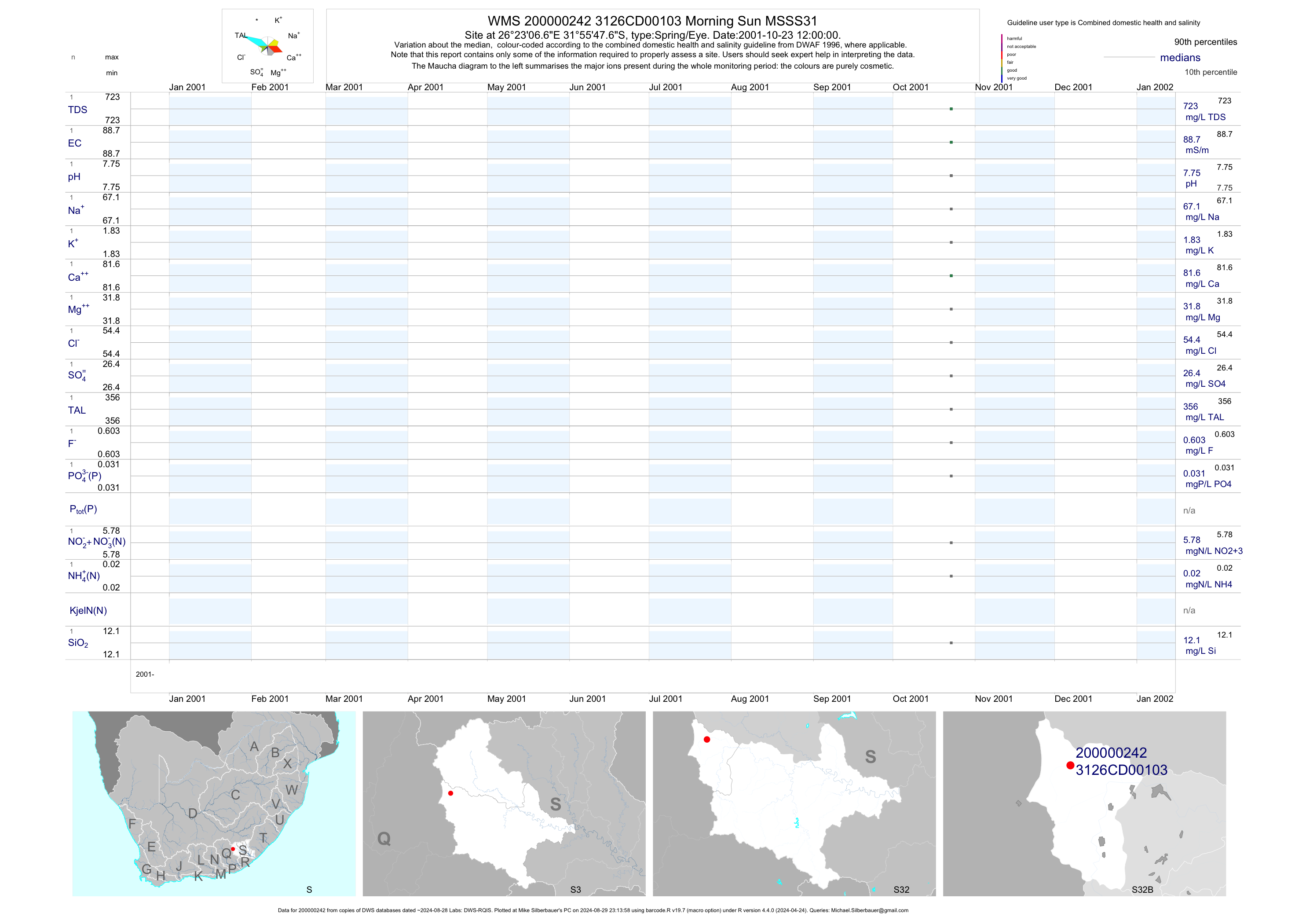
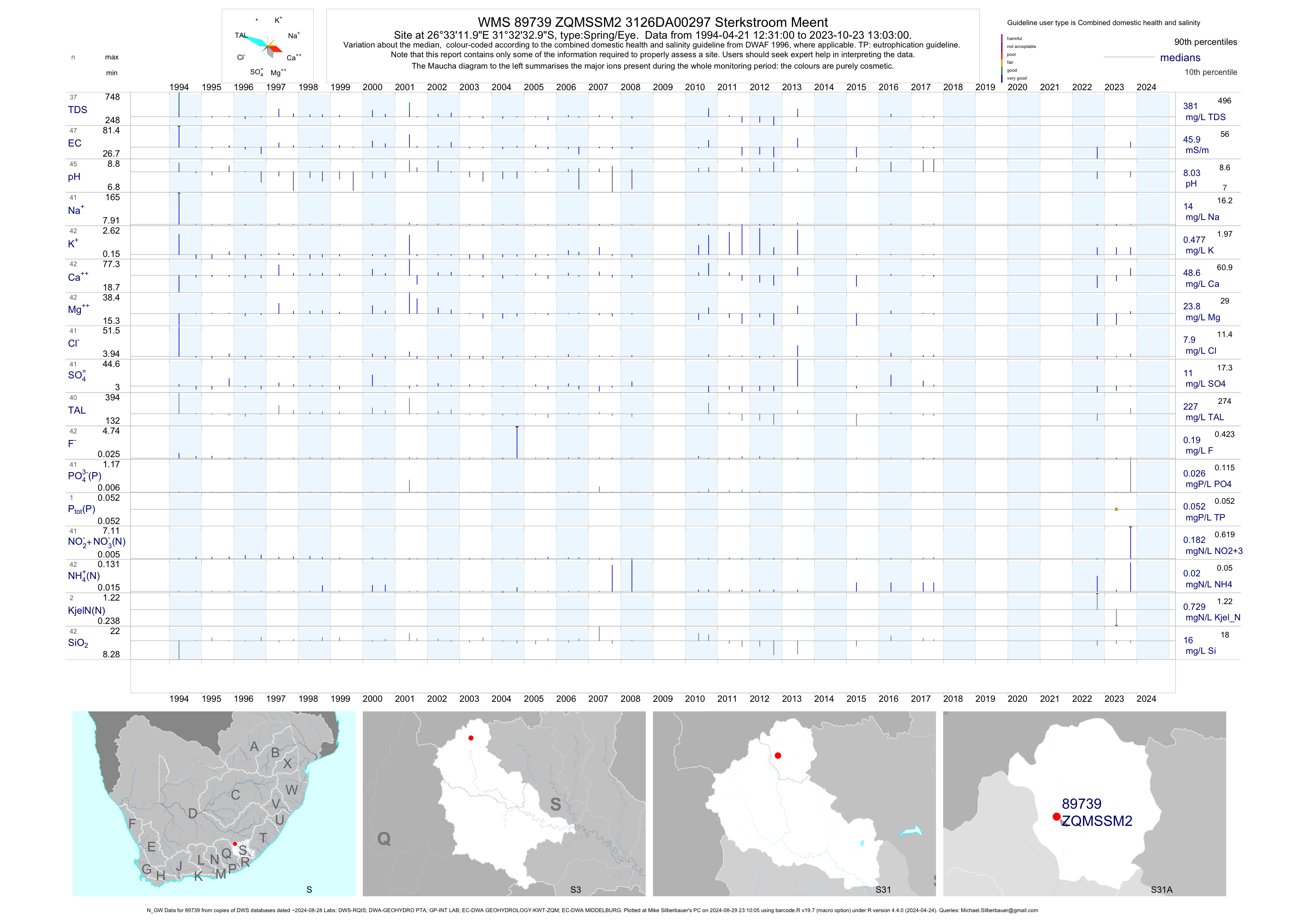
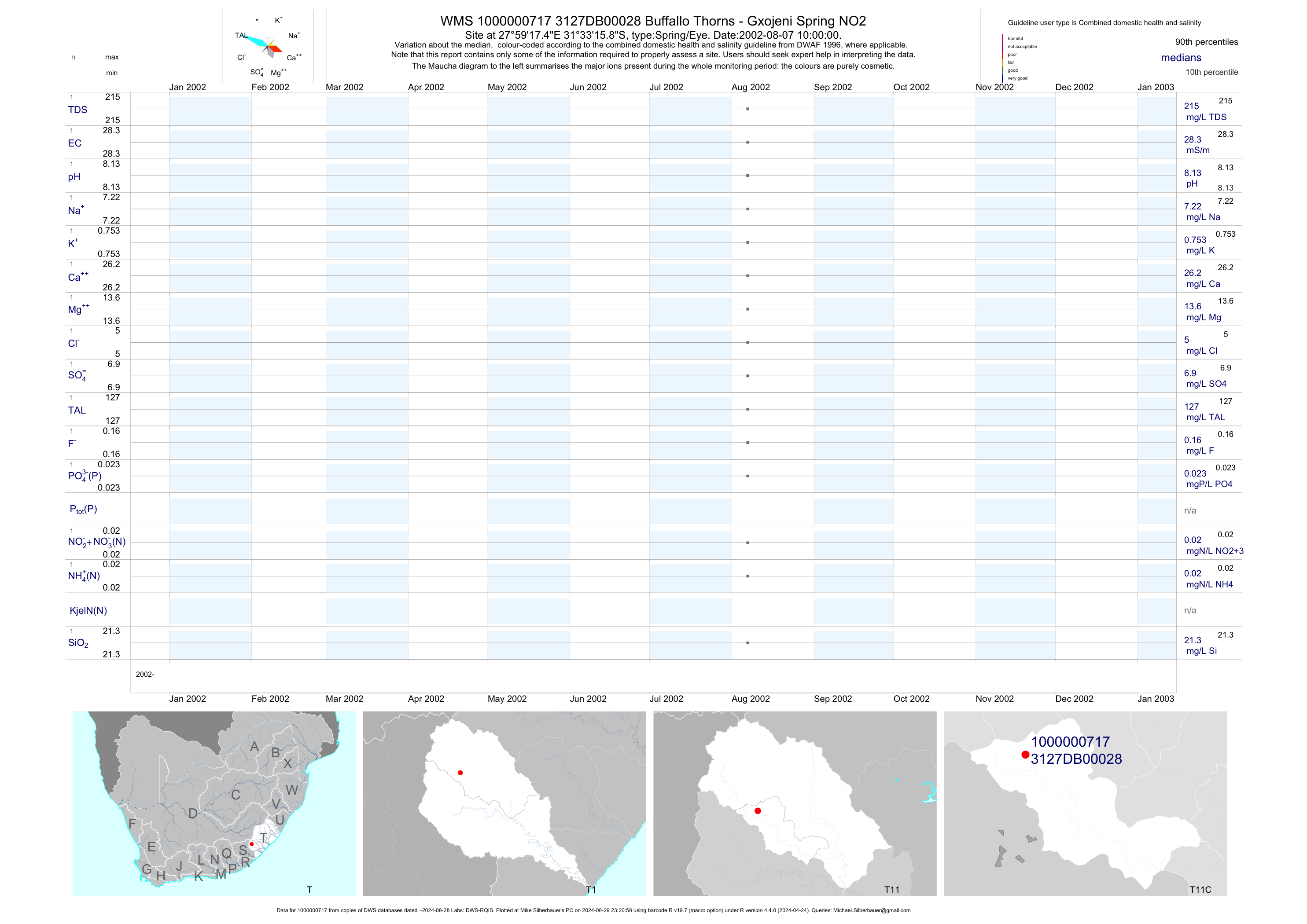
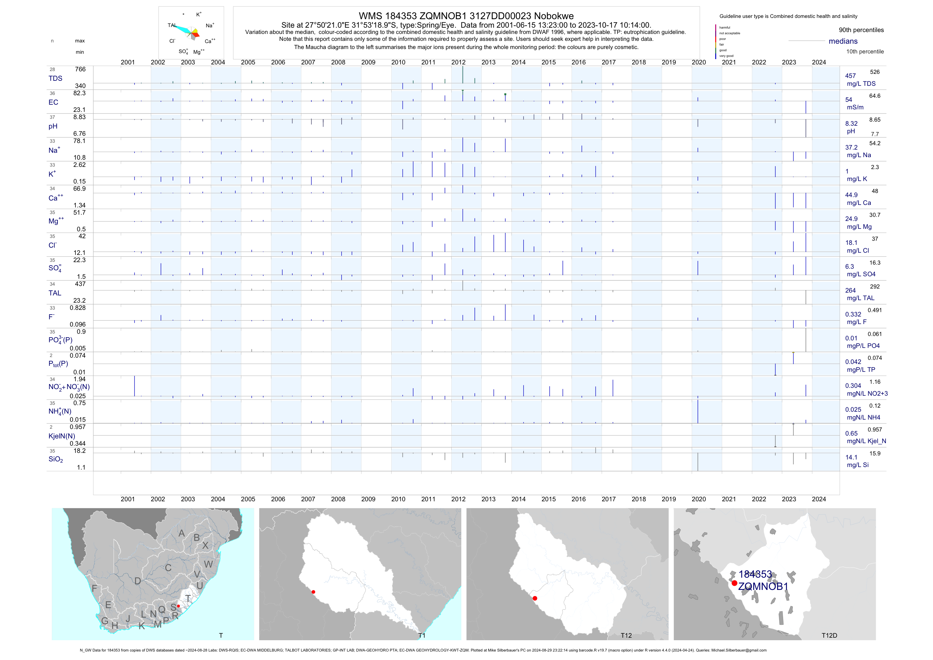
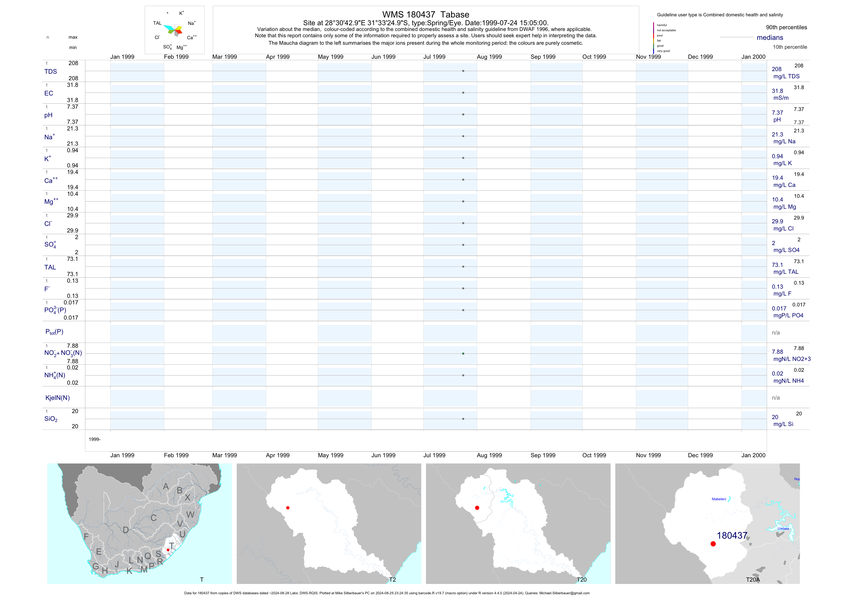
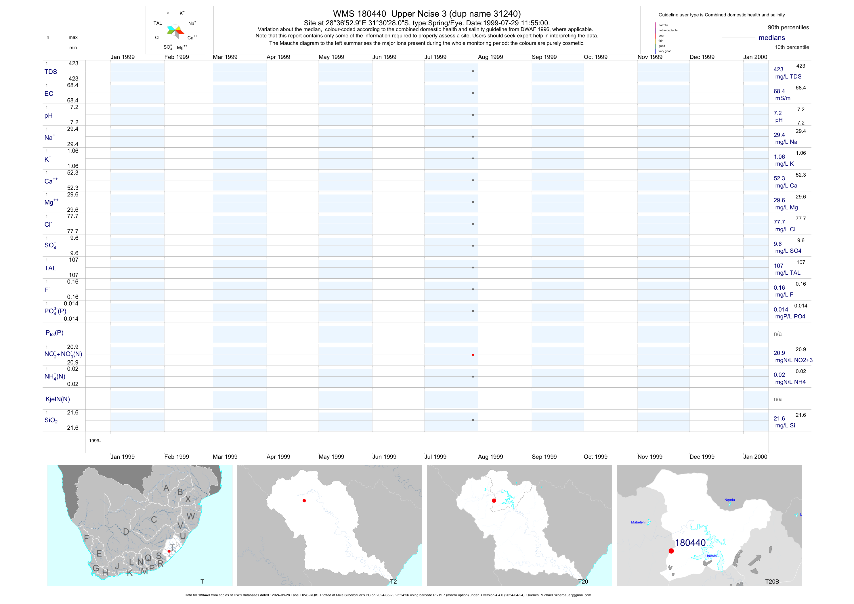
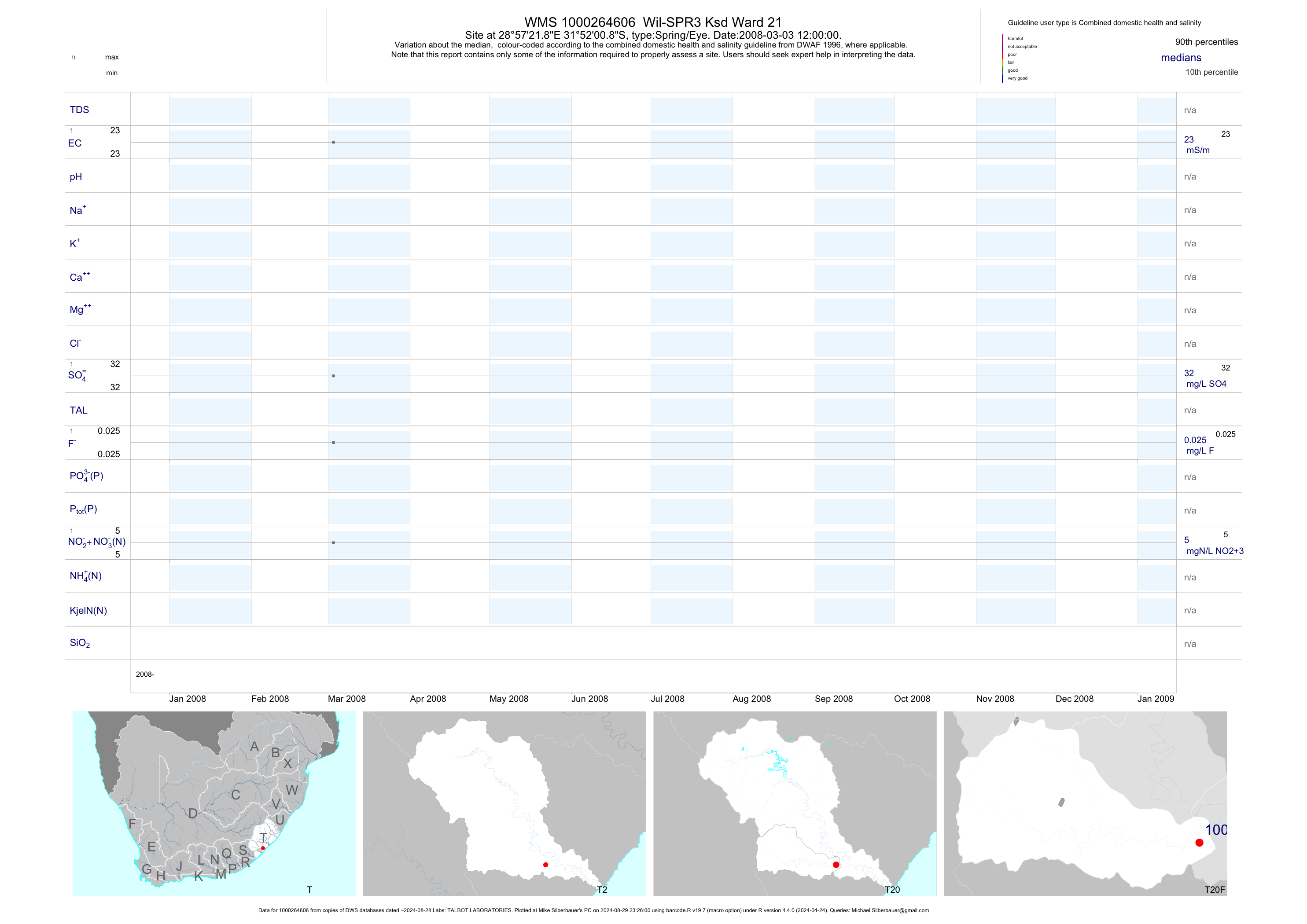
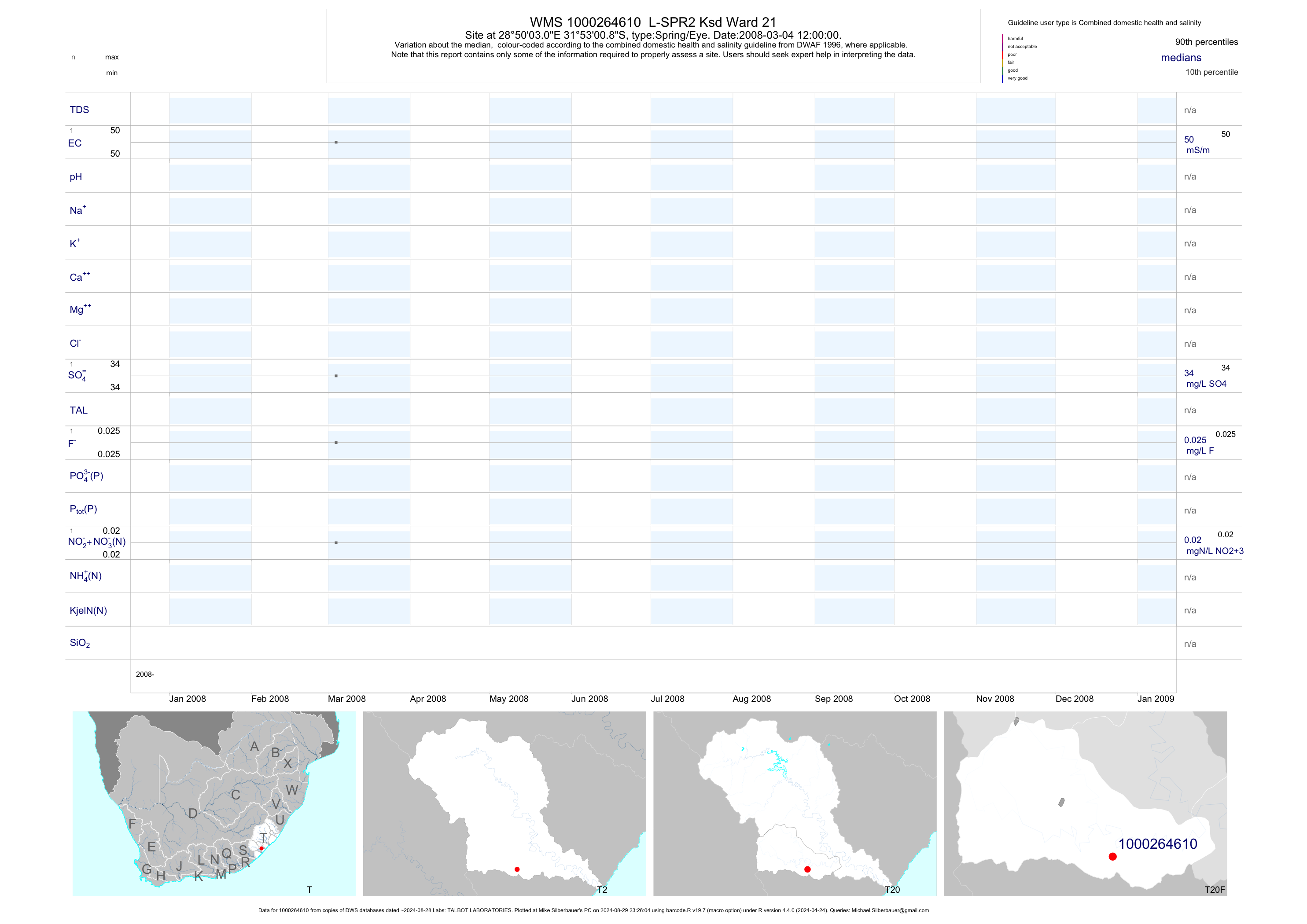
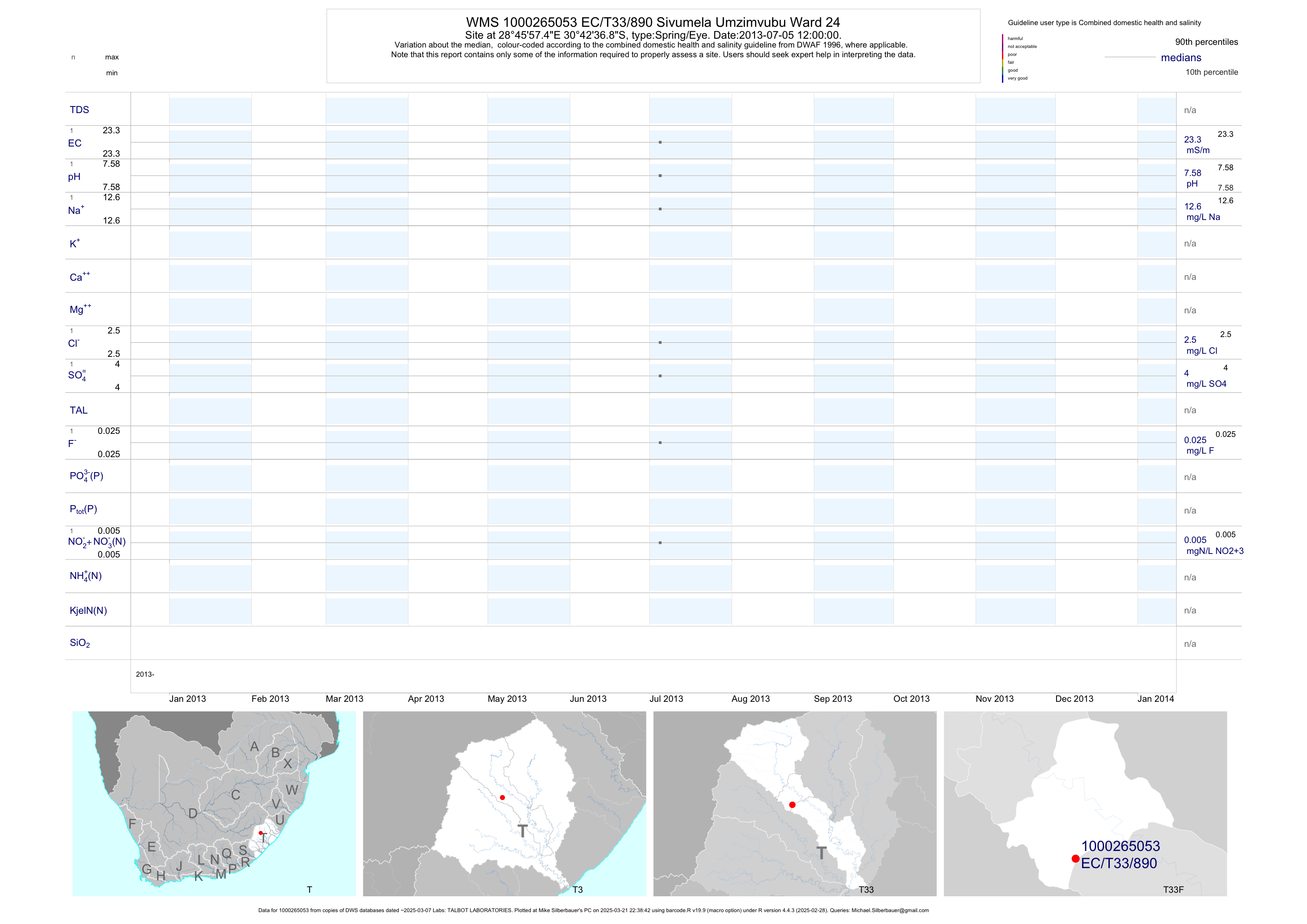
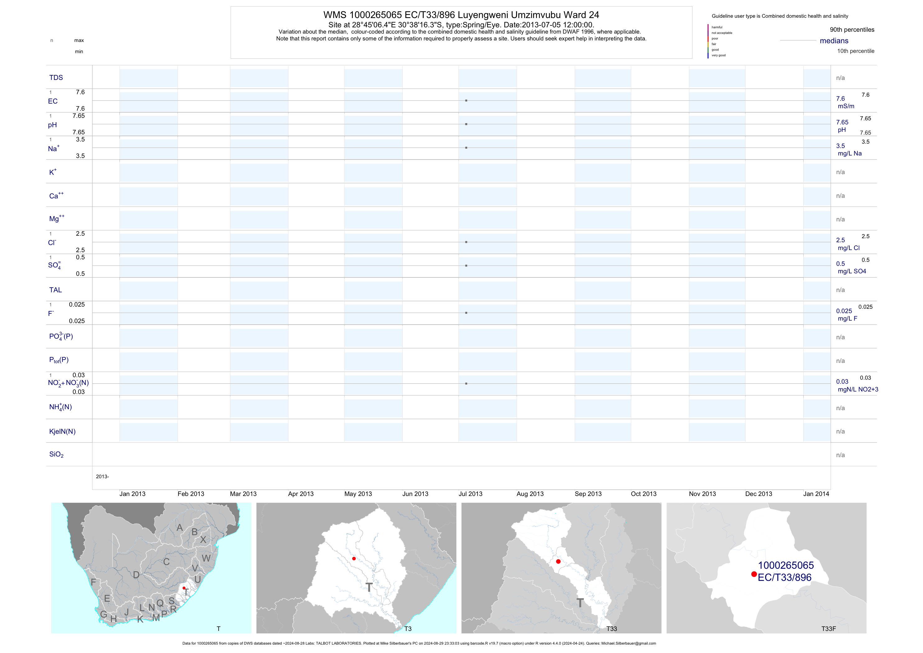
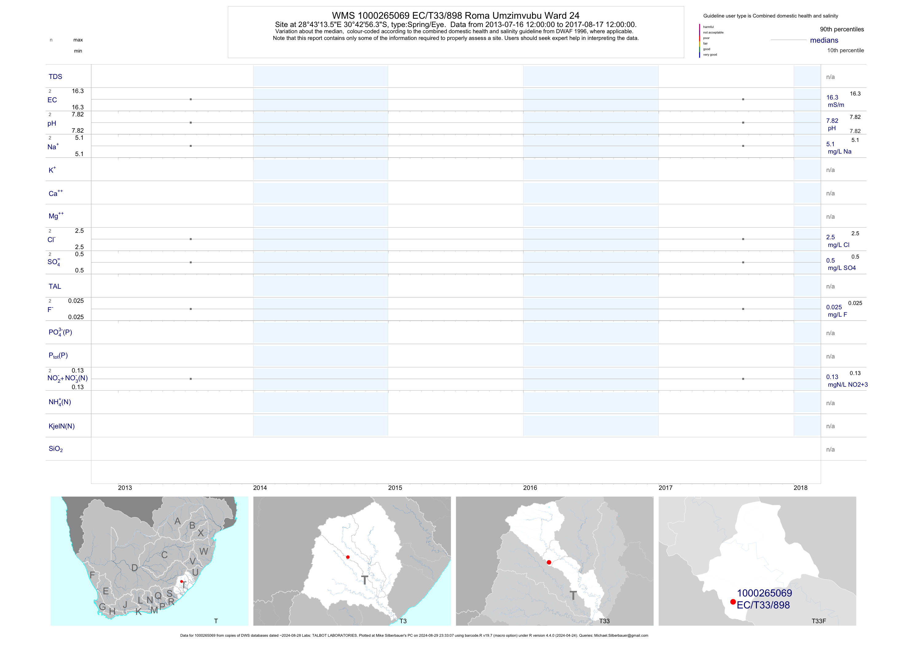
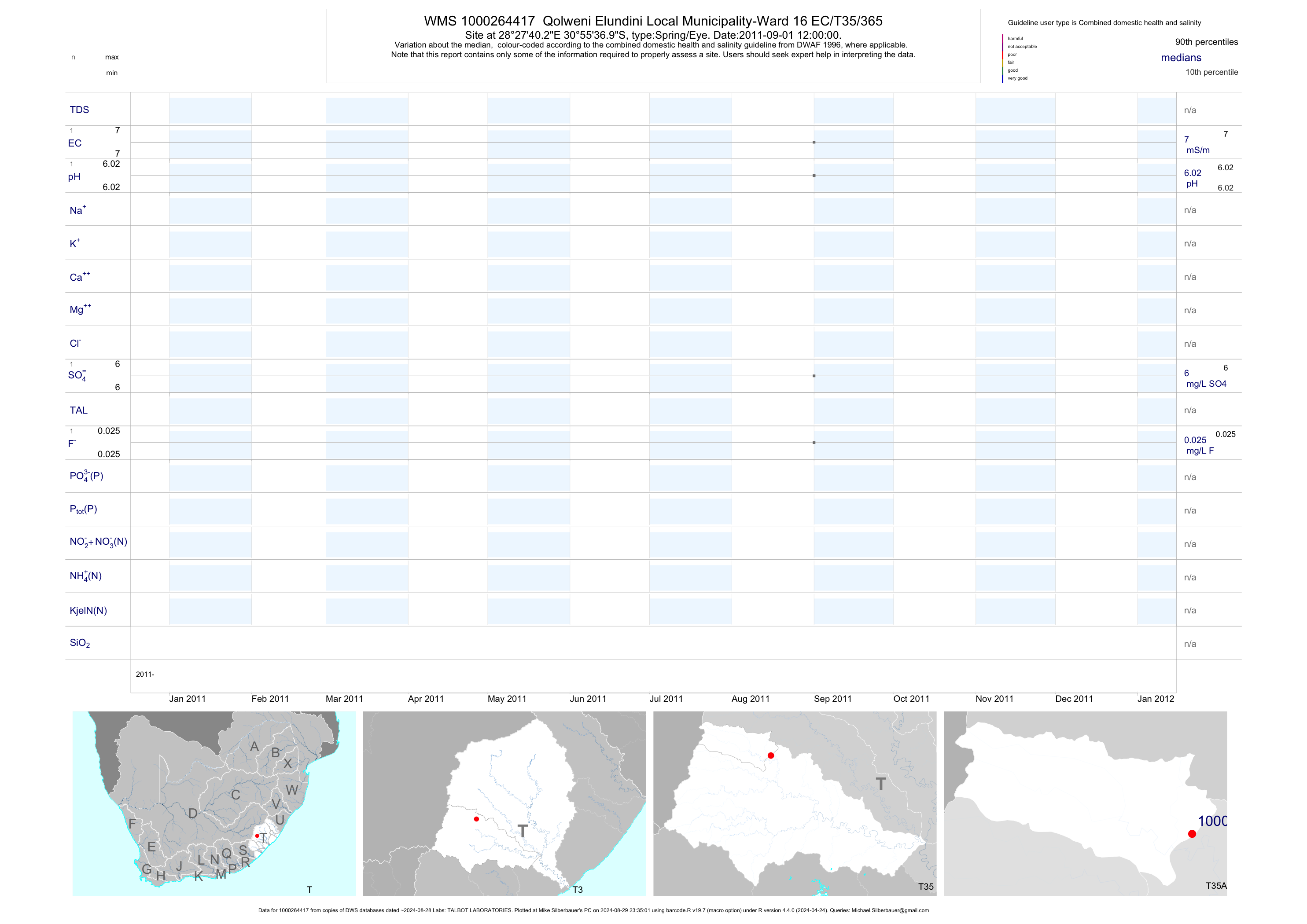
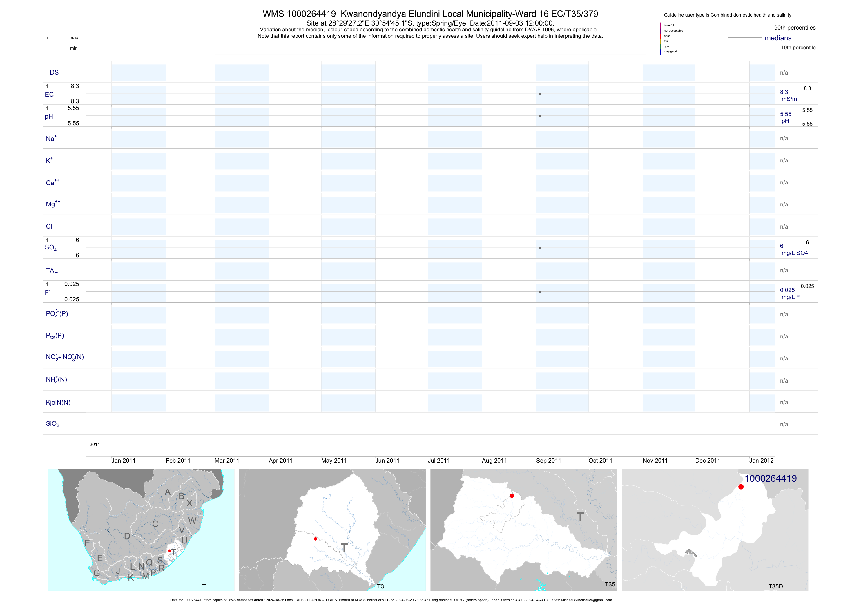
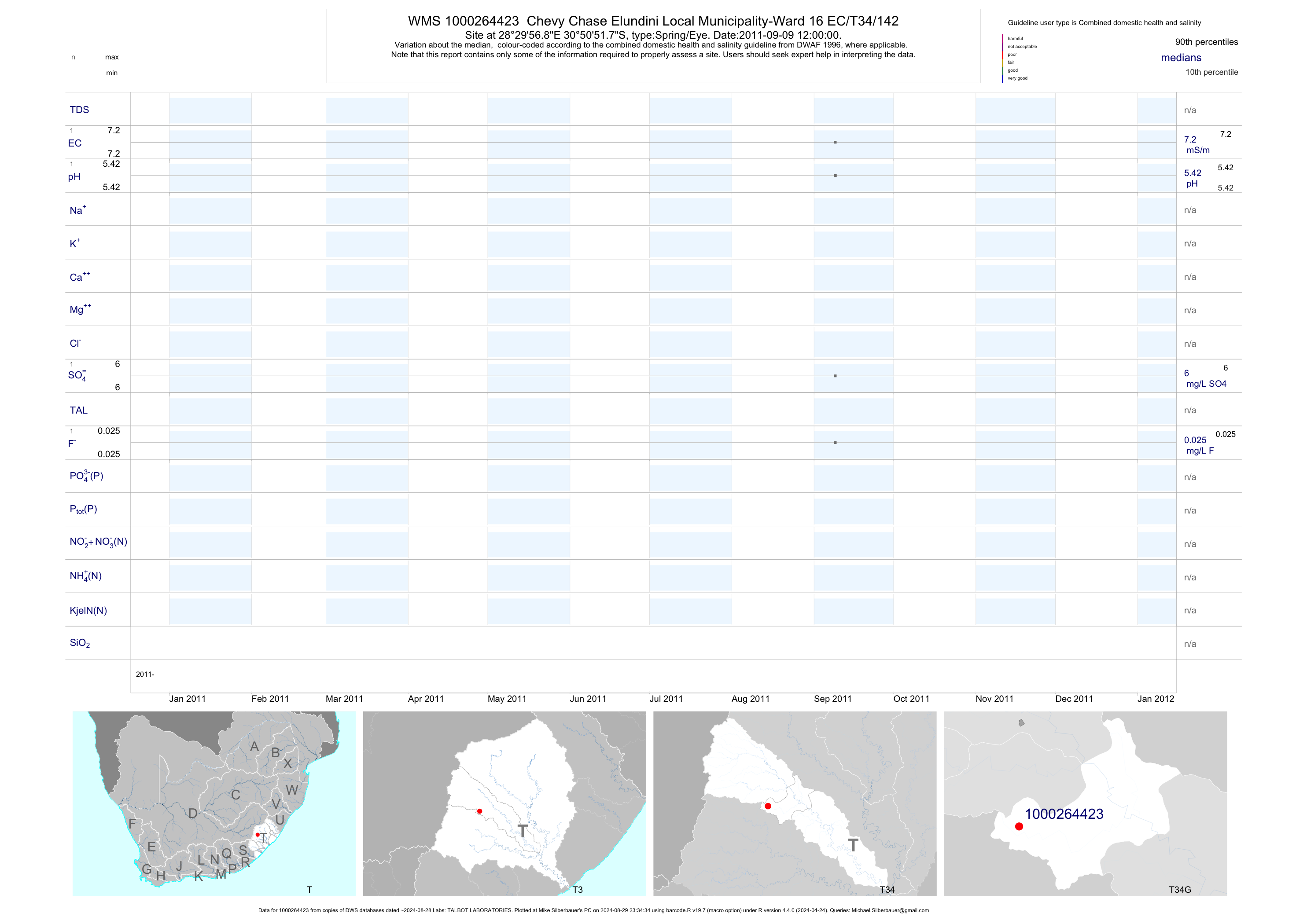
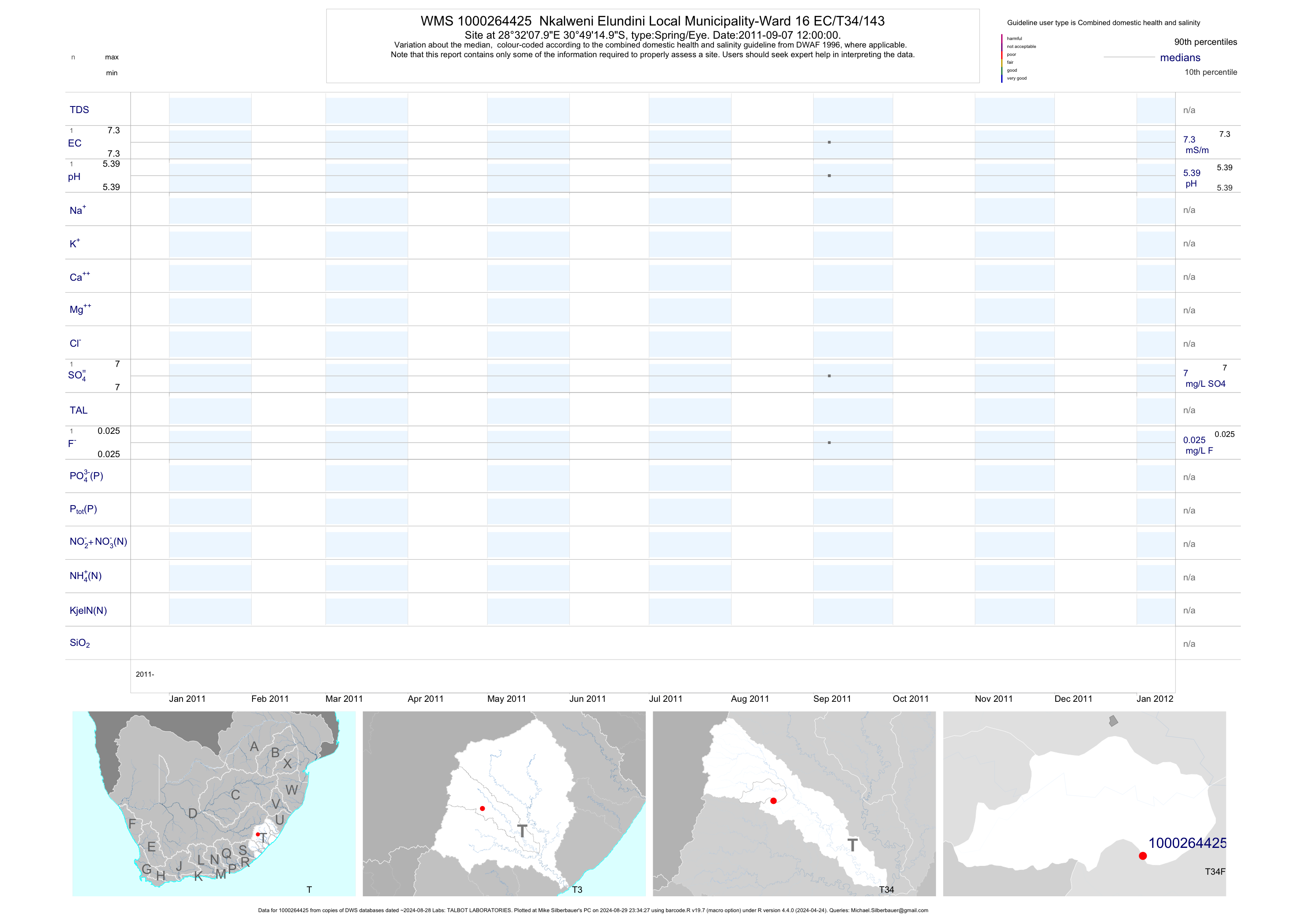
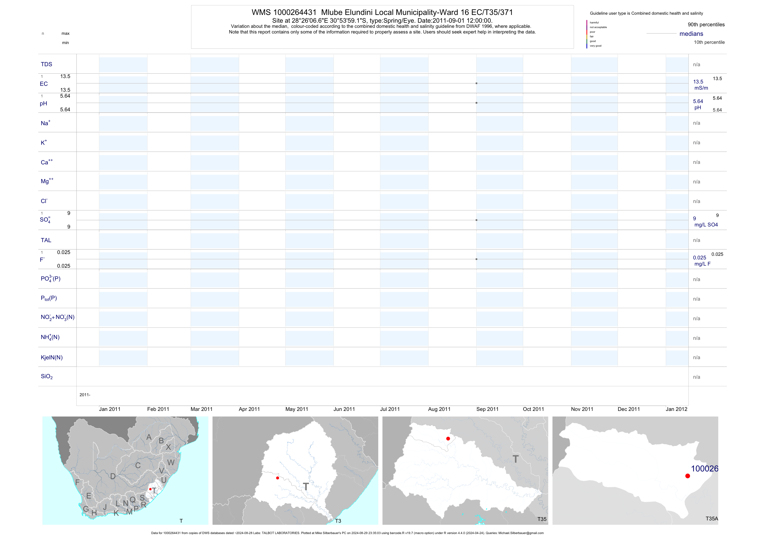
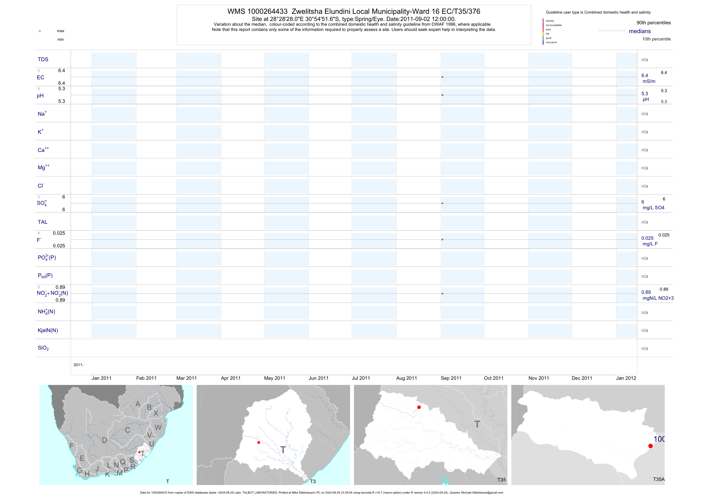
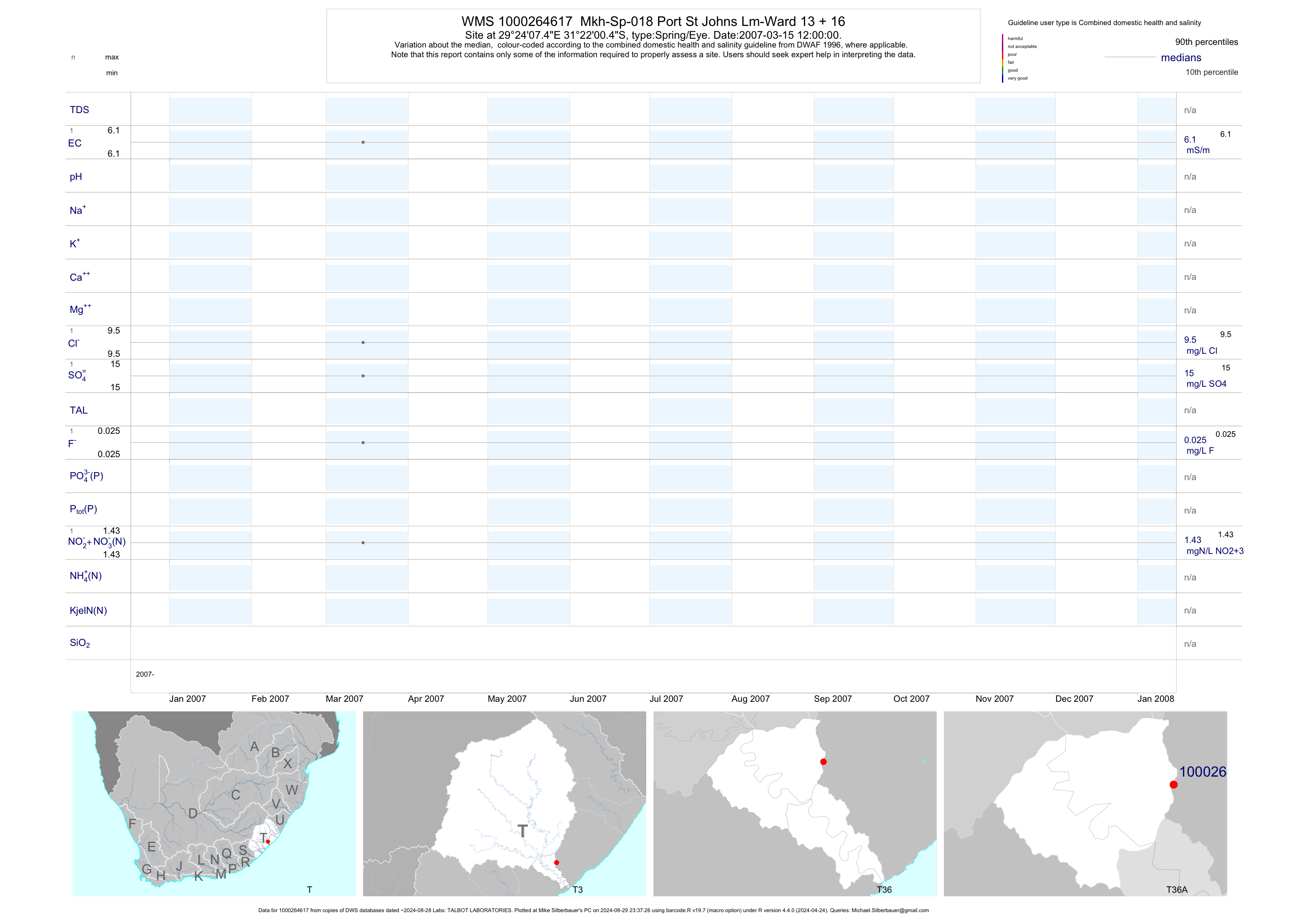
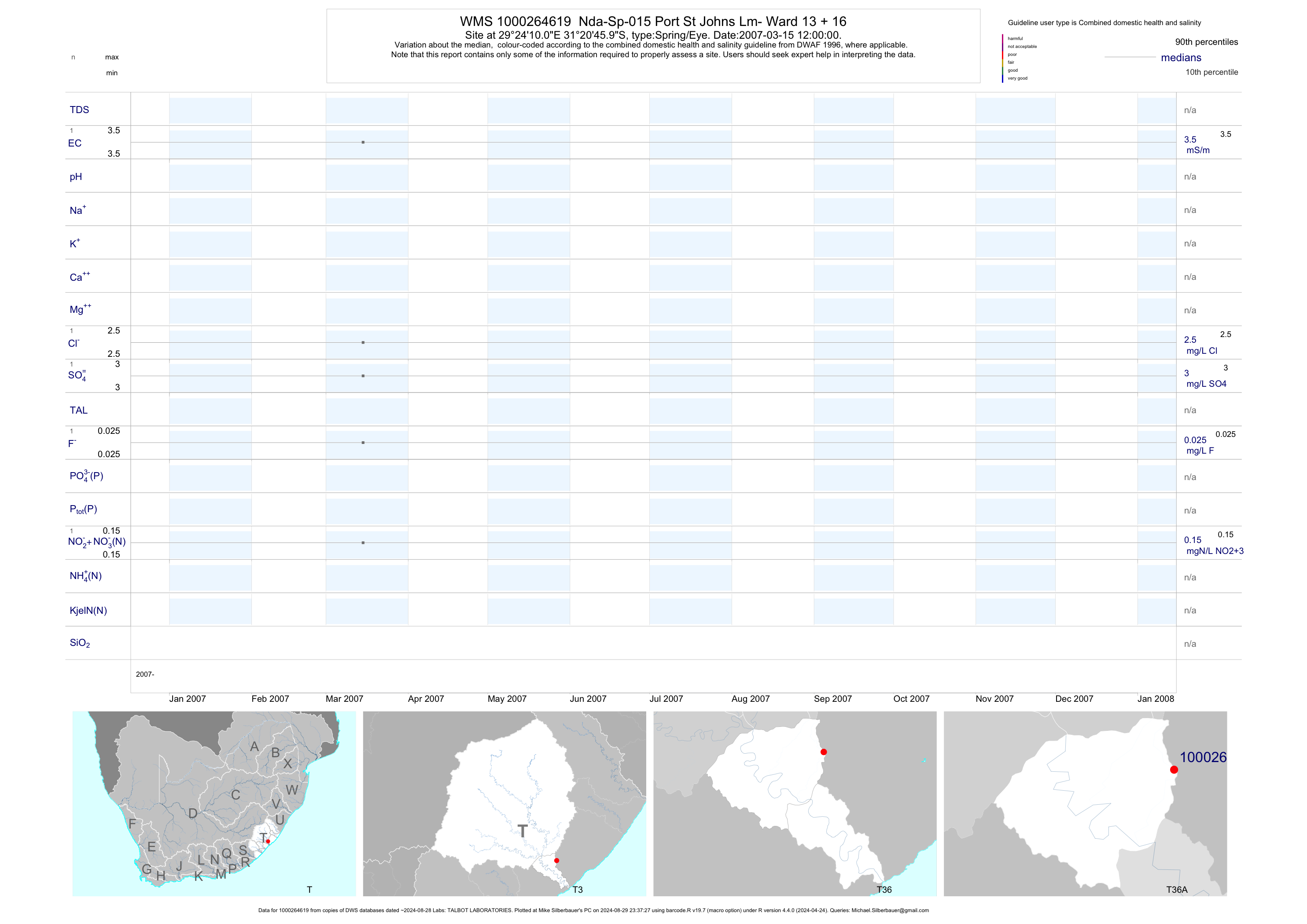
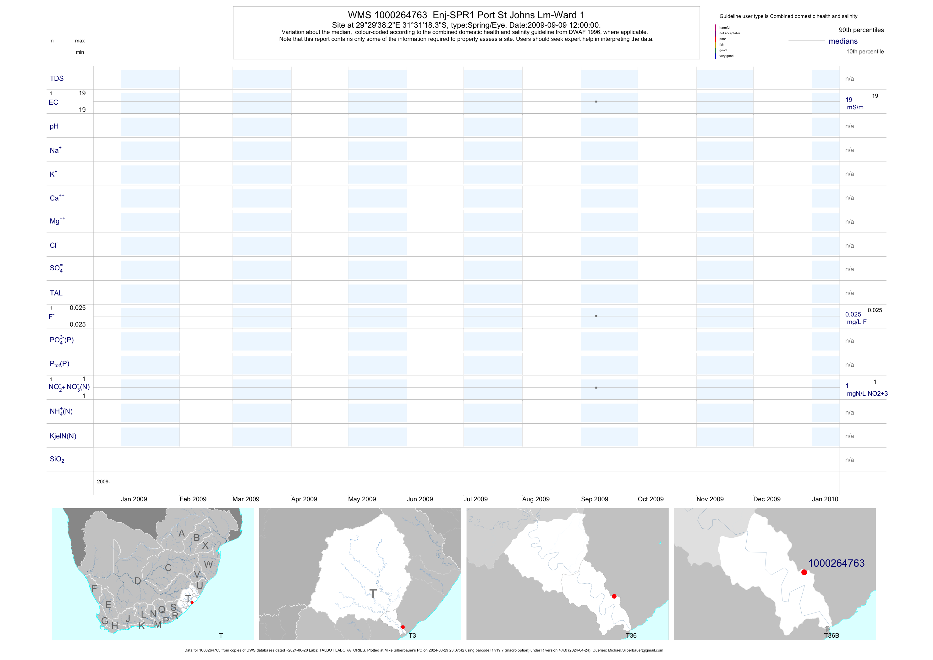
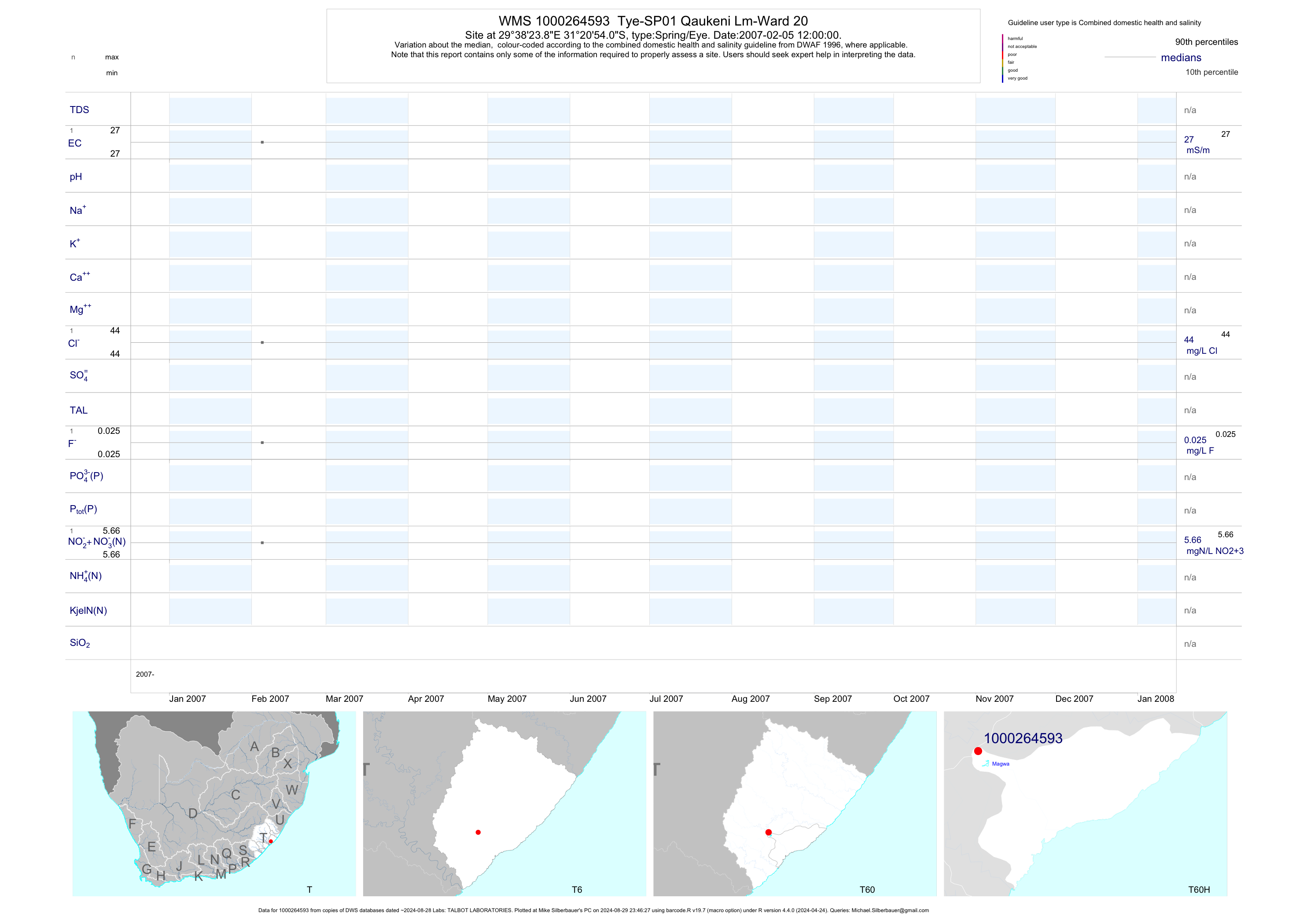
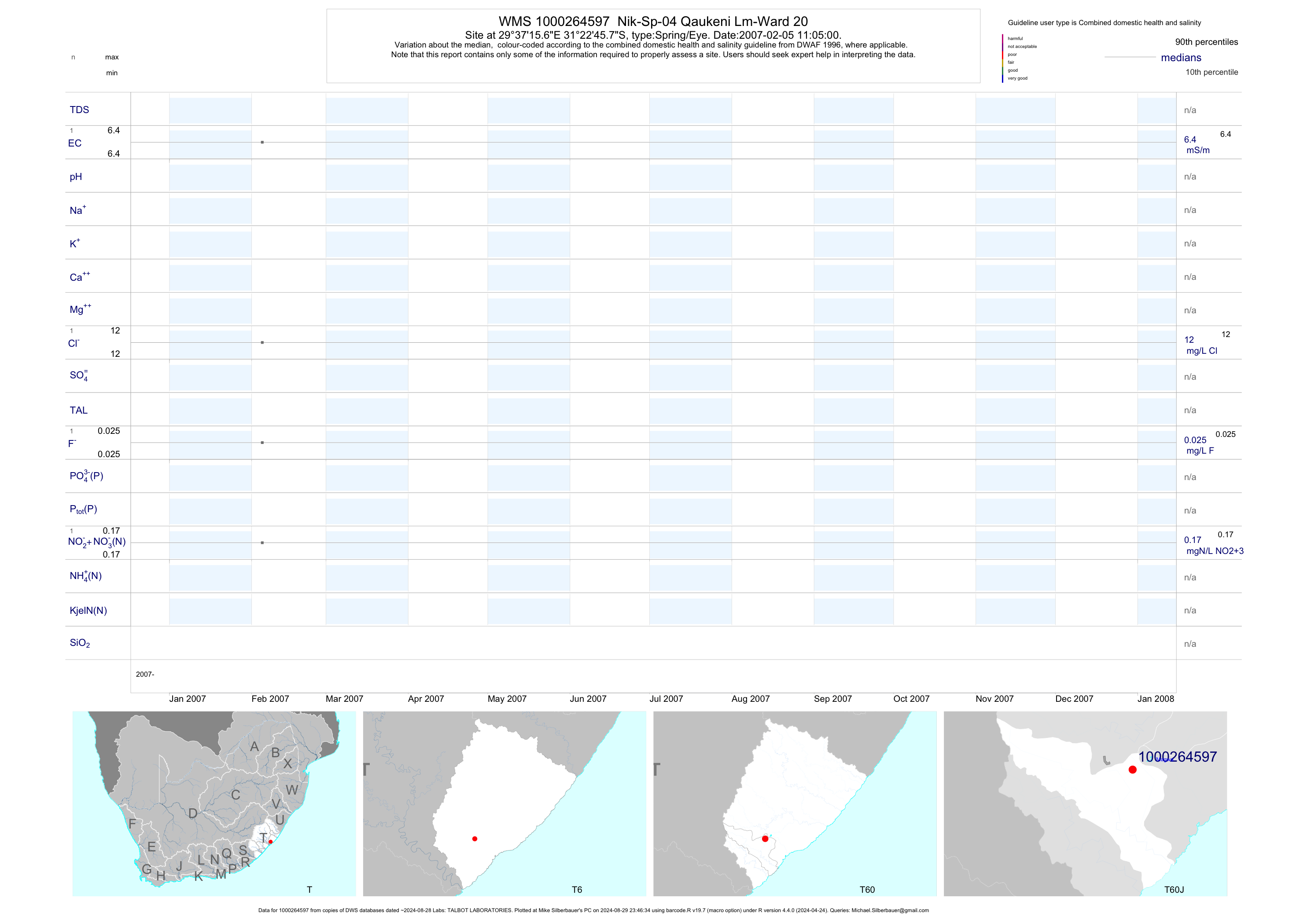
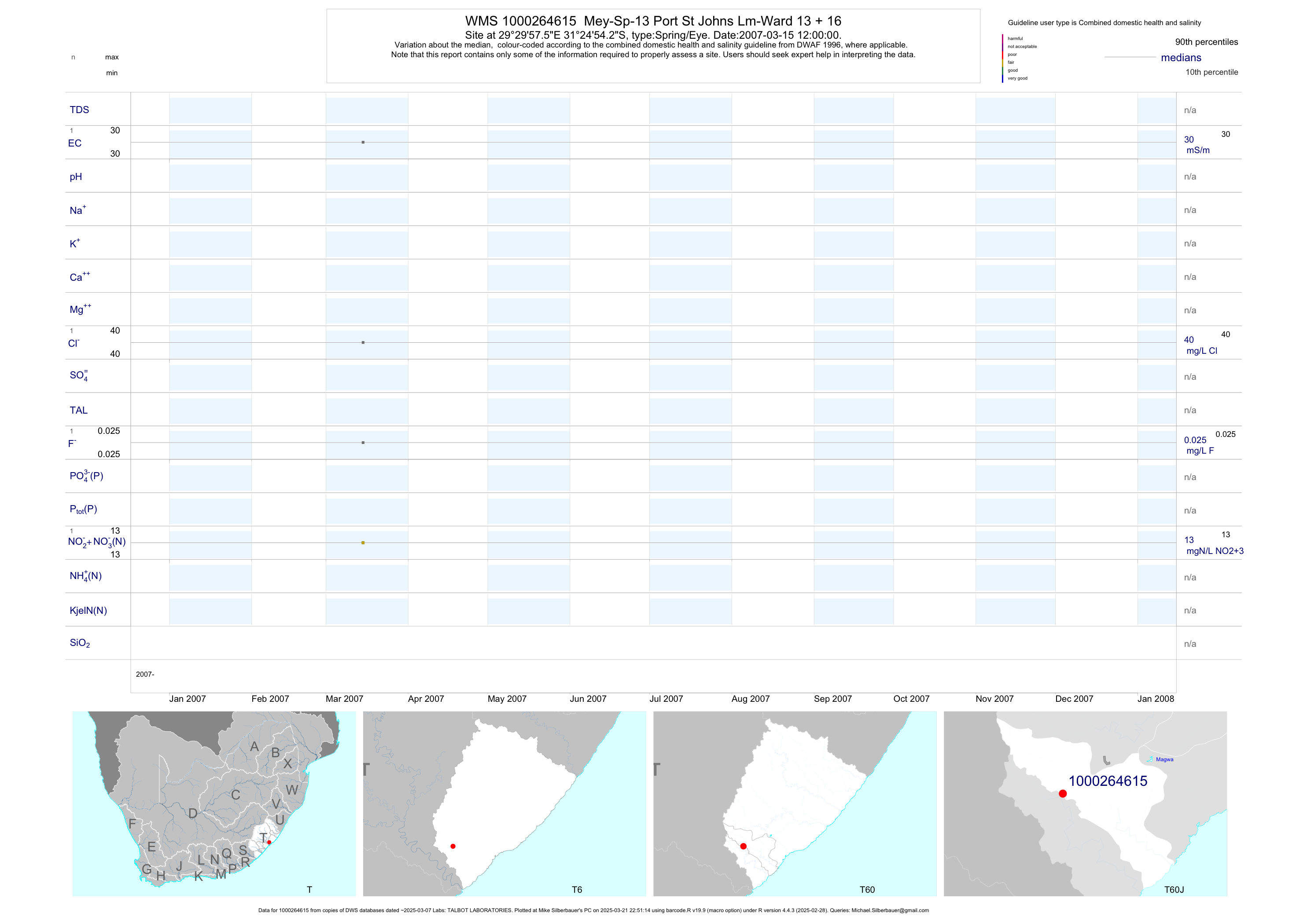
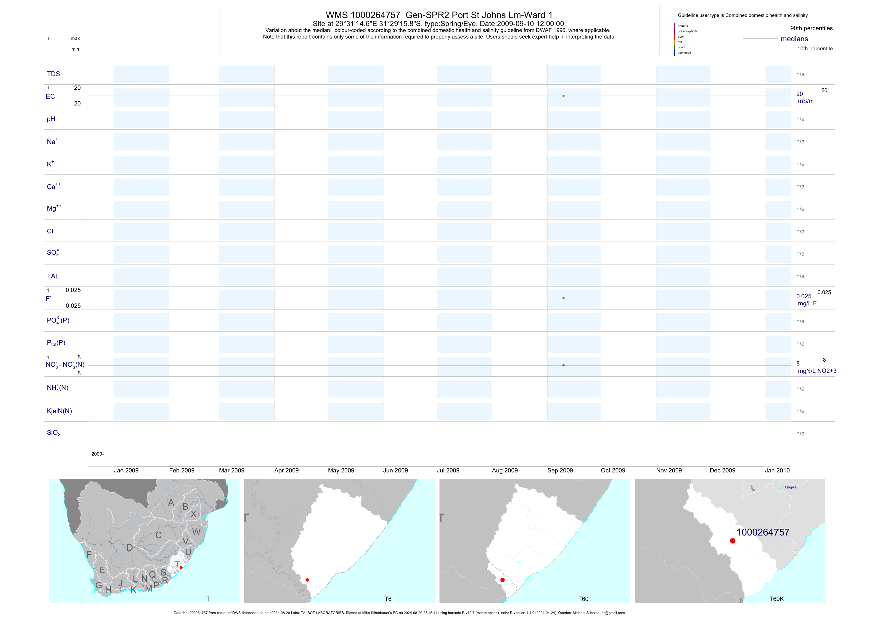
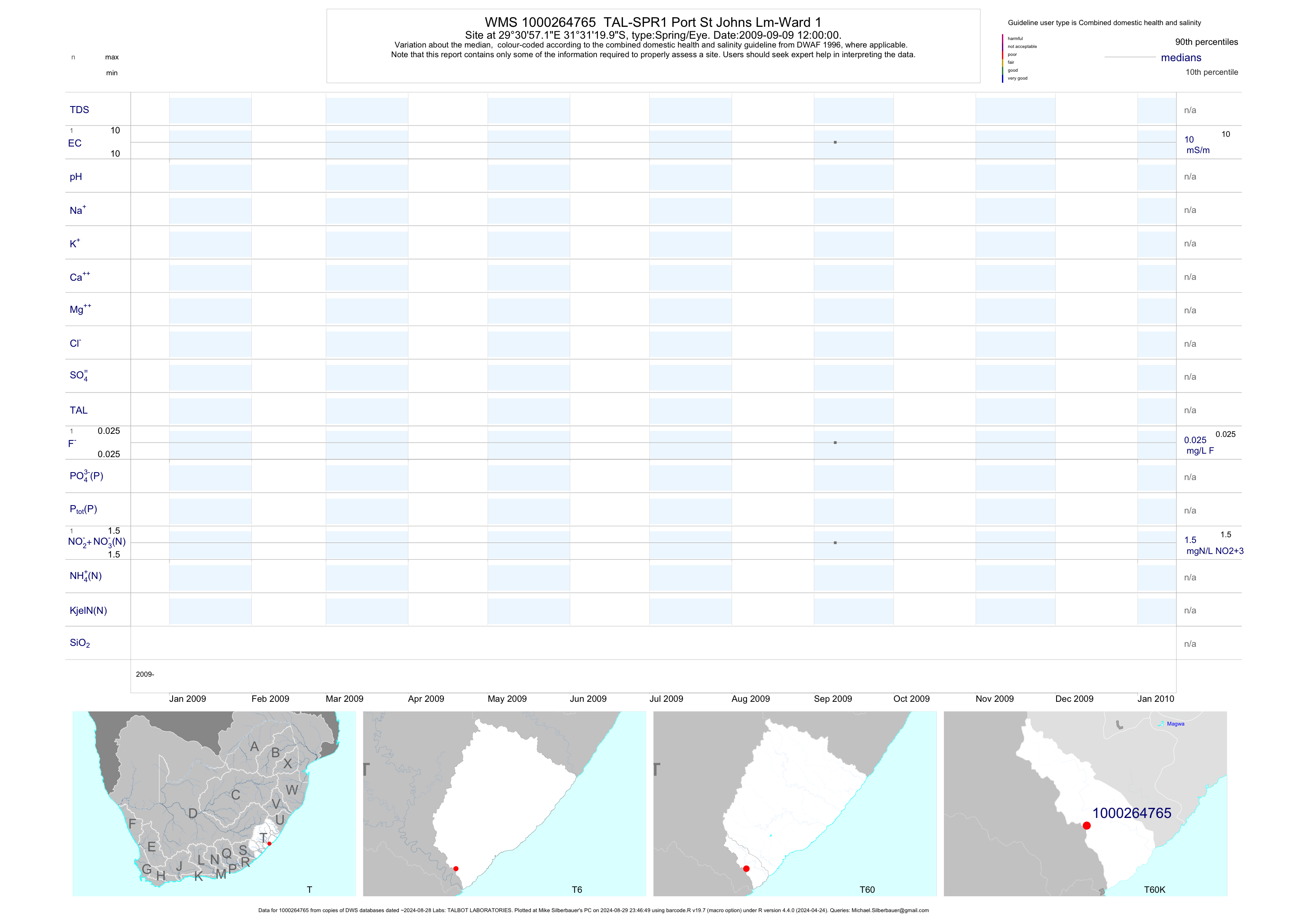
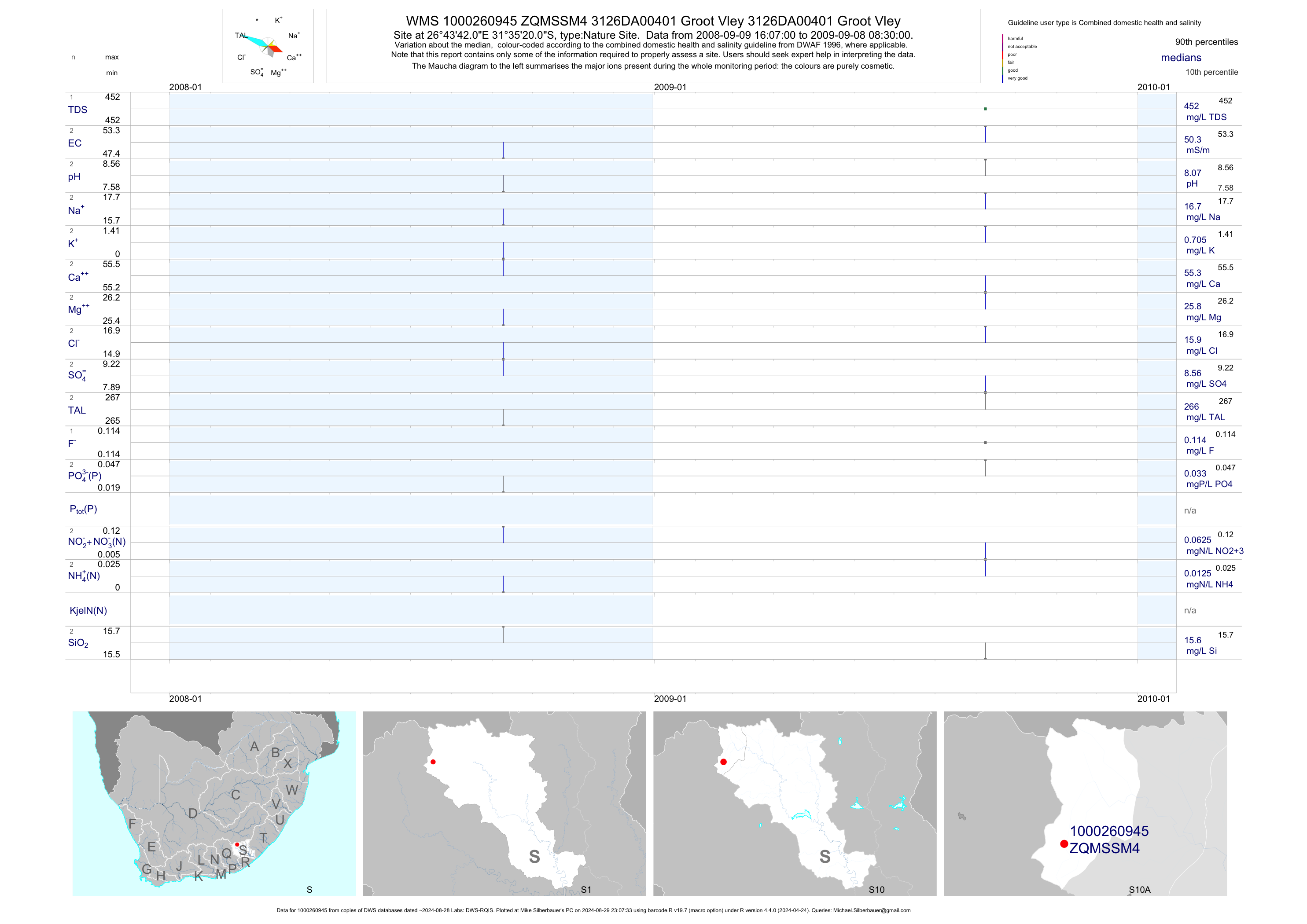
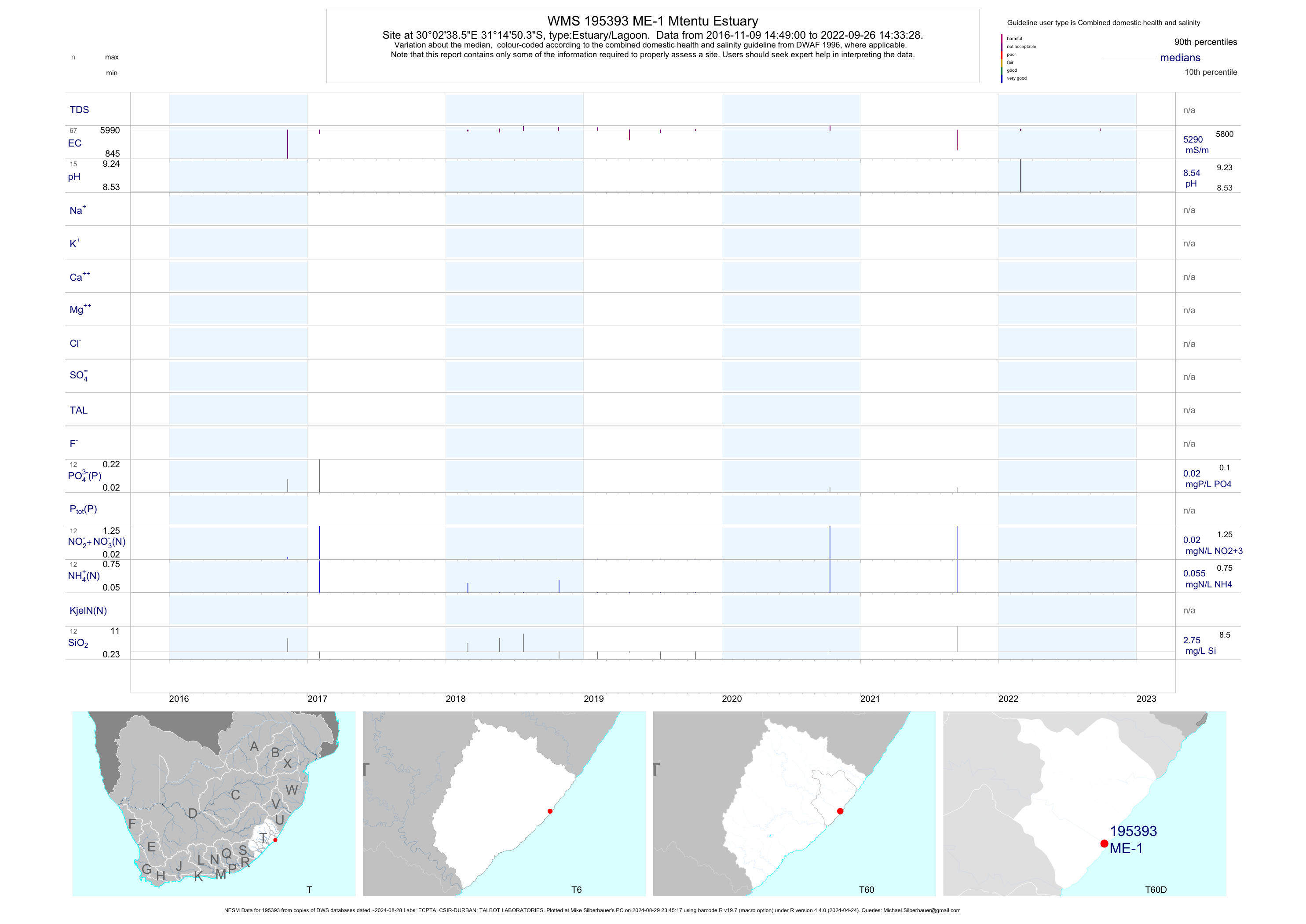
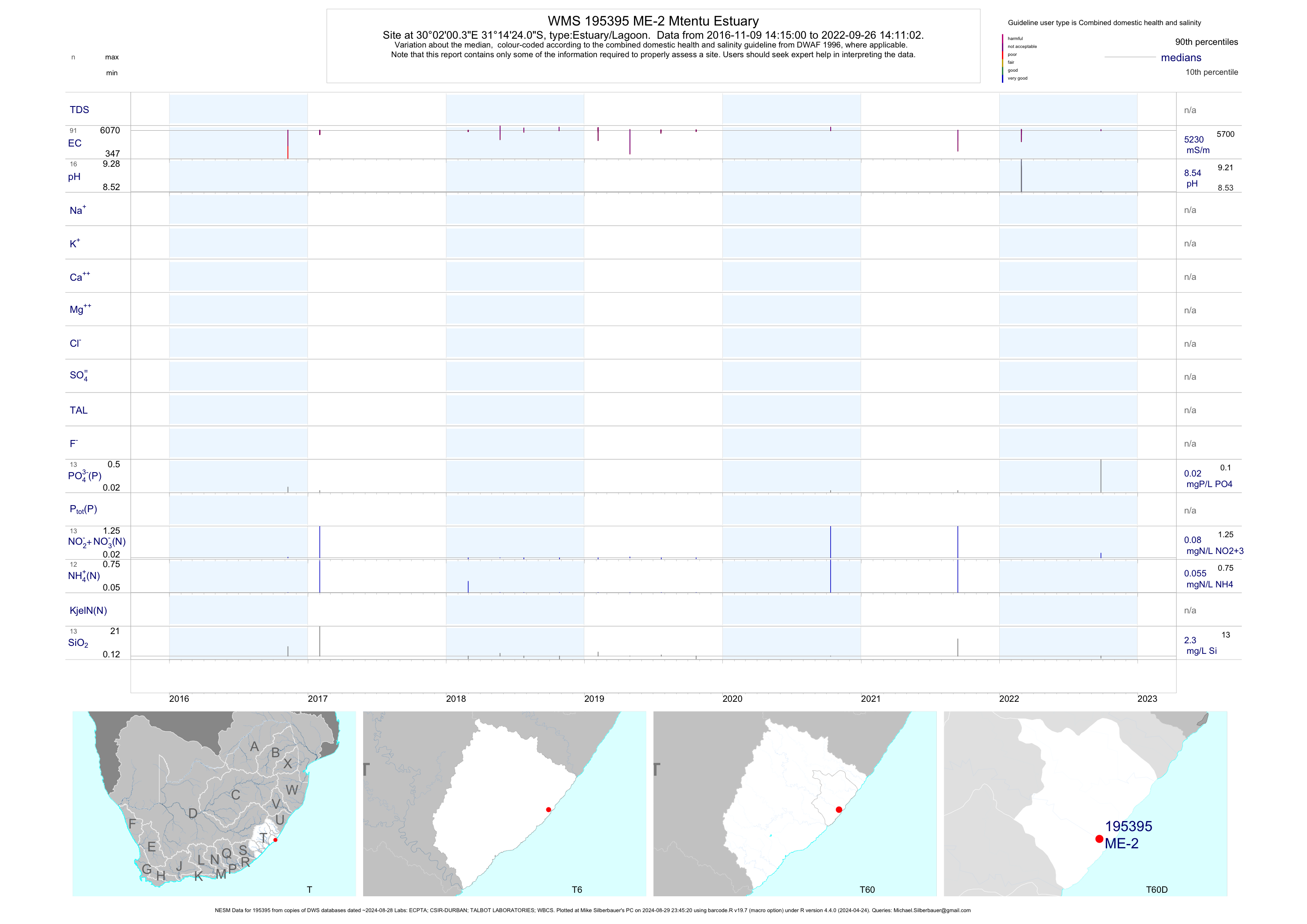
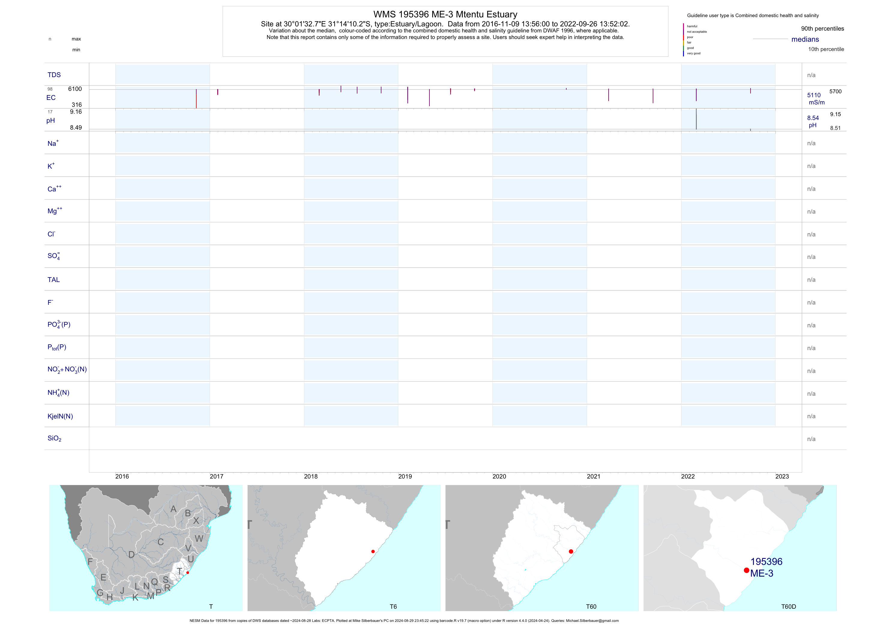
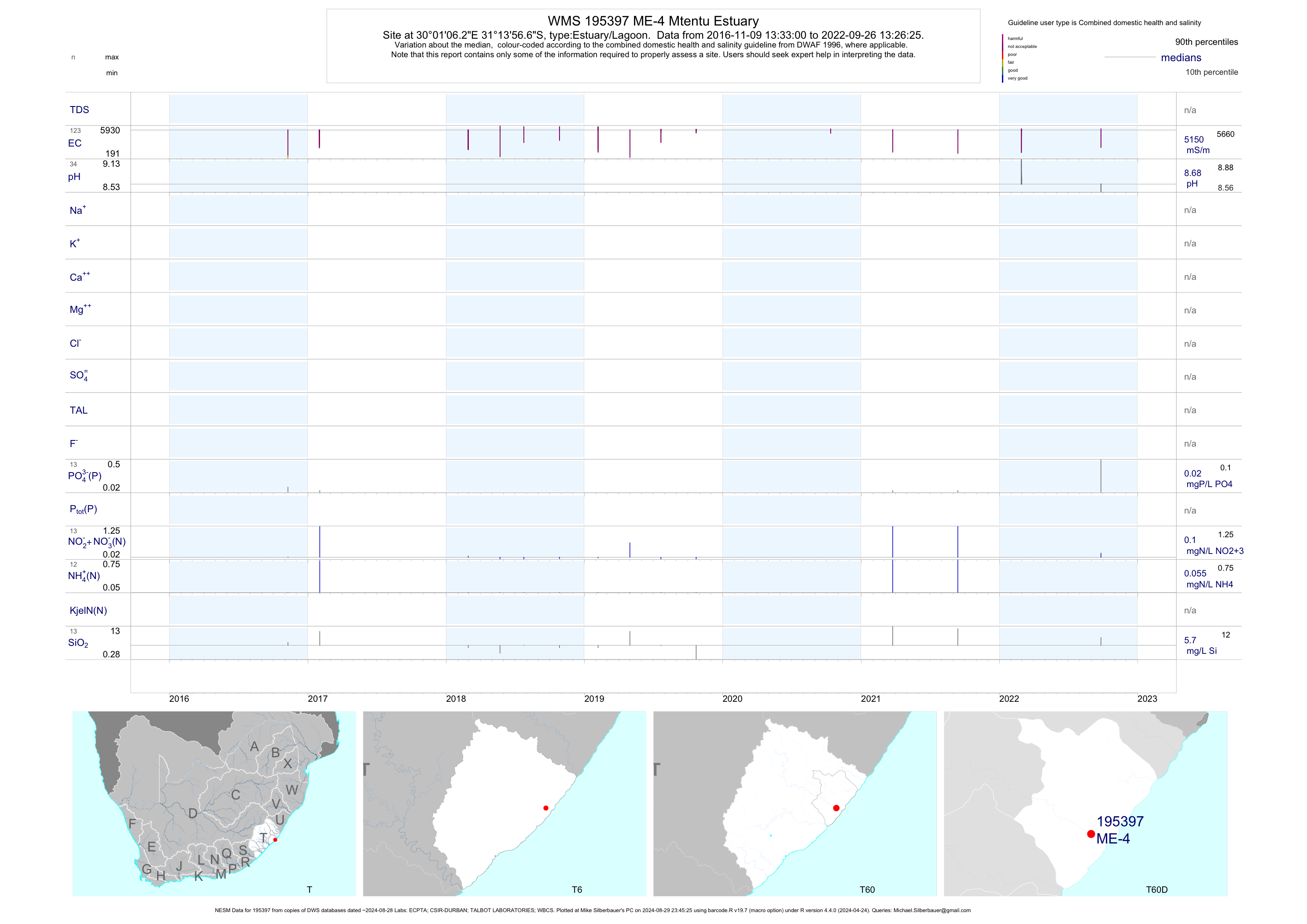
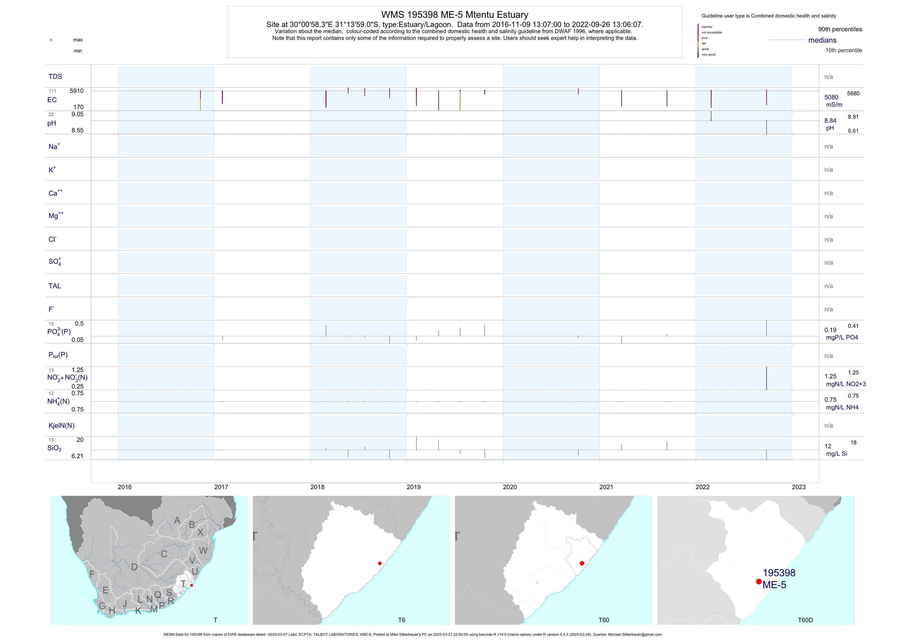
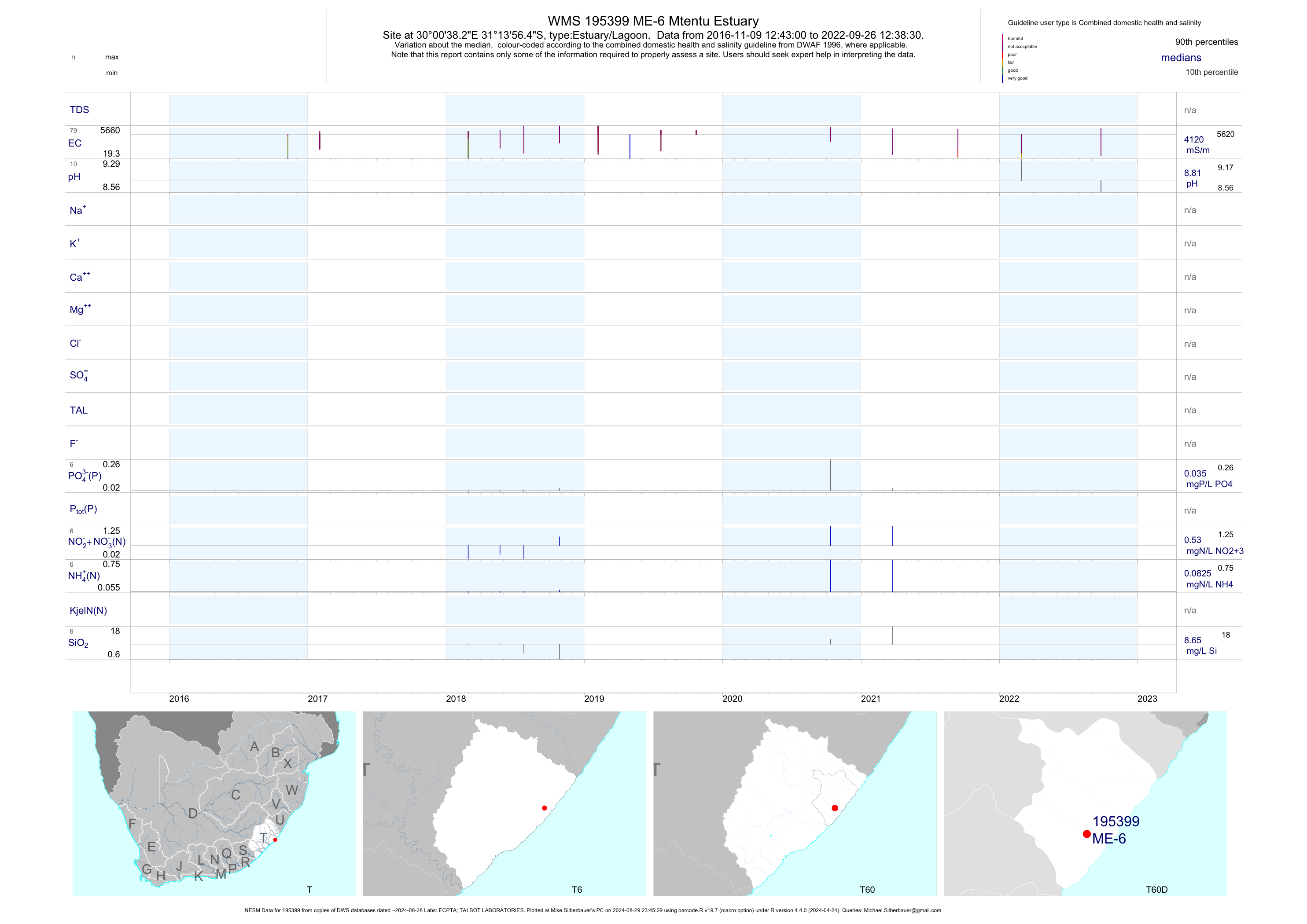
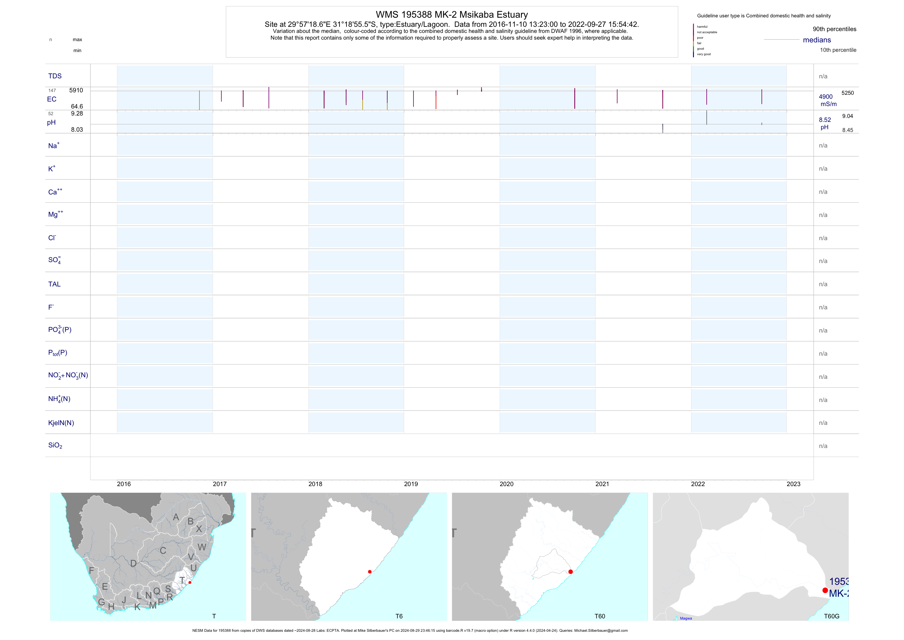
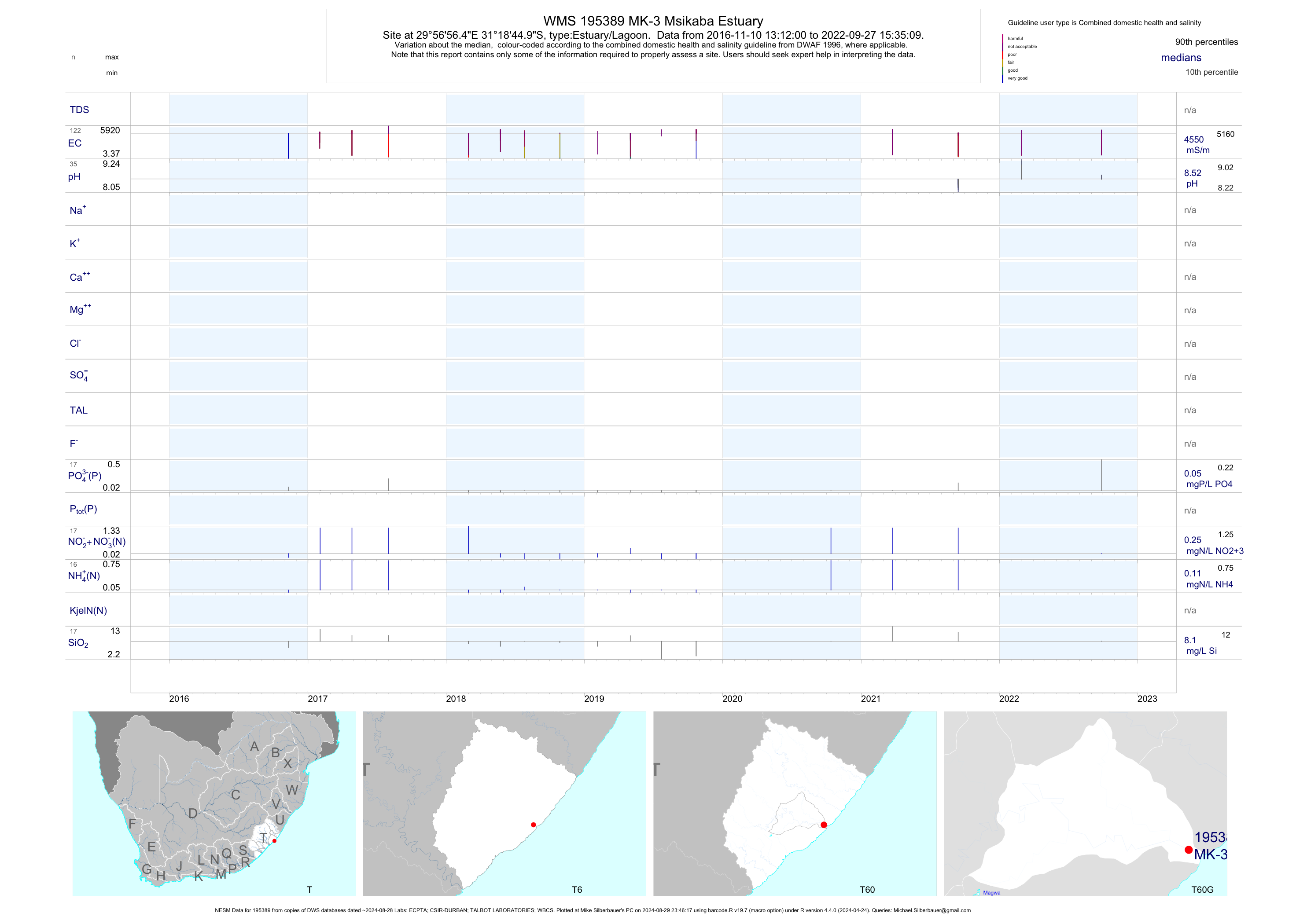
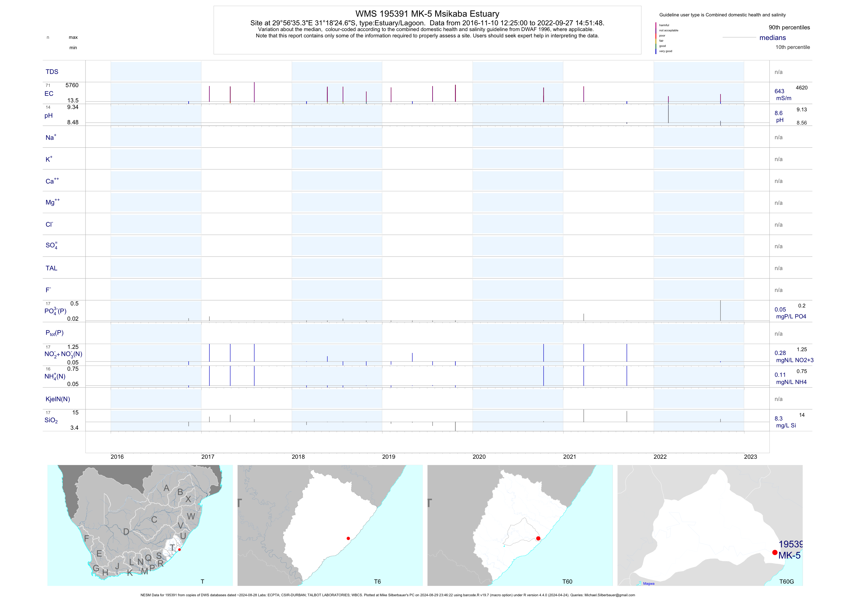
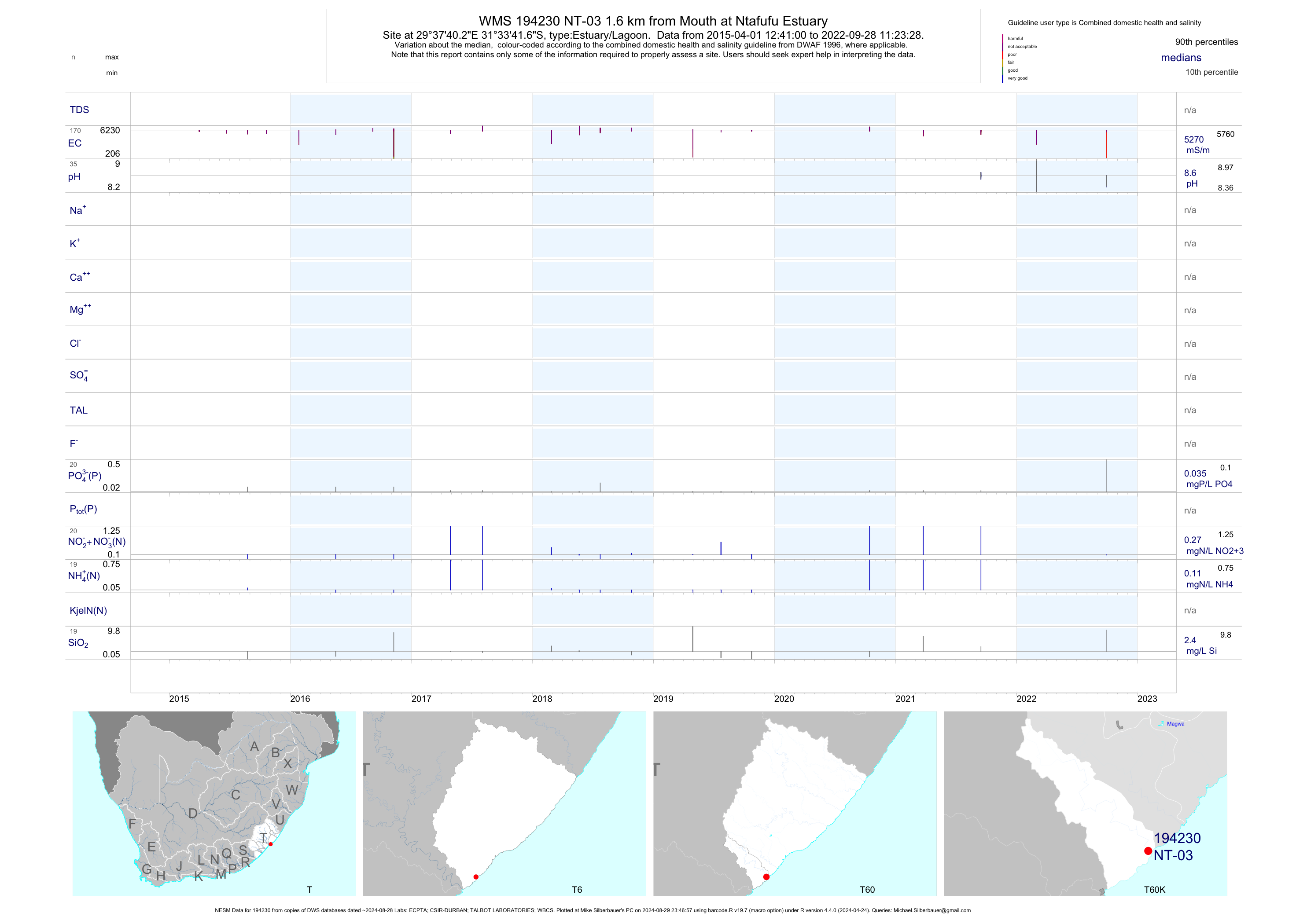
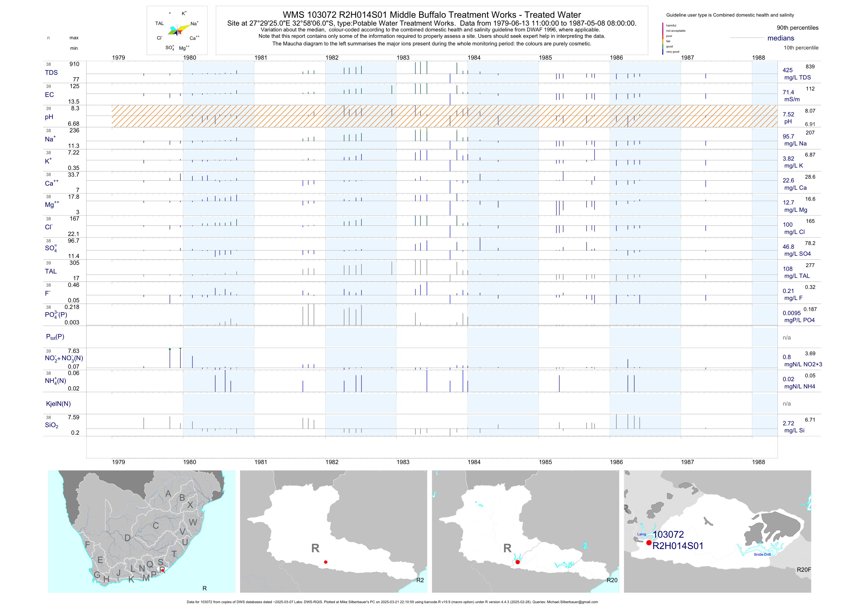
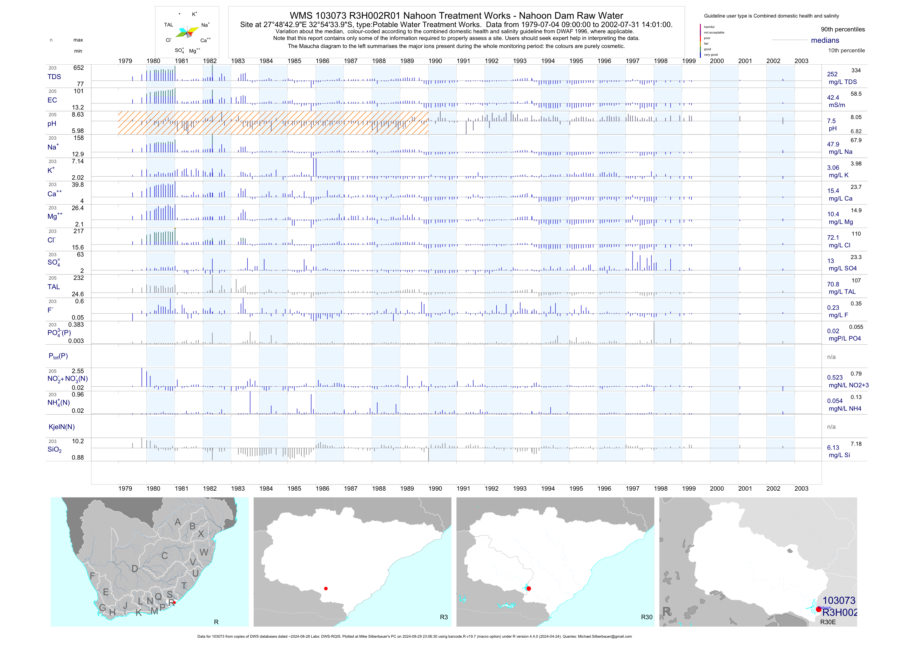
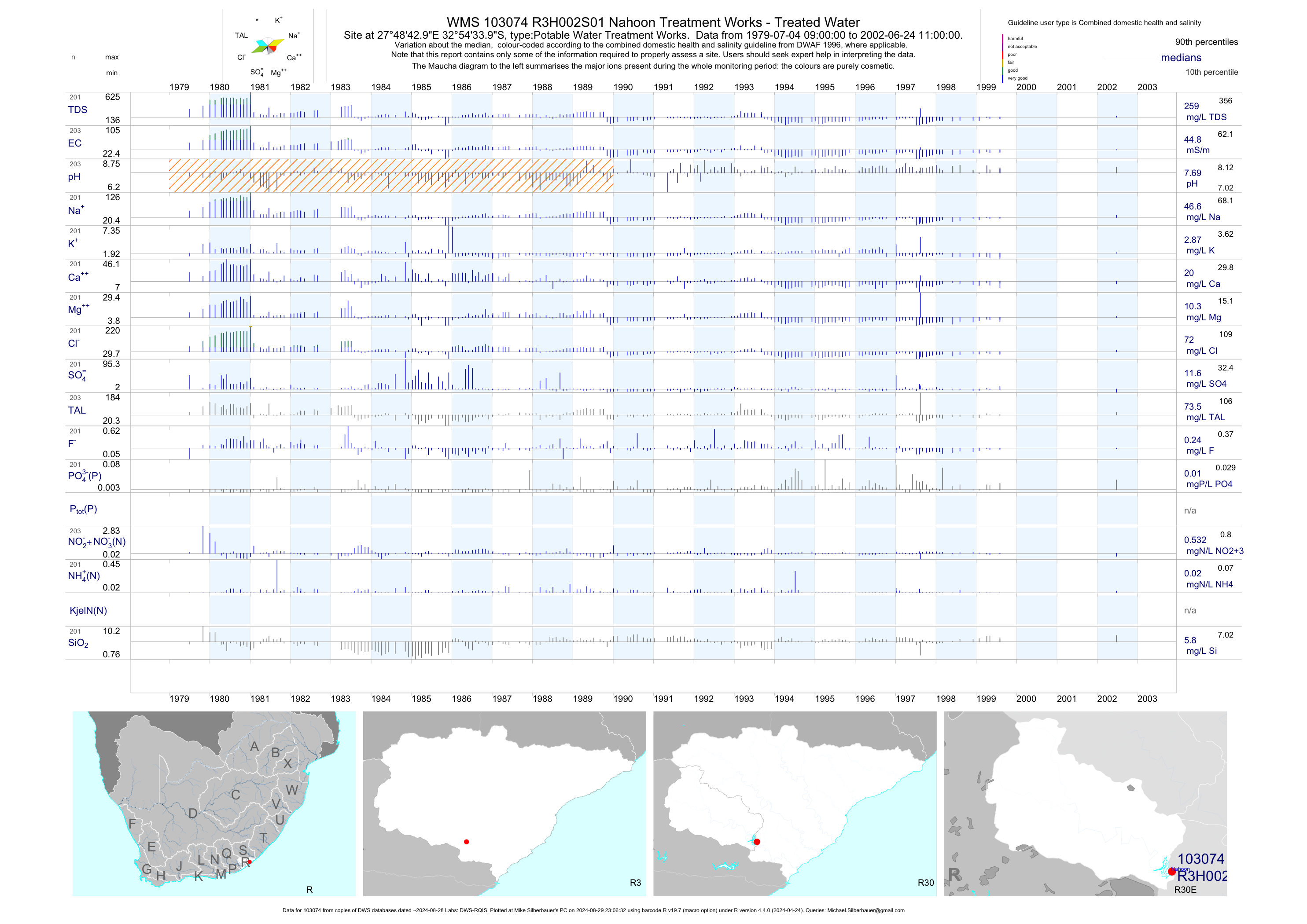
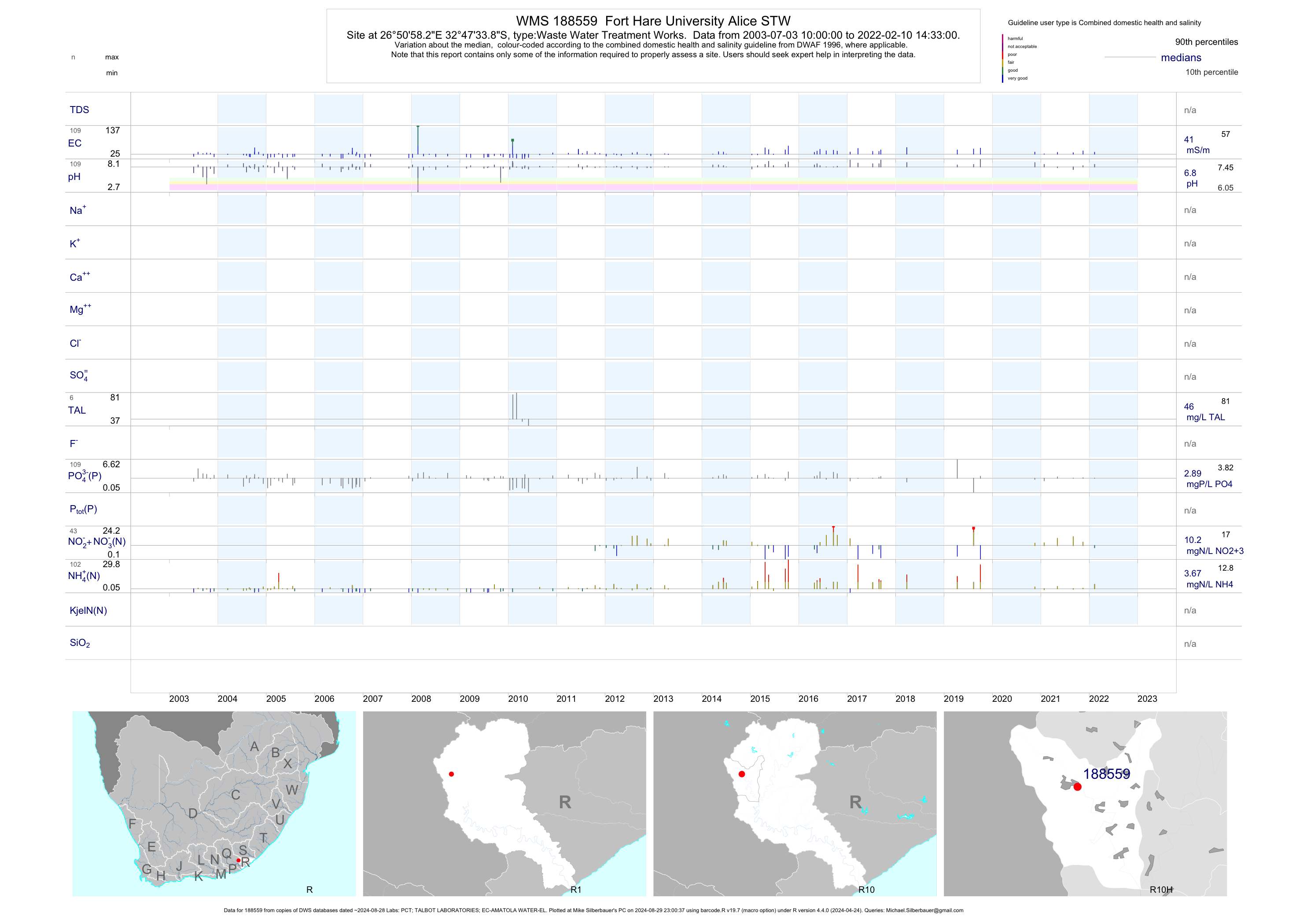
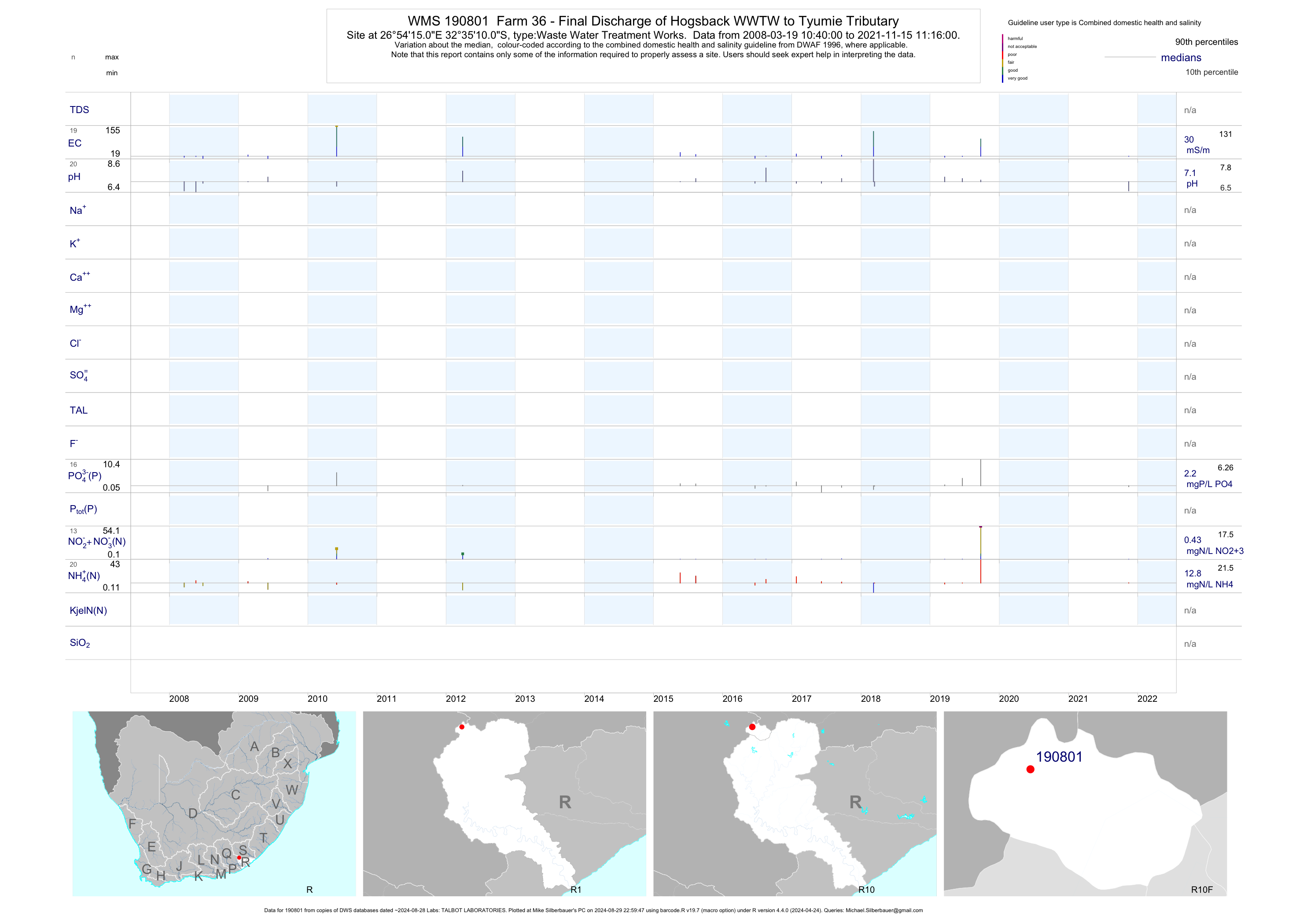
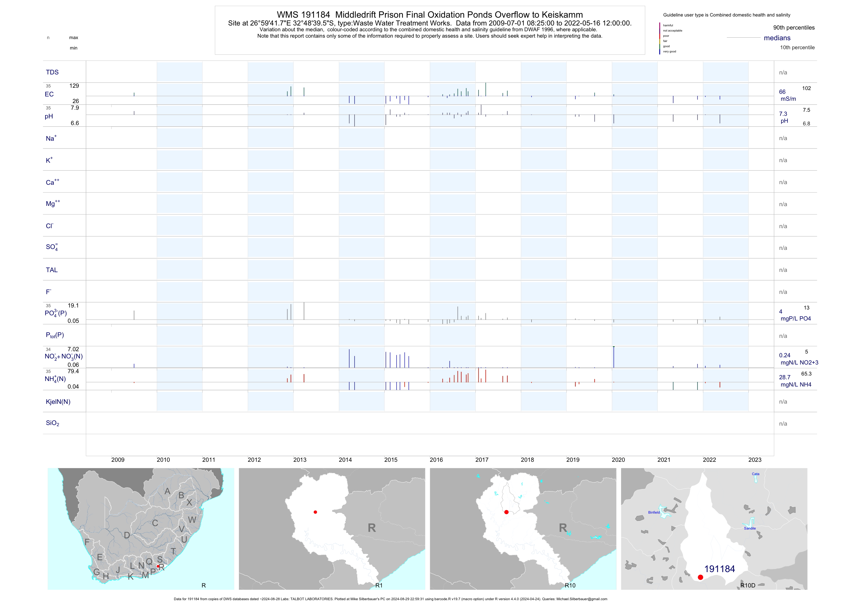
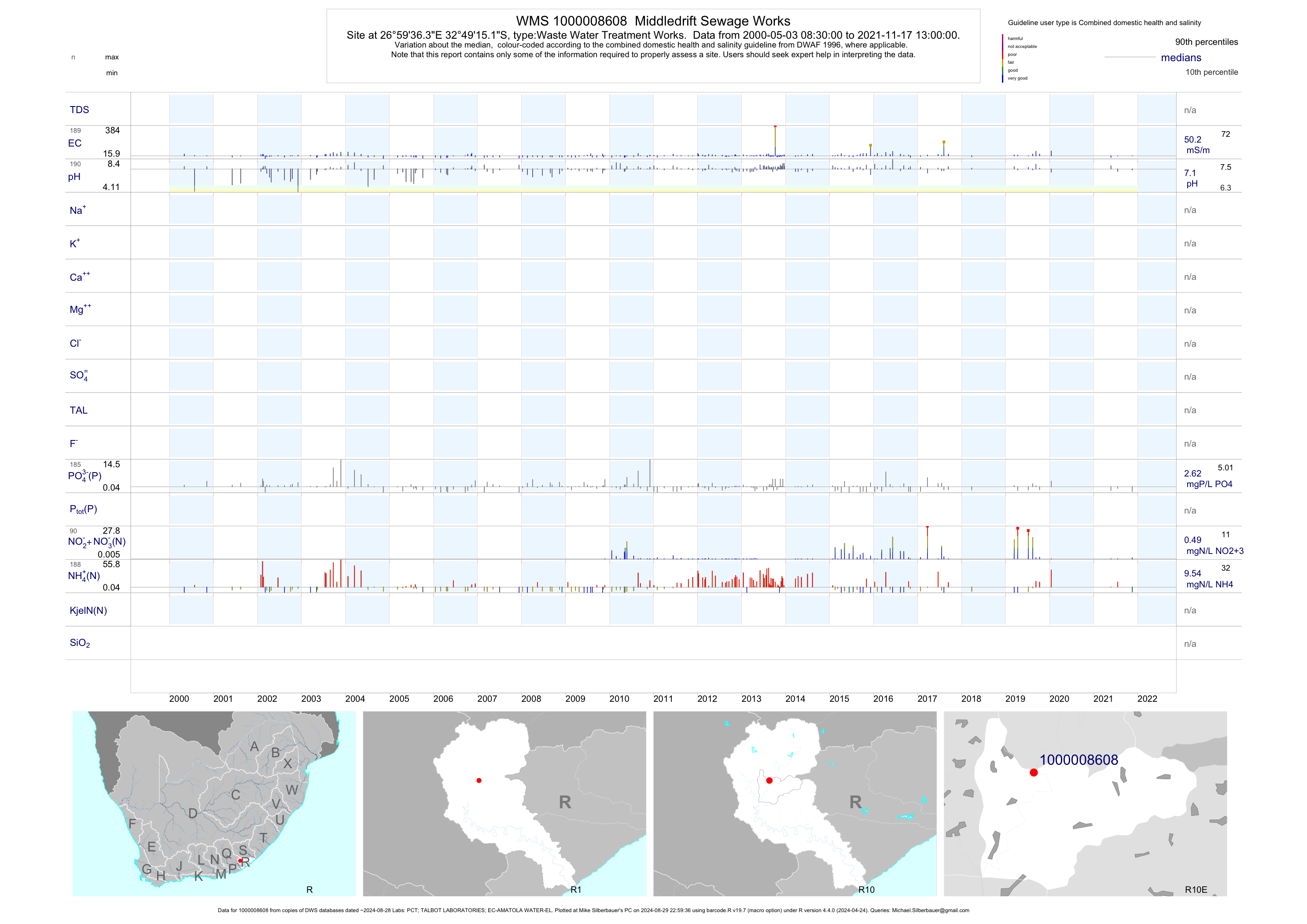
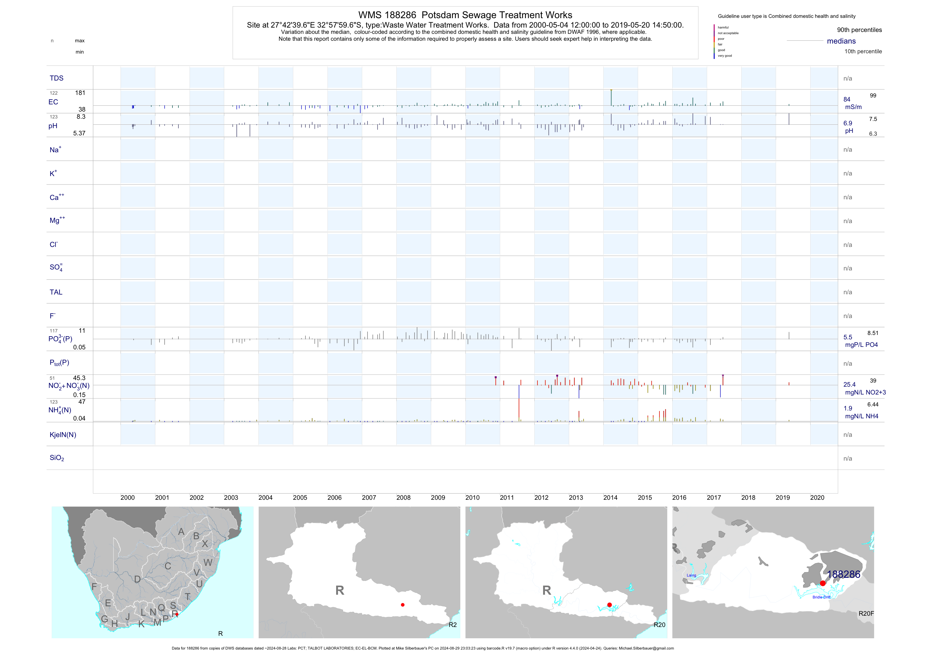
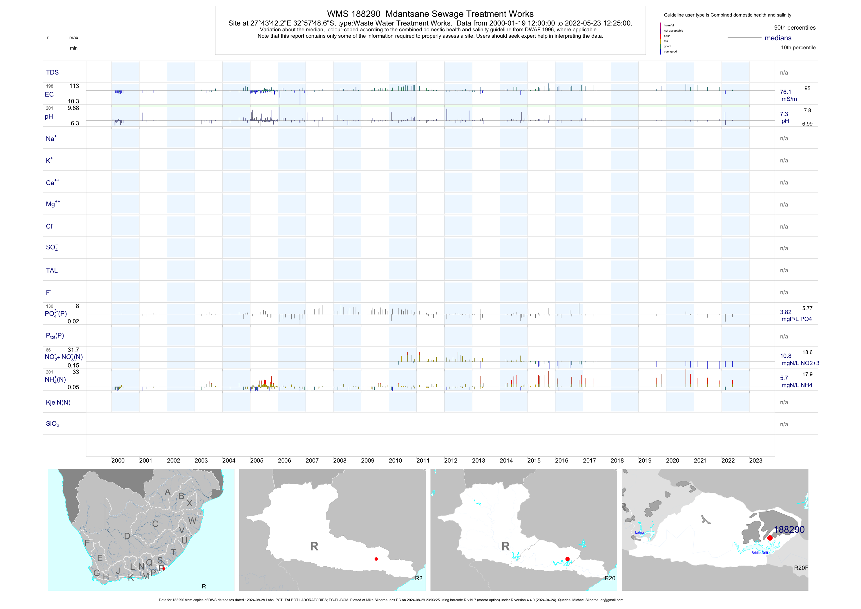
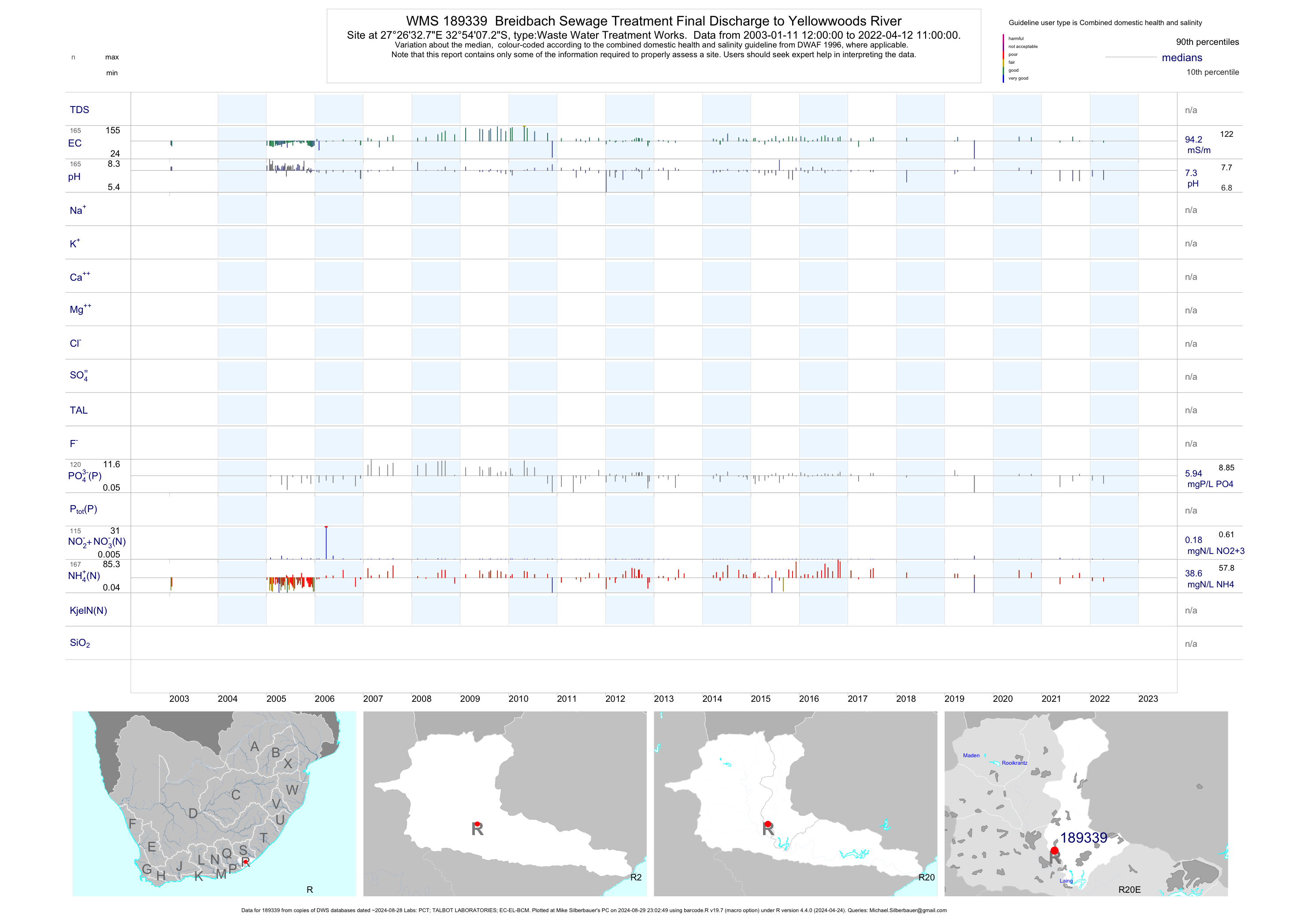
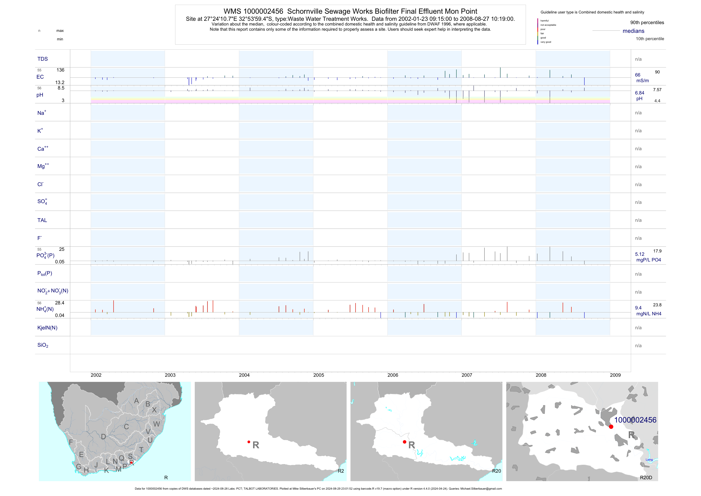
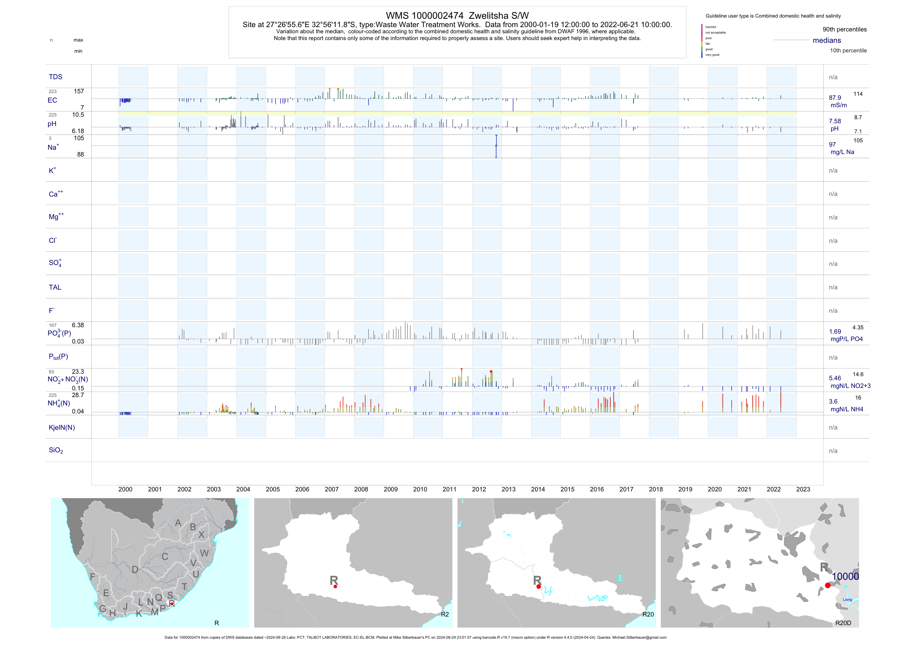
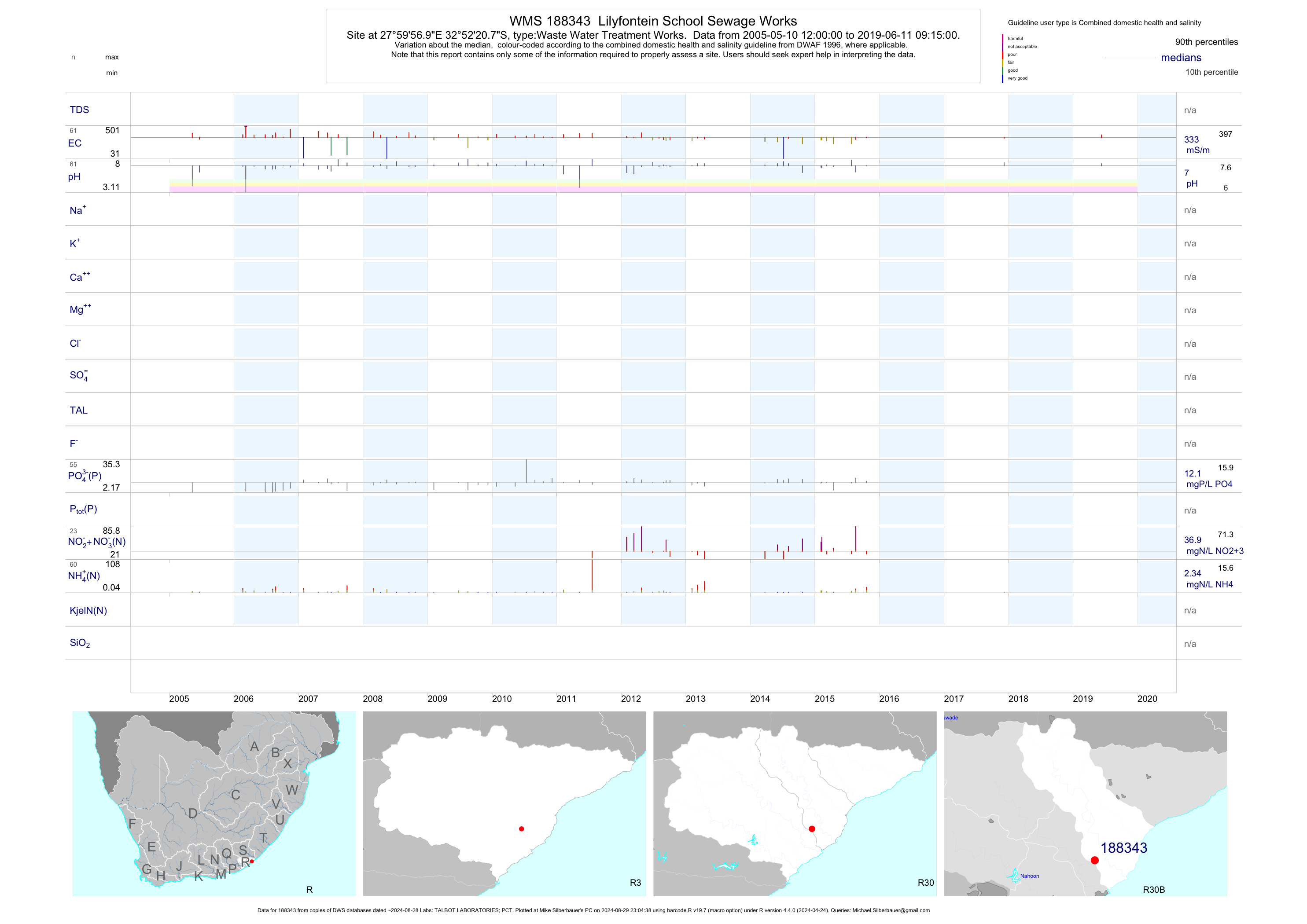
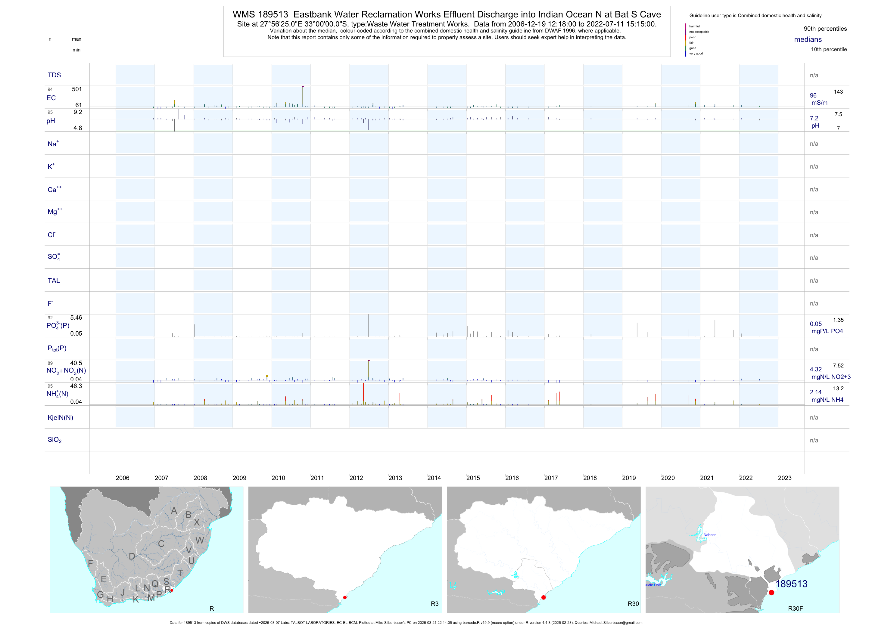
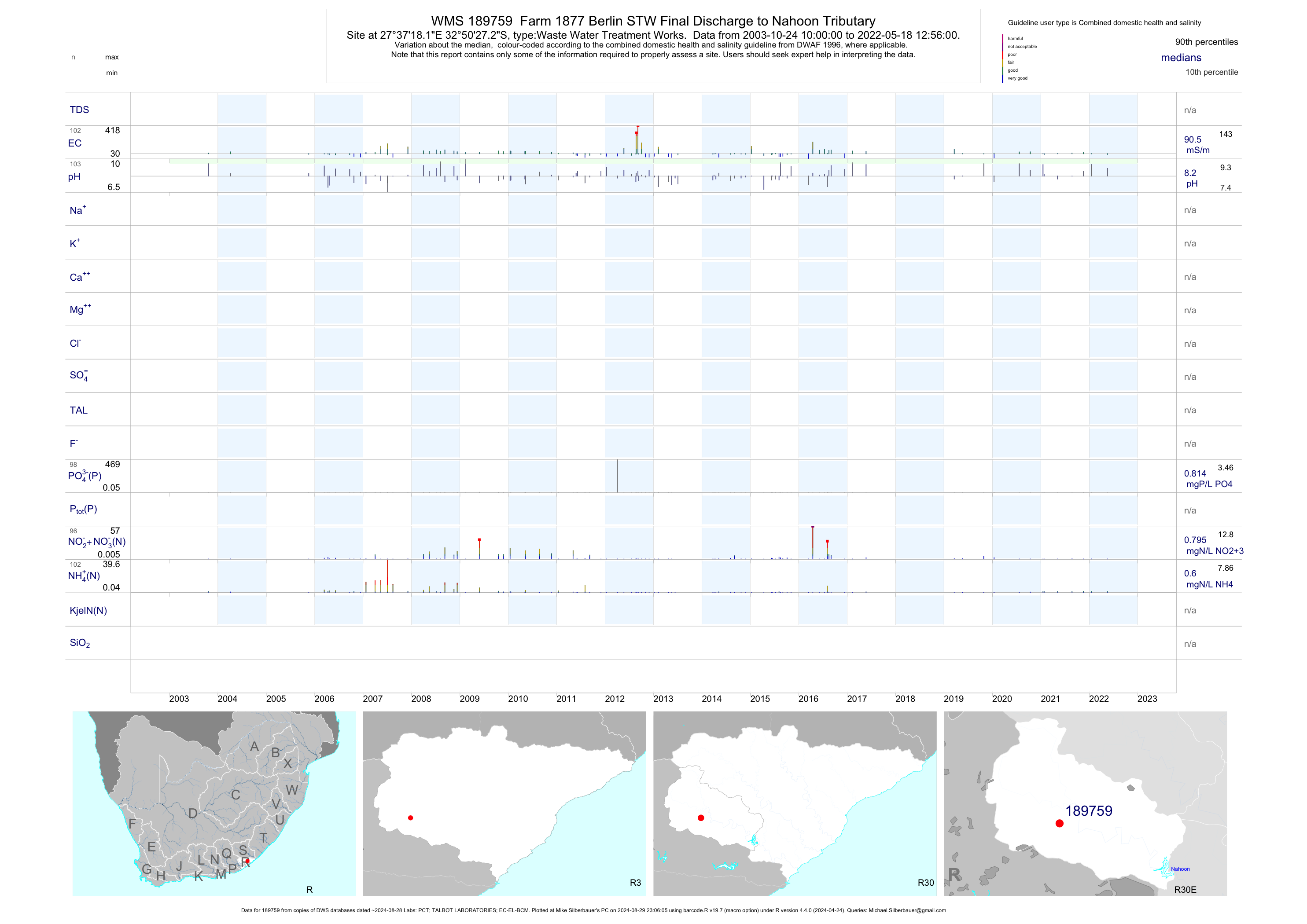
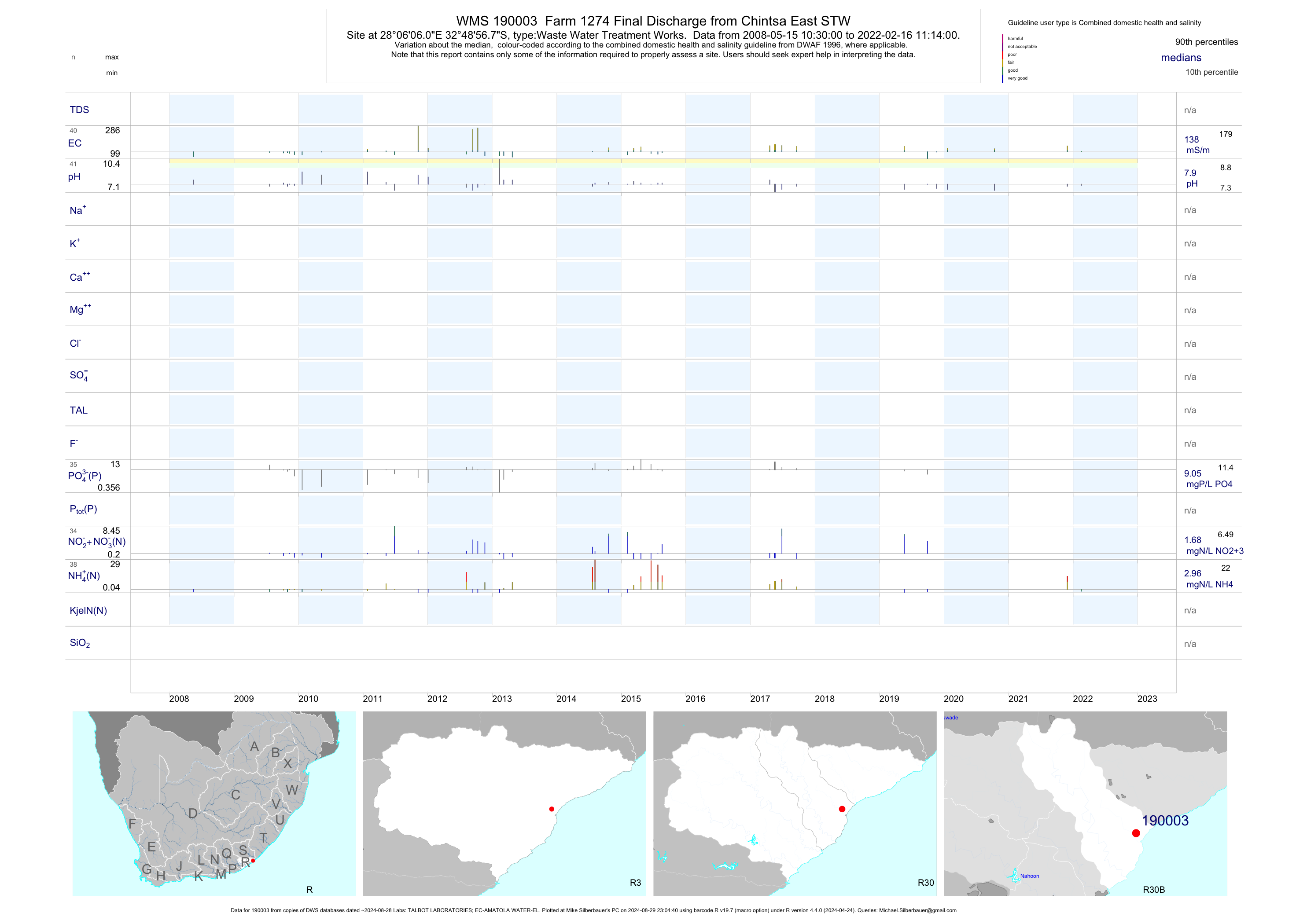
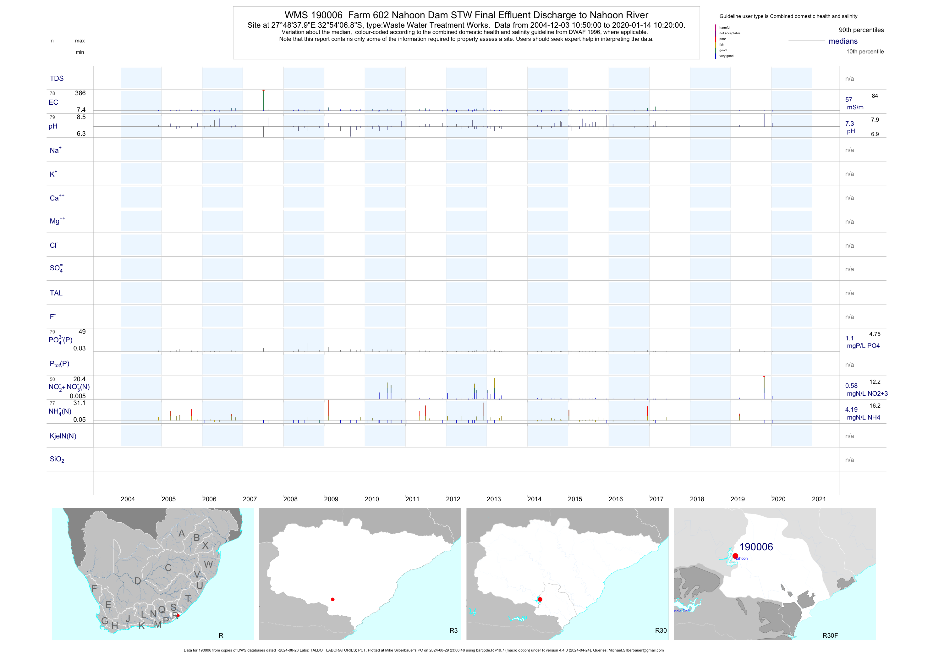
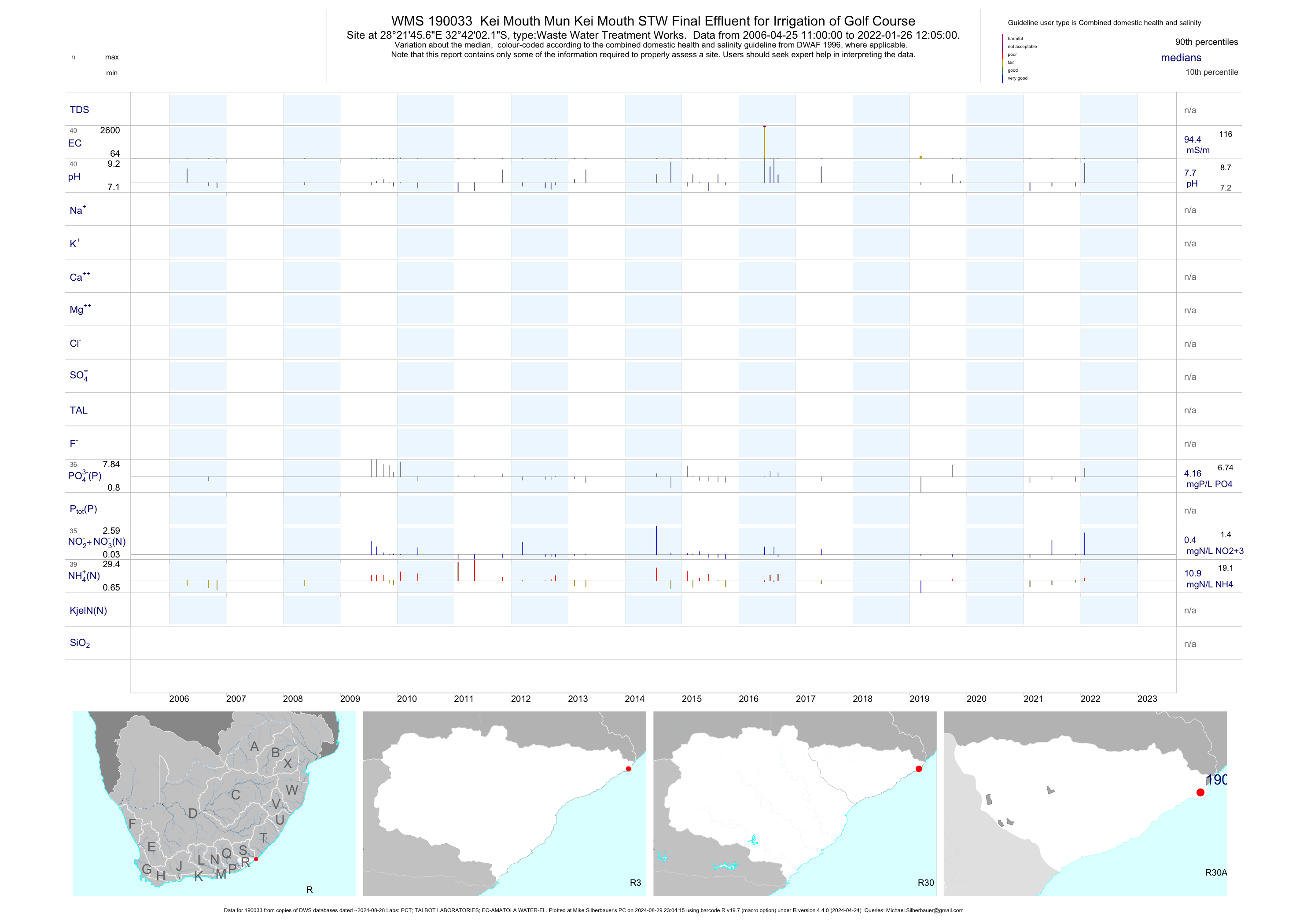
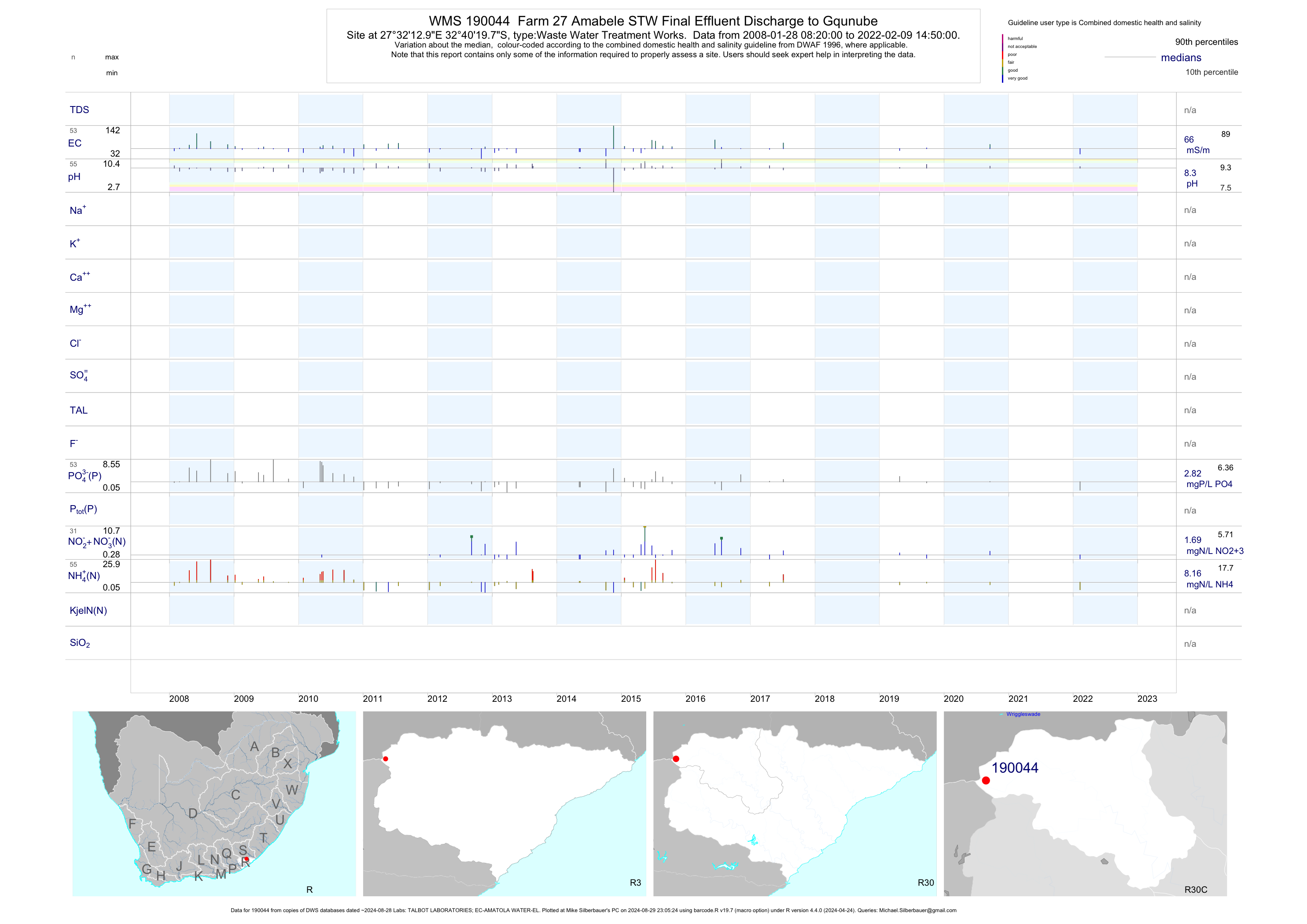
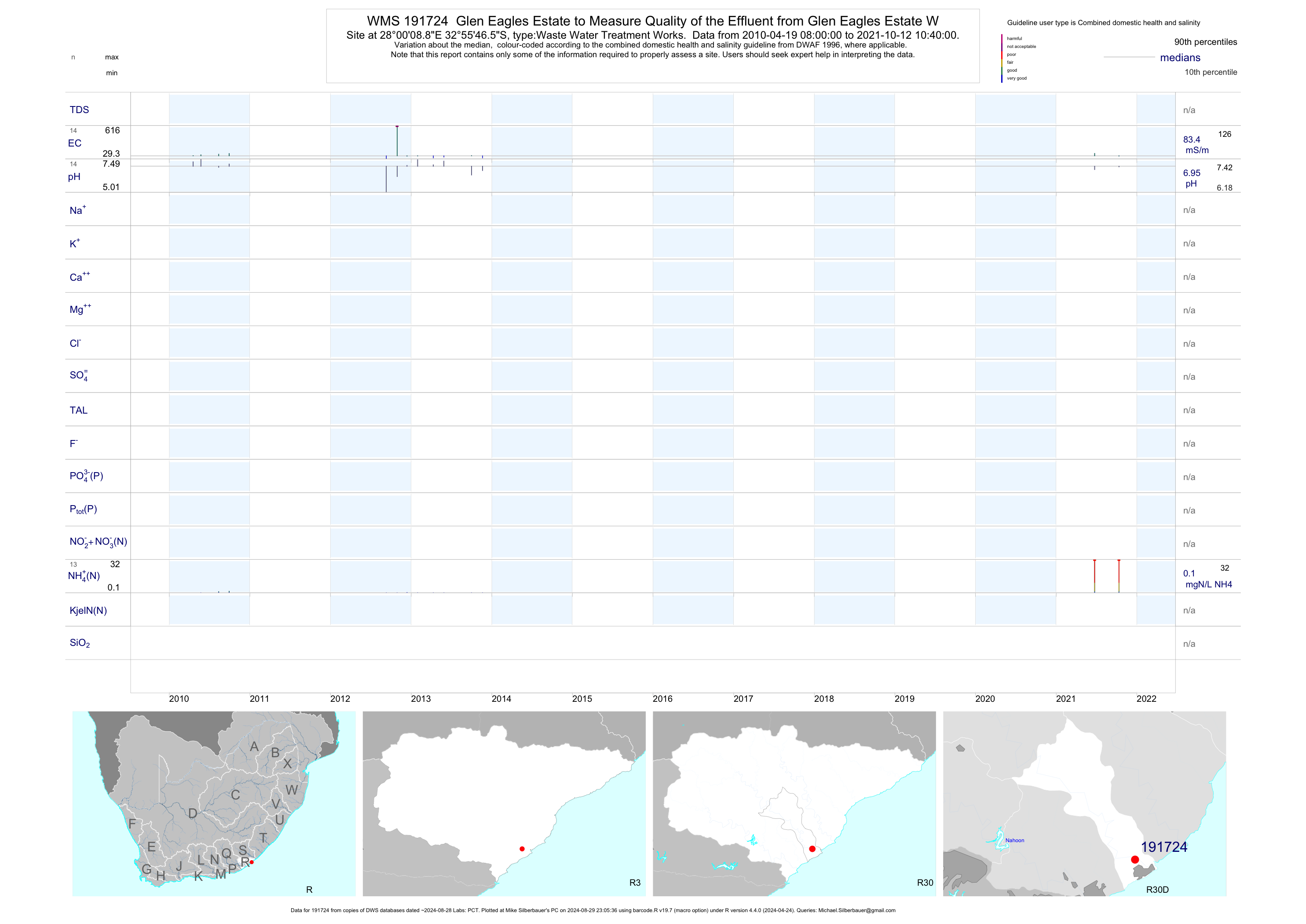
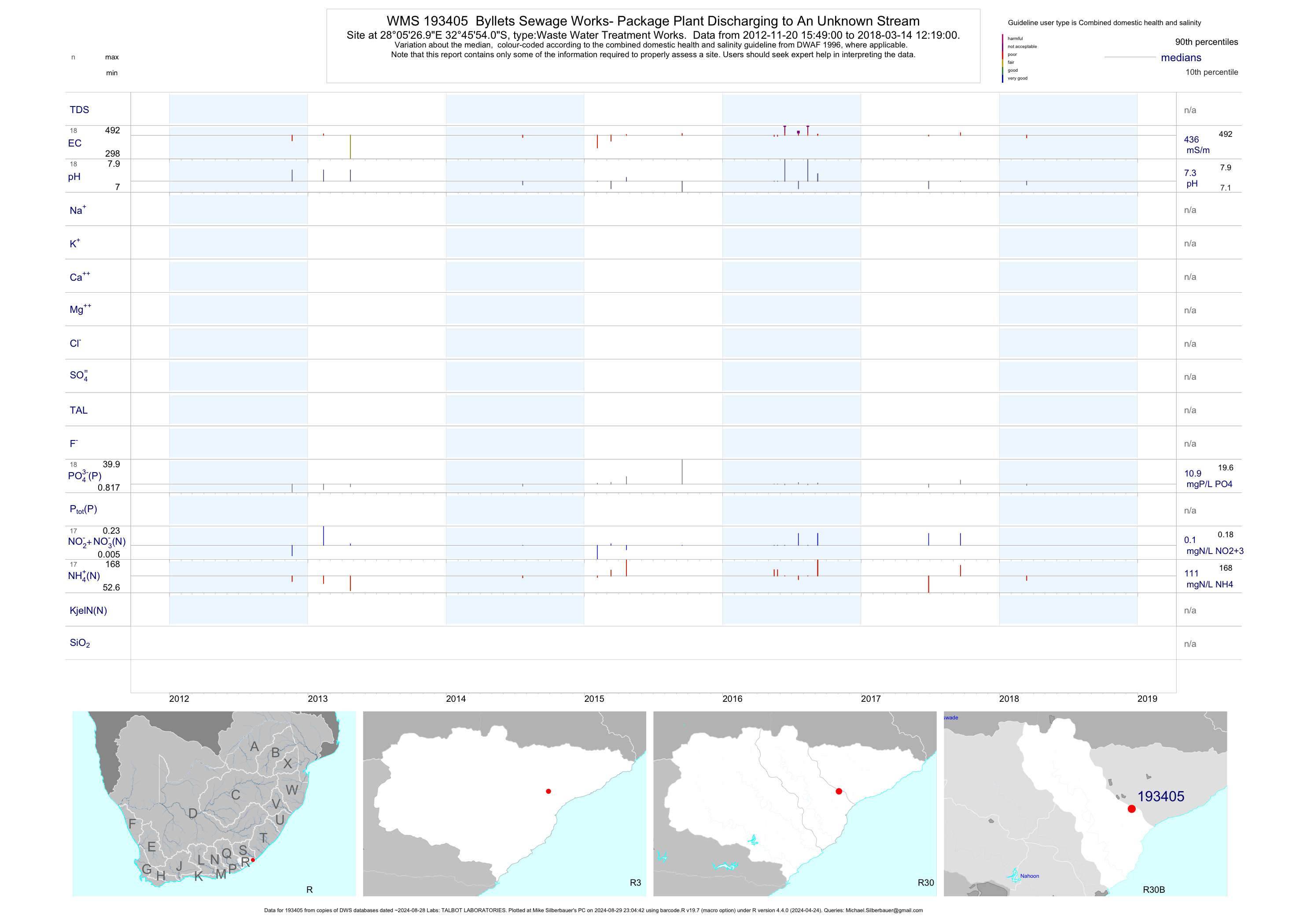
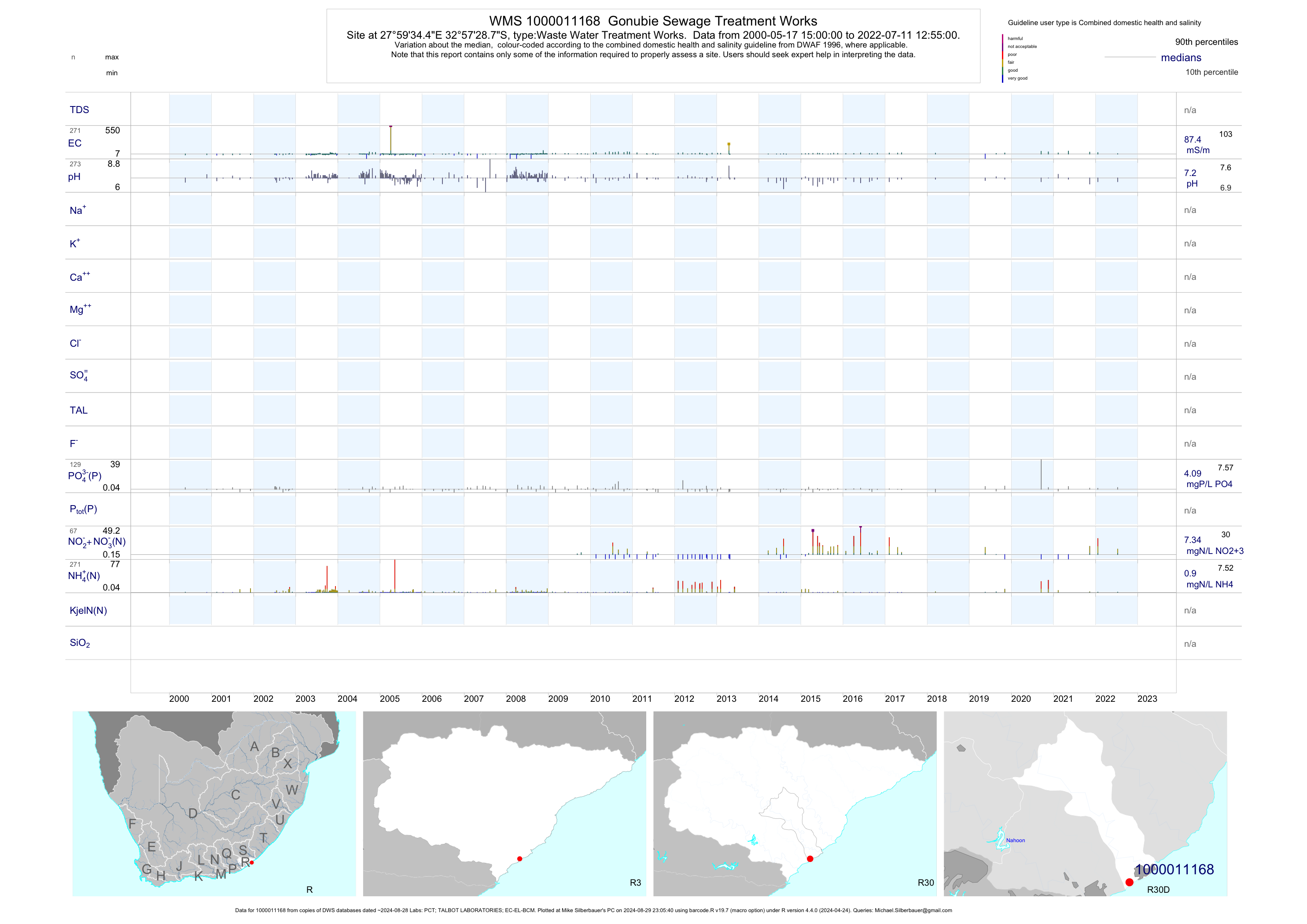
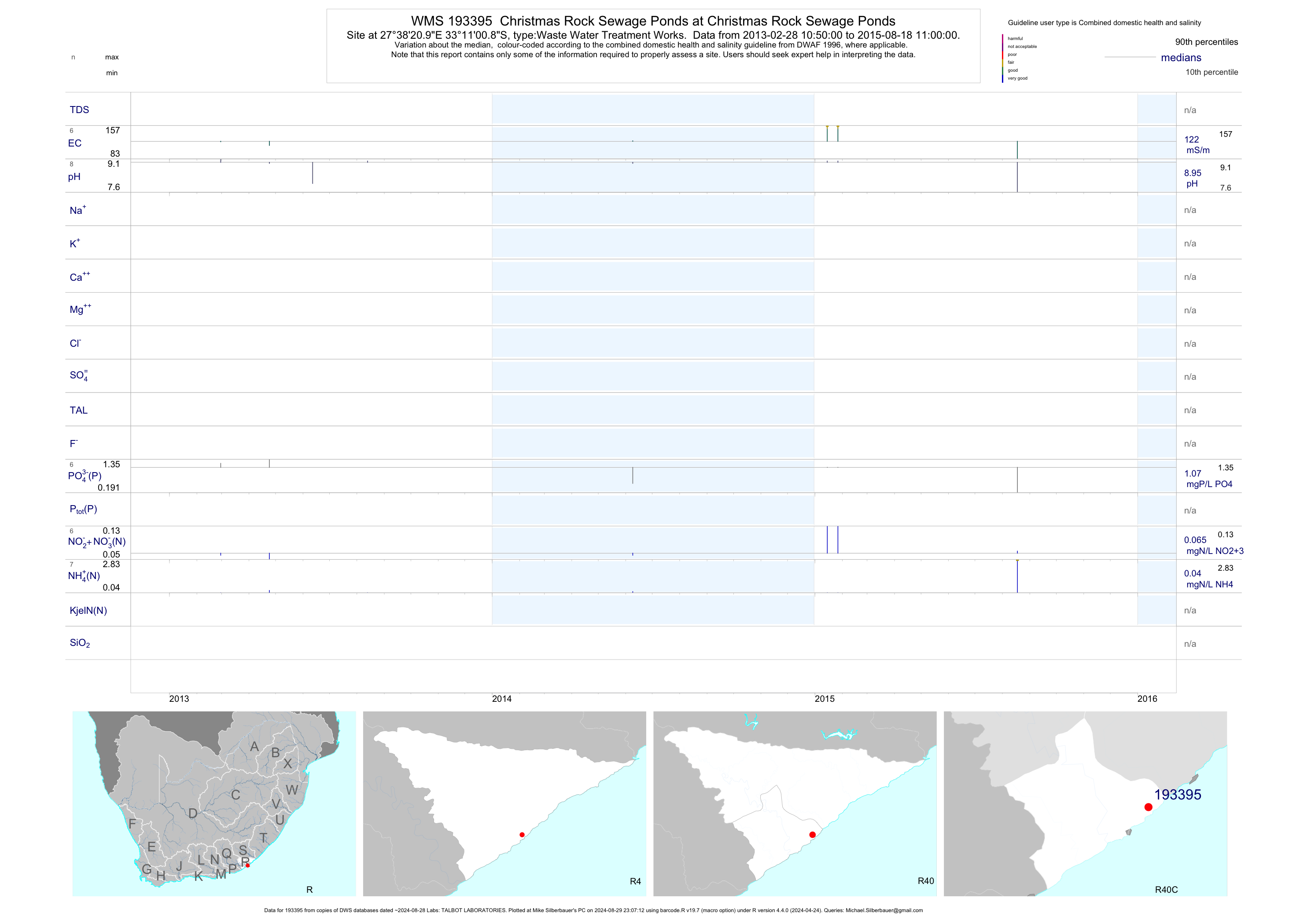
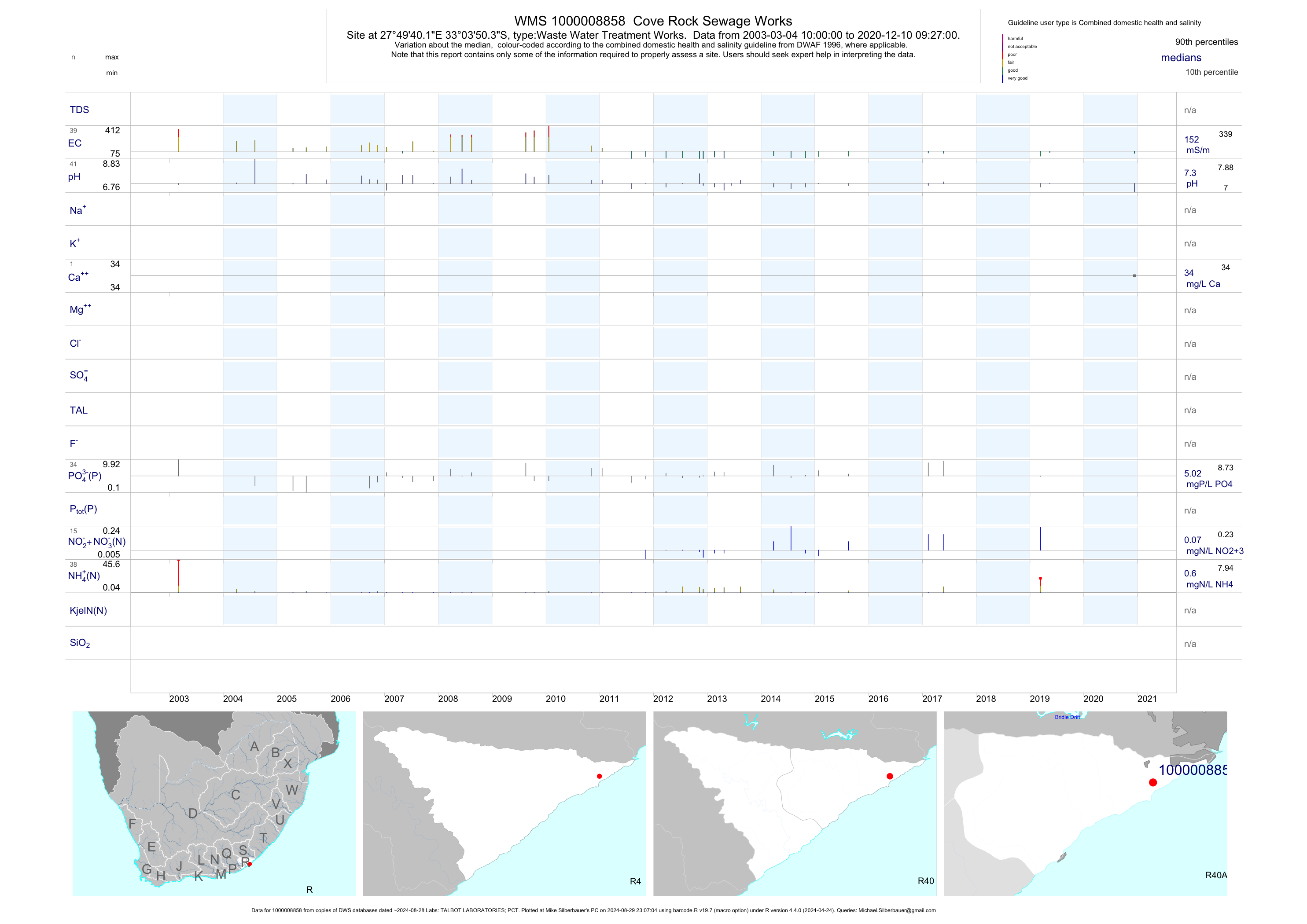
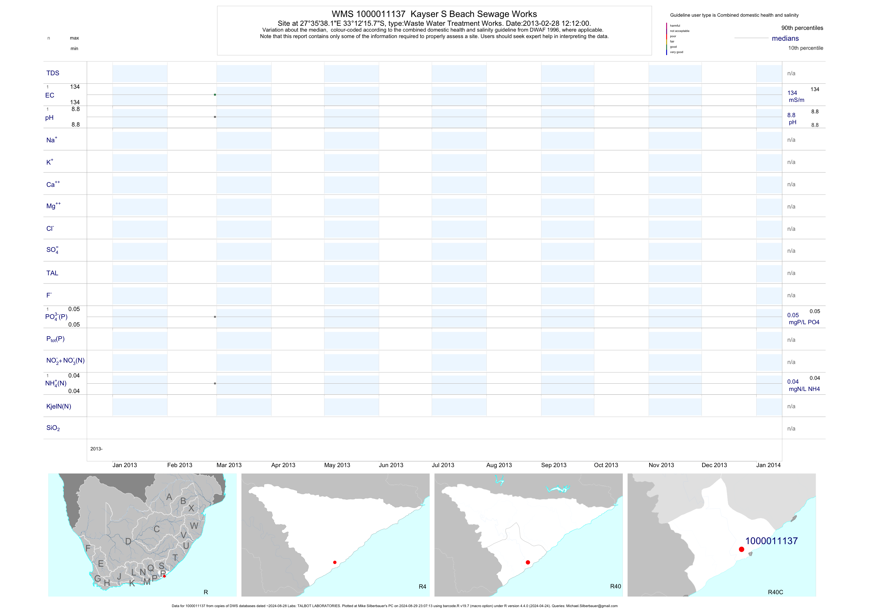
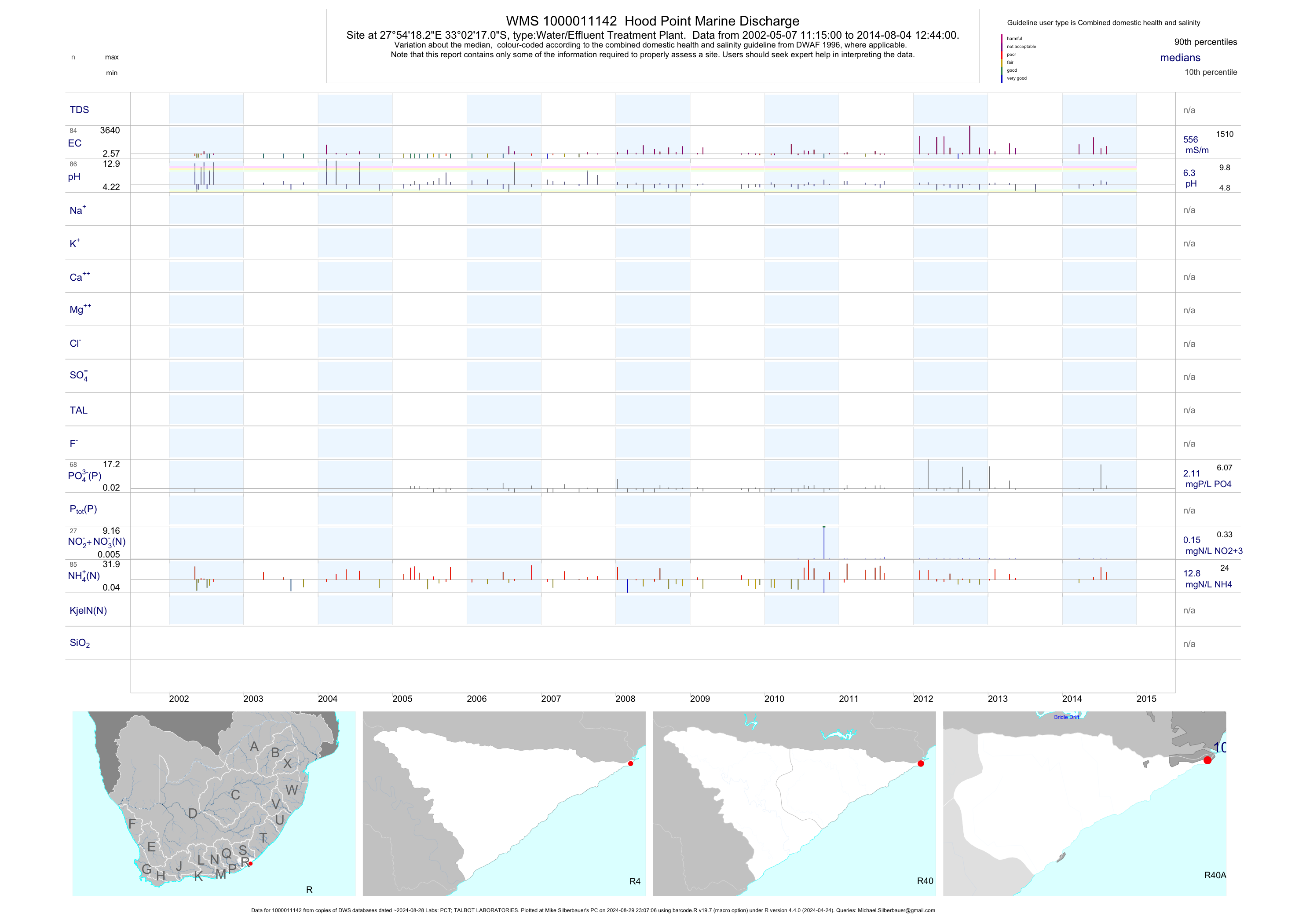
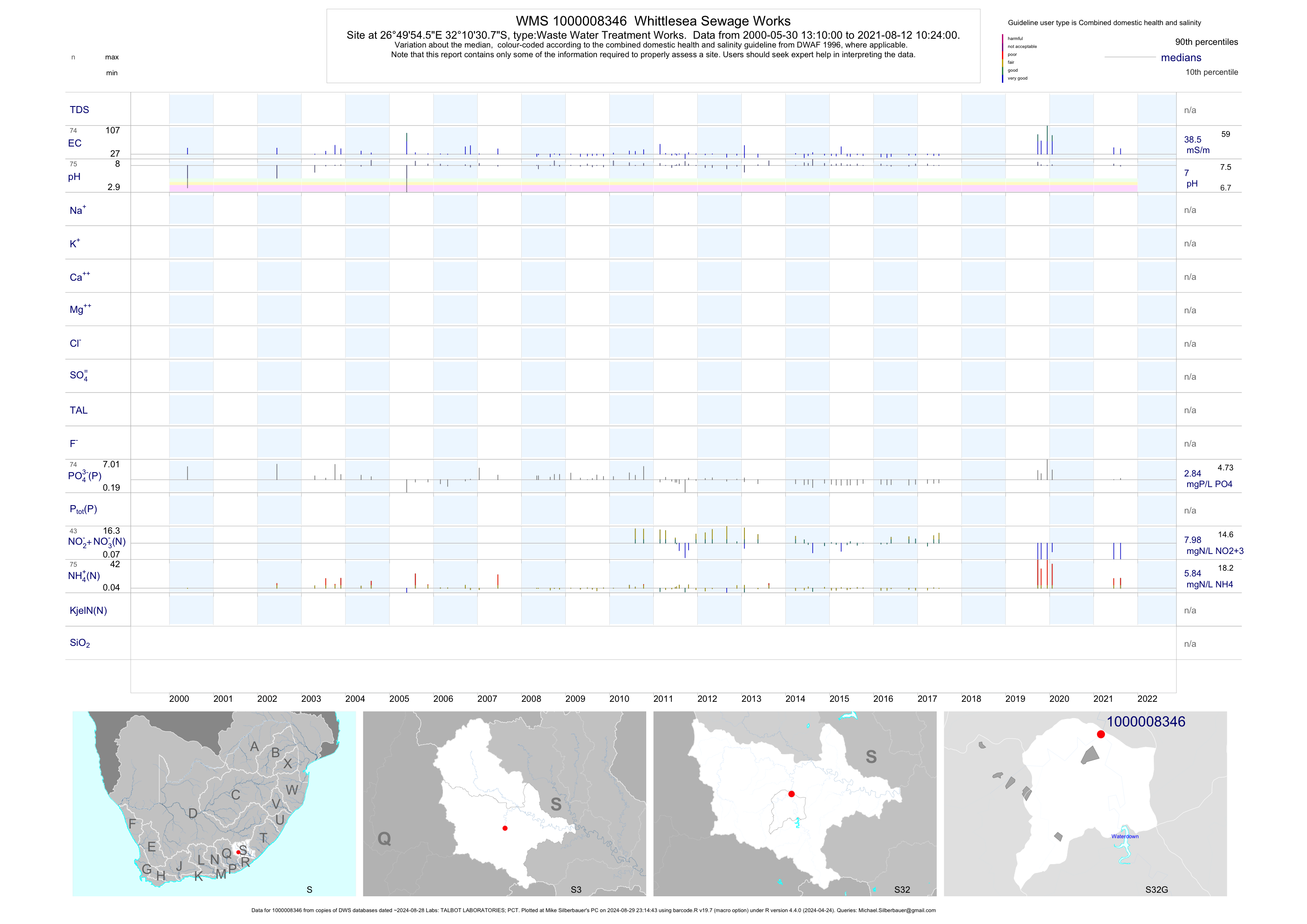
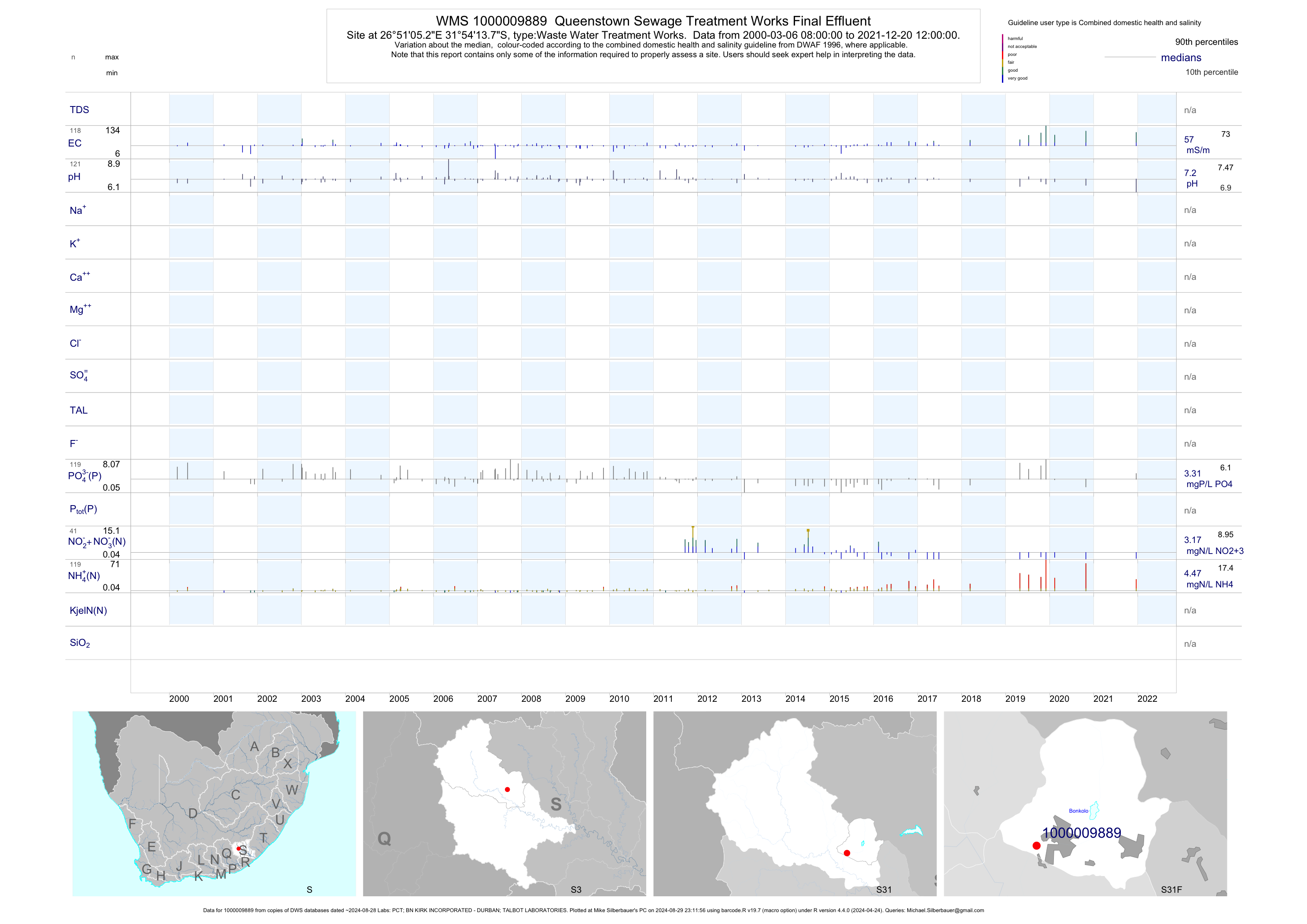
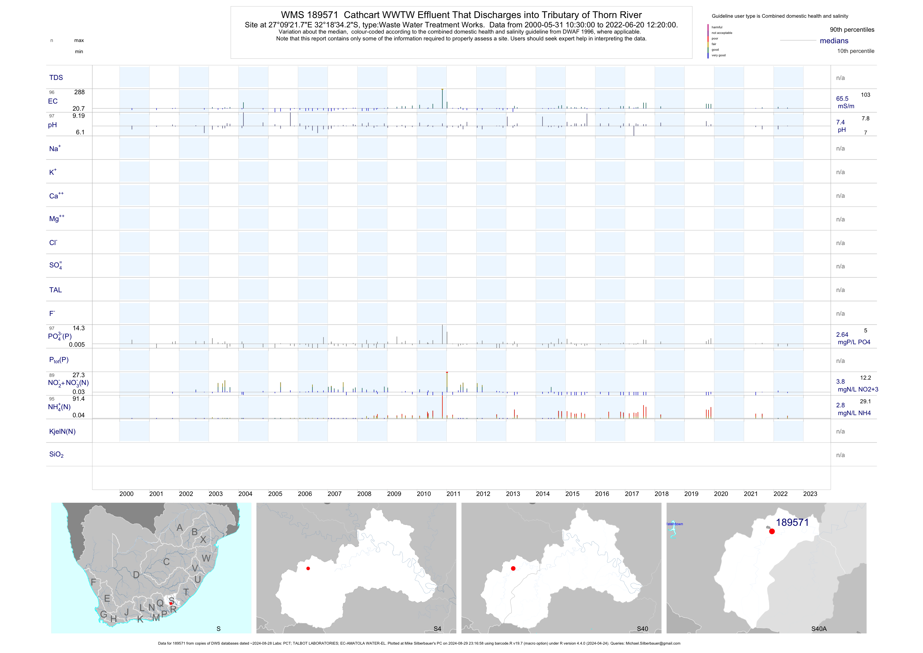
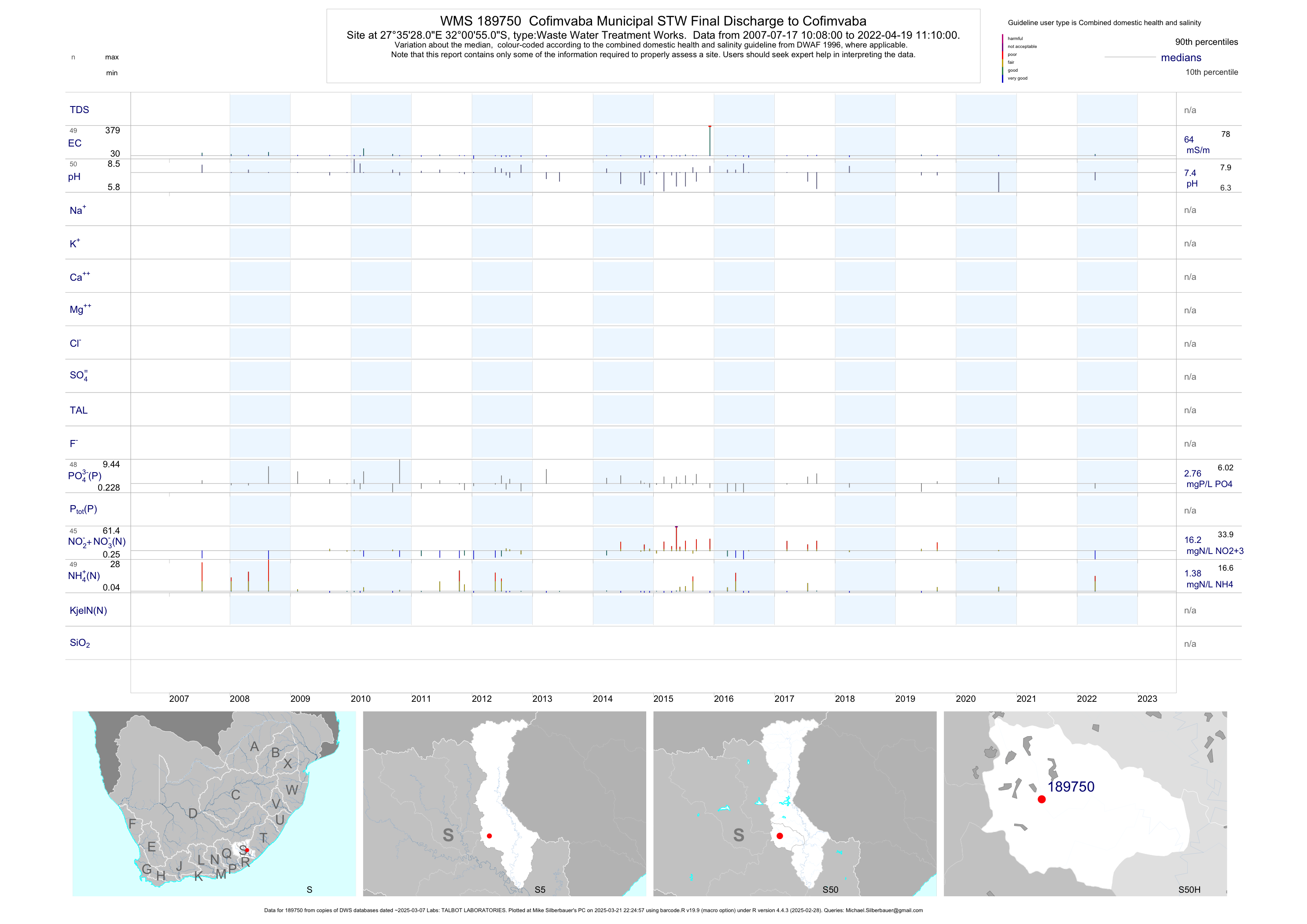
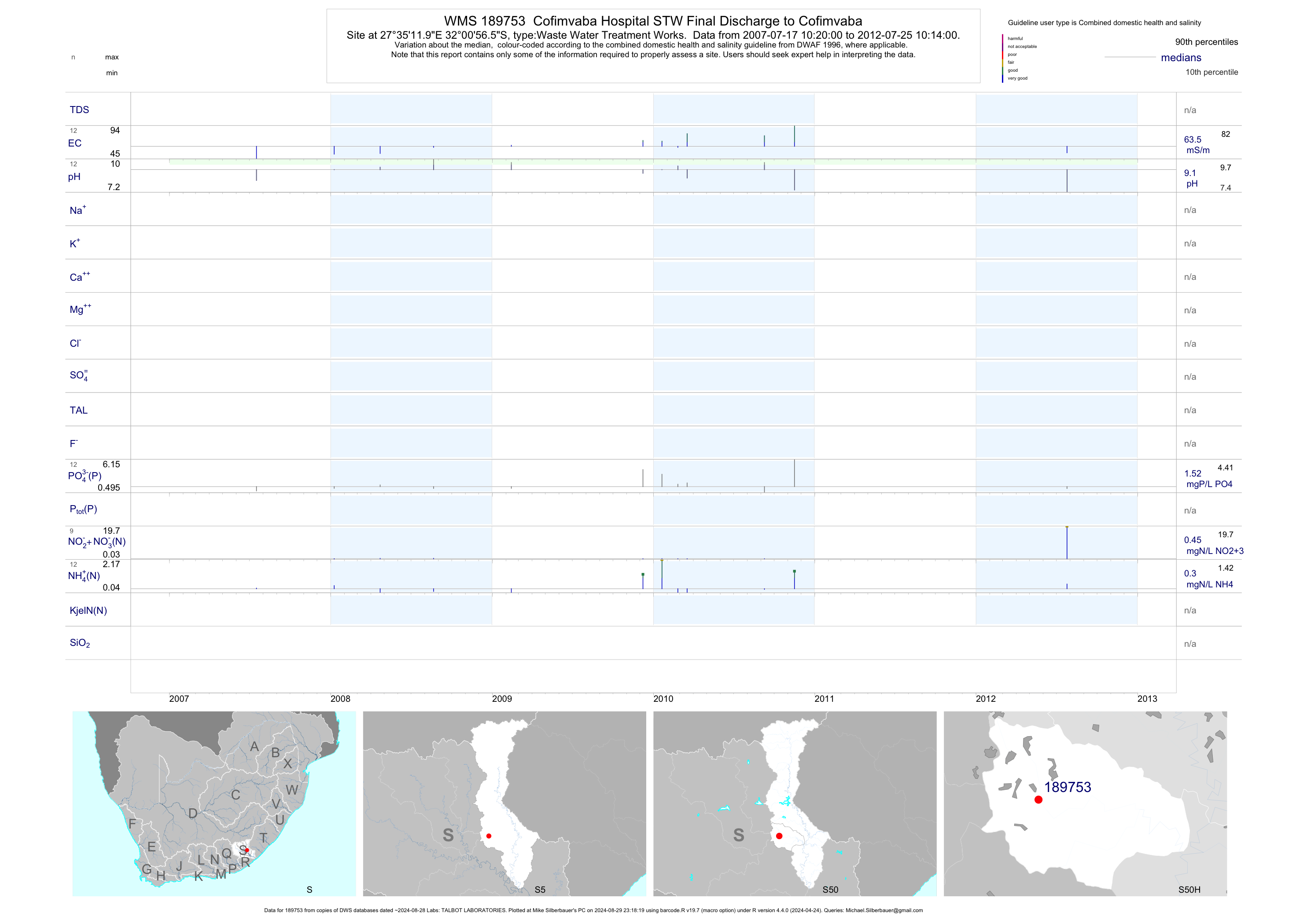
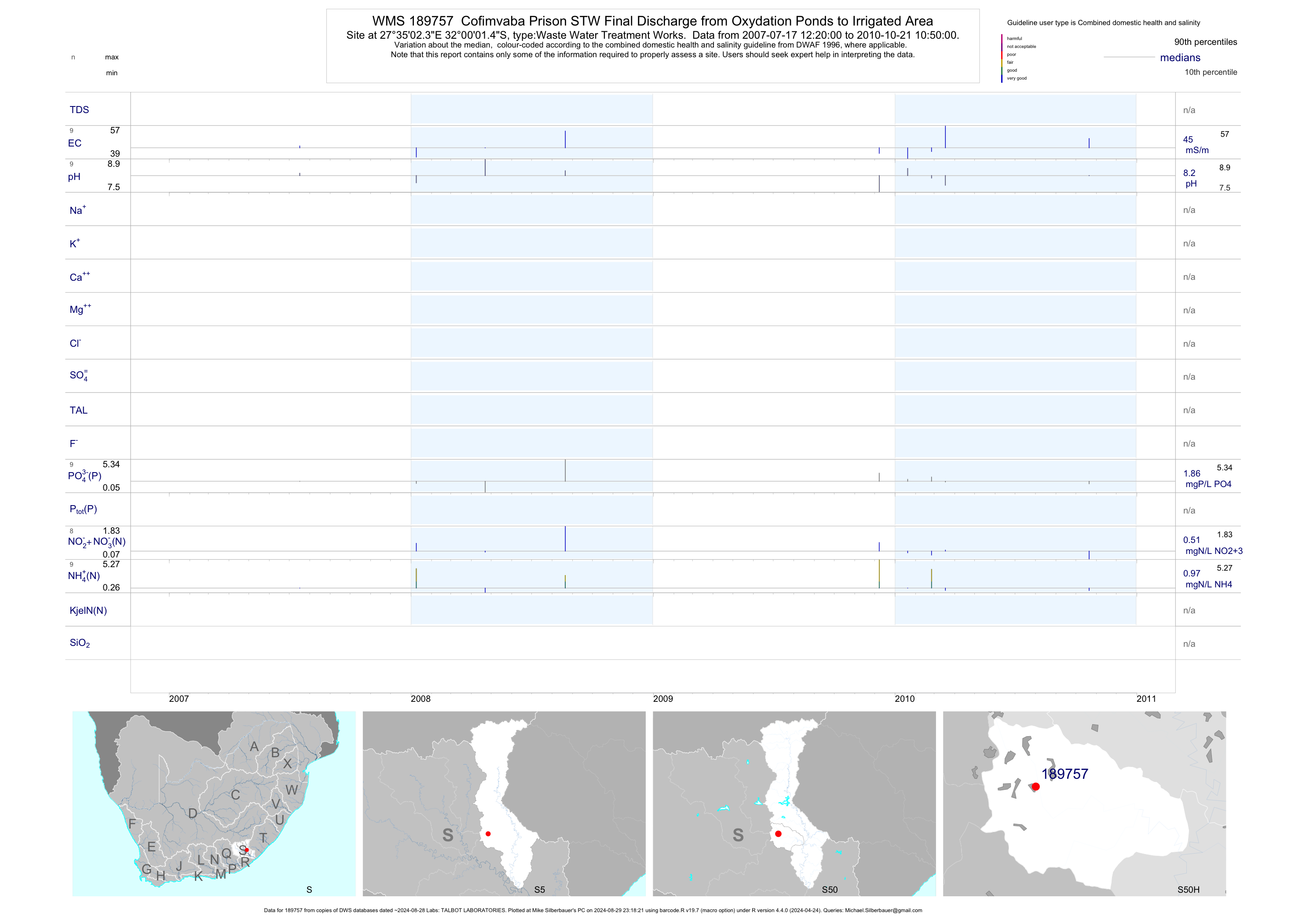
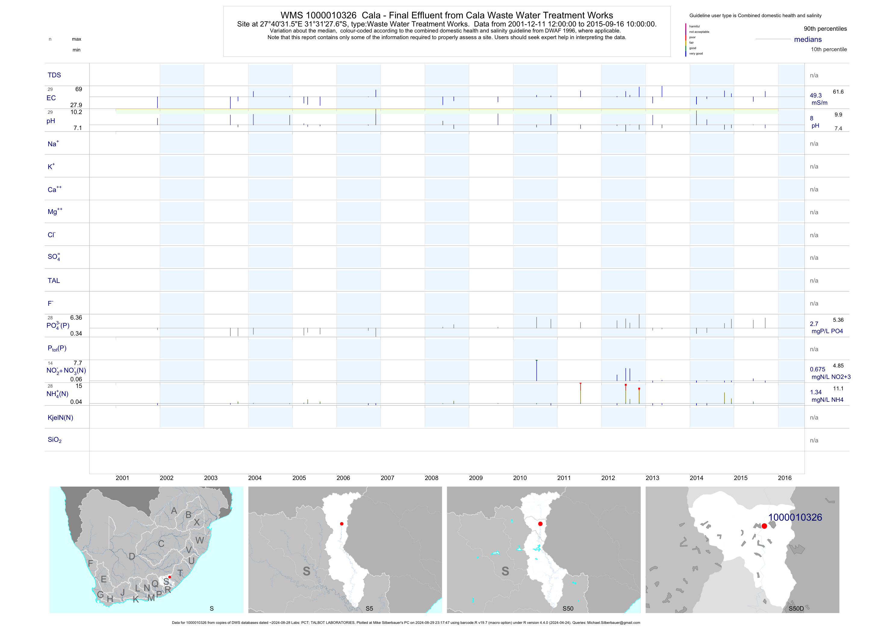
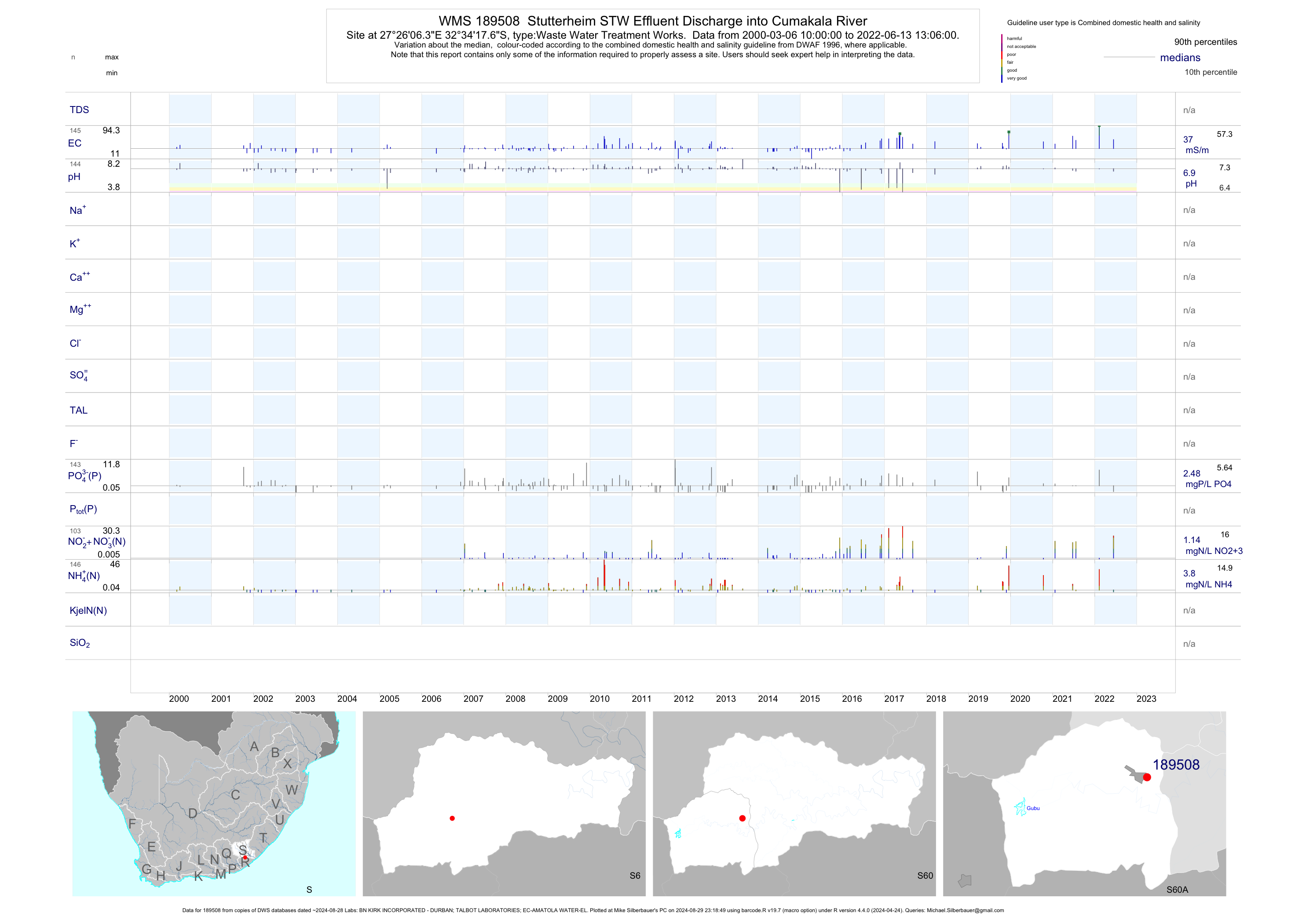
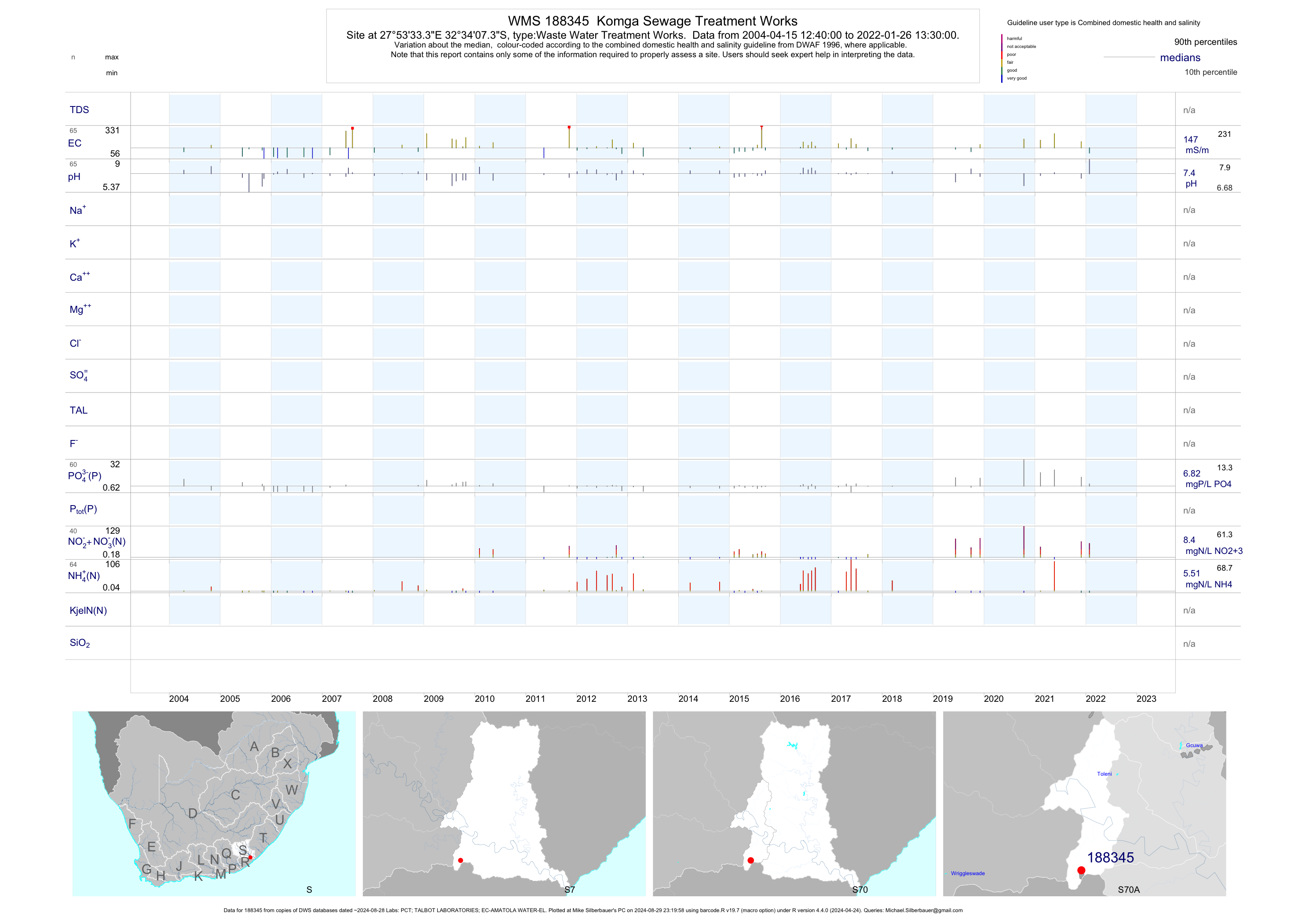
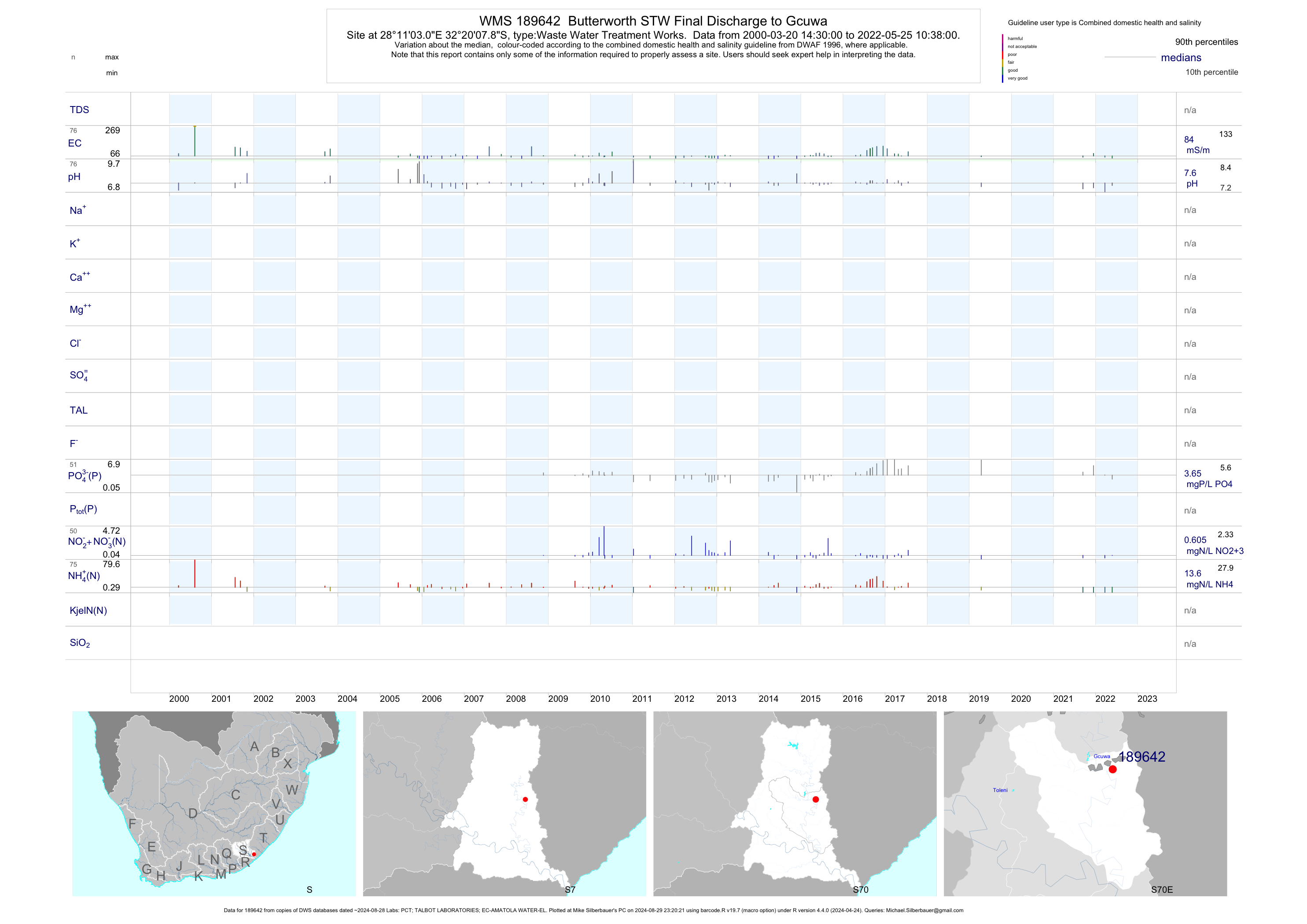
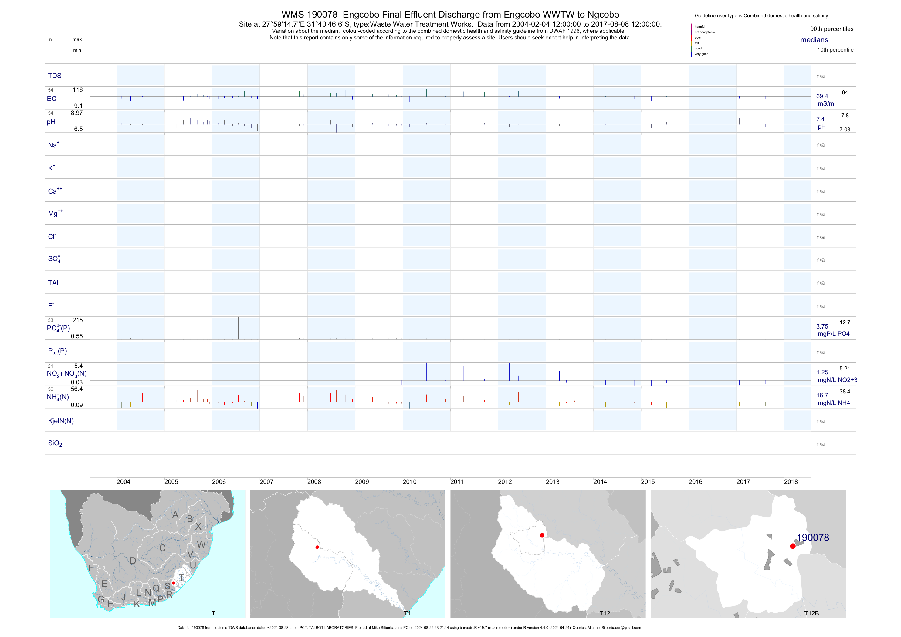
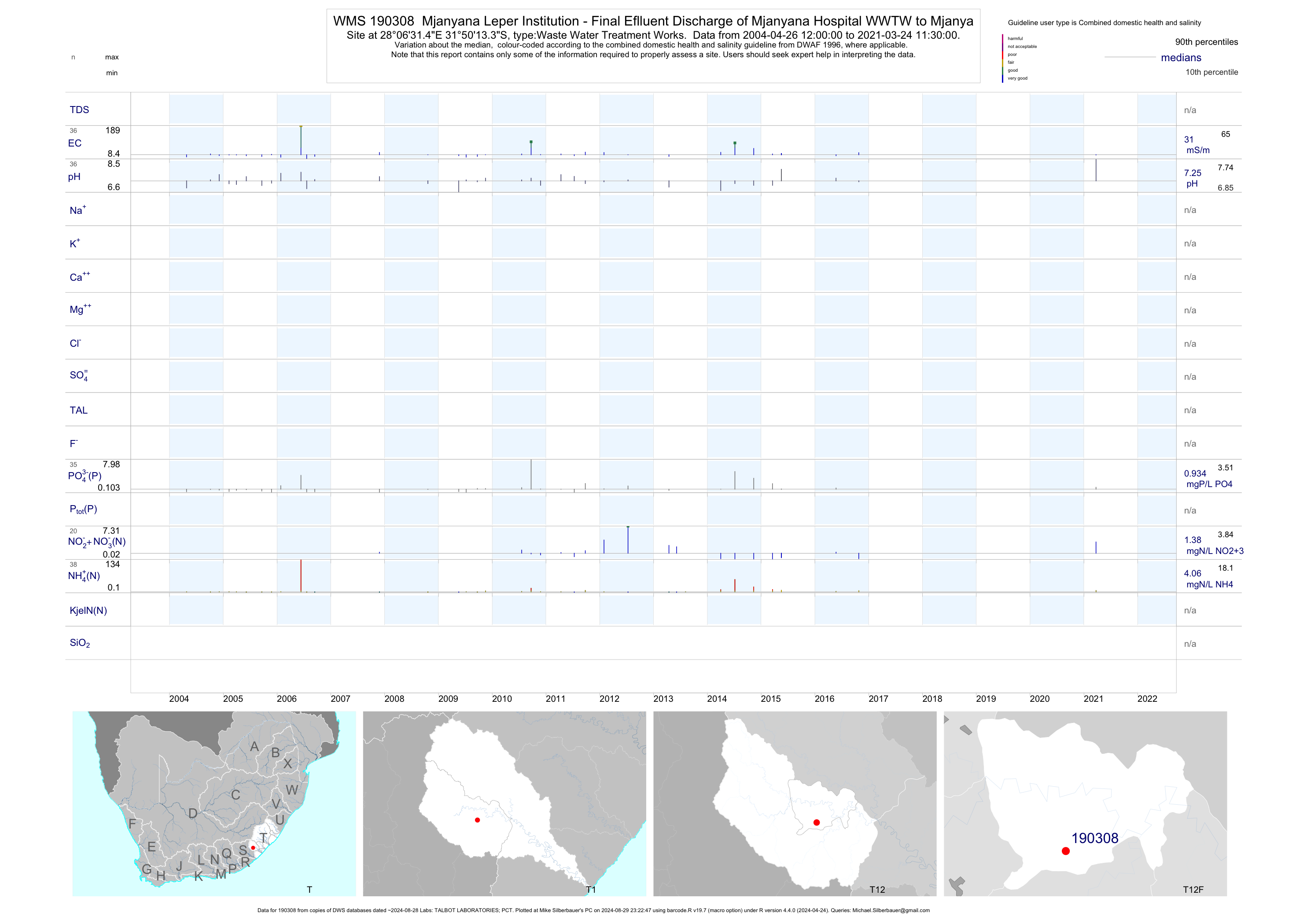
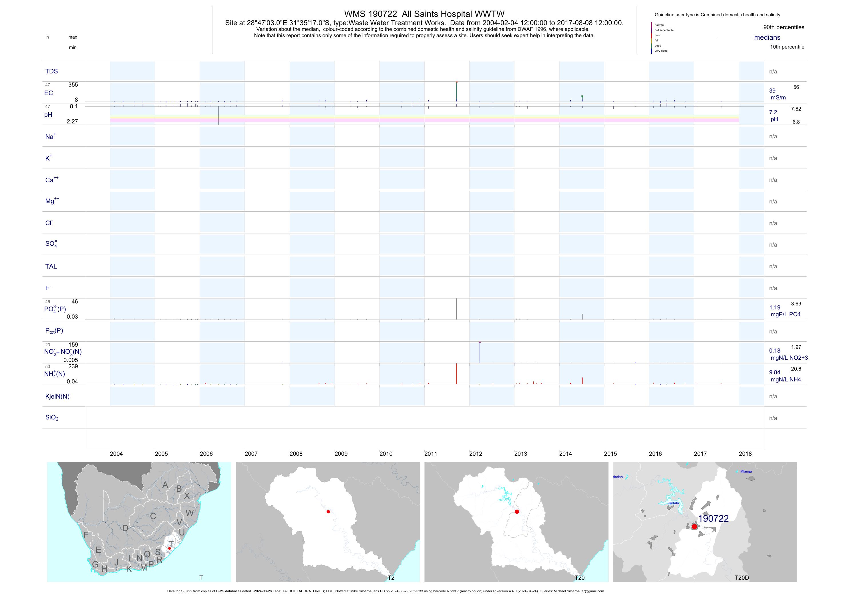
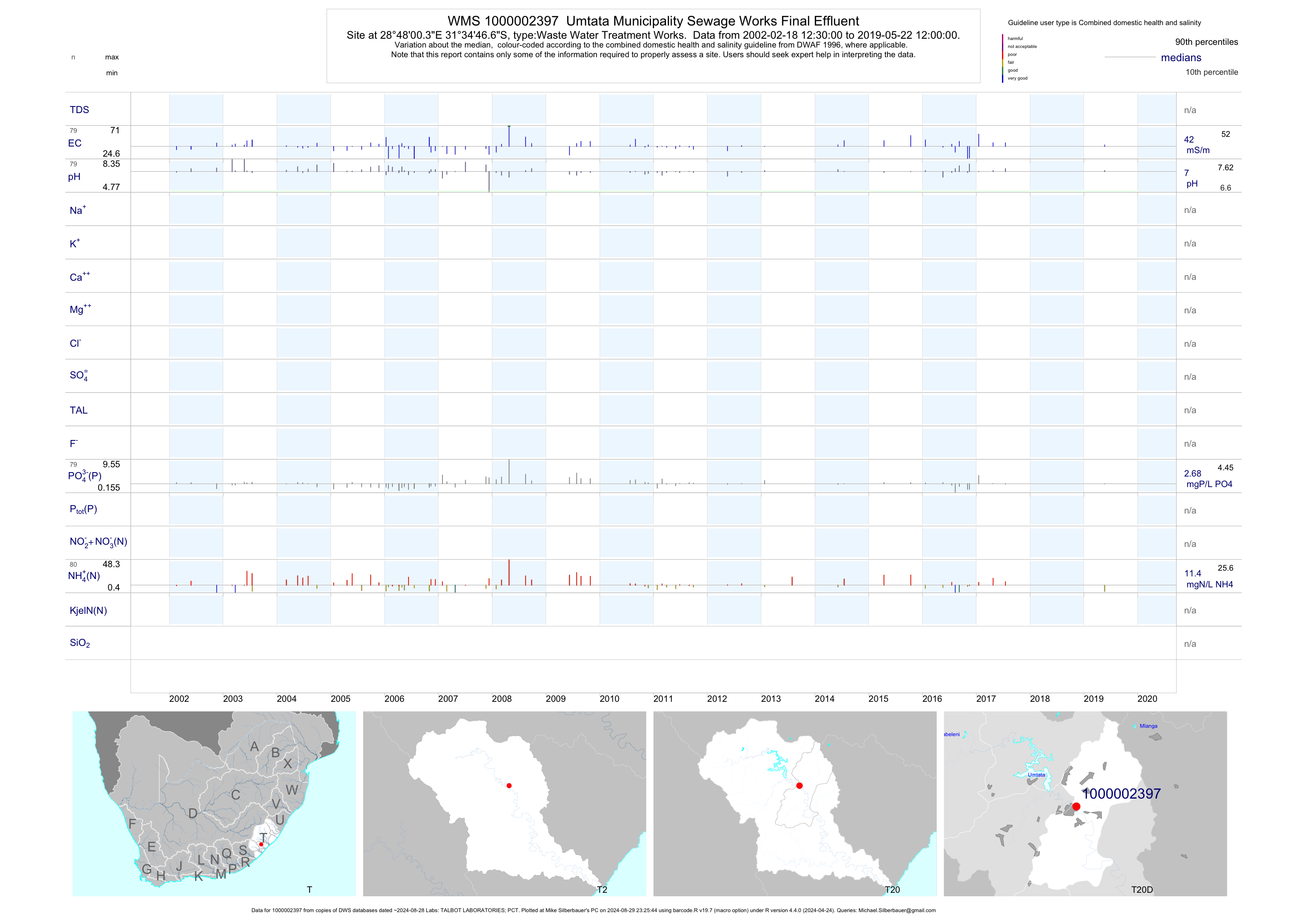
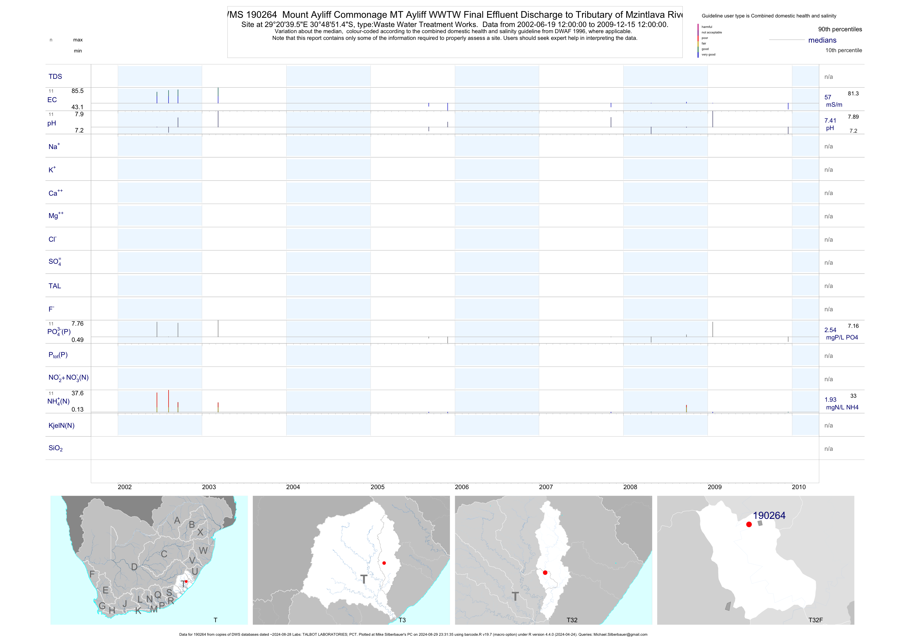
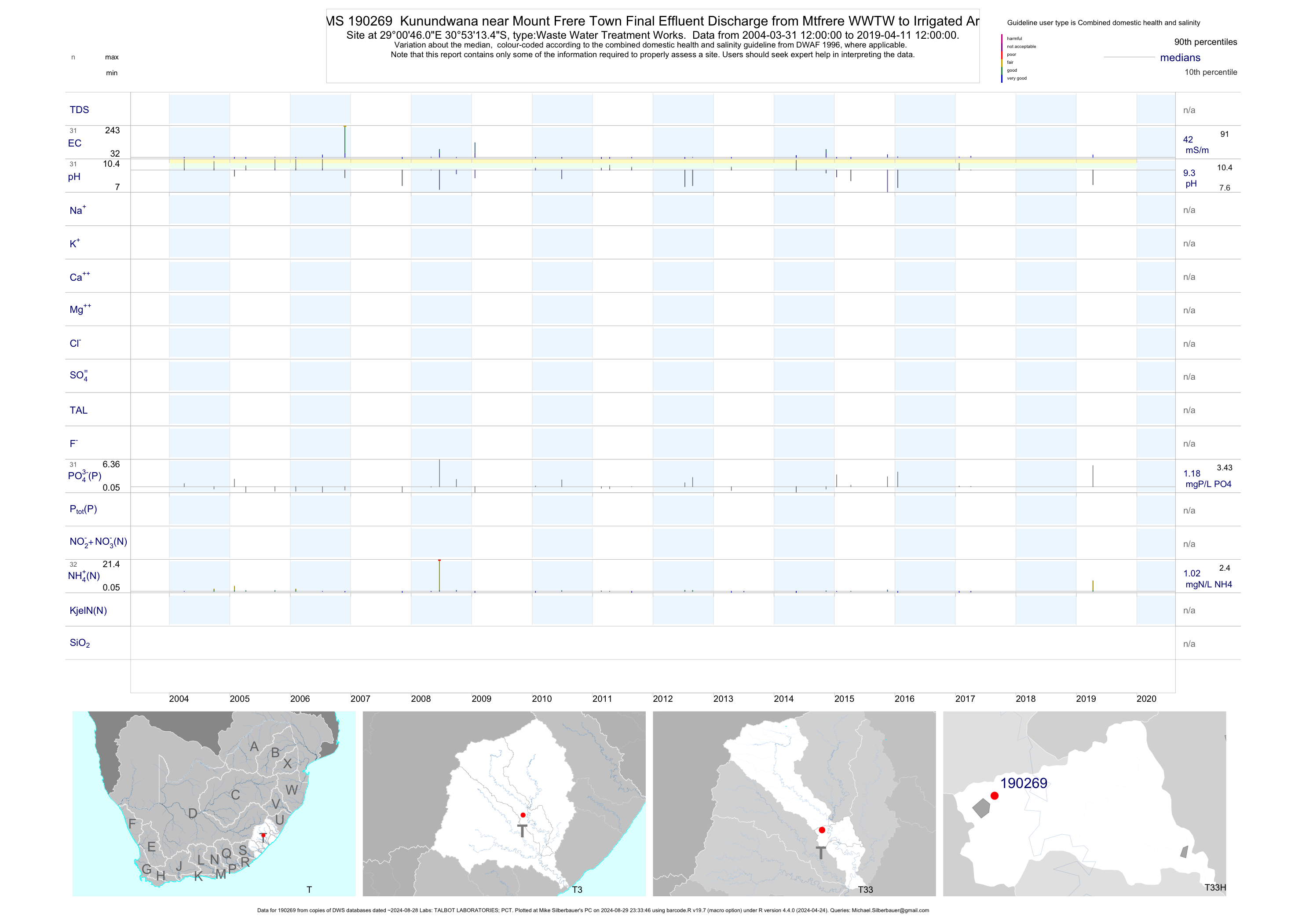
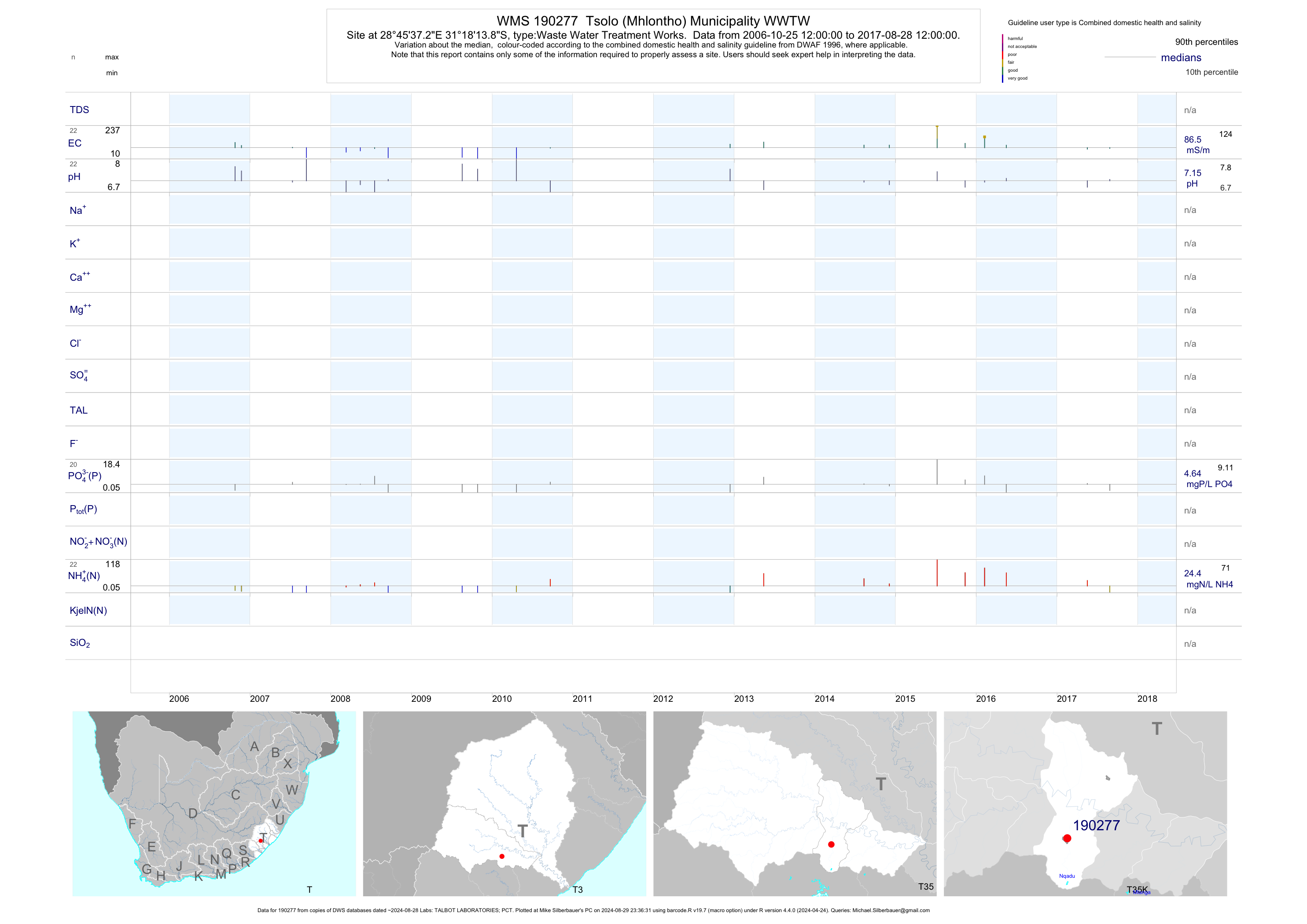
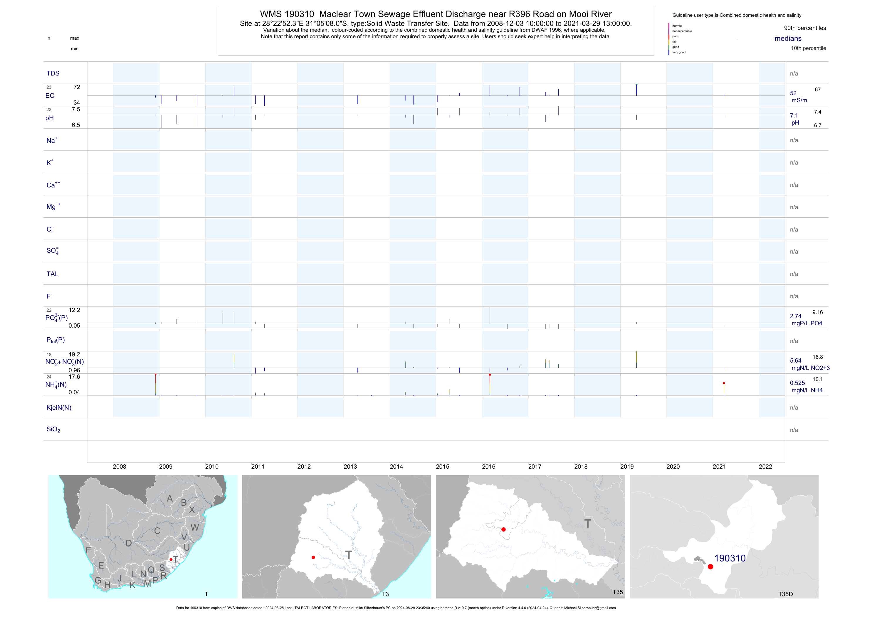
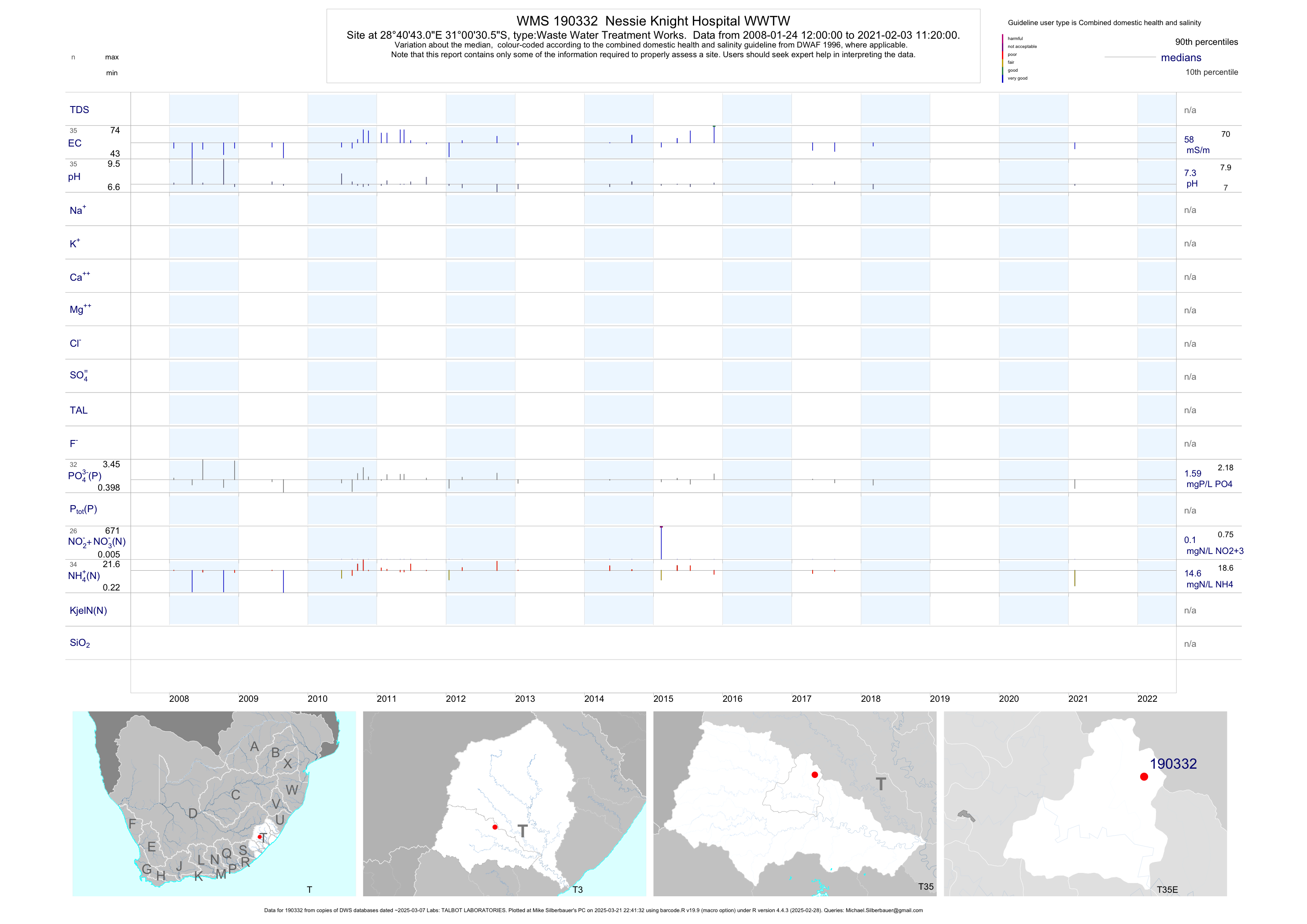
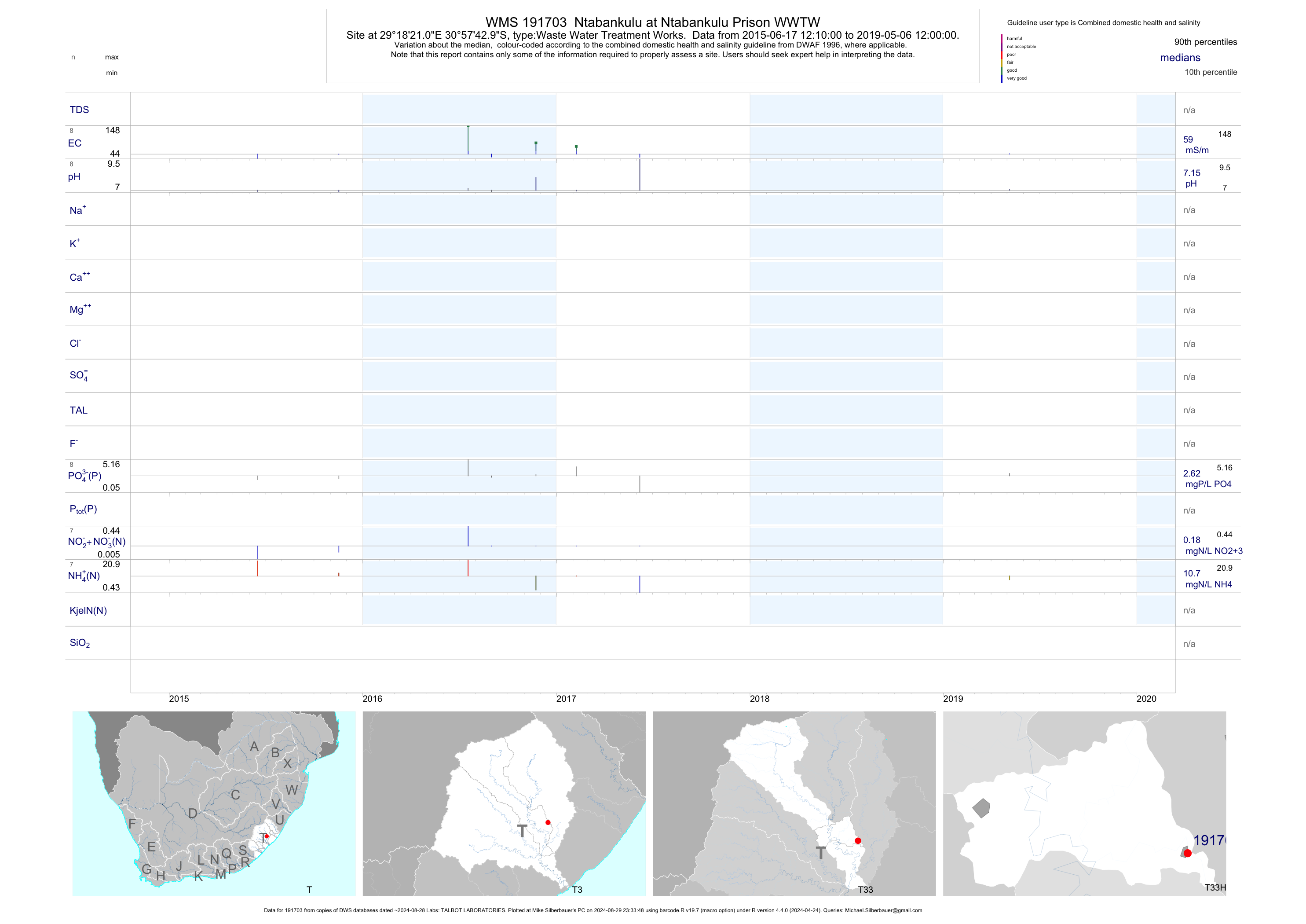
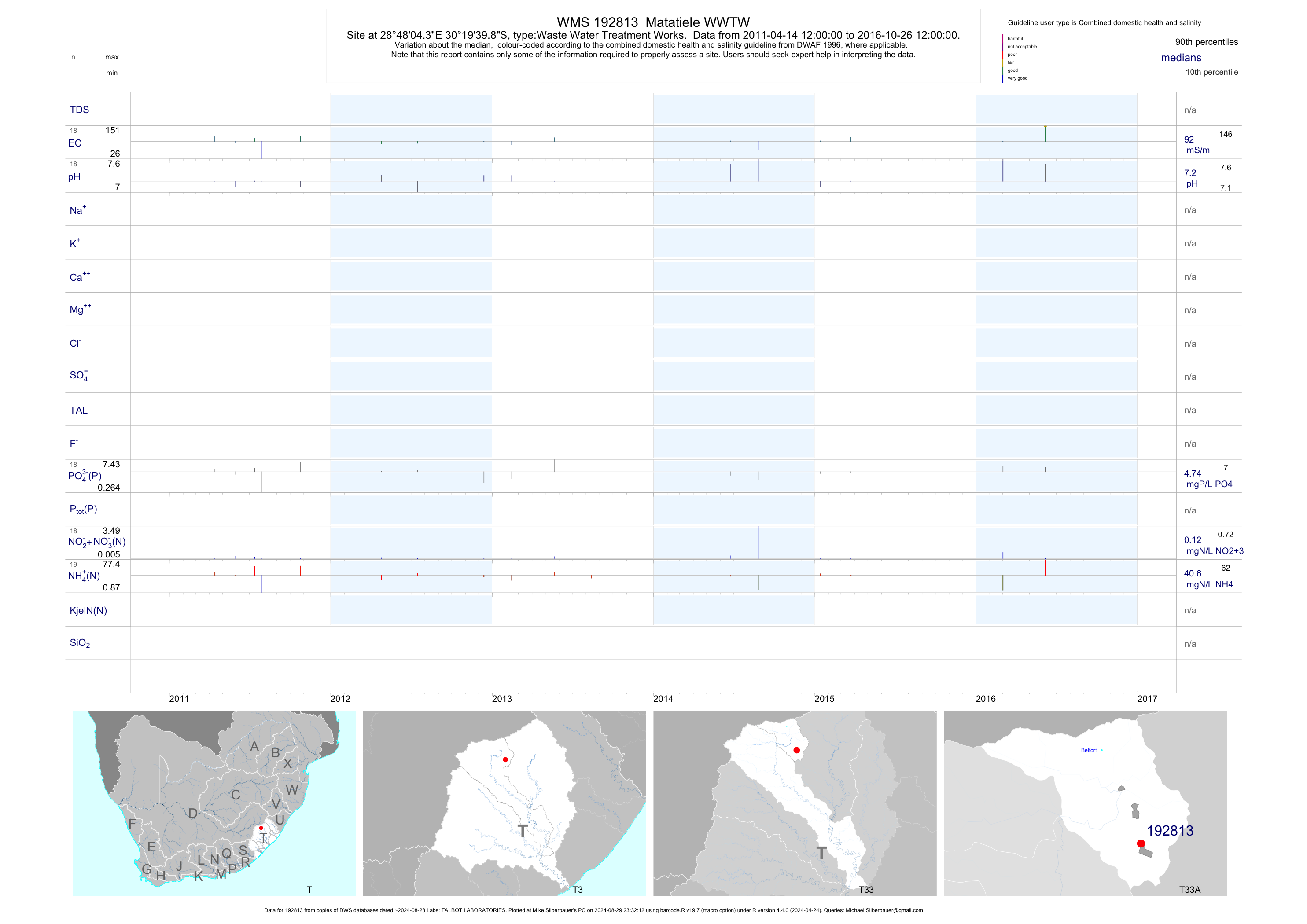
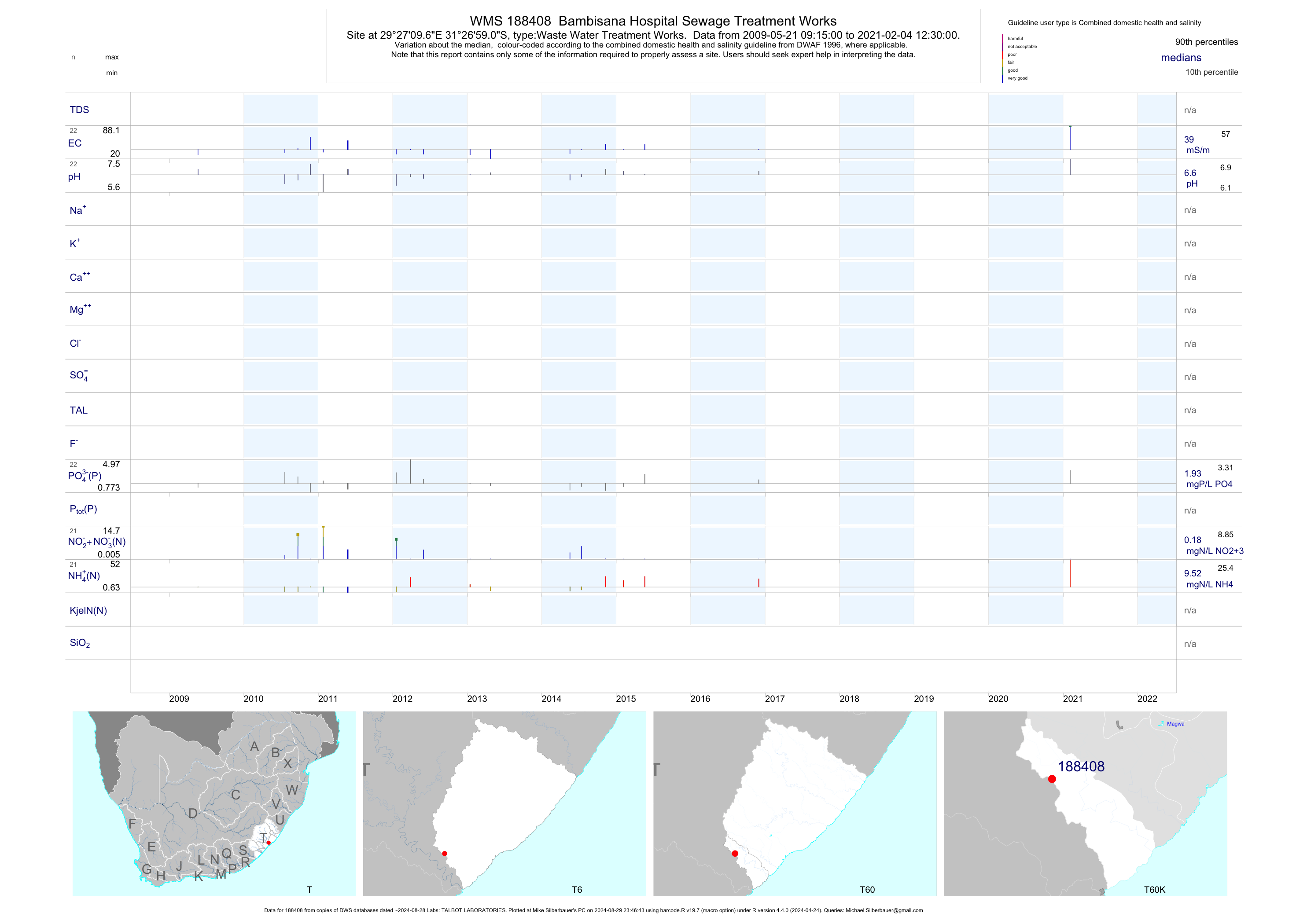
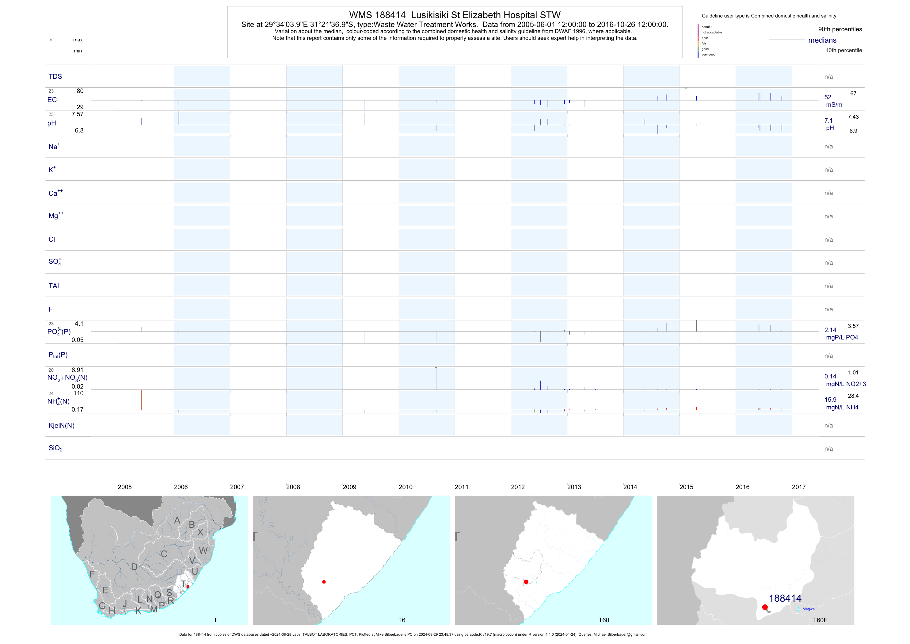
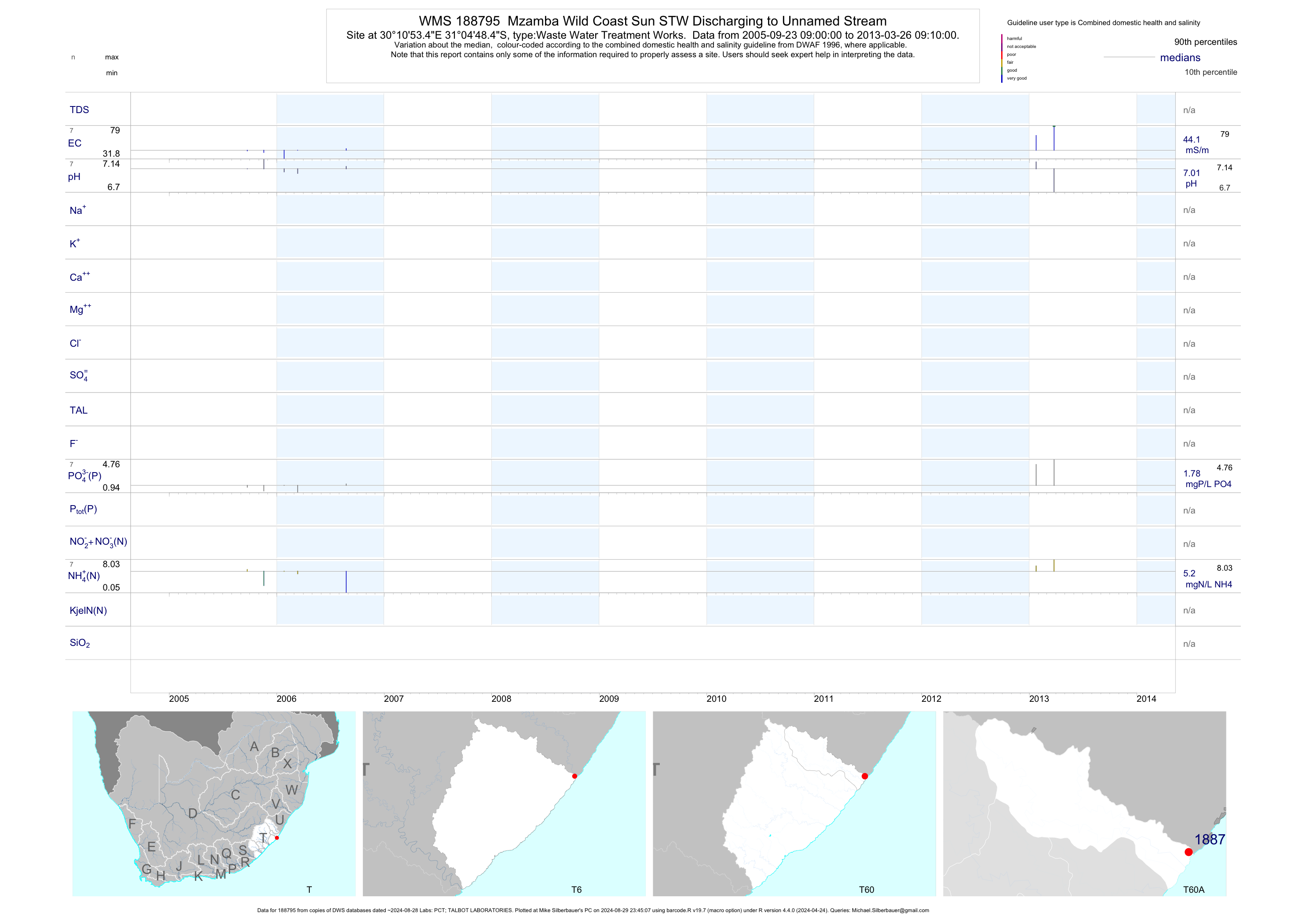
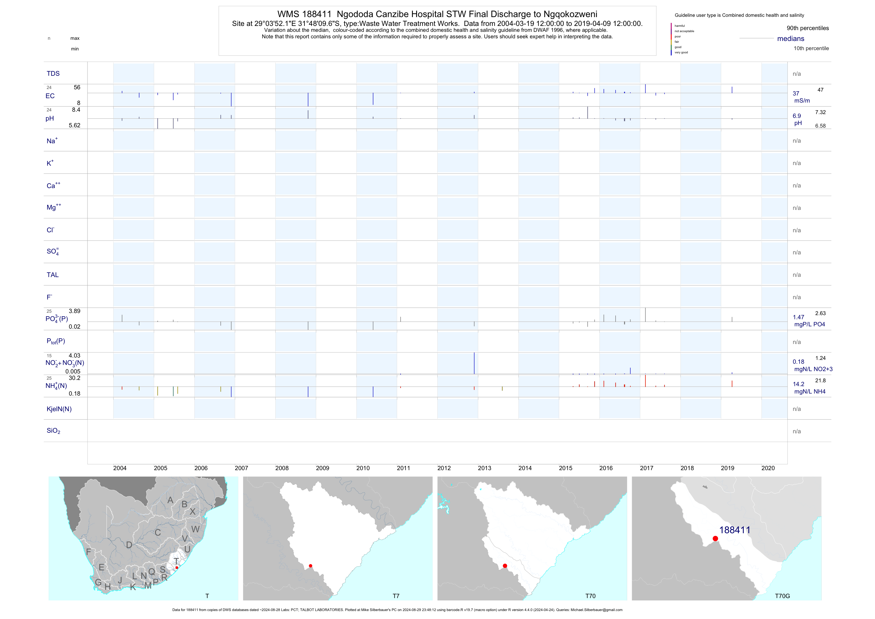
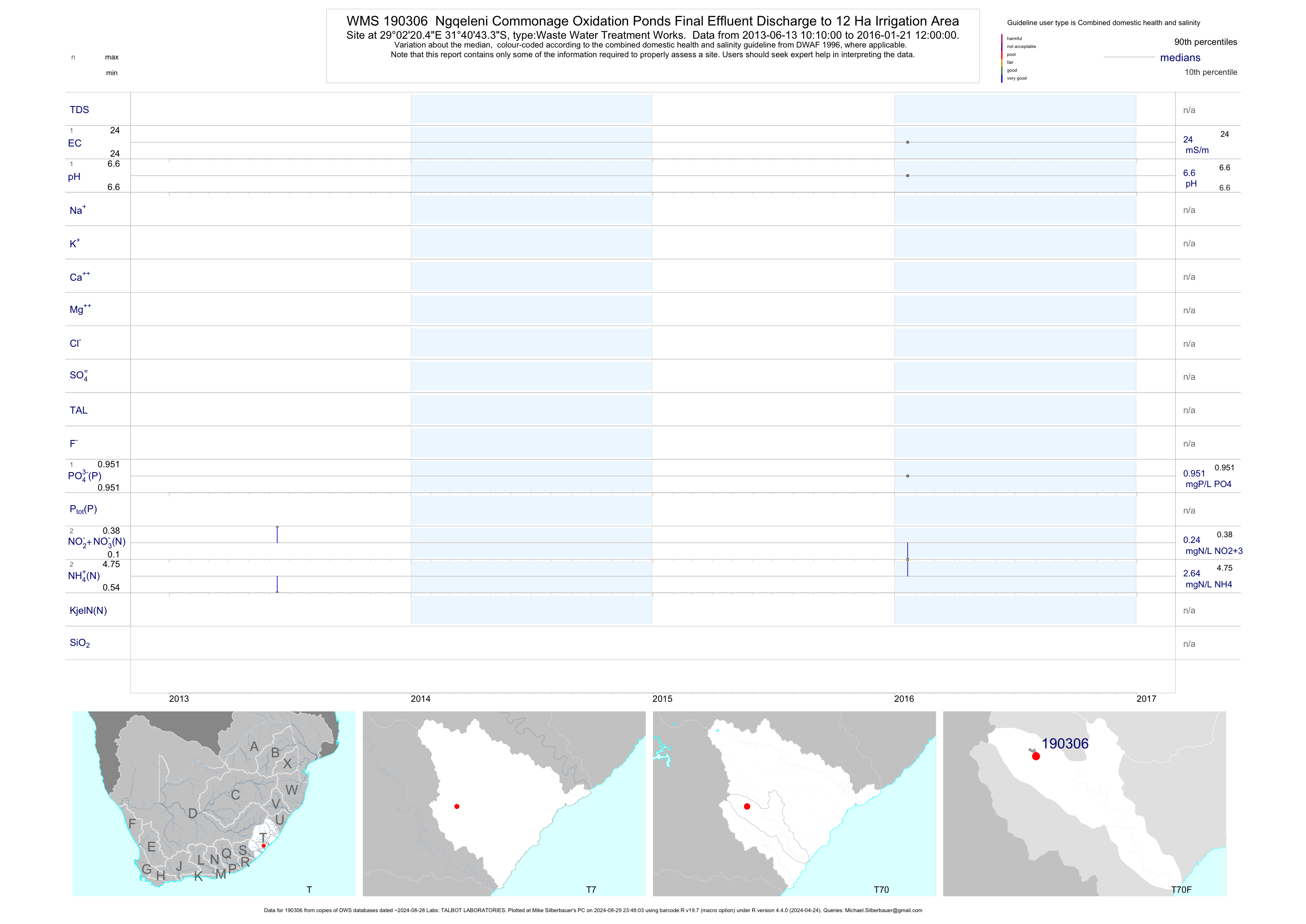
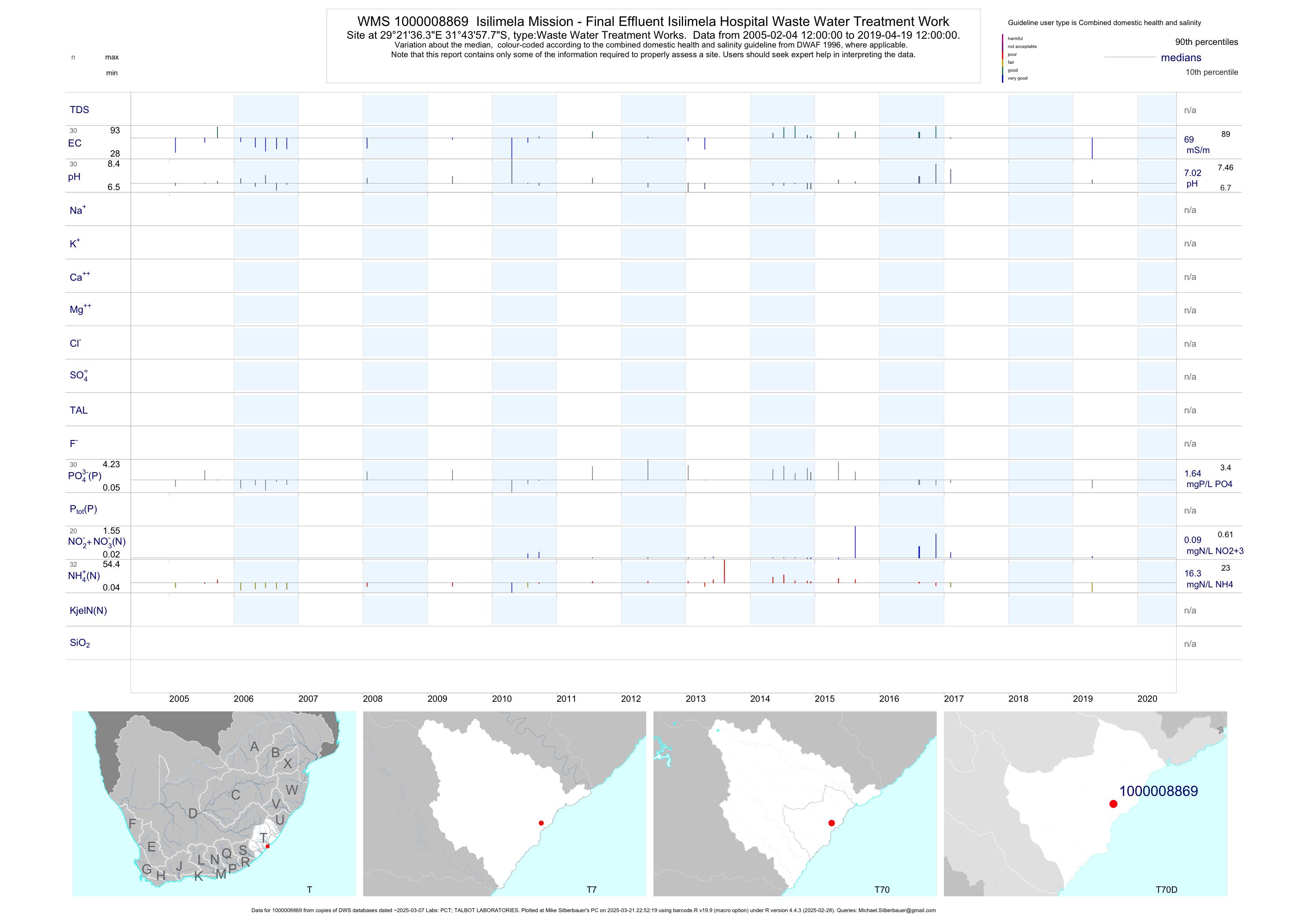
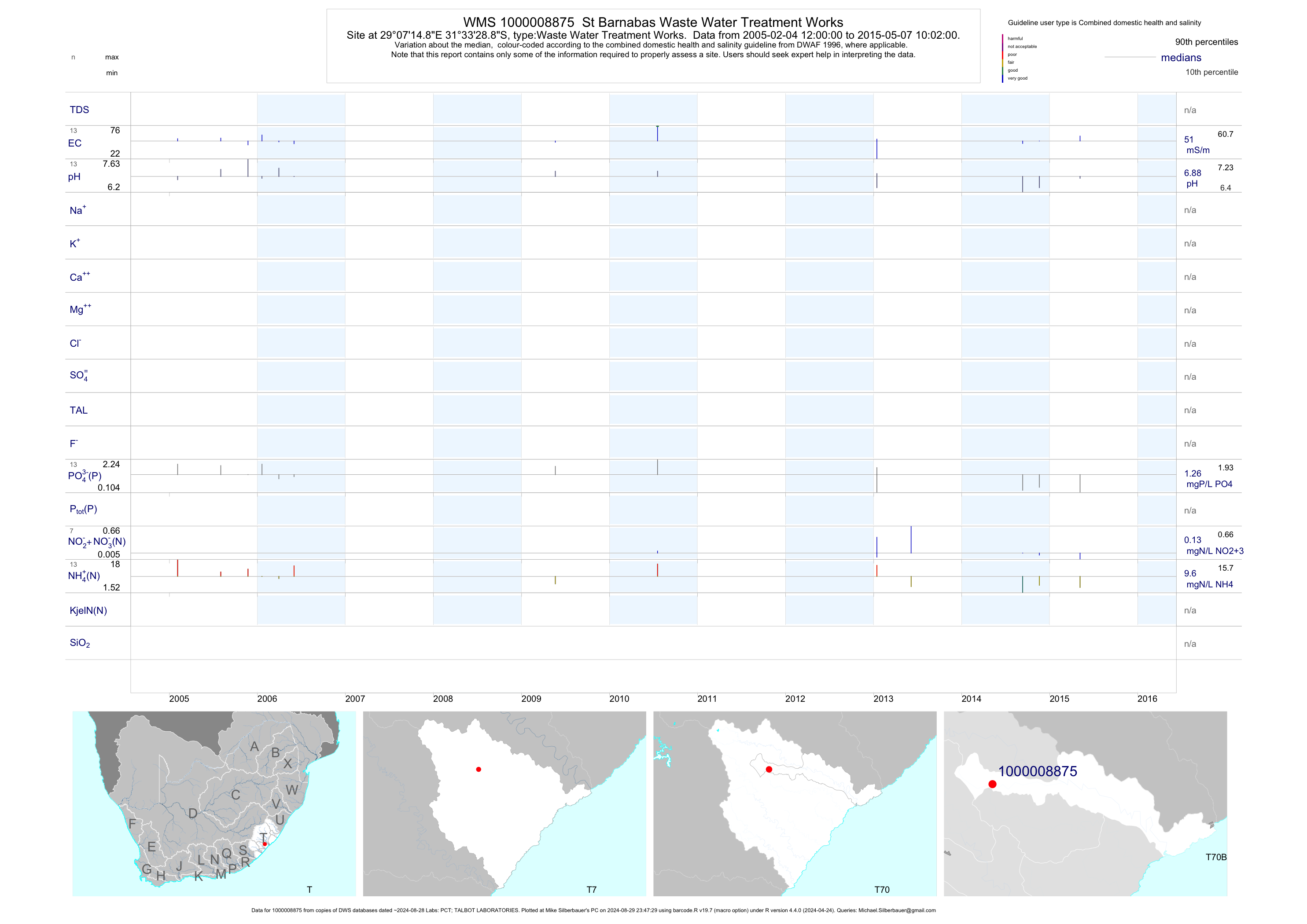
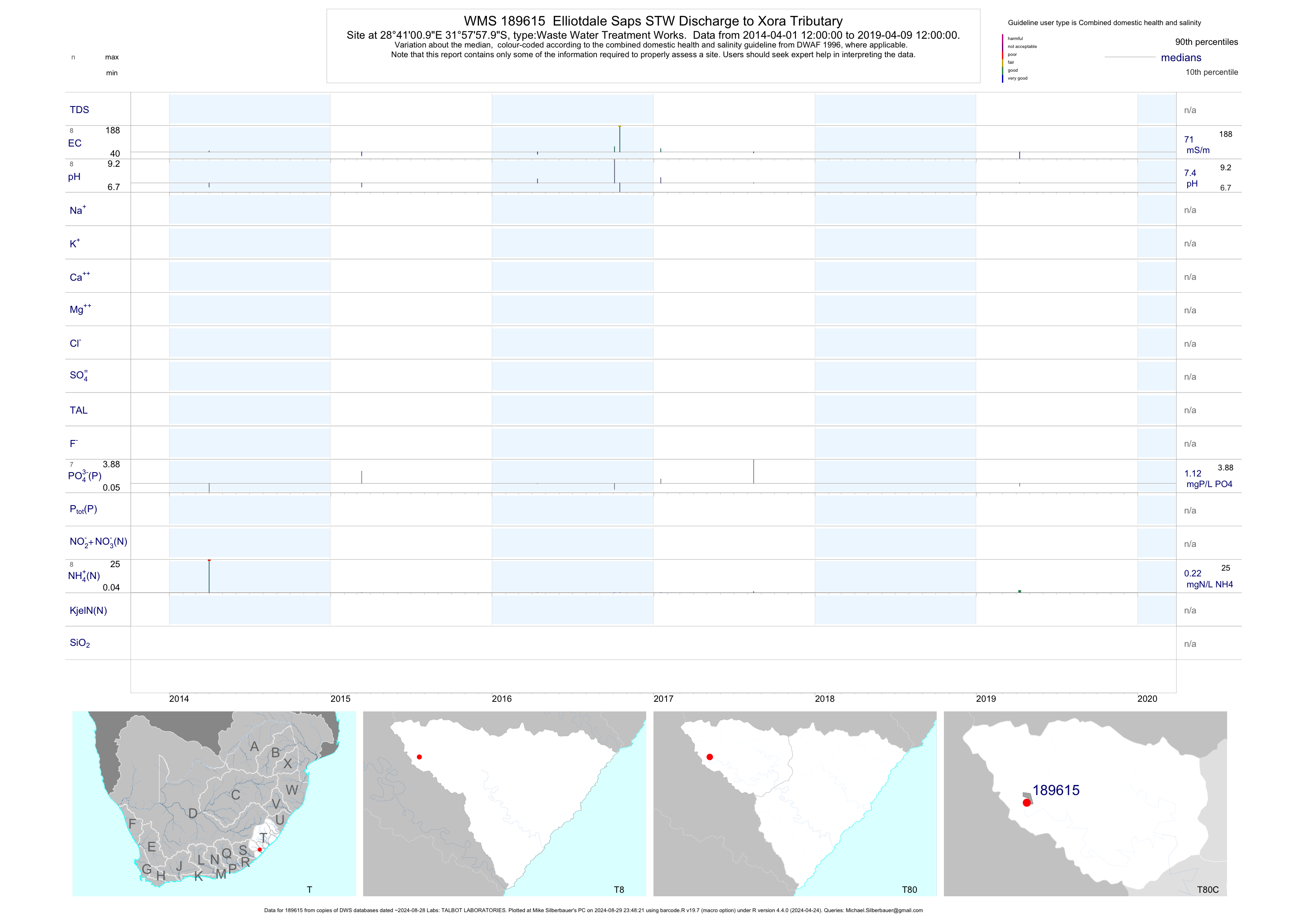
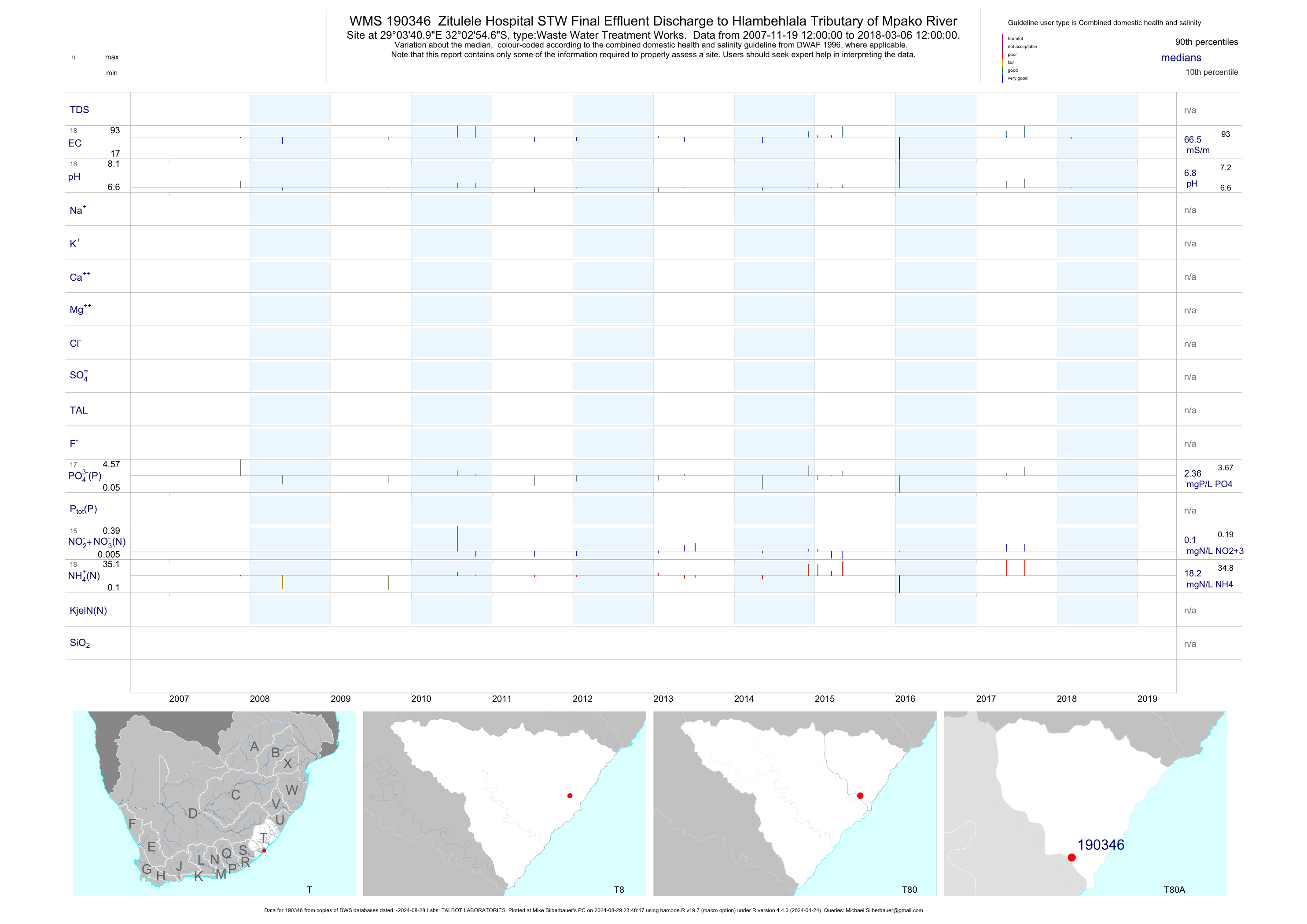
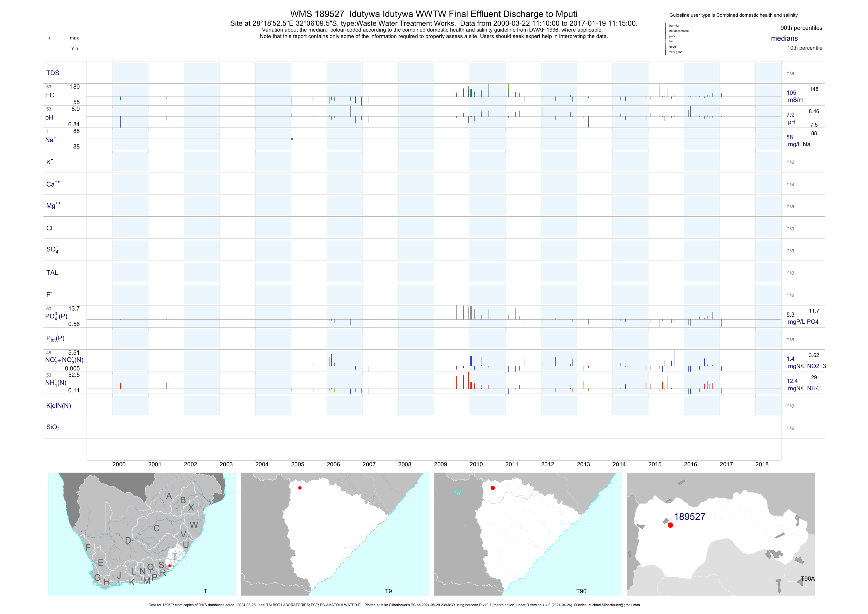
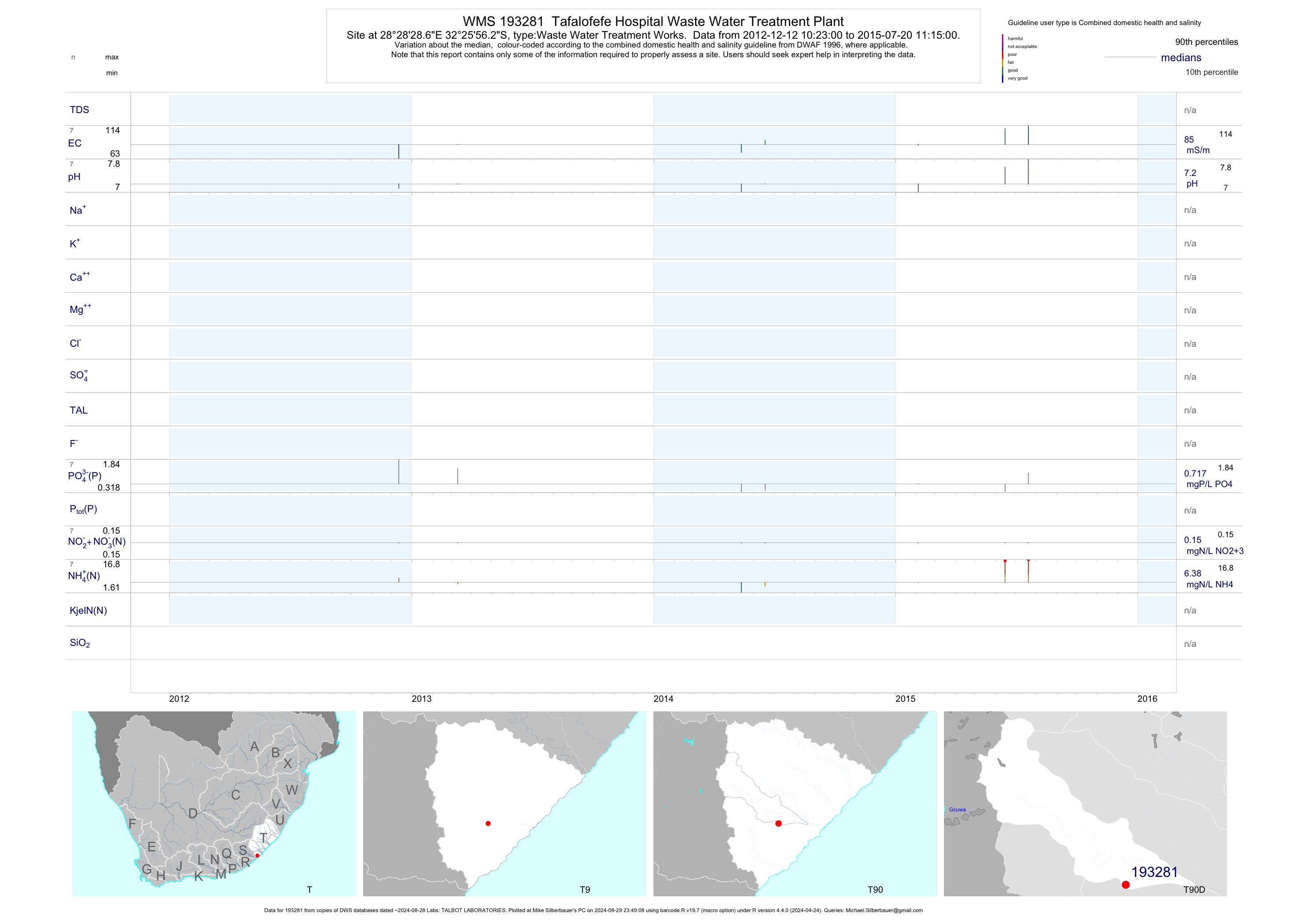
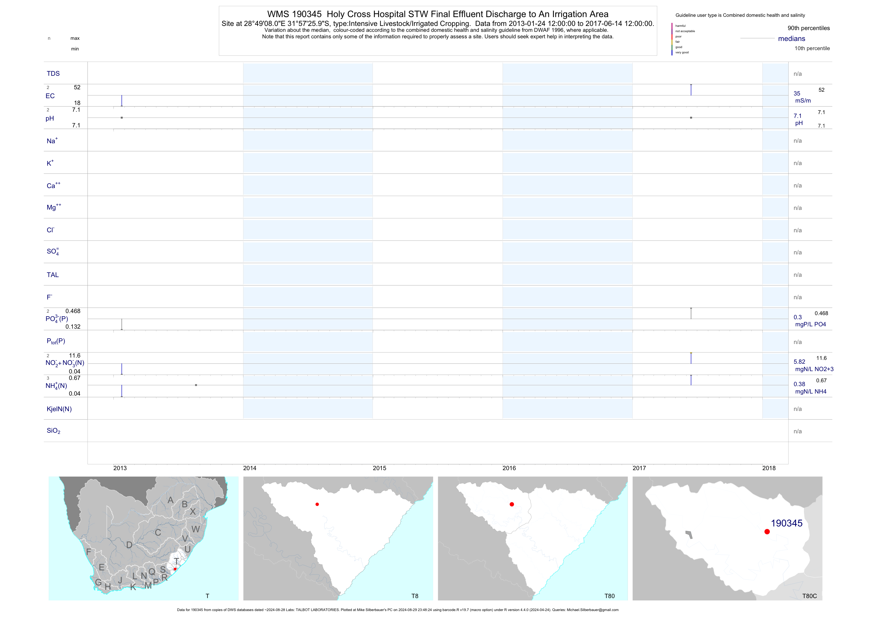
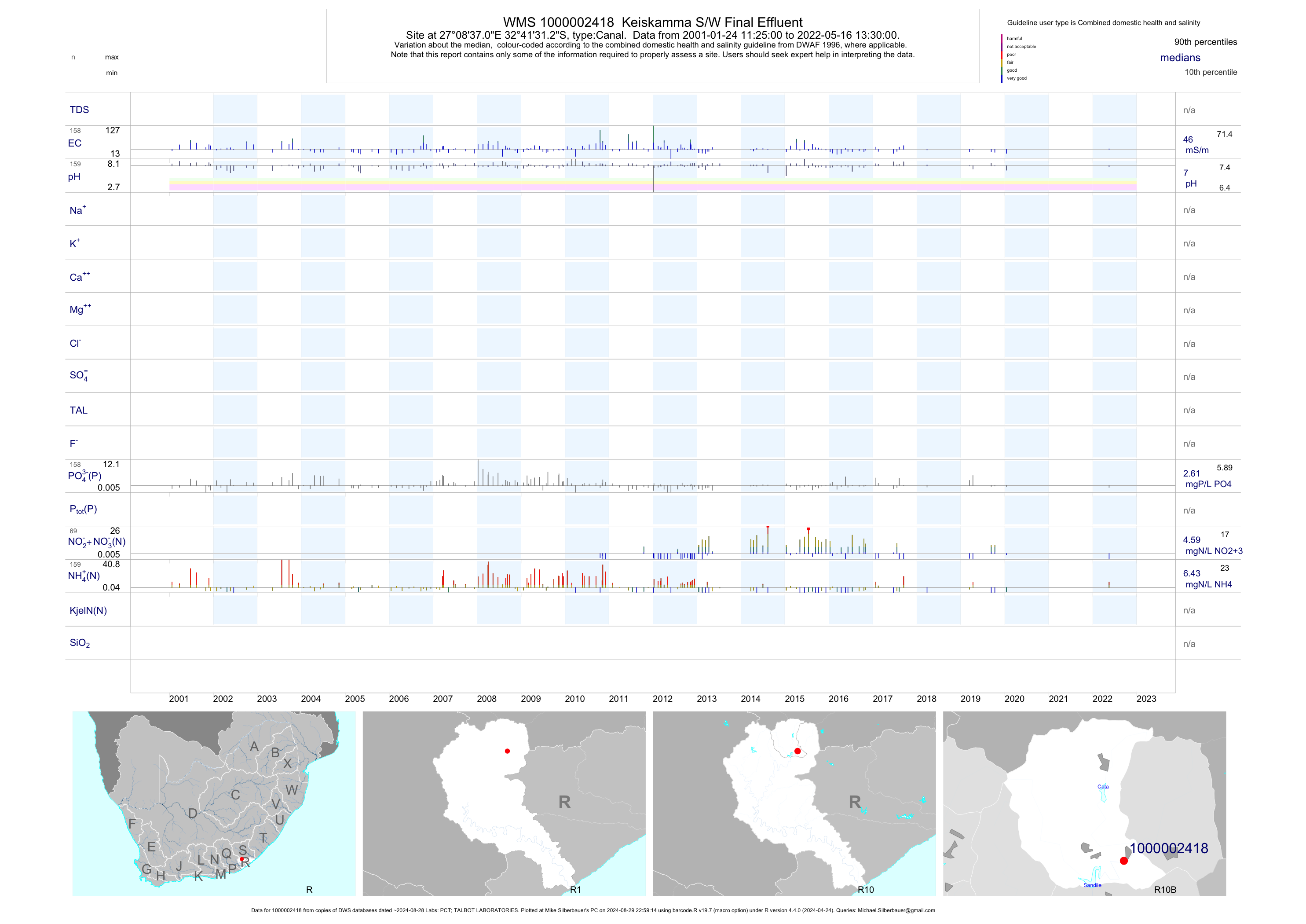
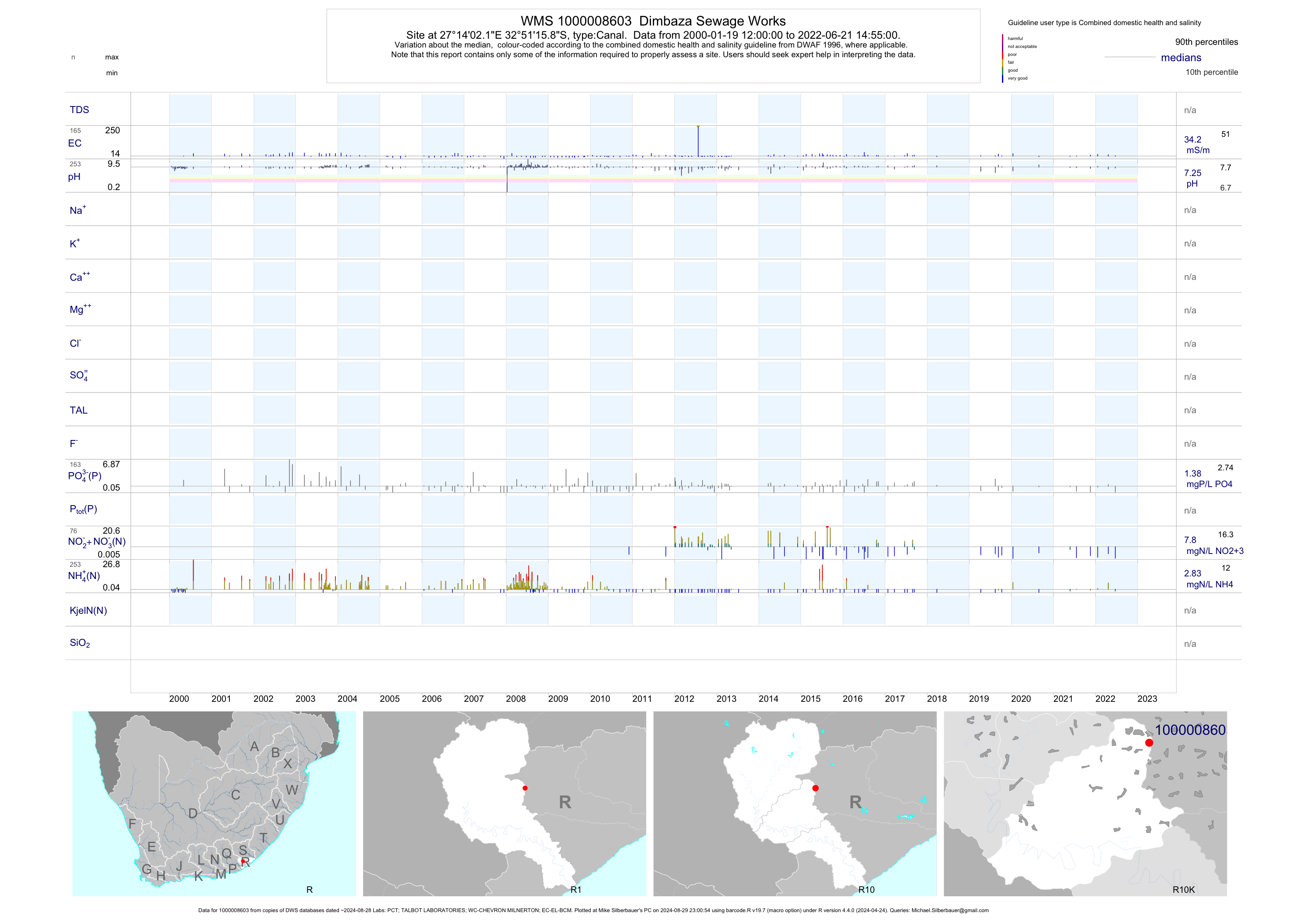
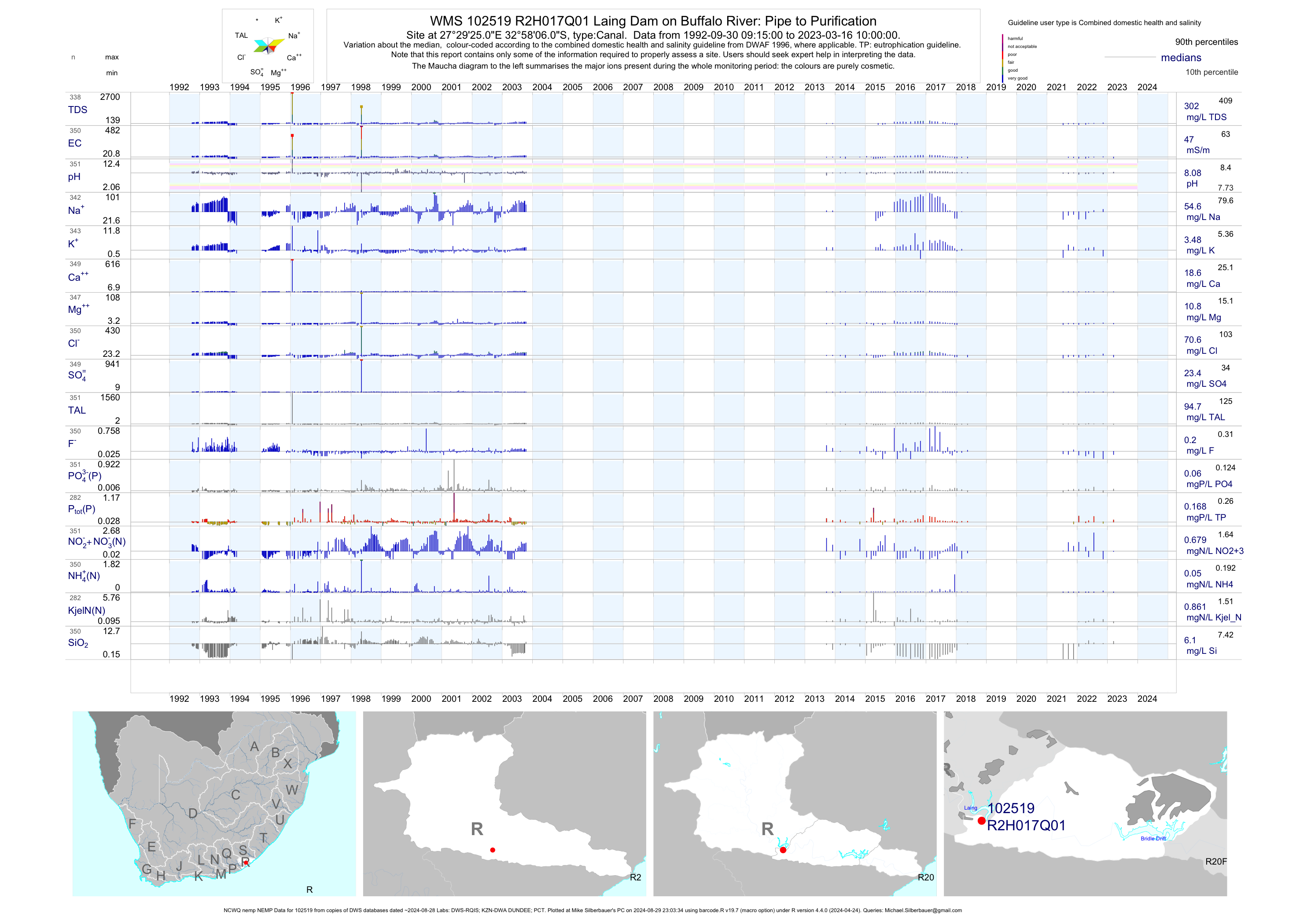
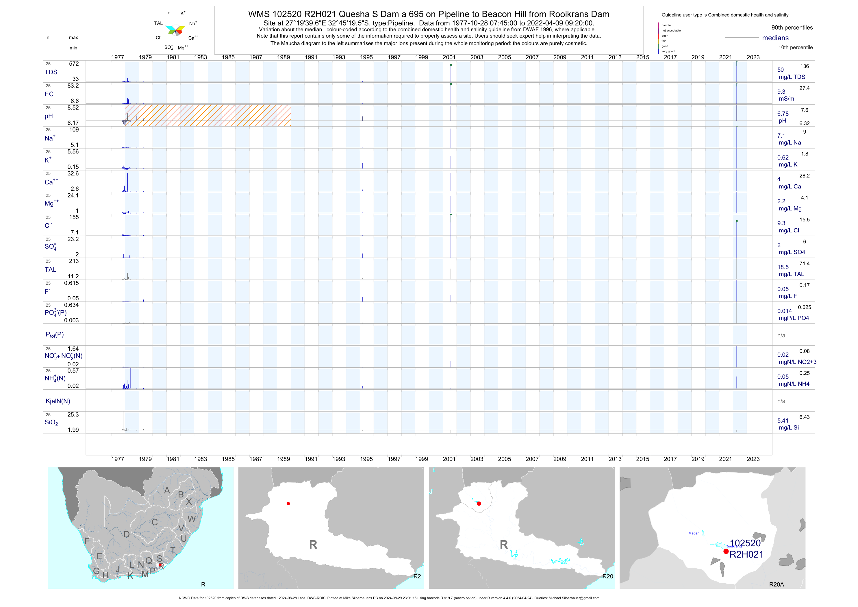
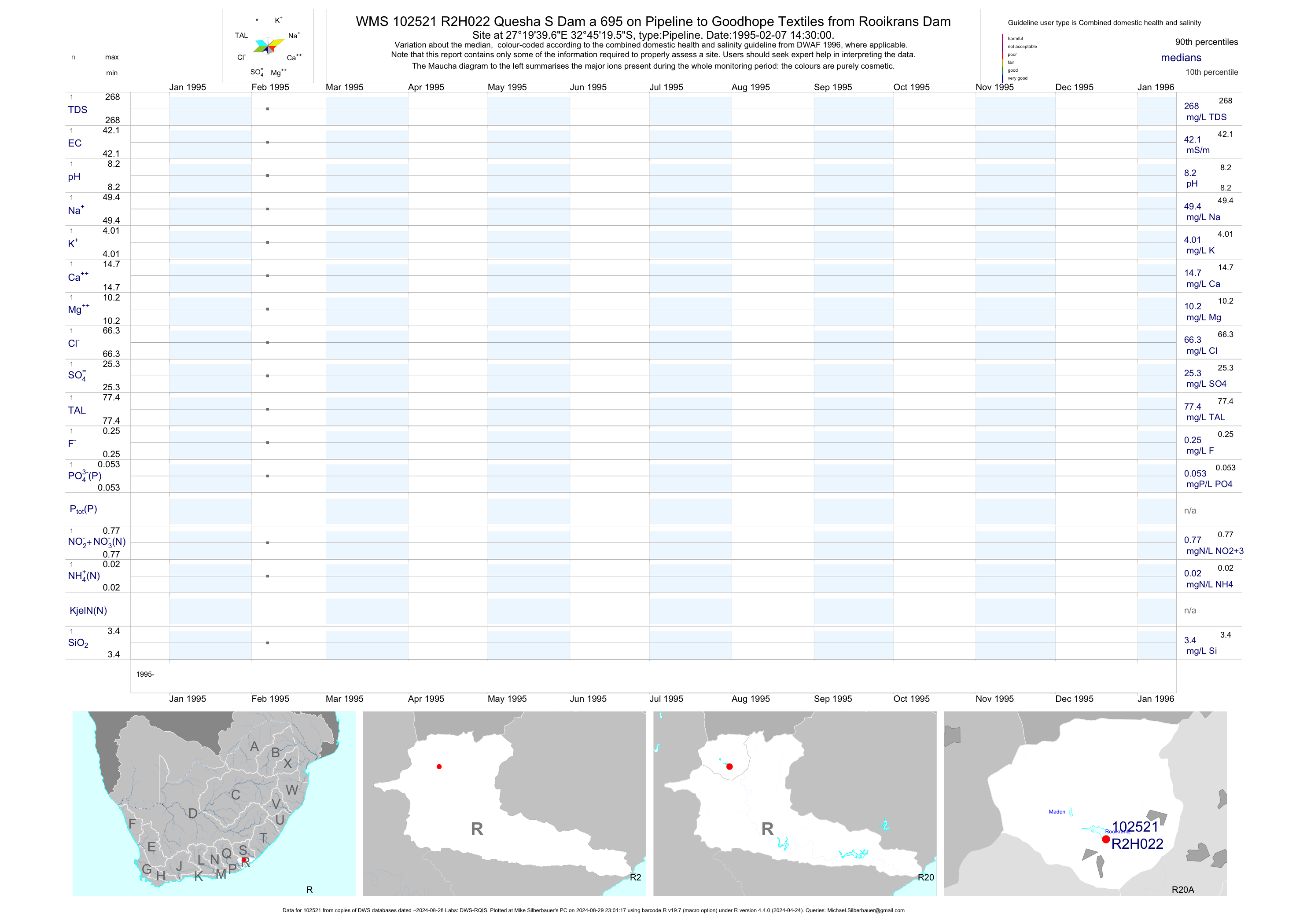
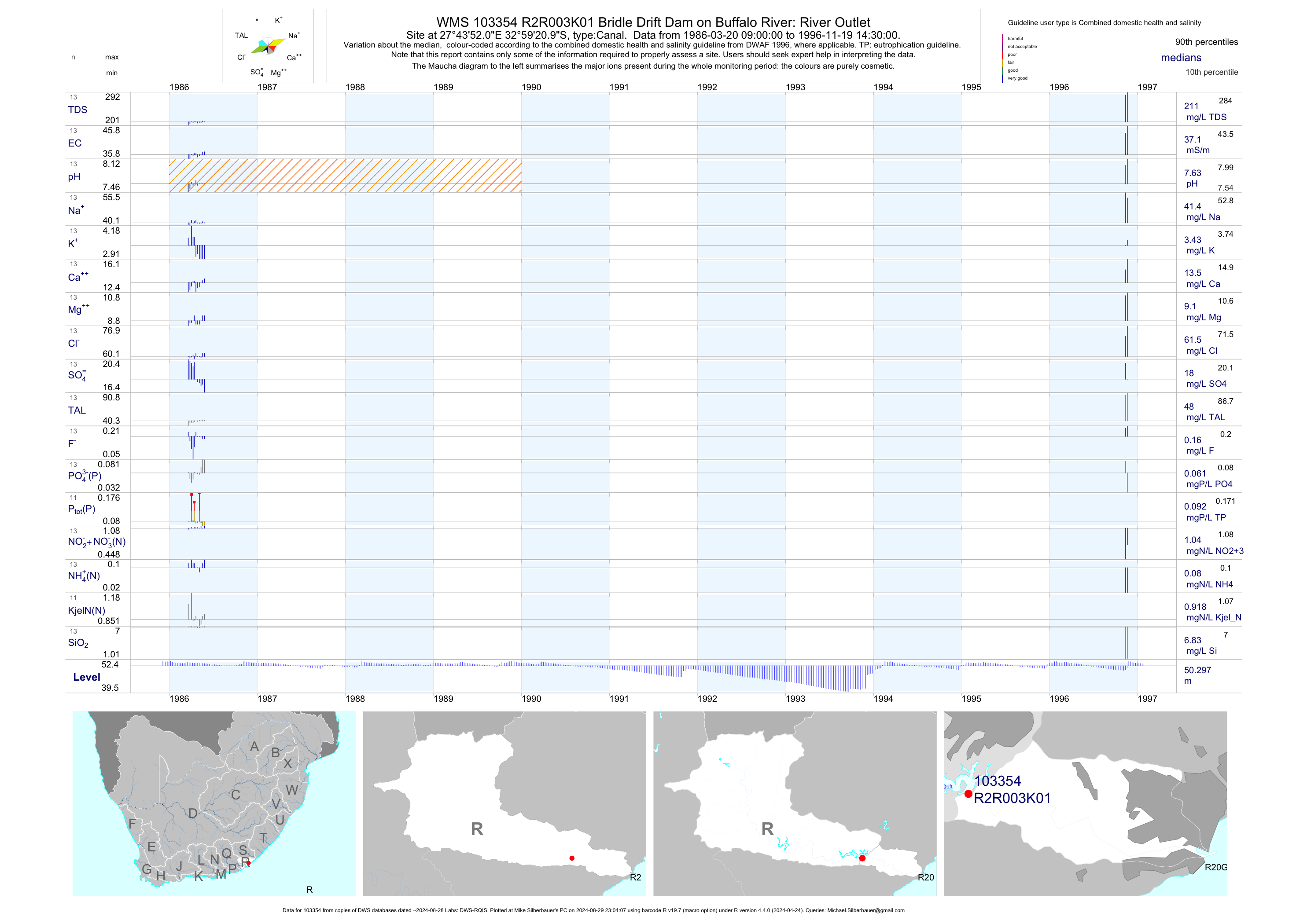
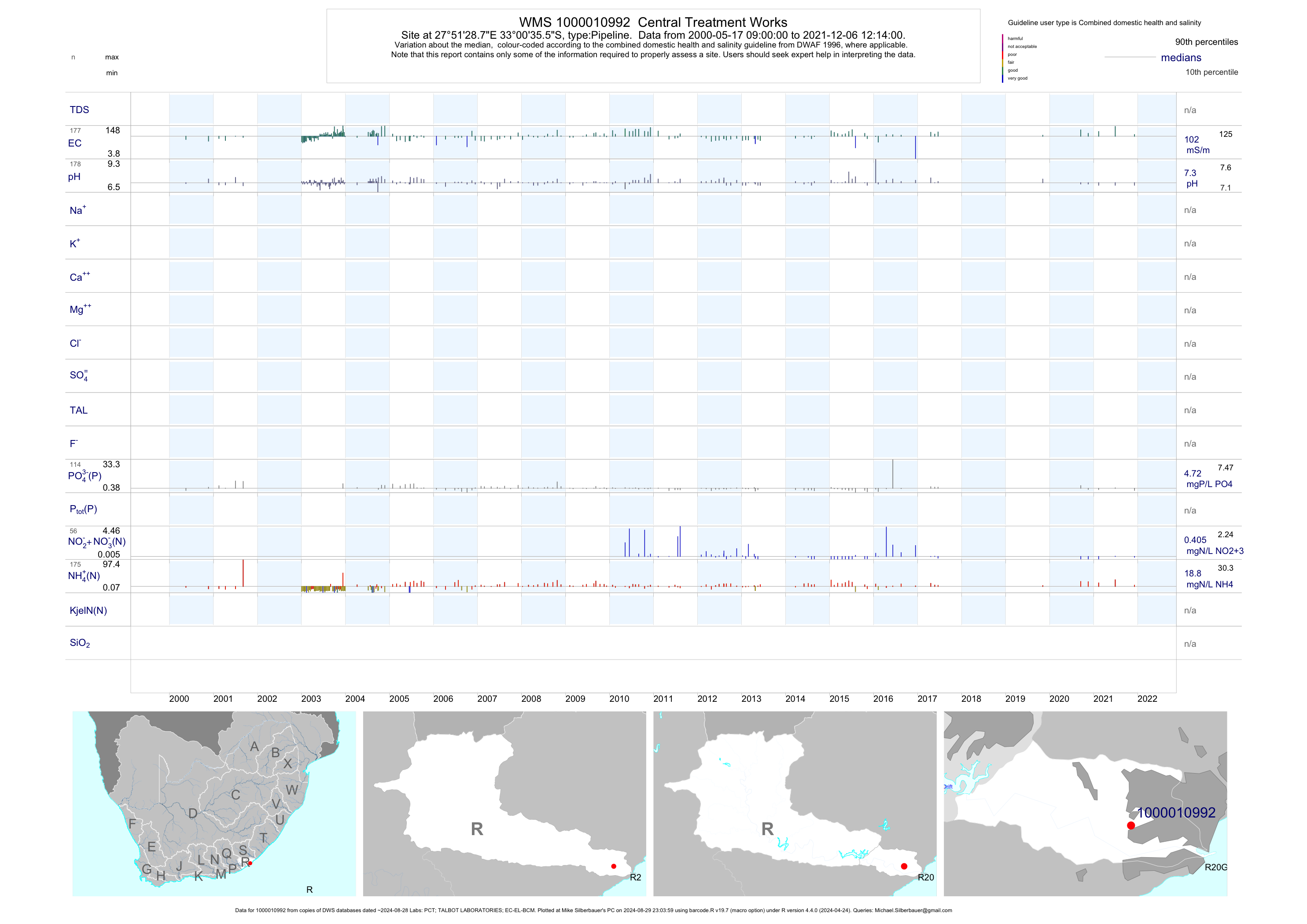
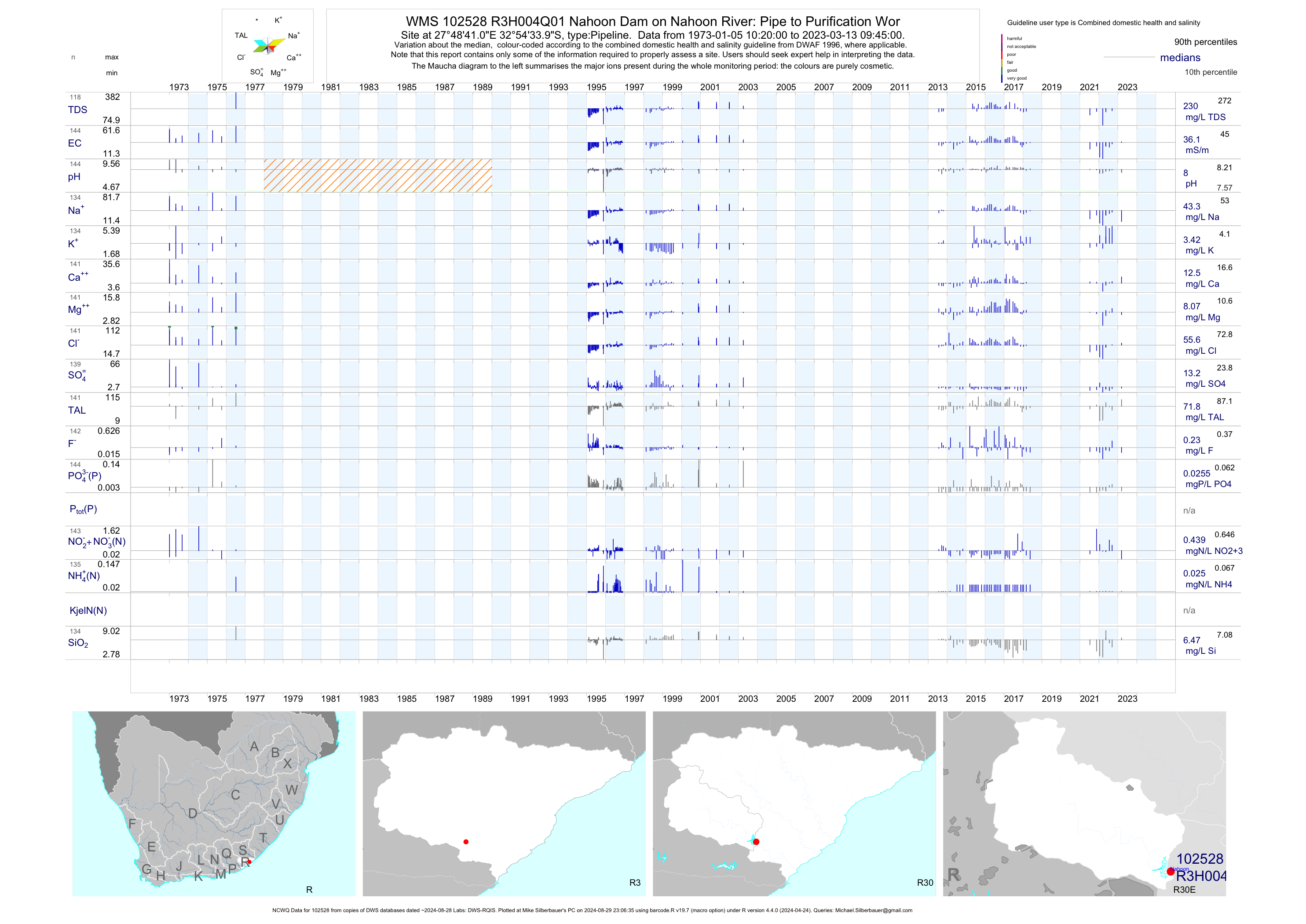
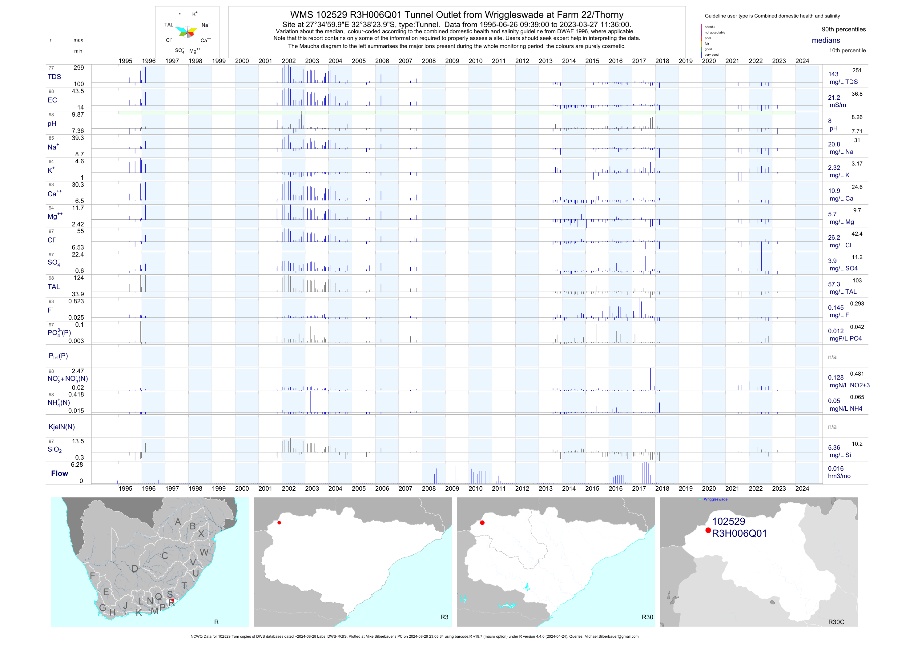
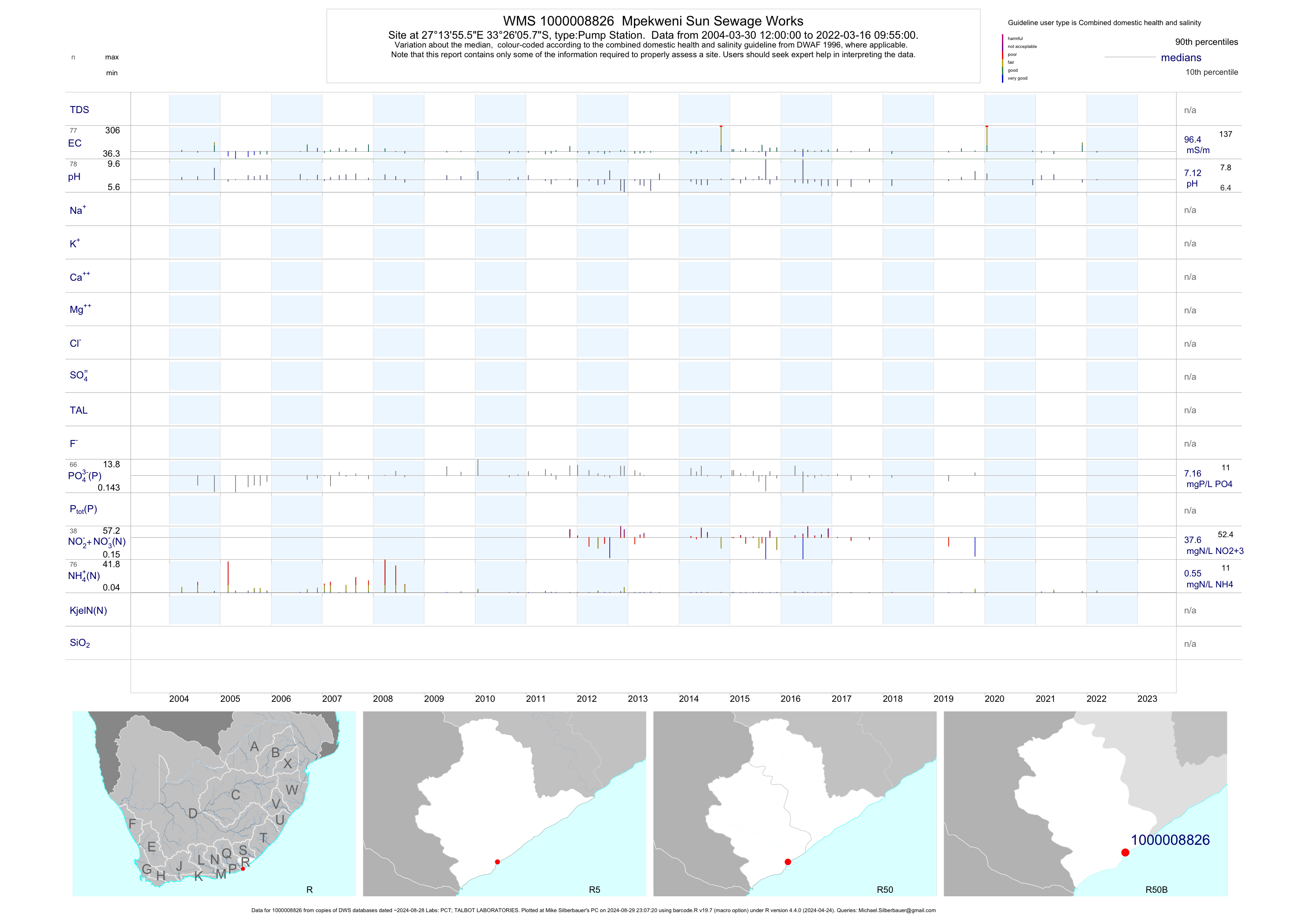
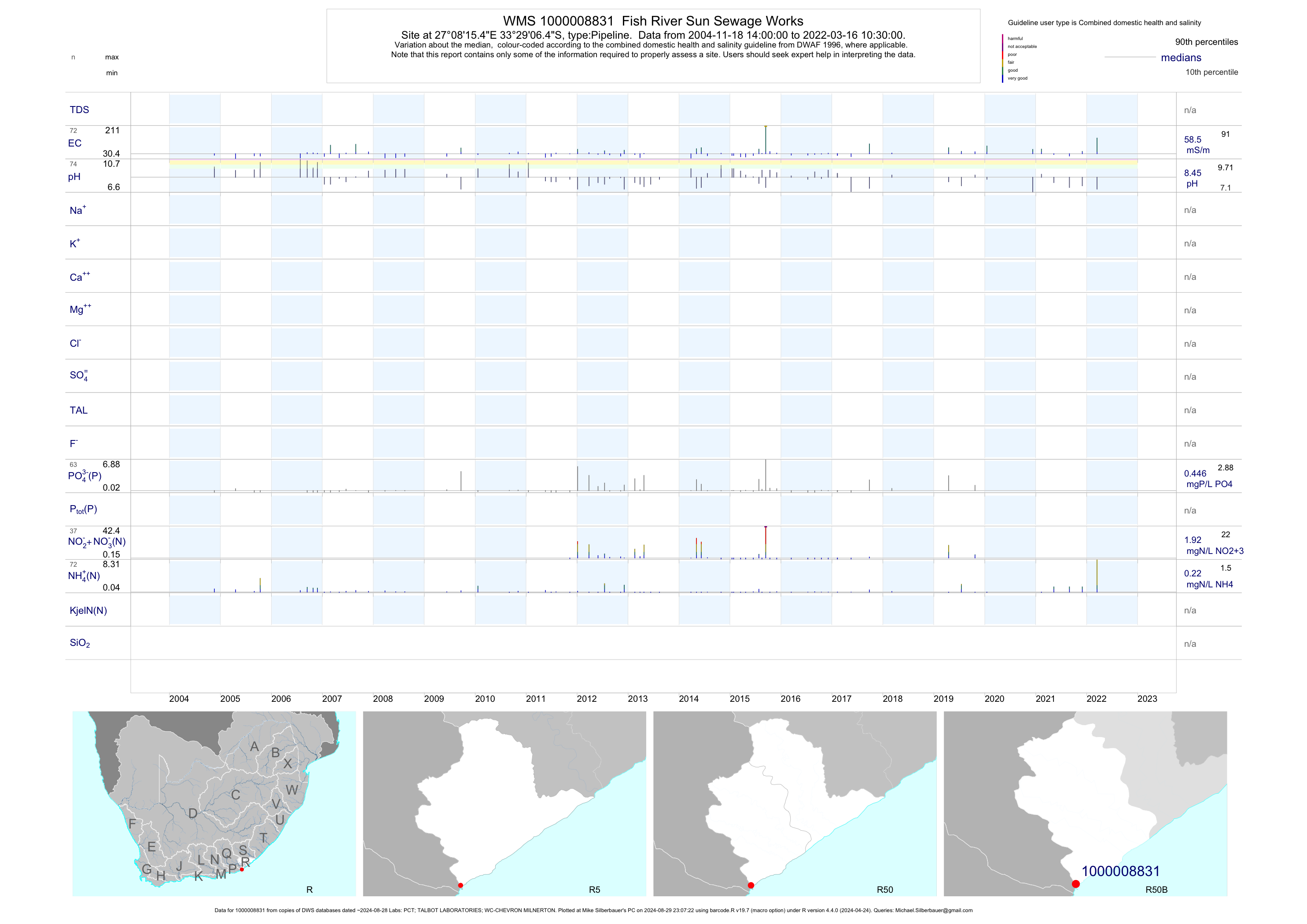
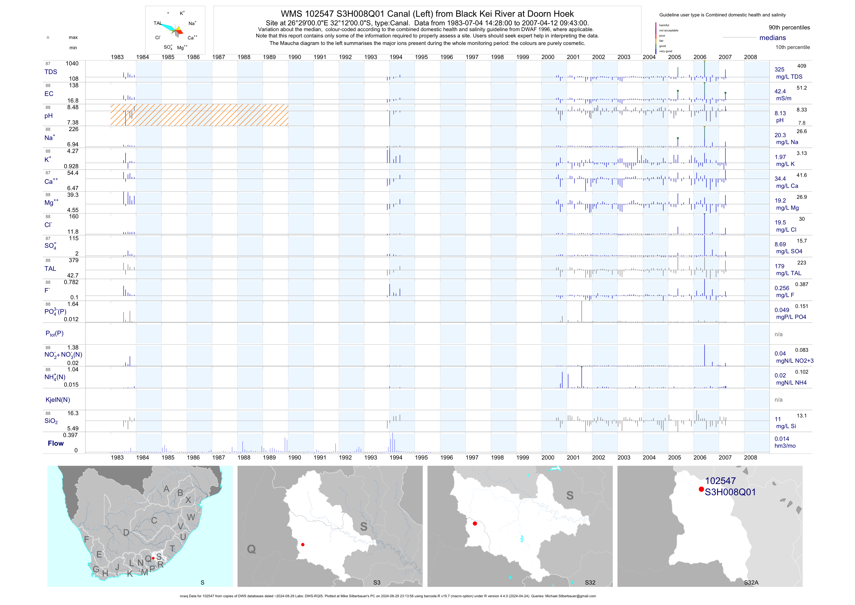
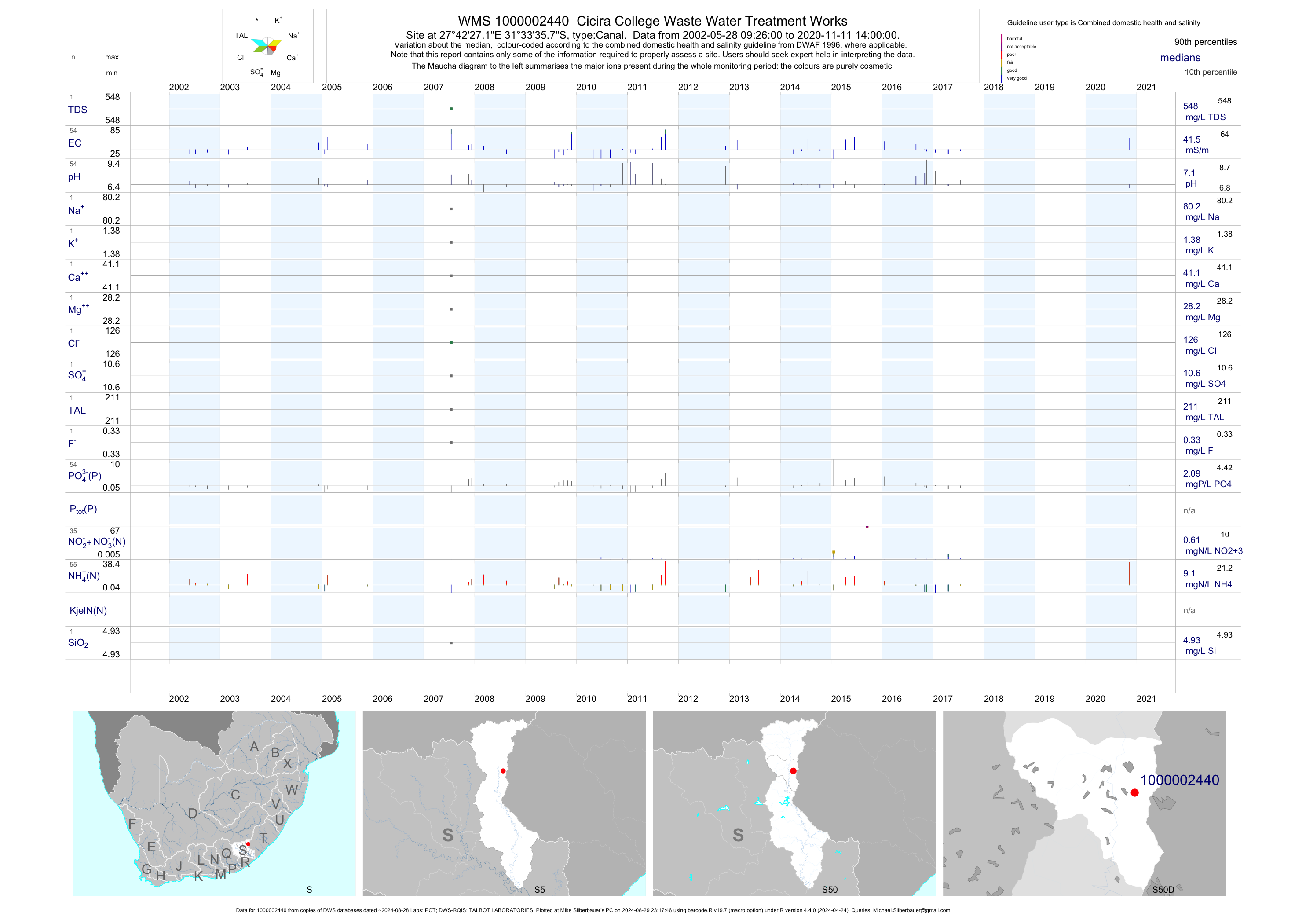
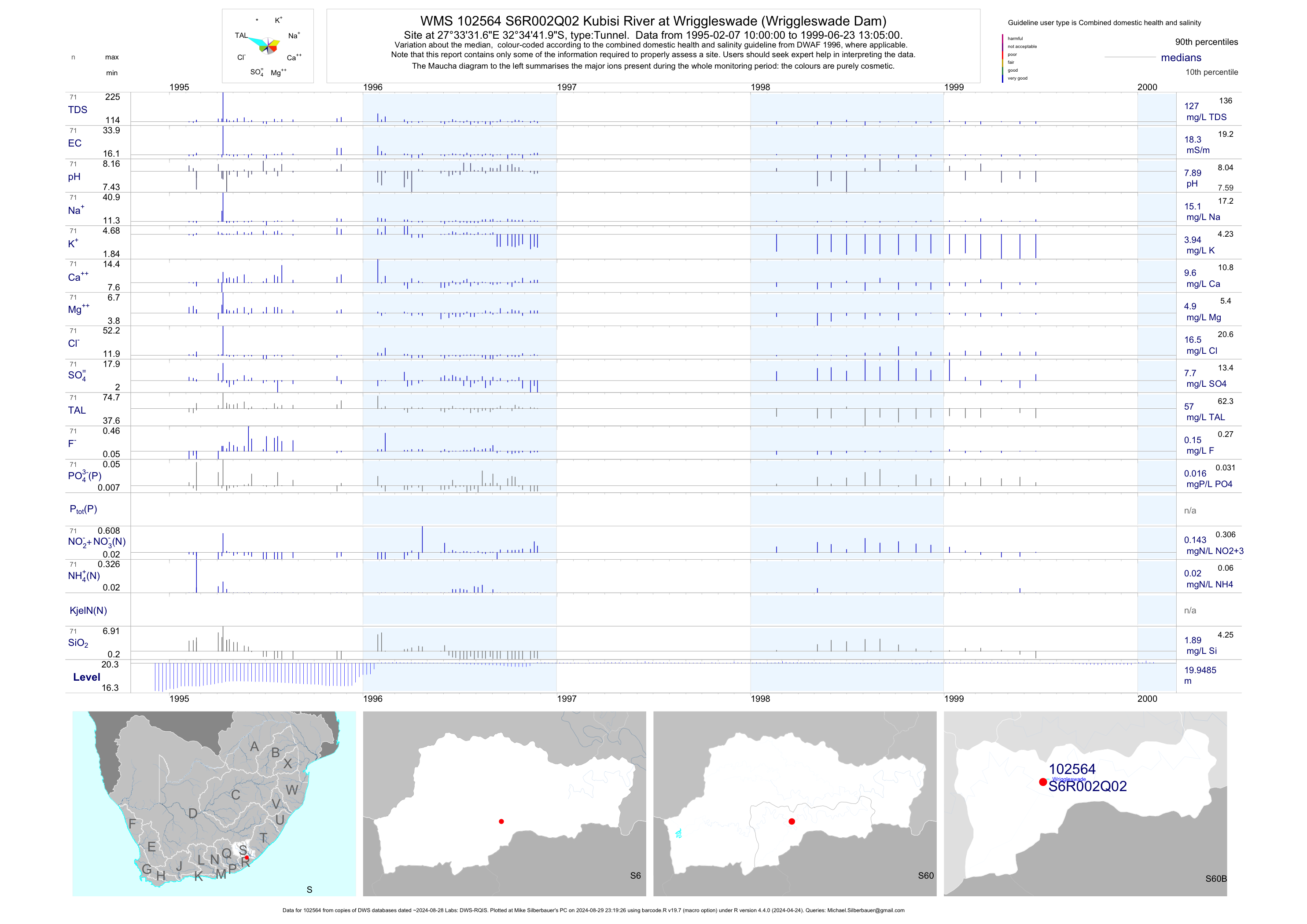
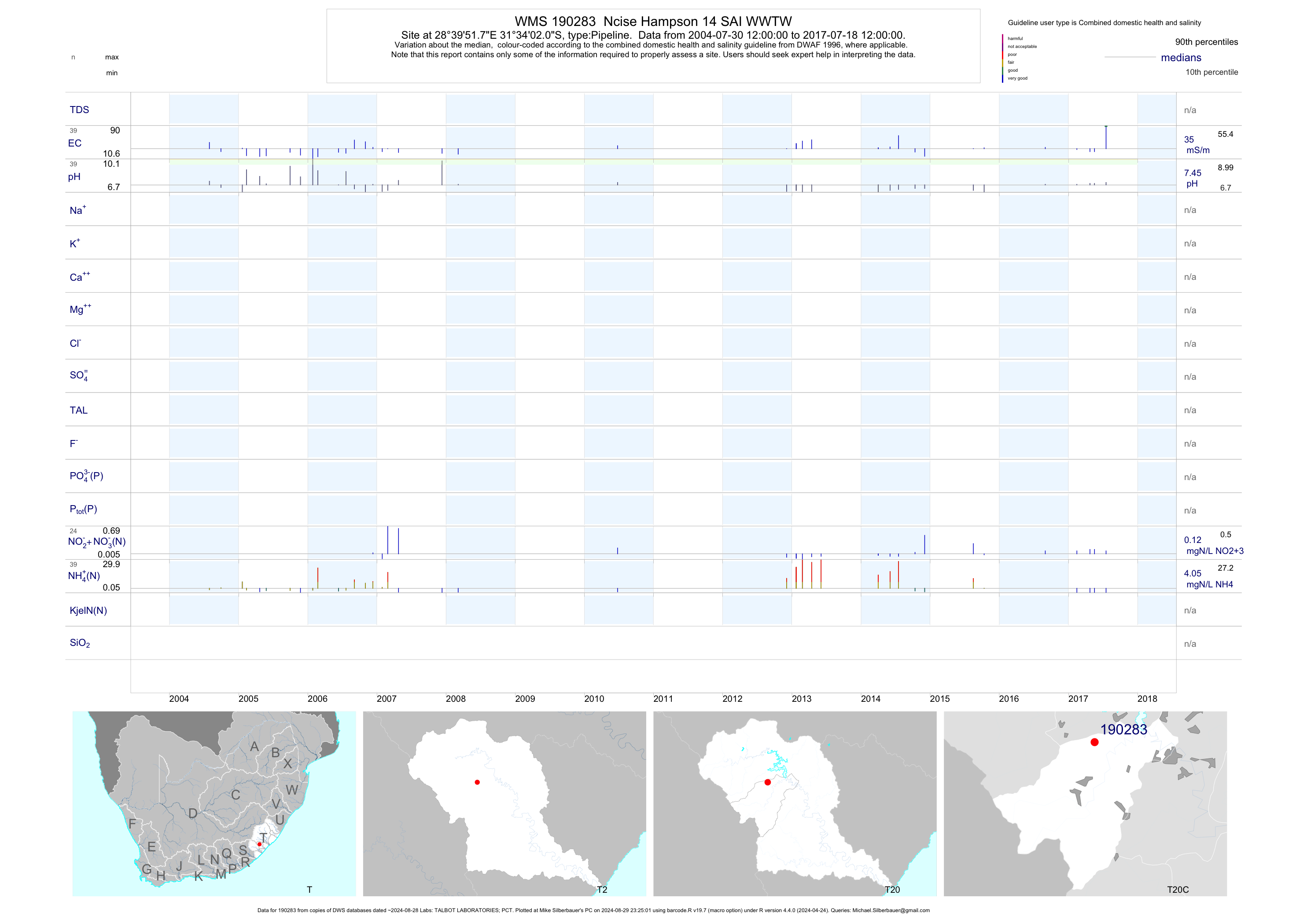
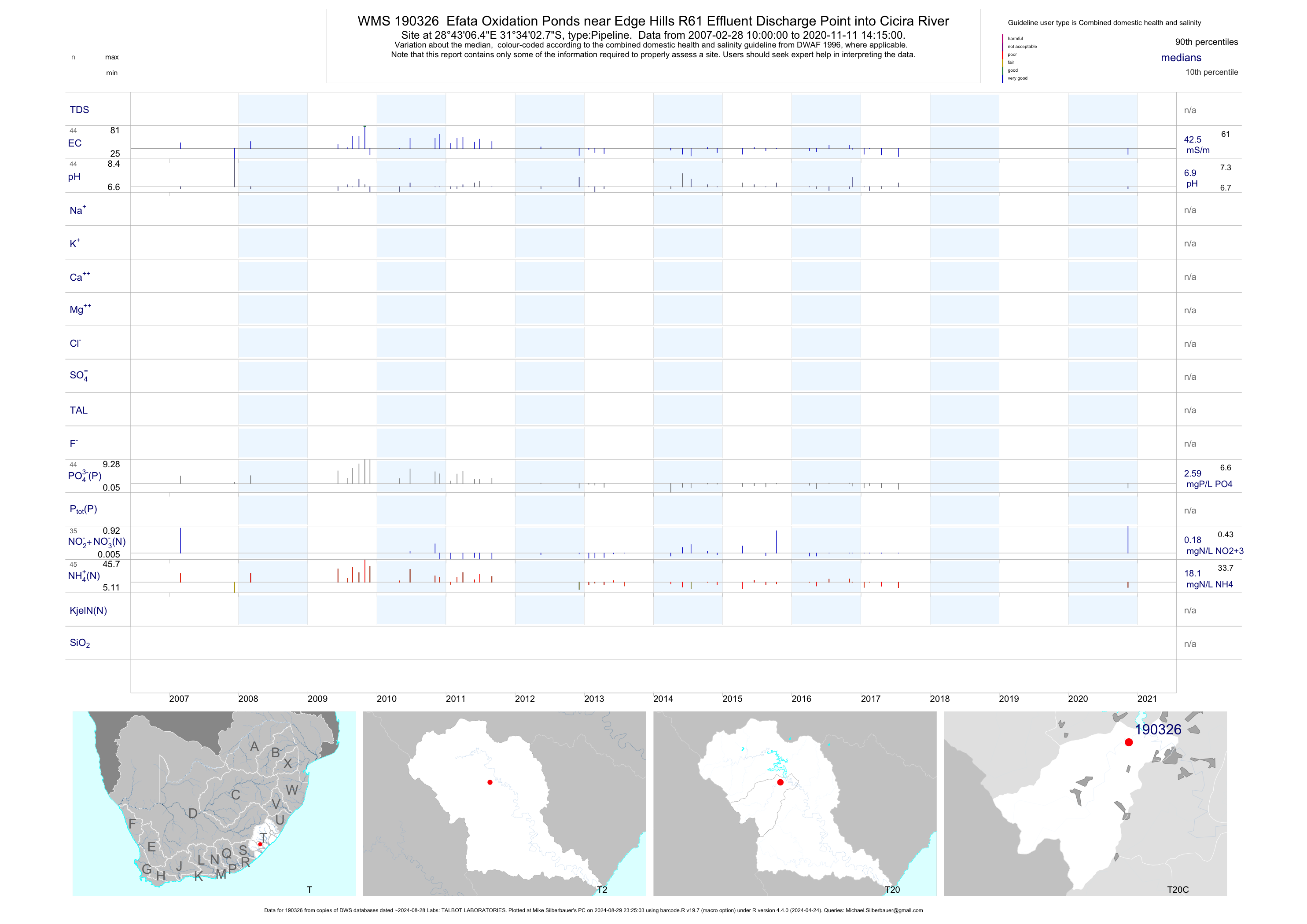
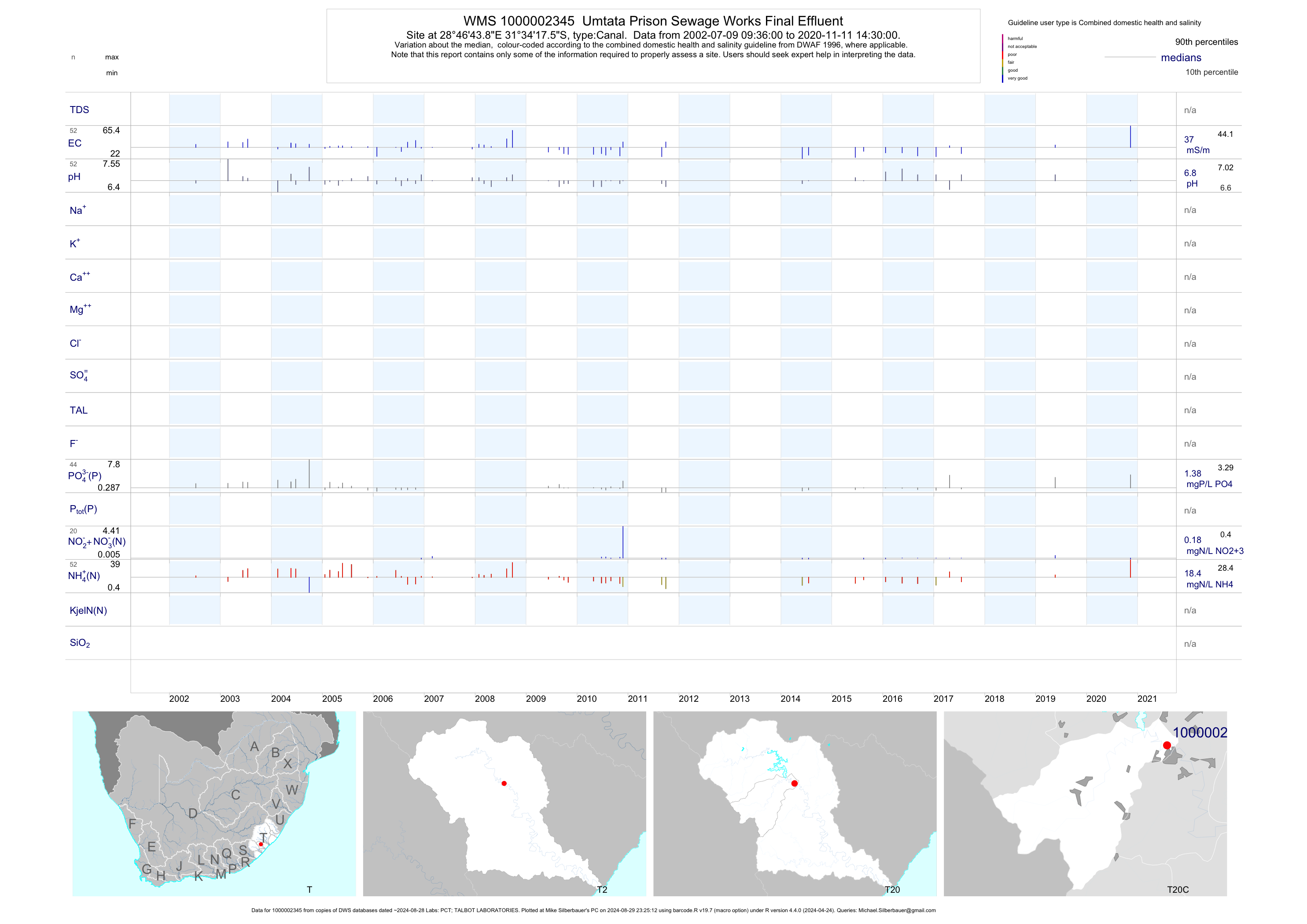
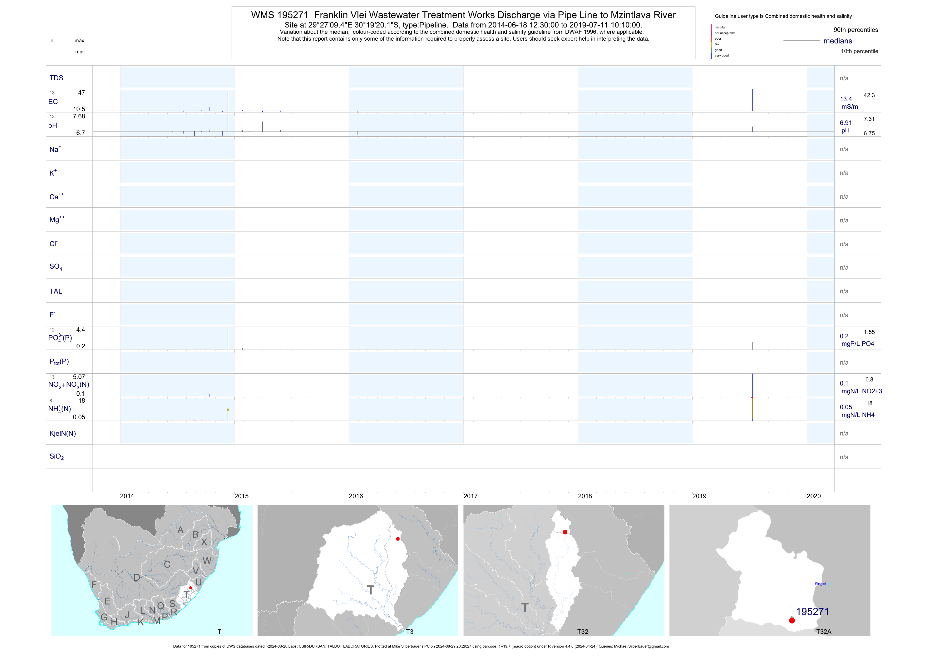
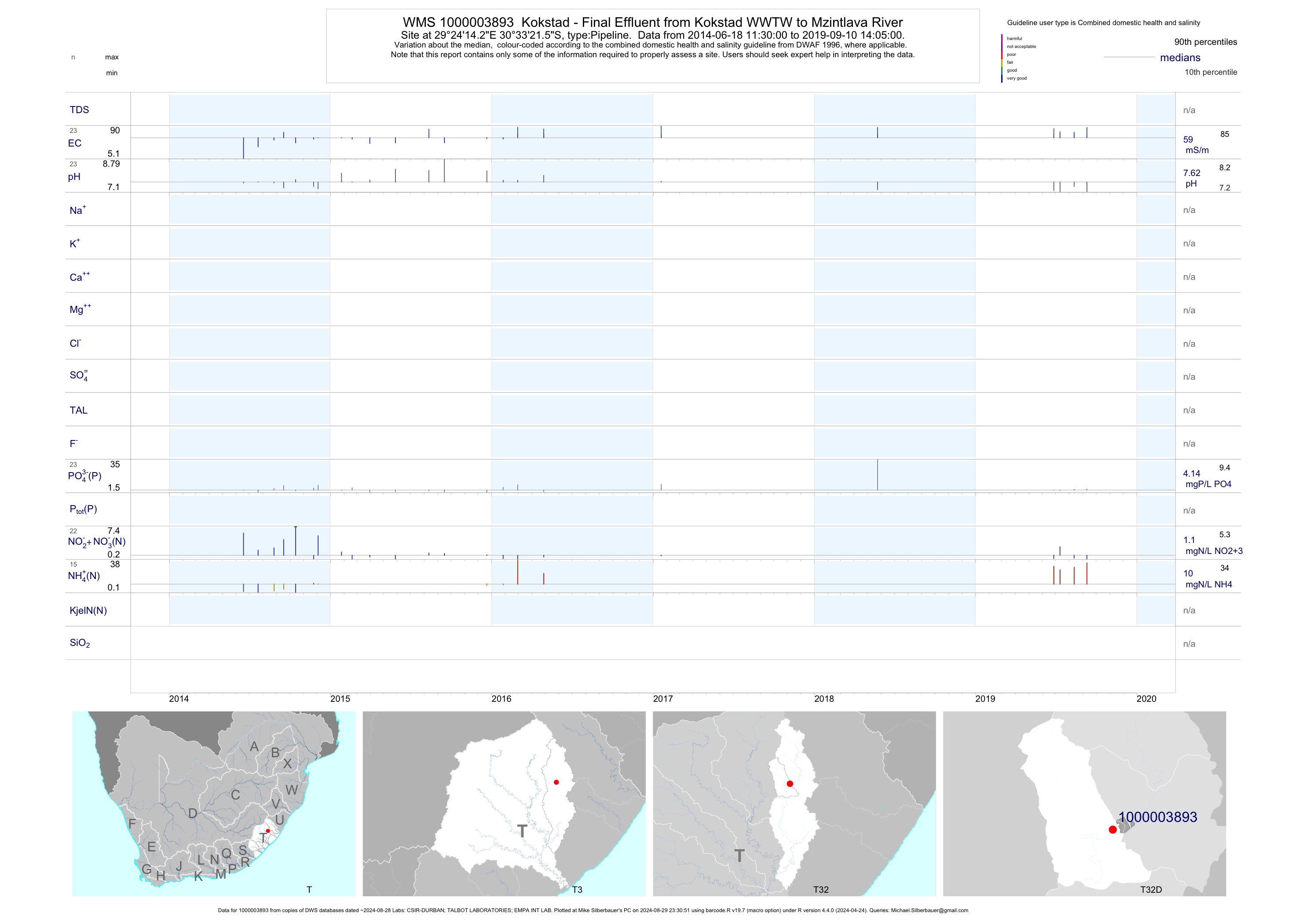
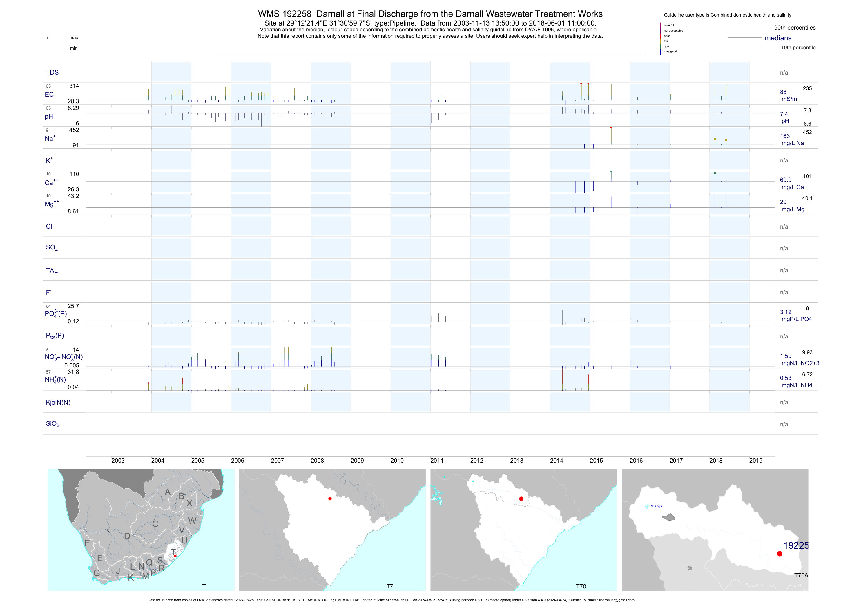
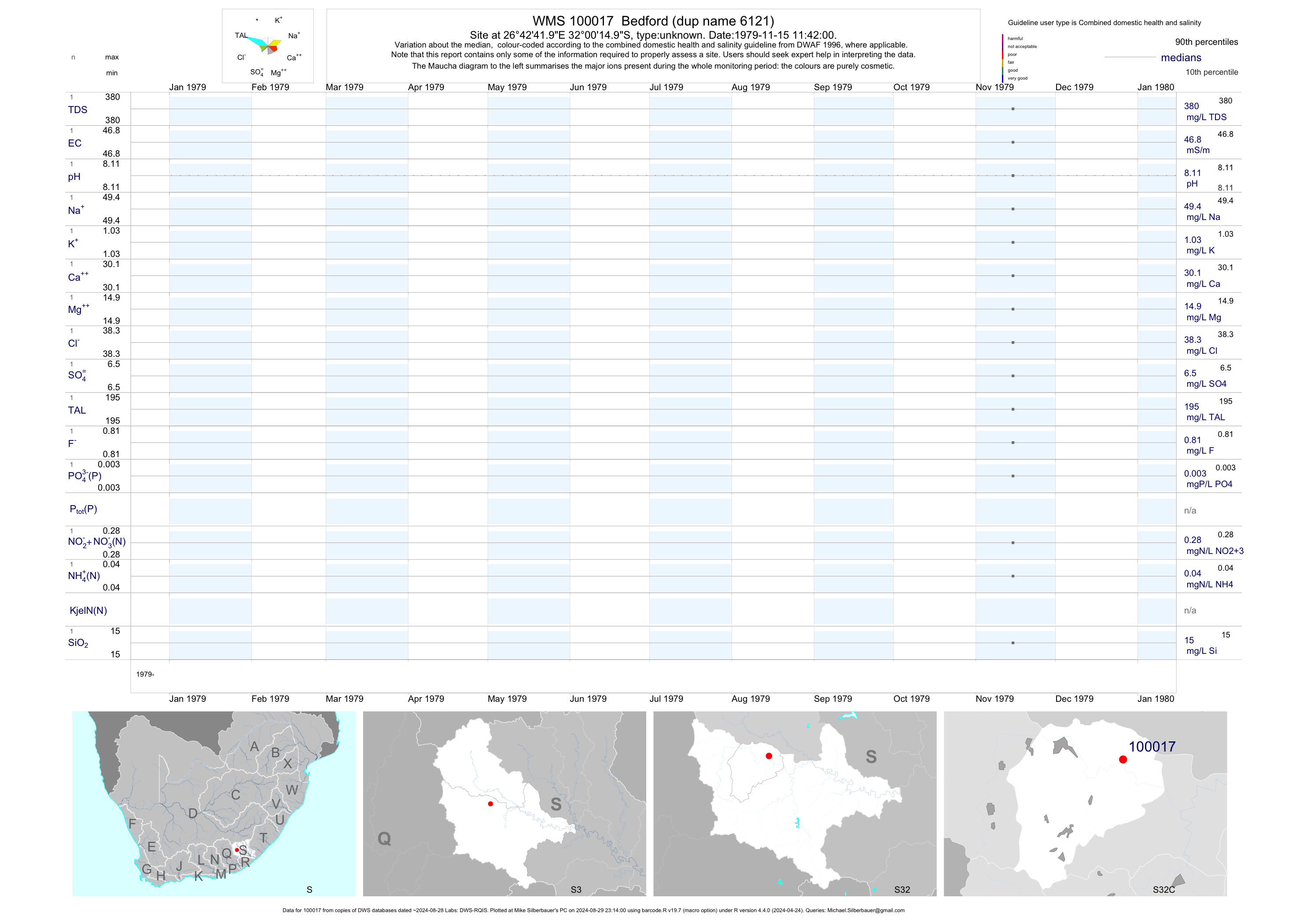
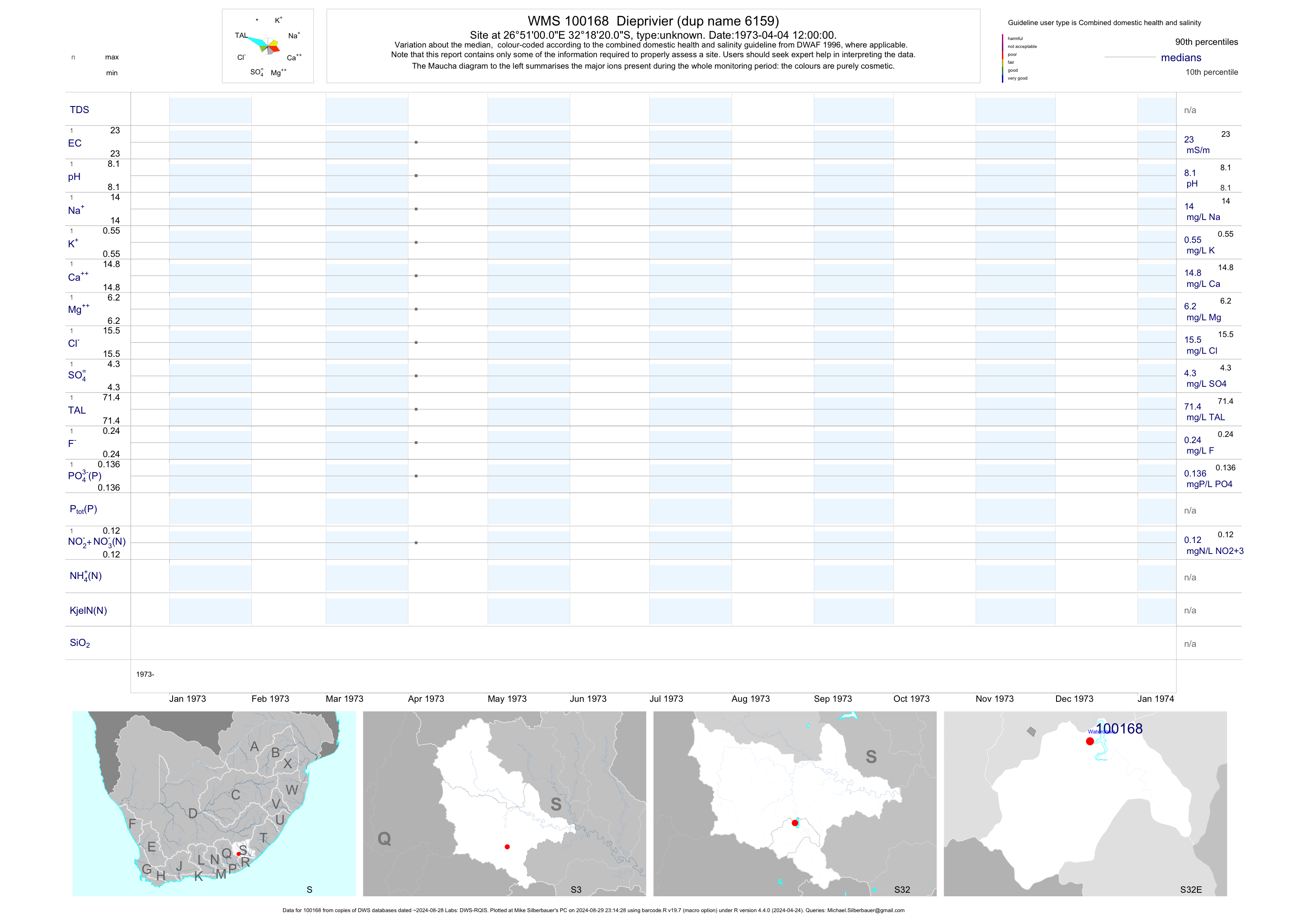
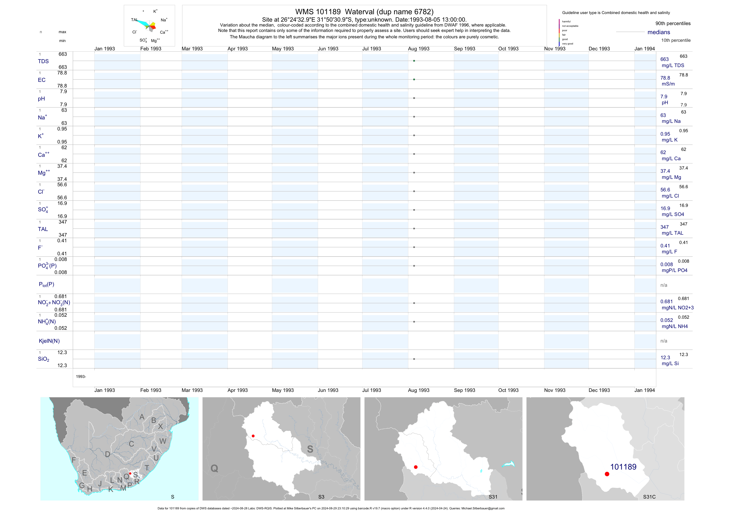
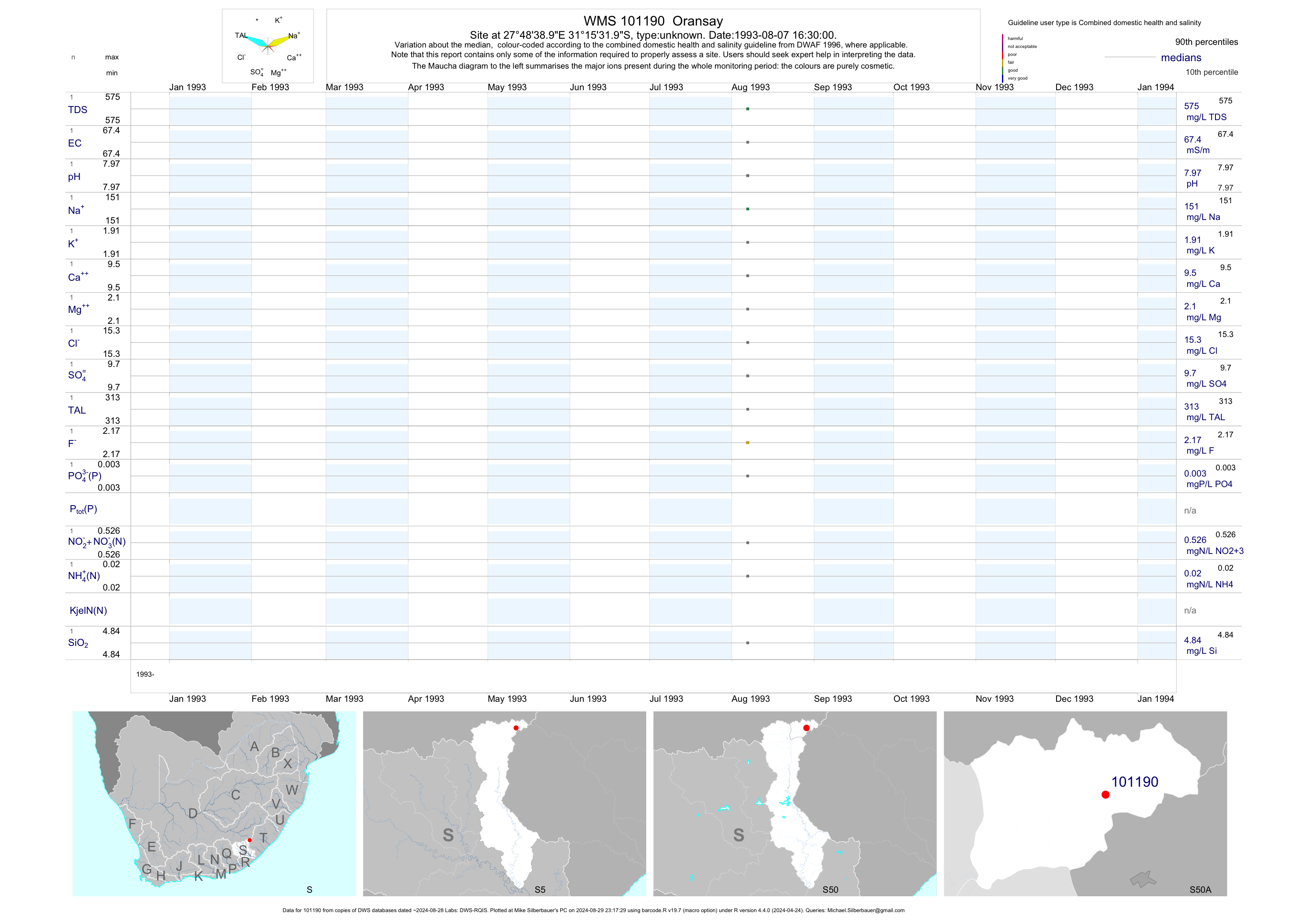
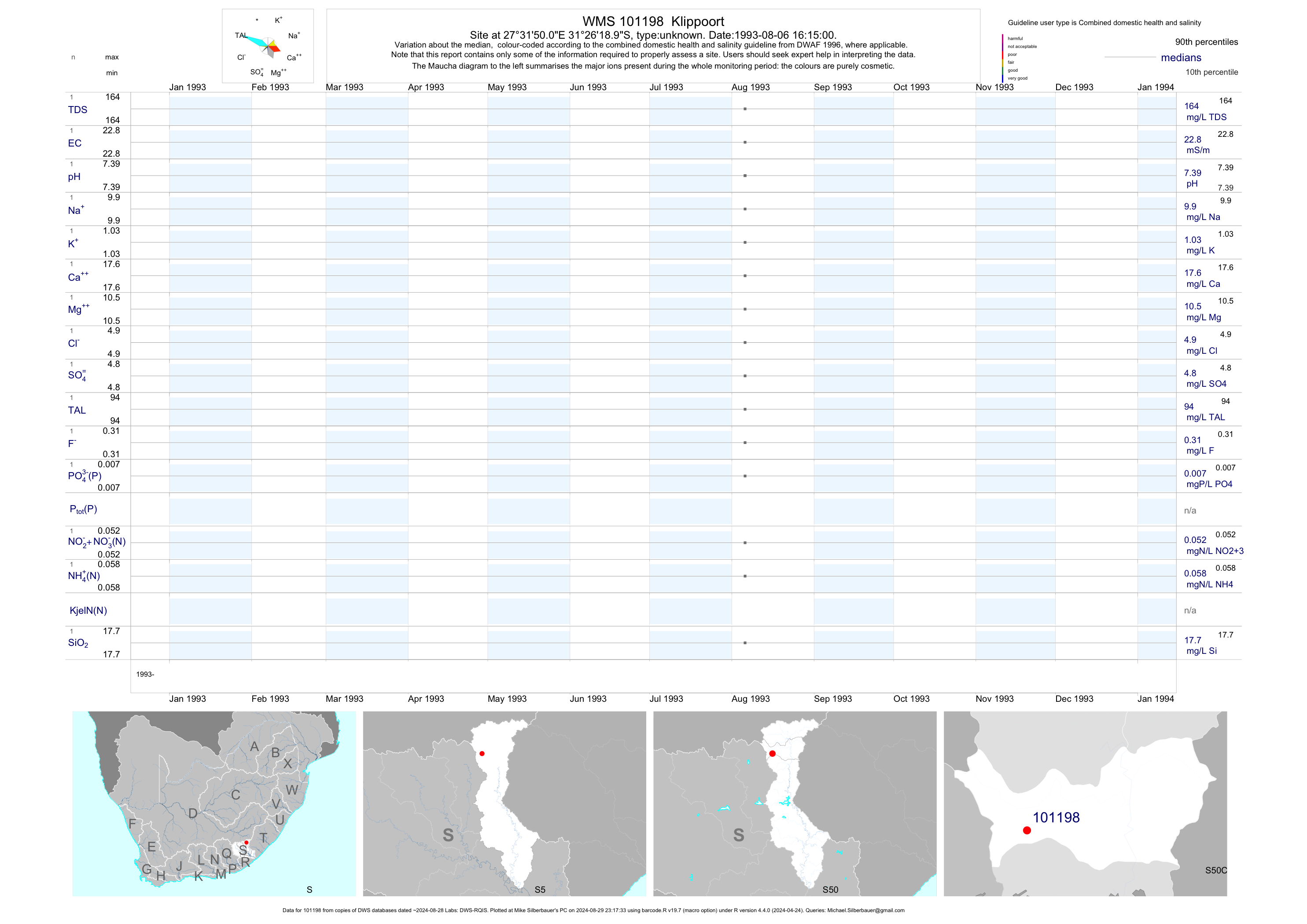
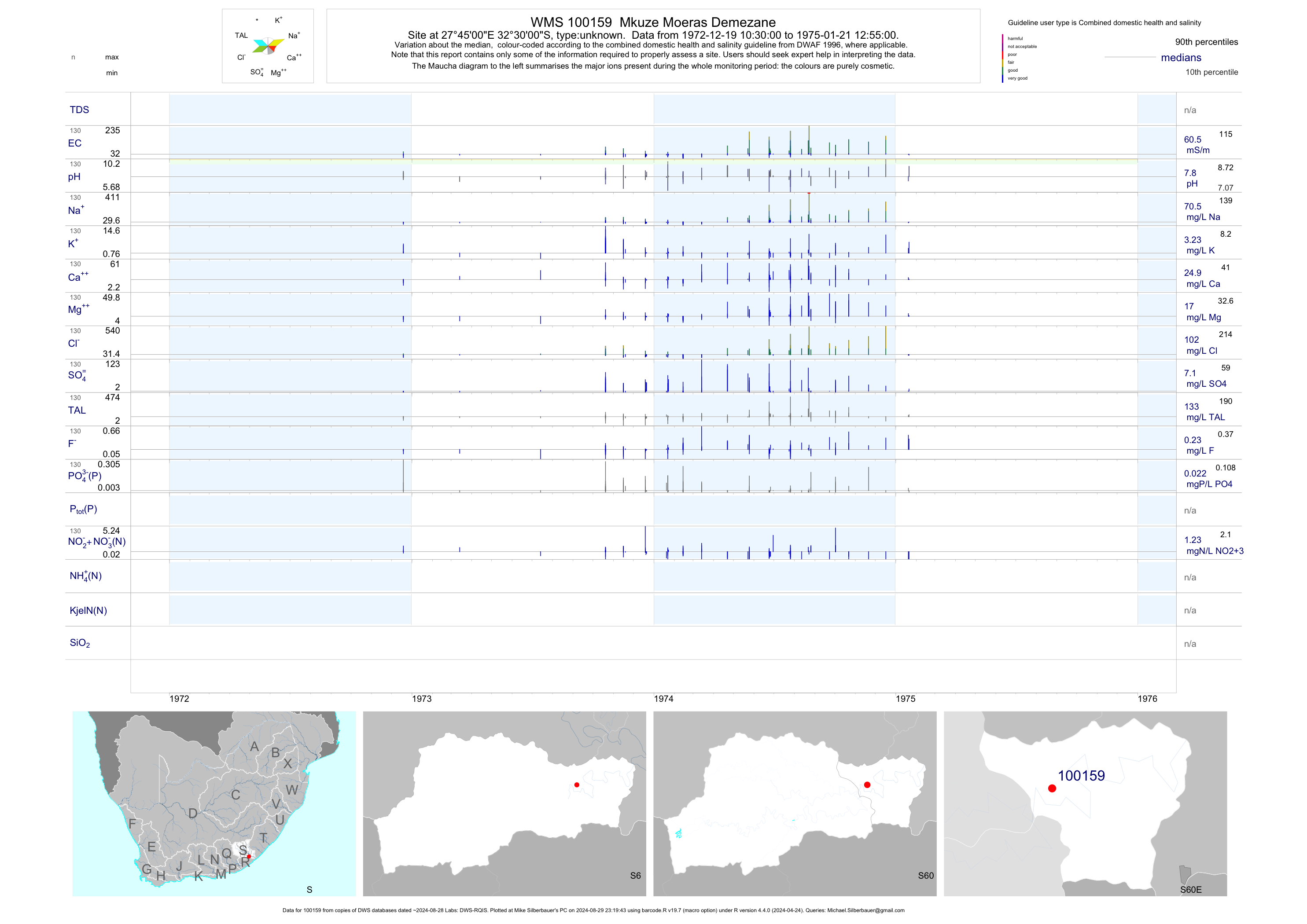
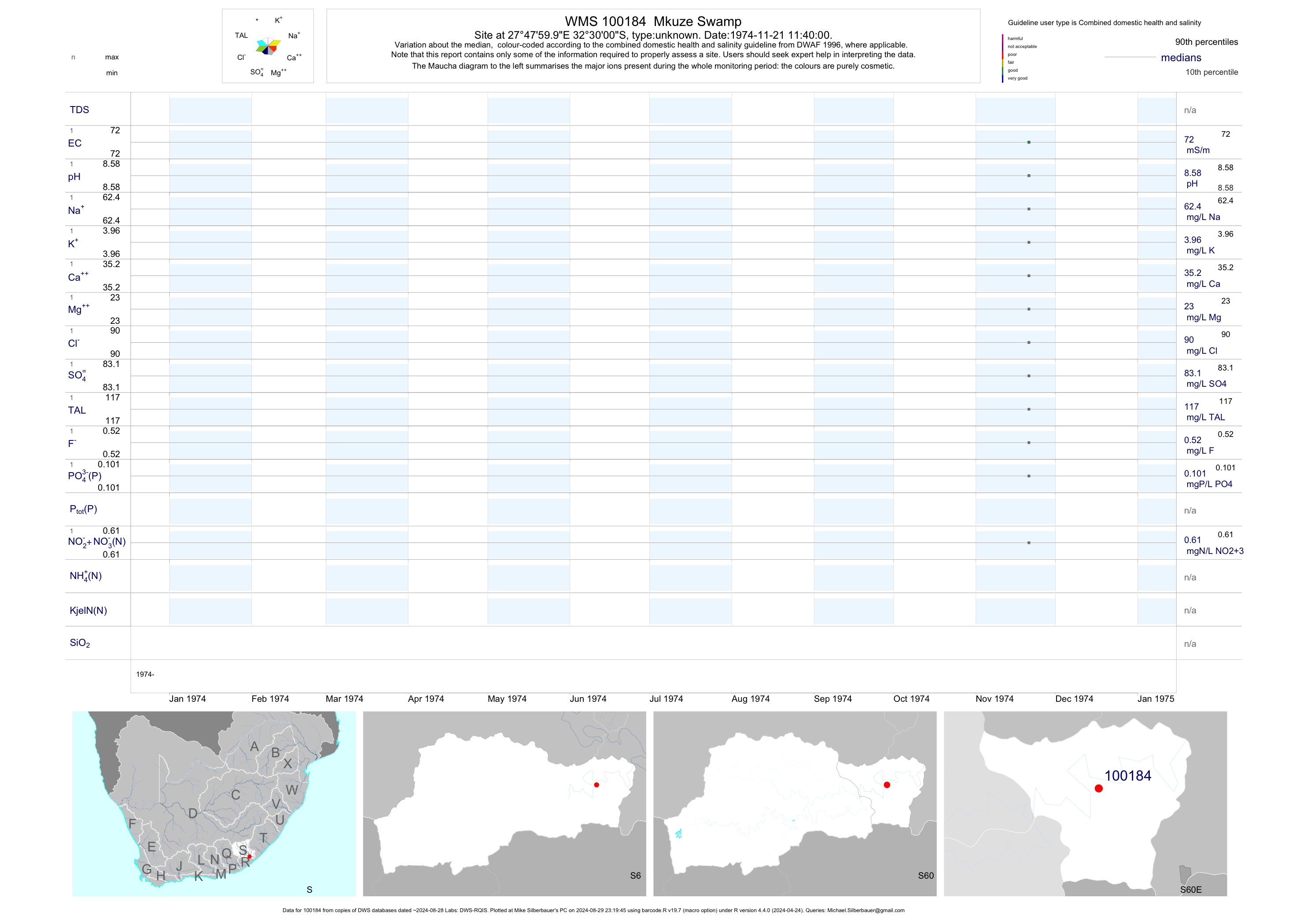
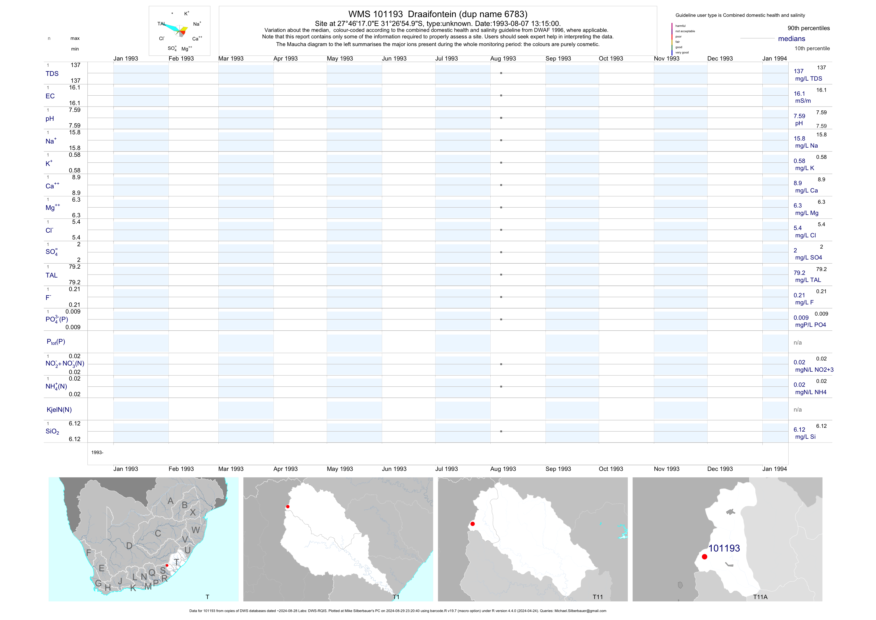
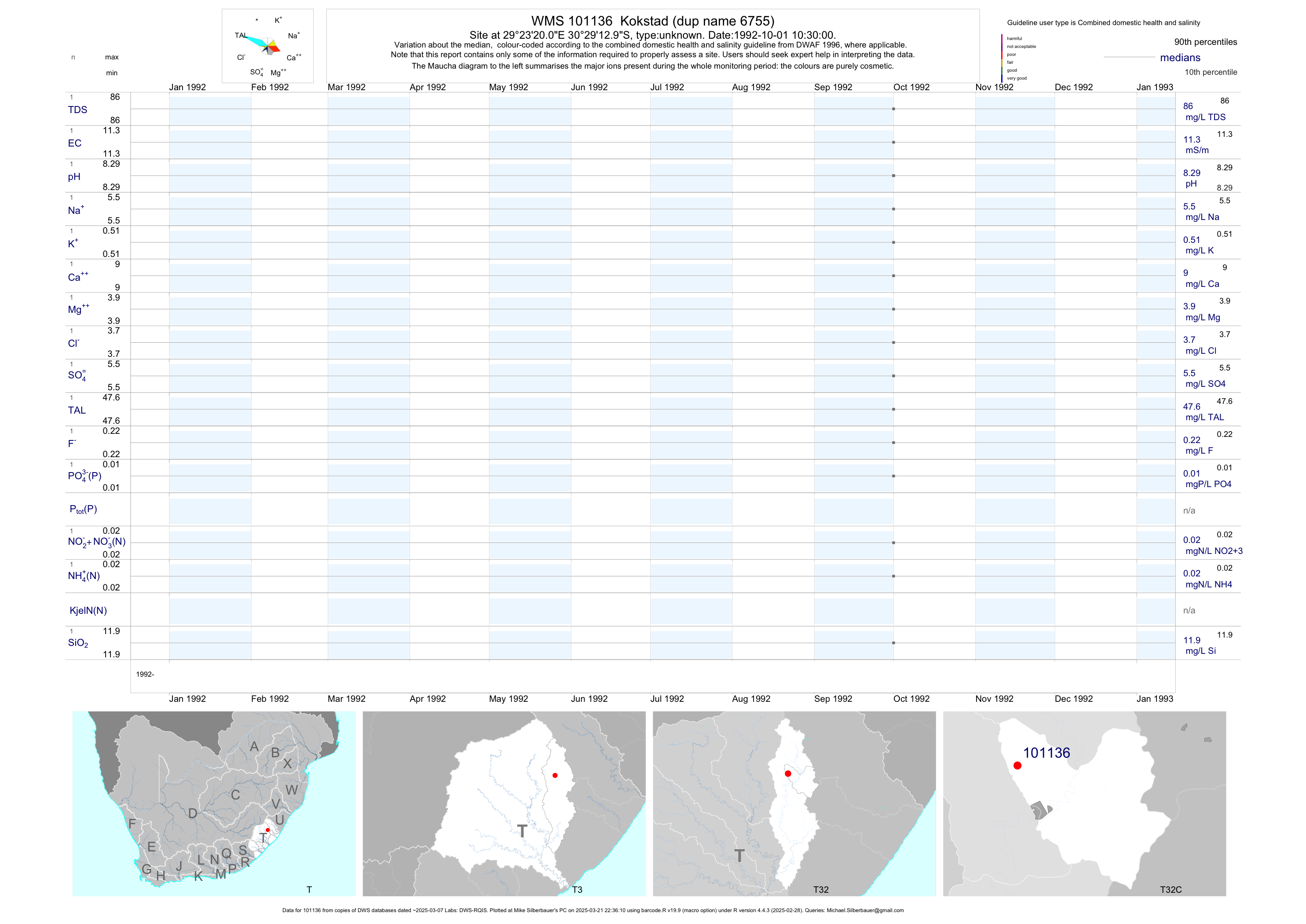
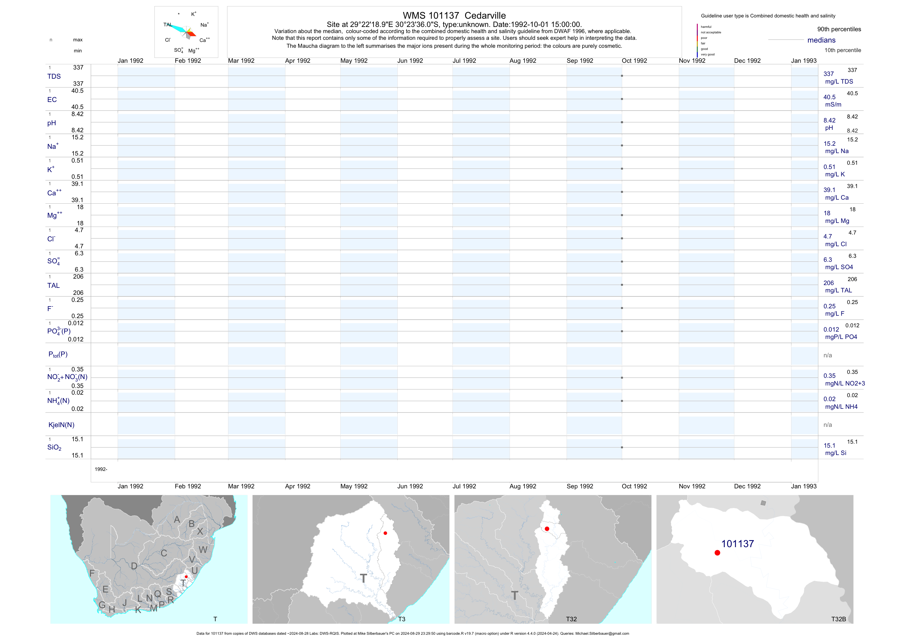
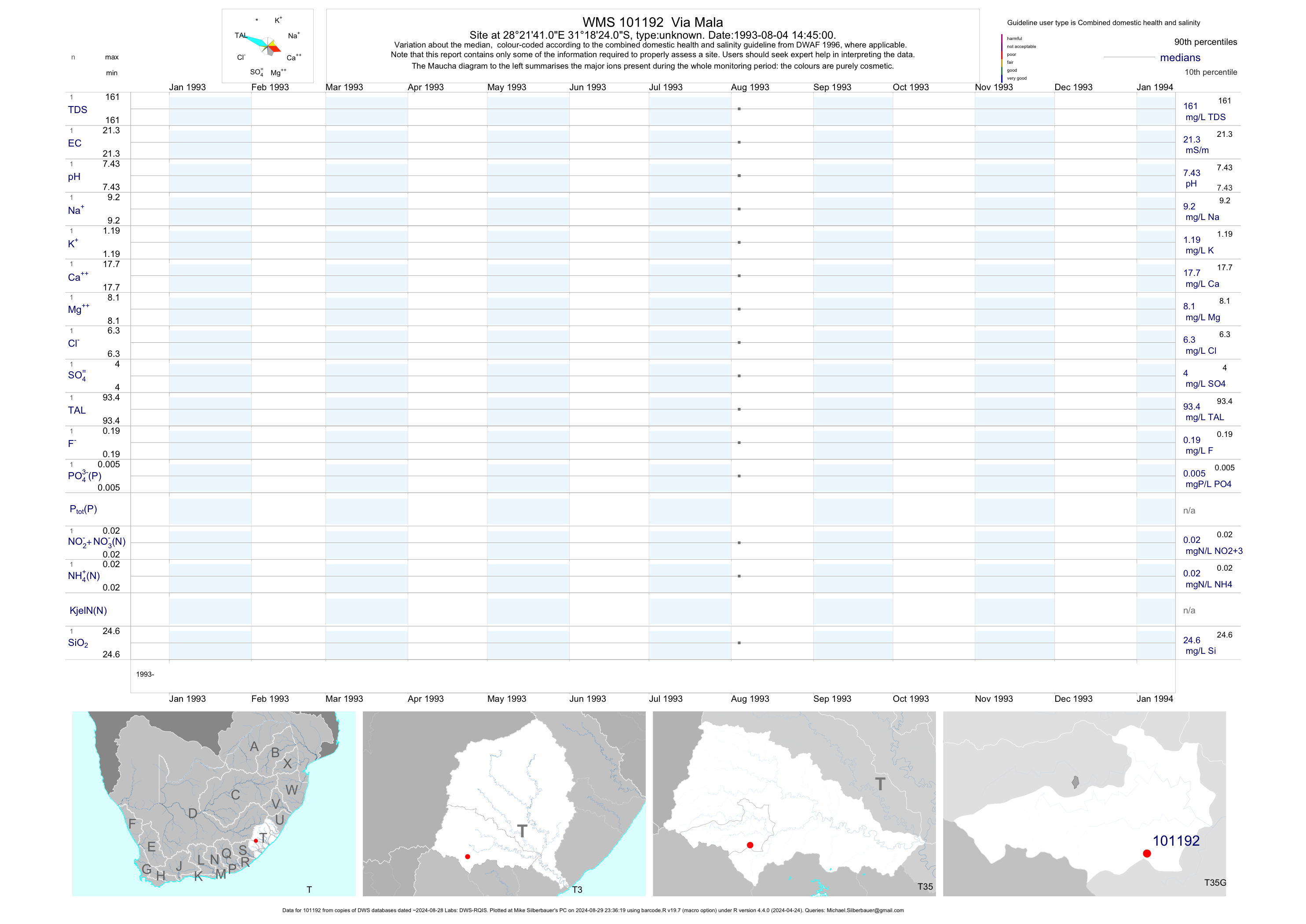
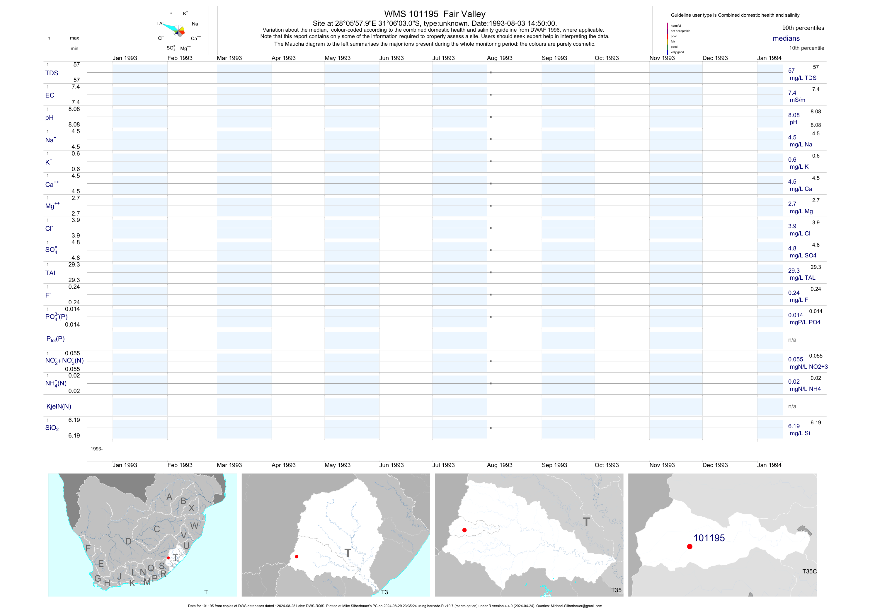
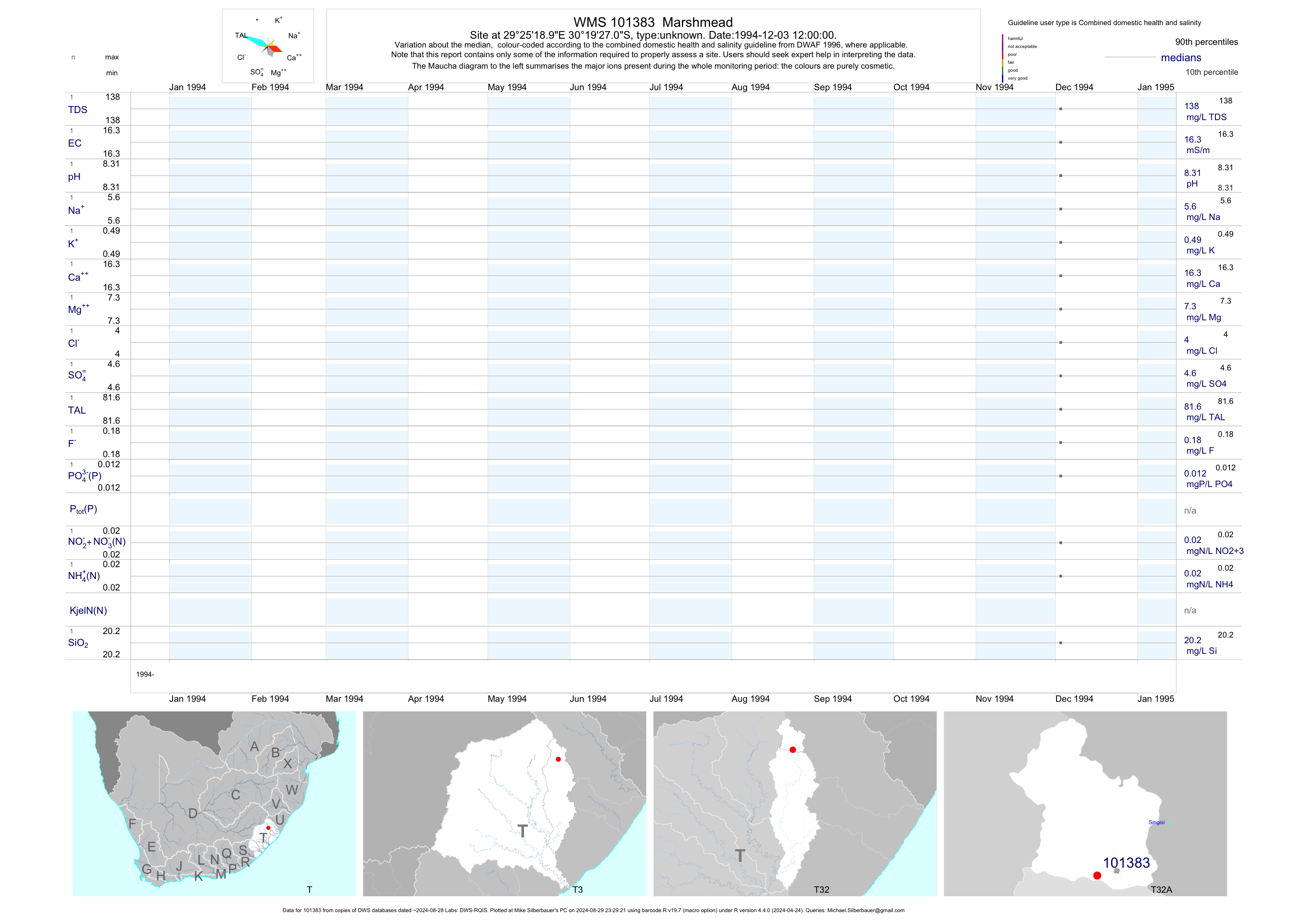
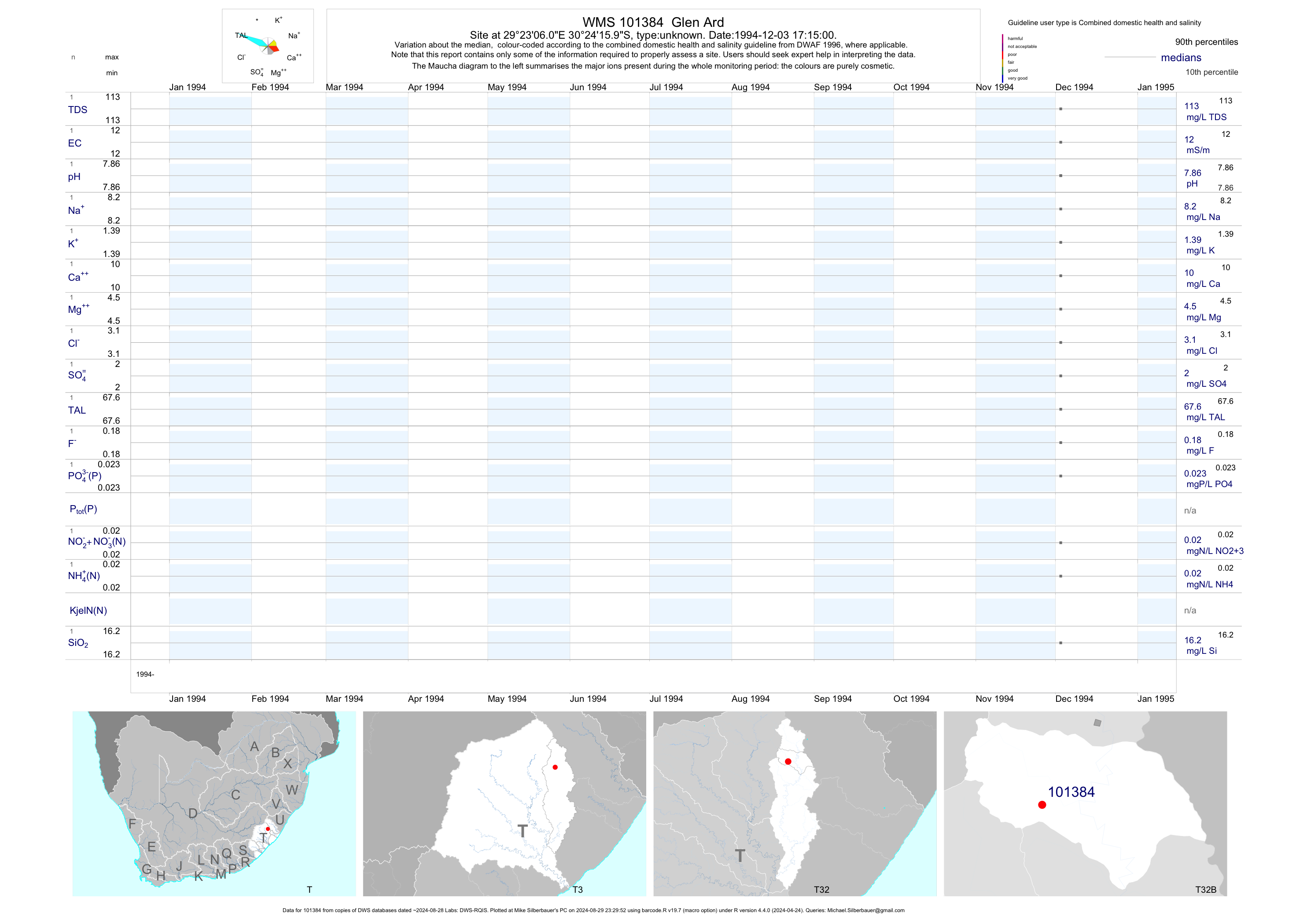
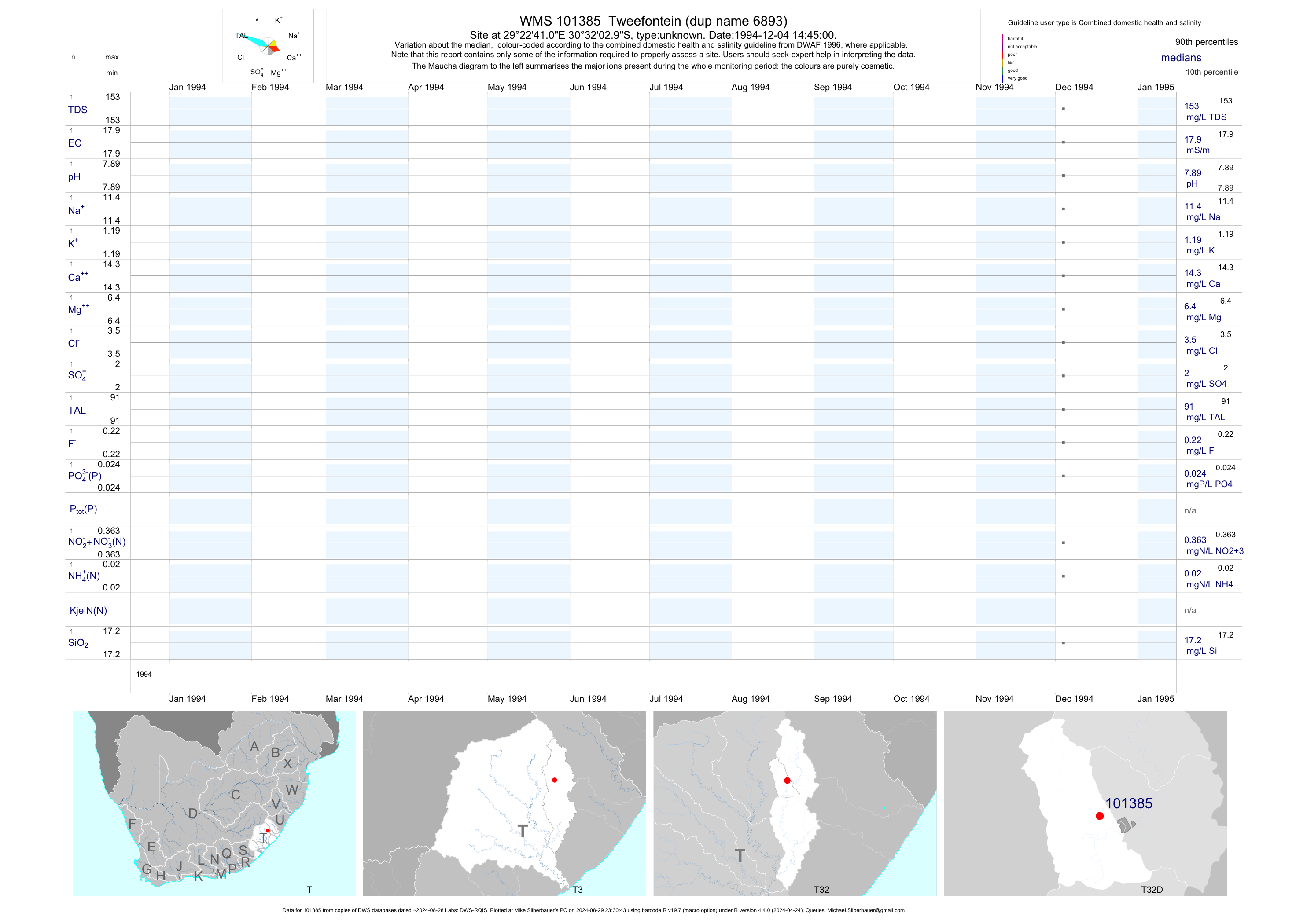
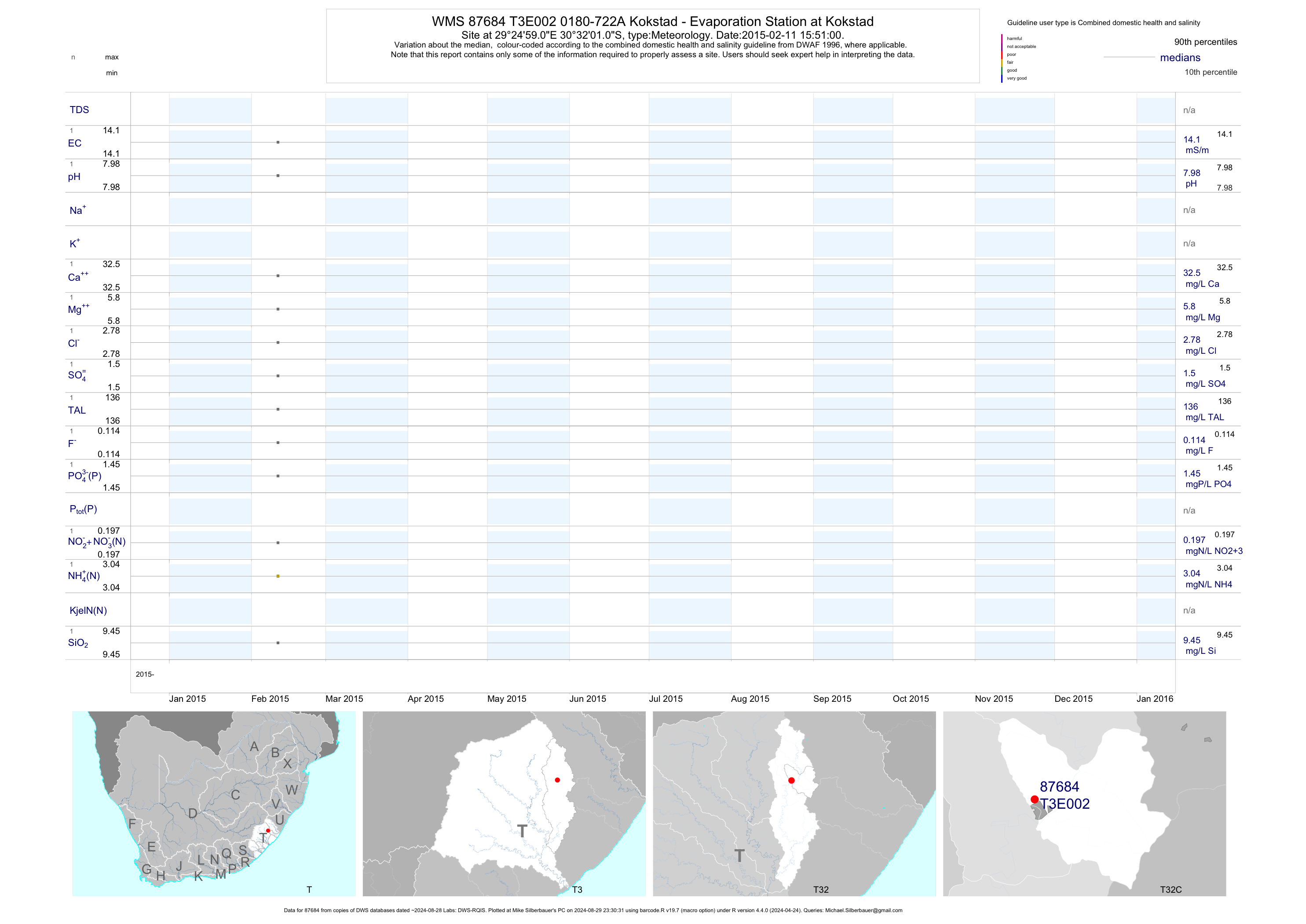