|
Area Description
As depicted on the inserted map of the study area, the study will focus on the
water resources of the Upper and Lower Orange River Water Management Areas
(WMAs), while also considering all the tributary rivers and transfers affecting
the water balance of the system. This core area forms part of the Orange-Senqu
River Basin, which straddles four International Basin States with the Senqu
River originating in the highlands of Lesotho, Botswana in the north eastern
part of the Basin, the Fish River in Namibia and the largest area situated in
South Africa.
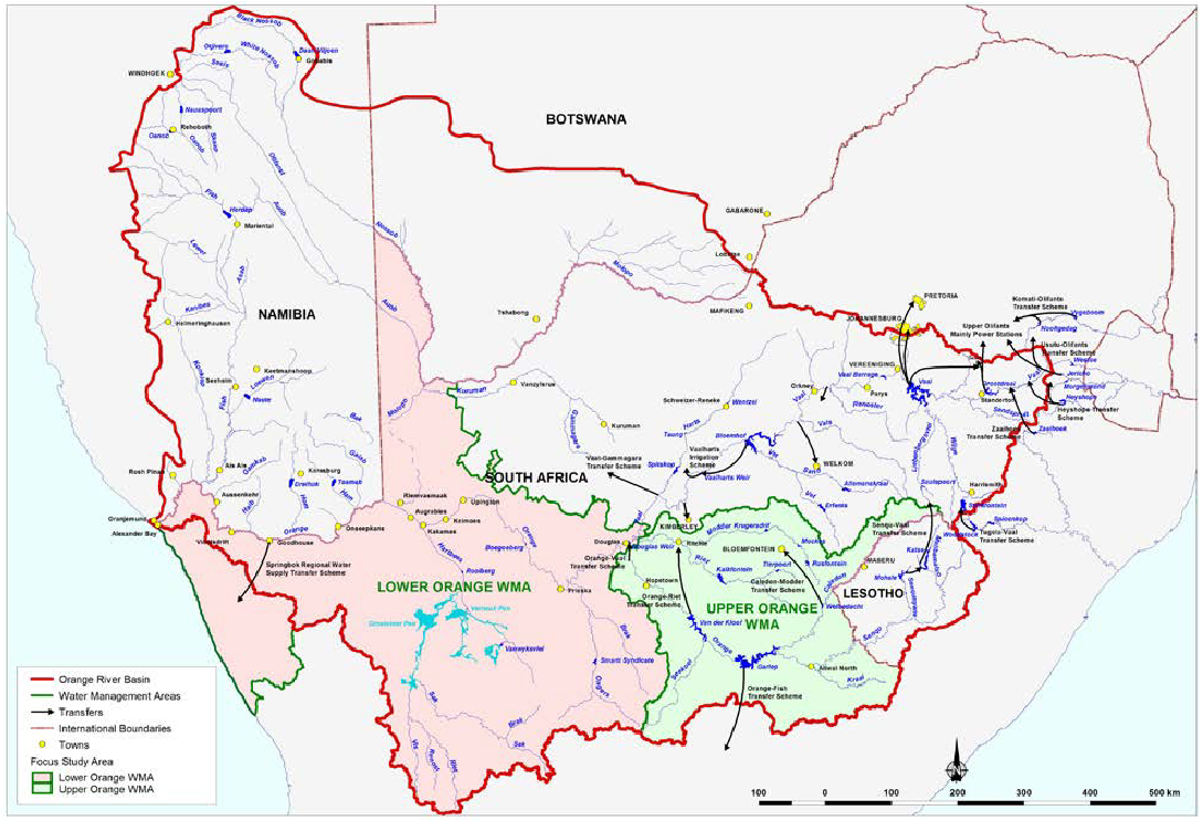
Major water resource infrastructure in the study area are the Gariep and
Vanderkloof dams with associated conveyance conduits supporting large irrigation
farming in the provinces of the Free State, Northern Cape and the Eastern Cape -
through the Orange-Fish Tunnel.
The Caledon-Modder System supplies water to the Mangaung-Bloemfontein urban
cluster (largest urban centre in the study area) and the 2 200 km long
Orange-Senqu River is the lifeline for various industries, mines, towns and
communities located along the way until the river discharges into the Atlantic
Ocean at Alexander Bay.
Since 1994, a significant driver of change in the water balance of the Orange
River System was brought about by the storing of water in Katse Dam as the first
component of the multi-phase Lesotho Highlands Water Project (LHWP). Currently
Phase 1 of the LHWP (consisting of Katse, and Mohale dams, Mosoku Weir and
associated conveyance tunnels) transfers 780 million cubic metres per annum via
the Liebenbergsvlei River into the Vaal Dam to augment the continuously growing
water needs of the Gauteng Province.
The above description illustrates the complex assortment of interdependent water
resources and water uses which spans across various international and
institutional boundaries that will be considered in the development of the
Orange River Reconciliation Strategy. |