|
Area Description
The study area follows the boundaries of the proclaimed Olifants Water Management Area (WMA), but also includes the towns of Polokwane and Mokopane, as these are drawing water from the System.
The Olifants Water Management Area is 54 570 km2 in extent. The WMA includes parts of Gauteng, Limpopo and Mpumalanga Provinces, and includes eight District Municipalities and 25 Local Municipalities. There are three distinct zones, with the Upper Olifants draining the Mpumalanga and Gauteng Highveld and effectively ending with the Loskop Dam. The Middle Olifants is from Loskop Dam to the Escarpment and includes the Flag Boshielo and de Hoop dams, while the Lower Olifants extends from the escarpment, through Sekhukhuneland and a number of conservation areas, the Kruger National Park, and on in to Mozambique. The study area includes Traditional Authority areas. The largest portion of the population live in rural settlements spread widely across the WMA.
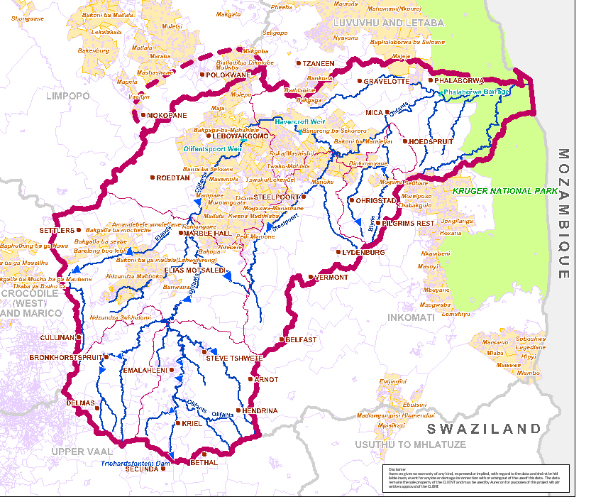
The study area and larger rural settlements are shown on the map in Figure 1.
|
Topography and Climate
Topography is very varied - from the relatively flat and rolling Highveld,
through hilly and mountainous terrain, and the Drakensberg escarpment, to the
Lowveld.
Most of the catchment is very dry with rainfall ranging from 325 mm/a to 750
mm/a. High rainfall of up to 1 000 mm/a occurs only in a narrow belt along the
escarpment. The mean annual evaporation for the catchment ranges from 1300mm to
1700mm.
|
Figure 1: Study Area showing the larger rural areas
Population
The total population in the study area exceeds 3 million people. With water
supplied from the Olifants River System to the towns of Polokwane and Mokopane,
these have been added to the study area. These towns have populations of 168 000
and 89 000 respectively. Although there has been increasing urbanization, the
majority of the people live in rural areas and the households are situated over
a widespread area. These households are greatly dependent on groundwater.
The growing mining industry causes an increase in water demands in urban centres
and municipalities must cater for this.
Economic Activities
The main economic sectors in the study area are mining and associated industries on the Highveld and more recently in the platinum belt, along what is known as the Eastern Limb, agriculture, and tourism. Coal mining is the predominant activity, with platinum and other precious metals (gold, copper, etc) of growing economic importance. The mines can be seen on the map shown in Figure 2.
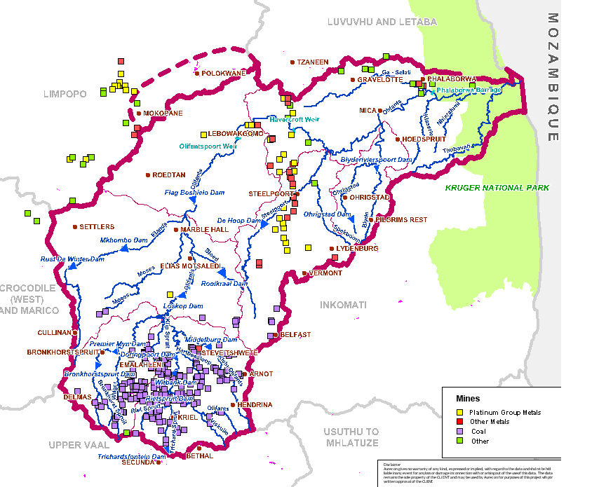
Figure 2: Mines in the Olifants River Catchment
Whilst agriculture uses the bulk of the available water (60% - excluding power
generation), it makes a relatively small contribution to the GDP, although
critical to livelihoods and employment.
A significant number of people in the catchment live subsistence livelihoods.
Tourism is recognised as one of the growing sectors in the study area. The
contribution of the Kruger National Park, in drawing international visitors, is
not only to the WMA and the region, but to the country as a whole
|