|
Untitled Page
|
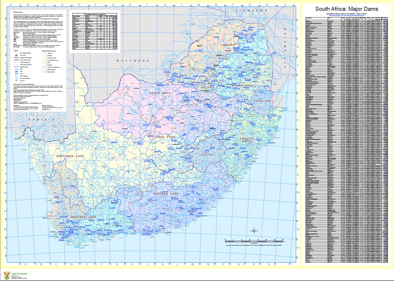
1. RSA Dams Weekly (Aug2014)
Map description:
This map depicts the location of the major dams in South Africa, as listed on the DWS website: "Weekly State of the Reservoirs", hosted by Hydrological Services. The website also provides weekly updated information on the storage state of the dams listed at the following link:https://www.dws.gov.za/hydrology/Weekly/Province.aspx
|
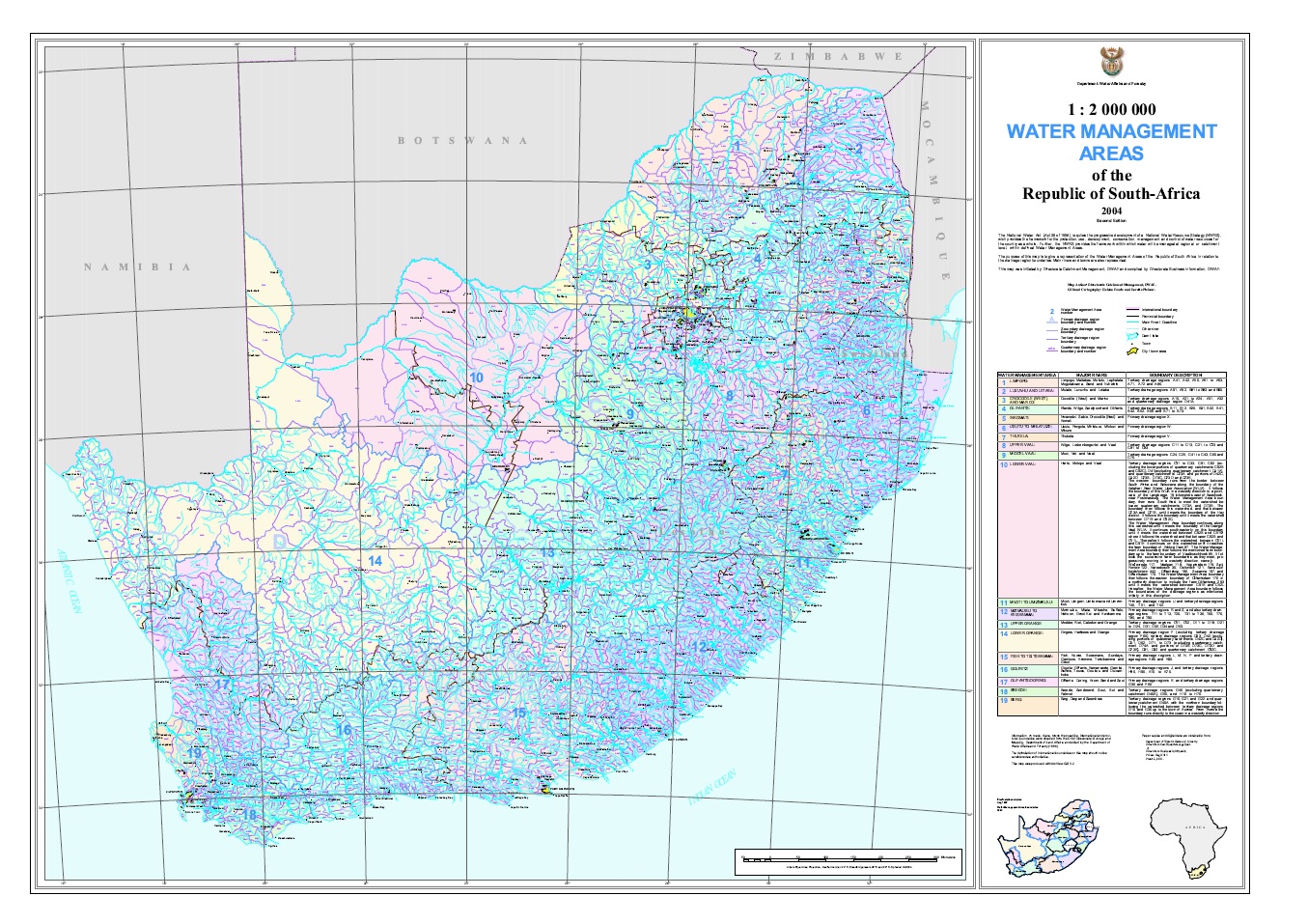
2. RSA 2004 Water Management Areas
Map description:
The National Water Act (Act 36 of 1998) requires the progressive development of a National Water Recourse Strategy (NWRS), which provides the framework for the protection, use, development, conservation, management and control of water recourses for the country as a whole. Further, the NWRS provides the framework within which water will be managed at regional or catchment level, within defined Water Management Areas. The purpose of this map is to give a representation of the Water Management Areas of the Republic of South Africa in relation to the drainage region boundaries. Main rivers, dams and towns are also represented.
|
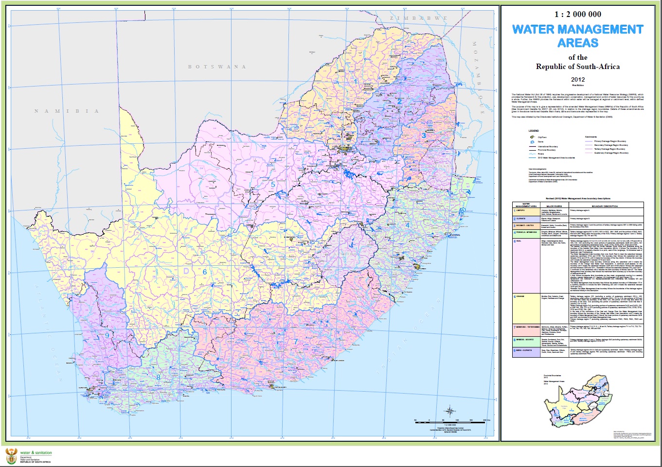
RSA 2012WMA - Darker colours (Used mostly in presentations)
Map description:
The purpose of this map is to give a representation of the amended Water Management Areas (WMA’s) of the Republic of South Africa [See Government Gazette No 35517 (20 July 2012)], in relation to the drainage region boundaries. Details of these amendments are given in the above mentioned Gazette. Main rivers, dams and towns are also represented in the map. This map was initiated by the Directorate Institutional Oversight, Department Water and Sanitation (DWS).
NB: Darker WMA colours are used for presentation purposes.
|
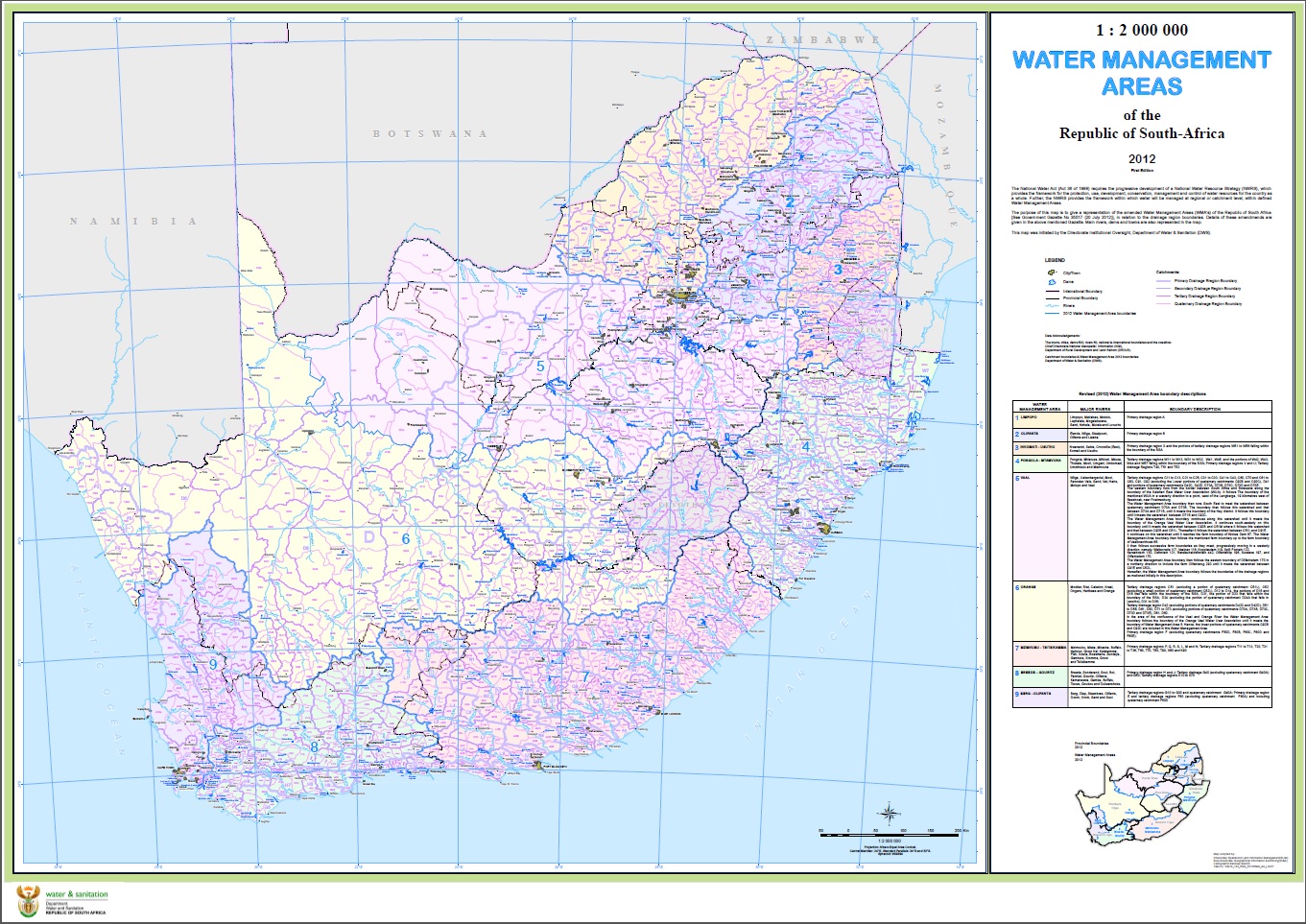
RSA 2012WMA - Lighter colours (Used mostly as a wall map)
Map description:
The purpose of this map is to give a representation of the amended Water Management Areas (WMA’s) of the Republic of South Africa [See Government Gazette No 35517 (20 July 2012)], in relation to the drainage region boundaries. Details of these amendments are given in the above mentioned Gazette. Main rivers, dams and towns are also represented in the map. This map was initiated by the Directorate Institutional Oversight, Department Water and Sanitation (DWS).
|
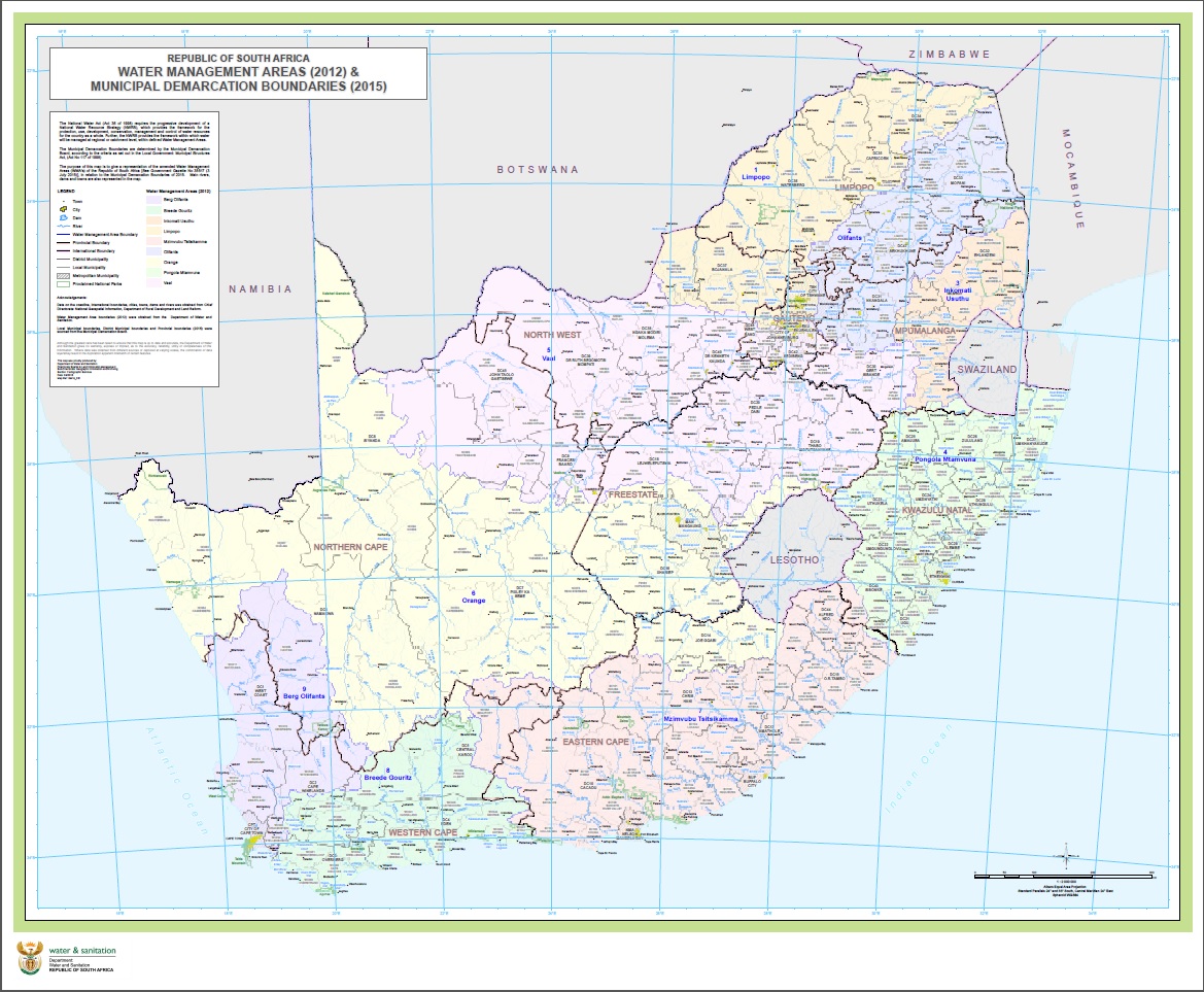
RSA 2012WMA & MDB2015
Map description:
The Municipal Demarcation Boundaries are determined by the Municipal Demarcation Board, according to the criteria as set out in the Local Government: Municipal Structures Act, (Act No 117 of 1998). The purpose of this map is to give a representation of the amended 2012 Water Management Areas (WMA's) of the Republic of South Africa [See Government Gazette No 35517 (20 July 2012)], in relation to the 2015 Municipal Demarcation Boundaries. Base map features like major rivers, dams and towns are also represented in the map.
|
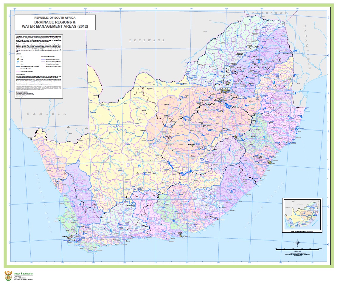
RSA Drainage Region Boundaries & 2012WMA
Map description:
The purpose of this map is to give a representation of the primary, secondary, tertiary and quaternary drainage region boundaries of the Republic of South Africa. The Department of Water and Sanitation is the custodian of these boundaries and they are reviewed on an on - going basis. The amended Water Management Areas (WMA's) of the Republic of South Africa [See Government Gazette No 35517 (20 July 2012)] is shown in relation to the drainage regions of RSA. Base map features like major rivers, dams and towns are also represented in the map.
|
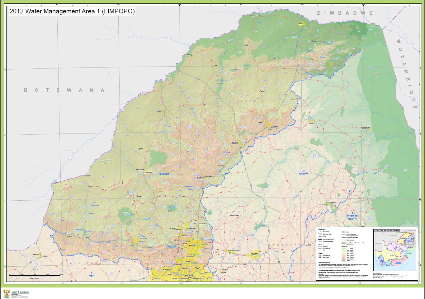
2012WMA 1 - Limpopo (Landscape – A0)
Map description:
The purpose of this map is to give an extended representation of the amended Water Management Area 1 – LIMPOPO. Presenting base map features like cities, towns, major rivers, major dams, provincial boundaries (2012), international boundaries, nature reserves, forest reserves and national parks. See Government Gazette No 35517 (20 July 2012) for a description of the amended 2012 WMA’s.
|
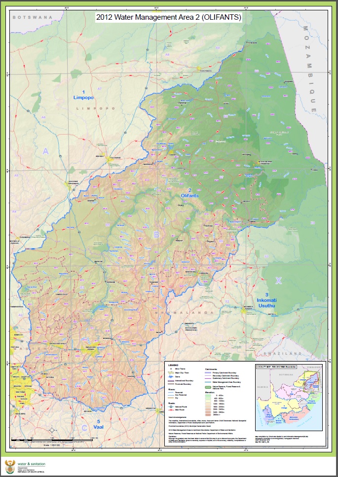
2012WMA 2 – Olifants (Portrait – A1)
Map description:
The purpose of this map is to give an extended representation of the amended Water Management Area 2 – OLIFANTS. Presenting base map features like cities, towns, major rivers, major dams, provincial boundaries (2012), international boundaries, nature reserves, forest reserves and national parks. See Government Gazette No 35517 (20 July 2012) for a description of the amended 2012 WMA’s.
|
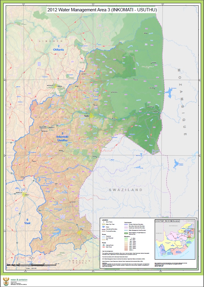
2012WMA 3 - Usuthu/Inkomati (Landscape – A0)
Map description:
The purpose of this map is to give an extended representation of the amended Water Management Area 3 – Usuthu/Inkomati. Presenting base map features like cities, towns, major rivers, major dams, provincial boundaries (2012), international boundaries, nature reserves, forest reserves and national parks. See Government Gazette No 35517 (20 July 2012) for a description of the amended 2012 WMA’s.
|
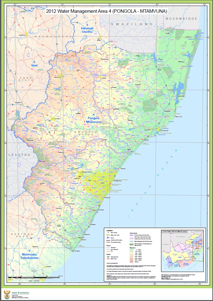
2012WMA 4 – Pongola/Mtamvuna(Portrait – A1)
Map description:
The purpose of this map is to give an extended representation of the amended Water Management Area 4 – Pongola/Mtamvuna. Presenting base map features like cities, towns, major rivers, major dams, provincial boundaries (2012), international boundaries, nature reserves, forest reserves and national parks. See Government Gazette No 35517 (20 July 2012) for a description of the amended 2012 WMA’s.
|
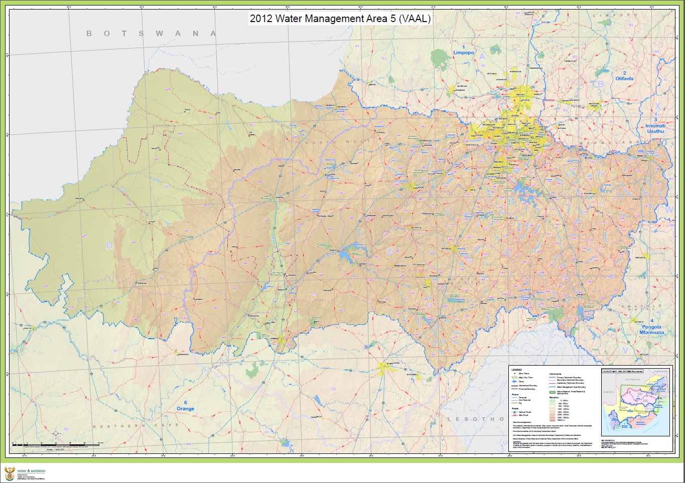
2012WMA 5 - Vaal (Landscape – A0)
Map description:
The purpose of this map is to give an extended representation of the amended Water Management Area 5 – VAAL. Presenting base map features like cities, towns, major rivers, major dams, provincial boundaries (2012), international boundaries, nature reserves, forest reserves and national parks. See Government Gazette No 35517 (20 July 2012) for a description of the amended 2012 WMA’s.
|
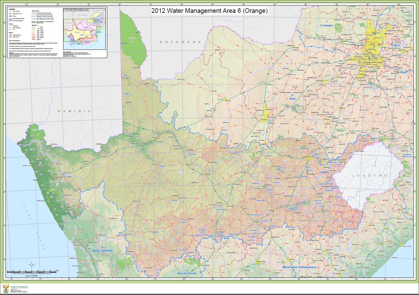
2012WMA 6 - Orange (Landscape – A0)
Map description:
The purpose of this map is to give an extended representation of the amended Water Management Area 6 – ORANGE. Presenting base map features like cities, towns, major rivers, major dams, provincial boundaries (2012), international boundaries, nature reserves, forest reserves and national parks. See Government Gazette No 35517 (20 July 2012) for a description of the amended 2012 WMA’s.
|
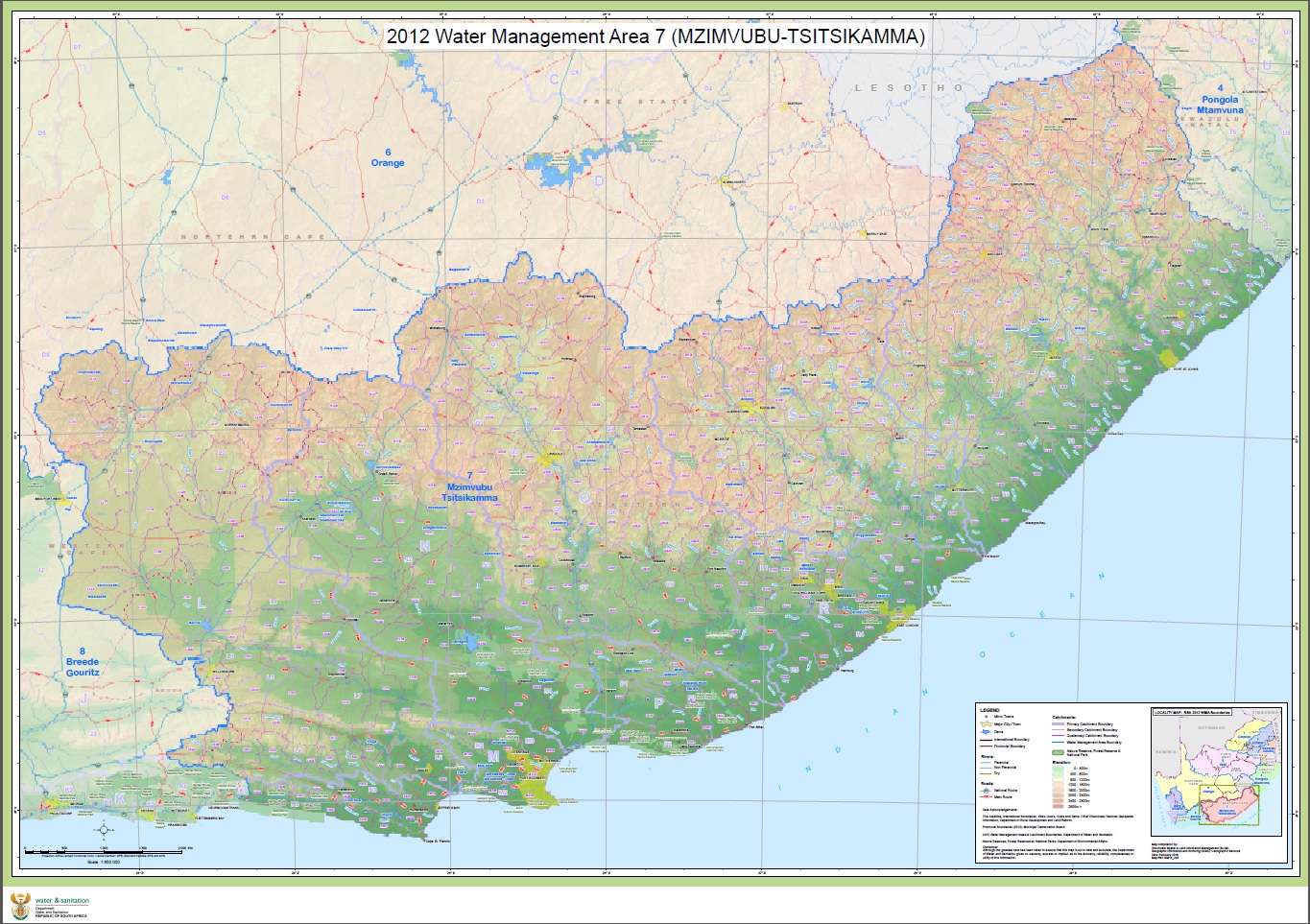
2012WMA 7 - Mzimvubu-Tsitsikamma (Landscape – A0)
Map description:
The purpose of this map is to give an extended representation of the amended Water Management Area 7 – MZIMVUBU-TSITSIKAMMA. Presenting base map features like cities, towns, major rivers, major dams, provincial boundaries (2012), international boundaries, nature reserves, forest reserves and national parks. See Government Gazette No 35517 (20 July 2012) for a description of the amended 2012 WMA’s.
 rgmw71
|
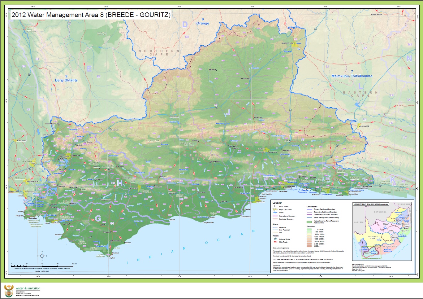
2012WMA 8 - Breede-Gouritz (Landscape – A1)
Map description:
The purpose of this map is to give an extended representation of the amended Water Management Area 8 – BREEDE-GOURITZ. Presenting base map features like cities, towns, major rivers, major dams, provincial boundaries (2012), international boundaries, nature reserves, forest reserves and national parks. See Government Gazette No 35517 (20 July 2012) for a description of the amended 2012 WMA’s.
|
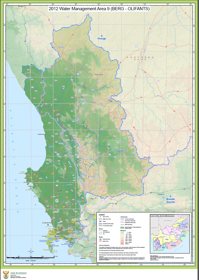
2012WMA 9 - Berg-Olifants (Landscape – A1)
Map description:
The purpose of this map is to give an extended representation of the amended Water Management Area 9 – BERG-OLIFANTS. Presenting base map features like cities, towns, major rivers, major dams, provincial boundaries (2012), international boundaries, nature reserves, forest reserves and national parks. See Government Gazette No 35517 (20 July 2012) for a description of the amended 2012 WMA’s.
|
|
|
|
|