| RHP |
South African
River Health Programme |
State of the Rivers Report
Crocodile, Sabie-Sand & Olifants River Systems |


|
|
2. Overview of the study area |
|
| |
|
Climate
The climate varies considerably due to the large variation in altitude and relief. The highveld region is cooler (10-18°C) with higher rainfall (400 to 1 000 mm per year), which is mostly received in the form of summer storms. This is relatively high for South Africa (average 600 mm), but low in global terms. The inter-annual fluctuations are large, however, and extremes of flooding and drought are not uncommon. In winter frost is common on the high interior plateau, due to clear skies, a dry atmosphere and absence of wind.
On the escarpment, the rainfall is generally higher (600-120 mm per year and more),
and mean annual temperatures vary from 10-12°C to 20-22°C. In the low-lying areas temperatures are generally warmer, with an annual average of 22°C, although conditions are drier (400-600 mm rainfall per year). Therse conditions are condusive to the production of subtropical and tropical fruits, with irrigation, and to commercial forestry.
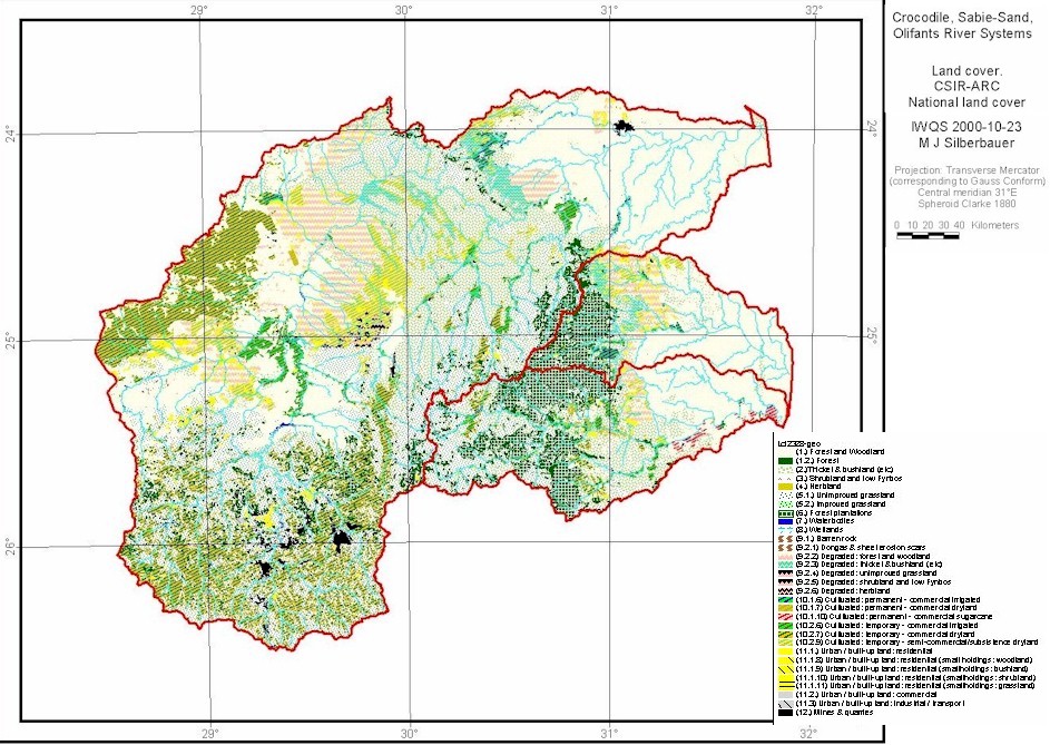
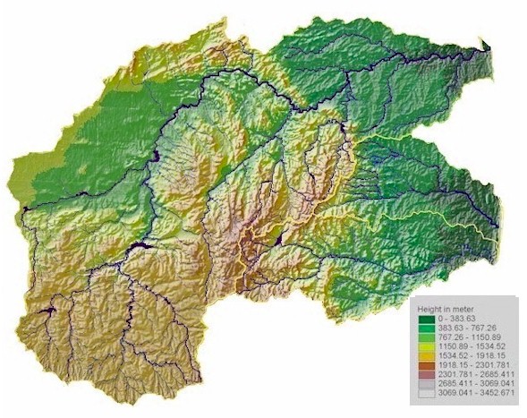
The Drakensberg Escarpment runs north to south almost through the centre of the study area. This creates three distinct physiographic regions, the high interior plateau, the escarpment zone, and the low-lying region, with altitudinal differences from 100 m to 2300 m above mean sea level. The high interior plateau has relatively flat, rolling terrain, suitable for cultivation or pasture; the escarpment zone is mountainous with scarps and steep valley flanks; and the low-lying region has flat rolling terrain, also suitable for cultivation, but requiring irrigation in many areas.
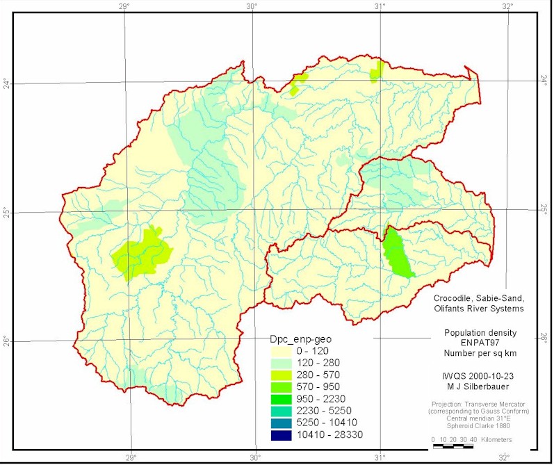
The population is largely rural, although there are a few towns in the area, and urbanisation is rapid. The study area encompasses a large part of the Kruger National Park, where population s low, but the impact of visitors is evident in infrastructure development, and pressures on water and waste systems.Poverty is widespread, with annual household incomes frequently below R2 000 per month, and high unemployment. There are huge disparities, however, between household incomes. This is reflected in the variation in life expectancy between the poorer communities (61 years) and the wealthier communities (64-77 years). The Human Development index (consisting of life expectancy, literacy and GGP) is similar to the rest of South Africa.
The economy of the area is based largely on the coal mining, electricity generation, oil refining and synthetic products industries, forestry, irrigated soft fruit production, and tourism. However, only 41% of production income accrues to residents of the study area, the remainder being remitted to the head offices of large mining houses and corporations. Similarly, although personal incomes are among the highest in South Africa, often these incomes are earned in industries and activities elsewhere in the country, with homes and farms in the study area representing holiday homes and second businesses. In 1998 a Strategic Environmental Management Plan was commissioned by the Mpumalanga Provincial Government as an input to planning for a Mpumalanga-Maputo Development Corridor (MMDC). This initiative aims to promote development and economic growth through the upgrading and improvement of transportation and communication infrastructure.
|
|


|
|