| RHP |
South African
River Health Programme |
State of the Rivers Report
Crocodile, Sabie-Sand & Olifants River Systems |


|
|
The Olifants River System |
|
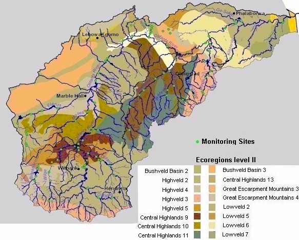
Catchment overview The Olifants Catchment covers about 54 570 km2 and is subdivided into 9 secondary catchments. The total mean annual runoff is approximately 2400 million cubic metres per year. The Olifants River and some of its tributaries, notably the Klein Olifants River, Elands River, Wilge River and Bronkhorstspruit, rise in the Highveld grasslands. The upper reaches of the Olifants River Catchment are characterised mainly by mining, agricultural and conservation activities. Over-grazing and highly erodable soils result in such severe erosion, in parts of the middle section, that after heavy rains the Olifants River has a red-brown colour from all the suspended sediments. Thirty large dams in the Olifants River Catchment include the Witbank Dam, Renosterkop Dam, Rust de Winter Dam, Blyderivierspoort Dam, Loskop Dam, Middelburg Dam, Ohrigstad Dam, Arabie Dam and the Phalaborwa Barrage. In addition, many smaller dams in this catchment, have a considerable combined capacity. The Olifants River meanders past the foot of the Strydpoort Mountains and through the Drakensberg, descending over the escarpment. The Steelpoort and Blyde tributaries, and others, join the Olifants River before it enters the Kruger National Park and neighbouring private game reserves. Crossing the Mozambique border, the Olifants River flows into the Massingire Dam. |
|
Summary of findings
Move cursor over map and select specific area to view detailed map and Present Ecological State (PES) findings.
|


|