|
 Business Definition
CHART is an integrated, hydrogeological analysis and reporting solution that aims to assist
hydrogeologists and hydrogeochemists in decision-making during analysis and assessment
of hydrogeological and hydrogeochemical data.
CHART supports the analysis and assessment of the complete hydrogeological cycle and
hydrochemical trends in an integrated fashion with collaboration between
groundwater, surface water, and rainwater data in a single snapshot or dashboard.
CHART also fulfills an integral management role that aims to assist geohydrologists
with implementation and management of monitoring programmes and networks.
Web enabled CHART was build for the Microsoft® Silverlight® platform and can be accessed with all major internet browsers such as Google® Chrome, Internet Explorer, Firefox®, Safari® and Opera®.
CHART Features
Read-only access to data from National Groundwater Archive (NGA), Water Management System (WMS) and Hydstra.
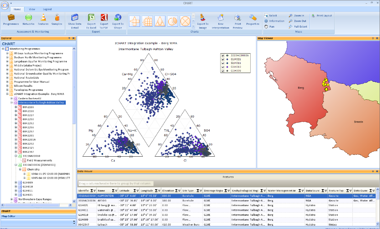
Plotting of standard hydrochemistry charts such as Durov, Expanded Durov and Piper.
Plotting of custom-build charts such as Ion Balance, Collins and Trend Analysis.
Microsoft® Office 2007/2010 Ribbon style navigation.
Microsoft® Windows and Outlook® style data viewing.
How to access CHART?
Web enabled CHART requires registration and can be done at the following website:
www.dws.gov.za/chart/home/default.aspx
CHART Preview
Data Viewer
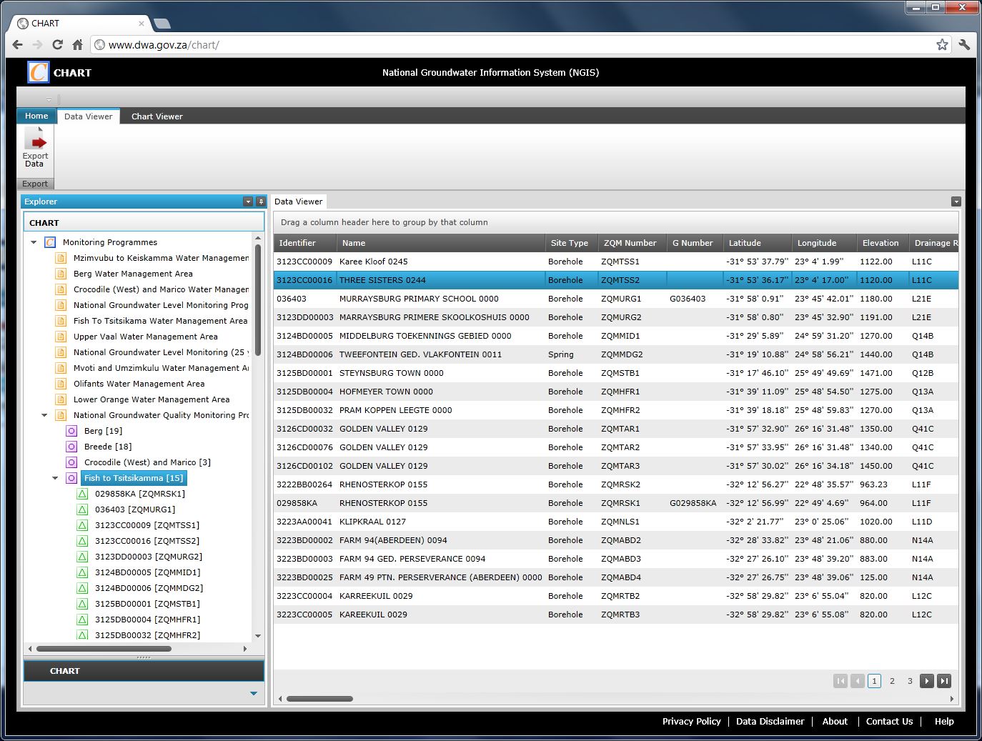
Chart Viewer
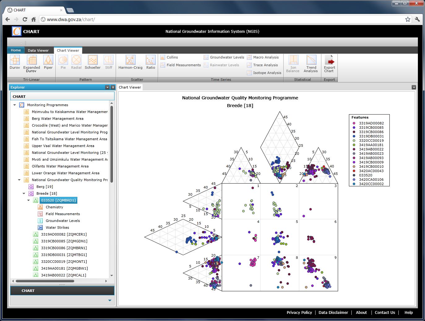
CHART: Version 1.6
The first major version of CHART was deployed on the 30th of April 2009 and recently upgraded to version 1.6 on the 08th of February 2017.
CHART is used by data management personnel and groundwater specialists in all regional offices, such as, Pretoria, Polokwane, Nelspruit, Durban, Port Elizabeth, Bloemfontein, Kimberley and Bellville.
CHART Preview
|