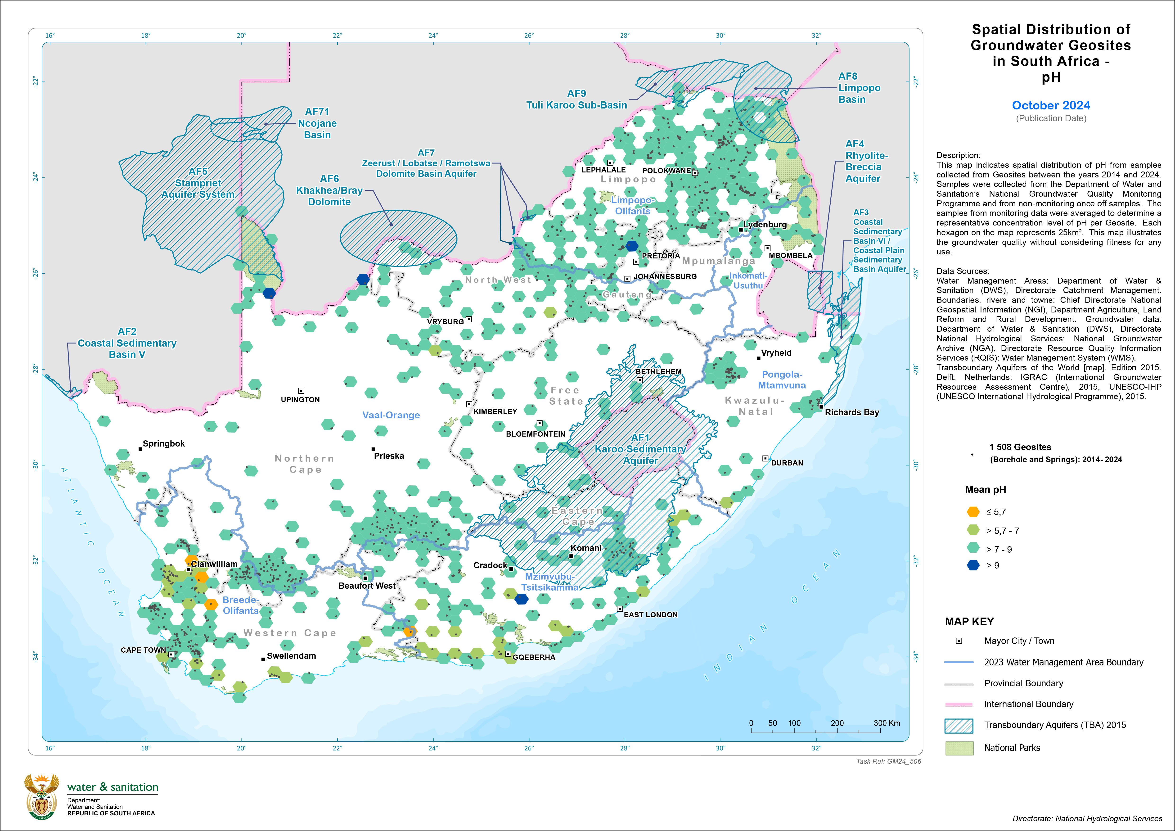
This map illustrates the spatial distribution of pH from samples collected from Geosites between the years 2014 and 2024. Samples were collected from the Department of Water and Sanitation’s National Groundwater Quality Monitoring Programme and from non-monitoring once off samples. The samples from monitoring data were averaged to determine a representative concentration level of pH per Geosite. Each hexagon on the map represents 25km². This map depicts the groundwater quality without considering fitness for any use.

|