Untitled Page
DWS Home Page  
 

National Groundwater Archive (NGA) Stored Borehole Distribution


right menu


bullet
Untitled Page

Groundwater Home

Groundwater Offices

Data Management


Documents

Forms

Groundwater Dictionary

Contacts

Links

FAQs


This map has been prepared from borehole records stored in the NGA as at December 2023 totalling 282 165. The bulk of the records were obtained from State-drilled boreholes.

The map does not depict all existing boreholes nor does it reflect the groundwater potential of any area. But you can learn about it from our Harvest Potential Map. Additional information on borehole records stored in the NGA is to be seen here.         
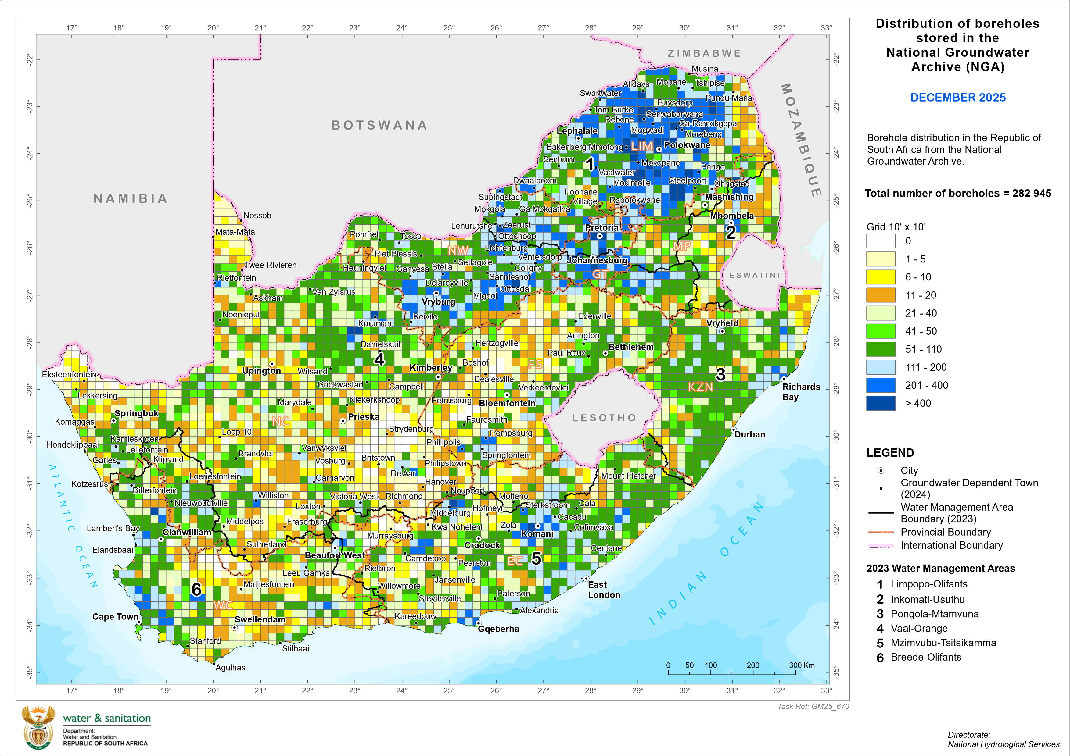
click to open larger view


Untitled Document
This site is best viewed with Internet Explorer 10 (or newer) and Mozilla Firefox 32.0 (or newer) at 1024x768 screen resolution.Click here to download Internet Explorer 11 or click here to download Firefox 32.
DWS Sitemap
If you experience any challenges regarding this site, please contact the Webmaster .