|
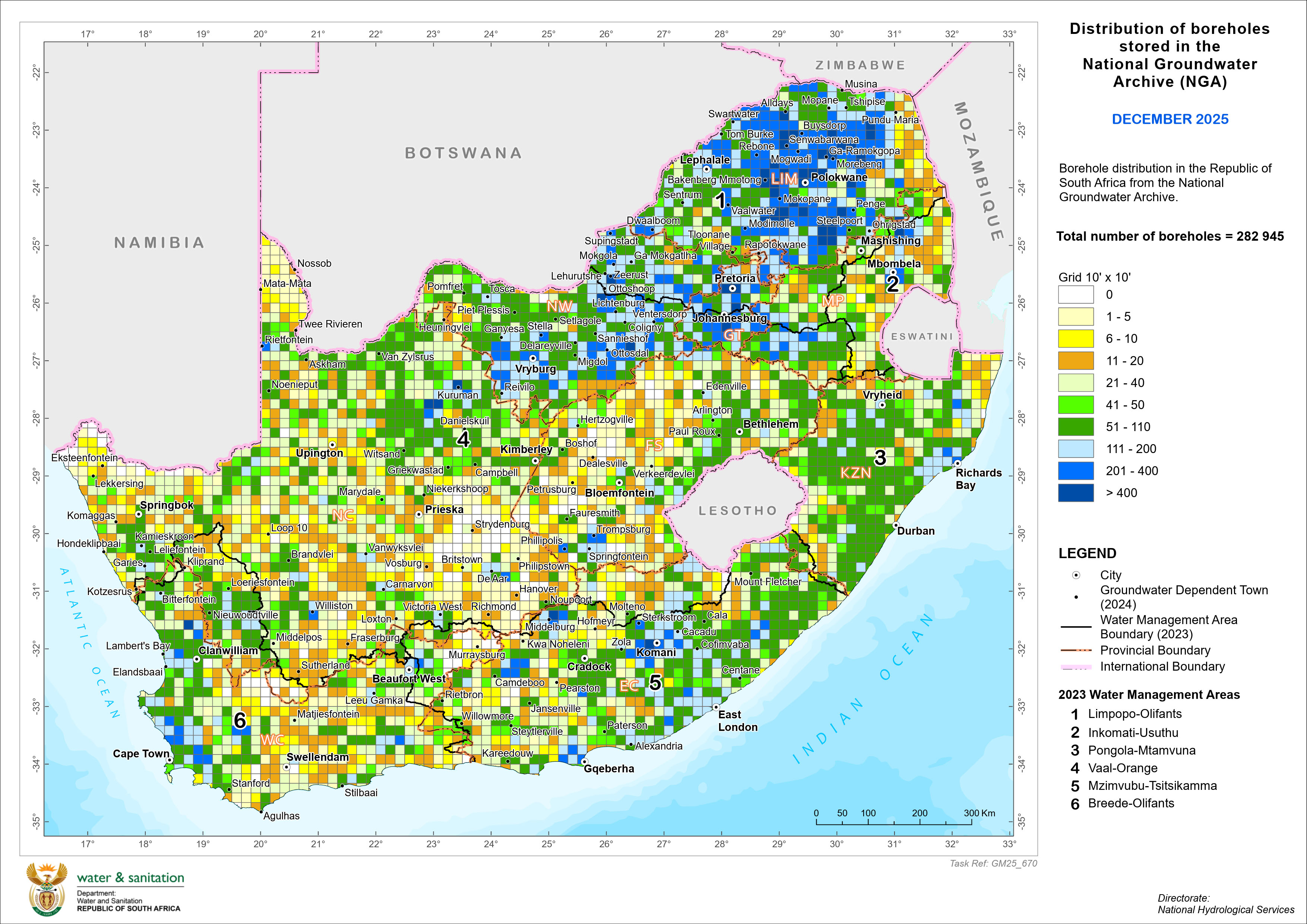
This map has been prepared from borehole records stored in the NGA as at
December 2025 totalling 282 945 . The bulk of the records were obtained from State-drilled
boreholes.
The map does not depict all existing boreholes nor does it reflect the groundwater
potential of any area. But you can learn about it from our
Harvest Potential Map. Additional information on borehole records stored
in the NGA is to be seen here.

|