GROUNDWATER LEVEL MONITORING SITES WITHIN TRANSBOUNDARY AQUIFERS
This map illustrates the Department’s number of actively monitored groundwater level Sites that occur within Transboundary Aquifers - as registered on National Groundwater Archive (NGA). The Sites are grouped into ten groups with different colours to differentiate between the Regional Offices responsible for the monitoring thereof.

 |
 |
 |
|
National Groundwater Level
Monitoring Sites - Eastern Cape,
March 2026 |
National Groundwater Level
Monitoring Sites - KwaZulu Natal,
March 2026 |
National Groundwater Level
Monitoring Sites - Limpopo,
March 2026 |
|
 |
 |
 |
|
National Groundwater Level
Monitoring Sites - Mpumalanga,
March 2026 |
National Groundwater Level
Monitoring Sites - North West,
March 2026 |
National Groundwater Level
Monitoring Sites - Northern Cape,
March 2026 |
|
Last updated: 29/05/2026
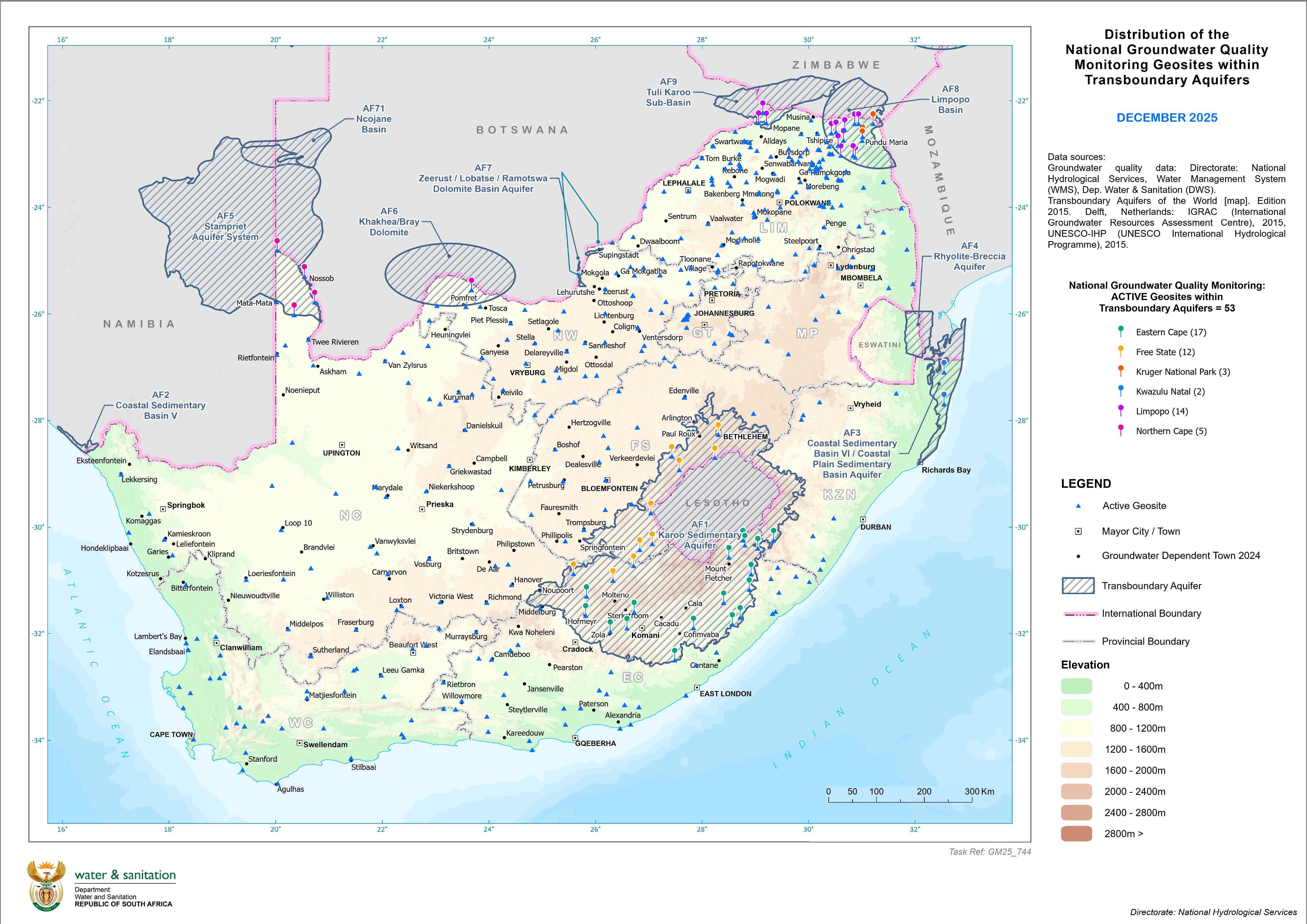
National Groundwater Quality Monitoring Geosites within Transboundary Aquifers
This map illustrates the Department’s number of actively monitored National Groundwater Quality Geosites that occur within Transboundary Aquifers - as registered on National Groundwater Archive (NGA) as well as stored in the Water Management System (WMS).
Last updated: 05/03/2026
|